4 minute read
Old Scheldt and Kalkenvaart


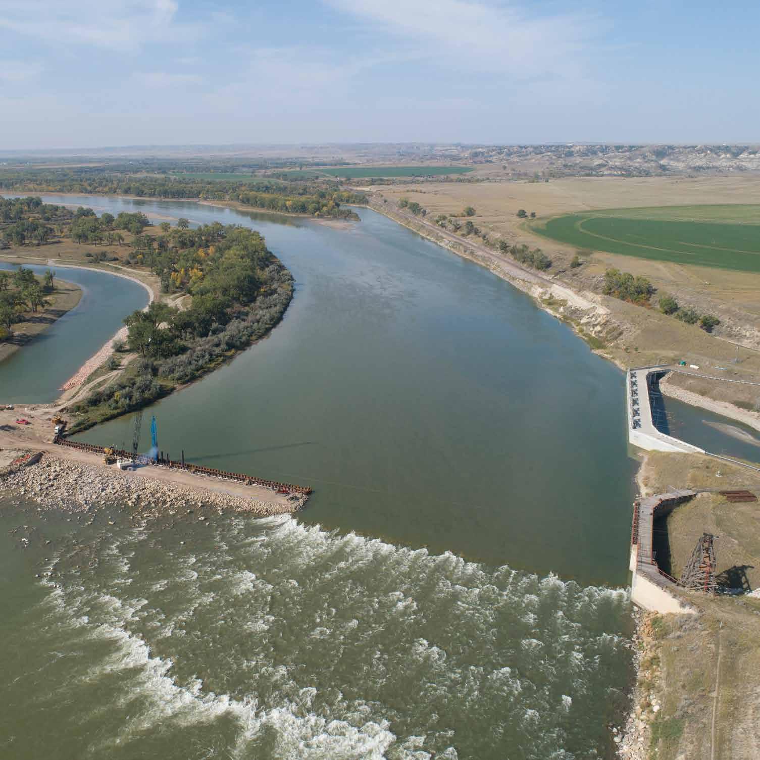
Aard, East Flanders, Belgium
Reclaiming agricultural land in the Scheldt river floodplain for climate mitigation. In the northern half of Belgium in the heavily urbanized Flanders region, the Kalkense Meersen remains one of the few large, open natural spaces. Though historically pasture and hay meadows, changing agricultural practices in the twentieth century left the area stressed and degraded by chemical fertilizers, pesticides, and lowered water levels. As the low point of the catchment area, this area of open water collects excess nutrients and pollutants and had largely lost its original grasslands. Starting with initial planning in 2005, as part of the Sigma plan, the project team devised a strategy for protecting the region from flooding while restoring the natural habitat. Work began in 2010 by converting arable land back to grassland. By the end of 2020, the team had restored the Old Scheldt—a damped river meander—and had dug extra shallow banks along the medieval canal, the Kalkenvaart. They then connected the combined body of open water to the tidal river Scheldt by a special fish ladder and sluice. Now the area’s diverse landscape provides a buffer for the surrounding community, containing excess water to protect against flood and providing more stable water levels in the face of climatechange-induced droughts.
Article cover: The Kalkenvaart (left) and Old Scheldt (right) after restoration. (Photo by Vilda Photo)
Producing Efficiencies
The water system is now more robust and efficient, no longer requiring the day-to-day use of pumps to manage water levels. The pumping station remains in place, to function as a final safety measure in the event of extreme flood events, but changing to gravitational discharge of water through the fish ladder and sluices saves money and labor on daily operation and maintenance. As one of the most studied rivers in the world, the Scheldt’s extensive hydrological modeling proved invaluable for the design of the sluice and to prevent flooding in the surrounding community.

Using Natural Processes
Retention of water at peak rainfall will reduce peak tides in the river while replenishing groundwater supplies. This guards against both flood and drought and provides a long-term buffer against climate change. Additionally, before this project, it was deemed nearly impossible to achieve natural two-way fish migration here without creating inundation risks. Valves in the sluices and culverts overcome this. In the flood phase, the river shuts the valve, allowing the fish to migrate between the polder and fish ladder but not to the river. In the ebb phase, the valve again opens and fish can move between the fish ladder to the river. This two-step migration resembles the passing of boats through a lock.

Broadening Benefits
In addition to mitigating the impacts of climate change and assisting with fish migration, the restored reedlands greatly benefit the Eurasian bittern (Botarus stellaris), and the wetlands provide habitat for the European eel (Anguilla anguilla), a critically endangered species. The project also provided an opportunity to restore and rebuild a missing link in the hiking trails of the Kalkense Meersen. The combination of an additional bridge and walkway in the heart of the Kalkense Meersen opens new possibilities for small-scale hiking loops starting from the adjoining municipalities, a boon for local businesses.

Promoting Collaboration
The partnership between the Agency for Nature and Forest and the Agency for the Environment was the key to securing funding for the “Old ScheldtKalkenvaart” project and led in 2019 to an integrated water management plan for the whole Kalkenvaart catchment area, including several stakeholder meetings. Additional funding is allowing the team to dredge the Kalkenvaart, removing historical pollution and enlarging the water body, thus creating extra fish habitat and enhancing the self-cleaning capacity. In collaboration with the municipalities of Laarne and Wichelen, replacing the surface of the dilapidated old road along the Kalkenvaart and banning cars further enhances nature and the visitor experience.