
NEWSLETTER
CONNECTING THE DOTS
TO INNOVATION
STANDING WATCH
USACE technology closely monitors nation’s beaches

VOL. 2 | NO. 1
FIELD NOTES
MAJOR GENERAL DIANA M. HOLLAND COMMANDING GENERAL, MISSISSIPPI VALLEY DIVISION
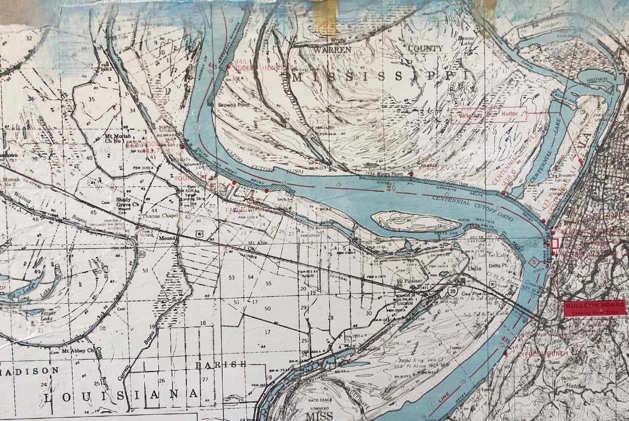
One of the world’s most significant rivers, the mighty Mississippi, extends more than 2,300 miles with a total drainage basin of more than 1.1 million square miles. It is also the backbone of our nation’s economy – moving more than 680 million tons of cargo annually and saving us $12.5 billion each year in transportation costs.
Maximizing the benefits of this powerful waterway requires cutting-edge innovation. In fact, the U.S. Army Corps of Engineers’ legacy of research and development began with the need to better understand the Mississippi River.
The great flood of 1927 prompted the creation of the Waterways Experiment Station, which evolved into the U.S. Army Engineer Research and Development Center – with seven laboratories in four states and a diverse $1.8 billion portfolio.
The flood’s aftermath also led to the birth of the Mississippi River & Tributaries Project, which has an impressive legacy of innovation in flood risk management, navigation and the environmental health of the country’s biggest river.
USACE’s world-class engineers and scientists have spent nearly 100 years studying the river’s dynamic forces. Their efforts have produced countless breakthroughs that have not only benefitted the Mississippi Valley Division but have also been applied to various challenges across our nation and around the world.
For example, the expertise we’ve developed in hydrology and geotechnical engineering proved invaluable in the aftermath of Hurricane Katrina as we designed an advanced hurricane protection system that held strong when confronted with Hurricane Ida’s 150 mile-per-hour winds in 2021. Meanwhile, USACE researchers have applied knowledge gained from addressing sand boils along Mississippi River levees by developing new sand boil filter kits that can be used to prevent internal erosion at earthen levees around the nation.
One forthcoming technology that I’m particularly proud of is Armor 1, which will replace the Mat Sinking Unit’s mat laying barge that has been used since 1948 to stabilize the Mississippi River’s banks and protect its levees. The new system will be safer, more efficient and more reliable, while also decreasing manual labor and maintenance costs.
Innovation will be more important than ever in the years to come. Climate change will continue to stress the Mississippi River and the surrounding valley — the most recent example being the low-water event of 2022. To address these threats and continue to deliver our program for the benefit of our citizens and our economy, USACE must remain committed to world-class research and development.
Essayons! Building Strong!
MG Diana M. Holland Commanding General Mississippi Valley DivisionINNOVATION will be more important than ever in the years to come ... USACE must remain committed to WORLD-CLASS RESEARCH & DEVELOPMENT.
NAVIGATE
Eye in the Sky: CorpsCam allows for more proactive management of federal beach projects.............................................................................. page 6
Innovation at Work.................................................................................................................... page 8 Cheaper, Faster, Better: Kit offers easier, less-expensive solution to sand boil threat......................................................................... page 10
Early Warning: Remote sensing helps water quality managers detect harmful algal blooms .............................................................................. page 12
Virtual Eyes & Ears: Structural Health Monitoring program key to more resilient, modern infrastructure network ................................................................ page 14 Connect With: Molly Reif.......................................................................................................... page 16
USACE R&D Strategy: Top 10 R&D Priorities...................................................................... page 16
Our mission is to deliver vital engineering solutions, in collaboration with our partners, to secure our nation, energize our economy, and reduce disaster risk.
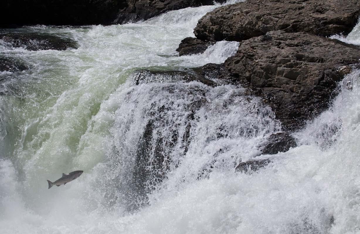
 Pacific Salmon leap the falls on the Similkameen River in northern Washington.
EYE IN THE SKY
CorpsCam supports proactive management of federal beach projects
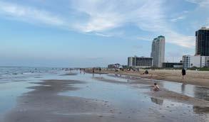
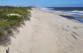
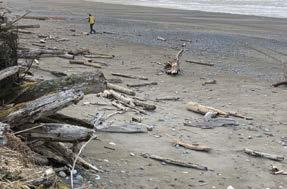

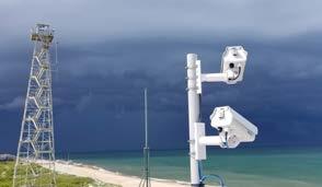
USACE executes numerous beach projects each year to protect the environment and economy of our nation’s coastal areas. However, little data is available for many of these projects because of high cost, restricted access and safety, thus limiting the decision-making process. CorpsCam fills this void by using automated, remote video technology to better monitor federal beach and other coastal projects. The effort incorporates multiple tiers, from citizen scientists using cellphone cameras to monitor beach state up to scientific-grade cameras that can determine bathymetry, current speed and wave parameters. “Having a better understanding — or a more holistic understanding — of our projects gives us better designs and adaptive management that can ultimately save districts money in potential damages,” said ERDC coastal research engineer Dr. Brittany Bruder.
To read the full story, visit: https://www.usace.army.mil/Media/News/NewsSearch/ Article/3277200/corpscam-supports-proactivemanagement-of-federal-beach-projects/
WHEN YOU HAVE INCREASED UNDERSTANDING, YOU GET IMPROVED PREDICTIONS AND BETTER SOLUTIONS.
DR. BRITTANY BRUDER
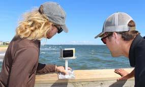
CoastSnap, part of the overall CorpsCam program, engages citizen scientists to take photos with their cellphones from a designated mount and upload those photos via a weblink to be processed for data. This enables sporadic qualitative monitoring of beach state, beach area and erosion rates.
CONNECTING THE DOTS
Data collected by CorpsCam IMPROVES PLANNING AND IMPACT ANALYSIS of coastal engineering projects
Dr. Brittany Bruder Research Civil Engineer U.S. Army Engineer Research and Development Center7 6
INNOVATION
Beneficial Use Research •
In support of the Buffalo and Detroit Districts, ERDC researchers are conducting tests on dredged material pulled from Toledo Harbor. The material is planned for beneficial use at Woodtick Peninsula on the west side of Lake ERIE to create habitat and shore up the peninsula. Woodtick serves as protection for approximately 1,000 acres of adjacent, newly restored Erie Marsh wetlands.
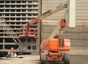
Emergency Response to Hurricane Ian • ERDC drone pilots and their equipment joined other USACE teams in deploying to Florida in response to Hurricane Ian. The teams support the installation of more than 10,000 blue roofs damaged by the strong hurricane. Operation Blue Roof is a priority mission managed by USACE for the Federal Emergency Management Agency. It provides homeowners and permanently occupied rental properties in disaster areas with fiber-reinforced sheeting to cover damaged roofs until arrangements can be made for permanent repairs. ERDC supports this USACE program by providing testing and evaluation of the drones and field data collection equipment.

To learn more about these projects and programs, email: cerd.info@usace.army.mil
Better Understanding of Extratropical Cyclones

• In collaboration with the Scripps Institution of Oceanography, ERDC produced a new algorithm to better understand the tracks of extratropical cyclones (ECs), which occur outside the tropics. These storms create ocean waves that can be larger than those of tropical cyclones. These extreme sea states are responsible for coastal hazards, including erosion and surge-induced flooding. In the development of the algorithm, software examined satellite measurements of wave heights within the tracked ECs to investigate wave growth and overall wave climate.
Surveying Resilient Infrastructure •


Working with the New England and Seattle Districts, ERDC researchers completed a multi-model survey of the Libby Dam in Montana. The survey combined terrestrial and airborne LiDAR techniques to detect subsidence and other potential failure mechanisms on the dam embankments. The project created a high-density elevation model of the dam, its high-relief embankments and 13 river miles of the Kootenay River.


9 8
CHEAPER, FASTER, BETTER
Kit offers easier, less-expensive solution to sand boil threats
 Samantha Lucker Research Geologist
 U.S. Army Engineer Research and Development Center
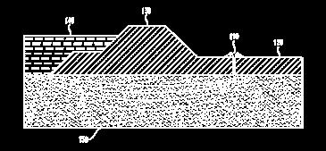
Developed at ERDC, the sand boil filter kit provides USACE an inexpensive and effective device to address small to medium sand boils that threaten a levee's integrity.
Sand boils are caused when rising water levels on one side of the levee create erosion inside, forcing sand within the levee outward. If unchecked, sand boils could grow, displacing more sediment and increasing the risk of a catastrophic levee breach.
A reusable sand boil filter kit, complete with tools to install and replacement parts, is estimated to cost $200, while the cost of sandbagging a small- to medium-sized sand boil, six inches or less, would cost thousands of dollars. A kit can be installed by one person in 15 minutes, while ringing a sand boil takes a team of people and hundreds of sandbags.
Five districts within the Mississippi Valley Division – Vicksburg, Little Rock, Memphis, St. Louis and Rock Island – are collaborating with the team to test the kit’s existing design. Data from this collaboration will be used to further enhance its design.
To read the full story, visit: https://www.usace.army.mil/Media/News/ NewsSearch/Article/3278081/kit-offers-easier-lessexpensive-solution-to-sand-boil-threat/

CONNECTING THE DOTS
Deployment of sand boil filter kit is 114x less expensive than sandbagging after its first use
Kevin Taylor, a civil engineering technician with the Geotechnical and Structures Laboratory, shows a sand boil filter kit designed and developed at ERDC.THESE KITS WILL SAVE TIME, SAVE MONEY AND REDUCE THE LOAD ON OUR DISTRICTS.
SAMANTHA LUCKER
11 10
WARNING
Remote sensing helps water quality managers detect harmful algal blooms


The rapid bloom of tiny freshwater microorganisms, called cyanobacteria, sometimes releases toxins that are harmful to aquatic life and can contaminate drinking water. These harmful algal blooms (HABs) pose a significant threat to public health and safety, ecosystems, freshwater resources and recreation.

 Molly Reif Research Geographer U.S. Army Engineer Research and Development Center

Sentinel-2 satellite image (bands 4,3,2) for July 8, 2021
A collaborative R&D effort between USACE and other federal, state and academic partners has developed methods to use remotely sensed satellite imagery to provide an early warning about the possible presence of HABs, giving USACE water quality managers the tools they need to remain ahead of the challenge.
Built on research that began in 2012, these software tools have varying capabilities to meet a wide range of early detection and monitoring needs. They include the ability to create abundance maps of HAB indicators, as well as a web application that rapidly screens for potential HAB conditions in five easy steps.
CONNECTING THE DOTS
Between 2010 and 2020
HABs cost U.S. communities
Normalized Difference Chlorophyll Index (NDCI) for July 8, 2021
To read the full story, visit: https://www.usace.army.mil/Media/News/ NewsSearch/Article/3277031/remote-sensing-givesusace-an-edge-at-detecting-harmful-algal-blooms/
$1 BILLION
THERE’S A CRITICAL INFORMATION GAP SURROUNDING SMALL, INLAND WATERBODIES THAT’S YET TO BE FULLY ADDRESSED & IS AN ONGOING AREA OF CURRENT & FUTURE WORK.
MOLLY REIF
EARLY
12
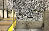
VIRTUAL EYES & EARS
Structural Health Monitoring program key to more resilient, modern infrastructure network
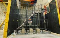
Given the aging condition of much of the nation’s navigation infrastructure, managers need accurate and real-time information on the condition of locks, dams and bridges operating well beyond their expected design lives. However, inspecting these critical components can be expensive, time consuming and dangerous.
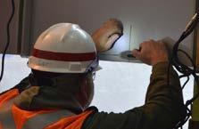

USACE is solving this challenge through a broad range of structural health monitoring (SHM) capabilities. It has developed sensors that provide constant, real-time information on structural conditions, giving warnings of impending failures and estimates of the remaining life and reliability of infrastructure components.
Looking ahead, SHM development will include the use of digital twins that provide a centralized platform for modeling scenarios. This streamlined data processing will help managers make decisions and ensure maintenance investments are optimized.
To read the full story, visit: https://www.usace.army.mil/Media/News/NewsSearch/ Article/3276980/structural-health-monitoring-key-to-a-more-resilient-modern-infrastructure-netw/
CONNECTING THE DOTS
Advanced monitoring techniques prevent catastrophic failures that could lead to MILLIONS IN ECONOMIC LOSSES

STRUCTURAL HEALTH MONITORING PROVIDES A CLEAR LINE OF SIGHT FROM OBSERVATION TO DECIDING A PLAN OF ACTION.
DR. BRIAN EICKDr. Brian Eick Research Civil Engineer U.S. Army Engineer Research and Development Center
15 14
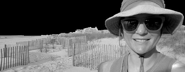
Molly Reif CONNECT
WITH Molly Reif is a research geographer with the U.S. Army Engineer Research and Development Center’s Environmental Laboratory and Geospatial Data Analysis Team lead.

How is R&D important in your projects?
In addition to reimbursable projects, R&D represents my primary focus to support a variety of civil works applications across all three major business lines. I especially value opportunities when our team of geospatial experts has space to explore new methods and technologies, while simultaneously addressing specific USACE needs. This combined R&D process is important to our work because it provides the potential to not only integrate fundamental research concepts with other teams and labs, but also to embrace a variety of geospatial approaches and data resources, giving us a unique perspective with respect to research projects.
USACE STRATEGY
Where do you see the need for more R&D?
As remote sensing technology continues to advance and so many more sensors come online, it really opens opportunities to address questions that we haven’t been able to in the past – or at least not as comprehensively as we might like. At the same time, climate change is rapidly bringing all sorts of new challenges to the forefront; thus, remote sensing and geospatial techniques have the potential for us to examine relationships across the landscape at both very fine spatial scales that weren't possible twenty years ago, as well as at regional or even global scales, to better understand how the mosaic fits and changes together. For all these reasons, there’s so much room for more R&D to see what else we can learn with remote sensing. This is not a one-and-done research project, but an evolving, adaptive technological approach that can be tailored to current and future scientific needs.
Below are the current Top 10 USACE R&D Priorities to address the nation’s toughest challenges with multi-disciplinary solutions. These strategies lay the foundation for a bold, new era of USACE R&D. @USACEHQ
Improve
Protect
US
SCAN FOR MORE ON USACE R&D

For additional information email: CERD.INFO@USACE.ARMY.MIL
PRIORITIES
FOLLOW
Approved for public release / Distribution unlimited
Mitigate & Adapt to Climate Change Win Future Wars Modernize Our Nation’s Infrastructure Support Resilient Communities Enable Smart & Resilient Installations
Environmental Sustainability and Resilience
Reliable Installation Energy
and Accelerate Decision Making
Ensure
Secure
Revolutionize
Cyber and Physical Security
and Defend the Arctic
