Urban Design and Architecture Portfolio / 2024 / Rafael Letizio
Rafael Letizio Sedeño Pinto portfolio
urban planning and design selected professional and academic work
“Planning is not just physical, it’s also about supporting people to fulfil their dreams and meet their needs.”
Helle Søholt
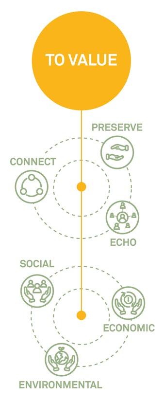
This portfolio presents works investigating urban life and the spaces that make room for it. It congregates different projects linked by the common idea that effective planning and design create spaces that allow all groups to interact and thrive.
linkedin.com/in/rafael-letizio/ São Paulo, Brazil
Rafael Letizio Sedeño Pinto urbanist and architect
Contents
Professional work
1 Feel free to breastfeed _ Proximity of Care Community engagement, public spaces, design thinking
2 Liga Solidária Masterplan Site Analysis, masterplan, landscape
3 Bebeteca _ The Baby Library Open design, furniture, public spaces
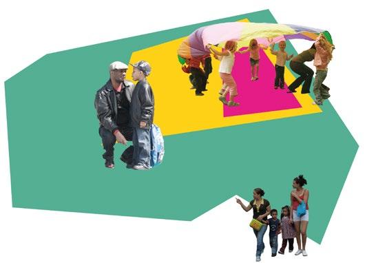
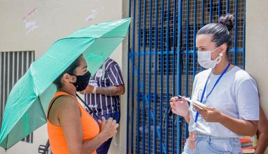
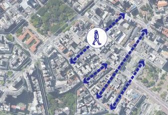
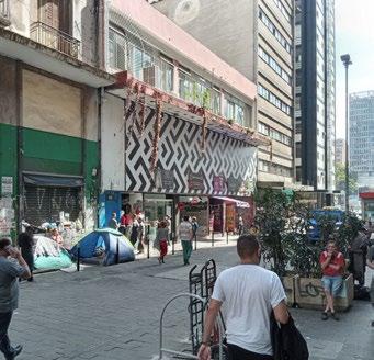
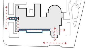
Can public spaces help change behaviors and taboos?
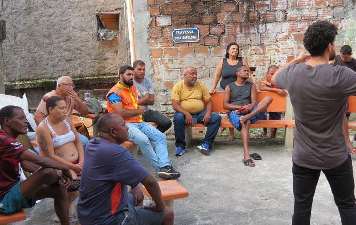
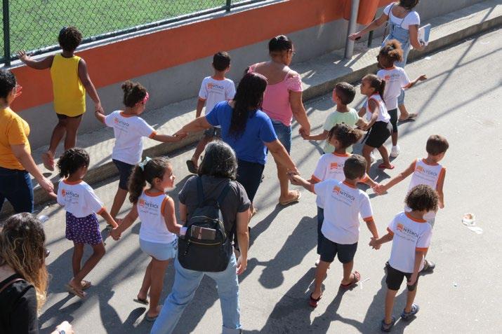
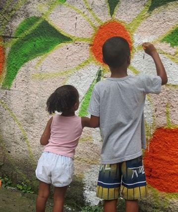
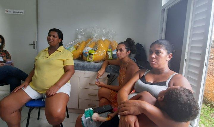
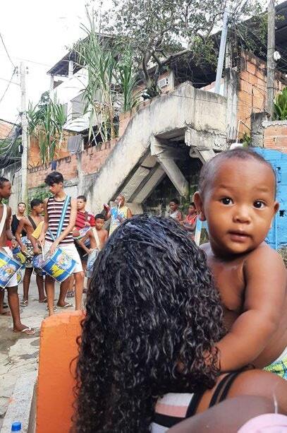
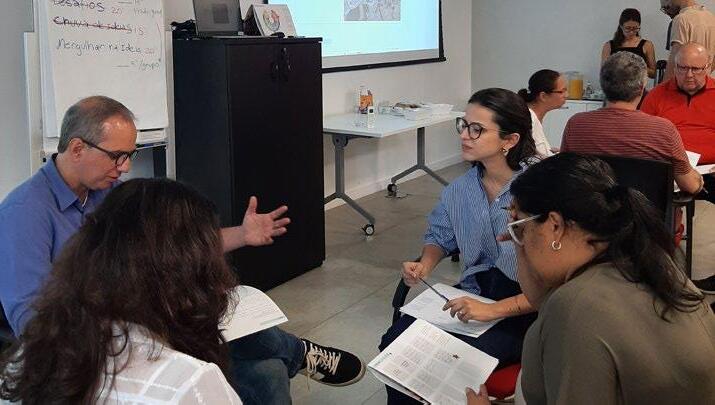
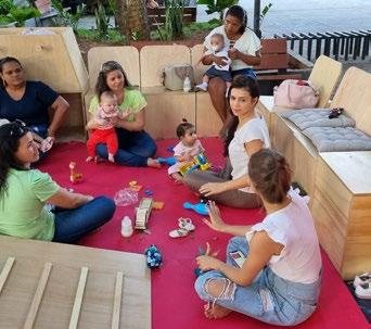
Led by ARUP, the Proximity of Care framework sparked this initiative in the Salinas community, Niterói. Focused on vulnerable children and their caregivers, the process highlighted the lack of adequate spaces for these groups. Field research revealed that public breastfeeding, often stigmatized in Brazil, is a key issue intertwined with caregiving, community dynamics, and the use of spaces. This project joined behavior change and physical space interventions to confront the issue.
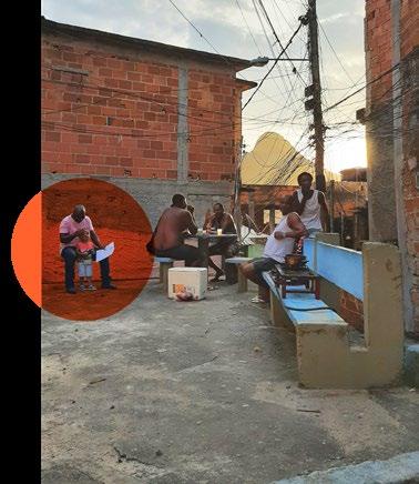
Event for area activation after tactical urbanism intervention
Estúdio +1, ARUP Urban Design, Municipality of Niterói Design concept, community engagement, image production What When Where Why Who How
Community informed design process to encourage breastfeeding 2022-2023
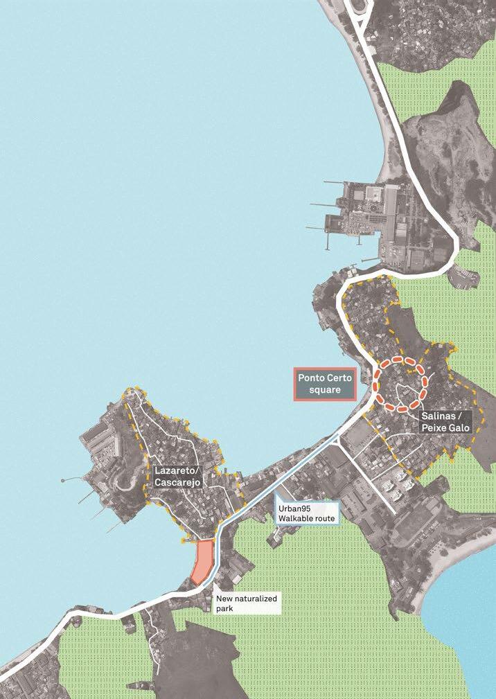
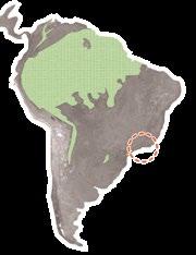
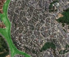
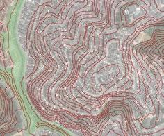
Niterói, Rio de Janeiro, Brazil
Professional Work
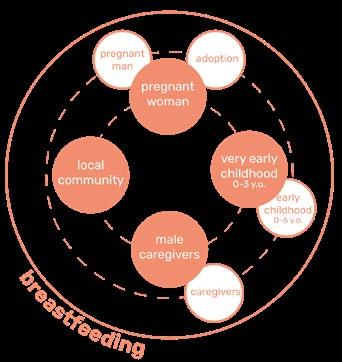
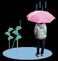
Breastfeeding as a connection thread to change spaces and behaviors.
of children were once breastfed In Brazil, but only and of children up to 6 months old have exclusive breastfeeding still on exclusive breastfeeding by the 4th and 5th month
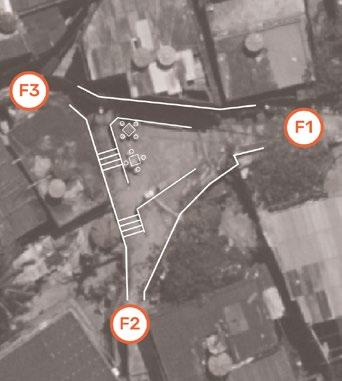
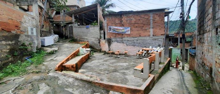
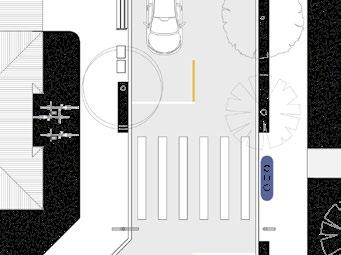
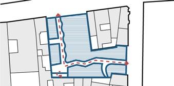
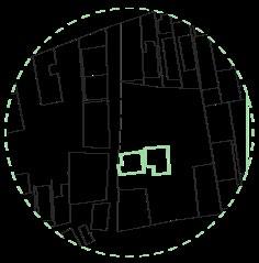
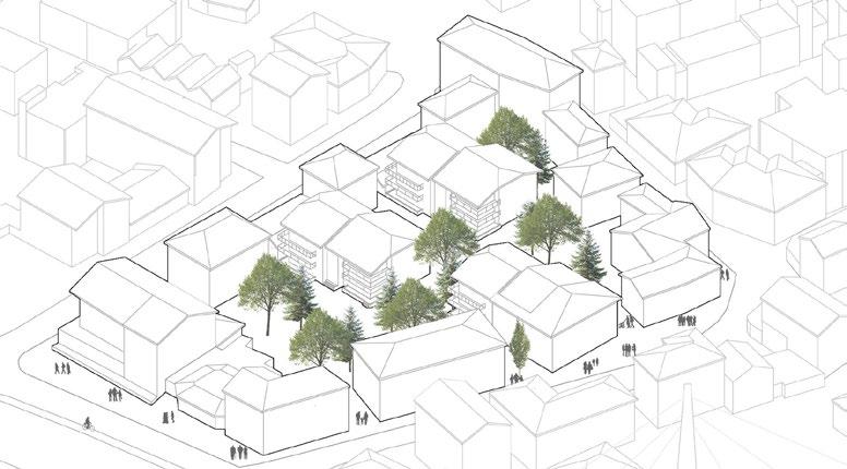
Ponto Certo Square, at Salinas Set of joint interventions planned in the area
Children from the local kindergarten in a neighborhood walk
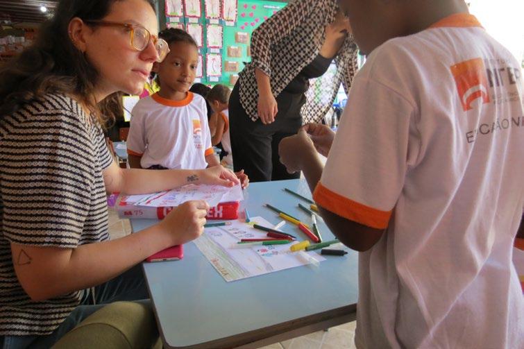
Drawing interview with children and teachers
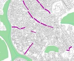
flow data collection Engagement and area activation
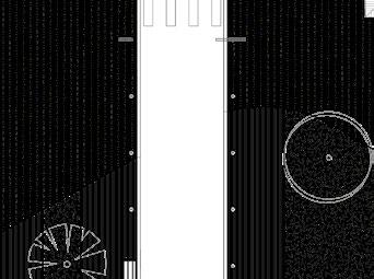
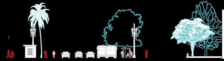
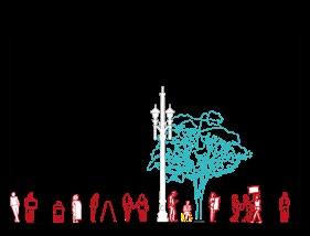
F1 - Pedestrians per hour, by gender.
F2 - Pedestrians per hour, by gender.
F3 - Pedestrians per hour, by gender.
Project feedback and meeting
Design and Engagement
Planned actions encompassed action in three different axes, not limited to their own categories.
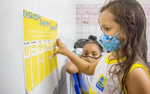
Engagement actions were thought to promote discussions in the community, engage as many different stakeholders as possible, and encourage behavior change; area activation
consisted of activities on the site of the project, specifically involving residents, adults, and children, to discuss design and stimulate their sense of ownership about the public space; physical intervention axis assured that public officers got involved in the process, to ensure resources and workforce for the final design construction.
Furniture prototyping
Collective mural painting
Breastfeeding kit distribution and interview with pregnant women
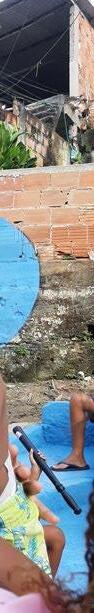
Ponto Certo Square before interventions
Halphy
Water comp.
Innovation Dept.
Urbanism Dept.
Antônio
Priscila
Infrastructure
Paula Bruna Valéria
Ana
Michelle Josy Betina
Health Dept.
Kit delivery + message discovery
Urban furniture prototype
Children carnival Art mural
Rodrigo
Open Design
Karen Aline
Students
Suel AKUMA
Artist
Public and private stakeholders involved
Augusto
Leandro
Regional adm.
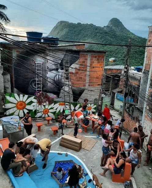
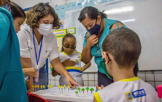
The whole process led to many iterations and discussions about the final form. Estúdio+1 and the local residents organized a tactical urbanism intervention to assess the design on its real scale.
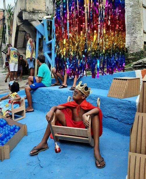
Working as a behavior change tool, an art mural was produced by a local artist, depicting a breastfeeding scene. Pieces of furniture were prototyped in wood to better refine their use and size. As a launching event, we organized a carnival party with children and the local carnival band, Unidos de Jurujuba
Later, the final design was refined, documented and shared with the infrastructure department of the municipality to start the construction process.
Geraldo
Lúcia
Residents
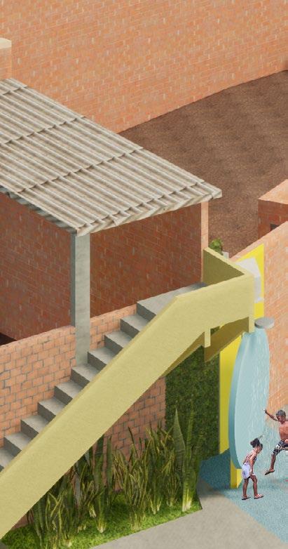
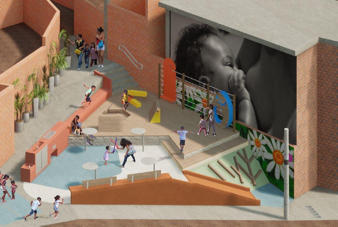
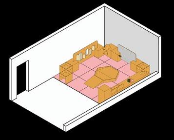
The final proposal - isometric view
The children carnival: activation event
The children carnival
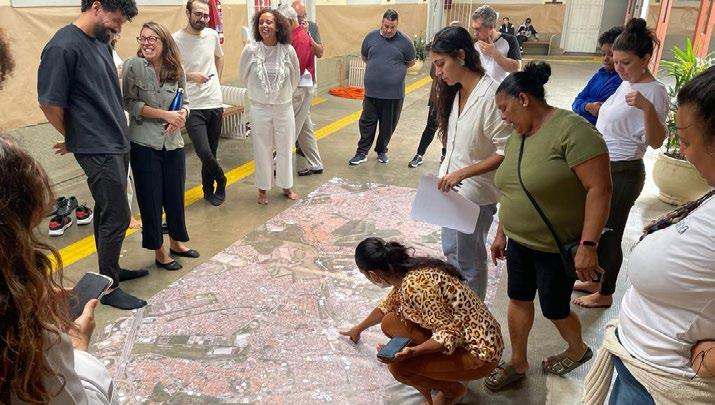
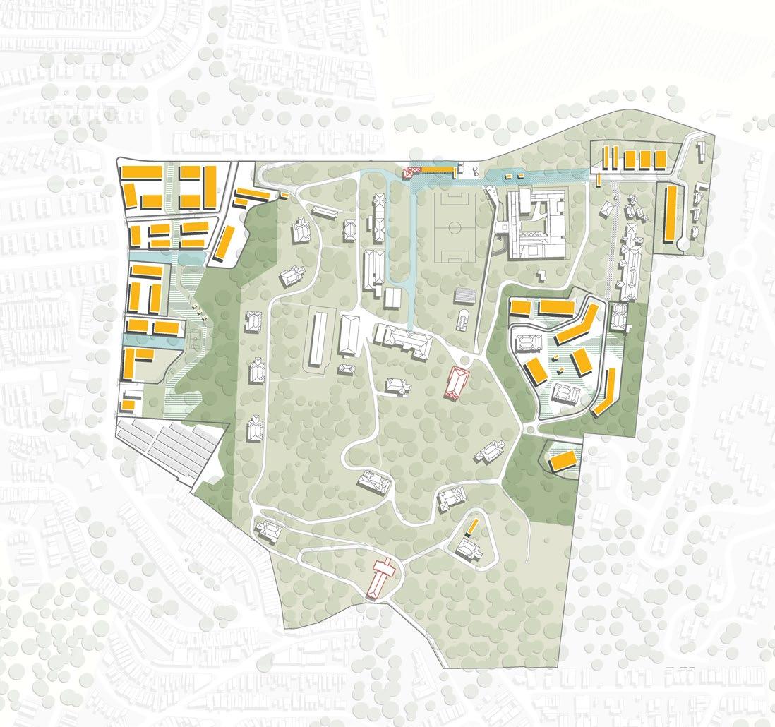
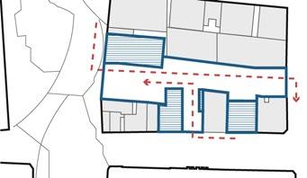
Liga Solidária Masterplan
How can a centennial institution use its territory as a tool for its social services?
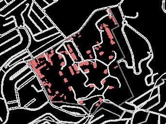
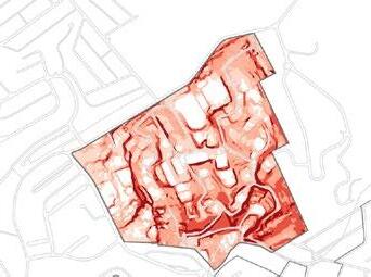
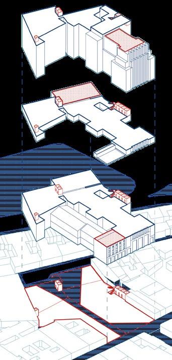
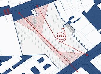
Educandário Dom Duarte is a headquarters of Liga Solidária (Solidary League). Formerly a farm, its territory is now completely in urban area and congregates six public schools, professional education, art classes, and sports facilities. This masterplan worked towards improving the relationship between the plot and its surroundings, by opening space and ordering future buildings and investments to prepare a more sustainable financial and territorial future for the institution.
Porfírio Sector - Perspective
Proposed sectors
Final built area
Green areas Street network
GIS and site analysis, design concept, institutional engagement, image production What When Where Why Who How
Territorial development masterplan for a charitable organization 2023-2024
São Paulo, São Paulo, Brazil
Professional Work
Estúdio +1, EMMA Arquitectos
Design and Engagement
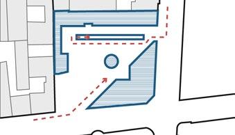
The proposal was built over thorough engagement with users and managers of the Educandário and careful analysis of its physical and historical characteristics. The plan contains the inner areas of the complex, their open spaces, and connections.
The place is divided into sections, with specific strategies designed for each. To provide financial safety for the institution, the masterplan envisions the possible future development of over 1.5 million sqft., to be carried with strategic partners.
Collective interview and mapping with managers
Collective mapping with users and community leaders
Public transportation - Bus lines
Watercourses
Existing buildings
Proposed scenarios
CDHU Sector - Isometric View
Porfírio Sector - View
CDHU Sector - View
Slope
Vegetation density
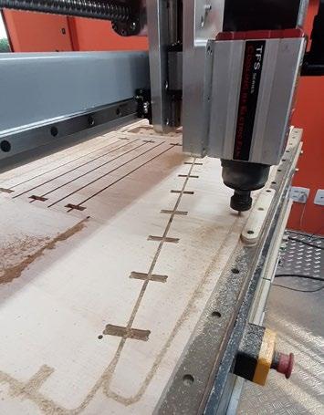
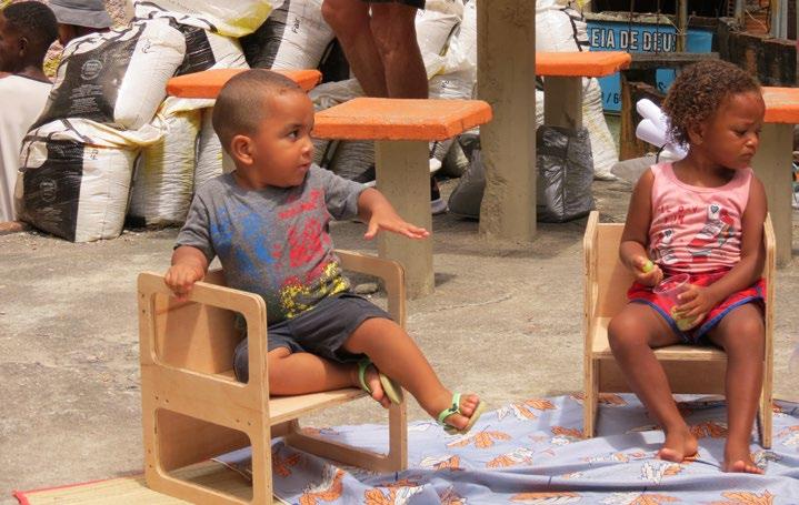
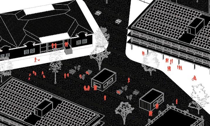
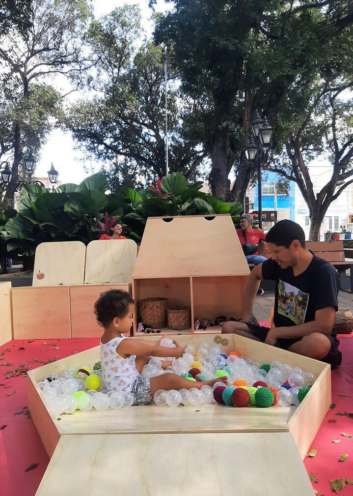
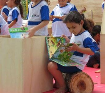
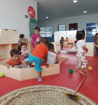
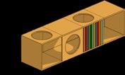
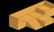
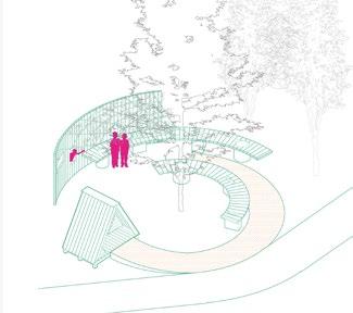
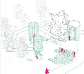
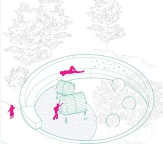
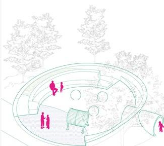
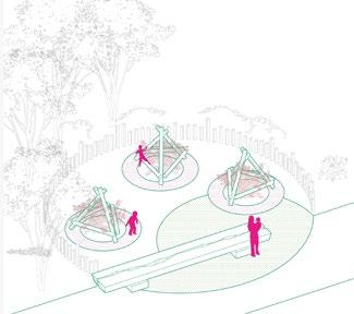
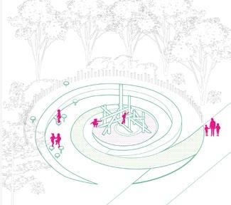
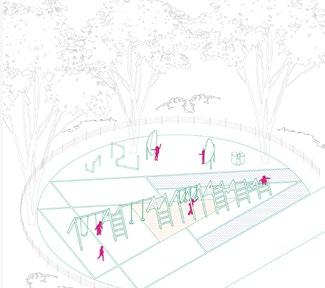
Bebeteca - The Baby Library
Can we aggregate children and caregivers in tactical urbanism actions?
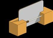
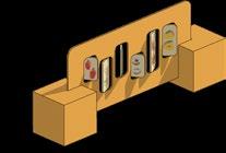
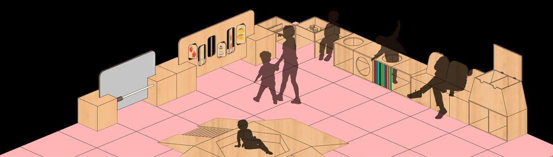
Bebeteca (from Portuguese Bebê, baby, and Biblioteca, library) is a set of open-design furniture, thought to reclaim public spaces for babies, toddlers, and their caregivers. Inspired by the Pikler approach, the space is composed of pieces that stimulate coordination and balance. Books and a locally curated set of items are set out in the place, encouraging interaction between children and caregivers. The drawings and specifications can be found in the complete guide (Portuguese) and on GitHub
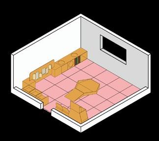
Bebeteca - Assembled at Sé Square, Crato
Ponta da Serra Kindergarden, Crato
Open design furniture for babies and caregivers 2023
Crato, Ceará, Brazil - anywhere
CAD Modelling, preliminary digital fabrication prototypes What When Where Why Who How
Professional Work
Estúdio +1, Onírica Urbe
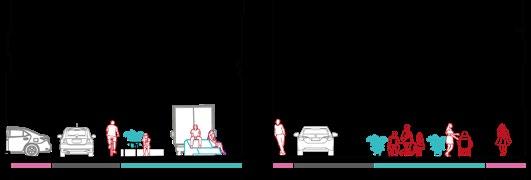
ludic, playful dynamic functional seating
Categories of furniture, examples
Spatial compositions for open or enclosed spaces
Microaccessibility Manual
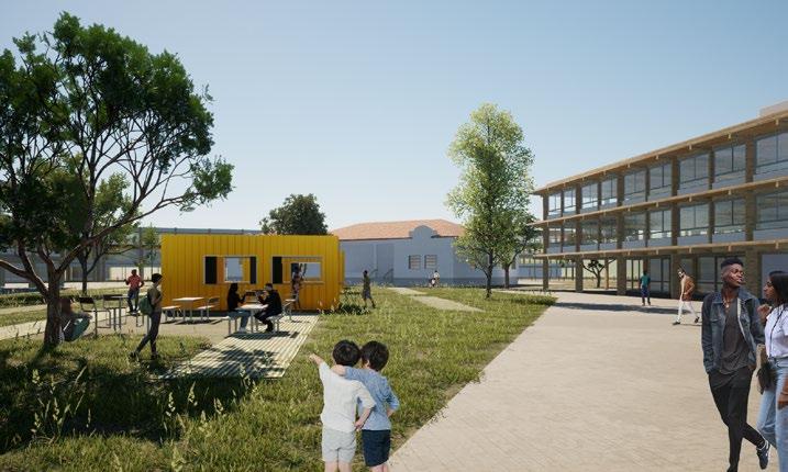
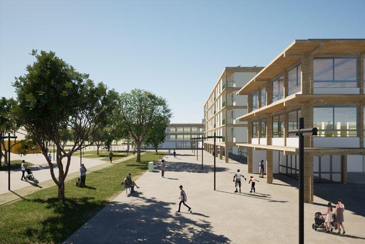
How can we provide accessible and inclusive urban spaces beyond standards?
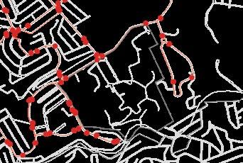
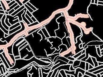
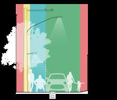
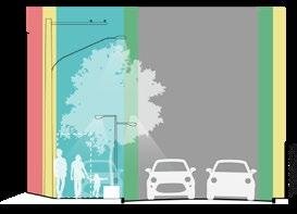
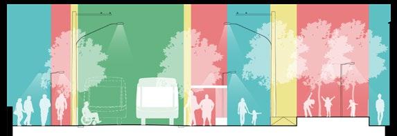
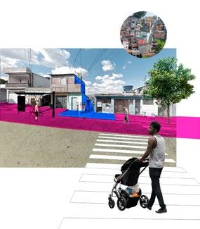
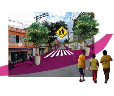
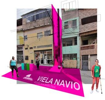
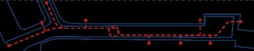
The Microaccessibility Manual was developed during The World Bank Smart Mobility Program for São Paulo. Its aim was to provide conceptual knowledge and practical solutions to ensure urban accessibility to transportation and services on the neighborhood scale, especially in underserved areas. The guide comprises a library of technical solutions and a pilot project designed at Guaicuri, an informal settlement near Billings water reservoir. The full document (in Portuguese) can be accessed here
Pilot project - Crossings (Drawing in collaboration with Vivian Madi)
Accessibility and pedestrian network solutions
2021 - 2022
São Paulo, São Paulo, Brazil - Anywhere Professional Work
Estúdio +1, The World Bank
Design assistance, regulations and standards research, image and model production What When Where Why Who How
Decision making
Planning
Design
Implementation
Maintenance
1| Defining the theme
2| Tracing the microaccessibility network
3| Applying microaccessibility principles
4| Consolidating the process
Organization processes
Intervention tools
Communication tools
Engagement processes
Local shared street
Stairway plaza and lookout
Plain language and wayfinding
School street access
School street
Shared street with bus line Street typologies
The manual sections and tools
The “Free Tunnel” - basis of the accessibility
Pilot project - Scenarios
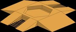
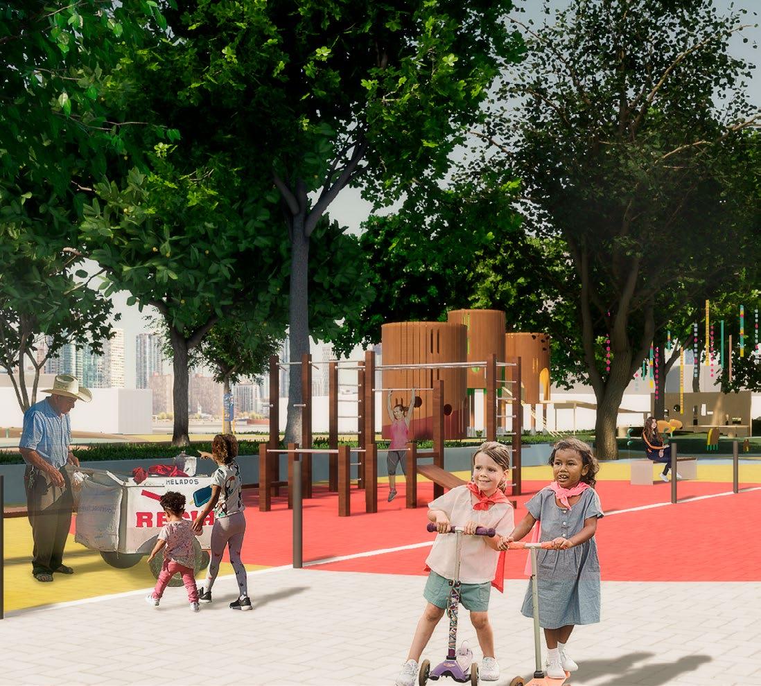
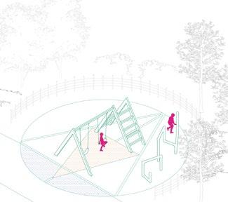
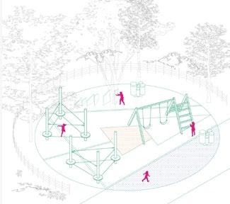
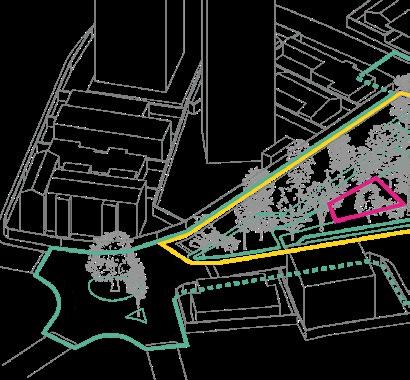
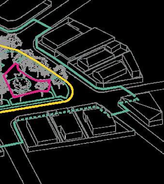
Childhood Squares of Recife
Can urban design encompass childhood development concepts?
The Design Guide for Childhood Squares of Recife deals with natural concepts, communication, and local culture regarding the possible paths to be followed by future squares of the city. Dom Miguel Valverde Square was elected as the pilot project to assess the proposed methodology and to be the first action on the children-oriented development that Recife wants to apply. The guide (in Portuguese) can be accessed here
Dom Miguel Valverde Square perspective
IABpe 2023 Prize
Institute of Architects of Brazil, State of Pernambuco
1st prize on Urbanism category
Research, modelling, image production, follow-up and advisor of municipality team What When Where Why Who How
Design and implementation guide for children-oriented spaces
2021 - 2023
Recife, Pernambuco, Brazil
Professional Work
Estúdio +1, Municipality of Recife
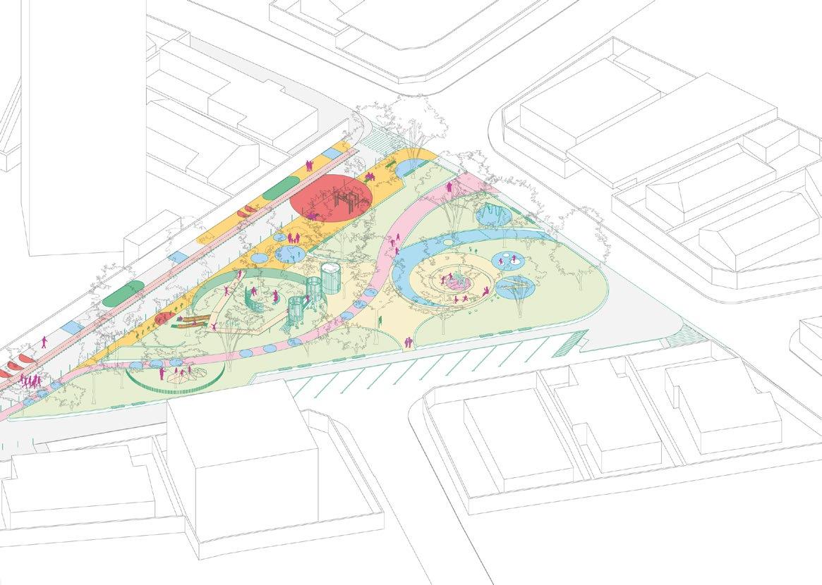
The thematic circles
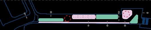
Based on local cultural elements, the concept for the squares of Recife draws from the circular movement present in dances and traditional storytelling moments. Thematic circles represent natural elements, each focusing on a different activity. Connecting them, an accessible structuring path that represents a possible course on the place. The thematic circles are developed in three different sizes based on complexity and available space.
The guide proposes three different zones to be defined in each square: the caring zone, in which adult everyday activities happen; the integration zone, in which spaces are harmonically shared between kids and adults; and the priority zone, where interactions between children and the space are essential.
Connection with nature and meeting spaces - Tree circle - S, M and L
Sound, music and physical activities - Wind circle - S, M and L
Imagination and coordination skills - Earth circle - S, M and L
Celebration and gathering - Fire circle - S, M and L
The concept for each circle
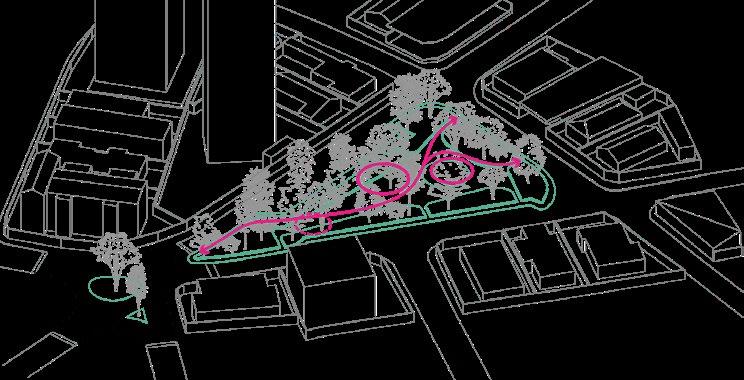
The pilot project - Dom Miguel Valverde Square
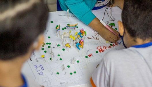
Intense engagement activities were carried out with both children and caregivers of the area to inform the pilot project at Dom Miguel Valverde Square. Physical modeling activities at the neighborhood school and interviews provided registers to foster the design concept for the square, encouraging children to explore different physical and playful activities.
Three thematic circles were considered: tree, earth, and fire. The first brings a space for shadow and rest; the second provides contact with the ground and profits from the terrain form; the last presents a gathering space on the existing clearing.
Engagement activities at the neighbourhood school. Photo by Edson Alves.
Dom Miguel Valverde Square - Diagram of the proposal
Outcomes and reach
The guide contemplates a careful methodology to evaluate and design childhood spaces in other squares in the city. It includes furniture, communication elements, and recommendations regarding plants and trees.
The Municipality of Recife has drawn from the guide to autonomously implement 10 childhood squares. The initiative has spread to other cities in the State, that started using the publication to guide their own initiatives.
Photos of the square opening. Photos by: Helia Scheppa and Paulo Melo
The proposed zones - caring (green), integration (yellow),
Dom Miguel Valverde Square - Proposal
The proposed structuring path
(yellow), and priority (pink)
Three design studies in República
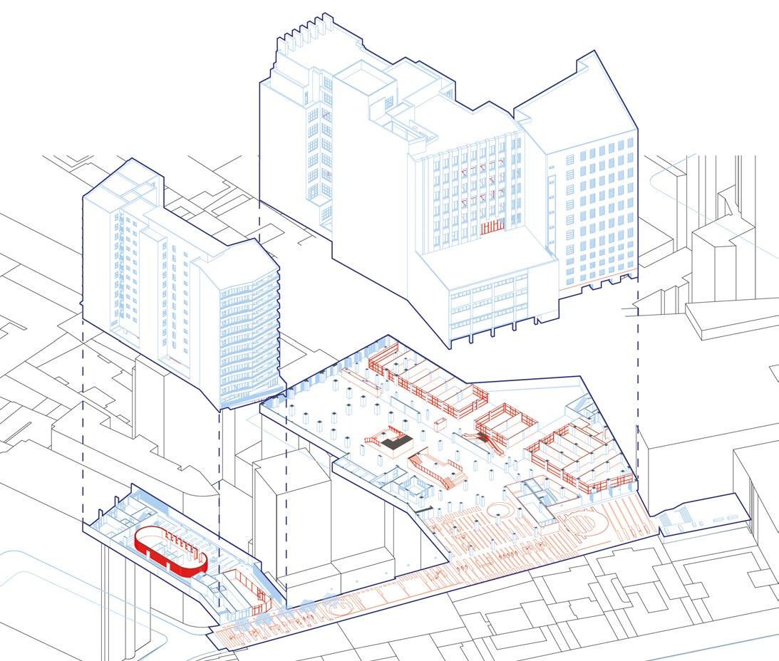
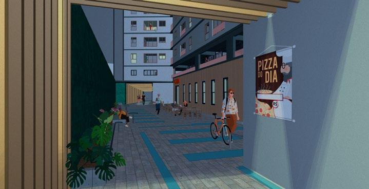
Can a building be an active connection element in the urban structure?
Beginning in the late 1930s, the modernist movement in São Paulo started dealing with the downtown area densification. The design strategies stand out and still resonate in the urban form, and pose lessons for contemporary architecture. Inspired by these, the project aims to make three design essays for three different objects on the same urban block: a street, an existing building, and an empty urban plot. The complete analysis and design (in Portuguese) can be seen here
Contemporary proposals for existing public-private spaces
2021
São Paulo, São Paulo, Brazil
Academic work _ Final Thesis at University of São Paulo
Individual work, advised by Prof.Luciano Margotto
Mapping, typology analysis, urban design, building design
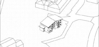
Basílio da Gama street - Perspective of the proposal
The architectural pedestrian system
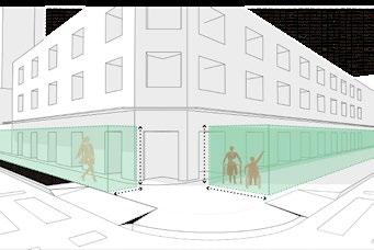
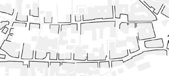
The República district witnessed the growth of the city in the 19th century. Numerous commercial galleries were built, using internal walkways as commercial connections across streets. The density of such buildings in this neighborhood creates a system of passages that complements the existing
streets. The various street typologies are enrichened by these galleries, dissolving urban blocks and providing a diverse urban experience. Contemporary structures have successfully used similar strategies, and this project aims to draw ideas from them in three design studies.
Basílio da Gama Street. - view from the corner with Gabus Mendes Street (2021)
Cine Coral - view from 7 de Abril Street (2021)
Telesp Clube Complex - view from 7 de Abril Street (2021)
Vehicular flows
Pedestrian main streets and subway stations
Pedestrian secondary streets
Existing urban blocks
Dissolving urban blocks
Existing passages (commercial galleries)
Existing street typologies - São Luís Av. (left), Barão de Itapetininga st. (right)
Telesp Club - Inner courtyard view
Praça das Artes
Sesc 24 de Maio
Mário de Andrade Library extension
Contemporary spatial strategies
Califórnia Gallery
7 de Abril Gallery
Metrópole Gallery
Modernist buildings’ spatial strategies
pedestrian space vehicle space living/leisure
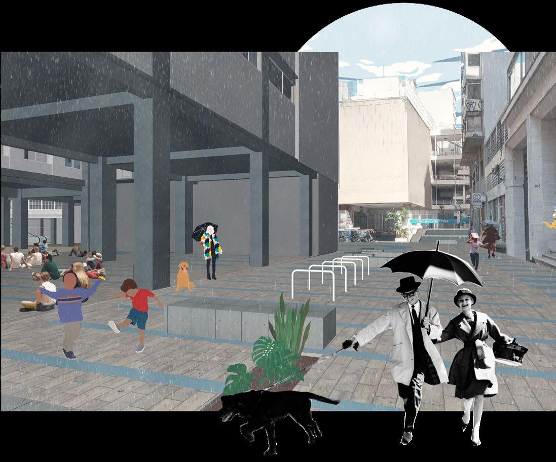
Repurposing the street - Basílio da Gama St.
Basílio da Gama is a dead-end street for vehicles, but not for pedestrians: on its end, it is possible to access the stairs of Metrópole Gallery and cross it to Dom José de Barros Square.
What is the purpose of this street in the context around it? How to strengthen the existing uses? How to make it more
comfortable for pedestrians without restricting access to the existing parking lots and garages? The answer given was the remodeling of the street as a shared space, rethinking areas dedicated to people and cars.
Basílio da Gama st. - proposed plan
Paving, vehicular flow and street zoning
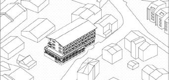
Basílio da Gama street - View to Cine Coral Residential
Basílio da Gama street strategies
Special locations houses foyers and courtyards that gather and organize user flows.
Telesp Club strategies
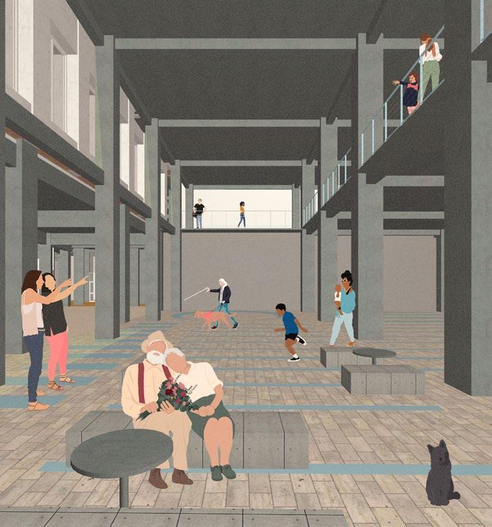
Repurposing the buildings - Telesp Club and Cine Coral
In 1916, the Brazilian Telephone Company (later, named Telesp) started to build an office complex with entrances from 7 de Abril and Basílio da Gama streets, that now comprises four blocks. In the same street, what was once the first “arthouse” cinema in São Paulo (Coral), now hosts stores and a parking lot.
The challenge is to create a new relationship between the street and the buildings, providing both internal and external connections, while respecting the built context. The commercial avocation of the area is maintained on the ground floor. Telesp Club holds cultural facilities on the upper areas, while a new residential building is erected on the cinema plot.
Telesp Club - Basílio da Gama foyer
Coral Residential -view of the commercial walkway at the ground floor
The ground floor allows a public link between streets; a second circulation wanders through the multiple courtyards on upper floors.
Beyond Transposition _ Brasilândia stairs
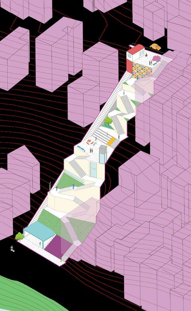
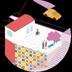
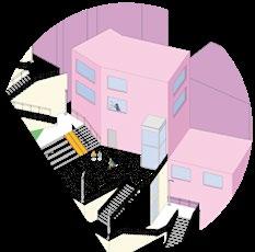
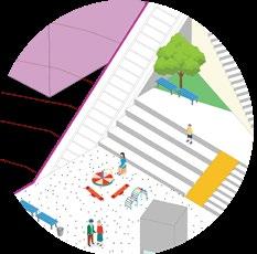
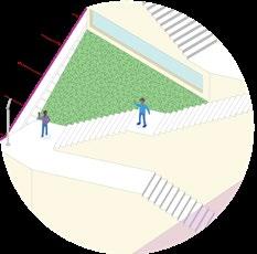
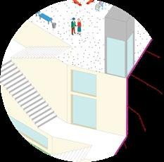
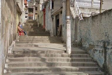
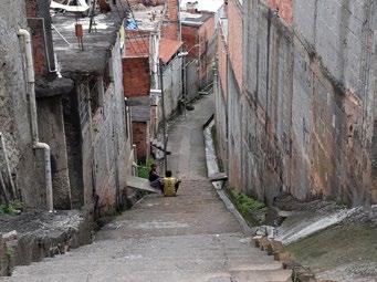
Can we design infrastructure as functional public spaces?
Marked by steep hills and significant elevation changes, Brasilândia is a district on the northern outskirts of São Paulo. Understanding this aspect of the landscape and the resulting significance of the stairways to the neighborhood, the project aims to transform this infrastructure into qualified urban spaces. The new stairway proposal - Design and scenarios
What When Where Why Who How
IABsp 2018 Prize
Institute of Architects of Brazil, State of São Paulo
1st prize on Student category
Design for a public main stairway connection
2018
São Paulo, São Paulo, Brazil
Academic work _ Urban Design studio, University of São Paulo
With Bianca Bonachela, Caroline Viana, Luis Scavassa, Vinicio Diani, and Yêdda Magalhães; advised by Prof. Catharina Pinheiro and Prof. Karina Leitão
Urban analysis, design of alternatives, image production
1| Democratic transposition
A funicular cable car is proposed to improve access to the different levels of the stairs.
2| Transposition as an experience
The idea of a “plazastairway” is adopted as a way to explore its potential to promote meetings in the community and to supplement the lack of public spaces in the neighborhood.
3| The transposition activating the area
Additional facilities are proposed in the passage to improve its social dynamics, making it active throughout the day. To do so, we propose a library in the middle landing and social housing next to the stairs.
4| The transposition as a safe space
The project focused on keeping a sense of security throughout the path. To do so, the design keeps clear views and lighting around all areas.
1st| No accessibility; visual obstacles
2nd| No accessibility; no space for cable car
3rd|Sufficient space, no visual blockages
Street network Houses and Canivete linear park
The passages as a living room People occupying the existing spaces (Photos by Luis Scavassa)
Topography 5m countours
Public Stairs Intervention area
Bormio Resilience Strategies
Can we design spaces for events that lead to long-lasting change?
Milan and other cities of the Italian Alpine Dolomites area will co-host the 2026 Winter Olympic Games. In this context, the Olympics may be seen as a driving force for renewal. Dealing directly with contemporary problems of small Alpine Italian towns, this project addresses densification as a way to provide affordable housing and touristic accommodation; at the same time, uses it to protect typology and traditional urban form in Bormio, the host of skiing competitions.
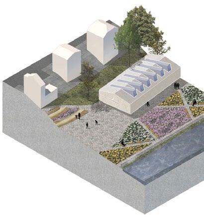
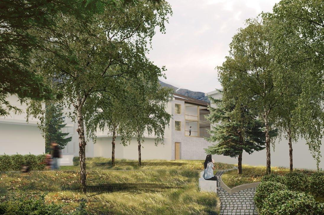
Riverfront view (Drawing in collaboration with Athul Narayanan)
When Where Why Who How
Design proposal for Winter Olympic Games host city 2019
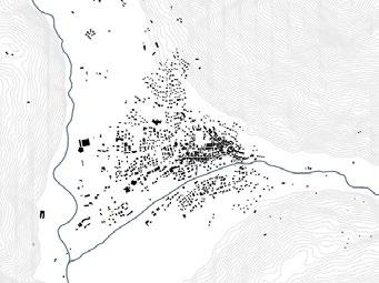
Bormio, Sondrio, Italy
Academic work _ Politecnico di Milano
In collaboration with Athul Narayanan and Tristan Schrey, advised by Prof. Isabella Inti, Prof. Riccardo Mazzoni, and Prof. Irene Toselli
Data research, typology analysis, urban and landscape strategy
The urban development
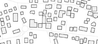
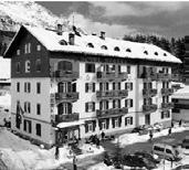
Like many cities in mountain areas, Bormio has seen rapid growth along the “touristic boom” beginning in the 1950s. Touristic accommodations were raised diverging from the original city center form. Freestanding typologies, such as chalets and ski resorts, were erected in low density. Not only does it threaten the city’s identity, but makes the housing prices increase drastically.
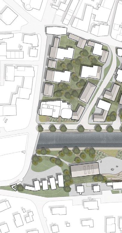
To deal with the evoked question, the design acts in two different ways. In the building and block scale, reshape existing structures with extensions to allow densification The expansion helps to recover the morphology of urban blocks and to create inner courtyards. )n the urban scale, activating the riverfront as a public space consolidates the larger urban open area of the city.
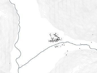
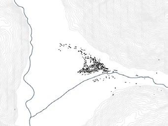
1900 - Bormio
“Chalet” typology
Morphology: traditional vs. contemporary
“Ski resort” typology
1950 - Bormio
2010 - Bormio
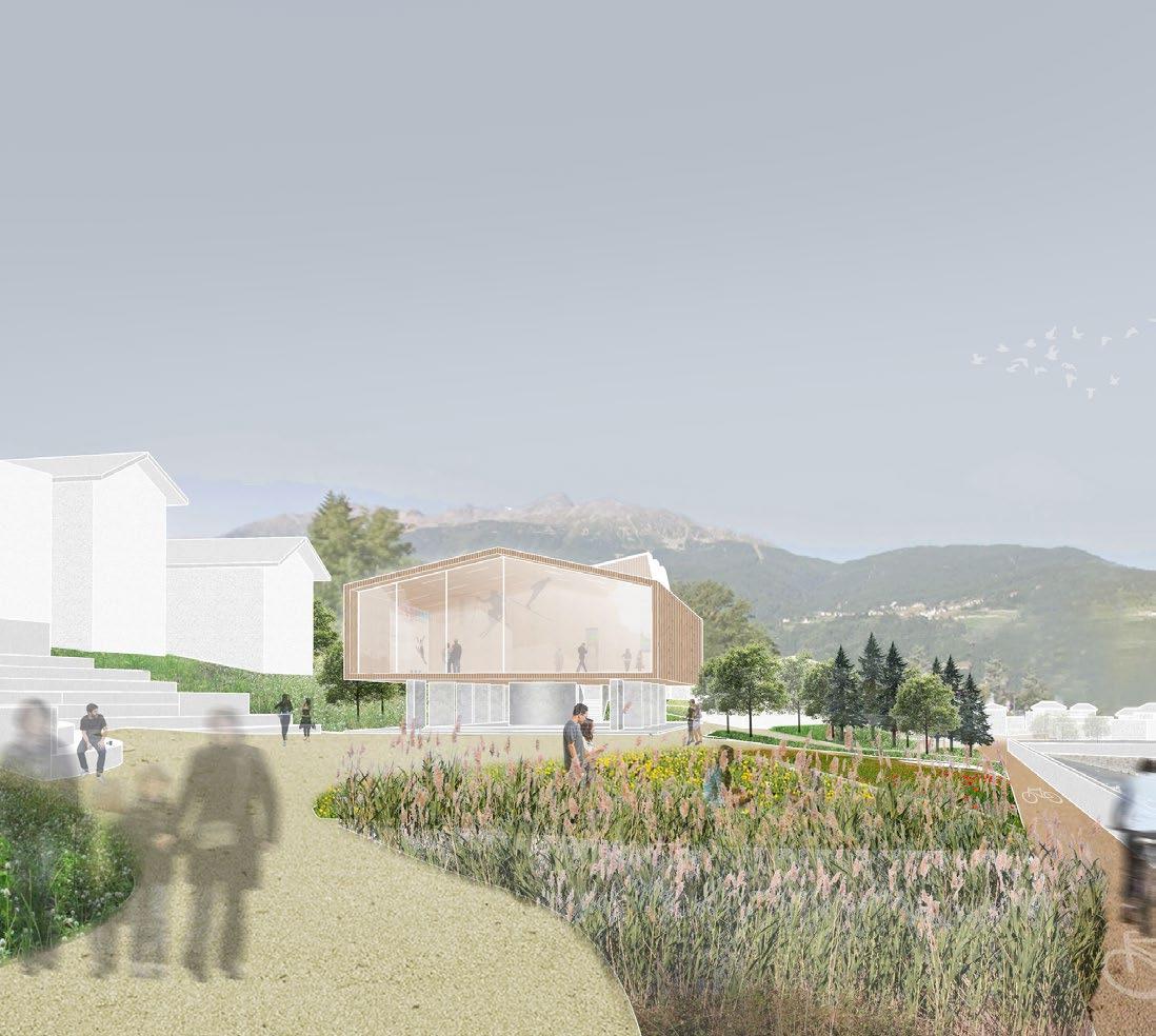
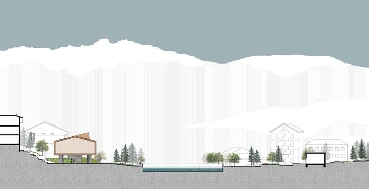
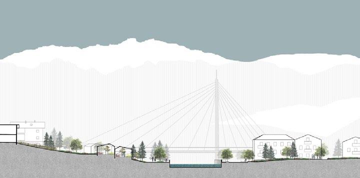
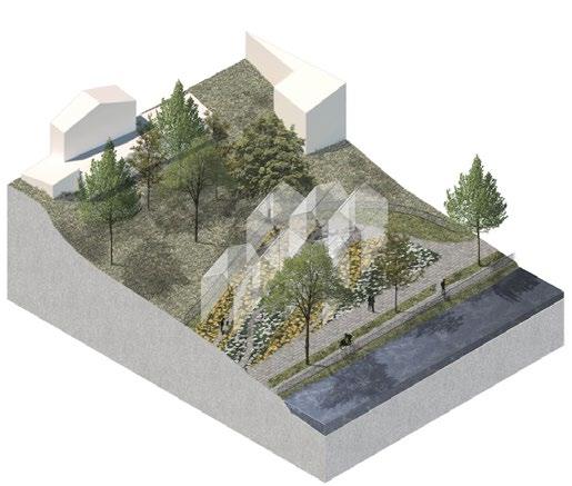
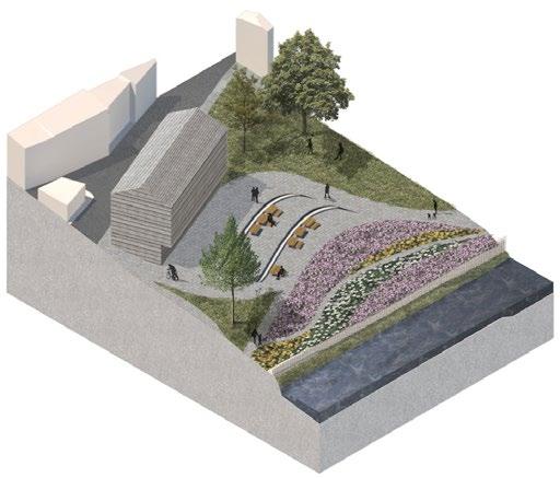
Recovering the riverfront
Bormio’s riverfront has the potential to provide an easily accessible public space near the city center. To do so, a new structure is proposed, combining pedestrian paths, green areas, and spaces for civic activities.
On the northern side, the riverfront comprises the street areas and small plazas. On the southern side, it encompasses the non-used public area behind the existing buildings’ backyards to open spaces for civic buildings and a park.
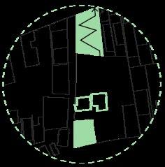
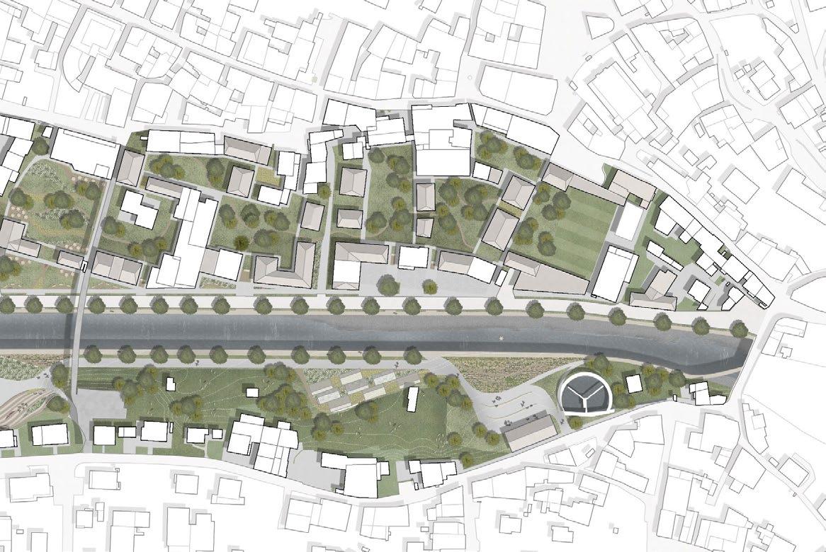
Bormio Riverfront - Plan
Bormio Riverfront - Section a
Bormio Riverfront - Section b
Proposed spaces
Cultural facilities
Greenhouses Community condenser
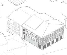
Strategy - recovering morphology through densification
Transitional typologies
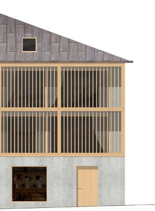
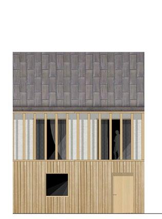
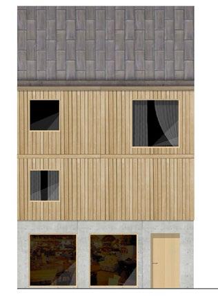
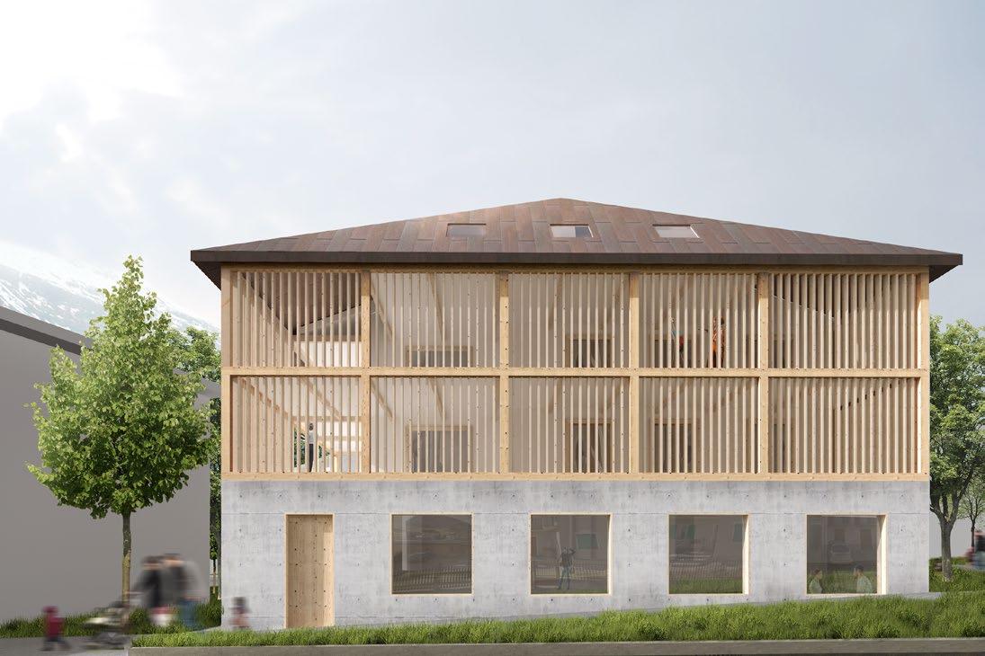
Additions to the existing blocks are made reinterpreting the traditional typologies and urban context. Based on alpine architecture, the extensions are built on a heavier base, on concrete, and lighter upper parts, on wood.
It provides a possibility to revalue the architecture of the expansion years, to prepare the city for the touristic flows of the Winter Olympics, and to make space for future generations on the mountains.
Private inner courtyards (Image in collab. with Tristan Schrey)
Proposed facades for the extensions, following local materials
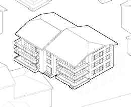
Existing housing buildings and proposed expansion
Strategy - recovering morphology through densification (Image in collab. with Tristan Schrey)