
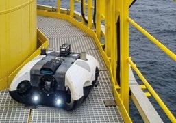


The magazine of choice for Ocean Robotics focused Professionals 33 ISSUE Q4 / 2022 Greensea’s Open Architecture Software Revolution 7. AI Meets Underwater Inspection 53. Close Up View of Damaged Nord Stream Pipelines 17. Nekton Maldives Mission 47.




ISSN 2634-0283 (PRINT) ISSN 2634-0291 (ONLINE) EDITOR-IN-CHIEF Richie Enzmann COPY EDITOR Will Grant SALES DIRECTOR Nick Search DESIGN & LAYOUT Milan Farkas CONTRIBUTORS Richie Enzmann, Marc Deglinnocenti, Ash Sheppard, Reenst Lesemann, Richard Purser, Saul Trewern, Sienna Cumby, Silke Braham, Trond Larsen, Victor Sepulveda SPECIAL THANKS TO Åge Holsbrekken, Anna Wahlin, Audrey Leon, Ben Grant, Bill Mallin, Claire Cardy, Curtis Lee, Danny Church, Dawn D'Angelillo, Filip Stedt, Gunvor Hatling Midtbo, Gautier Dreyfus, Hayley Yule, James Colebourn, Jeroen Romijn, John Benson, John Bloomfield, Judith Patten, Julian Lalanne, Julie McLaughlin, Marion Seyve, Matt Bates, Neil Manning, Niklas Andersson, Oliver Steeds, Paul Fletcher, Rachel McAlpine, Richard Mills, Rob Howard, Scott McLay, Siv Tveit, Victor Sepulveda, Willard Balthazar 3D at Depth Bayonet Ocean Vehicles Blueprint Subsea Blueye Robotics BeeX C-Power DeRegt Cables Digital Edge Subsea Eurofleets EvoLogics Exail Film-Ocean Forssea Robotics Greensea Systems Hydramec IMCA Impact Subsea Kongsberg Maritime Modus Subsea Services Nekton Nortek Oceaneering QYSEA QSTAR RTS Saab Seaeye Spanish Navy Subsea Europe Services Tritech WaterLinked Zetechtics 04 Events Calendar & Welcome to Ocean Robotics Planet 07 Greensea Systems’ Open Architecture Software Revolution 13 Hydramec to Set the Pace in Delivering Remote Solutions 17 Blueye Robotics Close Up View of the Damaged Nord Stream Pipelines 21 Nord Stream, Geopolitical Tensions, and the Need for Power to Protect Remote Offshore Assets 25 Eurofleets AUV Workshop in the Gullmar Fjord, Sweden 30 Poster: The “Ran” Hugin AUV 33 Modus Subsea Services Awarded the World’s First Resident Subsea Drone Contract 37 FiFish: The Small ROV with Large Options 43 Spanish Navy Acquires Leopard ROV through NSPA 46 ONS Review – Insight into the Future of the Energy Industry 47 Nekton Maldives Mission: Where No Human Has Gone Before 51 Powering Resilient Navigation to Safeguard Naval Operations 53 Artificial Intelligence Meets Underwater Inspection 57 IMCA Turns its Guidance Spotlight on USVs TABLE OF CONTENTS 25. 33. 43. WWW.OCEANROBOTICSPLANET.COM Front Cover Image: Courtesy of Greensea Systems Poster Photo:
Richie Enzmann
NOVEMBER
FEBRUARY
OFFSHORE ENERGY
Amsterdam, The Netherlands (29–30 November 2022)
OCEANOLOGY INTERNATIONAL
San Diego, CA, USA (14-16 February 2023)
SUBSEA EXPO Aberdeen, UK (21–23 February 2023)
MARCH U.S. HYDRO 2023
Mobile, AL, USA (12-16 March 2023)
MCEDD 2023 London, UK (28-30 March 2023)
APRIL SEA AIR SPACE National Harbor, MD, USA (3–5 April 2023)
OCEAN BUSINESS Southampton, UK (18–20 April 2023)
WINDEUROPE 2023 Copenhagen, Denmark (25–27 April 2023)
MAY OTC 2023 Houston, TX, USA (1-4 May 2023)
DEEP SEA MINING SUMMIT London, UK (3-4 May 2023)
UDT 2023 Rostock, Germany (9-11 May 2023)
UNCREWED MARITIME SYSTEMS TECHNOLOGY London, UK (10-11 May 2023)
JUNE MTS/IEEE OCEANS Limerick, Ireland (06-08 June 2023)
GLOBAL OFFSHORE WIND London, UK (14-15 June 2023)
SEPTEMBER
SPE OFFSHORE EUROPE
Aberdeen, Scotland, UK (5-8 September 2023)
DSEI London, UK (12-15 September 2023)
My name is Richie Enzmann. Allow me to welcome you all to the latest issue of Ocean Robotics Planet!

Dear Reader,
It’s been an eventful quarter, for good and for ill. We’ve had many wonderful exhibitions but have also been caught off-guard by the Nord Stream pipelines incident that rocked the subsea community. I was at the WindEnergy conference in Hamburg when the news about the sabotage broke. Right away I was keen to find out more about the current state of those pipelines. I decided to interview Trond Larsen from Blueye Robotics to hear what he saw and experienced while inspecting the damage. Trond was one of the first people to respond, so we’ve been fortunate enough to glean his first-hand insight.
This incident has also been a game changer, in terms of how we view our critical underwater infrastructure: we’ve realised how vulnerable it all is, without a clear means of protection. However future protection may evolve, there will certainly be a need for remote power when monitoring subsea pipelines and cables. This was outlined by Reenst Lesemann who heads up C-Power, a company providing wave energy solutions for the defence and commercial sectors.
In this issue we also report on the exciting Nekton mission in the Maldives. The Maldives is just 1.5m above sea level, perched upon coral reef atolls, and it’s one of the most climate change threatened parts of the World. The Nekton Mission believe they have discovered a previously undescribed ecosystem –'The Trapping Zone' – that is creating an oasis of life 500m down in the depths of the Indian Ocean.
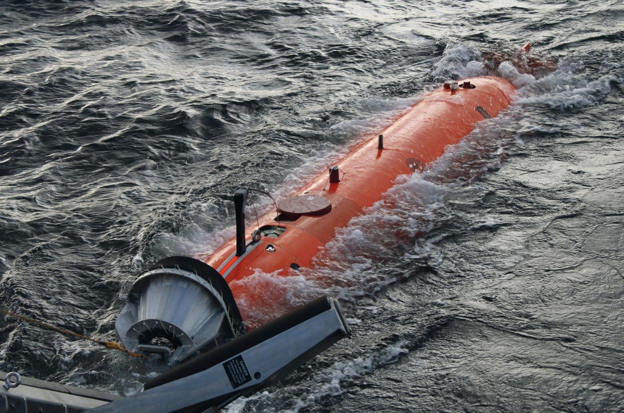
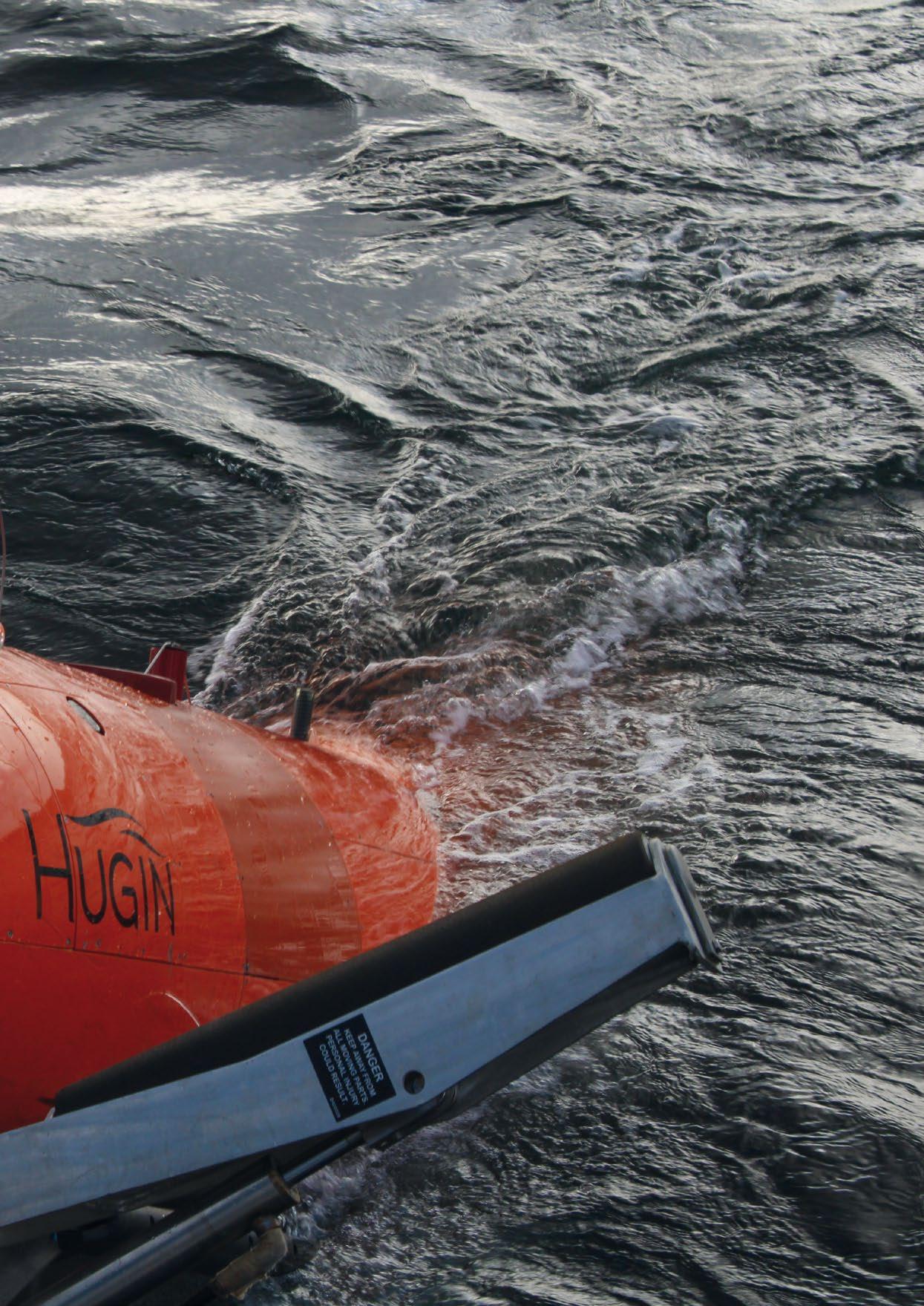
In other news, Captain Marc and I went on two separate seagoing journeys in this quarter: Captain Marc tested the Fifsh V6 Expert ROV from QYSEA and wrote a review on his experiences; I took part in the AUV workshop organised by the Eurofleets programme and the University of Gothenburg in Sweden. I hope you enjoy reading these reviews, and of course the accompanying photos. I managed to take a great action shot of the Kongsberg Hugin AUV, named “Ran”, as it was retrieved from the water onto the containerised LARS system. You can see it in all its glory in this issue’s centrefold.
Last but not least, you’ll have already seen Greensea Systems splashed across our front cover. Over the past decade and a half Greensea has developed an open architecture framework called OPENSEA, upon which marine robotics can be built. The dynamic software solutions company – led by their charismatic CEO Ben Kinnaman – has coined the company motto MTFB (“Move the F-cking Ball”). This reflects their level commit ment and teamwork to getting things done. This MTFB culture combined with the OPENSEA platform is what’s driving trans formative change and advancement. You can find out all about the great work they do and more inside. Best regards, Richie Enzmann
EVENTS CALENDAR 2022 For more information about all events visit www.oceanroboticsplanet.com
WELCOME TO OCEAN ROBOTICS PLANET!
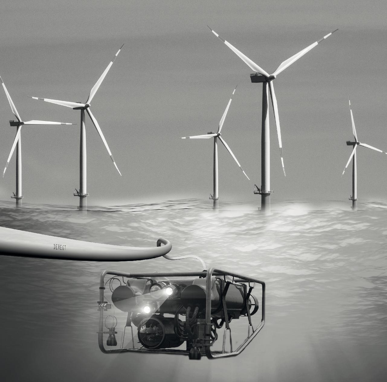
Cable solutions that challenge the status quo
Which design considerations are the most important for your project? And how does ROV Cable manufacturing work?
Discover all about ROV Cable manufacturing, requirements, the latest trends and make your subsea project a success! To help you select the perfect ROV cable, please download our Ultimate Guide here or scan the herein QR code.
Connect with us : deregtcables.com / LinkedIn

GREENSEA SYSTEMS’ OPEN ARCHITECTURE SOFTWARE REVOLUTION
The next generation of marine robotics platforms will require the advanced capabilities that Greensea’s software is ready to deliver today.

The OPENSEA operating system from Greensea is bringing true autonomy to marine robotics platforms through an open architecture framework that fosters more collaboration and rapid integration of systems and instruments. This adapt ability enables the delivery of advanced capabilities including autonomy, AI, vehicle perception, and over-the-horizon communication and control. By providing truly disruptive software, Greensea continues to break down siloed technolo gies in marine robotics, facilitating innovation and growth.
THE MAN BEHIND THE VISION
Ben Kinnaman, CEO and President of Greensea, is a visionary. He is the original developer of the revolutionary open archi tecture software platform OPENSEA for marine robotics. An engineer and salvage diver by background, Ben founded Greensea with the aim to improve the relationship between operator and machine.
While his growing team of developers have long taken over the day-to-day development and testing of the core plat form and integration activities, Ben himself has been busy collaborating with industry-leading software and platform OEMs, enabling their applications and innovations through OPENSEA, starting something of a robotics revolution.
| 7
Courtesy of Greensea Systems
ANYTHING IS POSSIBLE ON OPENSEA
OPENSEA sits at the heart of the Greensea offering. It is the foundation platform that provides a robust technology framework for a range of applications of a robot agnostic autonomy package. This capable and scalable system provides reliable and precise integration, navigation and control systems for offshore vehicles – improving the rela tionship between operator and machine at the heart of it.
The open architecture platform enables quick and easy inte gration of third-party robotic hardware, including sonars, cameras, manipulators and inertial navigation systems (INS), for a range of applications. It provides a solution to help deliver precision and accuracy to ROVs, AUVs, USVs and other autonomous and remote-controlled marine vehicles, while being operator friendly, reliable, and easy to maintain. In addition, it allows for easier, quicker, and more cost-effective addition, upgrade or replacement of robotic components, allowing huge flexibility and adaptability of solutions for a constantly changing industry landscape. The potential for further development and innovation to thrive, ultimately benefiting the end user, is an industry game changer.
To support the flexibility of its product offering to the offshore and subsea markets, Greensea has continually developed add-on applications built on OPENSEA’s stable backbone. For example, the EOD Workspace is a humanmachine interface that combines vehicle control and navi gation, payload sensors, as well as diagnostics and data management within a single screen allowing human opera tors wider situational awareness than they have ever had at their fingertips before. Accompanying the EOD Workspace is its simulator, a powerful training tool designed to develop and maintain user skills anywhere, at any time, without the cost and logistics of removing a vehicle from the subsea fleet solely for training purposes.
Further supporting the operation of a robotic asset, Greensea provides its Safe C2 ‘over-the-horizon’ technology for longrange command and control. This enables subsea vehicles to be operated from anywhere, whether that be from a nearby surface vessel or from a ship/onshore command center many miles away. Safe C2 can support systems on the OPENSEA platform and any communication standard (Satellite, WIFI, Cellular, Radio, etc.).
Greensea’s RNAV2, an integrated system operability frame work that supports complex tasks in hostile conditions, provides navigation, control and communication for one of the most widely used underwater mobility platforms, the Diver Propulsion Device.
LIMITLESS POSSIBILITIES FOR MARINE ROBOTICS

Since Greensea’s inception nearly twenty years ago, leading OEMs have built their robotic technologies on OPENSEA, trusting in a stable, adaptable and well-proven operating system for their marine robotics.
8 | GREENSEA SYSTEMS’ OPEN ARCHITECTURE SOFTWARE REVOLUTION
Courtesy of Greensea Systems
Courtesy of Greensea Systems
Collaborating with Greensea, and utilising its OPENSEA software, presents an opportunity of limitless possibilities for operators of marine robotics. The number of integrated robotics systems operating on OPENSEA stands at around 2,500, with advantages being enjoyed across multiple marine sectors, from energy to defence, and civil engineering to the ocean science community.
Building innovative technologies on the OPENSEA platform provides engineers and subsea fleet operators with a stable, adaptable and, vitally, well-proven operating system in marine robotics, whether the system covers subsea, surface, manned, remote or unmanned vehicles. The range of applications is nearly endless, with open architecture allowing technical solutions and capabilities to decouple from any specific robots or platforms.
A range of applications have already achieved market-leading success by making use of OPENSEA as the operational back bone of diverse robotic technologies.
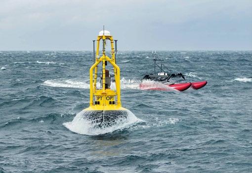
Some of these, demonstrating a plethora of applications, include Ocean Power Technologies, a pioneer in ocean-energy

technology, who chose OPENSEA to facilitate and expedite their development of the next generation PowerBuoy®-based, wave energy powered Maritime Domain Awareness Solution.
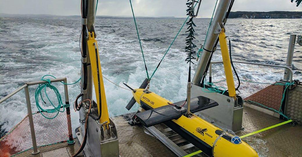
Kraken Robotics, is a marine technology company providing advanced sonar and laser systems, as well as subsea power solutions, which has successfully used OPENSEA to develop autonomy and software control for its Thunderfish AUV, and since entered into a partnership with Greensea to advance capabilities in marine robotics.
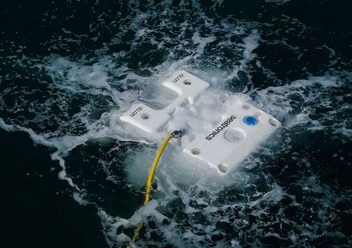
Seatronics Ltd, an Acteon company, makers of the Versatile and Lightweight Observation ROV (VALOR), selected the OPENSEA platform to provide autonomy, navigation, and command and control for their vehicle. Greensea’s Professional Workspace is standard on every VALOR, making it the most capable ROV in its class.
Ocean Infinity uses the OPENSEA platform for its Armada Dynamic Payloads Control, giving it advanced capabili ties for robotic control and supervision for the Armada fleet’s payload. This includes supervising and control ling a remotely operated vehicle system, including the deck gear, launch and recovery system from any of Ocean Infinity’s remote-control centers, through Safe C2’s overthe-horizon command and control suite. Thanks to the OPENSEA API and OPENSEA SDK interfaces, any partner can easily plug into the Armada DPC to add functionality to the fleet.
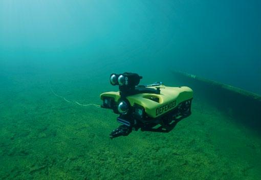
VideoRay’s collaboration with Greensea resulted in updates to OPENSEA’s add-on Workspace to support VideoRay’s Expeditionary Splashproof Controller, ensuring interactions are intuitive and natural for the VideoRay Defender techni cian, supporting the ongoing development of their Mission Specialist Series ROVs.
| 9
Courtesy of Greensea Systems
Courtesy of Greensea Systems
OPENSEA allows companies wanting to make an impact in the field of robotics, to bring new hardware designs to market quickly, benefiting from tried and tested software that is easy to integrate into a wide range of robotic hardware.
Utilising the flexibility and scalability of the OPENSEA platform itself, Greensea launched spin-out company Armach Robotics in November 2021, with a proactive, autonomous in-water cleaning robot. Combining purpose-built robotics, with naviga tion and operational software built on OPENSEA, Armach can offer shipowners hulls that are permanently clear of marine biofouling, and the associated cost benefits that come with this. Additionally, the system provides unmatched hull intelligence and insights for shipowners, informing cost-effective schedules of future inspection, fuel saving measures, sustainability objec tives, operational efficiency and fleet readiness.
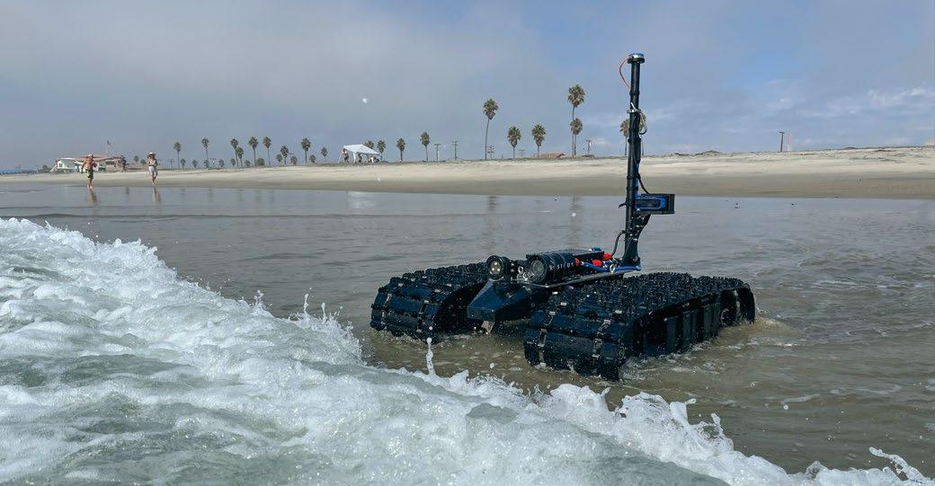
Early in 2022 Greensea also acquired C-2 Innovations, Inc. and spun out a third company Bayonet Ocean Vehicles with its range of amphibious underwater ground vehicles (AUGV) the 150, 250 and 350 that operate in the surf zone, on the seafloor, in rivers, estuaries, intertidal margins and marshes. Built on OPENSEA, these tracked AUGVs offer precise navi gation, payload integration, autonomy, and over-the-horizon command and control, a combination unique to the market, covering a wide range of applications. They can be fitted with a variety of environmental, oceanographic, hydrographic and industry specific sensors to accommodate the numerous commercial and military applications of the vehicles.
AGILE AND ADAPTABLE FOR MARINE ROBOTICS
OPENSEA breaks perceived barriers in marine robotics, moves quickly, and continues to be developed, always offering the latest enhancements in capability, reliably and easily scalable. Collaboration plays a big part, bringing together the best of the best in a combination of advanced technological solutions.
Moving into remote operations is a trend that is developing momentum in many industries. Some are leading, some are following, many identifying and assessing new technologies to solve their operational issues. The defense sector, an industry
in which Greensea is well established, has long been an early adopter of emerging technologies. Greensea has an enduring working relationship with the US Department of Defense, developing technologies to support the completion of complex ROV tasks. As an industry, defense is naturally better positioned and more risk tolerant to help fund early-stage developments.
Remote operations are proving to be a high growth, high return technology across multiple sectors. The aviation industry, for example, has been working for years on devel oping, assessing and moving to digital tower operations. There are also early signs that remote robot operation and supervision has broken into the offshore and oil and gas sector. Greensea is well placed to support emerging technolo gies and subsea robotics with its well-established open archi tecture, ability to adapt, and integrate quickly and efficiently, enabling new products to go to market quickly, in response to growing demand.
For the oil and gas industry, the concept of the costly deploy ment of large vessels and crews for offshore tasks, is under scrutiny, but a rise in remote robotic operations in other areas is naturally beginning to drive the industry, even if it is one that can be slower to adopt.
“The existing model of sending ships with crews and ROVs offshore to do basic IMR tasks and basic interventions is a tired concept” says Kinnaman. “It is too expensive, it is not scalable, and it doesn’t work with the new economy of offshore energy”.
The vision of robots remaining for months at a time resident on offshore installations, whether surface or subsea, is set to be the future of offshore operations, according to Kinnaman. Because the company can call upon decades of experience in collaborating with hardware manufacturers to develop the latest in robotic systems for any marine application, Greensea sits in a key position to take these revolutionary concepts into reality.
Greensea is pushing marine robotics software and capa bilities to the edge with its latest collaboration with SeeByte. Artificial intelligence as part of the robotic system, less data transfer back to the operator and consequently less depend ency on bandwidth connection, tetherless subsea robotics –truly making anything possible on OPENSEA.
CHALLENGING THE STATUS QUO
Greensea’s open architecture is challenging the status quo of marine robotics. OPENSEA, the software that seamlessly integrates with OEMs’ products to operate in and withstand the harshest ocean environments, is a key facilitator and enabler. Its open architecture philosophy will continue to keep the brakes off these critical developments.
As Ben Kinnaman succinctly sums it up: “Technological advancements drive progress and efficiencies in operations, whatever the industry, and marine robotics are no exception.”
10 | GREENSEA SYSTEMS’ OPEN ARCHITECTURE SOFTWARE REVOLUTION
Courtesy of Greensea Systems
EFFECTIVE




Connecting What’s Needed with What’s Next™ Connect with what’s next at oceaneering.com/liberty
© 2022 Oceaneering International, Inc. All rights reserved.
Copyright
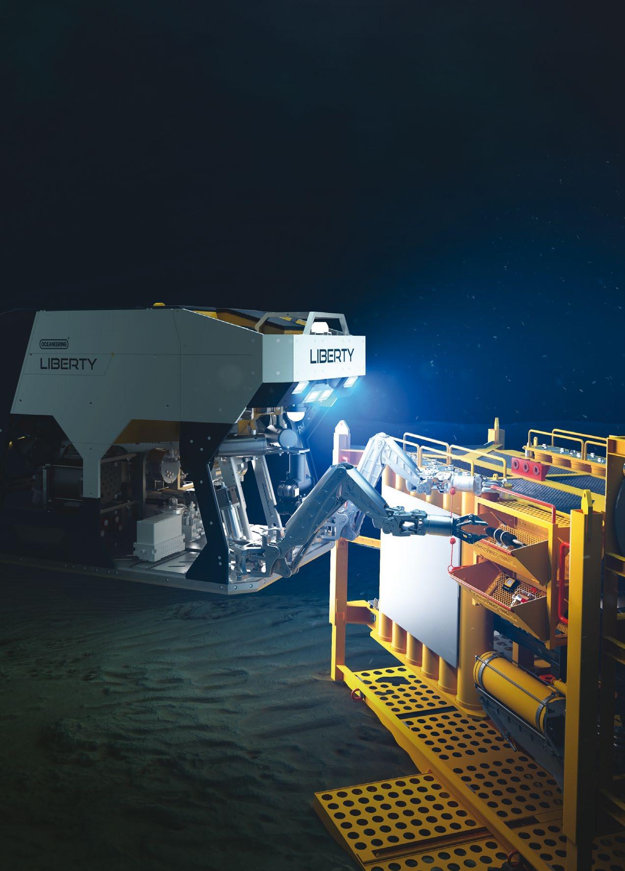
IMR SOLUTIONS The self-contained Liberty™ E-ROV System is a safe and reliable work class solution that eliminates the need for a dedicated support vessel, reducing both carbon emissions and vessel costs.


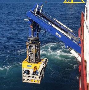
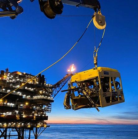

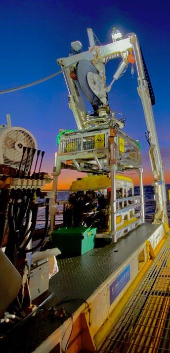


Film-Ocean’s versatile ROV fleet is capable of working from surface to seabed in the most arduous conditions. Our class leading ROV fleet can support your projects from vessels and platforms. We specialise in providing innovative, cost effective subsea solutions to the global offshore energy industry. Versatile ROV Solutions 4 Balmacassie Drive, Balmacassie Commercial Park, Ellon, Aberdeenshire, AB41 8BX, UK Tel: 01358 575000 | enquiries@film-ocean.com | www.film-ocean.com Email: enquiries@film-ocean.com PLATFORM INSPECTION UWILD & IRM OFFSHORE WIND DECOMMISSIONING DRILL SUPPORT Our ROV fleet delivers the latest technology including: Full 1080i HD and 4k cameras Telephone: +44 (0) 1358 575000 Video Enhancement Multi-beam sonar to combat poor visibility conditions Complete Tooling Solutions 3D Data Acquisition Remote Inspection All ROV systems come with the option of high bandwidth data ports allowing integration of 3rd party inspection tools
HYDRAMEC TO SET THE PACE IN DELIVERING REMOTE SOLUTIONS

Hydramec have built and designed over 200 Launch and Recovery Systems (LARS) during the 32 years of service. During this time their designs have consistently improved due to customer demands and feedback. Hydramec’s standard LARS have been very popular throughout the years, ranging from standard A-Frame's to Crane LARS.
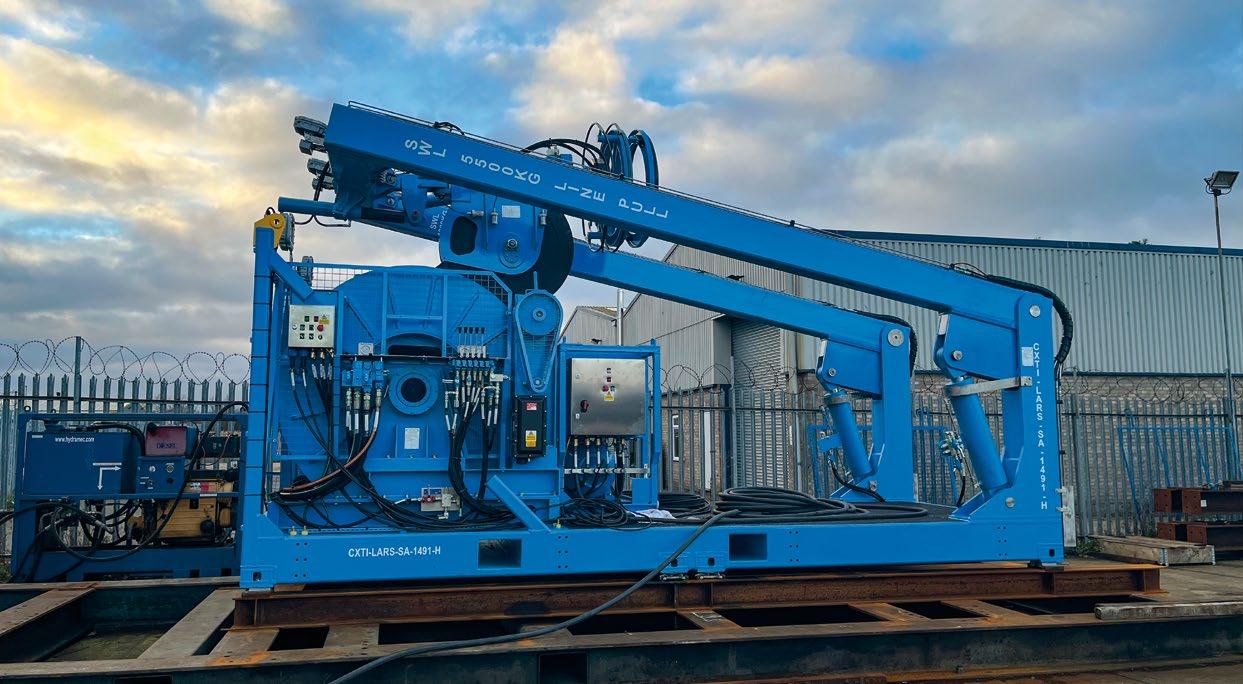
Hydramec have also built many bespoke systems, tailoring dedicated solutions to customers' specific requirements, available spaces, and timelines. Hydramec prides itself on having the flexibility to adapt to an ever-changing market and conditions. That’s why when they noticed a shift in the industry towards remote operations in 2017, Hydramec started to explore the possibility of the autonomous launch of their standard LARS, as well as looking at the added value that active heave compensation (AHC) provides.
During this period of feasibility studies and research and development, Hydramec was approached to manufacture a small lightweight system. This would be used for launching an observation class ROV from a small 12-metre-long vessel. However, this came with certain restrictions due to the system’s weight and size allowance. As a result, the final system was designed and manufactured from aluminum and several other lightweight composites.
The client also required the system to be operated remotely from a control centre based on land, with the potential to be operated anywhere in the world using a satellite or 5G network. In partnership with Scantrol AS, Hydramec devel oped a control system to allow remote operations. This was paired with several safety interlocks and specialist features to easily control the launch of the ROV in sea states up to 2 m. This design has since been developed even further as Hydramec has embarked on building the fifth LARS of this kind.
As a result of the success of this product, Hydramec has been approached by several other companies to supply similar products for their bespoke LARS. Although all the systems are unique and designed to fit the client's individual needs, they all have one design feature in common: the ability to control them from land. As well as the prospect of using learning cultures in the software to support autonomous launch in the near future.
| 13
Hydramec's Standard Launch and Recovery System (Courtesy of Hydramec)
One advantage of autonomous operations is that systems can be installed on much smaller vessels or integrated into larger ships as part of a bigger spread where all the equip ment can be piloted from a remote-control centre. Another obvious benefit is that personnel are not required to work offshore in dangerous environments.
ELECTRIC BENEFITS
Additionally, LARS designed and built with electric drives reduce the use of hydraulic equipment needed for launch and recovery. This removes the possibility of contaminating the sea from leaks, burst pipes, and maintenance activities. Electrically driven equipment has also been proven to be more efficient than hydraulically driven equipment, espe cially when using AHC operations. Overall, autonomous operations can massively reduce the carbon footprint of these procedures.

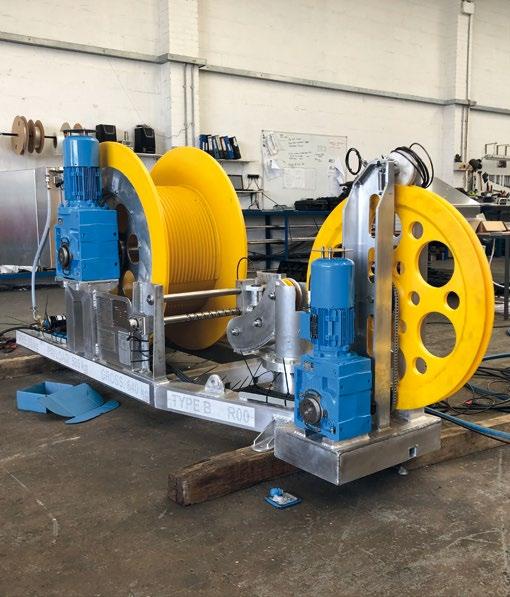

Clients in the industry have recognised the benefits of electri cally driven equipment, and this has led to Hydramec devel oping several designs for small electric winches. These include ROV tether winches with survey equipment such as side-scan sonar, sound velocity winches, steamer winches, and constant tension umbilical winches. These electrical drives can also be tailored to suit any size that clients may require.
MAXIMISING AUV LAUNCH CAPABILITIES
Hydramec is constantly striving to come up with new launch and recovery systems for different applications. A particularly exciting design which is currently being devel oped consists of a setup that can launch multiple AUVs from a single platform. This LARS will be based around a 20 ft container footprint, meaning easy shipping and road
transportability, while also reducing the footprint required on board the vessel for traditional AUV systems. We fully expect to be supplying these with remote operation and autonomous launch going forward.
Having integrated autonomous equipment into their port folio, the next step for Hydramec will be to develop a fully electric observation class and work class ROV LARS. This will completely remove the need for hydraulics in a marine environment, whilst still providing the same high-level of control and operational functionality as their long-standing hydraulic launch and recovery systems. After having had several conversations on this subject, Hydramec believes this shift will be primarily client-driven. Although this is the next progression for Hydramec, it’s important to note that all existing and standard products will still be available and supported. This is a very exciting time for Hydramec in adapting their launch and recovery systems in line with industry needs.
14 | HYDRAMEC TO SET THE PACE IN DELIVERING REMOTE SOLUTIONS
Testing and spooling of the autonomous system (Courtesy of Hydramec)
Testing and spooling of the autonomous system (Courtesy of Hydramec)
3D drawing of autonomous winch (Courtesy of Hydramec)

BLUEYE ROBOTICS CLOSE UP VIEW OF DAMAGED NORD STREAM PIPELINES
Between the 26th and 29th of September 2022 a series of explosions and gas leaks were detected on the Nord Stream 1 and 2 pipelines. These pipelines carry natural gas from Russia to Germany under the Baltic Sea. From the outset there were speculations of sabotage, with several countries blaming each other. The explosions and gas leaks happened in international waters, but within the exclusive economic zones of both Sweden and Denmark.
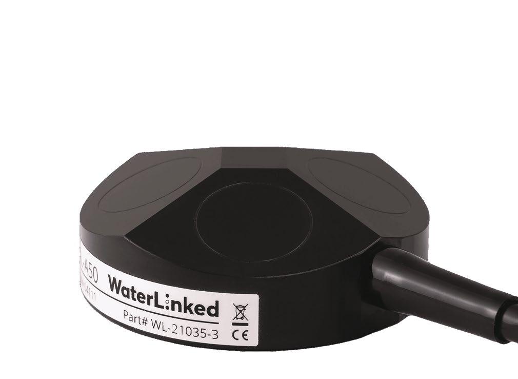
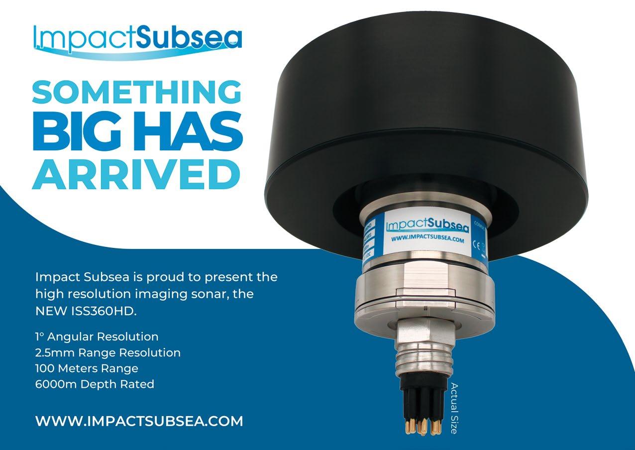
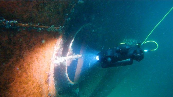
To ascertain the current state of the pipelines, Blueye Robotics embarked on an expedition to survey the damaged pipeline area using their Blueye X3 drone. Two separate missions were run with two X3 drones utilised for each. During the initial dive to locate the damaged pipeline sections, a WaterLinked DVL-A50 and Impact Subsea ISS360 scan ning sonar were used on one of the drones; the other was equipped solely with a camera.

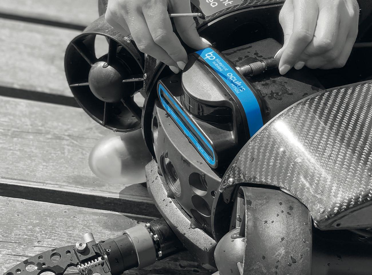
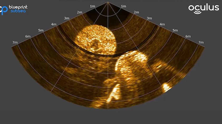
The first dive was covered by the Swedish tabloid Expressen: the second by BBC Europe. On the latter expedition the secondary X3 drone was also kitted out with a WaterLinked UGPS and a Blueprint Subsea Oculus 750d multibeam sonar.
ORP interviewed Trond Larsen, the Technical Sales Engineer at Blueye Robotics about his expedition to the damaged Nord Stream pipeline.
RICHIE ENZMANN: Hi Trond. What equipment did you use to locate the damaged area of the pipeline, and how did you do it?
| 17
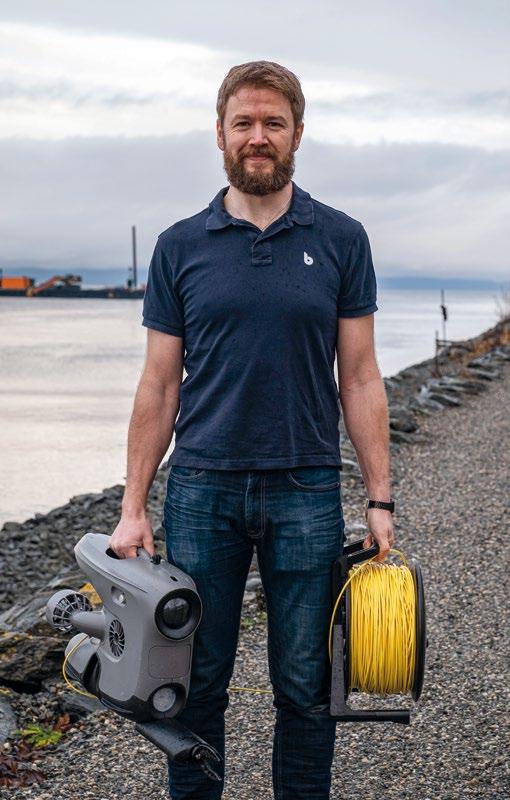
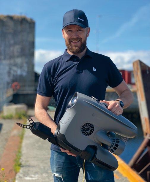
Trond Larsen, Technical Sales Engineer at Blueye Robotics. (Courtesy of Blueye Robotics)
TROND LARSEN: We had the coordinates for the blast sites from the navigational warning, and the pipes are of course drawn onto the sea charts. When arriving in the area, we used the ship echosounder to look for any deviations on the sea floor. Within a short time, we had a few points with depres sions and protrusions from the sea floor marked. We got the Blueye X3 down. The first time we just used visual clues and the compass on the drone to locate any changes to the sea floor, and - after a while - a piece of the pipe itself. The second time we had a high-end sonar on the Blueye X3, and with the range of 120 m we could locate the pipe sections within seconds. It was a matter of minutes from the time that the drone was deployed until we arrived at one of the pipe pieces with visual confirmation.
RE: What was the visibility around the pipeline area?
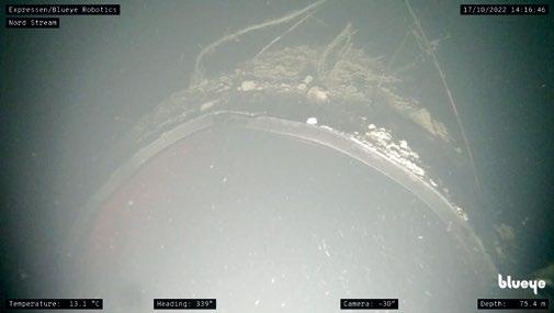
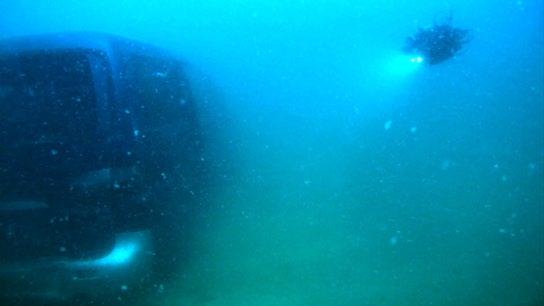
TL: The visibility was 1-2 m horizontally, but a lot shorter verti cally. The drone had to be positioned between 20 and 50 cm above the seafloor to see the bottom. If we got lower, we whirled up the loose sediments; any higher and we couldn’t see the bottom, even with 3300 lumens-worth of light. The conditions were challenging.


RE: What precautions did you take to protect yourself against hazards, such as gases coming up from the damaged pipeline?
TL: The first trip that was planned was actually postponed due to reports of small volumes of gas still coming out of the pipes. But the Swedish coast guard had surveillance of the area, and when they told us that the area was safe, we took that as a good enough precaution. There were also military vessels quite close by in the area, so we took that as a sign of lowered risk of gas exposure.
RE: What vessels were used for these expeditions?
TL: For the first trip it was a 29 ft Targe single hull motorboat, and the second was a slightly larger catamaran. Both vessels were rental boats from local marinas. With a speed of about 19 kts, the trip out to the inspection area took about 2.5 hours.
RE: How did you launch the X3 drone, and in what weather conditions?
TL: The Blueye X3 weighs only 9 kg, and the tether is strong enough to deploy and retrieve it, so we just used that to launch the drone. The weather wasn’t perfect for this kind of operation, especially with the type of boat we had. The 4 – 8 m/s wind made us drift quite fast, and swells can impact the stability of the video feed. On our first trip, we had trouble keeping the vessel on site while diving, and at times we needed 250 m of tether just to keep the drone in position at 75 m deep.
The second time we visited we were aboard a larger vessel that had better navigation options with two motors. This allowed us to stay in a good topside position. The weather was OK in the beginning, but at the end of the dives the swells made it hard to simply stand upright. At that point operating the ROVs got more challenging, but we managed to get the footage we needed.
RE: At what depth did you find the damaged sections of the pipe?
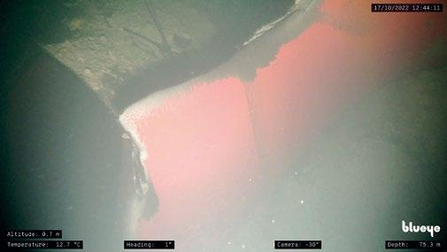
TL: The seafloor in the area of the blast site we visited is about 75 to 80 m deep.
RE: Were there several damaged sections?
18 | BLUEYE ROBOTICS CLOSE UP VIEW OF DAMAGED NORD STREAM PIPELINES
Photo of the damaged Nord Stream pipeline taken by Trond Larsen using the Blueye X3 drone. (Courtesy of Expressen/Blueye Robotics)
Photo of the damaged Nord Stream pipeline taken by Trond Larsen using the Blueye X3 drone. (Courtesy of Expressen/Blueye Robotics)
Photo of the damaged Nord Stream pipeline taken by Trond Larsen using the Blueye X3 drone. (Courtesy of Expressen/Blueye Robotics)
Photo of the damaged Nord Stream pipeline taken by Trond Larsen using the Blueye X3 drone. (Courtesy of Expressen/Blueye Robotics)
TL: During the first dive we had a hard time getting the full overview of the area due to low visibility, but on the second dive the sonar images revealed a lot more. There are several pieces; one of them about 50 m long that is simply torn off from the pipe, laying 30 – 40 m away from the main pipeline. We also found one piece of pipe sticking up vertically, 5 – 6 m above the sea floor.
RE: What kind of damage did you see on the pipeline, and how far did it extend? Was there any indication of how it was blown up?
TL: Even with the video we retrieved and the competence of the people at Blueye, there is no one here that can reli ably speculate on how or where the explosion started. All we can say is that there have been great forces at play, and that 45 mm steel pipes were torn apart and thrown quite a distance.
RE: Is the pipe still leaking?
TL: That we don’t know, but we didn’t see any gas coming out of the pipes while we were there.
RE: Was there any apparent environmental damage that you saw while out there? Perhaps some dead fish or damaged seabed?

TL: The ocean currents following the gas blowout have moved a lot of sand and sediments in the area. In several places there are trenches in the sea floor that we assume are the result of the forces involved in the event. We saw one dead fish, but as we don’t have a good picture on what the sea floor looked like before, it’s hard for us to comment on any post-incident changes.
RE: Thank you Trond for this riveting update and a valuable insight into these expeditions.
Blueye Robotics is a Norwegian underwater tech nology company based in Trondheim. They have roots in the highly renowned Centre for Autonomous Marine Operations and Systems (AMOS) at NTNU. Since 2015 their overarching design goals have been exceptional ease of use, portability, and robustness. Their first underwater ROV was launched in 2019, and since then more than 1000 of their systems have been delivered across verticals in over 50 different countries.
| 19
Trond Larsen, Technical Sales Engineer at Blueye Robotics. (Courtesy of Blueye Robotics)
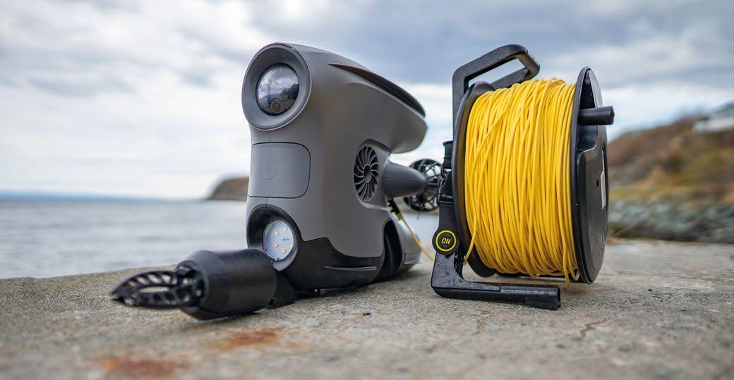
The Blueye X3 on a quay equipped with a 2-axis gripper. (Courtesy of Blueye Robotics)
Oculus Multibeam Imaging Sonars
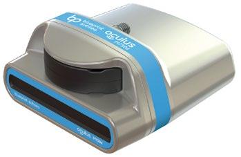
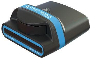
High resolution imaging in turbid water for improved situational awareness and target identification. Available in 375kHz to 3.0MHz. Depth rated to 500m, 1000m, or 4000m.
REAL-TIME IMAGING IN ALL CONDITIONS www.blueprintsubsea.com enquiries@blueprintsubsea.com TRANSFORM YOUR CAPABILITY
NORD STREAM, GEOPOLITICAL TENSIONS, AND THE NEED FOR POWER TO PROTECT REMOTE OFFSHORE ASSETS
Reenst Lesemann, CEO, C-Power
The Nord Stream pipeline, which delivers gas from Russia to Germany via a subsea route through the Baltic Sea, was the victim of apparent sabotage in late September. Multiple leaks, created by what experts believe were underwater explosive devices, led to what the United Nations said is likely the largest single release of methane ever recorded. In addition to the climate and environmental impacts, which are substantial, the fact that critical infrastructure assets are now targets of attack has created a new, more fraught reality for owners. The stakes of geopolitical conflicts have risen in a way the world hasn’t experienced in decades.
Days after the leaks were discovered, the United States, Russian, and European governments continued to point fingers in different directions as to who was responsible. Russia’s ongoing war in Ukraine loomed in the background, an event that had already led to rising tensions between Russia and the West as well as skyrocketing natural gas prices in Europe.
Unfortunately, geopolitical tensions aren’t only on the rise in Europe. For example, China continues a program to expand its influence and control of seas across the Pacific and Indian oceans, not to mention renewed friction in its long-simmering conflict with Taiwan. These tensions present challenges to the ocean economy and add risk to offshore operations and assets.
| 21
Courtesy of C-Power/Adobe Stock
However, the ocean economy is immensely valuable and critical to global commerce. Businesses and governments have no choice but to find ways to protect their assets.
Infrastructure security is essential in a world in which bad actors are not only willing but capable of launching an attack. Whether the offshore asset is a pipeline, an oil and gas field, a fiber optic cable, or even a coastal industrial or defense facility, organizations of all kinds need solutions now more than ever to provide inspection, monitoring, intrusion detec tion, surveillance, and reporting. Delivering that level of infra structure security requires 24/7 power and communications. Unfortunately, the ocean today is a power desert.
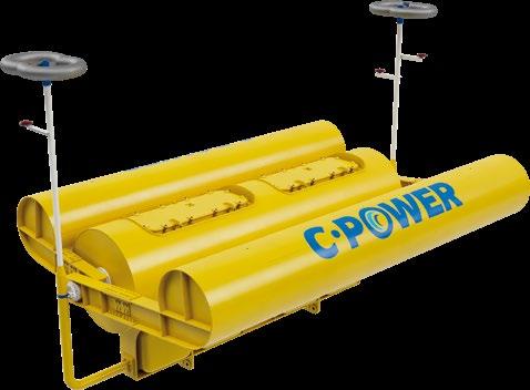
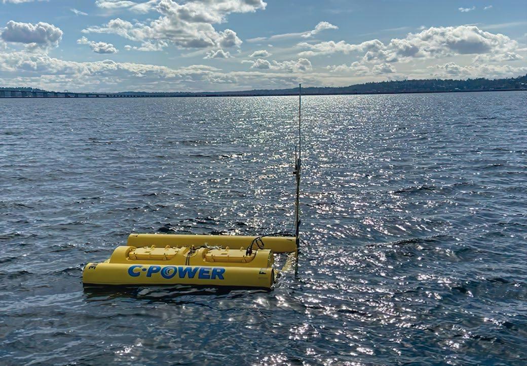
C-Power’s SeaRAY autonomous offshore power system (AOPS) generates power from reliable ocean waves and enables real-time, two-way data and communications. That means a SeaRAY or array of SeaRAYs can be co-located with critical offshore assets, delivering continuous power to the autonomous, digital, resident technologies needed to provide 24/7 security. Just as important, the ability to send and receive data in real time allows those technologies to report threats as they emerge and even receive instructions to perform an operation to avert the threat.
The SeaRAY’s game-changing potential for offshore and coastal infrastructure security is a big reason why the tech nology was selected for the U.S. Navy’s Coastal Trident
port and maritime security program. It also led to C-Power receiving a 2022 TechConnect Defense Innovation Award in September.
C-Power’s upcoming demonstration of a 20-kW SeaRAY AOPS at the U.S. Navy’s Wave Energy Test Site, which is supported by a U.S. Department of Energy grant and the U.S. Navy, has multiple opportunities available for organizations to partner with us on co-demonstrations, particularly in the field of infrastructure monitoring.
22 |
STREAM, GEOPOLITICAL TENSIONS, AND THE NEED FOR POWER TO PROTECT REMOTE OFFSHORE ASSETS
NORD
TigerRAY deployed by the University of Washington Applied Physics Lab for the U.S. Navy (Courtesy of C-Power)
SeaRAY graphic (Courtesy of C-Power)
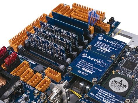

Bandwidth control on ports Modular internal construction Serial Data to Ethernet Interfaces Video Digitiser Interfaces Interface to SFP in COTS surface router Redundant 1Gb Single-Mode fibres Optical long distance links via Dual • Comprehensive VLAN functionality • Link Aggregation (LACP) Spanning Tree Support (STP) Non-blocking switch fabric • 4,000m rated managed switch designed to meet the requirements of a modern subsea network • www.zetechtics.com Tel: +44 (0) 1653 602020 • 24 Port Fast Ethernet Switch for Subsea Use Traffic priority (QoS) •





EUROFLEETS AUV WORKSHOP IN THE GULLMAR FJORD IN SWEDEN
 Richie Enzmann, Ocean Robotics Planet
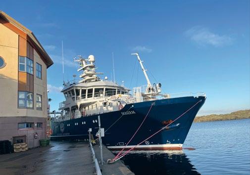
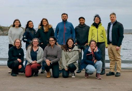
This fall I had the pleasure of taking part in the latest AUV workshop organised by the University of Gothenburg (UGOT). This was within the framework of the Eurofleets+ programme held at the Kristineberg research station in Sweden. The workshop was led by Anna Wahlin, Professor and Niklas Andersson, Project Assistant, with help from Filip Stedt, AUV technician, all from the University of Gothenburg. It focused on AUV mission planning and operations launched from the newly built R/V Skagerak. The objective was to familiarise marine scientists with AUV technology and their capabilities from the user’s perspective. There were almost a dozen participants from the marine science community, ranging from PhD students to professors, all hailing from various European universities.
| 25
Photo: Richie Enzmann
THE EUROFLEETS+ PROGRAMME
The Eurofleets+ programme facilitates open access to an impressive fleet of research vessels and specialised infra structure for European and international research commu nities. It allows interdisciplinary research groups to access European and global seas and oceans in order to conduct excellent research. Priority is given to new users, earlystage researchers, female scientists, and researchers from less well-equipped nations. The project enables access to a unique fleet of 27 state-of-the-art research vessels from European and international partners. Through competi tive calls, researchers can access the entire North Atlantic and South Pacific Oceans, as well as the Mediterranean, Black, North, Baltic, and Ross Seas. In addition to ship time, researchers now also have access to new AUVs and ROVs.
R/V SKAGERAK AND THE RAN AUV
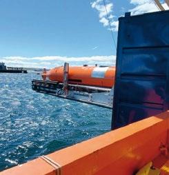
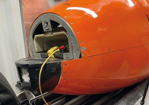
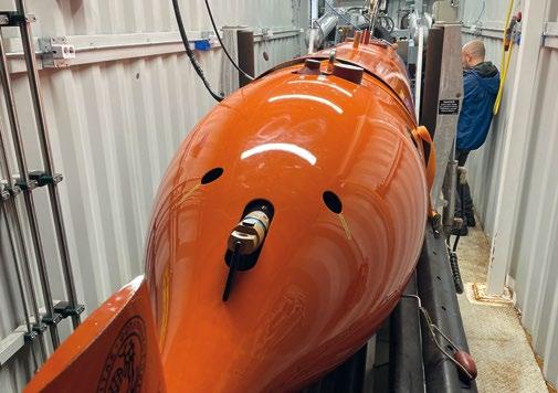
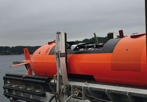
The R/V Skagerak is a recently commissioned vessel, outfitted with state-of-the-art facilities and housing an impressive technological spread. This includes a Kongsberg Hugin AUV named Ran - launched from a containerised LARS - which was designed by Hawboldt Industries. One of the good things about having an AUV is being able to send it away on separate tasks while a ship has other survey missions. It can also go into spaces that a manned vehicle cannot.
The Ran Hugin AUV is 6.5m long: 80cm longer than the standard version. This allows for additional sensor or battery payload. It weighs nearly 2 tonnes, which increases to 2.5 tonnes when the hull is fully flooded. The vehicle has an endurance of 36 hours with an estimated range of 300km. After 36 hours of operation, the system goes into emergency reset. This makes the vehicle positively buoyant by dropping weight, and thus forcing it back to the surface automatically. This option can also be disabled if the AUV is used in under-ice operations.


Ran can communicate through several different channels under and above water. For underwater positioning, it uses a USBL (with a HIPAP transponder) to give its relative distance from the vessel and update navigation. It can also use the cNODE command and data link to provide position updates to the AUV from an under water beacon, to eliminate the uncertainty error drift. On the surface it can connect via Wi-Fi, Iridium satellite, or UHF radio link.
When it comes to navigation the challenge is always accuracy. For navigating underwater Ran uses a selection of sensors such as an inertial Honeywell navigation unit, a GPS receiver, a Leica compass, forward and down looking altimeters from Kongsberg Mesotech, and a pair of Nortek Doppler Velocity Logs (DVL), both running at 500kHz. The down looking DVL is for bottom tracking, while the upward looking one is for ice tracking in under-ice missions.
HUGINOS AND AUV MISSIONS
IN THE GULLMAR FJORD
The first day of the AUV workshop began with a general intro duction: a familiarisation with AUV technology and application software. After loading the regional map into the software, we
26 |
AUV WORKSHOP IN THE GULLMAR
IN
EUROFLEETS
FJORD
SWEDEN
Photo: Richie Enzmann
Photo: Richie Enzmann
Photo: Richie Enzmann
Photo: Richie Enzmann
received a tutorial that covered the HuginOS software used for mission planning. Then we were split into smaller groups based on our hydrographic interests. The idea was to simulate missions for marine scientists similar to their own projects back home, so that they could then apply the newly gained knowledge and lessons learnt after the workshop.
After the initial introduction presentations and mission plan ning day, there followed three practical days at sea followed on board the R/V Skagerak. We sailed to the first mission location, where we were tasked to survey around an island. The waypoints of the mission were set into the Skagerak’s computer, which was communicating with the AUV. On location, the sound velocity profile of the water column was needed. To get this sound velocity profile, a CTD probe was lowered from the Skagerak’s hangar to a depth of 110m.
The sound velocity is important to know in order to determine the propagation of acoustic signals. It also affects the accuracy of sonars, multibeams, and positioning systems because it depends on the temperature, salinity, and density of each part of the water column. To get accurate range and positioning/survey data, the sound velocity profile is needed. The instruments can then be calibrated for accurate measurements and data.

The mapping of the sound velocity profile is also useful when calibrating the buoyancy of the AUV. The operators of UGOT have an excel spreadsheet for Ran. It’s used to calculate any
additional weights required for the AUV. They can adjust it to make it naturally buoyant based on payload configurations and environmental conditions (water density, etc). Both soft and hard buoyancy can be added to the AUV. The soft buoy ancy loses its volume in deeper water, meanwhile the hard buoyancy keeps its volume up to its rated depth.
For the AUV there is an on board CTD sensor at the back of the vehicle that calibrates the sonar in real time. Therefore, the initial CTD sampling was only needed for the AUV buoy ancy calibration and for the Kongsberg EM2040 multibeam lowered from the vessel hull. The turbulence of the water can also be measured by the Nortek ADCP located on the AUV. Furthermore, water samplers were also part of the AUV.
Once this information was obtained and the vessel reached the site of the survey locations and all pre-dive checks were completed, then the impressive AUV Skid was hung out from the container toward the aft of the vessel. The covers were removed from Ran to get an accurate GPS/satellite posi tioning reading, and to drain the water from its batteries from a previous dive. All this of course was after the toolbox talk had taken place.
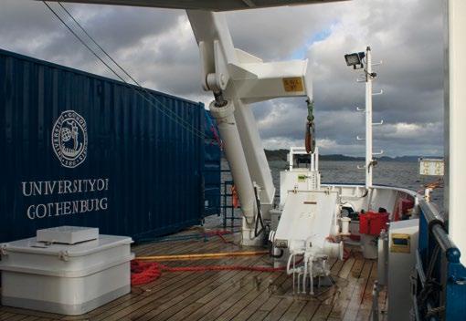
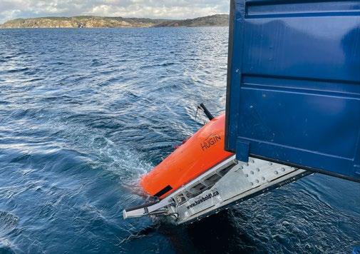
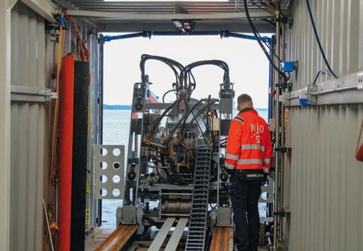
After the necessary pre-dive checks, the AUV was ready for launch. The process of launching is straight forward, with two technicians supervising the operation. The skid was moved backwards through a mechanical system towards the back
| 27
Photo: Richie Enzmann
Photo: Richie Enzmann
Photo: Richie Enzmann
Photo: Richie Enzmann
of the vessel and was tilted overboard at 45 degrees. Once that skid manoeuvre was completed, the AUV was lowered halfway down so that water could enter its chassis and stabi lise, before the AUV was released into the water.
It took a further two to three minutes for the AUV to swim on the surface - as per the mission plan - before diving in the water at a speed of 2m/s.
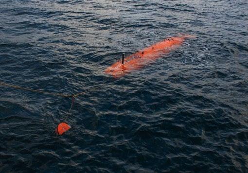
When creating the mission plans, the limitations of the AUV maneuverability also needs to be kept in mind. The vehicle has a minimum turning radius that needs to be accounted for: 45-50m in the case of the Hugin. If working a “lawnmower” pattern there are two kinds of options to move from one line to the other. During a “normal turn”, the AUV starts to turn early - before the end of the line - to reach the specified waypoint at the end of the parallel line. Meanwhile, if we specify “outside turn”, then the AUV only starts to turn once it has reached the last waypoint in the line before moving onto the next line.
At least 15m of travelling depth was chosen when transiting between the survey areas to avoid the marine traffic and the car ferry that regularly cross the fjord. It was also observed that the AUV needed to be at at least 4m deep for the sensors to work accurately when in survey mode.
The following types of missions were run during the workshop.
a) Mission one was to send the AUV around Bornö island and then track it with the vessel. Here Ran was going up and down in a zig zag pattern. Altogether this took around about 3.5 hours to navigate around the island once the AUV was in the water. The geological features and currents were also measured using the ADCP sensors.
b) Mission two on the second day was a survey along the fjord: first doing a patch test, and then comparing two different types of surveys, performing a lawnmower type survey. The first survey was at 40m depth from the surface, and then followed by the survey. It followed the terrain with an altitude of 20m above the seabed.
c) Finally, mission three was water sampling and turbidity measurements of sound velocity profiles by using CTD sensors launched from the ship’s hangar at specific loca tions through the water column.
AUV RECOVERY AND SURVEY RESULTS
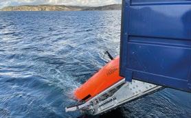
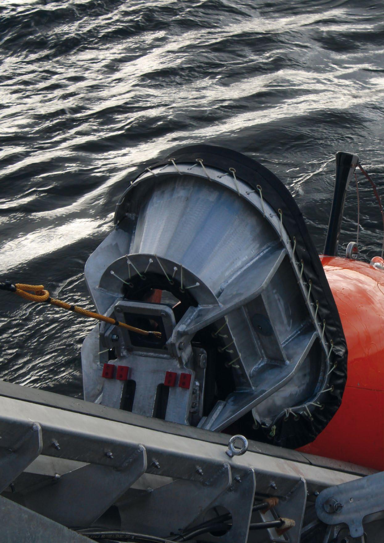
The AUV retrieval is the reverse of the launch, but in a more manual kind of way. Once the AUV completes its mission then it surfaces, and the nose cone pops off, but is still connected to the body of the vehicle through a rope. This rope then needs to be fished out by an operator using a pole. This then gets fed back into the recovery system, which eventually pulls the AUV back onto the skid and into the container.
The results of the surveys were displayed in different software applications post-processing, such as Caris, EIVA, and QPS.
Some of the interesting lessons learnt and verified were the comparison of the surveys in different resolutions. For example, the surveys with the AUV were higher resolution compared to the ships multibeam echosounder, but the ship was faster and covered a wider swath. Also, when comparing the different type of AUV mission, we received higher reso lution when following the terrain. However, there were also some small blind spots found when the terrain was not flat.
There were also comparisons of AUV runs on different mapping frequencies (200kHz to 400kHz). Again, as expected, the higher the frequency, the higher the resolution as there was an increased sampling rate.
Overall, it was great experience to learn about the different aspects of AUV launch and recovery, mission planning, and general surveyor techniques from real-life examples. Learning by doing and then applying these lessons contrib uted to the missions of individual science projects, so I wholly recommend this workshop to the members of the ocean scientific community.
Also, the opportunities for ocean research through Eurofleets+ is huge for the marine science community and should be taken advantage of and utilised. It will extend and enhance the capabilities of the European research vessel infrastruc ture, bringing new perspectives, new ideas, and new research and innovation tracks.
28 |
AUV WORKSHOP IN THE GULLMAR
EUROFLEETS
FJORD IN SWEDEN
Photo: Kai Salm
Photo: Richie Enzmann

Please check out our website on: www.oceanroboticsplanet.com
Micron Gemini Find what you are looking for Multibeam imaging sonar Depth & pressure readings Optional AHRS
MODUS SUBSEA SERVICES AWARDED THE WORLD’S FIRST RESIDENT SUBSEA DRONE CONTRACT
BY EQUINOR ENERGY

The technological landscape of underwater robotics is evolving. Underwater Robotics play a vital role in monitoring subsea structures used across the energy industry and the growth of offshore wind has increased the need for underwater robotics both in a survey and monitoring capacity. There also continues to be heightened concerns around risks to critical national infrastructure leading to requirements for survey, inspection, and ‘change-detection’.
Remotely Operated Vehicles (ROVs) are most commonly used to inspect offshore structures whilst Autonomous Underwater Vehicles (AUVs) are typically untethered and manoeuvre them selves. Today, there is an increased use of Hybrid Autonomous
Underwater Vehicles (HAUVs), or Underwater Drones, that combine the key operational capabilities of ROVs and conven tional AUVs and remove operational limitations while reducing cost and eliminating emissions dramatically.
| 33
Courtesy of Modus Subsea Services
HAUV RESIDENCY
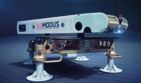
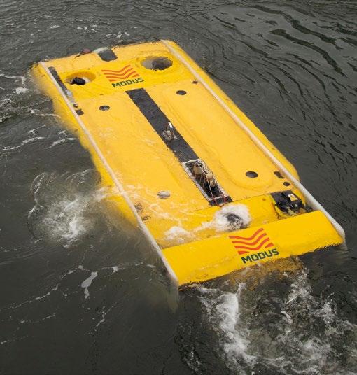
Modus, a world-leader in the application of HAUVs, has taken a step further in the evolving subsea sector and has achieved a world-first resident subsea contract with Equinor for the autonomous deployment of a Saab Sabertooth HAUV. The contract, for underwater intervention drone operations at the Equinor Johan Sverdrup field, will see the Saab Sabertooth vehicle resident in field for significant periods. Residency, where the vehicle remains docked with a subsea docking station for charging and data transfer, will improve sustain ability, efficiency, safety, and decision making within the sector.
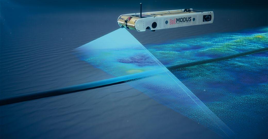
The offshore operations will involve in-field autonomous surveys and light interventions with over the horizon control from Modus’ Command & Control Centre at its UK Head Office.
The world-first award followed a competitive tendering process and trials spanning over 6 months were carried out in the UK showcasing a Saab Sabertooth successfully autonomously docking to a Subsea Docking Station without any operator intervention. The entire operation was monitored live from Modus’ Command and Control Centre in Darlington using a secure data network and free space optics at its test site.
THE TECHNOLOGY
The technological capabilities developed and integrated by Modus have moved the business to the forefront of subsea technology and innovation with a vision to transform the way subsea survey, inspection, maintenance, and repair is conducted to deliver dramatically reduced cost, and faster higher quality data, by a low-energy carbon-zero process. Modus has a track record stretching back over four years of using the HAUVs on commercial projects. These have included cable depth of burial surveys, high resolution bathymetric surveys, acoustic and CP pipeline inspection surveys, environmental surveys, decommis sioning surveys, and geophysical site investigations.
Key to completing these projects successfully is the vehicle providing a very stable and acoustically quiet sensor plat form even when operating in areas of high currents.
For accurate subsea navigation the HAUV is equipped with a precise inertial navigation system (INS) which integrates motion sensor data, fibre optic gyros, doppler velocity log (DVL) and depth sensors to provide a precise subsea posi tion to the HAUV flight computer. In deep water this can be aided with ultra-short baseline (USBL) or long baseline (LBL) acoustic positioning systems.
High-definition cameras and lights form part of the standard vehicle sensor package as does a high-resolution obstacle avoidance sonar. This is a forward-looking sonar which allows the HAUV to detect obstacles in its direction of travel and to recalculate, in real time, a safe passage around the obstacle.
Project specific sensor payloads have included twin head ultra-high resolution multibeam echosounders for high resolution seabed mapping and asset inspection; Triple frequency side scan sonar for seabed anomaly detection; Sub-bottom profiler to measure the seabed sedimentary structures and buried object detection; non-contact field gradient sensors for cathodic protection measurements of subsea assets.
The HAUV is flexible in its modes of operation. It can be controlled by means of a small diameter tether containing fibre optics and copper to provide power and control to the HAUV. In this more conventional ROV mode real time control and sensor data are available but at higher speeds than a conventional work class ROV systems thanks to its superior hydrodynamics, essentially providing a high speed ROV system.
34 | MODUS SUBSEA SERVICES AWARDED THE WORLD’S FIRST RESIDENT SUBSEA DRONE CONTRACT BY EQUINOR ENERGY
Courtesy of Modus Subsea Services
Removing the tether allows the HAUV to operate on internal batteries and provides greater freedom and access to some of the more challenging work areas by being physically discon nected from the surface vessel. The HAUV can then complete a preprogramed survey mission fully autonomously or in a supervised mode via an acoustic tether.
Modus has also trialled and proven the use of free space optics to provide real time vehicle control and live sensor data through the use of high bandwidth optical modems without the physical limitations of a tether and surface vessel.

By combining this experience and technology, Modus are now able to offer resident underwater drone services whereby subsea docking station is installed on the seabed and power and communications are tied back to the local infrastructure. The HAUV can locate the subsea dock through the use of a magnetic homing signal which the HAUV can use to perform a fully autonomous docking manoeuvre to an inductive charging and ethernet connector provided by BlueLogic. Once the HAUV is mechanically latched to this connecter the HAUV charges its internal batteries and is ready to receive an uploaded mission plan from the Modus control and command
centre. The mission could be a fully autonomous survey and inspection campaign or could also include real time control of the HAUV under free space optics for more complex inter vention work programmes. Once completed the HAUV will automatically return to the docking station to upload the mission data, recharge and wait for the next mission.
Where subsea docking stations are not available, Modus also provide flexible launch and recovery systems (LARS); The HAUV can be shore launched via a boat trailer or crane to perform autonomous nearshore survey missions; A CTV, SOV, DSV, CSV etc. could be used as a host vessel to perform autonomous survey missions whilst the host vessel is conducting its main scope of work; A portable, heavy weather LARS can be installed on a low logistics vessel of opportunity to provide a provide mobilisation and demobilisation of the HAUV system anywhere in the world.

THE FUTURE
Modus has recently announced an acceleration in its strategy to focus solely on HAUV operations, bringing the latest tech nology to market and offering the industry carbon zero, low energy, low cost, data driven IMR and survey services.
Courtesy of Modus Subsea Services
Courtesy of Modus Subsea Services


CONNECTING THE OCEAN TECHNOLOGY, ENGINEERING & SCIENCE COMMUNITIES ACROSS THE AMERICAS Organised by: Learned Society Patron Country Pavilion Ambassador CALLING ALL OCEAN TECH AND SCIENCE SOLUTIONS SUPPLIERS MEET your next collaborator REACH new multiple buyers from across the Americas FIND new leads DISCOVER new solutions for your business IMAGING & METROLOGY OFFSHORE OIL & GAS HYDROGRAPHY, GEOTECHNICS & SURVEY MARITIME SECURITY & NAVAL POSITIONING & NAVIGATION AQUACULTURE MARINE RENEWABLES UNCREWED VEHICLES & VESSELS OCEAN OBSERVATION & SENSING OFFSHORE ASSET INTEGRITY PORTS & HARBOURS OCEAN ICT & DATA oceanologyinternationalamericas.com For more information visit: Scan me to learn more 14-16 FEBRUARY 2023 | SAN DIEGO CONVENTION CENTRE, CA
THE SMALL ROV WITH LARGE OPTIONS
By Capt. Marc Deglinnocenti, U.S. Merchant Marine (Ret.), oldarmada@gmail.com
Small in size and small in cost, some inexpensive Remotely Operated Vehicles (ROVs) are starting to hit the market. These pseudo ROVs really aren’t what they’re all cracked up to be. These underperforming ROVs are really just glorified moving underwater cameras. Sure, they’re inexpensive, but just wait until one breaks down or one gets shipped to you with some missing bits. Just try communicating with the sellers then. You might get the silent treatment from the sellers and the sound of crickets from their governmental oversight authorities. Having said all that, there happens to be a few Chinese ROVs that are the exception to the rule. They are still small and inexpensive, and yet they can perform very well indeed with quite reliable warranties and responsive customer service departments. One of those outstanding exceptions is an ROV company called QYSEA. They offer an interesting and diverse line of ROVs with 100, 150, and 350 metre depth ratings. Another thing that stands out about this ROV supplier is their serious commitment to compete with other professional ROVs that have multiple capabilities. The performance numbers are impressive, but how do they perform in the real world? I decided to find out for myself just how far QYSEA goes beyond the simple underwater drone concept.
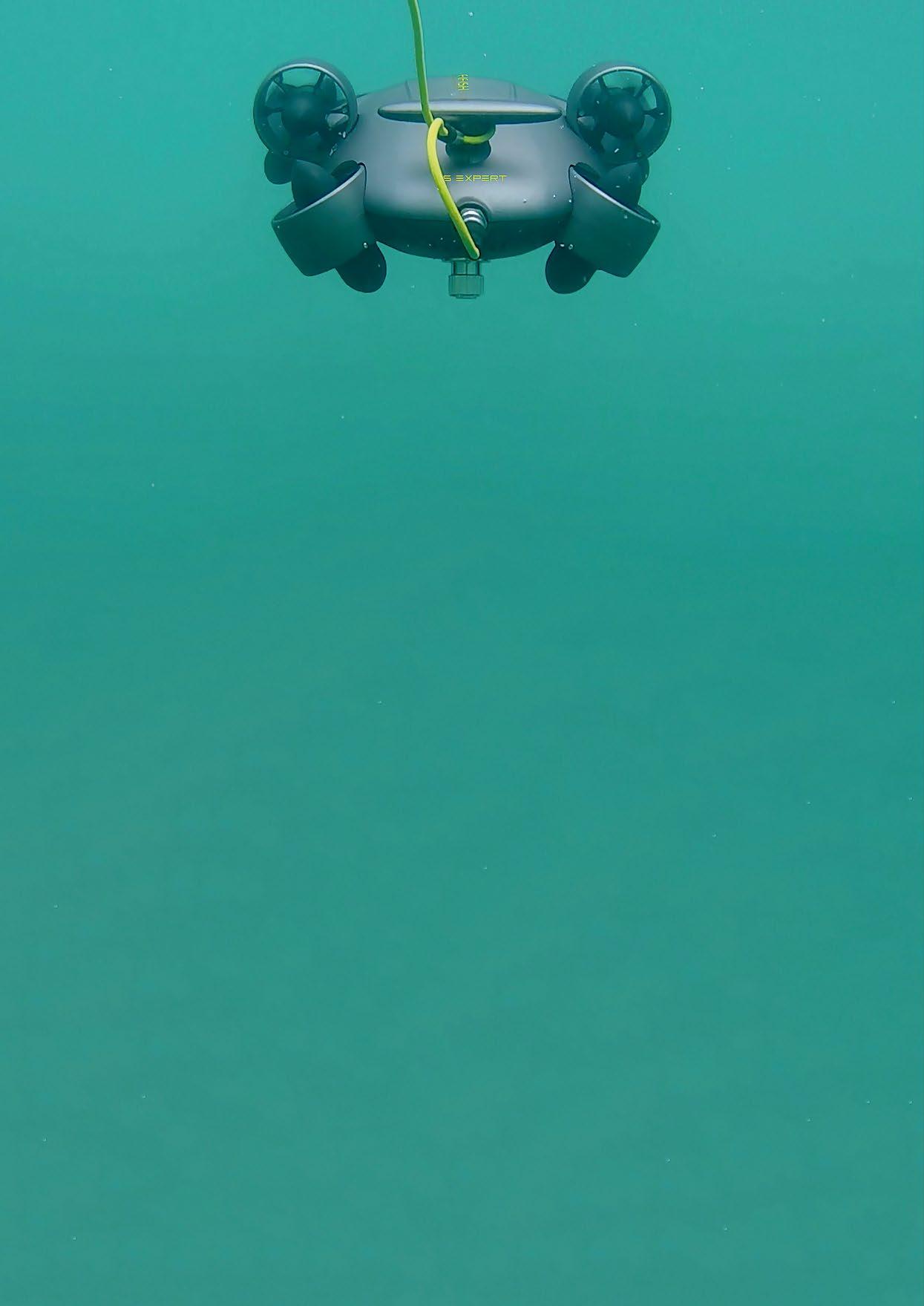
I took the risk of ordering one from China myself so that you wouldn’t have to. My QYSEA FiFish V6 Expert ROV, model M100A arrived at my home in Eagle, Idaho, USA undamaged and complete. The model M100A includes 100 metres of Kevlar reinforced tether and a manipulator arm along with other peripherals. The ROV was undamaged primarily due to the fact that its custom designed waterproof carrying case with wheels doubled as a neatly padded shipping container. So, the cost of this 100-metre rated ROV at $3999 USD (£3258, €3796) along with the fast and safe shipping experi ence received its first passing grade. Another passing grade came when its first shallow water 3 metre dive came.
I took the ROV to a freshwater reservoir and launched it from a dock just to see how it handled. This is a very responsive ROV. I recommend that you start out in the semi-autonomous mode until you can become more familiar with the controls.
The included instructions also suggested the same thing. It’s a fast little ROV that was hydro-dynamically designed for speed. This training and easy to maneuver mode is denoted by the circle A icon on the touch screen of your smart phone. There’s a free downloadable app that shows a remarkable amount of data overlaid on your phone now turned into an ROV video screen. I’m sure that a larger iPad or laptop with WiFi would work just as well. You can even use both your WiFi enabled smart phone wirelessly that fits snuggly on top of the controller as well as the wired HDMI port. The HDMI outlet on the controller lets you plug into their “HDMI Box” and then into a larger video monitor type device. There’s even an “Edgebox Control System” that QYSEA sells that allows the ROV’s video to been seen over the internet in real time. This A mode kept the ROV level when the controls were not being used. I found that to be a relief while trying to learn the controls. The ROV always returned to a nice neutral
| 37
Courtesy of QYSEA
level position on its own. Once I got used to the controls in the semi-autonomous A mode, I tried out their depth lock feature. It’s a simple one touch button on the controller that tells the ROV to maintain its present depth so that you can be even more hands free to perform other functions. I found it to be extremely convenient, and I found myself using it a great deal of the time. I later found out that I could have done this very preliminary dive in a swimming pool, because this ROV is not affected by the chlorine in freshwater pools. Just remember to perform the 20-minute preprogramed thruster cleaning routine in tap water after use as specified in the instructions, and your ROV should last a long time. It was now time for some deeper dives. There were some more features to try and more maneuvering tests to do later as well.
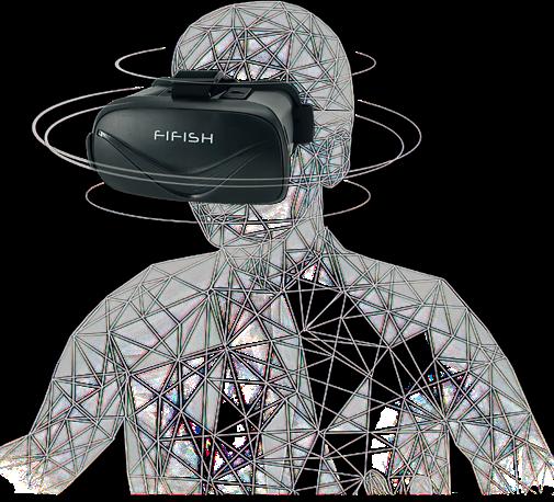
The second ROV dive took place from a small boat on a freshwater lake. This dive went down to 16 metres. It was the perfect time to try another one of its built-in control methods. This way to control this ROV was by inserting my smart phone turned ROV monitor into the included virtual reality headset goggles. If you then activate their prepro gramed software called “VR Intelligent Head Tracking”, you can turn your head in any direction that you want and the ROV will instantly mimic your head movements. That’s a great way to maneuver the ROV a full 360 degrees around as well as up and down much more intuitively. This really came in handy when trying to keep the camera on swimming fish. All I had to do is follow the fish with my head and then hit the record button on the controller to get a video recording of the fish. I never could have done that with the joysticks. The fish were just too fast for that, but it was easy tracking them with my head. The goggles also blocked out the bright sunshine and the lake surface glare from my eyes too. The VR Intelligent Tracking was definitely an advantageous feature of this ROV. It was now time to try another autonomous control feature of this ROV. That additional autonomous control method is called “AI Vision Lock” which uses artificial intelligence to keep the ROV locked into one position despite fluctuating currents. It was also time to test this ROV on a saltwater deep dive. I also needed to test out one of its three sonar options which led to a remarkable marine technology industry collaboration.
NORTH AMERICAN BLUE ROBOTICS MEETS EASTERN CHINA QYSEA


As many of our readers already know, Blue Robotics of Southern California makes their own ROV kit called the BlueROV2. Along with their blue coloured ROV comes some great underwater technological options and add-ons that they sell online. Of course, many people purchase these options for their own ROVs, Uncrewed Surface Vehicles (USVs), and Autonomous Underwater Vehicles (AUVs). Their blue coloured thrusters can often be seen on ocean robotics of all types and brands around the world. They also contributed an interesting and exciting option to the QYSEA V6 Expert ROV. It was their Ping 360 Scanning sonar! This remarkably affordable sonar was designed to be hardwired into their BlueROV2, however with some quick and careful engineering by Blue Robotics and the QYSEA team in China, they both managed to install a Q-IF interface 9 pin connector that’s compatible with the V6 Expert. Of course, it wasn’t that simple. New hardware mounts and buoyancy had to be engineered along with the new interfacing software controls too. However, all that work opens up a whole new opportunity for ROV, USV, and AUV operators on limited budgets to plug in an economical scan ning sonar. The Blue Robotics Ping 360 Scanning sonar retails for $2450 USD (£2261, €2529) on their website. If you’ve ever priced 360 degree scanning sonars, then you know that is an extremely economical price. That is industry breaking news indeed, but how did the blue scanning sonar perform on a foreign grey ROV? I’ve made arrangements to take a voyage on a 28 metre former research vessel to find that out, and I will cruise with that ship just as soon as QYSEA sends me the Blue Robotics modified sonar for testing in a real world harsh saltwater environment. No matter how those tests turn out, this little ROV has already proven itself to be a winner.
So, this ROV might be a bit limited in its ability to multitask using multiple options at one time on a single dive, but its surprisingly versatile using its multiple options one at a time. Seldom have I seen small ROVs with so many add-on options either. If you want to have multiple high powered tools mounted on an ROV at the same time, you’ll just have to pay more- a lot more. This one-tool-at-a-time limitation ROV is not what worried me. The low price and useful software feature
38 | THE SMALL ROV WITH LARGE OPTIONS
Courtesy of QYSEA
well made up for it. You really get a lot for your money. What really worried me was buying an ROV all the way from China. Would there be a language barrier? What would happen if I got the old bait and switch, or what if something arrived broken? How would I get a replacement part, and what would be my appellate process to a Chinese consumer protection agency be if QYSEA refused my request? The main question on my mind was what would the customer service really be like? I did some research to answer some of those questions.
I found one German customer that stated that the manipu lator arm cable broke at the base of the arm. It was a weakly designed socket that broke after connecting and discon necting the cable over time. He took a photo of the break and asked for help from QYSEA. Not only did QYSEA send him a new arm for free, but they redesigned all of their manipulator arms so that it wouldn’t happen again. That’s top marks for a customer service department. Another incident related to me was that one of these ROVs may have been handled a bit too roughly. I don’t recommend that you do that to any ROV brand. This resulted in a stabilization and lighting issue within the electronics of the ROV. QYSEA replaced the entire ROV at no charge. They won’t do that for obvious signs of physical abuse though, and I wouldn’t blame them if they refused under those circumstances, but that’s another example of great customer service. I also found that they have supplied their customers with some online training and instructional videos right on their website. They also respond quickly to customer email questions. They did to my multiple questions for this article. Overall, they get an excellent grade for customer service.
So, the customer service of QYSEA is great along with the many optional tools that this ROV can use even though it’s only one at a time, but why would a marine journalist that writes about multimillion dollar ROVs and has previously operated $100000 and $250000 ROVs capable of using multiple tools at the same time recommend that high end ROV users purchase one of these FiFish V6 Expert ROVs? Well, let me tell you a story that I learned first-hand from the person involved. That person wanted to retrieve an artifact from the hold of a sunken ship. He purchased a $120000 ROV to get the job done. That ROV was piloted into that ship wreck and immediately became snagged within the wreck. The tether broke while trying to retrieve the ROV which resulted in a total loss of that ROV. That person then purchased a second ROV at $120000. It too was lost on its maiden dive. That person then had to give up on the artifact retrieval mission, because at that point they had no more funds available. The irony of the story is that the ship wreck dives were well within the depth range of the V6 Expert, and only a manipulator arm was required as an add-on to the ROV to get the intended job done. That person could have bought 60 QYSEA ROVs for the price of those two more expensive ROVs. So, even if you’re a sophisticated and expensive ROV advocate, there are times when operating a QYSEA V6 Expert ROV is actually a much smarter choice than other more expensive ROVs. I would much rather risk a $4000 ROV than a $120000 one on a potentially dangerous mission. There’s another reason to buy the V6 Expert ROV. Many schools and marine research institutes aren’t big named ones with big budgets and rich donors. If a school can raise $20000 or $30000 to equip a sports team, then they should be able to raise $4000 or $5000 for an ROV that can deliver real time educational dives for their students. That’s a lot better than reading about marine biology from a textbook. So, inex pensive ROVs do have their place in a world that’s always demanding more and more technological advances along with higher and higher price tags.
QYSEA’s V6 Expert ROV is inexpensive and yet versatile in its simplicity. The words “versatile simplicity” might be considered contrary terms, and it might be frustrating always having to change out its tools, but you just cannot argue with the price of this ROV with respect to its 100 metre dive depth, autonomous features, and large variety of options along with a very responsive customer service department. That’s why I can recommend this ROV for both high budget and low budget users. If you’re a high budget user, then get one as a backup for high risk dives. If you’re a low budget user, then get one to jump start your theoretical marine science program into reality. After all, this is a real ROV and not just another underwater drone with a camera.

Real ROVs are more than just self-propelled underwater cameras. They have multiple tooling options and therefore multiple ways of working and collecting scientific data. This ROV also has a long list of add-ons. Listing them here will show another reason why the V6 Expert ROV is more than just a toy ROV.

| 39
Courtesy
of QYSEA
1. Waterproof Onshore Power Supply for continuous dive times.
2. QYSEA’s patented Q-tether water blockage cable that prevents water intru sion if the tether becomes damaged.
3. Underwater Quick Positioning System. U-QPS is a software and hardware ecosystem that provides a 3D map of the ROV’s real-time location under the water.
4. Q-Camera is an addi tional camera and mount that can be positioned 360 degrees around the ROV.
5. Blueprint subsea Oculus M750d sonar. (After some research with Blueprint Subsea I found out the Oculus M1200d sonar is also compatible with the ROV.)
6. Oculus M Series Buoyancy mount.
7. HDMI Box 2.0 for real time dive viewing over the internet.
8. Edgebox Wireless Control System that gives operators the ability to control the ROV over long and remote distances.
9. Sports Camera Mount for independently battery powered cameras.
10. External Lighting Mount for additional lighting needs. The ROV already comes with two LED lights with on/off, low, and high settings for up to 6000 lumens.
11. Underwater Metal Detector.
12. Waterproof Laptop Computer.

13. Controller Sun Hood.
14. Lighting to Ethernet Cables.
15. Compass Ruler manipu lator arm attachment that accurately controls and measures the sizes of underwater objects.
16. Laser Scaler.
17. AR Ruler is an augmented reality laser scaler that more accurately measures the sizes of underwater objects.
18. Distance Meter uses sound waves to measure the distance between the ROV and an object.
19. Altimeter that tells you how far from the bottom that the ROV actually is.
20. Mini DVL (Doppler Velocity Log) with Station Lock Module and buoyancy for measuring the speed of currents.
21. Two and Three Finger Manipulator Arms and attachable Gripper, Retrieval Hook, Mort Remover for aquaculture, Underwater Dozer, Fishing Net, Net Patch Kit, and Benthic Sampler.
22. 100 ml and 500 ml Water Samplers.
23. Dissolved Oxygen Sensor.
24. Salinity Sensor.
25. Turbidity Sensor.
26. pH Sensor.
27. Electrically Powered Tether Spool.
28. Propeller Protectors.
Capt. Marc Deglinnocenti has sea time on various
vessels dating back to 1974. Those vessels included conventional
tractor tugs, sailboats, ferryboats, water taxis, training
barges, containerships, near coastal passenger
and research vessels to name a few. He was in the U.S. Merchant
for 33 years, 25 of which as a master mariner. He was also a designated qualified engineer and held many individual certifications and positions on ships such as QMED, able bodied seaman (lifeboatman along with the AB), unlimited radar observer, shipboard firefighting, and assis tance towing endorsement. He served as an engineering officer, deck officer, commissary officer, and he even was a California State creden tialed maritime teacher. He has experience piloting USVs and ROVs.
If all of the above options along with all of the above semi-autonomous features don’t scream out “Professional ROV”, then what that does? This ROV is much more than that; it’s a winner.
For less than ten thousand dollars US I will soon be testing The V6 Expert ROV equipped with the prototype Blue Robotics 360 degree scanning sonar. I expect to see many more grey ROVs with blue mounted sonars in the very near future if it performs well. I will write a follow up report of just how this ROV performed in a deep saltwater dive using its AI Vision Lock and its Blue Robotics 360 Ping Scanning Sonar. To be continued…
40 | THE SMALL ROV WITH LARGE OPTIONS
types of
and
ships, warships, cargo
vessels, paddlewheels,
Marine
CAPT. MARC DEGLINNOCENTI
Courtesy of Blue Robotics
Courtesy of Blue Robotics
E n t e r p r i s e A I R OV S o l u ti o n s
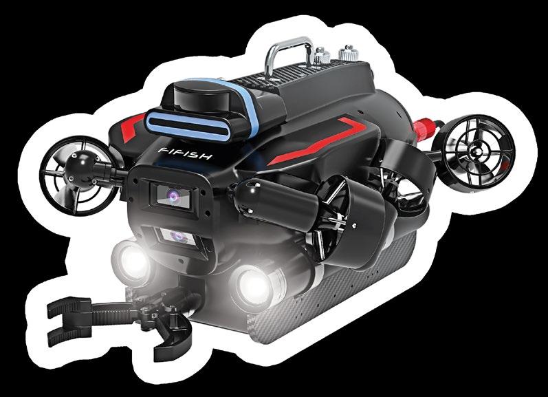




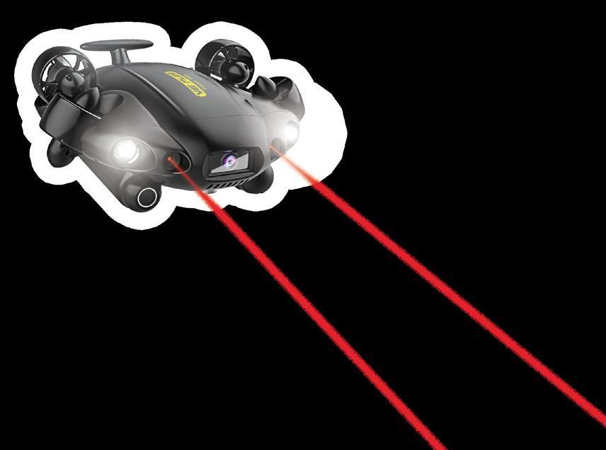
The FIFISH PRO is a series of innovative and high-performance compact inspection ROVs , equipped with 4K UHD Camera systems, 360 degrees of maneuverability, AI object tracking features, professional tool extension capabilities, as well as a suite of collision avoidance sensors, smart
lock systems, and precise AR measurement functions. Portable, rugged
reliable,
by
are built to optimize your
operations.
position
and
the FIFISH Underwater Robots
QYSEA
small-scale underwater
info@qysea.com · +86-0755-2266-2313 · www.qysea.com 383mm (l) x 331mm (w) x 158mm (h) 700mm (l) x 469mm (w) x 297mm (h)

SPANISH NAVY ACQUIRES LEOPARD ROV THROUGH NSPA
Victor Sepulveda, QSTAR
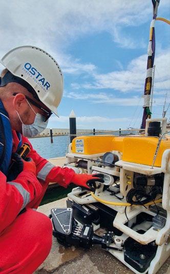
CORPORATE ONSITE ROV PILOT TRAINING
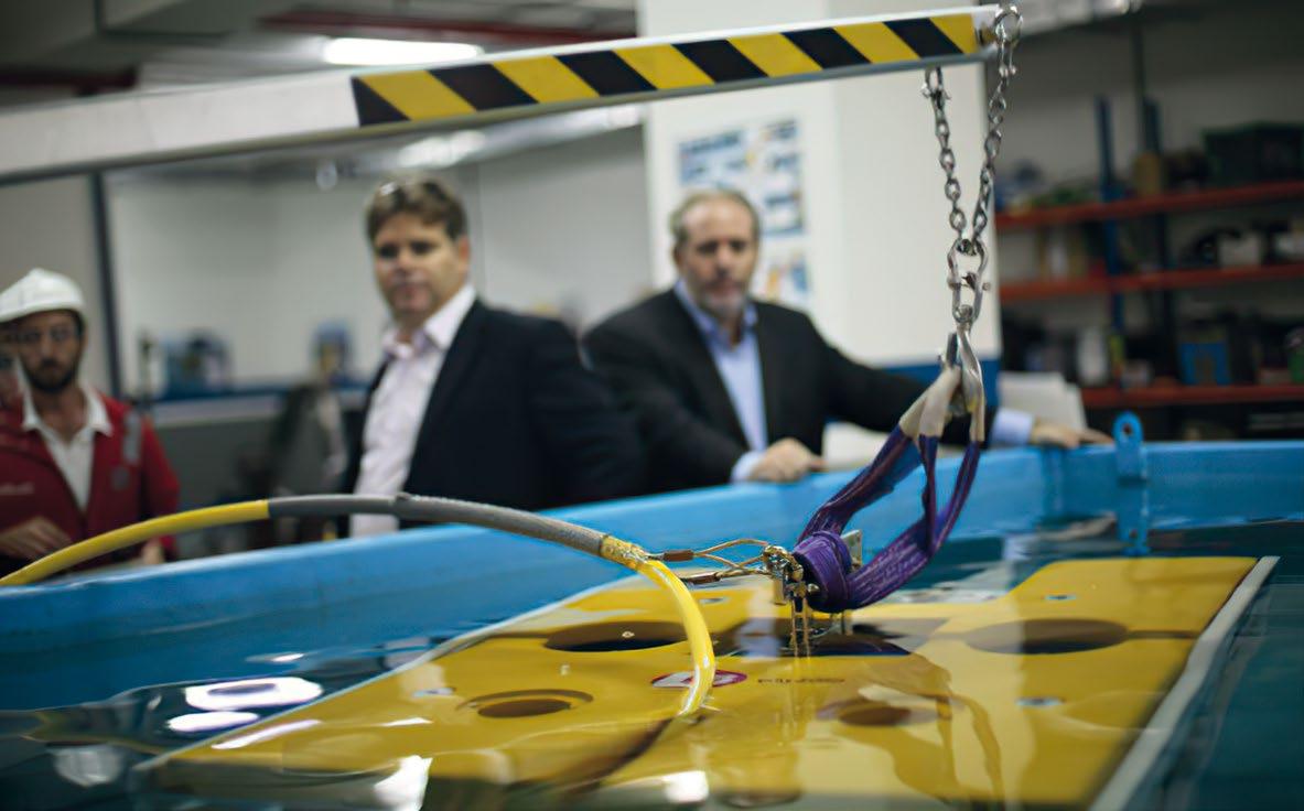
In addition to providing high quality training courses, QSTAR specializes in supplying on-site and corporate ROV training. We also offer training for ROV personnel from different companies worldwide by performing specific on-site training tailored to the company’s individual needs. Furthermore, QSTAR Marine and Subsea Solutions division have been undertaking ROV installation and commissioning projects internationally, from both offshore vessels and onshore operating bases.
QSTAR offers the locations, human technical resources, and the experience accumulated from 15 years in service of the maritime industry and training of personnel. We have the most advanced facilities and the best environment to carry out specific tech nical training for the subsea industry and other sectors. We are a

worldwide training establishment member of the International Marine Contractors Association (IMCA), part of the Remote Systems and ROV Division, Europe and Africa Section.

QSTAR AND SAAB SEAEYE
Over the past few years QSTAR has been collaborating with Saab Seaeye on ROV Training projects for the manufactur er's customers, maintaining a close relationship between both companies and always seeking customer satisfaction. We are specialised in transporting and mobilising qualified personnel to any part of the world to develop training and commissioning projects for new ROV systems. This covers reception of the system to complete installation of the equip ment, through HAT (Harbour Acceptance Tests) and SAT (Sea Acceptance Tests) acceptance.
| 43
Courtesy of QSTAR
QSTAR AND THE SPANISH NAVY –TRAINING BACKGROUND

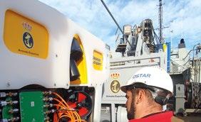
Even the Spanish Navy has approached QSTAR to take advan tage of our outstanding training programs. Members of the EMB (Military Diving School) Divers Unit’s at Cartagena base, and military staff from the Vessel Neptuno (both from the Spanish Navy) joined us back in March 2019 for the ROV Pilot Technician Grade II three-week training course. This group was interested in gaining in depth knowledge of ROVs from opera tions, fibre optics, hydraulics, maintenance, and safety proce dures modules. All of this was to supplement their previous experience gained whilst onboard the rescue ship Neptuno.
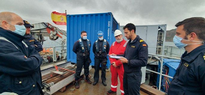
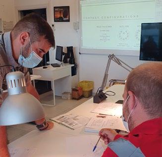
In June 2021 the Spanish Navy again entrusted QSTAR to deliver a second Pilot Technician Grade II Course. Participants success fully achieved all the course objectives, increasing the Navy’s capabilities with a complete ROV personnel skilled team.
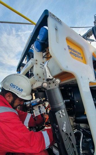
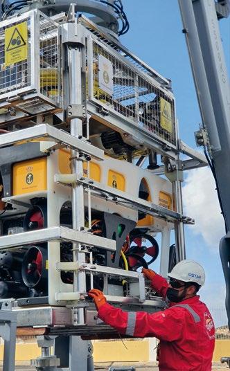
(NSPA) recently acquired an ROV system for the Spanish Navy. It will provide them with improved diving support capa bilities and will facilitate the execution of their International Submarine Escape and Rescue Liaison Office responsibilities.
This is a replacement for the old Scorpio ROV that was discharged from the Spanish Navy during the first quarter of 2022 from the vessel BSR Neptuno. The Leopard ROV shall be used in support of distressed submarines, and for any other task related to underwater salvage and rescue. The contract was awarded to Saab Seaeye after a complex procurement process. During the time of delivery, the NSPA coordinated operator and support training, as well as the installation and integration of the ROV.
SPANISH NAVY
ACQUIRES
A LEOPARD ROV THROUGH NSPA
In addition to retooling their personnel with new skills and knowledge, the Spanish Navy has also been updating their ROV fleet. The NATO Support and Procurement Agency
The Leopard is an exceptionally powerful electric work class vehicle with a minimal 20ft x 8ft LARS footprint. It is fitted with up to 11 thrusters to provide a forward thrust of over 500kgf. It also has a 200kg payload and is controlled by Saab Seaeye’s iCON intelligent control system.
The ROV includes a LARS, tether management system, hydro-acoustic positioning capability, and a shipboard
44 | SPANISH NAVY ACQUIRES LEOPARD ROV THROUGH NSPA
Courtesy of QSTAR
Courtesy of QSTAR
Courtesy of QSTAR
Courtesy of QSTAR
Courtesy of QSTAR
control module. The workhorse of the ROVs is a Seaeye Leopard, an innovative mid-size electric ROV that provides optimised transportability and operational capability with a reduced footprint. A large open payload within the chassis allows for the installation of specially designed sliding trays, equipped with survey sensors or tooling options. A wide range of tooling skids make the Leopard a versatile system capable of performing a range of work tasks in even the harshest of environments at depths of up to 2,000m.
QSTAR’s ROV personnel team supported the HATs and SATs by providing an ROV supervisor, ROV senior pilots, and an ROV instructor to deliver the ROV pilot training.
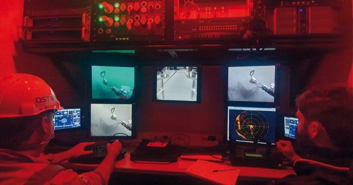
During the trials the primary tasks – such as hatch opening and ELSS pod delivery – were successfully completed. For the HAT, the Leopard ROV was set to a free-swimming mode on a winch. All the advanced vehicle autopilots for heading, depth,

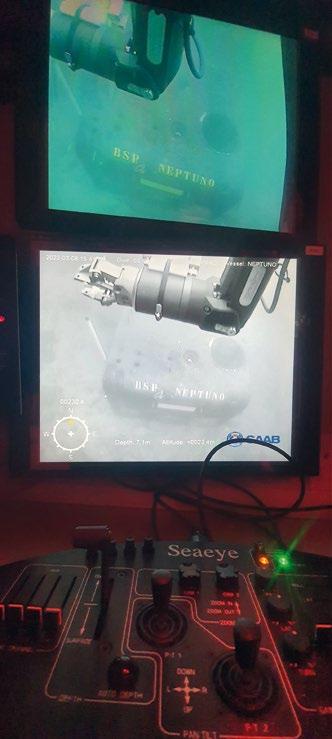
ABOUT QSTAR

Founded in 2007, QSTAR – ROV TRAINING & SUBSEA SOLUTIONS, located in Barcelona and the Canary Islands, is an international marine and subsea services provider. They offer effective solutions to both the on and offshore industries. QSTAR's operational philos ophy is based on the quality of the services provided, and the special attention paid to safety aspects concerning staff and equipment.
pitch and roll, and altitude, compliment Saab Seaeye's iCON™ intelligent control system. This allows the system to control, self-diagnose, and log data from various devices. These were also successfully tested during the trials.
Precise navigation and positioning with the aid of the integrated DVL allowed the pilots to fly around an underwater structure –a submarine replica – designed to simulate a real-life scenario involving a distressed submarine. The scenario included:
ƀ hatch opening and close with the ROV manipulators; ƀ cutting a steel pipe with the supplied hydraulic grinding disc;
ƀ cutting a steel armoured cable with the supplied hydraulic cutter;
ƀ ELSS pod deployment and delivery via the ship's crane.
After leading the ROV Technical Pilot training at an international level, QSTAR has provided the possibility to sample its ROV Courses through E-learning systems via its online campus. The professional courses –delivered in line with IMCA standards – contain online theory modules and face-to-face content through their training centres in Barcelona and Las Palmas. Find out more at www.rovtrainingcentre.com
| 45
Courtesy of QSTAR
Courtesy of QSTAR
ONS REVIEW INSIGHT INTO THE FUTURE OF THE ENERGY INDUSTRY


As energy industry and political leaders gathered in Stavanger for the ONS conference and exhibition, Europe’s current challenges prompted captivating discussions about the oil and gas industry’s future direction.
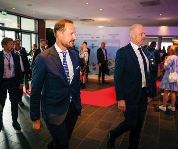

The scene was truly set with an emotional and highly relevant line-up of speakers. His Royal Highness Crown Prince Haakon of Norway opened ONS 2022 and was followed by Norwegian Prime Minister Jonas Gahr Støre who introduced the Ukranian President Volodymyr Zelenskyy live from Kyiv. President Zelenskyy addressed the crowd with a passionate speech about the war with Russia was and how this affects both the global and European energy security in a dramatic way.


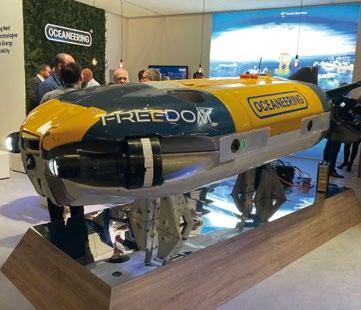
TotalEnergies CEO Patrick Pouyanne and Equinor CEO Anders Opedal high lighted unexpected transition benefits of the oil and gas industry’s windfall, saying the excess cash can help accelerate the move towards decarbonisation. Tesla CEO Elon Musk was interviewed by moderator Xenia Wickett and discussed electrification, the continued need for hydrocarbons, and the energy transition.
In addition to the interesting discussions there were a selection of ocean robotics equipment on display such as the Freedom Resident AUV/ROV from Oceaneering, plans of the Cuvier Deep from 3D at Depth, and the all-electric Olympic robotic arm from Nauticus Robotics.
Overall, the event had a total visitor numbers of around 61,000 people with over 1,000 companies exhibiting.
46 |
Energy Company CEOs at ONS (Photo: Richie Enzmann)
Elon Musk (Courtesy of ONS/KRAFFTWORK)
HRH Crown Prince Haakon of Norway (Courtesy of ONS/KRAFFTWORK)
Photo: Richie Enzmann
Photo: Richie Enzmann
Photo: Richie Enzmann
NEKTON MALDIVES MISSION WHERE NO HUMAN HAS GONE BEFORE

A scientific research vessel, with two state-of-the-art submersibles on board, has been on a voyage of discovery never before attempted. The R/V Odyssey carried scientists from the Maldives, UK, India, Sri Lanka, Seychelles and South Africa on a pioneering 35-day mission to one of the most climate change threatened parts of the Indian Ocean, between 4th September to 7th October. The Maldives is just 1.5 metres above sea level on islands of coral reef atolls. Globally, coral reefs account for 32% of known biodiversity. They are seen as the ‘rainforests of the ocean’, yet at least 97% could be lost with a 1.5-degree temperature rise.
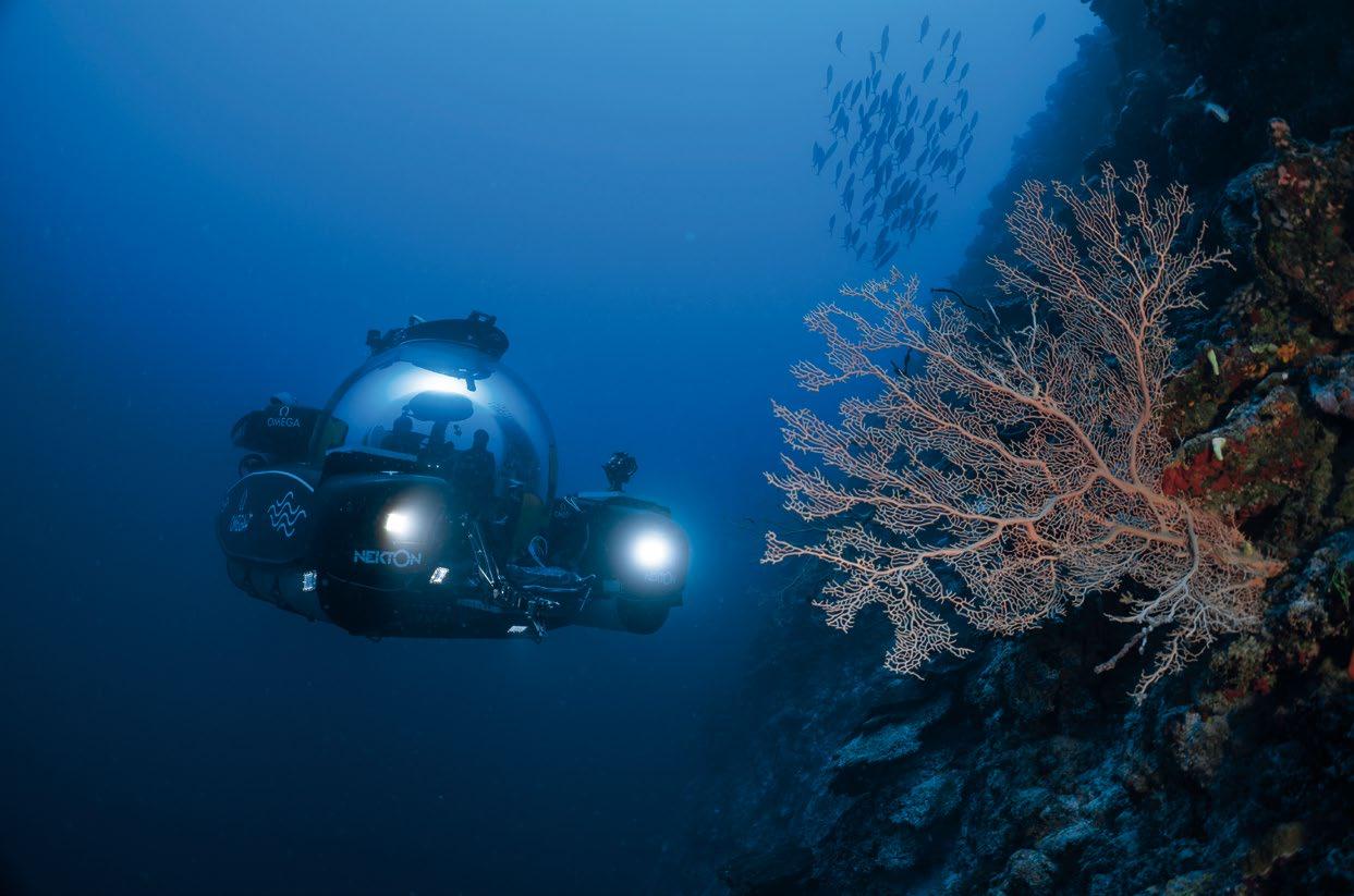
The ambitious adventure took place in uncharted waters off the Maldives in a joint endeavour between the Maldivian Government and the UK science foundation Nekton, which exists to accelerate our scientific understanding and protec tion of the world’s oceans. The mission undertook the first systematic survey from the surface to 1000metres across the Maldives. From this, the team are establishing a ‘base line health check’ on the status of the Maldives ocean and provided data to scientists and policy makers worldwide to enable the protection of critical nurseries, spawning habitats and related ecosystems.
The vessel used for the mission, R/V Odyssey, combines state of the art oceanographic, exploration, scientific and filmmaking capabilities including seabed mapping system, wet labs, dry labs, on-board medical facility, hyperbaric chamber, a sophisticated Mission-Control Centre, as well as a broadcast-quality studio. Formerly known as M/V Alucia, previously owned by Ocean X, it supported the successful search for the wreckage of Air France flight 447, the filming of the first giant squid in the wild and BBC Blue Planet II. Prior to Ocean X, she was the support ship for the French submersible Nautile on hundreds of sub dives including the first dives on Titanic in 1987.
| 47
Scientists on the Nekton Maldives Mission believe they have likely discovered a previously undescribed ecosystem - 'The Trapping Zone' - that is creating an oasis of life 500 metres down in the depths of the Indian Ocean. The discovery observed from on board the Omega Seamaster II submersible has been hailed as hugely significant by mission scientists and the Maldivian government. Taken on 24th September 2022 at Fuvahmulah. (Courtesy of Nekton/Henley Spiers)
THE SUBSEA TECHNOLOGY USED IN THE MISSION

The newest of the two Triton submersibles aboard the ship - the REV Ocean owned Aurelia - was the subject of exten sive sea trials off the coast of Barcelona this summer. She is now certified as the world’s most advanced craft of her kind. The other - the Omega Seamaster II - is a three-seater Triton submersible branded the same as the submersible on the earlier Nekton mission to the Seychelles in 2019 where, in partnership with scientists from that nation, marine explorers found dozens of new species and mapped the waters off the coast which were previously uncharted below 30 metres.
A Saab Seaeye Falcon underwater robotic vehicle also joined the fleet of submersibles on the Nekton Maldives Mission to undertake the pioneering research. As an official partner, Saab Seaeye donated the use of a Seaeye Falcon to work along side human-occupied submersibles, autonomous systems, and research technologies. Renowned for its ability to hold
steady in strong currents while filming and manoeuvring, the Falcon is the world’s top robot in its class with a reliability record covering over a million hours underwater. The vehicle rated for 300 metre depth was equipped with five cameras for biodiversity documentation and with sampling systems.
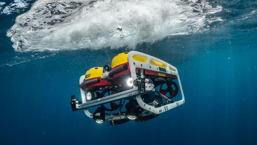
Two sets of cameras were positioned on the vehicle, one set forward facing and the other set downward facing. They were spaced 80cm apart and at inward angle of 8 degrees ready to be calibrated for stereoscopic video recording. The same system was used by snorkelers and the other submersibles to complete video transects in an identical manner and at different depths.
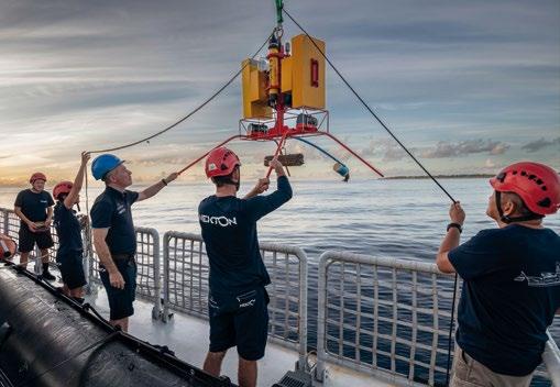
To enable scientists to document the biodiversity of the ocean around the Maldives, Nekton scientists devised, tested, improved, and deployed a novel methodology for using the Falcon for video transects in shallow waters on the complex topography of coral reefs and operating in areas of strong currents.
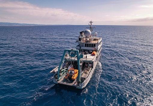
48 | NEKTON MALDIVES MISSION:
NO
HAS GONE BEFORE
WHERE
HUMAN
Saab Seaeye Falcon fitted with special stereoscopic camera array. (Courtesy of Nekton)
REV Ocean's newest submersible Aurelia on deck undergoing sea trials on 1st July 2022 in Barcelona, Spain. (Courtesy of REV Ocean/Nekton)
In this image released on Monday, Oct. 10, 2022, scientists on the Nekton Maldives Mission believe they have likely discovered a previously undescribed ecosystem - 'The Trapping Zone' - that is creating an oasis of life 500 metres down in the depths of the Indian Ocean. The discovery was observed on bait cameras, launched from the Nekton mothership RV Odyssey, which sink to the seabed and record marine life. The data has been hailed as hugely signifi cant by mission scientists and the Maldivian government. Taken on 24th September 2022 at Fuvahmulah. (Courtesy of Nekton/Henley Spiers)
MALDIVES AQUANAUTS HISTORIC MAIDEN DIVE
Two intrepid Maldives aquanauts have also journeyed into the history books by becoming the first people from the world’s lowest-lying nation to descend deep into the twilight zone.
Marine biologist, Shafiya Naeem, director general of the Maldives Marine Research Institute, and research assistant colleague Farah Amjad were chosen as lead aquanauts on the maiden dive of the Nekton Maldives Mission.
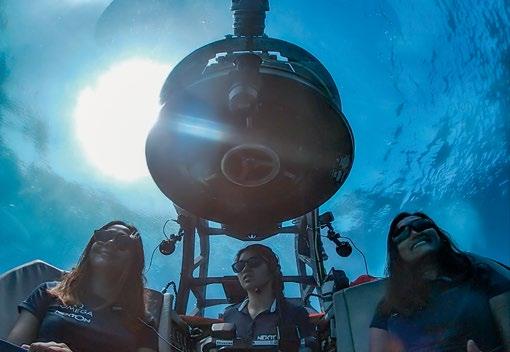
The aquanauts launched from the mission mothership R/V Odyssey off Laamu Atoll and, in an impromptu gesture of national pride, raised the flag of the Maldives as the Omega Seamaster II three-person submersible rolled out on deck
They were piloted by American Kimly Do on a journey to investigate the wall of coral and marine life along the east coast of Lammu at varying depths from 60 metres, through
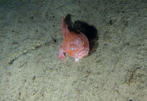
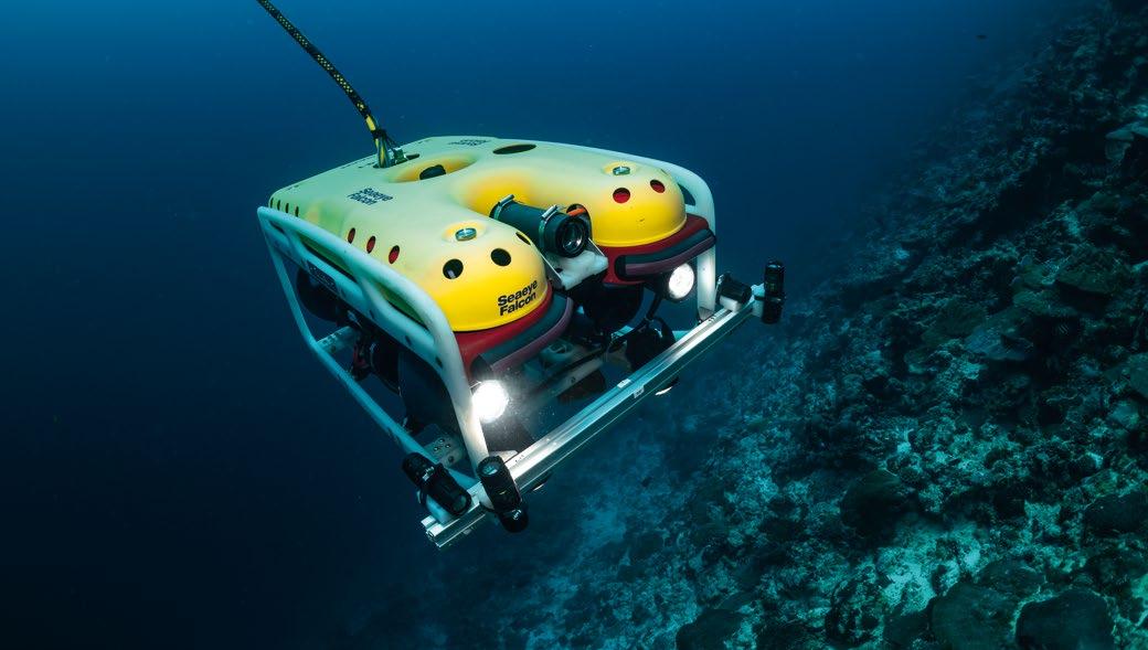

a 120-metre-deep survey to the darker depths of 250 metres. The scientists are especially interested in the interconnec tivity between corals and marine species living near the surface and at greater depth.
The Maldives team admit to feeling the weight of expec tation on their shoulders. Their nation is the lowest lying country on earth and is already experiencing storm surges and so-called coral bleaching events - when corals, which act as natural sea defences, are literally boiled to death by rising sea temperatures, sparked by global warming. Unless global carbon emissions are kept in check, swathes of this archipelago could become uninhabitable.
DISCOVERY OF NEW ECOSYSTEM –‘THE TRAPPING ZONE’
Scientists on the Nekton Maldives Mission believe they have likely discovered a previously undescribed ecosystem - ‘The Trapping Zone’ - that is creating an oasis of life 500 metres
| 49
Two scientists from the Maldives and their American submersible pilot make history by being the first people from the Indian Ocean nation to dive into the twilight zone. Shafiya Naeem right and Farah Amjad left, were piloted to 250m by Kimly Do centre aboard the three person Omega Seamaster II submersible on Sunday 11th September 2022 at Laamu Atoll, Maldives. (Courtesy of Nekton)
In this image released on Monday, Oct. 10, 2022, a coffinfish sits on the seabed at 500m down off the coast of the Maldives, where Nekton Mission scientists believe they have discovered a previously undescribed ecosystem known as "The Trapping Zone". (Courtesy of Nekton/ Sarah Hammond)
The Seaeye Falcon was able to transect steep reef cliff faces and maintain stability in strong currents and swell surges. (Courtesy of Nekton)
down in the depths of the Indian Ocean. The discovery has been hailed as hugely significant by the Maldives Government.
Video evidence from Nekton science cameras aboard the Omega Seamaster II submersible, combined with biological samples collected and extensive sonar mapping, point to megafauna predators such as sharks and other large fish feeding on swarms of micro-nekton - small organisms that can swim independently of the current - which are trapped against the subsea landscape at the 500metre mark.
The volcanic subsea strata and fossilised carbonate reefs which form the base of Maldivian atolls combine steep vertical cliffs and shelving terraces which appear to cause these species to be prevented from diving any deeper as the sun rises. These animals typically migrate from the deep sea to the surface at night and dive back down into the deep at dawn, otherwise known as The Vertical Migration - the largest nightly migration on Earth.
The trapped animals are targeted by large pelagic predators, including schools of tuna and sharks, along with well-known, large deep-water fish including the spiky oreo and alfonsino.
Tiger sharks, six gill sharks, sand tiger sharks, dog fish, gulper sharks, scalloped hammerhead sharks, silky sharks and the very rare bramble shark have all been documented.
Whilst a trapping effect has been associated with the biodi versity hotspots on subsea mountains or seamounts, it has not previously been linked to the different geomorphology and biological parameters of oceanic islands, like the Maldives.
Analysis of the video and biological data is ongoing in the Maldives, Nekton’s UK headquarters in Oxford and at partner laboratories. The discovery could have important implica tions for other oceanic islands and the slopes of continents, sustainable fisheries management, the burial & storage of carbon and, ultimately, climate change mitigation.
Previous Nekton missions have led to major scientific break throughs. Its expedition to Bermuda in 2016 confirmed the discovery of the Rariphotic Zone, or rare light zone, a new ecosystem found at depths between 120 metres and 300 metres.
Further details and coverage of the Nekton Maldives Mission: www.nektonmission.org
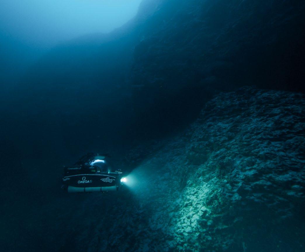
50 | NEKTON MALDIVES
MISSION: WHERE NO HUMAN HAS GONE BEFORE
In this image released on Monday, Oct. 10, 2022, scientists on the Nekton Maldives Mission believe they have likely discovered a previously undescribed ecosystem - 'The Trapping Zone' - that is creating an oasis of life 500 metres down in the depths of the Indian Ocean. The discovery observed from on board the Omega Seamaster II submersible (pictured) has been hailed as hugely significant by mission scientists and the Maldivian government. Taken on Wednesday 5th October at Vaavu, Maldives. (Courtesy of Nekton/Sarah Hammond)
POWERING RESILIENT NAVIGATION TO SAFEGUARD NAVAL OPERATIONS
The contemporary naval operating environment repre sents an increasingly complex arena for nations seeking to successfully conduct and complete critical missions at sea. One of the greatest obstacles facing navies world wide is the ability to operate in contested environments where naval platforms can find themselves suffering from significant disruptions to space-based connec tivity including Global Navigation Satellite System (GNSS) technology. GNSS is indeed vulnerable to attacks by adversaries capable of implementing innovative tactics to disrupt, jam, or spoof satellite signals, resulting in critical risks for the safety of naval operations.
When operating within these types of demanding environ ments, it is critical for surface ships, as well as subsea plat forms such as submarines and drones, to retain the ability to accurately calculate their positions anywhere and anytime in order to aid navigation but also optimize situation awareness, precision fires and many more combat applications.
In these contested operating environments, Inertial Navigation System (INS) technology represents a critical component for naval forces. In the sub-surface environment, INS will be relied upon to confirm the position and heading of strategic submarines operating underwater for extended periods of time. On the surface, INS will be integrated into a wider
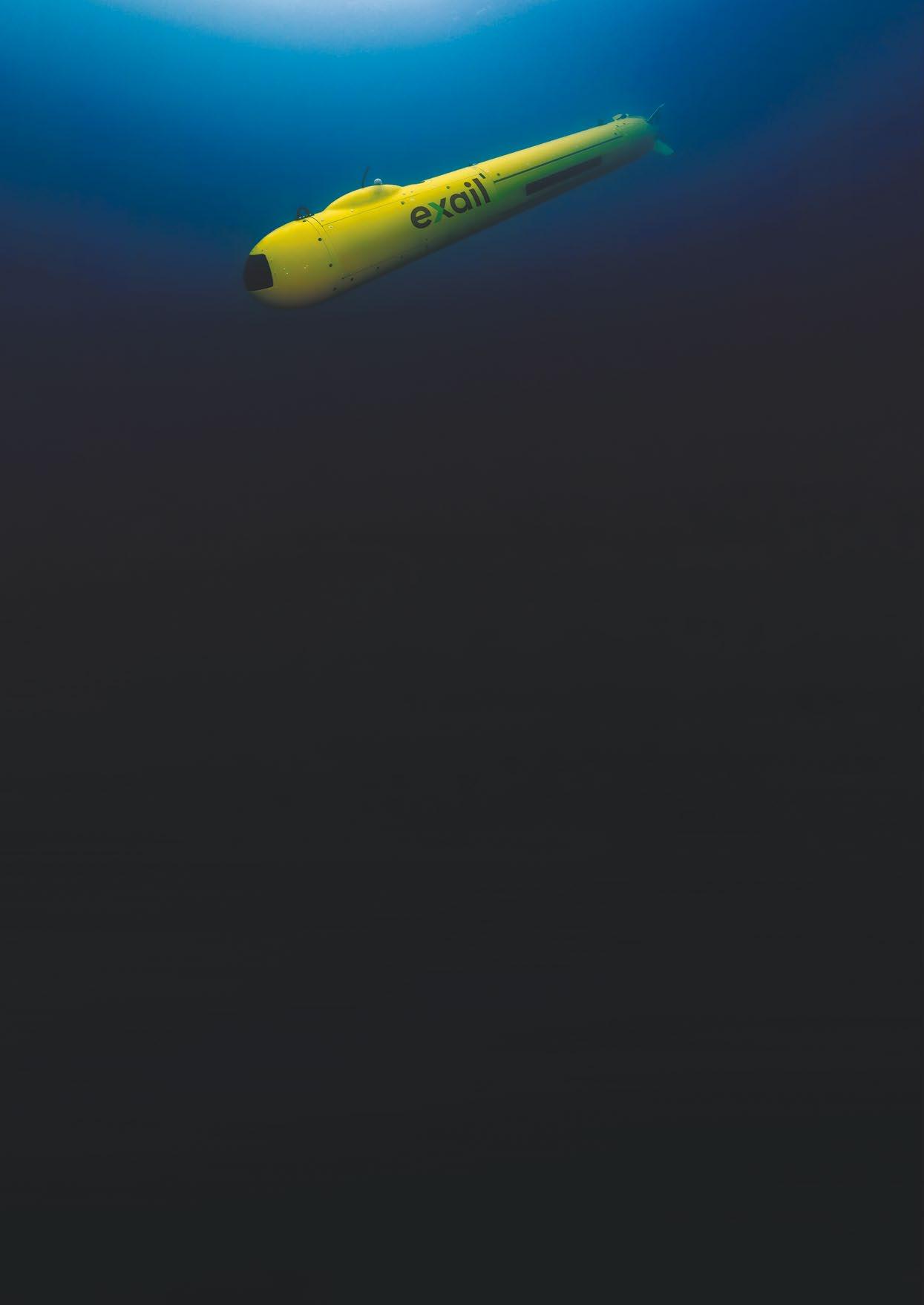
| 51
Courtesy of Exail
system of systems approaches to, for instance, provide commanders with redundant position and navigation infor mation to support rapidly changing operational situations.
European leader in naval navigation systems, Exail provides resilient and safe navigation to over 80 navies worldwide. The company’s critical navigation sensors and solutions include ITAR-free inertial navigation systems (INS & AHRS), Navigation Data Distribution & Computation Systems (NDDCS), as well as navigation software (WECDIS). They are all designed to address naval platforms’ requirements, from smaller coastal and support vessels to aircraft carriers, including main surface combatants, subsea drones and submarines.
ENSURING RESILIENT NAVIGATION WITHIN GNSS-DENIED ENVIRONMENTS
Exail is recognized throughout the world for its pioneering work on Fiber-Optic Gyroscopes (FOG) that have revolu tionized navigation over the past 30 years. Providing highly accurate heading, roll, pitch, speed, and position infor mation in all environments, Exail’s Attitude and Heading Reference Systems (AHRS) and Inertial Navigation Systems (INS), already power resilient navigation to over 1,000 naval platforms.
Delivering unlimited autonomous navigation within GNSSdenied environments, Exail’s FOG-based AHRS and INS are exempt of all physical drawbacks that may affect other existing technologies and ensure that resilient navigation information is provided at all times. Solely relying on light motion, FOGs are indeed solid-state passive systems that do not involve any movement of mechanical parts that might cause dithers, vibrations, and frictions, and that might result in parts’ weariness and noise.
Highly performant, robust and stealthy, Exail’s navigation systems are able to withstand the most demanding environ ments of naval warfare, while providing unrivaled reliability and accuracy. Able to limit surface and subsea platforms’ drift to 1 nautical mile in 360 hours, whatever the Milspecdefined environmental conditions encountered (shock, vibra tion, temperature, magnetic field…), they are highly scal able systems. The performance of FOG-based systems can indeed be changed by altering the length and diameter of their coils, making them adaptable to a wide range of perfor mance needs, meeting the requirements of all kinds of naval platforms.

Because Exail has complete mastery over all the components that are integrated into its systems, from its own optical fiber and components to its accelerometers and algorithms, the company can further push the limits of the FOG technology to have it reach unmatched peaks of performance, powering unlimited autonomous navigation for critical long-endurance surface and subsea missions.
DELIVERING RESILIENT NAVIGATION INFORMATION THROUGH CYBERSECURE MULTI-SENSOR DATA FUSION
Once all the navigation and positioning data has been collected by the various sensors, including the AHRS and INS, it is then acquired, analyzed, correlated, and distrib uted to all onboard systems by Exail’s Netans Navigation Data Distribution & Computation Systems (NDDCS), that directly interfaces with the ship’s combat system and plat form management.
Contributing to the vessel operational capabilities, the Netans Series is a real-time system that distributes and processes almost instantaneously the very diverse and highly complex data provided by all navigation sensors. The system will first check the validity of the data provided by the sensors by ensuring that it is coherent with the previously received values. It will then ensure that the data received from one sensor is plausible by checking its coherency compared to the data received from other sensors. The integ rity of the data is finally checked by the system that makes sure that there is no alteration during the data transmission. Besides data distribution, the Netans Series delivers the most complete real-time and cybersecure merged and consoli dated navigation information available, ensuring resilient and safe navigation at all times.
Exail’s navigation technology not only provides an immediate solution which can be retrofitted on legacy combat platforms operating across the naval warfare domain today. It also provides a future-proof capability which stands ready to be integrated on board the next-generation of combat plat forms. The company’s navigation technology was inciden tally recently selected to equip cutting-edge naval programs such as France’s future FDI frigates, Norway and Germany’s newly built U212CD submarines, as well as Spain’s future F110-class multi-mission frigates.
52 | POWERING RESILIENT NAVIGATION TO SAFEGUARD NAVAL OPERATIONS
Crown Copyright
ARTIFICIAL INTELLIGENCE MEETS UNDERWATER INSPECTION
The A.IKANBILIS is a ‘Hovering AUV’ designed for autonomous ‘launch and leave’ underwater inspections that reduce project execution costs while providing the potential to deliver data to the client almost in real-time. Innovations like this are essential if the underwater inspection needs of a huge influx of new offshore wind infrastructure are to be met in the years to come.
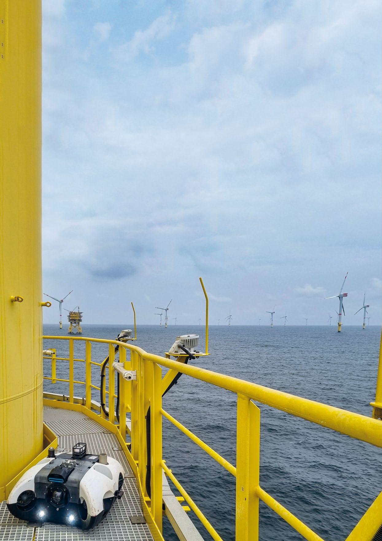
| 53
Courtesy of BeeX
While the global pandemic slowed the rate of development, we have witnessed significant growth in underwater infra structure due to new renewable energy projects being devel oped in the fight against climate change over the last five years. New wind energy capacity targets are now driving a return to full development however, and huge amounts of underwater infrastructure will be installed.
The figures speak for themselves; in Germany alone, there is an expected 10,000 new offshore wind turbines to install if government targets for 2030 are to be reached. While the sheer scale of the engineering task will drive a manufacturing boom, supporting industries operating in the offshore sector will also need to expand to service the growth in wind power infrastructure.
At the current capacity and indeed service cost, underwater inspection contractors need to develop opportunities to optimise and increase their coverage and availability in a nonlinear way. Without a serious combined and collaborative effort, it’s possible that there won’t be enough equipment, expertise, and service capacity to efficiently serve the market. This could mean that turbines may be under-inspected and as a result, could potentially experience more mechanical and operational issues that lead to higher lifecycle costs.
In the context of large wind farms with hundreds of installed turbines, it’s easy to understand how delayed inspections could have a tangible impact on Operations & Maintenance (O&M) budgets.
AUTONOMOUS UNDERWATER INSPECTION


Regular visual inspections are important to identify struc tural damage, stress, or fatigue trends at an early stage to be able to initiate corrective actions in time before they become serious issues. Underwater inspection covers many aspects of maintaining the health of submerged structures, and waiting too long to i.e., measure the cathodic protection levels across foundations to verify proper functionality of the Impressed Current Cathodic Protection (ICCP) systems may accelerate structural fatigue.
According to Jan Schmökel, Balance of Plant Engineer at Nordsee One GmbH, new ways to expand and optimise under water inspection capacity by leveraging the power of Artificial Intelligence and machine learning enabled autonomous systems can help to ensure new infrastructure is inspected on schedule, by streamlining and lowering costs across the board.
“The requirements for subsea inspections at offshore wind farms call for autonomy,” he said. “Currently, an ROV support vessel mobilized specifically for inspections comes to our wind farms every year, but the limited equipment spread required for AUV operations makes it possible to launch from a Crew Transfer Vessel, Service Operation Vessel, or even Transition Piece, which eliminates the need for an additional vessel and therefore significantly reduces the required offshore manpower. This is an important safety aspect while reducing the environ mental footprint to make wind energy even cleaner. In addition, it would significantly reduce the operating expenses.”
Nordsee One GmbH is a forward-thinking wind farm operator, and, as such, is continuously engaged with and testing new technologies to reduce OPEX, as these costs can have a direct impact on the price of energy to the consumer. The company is currently building an innovative approach to incorporate autonomous technology for underwater inspections at its Nordsee One wind farm, which has a total area of 41.3 km² and is situated approximately 40km north of the island of Juist between the traffic separation area Terschelling-German Bight and German Bight Western Approach in the North Sea.
As part of its intentions, Nordsee One GmbH tested one of the latest autonomous innovations – the A.IKANBILIS robot, which its developer, Singapore-based BeeX has classed as a ‘Hovering AUV’ (HAUV) – at the Nordsee One wind farm in September this year.
A NEW TYPE OF AUV
While HAUV is yet another acronym to add to the long list in the world of Ocean Robotics, it’s certainly a fitting descrip tion for a vehicle that could be mistaken for an observation class ROV but can operate completely autonomously without
54 | ARTIFICIAL INTELLIGENCE MEETS UNDERWATER INSPECTION
Courtesy of BeeX
Courtesy of BeeX
a tether. This unique approach comes from the relatively small but highly technical team at BeeX, who have been on a journey to create a new, highly agile and data-centric solution for underwater inspection since 2012.
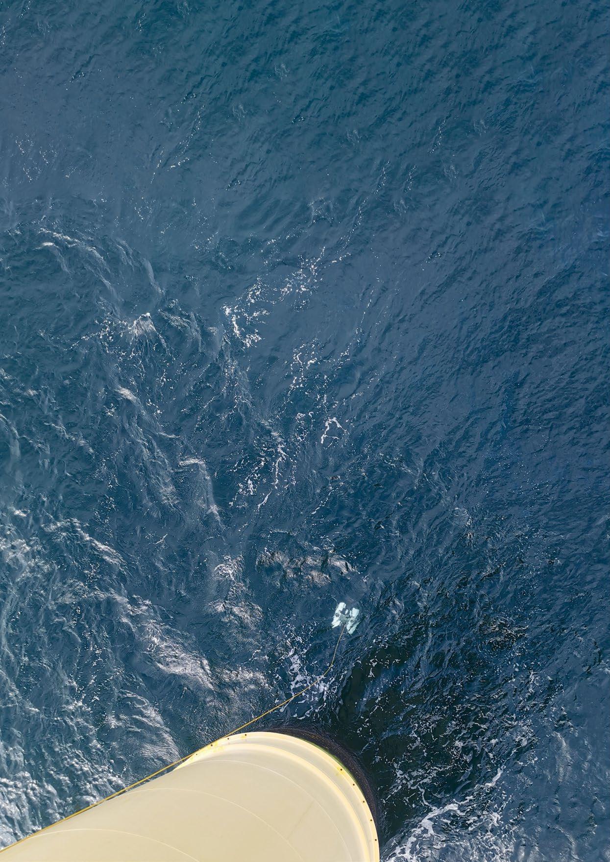
“The genesis of our work is the development of AUVs for academic defence competitions organized by the US Office of Naval Research,” explained Grace Chia, CEO at BeeX. “Through this we realised that ROVs are very capable but highly limited by the tether and the pilot-of-the-day. The tether alone creates expensive overheads including support vessels and complicated launch and recovery mechanisms, so we set about creating a new concept that would overcome these physical limits to lower operational costs and risks, while enabling the industry to efficiently scale up and protect underwater infrastructure.”
According to Grace, the team prioritised the hovering stability of A.IKANBILIS as this ensures agility in the water, leading to the capture of actionable video, images and precise data during inspections. Importantly, BeeX also wanted to create a system with a smooth end-user experience. From launch and recovery down to how the customer manages the data, “should be almost like magic,” Grace tells us, adding that, “this meant we needed to build an integrated system instead of just adding software to hardware and calling it an HAUV.”
JUST LAUNCH AND LEAVE
The AI autonomy controller is at the centre of this integrated system, and according to BeeX, it is one of the most advanced systems operating today. It’s capable of conducting an under water inspection with very minimal planning. Instruction sets simply need to provide A.IKANBILIS with a scope of work, e.g., is it inspecting a monopile or is it supposed to conduct an encirclement to check the rocks?
Once in the water, it will work out the best approach to its mission using existing data and data acquired through its cameras and other sensors. The level of autonomy is so advanced that the system requires no human interaction during a mission, making it a true ‘launch and leave’ system that will only grow in capabili ties as its machine learning algorithms improve route planning, navigation, and the ability to target objects of interest.
“Our adaptive autonomy module searches for objects of interest and plans its path. It is similar to a self-driving car, where these path inputs are then provided to the computer and controllers are activated to drive the thrusters in a very precise manner. It uses ‘xyz’ underwater positioning through a combination of DVL and INS, which can be aided by USBL, although it is not always required,” explained Grace.
While the autonomy controller is clearly a step up from many AUVs operating today, the Sambal operating system devel oped by BeeX for A.IKANBILIS is also a potentially gamechanging innovation, as it can transfer data practically in real-time. It can take weeks for underwater inspection data to reach the client using contemporary practices, but the ability to share directly to data platforms on board and ashore (communications infrastructure permitting) enables optimisation at every stage of a wind farm’s lifecycle.
Jan explains that “during conventional ROV inspections, large amounts of data are stored locally and afterwards delivered on HDDs. Sometimes it takes weeks until all data and reports are available. With the Sambal reporting portal, every colleague can check the inspection results more or less in real-time. While the amount of data produced during an inspection is still a lot for satellite transfer, it is important to be able to access the data quickly to be able to react to potential anomalies at short notice, possibly even within the same mission.”
| 55
Courtesy of BeeX
ACCELERATING THE DATA JOURNEY

As BeeX’s European technology and service partner a team from Subsea Europe Services GmbH joined the September trials at the Nordsee One windfarm. The company, which already operates a new Unmanned Surface Vehicle (USV) for marine data acquisition is at the forefront of digitising marine data so that its value can be leveraged on cloud platforms by different users and at a lower cost than today.
“It was clear during the trials that the unique physical aspects of the A.IKANBILIS platform make light work of most under water inspection tasks, but its ability to accelerate the data journey could be just as transformative in the industry,” said Subsea Europe Services’ CEO, Sören Themann. “Digitalisation will be essential to optimise underwater inspection not only at the marine operations level but in the cloud too, where service providers and energy companies will be tasked with managing much more data than they are used to. The fact that this data can be acquired, analysed and stored in a frac tion of the time than with today’s processes is just as impor tant as the unmatched agility and launch and leave operation of the A.IKANBILIS system.”
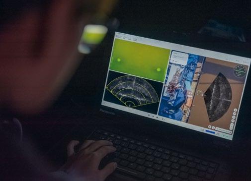
A.IKANBILIS was set a number of standard underwater inspection tasks – which it completed without any issues –during the Nordsee One trials. It inspected structures such as monopiles, anodes, water exchange holes, and boat landings, and enabled the creation of both 2D mosaics and 3D point clouds of the scour protection, cable protection system, and cable burial points. Through this, BeeX was able to validate the operational capabilities of the adaptive autonomy stack, which was a key milestone in breaking free from the limits imposed by a tether. They also validated that the experi ence of reporting is more intuitive and helpful for wind farm management than current systems.

“Lately, developments in the field of autonomous systems have progressed rapidly and after reviewing various AUVs, the BeeX system was found to have the greatest potential,” said Jan. “The trials allowed us to see how the AUV would behave in an offshore environment, and I was surprised how stable it moves in the water column. With its associated Sambal reporting portal, BeeX's AUV is a potential game changer for subsea inspections. Recognising the potential, we are keen to give BeeX and Subsea Europe Services the opportunity to continue trialling their AUV at our wind farms in the future to further drive its development.”
REDUCING THE MARGINAL COST OF DATA
Without the need for support equipment and large on-site teams, the marginal cost of data collection using the A.IKANBILIS is very low. The BeeX team envisions its vehicles helping to collect and analyse data from pre-development to end of life and is currently involved in a number of new appli cations. For instance, they are already working with another renewable energy provider to explore how A.IKANBILIS can be used to collect ecology data throughout the water column at higher resolution and lower cost compared to crewed vessels.
As an autonomy specialist, Themann is convinced that such developments are essential for the future of the underwater inspection industry as well as other areas of operations including bathymetric survey and dredging, in the context of unfathomed growth in the offshore wind sector.
“We need to build capacity to meet demand and the smartest, most cost-effective way to do this is to let the autonomous systems do the groundwork while the experts oversee oper ation. With autonomy that can be trusted to just do its job based on minimal instructions and zero human interven tion during an inspection or survey, the trained operator can take responsibility for more projects, which will immediately increase capacity while reducing costs. Factor in direct to cloud data management and data backlog will also become a thing of the past, opening even more capacity to survey and inspect wind farm sites and associated infrastructure.”
56 | ARTIFICIAL INTELLIGENCE MEETS UNDERWATER INSPECTION
Courtesy of BeeX
Courtesy of BeeX
IMCA TURNS ITS GUIDANCE SPOTLIGHT ON USVS
The use of Uncrewed Surface Vessels (USVs), to perform surveys or inspections has been
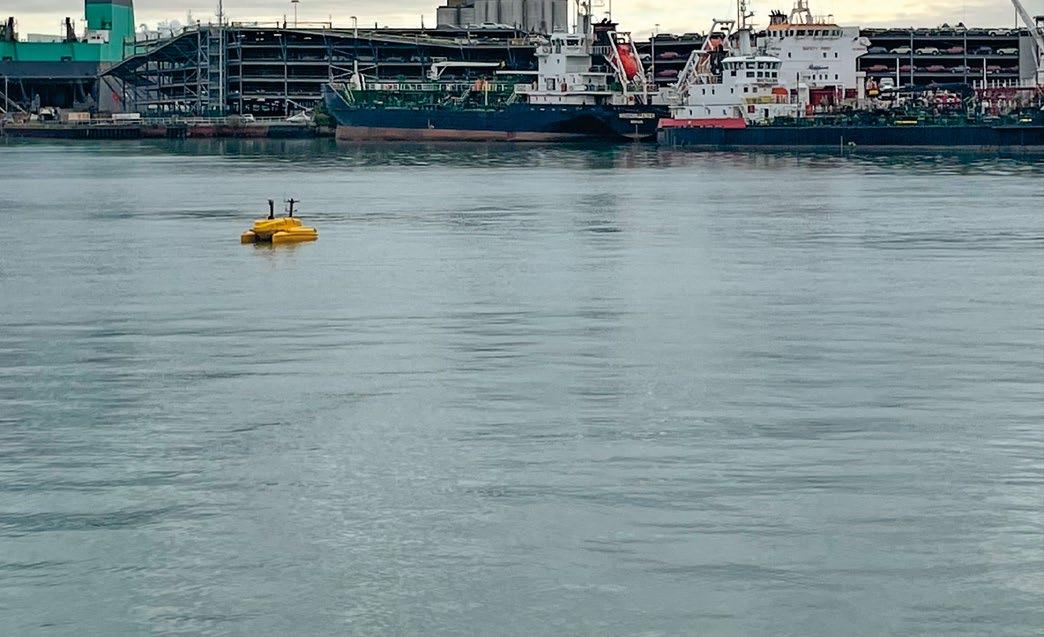
last few years. With limited regulation for USVs, the International
drawn from members, formed a working group to create a guidance document
establish best practice for the safe and efficient use of USVs in energy fields.
The International Maritime Organization’s Maritime Safety Committee (MSC) defined four degrees of Marine Autonomous Surface Ship (MASS) vessel autonomy during MSC 100 in December 2018. It was determined that IMCA’s guidance would be specifically applicable to USVs, not for wider MASS systems. Using the IMO MSC definition our committee’s work was to produce guidance for ‘Degree three’ vessels. These are defined as ‘Remotely controlled ships without seafarers on board’ and are controlled and moni tored from another location.
‘Safe and Efficient Use of an Uncrewed Surface Vessel (USV)’ (IMCA M 257) published earlier this year has been welcomed by members well-used to helpful guidance from IMCA. It has been produced to provide a reference document for the safe and efficient offshore operation of USVs and the relevant support systems; and represents the initial guidance for this new, and rapidly developing, technology. This is (like all IMCA documents) a dynamic document which will be regularly updated. It is envisaged that ‘Degree four’ vessels may be included within future revisions as the industry grows. These are defined by IMO MSC as ‘Fully autonomous ships’ on which the operating system of the ship can make decisions and determine actions by itself.
M 257’S USERS – AND THEIR FEEDBACK
IMCA M 257 is designed for use by both contractors and clients, the guidance purposely avoids subjects of minority interest. It contains guidelines and recommendations that, when combined with manufacturers’ instructions and companies’ operational procedures/ processes, allow for the maintenance of a high level of safety and efficiency across the sector. However, it does not attempt to replace the need for contractors to maintain comprehensive operations manuals, maintenance manuals, policies, and procedures.

IMCA anticipated that adoption of this document and adherence to the guidance contained within it will contribute to a safe and efficient industry that operates to common standards and that has proved to be the case with comments from users including:
ƀ “Now that M257 is out there in the industry we have something to work with, hopefully IMCA will continue to evolve the document.”

ƀ “It is good to know that credible industry experts have been actively involved with development of M257.”
ƀ “M257 is a sound base for moving forward with this very fast evolving industry.”
| 57
Richard Purser, Technical Adviser Marine, IMCA
increasing over the
Marine Contractors Association (IMCA) USV Committee,
to
USV operated in Southampton harbour
(Photo: Richie Enzmann)
GETTING DOWN TO DETAIL
Our eleven-strong committee comprising representatives from Class, oil majors, vessel operators and leading pioneers developing the technologies established they wanted to keep the document user-friendly, with dedicated sections containing short paragraphs. First comes a descriptive foreword followed by an introduction to USVs; an invalu able glossary of abbreviations and acronyms (fitting for guidance concentrating on a vessel identified by its own acronym) follows; then detailed sections on USV Tasks; USV Operations; and USV Personnel. The 22-page document ends with references.
USV systems have the potential to provide a full scope of services as currently provided by crewed vessels. The section on USV tasks considers hydrographic operations; bathy metric operation; ROV/AUV operations; unmanned aerial vehicles support operations; seabed drilling operations; environmental monitoring; and inspection and interven tion operations.
The section on USV Tools is similarly comprehensive, explaining that for USVs to be effectively used for various operations, attention must be paid to the various tools, equipment and systems on board that facilitate safe and proper use.
All USVs are equipped with systems and tools, each of which fits into one of the following three areas:
ƀ Navigation equipment for basic operation as a vessel (which also refers the reader to the Operations section)
ƀ Communication equipment (with a link to the relevant section in the ‘Operations’ section)
ƀ Survey equipment – covered in detail in this section under three headings: ƀ Vessel mounted ƀ Passive deployed ƀ Active employed
As industries use of USVs now encompasses a wide range of vessels, ships, and craft, each of them may exhibit varying degrees of the above; from the most basic having only simple navigation hardware, to the most complex being equipped with a range of different systems.
The fourth section,’ Environmental Considerations’, covers weather (including sea state and swell; currents; and marine life – refencing the fact that the Joint Nature Conservation Committee (JNCC) is currently unaware of any issues regarding USV operations and interfaces with marine mammals).
Next on the agenda is ‘Systems’, with an explanation that USV systems managing power and onboard auxiliary support systems requirements must demonstrate safety and require management systems that communicate to shore to monitor the potential for uncontained release of energy damaging the environment or USV.
This leads into sub sections on ‘Operating Criteria’ including ‘safe state’; ‘Redundancy’ (covering system reliability; redun dancy of systems; performance protection detection; – the three key elements of a fault tolerant design; as well as power units; internal combustion engine (ice); ice/ electric; electric; and finally, ‘alternative fuels’, with grids focussing on ‘Carbon Fuels’; ‘Carbon Neutral Fuels’ and ‘Carbon Zero Fuels’.
‘USV Operational Activity’ follows, embracing risk assessment; operating procedures (including operational activity planning; activity specific operation guidelines (ASOGs); manuals and documentation (under which sit USV FMEA; USV Operations Manual); Communications (including Line of Sight (LoS); Over the Horizon; (OtH); Cyber Hazards; Operational Technology and IT Risks). Next comes Physical Hazards with its sections on Obstacle Avoidance/Anti Collision; and finally Remote Control Centre with short sections on Risk Assessment; Operating Procedures (both Operational Activity Planning and ASOGs); and Manuals and Documentation.
The final full section is devoted to ‘Personnel’ explaining that the aim of M 257 is to improve the safety and efficiency of USV operations, by defining minimum industry guidelines for ƀ training, qualification, and competence levels of key USV personnel; ƀ developing and sustaining competence through continuous professional development (CPD) for key USV personnel
Then, looking at the objectives supporting the achieve ment of the aim; and at the key RCC personnel identified –RCC Commander; USV Controller; USV Operator and RCC Engineer; as well as training and qualification and knowledge requirements of RCC Personnel. A section that we readily acknowledge will be updated once further IMO and Flag State guidance is developed and issued.
Our working group has done a superb job producing M 257 and its members are well aware that change will be in the air as time goes on for it will be regularly updated keeping in step with the development of the industry. Indeed, we encourage anyone with suggested improvements to forward these to IMCA (e-mail imca@imca-int.com) for consideration by the appropriate technical committee.
All IMCA documents are written by the industry for the industry, and we therefore welcome all constructive thoughts that aid safe and efficient operations.
58 | IMCA TURNS ITS GUIDANCE SPOTLIGHT ON USVS
Largest

SubseaExpo.com
Organised by The World’s
Subsea Exhibition and Conference P&J Live, Aberdeen 21-23 February 2023
Ready to Survey
Nemo
The Nemo is purpose-built for ROV navigation and features state-of-the-art field proven components from renowned subsea manufacturers iXblue, Nortek and RTS. The Nemo comes ready-calibrated in a robust single housing which reduces both time and possible errors.
Nautilus a remarkable high-performance combined INS / DVL that offers the very best technology available in the commer cial marked. This makes it highly suitable for a wide range of subsea applications from station keeping to high precision survey campaigns, where the customer is looking for the very best in sensor technology.
 Åkrehamn + Stavanger, Norway | Aberdeen, UK | Valencia, Spain | sales@rts.as | sales.uk@rts.as
Devoted
rts.as
to Solutions.
RTS
INS / DVL
RTS Nautilus High Precision INS / DVL


 Åkrehamn + Stavanger, Norway | Aberdeen, UK | Valencia, Spain | sales@rts.as | sales.uk@rts.as