



Delivering data in most adverse conditions: underwater acoustic modems with advanced communication technology and networking


Accurate USBL and LBL positioning of underwater assets
Modem emulator and other cost-saving developer tools


Autonomous surface vehicle for bathymetry, monitoring, search & rescue, and AUV support


sales@evologics.de sales-us@evologics.com

04. Events calendar & Welcome to Ocean Robotics Planet
07. iXblue and ECA Group Merge to become Exail
12. Aberdeen based Hydro Group Celebrates 40 years
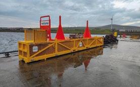
17. The Missing Puzzle Piece for Reliable and Renewable Subsea Power
21. TF59: Digital Horizon Naval Exercise
27. Naval Oceanography: Pathfinders of the American Military
33. Battling a Blue Arctic


40. Poster: The Allseas Designed Pilot Nodule Collector Vehicle
43. NORI and Allseas Lift Over 3,000 Tonnes of Polymetallic Nodules to Surface
47. Blue Nodules Harvesting at a Depth of 5.5km
50. Specialised Personnel, Services, and More: What can the Oceanscan Group do for You?
53. Mind the Gap: The Amphibious Autonomous Tracked Vehicle Standing its Ground in the SURF Zone
59. Satellite AIS: A Boon to Ocean Robotics

62. SubmergeDeep®: A Multifunctional Heat Transfer and Hydraulic Fluid for Marine Electric Vehicles
67. Maintaining Operational Advantage through Increased Maritime Awareness
71. Great Balls of Fishy Firelight
75. subROV Underwater Discoveries
13.
ISSN 2755-239X
EDITOR-IN-CHIEF
Richie Enzmann
COPY EDITOR
Will Grant
SALES DIRECTOR
Nick Search
DESIGN & LAYOUT
Milan Farkas
CONTRIBUTORS
Richie Enzmann, Adrian Pierce, David Sundin, Dominique Giannoni, Ed Darack, Garner Fleming, Guy Thomas, Marc Deglinnocenti, Paul Slorach, Sarena Padilla
SPECIAL THANKS TO Audrey Leon, Bill Mallin, Christian Blinkenberg, Curtis Lee, David Currie, Dawn D'Angelillo, Gautier Dreyfus, James Colebourn, Jeroen Romijn, John Benson, Jose Luis Gonzalez, Julian Lalanne, Julian Nelson, Julie McLaughlin, Lars Heeg, Marion Seyve, Matt Bates, Matthieu Scheffers, Paul Fletcher, Rachel McAlpine, Rob Howard, Silke Braham, Siv Tveit, Timothy Hawkins, Victor Sepulveda, Willard Balthazar
Advanced Navigation
Bayonet Ocean Vehicles
BEC Plastics
Blueprint Subsea
Blueye Robotics
DeRegt Cables

Digital Edge Subsea
Engineered Fluids
EvoLogics
Exail
Forssea Robotics

Greensea Systems

HPR
Hydro Group
Naval Ice Center
Norwegian Offshore
Rentals
Oceaneering
Oceanscan
QYSEA
QSTAR
RTS
Saab Seaeye
Silicon Sensing
The Metals Company
Tritech
U.S. Navy
Valeport
Verlume
VideoRay
Zetechtics
MARCH
U.S. HYDRO 2023
Mobile, AL, USA (12-16 March 2023)
MCEDD 2023
London, UK (28-30 March 2023)
APRIL SEA AIR SPACE
National Harbor, MD, USA (3–5 April 2023)
OCEAN BUSINESS
Southampton, UK (18–20 April 2023)

WINDEUROPE 2023
Copenhagen, Denmark (25–27 April 2023)
MAY OTC 2023
Houston, TX, USA (1–4 May 2023)
UNCREWED MARITIME SYSTEMS TECHNOLOGY
London, UK (2–3 May 2023)
DEEP SEA MINING SUMMIT
London, UK (3–4 May 2023)
MARITIME RECONNAISSANCE AND SURVEILLANCE TECHNOLOGY
Arlington, VA, USA (4–5 May 2023)
UDT 2023
Rostock, Germany (9–11 May 2023)
UNCREWED MARITIME SYSTEMS TECHNOLOGY
London, UK (10–11 May 2023)
JUNE MTS/IEEE OCEANS LIMERICK
Limerick, Ireland (5–8 June 2023)
GLOBAL OFFSHORE WIND
London, UK (14–15 June 2023)
SEPTEMBER
OCTOBER
NOVEMBER
SPE OFFSHORE EUROPE
Aberdeen, Scotland, UK (5–8 September 2023)
DSEI
London, UK (12–15 September 2023)
MTS/IEEE OCEANS GULF COAST
Biloxi, MS, USA (25–28 September 2023)
FLOATING OFFSHORE WIND
Aberdeen, Scotland, UK (3–5 October 2023)
MARINE AUTONOMY & TECHNOLOGY SHOWCASE (MATS)
Southampton, UK (7–9 November 2023)
OFFSHORE ENERGY
Amsterdam, The Netherlands (28–29 November 2023)
My name is Richie Enzmann. Allow me to welcome you all to the latest issue of Ocean Robotics Planet!

Scarce metals and minerals that we may desperately need in the future lie at the bottom of the ocean. Therefore, many countries are looking into the possibilities of deep-sea mining: harvesting these raw materials at depths of many kilometres. At the end of last year deep-sea mining has reached an important milestone with The Metals Company (TMC) lifting 3,000 tonnes of polymetallic nodules from the seafloor of the Clarion Clipperton Zone of the Pacific Ocean. This is an important step towards the creation of a new industry: one that could secure the supply of critical minerals required for batteries and the energy transition, despite the geopolitical challenges that we currently face. You can read more about it inside.

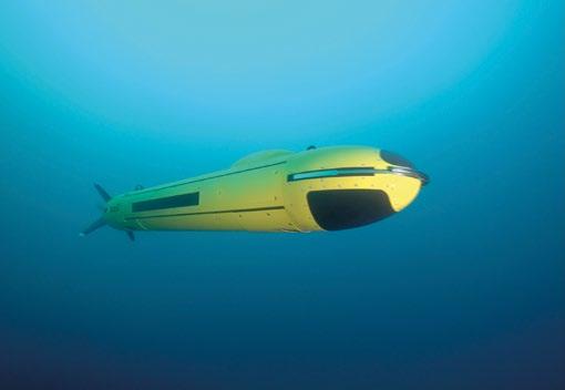
The front cover of this issue shows the DriX USV from Exail. With over 15,000 hours in operations around the world over the past three years, the DriX USV, along with its efficient launch and recovery system, is a seasoned asset in the environment of supervised autonomy. We interviewed Dominique Giannoni, CEO of Exail to find out more about the recent merger of iXblue and ECA Group, and the creation of Exail. They’re already shaping up to be a leading innovative high-tech industrial company focusing on maritime, navigation, aerospace, and photonics technologies. We are very excited to see Exail integrating the two previous companies’ products and developing new innovative solutions.
You can also read about the Satellite AIS (S-AIS) and how it has the potential to transform the operations of unmanned systems in the future. People are already using the geolocation and identity of all legal ships provided by S-AIS to run models to exploit the sensors found on a broad range of robotic vehicles, including aerial and seaborne vehicles.
Last year we reported on Task Force 59 and how it fits into the wider strategy of the U.S. Navy. Following on from that, we look at the lessons learnt and key take aways from their most recent Digital Horizon naval exercise in Bahrain. Some other defence related topics include a preview of the UDT conference in Rostock this year, and coverage of the U.S. Naval Ice Center and the U.S. Naval Observatory. These organisations are not widely known but still highly important in safeguarding our nations in order to keep both us and our values safe.
I hope you enjoy this issue and I look forward to meeting you at the events in 2023!
Best regards,
Richie EnzmannWhich design considerations are the most important for your project? And how does ROV Cable manufacturing work?
Discover all about ROV Cable manufacturing, requirements, the latest trends and make your subsea project a success!
To help you select the perfect ROV cable, please download our Ultimate Guide here or scan the herein QR code.
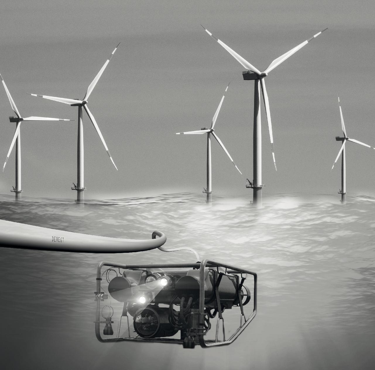

We spoke with Dominique Giannoni, CEO of Exail to find out more about the recent merger of iXblue and ECA Group, and the creation of Exail, a leading innovative high-tech industrial company operating in the fields of maritime, navigation, aerospace, and photonics technologies.

RICHIE ENZMANN: Hi Dominique, it’s nice to have you here. Please tell us about the recent merger between iXblue and ECA Group. How is the formation of Exail working out for the new company? What are their recent experiences?

DOMINIQUE GIANNONI: The merger was announced a year ago and came into full effect at the end of September 2022, with our new brand revealed during Euronaval. Now we are a few months in from us getting together, and I must confess this merger is working out great for us.
First, what matters is our customers and how they perceive this new company in the different areas in which we operate. We have four domains which stem from the previous two companies: iXblue and ECA Group. These domains are photonics, navigation, maritime systems, and aerospace & land solutions. What the customers are telling us in all domains is that they are very happy that we got together, because we are now 1,500 people strong, and we have a complementary offer.
For example, in the maritime domain we are more vertically integrated than before; we have navigation, subsea positioning, and sonar systems, as well as AUV and USV, in addition to a system layer. So, we are able to bring our customers an Exail designed and managed solution, be it a stand-alone system or a fully integrated end-to-end system. This is something that they appreciate. With this kind of approach, you can better integrate the solutions, and you can add value at the interface. This is something which is more difficult when you actually build on top of supplied sub systems.

RE: So you’ve had validation from the customers telling you that this is a good idea. Personally, when I heard about the merger, it made sense to me as I could see the complimentary sides of the two businesses and how they could fit together. How do you see the future for the new Exail brand? Is it a bit of iXblue and a bit of ECA Group?
DG: We are trying to take the best of the two cultures by creating a brand new ‘Exail’ culture, and we want to make sure that we remain agile. When you double the size of the company overnight, one of the pitfalls that may occur is that the culture becomes more bureaucratic. We want to remain nimble by having empowerment at all levels of the organisation to make sure that we answer our customers’ demands.
If we look at our current world, we must manage challenges of sovereignty, war, global warming, and environmental issues. Society is asking for solutions to these big challenges. At Exail, we have a strong belief that with disruptive technology we can help to solve these problems whether they are on the defence, social, or environmental side.
These disruptive problems require disruptive technologies. Take the environmental issues, for example; we are very active in helping to set up offshore wind farms. Our solutions for subsea positioning, ROVs, AUVs, and USVs help to efficiently map the locations of new wind farms. Also, with the DriX USV we have demonstrated that a lot of fuel can be saved by replacing large boats that go to sea for many days for seafloor mapping. At the same time the quality of the data is improved as the platform


is much quieter, while operations are performed with more efficiency with less downtime than using traditional vessels.

RE: Can you please give us some examples where you were able to take the product portfolios of the two companies and offered a holistic integrated solution?
DG: Recently, we did a demonstration on how the DriX USV from former iXblue can control, monitor, and position the A18D AUV from former ECA Group, and this is one of the many examples where the combination of the two companies bring value to our customers.
This is also a link to our capabilities in inertial navigation systems, and subsea positioning. We have a large demand on both the civilian and defence sides regarding autonomous systems. We’ve mastered most of the key elements, systems, and subsystems of these autonomous solutions.
Another example would be that we sold our R7 ROV – which is an inspection and exploration ROV rated for 300m – in conjunction with a Gaps positioning system. For the customer this was a one stop shop. The customers are responding great, we have great support from the team members, and this is crucial for success. The key thing is that we are completely complementary and without any overlaps.

RE: When you merge two companies some previous clients might unexpectedly become competitors overnight. How are you going to manage this at Exail?
DG: We will continue to sell and to work with people that could have been competitors of one of two companies before, because our drive is towards product policy. We believe that the products must face the markets in order to remain competitive. This means that we will continue to sell inertial navigation solutions to other AUV manufacturers that were competitors of ECA Group, because this is our product policy. We will make sure that there is no communication from one part of the company to the other on proprietary information. We are really committed to this and believe that we can handle it by having a barrier between the departments and having a firm product policy. The product is used internally but is also sold to competitors, and it is the best way to have the highest quality product. If you only sell in-house, then you are going to lag behind.
RE: Let’s talk a bit about defence and mine countermeasures. When thinking of ECA Group, a novel MCM solution comes to mind where you have the whole package to detect, classify, and then neutralise mines. What does your new defence portfolio look like?
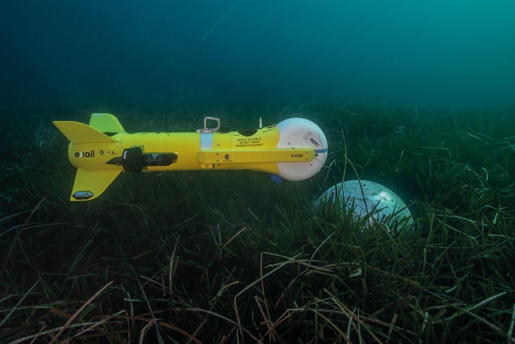
DG: In defence we are one of the world leaders in what we call third generation MCM solutions. We are one of the few companies around the globe that are able to go – exactly as you described- from detection, to identification, classification, and then neutralisation. This is basically a stand-off concept where AUVs go into the minefield to clean it while

keeping people away from danger. You don’t need to put people in boats in the suspected zone. It’s totally uncrewed but fully supervised, meaning that you always know what the system is doing. Within this system, we leverage our inertial navigation solutions to increase the accuracy of the positioning of the AUV and USV, and also provide forwardlooking sonar for USV and mothership to keep them away from danger.

RE: Are there any new developments on the horizon? What should we look out for?
DG: We are working on all of these domains that we previously mentioned. We also have a very similar DNA: investing in technology, in people, and work outside of our home
country: France. These things create bonds. We will have some exciting new solutions coming out this year that we are eager to share with the industry. We want to remain on the forefront of innovation, so we are constantly developing our products, and you can expect some new products and innovation from us in 2023.
Coming together as Exail will be an accelerator for our innovation, and we will continue to significantly invest in R&D. We truly believe that R&D is the differentiator; with both companies we have been successful before, and we are continuing these investments. What unites us as Exail is our drive for technology and innovation in different domains: bringing differentiating value to our customers, whether they are military navies, oil and gas or renewables companies, logistics customers, or manufacturers of quantum computers.


Boreas takes FOG technology to the next level with new patent pending digital FOG (DFOG) technology. The revolutionary DFOG technology combines a specially designed closed-loop optical coil with advanced digital signal techniques that have been developed over the last 25 years. This ground-breaking gyroscope combined with our AI-based algorithm provides unparalleled performance and reliability, with the lowest SWaP-C (Size, Weight, Power and Cost) on the market.

Hydro Group was founded in 1982 with a small team of experienced engineers. Its role was to create bespoke cable and connector assemblies, initially to service the oil and gas sector. Their long-term mission was to create a tailored engineering company that could provide targeted solutions for defence applications.

Within two years, the company achieved ISO accreditation and began supplying harsh environment systems to the naval defence sector. They are extremely proud of this heritage: outboard cable assemblies and pressure hull penetrators installed on Trafalgar, Vanguard, and Astute class submarines, and now supporting the latest nuclear submarine programme. They were delighted to be part of the CASD 50 celebrations, marking fifty years of the Royal Navy Continuous At Sea Deterrent.
In 2010, the company invested in a new purpose-built facility. At a cost of over £4 million, the 2.2 acre site in the Aberdeen Science and Energy Park includes 60,000sq ft of cable

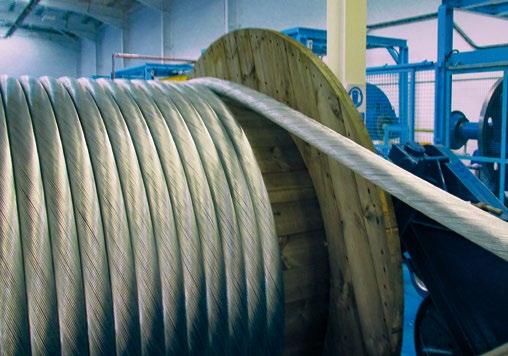
manufacturing facilities, workshops, and offices. In 2015, an extension was added to support the company’s continued expansion.

The company also identified the need to manufacture longer, heavier, and more complex cables to increase capacity and improve turnaround times. Working with industry specialists to define a fully automated line allowed the expansion of their product portfolio of bespoke subsea cables for harsh environments. Together with specially manufactured Caterpillar units and the automated control system, this represented a major upgrade for the facility.


The new facility marked an emerging era of growth for the company that allowed fresh product development for the renewable energy and marine science sectors, whilst facilitating growth in the defence arena.
This focus on product development and keeping ahead of market trends, saw the launch of the 36kV (66kV in development) dry mate connector and power distribution hub for the floating wind, tidal, and wave energy sectors. This connector allows subsea connectivity with a device cable and an export cable in series.
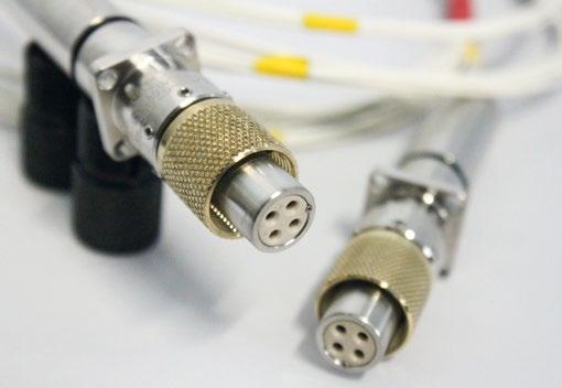

They also developed a fibre optic penetrator rated to 650-msw for manned systems. The design of their fibre optic manned penetrator allows for signals to be transmitted more securely, and with increased speed and bandwidth. This improvement in data transfer between the topside vessel and divers within the bell or manned submersible is a real step forward. Designed, manufactured, and qualified by Hydro Group, their range of fibre optic penetrators eliminates the need for cable screening, as fibre optics are not subject to the signal interference which can plague traditional penetrator designs.

Furthermore, the company increased their range of Special Deck Mate connector configurations to support a wider range of defence applications. These now include acoustic and magnetic ranges, submarine rescue vessels, towed cable systems, and MCM systems.
In 2018, the company was awarded the prestigious Queens Award for Enterprise: International Trade, acknowledging their substantial international development. Hydro Group now has a global network of business partners operating in over 20 countries worldwide with export revenue now accounting for approximately 35% of its turnover.

A key part of the company’s success is its staff, with more than ten percent of the overall workforce having been with them for longer than 25 years. In fact, the average duration of employment is around 10 years, which demonstrates retainability and a good place to work. They also operate a successful apprenticeship scheme and graduate traineeship
and have found growing their own talent within this niche market space to be incredibly effective in developing a highquality team.
Hydro Group’s self-reliance within the manufacturing process and their focus on stocking key materials for the build. From raw materials to testing, the whole lifecycle of the project is in-house. Even the critical materials are on stock to support production. Hydro Group facility houses a machine shop, cable moulding tooling, testing in-house, and custom live testing.
The unique selling point of the company is the tailored systems they provide ensuring full system compatibility in all cases. The building of a holistic design solution based on the customers specification - whilst keeping in mind the environmental conditions and matching the requirements for the whole system - ensures a high degree of reliability for the end product.
Hydro Group would like to take this opportunity to thank all staff, customers, suppliers, and associates for their invaluable support over the last 40 years, and look forward to continued success long into the future.




Wide-ranging solutions will be required to achieve decarbonisation targets across the Blue Economy, including the electrification of subsea assets. A collaborative project has been developed by partners within the UKCS, which will demonstrate the robustness of combined renewable energy and seabed battery energy storage for powering production and control applications offshore. This presents a potential solution to enable more rapid decarbonisation.
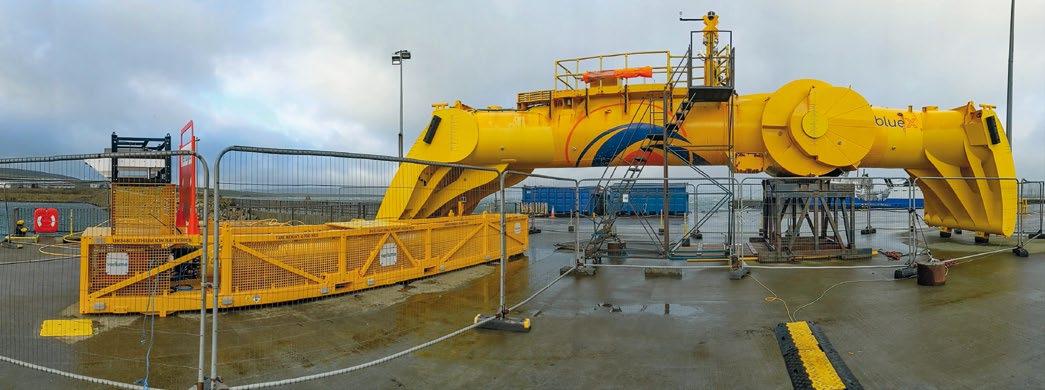
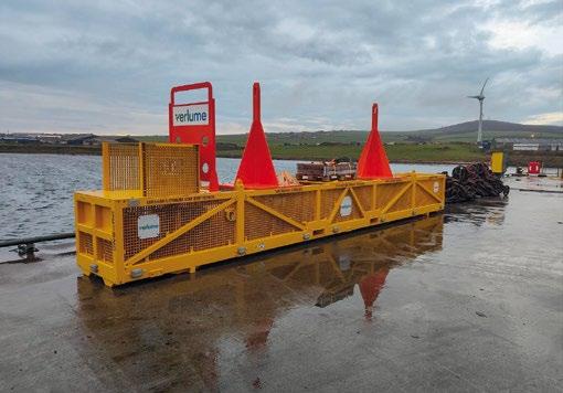
The Renewables for Subsea Power (RSP) project brings together Verlume’s Halo seabed battery energy storage system and Mocean Energy’s Blue X prototype wave energy converter. Partners Baker Hughes and Transmark Subsea are also providing the connected outputs of a Semstar subsea electronics module and an ARV-I AUV respectively.
A key focus of the project will be demonstrating the use case of the system for providing power to AUV docks for subsea
inspection applications. Verlume’s seabed battery energy storage unit could also supply power to AUV applications with a standalone battery pack. This could be in the subsea market (as in the RSP example), as well as in offshore wind inspection applications.
In addition to powering subsea electronics modules and vehicle residency applications, the RSP system could also re-enable failed assets with electrical umbilical failures, enable in-fill or stranded asset wells, long offsets, or the adoption of all-electric subsea systems for carbon capture utilisation and storage.
Providing a full renewables remote power and communications system for subsea power, the £2 million demonstrator project is backed by industry. This includes operators such as Harbour Energy and Serica Energy, alongside the Net Zero Technology Centre.
The European Marine Energy Centre (EMEC) has supplied instrumentation to measure the speed and direction of currents during deployment, whilst Wave Energy Scotland has provided £160,000 to support the integration of the umbilical into the wave energy converter.

Verlume is providing the Halo battery energy storage system, a technology which provides a reliable, uninterrupted power supply at point of use. The Halo that is being utilised as part of the project has been developed specifically for the underwater environment. It’s the second variant that has been built for commercial wave power integration, and the first to be built at Verlume’s 20,000 square foot facility in Dyce, Aberdeen.
Halo’s lithium-ion based battery architecture is scalable up to MWh and is fully integrated with Verlume’s proprietary intelligent energy management system, Axonn. This enables continuous power delivery and longer duration operations for subsea architecture. Axonn is built using a modular suite of firmware, software, and hardware building blocks. It can therefore be configured to add intelligence to any power system across the energy sector. The modular nature of the system means that it is scalable to different applications and payloads. It is also both AC and DC output capable with an adaptable voltage.
The RSP project is powered through a wave energy device, but as the Halo system has been designed to be power input agnostic, it can accept power from any renewable energy source.
Mocean Energy’s Blue X prototype is 20m long and weighs 38-tonnes, providing a 10kW rated wave supply. In 2021, Blue X underwent a programme of rigorous at-sea testing at the European Marine Energy Centre’s Scapa Flow test site in Orkney. Here Mocean first generated power and gathered significant data on machine performance and operation.
Within the RSP project, Transmark Subsea is providing its ARV-I AUV which enables small, underwater drones to be operated from remote locations. This allows 24/7 access to the ocean with high definition 4k video footage during remote operations. It also eliminates the need for traditional large surface support vessels.
As part of the RSP system, there is built-in wireless communications via a cellular network back to the beach and wireless comms.
It is understood to be the first such project to integrate existing subsea production control system technology to seabed energy storage and renewable energy production using remote control from shore.

The test programme of Renewables for Subsea Power commenced in 2020, adopting a phased approach. Phase One was a detailed front end engineering design study. Phase Two was an onshore test programme, which was conducted to de-risk the offshore phase. Functionality and communication checks were completed in a controlled environment within Verlume’s operations facility. The onshore testing was highly successful, leading to Phase Three: an offshore test.
The offshore test programme is now underway in the UK North Sea off the coast of Orkney. At a water depth of approximately 50m, the testing has kicked off a four-monthplus programme. This will showcase the capability and the viability of the system in a harsh marine environment over the winter months in a range of wave conditions.
There are three key test objectives which are required to satisfactorily complete the testing programme, these are as follows:
ƀ Demonstrate functionality of the RSP power system for power provision in a representative operating environment;
ƀ Demonstrate reliable and robust communications;

ƀ Demonstrate reliability of the RSP power system under environmental conditions over an extended duration.
By the end of the project, it is the intention to demonstrate the first full scale prototype system to TRL 6 (American Petroleum Institute, 2017). Successful completion of the programme and sharing of project results will contribute to the industry’s understanding of the suitability of generic autonomous offshore power systems for production control applications.

To further bolster the collaboration that has already taken place between the project partners, in September of last year a tri-party memorandum of understanding (MoU) was signed between Verlume, Mocean Energy, and Baker Hughes. The MoU will look to identify and discuss further potential opportunities for collaboration on integrated wave energy and subsea energy storage solutions for the emerging subsea clean energy market.
Achieving decarbonisation targets will be made possible with the missing puzzle piece: the combination of both renewable power and energy storage to create a reliable source of power for the decarbonisation of offshore applications at scale for years to come.
Find out more at: WWW.VERLUME.WORLD | WWW.MOCEAN.ENERGY Courtesy of Verlume Courtesy of Verlume Courtesy of VerlumeWhen your mission must succeed the first time...and failure is not an option.
Depend on VideoRay Mission Specialist Technology.
VideoRay ROVs are one-made portable and made in the USA to deliver maximum performance and reliability when it matters most during challenging operations. And if things go sideways, we’ve got your back with exceptional, worldwide service and support to get you up and running fast.
Want to know more? Visit www.videoray.com

Last December saw the conclusion of Digital Horizon: a three-week event that included 17 industry partners and brought 15 advanced unmanned data integration and AI systems to Bahrain. Ten of these systems were in the region for the first time.
One of the unique aspects of this event was that the U.S. Navy’s Task Force 59 were able to exercise and role-play scenarios based on those that they regularly see in the waters of this region. Task Force 59 pushed the limits of their systems in order to observe their true capabilities. It was a highly valuable experience, not only for their operators but also for their industry partners. Speaking with Commander Timothy Hawkins we gleaned five key take aways from this exercise.

First, the U.S Navy were able to advance their mesh network capabilities. If you’re not familiar with the mesh network, it’s simply a system for exchanging data and information in a communication denied environment. If you look at the trends and the operational environment, that’s a critical capability in any potential future conflict.
Leading up to Digital Horizon, Task Force 59 spent months developing a rudimentary mesh network during a series
of bilateral exercises with Saudi Arabia, Jordan, Israel, and NATO off the coast of Portugal. They iterated the capability over a weekly basis. This speaks to the accelerated pace of discovery and innovation that was the goal from the outset when Task Force 59 was established back in 2021. So, during Digital Horizon, Task Force 59 literally and figuratively took the mesh network capability to the next level.
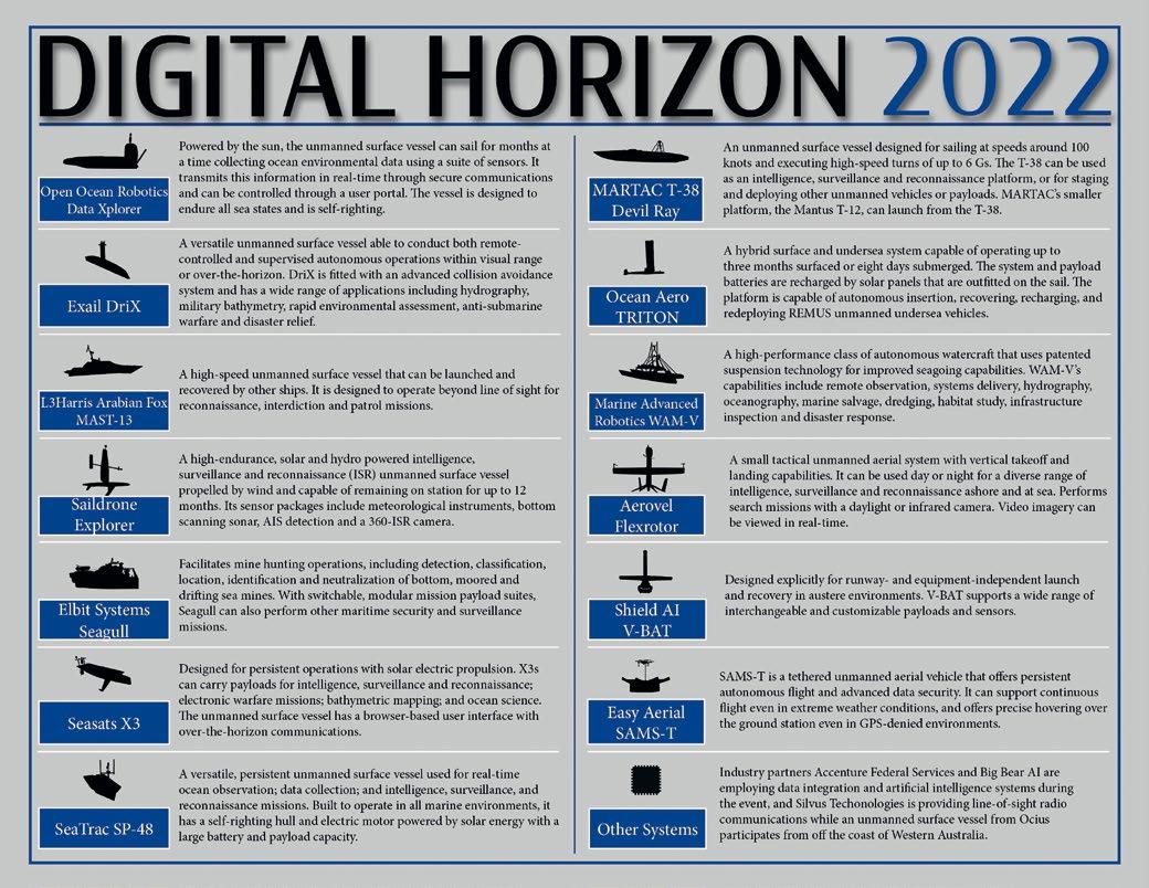

Commander Hawkins explained this in more detail: “We successfully launched an unmanned aerial vehicle from a
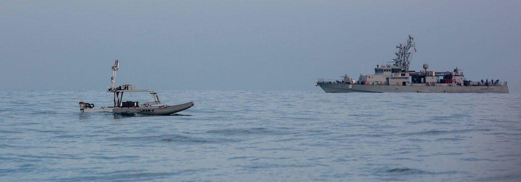
coast guard cutter. We released video of an Aerovel Flexrotor: a tactical unmanned vehicle with a vertical take-off and landing capability. The value of it is that it can house cameras and provide full motion video which we can relay in real time to an operation centre ashore.
“But one unique feature that came to fruition during Digital Horizon was the provision of an over the horizon capability for the mesh network. Before Digital Horizon this mesh network and our ability to transfer information over it was basically a line-of-sight radio communication. By launching this unmanned aerial vehicle with the Aerovel Flexrotor from this location, it demonstrated this over the horizon functionality.”
This was a significant breakthrough in further developing a resilient communications network for unmanned systems to relay imagery video and data to monitor events at sea and ashore.

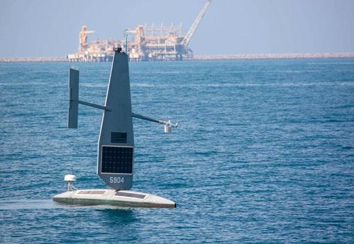

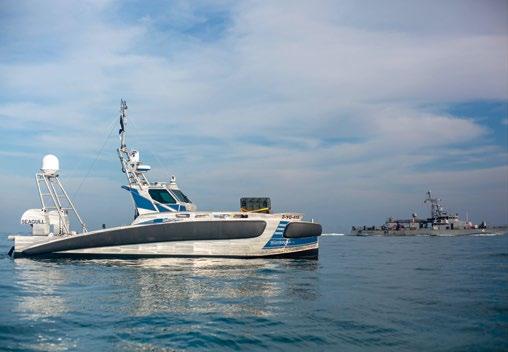
The second discovery was the U.S. Navy’s ability to observe the best new unmanned artificial intelligence and data integration technologies; what you might call the ‘best in class’. The platforms brought out were diverse in both their design and functionality. Of course, all this technology is commercially available, they were able to look at their applications in common situations found in the area, as well as how to integrate them into operations to enhance what can be observed from all angles.
There were Unmanned Surface Vessels (USVs) with highspeed capabilities, some with high endurance. The exercise also saw different types of unmanned vehicles, like a tether aerial drone, and the vertical take-off and landing vehicle mentioned previously.


Commander Hawkins explained, “It was fascinating to see how industry partners responded to different design challenges from unmanned systems in different ways. Some of them converted traditional boats, and some of them designed their vessels from scratch. But overall, the systems were an incredible testament to the rapid growth in the field. It’s also a strong indicator that we are indeed on the cusp of an unmanned technological revolution; one that Admiral Cooper has discussed previously.”
The third major take away from Digital Horizon was progress in what’s referred to as the ‘single pane of glass’. This is a phrase that is used to describe how an operator can command and control multiple systems from a single screen. This means one operator controlling multiple unmanned systems, not one system being controlled by multiple operators.
In this respect Task Force 59 were able to move forward in a meaningful way by leveraging AI to reduce the cognitive load on observers by helping them in making smart decisions faster, and by being able to process and see all of the information from one location.
The fourth outcome from Digital Horizon was how we were able to create rapid innovation in our process through exceptional industry collaboration. That’s not something that one can take for granted. Task Force 59 innovated at a pace that we simply haven’t seen before; they saw software changes made within hours, and hardware changes made within days throughout the event. Under typical circumstances one would see software changes in weeks and hardware changes in months.
“This acceleration is indicative of the tremendous talent and innovative minds behind all our work. It was truly significant and a tremendous contribution for all of those involved: our active reserve military members who were in Bahrain for the event; our international officers who were observing; civilians at the event; and of course, our industry partners.”, exclaimed Commander Timothy Hawkins.
Finally, the fifth key take away was that people remain at the heart of everything the Navy does. They were front and centre during this operation. This is what they’ve been saying all along: that the U.S. Navy’s people are the real secret sauce in their ability to rapidly integrate these new technologies. It’s not just about the gadgets; it’s about the ingenuity, dedication, and commitment from their team that we have seen ever since the initial establishment of Task Force 59. It’s why they remain confident in the direction that they’re heading.
Overall, the exercise was a great success in terms of allowing us to continue the rapid progress that Task Force 59 has made 15 months on from its establishment, and 17 months on from its first proposal in a white paper. This is considered a major milestone to have come so far – from the initial concept, to being declared fully operational capable by Admiral Cooper as of January 10th – within such a short time.
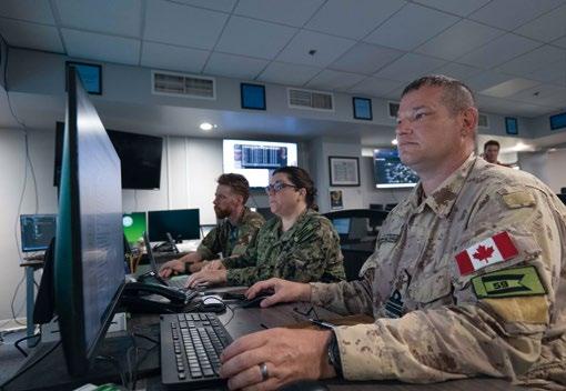

Task Force 59 were able to achieve this major milestone through 11 bilateral maritime exercises; three major international exercises; and more than 30,000 hours of safely operating USVs in waters around the Arabian Peninsula. The tremendous effort by the team and the rapid advancement of the integration process over just a few months can’t be overstated. And it speaks to the great collaboration not only with the industry, but also their regional partners.
Last February the goal of establishing the world’s first USV fleet was announced, and on that path significant progress was made. The plan is still to achieve this target by the end of summer 2023.
This fleet will include 100 diverse platforms that are made available for deployment in regional waters in close collaboration with the partners of the U.S. Navy. In fact, 80% of the vessels that are part of this 100 USVs goal will be resourced by regional partner nations, not the United States.


“This speaks to our commitment and focus on not just integrating unmanned systems and AI for the sake of enhancing the U.S. Navy’s capability but doing it in a way that also strengthens our collaboration and relationships with regional and international partners, whom we work alongside with daily. Because this region is so vast and dynamic, no one nation can patrol these waters alone. That is a goal that we are still working closely towards.”, concluded Commander Hawkins.


Oculus Multibeam Imaging Sonars
High resolution imaging in turbid water for improved situational awareness and target identification. Available in 375kHz to 3.0MHz. Depth rated to 500m, 1000m, or 4000m.
Bathy2
The latest evolution in bathymetric measurement


www.blueprintsubsea.com enquiries@blueprintsubsea.com

Density corrected depth data directly from one instrument.
The Bathy2 is an enhancement of the MIDAS Bathypack offering Valeport’s proven survey industry standard sensors to generate precision Sound Velocity and Density profiles for highly accurate depth and height data.


 By Ed Darack


The modern U.S. Navy operates some of the most technologically advanced systems ever created. These include much heralded programs such as the USS Gerald R. Ford (CVN 78) aircraft carrier, the F-35C Lightning II fifth-generation multirole combat jet, and Virginia-class attack submarines. Icons of national power and the culmination of decades of innovation, rigorous testing, and trials by fire, these and other key American military assets can only function to their full capabilities with the backing of myriad support elements. One of the most important of these is the Naval Meteorology and Oceanography Command, COMNAVMETOCCOM, typically shortened to METOC, pronounced “me-tock.” It is referenced throughout the Navy and the Department of Defense by its umbrella term “Naval Oceanography.”
The command, headquartered at NASA’s John C. Stennis Space Center in Mississippi just inland of the Gulf of Mexico, began humbly as a small navigation implement repository and maintenance facility in Washington D.C. Through the decades, as the U.S. military has expanded its range of capabilities, Naval Oceanography has become the Department of Defense’s premier environmental situational awareness provider. It produces a wide range of meteorological, oceanographic, and navigational products, directly supporting Navy and U.S. military conventional and special operations missions, globally. From a technical military standpoint, the best way to describe METOC’s overarching function is that it “optimizes environmental situational awareness in all physical warfighting domains at the tactical, operational, and the strategic levels for the country’s warfighters and those of its allies.” Optimizing environmental situational awareness means providing the most accurate, timely, and relevant information about dynamic physical surroundings of friendly forces to a degree greater than that which any adversary could possibly attain. Physical warfighting domains are land, sea, air, and space. Conceptual warfighting levels range from the tactical (smallest), to the most expansive, the strategic. Tactical engagements and actions can occur in an area as small as a half-acre (or even smaller).
Operational represents the aggregate of the tactical and is typically as physically expansive as a few miles to a few tens of miles. Strategic describes national-level actions and outcomes that typically have historic implications—like a nuclear strike, launched from a U.S. Navy Ohio Class ballistic missile submarine. METOC plays critical roles throughout this warfighting spectrum on a constant basis, whether at war or not. Its state-of-the-art systems, processes, and above all, highly specialized personnel, have built this command into what is arguably the most advanced atmospheric and oceanographic systems dynamics entity in history. National defense not only relies on this level of capability, it demands it. “Naval Oceanography operates simultaneously at the strategic, operational and tactical levels of warfare in every theater around the globe,” explained Rear Admiral Ron Piret, commander of Naval Oceanography and the Oceanographer and Navigator of the U.S. Navy. “We pride ourselves in our ability to characterize the battle space and then predict changes in the environment over time.”
History provides countless examples where knowledge of the environment has provided a critical advantage over an enemy—and where oversight of such details has led
to disaster. Furthermore, some of Naval Oceanography’s information supports not just the U.S. military, but a tremendous range of vital private and commercial activities throughout the globe, activities that would grind to a halt without METOC’s continuous support.
The history of the Naval Meteorology and Oceanography Command stretches back nearly two centuries. On December 6, 1830, then Secretary of the Navy, John Branch, directed 25-year-old Navy Lieutenant Louis M. Goldsborough to establish a facility to maintain, update, and log performance data for all of the Navy’s navigation equipment. This included chronometers, necessary for mariners to compute longitude. Established on a budget of $330 (plus his salary), Goldsborough opened the Depot of Charts and Instruments in early 1831 in Washington D.C., near the White House (see Sidebar 1 on the modern iteration of this command, the U.S. Naval Observatory). The overarching goal of the depot was to ensure that the Navy would always maintain the highest degree of precision in navigation on the high seas as was possible, the most basic form of environmental situational awareness. The Depot worked to give Navy personnel the

best tools and information for this end, with an emphasis on calibrating their chronometers. Shortly after opening the depot, the Navy recognized the need for a detailed understanding and observation of celestial bodies, integral to gauging both time and position. In 1834, under the directorship of Navy Lieutenant Charles Wilkes, the Depot moved to a location just north of the Capitol, a part of Washington, D.C., much better situated for viewing the heavens. After expanding their repertoire with the inclusion of astronomy, the Depot undertook its first hydrographic survey. Led by Wilkes, members of the Depot explored Georges Bank, an elevated swath of seafloor of the North Atlantic Ocean east of Cape Cod, Massachusetts.
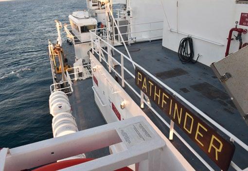
In November of 1838, just after the Georges Bank survey, the Depot began regimented meteorological observations. Working under a broad directive of the Secretary of the Navy that mandated an ever greater degree of environmental understanding, then officer in charge of the Depot, Lieutenant James Melville Gilliss, had the Depot take and record key atmospheric data. These included weather type (clear, rain, cloudy); wind force (calm, light, moderate, heavy); wind direction; temperature, both in the sun and in the shade; dew point; atmospheric pressure; 24-hour precipitation; diurnal maximum and minimum temperatures; and evaporative potential. Depot personnel made these measurements four times per 24-hour period: 3 a.m., 9 a.m., 3 p.m., and 9 p.m. In less than a decade, the Naval Depot of Charts and Instruments established itself as an exploratory body of the sea, the stars, and the sky. In the years to come, this work would continue to accelerate in scope and breadth, due in great measure to the superintendent who took charge of the command in 1842, Navy Lieutenant Matthew Fontaine Maury. Born January 14, 1806, Maury was fascinated by the heavens, the world’s oceans, and the sky from a young age. At 19, he became a midshipman, a U.S. Naval officer in training, and served initially on the frigate USS Brandywine. As his naval career progressed, Maury both taught himself and pioneered the disciplines of meteorology, oceanography, astronomy, cartography, and geography. He focused on the interaction of winds, latitudes, and ocean currents, forging a synthesized view of the sky and the ocean. He was a member of a number of ship crews during his total of nine years at sea, including on the USS Vincennes when it made the first circumnavigation of the world by an American warship. He published a number of books, including On the Navigation of Cape Horn, Plan of an Instrument for Finding the True Lunar Distance, and A New Theoretical and Practical Treatise on Navigation. The latter, first scientific book written and published by a U.S. Naval officer, proved a tremendous success, with a copy placed on every ship in the Navy in 1837. His work made him famous, and he became known as the “Father of Modern Oceanography,” the “Father of Naval Meteorology,” and most enduringly, “Pathfinder of the Seas.”
After nearly a decade on the world’s oceans, his seafaring career came to an abrupt end in 1839. While travelling to the New York Naval Yard after a visit with his parents, the stagecoach on which he was a passenger overturned, breaking his

right femur. The injury rendered him permanently unfit for sea duty. After a long recovery, he took the job of superintendent of the Depot of Charts and Instruments, reporting for duty on July 4, 1842. During his tenure at the command, Maury took what had been accomplished in the fields of meteorology, oceanography, and astronomy and combined it with his work and the outlook that he had forged while on the seas. Under his directorship, the Depot became the premier scientific institution in the country, pioneering the disciplines of hydrography and atmospheric science. Among Maury’s many accomplishments, the installation produced a series of influential navigation charts that revolutionized maritime travel for both the Navy and commercial shipping.
The decades that followed saw the Navy change the name of the command a number of times, move it to its current location, and enhance its capabilities through a number of the nation’s most grueling, and important, conflicts. With each war, and with each advancement in military, meteorological, astronomical, and oceanographic technology, the knowledge base grew. As the nature of warfare evolved—with the advent of air power, changes in sea power to include submarine warfare, and with the introduction of space systems—Navy meteorology, oceanography, and navigational capabilities expanded, adapted, and evolved, always maintaining a place at the edge of innovation, often pioneering it. The command has been responsible for a number of discoveries and important experiments, including discovering the moons of Mars
and verifying the effects of Albert Einstein’s general and special theories of relativity. Maury’s tenure, which combined the foundational work of the Depot with his own outlook, burgeoned over the decades to form the modern Naval Meteorological and Oceanography Command. Today, rooted in the spirit of Maury, members of the command are the modern pathfinders of the Navy and the American military.

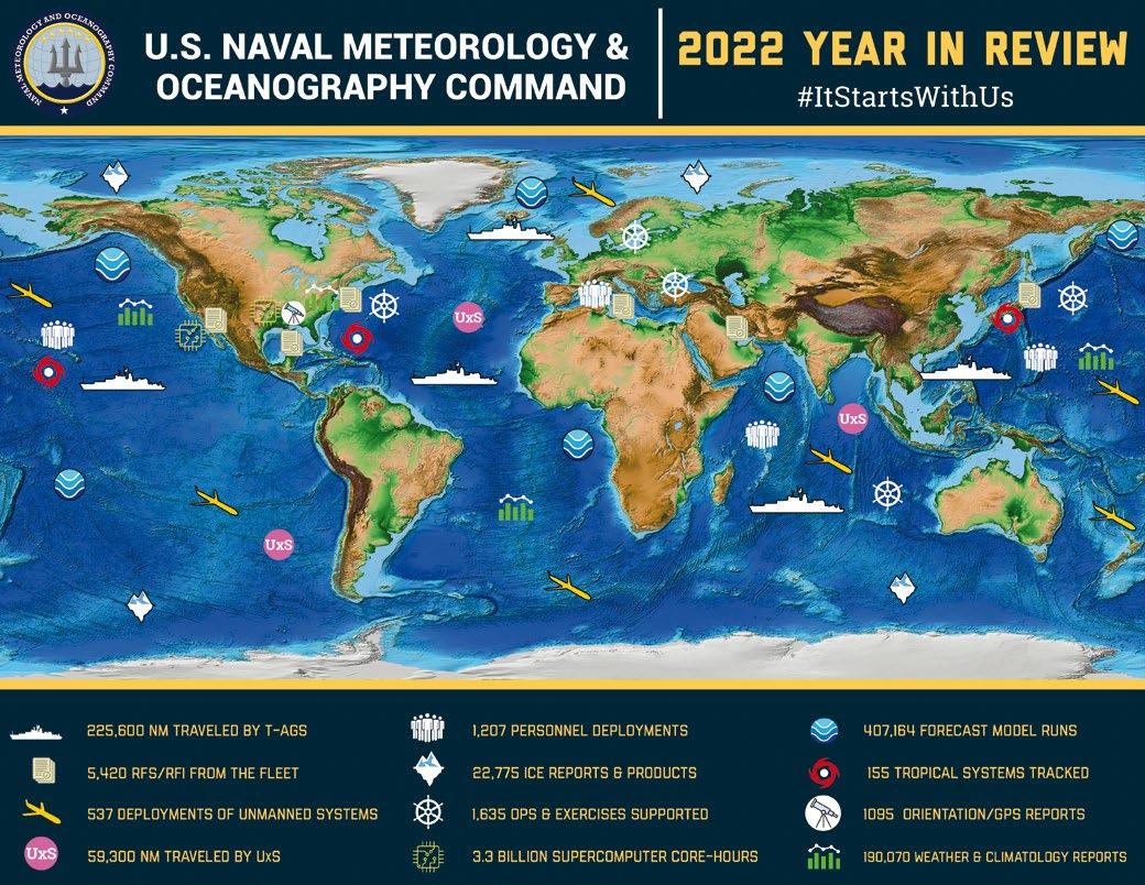
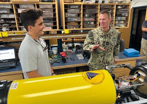
METOC today comprises fourteen subordinate commands and employs over 2,600 people, including members of the Navy (many with the official title of aerographer, who collect both meteorological and oceanographic data), full-time government employees, and contractors. They are located throughout the globe and operate and source data from a wide range of systems, including unmanned underwater vehicles, manned surface vessels, aircraft, satellites, and deep space telescopes, engendering their motto “from the bottom of the ocean to the stars.” The products that Naval Oceanography produces support operations throughout the Department of Defense, both conventional and special operations—and because they are a component of the Navy, they have a special emphasis for operations organic to the service, including anti-submarine warfare, naval special warfare, fleet operations, and naval aviation, among others. The individual components of METOC include the U.S. Naval Observatory (the modern embodiment of METOC’s progenitor, the Naval Depot of Charts and Instruments), the Naval Ice Center, the Joint Typhoon Warning Center, two Fleet Weather Centers, the Naval Oceanographic Office, and the Fleet Numerical Meteorology and Oceanography Center.
Ranking among the most important of products Naval Oceanography delivers to the Navy and the Department of Defense are myriad environmental forecasts, and notably, weather forecasts. “Not a ship gets underway and not an aircraft takes off without a forecast from our community,” explained Captain Kate Hermsdorfer, the commanding officer of METOC’s Fleet Weather Center San Diego, which is responsible for providing forecasting for the geographic area stretching from the West Coast of the United States to the Suez Canal. This includes the entire Indo Pacific region, formally classified as the USINDOPACOM Geographic Combatant Command by the Department of Defense. METOC’s Fleet Weather Center Norfolk VA is responsible for the Atlantic and the Mediterranean regions. Hermsdorfer explained that some ships have embedded METOC personnel onboard, and some don’t. Either way, ships receive timely forecasts, custom tailored to their needs. Forecasts include a variety of relevant data, including wind speeds and directions, sea conditions, fronts, and expected precipitation and other conditions. While focused on maritime travel, METOC generates environmental forecasts for military personnel and platforms functioning in all physical warfighting domains: sea, land, air, and even for space-based platforms.
The forecasts are focused largely on safety of flight for aircraft and safety of navigation for surface vessels and
submarines. To this end, Naval Oceanography personnel generating these products take into consideration a number of factors about the platforms that will be traversing regions for which the forecasts are to be made. These include dimensions of ships, including length, beam, and wave size that they can sustain. Even the latest aircraft carrier, the USS Gerald R. Ford (CVN 78), has its limits with respect to wave height. A poor forecast, or a forecast unheeded, can lead to a ship sinking. An example of this, unrelated to Naval Oceanography, occurred with the commercial cargo vessel SS El Faro, when it sank while in the eyewall of 2015’s category 3 Hurricane Joaquin. Waves that battered the vessel were estimated to have been upward of 30 feet. Routers, who are integral to METOC’s two Fleet Weather Centers in determining specific ship routes, work with individual Navy ships underway to ensure their safe passage based on predicted weather events.
Captain Hermsdorfer noted that their forecasts, in addition to ensuring safe passage and safe operation of platforms, are developed with operational efficacy in mind. “We look at operational intent,” she explained. Forecasts are then fashioned in as great of detail as necessary, including recommended routing. These can include tactical situations, in which a certain predicted weather event may provide leverage over a potential adversary, such as fog or high seas.
Continuing, Part II of this article on naval unmanned systems, including history, and METOC’s modern usage will be published in the next issue of the Ocean Robotics Planet Magazine (Issue 35 – Q2 2023).
Ed Darack is an author, unmanned systems developer, and founder of Darack Research. More information at www.darack.com.
The U.S. Naval Observatory (USNO), the historic origin of METOC, today performs some of the American Military’s most technical, farreaching, and critically-important work. While not directly involved in meteorological and oceanographic observation and prediction, the USNO provides precise time and location data, which is used not only by other components of METOC and the Navy, but by the entire Department of Defense—and the entire world.
The Observatory, founded in 1830 in Washington D.C. as the Naval Depot of Charts and Instruments, was established to ensure the proper function of all the Navy’s navigation equipment, notably chronometers. Accurately functioning chronometers were vital to maritime travel at that time as they are necessary to gauge longitude while at sea. Calibrating and gauging the reliability of each instrument was performed by comparing its function against the timing of the rotation of the earth. To do this, the observatory used a “transit telescope,” an optical system that precisely measures positions of celestial bodies, notably stars, as they visually intersect the meridian passing through the observatory’s location as the planet rotates.
From these beginnings, the small facility soon began disseminating time and celestial body information. In 1845, personnel at the Depot began dropping a large ball at noon every day, visible to citizens of Washington D.C. as well as to ships plying the Potomac River. In later years, Western Union transmitted USNO coordinated time throughout the United States. Starting in 1852, the Depot began publishing the “American Ephemeris and Nautical Almanac,” an annual publication giving precise positions of celestial bodies, necessary for maritime navigation and a number of terrestrial applications, like surveying. The information is still published each year, although it has been divided into two publications, the Nautical Almanac and the Astronomical Almanac, since 1981.
Today, the USNO continues to provide time and positioning information, and the instruments the facility uses—descendants of its earliest telescopes and chronometers—are the most advanced and precise in the world. The U.S. Naval Academy continues to teach celestial navigation, and the Navy considers it a backup form of navigation on ships. It is also a form of navigation on another type of Navy vehicle, a Trident II D5 submarine launched ballistic missile. Once launched, a special star tracking camera isolates a star in the sky and compares its location to digital tables the USNO produces, and then the missile makes adjustments to align itself onto the proper course to the target (such missiles do not use GPS as this system can possibly be jammed or “spoofed”). The science is called astrometry (related to astronomy). With astrometry, which the USNO continues to pioneer, specialists take extremely precise measurements of celestial bodies.
“USNO has two main jobs that can be summarized in two words: reference frames,” explains Geoff Chester, the public affairs officer of the USNO. Position information comes from radio telescopes, located throughout the globe, that observe quasars. Quasars, extremely bright galactic cores, are some of the most distant objects known in the universe. Although the universe is expanding, their great distances make them essentially stationary to an observer on earth and provide ideal “fixed” positional references. “Perhaps the most important part of these measurements are called Earth Orientation Parameters (EOPs),” explains Chester, who has a background in astronomy and physics (and whose great grandfather was the superintendent of the observatory from 1902 to 1906). “When measured against the celestial reference frame, we can see the small but significant changes in the Earth’s speed of rotation as well as the changing angle of the planet’s rotational poles. These parameters figure into the position solutions of GPS.”
GPS, or Global Positioning System, relies on the USNO’s time calculations to function. The foundational process of GPS is called multilateration, in which precise distance measurements from each of three or more orbiting satellites to a position on the surface of the planet gives a precise coordinate for that position. With the speed of light known, distances are calculated by time-of-travel from each satellite to the position in question, hence the importance of precision time.
Called the Department of Defense Master Clock, the USNO system that coordinates this process is an ensemble of more than 100 specialized atomic clocks. Atomic clocks, initially developed by Britain’s National Physical Laboratory in the early 1950s, rely on counting oscillations of the


single valence electron of certain atoms (cesium, rubidium, and hydrogen). Chester explains that when these atoms are stimulated by microwave radiation, the electron oscillates between two “hyperfine” states at a specific frequency. “Working with astronomers here at USNO, a relationship was determined that linked an astronomically defined second, the Ephemeris Second, with a specific frequency of oscillation in the cesium133 atom. Since 1967, the second has been defined by this frequency as the duration of 9,192,631,770 cycles of radiation corresponding to the transition between two hyperfine levels of the ground state of cesium-133.” Clocks that use cesium, Chester explains, are formally called “cesium beam frequency standards,” as their frequency defines the second. Each GPS satellite has a number of onboard atomic clocks, some that use cesium and some that use rubidium. Just as the USNO originally analyzed chronometers and noted any deviations from locally-observed timing, personnel at the USNO today carefully check the onboard clocks on GPS satellites daily against the Master Clock, which has a precision of a few hundred picoseconds (a picosecond is a trillionth of a second). Any deviations in specific clocks in satellites from the Master Clock are disseminated so that receivers can automatically adjust and provide location information of the highest possible accuracy and precision. Department of Defense GPS satellites transmit frequencies usable by any GPS-enabled device on earth, and furthermore, USNO adjustments are disseminated globally. USNO-sourced timing data are critical in a number of nonmilitary applications. Virtually all global electronic financial transactions and computer and telephonic networking systems rely on the USNO’s continuously updated timing standards. Just like the early days when it provided daily noontime ball drops for residents of Washington D.C. and those on the Potomac, the modern USNO keeps the entire U.S. Military—and much of the entire world—synchronized.

– the evolution of ROV survey multiplexer
– 19 channels
– Remote operation for web interface
– Depth rated to 4500 m
– Proven technology based on Gen 5 reliability
– Software resettable fuse on every channel

The Arctic domain is the next frontier for US military operations, where the physical environment poses a greater threat to achieving strategic dominance, managing assets, and ensuring freedom of the seas.
The time has come to shift our mindset as a defensive nation in more ways than one. The Arctic Ocean is in many ways an uncharted domain for conducting military operations. It will be no easy feat to operate in this region; a hostile environment for modern vessels within ice-infested waters. Currently, there exists a limited icebreaking capability by our naval forces that is completely reliant on the US Coast

Guard (USCG), with assets USCGC Healy and USCGC Polar Star handling all polar pathfinding needed to ensure safe transit in these regions. This shortfall is driving the production of the next generation of Polar Security Cutters, a joint USN and USCG effort to address the dire necessity for increased icebreaking operations in the near future. The first new Polar Security Cutter is expected to be delivered in 2025.

Along with an updated force, any future naval conflict will require leveraging technological advancements made in the past 80 years since the naval challenges posed by World War II. The US was last fully tested as a strategic force implementing legacy efforts during WWII in both the Atlantic and Pacific theaters – both vastly different operational realms than what the Arctic presents. The future of warfighting


will demand means beyond globally-deployed strike groups and a prominent physical presence. The Information Warfare Community will be of greater importance as the challenges facing battlespace awareness, assured command and control, and integrated fires are heightened in the austere environment of the Arctic. Successful intelligence preparation of the operational environment, mastery of the electromagnetic
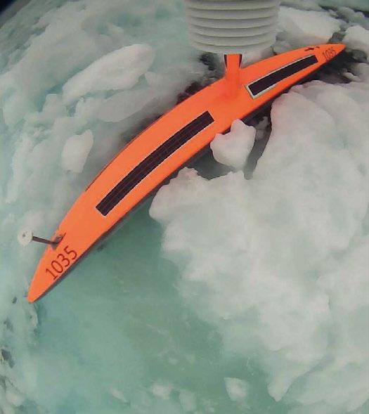
spectrum, and solid communications could very well be deciding factors for any conflicts in the high latitudes. Any future conflict will now be settled in large part by how well information, including environmental intelligence, is gained, exploited, and disseminated.
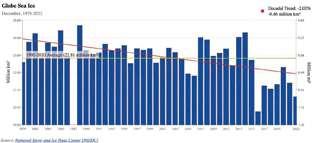
Technology that implements Artificial Intelligence/ Machine Learning (AI/ML) methods could yield a warfighting advantage in predicting the physical battlespace. Current projects are underway across the fleet, many led by Office of Naval Research and Naval Research Laboratory, to address the need for advanced multi-platform data assimilation to improve high-latitude numerical environmental models for forecasting and predictions. A variety of environmental data collected through in situ or remote means is necessary for these modeling efforts to be successful. The sea ice edge can vary by hundreds of miles overnight when faced with the dynamic meteorology present in the region. Many analytical intelligence challenges can be partially to fully automated AI/ML, but even these innovative efforts require substantial data, among other resources, as a driving mechanism. It will be essential to fill the current environmental data gaps in the Arctic if the US is to harness the technical advances made in computing and successfully exploit technologies such as
more sophisticated models and innovative AI/ML projects. Some small but mighty naval commands have started paving a path forward to meet these shortfalls.
The US National Ice Center (USNIC) is a tri-agency organization of the US Navy, the National Oceanic and Atmospheric Administration (NOAA), and the USCG has a mission to provide global to tactical scale ice and snow products, ice forecasting, and related environmental intelligence services for the United States government. Less than 50 uniformed, civilian, and contract personnel comprise the USNIC on a daily basis with only a dozen of those individuals performing the USNIC duty of creating a variety of routine ice analyses for the Arctic, Antarctic, US Great Lakes, and other geostrategic locations where ice may form; a daily analysis of US Northern Hemisphere snow, and ice products to directly support assets and personnel in the field. With such a small team, providing environmental intelligence to ensure safety of navigation in treacherous polar waters and economic prosperity within and along high latitude commercial routes and port regions is a heavy task.

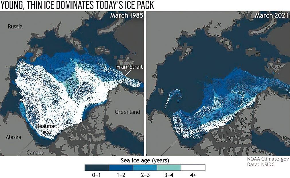
Sea ice not only affects its local surroundings but is also a driver of global ocean temperatures and currents. Sea ice generally forms during the winter months and recedes in the summer months, leaving some sea ice to linger until the next summer. As sea ice has a high albedo, implying it is a bright surface, much of the solar radiation received by sea ice will be reflected away from the earth, assisting in keeping the polar regions cold. As temperatures warm either seasonally or climatologically, less sea ice remains to reflect this solar energy, creating a positive feedback cycle that further exposes ocean waters to insolation and the absorption of energy. This cycle, intertwined with sea ice cover, is one reason the polar regions are sensitive to even the slightest fluctuations in global temperature.
Several portions of the Arctic Ocean that have historically been covered with sea ice through at least parts of the winter

will become increasingly ice-free in the coming years. This decrease in ice poses the consequence of shorter maritime trade routes, or completely new transpolar routes, becoming available thus significantly decreasing maritime Arctic transit. The great power competition’s intrinsic threats to the Arctic region are expected to grow as economic and geopolitical opportunity grows. It should be noted that the Arctic is the sole shared battlespace with a peer competitor. There is no doubt rapid change is occurring in the Arctic, making now the opportune time to form strategic war plans that include solutions from the Information Warfare Community.

The US National Strategy for the Arctic Region was most recently updated in October 2022 with a new 10-year scope that seeks a peaceful, stable, prosperous, and cooperative Arctic; acknowledging the heightened strategic competition in the Arctic alongside corresponding strategic objectives that share commonalities with the USNIC mission. The geostrategic importance of the Arctic domain will only increase each year as the decline of the perennial sea ice continues and the ice edge shifts. It is imperative to strengthen awareness and corresponding action of the unique operating environment that the Arctic presents which will yield a strategic advantage. This effort includes investing in technology that detects and tracks potential threats and improves our own capabilities in the region as a nation. This is not a simple task due to the dominant role that Russia has in the Arctic, as well as the growing concern for China’s desire to be an influential nation in the region.
The Arctic is still largely unfamiliar in its delicate environmental complexities. The need for increased and enhanced observations continuously grows as the sea ice left behind year after year becomes more fragile, thin, and diminishes in extent, losing an equivalent area the size of South Carolina
annually. Characterizing the ice in the region requires various input sources whether it be satellite-derived data, in situ sensing platforms, or occasionally deployed personnel feedback while onboard icebreaking operations in the region. The limited in situ observations help increase near-real time environmental knowledge in the Arctic, but at current numbers, they form an incomplete picture and are not enough for fully forecasting and safely operating within such a complex, harsh domain. The USNIC and partners are able to sense atmospheric and sea state conditions by using a network of buoys through the US Interagency Arctic Buoy Program (USIABP), but the unforgiving surroundings that the Arctic poses degrade any deployed hardware quickly. The resulting data gaps require routine sensor replacements and drive the demand for development of tailored equipment for this cold, icy region. The USNIC most heavily relies on satellite imagery to fulfill its mission. As the sea ice extent continues to be influenced by climate change, the workload for operational centers like the USNIC rises with increased vessel traffic near ice-infested waters. The USNIC is pursuing automated solutions to combat the uptick in vessel traffic needing ice products and expertise. This will improve sea ice characterization from its current standards which are reliant on manual analytical methods by trained ice analysts. By bringing AI/ML into the analytical workflow for making sea ice products, the USNIC is able to provide enhanced qualitative and quantitative sea ice products and support the safety of navigation.
In situ sensors deliver invaluable information on the scene utilized for reporting near-real time atmospheric and sea state conditions, initialization, and forcing of global weather models, validation of satellite-derived environmental data, and identifying long-term trends in the region. Buoys are routinely deployed by members of the USIABP, including USNIC personnel, from either shipborne or airborne
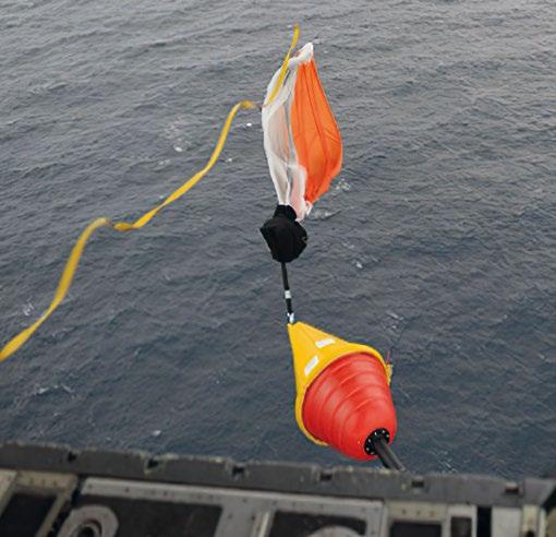

platforms. In collaboration with 12 nations across the globe, the USIABP observations contribute to the broader International Arctic Buoy Programme (IABP) buoy network. In situ sensor deployments can be costly and require careful planning but the data they collect is necessary to achieve a prosperous and peaceful Arctic region. Since deploying buoys, the USNIC and other IABP partners have gained the ability to validate environmental predictions and identify vital trends in the Arctic for large-scale operations such as Ice Exercise (ICEX) held every two years on the Beaufort Sea. Deployed buoys are subject to the harsh environment of the Arctic and may become dormant for weeks or months in detrimental weather, if not destroyed completely by the force of shifting ice. Buoys typically only survive a few years at best before requiring complete replacement. Data gaps are also formed from the sensors drifting south of the Arctic Circle, no longer reporting conditions proving useful for Arctic operations.
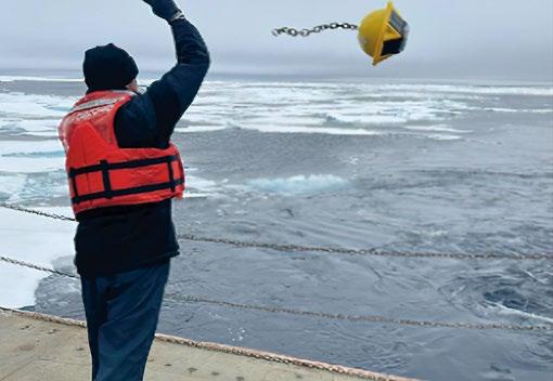
Having additional sensing platforms in the Arctic region and enhancing their performance and design is beneficial not only to global researchers and the USNIC specifically, but also fulfills a pillar of US National Strategy for the Arctic Region: “Security: Develop Capabilities for Expanded Arctic Activity”, calling for “invest[ing] in modernized domain awareness to detect and track potential airborne and maritime threats and improve sensing and observational capabilities, including for sea ice, ship traffic, and weather.” The future of the Arctic and
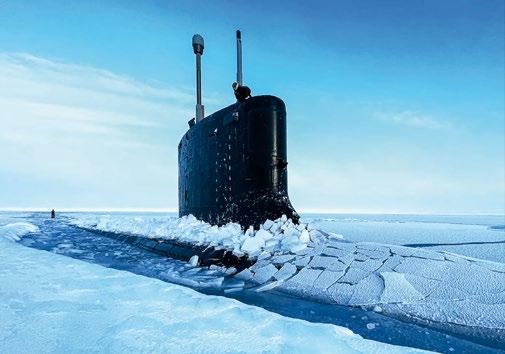
its stability depends on how effectively we depict battlespace awareness in the region. Well-equipped sensors and novel computing methods will allow the United States to reach that goal.
The USNIC primarily examines Synthetic Aperture Radar (SAR) satellite imagery due to its ability to penetrate clouds and provide reliable, high-resolution coverage throughout day and night. This imagery in conjunction with AI/ML algorithms is a powerful tool that will allow end operational users, like USNIC and partner services like USCG’s International Ice Patrol; Canadian Ice Service; and Danish Meteorological Institute to form better environmental products and predictions of the polar regions. The embedded potential in using AI/ML processes will further increase the efficiency of the USNIC to more effectively support mariners, save ice analysts time and effort, as support requests continuously increase, and lead to increased comprehension of a changing polar environment.


Even the most advanced AI/ML models at first require substantial data sets to be trained on before becoming a part of the operational workflow to characterize sea ice. Environmental machine learning models that intake satellite imagery can vary in output based on several factors, including fluctuations in season, viewing angle, weather conditions, and which region of the Arctic being imaged. While AI/ML applications ideally make manual processes

more streamlined and of higher quality, there is significant effort initially to ensure the model is producing accurate and meaningful results for the mission, like classifying multiple stages of sea ice from a single SAR image.


It requires a team effort to fully utilize aforementioned technological advancements to better predict the Arctic battlespace. Industry partners continue to provide cutting edge business models and oceanographic sensors that more effectively aid decision-makers in mission planning and execution than solely what the DoD is capable of. The observational gaps can be filled with multitudes of smaller, satisfactory instruments rather than just a single highly precise, expensive unit — yielding minimized temporal latencies when viewing data from every angle. The USNIC has recently taken part in the Cooperative Research and Development Agreement (CRADA) between Naval Meteorology and Oceanography Command (CNMOC) and Sofar Ocean Technologies.

This partnership allows further testing of buoy-based sensors in high-latitude operating environments for longevity in severe weather conditions faced in the Arctic. An ongoing effort exists to bring currently available data from shipboard and unmanned platforms into global weather models and decision support services such as USNIC sea ice products. A joint force of all DoD players operating within the Arctic region will determine mission success as conflicts arise. The US Navy’s Arctic Submarine Lab coordinates ICEX to challenge naval operational readiness, boost experience and understanding, and develop partnerships further with likeminded nations, other armed service branches, and research partners. USNORTHCOM holds Arctic Edge biannually across the Alaskan landscape, in order to gain agility training in a cold-weather environment for both US and Canadian

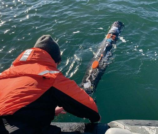

defense personnel. These exercises require improved coordination and communication between all service branches in the coming years to test and maximize joint capabilities in the region.
Most recently, the USN Strategic Blueprint for the Arctic (“A Blue Arctic”, 2021) was released, acknowledging that 90% of global trade travels across the world’s oceans, which is expected to double over the next two decades. The Arctic Ocean has the potential to connect over 75% of the world’s population as melting sea ice opens up timelier maritime trade routes between North America, Europe, and Asia.
An opening of the Arctic Ocean brings the US closer to northern neighbors to provide mutual assistance in times of need; enable allied nations to defend the homeland, deter aggression, and coercion; and protect sea lines of communication. The US Navy’s resilience in the Arctic is embodied by the late RADM Robert Peary, credited as the first to land at the North Pole in 1909, “I will find a way or make one”. Building a more capable Arctic naval force is critical to securing our national security.
ABOUT THE AUTHORS
LT Sarena Padilla and ENS Garner Fleming are active METOC officers currently stationed at the USNIC within the Science and Technology Department. This department plays a vital role in transitioning research to operations including novel sensor utilization and machine learning efforts. Several USNIC personnel contributed their insight from operational and scientific perspectives in order to portray an accurate outlook, keeping in mind that the nation will face a different array of combatant challenges than what has historically taken place; where warfighting will require a grasp on the smaller, more agile measures in the multitudes.
For more information regarding current sea ice and snow support products, reach out to the US National Ice Center by visiting usicecenter.gov


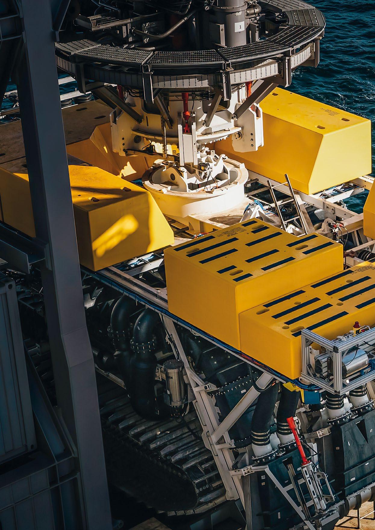
 The Allseas Designed Pilot Nodule Collector Vehicle (Courtesy of The Metals Company/TMC)








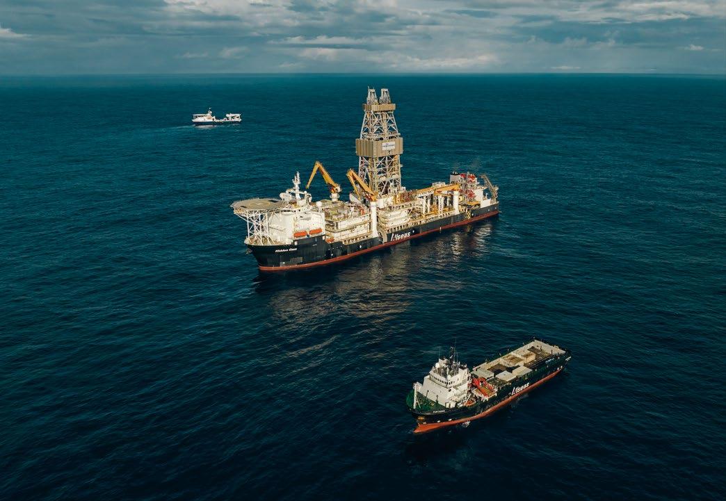
The Metals Company (TMC), an explorer of the world’s largest estimated undeveloped source of critical battery metals, announced that its subsidiary NORI and offshore partner Allseas have successfully concluded the first integrated system test in the Clarion Clipperton Zone of the Pacific Ocean since the 1970s. TMC achieved all significant pilot milestones while collecting approximately 4,500 tonnes of seafloor polymetallic nodules. Over 3,000 tonnes were transported up a 4.3km-long riser system to the surface production vessel, Hidden Gem, while the additional 1,500 tonnes of nodules were purposely left behind on the seafloor as part of the trials.

Following initial pilot system commissioning tests, the dedicated team of 130 crew and engineers aboard the Hidden Gem conducted a series of production runs in NORI-D test area to assess the system’s endurance prior to further development into a small-scale commercial system. Driving the pilot nodule collector over 80 kilometers, Allseas engineers put the system through a series of tests achieving a sustained production rate of 86.4 tonnes per hour, roughly equivalent to transporting the mass of 40 Tesla Model S vehicles up the 4.3-km riser pipe every sixty minutes. The pilot system is expected to be scaled up to include additional collector heads and a wider diameter riser pipe in preparation for NORI’s Project Zero, which will target a production rate of over 200 tonnes per hour.
Concurrently, aboard a dedicated monitoring vessel, marine experts and academic scientists conducted the first monitoring program of an integrated pilot collector system test. The team used remotely operated vehicles (ROVs) and autonomous underwater vehicles (AUVs) to survey, monitor and sample the sediment plumes generated by collector operations on the seafloor as well as the mid-water discharge of water from the riser system used to transport nodules from seafloor to the Hidden Gem. The team deployed an array of over 50 subsea sensors on seafloor landers and mid-water moorings to continually monitor sediment plumes and noise generated by the nodule collection operations. The ongoing monitoring
program will continue to survey environmental impacts and produce valuable scientific data after the conclusion of the collector system test.

Gerard Barron, CEO & Chairman of The Metals Company said: “We believe in making decisions based on data and evidence, not speculation and sentiment. This pilot collection system trial and monitoring campaign is the single most important milestone in de-risking the NORI-D project and establishing actual data on the environmental impact profile of potential nodule collection operations and improvements we can make going forward.”
He added: “I’d like to thank the teams aboard all three vessels involved in this complex pilot test and monitoring campaign who have worked tirelessly—some for months—co-ordinating and solving problems together offshore. Hidden Gem is now heading back to port with over 3,000 tonnes of nodules in her hold, but the post-collection survey work is still ongoing until the end of the year. We look forward to the completion of this important work and the opportunity to share the data and its implications with the global community as soon as possible.”
With the technology trials complete, the marine research teams will remain on-site to recover the landers and moorings deployed for the collector test monitoring program and will undertake post-collection surveys to compare the


status of the seafloor environment before and after the test. Once complete, the collection system test monitoring program will represent the single largest simultaneous environmental impact monitoring study ever conducted in the CCZ. The data collected, together with many terabytes of existing baseline data collected by NORI throughout 16 offshore campaigns, will form the basis of NORI’s application to the International Seabed Authority for an exploitation contract, which the Company expects to be ready for submission in the second half of 2023.
TMC and NORI expect that the findings from the rich data gathered during the trials will be published in scientific literature in the next year, in what is expected to be a significant expansion of our understanding of the deep-sea ecosystem in the CCZ where 17 of the 19 nodule exploration contracts awarded by the ISA are located.

In March 2022, NORI and Allseas agreed that the pilot nodule collection system would be upgraded by Allseas to a commercial system with a targeted production capacity of 1.3 million tonnes of wet nodules per year and expected production readiness by Q4 2024.


A multifunctional heat transfer and hydraulic fluid for marine electric vehicles, created by Engineered Fluids.

This revolutionary fluid meets the requirements needed in ROVs for pressure compensation, electrical insulation, thermal management, and hydraulic power transfer. Achieve higher operational performance while eliminating the health and environmental issues posed by traditional fluids used today.

Oceanscan personnel division provide competent and compliant personnel to the offshore energy sector on a global scale.


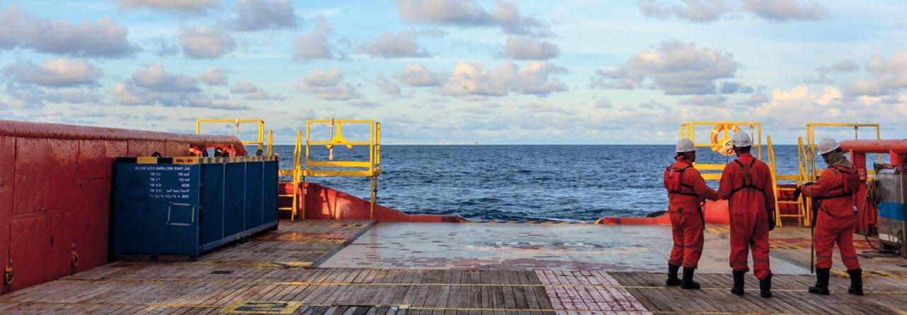
Scarce metals and minerals that we may desperately need in the future lie at the bottom of the ocean. Therefore, many countries are looking into the possibilities of deep-sea mining: harvesting these raw materials at depths of many kilometres. In this context, an important role is reserved for ROVs and ROV cables.
The most important question at the forefront of this discussion is how to harvest deep-sea polymetallic nodules, whilst avoiding causing serious harm to the environment.

Polymetallic nodules contain relatively high concentrations of nickel, copper, and cobalt. Cobalt is especially valuable because of its use in electric car batteries. Nodules occur at any depth, but the highest abundance has been found between 4,000 and 6,000m below sea level. But how do you harvest these nodules at such depths?
"Deep sea mining is not an easy task," explains Wiebe Boomsma, Manager Product Development at Royal IHC. "In many cases, standard equipment is not enough."
As a maritime technology company, Royal IHC builds and supplies integrated vessels, equipment and services to customers in the dredging, offshore, mining and defence industries. They also developed an unmanned seabed mining crawler that can remove valuable substances from the ocean floor. "In 2026, our first customers will start launching their commercial mining activities," Boomsma estimates. "We have been researching, developing prototypes, and conducting pilots for ten years now, with which clients can ultimately start their operations. We not only look at the technical possibilities, but also at the impact of deep-sea mining on the environment."

Currently, about 85% of rare-earth materials, such as nickel, cobalt, and copper, come from Asia. The raw materials on land are regularly the subject of geopolitical games. That is why many European countries are looking to become less dependent on these raw materials. As a result, the development of deep-sea mining machines has gained momentum. "It's not that land-based resources will run out soon," Boomsma says, "but by extracting resources from the sea, you have a better guarantee of a constant supply. We'll desperately need that supply in the future.

"Due to the energy transition, the demand for metals will grow considerably. Materials in wind turbines and electric car batteries last for decades. So, for the time being, those materials are not yet entering the recycling cycle. This makes us really dependent on new sources of supply."
Since Royal IHC has been investigating technology and sustainable solutions for deep-sea mining for ten years, the company has now accumulated a great deal of knowledge. "Often, the customer has a specific idea, which we develop further in a concept study. From the outlines to the smallest details, together with the customer we come up with the best solution," explains Boomsma.
Royal IHC has joined forces with a whole army of suppliers, including DeRegt Cables, to share knowledge. For example, the companies have worked closely together in the framework of Blue Nodules, a research project subsidised by the European Union, intending to develop a deep-sea mining system. It focuses on harvesting polymetallic nodules at four to six kilometres deep.
14 parties from seven European countries are considering how these nodules can be mined with minimal environmental impact. "We're literally around the corner from DeRegt," Boomsma says. "Only the River Lek separates us. Since we're so close to one another, it's easier to work together than having to fly halfway across the world first. It's a very pleasant partnership."
The system that has been developed for nodule mining can best be compared to a giant vacuum cleaner. The Apollo II, as the system is known, is equipped with a 5.5-kilometer-long umbilical. Six powerful pumps transport the nodules which are 'harvested' to the vessel on the surface. This operation requires a lot of energy: about five megawatts. By way of comparison, one megawatt can supply about a thousand households with electricity simultaneously.
DeRegt developed a one-size-fits-all cable so that one part can be easily replaced. The umbilicals contain a double steel armour sheaf to transfer loads whilst protecting the electrical and optical components from crushing. Fragile components are placed towards the centre of the cable. For corrosion prevention, every single steel wire is jacketed. This means that if the cable is damaged and its water tightness is compromised, it will have minimal impact on its durability. For optimal protection, the outside of the cable is also covered with double steel armour. The Apollo II hangs on this cable by which it is also powered.
For safety reasons, no human interference is allowed, so a clamping system that allows the cables to be fixed to the vertical transport system needed to be developed. This system automatically clamps and de-clamps the umbilicals

along the 5.5 km long hose during the launch and recovery of the system. An innovative method was used to minimise the mechanical loading onto the umbilicals and vertical transport system.
Mining requires so much energy that a battery is not enough. Boomsma explains, "The system has been tested in the Mediterranean. There's almost no tide there, like in the ocean. As a test site, it's easier to reach, less deep, and the bottom

is very similar to the ocean's." Together with the Royal Netherlands Institute for Sea Research (NIOZ), Royal IHC looked at the impact of the vehicle on the environment and the technical possibilities. "The cable developed by DeRegt fits well on the underwater vehicle we developed and is ready to be sold commercially. A very nice tangible end product of such a large-scale project!”
Thanks to these many technological efforts, deep sea mining of metals and minerals on the seabed is gradually becoming more of a feasible alternative. Boomsma explains, "If we didn't believe in it, we wouldn't have put so much energy into it. Deep sea mining machines are getting more advanced every day."
Each ROV cable design is different, and every subsea project requires its sown specifications. In the Ultimate ROV Cable Guide, you can read everything there is to know about projects like these, ROV cable construction, and trends in the ROV market.


Formed in 1989, Oceanscan Limited, a privately owned company, is a specialist supply company, providing rental equipment and personnel to the offshore energy sector on a global scale.
Since inception, the company has grown to incorporate businesses that provide synergistic services that both complement and enhance our service provision. As a result, Geoforce Technical Services Limited, Sercal NDT Equipment Ltd, Oceanscan Inc, and more recently HPR (UK) all operate within the Oceanscan Group.

Focusing on the personnel division, Oceanscan acquired HPR (UK) – a provider of competent and compliant personnel to the offshore energy sector – in June 2021, further strengthening our position and providing customers with access to a combined pool of personnel.
The personnel division now comprises two entities employing management and account handlers, with extensive

experience in operations and/or recruitment within the offshore energy sector. The group is now a key supplier of skilled personnel – either individually or as complete teams –for both short and long-term placement.
Personnel Business Development Manager, Julian Nelson said, “Having spent over 30 years in the offshore energy sector I have gained experience both in the field and onshore, and consequently know the importance of having the right people in the right place at the right time. For our customers, collectively we understand your project requirements and can help you source personnel with the level of competence, expertise, and experience required. For the contractor, we know what is expected of you and how best to represent you”.
Prior to working with Oceanscan, Julian worked in operations management. He went on to say, “Having previously worked with both Oceanscan and HPR (UK) as key suppliers, I valued their commitment, integrity, and compliance at all times. The teams continue to build trust with customers and contractors alike; they take pride in their ability to source and secure candidates to meet the high-level labour demands of the offshore energy sector.”


Sarah has a wealth of recruitment experience in the offshore industry, and has led personnel recruitment at Oceanscan since 2009, when the Lowestoft office was established. Since then, Sarah has gone on to develop and grow the business, as well as sharing her values and knowledge with the team. Well known within the industry, Sarah has developed strong relationships with both customers and contractors. She has the passion to provide the high level of service that you would expect from a global supplier.
Whilst the group continue to focus on a number of key disciplines – including survey, ROV, inspection, diving, offshore management, cable/flexi/rigid lay and SURF, rigging and lifting, HSE, trenching and plough – the teams led by Sarah Chapman and Phil Hargreaves have the resources, problem solving capabilities, and experience to supply candidates from other specialist skill sets to meet customer-specific project requirements.
Having cut his teeth in the subsea recruitment industry in the 1990s at Racal, Stolt Comex, and Acergy, and within the Renewables sector at Subocean Group, Phil moved into agency recruitment in 2005. Heading up the HPR (UK) entity in Inverurie, Phil is responsible for the team, and provides in-depth knowledge of the requisite standards and individual requirements. His work helps provide a long-term support structure for both customers and contractors alike.


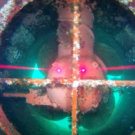
precise AR measurement functions. Portable, rugged and reliable, the
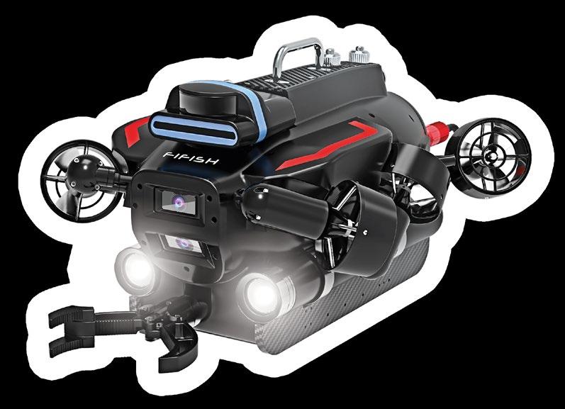


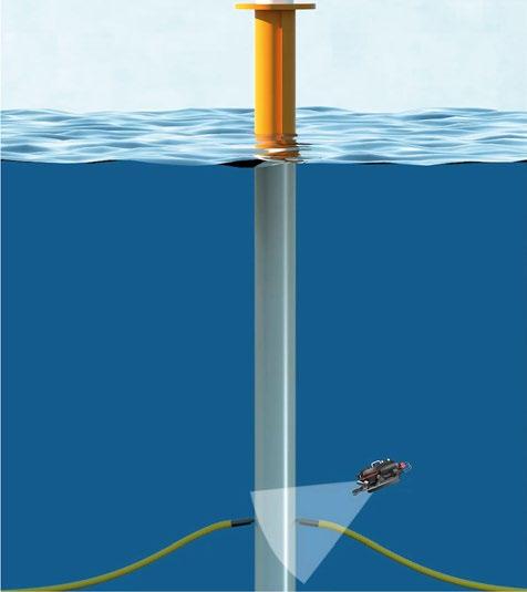 The FIFISH PRO is a series of innovative and high-performance compact inspection ROVs , equipped with 4K UHD Camera systems, 360 degrees of maneuverability, AI object tracking features, professional tool extension capabilities, as well as a suite of collision avoidance sensors, smart position lock systems, and
FIFISH Underwater Robots by QYSEA are built to optimize your small-scale underwater operations.
Fast-evolving military threats in the world’s surf-zones have prompted the relatively rapid development of a range of tracked amphibious vehicles packed with multiple sensors, but such vehicles could also solve an array of data acquisition challenges in the wider commercial marine industry.

From a military strategy point of view, the surf zone, intertidal margins, and areas of very shallow waters, such as estuaries, have long been considered a security soft underbelly by forces across the world. Difficult for personnel to work in, too shallow for many naval vessels, and too wet for terrestrial equipment, concerns in this area have understandably grown alongside recent technological developments in mines and minelaying.
So, an increase in mine related incidents and more advanced anti-access capabilities, saw the U.S. Navy review its need to be able to project force from ship to shore, and be able to manoeuvre in the littoral zone, as well as have the capability to clear hazards in the surf zone, on the beach landing zone and beyond.
The United States Department of Defense founded the Defense Innovation Unit (DIU) to accelerate the adoption of commercial technology into the military domain. In early 2022, the DIU launched a project to seek a state-of-the-art amphibious unmanned system that would be capable of detecting, identifying, localising, and navigating to potential explosive hazards from the beach, through the surf zone into deep water, and be able to neutralise explosive hazards in a range of depths, including very shallow water.
At the same time, marine technology specialists Greensea Systems, Inc. (Greensea) had just acquired a small engineering company that had been utilising Greensea’s open architecture platform to operate their line of crawling robots, in

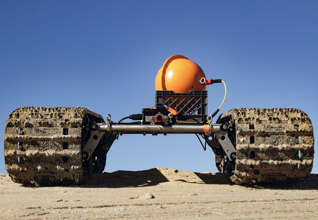

order to advance and scale the use of these robots into the commercial market. From this acquisition, Bayonet Ocean Vehicles (Bayonet) was launched in 2022, introducing its new line of amphibious crawling vehicles. While they had already proved their mettle in mine countermeasures, Greensea had a bigger picture in mind for these robots. Thanks in part to the DIU contract, the robots had acquired significant capabilities, such as object identification, machine learning, and were carrying a wide range of sensor payloads. These were clearly capabilities that should not be limited to the military context.
Other tasks that the vehicles are addressing outside of littoral warfare include hydrographic survey, wind farm survey and maintenance, coastal dredging support, environmental monitoring of the seafloor, beach zone, rivers and marshes, and wharf inspections.
Deployable from land or water independent of weather, the three sizes of Bayonet ground vehicles are designed to transit along the ocean floor as well as on land. Benefiting from this state-of-the-art software built on Greensea’s OPENSEA open architecture platform, the crawlers offer precision navigation, payload integration, autonomy, over-the-horizon command and control. In combination with robust hardware, the crawlers can easily work in the surf zone, carrying larger sensor payloads onto the sea floor, and can be fitted with a variety of environmental, oceanographic, hydrographic, benthic and industry specific sensors, meaning they can cover a wide range of applications for both military and commercial applications.
These vehicles are unique in offering robotic platform capabilities working from the beach and into the surf zone, as well as in ocean depths of up to 100 meters.


It could be persuasively argued that the initial military adoption of this technology has de-risked it for other industries. The commercial market is increasingly attracted to utilizing tried and tested technology to support their efforts and, thanks to defence dollars, the issues with operating vehicles in such a challenging environment have all been addressed. The challenges of working in the surf zone, a frequently harsh and volatile environment between the beach and sea, are often a barrier to activities within and beyond this zone, but the benefits of utilising amphibious ground vehicles that can easily negotiate the environment between the shore and the sea is not hard to see.
According to NASA, around 70% of the earth’s surface is water, of which 97% is the ocean. With the oceans, and specifically the waters along coasts and islands, being so important for human activity, it is desirable that mapping of these areas to a good degree of accuracy is achieved. However, the challenges faced for coastal mapping and shallow water surveying are well documented. Utilising amphibious crawlers is offering a new means of surveying in a range of disciplines. By design, the crawlers operate extremely well in the conditions presented during hydrographic surveys, where the capabilities of land-based vehicles and humans,

and those of in-water vessels decrease. This zone, frequently characterised by higher currents, increased wave activity, unstable ground, is no challenge for the heavy-duty amphibious crawlers. They can easily transition this zone, carrying different payloads of sensors, such as cameras, lights, sonars, etc. from the shore into the sea to carry out a range of tasks easily and return with valuable data.
The fact that the vehicle can operate through this zone opens new possibilities for conducting surveys without key ‘missing pieces’, along with the potential of reducing survey operation costs. No longer is a bespoke, shallow draft crewed vessel required to reach the site from its mooring or berth. The vehicle can be transported in the back of a car, set up on the shore with all the required payloads, and set to perform its task.
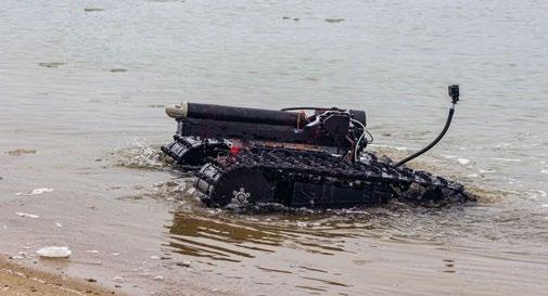
In between survey tasks, the electric Bayonet vehicles can lie completely dormant on the seabed, almost indefinitely, with near zero battery drain.

The offshore oil and gas industry is another industry that relies heavily on innovative technology. Complex surveys need to be completed in challenging terrain to ensure the area targeted for exploration, construction and extraction is carefully surveyed. Environmental impact studies may also be required. The flexibility of the range of payloads that the vehicles are able to carry, provide a solution that is easily customisable.

Late in 2022 a strategy to harness the potential of offshore renewable energy was commissioned by the European Commission. In order to explore and invest in the marine renewables sector, projects and spatial planning activities will be needed, bringing together a range of users of the ocean, all of whom will be involved in a range of survey tasks.
However the offshore energy mix pans out, reducing the number of assets needed to conduct surveys, and selecting vehicles such as Bayonet’s, are both a great help towards reducing the operator’s overall carbon costs, a key consideration for the oil and gas or offshore renewables industries alike.


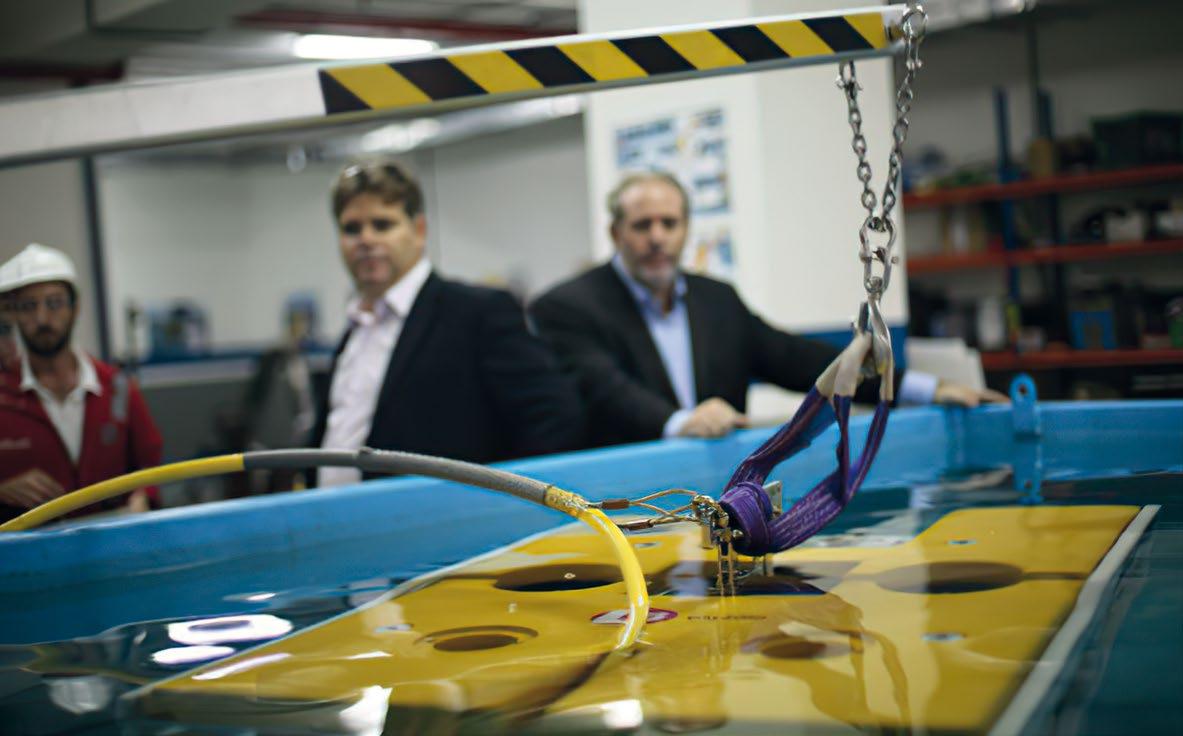

Rotary Docking interfaces conforming to BS EN ISO 13628-8:2006 ROV interfaces on subsea production systems.
The ETT operates through a dedicated web browser interface, which enables seamless integration with both electric ROV’s &

The Jupiter Electric Torque Tool (ETT) is designed for Class 1-4 conventional ROV’s via an Intelligent Power Pod (IPP). The standard

communication interface is Ethernet 10/100 Base-T.
Specification


Max Working Torque: 30Nm to 2,711Nm
• Max Working Speed: 6RPM (fully variable)
• Torque Control Accuracy: ±2% of Torque Demand (271Nm to 2,711Nm) ±10Nm (30Nm to 270Nm)
• Size: 580 x 227 x 215mm
• Lightweight
Depth Rating: 3,000 msw (options to 6,000 msw)
•

• Power: 115VAC @ 800W (other options available)
• Communication:
Ethernet: 10/100 Base-T Serial: RS232 / RS485
For further information, contact sales@zetechtics.com
www.zetechtics.com

When people think of Satellite AIS (S-AIS)’s ship tracking capability they typically immediately link it to the tidal wave of new Earth observation satellites currently coming online. However, there is another tidal wave of capability out there benefitting from real-time knowledge of every legal ship’s location around the globe. The unmanned marine vehicle (UMV) world – both on and under the seas – is also undergoing its own explosive growth. People are now using the geolocation and identity of all legal ships provided by S-AIS to run models to exploit the sensors found on a broad range of robotic vehicles, including aerial and seaborne vehicles.

Unmanned marine vehicles are highly stable platforms for all kinds of video, sonar, and manipulator work, but they often need to know what other vehicles are in their area, who they are, and their planned trajectory. In this regard, AIS can help in the immediate vicinity, and S-AIS can identify all transmitting ships in the region well before they pass near the UMV or any mothership.
One of the first such uses of S-AIS was in the search for MH 370, the Malaysian airliner which went missing while flying from Kuala Lumpur to Beijing. S-AIS provided the location of the search vehicles controlling the deep ocean robots to all elements of the search team, onboard other vessels and ashore. This allowed the team to better coordinate their search efforts and for command centers – both on scene and at national centers on land – to fully understand the on-scene tactical picture.
Geospatial intelligence at all classification levels –“Unclassified” through “Top Secret” – must have positional and time of collection information in order to be fully useful. The timelier and more accurate the information is, the more useful. This is absolutely true at the tactical level: the “Here and now” level.
Drones and robots are now being widely used in this way, both on land and at sea, in addition to ocean research. S-AIS can be of major assistance in determining where to send the UMV and what other vessels are in the area that might interfere with the operation.
Ukraine appears to now be patrolling its shores and surveilling Russian operations in the Black Sea and possibly the Sea of Azov with unmanned low-profile vessels. They may well have both AIS receivers on board as well as receiving S-AIS
reports via satellite links on where known ships are located so as to maximize their effectiveness. Warships are almost certainly not broadcasting their AIS, but merchants almost certainly are so they will not be targeted by either side.
The expanded use of unmanned platforms on the seas is really just getting started. Much like the start of aviation 115 years ago, the start of space flight 65 years ago, and the creation of the internet 40 years ago, the only real limit is our imagination. We now use planes, satellites, and the internet for tasks that the inventors of those first systems never dreamed of. Wilbur Wright had no idea his contraption would lead to the Airbus 380, the SR-71, or the F-35.

This is also true of robotics, and S-AIS is a natural partner with those systems engaged in the maritime world. It tells you where the “good guys” are and who is behaving abnormally, especially those who are trying to spoof AIS by using incorrect identities or providing false positions, both of which can be easily detected.
Of course, it is impossible to detect vessels who intentionally turn off their AIS. However, if they’ve ever had AIS turned on and then turned it off while at sea, anomaly trackers immediately detect them, and those vessels are immediately assigned to watch lists in many places. When they do turn their AIS back on the questions immediately asked in those places are many. They begin with: why did it go dark; where was it; and what was it doing?
In the future it’s entirely possible that it will be normal for a robotic ship or aircraft to be tasked to intercept these vessels for inspection if they can be subsequently located. These sorts of operations are already taking place, although at the moment they are few and far between.
Guy Thomas is the S &T Advisor to NATO's Maritime Security Center of Excellence and Chairman of the Maritime Security Information Sharing Working Group. Prior posts included the US’s first Science & Technology Advisor for Maritime Domain Awareness, where he wrote the C-SIGMA concept, basis for Task #1 of the US National Space Policy of 2010, and with the Department of Homeland Security Science & Technology Directorate.
Prior to his civilian government positions Guy spent 35 plus years in military signals intelligence, participating in surveillance missions and systems development in the US Navy, US Air Force, and at Johns Hopkins APL where he conceived and led the design of Satellite AIS. Leading reconnaissance operations in aircraft, cruisers, and submarines, he spent over a year in hostile waters, and 2,000 plus hours in unfriendly airspace. He was one of the Navy’s first space cadre, thereby becoming the first quadruple qualified person in Navy history.
Directing the mission systems acceptance tests of both the Navy EP-3E and the USAF RC-135W, Rivet Joint Block III, the first two aircraft with automated mission systems, he was allowed to wear both USN and USAF wings at the same time, a unique honor.
He was NGA’s Individual of the Year (Industry) in 2015.
Author of “A Silent Warrior Steps Out of the Shadows” and “New Sentinels of the Seas.”
As the costs of this technology go down and the cost of crewed ships and planes go up, there will be more and more unmanned vehicles in many different roles, both in the air and on the seas. I believe one of those primary roles will be surveillance and reconnaissance, which are related but different. Surveillance is a continuous action while reconnaissance happens for a shorter period of time.
But there are many other tasks the marriage of S-AIS and robotics can accomplish in the future. This is especially true as a major upgrade of S-AIS is just coming on-line. The next generation of AIS, the VHF Data Exchange System (VDES), will have up to 32 times the bandwidth, thereby providing significantly more data exchange capabilities for ship/ground interconnectivity via satellite. It will also have substantially increased cyber security.
As with AIS, VDES will include a space link with satellite constellations planned for launch in the coming years. VDES –basically AIS 2.0 – will provide two-way messaging capability, turning S-AIS into a significant IoT communications method. S-AIS is already a major player in the maritime M2M/ IoT world but the technological leap of VDES will give the maritime community the opportunity to develop new applications that will ultimately provide better efficiency, safety, and security as well as increased protection of the marine


Blueye Robotics provides professional underwater ROVs designed, developed, produced, and serviced in Norway.

Reliable and user-friendly underwater technology for frictionless access to what’s below the surface.
environment and its resources. This will allow for another means of two-way communication anywhere on the globe with robotic and autonomous vehicles. Another benefit is that because VDES will continue to operate in the same VHF frequency range as AIS, there is no need for a highly sophisticated or complicated antenna, thereby significantly simplifying system installation.
ORBCOMM – who launched the first commercial S-AIS network and currently provides global AIS data services to government and commercial customers worldwide – has partnered with AAC Clyde Space and Saab to launch a proofof-concept VDES satellite that is expected to launch later in 2023. Asked to comment on VDES and its benefits to ocean robotics, Andy Loretta, Senior Director of Maritime Business Development for ORBCOMM, said that: “VDES will truly democratize narrow-band VHF communications for the maritime community. By turning AIS into a two-way messaging service, it will allow for a whole new set of applications in the industry, including command and control of autonomous vehicles, sensors, and robotics.”
AIS, and especially S-AIS, should be investigated if they are not already well known to you. The coming deployment of VDES bears monitoring by all involved in maritime operations, especially those with smaller platforms such as those engaged in ocean robotics.
www.blueyerobotics.com

 Dr. David Sundin, Engineered Fluids, Inc.
ROVs for deep sea applications are required to operate in the harshest conditions on earth in terms of pressure, temperature, and environment. ROVs rely entirely on batteries, electric motors, and hydraulic actuation for their powertrain and manual actuators. In addition to pressure compensation, these components require water intrusion protection, thermal management, and highly reliable hydraulic power transfer fluids.
The use of traditional hydraulic fluids in these applications has unfortunately resulted in significant exposure-related health issues for operation and maintenance personnel, as well as the introduction of hazardous oil pollution to sensitive marine environments. This article examines the use of an entirely new type of synthetic multifunctional fluid to meet the requirements of ROVs pressure compensation / electrical insulation / thermal management / hydraulic fluids that provide higher operational performance, while eliminating the health and environmental issues posed by traditional formulations.
In the last two decades, there have been rapid developments in electric battery and motor technology, leading to the adoption of electric drivetrains in ROVs and marine vehicles in general. Requirements for lubricants and coolants are being reevaluated with an eye towards consolidation of the number of different types of fluids used.

Research into battery and electronics cooling has shown that Single-phase Liquid Immersion Cooling (SLIC) technology is an efficient and safe thermal management approach for a wide variety of electrical devices. SLIC technology refers to
moving heat from hot electronics or motors with an electrically insulating fluid, then cooling the fluid somewhere else.
Hot electrically live components are fully immersed in a dielectric liquid coolant. The components are cooled through low pressure circulation of dielectric coolant through and around electronics or motors, then dumping waste heat using liquid-to-liquid or liquid-to-air heat exchangers. Using an electrically insulating fluid eliminates the need for any insulation between the electrically-live motor and electronics and the fluid itself. As liquids are about 2,000 times more efficient at moving heat than air, power-dense systems can be easily cooled with SLIC technology.
ROVs and other Marine Electric Vehicles (MEVs) use battery coolants, motor coolants, charging cable coolants, hydraulic fluids, pressure compensation fluids and lubricants in various applications on each vehicle. One of the problems that this has brought about is the proliferation of different types of fluids in today’s vehicles. Reduction in the number and weight of different fluids is especially important in the case of marine applications. Some of the applications for different functional fluids in ROVs are:
BATTERY COOLING – as batteries are charged and discharged, they generate heat. The faster that this charge/discharge cycling occurs, the more heat is generated. However, electric batteries operate efficiently in a narrow temperature band. To maximise battery performance and life, it’s important to keep the temperature within this band. Cooling batteries by immersing them in an electrically insulating fluid has been proven to be one of the most efficient means of keeping batteries in the desired temperature range.
MOTOR COOLING – high torque DC motors are used in EV powertrains. Traditionally, these motors have been lubricated with recirculating motor oils, hydraulic fluid, or Automatic Transmission Fluid. Environmental regulations are expected to increase demand for highly biodegradable, non-toxic alternatives.
ELECTRONICS COOLING – Electronics assemblies on board MEVs are now smaller but have increased power capacity. Today’s Marine EVs have several assemblies of power-dense electronics components that require advanced thermal management.
HYDRAULIC POWER TRANSFER – One of the largest volume applications for a functional fluid in marine vehicles is for hydraulic fluid. ROVs use hydraulic pumps and cylinders to engage directional changes and movement of external arms, grippers, and sensors. Functional requirements of hydraulic fluids are not expected to change, but regulatory demands are moving the industry towards the use of highly biodegradable, non-toxic base oils.
PRESSURE COMPENSATION – ROVs and other deep-sea equipment need a way to compensate for the tremendous hydraulic pressure that can be encountered in subsea applications. This can be done by strengthening the external housing or by flooding the EV with a noncompressible fluid to compensate for the external pressure.
As hydraulic fluids have represented the largest volume of any single type of functional fluid on MEVs to date, there have been efforts to use them to perform the job of other functional fluids. Obviously, for lubrication of hydraulic pumps and cylinders, hydraulic fluids perform well. They have shortcomings, however, when used in battery, electronics, and motor
cooling, or as a pressure compensation fluid. Hydraulic fluids’ low dielectric strength limits their application as electronics coolants. The zinc and phosphorous-containing additives that hydraulic fluids typically use are not only toxic but can cause a variety of health problems with workers. “Touching some hydraulic fluids may cause weakness in the hands or burns to the skin depending on the chemical make-up of the fluid.”
Electrically, hydraulic fluids have poor resistivity and low dielectric strength, preventing their use as nonconductive fluids for cooling electronics, batteries, or charging systems. The petroleum base oils used typically contain sulfur, which attacks electrical circuit boards and are too highly compressible to be used in pressure-compensation applications.

Recently, the use of more modern raw materials with newly discovered chemical reaction pathways led to the development of fluids with multipurpose functionality. In 2020, researchers succeeded in the development of noncompressible, electrically insulating hydrocarbon molecule with enhanced lubricity characteristics. This molecular structure can be used to make fluids that have characteristics that, until now, were considered antagonistic to one another; impossible to exist within a single chemical.
In 2022, SubmergeDeep* was introduced by Engineered Fluids, Inc., as an example of a Multifunctional Fluid specifically made for Marine Electric Vehicles. SubmergeDeep, a non-toxic, biodegradable dielectric heat transfer fluid acts as a coolant, an electrical insulator, a pressure-compensation fluid, and as a hydraulic fluid.
The comparison shows that SubmergeDeep has advantages over a typical hydraulic fluid in many applications:
ƀ A lower viscosity, combined with higher thermal conductivity means that SubmergeDeep is more efficient with respect to heat transfer. This means that lower fluid volumes and fluid flowrates are required to maintain the motors at their optimum operating temperature.
ƀ High flash and fire points of SubmergeDeep add a significant margin of safety against fire and explosion.
ƀ Higher dielectric strength allows SubmergeDeep coolants to be used in SLIC applications where electrically live components are submerged directly into the coolant fluid.
ƀ Absence of zinc and phosphorous-based additives means that SubmergeDeep does not cause skin allergies and health problems often associated with these chemicals in hydraulic fluids.

ƀ Lower pour point allows SubmergeDeep to remain fluid at lower temperatures.
ƀ A higher biodegradation rate is better for our environment in case of a spill.
Electric powertrain improvements have led to the development of electrified ROVs and MEVs in the last decade, which have different requirements for functional fluids than vehicles powered by combustion engines. One of these requirements is cooling a variety of electrical components (motors, batteries, charging systems, electronics, etc.). The most efficient way to cool live electrical components is with SLIC Technology, where the hot component is immersed in the flow of a dielectric fluid.

Hydraulic fluid has been used for many of the functional fluid applications on ROVs and MEVs, but their poor electrical properties have limited their application in cooling electrical parts. In addition, hydraulic fluids have problems meeting modern HES (Health, Environmental and Safety) requirements. Electrical insulating oils, on the other hand, have


traditionally not had the lubricity and antiwear properties required to be used in hydraulic systems. In addition, their material compatibility profile made them unsuitable for use with many hydraulic pumps.
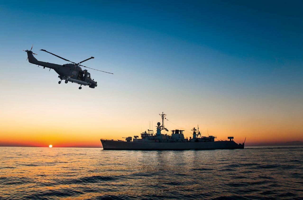
A new class of Multifunctional Fluids has been developed, which can be used as both a dielectric coolant as well as a hydraulic fluid. These hydrocarbon liquids have an excellent HESprofile. They also have sufficient anti-wear functionality to protect hydraulic systems while retaining excellent electrical characteristics. SubmergeDeep, a product line of Multifunctional Fluids is now being used commercially in MEVs in place of hydraulic fluids. SubmergeDeep is the first product that can be used in both hydraulic and thermal management systems, as well as acting as a deep-sea pressure compensation fluid.

KEY
•
•
• Engage and network with senior program leaders and solution providers developing and integrating innovative technologies in the space of maritime ISR


•

9-11 May
Rostock, Germany
2023


Rostock will host the 34th edition of UDT this May. Designed to equip nations in the face of increasingly diverse threats and challenges, the focus of the conference theme will be “ Maintaining Operational Advantage with Increased Underwater Domain Awareness”. Alongside the three-day conference, the exhibition will showcase the latest solutions available to tackle the challenges of operating in one of the toughest environments known to man.
Ready to join us in Germany? Visit our website to register.
75%


96% exhibitors met new prospects
visitors achieved their business goals
Organised by Interested in Exhibiting?
If you would like to become an exhibitor or a sponsor please contact Samar Jaafar, Event Manager samar.jaafar@clarionevents.com
udt-global.com


We caught up with Adrian Pierce, naval spokesperson for Undersea Defence Technology (UDT) 2023 to find out what we can expect from UDT Rostock. We touch on the topics of defence, security, and subsea infrastructure.

RICHIE ENZMANN: Nice to have you here Adrian. Please let’s start with the location of this year’s UDT and talk about the German Navy being the host of this year's conference.
ADRIAN PIERCE: The location is Rostock, and the German Navy are acting as the host and sponsor for this year’s event. Rostock is now the location of the German Naval operational command, as I’m sure you are aware. They have announced a further investment in Rostock for the recovery of the ship repair yard that they will use to cover some of the maintenance delays. And they will also open the future home of the Baltic Sea Maritime Command headquarters. It’s good that UDT is going somewhere that is very much at the centre of German naval thinking. Of course, the German Navy have their own investments in the undersea domain, including their forthcoming P8 surveillance aircraft, the NH-90 – the replacement for Lynx helicopter – and they also have the
program for a further two, improved Type-212 submarines, which is a joint programme with Norway. So, it’s quite exciting for the German Navy right now; there is a lot going on within a fairly short period of time. This is quite prescient with the geopolitical situation reflecting the events of the last year.
RE: Obviously, this the region of high geopolitical tensions. The Baltic Sea is contested waters and the Nord Stream gas pipelines – which were recently sabotaged – are also used to feed into a terminal near Rostock. How would this impact the defence industry in your opinion? Would there be more investment for pipeline protection in the future, and how is this aligned with the conference theme this year?
AP: I think there was already an increased focus on the seabed and the infrastructure that sits on it. And the events around Nord Stream I and II have certainly shifted the public focus as well. I think there was already a move to that area as far as some commercial companies are concerned, so this is a sphere where we have already seen some investments. Recently the UK bought a vessel for seabed surveillance and seabed defence, and they are certainly not the only ones. We will see more of that in the future.
You could argue that this exploits the “grey zone”, which was the theme of the last conference in 2022: that the underwater domain has always been a grey zone. It’s not necessarily easy to disrupt, but activity goes on underwater where it can’t be seen. That being said, it’s not necessarily something that the average person on the street would be interested in, despite being close to our hearts and interests.
The sea is a place in which it’s difficult to operate because the weather, the oceanography, and the water column is ever changing. It’s not the same from one geography to the next, so the problems we see in the North Atlantic and the Baltic can be very different from those in Southeast Asia and the Pacific, both of which have huge interest from a defence perspective. Of course, both are very open to technology and a lot of investment, and I think in the next decade it has been assessed that over $90 billion will be spent on conventional submarines. This is a lot of money but not all countries have that sort of cash to throw around, so people are looking for disruptive technologies.
Disruptive Technology (DisTec) programme will also be at UDT showing the opportunity to explore non-traditional solutions and innovations for underwater defence and security. DisTec will be an innovative forum we hope, and – in many ways – they have the potential to reshape the future of undersea operations.

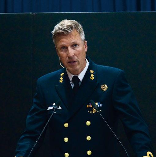

Of course, when we speak about undersea operations, we are looking at it from a defence perspective, but we are also looking at defending and securing commercial operations effectively. The Nord Stream pipelines you mentioned, and other stories in the press about cables: they are commercial cables not owned by governments and nations, but owned by commercial companies and affect many, if not all, nations across the world. Therefore, it’s important that defence talks to commercial entities as well. There should be something of interest for everyone at UDT to educate and to provoke thought. It’s not just to sell their wares, but also hopefully to reflect on future products, problems, and solution sets as well.
RE: As you mentioned some of these pipelines and cables are commercial assets. How do you see the future? Who will pay the bill for surveillance and security? Do you think it will be the responsibility of the asset owners – such as energy companies – or governments?
AP: I don’t think there is going to be any one answer that fits every question. It would depend on which asset we were talking about and what it provides. If it is a power cable, that might be very different to a communications cable. You also must look at how many assets there are available that do repairs, and therefore how much effort you want to put into surveillance in the first place, so you can try to prevent rather than wait for a repair to be needed.
It will also depend on individual countries, companies, and relationships. And of course, with any cable or pipeline you are not just talking about isolated nations. In most cases you’re talking about a minimum of two; in many cases, it could be multiple countries being affected. So, while it might be a single commercial company that owns the bulk of it, it’s going to be a very complex piece, and of course it will be too late when the repair is required.
RE: I agree, it sounds like a very complex issue especially with all the subsea communications cables connecting continents across the globe, and the existing oil and gas and offshore wind infrastructure.
AP: And it’s only going to get more complex, not less. There are a preponderance of projects going on. In Europe there are more cables going across the North Sea for power, you have an Interconnector going between Denmark and the UK, I believe. There is of course offshore wind running in all sorts of places, which provides an increased power network. There is also a project to link Morocco with the UK for energy. Interestingly that project shows you how much capacity there is currently in the world. They are looking at building
their own cable layer and factory to manufacture cables, because the capacity just isn’t there currently. It tells you how much is going on around the globe right now. The seabed – and the national critical infrastructure that sits within that – is something that actors are becoming increasingly aware of, potentially increasing vulnerability and disruption – and that’s why we need to have a greater awareness of what is happening in the maritime domain. We need to understand that this domain is far broader perhaps than some are looking at, both from a defence and security standpoint, but also a from a safety, environmental, and of course economic perspective. There is a lot of work going on with maritime domain awareness, and it’s very much the flavour of the month; there are lots of nations and others –including the UN and EU – looking at improving maritime domain awareness. That includes all maritime operations like ports, underwater, on the water, above the water. It’s huge!
RE: Does the theme – Maintaining Operational Advantage Through Increased Maritime Awareness -refer to warfighting or something much broader?
AP: It’s not necessarily fighting. As we started highlighting at the last UDT, the fact that the underwater world is known as the grey zone indicates that we haven’t had a lot of kinetic fighting in the underwater domain for many years, apart from incidences such as those in Korea [RKOS Cheonan, March 2010]. But operational advantage refers to trying to maintain an edge over potential adversaries in order to increase your success if it ever comes to hostilities. It also increases the protection of your own assets and therefore hopefully avoids hostilities in the first place. If you can make it too costly for somebody, then hopefully we won’t have something as costly as warfare, which is expensive in both lives and money.
That’s why we have a security industry: to try to avoid people getting injured and equipment damaged, so that we can go on with our commercial and other activities uninterrupted. If
you can maintain that operational advantage, then hopefully the deterrence value is there.
RE: Let’s look at the main theme in more detail. What will we see in the conference tracks relating to maintaining operational awareness through increased maritime awareness?

AP: The programmes are organised around six pillars: platform design, sensors and processing, weapons and countermeasures, uncrewed remotely piloted autonomous systems, operational drivers and imperatives, and big data, AI, and machine learning. All these pillars are cross connected. There is a lot about submarines and underwater vehicles, but it’s not just that, and we look at subjects in all those pillars.
RE: With regards to ocean robotics, what are some interesting topics that spring to mind?

AP: There are some exhibitors with interesting solutions in that field. Saab, Lockheed Martin, Babcock, and other key players in the industry are there with great papers being presented about autonomous recovery systems: about the extra-large UUVs, and smaller ones. And there are more specialist topics: everything from power solutions to sensing and the realities of operating in the undersea environment. Naval mine countermeasures are another topic related to underwater vehicles, and we see the increased use of unmanned vehicles for oceanographic and hydrographic work, maritime surveying for charting, etc. It’s very easy to talk about digitising the battlespace but ultimately physics only lets you do so much. As such, it’s right to look at the realities surrounding that.
Machine learning, and the advent of AI is also big this year. We need better machine learning and AI to develop the full capability of our systems. If you are interested in the underwater environment, then there is something there for everybody at UDT!

CHAIRMAN:
Commodore (Ret’d) David Burton, Director ASW Barrier - Smart Defence Initiative, Royal Navy MARCAP
KEYNOTE SPEAKERS INCLUDE:
Commodore Richard Atkinson, Navy Deputy Director Strategic Force Development, Royal Navy
Commodore Darron Kavanagh, Director General, Warfare Innovation Navy, Royal Australian Navy
Commander Hatice Gomengil, Maritime Situational Staff Officer and Usage of UMS in MSO Concept Development Lead, NATO Maritime Security Centre of Excellence (NATO MARSEC COE)
Captain Colin Corridan, Taskforce 59, Commander Unmanned & Artificial Intelligence integration, U.S. Navy
Mr Robert Iannuzzi, Director of Unmanned and Autonomous Systems Development and Integration, Naval Surface Warfare Center
Mr Jeffrey Brewer, Co-director, London Tech Bridge
INTERNATIONAL MILITARY AND SPEAKERS INCLUDE:
KEY REASONS TO ATTEND:
• Listen to keynote briefings from leading military leaders driving the development of uncrewed maritime systems
• Hear updates and guidance from allied UMST programme managers
• Delve into the latest topics and trends shaping the future of uncrewed maritime systems and learn of how to integrate these new technologies into enhance your operational effectiveness
• Discover cutting-edge technology to enhance operational effectiveness and explore opportunities for greater coalition interoperability
• Benefit from the extensive networking opportunities at the conference and meet your fellow peers at dedicated networking lunches
• Explore the Uncrewed Maritime Systems equipment exhibition showcasing the latest technology

SPONSORS AND EXHIBITORS
Commander Paul Hornsby, Navy Lead & Operational Requirements Sponsor, Royal Australian Navy
Commander Renauld Hock, Project Leader, Belgian Netherlands replacement MCM programme, Belgian MoD
Commander Antonio Mourinha, Director CEOM, Portuguese Navy
Commander Pieter Blank, Innovator Program Manager, Royal Netherlands Navy
Mr Ferdinand Peters, Naval Systems Architect, Defence Material Organisation, Ministry of Defence, Netherlands
Mr Jonathan Reed-Beviere, Programme Director, Mine Hunting Capability Programme, Director Naval Aquisition, Royal Navy
Dr Martin Syre Wiig, Research Manager, Underwater Robotics, FFI (Norwegian Defence Research Establishment)
Mrs Coco van Boxtel, Specialist Underwater Warfare Technology, Defence Materiel Organisation
Dr Henry Dol, Senior Scientist, TNO
Dr Alain Maguer, Programme Director Autonomous Unmanned Systems, NATO Centre for Maritime Research and Experimentation
Mr Nikos Pronios, Innovation Lead, Innovate UK
Dr Philip Bagley, Long Range Operations Manager, National Marine Facilities, National Oceanography Centre
Mr Philip L. Hoffman, Uncrewed Maritime Systems Research & Development Coordinator, National Oceanic & Atmospheric Administration (NOAA)
Mr William Langton, Registrar of Shipping & Principal Inspector, Defence Maritime Regulator, UK Ministry of Defence
www.umsconference.com/oceanroboticsplanet
Some fish are attracted to light. We all know that. We’ve known that since ancient people have been waving fire torches from wooden dugout canoes. It’s even evident today. It can be seen in all of those brightly lit up fishing vessels at night. Sure, those lights help keep the deckhands safe, but you can tell that many of those lights are specifically designed and aimed at bringing fish up closer to the surface. So, why not produce some special underwater lights for the seabed fishing industry? Well, a few companies have tried to do just that by selling lights for crab pots, lobster traps, and bottom trawls. Some of those products have provided mixed results due mostly to the quality of the products made. However, one company has managed to shed some light on the subject in a most positive way as far as the practicality of their product is concerned. Before we start dissecting products though, we should first concern ourselves with whether these bottom fish attracting lights work on bottom feeding fish. To find that out we must turn to a few scientific studies regarding these benthic type fishing lights.
In order to grasp the truth of the matter we must take a visit to the Hokkaido University in Japan and take a look at their 2017 study entitled Fish Attracting Effects of LED Light of Different Colours. There we will find a scientific study testing the effectiveness of underwater lights attracting fish. The obvious results of their experiments proved that LED lights do attract various species of underwater fish. As stated above, we already knew that, but what is interesting is that different LED light colors attract fish differently. The 12.5hour study rendered the following results:
ƀ Red LED, 633 nm wavelength, 70 lx intensity, attracted 101 fish
ƀ Green LED, 514 nm wavelength, 122 lx intensity, attracted 400 fish
ƀ Cyan LED, 490 nm wavelength, 36 lx intensity, attracted 450 fish
ƀ Blue LED, 465 nm wavelength, 37 lx intensity, attracted 1119 fish
Oddly enough this study did not test pure white LED lights, however I did meet up with CEO Friedrich Trobolowitsch of FT-TEC at the 2022 Pacific Marine Expo in Seattle, Washington, USA to discuss the specifics of white underwater LED fishing lights. Seaangel is a subsidiary of FT-TEC of Austria which makes various colored underwater LED lights that enhances fishing. His booth at the expo had a bright array of flashing and steadily lit LED lights of multiple colors guiding me to it as if I were the fish to be caught. These

clear yet sealed spheres had no external switches. They were turned on and off by an external magnetic key. Even their 4-to-6.5-hour charge time was accomplished by an external charger that uses electromagnetic induction to charge their internal batteries. Even their light settings are accomplished with external magnetic keys. This clever sealed design allows for a remarkable depth rating of 1600 meters (5280 feet) as per CEO Friedrich Trobolowitsch’s test data shows. He then went on to make a series of more fantastic claims.
I asked him about how the different colored LED spheres worked attracting different fish as I held up a flashing red one. He stated that the red flashing LEDs soon become obstructed at deep depths. Red LEDs are only good for the shallowest of fishing tasks. He also stated that red LEDs attract the fewest fish. His personal experience statements were corroborated by the above Japanese study. He said that a steady white LED light rendered the best results for crab and lobster fishing. He also stressed that these lights merely enhanced your fishing results, but they could not work alone. They still needed the use of fish bait as he held a small blinking SeaTrace sphere in his hands. The SeaTrace 3000 sphere has a 96 mm (3.78 inches) diameter that can take about 1000 charges over its lifespan. Each charge renders 10 days of constant run time. That works out to about a 20 year useful lifespan for this tough product. There’s no question that tough means no battery change outs, no seal changes, and no maintenance with a remarkable depth rating and long run time. As to which light color attracts which species of fish is a much larger question.
The best color for your fishing is something that you yourself are going to have to either find out through studies or through experience. Maybe CEO Friedrich Trobolowitsch can help you out there too. He cited a St. John’s University study to back his claims. No matter how you find that out, it is interesting to know that some fish like some colors while others do not. That simple fact can also be used to create another fishing advantage. Placing the right colored lights inside of a pot, trap, or trawl can help attract your desired catch. Placing different colored lights at the exits or escape zones of those fishing devices can help eliminate bycatch. How much bycatch can be eliminated using LED lights? A study made
by Bangor University of Wales, UK found that up to 47% of bycatch can be eliminated using this good light / bad light method depending upon the species.

These small yet robust underwater LED spheres have been proven to work well to both enhance your catch as well as help eliminate your bycatch. Since there are many factors involved with your specific fishing needs, I recommend that you start off with Seaangel’s, SeaTrace 3000 Pro Set. That way you can experiment by changing the colors of the spheres depending upon your fishing needs. You get the charger, magnetic keys, and some extras in the set. You also get 5 spheres at a reduced price rather than buying them one at a time. The cost is €780 ($812) plus shipping. I’m sure that Seaangel also has a lot of data results saved up to save you a lot of that experimental time. So, underwater colored LED fishing lights do work well toward attracting fish, and SeaTrace lights work the best.


Capt. Marc Deglinnocenti has sea time on various types of vessels dating back to 1974. Those vessels included conventional and tractor tugs, sailboats, ferryboats, water taxis, training ships, warships, cargo barges, containerships, near coastal passenger vessels, paddlewheels, and research vessels to name a few. He was in the U.S. Merchant Marine for 33 years, 25 of which as a master mariner. He was also a designated qualified engineer and held many individual certifications and positions on ships such as QMED, able bodied seaman (lifeboatman along with the AB), unlimited radar observer, shipboard firefighting, and assistance towing endorsement. He served as an engineering officer, deck officer, commissary officer, and he even was a California State credentialed maritime teacher. He has experience piloting USVs and ROVs.

MANAGING THE VOLATILE MARKET TOGETHER
MARCH 28-30, 2023 | LONDON, UK
MILLENIUM GLOUCESTER HOTEL | MCEDD.COM
Hear from major operators:
MCE Deepwater Development is the only event dedicated to the technical opportunities and challenges facing deepwater operators. With global attendance from leading IOCs, NOCs and Independents, MCEDD is the venue to present your deepwater solutions.
THE TECHNICAL PROGRAM FEATURES SESSIONS SPANNING MULTIPLE CATEGORIES, INCLUDING:


• What are the Enablers to FID


• Pipelines, Flowlines and Risers
• Subsea Technologies

• Subsurface, Well & Drilling Technology & Assets
• Technologies
For sponsor information
Bo Howard at Bo.Howard@GulfEnergyInfo.com
ORGANIZED BY:
• Energy Transition, Energy Mix & Security of Supply
• Floating Systems Technology
• Marine Construction
• Life of Field
• Health, Safety & Environment
For general information Sara Wilkins at Sara.Wilkins@GulfEnergyInfo.com
#RUKGOW23
The largest dedicated offshore wind event in the UK is returning to London. Don’t miss 6 streams of content, 250+ expert speakers, 180+ exhibitors and so much more!

subROV: Underwater Discoveries is a submarine exploration game where you learn to operate an ROV (Remotely Operated Vehicle) and embark on dives the world around. You will chart unknown regions, sample hydrothermal vents, find shipwrecks, and study aquatic species along the water column. Plunge your submarine avatar into the water and enjoy the discoveries that come your way!
The game was developed by Jose Luis Gonzalez, an indie developer who has spent the best part of the last two years working on subROV: Underwater Discoveries, a deep-sea exploration simulation game that lets players embark on rich and immersive bottomless voyages.

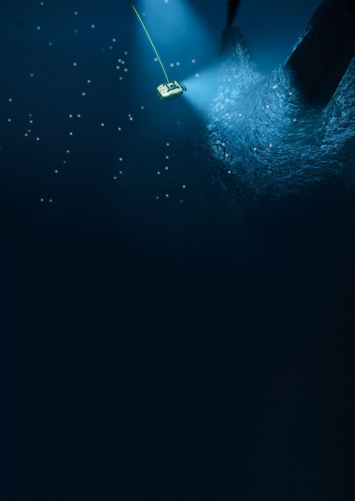
subROV is his rendition of the oceanographic live streams that allow people to follow cutting edge dives in real time. It’s truly amazing to experience aspects like the undocking procedure and hearing the gasps of scientists when they come across a creature they’ve never seen before at 1250 m depth. What Jose Luis wants with subROV is to recreate that whole experience by putting players at the centre of it all, right at the heart of the control panel of the submarine robot.
The game is currently at an early access stage meaning that new content is being added at a good pace, and it’s very satisfying to see new creatures come to life for the very first time in the game. In fact, many of these creatures are being featured in a video game for the first time ever.
And what has inspired Jose Luis in the first place? He was awestruck by the vast, concealing nature of the sea. It attracted him with a kind of fascination that he couldn’t fully explain.
He has always been interested in games with an underwater theme and he couldn’t think of a setting that would align better with both his personal interests and professional development. Jose Luis tells us that the game development was one of the best experiences of his life: one day he would discuss inverse kinematics (robotic arm control) with some of the best ROV pilots, and next he would browse through stunning pictures of corals or ask biologists about a particular species of fish. It’s been both enriching and fulfilling for him to see how excited they all were to help and share their knowledge with him.
It’s also worth to mention that both the Schmidt Ocean Institute (SOI) and the Bermuda Institute of Ocean Technologies (BIOT) are involved in the project and have been instrumental in the development of the game. They’ve given Jose Luis support, endorsement, and direct access to resources and experts he could rely on when touching on specialized subjects. Whether if it was the depth at which the Humboldt squid dwells during daytime, or the classification of a deep-sea coral specimen, with their help he has been able to make this game both unique and authentic.

As the game develops further, subROV has a great potential for growth as a framework to recreate scientifically-sound, entertaining dives, and to work with scientists and institutions in the future to bring their work to the game.

Currently, the game is available on PC, but it is possible that in the future a Linux version could come out and consoles are not off the cards either. So, if you ever wondered how it feels to pilot an ROV then this is the game for you! You can get instant access and start playing; get involved with this game as it develops via the following link:


store.steampowered.com/app/1648760/ subROV__Underwater_Discoveries/
SubROV and Jose Luis Gonzalez are open to collaborations and sponsorships of any kind; both from oceanographic institutes and individuals interested in ocean robotics.


5th -8th June
Save the dates for OCEANS 2023, June 5-8 and join us in Limerick , I reland.

The OCEANS conference is the ship event of the IEEE Oceanic Engineering Society (OES) and the Marine Technology Society (MTS). The event is recognized as the premier forum for the international marine community to meet and discuss technical innovations and current trends in the marine technology sector.
OCEANS brings together engineers, industry practitioners, government o ials, public sector executives, researchers and academics from all aspects of the oceanic spectrum. The event will feature all aspects of oceanic engineering, science and technology. The conference theme is "Blue Ocean Planet Earth".


Key highlights:
• O ver 500 professionally reviewed technical papers, including special focus theme sessions.
Plenar y sessions with leaders from industr y, academia, and government. exhibitors showcasing the latest innovations in produc ts and ser vices.
nt poster session featuring outstanding projec ts and other student ac tivities.
Papers presented at the conference are subsequently archived in the IEEE Xplore online research database.

• Tutorials, workshops, demonstrations, government listening sessions, social and
an attrac tive social programme.
National Oceanography Centre


THE HANDS-ON OCEAN TECHNOLOGY EXHIBITION AND TRAINING FORUM THE HANDS-ON OCEAN TECHNOLOGY EXHIBITION AND TRAINING FORUM
G Meet 360+ world leading manufacturers and service providers


G Discover the latest marine autonomous systems, survey tools and biological and chemical sensors


G See equipment live with 180+ hours of free training & demonstrations
G Navigate the year ahead and have your questions answered at the free conference
3 DAYS HUNDREDS OF SOLUTIONS
TRANSFORM YOUR BUSINESS
R7 COMPACT OBSERVATION CLASS ROV

A perfect balance of power and portability
Enhanced navigability and stability due to high-performance embedded sensors
Open frame design for easy payload integration
Powerful, robust & easy to deploy
formerly ECA Group & iXblue