



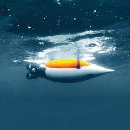
Delivering data in most adverse conditions: underwater acoustic modems with advanced communication technology and networking


Accurate USBL and LBL positioning of underwater assets
Modem emulator and other cost-saving developer tools
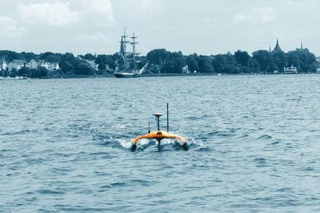
Autonomous surface vehicle for bathymetry, monitoring, search & rescue, and AUV support


sales@evologics.com sales-us@evologics.com

04. Events Calendar & Welcome to Ocean Robotics Planet
06. Exploring the Abyss with Mouse Clicks, not Joysticks
13. Viva La France, Viva La AUVs!
19. A Decade of Training on Ocean Glider Technologies
25. AUVs Maintain our Undersea Superiority: Bluefin Robotics Celebrates its 25th Anniversary
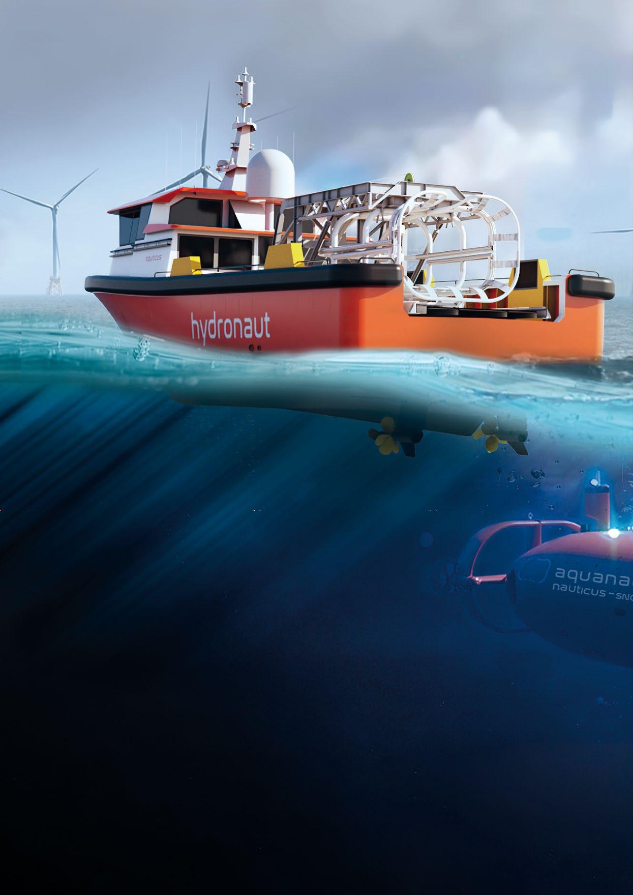
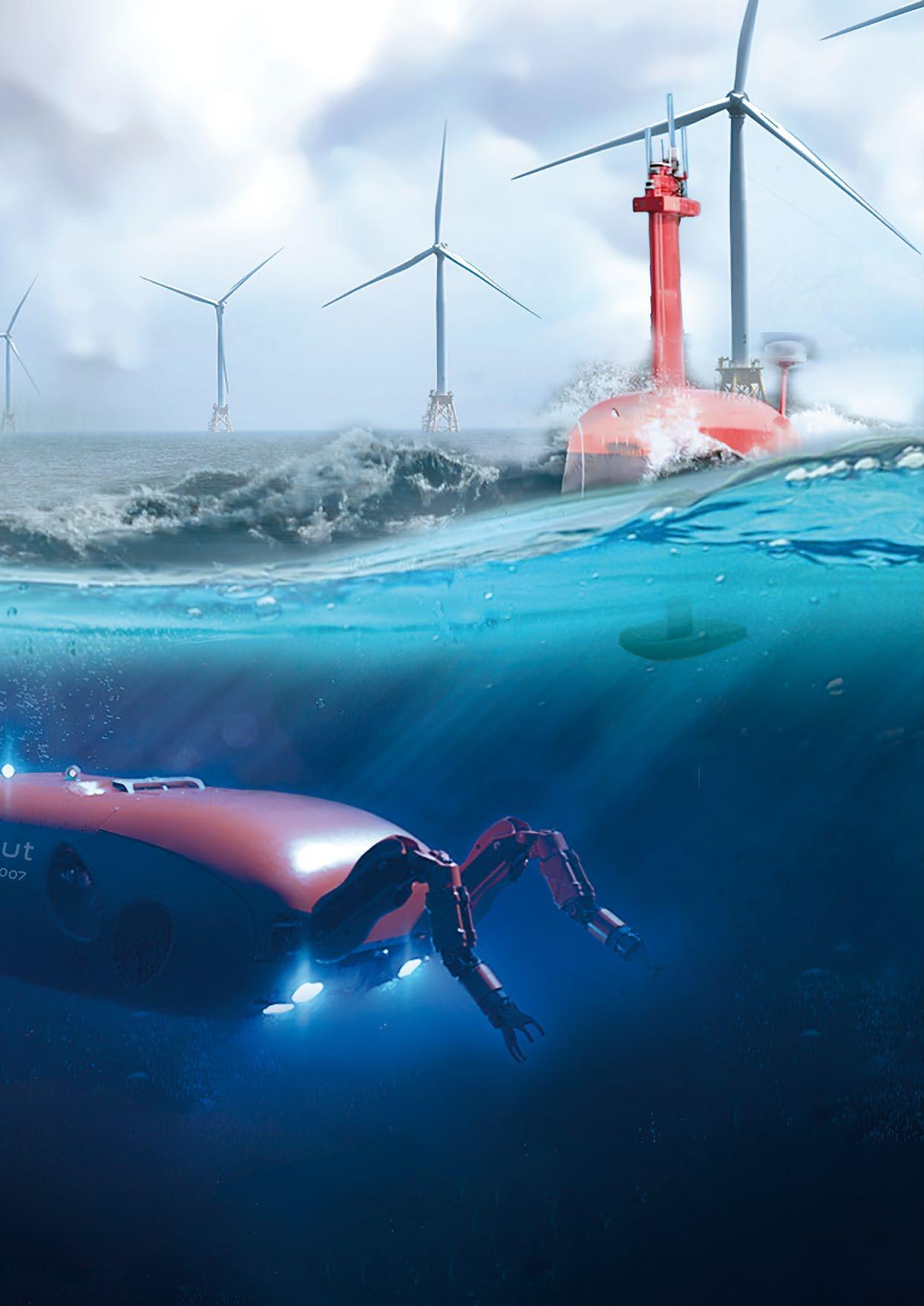
30. Poster: Nauticus Robotics Hydronaut and Aquanaut
33. LR11: Industry Leading Submarine Rescue Vehicle (SRV) Provides Naval Sector with Performance and Reliability
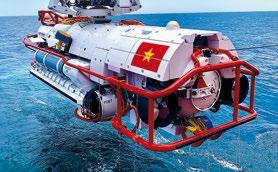
37. Marines Use Unmanned Surface Vehicles to Sustain Dispersed Forces.
41. Unlocking the Ocean’s Secrets: Versatile Optical Solutions and Subsea Operations
45. U.S. Naval Oceanography: Pathfinders of the American Military – Part II
53. Unlocking Automation and Real-Time Decision at Sea with Numurus’ NEPI Operating System for Robotic and Edge-AI Applications
57. Introducing iSite Subsea a Game Changing Digital Data Management Tool
ISSN 2755-239X
EDITOR-IN-CHIEF
Richie Enzmann
COPY EDITOR
Will Grant
SALES DIRECTOR
Nick Search
DESIGN & LAYOUT
Milan Farkas
CONTRIBUTORS
Richie Enzmann, Carlos Barrera, Chris Buckle, Ed Darack, Edward Lundquist, Marc Deglinnocenti, Nicolaus Radford
SPECIAL THANKS TO
Audrey Leon, Bill Mallin, Carlie Wiener, Chris Gibson, Christine Tichenor, Curtis Lee, Dawn D'Angelillo, Debbie MacKenzie, Francisco Bustamante, Gautier Dreyfus, James Colebourn, Jason Seawall, Jeroen Romijn, John Benson, Jonathan Reichel, Jostein Jansen, Julian Lalanne, Julie McLaughlin, Lisa Bland, Marion Seyve, Matt Bates, Matthieu Scheffers, Patricia Sestari, Paul Fletcher, Rachel McAlpine, Rob Howard, Silke Braham, Victor Sepulveda, Willard Balthazar
Acteon
Alseamar
Bayonet Ocean Vehicles
Blueprint Subsea
DeRegt Cables
Digital Edge Subsea
EvoLogics
Exail
FET
Forssea Robotics
General Dynamics
Greensea Systems
Nauticus Robotics
Norwegian
Offshore Rentals
Numurus
Oceaneering
PLOCAN
QYSEA
QSTAR
RTSYS
Saab Seaeye
Seaber
Silicon Sensing
SOI
Tritech
U.S. Navy
VideoRay
Voyis
Zetechtics
For more information about all events visit www.oceanroboticsplanet.com
JUNE MTS/IEEE OCEANS LIMERICK
Limerick, Ireland (5–8 June 2023)
UNDERWATER TECHNOLOGY CONFERENCE (UTC)
Bergen, Norway (13–15 June 2023)
GLOBAL OFFSHORE WIND
London, UK (14–15 June 2023)
SEANERGY
Paris, France (20–21 June 2023)
SEPTEMBER
SPE OFFSHORE EUROPE
Aberdeen, Scotland, UK (5–8 September 2023)
DSEI (DEFENCE AND SECURITY EQUIPMENT INTERNATIONAL)
London, UK (12–15 September 2023)
MTS/IEEE OCEANS GULF COAST
Biloxi, MS, USA (25–28 September 2023)
UNMANNED MARITIME SYSTEMS TECHNOLOGY USA
Arlington, VA, USA (27–28 September 2023)
My name is Richie Enzmann. Allow me to welcome you all to the latest issue of Ocean Robotics Planet!
OCTOBER
FLOATING OFFSHORE WIND
Aberdeen, Scotland, UK (3–5 October 2023)
REUTERS EVENTS:
OFFSHORE & FLOATING WIND EUROPE 2023
London, UK (25–26 October 2023)
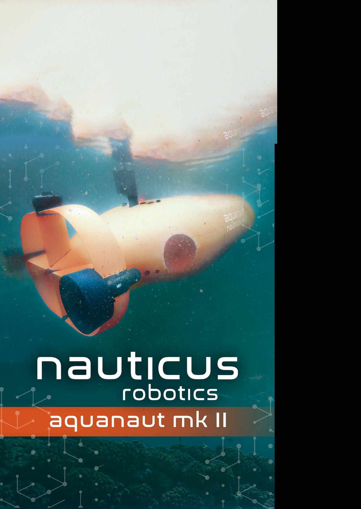
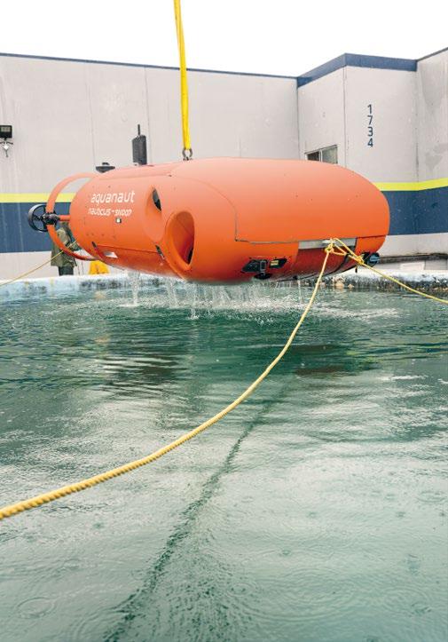
On the front cover of this issue, you can see an exclusive photo of the Aquanaut from Nauticus Robotics as it’s being tested underwater. This revolutionary ocean robot uses the latest advancement in AI and supervised autonomy. It was developed by ex-NASA engineer and visionary CEO Nicolaus Radford, and his team. They’re applying everything they’ve learned about observation and manipulation in space and are using it to solve problems under the sea. At the heart of this endeavour is the principle of mobile manipulation, which allows them to operate robots from very far and interact with the world they’re exploring. The article written by Nic titled "Mouse Clicks, not Joysticks” refers to the task focused technology that Nauticus Robotics has on offer.
NOVEMBER
MARINE AUTONOMY & TECHNOLOGY SHOWCASE (MATS)
Southampton, UK (7–9 November 2023)
OFFSHORE ENERGY
Amsterdam, The Netherlands (28–29 November 2023)
UNDERWATER INTERVENTION
New Orleans, LA, USA (29 Nov – 1 Dec 2023)
In February of this year, Captain Marc Deglinnocenti visited Oceanology International in San Diego and took an in-depth look at the three French mini-AUV/glider developments that were on display at the show. These AUVs might be short in length but they’re long on delivering their own specialised results. One of their advantages is that they’re easy for one person to launch and recover. Continuing the glider theme, we have an overview of the famous Glider School written by Carlos Barrera from PLOCAN. Over the past 10 years, many scientists and future glider operators have gone through this school located in the Canary Islands.
On the military side of things, Captain Edward Lindquist looks at the history and evolution of the past 25 years of Bluefin Robotics. Bluefin - now part of General Dynamics –is now an iconic brand used by various navies around the world. Capt. Lindquist also reports on the use of USVs to resupply troops during military exercises in the Swedish archipelago.
I hope you enjoy this issue and I look forward to meeting you at the events in 2023!
Best regards, Richie Enzmann
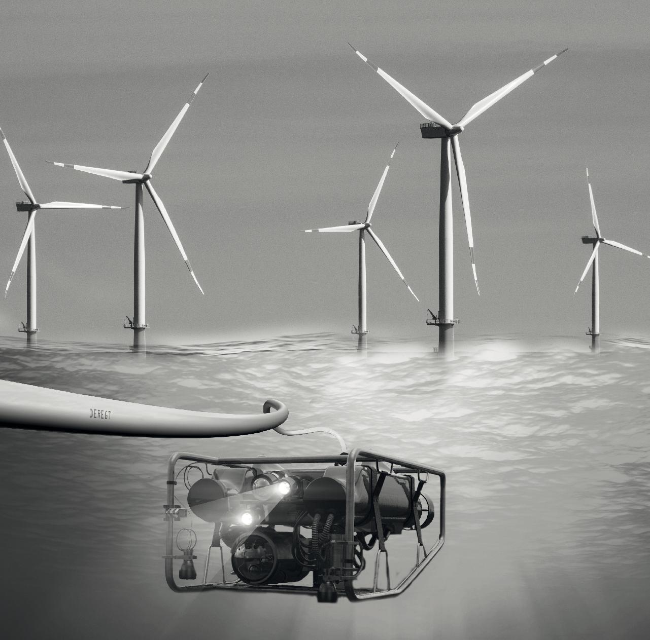
Which design considerations are the most important for your project? And how does ROV Cable manufacturing work?
Discover all about ROV Cable manufacturing, requirements, the latest trends and make your subsea project a success!
To help you select the perfect ROV cable, please download our Ultimate Guide here or scan the herein QR code.

Humans are intrepid, natural explorers. From the beginning of time, humanity has been fascinated with advancing technology. It is what has progressed our species from small bands to a global network that has come to dominate the earth.
The ocean world has not benefitted from the same technological advancements we have introduced on land and in the air. Yet, in our modern times, exploring the oceans’ depths has never been more important with all its invaluable resources and implications toward climate change.


The ocean intersects nearly everything we do on a daily basis: food, energy, transportation. It is a $3 trillion economy that few people think about and even less are concerned with its impact on our daily lives and impact on the future. The oceans cover 71% of the Earth’s surface, yet it seems we know far more about Mars. More than 80% of this realm remains unobserved, unmapped, and far from being understood. Ironically, the relative value of the ocean vs terra firma is estimated to be 20 times greater. In fact, you could say 'we live on an ocean planet stupidly called Earth.'
Rewinding the clock, evolving subsea technology continues as far back as 332BC when Alexander the Great was lowered into a glass diving bell to gaze on the underwater world around him. This, or essentially variations on it, would remain the status quo for nearly two millennia. Off-shore, the industry seems to operate technology that lags behind the latest available advancements pioneered by our greatest innovators.

Over the past century, the best thinkers, dreamers, and makers have made gigantic strides to achieve the impossible in space. That same cohort is now redirecting its focus from the galaxies beyond to the depths below to develop technology to help future proof our oceans for the generations to come.

I was fortunate enough to spend almost 15 years in NASA’s Dexterous Robotics Lab as a principal leading the humanoid robotics’ development teams. It was a fascinating time to interact with such revolutionary and cutting-edge ideas, helping lay the foundation for modern robotics. Most of our work centered around technologies required to launch and safely operate our robotic astronaut, Robonaut, on the International Space Station – which we successfully accomplished on STS-133,
the last flight of the Discovery Space Shuttle. We, of course, had other creations like self-driving moon rovers, a 600lb robot spider, a robot snake, bipedal walking robots modeled after female first responders called Valkyries, and a wearable exoskeleton ‘ironman’ suit.

An ambitious group of us left the agency determined to develop the first clean-sheet robot with exceptional utility: a true subsea robot purpose-built to seamlessly operate in the ocean, eschewing a tether. We were focused on taking the knowledge we had gained as technologists to make an impact in a commercial business. We could have chosen to enter any one of several different markets, but we chose to focus on the ocean – not because we understood the Blue Economy, but because we saw the need to make a significant change in ocean-based technologies.
Initially, it was all about technology for us, but we quickly learned the Blue Economy ecosystem is vast and there are many opportunities for a startup company like ours to make an impact with robots.


There is a growing awareness of the damage human activity is having on the environment, and more specifically, ocean ecosystems. Reducing greenhouse gas emissions, overfishing, habitat destruction, and pollution is a market driver. Governments are developing strategies and policies that are aimed at striking a sustainable balance between economic growth and ocean health for the Blue Economy.
The incumbent service infrastructure underwater cannot fulfill that mission. There is a myriad of equipment pitfalls – trillions of dollars’ worth of assets across several industries need to be constructed, operated, inspected, maintained, and repaired, and even decommissioned. Any time work needs to be performed underwater, a large ship must steam out and (most of the time) drop off the side what looks like more like heavy construction equipment, called a Remotely Operated Vehicle (ROV) in the water connected by thousands of feet of cumbersome umbilical back to the ship. This expensive, manual, and rather tedious way of operating subsea has remained largely unchanged for the last 60 years, while topside the robotics revolution has been exploding. In fact, for all intents and purposes, there has been little advancement from when the first ROV was invented in the 1950s to those used today.
Operating legacy ROV technology is time-consuming and therefore extraordinarily expensive. The industries that use it cannot cut the cord because they have not invested the last 20 years in researching how to use robots on other planets. There seems to be very little pressure to innovate in this area because of the extreme cost in developing, testing, and bringing change to market. “Innovation” is a word thrown around a lot, but to me it has always meant invention + commercialization, with the latter part being critical.
The tether umbilical is a major impediment. Though it may be useful and exciting to see high-definition images in real-time, a major reason for this necessity is it takes several personnel and real time control to run one ROV machine, because the pilots must be able to see what they’re doing with near zero-time delay between operator input and action. But to me, it’s like using a Ouija board to do brain surgery, and the truth is this isn’t a robot; it’s a glorified backhoe.
Real machine intelligence is at the technology core of service robotics. Smarter machines enable a fresh view to ocean-based activities and the human-to-machine interface can be changed in ways to provide economic and environmental value.
At Nauticus, we had to pick a starting point, and decided on two ocean markets with different application needs but similar technology needs. These markets aligned with the knowledge gained from our NASA humanoid robotics days, in that both required a robot with situational awareness that could autonomously interact with objects.
One of our goals was to apply what we had learned in spaceflight robotics toward national security in the ocean domain. Before long, we started working close with US Government interests and won contracts to prove that our robots and autonomy framework could adapt and execute behaviors subsea to perform tasks for maritime objectives.

However, we wanted to do more, so we investigated offshore energy markets: oil and gas, and the emerging offshore wind markets. We learned that the life cycles of these offshore projects are comparable to building and maintaining cities. We studied how ROVs, and autonomous underwater vehicles (AUVs) were being used and we knew we had found a niche where we could make a difference.
Our thesis has become to take the features of these two technologies, combine them into one robotics platform and then remove the need for an umbilical by using the latest advancement in artificial intelligence and supervised autonomy.
The potential benefits to the Blue Economy are significant, and by our estimation we can reduce the CO2 footprint of offshore vessels by over 90%, reduce the need for people offshore by over 95%, and lower value stream costs by 50%.

The challenge with traditional ROVs is it takes multiple individuals and significant operating resources just to run one unit because it is not a robot. Currently, everything is teleoperated with joysticks – whether it is a crane operator or ROV pilot, people must move things around manually.
At Nauticus, we aim to endow robots with a level of intelligence and a certain level of self-sufficiency, by extension removing the necessity of a cable. Once you remove the need
for a human to dictate every input, you can better manage the time delay. And if you can deal with the time delay, you don’t need a cable, which was only required because human operators could not work with a time delay. There is no intelligent automation because they are not real robots, so they require direct video to operate their marionettes.
In space, we have austere communications environments, especially when managing extra-planetary missions. To operate remote geologists or send robots ahead of human explorers requires extensive “mobile manipulation.” We need to operate robots at extreme distances without the presence of high-bandwidth or high-capacity networks.
On the International Space Station, we have a delay due to the operating sequency. Once an info packet leaves the Control Center, it goes to the White Sands Network, is then beamed to the Tedra satellites, relayed to the gateway of the space station where it gets beamed around that network, and then finally delivered over to the robot. That sequence builds to a three-second latency. It was impossible for us to teleoperate one-on-one from the ground, so we had to invent a solution that could. Not only did we need to develop new technology, but we reinvented an industry along the way.
For Aquanaut, we have taken 20 years of NASA R&D and adapted it to the ocean. We are applying everything we have learned about observation and manipulation in space, and are using it to solve problems under the sea. At the heart of this endeavor is the principle of mobile manipulation, which allows us to operate robots from very far and interact with the world they are exploring.
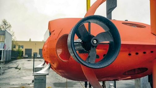
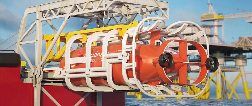
The essence of Aquanaut is its versatility. It transforms from a sleek, hydrodynamic form able to transit long distances, to a hoverable, six-degrees-of-freedom, controllable platform humanoid-esque robot, with a head, two arms and hands, that it can use to perceive and interact with the environment.
While the methods used to operate ROVs are direct and rather rudimentary, Aquanaut uses a real-time convex, quadratic optimization controller that allows us to close solutions 500 times a second in every dimension. It is the only robot in the world with the ability to nimbly adapt its hydrodynamic and buoyancy profiles while remaining stable in order to perform sophisticated maneuvering and manipulation techniques. It is this advanced engineering that allows the Aquanaut to remain steady while operating its arms, interacting with structure, or carrying payloads.
There is a significant opportunity to create a future where more autonomous and intelligent robots are used to reduce cost, decrease our environmental footprint while increasing efficiencies, and eliminate human exposure to hazards while improving the offshore industry in every way possible.
The industry’s standard operating procedure is constraining and limiting. We cannot explore or execute meaningful work in a cost-effective manner if we remain tethered to technologies of yesteryear. Anyone who wants to work extensively and affordably in the ocean must alter the cost structure, the deployment structure, and the holistic infrastructure. Nauticus can reduce the cost of commuting and working in a subsea field significantly below half the current market rate.
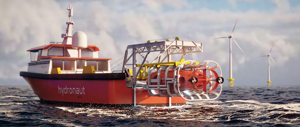
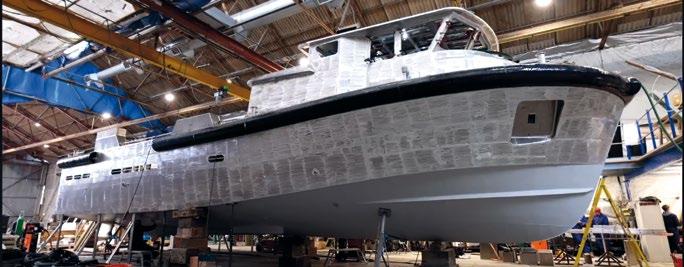
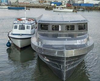
In April of 2022, Nauticus commenced production of the first-of-its-kind Nauticus Fleet, along with the advanced second generation of Aquanaut. The Fleet is a robotic navy comprised of Hydronaut-Aquanaut robotic pairs that will be deployed to multiple operational bases around the world to service offshore industries ranging from subsea data collection to maintenance and intervention. The Fleet was developed to significantly reduce the greenhouse gas emissions associated with the legacy methods which on the aggregate can be the equivalent of millions of cars per year of effective emissions. Hydronaut is a small, surface-level vessel that can be operated remotely and autonomously to deploy Aquanaut.
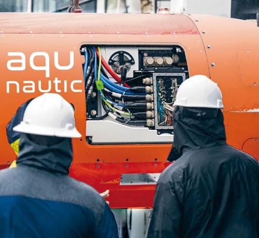
We also recently unveiled our second-generation Aquanaut. It further accelerates our mission to disrupt the offshore ocean services industry while setting a benchmark for nextgeneration subsea technology that will fundamentally revolutionize how the industry operates. Like its predecessor, Aquanaut Mark 2 is a fully electric, untethered, and autonomous subsea robot that is controlled through acoustic communication networking and underpinned by Nauticus’ proprietary software suite, toolKITT. With its technological improvements, it can continue to provide subsea service while operating in two separate modes, transforming to both excursion and intervention configurations.
Nauticus Robotics has championed this technological shift to disrupt an antiquated industry for the betterment of our oceans.




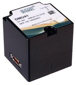

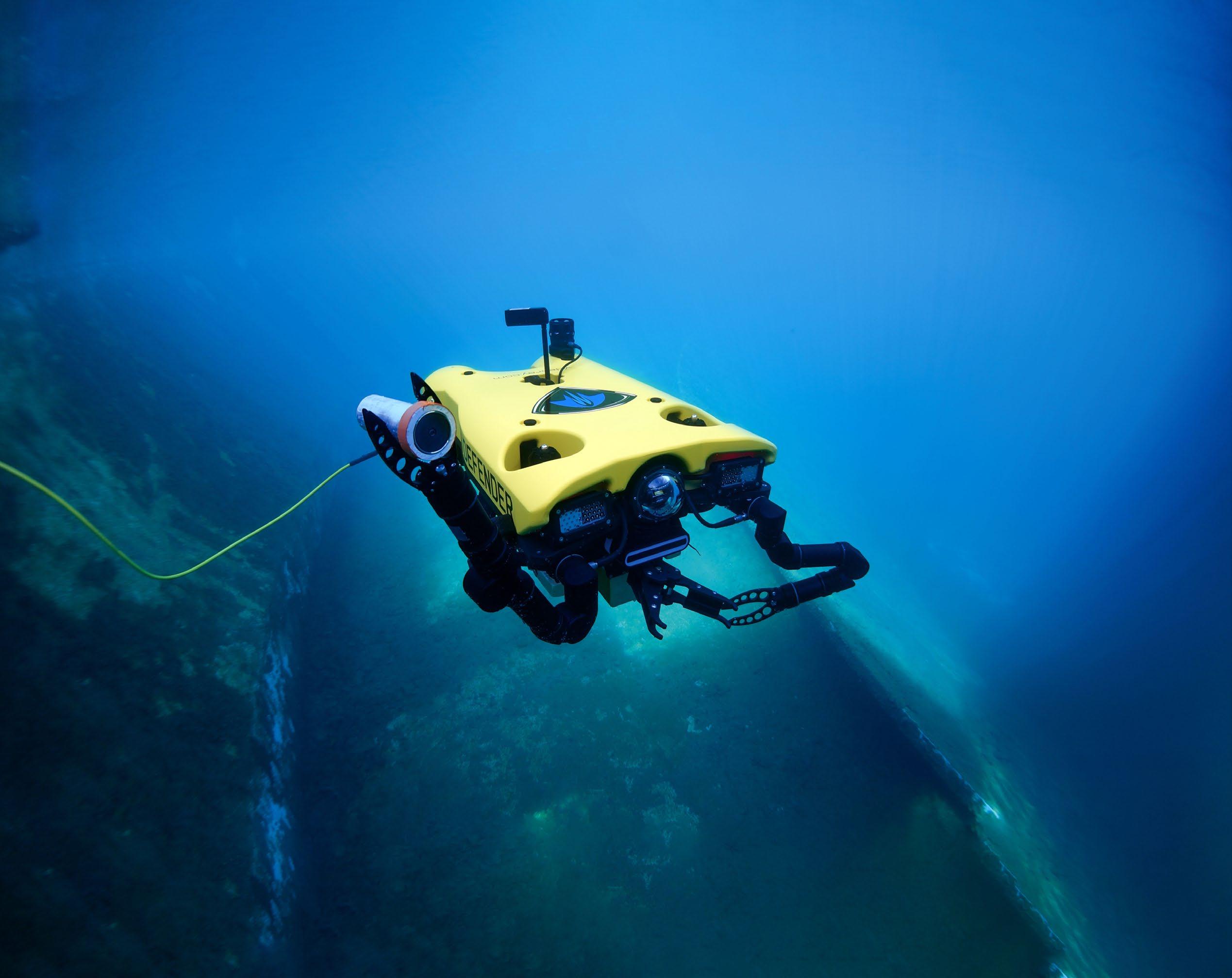
Mission Specialist underwater robotic systems are engineered to work hard. With powerful thrusters to handle currents up to four knots. A modular platform built to handle heavy payloads and a wide array of accessories. And durable construction that can take a beating and keep on working. That’s how we’re redefining “inspection class” to give you the performance you really need.



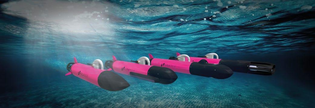
There’s so much more to France than brie and croissants, and the French proved that at Oceanology International Americas 2023 (Oi) in San Diego, USA. Three French AUV builders showed up and showed us all that AUVs do not have to be large and expensive to get the job done. Seaber of Lorient, RTsys of Caudan, and Alseamar of Rousset offered up their one and two metre long micro AUVs. These AUVs are short light weight and therefore easy for one person to launch and recover. These French AUVs might be short in length, but they’re long on delivering results in their own separate ways. The shocking pink coloured Seaber was represented by the CEO and Co-Founder himself- Vidal Teixeira. He explained with enthusiasm how his AUV was different from all the rest, and it was an impressive explanation indeed.
The Seaber keeps their base costs low, $22K USD- $23K USD, by using the assembly line method instead of building one from scratch each time an order is placed. That’s a great business plan, because the Seaber micro AUV happens to be the least expensive of the three listed here. When the almost inevitable custom order comes along, they still manage to keep their costs low. How can they possibly do that? They get around it by making five separate models of the Seaber where only the front end of the micro AUV varies. Each model

has the same propulsion motor, battery power, and guidance unit. This gives most of the five models an endurance of 8 –10 hours at 2.5 knots. The maximum speed of the micro AUV is 6 knots. That’s a pretty good performance for 98 cm to 123 cm long AUV with a 12 cm diameter. The routes of all five models can be preprogrammed or overridden up to 5k away with a small hand-held UHF remote control called SEACOMM. That remote control can tap right into the AUV’s on board navigation system.
Their Intuitive Navigation eXperience (INX) software provides the small AUV with precision navigation without having to rely upon expensive external acoustic positioning systems. That’s another way that Seaber can save you time and money. They also claim that the INX system can be programmed using their SEAPLAN interface in as short as five minutes. The SEAPLAN interface uses WiFi for access through different platforms and works on all five different models.
Seaber offers the YUCO-CARRIER model. That unit is perfect for carrying your own custom sensors. You can even install many off the shelf multi-sensors known as sondes. It’s 45 cm in length with an option for a built in Doppler Velocity Log (DVL). DVLs can measure the speed and direction of currents by understanding and utilizing the fact that currents approaching the DVL sensor have a higher sound frequency than the currents moving away from the sensor which are lower in frequency.
Their YUCO-SCAN model comes equipped with a side scan sonar operating at 680 kHz with a preinstalled DVL to go along with it. That’s a 98 cm long AUV. The increased power usage means a decreased endurance of 6 hours at 2.5 knots.
The Seaber model YUCO-CTD has an RBRlegato³ Conductivity Temperature Density (CTD) sensor with the DVL optional. This AUV is 112 cm long.
The YUCO-PHYSICO has an AML brand multi-parameter probe with an optional DVL. This can measure the physicochemical parameters of the water. Various sonde sensors can measure Sound Velocity, Conductivity, Dissolved Oxygen, Turbidity, pH, Chlorophyll A, Crude-oil, and much more. This is the longest of their AUVs at 123 cm, however it still has that 8 – 10 hours endurance at 2.5 knots.

Seaber offers the YUCO-PAM model which has a built-in acoustic recorder and room for an optional DVL. PAM stands for Passive Acoustic Monitoring. It has a built-in porpoise recorder from RS Aqua. It’s 98 cm in length.
All of these Seaber models have a 300-metre depth rating and come with a set of accessories such as extra fins and a transportation case. Try getting those for free with a large AUV. We are going to be seeing a lot of these shocking pink AUVs out and about in the very near future. Blue Robotics was even showing off one at Oi that they had bought.
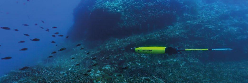
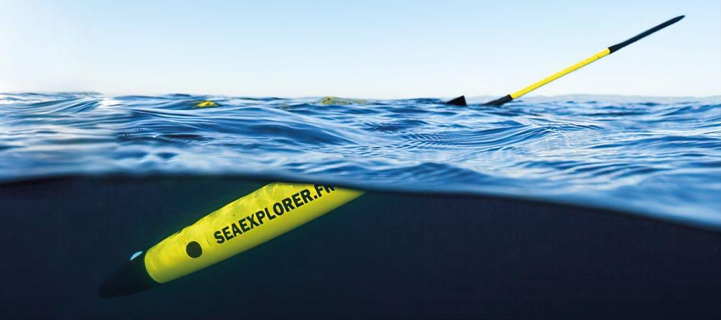
We might also see some bright yellow small AUVs out in our oceans too like the Sea Explorer AUV from Alseamar of Rousset, France. The Sea Explorer AUV is 2 metres in length plus a short tail antenna. It does have an impressive 1000 metre depth rating and an impressive endurance of about two months. That endurance can be pushed out to a maximum of 110 days depending upon payload, sensors, environment, etc. It can do that, because it really is classified as a glider without any propulsion of its own. That slows it down to an average of one half of a knot. However, a 110-day
endurance can equate to a 1700 km range depending upon the currents and many of the above conditions. Those are quite impressive specifications for its size and its single person operation. This $200K - $300K USD priced glider is their second-generation iteration, yet they were the first to employ internal batteries that could be charged externally. This might be a common technology today with other AUVs, but it does show that this company is an innovator within the marketplace. As a matter of fact, Alseamar has been developing its glider technology over the past 20 years. The Sea Explorer’s modular design allows for three immediate different nose-cone options with options within those separate nosecones. That modular design delivers an almost off the shelf customization for its users. Its short stern antenna can pop up out of the water for global communications for its users too.
This little AUV has GPS, and radio or satellite communications so that you can periodically collect data from its tail antenna and even issue it a change of orders from a shore station. These advanced capabilities along with its endurance makes its higher price still cost effective. Its silent operation also makes it perfect for collecting data on marine life. This is especially true for cetacean research like that of whales and dolphins. Along with its silent movements, the Sea Explorer has a multichannel acoustic survey capability that avoids interfering with cetacean communications and therefore also their natural movements and behaviors. In short, it is a great AUV for many marine biology-based research missions.

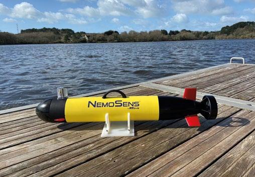
There was a third French micro AUV that appeared at Oi Americas, and it was also yellow in colour but with red fins. It’s less than 90 cm in length and can be launched and recovered by one person. It has an open LINUX architecture and is named the NemoSens from RTsys of Caudan, France. This small 300 metre depth rated AUV can travel between 2 to 8 knots with a ten-hour endurance depending upon multiple factors just like all other AUVs on the market. For example, if you increase the cruising speed from 2 knots to 4 knots,

then the NenoSens’ endurance decreases from 10 hours to 8 hours. This little AUV can handle up to a sea state of 4 though. They also pack a lot of capabilities that come standard in the NemoSens. It has a side scan sonar, CTD sensor, a DVL, a magnetometer, dissolved oxygen sensor, thermometer, a high-definition video camera, hydrocarbon sensors, turbidity sensor, and a sparse Long Baseline (LBL) transceiver for accurate positioning for underwater surveying. All of that makes the NemoSens extremely versatile.
The NemoSens can be used for marine biology research, bottom surveys, sonar imagery and searches, marine environmental monitoring, and even inner harbor and outer coastal security missions. If all that doesn’t suit your needs, then this AUV can be stripped down to just a single side scan sonar and a 2-payload package of your own design. That makes this micro AUV even more versatile than some others. Even more versatility can be achieved by utilizing this AUV’s built in surface communications module for real time data transfers and operational remote controls. Its
sophisticated Internal Navigation System (INS) along with its Global Positioning System (GPS) gives this micro AUV some advanced capabilities.
This micro AUV can be used in a Swarm configuration along with, and communicating with, other NemoSens AUVs in a fleet type of formation. The NemoSens can even operate in waters as shallow as 3 metres in depth.
So, pour yourself a nice cold glass of champagne and spread some pate over a fresh slice of baguette, and enjoy yourself whilst you visit the websites of these three petit AUVs from France. There’s so much more to learn about them there, and you will probably find one that suits you. After all, sometimes good things from France come in small packages!
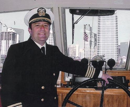
Capt. Marc Deglinnocenti has sea time on various types of vessels dating back to 1974. Those vessels included conventional and tractor tugs, sailboats, ferryboats, water taxis, training ships, warships, cargo barges, containerships, near coastal passenger vessels, paddlewheels, and research vessels to name a few. He was in the U.S. Merchant Marine for 33 years, 25 of which as a master mariner. He was also a designated qualified engineer and held many individual certifications and positions on ships such as QMED, able bodied seaman (lifeboatman along with the AB), unlimited radar observer, shipboard firefighting, and assistance towing endorsement. He served as an engineering officer, deck officer, commissary officer, and he even was a California State credentialed maritime teacher. He has experience piloting USVs and ROVs.


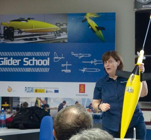
 Carlos Barrera, Head of Ocean Vehicles Unit, PLOCAN
Autonomy has been significantly improved in recent decades to provide a key platform for several sectors and domains, including ocean observing systems. The transition from research concept to commercial product and related services has not always been easy due to technology, business, and policy framework constraints. Ocean gliders and Autonomous Surface Vehicles (ASV) development and implementation illustrates this evolution.
Starting as small custom-prototypes operating near shore for survey and research applications, these cutting-edge technologies have evolved into more complex and capable platforms, that are now able to operate in highly demanding scenarios in coastal and open-ocean for long periods in fully autonomous routine mode. This progress has paved the way for small and large-scale autonomous ships (MASS) to be used as the ultimate step in maritime autonomy in a Digital Ocean context.
The transition between carrying out prototype tests to implementing routine operations with commercial systems on both a regional and global scale requires the availability of infrastructures such as the Oceanic Platform of the Canary Islands (PLOCAN). This includes appropriate equipment and highly qualified staff for the right handling and operation.
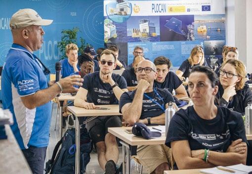
The PLOCAN Glider School initiative provides a unique capacity building framework within the context of international ocean-observing initiatives and programs such as the Global Ocean Observing System (GOOS) or European Ocean Observing System (EOOS), as basic hands-on training and a state-of-the-art overview forum on underwater glider and ASV technologies. From 2011 to present the annual events have been addressed to those from both academia and the private sector who are interested in learning more about these systems and and working with them. Leading manufacturers and world-renowned ocean-research institutions with the best level of knowledge and expertise possible in these cutting-edge technologies are committed to supporting the initiative with direct involvement.
In the last two decades, discussions on GOOS highlighted the tremendous potential value of ocean-gliders and ASV for physical, biogeochemical, and biological observations, particularly in the transition between the open-ocean and the coastal environment. This is a key area for societal and economic issues.


Over the last two decades, significant advances in technological disciplines – such as electronics, communications, sensors, new materials, etc. – have led to the development of autonomous platforms to replace research vessels and associated ship-based technologies in ocean observing.
Glider technology started its development in the late 1980s. The initial concept was that a network of small, intelligent, mobile, and synergetic ocean-observing platforms could fill sampling gaps left by other platforms, such as ship-based technologies, moorings, floats, drifters, ferry-box, etc. From the very beginning of the GOOS framework strategy, gliders
were considered one of the key technologies to improve ocean monitoring in a more efficient and sustainable way.


Nowadays, ocean gliders offer nowadays persistent fine resolution observations in both coastal and open ocean areas through two main approaches: buoyancy driven and surface technologies. In particular, the buoyancy-driven technologies profile the water column between surface down to 1,000 m (improvements for a full-range version down to 6,000 m are currently underway). Surface technologies are addressed to specifically monitor the upper layer of the ocean, including ocean-atmosphere coupling interaction. Ocean gliders offer a new approach in terms of capabilities and sustainability, allowing observations at scales hitherto unavailable. Routine missions and deployments of a year are now possible, with 3–6 month deployments now routine, and survey tracks extending over thousands of kilometres.
In some ways ocean gliders could be defined as sets of sensors on autonomous platforms. They can be assigned to monitor an endless array of essential climate and ocean variables: pressure, temperature, salinity, currents, turbulence, wind speed, dissolved
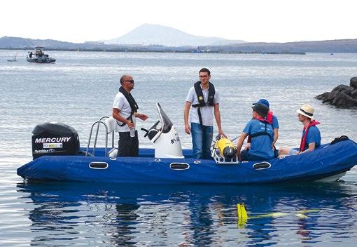
oxygen, irradiance, carbon dioxide, pH, nitrate, and hydrocarbon, among others. They are also able to collect samples in a wide range of applications, including undersea ice and ice shelves, to recover data from other deep instruments via acoustic telemetry or to detect acoustic tags on fishes and marine mammals.
Their unique sampling capacities (high resolution and long term) are suitable for some key coastal and oceanic phenomena. They have yielded major scientific breakthroughs, revealing new insights into ocean physical, biogeochemical, and biological processes.
The proper operation and management of cutting-edge technologies for ocean observing such as gliders requires both facilities and appropriate equipment, as well as accredited technical personnel. In both cases, unique scientific-technical infrastructures such as PLOCAN have enabled access to these technologies and personnel training from the national and international communities.
PLOCAN is a multipurpose service centre, with land and novel sea-based infrastructures to support research, development, and innovation in the marine and maritime sectors. Its mission is to promote long-term observation and sustainability of the ocean, providing a cost-effective combination of services, such as an ocean observatory, a marine test site, a base for underwater vehicles, training, and an innovation hub.
PLOCAN is a joint initiative between the central government of Spain and the regional government of the Canary Islands, with the contribution of the European Regional Development Fund. It’s also member of the Spanish Map of Unique Scientific and Technical Infrastructures (ICTS). Its main objective is the construction and operation of a fixed offshore platform located both close to the coast and near the edge of the continental shelf in Gran Canaria Island. This is part of a wider highly specialised infrastructure which acts as a test facility for industry and academia/research groups. Here, they can conduct trials and experiments in real operational scenarios in a safer, more efficient, and sustainable way.
Among its main capabilities and equipment, PLOCAN has a dedicated installation known as VIMAS (Vehicles, Instruments, and Submarine Machines) whose main objective is to provide permanent operational support through a multidisciplinary fleet of cutting-edge autonomous ocean vehicles, platforms, and instruments. These are available for all activities related to ocean monitoring from the perspective of technological development, marine sciences, training, and cooperation with institutions and technology-based companies.
The VIMAS base includes: a permanent base for underwater and surface autonomous vehicles; direct, fast, and

guaranteed access to coastal and open-ocean waters; technical and logistical support for test and operations both in tank, confined, and open waters; multidisciplinary and sectorial technological cooperation with institutions and companies; dedicated labs, workshops, boats, control room for testing, setup and repairs; and highly specialized training.
The idea and main motivation for undertaking the PLOCAN Glider School initiative took shape in 2011 during the 5th edition of the EGO Workshop & Glider School, organised and hosted by PLOCAN at its headquarters in Taliarte, Gran Canaria.
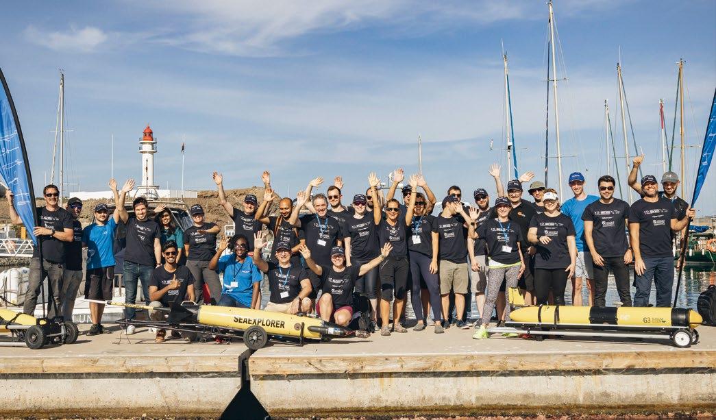
EGO (Everyone’s Gliding Observatories) is a biannual forum supported by collaborative frameworks such as EuroGOOS Glider Task Team and OceanGliders, that brings together the international community of operators, users, and leading companies in the sector to present both the latest advances and scientific-technical results. It covers the main technological innovations in underwater and surface (ASV) gliders, thus contributing to capacity building strategies worldwide.
However, considering the progressive increase in the use of these technologies, it was deemed necessary to design and implement a specific training forum. This offers a better approach on these state-of-the-art autonomous systems in ocean observation to potential new users.
PLOCAN Glider School provides a basic, hands-on training approach. There are 15 students per session, selected based on curricular merit in line with the quality certification criteria under which the PLOCAN Glider School is conducted.
The main objective of the PLOCAN Glider School is providing students with an overview of state-of-the-art glider technologies. This includes their wide range of uses and applications from both scientific and engineering perspectives.
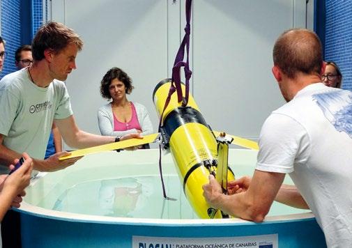
The PLOCAN Glider School has a fleet of ocean vehicles from the VIMAS facility (Vehicles, Instruments and Underwater Machines) of PLOCAN, where the main commercial glider technologies are represented. It also has its own boats and facilities, such as technical and testing laboratories, piloting room, as well as direct, quick, and easy access to both confined and open waters for practicing in a safe manner.
The didactic contents taught at the PLOCAN Glider School are carefully tailored to promote the goals of the school. These include the hands-on training component, the profile of the attendees, the number of technologies to be shown, and the duration of the training, among others. It is not the purpose of the school to overlap with specific training courses that are offered by manufacturing companies or official delegates.
Through them, it is intended that attendees without any experience on gliders have the opportunity to approach these technologies in a basic way. They are able to get a stateof-the-art overview of the main commercial technologies by having all of them in the school.

Each of the five days of PLOCAN Glider School are divided into eight-hour slots, in which theoretical and practical sessions in the laboratory, confined, and open waters are combined. In these sessions, students can learn about Slocum (Teledyne Marine), Seaglider (iROBOT, Kongsberg, HII, CSCS), Spray (Bluefin Robotics, MRV Systems), SeaExplorer (ACSA, ALSEAMAR), Waveglider (Liquid Robotics), Sailbuoy (CMR and Offshore Sensing), and AutoNaut (Seiche-AutoNaut) technologies.
Each session includes a range of content covered by staff specialists from the leading glider manufacturers. They will present students with the concepts and basic principles of operation to mission planning and piloting interface, as well as scientific payload configurations, data management, assembly and disassembly, maintenance, ballasting, etc. This is all covered on a basic training level for beginners.
Once the basic knowledge of each glider and ASV technology has been acquired, the fifth day is devoted to practicing in confined and open waters. This includes deployment and recovery manoeuvres and piloting. In some cases, this will be conducted on board an actual boat to allow for a more realistic simulation of this type of sea operation.
The PLOCAN Glider School also includes specific contents referring to certain subsystem components, such as science payload (RBR-Global, Seabird Scientific, Rockland Scientific, Ocean Sonics, Teledyne RDI, Wet-labs, AADI, Turner Design, Idronaut, etc.) and telemetry (CLS).
To better frame and reinforce these contents on glider technologies, each training day combines sessions where worldrenowned operators and users (Memorial University, MARUM, National Oceanography Centre, Rutgers University, MBARI, VOTO-University of Gothenburg etc.) share their experiences with students. This displays the potential in terms of related applications of this type of autonomous ocean observation platform. In the same way, sessions related to the international coordinated management framework for the Global Glider Network strategy (EGO, OceanGliders, EuroGOOS Glider Test Team, etc.) are given for the student to identify the contribution to the Global Ocean Observation System (GOOS, OceanOPS) that this type of device carries out.
Over the course of ten semesters of PLOCAN Glider School 165 students from 32 countries across five continents have attended. They’ve had academic and professional profiles that cover marine science, ocean technology, and engineering.
Their main motivation is accessing first-hand experience and training from a more practical perspective, that covers a large representative number of the main commercial glider technologies simultaneously. Obviously more time would be needed to become a fully qualified expert user or operator, but the school still provides a comprehensive first step.
The Glider School offers the students a degree of ability to identify, understand, and compare the capabilities of each glider technology the school provides. This knowledge will be handy for the students in their future work and also when specifying the criteria and requirements of future glider equipment that is procured for their institutions or companies to cover specific ocean monitoring needs.
One of the main strengths of the PLOCAN Glider School undoubtedly is its professoriate. This cohort includes both the best technical specialists representing each technology that is utilized by the school. There are also renowned operators and scientists with proven experience in the operation and use of this type of autonomous ocean observing technologies.
The PLOCAN Glider School professoriate is drawn from leading companies in this sector, as well as from technological-based ocean-research institutions with interest in the use and application of these cutting-edge technologies. In the ten years that PLOCAN Glider School has been running, a total of 28 companies and 15 institutions have joined and supported the initiative.
All the professoriate members have collaborated and contributed with the highest level of dedication: providing the best of their knowledge and expertise. Among them, a core-group of teachers stands out for having maintained their direct involvement and have subsequently joined Glider School for almost every session.

Bluefin Robotics is celebrating its 25th year of making state-of-the-art autonomous unmanned underwater vehicles (UUVs). The company had humble beginnings as "an entrepreneurial MIT spinoff," founded by Dr. James Bellingham and Frank van Mierlo, both engineers at the Massachusetts Institute of Technology (MIT).

"Bluefin Robtotic's first facility was a former auto parts warehouse a few blocks from MIT," said software engineer Steve Summit. "The team literally rolled the vehicles across the street dodging traffic."
Early on Bluefin Robotics had a contract from Office of Naval Research (ONR) to build the Battlespace Preparation Autonomous Underwater Vessel (BPAUV) and an order from Racal to build two deep-water survey vehicles. The two initial programs focused Bluefin Robotics development of autonomous unmanned underwater systems (UUVs) with integrated sensors and processing.
The company grew and was profitable every year. In 2005, Bluefin Robotics became a wholly owned subsidiary of the Battelle Memorial Institute, and in 2016 it was acquired by General Dynamics Mission Systems.
Since the inception, Bluefin Robotics vehicles have featured free-flooded designs with open architecture that allow them to be readily adapted or configured for a broad spectrum of missions, and capable of rapid data and battery exchange for fast turn-arounds. Modularity also permits the vehicles to be quickly broken down and packed in transit cases for rapid air shipment to hotspots across the globe.
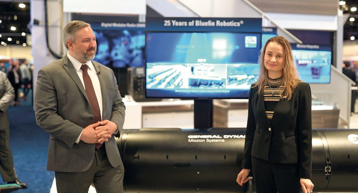
"We've seen how our family of Bluefin 21-inch, 12-inch and 9-inch vehicles have become the platforms of choice for the most challenging commercial, research and defense missions. Bluefin Robotics vehicles have evolved and continue to improve to provide more persistent presence; deliver more power to conduct complex on-board processing; and operate with even greater reliability in the toughest of environments," said Mike Guay, director of autonomous undersea systems at General Dynamics Mission Systems.
"Whether it was our historic search for Malaysian Airlines MH370 in the harsh seas off eastern Australia, our numerous excursions to the Arctic Circle with the U.S. Navy and MIT, or our cutting edge Knifefish Surface Mine Countermeasures UUV, chances are that if you follow the UUV market at all, you’ve either heard about or seen our systems in action," said Guay.
The Knifefish production line has outgrown the company's waterfront facility just south of Boston in Quincy, Mass., and has moved Knifefish assembly to General Dynamics Mission Systems' new UUV Manufacturing and Assembly Center of Excellence in Taunton, Mass. "We've totally modernized our production capabilities to meet the increasing demands for our unmanned systems today and in the future," Guay said. "Our waterfront facility in Quincy is now exclusively dedicated to advanced research and development and rapid prototyping of UUVs and other novel, autonomous maritime systems."
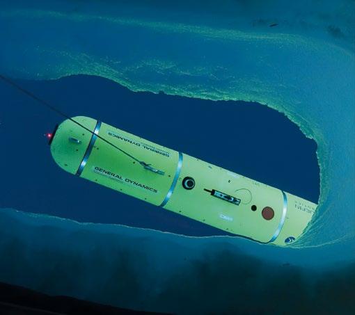
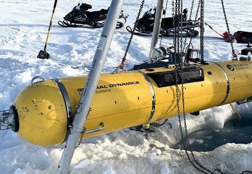
The Bluefin-21 has been the flagship system for over two decades, and is the basis for Knifefish and many other novel adaptations.

The MIT-owned and operated Macrura UUV, based on a Bluefin-21 vehicle--has been employed in the biennial Ice
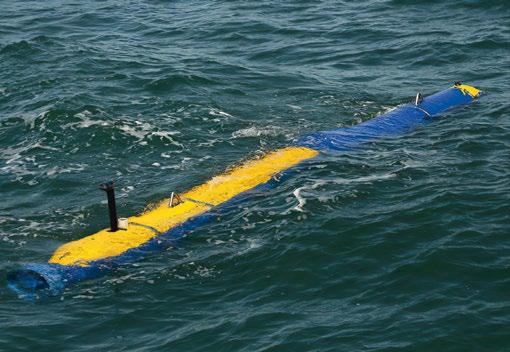
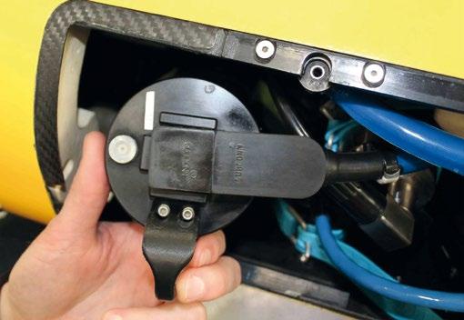
An operator is able to recover and redeploy their vehicle in 30 minutes or less and have reviewable or actionable data in-hand immediately. Bluefin-9’s RDSM acts as an independent data processor, generating and storing post-processed data with a simple interface to an operator’s workstation. The RDSM contains a high-definition, machine-vision-grade monochrome camera that captures still images and video. Imagery is geotagged for easy review during post-mission analysis.
Exercise (ICEX) in the Arctic and can operate autonomously underneath the ice.
Fugro Seafloor Surveys, Inc., uses an air-transportable Bluefin-21 AUV called Echo Mapper to quickly deploy to remote locations for search and survey missions.
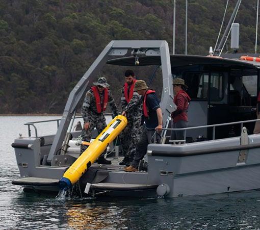
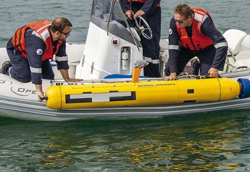

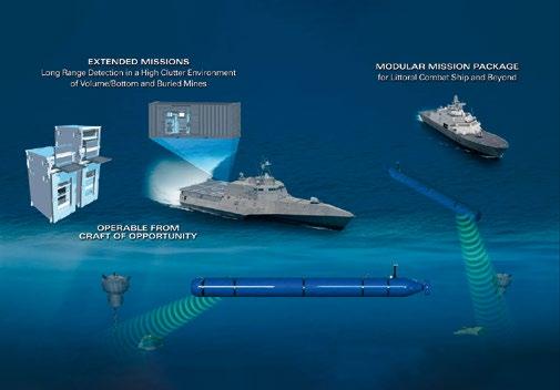
The Physical Acoustics Branch at the Naval Research Laboratory (NRL) in Washington, D.C., has employed their Bluefin-21 autonomous UUVs, Reliant and Black Pearl, to develop and test NRL’s low-frequency broadband (LFBB) sonar for mine countermeasures, anti-submarine warfare, and counter-UUV applications. That capability has been operationalized with the U.S. Navy’s Knifefish SMCM minehunting UUV. Knifefish is currently the only UUV that can find bottom or buried mines and is a key component in the Littoral Combat Ship (LCS) mine-countermeasures (MCM)

mission package. Knifefish can also provide the LCS or host platform with environmental data to support mission planning and execution for other mine warfare systems.

The NATO Science and Technology Organization Center for Maritime Research and Experimentation (CMRE) in La Spezia, Italy, employs a pair of autonomous Bluefin-21 UUV’s— the Minehunting UUV for Shallow Water Covert Littoral Expeditions (MUSCLE) experimentation platform and “Black CAT”—that can conduct collaborative minehunting as part of CMRE's Distributed and Decoupled (D2) Collaborative Autonomy Framework (D2CAF).
Phoenix International Holdings Inc., operated a Bluefin-21 known as “Artemis" to provide salvage deep-dive support to the U.S. Navy in the search for the missing Malaysia Airlines Flight 370 Boeing 777 that disappeared in 2014 with 239 people on board. Artemis was modified to conduct very deep
dives so it could approach the bottom of the Indian Ocean, which is as deep as 20,000 feet in the search area.


The company has invested in continuous product development, which has resulted in new “clean sheet” UUV designs, the Bluefin-9 and Bluefin-12, which launched in 2018 and 2019 respectively.
"Those systems are a pillar of the Royal Australian Navy’s SEA1778 program – helping revolutionize mine hunting capability for the Commonwealth at a very critical point in time," said Guay.
Guay said the full-ocean-depth operating capabilities make the systems deployable from any number of vessels of opportunity in any ocean.
Guay said the company's experimentation program has greatly expanded beyond simply proving that UUVs can operate reliably, to now focus on extending capability in more innovative ways.


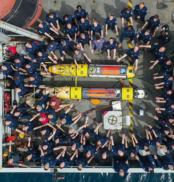
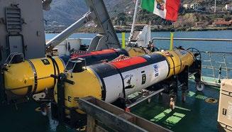
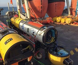
"These complementary centers at Quincy and Taunton enable us to deliver exceptional speed-to-market and the capacity required to meet the scale of tomorrow’s needs," he said. "As we look forward, we are still pushing the envelope. General Dynamics Mission Systems continues to make substantial investments in this vital class of technology."
According to Dr. Laura Hooks, General Dynamics Mission Systems vice president and general manager for maritime and strategic systems, the pace of unmanned systems development has steadily increased over the last decade and is approaching a pivotal inflection point that will see unmanned maritime systems integrated across naval operations—in the air, on the surface and undersea.
"The development of autonomous capabilities, networks and major platforms that support distributed unmanned assets, and common processes and policy that underlie their adoption and operation, will allow unmanned systems to serve as the necessary force multiplier our nation needs to face its current threats," she said. "UUVs represent the necessary extension of this transition to our most critical military differentiator in undersea warfare capabilities, and so we must continue to rapidly mature and deploy these capabilities to pace the threat and maintain our undersea superiority."
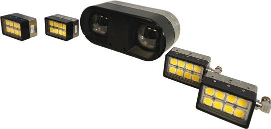
Discovery: The first smart ROV vision system for low latency vehicle piloting and 3D inspection with powerful edge-computing.
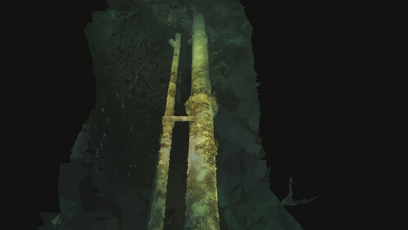

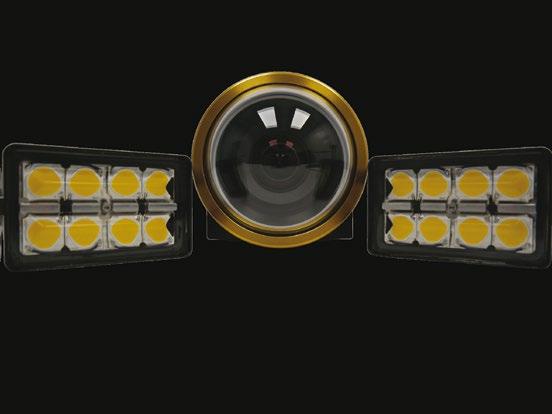

Discovery Stereo: A compact stereo camera platform for real-time 3D modelling and computer vision applications.

REAL-TIME IMAGING IN ALL CONDITIONS
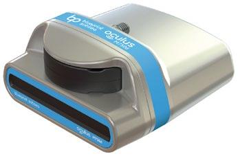
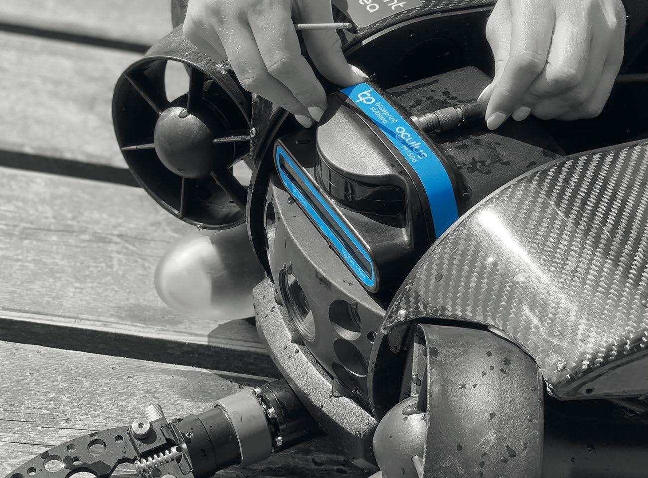
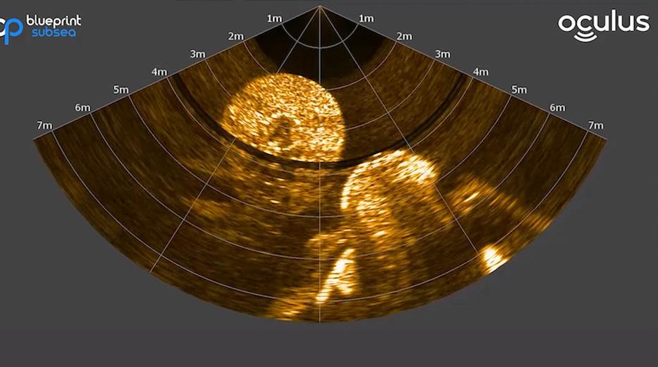
Oculus Multibeam Imaging Sonars
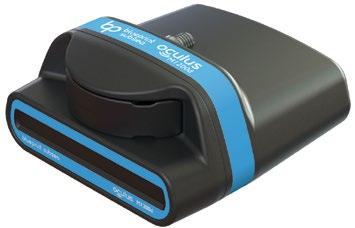
High resolution imaging in turbid water for improved situational awareness and target identification. Available in 375kHz to 3.0MHz. Depth rated to 500m, 1000m, or 4000m.

Subsea rescue is a global issue and at this moment in time, there has never been more of a requirement for reliable and effective rescue vehicles. With a fresh wave of maritime technology continuing to evolve, and, indeed, be created, there is a new generation of risk at play.
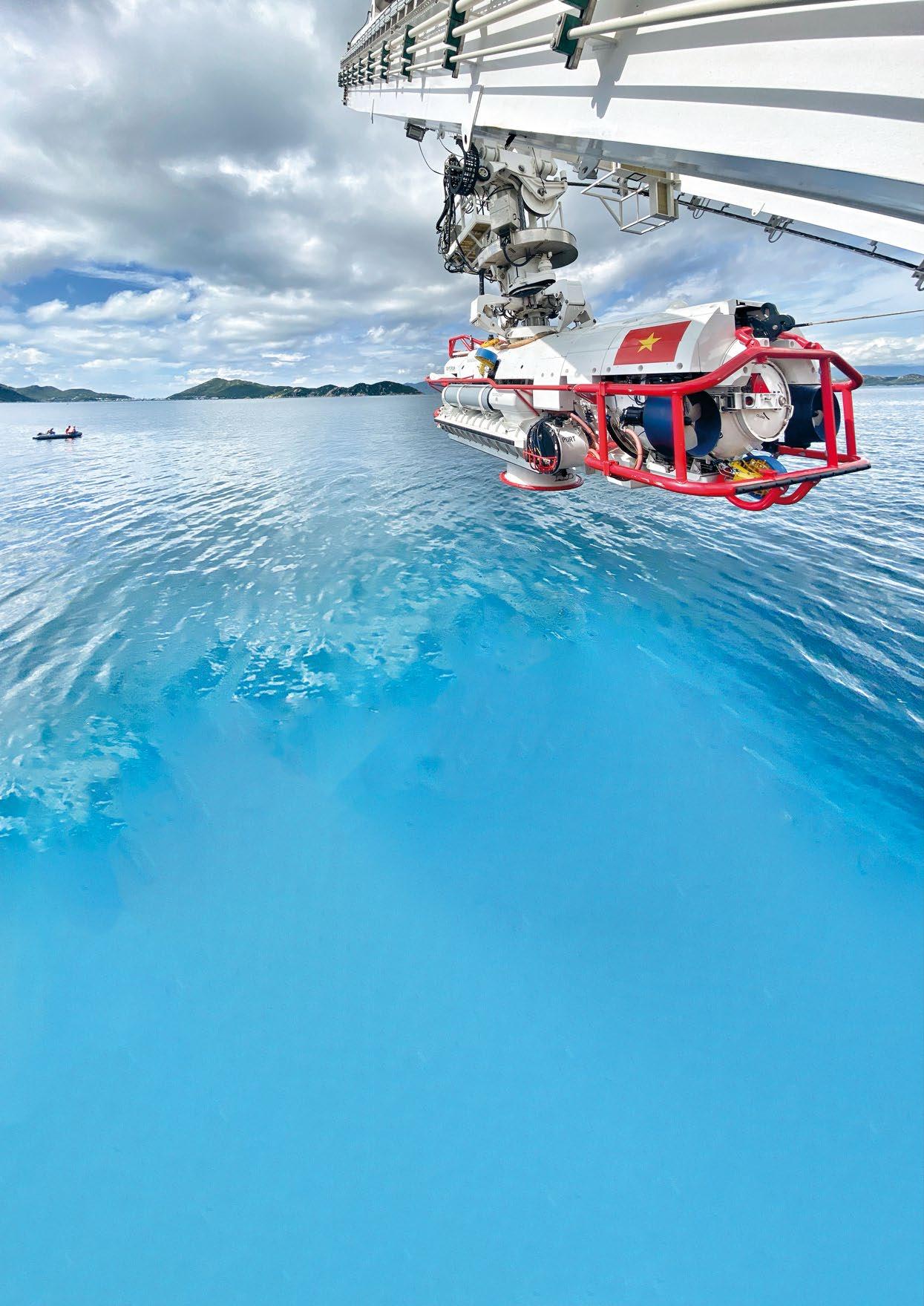
At Forum Energy Technologies (FET), the production of the most advanced Submarine Rescue Vehicle (SRV) of its kind, the LR11, has come at a time of unprecedented global uncertainty, which requires technology to support the submarine defence capabilities of maritime nations.
When issues do occur, following the ‘SUBSUNK’ alert, when rescue systems are mobilised following a subsea incident, motherships typically carry the SRV; a remotely operated vehicle (ROV); a launch and recovery system (LARS); and a hyperbaric chamber facility, the latter required to safely depressurise the rescuees in the event of elevated pressure onboard the distressed submarines (DISSUB). It is here that the LR11 flourishes.
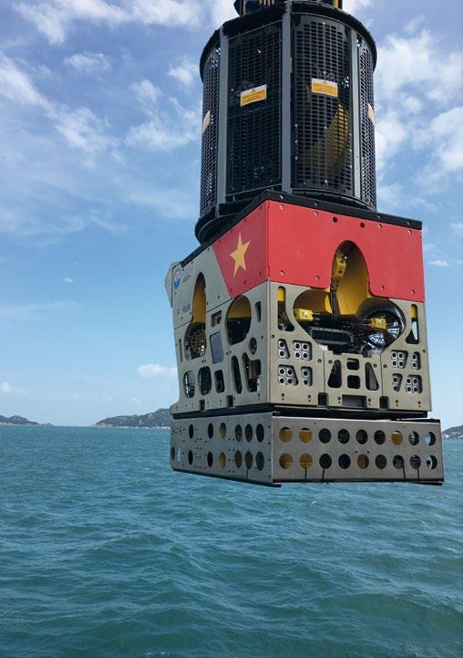
The LR11, with its classification on the Lloyds Register (LR) is packed with a variety of the latest technologies available, thus making it a sector-leading solution.
The SRV itself features the design and build from two FET brands with nearly 100 years of combined history in subsea engineering – Perry Slingsby systems and Sub-Atlantic. The SRV is capable of travelling of speeds approaching 4 knots with an ability to operate at 600m of water depth.
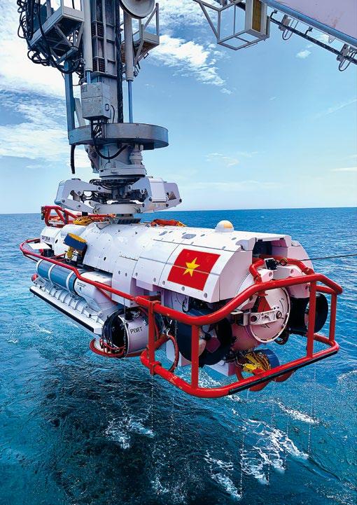
This depth, however, is not a limitation on the SRV, but a constraint of the distressed submarines. Indeed, the vehicles have the capability of reaching and operating at any depth
required, with FET’s well-established (ROVs) reaching typical depths of 4,000m and above. When compared to older SRVs, the LR11 and its proven capability in harsh environments that its competitors cannot operate in, ensures that it is in a league of its own.

The LR11 provides operators with maximum performance, lifespan, and safety due to its proprietary Rechargeable Energy Storage Systems (RESS) technology, which comprises of battery packs stored on each side of the vehicle in cylindrical pods. These storage systems utilize the best suited lithium-Ion chemistry available to ensure maximum capacity for the volume and weight of the battery packs.
The RESS Technology has been designed and built with six battery packs that provide energy for the propulsion and life support systems and has the ability to provide redundancy for both of these critical technologies. The submersible uses the latest technologies incorporating CANBUS networking as well as the High Voltage Interlock Loop (HVIL) safety feature.
The LR11, through power provided by the RESS, also has 20 kilowatt electric thrusters which provide thrust. With this RESS in place it produces maximum efficiency to ensure that traversing into dangerous environments can be conducted in the fastest and safest manner possible.
It was at FET’s Kirkbymoorside facility in North Yorkshire (UK), which features a 600 cubic meter test pool and a hyperbaric chamber, that the LR11 was designed, built, and tested.
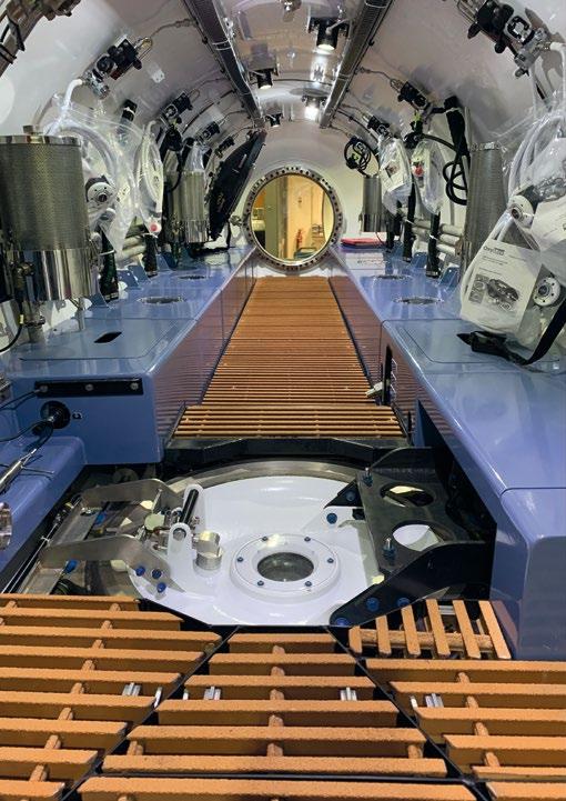
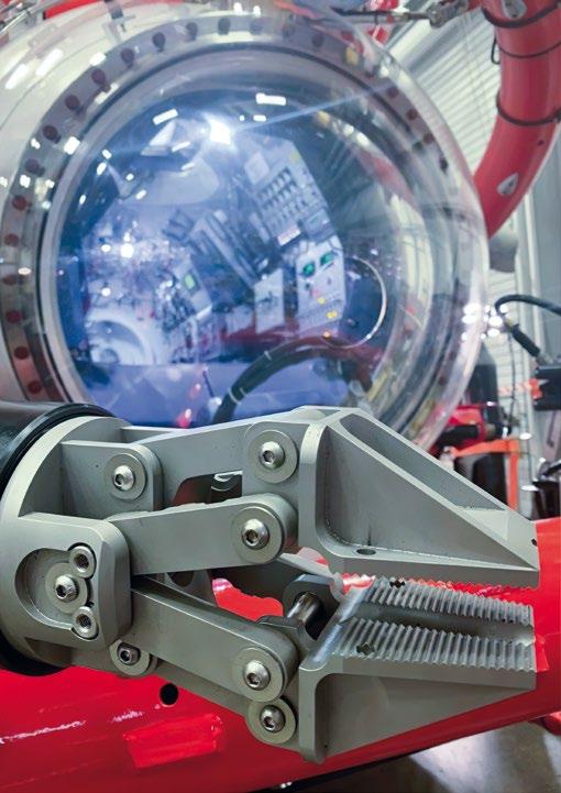

Sea trials then took place in co-operation with the Vietnamese Navy, which alongside LR, offered third party verification and supervision over the course of a two month process.
The LR11 was put through its paces with its capabilities thoroughly examined. Tests included deep dives, navigation and connecting with a mating TARGET and DISSUB. Nine of FET’s experts partook in the trial period which was key for ensuring that the SRV could perform the rescue activities of a DISSUB and the extraction of potentially injured personnel.
When in operation, two senior pilots operate the SRV. One is situated in the Command Module and steers the submersible, while the other sit towards the rear of the same compartment and is responsible for the majority of sensors, the life support system and also moves ballast water as and when required.
The Rescue Chamber is another important section of the SRV and this is manned by the Rescue Chamber Operative (RCO), whose role is to operate the rescue hatch and assist with the safe transfer of up to 17 rescuees. As the RCO is also responsible for caring for those requiring rescue, their role
is vital as they deal with people who are potentially suffering from mental and physical injuries.
Once the DISSUB is located, work can begin on the operation itself, including cutting any potential obstructions and navigating to ensure that the transfer skirt is above the respective rescue hatch. Water is then pumped by the ballast pumps so that a transfer of personnel can take place.
Prior to entry, vital communication is undertaken to identify any potential risks, including toxic gases or the potential for pressure differential. The hatches are then opened, and the submariners can be taken onboard the SRV. As they are transferred life support systems on the SRV are recharged so that multiple trips back and forth can take place.
The defence sector is one where investment will be plentiful in the coming years. As navies continue to invest in their resources, safety will be a priority and so equipment like the SRV will be key. The market in which the LR11 competes is a small one but it is one that is key to making operations as safe as possible.
Chris Buckle is a chartered engineer who has worked at FET since 2004, developing subsea systems like the NSRS and LR7 SRVs. His more recent projects include management of the delivery and sea trials of FET’s latest SRV (LR11) to Vietnam in 2021.
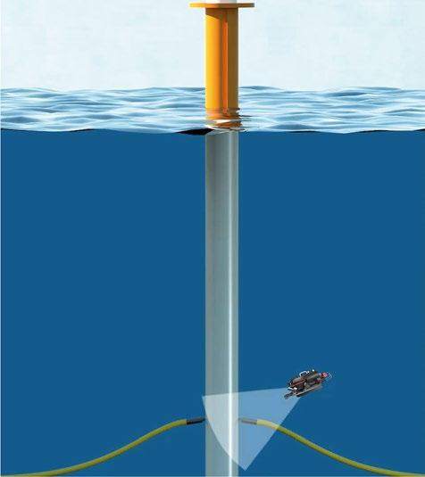
Multibeam imaging sonar
Depth & pressure readings

Optional AHRS
Digital solutions

High quality data insights
Remote processing, operations, and monitoring
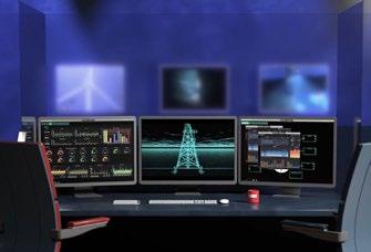
Uncrewed and autonomous surveys and inspections

Organised across all phases of the offshore wind farm project lifecycle, from desktop studies to decommissioning.
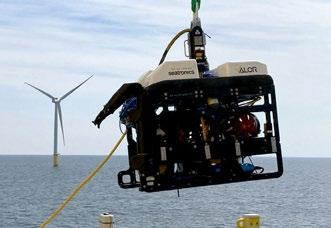
Tailored technology solutions to deliver commercial and environmental benefits


 By Captain (Ret.) Edward Lundquist, US Navy
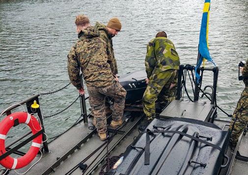
(Uto, Sweden) You can make a general assertion that Marines are used to fighting in remote locations in all weather conditions under austere circumstances. Employing the doctrine of "distributed maritime operations," U.S. Marines must be able to deploy to any and all types of warfighting environments for sustained periods of time. For Swedish Marines, the many rocky islands of the Swedish Archipelago are home. But for the U.S. Marines, operating in and among the many islands of the Swedish Archipelago presents a new kind of warfighting challenge. That’s why the Archipelago Endeavor bi-lateral exercises has been so valuable for both countries.
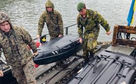
Navy Rear Admiral Ewa Skoog Haslum (right), Chief of Swedish Navy, and Swedish Marine leadership, receive a demonstration on the RECKLESS unmanned surface vehicle, which can be used for logistics support for expeditionary advanced base operations, during exercise Archipelago Endeavor 22 (AE22) on Berga Naval Base, Sweden, Sept. 21, 2022. (U.S. Marine Corps
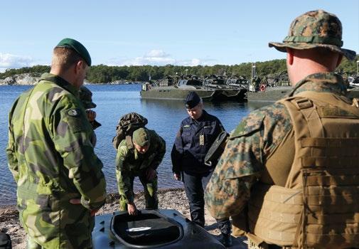
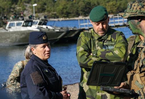
As the U.S. Navy and Marine Corps develop their capabilities and operating concepts to conduct distributed maritime operation (DMO) and expeditionary advanced base operations (EABO), the “extreme littoral” environment of the Baltic Sea and the Swedish Archipelago provides the perfect training and concept development laboratory.
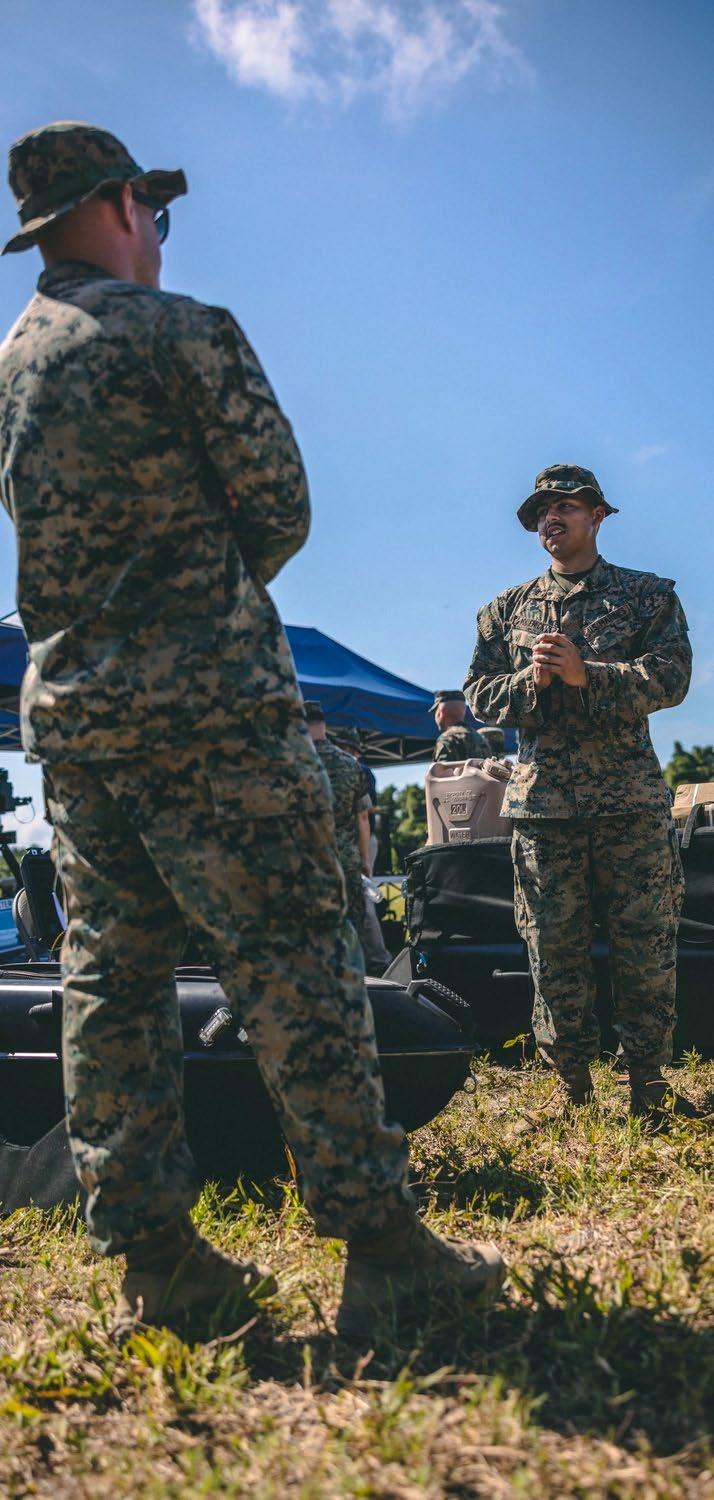
Brigadier General Andrew T. Priddy, Deputy Commanding General of II Marine Expeditionary Force said the Americans can learn a lot from their Swedish counterparts. “The Swedes have about 100,000 islands, so being able to operate in this type of environment--in the archipelago and in the littorals— it's extremely important. For us, as a Marine Corps, we have a lot of lessons we can learn.”
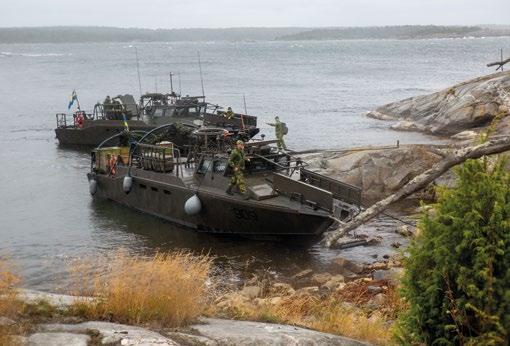
Swedish Marines, 4th Boat Training Company, 2d Swedish Marine Battalion, dock Swedish Combat Boat 90s, during exercise Archipelago Endeavor 2022 (AE22), at Berga Naval Base, Sweden, Sept. 13, 2022. AE22 is an integrated field training exercise that increases operational capability and enhances strategic cooperation between the U.S. Marines and Swedish forces. (U.S. Marine Corps photo by Lance Cpl. Adam
A key to the success of DMO is the ability to maneuver, communicate, direct fires and sustain dispersed forces. The U.S. Navy and Marine Corps Distributed Maritime Operations, Littoral Operations in a Contested Environment, Concept for Stand-in Forces, and Tentative Manual for Expeditionary Advanced Base Operations (TM-EABO) underscore the importance of providing the resources of combat power where and when needed.
According to TM-EABO, “Littoral forces rely on resilient and agile logistics that adapt to changing environments and conditions to conduct EABO. Effective sustainment provides the means to enable freedom of action and endurance while extending operational reach. Sustainment determines the

depth to which a force can conduct decisive operations, allowing a commander to seize, retain, and exploit the initiative.”

Sweden provided a number of CB 90 combat craft, as well as the training space and sophisticated ranges in the archipelago. The U.S. Marines were able to see how the Swedes sustained their forces in an expeditionary and distributed way, which are optimized for littoral operations in the Baltic.
“The Swedes are very well versed in how to do that,” said 1st Lt. Terrence Rohmeyer of Combat Logistics Battalion 6 (CLB 6) Littoral Tactical Logistics Section (LTLS). “We’re here to exchange standard operating procedures and whatever we can learn from them.”
The U.S. Marines are training with the Swedish Group Boat, also known as the G boat, Hovercraft 2000 and the CB 90 watercraft platforms. And the Americans brought a pair of unmanned surface vessels (USVs) made by Hydronalix, a small company based in Green Valley, Arizona.

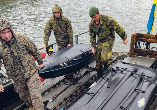
The Hydronalix vehicles, a Sonar AMY and a RECKLESS USV, can carry sensors or cargo. The Sonar AMY is used reconnaissance of the beach area, and the RECKLESS USV is a logistical model that is used to provide sustainment to a forward position. Both are man-portable. The RECKLESS USV can be handled by several individuals, depending how heavy it is loaded, and can be equipped with a top-mounted carrier for more cargo.
AMY is listed as a general-purpose USV, weighing 145 lbs. (66 kg.) and 78 inches (1.98 meters) in length, with 11 cubic feet (.67 cubic meters) of internal volume. It can be configured with radar, AIS, satellite communications or sidescan and downward imaging sonar. The 80-inch (2 meter) RECKLESS empty weight is the same as AMY, and can also be fitted with a variety of sensors. Like AMY, it navigates remotely or autonomously, and can run for six hours with a 40 lb. (18.1 kg.) payload.
Conceivably, large numbers of the RECKLESS USVs could be loaded as needed for different small teams of Marines at dispersed locations.
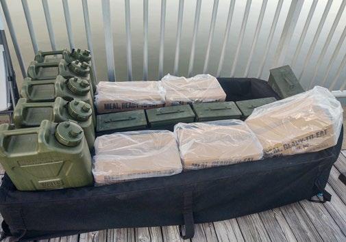
At Archipelago Endeavor, the Marines used Sonar AMY to provide information about the bottom topography and water conditions, while RECKLESS was evaluated as a means to resupply small groups of Marines at remote island locations.
“We’re practicing deploying the USVs from the G-boats and CB90s, as well as our typical shore-based deployment,” Rohmeyer said. “Trying to figure out the whole sustainment network is why we’re here."
“The big takeaway for us is how [the Swedes] operate,” said Priddy. “They’re great partners, and this is a great opportunity to work with one of our allies in the Baltic region.”


precise AR measurement functions. Portable, rugged and reliable, the
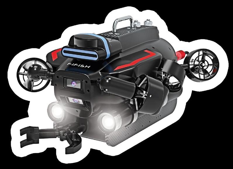
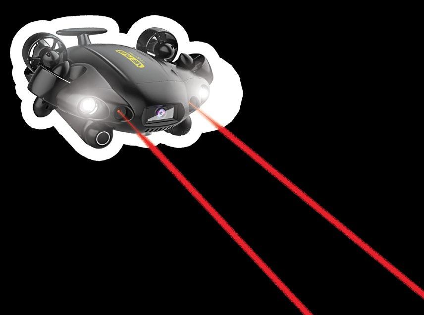
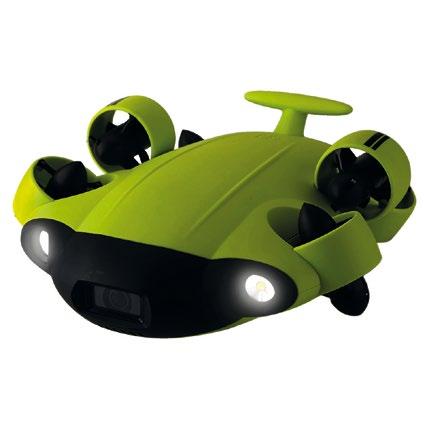
 The FIFISH PRO is a series of innovative and high-performance compact inspection ROVs , equipped with 4K UHD Camera systems, 360 degrees of maneuverability, AI object tracking features, professional tool extension capabilities, as well as a suite of collision avoidance sensors, smart position lock systems, and
FIFISH Underwater Robots by QYSEA are built to optimize your small-scale underwater operations.
As exploration of our oceans becomes more accessible, it is becoming apparent that subsea vehicles must not only navigate these challenging environments, but also deliver comprehensive and accurate data collection to unlock the ocean’s secrets. This is particularly critical for inspections and surveys of underwater infrastructure, such as pipelines and offshore wind farms, which require precise and high-resolution data from a variety of subsea vehicle platforms to enable effective decision making.
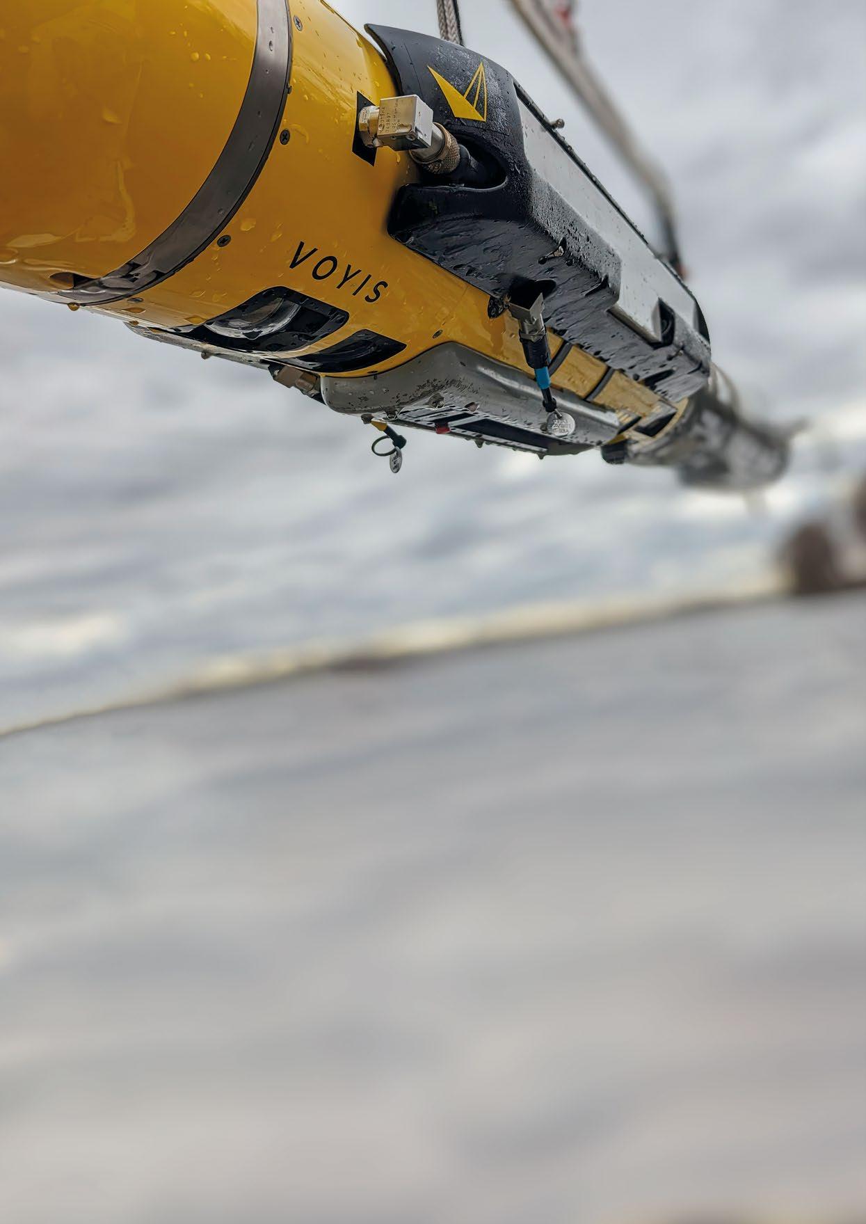
With the operation of these platforms rapidly shifting towards autonomy, the ability of sensors to reliably capture and process data in real-time becomes essential for making these decisions on the edge. This has become the core goal of Voyis' versatile optical solutions – endeavoring to enable every subsea vehicle to capture the best possible data in real-time and deliver true autonomy.
Autonomous underwater vehicles (AUVs) carry out preprogrammed missions to explore the ocean's depths without active operator control. AUVs play a vital role in ocean exploration, as they can survey wider areas for longer periods of time than human-operated vehicles. Voyis offers a range of AUV optical payloads for leading vehicle manufacturers that are designed to add-on wide-area imaging and mapping capabilities to these platforms.
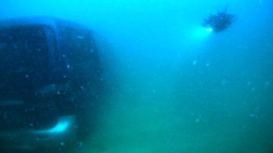
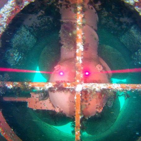
The Recon AUV payloads are equipped with underwater laser scanners and stills cameras, which enable AUVs to capture detailed 3D maps of the seafloor and underwater structures. These products use laser technology to dynamically measure the dimensions of seafloor targets, generating a detailed 3D model of the survey environment in real-time. The combined Stills Camera simultaneously captures high-resolution colour images at high speed, which can be used to identify marine life and the condition of infrastructure, while also enabling machine learning.
Stills images captured by Voyis' payloads are not just highresolution, but are also optimized for photogrammetry. Photogrammetry is a powerful capability that enables 3D models to be created from 2D images. By utilizing edge computing to correct image lighting, colour, and distortions in real-time onboard the vehicle, photogrammetry software can be efficiently used to analyze the position and orientation
of the stills images and create a complete colorized model of the underwater scenes. These not only provide a virtual representation of underwater structures, but also generate a comprehensive digital twin of a subsea environment to monitor changes over time.

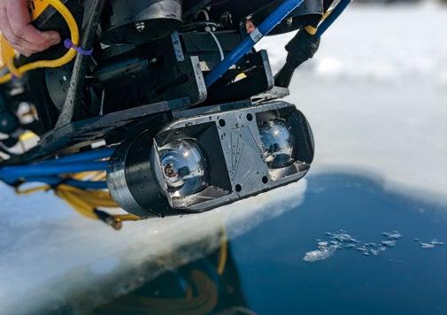
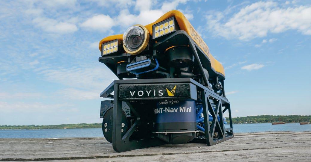
Remotely operated vehicles (ROVs) are used for a wide range of subsea tasks, including the inspection and maintenance of subsea infrastructure, with control provided through the tether to a topside operator. Voyis has developed an ROV skid that can be rapidly deployed on a wide range of ROVs, enabling them to capture high-quality images and accurate 3D models by looking downward onto the seafloor.
Voyis’ Perception ROV skid is equipped with both an underwater laser scanner and stills camera, which enable ROVs to dynamically generate detailed 3D models of the seafloor by simply flying over it. The product is designed to be compact and neutrally buoyant, allowing it to be easily transported
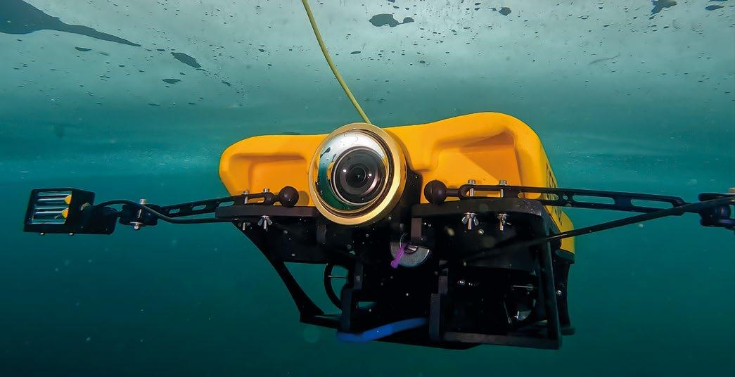
with the vehicle and deployed without any impact to the vehicle dynamics. The skid comes pre-integrated with an inertial navigation system which enables users to acquire not only gain geo-referenced datasets but also significantly improve vehicle positioning. This plug-and-play solution allows existing platforms to add-on cutting-edge optical survey capability that can be configured to meet the specific needs of each mission.
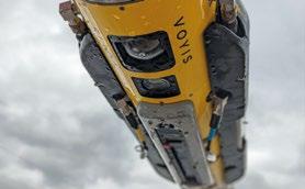
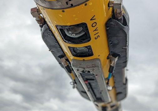
In order to provide complete situational awareness on these platforms, Voyis has recently released the Discovery Vision System for ROV piloting and 3D modelling in forwardlooking applications. Enhancing optical vision systems is critical to improving not only inspection effectiveness but also enhancing the pilot’s situational awareness and perception of their environment. Voyis believes that investing in advanced vision systems will allow their partners both operate these vehicles more efficiently, while also providing the data quality necessary for achieving autonomy on the platforms.
Voyis has launched the Discovery product line to address the trade-off that is currently made between Piloting Cameras and 3D Inspection Cameras. Piloting cameras prioritize low latency video, at the expense of image data required for 3D model generation. Conversely, 3D cameras prioritize image data at the expense of piloting effectiveness, with a higher latency and a limited field of view. The Discovery is a vision platform without compromise, leveraging edge computing to capture both low latency enhanced piloting video and the raw stills image data needed for 3D machine vision applications.

Voyis offers a complete range of optical solutions that drastically enhance the effectiveness of subsea platforms. By integrating Voyis' AUV payloads and ROV skids, operators can easily add 3D modelling capabilities to their existing vehicle assets. This additional optical data serves many purposes, such as the effective identifying marine life, the accurate assessment of underwater infrastructure, and the enablement of effective piloting and navigation.
Voyis' solutions are designed with vehicle integration simplicity as the paramount objective, facilitating any operator to adopt this innovative capability regardless of their expertise. These advanced sensing capabilities empower operators to obtain the best possible optical data across diverse operating missions, to enhance their operational efficiency, minimize costs and inspection time, and improve overall operational safety.
The adoption of Recon AUV payloads, Perception ROV skids, and the Discovery Vision System, has the potential to drive a revolution in subsea exploration. Voyis remains dedicated to addressing the challenges in underwater optical sensing to enable the world’s explorers to unlock the ocean's secrets.



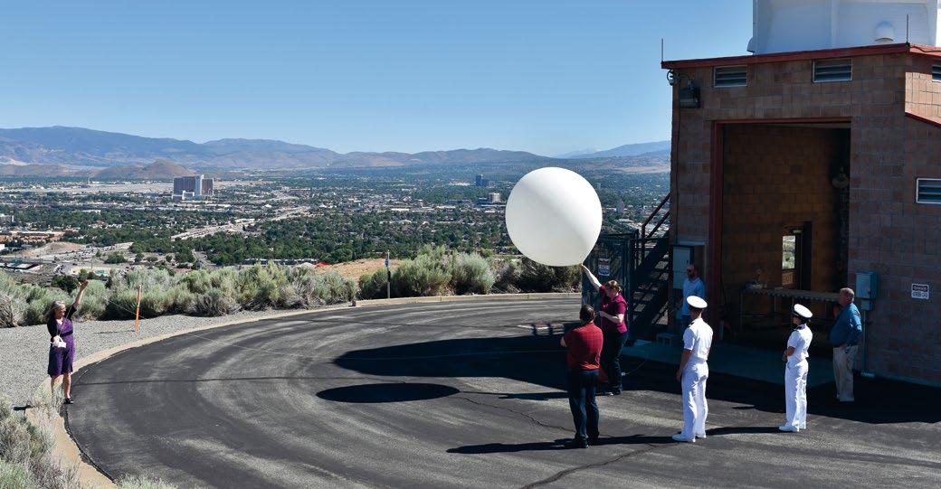
Historically, weather events have played key roles in outcomes of battles and entire campaigns. This happened famously during the Revolutionary War when George Washington moved much of his army across the East River under cover of fog after the Battle of Brooklyn (also called the Battle of Long Island). Outnumbered and outgunned by the British, fog allowed Washington to move roughly 9,000 of his Continental Army troops across the East River – a move that many historians claim set the stage for victory over the British, as had fog not emerged and had Washington not used it as a cloak, the British would have destroyed his army. The fog was an unpredicted, serendipitous event, one that Washington utilized to his advantage on the spot. In subsequent years, military environmental forecasts have evolved to become much more tightly involved in planning processes.
During the planning for Operation Overlord, the allied invasion of Normandy in World War II, forecasts of environmental factors made prior to operational execution played vital roles in ultimate success on D-Day. Planners for the operation left absolutely nothing to chance. They took into consideration tides, the phase of the moon for night-time operations, wind, waves, rain, and even fog, integrating all factors into the plan for the amphibious assault. Crucially, their careful integration of a wide array of weather monitoring systems allowed them to forecast a lull in inclement weather, a break that German forecasters, utilizing a less sophisticated weather monitoring and processing system than that of the
Allies, failed to predict. The Allies pounced during the brief period of correctly predicted calm, a window of opportunity that caught the Germans by surprise and led to the Allies defeating them. Accurate environmental forecasting proved to be the vital component for success in the operation.

Other more recent examples, including rain soaking roadways in Ukraine and subsequently inhibiting Russian logistical efforts, demonstrate how monitoring and predicting weather – and utilizing it for tactical and operational advantage – can fend off or defeat an enemy, even a technologically advanced adversary.
Today, environmental situational awareness information –like the predisposition of a designated landing zone to generate brownouts, and the possibility of haboob formation in a region during a certain time of year – is carefully integrated into planning and made available for general operational use throughout all services of the military. It is a result of continuously refined environmental monitoring and forecasting technology, and also a result of joint interoperability structures put in place as a result of the GoldwaterNichols Act.
Today, countless military operations, from the smallest to largest scale, proceed seamlessly from an environmental standpoint due to detailed operational incorporation of products like those of Meteorology and Oceanography (METOC).


METOC’s Fleet Weather Center personnel not only provide detailed forecast products but have developed – and continue to refine – an advanced weather intelligence product. It is a weather-based tactical predictive model that fuses multivariate intelligence information with weather data. Hermsdorfer noted that by working with Navy and other U.S. government bodies, patterns of operation of pirates in certain parts of the world emerged, based on weather. With certain weather criteria known – atmospheric events that can be reliably predicted and observed – Fleet Weather Centers can state when a certain region will be essentially guaranteed to be pirate-free for safe passage, and when to be vigilant for attacks, based on the weather in that region.
To generate such advanced products, including regular daily regional forecasts, ship- and fleet specific forecasts, operational forecasts, and weather-based predictive analysis products, Naval Oceanography relies on one of the world’s most advanced computing centers, the Fleet Numerical Meteorology and Oceanography Center, or FNMOC, pronounced “fin-mock.” Based in Monterey, California, the Navy established FNMOC in 1961 at the very beginning of the computer revolution – and they helped advance the technology. Today, the command is composed of mathematicians, computer scientists, oceanographers, and naval fleet operational and tactical experts. Personnel operate and source computing power from a range of some of the most
powerful computers ever created, including those housed at the Navy Defense Supercomputing Resource Center. They also have dedicated access to the computers of the Department of Defense Supercomputing Resource Center, a unit that provides computing power for a wide range of military initiatives and is sponsored by Naval Oceanography.
FNMOC receives tens of millions of data points per day, according to Captain Christi Montgomery, the unit’s commanding officer. They receive data from a wide variety of platforms, including a number of Navy and NOAA weather satellites, unmanned systems, and manned surface vessels. They regularly generate global and regional weather prediction products, including charts, and a number of regional and fleet- and ship-specific forecasts. With both atmospheric and oceanographic data, FNMOC can create extremely accurate models, and their base algorithms are continuously being enhanced and refined.
“We have a global atmospheric numerical model, and a global oceanography model, and we have a partnership with the Naval Research Laboratory Marine meteorology division,” explained Captain Montgomery. Furthermore, Captain Montgomery noted, they work with “ensemble” models, where different models, including those from the Air Force, are fused. “We found a lot of success running ensemble models.” One of these is called COAMPS, or Coupled Ocean/Atmosphere Mesoscale Prediction System. FNMOC personnel can create high-resolution predictive analysis oceanography-meteorology models for regions, fleets, or individual ships with this technique.
Continuously advancing their techniques and technology, a legacy that dates to the earliest days of the Naval Depot of Charts and Instruments, is a demonstrated component of Naval Oceanography culture, notably at FNMOC. Captain Montgomery explained that they work in-house and with the
Naval Research Laboratory to constantly upgrade forecasting. “Research and development transitions directly into naval operations all the time,” she stated.
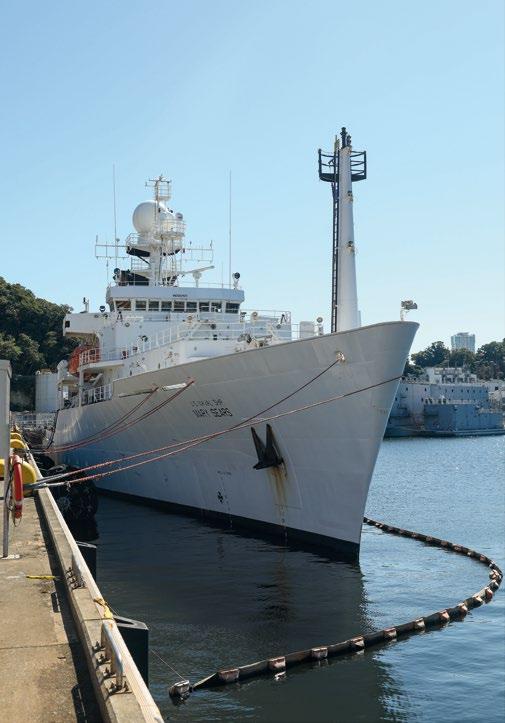
A sister command to FNMOC, the Naval Oceanographic Office (NAVOCEANO) provides the U.S. military with detailed information vital to maritime operations throughout the globe, including underwater dynamics – oceanographic “weather”. Captain Ken Wallace, the recently departed commanding officer of the unit, explained that, although 70% of the globe is covered by oceans, roughly only 20% of it has been surveyed. “It can be an enemy, but also it can be an advantage”. Like the other components of METOC, NAVOCEANO continuously seeks to always maintain a tactical and operational edge through knowledge of the environment. The command ingests massive troves of data every day, including information from satellites, manned surface and subsurface vehicles, unmanned aircraft, unmanned underwater vehicles, and specialized buoys, both fixed and drifting. One of the most important types of craft used is the oceanographic

survey ship, or T-AGS, pronounced “tags”. “These ships are always forward deployed,” Captain Wallace explained of the specialized data collection vessels that rank as some of the busiest in the Navy. They collect a wide spectrum of oceanographic data, including CTD (conductivity, temperature, and depth) and a number of other criteria. Wallace explained that these ships scan columns of ocean water from the seafloor to the surface, and the data collected is then fed into computers at FNMOC. Survey detachments travel throughout the globe, often battling extreme ocean conditions. “They are out there fighting heavy seas, in places where no other ships go, in inclement weather, so we understand and characterize a very complex ocean environment”.
The data collected by NAVOCEANO provides the Navy with “safety of navigation support”, meaning the ability to navigate throughout the world’s oceans – and under them.

Underwater warfare is one of the most technically difficult, dangerous, and secretive of all types of military operations. Naval Oceanography is the key enabler of underwater navigation for the U.S. Navy’s submarines. The data collected –and then processed into continuously evolving products, notably digital charts – allows American submarines to roam the oceans freely. Using different types of sonar systems, including side-scan sonar, from both manned and unmanned platforms, the NAVOCEANO continuously gathers bathymetric data (underwater topography) of areas of interest to the Navy. Working with the National Geospatial Intelligence Agency (charged with making map and charts or the Department of Defense), the office then produces detailed information products. Because GPS signals cannot penetrate water, and because they have no means (like windows) of directly visualizing their
surroundings while submerged, submarines rely primarily on inertial systems to determine their location as they ply the dark depths. Extremely sensitive gyroscopes and accelerometers, which detect movement and direction changes, internally track the motion of submarines, and hence location from a known reference position. While submarines possess active sonar that can be used for navigation, the use of such systems alerts potential enemies to the presence of the submarine emitting these “pings”, so this form of navigation is used judiciously. Accurate, up-to-date, and extremely detailed underwater charts are critical for submarine operations to proceed without potentially deadly collisions, where inertial navigation and METOC information alone guide them.
Just as important to submarine operations is dynamic hydrographic data – “underwater weather”. Submarines use passive sonar – essentially extremely sensitive microphones –to detect potential enemy vessels. To accurately identify the location and range of a detected enemy boat, submarine warfare specialists need to know how sound waves will be refracted (bent) as they are emitted from the enemy target to their submarine’s microphones.
Temperature, salinity, density, and ocean currents determine this. Even being slightly off with any of these criteria can prove deadly in actual combat. Any action by one submarine, like launching a torpedo, gives the other positional data through acoustics.
Hydrographic dynamics also affects submarine communication, which is limited to acoustic systems and extremely long wave radio waves (wavelengths of tens or hundreds of miles), both severely limited compared to communication above water. One of the most important components of America’s strategic capability is the U.S. Navy’s fleet of SSBNs, ballistic
missile submarines. These boats, which each carry up to 24 Trident II SLBMs (submarine launched ballistic missiles), silently lurk in key areas of the world’s oceans. When tasked to execute their mission, these submarines need to know the specific dynamics of the water in which they are operating to ensure that they can receive such a message. The Naval Oceanography Office ensures that SSBN communications specialists will be able to receive such a message by providing them with detailed information about the water in which they are deployed.
One of the most complex forms of naval warfare is ASW (anti-submarine warfare). NAVOCEANO is the key enabler for the U.S. Navy in this mission. The science involves fusing bathymetric data with underwater dynamics data to provide American attack submarines a “blank canvas” –a picture of the native environment, free of any enemy presence. By scanning a region using passive sonar, Naval specialists can detect any “brushstroke” of an enemy on this canvas, and can then move in and attack, using active sonar (which also requires detailed knowledge of the water’s character to the work properly) to provide high-resolution targeting data.
Naval Oceanography also is a key enabler of military operations in one of the most important of all environment types, the transition of sea to land, littoral zones. Called Fleet Survey Teams, this small component of Naval
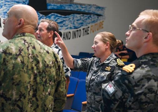


on vulture's row aboard the aircraft carrier USS Dwight D. Eisenhower (CVN 69) (Ike). Ike and its Carrier Strike Group are deployed in support of Operation Inherent Resolve, maritime security operations and theater security cooperation efforts in the U.S. 5th Fleet area of operations. (U.S. Navy photo by Mass Communication Specialist Seaman Joshua Murray)

Oceanography will prove to be one of the most important in all of the Department of Defense if war should break out requiring amphibious operations where Marines and other personnel land on beachheads using amphibious assault craft. Historically, the importance of optimized environmental situational awareness in littoral combat is best exemplified by the successful Normandy landings at D-Day of Operation Overlord. Failure to adequately incorporate meteorological and oceanographic information into a mission plan is best illustrated by November 1943’s Battle of Tarawa. Planners had predicted that a rising tide would provide five feet of water depth over coral reefs. They failed to predict the neap tide (when there is the least difference between high and low water), which prohibited their landing craft from making it through the littoral zone. Although they ultimately achieved victory, the Marines suffered severe losses due to the oversight of environmental factors.
Today, Fleet Survey Team detachments, which can operate from shore or ship, carefully survey littoral zones of interest, ensuring freedom of passage for American forces. They provide tide information (often down to the inch), locations of wrecks and submerged rocks, and other hazards. Fused with Naval Oceanography’s meteorological forecast products, Fleet Survey Team data collection ensures that any future amphibious assault proceeds like the advance at Normandy, and not as experienced at Tarawa.
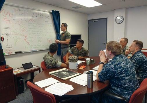
While Naval Oceanography covers a very broad range of environmental criteria, the command’s greatest strength is its composition of highly-specialized personnel. Many personnel begin their Navy careers in other fields, then “laterally move” into Naval Oceanography. This brings a diversity of backgrounds which helps the overall command provide relevant information, often custom tailored, to individual specific applications. Component commands of Naval Oceanography are similarly diverse and highly specialized. This includes the Naval Ice Center, work of which is vital in understanding route-finding in cold and high-latitude portions of the globe, and the Joint Typhoon Warning Center, which provides detailed information on the globe’s most powerful storms.
Operationally, Naval Oceanography supports all types of Department of Defense missions, including special operations. The Naval Oceanography Special Warfare Center (NOSWC) directly supports special operations from an oceanography and meteorological standpoint. Members of this component of Naval Oceanography train and deploy with special operations units, and sometimes accompany them on operations. Commander Mark Hebert, the commanding officer of NOSWC, provides a general overview of the command: “The mission of the Naval Oceanography Special Warfare Center (NOSWC) is to deploy full-spectrum Meteorology and Oceanography (METOC) teams to provide asymmetric warfighting advantage for Naval Special Warfare (NSW) globally. Many people equate NSW to Sea, Air, and Land (SEAL) forces, but it also incorporates Special Warfare Combatant Craft (SWCC) and other communities who commonly work with conventional and non-conventional forces”. Although the unit’s emphasis is on support of Naval Special Warfare operations, NOSWC can and regularly supports all types of special operations, throughout the globe. While a small component of METOC, personnel of the NOSWC have direct access to all of the other components of Naval Meteorology and Oceanography Command.
While the tools, techniques, and capabilities have changed over the decades from its inception – many of which could never have been imagined in 1830 – the spirit exemplified by Maury and other pioneers of Navy meteorology, oceanography, and navigation continues to drive those of METOC today; it is an enduring Pathfinder ethos.
Part I of this article was published in the previous issue of the Ocean Robotics Planet Magazine (Issue 34 – Q1 2023).

Ed Darack is an author, unmanned systems developer, and founder of Darack Research. More information at www.darackresearch.com
One of the premier innovators of the fields of meteorology and oceanography, the Navy is also a trailblazer in unmanned systems, notably METOC’s use of air, sea surface, and underwater craft.
The U.S. Navy’s development of unmanned systems dates to the Pioneer Era of Aviation. In 1911, the Navy contracted Elmer Sperry, inventor of the gyroscope (critical for stabilization of all aircraft, manned and unmanned), to begin work on systems that would be used to usher in the first controlled unmanned airplanes. In September 1917, during the height of World War I, the Hewitt-Sperry Automatic Airplane, which the Navy called an “aerial torpedo”, took flight. The craft was one of the first unmanned aerial vehicles in history to fly. Just a few years later, in 1921, the Navy repurposed the battleship USS Iowa (BB-4) as a remotely controlled craft. Officially designated “Coast Battleship No. 4”, the vessel, one of the world’s first military unmanned surface vehicles, was used as a target ship. Decades later, the Navy helped develop, fully funded, and operated the world’s first underwater unmanned vehicle. Called the SelfPropelled Underwater Research Vehicle, or SPURV, the program began in 1957 and was used to gather hydrographic information.
METOC has developed, and continues to refine, technology that traces its lineage to these decades-old progenitors. Today, the command operates and sources data from an extensive fleet of some of the most advanced unmanned systems ever developed. These systems are critical for the Department of Defense to maintain readiness and up-to-the minute environmental situational awareness, notably in strategic locations on the globe that are “data sparse” due to their lack of long-term, persistent sensors. These include a multitude of aircraft systems, sea surface systems, and underwater craft that collect relevant atmospheric and oceanographic data and transmit it for processing. Unmanned aircraft that can supply data to METOC include the large MQ-4C Triton, the Navy variant of the Global Hawk. The platform, which has a wingspan of 130 feet, 11 inches, can operate for more than 24hours and at altitudes up to 56,000 feet above sea level (the system has flown overactive hurricanes). METOC also sources data from smaller unmanned aerial vehicles, including hand-launched systems and high-altitude balloons. One of the most valuable aerial tools used by the command is the dropsonde, a small unmanned system that can be deployed from either a manned or unmanned aircraft. The dropsonde falls through the atmosphere, slowed by a parachute, and its position is continuously recorded by GPS. It collects and transmits temperature, pressure, and humidity profiles along its descent. Data gathered by dropsondes allow METOC to quickly develop detailed 3-dimensional models of the atmosphere, in near real-time.
Sea surface systems employed by METOC include a number of small systems that can function autonomously, called autonomous surface vehicles. These collect data in the atmosphere, on the sea surface, and underwater. Some of these are high endurance vessels, notably those powered by wind and solar energy. METOC also operates a large array of fixed and drifting buoys that collect and transmit both hydrographic and atmospheric data. “Profile floats” are systems that,
Mississippi, USA (Nov. 28, 2022) – From left, Mr. Anthony Gilless briefs meteorological operations to Mr. Simon Hardern, U.K. Hydrographic Office, and Royal Navy Rear Adm. Rhett Hatcher, U.K. National Hydrographer, and Rear Adm. Ronald Piret, Commander, Naval Meteorology and Oceanography Command during an official visit to the Naval Meteorology and Oceanography Command. During the tour, Hatcher and Hardern received an overview of oceanography operations, viewed unmanned systems static displays, and toured the Glider Operations Center. (Photo by Chief Petty Officer Patrick Gordon / United States Navy)
through using buoyancy control with oil, automatically dive into the depths, collect data on the way down and then on the way up, and then transmit this data via satellite link once at the surface.
Plying the depths beneath the surface of the world’s oceans, the command operates a fleet of underwater vehicles. Called AUVs, or autonomous underwater vehicles, these are direct descendants of the SPURV. One of the AUVs operated by METOC, the REMUS (Remote Environmental Measuring UnitS), can operate at depths of 20,000 feet and has an endurance of 30 hours. METOC recently acquired a “Superior Class” AUV, the HUGIN. This vehicle, based on a carbon fiber monocoque body, can carry a wide suite of sensor systems, has a range of 1,350 miles, and can operate for up to 24 hours and at depths approaching 20,000 feet.
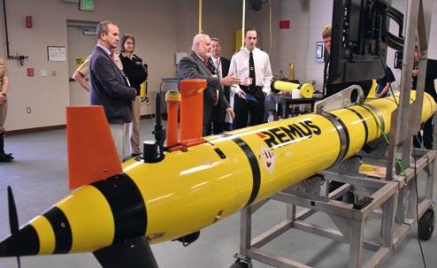
METOC also operates a fleet of “ocean gliders,” a highly specialized type of unmanned underwater system that can gather data for up to six months straight and can autonomously cross entire oceans. A glider resembles an airplane, with a long, narrow body, swept wings, and a simple tail section. Powered by batteries, the highly-efficient system uses buoyance control, via oil bladders, to repeatedly rise and sink in the seas. Vertical motion is converted to forward travel, care of the wings, and the system can steer itself into an area of interest, despite currents. A glider transmits its collected data each time it surfaces, the frequency of which is programmable from hours to days.
While unmanned systems have existed for decades, many components of the Department of Defense haven’t widely adopted them into operational use until relatively recently. METOC is an exception to this, as it has included unmanned systems in its core suite of sensor platforms for decades. As such, it has developed leading-edge capabilities to manage not just large volumes of data, but large numbers of independently-operating remote platforms. Furthermore, it has pioneered mechanisms to integrate the volumes of data sourced from myriad unmanned systems with collections from manned platforms and satellites for the creation of accurate, timely environmental information products for American and ally forces operating anywhere on the planet. “Naval Oceanography has successfully employed and operated unmanned systems for over 20 years, and, while unmanned systems applications are broad, we leverage these types of capabilities to characterize the physical environment, improve our modeling and predictions to fully inform decisions”, summarized Rear Admiral Ron Piret, Commander, Naval Meteorology and Oceanography Command, about METOC’s unmanned systems capabilities.
STENNIS SPACE CENTER, Mississippi, USA (Nov. 28, 2022) – Royal Navy Rear Adm. Rhett Hatcher, U.K. National Hydrographer, is briefed on unmanned glider operations during an official visit to the Naval Meteorology and Oceanography Command. During the tour, Hatcher received an overview of oceanography operations, viewed unmanned systems static displays, and toured the Glider Operations Center. (Photo by Chief Petty Officer Patrick Gordon / United States Navy)


center, and Simon Hardern, U.K. Hydrographic Office, during an official visit to the Naval Meteorology and Oceanography Command. During the tour, Hatcher and Hardern received an overview of oceanography operations, viewed unmanned systems static displays, and toured the Glider Operations Center. (Photo by Chief Petty Officer Patrick Gordon / United States Navy)

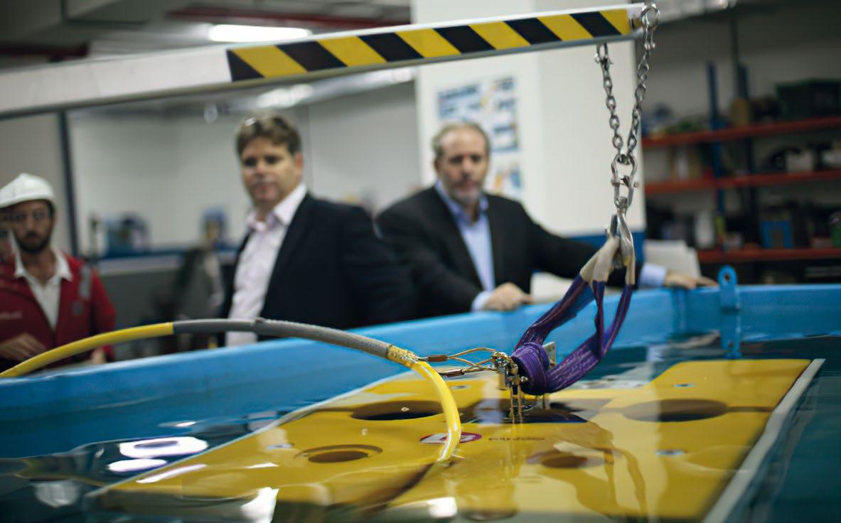
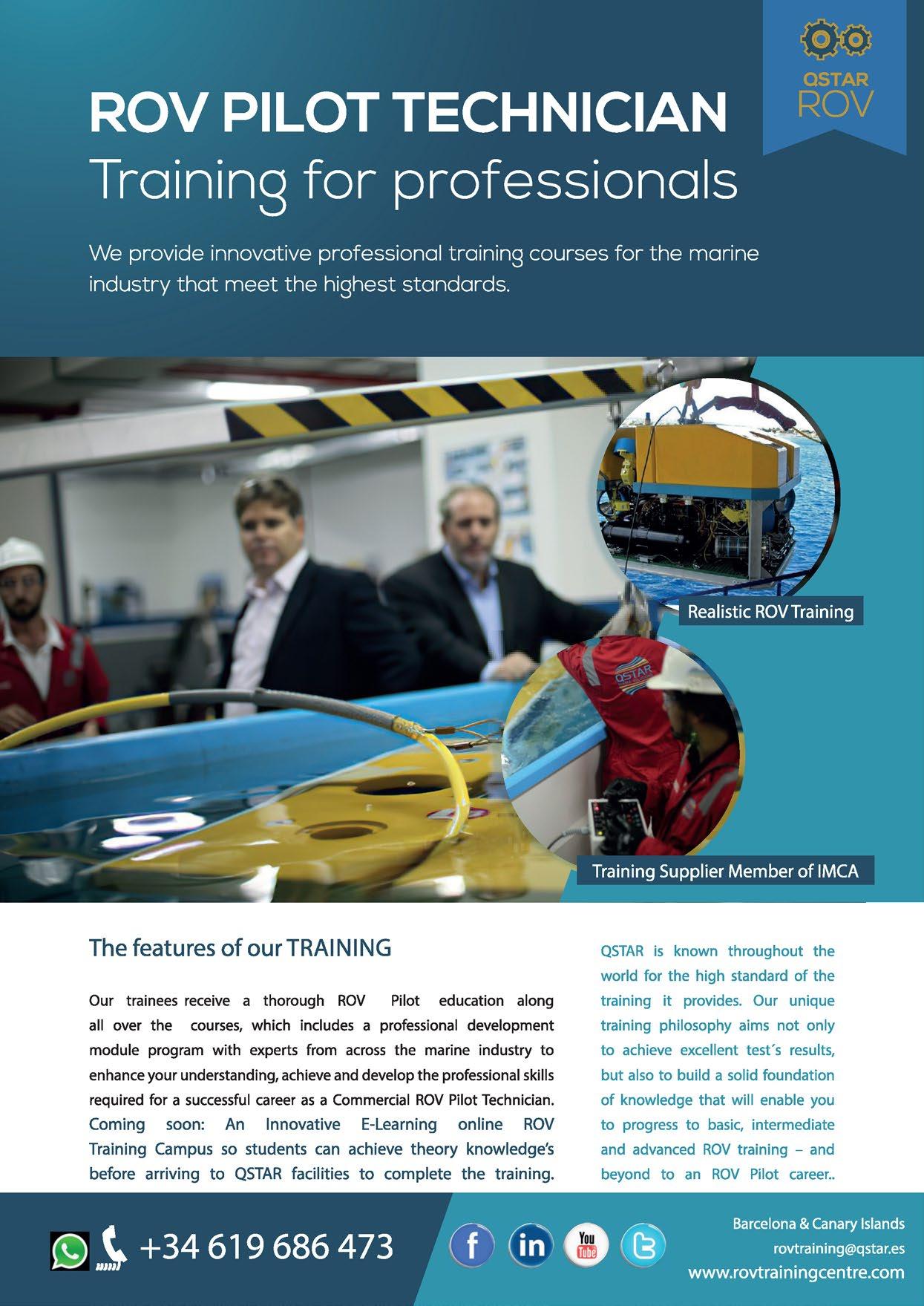
5th -8th June
Save the dates for OCEANS 2023, June 5-8 and join us in Limerick , I reland.
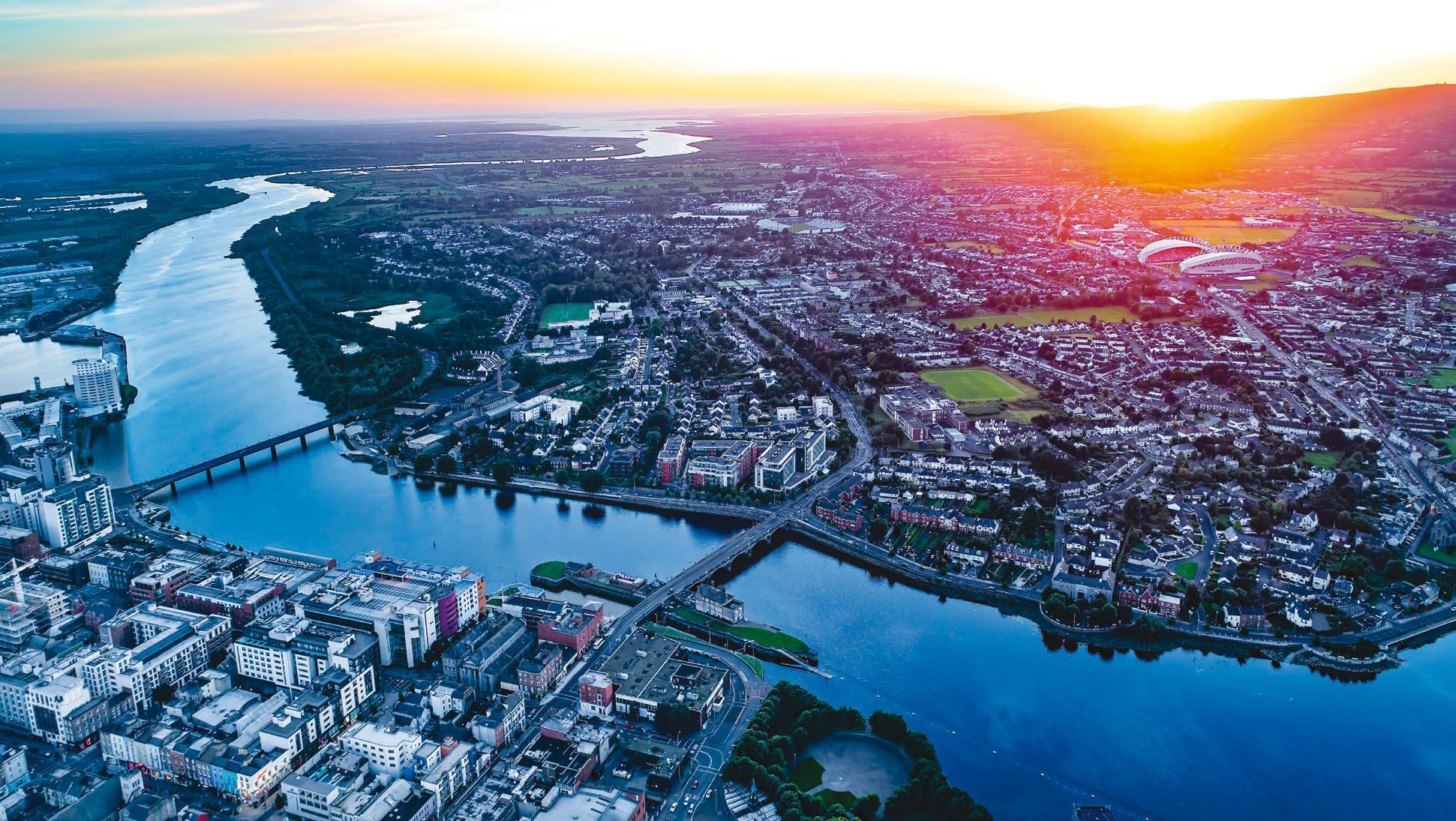
The OCEANS conference is the ship event of the IEEE Oceanic Engineering Society (OES) and the Marine Technology Society (MTS). The event is recognized as the premier forum for the international marine community to meet and discuss technical innovations and current trends in the marine technology sector.
OCEANS brings together engineers, industry practitioners, government o ials, public sector executives, researchers and academics from all aspects of the oceanic spectrum. The event will feature all aspects of oceanic engineering, science and technology. The conference theme is "Blue Ocean Planet Earth".

Key highlights:
• O ver 500 professionally reviewed technical papers, including special focus theme sessions.
Plenar y sessions with leaders from industr y, academia, and government. exhibitors showcasing the latest innovations in produc ts and ser vices.
nt poster session featuring outstanding projec ts and other student ac tivities.
Papers presented at the conference are subsequently archived in the IEEE Xplore online research database.

• Tutorials, workshops, demonstrations, government listening sessions, social and
an attrac tive social programme.

Real-time decision-making is crucial for safety and success in many maritime robotic operations, allowing for immediate unmanned vehicle reaction and rapid information distribution during critical, time-sensitive missions. To achieve this goal and reach the true value in-field automation can deliver, onboard AI and automation solutions must be rapidly deployable onto these platforms and easily configured for the mission at hand by technicians and operators. Integrating more automated processes into robotic solutions also expands the capabilities and use cases across a wider breadth of commercial and military applications for all types of marine robotic platforms, including ROVs, AUVs, USVs, and AUSVs.
One rapidly growing application for marine robotics is remote inspection and monitoring of offshore wind farm cabling and infrastructure. The ability of unmanned inspection robots to make decisions autonomously allows them to detect issues in real-time, localize the anomaly, and collect critical inspection and engineering data in one mission, rather than having to make a second mission after surfacing and human data review. This process also helps minimize data collection by only collecting critical rather than all data, ultimately resulting in much less data to transmit and review by remote personnel. The immediacy of real-time decisions can drastically affect predictive maintenance and issue response times. Another
scenario for real-time decision-making is in oceanographic research. With unmanned marine robotic platforms, data such as ocean currents, temperature, salinity levels, and marine life behavior can be collected and analyzed in realtime to make informed, autonomous decisions about the next action. The ability of robotic platforms to support such adaptive mission execution ensures the collection of the best information with the limited time and money available. Marine robotic automation is also used extensively in defense applications. Robotic platforms equipped with real-time decision-making capabilities create wider reconnaissance and surveillance landscapes for detecting, identifying, and
neutralizing underwater mines and IEDs with fewer in-field vessels and minimal human intervention. Automated decisionmaking and data reduction are even more critical in maritime robotic operations, where data and control updates can take hours or even days due to working in disconnected, intermittent, low-bandwidth (DIL) communication environments.

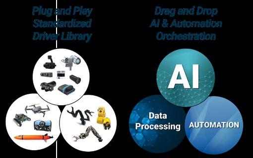
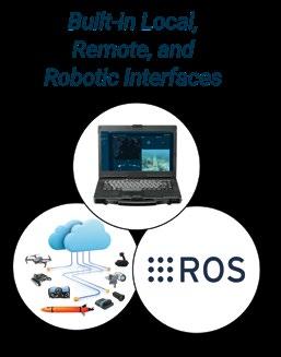
At the heart of this capability is edge-AI, which enables robotic systems to integrate sensor data in real-time, allowing them to make decisions without connecting with and relying upon human operator intervention. NEPI from Numurus, an open-source operating system built specifically for this purpose, is particularly powerful at enabling robotic inspection and maintenance automation. Designed for embedded GPU processors like NVIDIA's Jetson processor family, NEPI integrates plug-and-play abstracted sensor and communication drivers, backseat robotic and manipulator interfaces, drag-and-drop AI and automation tools, with local and remote system and data management solutions. NEPI makes adding AI and automation to marine platforms fast and simple. With full ROS data and control APIs, NEPI integrates seamlessly into most robotic platform architectures, further simplifying the automation development process.
With the recent release of NEPI 2.0 and the major updates to the integrated AI and automation management software toolset, Numurus is now working with leading marine sensor

and robotic platform vendors to ensure plug-and-play driver support for these systems. NEPI 2.0 will provide marine robotic developers the freedom to quickly create missionspecific, in-field inspection automation solutions.

While anyone can download and install NEPI on their own GPU hardware, Numurus offers off-the-shelf, marine GPU processing payload platforms under its S2X product line. S2X platforms provide developers with a rapid turnkey solution for adding AI and automation to any robotic or smart sensing project. S2X systems come preloaded with Numurus' NEPI Smart System Software, which includes a library of imaging sensor drivers plus onboard data, AI, automation, and IoT management solutions, local command and control through a well-documented Robotic Operating System (ROS) interface, and a web-browser supported Resident User Interface (RUI). Each S2X device includes a NEPI developers license that lets customers use the NEPI-installed software for in-house development. When customers are ready to start selling their smart solutions or services, they can easily upgrade to a NEPI commercial license.

A recent customer success story is Ocean Aero, producer of the TRITON AUSV, which used NEPI for AI-enabled 360-degree maritime threat detection. Ocean Aero launched an internal development effort to deploy at-sea AI-enabled inspection automation capabilities to its TRITON robotic platforms. To accelerate their at-sea AI and automated solution development, Ocean Aero turned to Numurus for off-the-shelf edge-compute hardware preinstalled with Numurus’ NEPI smart system operating system with a library of plug-andplay abstracted sensor drivers, drag-and-drop AI and automation management features, and built-in local and remote system and data management features. Within 6 months of starting their 360-degree maritime detection automation project leveraging off-the-shelf NEPI-enabled hardware development platforms, Ocean Aero successfully interfaced 5 directional cameras with onboard AI models, then fielded, tested, and demonstrated automated maritime domain awareness capabilities running on its TRITON AUSV systems. This resulted in less dependency on an operator-in-the-loop to detect and identify threats and increased delivery of actionable information to local and remote end-points.
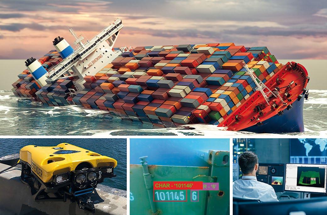
"The combination of Numurus' off-the-shelf compute hardware, NEPI smart system software, and its responsive engineering support team was a big factor in the success of this project. It saved our internal team from a lot of development work we’d otherwise have to do ourselves,” said Kevin Decker, CEO of Ocean Aero.



During the 2022 Advanced Naval Technologies Exercise (ANTX) Coastal Trident Exercise, VideoRay’s Mission Specialist Defender ROV upgraded with Numurus’ NEPI operating system for robotic and edge-AI applications, and SeeByte’s AI target detection models rapidly delivered a smart subsea inspection solution that automated critical data collection and real-time distribution to remote engineering teams.
"We saw firsthand during ANTX how the NEPI can significantly improve the autonomous capabilities of the Mission Specialist Defender. This man-portable solution intelligently collects critical inspection data and instantly distributes it worldwide, making it an invaluable tool for underwater inspection operations," said Chris Gibson, CEO of VideoRay.
These success stories reveal how Numurus' NEPI operating system for robotics and edge-AI applications can add new levels of inspection autonomy to existing robotic platforms, enabling real-time decisions when the stakes are high and costs, safety, and time are a concern. But this is just the beginning. Numurus is now working with technology partners to create additional sensor drivers for sonar, laser, and NDT sensors; increased robotic control system driver functionality; robotic manipulator control system drivers; and more pre-packaged AI models and automation scripts. Also, Numurus recently announced an addition to their lineup of plug-and-play abstracted camera interfaces, ONVIF camera driver support, tested on several leading underwater camera company product offerings like e-con Systems and Sidus Solutions. Numurus also works with clients to expand their maritime use cases to in-port vessel and asset protection, at-sea search and rescue, subsea survey and inspection, and multi-vehicle domain awareness. The future for real-time decisions at sea looks bright with Numurus.
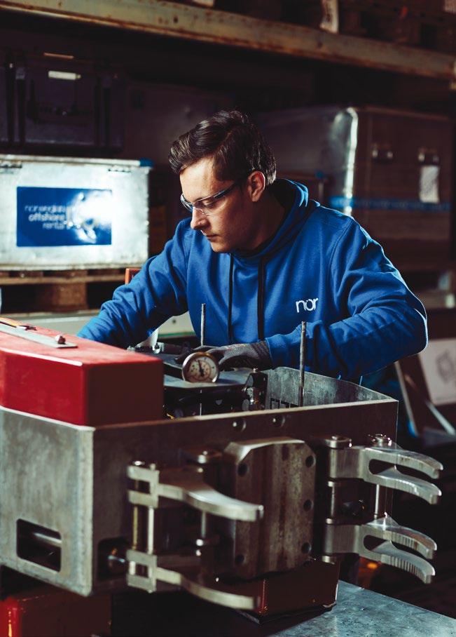


For more than 10 years, above-water asset owners have been enhancing safety and reducing costs using the market-leading iSite collaborative virtual asset and data management platform. UTEC, a Geo-services brand in Acteon’s Data and Robotics division, has now developed this core platform to create iSite Subsea, designed specifically to meet the needs of the offshore renewable energy market, and oil and gas subsea asset owners.
iSite Subsea is a game-changing, cloud-based platform that gives users an intuitive 360° visualisation of subsea assets and data. Using this platform, operators can source, view, manage and report on seabed, survey and asset data using a single, secure cloud-based interface. It enables interrogation and comparison of data over time, remotely, 24/7 and without specialist software knowledge. iSite Subsea helps to reduce costs, lower risk, enhance health and safety, and deliver better informed decisions.
The new platform facilitates the digital delivery throughout the lifecycle of a subsea asset of geophysical, geotechnical, structural integrity monitoring, inspection, and maintenance surveys, giving developers and contractors access to the data they need to plan, evaluate, and solve safety, environmental and risk scenarios. The streamlined end-to-end service delivery, including data input, storage, and visualisation, ensures that the latest data sets are always available to all users and eliminates the risk of double handling, incomplete data entries, multiple versions, and lost data/information.
For asset owners looking to consolidate key geo-referenced survey and inspection information, iSite Subsea is ideal because it can interface seamlessly with existing databases, resulting in additional long-term cost savings.
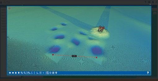


The iSite suite optimises delivery by empowering multidisciplinary teams to collaborate remotely across multiple locations and to contribute to projects via a single interface. This digital solution enhances safety by providing remote access to and assessments of subsea marine assets and environments, enabling customers to reduce risk by leveraging accessible, accurate information. The approach challenges the traditional storage of subsea data hosted in discreet, siloed packages within proprietary software across disparate offices and databases. Management of separate legacy information is prone to errors, breaks in communication, and missing or incorrect data, increasing the risk profile. iSite Subsea enables customers to reduce risk by leveraging an increased availability of accurate, up-to-date information on their projects and assets.

For a complete survey and data solution, UTEC also provides fast and accurate surveying techniques that are coupled with data interrogation through iSite to reduce the time and costs associated with personnel operating both onshore and offshore.
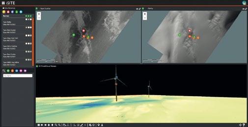
Onshore and offshore infrastructure owners are constantly looking for ways to improve safety, reduce site time and costs, and enable faster, better-informed decisions with less waste. However, UTEC realised that improvement in these areas is often held back because database-driven management systems have no visual relationship to actual assets. Other challenges include
ƀ lack of access to data sources because they are held in different systems
ƀ the struggle to ingest and make sense of the large volumes of available data
ƀ decision-making based on experience and gut instinct rather than reliable data
ƀ the requirement for tailored databases and analysis tools.
The UTEC team responded by creating the iSite and iSite Inspect products, now joined by iSite Subsea, to provide an interactive graphical visualisation, enhanced with “critical” data, as a powerful tool to drive informed decisions. The intuitive interface layers information and enables comparisons between data sets; a vital capability, particularly for repeat events such as inspections and maintenance.
At the heart of these digital solutions is the ability to draw key information from multiple sources and enhance the processed data through visualisation and the ethos of digitalisation.
The iSite suite uses innovative survey technology coupled with robust, innovative data management solutions to drive change in the renewables, oil and gas, telecommunications, and civil engineering sectors.
The platform’s intuitive 360° visualisation capability enables the user to tour any asset, take accurate as-built measurements on-screen, and view or download all project deliverables in multiple formats such as point clouds, drawings, 3D models, photos, and reports.
Operators need to support their existing infrastructure with customised Structured Query Language (SQL) databases and mobile solutions, and to satisfy reporting requirements. iSite is a scalable solution that can be tailored to meet these requirements while providing direct integration with existing integrity and maintenance information. This is achieved through iSite Inspect, a client-specific data handling and reporting suite that can be implemented as a standalone service or applied as an integrated module alongside iSite or iSite Subsea.
The benefits of the iSite suite are clear from a user survey. Of those surveyed:
ƀ 87% recorded significant cost savings, principally from fewer physical site mobilisations
ƀ 100% stated that they leverage value from iSite multiple times per week, and 35% observed that it brings more effective communication and project planning advantages multiple times every day.
The original iSite product was launched in 2012 and now has over 3,000 users managing more than 100 above-water projects globally. The platform has been widely recognised, including winning the prestigious Press & Journal Gold Award for Innovation.
iSite enables customers to manage any asset remotely from their desktop, driving down the cost of remote planning and communication, and it continues to service clients looking to consolidate survey data into a single portal accessible via secure cloud access. Its features and benefits include
ƀ providing an intuitive, feature-rich visual digital twin
ƀ being agnostic to scanning hardware, and legacy 3D and third-party data
ƀ enabling the download of engineering-grade point cloud data precisely where and when needed
ƀ offering inspection, maintenance, and decommissioning modules with a searchable tag taxonomy
ƀ integrating design models to enable evaluating as-built accuracy and performing clash analysis
ƀ linking information to existing or third-party client databases
ƀ providing secure user controls for managing teams and contractor access.
Visit acteon.com to find out how the iSite suite could help to reduce costs, lower risk, enhance health and safety, and better inform decisions for your assets.
