

London Breed, Mayor
Amanda Eaken, Chair Dominica Henderson, Director
Stephanie Cajina, Vice Chair Fiona Hinze, Director
Steve Heminger, Director Janet Tarlov, Director
Jeffrey Tumlin, Director of Transportation
Muni Forward is a program of the San Francisco Municipal Transportation Agency (SFMTA). The SFMTA is a city department, responsible for managing all ground transportation in San Francisco, including public transportation (Muni), bicycling, paratransit, parking, traffic, walking and taxis.
The effort to plan, design, fund and build Muni Forward projects over the past decade has included support from hundreds of city staff across multiple departments. The effort is led by the SFMTA's Transit Planning section, specifically the Transit Priority, Transit Engineering and Communications groups, with help from many other units of the agency. Within the Transit Division, Muni Forward receives extensive support from Service Planning, Transit Special Operations, Long Range Transit Planning, Maintenance of Way, Transit Operations and Transit Business Administration, among others. Special acknowledgement is given to Sean Kennedy, Julie Kirschbaum and Cheryl Liu for their ongoing leadership since the program's inception.
The SFMTA's Streets Division is also critical to Muni Forward's delivery, including the Sign, Paint, Meter and Signal shops, the Environmental Review Team, the Livable Streets unit, Parking Control Officers, the Curb Management team, Special Operations, Transportation Engineering, and others.
The Capital Programs & Construction division designs and oversees construction of many Muni Forward projects, while the Finance & Information Technology division has been instrumental in ensuring funding and information technology support is available for the program. Muni Forward has also benefitted from the support of the Communications division, Accessible Services, Enforcement & Legal Affairs, the Board Secretary, Human Resources, Government Affairs, the Safety division, the Chief Strategy Office and the Chief of Staff’s Office, as well as the strong support of the Director of Transportation and SFMTA Board. Muni Forward has important project partners in other city departments, including the Mayor’s Office, the San Francisco Board of Supervisors, the Department of Public Works, the San Francisco Planning Department, the City Attorney’s Office, the Office of Economic and Workforce Development and others. The Controller's Office was instrumental in the launch of Muni Forward.
We also acknowledge the partnership of the San Francisco County Transportation Authority, the Metropolitan Transportation Commission, the California State Transportation Agency, Caltrans and the Federal Transit Administration.
Most of all, we acknowledge the countless Muni riders, advocates and voters who have fought to make Muni the outstanding transit system the city deserves.
SFMTA
Michael Rhodes, Transit Priority Manager
Steve Boland
Julia Flessel
Cassie Halls
Jeremy Menzies, Staff Photographer
CONSULTANT
Nelson\Nygaard


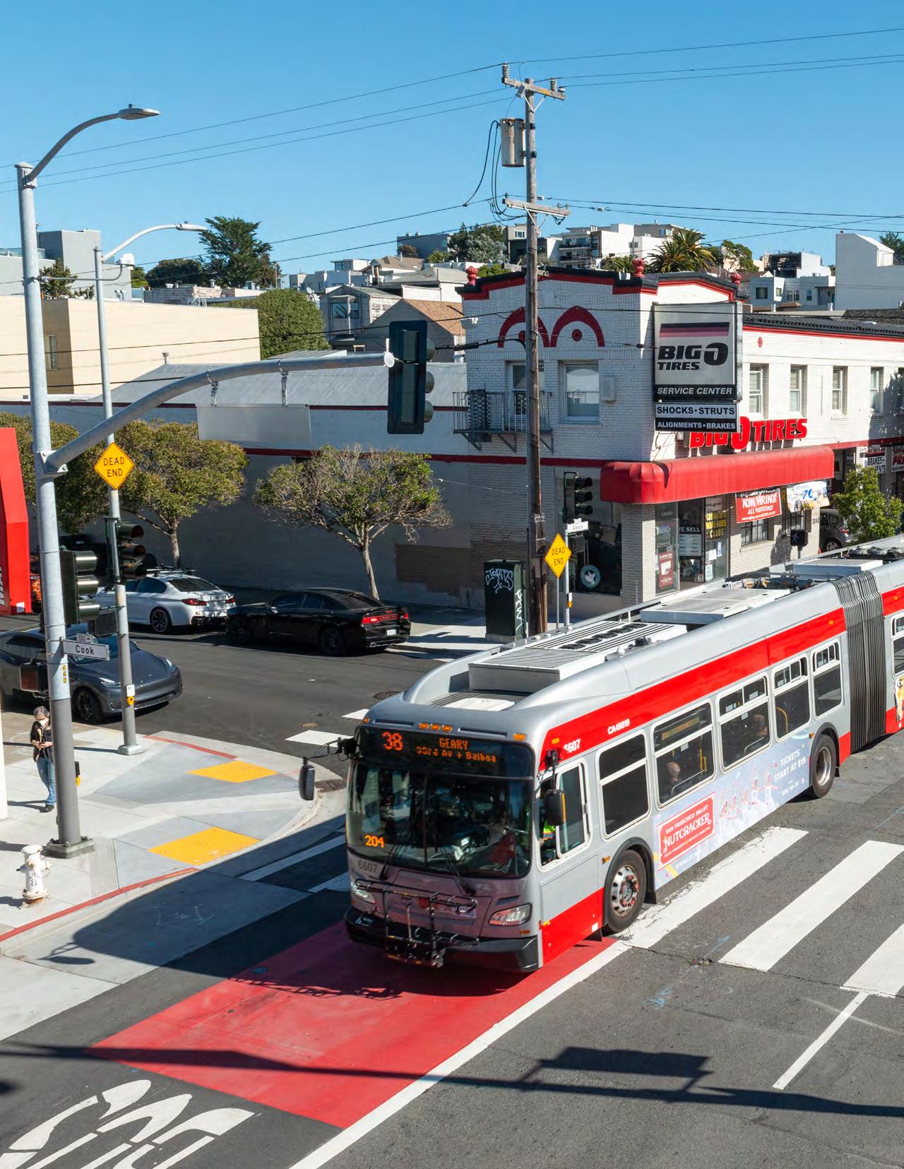
The SFMTA’s Muni Forward program has made transit in San Francisco faster, more reliable, easier to access and safer. Muni Forward improvements have driven Muni’s post-pandemic ridership recovery and boosted rider satisfaction. This section provides an overview of what Muni Forward is, what it has accomplished and why it matters to riders.
IN THIS SECTION:
• 10 Years and 100 Miles of Accomplishments
• Muni Forward's Guiding Principles
• Supporting San Franciscans' Shared Values
• Muni Forward on the Map
• Timeline: The Road to Muni Forward
• Why Transit Reliability Matters
• Outreach and Engagement Shape Muni Forward Projects
Since launching in 2014, Muni Forward has established the Muni Rapid network, created new connections, given Muni riders priority on congested streets and enhanced safety along Muni routes. This led to more people taking transit and record levels of rider satisfaction.
San Francisco is a national leader in redesigning streets to give priority to bus and train riders, with the most per-capita miles of transit lanes of any large US city, part of a suite of enhancements to transit speed and reliability.
Muni Forward projects highlight our ability to deliver improvements efficiently and equitably: our quickbuild approach implementing treatments with temporary materials while permanent infrastructure is designed means getting high-impact projects done fast, at a lower cost. This disproportionately benefits middle- and low-income San Franciscans who depend on Muni.
Muni Forward also aligns with community priorities and our shared city values of promoting trust and accountability in government, social equity, economic vitality and environmental stewardship.
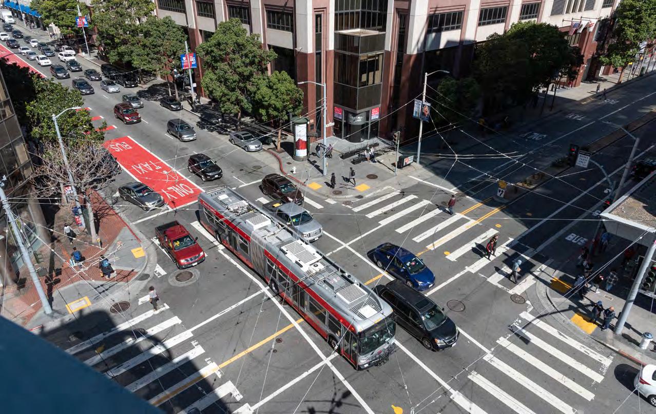
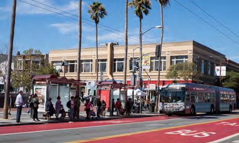
In 10 years, Muni Forward has built 100 miles of transit travel time and reliability improvements, benefitting Muni routes that serve 93% of all riders. Upgrades include red transit lanes that allow transit to skirt traffic, enhanced bus stops to help you board faster and traffic signals that stay green for buses and trains.

Muni Forward established the Rapid Network of five core bus routes prioritizing reliability and frequency on the busiest transit corridors. With frequent service every 10 minutes or better, the Rapid network, together with our Muni Metro rail network and frequent local bus routes, is the backbone of today’s Muni system. This is paving the way for the future Five-Minute Network—a set of routes with buses or trains every five minutes or better, all day.
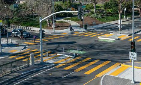
Muni Forward projects have reduced collisions and made streets safer for all roadway users—in line with our Vision Zero goals. Muni Forward has built safety upgrades on over 48 miles of the city's High Injury Network, the 12% of city streets where 68% of severe injury crashes happen. We have also made more stops accessible for all transit riders, including people with disabilities.

We have made new connections on heavily used routes, such as extensions to the Bayview, Mission Bay, the Presidio, Fisherman’s Wharf and Ocean Avenue. These new connections have helped better connect both historically underserved areas of the city and emerging job and population centers as the city continues to evolve.
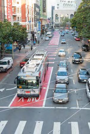
Muni Forward projects have reduced travel times by up to 35%. They have also resulted in up to 51% more reliable transit service, which means consistent time between arrivals and less guessing about how long your bus or train will take. See Corridor Profiles (starting on page 60) for more information.
Note: Reliability refers to lower variability in travel times. See page 104 for information about how we calculate travel time savings and reliability.
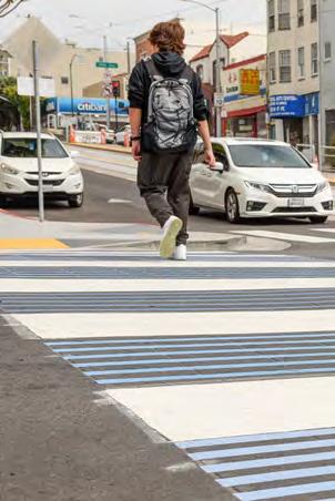
50% OR MORE REDUCTION IN INJURY COLLISIONS ON MULTIPLE MUNI FORWARD CORRIDORS
Muni Forward aligns with the city’s Vision Zero strategy to eliminate traffic fatalities. We have made a range of improvements to help riders get safely to and from stops, such as enhanced pedestrian crossings and pedestrian head start signals. These aim to reduce crashes, which makes streets safer for everyone, including people walking, biking, taking transit and driving. They also make Muni more accessible for more people. See page 56 for more information.

MUNI FORWARD PROJECTS DIRECTLY BENEFIT LINES THAT SERVE 93% OF ALL MUNI RIDERS AND 32 MUNI SERVICE EQUITY STRATEGY LINES
Muni Forward investments are informed by ridership data and the Muni Service Equity Strategy. This strategy delivers transit improvements to neighborhoods with high percentages of households with low incomes and low rates of vehicle ownership, people of color, seniors and people with disabilities. Ultimately, all of Muni's riders nearly 500,000 per day benefit, as resources saved by Muni Forward upgrades can be reallocated across the system.

23% RIDERSHIP INCREASE ON RAPID NETWORK CORRIDORS BEFORE THE PANDEMIC (2015-2019)
Ridership has grown the most where we’re making improvements to both frequency and reliability, such as on the Muni Rapid network. This means more people reaching more destinations with less pollution and traffic than a car trip would cause. Overall ridership on Muni Rapid bus lines increased by 23% from 2015 to 2019, compared to a 3% decline in systemwide ridership over the same period.
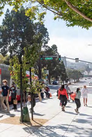
RIDERSHIP RECOVERY ON MUNI FORWARD CORRIDORS SINCE 2020
Compared to 2019, weekday ridership has returned faster since the pandemic on corridors with major Muni Forward improvements— including the 14 Mission (96%), 22 Fillmore (119%) and 49 Van Ness/Mission (138%)—than the Muni system as a whole (68% average). See page 22 for more information.
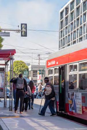
Muni Forward has shifted how riders perceive transit in San Francisco, leading to record levels of rider satisfaction (72% in 2024). We have raised the bar for reliability and safety, as well as customer amenity improvements such as bus stop signage, newer buses and trains and real-time information. See page 20 for more information.
Where Muni Forward has focused improvements over the past decade, ridership has grown, helping to meet our climate action goals, reduce traffic while supporting economic growth and recovery, and enhance mobility and access for everyone in the city. This is driving an overall increase in rider satisfaction as measured in recent surveys and serves as a roadmap for how a transit system can transform itself to better meet the needs of a dynamic city. We've done this by focusing on the following principles:
Muni Forward aims to make public transportation a great way to get around San Francisco, by improving travel time, reliability, safety, access and customer amenities. Since 2014, Muni Forward has expanded Muni’s Rapid network, built 100 miles of reliability improvements to heavily used bus and rail lines, such as red transit lanes, enhanced bus stops and traffic signals that help keep transit moving, and improved safety for people walking on corridors served by Muni. The program accomplished this with a toolkit of proven transit and safety upgrades (see page 45 for more information).
Muni Forward improvements are guided by a systemwide approach, informed by data, community and customer feedback and the Muni Service Equity Strategy. The focus is on delivering high-impact, low-cost projects on bus and light rail lines that together carry about 93% of all Muni trips. In addition, we prioritize lines identified for improvement in the Muni Service Equity Strategy This groundbreaking strategy delivers transit improvements to San Francisco neighborhoods that rely on Muni most, where there are greater numbers of people in low- and middle-income households, people of color, seniors and people with disabilities, and lower vehicle rates.
Muni Forward aims to reflect San Franciscans’ shared community values related to transportation —providing better mobility options, increasing access to opportunities for low- and middle-income people who rely on transit most, supporting local businesses and being better environmental stewards. The SFMTA uses ongoing community input to inform planning and design, even making adjustments to projects after implementation to ensure they meet the needs of riders, residents and other community members.
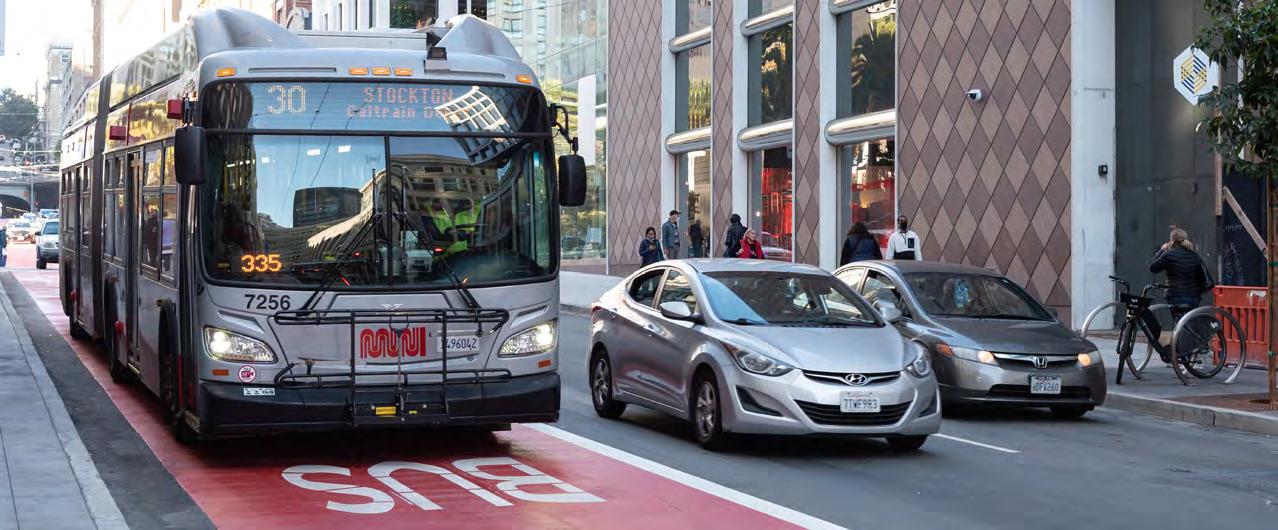
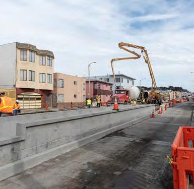

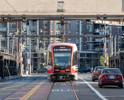
Coordinate with existing efforts to limit disruptions, reduce cost and maximize benefits.
Many of our projects are delivered in tandem with necessary state of good repair work, as well as in partnership with traffic safety projects, private developments and with community organizations.
Implement low-cost, quick-build projects that can be adjusted or even reversed if needed. Measure results before building permanent improvements.
Our priority is to deliver projects that benefit as many riders as possible as quickly as possible, so most Muni Forward improvements use a relatively low-cost, fast approach to implementation that can scale citywide.
Continuously learn, iterate and adapt. Revisit projects regularly to ensure they’re working well and be ready to make changes and improvements, even to “permanent” projects.
As traffic conditions, ridership patterns and transit priority best practices evolve, we continue to make adjustments, often revisiting improvements made as recently as a few months ago, or as long as 50 years ago.
Improving transit service isn’t just about getting people where they need to go. Done right, it’s also a way to build trust with communities, promote racial and social equity, enhance economic vitality, be good environmental stewards and combat climate change.
These values are consistent with the SFMTA Strategic Plan and are deeply important to many San Franciscans.
BUILDING TRUST
• Reliable transit builds trust in Muni’s ability to get people where they need to go.
• Genuine community engagement builds trust and understanding as we make transit improvements.
RACIAL AND SOCIAL EQUITY
• Muni Forward focuses investments on Muni Service Equity Strategy priority neighborhoods.
• People with lower incomes are over-represented among Muni riders and benefit the most from transit reliability improvements.
ECONOMIC VITALITY
• Muni Forward improves access to jobs and other opportunities by increasing how far people can travel by transit—reliably—in a given window of time.
• Transit priority increases the number of people that a street can move, giving the city room to grow its business activity and housing supply despite its limited roadway space.
ENVIRONMENTAL STEWARDSHIP
• Muni Forward makes transit a more attractive alternative to driving by private car. In so doing, it reduces greenhouse gases, particulate matter and other emissions. This supports our efforts to combat climate change and reduce local environmental impacts from vehicles.

Muni Forward aims to grow transit ridership, improve the customer experience for Muni riders and deliver service cost-effectively to get the most out of the community’s investment in Muni. While these outcomes are felt citywide, their greatest impact is in communities that rely on transit the most. To achieve these aims, Muni Forward has six main objectives:
Reducing travel times means getting where you need to go without needless delays. It also means we can deliver more frequent service with limited resources.
Improved reliability means service arrives as often as it’s supposed to, so riders can count on Muni showing up without an unexpected wait.
Reducing crashes makes our streets safer for people walking, biking, taking transit and driving. We also aim to reduce transit-involved collisions and avoid the delay and costs that collisions cause.
The transit rider experience is about more than the ride: it’s also about getting to and from stops and making transit more accessible for everyone.
Transit priority helps us to move more people within a limited right-of-way.
Muni Forward projects include rider amenities such as bus shelters, real-time arrival displays, transit stop lighting and improved stop identification signage.


100 MILES OF TRANSIT PRIORITY CORRIDOR IMPROVEMENTS SINCE 2014
These transit priority projects include a toolkit of over 20 engineering improvements that enhance travel time and reliability, such as transit lanes, transit bulbs, boarding islands, traffic signals with transit priority, stop spacing changes, turn pockets, turn restrictions and more. Learn more about these projects in the Muni Forward Corridor Profiles section, starting on page 60
Transit lanes are the most visible transit priority feature, giving buses and trains priority on the street. Out of 75 miles of transit lanes in San Francisco, over 20 miles are colorized with red thermoplastic, making them easier to see for drivers and improving compliance by about 50% on average. Learn more about transit lanes on page 46.
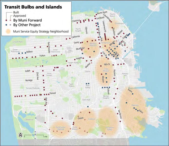
Transit bulbs and islands improve safety, accessibility and amenity for transit riders, such as providing room for transit shelters with real-time arrival displays. They also reduce delay to transit vehicles and, in the case of transit islands, can enable center-running transit lanes. Read more about transit bulbs and islands on page 51
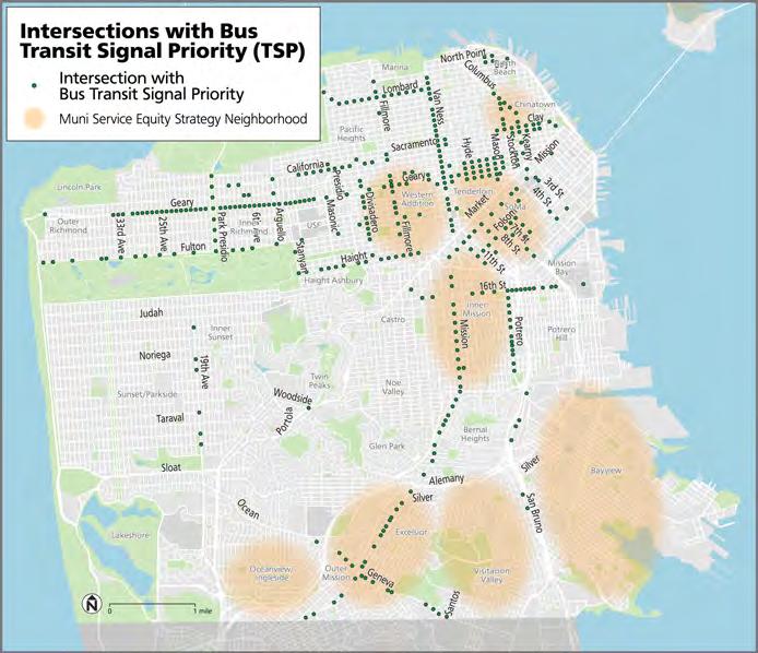
Transit signal priority uses GPS to hold green lights longer—and bring them up sooner—for buses. San Francisco has installed transit signal priority for buses at 318 intersections since 2014, making the city a national leader. Muni rail lines also have transit signal priority, but use a different technology and are not shown on this map. Learn more about transit signal priority on page 50
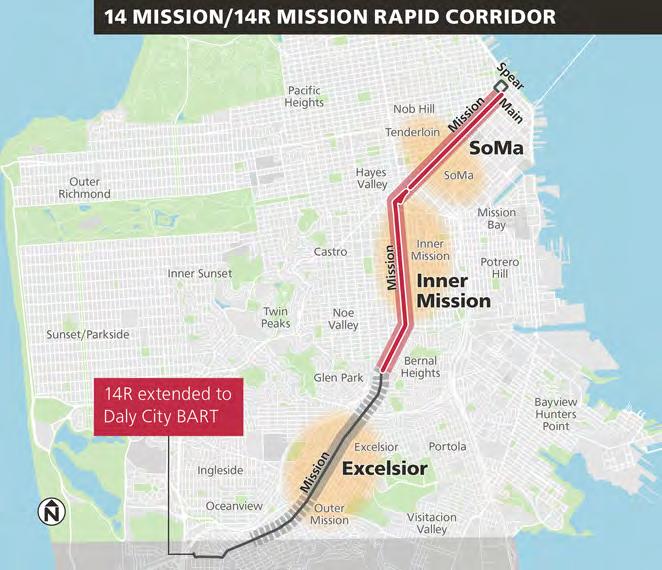
Mission Street illustrates how a series of Muni Forward improvements have acted together to make transit up to 31% faster in SoMa and 9% faster across the entire line overall. This is what Muni Forward looks like in practice.
Route 14 Mission/ 14R Mission Rapid 14R Mission Rapid Extension to Daly City BART

Muni Forward has made bus service on the Mission corridor up to 25% more reliable, with improvements like transit lanes, transit signal priority and removing some closely spaced stops.
Daly City BART
New Transit Bulb or Island
Dedicated Transit Lane Service Equity Strategy Neighborhood Muni Forward Project Area
The 14R Mission Rapid serves fewer stops than the 14 Mission local to provide faster service. Muni Forward extended the 14R Mission Rapid to Daly City BART and expanded hours of service.
Oceanview
• Mission District (2016): The 14 Mission Rapid Project, with transit priority and safety investments, resulted in 2 minutes time savings in the Inner Mission section of the route. However, surveyed riders perceived a 10-minute improvement, in part due to the better reliability.
• SoMa (2020–2022): Temporary Emergency Transit Lanes and related safety improvements—which have since been approved to remain permanently—reduced bus travel times by up to 31% in SoMa.
• Excelsior and Outer Mission (Construction): Construction is underway for the Muni Forward Mission/Geneva Safety Project
Muni Forward improvements reduced injury collisions on this corridor by 59% (2015-2019). Examples of safety improvements include:
• Wider sidewalks at intersections (also called "pedestrian bulbs")—two built, 27 under construction on the Mission corridor—and pedestrian head start signals to make crossing the street safer for people walking.
• Left turn restrictions at certain intersections to improve pedestrian safety, as well as transit reliability and general traffic flow.
Valley Castro

Heights
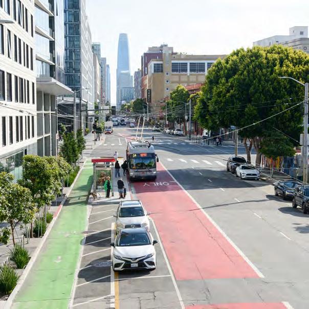
1 Dedicated bus lanes to avoid delays from congestion
2 Traffic signals with transit signal priority (TSP) to help buses keep moving through intersections. 3 Bus stops with wider platforms— "transit bulbs" or "transit islands"— to help riders board the bus more easily.
4 Safety features for people walking and biking, such as protected bike lanes that are separated from the bus stop, continental crosswalks and pedestrian head start signals.

• Improvement Plan for Transportation (1972): The plan included a policy to give priority to transit vehicles on designated streets to improve speed and reliability.
• Transit-First Policy Resolution (1973): Following up from the Improvement Plan for Transportation, a TransitFirst Policy resolution calls for a system of Transit Preferential Streets.
• Early Transit Priority (1970s and 1980s): Early transit lanes and other transit priority measures are built on Geary, O’Farrell, Sutter, Post, Mission and Judah streets.

• Proposition E (1999): Voters approve Proposition E, consolidating Muni and the Department of Parking and Traffic into a single agency (SFMTA) and updating the Transit-First Policy in the City Charter.
• A Vision for Rapid Transit in San Francisco (2002): This SFMTA plan outlined corridors for rail and bus priority improvements, many of which would become future Muni Forward corridors.
(2006): The SFMTA begins effort to identify causes and solutions to Muni’s greatest challenges, including customer experience and transit reliability—the precursor to Muni Forward.
• T Third (2007): T Third light rail line opens with a dedicated right-of-way on 3rd Street and signal priority.
• All-Door Boarding Policy (2012): Systemwide policy to let people get on and off transit vehicles from any door, resulting in 38% less time spent at stops (AllDoor Boarding Evaluation Report).
• TEP Pilot Projects (2013):
– 5 Fulton Limited Pilot provides limited service with fewer stops as well as other quick-build improvements on the corridor.
– First red transit lanes installed on Church Street.
Proposition A General Obligation Bond: Muni Forward launches, funded by voter-approved Proposition A, to improve travel time on heavily used Muni corridors, building on the TEP's recommendations.
• Safer Market Street (2015): Safer Market Street implemented, extending red transit lanes on Market Street.
• Muni Rapid Launch (2015): "Rapid" service replaces "Limited" service and expands on select high-ridership routes. Rapid routes come very frequently, make fewer stops than local routes and include transit priority improvements such as transit lanes. Today's Rapid routes include the 5R Fulton Rapid, 9R San Bruno Rapid, 14R Mission Rapid, 28R 19th Avenue Rapid and 38R Geary Rapid.
• Car-Free Market Street (2020): Car-Free Market Street implemented, closing remaining gaps in transit lanes on the corridor.
• Transit Delay Hot Spots and Transit Priority QuickBuild Programs (2020): Two programs to identify and address places with the most transit delay and make quick-build transit priority improvements
• Temporary Emergency Transit Lanes (20202022): As a response to the pandemic, the SFMTA quickly implemented transit lanes between 2020 and 2022—leading to the fastest ever expansion of transit lanes in San Francisco.

• 100 miles of transit reliability improvements completed (2014-2024), such as red transit lanes, enhanced transit stops and signal priority. San Francisco now has a total of over 75 miles of transit lanes.
• New Transit Priority Projects (2023–2024): New transit priority projects approved on the 19 Polk, 29 Sunset, 38 Geary, J Church, K Ingleside and M Ocean View, while permanent project construction is completed on Taraval Street (L Taraval), 16th Street (22 Fillmore), 19th Avenue (28 19th Avenue) and through the Tenderloin (27 Bryant), as well as on several quickbuild corridors and Transit Delay Hot Spots.
Detailed corridor-specific timelines are available in the Muni Forward Corridor Profiles (starting on page 60).
72% of Muni riders rated service as good or excellent in 2024, an increase from 66% in 2023 and the highest rating since annual customer surveys started in 2001.
Between 2021 and 2024, rider satisfaction increased considerably for three attributes that relate directly to Muni Forward improvements.
Muni does an “excellent” or “good” job at trips taking a reasonable amount of time, providing frequent service and providing reliability

TRIPS TAKING A REASONABLE AMOUNT OF TIME, I.E., FASTER BUSES AND TRAINS
PROVIDING FREQUENT SERVICE, I.E., BUSES AND TRAINS THAT COME MORE OFTEN
PROVIDING RELIABILITY, I.E., BUSES AND TRAINS THAT ARRIVE AT THE EXPECTED TIME
Source: Muni Rider Survey, SFMTA, 2024
Faster service, frequent service and reliability are core focus areas of Muni Forward improvements. Together with broader agency efforts, such as switching to headway management rather than timepoint schedules and an improved fleet, Muni Forward has helped to positively shift customers' perception of transit.
“The recent improvements to these lines are amazing. I use these buses all the time to get to the grocery store and I'm so happy I live in a neighborhood where transit is becoming more and more convenient and reliable.”
–14/14R and 49 Rider (2016)

Since the pandemic, ridership has bounced back faster on core Muni Forward corridors where we’ve made the greatest investments over the past decade, relative to systemwide ridership recovery.
Muni Forward has prioritized service and reliability improvements to the system's most heavily used routes as well as Muni Service Equity Strategy routes over the past decade, with an even sharper focus on equity since the pandemic.
The routes where we’ve made these improvements have proven to be the most resilient in retaining and growing ridership in the wake of the pandemic, with a ridership recovery rate of 100% or greater in some cases, particularly on weekends. With lines like the 22 Fillmore and 49 Van Ness/Mission exceeding their pre-pandemic ridership, Muni Forward has demonstrated that San Franciscans will still choose transit when it’s fast, frequent, reliable, safe and convenient.
Ridership on nearly all Muni Forward routes has recovered faster than the overall Muni system on average–for both weekdays and weekends
Ridership recovery shown as the percent of May 2024 ridership relative to May 2019 ridership
ROUTE

Source: Average daily Muni boardings by route and month (pre-pandemic to present), SFMTA, May 2024 and May 2019
Data Notes: (i) The 47 Van Ness also ran on Van Ness Avenue prior to the pandemic but is no longer in service. The ridership recovery rate is 100% when including the entire 49-line and boardings on the 47-line that occurred on Van Ness before the pandemic. (ii) Ridership for the 30 Stockton has been partly diverted to the T Third with the opening of the Central Subway, as well as to the 15 Bayview Hunters Point Express.
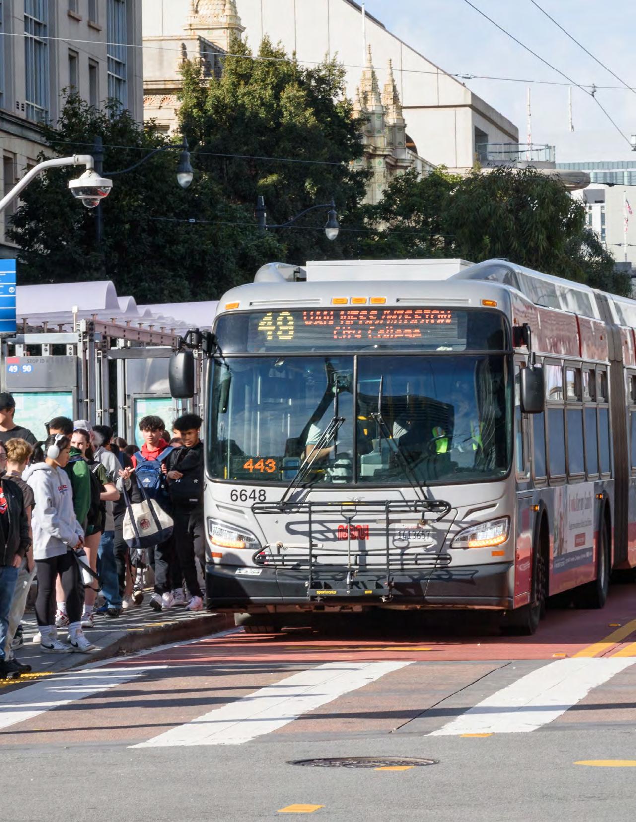
Transit reliability is critical for San Francisco. Prior to Muni Forward, transit delays had been a longstanding issue for riders on nearly every Muni line, making it hard for people—particularly people with low and middle incomes—to get around the city.
Muni speeds were gradually declining from the 1970s through the 2000s. By 2004, we had the second slowest bus system in the country. This was due to traffic congestion, double-parking, frequent stop signs, traffic signals without transit priority and closely spaced stops. Slow buses pose an especially urgent problem in San Francisco: Compared to other dense cities like New York and Washington, D.C., San Francisco relies more on buses and street-level trains since there isn't a citywide subway network.
In the mid-2000s, reliability—the percentage of transit trips without “bunching” or “gaps”—was also well short of our target of 85%. People waited longer than expected for a bus to arrive at their stop and then saw two buses arrive at the same time—the first one crowded with passengers and the second one nearly empty.
Source: San Francisco Transit Effectiveness Project Briefing Book, SFMTA, 2008.
“I take the L downtown & back 5 days a week and the frequency with which it's delayed is very frustrating.”
–L Taraval rider (2015)
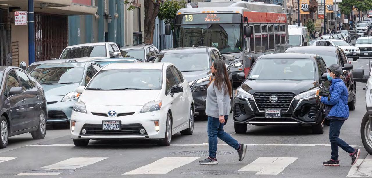
Who are the people who take transit and suffer most as a result of delay? In short, people with low and moderate incomes. In general, people with lower incomes have less flexibility about when they arrive to work, less ability to work remotely and longer commutes. Transit delays can mean losing a job, or having to make a long and expensive drive every day.
People earning less than $75,000 per year are over-represented among Muni riders: 60% of riders, versus 45% of all San Franciscans.

For people earning between $75,000 and $100,000, the share of Muni riders (9%) is roughly the same as the share of San Francisco residents in this income range (10%).
Just 16% of Muni riders have incomes above $100,000, while 45% of all San Franciscans are in this category.
Data Sources: Muni On-Board Survey, SFMTA, 2017; American Community Survey 1-Year Estimates, US Census Bureau, 2017. These are the most recent available sources for comparison.
Transit delay is a top concern for riders and San Francisco residents. According to the SFMTA’s 2023 Community Survey, 46% of respondents identify improving Muni’s speed, reliability and frequency as the most important transportation goal for San Francisco—by far the highest of any transportation priority, across all modes of travel. This is consistent with survey feedback we’ve heard from riders repeatedly over the past two decades.
46% of surveyed residents selected better Muni speed, reliability, and frequency as their number one priority for improving the city’s transportation
Nearly half (46%) of surveyed residents selected better Muni speed, reliability and frequency as their number one priority for improving the city's transportation

Source: Community Survey Results Summary, SFMTA, 2023.
Improving the speed, frequency and reliability of Muni buses and trains
tra c ow by
Muni Forward continually solicits community input and uses this feedback to guide decisions. See page 36 for more information on our approach to public outreach and engagement.
Delay doesn't just cost riders time and make their transit experience worse. As transit becomes slower due to traffic congestion and other delays, it also becomes more expensive for Muni to provide. Longer trip times mean we have to run more buses to provide the same frequency of service, increasing costs without providing any benefit to riders.
How much does it cost to provide Muni bus service every 10 minutes, from 6 a.m. to midnight daily?
How much does it cost to provide Muni bus service every 10 minutes, from 6 a.m. to midnight daily?
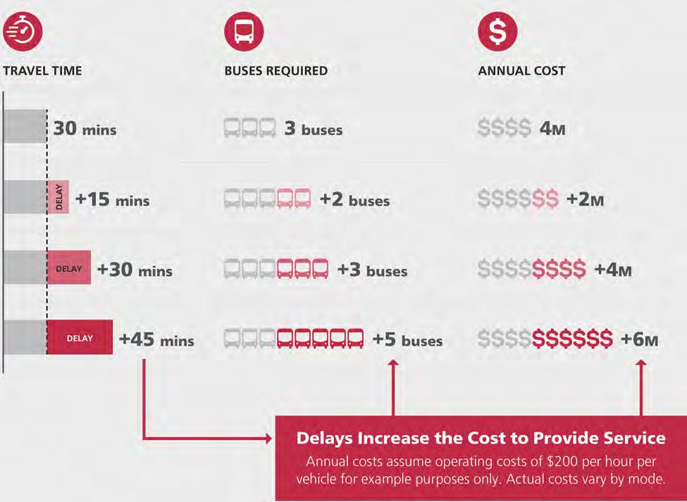
Annual costs assume operating costs of $200 per hour per vehicle for example purposes only. Actual costs vary by mode.
Like any public entity, the SFMTA is required to balance its budget. So how do we make up for the added costs of slower service? In short, increased delay on a transit line means we have to cut frequency on the route to make it work with the same number of buses, or “take a bus” from another route, cutting the other route's frequency. Either way, slower service leads to service cuts.
Transit delays can lead to a downward spiral where higher costs lead to less frequent and reliable service, which causes fewer people to choose transit and increases trips in private cars. This increases traffic congestion and further worsens transit delay, while also decreasing revenue from transit fares, leading to service cuts.
DOWNWARD SPIRAL CAUSED BY TRANSIT DELAYS
Delays increase costs, which make service worse and more costly
Worse service means people switch from transit to travel in private cars
With more traffic, transit becomes further delayed and unreliable
As more people travel in private cars, traffic congestion increases
Fortunately, it is possible to reverse the spiral. This is what Muni Forward has been doing since 2014.
Reduced delay improves service quality and allows us to avoid reducing frequency to make up for slower service. This causes more people to choose transit. For example, Muni Forward investments on Mission Street led to a 9% roundtrip travel time savings on the 14 Mission (2015–2023). The 14 Mission/14R Mission Rapid corridor saw a combined 9% increase in ridership over the same period.
VIRTUOUS CYCLE CAUSED BY SHORTER TRANSIT TRAVEL TIMES AND MORE RELIABLE SERVICE
Shorter travel times make service better and less costly to provide
With more people on transit, Muni can run buses and trains more often
Better service means more people take transit
As more people take transit, fewer travel in private cars, reducing traffic
The Muni Forward Toolkit section (page 41) explains the tools that Muni Forward uses to reverse the downward spiral and make transit work better in San Francisco.
One fewer bus running 12 hours a day, six days a week, results in approximately $1 million in annual savings. Estimates of cost savings from Muni Forward improvements are based on several factors, including how long a transit vehicle takes to run a given route, the number of buses or trains that serve a route and delays that would have otherwise worsened without Muni Forward efforts.
Systemwide, we estimate that Muni Forward has reduced operating costs by as much as $5-10 million per year compared to what it would cost to provide our current level of transit service without Muni Forward improvements. This is because time savings enables the SFMTA to provide the same level of service with fewer transit vehicles—reversing the trend described on page 27
Saving a transit vehicle is easiest to accomplish on frequent routes. Of the 17 routes featured in the Muni Forward Corridor Profiles in this report (starting on page 60), all operate using at least 10 buses or trains in service on weekdays, some with up to 27. As a result, the roundtrip time savings required to save a transit vehicle on these routes is roughly 4-10%. We have seen time savings in this range or greater for most of our segment-by-segment analyses.
For example, as a result of Muni Forward, the 49 Van Ness/Mission roundtrip schedules are approximately 10% shorter in 2024 relative to 2015, saving three buses. Had Muni Forward not reduced travel times, the 49 Van Ness/Mission would have needed three additional buses to provide service every six minutes—which is how often buses come during rush hour in 2024.
For buses that come every ...
6 minutes
What is the e ect of service that is 14 minutes faster roundtrip because of Muni Forward?
On the 49 Van Ness/Mission, which is scheduled to take ... Muni needs to use ...
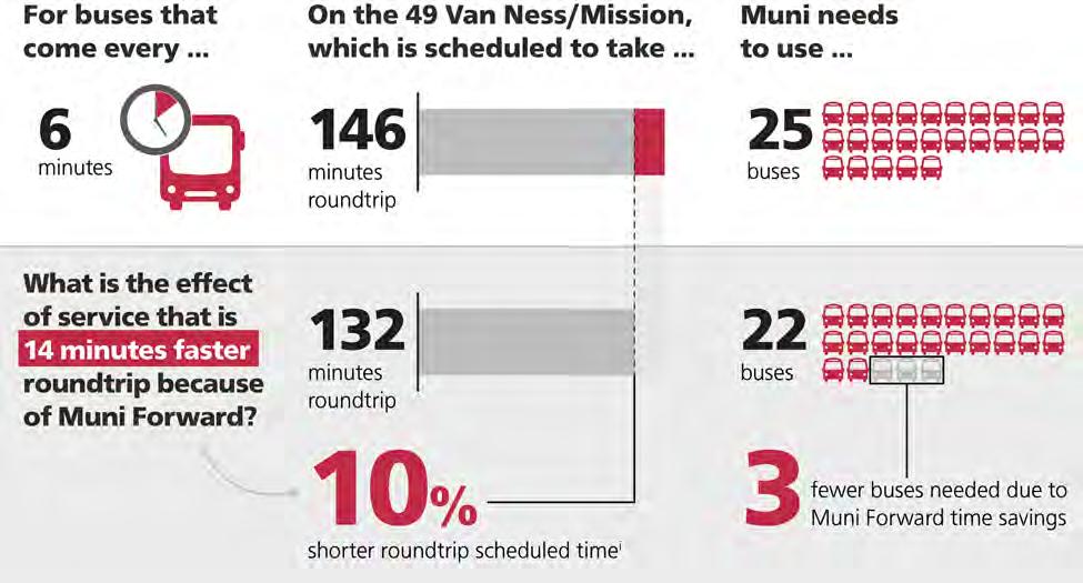
146 minutes roundtrip
132 minutes roundtrip
10% shorter roundtrip scheduled timei
25 buses
22 buses
3 fewer buses needed due to Muni Forward time savings
Data Note: (i) Based on weekday scheduled runtimes, 2015–2024. Actual observed time savings were even greater.
Muni Forward focuses on low-cost, high-impact investments that can scale quickly across the most heavily used lines in the city's transit network. For example, transit lanes have a very low cost relative to their resulting time savings for riders. The table below shows approximate cost ranges and time savings associated with typical Muni Forward transit priority interventions in San Francisco. By comparison, the cost of rebuilding a highway can be hundreds of millions of dollars per mile. See page 32 for a summary of total project costs for a range of Muni Forward corridors.
Transit lane
5-35% on block with transit lane
$100-200K per mile (non-red), $1M per mile (red) per direction
SFMTA shops
Transit signal priority (TSP) at existing signal
1-5% on block approaching TSP signal
New traffic signal replacing stop sign 1-20% on block approaching signal
Transit bulb 1-5% on block with bulb
Transit island 1-5% on block with transit island
$20-70K per intersection SFMTA shops
$700K per intersection Contractor
$250-500K+ each Contractor or SF Public Works crews
$100-500K each Contractor or SF Public Works crews
Turn restriction 1-5% on block with turn restriction Less than $2K each SFMTA shops
Transit stop removal and optimization
5-20% in route segment with changes
$4-8K per stop change
SFMTA shops
Notes: (i) Costs do not include soft costs (e.g., planning, environmental review, design, permitting). Soft costs are typically about 30% of total costs for larger projects delivered by contractors. Soft costs may be a larger share of project costs for lower-cost projects delivered by city crews. (ii) Generalized costs. Actual cost varies by location.

Established in 2020, the Transit Delay Hot Spots Program identifies the 10 slowest segments in the Muni system—where buses or trains often run slower than 4 miles per hour. We then develop simple, targeted solutions to address the problem spots. Once fixed, we develop a new list of hot spots, ensuring that help is on the way for riders experiencing the worst delays.
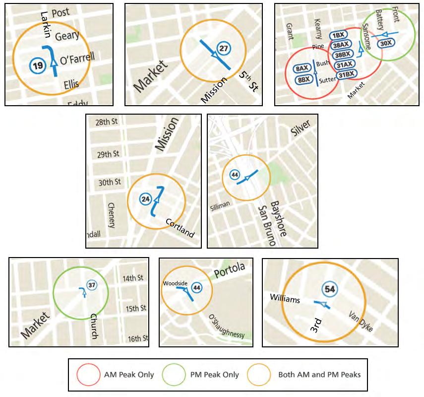
Source: Transit Delay Hot Spots Program, SFMTA, 2020
Example location: the 54 Felton was identified in the Transit Delay Hot Spots Program in 2020. The short segment on Van Dyke Avenue at 3rd Street saw slow very travel times, due to the bus stopping at both sides of the same intersection. The stop at the near side of the intersection was removed, reducing delay by one minute, or 50%, while continuing to provide a stop across the street. Similar improvements have been implemented at six other locations and will continue to roll out in the year ahead.
Typical Muni Forward projects
Muni Forward selects tools from a transit priority toolkit tailored to each project’s needs and context. The tools used can range in terms of level of investment from very low-cost, quick-build projects like basic side-running transit lanes, all the way up to more extensive projects that by Muni Forward standards involve a relatively high level of capital construction, such as Van Ness Bus Rapid Transit. Most Muni Forward projects are in the mid-range level of investment, similar to the 14/14R Mission or 30 Stockton corridors. However, even the most capital-intensive street transit priority investments are much less expensive than constructing a subway or new freeway, especially when separating out the core costs for transit priority improvements from other project costs, such as state-of-good-repair upgrades to utilities, pavement and other aging infrastructure in the public right-of-way.
CHARACTERISTIC
Length (bidirectional miles)
Core cost per bidirectional mile for core transit priority improvements
Cost per bidirectional mile including related infrastructure upgrades i
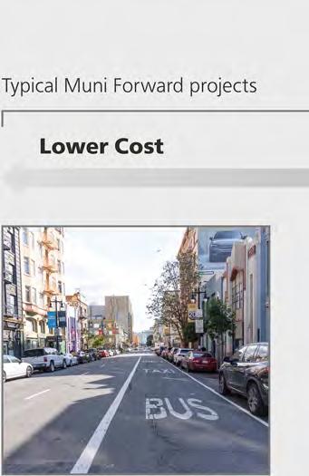

19 POLK TRANSIT LANES (7TH, 8TH, HYDE STREETS)
Less than $500,000
No related infrastructure upgrades
Time from planning to opening 6–12 months
Construction time 1–3 months
Transit priority features • Transit lanes without red colorization
Related utility and public space investments None
Muni Forward with streetscape enhancements


Bus Rapid Transit with extensive streetscape enhancements and complex utility work
Cost

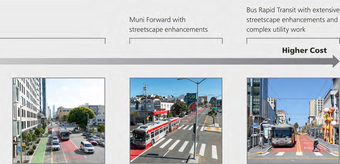
MISSION CORRIDOR (SOMA AND MISSION DISTRICT) GEARY RAPID PROJECT VAN NESS BUS RAPID TRANSIT 4
• Side-running red transit lanes
• Transit signal priority
• Transit bulbs and island
• Changes to stop spacing and placement
• Turn restrictions
• Right turn pockets
• Pedestrian safety infrastructure
• Side-running red transit lanes
• Transit signal priority
• Transit bulbs
• Changes to stop spacing and placement
• Left turn restrictions
• Right turn pockets
• Utility upgrades (SFPUC)
• Repaving (SF Public Works)
• Pedestrian safety infrastructure
• Removal of old infrastructure
• Center-running red transit lanes
• High-amenity boarding islands
• Changes to stop spacing
• Transit signal priority
• Utility upgrades (SFPUC)
• Repaving (SF Public Works)
• Overhead wires
• New street lights
• New trees
• Public art
Notes: (i) Costs include planning and design. (ii) Cost for transit priority features is approximate, as all project scope—including utility upgrades and other state-of-good-repair improvements—was combined in a single design and contracting process.
Through Muni Forward's Temporary Emergency Transit Lanes (TETL) program, the SFMTA built over 15 miles of transit lanes in two years, part of the fastest expansion ever in San Francisco. The lanes reduced transit travel times by up to 31% for riders.
TETL was an effort between 2020 and 2022 to minimize rider exposure to COVID-19 due to crowded buses and trains and to deliver reliable transit during the pandemic recovery. It was a critical part of the SFMTA pandemic response. Informed by data and focused on equity, it ensured that essential workers who depend on transit weren't stuck in slow, crowded buses during the worst months of the pandemic.
TETL also introduced the concept of piloting at scale. It gave people the opportunity to experience changes right away and enabled us to quickly evaluate the impact of our work.
TETL measured travel time savings resulting from a drop in overall traffic in March and April 2020 compared to prepandemic conditions. We used the data to inform where to install transit lanes to preserve travel times as traffic returned.
All TETL projects benefited lines that serve neighborhoods identified by the Muni Service Equity Strategy

TETL projects were successful in reducing delays and had strong community support. Following a robust outreach process, most of the transit lanes were eventually approved to remain permanently. But where we received strong feedback that the projects weren’t working well for the community, we made adjustments. And in a few cases, short sections of transit lanes were removed as the pandemic eased, in keeping with the temporary emergency-response nature of the program.
for all information on this page: Temporary Emergency Transit Lanes Evaluation Summary, SFMTA, 2022

Source: Temporary Emergency Transit Lanes Evaluation Summary, SFMTA, 2022
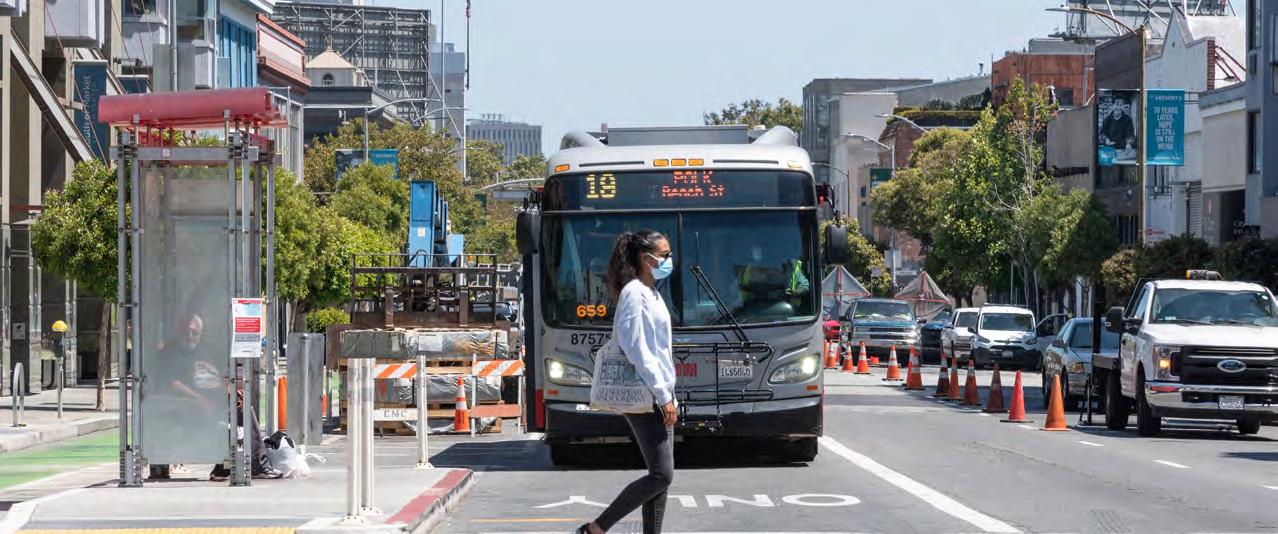
Community input helps to identify priorities, set goals, generate ideas and measure success for Muni Forward. And SFMTA uses outreach to provide ongoing, accessible information that keeps everyone up to date.
SFMTA tailors all Muni Forward outreach tools and activities to individual neighborhood contexts and needs. Tools and activities can include:
• "Listening tours" in early stages of planning
• Conversations with community groups
• Door-to-door merchant outreach
• In-person and virtual community meetings
• Project websites, including interactive “StoryMaps”
• Walk and ride audits
• Pop-up open houses at transit stops and key destinations
• Emails, text messages and mailers
• Surveys distributed to riders, residents, visitors and merchants
• Virtual office hours
Nearly all Muni Forward projects now begin with a listening tour to gather insights from community members. Following this phase, we use what we’ve heard to develop concepts, gather additional community feedback and ultimately finalize a proposal for approval by the SFMTA Board of Directors.

The public outreach approach for all SFMTA efforts, including Muni Forward, is called the "Public Outreach and Engagement Team" (POETS) and is guided by the following values:
• Consistent requirements for public outreach throughout the agency
• Resources to support staff who work directly with the public
• Inclusive practices to increase access and participation
• Development and cultivation of strong community relationships
All Muni Forward efforts—including quick-build projects—develop communications and outreach plans, which (1) identify community-based organizations and neighborhood partners, (2) establish outreach goals and (3) ensure that project information and materials are available in community-appropriate languages.
The Muni Service Equity Strategy identifies priority neighborhoods to address transit performance disparities. The neighborhood selection process considers concentrations of households with lower incomes, people of color, levels of vehicle ownership, the location of affordable and public housing developments, and Muni routes disproportionately used by people of color and with lower incomes.
The Service Equity Strategy establishes principles to guide decisions and improvements:
• Prioritize Equity Strategy routes when increasing service and when facing constraints on resources
• Perform ongoing evaluations of customer-reported issues on Equity Strategy routes
• Leverage ongoing community engagement efforts to identify key service and capital needs, including opportunities for Muni Forward improvements

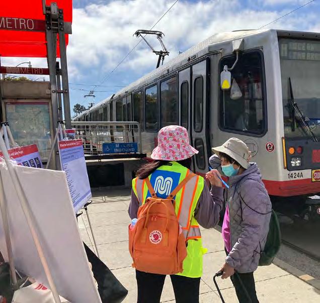
Efforts on three routes—the 19 Polk, 27 Bryant and 29 Sunset—illustrate how Muni Forward has made improvements using extensive community engagement and the Public Outreach and Engagement Strategy approach. These routes were selected in part to invest equitably based on the Muni Service Equity Strategy.
The 19 Polk on 7th and 8th Streets Transit Improvements Project was part of the Temporary Emergency Transit Lanes program. Portions of the route were selected for temporary transit lanes, based on prepandemic bottlenecks on 7th and 8th streets. Due to popular support among riders, 40% of whom have incomes below $35,000, Muni Forward gained approval to keep the transit lanes permanently. The 27 Bryant Transit Reliability Project focused on improvements north of Market Street in the Tenderloin and Nob Hill neighborhoods. We also rerouted the 27 Bryant from 5th Street to 7th and 8th streets so riders can benefit from the new transit lanes on these streets. The project's outreach was honored with an award by the International Association for Public Participation (IAP2) USA
• Open houses, virtual community meetings, tabling at events like Sunday Streets and farmers markets, virtual office hours
• Walk-ride audit
• Multilingual mailers, posters, emails and text message updates
• Onboard surveys, operator surveys, pre- and post-evaluation surveys
• Door-to-door merchant outreach
• Project website

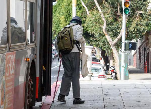
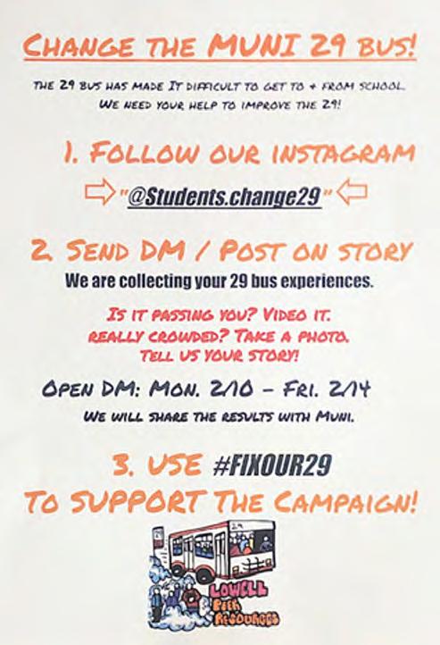

With an average weekday ridership of 16,400, the 29 Sunset serves many schools and colleges, as well as several Equity Strategy neighborhoods, including the Bayview, Visitacion Valley, Excelsior-Outer Mission and Oceanview-Ingleside.
Outreach for improvements on the 29 Sunset began in 2019 as a grassroots effort led by students at Lowell High School and other schools along the route. A rider survey in 2021 found that reducing wait time, travel time and crowding were the three highest priorities among riders.
Community input informed Muni Forward and other transit improvements, such as additional school hour service ("school trippers") to reduce crowding, as well as changes to bus stop design and spacing. The changes are anticipated to reduce travel times by 15-20% between Junipero Serra Boulevard and Baker Beach.
Phase 2 will focus on the southern and eastern parts of the 29 Sunset.
• Listening tour:
– Lowell High School students
– Neighborhood groups
– San Francisco Youth Commission
– San Francisco Unified School District
Source: 29 Sunset Improvement Project Storymap, SFMTA, 2023
• Community meetings
• Survey
• Door-to-door merchant outreach
• Email lists and mailers
• Project website

This section describes how Muni Forward makes transit work better—by providing Rapid service, making new connections and other route improvements and building transit priority upgrades. It also shows how different levels of investment can be applied, from smaller spot fixes to larger corridor-wide improvements.
IN THIS SECTION:
• Building a Rapid Network
• New Connections and Routing Improvements
• Transit Priority Toolkit
– Transit Lanes
– Transit Signal Priority
– Enhanced Transit Stops
– Stop Spacing and Placement
– Curb and Traffic Management
– Pedestrian Safety Infrastructure
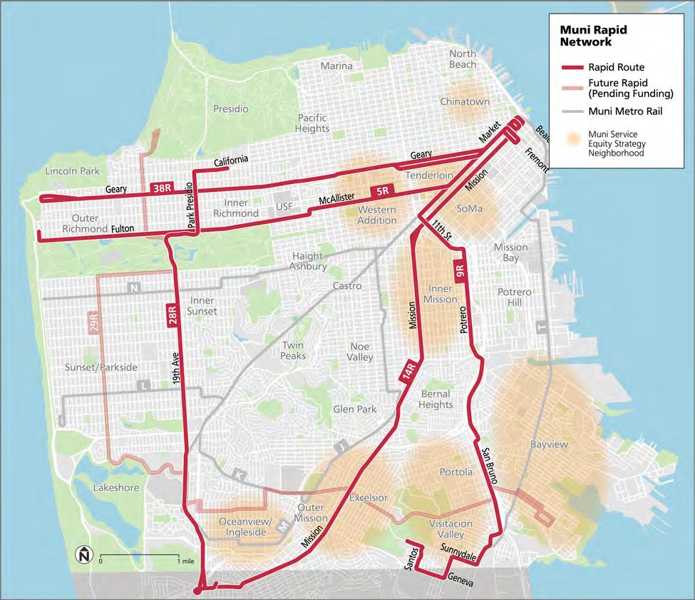
The Rapid Network is a key part of Muni Forward. Rapid routes—which have an "R" next to their number, like 14R Mission Rapid and 5R Fulton Rapid—stop less often than local buses to get riders where they need to go in less time.
Service with wider bus stop spacing has been available since at least the 1950s on certain routes, with buses that skip lower volume local stops to provide a faster trip for riders. But in the past, only two routes—the 14L Mission Limited and 38L Geary Limited—offered this limited-stop service all day and neither operated 7 days a week.
In 2015, as part of Muni Forward, Limited service transformed into Rapid service. Rapid routes continued to make fewer stops than local service, but unlike their Limited predecessors, Rapid routes come more often, all day, with more weekend service on some lines as well. This enhanced Rapid Network launched together with Muni Forward investments on all of the Rapid lines, to reduce travel times even further.
Rapid routes include a combination of Muni Forward transit priority measures, such as transit lanes, wider boarding areas ("bus bulbs") to make it safer and faster for people to get on the bus, and transit signals that stay green for buses. Most transit priority measures for Rapid routes benefit local bus service on the same corridors as well.
Today, the Rapid Network includes five routes, each with frequent, all-day service: 5R Fulton Rapid, 9R San Bruno Rapid, 14R Mission Rapid, 28R 19th Avenue and 38R Geary Rapid. The five Rapid routes carry over 65,000 riders each weekday, which represents 14% of the average systemwide weekday ridership (March/April 2024).
In the future, we intend to expand the Rapid Network as resources allow, providing more coverage throughout San Francisco.


Designing better routes is an important part of Muni Forward's toolkit.
We have made many routes more convenient for riders with relatively low-cost changes. These include extensions of existing routes to reach important destinations, more direct routes—with fewer turns—to help you get where you need to go faster and new routes to give you better connection options.

Building transit priority infrastructure—to improve travel time, reliability, safety and the rider experience—is a core function of Muni Forward. More information on the categories below is available on the following pages.
Dedicated transit lanes allow transit to bypass traffic and keep moving
Transit signal priority keeps lights green longer for transit
ENHANCED TRANSIT STOPS
Enhanced transit stops make it easier and faster to get on board
Transit stop spacing as well as placement (near or far side of the intersection) directly affect travel time
Managing curb space and vehicle turning movements can make transit more reliable and increase safety
Safety features for people walking reduce injuries and improve access to transit

• Transit lane in the middle of the street, separated from the parking lane by one or more general traffic lanes.
• Most effective where the friction from vehicles making right turns and double-parked vehicles heavily affects transit service.
• Can be paired with left turn restrictions for the greatest travel time and reliability benefits.
• Transit experiences almost no traffic delay with this type of transit lane.
• Ideal for rail corridors that already have center-running service in mixed traffic lanes.
• Less suitable for corridors with both local and Rapid service because there is not room for Rapid buses to pass local service at stops.
• Requires boarding islands, which may trigger relocating utilities and other street infrastructure.

• Transit lane between the parking lane and a general traffic lane.
• Fastest to implement: no boarding islands or special stop infrastructure required.
• Allows Rapid buses to pass local buses.
• Preserves parking.
• Friction from vehicles making right turns and double parking can still affect transit service in these lanes. They can be paired with separate right turn lanes and curb management improvements to address these sources of delay.
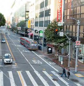
• Similar to offset lanes, but without curbside parking.
• Often necessary where space is limited and curbside parking and loading cannot be provided.
• Can lead to increased delays from illegally stopped vehicles where no legal loading or parking spaces are provided. A strong curb management strategy is needed to ensure curbside transit lanes work effectively.


• On one-way streets, a contraflow transit lane can be installed in the opposite direction.
• In some cases, contraflow lanes can help straighten a route and avoid “jogs” to reduce travel times—as in the case of the Sansome Street contraflow bus lane, which reduced travel times by several minutes by enabling a more direct route.
• Depending on local needs, commercial vehicles and other local access may also be allowed in the lane.
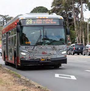
• Appropriate where transit volumes are relatively low compared to vehicle volumes.
• HOV/transit lanes provide benefits to transit riders while also supporting carpoolers.

• This type of transit lane is created through part-time parking restrictions along the curb.
• May be appropriate where space does not permit a 24/7 transit lane and curbside space is still needed for loading at some times of day.
• Reduces parking impacts compared to a full-time curbside transit lane.
• Provides less benefit outside of peak hours.
• May be more confusing for people attempting to park.
Short transit lanes approaching an intersection—often called "queue jumps"—can be used where there isn’t enough room for a transit lane for the full length of the block. Queue jumps work best when paired with a traffic signal that provides a head start for transit ("leading transit interval").
Transit lanes can move more people than general purpose lanes. This is because transit is a space-efficient form of transportation relative to cars.
Since our streets have a fixed width, transit lanes are an important way to mitigate traffic congestion by helping more people get where they need to go using less space. In other words, transit lanes build capacity for future growth, without making traffic worse. If just a fraction of people who currently take transit decided to use cars instead, traffic in the city would quickly become unmanageable.
Dedicated transit lanes can move more people than general purpose lanes
Dedicated transit lanes can move more people than general purpose lanes and lanes with mixed tra c
General purpose lane with private motor vehicles 600-1,600 people/hour
General purpose lane with mixed tra c including private motor vehicles and frequent buses 1,000–2,800 people/hour
Dedicated transit lane with frequent transit 4,000–8,000 people/hour
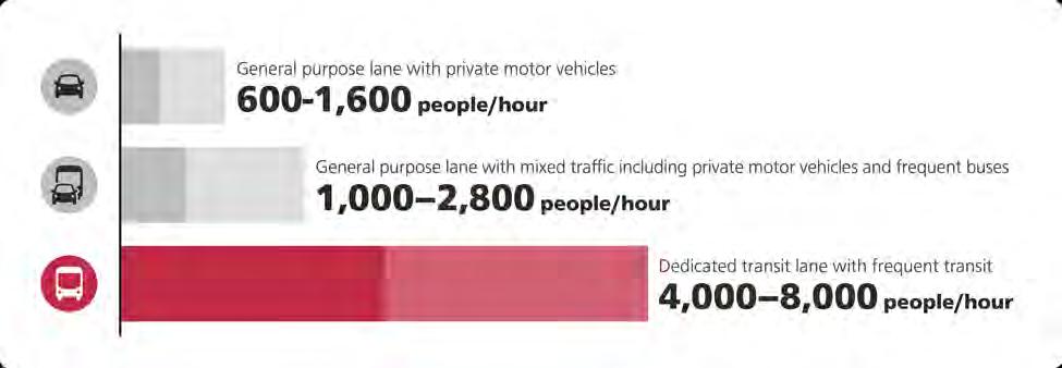
Source: Transit Street Design Guide, National Association of City Transportation Officials, 2016
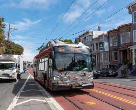
Red colorization helps vehicle drivers know to stay out of transit lanes. Since the first red lane was installed on Church Street in 2013, multiple SFMTA studies—on Geary, O'Farrell and 3rd streets—have found a 50% improvement in driver compliance compared to standard "non-red" transit lanes.
The lanes on Church Street achieved their purpose, reducing transit travel times by 14% and improving reliability by 27%. This led to the expansion of red transit lanes across the city. Church Street Transit Lanes Final Report, 2015.

The bus in this photo is carrying up to 80 people, while all the cars in the adjacent general purpose traffic lane are carrying about 15 people combined, despite the cars taking up much more space.
Transit Signal Priority (TSP) can detect buses and extend green lights, with a 4% average travel time reduction on blocks with TSP. The Muni Forward team is continuously improving the city’s TSP program, adjusting parameters and adopting new technology to further reduce transit travel times along busy corridors.

The basic timing of traffic signals also affects transit performance. The Muni Forward team often adjusts traffic signals by retiming them to keep transit moving. The combination of TSP and signal retiming is a powerful tool to reduce unnecessary delay.

Transit stops with comfortable seating and shelter can enhance the waiting experience. Transit stops are a key component of improving customer experience. When designed effectively, transit stops can also support faster transit service, reduce delay from traffic congestion and improve streetscapes. Muni Forward constructs transit bulbs and transit islands to achieve these benefits. These often also include accessibility improvements, such as wheelchair-accessible ramps for light rail stops.
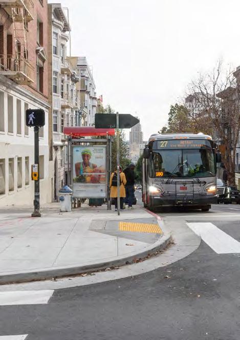
Transit bulbs are curb extensions that allow buses to pick up and drop off passengers without leaving the traffic lane and are most effective on busy streets. For example, Muni Forward installed quick-build transit bulbs at two stops on Fulton Street in the Inner Richmond, reducing stop times by about 10 seconds per stop, while providing a smoother ride and boarding experience.

Transit boarding islands are boarding areas for transit in the middle of the street, either next to a vehicle travel lane or a bike lane. Like transit bulbs, transit islands can reduce travel time for buses, but their design also creates a safe refuge area and shortens distances for pedestrians crossing the intersection. They can also separate bikes and buses, helping to reduce conflicts at stops.
Every time a bus or train stops, it has to slow down, let passengers on and off and speed back up, sometimes pulling back into traffic as well. Stopping takes Muni transit vehicles up to 30 seconds per stop on average. This is the primary reason why Rapid routes are so much faster than their equivalent local routes, despite benefiting from the same transit priority infrastructure: Rapid routes stop less.
More than two-thirds (69%) of respondents to the 2023 SFMTA Community Survey expressed a willingness to walk or roll farther for frequent, reliable transit
TO “WHICH
Having the most frequent and reliable buses and trains, even if stops are more than 2 or 3 blocks from where I live
Having a Muni stop within 2 or 3 blocks to where I live, even if the buses or trains run less frequently
Both/Neither/Don’t know

Source: Community Survey Results Summary, SFMTA, 2023
69% 24% 7%
Stop spacing should be close enough for riders to access Muni conveniently, but not so close that it creates excessive transit delay
We analyzed stop spacing as part of the Transit Effectiveness Project, the precursor to Muni Forward. Based on extensive community input and data analysis, we found that the ideal stop spacing is 8001,360 feet on local bus routes. For instance, this means spacing of two blocks on 19th Avenue. Areas with steeper hills or key destinations, such as senior centers or schools, can warrant closer spacing.
Less space between stops means more stops and slower service
More space between stops means fewer stops and faster service

In practice, the specific stop location matters. We account for many factors when proposing changes to stop spacing, including community feedback. We work closely with community groups representing seniors and people with disabilities, and share analysis of each proposed stop removal for review.
In addition to spacing, stop placement on the far side of signalized intersections helps buses and trains get through a signal before stopping Far-side stop placement works best with transit signal priority, to help transit avoid red lights. At intersections with all-way stop signs, transit stops can also be moved to the near side of the intersection (before the stop sign) to avoid “double stopping”.
Muni changed stop spacing on the 28 19th Avenue on 19th Avenue between Judah Street and Eucalyptus Drive near Stonestown Galleria mall. The number of stops on this segment dropped from 24 to 17 and the median travel time fell by 7–11%—12 seconds per stop—while still providing a stop every two blocks. The community was generally supportive of the changes. However, we preserved a stop at Irving Street that was originally proposed for removal due to input from riders and transit operators.
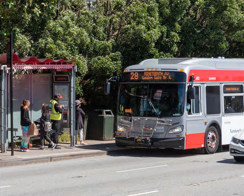


Right turn pockets prevent buses from waiting behind right-turning cars by providing a separate lane for right turns.
Left turn restrictions reduce delay for all through traffic, including transit, and increase safety for pedestrians crossing the street. Left turns accounted for about 40% of fatal crashes involving people walking in 2019.
Source: Left Turn Safety, SFMTA, 2019
Curb management reduces double-parking by providing legal places for delivering goods, picking up and dropping off passengers and improving parking availability in general, so there’s less doubleparking that can delay transit.
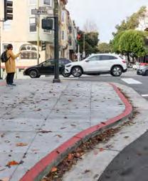
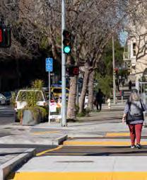
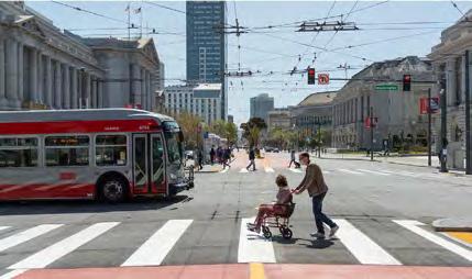


Pedestrian bulbs and pedestrian islands shorten crossing distances and increase visibility of people walking. They also make it easier to get to and from transit stops.
Pedestrian bulbs are also known as “curb extensions” or simply “wider sidewalks at intersections.” Pedestrian islands are also known as "pedestrian refuges" or "pedestrian refuge islands."
High-visibility ("continental") crosswalks make designated crossing areas more visible for people walking, biking and driving.
Traffic calming is a set of measures to reduce speeding and injury crashes. Removing a general traffic lane (sometimes called a "road diet") is a common form of traffic calming that can benefit transit by widening the remaining lanes to better accommodate buses. Converting a general traffic lane to a transit lane can also be a form of traffic calming, by reducing speeding.
Push button-activated flashing beacons are lights that signal to drivers to yield to people walking. In tandem with traffic calming, this can serve as an alternative to all-way stop signs that delay transit.

Muni Forward projects have reduced collisions and speeding and made streets safer for people walking, biking, taking transit and traveling in cars—in line with our Vision Zero goal to eliminate traffic fatalities.
We have built (or approved for construction) safety upgrades on over 48 miles of the 2017 and 2022 High Injury Networks. These are the 12% of city streets where 68% of severe injury crashes happen, identified by Vision Zero SF. This is an important example of Muni Forward partnering with other SFMTA departments and external organizations to deliver shared results.
Muni Forward projects prioritize safety in addition to transit reliability. Muni Forward safety measures have gotten results on many corridors. For example:
• Following Muni Forward investments, speeding on Geary Boulevard dropped by up to 81%.i The risk of pedestrian fatality increases dramatically when vehicle speeds exceed 30 miles per hour.ii
• Collisions involving people walking and biking dropped by 64% on Haight Street between Laguna and Stanyan streets after we implemented Muni Forward safety measures on the Haight Street.iii
• Safer boarding areas on L Taraval—as part of Muni Forward quick-build improvements in 2017 and 2018—eliminated the incidence of cars hitting riders getting on or off the train.iv
This is important because nearly all Muni Forward projects overlap with the 2017 and 2022 High Injury Networks identified by Vision Zero SF.
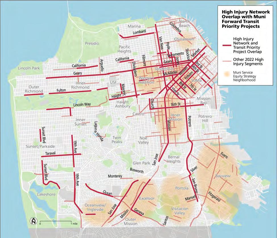
Sources: (i) Geary Rapid Project Evaluation Report, SFMTA. (ii) Impact Speed and a Pedestrian's Risk of Severe Injury or Death, AAA Foundation for Traffic Safety, 2011. (iii) Haight Street Muni Forward Project Evaluation, SFMTA, 2023; includes Haight Street between Laguna and Stanyan streets, 2014–2023. (iv) SFMTA analysis of traffic collision data, 10 years prior to quick-build implementation in early 2017 compared to two years following implementation.
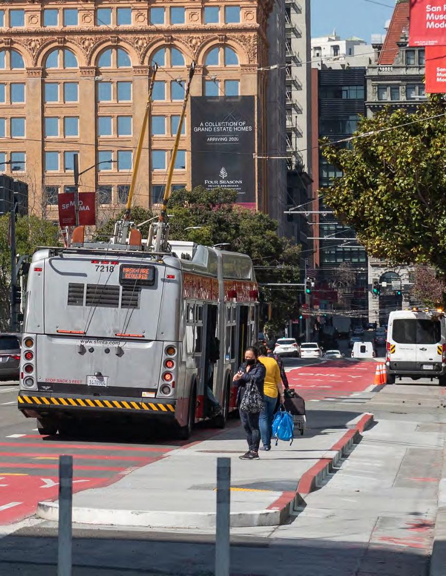
This section includes profiles of each Muni Forward corridor, including project features and results.
IN THIS SECTION:
• 5 Fulton/5R Fulton Rapid
• 9 San Bruno/9R San Bruno Rapid
• 14 Mission/14R Mission Rapid
• 38 Geary/38R Geary Rapid
• 1 California
• 7 Haight/Noriega
• 22 Fillmore
• 28 19th Avenue/28R 19th Avenue Rapid
• 30 Stockton
• Van Ness Bus Rapid Transit
• L Taraval
• N Judah
This section provides detailed information about 12 Muni Forward corridors where we have focused considerable effort in the past decade.
These corridors have been prioritized based on ridership levels and through the Muni Service Equity Strategy. The corridors range in scope, challenges, location, length, context and people served. However, they have all have succeeded in improving transit travel time, reliability, safety and the customer experience.
The map below shows the 12 Muni Forward corridors with profiles on subsequent pages: 5 Fulton/5R Fulton Rapid, 9 San Bruno/9R San Bruno Rapid, 14 Mission/14R Mission Rapid, 38 Geary/38R Geary, 1 California, 7 Haight/Noriega, 22 Fillmore, 28 19th Avenue/28R 19th Avenue Rapid, 30 Stockton, Van Ness Bus Rapid Transit, L Taraval and N Judah.

For a complete map of all built or approved Muni Forward transit priority corridors, including several that are not included in the profiles in this section but are discussed elsewhere in the report, see page 14. Specifically, routes 19, 27 and 29 are showcased on page 38 and the J Church, K Ingleside, M Ocean
and
(page 100).
rail lines are included in the

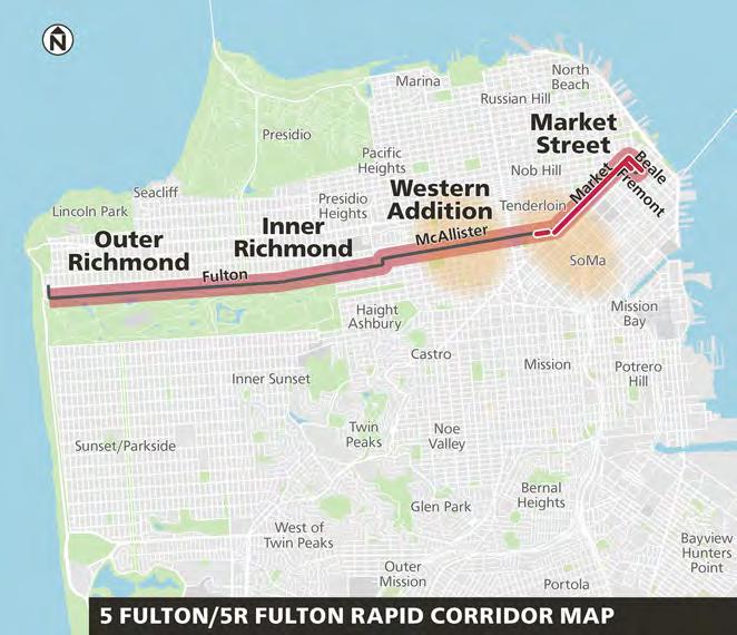
Muni Forward transit priority and safety improvements on the 5 Fulton and 5R Fulton Rapid benefit 14,000 daily riders and increase access to Golden Gate Park.i
The 5 Fulton and 5R Fulton Rapid make up one of the most complete Muni Forward corridors in the city. The routes now provide faster, safer access to multiple neighborhoods and beloved San Francisco destinations, with new bus lanes, improved stop locations and safety measures for people walking, such as wider sidewalks at intersections, enhanced crosswalks and traffic signal timing to reduce speeding. This corridor is part of the Vision Zero High-Injury Network San Francisco's streets where most severe collisions happen and Muni Forward efforts have made safety improvements on Fulton and McAllister streets, while improving transit travel times by up to 12%.
RESULTS
Up to 12%
Time savings with implementation of Rapid service and transit priority in 2013
2
60 %
Increase in total ridership on the 5 Fulton and 5R Fulton Rapid, 2009-2019
Miles of new or upgraded transit lanes to get you there faster and more reliably
24 Intersections with transit signal priority to keep transit moving 19
Transit bulbs or islands to make it easier to get on and off at your stop, with six more starting construction soon
Pedestrian bulbs or islands to make it easier and safer to get to your stop
RIDER PROFILE
Income below $35,000:

People of color:

Data Notes: (i) Ridership is from March/April 2024. (ii) Source: 5L Fulton Pilot Final Report, 2015, SFMTA. (iii) See page 104 for more information about calculating travel time savings and variability. (iv) Source: On-Board Rider Survey, SFMTA, 2017.
Muni Forward transit priority projects implemented west of Park Presidio Boulevard and east of Stanyan Street
Richmond District Fulton Street Safety and Transit Project implemented (quick-build)
Before 2014: McAllister Street contra ow transit lane implemented (2011); Rapid pilot launched (2013)
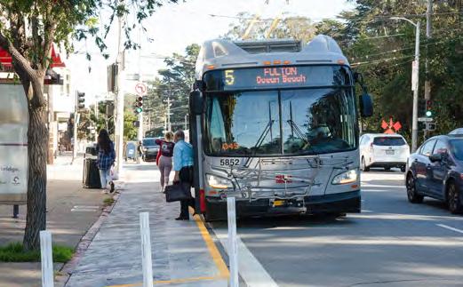
Temporary transit bulb on Fulton Street: Quick-build transit bulbs made of wood were installed on Fulton Street at 6th and 8th avenues. These will soon be replaced by concrete bulbs.
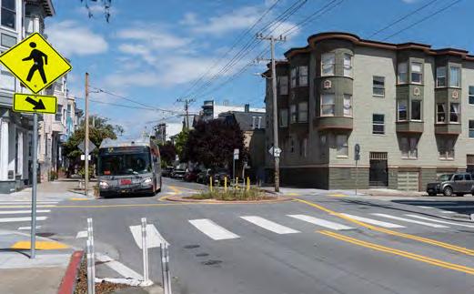
New transit-friendly traffic circle: A traffic circle replaced a fourway stop sign at McAllister and Lyon streets. Cross traffic must still stop and buses, traffic and bikes on McAllister have right-of-way.

Contraflow transit lane on McAllister Street: A contraflow transit lane enabled the removal of a time-consuming "jog" in the 5 Fulton route, saving about 3 minutes per trip.
• Permanent Richmond District
Fulton Street Safety and Transit Project (2025)
•New tra c signals (2025)
• Civic Center McAllister Street improvements


Permanent concrete transit bulbs on Fulton and McAllister streets: New transit bulbs–shown here at McAllister and Divisadero streets–help to improve travel time and safety.
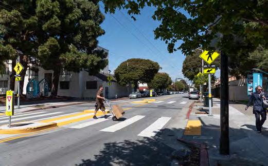
Upgraded crosswalk at Fulton and Buchanan streets: An upgraded crosswalk with flashing beacons and pedestrian refuge islands improves safety while keeping transit moving.

New traffic signal with transit signal priority and pedestrian signals at McAllister and Scott streets: Using transit signal priority, the light can stay green longer for buses.
Prior to Muni Forward, 5 Fulton buses heading downtown had to turn right from McAllister Street onto Hyde Street and then left onto Market Street. This jog added delay to riders heading downtown.
Muni Forward implemented a two-block contraflow bus lane on McAllister Street—which goes in the other direction of the one-way street’s general traffic—from Hyde Street to Jones Street. This allows eastbound 5/5R Fulton buses (along with taxis, delivery vehicles and bikes) to follow the same direct route to Market Street as westbound buses. The contraflow transit lane shaved roughly three minutes off the 5/5R Fulton's travel time.

The iconic Golden Gate Park is an important destination, but speeding cars can make it feel dangerous to access—a concern echoed by nearby communities. Furthermore, parts of Fulton Street along Golden Gate Park are on San Francisco’s High Injury Network identified by Vision Zero SF. To address this, Muni Forward's Fulton Street Safety and Transit Project made a series of safety improvements, such as:
• “Daylighting” 34 intersections and installing 13 "painted safety zones" to make people crossing the street more visible to drivers.
• Retiming signals in the Inner Richmond to reduce speeding and lowering the speed limit.
• Installing transit bulbs to improve boarding and safety for people crossing.

The 5R Fulton Rapid—originally called the 5L Fulton Limited— launched as a pilot in 2013. The Rapid service was one of the first Muni Forward pilot projects. It launched in conjunction with quick-build transit priority improvements, such as stop spacing changes, longer bus zones and a road diet to reduce the number of lanes while widening them so they work better for buses.
Muni Forward used traffic calming measures on Fulton and McAllister streets to reduce bus delay, discourage vehicle speeding and make it safer for people walking. The measures included safer pedestrian crossings, wider sidewalks at bus stops, bus-friendly traffic circles and a four-to-three traffic lane reduction.

Muni Forward installed two pedestrian refuge islands and four pedestrian bulbs (wider sidewalks at crossings) along Fulton and McAllister streets. Improvements like these make it easier and safer for people to cross the street—including transit riders getting to and from stops.

Muni Forward implemented an innovative traffic circle at McAllister and Lyon streets designed to calm car traffic, maintain safety for people walking and accommodate bus movement.
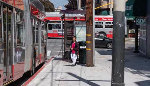
Muni Forward has installed wider sidewalks ("transit bulbs") at 19 bus stops, with six more on the way. This means more space for people walking and waiting to get on the bus. Bulbs also allow buses to serve the stop without leaving the traffic lane— reducing delay caused by merging back into traffic.

The change from four to three traffic lanes (two on some blocks) on Fulton Street between Stanyan and Baker streets helped to calm traffic, reduce speeding and ensure lanes that are wide enough for buses.
Muni Forward improvements on the 9 San Bruno and 9R San Bruno Rapid are the result of community-driven efforts benefiting over 18,000 weekday riders.i
Transit priority projects since 2009 have spanned five different segments of this corridor: Market Street, 11th Street, Potrero Avenue, Bayshore Boulevard and San Bruno Avenue. Most of the corridor overlaps with the city’s bike network, so Muni Forward also built bike enhancements where possible, such as transit boarding islands next to protected bike lanes.
On San Bruno Avenue, our efforts were part of a multimodal improvement project initiated by community request, with multilingual outreach and coordination with neighborhood groups and merchants. On Potrero Avenue, we leveraged a streetscape enhancement project to establish a transit lane and enhanced stops, as well as bike and pedestrian safety features.

RESULTS
Up to
4 minutes
Time savings for the slowest trips (90th percentile) on the 9R inbound to Market and 11th streets, 2015–2023
4.1
22
15
Up to 24 %
Less variable travel times on the 9R San Bruno Rapid inbound to Market and 11th streets, 2015–2023
Miles of new or upgraded transit lanes to get you there faster and more reliably
Intersections with transit signal priority to keep transit moving
Transit bulbs or islands to make it easier to get on and off at your stop
18
Pedestrian bulbs to make it easier and safer to get to your stop
Income below $35,000:

People of color:

Data Notes: (i) Ridership is from March/April 2024. (ii) Source: Travel time analysis, 2023, SFMTA. (iii) See page 104 for more information about calculating travel time savings and variability. (iv) Source: On-Board Rider Survey, SFMTA, 2017.
Before 2014: 9L San Bruno Limited launched (2009)
Projects on 11th Street and Bayshore Boulevard implemented
Potrero Avenue Streetscape Improvement Project implemented
Market Street transit lanes extended
• Additional improvements on Potrero Avenue and Bayshore Boulevard

San Bruno Avenue Multimodal Improvement Project implemented (quick-build 2017, permanent 2019)

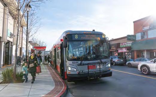
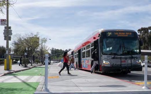

bikes from loading buses.
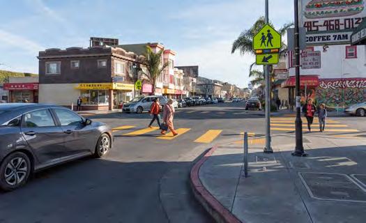
The San Bruno Avenue
Multimodal Improvement project was designed through a community-driven, multilingual outreach process. There was close partnership with neighborhood and business groups. Requests from residents and merchants were instrumental in prioritizing San Bruno Avenue for improvements and their input shaped the project design, including adjustments after implementation.

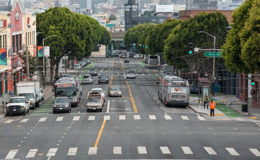
The Potrero Avenue
Streetscape Improvement Project combined improvements to transit, pedestrian and bike infrastructure as well as enhancing the streetscape in a complete rebuild of the street. This made it easier to reach the Mission and San Francisco General Hospital regardless of how you get there.


infrastructure often meant a dedicated bike lane—against the curb or buffered from parked vehicles—next to a dedicated bus lane, where space allows.
meant installing transit islands next to bike lanes when possible. These islands reduce bus-bike conflicts and provide a safe place for people waiting for the bus.
Rapid service on this corridor was introduced in 2009— the first "Limited" (now renamed "Rapid") route to come out of the Transit Effectiveness Project, Muni Forward's precursor. Together with transit priority improvements, this helped increase combined ridership on the 9/9R San Bruno corridor by 41% from 2009-2019.

Muni Forward improvements have reduced delays and grown ridership on the 14 Mission and 14R Mission Rapid, which serve 46,000 riders every day—the highest of any Muni bus corridor.i
Transit priority upgrades on Mission, including dedicated bus lanes, improvements to stops and stop locations and contextspecific redesigns of the roadway, have improved reliability.
Improvements on Mission are also designed to address traffic safety challenges. For example, safety features such as intersection "daylighting", a lane reduction, pedestrian head start signals and turn restrictions have reduced pedestrian collisions on Mission Street in the Mission by 59%.ii
More information on the corridor designs, which provide transit lanes on narrow streets while maintaining parking and loading for businesses, can be found on page 72
Up to
Travel time savings in SoMa; 9% median travel time savings for the entire 14 Mission
6.4
50
7
Up to 25%
Less variable travel times in the Mission following 2016 quickbuild implementation
Miles of new or upgraded transit lanes to get you there faster and more reliably
Intersections with transit signal priority to keep transit moving
Transit bulbs or islands to make it easier to get on and off at your stop (five built, two under construction)
Pedestrian bulbs or islands to make it easier and safer to get to your stop (two built, 27 under construction)
Income below $35,000:

People of color:

Data Notes: (i) Ridership is from March/April 2024. (ii) Traffic safety data compared between 2011–2015 and 2017–2019. (iii) Sources: 14 Mission Rapid Evaluation Report; Temporary Emergency Transit Lanes Evaluation Summary; SFMTA analysis of entire route runtime. (iv) See page 104 for more information about calculating travel time savings and variability. (v) Source: On-Board Rider Survey, SFMTA, 2017.
Mission Rapid Project (Mission District) implemented
SoMa TETL implemented (quick-build 2020, permanent 2021)

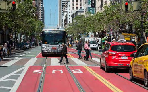
Red transit lane on Mission Street: A new red transit lane was installed in the Mission (shown at 24th Street) in 2016 to reduce delay, in tandem with other safety and reliability features.
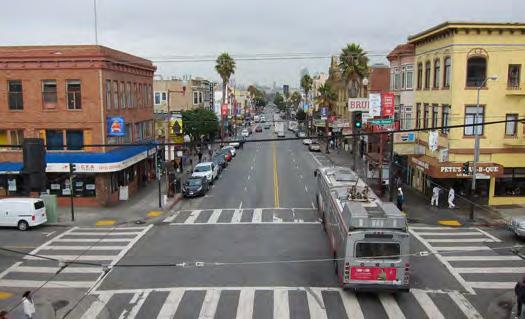
Mission Street at 20th Street (before): In the Mission, two general purpose lanes in both directions encouraged vehicle speeding and the lanes were too narrow for buses.

Street
The 14 Mission bus stop was located to the right of the bike lane, increasing the chance of conflicts, with no dedicated lane for buses.
Additional Mission District bus bulbs implemented
• Red colorized transit lanes in SoMa (under construction)
•Mission/Geneva Safety Project (under construction)

•Excelsior/Outer Mission improvements

Temporary Emergency Transit Lane in SoMa: New 24/7 transit lanes were installed in SoMa in 2020, which were later approved to remain permanently and upgraded with red colorization.
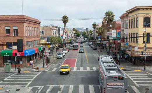
Mission Street at 20th Street (after): Removing a northbound lane and requiring northbound cars to turn right every few blocks reduced transit delay, while preserving most parking for businesses and making room for a southbound transit lane.

is now a
and bus lanes to reduce conflicts and a
Tens of thousands of people rely on Mission Street buses to eat, shop, get to services and visit friends and family. Notably, 85% of people who access Mission Street in the Mission District do so by transit, walking or biking.
Transit lanes increase the number of people who can get to the Mission in less time.
Source: 14/14R Mission Intercept Survey, SFMTA, 2015
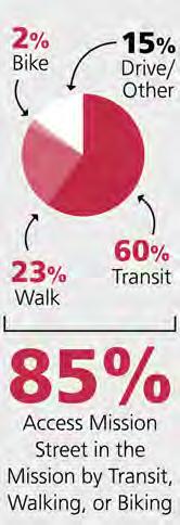
Project outreach in the Mission District included open houses, door-to-door canvassing to every merchant along the corridor and meetings with over 30 neighborhood groups. To broaden participation, we distributed multilingual surveys, 1,700 flyers and 1,500 rider cards and mailed more than 25,000 additional postcards. Combined, this attracted hundreds of attendees to meetings and over 500 survey responses. Community feedback helped shape the project, including post-implementation changes.
The Inner Mission was the primary focus for safety improvements along the corridor. Muni Forward efforts in the Mission reduced injury collisions by 59% between 13th and Cesar Chavez streets.

Left turn restrictions minimize potential conflict zones between people walking and vehicles turning. Turn restrictions also improve the flow of traffic for all forms of transportation at intersections, including transit.

At many intersections, pedestrian signals begin before the green light to give people walking a head start and greater visibility before vehicular traffic gets a green light.
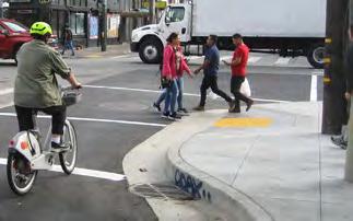
Wider sidewalks at intersections, also called "pedestrian bulbs," make pedestrians more visible, shorten the time it takes to cross the street and encourage cars to slow down before turning.
Curb space for loading and short-term parking is important for businesses. We used two different approaches—in SoMa and the Mission—to provide full-time transit lanes while also maintaining curb space for loading and parking within a limited roadway space.
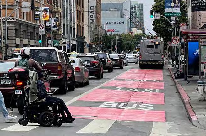
SoMa: Before, Mission had parttime "no parking" zones on both sides of the street to make room for rush-hour bus lanes, added in the 1970s. In 2020, parking was restored all day on one side of the street and removed all day on the other, making room for 24/7 bus lanes and a traffic lane in both directions. This improved transit reliability and ensured businesses have nearby curb access all day. Over the course of a day, the project increased the total commercial loading space.

Mission District: Before, Mission had four very narrow traffic lanes, with parking on both sides. In 2016, we removed a northbound lane and added required right turns every few blocks, excepting Muni, taxis and deliveries. This keeps the northbound lane clear for Muni and local access, while preserving most parking. Later, based on community input and data analysis, we removed two of six required turns. Southbound, there's room for a transit lane, a traffic lane and parking.
We expanded service on the 14R Mission Rapid in 2015. This meant the bus comes more often for more of the day. The combined service and capital improvements have led to a large increase in ridership.
From 2015 to 2019, ridership grew by 19%. As of May 2024, ridership had recovered to 95% of pre-pandemic levels on weekdays and had exceeded it on Saturdays (111%) and Sundays (114%), greatly outpacing the Muni system as a whole.
Muni Forward improvements in the Mission saved 14 Mission riders about two minutes per direction during rush hour on a typical trip. However, riders perceived reaching their destinations 10 minutes faster because of the increase in reliability. Many riders have provided positive feedback about service improvements.
"I ride Muni 3 mornings per week from Bernal to take my kids to school in the Mission, and I love (love!) how rapidly Muni is able to get me to our 24th Street stop now compared to before the red carpets began rolling out.”
—14R Rider (2016)
Muni Forward has built on a long history of improving transit reliability and safety on Geary, which carries over 41,000 riders daily on the 38 Geary and 38R Geary Rapid.i
Transit priority improvements on the 38 Geary date back decades, including some of the city's first bus lanes, installed in the 1970s. More recently, Muni Forward has greatly expanded transit lanes, bus stop enhancements, signal priority and other transit priority features on one of the city's most heavily used transit corridors, while also improving pedestrian safety. Now, nearly the entire 38 Geary corridor has dedicated bus lanes.
Muni Forward efforts on the Geary corridor also helped to reconnect communities harmed by 1960s urban renewal and the Geary Expressway, including replacing a non-ADA compliant pedestrian bridge with a high-quality crosswalk to improve accessibility and safety.

RESULTS ii,iii Up to
%
Time savings for 38R from Van Ness Avenue to Park Presidio Boulevard, 2018–2022
to
Less variable travel times for 38R from Van Ness Avenue to Park Presidio Boulevard, 2018–2022
Miles of new or upgraded transit lanes to get you there faster and more reliably
67
Intersections with transit signal priority to keep transit moving 14
Transit bulbs (including expanding 3 bulbs) to make it easier to get on and off at your stop, with 9 more coming soon 38
Pedestrian bulbs to make it easier and safer to get to your stop (with 23 more coming soon)


Data Notes: (i) Ridership is from March/April 2024. (ii) Source: 38 Geary Rapid Project Evaluation Report, 2022, SFMTA. (iii) See page 104 for more information about calculating travel time savings and variability. (iv) Source: On-Board Rider Survey, SFMTA, 2017.

Existing transit lanes colorized red
Geary Rapid Project implemented (quick-build 2019, permanent 2021)
Richmond District TETL implemented (quick-build 2020, permanent 2021)
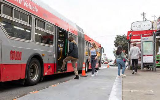
Quick-build transit bulb at Geary Boulevard and 20th Avenue: Riders use a quick-build transit bulb to board a bus in the Richmond. This will soon be replaced with a concrete bulb.
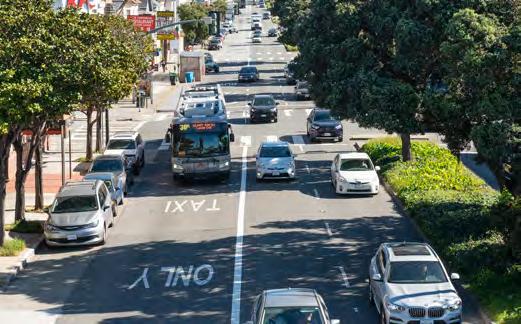
Quick-build transit lane in the Richmond: New transit lanes were installed as part of the Temporary Emergency Transit Lanes program and were later approved permanently.

with the Americans
Geary Boulevard Improvement Project implemented (quick-build)
•Permanent implementation of Geary Boulevard Improvement Project (2026–2027)

Concrete transit bulb near Japantown: Riders get off a 38R Geary Rapid bus at a stop with a new transit bulb and landscaping.
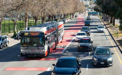
the

A better at-grade crossing at Steiner Street
The pedestrian
was replaced with accessible, clearly marked at-grade crossings along both sides of Geary Boulevard, including pedestrian refuge islands.
The Geary Boulevard Improvement Project had initially envisioned transit lanes in the center of the street between Arguello Boulevard and 28th Avenue. However, after evaluating the Geary Rapid Project and Temporary Emergency Transit Lanes, we instead pursued a side-running design. The side-running design shortened the timeline and reduced costs with comparable travel time benefits —all with less construction disruption.

Despite some parking removal on Geary due to the Geary Rapid Project, parking availability remains high.
According to post-project parking occupancy data (April–June 2022), average parking occupancy was 52% on Geary Boulevard in the Laurel Heights area and 59% on Geary Boulevard and adjacent blocks in Japantown. Maximum parking occupancy never exceeded 80% in Laurel Heights and 90% in Japantown. This means people in cars can find a metered parking space relatively quickly, regardless of the time of day or day of the week.
Muni Forward has improved safety on Geary Boulevard in the Western Addition, as well as on Geary and O’Farrell streets in the Tenderloin.
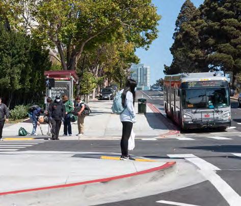
• Tenderloin: All streets in the Tenderloin have high rates of traffic collisions and are part of the High Injury Network identified by Vision Zero SF, the 12% of city streets where 68% of severe injury crashes occur. The neighborhood is also home to many historically marginalized groups. Muni Forward installed pedestrian safety measures—including wider sidewalks at intersections—on Geary and O’Farrell streets in the Tenderloin to reduce injury collisions.
• Western Addition: Muni Forward removed two traffic lanes on Geary Boulevard to calm traffic and provide space for a transit lane. As a result, the number of vehicles traveling over 40 miles per hour (more than 5 miles per hour above the speed limit) has decreased by up to 81%. This is welcome news, because the risk of pedestrian fatality increases dramatically at collision speeds above 30 miles per hour.
The Fillmore and Japantown neighborhoods, separated by Geary Boulevard, were devastated by urban renewal in the 1960s. Black and Japanese-American homes and businesses were demolished to make way for the widened eightlane Geary Expressway.
The Geary Rapid Project created a new pedestrian crossing at Buchanan Street, including a pedestrian refuge island decorated with locally themed art. By reopening this long-closed crossing, Muni Forward has helped to reconnect these neighborhoods.
On Geary Boulevard at Laguna Street, the transit lane occupies just 32% of the roadway width, but moves 48% of the people. This is because transit lanes can move far more people than general purpose car lanes.
Riders on the 38 Geary and 38R Geary Rapid noticed an improvement in travel time after we implemented the quick-build project and many have provided positive feedback. In an on-board survey, 82% of respondents reported saving time after Muni Forward changes and 34% reported taking transit more often as a result.
"Better public transit makes a positive impact on my life. Our household does not own a car and it is frustrating to see parked cars on Geary prioritized over buses actively transporting thousands of residents everyday. Any improvements to the 38's speed and reliability are appreciated!"
—38/38R Geary Rider

Muni Forward made the 1 California faster for 17,000 people who take it each weekday and improved safety for all.i
Transit signal priority at 28 intersections and extended transit lanes helped buses run up to 11% faster—and more reliably—on California, Clay and Sacramento streets between the Richmond and downtown.
Muni Forward has also focused on making California Street safer for people walking, taking transit and driving, through a street redesign that reduced the number of vehicle lanes from four to three in the Inner Richmond. As a result, injury collisions decreased by 64%. In addition, transit bulbs were installed on California Street in Laurel Village in partnership with a streetscape enhancement project.
Future Muni Forward efforts will continue making enhancements across the entire 1 California route.

RESULTS ii,iii
Up to 11%
Time savings from temporary emergency transit lanes, 2021 relative to January and February 2020
KEY FEATURES
3
Up to 64 %
Fewer injury collisions from Arguello Street to Park Presidio Boulevard, 2021 relative to 2017–2019 (inclusive)
Miles of new or upgraded transit lanes to get you there faster and more reliably
28 Intersections with transit signal priority to keep transit moving
4
Transit bulbs to make it easier to get on and off at your stop
RIDER PROFILE
Income below $35,000:

People of color:

Data Notes: (i) Ridership is from March/April 2024. (ii) Sources: Temporary Emergency Transit Lanes Evaluation Summary, 2022, SFMTA; California Street Safety Project Evaluation Report, 2022, SFMTA. (iii) See page 104 for more information about calculating travel time savings. (iv) Source: On-Board Rider Survey, SFMTA, 2017.
•Full 1 California line Muni
Forward project

Transit lanes on Clay and Sacramento streets extended
California Laurel Village Improvement Project implemented
California Street Safety Project implemented
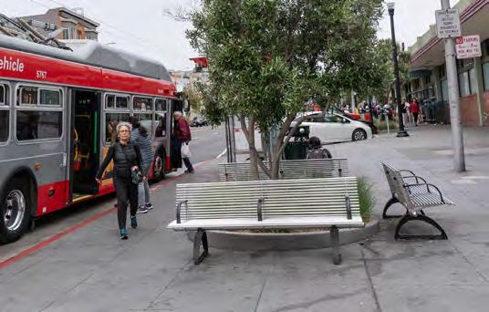
Transit bulb on California Street: New transit bulbs in Laurel Village incorporated seating and landscaping in partnership with a streetscape enhancement project.


Temporary Emergency Transit Lanes: Temporary Emergency Transit Lanes on California, Sacramento and Clay streets helped reduce travel times. They have since been approved to remain permanently. These include new 24/7 and part-time transit lanes, as well as extended hours for some existing part-time transit lanes.
California, Clay and Sacramento streets TETL implemented (quick-build 2021, permanent 2022)
•Additional Nob Hill transit lanes on Clay Street
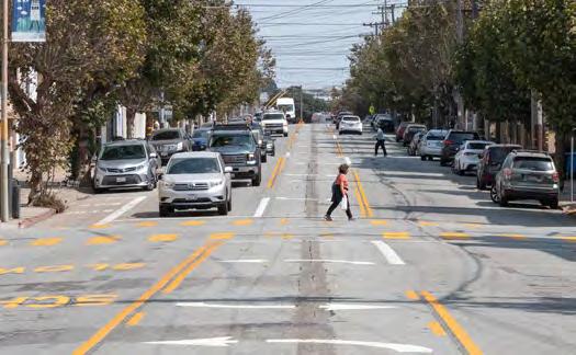
California Street "road diet" in the Inner Richmond: Muni Forward removed a general purpose lane to better accommodate transit vehicles and calm traffic on a high-injury corridor.
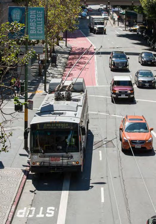
Clay Street red transit lane: A red transit lane on Clay Street helps to reduce delays for the 1 California in the Financial District.
Following Muni Forward investments, the 7 Haight/Noriega saw shorter travel times for its 11,000 weekday riders,i as well as fewer collisions.
Muni Forward improvements on the 7 Haight/Noriega include a bus lane between Laguna and Market streets to make the route more direct and avoid delay from congestion; wider sidewalks at bus stops; stop relocations; and transit signal priority to keep buses moving. The 7 Haight/Noriega also benefits from new or upgraded transit lanes on Market, Beale and Fremont streets. Travel times on Haight Street have dropped by up to 11%, which has helped ridership return to pre-pandemic levels.
The corridor is part of the Vision Zero High-Injury Network, the 12% of city streets where 68% of severe collisions occur. To address this, it also includes safety improvements, built in partnership with a streetscape redesign effort to limit construction disruptions.

Up to
Time savings on Haight Street between Laguna and Stanyan streets, 2015–2022
4.2
14
%
Fewer pedestrian and bike collisions on Haight Street between Laguna and Stanyan streets, 2014–2022
Miles of new or upgraded transit lanes to get you there faster and more reliably
Intersections with transit signal priority to keep transit moving
7
Transit bulbs to make it easier to get on and off at your stop
Pedestrian bulbs to make it easier and safer to get to your stop RIDER


Data Notes: (i) Ridership is from March/April 2024. (ii) Source: Haight Street Muni Forward project evaluation, 2023, SFMTA . (iii) See page 104 for more information about calculating travel time savings and variability. (iv) Source: On-Board Rider Survey, SFMTA, 2017.

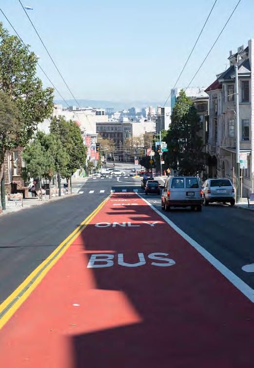
Haight Street red contraflow lane: A contraflow transit lane on Haight Street approaching Market Street makes bus trips more direct, avoiding a circuitous detour that added 2 minutes per trip.


Pedestrian bulbs along Haight Street: Wider sidewalks at intersections have improved safety and transit access for riders, while providing space for streetscape improvements.

for stop amenities.

Muni Forward improvements have made the 22 Fillmore more reliable for the over 22,000 people who ride it each weekday,i while enhancing pedestrian safety and supporting affordable housing.
The 22 Fillmore is a key crosstown route between Potrero Hill, the Mission, the Western Addition, Japantown and the Marina, recently extended to Mission Bay. Muni Forward improvements have reduced congestion delay and improved safety. Transit lanes were installed on 16th and Church streets, while pedestrian bulbs on 16th Street reduced crossing distances and made the street safer. New street trees and lighting made 16th Street more pleasant for bus riders and the community overall. In partnership with affordable housing developers, these upgrades helped the city win a state grant to fund affordable housing on Mission Street in tandem with transit improvements.

Up to 15%
Time savings inbound (7-9 a.m.) from 16th and Potrero to Church and Market, 2017-2024
KEY FEATURES
2
119%
Ridership recovery, May 2024 as a percent of May 2019
Miles of new transit lanes — with one more mile forthcoming on 16th Street—to get you there faster and more reliably 27
Intersections with transit signal priority to keep transit moving
New transit bulbs or islands to make it easier to get on and off at your stop
Pedestrian bulbs to make it easier and safer to get to your stop
Income below $35,000:

People of color:

Data Notes: (i) Ridership is from March/April 2024. (ii) Source: SFMTA analysis of travel time data. (iii) See page 104 for more information about calculating travel time savings. (iv) Source: On-Board Rider Survey, SFMTA, 2017.
•Fillmore Street Muni Forward Project

Before 2014: Church Street red transit lanes implemented (2013)
Transit lane implemented on 16th Street east of Potrero Street (quick-build)
16th Street Improvement Project Phase 1 implemented (Potrero, Mission Bay)
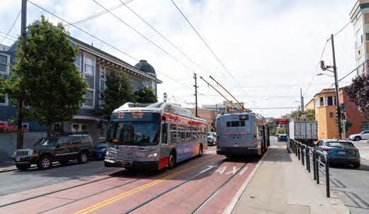
Church Street red transit lane: Total travel time on Church Street dropped by up to 14% or one minute (median) and travel time variability dropped by up to 27%. (Source: Church Street Pilot Transit Lanes, 2015, SFMTA)
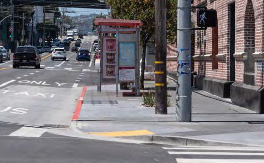
bulbs
environment for riders and help to reduce delay.

Service extended to Mission Bay 16th Street Improvement Project Phase 2 implemented (Mission District)
•Red colorized transit lanes on 16th Street

Extension to Mission Bay: Muni Forward extended the 22 Fillmore to Mission Bay, including a transit lane that is now colorized red, providing direct access to UCSF and the Chase Center.

Transit boarding islands on 16th Street. Boarding islands separate buses from delay caused by cars turning right and double-parked vehicles.
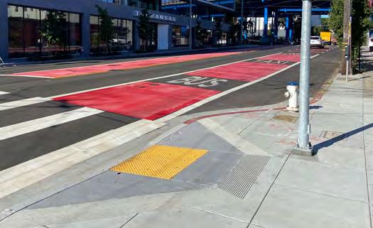
Muni Forward has improved travel times for the 15,000 weekday riders on the 28 19th Avenue and 28R 19th Avenue Rapid.i
The 28 19th Avenue provides crosstown service from Fisherman’s Wharf to Daly City, serving many schools and San Francisco State University, while running largely on stateowned roads. Muni Forward has partnered with Caltrans to deliver an innovative high-occupancy vehicle (HOV) lane pilot on Park Presidio Boulevard and Lombard Street; more efficient bus stop locations; and wider sidewalks at bus stops and intersections along 19th Avenue and Lombard Street to improve safety and boarding. We've also expanded Rapid service on the 28R 19th Avenue Rapid to an all-day service. Transit priority efforts reduced travel times by up to 19% on Lombard Street and up to 8% on 19th Avenue.

RESULTS
Up to 19%
Time savings (median) on Lombard HOV lane, 2019–2024
to
variable travel times on HOV lane segments, 2019–2024 KEY FEATURES 2.6
Miles of new transit/HOV lanes to get you there faster and more reliably
Intersections with transit signal priority to keep transit moving
New transit bulbs to make it easier to get on and off at your stop
Pedestrian bulbs to make it easier and safer to get to your stop


Data Notes: (i) Ridership is from March/April 2024. (ii)
Source: Park Presidio Lombard Temporary HOV Lanes Pilot Final Evaluation Report (September 2024 draft), 2024, SFMTA . (iii) See page 104 for more information about calculating travel time savings and variability. (iv) Source: On-Board Rider Survey, SFMTA, 2017.
study

28R 19th Avenue Rapid expanded to all-day service on weekdays
Lombard Street Vision Zero Project implemented
HOV lanes pilot implemented on Park

Bus bulbs on Lombard Street: These wider boarding platforms improve the rider experience and reduce delays on the 28 19th Avenue and 28R 19th Avenue Rapid.
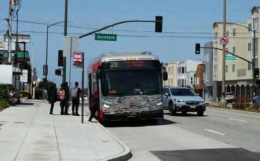
Bus bulbs on 19th Avenue: Bus bulbs on 19th Avenue provide a better waiting environment for riders and help to reduce transit delay.

Expansion of Rapid service and new connections: Muni Forward expanded Rapid service on the 28R 19th Avenue Rapid from peak-only to all-day service and extended the 28 19th Avenue to Fisherman's Wharf.
19th Avenue Muni Forward Project implemented

to both transit and people carpooling.

and carpools on Lombard
helping to protect transit from growing traffic congestion.

Muni Forward improvements have made the 30 Stockton faster, more reliable and safer for the over 16,000 riders who take it each weekday.i
This has included transit priority efforts over nine years spanning the entire route—such as upgrading existing transit lanes, adding new transit bulbs and implementing transit signal priority. Bus bulbs and islands have been installed on Chestnut Street (Marina), North Point Street (Fisherman's Wharf), Columbus Avenue (North Beach), Stockton Street (Chinatown and Union Square) and 3rd Street (SoMa). Service has also been extended to the Presidio.
In addition, we have invested in pedestrian safety, including measures to ensure safer street crossings, such as wider sidewalks at intersections. These align with Vision Zero goals to reduce fatal and injury collisions.
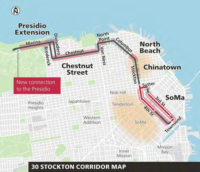
RESULTS
Up to 24 %
Time savings on 3rd Street during the morning rush hour (7–9 a.m.), 2019–2024
KEY FEATURES
Up to 67%
Less variable travel times on 3rd Street during the morning rush hour, 2019–2024
1.4 Miles of new or upgraded transit lanes to get you there faster and more reliably 8
Intersections with transit signal priority to keep transit moving
Transit bulbs or islands to make it easier to get on and off at your stop
Pedestrian bulbs to make it easier and safer to get to your stop
RIDER PROFILE iv
Income below $35,000:

People of color:

Data Notes: (i) Ridership is from March/April 2024. (ii) Source: SFMTA analysis of travel time data. (iii) See page 104 for more information about calculating travel time savings and variability. (iv) Source: On-Board Rider Survey, SFMTA, 2017.
3rd Street transit lane colorized red
•Transit lane on Van Ness Avenue (2025)

Chestnut Street Muni Forward project implemented
3rd Street (quick-build) and 4th Street Muni Forward projects implemented; service extended to the Presidio

Red transit lane and islands on 3rd Street: The existing transit lane on 3rd Street in SoMa was redesigned to separate buses from right turns, with new quick-build boarding platforms. The slowest trips (90th percentile) improved by up to 4 minutes (or 39%).

Street red transit
An existing transit lane on Stockton Street in Union Square was upgraded with red colorization to improve driver compliance in this busy corridor.
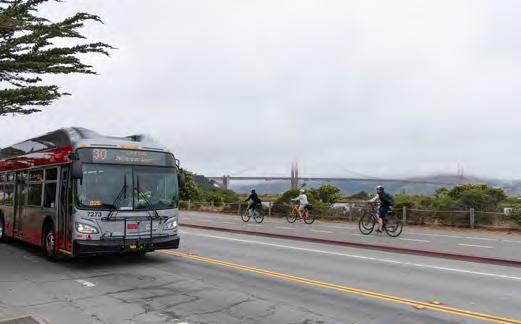
Serving
Stockton Street transit lane colorized red
Townsend Street queue jump lane implemented
•Market to Van Ness Muni Forward improvements
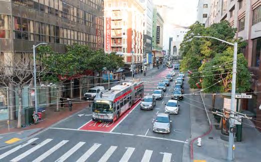
4th Street red transit lane: An existing transit lane was redesigned and extended on 4th Street in SoMa, improving its functionality and reducing impacts from congestion.

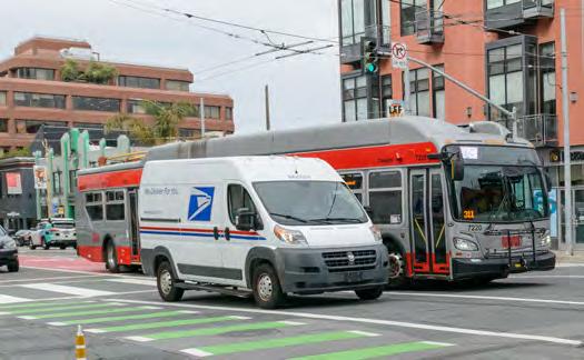
The Van Ness Bus Rapid Transit (BRT) project has made buses 45% more reliable and attracted thousands of new riders to the 49 Van Ness/Mission route. In 2024, weekday ridership rose to 34,000—32% higher than pre-pandemic levels.i
Van Ness BRT features center-running bus lanes, signal priority and improved stops, reducing travel times by up to 9.5 minutes.ii
Safety measures such as corner sidewalk extensions and left turn restrictions have reduced injury collisions for all modes by 36%.ii
We partnered with Caltrans to rebuild aging infrastructure and transform Van Ness into a model of transit priority and safety.
Van Ness BRT is one of only four “Silver” rated BRT lines in the United States, as awarded by the Institute for Transportation and Development Policy

RESULTS iii,iv Up to
%
Time savings on Van Ness Avenue between Lombard and Mission streets, 2016–2023 Up to 45%
Less variable travel times on Van Ness Avenue between Lombard and Mission streets, 2016–2023
Miles of new transit lanes on Van Ness Avenue to get you there faster and more reliably
26
Intersections with transit signal priority to keep transit moving
Transit islands to make it easier to get on and off at your stop
Pedestrian bulbs and islands to make it easier and safer to get to your stop
RIDER PROFILE vi Income


Data Notes: (i) Ridership is from March/April 2024. The 47 Van Ness also ran on Van Ness Avenue prior to the pandemic but is no longer in service. The ridership recovery rate is 100% when including the entire 49-line and boardings on the 47-line that occurred on Van Ness before the pandemic. (ii) Based on collision data five years before project construction and two years after completion. Looking at only one year both before and after the project, collisions were reduced by 53%.

Van Ness Bus Rapid Transit opened Van Ness Improvement Project began construction
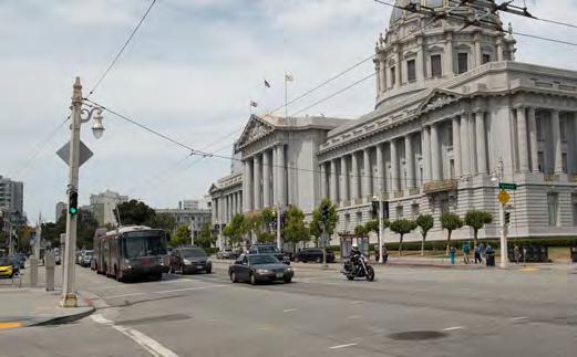
Ness Avenue at Grove Street facing San Francisco City Hall before Van Ness BRT (2015): Buses operated in mixed traffic on this heavily congested state highway corridor.

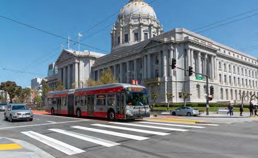
Van Ness Avenue at Grove Street facing San Francisco City Hall after Van Ness BRT opening (2022): Buses now operate in a dedicated center-running transit lane with boarding platforms.
BEFORE
(2015):
Avenue
before Van
faced challenging conditions on this six-lane roadway before the project was implemented.

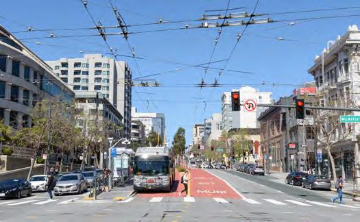
Van Ness Avenue at
after
opening (2022): The project features extensive safety features, including wider sidewalks at intersections and left turn restrictions.

(iii) Source: Van Ness BRT Evaluation Report, 2024, SFMTA. (iv) See page 104 for more information about calculating travel time savings and variability. (v) Key features shown for BRT segment only (between Lombard and Mission streets). (vi) Source: On-Board Rider Survey, SFMTA, 2017.
Muni Forward has helped transform the L Taraval from a legacy streetcar line to a modern light rail line that prioritizes safety.
Improvements on the L Taraval include new boarding platforms at all stops on Taraval Street, dramatically improving safety for riders. Quick-build upgrades have since been replaced with permanent infrastructure, built in partnership with trackway and underground utility replacement efforts. Improvements also include transit lanes, wider sidewalks at intersections, transit priority signals, wheelchair ramps at more train stops and streetscape enhancements. As part of the project, we also worked with merchants to address impacts to parking. Prior to this effort, there were no platforms at most stops and riders would step off the train into a lane of traffic, with 24 riders hit by vehicles in five years. Quick-build improvements in 2017 ended this collision pattern.
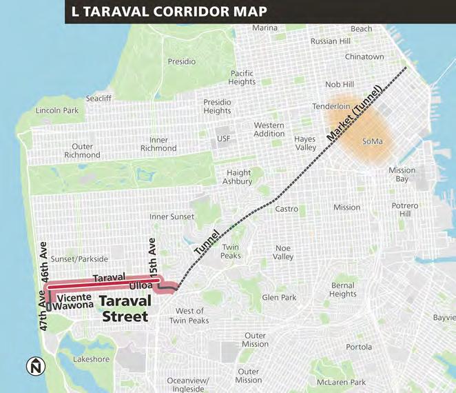
i
Up to 5%
Time savings (median) after quick-build, for outbound trips between West Portal and SF Zoo terminal, 2016-2018
KEY FEATURES
3.6
7
Up to 60 %
Fewer pedestrian collisions on Taraval Street between 15th and 46th avenues after quick-build in 2017.
Miles of new transit lanes to get you there faster and more reliably
Intersections with transit signal priority to keep transit moving
20
10
New or upgraded transit bulbs or islands to make it easier to get on and off at your stop
Pedestrian bulbs to make it easier and safer to get to your stop
Income below $35,000:

People of color:

Data Notes: (i) Source: SFMTA analysis of travel time and collision data. For collisions, the "before" period is the 10 years prior to quick-build implementation in 2016; the "after" period is 2017-2019. (ii) Source: OnBoard Rider Survey, SFMTA, 2017.
L Taraval Rapid Project implemented (quick-build)


Boarding into a lane of traffic, before improvements: Before the project, passengers at most stops got on and off the train into an active traffic lane, leading to 24 injury collisions in five years.

Quick-build safety improvements at stops: Quick-build painted safety zones were installed at stops in 2017, in the footprint of future boarding platforms, greatly improving safety.
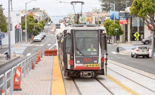
Permanent transit boarding islands on Taraval: Quick-build safety zones have been replaced with new permanent boarding islands made of concrete at all stops on Taraval Street.
Permanent L Taraval Improvement Project implemented

New wheelchair accessible boarding platforms and transit lanes on Taraval: These features have improved safety, accessibility and transit reliability on the L Taraval.
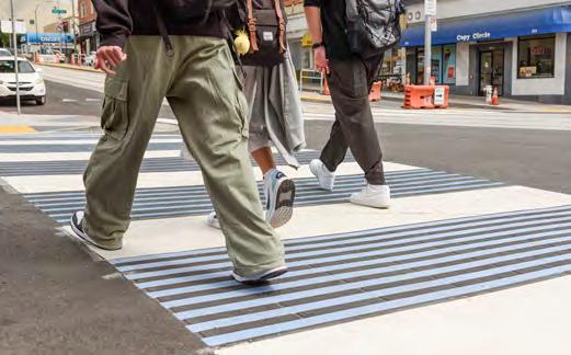
Decorative high-visibility crosswalk: Upgraded crosswalks on Taraval Street both improve safety and contribute to the unique streetscape, complementing Taraval's oceanside location.

Mosaics and greenery: The project incorporated numerous features to enhance the streetscape and reflect the local character, including thematic mosaic tiles on wheelchair ramps, landscaping on boarding islands and new street trees.
Muni Forward is transforming travel on the N Judah, SFMTA's highest ridership light rail line—and more improvements are in the works.
With 27,000i average weekday riders, the N Judah is Muni’s busiest rail corridor, connecting downtown to the Sunset District and Ocean Beach.
Muni Forward projects in the corridor include enhanced boarding platforms at stops on Irving, Carl and Judah streets; transit signal priority to reduce delays at intersections; new wheelchair accessible platforms; and other transit priority and pedestrian safety measures. Much of this work occurred in partnership with the Irving Streetscape Improvement Project.
Future Muni Forward work will aim to bring additional improvements to the entire line.

• A future project will seek to address delay, reliability, crowding, customer amenities and safety along the entire N Judah route.
• Planning and public outreach for this effort will start in late 2024 and will build on past improvements.
0.2
8
9
6
Miles of upgraded transit lanes to get you there faster and more reliably
Intersections with transit signal priority to keep transit moving
Transit bulbs or islands including four new wheelchairaccessible ramps
Pedestrian bulbs to make it easier and safer to get to your stop
Income

People of color:

Data Notes: (i) Ridership is from March/April 2024. (ii) Source: On-Board Rider Survey, SFMTA, 2017.
Muni Forward projects implemented (transit priority signals 2015, boarding islands 2015, two blocks of red colorized transit lanes (2016)
Inner Sunset Streetscape Improvement Project implemented


Transit bulb with landscaping (example 1 of 2): This transit bulb on 9th Avenue in the Inner Sunset is an example of transit priority and safety measures that also enhance the streetscape.
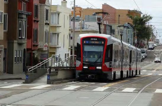
Wheelchair-accessible boarding platform (example 1 of 2): The wheelchair-accessible boarding island platform on Judah Street at 28th Avenue provides access to high-floor trains.

N Judah Terminal Safety Improvements Project implemented
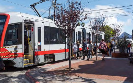
Transit bulb with landscaping (example 2 of 2): This transit bulb on Irving Street at 8th Avenue is another example of transit priority infrastructure that also enhances the look and feel of the street.

Wheelchair-accessible boarding platform (example 2 of 2): The boarding island platform on Irving Street at 6th Avenue prioritizes accessibility and the rider experience.
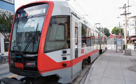
compliance

This section includes a summary of lessons learned and outlines next steps for Muni Forward, as well as related longer-term improvements to transit in the city.
IN THIS SECTION:
• Lessons Learned Through 10 Years of Muni Forward
• The Future of Muni Forward
• Transforming Muni Metro
Over the past 10 years, Muni Forward has learned important lessons about building transit priority infrastructure in partnership with local communities.

At the outset of the program, develop a systemwide plan and make a case to constituents and policymakers for why it’s important for the system as well as the city. Focus on a citywide program of small- and medium-scale projects that can deliver tangible benefits quickly, at a relatively low cost.

Community members, stakeholders and decisionmakers consistently want faster benefits, shorter construction times and lower costs. As a result, Muni Forward uses the 3 P's process: partner with existing city construction projects and engagement efforts; pilot using temporary, low-cost actions; and persist by continuously learning and iterating (page 11).
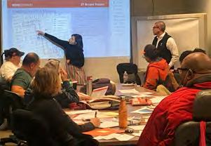
Building community support is critical. San Francisco has a strong transit advocacy community, but we also brought strong data and analysis to the table that helped make the case for transit improvements.

Pair transit reliability with pedestrian safety improvements to maximize benefits, improve access and build support for improvements. Most heavily used transit corridors are also high-injury corridors for pedestrians (page 56).

Focus the first rounds of outreach on a listening tour approach. This allows the community to help navigate potential trade-offs before a proposal is developed. This builds better support and trust and ensures the final proposal reflects community priorities.
In the coming years, Muni Forward will continue delivering results for transit in San Francisco. This section provides an overview.
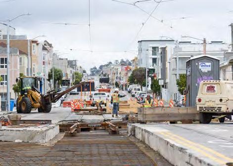
Construction is now substantially complete on projects to reduce travel times and improve safety on the 22 Fillmore (16th Street Improvement Project) and the L Taraval (L Taraval Improvement Project).

Quick-build improvements are underway and will soon be completed on the J Church (pictured above with new transit lanes on San Jose Avenue), K Ingleside and M Ocean View lines, where Muni Forward improvements were recently approved. See page 101 for more information about this work.

Following quick-build improvements, detailed design is underway for the construction of permanent (concrete) improvements for approved projects on the 29 Sunset (future transit bulb location pictured above), 38 Geary, J Church, K Ingleside and M Ocean View.
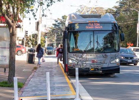
Construction will begin in the coming months on permanent (concrete) transit bulbs on the 5 Fulton in the Inner Richmond.
In 2024 and 2025, we are starting planning and outreach on a new round of Muni Forward corridors. This work will support the vision of the Five-Minute Network (see page at opposite) and the Muni Service Equity Strategy and will deliver a new round of Transit Delay Hot Spot improvements:
• T Third reliability improvements
• J Church: Noe Valley Muni Forward
• 29 Sunset (Phase 2) Muni Forward
• N Judah Muni Forward
• 1 California Muni Forward
• 22 Fillmore: Fillmore Street Muni Forward
• Top 10 Transit Delay Hot Spots
Future Muni Forward projects are planned on other corridors, including the 43 Masonic and 44 O’Shaughnessy, as well as remaining segments of the 8 Bayshore, 7 Haight/Noriega and 14 Mission. We’ll also revisit existing corridors with a focus on further time savings to improve service quality and cost effectiveness.
Muni Forward will continue to prioritize corridors serving Muni Service Equity Strategy neighborhoods, in addition to high-ridership routes.
Future efforts will focus not only on time savings, but also on reducing operating costs. This will allow us to maintain service with fewer buses and ultimately provide more service as funding allows.
We are aiming to use more sophisticated transit signal priority and automated camera lane enforcement technology to deliver more time and cost savings. This could include cloudbased transit signal priority, transit lane enforcement cameras that can automatically detect violations and other international best practices.
The Five-Minute Network is the SFMTA’s vision for a set of high-ridership transit corridors with service every five minutes or better throughout the day. No need to worry about schedules for these routes—just hop on and ride. As funding allows, we plan to expand this network and focus our most intensive transit priority treatments on these corridors.
The Five-Minute Network is the longer-term vision for a set of bus and rail corridors with service running every five minutes or better, all day. The purpose is to provide fast, frequent, reliable Muni service throughout San Francisco. Transit priority capital improvements help to make reliable five-minute service possible, even in busy areas. The vision of the Five-Minute Network is that high-frequency routes only stop at stops, with no unnecessary delay from congestion or other factors.
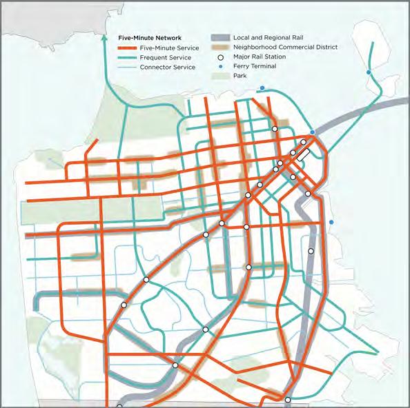
Source: ConnectSF Transit Strategy, SFMTA, 2021
The corridors on this map show what a five-minute network could look like
The Five-Minute Network would benefit the entire city, including eight neighborhoods that are part of the Muni Service Equity Strategy. This concept was vetted through community engagement as part of the ConnectSF planning process and reaffirmed by the 2023 SFMTA Community Survey, which highlighted that fast, frequent, reliable service is the top priority identified by riders.
Recent analysis shows that frequent routes spaced ¼ to ½ mile
number of people, which means people would have more options
and
The Five-Minute Network will guide the next generation of Muni Forward capital projects. Investments in the Five-Minute Network will focus on:
• Busy corridors that can support transit coming every five minutes or less, all day.
• Routes that provide important connections to the Five-Minute Network, generally operating at 10-minute or better frequencies.
This capital program will be coupled with more frequent transit service as funding allows.
Expanding the number of Rapid bus lines is an important step in moving toward the Five-Minute Network vision. To this end, Muni is planning to expand the Rapid Network to high-ridership areas where Rapid service is not yet available, as funding allows.
The SFMTA is working towards a vision of a much faster, more reliable and more convenient rail network, making it the efficient, modern system that San Francisco needs and deserves.
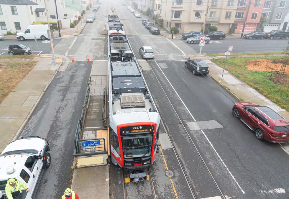
This vision means light rail service that functions more like a subway (even on the street), longer trains to reduce crowding and better amenities at stops. We’re working towards this vision with Muni Forward improvements, as well as future investments in our Train Control Upgrade Program (TCUP) and other operational enhancements.
The goal is to modernize and enhance Muni rail lines, so they meet their full potential to serve as a backbone of our transit network. The first 10 years of Muni Forward focused heavily on bus lines, which carry the great majority of Muni trips (almost 80% as of 2024) and operate entirely on city streets without grade separation. More recently, however, we’ve turned our attention to the rail network as well, completing improvements on the L Taraval and N Judah and gaining approval for projects to improve the J Church, K Ingleside and M Ocean View. In many places, our rail lines still lack safe, accessible boarding facilities and dedicated right-of-way on the street; our current and future projects will address both of these challenges across our rail network.
Projects on the J Church, K Ingleside and M Ocean View were approved in 2023 and 2024, with quick-build implementation underway now. These include concrete boarding islands, transit lanes on San Jose and Ocean avenues, and safety improvements such as wider sidewalks and flashing beacons at pedestrian crossings. The boarding islands are the first instances of city crews from the Department of Public Works constructing concrete boarding islands on rail lines, which delivers critical safety, access and capacity improvements faster than a traditional construction process where work is bid out to a private contractor. Detailed design work is underway for permanent improvements on these projects as well, which will begin construction in the coming years.
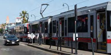

New quick-build transit boarding islands are long enough for all doors of two-car trains. This makes it easier to get on and off the K Ingleside and reduces delays at West Portal. Transit lanes will be installed soon as well.


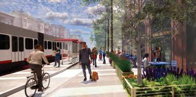
We're launching projects in the coming year aimed at greatly enhancing the N Judah and T Third, focusing on reliability, safety, crowding and the overall customer experience. These projects will build on past improvements, such as the Inner Sunset section of the N Judah and the TETL improvements on the T Third.

Muni Forward will be developing a longer-term vision for the N Judah corridor in collaboration with community members and stakeholders. The N Judah is the highest ridership Muni light rail corridor and was last fully updated in the 1970s. The intent of this effort is to enhance the rider experience by improving safety and accessibility, and reducing travel time and crowding. This will build on past improvements to the line.
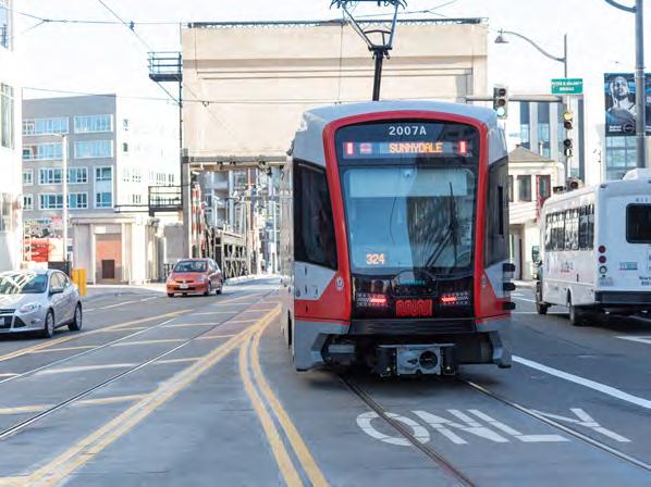
In the near future, the SFMTA will undertake a corridor-wide review of delay on the T Third in close collaboration with the communities along the route. Delays continue to be a challenge on many parts of the line. Future updates to the T Third will build on quick-build efforts already implemented. Solutions could include Muni Forward transit priority upgrades as well as operational improvements and next-generation signal priority enhancements.
In addition to Muni Forward, San Francisco is pursing a range of additional projects that will enhance and expand the rail network in the longer term.
Muni Metro Modernization is a comprehensive program to prepare San Francisco's light rail system— much of which is more than a century old—for the remainder of the 21st Century. It includes state-ofgood-repair maintenance in subway tunnels, capital investments to improve reliability and capacity on surface rail, improvements to maintenance of the light rail vehicle fleet, and facility upgrades.
It also includes the Train Control Upgrade Project, or TCUP, which will modernize Muni Metro's decadesold train control system over the new few years. The current Automatic Train Control System, or ATCS, is based on 1980s technology and still uses floppy disks. Replacing the system with state-of-the-art
Communications-Based Train Control will increase capacity in our subways, extend automatic train control to surface segments of rail lines and improve service reliability.
Finally, Muni Metro Modernization includes the Muni Metro Capacity Study, which will identify improvements to ensure sufficient capacity for current and future ridership. The Muni Metro Core Capacity Study is currently identifying further improvements for the entire M Ocean View light rail corridor, which may include additional transit priority measures and longer trains to increase the number of people the line can serve.
While the SFMTA's rail-related efforts are largely focused on improvements to the current system, expansions of the city's rail network are also being planned. Based on recommendations from the city's ConnectSF Transit Strategy, the following are being studied: extension of the Central Subway to Fisherman’s Wharf; the Portal, an extension of the Caltrain and future California High-Speed Rail corridor to Salesforce Transit Center; a new Caltrain station in the Bayview; and a Geary/19th Avenue subway that could potentially connect to a new transbay rail crossing under study by the LINK21 program

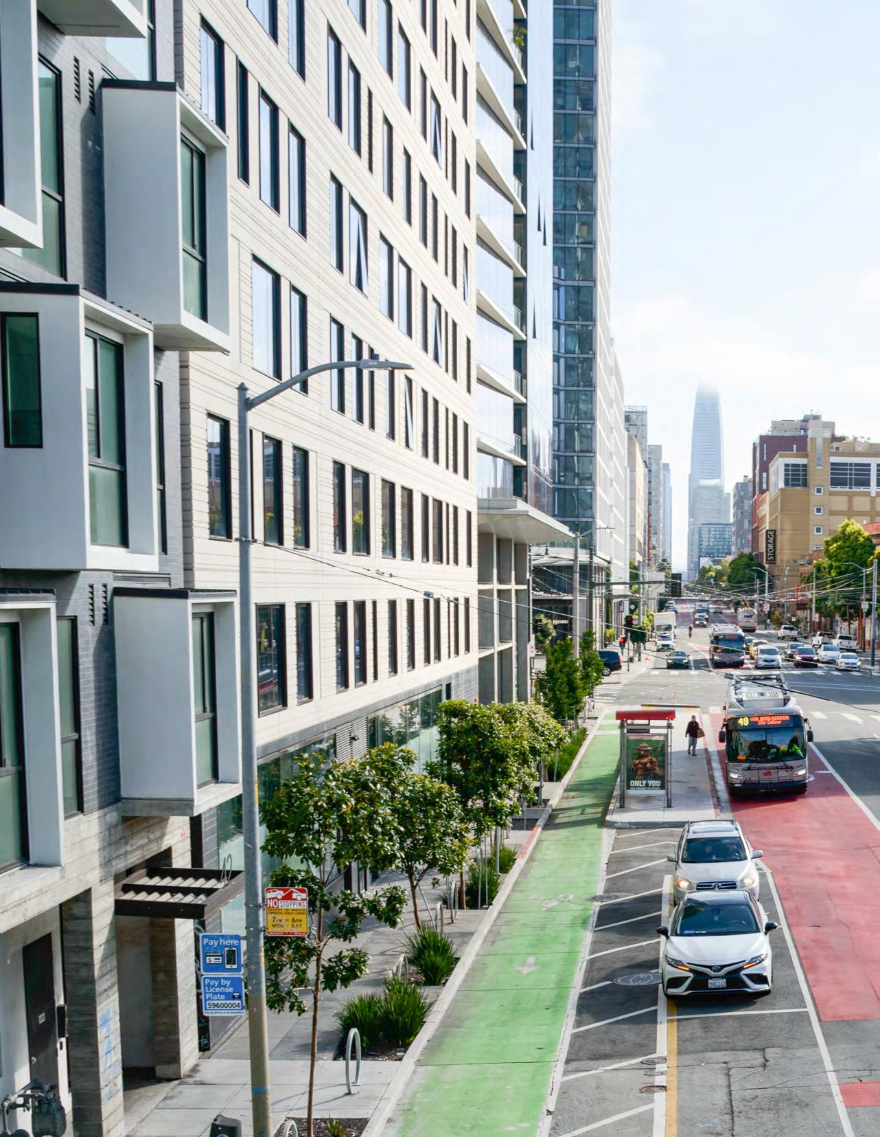
Travel time savings figures are median (50th percentile) time savings except where noted. Where time savings are referred to as being "up to" a given percentage, this indicates that is the greatest time savings observed across different times of day and directions of the route. This typically refers to a specific segment of the route where improvements were implemented, which is generally noted in the report.
Reliability metrics provided in this report generally refer to the change in how variable travel times are after project implementation. Travel time variability is a primary cause of "bunching" and "gapping," key indicators of reliability issues. For most projects, variability is measured as the difference between the 90th and 50th percentile travel times. For instance, if the variability between the 90th and 50th percentile travel times is reduced from 4 minutes to 2 minutes, this would represent a 50% decrease (improvement) in variability or reliability. For some older project evaluations, variability may use another metric, such as the difference between the 75th and 50th percentile; this has been indicated where it is the case.
