PORTFOLIO LANDSCAPE ARCHITECTURE


PROJECTS


I would like to acknowledge the Bedegal people that are the Traditional Custodians of this land on which I am fortunate to persue my education. I pay my respects to the Elders both past and present and extend that respect to other Aboriginal and Torres Strait Islanders who are present here today. I would also like to celebrate the diversity of Aboriginal peoples and their ongoing cultures and connections to the lands and waters of NSW.

As an architect with two years of experience, I have developed a deep interest in landscape architecture through my exposure to diverse natural environments and contrasting constructed urban spaces while living in different countries. This exposure has inspired me to pursue landscape architecture as a means to study and create a harmonious balance between the community and the environment.


Sydney, with its favorable equilibrium between urban development and natural landscapes, has been a compelling choice for furthering my studies in landscape architecture. I am particularly interested in exploring how the design of our built environment can enhance the well-being of both the community and the surrounding ecosystem, fostering a sense of harmony and sustainability.
I excel in effective verbal communication and critical thinking, enabling me to articulate design concepts clearly and develop innovative solutions for complex landscape architecture projects. With a team-oriented mindset, I collaborate effectively with professionals from diverse disciplines. I am a quick learner, constantly seeking opportunities to expand my knowledge and stay up-to-date with industry advancements.
I am eager to contribute to the Australian landscape architecture community, creating sustainable landscapes and hope to gain practical experience and deepen my understanding of local contexts and design practices. Being passionate about making a positive impact, I am excited to grow as a landscape architect in Australia to learn as well as put my skill to practice to create innovative and sustainable designs.

Advanced level
SKETCHUP GRASSHOP-




Advanced level
LUMION V-RAY
Advanced level
Developing level
REVIT QGIS


Good skill level
Developing level
3DS MAX ADOBE SUITE
Developing level

Advanced level
Excelent quality to verbally communicate an idea or concept


LEADERSHIP
Great leadership qualities and excellent ability to work in a team.
- Represented media commetee in cultural club in UNSW.
Ability to manage time and work under pressure.

Enthusiasm to learn new concepts quickly.
Excellent ability to adapt in different environment.
MICROSOFT OFFICE TEAMS
Advanced level
Advanced level
Great at handling jobs responsibly with a strong sense of duty and accountability.
MATERS IN LANDSCAPE ARCHITECTURE

2023 l University of New South Wales
BACHELOR OF ARCHITECTURE
2020 l College of architecture Trivandrum
SCHOOLING
2015 L Good Shepeard Public school, India
2013 l Indian School, Al ain, U.A.E.
SKETCHUP
2018 l Intercad System Pvt. Ltd, Trivandrum
PARAMETRIC MODELING
2019 l Rhinoceros 3D & Grasshopper, Para Kraft
CIVIL DESIGNING
2020 l Vastu Shasthra, Rajadhani Finishing School
REVIT AARCHITECTURE
2021 l Zero to hero by Munir Hamad, Udemy
ARCHITECTURAL INTERN
Worked for the world’s largest Safari zoo (apart from Africa) which is being constructed in Al Dhaid. Prepared construction drawings with frequent site monitoring and worked with different departments like landscape, theming, MEP etc.
ARCHITECTURAL INTERN
Carried out various kinds of projects like govt. buildings, school, hospital etc.Worked on a competion project to design an Administrative complex in Goa, which got short-listed. Mainly focussed on skills like time management, software skills, team cordination, brainstorming and perfection in work.
ARCHSTUDIO V , BANGALORE, INDIA ARCHITECTURAL
Worked on various project types like Residential (Single Villa, Gated compount, Appartment as per Vastu), Commercial (Mall), Landscape projects.
Often met with clients to discuss project plans and update them with the design progress.Regular site monitoring to ensure accurate design execution.
MANAGEMENT SKILL
SUPERVISOR IN HOSPITALITY
Strong quality developed to effectively lead and supervise diverse teams to ensure smooth operations and customer satisfaction.
VISUAL COMMUNICATION
FREELANCE GRAPHIC DESIGN PROJECTS
I have honed my visual communication skills to effectively convey messages and capture attention.
TIME MANAGEMENT
Ability to manage time and work under pressure.
Member of COUNCIL OF ARCHITECTURE, INDIA
Member of AUSTRALIAN INSTITUTE OF LANDSCAPE ARCHITECTS


1. Ecological Restoration

2. Resilient Design
3. Community Engagement and Stakeholder Participation
1. Weiliu Wetland Park Landezine. (2017). Weiliu Wetland Park by Yifang Ecoscape. [online] Available at: https://landezine.com/weiliu-wetland-park-by-yifang-ecoscape/.
2. Minghu Wetland Park ArchDaily. (2015). Minghu Wetland Park / Turenscape. [online] Available at: https://www.archdaily.com/590066/minghu-wetland-park-turenscape?ad_source=search&ad_medium=projects_tab.
3. Suzhou Taihu Lakeside National Wetland Park
“The 10th International Wetlands Conference.” n.d. Temp.intecol-10iwc. com. Accessed March 6, 2023. http://temp.intecol-10iwc.com/EN/HelpCenter/HelpInfo.aspx?nid=87.
1. NSW Wetland Policy
2. The NSW Wetlands Management Policy
3. The NSW Sea Level Policy
4. Multicultural Education Policy

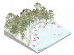
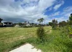
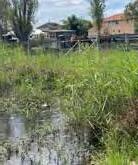
The Rockdale Wetland Corridor project is a restoration initiative, located in Sydney as part of a 5km wetland stretch. The chosen site belongs to the San Souci catchment and lies along Bado-Berong Creek, encompassing Bona Park.The site’s unique characteristics, such as tall trees, open sky, and a rich biodiversity hotspot, offer immense potential for innovative design. However, the project faces significant challenges such as sea level rise causing salination of fresh water, resulting in biodiversity loss, and water overflow from the creek affecting nearby low-lying residential areas. Addressing poor water quality and soil contamination are also key objectives.

To overcome these challenges, the project aims to build a resilient system that can adapt to sea level rise and water overflow, while simultaneously restoring and enhancing the wetland’s ecological functions. Phytotechnologies will play a crucial role in this effort, utilizing plants and vegetation to address water and soil quality issues and promote overall ecosystem health. Community engagement and participation will be fostered to create a sense of ownership and stewardship among local residents.The Rockdale Wetland Corridor project envisions longterm results within a timeframe of 20 to 30 years, recognizing the time required for the wetland to fully recover and showcase the desired eco-

SITE AREA : 110,542 Sq m


LAND USE : Public recreation, barren land
LAND
OWNERSHIP : Bayside Council, Road and traffic authority


BIODIVERSITY: Fauna - Golden wistler, grey headed flying fox SOIL TYPE : Ettalong swamp

FLAT TERRAIN


LAND OWNERSHIP
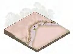
Land is owned by the bayside council. Rest of the site is owned by the Road and traffic authority
HEAT VULNERABILITY INDEX
Compared to other part of the site HVI is higher in this area and bona park.
- Special care to be give while design in case of recreational space.

SOIL TYPE : Ettalong swamp
LACK OF CONNECTIVITY TO WETLAND
Trees and the compound wall of the residence cut the physical access of residents to wetland.
- Bring openess and function
RESIDENCE TO BE CLAIMED
Few residence must claimed on either sides of the Bado- berong creek for the expansion of these open spaces
INSIGHTS
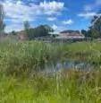
Vegetation : It was observed that most plants were planted over the years. Density : Housing density was slightly increased.

Porosity : The porosity to wetland decresed over the years.
Function : Most of the site is vaccant from 1950 while
HIGH CONTOUR
There is a chance of flash flooding as the site lies in between higher contours.
- Water detention in site
ENCLOSURE
Level of enclosure is quite low but differs when we move along the site. The openess and porosity changes with the types of vegetation length of site abd nearby built
- Space acquisition for expansion of open space


BADO-BERONG CREEK
It is a 2.5 km creek that drains into George river. It had poor water quality and can be treated before draining.
NOEL SEIFRET RESERVE
It is 3 acre park adjacent to bona park.


PLANTS
Acid sulphate soil
Class 3 and Class 5
- Vegetation to be chose wisely
Plants like reeds and shrubs block the visual access to creek and obstruct users to use the space
- Plants that help visual access. BONA


WATER TABLE
Water table is considerably high due to the low terrain which makes it a hazardous area during flood.
- Proper drainage systems and plants species to be choose wisely.



RECREATIONAL AMENITIES
1. Bona Park
2. Vegetative garden for residence

3. Dog Leash
During the site study and analysis process, various aspects were carefully examined. One crucial step involved creating an axonometric 3D diagram of the site to better understand the spatial relationships and interdependencies among different features. This diagram provided a visual representation of the site’s layers, aiding in the identification of key elements and their connections.
To develop this diagram, software programs such as SketchUp, Rhino, Adobe Photoshop, and InDesign were utilized.
OPEN SPACE ACQUISITION DIAGRAM

From the direct sun and UHI analysis it was observed that the site receives ample sunlight over a longer period but is poorly shaded making the site extremely hot and water in the creek dries up really quickly but floods during the slight event of rain. The strategies include to make the site more thermally comfortable. Planting more trees making it a riparian corridor can help shade the wetland and give thermal comfort.
The site is relatively flat but has low terrain which poses a threat to other activities in site. Water table is being hight land is inunded during tides or slight rain. North west of the site being on high terrain might also result in flash flooding during an event of rain.


The site has been identified as having problems such as flash flooding, sea level rise and storm water surge. These problems stem from the low ground on which the site is located. Stratergies that are adopted are space acquisition by nearby residents to reclaim their land, alteration of the terrain moderately, and expansion of the creek to act as a spill-out space.


In order to gain a deeper understanding of the site and its context, different scale sections were drawn to analyze various layers and their relationships. These sections provided insights into larger patterns, including birds and burra migration, and helped identify connections with neighboring areas such as the Blue Mountains, Kamay (Botany Bay), and the San Souci residential area. Additionally, sections were used to study the biodiversity, community dynamics, soil composition, the creek, and the site itself. By examining these sections, valuable information was obtained regarding the spatial and ecological relationships between these elements.


BUILDING RESILIENT SYSTEM

RESTORING
ECOLOGICAL FUNCTIONS


INVOLVING COMMUITY IN PHYTOTECHNOLOGY ACTIVITIES


1. Meeting Place / Gathering space

2. Water sustainability
3. Walkable streets
1. Israel Plads
“Cobe - Israels Plads.” n.d. Www.cobe.dk. https://www.cobe.dk/place/ israels-plads.
2. Karen Blixen Plads
“Cobe - Karen Blixens Plads.” n.d. Www.cobe.dk. Accessed July 11, 2023. https://www.cobe.dk/place/karen-blixens-plads.
3. Cumhuriyet Street Urban Design
https://www.facebook.com/archellocom. n.d. “Cumhuriyet Street Urban Design Project | PDG Mimarlar.” Archello. Accessed July 11, 2023. https://archello.com/project/cumhuriyet-street-urban-design-project.
1. Road Reserve Vegetation in Urban Areas Policy
2. Landscape Protection Policy
3. Council policies
4. Tweed Community Strategic Plan 2017–2027


The project’s objective was to redesign the Tweed Mall precinct in Tweed Heads, which held a significant position as a focal point benefiting from its proximity to the Gold Coast Airport, hospitals, residential areas, and the southern part of Tweed Heads connected via Wharf Street. The design concept took into consideration the proposed Tweed light rail, with a primary focus on creating a plaza that would serve as a meeting place for local mall users.The plaza was positioned in front of the mall, and the street in front underwent a redesign to promote walkability and incorporate cycle paths and light rail infrastructure. Additionally, water sustainability was integrated into the design, with provisions to capture, recycle, and reuse water resources.
Project involved various stages like precedent study, site visit, site study and analysis, concept design, master plan development and presentation to the council. Within the group project, my specific contributions included conducting a site analysis, designing the street and plaza, and producing visual renders to showcase the envisioned changes.

The site in Tweed Heads holds a significant position as a focal point, benefiting from its close proximity to the Gold Coast Airport. It is conveniently connected to hospitals, residential areas, and the southern part of Tweed Heads through Wharf Street. Surrounded by the Tweed River, Jack Evans Harbour, and the Gold Coast beach, the Tweed Mall site enjoys a picturesque location with abundant water sources. The Tweed River, in particular, plays a prominent role as a natural asset in the region. With its central location, accessibility via Wharf Street, and the presence of surrounding water sources, the site in Tweed Heads serves as a notable hub for residents, visitors, and businesses alike.


Maste plan was developed to have a common meeting point. From the frequent circulation path mapped, commonly used spaces are given function with the needs of the user. Ground floor of the mall opened up to the plaza with restaurent seating provided in the plaza. Design also included water features from the water collected from the design elements during rain. Safe play area is provided for kids using the space with shaded seating for the parents to supervise.


1. Green design [Vertical garden, green roof]

2. Universal Inclusive design
3. Community Engagement and Stakeholder Participation
1. Glenbrook Park
“Accessible Playground Archives.” n.d. Have Wheelchair Will Travel. Accessed July 11, 2023. https://havewheelchairwilltravel.net/category/ accessible-playground/.
2. Murrimboola Creek Precinct Revitalisation
“Murrimboola Creek Precinct Revitalisation Causes Talk.” n.d. Www.hilltopsphoenix.com.au. Accessed July 11, 2023. https://www.hilltopsphoenix.com.au/murrimboola-creek-precinct-revitalisation-causes-talk.
1. Policy framework for WSUD
2. State Environmental Planning Policy
3. The NSW Sea Level Policy
4. Multicultural Education Policy


The project focused on revitalizing the Salt Pan Creek, specifically addressing Site 10 among the divided 18 sections. The site presented opportunities as an open space, ideal for recreational activities for the local residents. However, it also posed potential threats such as contaminated soil, lack of entry points, and a shortage of seating or breathable green spaces.

To address these issues, the design implementation included WSUD initiative with other minor measures. These measures encompassed the creation of a walking trail and a bike path that extended through all the other sites, the incorporation of green parking spaces, the establishment of portal points for access to the site, and the addition of aesthetic elements like a vertical green wall and green roofs.The project aims to be completed within a timeframe of 3 to 5 years transforming the creek into a vibrant and sustainable space that enhances the recreational experience and environmental quality for the community.

This concept mainly aims to address and solve the problems in the edges of defined area to bring in an INTERACTIVE PORTAL to the site for users.
This concept mainly aims to address and solve the problems in the edges of defined area to bring in an INTERACTIVE PORTAL to the site for users.
This also aims to solve problem exsisting in site like accesibility, soil contamination, storm water drain, unattractive edges etc.
SHALIN THANKAM / UNSW / LAND7202
SHALIN THANKAM / UNSW / LAND7202
This also aims to solve problem exsisting in site like accesibility, soil contamination, storm water drain, unattractive edges etc.
BLURB
BLURB
This concept mainly aims to address and solve the problems in the edges of defined area to bring in an INTERACTIVE PORTAL to the site for users.
This concept mainly aims to address and solve the problems in the edges of defined area to bring in an INTERACTIVE PORTAL to the site for users.
This also aims to solve problem exsisting in site like accesibility, soil contamination, storm water drain, unattractive edges etc.
This also aims to solve problem exsisting in site like accesibility, soil contamination, storm water drain, unattractive edges etc.


GREEN VERTICAL WALL
Green vertical wall are introduced on blank walls for aesthetics and purification of storm water from roof
GREEN VERTICAL WALL


Green vertical wall are introduced on blank walls for aesthetics and purification of storm water from


7 8 9 12 14 15 16
PORTALS AND COMPOUND WALL
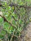
Twig natural portal for entrances and fences
PORTALS AND COMPOUND WALL
Twig natural portal for entrances and fences

PARKING
Ecoraster with grass and stone
PARKING
Ecoraster with grass and stone
from roof
Ecoraster with grass and stone


Assignment A3 : Designing
Assignment A3 : Designing
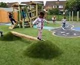
is manipulated to create green and save playscape for kids.


OF PLAYSCAPE
Study started with research on what elements needed to be addressed in site and the possible materials to be used.

Site analysis was carried out by a movie called ‘ Now you see me too’ This movie aimed at potraying how the nature exsits but still not seen from all the urban noise around. Throughout the movie the switching of audio represent the contrast and imbalance in nature. Site Analysis included exploration of videograhy and editing skills.
LINK : https://youtu.be/CTIGAlGI7M0


Topography is manipulated to create green and save playscape for kids.


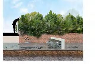
This is a stopping point for tourist which looks into surrounding area.


Plan and sections were prepared detailing where each function, portals, pitstop, walking path, bike path, lighting poles, edge treatment, roof garden etc. are provided.


This playground topography is articulated for for kids play area.
WSUD design of parking using Ecoraster helps the storm water to seep through
AREA 10
AREA 10

Assignment A3 : Designing water places
Assignment A3 : Designing water places


Water-sensitive urban design (WSUD) is a key solution for the Canterbury Sydney Creek revitalization project. It includes the creation of a connected walking trail and bike path, incorporation of green parking spaces, establishment of accessible portal points, and addition of visually pleasing elements like a vertical green wall and green roofs.


Design implentation was explored through hand made model with cardboard sheet and laser cut wood building block. Each site was then combined to show the proposal to the council

