From Here to the Horizon Photographs in Honor of Barry Lopez
January–May 2023
Learning Guide

January–May 2023
Learning Guide
January–May 2023
From Here to the Horizon presents work by fifty American photographers assembled in honor of Barry Lopez (1945-2020). Winner of the National Book Award for Arctic Dreams: Imagination and Desire in a Northern Landscape , Lopez was the author of over two dozen works of fiction and non-fiction and numerous wideranging essays. Recognized for his “glittering, mica-like prose poetry,” Lopez was one of our most highly regarded writers about humankind’s relationship with the natural world and a touchstone for a diverse community of writers and artists.
The images in the exhibition were selected by the photographers in conversation with Home Ground: A Guide to the American Landscape , a “reader’s dictionary” of geographic terms that Lopez compiled with his spouse Debra Gwartney. Standing as a marker of the admiration and affection of Barry’s peers, this collection traces the profile of our national landscape, finding elegance, inspiration, and solace in the places we call home.
Exhibition support is provided by Phyllis Acklie, Kristen and Geoff Cline, D F Dillon Foundation, The Charles Engelhard Foundation, Melanie and Jon Gross, Patricia and Joel Meier, Erica Peterson and Bart Dillashaw, Rhonda Seacrest, and Peck Stacpoole Foundation.born Orange, NJ, 1937
Clearcut. Second-growth Stump on Top of Old-growth Stump. Coos County, Oregon
Gelatin silver print, 2013; 11 3/16 × 9 inches

Sheldon Art Association
The Home Ground Collection: Gift of the artist in honor of Barry Lopez
S-1197.2022
Barry Lopez was an extremely courageous person, and his courage was ultimately on behalf of all of us, urging hope without reason except for what we can see. When he was asked why we should protect the earth, he said simply, “because it is so beautiful.”
Forest as elder, where trees coexist in the full spectrum of their development—from seedling to sapling to ancient, to snag and generative nurse log: old-growth forest features include thick duff, trees hoary with age, and certain indicator species that rely on the settled richness of variety in plant, insect, lichen, and other life forms. It seems to take about two centuries for these features to develop, by which time a forest crosses a threshold between a monoculture of trees of similar age—often the result of catastrophic fire or clearcut—to a multiage population of trees, with attendant opportunities for broad range in plant and animal populations. What old age gives the individual person, old growth conditions give a forest: a life-library of survival wisdom, flexibility, initiative, and a sustaining life process. Formerly called virgin forest, as untouched wilderness, oldgrowth forest has become controversial and precious. Besides the old-growth forests dominated by Douglas fir in the Pacific Northwest, old growth includes local stands of redwood in California, ponderosa pine east of the Cascade Mountains, eastern hemlock in the Great Smoky Mountains, as well as cedar, cypress, tulip tree, oak, and other species, often in tiny forest remnants.
—Kim Staffordborn Philadelphia, PA, 1946
17 Palms Oasis, Anza-Borrego Desert State Park, California

Pigment print, 2013; 31 5/16 × 40 inches
Sheldon Art Association
The Home Ground Collection: Gift of the artist in honor of Barry Lopez
S-1276.2022
Barry Lopez’s writing has been a major influence for me—I carried Arctic Dreams around for years, sharing passages and ideas from it with anyone who would listen. What impressed me so much about Barry’s writing, and Arctic Dreams in particular, was the slow-moving attention to detail. I felt like he was with me, using his version of a view camera—or I was with him—as he studied and thought about and tried to make sense of the world.
The word oasis is apparently of Egyptian origin and refers to a place in the desert where water is present. An oasis means life and fertility: permanent plant growth and the possibility for human settlement, drinking water, and enough moisture to grow plants and trees. An oasis can vary in size, from an ooze in cracked mud to a gurgling spring, to a pond or spring system so large it can hold whole cities. Natural oases occur in artesian basins or in deflation hollows, where dunes and sediments have been removed by wind, thus exposing an area that is at groundwater level. Nearly one hundred places in the United States are named Oasis, including the town of Oasis, California, the Oasis Reservoir in Colorado, Oasis Pond in Montana, and Oasis Lake in Texas. Another sort of oasis can be found in polar deserts—an ice-free area in an icebound landscape. Pearyland at the top of Greenland is one. Historically, the word oasis has been used to refer to the dark spots occurring on Mars. But most often an oasis is an island of aquatic relief. It is the place where lives are saved, and figuratively speaking, refers to any calm center. The piece of foam that holds flower stems in a floral arrangement is called an oasis; it too, represents an island of security, but one that sits just under the water’s surface. As a topographic feature, an oasis is life; it is a gathering point, a sanctuary, and a feeding station. It is the desert’s umbilical.
—Gretel Ehrlichborn Willimantic, CT, 1957
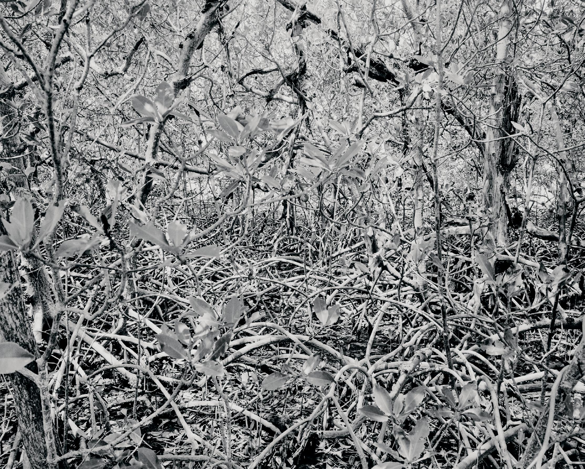
Mangroves, Everglades City, Florida , from the series Everglades Pigment print, 2002; 17 1/2 × 21 7/8 inches
Sheldon Art Association
The Home Ground Collection: Gift of the artist in honor of Barry Lopez
S-1209.2022
To me, the mangrove forest is the modern age superhero of the wetlands. Mangrove obtains fresh water from saltwater and sequesters carbon. The forests protect against storm surges and eroding coastlines and provide rich breeding grounds for marine life. Hugging the edges of the land, mangrove forests seem impenetrable and prehistoric, and their silence fools one into thinking that one is alone. Yet creatures abound – birds including the Wood Stork and White Ibis, alligators, crocodiles, turtles, crabs, fish, barnacles, and the endangered manatee. I imagine this wilderness as boundless.
To poet Elizabeth Bishop, mangroves made up the “celestial landscape” of Florida, with herons in “tiers and tiers of immaculate reflection” shining whitely among the leaves. She compared the roots of one mangrove, a red mangrove, Rhizophora mangle , to Gothic arches because of its distinctive bower of aerial roots and numerous fingerlike breather roots—pneumatophores—rising from the mud. Though mangroves flourish worldwide in tropical and subtropical areas, this particular one, the red, can be found only in Florida, while the white and black are found in Florida and elsewhere. Possessing all three of these salt-loving, tropical-zone trees, Florida has luxuriant mangrove “forests.” The red is the great colonizer, its foot-long seedlings dropping and rooting in the protective tangle of detritus below, or drifting off in storm-season tides to implant themselves elsewhere. Mangroves are essential to many water birds for rookeries and rest—the brown pelican nests almost exclusively on mangrove islands—and the watery, airy mazes the trees provide are favored by lobster, tarpon, and manatee alike. A peculiar environment, the mangrove swamp: displeasing to man in its tangled impenetrability, but celestial to a great and lovely multitude that is not man.
—Joy Williamsborn New York, NY, 1956
Cajón Bonito, Sierra San Luis, Chihuahua, Mexico

Pigment print, 2020; 11 1/16 × 16 9/16 inches
Sheldon Art Association
The Home Ground Collection: Gift of the artist in honor of Barry Lopez
S-1212.2022
In the Sierra San Luis, the borders of two nations, Mexico and the United States, and four great ecosystems, the Chihuahuan Desert, the Sonoran Desert, the Rocky Mountains, and the Sierra Madres, as well as the corners of the states of Arizona, New Mexico, Chihuahua, and Sonora divide the territory. On the horizon is Canyon de los Embudos, where Geronimo negotiated his surrender and below is Cajón Bonito, where Cormac
McCarthy’s young cowboy descended into Mexico with his wolf. Nestled on the hilltops, narcos still lay in the same lookouts the Apaches used.
A land or district on or near the border between two countries or districts is borderland, conveying the idea of a fringe or intermediary state or region. In the Southwest, the borderland is the stretch between Mexico and the United States, and the term carries with it the idea of a mixing and confluence of cultures. It also includes the idea of disparate economic systems that produce poverty, along with cultural interactions rich in ambiguities and tensions. Chicana poet and activist Gloria Anzaldúa describes the U.S.Mexico borderland as “ una herida abierta ”— an open wound. Borderland is thus no longer a geographical term but a geopolitical one.
—Arthur Szeborn New York, NY, 1956
Meigs County, Ohio , from the series Along the Ohio Pigment print, 1988; 13 7/16 × 20 inches

Sheldon Art Association
The Home Ground Collection: Gift of the artist in honor of Barry Lopez
S-1214.2022
Appreciating the Ohio River requires a rarer and more inclusive idea of beauty, one that exists not despite, but thanks to mankind’s shaping influence on the landscape. Even on the most bucolic stretches of the river, it is difficult not to be aware of a human presence. There is always a plume of steam fluttering above a power plant just around the bend, or the distant buzzing of a chain saw, or a tire gently bobbing in a pool by the shore. It is as if the river and humanity are tenaciously conjoined.
Wilderness
Wilderness is a cultural, not an ecological, concept. While its meaning and the values that attach to it have shifted through the ages, it stands essentially for the land and space where culture is not, or at least where the impacts of human culture are minimal: the desert wilderness of the Old Testament; the Adirondack wilderness of the Hudson River painters; the comparatively prosaic concepts of backcountry, bush, or the “high lonesome”; and the administrative designation conceived by Aldo Leopold as “a continuous stretch of country preserved in its natural state . . . big enough to absorb a two weeks’ pack trip, and kept devoid of . . . works of man.”
The most powerful of all definitions of wilderness is to be found in the 1964 Wilderness Act: “A wilderness, in contrast with those areas where
man and his own works dominate the landscape, is hereby recognized as an area where the earth and its community of life are untrammeled by man, where man himself is a visitor who does not remain.” The National Wilderness Preservation System, which the act established, now includes over 105 million acres of federal land, more than half of which is in Alaska. Irony necessarily abides in so protean a term: land that westering white Americans in the nineteenth century judged to be wilderness was home ground from the point of view of native tribes, and the birth of the wilderness preservation movement in the twentieth century occurred only after the lands on which it focused had been substantially tamed by the removal of the natives who inhabited them. Today wilderness remains one of the most evocative concepts in American culture. It might be said to describe any place on land (or sea) where the powers of nature are paramount and where the call of the wild might be heard. Ed Abbey, among many others, had meditated on its meaning: “Wilderness. The word itself is music. Wilderness, wilderness. . . . We scarcely know what we mean by the term, though the sound of it draws all whose nerves and emotions have not yet been irreparably stunned, deadened, numbed by the caterwauling of commerce, the sweating scramble for profit and domination.”
—William deBuysborn Novelty, OH, 1953
Moon Rising, the Night the Bird was Singing, Carlisle, Massachusetts , from the series The Meadow Pigment print, 2006; 32 × 40 inches

Sheldon Art Association
The Home Ground Collection: Gift of the artist in honor of Barry Lopez S-1278.2022
The night I made Moon Rising, the Night the Bird was Singing , the air was misty. At midnight, the moon was rising above the treetops. A bird in the tree next to me began singing loud and clear, its song a glorious serenade as I worked. The singing continued still as I took my leave from the meadow hours later as dawn approached. Barry Lopez’s writing taught me that photographs, like words, can hold the unseen, the invisible. That song, like that moonlight, is forever embedded in this image.
Meadow
Land covered with grasses, or a grassy field, or other discernable area of grassland either mown for hay or used as pasture is known as a meadow. Also, though rarely, the hay that is mown from this area. The term is used either to denote a “natural” (uncultivated) meadow or one planted to enhance the presence of particular flowers or to discourage the invasion of others. This distinction between an uncultivated and cultivated meadow usually depends on the context in which the word is used. Thus, a meadow can be wild or landscaped, but in general a healthy meadow has fifty percent of its surface in some form of grass. (Subalpine meadows, however, are dominated by herbaceous plants). In North American usage, meadow refers most often, though not exclusively, to a tract of uncultivated
grassland, often along a river or in a marshy region, as described by James Galvin in The Meadow : “There is an island on the island which is a meadow, offered up among the ridges, wearing a necklace of waterways, concentrically nested inside the darker green of pines, and then the gray-green of sage and the yellow-green of prairie grass.” Though rare, meadow can mean—chiefly in Newfoundland—an area of sea ice where seals come out of the water in large numbers, thus also seal meadow. Meadow is often a modifier or part of a compound noun, as in meadow flower, meadowlark, meadow mouse. This modifying habit is especially notable in the names of plants, denoting species that thrive in meadows, such as meadow barley, meadow buttercup, meadow campion, meadow clover, and meadow crocus. Sometimes the linkage creates an entirely new and figurative meaning, as in meadow silver, an obsolete term for a cash payment made in lieu of the feudal service of mowing. Meadow thatch is another such term, meaning the coarse grass or rush used for roofing a cottage. There is as well the term salt meadow, which is a grassy area subject to flooding or overflow by salt water. The etymology of meadow is directly related to mead, the alcoholic beverage made by fermenting honey and water. And mead, in turn, may have been a noun-form of the adjective meaning “sweet” in many old forms of languages as diverse as Frisian, Dutch, Icelandic, Swedish, Gothic, Sanskrit, Irish, Breton, and Church Slavonic.
—Patricia HamplJOANN BRENNAN
born Philadelphia, PA, 1962
North Platte River Reclamation, Walden, Colorado

Pigment print, 2000; 14 3/4 × 18 3/8 inches
Sheldon Art Association
The Home Ground Collection: Gift of the artist in honor of Barry Lopez
S-1215.2022
We marvel at trout swimming in a deep pool, wisps of fur along a game trail, or a raptor nest balanced at the top of a tree. Do we also notice the cluster of boulders anchored to the streambank, a motionactivated camera strapped to the trunk, or the conical guard stopping predators from taking eggs and hatchlings from the nest? In light of our constant and devastating impact on the natural world, anywhere there are wild animals, there are also scientists and researchers seeking solutions to a precarious situation, hoping to ensure a future with wildness still in it.
Few things assert the dynamism of nature better than the development of pools and riffles in a stream. Even if a channel is straight and the bed uniform, flowing water will generate turbulence. Depending on the resistance of the streambed, this turbulence may scour pools in certain places, which alternate with shallow bars called riffles or drops, where the excavated material is deposited. Generally the distance from one pool to the next is five to seven times the width of the stream, and successive pools will tend to develop on opposite sides of the channel, precursors to the formation of meanders. Very steep streams have step-pool sequences with similar cyclicity. Experienced anglers tend to be attentive to the pattern of pools and riffles, as fish like to wait in the slow water of a pool while watching for food to arrive from the faster flow of an upstream riffle.
—William deBuysborn Rockville Centre, NY, 1951
Badlands National Park, South Dakota
Platinum print, 1996; 7 7/16 × 18 3/8 inches

Sheldon Art Association
The Home Ground Collection: Gift of the artist in honor of Barry Lopez
S-1221.2022
When you arrive at the entryway to the Badlands, you drive down into the landscape. It’s like leaping off a diving board and landing in a parallel of Alice’s Wonderland, or the moon. Each time I’ve visited, my visual experience has been surprisingly different. Here, I was probably unconsciously remembering Timothy H. O’Sullivan’s 1872 photograph from Vermillion Creek Canyon, Utah, where the profile of the horizon (or in my case the edge of the bluff) and the undulating shadow cast against it allowed me to nestle the hoodoo into the dip of the skyline, where it becomes both separate from and part of the shadow behind it.
Badlands are regions dissected into steep hills and deep gullies by the action of wind, rain, and flash floods. The name was originally applied to a semiarid area in South Dakota east of the Black Hills, called les mauvaises terres à traverser by the French because it was so difficult to cross; the term is now generally applied to similar lands throughout the continent. In All the Strange Hours , Loren Eiseley writes: “I will never forget my first day of registration at the University of Pennsylvania. I had come directly from the Mauvaises terres, the Tertiary badlands of western Nebraska, into a great city of banging, jangling trolleys, out of a silence as dreadful as that of the moon.” The friable topography of the Badlands, composed primarily of shales, clays, and sandstones, has been sculpted into a maze of barren ravines and tunnels, and grassy-topped tables. (The sparse vegetation is deceptive; while puny on the slopes, it can be comparatively lush on the flat tops.) The average slope angle in the heart of this desiccated world often exceeds thirtyfive degrees—steep enough to drive rain from seasonal summer thunderstorms downhill with scouring force, leaving the sides of the tables looking barren and peeled. The Lakota Sioux name for the Dakota Badlands is Mako Sica, meaning “eroded land,” a region they were wary of. During the Ghost Dance conflicts of the late 1800s, diehard Lakota warriors assembled on remote tables in the depths of the Badlands, out of sight of white authorities who feared the dancing would foment an outbreak of violence.
—Conger Beasley, Jr.born Jersey City, NJ, 1944
Madison, Wisconsin
Gelatin silver print, 1979; 12 × 16 inches

Sheldon Art Association
The Home Ground Collection: Gift of the artist in honor of Barry Lopez
S-1217.2022
New houses have lawns. Old houses have yards. A yard is home to the spirits of those who brought it into being, people whose domestic lives extended out of doors: soil wear, rusted hardware and peeling fences—and often garden plots, either managed through their seasons or abandoned and slipping into wild ruin. The yard in this photograph (long gone, erased by asphalt emptiness) has the earned wear of a beloved work coat, the upright character of a mature and orderly mind, and, with its shovel in the thin, clear light, belief in a future where a body might adjust the old place to fit a new idea.
You can hear in yard its resemblance to garden and girdle. All three words arise from a root meaning “to enclose, surround.” The most familiar sort of yard is the plot of ground surrounding a house, often planted in grass, flowers, and bushes—hence the ubiquitous yard sales and laborious yard work. Nearly as familiar, and probably older, is the use of yard to describe a plot of ground that is itself enclosed by a fence or wall and devoted to a specific purpose, as in a farmyard, churchyard, or shipyard. When loggers haul felled trees to a landing, they are said to be yarding. By analogy to the pen where poultry and livestock are kept, yard also means a place where deer or moose gather to feed in winter.
—Scott Russell Sandersborn New York, NY, 1944
Lava, Hawaii
Gelatin silver print on printing-out paper, 1979; 8 × 9 15/16 inches

Sheldon Art Association
The Home Ground Collection: Gift of the artist in honor of Barry Lopez S-1219.2022
This past summer I was in Hawaii and was able to go back to this beautiful lava flow—it has been climbed on and chipped and lost its amazing sheen. I was lucky I was able to photograph it when we both were young.
Galway Kinnell captures the marked differences in the congealed flows of the two types of lava erupted by Hawaiian volcanoes in his poem “Lava”: smooth, ropy pāhoehoe is “a clear brazened surface/one can cross barefooted,” while jagged ‘a‘ā resembles “a mass of rubble still/ tumbling.” These terms are now standard for Western geologists describing the highly fluid basalt erupted by shield volcanoes (though Icelanders have their own names: helluhraun for pāhoehoe and apalhraun for ‘a‘ā). As it cools, a slowmoving pāhoehoe flow may solidify into fantastic forms: geologists speak of entrail, as well as filamented, corded, sharkskin, slab, and shelly pāhoehoe. What Hawai‘i residents call blue rock is an unusually dense basalt sometimes encountered when cut-ting roads through old lava.
—Pamela Friersonborn San Francisco, CA, 1946
The Snake River / Cauldron Linn, No. 2 / Jerome County, Idaho
Gelatin silver print, 2003–2004; 4 9/16 × 6 1/2 inches

Sheldon Art Association
The Home Ground Collection: Gift of the artist in honor of Barry Lopez S-1223.2022
I traveled to Idaho in July of 2003 to make work in the same spaces where Timothy H. O’Sullivan photographed in 1868 and 1874. His images from Shoshone Falls have been a beacon since I made my own first photograph almost exactly a century later in 1967. Upon arriving at the Snake River, I approached the falls from above, stopping first at Cauldron Linn. In this narrow basalt channel, the Snake River suggests something of its free-flowing past—its name, likely given after a waterfall in Scotland, was a message to my adopted home ground of Glasgow.
A particularly chaotic type of gaping river hole, a cauldron is characterized by “big, squirrelly, boily water,” in the words of one river runner. River cauldrons form where rocks, which have accumulated on the riverbed at a spot where the river suddenly drops, scour out a bowlshaped depression. The surface of the river churns and explodes here like soup boiling over in a pot. Sulphur Cauldron, on the upper Yellowstone River in northwestern Wyoming, is one of many famed river cauldrons. Cauldrons are also a seacoast feature. When ocean swells and breakers surge into constricted openings in the seaward face of the land, they sometimes produce ferocious hydraulics—violent whirlpools, geysers, and suddenly collapsing haystacks of white water.
—Terry Tempest Williamsborn Sacramento, CA, 1950
Spillway, Lake Berryessa, California , from the Great Central Valley project

Gelatin silver print, 1986; 10 5/8 × 18 7/16 inches
Sheldon Art Association
The Home Ground Collection: Gift of the artist in honor of Barry Lopez
S-1225.2022
Prior to the construction of the Monticello Dam and the creation of Lake Berryessa in the 1950s, Berryessa Valley was an agricultural paradise. Photographers Dorothea Lange and Pirkle Jones documented the forced abandonment of the town of Monticello in their book Death of a Valley . Residents left their homes, the Monticello cemetery was relocated, and houses and buildings were destroyed. Ranchers were evicted as equipment was auctioned away, the valley deforested, and their land flooded. Today, the dam provides flood control, electrical generation, drinking water, recreation, and irrigation for the Sacramento Valley.
The term glory hole can refer to a cylindrical feature in a reservoir, built right in front of the dam, designed to keep the dam from being overtopped—that is, if the water gets too high, it flows into the glory hole and is transported under the dam and downstream. However, glory hole is most often used as a mining term. Originally conjured during the gold rush to describe the process employed by those miners who could not afford conventional and more sophisticated extraction methods, the glory hole was the single shaft dug straight down in hopes of happening upon a gold seam. The Glory Hole near Central City, Colorado, for instance, was once part of the most productive gold mining area in the world. In modern mining, the term has come to signify the belowground cavern—whether natural or man-made—from which material is mined. This contemporary sense, ironically, harks back to another colloquial use of the term to mean any small room or cupboard, or, in the instance of Jack London’s novel Michael, Brother of Jerry , the hidden locker at the stern of a ship. Connotatively, the expression indicates both the means to, and the chamber of, secret and sequestered booty.
—Antonya Nelsonborn Fall River, MA, 1948
Canyonlands Saunter: Slick Rock Pool; The Narrows; Peek-a-Boo Canyon, Canyonlands National Park, Utah
Gelatin silver print, 1997; 15 × 14 7/8 inches, each image


Sheldon Art Association
The Home Ground Collection: Gift of the artist in honor of Barry Lopez
S-1226.A-C.2022
My triptych Canyonlands Saunter was compiled in 1997 from hikes made over several years exploring the remote Needles area of Canyonlands National Park, one of the most distilled, isolated landscapes I have found, at once grand and intimate. The Kodak Ektalure G surface paper I used has an unusually warm, milky tone that captured the tactile feel of the rock surfaces. This piece speaks more eloquently than anything I have read as an expression of the land and the experience of moving through it.
Slot, or slit, canyons are rare formations, the result of the combined forces of wind and water on sandstone. The narrow crevice sliced through a mesa by rushing water evolves from a hairline crack into a series of convoluted hollows, in some instances stacked many stories high. Little light enters, but its quality, as filtered, refracted, reflected, and observed from below, illuminates incandescent striations of the sand-stone as it has been etched over centuries by the flow of subterranean rivers. In 1931, a twelve-yearold girl was herding sheep in what is now the Navajo Indian Reservation in the Four Corners region when she discovered the country’s best-known slot canyon. It’s most often called Antelope Canyon, but is also referred to as Corkscrew, Upper Antelope, Wind Cave, or the Crack. A slot canyon that looks as if it has been cut out of sandstone with a saw is called a saw-cut canyon. Most U.S. examples of this feature are found in Arizona’s Glen Canyon, and include Labyrinth Canyon, which is about three miles of a twisting, turning passage that’s no more than two or three feet wide at the bottom and hundreds of feet high.
—Antonya Nelsonborn Ann Arbor, MI, 1947
Lake Huron, 5-10-2011 8:43pm , from the series Lake Pictures Pigment print, 2011; 20 × 20 inches

Sheldon Art Association
The Home Ground Collection: Gift of the artist in honor of Barry Lopez
S-1228.2022
Everyone who has grown up or lives in Michigan has some relationship to the Great Lakes since the upper and lower peninsulas are surrounded by three of the five Lakes. Living on the shores of Lake Huron, as I do five months of the year, the Lake is a source of calm and contemplation for me. What could be lost if we fail to cherish and attend to these natural wonders?
The horizon or sensible horizon is, first of all, the visible place where earth, or sea, and sky appear to meet. At a hundred feet above sea level, the horizon is approximately fourteen miles away. The word has other technical meanings. A true, astronomical, or celestial horizon in astronomy is the circle on the celestial sphere whose plane is at right angles to the visible horizon. In geology, the horizon is the plane of a stratified surface containing a particular series of fossils. In soil science, it is a layer of soil in a cross section of land. In literature it is, of course, often a symbol for opportunity, especially if it is out of reach. Here is Zora Neale Hurston in Their Eyes Were Watching God : “Ships at a distance have every man’s wish on board. For some they come in with their tide. For others they sail forever on the horizon, never out of sight, never landing until the Watcher turns his eyes away in resignation.” In the plural horizons can be sequences of days, as in this seascape from Wallace Stevens’s “The Idea of Order at Key West”: “Theatrical distances, bronze shadows heaped/On high horizons, mountainous atmospheres/Of sea and sky.”
—Robert Hassborn Appleton City, MO, 1951
Visitor Center, Monahans Sandhills State Park, Texas
Pigment print, 2004; 15 × 36 1/2 inches

Sheldon Art Association
The Home Ground Collection: Gift of the artist in honor of Barry Lopez
S-1230.2022
This photograph was made for a documentary project recording different perspectives about the Llano Estacado region of West Texas and Eastern New Mexico. The images we made were informed by a series of roundtable discussions with artists and scholars, including Barry Lopez. Our dialog led me to consider the diverse ways we experience and interpret landscapes— we may study, measure, sing songs, describe, map, illustrate, or photograph to grapple with the implications of a place. These frames and filters reflect our hopes and expectations, which are also part of the story.
Landlocked and located far from existing coastlines, some sandhills are the remains of dune fields and beaches once amassed along the shores of ancient oceans; others are the windblown products of erosion. Like present-day coastal dunes, sandhills are eolian landforms, shaped by winds acting on plentiful supplies of sand. Their various locations—southwest from the Texas Panhandle; miles inland from the Carolina and Georgia coasts; in the heartland of Nebraska—are a geological timepiece, marking these notably dry regions as former marine and riverine habitats. The Carolina Sandhills, for instance, indicate that the Atlantic Ocean was once much higher than today, its waves anciently
crashing near the present-day Piedmont fall line. The extensive 24,000-squaremile sandhill region of Nebraska has a more complex history: blown sand from ancient river deposits eroded from the sandstones of the Rocky Mountains, which were, in turn, the former seabed of an ancient inland sea that vanished as the North American continent and mountains were uplifted. In time the sandstone of the newly formed mountains began to erode; the resulting sand (along with silt and gravel) was transported across the plains by braided rivers, blanketing the plains east of the mountains. Then, over the last several million years, new rivers dissected the mass of sand, carrying some away, and exposing some to wind. Through differential wind-generated erosion, the finest particles were blown eastward to form loess deposits in Iowa; the heavier sand-sized particles remained behind and were moved only a short distance, forming the Nebraska Sandhills. Vast and undulating, ranging up to six hundred feet high, sandhills are majestic, serene, and elemental places. For many of the Plains Indians, they were sacred, the final home for departed spirits. The term has been applied to towns (Sandhill, Texas); entertainment facilities (Sandhills Drive-In Theater, Box Butte, Nebraska); a magnificent bird (the sandhill crane); and historically, to inhabitants of the pinelands of South Carolina and Georgia, who were known as sand-hillers.
—Emily Hiestandborn Kansas City, MO, 1944
Platte River, Nebraska
Pigment print, 1990; 19 1/16 × 19 inches

Sheldon Art Association
The Home Ground Collection: Gift of the artist in honor of Barry Lopez
S-1232.2022
Layers of use, layers of loss and recovery and loss again, vestiges. These photographs are neither a critique of land use nor a statement about the irony of its beauty. The photographs are not about abstract visual design; they are about specific places. They show marks that contain contradictions and mysteries that raise questions about how we live on the prairie. All of these places are beautiful to me, perhaps because all land is beautiful.
The river Menderes, which rises in what is today western Turkey and was known among the ancient Greeks as the Maiandros of Phrygia, flows to the Aegean with such seeming reluctance that it continually doubles back on itself, wreathing its floodplain in loop after serpentine loop of wandering channel. The name of the river, descended to modern English from Greek, gives us meander, which is our best verb for expressing randomness in thought and movement. The coinage is not without its irony, however, for the meandering of a river is only superficially random. If one thinks of a river or stream as energy moving through terrain, one can begin to see the ordered sinuosity of a meandering channel as the expression of how that energy is spent by the river and absorbed by the land. A river does two kinds of work: it transports its volume of water downhill, and it also transports some amount of
earthen freight consisting of silt suspended in water (suspended load) and rocks and gravel tumbling along the riverbed (bed load). If by virtue of velocity or volume a river has more energy than it needs to accomplish its work, it will spend that extra energy to reshape its course. Sometimes a river will incise its channel, ultimately lowering its bed, which is a way of diminishing the gradient at which it moves downhill; this in turn diminishes its velocity and the energy it has to spend. In other instances a river will extend its channel laterally by carving a series of curves or meanders. Here the river diminishes its gradient by lengthening the distance over which it descends a given amount of elevation. Meander formation is especially characteristic of rivers that flow through soft material and lack the erosive tools (i.e., bed load) to incise their channels. The Mississippi, twining from Cairo, Illinois, to New Orleans, is a classic meanderer, while the canyon-carving Colorado River is the Mississippi’s incisive opposite. The physics of meandering are consistent across all scales of flowing water, from great streams like the Mississippi to rivulets of meltwater on the surface of a glacier. Notably, the distance from the apex of one meander to the next, known as the wavelength of the meander, tends to be seven to fifteen times the width of the channel. Also noteworthy is the fact that meandering is not restricted to terrestrial waters and distractible humans. Ocean currents like the Gulf Stream meander, as do the jet stream and other currents of air.
born Zürich, Switzerland, 1959
The Western Edge of the Sacramento Valley, California

Pigment print, 2009; 16 1/2 × 23 7/8 inches
Sheldon Art Association
The Home Ground Collection: Gift of the artist in honor of Barry Lopez
S-1234.2022
I started this project because I was curious about this terrain, which is mostly bypassed by people speeding on the freeways dissecting it. Many consider it boring, flat, and empty. I never felt this way, as I have compassion for all places. And over the many years of roaming and crisscrossing the valley on the grid of small roads, I have found a varied landscape. The wooded uplands of the parameters give way to grasslands and brush, and as one descends into the swampy basins the vast sky is mirrored by sloughs, ponds, canals, and rice fields.
The base of a mountain or a mountain range is usually ringed or lined by a series of low rises. These are called foothills. The western slope of California’s Sierra Nevada offers a spectacular example of a complex and manifold system of foothills. Starting east of Sacramento it begins as soft, elevated undulations that develop into rounded but steeper and eventually sharper hills, morphing into one of the most sublime North American mountain ranges. A more gentle and extended range of foothills is the Piedmont area of the Middle Atlantic States, stretching from Maryland through the Carolinas. Compared with the ascendant and aristocratic peaks and ridges presiding above them, foothills are like steady commoners who occupy a middle ground between flatland and mountains. One feels at home in this proletarian landscape, consoled and reassured by its human scale.
—Michael Collierborn Tucson, AZ, 1949
Jaguar with a Rattlesnake Tail Petroglyph, Overlooking the Tularosa Basin and Trinity Site, Three Rivers, New Mexico, January 10, 1983

Pigment print, 1983; 15 1/16 × 19 inches
Sheldon Art Association
The Home Ground Collection: Gift of the artist in honor of Barry Lopez S-1235.20
One of my desires as a photographer is to show context. This petroglyph— possibly depicting a jaguar with a rattlesnake tail—commands a view of the Tularosa Basin and the distant Oscura Mountains in southern New Mexico. What cannot be as easily seen is the passage of time. These petroglyphs were likely created between 1050 and 1400 AD and the jaguar has stood as a silent witness to at least 600 years of time, including the mushroom cloud rising from the first atomic test at the Trinity Site on July 16, 1945. The Tularosa Basin was downwind from the explosion.
A basin is a large hollow or depression in the earth, either erosional or structural in origin; it is also a region that is drained by a river and its tributaries. The Mississippi River and its tributaries drain a basin that covers approximately two-fifths of the coterminous United States. The term basin also applies to an area of inland drainage where rivers unable to reach the sea flow into lakes or evaporate in playas. The Great Basin, centered in western Utah and Nevada, is a prime example. A cold desert in the Basin and Range province, the Great Basin encompasses Death Valley, nuclear bomb test sites, and Yucca Mountain, a proposed nuclear-waste storage site. In his book Basin and Range , John McPhee describes the Great Basin as “an ocean of loose sediment with these mountain ranges standing in it as if they were members of a fleet without precedent.” The term is also widely used for many of the land’s bowlshaped features, such as a ski basin in a single mountain. In her poem “The Matrix,” Amy Lowell writes: “Brown-lily-pads lie heavy and supine/Within a granite basin, under one/The bronze-gold glimmer of a carp; and I/Reach out my hand and pluck a nectarine.”
—Donna Seamanborn Wichita Falls, TX, 1942
Looking Southeast across Lahar (mud flow), Six Miles Southeast of Mount St. Helen’s, Washington
Gelatin silver print, 1983; 18 × 21 7/8 inches

Sheldon Art Association
The Home Ground Collection: Gift of the artist in honor of Barry Lopez
S-1237.2022
On the morning of the eruption on May 18, 1980, a torrent of viscous gray mud carried away trees, vehicles of every size, houses, and whatever else was in its path; tore bridges from their abutments and bore them along, buried roads, and ultimately blocked shipping on the Cowlitz and Columbia rivers. The water powering these flows came from the current winter’s snowfield and the year-round glaciers that had ringed the summit of Mount St. Helens. Several lakes’ worth were released almost simultaneously, to descend several thousand steep vertical feet, picking up, in addition to momentum, everything that wasn’t attached to the slope and most of what was.
LaharJavanese for rapid mudflow associated with volcanic activity, a lahar is created when volcanic ash is converted into a mobile paste by water from torrential rain, snowmelt, or breaching of the walls of a crater lake. This fluid landslide may spread many miles from the source volcano when confined along preexisting valleys: the five-thousandyear-old Osceola Lahar of Puget Sound in Washington is up to five hundred feet thick and extends over two hundred square miles. When the Electron Lahar that swept from Mount Rainier about five hundred years ago was excavated in 1993, remnants of an oldgrowth forest were exposed. Associated with lahars are nuées ardentes , French for glowing clouds—highly mobile, turbulent, and sometimes incandescent clouds erupted from a volcano and containing large amounts of ash and other pyroclastics. Such a mixture, once it settles, is quite fluid, and it can move rapidly down even a gentle slope. When the mixture comes to rest, the hot glass fragments meld together, forming a welded tuff. It was an eruption of this kind from Mount Vesuvius that buried the city of Pompeii in A.D. 79. In 1985, more than twenty-three thousand people were killed by a lahar that swept through Armero, Colombia. Lahars are, in fact, often catastrophic and the cause of most volcanic fatalities, which is why the United States Geological Survey recently instituted a pilot project in Washington called the Mount Rainier Volcano Lahar Warning System.
—Kim Barnesborn Madison, WI, 1951
Tapestry Wall, Colorado River, Lake Powell, Utah

Pigment print, 2013; 16 × 46 inches
Sheldon Art Association
The Home Ground Collection: Gift of the artist in honor of Barry Lopez
S-1203.2022
My travels to Lake Powell began in 1987, seven years after the first full pond. The controversy over the lake’s origin and destiny makes me wonder about my role in a complex dependency as I appreciated the undulating rhythms of blending colors—sky, sandstone, and sunlight reflected and energized by canyon walls and the smooth flow of water. And now, in 2022, based on the best available climate data, Lake Powell may become a place in-name-only, drained, the fundamental reality of living within aridity. Nature is under siege, yet icons of its inspiration reside within our collective imagination.
Sheets of darker colors seem to hang like curtains on the faces of many canyon walls in arid environments. The towering, buffcolored sandstone cliffs of Canyon de Chelly in northeastern Arizona, for example, which are famously revealed in the photographs of Edward Curtis and others, seem draped with umber hangings. The patterns of color on such tapestry walls record the patterns of water spills and seeps that periodically irrigate the walls with snowmelt and storm runoff. When the water evaporates, it leaves behind microscopic deposits of the minerals it once contained. These minerals gradually oxidize, perhaps as a result of the metabolic activity of bacteria that colonize the rock, and the buildup of oxides, rusty to brown where iron is dominant, accounts for the contrasting colors of the tapestry. Vegetation can also produce the impression of a tapestry hanging on the sheer face of a cliff or canyon wall. Vesey’s Paradise in the Grand Canyon, for example, is fed by a spring that pours from a seam high on the side of the lower canyon. A jungle of green seems to hang from the mouth of the spring, and, notwithstanding that much of this vegetation consists of nettle and poison ivy, such a profusion of green in a sere and sun-blasted environment gives an impression of a kind of Eden.
—William deBuysborn Danville, VA, 1941
Alluvial Fan, Natural Drainage, near the Yuma Proving Ground and the Arizona-California Border

Gelatin silver print, 1988; 9 11/16 × 9 5/8 inches
Sheldon Art Association
The Home Ground Collection: Gift of the artist in honor of Barry Lopez S-1198.2022
In a landscape photograph, both the mind and the heart need to find their proper place. Before the landscape we look for an invitation to stand without premeditation. It is always, in some sense, our home. At times we may also look for an architecture of light and a poetry of atmosphere which welcomes the eye into a landscape of process. It may also be the map—the evidence of the thing itself. May it also and always be a vision of the double world—the world of appearances and the invisible world all at once.
Alluvium is the sediment deposited by the flow of a river, so an alluvial fan is the mass of sediment, sand and gravel, silt and clay, deposited in a fanlike shape by the flow of a mountain stream or river when it has left a confined channel and opened onto a broad plain. Alluvial fans occur in humid as well as arid and semiarid landscapes, although the most prominent ones are in deserts. A series of fans, formed by parallel streams flowing out of a range of mountains, sometimes forms a continuous and overlapping apron of sediment which is called a bajada or alluvial apron. Norman Hinds notes an instance in his Evolution of the California Landscape : “Because of the height of the ranges around Death Valley and their consequently steep slopes, a host of valleys has been eroded into them and the streams have carried quantities of debris into the basin forming alluvial fans and aprons.”
—Robert Hassborn Fargo, ND, 1949
Red River, North of Georgetown, Minnesota
Gelatin silver print, 2013; 13 7/16 × 16 13/16 inches

Sheldon Art Association
The Home Ground Collection: Gift of the artist in honor of Barry Lopez
S-1238.2022
A 4 x 5 inch negative is capable of rendering detail from your toes to infinity. Bringing that capacity to a documentary project in northwest North Dakota initiated a way of seeing and working with a distinctive landscape that I have employed ever since. Over the years, I have worked on many projects that were driven by specific subjects— an oil boom, cemetery folk art, ethnic log structures, a government canal system, Icelandic ancestral landscapes. These interests appear in all of my work, be it deep space, marks on the earth’s surface, artifacts, or the sense of a particular place.
The area of a flat valley floor that a river, swollen by spring melt and spring rains in some parts of the country, and by hurricanes and tropical storms in others, will cover when it overflows its usual course or banks is a floodplain. It is an area in which you will probably not be able to buy flood insurance from a private company. Floodplain incursions are measured according to a river’s history—a variety of frequencies depending on the region’s hydrology and the upstream control by dams. The hundred-year floodplain is inundated once a century; the one-year floodplain, annually. The means of managing floodplain regions include dikes, floodways, and zoning and building codes— these regulated by community or state laws, unless they do not meet federal government, especially Federal Emergency Management Agency (FEMA), minimum standards; then federal law applies.
—Larry Woiwodeborn Kentfield, CA, 1980
Mine Tailings, Lyon County, Nevada

Pigment print, 2018; 12 5/8 × 18 7/8 inches
Sheldon Art Association
The Home Ground Collection: Gift of the artist in honor of Barry Lopez
S-1241.2022
I’ve learned a lot from the ‘beginnings’ of photography, in particular landscape photographs from the late nineteenth century. The way space is depicted, the clarity and isolation of forms— for me this era represents the first kind of ‘photographic seeing’ that, it’s interesting to note, wasn’t always thought of as art. These impulses are important to re-examine, though I wouldn’t do this through aesthetic or technical means. What remains significant is this way of looking, in which the medium can lead the artist to certain subjects and ways of putting them in a larger context.
After a mineral ore has been mined, crushed, and stripped of all concentrates valuable enough to be smelted, the remaining pulverized rock debris is called tailings. Being of no economic use, these loose waste materials are dumped near an active mine into tall, barren tailings piles, whose sides slope according to the angle of repose. A large mining operation turns the earth inside out as it buries surrounding landscapes under vast, pyramid-shaped mountains devoid of vegetation. A tailings pile is typically the most prominent physical evidence of a mine.
—Barbara Kingsolverborn Billings, MT, 1948
Yankee Doodle Tailings Pond, Tailings Dam, and Leach Pads, Butte, Montana , from the series The Treasure State Pigment print, 1991; 14 11/16 × 18 inches

Sheldon Art Association
The Home Ground Collection: Gift of the artist in honor of Barry Lopez S-1242.2022
Hard-rock mining—such as gold, copper, or nickel extraction—produces more waste by volume than all other industrial sources combined. Most hardrock mines west of the Mississippi fall under the jurisdiction of the antiquated Mining Law of 1872, including 500,000 abandoned mines. According to the Environmental Protection Agency, hardrock mining has polluted 40 percent of western watershed headwaters and is the nation’s leading toxic polluter. Since 1872, mining companies have extracted over $300 billion of publicly owned minerals without paying taxpayers a dime. Now the nation is faced with billions of dollars in cleanup costs.
Modern mining operations in the United States are required to contain and treat their waste piles because of the toxic cocktails they contain: zinc, copper, mercury, cadmium, lead, and other heavy metals are commonly present, along with the acids of cyanide and sulfur that are used in slurry extraction processes. The resulting dammed depressions are not ponds in any sense dreamed of by Thoreau at Walden, but rather, immense puddles of suspended pollutants. The hazards of holding volumes of poisonous fluids above ground are obvious: foundation seepage, seasonal flooding, or structural collapse will release the concentrated toxins into groundwater or the receiving watershed.
—Barbara KingsolverALEX HARRIS
born Atlanta, GA, 1949
Black Mesa, New Mexico, Looking East from Fred Cata’s 1957 Chevrolet Belair Pigment print, 1987; 22 × 27 1/2 inches

Sheldon Art Association
The Home Ground Collection: Gift of the artist in honor of Barry Lopez
S-1244.2022
When I found a car interior I especially liked, I would photograph it against the backdrop of the man’s village, or the landscape he frequently drove through. I chose the location, the car, its orientation, the season, and the time of day or night to make the exposure. As I learned to control the depth of field and to balance light with my view camera, I realized I could show what it was like for these men to be—and to see—in their cars.
In the North American landscape a mesa, which in Spain is merely a dinner table, occupies a grander scale: a flat-topped mountain or rock mass, usually capped with a weather-resistant rock stratum, it stands above an arid plain as a remnant of eons of erosion. Mesas and their smaller relatives, buttes—a butte is taller than it is wide, a mesa wider than it is tall—figure in placenames throughout the semiarid lands of Utah, New Mexico, Arizona, and Colorado. The world’s most famous mesa-and-butte landscape, in the Navajo Nation Monument Valley Tribal Park of northeastern Arizona and southeastern Utah, has so regularly served as the backdrop of cowboy movies and other manufactured visions of the American West that these unusual landforms are mistakenly assumed, throughout the world, to be the dominant feature of the western landscape. Mesas, in art, also commonly co-occur with another cliché of the Southwest, the saguaro cactus with its pair of raised arms, even though that plant has a limited range and does not grow within two hundred miles of Monument Valley.
—Barbara Kingsolverborn Dayton, OH, 1950
Levee Break, Quincy, Illinois, Mississippi River Flood, August 27, 1993 , from the series The River’s Green Margins

Pigment print, 1993; 12 × 16 1/2 inches
Sheldon Art Association
The Home Ground Collection: Gift of the artist in honor of Barry Lopez S-1205.2022
The 1993 Missouri and Mississippi flood began in April and continued until September. Water from 150 rivers and tributaries flooded over 17 million acres in nine upper Midwestern states. Floodwaters overtopped or damaged 1,083 federal, state, and local levees, 75 towns were completely inundated, and 50,000 homes were damaged or swept away. Barge traffic was stopped for two months, and virtually all railroads in the Midwest were shut down. On August 1, 1993 the Mississippi River at St. Louis crested at 49.6 feet, 19.6 feet above flood stage with a record flow greater than 1 million cubic feet per second.
A levee is an embankment along a river that resists the overflow of the stream. Derived in the eighteenth century from the French levée , meaning “act of raising,” the word refers in modern times especially to the elevated ground along the Mississippi and its tributaries. Natural levees are built up year after year by the deposit of sandy soil on the banks of the flooding river. As the floodwaters rise over the banks, no longer held by the channel, the velocity of the current drops, along with the water’s ability to hold sediment. Coarser materials fall out first, and finer silt and clay are carried into the back swamp areas of the floodplain, where they drop out of suspension as the water slows even more. The levees themselves are made of sand and coarser sediments. Man-made levees are
constructed to control flooding and protect populated areas along the river. Extensive levees have been built along the Mississippi system. The most famous use of the word is perhaps the Don McLean song celebrating rock and roll and lamenting the death of Buddy Holly: “Drove my Chevy to the levee/ but the levee was dry.”
—Robert Morgan
born LeClaire, IA, 1973
S-1246.2022
Above the Gilkey Trench, Camp 18, Juneau Icefield, Alaska , from The Light That Got Lost Pigment print, 2018; 20 × 25 1/4 inches Sheldon Art Association The Home Ground Collection: Gift of the artist in honor of Barry LopezShortly after moving to Juneau from the Interior, I worked on a set of pictures at the Mendenhall Glacier. I struggled with the landscape, as I tried to illustrate the gulf I felt between the joy of seeing that glacier for the first time, and the sense of mourning I felt with each subsequent trip. Years later, my curiosity drew me back to a need to explore that vast blue space and eventually to the Juneau Icefield Research Program. Through the students of the program—these young scientists, teachers, artists, and advocates—I have found a small degree of hope.
Nunatak is from an Inuktiut (Inuit Eskimo) word, nunataq , meaning “something prominent standing alone” or, more prosaically, “lonely peak.” (In the Iñupiaq language of the Iñupiat, who live on the Alaska coastal plain far from mountainous terrain, nunataq refers primarily to a cache of meat in the ground.) In its Anglicized form, the word refers to an isolated island of bedrock jutting out from a sea of glacial snow and ice. Nunataks are landforms that existed before glaciation, and within North America they are scattered in Alaska and Canada, and throughout the high-altitude, glacier-bound landscapes of the Rocky Mountains. One might think that these rock outcroppings sequestered in ice would be barren of life, but they have been found to be refuges for a diversity of species. Researchers studying nunataks in Canada’s Yukon Territory have found miniature meadows and gardens of sedges, moss campion, mountain heather, tiny poppies, saxifrages, daisies, and other plants that host rare insects and a species of wolf spider and attract occasional butterflies. The collared pika, a tough little mammal, has also found its way to these nunataks and made them home. All too often, nunataks are the final resting place for straying migratory birds seeking an oasis in the vast stretches of snow.
—Carolyn Servidborn Los Angeles, CA, 1965
River , from the series 12 Hz Pigment print, 2017; 15 × 20 inches

Sheldon Art Association
The Home Ground Collection: Gift of the artist in honor of Barry Lopez S-1248.2022
I had recently moved to Oregon, and I didn’t have a plan or an agenda. I just started making pictures until some things bubbled to the surface, which were these completely uninhabited landscapes—looking at geological forms, mostly rocks and water and ice. I wanted to know if it was possible to step back and look at the landscape in a way that didn’t sentimentalize it, that reminded us of a sense of scale and pulled us out of a human narrative, to see that there is a much larger world at work that has nothing to do with us.
In contrast to laminar flow, in turbulent flow any particle of a body may move in any direction with respect to any other particle. Hydrologists and river scientists, as well as the curious, beginning with Leonardo da Vinci, have studied turbulence in the Earth’s water and atmosphere, and all have found such movements difficult, if not impossible, to predict. Turbulence in a river occurs when rocks, holes, or sudden changes in the river channel obstruct the flow of the water. River rafters characterize turbulent flow by its irregular velocity and movement, reserving the term chaotic flow to describe the most dangerous parts of a whitewater river, where the river’s movement cannot be anticipated.
—Lan Samantha Changborn Los Angeles, CA, 1947
Glacial Outflow, Otto Fjord, Ellesmere Island, Canada

Cibachrome print, 1994; 24 1/16 × 30 inches
Sheldon Art Association
The Home Ground Collection: Gift of the artist in honor of Barry Lopez
S-1250.2022
Of Barry Lopez’s many books, my favorite was Arctic Dreams —it completely changed the way I viewed the Arctic. I was so inspired I wanted to see it for myself, and in 1994 I joined an Explorers Club group that was going to attempt crossing through the Northwest Passage. During that voyage we also took a flight to see to the high Arctic— Otto Fjord was the northern most reach of that flight. The fjord has seen epic glacial retreat, the image shown here where a side glacier used to be.
A glacial valley is distinguished by its distinctive U-shape: a broad flat floor flanked by high walls of rock. Such a valley has been bulldozed wide by a glacier scraping its way down an existing V-shaped valley, created by a preglacial river. Glacial valleys are common in the mountains of the American West and Alaska. In Prince William Sound and southeast Alaska, some of these classic-shaped valleys start deep in coastal mountain ranges and run into the sea later to become water-filled fjords. California’s Yosemite Valley is one of the United States’ most celebrated glacial valleys, and John Muir was the first to explain its icy origins. In his 1912 book The Yosemite , he writes: “These bald, westward-leaning rocks, with their rounded backs and shoulders [facing] the glacier fountains of the summitmountains, and their split, angular fronts looking in the opposite direction, explain the tremendous grinding force with which the iceflood passed over them.”
—Carolyn Servidborn Albany, NY, 1952
My Camera at the Head of Sinbad, San Rafael Swell, Utah 5/22/93

Gelatin silver print, 1993; 15 15/16 × 19 13/16 inches
Sheldon Art Association
The Home Ground Collection: Gift of the artist in honor of Barry Lopez
S-1252.2022
I first met Barry Lopez in 1989 at a memorial for writer Edward Abbey, held outdoors near Moab, Utah, east of where this photo was taken. The event was unpublicized, spread by word of mouth to friends, family, lovers of the canyonlands, writers, and wilderness warriors who had been influenced by Abbey. There were hundreds in attendance and Barry was one of the speakers. Afterwards I approached him, and he said to me privately that the only thing useful about being celebrated was that it gave one the ability to introduce people to others they were unaware of, but should know—that it was important to use notoriety to enable connections that could create a difference.
Though many first picture a swell as a feature of the ocean’s surface, the term is also used to identify a long, roundly arched, often isolated elevation on the surface of the Earth, created where soil absorbs a great deal of water. Used in this way, the term usually includes an adjective, such as broad, bulging, undulating, protruding, round, or oval. Isolated swells are sometimes called domes or arches, though these terms are technically inaccurate. Swells are correctly called rises when found on extensive plains in combination with the depressions known as swales, the rises being part of an undulating, wet-and-dry, swale-and-rise topography, formed by the differential melting of glacial ice, which once stretched for hundreds of miles across the Midwest. Perhaps the bestknown swell in North America is the domal San Rafael Swell in southeastern Utah. From the air, its eastern front resembles a fifty-milelong wave advancing across the desert, even to its seeming to break in a sea of froth over a spectacular “reef” of white Navajo Sandstone along its eastern perimeter. Formed forty to sixty million years ago, this two-thousandfoot-high swell bowed up so slowly that three rivers in the area—the San Rafael, the Muddy, and the Price—were able to maintain their courses across the uplifted land. They continue to cross the swell today.
—Terry Tempest Williamsborn New York, NY, 1941
Confluence of the Buffalo River (Flooded) and the Red River, Clay County, Minnesota , from the series The World in a Few States Chromogenic development print, 2013; 12 × 37 1/4 inches

Sheldon Art Association
The Home Ground Collection: Gift of the artist in honor of Barry Lopez S-1195.2022
I go out into the world, I look around, and find what’s there. I have made photographs in all fifty states; scoping out the lay of the land and what has been wrought on it. I find evidence of the land we’re on and the world we find ourselves in; where we’re at, and who we are; what we’ve done; and, where we can go. I simply like the feeling I might be making pictures for my grade school geography books.
The place where streams converge and unite is their confluence. North America’s two great rivers, the Missouri and the Mississippi, meet on the northern edge of St. Louis.
The confluence of the Allegheny and Monongahela Rivers in Pittsburgh forms the Ohio River. Similarly, the Kansas River, formed by the confluence of the Republican and Smoky Hill Rivers, flows about 169 miles eastward to its confluence with the Missouri River at Kansas City. And a place called The Confluence, in Canyonlands National Park and named by John Wesley Powell, is where the Green and Colorado Rivers meet. Many of the early thriving communities in the American colonies began at a confluence, since rivers were necessary for trade and the transportation of goods. Such trade often required the construction of forts to protect traders from the real or perceived threats of local Native
Americans or competing settlers and traders. Hence, Washington Irving notes in his book Astoria; or, Anecdotes of an Enterprise Beyond the Rocky Mountains (a glorified history of John Jacob Astor’s fur trade empire): “At length it was found necessary to establish fortified posts at the confluence of the rivers and the lakes for the protection of the trade, and the restraint of these profligates of the wilderness.” Writing about confluence sites in the Great Plains, Ian Frazier notes: “The reason no city grew at the confluence of the Missouri and the Yellowstone is that in 1866 the Army built a post called Fort Buford a few miles east of Fort Union, and in 1868 created a thirty-mile-square military reservation with the post at the center. Since the reservation was closed to all settlement, the city which people eventually built was farther down the Missouri, at the junction of the Little Muddy River. Today this city is called Williston, North Dakota, and it gets much of its income from oil, and its long commercial highway strips wax and wane.”
—Jeffery Renard Allenborn New York, NY, 1950
Mississippi River Valley at Dusk, La Crosse County, Wisconsin
Gelatin silver print, 2000; 17 × 21 1/2 inches

Sheldon Art Association
The Home Ground Collection: Gift of the artist in honor of Barry Lopez
S-1194.2022
Trempealeau County in western Wisconsin is bluff country—hilly, rugged, steep. It’s what the glaciers missed. The swale in the picture is part of the Mississippi River valley itself, in descent. Off in the distance the river is barely visible— that’s how wide the valley is. And at dusk, it’s perfectly still.
In The Land of Little Rain , Mary Austin describes a typical Paiute encampment as being “near the watercourse, but never in the swale.” In constructing his “campoodie,” Austin goes on to say, “the Paiute seeks rising ground, depending on air and sun for purification of his dwelling, and when it becomes wholely untenable, moves.” The swale avoided by the Paiute—and every other knowledgeable camper— is a marshy or moist depression (sometimes mimicking a stream course) in a gently rolling landscape. These elongated hollows were likely created by fingers of glacial ice that melted more slowly than the rest of an ice sheet, depressing the ground beneath them as they did so. (At the same time, the ground between the swales absorbed some of this meltwater and rose). In Florida, poorly drained swales alternate with beach ridges to form dune-andswale topography. In the midwestern prairies, a series of swales in an area of little vertical relief, and with
only slight rises above the general horizontal line of the glacial plain, is called swale-andrise topography. Hoosier Prairie, on the southeastern shore of Lake Michigan, is a typical example. With less than a ten-foot change in elevation across its 430 acres, the nearly treeless plain is equal parts dry and wet, its swales harboring ecosystems of great biological diversity. Rich plant communities, including bracken and sweet ferns, originally established thousands of years ago on sand dunes above the prairie, survive today in the protection of the damp swales. Another example of extensive swaleand-swell topography, which disappeared almost completely with agriculture in the late 1880s, is the area around Dallas and Guthrie Counties, Iowa, which was carved during the Wisconsin glaciation. Once a mosaic of wetlands and rolling savanna bordering the Mississippi River, the area must have been a hush of relief to migrating waterfowl.
—Terry Tempest Williamsborn New York, NY, 1961
Terminal Mirage 14
Pigment print, 2003; 29 × 29 inches

Sheldon Art Association
The Home Ground Collection: Gift of the artist in honor of Barry Lopez
S-1280.2022
In 2003, Utah’s Great Salt Lake shifted into a drought condition, which caused Robert Smithson’s seminal earthwork Spiral Jetty to reemerge from the waters of the lake. That shift from invisible back to visible inspired this series of aerial photographs of the lake and its environs. Terminal Mirage 14 depicts a zone of the lake quite close to Smithson’s Jetty. The horizonless image is completely abstract and nearly without scale. Its blood red waters and bleached, salty shoreline call to mind an alien planet or perhaps the interior of the human body.
A large body of water with a high salt content, situated in a sere landscape, with no outlet to the sea, is known as a salt lake. Utah’s Great Salt Lake, the shrunken remnant of Pleistocene Lake Bonneville, is so salty a swimmer can float on its surface without effort. In her poem “Salt Air,” Sharon Bryan writes: “You cannot sink into this 25 percent solution,/ it hosts no life but the microscopic/brine shrimp’s, which must trace a narrow path/ through blazing crystal knives.” In his essay “The World’s Strangest Sea,” Wallace Stegner described Great Salt Lake as a thin horizon line “of quicksilver, of lead, of improbable turquoise, of deep-sea cobalt, or of molten metals, depending on the conditions of the day.” Because it’s part of a closed system (the Great Basin), Great Salt Lake rises
if rainfall exceeds the rate of evaporation and recedes if evaporation exceeds rainfall. This shifting shoreline plays havoc with local roads. The Salton Sea, created in 1905–1907 when the Colorado River burst through poorly constructed and maintained irrigation controls south of Yuma, Arizona, and flooded an ancient lake depression in the Sonoran Desert in California, is another inland salt sea or saline lake. Mono Lake, near Lee Vining, California, on the rain shadow side of the Sierra Nevada, is an alkaline lake. Here, evaporation concentrates naturally occurring alkali salts that form a thin crust on the surface of the water. Nevada’s Carson Lake, whose waters contain a high concentration of sodium sulfate and lesser amounts of the carbonates and chlorides found in all briny lakes, is the archetype of a bitter lake. Many mineral lakes, strangely to some, teem with bird life. In Salt Dreams, William deBuys’s finely observed account of the Salton Sea, he describes the mismanagement of water, the response to cycles of drought, and the population and development pressures that are a part of the social history of the West’s mineral lakes.
—Terry Tempest Williamsborn New York, NY, 1958
Irrigator’s Tarp Directing Water, Fourth of July Creek Ranch, Custer County, Idaho

Pigment print, 2004; 31 5/8 × 40 inches
Sheldon Art Association
The Home Ground Collection: Gift of the artist in honor of Barry Lopez
S-1282.2022
A man drives a quad across a pasture to a ditch edged with daisies. He digs sod until water flows into the ditch and across a blue plastic tarp weighted with stones. Redirected to grow grass for cattle, the water comes from a stream originating in the White Cloud Mountains. The man might stop to survey the worm fences that mark private land. He might glance toward the Sawtooth Mountains and public land his family helped preserve. He might consider a time when there were no fences or ditches and Shoshones hunted elk, pronghorn, and salmon on their summer range.
Sawtooth is an adjective used to describe a range of mountains or a single ridge in a series of peaks that resembles the jagged edge of a saw. “The best place I have found to glimpse the western land as it was in the last [the nineteenth] century, without squinting too much, is in the Sawtooth-Stanley country in south central Idaho,” writes Harlan Hague in his article “The Sawtooth-Stanley Basin Country.” In addition to this classic range of sawtooth mountains, other examples include the ancient Sawtooth Mountain Range that anchors the coast of Lake Superior along the north shore, and Sawtooth Mountain, found in the Indian Peaks Wilderness Area south of Rocky Mountain National Park in Colorado. In his poem “Steel Mountain,” from Sawtooth Country , David Beisly-Guiotto writes of standing atop this mountain in Idaho: “sheer sky, blue air chipped by white peaks/far as we can see.” Those jagged sawtooth peaks.
—Pattiann Rogersborn Old Greenwich, CT, 1957
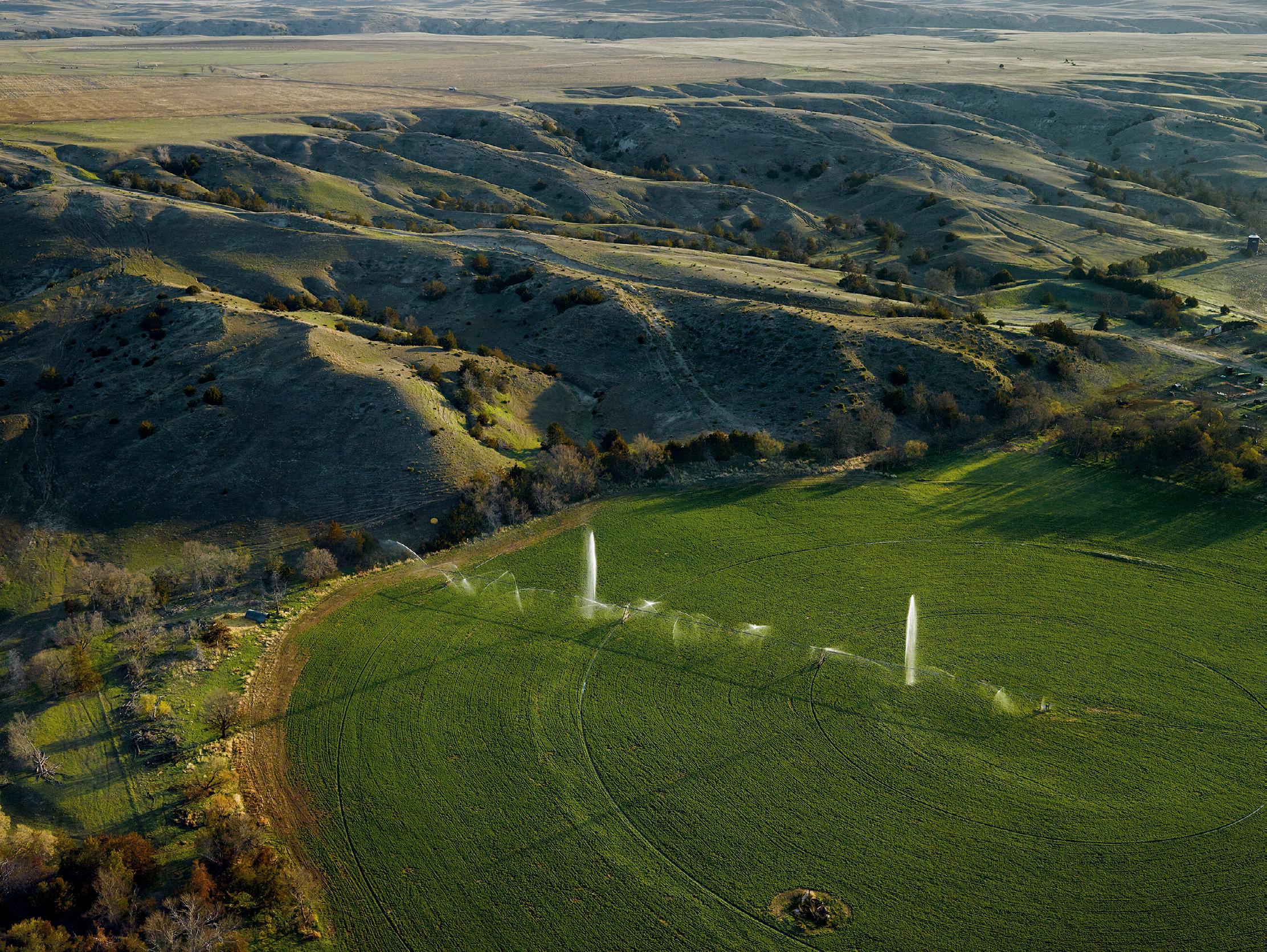
Broken Pivot, Cherry County, Nebraska
Pigment print, 2013; 30 × 40 inches
Sheldon Art Association
The Home Ground Collection: Gift of the artist in honor of Barry Lopez
S-1284.2022
The owners of this field are growing alfalfa, nestled against the broken land descending from the plateau above. Their irrigation pivot seems to be missing some sprinkler heads, marked by the cascades erupting along its span. In this part of the Sandhills, it’s a short reach down to the massive Ogallala Aquifer. However, due to the fragile sandy soil, most of the farming in this area is limited to growing seed potatoes, so the aquifer hasn’t been so severely depleted, unlike further south on the High Plains in the water thirsty cotton farms of Oklahoma and Texas.
AquiferWater, the treasure of the Earth, covers two-thirds of the planet. Some is visible, but much lies beneath the surface, hidden waters traveling through sand, rock, and gravel. These hidden seas are created in part when rain and snow trickle downward. Sometimes rivers dive deep and enter holds of water beneath even parched ground. These stores of water are called aquifers. The Ogallala Aquifer is the largest on the continent, reaching from the plains of South Dakota to Texas. The aquifer is declining by an average of 1.74 feet a year—over one million acre-feet—so excessive is the demand for agricultural and domestic purposes. In places in this region the land is actually collapsing. Native American people of several tribal traditions have long said that prairie dogs “call the rain.” Like all Earth’s waters, aquifers rise and fall with the moon, and as it turns out, this slow, strong pumping in the aquifers beneath prairie dog towns is what draws rainwater into those aquifers, replenishing them. Where prairie dog holes have ceased to exist, due to land development that has destroyed their habitat and the slaughter of prairie dogs for sport, the soil has become so hard rain can no longer reach the aquifer. The rain in fact has disappeared.
—Linda Hoganborn Boulder, CO, 1954
Loveland Pass, Colorado

Pigment print, 1994; 12 × 17 9/16 inches
Sheldon Art Association
The Home Ground Collection: Gift of the artist in honor of Barry Lopez
S-1255.2022
My pictures concentrate on landscapes that lie between the extremes of wilderness and metropolis—places most of us overlook because they are too familiar or because they do not fit conventional standards of worthwhile scenery. Natural beauty and human intervention sometimes seem to balance in landscapes such as these, if only briefly. In the most ordinary places, and even in landscapes threatened by industry or urban sprawl, there can be a subtle underlying peacefulness. On good days, it is possible to sense this calm beauty and to feel a deep belonging and hope.
A bench running along a slope, parallel to a valley below, is called a shoulder, as is a short, rounded spur on a mountainside. The term is also used to designate the crease in a glaciated valley where its steeply eroded lower slopes meet the gentler angle of its upper slopes, land that remained above the ice flow. The margins of a road are also called shoulders, if they’re flat enough and wide enough for a vehicle to pull over safely.
—William Kittredgeborn Minneapolis, MN, 1952
Following the Route of the Keystone XL, Syncrude Tailings Pond, North of Fort McMurray, Alberta

Pigment print, 2017; 22 × 28 5/16 inches
Sheldon Art Association
The Home Ground Collection: Gift of the artist in honor of Barry Lopez
S-1256.2022
Barry Lopez wrote, “Your Pipeline work. Holy. It confirms me in my resistance.” I never discussed the work with him, or asked about his comment, but from the tenor of our conversations over many years I know he saw the holy not only in the very remote and wild places he had experienced, but also in peopled, unprotected, unspectacular, and very ordinary places like the country the Keystone XL pipeline would cut through. My resistance, and certainly it was his, is to the relentless and seemingly remorseless defilement of people and place.
South of the treeless Arctic tundra, a forest shawl wraps eleven percent of the Earth’s northern terrestrial surface. This circumpolar boreal forest is white spruce-dominated, carpeted with lichens, moss, orchids, heaths, quilted with peat bogs, and cut by cold, silty rivers. In Crossing Open Ground , Barry Lopez describes one view of this landscape: “a backdrop of hills: open country recovering from an old fire, dark islands of spruce in an ocean of Labrador tea, lowbush cranberry, fireweed . . . each species of leaf the invention of a different green: lime, moss, forest, jade.” Boreal forces shape this forest: hot summers of endless daylight; frigid, dark winters; spring floods; permafrost; cycles of insect infestation and fire that decimate vast acreages. Yet fauna thrive: red squirrel, mink, moose, bear, wolf, lynx, marten, red fox, vole, muskrat, beaver, grouse, ptarmigan, porcupine, caribou, snowshoe hare, salmon, sheefish, whitefish, northern pike. And flora: spruce, tamarack, paper birch, quaking aspen, balsam poplar, blueberry, crowberry, Labrador tea, willow, cranberry, saxifrage, prickly rose. Indigenous people, to this day, rely on an intimate knowledge of geography to subsist on these animals and plants. Some nonNatives also pursue this intimate geographic knowledge of the boreal forest. For several years, the poet John Haines homesteaded in the boreal forest south of Fairbanks, Alaska, hunting and trapping for subsistence, receiving the forest’s spiritual and artistic sustenance. Of this time Haines wrote, “I am living out a dream in these woods. Old dreams of the Far North.”
—Eva Saulitisborn Chicago, IL, 1942
Canyon del Muerto, Arizona
Gelatin silver print, 1987; 12 13/16 × 18 3/8 inches

Sheldon Art Association
The Home Ground Collection: Gift of the artist in honor of Barry Lopez S-1258.2022
Looking into the deep space of Canyon del Muerto in Arizona, it was immediately clear to me that the early morning shadows and strong sunlight were creating a structure I wanted to work with. The image on the 5 x 7 inch groundglass of my view-camera, appearing upside down and reversed under the dark cloth, clarified what I had hoped to see—a view encompassing both depth and expansiveness. Technical details do not explain how some images allow us to understand a landscape more clearly, but I am convinced that abstract elements within a photograph can provide a structure that enables the picture to surpass mere description or fleeting drama.
Canyon
Canyon is a general term with a heady array of specifics. It may be as “simple” as a cleft between steep walls or as complex as the Grand Canyon or Mexico’s Barrancas del Cobre—miles across, layered in their depths like ragged, inverted cordilleras. In the Southwest, canyons are assertive landscapes. Aridity sharpens their bones. Rivers may run through them—open arteries in a carapace of rock; others flow only with blow-sand and chokestones. Canyons come blind, box, side, slot, hidden. They stair down and pour off. They gooseneck. They hang. Muley Twist, Desolation, Snap, Lavender, Blue Canyon, Rain Canyon—canyons are where you want to live merely on behalf of their names. The Hopi word pösövi means “canyon corners,” as if one quirky, prismatic facet at a time were all you could manage in this seemingly irrational geography of space and rock.
—Ellen MeloyJEFF RICH
born Atlanta, GA, 1977
Slough and MS-25 Bridge, Iuka, Mississippi , from The Watershed Project Pigment print, 2013; 19 × 23 13/16 inches
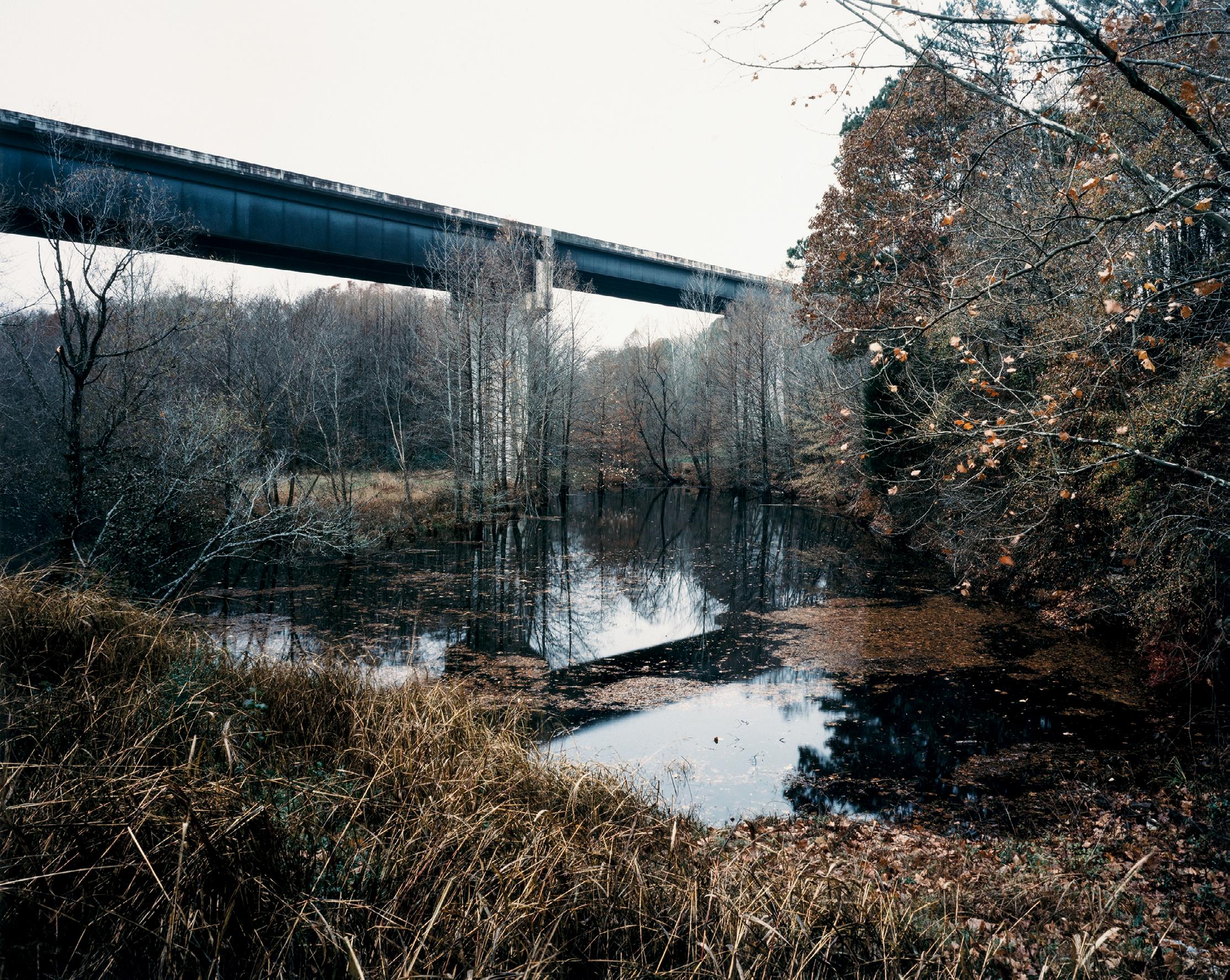
Sheldon Art Association
The Home Ground Collection: Gift of the artist in honor of Barry Lopez
S-1260.2022
The Tennessee River Basin of the twenty-first century is a place of contrasts. Hidden around every river bend is something unexpected. Around one you’ll find a threatened fish and mussel species hatchery, while a few miles down the river you’ll come upon Oak Ridge National Laboratory, established in 1942 as a Manhattan Project site, where it produced the uranium-235 used in the assembly of the world’s first atomic weapon. And if you return to Swan Pond Road, all that is left of the Guptons’ farm is a newly landscaped clearing that is paved with walking paths.
A slough—also slow, slew, sloo, slue—is a narrow stretch of sluggish water in a river channel, inlet, or pond. A slough can also be a marsh, swamp, bayou, or any soft, muddy, or waterlogged ground. The great, flat city of Chicago is built on filled sloughs, or swampy bottomlands. Slough is also a verb, meaning to mire in a slough or swamp, and “to be sloughed” can mean “lost in a swamp.” Used as slang, “to slough in,” or “slough up,” is to arrest or imprison, to be inhibited, or bogged down. Nineteenth-century travelers reported horses sinking up to their necks in sloughs that looked no deeper than a puddle. Prairies, especially those radiating from the Mississippi, are (or were) riddled with sloughs, and sloughs run along the St. Paul, Pacific, and Sioux City Railroad tracks and other elevated rights-of-way, providing ideal homes for muskrats.
—Donna Seamanborn Atlanta, GA, 1979
Littoral Drift #1223 (Chattahoochee River, Atlanta, Georgia 09.26.18, Draped on Long Island at Confluence of White Water Creek)
Dynamic cyanotype, 2018; 11 15/16 × 9 inches

Sheldon Art Association
The Home Ground Collection: Gift of the artist in honor of Barry Lopez S-1262.2022
This work stems from my fascination with the nature of our relationships to the landscape, the sublime, time, and impermanence. Entitled Littoral Drift , a geologic term describing the action of wind-driven waves transporting sand and gravel, the series consists of camera-less cyanotypes made in collaboration with the landscape and the ocean, at the edges of both. The elements that I employ in the process— waves, rain, wind, and sediment—leave physical inscriptions through direct contact with photographic materials.
Littoral means of or pertaining to the shore, and littoral drift is material moved along a beach by a littoral current, a current carried by waves breaking at an angle to the shoreline and moving parallel to and adjacent to the shoreline within the surf zone. Littoral drift is, then, the material waves and wind work to shape coastlines, depositing and rearranging the sand, rock, gravel, bits of shell, and other debris to form shoals, spits, bars, and beaches. One example of a high-littoral-drift zone is California’s Santa Cruz Harbor, where up to 327,000 cubic yards of drift is deposited each year, enough to cover a football field to a depth of 184 feet.
—Gretchen Leglerborn Bethlehem, PA, 1954
Hells Canyon Creek, Snake River Drainage
Gelatin silver print mounted on board, 1999; 7 1/2 × 9 1/2 inches

Sheldon Art Association
The Home Ground Collection: Gift of the artist in honor of Barry Lopez
S-1264.2022
Place names evoking Satan and his minions suggest a dominant attitude on the part of settlers of European origin towards the “New World” and it is no coincidence that the less the land resembles Europe, as one moves from east to west, the more the name of the Devil appears. Desert lands in particular were seen as desolate wilderness, and, in the Judeo-Christian tradition, wilderness is cursed; it is the land of fear, populated with demons. Environmental historian Roderick Nash wrote: “The identification of the arid wasteland with God’s curse led to the conviction that wilderness was the environment of evil, a kind of hell.”
In nineteenth-century America, hell was a generic term for a rough or difficult stretch of country, such as the wildly eroded Hell’s Half-Acre in Wyoming. Similarly, the thermal features of Yellowstone Park were originally called Coulters Hell, after the explorer and mountain man John Coulter. The word was also used to designate the most lawless sections of frontier towns like Fort Worth and San Antonio, as well as particularly dangerous and rough parts of the urban landscape, such as Hell’s Kitchen in New York City. In the southern Appalachians, a hell is a dense, extensive growth of laurel or rhododendron. Horace Kephart, in Our Southern Highlanders , defined the term this way: “A ‘hell’ or ‘slick’ or ‘wooly-head’ or ‘yaller patch’ is a thicket of laurel or rhododendron impassable save where the bears have bored out trails.”
—Charles FrazierMIKE SMITH
born Heidelberg, Germany, 1951
Blue Hole, Carter County, Tennessee

Pigment print, 2011; 7 1/2 × 9 3/8 inches
Sheldon Art Association
The Home Ground Collection: Gift of the artist in honor of Barry Lopez S-1266.2022
For over thirty years a print made and given to me by Cole Weston of his father’s image of Charis floating in the viaduct hung in my office and later my studio at East Tennessee State University. Edward Weston’s famous floating figure is arguably better than my 8 x 10 inch fuzzy floaters. But the elevated vantage point, a handful of supporting actors, and the presence of a wider landscape establish a social context to my picture, which was the purpose of this project. I believe the father’s watchful (or more likely, suspicious) eye on me helps date the image.
Blue holes, deep depressions filled with water sometimes so intensely blue they appear bottomless, are one of the spectacular formations of karst topography: limestone bedrock sculpted by the dissolving effects of rainwater or groundwater. Though there are many North American examples, such as the Blue Hole in northwestern Ohio, most famous is the Blue Hole sixty miles off the coast of Belize, a haven for deep-water scuba divers. Located in the aquamarine shallows of Lighthouse Reef, this blue hole is a near-perfect circle more than a thousand feet across, its deep indigo water a result of its four-hundred-foot-depth. Though now submerged, it formed on dry land, either as a cavern whose roof finally collapsed or as a sinkhole. Then melting glaciers at the end of the Ice Age flooded continental margins along the Atlantic coast, turning this land formation into one in the sea. The eerily pure color of a blue hole many not always signal depth: A shallow blue hole in the New Jersey Pine Barrens sometimes called the Jersey Devil’s Bathtub owes its saturated hue to the purity of strongly upwelling spring water—undoubtedly also the force that created the formation.
—Pamela Friersonborn New York, NY, 1944
Rim View Trail, Page, Arizona, August 1983
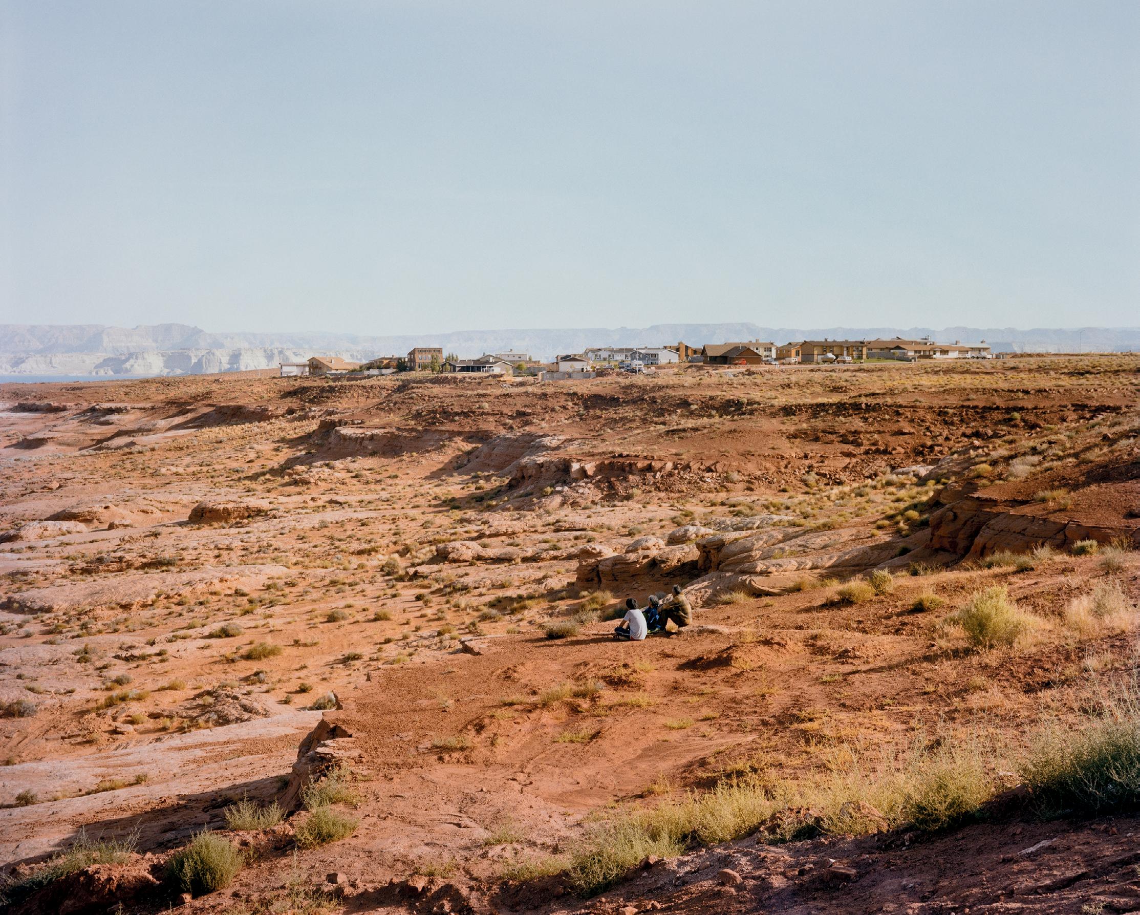
Digital chromogenic development print, 1983; 16 9/16 × 20 11/16 inches
Sheldon Art Association
The Home Ground Collection: Gift of the artist in honor of Barry Lopez
S-1267.2022
Page, Arizona was founded in 1957 as a community for workers and their families during the construction of the Glen Canyon Dam on the Colorado River. Six decades after it was built, the dam and the body of water that it formed, Lake Powell, remain controversial. In 1981, Edward Abby said “Surely no man-made structure in modern American history has been hated so much by so many, for so long with such good reason as the Glen Canyon Dam.” As the worst drought in 1200 years continues in the West, the future of Glen Canyon Dam and consequently of Lake Powell becomes unclear. In time, residents of Rim View Trail may look out at the wondrous Glen Canyon as it was before the digging began.
An extensive area of nearly level land that rises abruptly above a surrounding landscape on at least one side, known also as tableland, is called a plateau. Canyons often encroach on or dissect the plateau’s flat surface, and it is distinguished from similar formations by its breadth—the Columbia lava plateau of eastern Washington and Oregon, for instance, is different from the isolated prominence of a mesa, is larger than a butte, is flat, and presents a dramatic vertical fall on all sides. Plateau also designates the American Indians who inhabited the plateau country between the Cascades and Rockies, and the foodgathering culture there.
—Larry Woiwodeborn Milwaukee, WI, 1949
Sand Mountain, Nevada

Pigment print, 1980; 14 1/16 × 55 15/16 inches
Sheldon Art Association
The Home Ground Collection: Gift of the artist in honor of Barry Lopez
S-1202.2022
Dunes occur from Indiana to Mars. Those in the western United States don’t rival the Sahara’s, but they are set like gems wherever they occur. Nevada’s Sand Mountain is smaller than most dune fields, but more beautiful than any I have seen. It is luminous, glowing in an already shimmering sage desert. This picture pays homage to Timothy H. O’Sullivan’s 1867 view made while working on a federal survey of the West, as I was while making this panorama a century later. O’Sullivan’s vantage point faces northeast from the toe of the dune; mine from the south looking north.
Wind and a generous supply of granular material are needed to make a dune, which can arise in arid places or along the shore of a lake or ocean, or even along the banks of a river such as the Arkansas River in western Kansas. Dunes are classified by their shape, which is a function of sand and topography interacting with the wind. Sand particles begin to move when wind velocity reaches about eleven miles per hour. The particles move by skipping over the ground, a motion called saltation. The grains are kicked briefly into the air and then fall with a forward glide, hitting other grains on the ground and putting them into motion as well. Relatively fine sand collects this way to produce dunes with a clearly marked crest that drops off to a steep slip face
on the sheltered, leeward side. Coarse sand produces rounded dunes without these features. One of the largest dune fields in the United States is the Algodones Dunes, extending southeasterly more than forty miles from Glamis in Imperial County, California, to the southwestern corner of Arizona and into Mexico. The highest dune on America’s East Coast is the 140-foot-high Jockeys Ridge on the Outer Banks of North Carolina; it’s an example of a coastal dune. Sometimes, continuing wind causes dunes to move— as at White Sands, New Mexico, where the dunes of loose gypsum sand move twentyfour feet a year. If the winds and sand supply diminish, an advancing or migrating dune might acquire a covering of vegetation and settle down as a fixed or stabilized dune.
The dune environment often has unfamiliar acoustic properties and dune-created wind patterns that sculpt the features of the dune field. Wanderers among dunes may feel a thrill in their alien presence, be enchanted, or, like early saints, see visions in mirages and hear voices in the falling sand.
—D. J. Waldieborn Toledo, OH, 1956
Comb Ridge, Bureau of Land Management, Utah

Pigment print, 1989; 7 × 9 inches
Sheldon Art Association
The Home Ground Collection: Gift of the artist in honor of Barry Lopez
S-1268.2022
I live in the West because of its topography and its abundance of federal public lands. The eleven western states contain eighty-five percent of all the public lands in the continental United States, and almost one-half of these states’ total area is held in the public domain. From the drama of redrock canyons and alpine mountaintops to grassland meadows and arid deserts, our public lands contain beauty that any of us can freely access and engage. We hold this land in common, and what we decide to do with it is an expression of our values and who we are.
A comb ridge is a sharp mountain crest eroded by glaciers or water to look jagged, saw-toothed. Because of the pinnacles and notches along its crest, a comb ridge—the expression is often used interchangeably with arête—resembles a rooster’s comb. It is the acute and rugged divide between two aggressive glacial arenas. In the dryland west, a comb ridge is a single fold of upturned rock that has sharp teeth cut by water erosion. An example is Comb Ridge, near Bluff, Utah. Other comb ridges can be seen in Grand Staircase–Escalante National Monument, Utah.
—Robert Morganborn Chicago, IL, 1948
Chicago (Chicago River. View East from the Roof of the IBM Building)

Gelatin silver print, 1989; 13 9/16 × 16 15/16 inches
Sheldon Art Association
The Home Ground Collection: Gift of the artist in honor of Barry Lopez
S-1270.2022
The cityscape of Chicago presents little evidence of the natural landscape that existed here before its founding. The city is very flat, almost all the streets are plotted on a precise grid, the lakefront has been filled and shaped, and the Chicago River straightened and its flow reversed. It is an unnatural landscape. But Chicago’s founding and success relied on the river’s potential for travel from the Great Lakes to the Mississippi, and the city has cherished its lakefront. More importantly, Chicago is where I’ve lived my life, so I’ve always believed it is the landscape I should photograph.
A portage is a path or passageway along which canoes or other small boats and goods are carried around obstructions in a stream or between navigable bodies of water. A portage is also a place where such a land route begins or ends, and it refers, too, to the act of carrying or transporting canoes and goods overland, usually to skirt unmanageable rapids or waterfalls. So established a fact of transportation were portages, there existed a portage collar, a strap that passed around the forehead and attached at each end to the burden being carried, which was then supported on the back. A portage was no picnic, but it made traversing the wilderness possible—eventually there were even portage railroads. Most portages were only known locally, but one became famous: the Chicago Portage, which made possible the crucial water route from the Great Lakes to the mighty Mississippi.
—Donna Seamanborn Portland, OR, 1947
Palomino Lake, Malheur County, Oregon
Gelatin silver print, 8 1/2 × 18 5/16 inches

Sheldon Art Association
The Home Ground Collection: Gift of the artist in honor of Barry Lopez
S-1272.2022
In the course of taming and civilizing the West, photographic concerns turned to other issues—the land as a land of opportunity, a source of scenic splendor, a threatened wilderness, a bombing range, a strip mall, a source of pollution. My focus: the land (physically) remains, and we ought to try to understand what it is. That the land is beautiful is the strongest clue I have towards a greater sense of unity.
The extension or stretching of the Earth’s crust normally results in downfaulted valleys, or grabens, and upfaulted mountains, or horsts. North America’s huge geological province of north-south–oriented mountains and valleys created in this way is known as basin and range country (roughly 400,000 square miles) and runs between northern Mexico and southeastern Oregon, and the Sierra Nevada of California and the Wasatch Mountains of Utah. It includes parts of all the major North American deserts—the Great Basin, Mojave, Sonoran, and Chihuahuan. Death Valley, on the Nevada-California border, reaches a maximum of 282 feet below sea level, while the Panamint Mountains just to the west rise to some 11,000 feet in elevation. At the foot of such snowy ranges as the Ruby Mountains in Nevada and Steens Mountain in Oregon, peat-bog marshes form despite the aridity of the basins, providing havens for migrating waterfowl. Runoff from Steens Mountain flows through glacial valleys to the Malheur National Wildlife Refuge and drains into a series of alkaline playas where the waters evaporate.
—William Kittredgeborn Jackson, TN, 1943
Allen’s Landing on Buffalo Bayou, Houston, Texas
Photogravure, 2001; 7 1/8 × 22 inches

Sheldon Art Association
The Home Ground Collection: Gift of the artist in honor of Barry Lopez
S-1199.2022
Most Houstonians are aware that Buffalo Bayou was crucial in the founding and early development of our city, but few have taken more than a passing glance at the stream as it winds its way through Houston. From the time I first photographed the Buffalo Bayou, over forty years ago, I wondered where and how the stream began. Did it come bubbling out of the prairie as a primordial spring, or was it formed by the gradual confluence of numerous little creeks and tributaries?
Bayou is a word that sounds French but is in fact of Choctaw origin, deriving from bayuk , meaning “small stream.” In recorded usage since 1818, bayou most commonly refers to marshy offshoots and overflowings of lakes and rivers in the delta of Louisiana and the Gulf area. In a region of mostly swamps and marshy prairies, the bayous are spaces of open water, sluggish or stagnant, often the abandoned channels of the river delta cut off into oxbow lakes in the river’s variorum history of trial and evolution. Bayou can also refer to a secondary channel, away from the mainstream, where the current is slower and the volume smaller. Sometimes a tributary is referred to as a bayou, as is any sluggish stream. The word can be said to refer to any slow water in a marshy area, if not dead water perhaps sleeping water, or dreaming water.
—Robert Morganborn Lancaster, PA, 1957
Hanging Valley, Brooks Range, Alaska

Gelatin silver print, 1996; 9 × 9 inches
Sheldon Art Association
The Home Ground Collection: Gift of the artist in honor of Barry Lopez
S-1207.2022
My first encounter with Barry Lopez was in the summer of 1987, reading Arctic Dreams while volunteering at a remote field station just above the Arctic Circle in Northwest Alaska. His very first story includes a description of taking walks in the late evening when the sun hung low in the northern sky, encountering ground nesting birds, and his act of bowing to them out of both respect and gratitude. When photographing, I have tried to adopt Barry’s sense of respect for the place, and often bow to the place, and thank it for allowing me to make the pictures.
A high valley that converges with, and breaks off abruptly into, a deeper valley, often over a cliff, is known as a hanging valley. Hanging valleys occur when glaciations or water flow erode the main valley to a depth well below that of its tributary valleys. A hanging valley might include a hanging glacier, or end in a waterfall such as Bridal Veil Falls in Yosemite or Bird Woman Falls seen from the Going-tothe-Sun Highway over Logan Pass in Glacier National Park. Seacoast streams that fall over sea cliffs, which result from erosions caused by wave action and tectonic uplift, emerge from hanging valleys. Washes in the American Southwest often form hanging valleys, such as the seventy-five-foot cliff where Johns Canyon ends above the gorge of the San Juan River in the Grand Gulch country of southern Utah.
—William Kittredgeborn Harvey, IL, 1957
Cache la Poudre River, Colorado , from the series Stillwater Gelatin silver print, 2000; 17 3/16 × 21 9/16 inches

Sheldon Art Association
The Home Ground Collection: Gift of the artist in honor of Barry Lopez
S-1274.2022
From its source as snowmelt on the Continental Divide to its confluence with the Platte on the eastern plains, the Cache la Poudre is in effect a “working” river. Overutilized by agriculture and recreation, threatened by the possibility of a dam, the waterway is the focus of much attention and debate along the Front Range of Colorado. Although many sites retain the marks of human occurrences, the river itself remains wild and full of possibility.
Stillwater is a term that describes a curious phenomenon of quiet water. In the United States over two hundred places are named Stillwater—including rivers, canyons, streams, ponds, even flats and towns. In the late seventeenth century one such town, bordered by the Hudson River near Saratoga, New York, was chronicled as a place where “the water passes so slowly as not to be discovered, while above and below it is disturbed, and rageth as in a great sea, occasioned by rocks and falls therein.” In the late 1800s the best-known city by this name, Stillwater, Oklahoma, formed near a back-eddied place on a creek. Lesser-known Stillwater towns in Nevada, Montana, and elsewhere also grew up around pools of tranquil water. Such cities, because of their names, are often presented as stereotypically tranquil places to live, as depicted in Richard and Florence Atwater’s Mr. Popper’s Penguins : “It was an afternoon in late September. In the pleasant city of Stillwater, Mr. Popper, the house painter, was going home from work.” Stillwater is a term also used by meteorologists in predicting storm surges. In deep water they look for the midpoint of the wave crest before it reels down; in shallow water they look for the trough and crest of the wave. The stillwater level is the highest water level measured if wave action were completely smoothed out.
—Elizabeth Cox