
Select ed w o r k sS hinavi
UrbanDesign Portfolio
adnaH
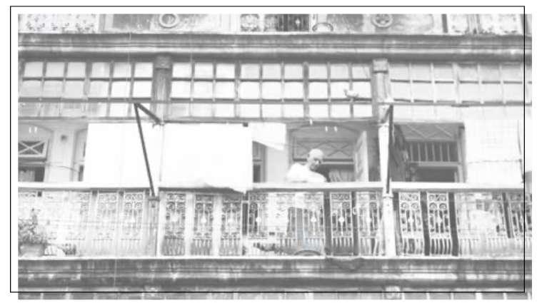
“Cities have the capability of providing something for everybody, only because, and only when, they are created by everybody.” - Jane Jacob
Dastur Meher street, Pune, India’ 17
Contents
1.
‘Re-imagining De-wallen’ Master thesis

2.
RWTH campus as a livinglab, Aachen Germany


3.
Re-purposing quarry regions in Istanbul, Turkey

4.
Tribal school and skill development center, Gujarat, India
1. ‘RE-Imagining De-Wallen’ Climate neutral strategy for the historic centre
Master thesis
Individual work
Softwares used: Qgis, Adobe CC & ArchiCAD, Adobe Illustrator & Photoshop
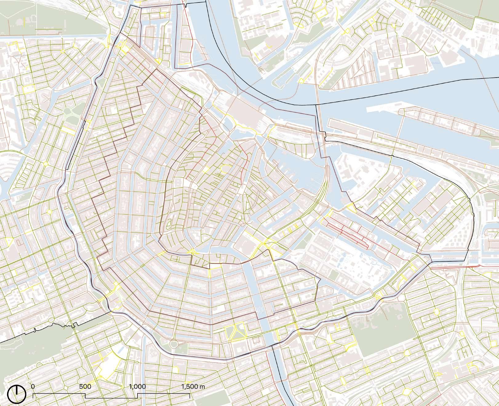
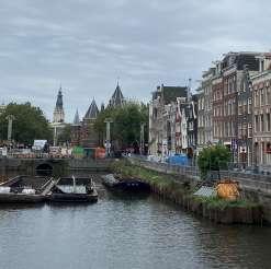
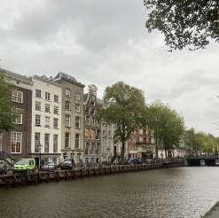
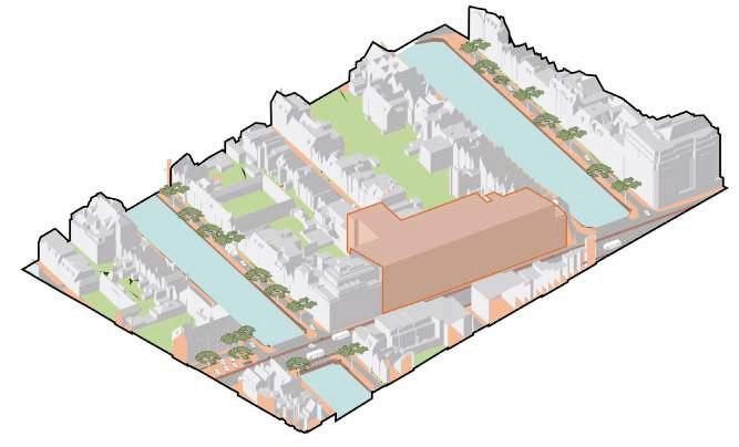
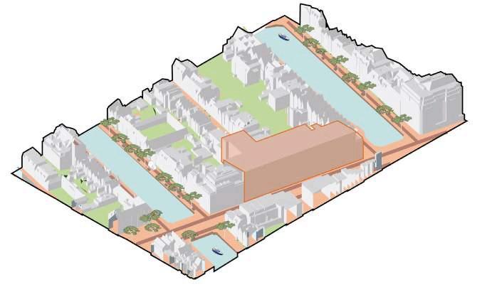
The imminent project for retrofitting of the decaying Quay walls presents the opportunity to rethink the the under-ground and above-ground assets of the protected ‘De Wallen’ area in Amsterdam. The project will focus on Mobility, Built Environment and Energy strategies to sequester carbon footprint for reducing the impacts of climate change for people and heritage. Implemtation of these strategies are shown in the focus area where streets and squares are ‘RE-imagined’ for the carbon neutral centre of tomorrow.
 Rijks museum
5% Streets
40% Streets
Streets
55% Focus Area
Vondelpark
along sqaures
between buildings
along canals
Current Scenario (2022)


Roads along canals
Roads between buildings
Roads along squares
Narrow roads between buildings
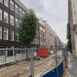
Ongoing construction
Construction on bridges
3. 2.
4. 1.
4. 2.
3.
1.
Central station
museum


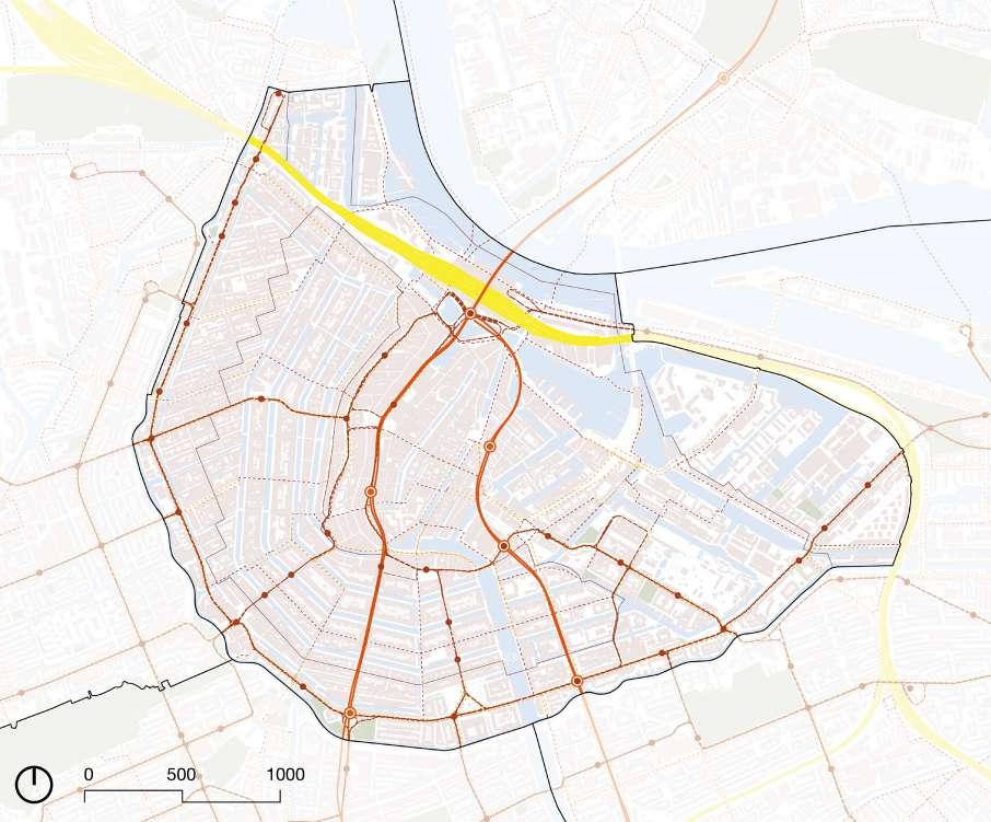
18% of the total carbon emission is from the Mobility sector. Thus the strategy for ‘De Wallen climate neutral 2050’ is based on 3 modes:
Avoid the need for motorised travel
Improve otheer tranport modes
Shift to sustainable models

Metro stop


Tram stop
Car sharing districts
Car as ‘guest’ design
Limit city streets

Surface parking limitation

Bike & Pedestrians first

Logististics via waterways

Charging point

Car sharing points
Avoid
Rail connection
Bike priority lane
Single Bicycle connection
Improve Shift
TOOLKIT
STRATEGIES &
Disclaimer: Out of 3 categories, only mobility is shown in this document. Contact the author for the full report.
Noordekerk Neighbourhood Transformation
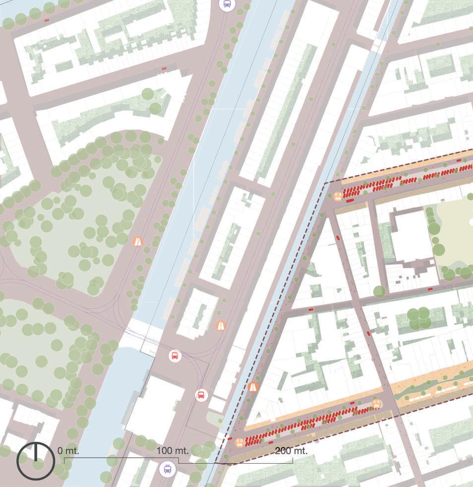
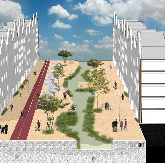
The project commences with the planned renovation of Leidenstraat in 2026, a pivotal moment for the community. Underground infrastructure upgrades ensure futureproofing with fiber and electric cables, linking the street to sustainable energy sources within the district. Embracing a car-free ethos, the neighborhood embraces various transportation sharing initiatives.
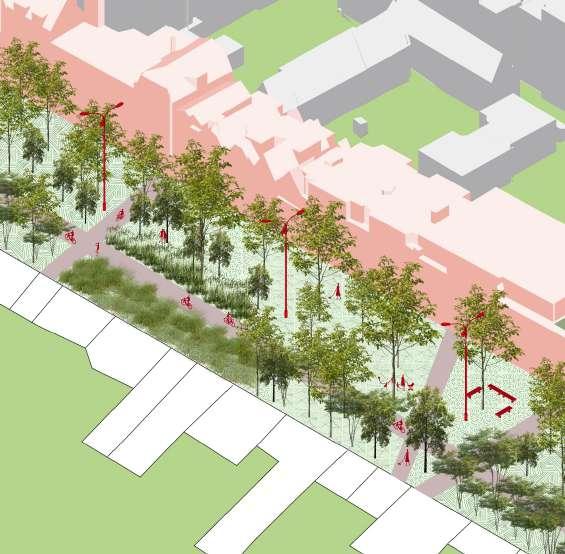
In the subsequent phase, Westerstraat transforms into Westermaarkt, a vibrant hub for community gatherings. Events like yoga day, in partnership with the Dancing Monkey Gym, and weekly second-hand clothing and food markets animate the space. Westermaarkt evolves into a bustling center for retail and communal activities.
Meanwhile, residents of Leidengracht embark on a green initiative, expanding their community gardens into a charming pocket park. Now equipped with bicycle accessibility and logistics support, it serves as a verdant oasis for locals.
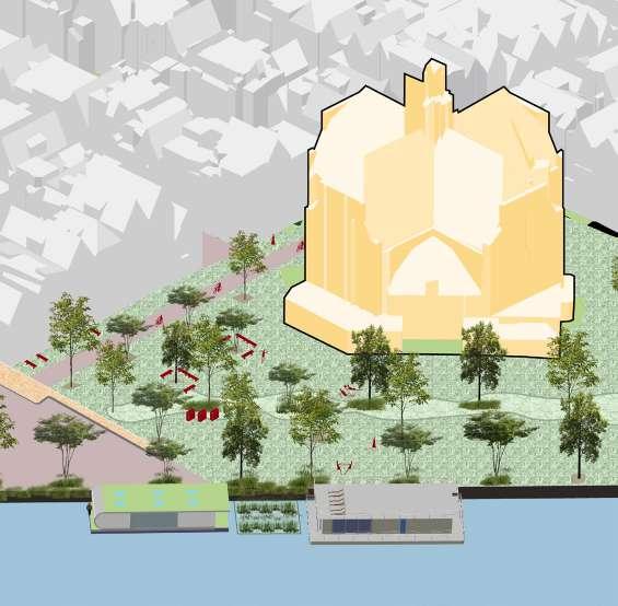
In a bid to enhance ecological and social engagement, the municipality takes action to remove surface parking near religious and cultural landmarks. This repurposed space fosters experimentation in ecological practices and community initiatives. Additionally, the integration of Noordemarkt with green houseboats, maintained by residents, adds to the neighborhood’s unique charm and sustainability efforts.






 WesterstraatTheoThijssenSchool
Leidengracht Lijnbaansgracht
Gym
Marnixkade
1.
2.


Coffeeshop/ Restaurants Hidden Garden NGO Leidengracht Leidenstraat 1 2 2 3 2.
Noorderkerk Noordmarkt Westerstraat Prinsengracht Keizersgracht Boomstraat Palmdwarsstraat WesterMarkt
Albert Heijn
3.
2. Campus as a Living lab, Nature based solutions, Aachen
Academic project
Group members: Mariia P, Safiya R, Shivani H, Wasila P, Zainab C Softwares used: Qgis, Adobe CC, ArchiCAD, AutoCAD, Grasshopper
This project opens an inspiring new chapter of how RWTH could lead by example in the global race of sustainable university campuses by adopting the framework of a Living Lab. This Living lab, a hub for co-creation and real life experimentation can solve our complex societal issues and improve the validity of our outcomes. In turn, allowing us to replicate and upscale the solutions. It brings together stakeholders from various fields of study, research, and industry to co-work on urgent issues in specific addressing the issue of sustainability we all face today.
The tools used to tackle this are Nature Based Solutions. The project has identified the problematic areas at Campus Mitte that are in urgent need of interventions. Through an extensive research, analysis, and the process of trial and error, we have proposed design solutions for the selected sites. This is followed by the development of a Toolkit, an essential part of a Living Lab, that aims to guide other campuses in creating a sustainable university campus.
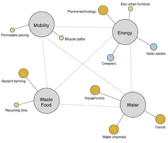

 Uniclinik
RWTH’S Living Lab Reflecting and learning Real life complex problem
Campus Melaton


Urgency Replicating and upscaling
& stakeholders Identify Real life co-creation
Social / sustainable Objective
Location
Campus Mitte
Campus West
Uniclinik
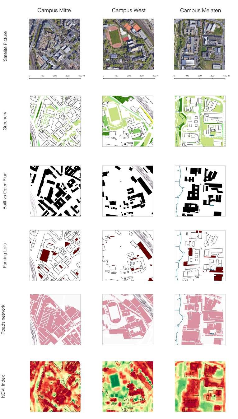
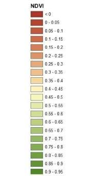
Regarding this analysis we selected 4 cells of was identified that still Mitte is the most each part of the RWTH, that represent 4 different accessibility level (from the most accessible to the least).
During the comparable analysis it accessible area, but has the most dense and complex structure, big amount of parking lots and less vegetation.


MORPHOLOGY
COMPARITIVE
ANALYSES
NATURE BASED SOLUTIONS: Campus Mitte
TOOLKIT:
Building scale Intervention
BSI01 Green roofs
BSI02 Green walls
BSI03 Urban rooftop farming
BSI04 wetland roof
BSI05 Vertical farm
BSI06 Living walls
Public scale Intervention
PS01 bioswales
PS02 pocket parks
PS03 Car parked with green layer
PS04 Eco-furniture
PS05 Garden beds
PS06 Twitter tree
PS07 Facilities for birds and fauna
PS08 Community Garden
Intervention for blue infrastructure
BI01 Gutters
BI02 Ditches
BI03 Water ground infiltration
BI04 Porous Paving
BI05 Aquaponic
BI06 Rainwater harvesting
Intervention for transport infrastructure
TLI01 Green roof canopy
TLI02 Green noise barrier
TLI03 Green corridor
TLI04 Turf mounds
TLI05 Green bus shelter
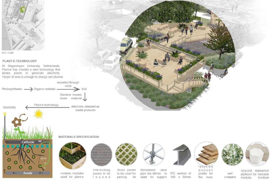
TLI06 Plant e-technology
Intervention for habitat biodiversity
EHB01 Beehive Gardens
EHB02 Hotel for insects
EHB03 Butterfly park
EHB04 Gardens of worms
EHB05 Bird sanctuary and gardens
Refer Catalouge fo NBS, Energy & Urban Planning Design Studio at the Politecnico di Milano (2017-2019)

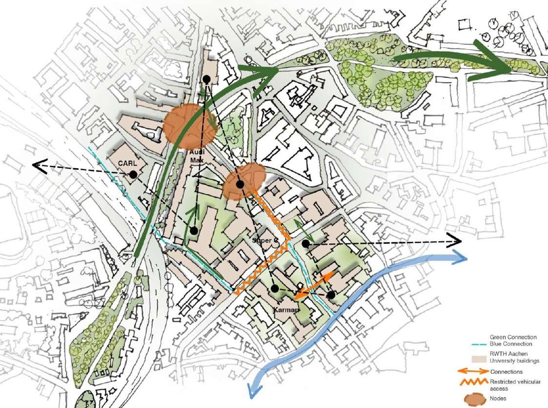
MASTER PLAN
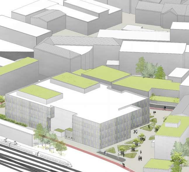
The Master plan is a general plan of all connected nature-based solutions interventions, that are located on six areas of interventions:
1) Mensa Academica;
2) C.A.R.L. Auditorium;
3) Talbot Parkplatz;
4) Miscellaneous;
5) Karman Auditorium;
6) Maschinenbau Plaza.
By connections in this Masterplan are considered pedestrian, bicycle, green and blue connections, which create the holistic pedestrian- and eco-friendly urban system.
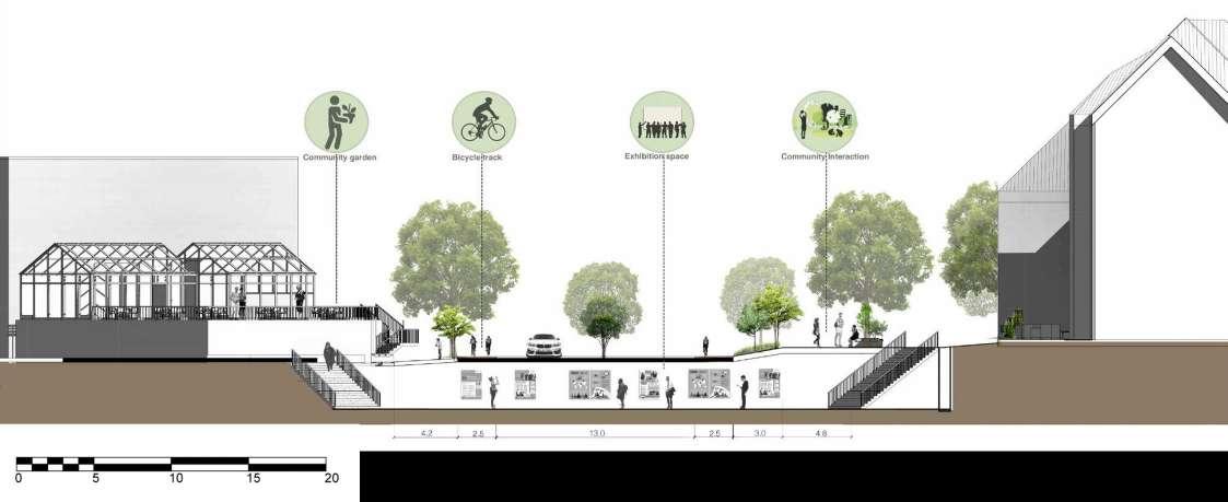 Section through Mensa crossroad
Roof top of Sparkasse bank
BSI01 Green roofs
BSI05 Vertical farm
BI06 Rainwater harvesting
PS05 Garden beds
PS06 Twitter tree
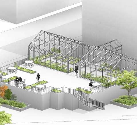
Rejuvinating spaces around Mensa
BSI01 Green roofs
PS05 Garden beds
PS04 Eco-furniture
TLI02 Green noise barrier
TLI04 Turf mounds
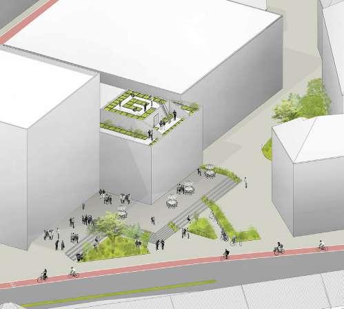
BI06 Rainwater harvesting
PS06 Twitter tree
NBS at C.A.R.L
PS04 Eco-furniture
TLI02 Green noise barrier
TLI04 Turf mounds
1.
2.
1.
RECLAIMING TALBOT PARKPLATZ: Campus Mitte
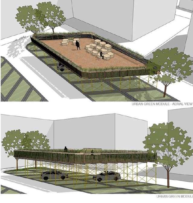
Urban Hives designed by Natahlie Harb in Beirut in 2018, seeks to reintroduced the urban garden into these parking lots, and potentially into other public, hard-surfaced spaces. Urban hives is conceived as a module that raises above 2 cars.
Modules can be multiplied or reduced to suit the site and easily assembled and disassembled for maximum flexibility. Thus, the parking lot retains its commercial use, but is also transformed into a site for communal gardening and food growing activity.
3.


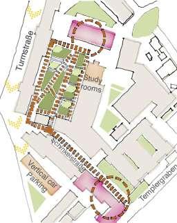
Talbot development is planned in 4 phases:
In Phase I, Reiff Museum is connected to Seminar Building. Urban hives are added on one side, while other side has surface parking.
In Phase II, One more connection is created between Reiff Museum and Seminar Building. Followed by green lawn and gentle reduction of car parking.
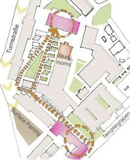
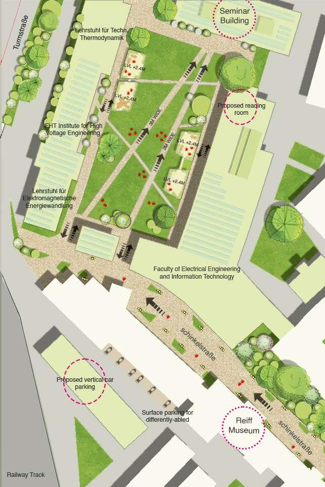
In Phase IV, Talbot parkplatz will be transformed into a recreational space for social interaction and for multiple activities. Vertical car parking is also proposed. Phase I Phase II Phase III Phase IV
In Phase III, addition of more green space and urban hives. Also, temporary study rooms are shifted on the roof of Aerodynamics institute and a new space for surface parking.
3. Re-purposing quarry regions
Istanbul, Turkey
Academic project
Group members: Shivani H, Wasila P & Said K Softwares used: Qgis, Adobe CC, ArchiCAD, AutoCAD
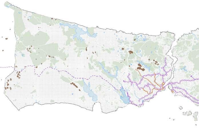
Destructive landspaces is an evident issue across globe. This project focuses on such landcapes in Istanbul, Turkey. Mining activities are very prevelant in Istanbul and has become a part of urban sprawl. The project here discusses about peri urban and rural landscape’s tranformation into a resilient and community oriented space. Landscape Resilience is an interconnected network of several sectors including social, ecological, economic and infrastructural resilience. The goal here is to shift profit driven economy by redevloping quarries of Cendere, Cebice and Catlca regions to a people ecological centric growth.
The goal is to shape the transition from a profit driven economy to a people ecologic centric growth.

Curret trend Profit minded Strategy resillience thinking Vision Evolutionary resilience
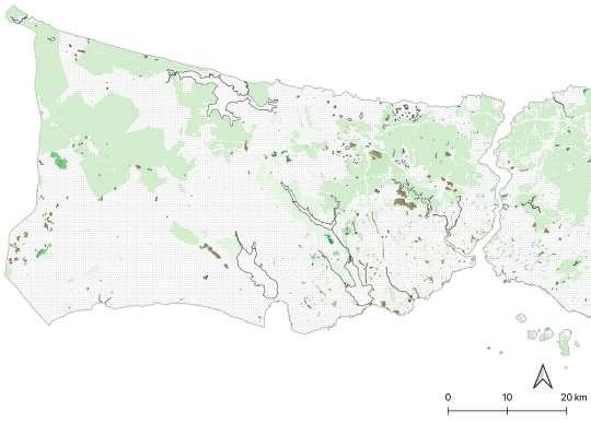
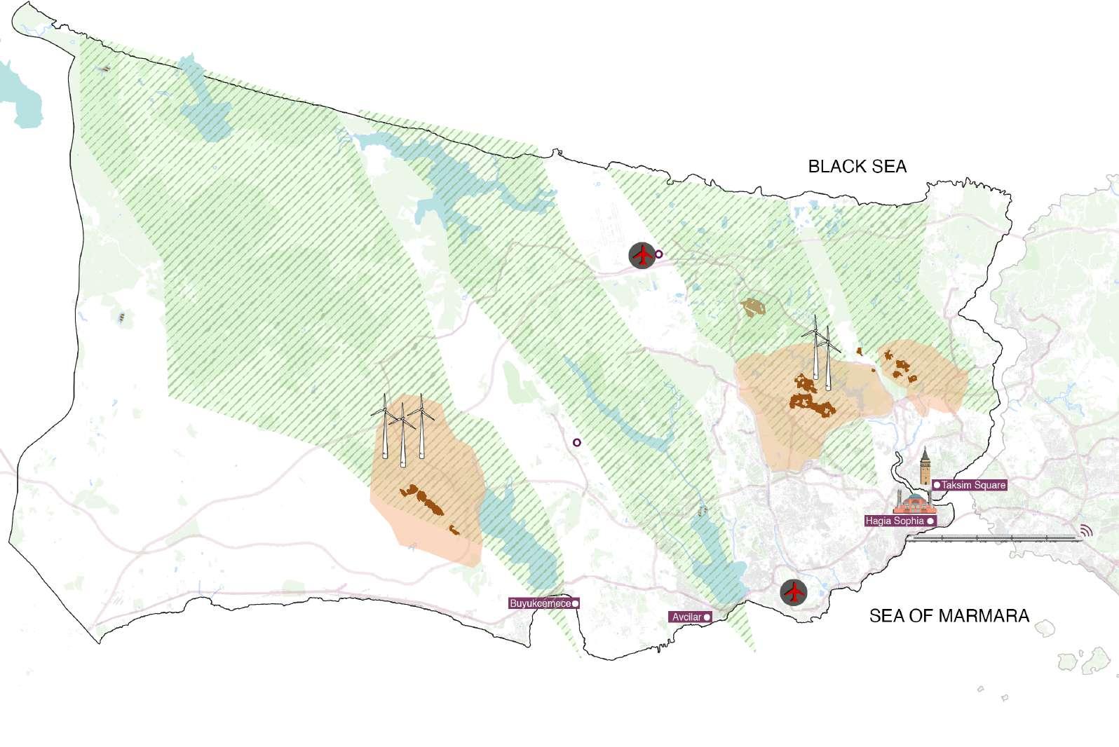
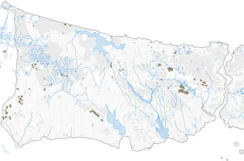
Quarries impacting green-blue and cultural landscape


SDV Loop
New metro routes



GlobalTo
Lake Durusu (162 million m3) Lake Büyükçekmece (16 million m3) Sazlıdere Dam (91.3 million m3) Küçükçekmece Lake 80 million m3) Küçükçekmece Lake 80 million m3) Taksim Sqaure Kuzuludere şelalesi (Naturral reserve) Around Durugol lake Sazlıbosna (Farmland) Arnavutköy Forest (National forest) Belgrad Forest (Recreational Areas) Taksim Sqaure
Planet Planet Planet People People Prosperity Prosperity People Profit


SDV stops
Metro stops

B i o Farm oCliving C e eredn C e ecib
ParkourA r e an Ç a talca Farmi n g Farmer ’ s tekraM Health c e retn C ommunity retnec


Improve Food supply | Empowering Farmers Farming innovation center


C o-working


Empoweringyouth



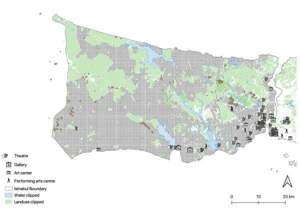
Istanbul is a part of the global green belt connected to the rest of the Turkey and other European countries. Mining activities are declining the quality of green and blue infrastructure. Wherelse, cultural landscape are far away from the urban centers and it’s density decreases as we move towards urban fringes.
ourism Hlaeht Tiruoms
(i) Rail network: trams and metro network


(ii) Rail network: trams and metro network


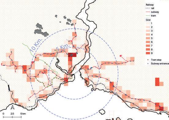
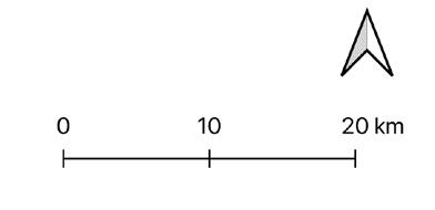
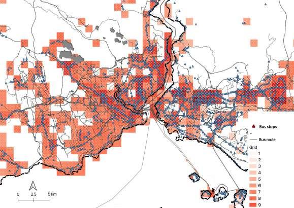
As analysed from the maps related to Rail connectivity we can see the network is more dense in the historic areas of the city. Also from the accessibility map we can see that there are areas above golden horn where only 2/3 of the tram and metro stops are accessible in 1200 mt range. Also, there are less tram stops then metro stops across the city. From the maps we can see that the road network is dense in Istanbul compared to Railway networks. So thus, the bus connectivity is more accessible than trams or metro in the city. More number of stops are accessible in the city center. Also, from individual quarry areas the bus stops are accessible for pedestrians within range of 400 mt. But because of the traffic issues in the city it takes more time to access places via bus.
Tram Subway Inter-rail connectivity 15Minutes 10minutes 1hr 55minutes 30 minutes Taksim Sqaure Motorway P/S/T road Bus stops Nearest stops 5Minutes 2minutes 5minutes 2hr 46 minutes 41 minutes 1hr6minutes 5minutes Taksim Sqaure
Mobility: Rail network(i) v/s Road network(ii)
VISION: Strategies and Toolkit
Sustainable resource usage

Knowledge economy

Autonomous vehicles
Local economy

Employment Opportunities

Multi functional landuse
Lansdscape Resilience
Integrated blue-green network
Ecological Economical

Smart Urbanism
Socio- cultural

Welness for all

Health tourism
Climate adaptation

Biodiversity Conservation
The vision of this project is to create a resilient and sustainable future of stone mining areas after 2030 in Istanbul European Peninsula. Our focus is on socio-cultural, ecological resilience, sustainable transportation and energy at a landscape scale. Hence we define landscape resilience as the ability of a landscape to sustain desired socio-ecological functions, robust native biodiversity, and critical landscape processes over time, under changing conditions, and despite multiple stressors and uncertainties.
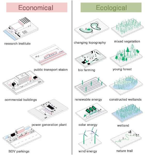
Socio-cultural Topography Economical Ecological
FOCUS AREA: Cendere mining area


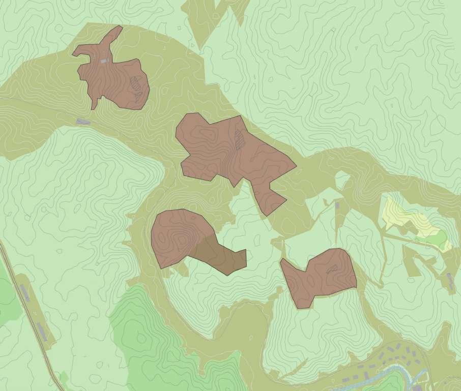







Strategies for the area
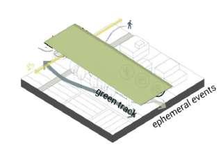

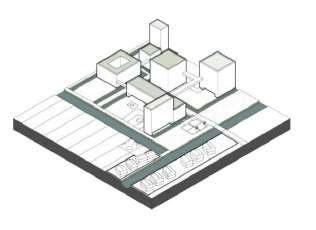
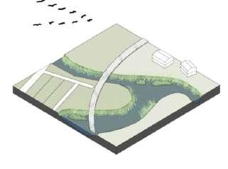
The focus here to transform the industrial landuse to something that is available and useful for all. Shutting down the mining activity and replacing it with humancentric spaces. The first quarry will be developed into spaces for work and play. Co-working spaces, offices and warehouses can be accomodated in this area with open amphitheatre and research centers. While Quarry two due to it’s proximity to residential project can be adapted into experimental housing project itself. The remaining quarry areas can be camoflauged with the context and the creek can be developed more.
green Softening
Green corridors Replacing Industrial cells with
water edges corridors
Live + Play Work + Play Biophilia healthcare 4. 3. 2. 2. 1.
1. 3.
Mixused development with green edges Quarry 01 Quarry 02 Quarry 03 Quarry 04
4. 2.
Eco bridge

Final phase will include the fully developed outdoor park and research centers. A green layer is developed in the entire destructive landscape with the help of experiments in Biomes. A nature trails is carved out leading visitors from parking areas to visitor’s center then to amphitheater and outdoor parks.
Section AA’
The slopes of the terrain is treated using nature based solutions such as living smiles, wattle fence and gabions. A connection from between 2 biomes are made which gives an elevated pedestrian access to citizens.
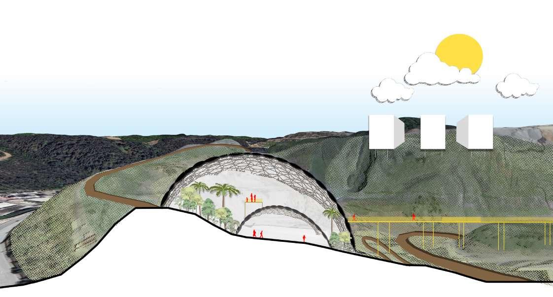
QUARRY 01: Cendere mining area
BIOME 02
OUTDOOR PARK
RECLAIMED LAND
AMPHITHEATRE
PARKING
RESEARCH CENTER
VISITORCENTER
Kemerburgaz Rd.
BIOME 01
A
A’
4. Tribal School and Skill development
............center, Makadamba, Gujarat, India
Architectural thesis
Project guide: Prof Mira Jobanputra, ar. Sujit Kothiwalle
Softwares used: Adobe CC, ArchiCAD, AutoCAD, Lumion, Sketchup
Aim of this project is to create an educational set up for all age groups in a tribal village.
Education is a powerful tool to uplift the living conditions of a community. Intervention at the root level can bring significant improvement in an economically struggling society. The thesis examines this concern for a (Dungri Bhil) tribal village in Narmada District of Gujarat. The objective is to provide better educational infrastructure solutions within the precinct not only for students but also for the villagers. All the interventions are in the scale of the present rural area and serve the adjacent villages too.
The proposals here aims towards development of farmers in the tribal district through an institute which focuses on the vocational and skill-based learning for all age group. Also developing the prevailing skills of craftsmanship in the community further provides a progressive growth pattern to a village.
QUALITY OF LEARNING SPACES
Flexible learning spaces

Covered playing area
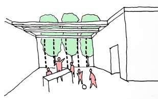
Exclusive shared spaces for students
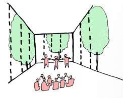
Learning Landscape
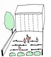
Plaza used for village festivals
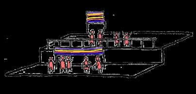
Plaza used for sports event


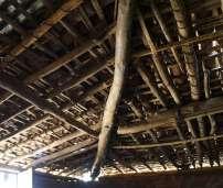
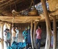


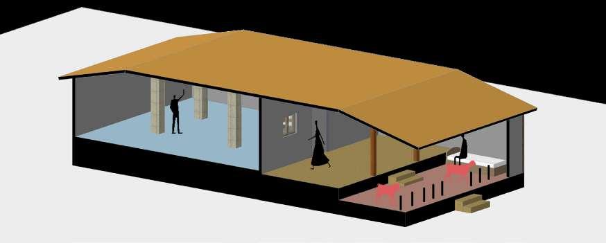
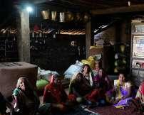
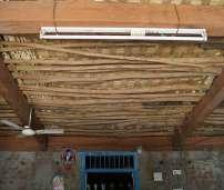

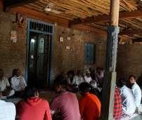
On ground research was conducted to observe community and children’s lifestyle in th hamlet. These drawings are a spatial representation of a typical family household’s look like and how the livestock share the common spaces along with the family inside of the house. The architecture style here is very vernacular and tactial.
CASE 1: Mud house with Bamboo and wood structure
CASE 2: Concrete, brick and mud house
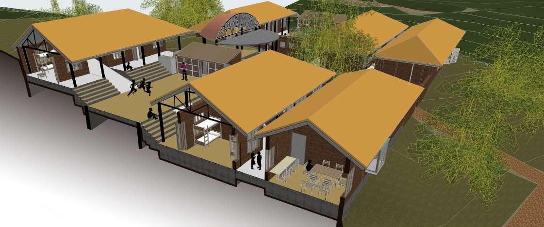
While climbing up towards the academic block there is an amphitheater facing the sunken plaza. As we enter the block, we are greeted with a multi-purpose area. Space can be used as an exhibition area, for performances on an annual day, morning gatherings, etc. The classes are set along with the slope of the site. There is an open farming space connected to each class. And above each class, there are spaces for recreational activities which are made out of bamboo (from the workshop). The layout of the workshop is similar to the academic block.


S-37
IN PASSAGES YELLOW
IN RAMPS & AMPHITHEATRE
TREE GUAVA TREE
TREE
USED
USED
CHICKOO
POMEGRANTE
NEEM TREE
BANYAN TREE
PEEPAL TREE
GULMOHAR TREE
FRUIT ORCHARD TO KEWADIA COLONY LVL-3mt.
RAMPS PASSAGES
A SECTION AA’ PLAN AT LVL: 12 mt. S2 7 S-37 A’ A MANDAP PLINTH LVL-9mt. PLINTHLVL-7mt. PLINTHLVL-6mt. PLINTH LVL-9mt. PLINTH LVL-7mt. PLINTHLVL-9mt. PLINTHLVL-7mt. PLINTHLVL-9mt. PLINTH LVL-9mt. PLINTH LVL-9mt. PLINTH LVL-9mt. PLINTH LVL-10mt. PLINTH LVL-7mt. PLINTH LVL-7mt. PLINTH LVL-7mt. MANDAP CLASSROOM CLASSROOM CLASSROOM PASSAGE PASSAGE CLASSROOM CLASSROOM ADMIN HEADMASTER’S OFFICE CLASSROOM CLASSROOM STORAGE OPEN WORKSHOP BAMBOO WORKSHOP TRAINING SPACE FOR WOMEN SEWING CLASS/ LECTURE ROOM WOOD WORSHOP STORAGE TRAINING PAVILION TRAINING PAVILION P,C,B LAB TOILET CLASSROOM CLASSROOM DINNING KITCHEN N PLINTHLVL-9mt. TOILET TO KUKARDHA LIBRARY COMPUTER LAB W1 PLAN AT LVL: 10mt.
ASHOKA TREE
ROADS
/PATHWAYS
SCHOOL AND SKILL DEVELOPMENT CENTER LAYOUT
SUNKEN PLAZA SECTION AA’
AMPHITHEATRE
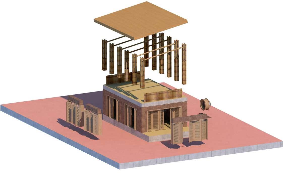


1000% 1 0 1000% 0 % 1000% 1000% % 0 % S-28 ENTRY SCHOOL GIRLS DORMITORY SUNKEN PLAZA LVL-1mt. LVL-9mt. B B’ LVL-7mt. PASSAGE WATER LVL-3mt. SCALE-1:250 WEAVED BAMBOO PANEL IN DOORS RAMMED EARTH WALL BAMBOO COLUMNS COMPOSITE ROOF
Typical unit of a classroom
The hostel block is divided into 3 parts. Canteen, girls block, and boys block. The house parent room is situated at the entrance for security. The parent house rooms are connected to the common room and entrance for the same reason. The Rooms overlook the common courtyard for the block. The rest of the space is left for future development.
1000% 00% 10 00 % 1 0 0 0 % S-23 S-23 S-24 S-24 S25 S25 S-2 PLAN AT LEVEL 10mt. GIRLS DORMITORY B BOYS DORMITORY LIBRARY LIBRARY HOUSE PARENT ROOM HOUSE PARENT ROOM DORM DORM DORM DORM DORM DORM DINNINGAREA KITCHEN ENTRY UP UP UP UP ENTRY N SECTION BB’ RESIDENTIAL BLOCK B’
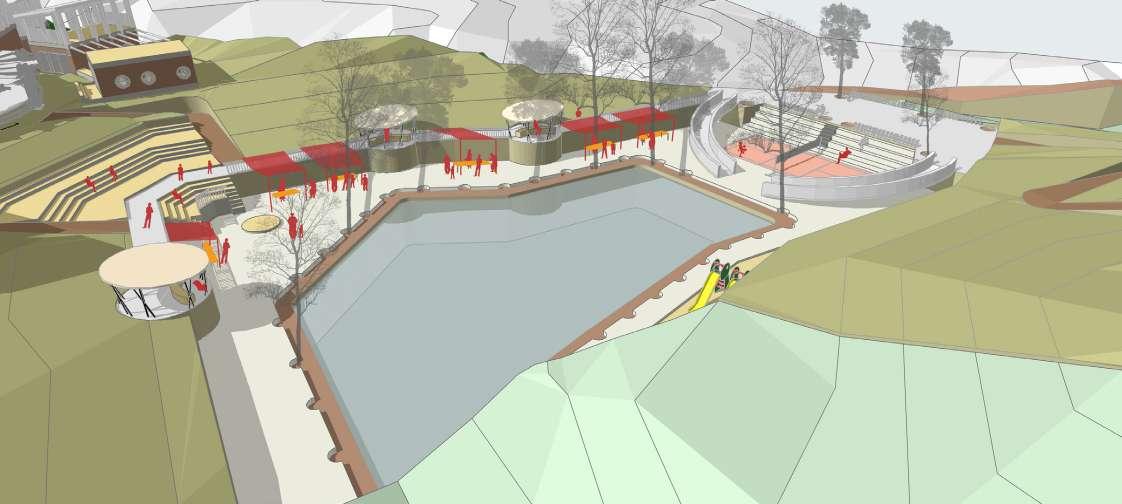
SUNKEN PLAZA: Multipurpose space

VILLAGE FETE
MARKET DAY

ANNUAL DAY/ EXHIBITION DAY
Email: shivani.handa@rwth-aachen.de
you for your time!
Thank
SHIVANI HANDA Contact: +91 7575062642


 Rijks museum






 WesterstraatTheoThijssenSchool


 Uniclinik


 Section through Mensa crossroad


