

PROLOGUE
- For History and Nature
Time has left us history, and also has pushed us to the future. History has gradually withdrawn from our real life, becoming fragile and dilapidated, but increasingly important. The future shields us from the history, but it also endows us to recall the past. The history should become clearer in the years to come.
But the reality is not so. Our lifestyle is erasing the traces of history, and this process is accelerating. The construction of cities seems to be racing against nature. We are striving to build, while nature is rapidly recycling our achievements. When the future gives us more powerful influence, urban designers should make a choice between accelerating creation and mitigating loss.
01 LIVE WITH ANCIENT CITY
HERITAGE CENTERED PLANNING & DESIGN

Date: 4/2021-6/2021 Area: 18.8ha Nanjing, China
02 ZEN BORN UNDERGROUND
RELIGIOUS COMPLEX DESIGN
Date: 7/2022-10/2022 Area: 8.87ha Nanjing, China
03 SALVAGE THE HARBOR
COASTAL PUBLIC SPACE DESIGN
Date: 6/2021-12/2021 Area: 18.9ha Helsinki, Finnland
04 NO MORE REFUGEES
EDUCATIONAL & SHELTER AECHITECTURE DESIGN
Date: 10/2022-12/2022 Area: 638ha Kajiado, Kenya
05 OTHER WORKS GIS APPLICATION


Date: 9/2020-6/2022

01 LIVE WITH ANCIENT CITY
Yuecheng Site, Nanjing, Jiangsu, China
Area: 18.8ha
Type: Individual Academic Work
Date: 4/2021-6/2021
Instructor: Yi Shi shiyi@seu.edu.cn
Keywords: Counterpoint Relation, Eco-friendly, Openness

The project site has a layered history. Archaeological remains from the Shang and Zhou Dynasties to the Qing Dynasty have been found inside the site, including the Yuecheng site. From the perspective of geographical location, the site is located at the end of the central axis of Nanjing's old urban area. It is close to many important landscapes, making it the core area to shape the image of Nanjing.
The status of the site development does not match its importance. Most of the internal area of the site is still under construction. Due to the lack of action, the Yuecheng site has low ornamentality and accessibility. Only one Yudai River is within site, separated from the surrounding natural resources.
The project renovates the site aiming to tap the site's potential and highlight the importance of displaying the city’s image. Taking the Yuecheng site as the core element of design, we build a heritage park around it, which closely interact with the surrounding environments and is harmonious with nature. The buildings around the site are made according to the texture of the site.
open green space historical district river system
historical axis ancient city wall
SITE ANALYSIS


Architectural Resources inside the Site
Archaeological Excavation Pit
Archaeological Mound
Historical Route Axis Historical Building
The most important resource in the site is the archaeological excavation pit that forms a certain crossover angle with the plot boundary. In addition, there are scattered cultural relics, buildings, and ancient street axis.
Green Space and Water Resources
Architectural Resources around the Site

Zhonghua Gate Castle
Ming Dynasty City Wall
Architecture Axis Porcelain Tower of Nanjing
The northeast side of the site faces the front elevation of the Zhonghua Gate Castle across the river, and on the east side is the Porcelain Tower of Nanjing Site Scenic Area with the obvious axis.
Types of Architecture around the Site
HISTORY COLLAGE

Urban Water System Flat Roof Building
Pitched Roof Building
Urban Green Space
The site, adjacent to the Qinhuai River in the north, has rich external natural resources. However, the public green space inside the site is small and is separated from the surrounding green space.
the Republic of China era
The site is in the south of the old city of Nanjing, surrounded by many historical buildings. The types of surrounding buildings are mostly pitched roof buildings.
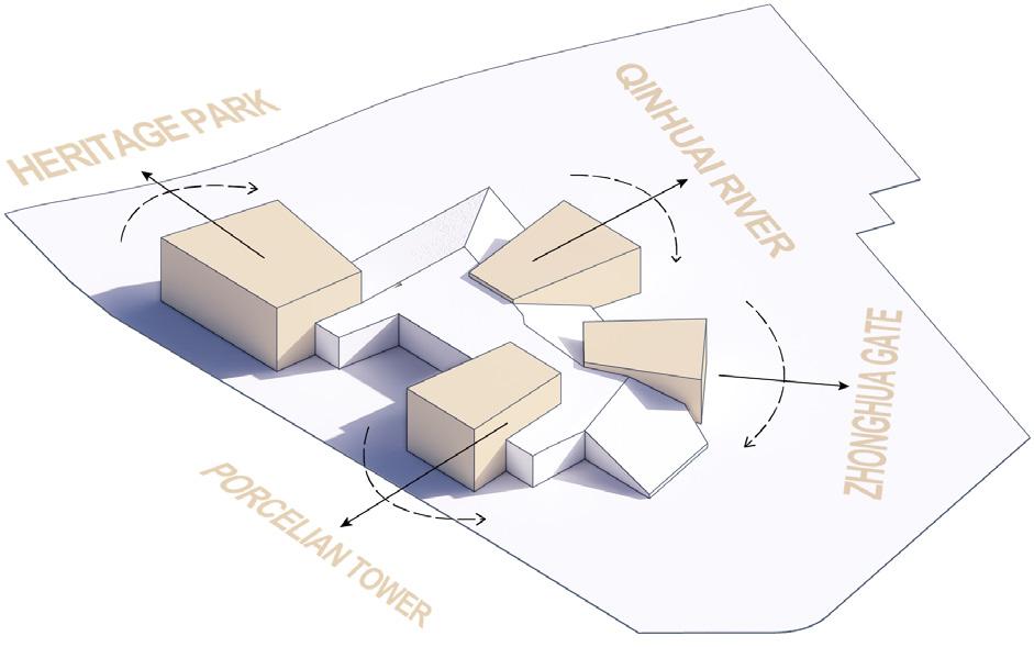
Create a wedge-shaped green space with the site as the core, and extend the heritage park to the Qinhuai River and the Zhonghua Gate, forming a counterpoint relationship. The internal footpath of the park is in a vertical staggered form with the direction of the archaeological excavation pit.


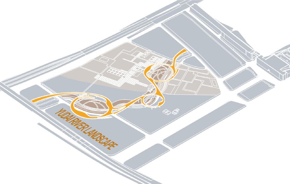
The landscape system with the river-crossing trestle path as the core is built along the Yudai River. The plank road forms three circular nodes around which a green landscape is created.
The internal footpath system of the heritage park will be extended to the south to create a residential area in harmony with the park in the south with a unified design language.

BASIC ANALYSIS
The form of the buildings in the commercial blocks facing the street is also determined according to the angle parallel to the archaeological excavation pit so that the buildings form a certain angle with the plot sideline to create some space for Greenland.

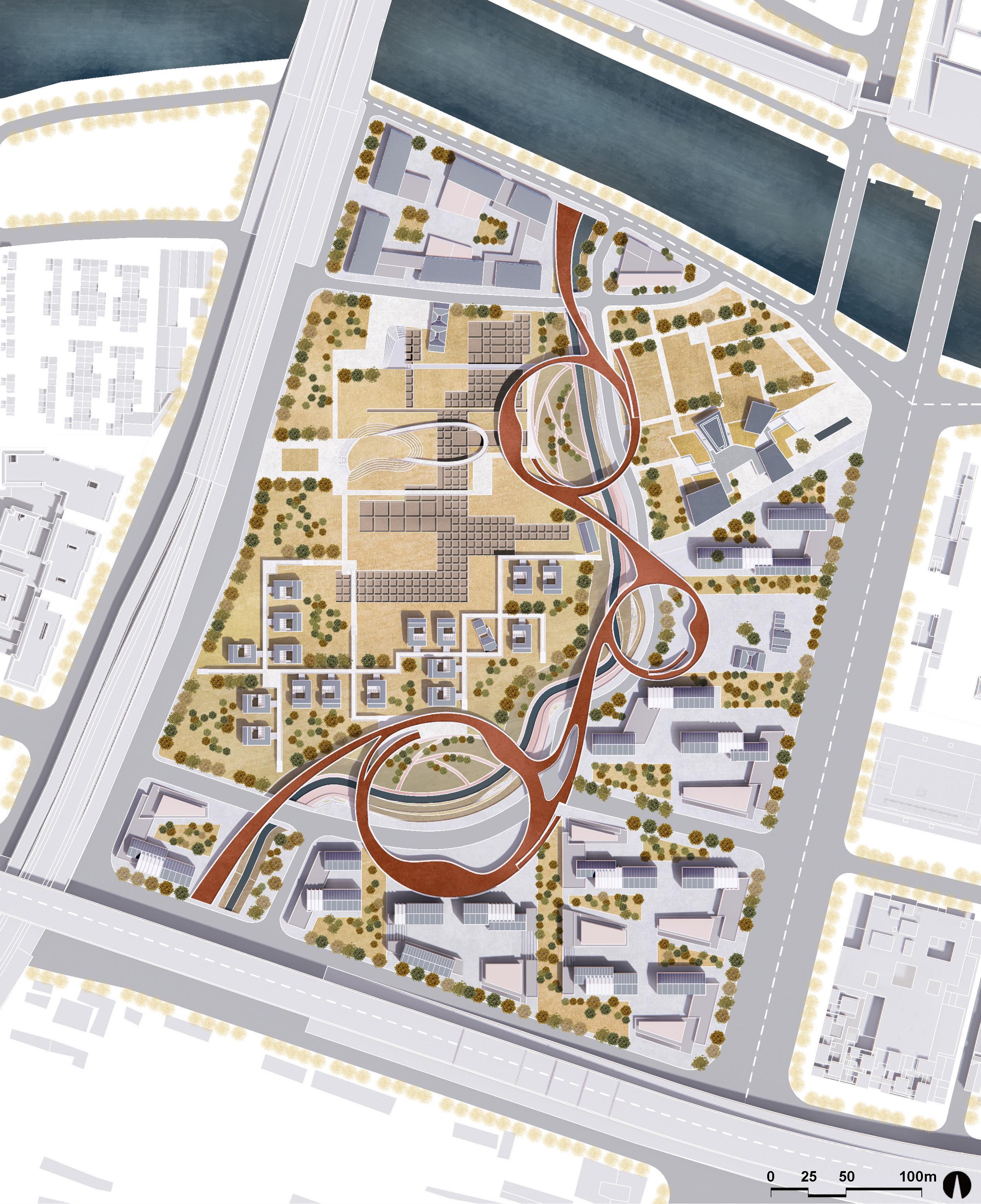
Response to Nature and History
The most harmonious way for human beings to get along with nature is the mutual penetration of the natural ecological environment and human life, that is, to seek a balance between using natural resources and protecting the natural environment.
Expressing the historical information of the site through spatial operation, rather than just through vision, is an effective way to memorize history deeply.


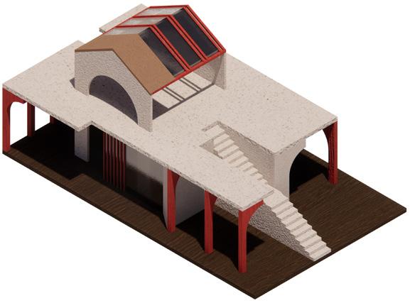
Eave Edge Structure
additionalwaterprooflevelinglayer
Accessible Roof Structure


C20 fine aggregate concrete t=40
thick plastic film t=0.4
waterproof layer
1:3 cement mortar protection layer t=20
Light concrete slope making layer t=70

1:3 cement mortar screed-coat t=20
thermal insulation layer
steel fiber reinforced concrete roof slab
Earth Coverd Roof Structure
vegetation layer
planting soil t=200
200g/m2 non-woven filter layer
concave-convex drain board t=20

1:3 cement mortar protection layer t=20
isolation layer


root puncture resistant compound waterproof layer
1:3 cement mortar screed-coat t=20
LC5.0 Light aggregate concrete slope making layer t=30
thermal insulation layer
steel fiber reinforced concrete roof slab

General Design


Residential Buildings

Commercial Blocks


02 ZEN BORN UNDERGROUND
Religious Complex Design

Qingliang Mountain, Nanjing, Jiangsu, China
Area: 8.87ha
Type: Individual Academic Work
Date: 7/2022-10/2022
Instructor: Yan Wang 101012656@seu.edu.cn
Keywords: Buddhism, Multi-function, Urban Regeneration
Nowadays, with the rapid development of society, people suffer from spiritual emptiness caused by highly pressured urban life while enjoying rich material life. Thus, the tranquil atmosphere and spiritual purification provided by Buddhist Zen spaces become increasingly important.
The Qingliang Mountain in Nanjing is a small natural mountain. Historically, it was once an important Buddhist site. There were Buddhist buildings in the Ming and Qing Dynasties on the hill, making a robust Buddhist atmosphere. This design aims to create an open public Zen space, and explores the development potential of Qingliang Mountain underground space. Building Zen space underground can protect cultural heritages and avoid suffering from high temperatures.
Under the Qingliang Mountain, this design uses the parameterized technique to integrate the Buddhist Zen space with the daily living space through the combination of carefully designed units, and constructs an underground Zen complex.
Jiangsu, China
Nanjing, Jiangsu

Qingliang Platform
Buddhist temples were built on the platform. It was mentioned in many important Chinese poems.

Qingliang Temple
A Buddhist temple built in the Qing Dynasty which was the Buddhist Center in Nanjing
The academy was built in the Ming Dynasty with a style of Jiangnan gardens.
Saoye Building
The former residence of Gong Xian, a famous painter and poet in the early Qing Dynasty
Military Fortress in The Six Dynasties Buddha Temple in Tang Dynasty Important Place for Literati Tourist Attraction in Modern Chongzheng Academy




COMPOSITION 1 COMPOSITION 2
COMPOSITION 3
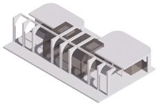


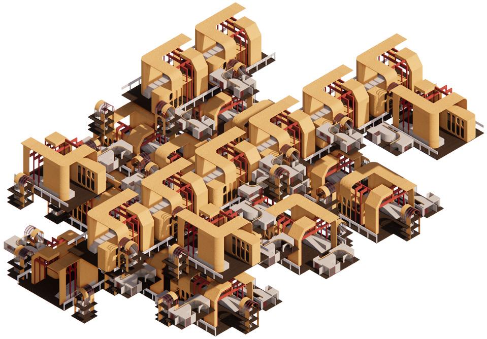

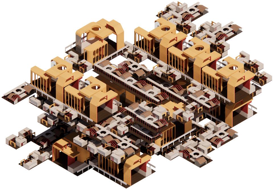
After parametric design operations based on the limits of the site boundary, we generate several complexes composed of various units, and select the most appropriate one. The whole complex consists of 2701 units. The large courtyard units are arranged consecutively, with the ends wrapped up by the Buddha Hall space to form the core Zen space. Around the core, spaces are the external service modules and living modules composed of the small exhibition, office, and living space in sequences or units.


FUNCTION


03 SALVAGE THE HARBOR
Coastal Public Space Design
South Harbor, Helsinki, Finland
Area: 18.9ha
Type: Individual Academic Work
Date: 9/2021-6/2022
Instructor: Guoping Xiong 101011052@seu.edu.cn
Keywords: Rain Flood, Terrain, Revitilization
Helsinki South Harbor was once the transportation center of Helsinki, a port city. The construction of the West Port and the port of Vuosaari has reduced the transportation function of the South Port. South Harbor, located in the city center, is now losing its vitality.In addition, the sea level is rising caused of climate warming, and the Baltic Sea is also affected. Helsinki South Harbor is facing the risk of being submerged.
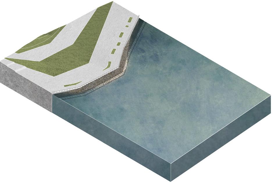
The project aims to transform the coastal public space of Helsinki South Harbor into an open space with strong accessibility, comfort, and attraction. At the same time, terrain design is used to cope with the sea level rise in the future to 2100.
To integrate the local characteristics of Helsinki into the design, we extracted the sea ice phenomenon along the coast of Helsinki. We made a topology of the sea ice morphology to generate the terrain used in the design.

site train station proposed train station subway station train route planned train route subway route highway tram line ship route for passenger ship route for freight water level, 2050 water level, 2100 historical architecture urban axis


“Our
modate
“Vuosaari
5.27.
a
national
The
Helsinki’s Managing Director Kimmo
MAPPING OF THREE PROBLEMS IN SITE SCALE PROBLEM ANALYSIS


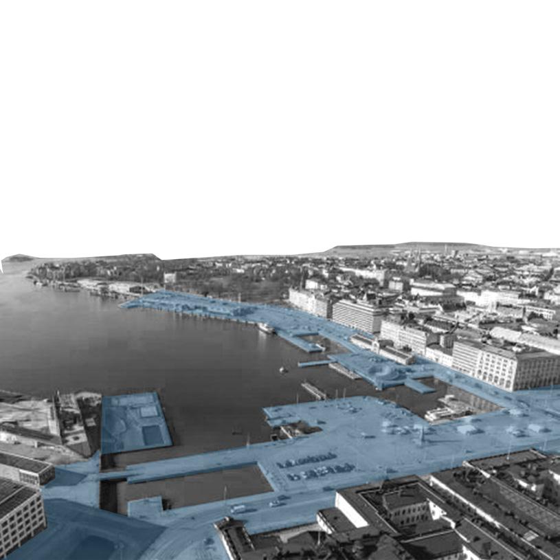
Narrow sidewalks and broken bicycle lanes only found outside the site block people from approaching the sea.


Fragmented green spaces with no connections with the site.

Upcoming sea-level rise and frequent floods



THE DERIVATION OF THE PLAN STRUCTURE OF SITE PLAN

Relocate the road to expand the coastal area and to connect outside green space.

Create an overall three-level elevation difference to tackle the flood issues.


Create continuous hard ground to provide bicycle lanes.
Response to flooding by small-scale topographic change.


Connect outside green space and invite green inside.
Waterfront platforms provide better accessibility to the sea.
Existing Bicycle Lanes


Proposed Bicycle Lanes Connection of Ecology Hard Ground Floating Island Seriously Flooded Area Slightly Flooded Area

Green Space


1.Helsinki Market Square
2.Havis Amanda
3.Helsinki Market Hall
4.Sandy beach
5.Marine trestle road
6.Square connected with the park
7.Port of Helsinki

8.Small ship wharf
9.Indoor leisure space
10.Green park
11.Floating island
12.Type 1 Terrain
13.Type 2 Terrain
14.Type 3 Terrain
15.Type 4 Terrain
16.Type 5 Terrain
17.Type 6 Terrain
MASTER PLAN
SEA LEVELS IN PRESENT AND FUTURE SCENARIOS


SEA LEVELS OF DIFFERENTS TERRAINS AFTER DESIGN



IMPORTANT AREA DETAIL RENDERING

[Green Square Connected with the Tahtitorninvouri Park ]
In the southwest of the site is an important landscape, Tahtitorninvouri Park, which is separated from the coast by a driveway. This design will build an elevated green square to connect Tahtitorninvouri Park with the coast. An underpass tunnel will be used to maintain the driveway's continuity and improve the beach's greening continuity.

[Green Park in the North of the Shore]
The green park on the site's north side has varied terrain, including rolling green space and interlaced footpaths combined with green space in the shape of broken ice. In addition, there are floating islands on the shore, which cannot be submerged while the sea level changes, and also simulate sea ice in shape.

 [Human Visual Perspective Drawing From Green Square]
[Human Visual Perspective Drawing from Upper Greenland]
Green Square Undercrossing Roadway Green Square Coastal Footpath
Tahtitorninvouri Park
Floating Island Coastal Footpath with Greenland Upper Greenland with Interlaced footpath Urban Area
04 NO MORE REFUGEES
Educational and Shelter Architecture Planning & Design

Kiserian, Kajiado, Eldoret, Kenya
Study Area: 638ha
Type: Group Work, Academic Work
Role in Team: Background Research 90%, Concept 80%, Architectural Design 80%, Technical Drawing 90%
Date: 10/2022-12/2022
Instructor: Yan Wang 101012656@seu.edu.cn
Keywords: Equity, Food Security, Locality
Kenya is one of the countries most seriously affected by the refugee problem. The refugee problem in Africa is closely related to food security. In recent years, natural disasters and disease in Kenya have been frequent in Kenya, leading to a sharp decline in the efficiency of food production, which caused an outbreak of refugees.
The project aims to address food security to alleviate the refugee problem at its root by planning and building a series of architectures with educational and shelter functions. The refugees will be sheltered and re-educated in these architectures to become specialists with professional agricultural skills.
We selected an area around Kiserian, Kenya, as the research scope, collected relevant information about the site, and determined the location and volume of buildings through the genetic algorithm, to ensure livelihoods, reduce costs, and facilitate education and space equity. Finally, based on the analysis of local resources, functional needs, climate characteristics, and other factors, we designed buildings with solid local features in three different scales.
Seven people died, and at least 1000 homes were destroyed in fires that ripped through Knysna and Plettenberg Bay. Cape Town was hit by a severe drought with stringent restrictions imposed and threats made of a 'day zero'. 24.2 million Africans were forced to leave their homes in 2017, 4.6 million more than the previous year.

The Nigerian government launched a mass vaccination campaign, in alliance with the World Health Organization (WHO), to immunize more than 25 million people before the end of this year. Listeria has caused more than 60 people dead across South Africa, with nearly 750 confirmed cases.
Parts of southern and East Africa suffered from natural disasters. Botswana, Lesotho, Namibia, and Zimbabwe declared drought an emergency, as it destroyed crops and claimed the lives of animals. In July, Ethiopia's government launched a major reforestation program to combat climate change.
COVID-19 is accelerating in Africa. Africa recorded its first case of the new disease in mid-February. Child food insecurity rose by 20 percent because of COVID-19. Schools were closed in 14 nations. The disruption to education has resulted in poor nutrition, stress, and increased exposure to violence and exploitation.

COVID cases were surging in Africa at the fastest rate, but deaths remained low. More than 5.7 billion COVID-19 vaccine doses had been administered globally, but only 2% were in Africa. Madagascar had recently been on the brink of famine as the drought intensified due to climate change. Madagascar has experienced the longest drought in 40 years.
A third of East Africa's grain supplies have come from Ukraine and Russia. The conflict between the two countries has resulted in soaring food prices in East Africa. Days of heavy rainfall caused floods in eastern South Africa in April. In August, Sudan suffered from floods and heavy rain. In October, the Nigerian floods were the worst in a decade.

Agricultural Practice
Roadways Farmlands
Roadways provide convenient access to various facilities.

Farmlands provide an opportunity to practice agricultural theories.
Forest Resources Waters
Larger volumes can be constructed in areas close to raw materials.
Water areas can provide water resources for agricultural work and life.
Available Open Spaces
Vacant lands where buildings can be built.


Medical Facilities
Medical facilities can ensure life security.
Commericial Buildings
Commercial buildings can meet the needs of purchasing daily necessities.
Building Heights
The height of surrounding buildings affects the volume of new buildings.
Minimun
After the genetic algorithm, 20 generations are generated with 50 solutions per generation, including construction location and building volume.


The 1000 results were divided into four groups through screening of one objectiveoriented and 3 objectives average, and 6 superior results were selected for each group to display.


The value of the goal indicates the degree of objective completion, with the lower value representing a more ideal solution


Fitness value: 141.788791 Fitness rank: 761/1000


value: 353.715857 Fitness rank: 154/1000
462.855495 Fitness rank: 826/1000
200m 0
We select the group with relatively small differences in completing the three objectives and choose one solution to achieve the four goals of low cost, space equity, skills training, and life security equally.
In this group, the 27th solution of the ninth generation has the lowest average value of fitness rank in three objectives, representing the highest average completion, which is a relatively ideal result.
Among the 23 construction sites in the solution, three sites are selected for specific architectural design. The calculation results of building volume in sites A, B, and C are small, medium, and large scale, respectively.


GENERATION PROCESS
Site A - Small Scale
A corridor divides the building space into two halves.
The wide side is divided into two parts: large and small.


Site B - Medium Scale
The main part is for residential areas, and the small part is for classrooms.


The c-shaped volume layout encloses a courtyard for planting experiments.
Raise part of the volume to the second floor for eating and interaction.

Site C - Large Scale
The three main volumes are connected from end to end, forming an open courtyard.
The educational function occupies the main space, with a small number of residential areas.
Break up the long volume to set up a connecting corridor, and raise part of the area.
The residential area in the center is close to the farmland for education space.
CONSTRUCTION DETAILS

PERSPECTIVES


Social Research: The Integration Degree of Nanjing International Community
Abstract:
With the rapid process of social globalization, the international community has become an essential carrier of many social phenomena in Nanjing. Cultural differences lead to of separation between immigrants and between immigrants and aborigines to certain degrees. Concerning such phenomena, this report combines and analyzes the status quo and internal determinants of the degree of integration of international communities from the perspective of integration and provides suggestions for constructing integrated international communities.
1. Spatial Integration Analysis of living and


Type: Individual Academic Work Date: 9/2021-12/2021 Instructor: Xiao Wu 101010124@seu.edu.cn
2.Economic Integration
Site Olympic Village Nanxiu Village Dongfang Tianjun
Access to housing Form of Living
3.Social Integration
Example of analysis results: social participation


Site Olympic Village Nanxiu Village Dongfang Tianjun gain community sevices join community activity
4.Cultural Integration
Example of analysis results: cultural adaptation
Site Olympic Village Nanxiu Village Dongfang Tianjun Language Mastery Communication barriers
Rent
Dormitory Purchase Live alone Share Family
Summary of economic integration
Based on the questionnaire survey results, we can judge that Nanxiu Village, where housing purchase occurs, has the highest degree of integration in living conditions, followed by Dongfang Tianjun, where people live with their families.
Regarding working conditions, we analyzed the occupation and enterprise type of residents, the highest degree of integration is among the residents of Nanxiu Village, who take Chinese students in their social network. And the second is the residents of the Youth Olympic Village who work with Chinese colleagues.


Summary of social integration
Few or no Occasional Often
Regarding social participation, the integration of foreign residents in Dongfang Tianjun and Nanxiu Village is significantly higher than in Youth Olympic Village.To a certain extent, it is affected by their living style and occupation。
Few or no Occasional Often
In social relations, we mainly collect data on the number of Chinese friends of non-Chinese residents. The overseas students in Nanxiu Village have more Chinese people in social network.
In terms of access to public service facilities, the Youth Olympic Village has the highest degree of integration, which may be because the Youth Olympic Village was initially built as a city node.
Summary of cultural integration
Few or no Primary Mastered
Low General High
From the perspective of cultural adaptation, the integration degree of Nanxiu Village is higher than that of the Youth Olympic Village and Dongfang Tianjun. Students have the highest cultural adaptability, followed by company employees, housewives and children have the least.
Both social evaluation and identity recognition levels show that Nanxiu Village has a higher integration degree than Dongfang Tianjun and Youth Olympic Village. This is affected by the acceptance of community services and participation in community activities.
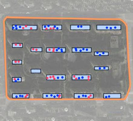


Summary of spatial integration Based on the questionnaire survey results, non-Chinese residents tend to gather in apartments under the premise of foreign students or international apartments. At the same time, the environment of pure commercial housing can promote the integration of residential space to a greater extent than apartments.
Although there is a certain degree of integration difference in residential space due to different housing types, the equal use of public space is essential to promote integration.The public areas of different sizes, types, and service objects provided by various communities are used by residents of various countries simultaneously.

Summary and Optimization Strategies
Regarding spatial equity, most international communities passively provide space for the integration of local and foreign residents, lacking consideration of the integration needs of migrant groups. From the economic and social aspects, the integration of non-Chinese residents is primarily affected by their occupations and enterprises. From the cultural aspect, the degree of integration of non-Chinese residents depends on the demand for social relations and the degree of cultural barriers.
Optimization strategies: 1. Create a diversified environment. Hold Sino foreign exchange activities according to the immigration background of various international communities, and create more space for quick social events.
Promote community renewal. Create residential and public spaces that meet the needs of migrant groups.
Build service facilities. Implant public service facilities within the 15-minute life circle.
GIS Application: Green Space Design Based on Ecological Sensitivity Analysis


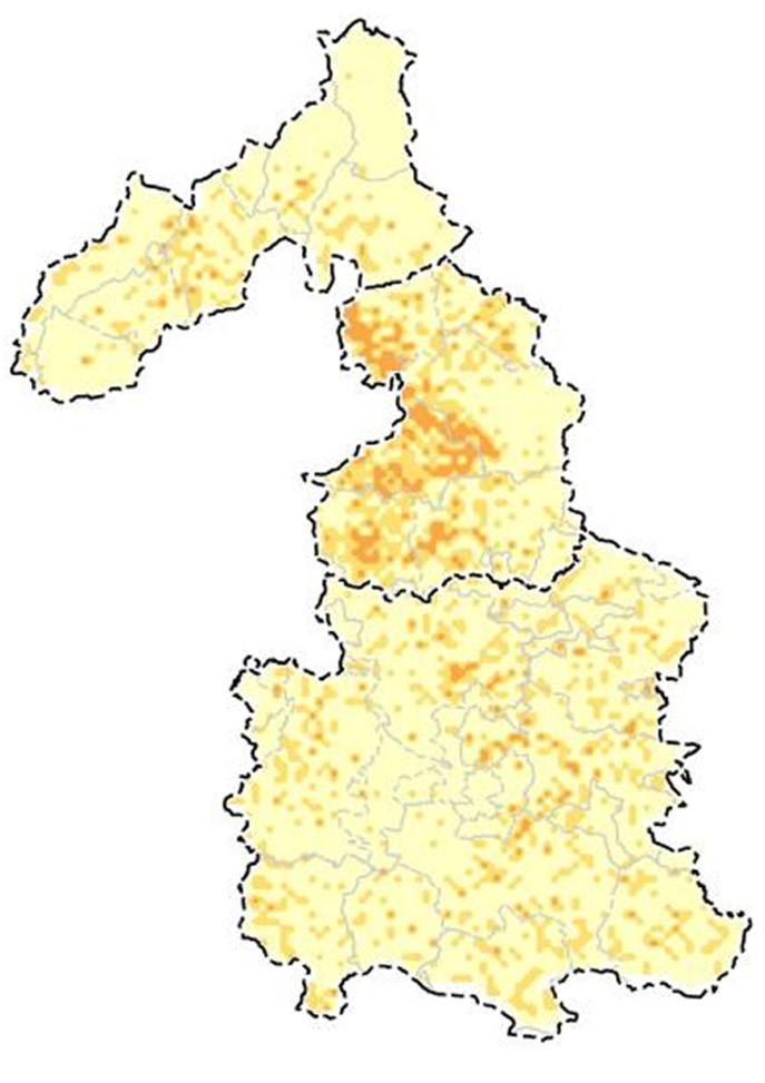


The project is an urban design for a new town center of an area of 160ha in Nanjing, China. ArcGIS is used to analyze the site's green space, water, elevation, and slope for ecological protection in planning urban green space and selecting the area with high environmental sensitivity to set green space.

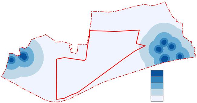


Manual Model: Laser Cutting

GIS Application: "Double Evaluation" of National Territory Development Plan

Evaluation Process:
Importance of ecosystem service Sensity to water and soil loss
Importance of ecological protection
Land resource Water resource Climate evaluation Meteorological disaster Land resource Water resource Geological disaster Environment evaluation Location advatage
Suitability of agricultural production

Suitability of urban construction
Manual Model: Chess Based on the Contradiction between Modernism and Postmodernism
This project is a chess game based on the topological form of two groups of modernist and post-modernist architectures. We learn the differences between the two architectural trends during the production process.

The shape of the chess pieces is carved with rubber stamps, then turned over with silica gel, and finally watered with drops of glue to shape to sense the architectural shape by hand.
The chessboard is also the display cabinet and storage box of chess pieces, with built-in drawers. The internal chess pieces can be observed on the surface of the acrylic. The production process of the chessboard is laser cutting and manual assembly.

