

PROPERTY FEATURES


Date R hi i1 71. 175_ the the ea
1 rrtrp tui iiun itinva
I zaip •".* ii LL, iirboniiiiiiiierci.
1 ri4vir. ry LlaL1.7 aivur raquvm Jnr a p
1 ar• oJT GF11 4NV' LR 9InS+ 1117: 44014fl IQUllt urawing UT smem ! 1i
Warr ...... Tr. eWo Para. maw" VI to N.i MOHO IR WN ALL, RlaWf$ R$ anQ allinUrlit
t , r' Oi.. ti eft Pana• . e—..... ilFi' . i.,..:*u__ e_.. 416%... eel, e1 Y ICM M KF Cr'Qii ,IL1 lawcr f1 ( LNIvwu . 0 au perks ano J./. t.. ( 4.
I : emirs .,. e aces riwaiw•••••.• . m I09W iirw.r.rgleng. 1 Will Lica ICLLIffHEM. u ma spa
IT St * 67 , z sZme



Portions of Lots 86 and 87, CROSSROAf `>, SECOND ADDITION, a subdivision of record situated In' the Southeast Quarter ( SE'/ W1 of Section 1, TOWNSHIP 15 SOUTH, RANGE 9, EAST of THE WILLAMETTE MERIDIAN, Deschutes County, Oregon; Being more particularly described as follows:
BEGINNING at the Southwest corner of saki Lot 87, on the Easterly right -of -w: '., line of Bluegrass Lane; thence around a' 2, 18. 84 -foot radius curve to the left, on said East right: ofway line, ( chord bears north 08° 29' 56" West, 139. 40 feet), 141. 29 feet to the corner cornmor, to said Lots 86 and 87; thence continuing around said 248. 61 -foot radius curve to the left, ( chord bears North 29° 57' 56" West, 44. 96 feet), 45. 02 feet; thence South 88° 13' 31" East, 264. 86 feet to a 5/ 8" Iron rod on the east line of said lot 87; thence South 00° 04' 15" West, on the East line or ',: ilei Lot 87, 198. 87 feet to the Southeast corner thereof; thence North 82° 13' 11" West, on the Soft i line of said Lot 87, 223. 48 feet to the point of beginning. 5'`7.65
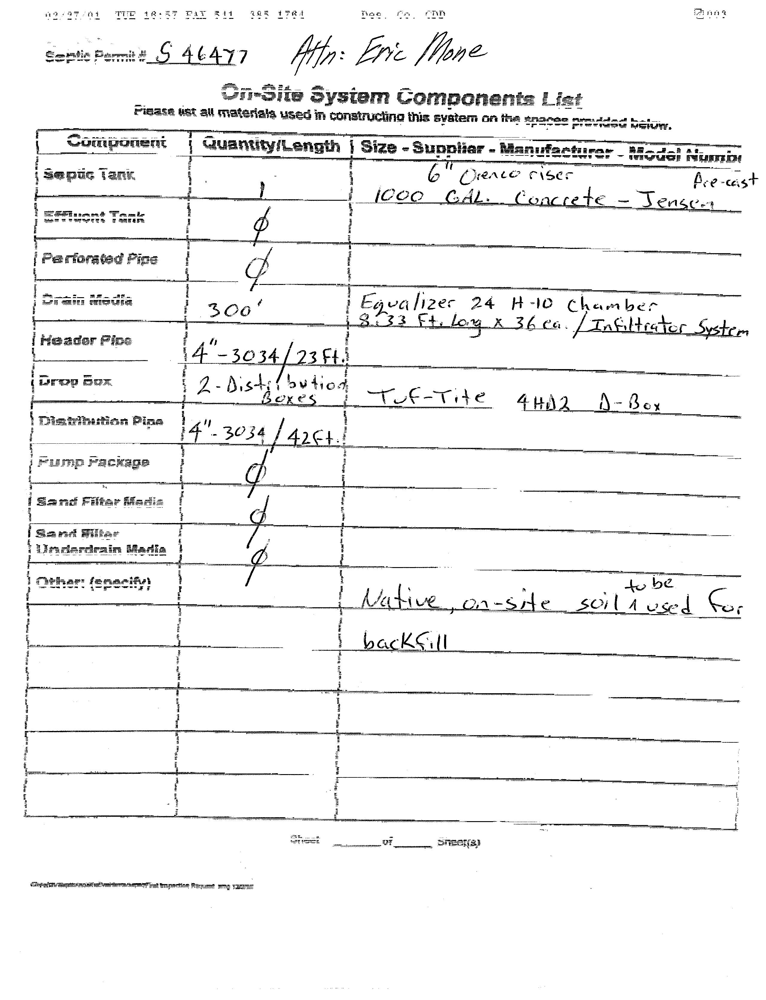
An Inspection of this On -Site Sewage System has identified the following deficiencies:

Under the provisions of the OREGON ADMINISTRATIVE RULES, all deficiencies listed above must be corrected within 30 days, and a CERTIFICATE OF SATISFACTORY COMPLETION must be issued prior to use of this system. When corrections have been completed, call for inspection.










Senate Bill 391
Sponsored by Senator DEMBROW (Presession filed.)
SUMMARY
The following summary is not prepared by the sponsors of the measure and is not a part of the body thereof subject to consideration by the Legislative Assembly. It is an editor’s brief statement of the essential features of the measure as introduced.
Authorizes county to allow owner of lot or parcel within rural residential zone to construct one accessory dwelling unit on lot or parcel, subject to certain restrictions. Specifies that single-family dwelling and accessory dwelling on same lot or parcel are considered single unit for purposes of calculating exemptions from ground water rights requirements.
Declares emergency, effective on passage.
A BILL FOR AN ACT
Relating to accessory dwelling units in rural residential areas; and declaring an emergency.
Be It
Enacted by the People of the State of Oregon:
SECTION 1. Section 2 of this 2021 Act is added to and made a part of ORS chapter 215.
SECTION 2. (1) As used in this section:
(a) “Accessory dwelling unit” has the meaning given that term in ORS 215.501.
(b) “Area zoned for rural residential use” has the meaning given that term in ORS 215.501.
(c) “Single-family dwelling” has the meaning given that term in ORS 215.501.
(d) “Vacation occupancy” has the meaning given that term in ORS 90.100.
(2) Consistent with a county’s comprehensive plan, a county may allow an owner of a lot or parcel within an area zoned for rural residential use to construct one accessory dwelling unit on the lot or parcel, provided:
(a) The lot or parcel is not located within an area designated as an urban reserve as defined in ORS 195.137;
(b) The lot or parcel is at least two acres in size;
(c) One single-family dwelling is sited on the lot or parcel;
(d) The existing single-family dwelling property on the lot or parcel is not subject to an order declaring it a nuisance or subject to any pending action under ORS 105.550 to 105.600;
(e) The accessory dwelling unit will comply with all applicable laws and regulations relating to sanitation and wastewater disposal and treatment;
(f) The accessory dwelling unit will not include more than 900 square feet of useable floor area;
(g) The accessory dwelling unit will be located no farther than 100 feet from the existing single-family dwelling;
(h) If the water supply source for the accessory dwelling unit or associated lands or gardens will be a well using water under ORS 537.545 (1)(b) or (d), no portion of the lot or parcel is within an area in which new or existing ground water uses under ORS 537.545 (1)(b) or (d) have been restricted by the Water Resources Commission;
(i) No portion of the lot or parcel is within a designated area of critical state concern;
(j) The lot or parcel is within a rural fire protection district organized under ORS chapter 478;
(k) The lot or parcel and accessory dwelling unit comply with rules of the State Board of Forestry under ORS 477.015 to 477.061; and
(L) Statewide wildfire risk maps have been approved and the accessory dwelling unit complies with the Oregon residential specialty code relating to wildfire hazard mitigation for the mapped area.
(3)(a) A county may not permit both the existing single-family dwelling and the accessory dwelling unit allowed under this section to be used simultaneously for vacation occupancy:
(A) During more than one week per year; and
(B) Unless the county has been notified in advance.
(b) If a county allows the use of an accessory dwelling unit for vacation occupancy, the county may impose conditions including:
(A) Requiring the owner to use the existing single-family dwelling as a primary residence.
(B) Requiring neighbor notification.
(C) Requiring a local point of contact for vacation occupants and neighbors.
(D) Registration with the county.
(4) A county that allows construction of an accessory dwelling unit under this section may not approve:
(a) A subdivision, partition or other division of the lot or parcel so that the existing single-family dwelling is situated on a different lot or parcel than the accessory dwelling unit.
(b) Construction of an additional accessory dwelling unit on the same lot or parcel.
(5) A county may require that an accessory dwelling unit constructed under this section be served by the same water supply source or water supply system as the existing singlefamily dwelling. If the accessory dwelling unit is served by a well, the construction of the accessory dwelling unit shall maintain all setbacks from the well required by the Water Resources Commission or Water Resources Department.
(6) An existing single-family dwelling and an accessory dwelling unit allowed under this section are considered a single unit for the purposes of calculating exemptions under ORS 537.545 (1).
(7) Nothing in this section requires a county to allow any accessory dwelling units in areas zoned for rural residential use or prohibits a county from imposing any additional restrictions on accessory dwelling units in areas zoned for rural residential use, including restrictions on the construction of garages and outbuildings that support an accessory dwelling unit.
SECTION 3. This 2021 Act being necessary for the immediate preservation of the public peace, health and safety, an emergency is declared to exist, and this 2021 Act takes effect on its passage.


Mi ddle School Hi gh School Cros sro
The Peterson Ridge Mountain Bike and Hiking Trail was designed as a ladder system. It consists of two linear trails, the PRT West and PRT East trails, with numbered connectors marked by junction posts that allow riders and hikers to design their own riding or hiking experience. We have included a loop option guide showing the distances from our Sisters Trailhead.


whychus canyon preserve trail map + rules of use

Whychus Canyon Preserve Rules:
—Dogs must be kept on physical leash AT ALL TIMES. Please clean up after your pet.
—Pedestrian travel only: no bike, horse, or motorized vehicle use.
—Stay on roads and trails and respect restrictions as posted.
—Removal or disturbance of plants, wildlife, and historical artifacts is prohibited.
—Catch and release fishing with barbless hooks is permitted subject to applicable state regulations.
—Commercial use and private events are prohibited.
—No hunting, motorized vehicles, camping, campfires, smoking, or unmanned aircraft use.
whychus canyon preserve suggested routes
Wagon Road and Meadow Loop: This route follows a portion of the historic Santiam Wagon Road. Interpretive signs along the way share the story of the Wagon Road east of the Cascades and the role it played in the settlement of Central Oregon. This fairly flat trail is lovely in the spring when desert wildflowers begin to bloom.
From the trailhead, follow signs to Wagon Road + Meadow Trails. When you see a Santiam Wagon Road interpretive sign on the right, veer off of the road and follow the dirt Wagon Road Trail. After 1.1 miles, you’ll reach a junction. Turn left and follow the trail through juniper and pine forest until you reach another junction after 0.4 miles. Turn left to continue on the Meadow Trail 1 mile back to the trailhead. Total Distance: 2.5 mile loop.
Long Canyon Route: Head down into the canyon to Whychus Creek, then stroll along the creek before heading back to the top of the canyon. This beautiful hike is challenging and involves steep trails with 300 feet of elevation gain/loss. Enjoy stunning displays of spring wildflowers, mountain views, and tranquil creekside breaks.
From the trailhead, follow signs to Rim + Creek Trails. At the first junction, turn left and walk .3 mile to a stone bench and overlook. The trail will begin to head down into the canyon for .8 miles. You’ll reach an intersection midway down the slope. Follow signs for the Creek Trail to reach the valley floor and walk downstream along Whychus Creek for 0.8 miles. At the next junction, continue straight through a sagebrush meadow for another 0.7 miles. The trail will then turn and begin to climb out of the canyon. Enjoy another scenic overlook before reaching the next junction at the top of the canyon. Follow signs for Meadow Trails and Trailhead for 1.5 miles back to the trailhead. Total Distance: 4.9 mile loop.
Mid Canyon Route: This route is for those looking for a quicker route that still dips into the Whychus Creek canyon without all the elevation gain/loss. Enjoy stunning displays of spring wildflowers and mountain views with 150 feet of elevation gain/loss.
From the trailhead, follow signs to Rim + Creek Trails. At the first junction, turn right and head down a steep route into the canyon for 0.4 miles. At the next junction, follow signs for the Rim Trail and turn right. After 0 7 miles along a rolling mid-canyon trail, you will reach a scenic overlook and bench with views into the northern portion of Whychus Canyon Preserve. Continue past the overlook to the next junction and turn right. After 0.2 miles you’ll reach another intersection. Turn left to add a quick 0.4 mile detour to another overlook. Or, turn right and follow signs for Meadow Trails and Trailhead for 1.5 miles back to the trailhead. Total Distance: 3.0 mile loop.
Georeferenced Map
Download a georeferenced map of Whychus Canyon Preserve to help with navigation. Scan the QR code to the right to download.


