

PROPERTY FEATURES








Report Date: 4/30/2024 1:25:46 PM
The information and maps presented in this report are provided for your convenience. Every reasonable effort has been made to assure the accuracy of the data and associated maps. Deschutes County makes no warranty, representation or guarantee as to the content, sequence, accuracy, timeliness or completeness of any of the data provided herein. Deschutes County explicitly disclaims any representations and warranties, including, without limitation, the implied warranties of merchantability and fitness for a particular purpose. Deschutes County shall assume no liability for any errors, omissions, or inaccuracies in the information provided regardless of how caused. Deschutes County assumes no liability for any decisions made or actions taken or not taken by the user of this information or data furnished hereunder.
Review of digital records maintained by the Deschutes County Assessor s Office, Tax Office, Finance Office, and the Community Development Department indicates that there are County tax, assessment, or property development related notations associated with this account and that have been identified above. Independent verification of the presence of additional Deschutes County tax, assessment, development, and other property related considerations is recommended. Confirmation is commonly provided by title companies, real estate agents, developers, engineering and surveying firms, and other parties who are involved in property transactions or property development. In addition, County departments may be contacted directly to discuss the information.
POLICE SERVICES DESCHUTES COUNTY SHERIFF'S OFFICE (541) 693-6911 63333 HIGHWAY 20 WEST, BEND, OR 97703
FIRE DISTRICT
SISTERS CAMP SHERMAN FIRE DISTRICT (541) 549-0771 301 SOUTH ELM ST, SISTERS, OR 97759
SCHOOL DISTRICT SISTERS SCHOOL DISTRICT #6 (541) 549-8521 525 EAST CASCADE AVE, SISTERS, OR 97759
ELEMENTARY SCHOOL
ATTENDANCE AREA SISTERS ELEMENTARY SCHOOL (541) 549-8981 611 EAST CASCADE AVE, SISTERS, OR 97759
MIDDLE SCHOOL ATTENDANCE AREA SISTERS MIDDLE SCHOOL (541) 549-2099 15200 MCKENZIE HWY, SISTERS, OR 97759
HIGH SCHOOL ATTENDANCE AREA SISTERS (541) 549-4045 1700 MCKINNEY BUTTE RD, SISTERS, OR 97759
EDUCATION SERVICE TAX DISTRICT HIGH DESERT EDUCATION SERVICE DISTRICT (541) 693-5600 145 SE SALMON AVE, REDMOND, OR 97756
COLLEGE TAX DISTRICT CENTRAL OREGON COMMUNITY COLLEGE (541) 383-7700 2600 NW COLLEGE WAY, BEND, OR 97703
PARK & RECREATION DISTRICT SISTERS PARK & RECREATION DISTRICT (541) 549-2091 1750 W. McKINNEY BUTTE RD, SISTERS, OR 97759
LIBRARY DISTRICT DESCHUTES PUBLIC LIBRARY (541) 617-7050 601 NW WALL ST, BEND, OR 97703
WATER SERVICE PROVIDER AVION WC - SQUAW CREEK CANYON (541) 382-5342 60813 PARRELL RD, BEND, OR 97702
ROAD TAX DISTRICT SQUAW CREEK CANYON ROAD DISTRICT , GARBAGE & RECYCLING SERVICE HIGH COUNTRY DISPOSAL (541) 548-4984 1090 NE HEMLOCK AVE, REDMOND, OR 97756
County Development Details Wetland (National or Local): Conservation Easement:
TDC/PRC Restrictive Covenant: FEMA 100 Year Flood Plain: Not Within a Mapped Wetland
County Zone Description RR10 RURAL RESIDENTIAL - 10 ACRE MINIMUM WA WILDLIFE AREA COMBINING ZONE
Inspections
Date Init. Comments
08/01/2000 SEF *FINAL APPROVED
06/22/2000 LRP GC R-3N 108 SQ FT @ $7.50 = $810.00.
06/21/2000 MYA NO PLOT PLAN: THIS IS A 2ND FLOOR BALCONY DECK OVER AN EXISTING LOWER DECK: 6 X 18
$810.00
Building Permit Details
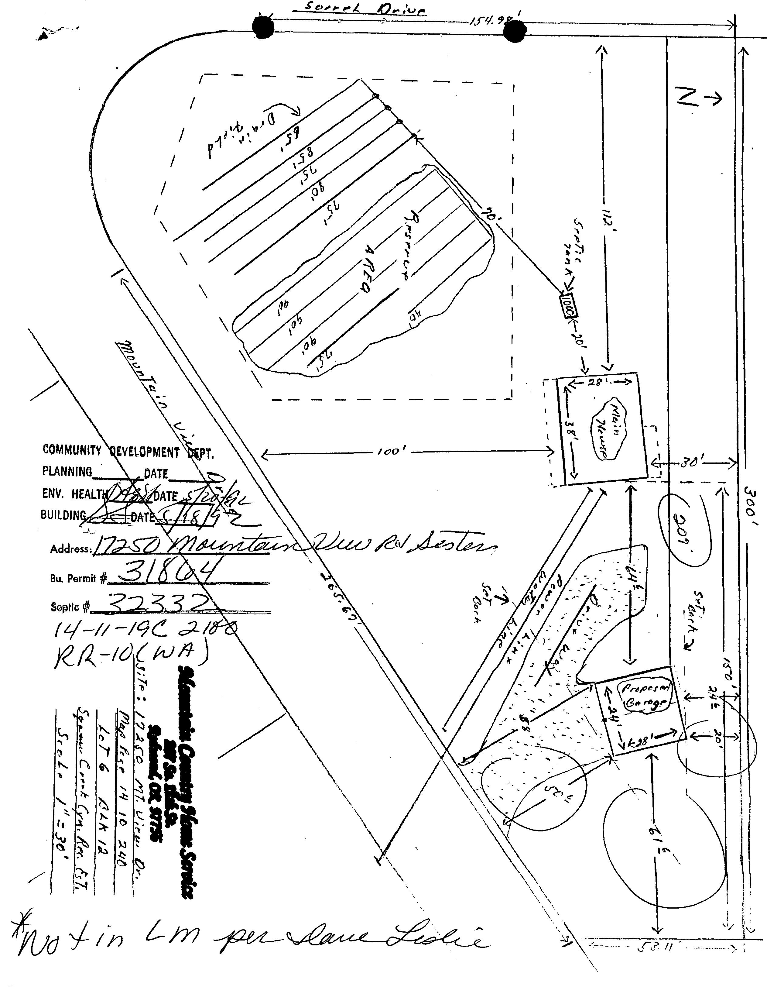
247-B31864
Permit Number: BEU KENNETH E TRUSTEE
Permit Name: MOUNTAIN COUNTRY HOME SERVICE Contractor: 05/18/1992 Application Date: 06/29/1992 Issue Date: 08/13/1992 Final Date: Finaled Status:
Residential Building Class: New Construction Class of Work: DETACHED GARAGE Building
Inspections
Date Init. Comments
08/13/1992 SEF GARAGE FINALLED. 08/12/1992 SEF NO ONE HOME. PERSONAL BELONGINGS INSIDE.
07/21/1992 RVS FRAME APP.
07/06/1992 RRN TRUSS DRAWINGS APPR. 06/30/1992 SEF FOOTING APPROVED TO BLDR'S STAKES. 06/25/1992 RRN M-1=672X14.94=10040.00.
Building Permit Details
247-B30640
Permit Number: SQUAW CREEK CANYON REC EST INC
Permit Name:
Contractor:
MOUNTAIN COUNTRY HOME SERVICE
Residential Building Class: New Construction Class of Work: RESIDENCE Building Use:
Inspections
Date Init. Comments
07/21/1992 RVS BLDG FINAL APP. 02/10/1992 RVS INSULATION APP. 02/03/1992 RVS FRAMING APP. 02/03/1992 RVS ROUGH HEATING APP. 10/18/1991 RVS UNDER FL. APP. FRAMING. 10/11/1991 RVS FOOTINGS APP. 09/16/1991 JMH R3=1820=60=109200.00
08/27/1991 JAS OLD SITUS= 70084 SORRELL DR,SISTERS
Electrical Permit Details
Permit Number:
247-E18754
BEU KENNETH E TRUSTEE Permit Name:
Contractor:
GOWDY BROS. ELECTRIC, INCL
08/27/1991 Application Date: 09/18/1991 Issue Date: 07/21/1992 Final Date:
06/29/1992 Application Date: 06/29/1992 Issue Date: 08/11/1992 Final Date:
Finaled Status:
Residential Building Class: New Construction Class of Work: DETACHED GARAGE/NO SUB PANEL
Service Description:
Building Use: 31864 Linked Permit:
Inspections
Date Init. Comments
08/11/1992 CER FINAL APPROVED AND FINALED
07/23/1992 CER ROUGH AND SERVICE APPROVED
06/29/1992 STS ONE CIRCUIT TO BE RUN OFF RESIDENCE PANEL TO DETACHED GARAGE
Electrical Permit Details
Permit Number:
Permit Name:
Contractor:
247-E15284
SQUAW CREEK CANYON REC EST INC
GOWDY BROS. ELECTRIC, INCL
Residential Building Class: New Construction Class of Work:
Service Description:
RESIDENTIAL WIRING THRU 1500 SQ FT(1) RES WIRING EACH ADD. 500 FT OR PORTION(1)
Inspections
Date Init. Comments
06/04/1993 SYS GC Permit expired by system
09/16/1991 Application Date: 09/18/1991 Issue Date: 06/04/1993 Final Date: Expired
Building Use: 30640 Linked Permit:
07/20/1992 CER ADD RECPT IN LOFT AREA AS PER LAST COMMENT
02/04/1992 CER R&S APPROVED IF RECPT ADDED TO LOFT ROOM
Electrical Permit Details
Permit Number:
247-E15039
Permit Name: GOWDY BROS ELECTRIC Contractor:
SQUAW CREEK CANYON REC EST INC
Residential Building Class: New Construction Class of Work:
Building Use: Linked Permit:
08/27/1991 Application Date: 08/27/1991 Issue Date: 10/15/1991 Final Date: Finaled Status:
Service Description: INSTALLATION,ALTERATION OR RELOCATION OF TEMPORARY SERVICE 200 AMPS OR LESS(1)
Inspections
Date Init. Comments 10/15/1991 CER TEMP APPROVED AND FINALED
Feasibility Permit Details
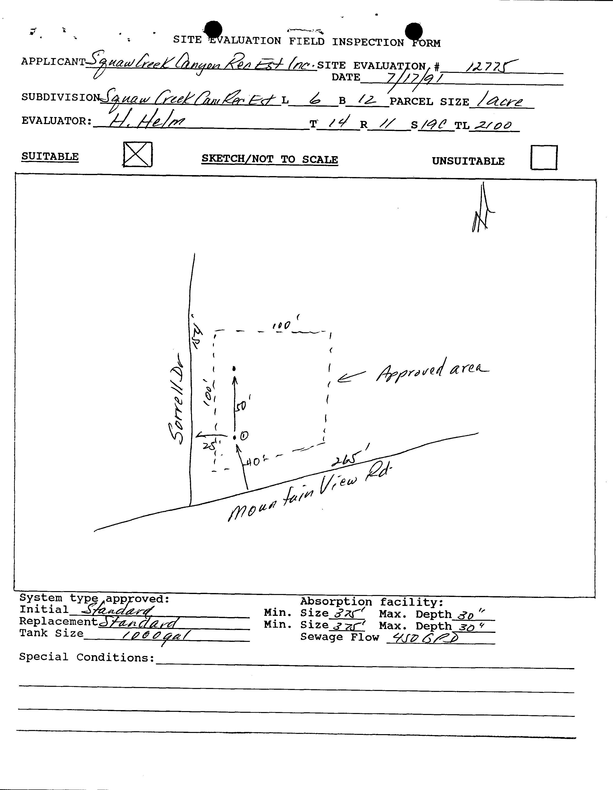
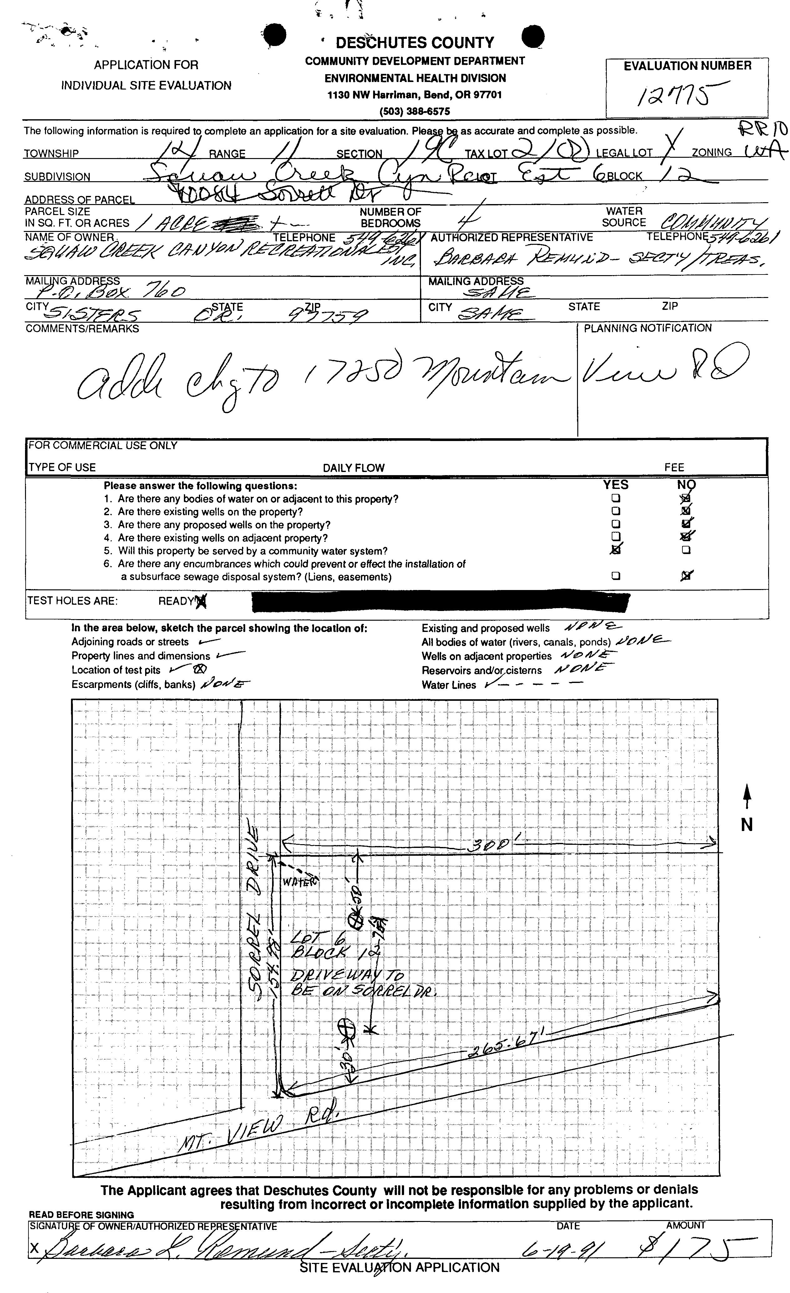
247-FS12775
Permit Number: SQUAW CREEK CANYON REC EST INC
Permit Name:
Residential Building Class: PROPOSED RESIDENCE Building Use:
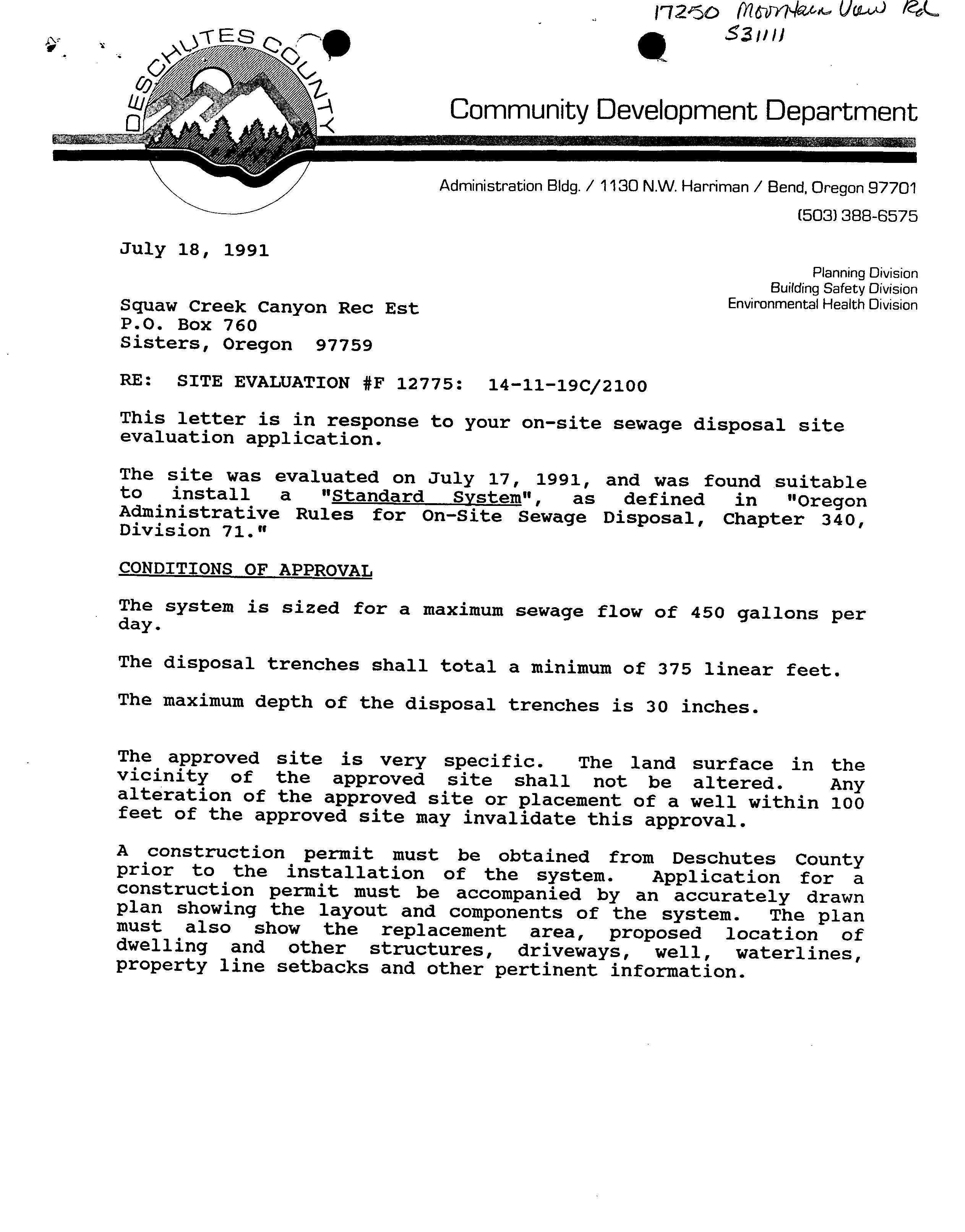
07/01/1991 Application Date: 07/01/1991 Issue Date: 07/19/1991 Final Date:
Evaluation Class of Work: Standard System Service Code:
System Approved System Type Code: Approved System Type:
Finaled Status:
Inspections
Mechanical Permit Details
Permit Number:
No inspection records found. 247-M5697
Permit Name: QUALITY HEATING
SQUAW CREEK CANYON REC EST INC
Contractor:
Residential Building Class: New Construction Class of Work:
Service Description: ISSUANCE FEE (1) NEW INSTALL THRU 100,000 BTU (1)
Inspections
No inspection records found.
Plumbing Permit Details
Permit Number:
247-P5186
Building Use: Linked Permit:
Issue Date: 07/21/1992 Final Date:
09/18/1991
Finaled Status:
Permit Name: G & S PLUMBING & MECHANICAL
SQUAW CREEK CANYON REC EST INC
Contractor:
Residential Building Class: New Construction Class of Work:
09/16/1991 Application Date: 09/18/1991 Issue Date: 07/21/1992 Final Date:
30640 Linked Permit:
Service Description: 1 & 2 FAMILY/2 BATH NEW CONSTRUCTION, INCLUDES 1ST 100 FEET OF SEWER AND WATER (1)
Inspections
Date Init. Comments
07/22/1992 RVS PLBG FINAL APP. 02/03/1992 RVS PLG TOPOUT APP.
Septic Permit Details
247-S32332
Permit Number: BEU KENNETH E TRUSTEE
Permit Name:
Contractor:
Residential Building Class: Authorization Notice Class of Work: DETACHED GARAGE Building Use:
05/18/1992 Application Date: 05/20/1992 Issue Date: 05/20/1992 Final Date: Finaled Status:
Tank Material: DEQ Approval Number: Authorization Notice, no field visit required Service Code:
System Type Linked Feasibility Permit:
Inspections
Date Init. Comments
05/18/1992 STS DONE FOR LOCATION PURPOSES ONLY/S3111 WITHIN ONE YEAR BUT GARAGE WAS NOT SHOWN ON PLOT PLAN/NO PLUMBING/NO CHANGE IN USE
Septic Permit Details
Permit Number:
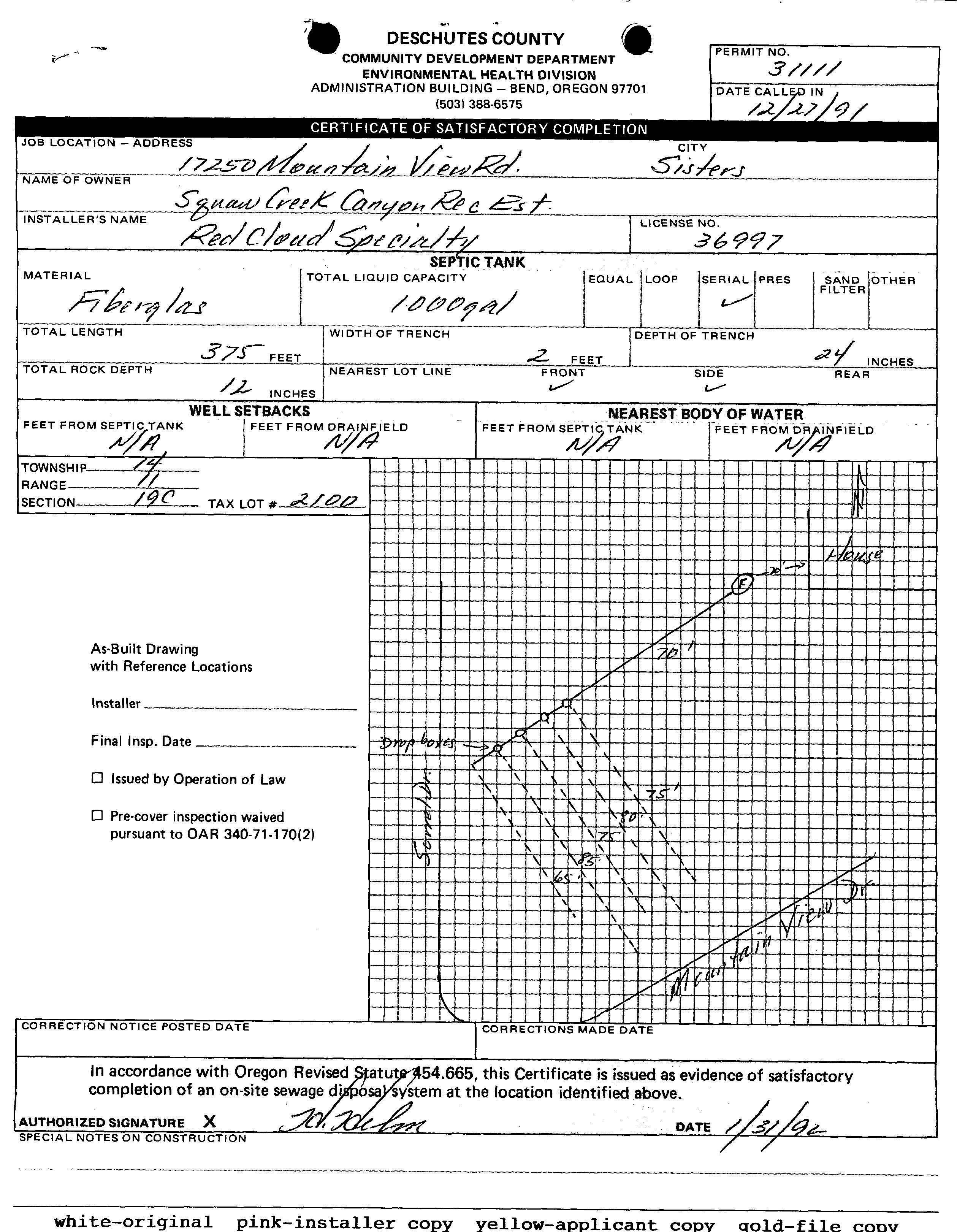
247-S31111
SQUAW CREEK CANYON REC EST INC
Permit Name: RED CLOUD SPECIALTY INC Contractor: 08/27/1991 Application Date: 08/29/1991 Issue Date: 01/31/1992 Final Date: Finaled Status:
Residential Building Class: New System Class of Work: RESIDENCE Building Use: Tank Material: DEQ Approval Number: Standard System Service Code:
System Type 12775 Linked Feasibility Permit:
SCHULZ, ROBERT W & CHRISTINA L 17250 MOUNTAIN VIEW RD SISTERS OR 97759 Please include this coupon with
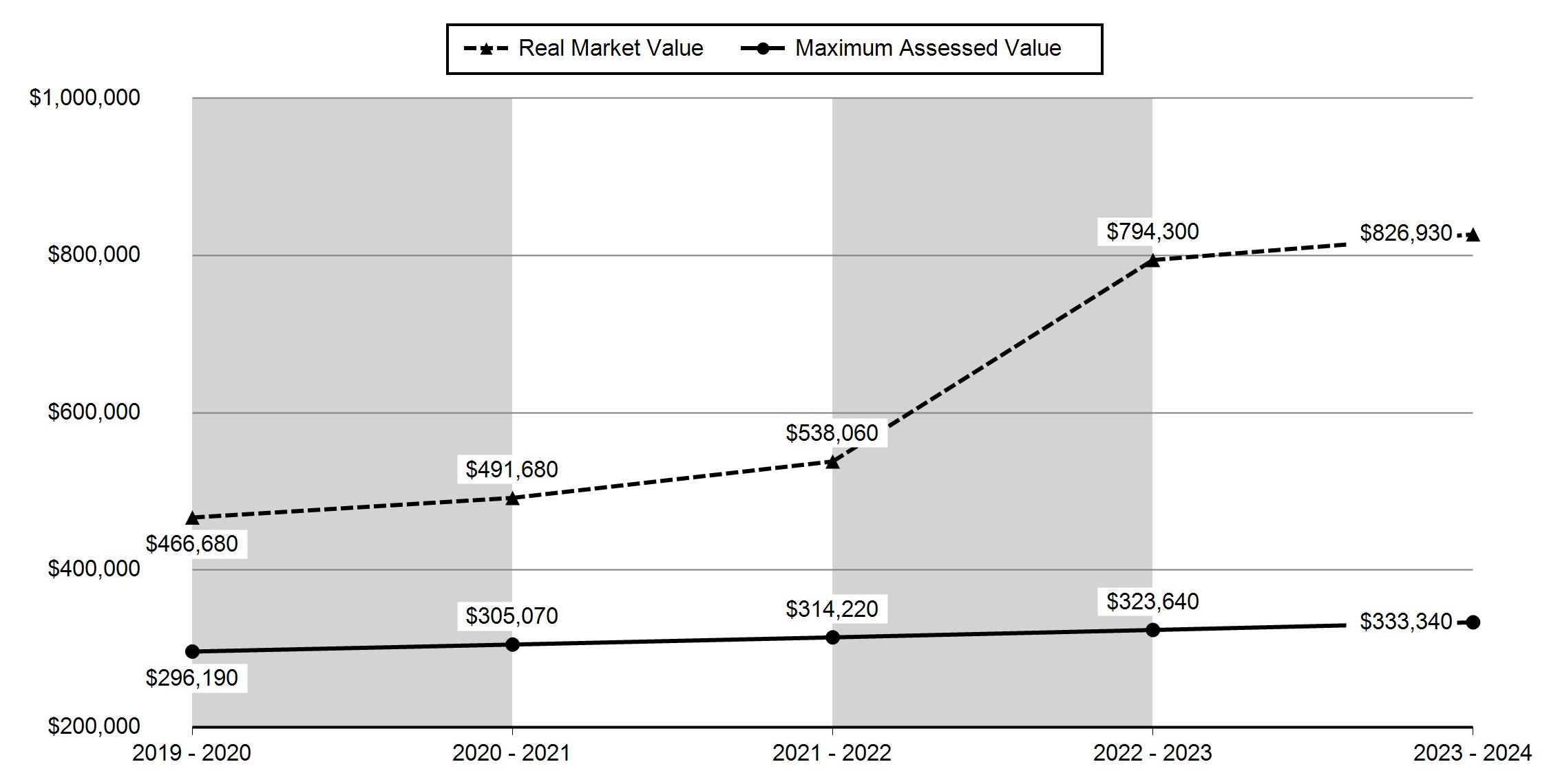
$5,068.42
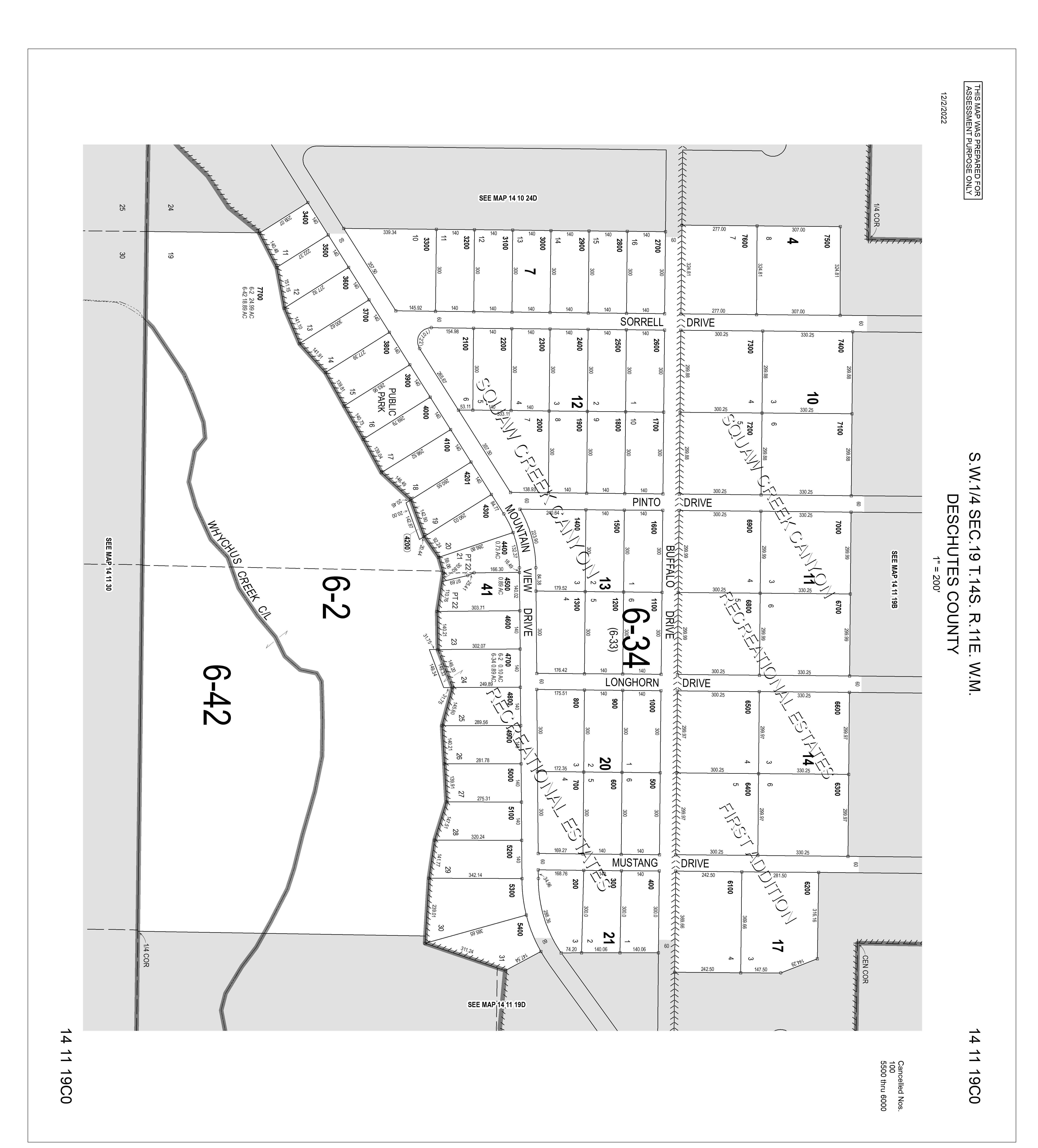
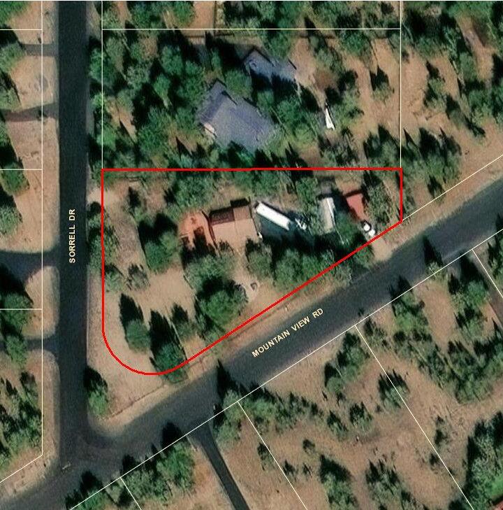
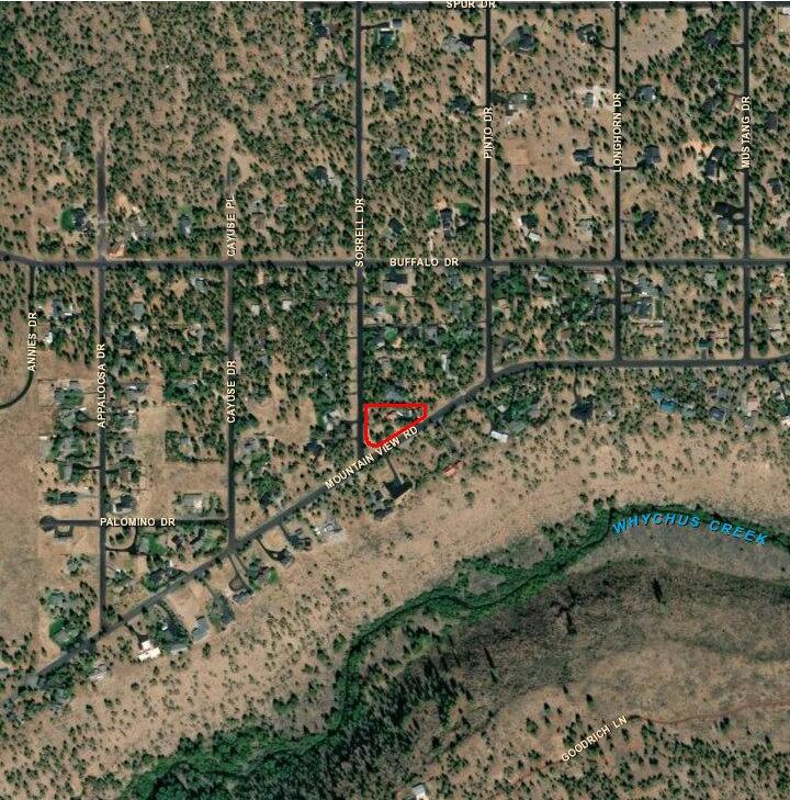
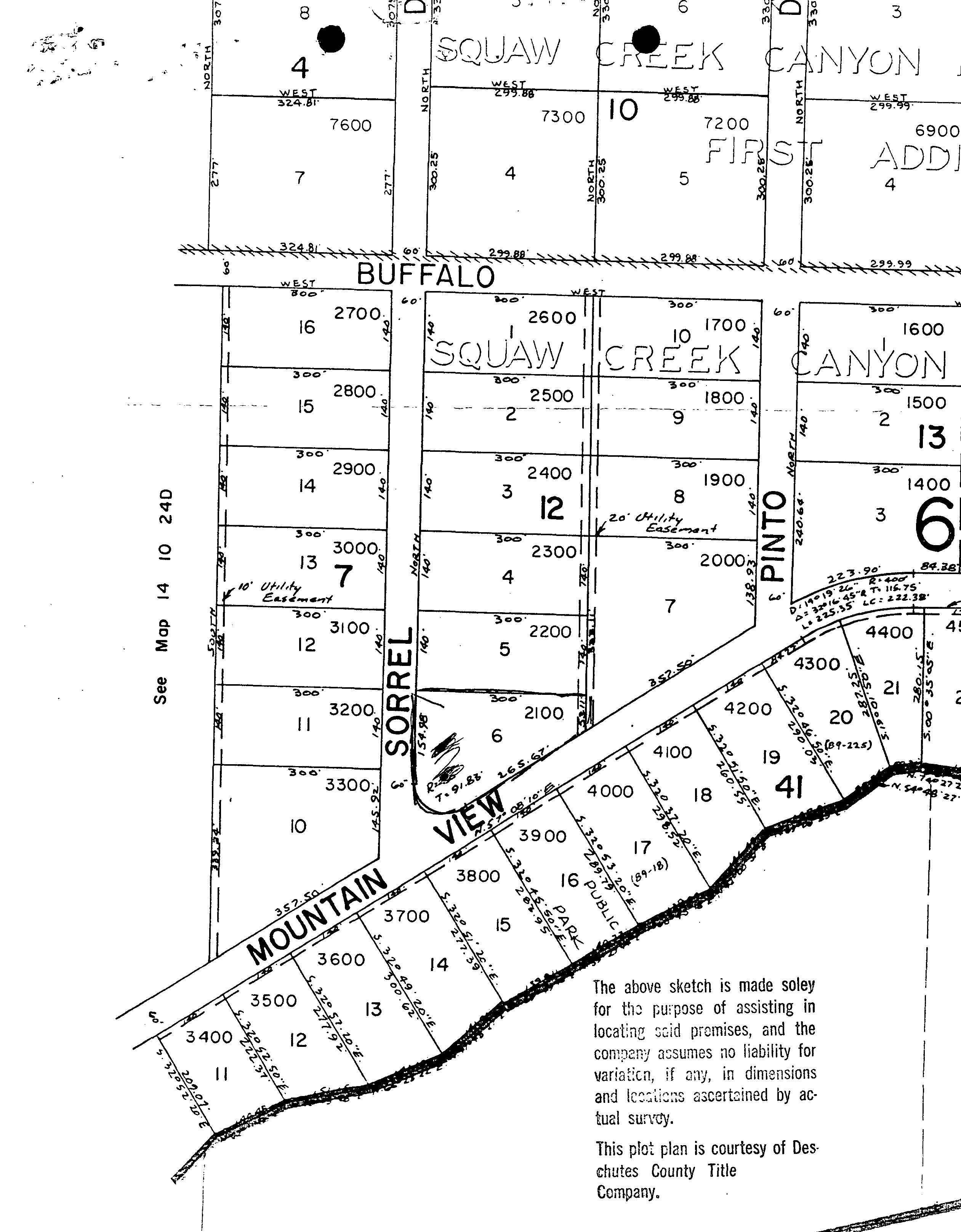
Roa d Map Map an d Tax l ot: 14111 9C 002100
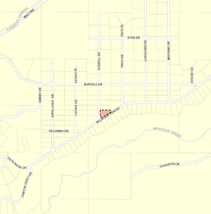


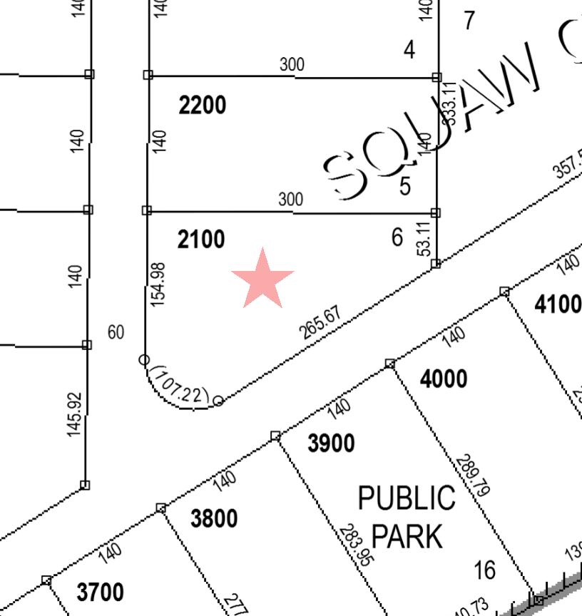

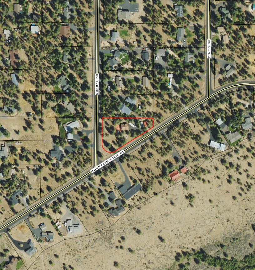
 PLAT
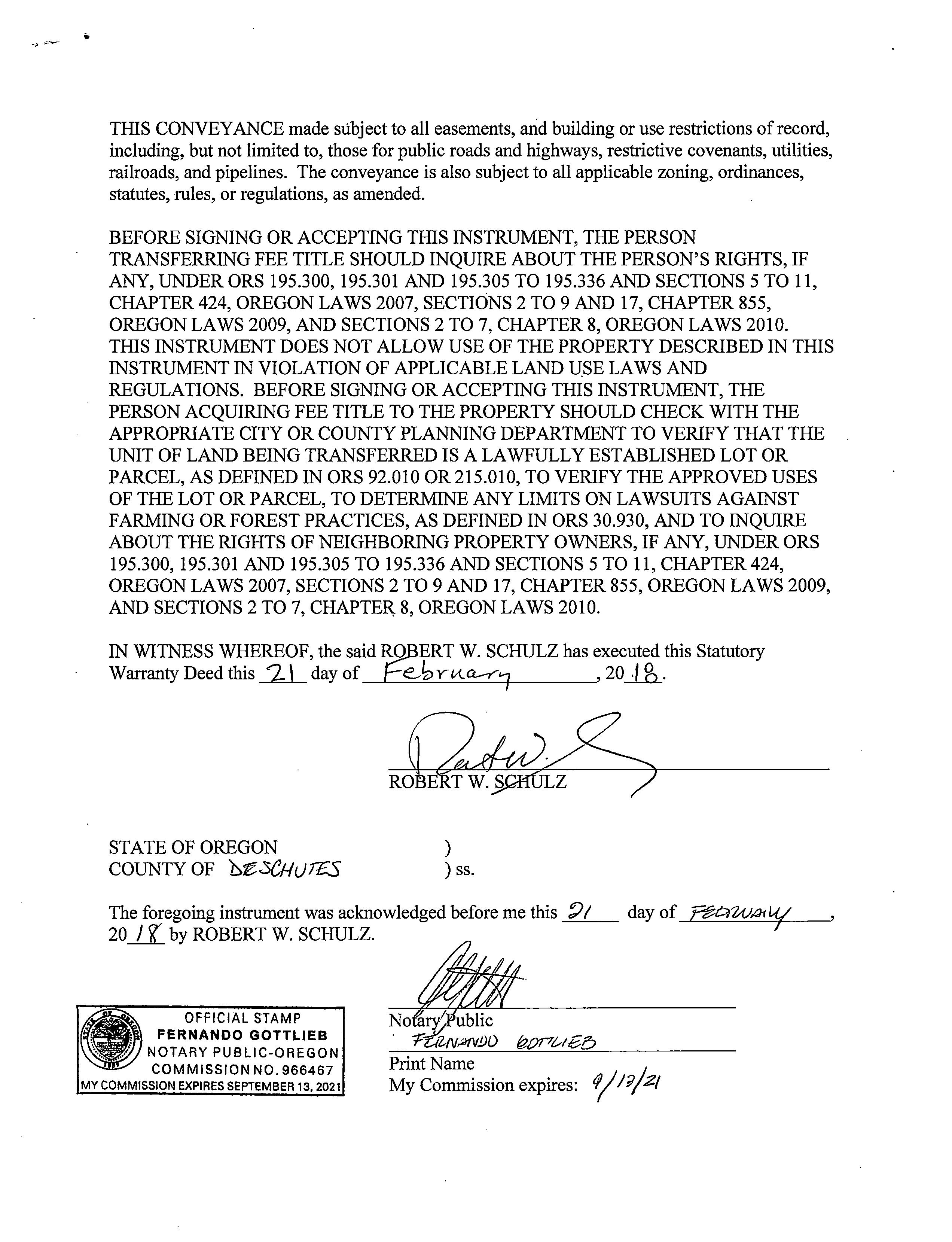
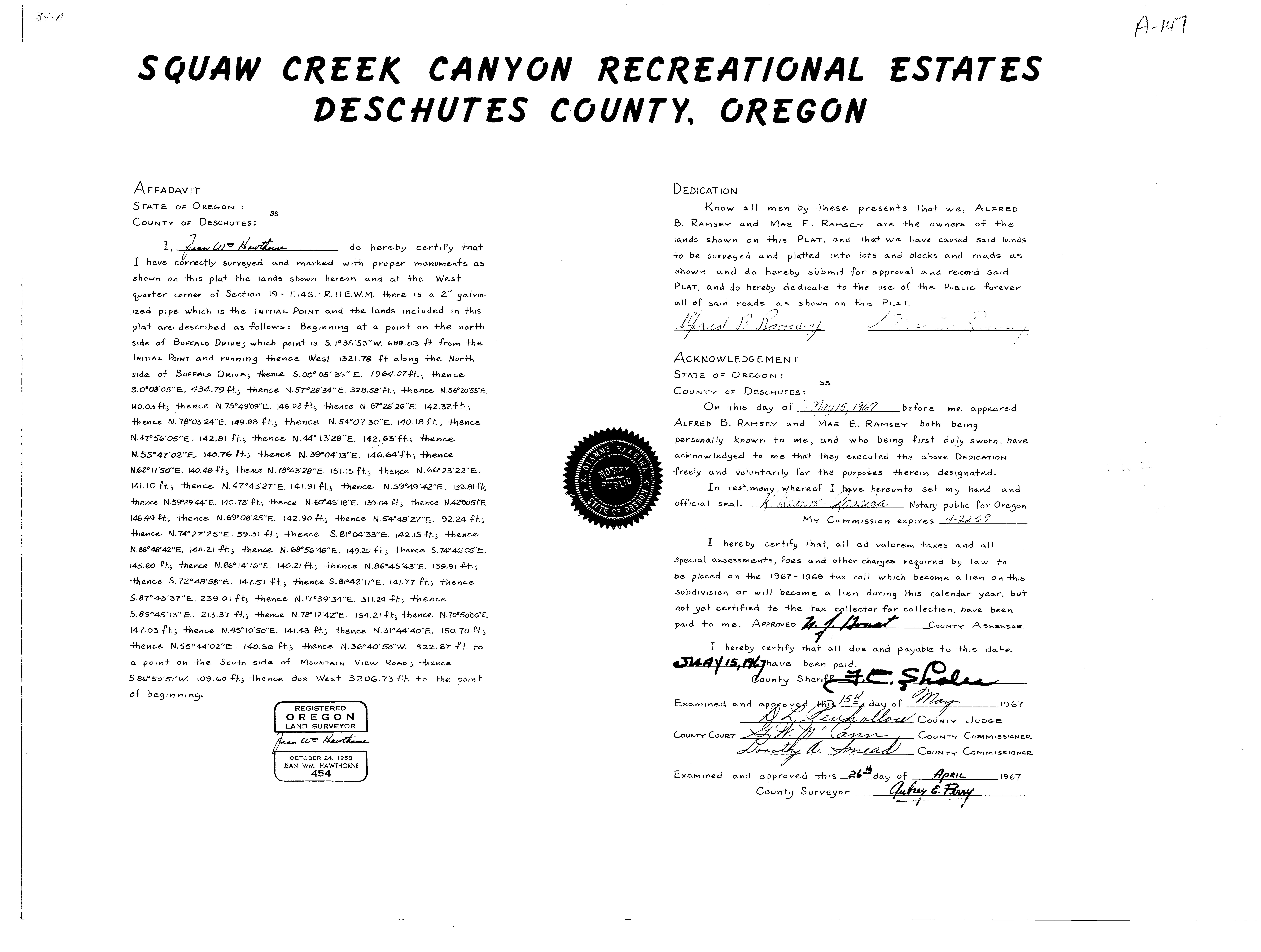
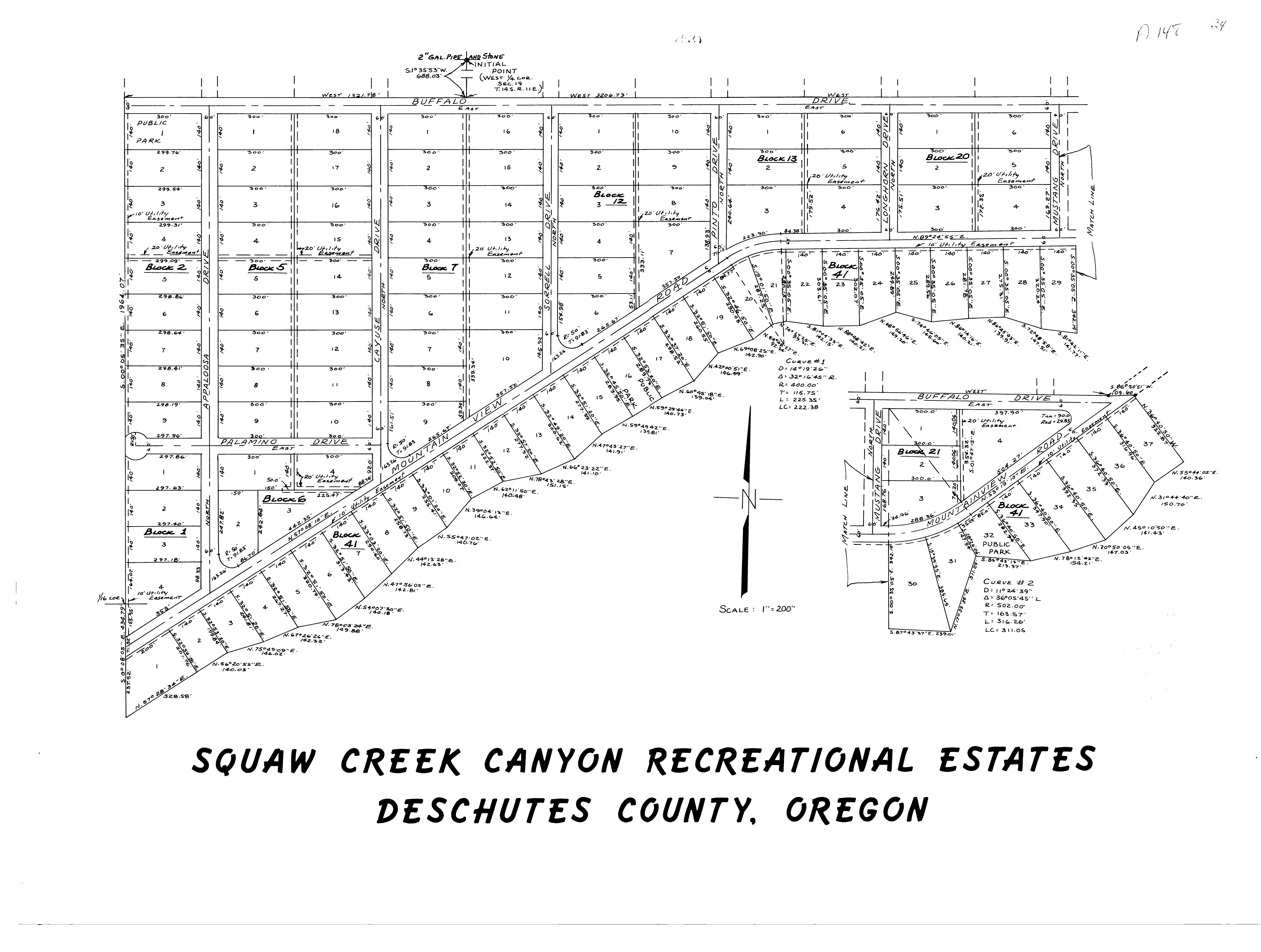
PLAT




















—Dogs must be kept on physical leash AT ALL TIMES. Please clean up after your pet.
—Pedestrian travel only: no bike, horse, or motorized vehicle use.
—Stay on roads and trails and respect restrictions as posted.
—Removal or disturbance of plants, wildlife, and historical artifacts is prohibited.
—Catch and release fishing with barbless hooks is permitted subject to applicable state regulations.
—Commercial use and private events are prohibited.
—No hunting, motorized vehicles, camping, campfires, smoking, or unmanned aircraft use.
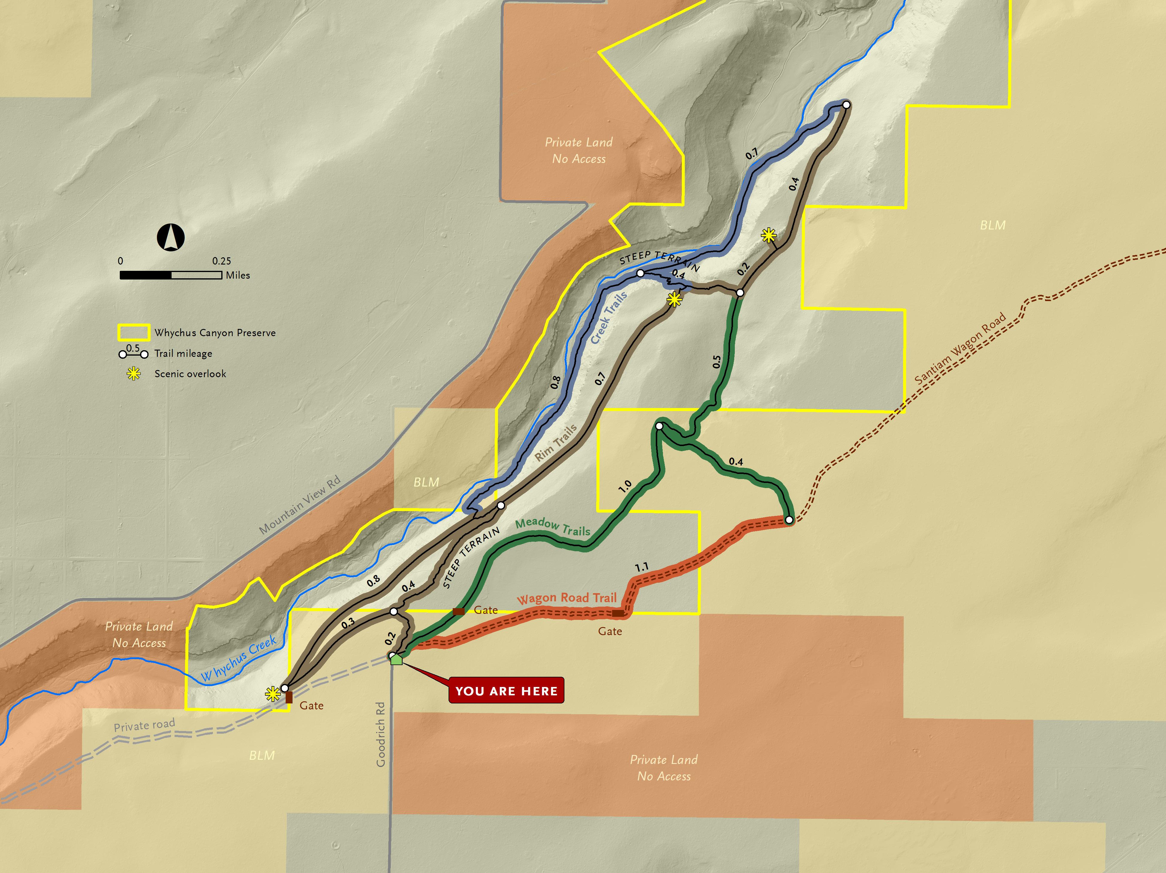
whychus canyon preserve suggested routes
Wagon Road and Meadow Loop: This route follows a portion of the historic Santiam Wagon Road. Interpretive signs along the way share the story of the Wagon Road east of the Cascades and the role it played in the settlement of Central Oregon. This fairly flat trail is lovely in the spring when desert wildflowers begin to bloom.
From the trailhead, follow signs to Wagon Road + Meadow Trails. When you see a Santiam Wagon Road interpretive sign on the right, veer off of the road and follow the dirt Wagon Road Trail. After 1.1 miles, you’ll reach a junction. Turn left and follow the trail through juniper and pine forest until you reach another junction after 0.4 miles. Turn left to continue on the Meadow Trail 1 mile back to the trailhead. Total Distance: 2.5 mile loop.
Long Canyon Route: Head down into the canyon to Whychus Creek, then stroll along the creek before heading back to the top of the canyon. This beautiful hike is challenging and involves steep trails with 300 feet of elevation gain/loss. Enjoy stunning displays of spring wildflowers, mountain views, and tranquil creekside breaks.
From the trailhead, follow signs to Rim + Creek Trails. At the first junction, turn left and walk .3 mile to a stone bench and overlook. The trail will begin to head down into the canyon for .8 miles. You’ll reach an intersection midway down the slope. Follow signs for the Creek Trail to reach the valley floor and walk downstream along Whychus Creek for 0.8 miles. At the next junction, continue straight through a sagebrush meadow for another 0.7 miles. The trail will then turn and begin to climb out of the canyon. Enjoy another scenic overlook before reaching the next junction at the top of the canyon. Follow signs for Meadow Trails and Trailhead for 1.5 miles back to the trailhead. Total Distance: 4.9 mile loop.
Mid Canyon Route: This route is for those looking for a quicker route that still dips into the Whychus Creek canyon without all the elevation gain/loss. Enjoy stunning displays of spring wildflowers and mountain views with 150 feet of elevation gain/loss.
From the trailhead, follow signs to Rim + Creek Trails. At the first junction, turn right and head down a steep route into the canyon for 0.4 miles. At the next junction, follow signs for the Rim Trail and turn right. After 0 7 miles along a rolling mid-canyon trail, you will reach a scenic overlook and bench with views into the northern portion of Whychus Canyon Preserve. Continue past the overlook to the next junction and turn right. After 0.2 miles you’ll reach another intersection. Turn left to add a quick 0.4 mile detour to another overlook. Or, turn right and follow signs for Meadow Trails and Trailhead for 1.5 miles back to the trailhead. Total Distance: 3.0 mile loop.
Download a georeferenced map of Whychus Canyon Preserve to help with navigation. Scan the QR code to the right to download.

210 nw irving, suite 102 ∙ bend, oregon 97703 (541) 330-0017 deschuteslandtrust.org

Description of Peterson Ridge Hiking and Biking Trail (PRT)
The Peterson Ridge Mountain Bike and Hiking Trail was designed as a ladder system. It consists of two linear trails, the PRT West and PRT East trails, with numbered connectors marked by junction posts that allow riders and hikers to design their own riding or hiking experience. We have included a loop option guide showing the distances from our Sisters Trailhead.


