

$9220
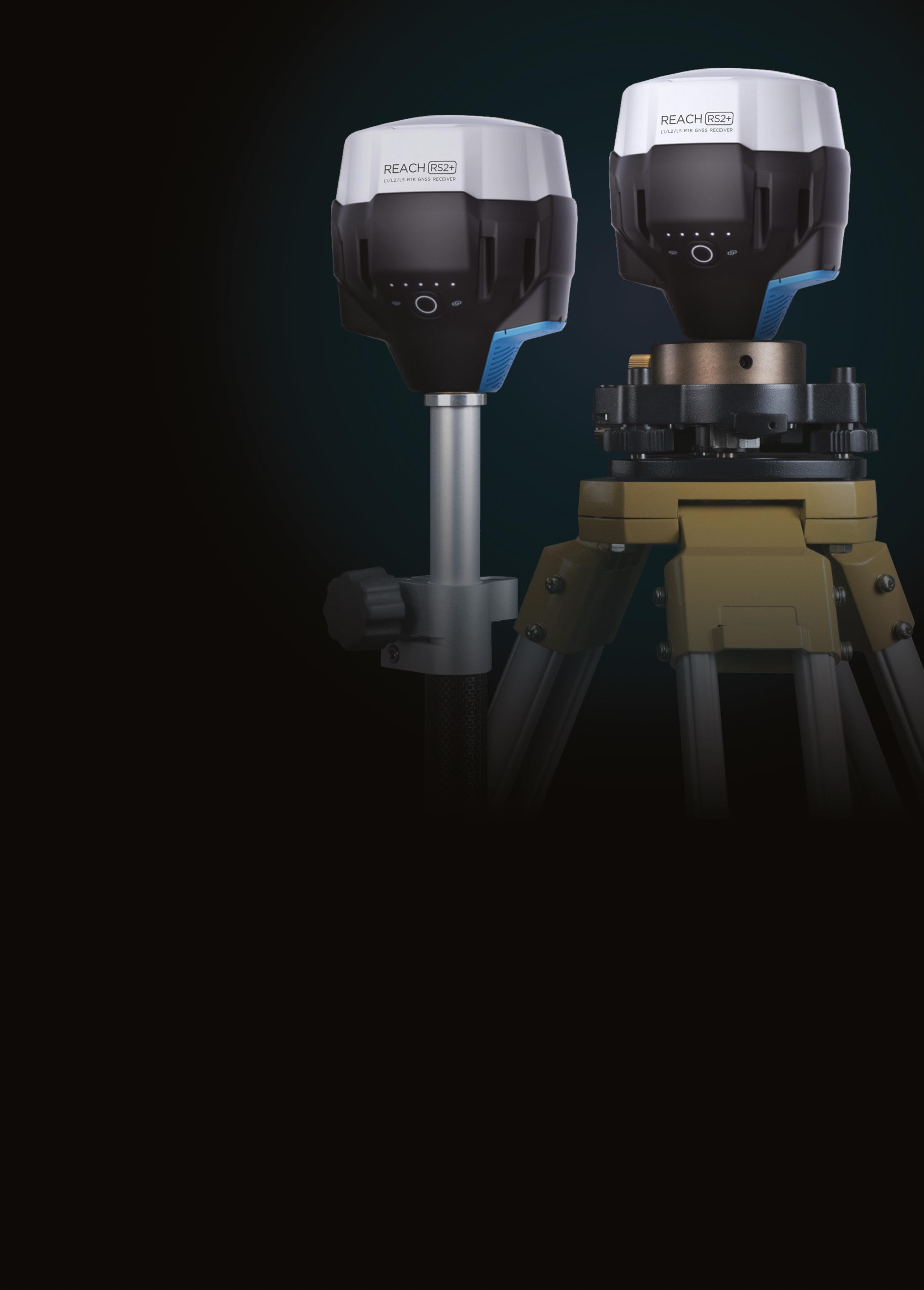
Our most popular bundle. Includes all the components required to establish a robust, multi-frequency RTK survey setup, with a local base station and a rover unit.
• 2 x Emlid Reach RS2+ GNSS receivers
• Triangl Wooden Tripod 1.67m
• Tribrach with Optical Plummet
• Rotating Tribrach Adapter
• Extension Pole 32mm x 500mm
• 2.4m Telescopic Survey Pole
• Thumb Release Type Bipod
‘High level expertise, speedy shipping and excellent customer service, nothing else you could wish for from Map Gear.

Highly recommend.’
Charlotte Mills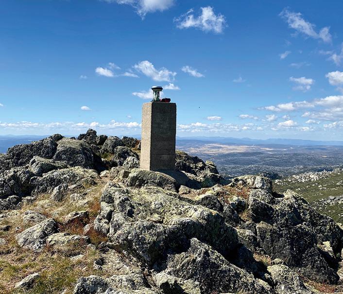


Super-thin chips made from lithium niobate are set to overtake silicon chips for light-based technologies, with potential applications including navigation on the Moon.

RMIT University’s Distinguished Professor Arnan Mitchell and the University of Adelaide’s Dr Andy Boes led a team of global experts to review lithium niobate’s capabilities and potential applications. The team is working with industry to make navigation systems that are planned to help rovers drive on the Moon later this decade.
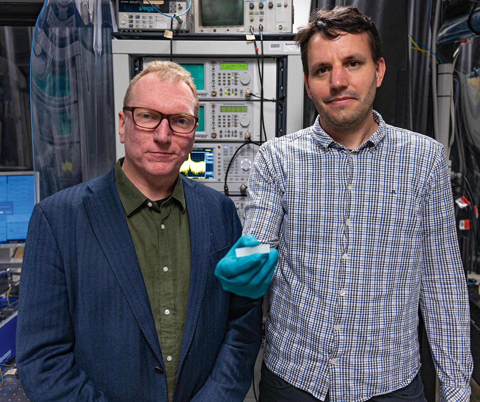
Lithium niobate is an artificial crystal that was first discovered in 1949 but is “back in vogue,” according to Boes.
As it is not possible to use GPS on the Moon, lunar rover navigation systems will need to use an alternative system. So the team is working with Australian company Advanced Navigation to develop optical gyroscopes, where laser light is launched in both clockwise and anticlockwise directions in a coil of fibre, said Mitchell, Director of the Integrated Photonics and Applications Centre.
“As the coil is moved, the fibre is slightly shorter in one direction than the other, according to Albert Einstein’s theory of relativity. Our photonic chips are sensitive enough to measure this tiny difference and use it to determine how the coil is moving. If you can keep track of your movements, then you know where you are relative to where you started.”
“This is not science fiction — this
artificial crystal is being used to develop a range of exciting applications. And competition to harness the potential of this versatile technology is heating up.”
Mitchell added that while the lunar navigation device was in the early stages of development, the lithium niobate chip technology was “mature enough to be used in space applications”.
“Our lithium niobate chip technology is also flexible enough to be rapidly adapted to almost any application that uses light,” Mitchell said. “We are focused on navigation now, but the same technology could also be used for linking internet on the Moon to the internet on Earth.” n
2–5 May: Geospatial World Forum 2023 geospatialworldforum.org
9 May: 15th Australian Space Forum forum.andythomas.foundation/15thaustralian-space-forum
10 May: Space & Geospatial Collaborative Workshop sssi.org.au/events-awards/events/ space-geospatial-workshop
10–12 May: Locate23 locateconference.com
23 May–1 June: FIG Working Week 2023 fig.net/fig2023
6–8 June: 2023 National Surveying Congress https://www.consultingsurveyors. com.au/
13–15 June: RPAS in Australian Skies aaus.org.au/events/upcoming-events
21 June: World Hydrography Day 2023 HIPP Seminar sssi.org.au/events-awards/events/ hipp-world-hydrography-dayseminar-2023
11–12 July: Disaster & Emergency Management Conference https://anzdmc.com.au/
13–18 August: 31st International Cartographic Conference and 19th General Assembly icc2023.org
30 August–1 September: S+SNZ 2023 Conference surveyspatialnzconference.org
13–15 September: AIMS 2023 National Conference aimsconference.com.au
26–28 October: CSA of NSW October Conference https://www.countrysurveyors.com.au/
15 November: WA Digital Twin Summit & APSEA-WA sssi.org.au/events-awards/regionalconferences
For more events, go to www. spatialsource.com.au/event-listing
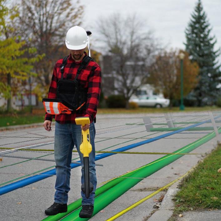
The mapping of sub-surface utility assets such as water, gas, electricity and telco networks, has been a critical task for infrastructure planning and maintenance for decades. Mapping is essential to ensure the safety of construction workers, avoid service disruptions and prevent damage to infrastructure.
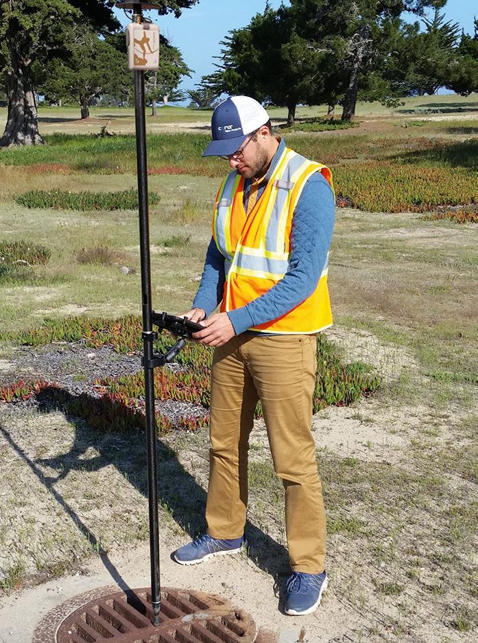
In the past, subsurface utility assets were not often mapped accurately in a coordinate system. It would have been expensive to engage a surveyor with specialist knowledge and equipment. Instead, the centreline of a pipe or cable would have been measured as a distance from fence corners, property boundaries, kerbs, power poles and so on. Thankfully, there are now other solutions, such as radio detection, magnetic locators, metal detectors, high frequency microwave and acoustic systems, to aid the skilled utility locator find most of the assets.
But recent innovations have now made it possible for non-survey-qualified operators to accurately map subsurface assets. Some training is required because, although the equipment can be straightforward, different correction services may result in different datums. This means that although you may have high precision, your actual coordinate may be in a different location to your asset management system or GIS.
GNSS technology has emerged as a powerful tool for mapping these assets accurately and efficiently. In particular, smaller, higher performing, more accurate and lighter receivers are now available that are easy to use. Recent enhancements include moving from GPS alone (one constellation) to GNSS (four or more constellations), dramatically increasing performance and accuracy, particularly in harsh environments. Where GPS alone averaged nine satellites in view, GNSS can average more than 40, thereby increasing the geometric strength of the position solution. Also, as mobile phone coverage has increased, GNSS users now have increased access to CORSNet in many more locations.
Enhanced GNSS receivers such as the Eos-GNSS Arrow (available from 4D Global) can now access the new Australian/ New Zealand Satellite Based Augmentation System, known as SouthPAN. SouthPAN provides Australia and New Zealand wide sub-metre accuracy for free for compatible L1 (single frequency) and multi-frequency receivers. Not all receivers can currently use SouthPAN, and those that can will require their configuration to be set up correctly to use the service. Ultimately there will be three services levels available down to 100 mm for an L1, L5 compatible receiver. Eos-GNSS units are also designed for Esri field-mapping solutions out of the box to save time for utilities that use ArcGIS for their corporate GIS.
Whether your goal is to map for spatial asset management, ISO55000 or AS 5548.1 classifications or locating for water and gas utilities, another innovation to improve your GIS data in the field is to use a radio detection system for locating subsurface metal pipes and have the location data passed straight through to the mapping software with accurate GNSS coordinates.
The major advantage of using GNSS technology is efficiency. GNSS enables field technicians to map assets quickly to reduce time and cost. This is especially important for infrastructure planning, design, construction, digital twin foundational datasets and asset maintenance, where accurate and up-to-date mapping data is essential.

GNSS technology has emerged as a powerful tool for mapping sub-surface utility assets. However, challenges such as urban canyons or vegetated environments need to be addressed to ensure the quality and reliability of the data. To ensure you get the results you need, consult an experienced GNSS solutions supplier to ensure that your equipment is set up correctly right at the start of your project. n
4D Global’s Peter Terrett has more than 35 years of experience in providing spacebased positioning solutions.
To learn how GNSS can save you time and take your subsurface mapping to the next level, contact Peter Terrett at pterrett@4dglobal.com.au or 0419 30 7770.Consult an experienced GNSS solutions supplier to ensure that your equipment is set up correctly.

Publisher
Simon Cooper
Editor
Jonathan Nally
jnally@intermedia.com.au
National Advertising Manager
Anna Muldrock
amuldrock@intermedia.com.au
Prepress
Tony Willson
Production Manager
Jacqui Cooper
Subscribe
Position is available via subscription only.
A 12 month subscription (6 issues) is AUD$76.00. To subscribe visit www.intermedia.com.au, phone: 1800 651 422 or email: subscriptions@intermedia.com.au website: www.spatialsource.com.au
Position is published six times a year, in February, April, June, August, October and December by Interpoint Events Pty Ltd.
ABN: 9810 451 2469
Address: 41 Bridge Road, Glebe NSW 2037
Ph: +61 2 9660 2113 Fax: +61 2 9660 4419
Reprints from Position are permitted only with the permission of the publisher. In all cases, reprints must be acknowledged as follows: ‘Reprinted with permission from Position Magazine’, and must include the author’s byline.
The opinions expressed in this publication are those of the authors and do not necessarily represent those of the publisher.
Supported by

Excitement is definitely building in the lead up to this year’s Locate conference, to be held in Adelaide back-to-back with the Australian Space Forum. I’m really looking forward to catching up with colleagues and acquaintances old and new, and continuing to learn about this exciting industry of which we’re all privileged to be a part. I’m hoping there will be lots of exciting announcements from companies and organisations, perhaps news of some breakthroughs or innovative initiatives, and plenty of insights into what geospatial experts are achieving around the country.
The space and spatial connection is particularly relevant given the recent release of the 2030 Space+Spatial Industry Growth Roadmap (see page 31), a milestone achievement which hopefully will set the stage for a once-in-a-generation revolution. The brainchild of Peter Woodgate (now sadly deceased), the Roadmap sets out a clear vision for symbiotically growing both the spatial and space sectors to strengthen Australia’s economy and geostrategic position. I encourage you to download it (2030spaceandspatial.com) and see where your organisation fits within that vision. While a lot of emphasis is placed on government support and policy changes, making a success of the opportunities ahead will also require every individual industry member to play their part.
Another thing I’m looking forward to in Adelaide, will be the gathering to celebrate the launch of the new Geospatial Council of Australia. The GCA has been formed from the merger of the Surveying and Spatial Sciences Institute and SIBA|GITA. I think it’s fair to say that this development is one of the most significant of recent times, and promises to bolster industry’s voice to government, consolidate industry-internal efforts and bring individual and corporate members closer together. Mergers are rarely easy, and I know that a lot of hard work has gone into it, so all those involved are to be congratulated for seeing the process through in such a positive and constructive manner.
Jonathan Nally Editor
The Intermedia Group takes its Corporate and Social Responsibilities seriously and is committed to reducing its impact on the environment. We continuously strive to improve our environmental performance and to initiate additional CSR based projects and activities.
As part of our company policy we ensure that the products and services used in the manufacture of this magazine are sourced from environmentally responsible suppliers. This magazine has been printed on paper produced from sustainably sourced wood and pulp fibre and is accredited under PEFC chain of custody.
PEFC certified wood and paper products come from environmentally appropriate, socially beneficial and economically viable management of forests.
June/July
Standards — From datums to devices, standards are key to the future. Resources — Geospatial’s place in mining, energy and the environment. Mapping — Surveying and mapping tech, software and services.
Advertising booking date: 5 May 2023
Advertising material date: 10 May 2023
Publication date: 29 May 2023
For article proposals, contact the Editor: jnally@intermedia.com.au
For advertising, contact the Advertising Manager: amuldrock@intermedia.com.au
The NSW Board of Surveying and Spatial Information (BOSSI) has finalised its new strategic plan for the years 2023 to 2026 and beyond. Release of the plan follows a period of stakeholder engagement and an externally facilitated workshop. The workshop concentrated on a review of strategic themes and challenges, identification of key future focus areas, as well as the refreshing of strategic goals and setting priority actions. The identified strategic priorities include:
• BOSSI role and identity
• Integrity of the cadastre and mine surveying
• Sustainability and integrity of the profession
• Engagement and communication
BOSSI’s mandate and core functions have been solidified as:
• Registration of land and mining surveyors, and ongoing administration of the register.
• Investigation of complaints against registered land and mining surveyors, and implementing disciplinary action that may arise as a result of the investigations.
• Provision of advice to the Minister on the integrity of the cadastre, practice of surveying, spatial information and all other matters in connection with the administration of the Surveying and Spatial Information Act 2002.
• Investigation and prosecution of breaches of the Surveying and Spatial Information Act 2002. ©stock.adobe.com/au/Yuttana


The Ocean Decade Corporate Data Group — co-chaired by Fugro and the Intergovernmental Oceanographic Commission of the United Nations Educational, Scientific and Cultural Organisation (IOC/UNESCO) — has been officially launched.
Organised in support of the United Nations Decade of Ocean Science for Sustainable Development, the working group is focused on creating frameworks and mechanisms to make privately owned ocean science data publicly available for the benefit of humanity.
Joining the group as founding members are five privatesector companies representing a diverse range of industries: Alcatel Submarine Networks, Ava Ocean, CGG, Equinor and Ørsted. Discussions are ongoing with other industry-leading companies who are expected to join at a later stage.
Members will explore data sharing challenges and opportunities to develop solutions and best practices for making private-sector ocean data publicly available.
“We are delighted to officially launch this working group to establish ways to unlock the huge potential of industrial ocean data that is currently inaccessible to science,” said Dr. Vladimir Ryabinin, IOC/UNESCO Executive Secretary. “Such collaborations amongst science, industry and governments are transformative in enhancing ocean knowledge and information… I am very grateful to the founding members of this group for engaging proactively with us in this movement and I know they will inspire many others to join.”
©stock.adobe.com/au/Sasa
Kadrijevic
A new Australian Low Earth Orbit Satellite Working Group has held its first meeting and identified four main regulatory areas applicable to the telecommunications reform. The intention to establish the Group was announced in October last year. The first meeting, held in Sydney in early February, saw a range of telecommunications industry participants come together, along with representatives from the Department of Infrastructure, Transport, Regional Development, Communications and the Arts, the ACMA, and the new First Nations Digital Inclusion Advisory Group.
The four priority issues singled out by the Group are:
• How satellites can help close the digital inclusion gap, particularly in relation to First Nations peoples consistent with Closing the Gap Target 17;
• The role of satellites in supporting greater resilience and redundancy in emergency circumstances;
• The use of satellites to deliver universal telecommunications services; and
• The economic benefit that could come from greater LEOSat usage, including by facilitating the Internet of Things. The potential for LEO to play a role in position, navigation and timing (PNT) services was a key theme of last December’s IGNSS conference in Sydney.
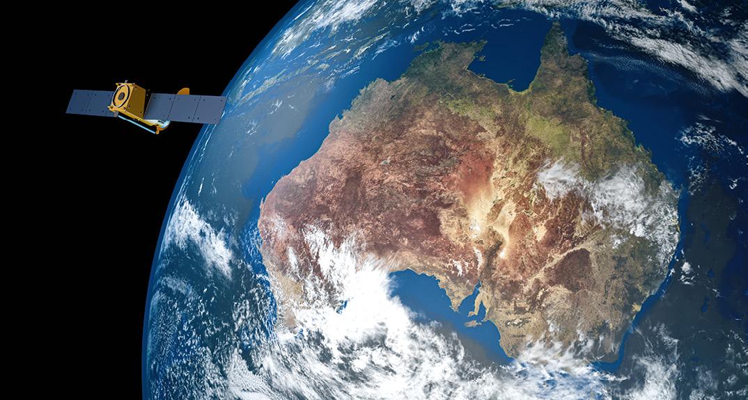
Hydrographers and all those with an interest in hydrography and related disciplines, are invited to attend a World Hydrography Day 2023 Seminar in Suva, Fiji, on 22 and 23 June. The seminar will be held jointly by the Australasian Hydrographic Society and the Fiji Hydrographic Service. The venue will be the Moana Anglican Services and Teaching Centre at St John the Baptist Theological College.
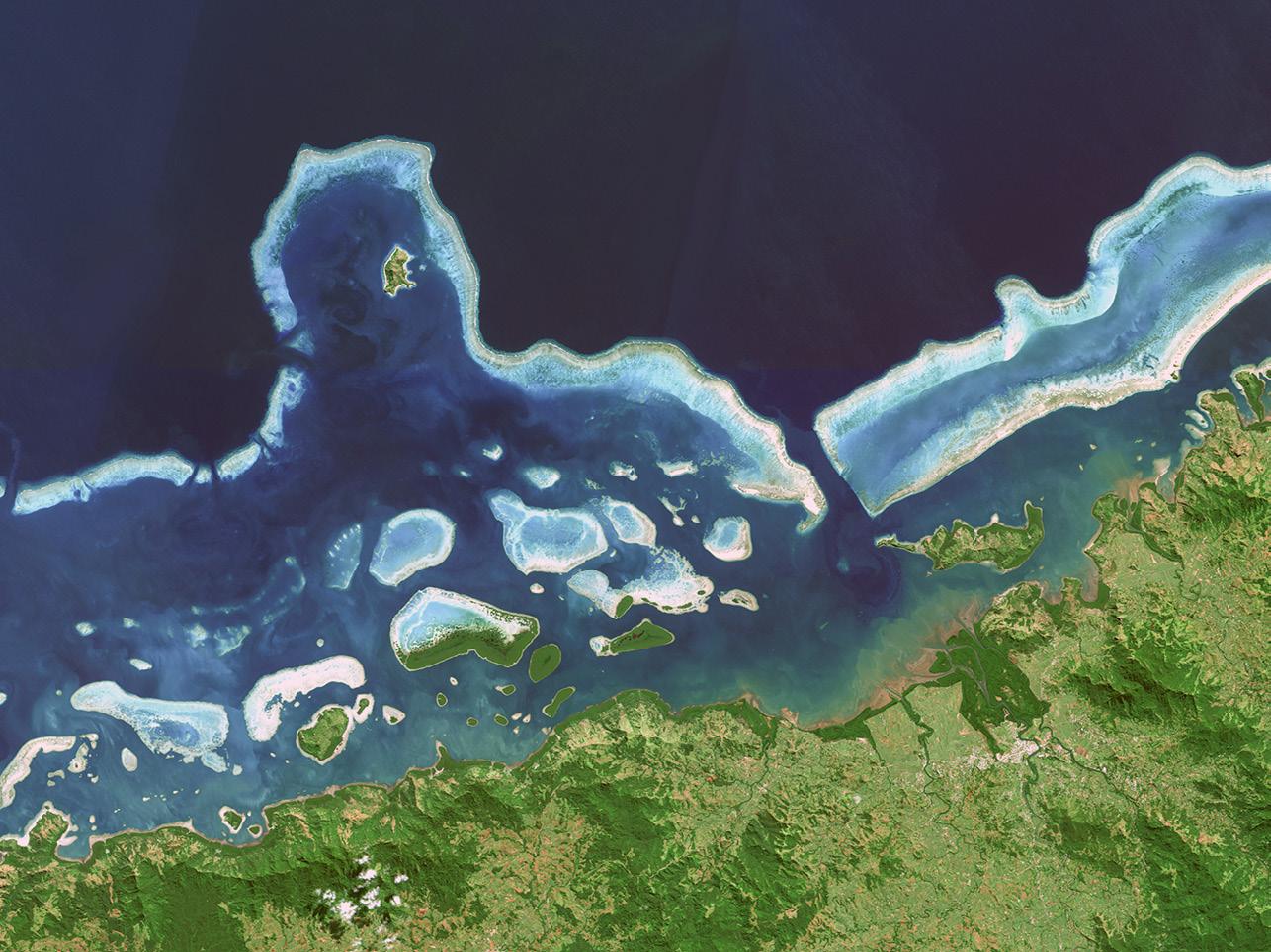
The theme for World Hydrography Day 2023 is ‘Hydrography: Contributing to the United Nations Ocean Decade,’ and the seminar comes after a two-year pause due to the COVID pandemic and associated travel restrictions. It will provide an opportunity for professionals to network and share hydrospatial knowledge through presentations and discussion. It is also intended that the presentations will highlight the empowerment of women within the hydrography field.
The organisers are calling for potential sponsors and presenters to get in touch. Registration is free but places are limited. Registrations must be secured by close of business, Tuesday, 20 June 2023. To obtain further details or to register, contact John Maschke, AHS SW Pacific Region Chair, via swp@ahs.asn.au, maschkejw@gmail.com or +61 424 094 546.
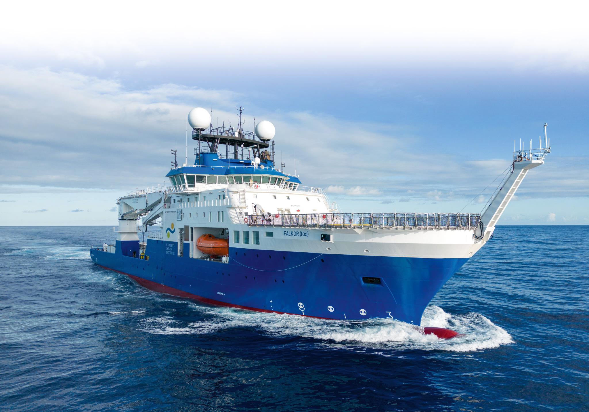
The Schmidt Ocean Institute has commissioned its new 110-metrelong, global-class research vessel, the Falkor (too), for use by marine scientists worldwide to push the frontiers of deepsea investigations.
Funded by Schmidt Ocean Institute founders Eric and Wendy Schmidt, the ship will embark on a series of expeditions and be available to scientists and technologists globally at no cost — all they have to do is make their research and discoveries publicly available.
The ship replaces the Institute’s previous research vessel, Falkor, which was in service for a decade and hosted more than 1,100 scientists, discovered over 50 new marine species and underwater formations, and mapped more than 1.3 million square kilometres of seafloor. Falkor spent time in Australian waters.
©stock.adobe.com/au/Christian
“The ocean is our planet’s last frontier, and the opportunities for exploration are immense,” said Wendy Schmidt, co-founder and president of Schmidt Ocean Institute.
The seven-deck Falkor (too) will offer scientists a modular platform to conduct almost any research at sea, with a 105-square-metre main laboratory in addition to seven other at-sea laboratories. The ship also features a 150-tonne crane, two moonpools, and equipment for high-resolution ocean depth mapping… which will contribute to the global effort to map the entire ocean floor by 2030.
The Falkor (too) began life as the M/V Polar Queen, an offshore industry vessel. It was acquired by the Schmidt Ocean Institute in 2021 and converted to a scientific research vessel.
Survey and Spatial New Zealand (S+SNZ) has launched its long-awaited new Certification Framework, following a two-year development period that included a successful pilot program in 2022.
According to S+SNZ, the purpose of the framework is to “provide a recognised professional pathway for members at all levels, with clear eligibility criteria, a public register and mandatory Continuing Professional Development, supported by a robust renewal process and a quality management system”.
Certifications will be available only to S+SNZ members, with the applications process to open in July 2023. Costs are yet to be announced.
To begin with, the framework will provide certification for two categories (with the goal of adding others):
• Engineering Surveyors (Survey and Spatial New Zealand Certified Professional Engineering Surveyor)
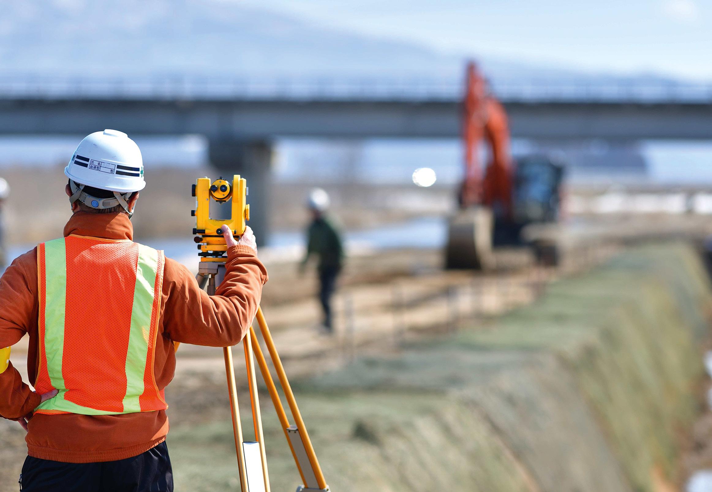
• Land Development Engineers (Survey and Spatial New Zealand Certified Professional Land Development Engineer)
Engineering surveying has been spotlighted because, according to S+SNZ, this is currently an unregulated sector in New Zealand, making the new certification the “first step to providing recognition of professional and technical competency for NZ Engineering Surveyors. It will provide quality assurance for employers, clients, and third parties and provide a new career pathway for our members.”
The land development engineering certification will be the first certification for New Zealand professional land development engineers. The assessment will be set at a high standard and will recognise “current professional and technical competency in Civil Engineering as it relates to Land Development,” as well as aligning with the aims of the new ‘Occupational Regulation of Engineers’ Act which is due to be passed this year.
Certification currency will be assured via a four-yearly reassessment, an annual practising certificate with compulsory CPD requirements, and an annual commitment to ethics and best practice.
More information will be forthcoming for S+SNZ members via email updates, webinars, Zoom sessions and posts on its website. Interested parties can email certification@surveyspatialnz.org for further details.
©stock.adobe.com/au/godfather
Toitū Te Whenua LINZ continues to provide essential services for government and private-sector clients in the wake of the devastation wrought by Cyclone Gabrielle. The cyclone hit New Zealand and parts of Vanuatu in February 2023. According to some sources, it is the costliest cyclone on record in the Southern Hemisphere, with the damage bill already reaching about $12 billion.
In a statement posted on the LINZ website, the agency says that “All our services, including Landonline, are operating during the national state of emergency activated in response to the cyclone”.
“We are working closely with colleagues across Government to support communities throughout New Zealand affected by Cyclone Gabrielle.”

LINZ says that it recognises that “Due to travel issues and other significant disruptions in areas affected by Cyclone Gabrielle some practitioners may be unable to meet with new or existing clients in person to take conveyancing instructions.
“In these situations, and where practicable, practitioners may follow the guidance set out in the Authority and Identity Requirements and Electronic Signing of Documents Interim Guideline 2020.
“Practitioners should retain a file note recording what other reasonable steps were taken to verify the identity of the client.”
The agency says that it is “providing geospatial support to response agencies via the National Emergency Management Agency (NEMA), including the coordination of satellite and aerial imagery and LiDAR data”.
“Updated geospatial data, such as satellite data and aerial imagery will be released on the LINZ Data Service and/or LINZ Basemaps as it becomes available.”
Maxar Technologies has been awarded Phase 3b of the US Army’s One World Terrain (OWT) prototype Other Transaction Agreement contract. The OWT program aims to deliver 3D global terrain capability and associated information services that support a fully accessible virtual representation of the physical Earth through the Army network.
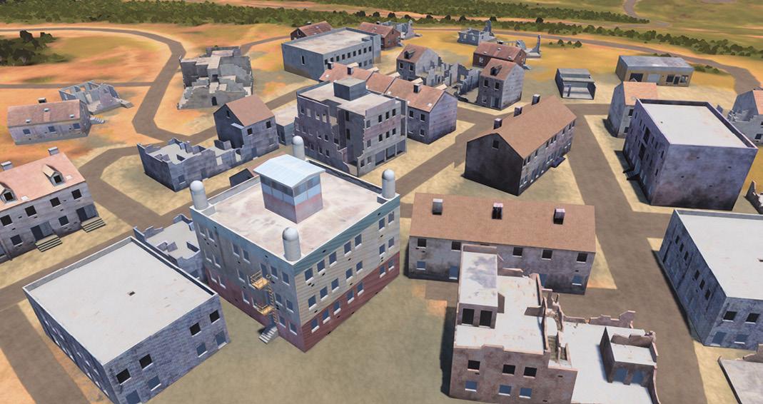
OWT is a key component of the Army’s Synthetic Training Environment (STE), which aims to provide a realistic, common and automatically generated global geospatial dataset for simulation,
mission command and intelligence systems to conduct collective training, mission rehearsal and mission execution at the point of need.
“The evolution of OWT shows how 3D terrain and information services are becoming essential tools for planning and decisionmaking not just for the US Army but for a wide range of military, civil and commercial institutions,” said Tony Frazier, Maxar’s Executive Vice President and General Manager, Public Sector Earth Intelligence.
In 2022, Maxar’s Phase 3a work focused on improving 3D terrain dataset fidelity and refining the automation processes to generate realistic terrain derived from the company’s satellite imagery for high-fidelity modelling and simulation systems, as well as terrain data export capability for operational Mission Command Information Systems.
In Phase 3b, Maxar will focus on enhanced conflation with open-source geospatial data and enhanced training areas using multisource collection, high-resolution insets.
The OWT prototype will evaluate the use of small unmanned aerial collections and the geo-registration of existing US Army terrain datasets. The original OWT contract was awarded in June 2019 to Vricon, which was acquired by Maxar in 2020.
NSW Land Registry Services (LRS) is working on the latest instalment of NSW LRS Connect, which will replace ePlan, with the aim of streamlining plan preparation and the lodgement process.

Coming this year, NSW LRS Connect will include the following features:
• ePlan functionality enhanced and available in NSW LRS Connect, including self-service sign-up and organisation linking processes, lodgement/relodgement of plans, and digital tools.
• Plan Workspace enhanced to accommodate all plan lodgement scenarios and transition to an online end-to-end plan registration process.
• Digital Form enhancements, including the ability for contribution from multiple parties.
• Improved Digital Plan CAD translator based on feedback received from the industry during the Beta release. The Digital Plan CAD translator is an optional online tool codesigned with the Surveying profession to efficiently create Digital Plan files.
Upon the full launch, all approved stakeholders, including lodging parties, legal professionals and government agencies will be able to sign up to use NSW LRS Connect.
At the end of 2022, NSW LRS published a guide to assist key customers to prepare for the transition from ePlan to NSW LRS Connect. This
guide is available on the NSW LRS website, or should prove beneficial for:
• Registered surveyors
• Existing ePlan users and organisations
• Legal professionals
• Councils and valuers
• Utility providers and prescribed authorities
• Government agencies
As part of this instalment of NSW LRS Connect, all current ePlan surveyors/lodgers will retain links to organisations in NSW LRS Connect based on the organisations they are linked to in ePlan. Customers should contact ePlan@nswlrs. com.au to check which surveyors are linked with their organisation.
The aircraft can carry various sensors of up to one kilogram in weight, which can be quickly switched in the field.

From
Remotely piloted aircraft systems (RPAS) are fast becoming a mainstay of surveying, engineering and geospatial applications. The technology, computer processing speeds and data integrity have come a long way since their first introduction as aerial mapping instruments in 2011. And it’s fair to say their in-flight stability, battery life and overall reliability have also improved tenfold or more.
Intelligent positioning solutions provider Position Partners was the first to introduce a survey-grade RPAS in 2011. “We are continuously on the look-out for innovative solutions from around the world that will improve productivity for our customers,”
said Gavin Docherty, RPAS manager for the company.
“It was a steep learning curve to begin with and the workflow was cumbersome, but we saw the potential early on for this technology to provide real benefits, particularly in Australia and New Zealand for surveying large areas, hazardous sites or challenging topography.”
Although available in a variety of configurations and styles, the majority of survey mapping drones fall into two categories: multi-rotor or ‘copter style aircraft that are handy for inspecting infrastructure and other hard to reach areas; and fixed-wing, aeroplane-style models that are widely used to map large scale areas
such as mine sites, agricultural properties and forests.
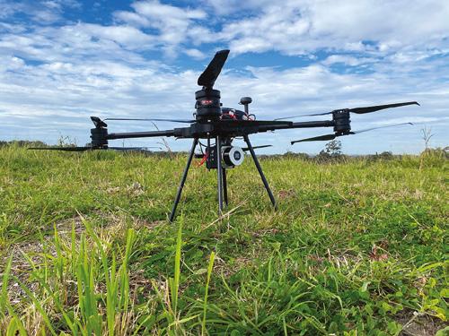
One such option is the Trinity F90+ system, made by German firm Quantum Systems and distributed in Australia and New Zealand by Position Partners. Unlike many fixed-wing drones that require the aircraft to ‘belly land’ (often causing significant damage or total failure of the wings and body), the F90+ takes off and lands using small propellers mounted to the top of the wings. With vertical take-off and landing, or VTOL, the Trinity F90+ can be used for a wider range of applications, safely, as Mr Docherty explained.
“The Trinity combines some of the key benefits of both fixed wing and ‘copter
calculating carbon credits to LiDAR mapping, the versatility of aerial mapping applications is expanding at pace.style aircraft, because the vertical take-off and landing means it only needs a small area to start and finish a flight safely, but it has the longer flight times and better inflight stability of fixed-wing aircraft to handle large areas including mines and forestry applications.”
Used widely in Australian mine sites, the Trinity boasts a 90-minute flight time and often reduces or even eliminates the need for manned aerial mapping work. Chris Nixon, a mine surveyor in the Hunter Valley, said the long flight times and safety features make the Trinity a great choice for mining.
“We work on a number of worksites that are high risk or with restricted space, so having a VTOL RPAS is a big tick for us. The Trinity is certainly bridging the gap between little drones and manned aircraft — this also benefits the client as we can spend less time in the field and still capture large areas, which is better value for money.”
Thanks to advances in flight time and processing speeds, survey drones can now be used in conjunction with terrestrial scanners to enable environmental projects such as carbon offsets. In recent trials, the Trinity has been successfully used to calculate carbon credits in conjunction with terrestrial scanning solutions.

“By mapping an area of rainforest and supplementing the data with samples of terrestrial
scans taken underneath the tree canopy, scientists can use the data to extrapolate carbon offsets over larger areas,” Docherty added.
Like the drones, 3D terrestrial scanners are also becoming less cumbersome, with new wearable mobile mapping solutions such as the NavVis VLX, dramatically reducing data capture time whilst maintaining excellent data integrity.
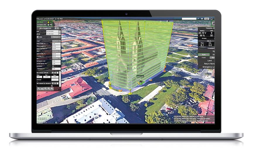
In addition to the improved hardware performance of massdata capture devices such as RPAS and terrestrial scanners, is the versatility of the payload options to deliver survey-grade accuracy of the data.
From thermal imaging and multispectral data capture to monitor vegetation and crops, to photogrammetry that can be used to produce orthophotos, point clouds and digital elevation models (DEMs), the Trinity can also be paired with a geomatics-grade LiDAR scanner.

The aircraft can carry various sensors of up to one kilogram in weight, which can be quickly switched in the field without any tools via a quick-release bracket.
Mark Steggall, a civil engineer and Managing Director of Stegg Civil, is impressed with the versatility of the Trinity and the various outputs it enables him to offer his clients.
“I am continually amazed at the accuracy of the Trinity F90+ with little or no ground control points. The constant updates
and improvements by Quantum Systems makes this a great product to be partnered with and the Altium payload means I can expand my business into the ag market,” he said.
Lastly, but arguably most importantly, is the rapid expansion of software solutions and increased computer processing speeds in recent years that enable the vast quantity of data captured to be processed and used efficiently.
“In the early days of aerial mapping, the data processing times were huge and the resulting orthophoto could be very cumbersome to use and extract information from as you needed specialist computers to run it,” Mr Docherty said.
“Now with most software platforms offering web-based viewing and analysis tools, and cloud hosting, the data is readily accessible and easy to share with key stakeholders.”
Similarly to payload options, Mr Docherty explained that there’s a software option to suit just about any application or even expand the functionality of the hardware itself.
“When it comes to multirotor options that are best suited to inspection work such as bridges, powerlines and other infrastructure, certain software packages can get more from the hardware so you can do more with the same aircraft,” he said. “One example is UgCS software, which can enable DJI Mavic 3 users to fly complex missions and dramatically improve vertical accuracy.”
To help sort through the plethora of choices, Mr Docherty always advises starting with the end result you’re looking for. “We always start by asking customers about the data output and formats they need, before working backwards to look at the best payload options, hardware and positioning setup to give them the most workable solution,” he said. n
Data from RPAS is used for Digital Elevation Models (DEMs), thermal mapping, 3D point clouds and more. The Trinity F90+’s long flight times and safety features are ideal for mine surveying.What is the focus for Surveyor-General Victoria in 2023?
In 2023, Surveyor-General Victoria (SGV) will focus on innovation to provide better service for all Victorians. We will use digital systems to modernise our processes and platforms to drive opportunities for improvement. Our work to transform the cadastral system and embrace digital data will ensure we continue to provide accurate information and advice to our stakeholders. SGV is also focused on preparing for the future by building a thriving culture that attracts and retains a capable, diverse, and inclusive workforce.
What’s the status of Victoria’s cadastre system?
Land Use Victoria (LUV), through consultation with the surveying profession and the geospatial sector, has developed a 10-year strategy and vision for the modernisation of Victoria’s cadastre. The strategy is due for release early in 2023 and has three pillars that will guide development over the next decade:
1. Three dimensional (3D) and digital cadastral data
2. Streamlining the cadastral data lifecycle, and
3. Nationally agreed standards and protocols.
In 2023, LUV will continue to engage and work with the surveying profession to understand the pathway and barriers to digital lodgement for all cadastral survey data. This engagement began in January.
The Victorian Government will continue to be a project partner with the ICSM in the development of the 3D Cadastral Survey Data Model (3D CSDM). This is a collaborative project to develop a data model for the management of cadastral data in the third dimension and incorporating
It’s going to be a busy year for the Surveyor-General of Victoria and his expert team.
Craig Sandy LS GAICD is the Surveyor-General of Victoria and the primary government authority on surveying and the cadastre; his role includes being the Chair of the Surveyors Registration Board of Victoria (SRBV). He is also the chair of the Intergovernmental Committee on Surveying Mapping (ICSM).

the fourth dimension (time). In 2022, the conceptual model was developed and in 2023 the next phase of the project will commence with the aim to develop a data exchange format. New Zealand, New South Wales, Queensland and Western Australia have been working to ensure the development of a nationally and internationally relevant format now and in the future.
In December 2022, SRBV released the recommendations for the review of the process for licensing surveyors in Victoria and has recently released a draft model for a new licensing pathway. The new pathway incorporates the work of the Council of Reciprocating Surveyors Boards of Australia and New Zealand (CRSBANZ) on a National Competency Standard for graduates and licensed/registered surveyors. The draft model is available for review and comment. The next step will be to create the new pathway together with interested organisations and individuals. An expression of interest will be available for the development of the model.
Discussions with CRSBANZ, the other Australian and New Zealand Surveyors Boards, academic institutions and industry organisations will help to refine the draft model and to progress its implementation.
Is Victoria getting heavily involved in SouthPAN?
Australia and New Zealand released its first Satellite Based Augmentation System (SBAS) in late 2022. SouthPAN offers 10cm level accurate real-time positioning when access to mobile, internet and radio telecommunications and use of the existing Continuously Operating Reference Station
(CORS) network is unavailable. Victoria is preparing to support the delivery of the SBAS service.
What’s the status of Victoria’s $45 million investment in digital cadastre? The five-year Digital Cadastre Modernisation (DCM) program is scheduled to conclude in 2023. Victoria will have a spatially accurate digital representation of the cadastre, with eleven Local Government Areas already released into our VicMap products. The benefits of this investment will be realised as users begin to change their processes to incorporate the new data in their work.
Land surveyors will benefit from the update through the Vicmap Survey product in terms of:
• Reduced manual entry of survey data, and
• Improvements to the data set for future users.
Surveyors can download accurate cadastral data prior to beginning their survey work and it can be used as part of the pre-field assessment. Any differences identified by the surveyor can be provided to LUV to update the cadastre and continually improve the accuracy for future users. Land Use Victoria is also modifying our internal processes to incorporate the new data sets into project survey work in SGV and create automated processes to include the cadastre in Digital Twin Victoria platform.
Does the SGV get involved in promotion of the profession?
The Victorian Survey Taskforce (STF) is working with SGV to promote the surveying profession to school children and will distribute the material produced by SheMaps and Get Kids into Survey to
promote careers in surveying at primary and high schools.
SGV will continue to promote diversity in the surveying profession through our ‘Diversity and inclusion in surveying’ university scholarships. In 2022, four students were sponsored to study at RMIT University and the University of Melbourne. Two of our sponsored students graduated in 2022. The university scholarship program will continue in 2023 and is available for women and Indigenous students and provides financial support for students studying geospatial science and surveying disciplines. SGV also invites current students to undertake summer work experience at SGV to learn more about the diverse roles in our team and apply some of their learnings.

What about technological change in surveying?
Over the last two years, our team has been utilising laser scanner and drone technology for application in our work. Part of this work is assessing the potential for use in cadastral surveying and identifying the most appropriate methods for calibration, to enable legal traceability of observations and measurements to comply with the National Measurement Act 1960. While technology is a driver for training and upskilling staff, there are other aspects to training that will be a focus throughout 2023. LUV employs more than ten graduates eligible for entering or progressing a Professional Training Agreements; improving our training methods is always under consideration.
For those who not already aware, please tell us about the ICSM. The ICSM works collaboratively with government land organisations from Australian government jurisdictions and New Zealand. Together with ANZLIC – The
Spatial Council, we are responsible for the delivery of standards, protocols and practise guidelines and providing a consistent approach to surveying, mapping and charting across Australia and New Zealand. ICSM supports ANZLIC in the delivery of the ANZLIC Roadmap and provides leadership, co-ordination and standards for assembling, delivering and maintaining national framework geospatial datasets.
What is the focus for ICSM in 2023?
The Australia Geospatial Reference System Compendium, Addressing 2035, Phase 1 of 3D Cadastral Survey Data Model and the standard for the accuracy of spatial cadastres publications have been delivered. Our work for 2023 will focus on the modernising of foundational spatial data, including the standards to support these data sets. 2023 is an exciting time for the ICSM team as it focuses on several key activities:
• Review of the current ICSM strategic framework and action plan, along with the development of a new Terms of Reference and Governance Charter that will be released to reflect changes to ICSM in recent years. This will include expanding the Foundation Spatial Data Framework to incorporate four additional themes from the Global Fundamental Geospatial Data Themes.
• Development and implementation of an Addressing Plan for 2023. This plan will modernise the way street addresses are assigned and used in a modern community. The 2-dimensional addresses aligned to the centroid of a land parcel are no longer sufficient to support the range of applications our community require to access services and ensure public safety.
• Release of an ‘Imagery statement of direction’. This statement will complement the existing Elevation and
Depth 2034 strategy. With LIDAR and a range of satellite platforms providing a wide choice in the use of imagery, this statement will support all governments with standardised imagery to provide economic value in solving the most pressing environmental challenges. I’m looking forward to the release of this strategy in 2023.
• Establish a working group to focus on the work around data standards in the marine environment. This group will be focused on the S100 standard for Australia and New Zealand. The S100 standard is for the mapping of marine assets. The standard has subclasses for defining the type of assets to be mapped; for example, navigation aids and port features. This aim is to develop digital products and services for operators in hydrographic, marine and GIS communities. It is an important piece of work for countries surrounded by ocean.
From a personal perspective, 2023 is shaping to be a year of opportunity — a time to make connections through government, academia and industry and to find creative solutions in partnership to some of our biggest challenges. Our profession needs to work more closely together to resolve these challenges.
Technology is an enabler for greater insights and working more efficiently, but developing the people in our profession is equally important. Machine learning and AI solutions only provide value when highly skilled and trained professionals can assess outcomes to ensure high-quality results are achieved. This will be a year to focus on developing our people and their capability in working in a highly digital environment. n
2023 is shaping to be a year of opportunity - a time to make connections through government, academia and industry.
Backed by more than 100 years of geospatial innovation, the time has come for AAM to evolve to a new level.

In September 2021, AAM was acquired by US firm Woolpert. With a similarly rich geospatial history, Woolpert traces its roots back to 1911 when it was founded as a surveying and engineering company in Dayton, Ohio. Over the years, the firm grew in both size and services, gradually adding aerial mapping, GIS and geospatial capabilities, aligning with the needs of the industry and clients around the world.
Since commencing operations in 1959 as an aerial survey company, AAM has proudly provided geospatial expertise and innovation throughout Australia, AsiaPacific, Africa and the Middle East. By delivering world-leading lighthouse projects for more than six decades, the AAM brand has evolved into one of the most-trusted in the geospatial sector.
Throughout 2022, Woolpert and AAM
integrated their systems, resources, teams and knowledge. Now in 2023, AAM has transitioned from ‘AAM, a Woolpert Company,’ to become fully integrated into Woolpert.
According to Woolpert Asia-Pacific Vice President Brian Nicholls, “Our clients and partners will see our new name, however it’s the evolution of geospatial services and expertise available to them that is truly remarkable.”
“Together, we provide wider-reaching international partnerships, access to additional aircraft and sensors, global knowledge sharing and best practices, a deeper talent pool, integrated systems, and an enhanced focus on research and development… to name a few,” Nicholls said.
“That is the power of collaborative innovation that Woolpert provides in our position as a global geospatial specialist.”
Woolpert Geospatial Sector Leader and Senior Vice President, Joseph Seppi, has been instrumental in the firm’s international expansion and union of the two geospatial powerhouses.
“Leveraging regional experience and capabilities across multiple continents enables Woolpert to deliver unparalleled geospatial solutions at a global scale. We view the ability to deliver standards-based, accurate, geospatial information as crucial to fuelling the growth of the geospatial industry worldwide,” Seppi said.
Woolpert also provides full-service architecture, engineering and strategic consulting services, which are integrated with these expansive geospatial capabilities to innovate within and across markets to serve public, private, and government clients worldwide.

Woolpert has over 2,000 employees and more than 60 offices on five continents, and actively nurtures a culture of growth, inclusion, diversity and respect. For more information, visit woolpert.com or email asiapacific@woolpert.com. n
 Woolpert has worked on the development of Singapore’s 3D National Map.
Woolpert conducts aerial surveys throughout the Asia-Pacific; this image is from a recent project in the skies above Fiji.
Woolpert services in the Asia-Pacific region include:



• Geospatial advisory
• Aerial LiDAR
• Aerial imagery
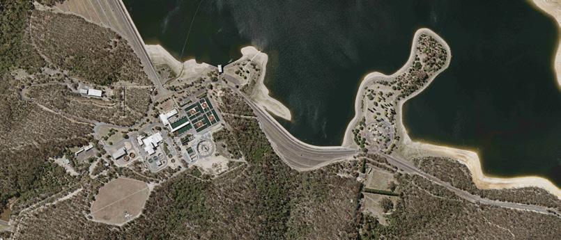
• Hydrography and bathymetric LiDAR


• Spatial digital twins
• Land survey
• Laser scanning
• Building information models
• Agile survey
• GIS services and consultancy

“Leveraging regional experience and capabilities across multiple continents enables Woolpert to deliver unparalleled geospatial solutions.”
Joseph Seppi, Senior VP, WoolpertScott Cattran (Woolpert President and CEO, centre) with some of the Asia-Pacific team. Woolpert has team members in Australia, New Zealand, Singapore, Malaysia, Abu Dhabi, and Papua New Guinea.
WHAT: Locate23: The Geospatial Event
WHEN: 10–12 May 2023
WHERE: Adelaide Convention Centre
WEB: locateconference.com
The Australian geospatial industry’s most important annual event, Locate, is on once again, this time in Adelaide from 10-12 May 2023 and with a distinctly spacey feel. With the city now recognised as the nation’s ‘space capital’ — home of the Australian Space Agency, the SmartSat CRC and numerous space-related companies — and with the ever-growing nexus between the spatial and space sectors, it makes sense that Locate23 will be held in Australia’s new space heartland. The theme will be ‘Geospatial Evolutions: From lands to seas to stars’.
The recent launch of the 2030 Space+Spatial Industry Growth Roadmap (see page 31 of this issue) has put into stark focus the opportunities and challenges presented by the close relationship between the two sectors. No doubt the Roadmap will be a source of much discussion and conversation at Locate23.
A reflection of that growing relationship is the fact that Locate23 will be held immediately following the Australian Space Forum (9 May, at the same venue). Further, a special Space & Geospatial Workshop will be held on Wednesday, 10 May, between 9:00am and 1:00pm. This will be a chance for professionals from the space and spatial sectors to come together to share views and explore opportunities for working together in fields such as PNT (positioning, navigation and timing), Earth observation and telecommunications. You can find more information about the Workshop at sssi.org.au/events-awards/events/spacegeospatial-workshop.
Locate23 will kick off on Wednesday, 10 May, with the aforementioned Space & Geospatial Workshop, plus a full day of other workshops covering a wide range of topics:
• Young professionals, students and early careers researchers
• Geospatial data validation
• Learning FME basics
• Victoria’s digital cadastre modernisation project
• Digital twins
• Digital transformation
• Building tomorrow’s workforce
• 3D land cover across Australia, and more.
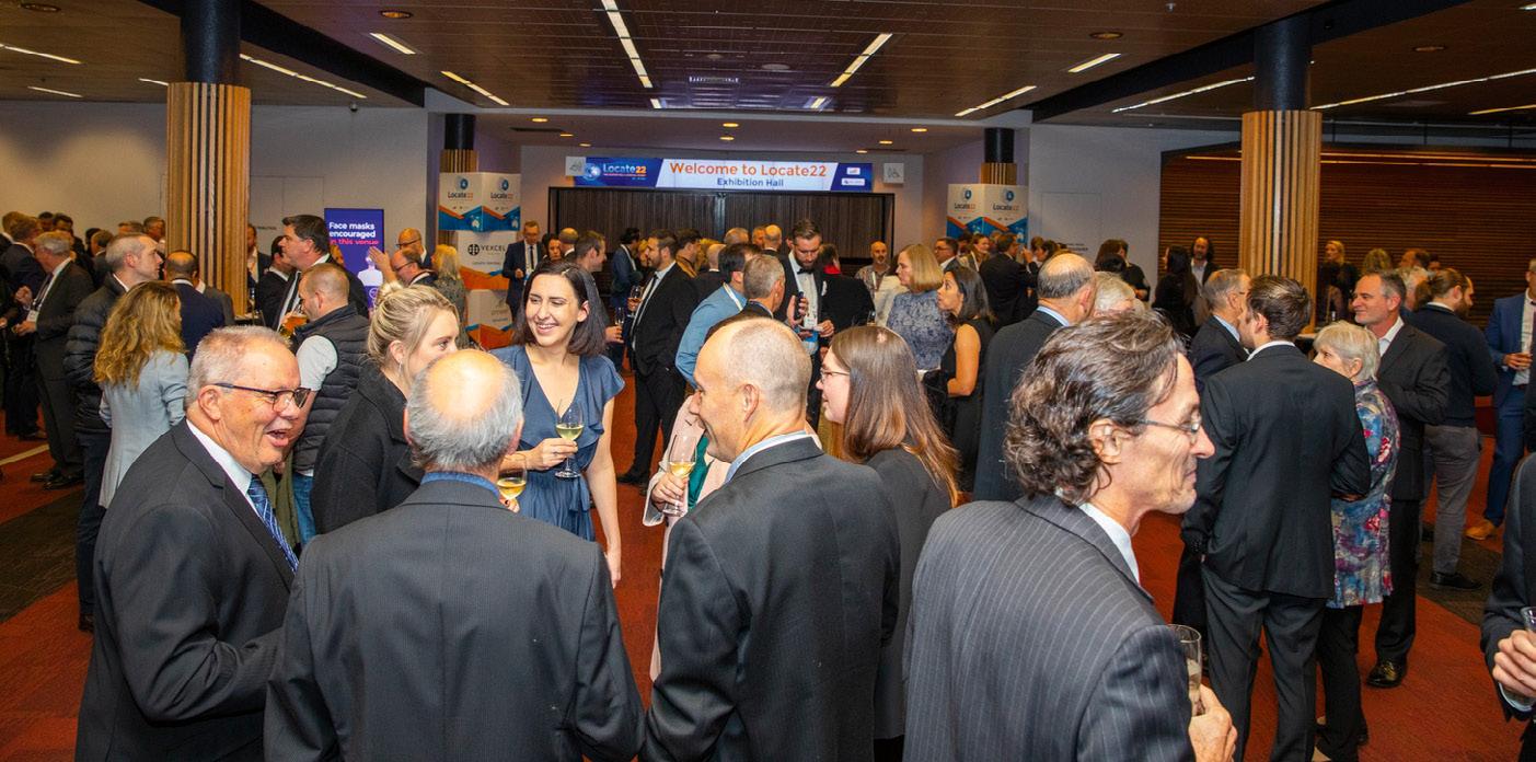
Day one will end with a welcome reception and a special gathering to mark the launch of the Geospatial Council of Australia, the new national peak body formed from the merger of the SSSI and SIBA|GITA.
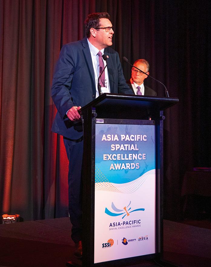
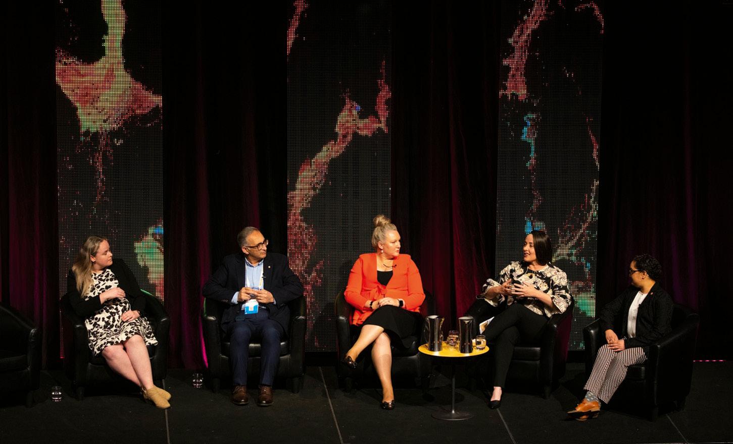
The second day, Thursday, 11 May, will begin with an introduction from Enrico Palermo, Head of the Australian Space Agency. That’ll be followed by a panel session comprising Alan Duffy (Swinburne), Bradley Slape (SA Surveyor General), Jennifer Brindle (Precision Hydrographic Services), Melissa Harris (ANZLIC) and Palermo.
Concurrent speaker sessions will begin after morning tea, split into five streams: Hydrographics, progress and partnerships; Climate change and resources; Cadastre futures; Data as an asset; and Spatial digital twins. Delegates will hear from (not a complete list):
• Andrew Coulls, Australian Hydrographic Office
• Dr Claire Fisk, FrontierSI
• Bradley Slape
• Nicholas Car, Kurrawongai
Industry delegates will gather in Adelaide in May for Australia’s leading geospatial event.• Chris Body, Open Geospatial Consortium
• Scott Miller, Fugro
• Ferlisa Valentine, Water Authority of Fiji
• David Pullar, University of Queensland
• Andrej Mocicka, 1Spatial
• Paul Digney, Jacobs
• Stafford Smith, Data61
• Sara Pulford, South Australian State Emergency Service
• Steven Henderson, Woolpert Topics covered will range from spatial improvement of digital cadastres to AI assisted agriculture, digital twins in rail operations to building trust in foundation data, partnerships in the Pacific to the Hydroscheme Industry Partnership Program, BIM to coastline monitoring, and many more.

The morning tea and lunch breaks will see the presentation of a series of tech talks and case studies, covering natural disaster assistance to airborne LiDAR bathymetry, 3D modelling of power networks to the evolution of survey data capture, and more.

The final session on the second day will comprise a plenary presentation followed by a panel session, all focusing on diversity and inclusion and tackling topics such as neurodiversity and advancing gender equality. Participants will include
Geoff Smith (Australian Space Analytics), Hilary Thompson (Australian GeospatialIntelligence Organisation) and Maurits van der Vlugt (SSL-DLN).
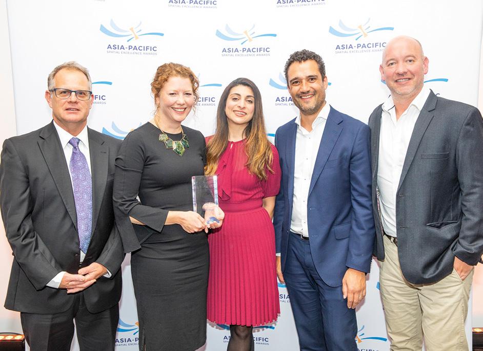
Day two will end with pre-dinner drinks, followed by the annual Asia-Pacific Spatial Excellence Awards (APSEA) presentation and gala dinner. This is always a fabulous opportunity to mingle and socialise and, through the awards, to celebrate outstanding achievements made by individuals and groups within the sector.
The third day of the conference will commence with a plenary session focused on research and innovation. Delegates will hear discussion on topics ranging from the use of geo-technology in the wine industry, to governments’ role in responding to and enabling emerging trends.
The concurrent sessions will continue with another with a range of presentations, from protecting coral reefs to IoT sensors, from using spatial for unlocking biodiversity data to building a ‘dream team,’ from smart roads to calculating work travel distances from Census data. The speakers will include (not a full list):
• Shaun Falconer, Accenture
• Michael Dixon, Geoscape Australia
• Alex Mckeown, Integrated Marine Observing System
• Dr Davood Shojaei, Melbourne University
• Dr Rajendra Shilpakar, Department of Regional NSW
• Roshni Sharma, FrontierSI
• Bradley Rasmussen, Sizztech
All speaker sessions over both days will conclude with 10-minute panel discussions.
The morning tea period will once again feature tech talks and case studies, covering the challenges of deploying digital transformation efforts, and creating a digital twin using UAV-collected data. The lunchtime talks will cover creating engaging GIS experiences, the UK’s experience of data assurance for the environment, using AI for smarter and safer roads, and a ‘data lake’ for South Australia’s government.
The very final session of the conference (prior to the closing ceremony) will look into the future with plenary presentations by Alan Smart (ACIL Allen Consulting), who will be interviewed by Dr Zaffar Sadiq MohamedGhouse, and Joseph Seppi (Woolpert).
For full details about the conference, including speakers, workshops, other activities and exhibitors, along with registration details, visit locateconference.com. n
Anditi is an Australian Advanced Spatial Analytics company specialising in transforming spatial data. We produce a wealth of high-value data products for roads, infrastructure, environment and carbon sequestration projects using proprietary AI and machine learning algorithms. Anditi is committed to helping you get the most out of your data.

Our proprietary LiDAR analytics engine and automated algorithms search for and classify a wide range of features such as powerlines, ground, vegetation/trees, houses, fences, road assets and more. Our iRAP-accredited RoadViewer web portal provides a powerful and intuitive way of analysing road corridors in unsurpassed detail, with products including iRAP Star Rating, bridge clearances, swept path analysis and asset management. And our powerful 3D data web portal enables easy access to high-quality spatial data anytime, anywhere, with no downloads or licenses required.
Visit us at Stand #1 at Locate23 to learn more about our products and services and how we can help you achieve your goals.
And don’t miss our managing director Peter Jamieson’s presentation on ‘Catalysing the use of AI for Smarter and Safer Road Corridors’ at 1:45pm on Friday, 12 May, in the exhibition theatrette.
This year marks the Asia-Pacific debut of Woolpert, proud gold sponsor of Locate23. A long-standing industry leader in mapping and surveying, Woolpert has built and vetted a global network of geospatial services and specialists to best support evolving needs. From elevation-derived hydrography to topobathymetric sensor development to enterprise GIS services and everything in between, Woolpert works with its family of companies and partners like Google and Esri to provide vital, accurate, and cost-effective solutions.
In 2021, Woolpert acquired leading Asia-Pacific geospatial and surveying firm AAM to combine strengths and optimally support needs across the region. Woolpert also provides architecture, engineering, and strategic consulting services, integrating its geospatial capabilities to innovate within and across markets for public, private, and government clients worldwide. Actively nurturing a culture of growth, inclusion, diversity, and respect, Woolpert has over 2,000 employees and more than 60 offices on five continents.
Join the Woolpert-hosted workshop where Geospatial AI is explored through the lens of Unleashing the Power of 3D Land Cover across Australia. Meet the Woolpert team at their stand located at the Foyer M entrance. Don’t miss the plenary session where you’ll hear Woolpert Geospatial Sector Leader and Senior Vice President, Joseph Seppi, share insights into geospatial evolutions into the future.
At AURIN we unlock and make accessible hard-to-get data, supporting innovative research on sustainable and resilient cities and towns. By building and providing complex digital infrastructure, we empower Australian researchers to address the greatest urban and regional challenges facing us today.

We specialise in doing the legwork on behalf of the researchers, with the aim of eliminating the time-consuming tasks researchers go through when starting a new project. We streamline access to health, transport, housing, economic, land use, demographic data — all integrated to work together. Making this data accessible and useable saves time and resources across the research community.
In 2022 we launched the AURIN Data Provider (ADP).
The ADP is the first part of the development of the next generation of AURIN eInfrastructure for spatial data analytics, modelling and tools. AURIN will continue to be refined to deliver increased industry engagement and co-investment, as well as effective research translation to increase potential commercial opportunities, productivity, and other economic and social benefits.
Come and visit our exhibition stand at Locate23 where we will be showcasing new data, tools and innovation in geospatial research, along with research impact stories from researchers addressing current urban and regional challenges.
UPG is the Authorised Distribution Partner for Trimble’s innovative technologies, including integrated sensors, field applications, real-time communications and office software for processing, modelling and data analytics.
UPG is your technical partner in the geospatial and monitoring sphere, providing solutions that facilitate highquality, productive workflows and information exchange, driving value for a diverse customer base of surveyors, engineering and GIS service companies, governments, utilities and transportation authorities.

Using Trimble solutions, organisations can capture the most accurate spatial data and transform it into intelligence to deliver increased productivity and improved decision-making. Whether enabling more efficient use of natural resources or enhancing the performance and lifecycle of civil infrastructure, timely and reliable geospatial information is at the core of Trimble’s solutions to transform the way work is done.
The Trimble Geospatial Advantage — pioneering the future of data intelligence, converging people, product, and place seamlessly to help you make your mark and leave your legacy.
On Stand #2 at Locate23, we’ll be showcasing: Live demos of the DA2 GNSS with Trimble Catalyst; SPOT the Robotic Dog powered by Trimble; the Trimble SX12 laser scanner; augmented reality, and more. Come and chat to one of our experts and see some of the latest technology in action.
» Designed for Seamless OEM Integration







» Robust to Vibrating Environments


» Post-processing with Qinertia PPK Software





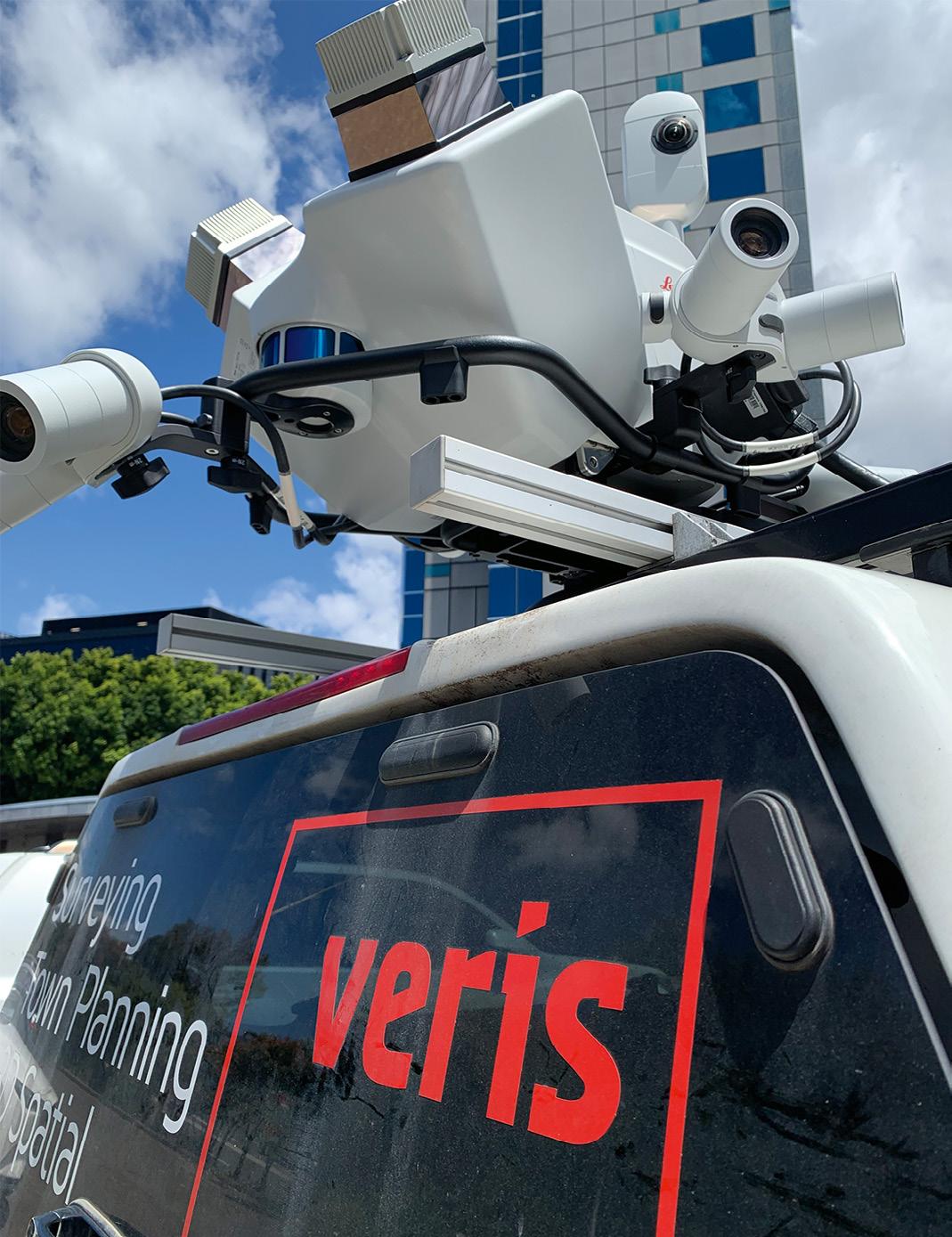
The Leica Geosystem’s Pegasus TRK vehicle-mounted scanner is making surveying safer and far more cost effective.
When one of Veris’ clients needed to quickly survey hundreds of newly installed street furniture assets within the busy CBD of an Australian capital city, the company turned to the Leica Geosystem’s Pegasus TRK vehicle-mounted scanner to do the job.

The aim of the project was to ensure that the streetside assets were sited and built as stipulated by the client and in accordance with requirements specified by the relevant governmental authority. With the assets initially installed, liability for any problems — graffiti, car accidents, pedestrian accidents — remained with Veris’ client until such time as the client could assure its client that the assets had been installed correctly… whereupon liability would then
transfer to that ultimate client. In order for this to happen, a survey would need to be undertaken.
All up, there were 500 individual assets within the CBD area that needed to be checked.
“We looked at the safest way to execute it and the most efficient way to execute it,” said Vassili Galettis, Client Director at Veris. “That’s where we came up with the TRK solution, and its ability to handle urban canyons, tall buildings and a GNSSdenied environment.”
“It meant we could use it’s SLAM capability to produce an accurate, georeferenced point cloud, from which we could extract the information required,” said Galettis.
The client had already broken the back of the asset installation work, with 70% of the job completed. This meant that Veris could get the project done in a fast timeframe, which in turn meant that client’s liability obligations would be assured in an expedited manner.
“And that enabled them to hit their program targets,” said Galettis. “They would have been looking at months of data capture the traditional way as opposed to just days with the TRK.”
Veris conducted the survey during the daytime because they saw the value in having imagery of the assets, not just the LiDAR data. “We did multiple runs along each of the streets, and the beauty of the TRK is you have the ability to merge the
data from the runs and remove unwanted items,” said Galettis.
That ability to simultaneously capture both LiDAR data and imagery meant that not only was it possible to capture the XYZ coordinates of the assets (which related back to the civil authority’s requirements) but also to formally prove the condition of each of those assets at the time of capture.
The difficult GNSS conditions along the CBD routes due to the tall buildings and urban canyons, meant that the TRK’s SLAM capability (which assists with trajectory accuracy through GNSS denied areas) made it the ideal choice for the project.
A typical TRK installation comprises the scanning unit, a control unit and a battery unit. The control unit enables the user to go straight from data capture to processing on-the-fly — no more time-consuming transcoding, storage overhead or errors during data transfer. And the battery unit is expandable, with up to three batteries for up to 21 hours of operation or for hot-swapping for continuous power.
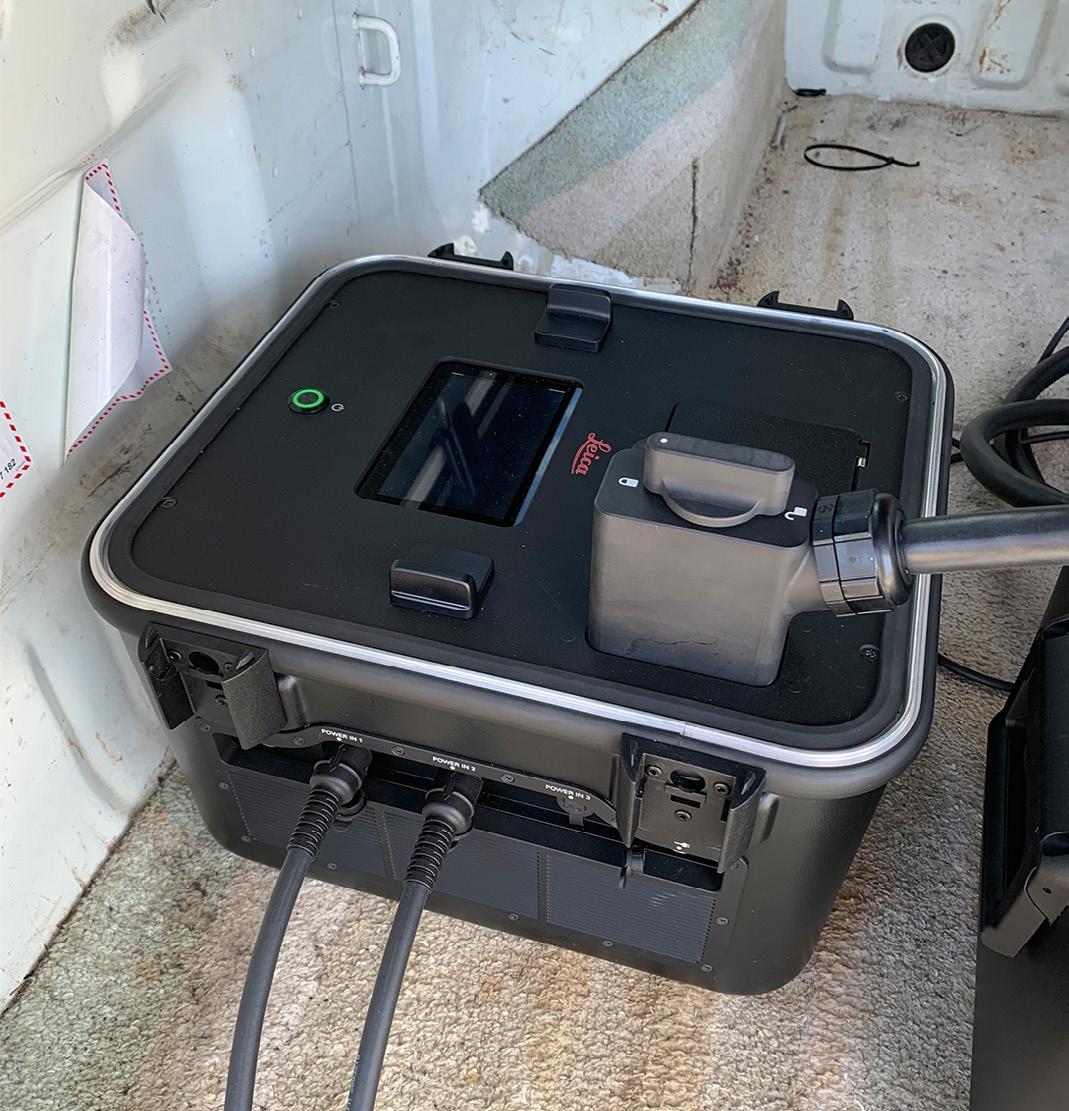
The integration of IMU and SLAM technology enables georeferencing in challenging GNSS-denied environments. Precision RTK positioning gives location accuracy down to the centimetre, in real-time. And weighing in at just 18 kg with its rotating-tilt mounting platform, the Pegasus TRK can be safely set up and operated by just one person.
According to Galettis, “one of the main advantages of the TRK is its ability to quickly handle large datasets, and the ability to get the information out of the machine with relative ease”.
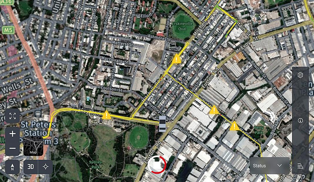
The Leica Pegasus FIELD software enables users to plan routes and set goals for each project from the office or in the field. Data acquisition considers satellite availability and signal coverage for automated routing, while edge computing and on-the-fly processing means data is collected and enhanced in real-time — at the speed of the traffic. The software guides the user through project set-up and planning, with an option to use predefined profiles to achieve the best possible results.
Leica Cyclone Pegasus OFFICE provides the data flow into the post-processing and publishing workflows. Users can complete all their processing requirements in the one solution, including refining data with precision geo-referencing and multi-pass trajectory adjustment, and creating colourised 3D point cloud data that is automatically privacy compliant.
“Keeping people out of live environments is key, and safety is at the top of what we do,” said Galettis. “Our greatest safety risk as a company is either driving a car or being roadside doing survey work.”
“To execute a contract such as this in the traditional way, we would have been looking at traffic control requirements, a multiple night shifts, road occupancy licenses, access roads — it would have been difficult to try to provide the deliverables the client was after while maintaining safety,” he added.
Naturally, this led to substantial cost savings all along the line… not just survey related costs but also project-related costs. Plus, as outlined, the client could reduce its liability risk by transferring control to the ultimate owner of the assets far sooner.
“Veris has always been on the cutting-edge of spatial data management and data capture technology on infrastructure projects both small and large,” said Galettis. “The TRK helps us continue this tradition.” n
For more information about the Leica Geosystems Pegasus TRK, go to: survey.crkennedy.com.au/pegasus-trk-neo
Profiles of four professionals who have made their mark in the spatial and space fields.
We celebrated International Women’s Day (8 March) this year by publishing (online) a series of profiles of outstanding professionals who have forged very different career paths within the spatial and space sectors. Abbreviated versions of those interviews are presented below. For the full profiles, please go to spatialsource.com.au/celebrating-women-in-the-spatial-space-sectors. There is no doubt that our industry still has quite a long way to go to attain equal gender representation in the workforce, although it’s better than it once was. Achieving a more diverse and inclusive workplace that comprises members with a wide variety of backgrounds, skills and outlooks, can only be a good thing for the industry and for the nation as a whole.
improving the performance of GPS and find new ways for innovative uses of it.
What do you enjoy most about your job?
I enjoy the challenge of doing research, solving research problems, and knowing that my research outcomes are making a difference to society. And I feel pride when seeing the diversity of growth in my students, their joy in learning and being successful.
Are there any personal qualities or attributes that are helpful to have in this field?
Suelynn Choy
Choy is an award-winning expert in GNSS science and applications, and Professor of Satellite Navigation at RMIT University.

How did you get into this field?
Becoming a professor was certainly not planned! I initially pursued a Bachelor (Hons) Degree in Land Surveying due to family ties — I was following in my dad’s footsteps. The plan was to return to my home country (Malaysia) to help dad with the family business. However, when I graduated, I was offered a generous scholarship by the Australian Government to pursue a PhD research degree. How could I say no to further education?
I wanted to further my knowledge in this field, make contributions towards
Being resilient, open minded, collaborative and kind.
What makes you most proud about your role and achievements?
I am most proud of my achievement in having demonstrated — in an Australian first — that GNSS positioning data generated by local infrastructure, transmitted by a regional satellite navigation system, can be used to provide accurate (cm-dm level) positioning anywhere outdoors in Australia at any time. This has in some ways laid the foundations for the Southern Positioning Augmentation Network (SouthPAN) and the Ginan Analysis Centre software, which bring significant improvements to our current GNSS positioning, navigation and timing capabilities. This will in turn benefit
JONATHAN NALLYmany industries such as transportation, agriculture, resources, emergency services and mapping. I was awarded the 2016 National Measurement Institute Prize in recognition of my research work.
As a woman, have you had many struggles during your career? Conversely, have you had a lot of support?
The biggest challenge I confronted was establishing my presence, credentials and credibility in a male-dominated industry. I was often one of the few women, if not the only woman (and Asian) in the room. And there were times when I was not taken seriously for career growth and promotion. But times are changing as the university and industry are recruiting more women into management and senior positions.
Yes, conversely, I have had a lot of support as well in my career development. Interestingly, that has come from my male colleagues, mentors and champions. They helped me to be heard and seen, build confidence, achieve my goals and ambitions, and have been role models.
Any advice for young women considering a career in geospatial? No one is an expert in the beginning, and everyone has something to contribute. Do not let fear or lack of confidence keep you away from an opportunity or your ambition.
How did you get into this field?
I fell into surveying a few years after completing a year of university and then having a baby. I wanted a career that wasn’t based behind a desk. I applied and got into landscaping and surveying at TAFE. Surveying was going to take two years full time, while landscaping was four years part time. I was a single parent, so I chose surveying.
What do you enjoy most about your job?
As a surveyor, I love the variety of every
job, the places it takes you and being able to problem solve, plus the flexibility of working outdoors but also applying my creative side to the drafting and management side of the profession. Every day is different.
As a teacher/facilitator, I love imparting information and knowledge to the people who are learning and seeing them applying it to their daily tasks. I love seeing that ‘lightbulb’ moment, when everything falls into place and the student can see how the theory meets the practical. I love being there to support their journey and watch them grow and learn to become surveyors in their own right. And building relationships that last — I still have contact with a lot of my former students.
What makes you most proud about your role and achievements?
I have had a great career spanning 28 years so far, where I have nurtured my family (three boys), experienced so many different types of surveying, been a part of the educational side of teaching and now being in a position to mentor others. Plus making history by starting the first-ever surveying program to deliver vocational qualifications outside of TAFE in a work-based capacity. I recently won an award for ‘Exceptional Educator’ with Empowered Women in Trades, a not-for-profit group that supports, encourages and provides assistance to females wishing to enter non-traditional or male-dominated fields of work.
As a woman, have you had many struggles during your career?

Conversely, have you had a lot of support?
I’ve been in the industry for a long time. I have been lucky to surround myself with supportive males throughout my career. That doesn’t mean my path has been easy. But I can say that I have been able to hold my own on a job site when necessary. There have been times throughout my career where I haven’t been taken seriously or looked over for positions due to being female. The ‘boys club’ was strong for a very long time in both industry and education. Throughout my career, I have only worked alongside a handful of women. Support is better now than when I was young.
Any advice for young women considering a career in geospatial?
Surveying is a great career; the geospatial sector is moving forwards in leaps and bounds. It can take you places you never thought you could go. You will learn so many great things, play with awesome technology and meet amazing people. Don’t think it’s just about bashing in pegs or cutting lines through the bush.
Is there anything else you would like to add?
Don’t be afraid to give something a go; don’t be afraid to get outside of your comfort zone — don’t be afraid to take the leap, as this is where you may fly!
Please tell us about your current role and responsibilities.
I am the lead for the Positioning, Navigation and Timing (PNT) Space Priority Area (SPA) set out in the Australian Civil Space Strategy. I am responsible for writing the PNT roadmap that sets the direction for PNT in Australia out to 2030. This requires me to be familiar with all aspects of the broad scope of PNT, as well as which industry and research institutions we have in Australia that work in this field, and how they’re different to international capabilities.
How did you get into this field?
Elizabeth PearceMy career journey has not been a straight line. I started out with an interest in space weather, which was fostered during my Honours year at University of Newcastle.

I discovered during my first research program that you can use GPS signals to infer the number of electrons in the ionosphere that can affect communication technologies. That brief exposure put me above the pack when applying for a graduate position in Defence Science and Technology Group (then Organisation) in the PNT Technologies and Systems group. When the Australian Space Agency was announced, I saw an opportunity to return to the space focus.
What do you enjoy most about your job?
Connecting with the industry in Australia, learning what they are doing and what they need to grow. I feel a really strong connection to everyone I’ve been working with, and I like to think that my job is helping them in some way.
Pearce is Deputy Director, Strategy and Integration, Office of the Chief Technology Officer in the Australian Space Agency. Peta Cox Cox is National Training and Development Manager for the Association of Consulting Surveyors National. She produces the Defining Boundaries podcast.'From previous page'
What makes you most proud about your role and achievements?
I am making a difference. All the work we do at the Agency has direct impact on the industry, and it’s really great to see. Particularly in PNT — it’s a capability that has become invisible to most people but it’s so prevalent and so important. I like knowing I’m working to protect our way of life.
As a woman, have you had many struggles during your career? Conversely, have you had a lot of support?
Honestly, I’ve had a lot of difficulties that I didn’t realise were difficulties until later and reflecting back. I think most women in STEM have. The challenge is whether you get stuck in that reflection or not. I find those that set you back do it in small bites, but those who support you will make a huge difference in moving forward in your career. My greatest supporters made huge changes to my capabilities, knowledge and confidence, which led to where I am today. Those that set me back (and there were many tiny steps back) have taught me how NOT to do it when I am a leader. It has also made me very aware of the new women who join my team or work close to me, to ensure they don’t have
to endure the same tiny cuts I did. We have a lot of women in the Agency, especially in the CTO team, which thankfully means this kind of thing doesn’t happen.
We need more women in the sector. Any ideas?
Recruit from adjacent areas of knowledge, e.g. mathematics, engineering etc. I think having an understanding of how important the geospatial and space sectors are in everything we take for granted will help sell the roles. Without those industries, life as we know it would end, so we need to really start selling their importance more in the general community.
which is the collection of datums, reference frames and working surfaces that are used to define latitude, longitude and height throughout Australia.
How did you get into this field? What attracted you to it?
Anna RiddellRiddell is currently acting as Director for the GNSS Analysis section at Geoscience Australia.
Please tell us about your current role and responsibilities.
I am responsible for the teams conducting our routine GNSS processing and analytics to provide the products and services that you may be familiar with, such as AUSPOS, APREF, Regulation 13 certification for the verification of position, and running the GNSS antenna calibration facility. I am also responsible for the team that is building and evolving Ginan, our GNSS analysis centre software. Recently I also became the new chair for the Intergovernmental Committee on Surveying and Mapping’s Geodesy Working Group, having only just taken on this role late last year.
My substantive role is managing the Australian Geospatial Reference System,
My technical background is in GNSS geodesy, where my PhD research (completed in 2021) looked at how the Australian crustal plate is moving vertically. I got hooked into a surveying degree at the University of Tasmania with the endless possibilities for travel, working outdoors and being able to explore and understand how our planet Earth wiggles about in time and space. Now, I really enjoy being able to work on expanding our understanding of how the Earth changes shape and size and how this affects our everyday life.
What do you enjoy most about your job? I enjoy talking about what I do and how it has impact on our everyday lives at the foundational level — everything happens somewhere. And I love seeing the ‘lightbulb moment’ when people realise how ubiquitous positioning has become and how reliant we are on location-based services in our everyday lives across all industries. I enjoy outreach sessions in schools and local community groups, where I speak about geodesy and the related spatial sciences, knowing that if we can foster curiosity early, we will be able to spark interest for the next generation of scientist and STEM specialists.
The teams I get to work with are incredibly diverse, which brings new

perspectives to enable innovation, and the global community is well engaged. One of the highlights of my career so far, has been to work on a draft United Nations resolution that was then accepted by the UN General Assembly for the Global Geodetic Reference Frame for Sustainable Development.
As a woman, have you had many struggles during your career? Conversely, have you had a lot of support?
I have benefitted from a tremendous support network throughout my career in both my personal and professional lives. In a professional sense, I have had wonderfully supportive managers and colleagues who have never seen my gender as a barrier or an advantage. In my personal life I have had wonderful family support and role modelling, from my grandparents all the way down to my own children. They never let me forget that I am more than just my work!
We need more women in the sector. Any ideas?
Providing opportunities, having visible role models and telling stories about how fun it can be to work in a sector with endless applications.
Any advice for young women considering a career in geospatial?
Take a chance and say, “Yes”! Even if you don’t land in a job or role that you love from the outset, the skillsets and knowledge that you develop in geospatial/geodesy are highly transferable and in high demand. n
Satellite imagery is playing a crucial role in studies of how phases of the El-Niño-Southern Oscillation (ENSO) cycle are contributing to erosion on beaches along Pacific Ocean coastlines.
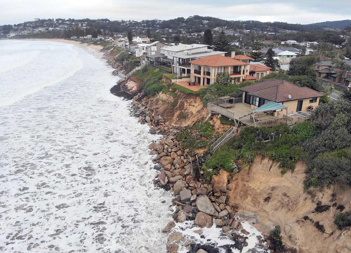
ENSO is the name given to sea surface temperature changes that occur across the Pacific, as the warming phase, El Niño, gives way to the cooling phase, La Niña, and vice versa. This cycle drives weather patterns that affect not only the land in terms of droughts and floods, but also coastlines. ENSOdriven beach erosion can threaten coastal communities and cause many millions of dollars damage.
Until relatively recently, scientists concerned about mapping coastal erosion had been restricted to traditional coastal surveillance methods, which limited their observations to ground-level and restricted the number of beaches they could monitor.

“Scientists have known beaches respond to ENSO cycles for decades, but we’ve only been able to paint a small picture of this from a few sporadic beach monitoring sites,” says Dr Mitchell Harley, co-author of the study from UNSW’s Water Research Laboratory at the School of Civil & Environmental Engineering.
“For this research, we were able to take a completely different angle to complete the bigger picture of how climate cycles impact entire Pacific coasts.”
The scientists developed an open-source software platform called CoastSat, which takes satellite imagery and puts it through image processing and machine learning algorithms to extract useful data about beaches right across the Pacific.
“The tool automatically maps the position of the interface between the sand and water. Doing this over multiple images and beaches, and correcting for the tide, we can discover changes in the coastline over a large temporal and spatial scale and how this correlates with ENSO cycles,” says Dr Kilian Vos, lead author of the study from the Water Research Laboratory.
The tool enabled the researchers to take 38 years’ worth of Landsat imagery and find correlations between the width of beaches and the El Niño and La Niña cycles. In total, more than 8,000 kilometres of sandy beaches were studied, from Australia to the USA to Chile.
What they found is that beaches in south-eastern Australia narrow during prolonged La Niña events and widen during El Niños. However, the opposite effect is found on the other side of the Pacific — beaches widen during La Niña and narrow during El Niño.
“While our study is looking at the average behaviour of sandy beaches correlated with the ENSO cycle, this is consistent with what we’ve observed,
for example, with the recent triple-dip La Niña in Australia, where successive coastal storms have been stripping sand from beaches along the NSW and QLD coastlines,” says Dr Vos.
“Sandy coasts are some of the most dynamic and populated environments on the planet. In some conditions, they can completely disappear overnight and take years to come back,” Dr Vos added.
“It’s essential we continue to monitor them through studies like this which help inform how we can manage our beaches, which provide a buffer between ocean waves and the high-value infrastructure around them.
Dr Harley heads up the CoastSnap citizen science program, in which members of the public can upload photos of beaches. The aim is to combine insights from CoastSat and CoastSnap to learn more about how beaches respond to waves, sea level and climate change.
“Using all these incredible data sources from space and the community, we can continue to increase our understanding of how our coastlines are changing now and in the future,” Dr Harley said.
“If you’re a tourist looking to spend a holiday on the beach, it might be worth looking at the ENSO forecast as it might give you an indication of where to expect wide sandy beaches,” added Dr Vos. n
Sandy beaches across the Pacific widen or narrow according to phases in the El-Niño-Southern Oscillation cycle.
“The tool automatically maps the position of the interface between the sand and water.”
Dr Mitchell Harley, UNSW Water Research Laboratory



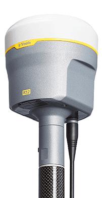

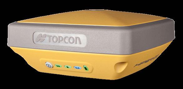
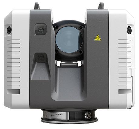

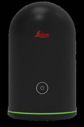



Sentinel-1 data is helping Italian authorities monitor ground movement, essential for a country with a very active geology.
Anew ground motion service utilising Copernicus satellite data is being used by the Italian road agency to detect and monitor unstable ground — helping to improve nationwide road infrastructure safety.

The design and construction of roads and motorways are strongly affected by any movement taking place on the ground. Italy is particularly subject to unexpected ground movement including landslides, subsidence and earthquakes.
Avoiding or mitigating the consequences of such events poses significant challenges for planning, building and maintenance of road infrastructure.
Planetek, an Italian company based in Bari, has developed a ground motion service called Rheticus that provides regularly updated nation-wide maps of ground movement based on data from the Copernicus Sentinel-1 mission. Sentinel-1’s Synthetic Aperture Radar (SAR) instrument allows large-scale maps showing millimetric movements on the ground to be generated.
ANAS, The Italian Roads Authority, is now using Rheticus to assess risk and adapt road designs to reduce the danger for Italian motorways, tunnels and bridges.
The extremely accurate measurements of ground movement will enable road planners and builders to identify the risk of ground instability. As a result, the design of motorways can be made more resilient against future ground-movements.
An example of this is in Abruzzo, where an upcoming road is being constructed, and satellite data, including that from Sentinel-1, have been used to help the planning phase of the project. Using satellite data on a regular basis will enable the detection of smaller ground movements and for potential risk to be assessed.
“Over the past 20 years, we have utilised satellite data in many projects and, where possible, used it to solve landslide related issues often emerging during construction,” said Flavio Capozucca, an Engineering geologist at ANAS who contributed to the study.
“Given the good availability of satellite data in the last years, we have tried to move towards an extensive and preliminary use of all the available information coming from Earth observation, starting from interferometric data, such as the ones from the European Ground Motion Service. These data are fundamental for monitoring and checking the various geomorphological sites and related maps of the Italian territory, which usually are the starting point of any project analysis.”
“Planetek Italia is proud to support ANAS in enhancing its services and reaching its goals with the operational use of actionable analytics based on Copernicus data,” added Giovanni Sylos Labini, CEO of Planetek Italia.
This case study has been analysed as part of the Sentinel Benefits Study (SeBS) which aims at assessing the benefits brought by Copernicus Sentinels to society.
“This case shows just one of the ways in which immense societal value is being created through the use of Sentinel data,” said Geoff Sawyer, Secretary General of the European Association of Remote Sensing Companies, which manages the study for ESA.
“The benefits are not just measured in economic terms but also drive value in many other ways. The Sentinels Benefits Study cases are exposing these benefits for public administrations and businesses for the environment, for regulators, researchers, innovators and for citizens and society.”
The European Ground Motion Service (EGMS), part of the Copernicus Land Monitoring Service, provides consistent and reliable information regarding natural and anthropogenic ground motion over the Copernicus Participating States and across national borders, with millimetre accuracy.
The EGMS operationally uses Sentinel-1 data and represents a baseline for ground motion applications at continental, national and local level, providing ground motion product updates three times a year, typically. n
Information courtesy ESA.
Planetek has developed a ground motion service called Rheticus that provides regularly updated maps of ground movement based on data from the Sentinel-1 mission. Credit: Rheticus.Along-anticipated roadmap that sets out a vision for the growth of Australia’s spatial and space sectors, was released on 14 February 2023. The result of months of hard work by experts within the sectors, the Space+Spatial Industry Growth Roadmap outlines the challenges and opportunities inherent in Australia’s current and future space and spatial ecosystem.
The modern spatial and space sectors are inextricably intertwined, each supporting the other — from satellite communications to Earth observation (EO), from positioning, navigation and timing (PNT) services to GNSS.
Australia’s national space aim, in an economic sense, is to growth the civil space industry from a $3.8 billion sector in 2016 to $10–12 billion by 2030. This requires a compound annual growth rate in excess of 8.5% per annum. Currently it is about 5%. “To build Australia’s underpinning space and geospatial capability and meet the growth goals, Australia needs to shift into a higher gear,” the roadmap’s authors say.
The roadmap also provides forecasts for success based on three different growth models — matching Australia’s GDP, matching international growth, or transformational growth to reach the 8.5% goal — plus the actions needed to achieve each of them. Australia lags far behind other countries, even smaller ones, when it comes to space industry investment. And much of the nation’s space industry spending still goes overseas.
The roadmap’s conclusions are based upon eight key findings and observations:
• Space and geospatial technologies are essential for addressing critical national challenges, including climate change.
• Consensus is needed for investment. Australia has at least 25 space and geospatial strategies and plans — a clearer statement of priorities is required.

• Sovereign risk must be reduced. Australia relies too heavily on space assets and geospatial information products and services controlled by other countries.
• Government support is needed. “At present, Australian space and geospatial capability largely reside in small and medium-sized enterprises (SMEs) which will need to attain critical mass to be able to successfully bid for larger contracts,” the authors say.
• Australia must get involved at an international level to accrue the benefits of ongoing EO, PNT, GNSS and communications developments.
• Australia needs to strengthen the resilience of its critical space
and geospatial assets, as space assets and space access are coming under increasing threat from malign actors.
• The cost of access to space is rapidly reducing and the sector is growing quickly, but Australia risks being left behind in terms of capability (satellite manufacturing, launch systems, control and data reception).
• Setting ambitious industry development goals via National Space Missions generally pays off, based on the experience of other countries. Australia is starting down this path with, for instance, the National Space Mission for Earth Observation. With those observations as a base, the roadmap’s authors have proposed nine national objectives to “optimise industry potential”:
1. Establish a Blueprint with ongoing National Space Missions. This should lay out the critical capabilities and actions needed to build capability and address sovereign needs.
2. Drive industry growth by developing a robust ecosystem of local space and geospatial companies.
3. Improve coordination of publicly funded research for the space and geospatial sectors.
4. Increase workforce capabilities via increased investment in career promotion, suitable education and training pathways and improved skilled migration schemes.
5. Build sovereign capability in spatial digital twins as a critical national capability and an economic growth opportunity.
6. Upgrade PNT capabilities and technologies to meet national needs and position the nation to capture a bigger slice of global economic growth in PNT.
7. Reduce sovereign risks to the supply of Australia’s critical space and geospatial infrastructure.
8. Support the local space and geospatial sectors to meet more of the needs of the Department of Defence.
9. Maintain and enhance Australia’s national map base to ensure the accuracy and integrity of the geospatial reference system and the critical data that it supports. The roadmap’s authors conclude by saying that “Australia has a golden opportunity to establish new and deeper relationships with our emerging sovereign space industry as well as with established players in the geospatial industry”.
“If Australia collectively seizes this opportunity, it can accelerate the rate of growth of both industries and realise critical mass far more quickly. Building Australia’s space and geospatial capabilities is mission critical to the future of this nation.” n
JONATHAN NALLYSouth Australian artificial intelligence company AICRAFT has successfully launched its edge computing module into orbit, with which it hopes to set a record for big data processing. The device, named Pulsar, is only 95mm x 90mm x 25mm in size, and was launched on 10 February 2023 aboard the JANUS-1 satellite belonging to Antaris Space.
The launch took place from the Satish Dhawan Space Centre of India under a commercial arrangement with NewSpace India, the commercial arm of the Indian Space Research Organisation. As a key sub-system of the JANUS-1 satellite, AICRAFT’s edge computing module will perform ultra-fast processing of space data using artificial intelligence but with low power consumption.
Pulsar was designed and manufactured in Australia and is the only Australian payload on the JANUS-1 mission. In its preliminary tests on the ground, the company demonstrated the module’s ability to classify 1,250 Earth observation images in about 10 seconds. This was achieved using the device in low-power mode, which the company expects will enable 24/7 computation — even on ‘shoe-box-size’ nanosatellites — compared to the 10 minutes per day with current market solutions.
Pulsar can toggle between low-power and high-performance modes, which can give a fourfold increase in the speed of its low-power processing. The module is highly customisable depending on the host satellite, mission duration and orbit, which, the company says, makes it affordable for a variety of customers. And it supports


more than 20 of the most popular machine learning frameworks, with users able to develop algorithms in the same way as they do on desktops, leveraging from opensource software.
“Getting to this point was a phenomenal journey for us. The JANUS-1 mission gave us the focus to build an advanced and space-grade AI technology in a very short time (9 months) and provided a springboard for AICRAFT to enter the space ecosystem,” said CEO of AICRAFT, Dr Tony Scoleri.
“The collaboration with the US-based Antaris Space commenced through their Australian subsidiary company which is also a member of the Aurora Space Cluster, an initiative of SmartSat CRC for start-ups, and enabled [us] to combine forces.”
Development of the host JANUS-1 satellite involved eight organisations spanning seven countries collaborating virtually through Antaris’ cloud-based platform, which features open APIs and core open-source elements.
“This is an exciting flight for us, and we are already in conversation with potential customers for our next mission,” said Dr Scoleri.
Researchers at the Australian Centre for Space Engineering Research (ACSER) at the University of New South Wales have developed a new receiver that accepts signals across multiple frequencies from the GPS and Galileo constellations.
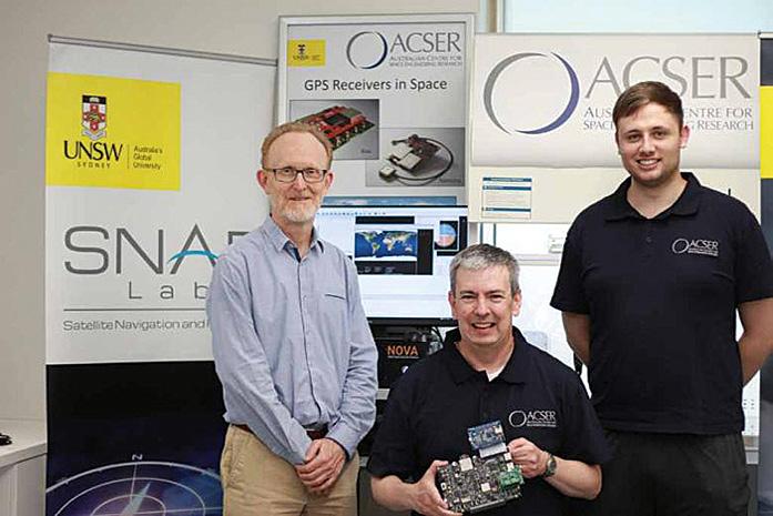
The device is an evolutionary upgrade of an earlier generation of receiver, called Kea. Made in Australia and New Zealand, Kea was a single-frequency GPS receiver and one of the first locally made units of its kind to be proven in spaceflight (aboard the UNSW-ECO cubesat).
Development of the new receiver was led by Professor Andrew Dempster, Director of ACSER.
“The idea was to take that work (on Kea) and upgrade it for this multifrequency, multi-system solution,” Professor Dempster says. “We needed to scale up the performance of many of the components on the boards — in particular, where the
digital processors and hardware live.”
Because the receiver has four front ends, it can be used for special applications such as reflectometry (as a single instrument), or antenna beam-forming. Reflectometry uses signals reflected from the Earth’s surface and can be employed to study environmental conditions over land and sea.
Potential users of this capability include the defence, construction, mining, logistics and agriculture sectors, as well as mobile navigation services.
ACSER hopes the locally designed receiver will reduce dependence on imported receivers, while also having strong export potential. It can benefit satellite missions by providing precise positioning, timing and velocity information, enabling orbiting Earth observation instruments to produce higher quality images.
“Dual-frequency GNSS receivers have been around for a long time, but dualfrequency reflectometry instruments have not,” Professor Dempster says. “Our receiver has been made much more functional and capable by using the two signals.”
“People aren’t using (reflectometry instruments) too much in space. That’s where we are hoping to do something new and original.” n
Andrew Dempster, Eamonn Glennon and Michael Rohrbach from ACSER. Credit: Cheryl Brown. ACSER’s new modular prototype dual-frequency, dual-system GNSS receiver. Courtesy ACSER. AICRAFT’s Pulsar is a super-fast edge computing module for use in orbit. Courtesy AICRAFT.MUDDI aims to straighten out the mass of data on underground infrastructure.
Asystem for mapping and visualising underground infrastructure assets such as pipes and cables, is being put to the test in the UK. The concept, known as the Model for Underground Data Definition and Integration, or MUDDI, has been developed by data scientists in an Open Geospatial Consortium working group.

The aim of MUDDI is to visual subsurface assets and characterise the underground environments in which they sit, and define an encompassing data store. Once this is done, the data can be shared with those who need it and translated into easily understood maps.
Damage caused to underground assets from digging, and the need to alter plans when unexpected underground assets are found, costs nations hundreds of millions of dollars every year.
MUDDI was developed from data standards such as INSPIRE and CityGML. The aim is for it to eventually become a new international standard.
The UK Ordnance Survey’s Chris Popplestone said that MUDDI is an ideal example of a ‘harmonised data model’.
“The harmonised data model is that central target into which all of the source infrastructure data is transformed,” he said. “The source data comes in all different shapes and sizes, but it all gets transformed to this harmonised model.”
“We start off with a conceptual model of how this transformed data will look and we use various tools to focus that down into a physical model that can then be implemented as a data store. It’s a process from a high-level
conceptual design down to an actual physical schema which can then be deployed by a development team.”
MUDDI has been trialled during pilot testing for the UK’s National Underground Asset Register (NUAR) program, which is led by the UK Government’s Geospatial Commission.
Two pilots were undertaken — one in London and the other in the northeast of England — and work has now begun on rolling out the system nationally under the lead of engineering consultancy, Atkins. That roll out of NUAR will lead to the development of a UK profile of MUDDI, which will be focused on the safe-digging use case.
Geospatial firm 1Spatial is providing the data transformation and data ingestion parts of the activity, with information collected from around 650 data or asset owners.
The task of shaping the MUDDI-based harmonised NUAR model is being undertaken by the Ordnance Survey, and involves building the data store and developing the software platform that will translate the data into a map-based interface. The idea is that field workers can highlight an area on the map, and it will instantly reveal the location of any relevant underground assets.
“The NUAR pilot was based on an earlier version of MUDDI, and the feedback we got from the pilot phase has fed into a new iteration of the MUDDI model, and that is now forming the basis of the national roll out of NUAR,” said Popplestone.
“There has been a lot of
international involvement and that is being looked at very carefully for other international projects that are also planning to follow a similar approach.”
But the MUDDI concept will only be as good as the data fed into it, which is one of the biggest hurdles any such system faces.
“Because we know that is a risk, we have tried to make everything about the data model and the implementation of the data model as responsive as possible,” said Popplestone.
“Working under the Geospatial Commission we helped to build in flexibility to the UK’s ‘excavation profile,’ alongside strong governance structures, to try and streamline any additions that need to be made, so we don’t have to completely tear down data stores and rebuild them because we have found a new type of pipe.
“We have tried to make it quite modular and quite flexible.”
Popplestone says subsurface asset data is a particular problem in the UK, where most of the country’s infrastructure is under the ownership of numerous private companies, each of which has its own (often disparate) data systems.
“That is part of what the data model is designed to solve,” he said. “There is potentially so much variation that we have to be able to make tweaks and add things that we haven’t come across in other data sets.”
“So, things like terminology can be quite different between different companies — we must make sure when we come across a new term it is a genuinely a new thing rather than something else that we have already modelled [but] called by a different name.” n
The Survey Control Information Management System (SCIMS) is NSW’s database containing more than 250,000 survey marks on public record across the state. It was recently updated with Australian Height Datum (AHD) values sourced from a state-wide Digital Elevation Model (DEM) for more than 127,000 survey marks with existing Class U or null AHD heights. Almost 19,000 marks received an AHD height for the first time, while 100 gross AHD height errors in SCIMS were identified and corrected.

The updated AHD heights are displayed in SCIMS to the nearest metre and provide important benefits for industry, such as enabling the calculation and reporting through SCIMS of the Combined Scale Factor (CSF) and supporting datum modernisation to further improve user access to survey information.
DCS Spatial Services, a unit of the NSW Department of Customer Service (DCS), provides a state-wide DEM with a vertical uncertainty of ±0.9 m
at the 95% confidence level (CL) and a horizontal grid density of 5 m. While it has been available through ICSM’s Elevation Information System (ELVIS) as 2 km by 2 km data tiles for some time, the DEM can now be queried directly through a publicly accessible Application Programming Interface (API). This article outlines how the new interface was used to query the coordinates of all marks in SCIMS to retrieve AHD heights from the elevation model, assess the accuracy of these AHD heights and update SCIMS with DEM-sourced heights for suitable survey marks to yield a homogeneous dataset of known provenance and verifiable quality across NSW.
As surveyors and spatial professionals, we know that height and elevation data is crucial for a vast number of applications and that our survey control underpins this data. DCS Spatial Services delivers various imagery and elevation products as part of its ongoing custodial responsibilities
regarding the NSW Foundation Spatial Data Framework.
Accurate and reliable orthorectified aerial imagery and high-resolution elevation data are critical to effective planning, decision making, change monitoring and risk mitigation and are utilised by government, industry and the community. Reliable and quality-assured survey control is fundamental to ensuring the integrity of this data, which contributes significantly to economic, social and environmental sustainability in NSW.
One of the products provided by DCS Spatial Services is a state-wide DEM with a vertical uncertainty of ±0.9 m (95% CL) and a horizontal grid density of 5 m. It was produced by a combination of category 1 LiDAR, category 3 LiDAR, 10cm ground resolution imagery and 50cm ground resolution imagery.
This DEM can now be queried directly through a new publicly accessible API to return an AHD height at a specified location.
AHD heights from the statewide DEM were extracted via an in-house-developed Python script using the ‘public/ NSW_5M_Elevation’ API, available on the NSW Spatial Information Exchange (SIX) platform.
To obtain a sufficiently large dataset for evaluation of the accuracy of the returned data, every survey mark in SCIMS (including witness marks, destroyed marks and interstate marks along the borders) was submitted to the API for height retrieval. This included 301,200 marks, using their horizontal GDA2020 positions for interrogation.
Due to the enormous number of queries required, and to prevent overload of the server, the submission data was separated into sets of 50 marks for asynchronous retrieval, with a wait timer introduced between sets.
Retrieval was an iterative process, as failure rates for the server’s identify function were up to 50% of the submitted
JONATHON SMITH and VOLKER JANSSEN NSW’s statewide Digital Elevation Model improves approximate AHD heights on public record.set at times (likely caused in part by inferior internet connections while working from home during the COVID-19 pandemic). Failed retrievals were re-added to the submission set for the next iteration and automatically resubmitted until completion. This process took approximately eight days of continuous processor time.
We found that 872 of the submitted positions returned no data, with 46 of these located on Lord Howe Island (not covered by this DEM nor true AHD). The remainder (apart from a few anomalies) were located along the Queensland, South Australian and Victorian borders.
Closer inspection revealed that all these locations were outside the extent of the DEM. Note that SCIMS includes several interstate survey marks close to the NSW border and that the Australian Capital Territory is entirely covered by the DEM.
The lower-accuracy AHD heights retrieved from the DEM were compared to existing high-accuracy AHD heights of survey marks in SCIMS that satisfied the following criteria:
• Established (Class D or better) horizontal GDA2020 coordinates.
• Accurate (Class B/LD or better) AHD height.
• Mark located at or near ground level.
The prerequisite for established horizontal coordinates is as important as an accurate AHD height because local terrain undulations can quickly alter the height returned from the DEM. Similarly, selecting marks that are not on the natural ground surface renders the comparison invalid.
In this instance, 34% of the survey marks in SCIMS (102,437 of 300,328 that returned heights) met the required criteria. For example, Figure 1 illustrates the distribution of these marks across Greater Sydney.
The threshold for a successful comparison was set at ±0.9 m, which is the quoted vertical uncertainty of the DEM (95% CL). We found that the calculated height differences between the DEM and SCIMS were within this threshold for 95,866 marks, i.e. 93.6% of the comparison set (indicated in blue in Figure 1).
This pass rate is slightly lower than the quoted vertical DEM uncertainty, for two main reasons:
• The comparison did not consider the survey marks’ vertical position above or below ground level (typically up to 0.2 m in either direction). This was deemed unnecessary as the result was fit for purpose and this information was only available for 3.7% of the comparison set.
• The horizontal density of the DEM is 5 m, so AHD heights at marks located on undulating terrain may show some discrepancy, depending on their position relative to the DEM sample points (used to interpolate the height at the specified position).
For at least the last five years, DCS Spatial Services has recorded the mark-to-groundlevel offset at each survey mark occupied or inspected as part of normal field operations. To examine the effect of including such metadata, we repeated the analysis for a subset of 3,849 marks.
This smaller sample exhibited a pass rate of 97.1% when the mark-to-ground-level correction was applied and a 96.2% pass rate when it was ignored. Together with the earlier analysis, this result was deemed fit for purpose, confirming the stated DEM uncertainty.
Interestingly, 960 (14.6%) of the 6,571 marks that failed to meet the ±0.9 m threshold (indicated in orange in Figure 1) are located within 20 m of the centreline of a major highway or motorway. This can be explained by rapid changes in topography often occurring along the cross section of the road corridor, including embankments and cuttings.
Furthermore, some of these roads are extremely steep, such as the Great Western Highway between Penrith and Glenbrook. Finally, 1,082 (16.5%) of all the marks failing to meet the threshold are specified as ‘destroyed’ in SCIMS, indicating that their AHD height may relate to a time prior to road or other construction earthworks altering the topography.
Following initial height retrieval, we noted that the DEM returned an AHD height that was significantly different (> 20 m, e.g. a typical contour) from the value in SCIMS for 787 survey marks with an existing Class U AHD height.
This was investigated by querying Geoscience Australia’s national 1-second Shuttle Radar Topography Mission (SRTM) DEM for the entire dataset via another API. We then compared the two DEMs to each other and to SCIMS. Wherever the NSW DEM value differed from SCIMS by more than 10 m (in 4,690 cases), the 3-way comparison was recorded.
Any AHD height difference exceeding 20 m between the two DEMs was manually investigated, resulting in 45 of 108 marks (41.7%) being excluded from the following SCIMS update. All these
excluded marks were located where an open pit mine had subsequently been created.
Any other large differences between the two DEMs were a result of the coarser resolution of the SRTM DEM (1 arcsecond equates to approximately 30 m). For example, for trigonometric station (TS) pillars located on the side of a cliff, the SRTM DEM sometimes returned the height partway down the cliff.
Most remaining large differences between the NSW DEM and SCIMS appeared to be the result of transcription errors in the SCIMS height (e.g. 1,000 m instead of 100 m) or rounding to the nearest contour when the heights were initially entered into SCIMS.
Reliable and quality-assured survey control is fundamental to ensure the integrity of the imagery and elevation products delivered by DCS Spatial Services. However, this connection can work both ways as these products can then be used to improve survey control information on public record.
In this case, we updated SCIMS with suitable DEMsourced AHD heights (at Class U) to yield a homogeneous dataset of known provenance and verifiable quality across NSW. This essentially improved
approximate AHD height values that were initially obtained from the nearest contour on 1:25,000, 1:50,000 and 1:100,000 topographic maps to DEM-sourced values with submetre uncertainty.
Noting the DEM uncertainty, survey marks were only selected for AHD height update if their existing AHD height in SCIMS was null or Class U. Furthermore, it is important to consider that SCIMS holds records for a wide range of different monument types.
A location descriptor also indicates whether the mark was placed in the ground or on a structure. As such, further filtering was applied to limit the height update to only those marks that are likely to be at (or near) ground level.
Consequently, several monument types (e.g. chimney, mast, reservoir, tower) and mark location descriptions (i.e. building or structure, silo, other structure) were excluded from the update. Any TS whose name included the word ‘tower’ was also excluded.
Note that ‘reservoir or tank’ should also have been on the list of excluded mark locations but was unfortunately missed. This resulted in 30 trig stations on reservoirs incorrectly receiving a height at ground level, which has since been revisited and corrected.
After filtering and before the SCIMS update was executed, a
final test was performed to check for trends. This revealed that the data was normally distributed and 99.3% of the AHD heights included in the update were within 20 m of their existing SCIMS values (see Figure 2).
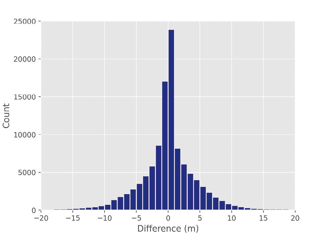
A 20 m error in height corresponds to approximately a 3 parts per million (ppm) error in the reduction of ground distances to the ellipsoid between two marks, which was deemed acceptable and fit for purpose.
As previously mentioned, height differences larger than 20 m were generally attributed to:
• Transcription or rounding errors in the existing SCIMS value (corrected by the update).
• Marks located where an open pit mine had subsequently been created (excluded from the update with mark status updated as ‘destroyed’).
This SCIMS update delivered DEM-sourced AHD heights at Class U for 127,154 survey marks, of which 18,854 marks (14.8%) received an AHD height for the first time (see Figure 3).
Putting this large number into perspective, 42.3% of the survey marks that returned a DEM-sourced AHD height during the initial retrieval were updated. This is a huge improvement in the access to reliable, approximate AHD
heights of known quality in SCIMS, ensuring that nearly every survey mark in NSW has an AHD value of 0.9 m uncertainty or better.
When inspecting Figure 3, it is worth noting the near-perfect straight line of AHD height updates to survey marks running from north-west to south-east through the centre of the state. Despite appearing to be an artefact, this is a series of marks located along a gas pipeline easement, which connects to the main distribution network on the east coast.
These updated AHD heights provide several important benefits such as enabling better calculation and reporting of the Combined Scale Factor (CSF) with confidence at virtually all survey marks (99.98%) in NSW through SCIMS. CSFs are now typically up to 1.5 ppm better because heights have been improved from 10-metre to sub-metre accuracy.
The DEM-sourced AHD heights support our datum modernisation efforts through the ongoing readjustment of legacy terrestrial data for inclusion in the growing GDA2020 state adjustment by facilitating the rigorous reduction of terrestrially measured distances to the ellipsoid. This translates into more SCIMS marks being assigned a Positional
Uncertainty (PU), directly benefitting the profession.
Furthermore, this process identified and corrected 101 extremely large AHD height errors (Class U) in SCIMS. It follows that retrieved DEMsourced heights can now also be used to identify gross errors on SCIMS marks with existing accurate AHD heights. This further contributes to our ‘Saving AHD’ efforts, which aim to ensure that users have continued and easy access to reliable physical heights and their uncertainties across NSW (see Position 115, Oct/Nov 2021).
Finally, with SCIMS now holding AHD heights of known quality state-wide, ellipsoidal height was derived by applying AUSGeoid2020 at all applicable survey marks with existing null ellipsoidal height values.
Another SCIMS update then provided GDA2020 ellipsoidal heights for 267,581 survey marks for the first time, ensuring that practically all SCIMS marks now also have an ellipsoidal height. Publishing these values allows surveyors and other users to easily verify that they have set their height datum and/or applied AUSGeoid2020 correctly during both field operations and office processing and reductions. n
Jonathon Smith and Dr Volker Janssen work at DCS Spatial Services, a unit of the NSW Department of Customer Service.
Maxar Technologies has launched SYNTH3D, a high-performance, geotypical 3D representation of the entire planet for gaming, simulation, entertainment, virtual reality, smart cities and metaverse applications. Developed through a partnership with blackshark.ai, SYNTH3D enables developers to simulate and visualise 3D environments representative of real-world locations where aesthetics and performance are key to commercial applications. Blackshark.ai creates SYNTH3D by applying its generative AI to Maxar’s Vivid imagery basemap, a cloud-free, virtually seamless view of Earth. The AI extracts more than 1.4 billion buildings and procedurally generates them as 3D buildings, which have geotypical textures applied.
Orolia has announced that its Skydel GNSS simulation engine software can generate more than 500 signals from a single platform. According to the company, Skydel gives GNSS chipset and receiver manufacturers a solution that can generate a very high capacity of signals from a single workstation. Skydel contains a feature set that includes multiconstellation/multi-frequency signal generation, remote control from user-defined scripts, and integrated interference generation. In addition to generating a high channel/satellite count, Skydel can also produce navwar signals without any additional hardware. Since 2015, Skydel software has been used to simulate GNSS signals for a wide range of applications and business segments including automotive, aerospace, space, telecommunications and defence.
Esri has introduced ArcGIS Reality, which, it says, enables site, city, and country-wide 3D mapping for digital twins.


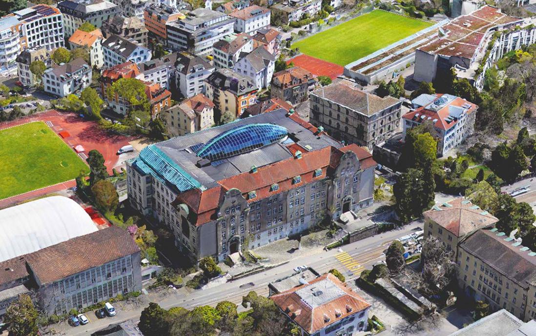
ArcGIS Reality is a family of products that use the new ArcGIS Reality Engine: ArcGIS Reality for ArcGIS Pro, an extension of Esri’s desktop GIS software, which enables users to input images from drones or crewed aircraft; ArcGIS Reality Studio, a new application for reality mapping from aerial images for entire cities and countries; Site Scan for ArcGIS, a cloud-based, end-to-end reality mapping software for drone imagery, designed to simplify drone program management, imagery data collection, processing, and analysis; and ArcGIS Drone2Map, a desktop application focused on reality mapping from drone imagery.
Leica Geosystems has released the HawkEye-5, a new airborne bathymetric LiDAR solution for deep water surveying that expands the capabilities of the Leica Chiroptera-5 bathymetric LiDAR system, enhancing the productivity of applications such as nautical charting, environmental monitoring, and maritime surveillance in deep waters.
The HawkEye-5 is designed to fit the Leica PAV100 gyrostabilised mount, which isolates the sensor from unwanted aircraft movements, resulting in consistent data density and more efficient area coverage. The combination of the Chiroptera-5 with the HawkEye-5 features three LiDAR sensors, one 4-band camera and a QC camera. Each module is optimised for a specific task, allowing seamless acquisition of the highest quality geospatial data from land to deep ocean seafloors.
The HawkEye-5 fully integrates with Leica Geosystems’ bathymetric data processing and analysis workflow.
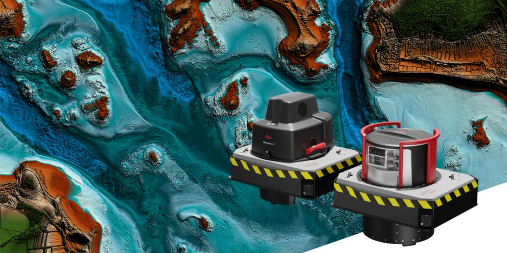

News of the formation of the Geospatial Council of Australia has received an overwhelmingly positive response from both the public and private sectors, exceeding all expectations. By establishing the Geospatial Council, we can work collaboratively to advance the industry, support professional development and create opportunities for growth and innovation.
For many months leading up to the creation of the Geospatial Council, we diligently built a compelling case for our purpose: To sustain a vital, diverse and thriving geospatial community for the benefit of the nation. Our role is critical to developing a modern digital economy that is powered by geospatial technologies, and we take this responsibility seriously. By promoting the growth and advancement of the geospatial sector, we are playing a vital role in driving the future success of Australia’s economy.
To achieve our ambitious goals, the Geospatial Council has identified four key areas of focus: building workforce expertise and addressing the structural issues affecting the education and training of professionals; advocating policy changes that will have a positive effect on the growth of the industry and its capability; championing professional development; and building sector recognition. By addressing these crucial areas, the Geospatial Council is laying the foundation for a thriving modern digital economy that will benefit the entire nation.
Our first priority is to enhance our workforce expertise by addressing
skills shortages, overcoming structural constraints that hinder the recruitment of professionals and improving professional standards. This will involve implementing measures such as recognition of national professional competency standards through wider certification and micro-credentialing for specific technical, career advancement and business competencies. We also plan to work with government policymakers and the wider sector to ensure that we have the necessary support to address workforce shortages and meet the demands of the growing geospatial industry.
We recognise that government policies play a crucial role in creating an environment that fosters innovation, attracts investment and supports the growth of businesses in the geospatial industry. We will work with relevant ministers and government executives at both national and state/ territory level to identify areas where policy changes are needed to lift the capability and growth of the geospatial industry. This includes policies related to industry growth including investment priorities, procurement, regulations, standards and data sharing. Regular consultation with our members and other key industry stakeholders will be crucial to developing initiatives and programs that promote capability development, foster innovation and support the growth of geospatial companies across the nation.
We are committed to building a comprehensive online learning program
A thriving geospatial sector means a better future for Australia
that will provide access to quality education and training for professionals at all levels. Our online resources are designed to help individuals develop the skills and knowledge they need to succeed in the geospatial industry. We are also committed to strengthening our annual events program. This program provides an opportunity for industry professionals to network, share knowledge and best practices, and collaborate on innovative solutions to common challenges. Our events program includes conferences, workshops and other professional development opportunities that are designed to meet the diverse needs of our community. Through our focus on professional development, we aim to raise professional standards, improve productivity and create a dynamic and innovative geospatial community in Australia.
This is our chance to build sector recognition and increase public and political awareness of the critical role geospatial technologies play in driving the national economy. This can be achieved by highlighting success stories, promoting thought leadership through various forums, and showcasing the latest technological innovations. The Council seeks to create a greater understanding of the potential for geospatial technologies to drive economic growth and enhance societal well-being. We will continue to acknowledge our sector leaders through the Geospatial Excellence Awards and our Fellowship program. As we move forward, our policy development and advocacy efforts have already become increasingly vital. On
14 March 2023 we launched the 2030 Space+Spatial Industry Growth Roadmap at an exclusive media event held at the Space Discovery Centre in Adelaide. We must recognise the significant contribution our late President Dr Peter Woodgate had in developing this Roadmap. He conceived the vision and garnered support and participation from the most senior industry and government leaders from the space and geospatial sectors to develop the Roadmap. Being involved in the development of this crucial piece of work has been a personal honour.
The 2030 Space+Spatial Industry Growth Roadmap serves to steer government policymakers towards Australia’s economic success, societal wellbeing and national security. This will be achieved by our ability to collect, disseminate and understand data. Australia’s space and geospatial capabilities are central to achieving that aim. The nine recommendations in the 2030 Roadmap will ensure that Australia can be self-sufficient in providing essential data and services to support areas of national importance, including land and water security, emergency management, autonomous systems and smart cities management.
Achieving these objectives will have significant implications, such as addressing climate change, improving disaster resilience, bolstering defence and safeguarding our critical infrastructure. This is merely the start of our endeavours to establish geospatial technology as a fundamental part of our nation’s economy.
The Board of the Geospatial Council has convened and begun the process of prioritising our future initiatives. One of
our priorities is to complete an economic impact assessment of geospatial on the national economy.
According to a 2021 Deloitte Economics commissioned by Geoscience Australia, the economic impact of seabed mapping alone is estimated to be $9 billion. However, when all of the other segments are included this figure is likely to grow substantially through the inclusion of other sectors such as property, construction, resources, energy, water and environment, agriculture, transportation and logistics, and defence. To better understand the full economic impact of geospatial services, a second stage of the study will examine the skills gap and its effect on economic growth. By presenting a compelling argument to federal and state governments, we hope to receive support in addressing the skills problem.
The success of the Geospatial Council hinges on the co-operation of various stakeholders, including participants from diverse and complementary sectors, other representative bodies, the education sector and, most importantly, sectors that heavily rely on geospatial services… and of course our members and other participants within our sector.
We are excited to engage with our sector at Locate23 in May and see significant opportunities for growth and development. We believe that by working together, we can overcome any challenges and create a better future for the geospatial sector. n
 Tony Wheeler Chief Executive Geospatial Council of Australia (t/a Surveying & Spatial Sciences Institute)
The inaugural leadership team of the Geospatial Council of Australia has been nominated to drive a forwardthinking strategy to position the new peak body as the voice for the geospatial community. The expertly qualified Board members will bring decades of experience to their work with the membership on the Geospatial Council policy agenda.
Early engagement with the community has indicated priorities for advocacy around digital transformation, workforce advancement, diversity and inclusion, and
building the economic profile of geospatial. Our organisational members have highlighted three key areas requiring attention:
1. Increase the profile of geospatial-related occupations to attract and retain talent.
2. Increase investment into, and the recognition of, the geospatial ecosystem to provide global best practice technology and services across the economy.
3. Strengthen the voice of the geospatial ecosystem across whole of government,
industry, and communities throughout Australia and internationally.
The launch of the Geospatial Council of Australia is the vital next step in fulfilling the needs of the organisations and professionals across the geospatial community.
Watch this space! The role of Geospatial Council of Australia President will be announced soon, following a recruitment process to replace the late Dr Peter Woodgate.
Why the Geospatial Council of Australia? In the past, Australia had two clearly defined camps –surveying and spatial sciences. Today the lines have blurred. Surveying and spatial are complementary and are just two parts of the overall geospatial picture.
Geospatial is an all-encompassing term covering the accurate knowing of ‘where,’ which includes: surveying; hydrography; cartography; Global Navigation Satellite Systems (GNSS); Positioning, Navigation and Timing (PNT); spatial analytics; Earth observation from space; airborne and terrestrial platforms; and 3D scanning also from airborne and terrestrial platforms.
Geospatial also includes smart technologies such as, big data, AI, advanced robotics, automation, edge computing, continuous internet connectivity, sensors everywhere, digital twins and advanced interoperability — the same technologies associated with
the Fourth Industrial Revolution driving an economy wide digital transformation.
The industry is made up of those technologies, services, software, hardware data and knowledge. It is time we are defined as one. Collectively we are geospatial, but we are comprised of many disciplines and technologies.
Come to Locate23 in Adelaide from 1012 May and help us celebrate the official launch of Australia’s peak body for the geospatial professions — the Geospatial Council of Australia.
The Geospatial Council will bring the geospatial community together during the welcome reception on Wednesday, 10 May. There will also be plenty of networking opportunities at a dedicated space to welcome the new Board and the Geospatial Council team. Come along and find out more about what’s planned for 2023 and beyond.
When you join the Geospatial Council as an individual for professional and personal development, you gain immediate access to Australia’s bestconnected geospatial network. There’s an opportunity to have your say in developing the future of your profession. Businesses also benefit from a united voice in shaping the industry and opportunities to broaden organisational networks within the geospatial community.
• Individual membership is available to anyone in Australia working in or interested in the geospatial industry.
• Affiliate membership is available to anyone outside Australia.
• Organisational membership categories are Business, Public Sector, Education (universities and training organisations) or School.
Acting President Paul Digney is the Survey Technical Director for Jacobs Australia and is a licensed surveyor in Tasmania and Victoria with over 25 years’ experience in the surveying/spatial profession. The former President of SSSI, Paul has shared his employment equally between public and private sector roles with a strong focus on geodetic/cadastral surveying and, more recently, 3D laser scanning, digital engineering and strategic consulting.
Jacinta Burns has extensive experience working in spatial industry roles within utilities, state and local government. Jacinta has recently been appointed Digital Innovation Lead at CitiPower and Powercor and was only recently a Product Owner at PelicanCorp, managing multiple products globally with the aim of improving the safety of the community. Jacinta was formerly a SIBA|GITA Board member, is part of the Spatial and Surveying One Voice Committee and has been actively involved in the SSS-DLN Diversity Survey Committee.
Kate Ramsay is a longstanding member of the Australian geospatial community, having built her expertise in the areas of product development, support and management. She is the Group Chief Client Officer for Esri Australia and has led teams across the APAC region, actively promoting the value of GIS and championing the efforts of some of the region’s most innovative spatial practitioners to decision-makers within the private and public sectors.


Deputy President Alistair Byrom is Principal Surveyor at Veris in Brisbane. For more than 20 years has served on committees for ISAQ, SSI, SSSI and SIBA|GITA, where he has supported the ongoing growth and development of the surveying profession and the spatial industry. He is the former Chair of SIBA|GITA. Alistair has proven to be a vital source of knowledge for those seeking registration with the Surveyors Board of Queensland. Alistair’s affinity with land law, as it relates to surveying, has led him into one of his core skills, being forensic consulting. He has prepared numerous expert reports for the Supreme Court, Land Court and the Planning & Environment Court.


Darren Mottolini is acknowledged as a recognised leader within the spatial community for leading spatial strategies, implementation plans and advising on best practice for the delivery and use of data spatial in many industries. Darren has worked as a lead consultant for both the Australian and foreign governments, the private sector and academia. He has recently returned to Landgate where he will take the lead in delivering Spatial WA, a digital twin framework for Western Australia.

Roshni Sharma is a Project Manager and Analyst at FrontierSI. She is passionate about creative positive intergenerational change within the industry and is founder of the SSSI National Mentoring Program. Roshni is also a strong advocate for diversity, equity and inclusion and reimagining leadership in geospatial. She is travelling to Antarctica in 2023 for Homeward Bound, a leadership program for women in STEM. In 2021, Roshni was selected as Geospatial World’s Top 50 Rising Stars.
