
Resilience & SLR Adaptation Project [WRAP]


Resilience & SLR Adaptation Project [WRAP]

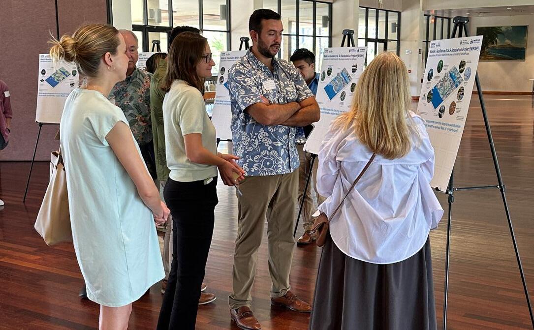
During this project phase, UHCDC developed presentation boards and interactive visioning exercise materials for a series of two participatory planning and design events aimed at seeking additional public participation and community/stakeholder input, ideas, and feedback on the long-term resilient future of Waikīkī and its context.
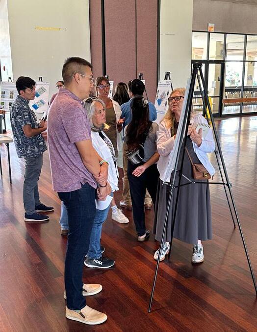
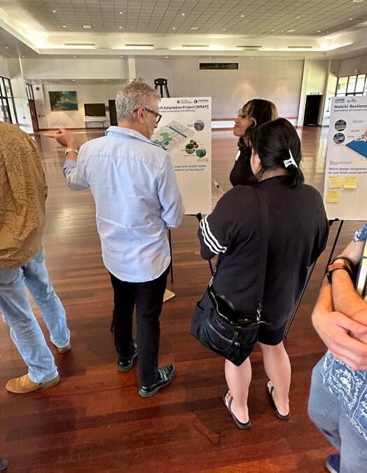
The project team coordinated, conducted, and facilitated two in-person co-design charrettes on Friday, February 23, 2024 (2:00 pm - 3:30 pm) at Ala Wai Community Park (Boathouse) and on Monday, March 4, 2024 (1:00 - 2:30 pm) at the Ala Wai Golf Course Clubhouse.
This chapter includes:
Project Overview and Background Materials (printed on 24” x 30” presentation boards for the events) Charrette 1: Ridge to Reef Scale Considerations (Visioning Exercise Materials, Summary of Results) Charrette 2: Neighborhood Scale Adaptation (Visioning Exercise Materials, Summary of Results)
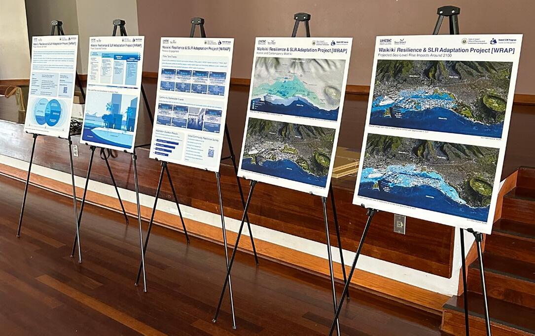
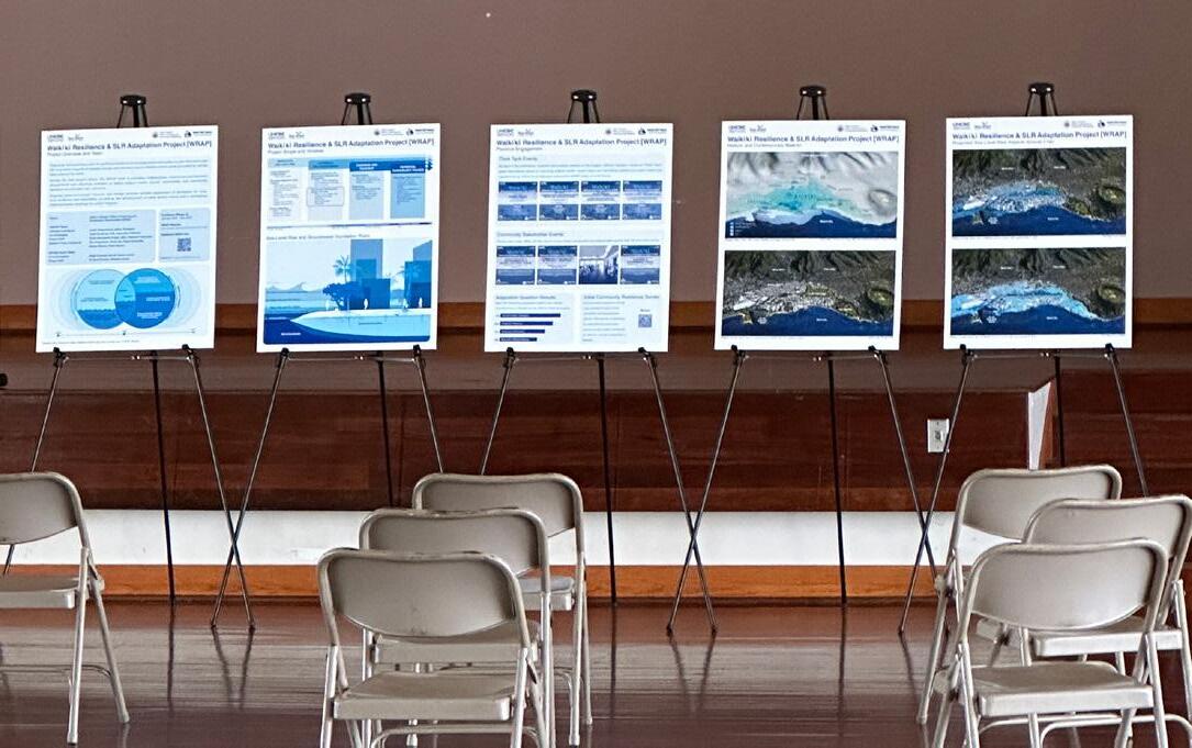


PROJECT OVERVIEW AND BACKGROUND

State of Hawaiʻi Office of Planning and Sustainable Development


This state-funded project aims to lay the groundwork for an adaptation and resilience plan that addresses the long-term impacts of climate change and sea-level rise on Waikīkī and to serve as a pilot for similar sites around the state.
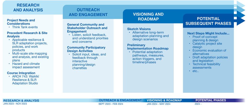
During the first project phase, the WRAP team is providing collaborative, community-participatory engagement and visioning activities to solicit subject matter expert, stakeholder, and community feedback on priorities and concerns.
Ongoing proof-of-concept research and design services include assessment of strategies for longterm resilience and adaptation, as well as the development of initial sketch visions and a conceptual implementation roadmap for action triggers.
Client: State of Hawai‘i Office of Planning and Sustainable Development (OPSD)
UHCDC Team:
Principal Investigator Judith Stilgenbauer, ASLA, Professor
Co-Investigator Cathi Ho Schar, FAIA, Associate Professor
Project Staff Emily Sobolewski Knight, ASLA, Research Associate Student Project Assistants Zoe Angelopulo, Kiana Dai, Alzira Fernandes Kenny Morrow, Sierra Spears
UH Sea Grant Team:
Co-Investigators
Dolan Eversole and Dr. Darren Lerner Project Staff Dr. Brad Romine, Melanie Lander
Timeframe (Phase 1): January 2023 - May 2024
WRAP Website: www.uhcdc.manoa.hawaii.edu/work/wrap
Additional WRAP Info: Questions? UHCDC.WRAP@gmail.com
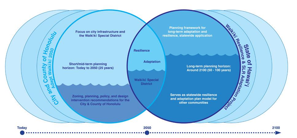


Project Scope and Timeline


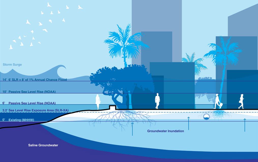
Sea-Level Rise and Groundwater Inundation Risks


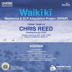
As part of the preliminary research and analysis phases of the project, UHCDC hosted a series of “Think Tank” panel discussions aimed at soliciting subject matter expert input and identifying additional project needs and considerations, which have informed subsequent WRAP scope of work items.
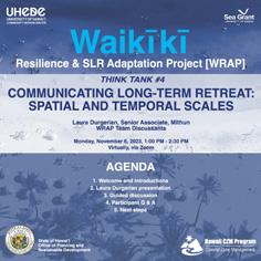
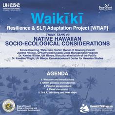
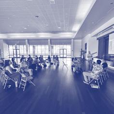
During December 2023, UH Sea Grant hosted three community and stakeholder events with 95 total attendants.
A community resilience survey was created as part of the outreach and engagement efforts. This survey is designed to understand community concerns and collect feedback on climate change adaptation in Waikīkī.


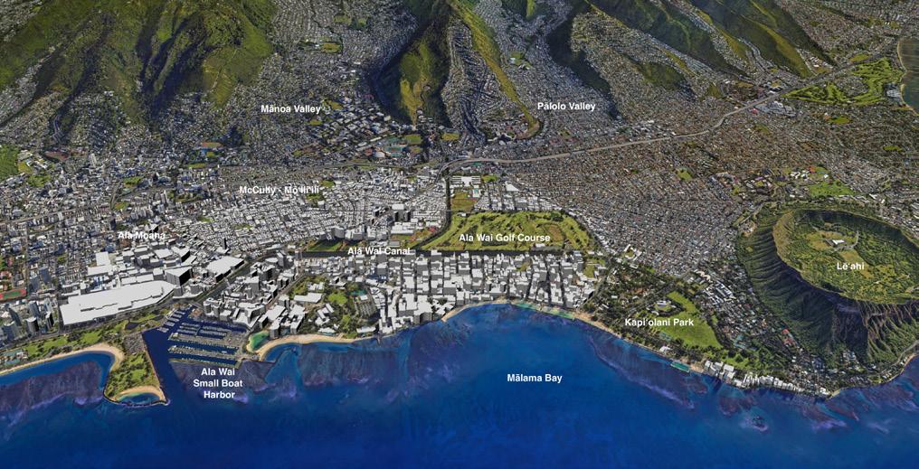


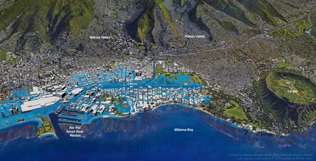
Projected Sea-Level Rise Impacts Around 2100


Resilience & SLR Adaptation Project
Friday, February 23, 2024, 2:00 - 3:30 PM Ala Wai Community Park (Boathouse) 2015 Kapiolani Boulevard, Honolulu, HI 96826


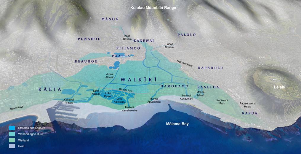
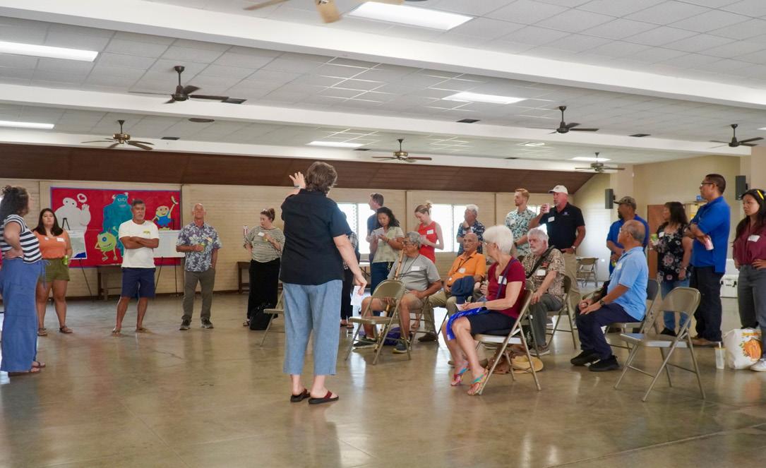
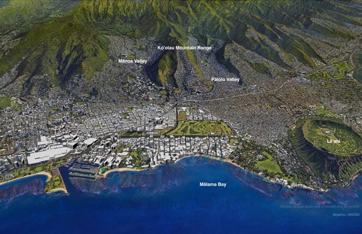
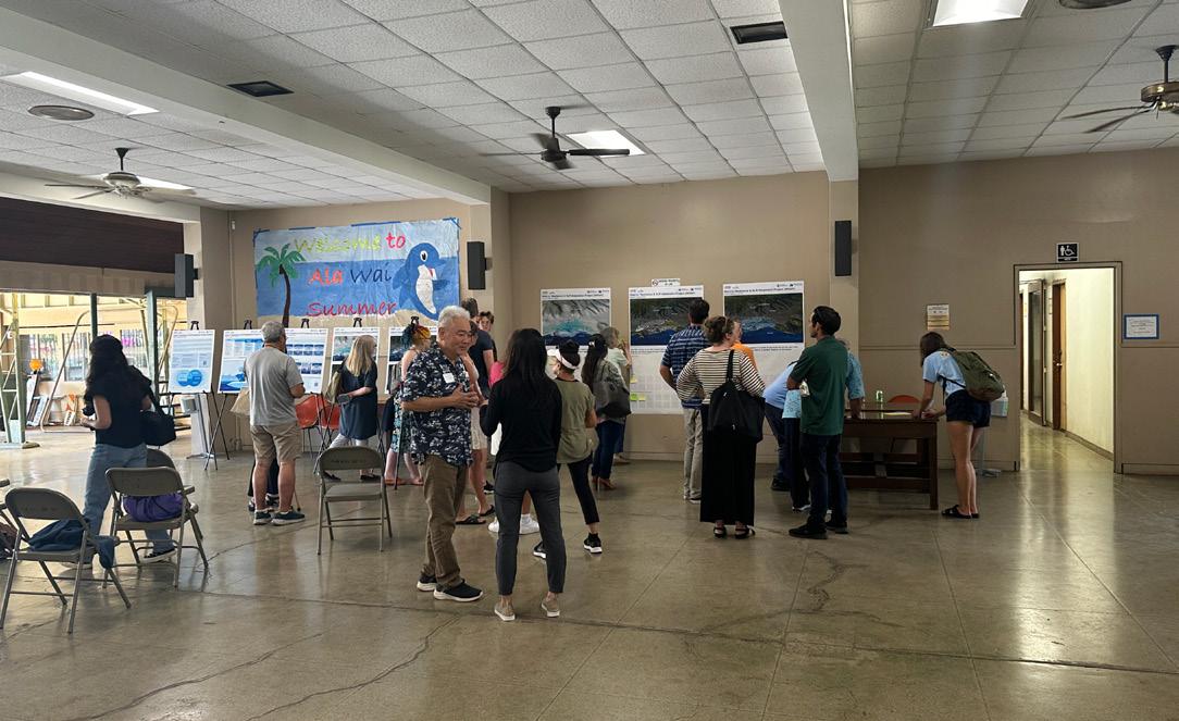
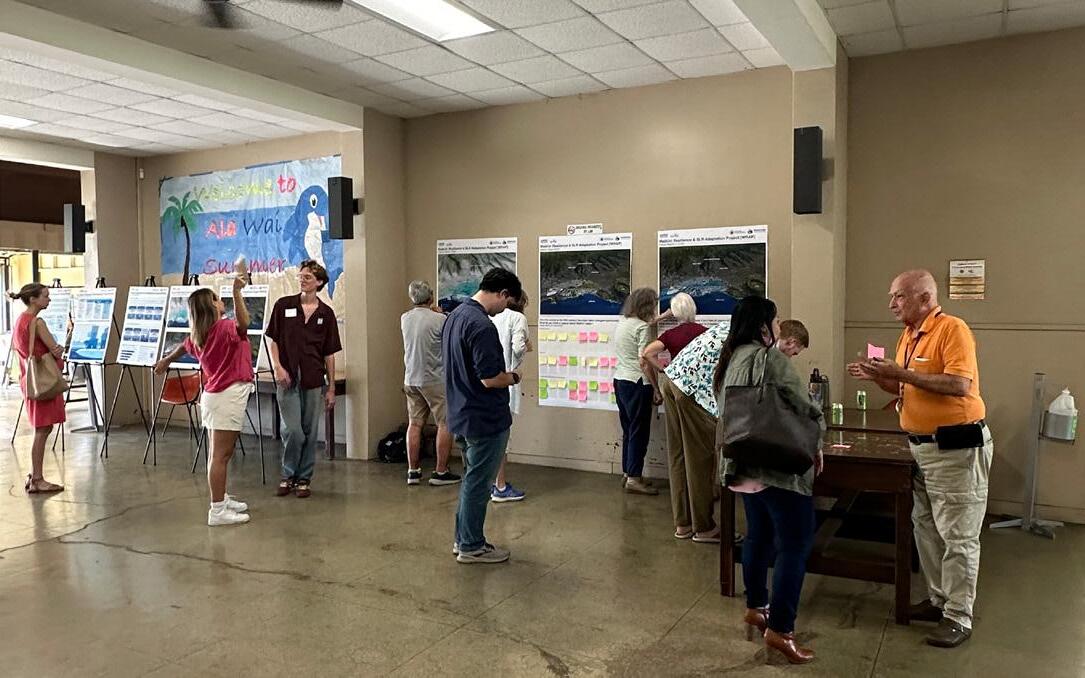
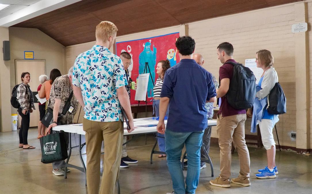
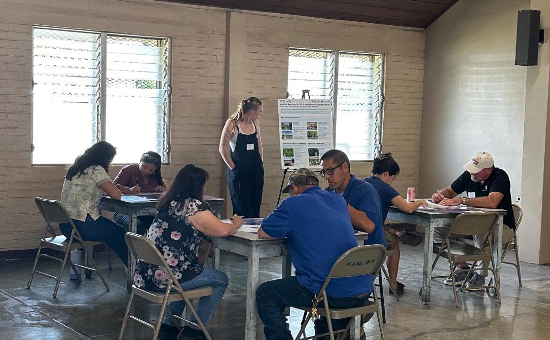
On Friday, February 23, 2024, UHCDC hosted the first of two community and stakeholder visioning events. This co-design charrette focused on the Special District in its wider watershed and neighborhood context. The interactive exercises posed questions related to ecology, hydrology, historical/cultural factors, as well as built environment/infrastructure vulnerabilities and nature-based solutions. The event was held at the Ala Wai Community Park Boathouse on the mauka side of the Ala Wai Canal.
46 Attendees
TO REEF SCALE | FRIDAY, FEBRUARY 23, 2024


Activity 1: Ridge to Reef Opportunities
Activity 2: Historic Waikīkī, Waikīkī Today, Future Waikīkī
Activity 3: Built Environment Climate Concerns
Activity 4: Nature-Based Solutions

RIDGE TO REEF SCALE | FRIDAY, FEBRUARY 23, 2024


Waikīkī Resilience & SLR Adaptation Project [WRAP] Ridge to Reef
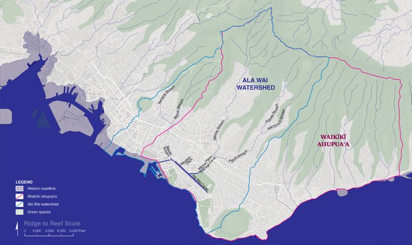
Identify ecological, hydrological, and social or cultural opportunities.


Waikīkī Resilience & SLR Adaptation Project [WRAP] Ridge to Reef
Identify ecological, hydrological, and social or cultural opportunities.
Please place a colored dot on opportunity sites: Ecological Hydrological Social or Cultural


| FRIDAY, FEBRUARY 23, 2024
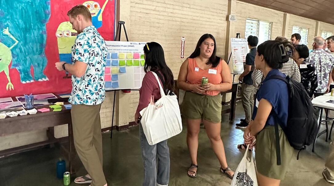
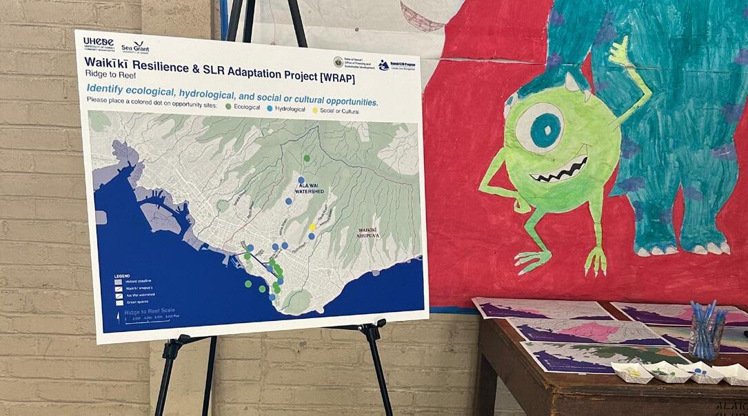
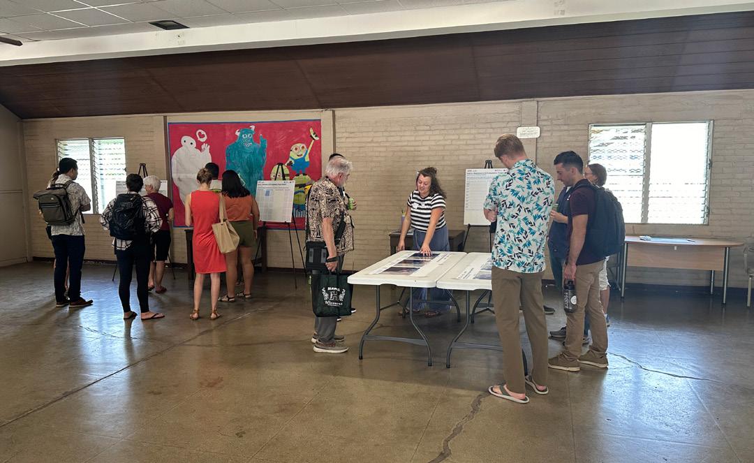
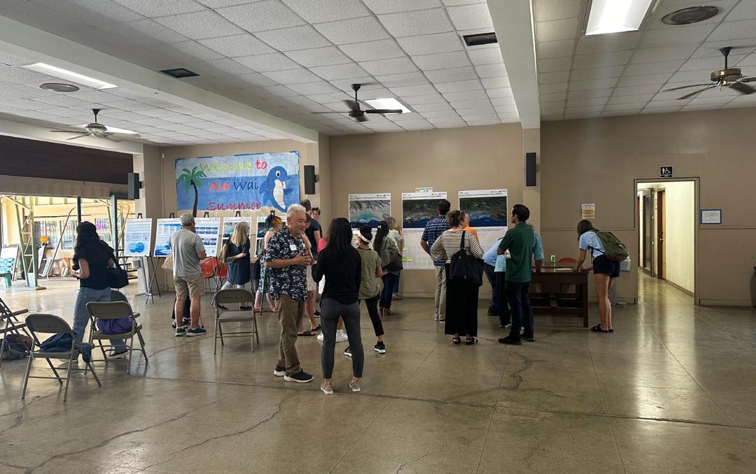
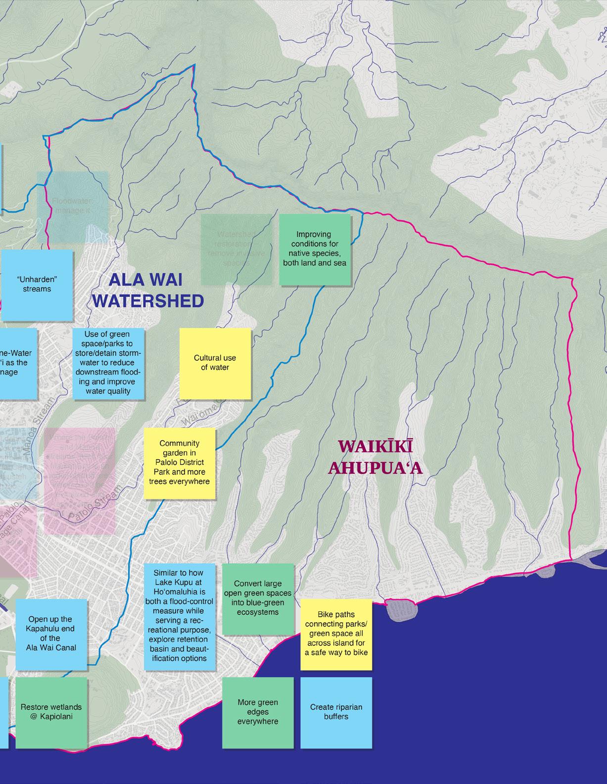
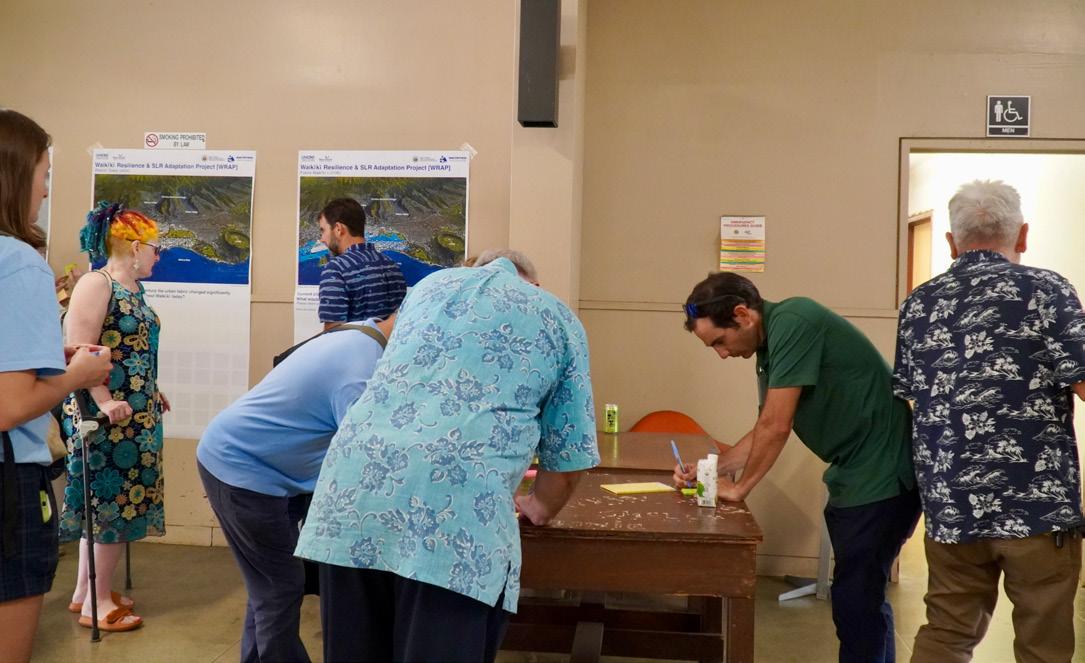
The first activity prompted community members and stakeholders in attendance to highlight and describe opportunities at a ridge to reef and ahupuaʻa scale. The map component utilized color-coded dots to specify ecological, hydrological, and social/cultural opportunities. Participants then described the opportunities on sticky notes. TASK 8.1:
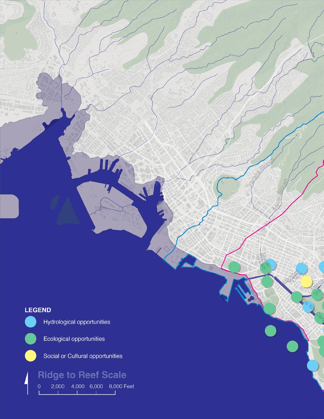
Summary of visioning charrette feedback
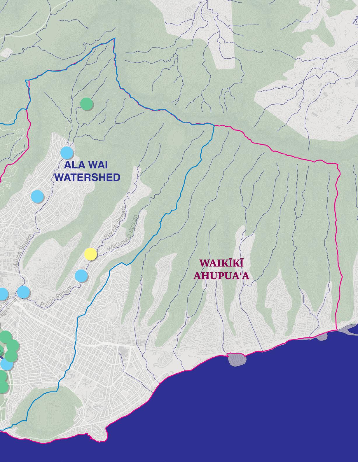
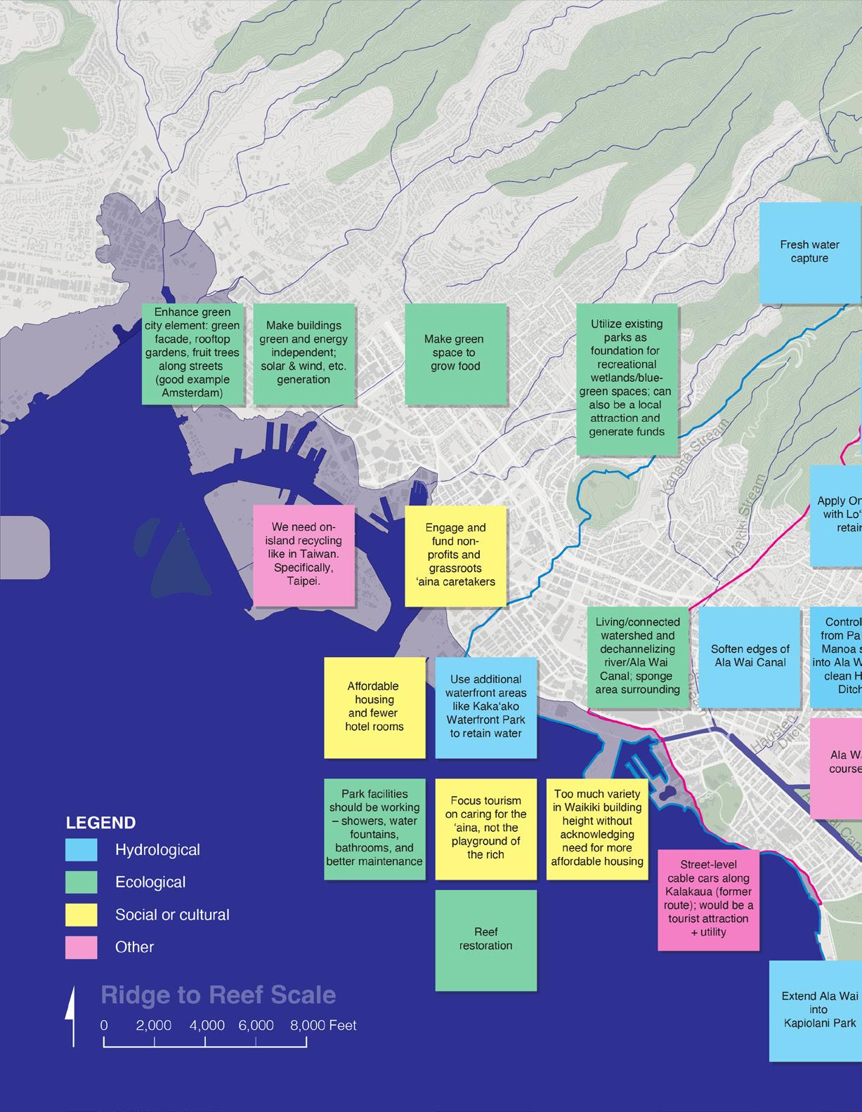
Summary of visioning charrette feedback
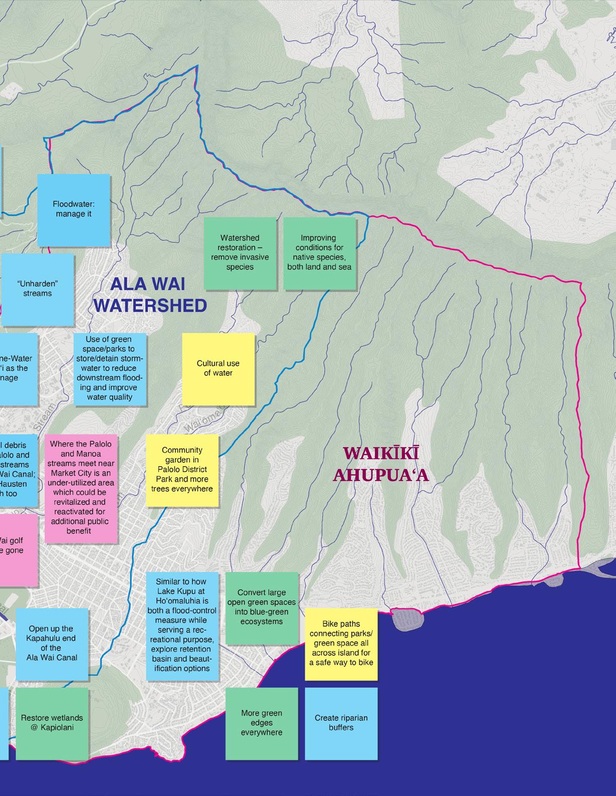
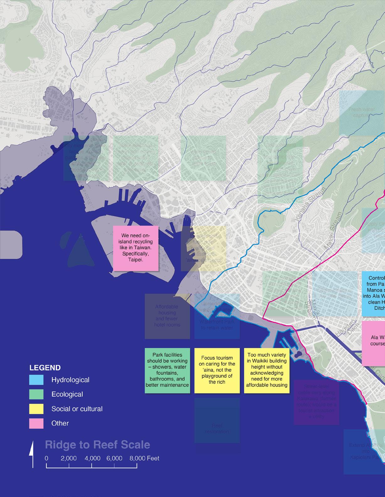
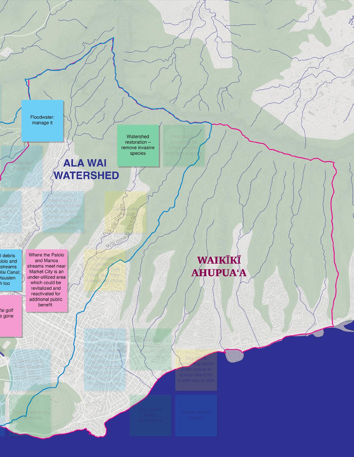
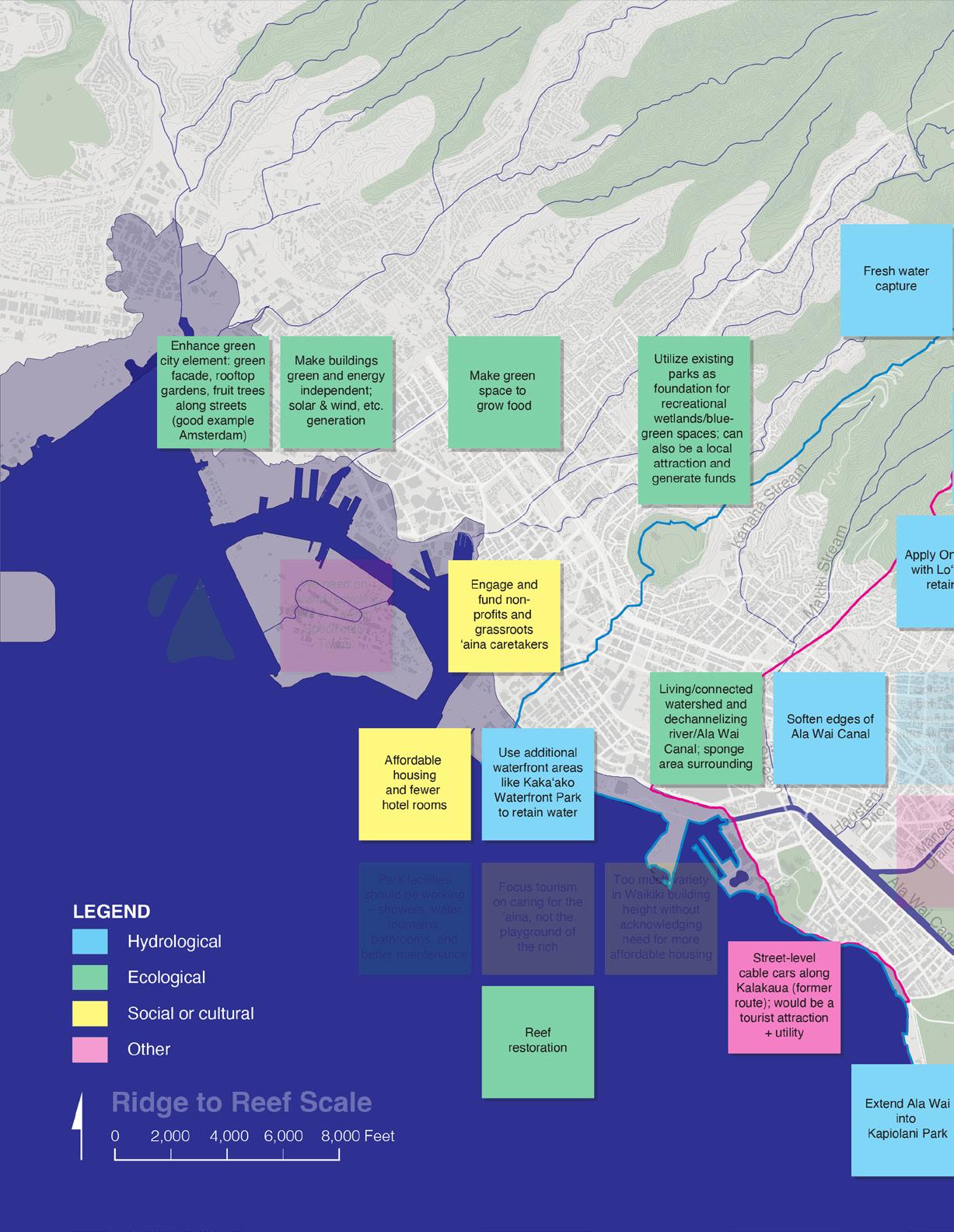
Summary of visioning charrette feedback

Waikīkī Resilience & SLR Adaptation Project [WRAP]

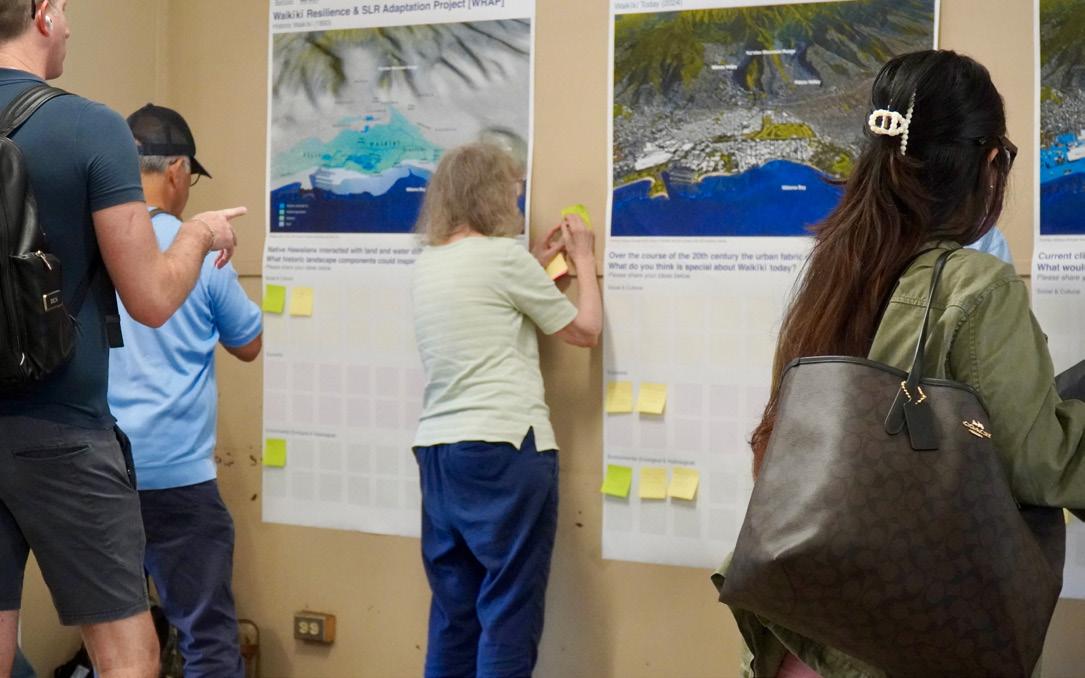
Native Hawaiians interacted with land and water differently than we do today. What historic landscape components could inspire the Waikīkī of the future? Please share your ideas below.
Waikīkī Resilience & SLR Adaptation
Over the course of the 20th century the urban What do you think is special about Waikīkī Please share your ideas below.
The second interactive community exercise focused on Waikīkī and its context during three different times periods: Historic Waikīkī (1893, overthrow of the Hawaiian Kingdom), Waikīkī Today (2024), and Future Waikīkī (long term, 2100). For these three moments in the time scale, visioning charrette participants were asked to comment on different prompts (please see above). The post-it note answers


urban fabric changed significantly.
today?
RIDGE TO REEF SCALE | FRIDAY, FEBRUARY 23, 2024

Waikīkī (~2100)

Current climate science suggests 4 to 6 feet of sea-level rise by the year 2100. What would you like to see included in a resilient Waikīkī of the future? Please share your ideas below.
were meant to be categorized and color coded by ideas related to the following themes: social & cultural factors, economic factors, and environmental (ecological and hydrological) factors. The activity intended to gather additional, broad community input on a vision for a long-term resilient, climateadapted Waikīkī within its context.
RIDGE TO REEF SCALE | FRIDAY, FEBRUARY 23, 2024
What historic landscape components could inspire the Waikīkī of the future?
Summary of visioning charrette feedback: Historic Waikīkī (1893)
Reconnecting stream/ water flow from mauka to makai
Living with water
Organize built environment around water - not forcing water to avoid development
Look at how cool the Ala Wai is. Banger
Fish pond Derussy
Ulu in every yard
Food production to supply native population (reduced import depen- dency). This ties in al three of these elements: social, economic & envi- ronmental
Circulate economy! Local population fed by local fish, produce, no waste
The loʻi kalo <--->
The loʻi kalo, later used for rice fields
Freshwater fish ponds
Loʻi kalo, wetlands
The loʻi kalo <--->
RIDGE TO REEF SCALE | FRIDAY, FEBRUARY 23, 2024
understanding of envi- ronment, thru education, experience, etc
The idea of the ahupuaa where people and land were tied together from mountain to sea. So many people today don’t realize that what they do mauka affects the oceans
Respecting the environment, not overdeveloping
Students of Prof Lynette Cruz did a poster addressing this topic years ago luciano@hawaii.edu
No plastic
Conversion of marshland into Waikiki + Golf course
Use golf course & parks as flood retention basin and native wetlands
Greening of ala wai marina
Allowing wetlands to act as their natural purpose of infiltration & sediment catch
Grow native utility plants
Summary of visioning charrette feedback: Waikīkī Today (2024)
The only place in the world where you can see surfing catamaran’s canoes from your balcony
Our beaches Our parks Honolulu Zoo
So many people on the beach and sidewalk from many places in the world.
Ala Wai more than a canal. It’s also a recreation space
The beach, and ocean, and reef. Surf
Walking along Ala Wai Canal. Viewing sunrise at end of canal. Entertainment areas within walking distance
Views of Lēʻahi, across from the Ewa side of Kapiʻolani Park of the Koʻolau Ridge across the Ala Wai Canal & golf course. The Convention Center is a building with a Hawaiian sense of place. The walkable size of Waikiki.
Over tourism
Famous beach, attracts tourism. There’s considerable interest in this area so it’s an opportunity to lead adaptation by example
Continuednourishmentbeach
Engineered shoreline, high density
Urban - eco-tourism
Tourism supports the economy
Waikiki generates almost half of all tourism revenue in the state
The Ala Wai Kanal should be made cleaner and could have more green (trees) alongside. Waikiki should work on zero waste strategies - eco tourism to protect the most beautiful nature.
Erosion causing loss of beach and storefront
Tourism-based economy is too subject to market fluctuations and perpetuals income inequality with revenue leaving the state. Diversification needed
Waikiki is one window of Hawaii for our visitors. There needs to be more interaction with the host culture.
TO
| FRIDAY, FEBRUARY 23, 2024
Development & sprawl
Best if no bridge over the Ala Wai - if have to, a graceful low arch without cars (except for emergencies and maintenace)
Waikiki has an indoor-outdoor environment for pedestrians
Protect Ala Wai park for park users including Micronesian Village
No bridge over the Ala Wai
Parks and public spaces
The perfect weather
“Special” implies “good”. Waikiki is overrun with minimum wage jobs working for companies based off island. We need local $ and staying here - not sending it off island.
Its economic vitality over decades - palpable when one walks along Kalakaua Ave with throngs of people
Walkability reduce car infrastructure
Interesting but not positive - the confinement of business (outside of Waikiki I suppose but close)
Highly engineered water ways, again there’s interest in Waikiki so an opportunity to lead by example
Turn the Ewa end of the 8 hole golf course into water hazards for phase 1 detention ponds, then phase 2 turn the 9 holes at the Ewa end into a larger detention pond
Lack of space for wetlands
Water diversion
The push to clean the Ala Wai
What
would you like to see included in a resilient Waikīkī of the future?
Summary of visioning charrette feedback: Future Waikīkī (2100)
Increase in green-blue spaces that work with nature rather than against
Incorporating natural beach protecting strategies
Increase infrastructuregreen in the designs
Native wetland restoration and growth
No more seawalls, protect our beaches
Removal of cement
Opportunity to restore wetland, more green spaces and less hardening, future development accounts for SLR
Return back to some of the mauka to makai ahupuaʻa land and sea management. Hybrid/ diversified economy of tourism and agriculture
Less car dependent & more pedestrian friendly/public transit orientation -> elevation?
Car-free area, close down certain road, increase public transit and walkability and green space to gather
Easier to get into Waikiki, more pedestrian access points, safer bike lanes, and morebusesfrequent
More green-blue ecosystems
Native plants as way to revive historical aspect of Waikiki before Western contact
Rebuild our reefs and dune/natural beach systems
Culturally sensitive and restorative water and land management with resilient infrastructure
Use of Ahupuaʻa resource management practices
streets
car-free or car-lite
Living with water. Nature based solutions. Water transportation (like water taxis, ferries, etc)
Elevated walkways, abandoning first floor of existing buildings. No new development and eventually retreat at the end of current buildings’ lifespan
Nice to see Kapiʻolani Park and Magic Island is still above SLR! (might add fill for selected limited parts of Waikiki?) Boats for getting around hop on - off. Revival of the Loʻi with plants adaptable for the new conditions. Would want raised walk ways along the new canals over the old streets more pedestrians, less cars more easy accessible public transportation to substitute the car traffic - Kaipulani should be bike pedestrian areasmaybe be a canal eventually
Canals to replace roads
Self-sufficient buildings
Green buildings with energy generationenough to support the building
| FRIDAY, FEBRUARY 23, 2024
Protection of historical buildings & sites
Co-benefits: hazard resilience, affordability, equity
Food security
Storm + sea level rise preparedness TASK 8.1: VISIONING
A way to bring in revenue from tourists that can help fun restoration/climate environmental intitiatives
more diverse economy not just tourism
Debris flowing from Manoa Stream and Palolo Stream into Ala Wai Canal
Make the Ala Wai clean and safe and usable for recreation
On-island recycling plants
50% of hotel rooms turned into affordable housing. (2 hotel rooms = enough water for easy convert to an apartment)
Only reusable water/ pool/ocean toys available for tourists to rent - Rather than something they use once and put in the trash.
Affordable housing
Ferry to other islands
Control on land grabs for long/short term rentals
Locals and visitors Malama Aina!
community resilience hub, cooling center for increase in heat, events to preparednessincrease and awareness of hazards
The PLAN should not be for Waikiki only also for Moilili and Manoa
Redevelop in a way that better serves vulnerable communities
acceptance and planning water-based infrastructure
More ecotourism so that visitors have less of an impact on our resources
opportunities for recreation, including residents, not just tourists, development that caters to locals
Stop building high rises
Retreat from shoreline buildings and roads
Decent Infrastructure


Built Environment Risk Mapping Transportation Building Stock
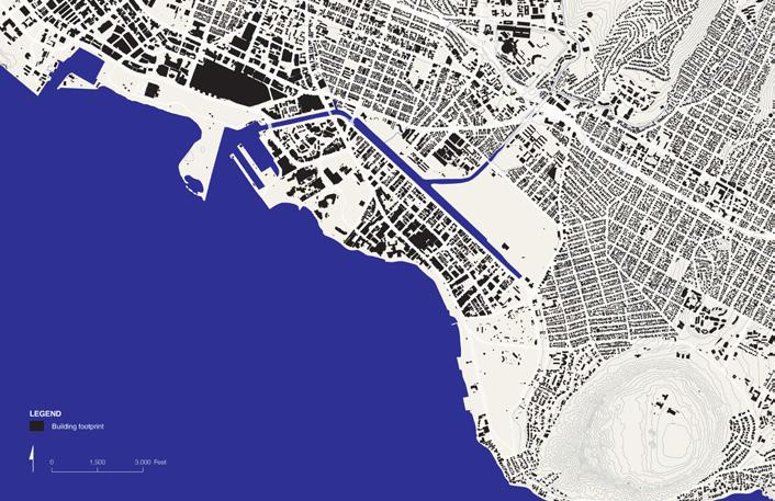
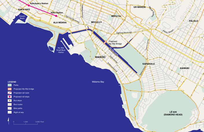
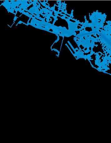
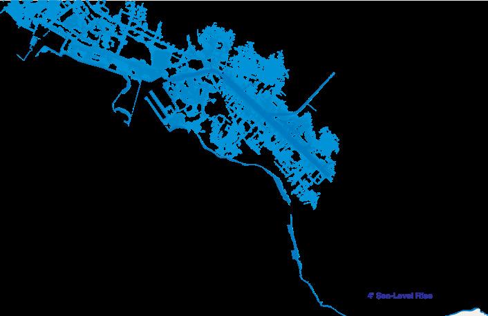
The third activity was designed to educate visioning charrette participants on the impacts of sea-level rise on Waikīkī’s urban fabric. Community members and stakeholders in attendance were asked to review three maps (see above) that each highlighted different elements of the urban built environment: Building Stock, Transportation & Circulation, and Utility Infrastructure. Below each map were lists of key programs impacted by sea-level rise.
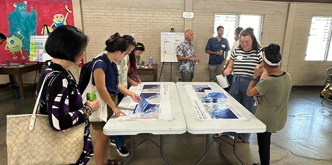
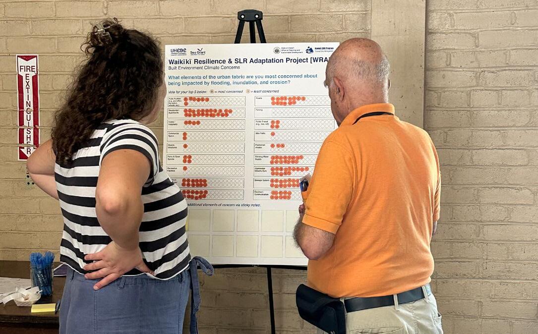
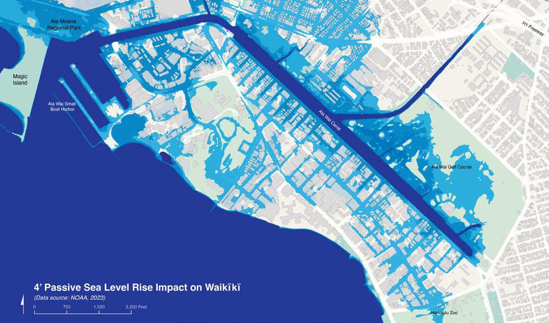
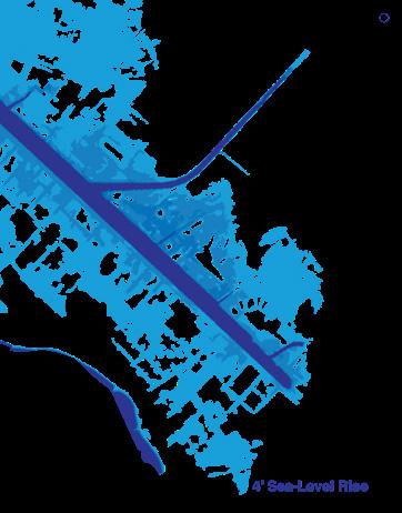
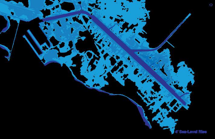
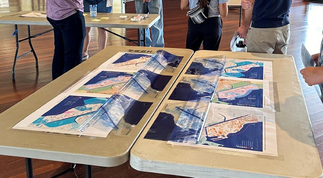
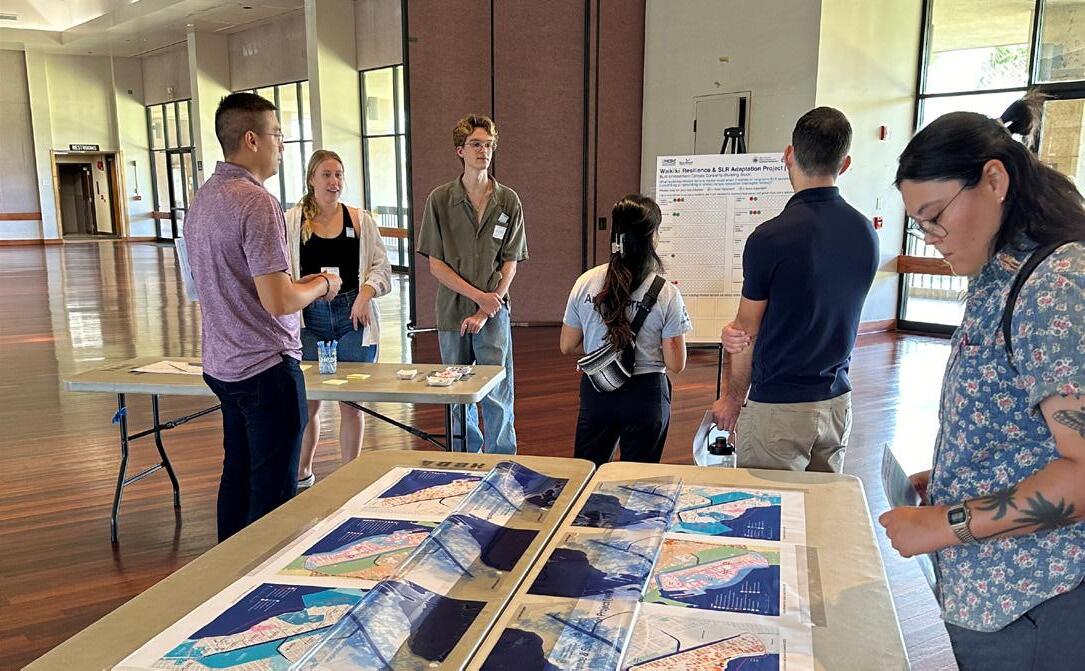
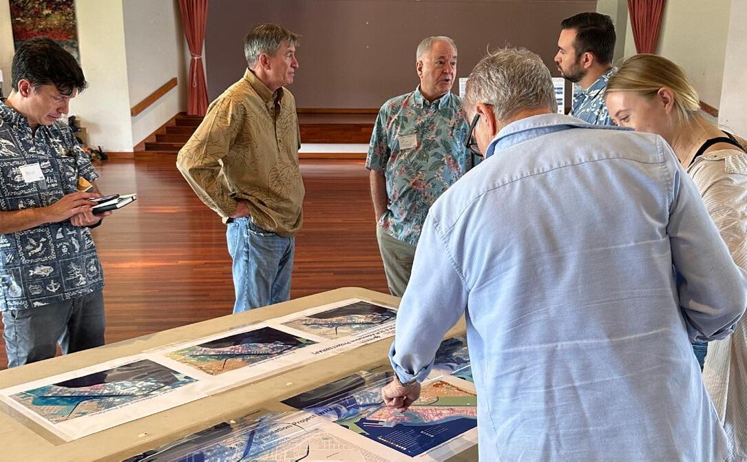
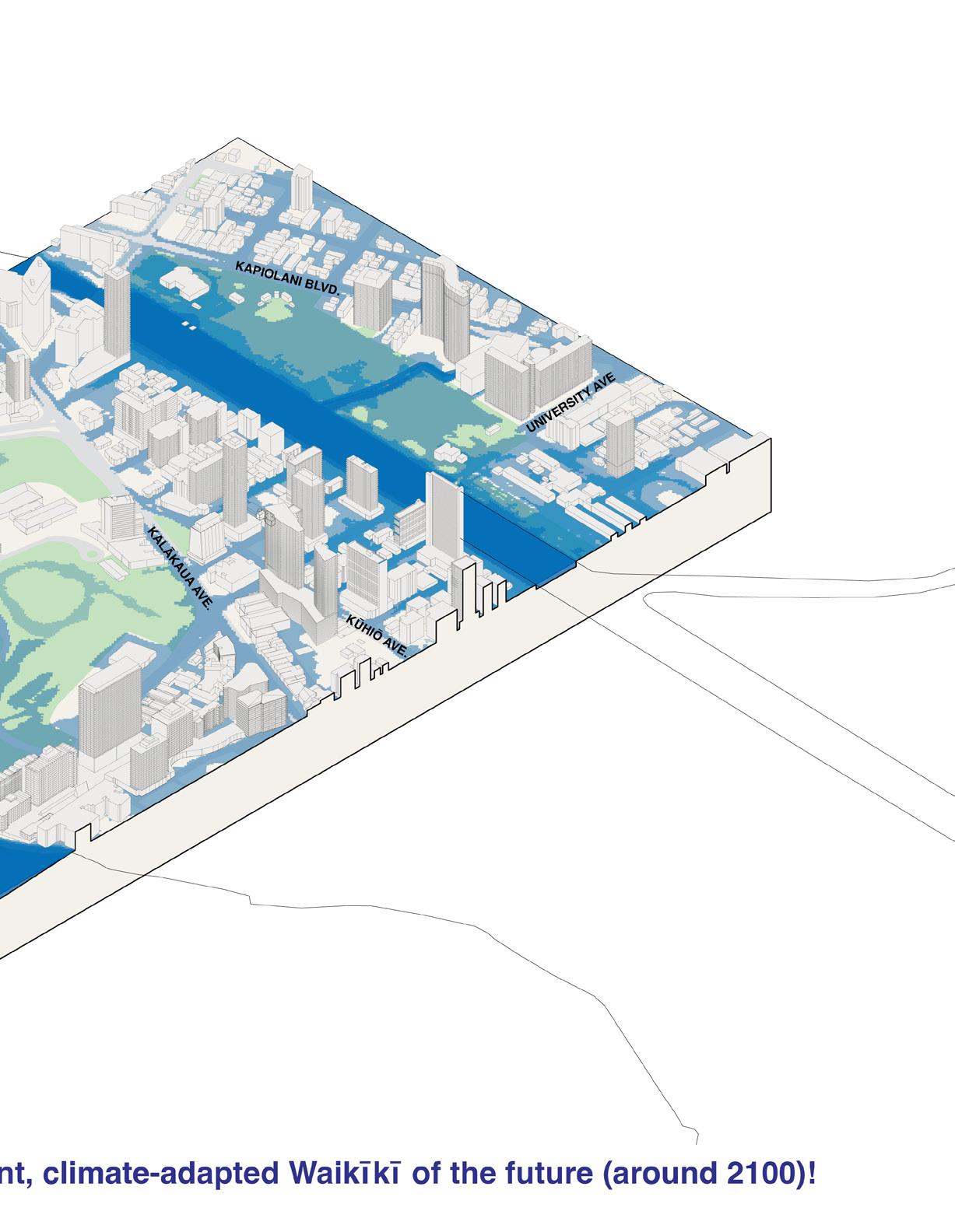
During the event, WRAP team members encouraged participants to use interactive clear film overlays, affixed to the top of each map (see image on right), illustrating how 4 feet of passive sea-level rise are anticipated to affect the various layers and elements of the urban environment of Waikīkī.
After reviewing each of the maps, participants were given five dots labeled 1 to 5. They were then asked to place their five dots on a voting board, indicating what elements of the urban fabric they are most concerned about. The dots were ranked as 5 being the most concerned and 1 being least concerned.
Community members and stakeholders were also given the opportunity to write in and vote on any concerns that were not represented or listed in the maps.
/ Circulation
| FRIDAY, FEBRUARY 23, 2024


• Pedestrian access
• Parks & open spaces
• Waterfront access & beaches
• Bridges & evacuation routes

• Drinking water supply
• Sewage system
• Septic tanks
• Pump stations
• Stormwater infrastructure
• Electrical conduits and facilities
• Communication systems and conduits
• Etc.


What elements of the urban fabric are you most concerned about being impacted by flooding, inundation, and erosion?
Vote for your top 5 below:
Built Environment Climate Concerns 5 = most concerned 1 = least concerned
Please share additional elements of concern via sticky notes:
TASK 8.1:
RIDGE TO REEF SCALE | FRIDAY, FEBRUARY 23, 2024
What elements of the urban fabric are you most concerned about being impacted by flooding, inundation, and erosion? Summary of visioning charrette feedback.
Bar Chart Voting Results
Summary of visioning charrette feedback in ranked order: TASK 8.1: VISIONING
| FRIDAY, FEBRUARY 23, 2024
Residential/ Apartments
Stormwater Infrastructure
Drinking Water Supply
Drinking Water Supply
Roads
Waterfront Access & Beaches
Sewage System
Bridges & Evacuation Routes
Electrical System
Parks & Open Spaces
Public Facilities (e.g. post office, fire station, schools, etc.)
Public Transit (e.g. bus, rail)
Hotels/Hospitality
Pedestrian Access
Cultural Sites*
Commercial Space
Bike Paths
Historic Structures
Recreation Facilities
Parking
29 Participants
*Voting option added by workshop participant


State of Hawaiʻi Office of Planning and Sustainable Development


Nature-based solutions are sustainable planning, design, environmental management, and engineering practices that weave natural features or processes into the built environment to promote adaptation and resilience. These solutions use natural features and processes to combat climate change and reduce flood risk.
Source: FEMA www.fema.gov/emergency-managers/risk-management/climate-resilience/nature-based-solutions)
Landscape elements at a range of scales can function as nature-based infrastructure that harnesses natural processes, provides ecosystem services for communities and sites, protects neighborhoods from flooding, manages and filters stormwater, prevents erosion, combats the urban heat island effect, removes pollutants from soil, water, and air, sequesters carbon dioxide, links ecosystems, provides habitat, promotes biodiversity and resilience, contributes to public health, and replaces outdated grey infrastructure in cost-efficient and smart ways.
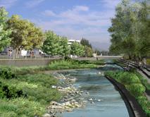

Stream Restoration
• Increased resilience
• Carbon sequestration
• Ecosystem services
• Native riparian habitat and biodiversity
Wetlands, Tidal Marshes, Coastal Buffers
• Provide ecosystem services
• Increase the distance between water and development
• Retain and absorb inundation
• Slow erosion
• Provide habitat
Reef Restoration and Living Breakwaters
• Increase biodiversity
• Protect coastline from wave impacts
• Create habitat for native species
• Contribute to layered living shorelines
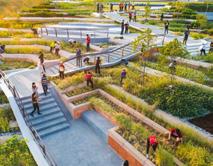
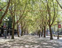
Green Stormwater Infrastructure
• Manages and clean urban runoff
• Provides other ecosystem services
• Native riparian biodiversity and habitat
• Strengthens ecosystem connectivity
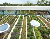
Green Roofs and Facades
• Reduce urban heat island effect
• Insulate buildings/ temperature regulation
• Public health benefits
• Provide habitat and promote biodiversity
• Potential for local food production
Urban Forests and Increased Tree Canopy
• Reduce urban heat island effect
• Sequester carbon dioxide
• Improve public health
• Create pedestrian-friendly environments
• Decrease urban runoff
Cultivation of food, fuel/energy, or fiber plants within the urban environment for human consumption and use, including community gardens, urban farms, etc.
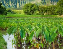
Loʻi Kalo (Wetland Taro)
• Water filtration
• Promotes biodiversity
• Flood mitigation
• Soil and water temperature regulation
• Food cultivation
• Bio-cultural restoration
• Educational opportunities
• Promote public health
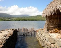
Loko Iʻa (Fishponds)
• Sediment capture
• Food production
• Bio-cultural restoration
• Educational opportunities
• Community engagement
• Potential to contribute to living shoreline systems
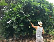
Urban Agroforestry
• Increases shade
• Reduces urban heat island effect
• Builds community connections
• Local food production
• Carbon sequestration
• Improves air quality
• Reduces urban runoff
• Provides restorative properties
Urban Agriculture and Farming
• Food cultivation
• Support pollinator species
• Build community connections
• Opportunity for biocultural restoration
• Potential for stormwater and greywater use
• Public health benefits
TASK 8.1: VISIONING
TO REEF
| FRIDAY, FEBRUARY 23, 2024
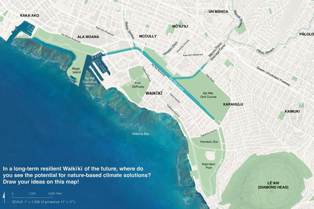
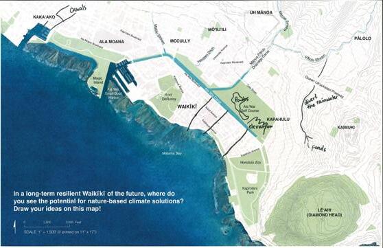
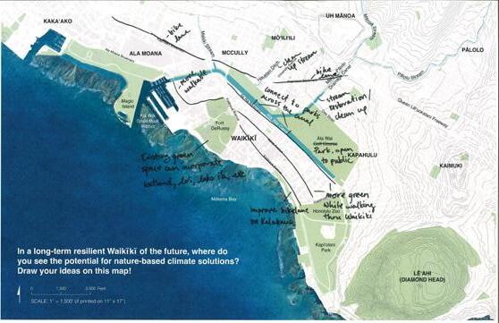
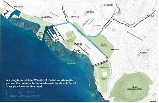
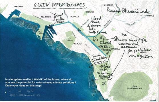
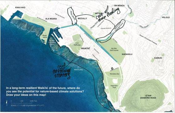
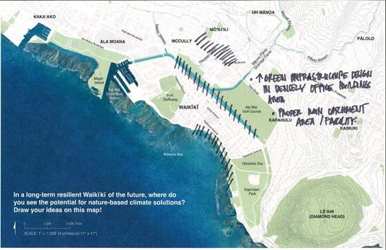
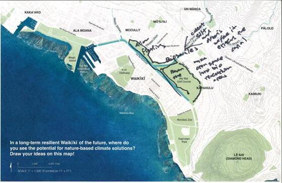
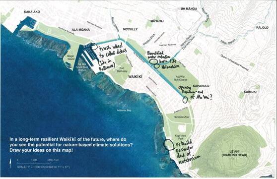
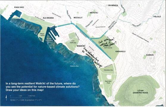
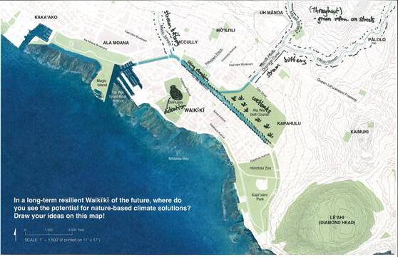
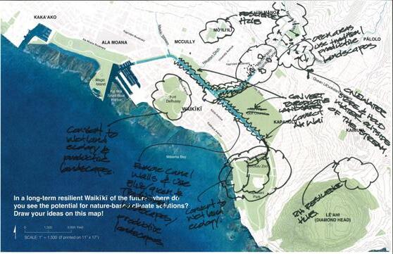
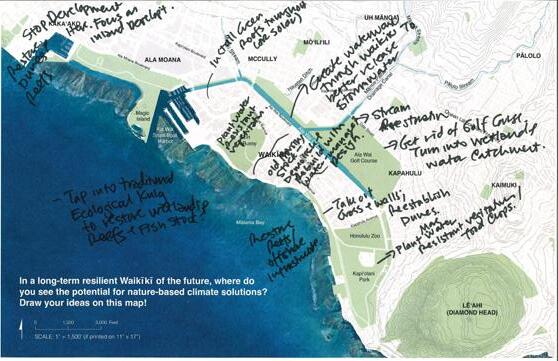
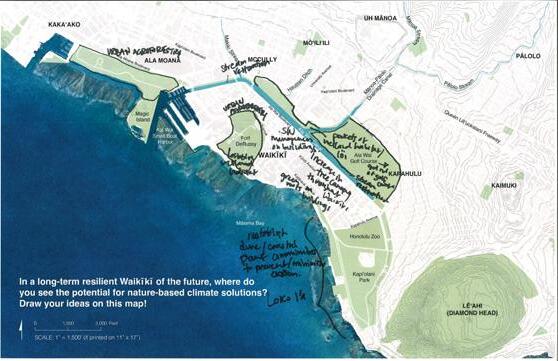
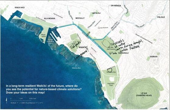
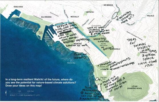
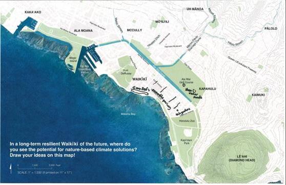
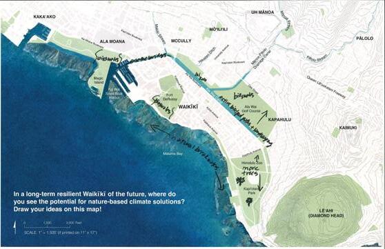
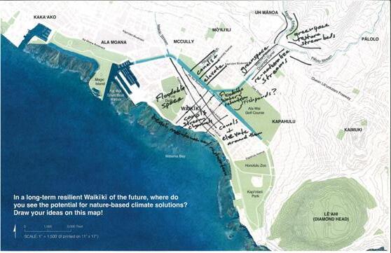
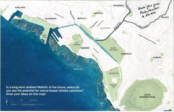
11” x 17” map copies were provided to charrette participants for their individual annotations and sketches
The fourth and final activity at the February 23 Ridge to Reef Scale visioning charrette aimed to educate community members and stakeholders on the different ways in which nature-based solutions can be employed in urban ecological design to promote sustainability, climate adaptation, and resilience.
WRAP team members who staffed this activity station were available to explain concepts of BlueGreen Infrastructure, Traditional Ecological Knowledge, and Productive Landscapes (also see reduced-size version of informational event board on left).
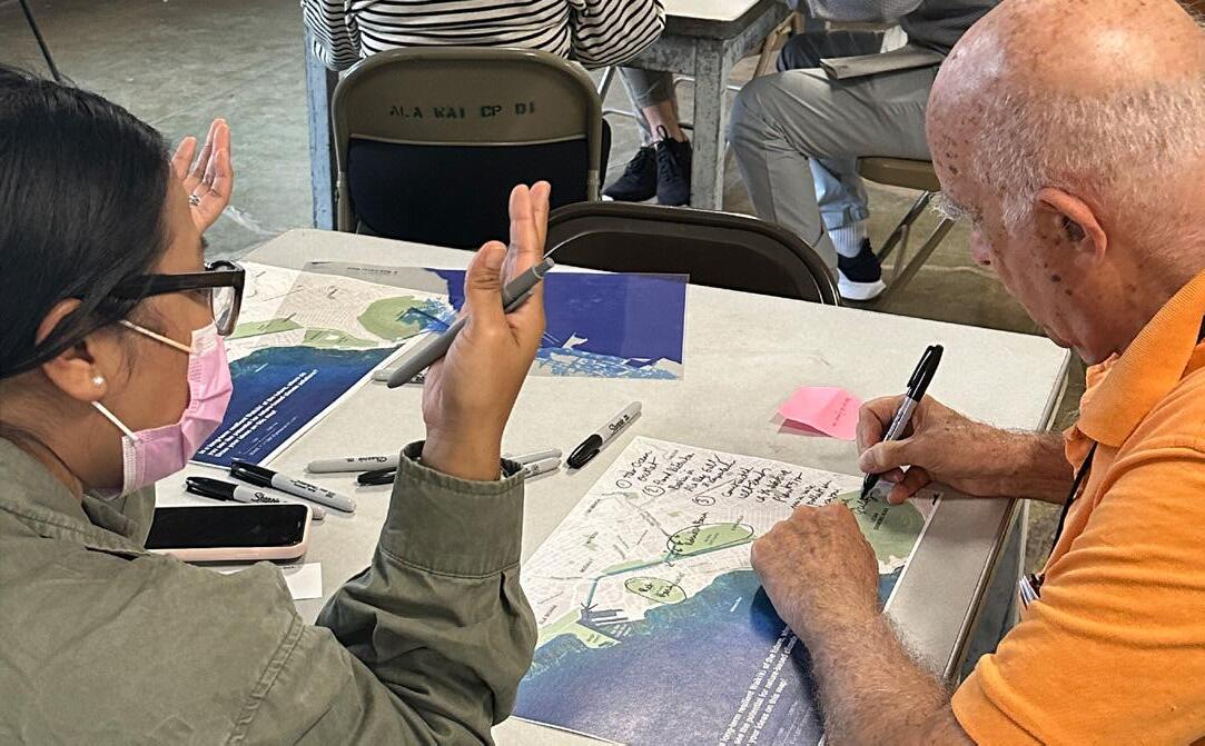
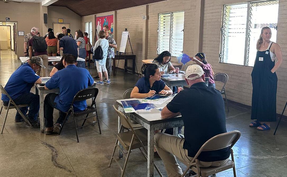
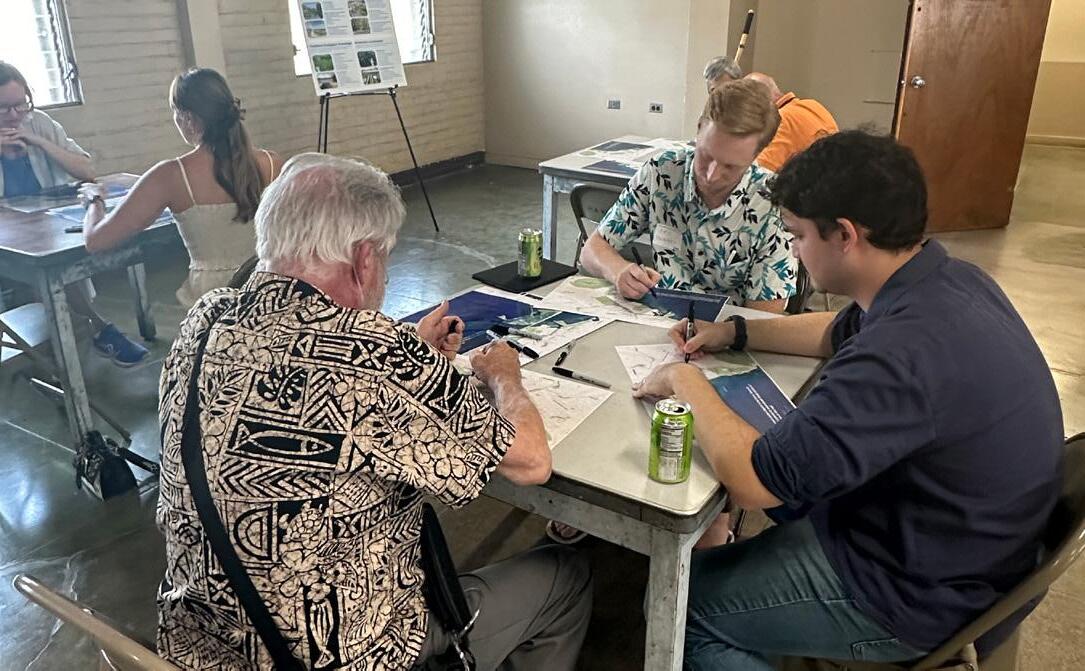
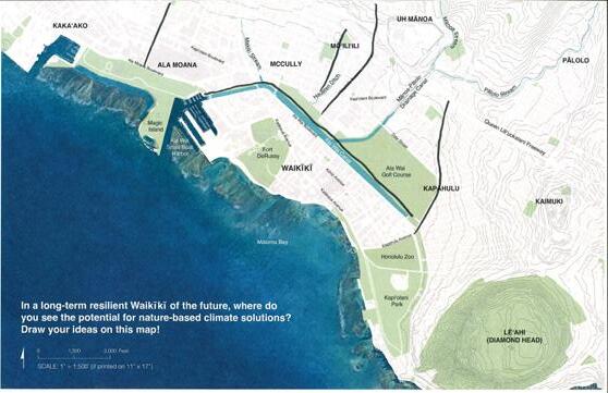
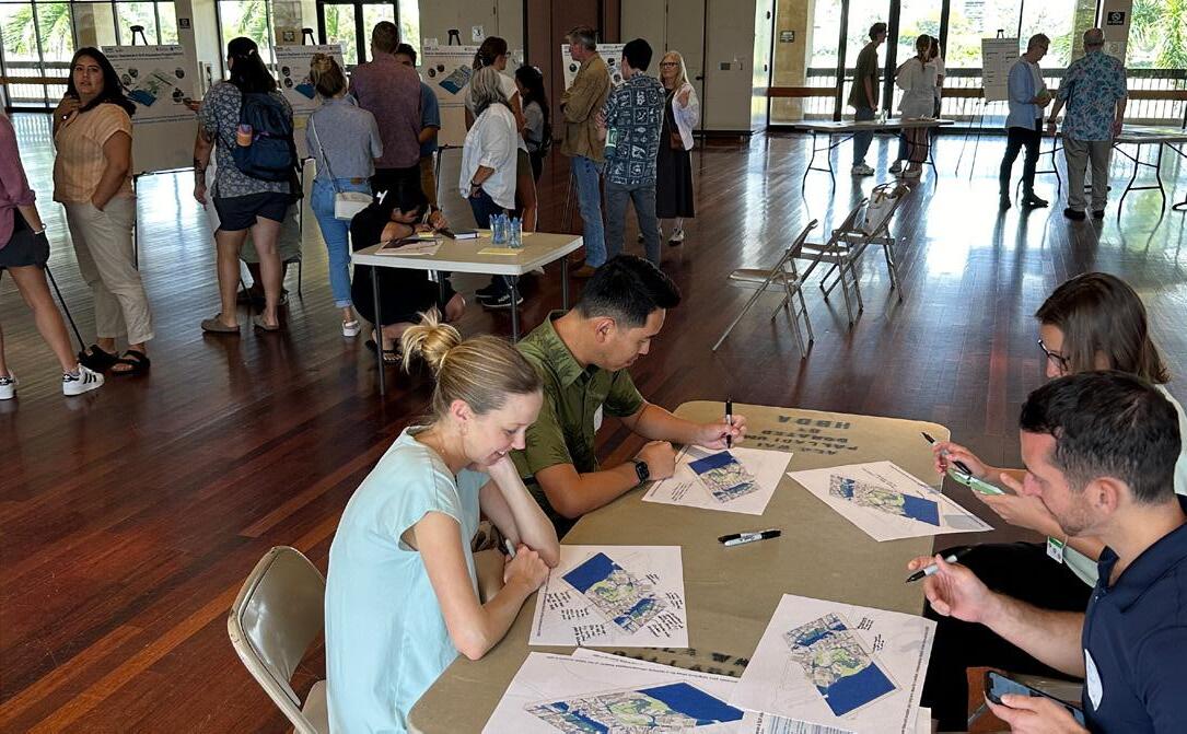
For the interactive component of this exercise, workshop participants were provided with 11” x 17” printed maps and markers.
WRAP team members encouraged community members and stakeholders to annotate and draw locations where they think nature-based climate adaptation solutions should be used in and around a future Waikīkī.
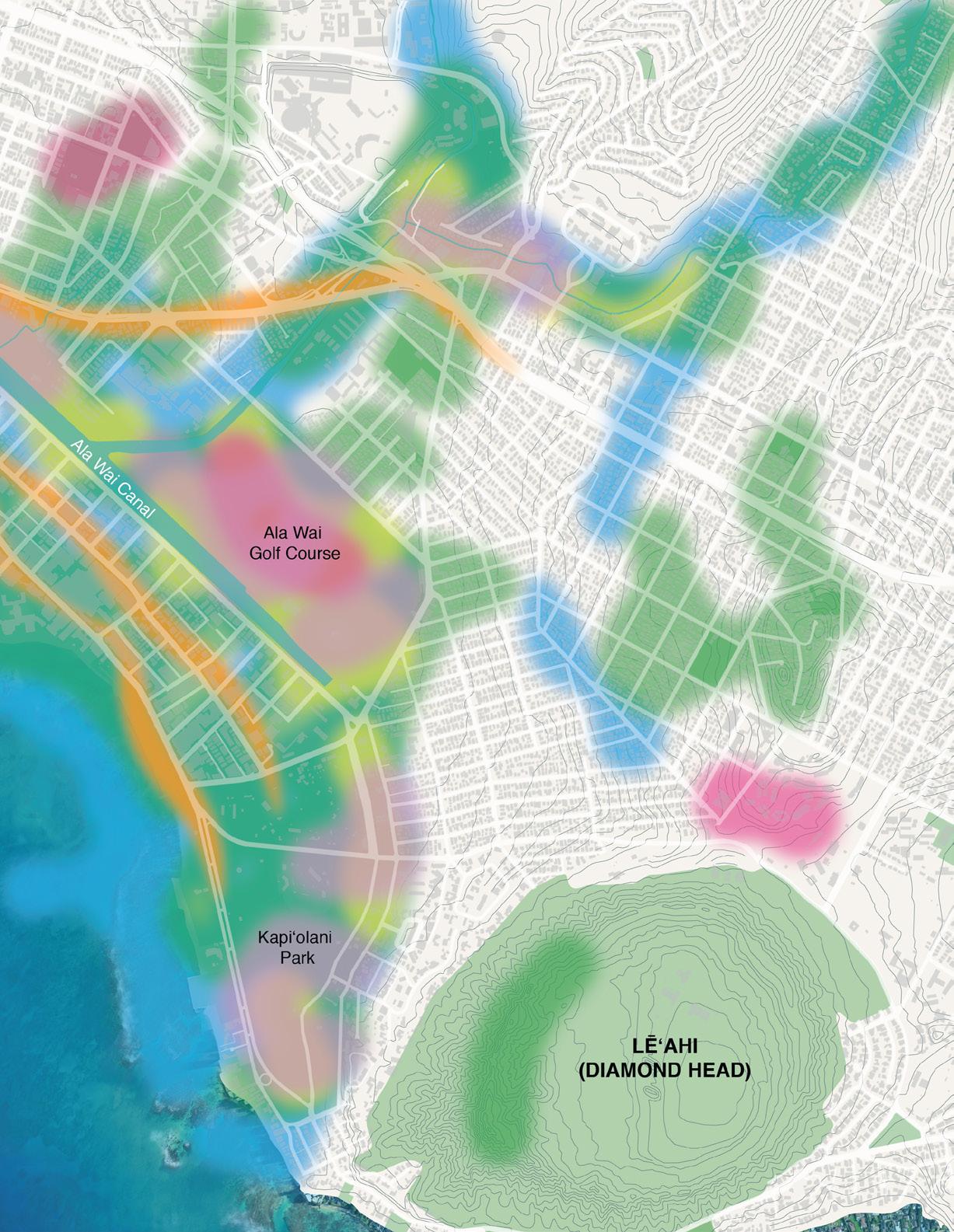
The results were a combination of spatialized and written comments that drew on opportunities to connect open spaces and expand blue-green infrastructure.
RIDGE TO REEF SCALE | FRIDAY, FEBRUARY 23, 2024
Scans of community/ stakeholder sketches and comments

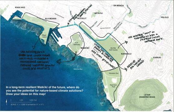
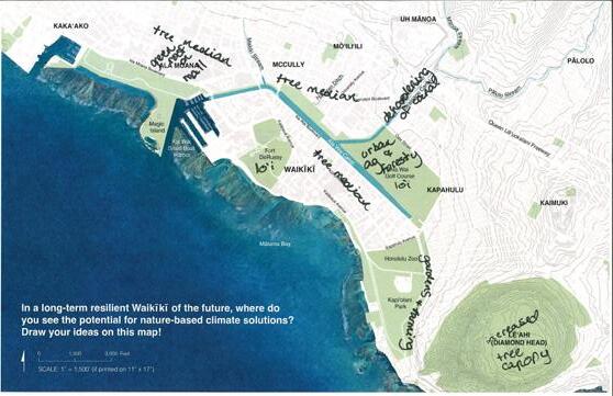
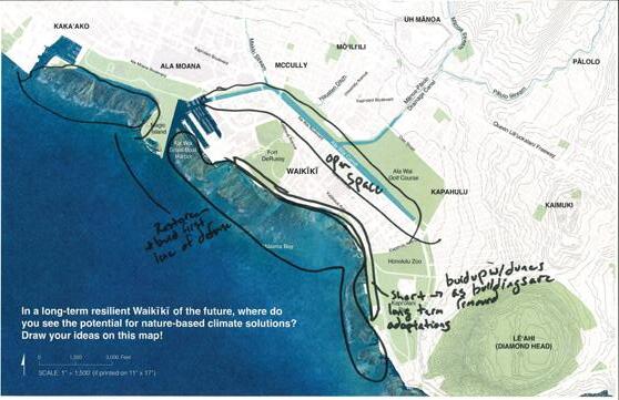
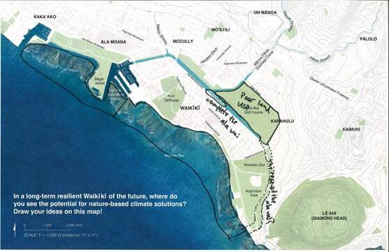
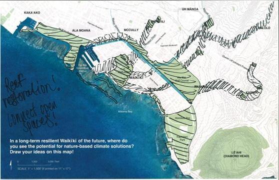


Scans of community/ stakeholder sketches and comments (contʻd)





Spatial summary of community/stakeholder sketches and suggestions
Spatial summary of community/stakeholder sketches and suggestions
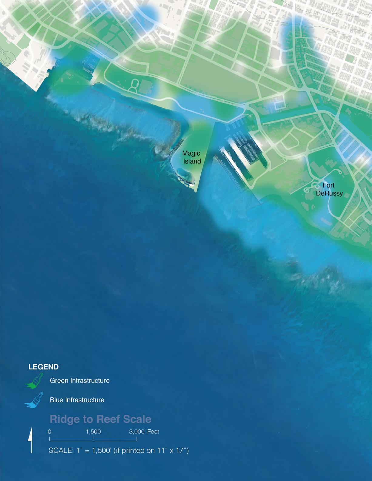
(Participant Suggestions)
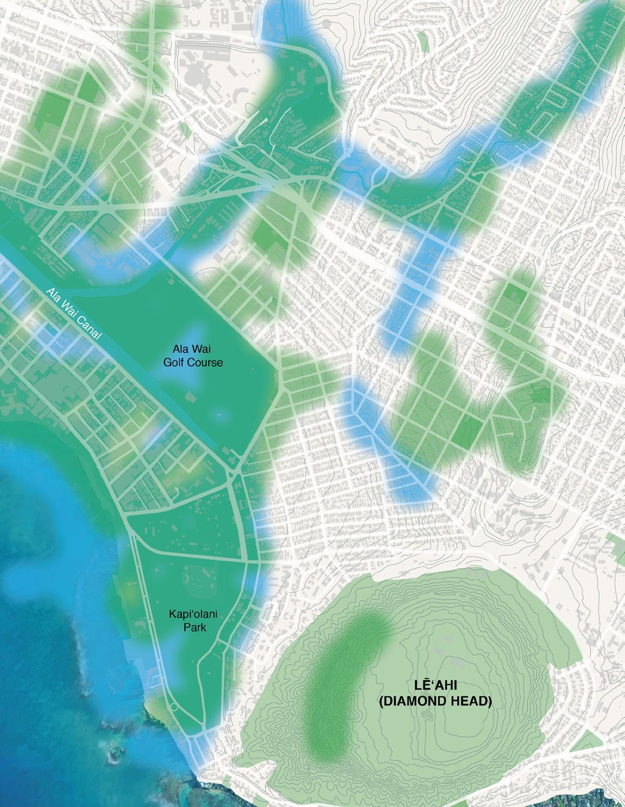
Spatial summary of community/stakeholder sketches and suggestions
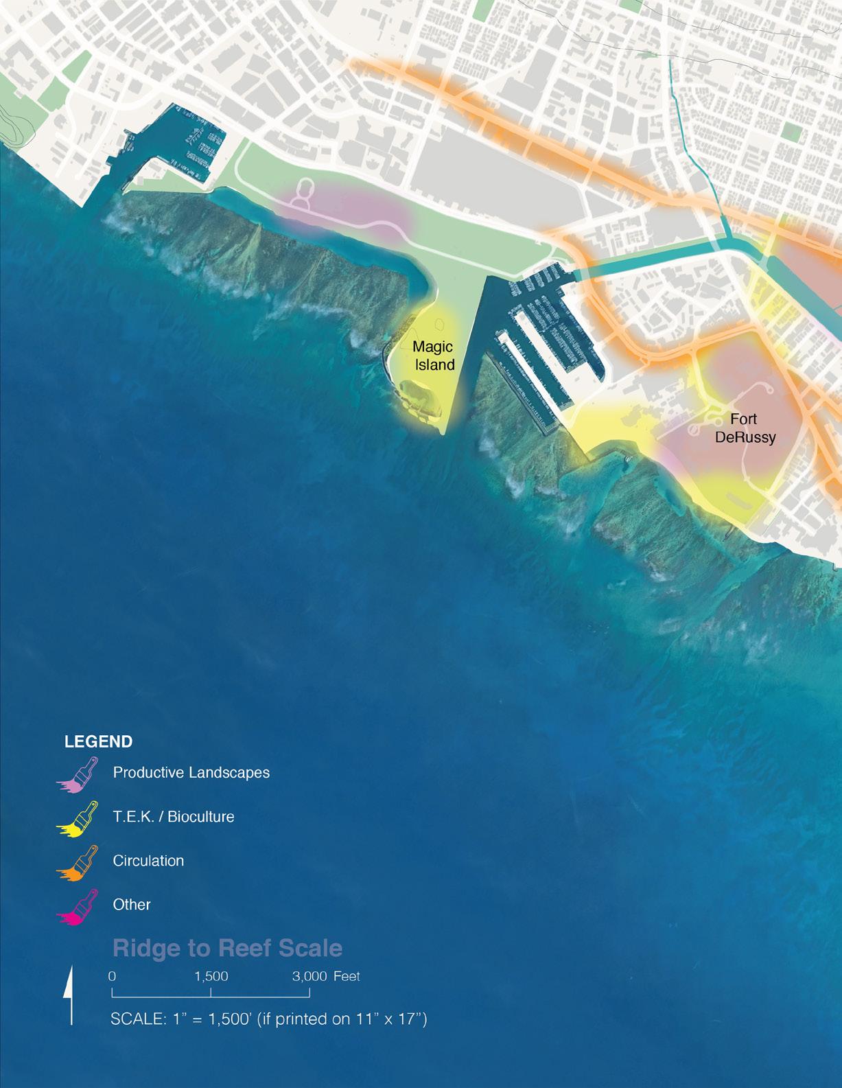
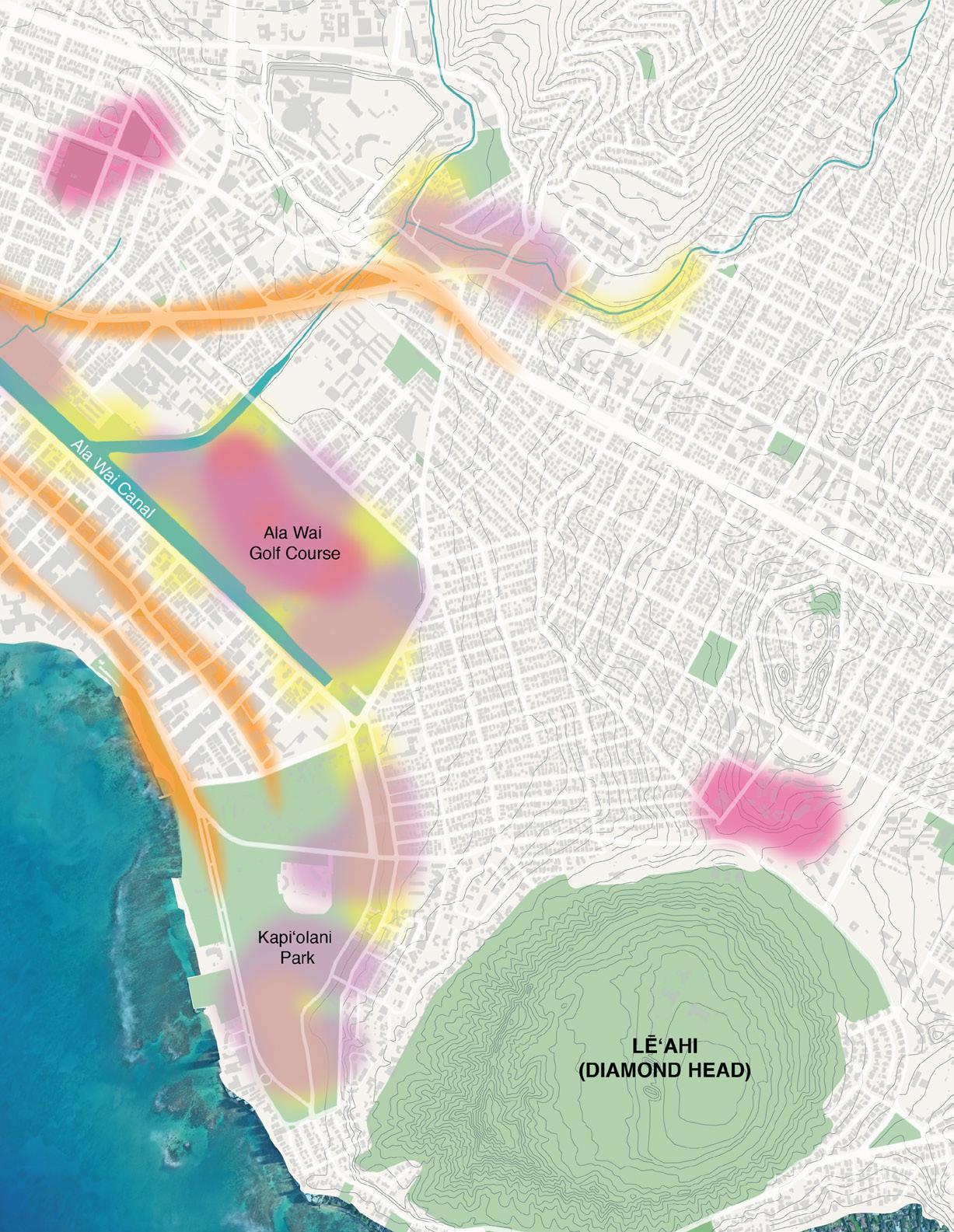
Top participant comment categories:
Hydrological Opportunities
Ecological Opportunities
Social / Cultural Opportunities
Other Opportunities
Top participant comment categories:
| FRIDAY, FEBRUARY 23, 2024
Top participant concerns:
Residential/ Apartments
Stormwater Infrastructure
Roads
Water Supply
Waterfront Access & Beaches
Sewage System Drinking Water Supply
Top written participant comment categories:
Blue Infrastructure (Fresh Water)
Green Infrastructure
Blue Infrastructure (Salt Water)
TEK / Bio-Cultural
Productive Landscapes
Other
Circulation

Monday, March 4, 2024, 1:00 - 2:30 PM Ala Wai Golf Course Clubhouse, 2nd floor 404 Kapahulu Avenue, Honolulu, HI 96815


On March 4, 2024, UHCDC hosted the second visioning event. This charrette focused on seeking participant input at the neighborhood scale with the goal of informing subsequent preliminary sketch visions.
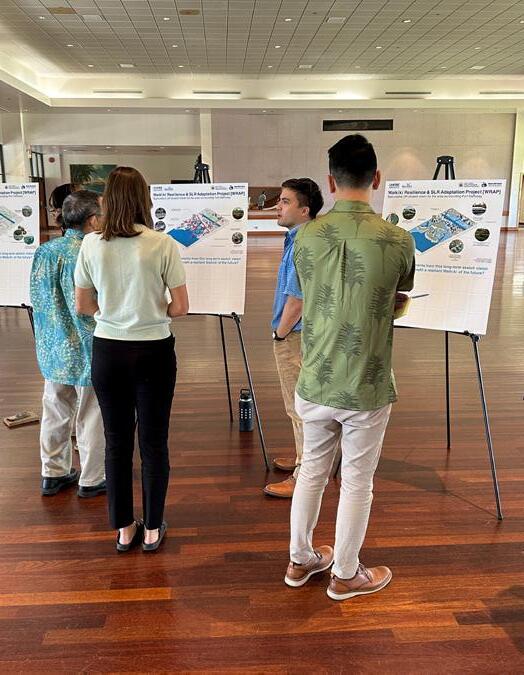
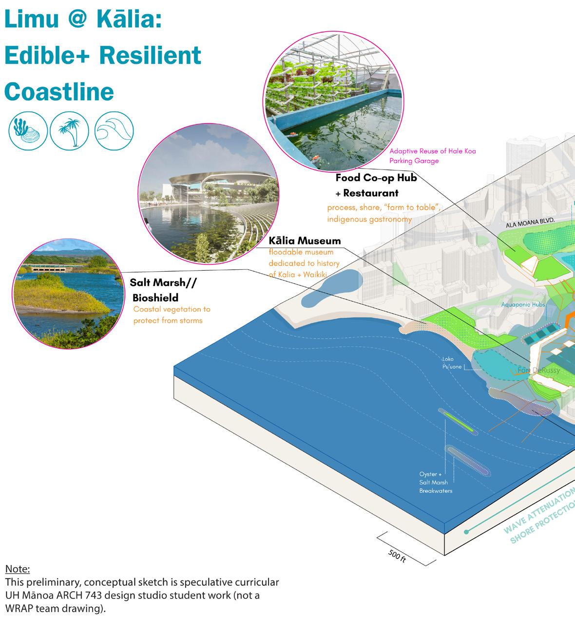
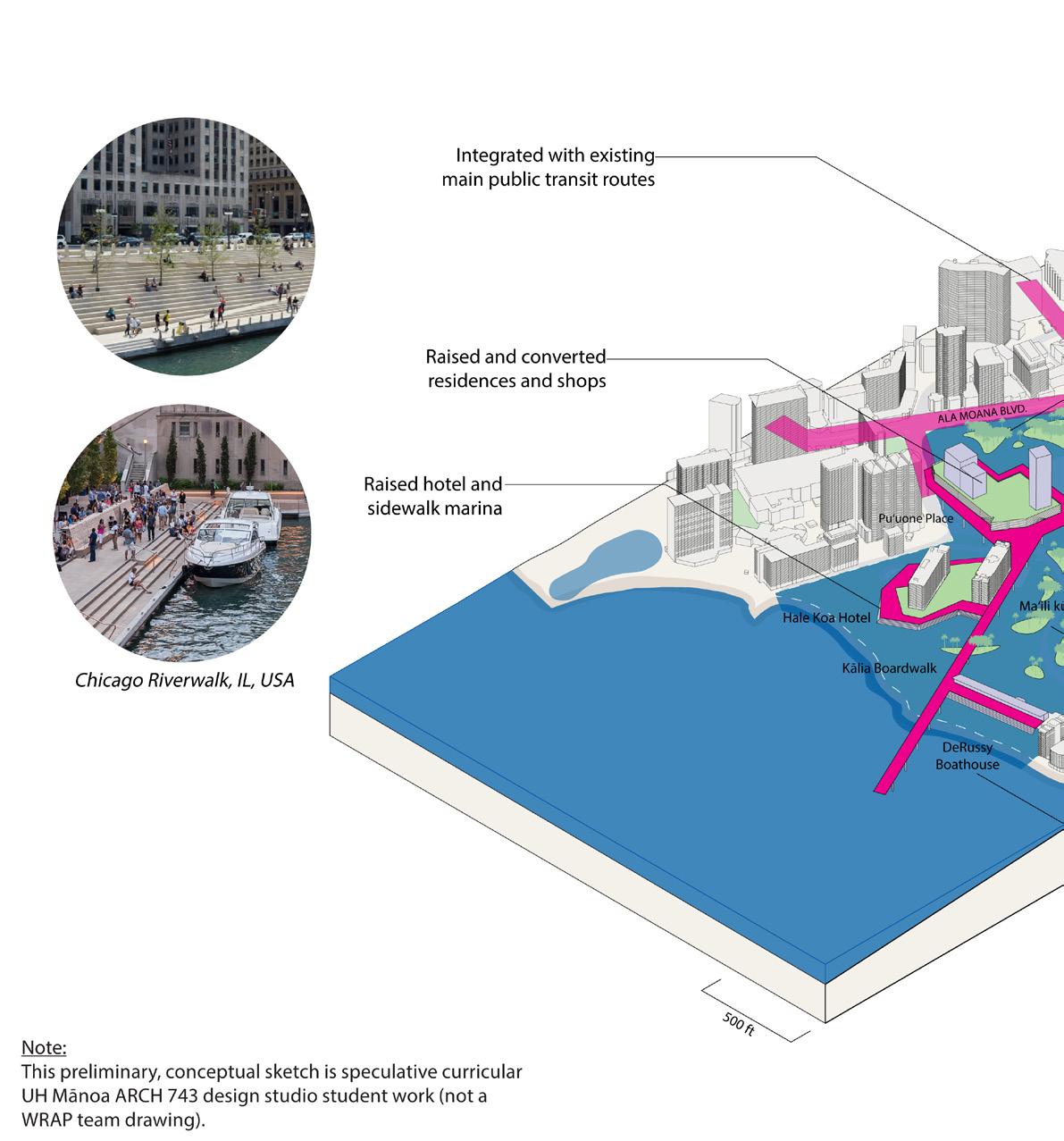
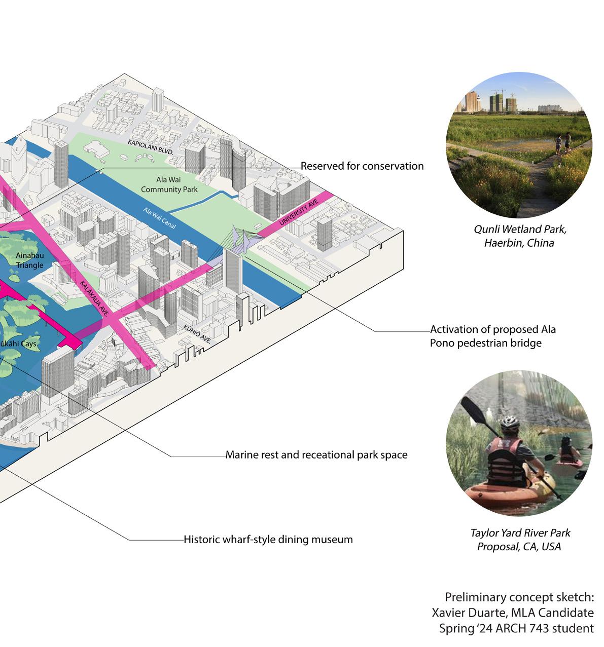
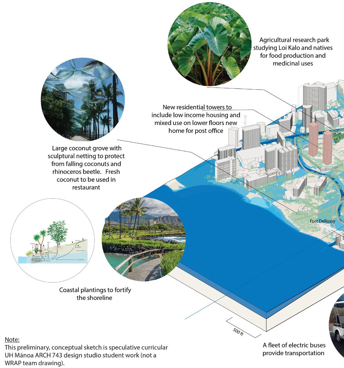
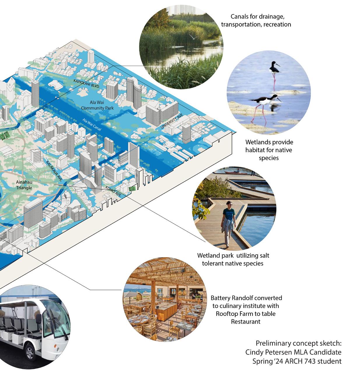
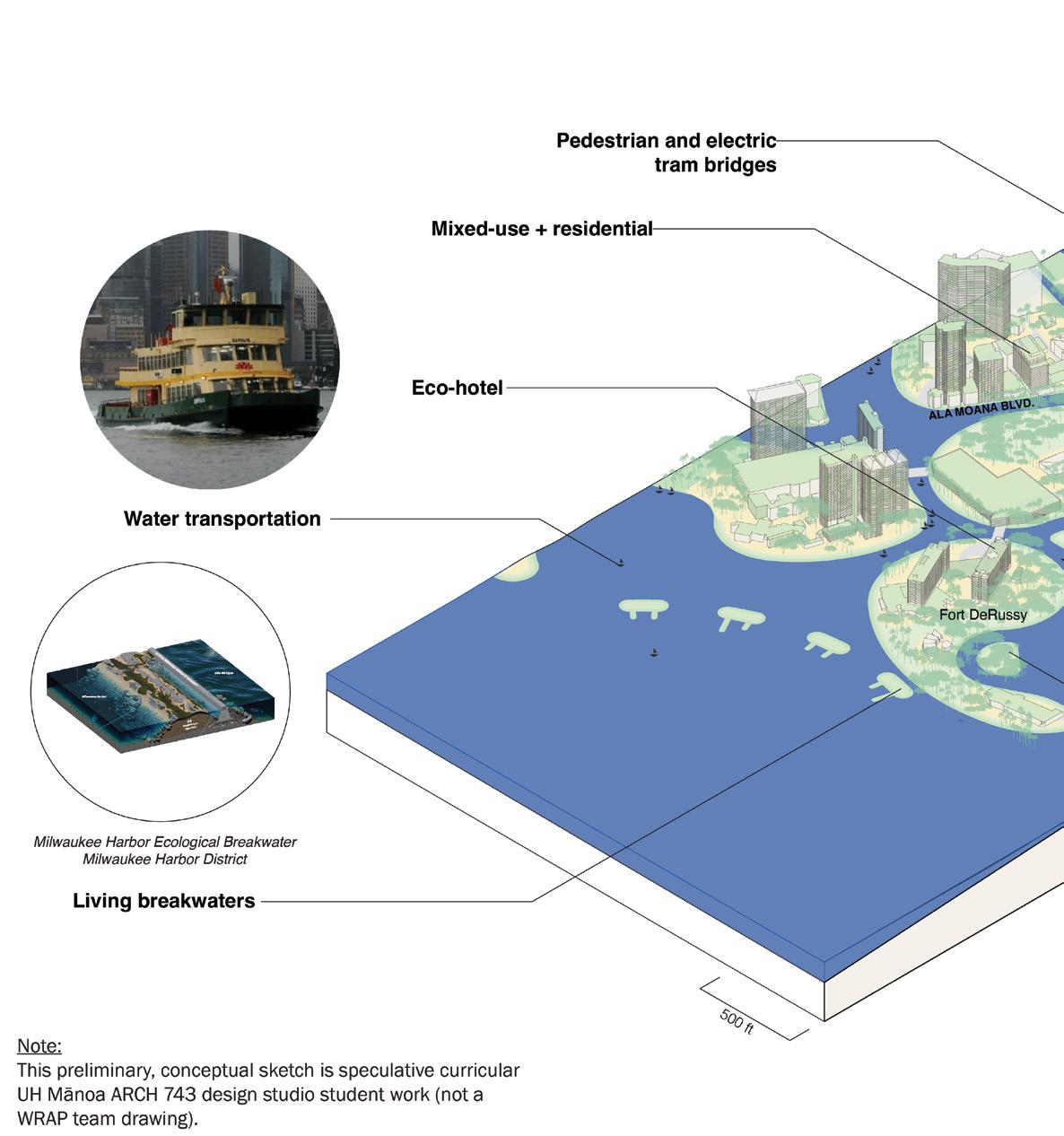
The exercises posed questions related to sea-level rise adaptation strategies, building stock vulnerabilities, and long-term ideas for resilience. The charrette also included speculative student work from UHM’s Spring ‘24 ARCH 743 urban design studio course.
30 Attendees
TASK 8.1: VISIONING
NEIGHBORHOOD SCALE | MONDAY, MARCH 4, 2024
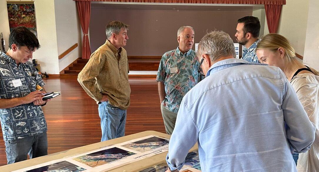
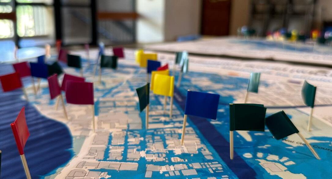
Activity 1: Sea-Level Rise Adaptations Strategies
Activity 2: Climate Concerns (Building Stock)
Activity 3a: ARCH 743 Speculative Visioning
Activity 3b: Waikīkī of the Future
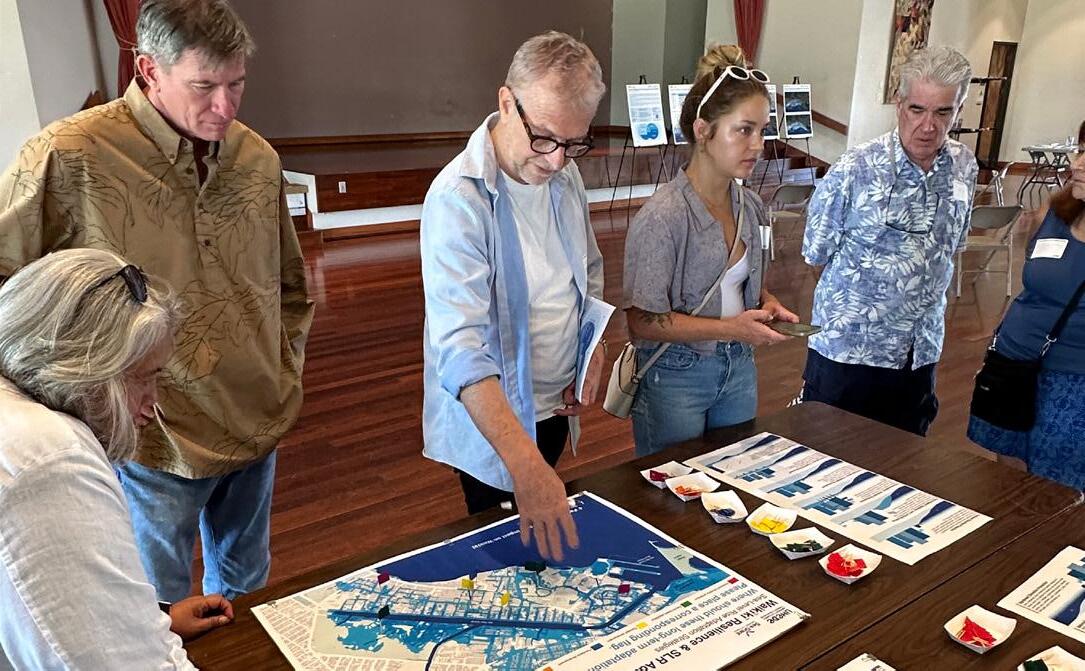
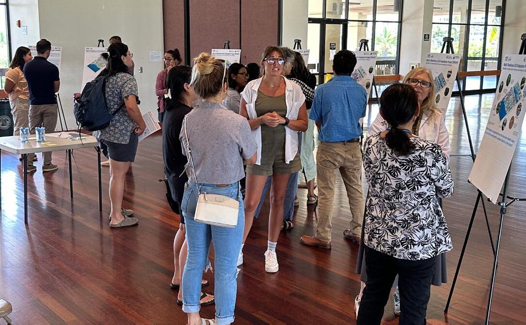
TASK 8.1:
NEIGHBORHOOD SCALE | MONDAY, MARCH 4, 2024


Sea-Level Rise Adaptation Strategies
Where should these long-term adaptation strategies be employed? Please place a corresponding flag.


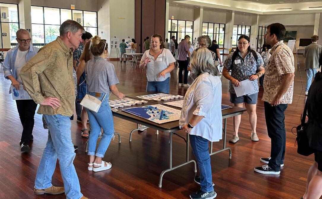
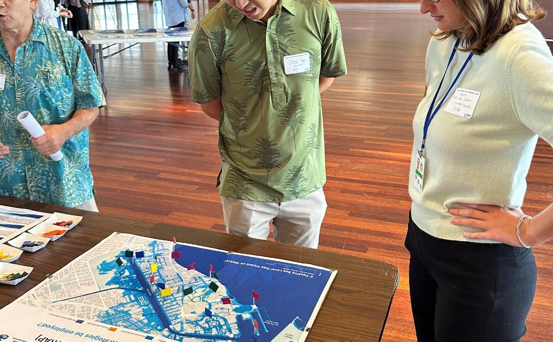
The first activity focused on long-term sea-level rise adaptation strategies for Waikīkī. The goal of this interactive exercise was twofold: to educate community members and stakeholders in attendance about applicable adaptation strategies and to gather additional information about the community’s adaptation preferences and proposed spatial locations.
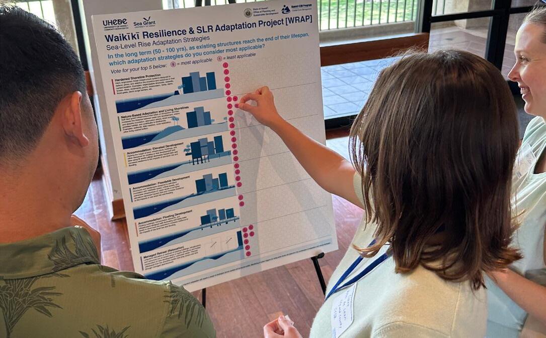
Visioning charrette participants were asked to rank the following sea-level rise adaptation and accommodation strategies: hardened shoreline protection, nature-based adaptation, elevated development, floodable development, floating development, and managed retreat (relocation).
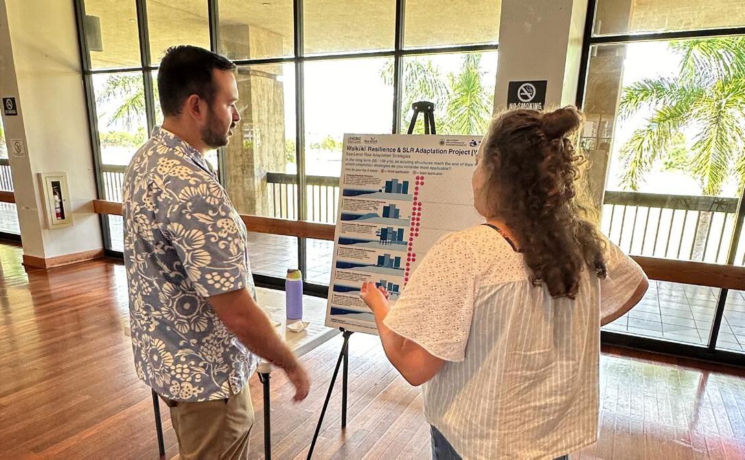
WRAP team members provided participants with dots numbered 1 (least applicable) through 5 (most applicable). The dot voting component of the exercise asked participants to indicate which adaptation strategies they consider most applicable for Waikīkī in the long term (50 - 100 year time horizon).
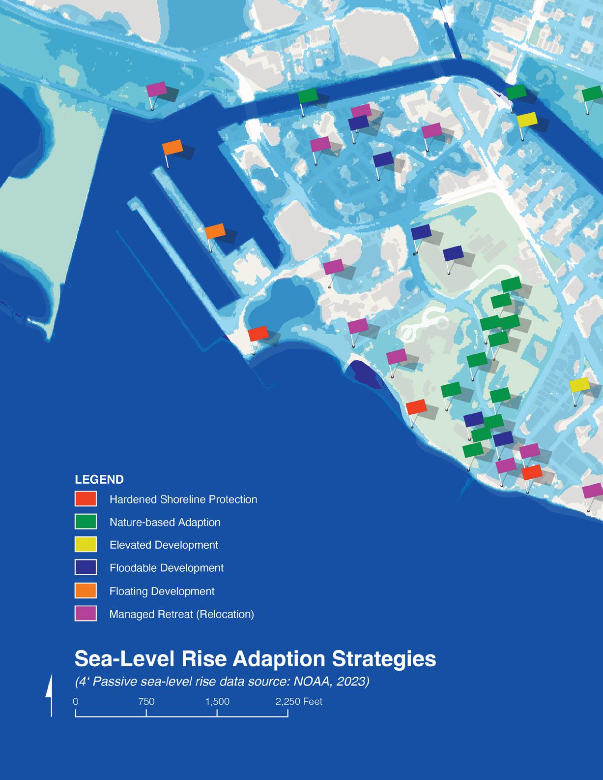
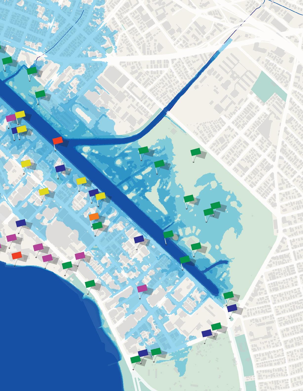
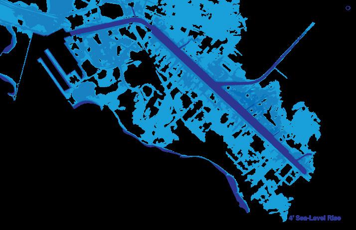
The second exercise component prompted workshop participants to place color-coded flags on a map of Waikīkī with 4 feet of passive sea-level rise to identify and spatialize adaptation strategy locations. There was no limit to the number of flags participants were able to place.
TASK 8.1:
NEIGHBORHOOD SCALE | MONDAY, MARCH 4, 2024
Summary of visioning charrette feedback


In the long term (50 - 100 yrs), as existing structures reach the end of their lifespan, which adaptation strategies do you consider most applicable?


TASK 8.1:
NEIGHBORHOOD SCALE | MONDAY, MARCH 4, 2024


Built Environment Risk Mapping (Building Stock)
Zoning and Building Special District Building Age (2023)
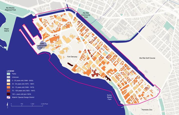

The second participatory activity intended to educate visioning charrette participants on the impacts of sea-level rise on Waikīkī’s building stock.
Community members and stakeholders in attendance were asked to review three maps (see above) that each highlighted different building-related aspects of the urban fabric: Special District Building Age (2023), Zoning and Building Use, Large Landowners and Population.
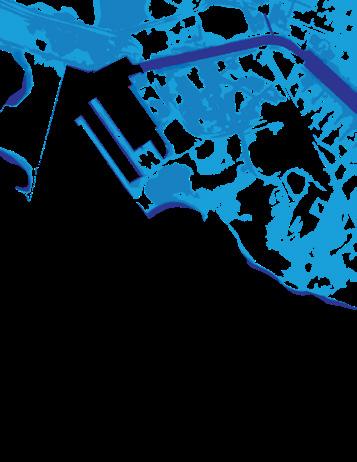
During the event, WRAP team members encouraged workshop participants to use interactive clear film overlays, affixed to the top of each map (see image on right), illustrating how 4 feet of passive sea-level rise affect various building-related factors.
After reviewing each of the maps, participants were given five dots labeled 1 to 5 (blue for residents, red for businesses or land owners, and green for other stakeholders). Participants were then asked to place their five dots on a voting board, indicating what building-related factors matter the most. The dots were ranked as 5 being the most important and 1 being least important.
Community members and stakeholders were also given the opportunity to write in and vote on any factors that were not represented in the maps or listed on the dot voting board.
SCALE | MONDAY, MARCH 4, 2024

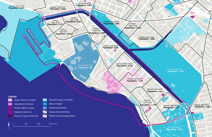


What building-related factors matter most when it comes to long-term SLR accommodations (retrofitting or rebuilding in place) versus relocation (managed retreat)?
Please vote for your top 5 below: 5 = most important 1 = least important
Use a blue sticker if you are a resident, red if you represent a business/land owner, and green if you are a stakeholder.
Please share additional building-related factors via sticky notes:
TASK 8.1:
NEIGHBORHOOD SCALE | MONDAY, MARCH 4, 2024
Please vote for your top 5 below:
5 = most important 1 = least important
Use a blue sticker if you are a resident, red if you represent a business/land owner, and green if you are a stakeholder.
Bar Chart Voting Results
Summary of visioning charrette feedback in ranked order: TASK 8.1:
| MONDAY, MARCH 4, 2024
blue = resident, red = business/land owner, and green = stakeholder
Environmental impact
Location (relative to flood elevation)
Health and safety
Adaptation cost
Residential density
Historic structure or landmark Use (e.g., public, residential, commercial)
Building age Insurance cost
Building material or construction type
Water and energy efficiency
Building revenue
Property value
Building height


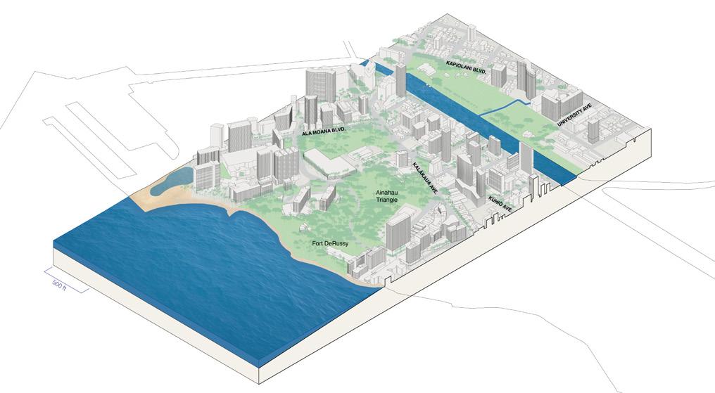
Isometric cross section through Waikīkī Special Design District in the area surrounding Fort DeRussy

TASK 8.1:
NEIGHBORHOOD SCALE | MONDAY, MARCH 4, 2024

Jade Rhodes, MLA Student
SCALE | MONDAY, MARCH 4, 2024
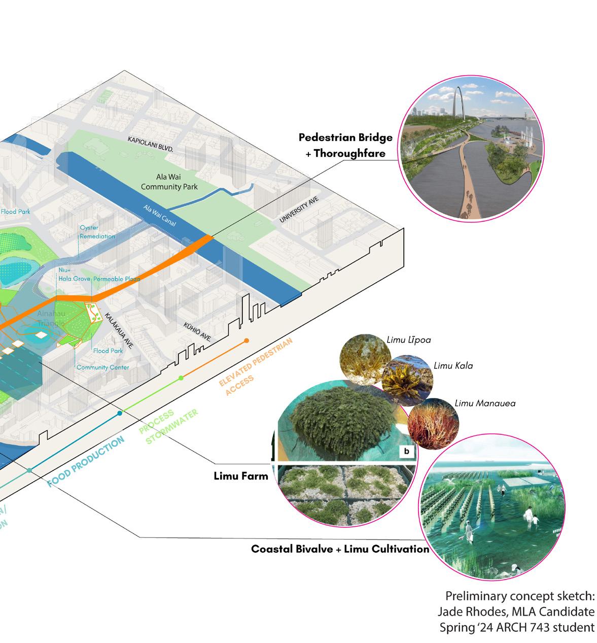
Xavier Duarte, MLA Student
SCALE | MONDAY, MARCH 4, 2024
Cindy Petersen, MLA Student
SCALE | MONDAY, MARCH 4, 2024
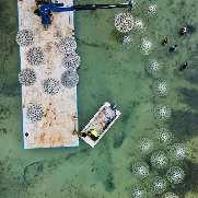
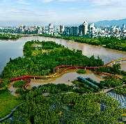
Note:
This preliminary, conceptual sketch is speculative curricular UH Mānoa ARCH 743 design studio student work (not a WRAP team drawing).
SCALE | MONDAY, MARCH 4, 2024
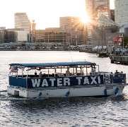
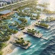
Zoë Angelopulo, MLA Student
SCALE | MONDAY, MARCH 4, 2024
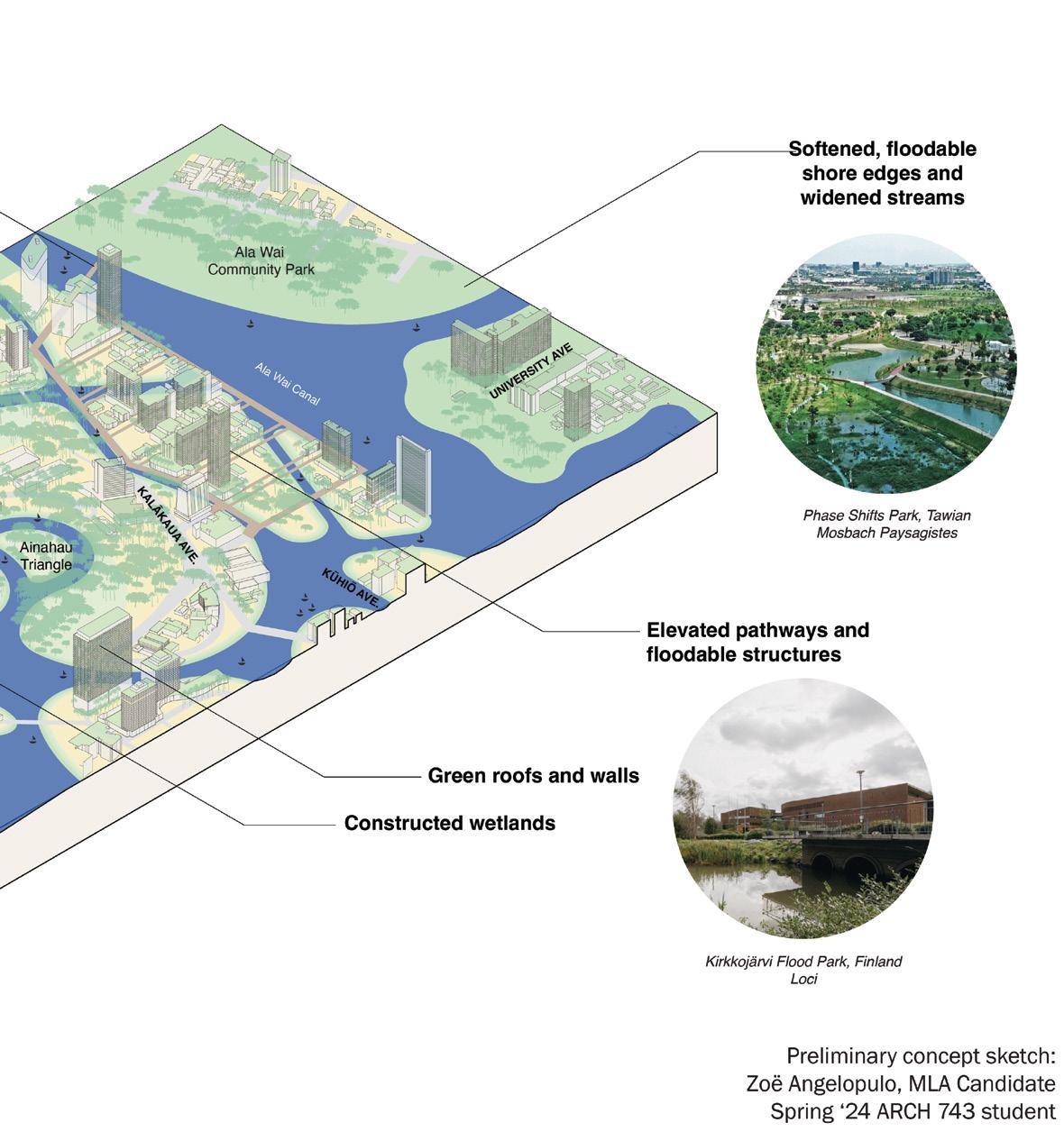

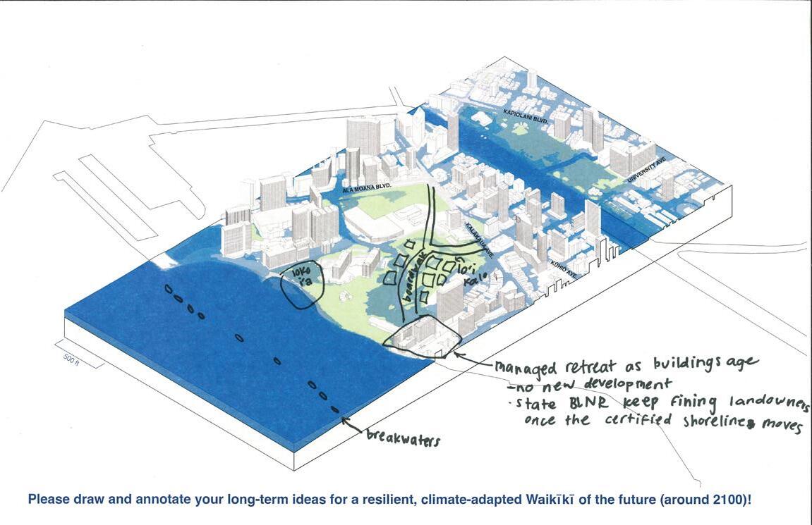
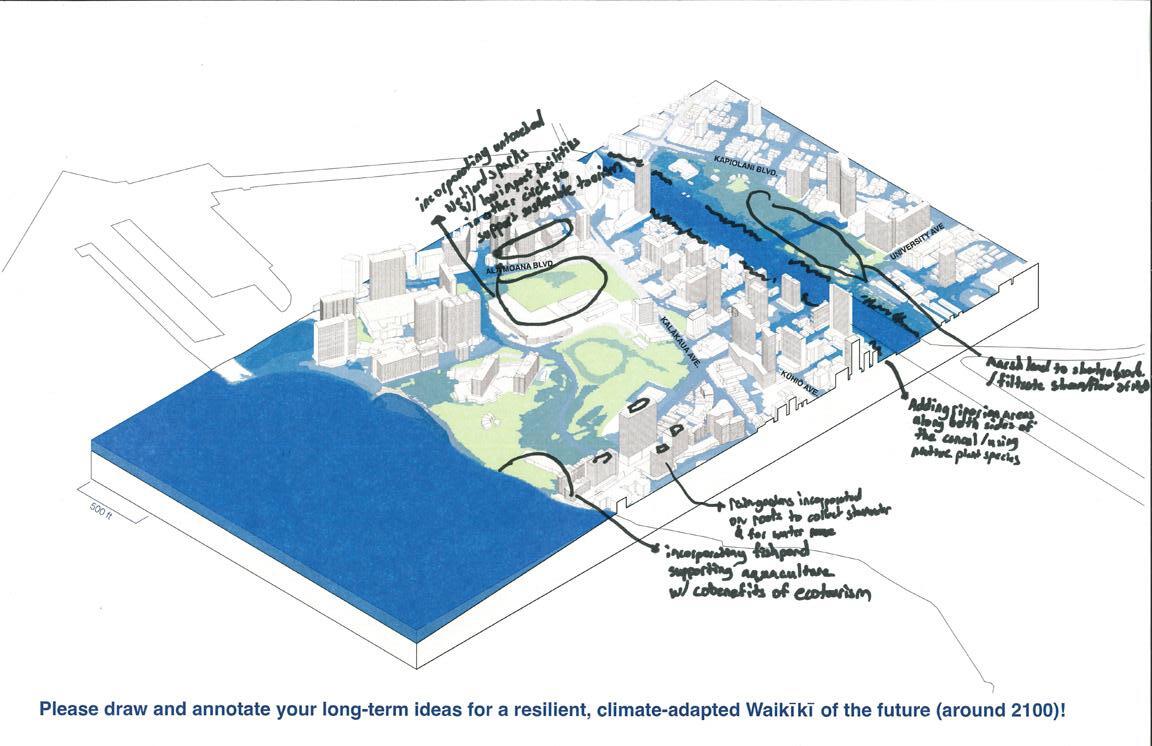
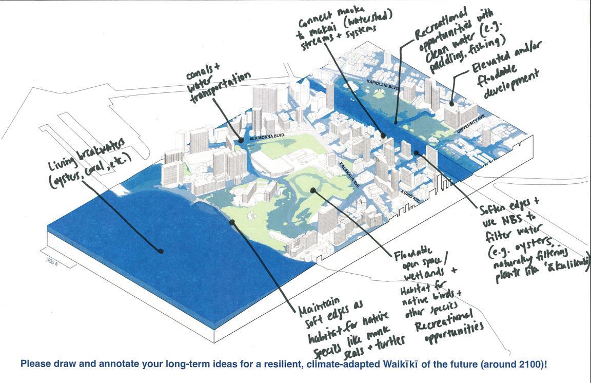
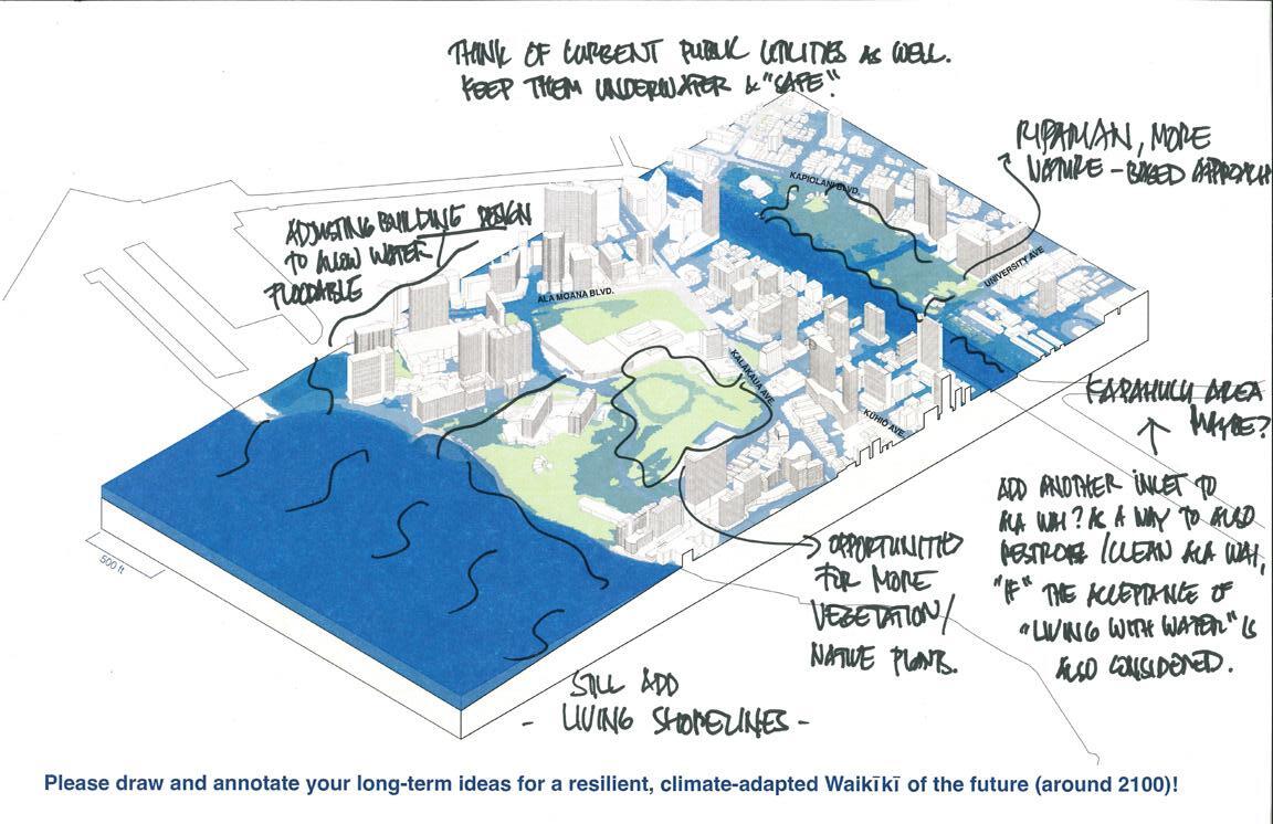
Charrette participants were provided with markers and 11” x 17” color copies of this isometric graphic for their individual annotations and sketches of resilience and adaptation design ideas.
SCALE | MONDAY, MARCH 4, 2024
Scans of community/stakeholder sketches and comments


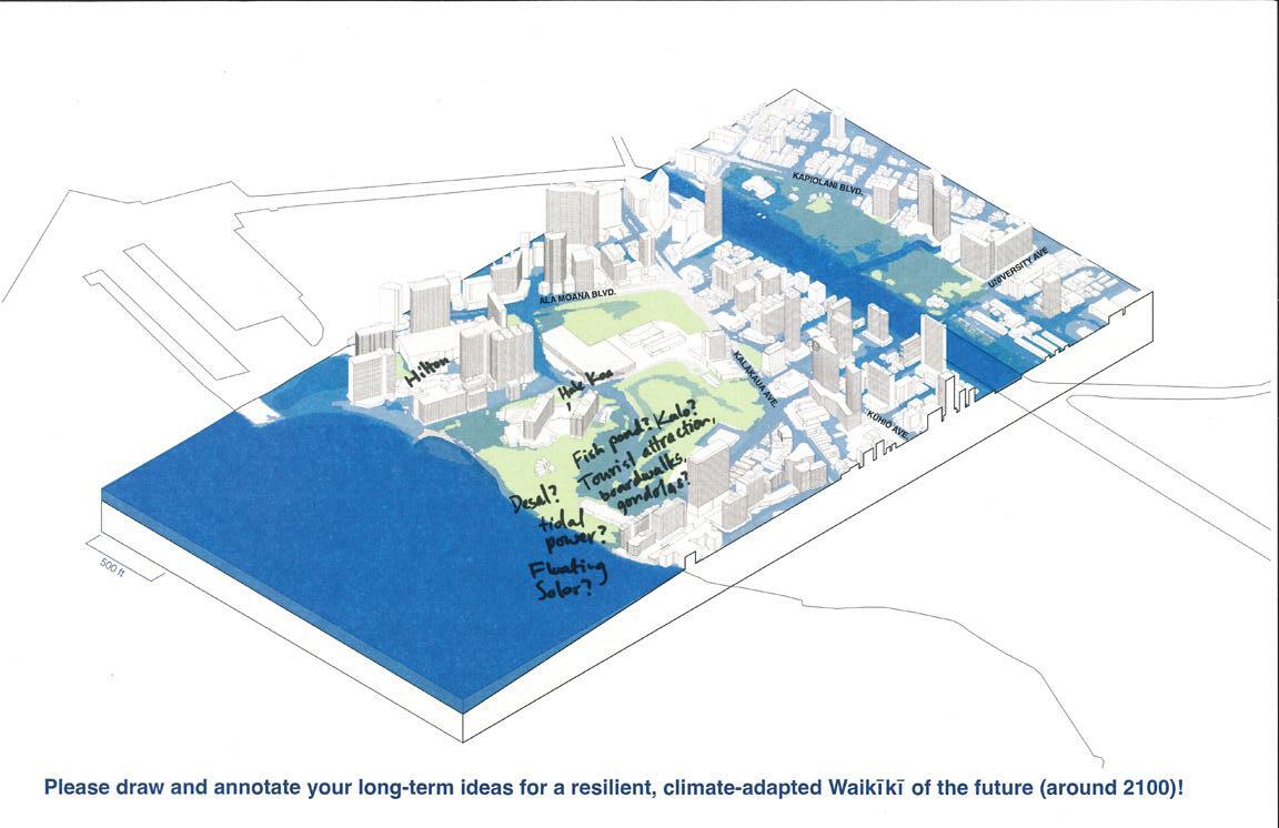
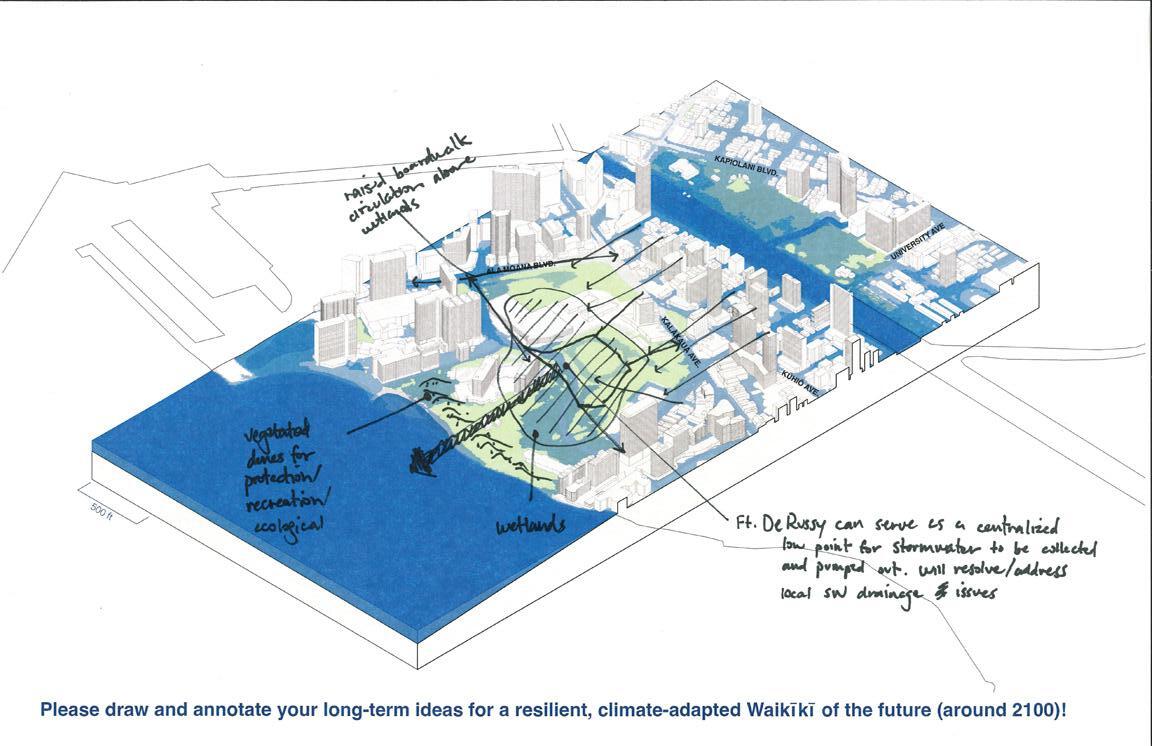
Scans of community/stakeholder sketches and comments
Top participant preferences:
Top participant concerns:
NEIGHBORHOOD SCALE | MONDAY, MARCH 4, 2024
Participant flag responses in ranked order:
Nature-Based Adaptation and Living Shorelines (33)
Managed Retreat (Relocation) (16)
Floodable Development (14)
Elevated Development (8)
Hardened Shoreline Protection (5)
Floating Development (3)
Business / Landowners Residents Stakeholders