
Resilience & SLR Adaptation Project [WRAP]


Resilience & SLR Adaptation Project [WRAP]

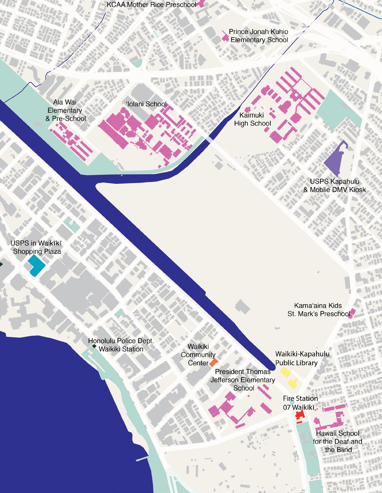
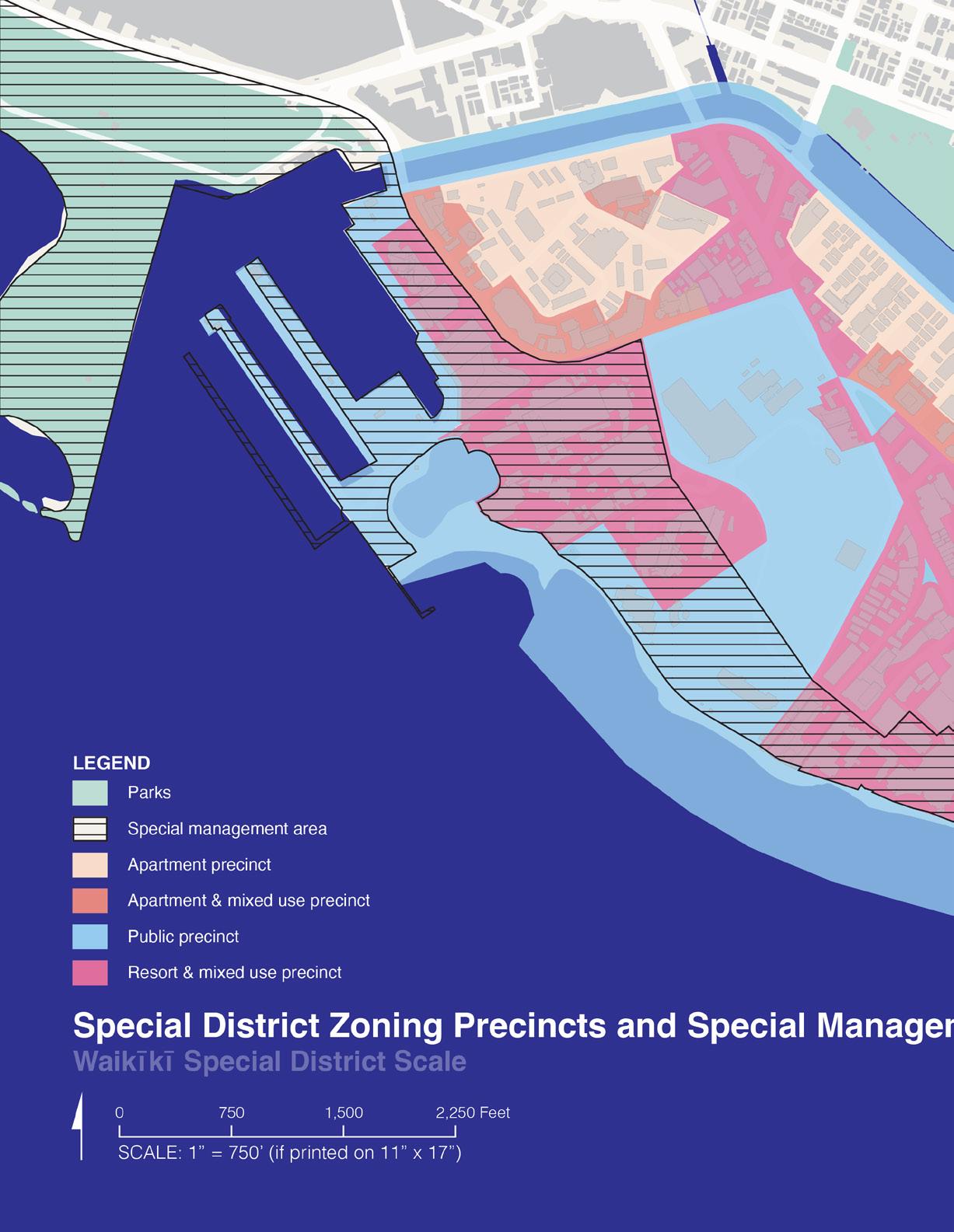
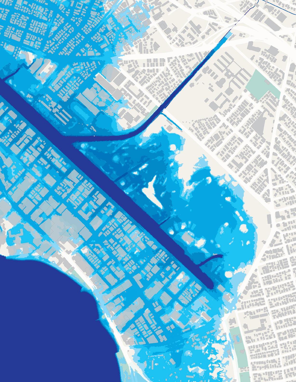
Mapping and diagramming of select site conditions and hazards at watershed/ahupua’a scale (ridge to reef), Waikīkī context scale (including areas immediately mauka of Ala Wai Canal and Kapiolani Park context) and Waikīkī Special District scale.
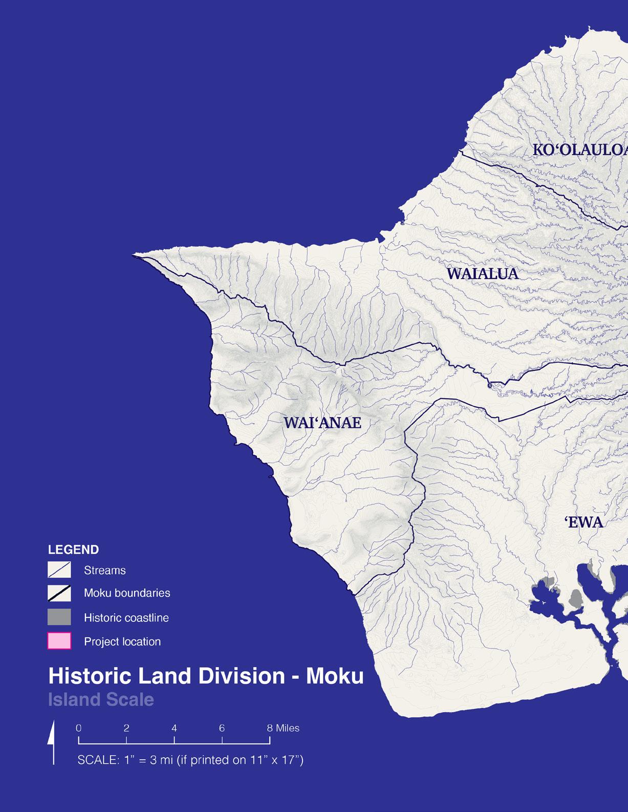
Island Scale
Ridge to Reef Scale
Context Scale
Waikīkī Special District Scale
Island Scale
Historic Land Division - Moku
Regional Planning Areas
Oʻahu Context
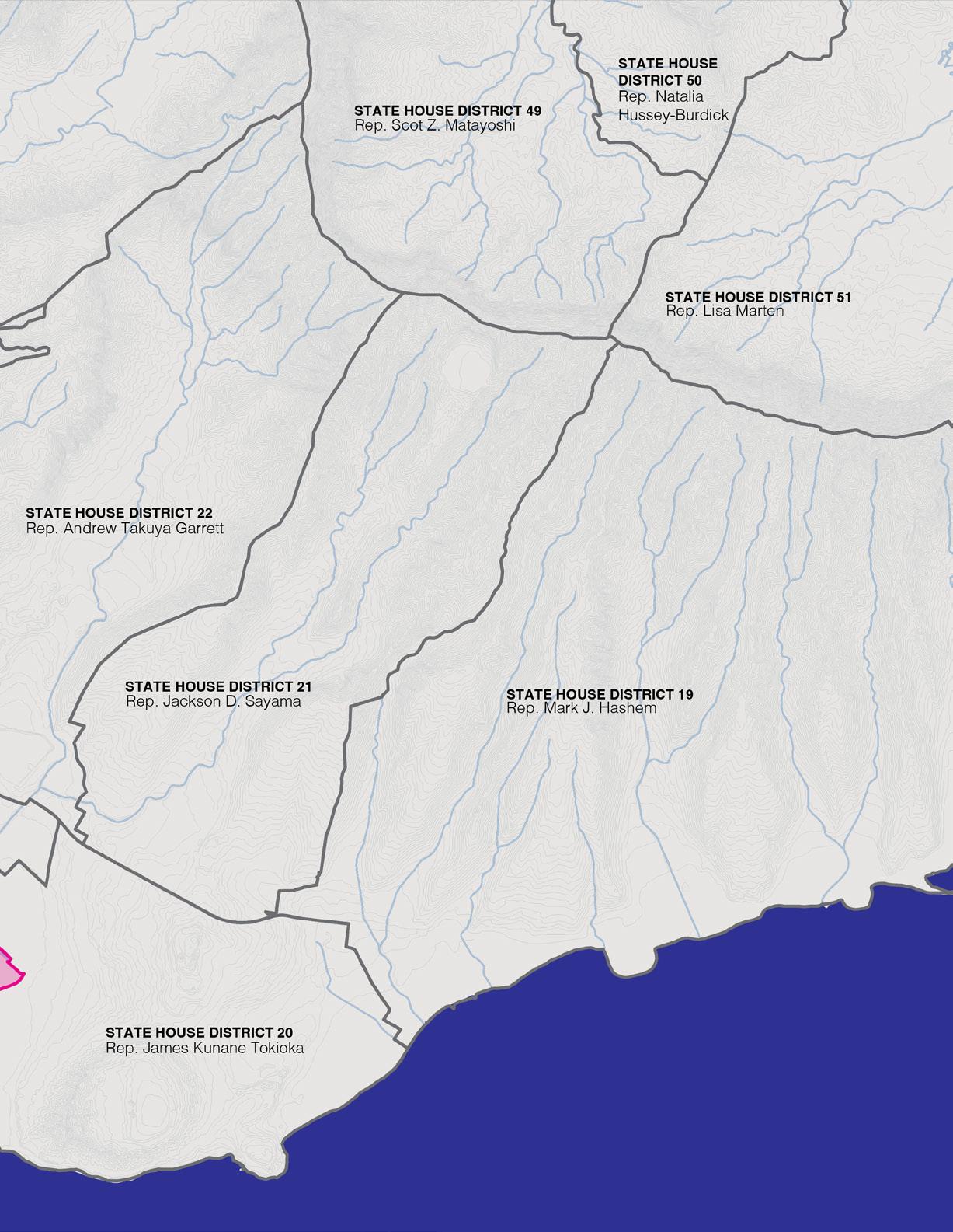
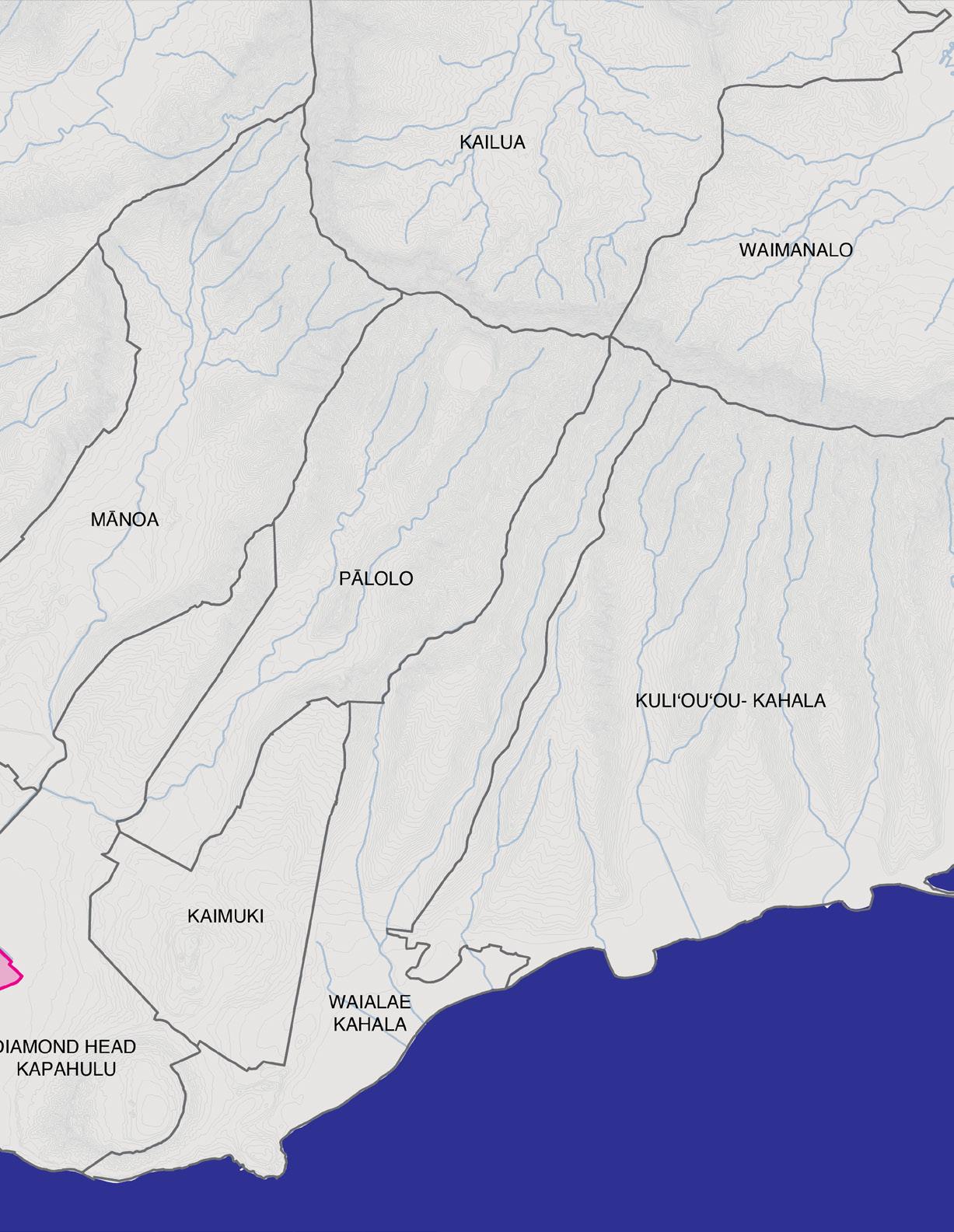
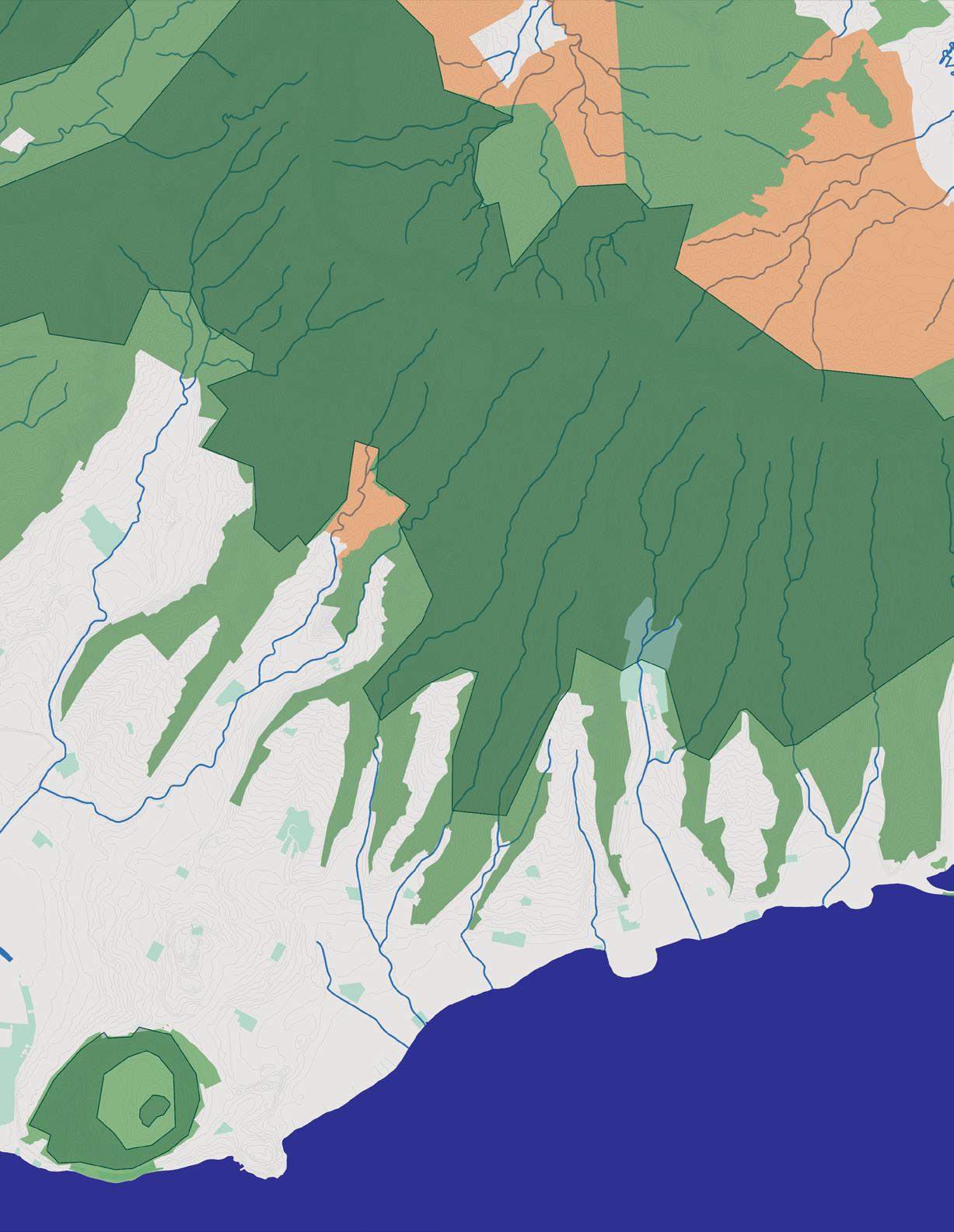
Ridge To Reef Scale
Historic Land Division - Ahupuaʻa
Ala Wai Watershed
State Senate Districts (2023)
State House Districts (2023)
Honolulu City Council Districts (2023)
Neighborhood Boards
Moisture Zones
State of Hawaiʻi Land Use Districts and Critical Habitat
Context Scale
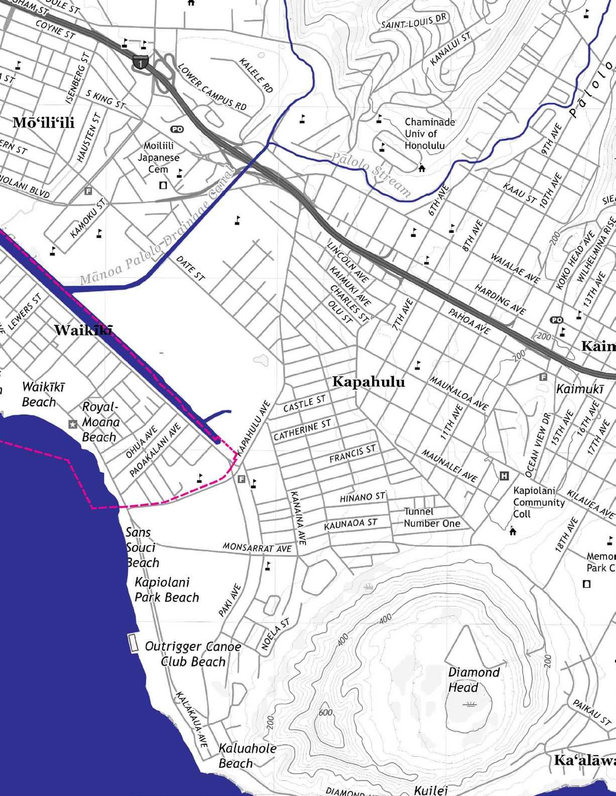
Site Context
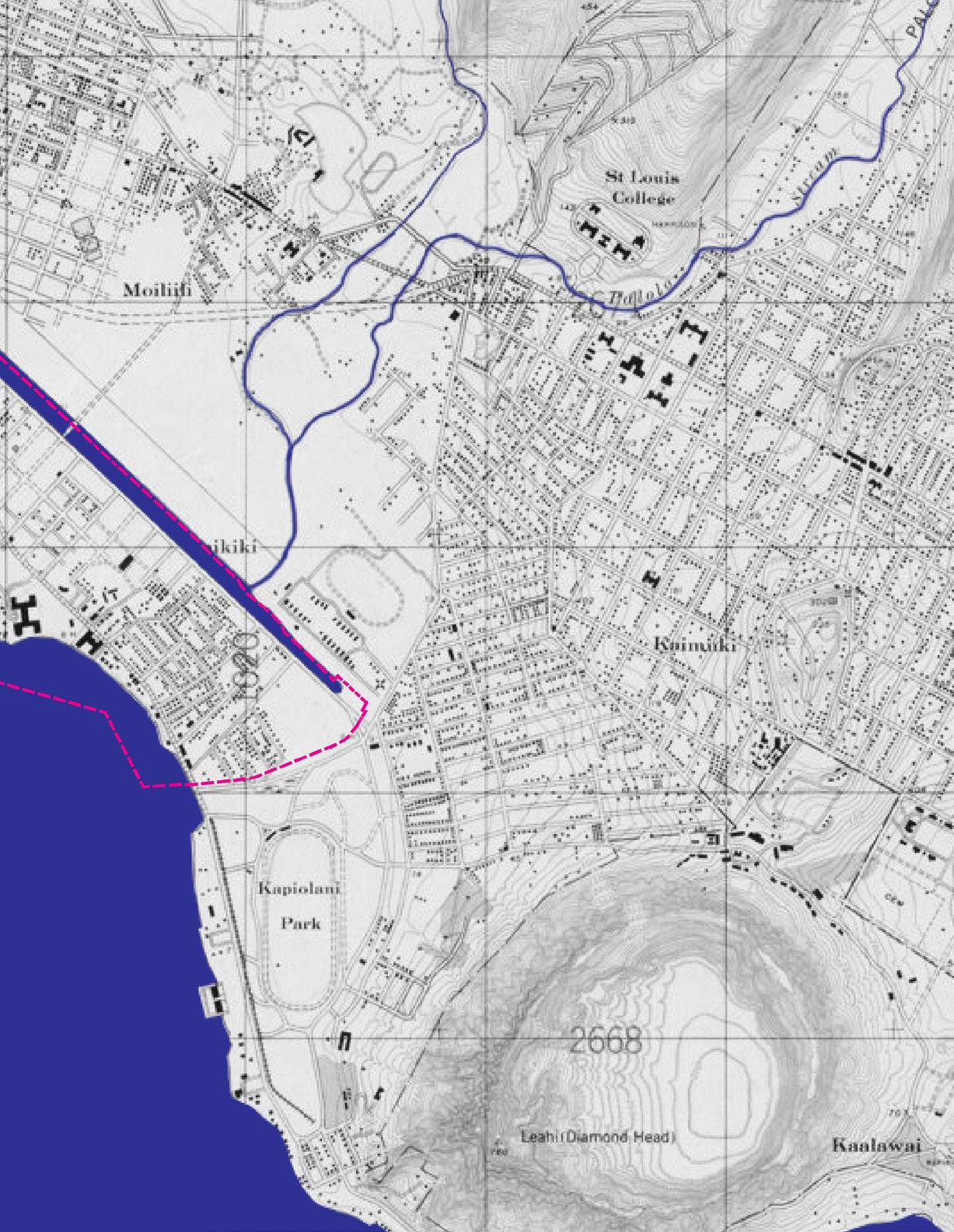
Shoreline Conditions (1897)
Shoreline Conditions (1933)
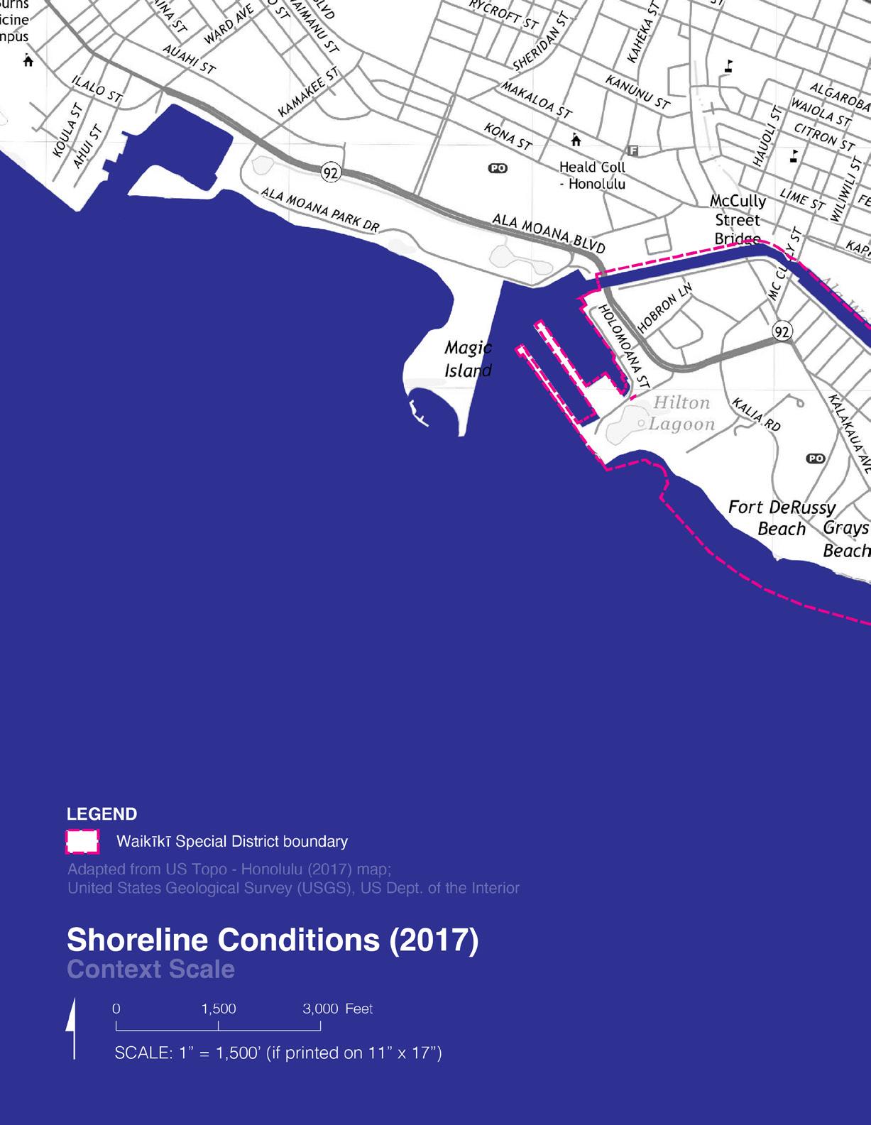
Shoreline Conditions (2017)
Special District Boundaries
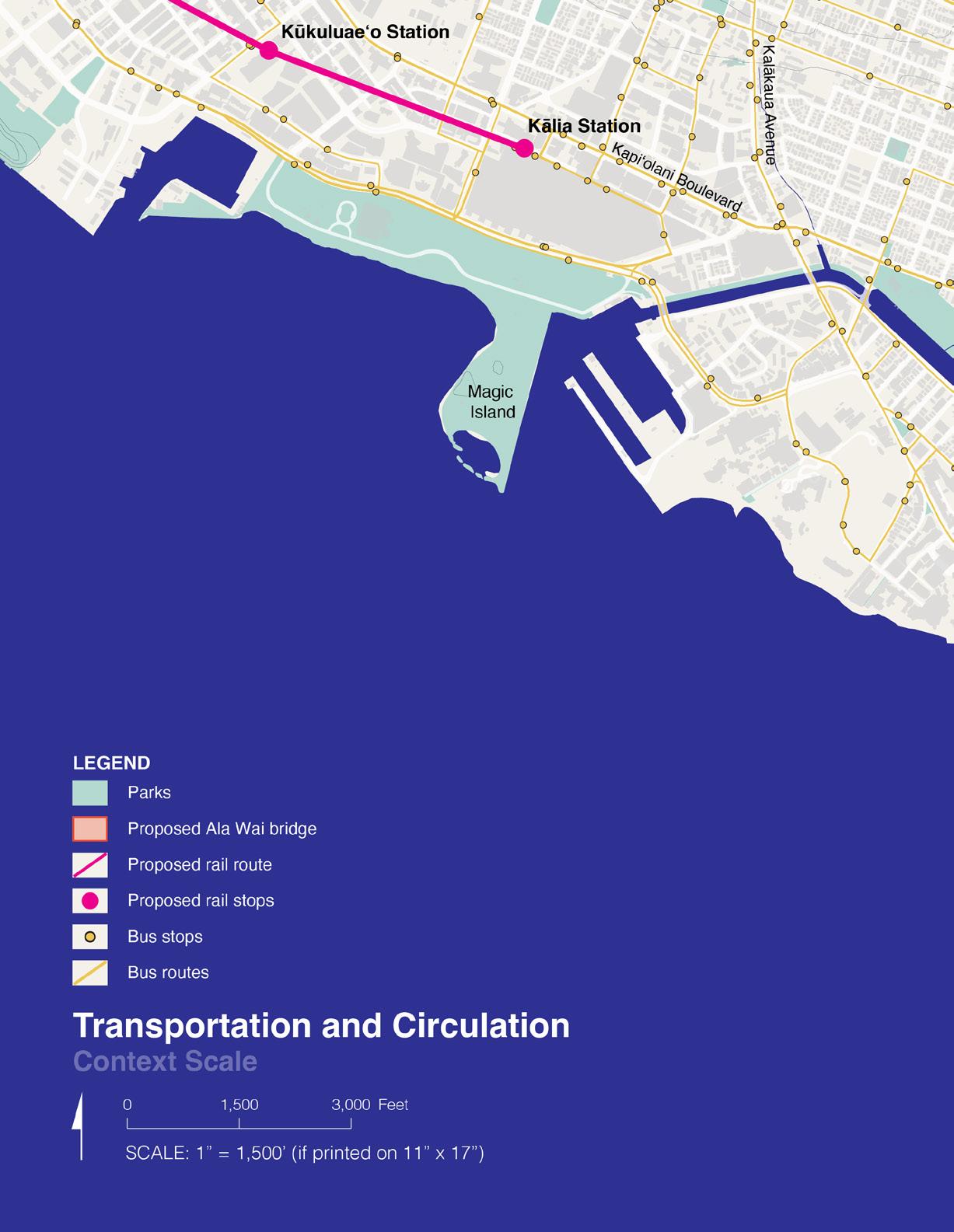
Transportation and Circulation
Stormwater Infrastructure
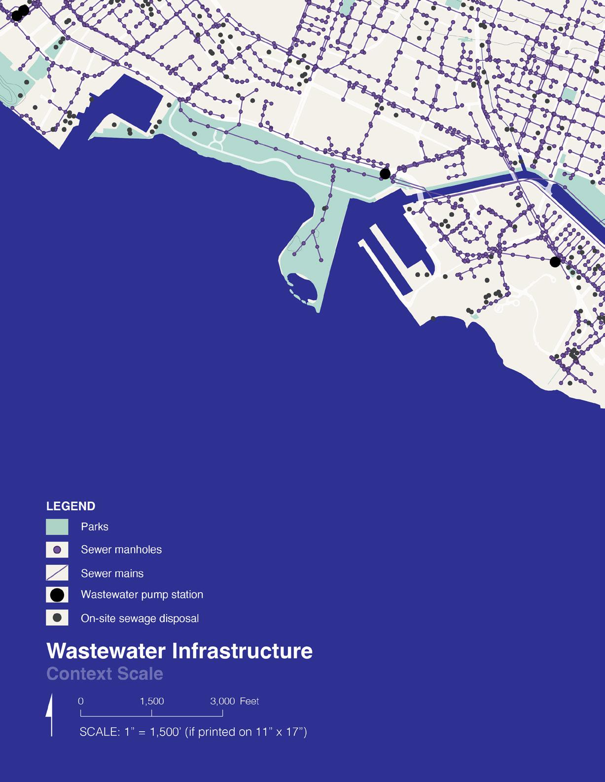
Wastewater Infrastructure
Large Landowners
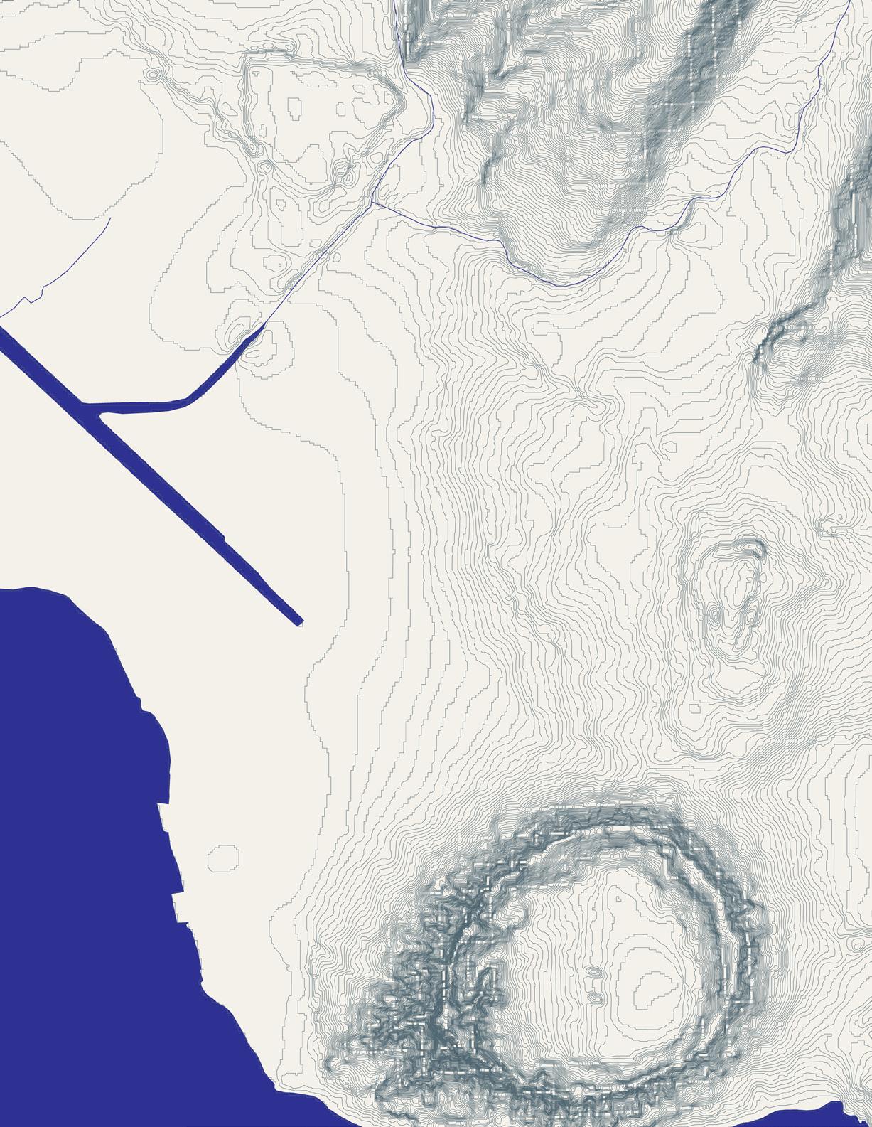
Contour Map
Geologic Conditions
Habitat
Tsunami Evacuation Zone
FEMA Flood Risk Zones
3.2-ft Sea Level Rise Exposure Area (SLR-XA)
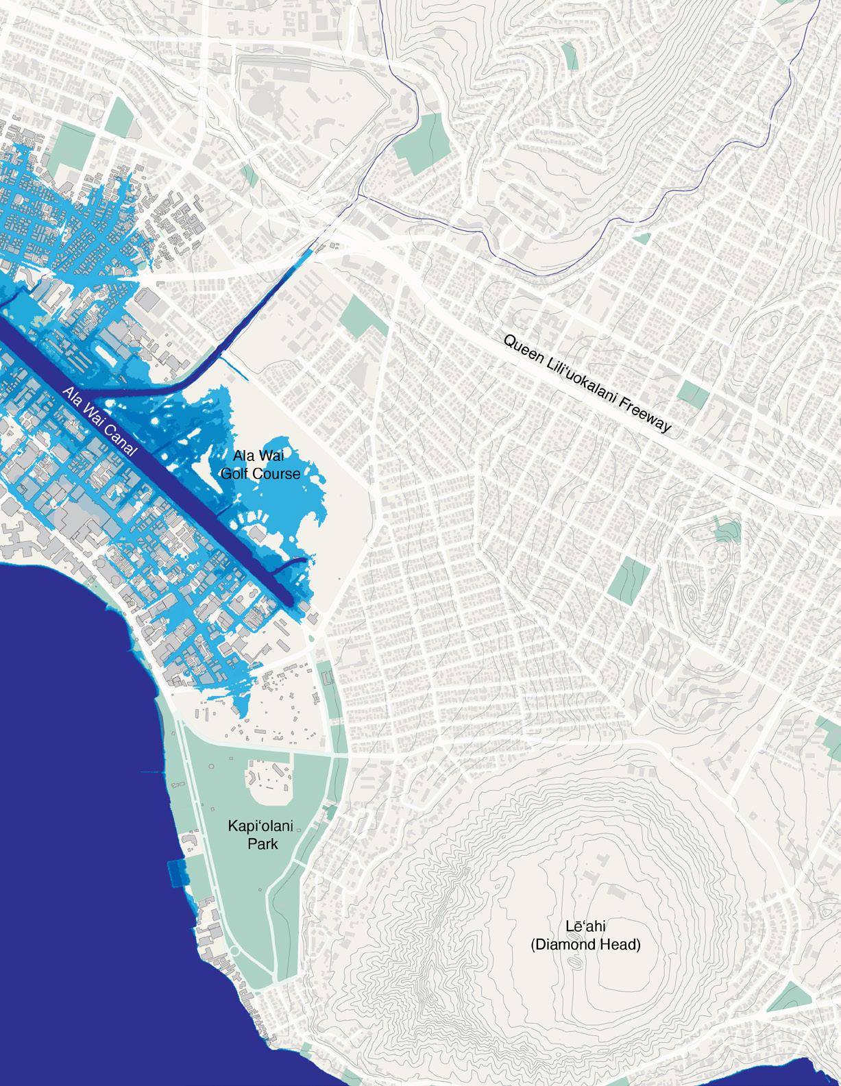
4-ft Passive Sea Level Rise (NOAA)
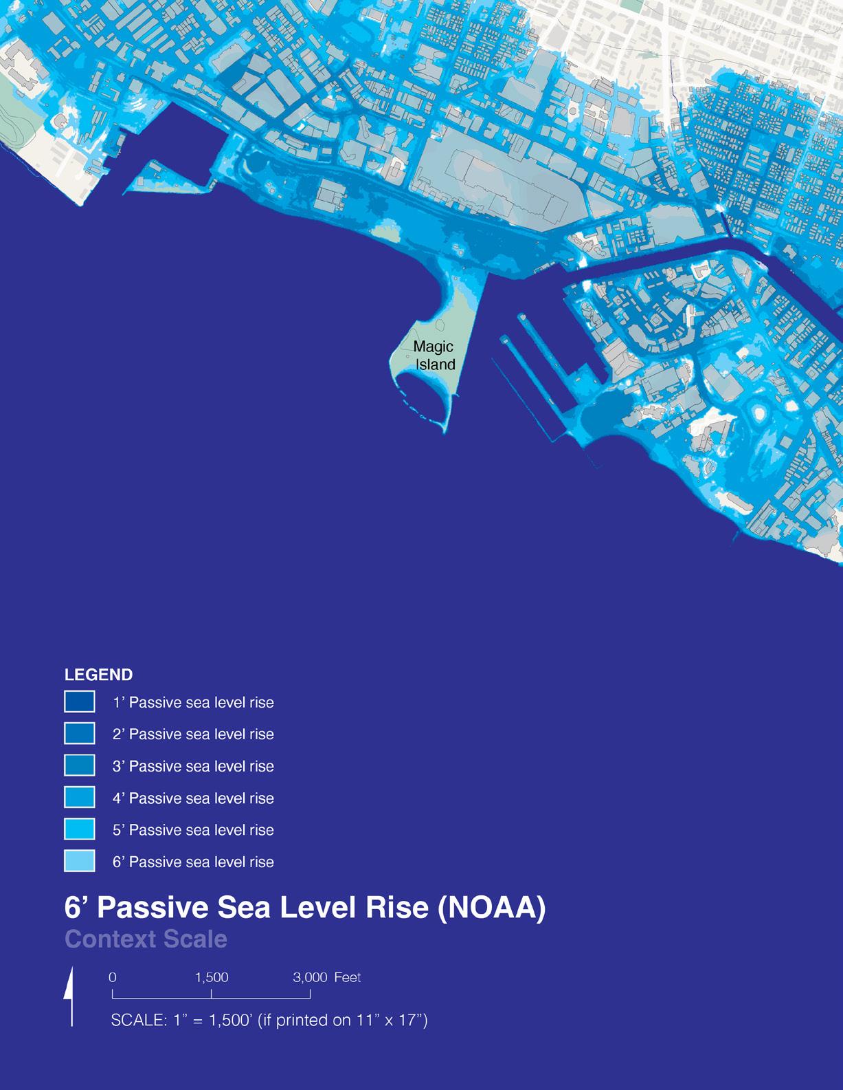
6-ft Passive Sea Level Rise (NOAA)
Waikīkī Special District Scale
Waikīkī Special District Boundary
Figure Ground Map
Building Age
Building Age (Table)
Transportation and Circulation
Green Space
Census Tracts and Population
Census Data (Table)
Large Landowners
Public Services
Hotels, Resorts, and Hospitality Buildings
Hotels, Resorts, and Hospitality Buildings (Table)
Stormwater Infrastructure
Wastewater Infrastructure
Board of Water Supply and Hawaiian Electric Facilities
Building Height Limits
Special District Zoning Precincts and Special Management Areas
LUO Zoning
3.2-ft Sea Level Rise Exposure Area (SLR-XA)
4-ft Passive Sea Level Rise (NOAA)
6-ft Passive Sea Level Rise (NOAA)
Waikīkī Shoreline Interventions (from South Shore Project Report)
















Adapted from Pacific Islands Ocean Observing System (PacIOOS) sea-level rise data (December, 2023)


Adapted from National Oceanic and Atmospheric Administration sea-level rise data (December, 2023)
Adapted from National Oceanic and Atmospheric Administration sea-level rise data (December, 2023)
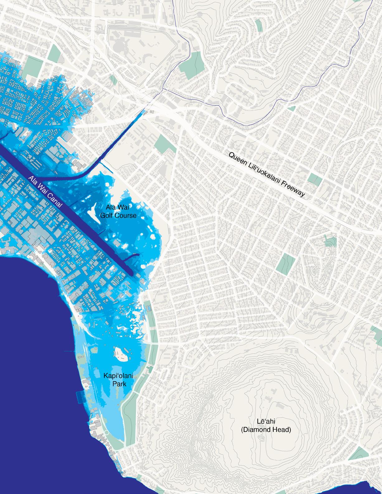


Adapted from City and County of Honolulu’s Real Property Assessment TMK parcel data (December, 2023)




260270340000
260270370000
260270490000
260270500000




Adapted from Pacific Islands Ocean Observing System (PacIOOS) sea-level rise data (December, 2023)


Adapted from National Oceanic and Atmospheric Administration sea-level rise data (December, 2023)


Adapted from National Oceanic and Atmospheric Administration sea-level rise data (December, 2023)

Hardened structure parallel to the shore seaward of the land/water interface.
Removal of sand and coral from the beach or nearshore environment to create a patch to deeper water or create a path of consistent depth.
Removal of coral from the beach or near-shore environment.
Hardened structure perpendicular to the shore extending seaward and landward of the land/water interface.
Hardened structures perpendicular to the shore on either side of a coastal inlet extending seaward and landward of the land/water interface; usually longer than groins.
Beach compartments containing the complete cycle of sedimentation including sources, transport paths, sinks.
Shift of built environment boundary landward or seaward.
Depositing sand on the beach.
Removal of sand from the beach or near-shore environment.
Hardened structure parallel to the shore at the land/ water interface also called bulkheads, revetments, retaining walls.
Block/dissipate wave action. Sand accumulates between breakwater and
Improve navigation; improve beach or near-shore sand quality for comfort of beach-goers.
Improve navigation; improve near-shore swimming/ wading.
Creates outlets for long-shore current to turn seaward relieving littoral cell of sand; destroys habitat.
Creates outlets for long-shore current to turn seaward relieving littoral cell of sand; destroys habitat.
Interrupt and trap long-shore flow of sand (capture and retain sand). Updrift accretion; downdrift erosion.
Prevent sand from accumulating in a navigable channel; prevent river mouths from meandering naturally.
Natural cycle; seasonal.
Increase (landward shift) or decrease (seaward shift) beach width (or vegetation width) by adjusting sand-built environment interface (or vegetation-built environment interface).
Widen, restore, or create beach.
Harvest sand for wetlands fill or beach nourishment; improve navigation.
Protect structures by stopping the natural movement of water and sand (protect shoreline property).
Updrift accretion; downdrift erosion.
Seven littoral cells defined on Waikīkī beach: Fort DeRussy, Halekulani, Royal Hawaiian, Kūhiō, Kapi‘olani, Queens, Kaimana.
Landward shift increases beach (or vegetation buffer) width at the expense of buildable land; seaward shift increases the buildable land at the expense of beach (or vegetation buffer) width.
Requires sand grain of near-equal size to that of the natural beach; costly, temporary solution.
Depletes sand, which is already subject to natural erosive forces.
Reflected waves transport sand offshore; flanking erosion - reduce reflection by sloping or by creating pockets/grooves.
Kūhiō
Kaimana
Kapi‘olani
Royal Hawaiian
Royal Hawaiian
Kapi‘olani
Fort DeRussy
Fort DeRussy
Fort DeRussy
Fort DeRussy
Royal Hawaiian
Fort DeRussy
Fort DeRussy
Fort DeRussy
Fort DeRussy
Fort DeRussy
Fort DeRussy
Halekulani
Fort DeRussy
Fort DeRussy
Fort
Kaimana
Kapi‘olani
Fort DeRussy
Kapi‘olani
Halekulani
Ala Wai
Royal Hawaiian
Kūhiō
Royal
Ala
Ala
Royal
Kaimana
Kaimana
Royal Hawaiian
Fort DeRussy
Royal Hawaiian
Royal Hawaiian
Ala Moana
Ala Moana
Fort DeRussy
Halekulani
Royal Hawaiian
Ala Moana
Ala Wai
Seawall
Seawall
Seawall
Seawall
Seawall
Coral Dredging
Channel
Coral Dredging
Sand Mining
Seawall
Groin
Groin
Seawall
Coral Dredging Channel
Seawall
Seawall
Seawall
Coral Dredging
Sand Fill
Seawall
Seawall
Seawall
Groin
Seawall
Groins
Coral Dredging
Sand Fill
Sand Fill
Seawall
Coral Dredging Channel
Coral Dredging Seawall Groin
Sand Fill
Groin
Groins
Coral Dredging
Channel
Groin
Sand Fill
Groin
Sand Fill
Coral Dredging
390’ retaining wall to protect Waikīkī Road (Kalākaua Avenue) near entrance to Kapi‘olani Park.
James B. Castle home
867’ retaining wall to protect Waikīkī Road (Kalākaua Avenue).
230’ Mānoa Hotel
Honolulu Seaside Hotel seawall encroached upon beach, future site of Royal Hawaiian.
Coral removed from offshore Kapi‘olani Park public baths.
Coral dredged, sand mined to create channel to get dredge to Fort DeRussy site wetlands filled.
Coral dredged, sand mined to create channel to get dredge to Fort DeRussy site wetlands filled.
Coral dredged, sand mined to create channel to get dredge to Fort DeRussy site wetlands filled.
Coral dredged, sand mined to create channel to get dredge to Fort DeRussy site wetlands filled.
Concrete wall built between Mānoa Hotel and Outrigger Canoe Club.
Barrier built to trap littoral sand; seawall built to retain sand.
Barrier built to trap littoral sand; seawall built to retain sand.
Created a channel to transport a 69-ton artillery piece.
Created a channel to transport a 69-ton artillery piece; channel connects Fort DeRussy to Halekulani Channel.
290’ seawall Wilder’s property near Fort DeRussy.
Seawall constructed after beach eroded Fort Derussy to future Sheraton Hotel site.
430’ seawall Gray’s beach (Ewa) and 225’ long seawall (Diamond Head).
Coral/sand dredged to fill old duck ponds 134, 642 cyds.
Seawall extended 1150’, landward fill 26, 343 cyds.
Seawall extended 1150’, landward fill 26, 343 cyds.
208’ seawall Kaimana Beach.
210’ seawall in front of current Elks Club.
70’ concrete stormdrain (box culvert).
Seawalls constructed along Kapi‘olani Park.
Experimentation with groins, sand bags and wood planks.
Completion of the Ala Wai Canal; ceased fluvial sediment from ‘Āpuakehau and Kuekaunahi Streams.
Completion of the Ala Wai Canal; ceased fluvial sediment from ‘Āpuakehau Stream.
Completion of the Ala Wai Canal; ceased fluvial sediment from Kuekaunahi Stream.
Construction of the Royal Hawaiian Hotel; new seawall shoreward of old seawall.
Kewalo Basin entrance channel.
Kewalo Basin entrance channel.
Experimentation with groins, sand bags and wood planks.
Experimentation with groins, sand bags and wood planks.
Construction of the Memorial Natatorium; 375’ seawall extended 200’ onto reef.
Construction of the Memorial Natatorium; 375’ seawall extended 200’ onto reef.
Concrete wall built between Moana Hotel and Outrigger Canoe Club (1910) removed.
Sand fill Fort DeRussy.
Royal Hawaiian groin 170’.
Eleven groins.
Ala Moana Beach shore-parallel navigation channel Kewalo Basin to Ala Wai Canal.
Moana
Ala Moana Beach shore-parallel navigation channel Kewalo Basin to Ala Wai Canal.
Moana
YWCA 110’ (east of Fort DeRussy stormdrain).
Sand pumped from reef flat through pipeline to Halekulani Hotel beach.
Royal Hawaiian groin extended to 368’ (also heightened).
Coral and sand fill placed landward of seawall along the shore-parallel channel.
Ala Wai Yacht Harbor constructed.
Kūhiō
Kūhiō
Kūhiō
Kūhiō
Ala Moana
Ala Moana
Kapi‘olani
Kūhiō
Kūhiō
Kūhiō
Ala Wai
Ala Wai
Royal Hawaiian
Kūhiō
Kūhiō
Kūhiō
Breakwater
Coral Dredging
Sand Fill
Groin
Coral Dredging
Channel
Sand Fill
Groin
Seawall
Sand Fill
Coral Dredging
Channel
Vegetation Shift
Groin
Breakwater
Coral Dredging
Submerged (-1’) offshore breakwater, beach construction 210 m; 4000 cyds coral dredged; 7000 cyds sand fill.
Submerged (-1’) offshore breakwater, beach construction 210 m; 4000 cyds coral dredged; 7000 cyds sand fill.
Submerged (-1’) offshore breakwater, beach construction 210 m; 4000 cyds coral dredged; 7000 cyds sand fill.
Sandbag groin constructed to retain sand fill western end of Kuhio Beach.
Kewalo Basin enlarged; entrance channel dredged.
Kewalo Basin enlarged; entrance channel dredged.
Beach construction sand fill +38,000 sqm (110,000 cyds).
Kapahulu stormdrain 355’ long, 19’ wide, +8.5’ MLLW; beach construction sand fill +38,000 sqm (110,000 cyds).
425’ constructed southeasterly from Kapahulu stormdrain.
Kapahulu stormdrain 355’ long, 19’ wide, +8.5’ MLLW; beach construction sand fill +38,000 sqm (110,000 cyds).
Ala Wai entrance navigation channel dredged.
Ala Wai entrance navigation channel dredged.
Seaward shift of the vegetation line.
Installation of T-head groin, south basin.
Above surface (+3’) offshore breakwater 730’, T-head groin,
sqm.
Above
Kapi‘olani
Kapi‘olani
Kūhiō
Ala Moana
Ala Moana
Ala Moana
Ala Moana
Ala Moana
Kaimana
Sand Fill
Coral Dredging
Coral Dredging
Sand Fill
Sand Fill
Coral Dredging Channel
Seawall
Breakwater
Sand Fill
Coral Dredging
Kūhiō
Fort DeRussy
Fort DeRussy
Fort DeRussy
Fort DeRussy
Fort DeRussy Kaimana
Groin Jetty Groin
Kūhiō Sand Fill Groin Groin Groin
Promenade Shift
(+3’)
(+3’)
sqm. Above surface (+3’) offshore breakwater 730’, T-head groin, coral dredging -9,174 sqm, sand fill +3,440 sqm. Coral rubble dredged (490,000 cyds) to fill old navigation channel; sand fill (54,000 cyds) to create beach.
Coral rubble dredged (490,000 cyds) to fill old navigation channel; sand fill (54,000 cyds) to create beach.
Coral rubble dredged (490,000 cyds) to fill old navigation channel; sand fill (54,000 cyds) to create beach.
Duke Kahanamoku Beach and lagoon constructed on flat reef; 150’ wide, 7’ deep swim channel, groins to hold sand on east and west ends.
Duke Kahanamoku Beach and lagoon constructed on flat reef; 150’ wide, 7’ deep swim channel, groins to hold sand on east and west ends.
Duke Kahanamoku Beach and lagoon constructed on flat reef; 150’ wide, 7’ deep swim channel, groins to hold sand on east and west ends.
Duke Kahanamoku Beach basin 5-8’ below MLLW channel dredges through reef to deep water.
Construction of Queens groin (storm drain 360’ long) and uniform beach from natatorium to Queens.
32,000-35,000 cyds.
Shore-parallel swimming basin dredged.
Duke Kahanamoku Beach basin deepened to 12’ below MLLW.
Sand fill +14,335 sqm (18,757 cyds).
Magic Island constructed on 30 acres of reef flat; two beaches: “inner” and “outer”.
Magic Island; narrow channel parallel to NW side of peninsula through reef.
Magic Island; narrow channel parallel to NW side of peninsula through reef.
Magic Island; seawall on Diamond Head side to prevent fill from washing into Ala Wai entrance channel.
Magic Island; rubble mound seaward of outer beach; protects beach and provides swim basin.
Outrigger Canoe Club 1,660 cyds coral fill, 6,000 cyds sand fill placed on beach
Outrigger Canoe Club to Kapua Entrance, 4.5’ deep.
Outrigger Canoe Club to Kapua Entrance, 4.5’ deep.
Outrigger Canoe Club constructed in front of Colony Surf Apartment Building; 190’, 10’ wide, +3.7-8.1’ high.
Bagged concrete groin extended (Ewa).
75’ rubble mound spur jetty built perpendicular to stone seawall at Ala Wai entrance channel.
Concrete stormdrain (box culvert) extended to 150’.
Screened, crushed coral fill (82,000 cyds), construction of rubble mound groin next to storm drain.
Concrete stormdrain (box culvert) extended to 418’.
Rubblemound groin on Fort DeRussy side of stormdrain 160’ seaward from beach +7’ above MLLW. Elks Club.
Seaward shift of promenade.
Kūhiō
Kūhiō
Kūhiō
Kūhiō
Kūhiō
Kūhiō
Fort DeRussy
Ala Moana
Kapi‘olani
Royal Hawaiian
Fort DeRussy
Kapi‘olani
Kūhiō
Kūhiō
Kapi‘olani
Kūhiō
Kūhiō
Kaimana
Royal Hawaiian Royal Hawaiian
Groin
Sand Fill Seawall
Breakwater
Groin
Sand Fill
Sand Fill
Sand Fill
Groin improvement, sand fill +9,174 sqm (82,500 cyds).
Groin improvement, sand fill +9,174 sqm (82,500 cyds).
Retaining wall (seawall; 1890-1900) protecting Kalākaua Avenue removed.
Breakwater extention, groin improvement, sand fill +7,263 sqm (9,500cyds).
Breakwater extention, groin improvement, sand fill +7,263 sqm (9,500cyds).
Breakwater extention, groin improvement, sand fill +7,263 sqm (9,500cyds).
Sand fill +.6 m (2’) layer.
30,000 cyds.
Vegetation Shift
Vegetation Shift
Vegetation Shift
Sand Fill
Vegetation Shift
Sand Fill
Sand Fill
Vegetation Shift
Promenade Shift
Seawall
Sand Fill
Fill
Fill
Landward shift of vegetation line.
Landward shift of vegetation line, demolition of Waikīkī Beach Center.
Removal of coral fragments, sand fill +382 sqm, beach grading.
Seaward shift of the vegetation line.
Beach area enlarged by 3,981 sft.
Sand fill +1,066 sqm (1,400 cyds).
Seaward shift of the vegetation line sidewalk/landscape.
Seaward shift of promenade, seawall construction on former beach.
Seaward shift of promenade, seawall construction on former beach.
Sand moved from west end to east end.
Sand Fill 10,000 cyds.
8,115
Tsunami (Source: Chile)
Tsunami
Severe wave action
Tsunami (Source: Aleutian Islands)
Tsunami (Source: Kamchatka)
Tsunami (Source: Aleutian Islands)
Hurricane Dot
Tsunami (Source: Chile)
Tsunami (Source: Alaska)
Iwa
Hurricane Iniki
Tsunami (Source: Chile)
Tsunami (Source: Japan)
Littoral Cell Research Data Sources:
Beachpedia.org
Shoreline Structures. http://www.beachapedia.org/Shoreline_Structures (Last Modified: 23 September 2015).
Wiegel
Waikiki Beach, Oahu, Hawaii: History of its transformation from natural to an urban shore (2007).
Fletcher
Royal Hawaiian Beach: Replenishment, Monitoring, and History of Engineering (2013).
Miller, Fletcher
Waikīkī: Historical Analysis of an Engineered Shoreline (2003).
All online data linked below accessed in December 2023
Ahupuaʻa
https://geoportal.hawaii.gov/datasets/HiStateGIS::ahupuaa Moku https://geoportal.hawaii.gov/datasets/cccddcec38bf4e0ea5516b17d6b104cf_3
Oʻahu Contour - 5ft https://honolulu-cchnl.opendata.arcgis.com/datasets/cchnl::elevation-5ft
Oʻahu Contour - 20ft, 40ft https://honolulu-cchnl.opendata.arcgis.com/datasets/cchnl::elevation-1
Statewide Contour - 100ft https://planning.hawaii.gov/gis/download-gis-data-expanded
ENVIRONMENTAL AND GEOLOGIC
Coastline
https://geoportal.hawaii.gov/datasets/cchnl::coastline
Geology https://mrdata.usgs.gov/geology/state/state.php?state=HI
Coral Reefs https://geoportal.hawaii.gov/datasets/HiStateGIS::coral-reefs
Benthic Habitat https://geoportal.hawaii.gov/datasets/HiStateGIS::benthic-habitat USGS Soil survey https://websoilsurvey.nrcs.usda.gov/app/
HYDROLOGY AND OCEANIC
Streams
https://geoportal.hawaii.gov/datasets/HiStateGIS::streams Watersheds (CWRM) https://geoportal.hawaii.gov/datasets/HiStateGIS::watersheds Watersheds (DAR) https://geoportal.hawaii.gov/datasets/HiStateGIS::watersheds-dar-version Ocean depth https://geoportal.hawaii.gov/datasets/HiStateGIS::ocean-depth
BIOLOGIC AND ECOLOGIC
Areas of Critical Habitat https://geoportal.hawaii.gov/datasets/HiStateGIS::oahu-critical-habitat-elepaio Wetlands https://geoportal.hawaii.gov/datasets/cchnl::wetlands
ADMINISTRATIVE AND POLITICAL BOUNDARIES
Parks https://geoportal.hawaii.gov/datasets/cchnl::parks
Neighborhood Boards https://geoportal.hawaii.gov/datasets/cchnl::neighborhood-boards-
HI State Senate Districts https://geoportal.hawaii.gov/datasets/HiStateGIS::hawaii-state-senate-districts-2022
HI State House Districts https://geoportal.hawaii.gov/datasets/HiStateGIS::hawaii-state-house-districts-2022
Honolulu City Council Districts https://geoportal.hawaii.gov/datasets/HiStateGIS::honolulu-county-council-districts
Census Tracts (2020) https://geoportal.hawaii.gov/datasets/HiStateGIS::2020-census-tracts
Detailed Tract Information https://data.census.gov
Moisture Zones
https://geoportal.hawaii.gov/datasets/HiStateGIS::moisture-zones
Extreme Tsunami Evac. Zones https://geoportal.hawaii.gov/datasets/HiStateGIS::extreme-tsunami-evacuation-zones
Tsunami Evacuation Zones https://geoportal.hawaii.gov/datasets/HiStateGIS::tsunami-evacuation-zones
Hawaii Brightfields https://geoportal.hawaii.gov/datasets/HiStateGIS::hawaii-brightfields-initiative-data/explore
Flood Lines https://geoportal.hawaii.gov/datasets/cchnl::flood-elevation-lines
Flood Zones https://geoportal.hawaii.gov/datasets/cchnl::flood-zones
3.2-ft SLR-XA
https://geoportal.hawaii.gov/datasets/HiStateGIS::slr-exposure-area-3-2-ft-scenario
Passive SLR (NOAA) https://coast.noaa.gov/slrdata/
State Land Use Districts https://geoportal.hawaii.gov/datasets/HiStateGIS::state-land-use-districts
Development Plan Areas https://geoportal.hawaii.gov/datasets/HiStateGIS::development-plan-areas Special Management Areas https://geoportal.hawaii.gov/datasets/HiStateGIS::special-management-areas-sma Sustainable Communities https://geoportal.hawaii.gov/datasets/cchnl::sustainable-communities-plan-areas Government Land Ownership https://geoportal.hawaii.gov/datasets/HiStateGIS::government-land-ownership-detailed State Owned Land https://geoportal.hawaii.gov/datasets/cchnl::state-owned-land
City Leased Land https://geoportal.hawaii.gov/datasets/cchnl::city-leased-land
Special District Zoning https://geoportal.hawaii.gov/datasets/cchnl::zoning-special-district
Zoning - LUO https://geoportal.hawaii.gov/datasets/cchnl::zoning-land-use-ordinance/about?layer=0
Special District Bldg Heights https://geoportal.hawaii.gov/datasets/cchnl::zoning-map-height-limit TMK Boundaries https://geoportal.hawaii.gov/datasets/cchnl::parcels-tax
Building footprints https://geoportal.hawaii.gov/datasets/cchnl::building-footprints-cch Police Stations https://geoportal.hawaii.gov/datasets/cchnl::police-stations-1
Public Schools https://geoportal.hawaii.gov/datasets/cchnl::public-schools-1
Hotels https://geoportal.hawaii.gov/datasets/HiStateGIS::hotels
Private Schools https://geoportal.hawaii.gov/datasets/HiStateGIS::private-schools
UTILITIES NETWORKS
On-site Sewage https://geoportal.hawaii.gov/datasets/HiStateGIS::on-site-sewage-disposal-systems-oahu
Sewer - Manhole https://geoportal.hawaii.gov/datasets/cchnl::sewer-manhole-1
Sewer - Pump Station https://geoportal.hawaii.gov/datasets/cchnl::sewer-pump-station
Sewer - Main https://geoportal.hawaii.gov/datasets/cchnl::sewer-mains
Cables https://geoportal.hawaii.gov/datasets/HiStateGIS::cables-submarine
Dumping Areas https://geoportal.hawaii.gov/datasets/HiStateGIS::marine-dumping-areas
Wastewater Treatment Plant https://geoportal.hawaii.gov/datasets/HiStateGIS::wastewater-treatment-plants
Stormwater - Structures https://geoportal.hawaii.gov/datasets/cchnl::storm-water-structure
Stormwater - Conduits https://geoportal.hawaii.gov/datasets/cchnl::storm-water-conduit
Right of Way
https://geoportal.hawaii.gov/datasets/cchnl::right-of-way Bridges https://planning.hawaii.gov/gis/download-gis-data-expanded Transit Station (Rail) https://geoportal.hawaii.gov/datasets/cchnl::rail-transit-station-points Bus Routes https://geoportal.hawaii.gov/datasets/cchnl::bus-routes Bus Stops https://geoportal.hawaii.gov/datasets/cchnl::bus-stops-1 Major Streets https://geoportal.hawaii.gov/datasets/cchnl::major-streets
Proposed Bike Facilities https://geoportal.hawaii.gov/datasets/cchnl::proposed-bike-facilities
Existing Bike Facilities https://geoportal.hawaii.gov/datasets/cchnl::existing-bike-facilities Street names https://geoportal.hawaii.gov/datasets/cchnl::street-names
1897 Honolulu (Monsarrat) https://evols.library.manoa.hawaii.edu/items/51952660-ad20-40a7-bcd6-c19b7e1af8d4 1901 Honolulu (Monsarrat) https://evols.library.manoa.hawaii.edu/items/6fa4ba14-2234-4d33-b63f-0e94f2bc0f4f 1933 Honolulu Quadrangle https://evols.library.manoa.hawaii.edu/items/6a5e6449-f4e7-45c6-af44-8849237716fd 2017 US Topo - Honolulu https://ngmdb.usgs.gov/topoview/viewer/#13/21.2891/-157.8596
South Shore Project Report https://www.uhcdc.manoa.hawaii.edu/work/south-shore-promenade
TMK Tax Records https://qpublic.schneidercorp.com/Application.aspx?App=HonoluluCountyHI&PageType=Search