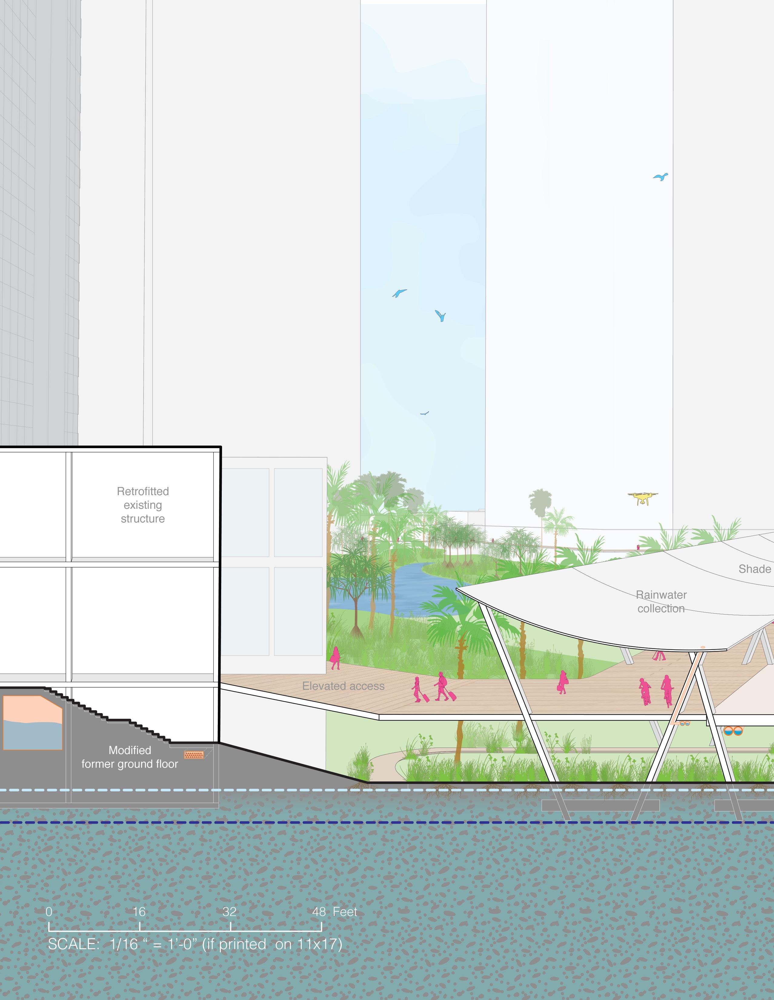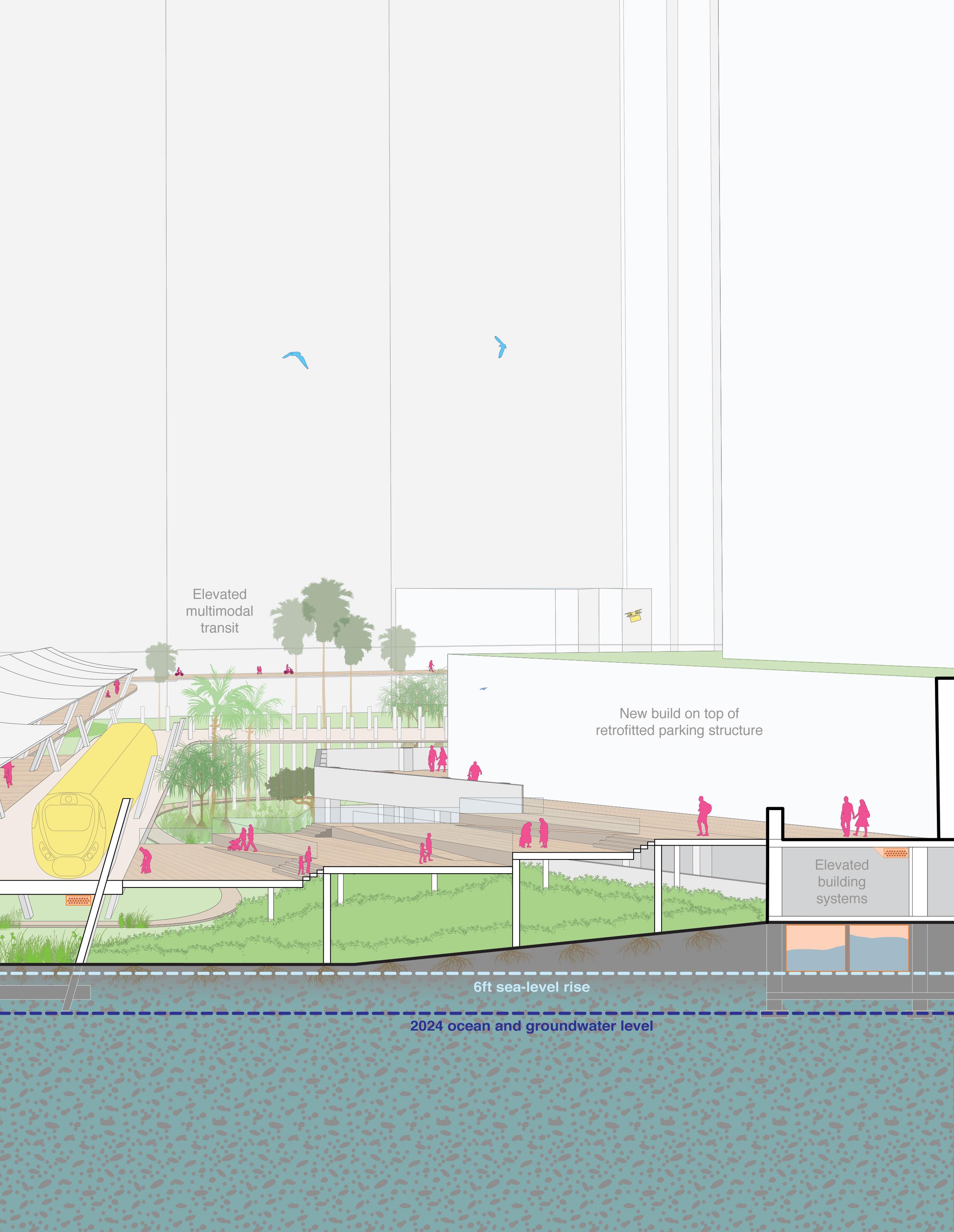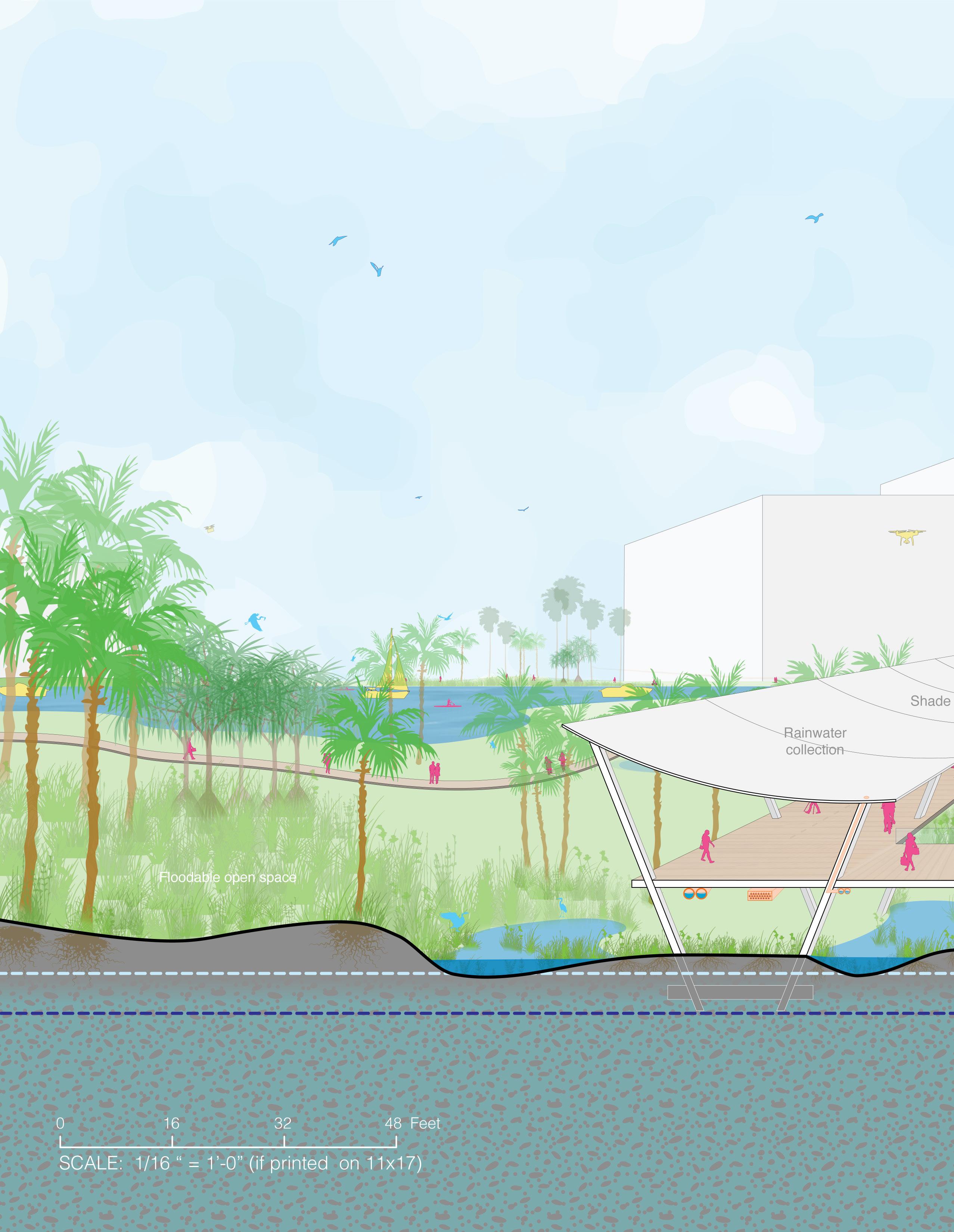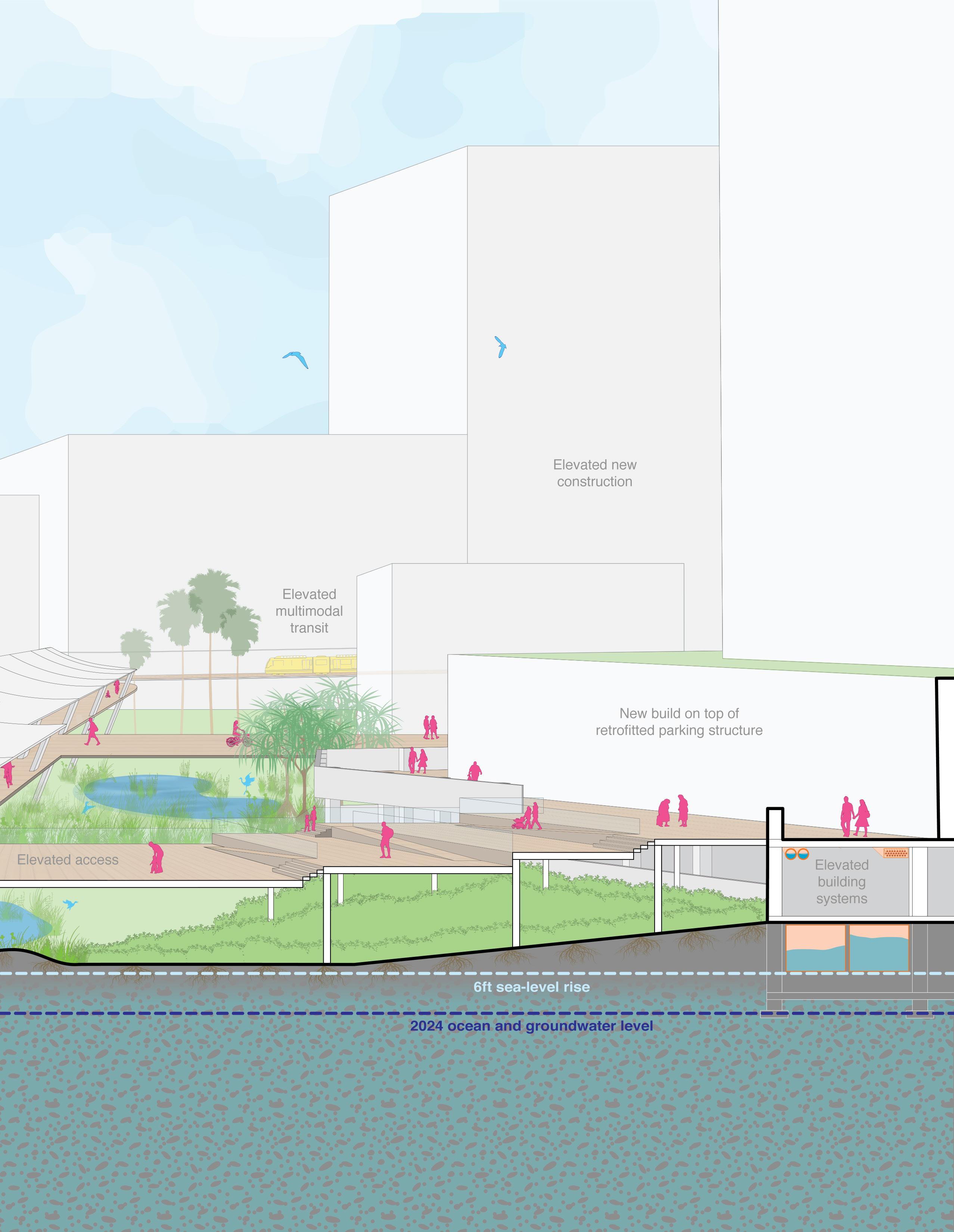


Based on the combined results from previous WRAP phases, including community/stakeholder engagement and visioning feedback, UHCDC developed the following Prelimininary Sketch Vision materials:
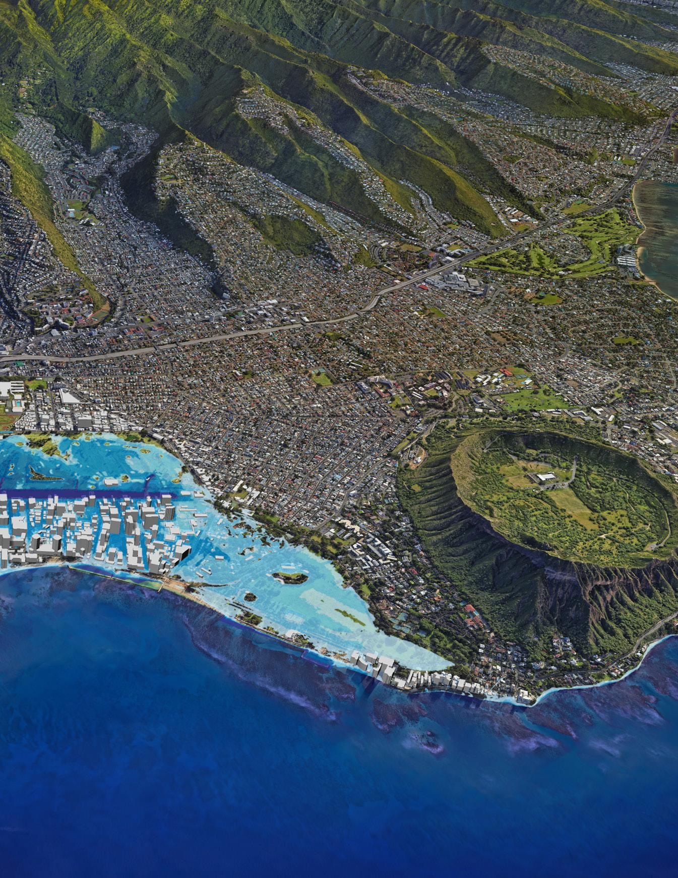
Bird’s-Eye Views: Historic, Existing, 4-ft SLR, 6-ft SLR, Sketch Vision 1, Sketch Vision 2
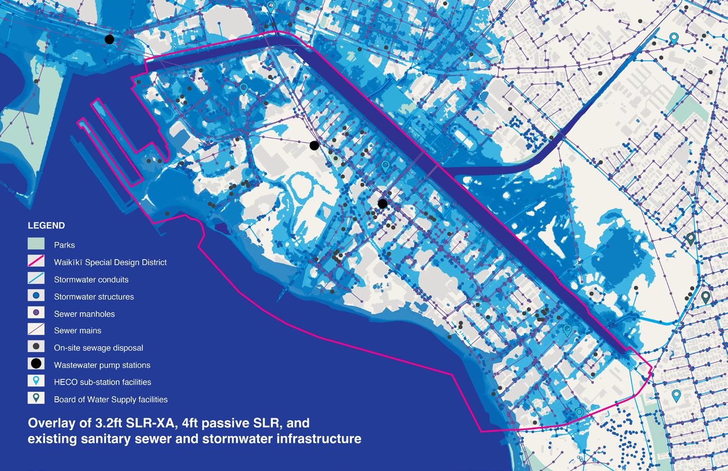
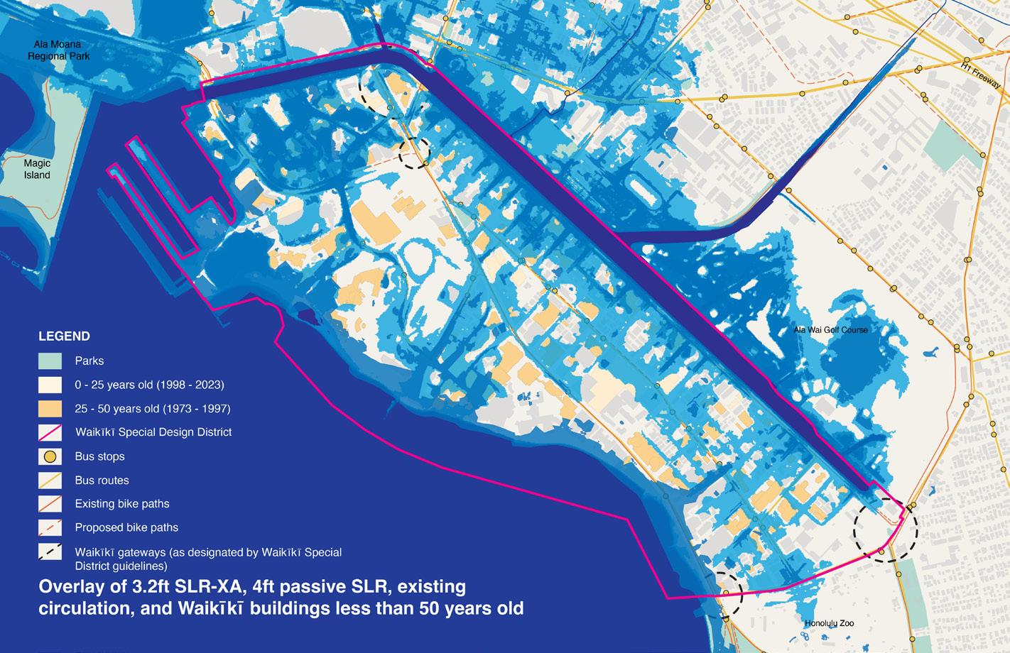
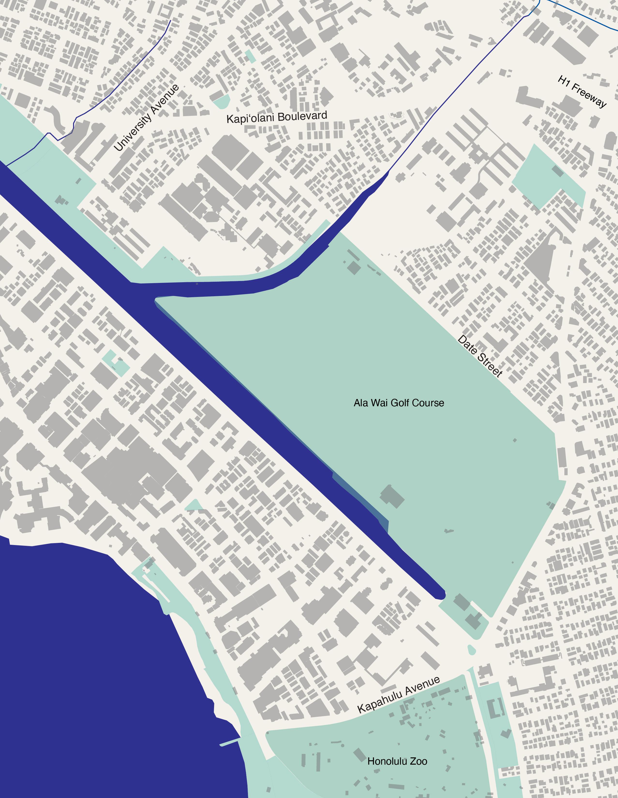
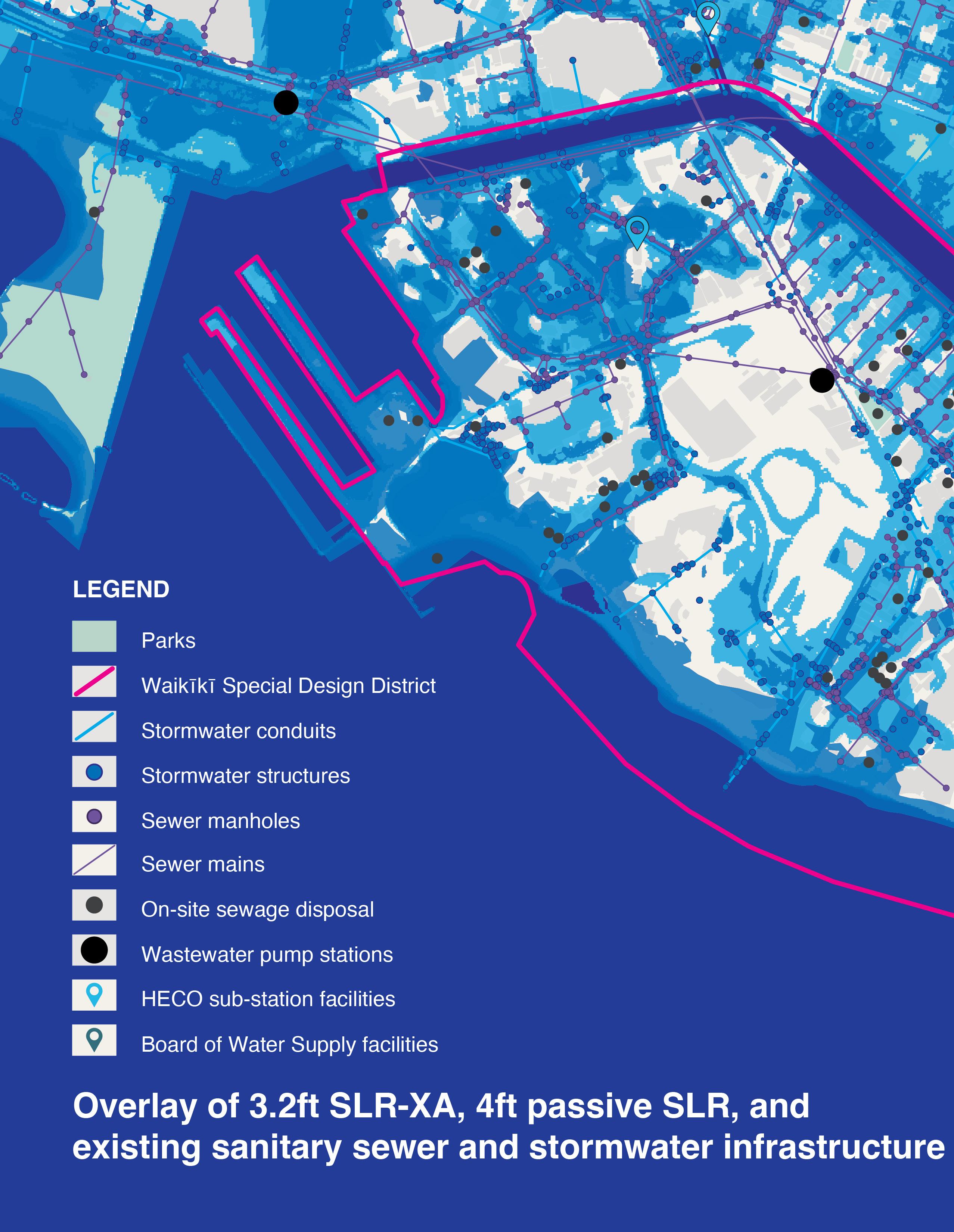
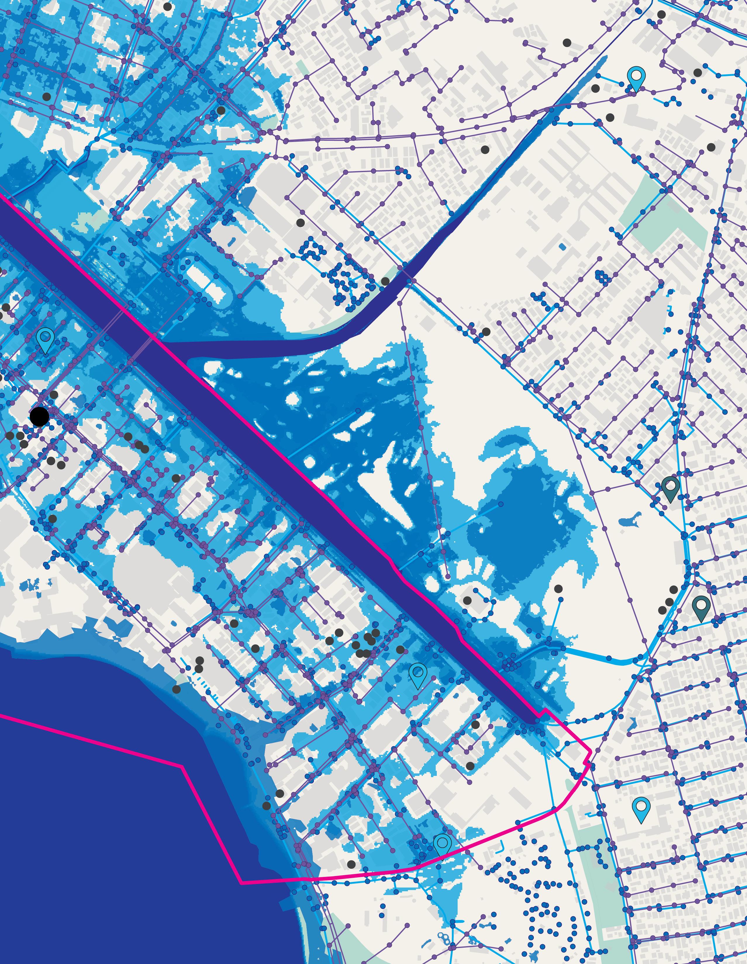
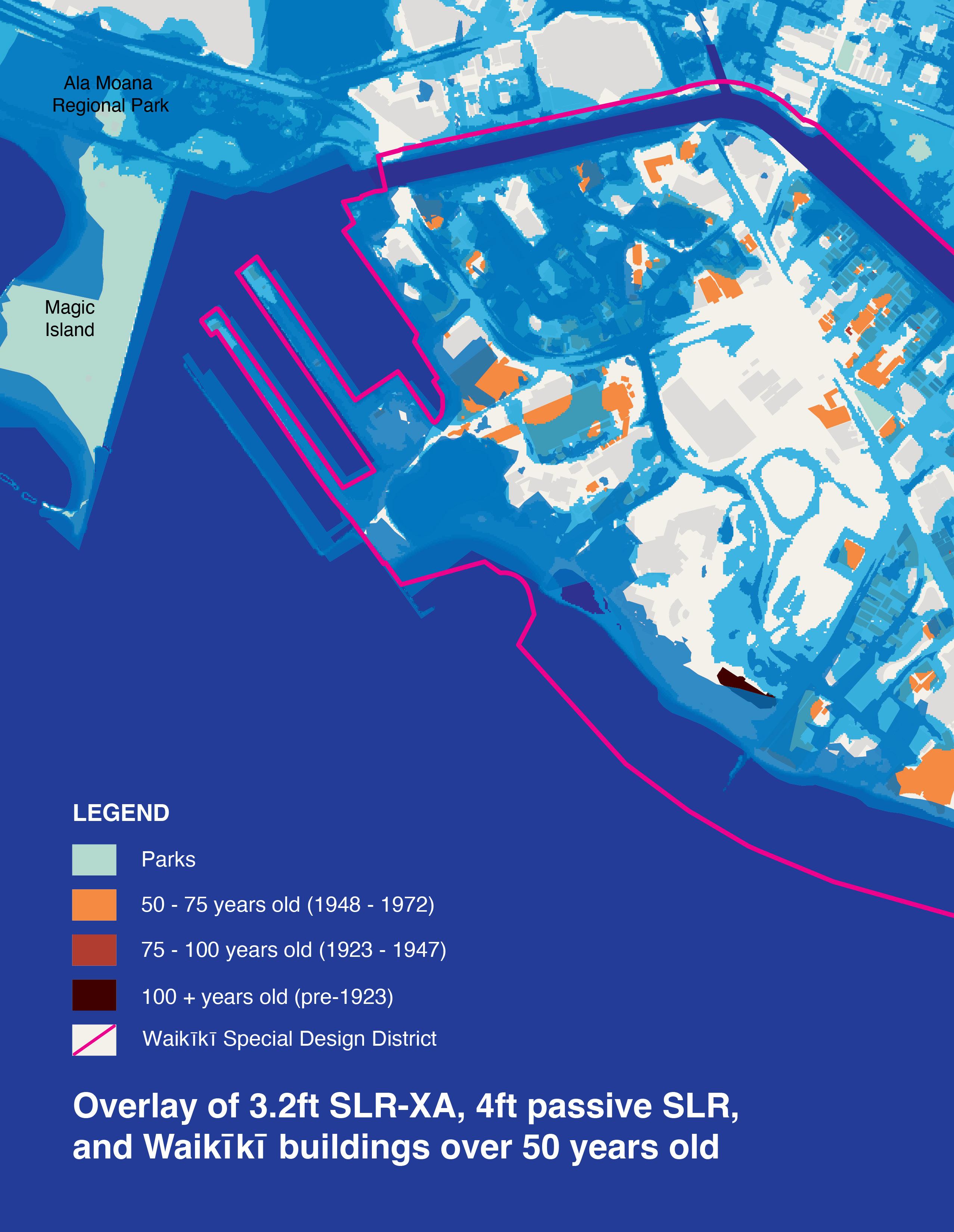
Select Analysis Maps
WRAP Adaptation Strategies
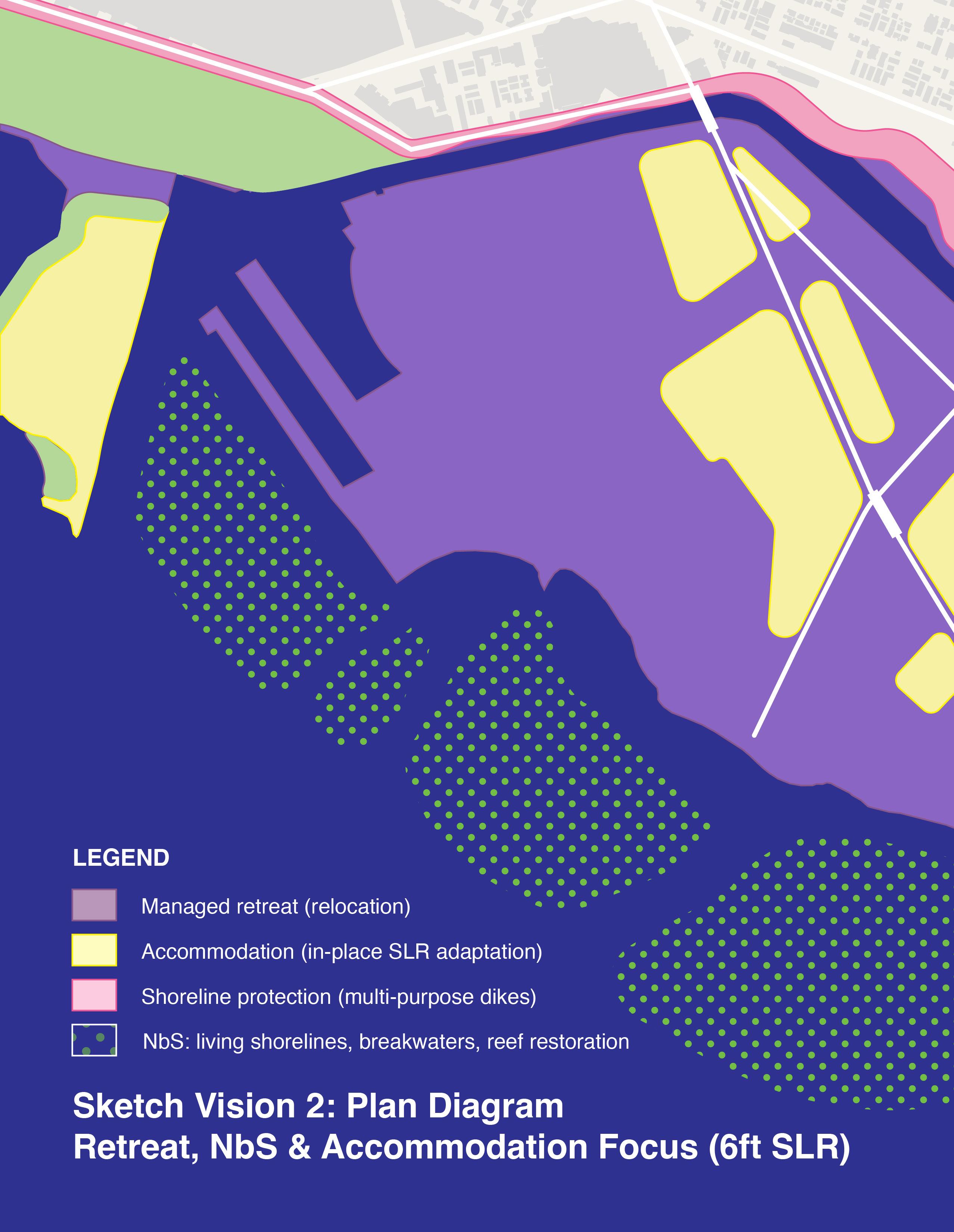
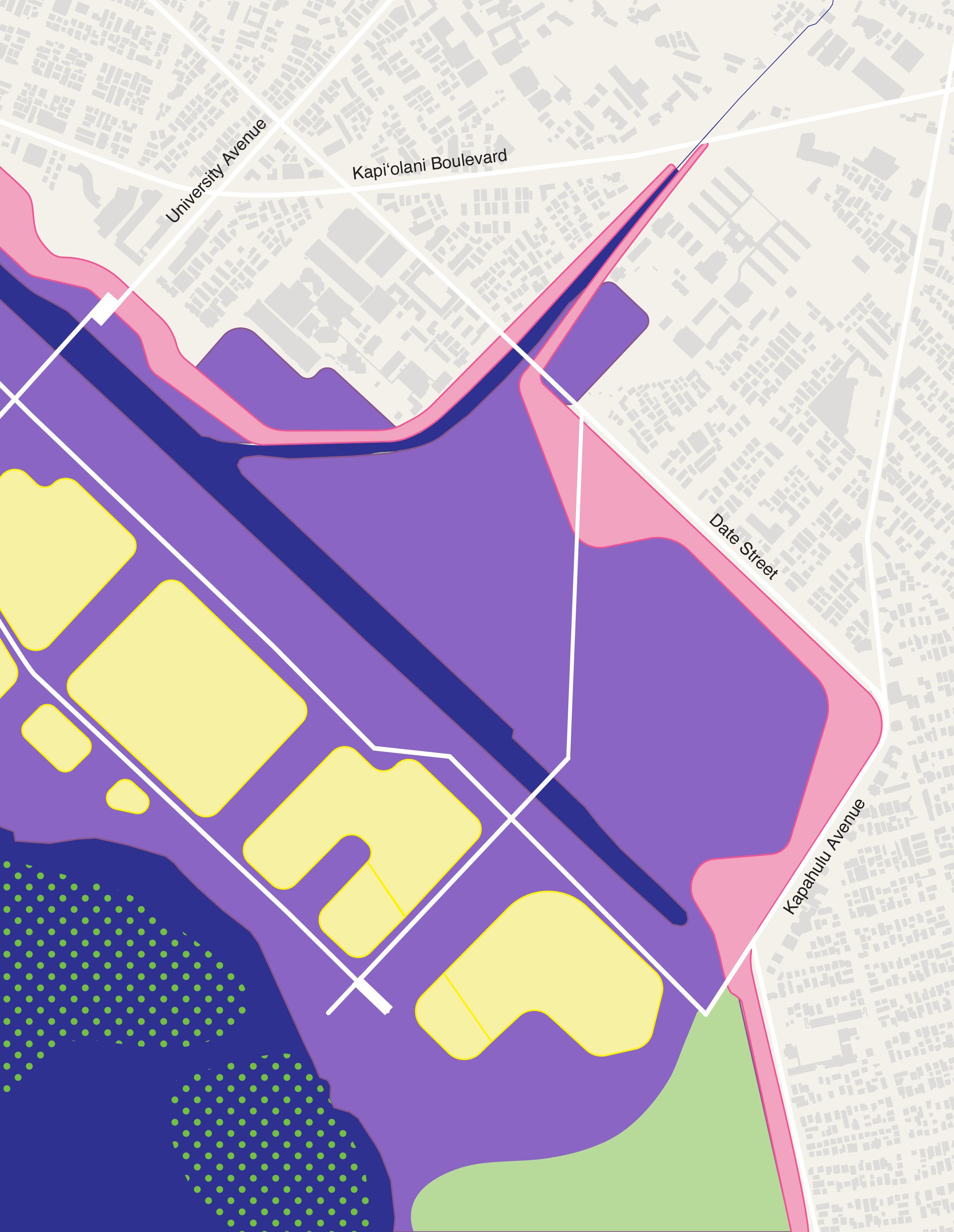
Plan Diagrams: Sketch Vision 1, Sketch Vision 2
Section Perspectives: Saratoga Road Location
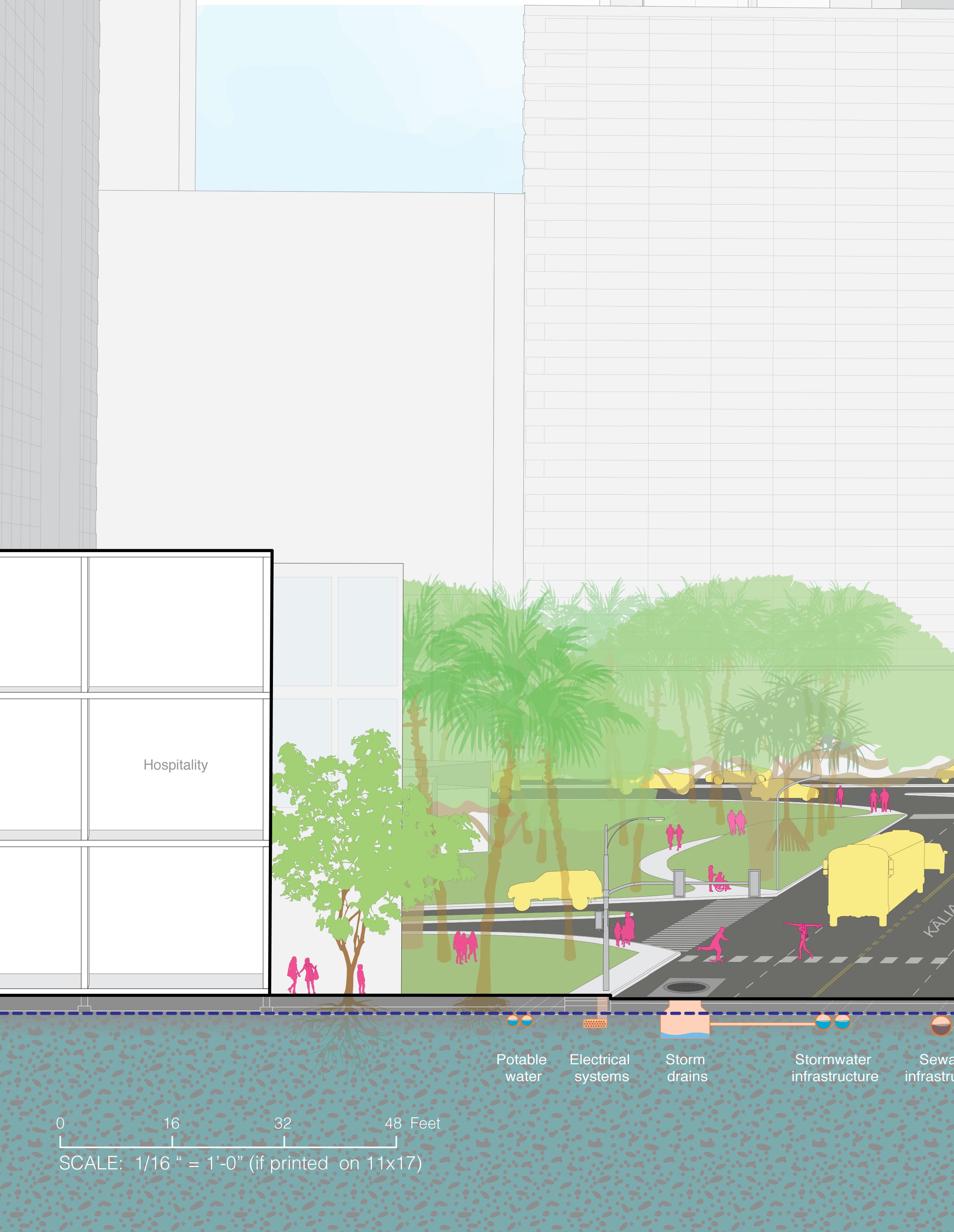
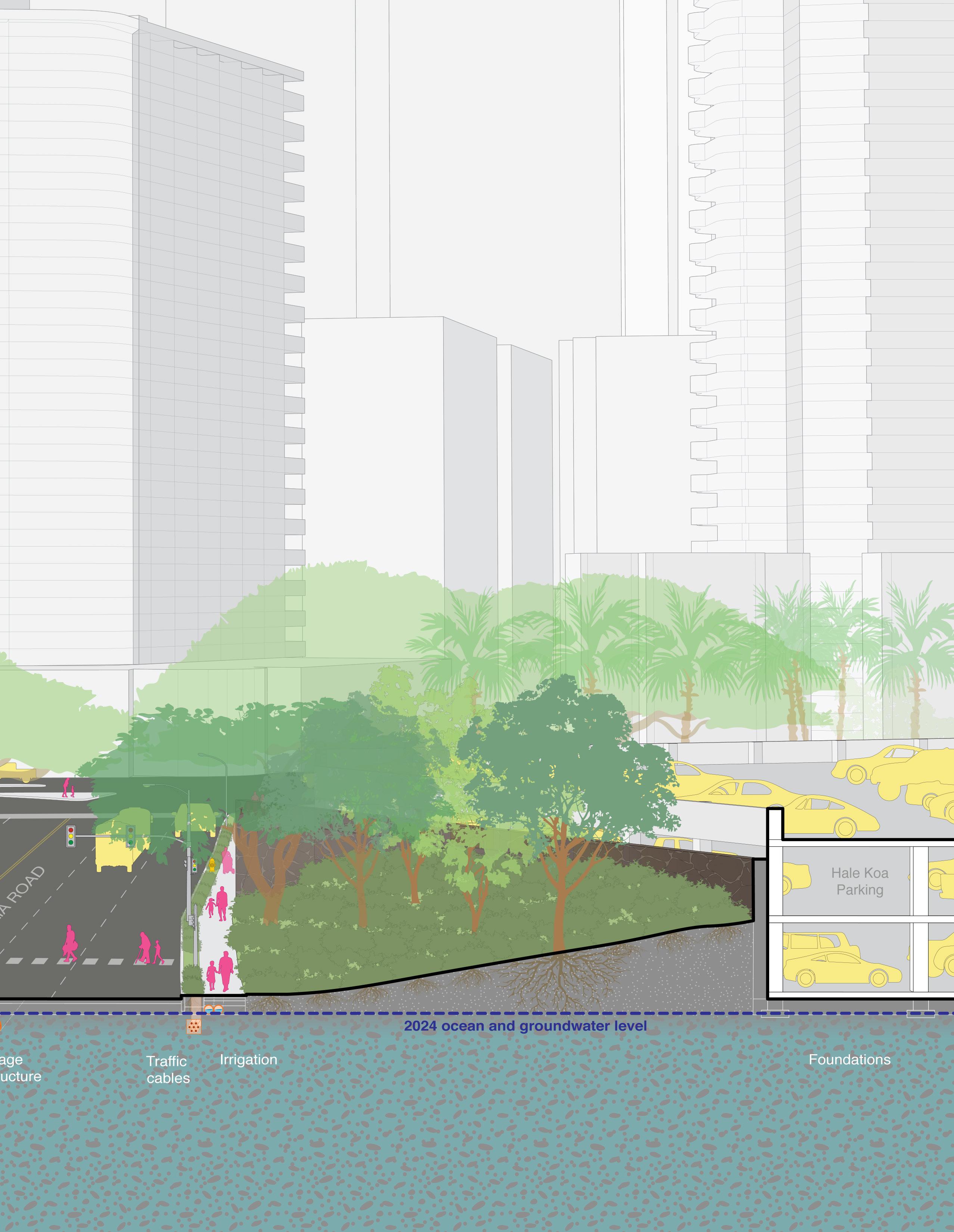
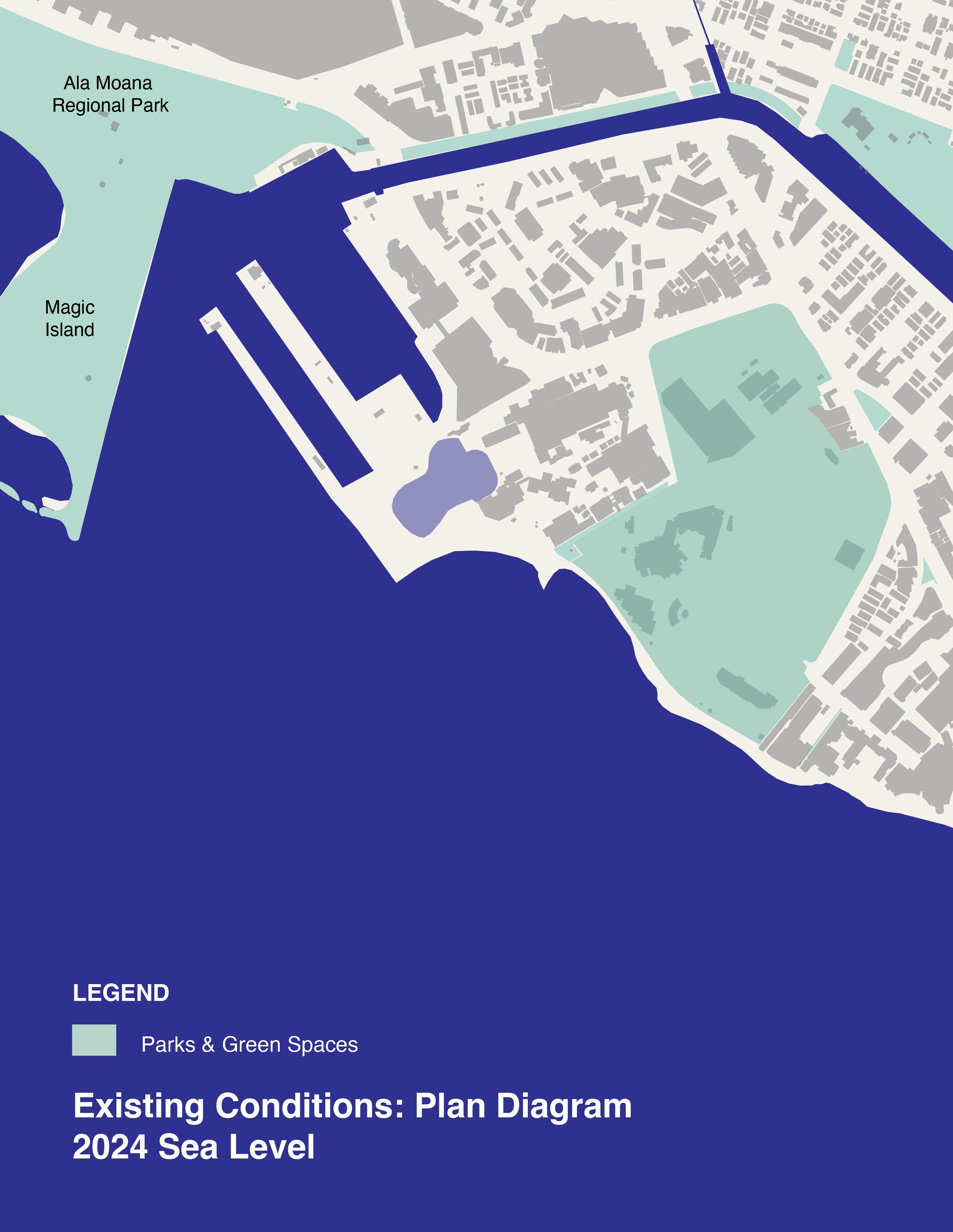
Existing Conditions (2024)
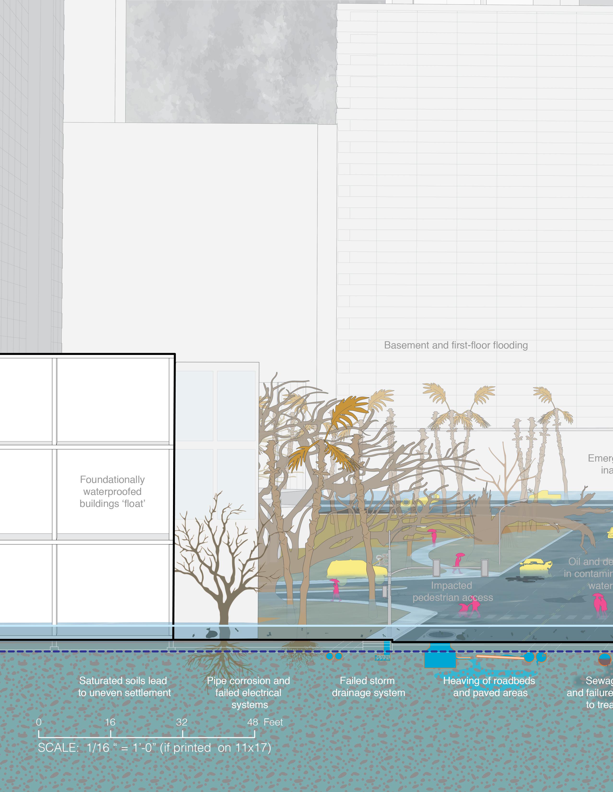
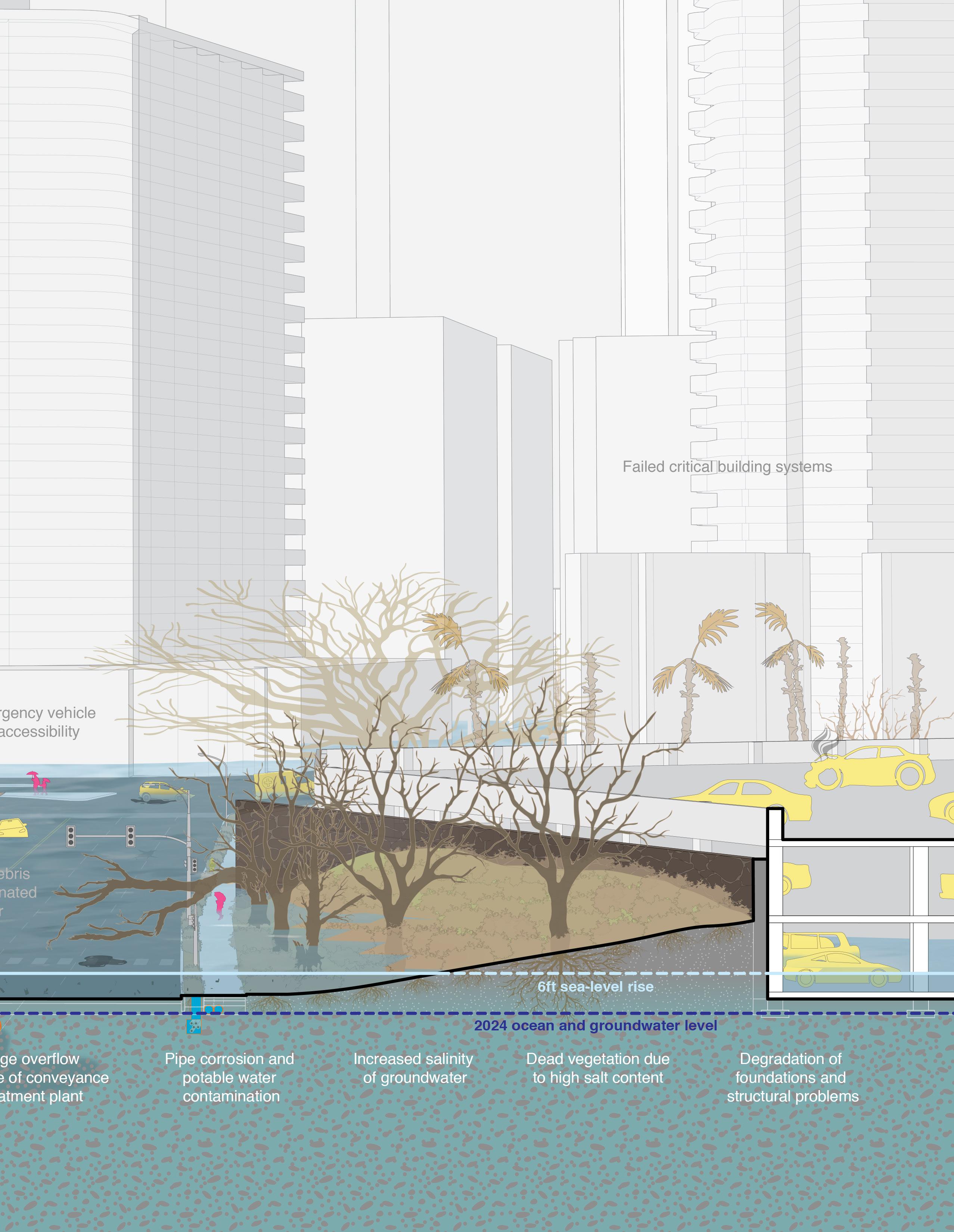
Long Term (6-ft SLR) Sketch: Inaction
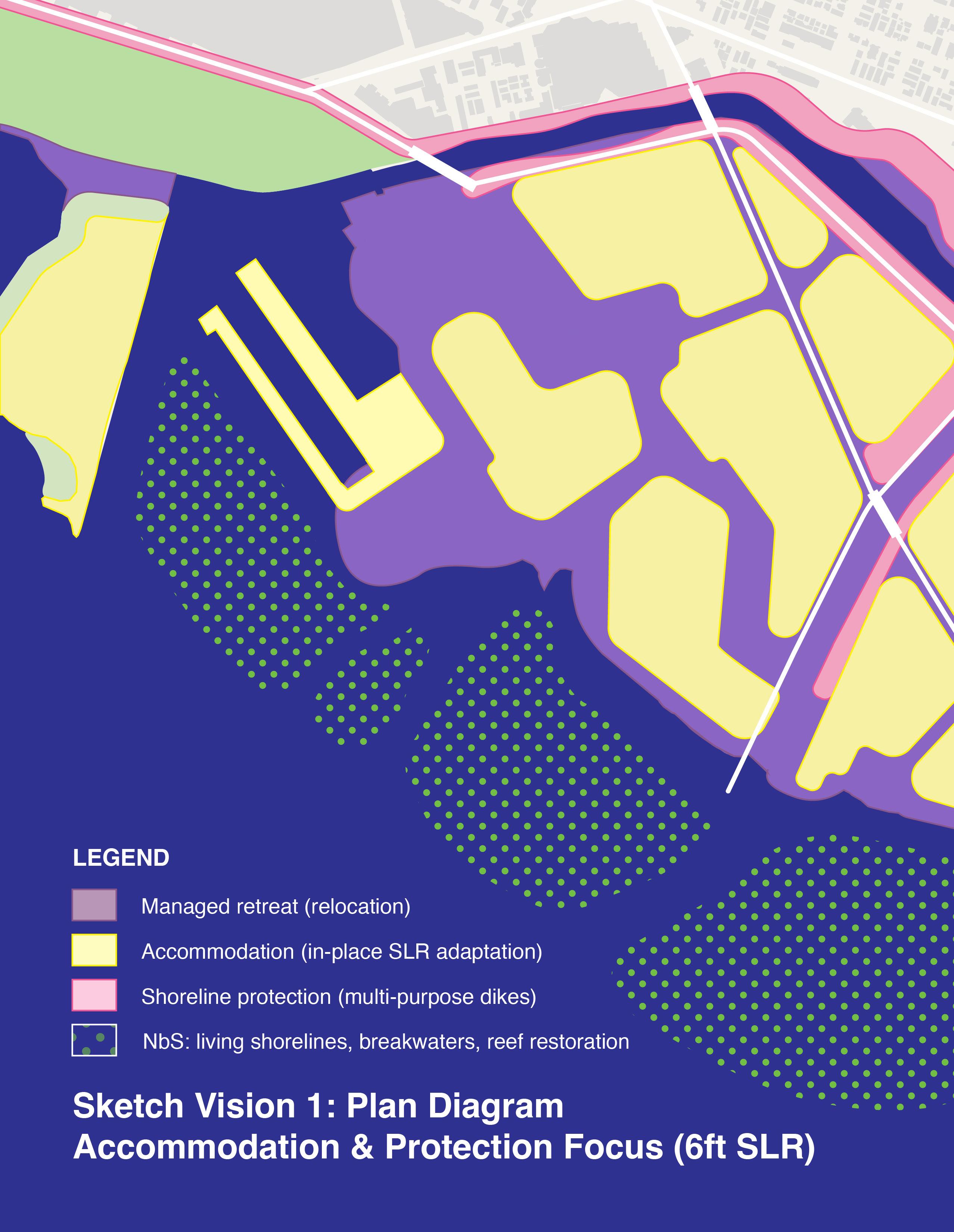
Preliminary Sketch Vision 1: Accommodation & Protection Focus
Preliminary Sketch Vision 2: Retreat, Nature-Based Solutions & Accommodation Focus Kālia Road Location
Existing Conditions (2024)
Long Term (6-ft SLR) Sketch: Inaction
Preliminary Sketch Vision 1: Accommodation & Protection Focus
Preliminary Sketch Vision 2: Retreat, Nature-Based Solutions & Accommodation Focus
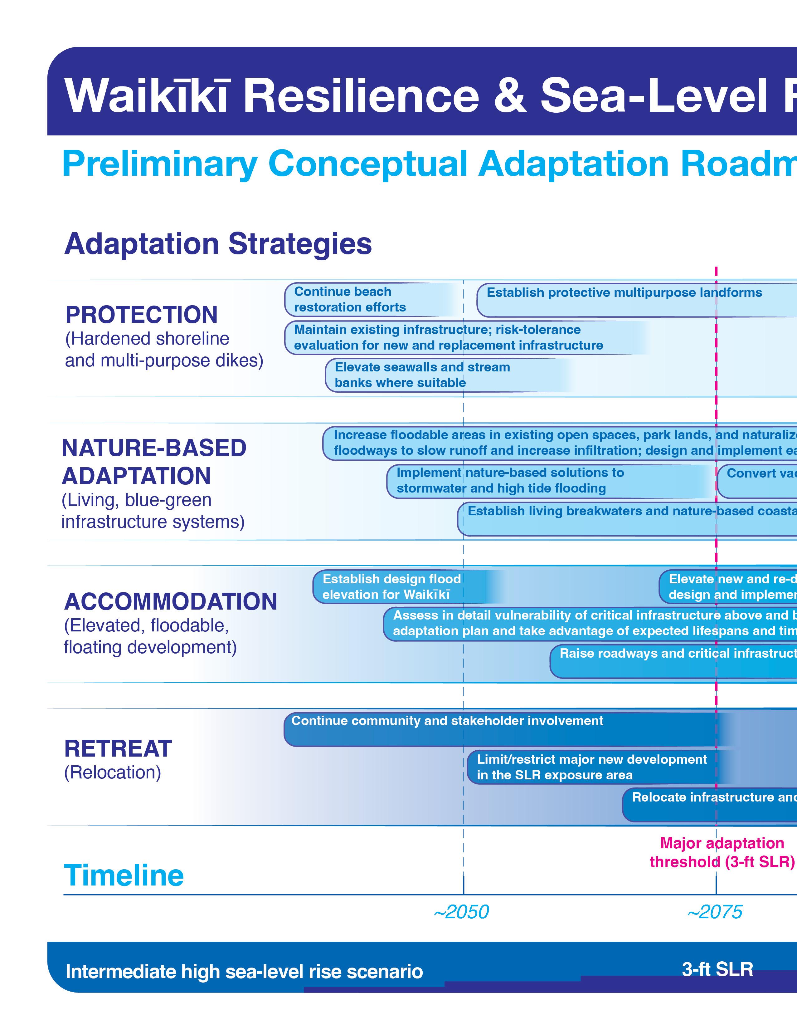
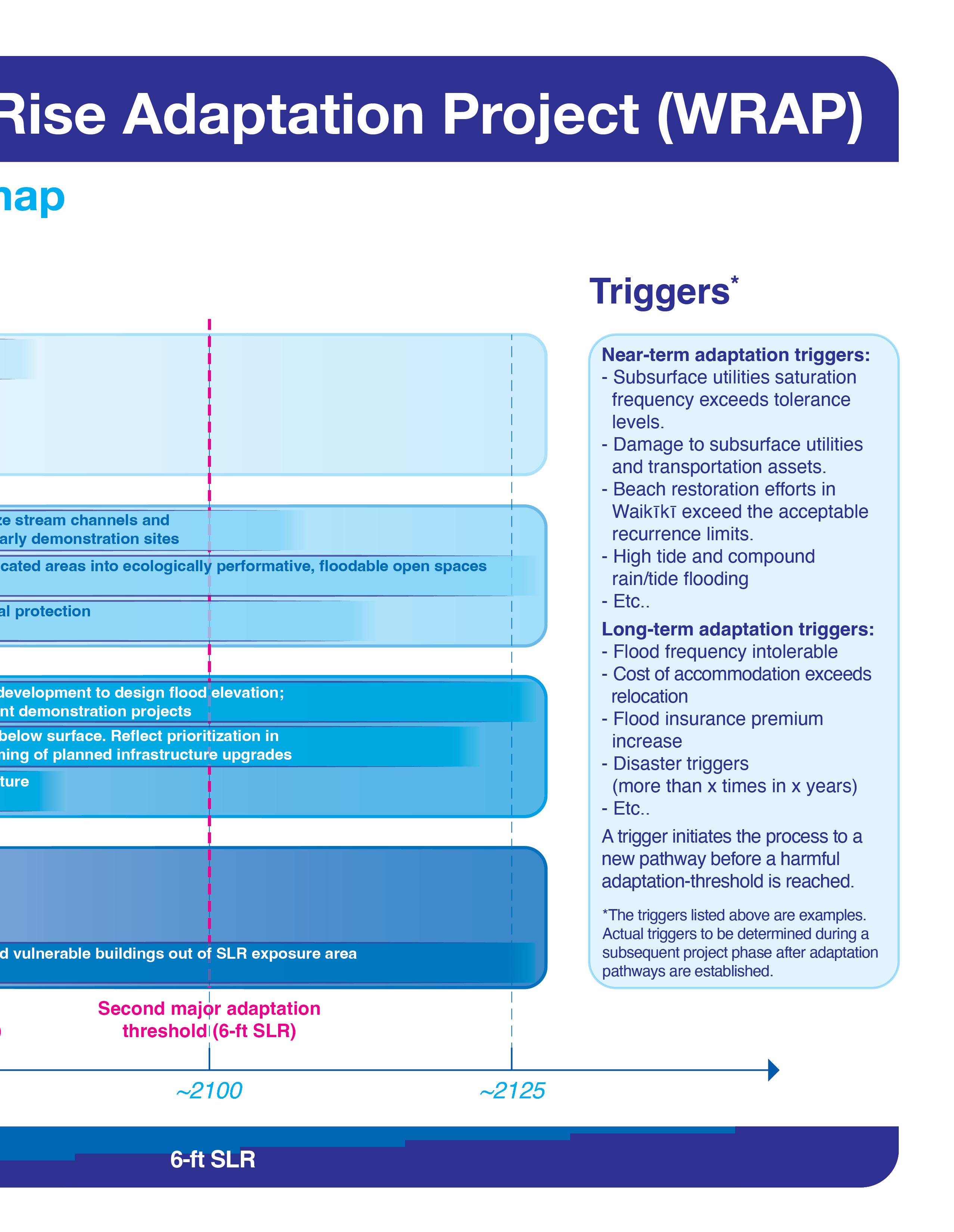
Preliminary Conceptual Adaptation Roadmap
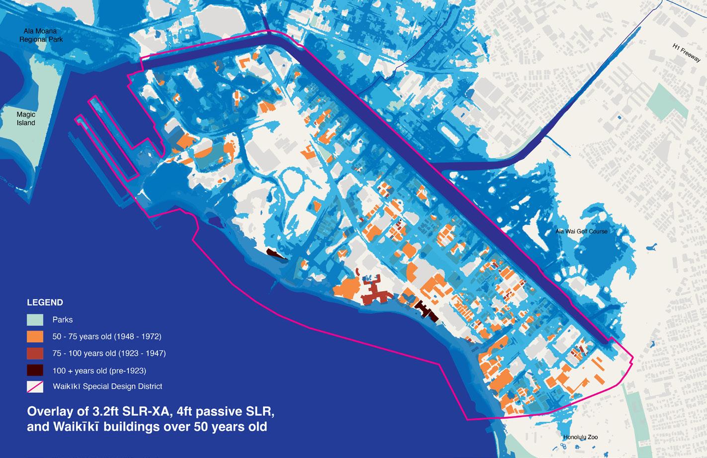
The long-term impacts of sealevel rise on Waikīkī (50-100 year time horizon) will affect all aspects of the urban fabric.
According to current data from the U.S. Interagency Sea Level Rise Scenario Tool, under an Intermediate (mid-range) sea level rise scenario, it is likely that Waikīkī and its context will experience 3 to 4 feet of sea level rise by the end of the 21st century. 6 feet or more of sea level rise by 2100 is plausible under the Intermediate High and High scenarios.
During previous project phases, the WRAP team provided collaborative, community-participatory engagement and visioning activities to educate members of the public about anticipated sea level rise threats and their impacts on Waikīkī and solicited subject matter expert, stakeholder, and community feedback on priorities and concerns.
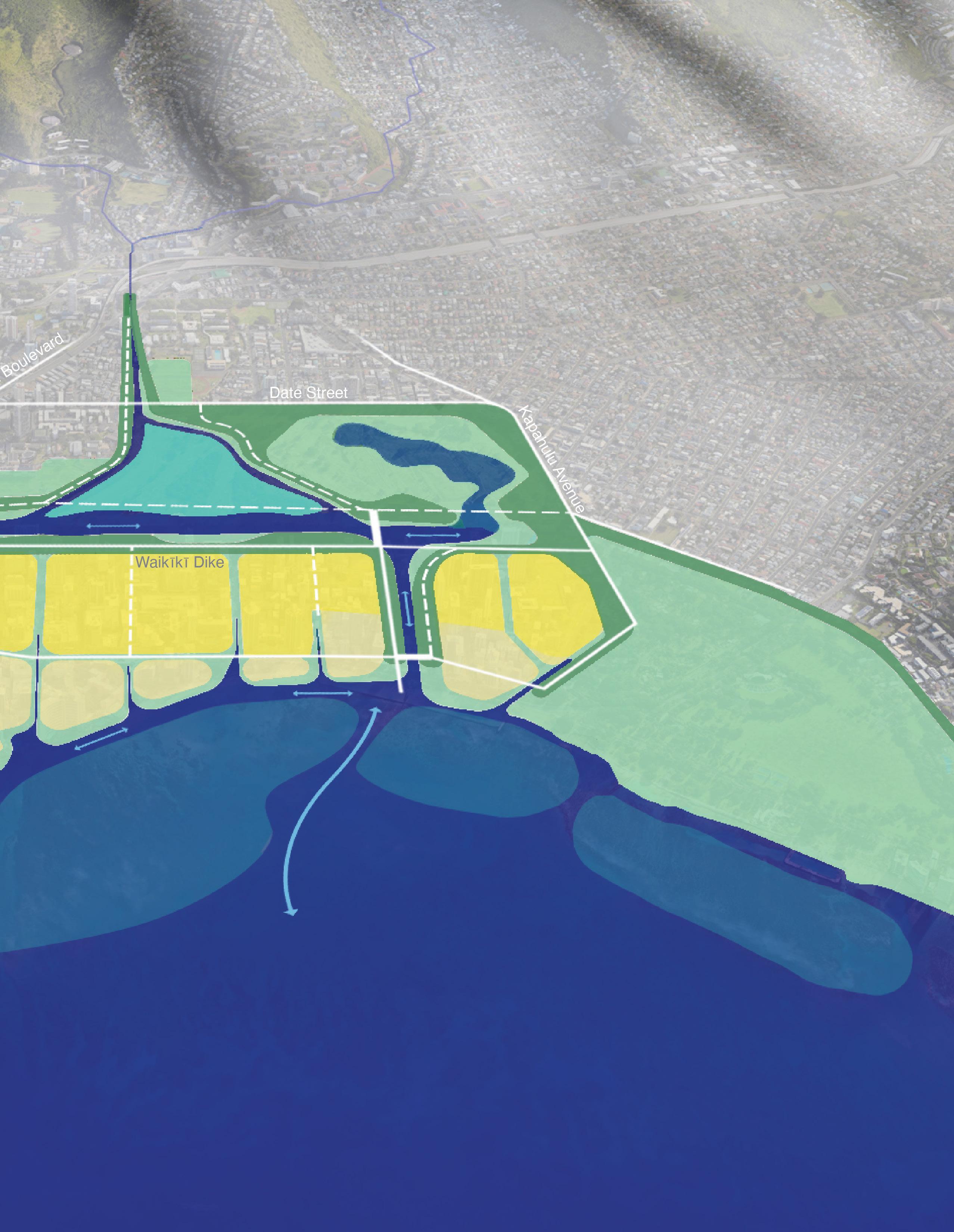
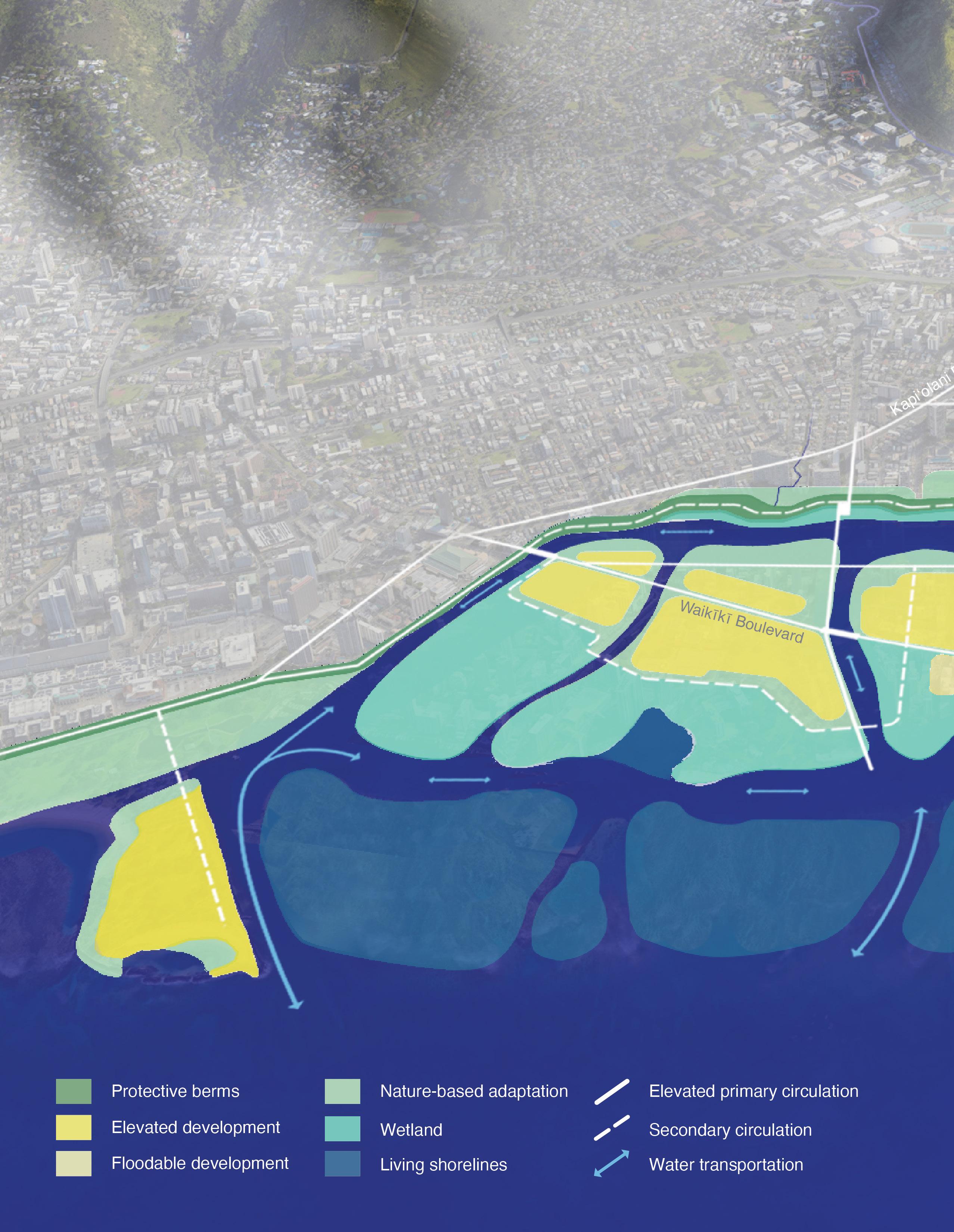
The plans and section perspective drawings included in the following pages represent the WRAP team’s effort to distill all information and input gathered up to this point into two initial sketch visions for a long-term climate-adapted Waikīkī:
Preliminary Sketch Vision 1: Accommodation & Protection Focus
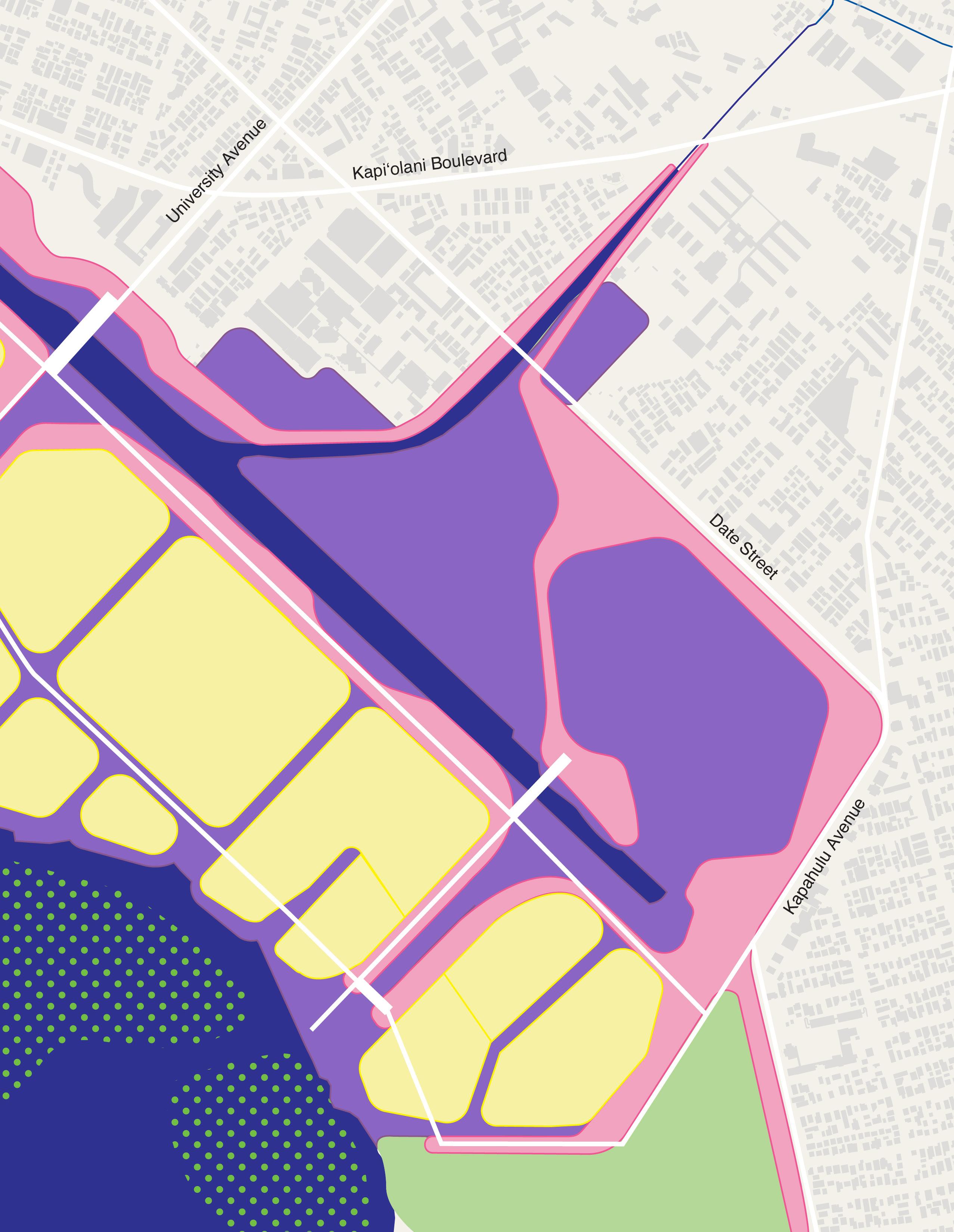
Preliminary Sketch Vision 2: Retreat, Nature-Based Solutions, & Accommodation Focus
This work intends to further the discourse on a future vision for a resilient Waikīkī. It does not represent planning documents.
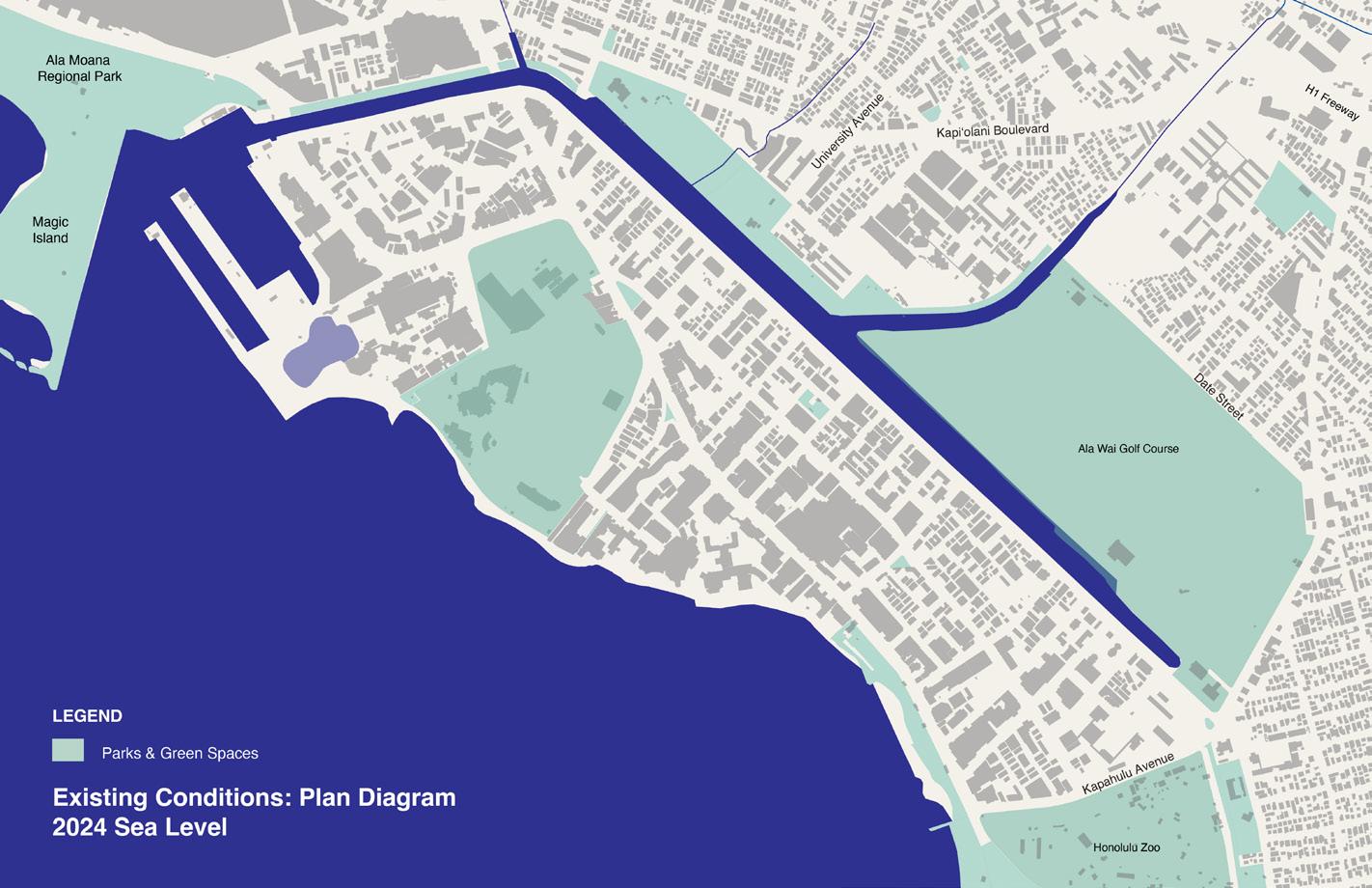
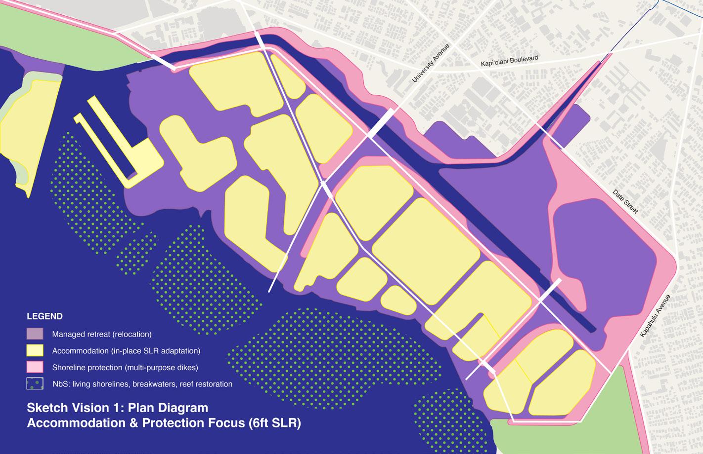
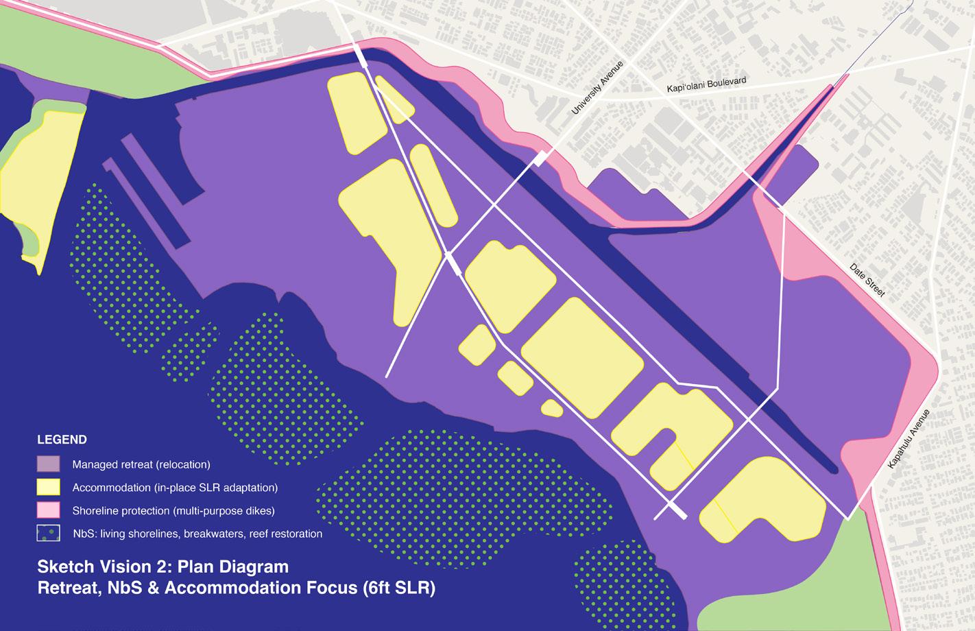
As existing buildings, transportation facilities, infrastructure elements, and underground utilities reach the end of their lifespan, a range of sea-level rise adaptation strategies need to be considered. Methods applicable to a densely developed urban area such as Waikīkī are summarized on the following page.
Long-term visioning requires a variety of adaptation approaches across temporal and spatial scales. Monitoring of action triggers for rising water levels should determine the timeline and combination of accommodation and retreat strategies.
As existing subsurface systems for stormwater and sewage management begin to fail, future elevated and floodable development in Waikīkī will need to rely increasingly on surface drainage and canals. Other underground utilities (e.g., electrical, communications, potable water) will need to be off-grid and elevated along with future building and infrastructure contruction.
A long-term resilient Waikīkī will integrate wide, multipurpose dikes with nature-based adaptation solutions, such as floodable green spaces that provide ecosystem services and layered coastal protection systems, e.g., living breakwaters, engineered coral reef ecosystems, fish ponds, etc Nature-based solutions should take inspiration from, and incorporate, native Hawaiian traditional ecological knowledge and biocultural practices.
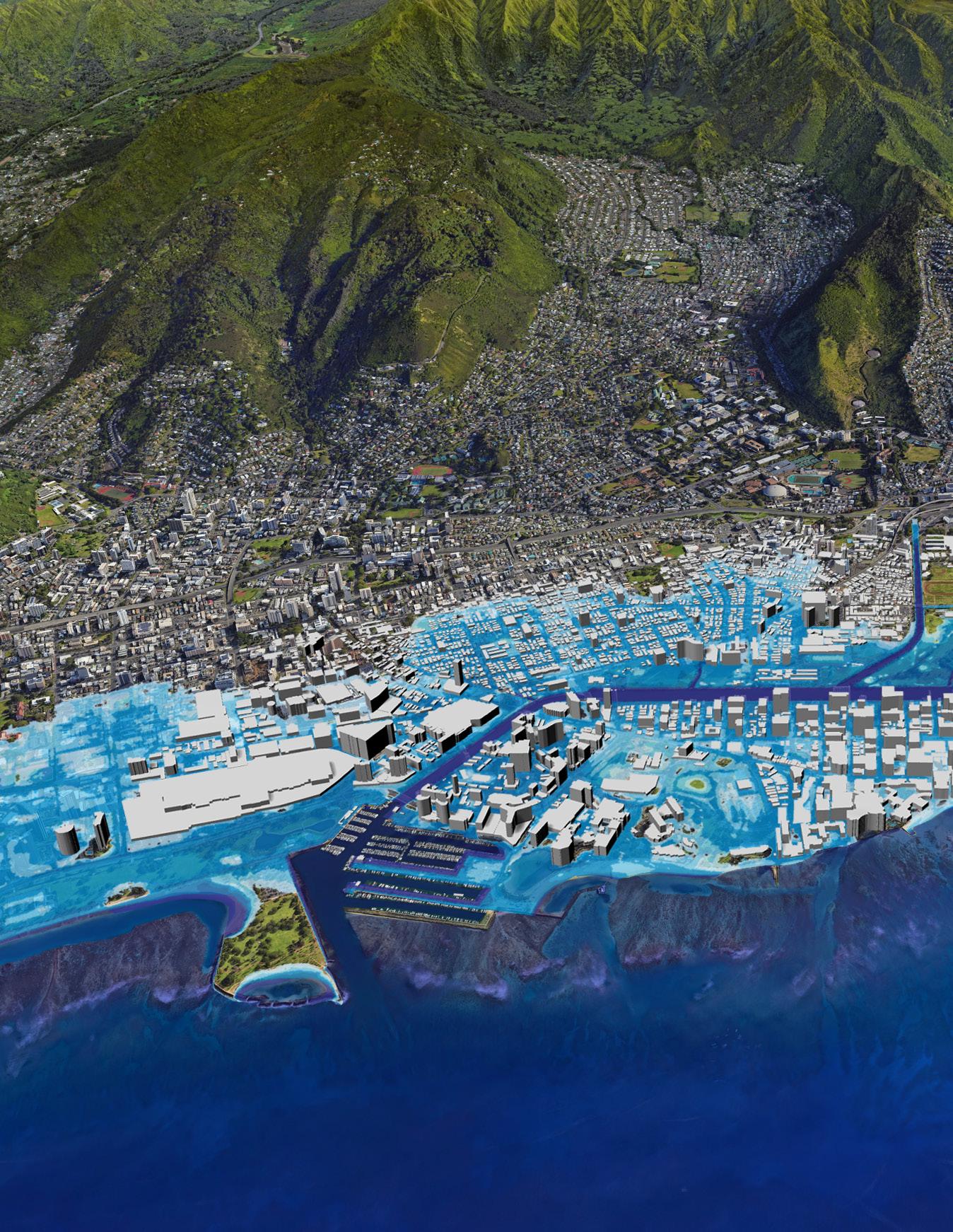
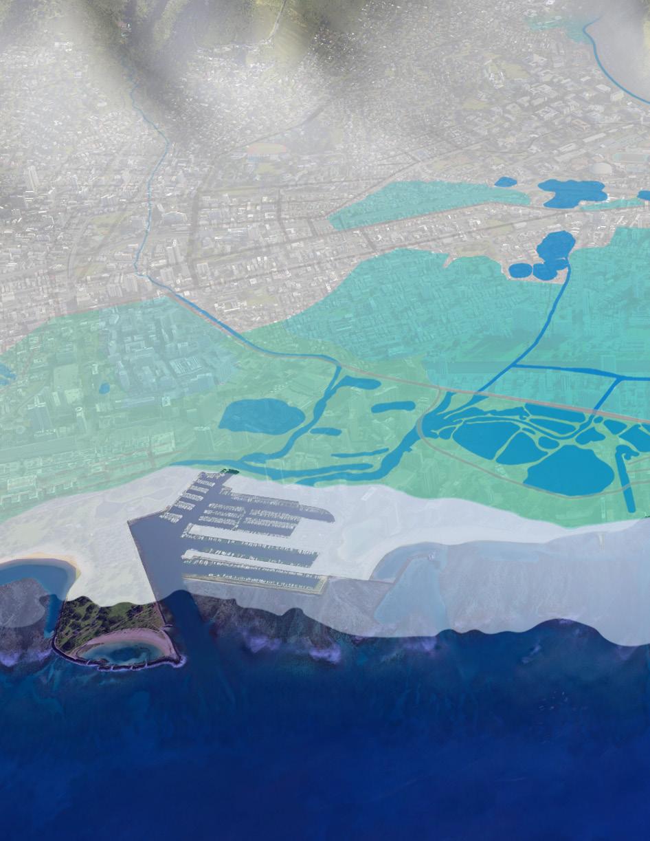
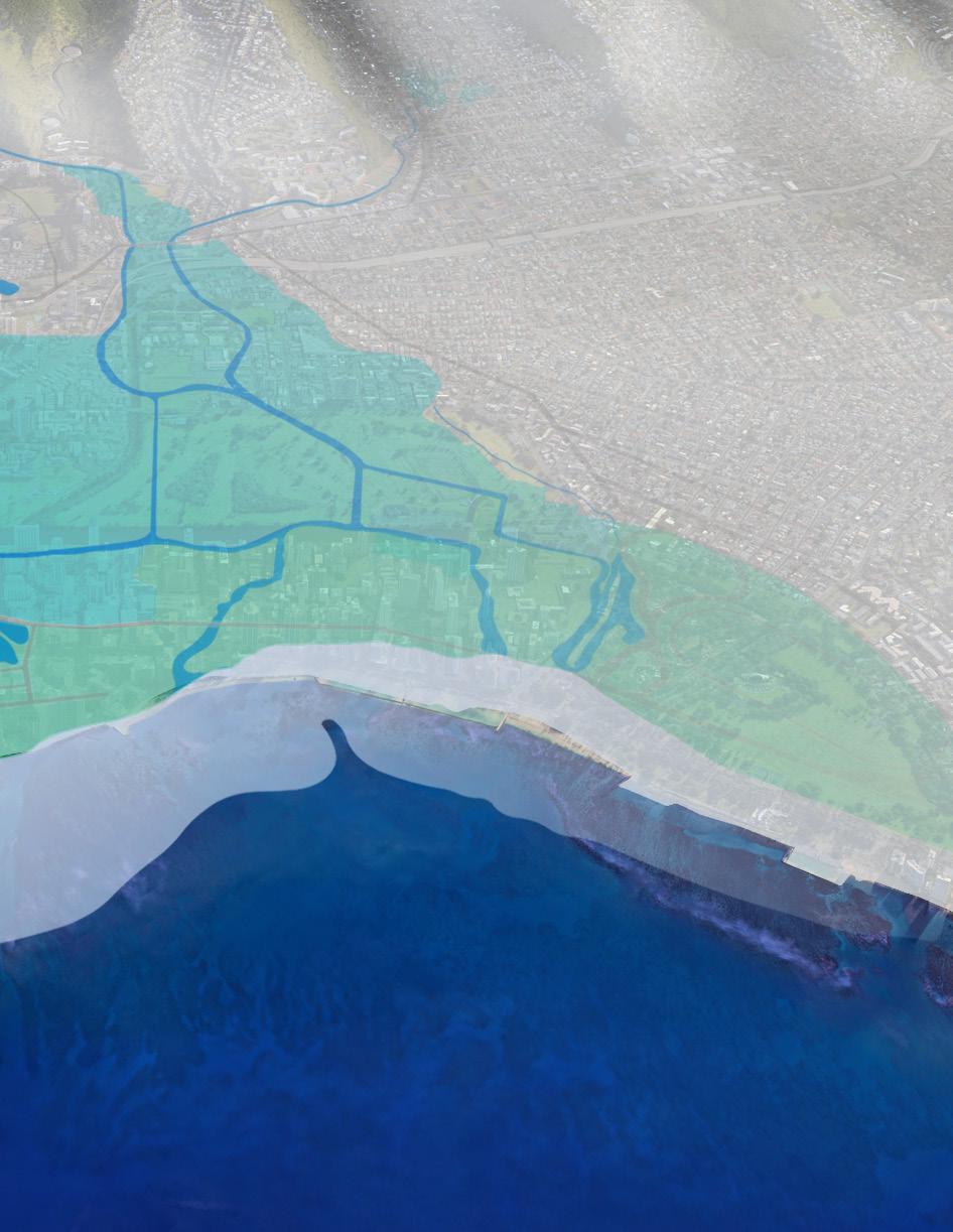
Oblique view of late 19th century Waikīkī hydrology and land use
Source: Map of Honolulu and vicinity, 1893; http://avakonohiki.weebly.com/maps-kona.html Graphic: UHCDC
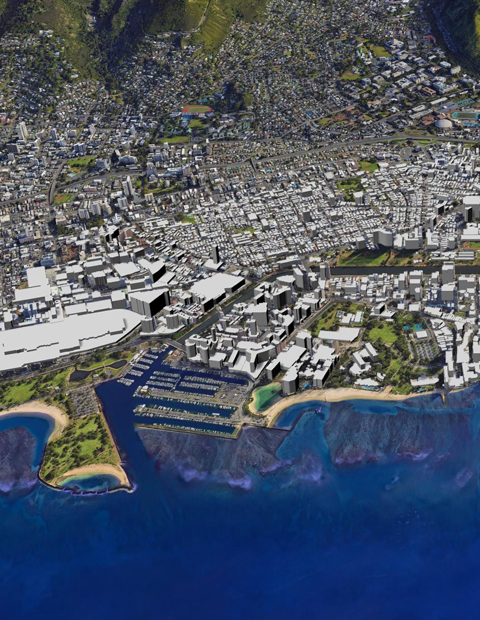
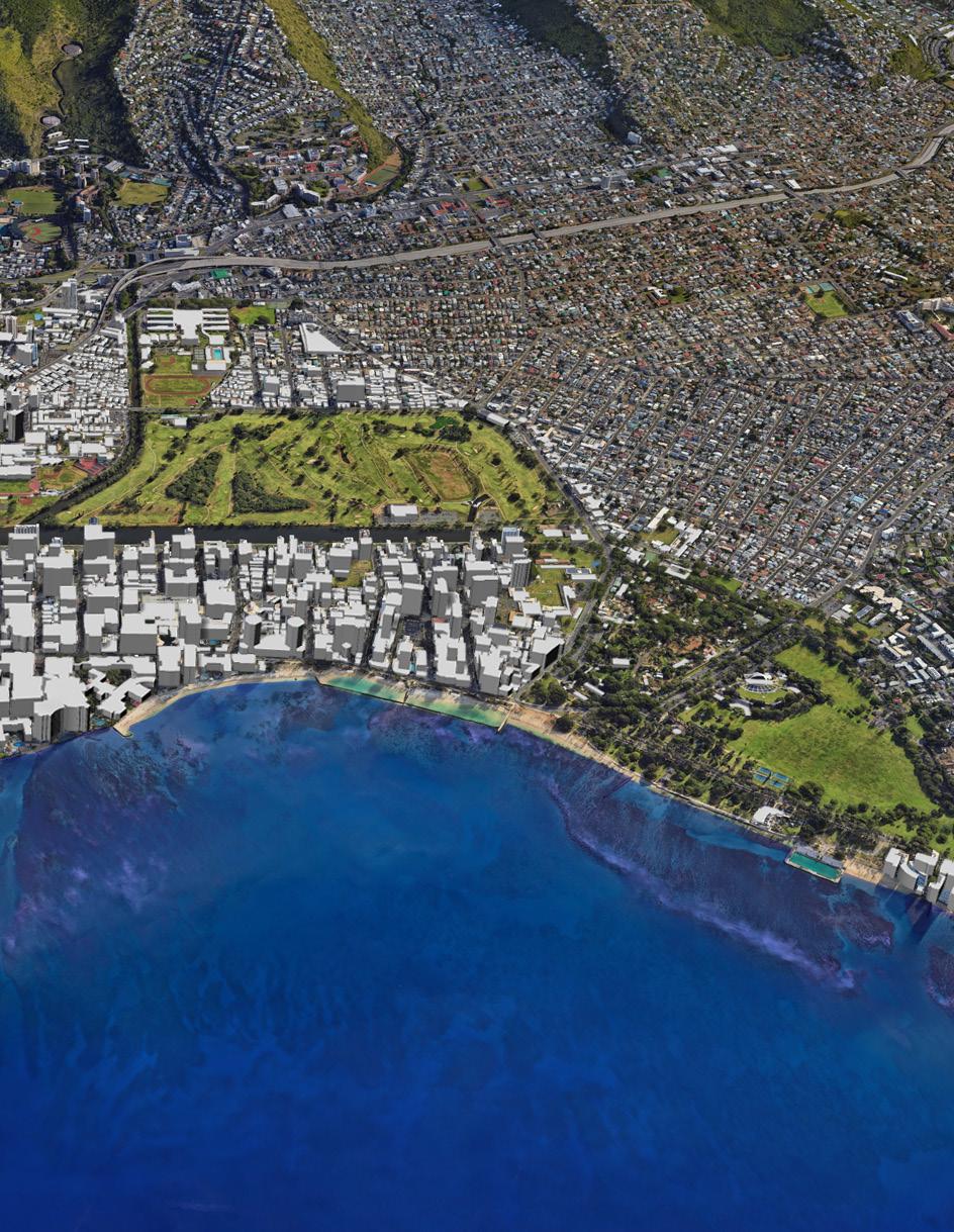
Overlay of oblique Google Earth view of Waikīkī and its context
Graphic: UHCDC
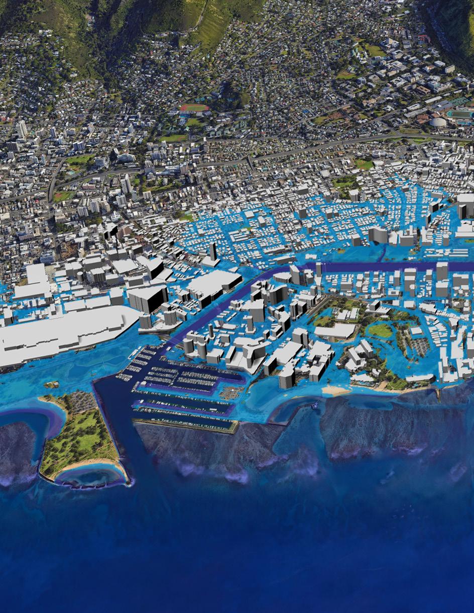
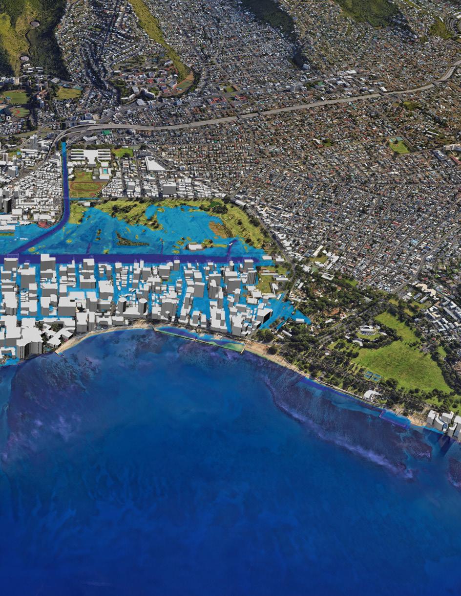
Overlay of oblique Google Earth view of Waikīkī and its context with approximate area of 4’ SLR (Based on NOAA data).
Graphic: UHCDC
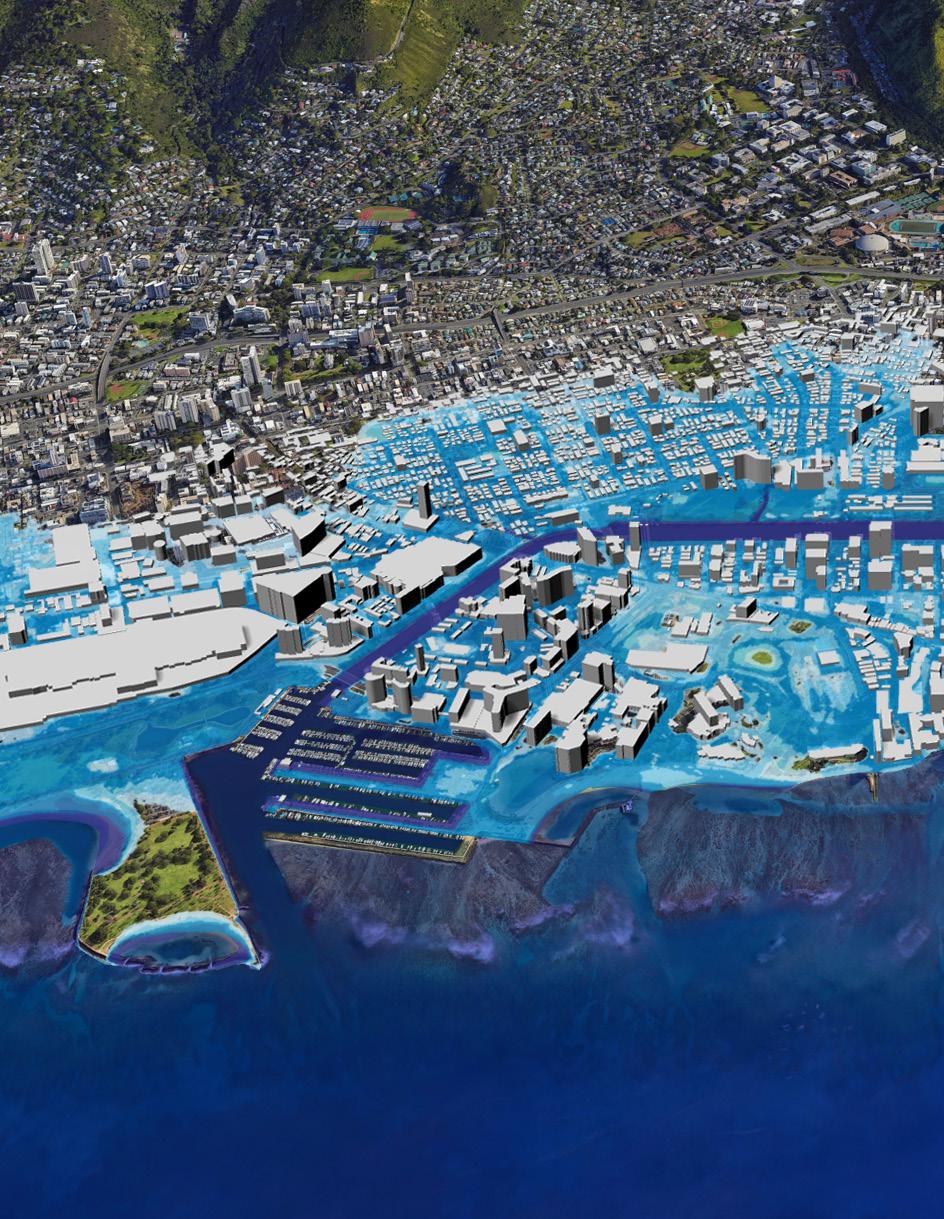

Overlay of oblique Google Earth view of Waikīkī and its context with approximate area of 6’ SLR (Based on NOAA data).
Graphic: UHCDC

Graphic: UHCDC


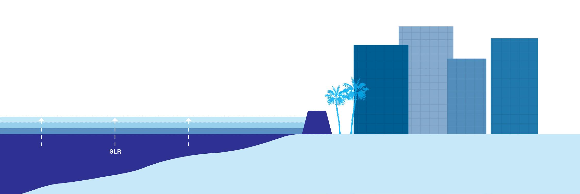
Hard, engineered, linear infrastructure systems designed to defend, armor, and stabilize the shoreline and resources in their current location. Examples: impermeable structures, seawalls, levees, dikes, revetments, groins, breakwaters, riprap, dams, flood gates, storm surge barriers, etc.
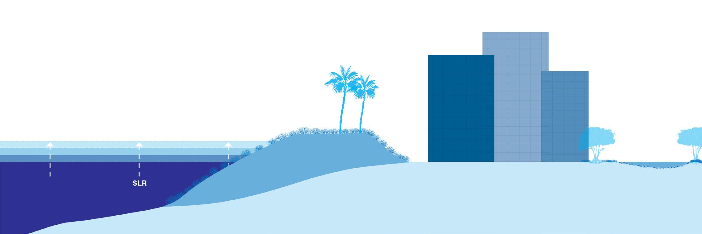
Soft blue-green infrastructure that relies on ecosystem services, increases the distance between water and development, retains and absorbs inundation, attenuates waves, slows erosion, provides habitat, and contributes to biodiversity. Examples: wetlands, tidal marshes, coral restoration, other living coastal buffers
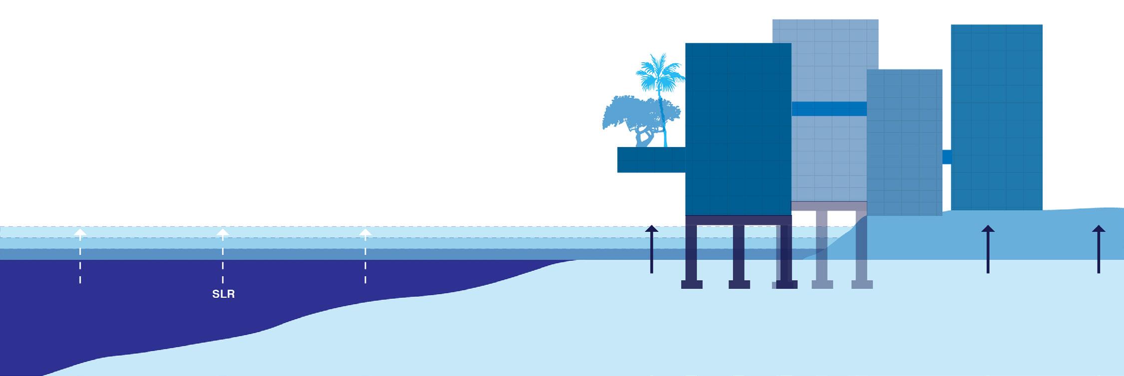
Accommodation: Elevated Development
Raising the height of land, infrastructure, buildings, and other resources for existing or new development over time using fill and/or pilings decreases hazard risks and increases resilience to the impacts of sea level rise and flooding.
Combination of strategies listed above. Long-term resilience and adaptation planning will require a range of determine the timeline and combination of accommodation and retreat strategies.
Structures and landscapes designed to withstand inundation with habitable space, critical assets, and vulnerable infrastructure on upper levels or at higher elevations decrease hazard risks and increase resilience to the impacts of sea level rise and flooding.
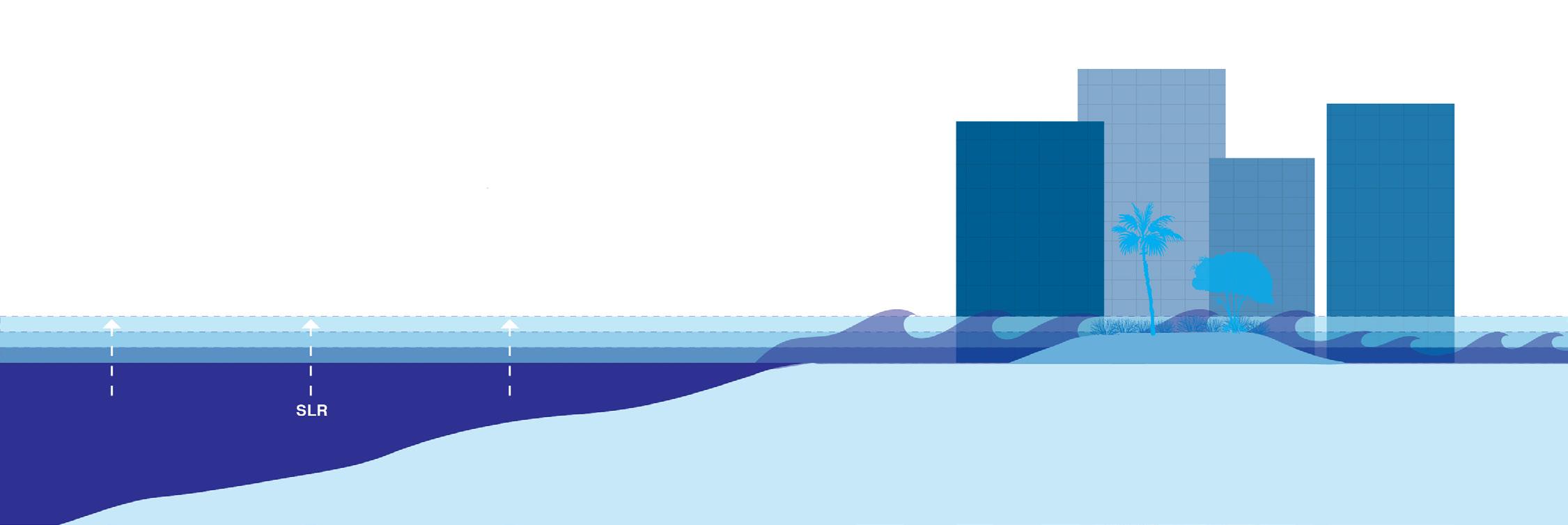
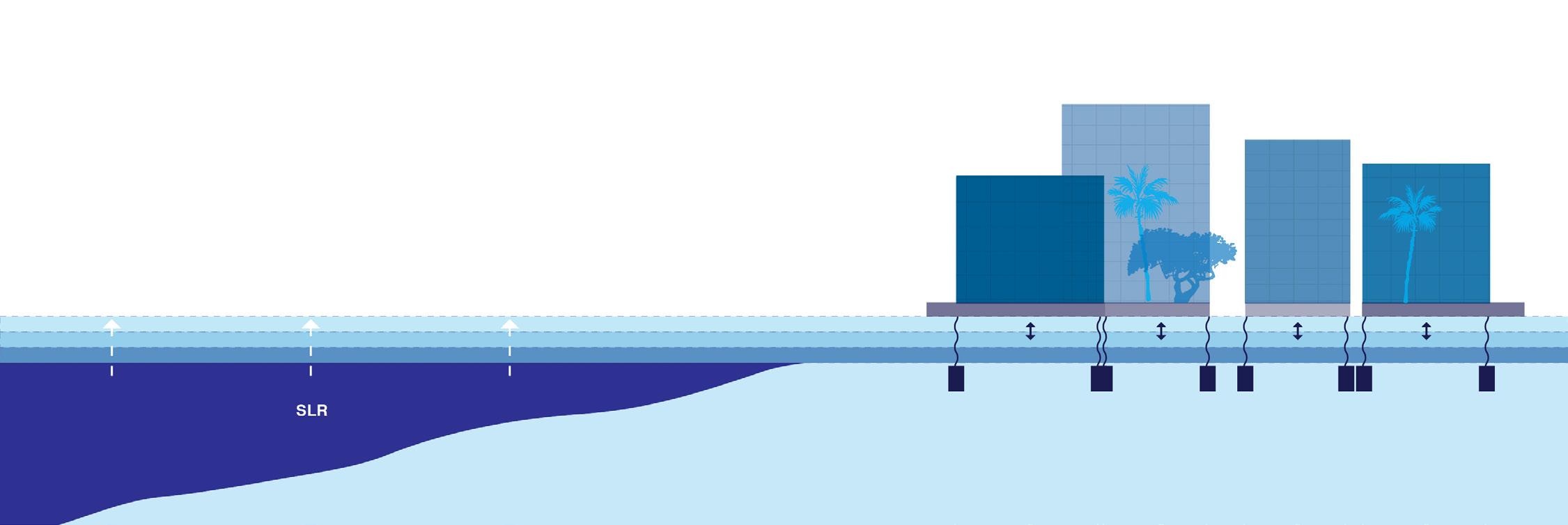
Floating buildings, transportation elements, and infrastructure designed with fluctuating and rising water levels in mind have the potential to increase resilience to the impacts of sea level rise and flooding.
Long-term relocation or removal of existing buildings, infrastructure, and resources out of hazard areas to higher elevations and limited construction of new development in vulnerable areas. Planned withdrawal from the shoreline and/or low-lying zones over time through managed abandonment.
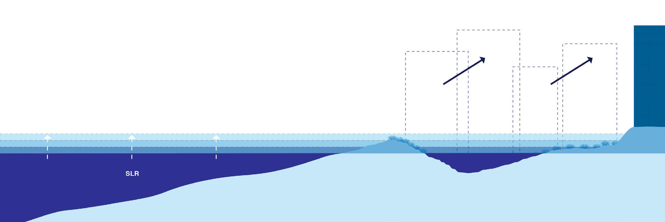
of strategies across spatial and temporal scales. Monitoring of action triggers for rising water levels should
LEGEND
Primary circulation (elevated)
Secondary circulation (elevated)
Ocean access
Water transportation
Shoreline protection (wide multipurpose dikes)
Elevated development
Floodable development
Nature-based adaptation and living shorelines
0 750 1,500 2,250 Feet
SCALE: 1” = 750’ (if printed on 11” x 17”)
UniversityAvenue
Self-sustaining,mixed-use development(elevated)
LEGEND
Primary circulation (elevated)
Secondary circulation (elevated)
Ocean access
Water transportation
Flood protection (wide multipurpose dikes)
Elevated development
Floodable development
Nature-based adaptation and living shorelines
0 750 1,500 2,250 Feet
SCALE: 1” = 750’ (if printed on 11” x 17”)
Nature-based coastalprotection
Long-Term (6 ft SLR) Preliminary Sketch Vision 2: Retreat, Nature-Based Solutions & Accommodation Focus
UniversityAvenue
Kapiʻolani Boulevard
DateStreet
Self-sustaining,developmentmixed-use (elevated)
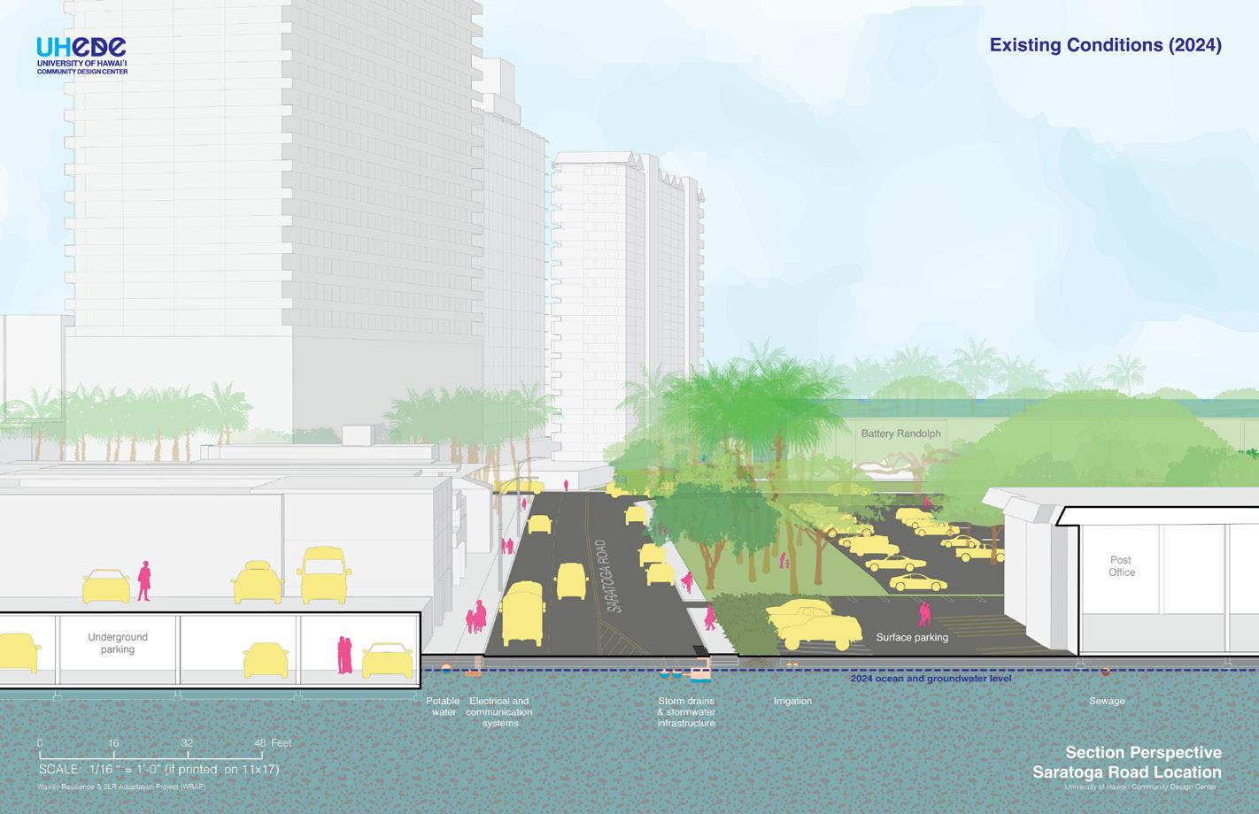

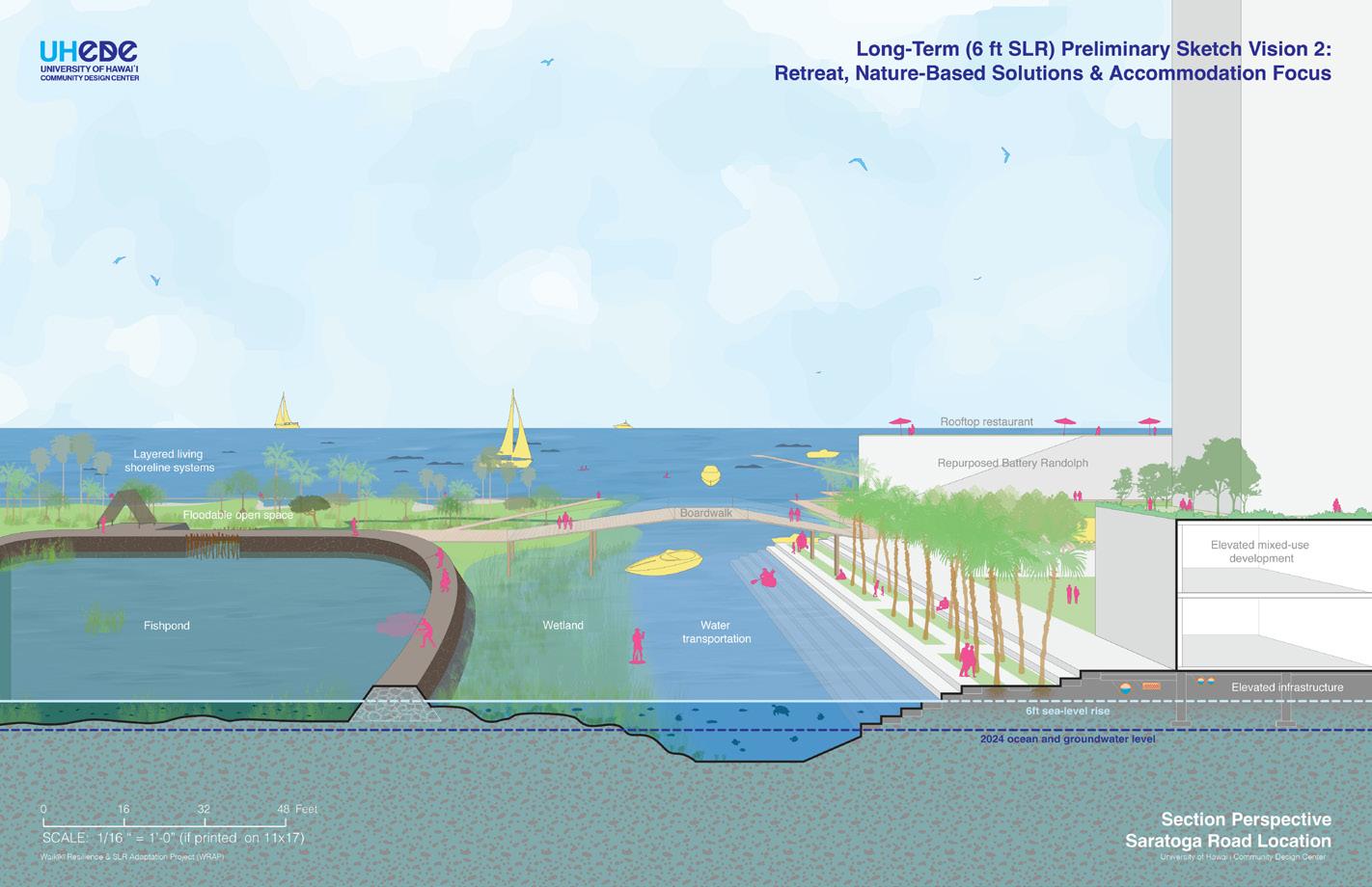
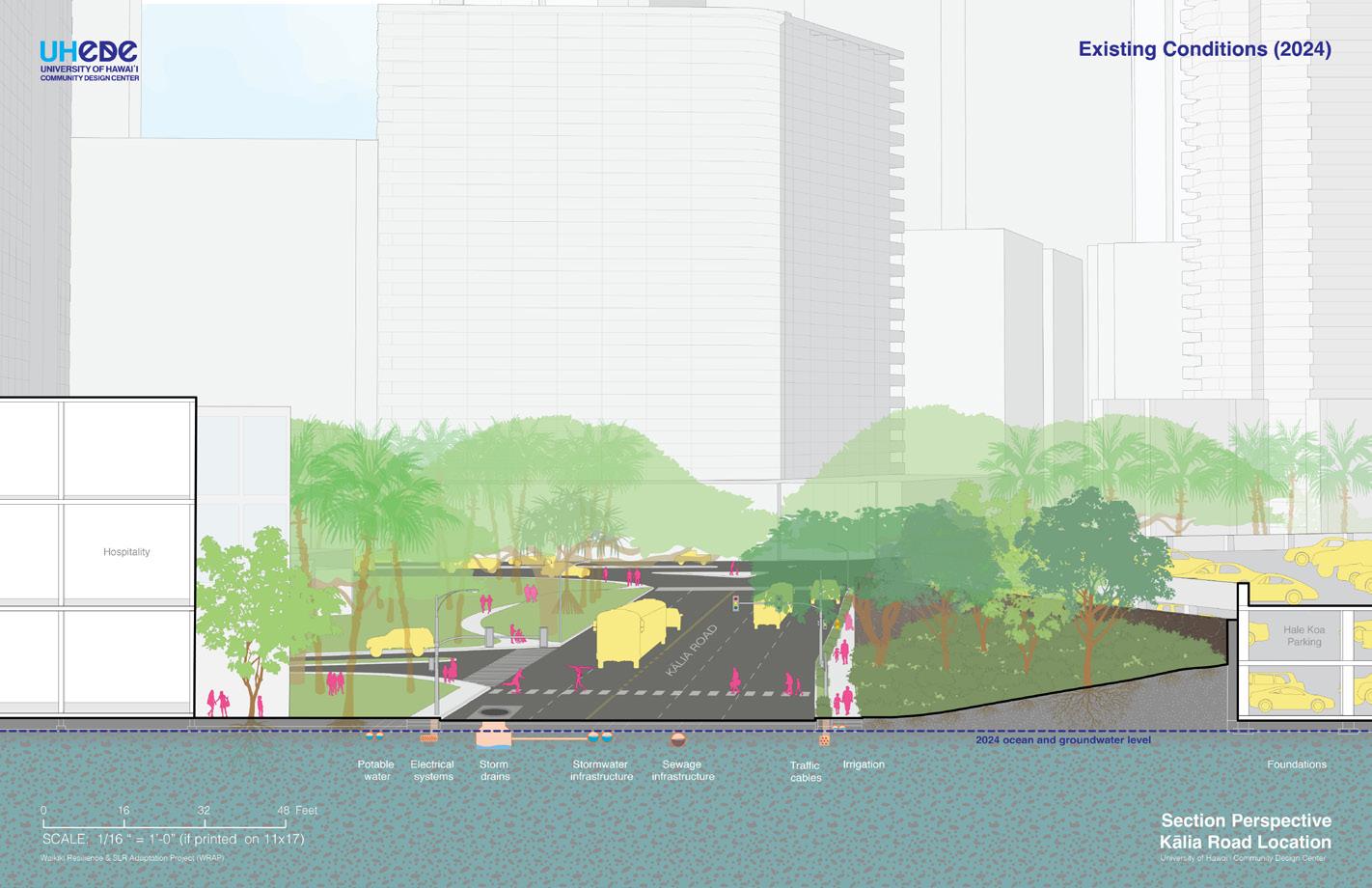
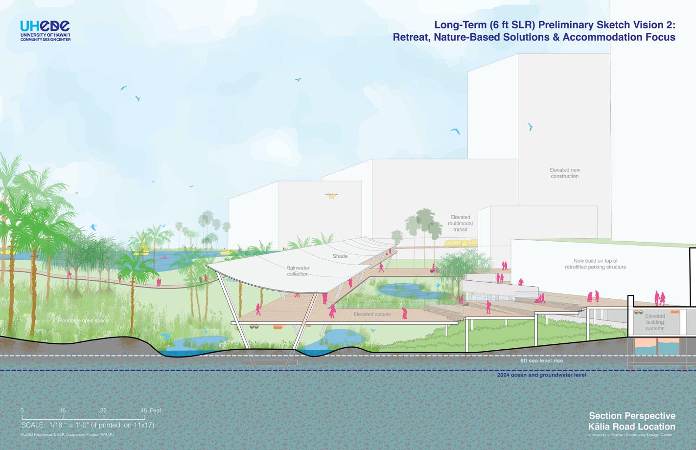
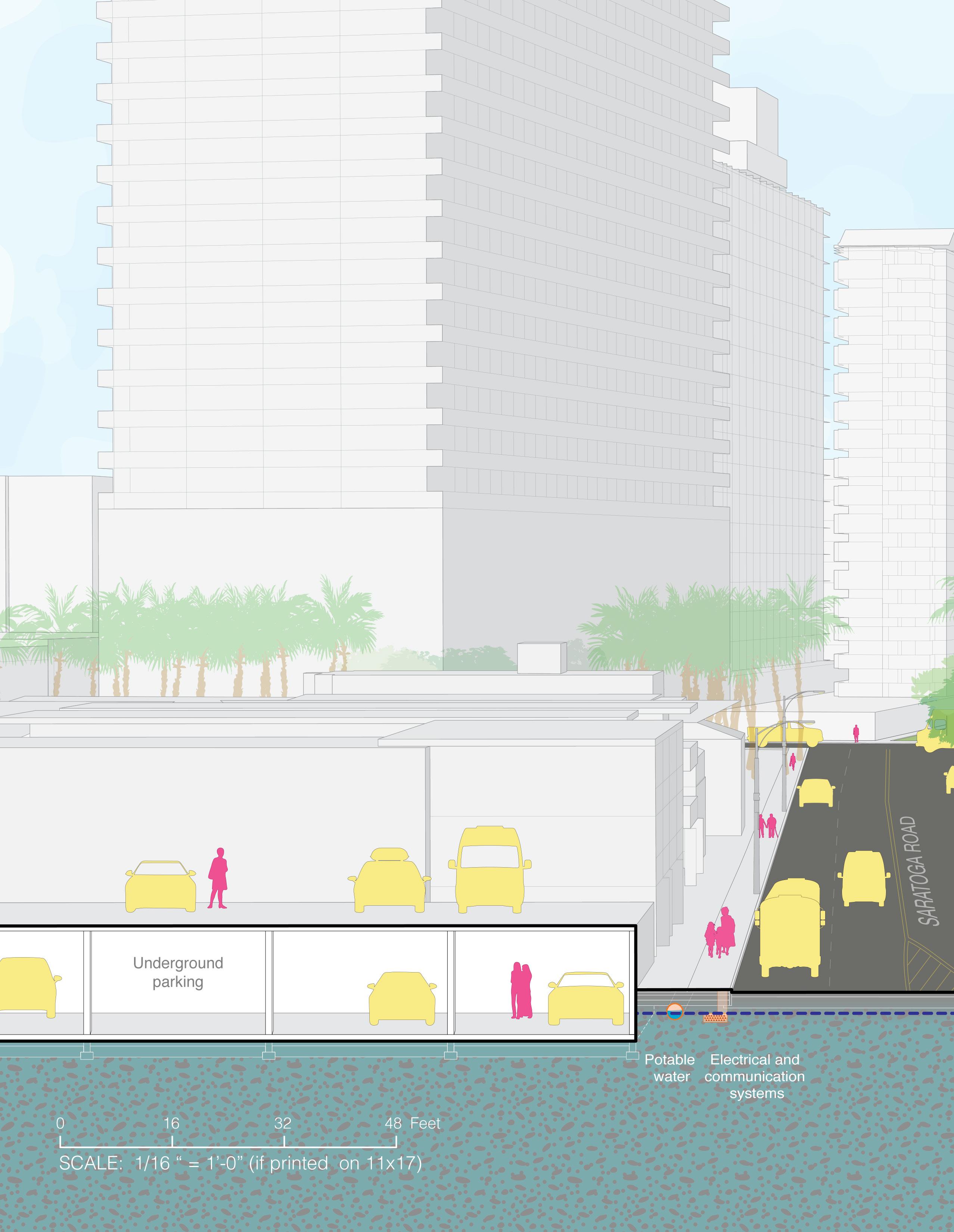
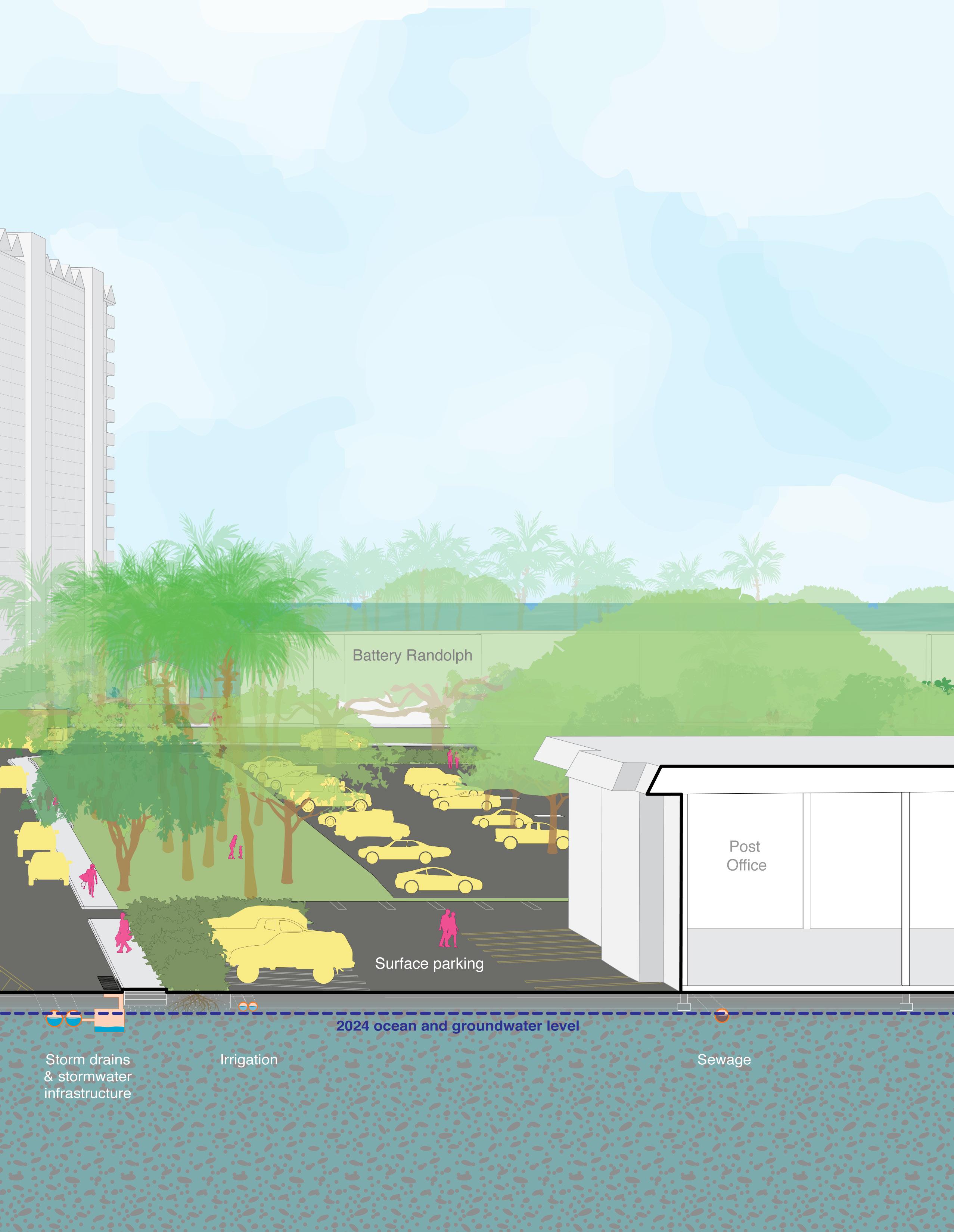
The section perspective sketch studies included here are intended to provide a sense of the user experience in the existing conditions that contrasts with the long-term, proposed conditions in two locations in Waikīkī: Saratoga Road Location and Kālia Road Location (refer to the following pages for section location maps).
This illustrative representation format might assist viewers in visualizing proposed adaptation related changes and improvements over time more easily than abstract plan diagrams alone.
The section perspective sketches included in the following pages represent envisioned potential longterm adaptation approaches (50100 year time frame) to Waikīkī’s urban fabric. The four sequential drawings for each of the two locations represent:
Saratoga Road Location
1. Existing Conditions (2024)
2. Long-term Sketch: Inaction
3. Accommodation & Protection
4. Retreat, NbS & Accommodation
Kālia Road Location
1. Existing Conditions (2024)
2. Long-term Sketch: Inaction
3. Accommodation & Protection
4. Retreat, NbS & Accommodation
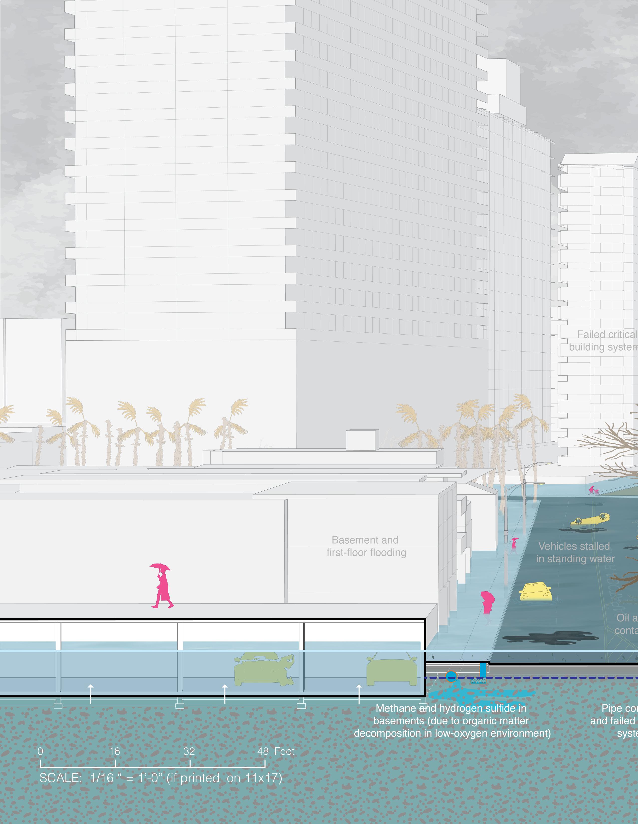
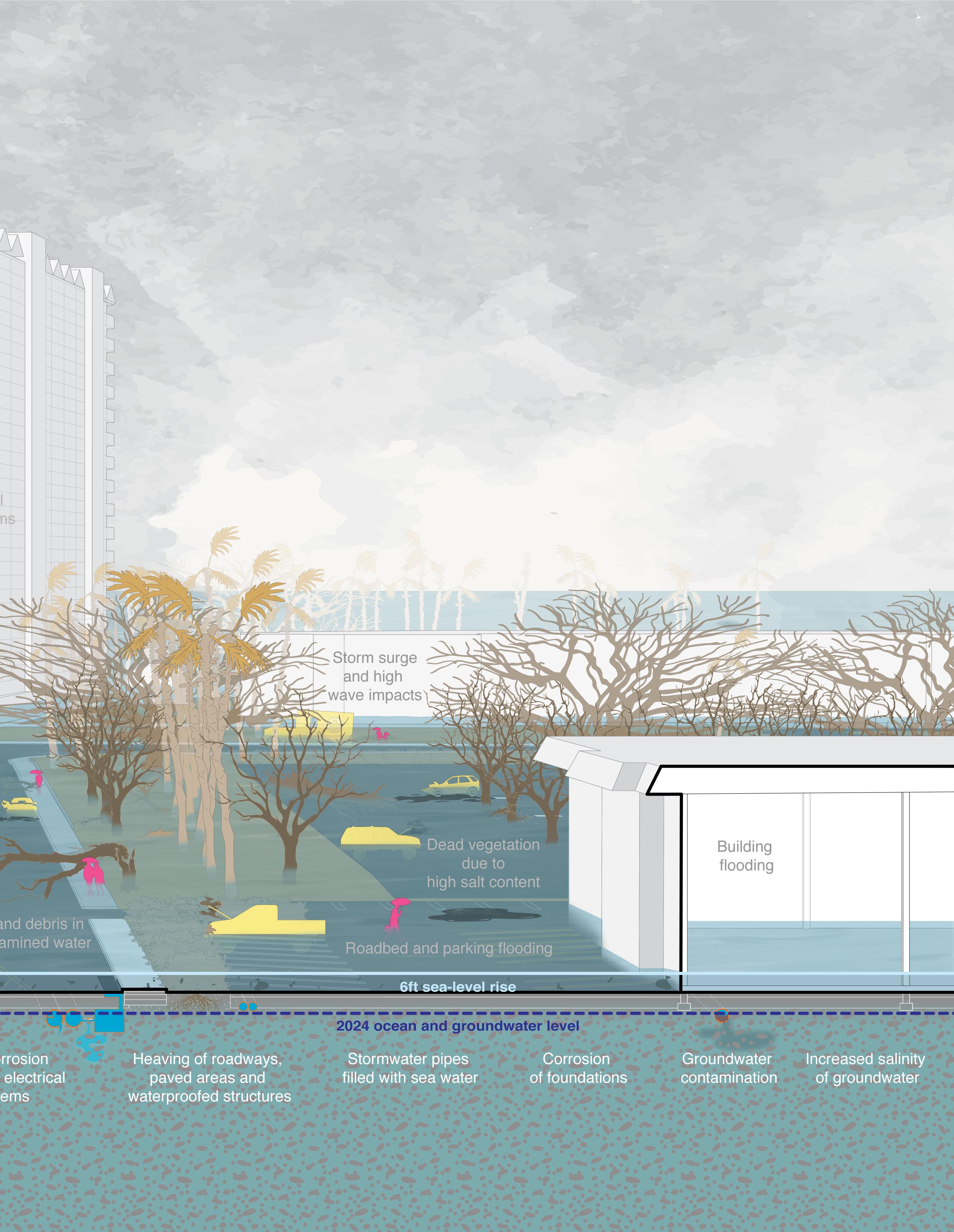
The set of Saratoga Road Location section perspective drawings visually illustrates the long-term replacement of a roadway (that would be covered in approximately two feet of water by the time Waikīkī experiences six feet of sea level rise) with a future canal.

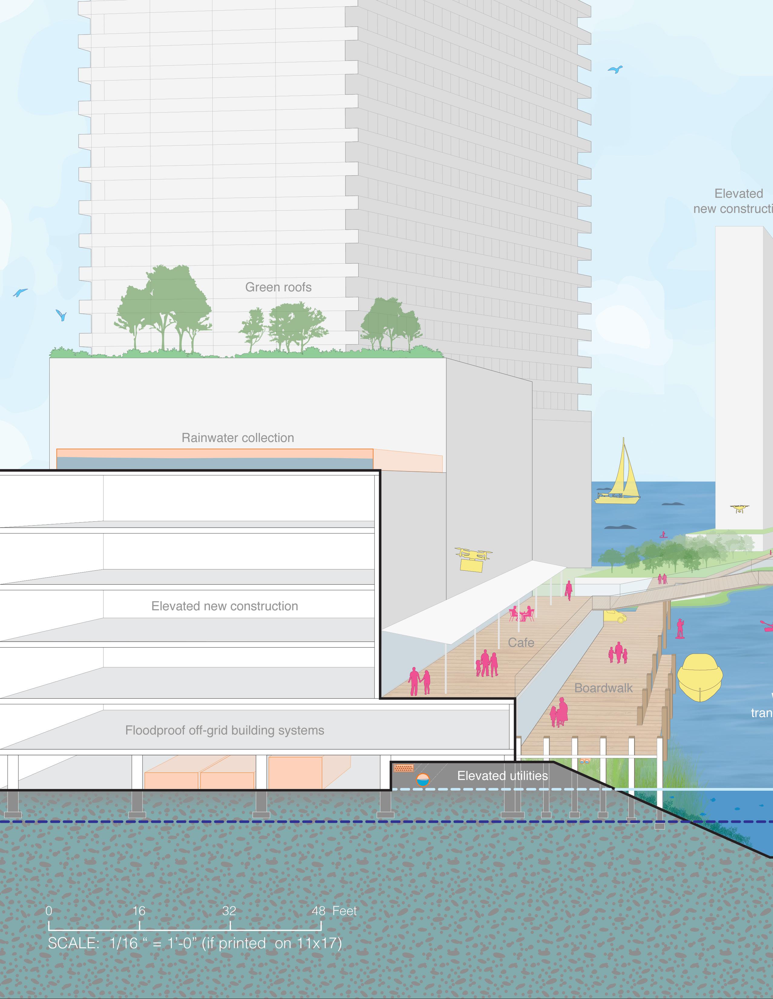
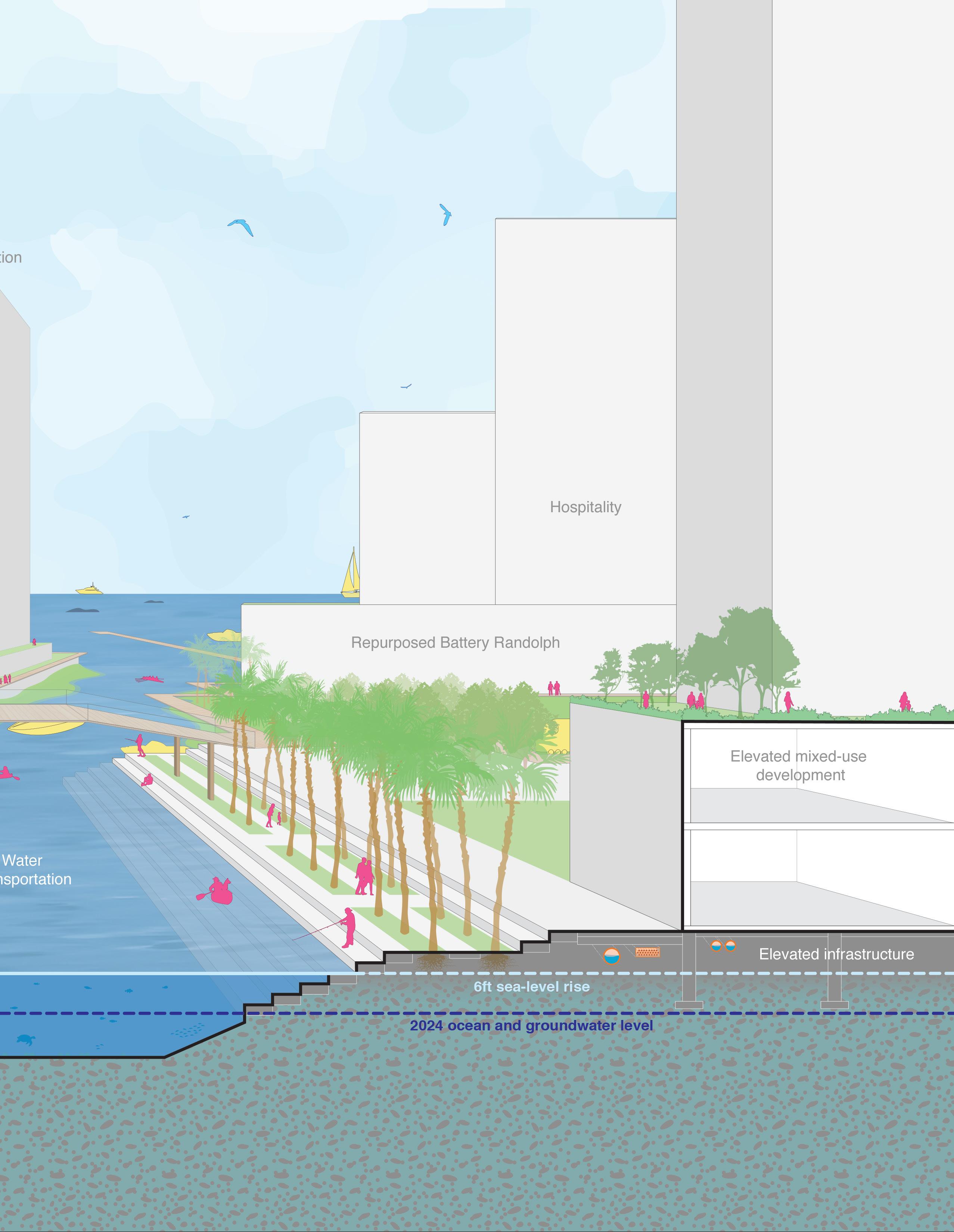
In both sketch visions, below-ground utilities—already impacted by the current groundwater table in this location—are proposed to be elevated along with new buildings. Water-based transportation and autonomous electric transit replaces individual automobiles.
Focused on managed retreat (relocation), nature-based solutions, and accommodation, Sketch 2 illustrates how a fishpond and floodable open spaces replace built structures that currently exist in areas expected to be heavily affected by sea-level rise.
In the Kālia Road Location, the section perspective drawings illustrate how a roadway that is currently already affected by nuisance flooding during heavy rain events is envisioned to be replaced with an elevated, multi-modal transportation, circulation, and infrastructure system.
Sketch 1 visualizes how existing buildings might be retrofitted in-situ by sacrificing and filling existing ground levels and elevating critical building systems and access points to flood-safe elevations. Underground utilities are relocated into elevated conduits that are components of future self-sufficient off-grid systems,
In Sketch 2, existing buildings on the makai side of Kālia Road retreat and make room for floodable open spaces that provide a multitude of ecological and hydrological benefits.
Saratoga Road Location
Existing Conditions (2024)
6-ft SLR Sketch: Inaction
6-ft SLR Sketch 1: Accommodation & Protection Focus
6-ft SLR Sketch 2: Retreat, Nature-Based Solutions & Accommodation Focus
Location of Saratoga Road Section Perspective Sketches
Kālia Road Location
Existing Conditions (2024)
6-ft SLR Sketch: Inaction
6-ft SLR Sketch 1: Accommodation & Protection Focus
6-ft SLR Sketch 2: Retreat, Nature-Based Solutions & Accommodation Focus
Ala Moana Blvd.
Location of Kālia Road Section Perspective Sketches




Location of Kalia Road
Section Perspective Sketches


