12 minute read
DOWNTOWNS
As UDA started with the development of urban neighborhoods, downtowns have always remained the heart of cities and a major contributor to sense of place within the entire city.
Generally, of all neighborhood types, it is the downtown that often defines a sense of place for a city, far beyond the specific borders of the neighborhood itself.
Advertisement
Quite simply, the best downtowns have a rich mix of uses, cultural characteristics, and open space. At the same time, the design of down- towns is tricky, requiring a complex public process that interweaves broad participation with broad political and economic implica- tions. We see these challenges as opportuni- ties to build something extraordinary in the creation of a truly inclusive downtown for everyone. Often times, our efforts develop a new tradition of inter-governmental coordina- tion that has influences far beyond the project boundary itself. UDA has been involved in master planning a long list of downtown environments, includ- ing Cincinnati, Pittsburgh, Huntsville, Bir- mingham, Greenville, Salt Lake City, Tampa Bay, Pensacola, Boca Raton, Omaha, and Nash- ville. Internationally, our work has extended to major capital cities such as Riyadh, Saudi Arabia, and Moscow, Russia.
These three examples illustrate the way in which we approach projects and create wel- coming urban spaces for everyone:
Norfolk: Over 30 years of revitalizing a downtown, one project at a time. West Don Lands: Reconnecting Toronto to the Don River. South Lake Union: A former industrial zone becomes a thriving innovation district.
DOWNTOWN NORFOLK
VIRGINIA
Revitalizing a downtown, one project at a time
Norfolk was a sleepy, southern downtown ready for revitalization. Before hiring UDA, revitalization and growth were scattered, without a unified goal. In 1989, Norfolk hired UDA to identify, communicate, and execute clear, actionable revitalization goals to rediscover and refocus on the downtown and waterfront. The result was a new momentum, catalyzing revitalization through a series of strategic investments.
UDA’s work included two master plan updates, a downtown pattern book, and an architectural consulting and design review. However, through the UDA process, the team connected various departments, creating cooperation toward common redevelopment goals. After years of rapid and successful restoration and development, Downtown Norfolk is now a vibrant regional center, economic engine, and quality of life destination. Furthermore, the city’s tax revenues have increased by nearly $2 billion, making Downtown Norfolk one of the most successful transformation stories in the United States.
Client
City of Norfolk
Awards
ICA, Palladio Award, A Pattern Book for Norfolk Neighborhoods, 2005 CNU, Charter Award, A Pattern Book for Norfolk Neighborhoods, 2005


NORFOLK A VISION FOR THE NEXT DECADE
This Plan UPDATE for Downtown Norfolk continues Norfolk’s tradition of using physical planning as a primary tool for economic development. Synergy—using every project to create another—will continue to be the plan’s driving force. Public investment will continue to be used strategically to catalyze private development. Large and small projects will be coordinated with public investments to create urban spaces and districts. This UPDATE marks the beginning of a new era for Downtown. Light Rail Transit is under construction as the plan is being written. With the various issues associated with gasoline and mandates to reduce carbon emissions, the LRT system will greatly enhance Downtown’s role as the unique center of the region. Transit stations will be key focal points in Downtown’s interconnected network of pedestrian-friendly streets and public spaces. All of the needs of daily life will be within walking distance or accessible by transit, thereby reducing auto dependency. Downtown will increasingly become the destination of choice. Additional initiatives will be developed along the NET shuttle bus route. Together, these initiatives will establish all of Downtown as a TransitOriented Development. Although a series of key projects is either underway or in the planning stage, much of the area available for redevelopment is not yet ready for detailed planning. Therefore, a major focus of this UPDATE is the framework of transportation and pedestrian open space which will encourage future private investment. This UPDATE includes two initiatives which build on the success of the Waterfront, multiple new initiatives whose focus is alternative modes of transportation including Light Rail Transit. Together, these represent the completion of the renaissance of Downtown’s urban core. This UPDATE also begins the process of creating strong connections between Downtown and the neighborhoods of the City. The first step will be to overcome the physical barriers which have separated Downtown from these neighborhoods, and the next step will be to coordinate Downtown efforts with the planning programs of those neighborhoods.
DOWNTOWN NORFOLK 2020:
From the Ball Park to the Opera House
The Master Plan for 2000 established a Vision of Downtown with a continuous, interconnected environment from Harbor Park to the Opera House. This aerial view illustrates how a series of new initiatives, which build on the previous accomplishments, can make this vision a reality by 2020. Four Downtown stations for a new transit rail system will introduce an alternate mode of transportation, link the new initiatives, and contribute to the future success of Downtown.
WATERFRONT-RELATED DEVELOPMENT
The Downtown Waterfront will continue to be a public amenity that serves the entire City and the Region. The continuous pedestrian park will be extended to Harbor Park. Improved pedestrian crossings across Waterside Drive and other streets will serve as extensions of pedestrian routes and will better connect this park to Downtown through the following series of initiatives.
Granby Connector and Hotel
Conference Center: The Granby Connector will provide safe pedestrian access between Otter Berth and Downtown at the 100 block of Granby Street. Behind the historic buildings in that block, a hotel conference center fronting on Main Street will greatly improve Norfolk’s capacity to attract major conferences and events.
East Main Street and Harbor
Park: Waterfront mixed-use development and improvements to waterfront pedestrian paths and the entrance to Harbor Park will occur. This waterfront segment also includes the Ferry Landing and leads to East Main Street and the Government Center complex.
TRANSIT-ORIENTED INITIATIVES
The four Downtown stations of the new Light Rail Transit system are the focus of coordinated initiatives which combine public investment in streetscape improvements with private investment in development.
Government Center Station:
The station is in the middle of a new Civic Green for the City. On one side, the new Courthouse will create a landmark along St. Paul’s Boulevard. On the other, City Hall, now more visible, creates a dramatic terminus for Main Street and marks the edge of a new office district that extends to Waterside Drive. The public space between the LRT station and St. Paul’s Boulevard will include a new memorial to Commemorate the End of Massive Resistance.
MacArthur Station &
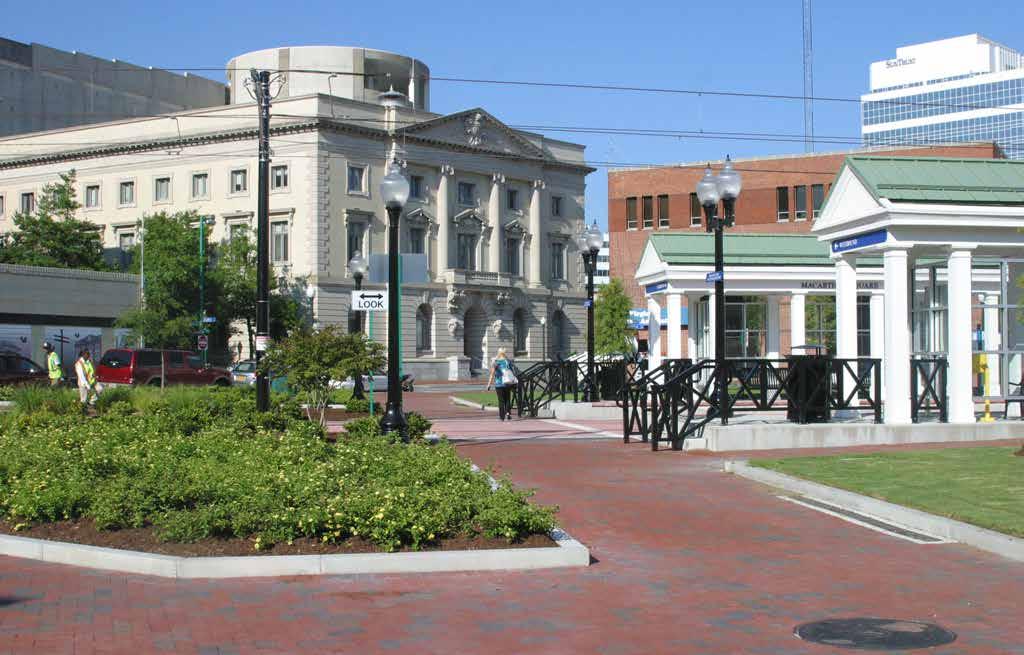
Slover Library: The Station is the center of a public Market Square with cafés, news stands, and an information center for Downtown activity. New upgraded facilities at the MacArthur Memorial on the east side of the Station will include a book shop. The City Hall Avenue facade of MacArthur Center has new shops and is more accessible with new pedestrian crosswalks. The Slover Library, with a glass atrium connecting the Seaboard Building

with a new building, is on the west side of the Station, adjacent to the newly restored facade of the Selden Arcade.
Monticello Station: One block from Granby Street, the Station provides access to new mixed-use development with ground floor shops, an office tower, and residential buildings. It also provides access to MacArthur Center, which includes its mixed-use final phase, and to the Tidewater Community College. The TCC Core Campus has been completed with a new Student Center and additional academic spaces.
The Museum Station: Located at the intersection of York and Yarmouth Streets, the Station serves the Chrysler Museum and Ghent in addition to the Freemason area. The Museum’s expansion program includes facilities that will extend to Brambleton Avenue along a linear park that lines Duke Street. Largescale new apartments, hotels, and mixed-use buildings will combine with the streetscapes to create a gracious Boulevard that is easy for pedestrians to cross, thereby connecting the area north of Brambleton to the core of Downtown.
The NET Downtown shuttle bus system is the focus of a series of initiatives:
Granby Street north of Brambleton will have new streetscapes, a small town square, and a series of new developments. The former Greyhound site will become a mixed-use development. Monticello Avenue will have improved streetscapes, including the edges of Scope Plaza and the Federal Courthouse, as well as a redeveloped hotel on the Radisson Hotel site.
Brambleton Ave.
G ranb y St .
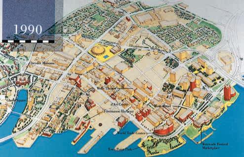
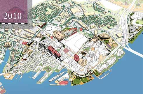
1980 | Downtown was clear of blighted structures, new roads had been built, and the first new office and civic buildings in separate clusters around the new City Hall, on East Main Street, and along Brambleton Avenue at St. Paul’s Boulevard had been developed. One development, a hotel, had been built on the vacant waterfront. 1990 | The Waterfront had become the most desirable address, with The Waterside and Town Point Park attracting visitors from all over the region and beyond. Office towers were built with waterfront views, and along Main Street. Freemason and Ghent were thriving as revitalized neighborhoods with a mix of new housing and restored historic houses. 2000 | Downtown was restored as the primary retail center of the region with the construction of MacArthur Center, the revival of Granby Street as a retail and restaurant destination, and the repositioning of Waterside as an entertainment facility. The Tidewater Community College campus was established. Boush Street had become a residential address linking Granby Street with the Freemason area. The Waterfront was expanded with the construction of Nauticus, the berthing of the USS Wisconsin, and the completion of Harbor Park. The Norfolk Electric Transit (NET) system was in place to link all major destinations with parking facilities. The Chrysler Museum and Harrison Opera House expansions were completed, reinforcing their key roles in the region’s cultural arts. 2010 | The core of Downtown continued to strengthen with the construction of two major office towers, 1,000 units of high quality Downtown apartments, new retail shops, a Hotel and Conference Center, the Cruise Terminal, and the construction of the LRT system. Adjacent areas such as Freemason are being extended with new residential and hotel development to establish a presence along Brambleton Avenue. Improvements to Brambleton Avenue will make it possible to connect Downtown with the Chrysler Museum and the Opera House area as well as with Ghent. Similar improvements along St. Paul’s Boulevard are being coordinated with the planning effort for St. Paul’s Quadrant to the east.
2010
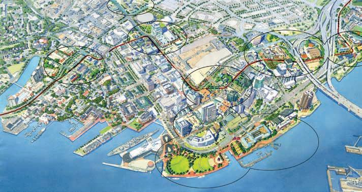
This aerial view illustrates how the next phase of this framework and a series of new initiatives, which build on the previous accomplishments, can make this vision a reality by 2020.
N
N O R F O L K C I T Y COUNCIL CITY MANAGER Regina V. K. Williams

Paul D. Fraim Mayor Anthony L. Burfoot Vice-Mayor Daun Sessoms Hester Councilwoman Paul R. Riddick Councilman Dr. Theresa Whibley Councilwoman Donald L. Williams Councilman Barclay C. Winn Councilman W. Randy Wright Councilman PROJECT MANAGERS Anne F. Odell Assistant City Manager Frank M. Duke, AICP Director of Planning CONSULTANT Urban Design Associates 2020




WEST DON LANDS
TORONTO, ONTARIO
Reconnecting downtown Toronto to the Don River
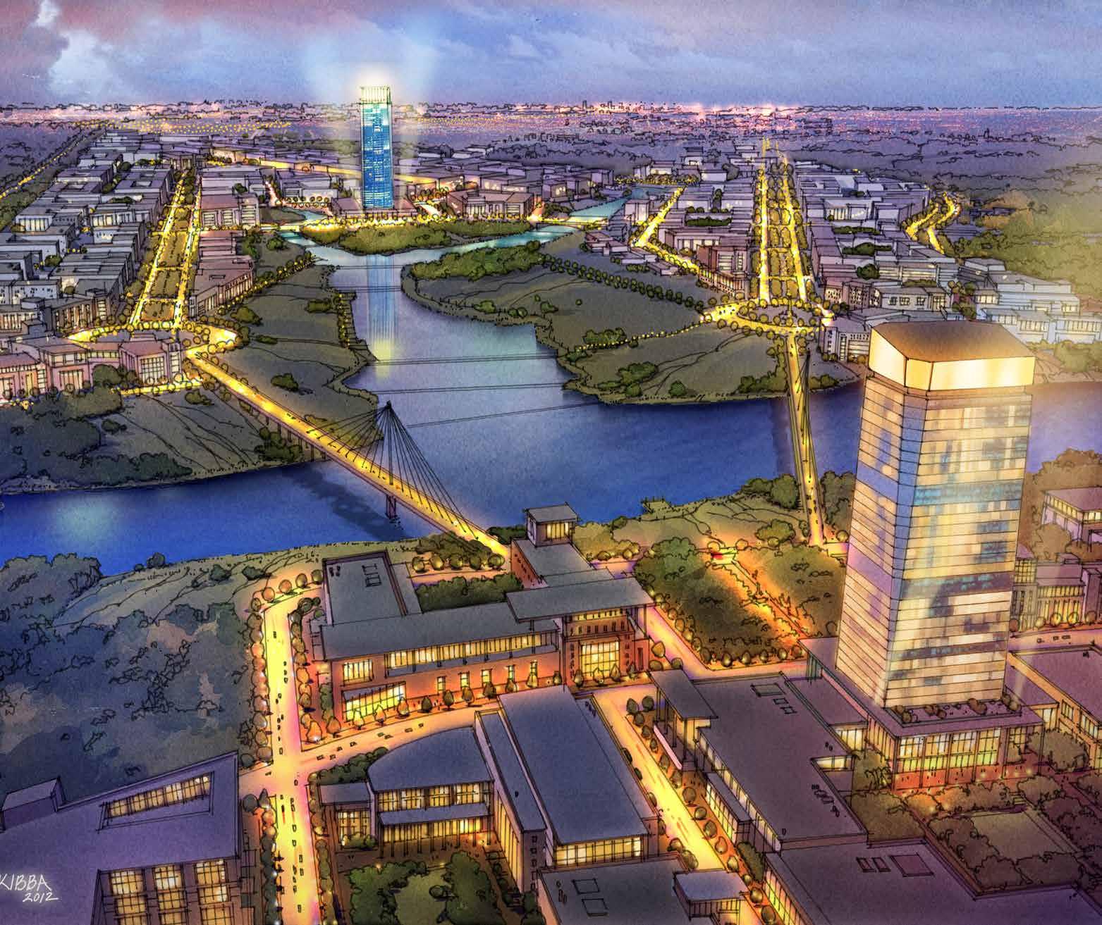
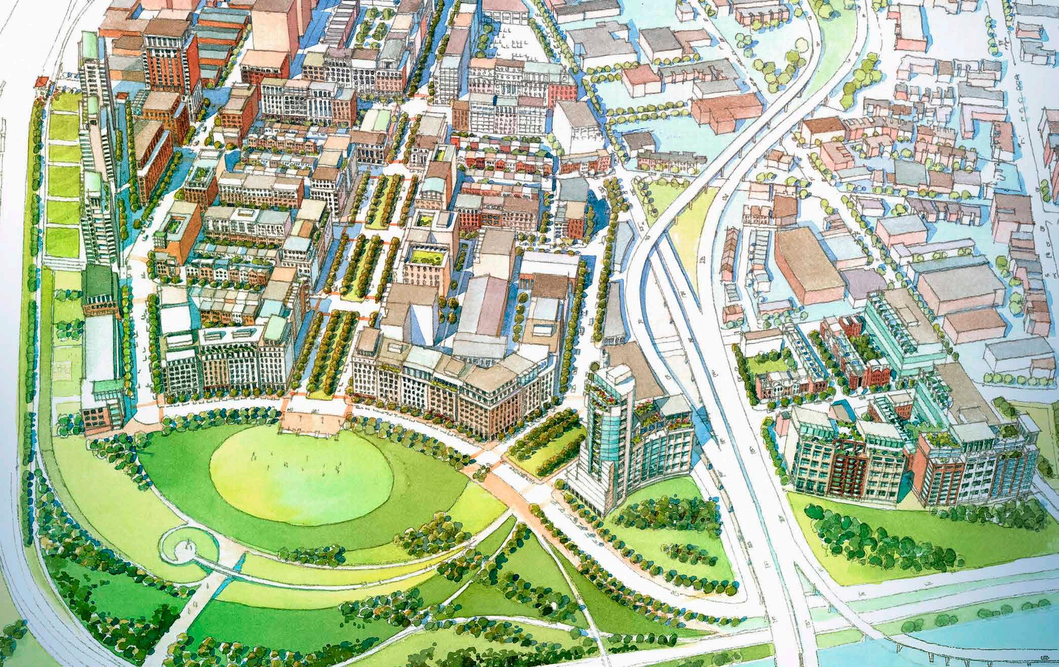
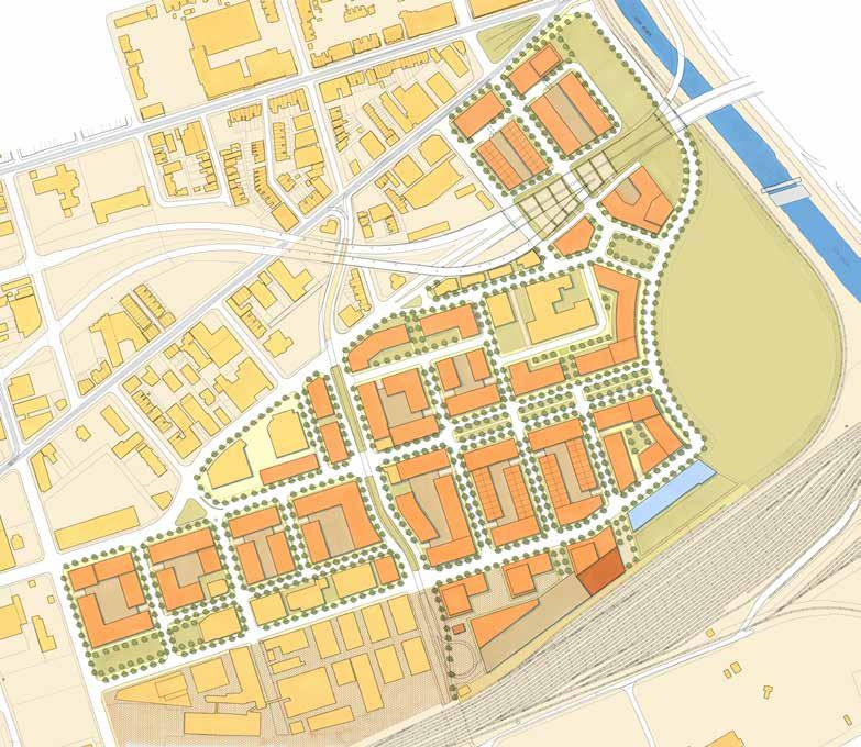
Waterfront Toronto, a public development corporation, was created to plan, design, and implement redevelopment of Toronto’s vast industrial waterfront. UDA prepared a master plan and form-based code for the West Don Lands precinct. The design team engaged the community in an extensive public planning process.
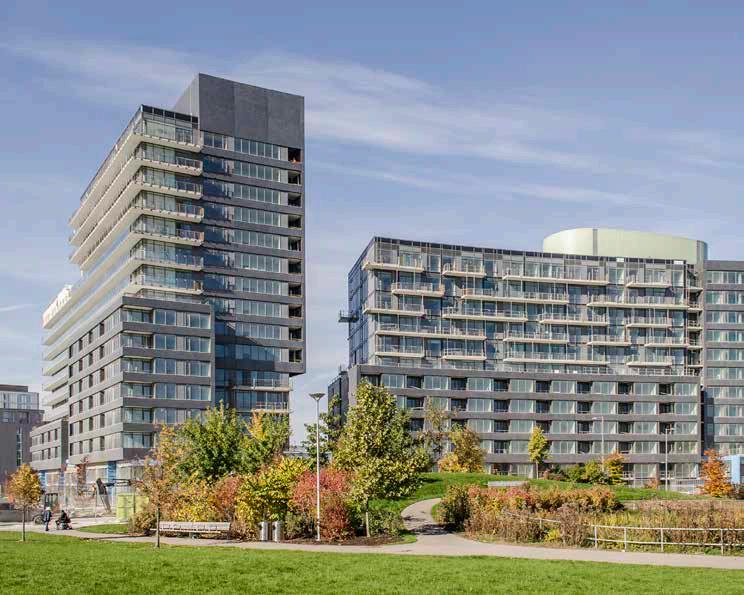
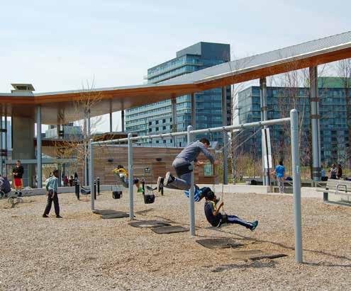
Corktown Commons – a new 18-acre, $135 million civic park on the Don River – was designed with flood control devices to protect the new district and to serve as a critical component of both the river’s restoration and the creation of a major continuous greenway for the city. In 2015, the precinct served as the Athletes Village for the Pan American Games, accelerating implementation of the plan.
Client
Waterfront Toronto
Team
Joe Lobko Architect, Inc., du Toit Allsopp Hillier, LEA Consulting, Earth Tech Canada, GHK International (Canada) Ltd.
Award
ULI Global Award, 2018 Toronto Architecture & Urban Design Award of Excellence, Visions and Master Plans, 2005




© Jimmy Wu


SOUTH LAKE UNION
SEATTLE, WASHINGTON
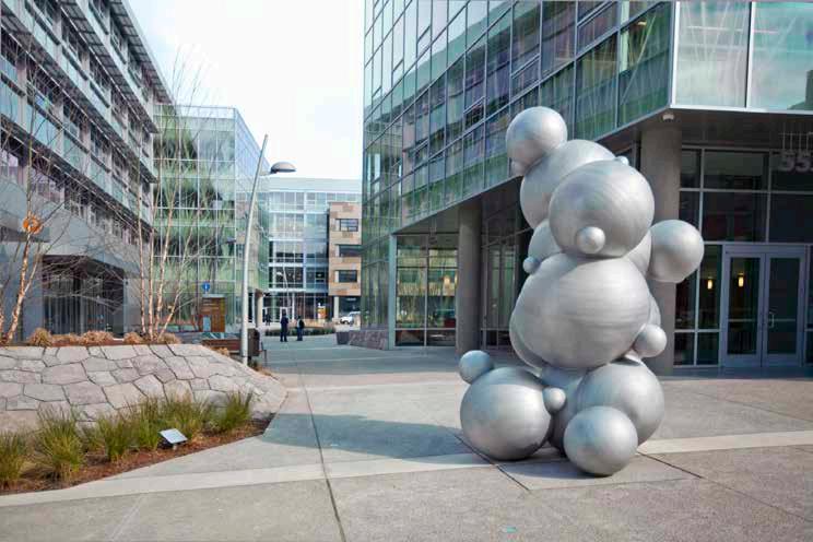
In the 1990s, the age of technology began to take root in Seattle. When Microsoft co-founder Paul Allen’s development company, Vulcan, sought to transform a forgotten industrial neighborhood, they turned to UDA for the master plan. Located adjacent to the downtown along the southern edge of Lake Union, UDA led a planning process for what would become one of the most dynamic innovation districts in the nation, yielding a form-based zoning strategy and a framework for building sites, improved streets, a new streetcar line, pedestrian ways, and courtyard places.
The district is now a vibrant mixed-use area — home to Amazon’s HQ and countless other tech companies, as well as new mixed-income housing, restaurants, retail, hotels, and parks. UDA’s work laid the foundation for $2.85 billion total investment since 2004, generating an estimated $1.3 billion in cumulative tax revenue through 2025.
Team
Glatting Jackson


