


Taking actions to restore, manage and conserve Washington’s forests so our environment and communities thrive.
This publication wouldn’t exist without the expertise and knowledge shared from many individuals. We are grateful for the time and wisdom they contributed to make this annual report possible:
CONTRIBUTING WASHINGTON STATE DEPARTMENT OF NATURAL RESOURCES
Al Lawson
Aleksandar Dozic
Alex Smith
Amy Ramsey
Ana Barros
Andrew Spaeth
Annie Smith
Angie Lane
Ashley Blazina-Cooper
Ben Thompson
Bret McNamara
Brian Bailey
Chuck Hersey
Collin Haffey
Derek Churchill
Garrett Meigs
George Geissler
Guy Gifford
Hannah King
Jen Watkins
Jenny Coe
Jessica Walston
Kate Mickelson
Kate Williams
Kelsey Ketcheson
Kenny Ocker
Kyle Lapham
Mark Reed
Matt Axe
Matt Provencher
Michael Tonkel
Rachel Benbrook
Rachel Mazzacavallo
Rachel Santa Olalla
Scott Hanna
Steve Harris
Trevor McConchie
Will Rubin
Andrew Lavalle, US Fish and Wildlife Service
Angela Peterson, One Tree Planted
Claribel Orellana, USDA Forest Service (USFS)
Chris Martin, Blue Pine Fuels
Dan Baribault, Northport School District
Dan Kipervaser, USFS
Darcy Batura, The Nature Conservancy (TNC)
Darrin Masters, Washington Dept. of Fish and Wildlife (WDFW)
Eric Johnson, Washington Association of Counties
Jason Ransom, National Park Service (NPS)
Jay McLaughlin, Mt. Adams Resource Stewards
Joe Cushman, Nisqually Indian Tribe
Joe Kane, Nisqually Community Forest
Matt Eberlein, WDFW
Mike Kaputa, Chelan County Natural Resources
Nick Johnson, Tulalip Tribes
Richard Tveten, WDFW
Santino Pascua, USFS
Tia Beavert, Yakama Nation
Tony Craven, Suncadia Resort
Confederated Tribes of the Umatilla Indian Reservation
Yakama Nation Tribal Forestry
Yakama Nation Forest Development Program
Underwood Conservation District
Ponderosa Park Firewise USA Community Rad Mulching and Fire Reduction LLC
LEAD REPORT AUTHORS
Ashley Blazina-Cooper, Washington DNR
Andrew Spaeth, Washington DNR
All photos from Washington DNR archives unless otherwise noted: Cover photos (clockwise from top left): Western Gray Squirrel, photo by Linda Streidel; Worker planting trees; (DNR photo files); Worker thinning forest, photo by John Marshall; Firefighter at prescribed fire, photo by Kara Karboski.
Publication design:
Luis Prado / DNR Communications.
9
10
11
12
13
14
15
16
16
19
19
35
37 U RBAN AND COMMUNITY FOREST RESILIENCE
38 D NR’s Urban and Community Forestry Program Grows Report
39 D NR Offers Unprecedented $7M in Pass-Through Grant Funding for Washington Partners in Urban Forestry
40 Washington Tree Equity Collaborative
41 U.S. Forest Service Urban Forestry Inventory Analysis Data Collection
4 3 R
44 West Klickitat County Wildfire Defense Project
45 Northport School District Biomass Plant
46 Central Washington Initiative: Leveraging Public Investments to Promote Long-Term Stewardship in Chelan County, Washington
49 STEWARDSHIP OF FAMILY AND WORKING FORESTS
50 Western Washington Service Forestry Program Expansion
52 Eastern Washington Service Forestry Program
52 Ridgecrest Road Success Story
54 F orest Resilience and Wildfire Risk Reduction in K lickitat County
57 W ILDLIFE AND SALMON RECOVERY
58 N orthwest Forest Plan Amendment Process Underway
59 Washington Department of Fish and Wildlife Invests in Forest Health and Habitat Enhancement
59 Sinlahekin DFW/BLM/DNR Cooperative Prescribed Burn: Loomis
59 Cougar Canyon Prescribed Burn: Naches
59 Eastern Washington Future Planning Highlight: Crum Canyon Prescribed Burning: Entiat
60 Western Gray Squirrel Uplisting
62 Collaboration to Revive Wild Salmon and Promote Clean Energy in the Columbia River Basin
62 I nteragency effort evaluates options for restoring grizzly bears in Washington’s North Cascades
65
66 N DNR Works to Support Beaver Populations and Identify Suitable Habitat on State Lands
68 Watershed Resilience Action Plan Expands in 2023
69 Combined Effects of Forest Cover and Topography on Snow Depth in the Eastern Cascades, Washington
69 M anagement Implications
71 CONTACT

Taking actions to restore, manage and conserve Washington’s forests so our environment and communities thrive.
Washington's forests are landscapes unparalleled in their beauty, providing an array of ecological, economic, and cultural values to our residents and visitors. These lands are cornerstones of the Evergreen State but are imperiled by an array of unprecedented threats.
Many of the threats facing Washington forests are exacerbated by a changing climate. Warming temperatures have amplified the frequency and intensity of wildfires, insect infestations, and drought-related tree mortality. The health of our forest ecosystems has declined significantly over the last century, and there is an urgent need for proactive and innovative measures to ensure our forests continue to provide clean water and air, wood products, and wildlife habitat for generations to come.
The Washington State Department of Natural Resources, in collaboration with our sister state agencies, federal partners, tribal, and private landowners, has embarked on an ambitious journey to prepare our forests to be more resilient against the uncertainties of the future. This report outlines numerous stories of collaboration and progress towards the shared goals outlined in the 2020 Washington State Forest Action Plan and House Bill 1168. Enabled by legislative support and funding, the Department of Natural Resources (DNR) and many other land stewards have made remarkable strides in creating more conditions for healthy and resilient forests. By investing in strategic partnerships and collaborative efforts, Washington has made significant progress in implementing forest health initiatives, fuel reduction projects, and community-based wildfire preparedness programs.
While there was tremendous progress in 2023, the year was not without its challenges. Communities in Northeast Washington experienced the harrowing impacts of the Oregon Road and Gray fires, fast-moving blazes that decimated portions of Spokane County. The ferocity of these fires resulted in historic losses of structures, inflicted profound impacts on residents, and served as a stark reminder of the critical need for post-fire recovery work in impacted communities. These wildfires underscore the urgent need to create fire-adapted communities and resilient forest landscapes.
Currently, the commitment to forest health and resilience is often focused on wildfire, yet Washington’s holistic approach to forest management encompasses diverse values that extend well beyond wildfire mitigation. The science-based approach adopted by partners across Washington includes diverse aspects of forest management that emphasize watershed protection, wildlife habitat enhancement, and sustainable timber harvest practices, with the shared aim of ensuring the longevity and vitality of our forests for generations to come.
As we navigate the complexities of a changing climate, this report provides stories of hope and reminders of the dedication, innovation, and determination of Washingtonians. It serves as a testament to our collective resolve to confront challenges head-on and with a collaborative spirit, striving towards a future where healthy and resilient forests coexist harmoniously with thriving communities.
AS WE NAVIGATE THE COMPLEXITIES OF A CHANGING CLIMATE, THIS REPORT PROVIDES STORIES OF HOPE AND REMINDERS OF THE DEDICATION, INNOVATION, AND DETERMINATION OF WASHINGTONIANS.

Landscape resilience is defined in the Forest Action Plan as “the ability of a landscape to sustain desired ecological functions, robust native biodiversity, and critical landscape processes over time and under changing conditions.” Increasing resilience requires partnerships across ownership and jurisdictional boundaries – no one land manager can achieve landscape and watershed resilience alone.
Landscape resilience means including all voices and land stewards: environmental justice, equity, and holistic engagement are as necessary as robust scientific analyses for paving a sustainable path forward. While we know we have years of work ahead of us, we hope the success stories highlighted in this section across different land ownerships help to inspire continued action.
Forests are an integral part of our landscapes and communities, and they provide a wealth of benefits to Washingtonians and the planet.”HILARY FRANZ Commissioner of Public Lands
The priority actions in the DNR Forest Action Plan to increase landscape scale resilience include a commitment to “work internally across DNR divisions, with the Forest Health Advisory Committee, the Timber, Fish, and Wildlife Policy Committee, and other partners to lay the scientific, social, cultural, and economic framework for an all-lands forest health and resilience vision and approach for western Washington forestlands, building off of existing plans and strategies.”
We took several steps in 2023 to begin laying a foundation for this work with our partners. We launched a collaborative technical effort and hosted a spring workshop to explore methodologies for a landscape evaluation to determine forest health in western Washington. We tested our methods in two geographies to provide a proof of concept for review and discussion with partners in 2024: the Middle Snohomish priority landscape, and a potential planning area for restoration on the Gifford Pinchot National Forest near Packwood.
We will continue outreach on this technical effort in the year ahead and will continue to review results of our proof-of-concept testing to gain technical and potential end-user feedback. This will inform our revision of a forest health assessment. The end goal is for the assessment to be used as an analytic tool to define opportunities and spatial priorities for planning by land managers and partners for investments in active forest health management.
As a complement to this technical effort, DNR worked to gain insights from partners across western Washington on a shared vision and approach for increasing forest health and resilience. We conducted interviews with stakeholders and submitted a formal tasking memo our Forest Health Advisory Committee with recommendations for a problem statement, context, vision, and process to develop a forest health strategy for western Washington. Together, these efforts lay a foundation for us to meet the commitments of the Forest Action Plan.
The DNR Federal Lands Program continued making strides in 2023 across the state on USDA Forest Service and Bureau of Land Management lands. Acting as the agency’s primary implementer of its Good Neighbor Authority (GNA) agreements, the program has evolved into three distinct units: field operations, engineering, and environmental planning. Staff work to leverage resources within DNR and with partners to increase critical restoration efforts on federal lands and meet quantitative targets set at the state and federal levels..
In 2023, DNR’s Federal Lands Olympic District bolstered its efforts on the Olympic National Forest (ONF) alongside the Forest Service, staff implemented active commercial habitat thinning projects that produced more than five million board feet of timber and five miles of road maintenance. By primarily using the GNA, staff removed nine derelict vehicles from the forest, stored 9,000 cubic yards of rock, improved six miles of forest system roads, and implemented 153 acres of invasive species removal treatments.
Field operations and engineering staff with the Federal Lands Program also completed work on 145 acres of future commercial thinning projects. Those will include 2.6 miles of deferred road maintenance, 1.5 miles of road decommissioning, and 16 aquatic improvement projects. We also sold an additional commercial thinning and an additional public works project that will include restoring and connecting two miles of upstream fish habitat to a bridge installation site.
The Federal Lands Program expanded in 2023 by adding a first of its kind environmental planning team focused on channeling state resources to increase the pace and scale of efforts necessary to complete the National Environmental Policy Act (NEPA) process across Washington’s national forests. State funding from HB1168 provided the funding necessary to hire a program manager, who then hired a series of scientific specialists focused on geology, wildlife biology, archeology, and environmental coordination for NEPA-related efforts identified as a pressing need now and well into the future.
The team has completed eight projects within the last year, ranging from a variety of surveys and reports required under the Endangered Species Act to archaeological surveys and reports under the National Historic Preservation Act. The program supported NEPA planning efforts on eight planning areas across Washington, managed roughly $150,000 in service contracts associated with requirements of the NEPA process and filled in gaps on multiple interdisciplinary teams.
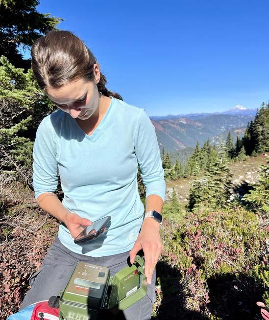
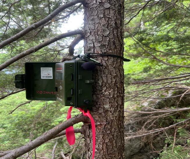
Along from contributing to specific projects in priority landscapes identified in the Forest Action Plan, the program also invested time and resources in passive acoustic monitoring technology. Autonomous Recording Units, also known as ARUs, are a relatively new technology that has been widely adopted as a way of monitoring terrestrial and avian species on the landscape. We partnered with the Forest Service and the Pacific Northwest Research Station in Corvallis, Oregon in 2023 to deploy 124 separate units across the Mount Baker-Snoqualmie National Forest to monitor distribution of the endangered Northern Spotted Owl. The team collectively hiked approximately 700 miles to deploy and retrieve these units over six-week intervals. The ARUs captured calls of multiple species, with a focus on Northern Spotted and Barred Owls. This data will help inform future implementation and updates to the Northwest Forest Plan.
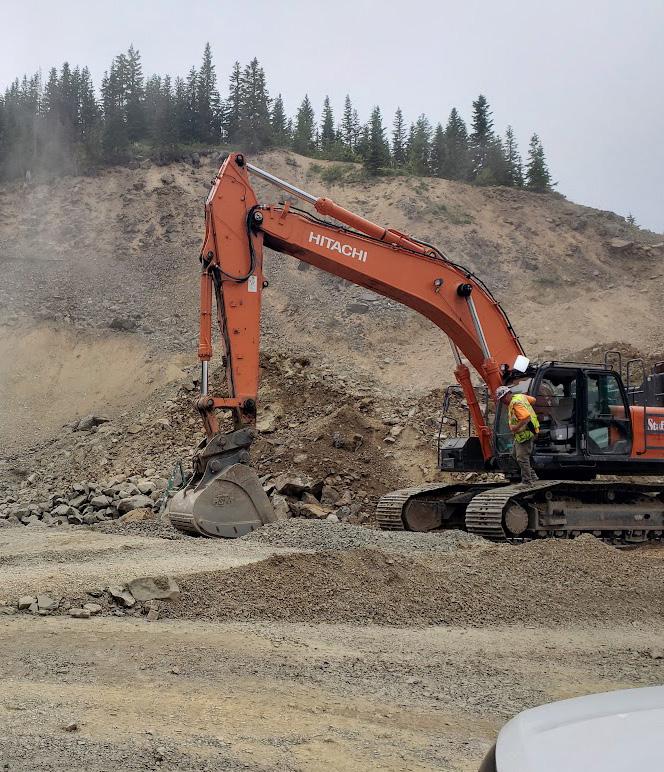
“Rock, it’s the enabling ingredient to everything!” Dan Kipervaser, Shared Stewardship Coordinator for the Mount Baker-Snoqualmie National Forest (MBSNF), shared the above “sediment” recently about a core material for forest restoration: rock. meet the commitments of the Forest Action Plan.
In adequate amounts and convenient locations, rock is a necessary lifeline for forest roads upkeep, as well as countless other activities on a forest. Rock provides a surface for nonpaved resource roads that allows for infiltration of water, while providing additional benefits for recreation, timber operations, and potential wildland firefighter operations, to name a few.
There are currently 2,390 road miles weaving through the MBSNF. Santino Pascua, a zone engineer for the south zone of the MBS, shared that while MBSNF staff would ideally maintain as much as 920 miles of forest roads annually, budget restrictions have compressed this number all the way down to just 168 miles in 2023. As unfinished projects have piled up, the MBSNF now has racked up an estimated $5 million in deferred road maintenance. Crushed rock is critical to addressing this deferred maintenance, which is most costeffective and operationally efficient when supplied from rock pits on the national forest. Many rock pits across the national forests in Washington were abandoned at the turn of the century following several years of budget cuts. Stockpiles of crushed rock produced by the now-shuttered pits have long since been used up.
In the summer of 2023, however, one key rock pit came back online thanks to a partnership between the USDA Forest Service (USFS) and DNR. The Forest Resilience Division at DNR provided a total of $150,000 for rock-pit redevelopment in the south zone of the MBS. The USFS Region 6 office saw an opportunity to leverage their funds and added an additional $300,000 to make the project a reality at the scale needed to make a difference on the ground.
Following testing by a Forest Service geologist at several abandoned pits for rock feasibility, a location was selected east of Greenwater in our Forest Action Plan’s Snoquera priority landscape. The reborn rock pit is located near popular recreation areas for camping, hiking, fishing, and target shooting, as well as several potential future timber sales.
While rock is most obviously needed for the creation, repair, and maintenance of forest roads, it opens up new possibilities for so much more:
• Rock means timber and our terrestrial and aquatic restoration footprint. Most timber sales on the MBSNF are put out to bid with the condition that the contractor “rock the roads” connecting to the sale areas. This not only ensures that the roads are safe for timber hauling, but also protects nearby streams from erosion caused by traffic and rain. This same rock is also needed when installing a fish passage to remove barriers to salmon migration. The price of purchasing and hauling tons of rock to repair road infrastructure is one of the most significant pain points on the MBSNF and can often determine whether a contractor bids on a project, let alone whether a timber sale is profitable. With a new rock source now located in a central spot on the south zone of the MBSNF, projects in the surrounding area will cost less both in terms of time and resources. This also means timber sales are more likely to sell. Most commercial projects on the MBSNF are currently motivated to increase forest health and resilience. Reducing the cost of their implementation leads to greater confidence in their execution but also the potential for these sales to generate revenue that can be used to fund habitat and watershed improvement projects – a compounding benefit to the forest.
• Rock means match. While the rock itself does not equate to dollars, it can act as a matching contribution in grant applications. For example, according to Pascua, the MBSNF can now use the value of the rock from their own pits as match to other costs of repairing damaged roads after a significant flood event through the Emergency Relief for Federally Owned Roads (ERFO) program. Similarly, rock can be used as in-kind match for an agreement with Weyerhaeuser to share maintenance and repair costs for roads used by both the company and the public.
• Rock means partnerships. Thanks to the newly available rock, collaborative projects aimed to improve roads and trails on the national forest can become a reality. Also, a local horseback riding group in the area has wanted for several years to help improve trails in the region. While the group is willing to volunteer their time and equipment to make improvements, rock was never available for the projects. The MBS can now provide the rock for those, and many other projects driven by volunteerbased recreation organizations.
• Rock means roads. With a limited budget, the MBSNF has had to take a triage approach to forest road maintenance –putting funds only toward roads that receive the greatest public use and delaying maintenance and repair for all others. Some roads have been left unmaintained for years, or even decades, as a result. Thanks to the shared investment in redeveloping a rock pit, staff can begin working through the backlog, which equates to safer roads and more comfortable rides for the visiting public, a reduced risk of washouts and riparian habitat damage, and improved access to restoration project areas.
• Rock means safer and more effective wildland fire operations. Wildland firefighters use networks of forest roads to access and fight wildfires. Well-maintained roads are required
for large engines to access emerging incidents quickly and directly. Rock and gravel are also a non-combustible material used by wildland firefighting teams to build fire control lines which help to contain or slow an active fire. Gravel can also be used to build control lines for potential future fire operations.
• Rock means recreation. Roads carry visiting recreators to trailheads, lakes, vistas, and campgrounds throughout a forest. Without a high-clearance vehicle, visitors are taking chances with their suspensions when traveling anywhere off the main road system. The roads leading to and around the Ranger Creek Campground, for example, are considered some of the worst on the south zone of the MBS. For the first time in 30 years, the MBS has rock to repair those and other roads resulting in better accessibility for those unable to afford more rugged vehicles.
“We’re still actively looking for partners who can help us unlock this critical resource that supports everything from recreation to restoration,” Kipervaser said.
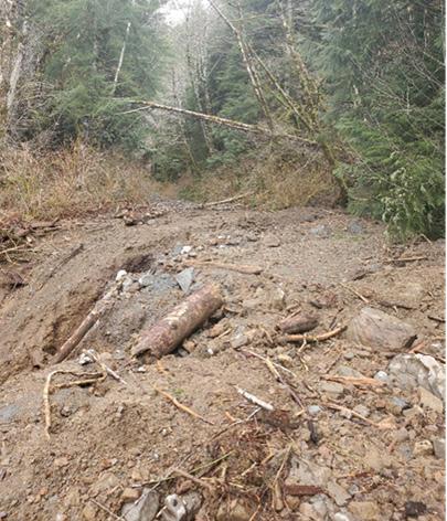
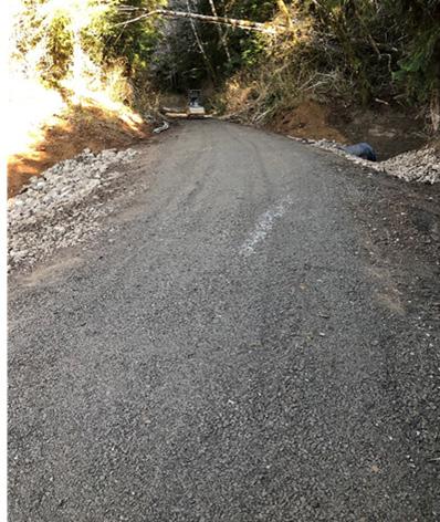
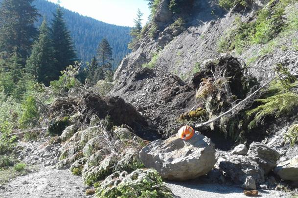
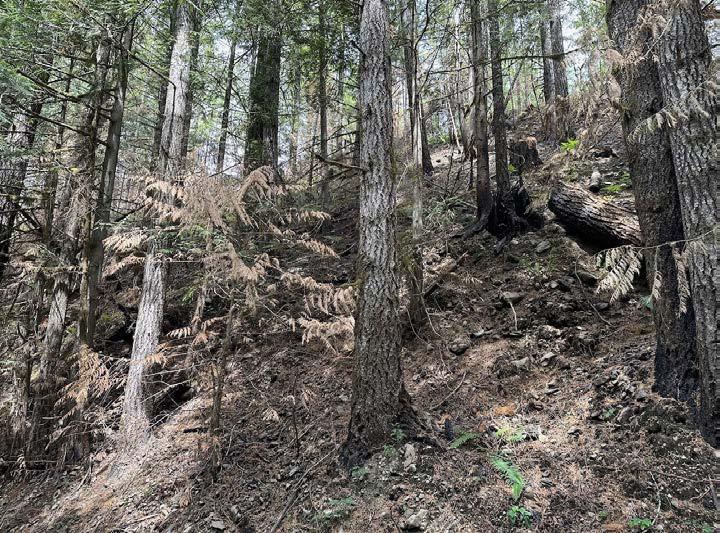
In addition to years of delayed maintenance on the MBSNF, all western Washington national forests, including the Olympic and Gifford Pinchot, are experiencing more frequent (annual and sometimes seasonal) large erosional debris events. These emergency events cost each forest huge amounts of time and resources when they are already low on funds.
As overdue challenges collide with new crises, the need for innovative partnerships and creative solutions is greater now than it has ever been. Building off previous travel management planning efforts, the MBSNF is working to develop its own long-term, sustainable solutions. For example, the MBSNF is examining how best to secure a road maintenance crew, as well as the heavy equipment needed to do much of the roadwork and maintenance, rather than contracting out the work. Staff with the MBSNF are also researching how to procure mobile rock crushing equipment.
“The MBS has a reputation in the Pacific Northwest region as a national forest that can put funds to good use,” further explains Pascua. “When there are additional funds to spend, we know we can spend it, and spend it well.”
Above: At left, a road on the Olympic NF that was covered in eroded materials. At right, the same section of road, after it was re-shaped and had rock re-added. Middle: Erosion events like the one pictured at left have become increasingly frequent on western WA forestlands. Bottom: Rock actively being crushed for future use.
DNR scientists and planners are working to bridge the gap between emerging scientific insights and practical management strategies across Washington state. Collaboration between scientists and managers has proven instrumental in unlocking the potential of new data products and transforming complex scientific findings into actionable guidance for on-theground decision-making. On the Gifford Pinchot National Forest, the integration of fire refugia concepts and data into forest management decisions is an evolving area of inquiry focused on adapting vulnerable, forested landscapes for the impacts of wildland fire and climate change.
Scientists and managers from the USDA Forest Service and DNR collaborated with Oregon State University scientists to craft a manager's brief focused on fire refugia in the Little White Salmon Forest Resilience and Wildfire Risk Mitigation Project (LWS). The brief serves as a template to facilitate incorporation of fire refugia science into forest project planning. It also presents a practical case study of actionable science for future regional projects employing fire refugia concepts.
The manager's brief is structured around two key objectives deemed critical for the effective integration of fire refugia concepts into project-level planning:
This section provides a comprehensive summary designed for managerial audiences. It includes:
Definition of fire refugia: a concise overview that defines fire refugia as areas on the landscape that experience less severe or frequent burning than their surroundings. This section addresses nuances in both relatively moist and dry landscape settings. Emphasis is placed on the challenge of aligning refugia information with land management objectives and ecosystems.
Available mapping products: an introduction to holistic fire refugia models, topo-climatic fire refugia models, DNR Large Dense Forest Sustainability maps, and their correlation with foundational research by Camp et al. (1997) on fire refugia in the Swauk Late-Successional Reserve on the Okanogan-Wenatchee National Forest.
Drivers of fire refugia: a succinct overview of the factors influencing the holistic and topo-climatic fire refugia models, encompassing vegetation and fuels, topography, fire weather, and fire growth components.
Mapping fire refugia in the LWS area: Visual representation through maps of the Little White Salmon watershed that showcase fire refugia products in the Resilience Block and High-Risk Block. These provide interpretative scenarios that may inform vegetation management decisions.
This section focuses on discussions and implications of vegetation management treatments on fire refugia characteristics, such as: Overlap of fire refugia with valued resources: suggestions for data analysis with fire refugia products exemplified by the integration of OGSI80 and OGSI200 maps with fire refugia products for informed management decisions.
Implications of refugia models at different scales: FAQs with insights for community discussions and decisions around the integration of fire refugia data.
Enhancing refugia sustainability through forest management: FAQs expanding on management ideas shaped by fire refugia products.
The report concludes with a compilation of additional resources on fire refugia. This collection offers an array of resources, including data products, webinars, journal articles, and relevant websites with the goal of fostering continued dialogue and application of fire refugia concepts within the community of practice.
The full report can be found at this link: https://oregonstate. app.box.com/s/m5qkgbjlqae14cuuksibkv3el2k0ohr2/ folder/217197079515
The Confederated Tribes of the Umatilla Indian Reservation (CTUIR) partnership with DNR is rooted in a shared commitment to land management and conservation of natural resources. The partnership, catalyzed by state funding provided by the Wildfire Response, Forest Restoration, and Community Resilience account established in 2021 by HB1168, is a burgeoning collaboration aimed at accelerating forest health and fuels reduction projects on the Rainwater Wildlife Area in the Blue Mountains of Eastern Washington. These initiatives align with the Tribes’ goals of improving wildlife habitat and first foods, mitigating wildfire risks, and enhancing the resilience of forest ecosystems.
Within the Blue Mountains, the CTUIR owns and manages the Rainwater Wildlife Area, which serves as the focal point of this collaborative effort. The infusion of state funding from HB 1168 empowered the CTUIR and DNR to accelerate the planning and implementation of forest management activities across the refuge of more than 10,000 acres. The Rainwater Wildlife Area is within the Touchet-Mill Priority Planning Area identified as one of 47 priority planning areas in Washington's 20-Year Forest Health Strategic Plan.
Through the leadership of CTUIR, and with the support of DNR, these forest health projects have restored wildlife habitat, mitigated hazardous fuels along strategic holding lines, and reduced risk of forest insects and disease.
This collaboration is expanding in the 2023-2025 biennium with additional investments to implement forest health treatments and increase stand-level monitoring on the Rainwater Wildlife Area. Monitoring data will be used to evaluate treatment outcomes and to measure the effectiveness of treatments over time. Fortified by state funding and guided by a shared vision for sustainable land management, this partnership serves as a positive example for Washington State and the greater Blue Mountains region.
The Yakama Tribal Forestry and Yakama Forest Development programs of the Confederated Tribes and Bands of the Yakama Nation partnered with DNR’s Forest Resilience Division during the spring of 2023 to thin 105 acres in the Spring Creek project area. The project was completed by Yakama fuels management and fire management crews, with funding for the project provided by DNR through HB1168.
The Spring Creek project area is located on the Yakama Indian Reservation, slightly north of the Highway 97 Priority Planning Area. The area burned in 1995 and was replanted in 1996 with primarily ponderosa pine. Nearly 30 years later, the project area needed thinning to remove trees, reduce overall competition for limited resources (including water), and to provide more space for the remaining trees with the best growth form to maximize future harvest and economic value.
The treatment consisted of thinning, bucking, and scattering with specific methods to reduce the chances of an lps beetle infestation following completion in April 2023. Ips beetles primarily infest pine trees, such as the ponderosa found in Spring Creek. For thinning, the specification was normal spacing of 16 feet with a 25% variance (12ft-20ft). As the trees were dropped, crews removed limbs and cut the trunk into pieces no larger than two feet. The pieces were then scattered throughout the unit to avoid piling. All ladder fuels were pulled away from the standing, live trees.
Through crew supervision, project administrators walking through the treatment units, and daily inspection reports, the crews were able to adapt and learn how to best implement the various methods required for this project. Future work in the Spring Creek project area will include collaboration among Yakama Tribal Forestry and Yakama Forest Development programs on managing downed material to reduce fire risk.
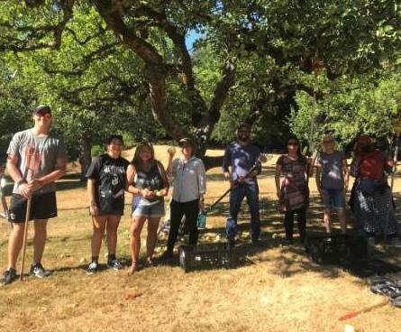
Two spring days, one year apart, and there is progress (and smoke) in the air.
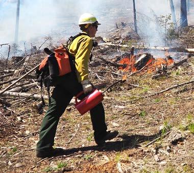
Roslyn resident Chris Martin attended a Washington State Certified Burner course in May 2022 as a student looking to add a certification to his prescribed fire resume. One year later, Martin had the right weather and fuel conditions to lead a prescribed burn for the field evaluation required to complete his certification.
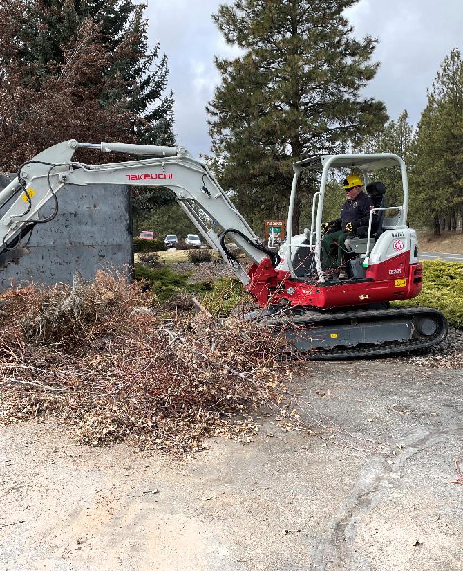
After going through all the necessary planning, Martin tipped over the drip torch and sparked the prescribed fire. An active member of the Roslyn community, Martin oversaw a successful 64-acre broadcast burn in the Forest Action Plan’s Cle Elum priority landscape. Of equal importance is the fact he did this work on private land in cooperation with primarily local partners.
The Certified Burner Program led by DNR provides fire practitioners in the state gross negligence protection – the highest level of liability protection available to burners in the event of an adverse outcome. The program also provides a clear standard of preparedness and safety protocols for those who lead burns, which had not previously been available to non-agency practitioners in Washington state. This certification provides class attendees the confidence to apply fire safely and with community support in more places. Because of his efforts, Martin now has more protections available to him, making it easier for him to lead treatment of high-priority areas identified in the DNR 20-Year Forest Health Strategic Plan. He is also more likely now to lead treatments on private land, a valuable and often untreated connector between our community forests and public lands.
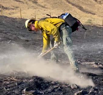
Success for the Certified Burner Program and DNR’s Prescribed Fire Program is defined simply as more prescribed fire occurring in more places with more people. For his burn, Martin relied on relationships with the City of Roslyn's fuels crew, the Mount Adams Resource Stewards (MARS) prescribed fire crew, local land managers, and the private landowners themselves. This local project would not have been completed without federal and state funding to cover the time and resources required of the participants, all of whom received prior training and had to be available when conditions allowed for a successful burn.
The successful partnerships and flexibility among partners meant that as operations progressed, burn leaders were able to add two additional units to the treatment plan and accomplish work on 174 acres that day. With each local success, we collectively increase the resiliency of Washington forests while also growing the workforce to get the work done.
THE CERTIFIED BURNER PROGRAM PROVIDES A CLEAR STANDARD OF PREPAREDNESS AND SAFETY PROTOCOLS FOR THOSE WHO LEAD BURNS.
Preparedness for the 2023 Fire Year was dominated by normal seasonal readiness preparations with continued House Bill 1168 (HB1168) implementation. The Washington Department of Natural Resources (DNR) Wildland Fire Management program neared full implementation of HB1168 with new aircraft, crews, and heavy equipment all coming online in time for Washington’s spring and summer fires.
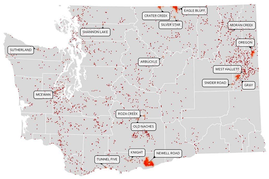
Washington experienced a “typical” fire year during 2023. Early season activity was driven by long-term drought, notably on the Olympic Peninsula and in Northwest Washington. Across the state, the number of ignitions and acres burned on DNR-protected lands were both at 10-year lows. As of the writing of this report, DNR had 1,042 fires statewide, and statewide acres burned for DNR fires was 102,942.
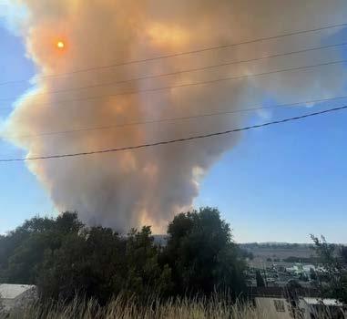
Despite the success in initial and extended attack, there were acute impacts during a cold front passage wind event on Aug. 18. The Gray and Oregon Road fires in Spokane County established a new “event of record,” which was previously the 1991 Firestorm. These events resulted in two reported civilian fatalities. DNR and Washington Fire Service partners are working to capture lessons learned from those incidents in a formal report (see additional details below) while continuing to support community recovery.
The top objective throughout the 2023 Fire Year has been firefighter and public safety. There were no firefighter fatalities in Washington state during the 2023 wildland fire season. Minimizing the public health impacts of wildfire smoke is an ongoing challenge for fire managers. The adverse effects of smoke were constantly factored into the development of incident strategies, consistent with firefighter safety. DNR will implement HB 1578 in 2024 to incorporate wildfire smoke mitigation, along with expansion of the Wildfire Ready Neighbors community resilience efforts into western Washington.
Washington’s 2023 fire season started off with moderate conditions in the high elevations and eastern Washington due to high snowpack and persistent precipitation. Late winter and early spring were wet across the state, but conditions changed and both weather and fuels dried west of the Cascade crest in May. In fact, some of the largest western Washington fires of the year were in May and June due to the lack of spring rain. Conditions eventually turned hot and dry across the whole state, and eastern Washington fuels became supportive of large fire growth.
On May 27, the western Washington summer fire season kicked off with the Shannon Lake Fire north of Concrete in Skagit County. This fire burned 85 acres of logging slash and reproduction timber. This was an indicator of how little late spring precipitation there had been leading up to this point.
On June 27, the Sutherland Fire started just outside of Port Angeles in Clallam County, burning 108 acres of timberland.
On July 4, the McEwan Fire started just outside of Shelton in Mason County, ultimately burning 250 acres. All these western Washington fires had a considerable ground and aerial response including multiple helicopters, super-scoopers, air tankers, and use of newly purchased heavy equipment. While the Shannon Lake Fire and the Sutherland Fire had less Wildland Urban Interface (WUI) complexity, the McEwan fire directly threatened 700 primary residences.
The first Type 2 complexity fire in Washington was the Tunnel Five Fire that burned next to the town of White Salmon in Klickitat County. The fire started on July 2 and burned 546 acres of WUI and in the cliff bands above the Columbia River Gorge. This fire was complex due to being located on very steep terrain with the immediate threat to densely populated areas, ultimately destroying five residences. On July 21, the Newell Road Fire, another large complex incident, burned 60,551 acres of grass, shrubs and some timber in east Klickitat County. The fire burned across vast, difficult terrain between Bickleton and the Columbia River, threatening solar farms, wind turbines, Roosevelt Landfill methane facility, agricultural lands, and 173 homes.
On July 29, Eagle Bluff Fire started just four miles outside of Oroville in Okanogan County. The fire quickly forced evacuations of the Oroville area and raced north across the U.S.-Canada border. Most of this fire burned through lighter fuel types of grass and brush, but there was also a timber component. A Type 2 Incident Management Team (IMT) assumed command after the initial attack efforts of the Northeast Type 3 Team. Because the fire burned into Canada, DNR, BLM, and BC Wildfire Agencies were able to utilize the “Hands Across the Border Agreement” to coordinate firefighting objectives and aircraft utilization, and because of the agreement, a DNR 20-person hand crew was able to operate across the border to continue with an important firing operation that held the northwest portion of the fire to a Canadian highway.
The most impactful incidents in Washington, both in Spokane County, started on Aug. 18 and were driven out of control by a strong dry cold front. The Gray Fire was located outside of Cheney in the Medical Lake community and the Oregon Road Fire was located outside of Deer Park in the community of Elk. Together these fires destroyed more primary residences than any other wildfire in recent history. The Gray Fire burned 240 residences and 86 other structures. The Oregon Road Fire
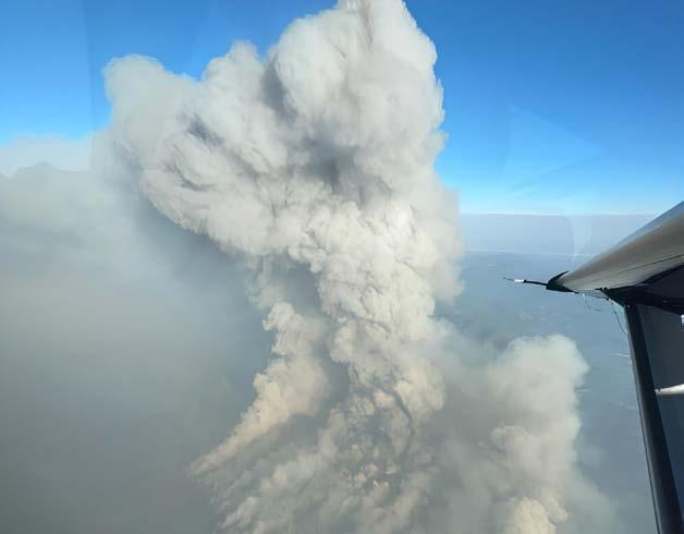
burned 126 residences and 258 other structures. These two fires burned through both wildland urban interface areas with dispersed homes and densely populated neighborhoods. The rapid growth of the fire initially overwhelmed state and local response entities that were concentrating on evacuating the public and protecting homes and infrastructure.
A case study, known as Facilitated Learning Analysis (FLA), is being conducted by fire professionals from DNR and Washington Fire Service. The analysis will focus on lessons learned from this extraordinary event. The FLA should be available for review in the spring of 2024.
The July and August lightning events were thankfully accompanied with considerable rainfall. Overall, for lands protected by DNR, Washington fared well in 2023 with less acres burned than the previous 10-year average and less fire occurrences.
2022 WAS THE LARGEST FIRE YEAR IN RECENT WESTERN WASHINGTON HISTORY, SERVING AS A WAKE-UP CALL TO PREPARE FOR A TRULY LARGE FIRE YEAR THAT WILL OCCUR IN THE FUTURE WHEN IGNITIONS CONVERGE WITH DRY FUELS AND HIGH WIND EVENTS.
Unlike the 2022 season, there was not much fire activity in Alaska, the Southwest, or Southern Geographic Areas in the early season. This allowed for expanded use of DNR wildland firefighters to implement planned prescribed burning in Northeast and Southeast Washington. Additionally, the rather slow start to the season allowed for a focus on readiness activities and more formalized crew preparedness reviews across the state.
Washington received multiple heavy lightning storms throughout the summer of 2023, but most storms brought plenty of rain with them. Most notable of the lightningcaused fires in western Washington that impacted DNR protected lands occurred late in August and included the Cowlitz Complex on the Gifford Pinchot National Forest (a complex of 30 individual fires within a 20-mile radius), the Chandler and Harmony fires (totaling over 47 acres) in rugged terrain of Lewis County, and the Lake Whatcom Fire (40 acres) which burned immediately off the shores of Lake Whatcom on very steep forested terrain. Eastern Washington received its fair share of lightning-caused fires as well, but most were kept small other than those that
were started on June 27; the Roza Creek Fire, which burned 486 acres along the Yakima River Canyon in Kittitas County, and the Silver Start Fire that burned 572 acres outside of Tonasket in Okanogan County. Aviation operations were an area of emphasis in 2023 due to the large fire potential across Washington and the need to expand the air asset coverage area, thus reducing response times to incidents. DNR responded more than 300 times via aerial support to initial attack incidents, flying more than 3,500 hours and delivering over 9 million gallons of water/retardant to wildland fires.
No AirNow monitors in any Washington county showed more than nine days of daily average values reaching Unhealthy for Sensitive Groups or above (defined as “poor air quality”). Okanogan County experienced nine days of poor air quality, followed by Stevens County with seven days, and Grant County with six days. Some counties, mostly on the western coast of the state, showed no full days of poor air quality, including Grays Harbor, Skagit, Thurston, and Jefferson counties. Overall, 2023 saw much better air quality than previous fire years statewide, but Okanogan County and Grant County once again experienced the worst average air quality in the state due solely to wildfire smoke.
Total acres burned for DNR fires was a mixed bag when looking at the average. Some regions were below or at average, and some were under. Overall, however, DNR was below average for those fires that burned during the period Jan. 1 to Sept. 30. In those nine months, 102,942 acres burned were reported, which was less than the 12-year average of 104,285 acres statewide.
WASHINGTON
EXPERIENCED A ‘TYPICAL’ FIRE YEAR DURING 2023. EARLY SEASON ACTIVITY WAS DRIVEN BY LONG-TERM DROUGHT, NOTABLY ON THE OLYMPIC PENINSULA AND IN NORTHWEST WASHINGTON.
Location of wildfires that occurred in Washington in 2023.
DATA SOURCES: NATIONAL INCIDENT FEATURE SERVICE 2023 (NIFC), WA DNR FIRE STATISTICS 2023 (EIRS)
Wildfire Ready Neighbors
Expands into Western Washington
DNR continued the Wildfire Ready Neighbors (WRN) Program in 2023, expanding into Pierce, Mason, and Thurston counties in western Washington counties during springtime. Each county had a community event to highlight their local launch of Wildfire Ready Neighbors and encourage people to act. All three counties had full marketing surges which included direct mailings, community events and social media posts, as well as radio and print ads. Before each surge, DNR worked with local county partners to identify focus communities to pilot these efforts. More than 750 people in western Washington signed up for the WRN program during the three surges.
Additional full and smaller marketing surges were implemented in eastern Washington, which included the program moving into additional communities and into additional fire district boundaries.
Spokane, Okanogan, and Kittitas all had full marketing surges in 2023. Yakima, Ferry, and Klickitat counties each had smaller marketing surges generally limited to direct mailings.
Slash collected and piled as part of wildlfire preparedness work by the Valleyford community through their microgrant.
DNR’s Community Resilience Program has grown to include eight staff and provides more holistic coverage of the state. The Community Resilience Program funded more than $1.5 million in agreements to support work around fire preparedness — the work of supporting communities in their wildfire resilience efforts requires many diverse hands and partnerships, so DNR was happy to help support a variety of partner-led initiatives and efforts:
• 20 awards went to various fire districts and nongovernmental organizations (NGOs) across the state to support fire preparedness planning and implementation work
• 3 awards were given to the State Conservation Commission, which focused work on home hardening, defensible space, education, and outreach
• 83 micro grants were awarded to many of the 128 Firewise USA sites across Washington, supporting the implementation of each site’s action plan
• 2 awards went to the Latino Community Fund (LCF) and the Community for the Advancement of Family Education (CAFÉ), which focused on wildfire preparedness training, community engagement, and home risk assessments. In all, CAFÉ and LCF trained 348 community members to be wildfire preparedness community leaders, completed 136 home visits in partnership with the Wildfire Ready Neighbors Program, and held 42 community events
Treatment Tracking Provides Visual Display of Cross-boundary, Coordinated Forest Health Work on Cle Elum
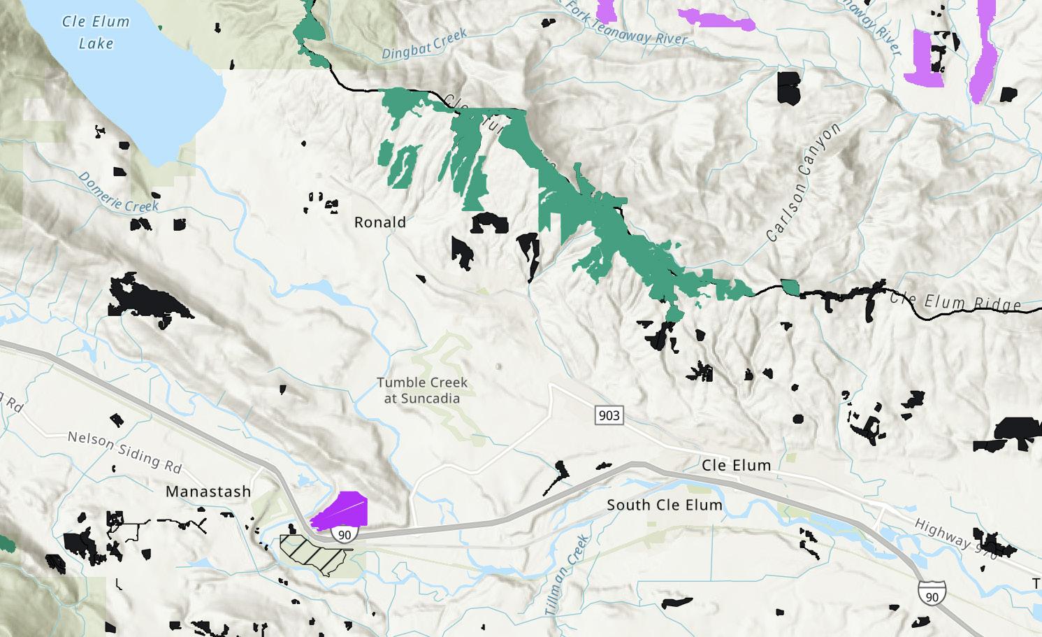
Washington is a patchwork of public and private land ownerships, with our forestlands being no different. The North Cle Elum Ridge encapsulates one such patchwork forest. Sitting above the central Washington communities of Ronald, Roslyn, and Cle Elum, the ridge is owned and managed by landowners such as The Nature Conservancy (TNC), DNR, and smaller private landowners, to name a few.
Knowing the diverse land ownership across this landscape, it is even more impressive to look at a current map of planned and completed forest health treatments along this ridge (See image below).
Implementation of these forest restoration projects was no small feat and did not occur overnight. Developing dynamic treatments that serve a variety of benefits including increased forest health, wildfire resiliency, community protection, water quality and quantity retention, maintaining sustainable recreational opportunities, and conserving wildlife habitat has been a long-term exercise for the community. The collective and coordinated work was initiated following the 2017 Jolly Mountain Fire and has required the passion, commitment, and time of a variety of land managers, planners, and community members to continue to get them through to the finish line.
“Really, it’s been the right people in the right place with the right tools,” said Amy Ramsey, all-lands environmental planner for DNR’s Forest Resilience Division.
The Kittitas Fire Adapted Communities Coalition (KFACC) was formed following the Jolly Mountain Fire in recognition of the need to make forests adjacent to local communities more fire-resilient. KFACC is composed of partners ranging from local fire responders, city, and community representatives and local landowners, to larger land managers passionate about addressing wildfire issues. Tools like the Cle Elum Forest Health Landscape Evaluation and the Dual Benefit Analysis, both prepared by DNR, have helped KFACC partners prioritize and plan
1 mile
where best to implement forest restoration and fuels reduction treatments. The ‘living laboratory’ approach that TNC has taken to the 20,000 acres it manages along the ridge have provided countless amounts of data on forest health thinning, prescribed fire treatments, and water quantity and quality. These mechanisms help to develop a more robust and inclusive land stewardship across the ridge. However, two of the biggest keys to getting work successfully on the ground have been open communication and opportunities for a variety of folks to be part of these decision spaces.
“There is a big need for coordinated communication when these activities are happening, Ramsey said. “If people know there is a space that they can go to ask questions, they will thoughtfully be engaged.”
One of the biggest successes for the project has been the concurrent funding opportunities that came with the Wildfire Response, Forest Restoration, and Community Resilience account established in 2021 by House Bill 1168. The planning and social discussions that had already been occurring in the area prior to 2021 meant the money from HB 1168 was almost immediately invested in forest restoration activities on the landscape. With its mix of private and public lands, the North Cle Elum Ridge is very similar to many areas in the Pacific Northwest. As other wildfire-prone communities work to better engage, plan, and manage their forestlands, the people who have made Cle Elum Ridge a success story believe their project underscores the need for each community to identify and plan for the unique aspects of their own landscapes, including their resources, values and overall objectives of working together.
COMPLETED FOREST HEALTH RESTORATION TREATMENTS FROM 2019–2023
Treatments included commercial thinning, non-commercial thinning, mastication, and prescribed fire.
Treatments by The Nature Conservancy.
Treatments on private lands, including the Roslyn Urban Forest and Suncadia, with projects paid for by DNR SE Region, DNR Service Forestry program.
Treatments on state-managed lands (WDNR, WDFW).
DATA SOURCE: WA DNR ARCGIS MAPS
The DNR Northeast Region Service Forestry team has provided financial and technical assistance to thousands of small forest landowners over the past several decades. Many of these small forest landowners have conducted forest health improvement and fuels reduction projects on their properties to make their forests more resilient to insect and disease pathogens, as well as to catastrophic wildfires. These projects typically involve non-commercial tree thinning, pruning, and slash disposal. Thinning stands reduces competition for limited nutrients like water and sun. Pruning the lower branches of trees reduces “ladder” fuels that can carry flames up into the tree canopy, which then increases the potential for catastrophic crown fires. Slash created during the thinning and pruning activities must be disposed of through removal or rearrangement in order to create a more resilient stand of trees.
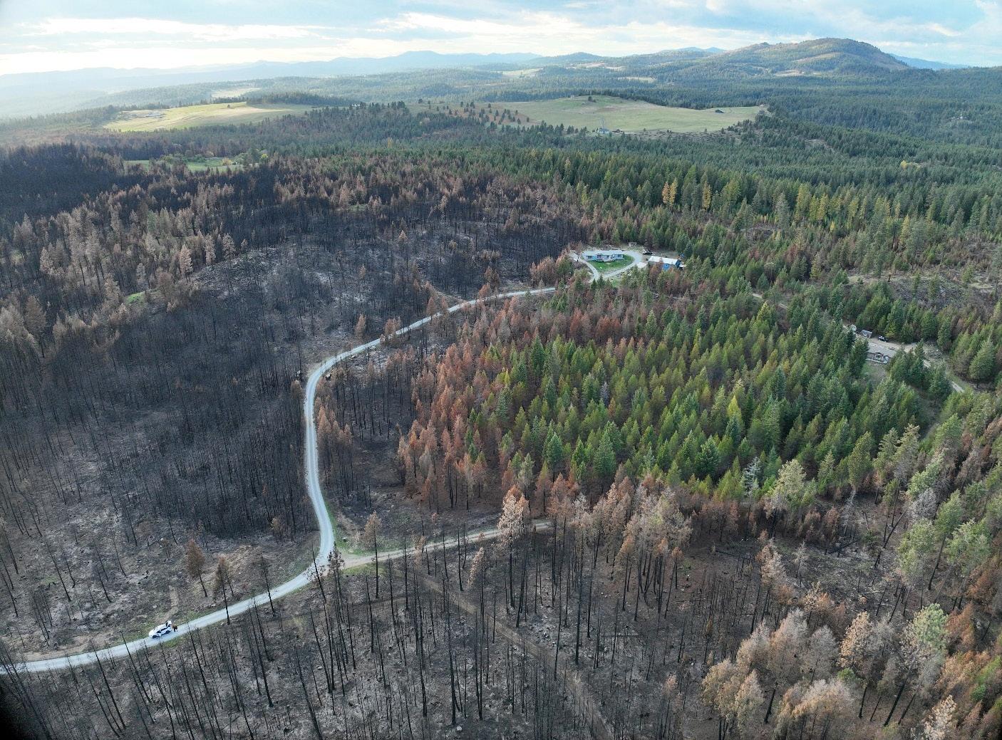
The 2023 fire season in Washington’s Northeast Region was uniquely destructive. On August 18, 2023, the conditions were especially ripe for uncharacteristic wildfire. The weather and fuel conditions necessary to support extreme fire behavior developed rapidly the week before. The observed Energy Release Component and Burning Index numbers, indices designed to highlight potential fire behavior, set daily record values indicating extreme burning conditions in the region – both values were in the top 1% of annual averages. Both the Spokane and Deer Park communities experienced four consecutive days of record or near-record temperatures prior to ignitions.
On August 18, fire weather conditions in the area contained the most critical combination of strong winds and low relative humidities on record: the temperatures were in the mid-nineties, relative humidity was as low as three percent, and the wind was blowing more than 20-miles-per-hour. As a result, the Gray and Oregon Fires spread rapidly and intensely across the landscape. Winds progressed to the north and shifted rapidly to the south, leaving landowners with little time to evacuate. These two fires burned 20,000+ acres and destroyed more than 700 structures with more than half being primary residences. Two civilian lives were lost.
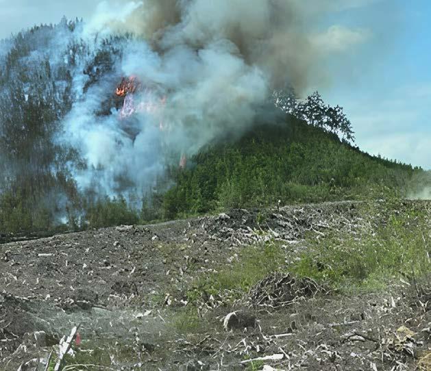
In the spring of 2023, DNR initiated a pilot monitoring program called the Wildfire Interaction with Treatments and Suppression (WITS) survey to determine the effectiveness of forest health and fuels reduction projects when tested by wildfires as related to suppression activities. The Oregon and Gray Fires provided a good opportunity to test the WITS survey. Within the fire perimeters, 53 separate small forest landowners had participated in DNR’s Financial Assistance for Wildfire Resilience and Forest Health program. A total of 110 projects were tested by the two fires. Preliminary results are still being analyzed, but engagement of fire staff and utility of treatments during suppression activities is becoming more prevalent in conversation because of WITS. Initial first observations indicate that forest health and fuels reduction projects effectively changed the fire behavior in the favor of the forests, landowners, and fire personnel.
Tested treatments (areas that received fuels reduction work and interacted with fire) showed varying degrees of tree mortality and fire severity. One small forest landowner, Dane Tackitt, had a treatment intersect with a running crown fire. The fire burned intensely as it entered the treated area, but dropped to the forest floor and began to burn at a lower intensity along the ground. The fire intensity dropped even more as it burned deeper into the treated unit to the point where the ecological impact of the fire was like that of a prescribed burn.
Earlier in the season, another wildfire tested the validity of previously completed forest health projects. The West Hallet fire ignited on July 31 in the wildland-urban interface areas between Cheney and Spokane. The fire only burned 120 acres but threatened hundreds of residences. Numerous ground and air resources were mobilized as the fire began to burn rapidly towards homes. The fire was successfully controlled with no loss of buildings due to a coordinated initial and extended attack, and in no small part due to multiple forest and fuels reduction projects in the area. Cindy and Brian Fiut’s 15 acre property that includes their home and multiple outbuildings was located directly in the path of the fire. They implemented a cost-share project in 2013 across 6.1 acres of their property. The Fiuts followed the advice of their forester and maintained the treatment annually with pole saws and loppers. Despite the project being nearly a decade old, the maintenance of the initial treatment ultimately led to reduced fire intensity and reduced tree mortality.
Interviews with initial attack firefighters on the scene revealed that ground resources were able to take advantage of the lower fire intensity and safely take suppression action to stop the fire on the Fiuts property. When they were able to return to their property, the Fiuts discovered that their fuel reduction efforts had paid off. All their structures survived, and the
THE FIRE INTENSITY DROPPED EVEN MORE AS IT BURNED DEEPER INTO THE TREATED UNIT TO THE POINT WHERE THE ECOLOGICAL IMPACT OF THE FIRE WAS LIKE THAT OF A PRESCRIBED BURN.
property suffered escaped large amounts of tree mortality. The fire went from a stand-replacing crown fire on the neighboring, untreated land to a low-intensity surface fire on the Fiut property.
The Fiut Treatment Area was the first to have a WITS monitoring survey completed on it. The survey allowed managers to capture the effectiveness of the treatment in altering the fire behavior and improving suppression opportunities. It also revealed the importance of maintaining fuel reduction treatments.
Treated and untreated lands will continue to experience wildfire. Following these events, it’s important to recognize and monitor the effectiveness and sustainability of treatments. Continued collaboration with fire managers and forestry staff can aid in increased utilization and understanding of fire tested treatments.
The fire suppression efforts of DNR are well-known by the average forest landowner in Washington. They easily recognize the red trucks, engines, and equipment that transports firefighting teams to active wildland fires.
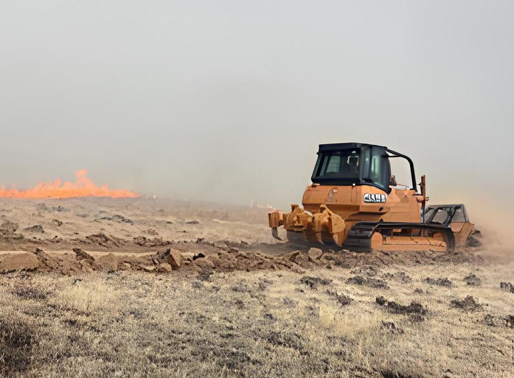
While it is critical to invest in planning, suppression, active management, and emergency response activities before and during fire events, planning for post-fire hazards and investing in resources for those activities are also vital activities. Post-fire challenges can be costly financially and physically, both to the landscape and to man-made resources. Landslides and flooding are more common after fires due to reduced vegetation on hillsides. These slides often pose risks to homes, fences, and other infrastructure. Ash, sediment, and other fire debris can infiltrate water resources, to the detriment of wildlife habitat and potable water sources. Because wildfire season often ends not long before fall rains and winter snowfall, post-fire events can occur mere weeks after a wildfire, or even while the fire is still actively burning. Post-fire risk and impacts can last for years after the fire is out.
Post-fire planning efforts like those by the Okanogan County Long Term Recovery Group and the After the Fire toolkit developed by the Washington Resource Conservation and Development Council provide real-world strategies for navigating the post-fire landscape on physical, social, and mental levels. Together, they are only a starting point for the fast-growing needs of communities across Washington.
The DNR Post-Fire Recovery Program aims to build on existing tools and facilitate expansion of the post-fire planning and implementation process in Washington. Starting with a collaborative, cross-boundary approach, DNR hired its first post-fire program manager in February 2023. It works at a community-to-watershed scale on post-fire recovery planning, communication, and implementation work.
While most post-fire recovery needs are in eastern Washington, recent wildfires in western Washington provided some unique collaboration and learning opportunities. The Bolt Creek Fire

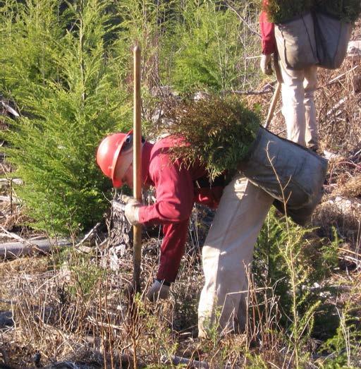
burned in September 2022 across tribal, state, private, and federal lands, including more than 500 forested acres purchased a few years prior by the Tulalip Tribes of Washington. The property was purchased from an industrial practitioner that had harvested most of the merchantable timber on the property and replanted the site to mostly Douglas-fir. The Tulalip Tribes are preparing to replant most of the burned area with Douglas-fir (80%), western redcedar (10%) and western hemlock (10%). Within the burned area where the slope is less than 35% and reasonably accessible by road for most elders, the Tribes are planning to replant the burned-over property with important cultural species in an effort to provide their community with more access to cultural landscapes and culturally important plants.
Partnerships have played key roles in planning for and executing this specific post-fire recovery effort. The Washington Geological Survey’s Wildfire-Associated Landslide Emergency Response Team (WALERT) assessed the landscape burned by Bolt Creek and identified the areas for the highest risks of post-fire debris flow. It also provided downstream recovery analyses. This helped the Tulalip Tribes to better define their initial reforestation work. The Tulalip Tribes then reached out to and developed a three-way partnership with the nonprofit One Tree Planted the DNR Post-Fire Program to support, steward, and manage the replanting effort.
With fire history in western Washington lacking in recent history, Tulalip Tribes and partners are learning what post-fire recovery can look like west of the Cascades. For example, the more than 150,000 trees for the project will need to be appropriately housed in a refrigerated environment for several months before they can be planted. Estimating the size of refrigerator truck, identifying rental companies, and figuring out where to house the truck are all things that Nick Johnson, Tulalip’s Forestry Program Manager, has never had to deal with in his decades of forestry work. Without much of a localized toolset, these efforts have required a lot of stop and go activity. Not knowing the costs and timelines for various supplies, contractors, and necessary equipment in post-fire replanting has led to a steep learning curve.
“Once we have taken care of our human community, we can move to our ecological community,” Collin Haffey said. “We know that these are inextricably tied, but if we are
trying to find someone a house, a place to sleep, we will need to do this first, and without plans, we will not be able to ever get to a place where we can work on the ecological restoration aspects.”
Haffey, the post-fire program manager for DNR, believes that the challenges, while requiring a lot of new learning opportunities, are all surmountable. The biggest issues with post-fire restoration for the Tulalip project were largely logistical in nature. Because of the groundwork laid by this project, various supplies, contractors, and necessary equipment will be more easily identified and ready to go for future post-fire efforts.
Having a better idea of the different post-fire needs and channels for recovery will make it much easier to plant a lot closer to the actual fire. “This means a lot less herbicide,” Haffey said. “Our success rates will be higher and there will be less competition for re-planted trees.”
The Tulalip have ordered the 150,000 seedlings that will be ready to plant in spring 2024. One Tree Planted and DNR are providing financial assistance to contribute to the cost of growing and planting trees.
Critical, initial steps towards strong, statewide postfire recovery network in Washington took place in 2023, supported by tools and information systems that communities and landowners can rely on after the fire. This is codified in House Bill 1578, which passed the State Legislature in 2023 with partial financial support to staff the Washington Geological Survey’s Wildfire-Associated Landslide Emergency Response Team (WALERT) team. DNR is hoping to gain full funding in 2024.
WASHINGTON HAS LOST MORE THAN 1.5 MILLION ACRES OF FOREST TO PRIVATE DEVELOPMENT SINCE 1978 (BRADLEY ET AL. 2007). THE LOSS OF FORESTS PUTS ECOLOGICAL, SOCIOCULTURAL, AND ECONOMIC VALUES AT RISK.
Washington has lost more than 1.5 million acres of forest to private development since 1978 (Bradley et al. 2007). The loss of forests puts ecological, sociocultural, and economic values at risk. Washington forests support more than 1,700 forest product businesses that generate more than $28 billion in annual income (Washington State Department of Commerce). Forests are spaces where Washingtonians go to practice their religions, cultural traditions, and exercise – they are a necessity for the physical, mental, and spiritual health for our state’s diverse array of residents. The urgent need to address forest conversion requires a collaborative and coordinated approach with partners across the state. The Forest Action Plan committed to:
• Expand efforts to ensure sustainable food and timber production by conserving working farms and forests, securing water resources, and protecting highproductivity soils in the face of population growth.
• Enhance retention of working forestland held by small forest landowners.
• Enhance and develop incentives, ensure effective administration of regulations, and foster sharing of information among relevant agencies and partners protecting and restoring ecologically important forestlands.
• Explore innovative approaches to conservation finance tools to address forest loss
Since 1990, the Forest Legacy Program (FLP) has helped protect forests at risk of being permanently converted to non-forest uses. In Washington, where our wildland-urban interface continues to be one of the fastestgrowing land types, maintaining forestlands is key to helping the Evergreen State retain its hue. As one of the original five states to be part of the Forest Legacy Program, Washington has a long history of protected lands to boast about, with more than 77,000 acres protected as of September 2023. Below, we highlight a few recent additions:
WITH THE LANDSCAPE MOVING THROUGH DIFFERENT ELEVATIONS, TEMPERATURES, AND TYPES OF VEGETATION AND WEATHER, KITTITAS WORKING FOREST PROVIDES FLEXIBILITY FOR MANY SPECIES TO ADAPT TO CHANGING CONDITIONS.
Located in Mason and Kitsap counties in the Kitsap-Shelton Priority Landscape, this project is the final phase of a three-part easement built over several years. Starting with the Dewatto Headwaters Phase 1 FLP (funded in 2018, completed in 2020) and Dewatto Phase 2 and Phase 3 projects (funded in 2020 and 2021), the Dewatto Headwaters Forest adds an additional 11,460 conserved acres. As part of Rayonier Hood Canal Tree Farm, the conserved forestland supports 41 direct positions and an additional 43 jobs indirectly. The diverse site includes 23 acres of few-flowered sedge, an imperiled ecosystem in our state, as well as 380 acres of wetlands, 15 miles of streams, and 106 acres of lakes. Due to its position near the Kitsap Naval Base, the US Department of Defense also provided funding for this project; the Dewatto Headwaters Forest also provides a buffer for the sometimes-noisy submarine testing.
Development and interest have boomed in Kittitas County in recent decades. Located in central Washington, Kittitas County is located within the eastern Cascade Range, a key area for habitat, species, and climate conversion zones. Past development in the area has fragmented important habitat for a variety of wildlife, including elk, wolverine, gray wolves, and northern spotted owls, making it more difficult for these key species to adapt to climate change induced conditions.
Funded in 2023, the Kittitas Working Forest was identified by the Washington Wildlife Habitat Connectivity Working Group as a key landscape for wildlife adaptability to climate change. With the landscape moving through different elevations, temperatures, and types of vegetation and weather, the landscape provides the flexibility for many species to adapt to changing conditions. Made up of 5,870 acres within the Cabin Creek Watershed, the Kittitas Working Forest also provides important protection for the Yakima River headwaters, which support irrigation for Yakima Valley’s important apple and cherry crops, as well as 75% of the United States hops supply.
The 46,000-acre Mount Adams project is located on the east slopes of the Cascade Mountain Range in southern WA. It lies in the shadow of Washington’s 2nd tallest peak, Mount Adams, between two Wild and Scenic rivers, and within the ceded territory of the Yakama Nation.
Phase one (funded 2023) is composed of 6,378 acres of Douglas-fir dominated forests surrounding the rural community of Trout Lake, WA (pop. 624). The project ties together a forested landscape between the adjacent Gifford Pinchot National Forest, state-owned timberlands, and natural areas. It also protects the source water for Trout Lake’s municipal water system. The forests support a workforce that in turn sustains a local timber economy composed primarily of familyowned forests. Phase one also provides important benefits for fish and wildlife including game species, five federally listed species, and additional state listed species. Protection of these resources is essential, as demand for recreational houses in this highly scenic landscape has created strong pressure for conversion. This conservation easement will permanently protect Phase one’s vital working forests, clean water, and habitat, and the public access that has defined it for generations.
THE FOREST SUPPORT A WORKFORCE THAT IN TURN SUSTAINS A LOCAL TIMBER ECONOMY COMPOSED PRIMARILY OF FAMILY-OWNED FORESTS.
In November 2023, DNR confirmed that it will be purchasing more than 9,000 acres in Wahkiakum County. The purchase encompasses four different properties across the county.
Most of these lands are purchased partially using funds allocated through the Climate Commitment Act (SB 5126). The act, which passed in 2021, is designed to help the state meet its emission reduction goals at a scale (and on a timeline) that provides tangible benefits to the state. The reduction targets for Washington are in line with the Intergovernmental Panel on Climate Change’s recommendations. For Washington, that means reducing our 2018 and 2019 emission levels by 50% by 2030, with progressive emission reductions targets and an end goal of net-zero emissions by 2050.
These land acquisitions help to ensure that these acres stay in carbon-storing forestlands. Through DNR’s purchase of these combined 9,000 acres, the land will stay in timber
production in perpetuity. The lands will also be managed for water quality, wildlife habitat conservation, and other public services.
The purchase also provides an economic opportunity for Wahkiakum County.
“Most counties in our state are rural, and keeping our forestlands intact and in production supports rural jobs and communities,” said Eric Johnson, executive director of the Washington State Association of Counties. “These lands will also provide additional environmental benefits for all Washington residents. This is a great example of an outcome where we don’t have to choose between environmental or economic benefits. In this case, we get both.”
The purchase complements a handful of other forestland purchases and planned purchases in Southwest Washington. DNR purchased 266 acres of land in Wahkiakum County in 2021. In June 2023, the Board of Natural Resources approved the purchase of 640 acres of forestland in Clark County, and in October 2023, the Board approved the purchase of 170 acres of land in Pacific County.
HOUSE BILL 1216 ALSO GAVE UCF THE CAPACITY TO QUINTUPLE ITS PASS-THROUGH GRANT DOLLARS TO COMMUNITIES THROUGHOUT THE STATE. THE GROWTH ALSO PROMPTED THE UCF PROGRAM TO INCREASE ITS PERGRANT MAXIMUM TO $40,000 PER PROJECT.
Washington Department of Natural Resources (DNR’s) Urban and Community Forestry Program supports planning, planting, and maintenance of trees in Washington communities. Urban trees and forests often face more stressors than their non-urban counterparts: heat from roads, buildings, and structures; emissions from cars, factories, and other sources can all cause a tree’s natural defenses and carbon-capturing abilities to work overtime. Tree cover enhances quality of life and provides benefits for human health, ecological services, and fish and wildlife. DNR is committed to increasing the pace and scale of urban and community tree opportunities. Through significant staff expansions to unprecedented grant dollars, the Urban and Community Forest Program (UCF) has more capacity than ever to serve the people in Washington. Additional tools like the Urban Forest Inventory help assess, monitor, and act on the tree and canopy needs across our state over time.
With support from the legislature through the Evergreen Communities Act and Climate Commitment Funding, DNR’s Urban and Community Forestry Program expanded rapidly to bring on new capacity to support cities and communities statewide with the following positions:
• Financial Assistance Planner – assists with grants, contracts, agreements, and direct investments to priority communities.
• Urban Forestry Specialist – leads technical assistance for eastern and western Washington.
• Urban Forestry Technicians – frontline field staff for delivering urban forestry technical assistance to communities in Washington.
• Evergreen Communities Coordinator – coordinates the development and launch of the Evergreen Communities Recognition Program and supports communities in their Tree City USA recognition.
• Urban and Community Forestry Outreach Specialist – connects urban forestry partners with the DNR Urban and Community Forestry Program’s services and supports development of new recognition programs, manages the Tree Link Newsletter, and coordinates recognition events such as Arbor Day.
• Urban Forest Inventory Technician – leads collection of tree inventory data in the field.
Additional data and contracts capacity was also added to facilitate the prioritization and execution of investments made by the program. This expanded capacity will increase the delivery of assistance to Washington’s communities.
The DNR Urban and Community Forestry Program recently offered a combined $7 million dollars in grants through their 2024 Community Forestry Assistance Grant. Funding sources for the record-setting grant cycle included $5 million in federal dollars, with an additional $2 million from state sources. The dollar figure is not only 11 times more than the previous single-year record of $550,000 set in 2021, but also more than double the total amount awarded to the nearly 220 recipients since DNR first began administering UCF grants in 2008.
To acquire the widest pool of applicants possible, UCF staff offered a variety of resources and application updates. Staff hosted an informational grant webinar series when the grant application period opened in fall 2023, as well as a pre-application conference. They also produced a Frequently Asked Questions document, which they shared on their website. Staff developed an online Urban and Community Forestry Program Prioritization Tool to help inform these investments to better identify underinvested communities. It uses a variety of input data including the Washington State Environmental Health Disparity Map data, salmon buffers, census data, canopy cover data, and more.
The grant application specifies that at least 50% of grant funds will be given to organizations and individuals who live and work in communities that are identified as having been historically under-invested in. Grant awards were scheduled to be announced in early 2024.
In April 2023, American Forests and DNR launched the Washington Tree Equity Collaborative, a statewide partnership to achieve tree equity across the Evergreen State by expanding and fortifying neighborhood tree canopy cover. The collaborative is engaging cities, community organizations and stakeholders during the next three years to build rigorous and inclusive urban forestry programs. The collaborative will support projects that increase tree canopy and urban forest health, which help keep communities cool during heat waves and lead to improved human health outcomes.
The collaborative will utilize data provided by American Forests’ Tree Equity Score tool, which measures canopy coverage across socioeconomic lines in United States cities and neighborhoods. According to the tool, nearly 85% of urbanized neighborhoods in Washington have inadequate tree cover and over 2 million people have less than half the tree canopy needed to support the needs of their neighborhood.
NEARLY 85% OF URBANIZED NEIGHBORHOODS IN WASHINGTON HAVE INADEQUATE TREE COVER AND OVER 2 MILLION PEOPLE HAVE LESS THAN HALF THE TREE CANOPY NEEDED TO SUPPORT THE NEEDS OF THEIR NEIGHBORHOOD.
"American Forests is proud to convene a growing movement of private and public partners who are committed to addressing Tree Equity to cool their neighborhoods, improve quality of life and support local economies," American Forests President and CEO Jad Daley said. "Washington is a national leader in forestry, and with Commissioner Franz and the DNR’s commitment to the Tree Equity Collaborative, we look forward to raising Tree Equity scores from Spokane to Yakima to Seattle, and communities in between."
American Forests and DNR held a formal launch event with the City of Seattle last spring at Roxhill Park. Dozens of local urban and community forestry advocates gathered to hear from Daley, Commissioner of Public Lands Hilary Franz, Seattle Mayor Bruce Harrell, City of Seattle Office of Environment and Sustainability Director Jessyn Farrell and Duwamish Alive Coalition Director Sharon Leishman.
CHRIS JOHNSON / UNSPLASH.COM
Urban tree canopy in downtown Spokane provides shade, noise reduction, and urban wildlife habitat.

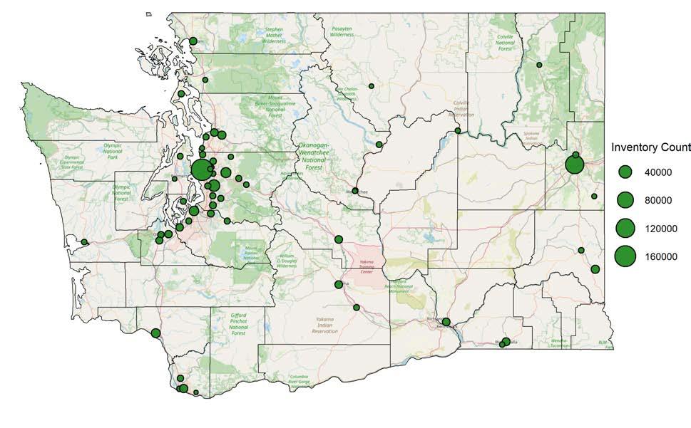
The UCF Program is currently engaged in an ongoing planning phase with partners from the USFS to begin a statewide inventory in 2024, utilizing the national Urban Forest Inventory and Analysis (UFIA) protocol. This planning phase includes executing new agreements, photo interpretation work on upcoming study areas, soliciting a request for and hiring contractors, training development, and creating a comprehensive UFIA work plan. The team is also looking to add an additional data collector to aid in the program’s efficiency and overall success.
In addition to UFIA data collection, the UCF Program is collaborating with communities across the state to gather inventories (see Figure 1 below). This street-and-park-tree inventory map will provide an understanding of urban forest health across the state. Collecting tree species and health in a collected format will provide a sense of broad themes regarding urban forest health and assist the Urban & Community Forestry Program in planning for future vulnerabilities to insects and diseases.
IN ADDITION TO UFIA DATA COLLECTION, THE UCF PROGRAM IS COLLABORATING WITH COMMUNITIES ACROSS THE STATE TO GATHER INVENTORIES.

GIVEN THE THREATS POSED BY WILDFIRE AND CLIMATE CHANGE, WE HAVE A ONCEIN-A-GENERATION OPPORTUNITY TO ESTABLISH NEW GREEN BUSINESSES THAT THRIVE BY RESTORING FOREST ECOSYSTEMS.
Our state’s forested landscapes provide an incredible abundance of resources. Given the threats posed by wildfire and climate change, we have a oncein-a-generation opportunity to establish new green businesses that thrive by restoring forest ecosystems. This section of the report highlights initiatives that show the promise of communities embracing their connections to the forests that surround them. In each case below, actions take were rooted in a belief that communities and forest ecosystems can thrive together when stewarded appropriately.
Recent strides, epitomized by Mount Adams Resource Stewards and Underwood Conservation District's successful application for a USDA Forest Service Community Wildfire Defense Grant, will fortify community resilience against heightened wildfire risks and lay the foundation for rural economic development in an underserved part of the state.
The pioneering work of Northport School District's biomass plant and Chelan County's strategic pursuits in forest products infrastructure reflect how the inventive thinking and entrepreneurial spirit of our people can drive sustainable practices and foster economic vitality. The winding path to resilience is highlighted in these stories and reflects the inextricable links between healthy forests, economic prosperity, and community resilience in Washington.
Mount Adams Resource Stewards (MARS) and Underwood Conservation District (UCD), community-based organizations in the heart of southcentral Washington, are both focused on sustainable natural resource management and community engagement, were recently awarded a USDA Forest Service Community Wildfire Defense Grant (CWDG). The funds will increase community wildfire preparedness and foster rural economic development opportunities in a low-income, underserved corner of Washington.
Wildfire risk to homes in populated areas of Klickitat County is higher than 92% of counties in Washington state and 97% higher than all other counties in the nation. In a bid to fortify rural communities in the county against the looming threat of wildfires, MARS and UCD worked with local partners to develop a successful application to the CWDG Program. This notable achievement will provide funding to bolster wildfire preparedness and mitigate risks across West Klickitat County.
The grant's purpose aligns with much of the core work of MARS and UCD – supporting projects that mitigate wildfire risks and foster community resilience. Rooted in the 2018 Klickitat County Community Wildfire Protection Plan, grant funding will support the creation of strategic roadside fuel treatments, which are vital components to improved fire fighter safety and enhanced suppression opportunities against future fires. In total, MARS will construct 1744 acres of strategic fuel breaks on 35 miles around seven high-risk rural communities. The project will also enable UCD to spearhead initiatives to empower homeowners and communities to establish Firewise USA® sites and implement defensible space practices. This groundbreaking project transcends individual residences and landowners by addressing wildfire risk through a coordinated approach and scaling work across numerous communities to support overall landscape resilience.
In a county facing one of the nation's highest wildfire risk levels, this grant is providing a crucial influx of resources to bolster existing efforts. The initiative underscores Washington's commitment to fostering resilient forests and fire-adapted communities. MARS and UCD are providing local leadership to make this possible, supporting rural communities and recognizing the inextricable link between healthy forest ecosystems, community well-being, and economic vitality.
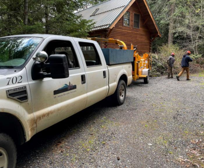
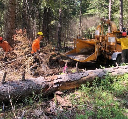
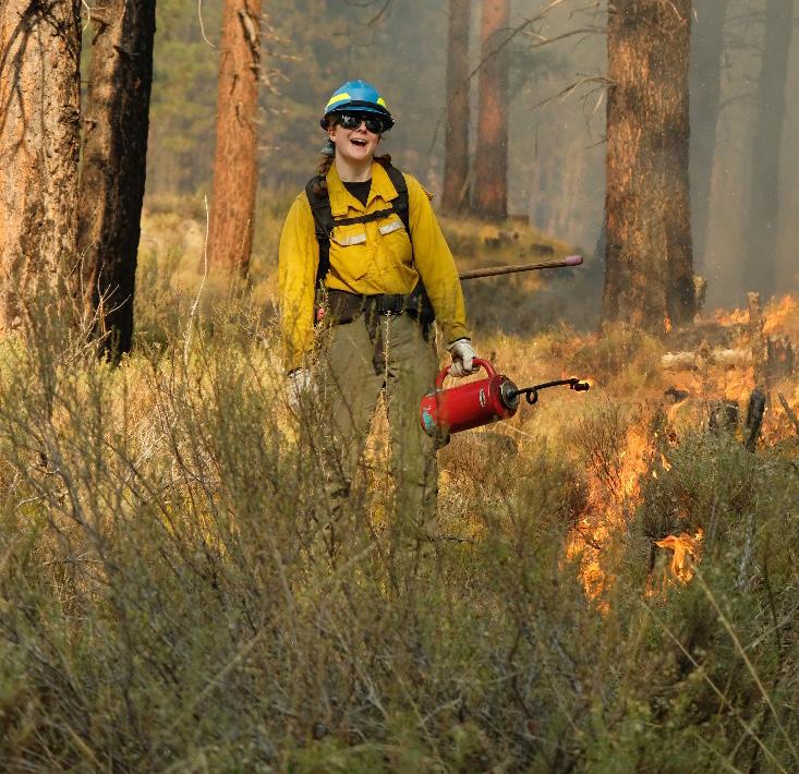
The community of Northport has emerged as a leader in the state in embracing local wood utilization and biomass heating. Their drive to innovate led them to operationalize a biomass heating system in 2018, the second to be built in Washington. Today, the school district has plans to expand the system.
In collaboration with the Washington State Department of Commerce and Wisewood Energy, and with support from Washington State Department of Natural Resources (DNR) and Washington State University, the district embraced the use of woody biomass as a renewable energy source when they were faced with the prospect of having to update an aging fuel oil heating system. The initiative brought proven technologies used widely in New England and Europe to Northeast Washington.
At the heart of the project is the biomass plant, a facility powered by locally-sourced wood pellets. This state-of-the-art, efficient system generates heat for the school campus, significantly reducing the district's reliance on expensive fuel oil. The project has reduced annual operating costs in the small school district while supporting the use of local wood from forest management and hazardous fuels reduction projects.
“The biomass system has been an outstanding investment for our school district and community,” said Superintendent Don Baribault. “Our school board and the town are really proud of what we’re doing here.”
Right: Building on the success of the first project, the school district now aims to expand its biomass plant to heat the high school. Their desire to expand the system is rooted in the benefits associated with financial sustainability and energy efficiency across their facilities. The proposed expansion is an exciting new chapter in the efforts of local communities to support sustainable forest management and utilize locally sourced renewable energy.
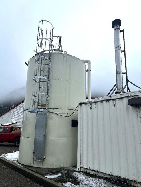

Chelan County, renowned for its stunning natural beauty, is home to a mosaic of forests, mountains, and waterways. This scenic county epitomizes the natural splendor of the Pacific Northwest. The escalating risk posed by wildfires to those unique resources is only becoming more evident. Each summer, wildfires threaten ecosystem health, quality of life, and economic activity in the county.
Chelan has been identified in numerous risk assessments as facing disproportionately more wildfire risk than most of Washington state. The 20-Year Forest Health Strategic Plan: Eastern Washington and the USDA Forest Service 10-Year Wildfire Crisis Strategy both identified numerous highrisk firesheds in Chelan County as part of their strategic priorities.
The Okanogan-Wenatchee National Forest was recently designated a “national priority landscape” by the Forest Service. As one of only 21 in the United States, the designation underscores the heightened risk in the area. Federal and state partners have as a result pledged more than $100 million to the Central Washington Initiative (CWI) in support of fuels reduction and wildfire risk mitigation projects over the next decade.
"Chelan County is the highest risk community in the state for potential wildfire damage,” said Mike Kaputa, director of natural resources for Chelan County. “This has been a problem in the making for a century, and reducing that risk is costly. A local forest products campus would increase the pace and scale of forest health treatment activity while reducing fire risk and creating jobs and economic activity in our community.”
To catalyze additional investments and ensure the longterm sustainability of this work, Chelan County is working to attract new forest products businesses and biomass utilization infrastructure to North Central Washington. Establishing wood products infrastructure today will help translate into long-term stewardship of these firedependent forest ecosystems for generations to come.
Local markets for the byproducts of forest restoration projects will generate revenue for private businesses and agencies. These revenues will help offset costs associated with hazardous fuels reduction projects. The siting of a local facility will also significantly reduce hauling distances and associated costs, thereby enhancing the economic
viability of commercial thinning projects on the OkanoganWenatchee National Forest and adjacent lands.
Chelan County hosted a summit in November 2023, bringing together leading experts from industry, government, economic development, and community organizations to determine the feasibility of establishing a forest products campus within the county. The summit represented a significant step toward making the transformative vision of the CWI a reality. Key outcomes of the summit included:
• A comprehensive wood supply assessment conducted by Mason, Bruce, & Girard, Inc., which found that between 153–448 million board feet of timber is accessible in Chelan, Kittitas, and Okanogan counties over the next 20 years.
• A site feasibility assessment conducted by private consultancy firm Perteet found that there are numerous industrial sites suitable for a forest products campus under existing zoning and land use laws in Chelan County.
• Public agencies, including the Okanogan-Wenatchee National Forest, are committed to sustaining available wood supply.
As Chelan County forges ahead, there's an optimistic outlook for a future where resilient forests and thriving communities coexist harmoniously in Washington. The proposed forest products campus represents a win-win for the local economy and environmental stewardship. It will aid in safeguarding communities and our natural resources.
A LOCAL FOREST PRODUCTS CAMPUS WOULD INCREASE THE PACE AND SCALE OF FOREST HEALTH TREATMENT ACTIVITY WHILE REDUCING FIRE RISK AND CREATING JOBS AND ECONOMIC ACTIVITY IN OUR COMMUNITY.
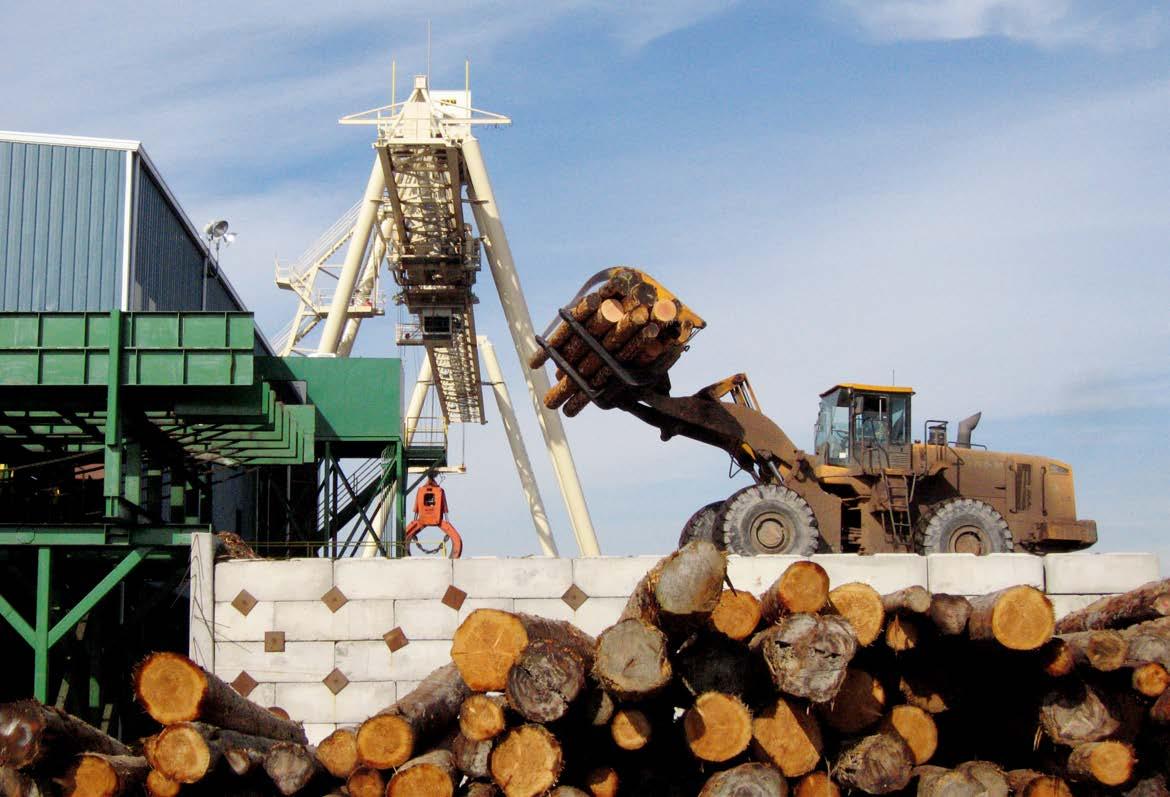
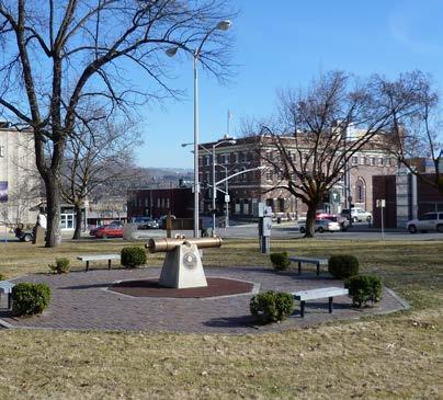
ESTABLISHING WOOD PRODUCTS INFRASTRUCTURE TODAY WILL HELP TRANSLATE INTO LONG-TERM STEWARDSHIP OF THESE FIRE-DEPENDENT FOREST ECOSYSTEMS FOR GENERATIONS TO COME.
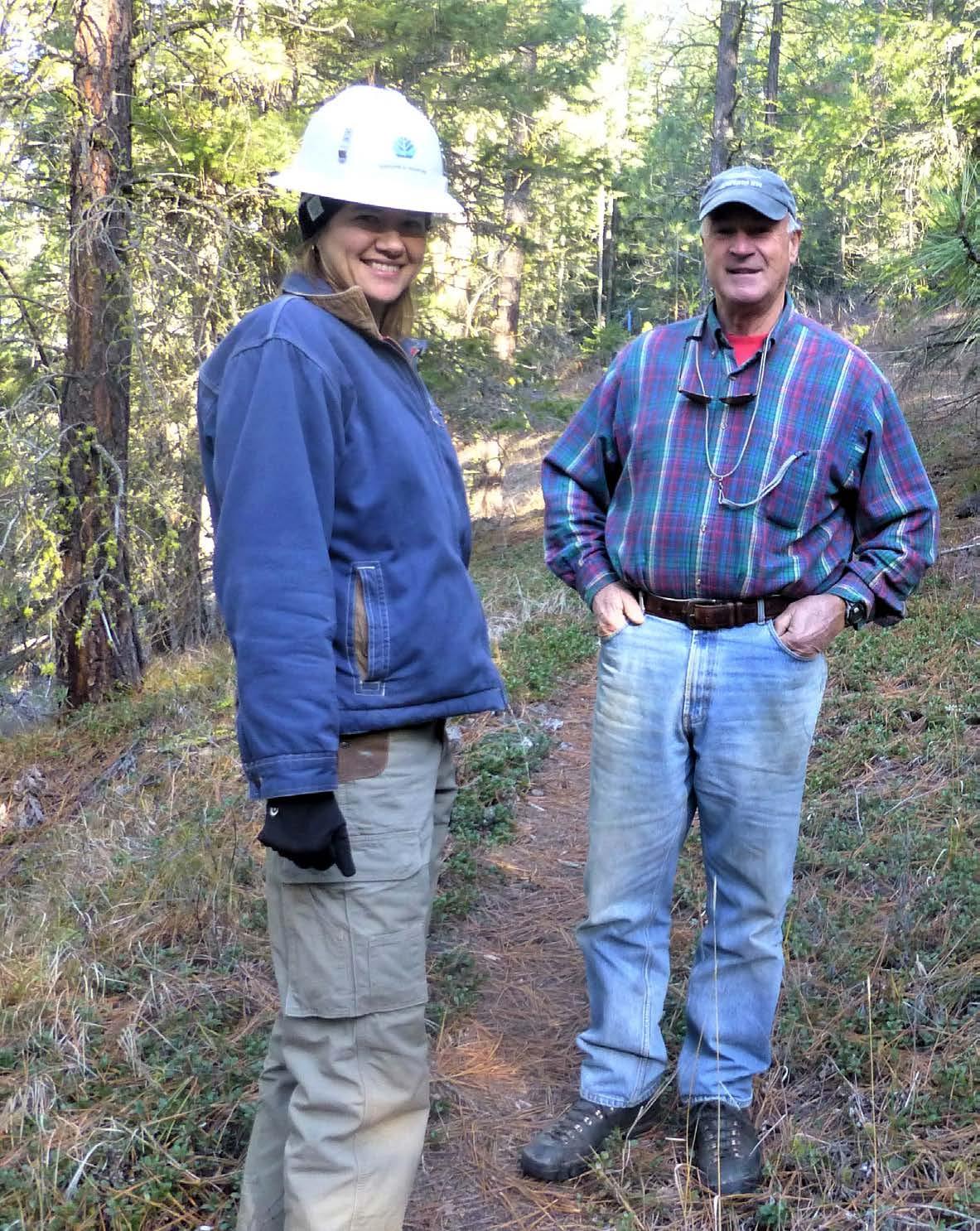
THE EXPANSION OF THE SERVICE FORESTRY PROGRAM IN WESTERN WASHINGTON IS A TESTAMENT TO THE DEDICATION OF THE STATE LEGISLATURE, DNR, AND THE LANDOWNERS WE SERVE.
The Washington Department of Natural Resources’ (DNR’s) Service Forestry program is undergoing a pivotal transformation in how they serve family forestland across the state. This section highlights the incredible progress being made on both sides of the Cascades. The expansion of the Service Forestry Program in western Washington is a testament to the dedication of the state legislature, DNR, and the landowners we serve.
Bolstered by increased funding from the Wildfire Response, Forest Restoration, and Community Resilience account established in 2021 by House Bill 1168, the program increased staffing and introduced a financial assistance program in western Washington. Evolving from its former incarnation as the Forest Stewardship Program, the Service Forestry Program now offers a broader scope of technical expertise, financial aid, and collaborative learning opportunities. Moreover, the program's outreach extends beyond individual landowners by engaging in educational partnerships with schools, conservation districts, and associations.
In eastern Washington, DNR’s Southeast Region's Forest Resilience Program has an ever-expanding roster of exciting project to highlight. Through strategic partnerships and community collaboration, the program has implemented multi-landowner projects, including the successful Ridgecrest Road Wildfire Risk Mitigation project and multiple projects near Goldendale. The initiatives demonstrate the power of collaboration between agencies and local communities.
The Service Forestry Program offers technical and financial assistance for forest health, wildfire resilience, insects and disease problems or concerns, invasive species management and removal, wildlife habitat improvement, and forest management plans. Expansion into western Washington allows DNR to reach more landowners and offer a wider variety of services, both directly and through an increased ability to collaborate with external partners.
Previously known as the Forest Stewardship Program, it consisted of just one forester and one wildlife biologist. In 2022, the program added 19 more positions spread out across western Washington. New positions include district managers, service foresters, and service forestry specialists.
Foresters provide technical assistance to landowners and totaled more than 400 site visits within the first year of the expansion. Staff work to understand landowners’ objectives, assess site conditions, and make management recommendations. Other work includes assisting with the review and completion of forest management plans.
Besides helping people on an individual basis, our foresters have participated in numerous partnerships to educate the public on forests and forest management principles. They have taught lessons during field trips for K-12 school children, been instructors for Washington State University Extension Forestry field days and classes, hosted workshops with conservation districts, and presented at events put on by various landowner associations. Foresters also assisted with DNR’s Wildfire Ready Neighbors campaign, which expanded to three western Washington counties in 2023.
In addition to technical assistance and education, our foresters help landowners enroll in a financial assistance program to offset the cost of certain management activities. This program is intended to encourage eligible forest owners to implement practices that improve forest health and reduce the risk of damage from wildfire and insect infestation on forest lands in western Washington. The program covers two separate project categories that are eligible for financial assistance: forest health improvement and wildfire hazard reduction practices, and forest stewardship plans. Landowners can receive funding for up to 50% of the cost of practices including brush control, thinning, pruning, and tree planting.
While eastern Washington has had a financial assistance program for many years, one didn’t exist in western Washington until 2022. The first full year of this program saw 98 projects totaling about 964 acres of completed treatments. While all financial assistance projects have similar goals of improving forest health and reducing wildfire risk, they vary widely in size, scope, and objectives.
One successful project in western Washington was on a property impacted by the 2022 Bolt Creek Fire. The fire killed a large portion of a young Douglas-fir plantation. DNR helped fund a project to thin over 100 acres of dead trees, manage the slash, and replant. Another notable project was the development of new criteria to better serve overburdened or underserved landowners. The Service Forestry program began working on incorporating environmental justice principles into its work, with an emphasis on making the forest health financial assistance projects more equitable. The program created resources to give additional assistance to landowners based on financial hardship, physical ability, whether they are a recognized minority, or have veteran status. The first project using those new criteria was implemented in 2023 on a property owned and managed by multiple generations of one family. One of their goals was to inspire future generations of the family to appreciate and care for the forest.
WHILE EASTERN WASHINGTON HAS HAD A FINANCIAL ASSISTANCE PROGRAM FOR MANY YEARS, ONE DIDN’T EXIST IN WESTERN WASHINGTON UNTIL 2022. THE FIRST FULL YEAR OF THIS PROGRAM SAW 98 PROJECTS TOTALING ABOUT 964 ACRES OF COMPLETED TREATMENTS.
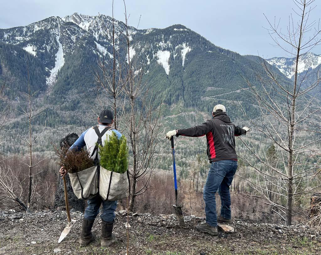
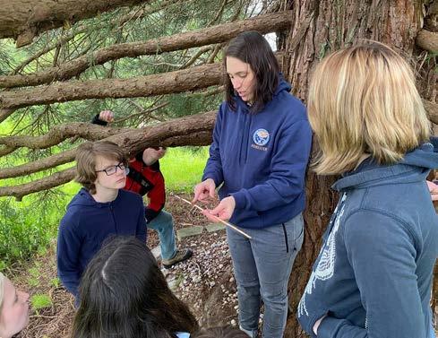
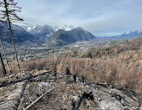
The Forest Resilience Program in DNR’s Southeast Region contributes to the goals and outcomes defined in the Forest Action Plan by implementing treatments on private forested lands that benefit both forest health and wildfire mitigation objectives. These projects also incorporate planning documents and landscape evaluation data from the 20Year Forest Health Strategic Plan. In addition to small individual landowner cost share projects, the program used larger-scale, multi-landowner projects to treat 772.5 acres across the region.
In Chelan and Kittitas counties specifically, these included the Union Valley, Big Tail, Ridgecrest Road, and Central Cascades Forests projects. These large, multi-landowner projects are often strategically placed for those dual benefits and enjoy strong community support. the Region prides itself on strong partnerships with local community groups, like the Kittitas County Fire Adapted Community Coalition (KFACC). Local partnerships not only provide the program with community contacts and guidance, but also help DNR establish a social license to implement treatments.
One such recently completed project is the Ridgecrest Road Wildfire Risk Mitigation project. Region staff became aware of the project proposal through relationships with KFACC members, Kittitas Fire District 6, and The Nature Conservancy. Partner agencies used spatial data in 2020 to develop potential control lines (PCLs) for use in wildfire management. The concept of strategic fuel breaks like PCLs is rooted in the House Bill 1784, which passed the Washington State Legislature in 2019. The Cle Elum Landscape Evaluation completed in 2020 also included dual-benefit analysis. Ridgecrest Road, located near Ronald, was one area consistently highlighted by the local community, fire partners, and within dual-benefit analysis portion of the landscape evaluation. With both the analysis and community support guiding us, all partners decided to implement a shaded fuel break project.
The scope of the project included fuels reduction work on approximately 64 acres of privately owned forest land encompassing 13 unique landowners along
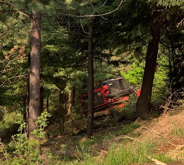
Ridgecrest Road and Thunder Ridge Road. Work included small tree thinning, brush removal, pruning, and removal of materials generated from the thinning and pruning. Treatments were designed to reduce potential fire severity, risk of catastrophic fire within and surrounding the treatment areas, and to improve ingress and egress for local residences and first responders.
This project is a part of much broader community effort across the Cle Elum Ridge area to reduce wildfire risk and improve forest health. Partner organizations, including DNR, have invested heavily in the landscape and are working to improve North Cle Elum Ridge, including the private lands above Cle Elum, Roslyn, and Ronald, as well as lands managed by The Nature Conservancy. The project is situated in the Cle Elum High Priority area highlighted in the 20-Year Forest Health Strategic Plan. This work, in conjunction with current and future adjacent projects across multiple ownerships, will increase overall landscape resilience to wildfire and other forest health threats.
The DNR Service Forestry Program and the local community are already benefiting from this project as more landowners become aware of the importance of this work. Several landowners have expressed interest in doing similar work on their own parcels after seeing the results of this project. We now have several new projects under development because of this one effort.
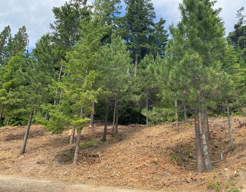
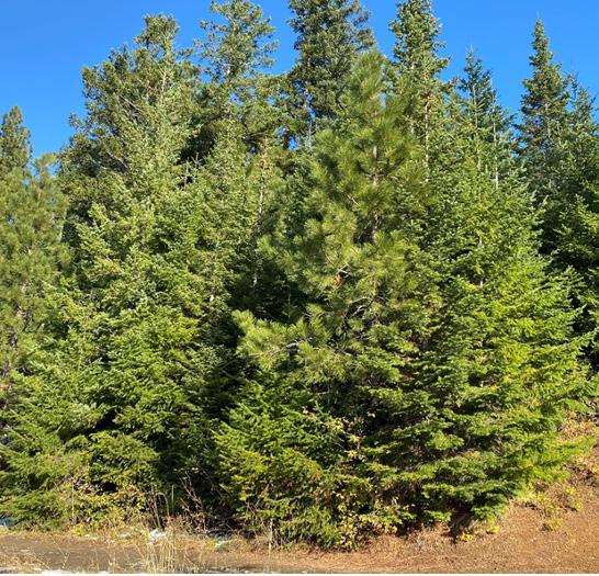
THE RIDGECREST ROAD PROJECT IS A PART OF MUCH BROADER COMMUNITY EFFORT ACROSS THE CLE ELUM RIDGE AREA TO REDUCE WILDFIRE RISK AND IMPROVE FOREST HEALTH.
Southeast Region staff completed approximately 127 acres of shaded fuel break projects last spring in two communities outside Goldendale. The first treated the perimeter of Keystone Acres, located just east of the Klickitat River Canyon along the Glenwood Highway. It created 200 feet of defensible space on the west, north and east borders of the community, tying into other cost-share work completed by landowners. This project treated three stand types: open woodland dominated by Oregon white oak, stands dominated by ponderosa pine, and those dominated by Douglas-fir.
The second project treated roadsides on the west side of Ponderosa Park. This community is approximately 10 minutes north of Goldendale, nestled between Pine Forest Road to the west and Pipeline Road to the east. The area contains primarily mixed ponderosa pine and Oregon white oak woodlands. This project is particularly notable due to the speed in which it was pulled together. By making use of available end-of-biennium variance dollars, the project was flagged and contract procurement completed within just a couple of months. The successful bidder was then able to complete the work within a single week. The high quality of their work helped spur additional sign-ups for future projects around the remaining perimeter.
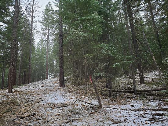
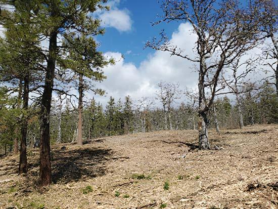
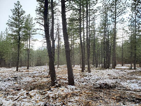
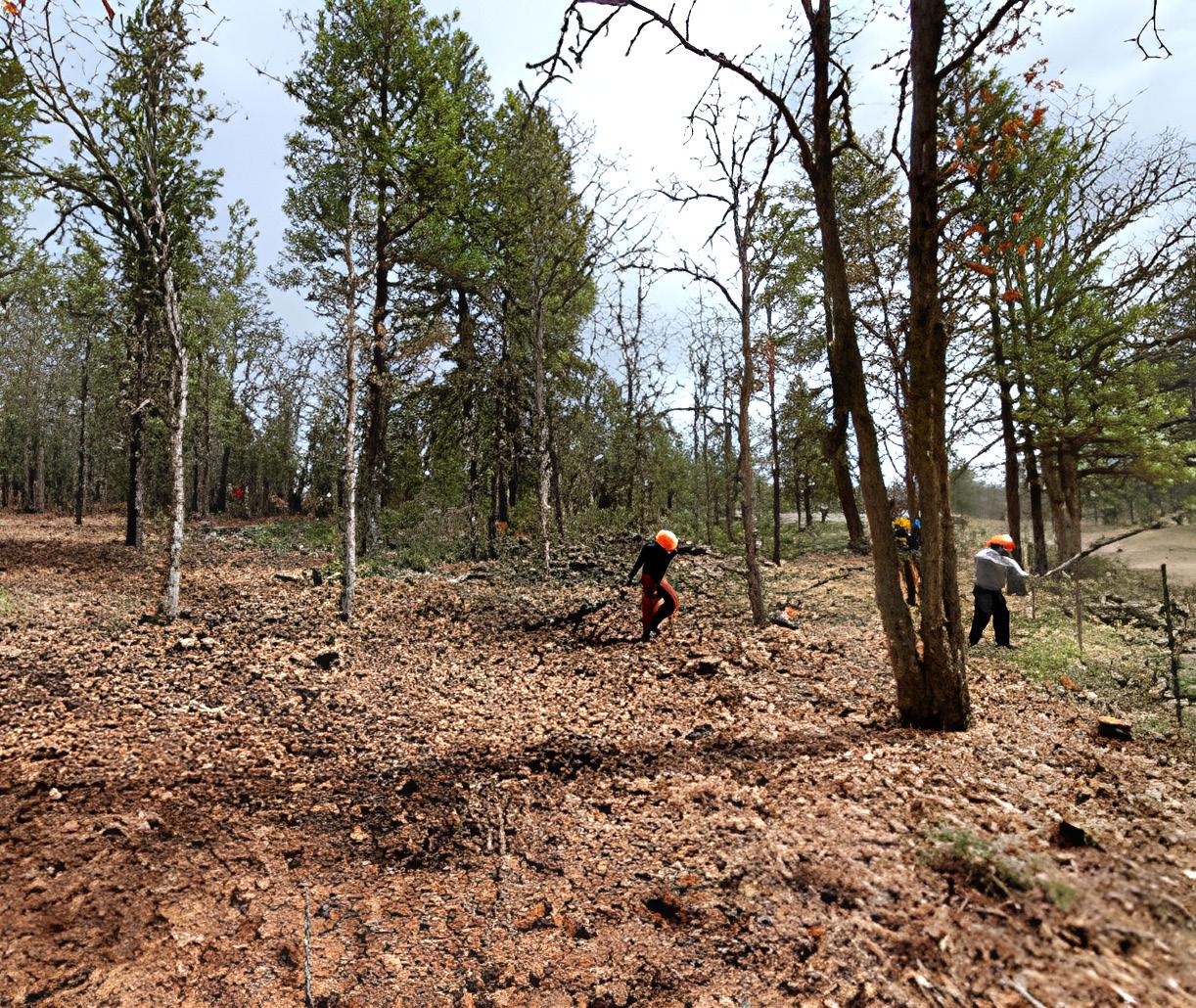
THE PROJECTS OUTSIDE GOLDENDALE CREATED 200 FEET OF DEFENSIBLE SPACE ON THE WEST, NORTH AND EAST BORDERS OF THE COMMUNITY, TYING INTO OTHER COSTSHARE WORK COMPLETED BY LANDOWNERS.
BY RELOCATING THESE SPECIES BACK INTO THEIR NATIVE RANGES, THEY CAN ACT AS AN ADDITIONAL HAND IN OUR FOREST HEALTH GOALS FOR WILDLIFE,
The Washington Department of Fish and Wildlife has provided leadership on crucial projects focused on improving forest health and habitat enhancement in our state. Collaborating with neighboring landowners and agencies, the Department of Fish and Wildlife (DFW) has advanced numerous cross-boundary initiatives vital for preserving ecosystem health, enhancing landscape resilience, and fostering habitat connectivity. Notable projects include cooperative, prescribed burns aimed at enhancing wildlife habitats, mitigating wildfire risks, and offering vital training to fire personnel. This section of the report also described the recent uplisting of the western gray squirrel to state endangered status, underscoring the urgency of collaborative efforts required, such as prescribed burning and habitat restoration, to protect this significant native species facing habitat loss and other threats.
This section also highlights a groundbreaking initiative that brings together Tribes of the Pacific Northwest, the states of Oregon and Washington, and federal agencies for a partnership aimed at revitalizing wild salmon populations and advancing clean energy production in the Columbia River Basin. With a commitment of over $1 billion in federal investments, this historic agreement centers on salmon restoration, expansion of clean energy sources, and the ensuring of community stability. Finally, efforts to reintroduce grizzly bears to North Cascades National Park are underway in hopes of restoring a species that historically inhabited the area. The story emphasizes the need for adaptive management strategies, habitat capacity, and climate resilience.
In 2023, the Forest Service published a Notice of Intent regarding proposed amendments to the Northwest Forest Plan. Originally approved in 1994, the Northwest Forest Plan intended to stop the “Timber Wars” and create more certainty for land managers, environmental advocates, and rural communities around the protection of old growth forest ecosystems and the production of forest products from public lands.
Since the mid-1990’s, the northern spotted owl, the species at the heart of the race to save old growth, has experienced continued population declines, largely due to competition with the invasive barred owl. This new threat, along with the impacts of climate change, megafires, and drought – have motivated the Forest Service to pursue changes to the Northwest Forest Plan. The amendment process is intended to enhance planning and monitoring processes associated with forest management across the 24 million acres covered by the plan. The objectives include integrating up-to-date scientific knowledge, adapting to the impacts of a changing climate, and bolstering ecological resilience within forest ecosystems.
The proposed amendments underscore a collaborative approach, emphasizing partnerships and coordination among federal, state, tribal, and local stakeholders. To initiate this process, the Forest Service established a technical advisory committee to provide input to the agency. Washington DNR serves as a sub-committee member and is supporting the Forest Service’s efforts to update the plan.
Overall, the goal is to implement sustainable forest management practices that align with contemporary environmental understanding to conserve old growth, reduce risk of catastrophic fire, promote long-term sustainable carbon storage, and provide a reliable timber supply from public lands. By revisiting and updating the Northwest Forest Plan, the initiative seeks to ensure that forest management strategies are wellinformed and adaptive, addressing the current challenges and complexities of forest management. To learn more visit https://www.fs.usda.gov/detail/r6/landmanagement/?cid=stelp rd3831710
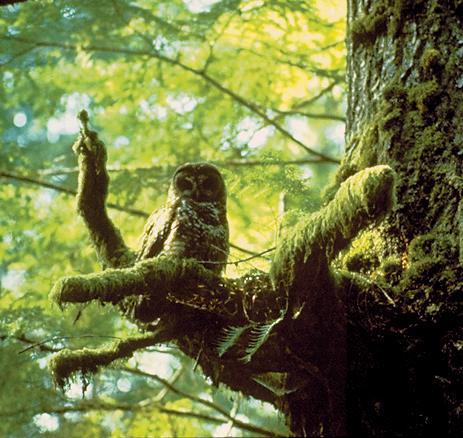
THE AMENDMENTS OBJECTIVES INCLUDE INTEGRATING UP-TO-DATE SCIENTIFIC KNOWLEDGE, ADAPTING TO THE IMPACTS OF A CHANGING CLIMATE, AND BOLSTERING ECOLOGICAL RESILIENCE WITHIN FOREST ECOSYSTEMS.
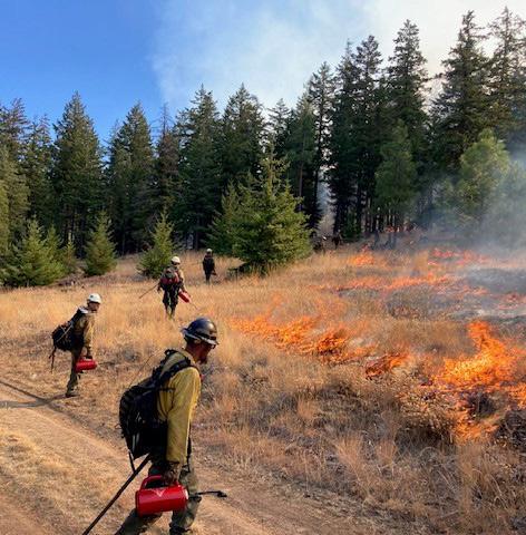
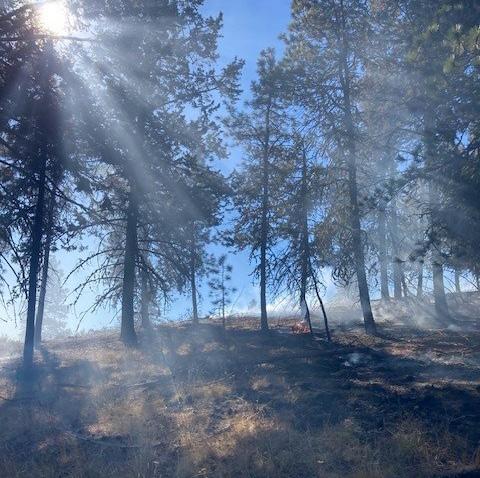
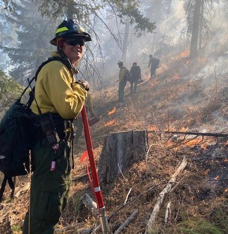
The following vignettes highlight recent and upcoming forest health and habitat enhancement projects implemented by DFW in partnership with neighboring landowners and agencies. Implementing cross-boundary projects is critical to promoting ecosystem health, landscape resilience, and habitat connectivity.
Loomis
Sinlahekin DFW/BLM/DNR
Cooperative Prescribed Burn
A prescribed burn of a cross-boundary project area that encompasses approximately 100 acres of DNR land, 100 acres of DFW land, and 40 acres managed by the federal Bureau of Land Management. The total burn block once the project is completed will include 240 acres. There are approximately 80 acres remaining to complete in 2024, split about evenly between DNR and DFW. This was a group effort to improve mule deer winter range habitat and reduce fuel loading to mitigate wildfire damage.
Naches
Cougar Canyon Prescribed Burn
Approximately 240 acres of DFW lands were identified for reduction of commercial harvest residue through prescribed burning. Staff from DNR contacted DFW and offered to add 55 acres of DNR lands to the project. The two agencies jointly provided staffing to complete the prescribed burn in fall 2023. The burn was a success and provided valuable training to over 30 fire personnel.
Entiat
Eastern Washington Future Planning Highlight: Crum Canyon
Prescribed Burning
In a joint effort to reduce wildfire and improve forested lands, DFW, DNR, BLM, USFS, and private landowners will work together to burn their respective sections of ownership in the Crum Canyon drainage. The project is still being designed and will incorporate hundreds of acres of federal, state, and private ownerships to create a landscape-level burn to improve fire resilience to the dry forest ecosystem. The Crum Canyon area has a long history with wildfires and is one of the last remaining areas in the Entiat river drainage that has not burned.
The western gray squirrel (Sciurus griseus) is one of four tree squirrel species native to the state of Washington. Others include Douglas’ squirrel (Tamiasciurus douglasii), American red squirrel ( Tamiasciurus hudsonicus), and the northern flying squirrel (Glaucomys sabrinus). The western gray squirrel is the largest native tree squirrel in the Pacific Northwest. The introduced eastern gray (Sciurus carolinensis) and eastern fox (Sciurus niger) squirrels are similar in size. Eastern grays are often confused with westerns because they are similar in appearance at first glance. A closer look reveals the differences: the western gray’s pelage is distinctively gray on the head, back, and tail, with a contrasting white belly. The tail is conspicuously long and bushy with whitetipped hairs that give it a frosted look. There is virtually no brown on the western gray. Brown hair only occurs (occasionally) on the back of the ears during the winter. In contrast, eastern grays have noticeable patches of brown on their forearms, face, flank, and tail. While similar in size, eastern fox squirrels are distinctively brown-gray to brown-yellow with a rusty orange belly.
Western gray squirrels prefer low- to mid-elevation conifer forests with moderately closed canopy and an open understory. In the southern part of their range, populations are commonly associated with Oregon white oak (Quercus garryana) woodlands, which are transitional between conifer forests and prairie ecosystems. Living on the edge of oak woodlands gives the squirrels access to acorns that provide a high level of energy, oil, and fat for the winter months. At other times of year, western grays take advantage of plentiful Douglas fir seeds and pine nuts, insects, green vegetation, and berries. The cooler environment provided by the closed canopy and relatively open understory of their preferred habitat also promotes the growth of hypogeous fungi (below ground, e.g., truffles). Surprisingly, truffles can make up a large part of their diet (>50%) and while they tend to avoid open areas, they spend a lot of time foraging on the ground if there are opportunities for escape.
The importance of a closed, multi-layered canopy cannot be overstated. The canopy is where they spend most of their time traveling and moving around the forest. It is a place of protection from predators and
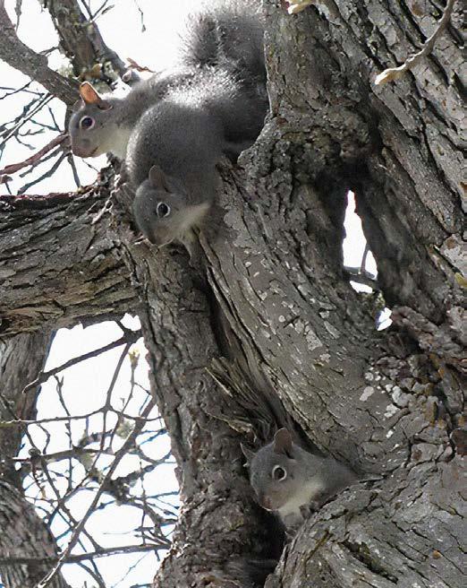
HISTORICALLY, THE WESTERN GRAY SQUIRREL’S RANGE IN WASHINGTON EXTENDED FROM PIERCE COUNTY SOUTH THROUGH THE COLUMBIA GORGE AND THEN NORTH ALONG THE EASTERN CASCADES FROM KLICKITAT TO OKANOGAN COUNTIES.
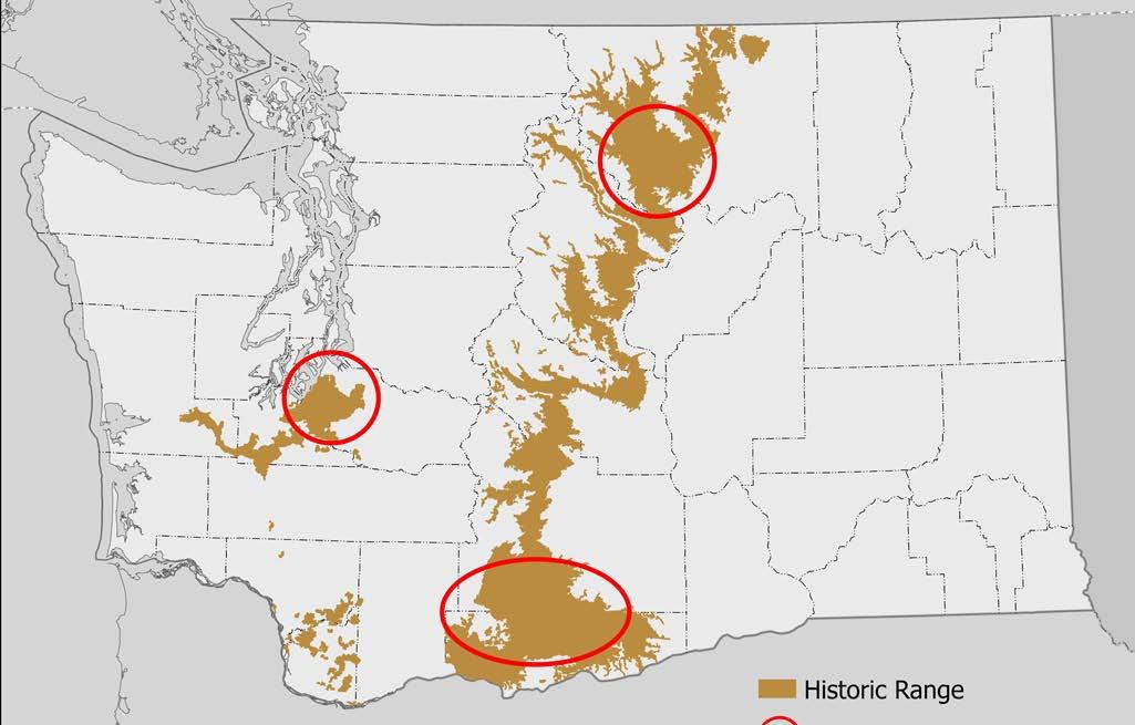
where they forage, rest, sleep, and raise their young. Good canopy can come into play when considering the species’ nesting habits: Western gray squirrels are prolific nest builders. In Klickitat County, they build an average of 14 nests each (with a maximum of 28 recorded!) where they rest and sleep throughout the day. Some nests are mere platforms that provide nice resting spots, while others are more elaborate for overnight stays, rearing young, and winter use. Tree cavities are often used for natal nests because they provide the most protection. When cavities are not available, they construct very large spherical nests (dreys) composed of sticks, leaves, moss, grass, and other debris. While they are active during daylight hours, most activity occurs just after sunrise. They are most active in fall and early winter when they are caching acorns and other nuts for winter. Even though they are difficult to observe, several large nests clustered in an area is a good indicator of their presence.
Historically, the western gray squirrel’s range in Washington extended from Pierce County south through the Columbia Gorge and then north along the eastern Cascades from Klickitat to Okanagan Counties. However, the squirrel’s population has declined across the state since the early 20th century. It is now restricted to three areas centered in Okanagan, Klickitat, and Pierce counties. Loss of habitat, habitat fragmentation, land conversion,

Historic range
Current population centers
DATA SOURCES: CITY OF YAKIMA, WA STATE PARKS GIS, ESRI, HERE, GARMIN, FAO, NOAA, USGS, BUREAU OF LAND MANAGEMENT, EPA, NPS.
wildfire, and timber harvest are the main drivers. A recent study by DFW in Okanagan and Klickitat counties indicates that primary habitat (closed canopy forest) has decreased by 21 percent since the species was listed as threatened in 1993. This, combined with small, isolated populations, limited ability to disperse due to habitat fragmentation, threats from disease (primarily mange), and road mortality prompted the Washington State Wildlife Commission to uplist the species to state endangered in October 2023. Reversing the downward trend in habitat availability will require cooperation between landowners, state agencies, the public, and conservation organizations. DFW is looking forward to working with all stakeholders to identify actions to keep this native squirrel on the Washington landscape. For more information, please contact Darrin Masters at: darrin.masters@dfw.wa.gov
Pacific Northwest Tribes and the states of Oregon and Washington announced a landmark partnership in December 2023 to restore wild salmon populations and expand clean energy production in the Columbia River System. This agreement includes more than $1 billion in new federal investments over the next decade and charts a historic path for the future of salmon in the Pacific Northwest. The agreement includes commitments by the federal government, the states of Oregon and Washington, and the Nez Perce, Umatilla, Warm Springs, and Yakama Tribes, along with environmental non-profit organizations as outlined in a Memorandum of Understanding.
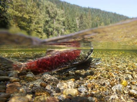
Key objectives include:
• Salmon Restoration: The initiative is geared towards reviving and sustaining wild fish populations in the Columbia River Basin, with a focus on salmon and steelhead.
• Clean Energy Expansion: Efforts will be made to develop affordable, clean, and reliable energy sources to support regional energy reliability and affordability.
• Community Stability: The initiative aims to maintain key services such as energy, transportation, recreation, and irrigation, even in scenarios where Congress may consider authorizing breaching the Lower Snake River dams.
President Biden’s memorandum directing federal agencies to prioritize salmon restoration in the Columbia River Basin laid the groundwork for this agreement. It builds on a previous agreement to bolster Tribal-led salmon restoration initiatives in the Upper Columbia Basin.
The grizzly bear, one of North America’s iconic megafauna, may make a return to North Cascades National Park. The park, in concert with several partner agencies, hopes to relocate 25 grizzlies to the area over the course of the next 5 to 10 years.
While grizzlies historically numbered in the thousands in the area prior to the 1800s, the U.S. portion of the North Cascades ecosystem has not had a confirmed grizzly sighting since 1996. Hunting of the species weakened the population to a few small, secluded pockets of bears. Development and extensive network roads north of the border have largely isolated the North Cascades habitat, with the closest healthy population of grizzlies occurring several hundred miles north in north-central British Columbia.
With grizzlies being one of North America’s slowest reproducing land mammals, populations have failed to bounce back to their previous levels despite the park being considered good habitat for the species. The largely roadless park (with Highway 20 being the major outlier) is part of a larger ecosystem of nearly 13,000 square miles, nearly 90% of which is under federal management.
A draft Environmental Impact Statement (EIS) was released for public comment in September 2023. It offered several paths the agencies could take to restore this piece of the ecosystem. These included a “no action” alternative that would continue existing management practices, but also two action alternatives that would both allow for the active restoration of grizzly bears. The draft EIS received about 12,000 comments during the public comment period, which closed in November.
This is not the first time that grizzly bear restoration has been considered. The National Park Service (NPS) and U.S. Fish & Wildlife Service (USFWS) developed similar restoration plans in 2017, but that EIS process was terminated in 2020. However, the tens of thousands of comments received during that previous process are now informing the development of agency proposals, including one that would designate grizzly bears in the area as an experimental population under section 10(j) of the Endangered Species Act.
Grizzly bears could soon return to North Cascades National Park, where the species' population once numbered in the thousands.
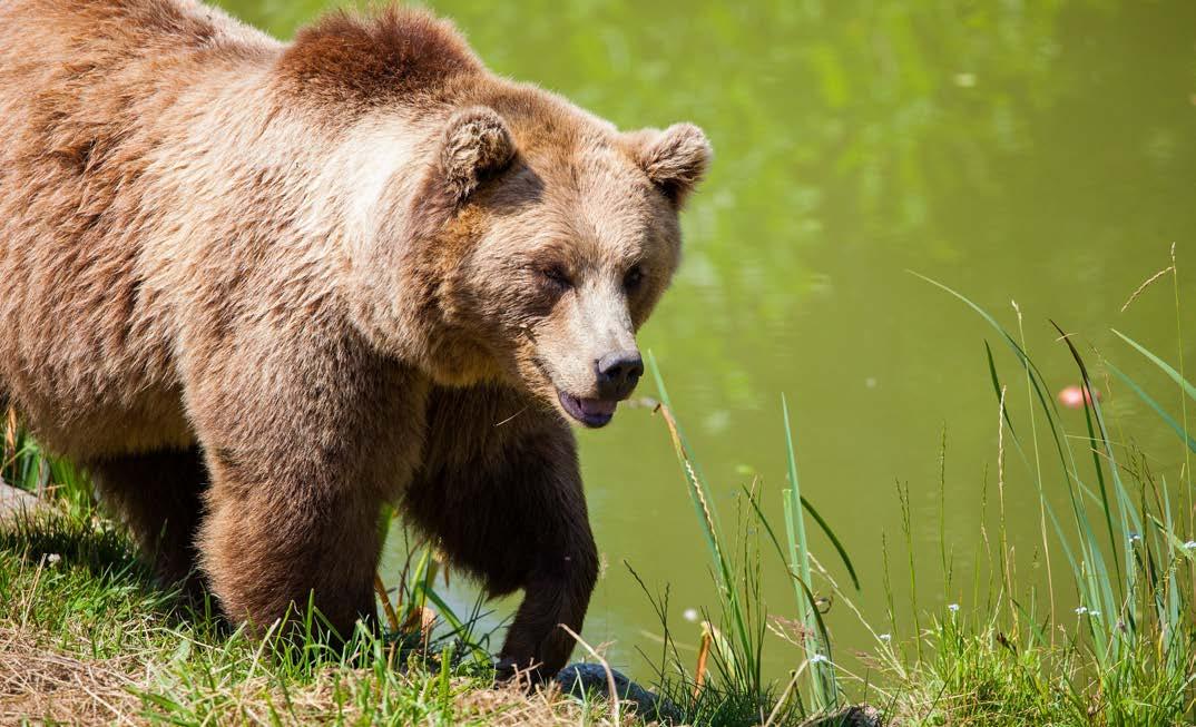
“A lot of the potential issues, we heard previously,” said Jason Ransom, senior wildlife biologist with the National Park Service. Ransom is the NPS technical lead for this project.
The 10(j) rulemaking process defined in the Endangered Species Act allows federally listed species to be reintroduced in areas that are geographically isolated from other populations. With this designation, agency staff can develop tools to help manage the population and encourage coexistence with humans through additional management flexibilities.
“For example, if a bear does leave the ecosystem and poses a threat to safety, under 10(j), we could proactively go out and bring it back to the park,” Ransom said. “Under the existing ESA designation, our options to help manage the situation are more limited.”
The 10(j) designation would also allow the USFWS to designate varying levels of management flexibility depending on location. For example, any state, local, or private lands are given a ‘zone 3’ designation, providing the largest toolbox to prevent conflict. This does not mean that the bears will be reintroduced to these areas, but that these areas will have a full suite of different measures available in the unlikely event that a bear were to ever disperse that far.
Grizzly reintroduction project partners are also paying close attention to possible restoration efforts that are planned north of the border by First Nations in British Columbia.
Current North Cascades National Park grizzly bear habitat could comfortably support a population of approximately 280 bears, per current climate models. This provides a lot of room for growth, so to speak, when compared to the small, founding population of 25 bears that NPS and USFWS staff hope to bring in (as well as accounting for First Nation reintroduction efforts). The carrying capacity of the habitat for grizzlies goes up even when accounting for mid-range to severe-range changes in the North Cascades.
“For things like wildfire – one of the first things that come back after a fire are bears’ favorite foods –huckleberry, cow parsnip,” Ransom said. “There’s no reason to believe that this habitat can’t support grizzlies in the future.”
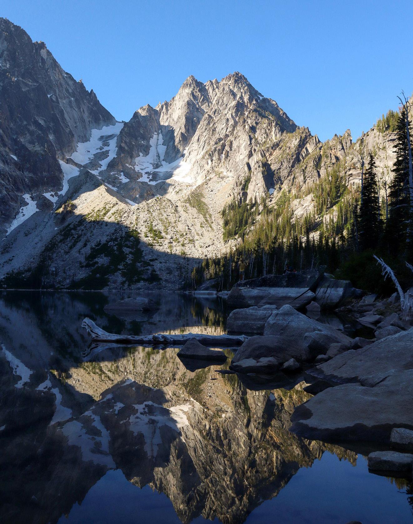
DNR’S WATERSHED RESILIENCE ACTION PLAN (WRAP) SERVES AS A CORNERSTONE INITIATIVE AIMED AT ADVANCING SALMON RECOVERY AND ENHANCING WATERSHED HEALTH.
Cold, clean water is perhaps the most valuable resource provided by forests. This section of the report highlights three projects focused on restoring watershed health and furthering our understanding of the connections between forests and water.
Beavers, hailed as nature’s engineers, can wield a profound influence on Pacific Northwest ecosystems. Tribes, state and federal agencies, conservation districts and nonprofits have led initiatives to relocate "problem" beavers across the state. The first story highlights the Tulalip Tribes’ commendable effort to relocate over 200 beavers since 2015, showcasing an inspiring model of coexistence and resilience.
DNR's Watershed Resilience Action Plan (WRAP) serves as a cornerstone initiative aimed at advancing salmon recovery and enhancing watershed health. The second story in this section describes the expansion of WRAP into the Puyallup and Nisqually watersheds.
This section of the report ends with an innovative study focused on the interplay between forest cover, topography, and snow depth in Washington's Eastern Cascades. This research reveals the intricate relationship between forest structure and snow accumulation and underscores the need for nuanced forest management strategies that balance wildfire risk reduction and wildlife habitat conservation while preserving critical water resources.
Beavers have been called nature’s engineers and are considered a keystone species in the Pacific Northwest due to their potential to fundamentally alter the ecosystem. The dams, lodges, and ponds they build create important habitat for salmonids and other aquatic and terrestrial species, increase groundwater storage by 240 percent and cool water temperatures by 2 degrees Celsius on average, according to a recent study in western Washington, and help create more complex and biodiverse aquatic and riparian systems.
While beaver populations in our region remain much lower than they were historically, human-beaver interactions continue to be a source of contention, especially in wildland-urban interface areas where new development can create conflict with former and current beaver habitats. Homeowners often worry about beavers causing flooding on their property. Beavers are most often considered a ‘nuisance’ and homeowners often see eradication as the best option to prevent harmful impacts.
Aquatic environments such as streams, rivers, lakes, and wetlands are constantly changing, and can thus be prone to flooding and other negative impacts regardless of the presence or absence of beavers. Beaver-human conflicts are likely to increase as local populations of these ecosystem engineers continue to rebound from impacts from the fur trade, when they were hunted almost to extinction throughout the United States. This is why coexistence and mitigation efforts are so important (see the graphic below for a list of organizations in Washington state working in this space).
Beavers seen as an inconvenience are often killed. Tribal comanagers, conservation districts, and nonprofits are working to help humans and beavers coexist more peacefully in our region.
In one notable example, the Tulalip Tribes relocated “problem” beavers to more remote watersheds, where they can provide ecosystem benefits without impacting private property or infrastructure. The Tulalip Beaver Project has relocated more than 200 beavers since 2015. Most of these animals are taken to streams and wetlands on Forest Service land, such as the Mount Baker Snoqualmie National Forest near the Skykomish and Snoqualmie rivers. All beavers are released in areas that have been studied for habitat suitability using a site scoring matrix that the Tulalip Tribes created for the purpose.
In 2022, DNR launched the Snohomish Watershed Resilience Action Plan (WRAP), our flagship effort to advance salmon recovery and watershed health in priority watersheds. The plan includes several actions related to supporting beaver populations due to the benefits for water quality, water quantity, habitat, and climate resilience they provide. For example, WRAP tasks DNR with identifying potential relocation sites by surveying 48 miles of stream for beaver habitat suitability.
To reach this goal, DNR Snohomish Watershed Steward Rachel Benbrook coordinated two beaver habitat survey trainings in 2023 for agency staff in its Northwest and South Puget Sound Regions. Led by Tulalip Tribes wildlife biologists Molly Alves and Dylan Collins, and utilizing survey methods approved by the DFW, these trainings provided DNR staff with the knowledge and procedures to identify potential beaver habitat.
For the training, DNR staff were given an introductory course on beaver habitat needs and were trained on how to use the site scoring matrix. Participants then visited several different aquatic habitat sites where they scored each site, then discussed site highlights and challenges.
The hope is that many of these DNR employees, as well as their colleagues and staff, will be able to conduct beaver habitat surveys as part of their field work in the coming years. This work will help identify potential relocation sites on DNR-managed lands, which is especially important given the increase in beaverhuman conflicts due to changes in land use and our growing beaver population.
“There are so many benefits beavers can provide, including helping to build resilience to climate change and improving salmon habitat,” Benbrook said. “It’s great to see DNR taking the first step in the long journey towards beaver relocation on DNRmanaged lands. While we have a lot of work to do to balance multiple objectives on state lands, I’m excited to keep engaging with Tulalip Tribes and my DNR colleagues to work through the challenges so we can support regional efforts to keep beavers on the landscape.”
The site habitat suitability training is one of the many prongs of beaver-related watershed stewardship work for DNR. Additional activities include developing a set of best management practices for beaver habitat on DNR lands, as well as conducting assessments on potential impacts of beaver reintroduction.
Organizations and Agencies Currently Working on Beaver Coexistence In Washington State:
• Snohomish Conservation District
• Beavers Northwest
• Methow Beaver Project
• The Lands Council
• Beaver Craftworks
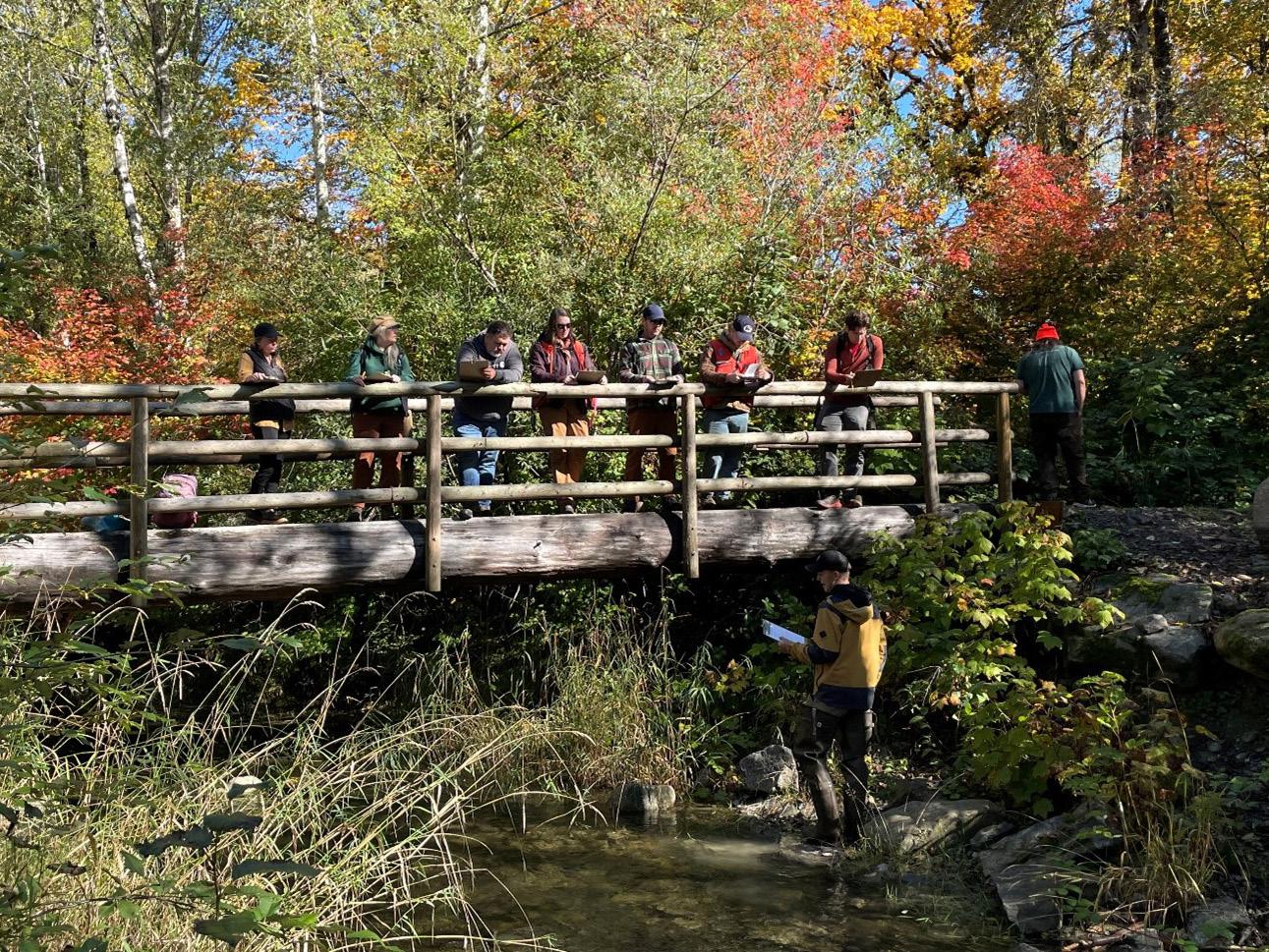
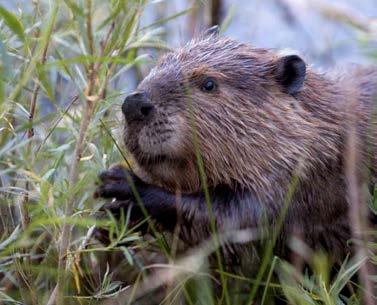
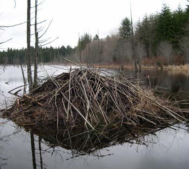
THE AMENDMENTS OBJECTIVES INCLUDE INTEGRATING UP-TO-DATE SCIENTIFIC KNOWLEDGE, ADAPTING TO THE IMPACTS OF A CHANGING CLIMATE, AND BOLSTERING ECOLOGICAL RESILIENCE WITHIN FOREST ECOSYSTEMS.
The Washington State Department of Natural Resources recently piloted a coordinated, watershed-scale management strategy for its lands, with an emphasis on salmon recovery and climate resilience. As described above, this work began with the 2022 launch of the flagship Watershed Resilience Action Plan (WRAP) in the Snohomish Basin. It presents an expansive “trees to seas” action plan for salmon recovery that organizes Department of Natural Resources (DNR) work within the watershed, bolstering ongoing agency and partner efforts and developing new programs to address barriers and accelerate progress. Since launching WRAP, DNR has successfully built capacity, supported partners, and brought millions of dollars in state and federal funding to support ecosystem recovery and resilience in the Snohomish Watershed.
To build on the success of the Snohomish WRAP, DNR seeks to expand watershed-scale coordination to the Puyallup and Nisqually watersheds. The goal of expansion is to use watershed-scale coordination to better support DNR’s ongoing work and accelerate the pace of salmon recovery. We do not aim to duplicate the Snohomish WRAP, but to adapt the framework of the original WRAP to the needs of the other watersheds. Our resilience planning in these watersheds will focus on better coordinating existing DNR programs, finding opportunities to increase support for partners, and identifying where new DNR work could be additive to the existing salmon recovery landscape.
Using the Snohomish Watershed as a pilot, expansion will be informed by lessons learned in development and implementation of the original WRAP. Extensive conversations internally and externally will refine a streamlined version of the WRAP to the local context. Staff have begun a pre-assessment process to identify existing DNR projects and current watershed needs by working with agency staff and external organizations. These assessments will provide a suite of possible projects aligned to the goals of expansion that lead to development of a menu of possible DNR actions in the watersheds. A short list of high-level goals and metrics for the expansion program will be used to track implementation.
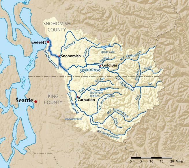
THE EXPANSIVE “TREES TO SEAS” ACTION PLAN FOR SALMON RECOVERY BOLSTERS ONGOING AGENCY AND PARTNER EFFORTS AND DEVELOPS NEW PROGRAMS TO ADDRESS BARRIERS AND ACCELERATE PROGRESS.
The challenges of managing forest health in the face of climate change and associated impacts of wildfire and drought are at the forefront of the Washington Department of Natural Resources 20-Year Forest Health Strategic Plan. Reduced snowpack, earlier spring melt, and associated changes in streamflow timing and quantity threaten salmonid populations and other aquatic species and functions.
The Department of Natural Resources (DNR) commissioned a study to explore the interplay between forest cover, topography, and snow depth in Washington’s eastern Cascade Mountains. Partnering with leading experts, the research aims to assess how forest thinning, primarily implemented for wildfire risk reduction and climate adaptation, impacts hydrologic systems in these fire-prone ecosystems.
Utilizing lidar datasets and previous ground monitoring efforts, the study focused on a transition zone within the Cascade Mountains, characterized by varied climates from warmer, wetter conditions on western slopes to colder environments on the eastern slopes.
Key findings underscore the significance of both forest canopy and topographic attributes in influencing snow depth distribution across the Eastern Cascades. In moderate to low elevation forests (< 3000 ft), distance to canopy edge emerged as a dominant predictor of snow accumulation. Reducing canopy cover decreases snow interception by tree canopies and increases accumulation, and thus the amount of water that ends up in the soil. However, only in gaps within topographically shaded areas (e.g., north facing slopes) did snow last longer and melt out later in the season. Without shading, elevated melt rates from increased solar radiation and wind negate the gains from greater snow accumulation due to reductions in canopy cover. Prolonging snow melt later into the spring is important for stream flow timing and maintaining high soil and fuel moistures later into the summer. At higher elevations (> 1000 m), topographically shaded forest gaps amass more snow, regardless of gap size, signifying a different dynamic than in lower elevations.
The report outlines in detail the project's overview, methods, analysis results, and management implications. Moreover, it provides comprehensive access to software, code, and data necessary to replicate this analysis, along with guides for calculating topographic and forest metrics using snow-off lidar data, aiding future forest treatment planning across the Eastern Cascades.
The research has important implications for forest management strategies. It highlights the important relationships between forest structure, topography, and snow accumulation, emphasizing the need for a nuanced approach to thinning and gap creation treatments. Reducing canopy cover over large areas through thinning and fire has the potential to increase overall snowpack and water entering the soil. Most important, focusing on topographically shaded areas is critical to extending the duration of the snowpack and maintaining the hydrological regimes that salmon are accustomed to. However, these cooler, shaded areas are often prioritized for maintaining dense forest cover for closed-canopy wildlife and other functions Thus balancing wildfire risk reduction and wildlife habitat for closed canopy species with snow accumulation and duration becomes paramount in balancing landscape resilience and aquatic system health in the face of a warmer, drier future with more wildfire and drought risk.
The insights gleaned from this study pave the way for more informed decision-making in forest management, aiding planners, policymakers, and partners in devising strategies that strike a balance between mitigating wildfire hazards and safeguarding critical water resources and biodiversity in the Eastern Cascades. DNR has partnered with the Pacific Northwest National Laboratory (PNNL) and USFS PNW Research Station to examine these tradeoffs over large spatial scales.
The full report was authored by Cassie Lumbrazo, University of Washington; Susan Dickerson-Lange, Natural Systems Design; Emily Howe, The Nature Conservancy; and Jessica Lindquist, University of Washington. A full copy of the report can be found at: https://deptofnaturalresources. box.com/s/srvhidgslwy9kbgzgseu4m740a48xb18
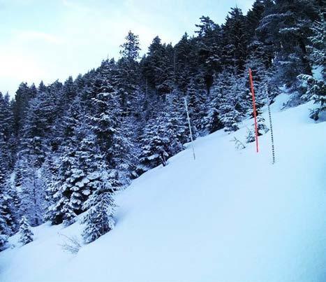
ENUMCLAW
OLYMPIA
dnr.wa.gov/foresthealth
OLYMPIA HEADQUARTERS
1111 Washington St. SE MS 47000
Olympia, WA 98504-7000 (360) 902-1000
NORTHEAST REGION
225 S. Silke Rd. Colville, WA 99114 (509) 684-7474
NORTHWEST REGION
919 N. Township St. Sedro-Woolley, WA 98284-9384 (360) 856-3500
PACIFIC CASCADE REGION 601 Bond Rd. PO Box 280, Castle Rock, WA 98611-0280 (360) 577-2025
OLYMPIC REGION 411 Tillicum Lane Forks, WA 98331-9271 (360) 374-2800
SOUTH PUGET SOUND REGION 950 Farman Ave. N. Enumclaw, WA 98022-9282 (360) 825-1631
SOUTHEAST REGION 713 Bowers Rd. Ellensburg, WA 98926-9301 (509) 925-8510
Facebook WashDNR
YouTube WAstateDNR
Twitter @waDNR
Fire Twitter @waDNR_fire
Instagram washDNR
Photos from DNR photo files unless otherwise noted.
DNR welcomes input and ideas about how to continue to accelerate implementation of the action plan. For more information about Washington State’s 2020 Forest Action Plan and to learn more about this annual report visit: dnr.wa.gov/ForestHealth
Visit our website dnr.wa.gov/foresthealth
Send an email information@dnr.wa.gov
Call us 360-902-1000
Come in See addresses at left