Cleveland Harbor Eastern Embayment Resilience Study


May 2021

This study was made possible by a grant from the National Fish and Wildlife Foundation (NFWF) Coastal Resilience Fund and matching funds from the five partner organizations – Cleveland Metroparks, City of Cleveland, Port of Cleveland, the Ohio Department of Natural Resources, and the Ohio Department of Transportation.



Cleveland is and will always be known as a waterfront community. Cleveland is one of many cities that flank the five Great Lakes and one that also contains a thriving riverfront.
The Great Lakes Basin Region spans more than 750 miles from west to east, and its areas of freshwater provide water for consumption, transportation, power, recreation and a host of other uses. The Great Lakes Basin is one of the world’s largest surface freshwater ecosystems. Eighty-four percent of North America's surface freshwater is in the Great Lakes Basin and about 21% of the world's supply of surface freshwater exists here. Given its proximity and its prominence to our local community, our nation, and the world, we endeavor to “connect Cleveland” to these assets.
Lake Erie is a tremendous asset that sits at the doorstep of our city. The CHEERS partnership initiative will ensure that our waterfront is utilized by our residents and that habitat is protected. The success of this effort will result in a waterfront that is livable for both residents and the ecological systems that exist within and along our waterfront.
Our water resources are enjoyed by many and visually evident to most, yet, this important asset remains out of reach for others. One of the key tenets of the CHEERS effort is to connect people to our waterfront, particularly, those who currently lack access. We believe that our waterfront resources are a gift to our community and no one should lack access to them. We envision a dynamic waterfront that will continue to serve our community as a place for commerce, recreation, and as a contributor to the overall health of our community.
On behalf of all of the CHEERS Partners, we look forward to working together on the implementation of this important initiative.
Freddy Collier Jr.
Director of City Planning –City of Cleveland
Sean McDermott Chief Planning and Design Officer –Cleveland Metroparks
Scudder D. Mackey Chief – ODNR Office of Coastal Management
Dave Lastovka Project Manager, ODOT District 12 Capital Programs –Ohio Department of Transportation (ODOT)
Linda Sternheimer
Director, Urban Planning and Engagement –Port of Cleveland
CHEERS offers a once-in-a-
opportunity to Embrace the Lake.
Special thanks to the hundreds of community members who participated in conversations, engagement activities, and meetings throughout the process and helped shape the vision for CHEERS.
CITY OF CLEVELAND
Edward W. Rybka, Chief of Regional Development
Freddy Collier Jr., Director of City Planning Sharonda Whatley, City Planner
Trudy Andrzejewski, Special Assistant to the Mayor, Regional Development
Sean McDermott, Chief Planning and Design Officer
Kelly Coffman, Project Manager and Senior Strategic Park Planner
Jennifer Grieser, Director of Natural Resources
Sara Byrnes Maier, Senior Strategic Park Planner
Kristen Trolio, Grants Manager
Scudder D. Mackey, Chief, Office of Coastal Management
Steve Holland, Coastal Resources Administrator, Office of Coastal Management
Dave Lastovka, Project Manager, ODOT District 12 Capital Programs
PORT OF CLEVELAND
Linda Sternheimer, Director, Urban Planning and Engagement
WRT, LLC
Keiko Tsuruta Cramer, Principal, Landscape Architecture
John Gibbs, Principal, Landscape Architecture
Mary Morton, Project Manager, Urban Designer + Planner
William Wellington II, Urban Designer + Planner
Ziwei Wang, Landscape Architect
KS ASSOCIATES INC.
Mark Cencer, Principal, Director of Coastal Engineering Services
Vito Melilli, Senior Coastal Engineer
GREAT ECOLOGY
Damian Holynskyj, Eastern Regional Director Cate Collinson, Ecologist
City of Cleveland Department of Port Control
City of Cleveland Department of Public Utilities
City of Cleveland Department of Public Works
City of Cleveland Mayor's Office of Capital Projects
City of Cleveland Mayor's Office of Sustainability
Cleveland City Council Ward 10
Cleveland Metroparks Outdoor Experiences
Cleveland Metroparks Outdoor Recreation
Cleveland Metroparks Park Operations
Cleveland Neighborhood Progress
Cuyahoga County Planning Commission
Cuyahoga County Public Works
Cuyahoga County Sustainability
Doan Brook Watershed Partners
Famicos Foundation Community Development Corporation
First Energy External Affairs
MidTown / AsiaTown Cleveland
Northeast Ohio Areawide Coordinating Agency
Northeast Ohio Regional Sewer District St. Clair-Superior Development Corporation
The Trust for Public Land University Circle, Inc. US Department of Agriculture Wildlife Services
Ariel International
Bike Cleveland
Black Environmental Leaders
Bluestone Heights
Campus District
City of Cleveland Land Bank
City of Euclid
Cleveland City Council Ward 7
Cleveland City Council Ward 9
Cleveland Cultural Gardens
Cleveland Public Power
Cleveland State University - Faculty from Biological Sciences and Urban Planning programs
Collinwood Community Development Corporation
Cuyahoga County Council District 7
Cuyahoga County Deptartment of Public Safety & Justice Services (Emergency Services)
Cuyahoga County Land Bank
Cuyahoga River Area of Concern Cuyahoga Soil & Water Conservation District Destination Cleveland
Dominion Energy
East Clark Elementary Bird Nerds Forest City Yacht Club
Friends of Kirtland Park
Greater Cleveland Regional Transit Authority Green Ribbon Coalition Holden Parks Trust
Ingenuity Cleveland Intercity Yacht Club Kirtland Bird Club
Lake Erie Coastal Ohio Trail Lakeside Yacht Club My Grow Connect
ODNR Division of Wildlife Phastar Corporation St. Martin de Porres High School
The Foundry
Upcycle Parts Shop US Army Corps of Engineers Village of Bratenahl West Creek Conservancy Western Cuyahoga Audubon Society Western Reserve Land Conservancy
Thank you to the numerous other environmental and communit y advocates that engaged throughout the process!
CHEERS brings the needs of the natural environment and the community into balance to create a resilient lakefront. The proposed improvements will Embrace the Lake as an asset for future generations. In order to achieve this vision, the plan includes goals that: connect people and communities to the lake, program spaces that meet the needs of the community, protect critical infrastructure and expand natural habitat areas, and celebrate the legacy, history, and significance of the lake.


CHEERS envisions returning the hardened edge of Cleveland’s east side lakefront to a natural shoreline with places for people and nature. The beneficial use of dredge will expand parks and habitat north of I-90, mitigate the impacts of the highway on existing parkland, protect infrastructure, and create a sheltered embayment where visitors can safely access the lake.
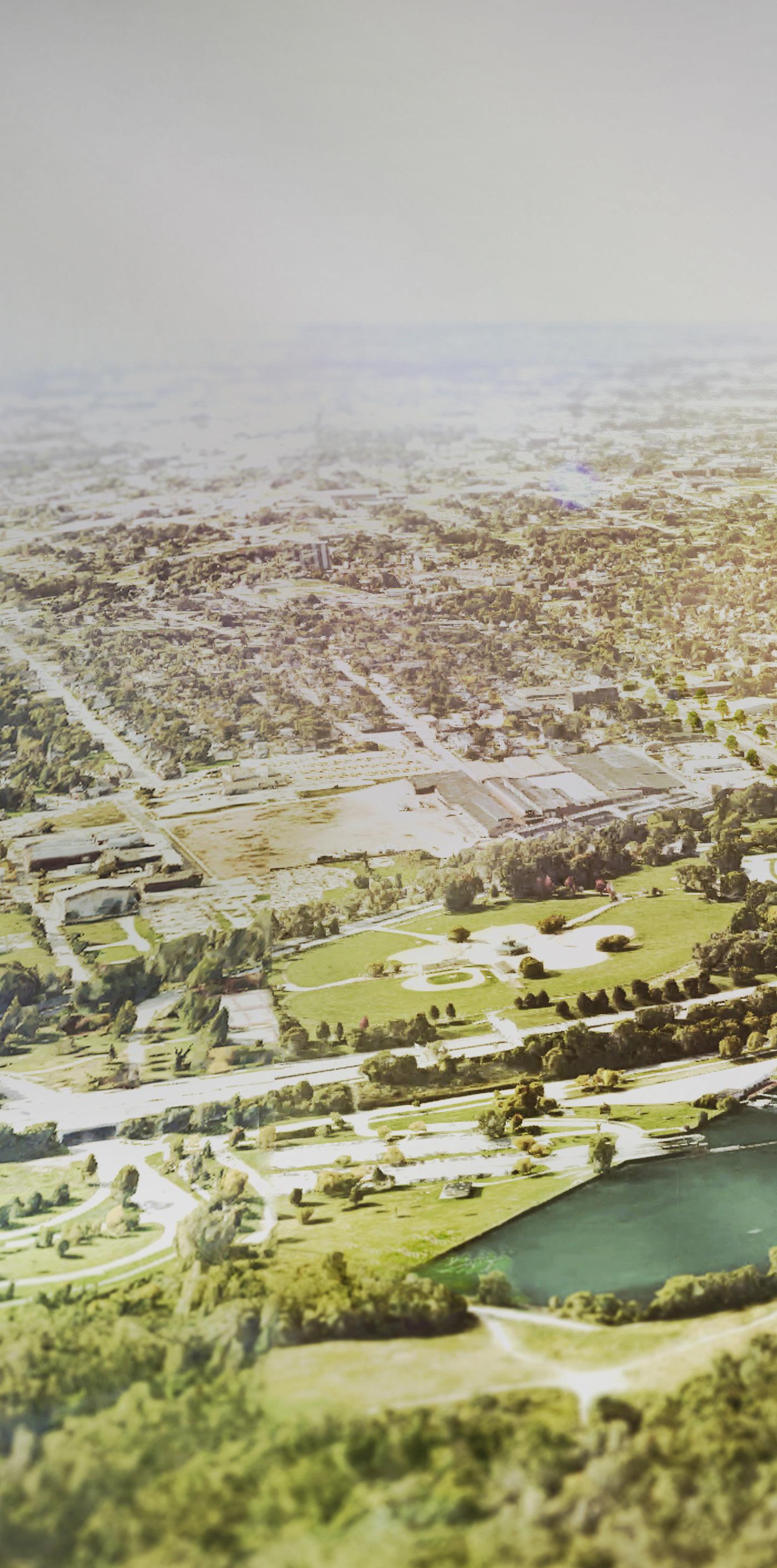 Cleveland Lakefront Nature Preserve
MLK Jr. Drive
St. Clair Superior
Gordon Park
Glenville
University Circle & The Cleveland Clinic


Community resiliency planning is arguably the most urgent undertaking of our time. The eastern lakefront sits at the intersection of social vulnerability and environmental risk. These communities have limited access to the lakefront – an underleveraged natural asset and resource – and are most vulnerable to the impacts of climate change. In addition to these risk factors, they have historically been left out of decision-making processes. This plan addresses current and anticipated challenges to improve the physical, ecological, and social resilience of the Lake Erie shoreline, the adjacent neighborhoods, and the larger community.
The team has been engaging with the community since the spring of 2020 to create a plan that improves access, connects communities to the lakefront, and preserves the longterm health of Lake Erie. The plan was shaped by the community resulting in a vision that provides unique spaces for current residents of nearby neighborhoods to enjoy.
the environment the economy the community Connect people and communities to the Lake Building the resiliency of the lakefront requires maximizing benefits to provide value beyond a single use or program by designing projects that not only improve the environment, but also provide benefits to the community and the economy. spaces that meet the needs of the community critical infrastructure and expand natural habitat areas the legacy, history, and significance of the Lake Protect Program CelebrateCommunity resiliency planning is arguably the most urgent undertaking of our time. The eastern lakefront sits at the intersection of social vulnerability and environmental risk. These communities have limited access to the lakefront – an underleveraged natural asset and resource – and are most vulnerable to the impacts of climate change. In addition to these risk factors, they have historically been left out of decision-making processes. This plan addresses current and anticipated challenges to improve the physical, ecological, and social resilience of the Lake Erie shoreline, the adjacent neighborhoods, and the larger community.
With the increased collaboration among partners, the need to improve habitat and water quality, the urgency to address infrastructure concerns related to climate change, a desire to improve the equity of the lakefront, a need for more park space, and funding support from the National Fish and Wildlife Foundation (NFWF) through the National Coastal Resilience Fund, the time is now to seize the momentum to develop and implement a plan that improves the resilience of the eastern lakefront. CHEERS is an opportunity to build on and enhance previous visioning and planning work, find beneficial uses for dredge material, and create essential natural habitat for bird, fish, and other species with projects that are primed for implementation. This habitat will protect the shoreline and nearby critical infrastructure from storm events, high winds, and changes in lake levels, which are currently at a historic high due to recent wet weather events.
The eastern lakefront sits at the intersection of social vulnerability, storm hazards, and environmental risk. Based on the 2015 Cleveland Climate Resilience and Urban Opportunity Plan, Cleveland is expected to see an increase in temperature of 4 degrees by 2070, more intense heat waves, more frequent and intense storms, an increase in heavy precipitation, and longer freeze-free seasons. The communities on the east side of Cleveland, where the CHEERS study area is located, have the highest degree of social vulnerability. This area has the largest percentage of residents living in poverty, the third highest percentage of minority residents, and the third lowest owner-occupied housing rate (NEO Storm Hazard Vulnerability Study).
This plan is animated by a shared urgency and alignment of goals among the partners – the City of Cleveland, Cleveland Metroparks, Port of Cleveland, the Ohio Department of Natural Resources, and the Ohio Department of Transportation – to awaken, enrich, and protect the lake. It tackles a variety of issues and leverages existing assets and opportunities to Embrace the Lake as an asset for future generations. These issues and opportunities include:

y Quality of Water and Habitat
y Wave Action, Storms, and Ice
y Impact on Critical Infrastructure
y Barriers to Community Access
The study area encompasses the Lake Erie shoreline from the Lakeside Yacht Club on the west to the Cleveland Lakefront Nature Preserve on the east and from the federal break wall on the north to I-90 on the south. The area is approximately two miles from east to west and three-quarter miles from north to south (I-90 to the Federal Breakwall).
SOURCE: CLEVELAND CITY GIS

Despite this portion of the shoreline lacking extensive habitat space and means of natural shoreline protection, it is an important stopover for migrating birds, a popular sportfishing destination, and a prime spot to enjoy nature within the city. Erosion, increased wave action, and more extreme storm events coupled with the hardened nature of the shoreline, magnify the damage and deterioration of shoreline ecosystems and the corresponding reduction in water quality. More natural wave dissipation can reduce damage, restore natural ecosystems, and support community recreational use.
The lack of in-water and nearshore habitat along the eastern embayment has resulted in a shoreline with no natural means of protection from storms and wave action.
The hardened shoreline with boulder walls, breakwaters, and steel bulkheads provides no areas for wave dissipation or means to break energy associated with storm events.

Over 2,000 linear feet of critical shoreline infrastructure, including roadways, trails, and an active airport, form the edge of the study area. I-90, a major regional thoroughfare and emergency evacuation route, runs east-west along the shoreline. At its narrowest point, the shoreline between I-90 and the lake is a mere 80 feet wide. Given its proximity to the Lake, the highway is frequently impacted by high winds, waves, and storm events, which cause millions of dollars in damage, lead to vehicle crashes, and often require the section of the highway that traverses the study area to be shut down. The study area also includes the Kirtland Pump Station, which is part of Cleveland’s infrastructure for drinking water, and a Cleveland Public Power facility. Additionally, the study area is adjacent to a general aviation facility, Burke Lakefront Airport.
The eastern lakefront during winter with a view of the skyline.

The construction of I-90 in the 1950s provided suburban workers greater access to Downtown Cleveland. However, like many cities across the country, it cut through the existing city fabric, severing linkages to the waterfront and bisecting a key recreational assets – Gordon Park. Today, there are limited pedestrian and bicycle connections to the lakefront from adjacent communities, all of which require going under or over I-90 and the railroad. The challenges associated with getting to the lakefront create physical and psychological barriers for the community to access the lake.
CHEERS objectives include: restoring and creating new places for habitat, finding beneficial uses for dredge material, protecting communities and critical infrastructure from the impact of storms and climate change, improving access and connections to the lakefront from adjacent communities, and thinking responsibly about how to spur new development in an equitable way that improves the economy and provides new opportunities for communities.
“This project represents healing. Water brings healing... to see the collaboration that is happening and know that this project is for all Clevelanders.”
– SeMia Bray, Black Environmental Leaders (BEL)
Resilience is the ability to survive, adapt, and grow in the face of long-term stressors (e.g., poor infrastructure, poverty) and shortterm shocks or events (e.g., storms, infectious disease outbreaks).
While the term resilience is often associated with environmental issues related to climate change like flooding, rising temperatures, and management of more frequent storm and rain events, CHEERS takes a three-pronged approach to resilience. This includes measures that improve the resilience of the environment, the economy and society, and health and well-being of the larger community.
Why we need to improve environmental resilience on the eastern lakefront:
+ Impact of Climate Change + More Frequent and Intense Storm and Weather Events + Impact of Waves, Ice, and Erosion on the Shoreline and Critical Infrastructure + Flooding and High Lake Levels + Limited Nearshore Habitat + Degraded Water Quality and Aquatic Habitat + Lack of Natural Shoreline Protection + Large Availability of Dredge Material that Needs to be Beneficially Used or Stored + Increase in Average Temperatures
Why we need to improve economic resilience on the eastern lakefront:
+ Limited Economic Opportunity for Adjacent Communities
+ Lack of a Destination or Draw to the East Side of Cleveland
+ Increasing Costs Associated with Maintaining and Repairing Infrastructure Damaged by Weather and Waves
+ Limited Lakefront Amenities for Potential Development
Why we need to improve community resilience on the eastern lakefront:
+ Barriers to Accessing the Lakefront
+ Lack of Equity in Availability and Access to Open Spaces and Recreational Amenities
+ Safety and Security Concerns
+ Vulnerable Communities with Limited Ability to Respond to Environmental or Economic Shocks
+ Need for Intergenerational and Community Gathering Spaces

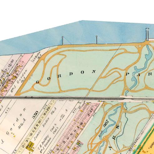
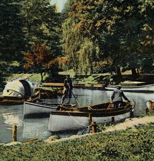
Lake Erie has played an essential role in the cultural legacy of the City of Cleveland since its founding in 1796, a legacy that continues to this day. The City’s location along this important waterway aided in its development as a hub for trading and industry. There are many layers of interconnected history throughout the longstanding relationship between Clevelanders and Lake Erie –from providing economic prosperity through industrial development and shipping to offering a vital connection to water and nature.
Boaters in Gordon Park –1900-1930 (the Cleveland Memory Project)
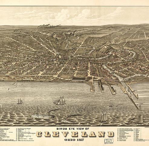
In 1796, the City of Cleveland was established by surveyors of the Connecticut Land Company.
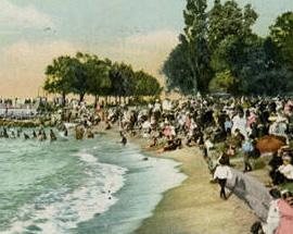
Prehistoric American Indians occupied nearby river valleys including the Cuyahoga for thousands of years before the arrival of Europeans. They utilized the abundant natural resources in and near Lake Erie for hunting, gathering, fishing, and trapping as well as travelling. These First People moved on from Ohio by 1600 as pressure from the east disrupted their way of life. There were no major American Indian occupations in Northeast Ohio after this time, but small groups of historic tribes used the area into the 1800s.
The 122-acre park was given to the city as a public park and recreation area in 1893, it became a popular destination for Clevelanders. Gordon Park and the surrounding neighborhoods have a direct connection with the lakeshore north of the rail lines.
In the 1800s, Cleveland became an important supply link for the country during the War of 1812. Its waterfront location provided key access links to trading routes on the Great Lakes. This only accelerated after the completion of the Ohio and Erie Canal that linked the Great Lakes to the Atlantic Ocean and Hudson River. The addition of new rail lines only furthered this growth and expansion. Following the Civil War, the City experienced rapid growth due to its advantageous location at the nexus between the east coast and the Midwest. With the exception of Gordon Park, much of the CHEERS study area was industrialized during this period of time. The history of the site of the former FirstEnergy Plant dates back to the late 1800s when it was originally developed and operated as the United Salt Company Works processing plant and the Consolidated Steel Wire Company manufacturing plant.
Gordon Park Boulevard –1900-1930 (the Cleveland Memory Project)

Gordon Park beach and pavilion – 1908 (the Cleveland Memory Project)
The shape of the shoreline itself has changed dramatically over the City’s long and storied history. In the 1800s, much of the CHEERS study area as we know it today did not exist. The original shoreline, shown in Figure 2, was as far south as the edge of Gordon Park. The 122-acre park was
Industry and rail activity harness the waterfront for manufacturing and movement of goods.
FirstEnergy Lakeshore Power Plant constructed (1911).

Dredging and fill programs begin to create new land such as Burke Lakefront Airport & Dike 14 in the late 1970s.

Cleveland reaches it’s peak population. Industry and transportation are the primary uses along the Eastern Embayment. Construction of I-90 begins, and bisects Gordon Park, altering the park experience for users.
New investment in park spaces and natural areas occurred in the 2000s. The Port established the Cleveland Lakefront Nature Preserve (formerly Dike 14). Cleveland Metroparks took over operation of the Lakefront Reservation park spaces.

How the shoreline has changed over time. The darker green represents the oldest portions of the shoreline dating back to 1874 and earlier. Lighter green sections represent more recent infill of land along the shore.

 SOURCE:
originally created by William J. Gordon, one of the founders of the Cleveland Iron Mining Company. Given to the city as a public park and recreation area in 1893, it became a popular destination for Clevelanders. The park was a welcome respite for residents seeking out natural beauty and a break from the hustle and bustle of the city. After its opening, a bathhouse, bandstand, and dance hall were added to enhance the visitor experience.
Cleveland established its position as one of the nation’s major manufacturing, shipping, and industrial centers by the early 20th century. The automobile was emerging and Cleveland was at the forefront of its development with multiple automotive companies headquartered in the city including the Winton Motor Carriage Company, the manufacturers of the first car to successfully drive across the United States in 1903. A new power plant within the CHEERS study area was completed in 1911 and began providing power for adjacent communities. The City’s booming economy attracted migrants from across the country and immigrants from around the world. This influx of new residents led to continued population and economic growth throughout the 1920s.
Like many other cities throughout the country, the crash of 1929 and the Great Depression took a toll on the City and its residents. Despite these challenges, Clevelanders
NEARMAP, GOOGLE EARTH, ESRI
Waves crash over Lakeshore Boulevard – 1940 (the Cleveland Memory Project)

Aerial view of the eastern lakefront after the construction of I-90 – 1961 (the Cleveland Memory Project)

persevered with the aid of the New Deal, Works Progress Administration (WPA) projects, and the Great Lakes Exposition in 1936. Structural issues and signs of decay in Gordon Park were remedied through WPA projects that rehabilitated bridges and rebuilt roads, culverts, dams, playgrounds, and ball fields.
When the United States entered World War II, Cleveland played a key role in manufacturing goods for the war effort, becoming the fifth largest manufacturing center in the country. Industrial development continued along the waterfront during this period. In the 1940s, the salt plant along the lakefront was removed and replaced with a truck service center and freight station. The new American Steel and Wire Company was constructed during this time period as well.

The post-war era brought prosperity to the City with a new economic and population boom. By 1950, the population of the city exceeded 900,000. Sports teams were growing in popularity and experiencing success on the national stage while a new genre of music was dubbed “rock and roll” by a local radio DJ.
However, a new system of federal highways and the growing popularity of the automobile saw the migration of residents from city centers out to new and larger housing in the suburbs. Construction of Interstate 90 (Cleveland Memorial Shoreway, now known as the Shoreway) in the late 1940s was considered an improvement for connectivity –linking residents from Lakewood and the western suburbs to the larger city grid. But to make way for the highway, hundreds of homes were demolished and Gordon Park was bisected, displacing residents and further disconnecting neighborhoods from the lakeshore and community assets. While Gordon Park continued to offer recreation spaces for Clevelanders, the nature of the lakefront was forever changed with new barriers to access. During this period, additional fill was used to extend the shoreline further and accommodate the right of way for the highway.
Like much of the country, Cleveland was reckoning with discrimination and inequality that led to unrest in parts of the city as community leaders fought for civil rights throughout the 1960s. These issues were exacerbated by changes in the steel and railroad industries that led to slowing growth in the city’s economy and then to loss of jobs and key industries.
The nascent environmental movement was elevated to a new intensity in June of 1969 when industrial pollution caused the Cuyahoga River to catch fire. In 1968, Cleveland elected its first African-American Mayor – Carl B. Stokes –who made great strides in working to repair many of the city’s social and environmental wounds.
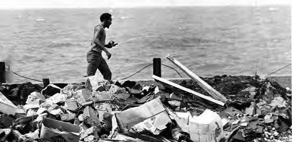
Changes in federal and international trade polices in the 1970s and 1980s contributed to a recession that had a lasting impact on Cleveland. In 1978, the City became the first major city to default on federally-backed loans since the Great Depression. During this period, the city saw the closure of many of its steel production centers, which led to skyrocketing unemployment.
In the mid-1970s, industrial sites along the lakefront continued to operate with a portion of the FirstEnergy property used for various manufacturing purposes, including as a temporary fly ash staging area. The power plant also transitioned from coal-fired boilers to fuel oil. Excess material collected from dredging for navigation channels was used during this period to further extend the shoreline, creating a series of confined disposal facilities (CDF) for dredge material. Dike 14 (now known as the Cleveland Lakefront Nature Preserve) was created as one of these CDFs in the late 1970s. Previously, this area of the lakefront was used as a dumping site and landfill. Doan Brook, one of the streams that flows into the CHEERS study area, was partially culverted by the U.S. Army Corps of Engineers in 1976. The culverted portion extends from south of I-90, under Dike 14, and flows out into Lake Erie. Despite continued environmental issues along the lakefront during this period, the City and the Ohio Environmental Protection Agency began working together to implement measures from Clean Water Act of 1972 and the National Environmental Policy Act of 1973, which set the stage for later environmental and community resiliency measures. In the 1980s, city leadership focused on a plan for recovery that included new cultural, sports, and entertainment venues in Downtown, including FirstEnergy Stadium and the Rock and Roll Hall of Fame.
Breakwater in front of the former FirstEnergy site (Cleveland Metroparks)

Anglers fishing at Gordon Park – 1970s (the Cleveland Memory Project)

The city leadership’s efforts to diversify the economy and focus on cultural assets, environmental protection, the arts, and healthcare have resulted in a new era of national prominence. The Cleveland Clinic is currently the largest private employer in the city and the state of Ohio, employing over 50,000 people (2019). Since 2010, Downtown Cleveland has experienced steady population growth and the city’s population losses have started to stabilize after decades of decline.
While the majority of industrial uses along the CHEERS lakefront study area ceased operations in the 1970s and 1980s, the FirstEnergy Plant continued to generate power until 2015. Following the decommissioning of the plant, an environmental assessment was completed to determine what environmental remediation measures would be needed. In 2017, the power plant and stacks were imploded and FirstEnergy entered into the Voluntary Action Program with the Ohio Environmental Protection Agency.
Current leadership continues to push forward revitalization efforts that focus on the city’s neighborhoods with initiatives furthering public heath, wellness, environmental protection, economic development, equity, and education. The focus on community resilience and protecting community open space assets led to Cleveland Metroparks assuming operations of park spaces along the shoreline including Edgewater Park, Whiskey Island-Wendy Park, E. 55th Street Marina, and Gordon Park. This collection of waterfront parks is called the Lakefront Reservation. In 2011 Dike 14 was renamed Cleveland Lakefront Nature Preserve by the Port of Cleveland and in 2012, the CLNP opened to the public. This focus has also resulted in plans, studies, and projects to improve the health and resilience of the shoreline and the communities directly adjacent to the lakefront, including a vision master plan for the lakefront, combined sewer overflow containment measures and long-term control plans, greenway and bicycle network plans and pilot projects, and the CHEERS study.

View of the lakefront parks from the CLNP (WRT)

The study area is located along the eastern Cleveland lakeshore, about two miles from Downtown. The area is bounded by the Burke Lakefront Airport to the west, the Cleveland Lakefront Nature Preserve to the east, and extends north to the Breakwall and south to I-90. To ensure neighborhoods adjacent to the study area were included in the process and that linkages were studied, a community outreach focus area was established. The community outreach focus area extends further south to St. Clair Avenue, incorporating a portion of the St. Clair-Superior, Goodrich-Kirtland Park, and Glenville Neighborhoods.
The study area is located within an industrial corridor running adjacent to I-90 from Downtown to Rockefeller Park. Many of these industrial facilities are located immediately adjacent to the south of the study area. Large areas of industrial use coupled with other physical barriers, such as the rail lines and the interstate, limit access from the residential neighborhoods. The major commercial corridors in the neighborhood are St. Clair Avenue and E. 55th Street. The inland residential neighborhoods are predominately detached single family homes with community-serving uses including schools, faith-based institutions, and community retail. Most of the Lake Erie shore in the City of Cleveland is dominated by industrial use or private residences. A small portion of the study area’s shoreline is reserved for publicly-accessible parks within the Lakefront Reservation, including Cleveland Metroparks East 55th Street Marina and Gordon Park, which provide much needed public greenspaces with amenities such as public boat ramps, fishing areas, restrooms, and food services. Smaller pockets of utility (e.g., I-90 and the Burke Lakefront Airport), industrial (e.g., Cleveland Public Power), and residential uses (e.g., the Shoreline Apartments) make up the remaining portion of the land uses along the lakefront.

The study area is located on the east side of Cleveland, only two miles from Downtown Cleveland.
SOURCE: CUYAHOGA COUNTY GIS


Cleveland’s Burke Lakefront Airport has ongoing dredge management and disposal areas that offer wildlife habitat, but are in conflict with aviation operations, putting birds and planes at risk. Since 1990, 587 birds of 44 identified species have been struck by planes at the airport (BKL strike data).
This confined disposal facility was developed to hold dredged material from the Cuyahoga River, allow for dewatering, and potential reuse of the material.
The Lakeshore Yacht Club was originally founded in 1930 and moved to its current location in 1932. Since then, the club has undergone a number of renovations and expansions. Today, the club offers 250 boat slips and other amenities.
Cleveland Public Power operates a facility in the western portion of the study area. The building, which can be identified by its distinctive whale mural, is situated next to a small public parcel of park land that extends to the water’s edge.
Forest City Yacht Club is one of three private clubs located within the study area. Members have access to year-round activities and docks for powerboats and sailboats sized up to 40 feet. The club was established over 75 years ago and provides storage for over 125 member-owned watercraft.
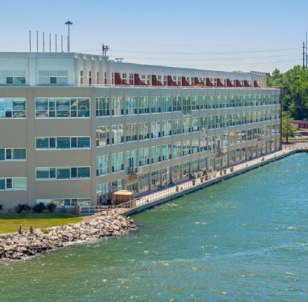
The Shoreline Apartments (formerly known as Quay 55), a private 5-story, 160+ unit building, is the only residential property located in this portion of the lakefront. The owner, Landmark at the Lake, LLC recently purchased the 4-acre vacant site adjacent to the Shoreline Apartments to develop a second apartment building with 214 apartments.

The E. 55th Marina, operated by Cleveland Metroparks, is a popular spot for anglers and boaters with a 1,200-foot fishing platform and 352 seasonal wet slips. In addition to the boating amenities, E. 55th includes spaces for picnicking, sand volleyball courts, and dining at the E55 on the Lake restaurant with an expansive patio that overlooks the water.

The southern portion of Gordon Park is managed by the City’s park division. It contains more traditional active recreation amenities, including bike polo courts, walking trails, 5 ball fields, tennis courts, a playground, and other recreation amenities.


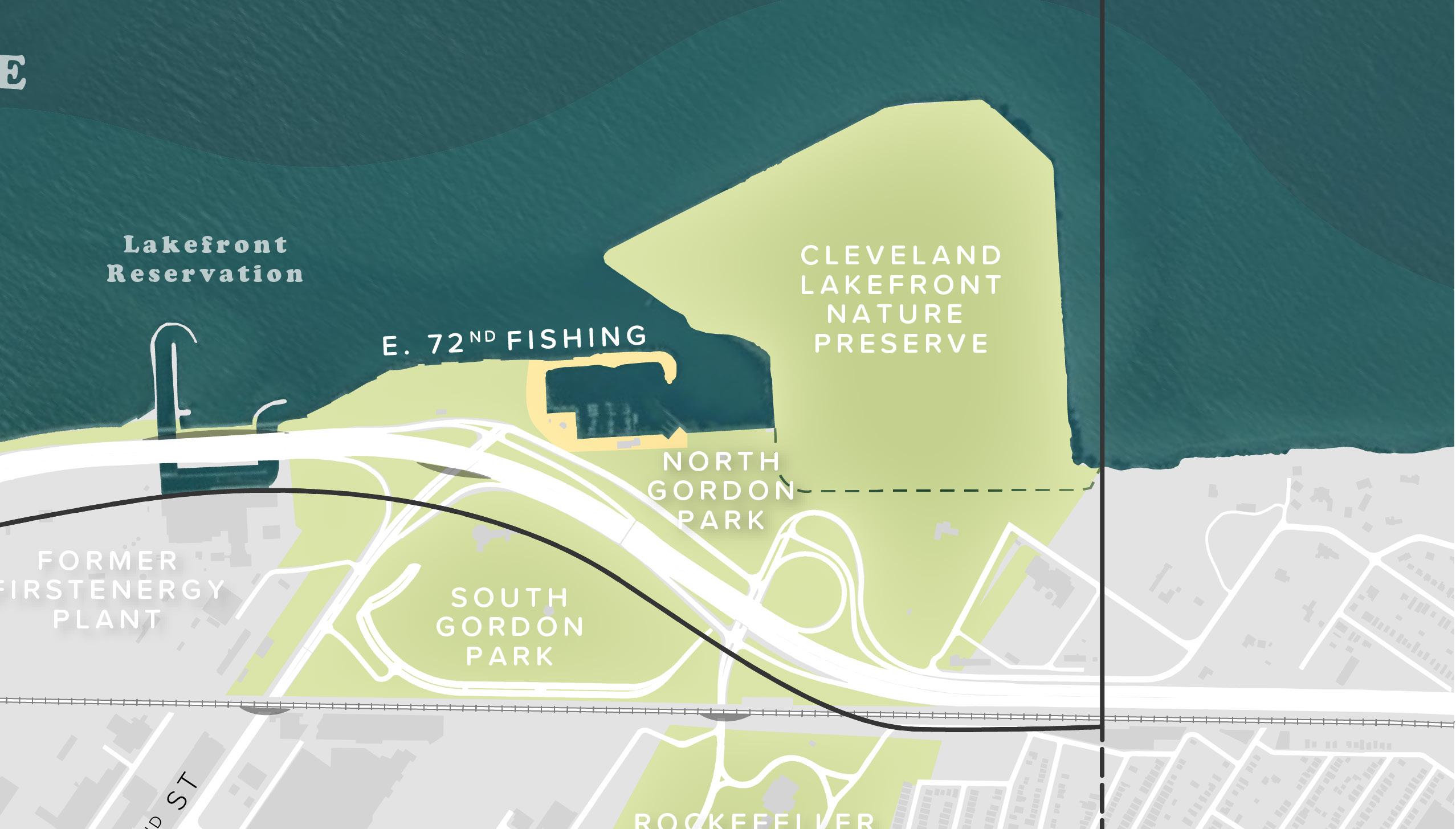
This area is one of the most popular fishing locations in the study area, with multiple platforms for fishing, ample amounts of parking, areas for picnicking, and direct access from E. 72nd Street. Based on parking and traffic data from 2019, this area is particularly popular during the peak summer months (June –August). A new comfort facility, funded by Holden Parks Trust, opened in the spring of 2021.
The InterCity Yacht Club is a privately-operated yacht club that provides access, events, and storage for members throughout the year. Organized in 1968, the InterCity Yacht Club is one of only two predominantly African-American yacht clubs in the country.
Gordon Park was originally one large 122-acre park on the banks of Lake Erie. Now the park is divided into two by I-90 and connected by a pedestrian bridge. The northern portion, managed and operated by Cleveland Metroparks, extends to the shoreline and includes a 6-lane boat launch, restrooms, and picnic lawn space.
The CLNP, previously Dike 14, is an 88-acre publicly accessible nature preserve. The peninsula, owned and managed by the Port, was constructed as a confined disposal facility for dredged material. It opened to the public in 2012 after the site was deemed safe for passive recreational use. Now, visitors hike the 2.5 miles of trails, bird watch, take in expansive vistas of the lakefront and Downtown Cleveland, and explore the native vegetation and wildlife. The CLNP provides an immersive nature experience with over 280 species of birds, 41 species of butterflies, 35 different plant species, and various animals identified within the confines of the preserve.

While most of the land use in the study area is publicly owned, access to these spaces varies. Properties are owned and operated for various uses by the Port of Cleveland, the State of Ohio, the City of Cleveland, Cleveland Metroparks, and the federal government. Cleveland Metroparks assumed the management of the lakefront parks in 2013, which had previously been operated by the City of Cleveland and most recently, by the Ohio Department of Natural Resources (ODNR). Since 2013, the Cleveland Metroparks has made significant strides to transform these underutilized and under-maintained parks into destinations of choice along the city’s lakefront. The Park District has thoroughly cleaned the parks, increased Police presence to improve safety, and made significant capital investments of over $18M across its Lakefront Parks. However, varied ownership, barriers to access, and the few private parcels along the lake create a disconnected lakefront experience for users.
The study area (north of I-90) does not contain any vacant parcels. However, the community outreach focus area (south of I-90) includes a number of land-banked parcels that are owned by the City and the county. The most significant vacant property adjacent to the lakefront is the former FirstEnergy Power Plant site just south of I-90, which presents an opportunity for the City and other partners to manage its redevlopment in a way that promotes access to the lakefront and equity. There is an opportunity to leverage these existing vacant parcels to extend greenways from the lakefront into the adjacent communities, implementing some of the stated goals from the Cuyahoga County Greenways Plan and the Re-Imagining a More Sustainable Cleveland vacant lot revitalization plan.

City Land Bank County Land Bank Metroparks Lease Metroparks Subleased
City Owned County Owned Port Owned State Owned Federally Owned Park (City) Owned


The map above depicts the varied ownership of public parcels and provides the location of county and city land-banked parcels within or adjacent to the study area.
SOURCE: CLEVELAND CITY GIS
While the majority of the study area and community outreach focus area is not residential, about 3,500 residents live within the boundary of these areas. Of this population, 80.8% are African American or Black, 15% are White, and 0.7% are Asian. The average household income is $38,501, and 33.1% live below the poverty line.
About 79,000 residents live within a three-mile bike ride of the study area. Of this population, 81% is African American, 71% report a household income of less than $35,000, and 36% of households do not own a vehicle.
The neighborhood adjacent to and within the study area, St. Clair-Superior, is a diverse and culturally-rich community with a resident-driven goal to revitalize the neighborhood in response to past loss of industry, disinvestment, and vacancy. This neighborhood is quite vulnerable to the threats of climate change based on both its waterfront location and sociodemographic factors including race, educational attainment, and income (Hardy, 2017; Cleveland Neighborhood Progress, 2015). While the city as a whole faces greater sociodemographic challenges associated with climate change and storm hazard vulnerability when compared to the rest of Cuyahoga County, the risk to St. Clair-Superior and the east side of Cleveland is higher still. Compared to the city, in St. Clair-Superior, 18.9% more of the population is non-white, 24% fewer adults have a high school diploma, and 18.4% more households are below the poverty line (U.S. Census Bureau, 2009). The confluence of physical challenges associated with the lakefront and these statistics indicates that the communities adjacent to the study area are at a higher risk of negative impacts associated with coastal climate threats due to a lack of institutional and financial resources available to absorb damages and remain resilient during long-term stressors and short-term shocks (Hardy, 2017).
The study area is home to about 3,500 residents. Businesses in the area employ 4,000 residents in 252 active establishments, primarily located along the study area’s two commercial corridors and within the industrial fabric south of I-90. The median household income for area residents is $20,584, compared to $26,150 for the City of Cleveland.
Like many areas in Cleveland, the neighborhoods intersecting the study area are still dealing with the effects of sprawling suburban growth, white flight, a decline in population, and loss of industry. These trends have led to concentrated poverty in core city neighborhoods, disinvestment in infrastructure, increased vacancy and blight, and growing racial and economic segregation. The neighborhoods within and adjacent to the study area are vibrant, but socially vulnerable and at a greater risk to negative impacts of climate change.
The Cleveland Neighborhood Progress Climate Resilience Plan incorporates social vulnerability metrics and identifies “protecting residents and neighborhoods from flooding, increased precipitation, and extreme weather events” in its top three priorities and details the need to focus on resiliency measures for these vulnerable and at-risk neighborhoods (Cleveland Neighborhood Progress, 2015). A detailed resiliency study of four neighborhoods in Cleveland, including the Glenville neighborhood that is immediately adjacent to the study area, was performed between 2016 and 2017 under the “Climate Smart Cities” program by The Trust for Public Land. This effort looked at the impacts that parks, open space, and green infrastructure, including living shorelines, can have on communities to improve overall resiliency, especially for at-risk populations. The objectives of the program were organized around four areas: Connect, Cool, Absorb, and Protect. An interactive GIS-based mapping tool was developed to assist with scenario planning related to resiliency efforts in the City of Cleveland. This tool was utilized during the study to aid in visualization of future conditions.
Four Cleveland neighborhoods – St. Clair-Superior, GoodrichKirtland Park, Downtown Cleveland, and Glenville – directly intersect the CHEERS study area and community outreach focus area. Each of these neighborhoods is unique with its own community conditions and cultural identity. Strengthening and creating safe connections from these neighborhoods to the lakefront are a key focus of the CHEERS study to ensure that all Clevelanders have the opportunity to enjoy the lakefront for generations to come.
Community Development Corporations (CDCs) are nonprofit organizations that focus on revitalizing and supporting communities. CDCs provide support for affordable housing, deliver community services including job training, help develop areas of the community, and connect residents to social programs. The CDCs in the surrounding neighborhoods provided crucial support throughout the engagement process, helping to connect residents to the process.
St. Clair-Superior is one of the most diverse neighborhoods in the city. The neighborhood is bounded by Lake Erie to the north and Superior Avenue to the south and E. 55th Street to the west and Martin Luther King Jr. Drive to the east. It was originally founded in the late 1800s and populated by immigrants from Eastern Europe as the industry rapidly took hold in Cleveland and immigrants from Lithuania and Slovenia moved to the area for work. Demographic shifts in the 1990s transformed the neighborhood from majority white to majority minority with African-American residents making up 79% of residents. The St. Clair Superior Development Corporation, the local CDC, was founded in the 1990s to organize residents and aid in the revitalization of the area. Today, the area is home to a thriving arts scene, unique cultural enclaves, a growing industrial district, and vibrant commercial corridor along St. Clair Avenue. Despite economic challenges, the neighborhood has undergone significant transformation and community-led revitalization efforts, that are still ongoing, to renovate existing homes and reuse vacant lots. Currently, the neighborhood is divided by I-90 and the rail lines, disconnecting residents from their lakefront.
Goodrich-Kirtland Park, which also includes part of AsiaTown, is roughly bordered by E. 55th Street to the east and I-90 to the west and Lake Erie to the north and Euclid Avenue to the
south. Once referred to as Chinatown, the area welcomed Chinese immigrants and railroad workers in the late 1800s. The neighborhood was a thriving ethnic enclave for Chinese immigrants and descendants from the 1930s to the 1960s. In the 1970s, new residents moved into the neighborhood and many second and third generation families moved out to the suburbs for the promise of larger homes and economic prosperity. During this time, there was an influx of Korean, Vietnamese, and other Asian immigrants leading to a new resurgence of AsiaTown that continues to this day. Today, AsiaTown is a cultural destination, hub of businesses and retail, and a thriving community. Three community development organizations serve this neighborhood – MidTown, Campus District, and St. Clair-Superior Development Corporation.
Downtown, also referred to as the central business district, is considered the economic center of the city. Downtown was an important part of the city’s development, containing the port, much of the rail infrastructure, and the civic and government buildings. The city and Downtown experienced continued economic growth through the mid-20th century, but by the 1960s, economic growth slowed as population and development continued spreading out into the suburbs following the expansion of the highway system. Sprawling development, population loss, and economic stress led to concentrations of low-income and impoverished residents in core city neighborhoods with increasing vacancy, blight, and disinvestment. Since the 1990s, the city has undergone numerous revitalization efforts to attract new residents, diversify the economy, and develop unique cultural enclaves and destinations. Downtown has been at the forefront of this effort with a population that has grown more than any neighborhood in the city between 2000 and 2010. The Downtown Cleveland Alliance non-profit organization has aided the City in many of these revitalization efforts to make Downtown a thriving neighborhood and economic center. The Downtown lakefront and the connections via trails and transit are key to ensuring that the Cleveland Lakefront is a cohesive and distinct regional destination.
Glenville is located on the eastern side of the study area and includes the Cleveland Lakefront Nature Preserve and a large portion of Rockefeller Park. Glenville, once an independent village founded as a resort community for wealthy Clevelanders, was annexed by the City of Cleveland
in 1904. From its founding until the early mid-20th century, Glenville was a predominantly Jewish neighborhood with a thriving commercial corridor of stores, restaurants, and synagogues. Many of these residents left the neighborhood in the 1950s and 1960s for the rapidly expanding suburbs east of the city. Today, the neighborhood is majority minority with African Americans making up over 97% of the population. The neighborhood has experienced a great deal of disinvestment and economic strife over the past few decades evidenced by vacancy, crumbling infrastructure, and high concentrations of poverty. However, the Famicos Foundation and the Mayor’s Neighborhood Transformation Initiative have helped lead revitalization efforts to promote housing repair, education, engagement, quality of life investments, and commercial revitalization throughout the community. A newly budding arts scene and natural assets like Rockefeller Park, the Cleveland Lakefront Nature Preserve, and the Cleveland Cultural Gardens have resulted in a resurgence of interest in this storied and historic neighborhood.
Diverse and vibrant communities and neighborhoods surround the eastern lakefront. The white labels and dashed black lines depict individual neighborhood boundaries and names. Colored areas represent CDC service areas. Hatched areas with one or more color represent areas where CDC service areas overlap.
 SOURCE: CLEVELAND CITY GIS
Recognizing the immense value of building on previous engagement and planning efforts, the team reviewed numerous relevant proposals and studies whose scope overlapped with the CHEERS study area.
2004
The 2004 waterfront plan provides a vision for the Cleveland waterfront as a “the most vital element in the transformation of Cleveland as a place to live, work, and play.”
OLIN Studio, 2014
2011
This report assess the feasibility for beneficial use of material dredged from the Cleveland Harbor. About 300,000 cubic yards (CY) of dredged material are removed each year to ensure the navigability of the federal channel.
ODOT prepared by LJB Incorporated, 2015
This study evaluated the existing safety performance on I-90 and at the interchanges with E. 55th Street, 72nd Street, and MLK Jr. Drive. The purpose of the study was to determine methods to reduce crashes along these segments of I-90. Between 2011 and 2013, 405 crashes were recorded in this area of I-90, two of which were fatal.
FirstEnergy by Arcadis, 2017
This study was prepared in advance of the demolition and potential sale of the former FirstEnergy plant located at 70th Street and the lakefront to determine what remedial activities would be required.
The Cleveland Lakefront Green Infrastructure Overlay identifies Cleveland Metroparks’ aspirations for sustainability and green infrastructure in lakefront parks and provides guiding principles to help inform future planning efforts.
Cleveland Metroparks, 2015
This study assesses the population within a one-half mile walk and three-mile bike ride of the Lakefront Reservation (E. 55th and North Gordon Park).
Human Nature with St. Clair-Superior Development Corp., 2018 In 2018, Cleveland Neighborhood Progress and the St. Clair-Superior Development Corp. organized a design charrette to develop a vision and coordinated approach to development to transform the underappreciated lakefront into a first-rate asset
Cuyahoga County Planning in partnership with Cleveland Metroparks, funded by Northeast Ohio Areawide Coordinating Agency (NOACA); prepared by SmithGroup, WSP, and Guide, 2019 Funded by a Transportation for Livable Communities Initiative Planning Study (TLCI), this plan proposes greenways and urban trails to connect existing assets and provide more mobility options.
Cleveland Metroparks, 2019
This annotated site plan identifies place-based opportunities for enhancing the natural and social functions of the Lakefront Reservation (collection of park spaces along the waterfront).
BLUE (Building a Livable Urban Edge) Project of EcoCity Cleveland & the Cleveland Waterfront Coalition, 2002
In 2002, EcoCity Cleveland organized a collaborative workshop to develop strategies to restore the ecological integrity of Cleveland’s lakefront and raise public awareness of the potential to bring nature back into the city.
Northeast Ohio Sustainable Communities Consortium (NEOSCC) with Sasaki, 2014
This three-year regional planning process, led by the NEOSCC, sought to answer three questions about the future of Northeast Ohio – what course is Northeast Ohio on; what future does Northeast Ohio want for itself; and how do we make that future a reality? The plan lays out three potential future scenarios – Grow the Same, Do things Differently, and Grow Differently.
Cleveland Neighborhood Progress, City of Cleveland Planning Commission, LAND Studio, the Cleveland Urban Design Collaborative at Kent State University, funded by the Surdna Foundation, adopted in 2008 and updated in 2014
This plan focuses on creating city-wide strategies for the reuse of vacant land. Since Cleveland’s loss of population over the last 60 years is unlikely to reverse in the near-term future, the city was looking for a strategy to deal with vacant land.
Cleveland Neighborhood Progress with City of Cleveland, Mayor’s Office of Sustainability, Cleveland Urban Design Collaborative at Kent State University, University of Buffalo, funded by Kresge, 2015
The plan used an asset-based and social-network approach to planning for climate change. It lays out strategies for preparing the city for a future with more frequent heat waves, storms, increases in heavy precipitation and associated flooding, and longer freeze-free seasons.
Davey Resource Group, 2015
The plan lays out a long-term management plan to implement the vision of the CLNP as a wildlife sanctuary for the community to enjoy by actively managing the preserve for a healthy native habitat.
Ohio Lake Erie Commission, 2016
This state-prepared plan provides a list of priority areas, goals, and strategic objectives for the conservation and restoration of Lake Erie’s coastal ecosystems.
Scott D. Hardy – Ohio Sea Grant College Program at The Ohio State University, 2017
An academic study to assess the risk and vulnerability of communities within the Northeast Ohio Regional Sewer District (NEORSD). The study evaluated 42 communities and ranked them against each other using indicators of vulnerability, both social (e.g., gender, ethnicity, age, housing, and income) and environmental (e.g., flood risk, erosion, debris, water quality). Results suggest this region has a large percentage of low-income residents who would inherently struggle with remaining resilient in the face of increasing environmental issues.
Doan Brook Watershed Partnership, prepared by EnviroScience, 2019
Provides an analysis of several proposed restoration alternatives for Doan Brook and provides a preferred alternative. The study included a feasibility study and analysis of ice flow, hydraulic modeling, water quality, regulatory requirements, and other pertinent environmental concerns to better inform future phases and implementation.


The lakefront is a popular destination for Clevelanders. From walking and biking trails to bird watching hot spots and fishing and boating destinations, the eastern lakefront provides a variety of recreation experiences. In 2020, Cleveland Metroparks, eastern lakefront parks received over one million visitors. Visits to the parks have steadily increased over the past four years with more than 800,000 visitors each year (2020 Cleveland Metroparks Visitation Report).
The shoreline is an important stopover for migrating birds, bats, and insects, making it a popular location for birders and nature enthusiasts. Multiple locations within the study area are migrant “hot spots” (eBird) and fall within the National Audubon Society’s “Important Bird Areas.” Over 280 documented bird species have been observed along the lakeshore including federally-listed species such as Kirtland Warbler, Red Knot, and Piping Plover. While terrestrial nearshore habitat in and around the study area is limited, this area remains a very important migratory stopover point, in part because it is one of the few spots along the lakefront with intact, native soils. Birding destinations along the lakefront include the Cleveland Lakefront Nature Preserve.
South and North Gordon Park provide the largest available recreation spaces. The northern portion of Gordon Park is operated by Cleveland Metroparks and includes more waterfront-related amenities, including a boat launch, parking, and an open lawn for picnicking and other passive uses. The southern portion of Gordon Park is operated by the City and includes some traditional active recreation uses with ball fields, a playground, lawn space for passive recreation, and visitor amenities (e.g., restrooms, water fountains). Aside from these two locations, there is limited active recreation and passive lawn space throughout the remaining portion of the study area with the majority of recreation space devoted to water-based activities and parking. The E. 55th Marina provides one of the only active recreation opportunities with sand volleyball courts adjacent to fishing and picnic areas. Additional opportunities for passive recreation include walking, biking, and hiking trails. The CLNP provides 2.5 miles of passive trails while the Lakefront Trail crosses east-west through the study area and connects to the Harrison Dillard Trail through Rockefeller Park.

Water recreation is one of the most popular activities within the study area – from stand-up paddling, kayaking, and boating to fishing and taking in the scenic water vistas. The area provides myriad options for engaging with the water.


Public fishing and boating areas are located at the E. 55th Marina, the breakwater adjacent to the former FirstEnergy Plant, the E. 72nd Fishing area, and the North Gordon Park Boat Launch. The North Gordon Park Boat Launch provides one of the only places with public ramps where visitors can launch watercraft into the lake. The area is also home to a series of private clubs that provide access to members, including the Lakeside Yacht Club, Forest City Yacht Club, and InterCity Yacht Club.
The area is a popular fishing spot for local residents who enjoy using the lakefront regularly to fish for recreation and to eat. Many anglers surveyed in this location in both 1997 and 2019 reported that they or someone they know eat the fish they caught or displayed characteristics of subsistence fishing. Subsistence fishing is not uncommon in the Great Lakes where over four million people consume fish caught from the lakes each year (Arima, 2019). The high rate of subsistence fishing in the area highlights the direct connection between ecosystem health and the health of lakefront communities as many fish in urbanized areas are known to have higher concentrations of harmful industrial pollutants. Improving fish habitat will support local anglers and will also foster a better connection between the lake and residents, create support for environmental stewardship within the larger community, and help connect more residents to the lake.
The area is a popular sportfish destination. The existing bulkhead and steep shorelines do not provide adequate cover for spawning or feeding. Despite the limitations of existing in-water habitat, this area of the lakefront is quite popular with anglers. Anglers in this area record catching a variety of fish, including Perch, Steelhead, Large and Smallmouth bass, Sunfish, Northern Pike, and Walleye. In addition to recreational fishing, organizations throughout the area host fishing tournaments like the Walleye Fall Brawl tournament that draws thousands of participants from across the city and region.
left: boats docked in the eastern lakefront, playground in South Gordon Park, the Bird Nerds at the CLNP (sources: Cleveland Metroparks, City of Cleveland, WKYC)
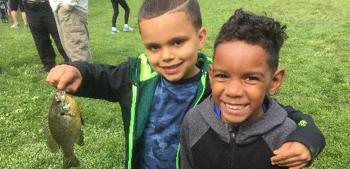
right: swings at E. 55th Marina, anglers at E. 55th Marina, paddleboarding on Lake Erie, young anglers (sources: Cleveland Metroparks, WRT)

The team has been engaging with the community since spring of 2020 to create a plan that improves access, connects communities to the lakefront, and preserves the long-term health of Lake Erie. This study is especially important for our communities and ecosystem as we consider how climate change will impact our area and the lake in the coming decades.
During the year-long planning process, the project team engaged over 1,500 community members and stakeholders. The planning process kicked off at the beginning of the coronavirus pandemic, which required adjusting plans, tools, and strategies to reach communities adjacent to the lakefront and beyond. Community engagement and coalition building were critical components of the planning process and essential to the creation of a community-driven resiliency plan. The lakefront is one of the most significant natural and cultural assets for adjacent neighborhoods as well as the city at large. The process was structured to ensure that current users and communities were involved in every step of the decision-making to shape the future of the lakefront.
Working with community partners and local Community Development Corporations (CDCs), the team created flexible and approachable community engagement strategies to reach the most vulnerable residents. This toolkit of strategies evolved throughout the process as the team learned more about the community and found new ways to overcome challenges.
Through this process, the project team learned from community members and residents that the eastern lakefront is valued as a serene natural oasis in the heart of the City that provides scenic views of Lake Erie and downtown. Community members emphasized the importance of retaining the peaceful character of the lakefront spaces, preserving space for current users, and providing more opportunities for gathering and being immersed in nature. But they want safer and better access, more places to touch and connect with the water, more open and flexible space for events and gatherings, more things to do (like picnicking and watersports), more trail connections, and more opportunities to disconnect and enjoy an immersive natural experience. By aligning these community priorities with the need to improve the environmental resilience of the lakefront, the planning
process was oriented toward finding the right balance of community spaces to meet user needs and ensuring the protection of the shoreline and critical infrastructure and the creation and restoration of the natural habitat.
The CHEERS project launch and the beginning of the coronavirus pandemic coincided in the spring of 2020. While the worldwide health crisis continued, the nation was faced with two additional crises – social and racial injustice and political upheaval during and after the 2020 election. As communities, businesses, and organizations grappled with a new reality and worked to address community needs, the project team began to workshop creative, flexible, and approachable engagement and outreach techniques to reach residents. This toolkit evolved throughout the process as the team learned more about the community and found new ways to overcome challenges by working with community partners and local CDCs. The final mix of engagement techniques included a range of ways for community members to get involved including digital tools like surveys, videos, virtual meetings, and social media, traditional flyers and postcards, and in-person and sociallydistanced events that ensured the safety of all participants.
Understanding the potential impact of the project for communities adjacent to the lakefront, the team worked with local organizations, partners, and CDCs to distribute information about the CHEERS study using a variety of outreach methods. Coordination with CDCs and other organizations in the community helped shape the outreach materials and methods to reach the widest number of community members. These methods included traditional media outreach using flyers and postcards, tabling at community events, lawn signs, and conducting intercept surveys as well as digital outreach through websites, online articles, event postings, and social media. A phone number, email address, and project website were incorporated in all materials to ensure that an open line of communication was available regardless of access to technology and the internet.
Every round of engagement included multiple ways to get involved and provide input during crucial moments in the planning process. Providing safe and convenient ways to provide input was central to the engagement strategy for CHEERS. Digital engagement activities including virtual scavenger hunts, interactive map exploration tools, surveys, and explainer videos allowed community members to provide input in a meaningful way that required less of an investment in time compared to a traditional town hall or presentation.
In addition to in-person and digital engagement, three larger, community-wide virtual town halls were held at critical points during the process – visioning, concept assessment, and the reveal of the draft master plan. Each event was held via Zoom and featured polling and breakout discussion groups using an interactive digital whiteboard to record feedback and reference maps and materials. Outreach for the events included targeted email outreach, flyers, posters, social media posts, and direct coordination with local CDCs.
The first round of engagement focused on activities that would help the team better understand how community members use lakefront spaces today and how they hope to use these spaces in the future. Activities included an online user survey and virtual town hall meeting.
A lakefront user survey was launched at the beginning of the process to gather information about how people use the park today, what they value, and ideas for how they would like to use the lakefront in the future. This feedback helped us better understand how community members use the space today and what they want to see in the future. The survey was distributed online and in print in three languages (English, Spanish, and Mandarin) over the course of more than a month. Over 500 users responded to the survey. Walking and jogging, biking, parking to enjoy the view, picnicking, and bird watching are currently the most popular activities along the lakefront. Users enjoy being close to the water, taking in the views of water and the city, using the open spaces, walking or biking along the trails, and bird watching. Users were concerned about the difficulty to getting to park spaces from adjacent neighborhoods, the impact of I-90 traffic and noise, limited space and activities available in park spaces, the safety of bicycle and pedestrian crossings and routes, and the perceived lack of security in spaces along the lakefront. In the future, they would like lakefront spaces to include more user amenities like restrooms and food and beverage options, more natural spaces, places to touch Lake Erie, better neighborhood and park space connections, areas that buffer park spaces from the highway, and more events, educational programs, and recreation opportunities.
of I-90 traffic and noise on park and Lakefront”
space and activities and programs in the existing parks”
lack of security in spaces along the Lakefront”
would you like to see improved along the lakefront?”
More natural spaces #1 Places to touch Lake Erie #2 Better connections to neighborhoods and between existing park spaces #3 Buffer park spaces from highway #4 More events, educational programs, and recreation #5
June 30th, 2020 at 6pm
Over 100 community members and stakeholders joined the partners in kicking off the CHEERS study during a virtual town hall in the summer of 2020. The meeting provided an opportunity for residents to learn about the goals of the study, the potential issues and opportunities in the study area, and how they could stay involved throughout the process. Following the formal presentation, facilitators led participants through an interactive breakout group discussion and workshop. This exercise asked participants to provide feedback on how they use the lakefront now, potential hurdles and challenges, and opportunities for the future. A total of ten breakout groups provided feedback and ideas for the future (see Appendix for detailed meeting summary).
Breakout groups used ConceptBoard (a virtual whiteboard / collaboration tool) to draw, add notes, and discuss ideas for the future.
get people down to the lake
provide opportunities to be “on the water” for all
wayfinding & signage

extend transit
places to gather
Natural Areas
fishing, hiking & birding
places to be in nature
too much concrete & car infrastructure
views of the water
there is a desire for more visitor amenities (benches, restrooms, places to eat/drink, etc.), areas for watersports (e.g., kayak launch areas), flexible passive and active recreation spaces, places to walk into and touch the water, safe places for kids to play, improved fishing amenities and spaces, and enhanced educational and natural programming.
participants wanted to preserve the scenic quality of the lakefront and enhance natural features, restore areas of the hardened shoreline and historic streams (e.g., Doan Brook and Giddings Brook), improve habitat areas to support existing anglers, protect bird and wildlife habitats, reduce the amount of impervious / paved surfaces, establish more ecotypes (e.g., wetlands, natural beaches, etc.), and connect to existing green spaces and greenways.
Better
access to the lakefront from adjacent communities (northsouth) and between lakefront park spaces (east-west) is a major concern. Participants suggested enhanced biking trails, improved pedestrian and bicycle connections along streets, enhanced crossings over I-90, expanded bus and transit routes, and new trail types to link existing park spaces.
Explore
there is an appreciation of the transformative potential of the lakefront and its ability to serve local communities and act as an economic driver and destination within the city.
Buffer the Negative Impacts of I-90 while part of the city’s critical mobility infrastructure, I-90 presents multiple impediments to accessing and enjoying the lakefront including safety, traffic noise, and visual obstruction.

“Fishing is
In the second round of engagement, the team used the existing conditions information and local insight gathered during the first phase of the project to begin exploring ideas with the community. The team held a series of in-person walkshops and launched a virtual scavenger hunt that asked community members to explore what is working and what is not working in the current spaces along the lake.
September 20th & 21st (4 tour routes, 3 time slots)
To find out how people use the park spaces along the lakefront and understand what they want to see in future spaces, the team needed to reach current users of these spaces. This was even more important given the challenges of engagement during a worldwide pandemic. To address this issue and ensure safety of the team and community members, we designed a series of “Embrace the Lake” walkshops where we invited users to meet us at the lakefront for socially-distanced walking workshops that explored different areas of the lakefront and asked users to envision new program elements and spaces they would like to see improved in the future. Conversations focused on identifying elements that are working or are valued by the community as well as spaces in need of future investment. These ideas helped the team hone in on key areas where investment should be focused.
The first set of walkshops were held during a weekend in September 2020. Participants were able to choose from four different tour routes with three time slots per route for a total of 12 sessions. The team and project partners promoted the walkshops via social media posts on Instagram, Facebook, and Twitter, targeted outreach to CDCs (Famicos, MidTown, and UCI), postcard distribution, posters and lawn signs at key areas along the lakefront, and a “This is Cleveland” event calendar post. The walkshops were attended by 87 community members and 12 volunteers who all followed strict COVID-19 protocols for safety.
Tour routes included the area adjacent to E. 55th Street, E 72nd Street, North Gordon Park, and the Cleveland Lakefront Nature Preserve. These walkshops were invaluable to the planning process as they offered the planning team an
opportunity to speak directly with users and “ground-truth” ideas and key areas for improvement. Participants at the walkshops received a free CHEERS reusable water bottle and information about how to stay engaged.
participants stressed the need for safer and more seamless connections from the adjacent neighborhoods to the lakefront.
while community members appreciate the expansive views of water along the lakefront there is a desire to have naturalized areas of the shoreline with opportunities for wading and watersports (fishing, kayaking, paddleboarding).
community members enjoy the mulituse lakefront bikeway, but would appreciate a variety of pathways and trails, including boardwalks and nature trails as well as better wayfinding and directional signage

more opportunities and areas to appreciate the natural beauty of the lakefront.
Walkshop participants at E. 55th Street, E. 72nd Street, and the CLNP (Cleveland Metroparks)
– Walkshop Participant (E. 55th Street)


“Walkways out into the water with areas for fishing and taking in views of the lake.”

The virtual scavenger hunt provided a way for community members who were unable to attend in-person walkshops to go out and explore the lakefront independently. A total of eight sites were available to explore. Each site included a different task or question to complete. Questions and activities included providing feedback about amenities, taking a selfie crossing a pedestrian bridge, or snapping a photo of something along the lakefront participants considered beautiful. Participants were invited to visit as many sites as they would like. One-of-a-king furniture designed and created by Cleveland-area teens through the Making Our Own Space, or MOOS, program were located at some of the eight sites. MOOS engages and empowers youth to transform public space; these pieces were conceived, designed, and built by students in the BuckeyeShaker neighborhood of Cleveland and the Moreland and Lomond neighborhoods of Shaker Heights. MOOS is an initiative of the Cleveland Urban Design Collaborative, a program of Kent State University’s College of Architecture + Environmental Design. Participants to completed the activity or question for at least one site were entered into a raffle drawing to win a Dave’s Grocery gift card.
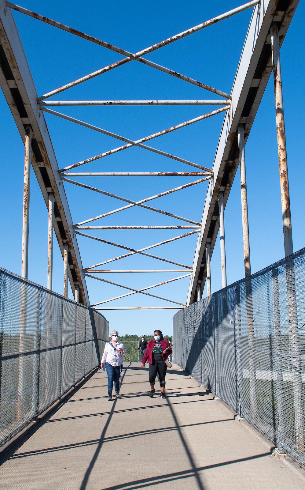
Walkshop participants traverse the Gordon Park pedestrian bridge of I-90 noting the lack of wayfinding signage and visual appeal.
A softer shoreline and more habitat would be fabulous.
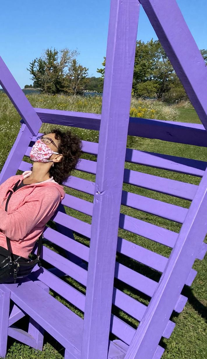
A walkshop participant takes a moment to enjoy the lake breeze on a MOOS bench near the E. 55th fishing area.
+ a place to be close to water + activities for all ages + more fishing & picnicking + places for events + watersports
+ lighting + walkways & bike amenities
+ fishing amenities + public art & wayfinding + seating & benches
+ improve water quality + planting & sound buffers + places to view + quiet places
+ connect neighborhoods + improve safety + make it easier to get there by foot / bike + new transportation options
+ security measures (panic/call buttons) + improve safety by the water + fix walkways & sidewalks + clean up and control pests
The East Clark “Bird Nerds” are a group of 6th, 7th, and 8th graders that meet after school to learn all about birds. The East Clark School students learn how to identify birds, their songs, and where and how they live. The group has taken numerous trips to local birding areas throughout the region. Their commitment to birding and becoming stewards for the environment is inspiring to all! The group joined the planning team in September for an Embrace the Lake Walkshop at the Cleveland Lakefront Nature Preserve. Their input on amenities for birders and strategies to make birding more accessible and welcoming for youth and communities of color was invaluable.
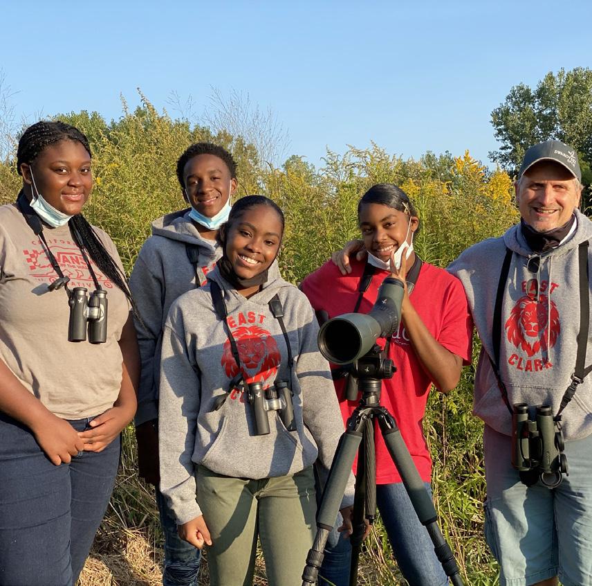 (left: Bird Nerds by WRT)
Through this process community members were encouraged to go out and explore the lakefront. Here’s some of what they saw and observed during the Virtual Scavenger Hunt!


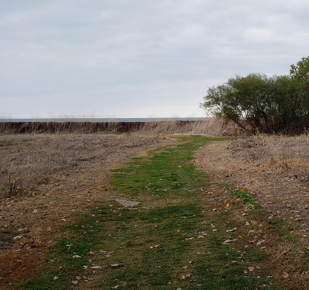

A selection of photos submitted by Virtual Scavenger Hunt participants. Participants took photos of areas or aspects of the lakefront they considered beautiful or unique. Photos featured the lake, views of the skyline, sunsets, and natural areas.


“Build a loop trail that incorporates this park and the Cleveland Cultural Gardens”
– Virtual Scavenger Hunt Participant
The third round of engagement incorporated all of the innovative ideas generated through the first two rounds of engagement into conceptual themes that dialed up the experiences of touching the water, playing at the shore, and connecting with nature. Each theme included a set of unique goals and projects. Community members were asked to vote on the goals they value and the project they felt would be most impactful to the future of the lakefront. This series of engagement included a virtual town hall, an interactive map explorer tool, and an interactive survey with explainer videos.
February 2nd, 2021 at 7pm
At the beginning of February, over 65 community members and stakeholders joined the partners and project team for a second virtual town hall to explore potential projects, goals, and concepts for the lakefront. The virtual town hall was one of three ways community members could provide feedback on the concepts. The team incorporated interactive polling during the formal presentation to ask participants about their preferred goals and projects. Following the presentation, the participants were placed in breakout groups where a facilitator guided them through questions about the concepts and projects using a virtual whiteboard. At the end of the breakout group sessions, each facilitator asked their group to pick a “gold star project;” the one project they would fund over all others. The larger group then convened back in the main room and a representative from each breakout group provided a summary of the topics discussed and feedback received.

Community members had the opportunity to join the team at a virtual town hall in February of 2021 to review potential goas and projects.
An online survey with explainer videos gave community members another way to provide input on goals and projects.


January - March 2021
Community members who could not attend the meeting had the option of taking a video survey or exploring an interactive map. The video survey included short explainer videos that walked through each concept and its series of goals and projects and asked users to answer a few short questions. The interactive map explorer allowed participants to take their time and explore the concepts on a map that included detailed descriptions of the projects and goals. As participants clicked through the map, a popup survey window asked questions about what projects and goals they would prioritize.
After watching each of the explainer videos participants were asked to select their favortie projects and goals.

“For the lakefront parks to be equitable, they must be safely connected to the adjacent communities. You shouldn’t need a car to get there.”
–
To achieve the goals of the project, the team worked with the community to undertake an urban ecological methodology that works to bring the needs of Lake Erie, the community, and the natural environment into balance. The success of the process is measured by the resilience of the lakefront and the resulting network of benefits that improve the environmental, social, and economic health of the area. During this process, the team worked with the community to weigh competing interests and goals of various stakeholders and partners, determine the programming needs of the community, understand what residents value, and find solutions that provide multiple benefits.
The first step in the process involved maximizing or dialing up the experiences using programmatic elements that different community members requested in engagement sessions. All the maximized experiences or concepts included a unique mix of projects that provided multiple benefits to the economy, the community, and nature. Instead of asking community members to vote on one concept or experience, the team asked community members to prioritize the projects and goals they felt were most crucial or important to the future of the lakefront. What emerged from these activities was not a menu of options or a list of desires, which would create clear winners and losers. Rather by asking users and stakeholders to prioritize needs, goals, and projects, the planning team was able to identify preferences of prioritizing the natural environment, connecting with water, and flexible passive recreation spaces.
Following the third round of engagement, the team worked with project partners, stakeholders, and the design team to create a hybrid concept that combined the highly-rated projects and goals into a final concept that includes multi-benefit projects that improve the health and wellness of the environment, people, and Lake Erie. This final concept creates a resilient lakefront that responds to the needs of the community and stakeholders. All of
the goals and desires of the community, stakeholders, and partners factored into the creation of concepts for potential projects and ideas of how to reshape the future of the shoreline.
The final concept incorporates the top-rated goals and projects from the community. It creates more opportunities to touch and engage with the water through softened shorelines and areas that allow visitors to get further into the water, it uses dredge material to create more park space and habitat areas to buffer critical infrastructure, it provides a diversity of water-based recreation opportunities, it enhances and creates new wetland areas and coves that protect the shoreline and grow habitat along the lakefront, and it creates new greenway connections via E. 55th and 72nd streets that connect communities to the lakefront. Top-rated projects including the cove, boardwalk trails, a cultural trail, greenways, lawn spaces, a shore for wading, an island, and natural surface trails are all project types that are incorporated in the final concept.
+ Create more opportunities to touch and engage with the water.
+ Use dredge material to create more park space and habitat areas to buffer critical infrastructure
+ Provide a diversity of water-based recreation opportunities (fishing, wading, watersports, etc.)

+ Enhance and create new wetland areas and protected coves that protect infrastructure & provide new habitat space

+ Create new greenway connections from the lakefront to the adjacent communities


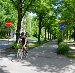

+ Developed sketches that incorporated top projects (voted by the community) and methods to reduce the impact of waves and maximize the storage of dredge material.


The final round of engagement provided community members an opportunity to refine elements of the draft plan and provide input on early action projects. Community members had the opportunity of joining a virtual town hall, joining in-person walkshops, or filling out an online survey. While this was the last round of engagement included in this phase of the project, this is not the last opportunity for community members to engage in the planning and design of the CHEERS projects. The project partners will continue working with local organizations and CDCs to engage with the community after this portion of the work is complete.
April 22nd, 2021 at 7pm
The partner team invited community members, stakeholders, and agencies to a final virtual town hall to review the concept for the CHEERS study area. Over 140 people participated. Partner organizations and local CDCs were invited to speak about ongoing engagement related to CHEERS and other complimentary efforts. Cleveland Metroparks spoke about ongoing efforts to continue improving visitor amenities along the lakefront, including a new investment in a comfort station at E. 72nd, and continued engagement with adjacent neighborhoods, stakeholders, residents, foundations, and local, state, and federal agencies. The partners also touched on current efforts to secure additional funding and support by building a coalition that includes the existing five project partners, the Black Environmental Leaders (BEL), the National Fish and Wildlife Foundation (NFWF), other stakeholders, and the US Army Corps of Engineers. The Black Environmental Leaders spoke about the mission and vision of their organization, how it aligned with the goals of the CHEERS effort, and their role as a partner for future phases of the CHEERS project. Famicos Foundation, one of the local CDCs, spoke about its ongoing mission, its role in the CHEERS community outreach, a current master planning effort for the neighborhood, and upcoming engagement events through its “Ignite! Neighbor Nights” every third Thursday. Finally, Bike Cleveland spoke about the ongoing Safe Routes to Parks effort, which is undertaking additional neighborhood engagement focused on access and removal
of barriers from Superior Avenue, E. 55th Street, and E. 72nd Street to the lakefront park spaces. The effort is a partnership between the SCSDC, Cleveland Metroparks, and Cleveland Kent Station Urban Design Collaboration. The meeting ended with a question and answer session geared at addressing participant comments and questions about the proposed plan, implementation and phasing, and adjacent efforts.
April 24th, 25th and 26th 2021 (4 tour routes, 3 time slots)
The second set of walkshops followed the April 22nd Community Town Hall, where the proposed concept plan was revealed. The walkshops provided an opportunity for participants to engage with conceptual design on-site, envisioning the proposed changes from the ground. Tour routes included the area adjacent to E. 55th Street, E. 72nd Street, North Gordon Park, and the Cleveland Lakefront Nature Preserve. Participants were also encouraged to share their impressions of the tour areas as well as suggestions for further improvements. There were over 60 registrants for the second set of walkshops. In their written reflections, participants shared their excitement about the proposed plan as well as appreciation for the walkshop format.
Common themes that emerged from participant suggestions in this round of walkshops included the desire for viewshed improvements through the removal of obstructions, increased seating (especially around prime areas for sunset viewing), new opportunities to access the water, nature programming, improved connections between Gordon Park and the lakefront, expanded and better wayfinding and interpretive signage, improved and expanded restroom facilities, picnic shelters, improved and expanded public transit connections, interventions to reduce sound pollution from 1-90, and moving parking away from the shoreline.
Team member leads a Walkshop group at E. 55th Marina. (Cleveland Metroparks)


Walkshop group pauses near the E. 55th fishing area. (Cleveland Metroparks)
A team member provides an overview of the draft plan. (Cleveland Metroparks)
The CHEERS engagement and design process focused on creating a resilient lakefront that responds to the current and future needs of the community and stakeholders as well as the environment. Each of the various desires and goals were factored into the creation of the plan and projects. Many of these aspirations – connectivity, access, creation of habitat –were shared amongst the project partners, stakeholders, and community members.
In order to deliver a vision for the lakefront that has a viable pathway to implementation, the planning effort needed to leverage the strength of partners with vested interest in the future and resiliency of the lakefront and adjacent communities. A collaborative partnership of five regional and local agencies – Cleveland Metroparks, the Ohio Department of Natural Resources (ODNR), the Ohio Department of Transportation (ODOT), the City of Cleveland, and the Port of Cleveland – was formed to spearhead the CHEERS initiative with grant funding from the National Fish and Wildlife Foundation.
The formation of this partnership was motivated by a shared urgency to awaken, enrich, and protect the lake for future generations and build upon past visioning and planning work to push beyond conceptual ideas into projects primed for implementation. The partners bring complimentary goals to the project.
A key goal of the engagement process was building excitement and support in surrounding communities, stakeholder groups, and local organizations and agencies. To facilitate engagement and help guide and structure recommendations, the project partners created two advisory bodies – the Project Team and the Stakeholder Committee. These groups helped set the stage to mobilize the involvement of the community and local organizations and institutional partners in making improvements to the lakefront a reality.
Walkshop participants stop for a moment of play at North Gordon Park. (Cleveland Metroparks)
Member organizations and representatives on the Partner, Project Team, and Stakeholder Committee.
Port of Cleveland
ODOT
City of Cleveland
Ariel International, Bike Cleveland, Bluestone Heights, Campus District, CEI, City of Cleveland – Wards 7 (Councilman
Jones) and 9 (Councilman Conwell), Cleveland Cultural Gardens, Cleveland Museum of Natural History, Cleveland State University – MUPD, Collinwood CDC, Cuyahoga Soil and Water Conservation District, Cuyahoga County Council, Destination Cleveland, Dominion Energy, Downtown Cleveland Alliance, City of Euclid, Forest City Yacht Club, Greater Cleveland Regional Transit Authority (GCRTA), Green City Blue Lake, Green Ribbon Coalition, Holden Parks Trust, Ingenuity, InterCity Yacht Club, Lake Erie Coastal Ohio Trail Scenic Byway, Lakeside Yacht Club, LAND Studio, MidTown / AsiaTown, MyCom Youth Council, ODNR Division of Wildlife, Shoreline, Slovenian National Home, St. Martin de Porres High School, The Foundry, UMADOP, US Army Corps of Engineers, Village of Bratenahl, West Creek Conservancy, Western Reserve Land Conservancy
Ward 10 Councilman
Hairston, Cleveland Neighborhood Progress, Cuyahoga County, Doan Brook Watershed Partners, Famicos, FirstEnergy, Northeast Ohio Regional Sewer District (NEORSD), Northeast Ohio Areawide Coordinating Agency (NOACA), St. Clair Superior Development Corporation (SCSDC), Trust for Public Land, University Circle, Inc., USDA – Burke Wildlife Specialist
The Project Team provided overarching guidance for the process to ensure consistency with project goals and regulatory framework(s). The group included members of the project partners, agencies, interest groups, and community organizations with a vested interest in the future of the area. This advisory body participated in eight interactive and participatory workshops throughout the process to discuss key milestones and developments.
The Stakeholder Committee included a larger network of interested groups, potential future partners, private entities adjacent to the study area, cultural and educational institutions, and local representatives. This group participated in five participatory workshops to provide a sounding board for testing ideas and concepts before being presented to the larger community. This group was a critical resource for generating public interest and aiding in outreach and engagement events during the pandemic.
To improve community outreach, the team set up partnerships with local CDCs. This effort was geared at not just improving the reach of the CHEERS effort, but also helping to forge new community-based partnerships to grow local capacity and steward the outcome of the plan. Throughout the process, the team held community engagement coordination meetings outside of the Project Team and Stakeholder Committee meetings to ensure that current efforts aligned with community partner schedules and events.
This was especially important since one of the key goals of the process was creating projects that provide crucial amenities and services to existing neighborhood residents. The partners and planning team worked with the CDCs, and will continue to work together through implementation, to maintain housing affordability, avoid or mitigate displacement of current residents, and encourage redevelopment and investment in an equitable manner.
Black Environmental Leaders Association stands as stewards of the natural and built environment through collaboration and partnership. They work to raise awareness and advocate for environmental and economic justice. The group provides a forum for community environmental education that can serve as a basis of a deeper understanding and commitment to land, water, air, transportation, and energy issues that impact the economic outcomes in communities through the lenses of health, diversity, inclusion, and equity. BEL provided a forum to share ideas and receive feedback with their core group and helped distribute information to its larger network of organizations and members. BEL will be a key partner in the next phases of design and implementation of the project.
Famicos Foundation is a local CDC that serves the Glenville, Hough, and St. Clair-Superior neighborhoods. The organization was founded by Sr Henrietta Gorris 50 years ago with the mission to empower residents to create an engaged, vibrant, diverse, healthy neighborhood, where residents choose to stay, invest, and help shape a “neighborhood of choice.” Their work
focused on strengthening housing markets, supporting better land reutilization, providing impactful urban amenities, promoting community-supportive commercial efforts, integrating transportation and mobility access, and promoting active living and access to health foods. Famicos provided support throughout the CHEERS planning process by distributing postcards, flyers, and other outreach materials, communicating planning efforts and engagement events to their residents, providing space for the planning team to table and speak at events, and participating actively in the Stakeholder Committee and Project Team meetings. Famicos and its members will be crucial partners in the next phases of engagement and planning for the CHEERS area.
MidTown Cleveland Inc is a local CDC that serves the MidTown Neighborhood and AsiaTown. Their mission is to leverage the community’s diverse assets to develop a dynamic neighborhood that unites the city’s downtown and innovation districts. This supports the vision for MidTown as a connected community that provides an inclusive place for people to innovate, create, prosper, and live. Throughout the process they provided key pathways to help reach underserved and underrepresented populations including recent immigrants and non-English speaking residents. MidTown distributed materials to their residents, provided space for the planning team to engage with residents, and actively participated in the Stakeholder Committee and Project Team meetings. Moving into future phases of the project, MidTown and AsiaTown will be critical partners to help continue building a strong community coalition and supporting access to the lake.
The St. Clair Superior Development Corporation (SCSDC) has been serving as the St. Clair neighborhood CDC for over 40 years. Its mission is to connect people, expand opportunity, and build livable, healthy, and inclusive places. The SCSDC was an active participant in the Stakeholder and Project Team Meetings and distributed outreach materials and publicized CHEERS engagement events throughout the process. At the beginning of 2021, the SCSDC began working in partnership with Bike Cleveland, Cleveland Metroparks, and the Cleveland Kent State Urban
Design Collaborative on the Safe Routes to Parks effort to better connect adjacent communities to the eastern lakefront. SCSDC will be a key member of the community coalition as the CHEERS study moves into future phases of design, engagement, and implementation.
University Circle Inc. (UCI) is a local CDC that serves the University Circle neighborhood. Its vision for University Circle is a vibrant and complete neighborhood without borders. The organization is working to create a community experience that connects all Clevelanders to the city’s center of culture, healing, and learning by developing new residential and visitor experiences, keeping the neighborhood clean and safe for residents and visitors, connecting and revitalizing main corridors (e.g., Euclid Avenue and Main Street), and creating active and inviting places and spaces for all people to enjoy. UCI was an active partner throughout the planning process by participating in the Stakeholder Committee and Project Team meetings and distributing project and outreach material. UCI and its members will continue to be an integral community partner as the CHEERS study moves forward with additional design and engagement.
The CHEERS planning process laid the foundation for increased coalition and relationship building between the five partner organizations and local CDCs and community organizations, but there is much more to be done. These activities and partnerships led to an increased use of existing parks by neighborhood residents and increased awareness of the eastern lakefront as a key community asset. Continued communication between the public, stakeholders, and project partners to emphasize project benefits, new community partnerships and coalitions, provide honest and transparent expectations for phasing and timelines, and demonstrating short-term wins by being responsive and taking action are crucial to full realization of the CHEERS vision.
Engagement activities and coordination with local CDCs led to new partnerships with organizations like the Black Environmental Leaders (BEL). BEL advocates and provides resources for black communities that often bear a disproportionate share of the harmful impact of environmental hazards due to a lack of political and economic power. BEL’s partnership with the CHEERS project represents a commitment to continued collaboration and equity in planning for recreation and environmental resources on the east side of Cleveland. They will play a central role in future phases of the project, helping to connect communities of color to the lakefront and the decision-making process.

CHEERS offers a once-in-a-generation opportunity to Embrace the Lake as an asset for future generations. The plan connects residents to their lakefront, allows the shoreline to adapt while preserving and creating new habitat, creates a buffer to protect communities and critical infrastructure, provides more spaces for the community to enjoy nature and the lake, and establishes the eastern lakefront as an equitable destination for the east side of Cleveland.


CHEERS brings the needs of the natural environment and the community into balance to create a resilient lakefront that leverages existing assets to Embrace the Lake as an asset for future generations. In order to achieve this vision, the plan includes goals that: connect people and communities to the lake, program spaces that meet the needs of the community, protect critical infrastructure and expand natural habitat areas, and celebrate the legacy, history, and significance of the lake.
CHEERS envisions returning the hardened edge of Cleveland’s east side lakefront to a natural shoreline with places for people and nature. The beneficial use of dredge will expand parks, create and enhance in-water and nearshore coastal habitat areas, mitigate the impacts of the highway on existing parkland, protect infrastructure, and create a sheltered embayment where visitors can safely access the lake.


Waterfront trail and community connections.
(Hunter’s Point South –New York, AIA New York)
The presence of I-90 and the rail lines act as barriers to the eastern lakefront, requiring residents to navigate over or under the infrastructure. Despite the miles of Lakefront Trail that traverse the study area, north-south access points from adjacent neighborhoods to the lakefront are limited for bicycles and pedestrians. Furthermore, the car-centric nature of many lakefront spaces and the limited access points lead to the feeling that pedestrians and bicyclists are not welcome and not safe moving through the study area.
CHEERS envisions the creation of an equitable and accessible lakefront with more opportunities to touch and engage with the water, contiguous and connected park spaces, and improved accessibility and safety for surrounding communities through the creation of new trails and greenways. The plan reconfigures access to the lakeshore – reconnecting residents from adjacent neighborhoods to the lakefront through greater bike, pedestrian, and vehicular access. Existing community streets (E. 55th and E. 72nd streets and MLK Drive) will be transformed with multi-use trails and bike lanes, wayfinding signage, and gateways at lakefront parks. The experience of traversing pedestrian bridges over I-90 will be enhanced and new pedestrian bridges near the former FirstEnergy plant and Kirtland Park will be explored to further enhance connectivity to nearby neighborhoods. The plan also improves community resilience by buffering communities from the negative impact of environmental stressors and increasing equity in the availability of recreational assets. New healthy shoreline ecosystems and natural protection will improve aquatic habitat and protect critical infrastructure. Combined, these improvements will restore adjacent neighborhoods as “Lakefront Communities.”
y Create more opportunities to touch and engage with the water.
y Unite existing park spaces along the lake to create contiguous public open space.
y Improve accessibility from neighboring communities.
y Establish new greenway connections to the lakefront that improve access and safety.

The lakefront is a popular destination for Clevelanders. From walking and biking trails to bird watching hot spots and fishing and boating destinations, the eastern lakefront provides a variety of recreation experiences. In 2020, Cleveland Metroparks eastern lakefront parks received over one million visitors. However, community members expressed a desire for more flexible open spaces for pick-up recreation games, picnics, and gatherings that would allow for more activity and enjoyment of spaces without disturbing the tranquility of the lakefront.
CHEERS envisions a series of nature-based, water-based, and passive recreation spaces that build upon what community members already love about the lakefront, ensuring that the lakefront is protected and enjoyed by all residents. The plan incorporates a variety of trail experiences, new opportunities for water- and nature-based recreation, flexible and passive recreation spaces for community events, and increased visitor amenities (e.g., benches, picnic tables, restrooms, etc.) creating a dynamic, accessible go-to recreation and immersive natural space in the heart of the city.
y Provide a diversity of water-based recreation opportunities like fishing, wading, and watersports.
y Create new spaces for informal and formal activities and events.
y Incorporate immersive nature-based experiences in the heart of the city.
Great lawn with gathering spaces for events and picnicking. (St. Patrick’s Island – Calgary, W Architecture and Landscape)

Over two thousand linear feet of critical shoreline infrastructure, including roadways, trails, and an active airport form the edge of the study area. This community infrastructure includes I-90, a major regional thoroughfare and evacuation route, the Kirtland Pump Station, which is part of Cleveland’s drinking water infrastructure, a Cleveland Public Power facility, and the Burke Lakefront Airport. The lack of in-water or nearshore habitat along the eastern embayment has resulted in a shoreline with no natural means of protection from storms and wave action. The impact of storms, waves, and ice on I-90 and other critical infrastructure has caused millions of dollars in damage and leads to unsafe conditions for community members.
Despite this portion of the shoreline lacking extensive habitat space and means of natural shoreline protection, it is an important stopover for migrating birds, a popular sportfishing destination, and a prime spot to enjoy an immersive natural experience within the city. Erosion, increased wave action, and more extreme storm events, coupled with the hardened nature of the shoreline, magnify the damage and deterioration of shoreline ecosystems and the corresponding reduction in water quality.
CHEERS envisions a series of more natural wave dissipation areas and barriers that reduce damage caused by storm events, restore natural ecosystems, and support community recreation and use. An offshore barrier isle provides protection from the most intense wave forces, allowing for the creation of a quiet cove with softened shoreline areas that will protect infrastructure, maximize new habitat space, improve water quality, and give greater community access to water- and nature-based recreation. New habitat areas will include both near-shore and aquatic habitat space that support water quality, biodiversity and fish spawning, and existing recreation activities like fishing. Protection of critical infrastructure, including I-90, will alleviate funding concerns related to maintenance and upkeep and contribute to the resilience of nearby communities and neighborhoods.
However, the reality is that the area will come under increasing threats and stresses from the changing environment. Given these unknown future conditions, the plan creates spaces that can evolve and adapt and are flexible and resilient in the face of a changing environment.
y Enhance and create new wetland areas that protect infrastructure and provide new habitat space.
y Use dredge material to create more park space to buffer critical infrastructure.
y Protect the shoreline and expand natural areas to maximize habitat space.

Cleveland’s Eastern Lakefront has played a significant role in the history of the City – from aiding in the early industrialization and economic prosperity to providing waterfront access and recreation for generations of Clevelanders. Though the area is still home to a few publicly-accessible parks and recreation spaces, much of the shore is still dominated by industrial uses, infrastructure, and private residences and properties. In addition to land use challenges, this area is seeing the impact of climate change in water level fluctuations and more frequent and extreme storm events, exposing communities and infrastructure to threats of erosion, wave surges, flooding, and wind damage.
CHEERS envisions a lakefront for all – one that celebrates and uplifts the history and significance of the lakefront and its influence on communities, honors the natural systems and its evolution, and helps to define a healthier relationship with the waterfront and its ecosystem. The vision provides new ways of engaging with the lake and the environment by creating community spaces that provide moments of respite, gathering spaces, and opportunities to actively engage with the water. The eastern lakefront of the future embraces the restorative qualities of green space and blue space (water) and their combined impact on the well-being and health of the community.
y Honor the cultural, historic, and environmental significance of the water and its connection to communities.
y Create places where the community can celebrate nature and appreciate the cultural and historic significance of the lake.
y Celebrate the lakefront as a natural oasis and refuge within the city.
CHEERS envisions returning the hardened edge of Cleveland’s east side lakefront to a natural shoreline with places for people and nature. The beneficial use of dredge will expand parks and habitat, mitigate the impacts of the highway, protect infrastructure, and create a sheltered embayment where visitors can safely access the lake. Swaths of new habitat and natural shorelines will be encircled by a network of trail systems and a tree-lined parkway. Play spaces, amenities, picnic lawns and pavilions, fishing areas, and overlooks will be distributed throughout the lakefront for the community to enjoy. Gateways, event lawns, and educational and natural programming will activate the edges of the Lakeshore, while the Cove and the Isle with its wetlands, grasslands, and marsh areas will provide a natural experience in the heart of the city. These components will work together to create a resilient lakefront that meets the needs of the environment and the community.
The Isle will create a new way to experience the lake. Visitors can walk or bike across the bridge or paddle out through the Cove to wander through the trails, tree-lined lawns, and nature play areas, immersing themselves in the unique natural environment of Lake Erie. The Isle presents an unmatched opportunity to create contiguous habitat space, maximizing the connectivity and health of ecosystems that make Lake Erie an unparalleled natural resource. Created from dredge material, this barrier island will also provide protection for the shoreline, allowing for the creation of a protected cove and naturalization of the water’s edge.
The Lakeshore will extend the existing shoreline, creating welcoming and connected park spaces. Major gateways at E. 55th and 72nd streets, Martin Luther King Jr. Drive, and enhanced pedestrian bridges will connect adjacent communities. The Lakeshore leverages existing activity nodes at the 55th Street Marina and North Gordon Park to create new gathering and recreation spaces for the community.
Nestled between the Isle and the Lakeshore, the Cove will provide a protected inlet for watersports and extensive habitat restoration and expansion. The insulated area will offer a space for visitors to interact with and touch the water in a way that has not been available on the east side. Visitors can wade at the Shore, learn to kayak or operate other watercraft in an area insulated from wave energy at the Launch, or walk along elevated boardwalk trails along marsh and wetland habitat that rings the outer edge of the Cove.


CHEERS will create 80 acres of new parkland along the eastern lakefront with natural habitat restoration and community gathering spaces created through the beneficial use of 3.1 million cubic yards of dredge material. The new space will improve environmental and community resilience.
+ Rain gardens and native plants along the park edge will filter stormwater and buffer noise from I-90.

+ The Habitat Loop uses dredge material to create a biologically-rich wetland habitat adjacent to the Cove.
+ A partially softened shoreline protects from wave and lake levels while creating space for habitat in emergent wetlands.

+ Fish habitat structures will support fish spawning and improve recreational and subsistence fishing.

+ Nature play areas will be tucked into Oak Savannah and grassland habitat that provide attractive habitat for migrating birds.

+ Larger stone revetments protect the Isle from high lake levels and intense wave action, allowing for the creation of a protected and natural cove.


The eastern lakefront is an essential natural and cultural asset for the city and the adjacent neighborhoods. It sits at the intersection of social vulnerability, storm hazards, and environmental risk. However, these challenges provide an opportunity to leverage infrastructure investments to achieve multiple community resilience and conservation outcomes that support the overall resilience of the lake and surrounding communities.

Resilience is defined as the ability to survive, adapt, and grow in the face of long-term stressors (e.g., poor infrastructure, poverty) and short-term shocks or events (e.g., storms, infectious disease outbreaks). While the term resilience is often associated with environmental issues related to climate change like flooding, rising temperatures, and management of more frequent storm and rain events, the team used a three-pronged approach to resilience –one that considers the resilience of the environment, the economy and society, and health and well-being of the larger community.
Water level fluctuations, extreme storm events, and heat are increasing in frequency and severity due to climate change, exposing infrastructure along Lake Erie to threats of erosion, wave surges, flooding, and storm impacts. Climate projections estimate that Cleveland is expected to see an increase in temperature of four degrees by 2070, more intense heat waves, more frequent and intense storms, an increase in heavy precipitation, and longer freeze-free seasons. The neighborhoods adjacent to the lakefront are vibrant and culturally rich, but vulnerable and at greater risk of experiencing the disproportionate impacts of climate change. In the past year, this was evident in these communities, which are experiencing higher rates of COVID-19 infections and continued economic stress. These current crises have exacerbated existing issues of inequity in services and access to amenities and made the issue of resiliency even more pressing. These impacts require that proposed improvements to the lakefront account for dynamic conditions over the next decades, allowing the lakefront to adapt while preserving ecological and community functions. The CHEERS study proposes a series of strategies and projects to strengthen the resilience of the lakefront and its communities by improving equitable use and access to amenities, tackling critical infrastructure challenges, and providing economic development opportunities.
y Use dredge material to buffer I-90 and critical infrastructure along the shore.
y Improve access to the lakefront for alternative modes of transportation, including biking, walking, and taking public or shared transportation.
y Create and restore native habitat ecotypes along the shoreline through the beneficial reuse of dredge material.
y Reduce maintenance costs for I-90.
y Expand the natural areas of the lakefront to create habitat corridors, manage stormwater, and improve water quality.

y Protect program elements and circulation systems from lake level fluctuations, wave action, and storm impacts.
y Create a destination for the east side of Cleveland that supports the local economy and provides equity in access to recreation and open space assets.
y Improve public awareness and understanding of natural processes and human impact on the environment.
y Build strong coalitions for the lakefront, including institutions, agencies, and park user partnerships to improve stewardship in an integrated and inclusive manner.
(Cleveland Metroparks)
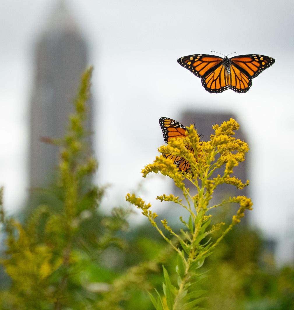
y Increase ecological diversity and create healthy ecosystems that support populations of native and adaptive species.
y Maximize natural habitat areas to support improved water quality, air quality, and natural means of shoreline protection.
y Ensure flexible programming of spaces to allow for changing recreation trends and respond to community needs.
y Combat nature deficit disorder by increasing access to natural areas within the park for play and educational opportunities.
y Plant vegetation and design spaces that will adapt to future environmental conditions.
y Support public health measures by providing recreational opportunities that encourage active lifestyles.
y Provide space for new shade trees and plant species that mitigate heat island effects and provide a respite for communities.
y Design park infrastructure, improvements, and structures in a sustainable and energy-efficient manner using low-impact development measures and metrics.
Neutral and/or Adverse Good Best
NATURAL AREAS (GRASSLANDS, MARSH)
INCREASE NATURAL HABITAT RESTORE ECOLOGICAL FUNCTION INCREASE ACCESS TO AND VIEWS OF WATER REDUCE POTENTIAL FLOODING IMPROVE WATER QUALITY REDUCE IMPACT OF HEAT INCREASE BIODIVERSITY IMPROVE AIR QUALITY BENEFICIAL REUSE OF DREDGE MATERIAL REDUCE IMPACT OF WAVES AND STORMS REDUCE BIRD STRIKES
THE LAWN
PICNIC GROVE
NATURE PLAY
OVERLOOK
THE COVE
THE SHORE & THE LAUNCH
THE HABITAT LOOP
THE GORDON HILLS
THE EASTERN FISHING COVE
72ND STREET GATEWAY
COMMUNITY GREENWAYS
Building the resiliency of the lakefront requires maximizing benefits to provide value beyond a single use or program by designing projects that not only improve the environment, but also provide benefits to the community and the economy. Emphasizing multibenefit projects will ensure the lakefront remains an asset for future generations and plays an important part in the social, environmental, and economic transformation of the city and adjacent neighborhoods.
Providing increased community benefits is essential to the lakefront’s future and long-term vitality. A key objective of the master plan is to increase awareness of the lake as a welcoming and inclusive asset for neighboring communities. These “lakefront communities” have been largely disconnected from the lakefront since the construction of the highway. Improvements to existing neighborhood streets, new trail connections, and improved pedestrian crossings will make lakefront park spaces more accessible to adjacent communities. New programming and activities including event spaces, increased fishing amenities, picnic lawns, natural surface trails, and playgrounds will allow community members of all ages and abilities to play at the shore, enjoy nature, and touch the water.
Community benefits go beyond providing beyond everyday programming and activities. The plan recommendations and proposed projects will strengthen the community’s connection to the water and its role in the history and vibrancy of the city, improve public health by promoting clean air and healthy waterways, combat nature deficit disorder, and provide a range of trails and activities that encourage physical health and provide a respite for mental health and healing through nature.
The significance of Lake Erie as a natural resource for the region and the city cannot be understated. Improving the ecological health of this vital resource was central to the planning effort. To meet this need, the proposed plan includes projects that provide multiple benefits. Environmental benefits of the plan include increasing biodiversity and habitat space through the restoration of in-water and nearshore habitat that accommodate a wide range of flora and fauna, including state-significant plant species and migrating birds to support the lakefront’s role as an Important Bird Area (IBA). Environmental restoration benefits nestled into community-facing projects provide protection for critical community and regional infrastructure, including highways and water and power infrastructure. These investments will reduce the need for additional infrastructure costs in the future while maximizing habitat and ecological benefits.
Natural open spaces, ecological restoration, and increased programming and amenities combine to create a new go-to destination for the east side of Cleveland. New concession, rental facilities, and event spaces will provide opportunities to offset maintenance and operation costs for new park spaces and provide potential spaces for new local job opportunities. This new amenity will not only increase equity in recreational amenities for adjacent neighborhoods, but also provides an opportunity to market and celebrate the diversity of assets within those neighborhoods to new visitors and investors. These new investments will also support the city’s tourism and overall economic development efforts. Continued coordination and partnership with local CDCs and community groups will help provide crucial amenities for existing residents and ensure that equity is central to each phase of implementation.
The matrix summarizes the potential environmental, community, and economic benefits for each proposed project
The plan’s frameworks of community, nature, water, and circulation adapt to the changing needs of the surrounding communities and the environment. Together, these systems work to bolster the quality of the natural environment, physical and mental well-being, safety, and Cleveland’s economic development and tourism.
The lakefront is a popular destination for Clevelanders. From walking and biking trails to bird watching hot spots and fishing destinations, the eastern lakefront offers a variety of recreational experiences. The park spaces along the lakefront welcome over 800,000 visitors each year. Despite the experiences currently offered at the park, there is a lack of a clear identity and understanding of what is offered along the lakefront. Many users feel there are not enough activities or programming at the lake to maintain interest or inspire prolonged visits.
Lack of identity and definition of the park spaces. Most community members do not see the collection of park spaces along the lakefront as one discernible place. When asked what they call this section of the lakefront, most participants responded that they were unsure or that they do not have a name for the space. The physical disconnection between spaces and lack of visitor amenities that unite park spaces contribute to the isolation of the individual elements.
Limited recreation experiences that meet the needs of diverse and intergenerational users. While the lakefront is popular for anglers, birders, bikers, and walkers, it does not provide enough diversity in programming and facilities to address the recreational desires and needs of the communities surrounding the lakefront, specifically youth and families. One of the top reasons community members give for not visiting the lakefront regularly is that there is no reason to go or not enough to do there, especially when compared with other park spaces along the lakefront. Awareness of existing programs and the availability of programs that meet community interests contributes to this perception. Additionally, the lack of space and capacity to host and program larger events is limited in this section of the lakefront.
Not enough space. Community members want to be close to the water to take in views, enjoy open space, and gather with friends and family. However, 41% of survey participants feel that the lakefront has limited space for activities and programs. Participants expressed a desire for more educational programming, watersports, walking and hiking areas, community events, biking trails, and space for pick-up sports games.
Few visitor amenities. People would like to spend more time by the lake, but the current visitor amenities do not provide enough to meet the needs of users. Survey participants expressed a desire for more amenities including concessions, picnic tables, vendors, wayfinding, trailheads, and restrooms to elevate the visitor experience.

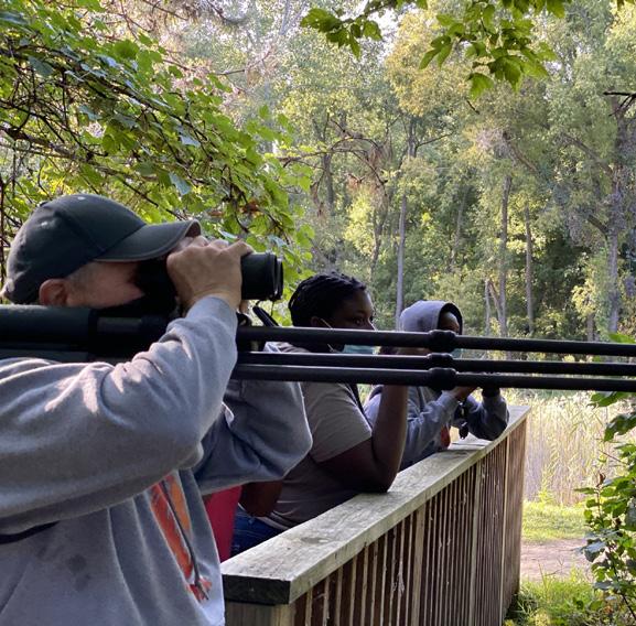


Ensure equity in access to recreational assets.
The proposed plan includes new recreational amenities and assets not currently available on the east side of Cleveland, including naturebased recreation, opportunities to wade and walk into the water, places to rent and operate watercraft, and intergenerational play spaces.
Build upon and improve existing recreational areas.
Existing fishing and nature recreation areas will be expanded, and park spaces will be united to create a unified park and visitor experience. New visitor amenities like concessions, restrooms, seating areas, and comfort stations will be dispersed through the park spaces to serve visitors and community members.
Expanded parkland and recreation experiences will provide new visitor amenities, activity zones, space for events without disrupting daily use, and gathering areas for the community. 1 2 3

Create flexible spaces that adapt to community needs and recreation trends.
A variety of flexible program spaces including lawns, picnic areas, play spaces, observation areas, and gathering spaces will provide opportunities for the park to grow and adapt to community needs and respond to changing recreation trends. These areas will provide spaces for visitors to enjoy a variety of activities from taking in expansive views of the city, enjoying a picnic in a shaded grove of trees to playing a pick-up game of soccer or kickball.

The eastern lakefront will be a dynamic destination that provides interest and activities throughout the year, changing with each season. New programming will emphasize the importance of enjoying the lakefront throughout the year, even during winter months! In the winter, visitors can partake in sledding and snow tubing on the Gordon Hills, cross country skiing and winter walks on lakefront trails, ice fishing, and skating while observing the stillness of the lake and wondering at the beauty of naturally-created ice sculptures created by wind forces.

Many community members live mere minutes from the lakefront. However, the lakefront spaces often feel much further removed as the presence of I-90 and the rail lines form a dividing line between communities and this great natural and cultural asset. The heavy presence of car-centric infrastructure in lakefront park spaces only further exacerbates the issue, leaving the impression that pedestrians and bicyclists are not welcome or safe moving to and within the lakefront.
Safety of pedestrian and bicycle circulation and crossings.
Walking, jogging, and biking are some of the most popular activities community members engage in while visiting the lakefront. However, many community members feel that existing bicycle and pedestrian crossings and routes are not safe or accessible to all. There was also a desire for more types of trails along the lakefront including more natural, earthen trails and wider multiuse paths to accommodate multiple modes.
Barriers to accessing the lakefront from adjacent neighborhoods.
The number one concern with the current lakefront is the difficulty in accessing park areas from adjacent neighborhoods. Community members felt that out of every challenge facing the park, access was the number one issue. I-90 and the rail lines create both a physical and psychological divide, alienating communities from the lakefront with limited and unsafe crossings and access points.
Car-dominated infrastructure along the lakefront.
Between the heavily trafficked highway directly adjacent to the lakefront, numerous on- and off-ramps, connector roads, and ample surface parking, much of the lakefront’s current open space is dominated by impervious space that only serves vehicular traffic.
Lack of wayfinding and signage.
Many community members were uncertain or unaware of the current assets along the lakefront and cited the need for clearer directional and wayfinding signage to help orient visitors. The lack of branding, signage, identity, and physical disconnection between spaces contribute to the isolation of the individual park spaces.
Challenges moving within park spaces.
One of the key challenges to accessibility and mobility along the lakefront is the lack of connectivity between individual park spaces. The proximity of I-90 near the former FirstEnergy site disconnects the lakefront park spaces and severs North Marginal Road, leaving visitors with only a single narrow trail connection along the highway. Visitors traveling by car are forced to navigate a spaghetti-like road network and take a short drive along I-90 to get from North Gordon Park to E. 55th Street marina.

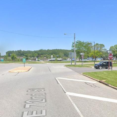
The map above identifies current and planned mobility routes.
SOURCE: CITY OF CLEVELAND GIS, CLEVELAND METROPARKS, GOOGLE EARTH, AND CLEVELAND.COM

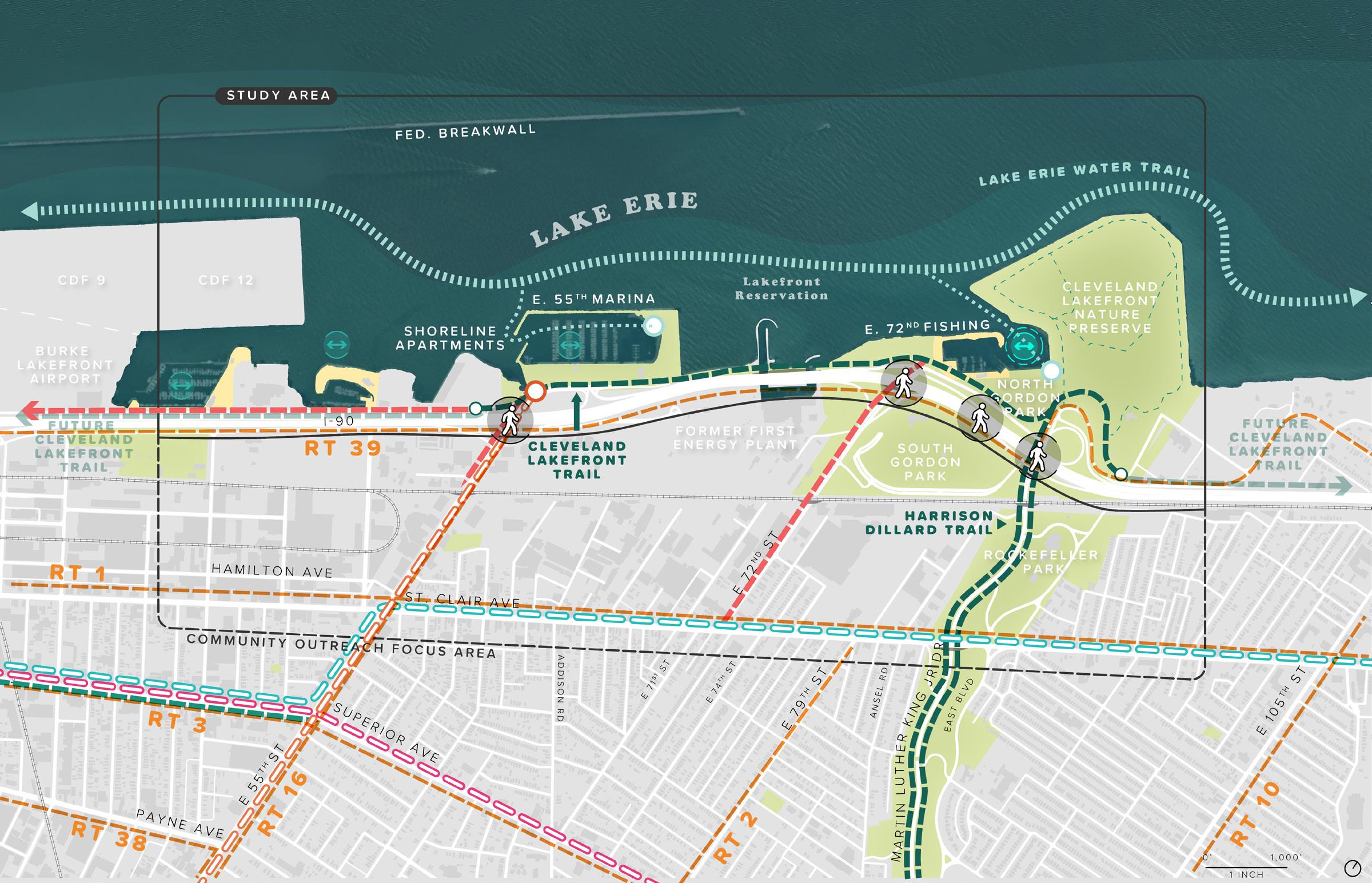
Improved systems of mobility will reconnect residents from adjacent communities to the lakefront with expanded bike and pedestrian access, opportunities for transit, and revised vehicular circulation.

1Improve access to the lakefront.
Community greenways along existing streets, new multi-use paths, protected bike routes, and new and improved pedestrian bridges over I-90 will provide safer, more accessible routes to the lakefront from adjacent communities. East 55th and 72nd streets will include new bicycle and pedestrian infrastructure that will allow for more seamless movement between the community and the lakefront. A new pedestrian bridge near the former FirstEnergy site and improvements to the existing pedestrian bridge at Gordon Park will provide additional north-south connection points to the lakefront. Through each of the four alternatives explored in the First Energy ReUse Study (2017), the common vision was enhanced connectivity to the waterfront, expanded pedestrian and bike networks, and quality development that met the needs of the existing community while also attracting new investment. The CHEERS mobility framework underscores the need to maintain affordability and public access through the FirstEnergy site.
Improvements to bike and pedestrian infrastructure and safety in addition to the exploration of shuttle routes and increasing the frequency of current RTA lakefront routes will provide visitors with additional modes of transportation to reduce long-term dependency on the car. A shuttle route will be established to bring visitors out to the Isle during regular intervals and for larger events. Space for additional mobility options including rental bicycles and scooters are included at key gateways and trailheads to provide access to the lakefront and within park spaces.
RTA Bus Route 39
While ODOT has not done any study on the relocation of I-90, the CHEERS concept plan would not prevent any future exploration to relocate the highway. However, any effort to relocate this section of I-90 would likely have to be identified as a regional priority for northeast Ohio due to the expected cost. The implementation of the CHEERS plan would require additional study and approvals to address potential traffic impacts to I-90 and existing interchanges.
.
While improvements to pedestrian, bicycle, and transit infrastructure highlight the importance of diversifying modes of transit to the lakefront, there is still a need for safe and accessible vehicular access. The expansion of parkland adjacent to I-90 will allow for the connection of Marginal Drive, which currently is disconnected by the highway. This new connected drive –called Lakeshore Boulevard – will be transformed into a tree-lined parkway that connects the park spaces along the lakefront. Lakeshore
Boulevard will provide access to parking areas. Enhanced tree trenches and green stormwater infrastructure will manage and filter runoff from the park road. While buffered sidewalks and bike lines provide additional mobility options. Parking areas will be strategically located adjacent to Lakeshore Boulevard and near nodes of activity. To accommodate new visitors and community members, the plan adds about 500 new parking spaces. In addition, the flexible event space with grass pavers will provide additional space for parking when needed during larger events.

2 Simplify and improve vehicular circulation and parking
The plan includes a variety of trail experiences. Multi-use paved trails will provide space for biking, walking, and running. Natural surface trails will meander through new wetlands, marshes, and grasslands. Boardwalk trails will extend over the Cove, wetlands, and marsh areas providing a closer link to the water. These trails will connect to existing regional and local trails like the Lake Erie Water Trail, the Cleveland Lakefront Bikeway, and the Harrison Dillard Bikeway, furthering local and regional mobility and connectivity.

The lakefront is one of the city’s most important cultural and natural assets. However, many users find getting to and navigating through the lakefront park spaces difficult, especially when walking or bicycling. The proposed plan establishes a series of new entry points and gateways that will welcome the community into the park spaces with improved pedestrian and bicycle infrastructure and visitor amenities. Gateways will provide framed views of Lake Erie, public art, wayfinding signage, and groves of trees and native plantings. A clear wayfinding system will help orient visitors, provide visual interest, and unite park spaces under one clear visual identity. These new gateways will also serve as trailheads, connecting visitors to local and regional trail connections.
Multi-Use Trail Nature Trail
Boardwalk Trail
Lake Erie Water Trail
Land Access Point
Create a diversity of trail experiences that connect park spaces.
Establish new park gateways and a clear wayfinding system.

The Lake Erie Water Trail route stretches 25 miles along the Cuyahoga County shoreline. The trail celebrates Lake Erie’s natural and scenic beauty with signage and key launch points for kayaks, paddleboards, and other non-motorized watercraft. Signage along the trail will provide users with crucial information about how to traverse the lake safely as conditions can change rapidly. Brochures and maps will contain tips and information about other access points and areas of refuge. The proposed route crosses through the eastern lakefront. The CHEERS mobility framework suggests additional stops at North Gordon Park, the Launch, and E. 55th Marina.
 (left: Cleveland Metroparks)
Trails and pathways were one of the most frequently requested improvements to the eastern lakefront. The CHEERS plan creates a diversity of accessible trails and experiences that loop through the park’s wetlands, grasslands, marshes, and community park spaces. Multi-use, natural surface, and boardwalk trails provide a varied, but connected experience. The trail systems link the eastern lakefront park spaces from east to west and to existing regional and local trails into adjacent neighborhoods.


Multi-use paved trails for biking, walking, and jogging will loop through the new programmed spaces within the park, connecting visitors with the lakefront’s diverse range of recreational and natural spaces. This lakefront multi-use trail will connect to the existing Cleveland Lakefront Bikeway, linking the eastern lakefront to other park spaces like Kirtland Park, other lakefront reservation parks, and Downtown. At the Martin Luther King Jr. Drive intersection, the multi-use trail will connect to the Harrison Dillard Bikeway, providing a key linkage to University Circle. Educational and interpretive signage will inform visitors about the history of the lake, its development over time, and its significance to communities. Wayfinding signage and mile markers will orient visitors to nearby program areas, natural restoration points, and trail linkage points.
(left: Hunter’s Point South – New York, David Lloyd)

Visitors will trek through a variety of natural surface trails that meander through the various habitat areas along the lakefront. Pathways will take visitors through the natural beauty of the Habitat Loop to the top of the Gordon Hills to take in expansive views of Lake Erie, along the edge of the Isle through native grassland habitat and Oak Savannah, and the naturalized banks and marshlands of the Cove. These quiet trails will provide ample opportunities to identify rare plant and bird species, learn about the ever-changing nature of Lake Erie, and take in a moment of respite from the hustle and bustle of the city to reconnect with nature. Natural surface trails will be designed with nature in mind, transitioning to Boardwalk Trails in areas that cross over the Cove or areas that are designed to be inundated as conditions change.

(left: Parklands at Floyds Fork – Louisville, KY, Charles Neer)
Elevated boardwalk trails will provide a new trail experience that brings visitors closer to the water. These trails will hug the shoreline and cross through wetlands and nearshore habitat areas that are occasionally inundated as conditions change along the lake. The boardwalk trails will connect visitors to other trails along the lakefront. The change in materials, elevation, and sound of walking along the boardwalk will provide a cue to visitors that they are traversing sensitive natural areas. Interpretive signage will provide educational opportunities and information about Lake Erie and natural restoration areas. Depending on the context and edge condition, trails may be concrete, metal, or wood decked with railings.
(left: Minghu Wetland Park – Lupanshui, China, Turenscape)

During the past 200 years, the lakefront has been almost entirely developed, stripping away all but a few remnants of natural habitat. To accommodate early industrial activities, the natural shoreline of Lake Erie was extended and hardened. Today, the eastern lakefront is highly urbanized with few natural areas. However, portions of the lakefront provide critical stopover habitat for a wide variety of migratory birds, acting as an island of habitat. The addition of new park areas and the availability of dredge material for habitat creation provide opportunities for natural restoration of aquatic and terrestrial habitats.
Fragmented habitat corridors.
The Lake Erie shoreline is an important stopover for migrating birds, bats, and insects, and locations along the lakefront are listed as migrant “hot spots” on eBird and are within designated “Important Bird Areas” by the National Audubon Society. Federally listed species such as Kirtland Warbler, Red Knot, and Piping Plover have been observed on the lakefront and are only three of the approximately 280 documented bird species. The suitable nearshore habitat in and around the lakefront is limited and fragmented, but highly used. Existing habitat areas are home to over 300 species of birds, amphibian and reptile species, and mammals.
Lack of tree canopy.
The eastern lakefront has a notable lack of tree cover when compared to surrounding areas. A healthy tree canopy helps mitigate heat island effects, contributes to habitat space, and enhances the visual appeal of park spaces. The prevalence of transportation-related infrastructure and industrial uses has created spaces devoid of mature tree canopy.
Limited native vegetation and habitat areas. Vegetation communities along the lakefront are indicative of urban environments. Most of the vegetated areas north of the railroad are mowed lawn with horticultural trees
associated with maintained park spaces and road right of ways. Naturalized areas, such as those found in the Cleveland Lakefront Nature Preserve, include restored prairie meadows, successional deciduous forest communities as well as cultural meadows. Scrub communities with a mix of trees, shrubs, and grasses mostly dominated by weeds and invasive species are dotted throughout the lakefront. All plant communities within the study area contain a mix of native and invasive species.
Species of note include state-listed threatened species, the flat-stem pondweed (Potamogeton zosteriformis), which was observed by Cleveland Metroparks within the East 55th Street Marina in 2017 and 2019. Other desirable species such as native American eelgrass (Vallisneria americana) and pondweed species (Potamogeton spp.) were observed in the harbor in 2012, 2017 and 2019. Although these species were not dominant at any location within the lakefront, these species provide ‘good fish’ habitat inside of the east-west breakwall. Non-native and nuisance species such as Eurasian milfoil (Myriophyllum spicatum) and coontail (Ceratophyllum demersum) occurred most frequently within lakefront areas. Aquatic vegetation within the lakefront was primarily associated with the shallower sheltered areas along the shoreline, including along the southern side of the east-west breakwall, within E. 55th Street Marina and the E. 72nd Street Harbor and Gordon Park boat ramp.
Doan Brook (culverted)
Doan Brook (stream)
Open Deep Water Habitat

Protected Shallow Water Habitat
CSOs

State Threatened Aquatic Vegetation


Cultural Meadow
Deciduous Forest Hedgerow
Mowed Lawn
Oak Savannah (restored)
Prairie Meadow (restored)

Successional Meadow (restored) Impervious Areas
This map shows the various habitat zones of the CHEERS study area, as well as the shoreline conditions, and invasive plant species.

SOURCE: GREAT ECOLOGY, THE PORT OF CLEVELAND, WRT

Enhanced, restored, and newly established habitat areas will improve the ecological function of the lakefront, provide connectivity to adjacent areas, improve recreational experiences for visitors, and provide an immersive and educational experience.
The proposed plan will build and strengthen the community’s relationship with the waterfront while also enhancing, restoring, and creating the ecosystems that biota depend on. Finding balance between the natural and human environments as well as the intended uses of the project area is a primary goal of the CHEERS project. Balance nature and human use.

To achieve the balance between nature and human use, the design and restoration of natural habitats within the project area must be intentional with a focus on the re-establishment of historic habitat complexes along Cleveland’s Lake Erie shoreline. This will provide opportunities for biodiversity maintenance and provision of ecosystem goods and services that have been absent in the project area for decades due to industrial and residential development, shoreline modification, and isolation from nearby natural areas. A continuum of representative – historic Lake Erie shoreline habitat types as well as rare Ohio habitats will be featured throughout the project area.
The proposed design for the lakefront includes both large and small shore and submerged habitat development concepts to achieve functionality (from an ecosystem perspective) and accessibility (to humans and biota). In an urban or industrial setting, such as Cleveland’s Lake Erie shoreline, incorporating larger natural habitat parcels will provide a protective buffer from adverse effects of adjacent land uses, while providing smaller habitat patches will provide refuge for birds and wildlife. The enhancement and restoration of aquatic, shoreline, marsh, and upland habitat types will improve the quality of natural habitats within the project area and provide greater ecological connectivity between land and water. It will also provide greater connectivity between the project area, Doan Brook, and the
CLNP to the east of the project area. Habitat enhancement and restoration will have the added benefit of improving the visitor experience by immersing visitors in nature and providing outdoor educational opportunities along the waterfront in areas such as the Habitat Loop and the Isle. Finally, creating and restoring habitats within the CHEERS project area will provide improved recreational fishing in designated fishing areas and passive recreational activities such as birdwatching throughout the project area.
The location of the eastern lakefront, which is encompassed by two major natural systems – aquatic habitat and upland coastal habitats of Lake Erie – informed the natural elements incorporated into the design. A priority
in creating and restoring natural habitat within the project area is to add habitat structure and complexity as well as improve the natural transition from aquatic to upland habitats to improve overall ecological function.

Newly created land from dredged material will allow restoration of larger areas of upland and coastal habitats adjacent to aquatic habitat. These areas include beach and dune habitats in the Shore area as well as successional forest and shrub habitats, which are currently limited along the waterfront. Additionally, vegetation communities such as native oak savannas and grasslands may be created on the Isle and in pockets throughout the project area depending on intended programming.
Restored and created upland habitats within the concept plan will provide stop over, refuge, and breeding habitat for a wide range of species as well as additional recreational space for waterfront visitors. Upland habitat restoration within the project area will primarily benefit highly mobile migratory and resident songbirds. While resident songbirds (those species that do not fly south of the U.S. during winter) are seasonally abundant in the area and are not in need of special consideration in habitat restoration efforts, neotropical migrants are in decline due to destruction of overwintering habitat in southern latitudes and fragmentation or loss of breeding habitats in the U.S. By incorporating native oak savanna and grassland habitat on the Isle and forest and shrub habitat within the Habitat Loop and adjacent to marsh areas, the area will provide important habitat for neotropical migrant species and draw these species away from BLK Airport, which may result in a reduction of wildlife conflicts. The creation of oak savanna and native grasslands will increase habitat acreages for several grassland bird species of conservation concern in Ohio such as bobolink (Dolichonyx oryzivorus) and eastern meadow lark (Sturnella magna) and will have the added benefit of deterring the colonization of the project area by larger bodied birds such as Canada geese (Branta canadensis) who prefer open mowed grass areas. Following the establishment of upland habitats, resident and neotropical songbirds are expected to readily colonize restored and created upland habitats within the area, exploiting newly available areas for foraging and breeding (Simenstad and Thom 1996).
Newly created upland habitats will naturally transition to aquatic habitats such as marshes, submerged aquatic vegetation (SAV) beds. In-water fish habitat will be restored and created using dredge material. This will improve the connection between land and water for biota and visitors alike. Shoreline softening (i.e., removal of bulkheads and riprap revetments) throughout the area will be integral to providing natural transitions, improved ecological function, and for creating opportunities for park users to touch the water.
Several opportunities exist where fish habitat can be enhanced by adding topographic variation through the placement of dredged material, to form underwater mounds or berms to promote fish aggregation, which would improve fish habitat as well as recreational fishing. Target species in the project area include: black bass (Micropterus salmoides), sunfish species, yellow perch (Perca flavescens), and walleye (Sander vitreus). Optimal siting criteria for these submerged fish habitat features would need to be developed in later (permit-level) design phases, giving consideration to avoiding interference with navigation, and providing access to both shore- and vessel-based anglers.
Three types of shorelines will be established along the lakefront – softened, semi-hardened, and hardened. The conversion of hardened shorelines to softened shoreline and creation of new softened shorelines in areas where site conditions allow will stabilize the shore, reduce erosion, provide ecosystem services, and increase coastal resiliency.
Softened and semi-hardened shorelines will be established along 17,000 linear feet of new and existing shoreline. To achieve a softened shoreline, the plan will employ “living shoreline” stabilization design techniques using natural elements such as wetland vegetation, wood, and stone, alone or in combination as a hybrid approach, with some of the
Soften edge conditions to improve ecosystem services and increase coastal resiliency.
more traditional ‘hard’ or ‘gray’ shoreline structures such as riprap revetments. In areas where wave action is limited, shorelines will be softened and feature different variations of a natural transition from open water habitat to aquatic habitat such as SAV beds into emergent wetland habitat, and finally into upland habitat. Topographic variation on the lakebed for fish habitat improvements will be created using mounded dredge material and large woody debris to create the habitat transitions. In these softened locations, vegetation will act as a buffer to upland areas and can even help dissipate small wave action to protect the underlying sediment. Large woody debris or other wood material may be used to help support the edge of the vegetated areas as they are establishing and will decompose over time to allow the succession of established plant communities to take its place.
Where wave energy prevents a more softened approach to protection, a hybrid shoreline treatment will be applied whereby a riprap revetment is built to the outer edge of the vegetated shore to protect against scour and water, wave, and ice erosion. This approach will protect against shoreline erosion in areas of open water exposure while allowing natural habitats such as emergent marshes to be developed upslope of the revetments within the project area such as in the Habitat Loop.
Native emergent coastal marsh habitat will be created along softened and semi-softened shorelines throughout the project area within the Habitat Loop, along the Marsh Walk, and on the south side of the Isle. Native marsh habitat will be created by placement of dredge material and the topographic re-contouring of that material to establish an optimal elevation gradient, allowing for the expression of several different plant species with varying inundation tolerances. Marsh species selection will depend on slope, water levels, and community associations with an overall emphasis on increasing habitat structure. This will include incorporating a mosaic of submerged aquatic, emergent vegetation, and upland shrub fringe habitat. Emergent marsh within the project area will withstand a range of environmental conditions and fluctuating water levels indicative of Lake Erie. Emergent marsh habitat would then transition into upland shrub and forest habitat or into green space depending on the intended use of the area. Emergent wetlands within the project area would improve water quality, provide fish and invertebrate habitat, and provide breeding and foraging habitat for a variety of bird species.
Bird strikes are a key concern for wildlife experts and airport operators. Over the past 30 years, Burke Lakefront Airport (BLK) has recorded over 700 bird strikes. Based on this data, larger bodies species (Canada Geese, Gulls) pose the most risk to aircraft while smaller bird species (Killdeer, Swallows) rarely cause serious collisions. Creating new nodes of habitat along the lakefront will provide alternative spaces for migrating birds, helping to divert species away from BLK. Review of species of concern and a three-dimensional view of collisions will help refine habitat along the eastern lakefront and determine potential risk. Coordination and engagement with BLK and the FAA will continue to determine wildlife management strategies for implementation that supports airport operations.

WaterThe entirety of the shoreline is hardened with boulders, breakwaters, and steel bulkheads and does not contain adequate areas for wave dissipation, means to break energy associated with storm events, or areas to adjust to lake level fluctuations. Water level fluctuations and extreme storm events in the region are increasing in frequency and severity due to climate change, therefore exposing communities and infrastructure on the Great Lakes to threats of erosion, wave surges, flooding, and storm impacts. The inadequacy of the hardened shoreline to provide buffer from climate threats intersects with vulnerabilities specific to the project area, putting the communities and wildlife within and near the project area at risk.
Intense wave action.
The lack of in-water and nearshore habitat along the eastern lakefront has resulted in a shoreline with no natural means of protection from storms and wave action. The hardened shoreline with boulder walls, breakwaters, and steel bulkheads provides no areas for wave dissipation or means to break energy associated with storm events. Of the over 50,000 linear feet of shoreline in the eastern lakefront over 30,000 linear feet is riprap revetment and 17,000 linear feet is steel bulkhead while only 263 feet is unstructured shoreline that enters the water on a natural slope. Based on the intense wave action along the lakefront, design wave heights ranged from about 12.6 feet north of the Shoreline Apartments to about 16 feet at the east end of the study area. Study points included areas of higher and lower wave energy to be mapped throughout the lakefront.
Impact of ice and winter conditions.
On average, 82.4% of Lake Erie is covered in ice each winter year based on data from 1973 to 2018 from the Great Lakes Engineering Research Laboratory (GLERL). Ice forms initially at the coastline where structures will be constructed and freezes the interior of the lake last. Cleveland is, on average, at or below freezing temperature for 78 consecutive days (December 5th to February 21st). Based on available data, an ice thickness of 24 inches was assumed for design purposes.
Increased frequency and intensity of storm events.
Impending risks due to rising lake levels and increased frequency of storm events due to climate change are an ever-present threat to the eastern lakefront. Flooding and damage to critical infrastructure are cause for growing alarm as the associated costs and impact to adjacent communities continues to climb. High winds, waves, freezing temperatures, and more frequent storms have resulted in more frequent highway closures, erosion, infrastructure damage, and higher reported vehicular collisions. During 2012’s Superstorm Sandy, 67 mile-


The location of CSO outfalls, culverted and daylighted streams, and wetlands are depicted in the map above.
SOURCE: CITY OF CLEVELAND GIS, WKSU, CLEVELAND.COM, CLEVELAND METROPARKS
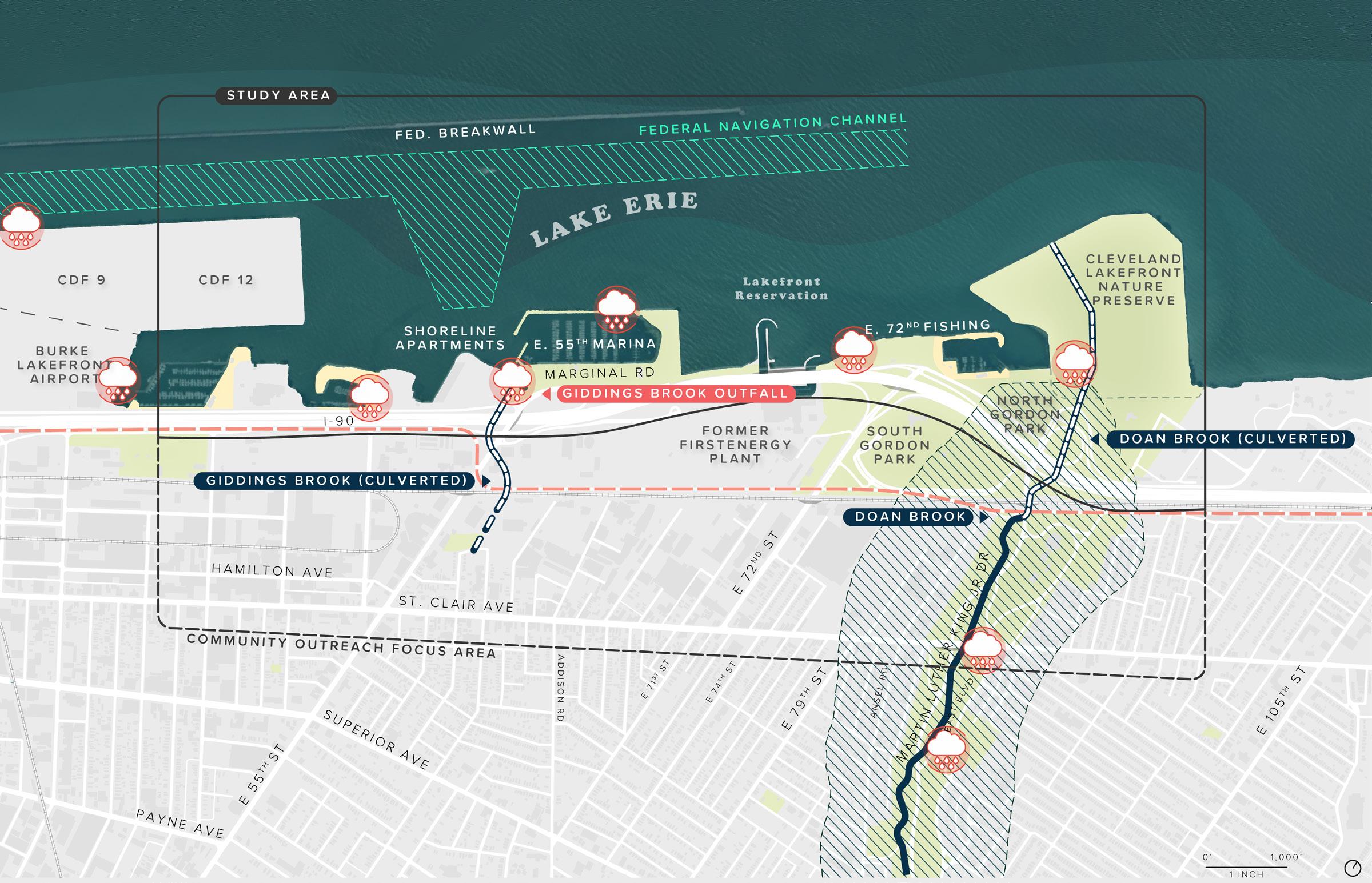
per-hour winds and 20-foot waves on Lake Erie were documented, resulting in closure of all 10 lanes of traffic and structural damage along the shoreline’s hardened edges. High waves frequently collide with the hardened shore, spraying water onto the highway causing wet or icy roadway or high water, resulting in extremely hazardous driving conditions. Large quantities of roadway crew time and resources are required to maintain the roadway and mitigate these risks. About 20% of crashes in this section of I-90 have occurred in wet pavement conditions.
Lake Erie’s water level is currently at a historic high. Water levels within the lake are influenced by long-term variations, seasonal changes, and short-term conditions. Long-term and seasonal changes are generally considered variations in the static water level, while short-term changes are the result of local wind setup, storm surge, or seiche. These ever-changing create provide challenges to providing access to the water and determining appropriate design heights for proposed improvements and new infrastructure.

Like many post-industrial cities across the country, Cleveland is facing the challenge of upgrading and maintaining aging water and sewer infrastructure and working to contain pollution by reducing combined sewer overflows (CSO). In combined systems, stormwater and sewage are conveyed in the same pipe. During dry weather, sewage is transported to a treatment facility, but during wet weather events, stormwater enters the systems and may cause it to reach capacity, leading to a mix of sewage and stormwater overflowing and discharging into Lake Erie and other water bodies. There are 11 CSOs in or near the eastern lakefront. Combined, these outfalls account for 363 overflows per year, resulting in over 340 million gallons of overflow. The NEORSD’s proposed Shoreline Tunnel project is expected to reduce the number of overflows in the eastern lakefront from 363 per year to 14 per year, resulting in a reduction of 310 million gallons per year. However, water quality and management of impervious surfaces to reduce pollution and degradation of Lake Erie will continue to be a concern even after the
Partially frozen portion of the lake at the E. 55th fishing area. (Cleveland Metroparks)
High winds and big waves along the E. 72nd fishing area in April 2020. (David Petkiewicz, cleveland.com)

This map shows the intensity of waves by height and return period for selected locations along the waterfront.
SOURCE: KS ASSOCIATES

The creation of the Isle using dredge material will provide protection from wave action, storms, and ice, allowing the establishment of expansive new habitat and natural areas within the Cove and along the Lakeshore.
Improve water quality in Lake Erie.
Improving water quality was a key consideration in the layout of the proposed plan. Water quality considerations include:
y Maintaining open water areas between the Isle and the Lakeshore to allow prevailing westerly winds to promote water flow along wind-driven surface currents and prevent stagnant areas.
y Positioning improvements in a way that takes advantage of currents generated by shortterm changes in water level due to wave set up or seiche.
y Considering long-term maintenance considerations for debris collection and removal.
y Enhancing water quality benefit by locating natural filtration areas near existing outfall structures.
The resulting plan includes the Cove, which is protected by the Isle – an offshore landform –that dissipates wave energy. The Cove will open to the harbor to the west and east to allow for water circulation. Additional flow modeling will be conducted during detailed design of the Isle and Lakeshore so the final design can be adjusted and fine-tuned for water circulation. Coordination with the Northeast Ohio Regional Sewer District (NEORSD) and Project Clean Lake will continue through detailed design and implementation.

ODNR is spearheading an initiative to transform Sandusky Bay into an area that supports wildlife and people by restoring wetlands and acquatic ecosystems while reducing wave action. The projects will reuse tons of dredged material the U.S. Army Corps of Engineers produces each year from the bay’s shipping channel. The material will be used to create “in-water wetlands,” using clean material that helps naturally protect the shoreline over time. The approach uses softer shorelines and includes materials that may degrade over time as vegetation is established. The projects will enhance fish habitat and support quality of life for city residents. Funding was supported by Ohio’s Healthy Lake Erie Fund. (left: KS Associates)

To allow for in-water and coastal improvements, which is a central objective of the project, detailed studies to review the range of water levels, waves, and ice forces along the eastern lakefront were conducted. Design conditions for new proposed elements were established based on a detailed study of the meteorological and oceanographic conditions along the lakefront, also known as a metocean analysis.
The analysis was performed in two steps. The first reviewed conditions on a large scale throughout the eastern lakefront, which informed the development of initial concepts. After the creation of a final concept using results from stakeholder and community engagement, a more detailed metocean analysis was performed. Historic and recent water level data was used to select design water levels for return periods, ranging from two to one hundred years, representing water levels with a 50% annual change of occurrence to a 2% annual change of occurrence. Water levels for design ranged from low water datum at an elevation of 569.2 feet IGLD 1985 (International Great Lakes Datum) to high water events ranging from 574.5 to 576.2 feet IGLD 1985.
Hydrographic survey data and wave hindcast data was then used to calculate preliminary design wave conditions at selected locations throughout the harbor. This method provided a base understanding of the forces to be considered while developing design concepts. Considering the wave and ice forces in the project area, substantial shore protection needed to be included in the design of project features, particularly lake-facing edges exposed to openlake wave energy. Sheltered areas, or areas sheltered by other improvements were designed with a softer, more natural water interface. The proposed plan proposes 7,300 linear feet of hardened shoreline on open water lake-facing edges, 12,000 linear feet of semi-softened or hybrid shorelines, and 5,000 linear feet of naturalized or softened shoreline.
Sections depicting types of natural (softened) and semihardened shoreline typologies proposed for CHEERS. Each type includes space for nearshore, upland, and aquatic habitat.


Proposed improvements will maximize natural areas and minimize the use of impervious surfaces, where possible. Project areas that include impervious surfaces like paths, parking areas, and buildings will include stormwater management and treatment measures like rain gardens, filtration areas, and tree trenches. These improvements will help filter runoff, reduce the burden on the combined sewer system, and improve the water quality of Lake Erie. This level of stewardship and stormwater management is even more important since a majority of the proposed area will drain directly to the lake.
Climate projections estimate that Cleveland is expected to see an increase in temperature of four degrees by 2070, more intense heat waves, more frequent and intense storms, an increase in heavy precipitation, and longer freeze-free seasons. These potential impacts and the dynamic nature of the lake require that design elements account for dynamic conditions over the coming decades with strategies that allow the shoreline to adapt while preserving habitat space and continued community use. Major program elements and circulation paths are situated in areas with protection from lake level changes, wave action, and ice. Natural areas create buffers along the edges of the Isle and Lakeshore, allowing for water level fluctuations.
Managing runoff from impervious surfaces using green stormwater infrastructure has multiple benefits – it helps reduce the burden on the sewer in a combined sewer area, filters and removes pollutants before water enters the lake, provides visual interest with planting, and supports habitat when planted with pollinator and native species. Stormwater best management practices (BMPs) can take many forms in and around parks, including rain gardens, swales, wetlands, porous paving, and tree trenches. The project pictured on the left – Citygarden – includes a 5,000 square foot rain garden perimeter planted with native grasses and wildflowers. This BMP manages over two-thirds of the impervious surfaces in the park.
(left: Nelso Byrd Woltz Landscape Architects)
Manage stormwater and impervious surfaces.
Incorporate flexibility in design elements to allow the shoreline to adapt to changing conditions.
The eastern lakefront of the future features a diversity of experiences that celebrate, uplift, and embrace Lake Erie as a vital natural and cultural asset for the city. These experiences, or rooms of the plan, provide moments of peace and opportunities for gathering for all community members and visitors to the lakefront.
The creation of the Isle will provide an immersive natural experience for hiking, picnicking, fishing, and connecting with nature. Current visitors and users of the lakefront cherish opportunities to view and connect with water and nature. However, the current lakefront provides few spaces to feel fully immersed in nature and connected to Lake Erie. Sitting just offshore, the Isle will offer a new way to experience the lake, one that only boaters and paddlers can experience today. Visitors will walk or bike across the bridge or paddle out through the Cove to wander through the vegetated trails, boardwalk paths, tree-lined lawns, picnic groves, and nature play areas, immersing themselves in the unique natural environment of Lake Erie. Boardwalk paths and natural surface trails provide birders and nature enthusiasts with opportunities to disconnect from the city and walk through sensitive environmental areas that are ever-changing as lake levels fluctuate. In the southern portion of the Isle, the boardwalk path will swoop out over the water’s edge providing expansive views of the Lakeshore. Created from dredge material, this barrier island provides protection for the shoreline, allowing the creation of a protected cove and softening and naturalization of the shoreline edge.
Located at the point of the Isle, the Lawn will provide the community with a flexible passive open space for informal and formal events, pick-up games, and picnics.

Nestled within a shaded grove of trees, the Picnic Grove will provide an immersive natural picnic experience for visitors along the banks of Lake Erie.
A new nature-based play space will be located adjacent to the Lawn and picnic areas on the Isle, inviting all ages and abilities to play.
The Overlook will provide visitors with sweeping views of the Lake and the Cleveland Lakefront Nature Preserve and new spaces to fish in deeper water.

Central Park’s Great Lawn is arguably the most famous lawn in the world. It occupies the center of Central Park, offering a pastoral space for gathering and play. It has become the front yard for residents and host to some of the most memorable outdoor concerts in the country. It is more than a flexible lawn space with room to play soccer, frisbee, and softball – it is a gathering point for residents and visitors near and far, a place to celebrate, relax, picnic, and enjoy a respite from urban life in the spring, summer, fall, and winter.
(right: The Great Lawn by Flickr user ep_jhu)

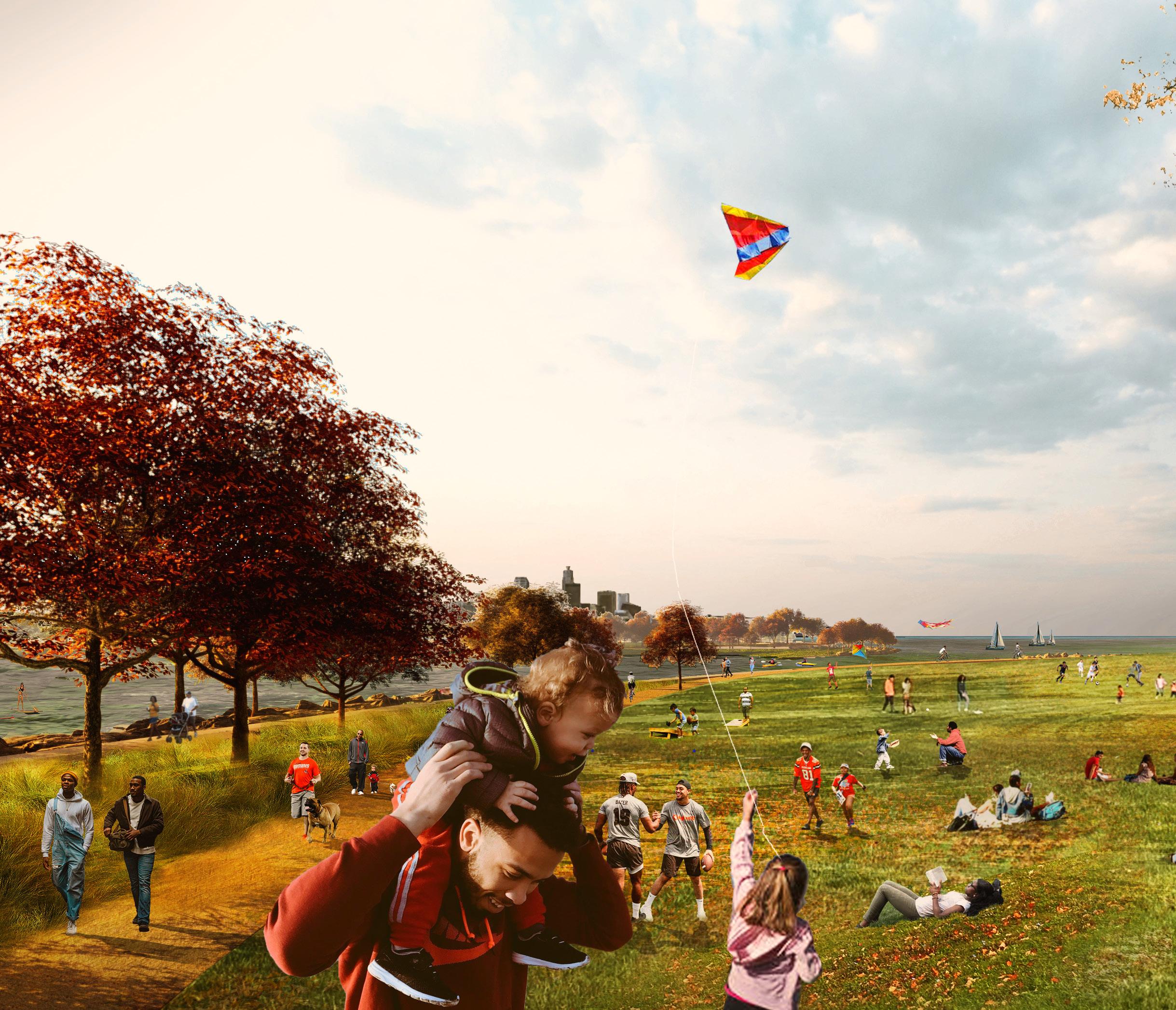
Located at the point of the Isle, the Lawn will provide the community with a flexible passive open space for informal and formal events, pickup games, and picnics.
A new seven-acre lawn will provide a new passive space where visitors will be encouraged to gather and create their own recreation adventures. For comparison, the size of the proposed lawn sits midway between the main multi-use lawn areas at Edgewater Park (20 acres) and the Euclid Beach Park picnic area (2.4 acres). Its location on the point of the Isle will provide panoramic views of the lake and the city skyline. While the Lawn will provide space for informal and formal events like a summer concert series or festivals, it will serve as a community space year-round where all will be welcome to enjoy a picnic, fly a kite, or play a pickup game of football or soccer. The Lawn will be ringed by the lakefront multi-use trail, which will connect visitors to nearby nature and boardwalk trails. A viewing pavilion located on eastern edge of the lawn will serve as a comfort station with restrooms, drinking fountains, a covered patio space and other amenities.
Nestled
The Lawn, located adjacent to the Picnic Grove, will provide a multiuse space where community members can gather, enjoy picnics, hang out with friends and family, or engage in a friendly pick-up game of soccer or catch.

Lake Erie.
The Picnic Grove will provide a new picnic experience on the shore of the Isle unlike any existing picnic site along the lakeshore. Picnic tables and pavilions will be dispersed within a grove of trees that line the flexible lawn at the point of the Isle. A nearby viewing pavilion will serve the area as a comfort station with restrooms, a covered patio space, and other visitor amenities for the Lawn, play spaces, and picnic areas.
within a shaded grove of trees, the Picnic Grove will provide an immersive natural picnic experience for visitors along the banks of
Living in urban areas and having access to a wide variety of indoor activities, including technology, has led many communities and kids, in particular, to feel alienated from nature. This condition, which can lead to negative behavioral and health outcomes, is commonly known as Nature Deficit Disorder (Richard Louv). Spending time outside can improve mental and physical health. For children, playing or spending time in nature can help build confidence, inspire creativity and imagination, stimulate senses, promote healthy movement and living, and reduce stress.
The creation of a new nature play area along the eastern lakefront will provide a dedicated space and activity for children and families. Throughout the engagement process, the team heard that adults enjoy the lakefront, but wish there were more activities and programs for their children and grandchildren. The nature play area will be nestled within new grassland, oak savannah, and forested habitat, offering an immersive experience for kids and caregivers of
all ages. Play equipment, which may include climbing logs, tree stumps, boulders, play sand, small hills or mounds, water tables or pumps, and gardens will allow for sensory and physical exploration of nature. The all-ages and abilities playground with nature-based play features will connect to the Lawn and multi-use, nature, and boardwalk trails. It will provide a much needed and desired amenity for children along the eastern lakefront and help reconnect children to nature, inspiring a new generation of Lake Erie stewards.
Welles Park, opened in 2018, provides children of all ages with a unique nature play experience. It includes small play hills, log balancing areas, climbing stones, stumps, sensory play elements, and a “mud kitchen,” where kids have the opportunity to touch and feel nature. Play elements encourage kids to use multiple senses as they play, stopping to listen, touch, watch, and smell. Surrounded by native trees and vegetation, it feels as if it is tucked in an enchanted forest, inviting children to play and explore. The 1.23-acre site is part of a larger nature-based play initiative in Chicago aimed at reconnecting kids to nature and inspiring healthy living. The play space was designed by Site Design Group, ltd. and received funding from the Chicago Park District, local officials, the National Recreation Park Association (NRPA), and other private foundation donors.
(Right: Site Design Group, ltd.)

A new nature-based play space will be located adjacent to the Lawn and picnic areas on the Isle inviting all ages and abilities to play.
Commissioned by the NYC Economic Development Corporation, the project is part of the plan to revitalize the 37.5-acre former industrial site along the East River. The continuous 10-acre waterfront park – Hunter’s Point South – includes wetland mitigation, new habitat, gathering spaces, a playground, courts, multipurpose fields, and an urban beach. However, one of the most signature elements of the park is a series of overlooks that provide sweeping views of the East River and Manhattan skyline. These overlooks allow visitors to access the water’s edge and enjoy moments of quiet retreat in the shadow of the busy city.
(left: NYCEDC)The Overlook will provide visitors with sweeping views of the Lake and the Cleveland Lakefront Nature Preserve and new spaces to fish in deeper water.
The Overlook responds to the community’s desire for more places to fish, areas where they can be closer to the water, and more viewing and observation areas to take in the picturesque views of Lake Erie and Downtown Cleveland. The walkway of the Overlook will curve along the northern edge of the Isle, providing sweeping views of the lake and the Cleveland Lakefront Nature Preserve and new areas to fish in deeper water. Visitors will traverse a shaded natural trail that reveals dramatic views of the water as they approach the Overlook. Once they arrive on the platform, panoramic views of Lake Erie open up, allowing for moments of serenity and reflection, celebration, and appreciation. The Overlook and other viewpoints throughout the eastern lakefront will provide the community with spectacular views and offer moments to contemplate and recognize the significance of the city’s connection to the lake.
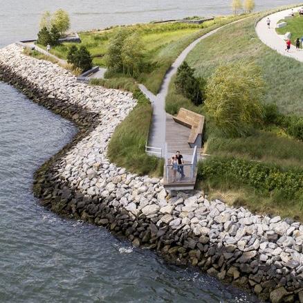
“We have a great lake, a precious natural resource, we should care for it and celebrate it.”
– Community Member
The Lakeshore will extend the existing shoreline, creating welcoming and connected park spaces that interface with adjacent communities. Major gateways at 72nd Street, 55th Street Marina, Martin Luther King Jr. Drive, and a new pedestrian bridge adjacent to the former FirstEnergy Plant will connect the Lakeshore with the St. Clair-Superior, Glenville, and Goodrich-Kirtland neighborhoods. These gateways not only provide safe and accessible connections for pedestrians and bicyclists, but also serve as trailheads, strengthening the existing local and regional trail systems. The Lakeshore leverages existing activity nodes at 55th Street Marina and the North Gordon Park Fishing Area to create new gathering and recreation spaces to serve the community.
Nestled between the Isle and the Lakeshore, the Cove will provide a protected inlet for watersports and extensive habitat restoration and expansion.
The protected Cove will facilitate the creation of the Shore and the Launch, which provide opportunities for visitors to touch and engage directly with the water by wading or lounging by the shoreline or spending the day paddling out on a kayak, canoe, or other watercraft.
A newly formed Habitat Loop will provide an immersive natural experience along the banks of Lake Erie that supports recreational opportunities for birding and hiking, protects critical lakeshore infrastructure, and restores and improves coastal habitat areas through beneficial use of dredge material.
Situated at the terminus of E. 72nd Street, the Gordon Hills will rise over 40 feet above the existing lakefront, giving visitors stunning views of Lake Erie and the Cleveland skyline.

The Eastern Fishing Cove will build upon existing amenities and programming at the E. 55th Marina, creating a node of intergenerational activity where families can spend the day fishing, picnicking, attending events, and enjoying time by the lake.
The 72nd Street Gateway will serve as the lakefront’s primary entrance or “front porch” – welcoming the community into safe, accessible, and vibrant park spaces.
Community Greenways along E. 55th and E. 72nd streets will welcome communities into the lakefront park spaces with improved pedestrian and bicycle amenities, new planting and street trees, enhanced wayfinding and signage, and opportunities for gateway art.
Key program spaces –Community Greenways, the 72nd Street Gateway, the Gordon Hills, the Launch & the Shore, the Habitat Loop, the Cove, and the Eastern Fishing Cove – will be located on the Lakeshore.

The Pier 4 Beach at Brooklyn Bridge Park includes a natural sandy and rocky shoreline for walking along the water edge and launching non-motorized boats. Sitting on the shoreline, visitors can observe activity in the water and wildlife at the offshore Bird Island –an inaccessible nature preserve. While swimming is not permitted at the beach, it provides residents and visitors with a closer connection to the water and a serene location for taking long walks or heading out for an afternoon of paddling.
(right: Brooklyn Bridge Park)

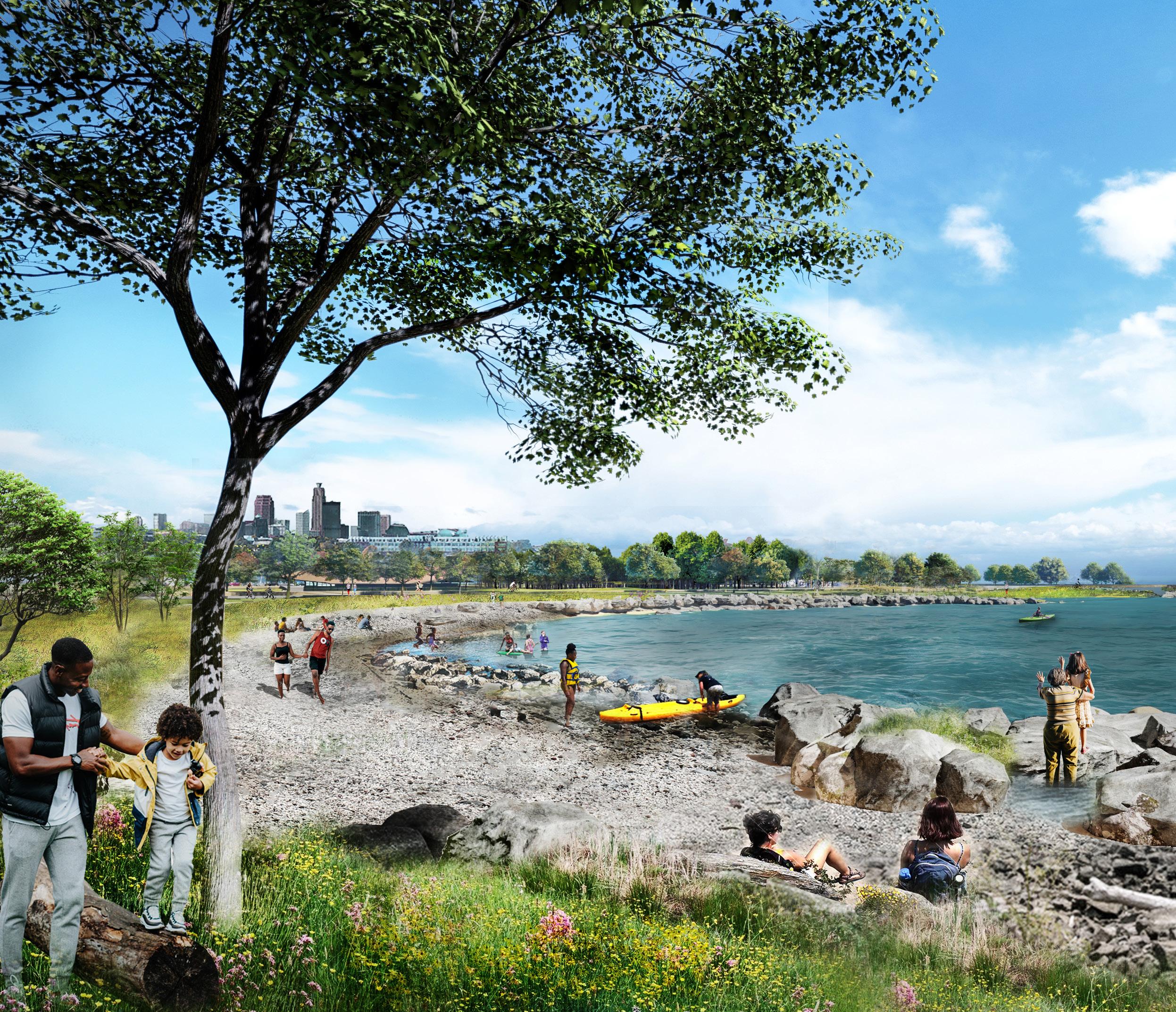
The Shore and the Launch will give nearby residents access to a protected cove for wading and watersports. A naturalized sandy shore area will provide a serene spot for viewing the Isle, observing marine life, sunbathing, or playing in the sand.
Nestled between the Isle and the Lakeshore, the Cove will provide a protected inlet for watersports and extensive habitat restoration and expansion.
Newly created land on the Lakeshore and the formation of the Isle will facilitate the creation of a protected cove that provides calm water for water-based recreation as well as habitat restoration. Emphasis on nearshore and inwater habitat restoration provides a better habitat for fish, birds, and other local flora and fauna. The insulated area will offer a space for visitors to interact with and touch the water in a way that has not been available on the east side. Visitors can wade at the Shore, learn to kayak or operate other watercraft in an area insulated from wave energy at the Launch, or walk along elevated boardwalk trails along marsh and wetland habitat that ring the outer edge of the Cove. The Cove will also serve as a new stop along the future Lake Erie Water Trail, a 25-mile paddling route along the shores of Cleveland. These newly created habitat areas will provide space to increase the biodiversity of the lakefront, protect the shoreline and critical infrastructure, and improve water quality and in-water habitat.
The protected Cove will facilitate the creation of the Shore and the Launch, which provide opportunities for visitors to touch and engage directly with the water by wading or lounging by the shoreline or spending the day paddling out on a kayak, canoe, or other watercraft.
The construction of the highway and the closure of waterbased amenities like the Gordon Park beach and lagoons severed the community’s connection to the water, removing the opportunity to experience a respite away from city life. Places to touch and engage with water was one of the most requested programmatic elements throughout

the engagement process. Community members desire to reconnect to the waters of Lake Erie with places to safely engage with the water and opportunities for more equitable access to watersports.
The Shore and Launch will be adjacent program elements located on the banks of the Cove. The Shore will contain a rocky natural shoreline that gently slopes into the water of the lake, providing visitors with an opportunity to safely wade and walk down into the water. The Shore reestablishes the community’s connection to the water and harkens back to days spent wading and gathering along the Gordon Park beach. This naturalized shoreline will be encircled by habitat restoration areas with emergent marshes, wetlands, tree groves, and meadows. As visitors approach the Shore from the adjacent parking areas or trailheads, they will walk along boardwalk trails through vegetated areas that open to reveal the expanse of the Cove. These restoration areas with planted dunes will not only provide an immersive natural experience, but they will also protect from shoreline erosion.
Located just to the east of the Shore, the Launch provides a centralized location to rent, launch, and learn how to operate watercraft including kayaks, paddleboards, and canoes in a protected and calm cove before venturing out into the open waters of the Lake. The Launch will include
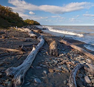
The Launch will include an ADA accessible launch area for non-motorized boats and a centralized location for renting and learning how to operate watercraft on Lake Erie.
(Brooklyn Bridge Park –Pier 1 Kayak Launch by Elizabeth Felicella)

an accessible sloped deck and a naturalized shoreline area to launch watercraft providing opportunities for large-group instruction and individual operators.
An adjacent building with a covered pavilion will provide a centralized location for renting equipment, accessing restrooms, and purchasing concessions that serves visitors to the Shore and the Launch. It will also serve as a gateway into the park spaces from the Lakeshore Boulevard (formerly Marginal Road) and the new pedestrian bridge over I-90 that connects the lakefront to the former FirstEnergy site. This gateway welcomes visitors to a series of nature, boardwalk, and multiuse trails, parking areas, and other nodes of activity at the lakefront.
Northly Island Park, a former airstrip, is now a 91-acre public nature preserve peninsula located on Lake Michigan. The decades long planning and design project spearheaded by SmithGroupJJR and Studio Gang envisioned a public park with space for nature and a large amphitheater.


Given budget constraints, the first phase of implementation spearheaded by the Park District and Army Corps, included a series of trails, hills, and a lagoon. These improvements provided ample space for habitat and visual interest for visitors. However, the first phases did not include the original offshore reefs and barrier islands designed to protect from Lake Michigan’s rising water levels and wave action due to budget constraints. Months after opening in 2015, high lake levels and waves began to erode the Island’s pathways leading portions of the walkway to crumble. The Park District closed the pathway and the Army Corps built up portions of the outer edge with armor stone. However, this is a short-term fix. Without the original planned barriers or more natural dissipation, the Island remains at risk to wave action and lake levels providing a key lesson in planning for uncertain environmental futures when investing in public space.
 (Left: Studio Gang Architects)
A newly formed Habitat Loop will provide an immersive natural experience along the banks of Lake Erie that supports recreational opportunities for birding and hiking, protects critical lakeshore infrastructure, and restores and improves coastal habitat areas through beneficial use of dredge material.
The Habitat Loop will be located at the current pinch-point where I-90 curves so near to the lake that the highway has been forced to shut down after large storm events due to hazardous roadway conditions. Dredge material will be used to expand the narrow area between the park and the highway and fill in two inlets and a cooling basin associated with the former FirstEnergy power plant, creating a new immersive natural experience. The Habitat Loop will also allow the closure of two decked or bridged portions of the highway, reducing overall maintenance costs for the Ohio Department of Transportation and improving the safety of motorists.
The Habitat Loop will provide a new immersive natural recreation experience that is welcoming and inclusive. A space that invites the local community to explore birding, take a hike, or just enjoy the natural beauty of the lake. It will provide a new opportunity for youth to learn about natural systems and help inspire a new generation of natural stewards. The nature-inspired area within the Habitat Loop will be characterized by a freshwater marsh typical to a natural lake shoreline ecosystem. This type of undeveloped and uncultivated landscape was historically found along Lake Erie’s shoreline, but has since started to disappear, being disturbed through habitat fragmentation by previous land use practices, diminishing the services these ecosystems provide. The Habitat Loop will exemplify how these natural systems function and their importance to our livelihood. It also serves as an example of how human-made ecological systems can be designed in a way to emulate natural processes to be more successful, sustainable, valuable, and harmonious to our living spaces as much as other landscapes found in our communities.
The Habitat Loop will consist of an expansive area of emergent marsh. This habitat will be adapted to the
The Habitat Loop will buffer infrastructure, provide nearshore and aquatic habitat, and create a new natural space that welcomes the surrounding community in to embrace nature first-hand with inclusive opportunities for birding, kayaking, and exploring.

A partnership between Metroparks Toledo, Ohio Division of Wildlife, and Ducks Unlimited has transformed a 987-acre agricultural property into a vibrant nature preserve. Howard Marsh includes over miles of walking and boardwalk trails that meander through the marsh areas providing access for hikers and birders. Kayak launches and water trails give the community another way to experience the marsh. The marsh also captures and filters stormwater runoff from surrouding areas, improving water quality before it reaches the lake. The project was funded by the Great Lakes Restoration Initiative with funding from NOAA and the project partners. (left:


dynamic environmental conditions found within Lake Erie and support an abundance of birds, amphibians, reptiles, fish, and macro-invertebrates. The hydric soils and emergent vegetation typically found in freshwater marshes contain high nutrient levels which contribute to an overall high rate of primary production providing an abundance of ecological services and functions that benefit the animal and human communities found in and around these areas. The design of the marsh will be modeled on biological processes found in nature to emulate a self-sustaining marsh system alongside the more programmed areas of the proposed lakefront plan. The marsh will be designed with a softened natural shoreline with a semi-hardened edge in key locations to protect the marsh while allowing freshwater from Lake Erie to flow through the vegetation and in consideration of seasonal water-level fluctuations that support successional vegetation to flourish and thrive.
The Habitat Loop will include an ADA accessible boardwalk trail that encircles the wetland and marsh habitats. The boardwalk will provide an elevated perspective for visitors to see the main ecological components of a wetland system and how they work together to strengthen the overall ecological function of the area. The elevated boardwalk will also maintain the ecological and hydrological connection between The Habitat Loop and Lake Erie. The boardwalk will contain a series of educational and interpretive signs highlighting important aspects of a freshwater marsh that will guide visitors along the walkway through an immersive natural experience. Certain stops along the trail will allow for viewing platforms and observation opportunities to investigate certain locations within the marsh that support interesting native plant species and wildlife habitat found in freshwater systems. The habitat loop trail also contains unpaved trails that meander through the interior of the marsh, allowing different user groups to get a closer look into the inner workings of key habitat zones within the freshwater marsh and providing access at select locations for wading, paddling, and fishing. An important aspect of the freshwater wetland is its ability to support passive recreational activities and other forms of enjoying the water’s edge, while providing an opportunity to teach users about the importance of respecting the space and needs of important marsh wildlife. The interior of the marsh will be designed to allow access for small non-motorized watercrafts such as kayaks and paddleboards. The habitat loop trail will provide birders, hikers, watercraft users, and nature lovers alike with the opportunity to enjoy and learn more about this natural amenity.
Dredged sediment from the Cuyahoga River and other navigation channels was traditional treated as waste and disposed of in lakefront landfills. However, new efforts by the EPA, the Port of Cleveland, and the U.S. Army Corps of Engineers has been exploring ways to beneficially use dredge material. Beneficial uses may include creating habitat, nourishing beaches, creating new park spaces, shore protection, and supporting industrial and commercial uses. Reusing dredge material is a great example of the “circular economy” in action where materials are recycled providing economic impact and community and environmental benefits.
The Port of Cleveland is one of the largest ports on the Great Lakes. Over 20,000 jobs and $3.5 billion in annual economic activity are tied to the roughly 13 million tons of cargo that move through Cleveland Harbor each year. The Port of Cleveland is the only local government agency whose sole mission is to spur job creation and economic vitality in Cuyahoga County. The Port is an economic engine for our community, a key to Northeast Ohio’s global competitiveness, and a crucial partner in building Cuyahoga County’s future.
The Port has been leading the way in creating new ways to sustainably use dredge material. In collaboration with the Ohio Environmental Protection Agency (OEPA), they researched the environmental impact of dredged material. These studies confirmed that sediment is suitable for unrestricted upland use and causes minimal, if any environmental impact. Since 2021, the Port has harvested 8,000 tons of dredge material that has been used for beneficial purposes.
Dredge material has been used and is currently being used to create habitat or protect shorelines in other Great Lakes cities. Pointe Mouillee and Windmill Island (Michigan) are examples of past successful beneficial use of dredge for stabilization and habitat creation. While Sandusky and Astabula (Ohio) have ongoing wetland restoration initiatives using dredge material.
Pointe Mouillee (South Rockwood, MI) is a major habitat restoration project that was constructed by the USACE in the 1970s. The 900-acre CDF (confined disposal facility) was designed to protect the existing area, hold dredge material, and provide space for wetland habitat and nature-based recreation. It is now a waterfowl, birding, fishing, and nature destination.
(Michigan Department of Natural Resources)

Material dredged from the Pensaukee Harbor were used to create a 4.6 acre island. Wave action has altered the original configuration into a fish-hook shape, providing habitat for birds and statelisted endangered species. It also protects from erosion by shielding an extensive wetland in the Pensaukee State Wildlife Area. (USACE)

Windmill Island is part of a 33-acre park in Holland Michigan. It was partially created with dredged material. Today, the island boasts acres of tulip beds and a working windmill transplanted from the Netherlands. (Waterfront Holland)
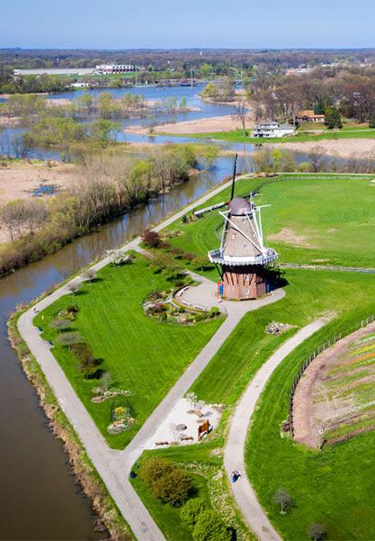

31-acre public park on an island at the confluence of two rivers just east of downtown Calgary. It has served as a public open space since the late 1800s. in 2010 the city worked with residents and stakeholders to create a vision for the park that emphasized the bond between people and nature. The renovated park includes multiple view and observation points that provide stunning views of the water and city skyline and a seasonal breach where visitors can wade into the water. A grassy hill provides a setting for events, picnics, and hikes with views of the city beyond.

The Gordon Hills will provide visual interest and activies for families year-round. Winter activies include sledding, snow tubing, and snowball fights.

Situated at the terminus of E. 72nd Street, the Gordon Hills will rise over 40 feet above the existing lakefront giving visitors stunning views of Lake Erie and the Cleveland skyline.
Community members love taking in the natural beauty and expansive views available along the lakefront and desire more opportunities and spaces to take in those vistas. Rising over 40 feet above the current elevation of the lakefront parks, the Gordon Hills will create a new vantage point to appreciate the natural beauty and wonder of the lake. Atop the hills, above the treetops, visitors will experience panoramic views of the Isle, the Cove, Lake Erie, and the Cleveland skyline.
Accessible natural surface trails connected to the lakefront’s larger network of trails will lead visitors on a climb to the top of the hill providing moments to pause and reflect on the tranquility of the lake. The Gordon Hills will become a year-round node of activity, changing with each season. In the summer, visitors will trek up to the top of the hills to view fireworks or watch the Cleveland National Air Show and relax as refreshing breezes roll off the water. As the air cools and the leaves begin to change color, visitors will enjoy hiking up the hills to take in the vibrant colors and natural splendor of autumn. During the winter months, as portions of the lake freeze over, the hills will become a prime destination for sledding and frolicking in the snow, viewing wave-created ice sculptures along the lake, and appreciating the stillness of nature. Then as the snow melts and the ice begins to thaw, spring visitors will be greeted by a meadow of wildflowers and native grasses that drape the hills attracting pollinators and birds.
The Eastern Fishing Cove will build upon existing amenities and programming at the E. 55th Marina, creating a node of intergenerational activity where families can spend the day fishing, picnicking, attending events, and enjoying time by the lake.

Fishing and picnicking are popular activities along the lakefront, especially adjacent to the E. 55th Marina. Community members expressed a desire for more places to fish, more interaction and engagement with the water, and more viewing and observation areas to take in the picturesque views. The Eastern Fishing Cove will expand current fishing areas by the E. 55th Marina and incorporate new fishing amenities. The outer perimeter of the area will provide almost 2,000 linear feet of shoreline for fishing, which includes platforms that hover over the stone edge, a naturalized shore for fishing, and a pier that extends out into the Cove. Enhanced fishing amenities will include cleaning stations, restrooms, and improved walkways.
The Eastern Fishing Cove will build upon the existing node of fishing activity at E. 55th, creating welcoming spaces for the current community of anglers and fun for kids and adults of all ages with open lawn space and picnic areas.
“The east side is growing and wants a family friendly waterfront park!” – Community Member
The Pennsylvania Fish and Boat Commission placed 126 vertical “fish crib” structures were in Presque Isle Bay in 2016 to stimulate fish hot spots in popular fishing locations. Artificial fish structures, created using natural materials, can help attract fish and create spaces for spawning to support local anglers.
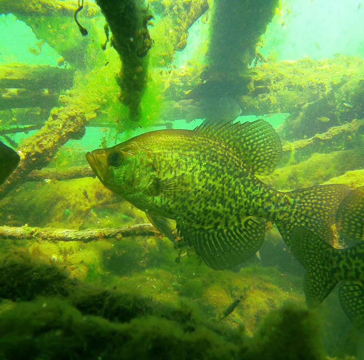
(left: Fishiding)

Nature and boardwalk trails meander along and loop through the submerged aquatic vegetation and emergent wetland areas providing space for nature lovers, anglers, birders, and walkers. In-water habitat enhancements with the addition of underwater mounds, berms, and fish habitat structures will improve fish habitat and support recreation and community fishing. Target species include black bass, sunfish species, yellow perch, and walleye. Adjacent marshes provide important breeding areas for Walleye fish, supporting the region’s role as the Walleye Capital of the World.
The interior of the Eastern Fishing Cove will contain an open lawn space for passive and active recreation, a picnic pavilion, and a flexible event space. The lawn will serve as an open space for community members to use in a variety of ways – from picnicking to frisbee games. Its location near parking lots and the flexible event space provides an opportunity to host events of various sizes throughout the year. Designed with grass “pavers” and a covered pavilion, the flexible event space will supply a multi-functional lawn space that can be adapted to accommodate larger events, festivals, vendors, or even parking for larger events. Visitors will be able to move seamlessly between these spaces via a series of nature, boardwalk, and multi-use trails that connect to adjacent parking and other nodes of activity along the lakefront.

The Chicago Riverwalk is a dynamic urban waterfront offering a variety of activities and points of interest. From marinas, fishing piers, and kayak launches to tree-shaded parks, floating wetlands, and boardwalks there are seemingly endless opportunities to explore. The Jetty “cove” includes floating wetland gardens, interpretive signage about the river’s ecology and history, and areas to fish and bird watch. Efforts to improve water quality and fish habitat in the river have been effective over the past forty years. When the Friends of the Chicago River formed in the late 1970s, there were fewer than 10 species of fish, but today anglers can find over 70 different species including smallmouth bass, carp, perch, crappie, bluegill, and catfish.

(right: Sasaki)
A covered pavilion provides space for picnics and larger events adjacent to the flexible lawn area.
(St. Patrick’s Island – Guy Nordenson and Associates)
E. 55th Street Greenway proposes the implementation of the City’s Midway Protected Cycle Track plan with the addition of a multiuse path for pedestrians.
Community Greenways along E. 55th and E. 72nd streets will welcome communities into the lakefront park spaces with improved pedestrian and bicycle amenities, new planting and street trees, enhanced wayfinding and signage, and opportunities for gateway art.
Improving access to the lakefront from adjacent communities is one of the primary objectives of the CHEERS study. Community members consistently cited issues with getting to the lakefront. Half of the survey respondents said that their top concern with the lakefront was getting to park areas from neighborhoods given the limited crossings at the railroad and I-90. Additional concerns included the safety of existing bicycle and pedestrian crossings and routes which is why almost 80% of surveyed users drive to the parks instead of biking, walking, or taking other modes of transit. However, during the planning process the team also worked to understand the psychological barriers to accessing the park, which include a lack of gateways and clear approach to the park spaces that welcome in neighbors from across the city.
E. 72nd Street Greenway proposes protected bike lanes and a multiuse path for pedestrians that connects to the E. 72nd Gateway.
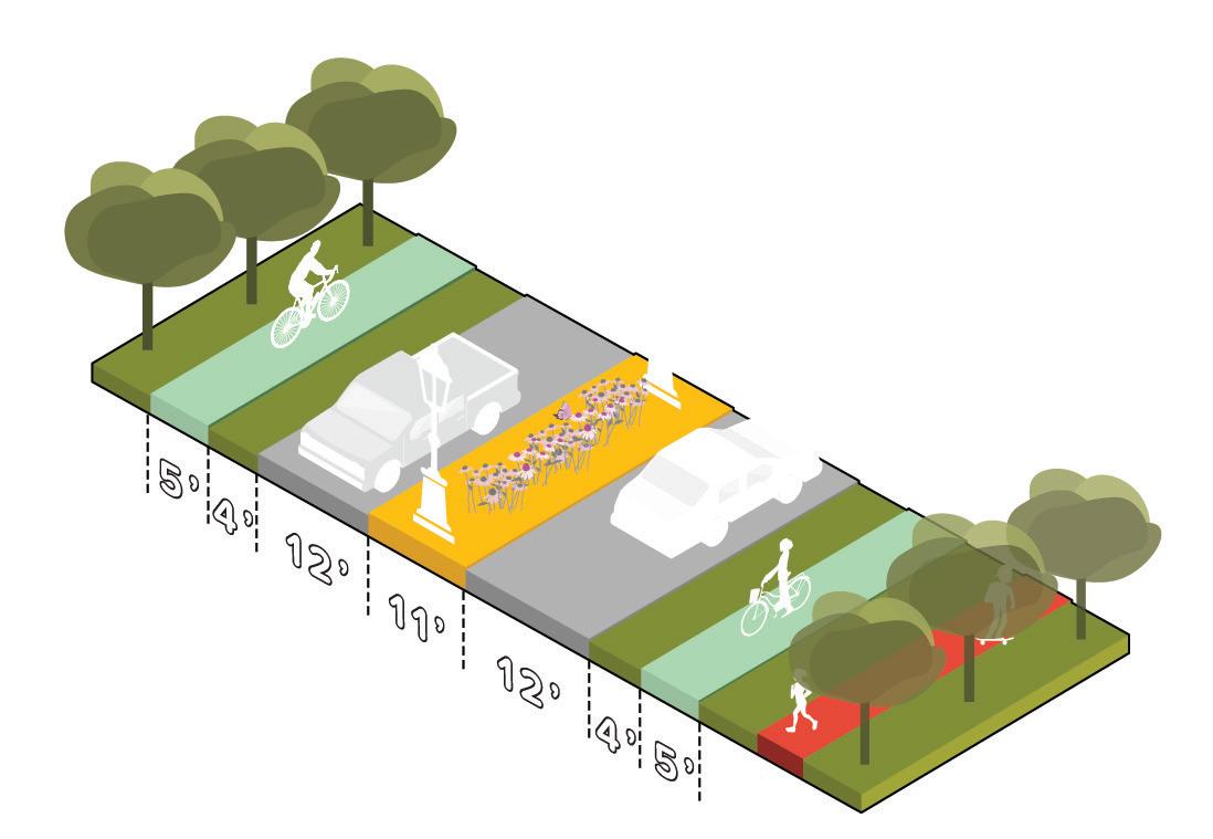

CHEERS envisions a series of green neighborhood connections that will extend park spaces from the lakefront back into the adjacent neighborhoods. These greenways or “green fingers” include necessary safety improvements for pedestrians and bicyclists, new planting and street trees, as well as wayfinding and opportunities for art. Smaller vacant lots located along these streets create a potential for a string of pocket parks that could be established along the greenways to further strengthen the connection. The alignment of E. 55th and E. 72nd streets respond to the specific space and right-of-way constraints. Additional study of these neighborhood linkages will continue through complimentary efforts by the City as well as the current Safe Routes to Parks Initiative. The Safe Routes to Parks initiative, a partnership between Bike Cleveland, the SCSDC, Cleveland Metroparks, and the Kent State Cleveland Urban Design Collaborative, will continue exploring these connections to the lakefront with additional community engagement and visioning studies.
The E. 55th Street greenway will include the implementation of the city’s proposed E. 55th Midway Protected Bike Boulevard segment that connects south to Broadway Avenue. The Midway Protected Bike Boulevards are part of the city’s larger proposed network of midway
cycle tracks that include center-aligned, protected bike lanes and other street safety improvements. In addition to the cycle track, the CHEERS plan includes an extension of a multiuse trail that connects to the lakefront multiuse trail. This improvement along with simplified intersections at the newly created Lakeshore Boulevard (formerly Marginal Drive), will improve safety for pedestrians and bicyclists accessing park spaces from adjacent neighborhoods.
The E. 72nd greenway will include protected and buffered bicycle lanes, a new multiuse trail link, and a revised median with opportunities for signage and public art that welcome community members to the lakefront. Simplified on- and off-ramps north of I-90 will improve vehicular, bicycle, and pedestrian safety by reducing the number of lanes and intersections. A new multiuse trail link provides clear and safe access to the lakefront parks, the E. 72nd Street Gateway, and South Gordon Park.
Cleveland’s proposed Midway Protected Bike Boulevard network will consist of 60 miles of buffered, two-directional centered bike lanes, which will connect Cleveland neighborhoods to assets like the eastern lakefront. (Bialosky + Partners Architects & OI studio)
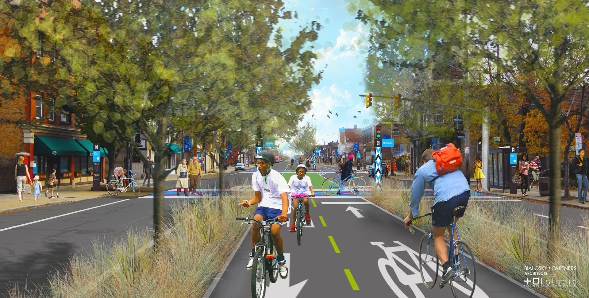 – Community Member
“The lake is a public amenity. It should always be accessible to everyone in an equitable capacity.
The 72nd Street Gateway will serve as the lakefront’s primary entrance or “front porch” – welcoming the community into safe, accessible, and vibrant park spaces.
Many community members feel the that the collection of parks along the lakefront lacks a clear and cohesive identity. The lack of welcoming wayfinding and signage and clear entry points that connect to adjacent neighborhoods leave many with the impression that the spaces are not for community use.
CHEERS envisions a series of gateways along the lakefront that will invite community members into the park spaces. The 72nd Street Gateway will serve as the lakefront’s primary entrance or “front porch” – welcoming the community into safe, accessible, and vibrant park spaces. This new space will be a physical manifestation of inviting adjacent communities to embrace the lakefront as their own. Walking into the gateway from the E 72nd Street
greenway visitors will be drawn in by lush gardens and tree groves, the rise of the Gordon Hills, and a glimpse of Lake Erie in the distance. A hardscaped entry plaza will provide a landing pad with visitor amenities like benches and restrooms where visitors can take a moment to relax as they explore the options along the lakefront. New signage, wayfinding, and visitor information kiosks will help orient visitors and provide clear directions to different program elements along the lakefront. The gateway will also serve as a key trailhead, providing linkages to the lakefront multiuse trail, natural surface trails, boardwalk trails, and other local and regional trail systems like the Harrison Dillard Bikeway and the Cleveland Lakefront Bikeway.
Domino Park, named after site’s history as a sugar refinery, was transformed into a waterfront park that includes a variety of recreational amenities. Noë & Associates worked with stakeholders to create placebased branding and a complementary wayfinding system that played on the site’s heritage and legacy using a dot grid often seen in domino tiles for graphic marks and a stencil typographic motif that celebrates the areas industrial heritage. The system is seamlessly incorporated into the park spaces, welcoming community members in through park entrances and gateways and providing key information and orientation throughout. The dynamic graphic motif not only helps the community navigate the space, but also helps honor and recognize the past while embracing the future.
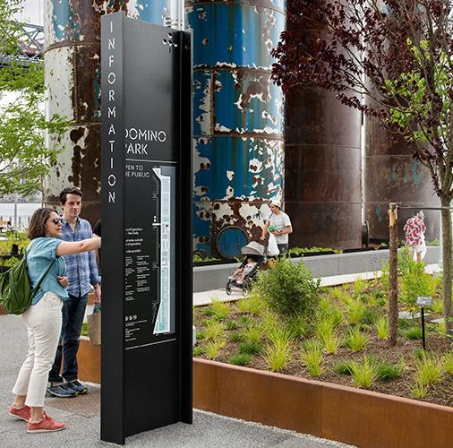 (left: Noë & Associates)
The CHEERS plan is a bold vision for the eastern lakefront, inspired by the vibrant and engaged communities that surround the lake and the transformative potential these spaces hold. Implementation will require continued coordination, new partnerships, a creative phasing plan, and a diverse mix of public and private funds.

Due to the scope and anticipated costs of creating 150 acres of park and habitat amenities, 80 acres of which will be new land, a phased approach will be crucial to a successful implementation. CHEERS was developed for the current communities and residents that reside on the east side of Cleveland. A key goal of the phasing approach will be to not displace any existing program element without first replacing it elsewhere. The approach will also work to mitigate any negative impacts to enjoying the lakefront during construction phases. The project elements are grouped in two phases –the Isle and the Lakeshore improvements.
There are several advantages to constructing the Isle as the first phase of the project. The primary one is that the Isle would provide protection from open-lake wave energy for several of the other project elements, enabling improvements in other areas to be constructed in a more efficient manner with less shore protection. This would allow naturalized or softened portions of the shore to be created in protected areas. The Isle also provides the maximum benefit in terms of dredge material capacity and would provide protection to the existing shore while funding is secured for future phases and park improvements.


However, constructing the Isle as the first phase of the project presents obstacles in relation to funding and development schedules. The Isle would also have a longer development schedule for design, permitting, construction, and filling with dredge material given its location in deeper lake water and need for larger protection measures. If full funding is not available for the construction of the Isle, starting with a combination of the outer breakwall structure of the Isle (Phase B1) and the lakeshore improvements (Phase A2) addresses immediate infrastructure protection needs, creates quality habitat, and is the most efficient construction sequence for achieving future full build out of the plan. Rather than construct hardened edges along the shoreline that will eventually be protected by the land mass of the Isle, a hybrid approach invests in the overall protective structure of the Isle, which will dissipate energy and wave action to protect the habitat created as part of the Shoreline. Phase A2 Lakeshore improvement offers a combination of infrastructure protection, particularly of I-90, and the ecological features essential to a vibrant living shoreline.


material storage
Constructing the Habitat Loop as a Phase A1 pilot project has several advantages and meets several of the overall goals of the CHEERS project: the beneficial use of dredge material, improved coastal habitat, increased waterfront amenities for communities in the project area, and protection of critical upland infrastructure (such as I-90).
A more detailed metocean analysis was performed once a final concept, the Habitat Loop area, was selected as a Phase A1 pilot project for advancement to the preliminary technical design stage. The detailed metocean analysis focused on the development of conditions, including water levels, waves and ice forces to be considered in the design of a perimeter breakwater to protect the Habitat Loop. The study assumed that the Habitat Loop would be constructed prior to other improvements, such as the Isle, that would provide wave attenuation lakeward of the structure.
A design wave height of 15.7 feet with a period of 8.7 seconds for a 50-year return period at the location of the Phase A1 perimeter breakwater was calculated. In this case, fetch-limited waves control design for this location (based on the assumption that no other improvements are constructed lakeward of the perimeter breakwater). Based on the design water levels and wave heights, up to 18-ton stone will be needed for the construction of the perimeter breakwater. This is consistent with the 12 to 24-ton stone required for the construction of the Cleveland Lakefront Nature Preserve in similar water depths and wave conditions.
Phase A2 – East 55 th Street Area
0’ 1,000’ 1 INCH ST. CLAIR AVE SUPERIOR AVE ADDISON RD E 71 ST ST E 74 TH ST E 79 TH ST ANSEL RD E 105 TH ST M A R T I N L U T H E R KING JR D R E A ST BLVD 500’ CHEERS!


Phase A2 – the Eastern Fishing Cove, the Shore, and the Launch – will extend the Shoreline improvement project to the area lakeward of East 55th Street Marina. Construction of Phase A2 would also involve construction of a stone breakwater for shore protection prior to filling with dredge material. The breakwater would extend along the north end of East 55th Street Marina, lakeward toward the Isle, and back to connect to the Phase A1 Habitat Loop.
The concept includes a small embayment between the Eastern Fishing Cove and the Habitat Loop. This area, call the Shore, is intended to allow for a natural shore feature similar to a beach. Constructing a natural shore in this area is complicated by the water depths and wave energy, if constructed prior to the Isle. Constructing a submerged sill structure to support the fill along the shore may allow this area to be developed with a more natural shoreline prior to construction of the Isle. Constructing the fill area at the east end of East 55th Street Marina and the Habitat Loop will also provide headlands to help prevent loss of fill from this area.
AVE

1,884,250 cubic yards of dredge material.

AVE
Phase A3 would extend the Shoreline improvement project to the area north of Gordon Park and the Intercity Yacht Club. The construction process for the Gordon Park area will be similar to Phases A1 and A2, with the construction of a perimeter breakwater prior to the placement of dredge material. The east end of proposed improvements will extend east of the Isle and will be exposed to open-lake wave energy, whether constructed before or after the Isle.
AVE
AVE
Phase B includes the construction of a new nearshore Isle. The lakeward facing edges of the Isle will require significant shore protection due to exposure to open-lake wave energy. Waves in the Cove on the landside of the Isle will be limited by the fetch distance for wave generation between the shore and the Cove. Most of the landside of the Isle can be constructed with limited protection, although a stone breakwater may still be required to contain dredge material until it is consolidated.
AVE

Constructing Phase A3, or a portion of Phase A3, prior to constructing the Isle may allow for more flexibility in construction methods for the Isle. Constructing a temporary causeway could allow the perimeter of the Isle to be reached with land-based equipment in addition to marine equipment.
Due to the size of the Isle, the deep water along the lakeward edge, and the exposure to open-lake wave energy, construction of the Isle will be the most expensive phase of the project. However, the Isle also provides the largest benefits in terms of dredge material capacity, wave energy dissipation and infrastructure protection. The presence of the Isle will also allow softer, more naturalized shores along the Shoreline improvement areas. This would result in significant cost savings for constructing Phases A1-A3.
Constructing just the outer breakwall of the Isle (B1) as one of the first phases of the project creates an efficient construction sequence for achieving future full build out of the plan. Rather than construct hardened edges along the shoreline that will eventually be protected by the land mass of the Isle, a hybrid approach invests in the overall protective structure of the Isle, which will dissipate energy and wave action to protect the habitat created as part of the Shoreline.
Construction methods will be similar for the perimeter structures and dredge material placement in each area. The construction will require placement of bedding stone to surcharge the lakebed and prevent settlement of the final structures. Once the lakebed has been compacted additional stone can be placed and shaped to construct the core of the perimeter breakwaters. Additional layers of stone, increasing in size, are placed over the core to create the breakwater cross section. The largest armor stone would be placed along the lakeward face of the structure. The cross section may also require the placement of small stone and gravel on the inside of the breakwater to prevent migration of dredge material through the breakwater. Once the breakwater is constructed, dredge material can be placed as fill. The fill can be generated from current dredge operations or material may be relocated to generate capacity at other disposal sites around the Harbor.
A variety of technologies exist for excavating and placing dredged material for beneficial use applications (USACE 2015). For open water placement of dredged material, a floating or submerged discharge pipeline may be used. Additional sections of pipe can be added for upland or shore zone placement. Dredged material can also be placed in hopper barges for subsequent placement in open water or near shore areas that are remote from the dredging area. For open water placement (i.e., creation of subaqueous mounds for fish habitat) split-hull hopper dredges are unloaded by splitting the hull open to allow the dredged material to fall to the open-water placement site. Most dredges are also equipped with pump-out systems to pump the dredged material to upland placement sites (for example, beach or wetland creation projects). The sidecasting dredge is a shallow-draft vessel, specially designed to remove material from channels or small inlets. Instead of collecting the material onboard the vessel, the side-casting dredge pumps the dredged material directly overboard through an elevated discharge boom.
Two basic types of mechanical bucket dredges may also be used to collect and place dredged material - the clamshell bucket dredge, and the backhoe dredge. The bucket dredging process usually requires that excavated material be hauled to a placement site by barge (often called a scow). Barges may be purposely built as dump scows with split hulls, or they may be flat-deck barges modified to carry dredged material, which is a hydraulically unloaded and pumped up on to the placement site. This operation usually involves adding additional water to the dredged material in the barge to form a slurry. The best use of the backhoe dredge is for excavating hard, compacted materials, rock, or other solid materials after blasting, and placing such materials to form submerged structure, or reefs to enhance fish habitat.
Environmental Dredging Windows: timeframes to complete dredging operations, including channel dredging or dredged material placement operations, are restricted to protect biological resources or their habitats from potentially detrimental effects. The primary concerns for aquatic and near-shore habitats typically involve impacts stemming from elevated turbidity, suspended sediments, sedimentation, and hydraulic entrainment of fish, turtles, and other aquatic biota. Additional impacts that must be avoided or minimized when dredging or placing dredged material include disruption of bird nesting activities, disruption of fish migrations, burial and physical removal of submerged vegetation, and potentially, disruption of recreational activities such as angling or boating.
Dredged Material Properties: Standard physical and chemical properties and engineering criteria should be evaluated to determine the characteristics of dredged material, and its suitability for wetland and upland habitat development applications. Soil parameters typically measured to determine suitability for beneficial use applications include grain-size, bulk density, permeability, specific gravity, plasticity, and organic content. Chemical properties should include cation exchange capacity (the capacity for soil particles to adsorb nutrients, including nitrogen and phosphorus, contaminants, and other chemical constituents). Engineering properties to be evaluated to determine the ability of dredged material to be used for various habitat and/or site development applications include consolidation, load-bearing capacity and shear strength.
Targeted upland habitats and recreational land features in the project area, including lawns, forest, shrub, and grassland communities, can be developed on dredged material substrate through natural colonization or by planting selected species. Plant material in the form of seed, bare root plugs, containers, and ball and burlap should be introduced early on along with a nurse crop of herbaceous grasses and forbs to promote rapid development of proposed vegetation communities. Even with careful planting, it is often very difficult to get climax species to survive under initial conditions due to lack of soil mycorrhizae (soil fungi that extend plant roots) to assist root growth and nutrient uptake, lack of shade, and extended spring flooding or fall drought conditions. Prior to planting, seedbed preparation should include plowing or disking to aerate the soil, destroy unwanted vegetation that may have invaded early on, and distribute soil amendments. Ideally, seedbed preparation should occur several months prior to planting and again just before planting (USACE 2015).
The advantages of natural colonization are low costs, and a greater degree of self-maintenance. The disadvantages include proliferation of non-native species, and slow growth and maturity (up to several decades). Initially, fencing off newly planted upland vegetation communities may be required to keep out the herbivores such as deer that eat developing tree bark, leaves, and shoots. The advantages associated with planting upland sites are the initial presence of desired tree/shrub species, rapid substrate stabilization, and more rapid progression towards the desired site aesthetics, which can be an important consideration if the habitat being developed is a component of a public space or park. The main disadvantage of establishing vegetation by planting is the cost involved with site/seed bed preparation and plant propagation and establishment. A hybrid approach may also be considered in certain situations, whereby natural colonization/species invasion is allowed to occur to stabilize the new substrate and promote soil and organic matter development, followed by planting of desired native tree/shrub species when conditions are deemed suitable (USACE 2015).
Engineering design for marsh habitat development using dredged material consists of defining elevation, slope, shape and orientation, and size (area and volume). The final elevation of the marsh substrate is determined largely by settlement and consolidation of newly placed dredged material and sub-grade soils. This is often the most critical design consideration as it determines both the amount of material placed as well as the plant community structure and functional capacity of the habitat established (USACE 2015). Determination of final elevation and biological benchmarks for vegetation is critical and should be based on precise knowledge of the elevational requirements of the plant community (often based on data collected at nearby, natural reference sites). Should a greater amount of settlement/consolidation occur, such that the final marsh elevation is below design specifications, the difference can be made up in supplemental materials placement (prior to final grading and vegetation establishment).
The spacing/density of planting units for establishment of native marsh plant communities can vary and is largely determined by substrate type/quality, propagule type, growing season duration, and project/design performance standards. A common goal for marsh development projects is to achieve relatively uniform cover by the end of the second growing season (USACE 2015). Planting at an interval of approximately 1 m (3.2 ft) on center is usually a good compromise between material costs and acceptable coalescence of marsh vegetation. In some cases, especially were heavy grazing by waterfowl or aquatic mammals may be anticipated, a denser planting interval of 30 cm (12 in.) on center may be desirable. In addition, where sandy, low nutrient soils are present, a positive short-term plant growth response can usually be elicited via fertilization and/or organic matter amendments.
Preliminary cost estimates to implement CHEERS primarily pivot around two construction scenarios. The first scenario includes construction of the Shoreline improvements prior to the construction of the Isle. The second scenario would be to construct an offshore Isle first to provide protection for the Shoreline improvements, limiting the size of stone required for shore protection. The second scenario represents significant cost savings by reducing the need for higher levels of shoreline protection.
In either case, structures exposed to open-lake wave energy in the relatively deep water at the east end of Cleveland Harbor will require significant protection. It is estimated that each of the armor stones necessary to construct the breakwaters will weigh approximately 18 tons each, based on the preliminary metocean analysis. This is similar in size to the 12- to 24-ton stone used to construct the perimeter of the Cleveland Lakefront Nature Preserve (Dike 14). The stone will need to be durable and of sound quality to provide for the longevity required for the structures. Stone of this size and quality is difficult to attain and typically requires specialized quarrying techniques. The stone will also need to be sourced from quarries with geology capable of producing the large stone. The cost of quarrying, transporting, and placing armor stone of this size is substantial.
The CHEERS project represents a significant investment in community and environmental infrastructure that will transform the eastern lakefront into a local and regional destination. The project encompasses 150 acres of shoreline and includes the creation of over 18 acres of new parkland and habitat space, miles of new trails, play spaces, and community gathering areas. This multi-million dollar investment will also protect the shoreline and critical infrastructure, helping to improve the long-term resilience of the lakefront and adjacent communities. The chart (right) puts this potential investment into the context of other regional planning and design projects.
Constructing the Isle first would prevent the need to armor portions of the Shoreline improvement areas with such large stone, resulting in significant cost savings. Conceptual-level cost opinions were prepared for both scenarios and are summarized in the adjacent chart.
“Construction Costs” (shown in the table to the right) are a rough order of magnitude. They include the estimated cost of building the project as conceptually shown in 2021. There may be uncertainties such as environmental mitigation or unanticipated challenge requirements from regulators. Likewise, there may be unanticipated savings that arise as the project scope is more carefully defined. The construction costs represent an order of magnitude that will continue to be shaped as funding and project scopes evolve. Each year, these costs are expected to escalate with inflation.
“Total Project Cost” captures the additional costs of developing a project outside of construction. This includes design, engineering and permitting fees. It captures project management costs and legal costs as the governance of the project and its contracts are negotiated. It also includes an estimate of the costs to fundraise money from corporate and philanthropic sources.
1: Construction of the Isle prior to the Lakeshore phases.
ESTIMATED CONSTRUCTION COST
TOTAL PROJECT COST
PHASE B: THE ISLE $135.6 m $161.5 m
PHASE A1: THE HABITAT LOOP $29.2 m $35.1 m
PHASE A2: E. 55TH STREET MARINA EXTENSION $57.2 m $68.7 m
PHASE A3: THE GORDON HILLS $30.9 m $37.2 m
TOTAL: $252.9 m $302.5 m
Construction of the Lakeshore prior to the Isle.
ESTIMATED CONSTRUCTION COST TOTAL PROJECT COST
PHASE A1: THE HABITAT LOOP $36.5 m $43.8 m
PHASE A2: E. 55TH STREET MARINA EXTENSION $71.2 m $85.1 m
PHASE A3: THE GORDON HILLS $38.6 m $46.3 m
PHASE B: THE ISLE $135.6 m $161.5 m
TOTAL: $281.9 m $336.7 m
Translating the goals and aspirations included in this plan will be critical on the path to implementing the plan. A series of lakefront design standards will help create a clear identity for the lakefront, uniting the park spaces along the lakefront. These standards should align with existing park development, operations and maintenance, and land management standards from Cleveland Metroparks and other partners. These design standards should include:
Including seating, waste and recycling bins, bike amenities, bollards, planters, and other elements that help structure the visitor experience within park spaces. Furnishings should include elements that are standard to other Lakefront Reservation parks as well as ones that might be unique to the experience at the eastern lakefront or help achieve a specific aspiration within a project.
Lighting standards should improve the sense of security for visitors while reducing negative impact to neighboring areas, including natural habitats. Proposed lighting should adhere to existing standards and strive to meet Dark Sky Compliant regulations.

Materials (Architecture & Landscape Design) Materials used in park landscapes and on proposed structures will inform the visual identity of the lakefront park spaces. Material standards should include hardscapes (plazas, paving, etc.), softscapes (planting, trees, etc.), and architecture (cladding, etc.). These materials should contribute to the sustainability and adaptability of the site and be selected to reduce overall cost of operations and maintenance.
Signage and wayfinding are essential to the visitor experience – providing visual interest and orienting visitors to key lakefront amenities and elements. Standards should identify standards that are consistent with other Lakefront Reservation parks as well as those that are unique to the eastern lakefront spaces. Types of signage should include, but is not limited to: monument signs, directional signage for vehicles, pedestrian wayfinding markers and kiosks, trail markers, interpretive and education signage, and building identification markers.
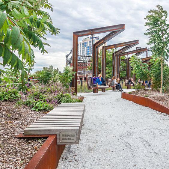
In the preliminary planning and design phase of the study, the team reviewed planning principles and guidelines for habitat restoration highly disturbed and/or isolated settings, including those where the beneficial use of dredged material is an integral component of the habitat development process, as it will be in CHEERS (Thom 1997, Pastorok et al. 1997, USACE 2000). Notably, these recommendations address the challenges of conducting restoration where ecological connectivity may be lacking, and include:
1) An ecosystem perspective, where restoration actions are formulated in a watershed or regional context and project attributes are defined at appropriate spatial scales;
2) A key species function perspective where it is recognized that the presence of certain organisms (plants and animals) can drive the outcome of restoration projects;
3) Maintaining ecosystem connectivity by creating suitable habitat corridors, removing barriers, and addressing fragmentation;
4) Recognition that a natural population with a limited range or abundance may be considered locally valuable or significant - habitat that is essential for
important species or critical to a species’ recovery and survival may be considered limiting and warrant protection.
5) A “bet-hedging” design perspective where restoration practitioners recognize that ecosystems are a mosaic of habitats, and that natural disturbances may not always result in adverse effects - this strategy incorporates diversity in design elements, and implies that restoration projects be flexible, resilient and able to recover rapidly following a disturbance event.
Finding a balance between the ecological needs of the habitat and human needs and behaviors will be a challenge to implementing certain components of CHEERS. In an urban or industrial setting, such as the eastern lakefront, larger habitat development parcels will provide a protective buffer from deleterious effects of adjacent land uses. The general absence of natural ecosystems in the vicinity to the CHEERS project may affect colonization of shorelines by emergent wetland plants and the recruitment of insects and other terrestrial invertebrates. In contrast, highly mobile aquatic birds and songbirds, including many migratory species, are expected to readily colonize created wetlands and upland habitats, exploiting newly available areas for foraging and breeding (Simenstad and Thom 1996). Smaller restoration projects are also useful for educational and outreach purposes because they are often easily

Benches

Planting
Lighting
The benefits of new open spaces and parks are clear. However, new park spaces can often have unintended consequences, exacerbating gentrification in neighborhoods and often displacing the very residents they are meant to serve. This is often coined “green gentrification.” To mitigate potential displacement and maintain affordability, new park amenity projects like CHEERS, must work to include equitable community development and strategies in coordination with CDCs and the City. These strategies will work to ensure that the residents who currently live in east Cleveland will benefit from these investments in their community.
(right: WRT)accessible and located within areas communities would like to reclaim, thereby increasing stakeholder support for the overall program (USACE 2009). The proposed design for CHEERS includes both large and small habitat development concepts; therefore, the overall design is both functional (from an ecosystem perspective) and accessible (to humans and biota).
Cleveland’s eastern lakefront contains many locations where permitted land uses, such as wastewater/stormwater infrastructure, port terminal facilities, and hardened shorelines are necessary to society and the economy and cannot be removed. Many of these concerns can be addressed in the final design and planning phases. Sensitive habitats should not be planned for areas prone to disturbance. Densely populated or active recreational use areas may not be appropriate for restoring sensitive habitats because of the costs associated with restricting access and safeguarding against vandalism and disturbance from feral or domesticated animals. Furthermore, restricting access to popular recreation areas can lead to community resentment of future restoration activities. Instead, restoration projects sited in populous areas should be designed to incorporate recreational uses, providing natural settings and enabling residents to gain a greater appreciation for the ecosystem goods and services habitats provided through habitat development projects.
In 2016, The Ohio Lake Erie Commission outlined several Priority areas, goals and strategic objectives for the conservation and restoration of Lake Erie’s coastal ecosystems in its Lake Erie Protection and Restoration Plan. Many of these objectives directly address components of the CHEERS initiative, including “Dredged Material Beneficial Use and Management.” The Plan promotes and prioritizes “research and demonstration projects on potential upland and in- water beneficial uses including habitat restoration, beach nourishment, and upland beneficial use of dredge material projects.” An outstanding regional example and precedent for the habitat development component of CHEERS is the Cleveland Lakefront Nature Preserve (CLNP), located just east of Burke Lakefront Airport. Prior to being designated a nature preserve in 2012, the 88-acre site was used for three decades as a confined disposal facility (CDF), storing approximately 5.7 million cubic yards of dredged material removed from the Cuyahoga River. The CNLP is managed by the Cleveland-Cuyahoga County Port Authority and is publicly accessible through a trail system. After active fill operations at the CDF ceased in 1999, tree and shrub cover naturally established on the site, forming open fields, successional woodlands, and shrub thickets, representing a mix of native and non-native species (Davey Resource Group 2015).

The funding strategy for the project will include a mix of private and public sources. Potential funding sources may include, but are not limited to:
y Continued grant funding through ecological foundations and organizations including:
• the National Fish and Wildlife Foundation (NFWF) through the coastal resilience program

• NOAA
• Great Lakes Restoration Initiative
• Ohio Healthy Lake Erie Fund
y Local, state, and federal infrastructure allocations.
y Partner organization funding (matching funds or allocations).
y Private foundations and donors.
y USACE Local Dredge Operations.
The National Fish and Wildlife Foundation (NFWF) awarded a $2.5 million coastal resiliency grant with $2.5 million in local match to the Superior Watershed Partnership (SWP) in 2019. The project, located in Marquette Michigan, will restore almost a mile of severely eroding Lake Superior shoreline. It includes approximately 4,200 feet of shoreline and will create approximately 28 acres of public green space.
Engineering with Nature is an initiative by the U.S. Army Corps of Engineers (USACE) to explore nature-based engineering solutions that area sustainable and deliver economic, environmental, and social benefits through collaboration with stakeholders and the community. The initiative focuses uses science and engineering to improve efficiency, natural processes to maximize benefits and the value provided by projects, and collaborative process to organize and engage. CHEERS aligns with the goals of the Design with Nature initiative by using a nature-based approach to protecting infrastructure, creating habitat, and providing recreational amenities to underserved communities. (left: USACE)
Building momentum early on in long-term projects is a major key to implementation and keeping stakeholders engaged. There are multiple partner-sponsored projects that are in various stages of development and completion.
Harrison Dillard Bikeway Intersection: The Harrison Dillard Bikeway runs parallel to Martin Luther King, Jr. Drive and Doan Brook for 3.74 miles through Rockefeller Park and Cleveland Cultural Gardens. Harrison Dillard links the Cleveland Lakefront Bikeway along the coast of Lake Erie to the north with the Laketo-Lakes Trail to the south, connecting Cleveland’s Glenville, St. Clair-Superior, Hough, and University Circle neighborhoods, providing an opportunity to create a trailhead with amenities.
ODOT Active Transportation Underpass Improvements: To reach the Lakefront, the Harrison Dillard Trail passes beneath I-90 through what used to be a dark and debris-laden segment of the path. Thanks to an Active Transportation grant from the Ohio Department of Transportation, the bicycle and pedestrian path was recently expanded to increase the separation between path users and motor vehicle traffic. A mural along the underside of the bridge depicts the transition from land to water as riders go north toward the lake.
Gordon Park Pedestrian Bridge: I-90 is a significant physical barrier between neighborhood residents and the recreational amenities of Lake Erie. A pedestrian bridge between E. 72nd Street and Martin Luther King Jr., Drive allows bicyclists and pedestrians to pass over the interstate, connecting the neighborhoods and South Gordon Park to lakefront amenities and North Gordon Park. Future wayfinding signage and ADA accessibility improvements could lead to heavier utilization.
E. 72nd Street Bike Lanes: In 2014, the City of Cleveland installed buffered bike lanes along E. 72nd Street, connecting the St. Clair commercial corridor and adjacent residential areas to the Lakefront.
Cleveland Lakefront Bikeway Extension: There is an opportunity to leverage the momentum behind CHEERS to extend the current lakefront trail from E. 55th to Downtown.
Moveable or semimovable furniture like picnic tables (top image – MOOS furniture) and loungers (bottom image) can provide nodes of gathering along the lakefront. (Streetlife & WRT)
The new E. 72nd Comfort Station was recently opened along the eastern lakefront. It includes water fountains, restrooms, bike parking, and shaded seating areas. (Cleveland Metroparks)


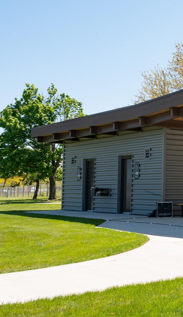
Safe Routes to Parks: Through a competitive grant award, Bike Cleveland, St. Clair Superior Development Corporation, Cleveland Metroparks, and the Kent State Cleveland Urban Design Collaborative are receiving technical assistance from the Safe Routes National Partnership to develop an action plan for improving active travel to Cleveland’s East Lakefront Park, including North and South Gordon Parks, and implement early actions from the plan. The action planning process will engage the community through surveys focused on bike and pedestrian programming, leading to recommendations and strategies to remove barriers to park access and proactively work toward ensuring that routes to the East Lakefront Park are safe and secure for all.
Lakefront East Connects! In partnership with the Northeast Ohio Areawide Coordinating Agency, the City Planning Commission is sponsoring a Transportation for Livable Communities Initiative (TLCI) planning study to catalyze transportation and development opportunities to connect the adjacent neighborhoods to the eastern lakefront. The existing street and trail network currently supports motor vehicles at the expense of other users. Making multimodal connections stronger, safer, and more viable will help to better link people to the waterfront, Gordon Park, Rockefeller Park, and the regionally connected Harrison Dillard Trail, resulting in public health improvements for residents. Planning
and implementation will focus on neighborhood scale connections such as E. 72nd St. corridor, bicycle and pedestrian enhancements along Martin Luther King, Jr. Drive, improvements to E. 82nd Ave., and Broad Ave. In addition, the study will explore opportunities for transitoriented development and an extended waterfront rail line or BRT. Finally, consideration will be given to improvements to freeway interchange entrances/ exits that will increase accessibility to the lakefront amenities.
Cleveland State University Eastside Parks Capstone Study: The 2020 Planning Studio course offered by the Levin College of Urban Affairs partnered with the City of Cleveland, Famicos Foundation, and University Circle Inc., to research and design practical, actionable strategies to connect eastside neighborhoods with Rockefeller Park and the lakefront. The study made recommendations on physical development, bike and pedestrian access, wayfinding and identity, parks programming and activation, and an organizational structure for implementation.
Gordon Park Planning: Gordon Park is 122 acres of underutilized park space owned and managed by the City of Cleveland. Recognizing that this park is lacking amenities, quality connections and access, and consistent investment the City’s Administration is contemplating a holistic development strategy centered on the community’s needs and most active users.
Wayfinding: Installing additional wayfinding and directional signage can help orient visitors to current amenities and programs along the lakefront.
Kayak access at E. 55th: Creating another access point for kayaking and watersports on the eastern lakefront will open up opportunities for new programming and activities along the lakefront.
Picnic Tables & Seating: More places to sit and picnic were a key community request throughout the process. Installing new picnic tables, benches, and other seating at areas of activity will increase visitor comfort and create a more welcoming atmosphere.
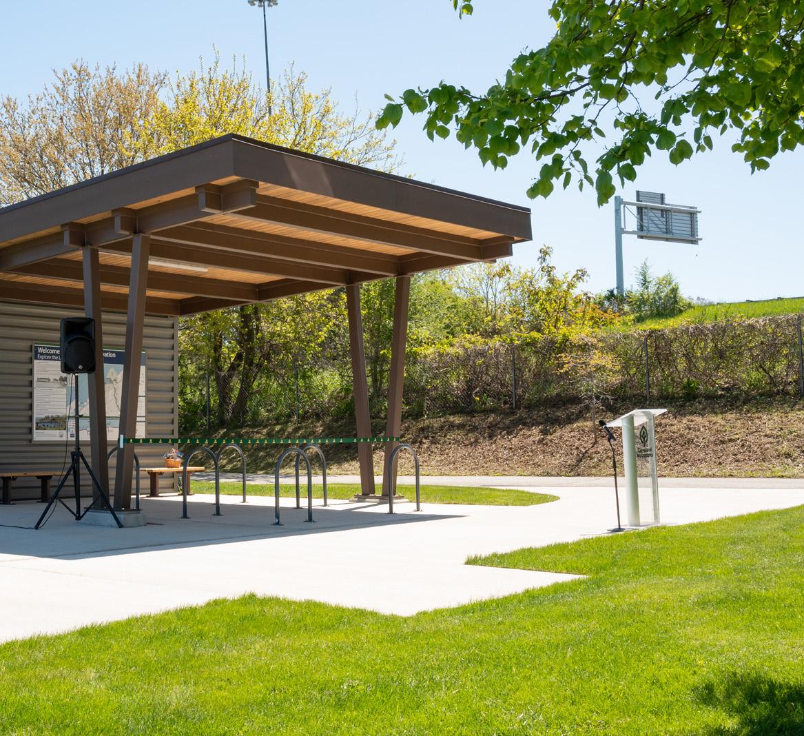
Habitat development projects in the Lake Erie coastal zone are subject to regulation by Ohio laws, statutes, and permitting authorities. In many cases, projects are jointly regulated with federal permitting authorities (e.g., USACE). All activities occurring within the designated coastal zone of Lake Erie must be consistent with Ohio’s approved coastal zone management policies.
Use of dredged material for creation of wetlands, islands and other coastal habitats in Lake Erie may be authorized under Section 404 (b)(1) of CWA 1972, Section 1135 of WRDA 1986, Section 206 of WRDA 1996 and Section 1122 of WRDA 2016. In addition, Section 204 of WRDA 1992 provides funding and authority for the beneficial use of dredged material for creation and restoration of aquatic or related habitats in association with construction, operation or maintenance of authorized navigation projects. Section 216 of RHA 1970 authorizes the USACE to review navigation projects and recommend modifications that would involve habitat creation/restoration using dredged material. Habitat development projects are also subject to regulation by Ohio laws, statutes, and permitting authorities. The Ohio Department of Natural Resources (ODNR) shares regulatory jurisdiction with the Ohio Environmental Protection Agency (OH EPA) over dredging and/or the discharge of dredged material into Lake Erie and its ports and harbors. Additionally, any proposed discharge or placement of dredged material into waters of the state, including wetlands, must receive a Water Quality Certification from OH EPA.
Additional permits may include: OEPA 401 water quality, USACE 404 discharge of dredge, NEPA, ODNR Shore Structure Permit and Submerged Lands Leases, and any additional permits as needed based on coordination with the Burke Lakefront Airport (BLK) and the Federal Aviation Administration (FAA).
A recurring concern voiced by project stakeholders is how potentially contaminated Lake Erie sediments would affect the proposed beneficial use of dredged materials for the development of various CHEERS ecosystem components. Before the 1970s, virtually all dredged material from the Great Lakes was placed in established open-lake placement areas. In 1970, Section 123 of the Rivers and Harbors Act (RHA) authorized construction of CDFs in the Great Lakes. Initially, the CDFs were built with a 10-yr design capacity, assuming that contaminated waterways would clean up sufficiently, as a result of passage and implementation of the Clean Water Act (CWA) in 1972, to re-allow open-water placement of all dredged material. In successive years, Great Lakes sediments failed to meet established testing criteria for open-lake disposal, requiring expansion of existing CDFs as well as the construction of new CDFs. Although many of Lake Erie’s CDFs are at or near capacity, an increasing proportion of dredged material removed annually from Ports and Federal channels is now considered suitable for open-lake placement, in accordance with federal and state regulations (GLDT 2016).
The USACE sampled and analyzed sediment in 2013 and 2016 and concluded that sediments from the upper portion of the Cuyahoga River federal navigation channel were suitable for open-lake placement, including most beneficial use aquatic habitat development alternatives (USACE 2014). Currently, sediment dredged from the lower navigation channel is deemed suitable only for CDF placement. The USACE Engineer Research and Development Center (ERDC) evaluated the suitability of dredged sediment from the Port for placement in Lake Erie waters and determined that dredged material from all areas of the Port and Federal Channel was suitable for most upland placement scenarios (except possibly for residential use) (USACE 2011).
Year one monitoring of Hunter’s Point South restoration – New York (Great Ecology)
The habitat development components of CHEERS should be, to the maximum extent possible, naturally functioning, self-sustaining aquatic, wetland and upland habitats that should require relatively little maintenance or human intervention over time. However, ecosystems are inherently unpredictable, and even engineered habitats or habitat complexes require some degree of initial and periodic maintenance and adjustment to achieve functional equivalency with natural habitats. The duration of post-construction monitoring should be determined through consultations with stakeholders and resource agencies (e.g., USACE, OH EPA). Ideally, the CHEERS habitat monitoring phase should extend long enough to provide a reasonable assurance that the developed habitats have met pre-specified performance criteria (i.e., observable physical, chemical, or biological attributes used to determine if a habitat restoration project meets its stated objectives). Typically, state and/or federal regulatory program permit conditions for habitat development projects specify monitoring programs of up to five years, to encompass and document the point of most rapid change and the period of stabilization. Specific components of the monitoring program, including measured parameters/

performance indicators, success criteria, number and location of monitoring stations, and data management and analysis protocols will be developed collaboratively with natural resource agencies and other stakeholders.
CHEERS project proponents should work with regulatory agencies and other project partners to assist in the development and implementation of an Adaptive Management Plan for the Project. Adaptive management differs from traditional ecosystem management in that it recognizes and prepares for uncertainty and stochastic natural events or disturbance. If implemented at the outset of post-construction monitoring, problems and deviations from the expected restoration trajectory can be detected early and adjustments made to correct problems or deficiencies. If post- construction monitoring indicates that habitat elements of the project are failing to achieve pre-established performance standards, reasons for failure would be evaluated and corrective actions would be proposed to correct shortcomings. If it is determined that pre-established performance standards may not be attainable, new standards may be developed. Adaptive management requires a long-term commitment to monitoring and adjustments to restoration projects long after initial construction, to maximize success and functional gains.
The time to act is now. The eastern lakefront and its communities are in urgent need of protection from the impact of a changing climate, natural habitat that supports biodiversity and creates natural filtration and dissipation areas, and equitable and accessible lakefront park spaces that meet the needs of current residents. The availability of dredge material, urgency of tackling community resiliency, and the community, partner, and stakeholder momentum all point to opportunities for transformative change. Change that will open up new experiences along the lakefront, enhance the existing natural beauty of the lake, and help protect and preserve infrastructure and communities.
Residents and stakeholders have made their ideas and aspirations for the lakefront clear – those projects, goals, and priorities shaped the community-driven plan for a resilient eastern lakefront. A lakefront that provides for community and user needs while providing the much needed space for nearshore and aquatic habitat that supports migrating birds and local fish species to thrive. A lakefront that provides for moments of joy, reflection, and respite and leverages the healing qualities of water to create spaces for communities to escape from the hustle and bustle of urban life.

CHEERS envisions returning the hardened edge of Cleveland’s east side lakefront to a natural shoreline with places for people and nature. The beneficial use of 3.1 million cubic yards of dredge material will expand parks and habitat north of I-90, mitigate the impacts of the highway on existing parkland, protect infrastructure, and create a sheltered embayment where visitors can safely access the lake.
Proposed projects along the Lakeshore, The Cove, and The Isle include projects that use nature-based solutions to create benefits for the environment, the local economy, and communities. These projects connect people and communities to the lake, program spaces that meet the needs of the community, protect critical infrastructure and expand natural habitat areas, and celebrate the legacy, history, and significance of the lake. All together these projects will create a resilient lakefront and signature open space that honors and celebrates the lake, uplifts surrounding communities, and creates a contiguous and impactful lakefront for the City of Cleveland.

Audubon 2020. Cleveland Lakefront. Accessed August 2020. Available at: https://netapp.audubon.org/ iba/Reports/2031
Barko, J.W., R.M. Smart, C.R. Lee, M.C. Landin, T.C. Sturgis, and R.N. Gordon. 1977. Establishment and growth of selected freshwater and coastal marsh plants in relation to characteristics of dredged sediments. Technical Report D-77-2, U.S. Army Engineer Waterways Experiment Station, Vicksburg, MS.
Bradley, K.P., and E. Hands. 1989. Dredged material underwater berms. pp. 2947-2954 in: Coastal Zone ’89, Proceedings of the Sixth Symposium on Coastal and Ocean Management, Charleston, SC, July 11-14, 1989. American Society of Civil Engineers, New York, NY.
Buckley, F.G., and C.A. McCaffrey. 1978. Use of dredged material islands by colonial seabirds and wading birds in New Jersey. Technical Report D-78-1, U.S. Army Engineer Waterways Experiment Station, Vicksburg, MS.
Chaney, A.H., B.R. Chapman, J.P. Karges, D.A. Nelson, R.R. Schmidt, and L.C. Thebeau. 1978. Use of dredged material islands by colonial seabirds and wading birds in Texas. Technical Report D-78-8, U.S. Army Engineer Waterways Experiment Station, Vicksburg, MS.
City of Cleveland, Smith Group, Waterfront District Plan. 2004.
[Cleveland Metroparks] Cleveland Metroparks. 2019 Visitation Report. 2019.
[Cleveland Metroparks] Cleveland Metroparks, OLIN Studio. Cleveland Lakefront Masterplan Green Infrastructure Overlay. 2014.
[Cleveland Metroparks] Cleveland Metroparks. Lakefront Reservation E. 55th and North Gordon Master Plan. 2019.
[Cleveland Metroparks] Cleveland Metroparks. Memorandum: Port of Cleveland 2017 & 2019 aquatic plant survey results. August 10, 2020.
[Cleveland Metroparks] Cleveland Metroparks. Walk Bike Shed Analysis E 55th and North Gordon Park. 2015.
Cleveland Neighborhood Progress, et. al. Cleveland Neighborhood Progress: Cleveland Climate Resilience and Urban Opportunity Plan. 2015.
Cleveland Neighborhood Progress, et. al. Re-Imagining a More Sustainable Cleveland. 2014.
Cleveland Planning Commission and NOACA, et. al. Midway Cycle Track Plan. 2017.
Cuyahoga County Planning, Cleveland Metroparks, et. al. Cuyahoga Greenways Plan. 2019
[Davey] Davey Resource Group. 2015. Land Management Plan Cleveland Lakefront Natural Preserve.
Deller, J. 2019. Ohio Department of Natural Recourse Cleveland Harbor Electrofishing Data. Unpublished.
Doan Brook Watershed Partnership. Doan Brook Estuary Feasibility Study CMAG. 2019
EnviroScience. 2019. The Doan Brook Watershed Partnership. “DOAN BROOK ESTUARY FEASIBILITY REPORT (Draft)” Prepared by EnviroScience, Stow OH.
FirstEnergy, Arcadis. FirstEnergy Lakeshore Reuse. 2017.
GLDT 2016. Guide to Policies and Projects Related to Beneficial Use of Dredged Material in the Great Lakes. Great Lakes Dredging Team.
Gooch, L.C. 2001. The Doan Brook Handbook. The Nature Center at Shaker Lakes. Accessed August 2020. Available at: https://doanbrookpartnership.org/wp-content/uploads/2019/04/DoanBrook-All-Pages.pdf.
Hardy, Scott D., Ohio Sea Grant College Program at the Ohio State University. NEO Storm Hazard Vulnerability Study. 2017
Human Nature, St. Clair Superior Development Corporation, Cleveland Neighborhood Progress. Cleveland Neighborhood Progress Cleveland Lakefront Concept. 2018
Kayle, K.A. 2015. USEPA-Great Lakes Restoration Initiative Project. Grant Number: EPAGLNPO-2010-H-2-1163-468. EPA GLRI Project Number: GL-00E00679. Project Title: Cuyahoga AOC Habitat and Fish Restoration Opportunities.
Kreitinger J.P., R.A. Price, T.D. Borrowman, A.J. Kennedy, D.L. Brandon, and M. Bourne 2011. Evaluation of Beneficial Use Suitability for Cleveland Harbor Dredged Material: Interim Capacity Management and Long-Term Planning. Environmental Laboratory, Engineer Research and Development Center, U.S. Army Corps of Engineers, Vicksburg, MS.
Larick, Roy. Doan Brook-Frontal Lake Erie watershed assessment unit Nonpoint Source Pollution Implementation Strategy. 2020.
Langan, J.P. 1988. Benefits of underwater berms. pp. 183-187 in: M.C. Landin ed., Beneficial uses of dredged material: Proceedings of the North Atlantic Conference. 12-14 May 1987, Baltimore, MD. U.S. Army Engineer Waterways Experiment Station, Vicksburg, MS.
Landin, M.C., J.W. Webb, and P.L. Knutson. 1989. Longterm monitoring of eleven Corps of Engineers habitat development field sites built of dredged material, 1974-1987. Technical Report D-89-1, U.S. Army Engineer Waterways Experiment Station, Vicksburg, MS.
Lunz, J.D., R.J. Diaz, and R.A. Cole. 1978. Upland and wetland habitat development with dredged material: Ecological considerations. Technical Report DS78-15, U.S. Army Engineer Waterways Experiment Station, Vicksburg, MS
[NEORD] Northeast Ohio Regional Sewer District. Combined Sewer Overflow Public Notification Rule Annual Notice. 2019.
[NEOSCC] Northeast Ohio Sustainable Communities Consortium. Vibrant NEO 2040 Northeast Ohio Sustainable Communities Consortium. 2014.
[NETR] National Environmental Title Research. 2020. 1954. Accessed August 2020. Available at: https:// www.historicaerials.com/viewer
New Hampshire Fish and Game. 2020. NH Wildlife Corridors. Accessed August 2020. Available at: https:// www.wildlife.state.nh.us/nongame/corridors.html
[ODOT] Ohio Department of Transportation et. al. I-90 Safety Study. 2015.
Ohio Lake Erie Commission, ODNR. Lake Erie Protection and Restoration Plan (LEPR). 2016
Port of Cleveland. Cleveland Lakefront Nature Preserve. Accessed August 2020. Available at: http://www. portofcleveland.com/environment-infrastructure/ cleveland-lakefront-nature-preserve#:~:text=The%20CLNP%20is%2088%2Dacres,280%20 species%20of%20birds
Woodhouse, W.W., Jr., E.D. Seneca, and S.W. Broome. 1972. Marsh building with dredge spoil in North Carolina. Bulletin 445, North Carolina Agricultural Experiment Station, Raleigh, NC.
Seneca, E.D. 1974. Stabilization of coastal dredge spoil with Spartina alterniflora. pp. 525-529 in: R.J. Reimold and W.H. Queen, eds., Ecology of Halophytes. Academic Press, New York, NY.
Seneca, E.D., W.W. Woodhouse, Jr., and S.W. Broome. 1975. Salt-water marsh creation. pp. 427-437 in: L.E. Cronin, ed., Estuarine Research Volume II: Geology and Engineering. Academic Press, New York, NY.
Simenstad, C.A. and R.M. Thom. 1996. Functional equivalency trajectories of the restored Gog-Le-Hi-Te estuarine wetland. Ecological Applications 6:3856.
Soots, R.F, Jr., and M.C Landin. 1978. Development and management of avian habitat on dredged material islands. Technical Report D-78-18, U.S. Army Engineer Waterways Experiment Station, Vicksburg, MS.
St. Clair Superior Development Corporation, Campus District, et. al. Lakefront Greenway and Downtown Connector Study. 2015.
The Blue Project. 2002. Ecological Restoration Opportunities for Cleveland’s Lakefront: Report from a workshop sponsored by the BLUE Project (Building the Livable Urban Edge) of EcoCity Cleveland and the Cleveland Waterfront Coalition, December 11, 2002.
USACE. 2015. Dredging and Dredged Material Management Manual. EM 1110-2-5025, U.S. Army Corps of Engineers, Washington, D.C.
[USACE] U.S. Army Corps of Engineers. Beneficial Use Suitability Cleveland Harbor Dredged Material. 2011
USACE. 2014. Finding of No Significant Impact and Environmental Assessment, Operation and Maintenance, Open-Lake Placement of Material Dredged from Cleveland Harbor Federal Navigation Channels in the Upper Cuyahoga River, Cleveland Harbor, Cuyahoga County, Ohio. U.S. Army Corps of Engineers, Buffalo District.
Yozzo, D.J. Wilber, P., and R. J. Will. 2004. Beneficial uses of dredged material for habitat creation, enhancement, and restoration in New York - New Jersey Harbor. The Journal of Environmental Management 73:39-52.
Prepared by KS Associates
August 2020 Technical evaluation of wave action and water levels for the eastern lakefront. Analysis is mapped at six locations within the study area.

Ohio Department of Natural Resources Port of Cleveland Ohio Department of Transportation City of Cleveland
August 27, 2020 KS Project No. 19292

Overview 2
Water Levels and Wave Action ..................................................................................................................... 3
General...................................................................................................................................................... 3
Design Water Levels 3
Ordinary High Water 4
Extreme Water Levels 4
Design Wave Heights 6
Extreme Wave Statistics ........................................................................................................................... 7
Offshore Wave Height and Wave Period .............................................................................................. 7
Fetch Limited Wave Heights 7
Breakwater Wave Transmission 10
Depth Limited Wave Heights 10
Preliminary Design Wave Heights 10 Wave Transformations ........................................................................................................................ 11
Ice Forces................................................................................................................................................ 12
This report was prepared by KS Associates, Inc. for The Client. The material in it reflects the judgment of KS Associates in light of the information available to them at the time of preparation. Any use that a Third Party makes of this report, or any reliance on decisions to be made based on it, are the responsibility of such Third Parties. KS Associates accepts no responsibility for damages, if any, suffered by any Third Party as a result of decisions made or actions based on this report.
KS Associates, Inc.

The Cleveland waterfront was initially developed to support industry and the transportation of goods via Cleveland harbor. Cleveland Metroparks has partnered with the City of Cleveland, Ohio Department of Natural Resources, the Ohio Department of Transportation, and the Port of Cleveland to produce a study to better utilize portions of the lakefront that have outlasted their original development focus. The resulting Cleveland Harbor Eastern Embayment Resilience Study (CHEERS) is being led by WRT, with support from KS Associates and Great Ecology. An aerial photograph of the study area appears in Figure 1.
The project includes an initial technical evaluation, public engagement, concept development, and preliminary technical design of proposed improvements to the area. Each step will need to be informed by the conditions in the project area so that feasible designs can be advanced. This requires a study of the meteorological and oceanographic conditions at the project site (metocean analysis). The metocean analysis detailed in this report develops the design wave levels, wave climate and ice characteristics in the project area. Relevant design criteria are also summarized at the study area The initial metocean analysis is based on available hydrographic survey data for Cleveland Harbor, historical and recent water level data, and wave hindcast data to develop an overall assessment of wave conditions in the project area. The hindcast data provides an overview of wave conditions to aid in concept development. A more detailed metocean analysis will be prepared for the proposed improvements once a final concept is advanced to the preliminary technical design stage.
The selection of appropriate water levels and wave conditions is critical to the design of both hard shore protection structures and soft shoreline stabilization measures Hard shore protection structures include armor stone revetments, sheet pile bulkheads, seawalls, and other permanent structures. Soft shoreline stabilization measures include beach restoration using sand fill, shorefront vegetation areas, and reinforced, vegetated banks The range of water levels, the design wave climate, and the existing topography and bathymetry will govern the possible solutions that best fit the project needs.
Design conditions developed from the metocean analysis are typically given in terms of return period or annual chance For example, a 100-year return period event has a 1 in 100 (1%) chance of occurring in a given year, while the 50-year return period event has 1 in 50 (2%) chance of occurring in a given year. The return period selected for each of the proposed improvements will depend on the relative importance of each structure, risk to persons or property in the event of failure, and anticipated design life of the structures. For example, the use of a 100-year flood elevation as a design water level may not be necessary for a timber boardwalk with an anticipated design life of 30 years, particularly for a structure with a recreational intent that is unlikely to be accessed or could be closed to the public during extreme conditions.
Lake Erie water levels are influenced by long term variations, seasonal changes, and short-term storm conditions. Long term and seasonal changes are generally considered variations in the static water level, while short term changes are the result of local wind setup, storm surge, or seiche. Historical Lake Erie water levels are available from the National Oceanographic and Atmospheric Administration (NOAA). The nearest gauge station to the project site is NOAA Station 9063063 (41° 32.5' N, 81° 38.1' W), located at Gordon Park (within the Cheers study area). Monthly mean water levels are available for Cleveland dating back to 1860 (shown in Figure 2), while monthly maximum water levels are available from 1904 to 1943 and 1980 to the present
The average water level over the approximately 160-year record is 571.3 feet IGLD 1985. The highest monthly mean water level was 575.3 feet IGLD 1985 (recorded in July 2019). The lowest monthly mean water level was 566 3 feet IGLD 1985 (recorded in February 1932).
The term ordinary high water (OHW) mark means that line on the shore established by the fluctuations of water and indicated by physical characteristics such as a clear, natural line impressed on the bank, shelving, changes in the character of soil, destruction of terrestrial vegetation, the presence of litter and debris, or other appropriate means that consider the characteristics of the surrounding areas (33 CFR 328.3(e)). The OHW established for Lake Erie is set at an elevation of 573.4 feet IGLD 1985. The OHW is used to determine the regulatory jurisdiction for the U.S. Army Corps of Engineers.
The U.S Army Corps of Engineers (USACE) has published several documents presenting both short term and long-term water level conditions along the shore of Lake Erie. The USACE (1988) Revised Report on Great Lakes Open Coast Flooding provides an analysis of monthly mean and hourly instantaneous water level data from the National Ocean Services and Canadian Hydrographic Service from 1960 to 1986. A Pearson Type III frequency distribution was used to estimate flood levels based on a variety of return periods. Extreme water levels for Cleveland (Reach Q) are shown in Figure 3.
The U.S. Army Corps of Engineers subsequently revised the water levels for the design of coastal structures along the Great Lakes in 1993. The Design Water Level Determination on the Great Lakes developed design water level curves using Pearson Type III frequency distribution based on monthly mean and maximum water level records through 1989. Extreme water levels for Cleveland gauge are shown in Figure 3
The Federal Emergency Management Agency (2019) recently published offshore, still water elevations for the study area as part of the Flood Insurance Study, Cuyahoga County and Incorporated Areas . Water levels were estimated for selected storms using the Advance Circulation Model. Model results were then extracted at 35 coastal transects across the county, with extreme statistics developed using the Generalized Extreme Value distribution. Still water elevations at Transect 14, near Gordon Park, are shown in Figure 3.
KS Associates also calculated design water levels based on the combined probability of occurrence of high static lake levels and local storm surge. The statistical analysis was based on verified monthly high mean water levels obtained from NOAA Cleveland Gauge Station from 1904 to 1943 and 1980 to 2019 (see Figure 3).
The most conservative water level estimates for the Cleveland area were those developed by W.F. Baird and Associates and KS Associates (2015) for the Perkins & Edgewater Beach Preliminary Design Report. For that effort, KS Associates directed Baird to perform an extreme water level analysis to help define the design conditions. Baird calculated design water levels based on the combined probability of occurrence of high static lake levels and local storm surge. The statistical analysis was based on verified monthly mean water levels obtained from NOAA Cleveland Gauge Station (9063063) from 1904 to 2014 and hourly water levels at the Cleveland Gauge from 1970 to 2014. The water levels developed by Baird (2015) were higher than those based on the other sources noted earlier. Accordingly, they were selected as the design conditions for this study and are listed below.

Table 1: Design water levels from Perkins & Edgewater Beach Preliminary Design Report (Baird, 2015)
50% annual chance 2-year return period 574.5 feet IGLD 1985*
20% annual chance 5-year return period 574.9 feet IGLD 1985*
10% annual chance 10-year return period 575.2 feet IGLD 1985
4% annual chance 25-year return period 575.6 feet IGLD 1985
2% annual chance 50-year return period 575.9 feet IGLD 1985
1% annual chance 100-year return period 576.2 feet IGLD 1985
*NOTE: 50% and 20% annual chance (2- and 5-year) values are extrapolated.
Observed wave data near the study area (https://www.ndbc.noaa.gov/) are limited to roughly two years of recent data. However, hindcast wind and wave data from 1960-2014 are available from the U.S. Army Corps of Engineers Wave Information Study (WIS, http://wis.usace.army.mil/). The nearest USACE hindcast station is WIS Station 92068 approximately 11 miles north of the project area (in Lake Erie). The wave rose in Figure 6 displays frequency of occurrence for significant wave heights outside the protected harbor by direction based on record data. The average waves that will hit the proposed areas are from the north-northeast and northeast The average offshore wave exhibits a significant wave height of 0.5 to 1.5 feet, with a peak wave period of 3.0 to 3.9 seconds.
SIGNIFICANT WAVE HEIGHT (m, feet):
0-3.3' 3.3-6.6' 6.6-9.8' 9.8-13.1' 13.1-16.4' 16.4-18.9'
Figure 4: Wave Rose for WIS station 92068 (USACE)
KS Associates Inc.

For a conservative design, a coastal structure must be engineered to withstand the largest possible waves that are expected to reach the structure based on the selected return period. Wave period should also be considered, as it partially governs runup and overtopping. The nearshore in the area of the proposed improvements is protected from open lake waves by the Cleveland Harbor breakwater. Therefore, design wave conditions are established by analyzing the conditions that limit the size of waves reaching the structure:
1. Offshore recorded wave height and wave period.
2. The wind and fetch conditions allowing the generation of waves impacting the structure
3. The height of waves overtopping the Cleveland harbor breakwater
4. The depth of water at the base of the structure
For a structure to be constructed in the eastern embankment of the Cleveland harbor it is prudent to consider each of these three cases.
The significant wave height and peak wave period offshore were evaluated by applying the Generalized Extreme Value (G.E.V.) Distribution to the top 55 wave events from 1960 to 2014. The resulting values are summarized in Figure 7 and Table 2
Table 2: WIS Station 92068 Offshore Wave Statistics
Return Period (years)
Peak Wave Period (seconds) 2 50% 12.4 ± 0.9 7.8 ± 0.9 5 20% 13.8 ± 0.9 8.1 ± 0.9 10 10% 14.8 ± 0.9 8.4 ± 0.9 25 4% 16.3 ± 0.9 8.8 ± 0.9 50 2% 17.5 ± 0.9 9.2 ± 0.9 100 1% 18.9 ± 1.1 9.6 ± 1.2
Annual Chance Sign. Wave Height (feet)
The maximum fetch for the generation of waves within the Eastern Embankment towards the shore of Cleveland is about 90 to 110 miles at an angle of about 9 degrees west of north to 39 degrees east of north. Based on historical wind data obtained from WIS Station 92068, winds from this direction (+/- 10 degrees) are expected to occur approximately 5% of the time with wind speeds ranging from about 22 to 34 miles per hour (shown in Figure 8).
KS Associates Inc.


WIND SPEED (m/s, mph)
0-11 11-22 22-34 34-45 45-56 mph
A more conservative estimate of wind speeds is presented in the American Society of Civil Engineers design standards. A design, 3-second wind gust of 90 miles per hour is specified by ASCE 7-05 for a latitude of 41.5 degrees north at Exposure Level C. The equivalent, 1-hour sustained with speed is 60 mph. For preliminary design, fetch limited waves can be estimated from Figures 3-24 and 3-25 in the U.S. Army Corps of Engineers Shore Protection Manual. A design wind speed of 90 miles per hour over a 90mile, 62-foot deep fetch results in a wave with a 15.9-foot height and 8.8 second period while a fetch of 110 miles with the same average depth results in a wave with a 16.2-foot height and 9.1 second period

In comparison to these values, the 50-year (2% annual chance) offshore wave height based on the WIS data is 17.5 feet, with a period around 9 seconds. The WIS hindcast data shows a somewhat larger wave height versus the fetch limiting case. For this reason, assuming a 50-year, 17.5 foot-high, offshore wave with a period of 9 seconds is recommended for design. Overall, both the fetch-limited waves discussed above and hindcast-based waves in Table 2 should be considered conservative estimates
Open lake waves can propagate past the Cleveland harbor breakwater through wave transmission. Generally, as waves break on the rocks, the majority are dissipated completely However, larger waves can overtop the rubble mound breakwater and propagate past the wall. The WIS data suggests that a 50year, 17.5-foot high wave will be reduced to 7.5 feet after interacting with the Cleveland harbor breakwater The smaller, transmitted wave should be considered for any structure that is otherwise isolated from the open-lake waves described above.
Nearshore waves will generally break when the wave height reaches about 75 to 80% of the water depth. Therefore, the largest waves that can reach a structure are limited by the water depth at the toe of the structure. It is assumed that larger waves will be broken farther offshore (dissipating wave energy and reducing wave heights).
At the design water level, the maximum water depth at the federal channel will be approximately 32.0 feet. This results in a maximum breaking wave height of about 25.0 feet. This is the largest unbroken wave height based merely on the water depths at the toe of the structure and can be seen as the limiting factor if other cases cause larger waves. It is highly improbable to see a wave this large in Lake Erie.
The fetch limited case results in waves that are less than the depth limited case but exceed the 50-year return for the WIS data Therefore, design waves for proposed structures are expected to be at a maximum for the fetch limited case.
For the Technical Evaluation Stage, KS selected six locations for prediction of design wave conditions. The sites selected are:
1. Adjacent to the Cleveland Public Power facility
2. North of the Lakeside Yacht Club
3. Near the north end of the Shoreline Apartments and the entrance to East 55th Street Marina
4. Near the northeast corner of the East 55th Street Marina breakwater
5. Near the Gordon Park Bike Trail along I-90
6. Adjacent to the Gordon Park fishing stations
Design wave heights for concept development at each location are listed in the table below.
Site 1 2 3 4 5 6
Wave Height (ft) 15.88 15.82 12.59 16.01 15.74 15.62 Period (sec) 8.79 8.74 8.66 8.91 8.67 8.57
For the technical evaluation stage, design wave heights have been calculated for a 50-year return period. The design wave heights will be reassessed during the technical design of each structure with consideration of the relative risk to each structure.
Waves transform as they move from offshore into shallower water. A process known as shoaling causes waves to gain height as the water depths decrease. Due to the USACE dredging the nearshore at the project location the water depths do not decrease enough for wave shoaling to have a noticeable impact.

Waves can also undergo refraction and diffraction. Refraction occurs when the wave is propagating at an angle to the lakebed contours and decreases in wave height as it bends towards the shoreline. Wave diffraction occurs when waves move around a solid or semi-solid wall and propagate behind the structure. Wave refraction and diffraction were not used for the design wave heights since the waves are not high enough to be affected by the water depths and propagate at an angle such that the Cleveland breakwater does not cause diffraction. Diffracted waves from the west will lose roughly 30% to 80% of their wave height and will be less than the chosen design heights above.
Wave transformation may need to be considered in the technical design stage, if required for the concepts advanced to technical design.
Structural designs will assume an ice thickness of 24 inches, similar to Daly’s (2016) estimate for Cleveland (20 to 25 inches). On average, 82.4% of Lake Erie is covered in ice each winter year based on data from 1973 to 2018 from the Great Lakes Engineering Research Laboratory (GLERL). Ice forms initially at the coastline where structures will be constructed and freezes the interior of the lake last.
Cleveland is, on average, at or below freezing temperature for 78 consecutive days (December 5th to February 21st). In recent years, Lake Erie has been experiencing a gradual reduction in ice cover.
Some structures resist ice forces better than others. Breakwaters can be constructed out of stone that has been set out for the winter to ensure that structural fracturing does not occur. Structures may also need to be designed for the weight of ice built up on the structure due to waves, wind, and precipitation.
Prepared by KS Associates April 2021 Technical evaluation of wave action and water levels for the proposed Habitat Loop (Phase A1).


Ohio Department of Natural Resources Port of Cleveland Ohio Department of Transportation City of Cleveland
April 20, 2021 KS Project No. 19292
This report was prepared by KS Associates, Inc. for The Client. The material in it reflects the judgment of KS Associates in light of the information available to them at the time of preparation. Any use that a Third Party makes of this report, or any reliance on decisions to be made based on it, are the responsibility of such Third Parties. KS Associates accepts no responsibility for damages, if any, suffered by any Third Party as a result of decisions made or actions based on this report.


The Cleveland waterfront was initially developed to support industry and the transportation of goods via Cleveland Harbor. Cleveland Metroparks has partnered with the City of Cleveland, Ohio Department of Natural Resources, the Ohio Department of Transportation, and the Port of Cleveland to produce a study to better utilize portions of the lakefront that have outlasted their original development focus. The resulting Cleveland Harbor Eastern Embayment Resilience Study (CHEERS) is being led by WRT, with support from KS Associates and Great Ecology. An aerial photograph of the study area appears in Figure 1.
The planning phase of the project includes an initial technical evaluation, public engagement, concept development, and preliminary technical design of proposed improvements to the project area. Each step has been informed by the conditions in the project area so that feasible designs could be advanced. A portion of the conceptual design prepared for the planning study has been selected for advancement through the technical design task as a Phase 1 pilot project.
Advancing the design of the Phase 1 project requires a study of the meteorological and oceanographic conditions at the project site (metocean analysis). The metocean analysis detailed in this report develops the design wave levels, wave climate and ice characteristics in the area of the Phase 1 project. Relevant design criteria are also summarized for the study area. The initial metocean analysis is based on available hydrographic survey data for Cleveland Harbor, historical and recent water level data, and wave hindcast data to develop an overall assessment of wa ve conditions in the project area. The hindcast data provides an overview of wave conditions for the technical design of the perimeter structures required for the pilot project.
The purpose of the pilot project is to restore and improve coastal habitat through the beneficial use of dredge material. The project will also provide recreational opportunities and protect critical landside infrastructure in the project area. The pilot project requires the construction of approximately 2,850 linear feet of new stone breakwater to dissipate wave energy and stabilize the dredge material. The metocean analysis includes a study of design water levels, wave energy and ice forces required for the design of a perimeter breakwater.
KS calculated design water levels and wave heights for return periods between 2 years and 100 years. Methodology for calculating water levels includes analysis of historic NOAA buoy data, FEMA floodplain development data, US Army Corps of Engineers (USACE) reports from 1993 and 1988, and a previous study by KS Associates and Baird for the design of the 2018-2019 shoreline rehabilitation at the Burke Lakefront Airport. The historic NOAA data was computed through a statistical analysis to return water levels based on the number of years and probability of occurrence. The USACE papers provide water levels based on return periods from previous studies conducted under the USACE’s supervision. The design water levels range from 574.5 feet IGLD 1985 to 576.2 feet IGLD 1985 based on a 2-year and 100-year return period, respectively.
KS calculated depth and fetch limited design wave heights at the location of the proposed perimeter breakwater. Waves are generated when wind causes shear stress over water for a set duration. The USACE have studied and compiled empirical data to calculate the maximum wave given a certain wind speed and fetch distance over 1 hour. This was then compared with a maximum possible wave height due to depth limitations and the historic Wave Information Study (WIS) data for an offshore buoy at the project location.
KS calculated a design wave height of 15.7 feet with a period of 8.7 seconds for a 50-year return period at the location of the Phase 1 perimeter breakwater. In this case, fetch-limited waves control design for this location (based on the assumption no the other improvements are constructed lakeward of the perimeter breakwater).
Based on the design water levels and wave heights, 18-ton stone will be needed for the construction of the perimeter breakwater. This is consistent with the 12 to 24-ton stone required for the construction of the Cleveland Lakefront Nature Preserve in similar water depths and wave conditions.
Stone larger than 8 to 10 tons can be difficult to produce at quarries resulting in increased costs. Some cost savings may be available by constructing a foundation of smaller stone and limiting the extent of the largest armor stone to areas subject to maximum wave forces. This typically requires increasing the overall width of the structure to provide a suitable foundation. The increase in stone quantities will partially offset the cost savings from quarrying smaller stone. KS recommends studying the design of the breakwater cross section for cost efficiency during the detailed design phases.
The selection of appropriate water levels and wave conditions is critical to the design of hard shore protection structures and soft shoreline stabilization measures. Hard shore protection structures include armor stone revetments, sheet pile bulkheads, seawalls, and other permanent structures. Soft shoreline stabilization measures include beach restoration using sand fill, shorefront vegetation areas, and reinforced, vegetated banks. The range of water levels, the design wave climate, and the existing topography and bathymetry will govern the possible solutions the best fit the project needs.
Design conditions developed from the metocean analysis are typically given in terms of return period or annual chance. For example, a 100-year return period event has a 1 in 100 (1%) chance of occurring in a given year, while the 50-year return period event has 1 in 50 (2%) chance of occurring in a given year. The return period selected for each of the proposed improvements will depend on the relative importance of each structure, risk to persons or property in the event of failure, and anticipated design life of the structures. For example, the use of a 100-year flood elevation as a design water level may not be necessary for a timber boardwalk with an anticipated design life of 30 years, particularly for a structure with a recreational intent that is unlikely to be accessed during extreme conditions.
Lake Erie water levels are influenced by long term variations, seasonal changes, and short-term storm conditions. Long term and seasonal changes are generally considered variations in the static water level, while short term changes are the result of local wind setup, storm surge, or seiche. Historical Lake Erie water levels are available from the National Oceanographic and Atmospheric Administration (NOAA). The nearest gauge station to the project site is NOAA Station 9063063 (41° 32.5' N, 81° 38.1' W), located at the Gordon Park Marina. Monthly mean water levels are available for Cleveland dating back to 1860 (shown in Figure 2), while monthly maximum water levels are available from 1904 to 1943 and 1980 to the present.
The average water level over the approximately 160-year record is 571.3 feet IGLD 1985. The highest monthly mean water level was 575.3 feet IGLD 1985 (recorded in July 2019). The lowest monthly mean water level was 566.3 feet IGLD 1985 (recorded in February 1932).

The term ordinary high water (OHW) mark means that line on the shore established by the fluctuations of water and indicated by physical characteristics such as a clear, natural line impressed on the bank, shelving, changes in the character of soil, destruction of terrestrial vegetation, the presence of litter and debris, or other appropriate means that consider the characteristics of the surrounding areas (33 CFR 328.3(e)). The OHW for Lake Erie is established by the U.S Army Corps of Engineers (USACE) at 573.4 feet IGLD 1985. The OHW is used to determine t he jurisdiction for the U.S. Army Corps of Engineers during the permitting phase and is a useful reference elevation for the design of shore structures.
The U.S Army Corps of Engineers (USACE) has published several documents presenting both short term and long-term water level conditions along the shore of Lake Erie. The USACE (1988) Revised Report on Great Lakes Open Coast Flooding provides an analysis of monthl y mean and hourly instantaneous water level data from the National Ocean Services and Canadian Hydrographic Service from 1960 to 1986. A Pearson Type III frequency distribution was used to estimate flood levels based on a variety of return periods. Extreme water levels for Cleveland (Reach Q) are shown in Figure 3.

The U.S. Army Corps of Engineers subsequently revised the water levels for the design of coastal structures along the Great Lakes in 1993. The Design Water Level Determination on the Great Lakes developed design water level curves using Pearson Type III frequency distribution based on monthly mean and maximum water level records through 1989. Extreme water levels for Cleveland gauge are shown in Figure 3.
The Federal Emergency Management Agency (2019) recently published offshore, still water elevations for the study area as part of the Flood Insurance Study, Cuyahoga County and Incorporated Areas . Water levels were estimated for selected storms using the Advance Circulation Model. Model results were then extracted at 35 coastal transects across the county, with extreme statistics developed using the Generalized Extreme Value distribution. Still water elevations at Transect 14, near Gordon Park, are shown in Figure 3.
KS Associates also calculated design water levels based on the combined probability of occurrence of high static lake levels and local storm surge. The statistical analysis was based on verified monthly high mean water levels obtained from NOAA Cleveland Gauge Station from 1904 to 1943 and 1980 to 2019 (see Figure 3).
The most conservative water level estimates for the Cleveland area were those developed by W.F. Baird and Associates (2015) for the Perkins & Edgewater Beach Preliminary Design Report. For that effort, KS Associates directed Baird to perform an extreme water level analysis to help define the design conditions. Baird calculated design water levels based on the combined probability of occurrence of high static lake levels and local storm surge. The statistical analysis was based on verified monthly mean water levels obtained from NOAA Cleveland Gauge Station (9063063) from 1904 to 2014 and hourly water levels at the Cleveland Gauge from 1970 to 2014. The water levels developed by Baird (2015) were higher than those based on the other sources noted earlier. Accordingly, they were selected as the design conditions for this study and are listed below.
Table 1: Design water levels from Perkins & Edgewater Beach Preliminary Design Report (Baird, 2015)
50% annual chance 2-year return period 574.5 feet IGLD 1985*
20% annual chance 5-year return period 574.9 feet IGLD 1985*
10% annual chance 10-year return period 575.2 feet IGLD 1985
4% annual chance 25-year return period 575.6 feet IGLD 1985
2% annual chance 50-year return period 575.9 feet IGLD 1985
1% annual chance 100-year return period 576.2 feet IGLD 1985
*NOTE: 50% and 20% annual chance (2- and 5-year) values are extrapolated.
Observed wave data near the study area (https://www.ndbc.noaa.gov/) are limited to roughly two years of recent data. However, hindcast wind and wave data from 1960-2014 are available from the U.S. Army Corps of Engineers Wave Information Study (WIS, http://wis.usace.army.mil/). The nearest USACE hindcast station is WIS Station 92068 approximately 11 miles north of the project area (in Lake Erie). The wave rose in Figure 4 displays frequency of occurrence for significant wave heights outside the protected harbor by direction based on record data. The average waves that will hit the proposed areas are from the north-northeast and northeast. The average offshore wave exhibits a significant wave height of 0.5 to 1.5 feet, with a peak wave period of 3.0 to 3.9 seconds.
KS Associates Inc.
SIGNIFICANT WAVE HEIGHT (m, feet):
0-3.3' 3.3-6.6' 6.6-9.8' 9.8-13.1' 13.1-16.4' 16.4-18.9'

For a conservative design, a coastal structure must be engineered to withstand the largest possible waves that are expected to reach the structure based on the selected return period. Wave period should also be considered, as it partially governs runup and overtopping. The nearshore in the area of the proposed improvements is partially protected from open lake waves by the Cleveland Harbor breakwater (from the west and northwest) but the structure is exposed to open-lake wave energy from the north and northeast. Therefore, design wave conditions are established by analyzing the conditions that limit the size of waves reaching the structure:
1. Offshore recorded wave height and wave period.
2. The wind and fetch conditions allowing the generation of waves impacting the structure.
3. The height of waves overtopping or diffracting around the Cleveland harbor breakwater.
4. The depth of water at the base of the structure.
The design of the Phase 1 perimeter breakwater must consider each of these cases.
The significant wave height and peak wave period offshore were evaluated by applying the Generalized Extreme Value (G.E.V.) Distribution to the top 55 wave events from 1960 to 2014. The resulting values are summarized in Figure 5 and Table 3.
Return Period (years)
Peak Wave Period (seconds) 2 50% 12.4 ± 0.9 7.8 ± 0.9 5 20% 13.8 ± 0.9 8.1 ± 0.9 10 10% 14.8 ± 0.9 8.4 ± 0.9 25 4% 16.3 ± 0.9 8.8 ± 0.9 50 2% 17.5 ± 0.9 9.2 ± 0.9 100 1% 18.9 ± 1.1 9.6 ± 1.2
Annual Chance Sign. Wave Height (feet)
The maximum fetch for the generation of waves within the Eastern Embankment towards the shore of Cleveland is about 90 to 110 miles at an angle of about 9 degrees west of north to 39 degrees east of north. Based on historical wind data obtained from WIS Station 92068, winds from this direction (+/- 10 degrees) are expected to occur approximately 5% of the time with wind speeds ranging from about 22 to 34 miles per hour (shown in Figure 6).

WIND SPEED (m/s, mph)
0-11 11-22 22-34 34-45 45-56 mph
A more conservative estimate of wind speeds is pr esented in the American Society of Civil Engineers design standards. A design, 3-second wind gust of 90 miles per hour is specified by ASCE 7-05 for a latitude of 41.5 degrees north at Exposure Level C. The equivalent, 1-hour sustained with speed is 60 mph. For preliminary design, fetch limited waves can be estimated from Figures 3-24 and 3-25 in the U.S. Army Corps of Engineers Shore Protection Manual. A design wind speed of 90 miles per hour over a 90mile, 62-foot deep fetch results in a wave with a 15.9-foot height and 8.8 second period while a fetch of 110 miles with the same average depth results in a wave with a 16.2-foot height and 9.1 second period.

In comparison to these values, the 50-year (2% annual chance) offshore wave height based on the WIS data is 17.5 feet, with a period around 9 seconds. The WIS hindcast data shows a somewhat larger wave height versus the fetch limiting case.
Open lake waves can propagate past the Cleveland harbor breakwater through wave transmission. Generally, as waves break on the rocks, the majority are dissipated completely. However, larger waves can overtop the rubble mound breakwater and propagate past the wall. The WIS data suggests that a 50year, 17.5-foot high wave will be reduced to 7.5 feet after interacting with the Cleveland harbor breakwater. The smaller, transmitted wave should be considered for any structure that is otherwise isolated from the open-lake waves described above.
Nearshore waves will generally break when the wave height reaches about 75 to 80% of the water depth. Therefore, the largest waves that can reach a structure are limited by the water depth at the toe of the structure. It is assumed that larger waves will be broken farther offshore (dissipating wave energy and reducing wave heights).
At the design water level, the maximum water depth at the federal channel will be approximately 32.0 feet. This results in a maximum breaking wave height of about 25.0 feet. This is the largest unbroken wave height based merely on the water depths at the toe of the structure and can be seen as the limiting factor if other cases cause larger waves.
The fetch limited case results in waves that are less than the depth limited case but exceed the 50-year return for the WIS data. Therefore, design waves for proposed structures are expected to be at a maximum for the fetch limited case.
Design wave heights for concept development of phase 1 are 15.7 feet high with a period of 8.7 seconds. For the technical evaluation stage, design wave heights have been calculated for a 50-year return period.
Waves transform as they move from offshore into shallower water. A process known as shoaling causes waves to gain height as the water depths decrease. Due to the USACE dredging the nearshore at the project location the water depths do not decrease enough for wave shoaling to have a noticeable impact.
Waves can also undergo refraction and diffraction. Refraction occurs when the wave is propagating at an angle to the lakebed contours and decreases in wave height as it bends towards the shoreline. Wave diffraction occurs when waves move around a solid or semi-solid wall and propagate behind the structure. Wave refraction and diffraction were not used for the design wave heights since the waves are not high enough to be affected by the water depths and propagate at an angle such that the Cleveland breakwater would only cause diffraction for waves approaching from the west or northwest, which are not controlling cases for the design.
Structural designs will assume an ice thickness of 24 inches, similar to Daly’s (2016) estimate for Cleveland (20 to 25 inches). On average, 82.4% of Lake Erie is covered in ice each winter year based on data from 1973 to 2018 from the Great Lakes Engineering Research Laboratory (GLERL). Ice forms initially at the coastline where structures will be constructed and freezes the interior of the lake last. Cleveland is, on average, at or below freezing temperature for 78 consecutive days (December 5th to February 21st). In recent years, Lake Erie has been experiencing a gradual reduction in ice cover.
Some structures resist ice forces better than others. Breakwaters can be constructed out of stone that has been set out for the winter to ensure that structural fracturing does not occur. Structures may also need to be designed for the weight of ice built up on the structure due to waves, wind, and precipitation.
Stone size is directly proportional to the design wave at the breakwater structure. The minimum required weight of a stone can be calculated using Hudson’s Equation (Coastal Engineering Manual 2006, Table VI-5-22). The stone size is calculated from the wave height, specific weight of the stone, density of water, and slope of the structure. Typically, rubble mound breakwater structures range between 1.5 horizontal to 1 vertical at the steepest to 3 horizontal to 1 vertical at the shallowest.
The median stone size required for the 15.7-foot design wave height at a 2 horizontal to 1 vertical slope is 18.1 tons. This can be reduced to 12.0 tons by constructing the structure at a 3 horizontal to 1 vertical slope. The armor stone will be placed on top of filter stone that is typically about one tenth (1/10) the weight of the armor layer. If applicable the filter layer can be placed on top of a core layer that is typically about one two hundredth (1/200) the weight of the armor layer.
Stone from quarries that has been set for a winter or otherwise proven to withstand natural weathering is used for the construction of breakwaters. Stone must have an elongation less than 3 which means that the longest dimension shall be less than 3 times the shortest dimension when measured. This ensures that the stone is roughly cubic and follows the presumptions from Hudson’s Equation.
Stone larger than 8 to 10 tons will have to be specially procured at quarries and a larger price will be anticipated. Some cost savings may be available by constructing a foundation of smaller stone and limiting the extent of the largest armor stone to areas subject to maximum wave forces. This typically requires increasing the overall width of the structure to provide a suitable foundation. The increase in stone quantities will partially offset the cost savings from quarrying smaller stone. KS recommends studying the design of the breakwater cross section for cost efficiency during the detailed design phases.
Prepared by WRT, KS Associates, and Great Ecology September 2020 Document that summarizes the existing conditions and technical evaluation analysis of the study area.
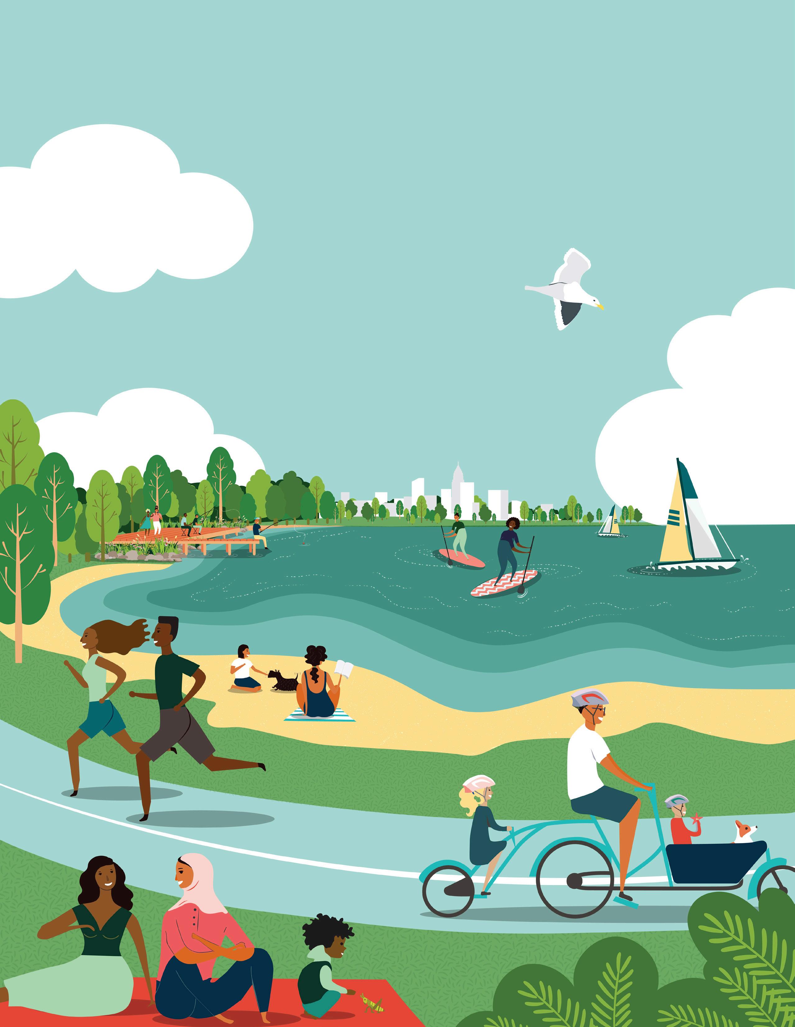




Cleveland’s Eastern Lakefront has played a significant role in the history of the City – from aiding in the early industrialization and economic prosperity to providing waterfront access and recreation for generations of Clevelanders. Though the area is still home to a few publicly-accessible parks and recreation spaces, much of the shore is dominated by industrial uses, infrastructure, and private residences and properties. In addition to land use challenges, this area is seeing the impact of climate change in water level fluctuations and more frequent and extreme storm events, exposing communities and infrastructure to threats of erosion, wave surges, flooding, and wind damage. Despite significant strides made by city and regional partners to transform underutilized park spaces into destinations along the lakefront, there is still work to be done to ensure that this essential asset is protected, resilient, and enjoyed by all residents.
Community resiliency and climate adaptation planning is arguably the most urgent undertaking of our time and more so for the Great Lakes, with impending risks due to rising lake levels and increased frequency of storm events. Throughout the city, miles of public trails and countless acres of critical lakefront areas are being threatened. Flooding and damage to critical infrastructure like I-90 are cause for growing alarm as the associated costs and impact to adjacent communities are better understood. Water level changes and increased frequency of major storm events will continue to expose communities and key infrastructure like to impact from wave surges, flooding, and erosion. This exposure will undermine both the ecological health of the area and the safety and wellbeing of nearby communities.
The Cleveland Harbor Eastern Embayment Resilience Study, known as CHEERS, is a year-long community planning process to study and create a plan that will address the physical, ecological, and social resilience of the Eastern Lake Erie shoreline. This study will seek to provide greater public access, connect residents in underserved neighborhoods to their lakefront, and ensure the long-term sustainability and resilience of the lakeshore and its communities. Impacts of climate change require that the plan account for dynamic conditions over the next decades with strategies to allow the shoreline to adapt and preserve habitat for critical species while creating a buffer that protects the shore from future storm events.
Right: Swings at E. 55th Marina Source:


The area encompasses the Lake Erie shoreline from Lakeside Yacht Club on the west to the Cleveland Lakefront Nature Preserve on the east and from the federal break wall on the north to I-90 on the south. This includes about two miles of hardened (e.g. bulkheads) shoreline bordering Lake Erie. The majority of the area is managed by Cleveland Metroparks, the Cleveland-Cuyahoga County Port Authority (Port), and the Ohio Department of Transportation (ODOT).
With the current political momentum, increased collaboration among partners, and funding support from partner agencies, the time is now to seize the momentum to develop and implement a plan that the community and partners can support. This study presents an opportunity to build on and enhance visioning and planning work completed during past efforts, pushing those ideas beyond conceptual ideas into projects primed for implementation.
The CHEERS study really sits at the intersection of social vulnerability, storm hazards, and environmental risk. Based on the 2015 Cleveland Climate Resilience and Urban Opportunity Plan, Cleveland is expected to see an increase in temperature of 4 degrees by 2070, more intense heat waves, more frequent and intense storms, an increase in heavy precipitation, and longer freezefree seasons. On the east side of Cleveland, where the CHEERS study area is located, is the community with the highest social vulnerability. This area experiences the largest percentage of residents living in poverty, the third highest percentage of minority residents, and the third lowest owner-occupied housing rate (NEO Storm Hazard Vulnerability Study).
This plan is animated by a shared urgency to awaken, enrich and protect the lake - it will tackle a variety of issues and leverage existing assets and opportunities to Embrace the Lake as an asset for future generations. These issues and opportunities include:

+ Wave Action, Storms, and Ice
+ Impact on Critical Infrastructure
+ Barriers to Community Access
+ Quality of Water and Habitat
The study area encompasses the Lake Erie shoreline from Lakeside Yacht Club on the west to the Cleveland Lakefront Nature Preserve on the east and from the federal break wall on the north to I-90 on the south. The area is approximately 2 miles from east to west and one mile from north to south.
Source: cLeVeLAND cITY GIS

The lack of in-water and nearshore habitat along the eastern embayment has resulted in a shoreline with no natural means of protection from storms and wave action. The hardened shoreline with boulder walls, breakwaters, and steel bulkheads provides no areas for wave dissipation or means to break energy associated with storm events.
Over two thousand linear feet of critical shoreline infrastructure, including roadways, trails, an active airport form the edge of the study area. I-90, a major regional thoroughfare and emergency evacuation route, runs east-west along the shoreline. At its narrowest point, the highway is a mere 80 feet from the shoreline. Given its proximity to the Lake, the highway is frequently impacted by high winds, waves, and storm events which cause millions of dollars in damage, lead to vehicle crashes, and often require the shutting down the section of the highway that traverses the study area. The study area also includes the Kirtland Pump Station which is part of Cleveland’s infrastructure for drinking water, and a Cleveland Public Power facility. The site is also adjacent to a general aviation facility, Burke Lakefront Airport.
The construction of I-90 in the 1950s provided suburban workers greater access to Downtown Cleveland. However, like many cities across the country, it cut through existing city fabric, severing linkages to the waterfront and bisecting one of the key recreational assets – Gordon Park. Today, there are limited pedestrian and bicycle connections to the lakefront from adjacent communities, all of which require going under or over I-90 and the railroad. The challenges associated with getting to the lakefront without a car result in a feeling or impression that the assets along the lakefront are not meant for community use.
Despite this portion of the shoreline lacking extensive habitat space and means of natural shoreline protection, it is an important stopover for migrating birds, a popular sportfishing destination, and a prime spot to enjoy an immersive natural experience within the city. Erosion, increased wave action and more extreme storm events coupled with the hardened nature of the shoreline magnify the damage and deterioration of shoreline ecosystems and the corresponding reduction in water quality. More natural wave dissipation areas are needed to reduce damage, restore natural ecosystems and support community recreational use.
Through this study we have the opportunity to: + restore and create new places for habitat, + find beneficial uses for dredge material, + protect communities from the impact of storms and climate change, + improve access and connections to the lakefront from adjacent communities, and + think responsibly about how to spur new development in an equitable way that improves the economy and provides new opportunities for communities.
Resilience is the ability to survive, adapt, and grow in the face of long-term stressors (e.g., poor infrastructure, poverty) and short-term shocks or events (e.g., storms, infectious disease outbreaks). While the term resilience is often associated with environmental issues related to climate change like flooding, rising temperatures, and management of more frequent storm and rain events, throughout this study we will be taking a threepronged approach to resilience. This approach will look at measures that improve the resilience of the environment, the economy and society, and health and wellbeing of the larger community.
CHEERS was made possible by a National Fish and Wildlife Foundation grant and matching funds from local and regional partners – Cleveland Metroparks, the Ohio Department of Natural Resources (ODNR), the Ohio Department of Transportation (ODOT), the City of Cleveland, and the Port of Cleveland. Cleveland Metroparks and their partners selected WRT, a design firm based in Philadelphia, to lead a team of consultants comprised of national and local experts. KS Associates, a local engineering firm, is lending their extensive knowledge of potential hazards, beneficial reuse of dredge material, and design solutions for the Great Lakes region. Great Ecology, a national ecology design consultant, is assessing nature-based solutions to improve the in-water and nearshore habitat along the Eastern Lakefront.

Lake Erie has played an essential role in the cultural legacy of the City of Cleveland since its founding in 1796, a legacy that continues to this day. The City’s location along this important waterway aided in its development as a hub for trading and industry. There are many layers of history and connection to the water throughout the longstanding relationship between Clevelanders and Lake Erie – from providing economic prosperity through industrial development and shipping to offering a vital connection to water and nature.

In the 1800s Cleveland became an important supply link for the country during the War of 1812. Its waterfront location provided key access links to trading routes on the Great Lakes. This only accelerated after the completion of the Ohio and Erie Canal that linked the Great Lakes to the Atlantic Ocean and Hudson River. The addition of new rail lines only furthered this growth and expansion. Following the Civil War, the City experienced rapid growth due to its advantageous location at the nexus between the east coast and the Midwest. With the exception of Gordon Park, much of the CHEERS area was industrialized during this period of time. The site of the former FirstEnergy Plant dates back to the late 1800s when it was originally developed and operated as the United Salt Company Works salt plant and the Consolidated Steel Wire Company manufacturing plant.
The shape of the shoreline itself has changed dramatically over the City’s long and storied history. In the 1800s, much of the CHEERS study area as we know it today did not exist. The original shoreline, shown in Figure 2, was as far south as the edge of Gordon Park. The 122-acre park was originally created by William J. Gordon, one of the founders of the Cleveland Iron Mining Company. Given the city as a public park and recreation area in 1893, it became a popular destination for Clevelanders. The park was a welcome respite for residents seeking out natural beauty and a break from the hustle and bustle of the city. After its opening, a bathhouse, bandstand, and dance hall were added to enhance the visitor experience.


Cleveland established its position as one of the nation’s major manufacturing, shipping, and industrial centers by the early 20th century. The automobile was emerging and Cleveland was at the forefront of its development with multiple automotive companies headquartered in the city including the Winton Motor Carriage Company, the manufacturers of the first car to successfully drive across the United States in 1903. A new power plant within the CHEERS study area was completed in 1911 and began providing power for adjacent communities. The City’s booming economy attracted migrants from across the country and immigrants from around the world. This influx of new residents led to continued population and economic growth throughout the 1920s.
Like many other cities throughout the country, the crash of 1929 and the Great Depression took a toll on the City and its residents. Despite these challenges, Clevelanders persevered with the aid of the New Deal, Works Progress Administration (WPA) projects, and the Great Lakes Exposition in 1936. Structural issues and signs of decay in Gordon Park were remedied through WPA projects that rehabilitated bridges and rebuilt roads, culverts, dams, playgrounds, and ball fields.
When the United States entered World War II, Cleveland played a key role in manufacturing goods for the war effort, becoming the fifth largest manufacturing center in the country. Industrial development continued along the waterfront during this period. In the 1940s, the salt plant along the lakefront was removed and replaced with a truck service center and freight station and the new American Steel and Wire Company was constructed.
The post-war era brought prosperity to the city with a new economic and population boom. By 1950, the population of the city exceeded 900,000. Sports teams were growing in popularity and experiencing success on the national stage while a new genre of music was dubbed “rock and roll” by a local radio DJ.
However, a new system of federal highways and the growing popularity of the automobile saw the migration of residents from city centers out to new and larger housing in the suburbs. Construction of Interstate 90 (I-90, Northwest Freeway) in the late 1940s was considered an improvement for connectivity – linking residents from Lakewood and the western suburbs to the larger city grid. But to make way for the highway,
hundreds of homes were demolished and Gordon Park was bisected, displacing residents and further disconnecting neighborhoods from the lakeshore and community assets. While Gordon Park continued to offer recreation spaces for Clevelanders, the nature of the lakefront was forever changed with new barriers to access. During this period, additional fill is used to extend the shoreline further and accommodate the right of way for the highway.
Like much of the country, Cleveland was reckoning with discrimination, and inequality that led to unrest in parts of the city as community leaders fought for civil rights throughout the 1960s. These issues were exacerbated by changes in the steel and railroad industries that led to slowing growth in the city’s economy and then to loss of jobs and key industries. The nascent environmental movement was elevated to a new intensity in June of 1969 when industrial pollution caused the Cuyahoga River to catch fire. In 1968, Cleveland elected its first African American Mayor – Carl B. Stokes – who made great strides in working to repair many of the city’s social and environmental wounds.
Changes in federal and international trade polices in the 1970s and 1980s contributed to a recession that had a lasting negative effect on Cleveland. In 1978, the City became the first major city to default on federally-backed loans since the Great Depression. During this period, the city saw the closure of many of its steel production centers which led to skyrocketing unemployment.
In the mid-1970s, industrial sites along the lakefront continued to operate with a portion of the FirstEnergy property used for various manufacturing purposes, including as a temporary fly ash staging area. The power plant also transitioned from coal fired boilers to fuel oil. Excess material collected from dredging for navigation channels was used during this period to continue extending the shoreline, creating a series of confined disposal facilities (CDF) for contaminated dredge material and debris. Dike 14 (now known as the Cleveland Lakefront Nature Preserve) was created as one of these CDFs in the late 1970s. Previously, this area of the lakefront was used as a dumping site and landfill. Doan Brook, one of the streams that flows into the CHEERS study area, was partially culverted by the U.S. Army Corps of Engineers in 1976. The culverted portion

extends from south of I-90, under Dike 14 and flows out into Lake Erie. Despite continued environmental issues along the lakefront during this period, the City and the Ohio Environmental Protection Agency began working together to implement measures from Clean Water Act of 1972 and the National Environmental Policy Act of 1973, which set the stage for later environmental and community resiliency measures. In the 1980s, city leadership focused on a plan for recovery that included new cultural, sports, and entertainment venues in Downtown, including FirstEnergy Stadium and the Rock and Roll Hall of Fame.
City leadership’s efforts to diversify the economy and focus on cultural assets, environmental protection, the arts, and healthcare has resulted in a new era of national prominence. The Cleveland Clinic is currently the largest private employer in the city and the state of Ohio, employing over 50,000 (2019). Since 2010, Downtown Cleveland has experienced steady population growth and the population losses for the city have started to stabilize after decades of decline.
While the majority of industrial uses along the CHEERS lakefront study area ceased operations in the 1970s and 1980s, the FirstEnergy Plant continued to generate power until 2015. Following the decommissioning of the plant, an environmental assessment was completed to determine what environmental remediation measures would be needed. In 2017, the power plant and stacks were imploded and FirstEnergy entered into the Voluntary Action Program with the Ohio Environmental Protection Agency.

Current leadership continues to push forward revitalization efforts that focus on the city’s neighborhoods with initiatives furthering public heath, wellness, environmental protection, economic development, equity, and education. The focus on community resilience and protecting community open space assets led to Cleveland Metroparks assuming operations of park spaces along the shoreline including Edgewater Park, Whiskey Island-Wendy Park, E. 55th Street Marina, and Gordon Park. This collection of waterfront parks is called the Lakefront Reservation. In 2011 Dike 14 was renamed Cleveland Lakefront Nature Preserve by the Port of Cleveland and in 2012 the CLNP opened to the public. This focus has also resulted in plans, studies, and projects to improve the health and resilience of the shoreline and the communities directly adjacent to the lakefront, including a vision master plan for the lakefront, combined sewer overflow containment measures and long term control plans, greenway and bicycle network plans and pilot projects, and the current CHEERS effort.
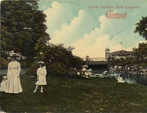


The study area, located along the eastern Cleveland lakeshore, is about two miles from Downtown. The study area encompasses the shoreline from the Lakeside Yacht Club and the Burke Lakefront Airport on the west to the Cleveland Lakefront Nature Preserve on the east and from the federal break wall on the north to I-90 on the south. The majority of the study area is comprised of park spaces, industrial uses, and retail establishments. The parks along the shoreline are part of a larger collection of waterfront parks called the Lakefront Reservation. The Lakefront Reservation includes Edgewater Park, Whiskey Island-Wendy Park, E. 55th Street Marina, and Gordon Park. To ensure neighborhoods adjacent to the study area are included in the process and that linkages are studied, a community outreach focus area was established. The community outreach focus area extends further south to St. Clair Avenue incorporating a portion of the St. Clair-Superior and Glenville Neighborhoods.

The study area is located on the east side of Cleveland, a few miles from the business district in Downtown.
Source: cuYAHoGA couNTY GIS


Cleveland’s Burke Lakefront Airport, which is adjacent to the project area, has ongoing dredge management and disposal areas that offer wildlife habitat, but are in conflict with aviation operations, putting birds and planes at risk. Since 1990, 587 birds distributed among 44 identified species have been struck by planes at Burke Lakefront Airport (BKL strike data). This project will propose additional habitat using dredge material along the lakefront but not near the airport, which has the potential to mitigate this risk of bird-plane strikes by directing wildlife away from the airport to other available habitat.
The Lakeshore Yacht Club, one of the three private clubs in this area, was originally founded in 1930 and moved to its current location in 1932. A fire in the 60s required the club to re-build the property. Since then the club has undergone a number of renovations and expansions as membership increased. Today, the club offers 250 slips to accommodate boats up to and over 60 feet long, an outdoor swimming pool, a fullservice convenience store, and a club house.

Cleveland Public Power operates a facility in the western portion of the study area. The building, which can be identified by its distinctive whale mural, is situated next to small public parcel of park land that extends to the water’s edge.
Forest City Yacht Club is one of three private clubs located within the study area. Members have access to year-round activities and docks for powerboats and sailboats sized up to 16 feet. The club was established over 75 years ago and provides storage for over 125 member-owned watercrafts and access to amenities including a swimming pool and clubhouse.
The Shoreline Apartments (formerly known as Quay 55), a private 5-story 160+ unit building, provides expansive views of the Lake and is currently the only residential property located in this portion of the lakefront. The owner, Landmark at the Lake, LLC recently purchased the 4-acre vacant site adjacent to the Shoreline Apartments to develop a second apartment building with 214 apartments — a mix of studio, one- and two- bedroom units.
The E. 55th Marina, operated by Cleveland Metroparks, is a popular spot for anglers and boaters with a 1,200-foot fishing platform, fishing cleaning stations, a marina store, a fuel dock, and 352 seasonal wet slips. In addition to the boating amenities, E. 55th includes spaces for picnicking, sand volleyball courts, and dining at the E55 on the Lake restaurant with an expansive patio that overlooks the water.


The southern portion of Gordon Park is managed by the City’s park division. This portion of the park is larger and contains more traditional active recreation amenities including bike polo courts, walking trails, 5 ball fields, tennis courts, a playground, and other amenities.

This area is one of the most popular fishing locations in the study area, with multiple platforms for fishing, ample amounts of parking, areas for picnicking, and direct access from E. 72nd Street. Based on parking and traffic data from 2019 (Cleveland Metroparks), this area is particularly popular during the peak summer months (June – August). An additional $120,000 will be invested in Gordon Park in 2020 to construct a new restroom facility, which was funded by a local private foundation, Holden Parks Trust.


The InterCity Yacht Club is a privately run yacht club that provides access, events, and storage for members throughout the year. Organized in 1968, the InterCity Yacht Club is one of only two predominantly African American yacht clubs in the country.
Gordon Park was originally one large 122-acre park on the banks of Lake Erie. Now the park is divided into two by I-90 and connected by a pedestrian bridge. The northern portion of Gordon Park, managed and operated by Cleveland Metroparks, extends to the shoreline and includes a 6-lane boat launch, restrooms, and picnic lawn space.
Cleveland Lakefront Nature Preserve (CLNP)
The CLNP, previously known as Dike 14, is an 88-acre publicly accessible nature preserve. This man-made peninsula, now owned and managed by the Port, evolved from a landfill to a confined disposal facility for dredged material, until it was opened to the public in 2012 after the site was deemed safe for passive recreational use. Now, residents and visitors can visit the preserve and hike the 2.5 miles of trails, bird watch, take in expansive vistas of the lakefront and Downtown Cleveland, and explore the native vegetation and wildlife. The CLNP provides an immersive nature experience with over 280 species of birds, 41 species of butterflies, 35 different plant species, and various animals identified within the confines of the preserve.

The Cleveland Lakefront is an incredible asset for the City. Given the importance of this asset, many plans have been developed for the areas in and around the lakefront. The CHEERS study will leverage many of these previous planning efforts, build on the vision and engagement activities completed by local and regional organizations, and prime the partner agencies to implement specific projects.
BLUE (Building a Livable Urban Edge) Project of EcoCity Cleveland & the Cleveland Waterfront Coalition, 2002
In 2002, EcoCity Cleveland organized a collaborative workshop to develop strategies to restore the ecological integrity of Cleveland’s lakefront and raise public awareness of the potential to bring nature back into the city. The report provides some innovative ideas for building an ecofriendly lake edge. However, the authors concluded that additional organizational work would need to be completed before implementation, including the creation of a Lakefront Conservancy, ongoing consultation with experts, development of protocols for restoring the natural edge of the lakefront, and integration of stormwater management techniques into transportation planning and construction. Since the publication of this report in 2002, the City, Cleveland Metroparks, and other partners have made significant strides in creating an organizational infrastructure capable of planning and implementing lakefront resiliency measures.
The ecological components of the proposed CHEERS study align closely with opportunities identified by shoreline ecology and planning experts at this workshop. This document helped shape the City of Cleveland’s 2004 Waterfront District Plan for the Lake Erie waterfront and the ideas generated in the workshop emphasized the importance of restoring ecological coastal conditions and exploring living infrastructure as a tool to create spawning, nursery, feeding, and refuge areas for fish. Popular concepts included creating habitat cells along the break wall, including within the CHEERS project area, and creating a new break wall in the CHEERS project area to protect habitat.
Northeast Ohio Sustainable Communities Consortium (NEOSCC) with Sasaki, 2014
This three-year regional planning process led by the NEOSCC sought to answer three questions about the future of Northeast Ohio – what course is Northeast Ohio on, what future does Northeast Ohio want for itself, and how do we make that future a reality? The plan lays out three potential future scenarios – Grow the Same, Do things Differently, and Grow Differently. The Grow the Same scenario predicts flat population and job growth, further abandonment of land and buildings, jeopardized natural resources, and extreme local government fiscal issues. The other two scenarios lay out a future that aligns more closely to the regional vision.
The regional vision calls for strengthening established communities, increasing transportation choice, preserving and protecting natural resources, and promoting collaboration and efficiency.
Relevance to CHEERS:
There are 41 regional initiatives included in the plan. Many of these recommendations include focusing more holistically on improving quality of life through environmental protection and preservation. Initiative 7.3 calls for improving regional quality of life and health by focusing on the interface between natural and human systems in the areas of flood mitigation, stormwater runoff, clean beaches, and the water quality of our lakes, rivers, and streams. Other relevant initiatives, including 3.1, call for creating strategies for reuse that may include green infrastructure, parks, and natural areas.
Cleveland Neighborhood Progress, City of Cleveland Planning Commission, LAND Studio, the Cleveland Urban Design Collaborative at Kent State University, funded by the Surdna Foundation, adopted in 2008 and updated in 2014
This plan focuses on creating city-wide strategies for the reuse of vacant land. Since Cleveland’s loss of population over the last 60 years is unlikely to reverse in the near-term future, the city was looking for a strategy to deal with the current vacant land. At the time of the study, the city contained over 3,300 acres of vacant land and about 15,000 vacant buildings. This plan explored how Cleveland’s vacant land could be put to productive use to help the city meet its potential to be a “green city on a blue lake.” The proposed menu of treatment options for vacant lots includes: holding strategies (for land with near-term development potential), green infrastructure, and productive landscapes as economic development vehicles.
The lakefront is listed as one of the “core development areas” from the Connecting Cleveland 2020 Citywide Plan which means that vacant land in and around this area would be earmarked for development first.
Cleveland Neighborhood Progress with City of Cleveland, Mayor’s Office of Sustainability, Cleveland Urban Design Collaborative at Kent State University, University of Buffalo, funded by Kresge, 2015
The CNP Cleveland Climate Resilience and Urban Opportunity Plan took an asset-based an social-network approach to planning for climate change. Unlike other places across the country, the effects of climate change in Cleveland do not include sea level rise. Instead, the city is preparing for a future with more frequent heat waves (estimated 4 degree increase by 2070), more frequent and intense storms, increases in heavy precipitation and associated flooding, and a longer freeze-free seasons. The current development and land use patterns in Cleveland exacerbate these issues. Years of sprawling development without population growth have resulted in concentrated poverty, outdated infrastructure, increases in impervious surfaces, and growing inequalities.
goals of the plan include:
• Cultivating a robust network of community development corporations that help to shape the development efforts at neighborhood and citywide levels;
• Building a dedicated team of neighborhood climate ambassadors to lead community outreach and engagement efforts;
• Establishing partnerships with the city, county, the regional sewer district, faithbased institutions, and other non-profits to help advance neighborhood scale climate adaptation strategies;
• Enhancing and creating more extensive weatherization and energy efficiency programs; and
• Utilizing the large inventory of vacant land to buffer residents from the impacts of climate change
This report provides a better understanding of the larger threats and risks the City is facing due to climate change and sets forth a series of short and long term goals to ensure the city is more resilient.
Davey Resource Group, 2015
Provides a summary of the 88-acre site’s history and development from a confined disposal facility to a nature preserve. The plan lays out a long-term management plan to implement the vision of the CLNP as a wildlife sanctuary for the community to enjoy by actively managing the preserve for a healthy native habitat. The document also includes the results of a vegetation survey covering about 50 acres of the nature preserve.
The CLNP is a key asset within the CHEERS study area that will tie into future recommendations. The plan outlines important recommendations for site management, invasive species control, and public access.
Doan Brook Watershed Partnership, prepared by EnviroScience, 2019
Provides an analysis of several proposed restoration alternatives for Doan Brook and provides a preferred alternative (Alternative 4). The study included a feasibility study and analysis of ice flow, hydraulic modeling, water quality, regulatory requirements, and other pertinent environmental concerns to better inform future phases and implementation. The preferred alternative involves daylighting a portion of Doan Brook through a new coastal estuary adjacent to Gordon Park and daylighting a portion of the stream within the I-90 cloverleaf.
Doan Brook is one of two culverted streams that pass through the study area and have outlets into Lake Erie. This study includes site history, a detailed analysis of restoration options, justification of preferred approach. It also includes summary of biotic communities (fish, birds, etc.) and anticipated benefits of restoration to biota/communities.
Ohio Lake Erie Commission, 2016
This state-prepared plan provides a list of priority areas, goals, and strategic objectives for the conservation and restoration of Lake Erie’s coastal ecosystems. Core priority areas include: nutrient pollution reduction, dredged material beneficial use and management, invasive species management, removing certain rivers from “designated areas of concern,” reducing toxic pollutants, promoting habitat and species diversity, monitoring and measuring the effectiveness of efforts, supporting the Great Lakes Compact, promoting economic opportunities for jobs and tourism, providing new beach and recreational spaces, improving community relations and education, and maximizing the use of funding.
Proposed outcomes of the CHEERS study align with priorities identified in this plan. The plan identifies coastal health and exploring beneficial uses of dredge material as key priorities. LEPR calls for development and implementation of plans to restore beaches and shorelines, with the strategic objective to “protect, enhance and restore wetlands and their functionality and expand wetland acreage within the watershed, with a priority focus on coastal wetlands.”
Scott D. Hardy – Ohio Sea Grant College Program at The Ohio State University, 2017
An academic study to assess the risk and vulnerability of communities withing the Northeast Ohio Regional Sewer District (NEORSD). The study evaluated 42 communities and ranked them against each other using indicators of vulnerability, both social (e.g., gender, ethnicity, age, housing, and income) and environmental (e.g., flood risk, erosion, debris, water quality). Results suggest that the most environmentally vulnerable communities are not always the most socially vulnerable. However, this region has a large percentage of low-income residents who in turn would inherently struggle with remaining resilient in the face of increasing environmental issues.
The CHEERS study really sits at the intersection of social vulnerability, storm hazards, and environmental risk. On the east side of Cleveland, where the CHEERS study area is located, is the community with the highest social vulnerability. This area experiences the largest percentage of residents living in poverty, the third highest percentage of minority residents, and the third lowest owner-occupied housing rate.
Human Nature with St. Clair Superior Development Corp., supported by Cleveland Neighborhood Progress with funding from the Rockefeller Family Foundation, 2018
In 2018, Cleveland Neighborhood Progress and the St. Clair Superior Development Corp. organized a design charrette focused on developing a new vision and coordinated approach to development that can transform the underappreciated lakefront into a firstrate asset. The charrette developed a series of potential options, goals, and objectives. These included:
• leveraging the availability of the former FirstEnergy site to catalyze a district-wide revitalization strategy,
• exploring modifications to I-90 to improve connectivity, and improving lakeshore natural areas and recreation assets,
• creating connections with adjacent assets (Doan Brook, Cleveland Cultural Gardens, and the future Lakefront Greenway), and
• improving connections with adjacent neighborhoods.
Many of the community partners from this study are currently engaged in the CHEERS effort. The development options created can provide a framework for recommendations during the CHEERS study.
Cuyahoga County Planning in partnership with Cleveland Metroparks, funded by Northeast Ohio Areawide Coordinating Agency (NOACA); prepared by Smith Group, WSP, and Guide, 2019
Funded by a Transportation for Livable Communities Initiative Planning Study (TLCI), this plan sets forth initiatives to implement greenways and urban trails that connect existing assets and provide more mobility options. Over 800 miles of potential trails were identified through the process. After evaluating proposed routes for suitability (e.g., transit, job centers, parks, etc.), the final plan proposes 69 projects, or 242.5 miles, of new trails categorized into critical gaps, regional links, and key supporting routes.
The Lakefront Greenway which runs through the CHEERS study area is identified as a priority regional link. Additional greenway connections within adjacent communities could provide greater access to the lakefront for residents.
2014
The Cleveland Lakefront Green Infrastructure Overlay identifies Cleveland Metroparks’ aspirations for sustainability and green infrastructure in lakefront parks and provides guiding principles to help inform future planning efforts. Sustainability and green infrastructure are examined at both the site and regional scale using the following lenses: water, habitat, energy, transit alternatives, materials, and integrated environments (socioeconomic issues).
Plans for green infrastructure for the E. 55th Park and Marina and North Gordon Park are included in the study. These measures could help inform final recommendations for the CHEERS study.
Smith Group, 2004
The 2004 waterfront plan provides a vision for the Cleveland waterfront as a “the most vital element in the transformation of Cleveland as a place to live, work, and play.” This vision includes: enhancing and populating existing lakefront communities, connecting people to the lake, capitalizing on existing assets, developing underutilized property, creating natural beauty and enhancing the environment, attracting new residents and jobs, and celebrating the unique culture and spirit of Cleveland. This plan was the first citywide lakefront planning effort undertaken and adopted by the city in over 50 years.
The vision for the eastern lakefront provides a foundation for the CHEERS study. The community’s vision for this portion of the lake includes the creation of spaces that expand the park system, infilling new land to provide new recreation amenities (e.g., new beaches, expanded marinas, overlooks, and harbors), developing new residential property, creating a celebratory promenade at the E. 55th Street Bridge, and creating new connections to the lakefront (e.g., a land bridge over I-90, realigned road connections, etc.).
Cleveland Metroparks, 2015
This study assesses the population within a one-half mile walk and three- mile bike ride of the Lakefront Reservation (E. 55th Park and Marina and North Gordon Park). Of the 900 people who live within a one-half mile walk of the area, 61% are African American, over 47% of households report an income of less than $20,000, and 30% do not have access to a car. Of the 75,000 people who live within a three-mile bike ride from the area, 81% are African American, over 50% of households report an income of less than $20,000, and 36% do not have access to a car.
Relevance to CHEERS:
While neighborhood and study area demographics are important, understanding the demographics and economic conditions of areas within a walk or bike ride of the study area will help better understand who might be using the park and how this area can best serve that population.
Cleveland Metroparks, 2019
This annotated site plan identifies placebased opportunities for enhancing the natural and social functions of the Lakefront Reservation (collection of park spaces along the waterfront). Opportunities include creating new shoreline wetlands, developing new prairie habitats, improving circulation and mobility through wayfinding, enhancing safety for pedestrians and cyclists, creating new recreation and gathering spaces, reducing the amount of impervious services, and expanding education and public programming.
This site study examines potential opportunities throughout the study area that should be considered in the CHEERS study.
St. Clair Superior Development Corporation, Campus District and the Historic Warehouse District, prepared by Michael Baker International & Environmental Design Group, funded by NOACA and the City of Cleveland, 2015
The study area for the TLCI Study is approximately 5 miles, bounded by the lakefront on the north, the Cuyahoga River to the west, Martin Luther King Jr. Drive to the east, and Superior Avenue to the south. Creating a lakefront greenway and strengthening connections from the lakefront to inland neighborhoods were the two main goals of the study.
The study provides recommended alignments and schematic designs for six segments of a proposed greenway trail along both North and South Marginal Roads. The design incorporates proposed roadway changes at the MLK Jr. Drive/Lakeshore Boulevard/I-90 W interchange near the Lakefront Nature Preserve. Additional improved connection recommendations include proposed improvements for the existing seven connections to the lakefront and plans for new lakefront connections outside of the CHEERS study area. Proposed improvements to the bicycle network include providing bicycle facilities on east-west roadways that connect between downtown, the Campus District, and the St. Clair Superior Neighborhoods (St. Clair Ave., Superior Ave, E 40th, and E. 55th).
Cleveland Planning Commission and NOACA, prepared by WSP and Smith Group, 2017
The Midway Cycle Track (also mentioned in the 2015 Lakefront Greenway and Downtown Connector Study, 2015) is a two-way bikeway that would run down the middle of a road, separated from vehicle traffic with buffered areas. This study looks at potential cycle track locations throughout the city. These facilities would then be integrated within the City’s Bikeway Master Plan and connected to other planned bicycle facilities and infrastructure. Thirty-two corridors and segments were identified as potential cycle track locations and 15 locations were selected as the highest priority corridors. The plan recommends a pilot corridor project to demonstrate the effectiveness and use of this type of bicycle infrastructure in the city. The first segment of the network will run along Superior Avenue, from the east side of Public Square to East 55th Street. In 2017, ODOT awarded the project an $8.3 million Congestion Mitigation and Air Quality (CMAQ) grant. This grant provides over half of the funding needed for this first segment. Fundraising for the remaining portion is underway with city and regional partners.
High priority corridors adjacent to or connected to the study area include: E. 55th Street (Lakefront to I-490), St. Clair (W. 9th Street to Hayden), and Superior (DetroitSuperior Veterans Memorial Bridge to E. 55th Street).
FirstEnergy by Arcadis, 2017
This study was prepared in advance of the demolition and potential sale of the former FirstEnergy plant located at 70th Street and the lakefront to determine what remedial activities would be required. The document presents four illustrative potential reuse scenarios for the site. Alternative 1 presents a public-facing option that would include active and passive recreation space. Alternative 2 proposes a facility that could aid local farmers in distribution. Alternative 3 examines the potential for a series of small artist and fabrication spaces similar to live-work uses in the nearby neighborhoods. Alternative 4 proposes a new residential community with retail and open space that aligns to park spaces along the lakefront.
The east side of Cleveland is in need of equitable lakefront recreation amenities. The former FirstEnergy site presents an opportunity provide new amenities to this community.
ODOT prepared by LJB Incorporated, 2015
Evaluation of the existing safety performance on I-90 and at the interchanges with E. 55th Street, 72nd Street, and MLK Jr. Drive. The purpose of the study was to determine methods to reduce crashes along these segments of I-90. Between 2011 and 2013, 405 crashes were recorded in this area of i-90, two of which were fatal.
The goal of this study is to improve North and South Marginal Road for bicyclists and pedestrians and strengthen connections and improve safety of connections with E. 55th Street, 72nd Street, and MLK Jr. Drive. Strategies to improve safety include realignment of exit ramps, new signals along portions of S. Marginal Road, longer deceleration lanes for off-ramps, and new dedicated turn lanes in intersections should be incorporated in the CHEERS study.
The report assess the feasibility for beneficial use of material dredged from the Cleveland Harbor. About 300,000 cubic yards (CY) of dredged material is removed each year to ensure the navigability of the federal channel. Due to limited storage space, this number has been reduced to 225,000 CY per year. To reduce storage needs, the report assessed the risk of using this dredged material for environmental and human use.
This feasibility study provides guidance for capacity management and long-term planning for how to beneficially reuse dredge material.
The study area is located within an industrial corridor running adjacent to I-90 from Downtown to Rockefeller Park. Many of these industrial facilities are located immediately adjacent to the south of the study area. Large areas of industrial use coupled with other physical barriers, such as the rail lines and the interstate, limit access from the residential neighborhoods. Figure 5 Shows the zoning for land within the study area. This map highlights the large portions of industrial land that comprise most of the project’s inland focus area.

The major commercial corridors in the neighborhood are St. Clair Avenue and E. 55th Street. The inland residential neighborhoods are predominately detached single family homes with community-serving uses including schools, faith-based institutions, and community retail.


This map shows zoning classification for the CHEERS study area. Certain zoning categories have been combined to create this simplified map. For example, “Industrial” condenses multiple GI-General Industry Districts)
Source: cITY oF cLeVeLAND GIS


Most of the Lake Erie shore in the City of Cleveland is dominated by industrial use or private residences. A small portion of the study area’s shoreline is reserved for publicly-accessible parks within the Lakefront Reservation, including Cleveland Metroparks East 55th Street Marina and Gordon Park, that provide much needed public greenspaces with amenities such as public boat ramps, fishing areas, restrooms, and food services. Smaller pockets of utility (e.g., I-90 and the Burke Lakefront Airport), industrial (e.g., Cleveland Public Power), and residential uses (e.g., the Shoreline Apartments) make up the remaining portion of the land uses along the lakefront. The community outreach focus area (south of I-90 to St. Clair Avenue) is predominantly industrial with clustering of utility and commercial uses along St. Clair Avenue and along E. 55th Street. Scattered residential uses are mostly located east of Rockefeller Park and on either side of the St. Clair Avenue commercial corridor.

Much of the land in the Study Area (north of I-90) is currently uses as parks and open spaces.
Source: cITY oF cLeVeLAND GIS


While most of the land use along the lakefront is comprised of parks and open spaces, ownership and access to these spaces varies. Parcels along the lakefront are owned and operated by a number of different public organizations including the Port of Cleveland, the State of Ohio, the City of Cleveland, Cleveland Metroparks, and the federal government. Cleveland Metroparks assumed the management of the Lakefront Reservation parks in 2013 from the Ohio Department of Natural Resources (ODNR), which had maintained them as state parks since 1978. Since 2013, the Cleveland Metroparks and the City have made significant strides to transform these underutilized and under-maintained parks into destinations of choice along the city’s lakefront. The Park District has thoroughly cleaned the parks, increased Police presence to improve safety, and made significant capital investments of over $18M across its Lakefront Parks. However, varied ownership, barriers to access, and the few private parcels along the lake create a disconnected lakefront experience for users.
The study area (north of I-90) does not contain any vacant parcels. However, the community outreach focus area (south of I-90) includes a number of land banked parcels that are owned by the city and the county. There is an opportunity to leverage these existing vacant parcels to extend greenways from the lakefront into the adjacent communities, implementing some of the stated goals from the Cuyahoga County Greenways Plan and the Re-Imagining a More Sustainable Cleveland vacant lot revitalization plan.

The map above depicts the varied ownership of public parcels and provides the location of county and city land banked parcels within or adjacent to the study area.
Source: cITY oF cLeVeLAND GIS

While the majority of the study area and community outreach focus area is not residential, about 3,500 residents live within the boundary of these areas. Of this population, 80.8% are African American or Black, 15% are White, the average household income is $38,501, and 33.1% live below the poverty line.
About 79,000 residents live within a three-mile bike ride of the study area. Of this population, 81% is African-American, 71% report a household income of less than $35,000, and 36% of households do not own a vehicle.
The neighborhood adjacent to and within the study area, St. Clair Superior, is a diverse and culturally rich community with a resident-driven goal to revitalize the neighborhood in response to past loss of industry, disinvestment, and vacancy. This neighborhood is quite vulnerable to the threats of climate change based on both its waterfront location and sociodemographic factors including race, educational attainment, and income (Hardy, 2017; Cleveland Neighborhood Progress, 2015). While the city as a whole faces greater sociodemographic challenges associated with climate change and storm hazard vulnerability when compared to the rest of Cuyahoga County, the risk to St. Clair Superior and the east side of Cleveland is higher still. Compared to the city, in St. Clair Superior 18.9% more of the population is nonwhite, 24% fewer adults have a high school diploma, and 18.4% more households are below the poverty line (U.S. Census Bureau, 2009). The confluence of physical challenges associated with the lakefront and these statistics indicate that the communities adjacent to the study area are at a higher risk of negative impacts associated with coastal climate threats due to a lack of institutional and financial resources available to absorb damages and remain resilient during long-term stressors and short-term shocks (Hardy, 2017).
The study area is home to about 3,500 residents. Businesses in the area employ 4,000 residents in 252 active establishments, primarily located along the study area’s two commercial corridors and within the industrial fabric south of I-90. The median household income for area residents is $20,584, compared to $26,150 for the City of Cleveland.
Like many areas in Cleveland, the neighborhoods intersecting the study area are still dealing with the effects of sprawling suburban growth, white flight, a decline in population, and loss of industry. These trends have concentrated poverty in core city neighborhoods, led to disinvestment in infrastructure, increased vacancy and blight, and growing racial and economic segregation. The neighborhoods within and adjacent to the study area are vibrant, but socially vulnerable and at a greater risk to negative impacts of climate change.
The Cleveland Neighborhood Progress Climate Resilience Plan, which incorporates social vulnerability metrics and identifies “protecting residents and neighborhoods from flooding, increased precipitation, and extreme weather events” in its top three priorities and details the need to focus on resiliency measures for these vulnerable and at-risk neighborhoods (Cleveland Neighborhood Progress, 2015). A detailed resiliency study of four neighborhoods in Cleveland, including the Glenville neighborhood that is immediately adjacent to the study area, was performed between 2016 and 2017 under the “Climate Smart Cities” program by The Trust for Public Land. This effort looked at the impacts that parks, open space, and green infrastructure, including living shorelines, can have on communities to improve overall resiliency, especially for at-risk populations. The objectives of the program were organized around four areas: Connect, Cool, Absorb, and Protect. An interactive GIS-based mapping tool was developed to assist with scenario planning related to resiliency efforts in the City of Cleveland and this tool will be utilized in this process to aid in visualization and data analysis of proposed concepts.
Four Cleveland neighborhoods – St. Clair-Superior, Goodrich-Kirtland Park, Downtown Cleveland, and Glenville – directly intersect the CHEERS study area and community outreach focus area. Each of these neighborhoods is unique with its own community conditions and cultural identity. Strengthening and creating safe connections from these neighborhoods to the lakefront are a key focus of the CHEERS study to ensure that all Clevelanders have the opportunity to enjoy the lakefront for generations to come.

St. Clair-Superior is one of the most diverse neighborhoods in the City. The neighborhood is bounded by Lake Erie to the north and Superior Avenue to the south and E. 55th Street to the west and Martin Luther King Jr. Drive to the east. It was originally founded in the late 1800s and populated by immigrants from Eastern Europe as the industry rapidly took hold in Cleveland and immigrants from Lithuania and Slovenia moved to the area for work. Demographic shifts in the 1990s transformed the neighborhood from majority white to majority minority with African American residents making up 79% of residents. The St. Clair Superior Development Corporation, the local CDC, was founded in the 1990s to organize residents and aid in the revitalization of the area. Today, the area is home to a thriving arts scene, unique cultural enclaves, a growing industrial district, and vibrant commercial corridor along St. Clair Avenue. Despite economic challenges, the neighborhood has undergone significant transformation and communityled revitalization efforts, that are still ongoing, to renovate existing homes and reuse vacant lots. Currently, the neighborhood is divided by I-90 and the rail lines, disconnecting residents from their lakefront.
Goodrich-Kirtland Park, which also includes part of AsiaTown, is roughly bordered by E. 55th Street to the east and I-90 to the west and Lake Erie to the north and Euclid Avenue to the south. Once referred to as Chinatown, the area welcomed Chinese immigrants and railroad workers in the late 1800s. The neighborhood was a thriving ethnic enclave for
Fugiatia volorem ernatusa sequam de natiis. Aximin nihicae et odit quis quibus eum sit utatius
Source: cITY oF cLeVeLAND GIS

Chinese immigrants and descendants from the 1930s to the 1960s. In the 1970s new residents moved into the neighborhood and many second and third generation families moved out to the suburbs for the promise of larger homes and economic prosperity. During this time there was an influx of Korean, Vietnamese, and other Asian immigrants leading to a new resurgence of AsiaTown that continues to this day. Today AsiaTown is a cultural destination, hub of businesses and retail, and a thriving community. Three community development organizations provide services for this neighborhood - MidTown, Campus District, and St. Clair-Superior Development Corporation
Downtown, also referred to as the central business district, is considered the economic center of the City. The City, founded in 1796, grew into a manufacturing and industry hub in the early 20th century. Downtown was an important part of this development, containing the port, much of the rail infrastructure, and the civic and government buildings. This economic expansion and job growth attracted immigrants and migrants from across the country and the world. The City and Downtown experienced continued economic growth through mid-20th century, but by the 1960s economic growth started to slow as population and development continued spreading out into the suburbs following the expansion of the highway system. Sprawling development, population loss, and economic stress led to concentrations of low-income and impoverished residents in core city neighborhoods with increasing vacancy, blight, and disinvestment. Since the 1990s the City has undergone numerous revitalization efforts to attract new residents, diversify the economy, and develop unique cultural enclaves and destinations. Downtown has been at the forefront of this effort with a population that has grown more than any neighborhood in the City between 2000 and 2010. The Downtown Cleveland Alliance non-profit organization has aided the City in many of these revitalization efforts to make Downtown a thriving neighborhood and economic center. The Downtown lakefront and the connections via trails and transit are key to ensuring that the Cleveland Lakefront is a cohesive and distinct regional destination.
Glenville’s is located on the eastern side of the CHEERS study area and includes the Cleveland Lakefront Nature Preserve and a large portion of Rockefeller Park. Glenville, once an independent village founded as a resort community for wealthy Clevelanders, was annexed by the City of Cleveland in 1904. Following the first world war, the community was rapidly developed, becoming an active city neighborhood. From its founding until the early mid20th century, Glenville was a predominantly Jewish neighborhood with a thriving commercial corridor of Jewish-owned stores and restaurants and synagogues. Many of these original residents left the neighborhood in the 1950s and 1960s for the rapidly expanding suburbs east of the city. Today, the neighborhood is majority minority with African Americans making up over 97% of the population. The neighborhood has experienced a great deal of disinvestment and economic strife over the past few decades evidenced by vacancy, crumbling infrastructure, and high concentrations of poverty. However, the Famicos Foundation has helped lead revitalization efforts to promote housing repair, education, engagement, and commercial revitalization throughout the community. A newly budding arts scene and natural assets like Rockefeller Park, the Cleveland Lakefront Nature Preserve, and the Cleveland Cultural Gardens have resulted in a resurgence of interest in this storied and historic neighborhood.

The lakefront is a popular destination for Clevelanders. From walking and biking trails to bird watching hot spots and fishing and boating destinations, the eastern lakefront provides a variety of recreation experiences. In 2018, Cleveland Metroparks eastern lakefront parks received over 839,000 visitors and visitation has held steady at near or over 800,000 visitors for the past five years.

The Lake Erie shoreline is an important stopover for migrating birds, bats, and insects making it a popular location for birders and nature enthusiasts. Multiple locations within the study area are identified migrant “hotspots” (eBird) and are within the National Audubon Society’s “Important Bird Areas.” Over 275 documented bird species have been observed along the lakeshore including federally listed species such as Kirtland Warbler, Rod Knot, and Piping Plover. While the nearshore habitat in and around the study area is limited, this area remains a very important migratory stopover point, in part because it is one of the few spots along the lakefront with intact, native soils. Key birding spots along the lakefront include the area near the Lakeside Yacht Club and the Cleveland Lakefront Nature Preserve. Enlarging the available habitat area here will make it even more attractive to migrating birds, bats, and invertebrates and provide new opportunities for birding and immersive nature experiences.
The Cleveland Lakefront Nature Preserve provides visitors with an immersive nature experience in the heart of Cleveland. The 88-acre peninsula is popular with birders, nature enthusiasts, and visitors looking to disconnect and enjoy nature. Owned and operated by the Port, the CLNP, includes 2.5 miles of walking and hiking trails, unobstructed views of Downtown, and opportunities to survey native flora and fauna.


Visitors seeking active and passive recreation opportunities have a few locations to choose from within the study area. South and North Gordon Park provide the largest available recreation spaces. However, the character and management of the northern and southern portions of Gordon Park are quite different. The northern portion of Gordon Park is operated by Cleveland Metroparks and includes more waterfront related amenities including a boat launch, parking, and an open lawn for picnicking and other passive uses. The southern portion of Gordon Park is operated by the City and includes some traditional active recreation uses with ball fields, a playground, lawn space for passive recreation, and visitor amenities (e.g., restrooms, water fountains). Aside from these two locations, there is limited active recreation and passive lawn space throughout the remaining portion of the study area with the majority of recreation space devoted to water-based activities and parking. E. 55th provides one of the only active recreation opportunities with sand volleyball courts adjacent to fishing and picnic areas. Additional opportunities for passive recreation include walking, biking, and hiking trails. The Cleveland Lakefront Nature Preserve provides 2.5 miles of passive trails while the Lakefront Trail traverses crosses east-west through study area and connects to the Harrison Dillard Trail through Rockefeller Park.
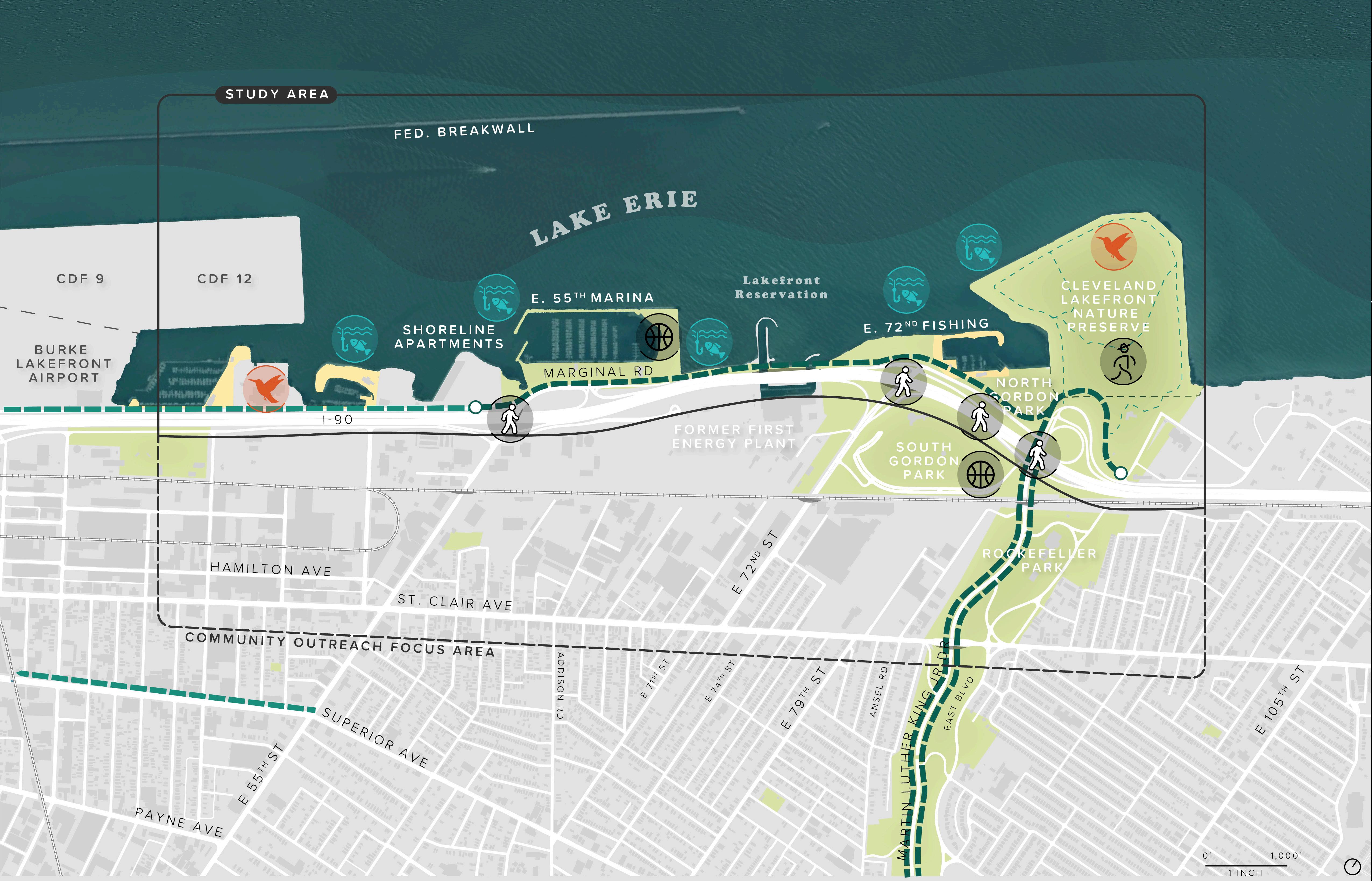
The map above identifies current active, passive, and nature-based recreation opportunities within the CHEERS study area.

Source: cITY oF cLeVeLAND GIS

Water recreation is a one of the most popular activities within the study area – from stand-up paddling, kayaking, and boating to fishing and taking in the scenic water vistas, the area provides myriad options for engaging with the water.

Public fishing and boating areas are located at the E. 55th Marina, the breakwater adjacent to the former FirstEnergy Plant, the E. 72nd Fishing area, and the North Gordon Park Boat Launch. The North Gordon Park Boat Launch provides one of the only places public ramps where visitors can launch watercraft into Lake. In addition to public fishing areas, marinas, and boat launches, the area is also home to a series of private yacht clubs that provide access to members. The Lakeside Yacht Club, Forest City Yacht Club, and InterCity Yacht Club – provide additional limited access for boating and fishing activities.
The study area is a popular sportfish destination and the creation of more shallow areas along the shoreline will allow for more for macrophytic vegetation could enhance these fish populations. The existing bulkhead and steep shorelines do not provide adequate cover for spawning or feeding. Despite the limited number of fishing access points, this area of the lakefront is quite popular with anglers. Anglers in this area record catching a variety of fish including Perch, Steelhead, Large and Smallmouth bass, Sunfish, Northern Pike, and Walleye. In addition to recreational fishing, organizations throughout the area host fishing tournaments like the Walleye Tournament that draw thousands of participants from across the city and region.
While sport fishing and boating is popular in this area, many anglers surveyed in this located in both 1997 and 2019 reported that they or someone they know were eating the fish they caught or displayed characteristics of subsistence fishing. Subsistence fishing is not uncommon in the Great Lakes where over 4 million people consume fish caught from the lakes each year (Arima, 2019). The high rate of urban subsistence fishing in the CHEERS are highlights the direct connection between ecosystem health and the health of lakefront communities as many fish in urbanized areas are known to have higher concentrations of harmful industrial pollutants. Improving habitats that


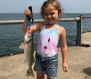

support anglers in the study area will also foster a better connection between the lake and residents who would otherwise not engage with the lake, creating support for environmental stewardship within the larger community.
Existing infrastructure related to recreational and commercial navigation will need to be considered in the development of design concepts in the project area.
The Cleveland Harbor Federal Navigational Channel passes through the study area approximately 500 feet south of the harbor breakwater. The channel includes a turning basin and is dredged to -25 LWD (544.2 feet IGLD 1985). Although this portion of the channel is not frequently used for commercial shipping, any design concepts developed will need to preclude impacts to the federal channel.

There are four existing marinas and one boat launch in the study area (see Figure 12). The InterCity Yacht Club, E55th Marina, Forest City Yacht Club, and Lakeside Yacht Club are located in the project area. Gordon Park features the only boat ramp in the area. Navigation and access to each of the marinas and the boat ramp will need to be considered in the development of design concepts.
The potential for enhancing or competing with existing recreational boating facilities will also need to be considered in the development of design concepts.


The Study Area (2,073 acres) is located on the southern shore of Lake Erie, east of the Burke Lakefront Airport. During the past 200 years, the Cleveland lakefront has been almost entirely developed, stripping away all but a few remnants of natural habitat (The Blue Project, 2002). To accommodate early industrial activities, the natural shoreline of Lake Erie throughout Cleveland and the Port of Cleveland was extended and hardened. Today, the Study Area is highly urbanized and comprised of a mix of industrial, commercial, protected open space, and residential land uses.
Apart from Lake Erie and the Doan Brook, natural areas within the Study Area are successional and concentrated east of E. 72nd Street within protected open spaces. Successional refers to a condition where an area that was previously cleared or disturbed is in the process of reverting back to a more natural condition, like meadows and woodland habitat. Natural terrestrial areas include the Doan Brook north-south riparian corridor, portions of Gordan Park, and the Cleveland Lakefront Natural Preserve (CLNP). Protected open space within the Study Area include Gordon Park, the CLNP, Cleveland Lakefront State Park, Kirtland Park, Rockefeller Park, and Grdina Park. These open spaces provide recreational fields for sports and picnicking, boat access to Lake Erie, fishing piers, naturalized wildlife habitat areas, and trails for walking and biking. The CLNP is the largest contiguous naturalized area within the Study Area (88.00 ac) and is located on Dike 14, a former confined disposal facility that was left to naturalize following the end of operations in 1999 (Davey Resource Group 2015).
While the Study Area is heavily influenced by its urban setting, opportunities for ecological uplift exist within protected open spaces and within the Cleveland Harbor. The following sections present a high-level description of the existing habitat conditions and species found within the Study Area based on desktop studies and a review of published reports, data, and observations provided by stakeholders. This information will be used to guide the master plan design and the identification of opportunities for ecological restoration and enhancement within the Study Area.

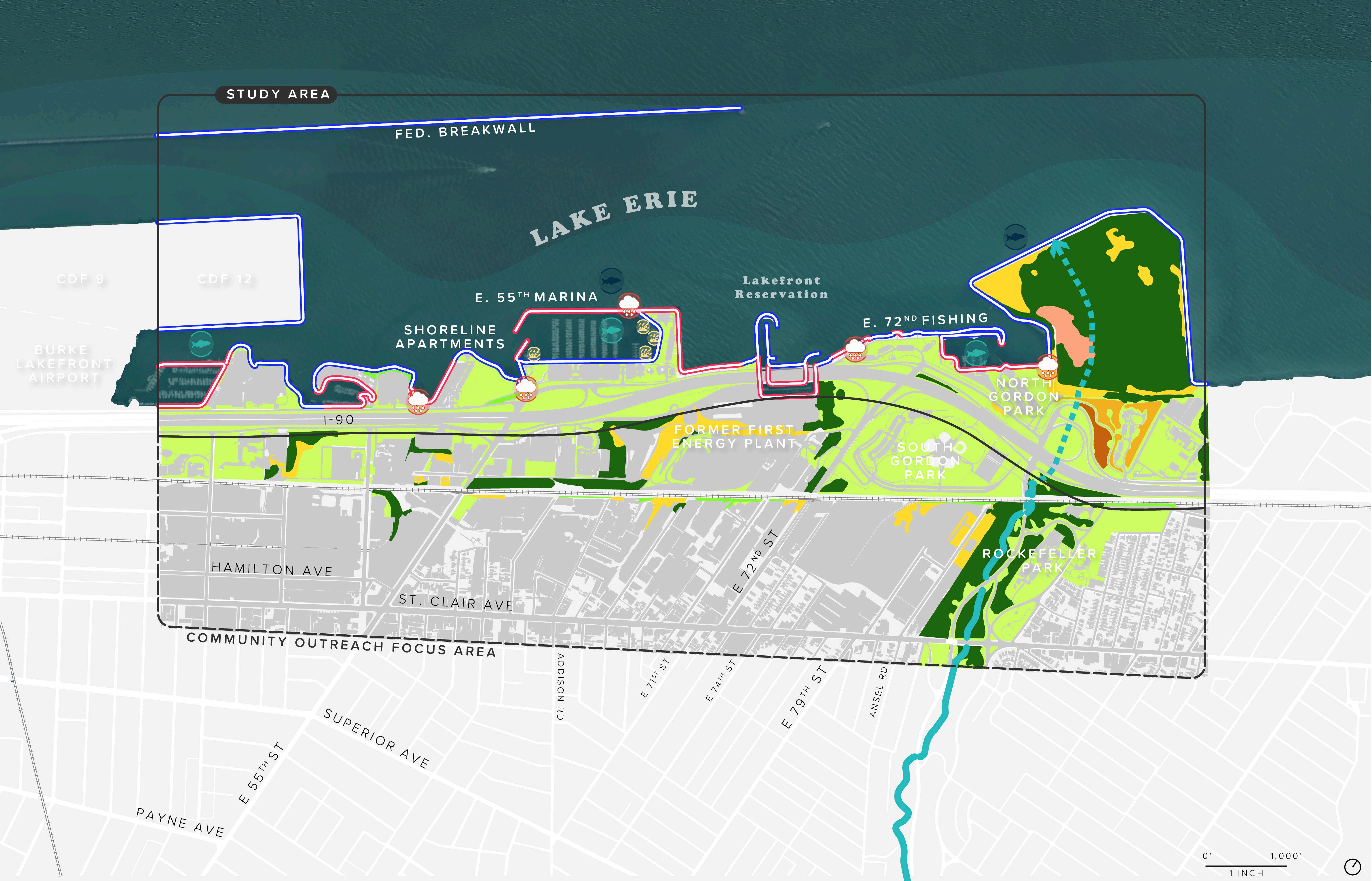
This map shows the various habitat zones of the CHEERS study area, as weel as the shoreline conditions, and invasive plant species.
 Source: GreAT ecoLoGY
Vegetation communities within the Study Area are indicative of urban environments. Most of the vegetated areas north of the railway tracks are mowed lawn with horticultural trees (182.17 ac) associated with maintained park spaces and road right-of-ways. Naturalized areas, such as those found in the CLNP and around the Cleveland Metroparks offices include restored prairie meadows, successional deciduous forest communities as well as cultural meadows which have been impacted by human activities. Additionally, scrub communities make up a small area of the Study Area and are associated with urban development and the breakwalls within the Cleveland Harbor. Scrub communities contain a mix of trees, shrubs, and grasses mostly dominated by weeds and invasive species. All the communities within the Study Area likely contain a mix of native and invasive species. The Doan Brook north-south riparian corridor (figure 13) is the only remnant of uncleared vegetation since at least 1954 (NETR 2020). Additionally, a few areas in the CLNP and around the Cleveland Metroparks offices just south of the CLNP have been actively restored to native meadow and oak-savannah communities. Natural vegetation communities within Study Area can be broken down into the following categories:
+ Deciduous forest (127.85 ac)
+ Cultural meadows (83.98 ac)
+ Scrub habitat (8.57 ac)
+ Successional meadow (Restored) (5.59 ac)
+ Prairie meadow (Restored) (5.40 ac)
+ Deciduous hedgerows (2.73 ac)
+ Oak-savannah (Restored) (2.49 ac)
Large areas of invasive species such as common reed (Phragmites australis), reed canary grass (Phalaris arundinacea), mugwort (Artemisia vulagaris) and poison hemlock (Conium maculatum) were mapped within the CLNP in 2015 (Figure 13). Other notable undesirable species found in small patches throughout the CLNP site include common teasel (Dipsacus fullonum) white sweet clover (Melilotus alba), and crown vetch (Securigera varia) (Davey 2015). An additional area of common reed was mapped outside of the CLNP via aerial imagery.
The CLNP and the Doan Brook north-south riparian corridor provide the largest terrestrial habitat areas within the Study area. According to the Port of Cleveland, the CLNP provides habitat to 16 species of mammals, 280 species of birds, 42 species of butterflies, and two species of reptiles (Port of Cleveland 2020). The preserve is identified as part of the Cleveland Lakefront Important Bird Area (IBA) by the National Audubon Society. This IBA offers critical stopover habitat for a wide variety of migratory birds, acting as an “island” of habitat in an urban area along a major flyway (EnviroScience 2019).
The Doan Brook Watershed Partnership has identified 30 species of mammals including bats, voles, squirrels, rabbits, and woodchucks, 66 species of birds including ducks, song birds, raptors, and wading birds, and 27 amphibian and reptile species including toads, frogs, salamanders, snakes, and turtles within the Doan Brook watershed (Gooch 2001).
The Study Area is located within the Cleveland Harbor on Lake Erie. The inner and outer harbor are defined by a 26,012-foot breakwall which extends east from the Westerly Wastewater Treatment Plant to the E 55th Street Marina within the Study Area. A federal shipping channel located on the south side of the breakwall connects Lake Erie, Cleveland Harbor, and the Cuyahoga River located west of the Study Area. The channel is dredged by the U.S. Army Corp of Engineers to maintain a depth of between 23 feet (ft.) and 30 ft. (Kayle 2015). Water depth within the Study Area ranges from 3 ft. in the East 55th Street Marina to 30 ft. along the north tip of the CLNP. Shallower areas are found along shoreline riprap revetments and the breakwall, as well as in marinas. The harbor has a sand and soft sediment bottom, and is relatively flat but slopes slightly downward to the federal shipping channel. Soils borings indicated that the material is (soft) gray silty clay for approximately 20 ft. below the existing harbor bottom. A silty clay material has accumulated in the harbor area due to filling over the years to create the existing shoreline – the original shoreline is approximately 500 to 800 ft. south of the current hardened shoreline (personal communication Vitto Melilli, P.E.).
The Cleveland Harbor and the Cuyahoga River are designated as a Great Lakes Area of Concern under the U.S.-Canada Great Lakes Water Quality Agreement (Kayle 2015). Areas of Concern under this agreement have been identified as environmentally degraded areas because of historical and ongoing pollution. There are five combined overflow sewers (CSOs) located within the Study Area (figure 15, page 69). In total, these CSO’s overflow approximately 280 times annually discharging 311 million gallons into the Study Area. These discharge points have the potential to reduce water quality within the harbor.
A four-year study of aquatic baseline conditions in the Cleveland Harbor and Cuyahoga River conducted by the Ohio Department of Natural Resources (DNR) (Kayle 2015) indicated that the Study Area had a mix of suitable and impaired conditions. The study found that phosphorus levels indicated the bioavailabilty of nutrients that fuel algal blooms in the harbor and nearshore Lake Erie (Kayle 2015). In addition, turbidity and suspended solids were high throughout the study
at all harbor stations which dampens light transmission in the water column and energy available for aquatic vegetation and green algae growth which support fish populations. Other water parameters studies indicated that the harbor is suitable for warmwater aquatic life (Kayle 2015).

There is approximately 50,000 ft. of shoreline within the Study Area including the lake shoreline and breakwalls. Of that, 32,278 ft. of the shoreline is riprap revetment, 17,413 ft. is steel bulkhead, and only 263 ft. is unstructured with a shoreline that enters the water on a natural slope (about ½ a percent of the shoreline within the study area) (figure 13). The limited areas of unstructured shoreline are likely areas where the riprap has eroded from its original placement.
Aquatic vegetation studies conducted in the Study Area by the DNR and Cleveland Metroparks identified 19 species, five of which are non-native (figure 13) (Kayle 2015 and Cleveland Metroparks 2020). A
State listed Threatened species, flat-stem pondweed (Potamogeton zosteriformis) was observed by Cleveland Metroparks within the East 55th Street Marina in 2017 and 2019 (figure 13). Other desirable species such as native American eelgrass (Vallisneria americana) and pondweed species (Potamogeton spp.) were observed in the harbor in 2012, 2017 and 2019 (Kayle 2015 and Cleveland Metroparks 2020). Although these species were not dominant at any location within the Study Area, these species provide ‘good fish’ habitat inside of the east-west breakwall (Kayle 2015).

In 2012, Kayle (2015) reported that non-native and nuisance species such as Eurasian milfoil (Myriophyllum spicatum) and coontail (Ceratophyllum demersum) occurred most frequently within the harbor sample areas. In both studies (Kayle 2015 and Cleveland Metroparks 2020) aquatic vegetation within the Study Area was primarily associated with the shallower sheltered areas along the shoreline including along the southern side of the east-west breakwall, within E 55th Street Marina and the 72nd Street Harbor and Gordon Park boat ramp.
Fish communities differ within the harbor depending on the location. Fish surveys within sheltered shallow water habitats (i.e., less than 20 ft.) which contain aquatic vegetation, habitat complexity (i.e., riprap revetments, large rock debris) and are sheltered from wind and wave action had greater species richness (i.e., the number of different species found) when compared to open deep water habitats (figure 14). Sheltered shallow water habitats within the harbor are found at the Lakeside Yacht Club, the East 55th Street Marina, and that East 72nd Street Marina and Gordon Park boat ramp. Species found within shallow water habitats include sunfishes such as largemouth bass (Micropterus salmoides), smallmouth bass (M. dolomieu), bluegill (Lepomis macrochirus), pumpkinseed (L. gibbosus), and rock bass (Ambloplites rupestris) (EnviroScience 2019; Deller 2019; Arima 2019). Sunfish are moderately tolerant of pollution and habitat alterations; however, largemouth bass and bluegill are generally associated with clearer waters with low siltation (EnviroScience 2019). These species also provide excellent sport fishing opportunities. Other native species caught in shallow water habitat areas include freshwater drum (Aplodinotus grunniens) and yellow perch (Perca flavescens). Non-native species caught within shallow water habitat include goldfish (Carassius auratus) and common carp (Cyprinus carpio) (EnviroScience 2019 and Deller 2019).
Species richness declined within open deep water habitat (i.e., greater than 20 ft.) (Figure 13). Open deep water habitat such as around the tip of the CLNP which is greater than 30 ft. is open to Lake Erie and is subject wave action and agitation and mixing from ship traffic, leading to higher turbidity and less aquatic vegetation. Fish are generally transient in this area and move into it during calm conditions and out of it when the waters become rough. Species caught in this area include smallmouth bass, bluegill, gizzard shad (Dorosoma cepedianum), and shorthead redhorse (Moxostoma macrolepidotum) (Deller 2019).
Additionally, most angler reports of walleye (Sander vitreus) in the Study Area occur in deep water habitat such as off the north side of East 55th Street Marina breakwall (figure 14); however, this species likely moves into shallow water to forage.
The Doan Brook is the only exposed stream in the Study Area. Its watershed includes approximately 12 square miles in Shaker Heights, Cleveland Heights, and Cleveland, Ohio (EnviroScience 2019). Much of the Doan Brook’s natural flow path has been channelized and altered. In addition to urban development along the brook, the mouth of Doan Brook was impacted by shoreline development and expansion in the 19th and 20th centuries and then further impacted by the development of the Dike 14 confined disposal facility for the Cuyahoga River dredge spoils. Dike 14 was built directly over the mouth of the stream (EnviroScience 2019). Doan Brook currently flows to Lake Erie at the northern tip of the CLNP by way of a 3,300 linear foot box culvert (EnviroScience 2019) (figure 13). This box culvert likely prevents regular fish movement upstream of Lake Erie into the upper reaches of the lower Doan Brook.

Natural wildlife corridors connect habitats so that wildlife can move between areas to meet their biological needs such as feeding, breeding habitat, and shelter. The loss of wildlife corridors may result in direct mortality, habitat fragmentation, and barriers to dispersal (New Hampshire Fish and Game 2020). While the Study Area occurs in a highly urbanized area, there still exist natural terrestrial and aquatic corridors that allow for aquatic and terrestrial wildlife movement in and out of the Study Area on the local and regional level: the Doan Brook north-south riparian corridor, Lake Erie, and the Lake Erie IBA (figure 14). Like most urban corridors, the corridors identified in the Study Area are impaired by urban development; however, there may be opportunities for ecological enhancements to improve these landscape connections.
The Doan Brook north-south riparian corridor has the potential to provide approximately 2 miles of connection and riparian cover between the Rockefeller Lagoons at Mount Sinai Drive and East 105th Street in south to the CLNP in the north. However, terrestrial corridors within the Study Area are often interrupted due to roads and urban development and there may by limited opportunities to improve these connections. For example, the Doan Brook north-south riparian corridor crosses under four major roadways and one railway which may contribute to undesirable interactions between wildlife and humans. Corridor improvement efforts could include the installation of below-ground or overpass wildlife crossings for mammals such as white-tailed deer (Odocoileus virginianus). However, the master plan concept may want to discourage the movement of larger wildlife (i.e., white-tailed deer) from the shore of Lake Eire and inner urban environment.
Lake Erie itself provides the greatest connection for aquatic species within the Study Area. Lake Erie connects aquatic species to the Cuyahoga River for spawning, rearing, and foraging while the Cleveland harbor provides an inward and outward migration corridor and patches of aquatic vegetation along the shallow areas of shoreline offer foraging opportunities for several species. The harbor connects to the open water of Lake Erie, offering opportunities for dispersal. We can improve these connections by adding habitat complexity in the form of substrate and topographic heterogeneity through placement of artificial structures and rocks and softening bulkheaded shorelines. Aquatic vegetation habitat could be created and enhanced by placing of additional breakwaters in select areas to further shelter areas from wind, wave, ship traffic. These efforts would increase foraging habitat for resident fish species as well as inwardly and outwardly migrating species. Improving aquatic habitat would also improve sport fishing within the Study Area.
The Cleveland Lakefront IBA is within the Atlantic Flyway and spans the southern shore of Lake Erie from Avon Lake west of the Study Area to Euclid east of the Study Area and encompasses the CLNP. Despite the hardened shoreline in the IBA, avian species are attracted to the fish population which gather in this area because of the mixing of waters from the Cuyahoga River, Lake Erie, and the warm-water outflows from power plants in the area (Audubon 2020). The Study Area offers a major resting area during migration in an otherwise urban setting and its benefits to avian species could be further improved by restoring mudflats and wetlands along the Lake Erie Shoreline. Benthic invertebrates and small bait fish are found in wetlands and mudflat habitat as well nearshore waters, and both provide an important food source for migrating species, particularly shorebirds such as piping plover (Charadrius melodus) and red knot (Calidris canutus rufa) This area is also an important corridor for insects, including the Monarch Butterfly.


The natural flows of avian, aquatic, and terrestrial species are shown in the map above.
Source: GreAT ecoLoGY


Lake Erie is the southernmost, shallowest, warmest and most biologically productive of the five Great Lakes. Lake Erie has three basins: the Western basin includes the islands area; the Central basin extends from the islands to about Erie, Pennsylvania; and the Eastern basin extends from Erie to the east end of the lake. Lake Erie is about 241 miles long, about 57 miles wide, and has about 312 miles of shoreline in Ohio, including the Lake Erie islands. Lake Erie’s maximum depth is 210 feet the average depth is 60 feet and the Western Basin’s average depth is just 24 feet. There are approximately 30,400 square miles of land that drain directly into Lake Erie from its watershed that includes Michigan, Indiana, Ohio Pennsylvania, New York and Ontario.
The study area lacks in-water and nearshore habitat and as a result, lacks natural means of shoreline protection. The entirety of the shoreline is hardened with boulders, breakwaters, and steel bulkheads and does not contain adequate areas for wave dissipation, means to break energy associated with storm events, or areas to adjust to lake level fluctuations. Water level fluctuations and extreme storm events in the region are increasing in frequency and severity due to climate change, therefore exposing communities and infrastructure on the Great Lakes to threats of erosion, wave surges, flooding, and storm impacts. The inadequacy of the hardened shoreline to provide buffer from climate threats intersects with vulnerabilities specific to the project area, putting the communities and wildlife within and near the project area at risk.

F I gu RE 15. HY d R o L og Y
The location of CSO oufalls, culverted and daylighted streams, and wetlands are depicted in the map above. Source: cITY oF cLeVeLAND GIS

Like many post-industrial cities across the country, Cleveland is facing the challenge of upgrading and maintaining aging water and sewer infrastructure and working to contain pollution by reducing combined sewer overflows. In a combined system, stormwater and sewage are conveyed in the same pipe. During dry weather, sewage is transported to a treatment facility. However, when it rains or there are other wet weather events (e.g., snow, ice melt), stormwater enters the system and may cause it to reach capacity leading to a mix of sewage and stormwater overflowing and discharging into Lake Erie and other waterbodies.
The Northeast Ohio Regional Sewer District (NEORSD) is the public water, wastewater, and sewer utility for the northeast Ohio region. The District was founded following the Cuyahoga River fire in the 1970s after local official and the EPA became concerned about pollution in the region’s waterways and charged with improving the health of waterways by regulating and improving the quality of water released into regional waterways. Today, the District administers a number of programs to improve water quality and reduce unauthorized discharges from CSOs through its CSO Operational Plan (EPA Nine Minimum Controls Implementation), Long-Term Control Implementation Plan (Project Clean Lake), and green infrastructure incentives and programs. Project Clean Lake, the District’s Long-Term Control Plan, is a 25-year plan to reduce combined sewer overflows from 4.5 billion gallons per year to less than a half a billion gallons per year, a capture rate of 98% by 2036. The plan calls for the construction of seven large capture tunnels, treatment plant improvements, system upgrades, and green infrastructure projects.
There are 11 CSOs in or near the CHEERS study area (#95, 96, 97, 98, 99, 200, 201, 202, 203, 204, and 205). Combined, these outfalls account for 363 overflows per year or over 340 million gallons of overflow. The Shoreline Tunnel project, one of the seven tunnels planned in Project Clean Lake, is expected to be completed by 2025. The proposed tunnel will reduce the number of overflows within the CHEERS study area from 363 per year to 14 per year, resulting in a volume reduction of 310 million gallons per year.
Historically, Giddings Brook was a direct tributary stream to Lake Erie. The stream was rerouted to join Doan Brook in the early 20th century. The natural flow of the stream north of the diversion point (Euclid Avenue) is now a combined sewer line that outfalls within the CHEERS study area. The Giddings combined sewer outfall is located at E. 55th Street (CSO #202) and empties into Lake Erie. The NEORSD maintains a floatables control unit adjacent to the plunge pool that is located adjacent to the outfall. Despite water quality issues stemming from unauthorized CSO discharges, the location provides some riparian habitat with some estuarine function (Doan Brook-Frontal Lake Erie Watershed Assessment Unit Report). However, the installation of the Shoreline Storage Tunnel by 2025 should reduce the number of overflows per year from twenty to just two, reducing the volume of effluent by over 20 million gallons (NEORSD, 2020). There is a potential to restore the estuarine marsh habitat at the mouth of the former Giddings Brook stream to help attract small animal and fish species and improve the natural habitat along the shoreline.
The CHEERS study area has a notable lack of tree cover when compared to it’s surroundings. A healthy tree canopy helps mitigate heat island effects, contribute to ecological habitat, and enhance visual appeal. The prevalence of transportation infrastructure, industrial, and vacant land have created a dearth of mature tree canopy. Figure 16 shows how the tree canopy has changed over time. While most of the loss of tree cover has occurred in developed areas, and those near major transportation routes such as I-90 and MLK Dr, the Cleveland Lakefront Nature preserve has seen continued gain.
The CHEERS study area includes a large percentage of impervious surfaces which contribute to combined sewer overflows during wet weather events and exacerbate water quality and pollution issues in the Lake. Most of the impervious area shown in Figure 17 is concentrated south of I-90. The most prominent permeable areas are within the existing parkland and within vacant or underutilized land.


Lake Erie’s water level is currently at a historic high. The U.S. Army Corps of Engineers (USACE) and the Federal Emergency Management Agency (FEMA) are working to develop a Great Lakes Coastal Special Flood Hazard Area (SHFA) assessment, which includes the impacts of wind surge and wave runup.
A review of historic and recent water levels records and wave data was conducted to determine the appropriate design water levels and wave heights for return periods between 2 years and 100 years. Methodology for calculating water levels included review of historic buoy data from the National Oceanic and Atmospheric Administration (NOAA), water level and wave runup data from Federal Emergency Management Agency (FEMA) flood insurance rate map development, US Army Corps of Engineers (USACE) documents providing design water levels (from 1993 and 1988), and a previous metocean study performed by KS Associates and Baird for the Burke Lakefront Airport.
Depth limited wave heights were calculated for the range of design water levels identified in the study area and bathymetry data compiled for Cleveland Harbor. Fetch-limited wave heights were calculated based on wind conditions from the U.S. Army Corps of Engineers Wave Information Stations. Maximum depth-limited wave heights were compared to fetch limited waves to determine preliminary design wave conditions at several locations within the study area. The design wave conditions for a 50-year return period are summarized in the adjacent map (figure 18).
Once concepts are identified a more detailed analysis of the meteorological and oceanographic conditions that will impact the design of the proposed infrastructure will be prepared for each structure during the Technical Design Task.

F I gu RE 18. d ESI gn WAVE HEI g HT
This map shows the intensity of waves by height and return period for selected locations along the waterfront. Source: KS ASSocIATeS

575.5 ft
575 ft
574.5 ft
574 ft
573.5 ft
576 ft 1 Year (100%) 10 Years (10%)
573 ft
WATER LEVEL (FEET NAVD88) 100 Years (1%)
RETURN PERIOD (CHANCE OF OCCURENCE WITHIN A GIVEN YEAR)
KS Associates/Baird, 2016 USACE, 1993 FEMA, 2019 USACE, 1988 Statistical Fit to 1904-1943 & 1980-2019 Monthly Maximums
Design water levels will be selected for each project element based on a consideration of the risks of exceedance.
Source: KS ASSocIATeS
One of the primary goals of the study is the beneficial reuse of dredge materials. Dredged material can vary in composition based on the area and depth of dredging. Material from the Cuyahoga River and Cleveland Harbor may be acceptable for use to construct the improvements that are likely to be identified by the CHEERS study but will need to be contained to prevent pollution and meet regulatory requirements.
The Cuyahoga River is typically dredged twice annually due to the influx of material from the Cuyahoga River Valley drainage basin. The average quantity of material removed is approximately 250,000 cubic. Approximately 80% of the material is dredged from the head of federal navigation to approximately 1.5 miles downstream. This material consists of sandy/silty material. The remaining 20% of the material dredged
contains a consistency of silty/clay and fine sand. The Port beneficially harvests and repurposes 50% of this material into marketable soil products including manufactured top soils, fill sand, and other permitted land application products.
The river is typically dredged from the Federal Navigation Channel using a clamshell dredge (figure 20). The material is placed into scows and delivered by tugboat to the Confined Disposal Facilities (CDFs) located in the eastern portion of Cleveland Harbor. Several CDFs have been constructed to accommodate the dredge material collected (as shown below). The CDFs were constructed in the following order 13, 9, 12, 14 and 10B with CDFs 10B and 12 being currently used for sediment containment. As CDFs 10B and 12 reach their capacity, beneficial use of dredge material will be required.

Material to be dredged from the Cuyahoga River is sampled and tested at intervals to determine the characteristics of the material and its suitability for re-purposing or for beneficial use. Additional sampling is performed within the CDF facilities to determine its suitability for beneficial use operations. Current operations for beneficial use are being performed by a contractor in CDF 12 under the administration of the Cleveland Port Authority. Material is sorted/classified into usable material for construction purposes or mixed with amendments to create topsoil for use throughout the Cleveland area.
A sizeable percentage of the remaining sediment, which is currently landfilled at abandoned confined disposal facilities (CDFs) within the harbor, could likely be beneficially repurposed in an environmentally responsible and beneficial manner for the CHEERS Study. Finding new and beneficial uses for this material would help create a long-term and sustainable solution for management of dredge in the harbor. This dredge material could be used to create new natural habitats such as emergent wetlands, shrub habitat, and coastal mud flats. This habitat will also serve to protect the shoreline and nearby critical infrastructure from storm events, high winds, and changes in lake levels. The dredged material can also be placed within the proposed improvements for beneficial re-use as fill. As filling nears the design elevation, the material can be capped to and graded to provide the desired contours for the project.


Improving connectivity, access, and public space as tools to repair this physical and social divide will be at the forefront of the CHEERS study. This study provides an opportunity to rethink access to lakeshore – reconnecting residents from adjacent neighborhoods to the lakefront (bike, pedestrian, and vehicular access), increasing access to recreational assets, and restoring these neighborhoods as “Lakefront Communities.”
The presence of I-90 and the rail lines act as barriers to the study area requiring residents to navigate access over or under the infrastructure. Despite the miles of Lakefront Trail that traverse the study area, northsouth access points from adjacent neighborhoods to the lakefront are limited for bicycles and pedestrians. Furthermore, the car-centric nature of many lakefront spaces and the limited access points lead to feeling that pedestrians and bicyclists are not welcome and not safe moving through the study area.

The Greater Cleveland Regional Transit Authority (RTA) operates multiple bus routes that traverse the CHEERS study area. the Lakeshore (39/39F) route follows Marginal Road and I-90, connecting residents to the lakefront from Bratenahl to the east and Downtown to the west. The East 55 route (16) is the only north-south connection that provides direct access to the lakefront. The route loops through Newburgh Heights and Cuyahoga heights then extends north following E. 55th Street through Central, Goodrich-Kirtland Park, and St. Clair-Superior. Exploring opportunities to improve access to the lakefront through transit could help reduce the need for parking and help create a less carcentric experience for visitors.


This map shows the major vehicle, bicycle, and pedestrian routes that cross through the study area.
Source: cITY oF cLeVeLAND GIS

<6,000 6,001-150,000 150,001-30,000 >30,000


Source: cITY oF cLeVeLAND GIS, oDoT


The main trail that runs east-west through the study area is the Lakefront Trail (also known as US Bike Route 130, the Cleveland Lakefront Bikeway, and the Lake Erie Coastal Ohio Trail National Scenic Byway) which connects the study area to regional destinations. This regionally significant corridor, which spans almost 300 miles, is managed by NOACA and other partners who are currently working to further expand the route.

Connections to the lakefront from the neighborhoods to the south is limited. E 55th and E 72nd Streets have some bike infrastructure including a partial buffered bike lane, but the presence of on- and off-ramps, lanes that are absent for sections of the road, and busy intersections may discourage some bicyclists from using these existing routes. Some of these existing roadways that connect to the lakefront were assessed for their potential to support additional bike infrastructure in the 2015 Lakefront Greenway and Downtown Connector Study. Improvements to the E 55th and 72nd Street infrastructure were considered and MLK Jr. Drive was assessed as a potential opportunity for installing additional bicycle and pedestrian infrastructure. Exploring possibilities to extend greenways, bikeways, or on street bike routes will be a key part of the concept development phase for the CHEERS study.

The study area includes a variety of trail types - from nature trails, bike and pedestrian routes, and watercraft (e.g., kayak and paddleboard) routes.


The 2019 Cuyahoga Greenways Plan identified multiple routes that intersect with or connect to the CHEERS study area. The most important of these is the extension of the Lakefront Trail, an important regional trail link, that would continue past E. 55th Street into Downtown Cleveland. The 2015 Lakefront Greenway and Downtown Connector study also assessed extending the trail along the Marginal Road Connector, adding a buffer between the trail and the roadway. Additional secondary trails and route connections were proposed that have the potential to connect adjacent neighborhoods to the lakefront, including the Superior Avenue Midway Cycle Track. This connector, which would run along the middle of Superior Avenue, would serve as a pilot project for implementing additional protected bike routes throughout the city. The first portion of this cycle track is slated for completion in the next year with the potential to continue the project with additional funding.
In addition to on-shore trails, the proposed future Lake Erie Water Trail would create a 25-mile inwater paddling route along the shores of Cleveland. Wayfinding signage placed along the route will educate paddlers about lake conditions, provide route guidance, and display safety tips. The new trail would connect to existing launch locations within the CHEERS study and will help further connect communities to the water – helping residents and visitors understand the value of Lake Erie as an essential natural resource. Strengthening connections from the neighborhoods to the water will help ensure that the trail is visible and accessible to local communities and visitors.

The map above depicts the locations of current and planned/proposed trails.

Currently, there are four north-south pedestrian access points that cross I-90 (MLK Jr. Dr, Gordon Park, E. 72nd St., and E. 55th St.) and three that cross the railroad tracks (MLK Jr. Dr., E 72nd St., and E 55th St.). The Gordon Park pedestrian bridge over I-90 is the only crossing not associated with a street. Despite the level of traffic on I-90, the bridge itself provides a sense of safety, separating pedestrians and bicyclists from motor vehicle traffic. Moving through the study area from east to west, the Lakefront Trail provides a safe and accessible route for bicycles and pedestrians from Rockefeller Park to the west side of E. 55th Street. While the majority of the Lakefront Trail is enjoyable there are “pinch points,” particularly near the former FirstEnergy Plant where the trail is mere feet away from the fast-moving traffic of I-90. After the E. 55th Street intersection the trail turns into an on street sharrow on Marginal Road. In this portion of the trail there is no separation between bikes and vehicles and the roadway widths are often too narrow to be comfortably shared by motorists and cyclists.
In addition to safety issues and crashes resulting from wet weather conditions on I-90, there are structural and highway design issues that contribute to vehicle crashes and reduce the safety of pedestrians and bicyclists in the area. The 2015 I-90 Safety Study conducted by ODOT identified three on/off-ramp locations of concern for I-90. These include E. 55th Street, E 72nd Street, and MLK Jr. Drive. The study recommended a series of measures to reduce crashes and improve safety for motorists as well as pedestrians and bicyclists moving through these intersections.

The map above shows the density of crash locations in and around the study area. Individual crashes are marked within the larger heat markers. The intersections of I-90 and E. 55th and I-90 and MLK Jr. Drive have the highest density of crashes in the study area.
Source: cITY oF cLeVeLAND GIS

Audubon 2020. Cleveland Lakefront. Accessed August 2020. Available at: https://netapp.audubon.org/iba/Reports/2031
City of Cleveland, Smith Group, Waterfront District Plan. 2004.
Cleveland Neighborhood Progress, et. al. Cleveland Neighborhood Progress: Cleveland Climate Resilience and Urban Opportunity Plan. 2015. Cleveland Neighborhood Progress, et. al. Re-Imagining a More Sustainable Cleveland. 2014.
Cleveland Planning Commission and NOACA, et. al. Midway Cycle Track Plan. 2017.
Cuyahoga County Planning, Cleveland Metroparks, et. al. Cuyahoga Greenways Plan. 2019
[Davey] Davey Resource Group. 2015. Land Management Plan Cleveland Lakefront Natural Preserve. Deller, J. 2019. Ohio Department of Natural Recourse Cleveland Harbor Electrofishing Data. Unpublished. Doan Brook Watershed Partnership. Doan Brook Estuary Feasibility Study CMAG. 2019
EnviroScience. 2019. The Doan Brook Watershed Partnership. “DOAN BROOK ESTUARY FEASIBILITY REPORT (Draft)” Prepared by EnviroScience, Stow OH.
FirstEnergy, Arcadis. FirstEnergy Lakeshore Reuse. 2017.
Gooch, L.C. 2001. The Doan Brook Handbook. The Nature Center at Shaker Lakes. Accessed August 2020. Available at: https://doanbrookpartnership.org/wp-content/uploads/2019/04/DoanBrook-All-Pages.pdf.
Hardy, Scott D., Ohio Sea Grant College Program at the Ohio State University. NEO Storm Hazard Vulnerability Study. 2017
Human Nature, St. Clair Superior Development Corporation, Cleveland Neighborhood Progress. Cleveland Neighborhood Progress Cleveland Lakefront Concept. 2018
Kayle, K.A. 2015. USEPA-Great Lakes Restoration Initiative Project. Grant Number: EPAGLNPO-2010-H-2-1163-468. EPA GLRI Project Number: GL00E00679. Project Title: Cuyahoga AOC Habitat and Fish Restoration Opportunities.
Larick, Roy. Doan Brook-Frontal Lake Erie watershed assessment unit Nonpoint Source Pollution Implementation Strategy. 2020.
[Cleveland Metroparks] Cleveland Metroparks. 2019 Visitation Report. 2019.
[Cleveland Metroparks] Cleveland Metroparks, OLIN Studio. Cleveland Lakefront Masterplan Green Infrastructure Overlay. 2014.
[Cleveland Metroparks] Cleveland Metroparks. Lakefront Reservation E. 55th and North Gordon Master Plan. 2019.
[Cleveland Metroparks] Cleveland Metroparks. Memorandum: Port of Cleveland 2017 & 2019 aquatic plant survey results. August 10, 2020.
[Cleveland Metroparks] Cleveland Metroparks. Walk Bike Shed Analysis E 55th and North Gordon Park. 2015.
[NEORD] Northeast Ohio Regional Sewer District. Combined Sewer Overflow Public Notification Rule Annual Notice. 2019.
[NEOSCC] Northeast Ohio Sustainable Communities Consortium. Vibrant NEO 2040 Northeast Ohio Sustainable Communities Consortium. 2014.
[NETR] National Environmental Title Research. 2020. 1954. Accessed August 2020. Available at: https://www.historicaerials.com/viewer New Hampshire Fish and Game. 2020. NH Wildlife Corridors. Accessed August 2020. Available at: https://www.wildlife.state.nh.us/nongame/ corridors.html
[ODOT] Ohio Department of Transportation et. al. I-90 Safety Study. 2015.
Ohio Lake Erie Commission, ODNR. Lake Erie Protection and Restoration Plan (LEPR). 2016
Personal communication Vitto Melilli, P.E. K S Associates. July 16, 2020.
Port of Cleveland. Cleveland Lakefront Nature Preserve. Accessed August 2020. Available at: http://www.portofcleveland.com/environment-infrastructure/cleveland-lakefront-nature-preserve#:~:text=The%20CLNP%20is%2088%2Dacres,280%20species%20of%20birds
St. Clair Superior Development Corporation, Campus District, et. al. Lakefront Greenway and Downtown Connector Study. 2015.
The Blue Project. 2002. Ecological Restoration Opportunities for Cleveland’s Lakefront: Report from a workshop sponsored by the BLUE Project (Building the Livable Urban Edge) of EcoCity Cleveland and the Cleveland Waterfront Coalition, December 11, 2002.
[USACE] U.S. Army Corps of Engineers. Beneficial Use Suitability Cleveland Harbor Dredged Material. 2011.

Prepared by WRT Engagement activities summaries:
+ Community Survey Summary
+ Engagement Summary (overview)
+ Community Kick-Off Summary
+ Walkshop Summary

“What are your top concerns with the Lakefront?”
50% 41% 41% 39% 38%
Impacts of I-90 traffic and noise on park and Lakefront” “ Limited space and activities and programs in the existing parks” “ Existing bicycle and pedestrian crossings and routes are not safe” “Perceived lack of security in spaces along the Lakefront”
What would you like to see improved along the lakefront?
More natural spaces #1 Places to touch Lake Erie #2 Connect with neighborhood & between park spaces #3 Buffer park spaces from highway #4
More events, educational programs, and recreation #5
`
“How would you like to utilize the Lakefront in the future?” “Hard to get to the park areas from neighborhoods (limited crossings of railroad and I-90)”
+ Biking, Hiking, Walking, Running + Extended Walkways and Trails
+ More Places to Touch / Interact with Water (beaches, etc.) + Watersports (e.g., kayaking, stand up paddleboards, canoe, etc.)
+ Concessions & Restaurants + More Access + Events (e.g., live music, festivals, etc.)
“What one thing must change about the Lakefront?
“MORE ACCESS” A | APPENDICES
“NATURAL AREAS”




Coloring
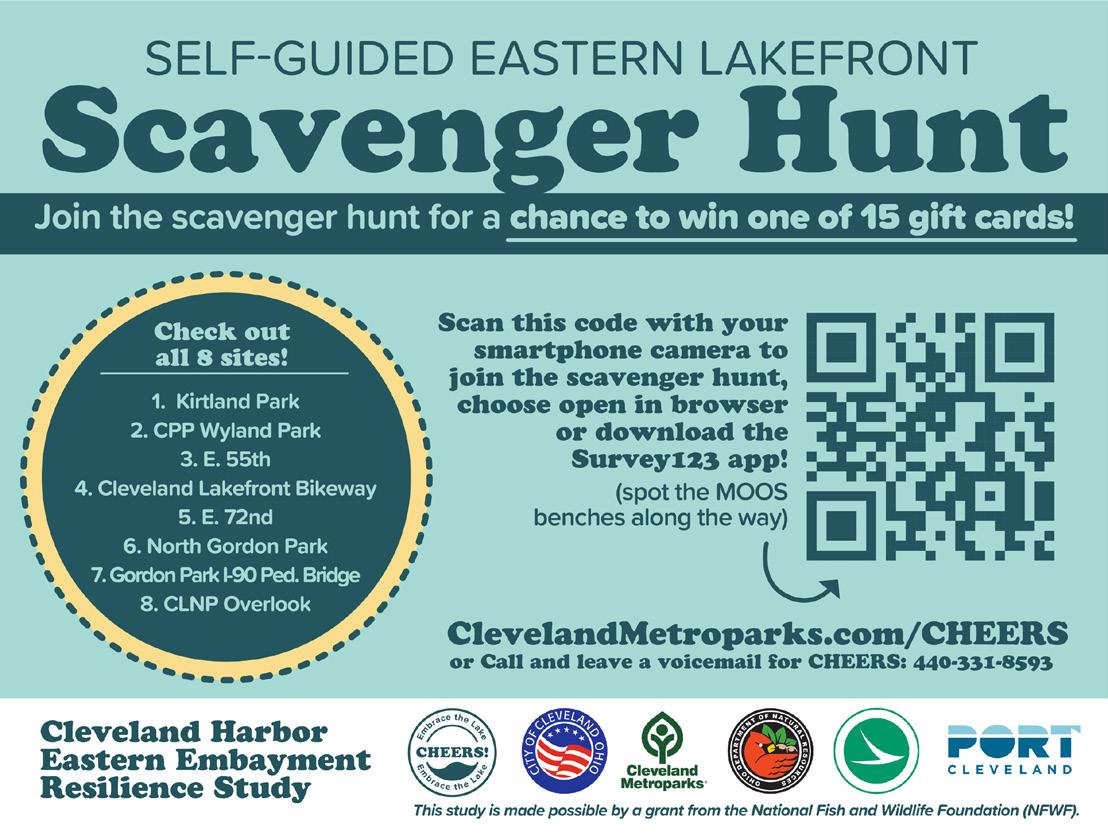


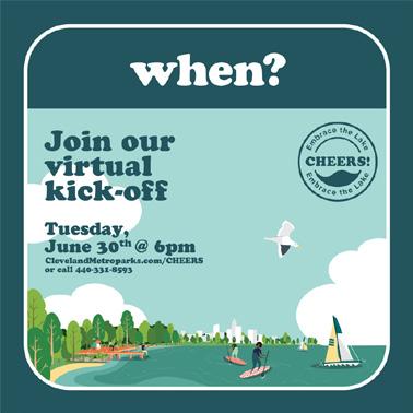


Custom CHEERS aluminum water bottles handed out to meeting participants


Custom stickers handed out to community members



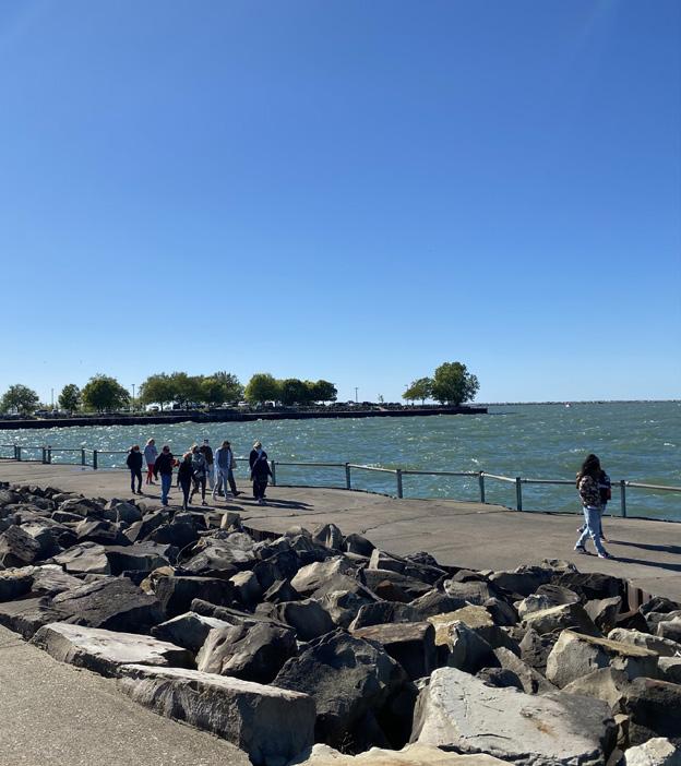
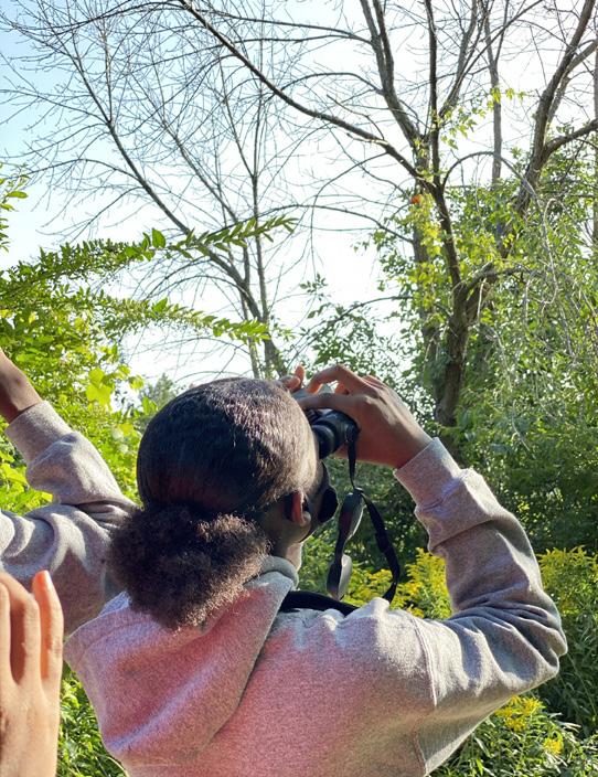



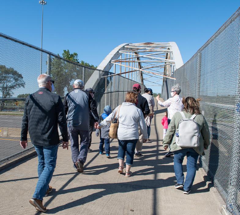
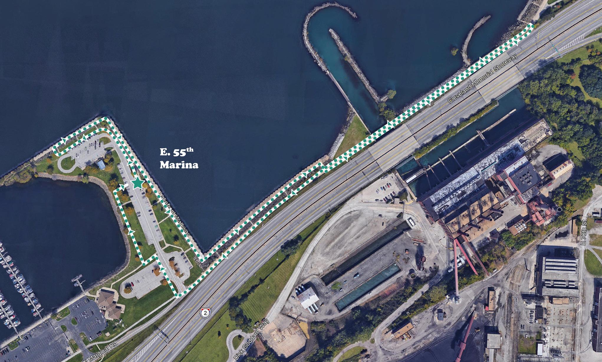


Participants were asked to visit and answer questions about 8 sites
Each site required participants to answer questions or do an activity. Participants were entered to win one of 15 Dave’s gift cards (local grocery store).
https://survey123.arcgis.com/share/14b66e466cc241e8859416f0af03d439?
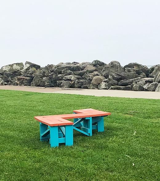


Each site had MOOs furniture–one-of-a-kind furniture designed and created by Cleveland-area teens through the Making Our Own Space. MOOS engages and empowers youth to transform public space; these pieces were conceived, designed, and built by local students. MOOS is an initiative of the Cleveland Urban Design Collaborative, a program of Kent State University’s College of Architecture + Environmental Design.

Digital Typeform survey provided information about how community members use the lake today and how they’d like to use it in the future

Shortened paper copies and translated surveys (english, Mandarin, and Spanish) were provided to project partners and used for intercept surveying along the lakefront.

What makes this space special?
Community Meetings were held over Zoom with interactive features like polling and facilitated breakout groups where particpants were invited to comment and draw on digital whiteboards


Cleveland
Trudy Andrzejewski, Special Assistant to the Mayor, Regional Development
Adam Davenport, District Planner
Sharonda Whatley, City Planner
Freddy L. Collier, Jr., Director of City Planning
Ed Rybka, Chief of Regional Development
Michael Cox, Director of Public Works
Darnell Brown, Chief Operating Officer


Sean McDermott, Chief Planning and Design Officer
Kelly Coffman, Senior Strategic Park Planner
Jenn Grieser, Director of Natural Resources
Kristen Trolio, Grants Manager
Kyle Baker, Sr. Asst. Legal Counsel and Director of Real Estate
Scudder Mackey, Chief, Office of Coastal Management
Steve Holland, Office of Coastal Management


Neil Shop, PE, District 12 Transportation Engineer
Dave Lastovka, PE, District 12 Capital Programs

Linda Sternheimer, Director, Urban Planning and Engagement
Project Funding is provided by a grant from the National Fish and Wildlife Foundation and matching funds from the five project partners.
City of Cleveland staff
City of Cleveland - Ward 10 Councilman Hairston
Cleveland Neighborhood Progress
Cleveland Metroparks Cuyahoga County
Ariel International Bike Cleveland Bluestone Heights Campus District CEI
District 7 Councilwoman Conwell
Destination Cleveland Dominion Energy Downtown Cleveland Alliance
LAND studio
MidTown / AsiaTown
MyCom Youth Council
Doan Brook Watershed Partners Famicos
First Energy
Northeast Ohio Regional Sewer District (NEORSD)
Northeast Ohio Areawide Coordinating Agency (NOACA) Trust for Public Land University Circle, Inc.
USDA - Burke Wildlife Specialist
City of Cleveland - Wards 7 (Councilman Jones) and 9 (Councilman Conwell)
Cleveland Cultural Gardens Cleveland Museum of Natural History Cleveland State University - MUPD Collinwood CDC
Cuyahoga Soil and Water Conservation District Cuyahoga County Cuyahoga County Council
City of Euclid
Forest City Yacht Club
Greater Cleveland Regional Transit Authority (GCRTA)
Green City Blue Lake Green Ribbon Coalition
Holden Parks Trust Ingenuity
InterCity Yacht Club
Lake Erie Coastal Ohio Trail Scenic Byway
Lakeside Yacht Club
ODNR Division of Wildlife St. Clair Superior Development Corporation Shoreline
Slovenian National Home St. Martin de Porres High School
The Foundry UMADOP
US Army Corps of Engineers Village of Bratenahl West Creek Conservancy Western Reserve Land Conservancy


Cleveland Metroparks and partners (ODNR, ODOT, City of Cleveland, and Port of Cleveland) kicked off the year-long planning process for CHEERS (the Cleveland Harbor Eastern Embayment Resilience Study) on Tuesday, June 30th at 6pm.
The WRT-led planning and design team held a virtual engagement meeting with Great Ecology and KS Associates to gather feedback from the community and better understand the challenges and aspirations for the eastern Lakefront. The following is a summary of the meeting and feedback received.
1. What is CHEERS?
2. Who is involved?
3. What is the Process?
4. Why do we need a plan?
5. Breakout Discussion Groups
6.Report Back


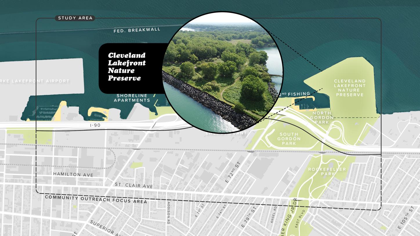


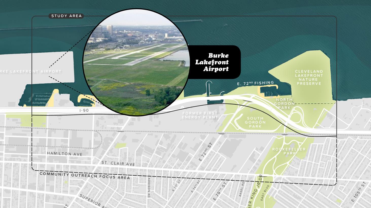






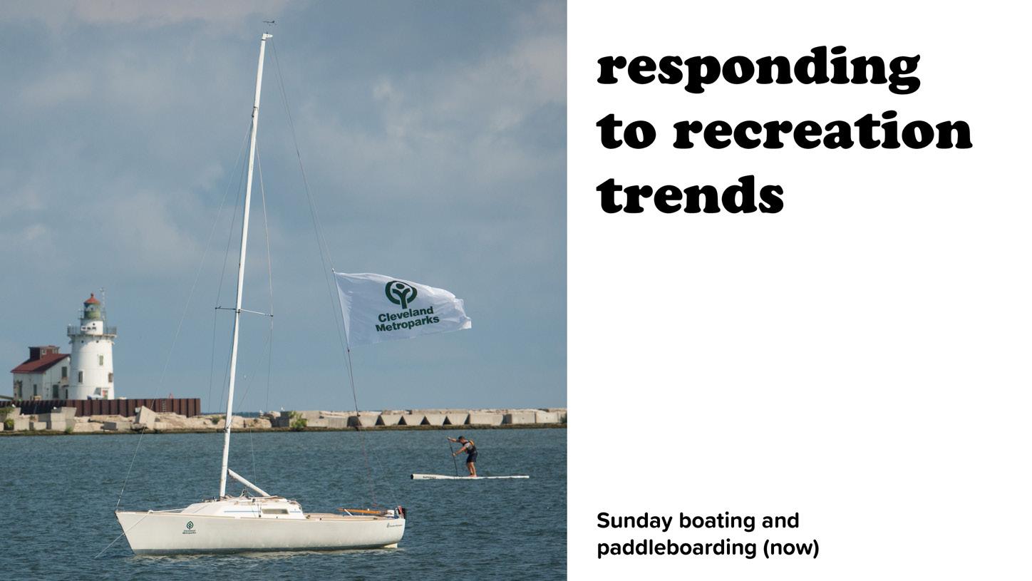


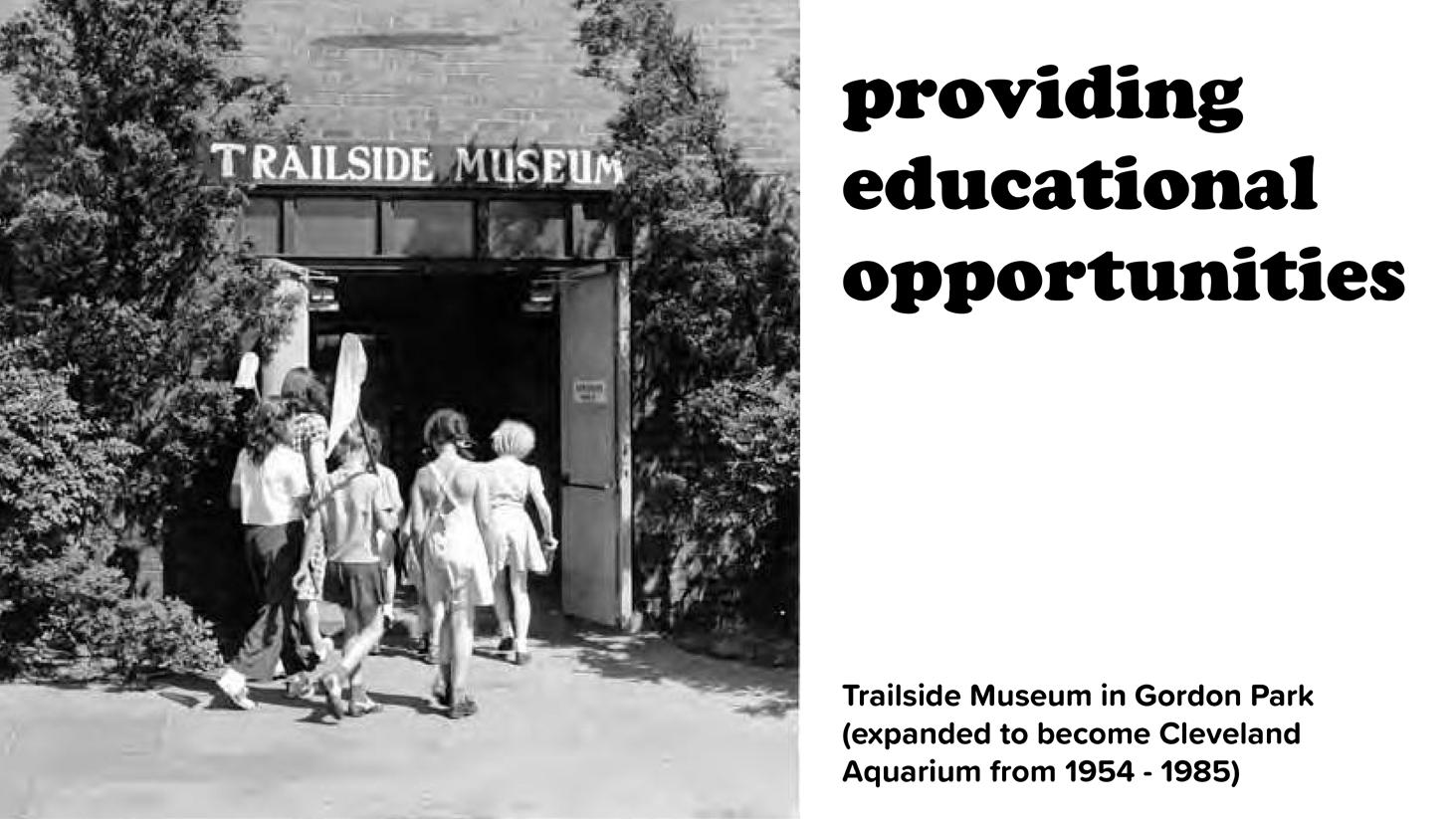


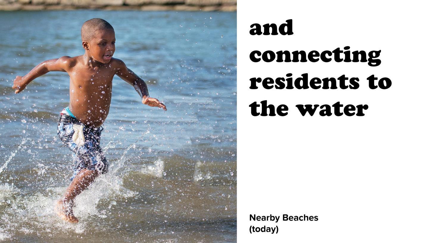


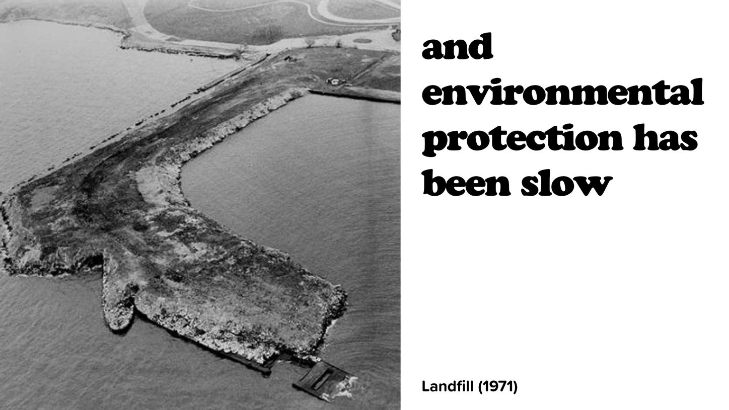


» Bikeway connection is there but is a bare minimum, world class bikeway along lakefront opportunity
» Enhance bikeway for all abilities
» Better places for people to walk
» Daylighting Doan Brook
» Appreciate bike trail (needs some work), kayaking, fishing - all hours of the day, good breweries near by, good access
» The Marina has potential for better kayak launch area that are protected by the breakwall area
» Views to downtown - very scenic, picnic tables, restaurant is a great asset near the water
» The north side of the former First Energy Plant is very difficult / tight - unsafe, could be lovely. Walking trail would be good
» Come close to nature and embrace it / experience / touch
» String of parks into Cleveland neighborhoods - parks and assets and users - strong partnerships already on the ground
» Access near the west side of South Gordon Park and at MLK but more are needed!
» Improve Connectivity b/w N and S Gordon Park
» LAND BRIDGE (between North and South Gordon Park)! People and Animals
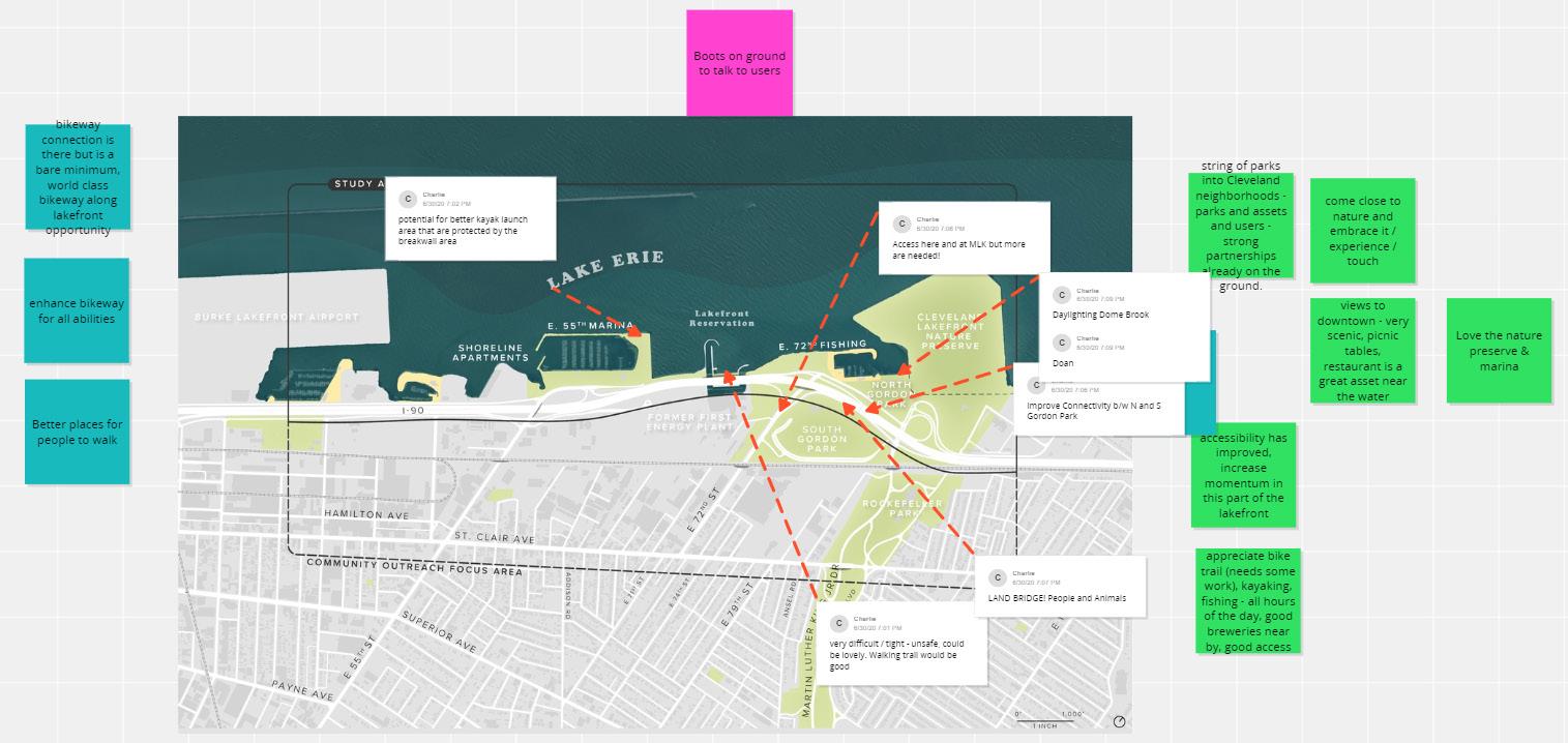
» Extend CLE Lakefront Bikeway - modify fences and get rid of barbed wire
» Bike trails and region balanced with neighborhoods and diverse users!!
» Interested in work to build trail and connect with OTET and downtown
» Bike trails and region balanced with neighborhoods and diverse users!!
» Combo active and passive to appeal to more people - mindful of sewer overflows and improvement
» Would love to walk along lake and get feet in the water - Add more entertainment and restaurant options - could have barge along lakefront - small businesses
» Improve views (not sheet piling) see tree plantings - also opportunity to make more welcoming entrance
» Touching water and making it a place people want to go - and feel welcome
» Mindful of improving habitat for fishing
» Hardened shoreline - opportunity to make it more nature based and not armored
» Tradition of sleeping at Kirkland Park / E72 - reawaken what lakefront used to be likechance to have equity and diversity by connecting to lakefront
» People who’ve lived within view and can hear the lake but can’t get there - goal to get neighbors to the lake - focus on people who’ve lived with in the neighborhood - power plant was for suburban AC - get people to walk here and experience!!
» Land ownership and additional access
» What are access points to get under I-90 (and railroad)
» Hundreds of African American fishermen - love to see part of this outreach to hear from these users and strong culture of fishing
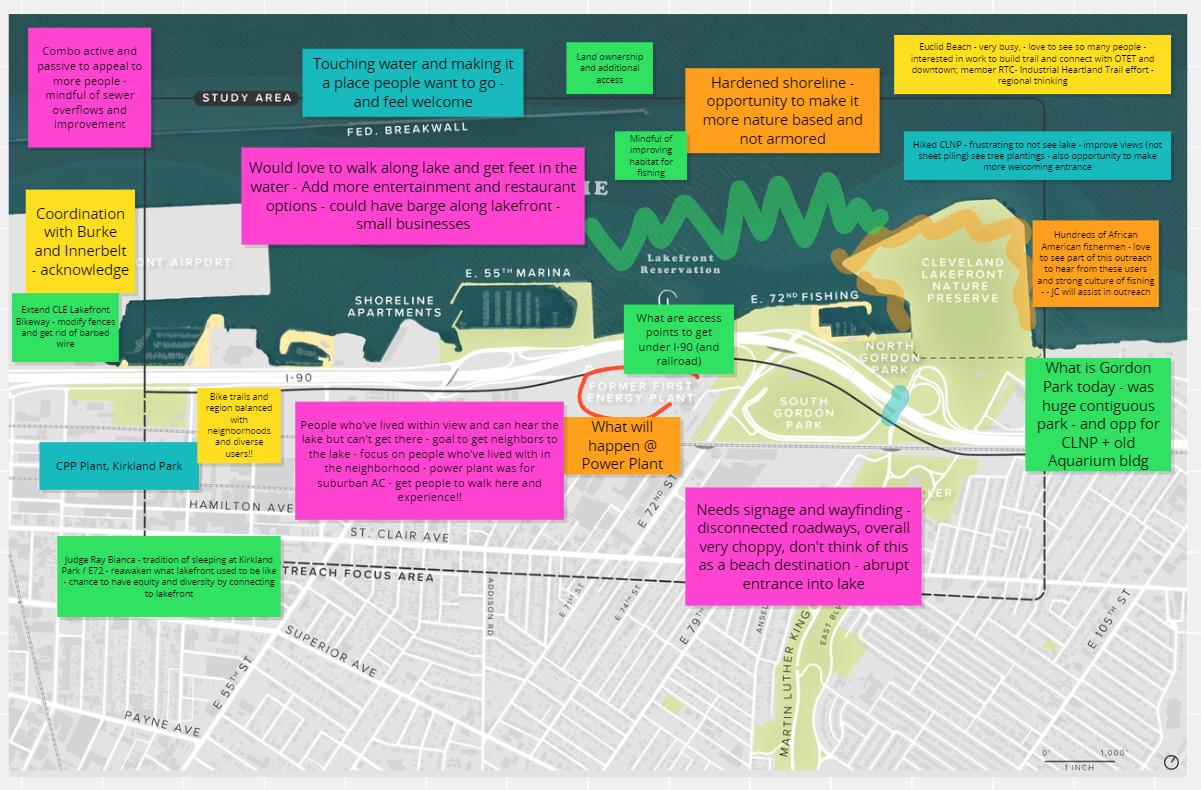
» Connections between the lake and neighborhoods
» The Nature Preserve is very isolated
» Accesses should be in the path of public realm
» More creative between human and nature
» North Gordon Park is dominant by parking and people cannot see the beautiful view
» The Nature Preserve can be a tourist site and economic driver, aka a destination for natural history
» People should be able to get down to the water and enjoy the water
» Protect the bird habitats
» Create and enhance more tree habitats
» The Nature Preserve can be a tourist site and economic driver, aka a destination for natural history
» People should be able to get down to the water and enjoy the water
» It should be safe for kids to play at the lakefront
» Fishing, birding, walking, etc
» Kids can learn how to swim

» Fishing popular activity, and need to protect that access and ensure high-quality fishing experience while adding new activities
» Similar to challenges faced in NYC about highways blocking access to highway
» Public programs for boating or kayaking have been one way to connect people with water
» Teaching people to use kayak; lots of agreement, paddle boarding opportunities, general increase of activity on the water
» More public programming, nature hikes, bird watching, get more visible activity here, in addition to downtown bikers and walkers
» Need more safe, viable options to walk and bike to the lakefront from the adjacent neighborhoods; specifically protected bike lanes, well-lit, well-designed, open (current pedestrian bridge seems enclosed, narrow)
» Wayfinding signs that tell you how far you are to amenities (ex. nature preserve) to encourage users to explore
» Wayfinding from the neighborhood into the study area with signs intentionally in the neighborhood, making sure people know how close they are to parks amenities; signage that shares history of park, wildlife sightings
» Better wayfinding to help connect new projects, Destination Cleveland working on it
» Cleveland becomes trail capital of the world with connections regionally and nationally
» Nature center, information about storm water features if included
» Keep boating access, maintain marinas
» Kayaking one day a week free first come first serve basis, removing barriers to cost and opening access; teaching people to use kayak
» Connectivity from and through Rockefeller Park; roadways included
» Better north south connectivity
» More greenspace
» Lakefront Nature Preserve unique quality, feel like you are leaving area and reaching unique solitary birding area

» Bikeway connection is there but is a bare minimum, world class bikeway along lakefront opportunity
» Better Pedestrian and bike friendly connections easier for people to get there more likely adjacent residents would utilize a better experience
» A small green corridors north and south of St Clair that end at the waterfront.
» 55th has plenty of room for pedestrian experience yes- 55th has vehicular choke points anyway so makes sense to devote some of the “extra” lanes to multi mode instead on punching and expanding
» Increasing downtown population; better connections without going down st clair avenue
» By observation there is heavy use of existing recreational facilities by the Black community - mlk cultural gardens, the tennis courts at mlk and 105, fishing, the marina etcso would be interesting to explore that more
» Boat tours with residents
» Sailing classes or boating classes! Swimming classesArchitectural engagement might develop in the future. White Motor!!!!
» Marina is a very popular way to connect culture and music
» Neighborhoods are south of St Clair; traversing st clair and threading up along the N/South streets into the Lakefront
» Neighborhood Park at 62nd street; not well used
» Ballfields; tennis courts are in poor condition; baseball may not be as popular or well used based on observations
» Need a place to go swimming - Edgewater park east
» Fishing classes
» Rockefeller Park pleasant experience to access for walkers; bicyclists
» Pedestrian Bridge needs to be enhanced between N and S Gordon Park
» Extend RT line to lakefront would open up a lot of accessibility;
» Expensive to change the shoreway; more practical; more locally supported and funded
» What to do with the industrial corridor so that it is not unseeable and unknowable engagement?

» Need better north-south connections
» Foot bridge over shoreway can be a bit scary
» Any way to soften I-90 and boulevarding or lower speed road
» Look at Opportunity Corridor traffic patterns and if larger changes like removing some highway ramps could be possible in the future
» No beach access/opportunity to touch the water is a negative
» Suffers from too much concrete, legacy of industrial uses\
» Need more access for community
» Leverage asset of the lake and environment
» Better connected separated trail along MLK/Rockefeller Park
» Bike access needs to be maintained and cleared of debris
» Appreciation of the lakefront all purpose trail
» Kirtland Park has space around strategy of land acquisition for keeping key areas as greenspace
» Park should be explored
» E. 72nd has concrete median that can be used for Green Infrastructure and more attractive if greened
» Gordon Park around fishing area is mainly concrete and parking
» Doan Brook Estuary/daylighting study and opportunity, and would like to see this opportunity explored more
» Overall less traffic noise
» Buffering and reducing however possible is needed
» Making sure there are many different types and price points

» Lack of beach access
» It is a very car-centric space now
» Connect north and south Gordon Park
» Do not privatize access
» Preserve to more folks
» More opportunities to touch the water
» More grass, less pavement
» Lighting through out the pathways
» Trash collects at 72nd
» Biking
» The marina should feel more like a bar on the water

Opportunity of Daylighting Doan Brook
Opportunity of Linking and Utilizing the Nature Preserve
Opportunity of Access Opportunity of Access Possibility of Utilizing the Blocks on the South Side of the River Track
Opportunity of New Access
» Opportunity of Daylighting Doan Brook
» Opportunity of Linking and Utilizing the Nature Preserve
» Opportunity of Access
» Opportunity of Access
» Possibility of Utilizing the Blocks on the South Side of the River Track
» Opportunity of New Access

» Improve connections to Downtown
» Could there be a “green bridge” for people and wildlife to access the lakefront
» Lakefront Preserve is an essential habitat for migratory birds
» The Nature Preserve can be a possible Nature Center
» Opportunity to establish more wetlands or even a beach to mitigate erosion and create more space
» Can the former First Energy Plant be repurposed for habitat and greenspace? Reusing exisiting intake to develop
» Perception of safety and protection from elements deters visitors. (Wave action, highways, quality of pavement and paths)
» Can we enhance the ability to interact with the lake more than just fishing? Hard and dangerous edges particularly along rocks
» Create a learning space in the remade estuary?
» Opportunity to add habitat, Kayak, and smaller craft access
» Hiking, running, biking, birding, volleyball, picnicking + Group Events

» Bike, walk, and car
» Stronger connections between south and north
» Variety of diverse ecological resource including Birding, and others
» Lakefront Nature Preserve unique quality, feel like you are leaving area and reaching unique solitary birding area
» Photography and many buzz around
» Number of trails leading diferent habita area
» Understand the larger context of ecological habitats, and make sure those networks are connected and maximized
» Biking near I-90 should have more safety

We would like to thank the 100+ community members and stakeholders who attended the Community Kick-Off Meeting.
Stay tuned for future meetings and updates: www.ClevelandMetroparks.com/CHEERS


Entrance is Scary / Unwelcoming
Like the Security Measures that Keep Joggers, Dogs, Bicycles Out (e.g., fence and gate)
Bridge Connecting CLNP to the Lakeshore
Create a Second Entrance
Create More Welcoming / Attractive Gateway
Do not Make Paths ADA (keep it natural, grass is good for birds)
Improve Access (especially for people who don’t own a car)


Prepared by KS Associates
Detailed design documentation for Phase A1 – The Habitat Loop.


SECTION 1-1
SECTION 2-2
SECTION 4-4 SECTION 5-5
SECTION 5-5 (CONTINUED)
SECTION 6-6
SECTION 7-7
Prepared by Great Ecology
Ecological restoration and enhancement opportunities for the CHEERS study area.
F ROM : G REAT E COLOGY


D A TE : M AY 7 , 2021
P ROJECT : CHEERS – C LEVELAND H ARBOR E AST ERN E MBAYMENT R ESILIENCE S TUDY
S UBJECT : P ROPOSED E COLOGICAL R ESTORATION AND E NHANCEMENT W ITHIN T HE CHEERS M ASTER
The following memorandum provides examples of ecological restoration and enhancement opportunities within the Cleveland Harbor Eastern Embayment Resilience Study (CHEERS) Master Plan Area (‘project area’) based on location and intended community use in each area. The sections below describe the proposed habitat configurations and associated transitions Suggestions of potential native vegetation species for each habitat type are provided; however, a final planting palette should be developed during subsequent phases of the project based on further analysis of site conditions, habitat opportunities, and in consultation with Cleveland Metroparks and other stakeholders Additionally, Great Ecology has developed preliminary cross sections of each habitat type and configuration based on where they could be implemented within the Final CHEERS project area (APPENDIX A)
This memorandum is organized into the following sections:
• Natural Shorelines (Page 2)
o Natural Shoreline Configuration #1 (Page 2)
o Natural Shoreline Configuration #2 (Page 4)
o Natural Shoreline Configuration #3 (Page 6)
• Upland Oak Savanna (Page 7)
• Upland Grasslands (Page 8)
WRT
CHEERS – Cleveland Harbor Eastern Embayment Resilience Study
There are several opportunities to naturalize the shorelines within the project area. Below we present three habitat configurations that could be incorporated into the concept plans, depending on the location, and intended community use at each location. Two of the three configurations would result in a natural transition between habitat types without hard infrastructure along the waters edge, with the intention of improving the ecological function and ecosystem services within the project area while also enhancing the recreational experience for the community. The last configuration includes a riprap revetment to protect restored natural habitats behind it from strong wind and wave energy

Natural Shoreline Configuration #1 would occur in several areas in the project area including along the ”Marsh Walk” area ”The Isle” (APPENDIX A). Currently the existing shoreline in the vicinity of the “Marsh Walk” is riprap revetment. As part of this configuration, the shoreline would be softened to create a natural transition between aquatic and terrestrial habitat. The shoreline would be sloped so that native submerged aquatic vegetation (SAV) (FIGURE 1) found in other areas of the harbor such as Sago pondweed (Stuckenia pectinata), water stargrass (Heteranthera dubia) and longleaf pondweed (Potamogeton nodosus) could establish in the nearshore area either passively through natural regeneration or actively through hand transplant. Active SAV habitat restoration efforts should occur at a water depth of between -3.0 and -8.0 feet (ft.).

Submerged aquatic vegetation habitat would transition into emergent wetland habitat (FIGURE 2). Emergent wetlands within the project area would further improve water quality, fish habitat, and benthic invertebrate habitat as well as foraging habitat for migrat ory birds. Additionally, the restoration of emergent wetlands would provide further protection against shoreline erosion. Emergent wetlands should be planted at a water depth of -3.0 ft. to 0.0 ft. Species selection for this area will depend on slope, water levels, and community associations, but may include the following species: broadleaf cattail (Typha latifoliaI), spatterdock (Nuphar advena), arrow arum (Peltandra virginica), broadleaf arrowhead (Sagittaria latifolia), and three-square bulrush (Schoenoplectuspungensi)
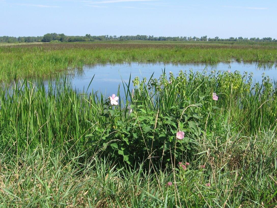
An upland transition area should be planted adjacent to emergent wetlands and should be composed predominantly of native shrubs. Species should be selected based on soil type and moisture regimes at the site but could include gray dogwood (Cornus racemose), silky dogwood (C . amomum), nannyberry (Viburnumlentago), maple-leaved viburnum (V. acerfolium), bayberry (Myricapensylvanica) and pussy willow (Salixdiscolor) Shrub habitat will further improve nesting habitat for birds in the project area.

-KeyBenefits: Ecological
• Improved water quality;
• Improved nursery and foraging habitat for fish;
• Increased habitat heterogeneity; and
• Shoreline protection through wave energy absorption.
Recreational
• Improved water quality;

• Improved migratory bird watching opportunities;
• Improved angling opportunities; and
• Improved on-water experience (e.g., kayaking, paddle boarding).
Natural Shoreline Configuration #2
Open Water → Fish Habitat Structures → Beach → Dune →UplandTransition→ Green Space
Natural Shoreline Configuration #2 could be implemented in “The Shore” area (APPENDIX A). In this configuration, open water would transition to the beach with a gentle slope. Topographic variation to improve fish habitat would be incorporated in the form of subaqueous mounds in water Open water would then transition to beach for use by visitor. Beach would then transition into dune habitat (FIGURE 3) planted with native species such as American searocket (Cakile edentula), American beachgrass (Ammophilabreviligulata), and beach pea (Lathyrusjaponicus). The addition of dune habitat in the project area would improve nesting habitat for certain migratory bird species. On the landward side of the dune habitat an upland transition area would be created and planted with shrubs such as bayberry, silky dogwood, and willows (Salix spp.). Finally, areas for walking, picnicking, and passive recreation would be located on the landward side of the upland transition area.
WRT
CHEERS – Cleveland Harbor Eastern Embayment Resilience Study

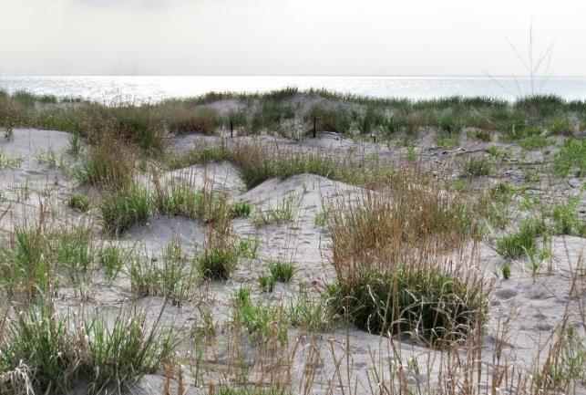
In Natural Shoreline Configuration #3, the riprap revetment would protect the shoreline from eroding and emergent wetland habitat would be created behind it and planted with native wetland species. Like Natural Shoreline Configuration #1, emergent wetland vegetation would be planted at a water depth between -3.0 to 0.0 ft allowing for the expression of several different species with varying inundation tolerances. The emergent wetland habitat would then transition into upland shrub species and then into green space depending on community needs.
Ecological • Improved water quality; • Improved nursery and foraging habitat for fish; • Increased habitat heterogeneity resulting in increased biodiversity and ecological resiliency within the project area; and • Shoreline protection through wave energy absorption.
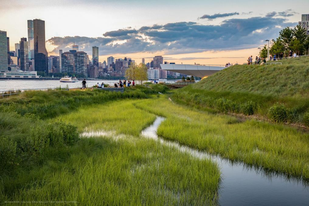
Recreational •
Improved water quality; • Improved migratory bird watching opportunities; and
Improved angling opportunities
WRT CHEERS – Cleveland Harbor Eastern Embayment Resilience Study

Building on Cleveland Metroparks’ restoration efforts in areas adjacent to their offices, Great Ecology proposes the implementation of ‘no-mow areas’ within the CHEERS project area (APPENDIX A). These areas would be planted with native oak trees (Quercus spp.) and understory species to create oak savanna habitat adding habitat structure and complexity (FIGURE 5). Oak savannas are characterized by less than 50 percent tree cover of species such as white oak (Q. alba), bur oak (Q . macrocarpa), and black oak (Q . velutina). Understory species are diverse and dominant in the community consisting of grasses, forbs, sedges, and shrubs (Kiser 2013 ; Ohio Environmental Council 2013). Oak savanna habitat would increase biodiversity within the project area by improving nesting habitat for grassland bird species and improve connectivity between the Cleveland Lakefront Natural Preserve and the larger project area. In addition, this habitat type would provide the added benefit of maintaining visual sight lines to the waterfront given its low tree density and low growing understory.
Ecological
Improved breeding bird habitat;

Improved habitat connectivity; and
Increased habitat heterogeneity resulting in increased biodiversity and ecological resiliency within the project area.

• Improved bird watching, • Educational opportunities; and • Improved waterfront esthetics

In addition to oak savanna, the CHEERS project area provides an opportunity to create native grassland habitat on the sheltered side of “The Cove” on the “The Isle” (APPENDIX A) (FIGURE 6). Native grassland habitats are in decline in Ohio and several birds of conservation concern in Ohio depend on native grassland habitat for breeding including bobolink (Dolichonyxoryzivorus) and eastern meadowlark (Sturnellamagna) (Ohio Division of Wildlife, 2015). These species currently use small patches of habitat around the Burke Lake Airport and within Wendy Park for stop over and nesting habitat. Creating larger areas of grassland habitat would encourage grassland bird nesting and potentially draw birds away from the Burke Lake Airport. Grasslands are dominated by grasses, sedges, and forbs and contain limited to no woody vegetation. These habitat types should be planted with native grasses such as big bluestem (Andropogon gerardii) and Indian grass (Sorghastrum nutans) as well as native forbs such as purple cone flower (Echinacea purpurea), prairie dock (Silphium terebinthinaceum), sawtooth sunflower (Helianthus grosseserratus), false white indigo (Baptisia lactea) and round-headed bush-clover (Lespedeza capitata). Once planted with native species, the grassland areas would become a ‘no mow areas’ except on an approved schedule, for example mowing every two years to prevent the establishment of woody vegetation. Creating native grassland habitat would increase habitat heterogeneity in the project area, increase bird nesting habitat opportunities, and enhance passive recreational opportunities.
Ecological • Improved breeding bird habitat; • Improved habitat connectivity; and • Increased habitat heterogeneity resulting in increased biodiversity and ecological resiliency within the project area.

Recreational • Improved bird watching, • Educational opportunities; and • Improved waterfront esthetics

Carpenter, S. (n.d.). Cuyahoga Valley National Park–Coliseum Grasslands. Accessed: April 2021. Available at: https://birding-in-ohio.com/summit-county/cuyahoga-valley-national-parkcoliseum-grasslands/
Kiser, M. 2013. Bluff Prairie & Oak Savanna Restoration. U.S. Fish and Wildl ife Service. Accessed January 2021. Available at: https://buffalo.extension.wisc.edu/files/2013/02/Email_PFW-BluffPrairie_Oak-Savanna.pdf
Luel, Steven. 2018. Fish communities in submerged aquatic vegetation. Accessed January 2021. Available at: https://habitat.fisheries.org/fish-communities-in-submerged-aquatic-vegetation/ Ohio Division of Wildlife. 2015. Ohio’s State Wildlife Action Plan. Columbus, Ohio, USA. Accessed: April 2021. Available at: https://ohiodnr.gov/static/documents/wildlife/wildlifemanagement/OH_SWAP_2015.pdf
Oaksavanna.org. n.d. Trees of Oak Savannas. Accessed January 2021. Available at: https://www.oaksavannas.org/savanna-trees.html
Platt, Deb. 2019. Headlands Dunes State Nature Preserve. Accessed January 2021. Available at: https://trekohio.com/2014/06/17/headlands-dunes-state-nature-preserve/ SWA/Balsley. n.d. Hunter’s Point South Constructed Wetlands. Accessed January 2021. Available https://greatecology.com/portfolio-item/hunters-point-south/ Swartz, B. n.d. Lake Earie Coastal Marsh. Accessed January 2021. Available at: https://www.lrb.usace.army.mil/Media/Images/igphoto/2002072175/
WRT CHEERS – Cleveland Harbor Eastern Embayment Resilience Study

WRT CHEERS – Cleveland Harbor Eastern Embayment Resilience Study


