JUNE 2023
2
THE NEW SCHOOLFIELD DISTRICT PLAN
JUNE 2023
The importance of the Dan River Mills site and surrounding community, now commonly known as Schoolfield, cannot be overstated. The site is at the heart of the economic history of the nation’s textile production that built Danville’s reputation as a major economic hub throughout the1800s and 1900s. The mill was once the largest single-unit textile mill in the world.
Prepared by WRT in partnership with:
Sherwood Design Engineers, Systematica, Cohere, Davey Resource Group, Ninigret, Dewberry, and Jon Morrison Associates.
3
Preface
4
ENJOY. EXPLORE. GROW.
The Schoolfield District holds a special place in the hearts of many Danville residents.
For over 100 years, Dan River Inc., one of the largest textile operations in the southeast, operated within this district and created a mill village that provided thousands of employees with resources to support their families, including housing, daycare, schools, and medical care. The combination of working in the mill and living in this village created a special bond between employees and a loyalty to the company that spanned generations. After the mills closed in 2006, there was uncertainty about the fate of this district. Buildings were demolished and this once bustling area of the community became a story of the past.
In 2019, the Danville Office of Economic Development & Tourism was tasked with redeveloping this district and engaged WRT, a national planning and architecture firm, to develop a master plan. During the exploratory phase, City staff and the WRT team walked through the Finishing Plant, which once stood on the main 80-acre mill site. As we entered an upper level of this building, we discovered a sign that read, “Through these doors walk the world’s greatest people.” We could just imagine the hundreds, if not thousands of employees that crossed under that sign daily. This sign not only served as a means of encouragement to mill employees – it reaffirmed what was central to the company’s values. It’s employees – it’s people – were at the very heart of the mill’s success. This paralleled the approach we would take throughout the planning process – putting people, our local residents, at the heart of this plan.
Soon after the planning process launched, the community welcomed an anchor tenant to the district. Caesars Virginia announced plans to invest $650 million and create a world-class casino resort at the former Dan River Inc. site. Again, we reached out to the people, and over 1,000 residents helped us determine how to leverage this catalytic project to attract additional investment into this once thriving area and develop amenities that will enhance the quality of life for residents. The Schoolfield District Plan offers a unique opportunity to write a new chapter to our community’s history impacting generations to come.
Corrie Teague Bobe Director, Economic Development & Tourism City of Danville, Virginia
5
Acknowledgments
A Special Thank You
to the hundreds of Schoolfield residents and Danvillians who participated in conversations, engagement activities, and meetings throughout the process to help shape the vision for Schoolfield.
The Schoolfield District Plan was made possible by the leadership and guidance of our many partners:
CITY LEADERSHIP PROJECT PARTNERS
City Administration
Ken Larking City Manager
Earl Reynolds Deputy City Manager
City Council
Alonzo Jones Mayor
Gary P. Miller Vice Mayor
James Buckner
L.G. “Larry” Campbell, Jr.
Bryant Hood
Barry Mayo
Sherman Saunders
J. Lee Vogler
Madison Whittle
Office of Economic Development & Tourism
Corrie Teague Bobe Director
Kelvin Perry Assistant Director
Laura Ashworth
Kimberly Custer
Lisa Meriwether
Industrial Development Authority (IDA)
T. Neal Morris Chair
Russell Reynolds Vice Chair
John H. Laramore Secretary/Treasurer
Kristen Barker
David Cumbo
Philip Hall
Robbie Woodall
6
STEERING COMMITTEE
City of Danville
Corrie Teague Bobe
Director, Economic Development & Tourism
Kelvin Perry Assistant Director, Economic Development & Tourism
Laura Ashworth Marketing & Research Manager, Economic Development & Tourism
Bill Sgrinia Director, Parks & Recreation
Stephanie Lovely Facilities & Services Planner, Parks & Recreation
Richard Drazenovich Director, Public Works
Brian Dunevant Assistant Director, Engineering
Jason Grey Director, Utilities
CONSULTANT TEAM
WRT
Planning, Urban Design, Landscape Architecture, Architecture
Davey
Ecology & Design Cohere
Branding, Marketing, & Web Design
Sherwood Engineers Systems & Civil Engineering
Ashtyn Foddrell Police Department
Doug Plachinski
Former Director, Planning & Zoning
Renee Burton Director, Planning & Zoning
Susan McCulloch
Division Director, Housing Development
Stakeholders
Ed Walker Developer
Ina Dixon Historian
Tim Clark President, Blair Construction
Brooks Stanley
Cameron Harris
Diana Schwartz
CEO, River District Association
Caesars Entertainment
Mark Schlang
Former Director, Caesars Entertainment
Tim Grantham
Architect, Marnell Companies
David Howryla President, Marnell Companies
Chris Albrecht
Senior Vice President & General Manager, Caesars Virginia
Steven Gould
Founder & Principal, Southern Virginia Legal PLLC
Gregory Combs
Senior Director, Design & Construction, Caesars Entertainment
Systematica
Transport planning & mobility
Ninigret
Economic & Market Analysis
Jon Morrison Associates
Structural Engineering
Dewberry
Transportation Engineering & Engagement
7
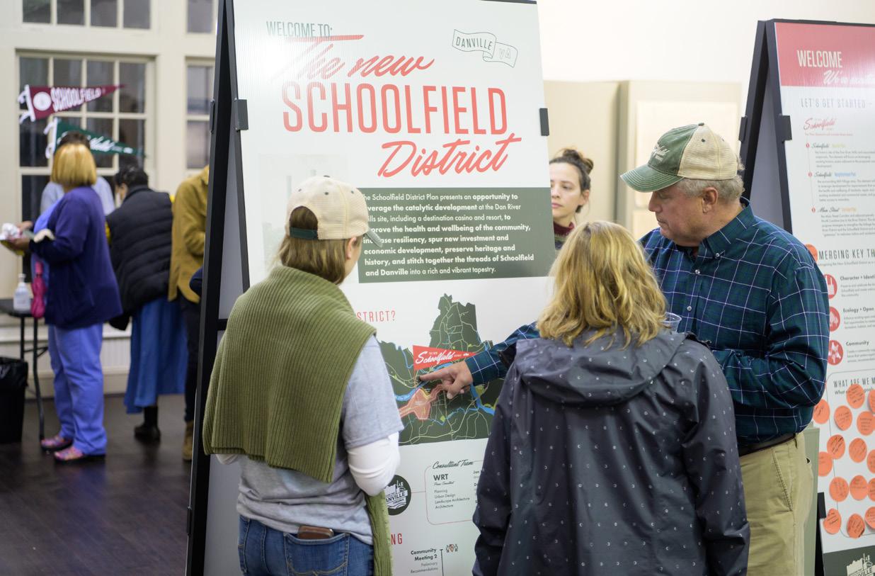
The Schoolfield District Plan presents an opportunity to leverage Caesars Virginia’s catalytic development and stitch together the threads of Danville and the Schoolfield District into a rich and vibrant tapestry.
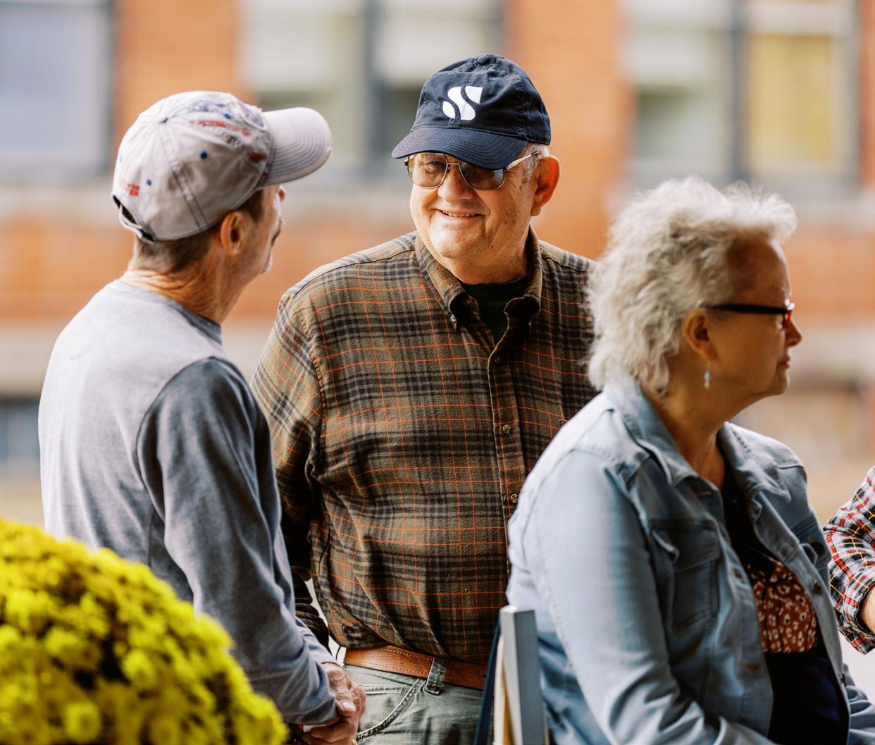
ENGAGING THE COMMUNITY
Engagement was critical to understanding the community connections to the District and an opportunity to bring together residents, stakeholders, and city agencies to envision ideas for the future.
KEY THEMES & SYSTEMS
Four key systems outline the framework of the Schoolfield District Plan. These systems work together to revitalize and shape; spur and stabilize; unify and nurture; and connect and link the district together.
The storied past of Schoolfield has had a profound impact on the physical and social fabric of the district today. Explore how the past has evolved to create the current conditions and how this plan can build off of the strong foundations to build an even brighter future.
SCHOOLFIELD TODAY THE VISION
The New Schoolfield District explores three scales of strategies - the corridor, the master plan, and the neighborhood - to create an authentic, resilient, historic, and thriving district.
8 Contents ES
01
02 04
03 EXECUTIVE SUMMARY
CONNECTING THE CORRIDOR
The W Main Street corridor is the key spine in Danville, connecting people to places. It has the opportunity to embody the distinct character and culture of the Schoolfield District while improving the quality of the journey and connections all while prioritizing the user and promoting environmental stewardship.
RESTITCHING THE VILLAGE APPENDICES
Central to all the ideas proposed in this plan are the residents of the Historic Schoolfield Village. The neighborhood section explores strategies to support new and future residents to improve quality of life and allow them to continue to thrive in their community.
The supplemental studies and analysis that informed the final plan strategies, including the full existing conditions analysis, Filtration Plant architectural and structure study, and community designs for the catalyst sites.
The Schoolfield District is experiencing a major transformation with the new Caesars Virginia resort. This plan seeks to leverage this catalytic development to provide services and amenities that benefit current and future residents and visitors.
SHAPING THE FABRIC IMPLEMENTING THE VISION
The New Schoolfield District Plan imagines a thriving district that is founded in past experiences, present needs, and future opportunities to benefit the community. In order to achieve this continued coordination, partnerships, creative phasing, and funding will be required to bring this vision to life.
Note: All images and graphics in this plan belong to WRT, unless otherwise noted.
05
07 A 06 08
9
What is a District Plan?
The New Schoolfield District Plan reimagines the area surrounding the former mill as a dynamic Village that balances economic opportunity, social responsibility, and environmental needs.
THE NEW SCHOOLFIELD DISTRICT PLAN
is comprised of 3 parts:
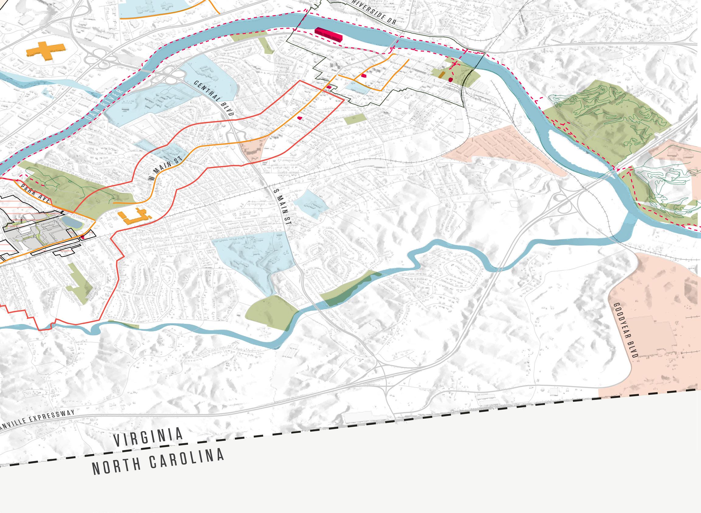
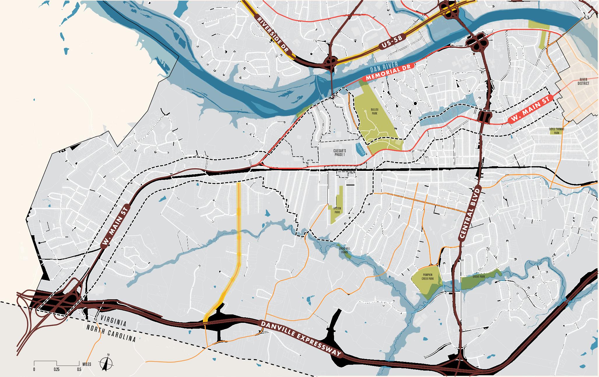
THE CORRIDOR
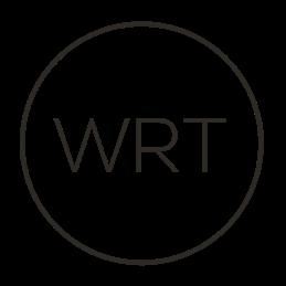
The Corridor Plan focuses on the W Main Street corridor and adjacent parcels from the North Carolina state line to the River District. The plan strategies strengthen the linkage through Danville and establish gateways to welcome visitors and residents into the City.
THE MASTER PLAN
The Master Plan centers on the historic Dan River Mills site and associated outparcels not occupied by the Caesars Virginia resort. The conceptual drawings focus on leveraging existing historic assets adjacent to the Caesars resort development to provide a range of opportunities and amenities for residents and visitors.
THE NEIGHBORHOOD
The Neighborhood Plan focuses on the historic Schoolfield Village with strategies to improve the health and well-being of residents, to repair and revitalize residential and commercial assets, and to provide better access to amenities.
10
THE CORRIDOR

THE MASTER PLAN
THE NEIGHBORHOOD
River District
THE NEW SCHOOLFIELD DISTRICT
VA / NC STATELINE 11
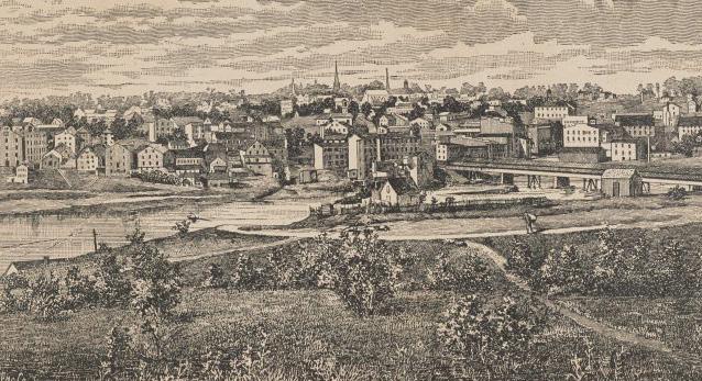
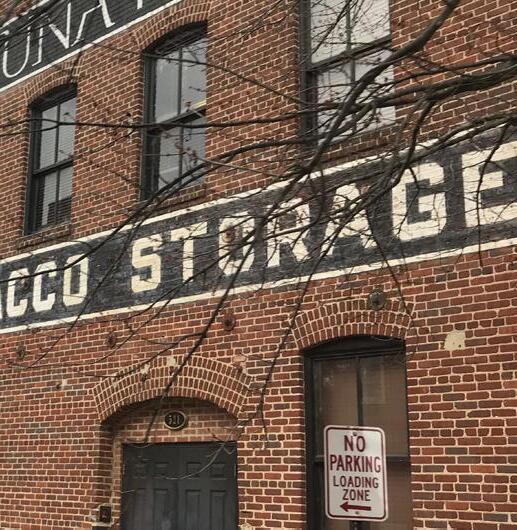
The Dan River Mills Schoolfield Mill was once at the center of textile production in US history. Its role in the development of Schoolfield Village cannot be overstated. The heart of the regional economy, Dan River Mills put Danville on the map as the largest single-unit textile mill in the world in the 19th and 20th centuries. However, economic and demographic shifts in the last century caused the mills to shut down, leaving Schoolfield with the need to adapt to modern urban conditions.
In order for Schoolfield to transition into a more supportive, prosperous community, it was critical to first unearth the layers of shared meaning, values, and aspirations embedded in this place and the surrounding district. There are deep and varied connotations amongst the community— some whose grandparents may have worked at the mill, others who know the site only as a beautiful industrial ruin, and others who only see the site as a lingering symbol of a lack of progress in Schoolfield. Yet, within this complexity, there is the transformative potential to celebrate the history of this place by leveraging existing assets to envision a revitalized Schoolfield District that sets Danville apart.
The Schoolfield District Plan presents an opportunity to take advantage of the catalytic development at the Dan River Mills site, including a destination casino and resort, to improve community health and wellbeing, increase community resiliency, spur new investment and economic development, preserve local heritage, and stitch together the loose threads of Danville and the Schoolfield District into a rich and vibrant tapestry.
 THE INTERCHANGE
FLIPPEN CEMETERY
THE INTERCHANGE
FLIPPEN CEMETERY
THE BEND
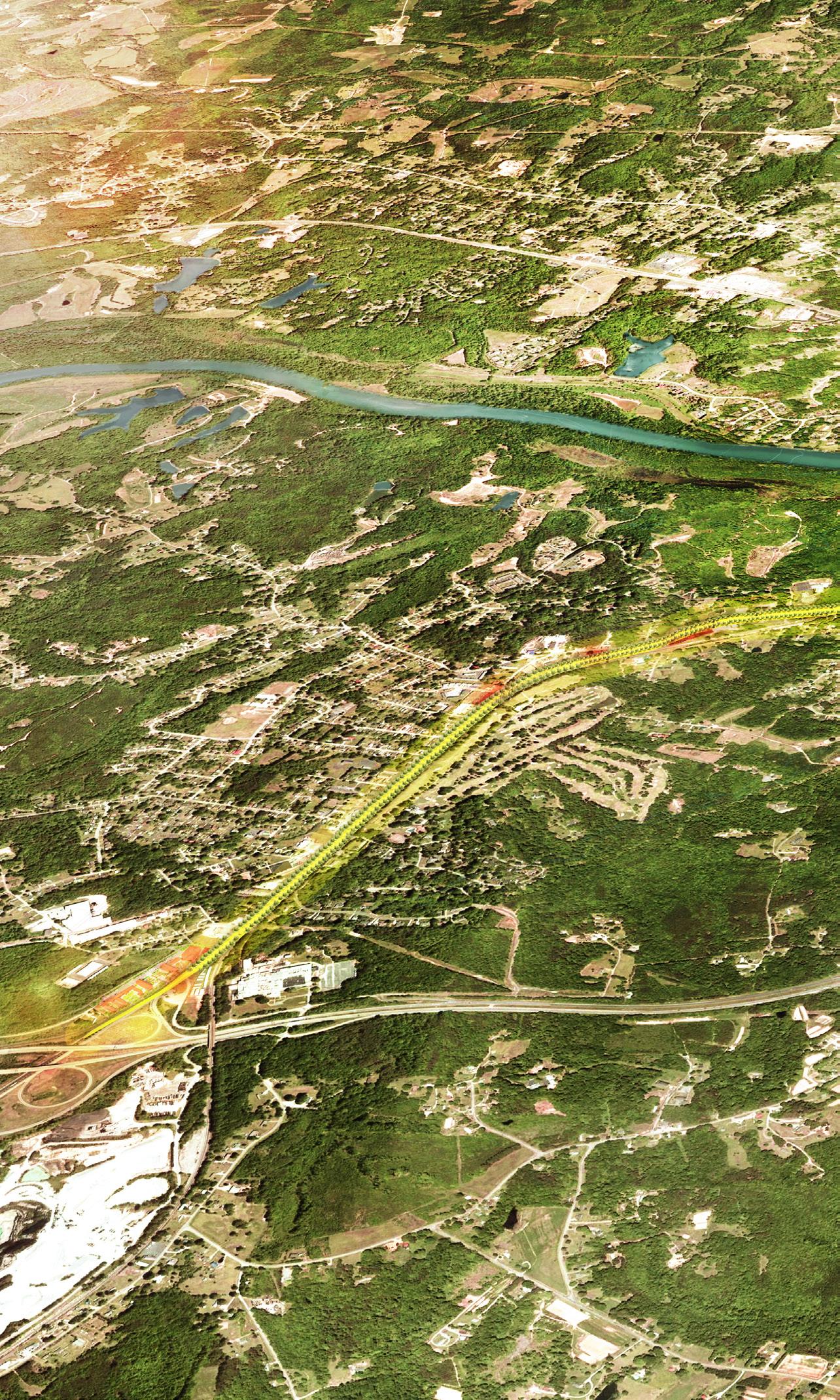
F I gur E 2 | Overall Development Scheme 12
 FILTRATION PLANT + SCHOOLFIELD WOODS SHOPPING CENTER REDEVELOPMENT
MAIN STREET GREEN
BALTIMORE AVENUE CLUSTER
DCC
BALLOU PARK HYLTON PARK
AVERETT UNIVERSITY
FOUNDERS PARK
GATEWAY PEDESTRIAN BRIDGE
SCHOOLFIELD WEST STREAM TRAIL
SCHOOLFIELD TRAIL
THE RIVER DISTRICT
FILTRATION PLANT + SCHOOLFIELD WOODS SHOPPING CENTER REDEVELOPMENT
MAIN STREET GREEN
BALTIMORE AVENUE CLUSTER
DCC
BALLOU PARK HYLTON PARK
AVERETT UNIVERSITY
FOUNDERS PARK
GATEWAY PEDESTRIAN BRIDGE
SCHOOLFIELD WEST STREAM TRAIL
SCHOOLFIELD TRAIL
THE RIVER DISTRICT
DANRIVER
EXECUTIVE SUMMARY 13
W MAIN STREET CAESARSVIRGINIARESORT
Executive Summary
SCHOOLFIELD TODAY
The storied past of Schoolfield has had a profound impact on the physical and social fabric of the district today. To develop a vision for the future of the Schoolfield District, it was first necessary to explore the history and current conditions which revealed Schoolfield’s strong community, proud historic legacy, beautiful natural setting, and renewed focus on Schoolfield as a strong foundation to build off of.
ENGAG I NG THE COMMUNITY
This District Plan could not have been generated without extensive input from the members of the Danville community. Through a long engagement process including conversations at open houses, design charrettes, and student workshops, the ideas of residents, stakeholders, and city agencies have become the backbone of this plan. This process pushed the vision for the future of Schoolfield beyond a development plan - but rather a community-led effort towards building an equitable future for Schoolfield founded in celebration of its rich culture, history, and community.
The Vision
The New Schoolfield District plan envisions an authentic, resilient, historic, and thriving village fabric stitched together by community and shared history. A village shaped by the stories of our past, creating a canvas for stories yet to be written.
14
KEY SYSTEMS
Four key systems build the framework for the future of the Schoolfield District:


COMM u NITY, CHA r ACTE r , & IDENTITY
Revitalize + Shape
Preserve and celebrate the history and legacy of Schoolfield and create welcoming gateways into the community.
HO u SIN g & ECONOMIC DEVELOPMENT
Spur + Stabilize
Combat displacement and identify equitable and inclusive revitalization and development opportunities that meet the needs of existing and future residents.
ECOLO g Y & OPEN SPACE
Unify + Nurture
Enhance existing open and natural spaces and find opportunities to create new spaces for recreation, habitat, and respite.
MOBILITY, CONNECTIVITY, & INF r AST ru CT
ur E
Connect + Link
Emphasize W Main Street as the city’s spine and create seamless multi-modal connections to the River District.
EXECUTIVE SUMMARY 15
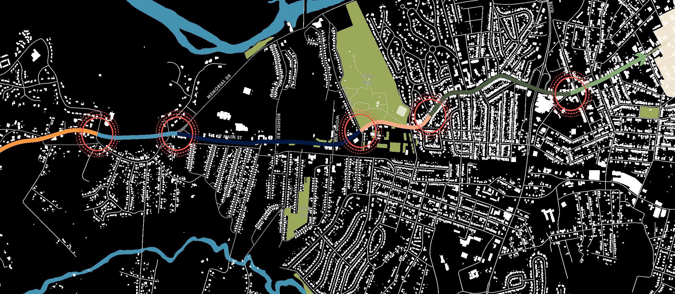
PLANNING ACROSS THREE SCALES
The Schoolfield District Plan leverages opportunities to respond to the Caesars Virginia development at three different scales of intervention: the corridor, the catalyst sites, and the neighborhood.


THE FAB r IC | W Main Street Corridor
The W Main Street corridor is the central spine of Danville and functions as the link between existing and proposed destinations. This 5.4-mile corridor includes six unique zones that are unified through consistent public realm improvements highlighting Schoolfield’s unique identity and improving accessibility and mobility across the district, connecting Danville from the VA/NC border to the River District.
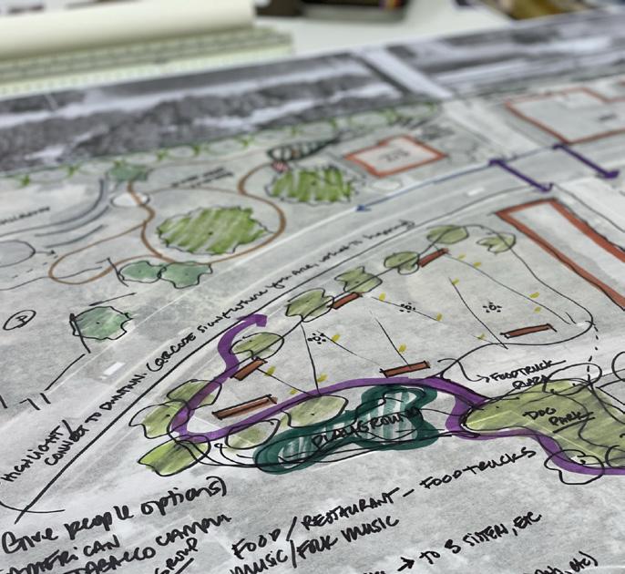
THE PLACE | Catalyst Sites
The catalyst sites create new central nodes of activity situated along the corridor leveraging new development opportunities while also complementing the many existing local assets. The conceptual plans ground the overarching strategies into five physical locations bringing together new housing, economic development opportunities, public plazas, community gathering spaces, open and natural spaces, and amenities that are critical to supporting an equitable and welcoming environment for residents and visitors alike.

THE PEOPLE | Neighborhood
Central to all the ideas proposed in this District Plan are the residents of the Historic Schoolfield Village. The neighborhood plan explores strategies to support these residents as they combat the threat of displacement and to improve overall health and wellbeing through specific strategies and design interventions that will allow residents to continue to thrive in their community.
16
IMPLEMENTING THE VISION
The New Schoolfield District Plan imagines a thriving Schoolfield Village that is founded in past experiences, present needs, and future opportunities of the Schoolfield community. In order to achieve this goal continued coordination, new public and private partnerships, and a creative phasing and funding strategy will be required to bring the vision to life.
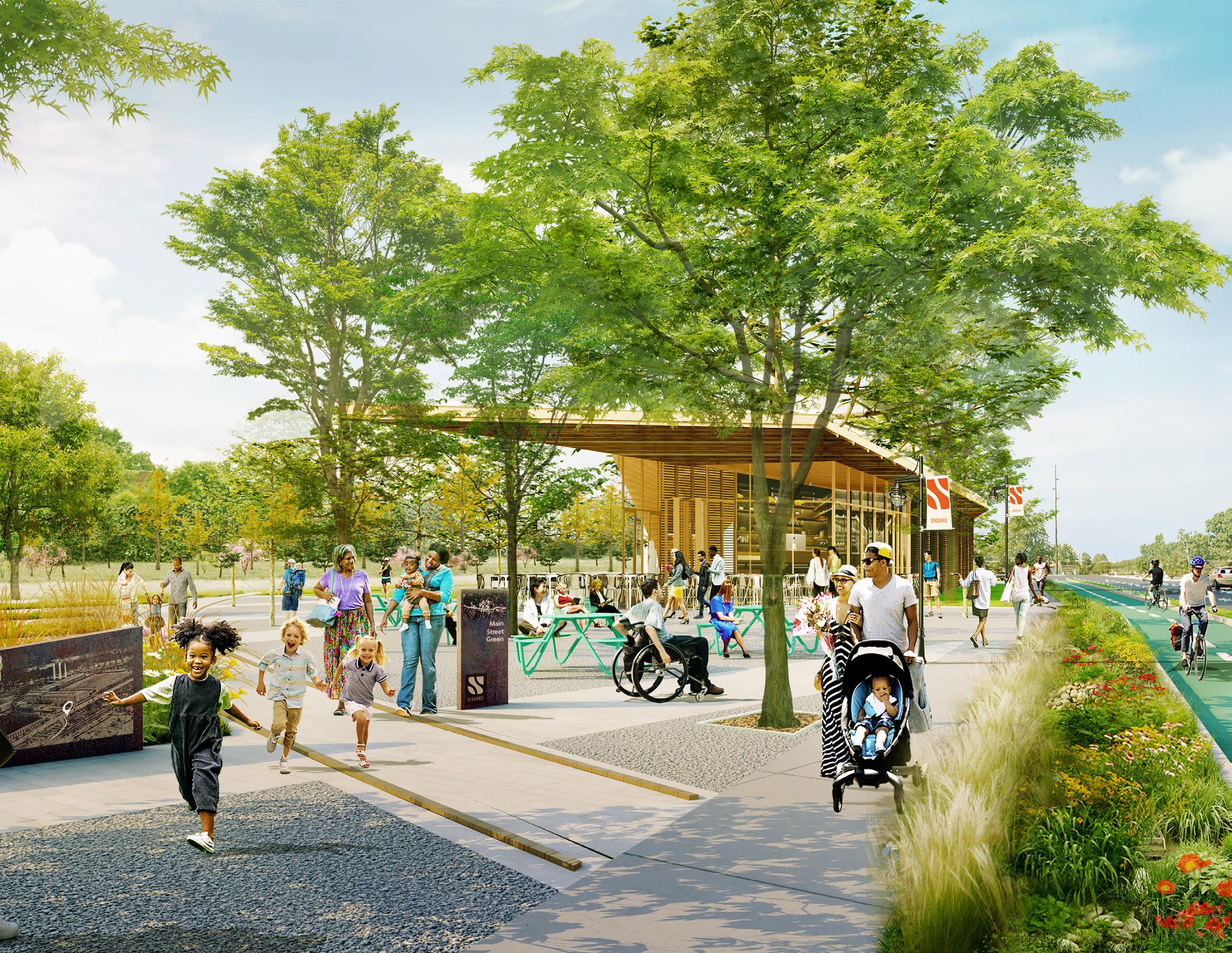
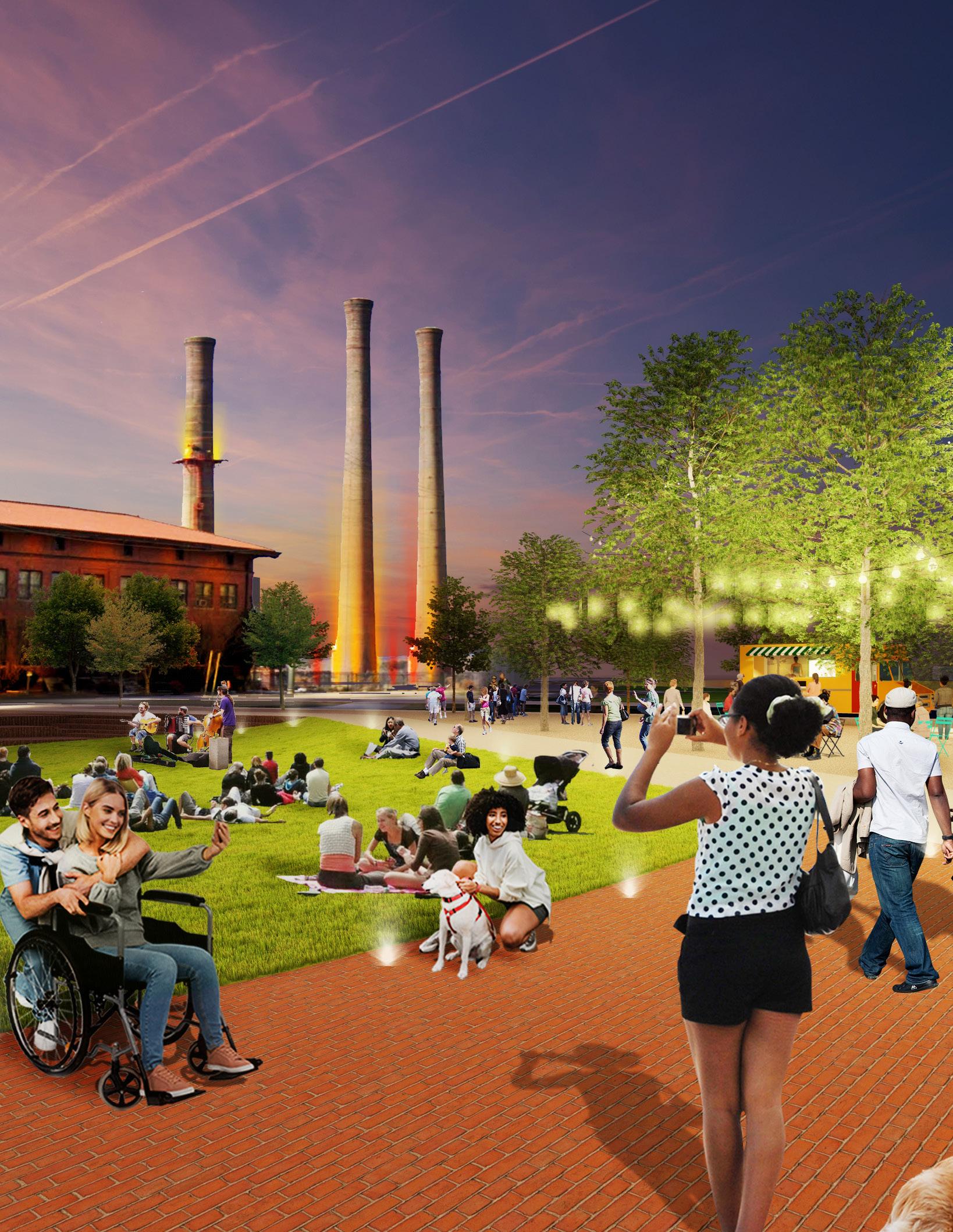
F I gur E 3 | Rendering View of Main Street Green EXECUTIVE SUMMARY 17
IN THIS CHAPTER: + History + Planning Context + Community Snapshot
+ Existing Conditions + Issues & Opportunities Analysis
01
18
Schoolfield Today
A brief look at Schoolfield’s storied past to understand the district’s evolution to its present-day conditions. The analysis of historic resources and existing conditions provides critical cues in the development of the concept design options and strategies for the New Schoolfield District.
This section is supplemented by a comprehensive Existing Conditions report included in the appendix.
SCHOOLFIELD TODAY 19
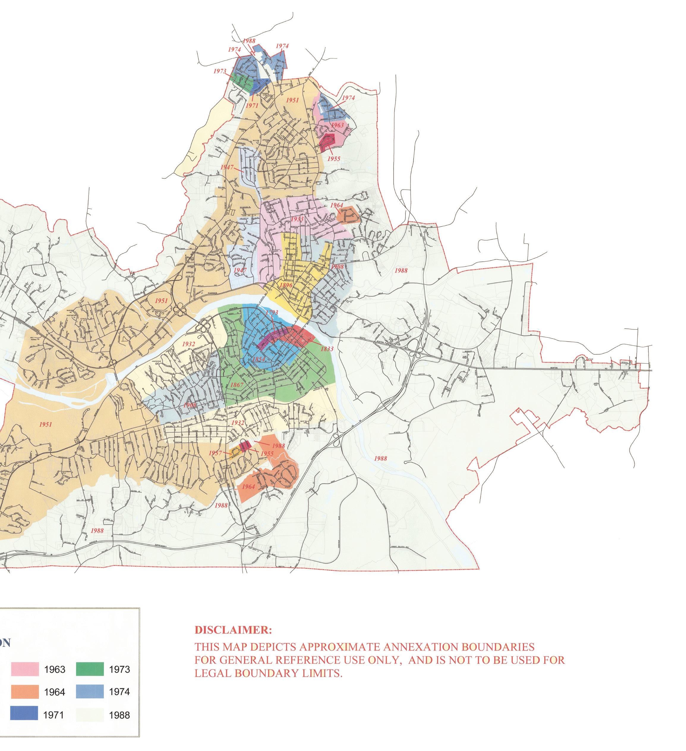
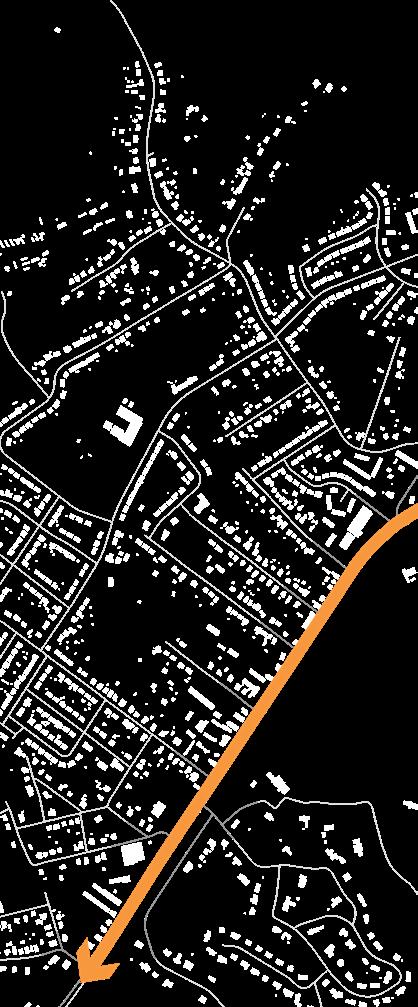
How Danville Grew
Origins of Danville
Located in southern Virginia, the land was inhabited by the Occaneechi Band of the Saponi Nation prior to European settlers coming to the region in the 1700s. Development began after the American Revolutionary War, with the first settlement known as Wynne’s Falls. The tobacco industry fueled the regional economy and lead to the creation and growth of what is known as Danville today.
Danville steadily grew throughout the 19th and 20th centuries, as seen on the map to the right. Beginning with the original boundaries around the present-day River District, development gradually grew outward over time incorporating established neighborhoods and villages, like Schoolfield.
Schoolfield Village
Developed as a mill village for employees of Schoolfield Mill, Schoolfield Village was established in 1904 and continued to grow leading into the Great Depression. Known as a closeknit community of workers, it provided places to live, work, play, pray, and learn. However, as operations of the mill decentralized outside of the Danville area, Dan River Mills released ownership of Schoolfield Village and the area was officially annexed into the city in 1951.
Danville Today
The city encompasses 43 square miles along the Dan River at the southern border of Virginia and is home to approximately 42,500 residents (2020 Census). Regionally recognized as a great place to live, Danville boasts a rare combination of small town charm and big city offerings.
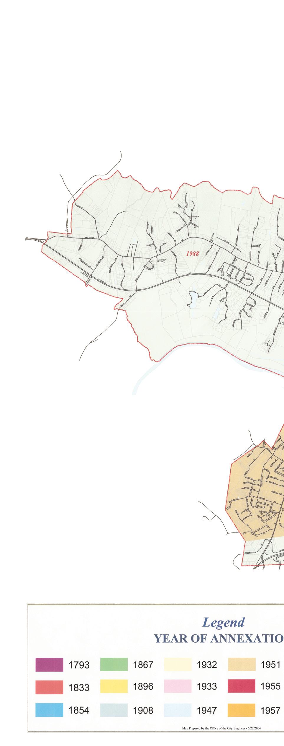
F I gur E 4 | City of Danville Annexation Map 20
SCHOOLFIELD TODAY 21
SCHOOLFIELD
Danville & the Dan River Mills

Origins of Danville
European settlers established the Village of Wynne’s Falls on the banks of Dan River in the 1700s, growing the regional economy to become “The World’s Best Tobaccos Market.” The booming industry leads to population growth outside the pre-arranged boundaries, and Wynne’s Falls is eventually renamed Danville. Canals and railroads were built to increase efficiency and access to Danville, expanding the city’s export of manufacturing and agricultural products.
Civil War Era
At the outbreak of the Civil War, Danville was thriving with a population of around 5,000. During the war, Danville served a major role in Confederate activity, the tobacco warehouses were converted to prison camps, and the Richmond and Danville Railroad became the main supply route to Confederate camps in Petersburg.
After the war, the tobacco industry quickly rebounded, leading to a population boom as Black workers moved from farms closer to the Danville area, founding majority-Black neighborhoods like Liberty Hill, Almagro, and HollbrookRoss.
Continued Success into the 20th Century
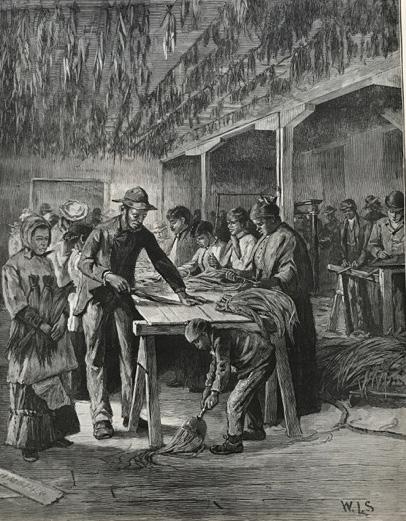
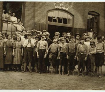
In the late 1800s, the tobacco industry continued to grow, leading wealthy Danvillians to consider new ventures into textile industries. Riverside Cotton Mills was founded in 1882 on the banks of the Dan River, followed by Schoolfield Mills outside of the city limits in 1903. The two merged operations in 1909 and eventually grew to become the largest textile firm in the South. The mills continued to be regionally significant throughout the early 1900s and gained national attention in the 1920s as they implemented “industrial democracy” to address small issues in industrial workforce. However, harsh conditions in the late 1920s lead to major strikes and a fight for mill workers’ rights.
1900 Loom Worker (Source: Bettmann)
22
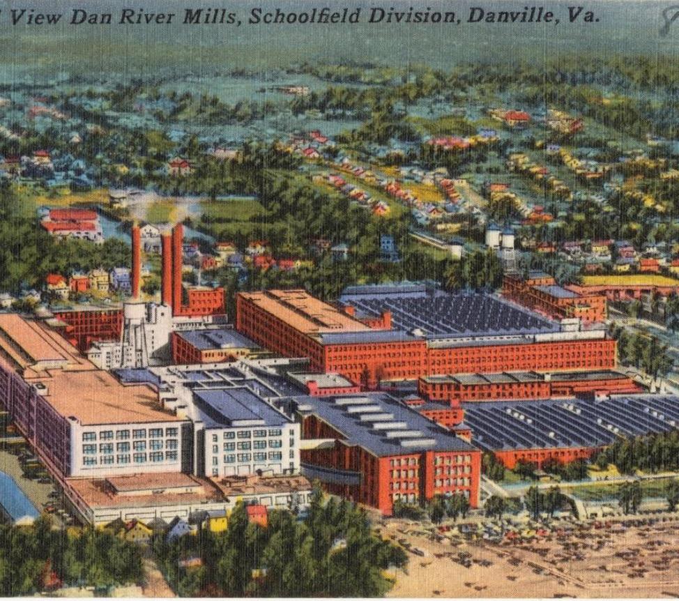
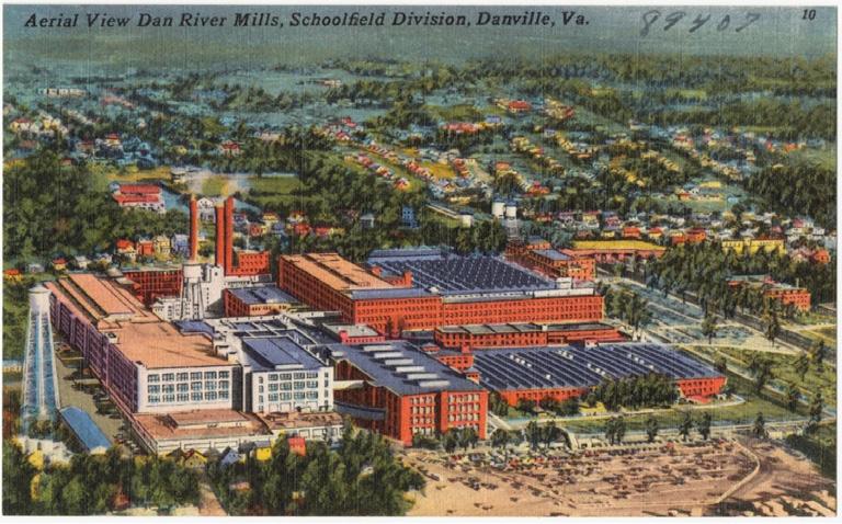
Dan River Mill Postcard (Source: Danville News Agency/Tichnor Brothers Collection)


World War II
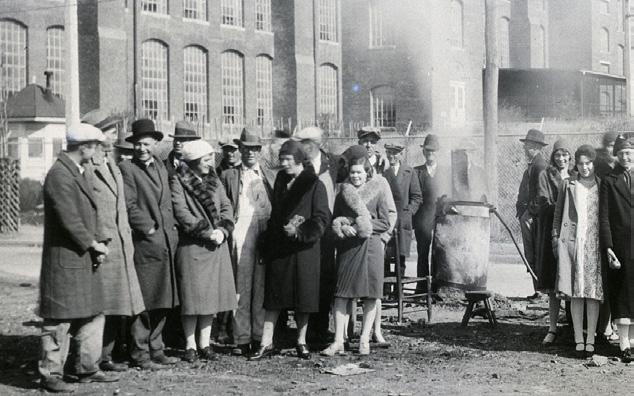
The mills thrived during World War II as a major supplier for the military, reinstating themselves as the largest textile industry in the region and the largest employer in Danville. The mills continued this legacy post WWII as they shifted focus towards fulfilling civilian demands for textiles. However, by the 1950s, operations began to decentralize and move out of Danville to other facilities throughout the South. Schoolfield Village was officially annexed by Danville in 1951. The Village was built to retain labor and was known for its close-knit community.
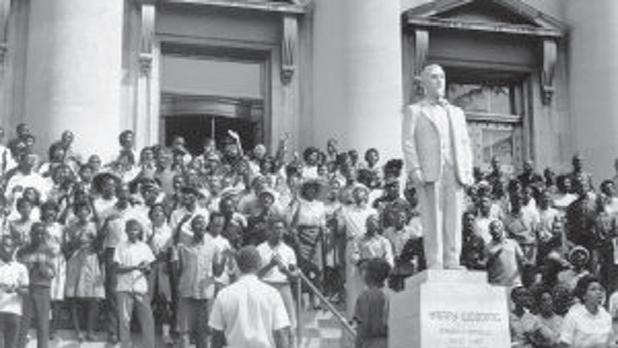
Civil r ights Era
Integration in the mills began in 1969 after tense protests against inequality and segregation, including Bloody Monday, a significant instance of violence against civil rights activists that took place in 1963. Prior to integration, Black workers could not hold certain positions and were not permitted to live in Schoolfield Village.

Decline
Starting in the1960s, demand for textiles and the mills declined with the rise of imports from foreign countries. Initially able to compete by investing in new technologies, Dan River Mills officially filed bankruptcy in 2004 and closed the Danville plant in 2006. Following the closure, many of the unoccupied buildings were salvaged for materials. After closing, a group of former Schoolfield High School alumni purchased the former Dan River Welfare Building and created a museum to honor the site’s history.
Next Chapter
The former Dan River Mills site at Schoolfield was selected by Danville City Council for casino development and approved by Danville voters in 2020. Shortly afterward, Caesars Entertainment took ownership of the site to begin temporary operations in 2023 with full operations beginning in 2024. During this time, Schoolfield Village gained a Historic District designation on the National Register of Historic Places. These developments as well as changing demographics and a renewed focus on the Schoolfield District fuel the need to create this community-driven plan.
Protest to integrate libraries in town (Source: Danny Lyon/Memories of Southern Civil Rights Movement)
SCHOOLFIELD TODAY 23
Demolition of Dan Mills (Michael Williamson/The Washington Post/Getty)
A Storied Past
UNDERSTANDING OUR PAST SO WE CAN BUILD A BETTER FUTURE
LAND OF THE OCCANEECHI BAND OF THE SAPONI NATION.
Danville 1880s
1792 - 1793
Founded as Wynne’s Falls (named Danville in 1793), the region was a hub for tobacco farming.
1860s: Post Civil War
Economy rebounded with growth in tobacco production resulting in a population boom and areas around Danville grow as workers moved off of farms and closer to the City. Including several majority-Black neighborhoods like Liberty Hill, Almagro, and Holbrook-Ross.
1900s:
Mill Development
Mill and Mill Village established Welfare programs, general store, and other amenities for workers.
1929 - 39: the Crash & Great Depression
The textile market slumped during the nationwide depression. Losses caused management to cut worker pay leading to a strike in 1930.
1940s
Following a slump in the 1920s and 30s, the mills thrive during WWII due to additional demand for textiles and become the biggest textile firm in the region, employing over 14,000 workers.
1700 1800 1900 1920 1940
early 1800s
Virginia produces 70% of the nation’s tobacco. Danville came to prominence with the “Danville system” of tobacco sales.
Danville as primary tobacco center of the South
1880s
Textile boom in the reconstruction era led to the creation of Mill Villages throughout the south. In 1882, Riverside Cotton Mills was established in Schoolfield to improve economic & social success for poor white families.
1910 - 1919:
Expansion
Additional housing and mill buildings constructed (YMCA, Welfare building, Hylton Hall). More land was acquired, including land occupied by black tenants forced to vacate.
1935
Danville Textile School established providing workforce training. Population of the Schoolfield Village reaches 5,000.
1883: Race Riot
Danville’s local government, at the time headed by a Black mayor under the rule of the Readjusters (a progressive, biracial political coalition), pushed for additional political power for the Black community. There was a backlash before the election and angry white mobs confronted Black Danvillians. The continued violence and tension led to voter suppression and the reestablishment of white political rule, ushering in increased segregation.
Striking workers outside of the Mill (1930)
24
1960s
Imported textiles began taking away market share from American textile mills.
1943 River Dan Benevolent Fund, Inc., a non-profit for the welfare of workers, was established.
1969
The Dan River Mill was integrated.

2004 - 2006: Decline
Dan River Mills, Inc., filed bankruptcy in 2004. The mill officially ceased operations in 2006.
2020 Schoolfield Historic District was designated on the National Register of Historic Places (Storied Capital & Hill Studio).
2020 1960 1980 2000
1951
Schoolfield was part of a large area annexed by the City of Danville; Mill Village homes transitioned out of company ownership into the hands of private landlords.
1963
Bloody Monday civil rights protests were held to fight inequality and segregation.

1990s
Textile industry collapse was driven by a surge of international imports and free trade.
2010s
Many of the unoccupied buildings were salvaged for materials. A group of former Schoolfield High School alumni purchased the former Dan River Welfare Building and created a museum to honor the site’s history.
Next Chapter
Changing demographics, the catalytic development of Caesars Virginia resort, and a renewed focus on the Schoolfield District fuel the need to create this community-driven plan.
 Dan River Mills
a Mill Village home
protesters fight for civil rights
Rendering of Caesars resort on the Dan River site
Dan River Mills
a Mill Village home
protesters fight for civil rights
Rendering of Caesars resort on the Dan River site
SCHOOLFIELD TODAY 25
demolition of mill buildings
Planning Context
INVESTING IN DANVILLE
A PUBLIC-DRIVEN PLAN FOR BEST USE OF CASINO REVENUES
The Virginia General Assembly approved legislation in February 2019 authorizing casino gaming in certain cities, including Danville. Following this authorization, the City of Danville issued a call for proposals from casino operators. Caesars Entertainment was chosen as the preferred operator on the Schoolfield property. Following a public review and input process, voters approved the development of a casino and resort at the Schoolfield site in November of 2020.
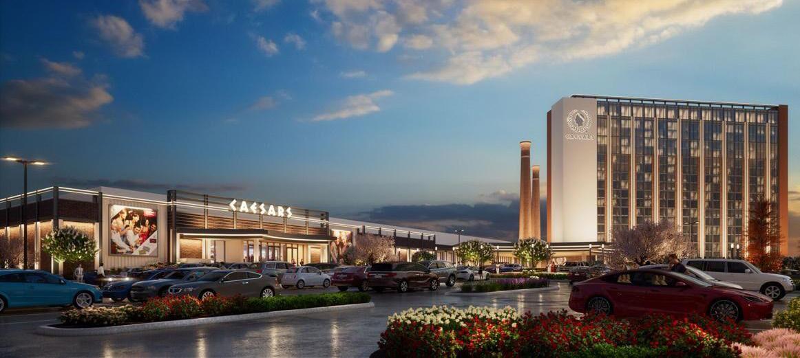
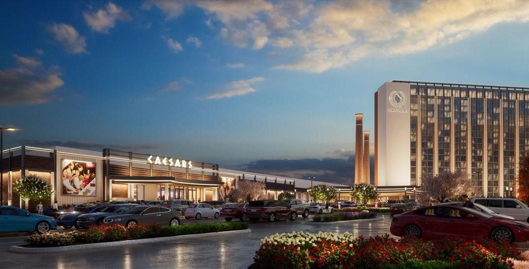
Caesars Virginia is planned to open in 2024, with temporary casino operations beginning in 2023. The resort will include 500 hotel rooms, a gaming floor, Caesars Sportsbook, restaurants, a live entertainment theater, a World Series of Poker room, and 40,000 square feet of meeting and convention space. In addition to the many amenities, Caesars Virginia is projected to generate 1,300 permanent jobs, creating economic opportunities and growth that will increase the long-term fiscal sustainability and competitiveness of Danville.
Investing in Danville was a four-month process from August to November 2020 to identify thoughtful, equitable, and community-driven solutions for how to use funds from the casino development for the greatest positive impact for Danville’s neighborhoods and communities. The plan was driven by guiding principles and goals of City Council, City Staff, the Community Advisory Committee, as well as results yielded from virtual community town halls and a community survey.
The guiding principles listed in the Investing in Danville plan regarding casino revenues are:
• Better Education
• Economic Development
• Public Safety
• Good, Safe Homes and Neighborhoods
• Parks and Community Centers
• Reduction of Poverty
• Improved Health Outcomes
• Emphasis on Equity
• Prioritize Financial Health
• Prioritize Partnerships
The Schoolfield District Plan builds on these guiding principles through strategies that leverage the catalytic development and investment of Caesars Virginia to benefit the city and community.
26
Rendering of the Caesars Virginia resort from W Main Street (Source: City of Danville)
 (Source: City of Danville)
The Danville 2030 Comprehensive Plan was adopted in September 2015 and serves as a guide for physical development in Danville to the year 2030. The comprehensive plan addresses the entire city and is intended to offer strategies for positive influence over the physical elements. The plan provides an overarching vision for the city to encourage continued development and growth of a safe and healthy community. It offers an ideal representation of what the City of Danville could be, while also considering the social, economic, and political constraints, both existing and potential.
Danville 2030 focuses on three major themes:
• Rebuilding and expanding the City’s economic base beyond traditional manufacturing and towards more high-tech industries that provide good, well-paying jobs for residents
• Redevelopment of older parts of the City, while protecting and leveraging the historic character and natural resources
• Need for public safety and maintaining the quality of life enjoyed by Danville residents
DANVILLE 2030 COMPREHENSIVE PLAN
These themes were addressed through the Future Land Use Plan and its six plan elements:
• Sustainable Growth & Land Use
• Transportation
• Corridors & Gateways
• Housing & Neighborhoods
• Historic & Cultural Resources
• Economic Development
In 2023, the City launched the comprehensive plan update to projections, trends, and the future vision for Danville based on current conditions and development trends including the new casino resort. The updated plan is expected to be completed and adopted in 2024.
SCHOOLFIELD TODAY 27
Community Snapshot
DEMOGRAPHICS
The Schoolfield District is home to 1,405 people, approximately 3% of the city’s population. The majority of residents in Schoolfield identify as White (55.9%), 35.4% identify as Black, and 8.2% identify as Hispanic (of any race). Schoolfield differs slightly from the city on the whole, which has a majority (51.7%) of residents identifying as Black, 41.7% identifying as White, and 5.3% identifying as Hispanic (of any race).
SCHOOLFIELD VILLAGE: Who Lives Here:
1,377 residents (Schoolfield Village + adjacent to Schoolfield Site)
56% WHITE 35% BLACK 1% ASIAN 4% OTHER 3% TWO OR MORE r ACE
44.2 Median Age
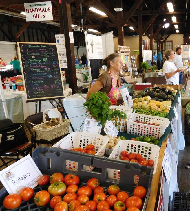
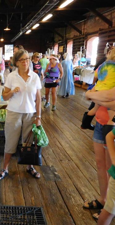
Danville Farmers Market (Source: Local Harvest)
28
Source: Esri BAO, 2019 ACS 5-yr estimates
18,776
People work in Danville, live elsewhere
8,724 People live & work in Danville
8,726
People live in Danville, work elsewhere
Median Income $38,904 Danville Schoolfield $35,204
INCOME + WORKFORCE
Compared to the City of Danville overall, the median household income in Schoolfield is slightly lower, $35,204 compared to $38,904 citywide (2021 ACS, 5-yr). The majority (52%) of the workforce in Danville live elsewhere, only 24% of jobs in Danville are held by residents (On The Map, 2019).
The top 3 industries in Danville, which employ 55% of the working population, are Health Care and Social Assistance (23%), Manufacturing (17%), and Retail Trade (15%). This differs slightly from Schoolfield neighborhood residents – who work in the Accommodation & Food Services (40%), Retail Trade (32%), and Health Care and Social Assistance (21%) fields.
Left; Residents at the first community meeting
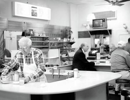
Right: Lunch at The Schoolfield (Source: Register & Bee)
SCHOOLFIELD TODAY 29
Source:
Esri BAO, 2021 ACS 5-yr estimates Source: On The Map, 2019
Assets
OPEN SPACE & RECREATION
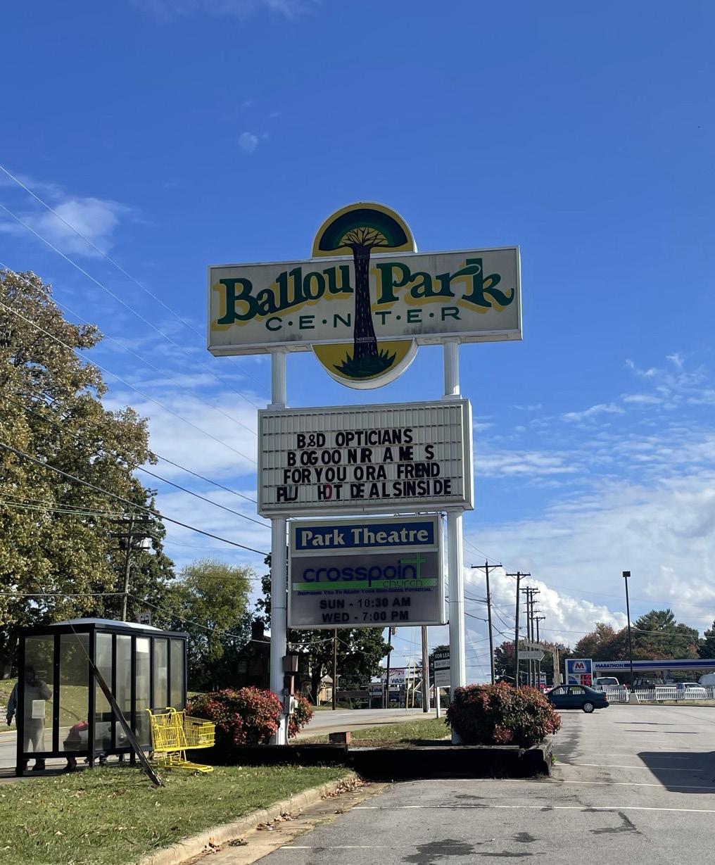
Ballou Park
One of the oldest and largest recreational spaces in Danville, Ballou Park includes a number of amenities making it a popular destination for events and activities.
Ballou Park Natural Trail
A ¾-mile trail beginning in the park and leading into the woods, the Ballou Park Natural Trail includes markers and a self-guided tour highlighting local flora and fauna.
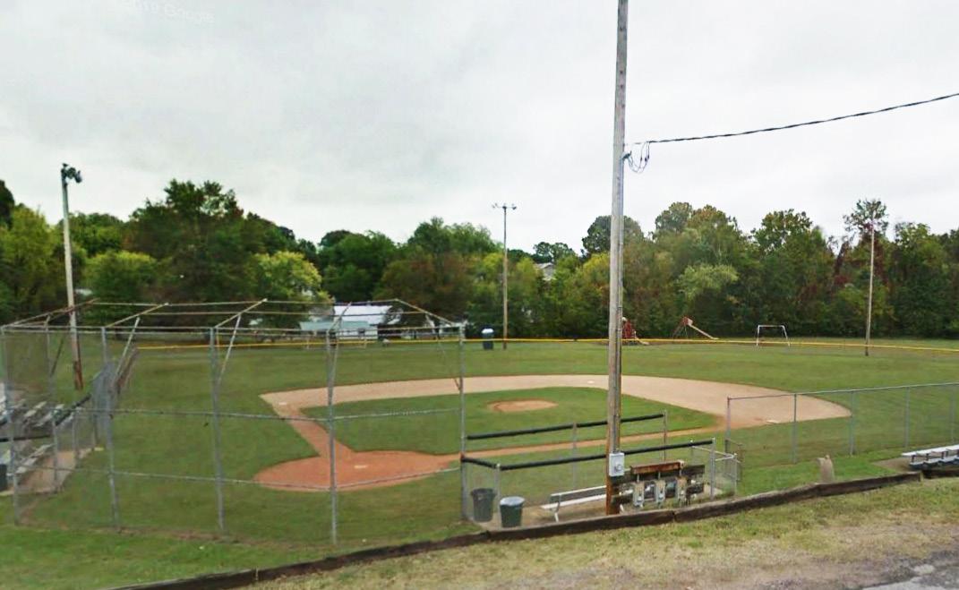
Hylton Park
Located in the middle of the Schoolfield Neighborhood, Hylton Park has many amenities, including a baseball field and playground. It is named for Hattie Hylton, who was an advocate for mill workers and the mill community.
r iverwalk on the Dan
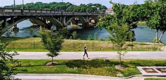
An 11-mile paved trail that highlights the natural beauty of the Dan River and connects recreational opportunities along the historically industrial riverfront. The trail is welcoming for all users - walkers, bikers, and commuters.
Planned Projects
There are two new planned parks and open space projects. The first is a new riverfront park located near Main Street Plaza and Martin Luther King Jr. Bridge, and the second is a series of neighborhood park improvements.
HISTORIC ASSETS
Historic Districts
Danville has seven historic districts, including three which connect to the W Main Street Corridor: Schoolfield Historic Mill District, Old West End Historic District, and the Downtown Danville Historic District.
Self- g uided Tours
Danville has two interactive self-guided tours: Our History Matters Tours
Old West End Tour
These tours explore the history of Danville and guide visitors through all of the historic assets in the City.
3 2 1
Riverwalk Trails
I
E 5 | Assets
(Source: Virginia.org)
F
gur
Map
Ballou Park
7
No. 2 - Historic 30
6 Danville Transit (Source: City of Danville) Old Belt
3
UNIVERSITY
WELDING CO
COMMUNITY COLLEGE E.A. GIBSON ELEMENTARY
HEALTH
River District AVERETT
JARETT
DANVILLE
SOVAH
MALL GEORGE WASHINGTON HIGH SCHOOL
DANVILLE
GOODYEAR PLANT
DAN RIVER MILLS
LANGSTON FOCUS SCHOOL
DANVILLE PUBLIC LIBRARY
SACRED HEART CATHOLIC SCHOOL
VIRGINIA RESORT
AT THE DAN Doyle Thomas Park Ballou Park Hylton Park Pumpkin Creek Park Druid Hills Park Grove Park Angler’s Park Dan Daniel Park 1 9 4 5 6 7 8
DANVILLE
MUSEUM OF FINE ARTS & HISTORY RIVERWALK TRAILS CAESARS
BALLOU PARK SHOPPING CENTER CROSSING
3
2
3
4
Schoolfield Site Woods
Hylton Park
(Source: Danville NDC)
(Source: Google Earth)
8 9
Historic Asset Schoolfield Welfare Building Schoolfield Village
(Source: Mx. Granger)
SCHOOLFIELD TODAY 31
(Source: Google Earth)
EDUCATIONAL FACILITIES
Schoolfield Elementary School
Located on W Main Street, Schoolfield Elementary is a K-5 school where students are performing at or above the statewide standard in English and Math.
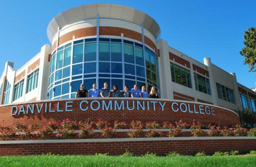
Danville Community College
As a two-year, higher education institution that values innovation, accessibility, momentum, dignity, courage, and commitment, DCC offers 103 distinct programs. The student body of over 3,000 comes from all over the Southern Virginia region.
Averett u niversity
A 4-year, private university that offers 30+ undergraduate programs and 5 master’s programs, Averett is consistently ranked as one of the best regional liberal arts colleges in the South.
Danville Public Library
An anchor in the city since its founding in the early 1800s, Danville Public Library (DPL) has moved locations multiple times, but is now located in the center of the River District, and serves as a central hub for connecting community to knowledge, information, and culture.
SERVICES & AMENITIES
Danville Transit System
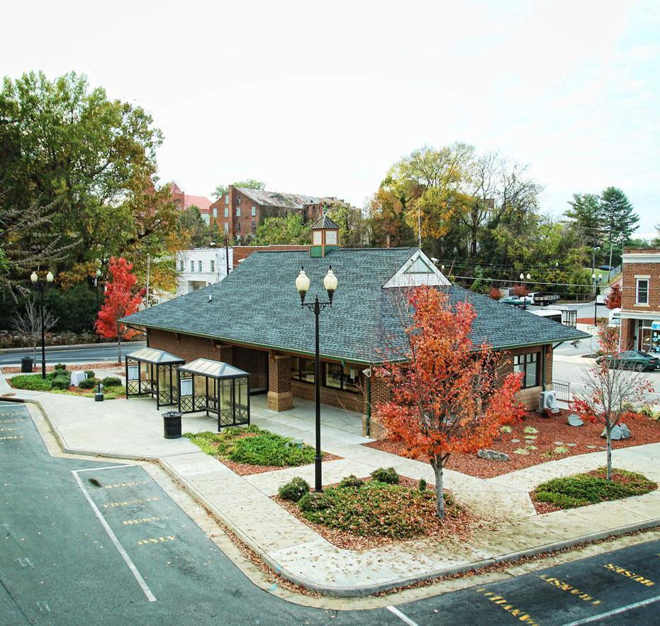
Bus services run on 11 fixed routes throughout the city, running Monday-Saturday from 6am - 6pm. All routes travel through the Transit Hub located in the center of the River District.
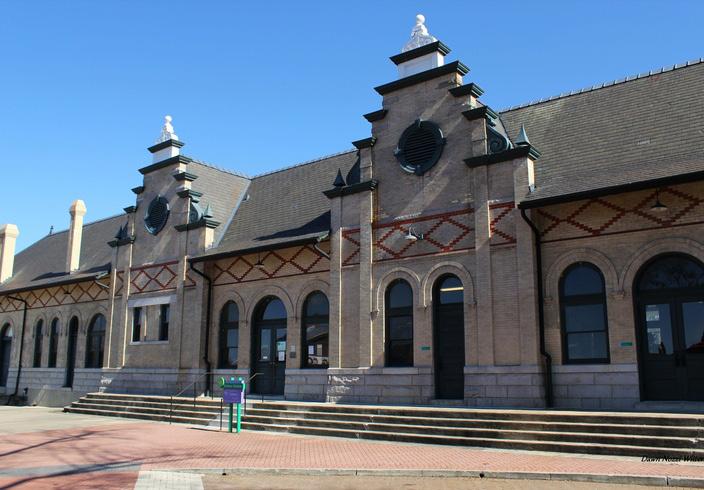
Danville Southern r ailway Passenger Depot
A historic train station operating in the River District, served by Amtrak’s Norfolk Southern Railway, and a stop on the Crescent Line. Built in 1899, the station is on the National Register of Historic Places.
Sovah Health
A regional health care system, the Danville campus is one of two locations, and includes an academic community hospital and is the only designated Chest Pain Center & Certified Advanced Primary Stroke Center in the region.
CULTURAL ASSETS
Entertainment, Arts, & Performance Venues
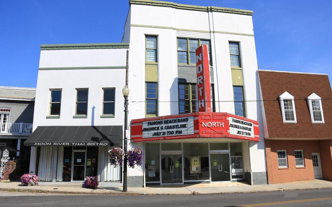
The Historic North Theatre was a movie and vaudeville house from 1947 - 1976, the theater was restored in 2003 and now shows classic movies and theatrical productions.
2 Witches Winery & Brewing Company is the first co-located winery and brewery in Virginia. 2 Witches is a family-run farm winery and nano-brewery with indoor and outdoor performance stages.
Ballad Brewing is located in a historic tobacco warehouse, where it boasts a family-friendly taproom and offers live music.
Danville Community College (Source: DCC)
Danville Transit (Source: City of Danville)
32
Danville Symphony Orchestra is a volunteerrun orchestra that provides quality live music, often in collaboration with other performers and organizations from the region.
Carrington Pavilion is an amphitheater on the banks of the Dan River that hosts outdoor concerts, theater productions, and events, and seating 1,100 in a covered pavilion, with an additional 4,000 lawn seats.
Arts @ Averett is a series of entertainment events hosted by Averett University, including a wide array of productions and performances by Averett groups.
Danville Concert Association hosts professional musical and performing artists from around the world since the early 1950s.
Churches & r eligious Sites
The City has over 120 places of worship, representing 29 denominations, in various locations throughout the city.
Museums
Danville Museum of Fine Arts & History was founded in 1974 to promote art, history, and culture to the Dan River region.
Danville Science Center is a place to explore STEM concepts and skills with interactive exhibits, hands-on activities, live demonstrations, touring exhibitions, including Digital Dome Theater presentations, and other special events.
Langhorne House is the former home of Lady Astor, the first woman to sit in the British Parliament. The museum showcases the restored parlor and master bedroom to its original character, with changing exhibits in the gallery.
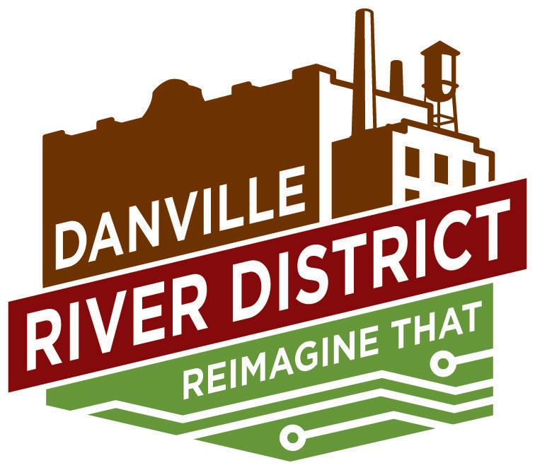
RIVER DISTRICT REVITALIZATION
Established in the late 1990s to help coordinate efforts to revitalize downtown Danville, the River District Association (RDA) seeks to maintain the unique historic character of Danville, while keeping the area attractive to encourage and retain businesses. Past revitalization efforts included new branding and the creation of design guidelines to maintain the look and feel of the district.
Branding
New branding was released in 2015 using the slogan: Danville River District: Reimagine That. It was designed to capture the historic character while welcoming new spirit of change. Signage and wayfinding was launched alongside the re-branding to highlight the many amenities and assets in and around the River District.
Design g uidelines
Adopted in 2013, the design guidelines ensure new development aligns with the historic context and retains the spirit of Danville’s past, present, and future. The guidelines include appropriate materials, outline procedures, and explain types of architectural elements that fit the character of the district.
Historic North Theatre (Source: Virginia.org)
River District Logo + Slogan (Source: RDA)
SCHOOLFIELD TODAY 33
Housing Conditions
SCHOOLFIELD VILLAGE
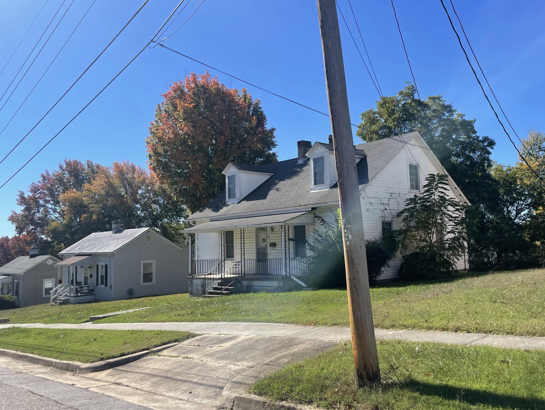
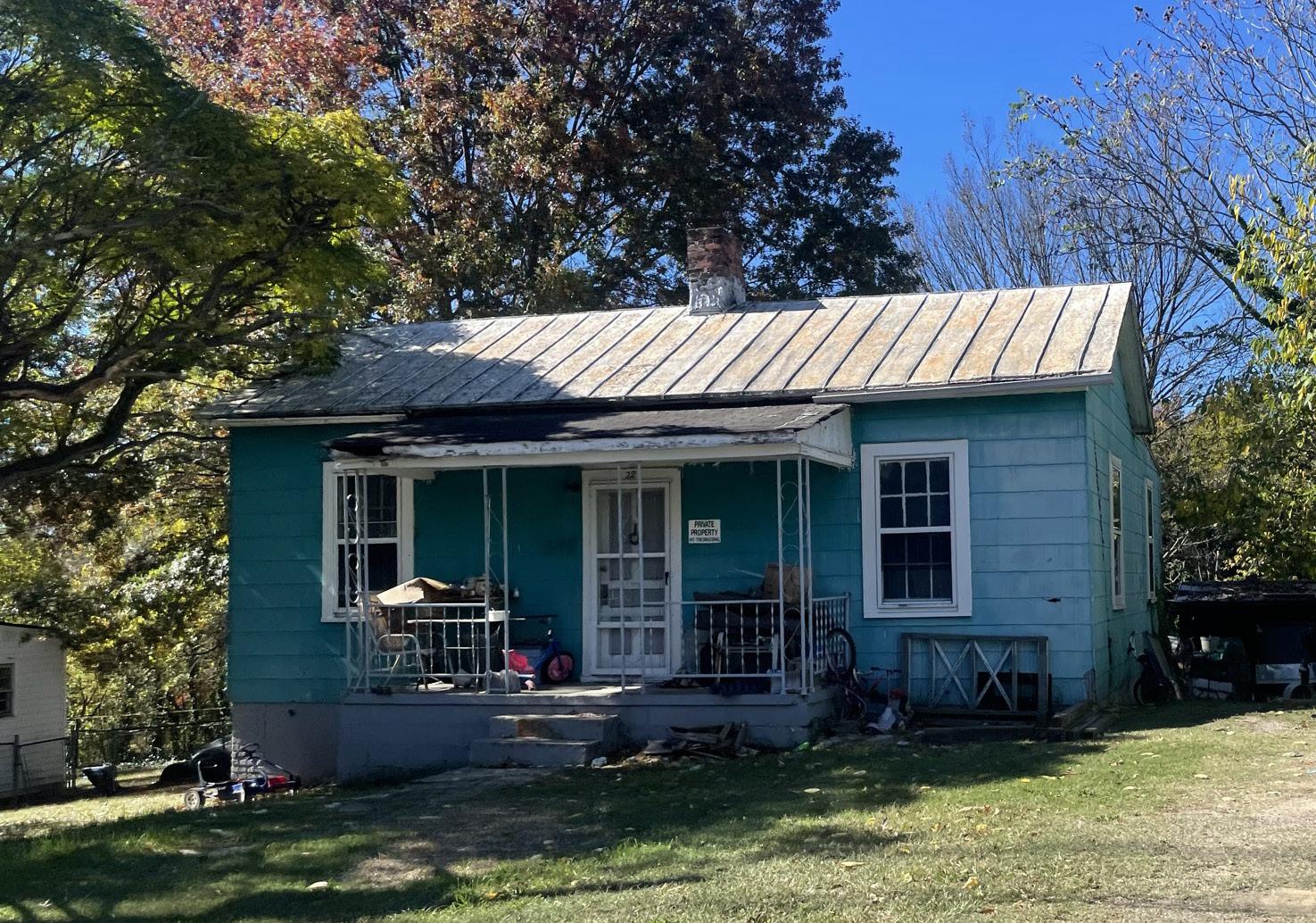
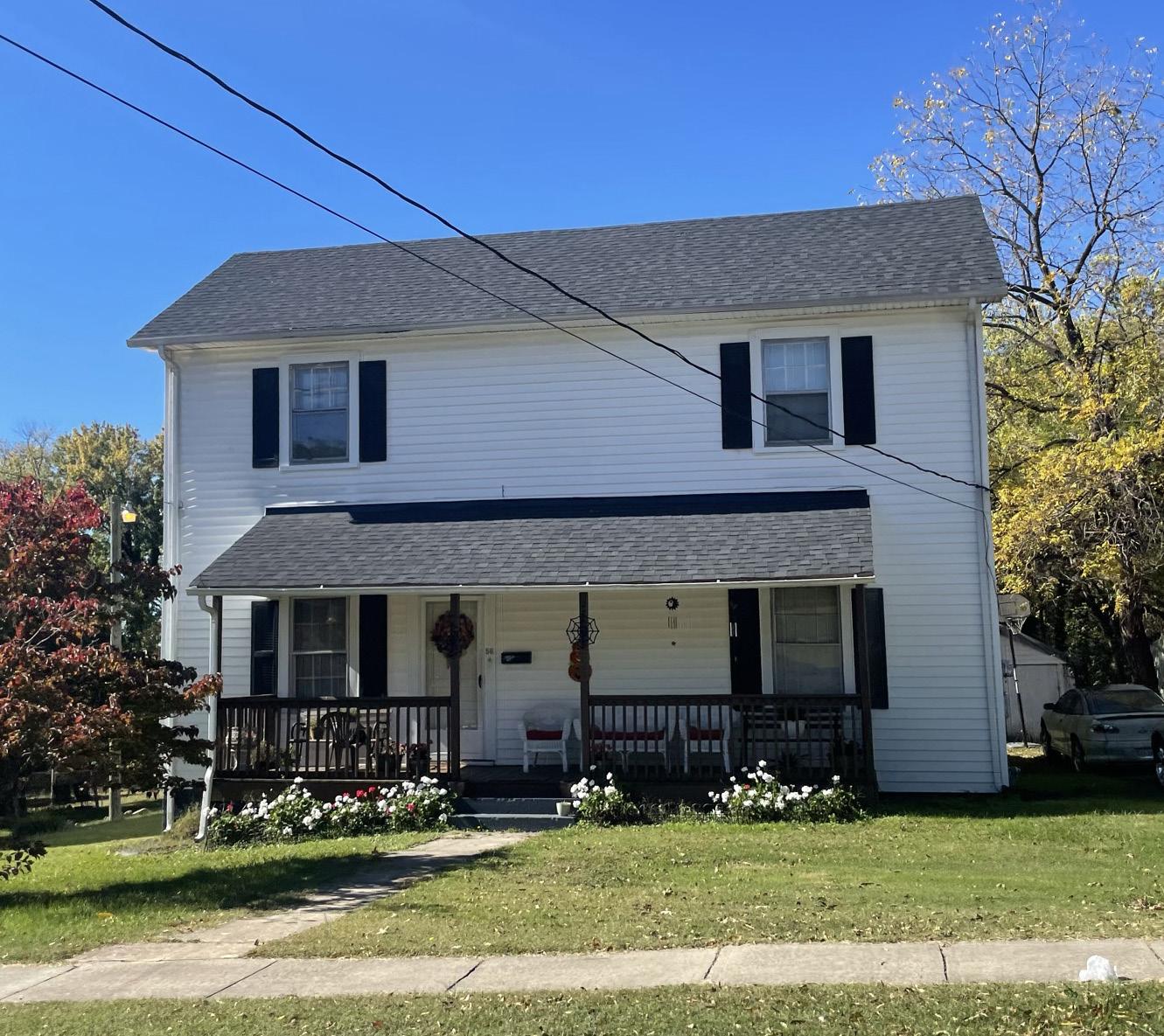
South of the Mills site, Schoolfield Village was built as a compact, mixed-use, planned development that included schools, recreation centers, churches, commercial corridors, and 834 residential units. Since the mills closed, however, Schoolfield Village has faced a similar decline in the neighborhood and infrastructure as the rest of the City. Today, around 550 of the original 834 homes remain. A 2017 physical conditions survey found that 83% of the homes in the neighborhood were showing some form of exterior deficiencies (ranging from minor aesthetic fixes to major structural issues). The City will be reassessing all of the homes to provide a better view of the current market.
738
90.8%
HOUSING TYPOLOGIES
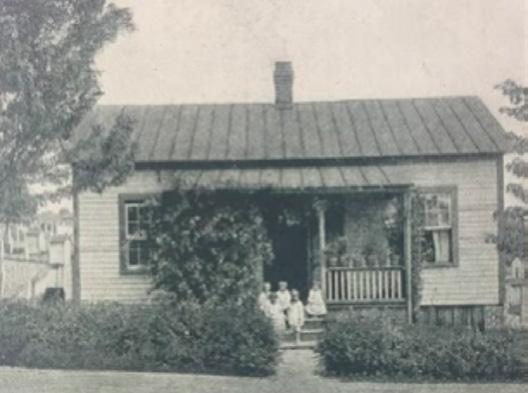
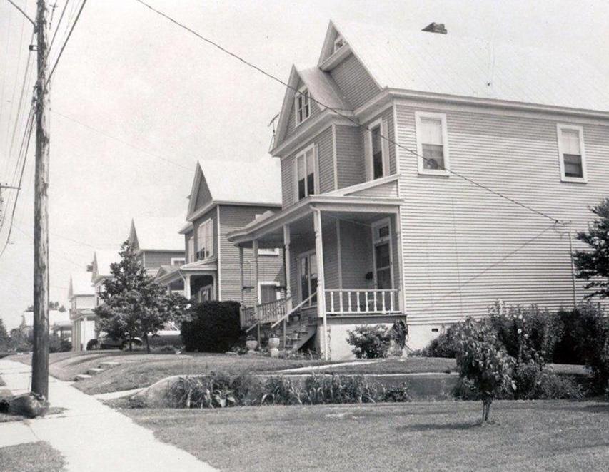
A typical Mill Village home is a single-story structure between 900 – 1,200 square feet with two bedrooms, one bathroom, and small covered front porch. Most homes are set back from the street to create a uniform block with small front yards and larger back yards. The Village was developed with a north-south street pattern, with few eastwest connections.
14.5% Vacant 30.6% Renter-Occupied 54.9% Owner-Occupied
Housing units
Median Home Value
$26,000
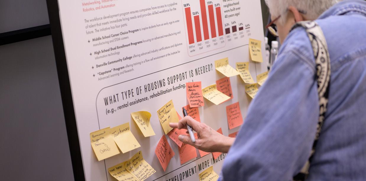
of homes in the Schoolfield neighborhood were built over 40 years ago! 1939 or earlier 19401949 19501959 18.9% 13.8% 24.3% 17.9% 15.9% 3.3% 3.6% 1.9% 0.4% 19601969 19701979 19801989 19901999 20002009 20102013
Below & Right
Homes
Schoolfield Village today Source: Esri BAO, 2019 ACS 5-yr estimates 34
Top Left: Homes along Park Ave (source: Register & Bee)
:
in


HOUSING MARKET
Home values in Schoolfield previously averaged around $26,000 - significantly lower than other similar residential neighborhoods in Danville. However, with the announcement of Caesars Virginia resort, the local housing market has skyrocketed with homes selling for several times more than they would have in the previous year (2020). The development of Caesars resort has increased the attention and investor interest in Schoolfield for both commercial and residential properties.
While the Schoolfield Village provides many benefits and opportunities for workforce housing near the resort, the rise in values also brings threat of displacement. As one of the most affordable neighborhoods in Danville, the rising values and costs could price out longtime homeowners and residents of the neighborhood.
See Chapters 6 & 7 for this plan’s proposed strategies to help combat these stressors in the Schoolfield neighborhood. Additional studies and strategies are also being conducted by the City.
A Typical Mill Village Home 900 - 1,200 Square Feet SINGLE-STORY STRUCTURES 2 bedroom 1 bathroom built between: 1903 - 1909 Kitchen Living Room Bedroom 1 Porch Bedroom 2 Bath Laundry
SCHOOLFIELD TODAY 35
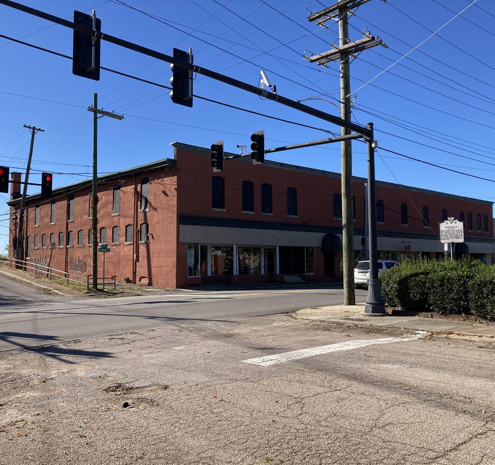
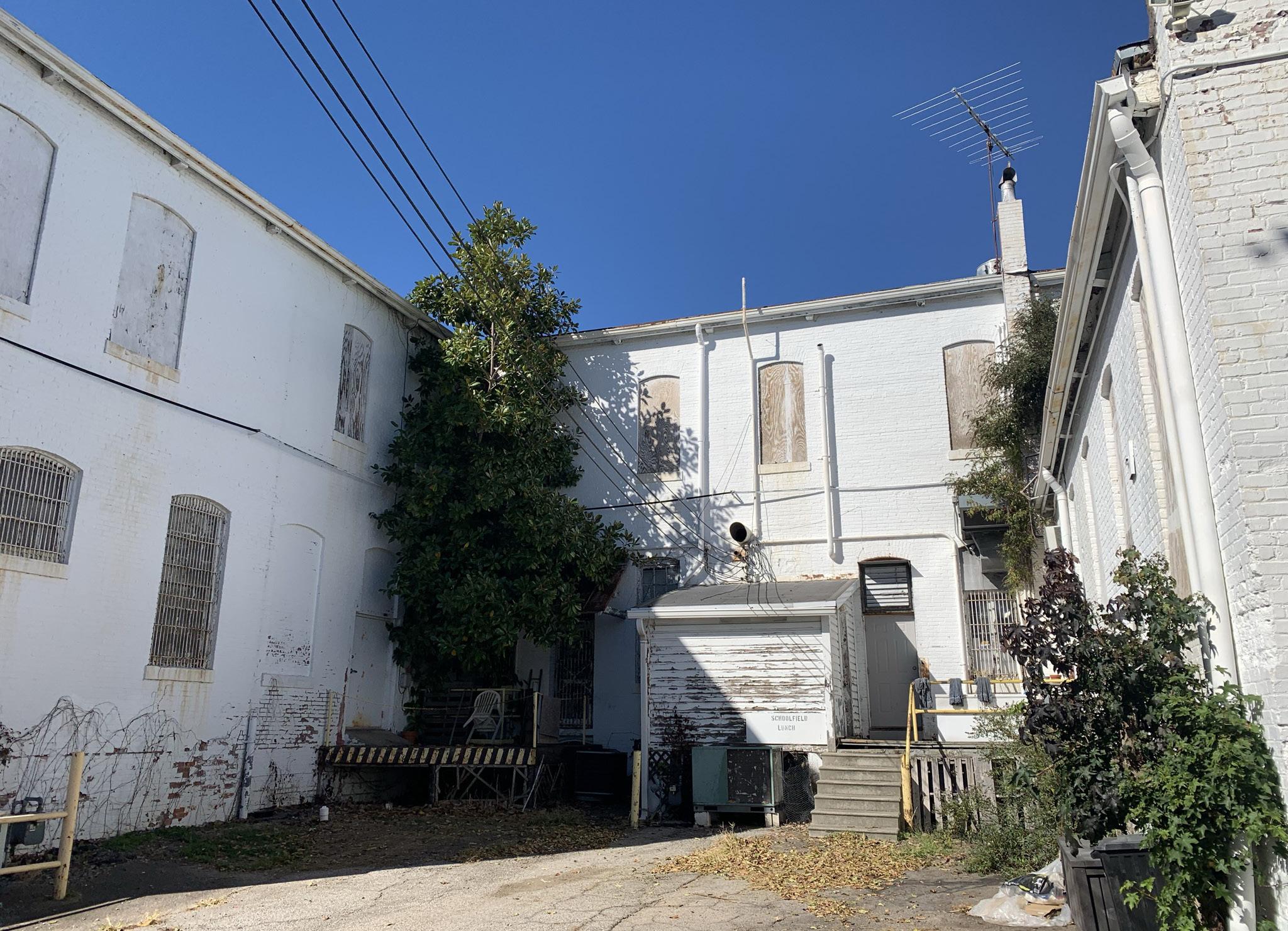
1009 W Main Street
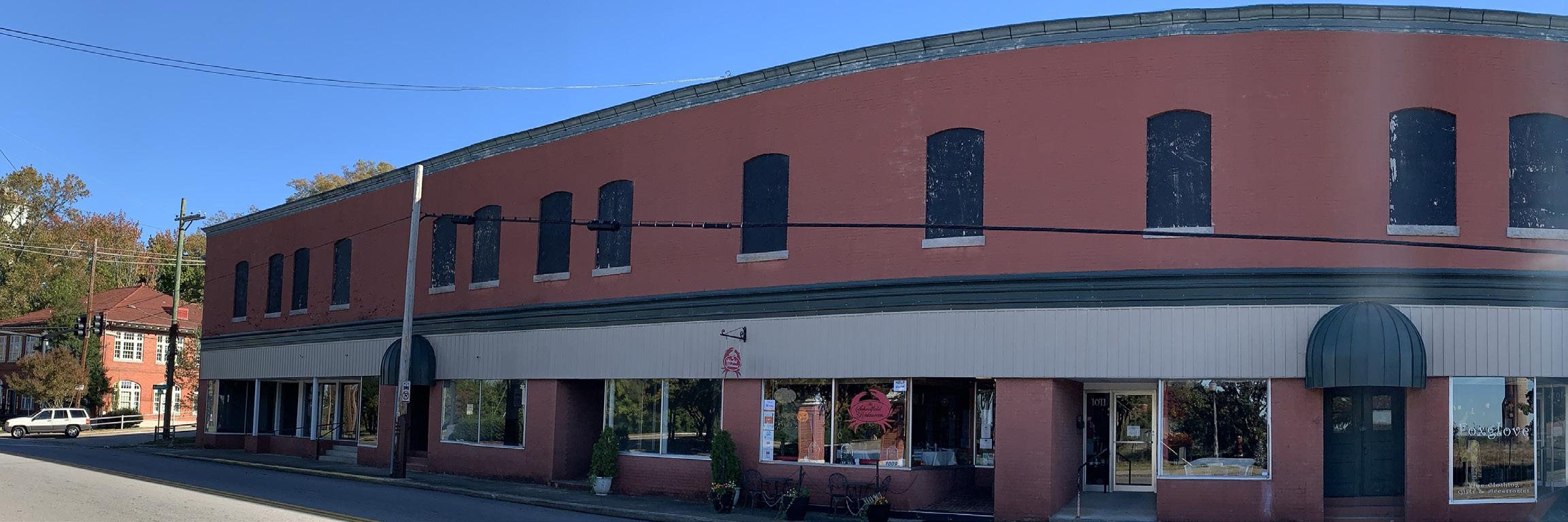
In 1903, the Park Place Mercantile Company was established by Dan River Mills Inc. at the current location of 1009 W Main Street. This two-story structure provided a retail and social outlet as well as informal gathering spot for the Schoolfield Village. Early on it provided essentials like wood, coal, food and miscellaneous household items as a convenience to the workers; however, by 1910 it provided multiple venues including a barbershop, drugstore, furniture store as wells as a billiard room; Level 2 provided a space for fraternal societies and other social clubs. The mercantile was indicative of the Dan River Mills desire to create a self sufficient Village. Later additions included its own post office, police department, hotel, hospital, nursery, and schools.
At the mercantile, mill workers could purchase items and have them deducted directly from their wages, removing the need to venture outside of the Schoolfield Village. Even after the ownership of Park Place Mercantile was transferred to private parties, the mill continued to oversee and curate the merchandise and aesthetics.
The Park Place Mercantile was just one of the landmarks of this evolving urban landscape being developed. Over the next 20 years, grander buildings were built alongside the mercantile under the supervision of the Dan River Mills, including the YMCA, the Bandstand, the Company Office Building, and the Welfare Building, creating an idealized urban gateway along W Main Street to the Schoolfield Village as the first impressions for visitors to the Village and
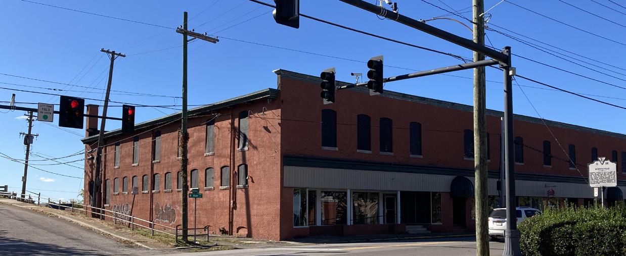
mill complex. A tree-lined avenue fronted by buildings with a high level of craftsmanship set the idealized tone for the Dan River Mills. Beloved institutions like the Schoolfield Lunch occupied the street front of 1009 W Main Street, becoming a place for multiple generations within the Village to create memories and feel a sense of belonging.
By the end of the 1940s, the Dan River Mills began to decline and the parallel events of the 1951 Labor Strike and the annexing of the Village to the City of Danville, changes started to occur. The Village began to erode and one by one the community buildings for the Schoolfield Village became company offices or were lost. Today most of the current structure is vacant and waiting for its next iteration in the story of Danville. Based on our structural, architectural, and zoning assessment, this structure represents an excellent opportunity for adaptive reuse towards office, commercial, or mixed-use programming.
North West elevation at Wood and W Main: Building 1 & 2
W Main Street (North) Facade: Building 1 & 2
BISHOPRD MEMORIALDR
AVE OAKRIDGEAVE B I SHOP AVE B I SHO P A L Y G
AVE SCHOO S T O K E LANIER AVE
WOOD
AUGUSTA
23.8 ACRES
36
SCHOOLFIELD WOODS


Total Acreage:
Approximately 1.98 Acres
Historic District:
Schoolfield Historic District
Property Class: Commercial
Building 1 & 2:
• Finished Square feet: 62,920 sf
• 2 stories
• Built 1903
• Warehouse construction
Building 3:
• Finished Square feet: 8,520 SF
• 2 stories
• Built 1955
Construction:
• Building 1 & 2: Timber framing with masonry exterior / warehouse construction
• Building 3: Was not accessible for review. Assume masonry exterior with steel framing and composite metal deck at floors and roof on concrete slab on grade at basement (to be confirmed)
Site Map
1. 1009 W Main Street
2. Open Parking Lot
3. Welfare Building
4. Parcel A
5. The Company Office Building
6. Bandstand (former site)
7. CVS (former site of YMCA)
8. Future Caesars Virginia resort
9. The Reservoir
10. Ballou Park
MAIN ST
AVE P AR K C I R BALT I MO HYLTO FAIRFIELD AVE ESTCIR DALLAS AVE
PARKAVE W
LANIER
43,560 SF = 1 Acre 5 3 1 2 4 6 7 10 8 9
BROW
F I gur E 6 |
SCHOOLFIELD TODAY 37
1009 Main Street North Elevation (date unknown) Courtesy of Ina Dixon
1009 W Main Location Map
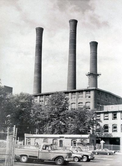
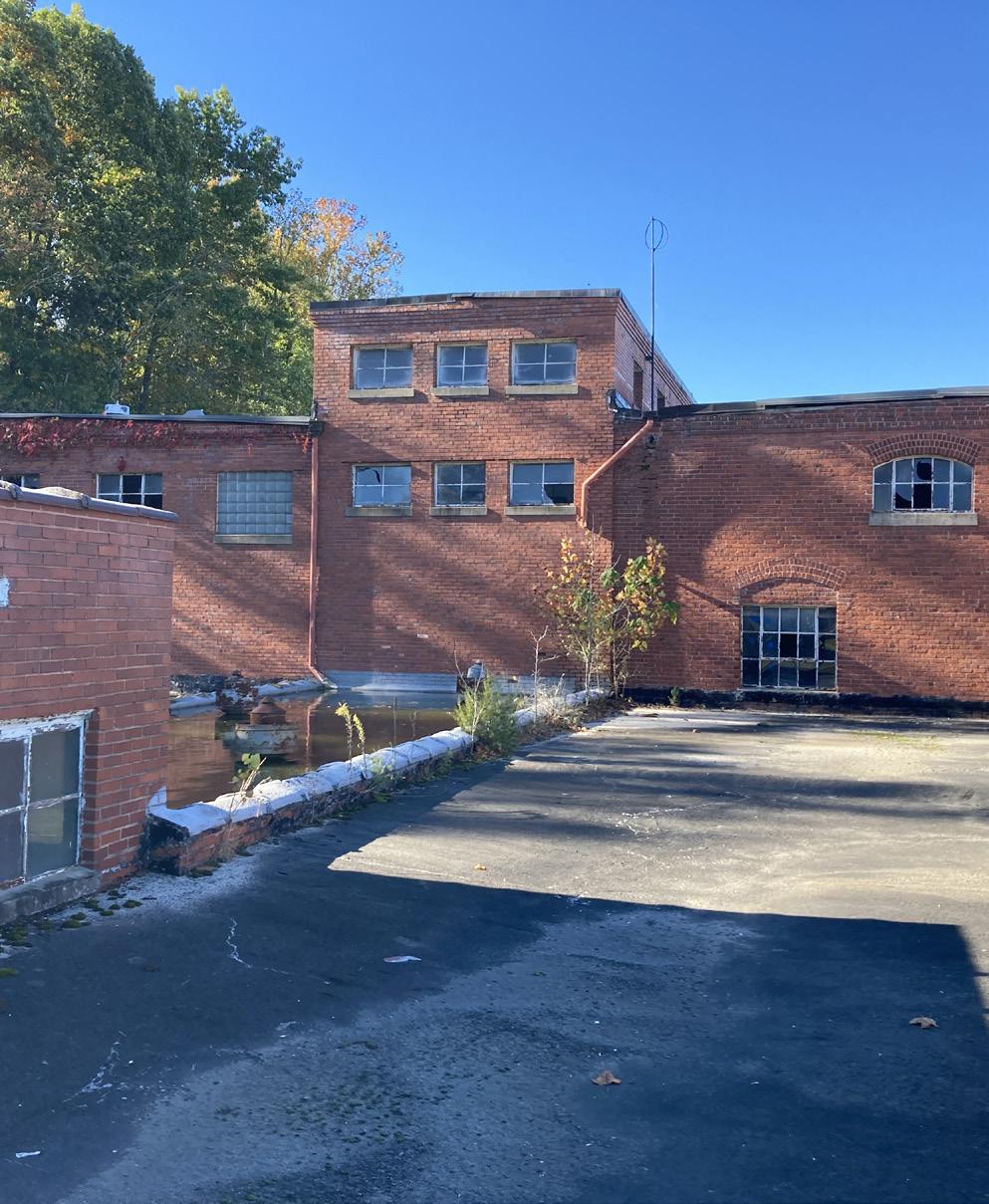
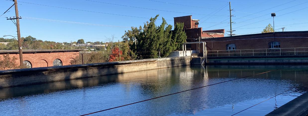
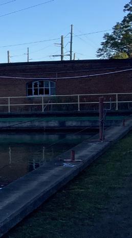
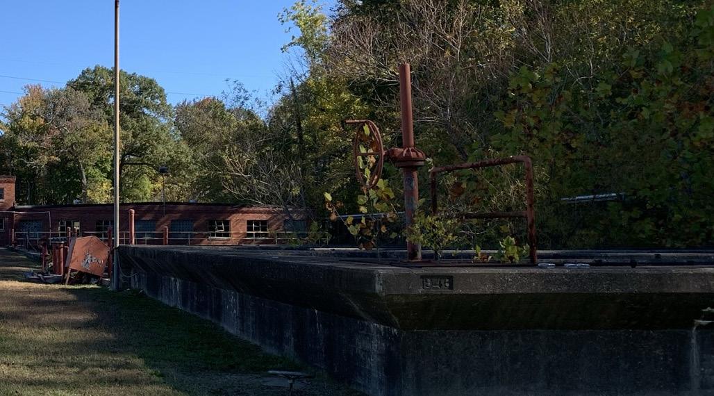
Filtration Plant
Little is known regarding the Water Filtration Plant on Memorial Drive. The local Danville City paper, The Bee, reported on October 19, 1946, an update to the Dan River Mill current projects including the new water filtration plant anticipated to be operational by turn of the year.
It appears from aerial photos that the Storage Warehouses and control offices, along with the exterior settling basins were built first. There were subsequently at least 2 additions as well as a canopy that fronts Memorial Drive. It is uncertain the dates and sequence but based on Sanborn Maps , structural elements were introduced intermittently in the late 1950’s, early 60’s, and mid-90’s.
Around 2015-2016, the filtration plant was decommissioned. When operational, it drew between 10-16 million gallons of water daily from the Dan River mainly for use in the bleachery. The water was pumped from the filtration plant up to holding tanks at the textile mill. The pipes that directly connected it to the plant and river now lie dormant.
The earlier sections of the filtration plant reflect the style and construction of the hydro plant across the street built in 1902 by Lockwood Greene, architect for many of the Dan River Mill structures. It is speculation that they were involved in the construction of the filtration plant, but the hydroplant definitely influenced the design of the filtration plant.
Per the EPA report dated 1992 regarding water use by Dan River Inc.:
Water Supply: All drinking water is supplied from the City of Danville public water supply system. This water is taken in from the Dan River approximately 2/10 of a mile upstream from the hydroelectric plant and the filtration plant operated by Dan River, Inc. Process water used by Dan River is taken in from the Dan River, treated at their filtration plant and pumped up to the site and stored in water towers and two reservoirs.”
Currently the Filtration Plant and adjacent settling basins as well as Schoolfield Woods are not occupied. Based on our structural, architectural, and zoning assessments, there are a variety of programmatic options for the adaptive reuse of the filtration plant. Potential future programming options include exterior community courtyard with outdoor events and dedicated vendors; events venue for weddings or entertainment with an outdoor roof deck; makerspace or coworking offices adjacent to the reimagined Schoolfield Woods.
 North settling tank looking northeast toward the Dan River
Sediment Basins looking east
North settling tank looking northeast toward the Dan River
Sediment Basins looking east
5 4 BISHOPRD MEMORIALDR OAKRIDGEAVE G L E N O A K D R
High bay pumping gallery clerestory windows adjacent to covered storage trankforeground. East side of filtration gallery background.
LANIER
38
See page 152 for structural considerations and potential uses and a full report in the appendix.
Total Acreage:
Approximately 23.8 Acres (TBD) of 78.16
Historic District:
Schoolfield Historic District
Property Class:
Commercial Building 8 & 9:
• Finished Square feet: 62,920
• Multi stories
• Built: 1947 with subsequent additions (dates to be confirmed)
• Masonry structure with reinforced concrete floors and stairs and a steel framed roof.
Construction:
• Masonry structure with reinforced concrete floors and stairs and a steel framed roof.
Site Map
1. Water Filtration Plant
2. Filtration Settling Basins
3. Schoolfield Woods
4. Hydroelectric Plant
5. Dan River Dam
6. Robertson Bridge/ Piedmont Drive
7. Riverwalk Trail
8. High Bay Building
9. Ballou Park
10. Future Caesars Virginia resort
PARKAVE W MAIN ST LANIER AVE P AR K C I R WOOD AVE B I SHOP AVE BALT I MORE AVE B I SHO P A L Y ROBERTSON BRG HYLTON AVE AUGUSTA AVE FAIRFIELD AVE FORESTCIR PARKVIEWPL DALLAS AVE SCHOOLF I ELD DR S T O K E S L A N D A V E BROWDER AVE B R A N D O N C T LANIER AVE AVE 23.8 ACRES SCHOOLFIELD WOODS North Office Wing - Lower Level F I gur E 7 | Filtration Plan Location Map 2 1 6 3 8 10 7 9 11 SCHOOLFIELD TODAY 39
Mobility + Connectivity
Road Hierarchy
• Motorway
• Primary Road
• Secondary Road
• Tertiary Road
• Local Road
Future road improvement
Primary r oadways
Much of the following information is collected from the City of Danville MPO (Metropolitan Planning Organization). The Danville MPO area includes the City of Danville and portions of Pittsylvania County. The MPO develops plans and programs subject to approval by federal transportation agencies to achieve federal transportation funding.
The City of Danville is served by an extensive network of arterials, collectors, and local roads augmented by interstate highways and US routes that facilitate intercity travel.
The Danville Expressway/Designated I-785 corridor works as a semi-ring road that bypasses the Schoolfield District Corridor and the downtown area and provides alternatives for the freight movements in those areas. The expressway is linked to W Main Street, and is a direct connection to the Schoolfield District and the downtown area. It has
potential as a multi-modal transit corridor, reinforced by the planned Park & Ride facility at expressway exit that can be implemented as a transit hub to support trips taken by alternative transport modes. According to the 2045 MPO Long Range Plan, this expressway significantly relieved traffic volumes throughout the roadway network and resolved many of the region’s capacity issues.
As indicated in the 2045 MPO LGTP, upgrades will be made to US Highway 29, between the Danville Expressway and I-840, northeast of Greensboro. These improvements are underway (fully funded by NCDOT) and should be completed within the next few years. Once completed, it will be designated as I-785 to facilitate interstate traffic between the two cities.
I
E
|
40
F
gur
8
Existing and Planned Road Network
The Main Street corridor is the primary roadway that runs through the Schoolfield District via W Main Street (VA-293). The street serves as a gateway into the city from the west as drivers exit from Highway 58, and as gateway to the River District from the east as you cross the Dan River into downtown. Between these points, W Main Street acts as a corridor connecting both gateways and as a connector between the northern and southern neighborhoods of the city. W Main Street also serves as the main access to most of the surrounding neighborhoods which are primarily residential areas.
W Main Street has the potential to serve as a unifying force between both the eastern and western ends of the city, with the proposed Caesars Virginia resort development area acting as one of the main nodes at the center of both gateways. Unfortunately, in its current form, W Main Street lacks uniformity in physical features or plantings that create a visually interesting and safe corridor to travel through, either by car, as a pedestrian, or by bike.
Car Ownership
According to US Census Bureau’s car ownership data in Danville, the city is car-oriented, with an average of two cars per household (on the average, 699 cars per 1000 inhabitants in Danville). This is approximately the same number as the national average. More specifically, car ownership on the northern side of the Schoolfield neighborhood and along the east portion of W Main Street is quite high. This is due to the fact that most of the residents are highly dependent on private automobiles for their work commute.
Vehicle Miles Traveled
Daily vehicle miles traveled in the Danville MPO has been relatively stable throughout recent years. Localities within the MPO experienced a slight drop in vehicle miles traveled along W Main Street between 2017 and 2018. However, it is expected that the construction of Caesars Virginia resort will significantly alter traffic volumes on W Main Street.
Commuting Patterns
According to the 2045 MPO plan document, approximately 83% of area commuters drove to work alone in 2017, and approximately 50% of the commute trips were under 15 minutes which makes the car highly favored to other transport modes. Limited public transportation services, and limited safe and comfortable bike and pedestrian network and infrastructure contribute to the high degree of population’s reliance on the automobile as a principal mode of transportation.
Modal Share Trends
(2013 - 2019) CAR 80.9 82.4 13.1 2.5 2.4 1.0 13.0 1.9 1.9 1.2 10.5 2.8 2.9 1.6 83.9 CARPOOLED BUS WALKED TAXI, MOTORBIKE, BIKE & OTHER MEANS 0 2000 4000 6000 8000 10000 12000 14000 2013 2016 2019
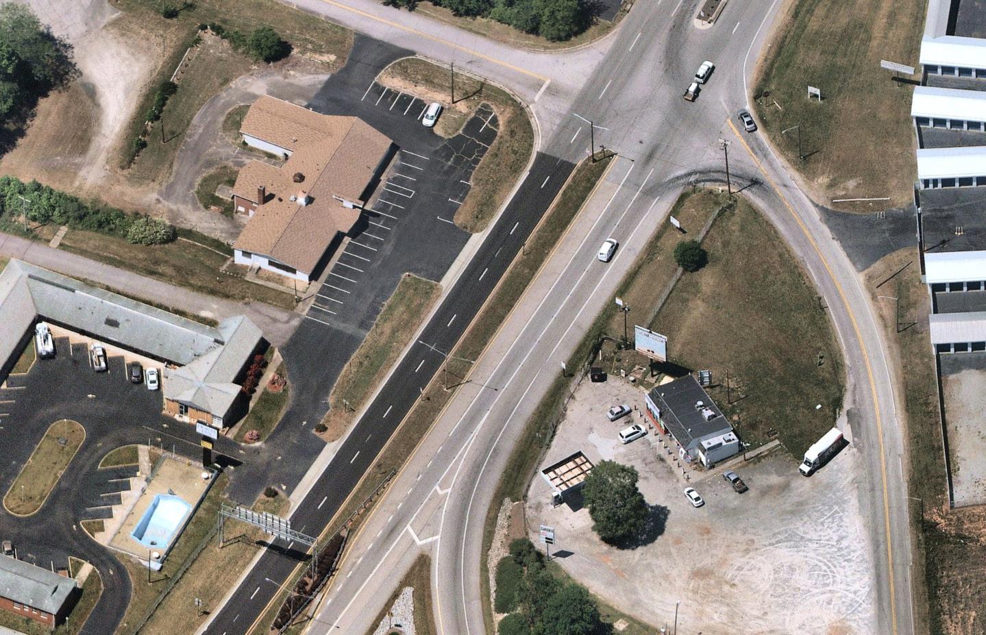
Section of W Main Street exhibiting “poor” streetscaping. (Source: Nearmap)
SCHOOLFIELD TODAY 41
Source: Esri BAO, 2019 ACS 5-yr estimates
Mobility + Connectivity
PUBLIC TRANSIT NETWORK
Danville is served by a regional airport and a regional railway line – Amtrak’s Crescent Line – which runs through the Crescent Corridor along Norfolk Southern’s rail lines. It connects 11 states and spans from New York to Louisiana. While the public transport network in Danville includes a rail network, it does not serve inter-city connections and the collective transport service need to rely on the bus system that includes fixed-route (6 main lines), organized around the Danville Transit Hub located in the downtown area, Handivan services, Reserve-A-Ride, and Senior Transportation Services.
The use of public transport is very limited in Danville with only 2% of commute trips done by public transport (US Census Bureau – American Community Survey (ACS), 2019). The latest ridership data indicates that 86% of all collective transport trips are on fixed routes, 8% on Reserve-A-Ride,
5% for senior transportation services, and 1% Handivan per the 2014 – 2018 Danville Transit Ridership data.
The low usage of the public transport system is due to several factors; however, the main reasons are the lack of funding resources for Danville to be able to offer high-performance service. The weaknesses of the current public transport network in Danville can be summarized as follows:
• Very low public transport frequency / headways (1 bus every 80 minutes, 1 passenger train with limited amenities), no evening bus services;
• Limited public transport service coverage with long distance between stops;
• Lack of fixed-route access to many critical destinations (Schoolfield neighborhood is not served by the fixed-route bus service); and
• Lack of amenities at bus stops, such as shelters, benches and service schedules.
As W Main Street has a direct connection to the Danville transit hub, solutions and ideas are emerging from the local authorities to promote demand response services, such as Reserve-A-Ride, ride-hailing, integrating technology (by the use of smartphone/apps), Dial-a-Ride, etc., to serve better local communities such as the Schoolfield District.
 HIstoric Danville Train Station (Source: Pinterest)
Danville Transit Hub (Source: City of Danville)
HIstoric Danville Train Station (Source: Pinterest)
Danville Transit Hub (Source: City of Danville)
42
PEDESTRIAN NETWORK
Sidewalks
The Danville MPO transportation network includes over 100 miles of sidewalks of varying width and physical condition. The 2045 MPO LGTP reports that there are 28.5 miles of sidewalks within a quarter-mile radius of the area’s public and private schools. Within walking distance to schools, there are 9.2 miles of bike lanes. There are some adequately sized sidewalks along W Main / Main Street, however, many of them are in poor condition. The VDOT’s Safe Routes to School Program funds construction of new bike lanes and sidewalks around schools to address deficiency of those facilities. A significant majority of the sidewalks are less than 5 feet wide and form a discontinuous network to allow for comfortable and safe walking conditions. Only a few areas of Danville can claim a walk score “above average walkability” and the Schoolfield neighborhood is one of the least walkable areas of the city.
r iverwalk
The most extensively developed pedestrian and cycle network in Danville is the Riverwalk, a trail dedicated to pedestrians and cyclists along the Dan River, which serves as the spine of the study area’s walking and cycling network. It connects the residents with the river and enhances the public realm. The Plan indicates that “the highest need is walking and hiking trails, especially the Riverwalk Trail.”
Planned Projects
The latest pedestrian and cycling projects include the Riverwalk extension. This plan includes specific trail route
recommendations with related cost estimates. The study recommends the installation of safe bicycle commuter stations at key locations along the Dan River, as bike amenities including stations and signage are lacking in Danville.
Furthermore, according to the 2045 MPO LGTP, there is a need to organize, plan for, and improve the current discontinuous bike and pedestrian infrastructure along and adjacent to the Riverwalk. This will involve working in parallel with the Danville transit system to link transit more effectively with the existing and future pedestrian and cycling transportation network.
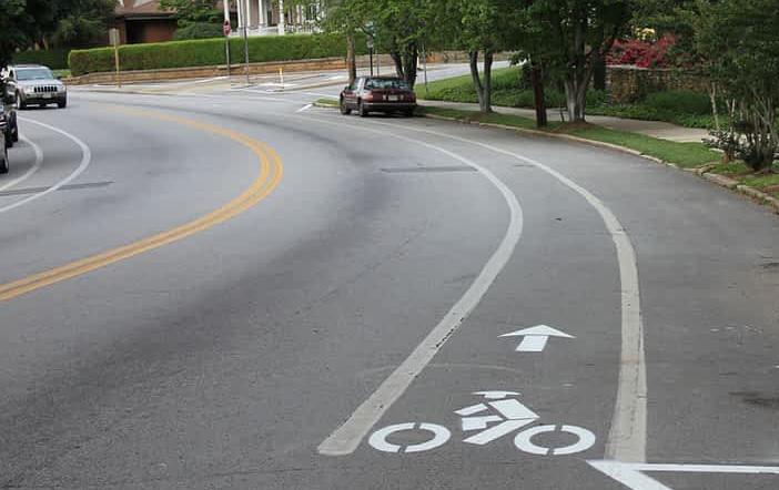
BICYCLE NETWORK
Danville has roughly 19 miles of bike lanes; however, the current cycle network is discontinuous and serves only small sections of Danville. The bike lanes are mainly painted designated lanes without physical separation from the vehicular road, and in some areas, they are implemented as sharrows, where cars and bikes share the road. The reliance on sharrows creates a potentially unsafe environment for cyclists of all levels.
According to the 2030 bike plan, the city is planning to extend the cycle network to create safer and broader cycle opportunities, along with introducing new street landscaping, lighting, and physical buffers. Together, these improvements will encourage the use of a bicycle as a viable mode of transport and create a safer cycling environment within Danville.
Lane s on W Main Street (Source: RIDE Solution)
Bike
SCHOOLFIELD TODAY 43
Main Street & W Main Street Typologies
The Main Street and W Main Street corridors (within this planning context) span 6 miles from the River District down to the Virginia - North Carolina border. In this stretch, the street design and surrounding context changes dramatically to create 6 different corridor typologies.
North Carolina border to River Oak Drive
• Two-way, two-lane road
• 64’ right-of-way
• Sidewalk in the north
• Grass median
• At grade rail
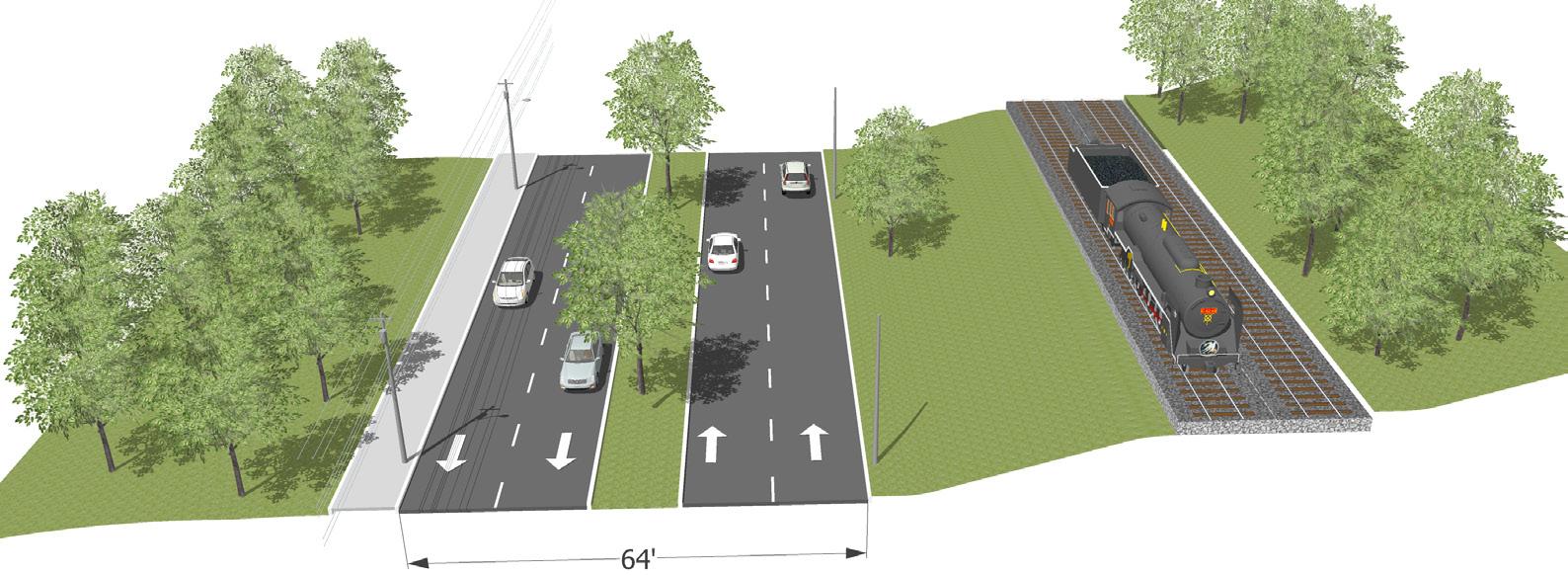
River Oak Drive to Memorial Drive
• Two-way, two-lane road
• 64’ right-of-way
• Sidewalk in the north
• Grass median
• Elevated rail
3 Memorial Drive to Park Avenue
• Two-way, one-lane road
• 40’ right-of-way
• Sidewalks
• Surface parking lots
• At grade rail
64’
40’
Parking
Surface
Auto-oriented Commercial
64’
1
44
1
Transition Zones between corridor typologies
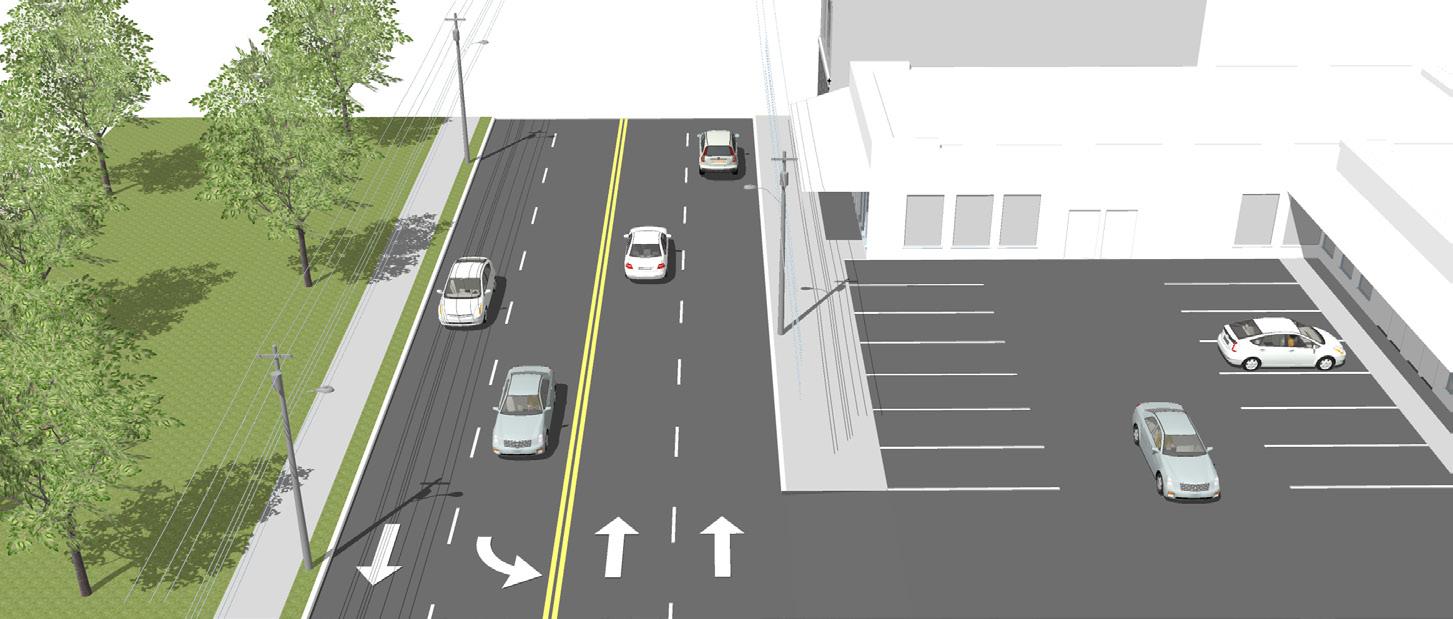
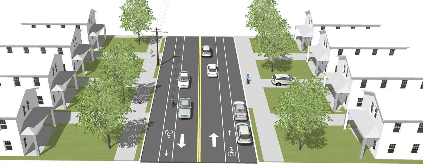
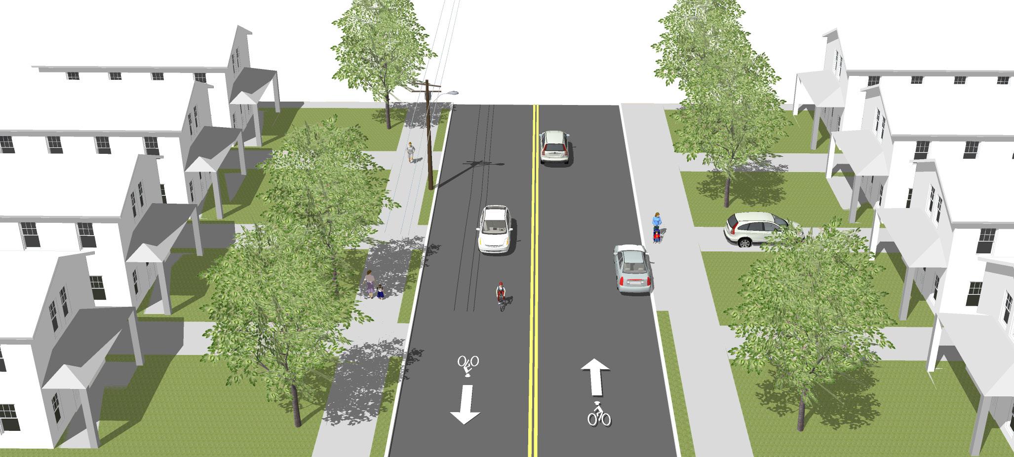
Park Avenue to Blackwell Drive
• Two-way, two-lane road
• 44’ right-of-way
• Sidewalks with planting strips
Blackwell Drive to Rison Street
• Two-way, one-lane road
• 46’ right-of-way
• On-street parking
• Bike lanes
• Sidewalks with planting strips
Rison Street to Jefferson Avenue
• Two-way, one-lane road with sharrows
• 40’ right-of-way
• Sidewalks with planting strips
3 2 4 5 6
5 6 44’ Auto-oriented Commercial
4
46’ Residential Uses Residential Uses
Residential Uses Residential Uses 40’
F I gur E 9 | W Main Street Typologies SCHOOLFIELD TODAY 45
Issues & Opportunities Analysis
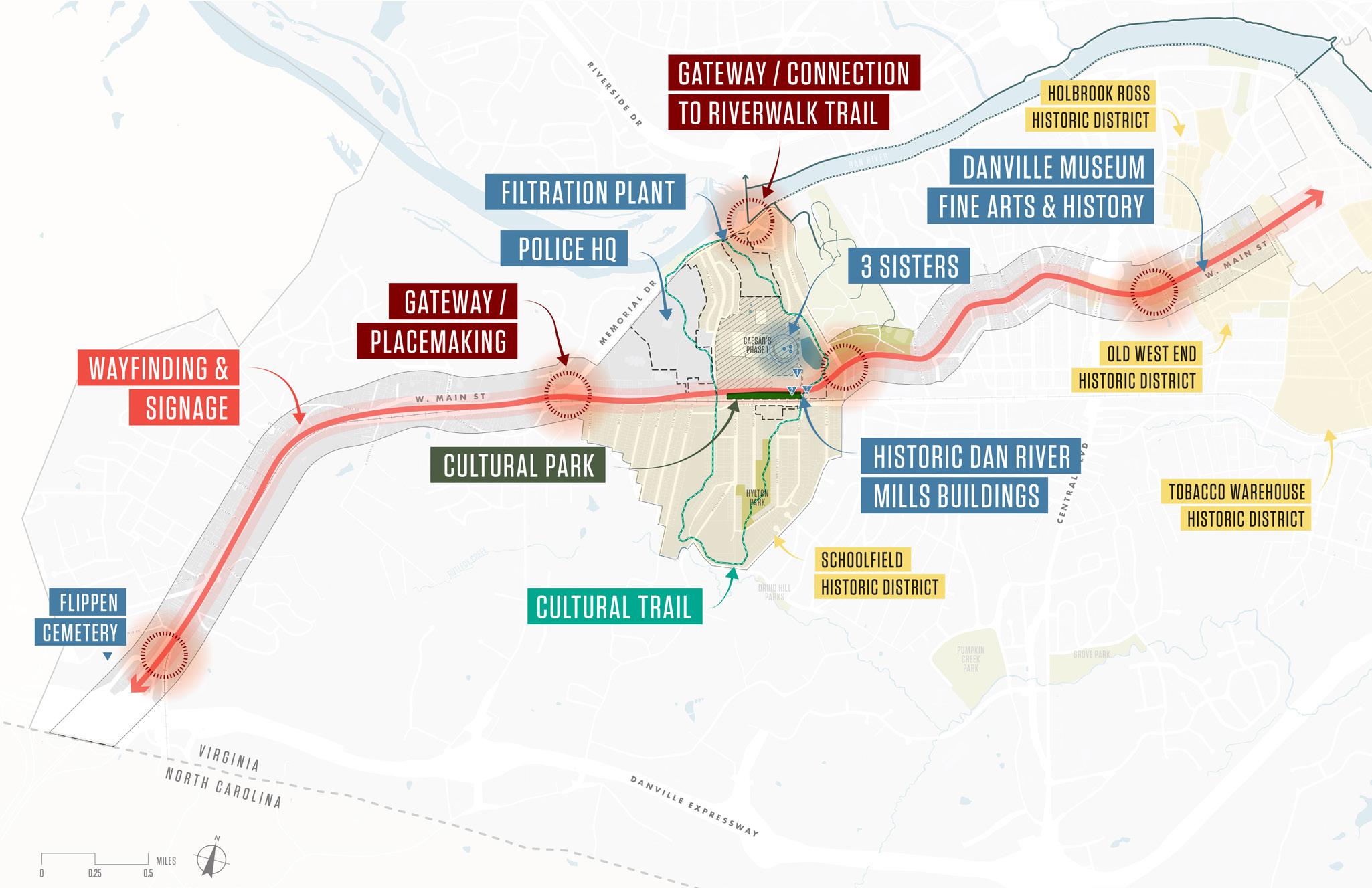
EXISTING STRUCTURES + ADAPTABILITY
Within the Schoolfield District, there are opportunities for catalytic adaptive reuse projects that can serve to enhance existing underutilized or abandoned built infrastructure, attract new uses, and honor and preserve these sites as assets for the community. Reactivating structures like 1009 W Main Street along the Main Street corridor and the Filtration Plant at the northernmost point of the study area offer opportunities to celebrate the unique history of the Schoolfield District by building on existing infrastructure, creating new nodes of activity that offer important synergies between other focus areas and projects.
46
OPEN SPACE + ENVIRONMENT
The Schoolfield District’s open space and environment is characterized by a variety of urban and natural environments, from flat parcels that resulted from industry and development to hills, rolling topography, and even steep slopes along the tributaries to the river.
The study area is defined by two major watersheds, bound by the Dan River to the north and the Pumpkin and Rutledge Creeks to the south. While the existing waterways are currently not as accessible from the Main Street Corridor to pedestrians, they offer a variety of recreational opportunities, as well as crucial interfaces for river hydrology, riparian support systems, and habitat. The large, forested areas to the north and northwest of the historic mill site present
opportunities to enhance ecological value, providing pockets of habitat for a variety of species. However, these areas also face erosion and introduced invasive species that affect habitat and ecological value.
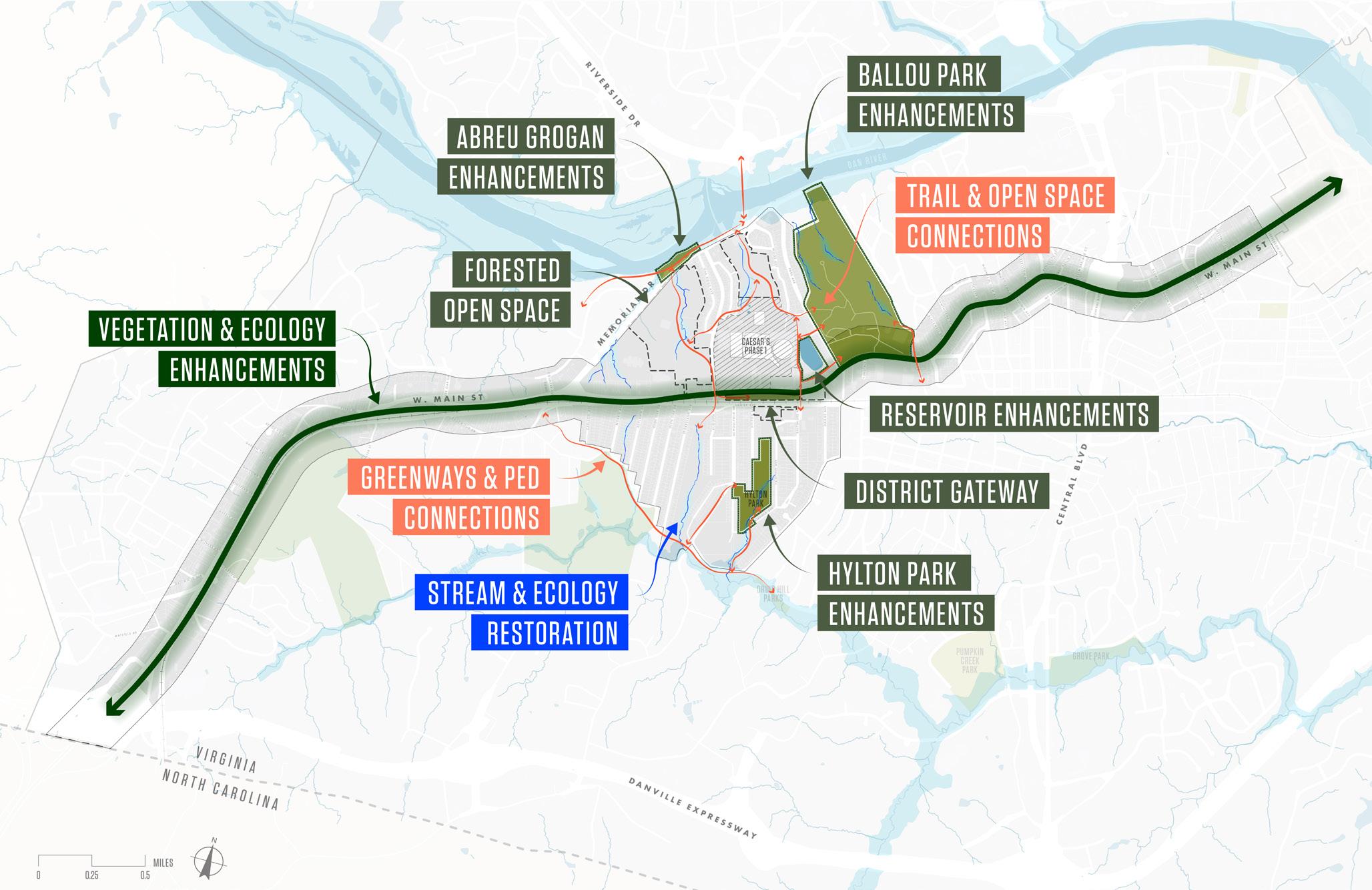
Danville’s existing and planned parks and open spaces, serve as a connection between the human and natural environment. Protecting, and where possible, enhancing accessibility to these open space and environmental assets will be a key next step.
F I gur E 10 | Ecology + Open Space Issues & Opportunities SCHOOLFIELD TODAY 47
ENSURE LONG-TERM AFFORDABILITY
Much of the urban form and planned developments that exist in the study area today are the result of early 1900s developments around industry, like Schoolfield Village. While these neighborhood areas and their infrastructure have faced recent declines and deficiencies, home values in Schoolfield have recently climbed in response to the announcement of Caesars Virginia resort. The historic housing typologies found in this part of town provide many benefits and opportunities for workforce housing in the study area, but the rise in value also brings the threat of displacement. As one of the most affordable neighborhoods in Danville, how can rising values and costs ensure that long-time homeowners and residents are not priced out of their neighborhoods? This District Plan provides ways to address this issue in Chapter 7 Restitching the Village.
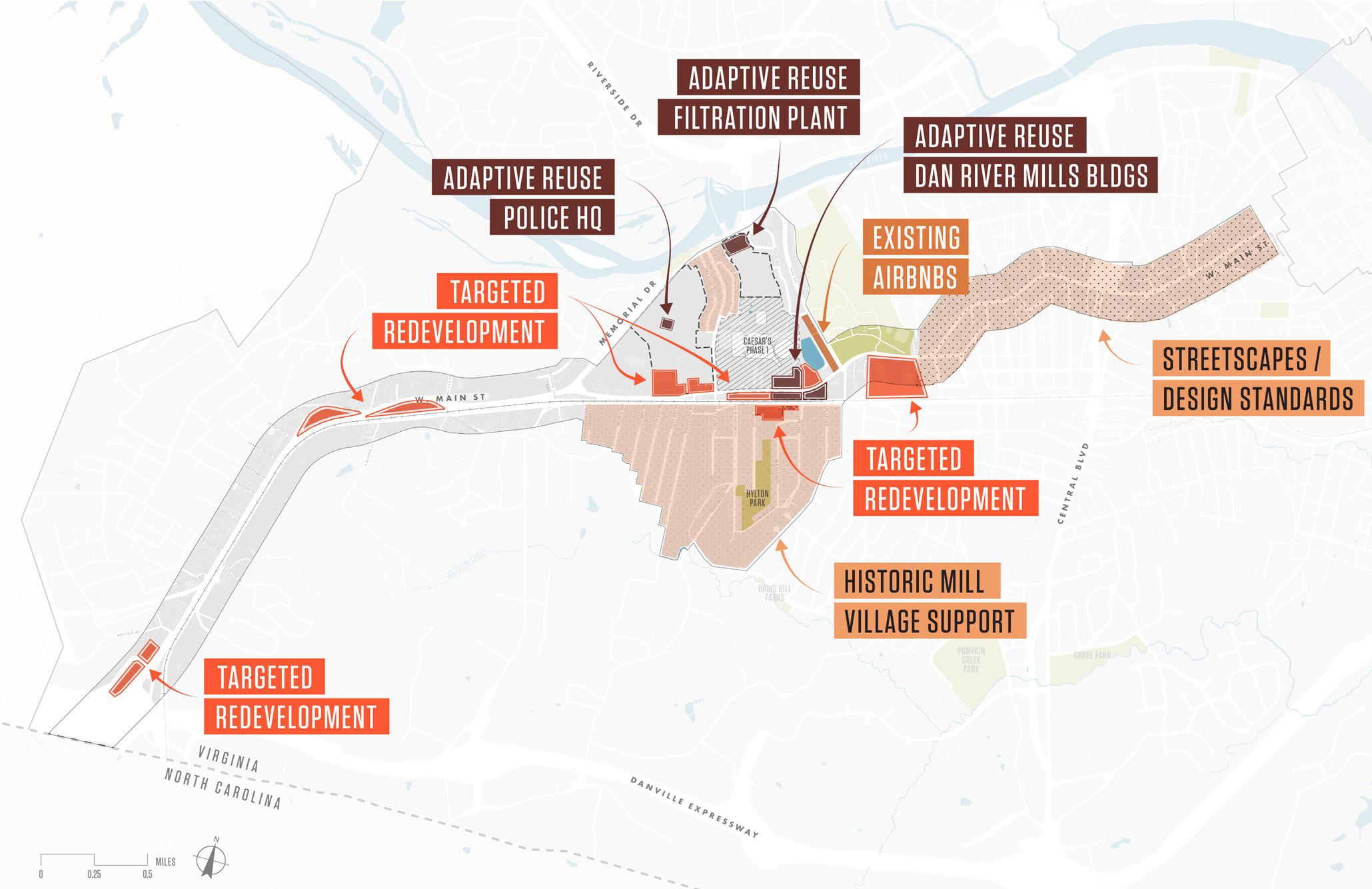
F I gur E 11 | Housing + Economic Development Issues & Opportunities 48
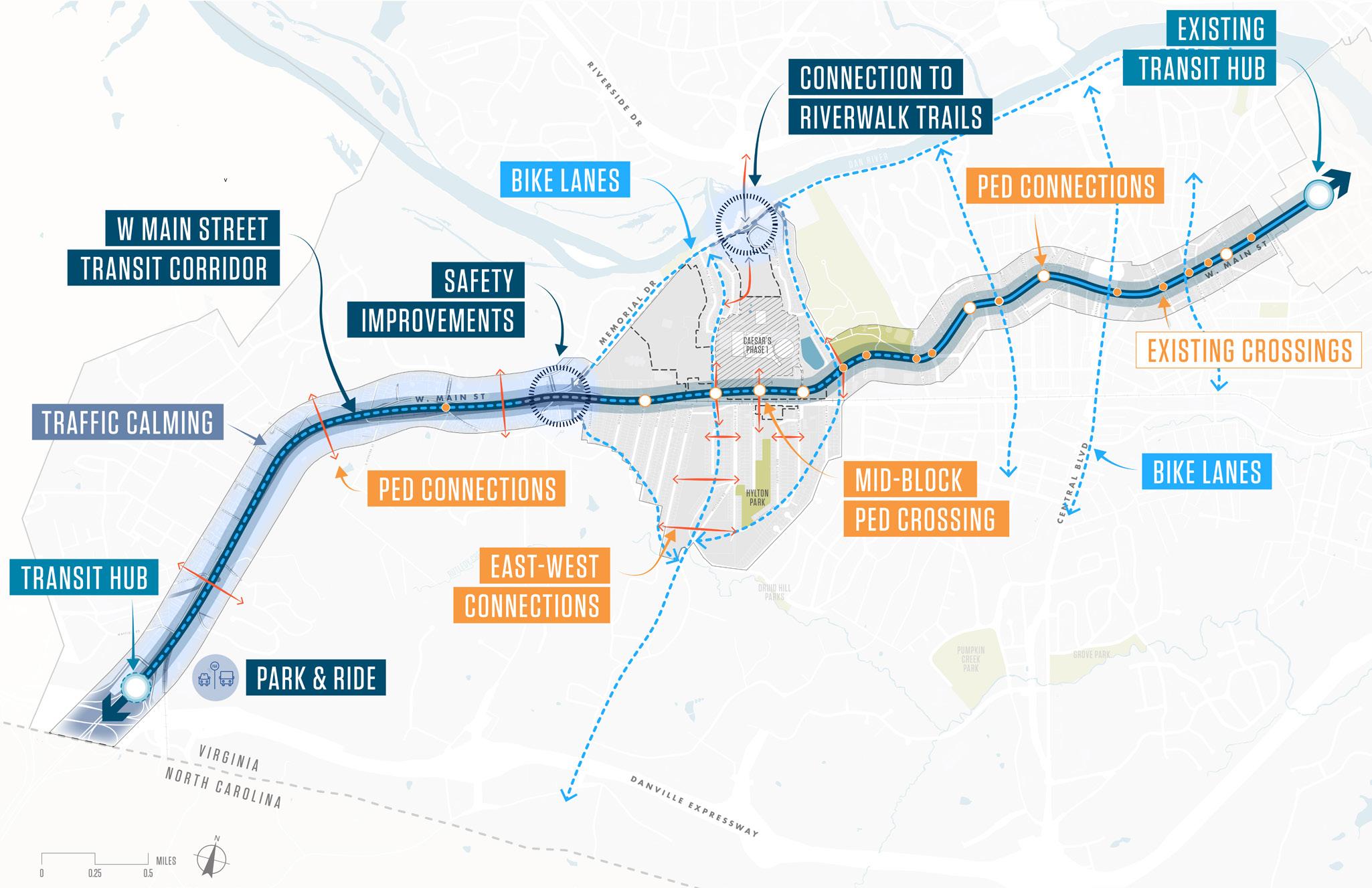
CIRCULATION + CONNECTIVITY
The study area is home to roughly 1,400 people, and is in close proximity to many of Danville’s key assets. Residents agree that the community’s open space and recreation amenities, educational facilities, services, history, and culture are key assets, and among the top reasons to live in Danville.
The patterns of land use found across the study area present opportunities to focus on key nodes within the community and opportunities for future development nodes, as well as the change to rethink how community and culture are made more accessible along the Main Street corridor. Extending public uses, and creating important transitions between the low-density single family residential typology and the commercial and future entertainment zones will be a priority, as well as enhancing connectivity to other community and cultural assets outside of the study area.
F I gur E 12 | Mobility + Connectivity Issues & Opportunities SCHOOLFIELD TODAY 49
Historic Danville Train Station (Source: Pinterest)
EXPAND GREEN STORMWATER INFRASTRUCTURE
The City of Danville provides open-source ArcGIS utility datasets including power and light, stormwater and sanitary sewer, water, gas, and other infrastructure as dynamic map layers. Power service is provided through the Appalachian Power Company (AEP), with adequate supply, and most lines are overhead lines in the study area. Stormwater and sanitary sewers are separate systems, and stormwater is captured through a series of curb and grate inlets and open channels, then directed through storm pipes and channels to outfall points. Stormwater is untreated and runs off directly from outfall points into surface water. There are many outfall points and open channels that are in poor condition within the area of this plan, resulting in greater amounts of contaminants and soil erosion.
How can utilities and infrastructure contribute to the New Schoolfield District? In the exploration and development of opportunities for the study area, utilities and infrastructure can begin to have a more deliberate impact on placemaking efforts. The selective undergrounding of power lines in strategic areas, or the introduction of more green stormwater infrastructure techniques can alter the existing conditions in ways that expand access to nature and improve the community’s well-being.
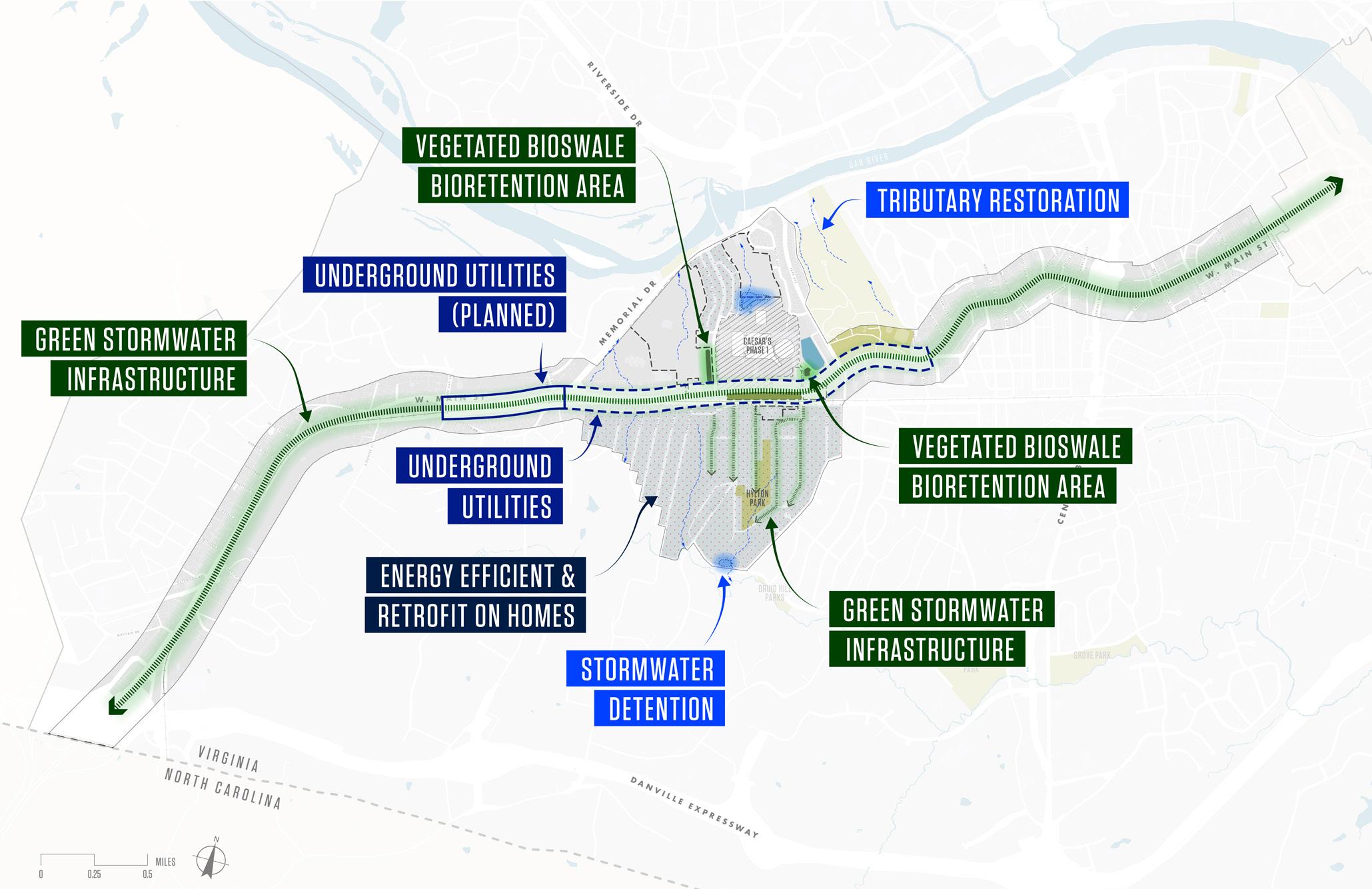
F I gur E 13 | Utilities + Infrastructure Issues & Opportunities 50
CONNECT COMMUNITY + CULTURE
The Schoolfield Neighborhood is home to roughly 1,400 people, and is in close proximity to many of Danville’s key assets. Residents agree that the community’s open space and recreation amenities, educational facilities, services, history, and culture are key assets, and are among the top reasons to live in Danville. Land use patterns in Danville lend themselves to nod-based clustered development strategies. Therefore, extending public uses and creating important transitions between the low-density single family residential typology and the commercial and future entertainment zones will be priorities, as well as enhancing connectivity to other community and cultural assets outside of the study area.

F I gur E 14 | Community + Culture Issues & Opportunities SCHOOLFIELD TODAY 51
Live Music at Engagment #3 Schoolfield Fest
02
IN THIS CHAPTER:
+ Engagement Process
+ Community Touchpoints
+ How the Community Shaped the Plan
52
Engaging Communitythe
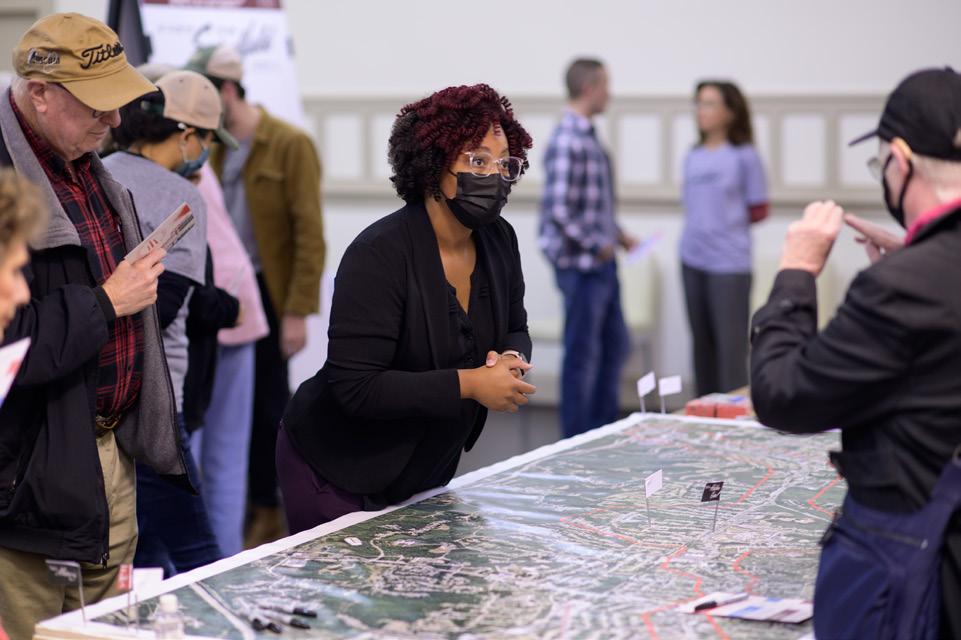
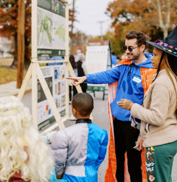
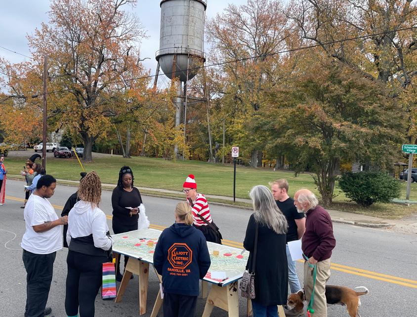
Community members have been an integral member of the planning process since Fall 2021. Engagement sessions were critical to unearth the layers of shared meaning, values, and aspirations for the future of the Schoolfield District. Three main community events occurred throughout the 18-month process. These events were opportunities to keep community members updated on the plan’s status and gather feedback to guide the development of the District Plan.
ENGAGING THE COMMUNITY 53
Community Impact, Outreach, & Engagement
PHASE
UNDERSTANDING SCHOOLFIELD
THE ENGAGEMENT PROCESS
Engagement was not about getting “public input,” it was about mobilizing residents through a meaningful community process that was grounded in reality and driven by input and sensitivity. The success of engagement hinged on the public’s willingness to embrace the strategies and goals.
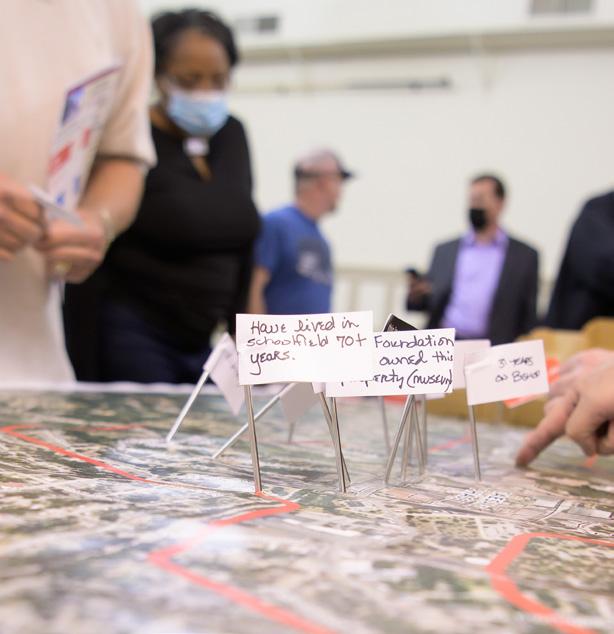
Throughout the process, the project team engaged with over 1,000 community members and stakeholders. The community engagement process was designed to capture the attention and interest of the community and to inspire future action and stewardship of the Schoolfield District. The goal was to involve a wide range of ages, races, ethnicities, and hard-to-reach residents in the process by providing many different locations, times, and events for egnagement to happen within the context of a person’s everday activities.
Through engagement, the project team learned from community members and stakeholders what the key priorities were for the District. The engagement activities and what the project team heard directly informed the development of this plan.
1: UNDERSTANDING
PHASE 2: EXPLORATION
SEP OCT NOV JAN MAR MAY DEC FEB APR
Community Kickoff + Visioning SCHOOLFIELD WEEK Exploring the Future
54

OUTREACH METHODS
Launched during the ongoing Coronavirus Pandemic, engagement took a hybrid approach that leveraged the “At-Home” + Digital strategies alongside “In-Person” + Physical tools to capture and incorporate community inputs.
At Home + Digital
Online tools like a project website and social media pages were created for a transparent reporting of the process. All materials produced were posted on the website for community members to review and social media pages reported announcements about upcoming events.
In-Person + Physical
Physical mailers and flyer were mailed to all homes in the Schoolfield District, and environmental graphics were put on W Main Street to spread awareness of the project. In addition, the project team would also “Pop Up” at locations around the neighborhood or at other events to engage more folks in the process.
3: REFINEMENT PHASE 4: DOCUMENTATION
PHASE
SCHOOLFIELD FEST
IMPLEMENTATION SEP OCT NOV JAN DEC FEB JUN JUL AUG
Draft Plan Unveiling
Schoolfield District Plan Community Events
ENGAGING THE COMMUNITY 55
Understanding Schoolfield
October 28, 2021 | 4:30 - 8:30 pm
COMMUNITY KICKOFF + VISIONING
130+ Attendees
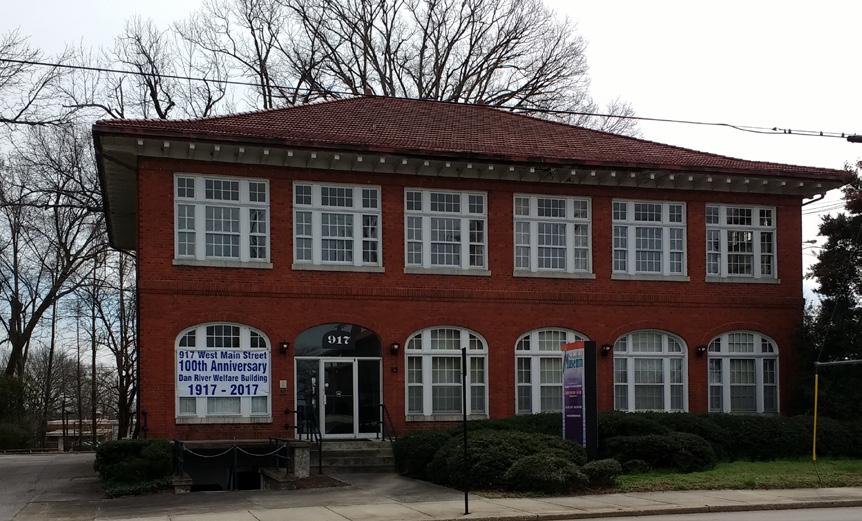
The first round of engagement focused on activities to help the team better understand the community and their connections to Schoolfield. Held at the historic Welfare Building at 917 W Main Street, the first round of engagement was an open house that included food, games, and activities.
Participants were invited to visit three stations focusing on:
+ Welcome
An overview of the project with the emerging key themes and goals. Participants were asked to share other goals and priorities that were important to them.
+ Understanding Our History & Community Attendees took a figurative walk through Schoolfield’s storied past and how it shaped the district today. Participants were asked about their needs and desires for housing, services, amenities, and more!
+ Our Future
Through interactive questions and activities, this was an opportunity to dream big and envision the future of Schoolfield. The community was asked to provide their vision for the future, including what it looks and feels like to live or visit Schoolfield in the future.
(See Appendix for the full meeting summary)
Key Takeaways
+ Better Access, Connections, and Transit
Emphasis on the need for better transportation infrastructure including pedestrian sidewalks, bicycle lanes, and transit connecting Schoolfield to the River District and down to the North Carolina state line.
+ Help Maintain and Preserve Historic Homes and Assets
The community shared their deep connections to the historic district and Schoolfield and the need to help preserve the history through building stock.
+ More Amenities, Entertainment, and Green/ Open Spaces
There was resounding support for more amenities and activities for people of all ages and abilities to enjoy in the district. This included a desire for more retail and commercial, especially a full-service grocery store, more activities or places to go after dark, and recreational activities.
+ More Housing Options and Support
More housing is a must, and should include a range of housing that is affordable for a range of incomes as well as more senior housing options to allow for aging-in-place. Many also expressed the need for homeownership educational programs to help first homebuyers understand the process of buying a home and caring for it.
TOUCHPOINT #1
56

WHAT
+ More transit - commuter train from Downtown to Caesars Virginia resort
+ Blight and disrepair addressed
+ More open and safe spaces
+ More affordable housing options
Safe
More Housing
Help Maintaining & Preserving
More Public
ARE SOME GOALS OR THEMES THAT ARE IMPORTANT TO YOU AND YOUR COMMUNITY?
COMMUNITY, CHARACTER & IDENTITY I WISH WE HAD MORE SPACE FOR... 12 VOTES AMENITIES (grocery stores, shopping, restaurants) 24% ENTERTAINMENT / SPORTS 9 VOTES 18% GREEN / OPEN SPACES 7 VOTES 14% MOBILITY & CONNECTIVITY WHAT CHALLENGES DO YOU SEE? 10 VOTES IMPROVE / ADD PEDESTRIAN INFRASTRUCTURE (sidewalks, lighting, crosswalks, ADA) 15% 10 VOTES 15% STREET IMPROVEMENTS (widen roads, fix potholes, etc) 10 VOTES 15% TRAFFIC ECONOMIC DEVELOPMENT & HOUSING HOW DO WE MAKE DEVELOPMENT MORE INCLUSIVE & EQUITABLE?
& Clean Neighborhood / Homes
Options
Homes
Amenities
inclusionary zoning) Maintain History / Charm 19% 14% 9% 9% 9% 9% WHAT TYPE OF HOUSING SUPPORT IS NEEDED? MORE HOUSING OPTIONS 12 VOTES 24% 14 VOTES HELP MAINTAIN & PRESERVE HOMES & HISTORIC ASSETS 27% SENIOR HOUSING 11 VOTES 22%
Policies / Grants (tax breaks,
ENGAGING THE COMMUNITY 57
Schoolfield District Plan Community Events
Schoolfield Week
May 2nd - 4th, 2022
#2 EXPLORING IDEAS FOR THE FUTURE
200+ Attendees
The second round of engagement focused on exploring potential projects and priorities that the community wants to see in the future. Spread out over a week, there were many opportunities for community members to share their ideas.
+ Monday
Open House #1: Design Concepts
Community members were asked to provide their input on issues and opportunities, vote on which catalyst sites to explore further, and projects or elements they’d like to see.
+ Tuesday + Wednesday
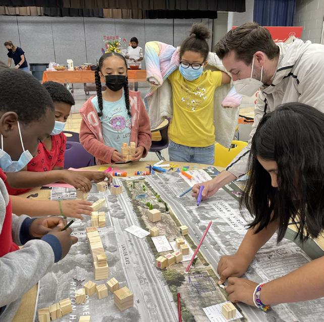
Community Design Charrettes
(See Appendix for the full meeting summary) TOUCHPOINT
Danvillians sat down with members of the design team to discuss land uses, programs, building types and locations, connections, and placemaking elements for the catalyst sites. These sessions resulted in concept plans for each catalyst site.
+ Thursday
Open House #2: Design Pin-Up
Another open house event, except this time the community was able to see the concept plans that they and their neighbors had created over the past few days.
+ Friday
Schoolfield Elementary Charrette
3rd - 5th graders created a vision collage of their perfect day in the New Schoolfield District and designed the Main Street Green in a hands-on interactive workshop.
+ Saturday
Pop-Up Farmers’ Market
The week ended at the opening day of the Community Market where the open house boards were displayed for the wider Danville community to provide input.
Key Takeaways
+ Top Themes & Goals
There was resounding support for focusing on Housing + Economic Development, Character + Identity, and Infrastructure as priorities for this district plan.
+ Explore Catalyst Sites Along the Corridor
The community felt that catalyst sites with the most visibility and connection to W Main Street would have the most potential for a wider variety of uses.
+ Top Projects and Priorities
Results from visual preference surveys showed that community members are interested in having a balance between the three themes with focus on community gathering spaces, building more housing, and providing economic development opportunities within Schoolfield.
58
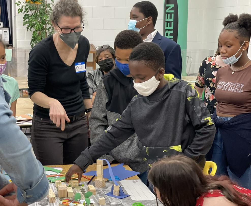
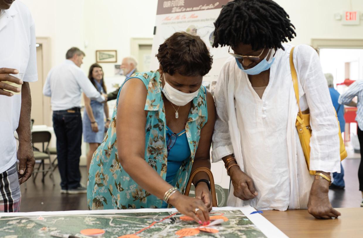
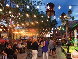
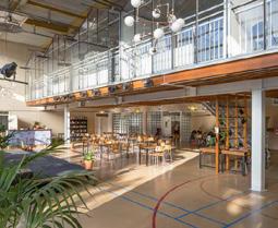
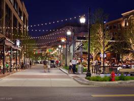
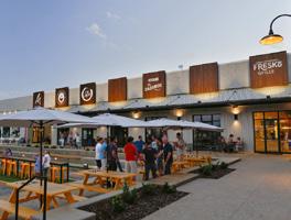
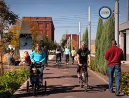

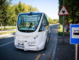
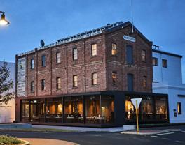
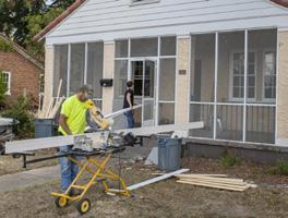
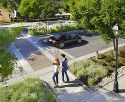
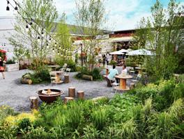
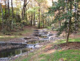
TOP THEMES & GOALS: Character + Identity 16 0 55 Housing + Economic Development 5 0 57 Community 10 0 37 Mobility + Connectivity 10 1 44 Ecology + Open Space 15 0 45 Infrastructure 5 0 52 WHICH CATALYST SITES SHOULD WE EXPLORE FURTHER? Shopping Center Redevelopment More local stores - a wider variety of retail + commercial Mixed Use retail + residential More opportunities to stay here 44 The Interchange Gateway - a lasting first impression Redevelop the motels - hotels & restaurants Live entertainment park 27 Main Street Green Condos with ground floor retail Night Life - outdoor events + food/ shop venues Welcome Center / Art Park 25 Baltimore Avenue Cluster Keep historic museum/displays Shops, food trucks, kids activities Connect to Hylton Hall site 14 The Bend Family entertainment Fast casual restaurants Shops - beauty salon, convenience stores 11 Filtration Plant Arts Center - with space for artists to work & live Open Market w/ small shops, etc Mixed use commercial & residential 13 TOP PROJECTS & PRIORITIES MEET ME ON MAIN Museum & Hotel 55 55 57 89 Autonomous Shuttle Main Street Town Square The Neighborhood Hub a thread of culture, connectivity, and community along Main Street. Complete Streets 57 59 88 90 Housing Support Village Gathering Nodes Shopping Center Redevelopment IT TAKES A VILLAGE an inclusive, walkable, historic neighborhood. Stream Restoration 52 61 64 67 Food & Garden Incubator Greenways Nature Park & Education Center A NEW LINK IN THE CHAIN connection people, the region, and nature. Schoolfield District Plan Community Events ENGAGING THE COMMUNITY 59
#3
Schoolfield Fest
October 29, 2022 | 2:00 - 6:00 pm
UNVEILING THE DRAFT PLAN
400+ Attendees
The third engagement event was a Halloween festival that included food trucks, candy, a beer garden, live music, a bouncy house, face painting, and giveaways. The event was also the culmination of all of the work and feedback that had been received up to that point. Key strategies and elements from the draft plan were displayed, as well as the refined catalyst drawings of the sites and programs that the community had begun to explore during Schoolfield Week. Held at the Baltimore Avenue Cluster site, Schoolfield Fest was also a demonstration of the programmatic opportunities presented in the Plan by closing a portion of W Main Street for events. The engagement boards used to provide the content for this event included:
+ Project Overview and Input from previous events
Context on the planning process and how previous engagement informed the strategies and concept designs.
+ Vision for the New Schoolfield District
The vision board included key strategies from each of the project themes and the overall plan vision.
+ System Frameworks
System framework diagrams showed how all the plan elements come together spatially throughout the district.
+ Fabric
Zoomed-in concept designs for the six character areas of W Main Street, including a contiguous 2-way bike lane, enhanced pedestrian and public realm throughout.
(See Appendix for the full meeting summary)
+ The Neighborhood District-scale boards expounded upon key strategies and projects focused on creating the Schoolfield Village.
+ Catalyst Sites
Detailed plans, axons, and renderings showed visitors what they might experience upon implementing the plan.
+ Implementing the Vision
Community members voted on their top priorities and projects to focus implementation efforts on.
Key Takeaways
+ Creating a lasting first impression
In addition to new housing, many felt that housing strategies focused on current residents and that existing housing units are important to address. Residents expressed a growing need and urgency around protecting themselves from being displaced to make way for short-term housing for visitors. TOUCHPOINT
There was a consensus that improving gateways and the portion of W Main Street corridor closest to the North Carolina state line was the top priority. The community agreed that a strong welcome reinforced by signage along W Main Street was important to build ahead of Caesars Virginia resort to create an identity and sense of place that resonates with the community.
+ Shopping Center Redevelopment
There was overwhelming support for revitalizing and redeveloping the Ballou Shopping Center. Throughout the planning process, the shopping center was often referred to as underutilized and in need of denser development that will offer more of the amenities and housing options that the community needs.
+ Housing Strategies
60
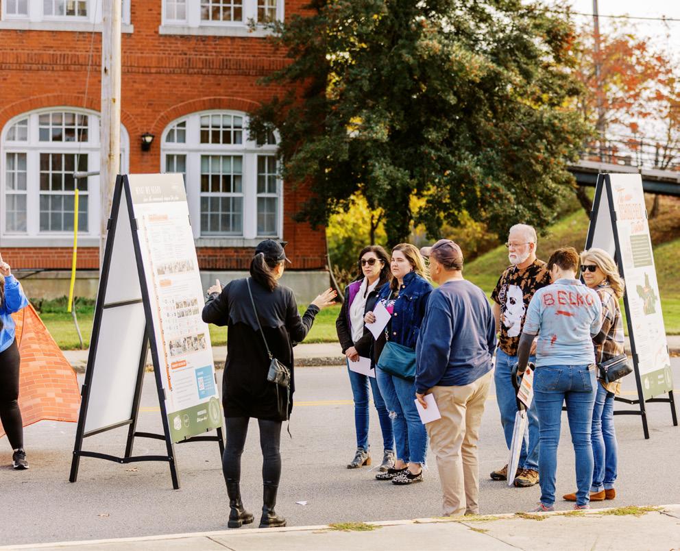
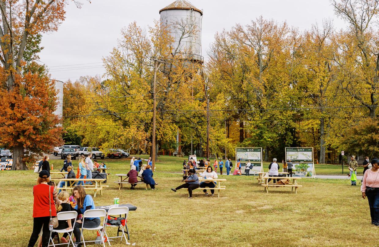
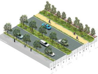
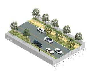
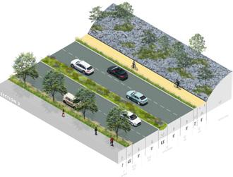
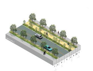
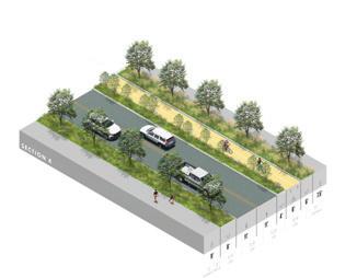
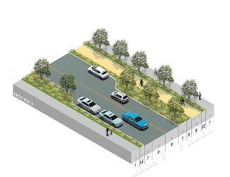
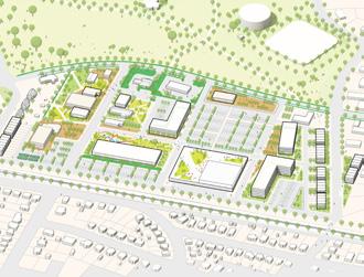
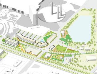
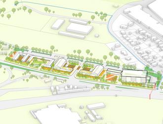
NOTE: votes shown in red indicate the Top 3 choices picked by the community. CORRIDOR Section 5 42 Section 2 56 Section 6 60 Section 4 46 Section 1 95 Section 3 48 NEIGHBORHOOD East-West Connections 62 Housing Strategies 155 Anything Else? 65 Improvements to Hylton Park 112 Greenways 102 CATALYST SITES Baltimore Ave Cluster 74 Main Street Green 91 Filtration Plant + Schoolfield Woods 85 The Interchange 71 Shopping Center Redevelopment 149 TOP
FOR IMPLEMENTATION Schoolfield District Plan Community Events ENGAGING THE COMMUNITY 61
PRIORITIES
How the Community Shaped the Plan
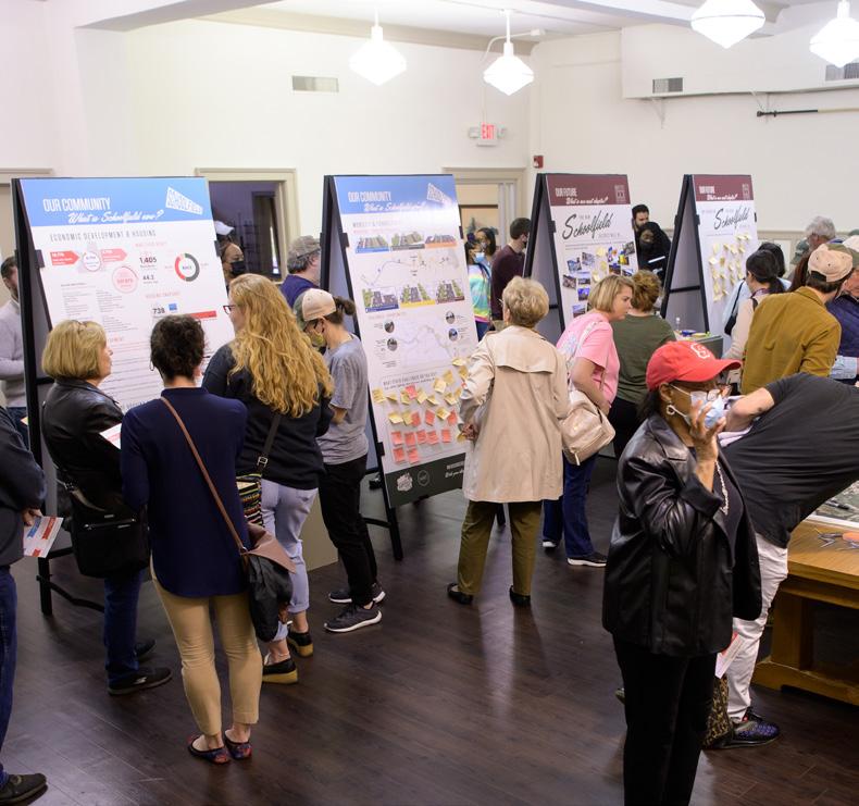
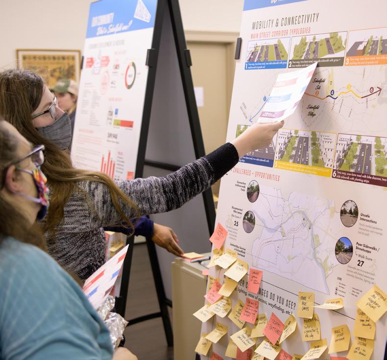
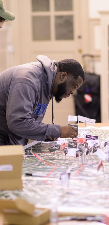
SHARING THEIR STORIES + ENVISIONING THE FUTURE
Residents shared their stories and connections to the site and surrounding district to help the project team understand their values and aspirations for the district. Community members shared their personal connections to the Old Riverside Cotton Mill, their childhood stories of growing up in Schoolfield Village, and what they hope to see in the future.
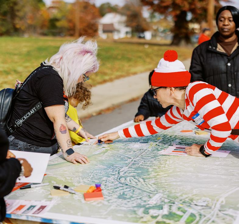
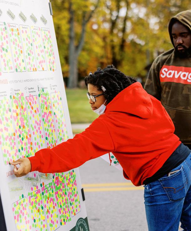
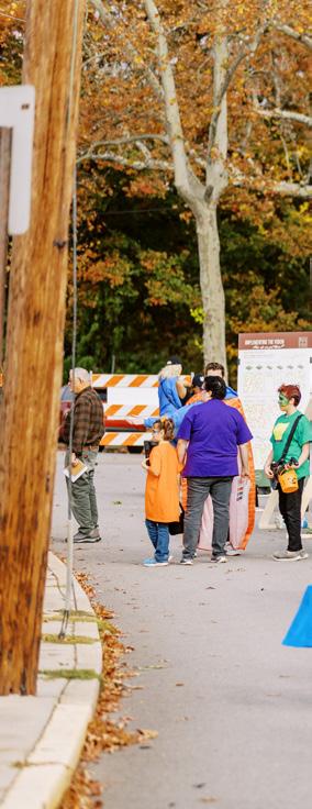
DOCUMENTATION
All of the engagement, comments, and stories we heard were documented and directly informed the final master plan document.
understanding refinement

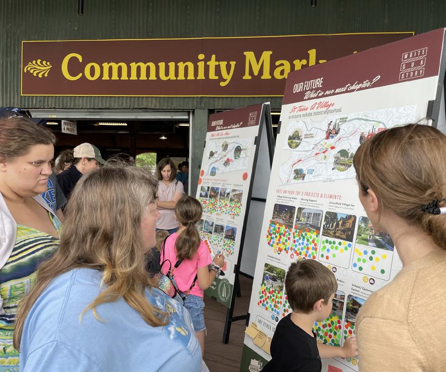
DESIGNING THE FUTURE
Community members sat down with the design team to draw and discuss their ideas at six potential catalyst sites throughout the district. They were also asked to vote for projects and elements they most wanted to see included in the master plan. A student workshop also engaged with children at Schoolfield Elementary to help them design their ideal park.
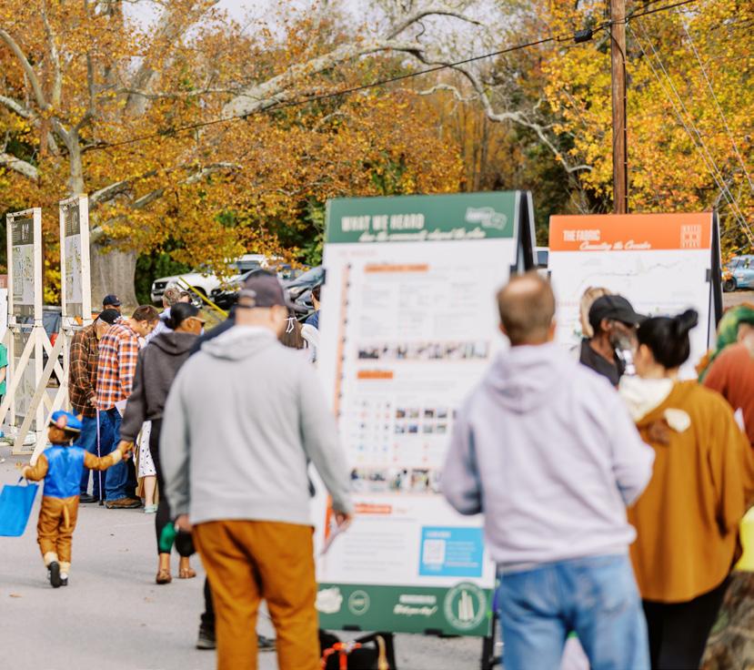
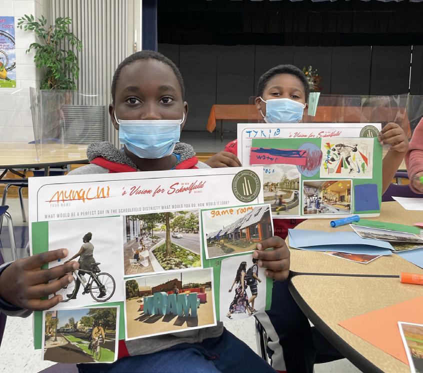
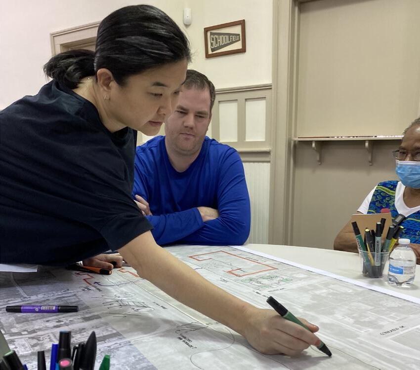
VOICING THEIR PRIORITIES
The concept plans created with the community at Schoolfield Week were refined by the design team over the summer and then presented back to the community in October for comments. Community members were also asked to vote for priority projects and areas to be focused on first during implementation.
IMPLEMENTATION!
As the City of Danville moves into implementation, the priorities set by the community and continued engagement will guide the focus and direction of the New Schoolfield District.
exploration ENGAGING THE COMMUNITY 63
IN THIS CHAPTER:
+ District-wide Vision
+ Plan Scales + Vision
03
64
The Vision
The New Schoolfield District Plan presents an opportunity to leverage the catalytic development at the Dan River Mills site to improve the health and well-being of the community, increase resiliency, spur new investment and economic development, preserve heritage and history, and stitch together the threads of Schoolfield and Danville into a rich and vibrant tapestry.
The vision explores three scales of strategies:
+ The Corridor
+ The Master Plan
+ The Neighborhood
THE VISION 65
The New Schoolfield District Plan envisions an authentic, resilient, historic, and thriving village fabric stitched together by community and shared history. A village shaped by the stories of our past, creating a canvas for stories yet to be written.
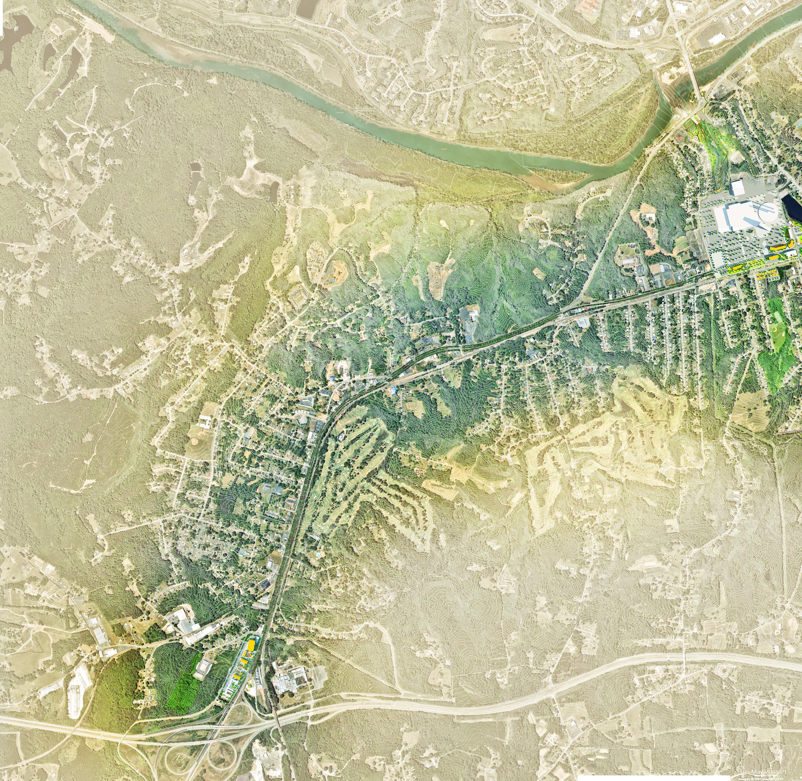
THE INTERCHANGE FLIPPEN CEMETERY
W
DANVILLE GATEWAY
SCHOOLFIELD GATEWAY
SCHOOLFIELD WEST STREAM
W MAIN STREET
MEMORIALDR F I gur E 15 | Illustrative Conceptual Plan
MAIN STREET
TRAIL
THE BEND
DANVILLE GOLF CLUB
ABREU GROGAN
L L E E
DANVI
XPRESSWAY
66
CAESARS VIRGINIA RESORT
PEDESTRIAN BRIDGE
FILTRATION PLAN + SCHOOLFIELD WOODS
BALLOU PARK
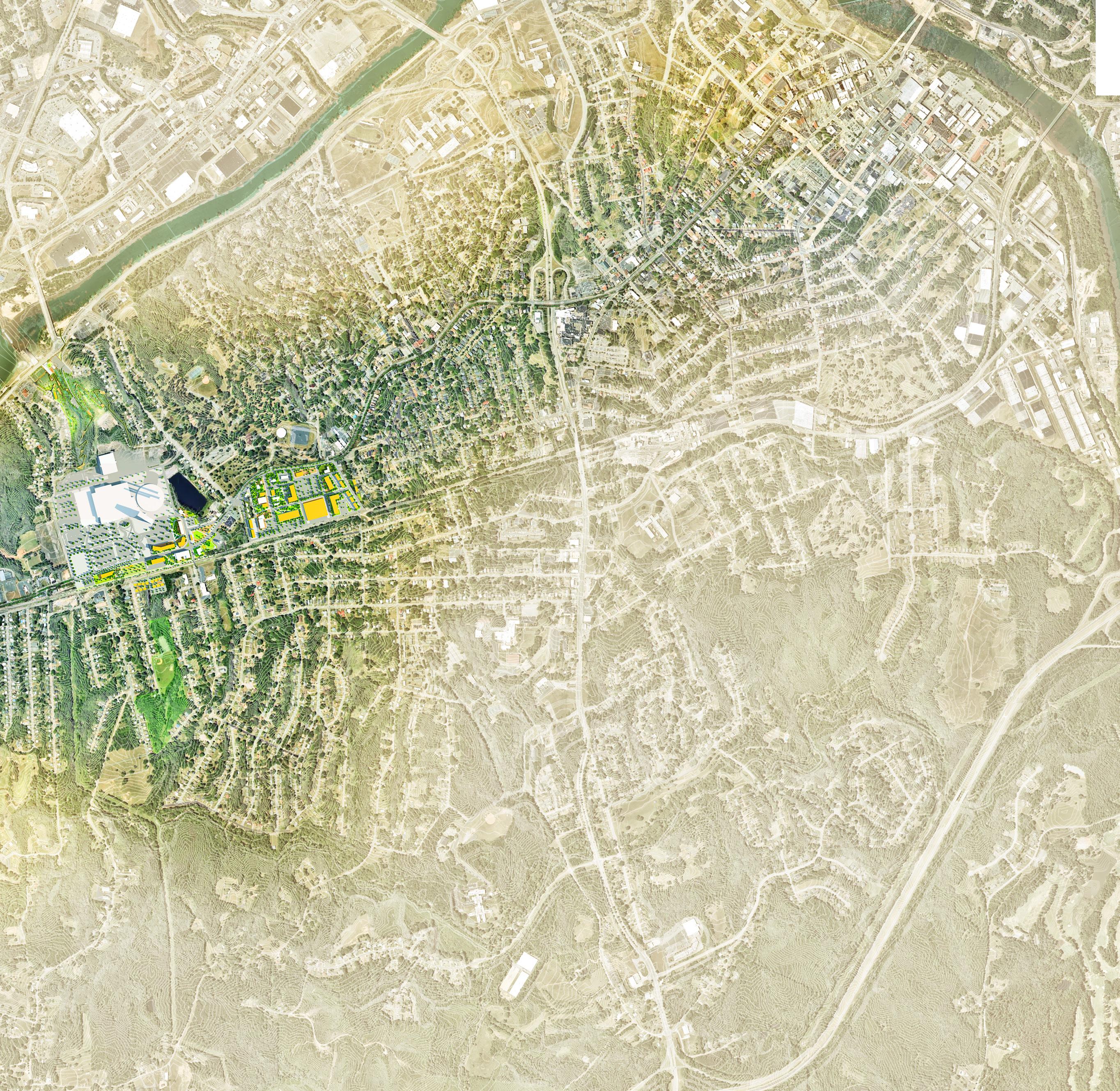
THE RIVER DISTRICT
AVERETT UNIVERSITY
HYLTON PARK
SHOPPING CENTER REDEVELOPMENT
FOUNDERS PARK
BALTIMORE AVENUE CLUSTER
SCHOOLFIELD TRAIL
WMAINSTREET
BLVD
DAN R I V E R
INDUSTRIAL AVE CENTRAL
PARK AVE
N
DCC
THE VISION 67
The Plan Scales
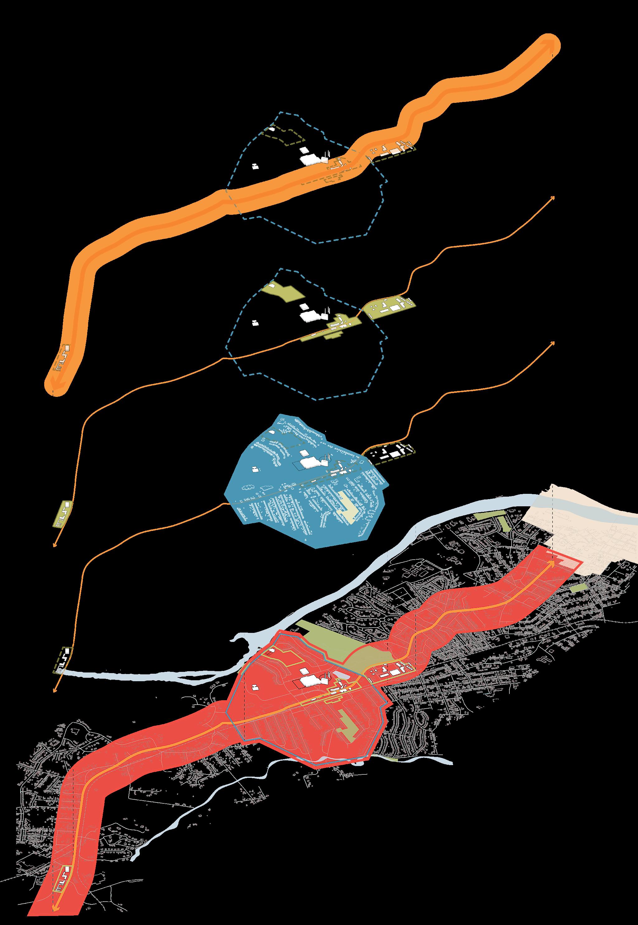
F I gur E 16 | Plan Focus Areas
68
The Schoolfield of the past was an epicenter of energy and activity, placing Danville on the map as a major regional economic engine. The plan restores this energy and revitalizes the village by creating destinations and nodes that stem from and reflect the authenticity of Schoolfield and accommodate varying scales and types of future growth.
place MASTER PLAN
Schoolfield occupies a special place in the hearts and collective consciousness of the Danville community. The plan honors the charm, culture, and historic authenticity of the site’s past while looking to the future with strategies and activity nodes that integrate inclusive economic growth, housing, recreation, nature, community, and mobility.
People have always been, and will continue to be, the lifeblood of Schoolfield. The plan creates new spaces and revitalizes historic buildings where people from all walks of life and backgrounds can gather and find a safe, accessible, and welcoming community where they can live, work, and thrive. people NEIGHBORHOOD
THE VISION 69
fabric CORRIDOR
IN THIS CHAPTER:
+ Community, Character, + Identity
+ Housing + Economic Development
+ Ecology + Open Space
+ Mobility, Connectivity, + Infrastructure
04
70
Key Themes & Systems
Across all scales of site and design considerations, four key themes emerged and have been developed in collaboration with the local community. These key themes and systems outline the framework with which specific strategies are identified in this Plan to: revitalize and shape the community character and identity; spur and stabilize housing and economic development; unify and nurture the ecology and open space; and connect and link mobility and infrastructure.
KEY THEMES & SYSTEMS 71
Community, Character, + Identity
Preserve and celebrate the history and legacy of Schoolfield and create welcoming gateways into the community.
The focus on Community, Character, and Identity aims to foster a healthy and inclusive village for future generations for Schoolfield, accomplished through strategies that focus on increasing access to healthy and local food, access to quality outdoor public spaces, and creating a sense of place that attracts the community and visitors alike.
Building on the historic legacy of Schoolfield, the character and identity of community spaces should aspire to strengthen existing community assets while also establishing new village nodes that provide neighborhood-focused amenities to serve the needs of residents. The implementation of a cohesive Schoolfield Brand through a series of wayfinding and signage installations, emphasized community gateways, public art, and historic interpretation guides around local assets and cultural destinations will unite the community, spur investment, attract visitors, and promote partnerships with existing community assets.
The preservation and celebration of Schoolfield’s rich history through cultural trails that link cultural sites, like the Three Sisters (the three smokestacks located on the Caesars Virginia Site), Flippen Cemetery, and Ballou Park, will underscore the legacy of Schoolfield. Adaptive reuse of historic Dan River Mills buildings will also restore the once thriving village hubs to serve the community. Efforts to celebrate and preserve culture and identity can also open opportunities to support existing educational assets within and adjacent to Schoolfield, including Averett University, Schoolfield Elementary, and Danville Community College. Building relationships between the community and local institutions is an effective tool used to support long-term cohesion and support of the community in the form of events and festivals that celebrate the people, business, culture, and future of Schoolfield.
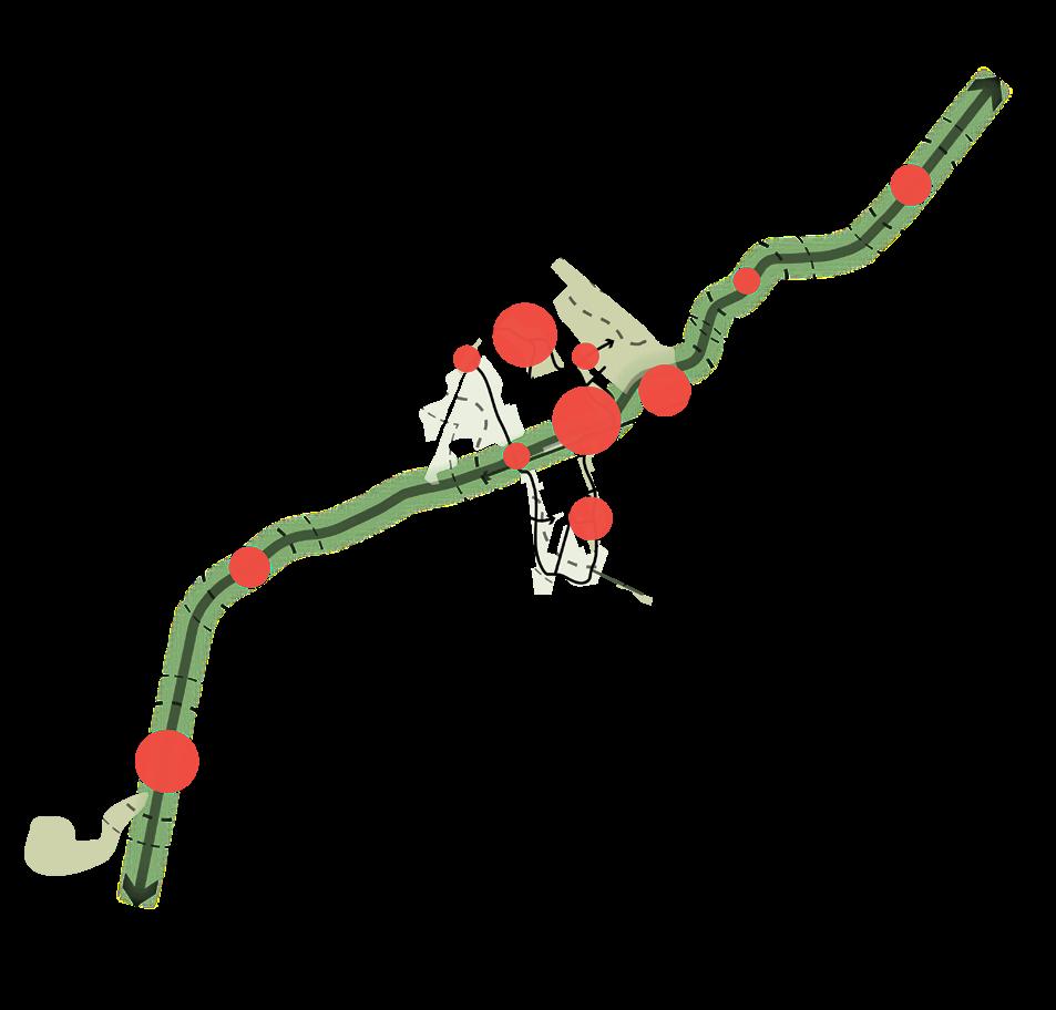
REVITALIZE + SHAPE
Create welcoming nodes of activity and gateways to spur revitalization efforts and shape the future of Schoolfield.

FOUNDERS PARK
N
WELCOME TO DANVILLE!
WELCOME TO SCHOOLFIELD!
GATEWAY
PEDESTRIAN BRIDGE
CEDAR BROOK PARK
HYLTON PARK
ABREU GROGAN
BALLOU PARK
AVERETT UNIVERSITY
DCC
FLIPPEN CEMETERY
F I gur E 17 | Community, Character, and Identity System Diagram KEY THEMES & SYSTEMS 73
Housing + Economic Development
Combat displacement and identify equitable and inclusive revitalization and development opportunities that meet the needs of existing and future residents.
Providing housing options (senior, workforce, multi-family, etc.) for a range of incomes is vital for the growth and development of Schoolfield and crucial for preserving community. In order to provide more diverse housing typologies, public-private partnerships will be critical, particularly in support of the Danville Housing Development Corporation to help develop a mix of units to spur the housing market.
In addition to identifying areas of opportunity for new housing, this plan also seeks to supply existing residents with resources to combat displacement and pressure from development forces. Providing support or funding to residents for home maintenance and rehabilitation, including energy efficiency retrofits or façade improvements, will help retain historic character, keep residents in the community and support aging-in-place. Other City-supported measures like the creation of a form-based code, utilization of code enforcement, and housing design templates catered to historic Mill Village homes will help reduce development costs, limit blight, and will help manage abandoned and neglected homes. Creation of a Housing Trust could help support all of these measures and facilitate or scale up existing housing rehabilitation programs or other resources the City of Danville and Danville NDC already have in place.
In order to create new housing opportunities, underutilized commercial or vacant commercial parcels should be rezoned to allow mixed-use development at strategic sites that can be acquired and prepared for housing. Adaptive reuse of existing structures, i.e., old Dan River Mills buildings, can provide greater housing capacity and should be explored throughout the district. All development of public parcels should be equitable for a range of incomes and abilities and should allow for community prosperity and wealth building.
As an implementation vehicle for public improvements, consider the creation of a Community Development Authority. To meet the needs of existing and future residents, district level incentives - for example: Economic Incentive Areas, or scattered site Tax Increment Financing - might support the growth of entrepreneurs and incubators, as well as supporting existing local businesses with resources like flexible office and retail space for small businesses and entrepreneurs. To bolster additional economic development from within the community, strengthening and expanding existing jobs training and development programs for Schoolfield residents, while attracting specific community-desired uses and services for current and future residents, like grocers, daycares, health services, is one effective strategy that might be deployed. Future community-oriented development opportunities can spur from key catalyst sites through incentivizing targeted redevelopments of underutilized lands in the district.

SPUR + STABILIZE
Target investment at strategic sites along the W Main Street corridor for initial development to spur future development and revitalization efforts.

FILTRATION PLANT + WOODS
POLICE HQ
W MAIN + MEMORIAL
THE BEND
REZONE FOR MIXED USE
STREETSCAPE GUIDELINES
OPPORTUNITY SITE
CAESARS VIRGINIA
BALTIMORE AVENUE CLUSTER
THE INTERCHANGE
INDUSTRIAL REDEVELOPMENT OPPORTUNITY
MAIN STREET GREEN
SENIOR VILLAGE
COMMUNITY DEV.
AUTHORITY SHOPPING CENTER
FORM-BASED CODE
N
F I gur E 18 | Housing and Economic
Diagram
Development System
KEY THEMES & SYSTEMS 75
Enhance existing open and natural spaces and find opportunities to create new spaces for recreation, habitat, and respite.
Ecology + Open Space
The focus on ecology and open space strives to provide easily accessible places for residents and visitors to come together while expanding and enhancing the quality of existing habitat, local ecology, and environment. The ecology and open space strategies aim to enhance the identity of Schoolfield through sustainable landscape features that connect across the district.
The W Main Street corridor presents an opportunity to increase vegetation and expand the tree canopy to weave together the fabric of robust existing open spaces and natural systems. As a connector across the district and city, W Main Street can link existing and new parks with greenways, and manage untreated stormwater from impervious surfaces – i.e., parking lots, buildings, and roads – with green stormwater infrastructure (GSI). Creating a network of GSI from the scale of a single site that expands to the scale of a corridor or district will better support sustainable opportunities to store, infiltrate, or evapotranspirate stormwater and reduce flows to sewer systems and surface waters.
Within existing natural areas, water quality can be improved to help restore streams and habitats within the district, and the open space system can improve trail connectivity to reconnect the community with assets like Ballou Park. As part of the framework for redevelopment, the open space system can improve the quality of the public realm for all residents and visitors, creating welcoming, authentic, and vibrant public spaces that will build on Schoolfield’s existing network of parks and open space, and expand access to currently underutilized areas.
Key existing zones that will be part of this future network include revitalizing Hylton Park with natural areas, recreation amenities, and greater connectivity to the neighborhood and other open spaces, enhancing the area around the Reservoir to provide public access and trail connectivity, and reimagining Schoolfield Woods as a connector between the W Main Street corridor and Dan River.
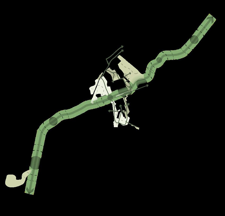
UNIFY + NURTURE
Create links between existing and proposed parks and development to nurture connections between people, nature, and opportunities.
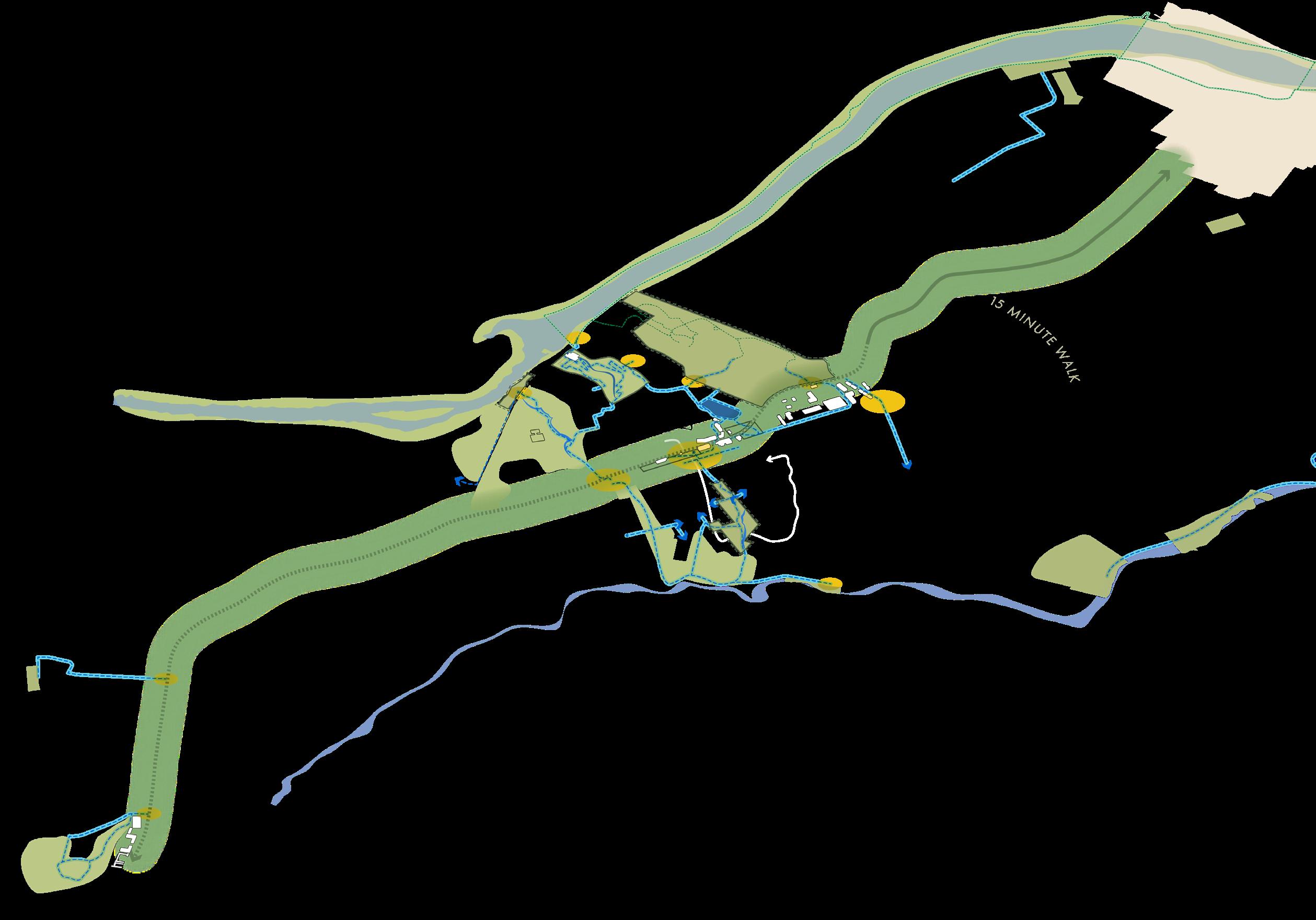
SCHOOLFIELD WOODS
BALLOU PARK CONNECTION
BALLOU PARK
RESERVOIR
WEST WOODS STREAM + TRAIL
ABREU GROGAN
CURB EXTENSION
GREENWAY TO CEDAR BROOK PARK
RIVERWALK TRAIL
FLIPPEN CEMETERY
SCHOOLFIELD VILLAGE TRAIL
FOUNDERS PARK
HYLTON PARK P
PLANTED BUMP OUTS
N
F I gur E 19 | Ecology and Open Space System Diagram
KEY THEMES & SYSTEMS 77
Mobility, Connectivity, + Infrastructure
Emphasize W Main Street as the city’s spine and create seamless multi-modal connections to the River District.
As the spine of the Schoolfield District, W Main Street is the major east-west conduit between the Virginia-North Carolina line and the River District. Focusing on the quality of the journey between the key destinations along the corridor with a set of corridor development standards and seamless multimodal opportunities will foster better connectivity and accessibility throughout the district.
Building on all of the overarching system strategies, the Mobility, Connectivity, and Infrastructure strategies aim to link all of the pieces of the systems together. Building a vibrant, pedestrianoriented corridor environment will create a safe and efficient boulevard for all users –bicyclists, pedestrians, and motorists. Implementing a series of green stormwater infrastructure improvements along W Main Street will manage runoff from the road and adjacent parcels and bring more vegetation to the corridor. The undergrounding of overhead utilities will further improve the experience by allowing more space to expand the public realm and pedestrian improvements by widening the streetscape. Implementing complete street strategies along W Main Street will improve accessibility, safety, multimobility, and versatility to prioritize safety for all users.
Spurring from the W Main Street corridor, neighborhood connectivity can be improved by introducing new east-west connections and strengthening existing crossings. Along the entire district, the safety of intersections and crossings can be improved. Public transit usage can be increased by improving existing shelters, installing new shelters and signage, and implementing other improvements to enhance the rider experience.
To advance efforts to improve infrastructure for a more inclusive and resilient community the existing bike network can be expanded to provide greater mode choice, a transit hub can be created near the state line to facilitate future transit improvements along W Main Street, and a shuttle can be considered to transport visitors and residents from Schoolfield to the River District. The extension of the Riverwalk Trail system into Schoolfield, with more pedestrian and bicyclist connections between the W Main Street corridor and trail systems, will provide safer connectivity and increased use, and should be paired with improved bicycle amenities within Schoolfield - more bike parking, expanded existing bike share - to allow for last-mile connectivity. In strategic areas along the corridor, sound from the adjacent railroad can be mitigated using planting and sound buffers. Continued engagement with the community is recommended in order to integrate community-prioritized improvements within infrastructure projects.
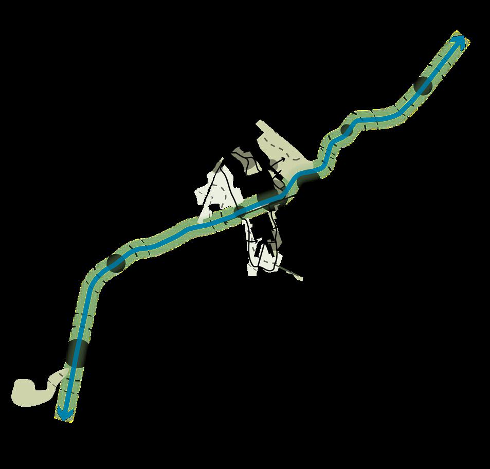
CONNECT + LINK
Enhance the quality of the public realm and user experience along the corridor to improve connectivity and links to existing and future destinations.
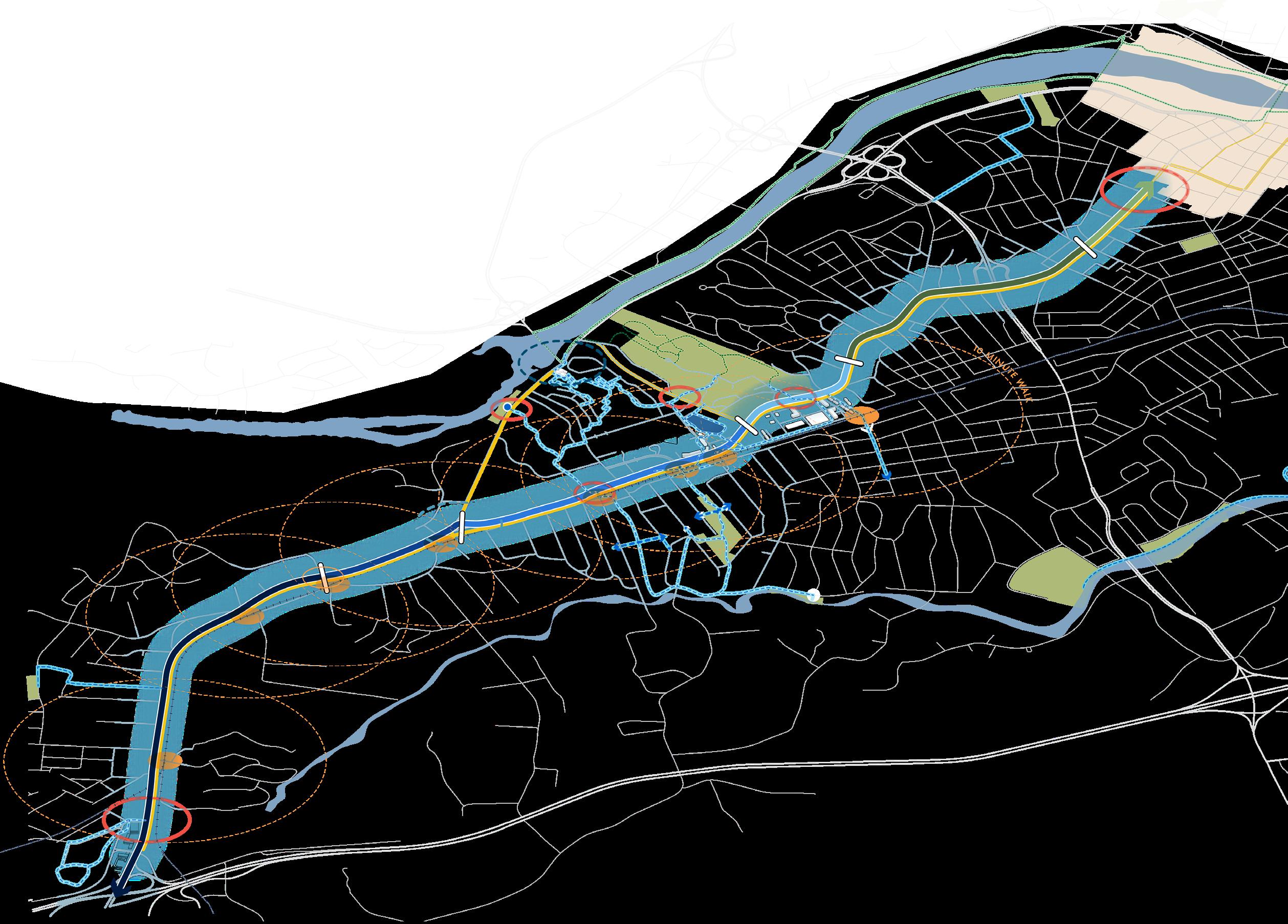
BIOSWALES
N
PEDESTRIAN BRIDGE
W MAIN + MEMORIAL
GREENWAY TRAIL PARK CONNECTIONS
GREENWAY TRAIL
W MAIN STREET
W MAIN STREET
W MAIN STREET
W MAIN STREET
W MAIN STREET
EAST - WEST CONNECTIONS
RAIL
BIORETENTION PLANTERS
2-WAY BIKE LANE
SIDEWALKS
AT GRADE RAIL CROSSING
PEDESTRIAN TUNNEL
6
5 4
W MAIN STREET 3 2 1
F I gur E 20 | Mobility, Connectivity, and Infrastructure System Diagram KEY THEMES & SYSTEMS 79
IN THIS CHAPTER:
+ Current Conditions
+ A String of Pearls
+ Character Zones
+ Transition Zones
+ Public r ealm
05
80
Connecting the Corridor
The W Main Street corridor is the spine of Danville, a key connective thoroughfare that has the opportunity to embody the distinct character and culture of the District. The corridorscale presents an opportunity to focus on the quality of the journey between destinations, improving circulation, prioritizing pedestrians, and promoting environmental stewardship. Strategies in this section aim to shape the future of Schoolfield by emphasizing the public realm and its connection to the place.
CONNECTING THE CORRIDOR 81
Current Conditions
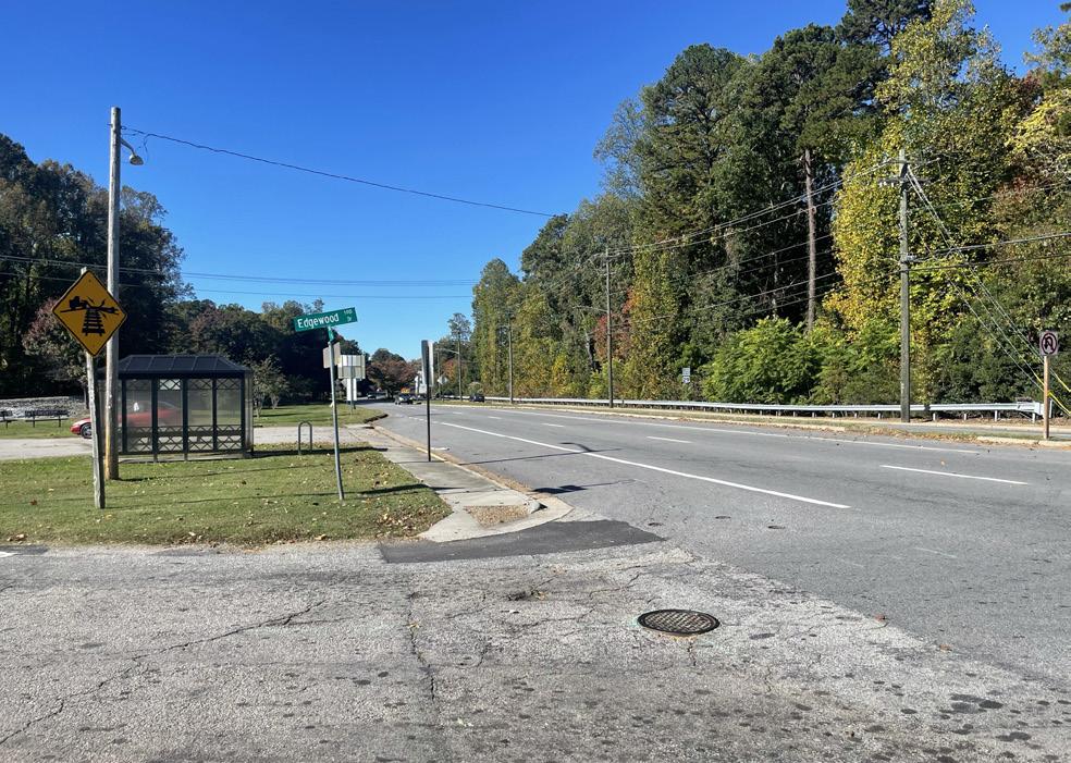
Lack of consistent character, no visual identity
In its current form, W Main Street lacks uniformity in physical features or plantings. The public realm does not generate a visually interesting and safe corridor to travel through, either by car, as a pedestrian, or by bike.
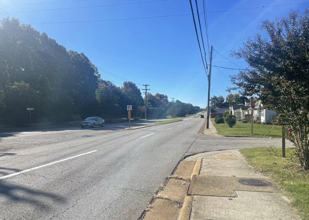
Incomplete and inadequate sidewalks
There are some adequately sized sidewalks along W Main Street, however, many of them are in poor condition or incomplete and abruptly end. According to the National Walkability Index, the Schoolfield District scores below average for walkability.
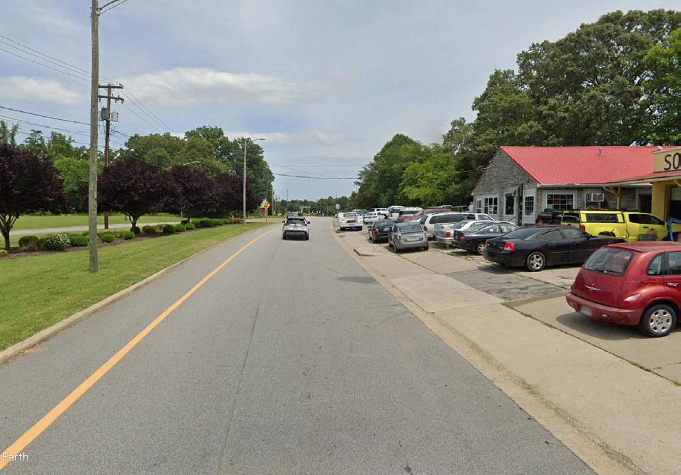
Visual clutter and obstructions
Lack of character and development standards has allowed varying uses and conditions along W Main Street, creating visual clutter in the form of large signs and billboards, auto body & repair shops with overflow cars parked adjacent to and in some cases on the public sidewalks.
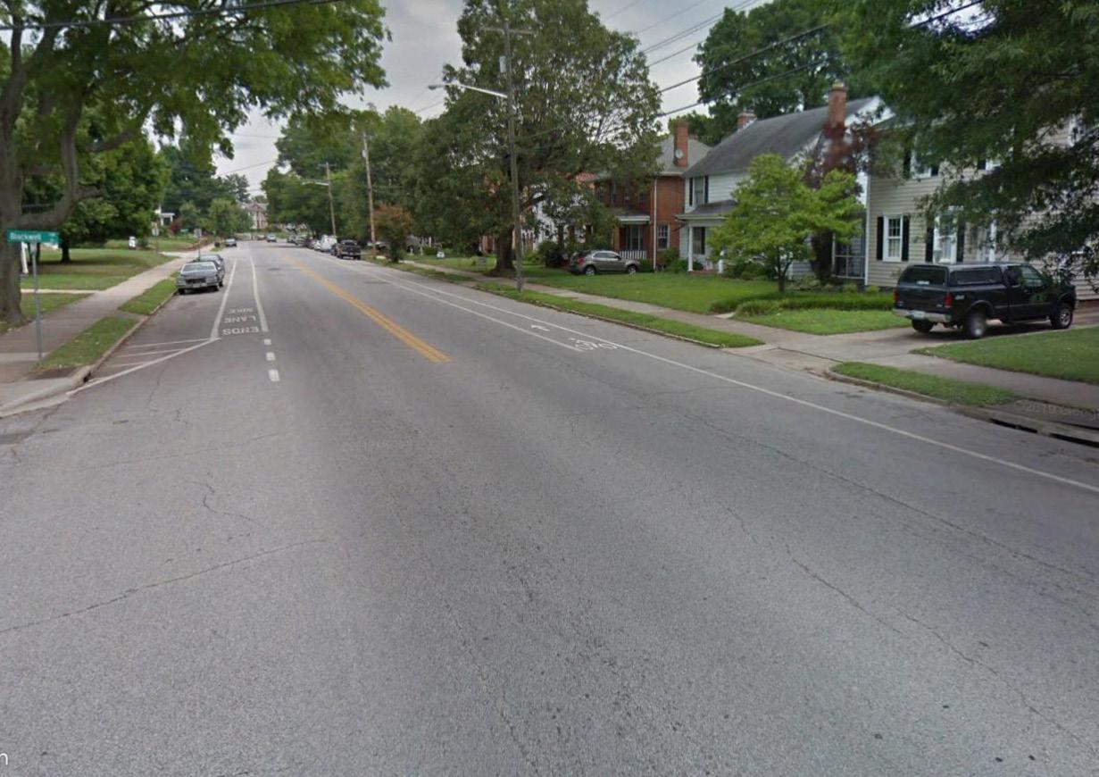
Limited bike infrastructure
Danville has approximately 19 miles of bike lanes, however, the discontinuous network serves only small sections of Danville. Additionally, there are limited protected bike lanes, most of the network is painted lanes or in some cases sharrows.
82
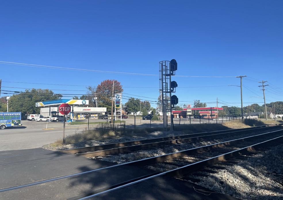
u nsafe crossings (road and railroad)
Lack of safe pedestrian crossings on W Main Street and the railroad track creates accessibility challenges for residents living in the Schoolfield Village. At-grade crossings without sidewalks or stop lights create dangerous conditions for pedestrians and limit connectivity.
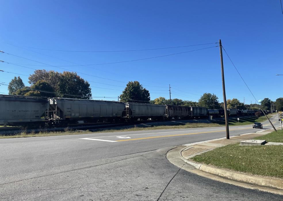
Nuisance noise from rail and street
Loud freight and passenger trains travel on railroad track parrallel to W Main Street and the Schoolfield neighborhood. Trains pass through at multiple times of day and night, disturbing residents and businesses on adjacent parcels.
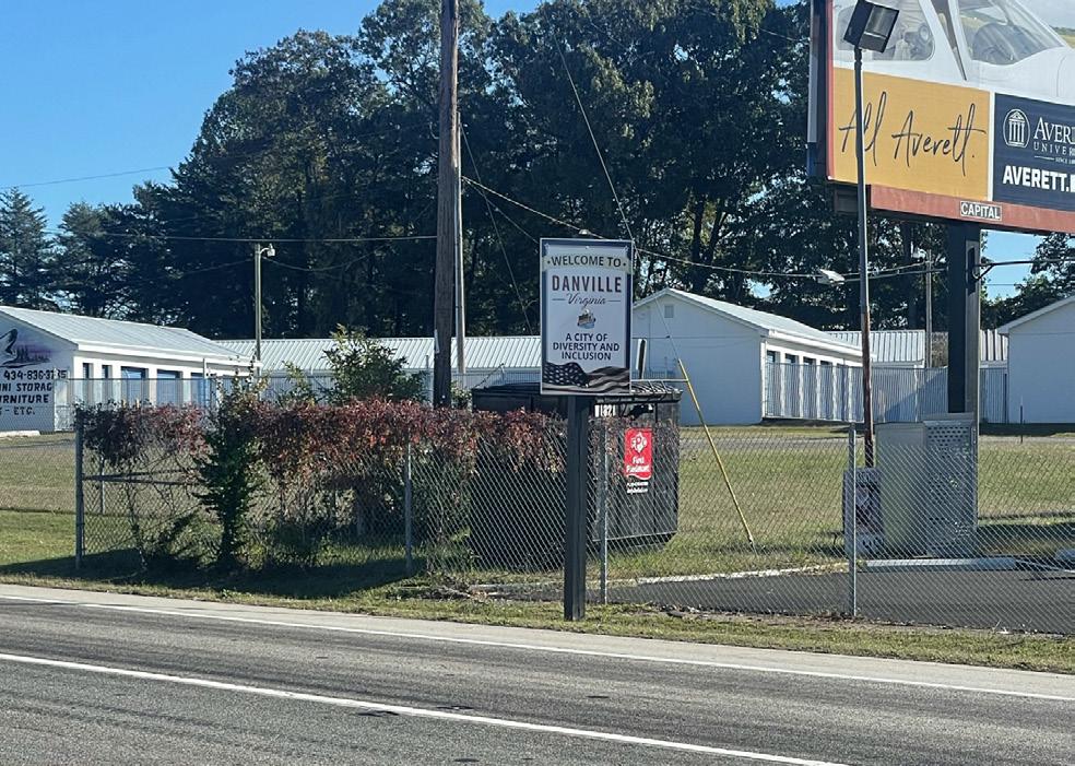
Inconsistent wayfinding and signage
As the primary roadway through Danville, W Main Street serves as a gateway into the city. However, there is a lack of consistent branding and signage to guide visitors into Danville and points of interest.
Lack of development standards for parcels along the corridor
Lack of standards has created an inconsistent building pattern that includes varying and sometimes incompatible uses located next to each other. Stark building walls facing the public right of way and buildings built right on the edge of the sidewalk leave no room for public realm elements.
CONNECTING THE CORRIDOR 83
A String of Pearls
W Main Street is the spine of Danville weaving together all of the destinations in the city. It has great potential to be a safe multimodal boulevard for bicyclists, pedestrians, transit riders, and drivers. Elements such as a transit-hub, cycling and micro-mobility amenities, and pedestrian-oriented public realm will improve the safety, walkability, and transit-readiness of the corridor and will create a resilient and inclusive community.
The “String of Pearls” framework creates new destinations, or village nodes, within a 15-minute walk to residences. These destinations, paired with enhanced mobility and stormwater interventions along W Main Street, will encourage walking and biking to essential and key services and will help improve quality of life for residents and visitors of Schoolfield.
F I gur E 21 | String
84
of Pearls Diagram
CONNECTING THE CORRIDOR 85
Character Zones
The goal of shifting toward a more sustainable mobility network and realizing a complete street concept inevitably starts from site-specific characteristics which need to be understood and addressed before any strategies can be put forth. The main component to address is the W Main Street corridor leading into Danville, that passes the new Caesars Virginia resort development and the Schoolfield neighborhood. This artery lacks any consistent character or visual identity besides being a vehicular corridor that moves vehicles between the highway and city center. Background analysis highlights the potential of W Main Street to become the backbone for multimodal mobility that stitches together local communities.
In order to provide strategies that tackle the different characteristics of the corridor, W Main Street is broken into six zones that are characterized by the ROW (right of way), available infrastructure, and urban context. Each zone is characterized to identify opportunities and constraints of the existing conditions.
Transportation and stormwater infrastructure opportunities have been explored for each section of W Main Street with the aim to reallocate portions of car-centric space to modes of active transport, prioritization of user safety, and integration of stormwater strategies without reducing the overall vehicle capacity of the corridor. In order to align the various proposed strategies with the future road capacity demands, projected vehicular volumes for the new Caesars Virginia resort development were taken into account.
NOTE:
The proposed concepts are preliminary configurations that do not include bus stop locations, intersection details, detailed design of the transition between corridor zones, and other unique conditions throughout the corridor. Additional engineering, traffic, and design studies will be required to further advance the concepts prior to implementation. Additional community & stakeholder engagement is also recommended.
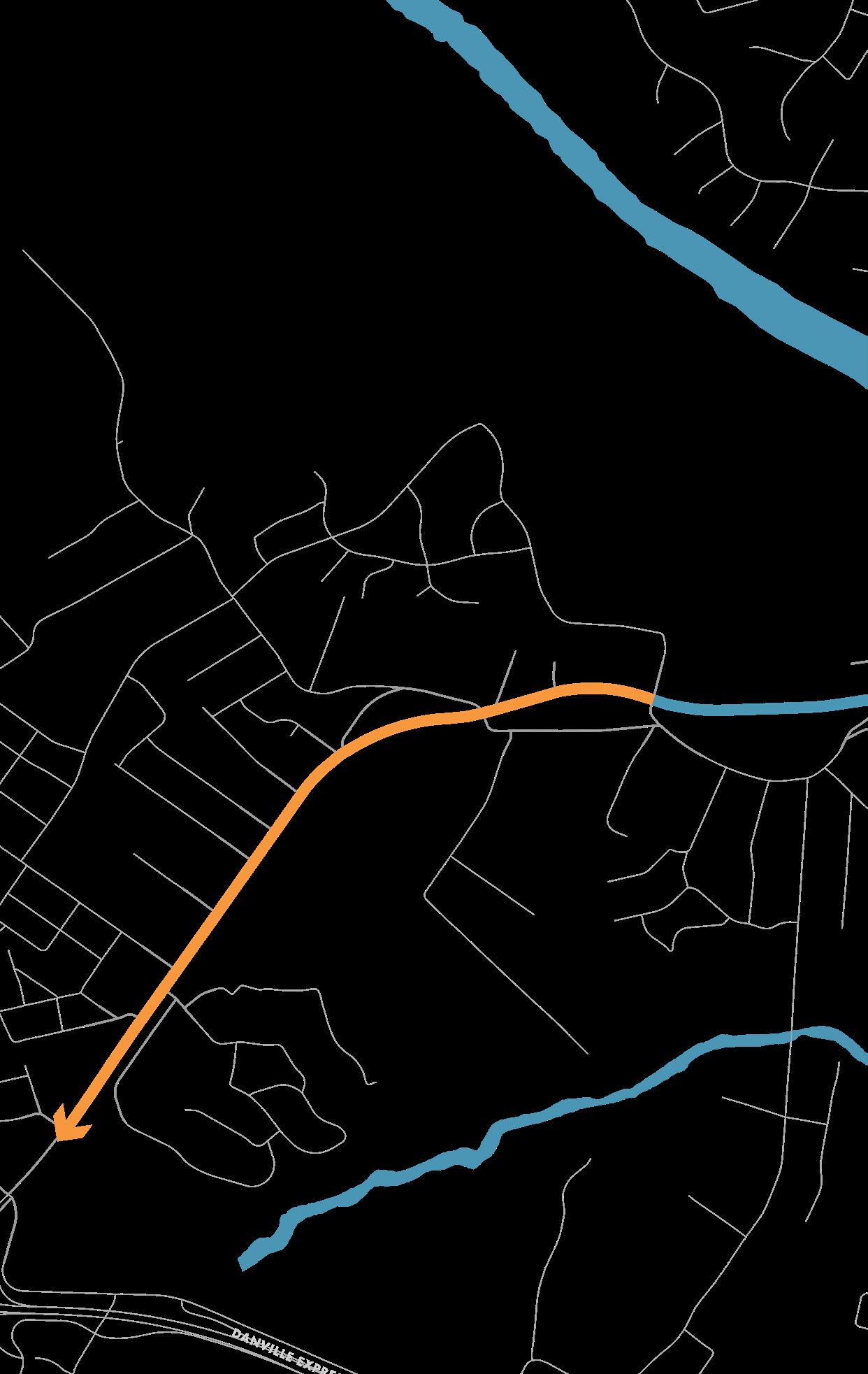
F I gur E 22 | W Main Street Character Zones 1 2
86
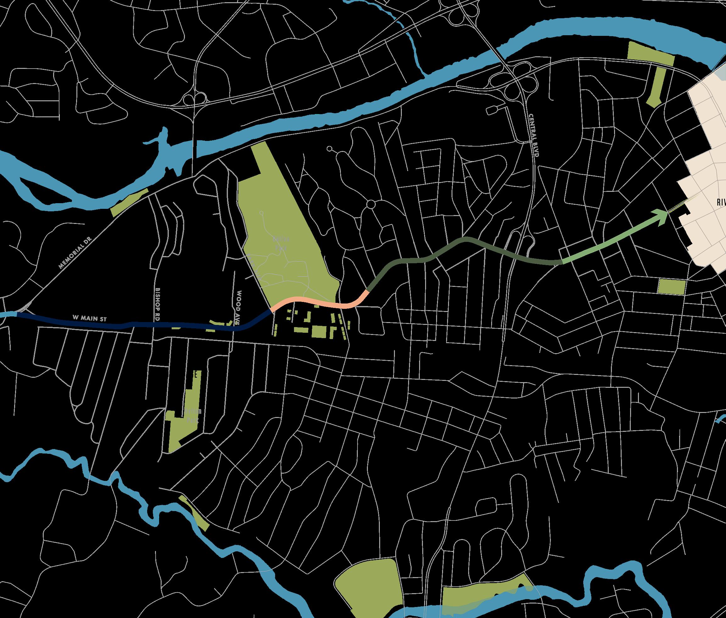
3 5 6 4 CONNECTING THE CORRIDOR 87
MOBILITY ELEMENTS
There is an opportunity on W Main Street to reallocate roadway space to integrate alternative modes of transportation and vegetated stormwater infrastructure. The mobility vision for the District and corridor includes redesigning W Main Street as a multi-modal transit corridor that integrates the following elements:
Recommended for the entire length of W Main Street
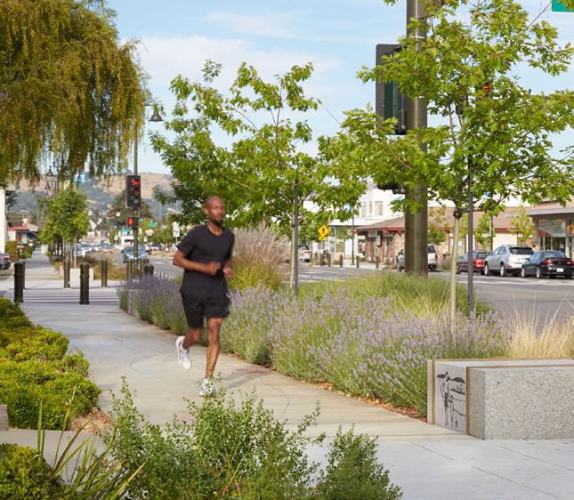
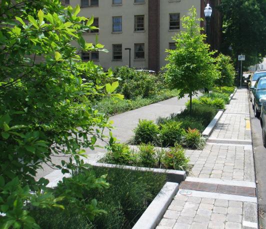
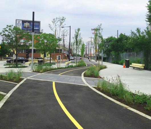
WALKWAY
Sidewalks require a minimum clear width of 4’ from back of curb. Any sidewalks less than 5’ should also have passing spaces at reasonable intervals. In some areas, such as near schools, sporting complexes, parks, and shopping districts, the minimum width is 8’.
C ur B EXTENSION / BIO r ETENTION PLANTE r S
Bioretention systems can be located in a hard-walled, concrete container or created by moving the 6” concrete curb closer to (or into) the street, and then opening inlets to divert street runoff into depressed vegetated areas within the expanded rightof-way.
BIKEWAY
The minimum width for a one-way bike lane is 5’, while the minimum for a two-way bike lane is 8’
Philadelphia Bicycle Coalition
VT Community Forestry
4’ - 8’ width
2’ - 7’ width
88
5’ - 8’ width
Recommended in Certain Areas see Zones for locations
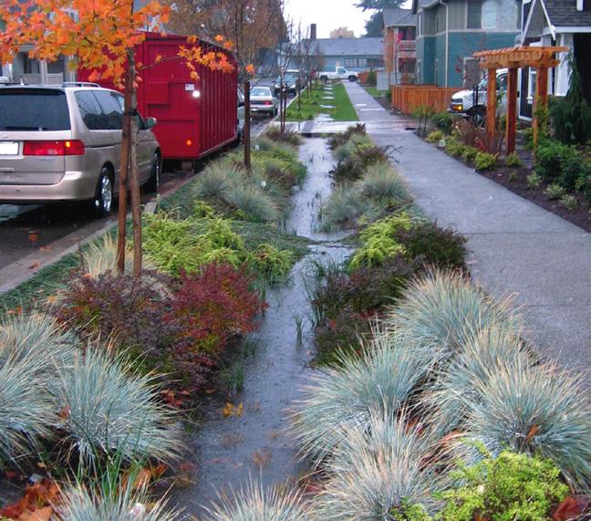
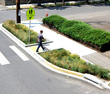
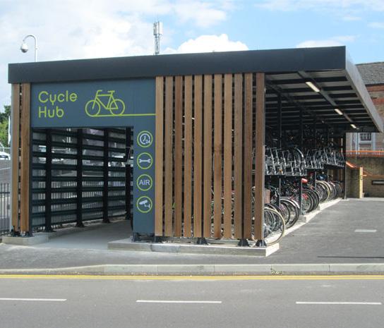
VE g ETATED BIOSWALE
Bioswales are linear, sloped, trapezoidal channels for bioretention with a minimum flat bottom width of 2’ and 3H:1V side slopes, where stormwater management occurs through infiltration of runoff through specified soil media and aggregate layers.
further analysis is needed for feasibility and maintenance.
PLANTED B u MP O u T
Bumpouts can be used to break up street parking with green beds for vegetation and trees.
further analysis is needed for feasibility and maintenance.
MOBILITY / T r ANSIT SHELTE r S *
These key pieces of infrastructure provide seating and protection from weather conditions, as well as an opportunity for signage, community information, and transit service updates.
*Locations Not Specified
Further analysis is needed
VT Community Forestry Cyclepods EPA
7’ - 14’ width
CONNECTING THE CORRIDOR 89
7’ width
ZONE 1
North Carolina border to Edgewood Drive
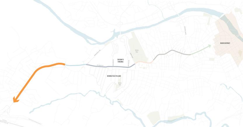
Key Challenges:
+ Physically constrained between caroriented uses and railway line
+ Utility poles reduce sidewalk space
Existing Conditions:
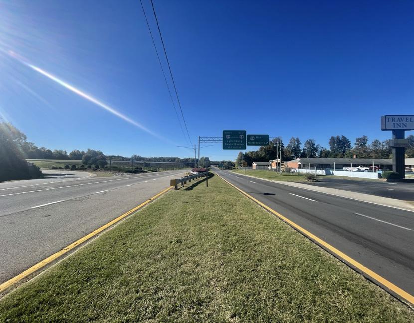
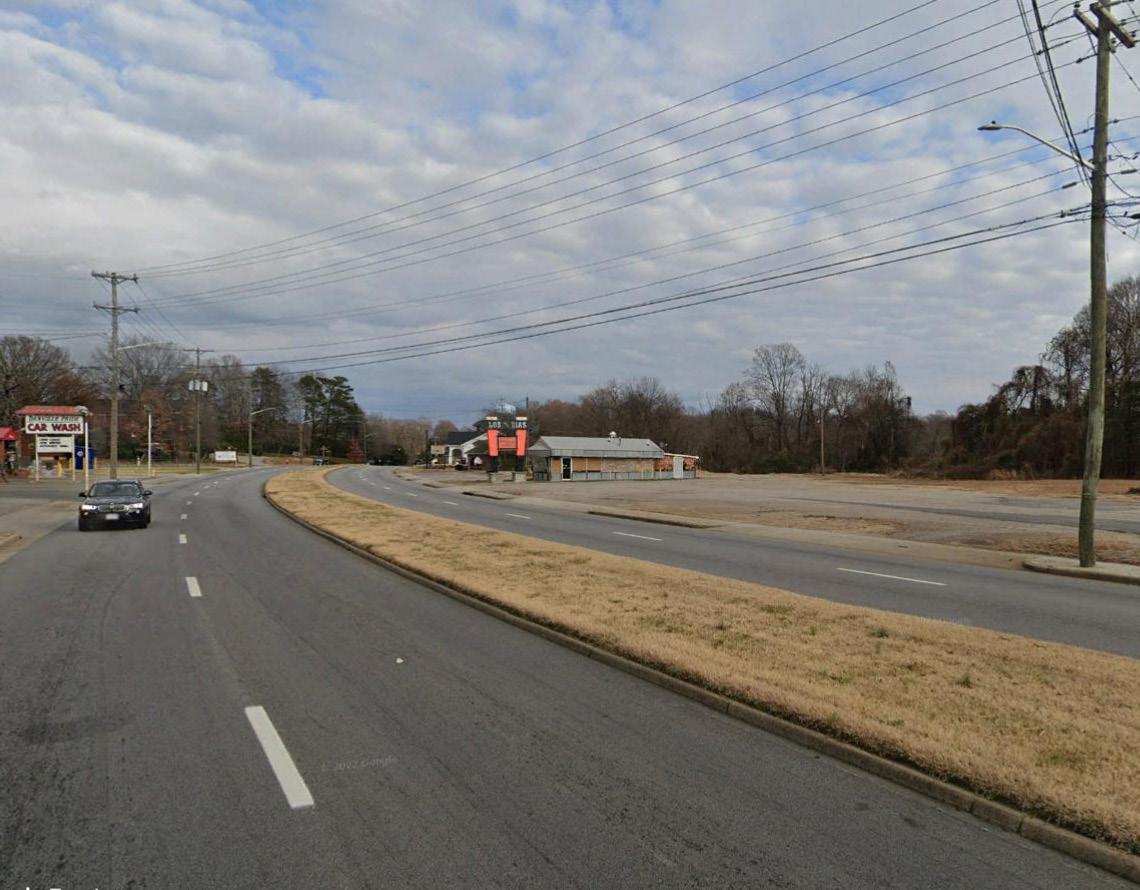
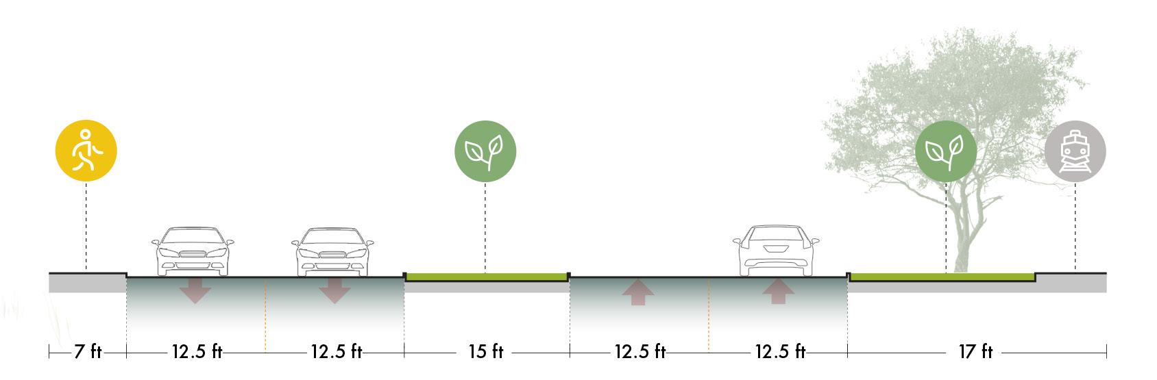
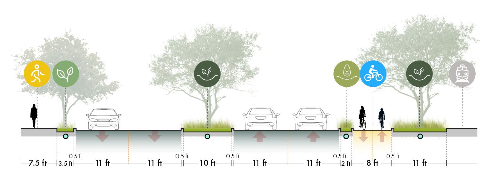
Existing
Zone 1 of W Main Street is a high-capacity ROW that is car-oriented with low to medium commercial and residential density. The left side of the street is immediately adjacent to car-oriented transit while the right side is bordered by green space and a rail line that creates a continuous physical constraint. In addition, there are utility poles in the pedestrian walkway that reduce the sidewalk space and create an obstacle to pedestrian circulation. This zone currently supports 12,000 - 15,000 vehicles per day (AADT 2019).
Proposed
The proposed concept for Zone 1 maintains a roadway configuration of two vehicle lanes in each direction. The roadway median and vehicle lane widths can be narrowed to provide space for a wider sidewalk and a 2-way bicycle lane that is separated from the vehicle flow by a bioretention planter. Placing the bike path on the right-hand side, parallel to the rail line, would ensure a continuous infrastructure route as there are fewer interruptions for vehicular turns. The interaction with the rail needs to be further assessed in coordination with the managing railway authority. A wide bioswale system will occupy the median and the right-hand side of the road to detain and filter runoff. A curb extension planter on the left-hand side of the road will provide protected separation for pedestrians while also infiltrating stormwater to improve water quality.
F I gur E 23 | Zone 1 Existing and Proposed Street Sections
90
EXISTING PROPOSED Source: Google Earth
CURB EXTENSION BIOSWALE
WALKWAY
NOTE: The proposed concepts are preliminary configurations that do not include bus stop locations, intersection details, detailed design of the transition between corridor zones, and other unique conditions throughout the corridor. Additional engineering, traffic, and design studies will be required to further advance the concepts prior to implementation.
BIKEWAY
BIOSWALE
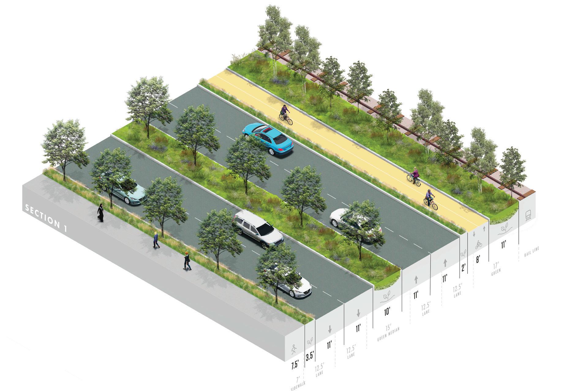
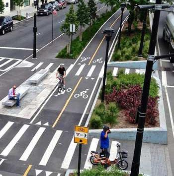
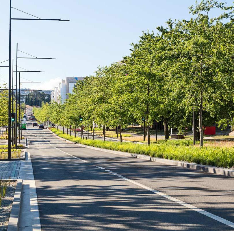
WHAT IT CO u LD LOOK LIKE
RAIL
The beginning of a bike and pedestrian connected corridor with street planting, gateway elements, and wayfinding.
F I gur E 24 | Zone 1 Proposed Axon
MarpilloPollakArchitects
Jane Irwi Gensler
CONNECTING THE CORRIDOR 91
ZONE 2
Edgewood Drive to Memorial Drive
Key Challenges:
+ Very limited space (constrained ROW)
+ Trees in median are not compatible with vehicular traffic (especially trucks and buses) and reduce sight lines
+ Utility poles reduce sidewalk space
Existing Conditions:
EXISTING
PROPOSED
Existing
Zone 2 of W Main Street is a high-capacity ROW that is car-oriented with low to medium commercial and residential density. The ROW is very constrained with limited space due to a large earthen berm with an elevated rail line on the right side, and an unprotected sidewalk on the left side. The trees that are currently in the median are not compatible with vehicle traffic (especially trucks and buses) due to the low canopy height potentially obstructing lines of sight and the passage of larger vehicles. In addition, there are utility poles in the pedestrian walkway that reduce the sidewalk space and create an obstacle to pedestrian circulation. This zone currently supports 16,000 vehicles per day (AADT 2019).
Proposed
The proposed concept for Zone 2 follows the same logic as Zone 1, smaller lanes and a reduced median create the space for the continuation of the bike infrastructure without impacting the capacity of the road. It is noteworthy that these two stretches of W Main Street run alongside the railway line and have limited right turns minimizing the vehicle/ bike conflicts and the cycle lane interruption. The interaction with the rail needs to be further assessed in coordination with the managing railway authority. A wider sidewalk can be created by undergrounding the utility poles, though a detailed engineering study is required. A wide bioswale system will occupy the median, capturing and conveying stormwater runoff. A bioretention planter and curb extension provide protected separation for bicyclists and pedestrians from vehicle traffic while also infiltrating stormwater to improve overall water quality.
F I gur E 25 | Zone 2 Existing and Proposed Street Sections
92
BIORETENTION PLANTER
BIOSWALE BIKEWAY
CURB EXTENSION
WALKWAY
EARTHEN BERM
F I gur E 26 | Zone 2 Proposed Axon
NOTE: The proposed concepts are preliminary configurations that do not include bus stop locations, intersection details, detailed design of the transition between corridor zones, and other unique conditions throughout the corridor. Additional engineering, traffic, and design studies will be required to further advance the concepts prior to implementation.

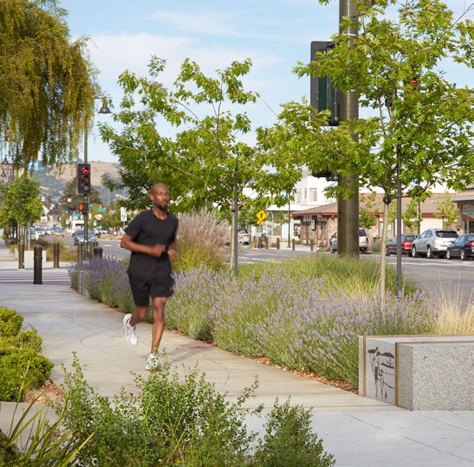
WHAT IT CO u LD LOOK LIKE
Continued bike and pedestrian connections and planting to buffer railroad tracks.
RRM Des
WRT
KelleyJor
RAIL
CONNECTING THE CORRIDOR 93
ZONE 3
Memorial Drive to Park Avenue
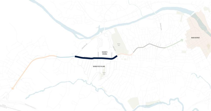
Key Challenges:
+ Wide lanes
+ Currently has very little activity
+ Vehicular traffic is projected to increase by as much as 1,800 additional vehicles per day with construction of Caesars Virginia
Existing Conditions:
Source: Google Earth
Source: Google Earth
EXISTING
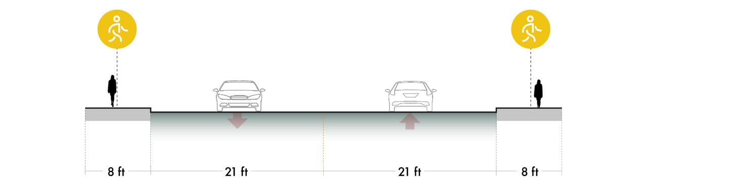
PROPOSED - STREET
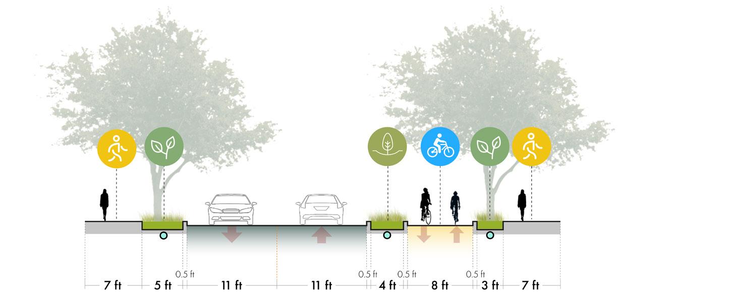
PROPOSED - INTERSECTION
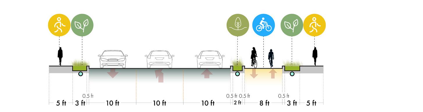
Existing
Zone 3 begins at the intersection of W Main Street and Memorial Drive, where the character of the streetscape begins to change as vehicle traffic reduces and residential density increases. In this zone the vehicle lanes are very wide and currently there is very little activity with a vehicle volume of 4,500-5,200 vehicles per day (AADT 2019), though this is projected to increase by as much as 1,800 additional vehicles per day with the construction of Caesars Virginia resort and other nearby developments.
Proposed
The proposed concept for Zone 3 maintains one vehicle lane in each direction, with a middle turning lane that corresponds to street intersections for left turns. Similar to the previous zones, the 2-way bike lane will continue along the right side of the road, separated from vehicle traffic by a bioretention planter. A more narrow sidewalk allows for curb extensions that provide pedestrians with protected separation from vehicle traffic while also infiltrating stormwater to improve overall water quality.
F I gur E 27 | Zone 3 Existing and Proposed Street Sections
94
PROPOSED - STREET
WALKWAY
CURB EXTENSION
PROPOSED - INTERSECTION
BIORETENTION PLANTER
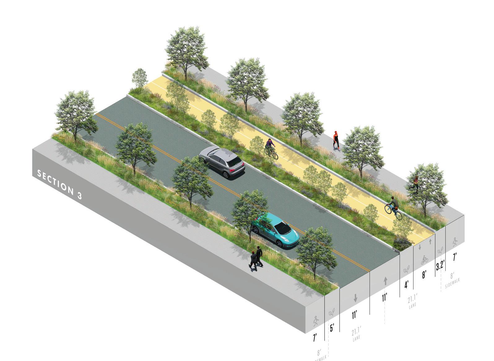
WALKWAY
CURB EXTENSION
F I gur E 28 | Zone 3 Proposed Axon
NOTE: The proposed concepts are preliminary configurations that do not include bus stop locations, intersection details, detailed design of the transition between corridor zones, and other unique conditions throughout the corridor. Additional engineering, traffic, and design studies will be required to further advance the concepts prior to implementation.
BIKEWAY
CURB EXTENSION
BIORETENTION PLANTER
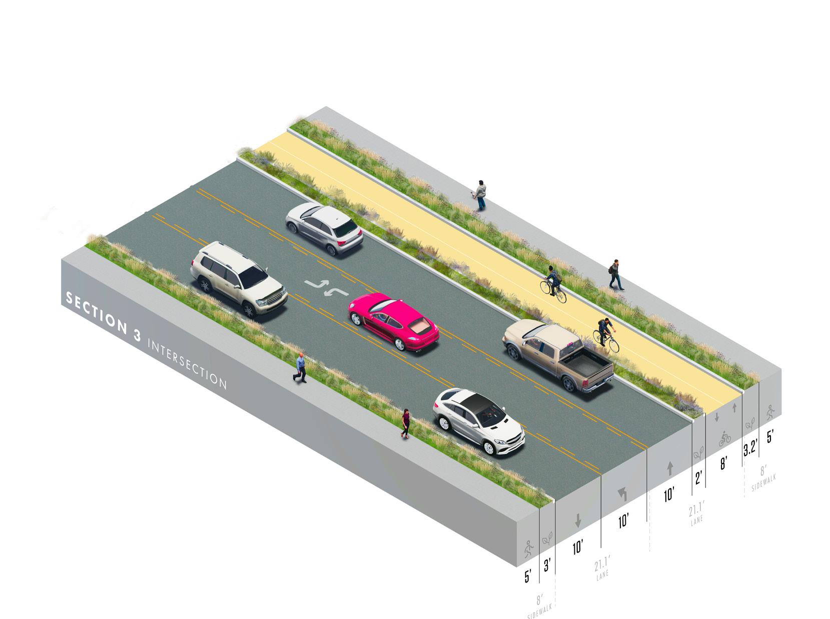
BIKEWAY
CURB EXTENSION
CONNECTING THE CORRIDOR 95
ZONE 4
Park Avenue to Hawthorne Drive
Key Challenges:
+ No ground floor activation (lined with parking, fast food, etc)
+ Currently over its vehicular capacity
+ No cycling infrastructure
+ Utility poles reduce sidewalk space
Existing Conditions:
Source: Google Earth
Source: Google Earth
EXISTING
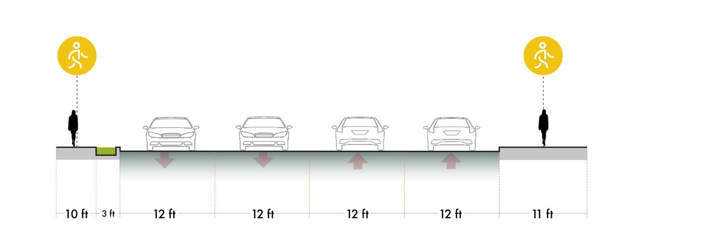
PROPOSED - STREET
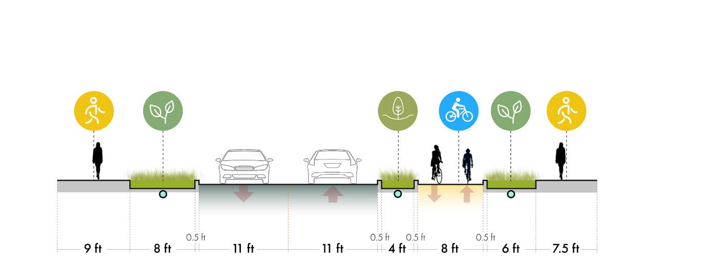
PROPOSED - INTERSECTION

Existing
Zone 4 is a high capacity ROW that begins to enter a denser urban fabric as it nears Danville’s downtown. It is currently over-burdened with vehicle traffic, supporting approximately 6,700 vehicles per day. The ground floor has limited activation due to a general absence of clear spatial identity and the informal on-street parking that is provided. There is no dedicated bike infrastructure and utility poles in the pedestrian walkway reduce the sidewalk space and create obstacles to pedestrian circulation.
Proposed
The proposed concept for Zone 4 is very similar to Zone 3 in that it maintains one vehicle lane in each direction, with a middle turning lane that corresponds to street intersections for left turns. The lanes will be narrowed in order to increase the widths of the sidewalk and continue the 2-way bike lane along the right side of the road. A bioretention planter and curb extension provide protected separation for bicyclists and pedestrians from vehicle traffic while also infiltrating stormwater to improve overall water quality. In this area of W Main Street, there is a particular focus on pedestrian and railway crossings, which connects the corridor to the adjacent Schoolfield neighborhood.
F I gur E 29 | Zone 4 Existing and Proposed Street Sections
96
PROPOSED - STREET
WALKWAY BIKEWAY
BIOSWALE
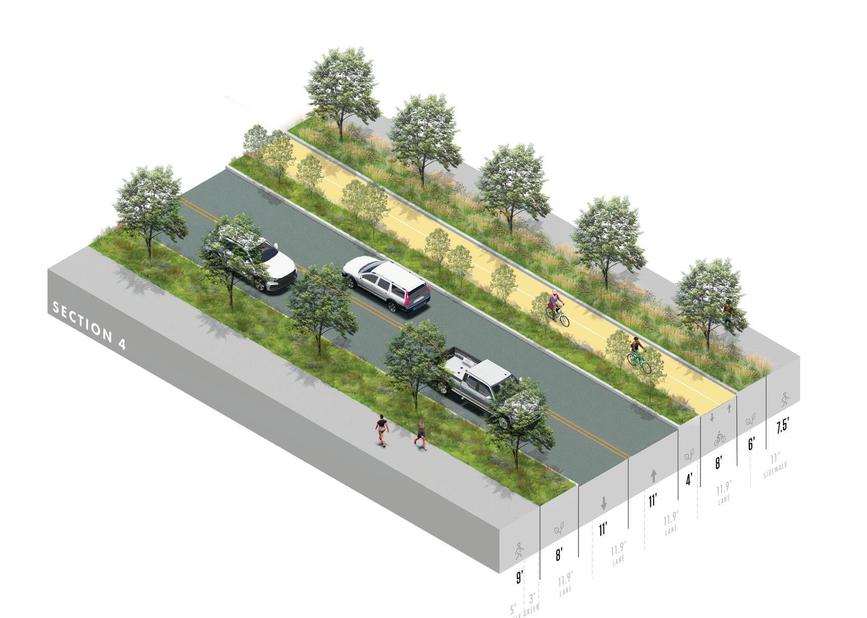
PROPOSED - INTERSECTION
BIORETENTION PLANTER CURB EXTENSION F
WALKWAY
WALKWAY
BIOSWALE
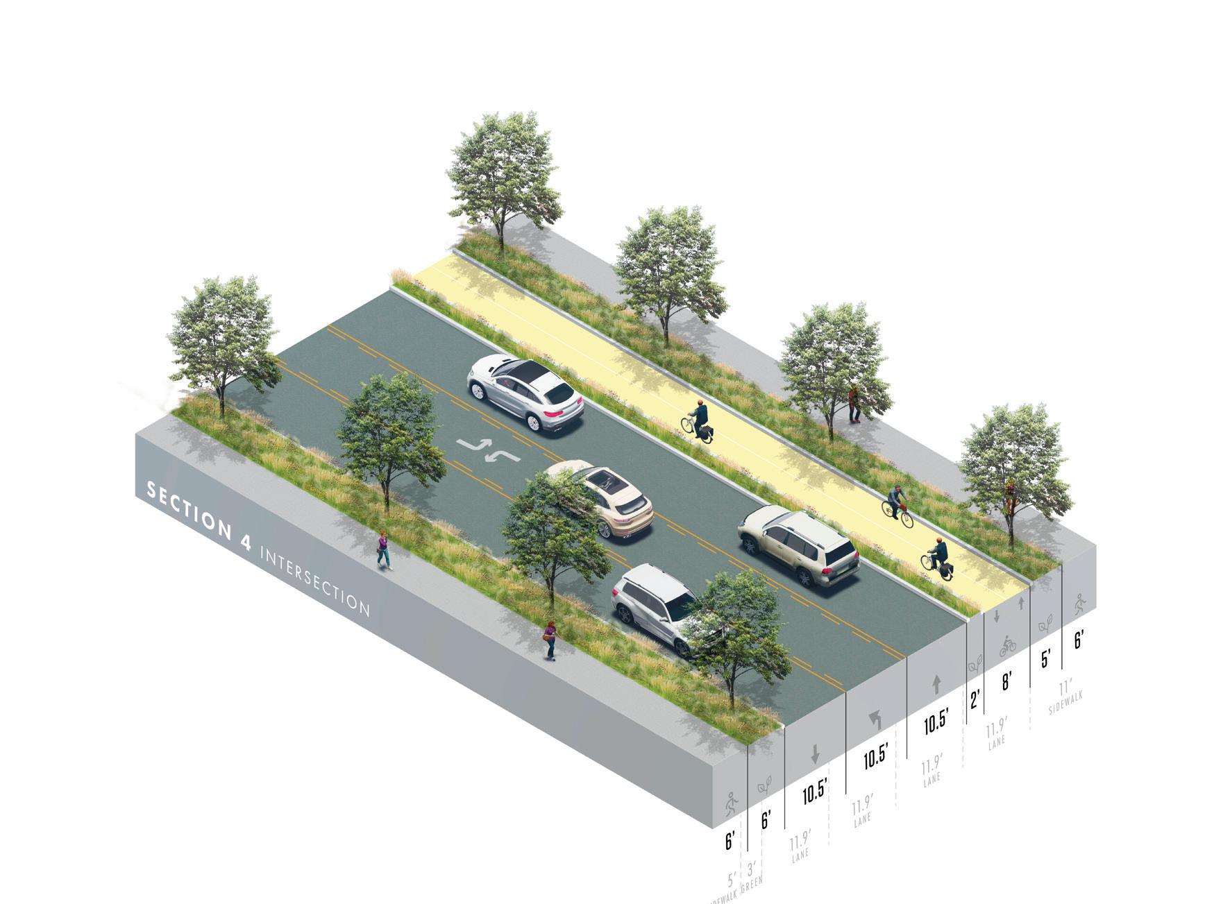
NOTE: The proposed concepts are preliminary configurations that do not include bus stop locations, intersection details, detailed design of the transition between corridor zones, and other unique conditions throughout the corridor. Additional engineering, traffic, and design studies will be required to further advance the concepts prior to implementation.
BIORETENTION PLANTER
BIKEWAY
CURB EXTENSION
I gur E
| Zone
30
4 Proposed Axon
CONNECTING THE CORRIDOR 97
ZONE 5
Hawthorne Drive to Broad/Rison Street
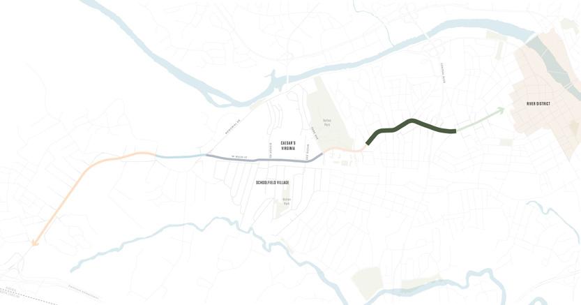
Key Challenges:
+ Current bike lane is a critical safety issue for both road users and bicyclists
+ Continuous parking lane limits quality of the public realm
Existing Conditions:
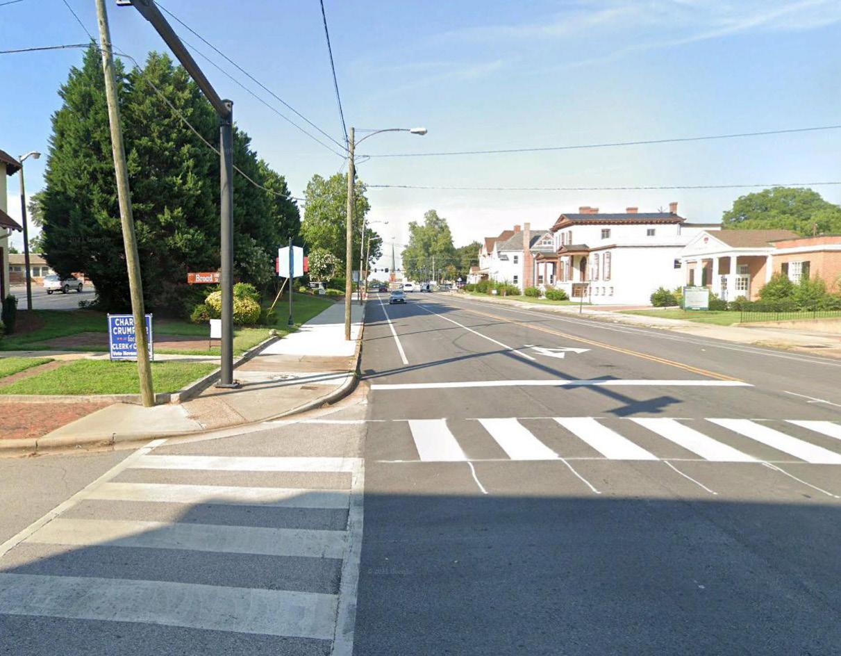
Source: Google Earth
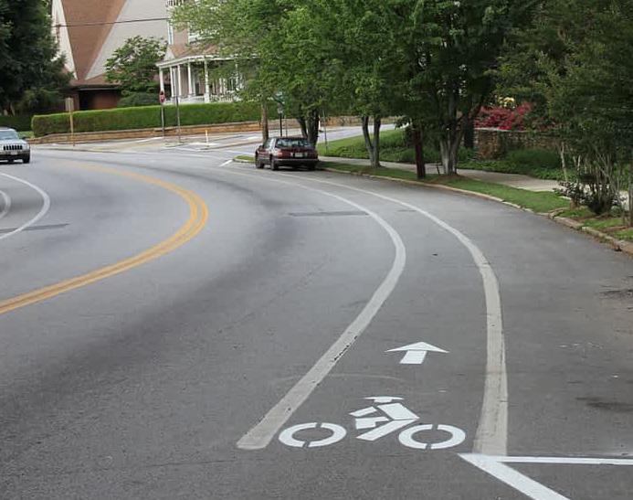
Source: Google Earth
EXISTING
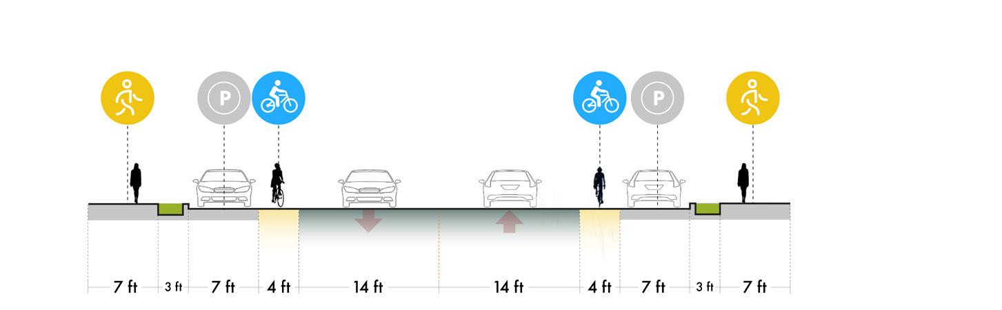
PROPOSED

Existing
Zone 5 begins to take on a very different character as it sits amongst a mix of denser residential areas and mixed-use development leading into downtown Danville, with a consolidated urban fabric that contains more continuous sidewalks and on-street parking. While bike lanes are present on both sides of the street, the lanes are unprotected which raises safety concerns for both vehicles and cyclists. This zone is still largely dedicated to cars with a large ROW and continuous park lanes that limit the available space and general quality of the public realm. This zone currently support approximately 7,700 vehicles per day (AADT 2019).
Proposed
The proposed concept for Zone 5 is to narrow the lanes to allow for curb extensions parallel to both sidewalks and a bioretention planter that shields cyclists from vehicle traffic. The 2-way bike lane that extends through the previous zones will replace the existing striped bike lanes. Parallel parking will be maintained on both sides of the street, with vegetated bump outs every 5 to 10 parking spots to expand on the adjacent stormwater systems for larger BMP coverage. The increased width created by the planted bump outs is sufficient to implement bioswales.
F I gur E 31 | Zone 5 Existing and Proposed Street Sections
98
WALKWAY PLANTED BUMP OUT
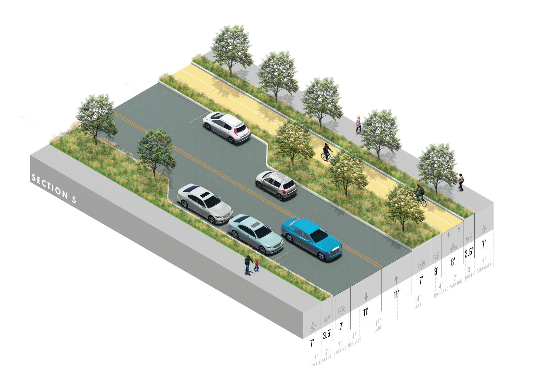
NOTE: The proposed concepts are preliminary configurations that do not include bus stop locations, intersection details, detailed design of the transition between corridor zones, and other unique conditions throughout the corridor. Additional engineering, traffic, and design studies will be required to further advance the concepts prior to implementation.
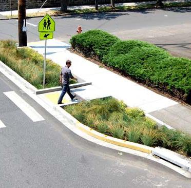
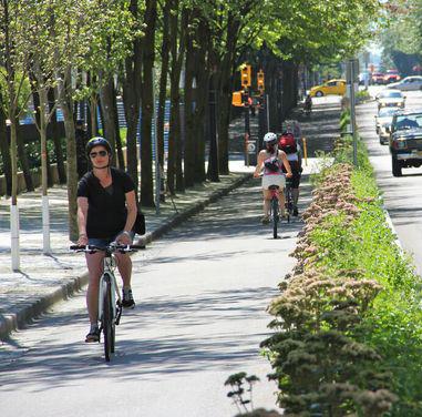
EXTENSION
WALKWAY
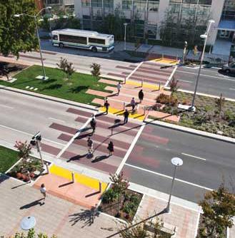
gur
|
VT Comm MIG
IT CO u LD LOOK LIKE A bicycle and pedestrian friendly corridor to support the adjacent uses.
BIKEWAY CURB
F I
E 32
Zone 5 Proposed Axon Wikimed
WHAT
CONNECTING THE CORRIDOR 99
ZONE 6
Broad/Rison Street to Jefferson Avenue
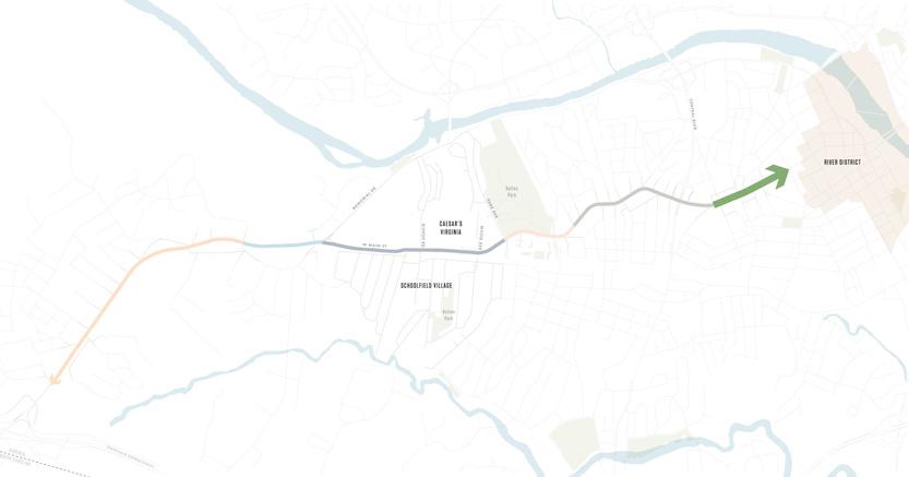
Key Challenges:
+ Large ROW without lane markings
+ Informal on-street parking
Existing Conditions:
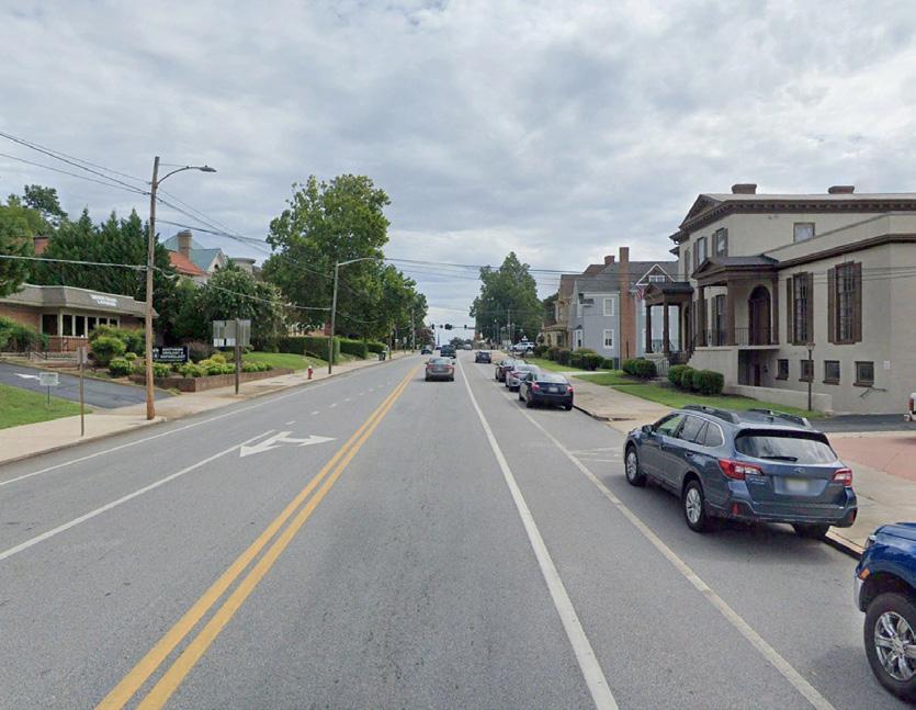
Source: Google Earth
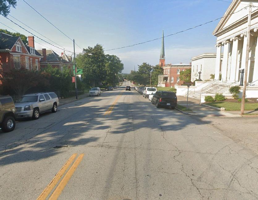
Source: Google Earth
EXISTING
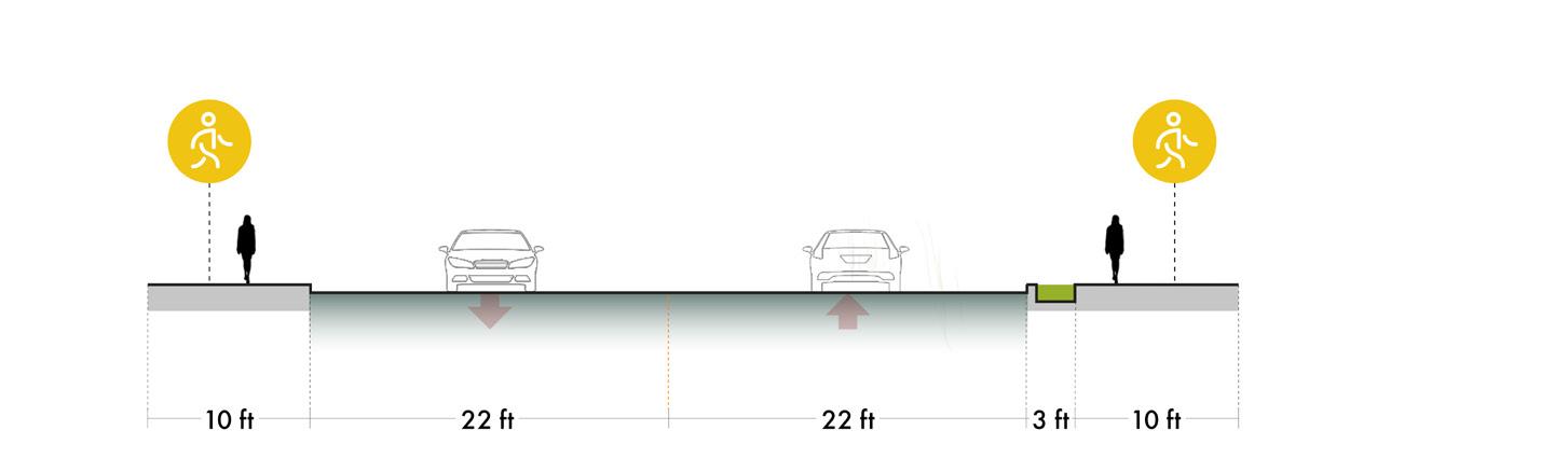
PROPOSED
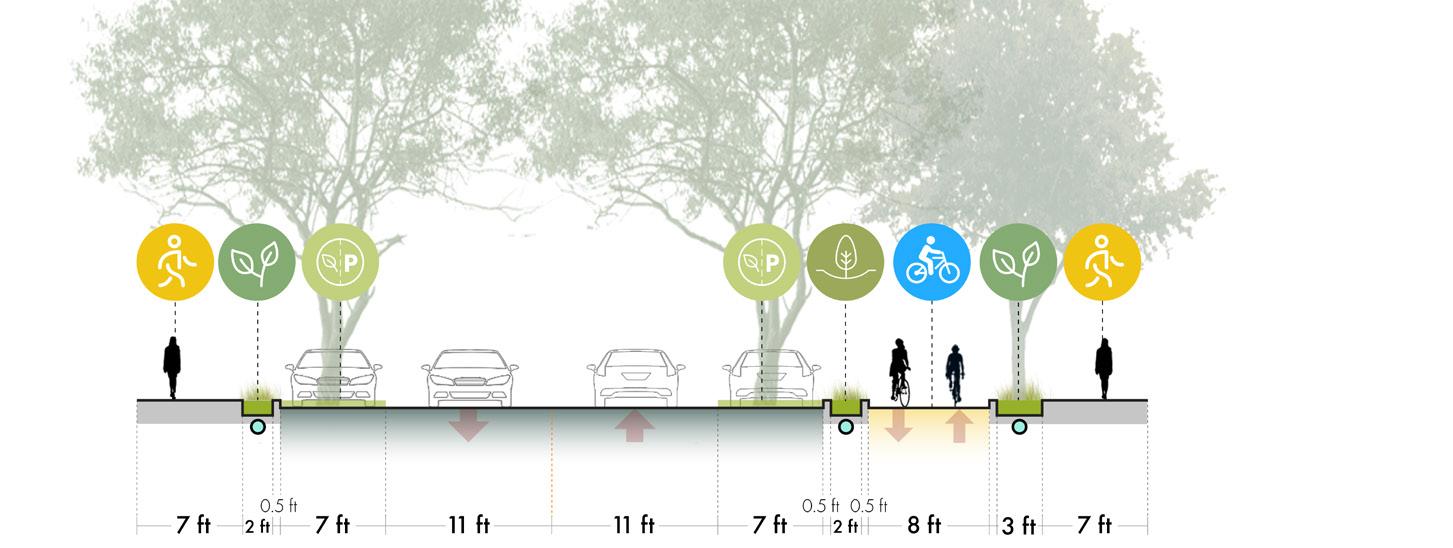
Existing
Zone 6 is very similar to Zone 5 in that it sits amongst a mix of denser residential areas and mixed-use development leading into downtown Danville, with a consolidated urban fabric that contains more continuous sidewalks and on-street parking. This zone is still largely dedicated to cars with a large ROW and informal on-street parking that limit the available space for other uses within the public realm. This zone currently supports approximately 7,600 vehicles per day (AADT 2019).
Proposed
The proposed concept is similar to Zone 5 in that the lanes are narrowed to allow for curb extensions and a bioretention planter to shield pedestrians and cyclists from vehicle traffic. Parallel parking is maintained on both sides of the street, with vegetated bump outs every 5 to 10 parking spots. The 2-way bike lane remains continuous through this section as well.
F I gur E 33 | Zone 6 Existing and Proposed Street Sections
100
WALKWAY PLANTED BUMP OUT
BIKEWAY CURB EXTENSION
WALKWAY
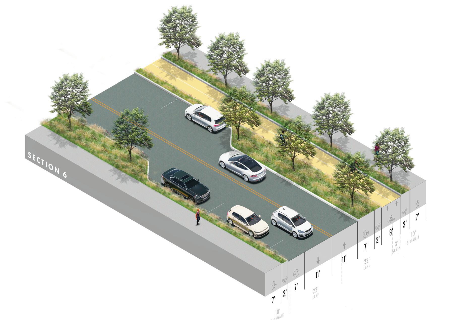
NOTE: The proposed concepts are preliminary configurations that do not include bus stop locations, intersection details, detailed design of the transition between corridor zones, and other unique conditions throughout the corridor. Additional engineering, traffic, and design studies will be required to further advance the concepts prior to implementation.
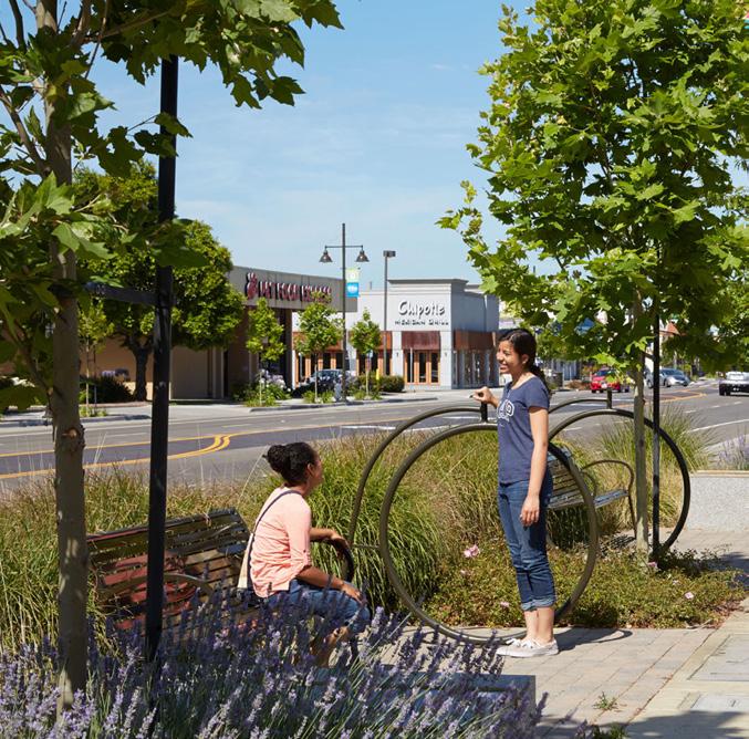
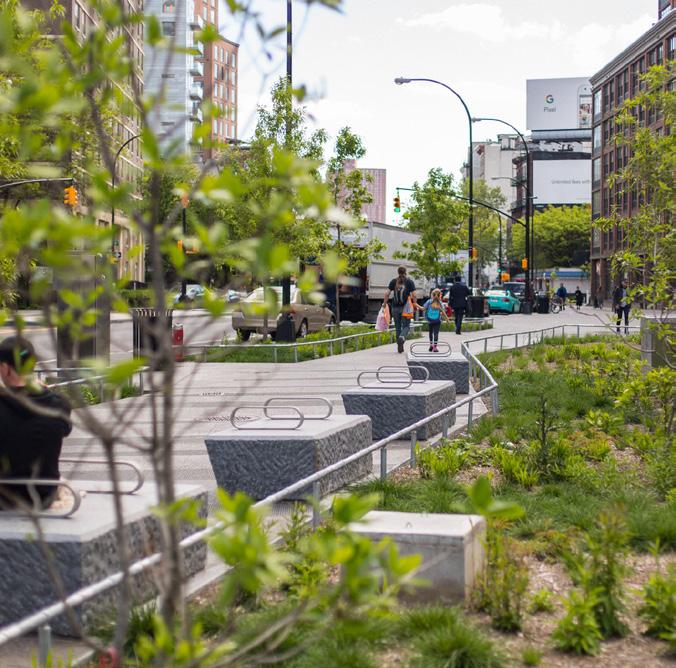
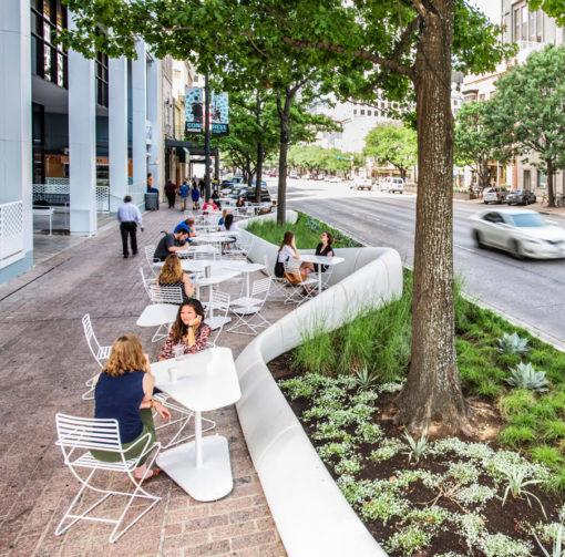
F I gur E 34 |
Zone 6 Proposed Axon NYCDDC
WRT
WHAT IT CO u LD LOOK LIKE A pedestrian friendly corridor to support the adjacent uses.
DWG
CONNECTING THE CORRIDOR 101
Transition Zones
Transition zones generally occur at key intersections along the corridor, where the character zones (presented in previous spreads) meet. These transition zones are crucial to an effective mobility framework as they establish a coherent and intuitive shift between the zones.
An effectively designed transition zone ensures a coherent vision along the entire corridor and provides a safe pedestrian and cycling environment. Most of the strategies for the transition zones prioritize the safety of active mobility and clearly identify the spaces dedicated for different users (vehicle, bicycle, and pedestrian). Where possible, it is recommended to integrate additional pedestrian/ bike crossings to support soft mobility. It is important to note that the following proposals are meant as preliminary configurations for which further analyses and studies should be conducted.
NOTE:
The proposed transition zones are preliminary configurations that will require additional engineering, traffic, and design studies to further advance the concept prior to implementation. Additional community and stakeholder engagement is also recommended.
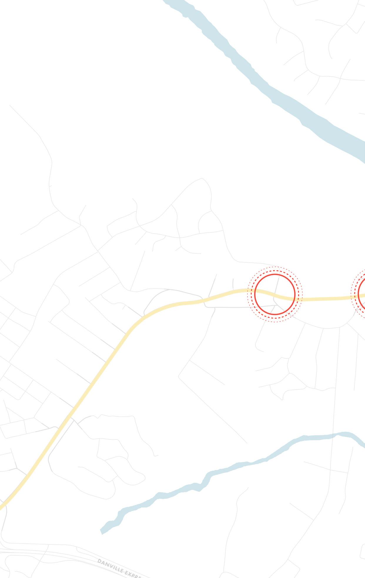
F I gur E 35 | W Main Street Transition Zones
1 2
102
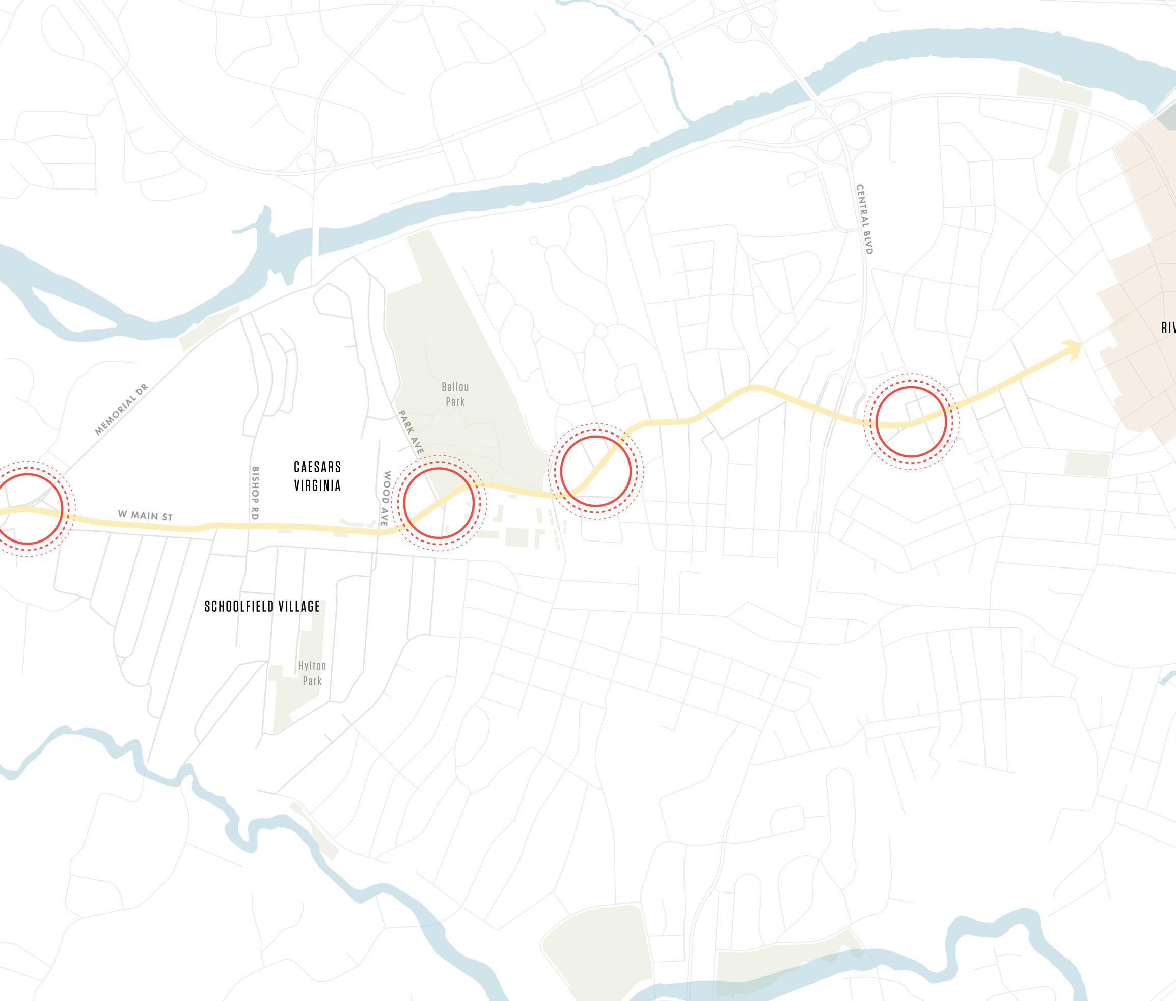
3 5 6 4 CONNECTING THE CORRIDOR 103
ZONE 1 TO ZONE 2
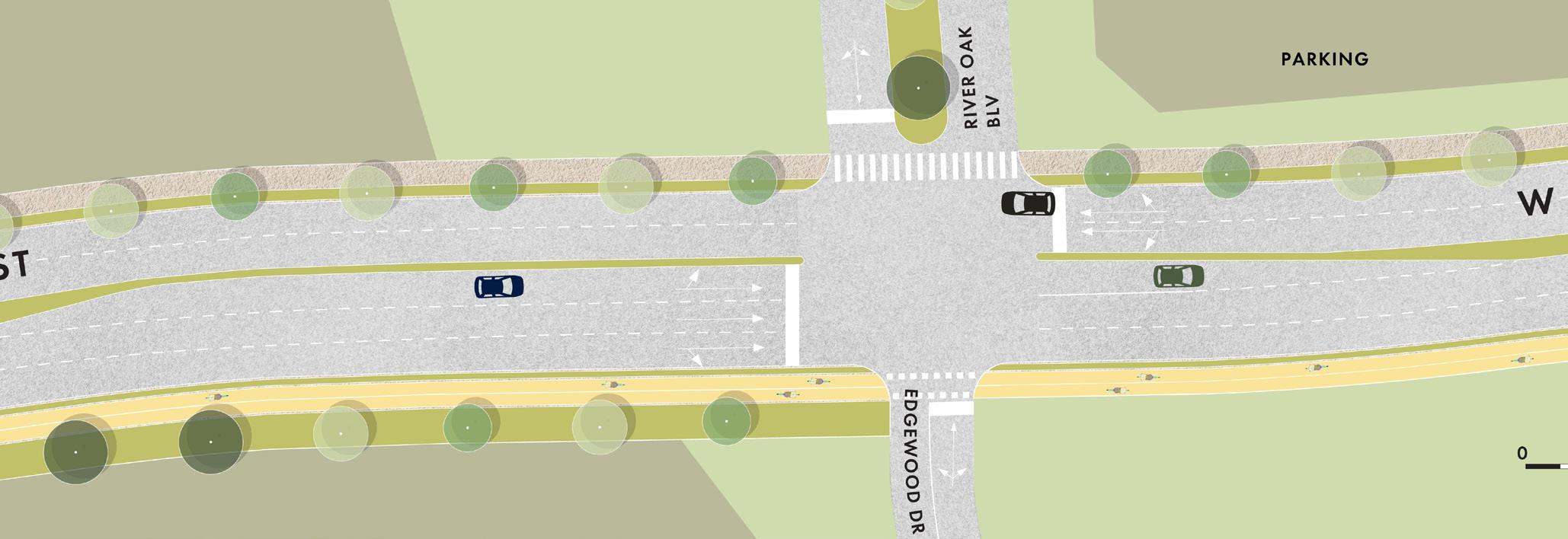
The transition between Zone 1 and Zone 2 ensures the continuity of the vehicle lane configuration, providing an additional turning lane for the left turn in order to not impact junction performance. The pedestrian infrastructure and bike lane crosses Edgewood Drive with a short crossing zone. For safety, it is recommended to integrate crossing signals in coordination with the main intersection traffic light.
ZONE 2 TO ZONE 3
The Memorial Drive and W Main Street intersection is currently the most complex along the whole corridor as it has a slip lane on the incoming W Main Street roadway that does not encourage drivers to decrease their driving speed. While Zones 1 & 2 represent the gateway for the City of Danville, this intersection has the potential to become the gateway for the new Schoolfield District. The incident data shows a significant number of traffic accidents involving pedestrians due to a lack of suitable pedestrian or bike infrastructure. This highlights the need to create a safer area with traffic calming strategies, with a particular focus on the nearby school.
This transition zone is also critical for directing Caesars Virginia vehicle traffic onto Memorial Drive to Bishop Avenue to the parking lot. This intersection will need clearly marked signage informing visitors of this route and directing others to continue onto W Main Street for other destinations.
Two alternative configurations are explored by this plan, both maintaining smooth vehicular circulation while improving the safety and experience for active mobility. It is important to note that the proposals serve as preliminary configurations that need additional study and coordination with the Public Works Department.
F I gur E 36 | Transition between Zone 1 and Zone 2
104
ZONE 2 TO ZONE 3
Option A
The first configuration proposes a change to the existing road configuration where the current slip lane shifts further towards the intersection, using a geometrical alignment aimed at slowing down incoming vehicle flows. This lane enables access to the amenities located on the right side of W Main Street and ensures that vehicle traffic heading east is not subjected to the intersection signals. The main intersection is equipped with a pedestrian crossing connecting the two sides of Memorial Drive and another crossing on W Main Street that links together the two sides of the cycle lane.
The main drawback of this option is the double crossing needed to overcome W Main Street, but the space created in the middle of the traffic calming island can host green space and infrastructure.
Option B
The second configuration creates a node at the intersection that splits the main traffic flow to decrease driving speeds by changing the road geometry without impacting the junction performance (dedicated slip lane).
The slip lane is located closer to the intersection and an additional one-way lane provides a roundabout to access the facilities on W Main Street. In this configuration, the cycle crossing W Main Street is a single crossing on a twoway road, which is easy to manage without a signal due to the close proximity to the main intersection.
This configuration requires more space, as the upper portion of the roadway needs to be enlarged to accommodate all the infrastructure for the necessary maneuvers. However, the additional green space created at the junction has the potential to create a gateway experience to the Schoolfield neighborhood.
F I gur E 37
|
Transition between Zone 2 and Zone 3 Opt A
|
B
F I gur E 38
Transition between Zone 2 and Zone 3 Opt
CONNECTING THE CORRIDOR 105
NOTE: Figures 35 + 36 are conceptual options for the W Main Street and Memorial Drive intersection that will require additional engineering, traffic, and design studies to further advance the concept prior to implementation. Additional community and stakeholder engagement is also recommended.
ZONE 3 TO ZONE 4
The transition between Zone 3 and Zone 4 contains a 1+1 vehicle lane configuration, supported by a middle lane used to allow the left turn at junctions. Road crossings are provided on all sides to create continuity for the sidewalks and cycling lanes. The existing slip lane from Park Avenue 3 is removed to create a more compact junction, since the slip lane was not justified due to being connected to a dead-end street.
ZONE 4 TO ZONE 5
The transition between Zone 4 and Zone 5 transition contains a 1+1 vehicle lane configuration, supported by a middle lane used to allow the left turn at junctions. In this case, the left turn from the new middle lane is available only for vehicle flows directed toward Hawthorne Drive, since it is not needed for flows coming from the city center. A bus stop is currently located in this transition and the 2-way cycle lane shifts to leave space for the shelter while providing an uninterrupted biking experience. In addition, on-street parking is alternated with vegetated bump outs to create a more pedestrian-friendly environment, while increasing green space and stormwater BMP opportunities.
F I gur E 39 | Transition between Zone 3 and Zone 4 F I gur E 40 | Transition between Zone 4 and Zone 5
106
ZONE 5 TO ZONE 6
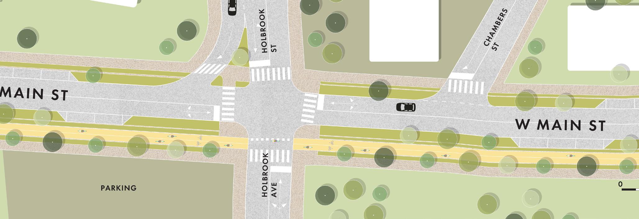
The proposed transition between Zone 5 and Zone 6 is a very compact intersection, with just one lane for each direction, except for a slip lane that allows the right turn between Holbrook Street and W Main Street. This compact crossing utilizes the sidewalk and bike lane enlargement to minimize the space needed for the pedestrian and bike crossing, providing more protected space for active mobility.
F I gur E 41 | Transition between Zone 5 and Zone 6
CONNECTING THE CORRIDOR 107
Public Realm
The public realm contributes to a resilient and inclusive community. Creating a public realm framework that prioritizes pedestrians, improves circulation, and promotes environmental stewardship is achievable through common design tools, either individually or together, along the corridor and at key locations. Together, these interventions can build the sense of the place and identity.
DESIGN TOOLS

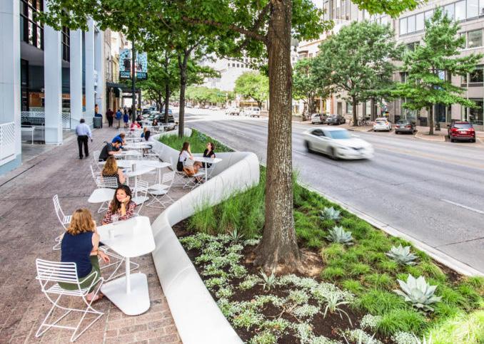
PAVING MATERIALS
Using a range of paving materials can help unify spaces, differentiate uses, highlight key elements, and define the identity of the public realm.
SEATING & FURNISHING
Street furnishings provide more visual interest, encourage outdoor activity, informal social gatherings, and visitor retention.
823 Congress Pocket Patio / dwg.
108
Michel Desvigne Paysagiste
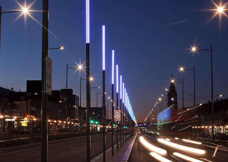
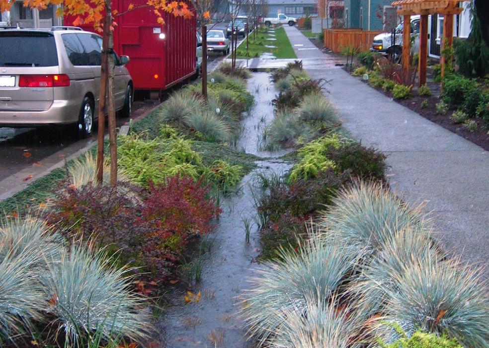

LIGHTING
Features like streetlights, bollards, ground lighting, and catenary lights improve visibility and create a safer environment, as well as highlight gateway features and landscape elements.
PLANTING
Planting enhances natural conditions and adds visual interest. Consistent and continuous planting also enforces the sense of place and identity of the district.
SIGNAGE / WAYFINDING
Wayfinding and interpretative signage celebrate local history, culture, and raise awareness of current events, as well as improve connectivity and accessibility throughout the district.
Lonsdale Street Dandenong / Electrolight
Source: Rain Garden, EPA.gov
CONNECTING THE CORRIDOR 109
Render of branding opportunity. Full guidelines available in appendix.
SIGNAGE & WAYFINDING
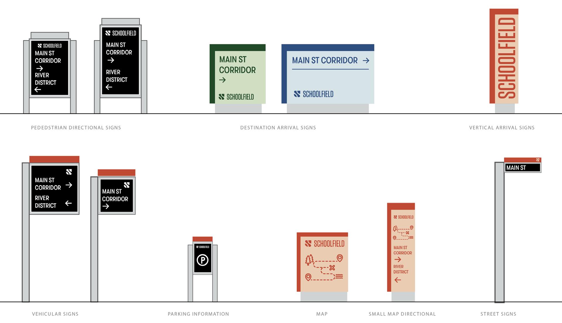
INTERPRETIVE SIGNAGE
Celebrate the history and culture of Schoolfield
Signage in Schoolfield could celebrate the past with an eye on the future for best practices in overall wayfinding, landmark moments, and pedestrian-centric experiences. Consistency with the Schoolfield brand will reinforce the visual identity of the place, and support greater recognition and adoption of the plan as it comes together.
Potential topics / sites:
+ History of the Mill Village (people)
+ Industrial Democracy
+ Textile History
+ Flippen Cemetery
+ Adaptive Reuse
+ Schoolfield residents (past and present)
ENVIRONMENTAL GRAPHICS
Environmental graphics can enhance the area and convey the story of the brand in meaningful ways, while being organically part of the local fabric. Not all signage needs to be overly-branded or emblazoned with a logo. Environmental graphics can tap into local talent to create meaningful elements that support the primary Schoolfield brand.
These moments can come to life by enlisting local commissions for areas such as:
+ Plazas
+ Parks
+ Public Art
+ Street painting
+ Activation of facades / walls (i.e., 1009 W Main Street)
+ Three Sisters (lighting)
+ Digital signage
+ Existing Water Towers
F I gur E 42 | Proposed Wayfinding System 110
WAYFINDING
Pedestrian Scale
Pedestrian-scaled wayfinding is key to engage visitors and locals alike as they navigate the Schoolfield site. Pedestrian nodes should provide context and information to enhance the overall experience and brand presence. People interacting at a pedestrian level should be well-aware of their location within Schoolfield via signals in their immediate surroundings as well as from the greater visible context.
This can be achieved through a few signage typologies:
+ Directional nodes which call out key landmarks at certain intersections
+ Street light banners and flag signage lining the key corridors
Vehicle Scale
Drivers should be able to seamlessly realize when they are within the Schoolfield district while traveling at a moderate speed down main thoroughfares. Signage typologies that support this goal are larger in scale and have a lasting visual impact and potential to influence brand and area awareness. Such signage opportunities are:
+ Signature landmark monuments on entries into Schoolfield. See the “River District” pylon as an example and reference to size and scale.
+ Distinct nodes and signage in designated parking and car-centric areas within the district. Key features that are seen from cars passing through should be considered as potential wayfinding and placemaking moments:
+ Water towers
+ Construction banners
(See Appendix for the full Brand Guidelines)
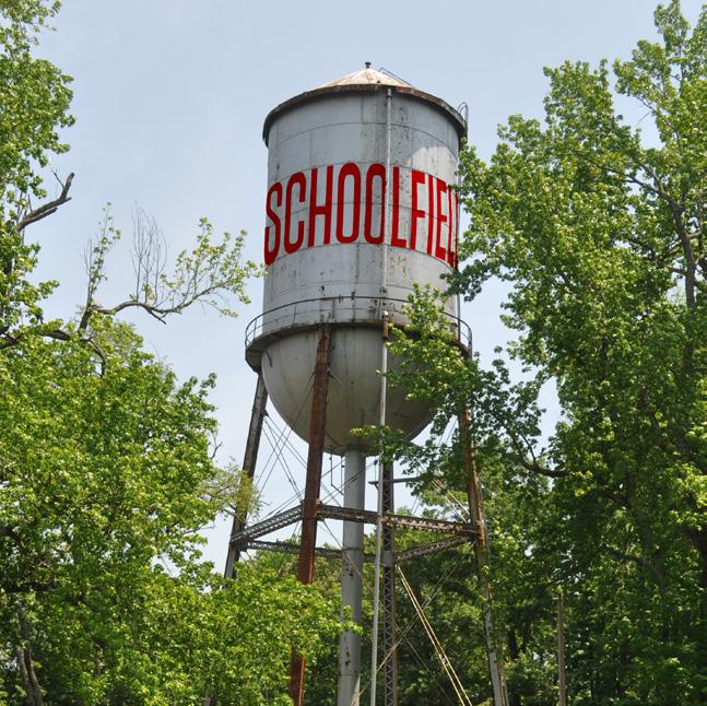
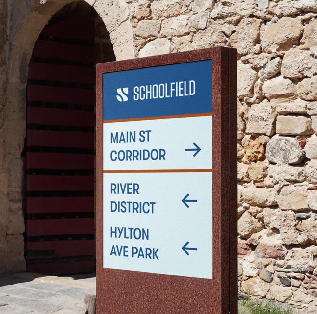
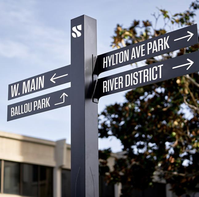
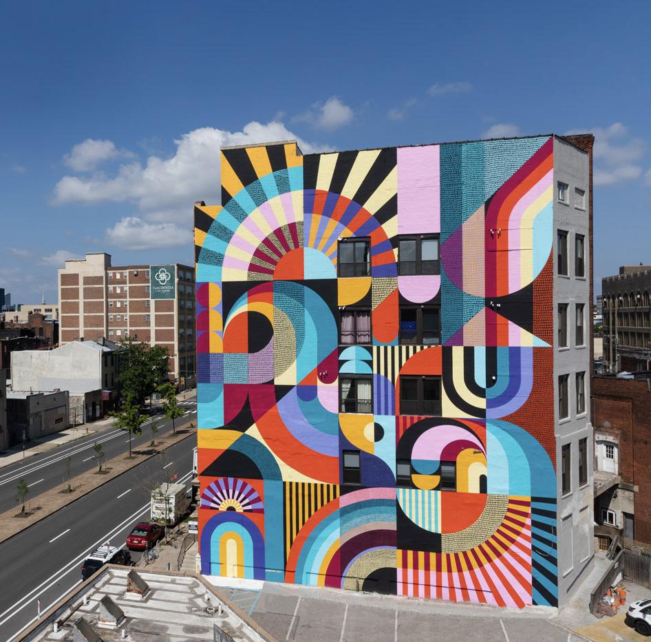
BrandingOpportunity at Baltim or e A v e n u e lC u tsre WayfindingBranding Opp ortu n ity WayfindingBranding Opp ortu n ity Example of Murals for Commu n ity I d e n t i t y / C ho ere CONNECTING THE CORRIDOR 111
IN THIS CHAPTER:
+ The Catalyst Sites
+ The Interchange
+ Main Street g reen
+ Baltimore Avenue Cluster
+ Shopping Center r edevelopment
+ Schoolfield Woods + Filtration Plant
+ Future Opportunity Sites
06
112
Shaping the Fabric
Schoolfield is experiencing a transformation with the new Caesars Virginia resort. This section explores conceptual opportunities on how to leverage existing local and regional efforts and attract new industries and economic drivers while honoring and preserving historic assets. The catalyst sites offer ideas on how to provide services that can benefit current and future residents and restore a collective consciousness of the community as a “village” - or hub of activity centers - to ground the overarching strategies and vision of the New Schoolfield District Plan.
SHAPING THE FABRIC 113
The Catalyst Sites
WHAT IS A CATALYST SITE?
Catalyst sites are areas along the W Main Street corridor that were identified as areas of opportunity to ground the overarching strategies and vision of the District Plan. Five catalyst sites were identified during the planning process as well as several other opportunity sites to consider for redevelopment in the future.
HOW THEY WERE IDENTIFIED
The catalyst sites were selected by identifying parcels with the most susceptibility to change and by ownership status. Publicly held parcels were prioritized and parcels with private ownership (i.e., The Interchange), were contacted by the Office of Economic Development and Tourism for permission to explore as part of the visioning efforts of the District Plan.
The catalyst site locations were unveiled to the community during Schoolfield Week in May 2022. Community members were asked to prioritize the sites and discuss ideas, draw concepts, and provide specific feedback on each of the sites through a series of interactive Open Houses and Design Charrettes over the course of the week. Participants were invited to discuss land uses, programs, building types and locations, connections, and placemaking elements that were displayed for public comment.
The catalyst sites that received the most attention were: Shopping Center Redevelopment (at the existing Ballou Park Shopping Center), The Interchange (near the Virginia-North Carolina border), Main Street Green (an Industrial Development Authority (IDA) parcel across from Caesars Virginia), and Baltimore Avenue Cluster (at the intersection of W Main Street and Baltimore Avenue). The Filtration Plant site (on Memorial Drive) and The Bend (a cluster of parcels near Old Greensboro Road) received less votes; however, the Filtration Plant site was expanded to also include the wooded area between Caesars Virginia and Memorial Drive for future studies.
NOTE:
The proposed catalyst site plans are conceptual and illustrate only some of the potential ideas that we heard from the community. Additional coordination will be required between parcel owners, the city, and/or private developers to further advance the design and test economic feasibility. Additional community and stakeholder engagement is also recommended.
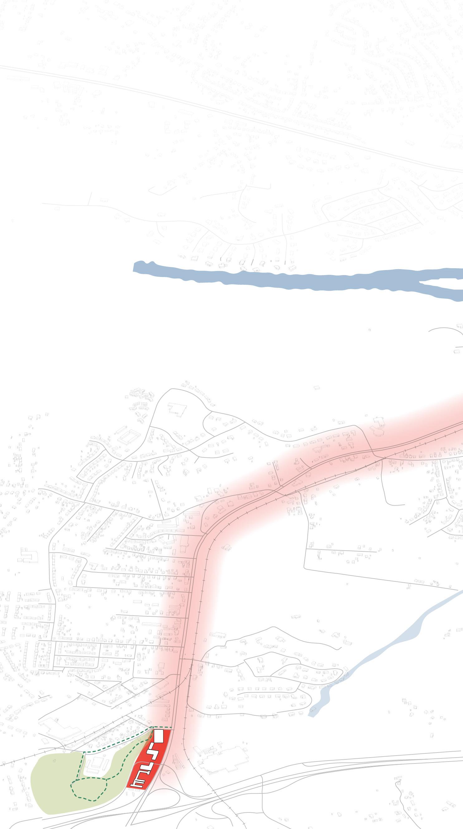
F I gur E 43 | Catalyst Sites
1 1 THE INTE r CHAN g E 2 MAIN ST r EET 114
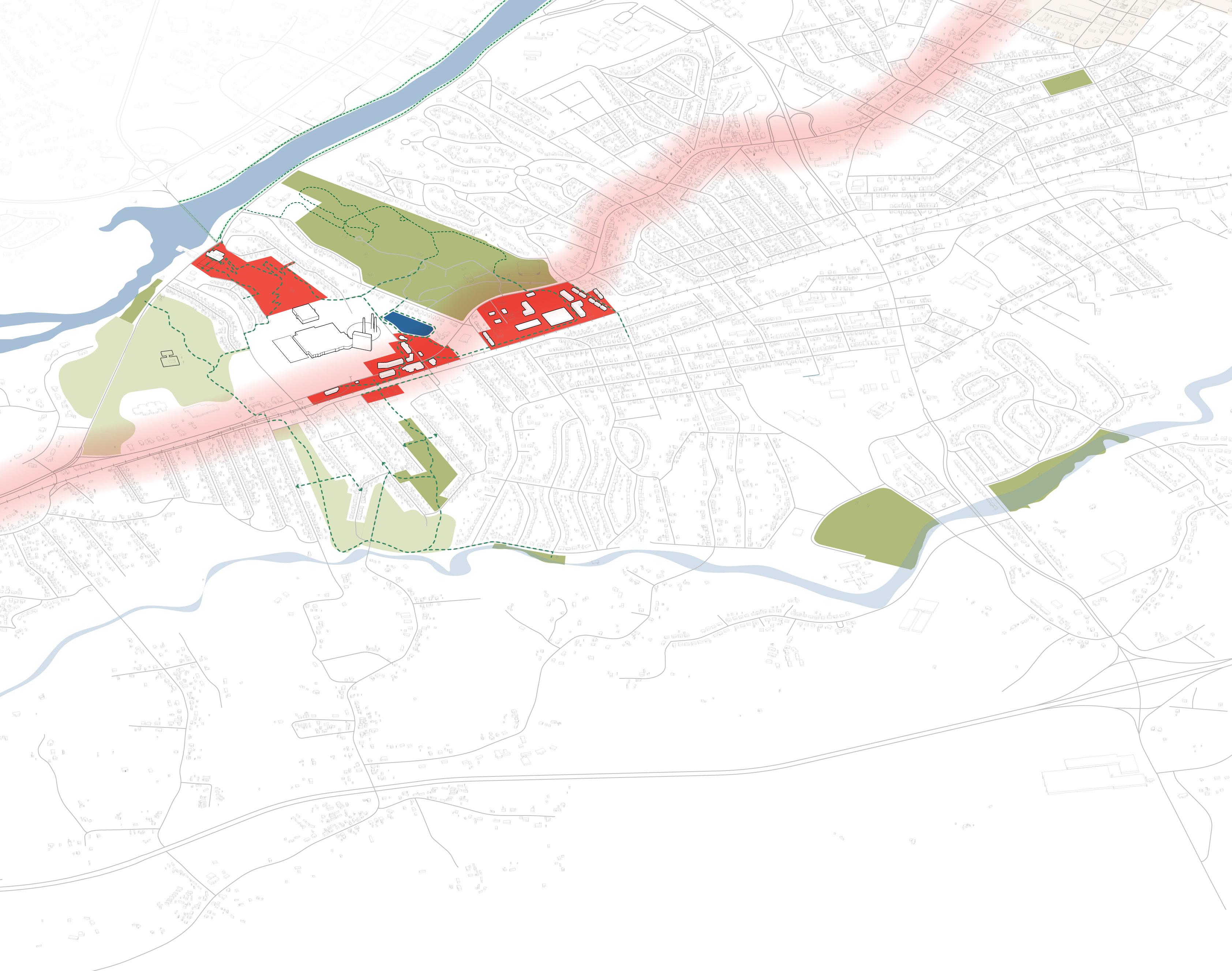
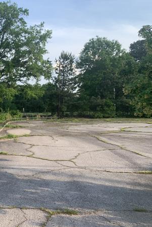
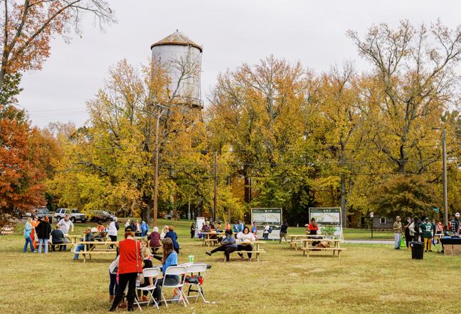
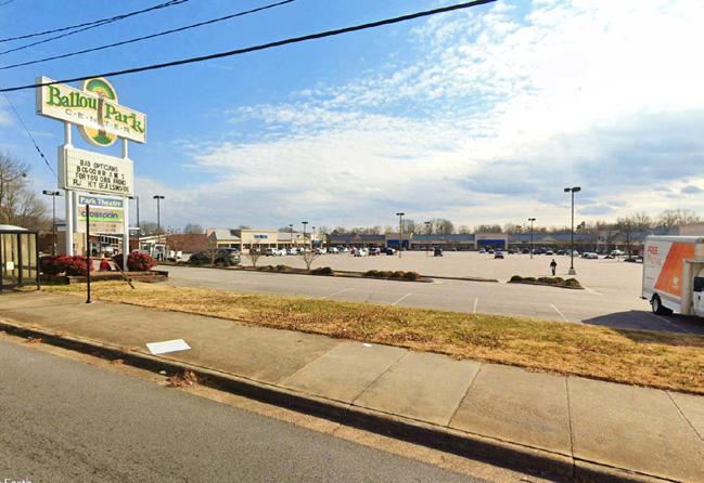
Source: Nathan Staley / Davey Source: Google
EET gr EEN 2 3 4 5
3 BALTIMO r E AVEN u E
CL u STE r
4 SHOPPIN g CENTE r r EDEVELOPMENT
5 SCHOOLFIELD WOODS + FILT r ATION PLANT
SHAPING THE FABRIC 115
Earth
GREEN INFRASTRUCTURE PROJECTS
All 5 catalyst sites create an opportunity for revitalization to restore Schoolfield as a thriving center of activity. With this momentum, there is also an opportunity to incorporate and highlight green infrastructure projects that redirect runoff to manage, protect, and restore stormwater in highly visible public areas, creating artfully designed spaces by incorporating water.

PARKING LOTS
Green strategies for parking lots should focus on reducing impervious surfaces and prioritize practices like permeable pavement and rainwater harvesting, while also considering maximizing tree rooting volumes with structural soils to encourage healthier tree canopy. Parking medians are encouraged to intercept and slow run off. Parking lots should be graded to redirect runoff to planted medians for capture and detention.
PERMEABLE PAVING
Permeable pavement enables stormwater to flow through the surface to reduce runoff. Successful permeable paving elements work by reducing impervious surfaces while providing visual interest with a variety of pavement types and textures. Permeable paving should be prioritized in public plazas and parking lots.
Source: Lampus
Source: di’ci la
116
BIORETENTION FACILITIES
Common facilities include rain gardens and swales, which use soils and plants to treat stormwater before it is infiltrated or discharged. Bioretention facilities can be incorporated into the landscape for stormwater and aesthetic purposes. Bioretention areas should be located throughout the sites to collect runoff, especially adjacent to green roofs with disconnected downspouts.
GREEN ROOFS
Green roofs are a great opportunity to capture rooftop stormwater on larger buildings. Green roofs can include native pollinator habitat plantings to increase biodiversity while treating stormwater. Disconnected downspouts should route to immediately adjacent bioretention facilities.
Evans Parkway Neighborhood Park / Oculus
Indego Bikeshare Green Roof / Philadelphia Green Roofs LLC
SHAPING THE FABRIC 117
Community Shaped Concepts
DESIGNING THE FUTURE
During Schoolfield Week community members sat down with the design team to discuss what sort of development, programs, and experiences they wanted to see in each of the proposed catalyst site locations. Hundreds of community members prioritized their top projects and programs at two open house events, over two days of community charrettes, and a design charrette with students at Schoolfield Elementary. The feedback and conceptual sketches from these events directly informed the overarching themes, strategies, and final proposed catalyst site plans.
The Catalyst Site Plans
The proposed catalyst site plans included in this plan are conceptual and illustrate various typologies and configurations of programs, development opportunities, and experiences as expressed by the community through our extensive engagement sessions. All of the catalyst site conceptual designs are responsive to the project goals and explore the feasibility of implementing various types of development throughout the District. These conceptual site studies showcase only some of the many ideas that we heard from the community and steering committee throughout the process.
The conceptual plans are intended to offer suggestions for future development at these parcels. Additional coordination will be required between parcel owners, the city, and/or private developers to further advance the design and test the economic feasibility. Additional engineering, traffic, and design studies will also be required to advance the concepts prior to implementation. Additional community and stakeholder engagement is also recommended.
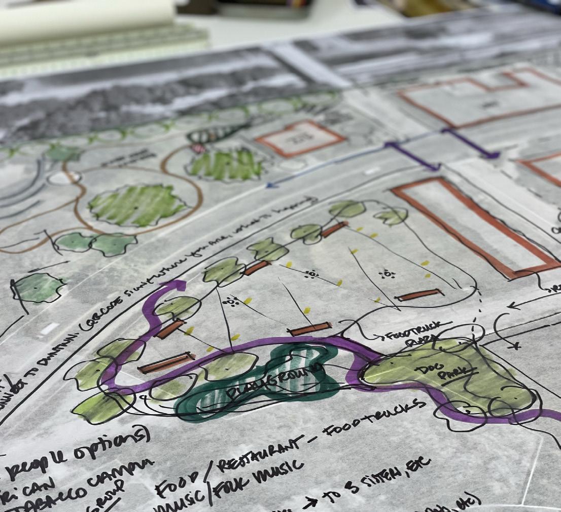
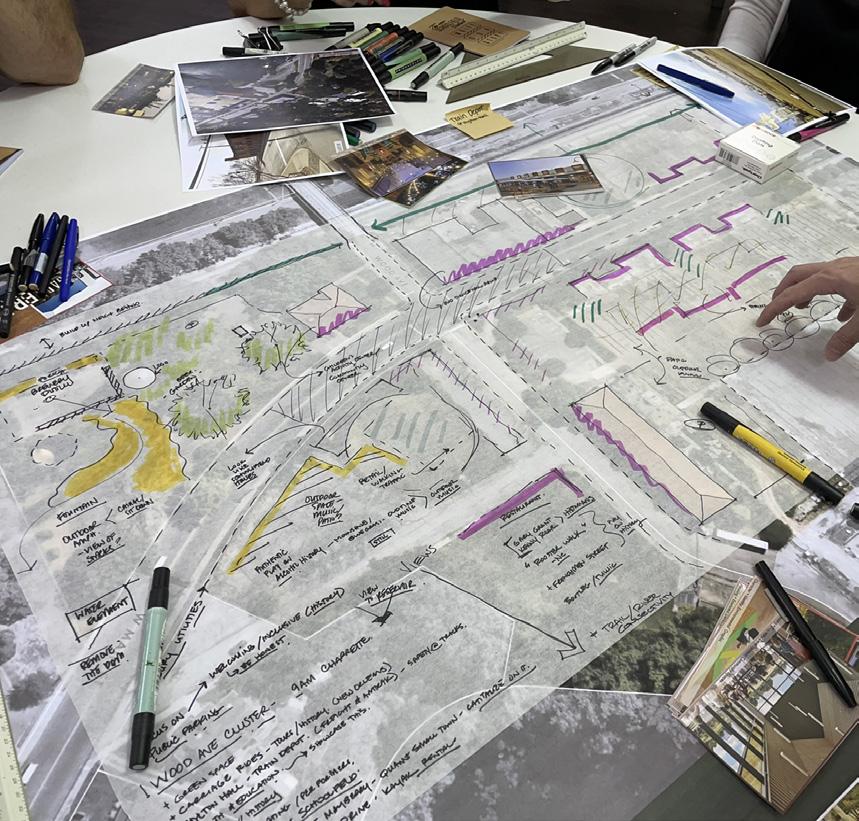

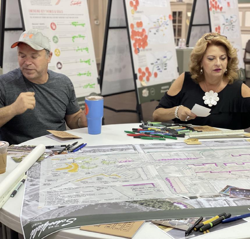


Community Sketches:
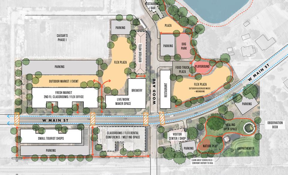
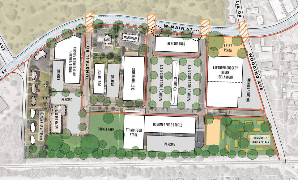
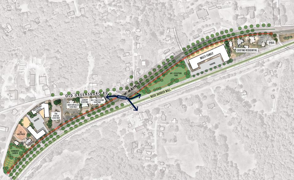
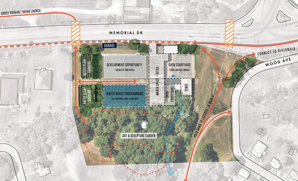
Four examples of the community-sketches that were developed during Schoolfield Week. The design team took these sketches and the top voted projects to refine the concepts to the proposed catalyst site plans.
POTENTIAL USES AND IDEAS DISCUSSED FOR EACH CATALYST SITE:
The Interchange
+ Renovate the Travel Inn
+ Bring more restaurants / food options
+ New hotels / motels
+ Senior Community
Main Street g reen
+ Small Shops / Boutique Stores
+ Affordable Housing / Senior Community
+ Recreation trails and community park space
+ Professional Service / Office Space
+ Park Space
+ Green Buffer from the railroad tracks
Baltimore Avenue Cluster
+ Mixed-Use buildings
+ Live / Work Spaces
+ Park Space to learn about Schoolfield History
+ Classrooms or meeting spaces
+ Train Depot
+ Brewery + Beer Garden
+ Outdoor music area
+ Visitor Center
+ Patio with outdoor dining
+ Indoor / Outdoor Market
+ Trail connection to Reservoir
+ Playground
Shopping Center r edevelopment
+ Expand Grocery Store
+ Community Garden
+ Park + Plaza Spaces
+ Mixed Use buildings
+ Townhomes
+ More food options (gourmet, ethnic foods)
+ Daycare, Senior Services, Doctor’s offices
+ Clothing Stores
+ Post Office
+ Restaurants
+ Headhouse / Farmers Market
Schoolfield Woods / Filtration Plant
+ Art & Sculpture Garden
+ Makers Space
+ Trail system down to wooded area
+ Connections across Memorial Dr
See Appendices for the detailed drawings and ideas from the community design charrettes.
SHAPING THE FABRIC 119
The Interchange
Located at the Virginia - North Carolina border, The Interchange is conceived as a new gateway for Danville that enhances the arrival experience and creates a more welcoming threshold. Despite the site’s high visibility, it lacks a welcoming public realm and pedestrian infrastructure. This paired with the backdrop of aging hotels and motels does little to welcome Danville residents, visitors, and tourists at this important end of the W Main Street corridor.
EXISTING CONDITIONS
+ Lack of public realm / pedestrian infrastructure
This stretch of the Main Street corridor has extremely scarce vegetation or tree cover, with few, if any, trees planted adjacent to the road or within the center median. Sidewalks are fragmented and there is no visual screening or framing of the streetscape elements disconnecting the site from the rest of the area.
+ No formal gateway or visual cue welcoming travelers to Danville
The site currently functions as a highway exit rather than a gateway. Vehicles traveling on Highway 29 / designated I-785 enter the city limits without any impression of Danville and what it has to offer.
+ Lack of amenities for tourists, workers, and residents
Surrounded by major thoroughfares, industrial development, and residential neighborhoods, there are not enough amenities for people who live, work, or play in this part of Danville. People are forced to drive to other parts of the city or county to eat, shop, or walk.
+ Aging hotels and motels
The two existing motels provide options for visitors looking to stay in Danville; however, both are aging and require renovations in order to meet the demands Caesars Virginia will bring.
120
F I gur E 44 | The Interchange Location Map
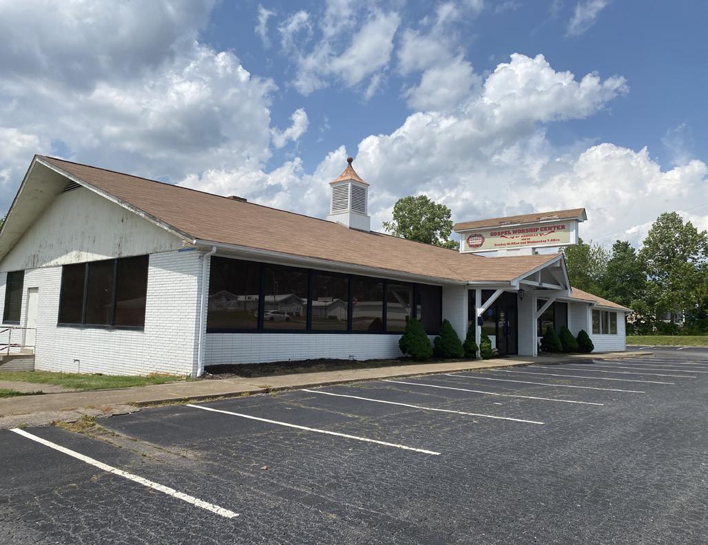
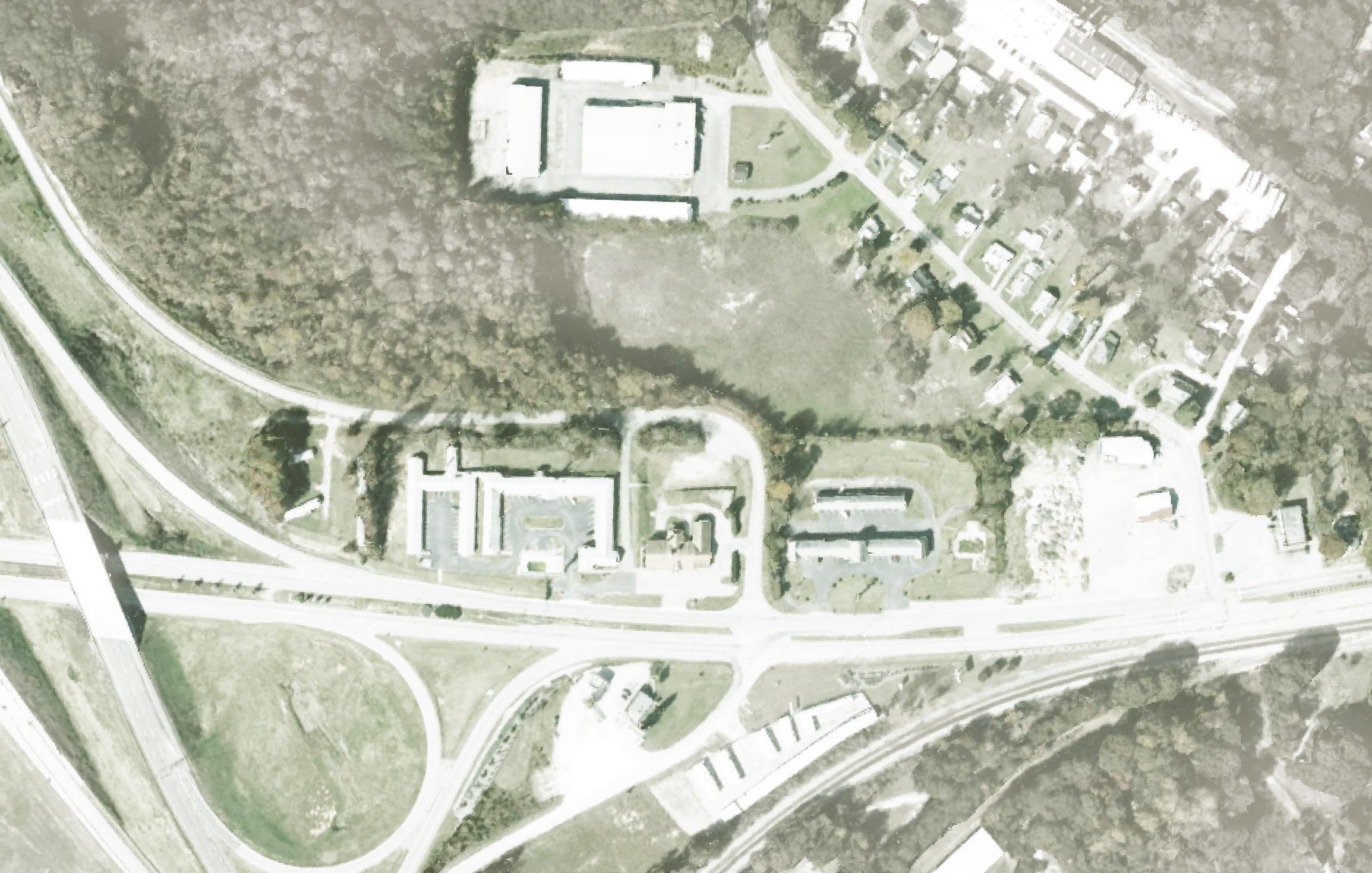
DANVILLE
FLIPPEN CEMETERY
GREENTREE ROAD
TRAVEL INN
EXISTING INDUSTRIAL W
GOSPEL WORSHIP CENTER
ECONOMY INN
RESIDENTIAL INDUSTRIAL
MAYFIELD ROAD
F I gur E 45 | The Interchange Existing
EXPRESSWA
HWY 29
Y
MAIN STREET
SHAPING THE FABRIC 121
A NEW GATEWAY FOR DANVILLE
Re-imagining The Interchange as a key gateway, the conceptual design includes strategies for renovation and redevelopment of the existing motel sites into a vibrant, attractive, and welcoming node for visitors as they enter the city.
+ Provide hospitality options for visitors and tourists
To accommodate the growing demand for hospitality in Danville, there is an opportunity to introduce new boutique or smaller-scaled hotels, a larger anchor tenant hotel, and renovate the existing Travel Inn which can then be framed with a series of plazas and open spaces that provide opportunities for gateway signage, gathering, shared amenities, and historic interpretation.
+ Provide options for dining and amenities for residents, workforce, and visitors
This site is a prime location for new restaurants that will expand access to food options in this section of W Main Street to serve residents, visitors, and workers.
+ Create a more welcoming public and pedestrian realm
Adding a layer of planting along W Main Street will not only buffer fast moving vehicular traffic but will also provide more space to create a pedestrian-oriented environment with continuous sidewalks and bike lanes along the corridor. These public and pedestrian realm improvements will tie into the public plazas and gateways to create a more cohesive development.
+ Better connect the site for all modes of travel
The conceptual plan simplifies the mobility and creates an easily accessible site for vehicles, pedestrians, bicyclists, and transit users. A transit plaza is envisioned at Corning Drive that will be supported with improved pedestrian infrastructure for people to move safely across W Main Street. A new trailhead is envisioned at the corner of W Main Street and Mayfield Road with interpretative signage to direct residents and visitors to the historic African American Flippen Cemetery. This is also where the 2-way bike lane will begin and continue along the entire length of W Main Street, connecting bicyclists to the River District. For cars, the driveways at Greentree Road and Mayfield Road will remain and lead to parking that is strategically tucked behind the buildings so it is less visible from W Main Street.
NOTE: The proposed catalyst sites are conceptual plans and illustrate only some of the many ideas heard during the planning process. The conceptual plans are intended to offer suggestions for future development at these parcels. Additional coordination will be required between parcel owners, the city, and/or private developers to further advance the design and test the economic feasibility. Additional engineering, traffic, and design studies will also be required to advance the concepts prior to implementation.
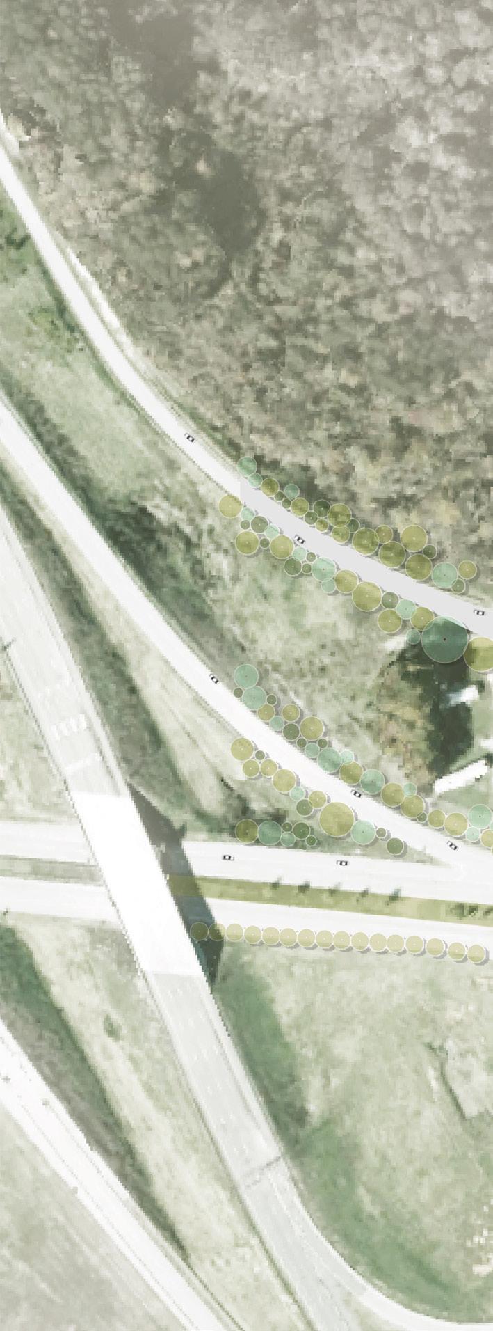
F I gur E 46 | The Interchange Conceptual Site Plan
DANVILLE EXPRESSWAY
29 122
HWY
TRAIL
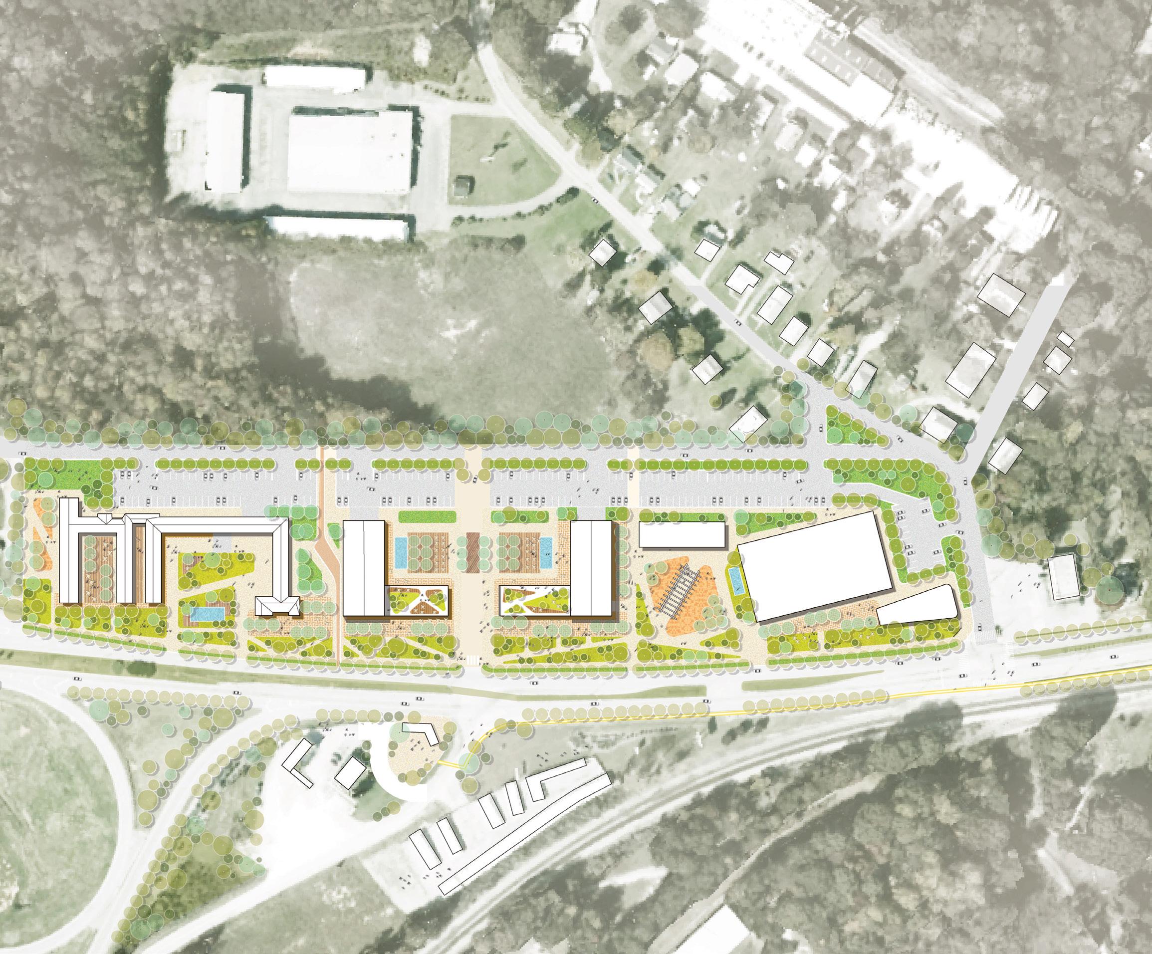
POOL
EXISTING INDUSTRIAL TRANSIT PLAZA / BUS TURNAROUND
POOL
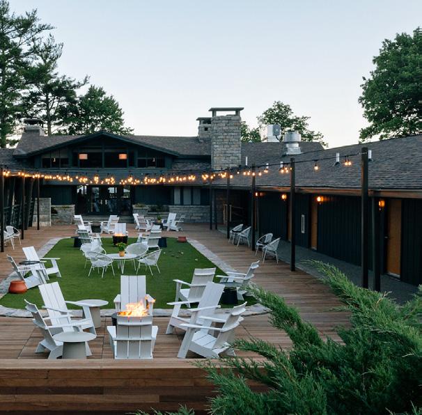
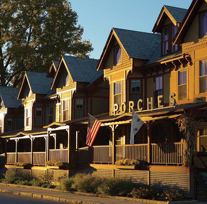
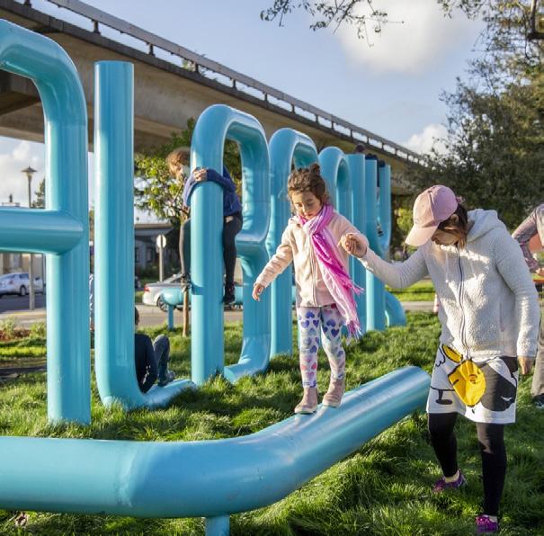
WHAT IT CO u LD LOOK LIKE
Ce bu l ka PorchesInn/Burr and Mc Ca l lu m AlbanyLoop/Groundworks
SkylineLodge/Andrew
W MAIN STREET
ROAD
GREENTREE ROAD MAYFIELD
PARKING LOT
& SHARED AMENITIES
CONNECTION TO FLIPPEN CEMETERY PLAZA
& SHARED AMENITIES
SIGNAGEGATEWAY HOTEL
HOTEL
HOTEL
MOTEL RESTAURANTS N SHAPING THE FABRIC 123
CULTURAL PLAZA
BOUTIQUE
BOUTIQUE
BOUTIQUE
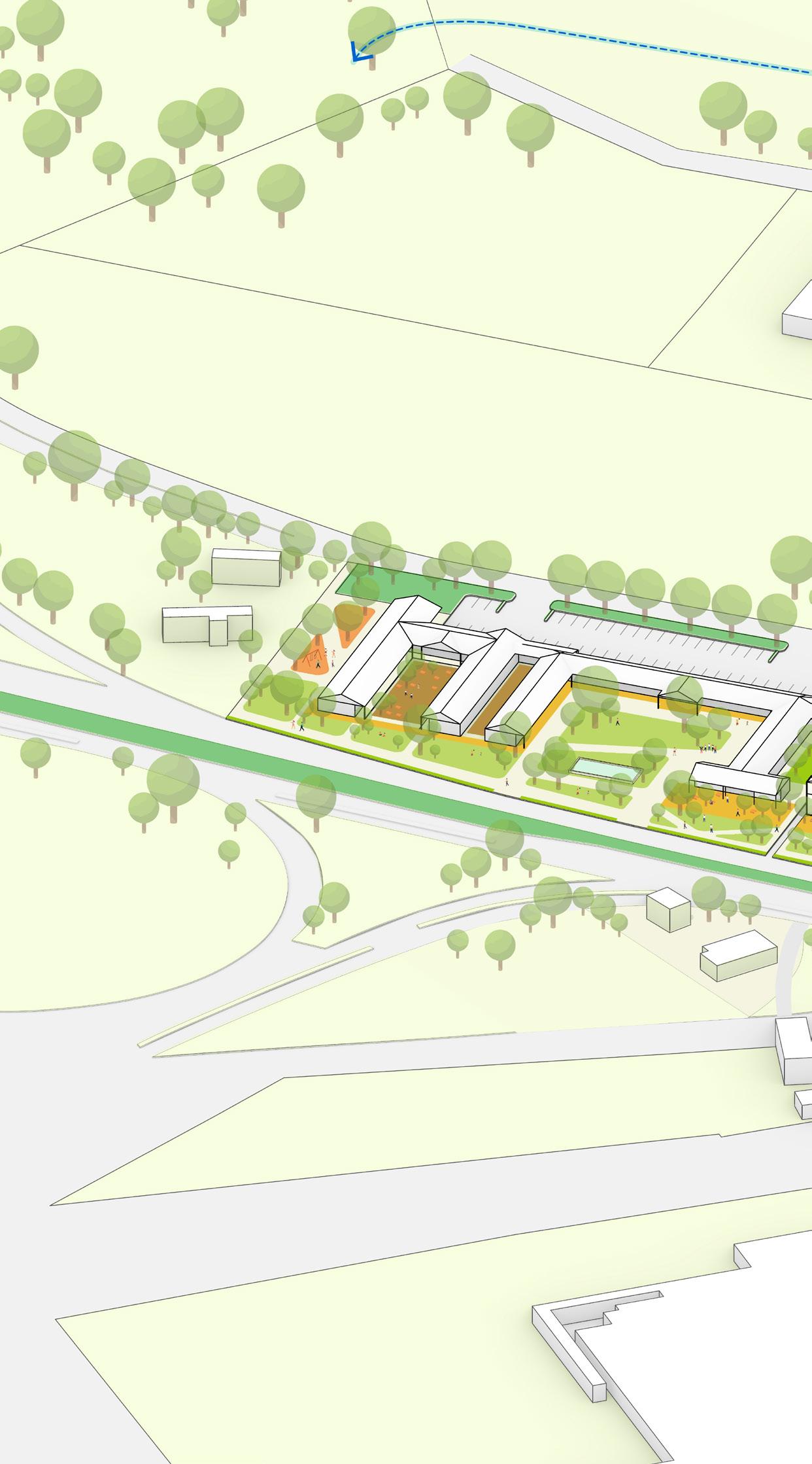
KEY STRATEGIES: Build Boutique Hotels Provide new restaurant options Renovate existing Travel Inn as a boutique motel Attract new hotel Renovate pool and add shared amenities 5 6 7 8 9 Create transit plaza with bus turnaround and Intermodal Improvements Begin mobility improvements Begin 2-way bike lane Authorized Vehicles Only 12 13 14 15 Highlight Flippen Cemetery (historic African American burial ground) with trail connection Create historic and cultural plaza with signage for Flippen Cemetery Implement new welcoming gateway signage Create public plazas 1 2 3 4 Increase vegetation and green infrastructure Formalize trail access to Flippen Cemetery Site Native Plant and Water Retention Implement Bioretention and Reduced Impervious Surface 10 11 F I gur E 47 | The Interchange Axonometric View 4 4 HIGHWAY OFF-RAMP CORNING DRIVE 7 9 1 TRAIL CONNECTION TO FLIPPEN CEMETERY CORNING MANUFACTURING 124
NOTE: The proposed catalyst sites are conceptual plans and illustrate only some of the many ideas heard during the planning process. The conceptual plans are intended to offer suggestions for future development at these parcels. Additional coordination will be required between parcel owners, the city, and/or private developers to further advance the design and test the economic feasibility. Additional engineering, traffic, and design studies will also be required to advance the concepts prior to implementation.
10 4 W MAIN STREET MAYFIELD ROAD BAKER STREET EXISTING INDUSTRIAL CORNING MANUFACTURING GREENTREE ROAD 5 5 6 8 9 9 11 12 13 15 2 3 3 14 SHAPING THE FABRIC 125
Main Street Green
Across W Main Street from the future site of Caesars Virginia, a central gathering node is envisioned at the Main Street
Green catalyst site. A cultural park with opportunities for historic interpretation, green infrastructure, and passive open space, this site can be a driver for revenue-generating development opportunities. Currently owned by Danville’s Industrial Development Authority (IDA), the long and narrow site is underutilized at a prime location.
EXISTING CONDITIONS
+ Vacant parking lot and underutilized land
A large, vacant parcel that currently serves as a parking lot, the hardscaped asphalt surface is heavily cracked and rarely used.
+ Challenging parcel for development
The site is approximately 100’-140’ wide by approximately 800’ long (along W Main Street). The size constrains the type of development that would fit within the site’s long and narrow layout, especially at the western edge where the buildable space is pinched to 100-110’ wide, creating additional challenges to fit parking on site.
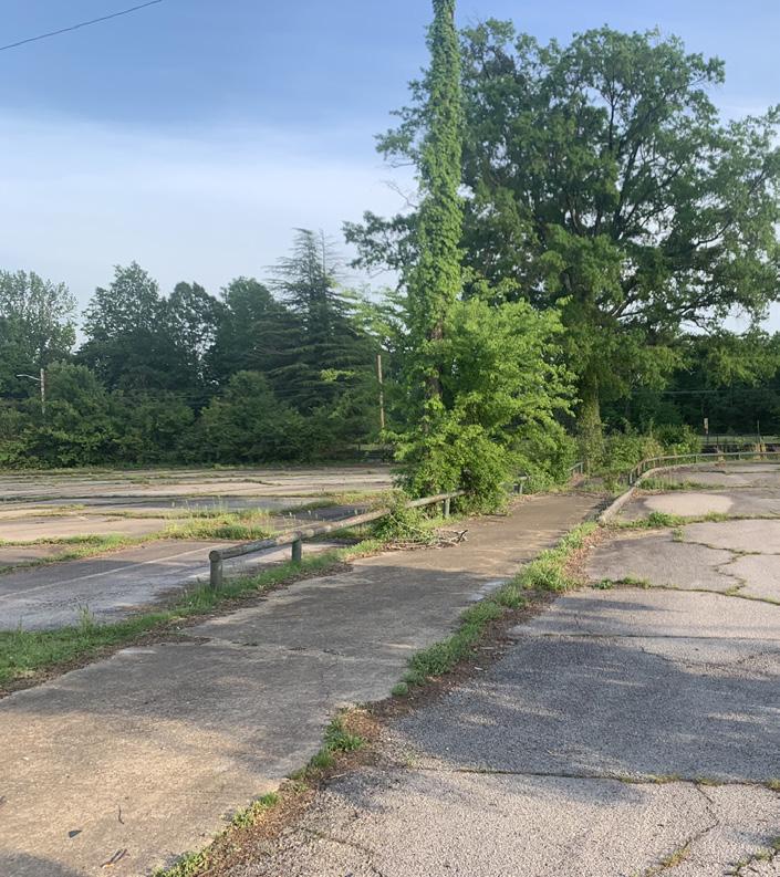
+ Proximity to W Main Street, active rail line, and Caesars Virginia
The site sits between W Main Street, the future Caesars Virginia, and an active rail line, all of which might disrupt potential programs. At the midpoint of the site are remnants of an old rail spur that once connected to the Schoolfield Mill. Branching out from the rail line, this unique feature presents an opportunity to create a park or plaza space around the tracks to share interpretive history of the former site.
I
126
F
gur E 48 | Main Street Green Location Map
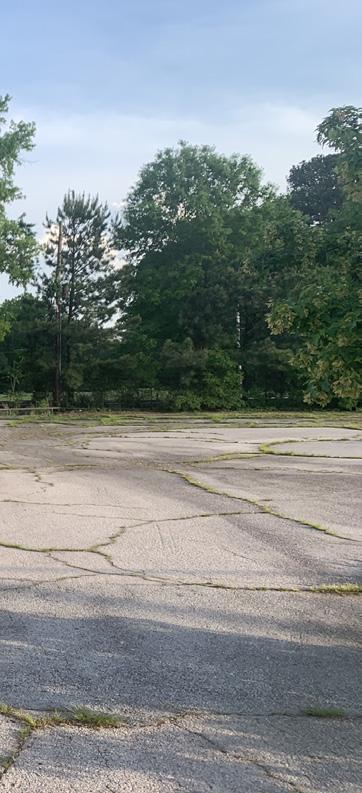
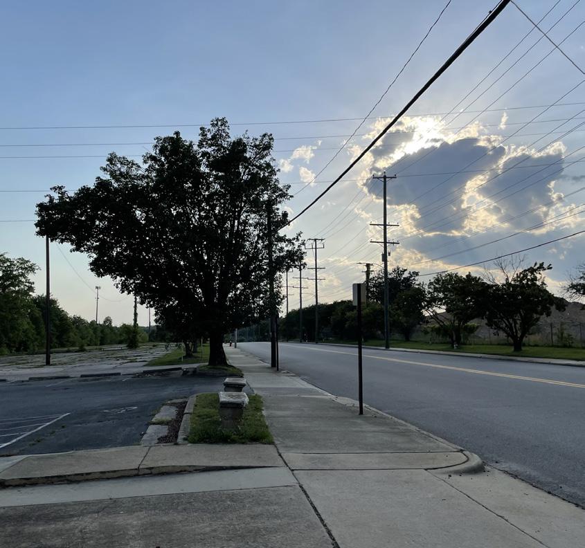
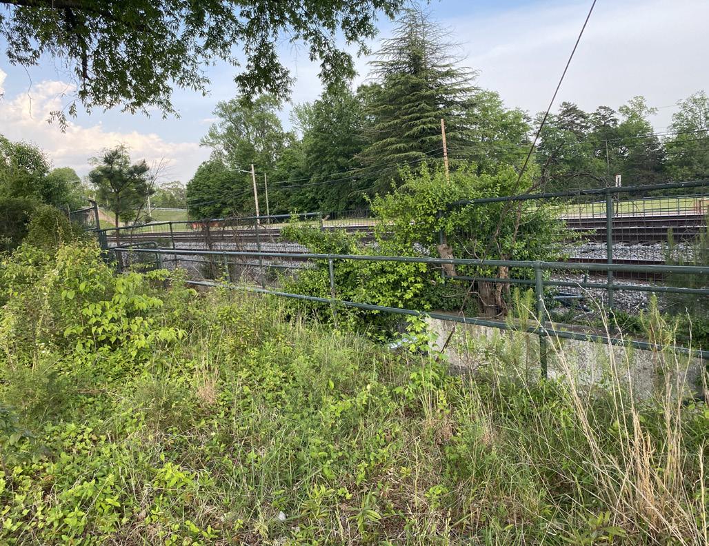
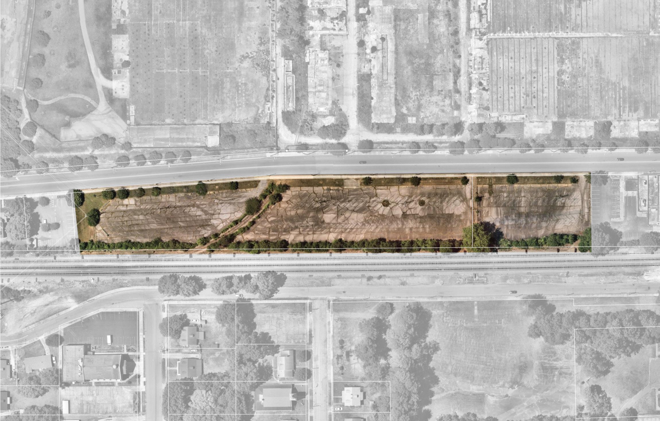
I gur E 49 |
F
Main Street Green Existing
W MAIN STREET
RAIL TRACKS
LANIER AVE
HYLTON AVE
SCHOOLFIELD DR PARKING LOT
PEDESTRIAN TUNNEL
RAILSPUR
CAESARS VIRGINIA RESORT
SHAPING THE FABRIC 127
FORMAL HYLTON HALL SITE
A CENTRAL GATHERING NODE
The conceptual design for Main Street Green includes mixed-use development, flexible plaza and park spaces for the community to honor Schoolfield’s storied past and exciting future through events or everyday passive use.
+ Activate ground floor uses through mixed-use development (retail, commercial, hotel, residential)
Located across the street from Caesars Virginia, this site is a prime location to incorporate other revenue-generating development that activates the ground floor. This includes ground-floor retail, hotel, or office uses. Given the narrow width of the site, parking to accommodate any development would be incorporated in the podium of new residential or hotel uses, and should be studied further.
+ Build a central community pavilion to support community and revenue-generating uses
A community pavilion is sited along W Main Street and is envisioned to provide space for events and exhibits with interpretative elements of Schoolfield’s history, but could also support food or coffee with office uses on the second and third floors.
+ Create flexible plaza and park spaces
The primary focus would be central gathering places designed to accommodate a wide range of needs and potential uses for the community. Design features would appeal to people of all ages and with varying levels of connection to the site and honor the legacy of the past.
+ Honor the legacy of Schoolfield
Directly adjacent to the former Schoolfield Mill site and future Caesars Virginia resort, Main Street Green holds a unique opportunity to connect people to place and past. The rail spur that once connected to the mill is an important cultural asset to preserve the legacy of the mill and a strong foundation for an interpretative plaza.
+ Provide a range of housing options
One of the community’s top requests was to include more affordable housing options for residents of all ages and income levels. This concept includes a large mixed-use building with residential units on the parcel adjacent to W Main Street. There is also an opportunity to include a senior housing village on the former Hylton Hall site, another top priority for the community, and would provide a safe and comfortable place for Schoolfield residents to age-in-place.
NOTE: The proposed catalyst sites are conceptual plans and illustrate only some of the many ideas heard during the planning process. The conceptual plans are intended to offer suggestions for future development at these parcels. Additional coordination will be required between parcel owners, the city, and/or private developers to further advance the design and test the economic feasibility. Additional engineering, traffic, and design studies will also be required to advance the concepts prior to implementation.

F I gur E 50 | Main Street Green
Conceptual Site Plan
ROAD
BISHOP
PARKING LOT FUTURE DEVELOPMENT SITE 128
BISHOP ROAD
PARKING LOT
CAESARS VIRGINIA RESORT
LIVE-WORK VILLAGE
W MAIN STREET
CONCESSIONS
RETAIL / COMMERCIAL
HISTORIC INTERPRETATION TRAIL
MIXED-USE RETAIL / HOTEL
NEIGHBORHOOD GREENWAY
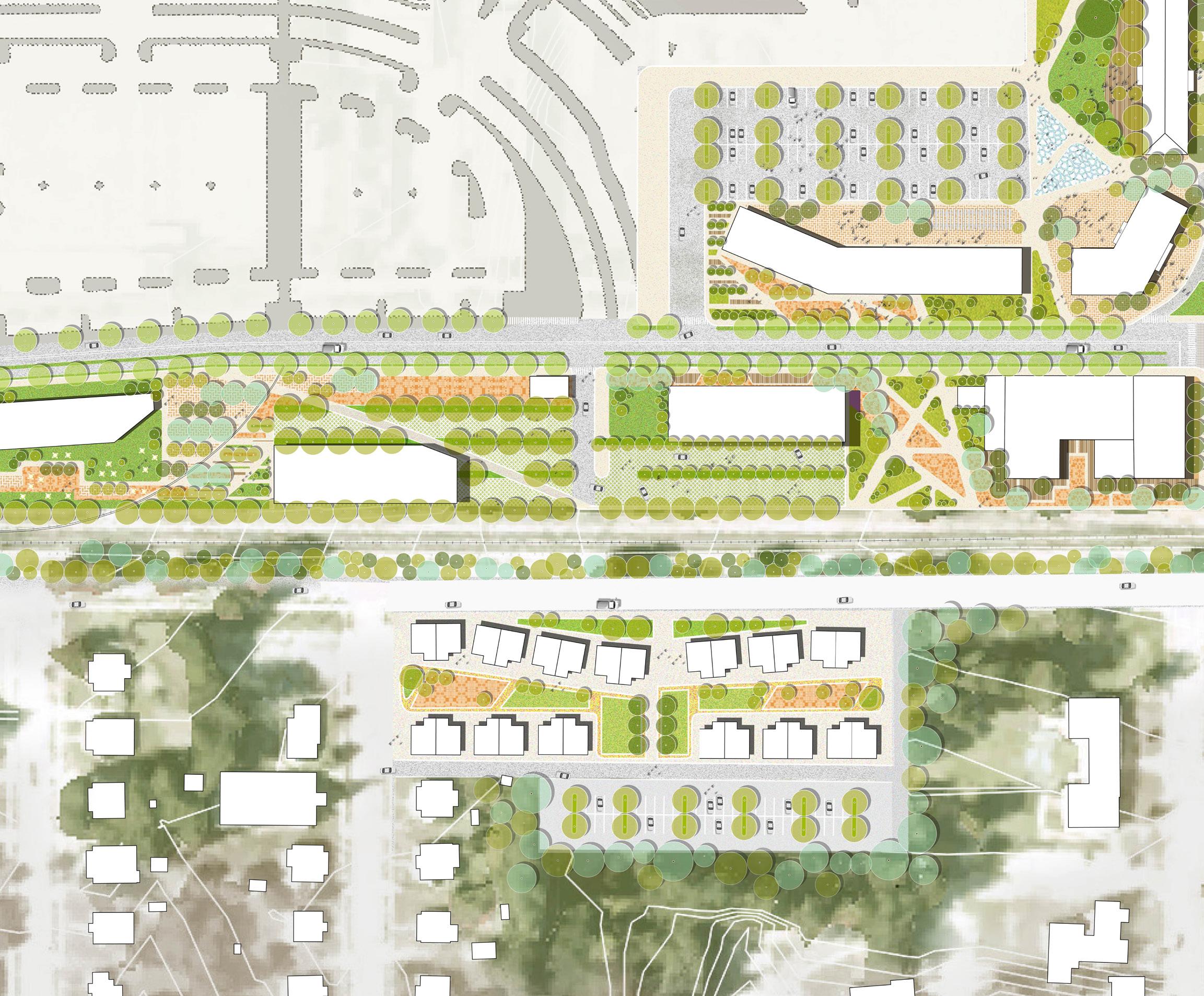
MIXED-USE RETAIL & RESIDENTIAL
PARKING & FLEX EVENT SPACE
PEDESTRIAN TUNNEL
MIXED-USE RETAIL & RESIDENTIAL
CONNECTION TO BALTIMORE AVE CLUSTER
LANIER AVENUE SCHOOLFIELD
HYLTON AVENUE
SENIOR VILLAGE
PLAZA
PARKING LOT
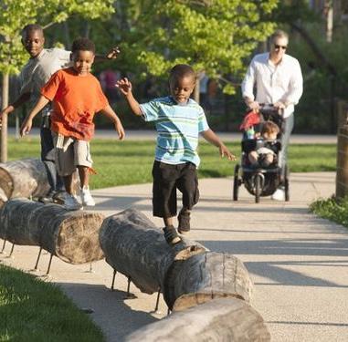
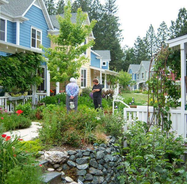
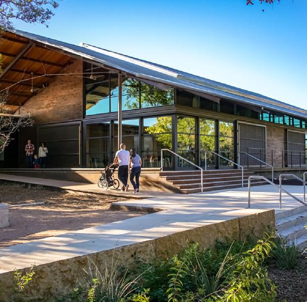
IT CO u LD LOOK LIKE
WHAT
MaggieDaleyPark/
MVVA
Tulsa Co-Housing
Ec o lo g y C e tn re / LkaotalFe
Phil HardbergerParkUrban
DRIVE
N
SHAPING THE FABRIC 129
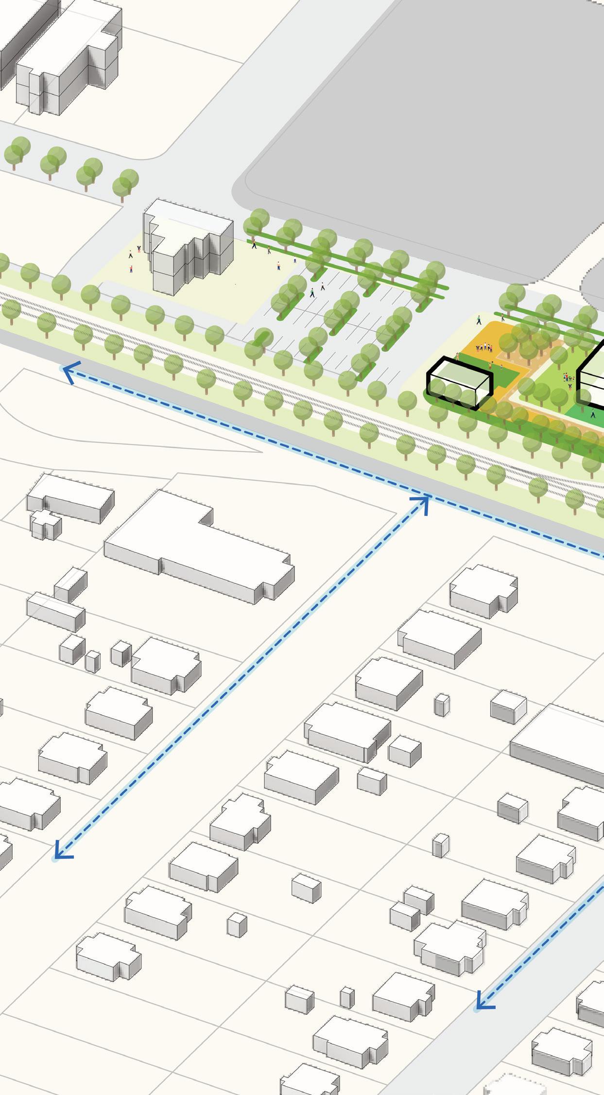
KEY STRATEGIES: F I gur E 51 | Main Street Green Axonometric View SCHOOLFIELD VILLAGE EXISTING BISHOP ROAD SCHOOLFIELD DRIVE PARKINGLOT Attract mixed-use retail, commercial, or hotel uses Develop according to context Build senior housing to allow residents to age-in-place Integrate new development with existing professional services 7 8 9 10 10 Increase vegetation and green infrastructure Build a green buffer / sound barrier from railroad Site native plants and water retention Implement bioretention and reduced impervious surface 12 11 11 Create a mixed-use community pavilion with cultural, community, and revenue-generating space Honor the past through an intreprative trail at the historic rail spur Create flexible space for Main Street Green events and parking Provide concessions for village hub Create welcoming gateways Create public spaces 1 2 3 4 5 6 6 Improve mobility and access along W Main Street Clean and improve pedestrian tunnel to neighborhood Improve the pedestrian realm Improved road crossings Link to neighborhood Greenway Connections 13 14 15 16 8 15 13 NEIGHBORHOOD GREEWNWAY 130
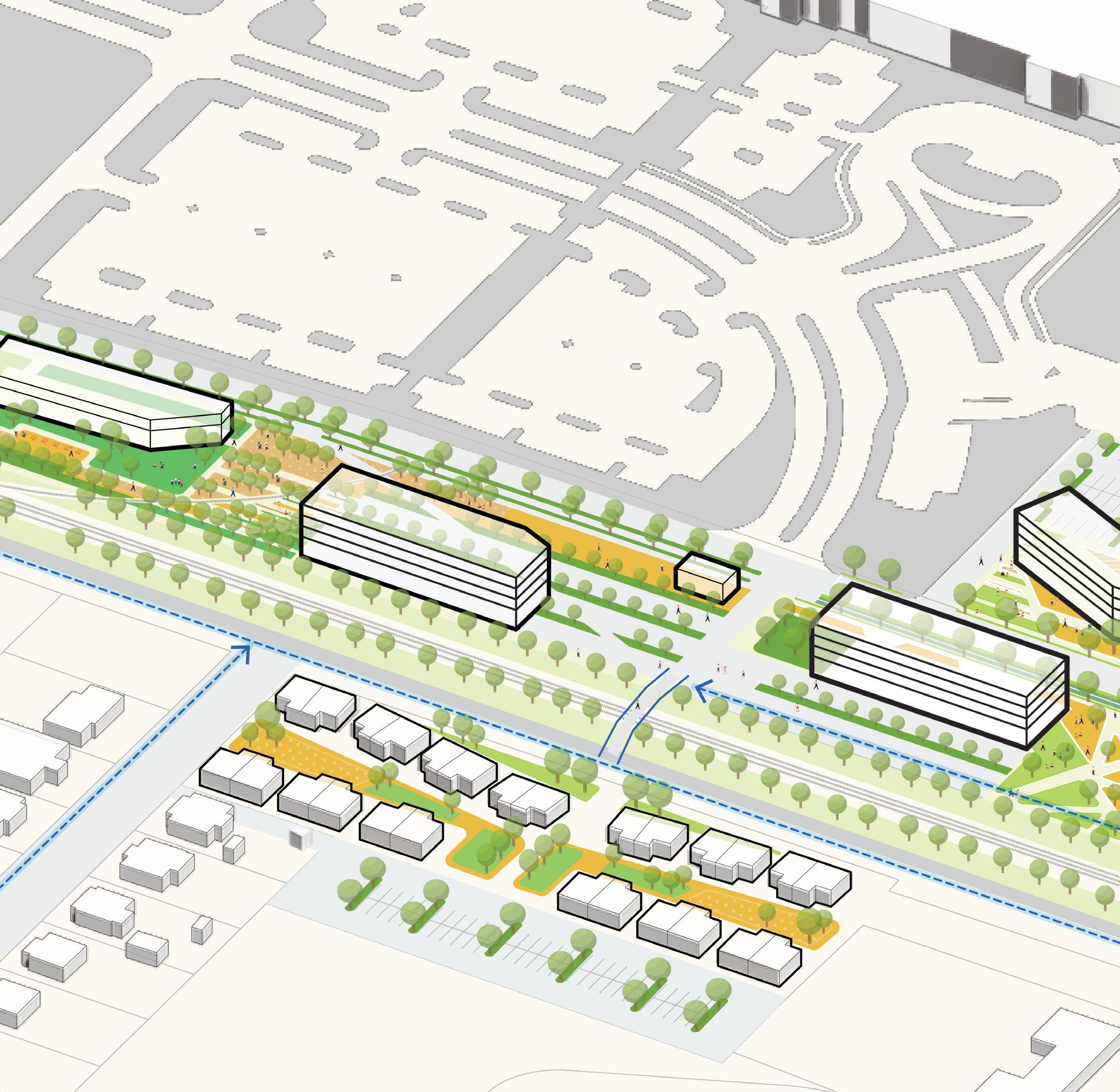
NOTE: The proposed catalyst sites are conceptual plans and illustrate only some of the many ideas heard during the planning process. The conceptual plans are intended to offer suggestions for future development at these parcels. Additional coordination will be required between parcel owners, the city, and/or private developers to further advance the design and test the economic feasibility. Additional engineering, traffic, and design studies will also be required to advance the concepts prior to implementation.
VILLAGE 7 7 16
HYLTON AVENUE W MAIN STREET LANIER AVENUE PARKINGLOT 1 2 3 4 5 9 11 13 14 6 6 6 6
CAESARS RESORTVIRGINIA
SHAPING THE FABRIC 131
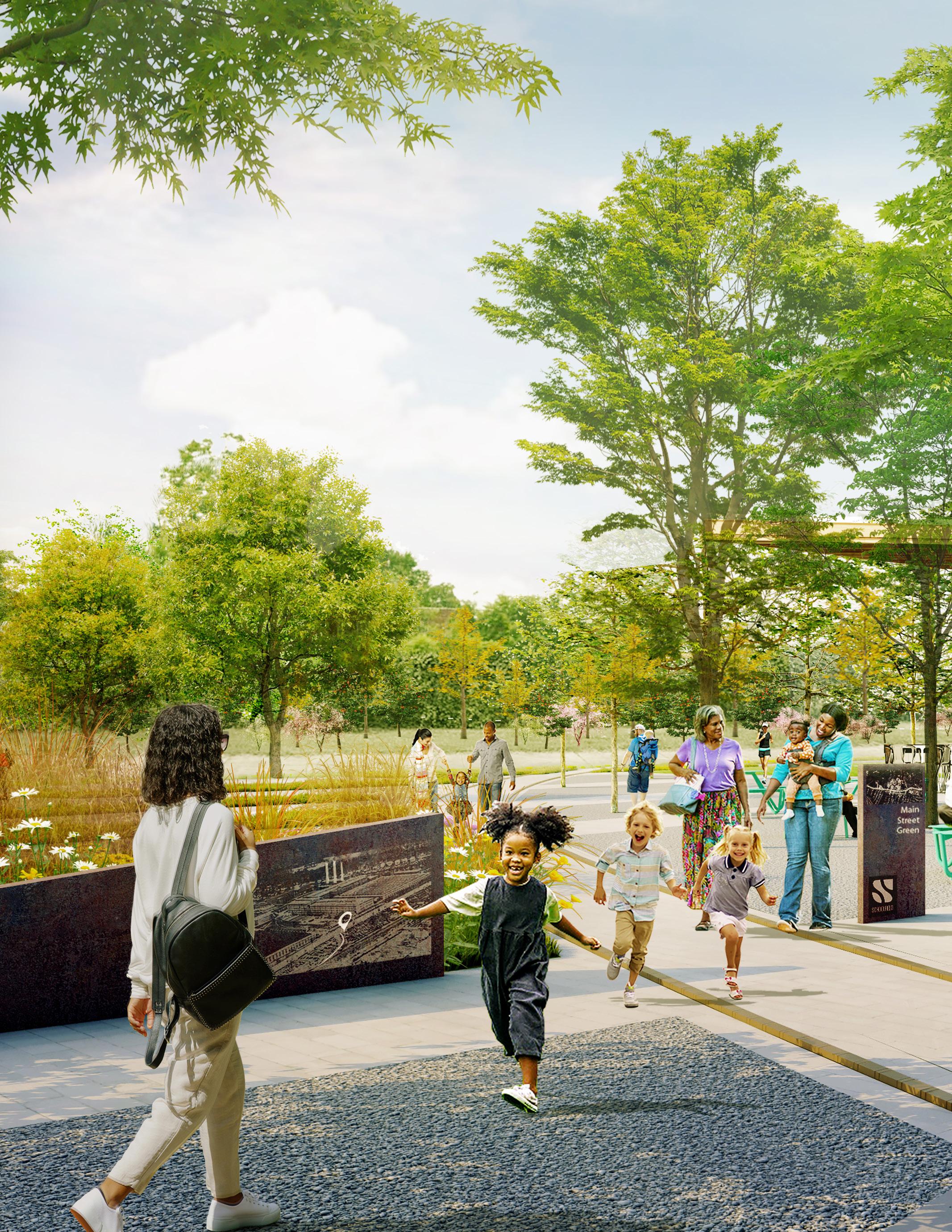
The Experience
Main Street Green offers an opportunity to honor Schoolfield’s past, while also exploring its future.
A historic interpretation trail along the rail spur that once connected to Dan River Mills allows the community to come together and supports adjacent opportunities to program and activate the site along W Main Street.
132
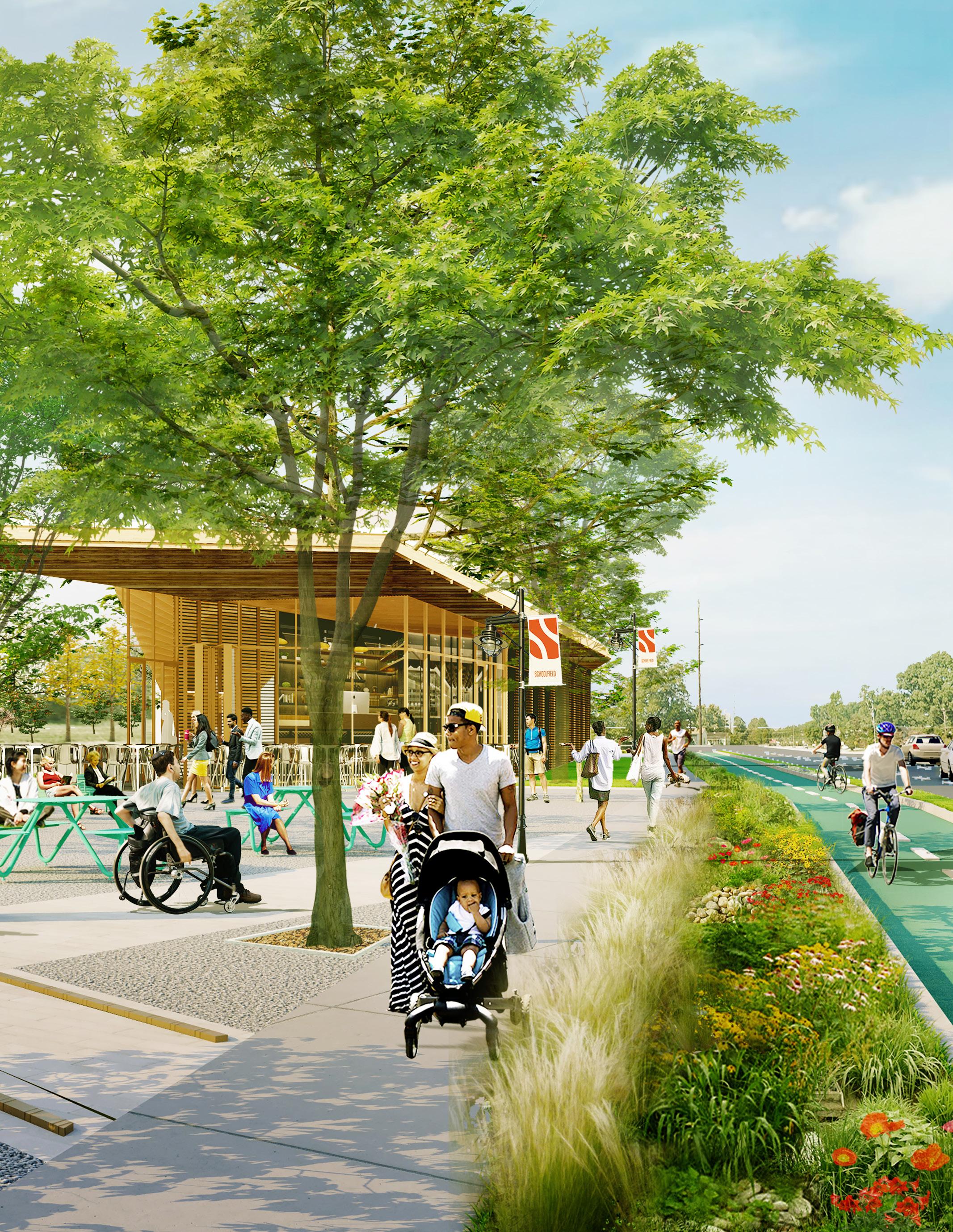
SHAPING THE FABRIC 133
Baltimore Avenue Cluster
The site of the most remaining historic structures associated with Dan River Mills, this site presents an exceptional opportunity to pair adpative reuse with new development to restore the Heart of the Schoolfield Village. Built on the legacy of the past, these improvements will result in transformational projects for its next chapter. This largely vacant and underutilized site presents a great opportunity for reactivation. F
EXISTING CONDITIONS
+ Vacant / underutilized land
From the collapse of the textile industry in the 1990s to the decline of Dan River Mills in the early 2000s, the Dan River Mills campus has slowly vanished over time. This site at the intersection of W Main Street and Baltimore Ave has remained largely vacant and underutilized for the last 20 years. Once a pivotal area for employees and residents of Schoolfield Village, the buildings and land can be repurposed to bring activity back to the area.
+ Historic mill buildings
Since Dan River Mills ceased operations and Caesars Virginia gained ownership of the site, much of the campus has been demolished to make way for new development. Thankfully, a group of Schoolfield alumni purchased the former Dan River Welfare building and others for future adaptive reuse and preservation. Currently owned by
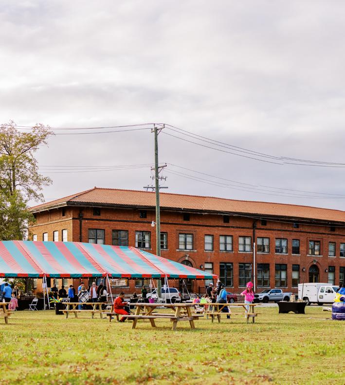
a local developer, Ed Walker, these buildings at the intersection of W Main Street and Baltimore Avenue are a few of the only remaining buildings of Dan River Mills.
+ Lack of ground floor activation
Though many of the buildings on the southern edge of W Main Street (former Welfare Building and 1009 W Main St) continue to operate businesses, including the popular Schoolfield Restaurant, there is still a great need for ground floor activation. The current uses attract many visitors, however, the lack of other amenities keeps people from staying in the area.
+ g ood tree canopy
The edges of the site feature good existing tree canopy and opportunities for park and gathering spaces.
134
I gur E 52 | Baltimore Avenue Cluster Location Map

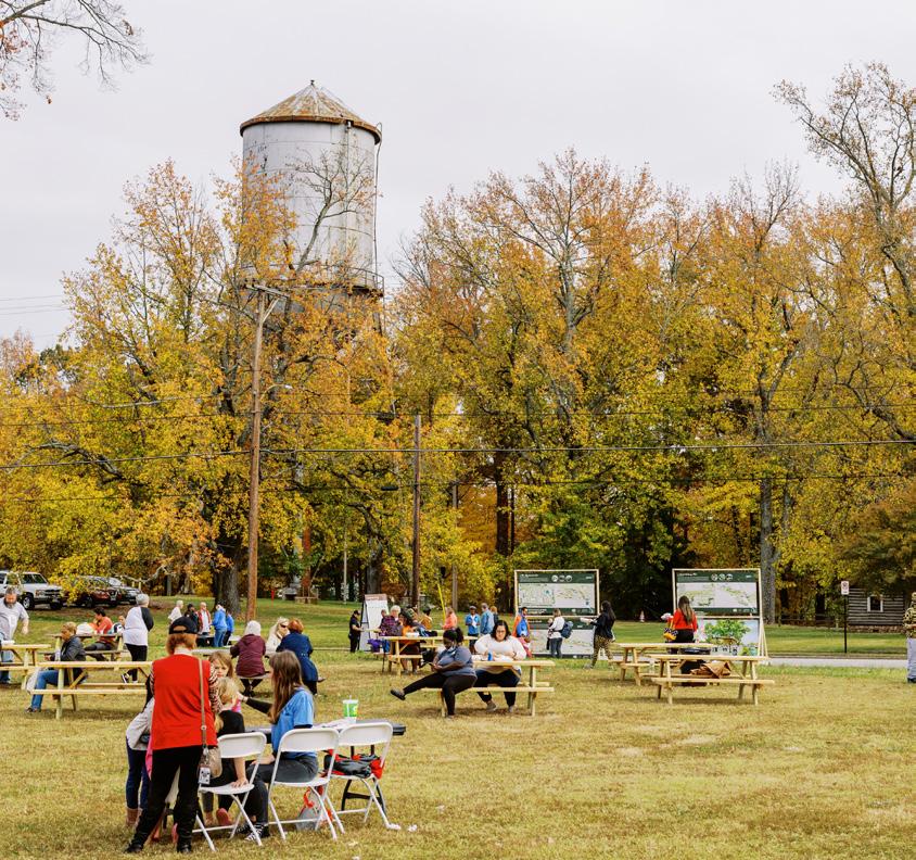
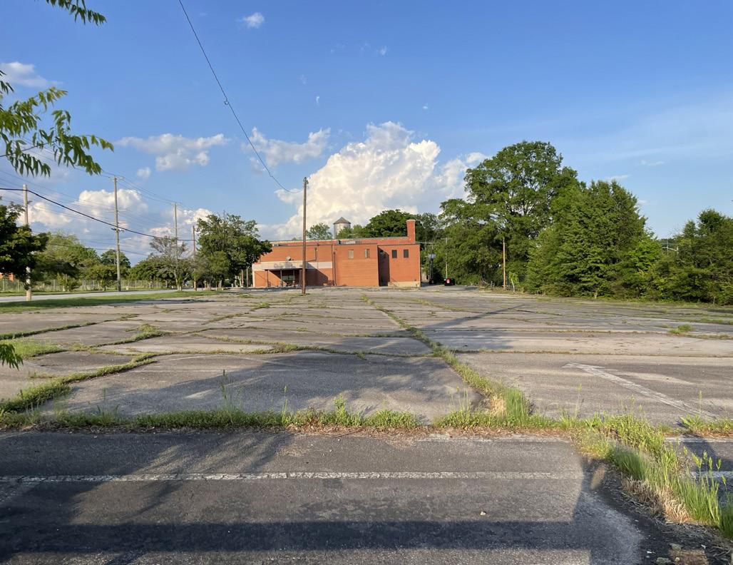
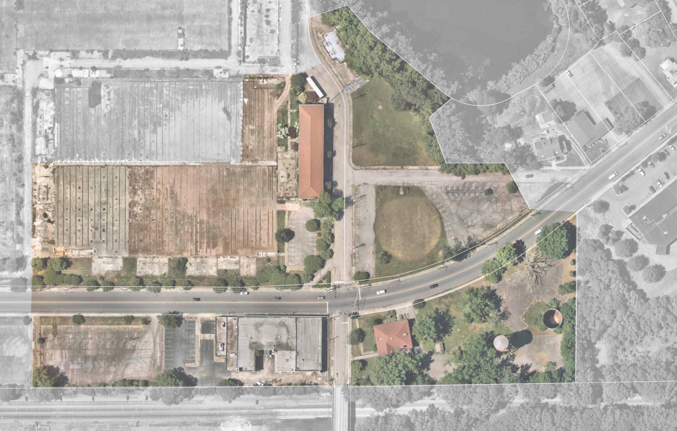
F I gur E 53 | Baltimore Avenue Cluster Existing 1” 30’ W MAIN ST WMAINST RESERVOIR BALTIMORE AVE CAESARS VIRGINIA RESORT 1009 W MAIN PARKING LOT FORMER BANK CONCESSIONS WELFARE BUILDING WATER TOWERS FORMER OFFICES SHAPING THE FABRIC 135
THE HEART OF SCHOOLFIELD VILLAGE
Envisioned as the center of the Schoolfield Village, the Baltimore Avenue Cluster plan includes key elements requested by the community - new residential typologies, retail, and community spaces. The plan honors the past while building a vibrant, active, and historic village node
+ Adaptively reuse historic mill buildings (boutique hotel, live-work, mixeduse, community space)
Working with the property owners, the historic center of the village can be restored by activating the historic structures. This includes a boutique hotel that will have views of the historic “Three Sisters,” renovating the old concessions building, creating a community center and housing at the old Welfare Building, and incorporating residential uses above the retail at 1009 W Main Street.
+ Improve access and mobility to the village hub
New streetscape improvements along W Main Street will allow for a more walkable, pedestrian-friendly environment that will provide enhanced circulation to ample gathering spaces and provide opportunities to celebrate and join together as a community, embodying and capturing the spirit of Schoolfield. A neighborhood greenway network will bridge across the railroad tracks to create safe, and more accessible routes for residents.
+ Honor the history of Schoolfield
Founders Park, adjacent to the Welfare Building, is envisioned as a space that will honor the Founders of Dan River Mills and the employees who made Schoolfield what it is today. The park includes a playground with the Schoolfield children’s playhouse and passive park space that includes an amphitheater near the water tower, honoring the location of the former bandstand. Additionally, preserving the viewsheds of the Three Sisters is strongly encouraged to honor the past.
+ Create public spaces for community members of all ages
The Baltimore Avenue Cluster is a central node of activity, located on a crucial intersection on W Main Street. By providing safe crossing over the railroad tracks into the historic Schoolfield Village and with views to the historic “Three Sisters,” this site is a prime location for community gathering. The plan includes space for a food truck plaza with hardscape and green spaces, a dog park, an outdoor viewing platform by the reservoir, and connections to the reservoir through trails.

F I gur E 54 | Baltimore Avenue
Cluster Conceptual Site Plan
+
Build more housing options
In addition to the proposed residential in the historic buildings, there are more opportunities to introduce different housing typologies along W Main Street which will increase density and activate the street at the ground floor. Live-Work buildings are proposed adjacent to Caesars Virginia, with parking tucked away from W Main Street. An additional mixed-use retail and residential development is proposed next to the existing 1009 W Main development to continue retail activity along both sides of the street, and more housing options.
NOTE: The proposed catalyst sites are conceptual plans and illustrate only some of the many ideas heard during the planning process. The conceptual plans are intended to offer suggestions for future development at these parcels. Additional coordination will be required between parcel owners, the city, and/or private developers to further advance the design and test the economic feasibility. Additional engineering, traffic, and design studies will also be required to advance the concepts prior to implementation.
VIRGINIA RESORT MIXED-USE RETAIL & RESIDENTIAL PARKING & FLEX EVENT SPACE 136
CAESARS
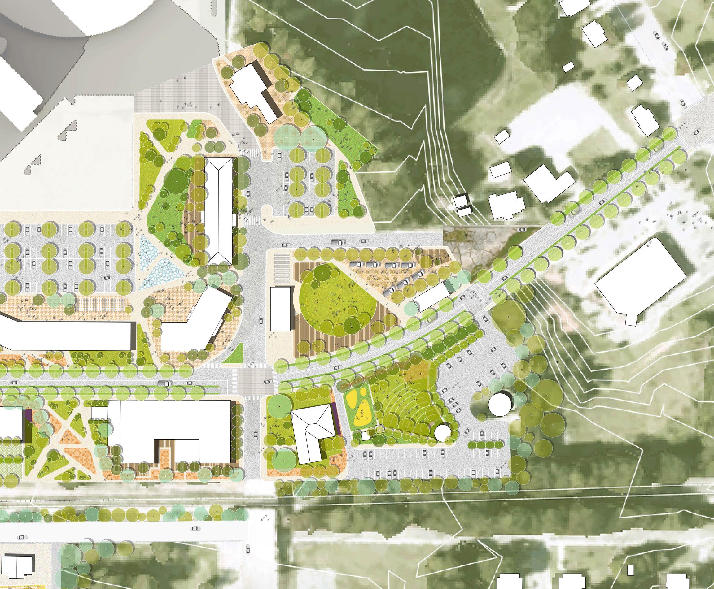
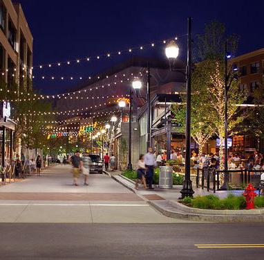
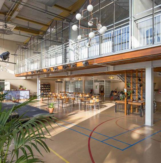
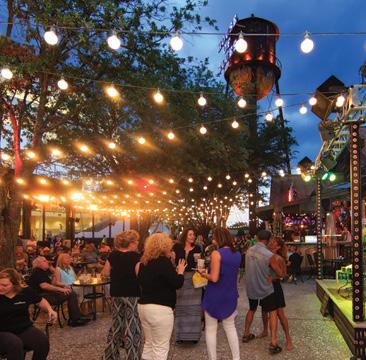
WHAT IT CO u LD LOOK LIKE AssemblyRow/Copley Wo l f f Ru PareCommunity /BETA Courtyard,House ofBlues, Or la n d o RETAIL RESIDENTIAL BOUTIQUE HOTEL CONCESSIONS CONCESSIONS LIVE-WORK VILLAGE
RETAIL & RESIDENTIAL CVS COMMUNITY SPACE & HOUSING WATERTOWER WATERTOWER LIVE-WORK BALTIMORE AVE W MAIN STREET FOUNDERS PARK FOOD TRUCK PLAZA AMPHITHEATER PARKING LOT PLAZA DOGPARK RESERVOIR IMPROVEMENTS + TRAIL LOOP TRAIL CONNECTION To shopping center N
MIXED-USE
SHAPING THE FABRIC 137
NEIGHBORHOOD GREENWAY
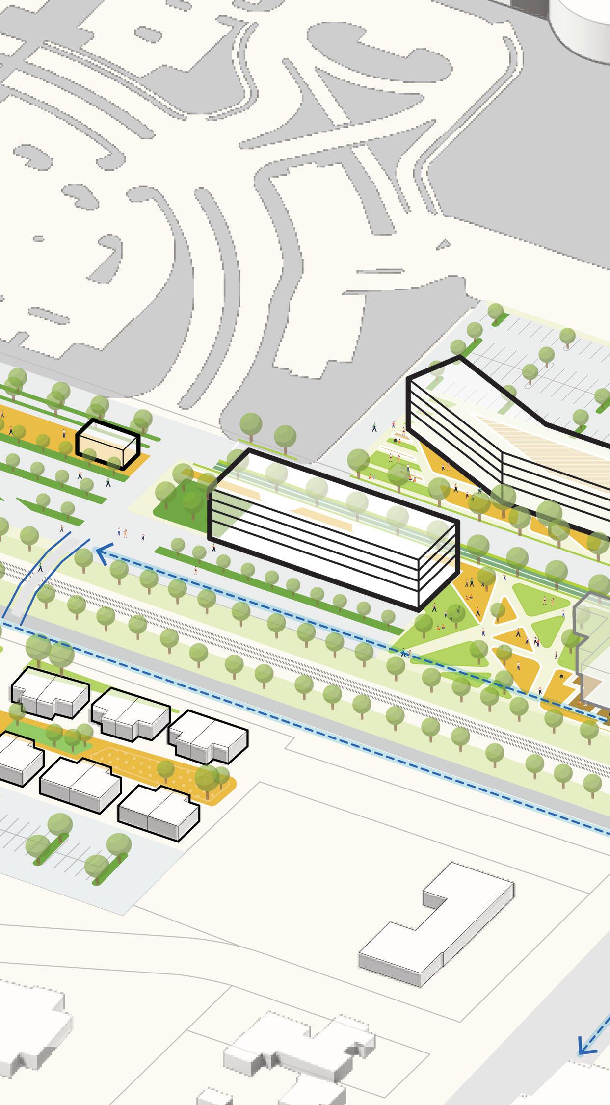
KEY STRATEGIES: F I gur E 55 | Baltimore Avenue Cluster Axonometric View 9 Increase mixed-use and residential development Build live-work village Adaptive Reuse historic building as mixed-use retail and residential Reuse historic office building as Boutique Hotel Renovate historic Welfare Building into a community space with housing 9 10 11 12 13 15 Increase vegetation and green infrastructure Build a green buffer / sound barrier from railroad Enhance reservoir to become a public recreational amenity with a recreational loop Site native plants and water retention Implement bioretention and reduced impervious surface 14 15 16 17 Improve mobility and access along W Main Street Improve pedestrian connection to neighborhood / Neighborhood Greenway Connections 17 18 3 4 7 Honor the history of Schoolfield at Founders Park Create Village Hub would food truck plaza
gathering space Create welcoming gateways Create public plazas Introduce wayfinding and signage along W Main Street Build community dog park Provide concessions for village hub Build amphitheater for community gathering 1 2 3 4 5 6 7 8 CAESARS
W MAIN STREET 18 NEIGHBORHOOD GREEWNWAY BALTIMORE 138
and
VIRGINIA RESORT
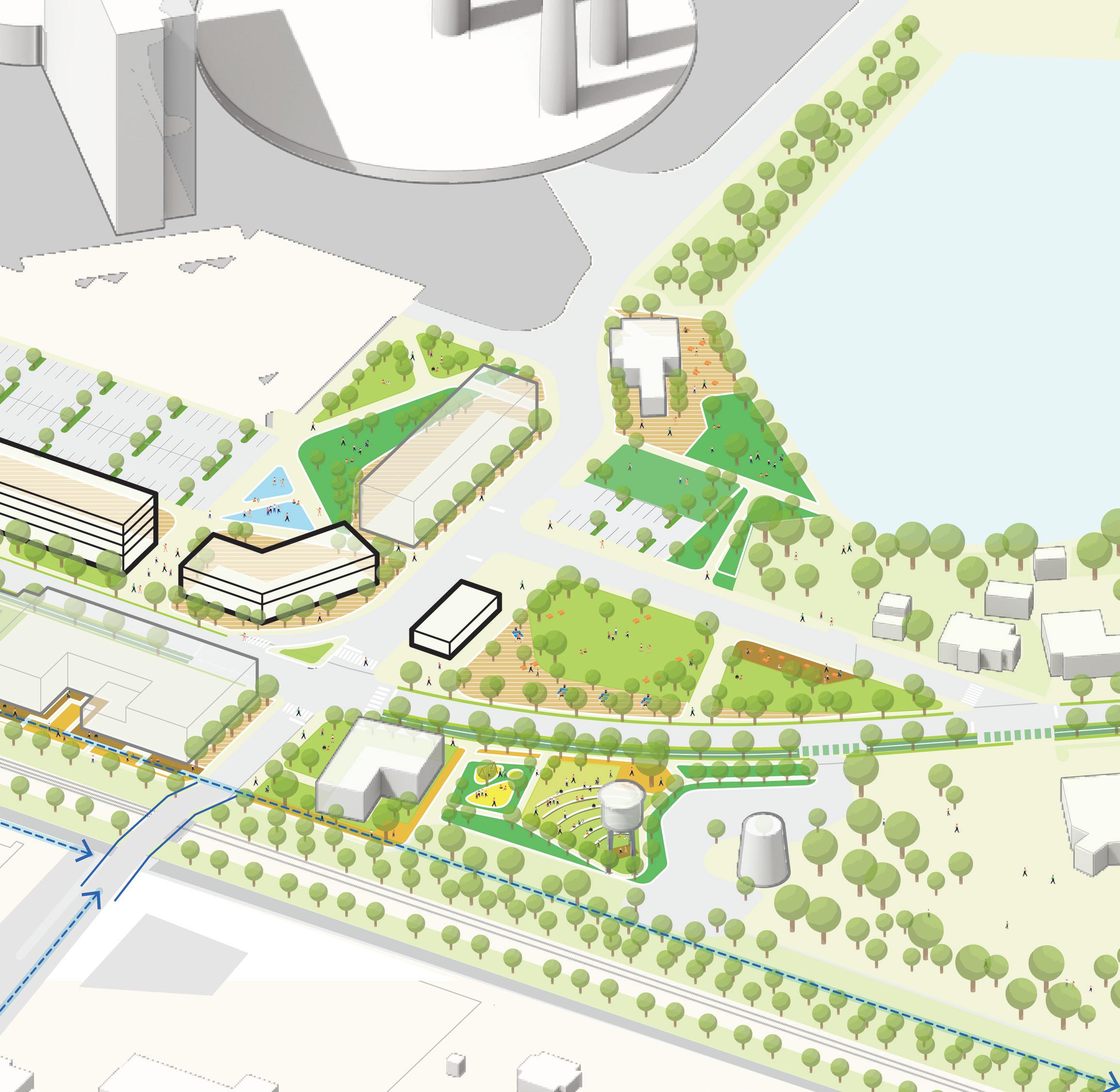
NOTE: The proposed catalyst sites are conceptual plans and illustrate only some of the many ideas heard during the planning process. The conceptual plans are intended to offer suggestions for future development at these parcels. Additional coordination will be required between parcel owners, the city, and/or private developers to further advance the design and test the economic feasibility. Additional engineering, traffic, and design studies will also be required to advance the concepts prior to implementation.
Create pedestrian connection to shopping center Bus Stop 19 20 20 20 10 10 11 12 13 14 16 18 19 1 2 3 3 4 4 5 6 7 7 8 PARKING LOT
BALTIMORE AVENUE BALTIMORE AVENUE
MAIN STREET SHAPING THE FABRIC 139
TRAIL CONNECTION TO BALLOU SHOPPING CENTER PARKING LOT RESERVOIR
W
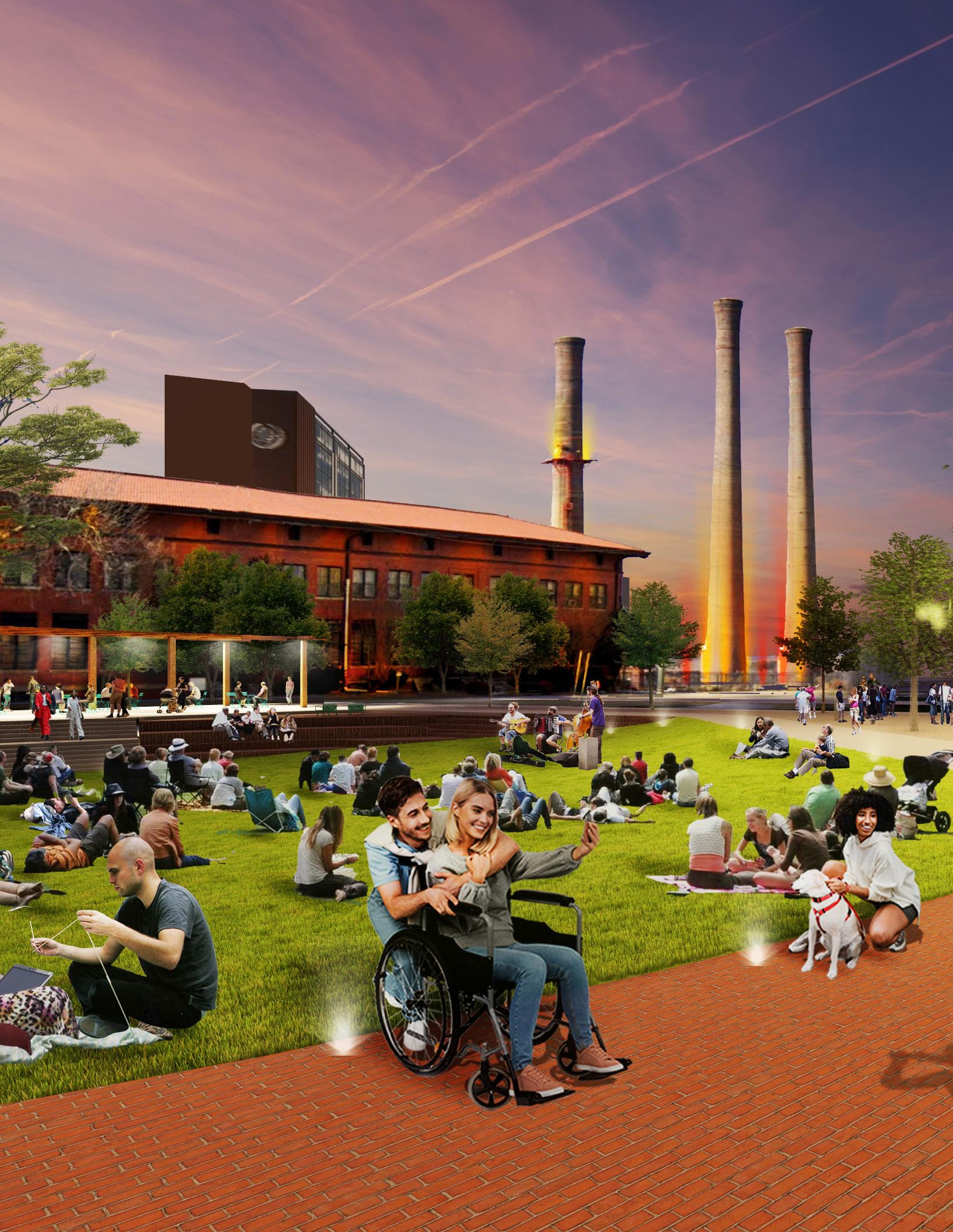
The Experience
The heart of the Schoolfield Village, Baltimore Avenue Cluster is an opportunity to build a vibrant, active, and historic village node along the W Main Street corridor, infusing new life into the historic fabric of this intersection with the backdrop of the Three Sisters - a place for community members of all ages to come together.
140
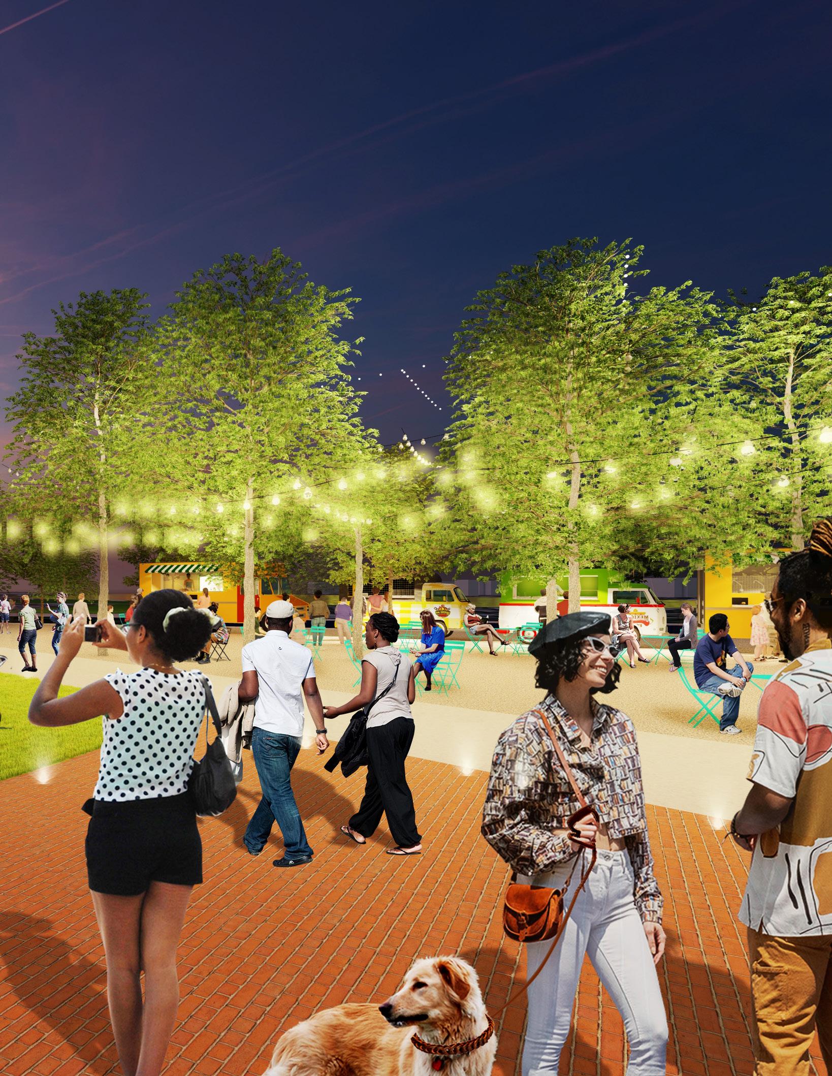
SHAPING THE FABRIC 141
1009 W Main + 1017 W Main
ADAPTIVE REUSE
Formerly the retail and social outlet and informal gathering spot, 1009 W Main Street has remained a beacon in Schoolfield for many generations. The bank structure (1017 W Main Street) was built separately, but has been part of the story of Schoolfield for years. These structures have tremendous opportunity to advance and create active street frontages along W Main Street to be the center of the village hub.
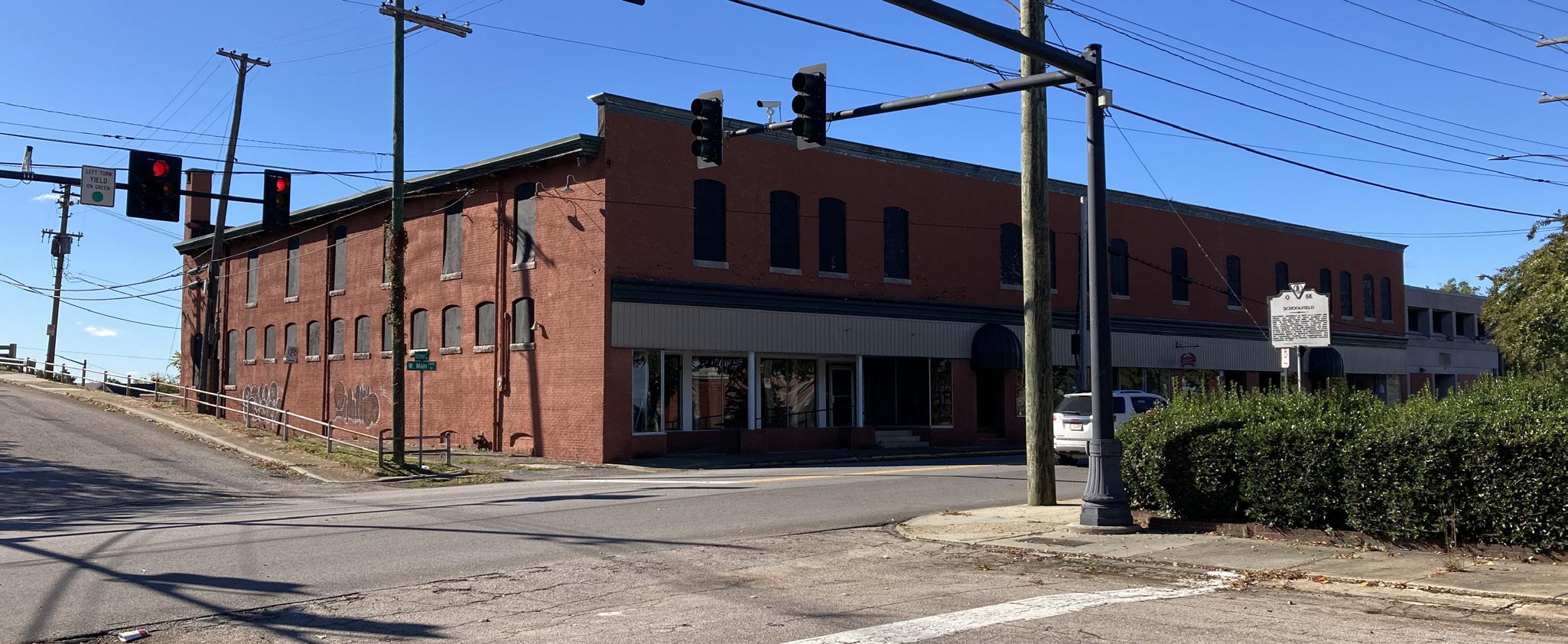
Structural Considerations
Exterior Masonry Walls
+ Fair to good condition with isolated diagonal settlement cracks noted at arch lintels.
Existing Roof
+ Rear of the site above 1B and 1C sections programmatic candidate for becoming an occupied roof
+ Existing roof structure will need to be strengthened to support an assembly loading, and possibly a light pergola
Existing Masonry Demising Walls
+ Likely sufficient reserve capacity to support a limited occupied roof
+ Access to the occupied roof feasible by lowering the masonry sills in the existing adjacent windows
142
Potential programming
1009 W Main - First Floor
+ Commercial space to complement programming on second floor and support active street front on W Main Street
+ Community programming
1009 W Main - Rear Courtyard
+ Exterior programming
+ Outdoor Amenities for second-floor residence
+ Outdoor eating venue for food and beverage from first floor
1009 W Main - Second Floor
+ Market-rate multifamily apartments (Studios, 1- and 2-bedroom units)
+ Future outdoor roof deck amenity at rear
1017 W Main
+ Connect to first and second floors of 1009 W Main (depending on further structural and code analysis)
+ Dedicated tenant on first and second floor
+ Residential units on second floor
Note: All new programs will require code review to evaluate for egress and accessibility requirements. Supplemental egress may be required.
Considerations
Phase 1 Environmental Site Assessment (ESA) is required along with a comprehensive structural analysis prior to revisions to any existing demising walls or modifications to the exterior.
+ All new programs will require a comprehensive code review to evaluate for egress and accessibility requirements
+ Supplement egress may be required when modernizing
+ Existing mechanical, electrical, plumbing and fire protection may need to be modernized or supplemented
+ Existing windows and exterior openings may need to be replaced or modernized for utilization and energy efficiency
Exposing existing original structure where feasible is recommended
+ New finishes to complement the existing historic fabric is recommended
+ The existing roof should be evaluated for repairs or replacement as well as upgrades for energy efficiency
SHAPING THE FABRIC 143
Former Commissary Building
ADAPTIVE REUSE
Adjacent to the reservoir, the former commissary building has potential to support a food and beverage or amenity space to supplement site program and adjacent boutique hotel.
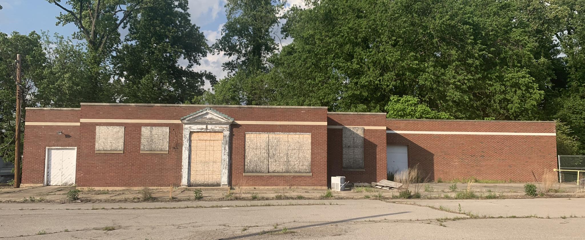
Structural Considerations
This is a one-story masonry clad building which is showing signs of foundation settlement, as evidenced by diagonal cracks in a portion of the exterior wall. It is feasible to stabilize the foundation and repair the exterior distressed masonry. The building can then have finishes and M/E/P systems upgraded to support new program.
Considerations
New mechanical, electrical, plumbing, and fire protection will be required. Phase 1 Environmental Site Assessment (ESA) is required.
+ Existing windows and exterior openings may need to be replaced or modernized for utilization and energy efficiency
+ Exposing existing original structure where feasible is recommended
+ New finishes to complement the existing historic fabric is recommended
+ Existing roof should be evaluated for repairs or replacement
+ The existing structure should be stabilized and secured as noted in the structural considerations.
144
Welfare Building - 917 W Main St
Potential Programming
First Floor
+ Community Programming
+ Townhall space
+ Visitor Bureau
+ Co-working space
+ Annex space for Averett University
+ Field Office to Ballou Park
Second Floor
+ Auxiliary to the first floor
+ Dormitory space to Averett University
+ Additional co-working space
Basement
+ Auxiliary to program for rest of the building
Building
+ Future connection to adjacent Founders Park and other programming along W Main Street
Note: A dormitory space may be considered a change of use and should be evaluated for code implications
Water Towers
Potential Programming
+ Recommended illuminating the superstructure of the water towers and using the metal tank as a canvas for community branding or an artist mural.
Considerations
A Phase 1 ESA is required.
+ The existing structure and tank should be reviewed for stabilization requirements as well as cleaned and finished
+ Lighting will require secure and dedicated power supply which can be coordinated with the Founders Park development. The power supply should be separate from the Welfare Building.
Structural Considerations
The building is currently occupied and appears to be serviceable for typical light commercial program uses. The loading capacity of the 2nd level framing will need to be verified, depending on the proposed program uses.
Considerations
Existing mechanical, electrical, plumbing and fire protection may need to be modernized or supplemented. While the first floor is currently occupied, the second floor has been vacant. A Phase 1 ESA is required as well as code review of existing egress.
+ All new programs will require code review to evaluate for egress and accessibility requirements
+ Existing windows and exterior openings may need to be replaced or modernized for utilization and energy efficiency
+ Exposing existing original structure where feasible is recommended
+ New finishes to complement the existing historic fabric is recommended
+ Existing roof should be evaluated for repairs or replacement
Structural Considerations
Two water towers, one at grade and one elevated, are part of the site infrastructure. They appear to be in generally serviceable condition. The local water department should be consulted to determine if these towers have been decommissioned and if recent structural condition assessments have been carried out.
SHAPING THE FABRIC 145
Shopping Center Redevelopment
There is an opportunity to rethink the main shopping center in the district as a new neighborhood hub with expanded opportunities for retail and shopping with an enhanced public realm framework. The current configuration creates a challenging pedestrian environment with a sea of parking and buildings set far back from W Man Street, breaking the urban fabric along the street front.
F I gur E 56 | Shopping Center Redevelopment Location Map
EXISTING CONDITIONS
+ Poor circulation
The current site favors vehicular circulation, with inefficient pedestrian routes. Within the larger district framework, the site is in a prime location on W Main Street within walking distance to other catalyst sites, Caesars Virginia, residential neighborhoods, and the beloved Ballou Park.
+ Vacant and underutilized buildings
Underutilized and poorly placed in the site, the shopping center is scattered with vacant buildings that lack spatial organization and hierarchy.
+ Opportunities for adaptive reuse
In reconceiving the site around opportunities for adaptive reuse, the current shopping center lacks an important frontage along W Main Street that could activate the site, and its retail frontage.
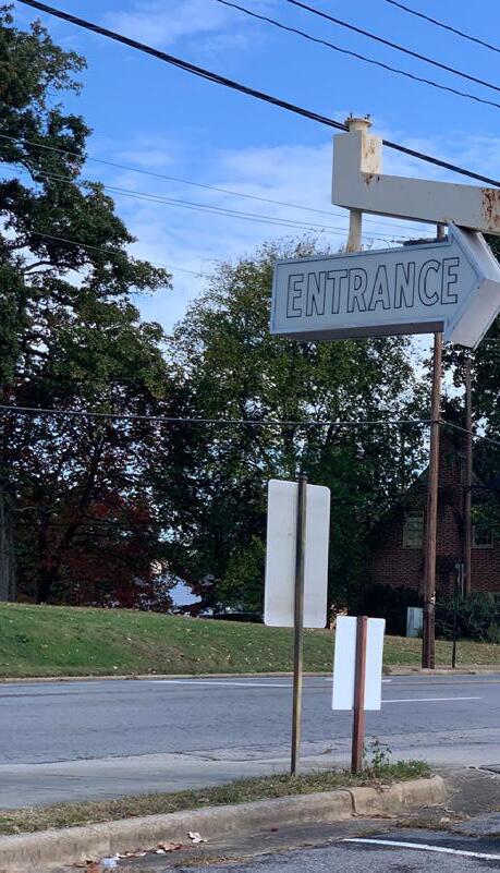
+ Limited green space and planting
There is an overabundance of parking onsite and a lack of existing green space, planting, and tree cover. This is a visual barrier for those traveling on W Main Street and is in stark contrast with Ballou Park across the street.
+ Visually unappealing / lacking character
The current layout is a U-shaped strip mall, with the majority of frontages are set far back from W Main Street, at the far end (south) of the site. This layout creates a visually unappealing site that lacks character with approximately 5 acres of surface parking fronting onto W Main Street, breaking the friendly pedestrian public realm experience coming out of the River District.
146
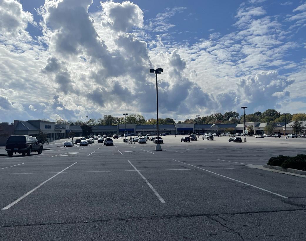
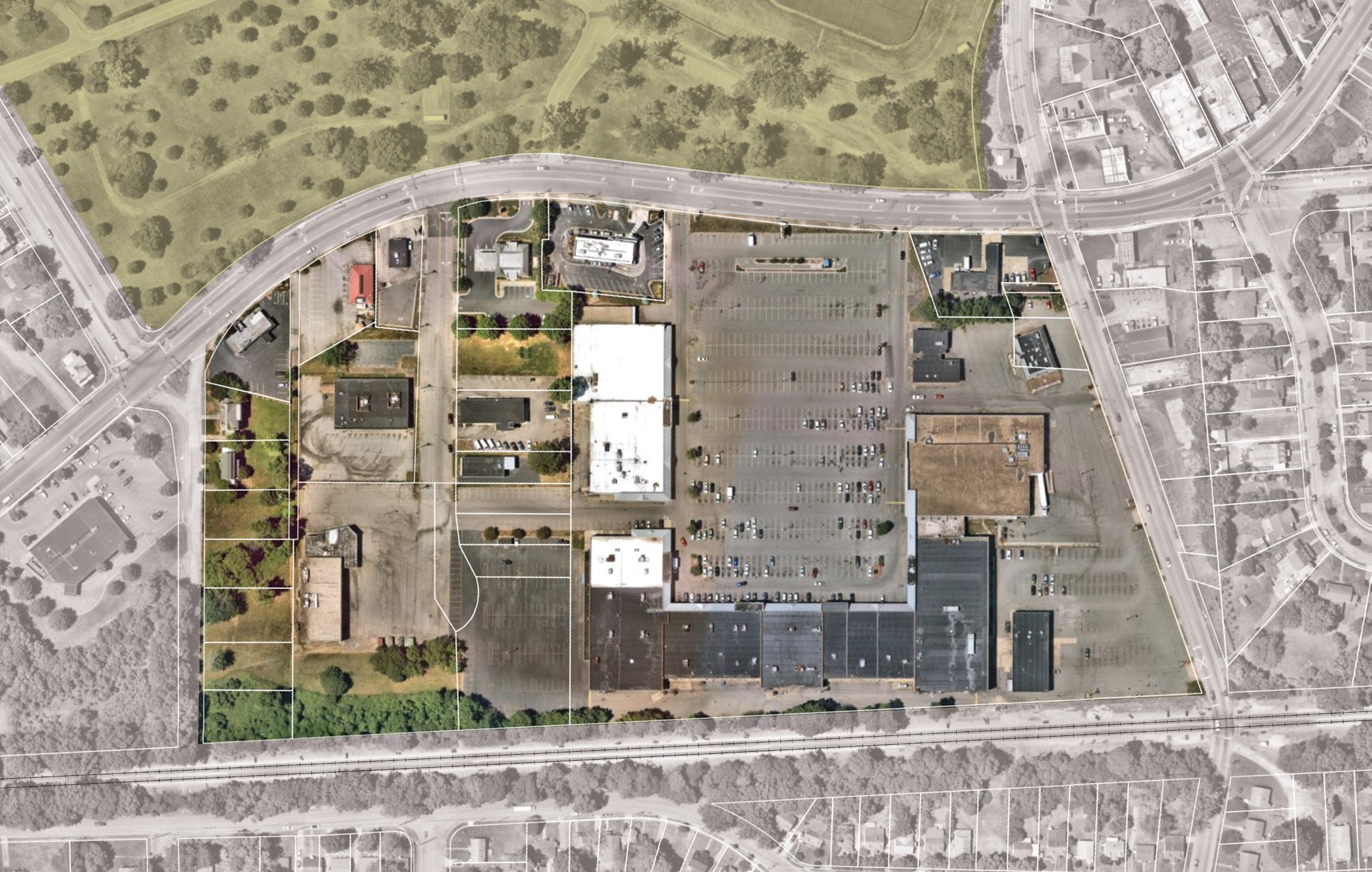
F I gur E 57 | Shopping Center Redevelopment Existing W MAIN ST PARK AVE TUNSTALL RD MAGNOLIA DR WOODING AVE
BALLOU PARK
PARKING LOT
CENTER MOVIE THEATER
FOOD LION PARKING / LOADING SHAPING THE FABRIC 147
RAIL TRACKS
RECYCLING
SCHOOLFIELD VILLAGE
A NEW NEIGHBORHOOD HUB
Re-imagining the Ballou Shopping center as an inclusive, mixed-use development creates an opportunity to build more amenities and housing opportunities. The plan includes key elements requested from the community - a larger grocery store, neighborhood focused retail and amenities, and a range of housing typologies to create a new shopping and living experience.
+ Create a range of housing options for a range of incomes and households (mixed-use, multi-family, townhomes)
The concept plan responds to a top priority identified by the community - building more housing options to serve a range of incomes and households. New townhomes are sited at the edges of the site along Park Avenue and Wooding Avenue, continuing the existing residential neighborhood fabric. Additional housing is located throughout the site in mixeduse buildings with multi-family residential over retail.
+ Attract neighborhood-serving retail and commercial uses
A larger grocery store at the shopping center would support greater food options to serve the community needs. Including other neighborhood-retail and commercial uses, such as restaurants, daycare or early childhood centers, dry cleaners, medical offices, post office, etc., were also priorities voiced by the community and incorporated throughout the site.
+ Better connect the site to the community for all modes of travel Community connections to the historic Schoolfield Village and Ballou Park are reinforced with new pedestrian paths and improved intersections. Back of house loading for larger retail and grocery functions are strategically placed at the southern edge of the site along the rail line to buffer potential noise and streamline traffic for deliveries. The updated approach to the site considers the role of both vehicular and pedestrian circulation in delivering an active, new neighborhood hub for shopping and entertainment. By reorganizing the parking around outdoor plazas and clustering around pedestrian circulation, the site promotes the pedestrian realm and experience of users coming out of buildings.
+ Integrate new development with existing buildings
The plan takes into consideration the existing recycling center, providing vehicular circulation to expand accessibility to this resource, used by residents from the City and County. Along Tunstall Road, infill development is proposed to create an active, pedestrian-friendly retail streetscape. Development density decreases on the edges to seamlessly integrate with the existing residential neighborhoods. Adaptive reuse of structures like the old theater are intended to honor and highlight the legacy of Schoolfield’s storied history.
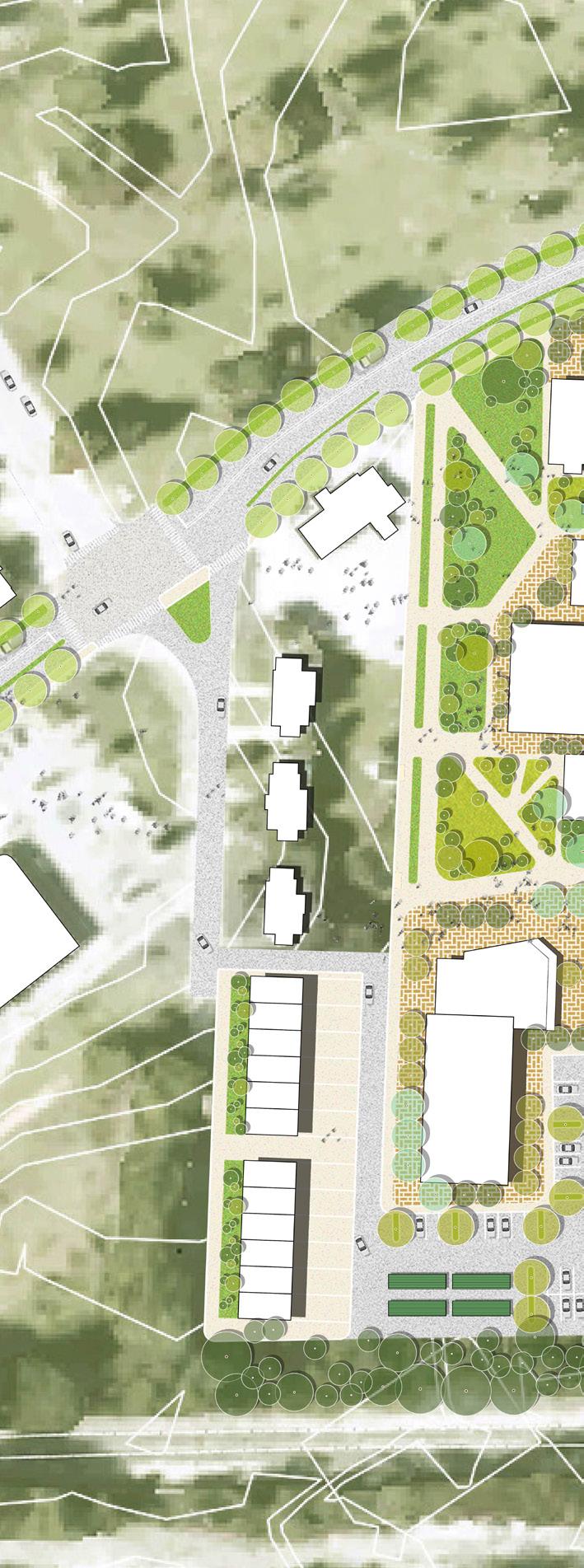
F I gur E 58 | Shopping Center
Redevelopment Conceptual Site Plan
NOTE: The proposed catalyst sites are conceptual plans and illustrate only some of the many ideas heard during the planning process. The conceptual plans are intended to offer suggestions for future development at these parcels. Additional coordination will be required between parcel owners, the city, and/or private developers to further advance the design and test the economic feasibility. Additional engineering, traffic, and design studies will also be required to advance the concepts prior to implementation.
to baltimore avenue cluster CVS WMAINSTREET PARK AVE RENOVATED THEEATER TOWNHOMES DRIVEWAY / PARKING OPEN SPACE 148
TRAIL CONNECTION
PLAZA
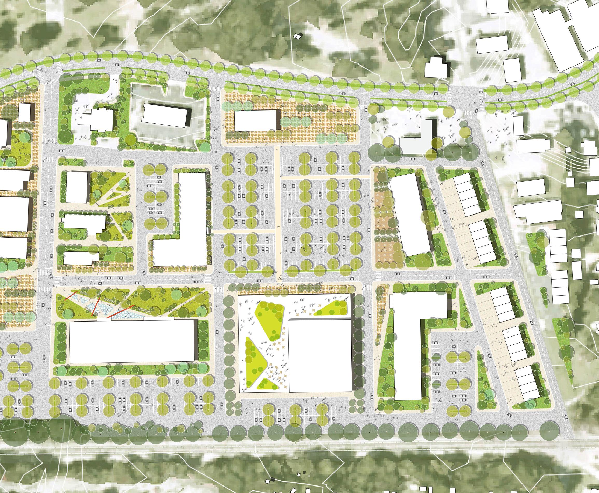
TUNSTALL ROAD
RETAIL PLAZA
BALLOU PARK W MAIN STREET
TRANSIT HUB
HEADHOUSE PLAZA
MIXED-USE + RESIDENTIAL
TRANSIT PLAZA
PARKING LOT
ROOF DECK
GROCERY + RETAIL
WALKRESTAURANT
RESTAURANT + RETAIL
MULTI-FAMILY RESIDENTIAL
LOADING / SERVICE
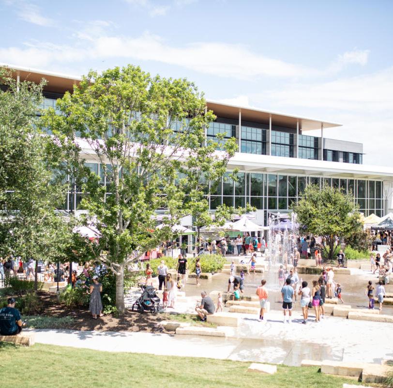
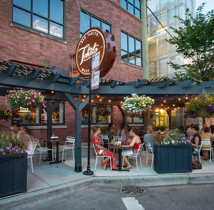
DRIVEWAY / PARKING
TOWNHOMES
WOODING AVENUE
DRIVEWAY / PARKING
TOWNHOMES
TOWNHOMES
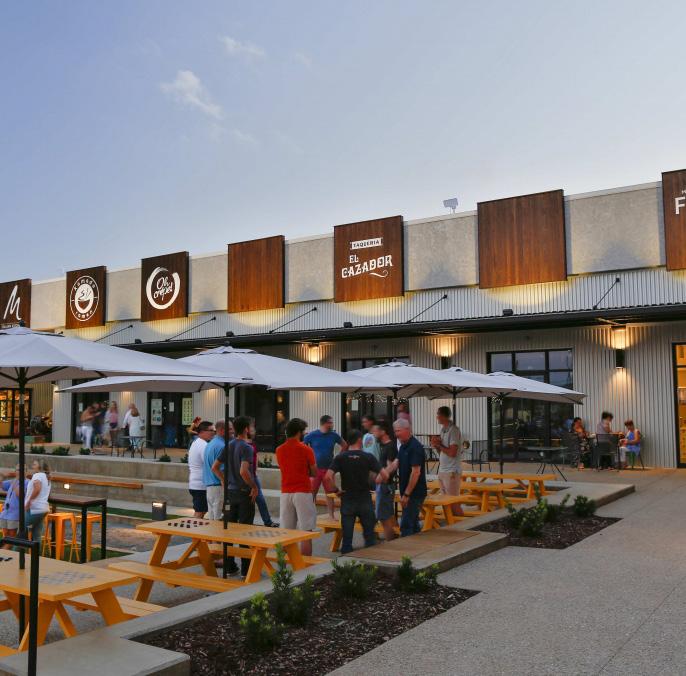
WHAT IT CO u LD LOOK LIKE BranchParkPavillion /Lawren c e G r o u p A hcr itcet s Bar Takito/D+KArchitects an d In t e r o r s Stovehouse/JSBC
Infill RETAIL Infill RETAIL infill RETAIL infill
RETAIL
RETAIL
N SHAPING THE FABRIC 149
KEY STRATEGIES: F I gur E 59 | Shopping Center Redevelopment Axonometric View 7 8 9 9 Expand grocery store and add retail Integrate new townhomes into the existing village fabric Renovate movie theater Retrofit existing buildings and provide neighborhood retail, services, and amenities Increase mixed-use and residential development Increase multi-family housing Provide more restaurant and retail spaces Integrate existing uses with new development Expand operations at the Recycling Center 6 7 8 9 10 11 12 13 14 14 15 Increase vegetation and green infrastructure Build a green buffer / sound barrier from railroad Native Plants and Water Retention Bioretention and Reduced Impervious Surface 15 16 16 2 2 3 Create welcoming gateways Create public plazas Introduce wayfinding and signage along W Main Street Build Headhouse Plaza Create green roof deck 1 2 3 4 5 CVS W MAIN STREET PARK AVENUE LANIER AVENUE TUNSTALL ROAD ARLINGTON PLACE PARK AVENUE Improve mobility and access along W Main Street Create a transit hub + plaza Improve pedestrian connection to neighborhood / Neighborhood Greenway Connections Internal Shuttle Route 17 18 19 SCHOOLFIELD ballou TRAIL CONNECTION 150
SCHOOLFIELD VILLAGE
NOTE: The proposed catalyst sites are conceptual plans and illustrate only some of the many ideas heard during the planning process. The conceptual plans are intended to offer suggestions for future development at these parcels. Additional coordination will be required between parcel owners, the city, and/or private developers to further advance the design and test the economic feasibility. Additional engineering, traffic, and design studies will also be required to advance the concepts prior to implementation.
ROAD 6 7 9 9 10 11 12 13 17 18 1 2 2 2 4 5 LOADING / SERVICE
ballou park WOODING AVENUE W MAIN STREET GARLAND STREET
19 NEIGHBORHOOD GREEWNWAY SHAPING THE FABRIC 151
Schoolfield Woods + Filtration Plant
Extending from the back (north edge) of Caesars Virginia toward Memorial Drive and the Dan River, the Schoolfield Woods + Filtration Plant catalyst site offers a new way to experience nature, transforming this 24 acre wooded site into an opportunity for activation through recreation and trails. Currently inaccessible and heavily wooded, this site offers several natural resources that are underutilized and have potential to bring more recreational and educational opportunities for families to enjoy within Danville.
F I gur E 60 | Schoolfield Woods + Filtration Plant Location Map
EXISTING CONDITIONS
+ Inaccessible
The former Dan River Water Filtration Plant and wooded area have the potential to be a major asset and attraction to the Schoolfield District, serving as a connection point between several local desintations. However, the current building is inaccessible, and while Schoolfield Woods is open to the public, there are no defined paths or accessible circulation for safe and easy connections.
+ Disconnected stream corridor
The former water filtration plant sits along a disconnected stream corridor that presents an opportunity for ecological enhancement and recreation. The stream is currently inaccessible and is covered under thick brush
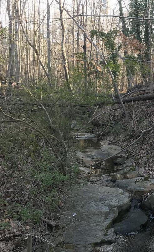
and vegetation, but flows directly under the building to the Dan River.
+ Vacant and underutilized
Currently part of the larger parcel owned by Caesars Virginia, the former Water Filtration Plant will be returning to the City of Danville as an opportunity for development. When it was in operation, the filtration plant drew between 10-16 million gallons of water daily from the Dan River to use in the Dan River Mills bleachery. Since the closure, the filtration plant has remained vacant. In its current condition it is underutilized in its prime location along Memorial Drive, and could serve as an asset and connection point from the Dan River, Robertson Bridge, and Riverwalk Trail to the Schoolfield neighborhoods and beyond.
152
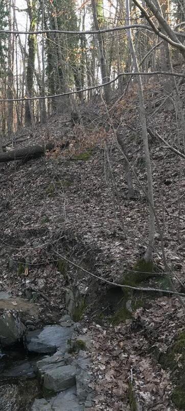
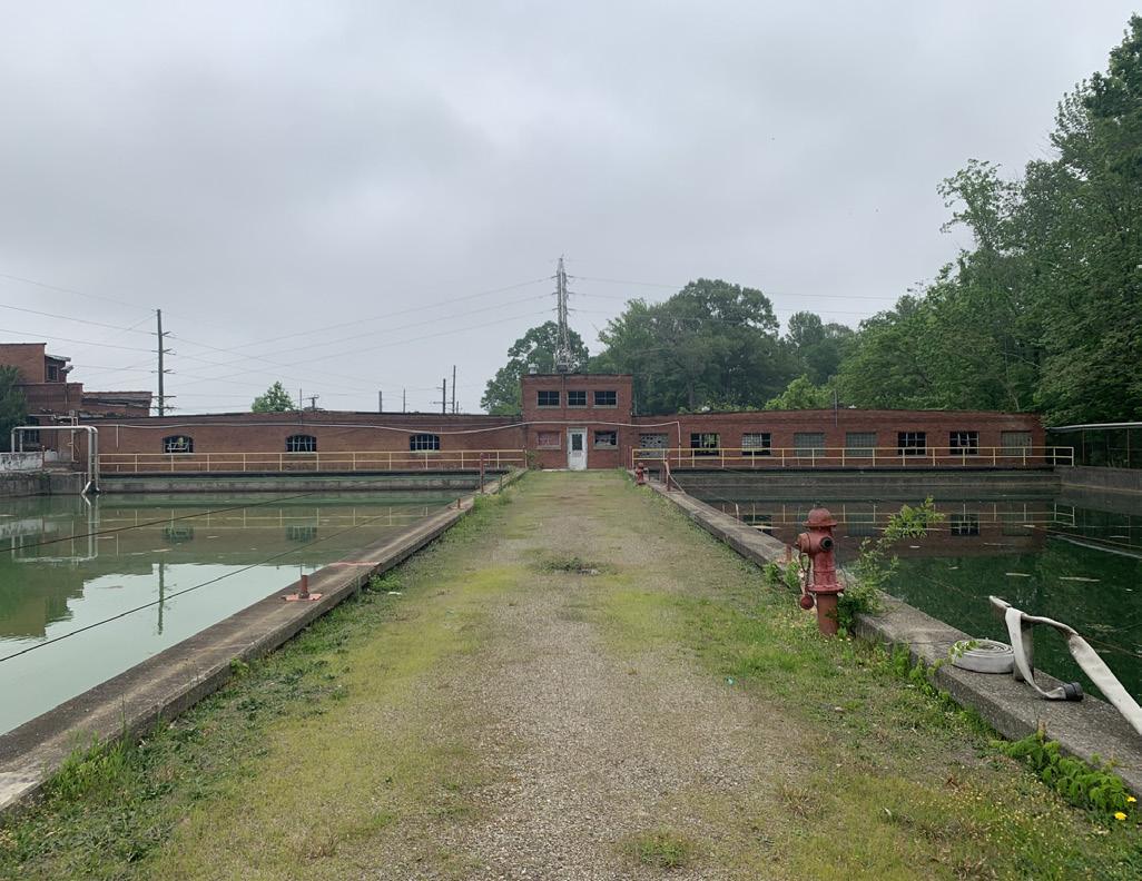
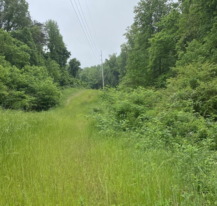
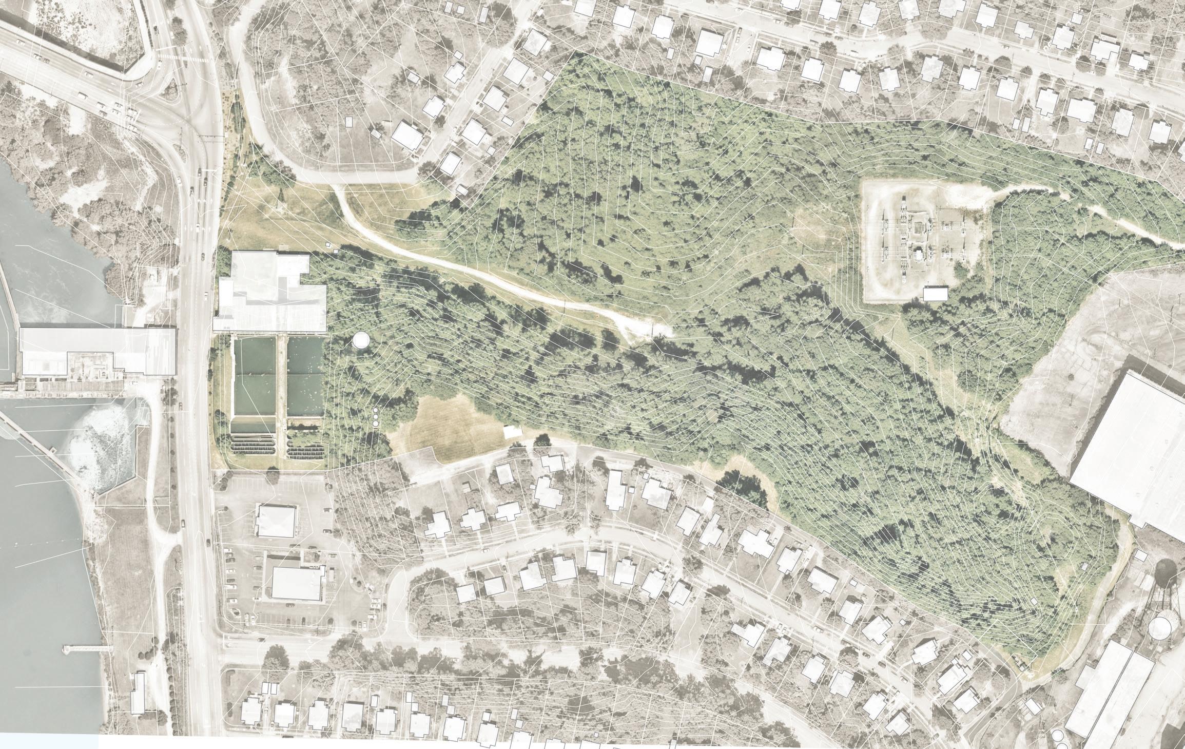
F I gur E 61 | Shopping Center Redevelopment Existing
PLANT
ROBERTSON BRIDGE MEMORIAL DR BISHOP AVE
RD
AVE
FILTRATION
SCHOOLFIELD WOODS
BISHOP
WOOD
SHAPING THE FABRIC 153
CAESARS VIRGINIA
A NEW WAY TO EXPERIENCE NATURE
The conceptual design for Schoolfield Woods & former Water Filtration Plant creates a new immersive natural experience that is framed by adaptive reuse of the historical brick and concrete structure in conjunction with recreational and educational amenities and trails.
+ Adaptive reuse of the Filtration Plant for a mixed-use community oriented development
The former Filtration Plant re-imagined as a destination and amenity will serve as an essential hub for the community as well as a gateway for the Schoolfield Village. The once utilitarian structure can be transformed to include an active venue with a community courtyard to support public and private events; hospitality center orienting users to surrounding amenities, restrooms, and concessions; community center for public gathering; maker-spaces for co-working and learning. As an entertainment venue, it can support community and private events with indoor and outdoor spaces. The new programming opportunities can create a node of activity along Memorial Drive that will extend connections back to the W Main Street corridor, connecting people to the Riverwalk trail and the existing trail systems in Ballou Park.
+ Create a trail system through Schoolfield Woods
A series of new, elevated and at-grade nature trails are proposed to meander through the serene woods with views of a restored stream corridor, connecting visitors between the Riverwalk and the Schoolfield Village. This system would provide important linkages in all directions to connect to surrounding existing and proposed trails and parks (Riverwalk Trail and Abreu Grogan in the north, Ballou Park to the east, W Main Street and the future opportunity at the Reservoir in the south).
+ Provide a nature education center
A nature education center or kiosk could be located adjacent to the woods to provide additional support to the nature preserve and serve as the gateway to the trail system for the neighborhood. Envisioned as a launching point for expansion of existing and future programs offered for families with children, and adults of all ages to have enhanced access to nature and its restorative effects.
+ Build community spaces
While the goal of this site is to preserve the site as a natural area, community parks spaces and gardens are also strategically located throughout the site to activate areas for residents to enjoy a variety of different activities in nature.
+ r estore the stream corridors for natural and recreational purposes
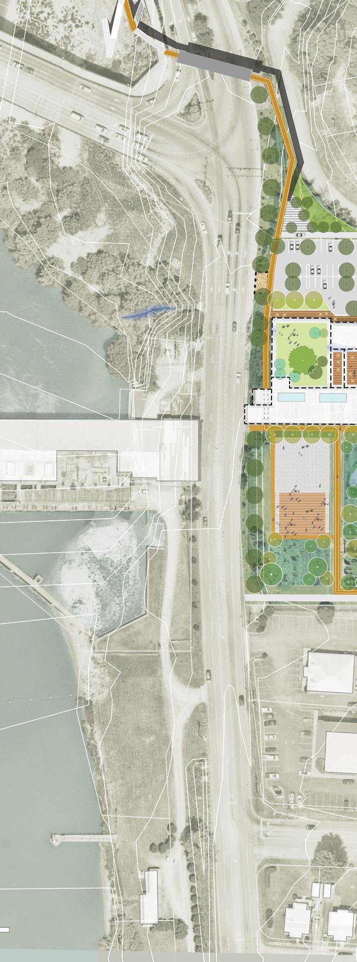
F I gur E 62 | Schoolfield Woods + Filtration Plant Conceptual Site Plan
NOTE: The proposed catalyst sites are conceptual plans and illustrate only some of the many ideas heard during the planning process. The conceptual plans are intended to offer suggestions for future development at these parcels. Additional coordination will be required between parcel owners, the city, and/or private developers to further advance the design and test the economic feasibility. Additional engineering, traffic, and design studies will also be required to advance the concepts prior to implementation.
FILTRATION
PLANT
ABREU GROGAN PARK
RIVER PEDESTRIAN BRIDGE CONNECTION TO RIVERWALK PARKING MEMORIAL DRIVE 154
HYDROELECTRIC PLANT DAN
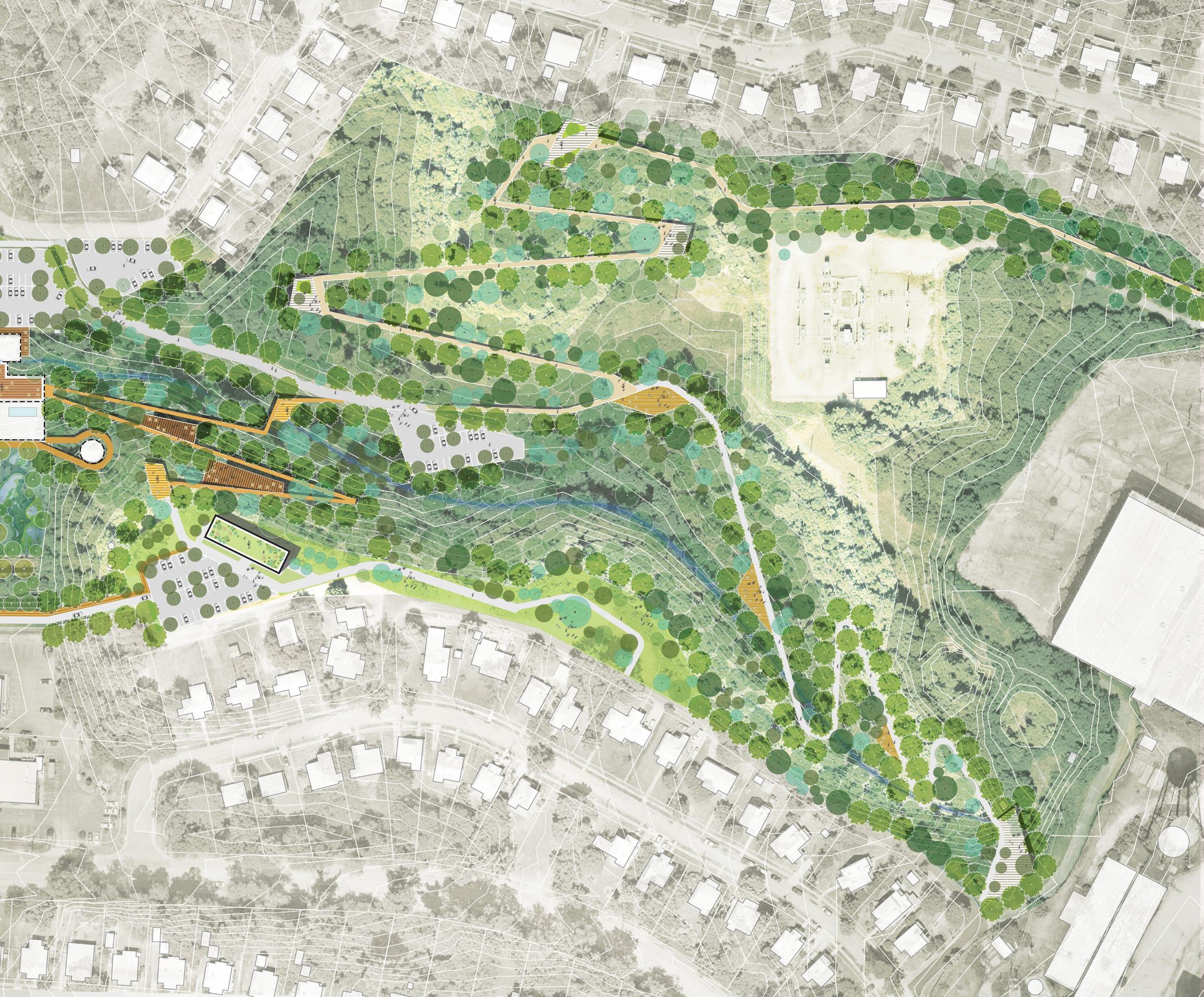
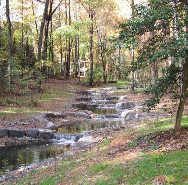
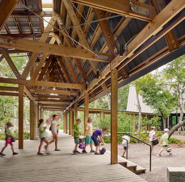
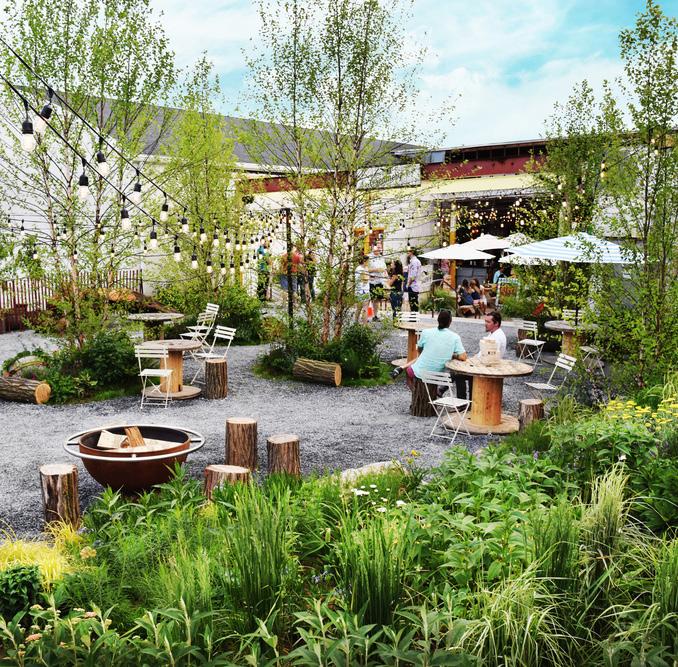
WHAT IT CO u LD LOOK LIKE DaveyResource Group MarineEd.Center/Lake Fla to KennettSquare Creamery / Gr o u n d s w le l FILTRATION PARKING LOT
WOODS NATURE PRESERVE
PARKING
PARKING LOT NATURE TRAIL ELEVATED TRAILS NATUREOVERLOOK NATURE OVERLOOK N S T R E A M R E S T O RATION
SCHOOLFIELD
CAESARSVIRGINIARESORT
LOT
RD
AVE
AVE
EDUCATION &CENTER SHAPING THE FABRIC 155
BISHOP
WOOD
WOOD
NATURE
KEY STRATEGIES:
Create
Restore
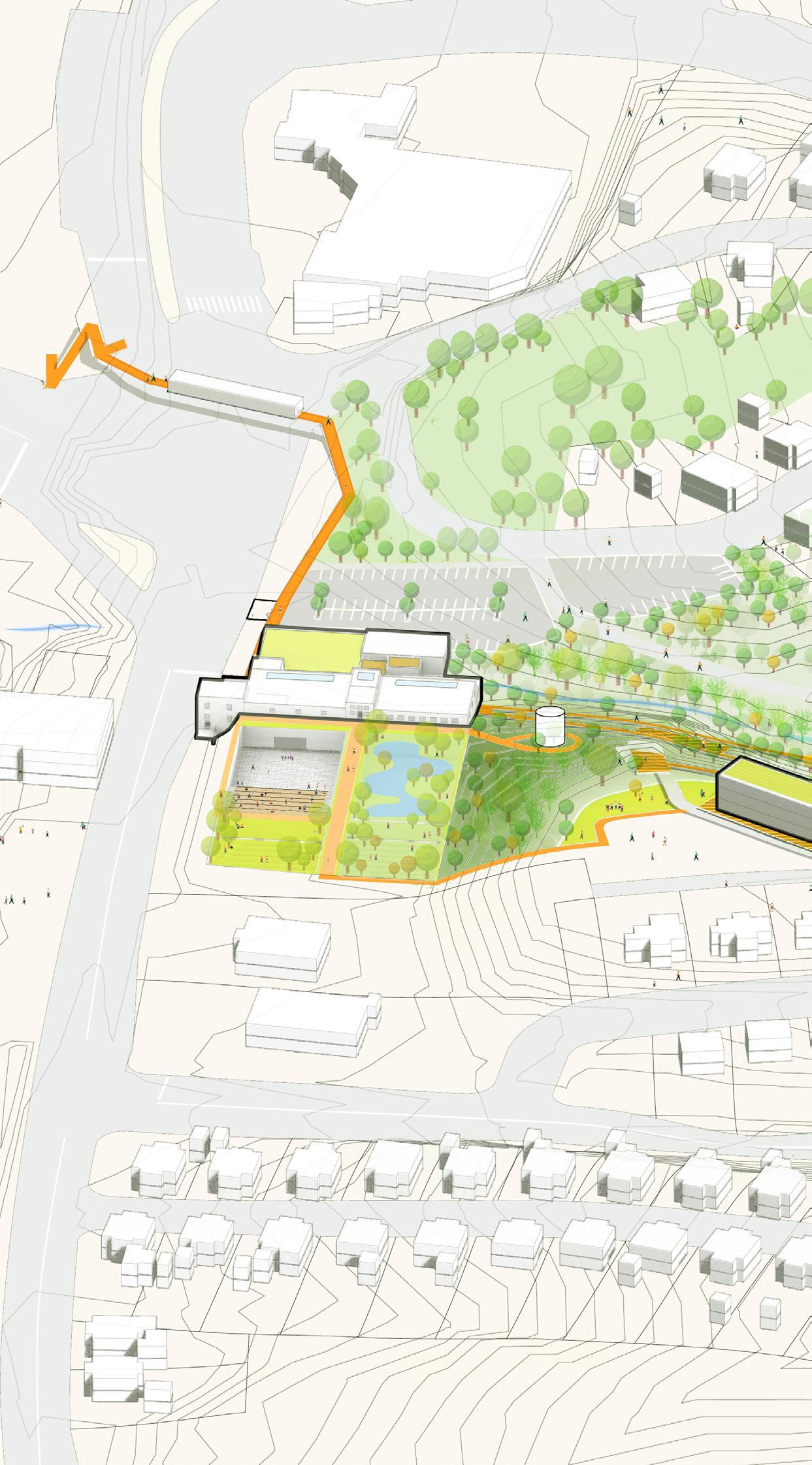
F I gur E 63 | Schoolfield Woods + Filtration Plan Axonometric View MEMO r IAL D r IVE BISHOP rOAD rOBErTSON BrIDgE OAK r ID g E AVEN u E PARKING LOT Adaptive reuse of former Filtration Plant as a mixed use development with amenity spaces 4 4 5 6 7 Native Plants and Water Retention Bioretention and Reduced Impervious Surface
a Nature Education Center
and enhance stream
elevated trails over stream Create nature trail connecting down to W Main Street Provide nature overlooks along the nature trail Create passive open space Preserve Schoolfield Woods Natural Area 5 6 7 8 9 10 11 12 13 Build 2-way bike lane connecting W Main Street and the Riverwalk Trail along Memorial Drive Build pedestrian bridge across Memorial Drive to connect to Riverwalk Trail Improve pedestrian connection to neighborhood / Neighborhood Greenway Connections and connections to Ballou Park 12 13 14 14 1 2
public spaces with public art opportunities
community courtyard in Filtration Plant Incorporate community gathering spaces 1 2 3 3 BISHOP r I V E r W A L K T r A I L C O N N E C T I O N T O B A L L O u P A r K 156
Provide
Create
Create
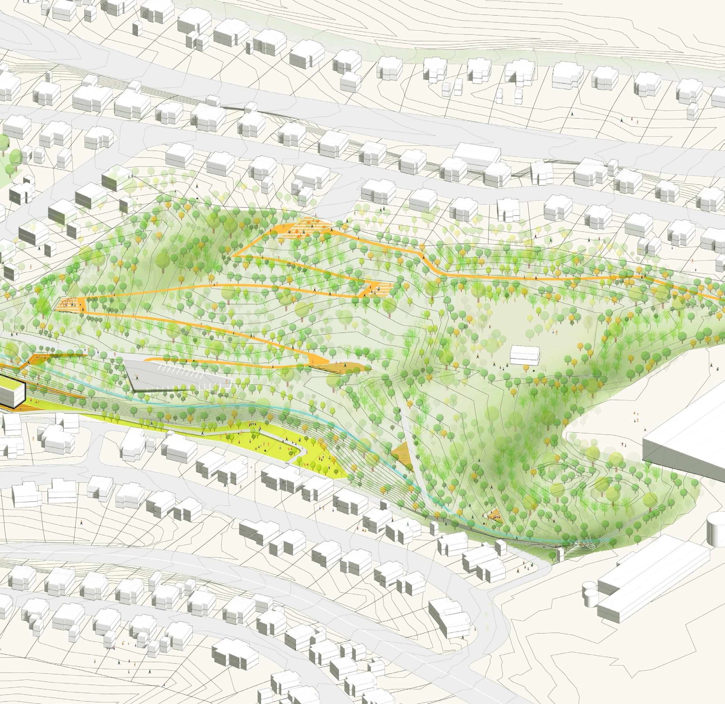
NOTE: The proposed catalyst sites are conceptual plans and illustrate only some of the many ideas heard during the planning process. The conceptual plans are intended to offer suggestions for future development at these parcels. Additional coordination will be required between parcel owners, the city, and/or private developers to further advance the design and test the economic feasibility. Additional engineering, traffic, and design studies will also be required to advance the concepts prior to implementation.
BISHOP AVEN u E
PArK AVENuE
SCHOOLFIELD WOODS NATURE PRESERVE PARKING LOT 6 7 8 8 9 9 9 10 11 14 14 1 14
WOOD
AVENuE BALLOU PARK
SHAPING THE FABRIC 157
The Filtration Plant
ADAPTIVE REUSE
The former Filtration Plant remains one of the few Dan River Textile Mill structures. This utilitarian structure has been relatively untouched with much of the original materials still intact. There are several opportunities to program for both public and private uses. The entire complex would be complementary to the Schoolfield Woods program and utilize the parking and loading areas proposed in the master plan with access from Wood Ave and Bishop Ave.
Structural Considerations
Outdoor Settling Basins
+ The height of the walls and area of the basins would lend themselves to re-purposing for outdoor programs such as an amphitheater or athletic courts.
Roofed Storage Basin
+ The existing roof structure at the northeast clear well can be easily removed to expose the structured volume. As continuous linear retaining structures relying on their heavy foundations for stability, these walls are able to sustain vertical openings to be cut out to allow for pedestrian circulation at the lower levels of the site.
Main Filtration Plant
+ The lower exterior perimeter walls are able to be selectively opened to allow for new circulation through the site.
Roof to the south of the site
+ Approximately at grade with the southern slope is a candidate for becoming an occupied roof. The existing roof structure will likely need to be strengthened and new light columns inserted to support an assembly loading and possibly a light pergola.
158
Potential programming
Around new open-air courtyard at existing clear well:
+ Event space for up to 150 people
+ Food and drink vendor spaces
+ Maker spaces
+ Occupied roof decks
+ Co-working/community learning space
Main Building
+ Dedicated tenant space
+ Office space to support program at Schoolfield Woods
+ Co-working / community learning space
Basins at southwest entrance
+ Utilized for active play (e.g., batting cages, lawn bowling, etc)
+ Entertainment Venues with an amphitheater (e.g., music venue, movies, outdoor theatre productions, etc.)
+ Public gathering spaces with water features and green areas
Note: All new program will require code review to evaluate for egress and accessibility requirements. Supplemental egress may be required.
Considerations
Based on the previous use it is anticipated that there are few environmental issues; however, a Phase 1 Environmental Site Assessment (ESA) is recommended along with a decommissioning of the structure and confirmation that is has been disconnected from any existing outside structures including the Hydroelectric power plant and former Dan River Textile Mill.
+ All new mechanical, electrical, plumbing and fire protection will be required
+ A comprehensive structural review is recommended to support the proposed program
+ Supplemental egress may be required when modernizing
+ Existing windows and exterior openings may need to be replaced or modernized for utilization and energy efficiency
+ Exposing existing original structure where feasible is recommended
+ New finishes to complement the existing historic fabric is recommended
+ The existing roofs should be evaluated for repairs or replacement as well as upgrades for energy efficiency

IT CO u LD LOOK LIKE
Arq u i t e c t u r a
an d In t e r i o r s PhiladelphiaDistilling /Bernar do n SHAPING THE FABRIC 159
WHAT
La RuinaParkBar/Tamen
Bar Takito/D+KArchitects
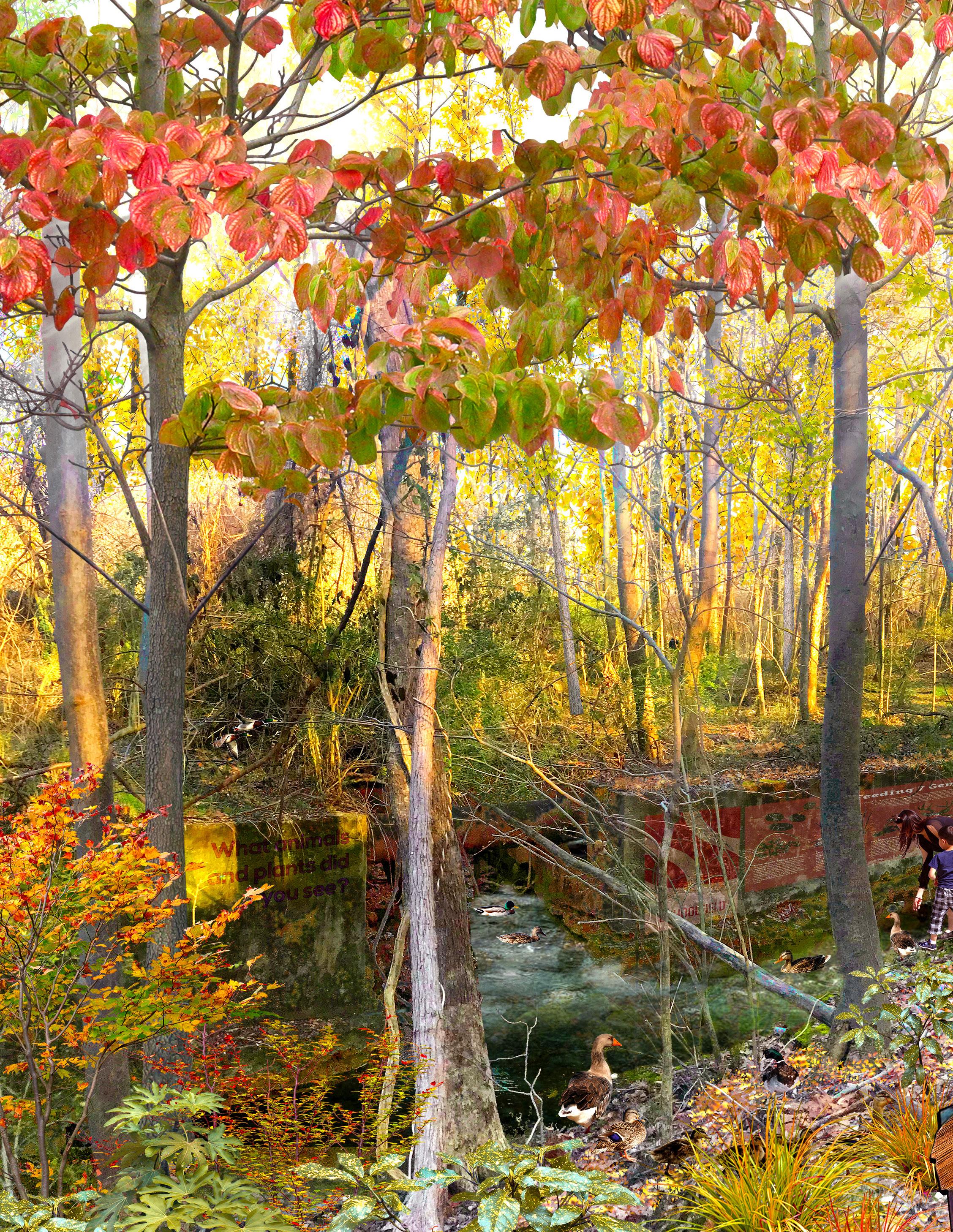
The Experience
Enhanced access to natural areas, trail connectivity, and stream restoration were some of the most exciting opportunities identified in the engagement process. Schoolfield Woods conceptual design facilitates a new immersive experience around nature education and recreation, with enhanced pedestrian and trail connectivity, and opportunities to engage with native habitats and ecology.
160
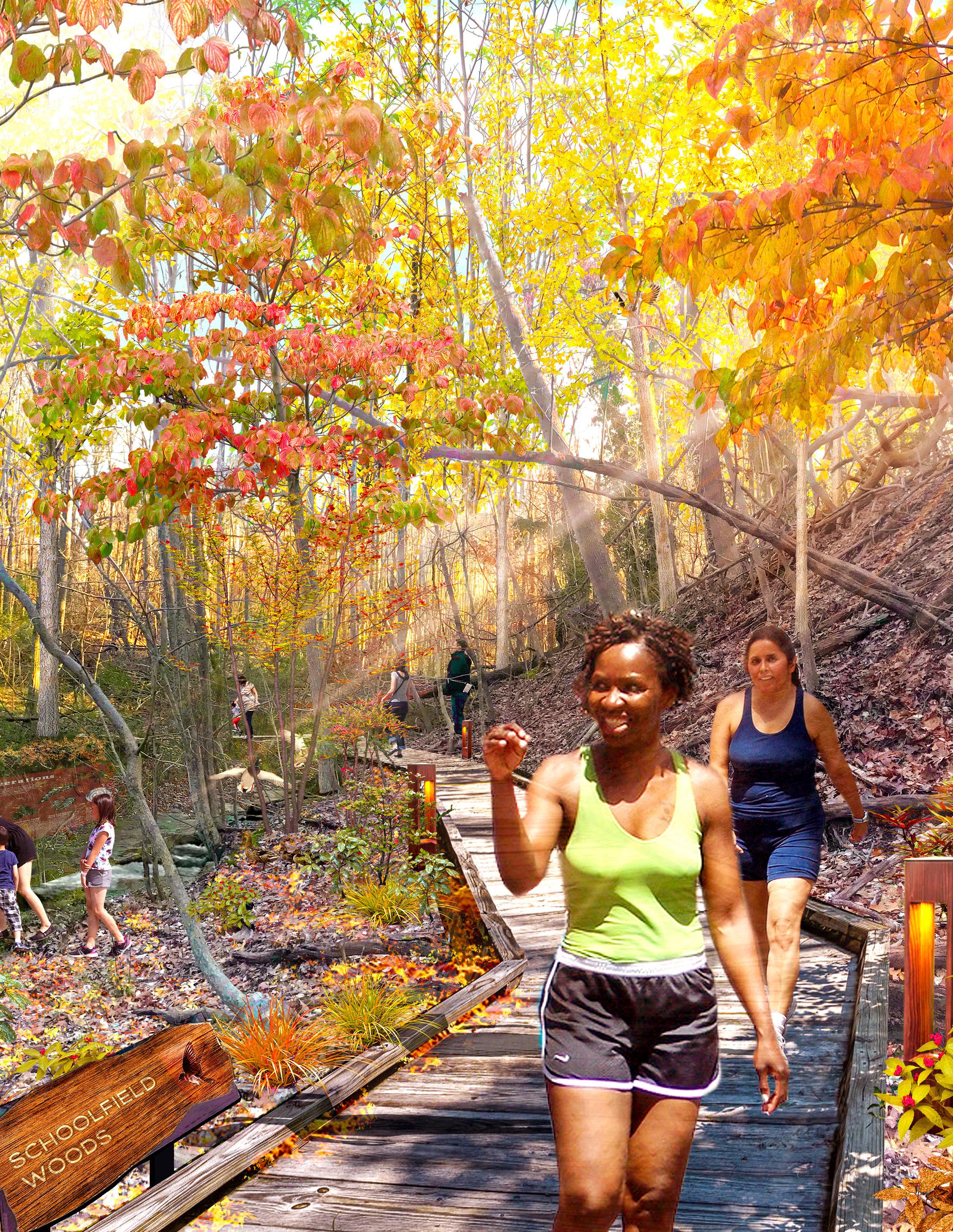
SHAPING THE FABRIC 161
Future Opportunity Sites
The following sites were identified during the planning process as areas of opportunity but not explored further as part of this district plan.
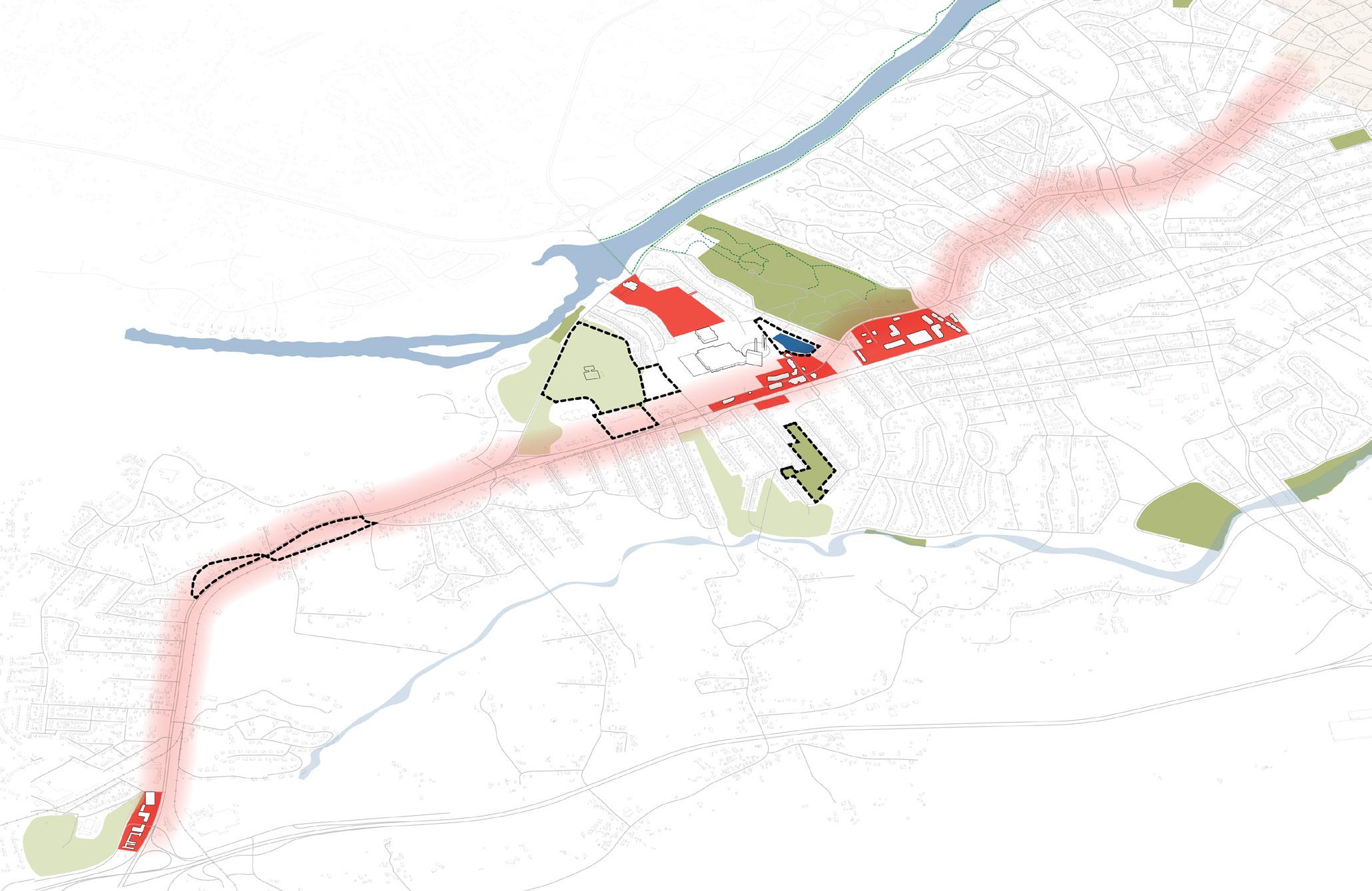
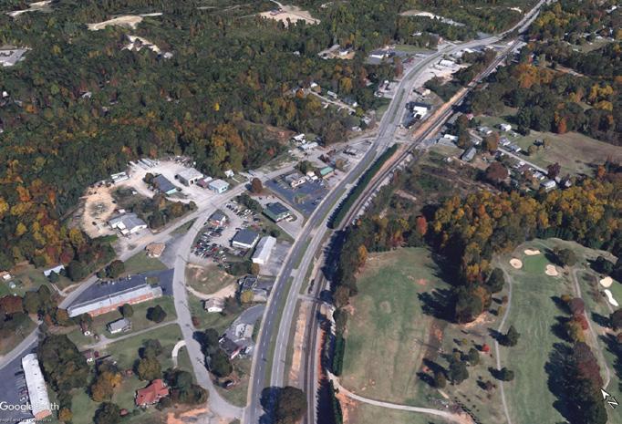
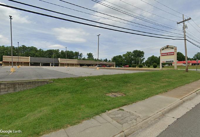
A cluster of parcels presented as a potential catalyst site but not developed further as part of this district plan due to low interest from the community and lack of site control.
Potential Uses: multi-family or senior housing, expanding Go-Kart race track and creating more activities for children and families, expanding community gardens, incorporating sculpture gardens, and building safer street and rail crossings to connect to surrounding neighborhoods.
An existing shopping center on W Main Street adjacent to Caesars Virginia and Schoolfield Elementary, this site is largely vacant and underutilized.
Potential Uses: the site is well suited for mixed-use development with retail, commercial, and residential to complement the surrounding uses.
1. The Bend
2. Dan r iver Plaza
F I gur E 64 | Future Opportunity Sites
1 2 3 4 5 6 162
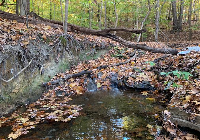
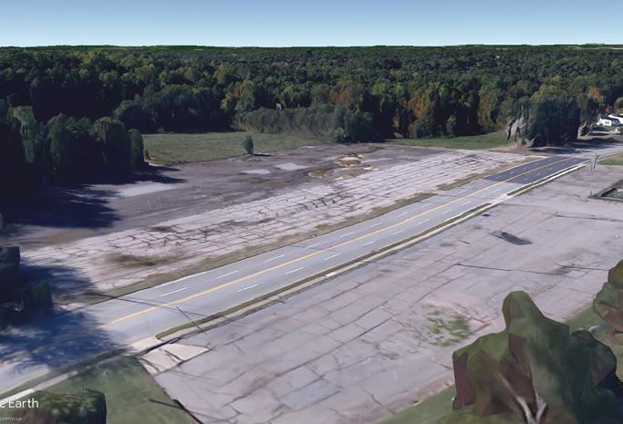
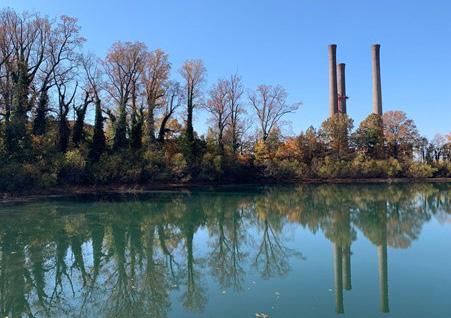
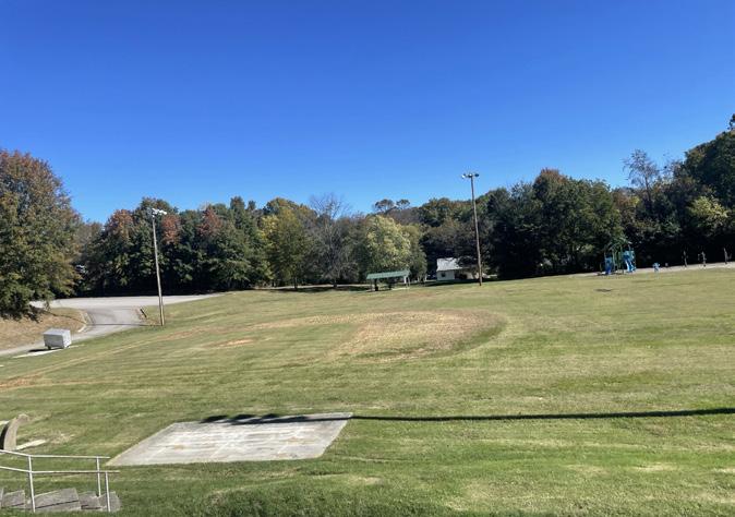
3. Site Surrounding New Police Headquarters
Catalyzed by the adaptive reuse of Dan River Mills Executive Offices for Danville Police HQ, this site spans between W Main Street and Memorial Drive with natural resources including a stream corridor.
Potential Uses: link between Schoolfield Village and Dan River to expand the recreation and trail network in the district, connecting the proposed Schoolfield Trail to Abreu Grogan Park and the Riverwalk Trail.
4. Bishop r oad
Owned by the IDA, this parcel is currently vacant and is located on the corner of W Main Street and Bishop Road, across the street from Caesars Virginia.
Potential Uses: the site is well suited for mixed-use development with active ground floor uses (restaurants, retail, etc.) that would complement the casino and destination, while providing more housing options for residents.
5. r eservoir Area
Owned and operated by the City of Danville, this small waterbody is centrally located between two major activity centers and two large nature and recreation areas.
Potential Uses: the site can be an integral connection between the natural preserve at Schoolfield Woods to the community centered Ballou Park. There is an existing riparian buffer that with restoration and additional accessways can became a public amenity. Note: these potential uses are dependent on the waterbody continuing to operate as a reservoir.
6. Hylton Park
Tucked away at the southern end of the historic Schoolfield Village, Hylton Park is underutilized and has great potential to be revitalized to become an asset to this community.
Potential Ideas: stream and ecological restoration of the existing patch of woodlands and stream connecting to Rutledge Creek.
Note: Hylton Park is on the Parks & Recreation Department’s list of neighborhood parks to be revitalized through a resident-driven design, the process is anticipated to begin in 2025.
SHAPING THE FABRIC 163
IN THIS CHAPTER:
+ The People + The Village
+ Housing
+ Livability & Sustainability
+ Arts & Culture
+ Parks & Open Spaces
07
164
Restitching the Village
The Historic Schoolfield neighborhood, or “Village,” consists of over 500 of the original mill village homes and a community with deep connections to the site and neighborhood. This section explores opportunities on how to leverage the assets of the community and mitigate the challenges that are arising for neighborhood residents as the district faces major transformation. The neighborhood plan offers strategies on how to improve residents’ quality of life while maintaining affordability, accessibility, and preservation of community and culture.
RESTITCHING THE VILLAGE 165
The People + The Village
Home to the people and stories of the past,
Schoolfield Village is the lifeblood of the district. This plan strives to preserve the heritage and culture of the historic Schoolfield Village while also creating a resilient community that will continue to thrive and adapt for future conditions. The neighborhood plan proposes strategies on how to create a welcoming community for people of all ages and abilities to live, work, play, and thrive. Strategies are focused on improving the lives of existing and future residents through physical improvements that make Schoolfield an attractive place to live, while also addressing concerns around long-term affordability, accessibility, and preservation.
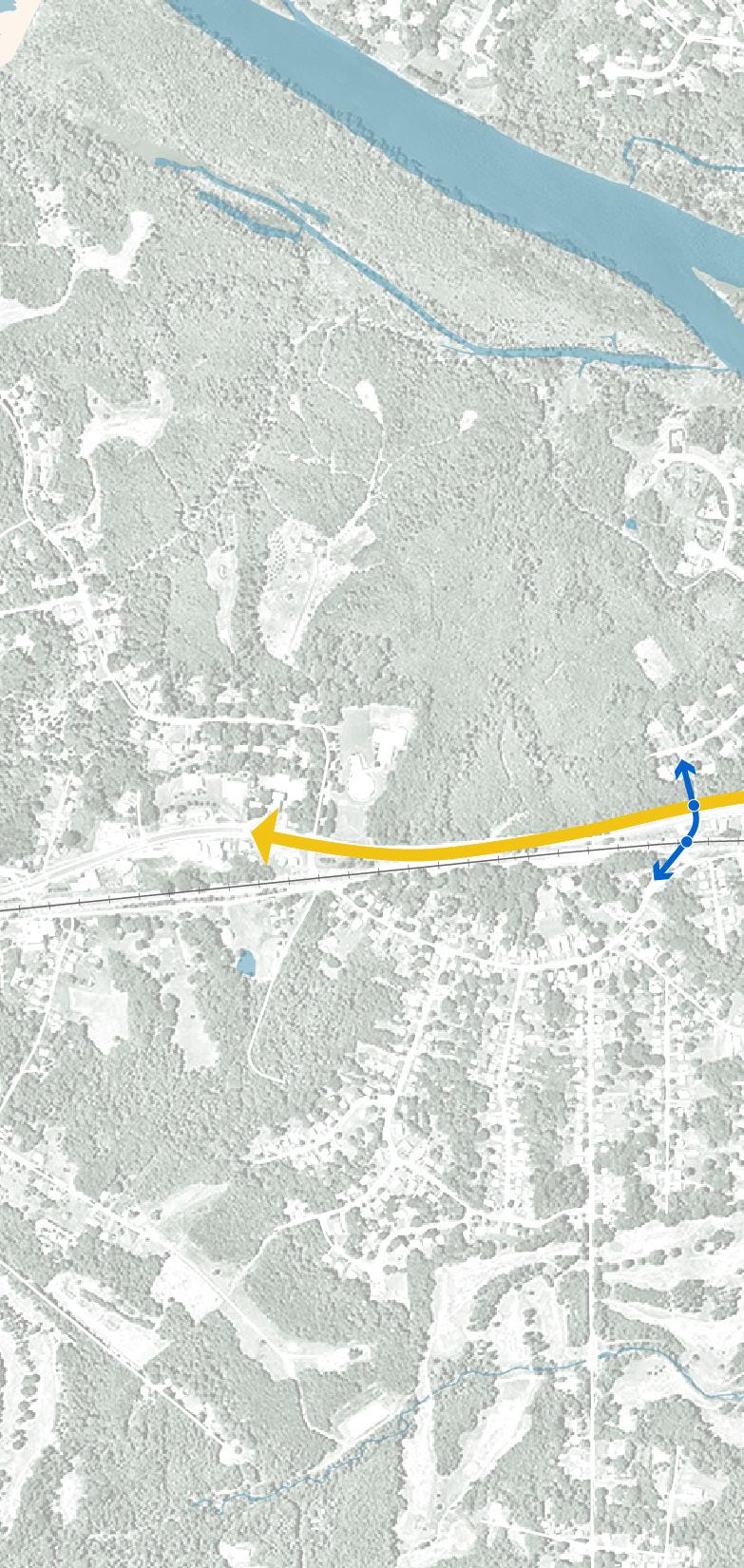
REZONE UNDERUTILIZED COMMERCIAL OR VACANT COMMERCIAL FOR MIXED USE to provide more housing options and amenities for residents
WAYFINDING + SIGNAGE branding
IMPROVED VEHICULAR + BICYCLE MOBILITY along W Main Street
INTERSECTION IMPROVEMENTS
SCHOOLFIELD TRAIL with historic and natural interpretation throughout
Neighborhood Strategies
F I gur E 65 |
166
MEMORIALDR
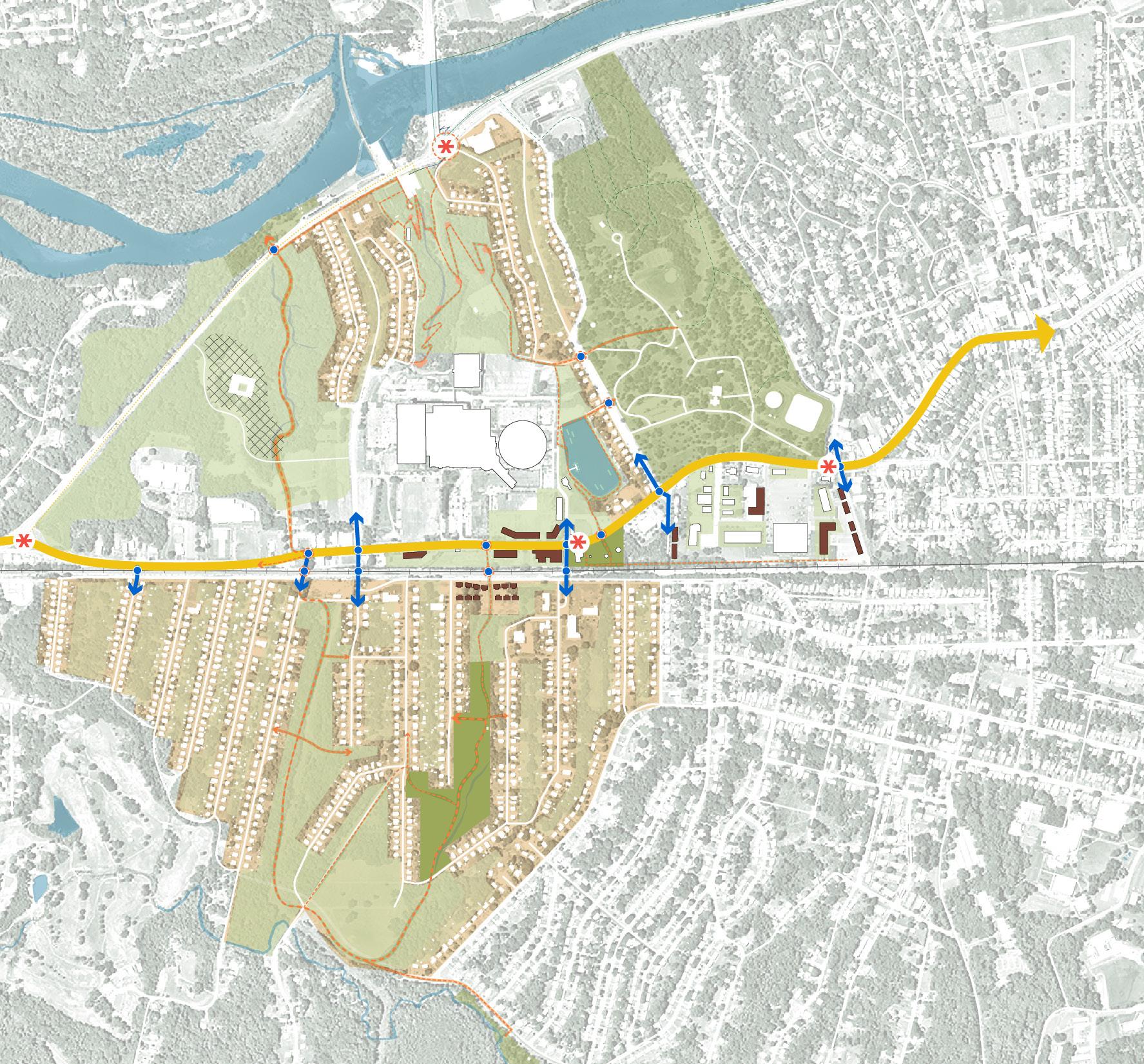
PARK AVE
RESERVOIR LOOP
MIXED USE retail, grocery, housing, and neighborhood amenities
FOUNDERS PARK honoring the history and founders of Dan River Mills
SENIOR VILLAGE
PEDESTRIAN TUNNEL
HOUSING STABILIZATION / REVITALIZATION PROGRAMS provide residents with support and resources for home maintenance and rehabilitation and to avoid displacement
W MAIN ST
PEDESTRIAN BRIDGE connection to riverwalk
BALLOU PARK TRAIL CONNECTION
HYLTON PARK STREAM RESTORATION + RECREATION ASSETS
SCHOOLFIELD WOODS stream restoration + recreation assets
RESTITCHING THE VILLAGE 167
BALLOU PARK
Housing
Since 2014 a number of housing studies have identified key issues and needs within the Danville housing market. The recent Danville Housing Strategy (2022) provides a very deep analysis of the present Danville housing market. What is clear from the Housing Strategy (Danter study) and echoed by the prior studies is there is a lack of housing development in Danville that has pent up the demand for more housing. The Danter study as well as the prior work proposed a series of recommendations that will encourage a supply-side ecosystem (developers, lenders, mortgage products) to develop and ultimately provide housing unit creation. A citywide housing plan (expected to begin in 2023) will provide a comprehensive zoning plan, trust plan, temporary housing options, and recommendations on support and protection for existing community residents.
The analysis for Schoolfield Corridor supports the general findings and directions of the recommendations from the previous studies. The Schoolfield District Plan amplifies these previous policy directions by providing more specific actions that can apply to the Schoolfield area.
Citywide Need DEVELOP MORE HOUSING STOCK
1. Provide housing options that meet the needs of current and future residents (e.g., senior housing, workforce housing, multi-family, etc.).
2. Support the Danville Housing Development Corporation to develop of a mix of housing units to spur the market.
3. Rezone underutilized commercial or vacant commercial for mixed use.
4. Acquire and prepare strategic sites for housing development.
5. Promote reuse of existing structures to provide greater housing choice.
168
KEY SCHOOLFIELD DISTRICT STRATEGIES
Expand the role of Danville Neighborhood Development Corporation (DNDC) to develop missing middle and selected market rate single family housing projects.
This recommendation supports the 2022 Housing Strategy finding about the lack of a local builder community willing to develop single family housing. The DNDC is working on expanding its development role to include missing middle housing and some market rate units, beginning with a new development near Danville Community College. DNDC could expand its reach by adding a second service area in Schoolfield, if aided by additional financial support from the city.
The intent is to “prove the market” with comparison sales that can support these developments and encourage developers and ultimately support credit underwriting. A non-profit housing development corporation should be created to take this on if the DNDC cannot support or take on this role at this time.
+ The Neighborhood Development Corporation needs to be more active in the housing market & establish a Housing Trust (with resources and funding to do so).
Missing Middle Housing Spotlight
Danville has had little new housing added to the market over the past two decades, and has significant gaps in the housing continuum, especially in move-up apartments and move-up single family homes (Housing Strategy, 2022). In addition to attracting developers and builders that will meet the housing need, the city can also evaluate its zoning code for any unintentional barriers standing in the way of “middle housing” (e.g., full range of housing types from small lot single-family to three and four-plexes, parking requirements, maximum density, minimum lot sizes).
RESTITCHING THE VILLAGE 169
Institute a series of initiatives to reduce the cost and risk for private housing development
Echoing the 2022 Housing Strategy recommendations, a series of actions need to occur to support private housing development. Actions can include creating financial incentives for builders and reducing regulatory uncertainty.
Specifically, these should be considered:
+ Develop ready-to-build lots that have the requisite infrastructure and entitlements. An economic development entity or a housing corporation could take on the role of securing the necessary permitting and land development. The pricing and disposition process for the lots could be used to support providing housing at various price points needed in the community.
+ Create a pre-approved pattern book for housing styles and typologies. The Schoolfield area could be an excellent demonstration district for this type of approach.
This idea would include:
+ Exterior design templates and architectural drawings to reduce development costs. The city would go through a design review and approval process and link the use of pre-approved designs for by right fast track development
+ Create low cost gap financing that can support development of infrastructure, model homes, or construction financing. The specific financial products offered by this vehicle should be developed in conjunction with input from bankers and developers about where there are financing gaps, risk profiles are too large or other related issues that make financing more expensive.
+ Evaluate a district-wide financing approach for infrastructure:
+ Tax Increment Financing Approach. The major question is whether this is a reimbursement / rebate project specific payment model or a district-wide borrowing in anticipation of future increment to address the district scale infrastructure improvements that may be needed
+ Community Development Authority: Enabled by Chapter 51 Title 15.2, the CDA provides funding and management framework to support development or significant redevelopment. The structure is approved by the city but sits outside of city government financially and administratively. The financing mechanism is either a special assessment or a special tax which is capped by state law.
Neighborhood Pattern Book Norfolk, VA Spotlight
The City of Norfolk, VA has developed several pattern books that serve as resources to residents and property owners looking to repair, rebuild, or expand their homes. The guides provide reference to traditional architectural found in Norfolk in various context - e.g., downtown and along the coast. The pattern books include: building siting, architectural styles (eaves, porches, windows, doors), principles for landscape spaces, resiliency, and application of the guidelines.
170
Create a form-based code and housing design templates based on the historic village to help reduce development costs and retain the historic character of Schoolfield Village.
In coordination with the development of a pattern book, consider a form-based code or overlay to be added to Danville’s zoning ordinance. Form-based codes focus on form of buildings and their relationship to each other and the street, rather than on use or density alone. Often used to promote walkability, compact development, and historic preservation / compatibility, form-based codes can be customized to fit the character of Schoolfield Village and the community’s vision. Form-based codes also address the width and design of streets, and relationship to public open spaces and buildings. Rather than adding a layer of complexity, the form-based code and design templates should be used to provide guidance for developers and property owners that reflects the community’s vision. These form-based standards can be incorporated into Danville’s zoning ordinance.
Colombia Pike Optional Form Based Code Arlington, VA Spotlight
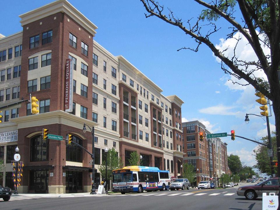
In 2013, Arlington adopted a Form Based Code for its special revitalization district with the purpose of strengthening its residential neighborhoods and mixeduse commercial centers; expanding affordable and diverse housing options; and preserving neighborhood character, historic buildings, and tree canopy. The Code includes standards for building envelope, design, and relationship to the street and neighborhood. Though optional in use, the County Board may approve additional height and density for certain areas of the district. In Arlington County, the use of the Form Based Code with the Columbia Pike TIF District has been successful in preserving existing affordable housing and encouraging diversity and a range of new housing, including affordable units (ULI).
RESTITCHING THE VILLAGE 171
Citywide Need REDUCE RISK OF DISPLACEMENT & SUPPORT AFFORDABILITY
1. Supply residents with resources to help avoid displacement and negative impacts of development pressure.
2. Utilize code enforcement to discourage blight from abandoned homes or neglected homes.
KEY STRATEGIES
Consider instituting a tenant right of first refusal to purchase ordinance
As a way to manage risk of displacement specifically for renters, several communities (none in Virginia but there are examples in Maryland) have put in place renter protections related to the sale of properties. These ordinances require landlords to either provide a right of first refusal for the sale of a property or an opportunity to respond to an outside offer by a tenant opportunity to purchase (TOTP). Virginia law (Title 55.1 Ch 16) does not expressly prohibit these types of initiatives from being in a lease agreement; however, it’s not completely clear if it can be mandated by a local government.
There are many considerations to be addressed including length of the provision, its application to all forms of rental housing, triggering conditions, and defining a qualified offer from a tenant. Also, there are considerations for the impact this may have on the rental housing market in Danville including new development. The Neighborhood Development Corporation needs to be more active in the housing market & establish a Housing Trust (need resources and funding to do so)
3. Create funding sources to support home maintenance and rehabilitation for residents.
4. Scale up housing rehabilitation programs and resources of Danville NDC.
Encourage creation of a Housing Trust to help maintain levels of affordability and reduce risk of displacement
Housing Trusts are non-profit organizations that own housing and the underlying land. They are designed to provide affordable home ownership opportunities through a number of tools such as deed restrictions and land lease agreements, among others. One of the principal benefits of the Trust model is that it removes the purchase of the underlying land from the financing needs of the home, helping to reduce the costs. Trusts also own and manage rental housing. There is one statewide community land trust in Virginia, and there are three community land trusts (Charlottesville, Richmond, and Newport News). Given the history of how housing was provided in Schoolfield, a Trust model may serve as an important tool in preventing displacement, preserving affordability, and also serving as an homage to Schoolfield’s past.
The trust would need financial resources and management infrastructure to launch and acquire properties. Alternative to creating a local trust, Danville could work with the Virginia Statewide Community Land Trust or Danville NDC land bank to provide land and potentially housing for a Trust.
172
Develop a tax abatement program to support improved NOAH housing stock
The mixed quality of housing in Danville is well-documented. However, Danville’s housing is also inexpensive. This Naturally Occurring Affordable Housing (NOAH) is an important asset in managing against the risk of displacement and managing continued affordability in the community. This abatement would be oriented toward infill rehabilitation and replacement of residential housing stock (single family and multifamily) and affordability. A number of communities in Virginia have adopted similar approaches.
Key design goals should include:
+ Qualify the abatement on major rehabilitation or teardown new construction
+ Minimum structure age
+ Rehab abatement based on minimum value increase to the property, e.g. 40%
+ Abatement of the taxes associated with the value increase with gradual step increase to reduce exemption
+ e.g., 5 year full abatement with graduated abatement reductions over another 5 years
+ Provide limitations on increase in square footage in older neighborhoods unless an additional lot has been acquired
+ Tie the abatement to the property
EXISTING RESOURCES FOR HOMEOWNERS
The City of Danville has several existing programs and tax relief programs to assist lowincome, elderly, and disabled residents with tax assistance, find a path to homeownership, and help with housing rehabilitation. Homes in the Schoolfield Historic District are also eligible to apply for historic tax credits to help with home maintenance and revitalization efforts.
+ Elderly or Disabled Tax Relief Property tax relief for residents 65 years or older or have been determined permanently and totally disabled. Filed annually with the city’s Tax Relief Official.
+ Lease Purchase Program a rent to buy program for low- and moderate-income residents to continue to rent for up to 24 months, with rent going towards the down payment and enrollment in homeownership counseling program.
+ Down Payment Assistance on up to 50% of lender required down payment for low- and moderate-income residents buying a home in the city.
+ Housing Rehabilitation a 0% interest loan to help low- and moderate-income homeowners with home renovations, including leaking roof, heating, plumbing, and electrical.
Champlain Housing Trust Burlington, VT
Based in northwest Vermont, the community land trust focuses on strengthening communities through development and stewardship of permanently affordable homes and related community assets. Champlain Housing Trust supports people searching for homes (to rent and for homeownership), offers lending and loan programs, and several education and supportive classes on home buying and homeownership. In addition to direct services, the Housing Trust is also involved in advocacy to ensure that residents can continue to have public programs and support from all levels of government (local, state, and national).
Spotlight RESTITCHING THE VILLAGE 173
Livability & Sustainability
Commonly defined as the ability of a community to recover from a natural or manmade disaster and prepare for future disruptions and change – the Danville community has shown its ability to adapt to economic and cultural changes over time, while preserving what makes the community special.
Citywide Need INCREASE COMMUNITY RESILIENCE
1. Develop a citywide strategy to manage untreated stormwater from impervious surfaces (parking lots, buildings, roads, etc) with green infrastructure.
SOCIAL
Improve community bonds and strengthen the neighborhood identity. Building an inclusive future for the village that celebrates the history and heritage of place, and supports the future generations is essential for community growth and success. The introduction of public art, murals, local food, interpretative signage, and places and opportunities for events and regular gatherings will help to strengthen and build those neighborhood connections. Additional ideas from the community include developing an organization or partner to set up regular community activities (e.g., Friday night dancing with Seniors, High School alumni events).
2. Strengthen and create new village nodes and community destinations.
3. Provide neighborhood-focused amenities that serve the needs of residents.
Improve and provide more social services and support to residents.
The community expressed the need for more support for people experiencing homelessness, temporary or transitional housing solutions, strategies to help renters and homeowners stay in their homes, and mental health services – especially as the economic and social impacts of the pandemic remain. Local support organizations like House of Hope should be engaged in expanded programs and services for those in need.
174
ENVIRONMENTAL
Assist Schoolfield residents in making energy retrofits to historic homes.
The older, mill homes found in the Historic Schoolfield District were built in a compact, mixed-use pattern that provided easy access, connection to their neighbors, and affordability for residents. However given the age of many of the neighborhood homes, the majority are in need of upgrades –from minor exterior repairs to major structural improvements. As residents age it becomes more difficult for them to keep up with reapirs and retrofits. The Danville Utilities Home$ave program currently provides a rebate program to support all residents in making energy-efficient upgrades to housing. Pittsylvania County’s Weatherization Assistance is an example of a program that offers support for low-income residents preventing displacement. Creating a similar program for historic homeowners in Danville would help families age in place while building equity in their homes.
Strengthen green infrastructure functions throughout the Village through public right of way improvements.
Green infrastructure can not only provide robust stormwater management solutions, but also contribute to the unique character and identity of neighborhood streetscapes so that pedestrians and cyclists are comfortable and protected from vehicle traffic. When a public ROW is car-dominated, it leaves little room for other uses within the public realm, promoting impervious surfaces and encouraging vehicle usage. Eliminating and narrowing vehicle lanes can create space and opportunity for green infrastructure strategies that facilitate biophilic design, support environmental stewardship goals, and create valuable ecosystem benefits for the community.
Complete incremental transition to underground utilities.
Overhead utilities are unsightly, require space, and are susceptible to damage from various hazards. There is an opportunity to reroute these utilities underground in order to improve views, make space available in the public realm for active mobility and green infrastructure, and improve the long-term resilience of the utility system from damage. This can greatly improve a neighborhood’s visual character and ensure a more reliable utility service.
RESTITCHING THE VILLAGE 175
Spotlight
Ozarks Small Business Incubator
West Plains, Missouri

Supported by LISC and the SBA Community Navigator Pilot Program, OzBI was formed with the mission to help business grow, the Ozarks Small Business Incubator is a one-stop resource and community for entrepreneurs and business owners at all stages of business development. OzSBI supports small businesses and entrepreneurs with essential services and mentorship to help start, grow, and improve their businesses.
Programs and support include:
+ Workshops and trainings
+ One-on-one mentoring with business leaders
+ Microloans
+ LaunchU guidance on how to start a business
+ Workspaces all inclusive office spaces at a fixed rate
ECONOMIC
Provide flexible office and retail space for small businesses and the tourism industry.
Offer diverse types of office, co-working, small retail spaces for pop-up businesses with amenities and short-term options to support growing businesses and tourism-related businesses.
Support existing local businesses with resources (e.g., marketing, incentives, etc.).
Expand local business support to Schoolfield Village, which can include technology, facade improvement support, and marketing materials. Additional support could include communications, events, and networking.
Encourage the development of a hospitality and culinary program to support the city’s growing hospitality and tourism industry.
The city’s advanced manufacturing training facility and program is a national leader. Attention should be given to developing a hospitality program (culinary, management, experience design) that develops appropriate technical skills. Given the growth in this sector ensuring a local labor pool is critical to continued growth viability in the River District as well as supporting the Casino.
176
Citywide Need SUPPORT HEALTH & WELL-BEING
1. Increase access to healthy, affordable, local foods & groceries.
2. Connect existing and new parks with greenways.
3. Restore streams and improve quality of water within the District.
Community design and neighborhood planning directly impact community health – from how we design our indoor and outdoor environments, access to services and amenities, availability of fresh food, use of parks and trails, and vulnerability to hazards. The plan’s approach to Restitch the Village aims to improve active connections, create new trails and opportunities for recreation, imrpove housing quality, and expand vegetation and green infrastructure to contribute to overall community health. Residents are in need of more grocery and fresh food options (e.g,. expanded grocery at Ballou Park) as well as new local options. Health Care and Social Assistance is the largest employment sector in Danville today, with Sovah Health as a regional academic hospital and community healthcare hub. Many health services are located on the Main Street corridor close to the River District. Danville’s recently completed Children & Youth Master Plan outlines a number of relevant community strategies that should be incorporated into the Village plan – including reducing barriers to food access, providing access to mental health supports, and building supportive peer and family relationships.
4. Improve trail connectivity.
5. Attract specific community-desired uses and services for current and future residents (grocery, daycare, health services).
CHILDREN & YOUTH MASTER PLAN
Completed in October 2022, the Children & Youth Master Plan creates a roadmap for how city government, schools, and the community can work together to ensure all children in Danville have the opportunities and resources necessary to thrive from cradle to career.
The Master Plan focused on 8 topics: Safety & Security; Cognitive Health; Mental Health; Physical Health; Purpose; Community; Relationships; and Environment. The plan outlines recommendations related to each with details on what the scope of work will entail, next steps to implement, prioritization and timelines for implementation, as well as lead agencies for execution and accountability.
RESTITCHING THE VILLAGE 177
178
Spotlight
Crime Prevention Through Environmental Design (CPTED)
Crime
Prevention
Through
Environmental
Design
(CPTED) strategies are recommended to address rising concerns around visitor safety and comfort using open spaces and trails throughout the district. CPTED is a multi-disciplinary approach to crime prevention using design strategies to deter crime and fear of crime.
+ Natural Surveillance
Maximize “eyes on the street” to allow residents and users to observe public spaces throughout the day and evening. This could be achieved through lighting, landscape, clear sightlines, and other design features that enhance visibility.
+ Territorial Control
Encourage activity and sense of ownership of public spaces for residents and stakeholders to help keep places more active and cared for, making it difficult for unwanted activity to occur. This can be reinforced through activities and programming such as food trucks/vendors, community supported uses, playgrounds, etc.
+ Natural Access Control
Create clear boundaries to keep unauthorized persons or activity out of a particular place. This can be done by minimizing blind spot by paying close attention to door locations and frontages, fences, shrubs, and placement of other physical features.
+ Maintenance and Management
Continued upkeep and maintenance demonstrates oversight and care of a space, while reinforcing a sense of communal stewardship. If a place looks like it is cared for and regularly used, it will deter unwanted activity.
RESTITCHING THE VILLAGE 179
Arts & Culture
Public art used to integrate culture and historic interpretation can be a powerful tool to unite community and attract visitors and investment within Schoolfield. Danville has a rich arts and culture community, particularly in the River District, that can be extended down through W Main Street and the Schoolfield District. Placemaking tools like gateways, signage, wayfinding, and public art, can be used to highlight and honor the rich history of Schoolfield and the Dan River Mills, while fostering a civic experience and connection to Schoolfield for current and future residents and visitors.
Citywide Need PLACEMAKING OPPORTUNITIES
1. Create a series of gateways that visually mark entrances to and progression through Schoolfield.
2. Utilize art, historic interpretation, and food to highlight cultural destinations and key areas (3 Sisters, Flippen Cemetery, etc.)
3. Establish cultural trails that link historic and cultural sites through Schoolfield.
4. Implement the Schoolfield brand within the District to unite the community, spur investment, and attract visitors.
5. Create welcoming, authentic, and vibrant public spaces.
6. Improve quality of the public realm for all residents and visitors.
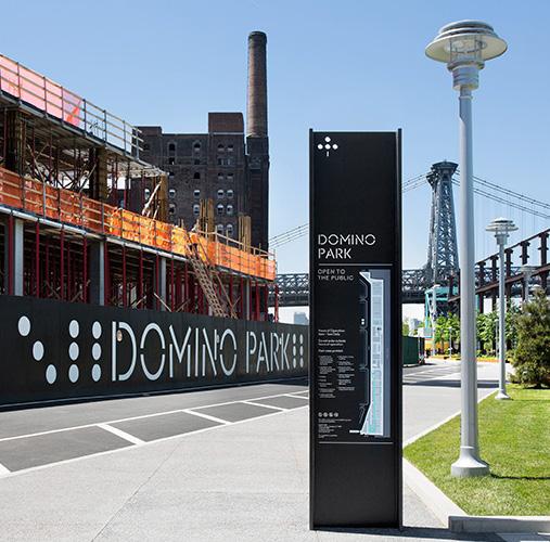
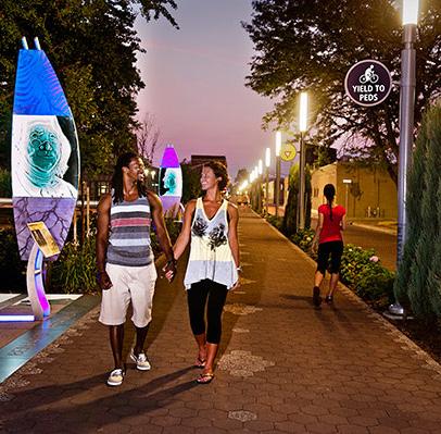
Des ig n
GlendaleGalleria/RSM
Run de l l E r n s t b re reg 180
DominoPark/JCFO IndianapolisCulturalTrail/
Create welcoming gateways and incorporate consistent wayfinding and signage.
Gateways are unique opportunities to introduce placemaking elements that help establish a sense of place. A visual marker that informs visitors they are entering a unique place, especially when enforced with consistent wayfinding and signage that focuses attention and engages visitors as they navigate through Schoolfield and Danville, directing towards destinations and amenities.
Recommended Gateways:
+ Welcome to Danville at the Interchange Catalyst Site
+ Schoolfield District at Memorial and W Main
+ Historic Schoolfield Village at Baltimore Avenue Cluster
+ Schoolfield Woods Pedestrian Bridge + Filtration Plant
+ Transition to River District
u tilize art and historic interpretation within public spaces.
Public art is a way to showcase and honor the cultural, social, and economic value of a place. It can be used to capture the different voices, stories, and eras of Schoolfield to help depict Schoolfield’s unique story. It can also act as an activation strategy to build a robust public realm and create welcoming spaces for residents and visitors. Public art can be implemented in small or large formats, ranging from murals, street banners, or lighting to larger installations (i.e., signage on water towers, signage across streets, etc.)
Recommended Sites:
+ Schoolfield Trail
+ Schoolfield Woods + Filtration Plant
+ Main Street Green railroad underpass
+ Founders Park
+ Hylton Park
+ Water Towers at Baltimore Avenue Cluster
HIGHLIGHTING FLIPPEN CEMETERY
A historic African American cemetery located off Mayfield Road (north of The Interchange catalyst site) and is the resting place for at least 274 African Americans from Danville, a belief that are many more graves yet unfound. The land was owned by the Flippen family from 1876 to 1963, when most of the burials took place. After they lost ownership, the cemetery was forgotten, and the land was used for dumping for many years.
In 2014, the Southside African American Cemetery Preservation Society formed to take back ownership and clear out the land to honor the graves and create a sacred place for the Black community. Since 2014, this organization has been
dedicated to preserving Flippen Cemetery and advocating for a larger presence in modern day Danville. Today, most of the graves remain unmarked and many are marked only by uninscribed field stones. The Southside African American Cemetery Preservation Society is working to uncover more of the unmarked graves and creating formalized paths with signage to help bring more awareness about its existence and the people buried here.
The Schoolfield District plan recommendations can tie into the work being done at Flippen Cemetery to bring more awareness and better connections to the sacred place through signage and trail connections from W Main Street.
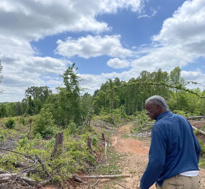
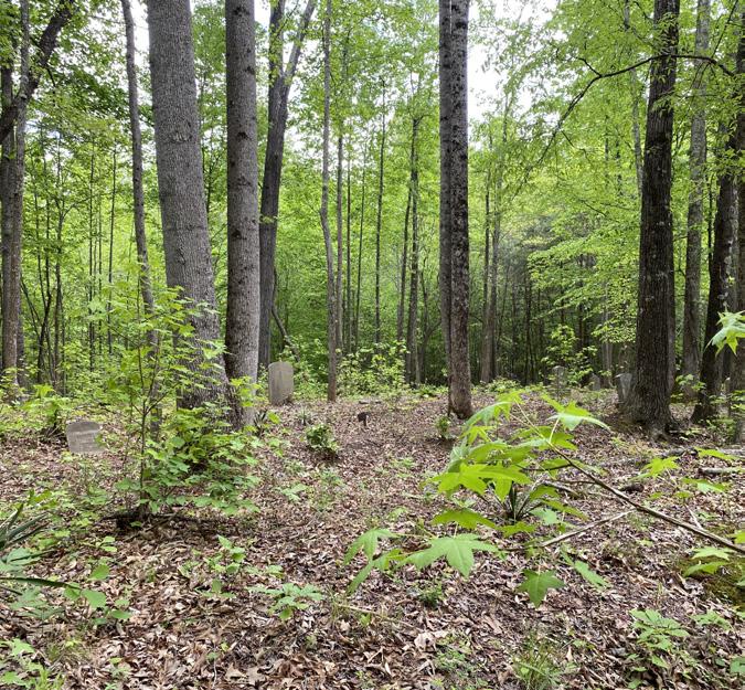
RESTITCHING THE VILLAGE 181
Parks & Open Spaces
Danville has a strong existing Parks and Open Space network with a range of programming and activities, several of which are located within or adjacent to the Schoolfield Village. Better connecting this network through the neighborhood will open up accessibility and more opportunities for residents to connect with nature and recreation, and to help find places for respite. This can be done through public realm improvements, programming, ecological and natural restoration, and creating more green connections.
Citywide Need ENHANCED PARKS & OPEN SPACES
1. Expand the tree canopy throughout Schoolfield.
2. Improve connections to Ballou Park.
3. Build upon Schoolfield’s existing network of parks and open spaces.
4. Enhance the area around the reservoir to provide public access and greater trail connectivity.
5. Redevelop the parcel between the Caesars Virginia and Dan River as Schoolfield Woods - an opportunity for nature trails and enhanced trail access to open spaces.
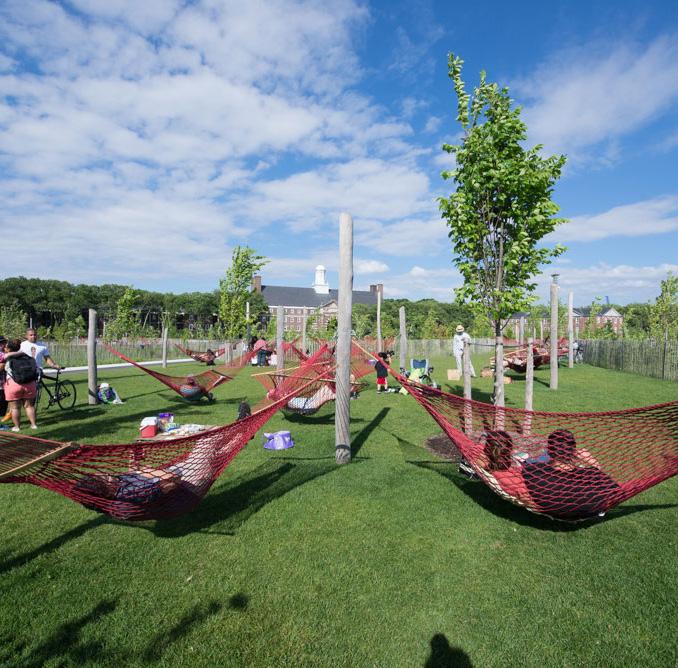
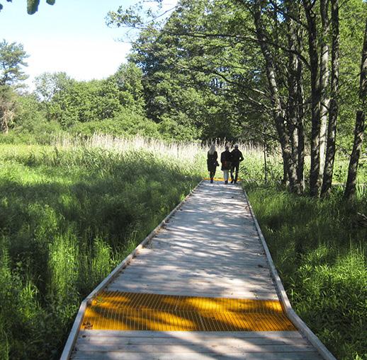
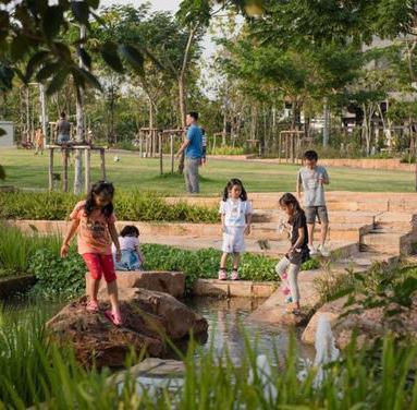 Govern Ferry
Nature lna Nature
Govern Ferry
Nature lna Nature
a k h o m
Vora
182
Build Schoolfield Trail to improve connections between parks and open space assets.
The Schoolfield Trail is an excellent opportunity to connect existing and proposed open space assets together. The proposed trail creates a loop around the historic Schoolfield residential village up through Schoolfield Woods. It creates important east-west connections within the neighborhood, while also tying into important existing links to the wider system.
Connections along the trail include: Ballou Park, the Reservoir, Founders Park (proposed), Hylton Park, Abreu Grogan, Schoolfield Woods + Filtration Plant (proposed), and the Riverwalk Trail.
Note: the Danville Neighborhood Park Network Plan recommends a Riverwalk Trail extension to connect to Abreu Grogan and a Greenway Trail along Rutledy Creek. Both of these improvements would connect to the Schoolfield Trail and would further increase connectivity between Schoolfield and the wider Danville park system.
r evitalize Hylton Park with natural areas, recreation amenities, and greater connectivity to the neighborhood and other parks.
Hylton Park is an important community asset for the Schoolfield Village. Currently underutilized, there is great potential for it be a beacon for community gathering and neighborhood recreation. Community members expressed this as being a top neighborhood priority when moving to implementation. A 13-acre site, with both existing recreation and natural features Hylton Park can be better suited to fit the needs of residents.
Design Ideas to consider for Hylton Park:
+ Stream restoration
+ Enhance trail and circulation system connecting eastwest
+ New recreation and playground amenities
+ Green infrastructure
Note: further engagement and design around the specific needs and feasibility will be needed.
NEIGHBORHOOD PARK NETWORK PLAN
Danville Parks & r ecreation
Spearheaded by the Danville Parks & Recreation Department, the plan will serve as the guide for future park development and activity in Danville. Developed through extensive community engagement and park inventory analysis, the plan prioritizes park revitalization based on opportunity and needs, and sets a schedule for future park improvements. Several parks within or adjacent to the Schoolfield District plan boundaries are prioritized on this list and will strengthen the recommendations of this plan.
Hylton Park
The Neighborhood Park Network Plan and the Schoolfield District plan recognize the importance of revitalizing Hylton Park to better serve the surrounding community. Parks & Recreation has prioritized this process for the next 5-6 years, beginning with design and engineering in 2026. This phase will rely on heavy community participation to inform the amenities and design features.
RESTITCHING THE VILLAGE 183
Existing Hylton Park
IN THIS CHAPTER:
+ r ough Order of Magnitude Costs
+ Funding Sources
+ Considerations
+ How Do We g et There - Implementation Tables
08
184
Implementing the Vision
People, Place, and Fabric - the New Schoolfield District envisions an authentic, resilient, historic, and thriving village fabric stitched together by community and shared history. This section re-introduces the strategies to achieve and implement this vision with rough order of magnitude costs for the corridor and catalyst sites, considerations, and a roadmap for propelling the Plan into the next phase of development and implementation.
IMPLEMENTING THE VISION 185
Rough Order of Magnitude
The Schoolfield District Plan proposes significant investment opportunities that will transform the W Main Street corridor (5.4 miles from VA/NC border to River District) and the catalyst sites (74 acres of development along W Main Street). The multimillion-dollar investments aim to respond to the catalytic Caesars Virginia resort development by improving connectivity and accessibility on W Main Street, protecting existing historic infrastructure, and positioning future developments as resilient and responsive to the needs of existing and future residents.
The rough order of magnitude (RoM) cost estimate gives a conceptual, high-level understanding of the costs associated with the conceptual corridor and catalyst site plans. The preliminary cost estimates are presented as ranges that align with the conceptual design scenarios presented in this plan. The total cost range estimates capture the additional costs of developing a project and are commensurate with the level of pre-conceptual design and planning studies conducted as part of the Schoolfield District Plan. This includes construction costs, design and engineering fees, permitting fees, as well as percentages allocated for contingencies and general conditions. At the low end, the cost represents a partial build out with less costly materials and at the high-end the full build out of the conceptual designs presented in this report.
The ranges are estimated based on the cost of building in February 2023. There may be uncertainties in the assumptions or unanticipated challenges once more detailed design and engineering is conducted; however, there may also be unanticipated savings that arise as the project scope is more carefully defined moving forward. Ranges include a small multiplier to account for near-term inflation, but inflation escalation rates cannot be anticipated and should be noted that costs will rise with each year.
This high-level cost estimate does not include costs associated with any selective, or full, demolition of existing site or structures, nor future studies or design and engineering required to further advance the concepts prior to implementation. The estimate is based on a series of assumptions - surveys, geotechnical investigations, detailed traffic studies, environmental assessments or archaeological surveys were not conducted as part of this planning study and will be required to take these concepts to the next phase of implementation. Cost estimates are recommended at future stages of the design process as developed are further developed with additional community and stakeholder engagement.
INCLUDED IN THE RANGE:
Corridor
+ Low-end: partial build out
+ High-end: full build out
Catalyst Sites
The Interchange (~10 acres)
+ Low-end: retrofitted motel with lower-cost materials
+ High-end: full build out of the conceptual design with higher unit cost materials and multiple typologies of hotels
Main Street Green (~6 acres)
+ Low-end: partial build out with lower-cost materials (does not include senior village and community building)
+ High-end: full build out of the conceptual design with higher unit cost materials
Baltimore Avenue Cluster (~12 acres)
+ Low-end: no new construction, only retrofits of existing buildings
+ High-end: full build out of the conceptual design with higher unit cost materials
Shopping Center Redevelopment (~24 acres)
+ Low-end: partial build out with 1 new multifamily development, retrofits to existing retail, and lower-cost materials (does not include rowhomes, grocery option)
+ High-end: full build out of the conceptual design with higher unit cost materials
Schoolfield Woods (~22 acres)
+ Low-end: partial building with lower-cost materials (does not include filtration plant investments, education center, pedestrian bridge)
+ High-end: full build out of the conceptual design with higher unit cost materials
186
PRE-CONCEPTUAL (ROM) COST RANGES
CORRIDOR ZONES (5.4 miles)
ZONE 1: 2.06 mi VA/NC State Border to River Oak Drive $17 - $20 million
ZONE 2: 0.51 mi River Oak Drive to Memorial Drive $3 - $5 million
ZONE 3: 1.02 mi Memorial Drive to Park Avenue
ZONE 4: 0.44 mi Park Avenue to Blackwell Drive
ZONE 5: 0.87 mi Blackwell Drive to Rison Street
ZONE 6: 0.50 mi Rison Street to Jefferson Avenue
$5 - $8 million
$2 - $4 million
- $8 million
- $5 million
CATALYST SITES (74 acres)
THE INTERCHANGE ~10 acres
MAIN STREET GREEN ~6 acres
BALTIMORE
SHOPPING
SCHOOLFIELD
TOTAL CATALYST SITE ( r OM) COST r AN g E
- $130 million
- $45 million
- $40 million
- $520 million
NOTE:
$5
$3
Range
$6.5
TOTAL CO rr IDO r ( r OM) COST r AN g E $35 - $50 million Cost
(RoM) by Mile
- $9.3 million / mile
$35
$25
CLUSTER
$50
AVENUE
~12 acres
- $105 million
REDEVELOPMENT ~24 acres $75
CENTER
- $200 million
$10
WOODS + FILTRATION PLANT ~22 acres
$195
Cost Range (RoM) by Acre $2.6 - $7.0 million / acre
IMPLEMENTING THE VISION 187
The RoM Cost Range does NOT include demolition of any existing infrastructure, future studies, and further design / engineering.
COSTS INCLUDED IN ROM
Corridor
Each corridor zone estimate includes unit costs of the elements depicted in each zone and is based on a range of materials explored. Unit costs are developed primarily from RS Means and local data collected in 2023 from the consultant team.
Line items that were included in the estimates include: curbs, walkways and sidewalks, curb extensions, planting areas, vehicular lanes, median planting, bioswale planting, bioretention planting, bikeway / bike lanes, street parking, planted bump-outs, mobility and transit shelter allowances.
Beyond the contingencies mentioned, the estimates do not include: demolition of existing streetcape, future studies, and design / engineering required for implementation (i.e., surveys, geotechnical investigations, environmental assessments, traffic studies, or archaeological assessments). Costs associated with mobilization or phasing studies for re-routing of traffic during construction are also not included in the RoM cost estimate.
Catalyst Sites
Each catalyst site is given a range in the RoM that represents a partial to full build out (based on a variety of factors and material costs for the assumed line items).
Assumptions for catalyst sites are depicted in Chapter 6, line items that were included in the estimates include: new and retrofitted structures, plaza and hardscaped areas, green space and planting areas, trees, parking lots, site signage and wayfinding, site lighting, general site utilities, and RoM construction costs.
Beyond the contingencies mentioned, the estimates do not include: demolition of existing structures or infrastructure, construction type (for new buildings), and foundation requirements are not factored in, all of which will require additional studies, design, and engineering.
This is a summary of the detailed list of line items and unit costs (provided separately to the City of Danville Office of Economic Development). These estimates are provided alongside the District Plan’s strategies and implementation matrix to assist in prioritizing implementation projects once the plan is adopted.
188
ADAPTIVE REUSE PROJECTS
For historic adaptive reuse of commercial buildings in 2022 in the mid-Atlantic region, we used an average base value of $262/SF plus a design/construction contingency of 15%, plus an additional multiplier of 10% to allow for recent inflation.
The figure used is therefore $262 x 1.15 x 1.10 = $332/SF
To re-purpose outdoor basins, assume $60/SF plus a design/construction contingency of 15%, plus an additional multiplier of 10% to allow for recent inflation:
The figure used is therefore $60 x 1.15 x 1.10 = $76/SF
While multiple phases may increase this number over the long term, it might be necessary due to funding.
FILTRATION PLANT
Under roof
Repurpose outdoor basins
1009 W MAIN STREET
22,634 SF x $332 = $ 7.48 MM
37,000 SF x $76 = $ 2.81 MM
TOTAL COSTS $ 10.30 MM
Gross area historic portion 62,920 SF
Gross area 1955 Bank Addition 8,520 SF
TOTAL COSTS (71,440 SF x $332) $ 23.7 MM
3500 W MAIN TRAVELODGE
As a simple structure of more recent vintage, a reduced design/construction contingency of 7% is appropriate.
The cost per square foot estimate is then $262 x 1.07 x 1.10 = $308/SF
For the 51 rooms with common spaces then, 21,183 SF x $308 = $ 6.52 MM
IMPLEMENTING THE VISION 189
Funding Sources
STREETSCAPES / BIKE / PED IMPROVEMENTS
The Schoolfield Plan has identified several potential infrastructure, streetscape and experience enhancements. The following are a list of local, state, and federal programs and grants to consider when moving into implementation.
STATE SOURCES
VDOT Access r oads Program
https://www.virginiadot.org/local_assistance_divisionaccess_programs.asp
+ Recreational and Historic Access Program provides resources to access publicly owned recreational or historic areas. The Schoolfield District may qualify for this opportunity depending on how committee interprets the recreational or historic assets in the application.
+ Competitive
VDOT Transportation Alternatives Program
https://www.virginiadot.org/business/prenhancegrants. asp
+ Set aside for communities under 50k population
+ Requires 20% local match which may come from a 3rd party
+ Based on FY23-24 selections can be used for trails, pedestrian improvements, bike facilities, multiuse paths, streetscapes among other things
+ Danville has successfully accessed this program numerous times
VDOT Smart Scale Program
https://smartscale.org/apply/default.asp
+ For transportation project funding to ensure the best use of limited tax dollars.
+ Funded through two sources: construction District Grants Program (DGP) and the High-Priority Projects Program (HPPP)
+ W Main Street corridor improvements would be eligible for the DGP funding as an improvement to support urban development areas.
+ Funding would support bicycle and pedestrian improvements, and transportation demand management projects (park & ride).
VDOT r evenue Sharing Program
https://www.virginiadot.org/business/local-assistanceaccess-programs.asp
+ Provides additional funding to construct or improve road systems.
+ Funding from this program is expected to be used in the same fiscal year for projects already underway, leading to their completion within the near term
+ Localities may request up to $10 million dollars, up to $5 million of this may be used for maintenance projects
VDOT r ecreational Access Program
https://www.virginiadot.org/business/local-assistanceaccess-programs.asp
+ Assists localities in providing roads or bikeway access to public recreational or historic areas owned by the Commonwealth of Virginia or a local government
+ The public recreational asset / site must be complete or in progress to be eligible for funding
+ Schoolfield Woods Trail and neighborhood greenway connections may qualify as connecting to the recreation areas proposed in the Schoolfield District Plan.
190
LOCAL SOURCES
Community Development Authority (CDA)
https://law.lis.virginia.gov/vacodefull/title15.2/ chapter51/article6/
+ Must be created by local government ordinance
+ Can be created for contiguous or non-contiguous parcels requiring 51% of the land area or land value be part of petition by the land owners
+ Has the ability to issue revenue bonds supported by special assessments or taxes
+ Bonds are not the responsibility of the host community
+ There are at least 20 CDAs across Virginia
Special Service District (SSD)
https://law.lis.virginia.gov/vacode/title15.2/chapter24/ section15.2-2403/
+ Must be created by local government ordinance
NATIONAL SOURCES
u SDOT r AISE g rant Program
Helps communities build transportation projects that have significant local or regional impact and improve safety and equity.
+ Funding can be used to complete critical freight and passenger transportation infrastructure projects
+ Priority is given to projects that address safety, environmental sustainability, mobility and community connectivity, and quality of life.
+ Has a wide range of potential powers and duties including infrastructure construction and maintenance as well as economic development services such as marketing
+ Cannot issue bonds but can collect special assessments or levy taxes
Tax Increment Financing (TIF)
https://law.lis.virginia.gov/vacode/title15.2/chapter24/ section15.2-2403/
+ Must be created by local government ordinance
+ Two methods of TIF
+ Statutory and By Agreement
+ Statutory TIFs are created by a locality through the designation of an area, and assessment of base levels
+ By Agreement TIFs are flexible tools that pay out incremental revenue not limited to real estate taxes
+ Danville has utilized TIF
+ W Main Street corridor improvements could qualify for this grant, as well as building better connections across the railroad tracks from the Schoolfield Mill Village to safely get residents across to bus stops, open space, shopping and other amenities.
IMPLEMENTING THE VISION 191
HOUSING
g AP Financing Program
Create low cost gap financing that can support development of infrastructure, model homes, or construction financing. The specific financial products offered by this vehicle should be developed in conjunction with input from bankers and developers about where there are financing gaps, risk profiles are too large or other related issues that make financing more expensive.
Develop a tax abatement program to support improved NOAH housing stock
The mixed quality of housing in Danville is well-documented. However, Danville’s housing is inexpensive. This Naturally Occurring Affordable Housing (NOAH) is an important asset in managing against the risk of displacement and managing continued affordability in the community. This abatement would be oriented toward infill rehabilitation and replacement of residential housing stock (single family and multifamily) and affordability. A number of communities in Virginia have adopted similar approaches. Key design features should include:
+ Qualify the abatement on major rehabilitation or teardown new construction
+ Minimum structure age
+ Rehab abatement based on minimum value increase to the property, e.g. 40%
+ Abatement of the taxes associated with the value increase with gradual step increase to reduce exemption
+ e.g., 5 year full abatement with graduated abatement reductions over another 5 years
+ Provide limitations on increase in square footage in older neighborhoods unless an additional lot has been acquired
+ Tie the abatement to the property
Historic r ehabilitation Tax Credits (H r TC)
The Virginia Department of Historic Resources and National Park Services have federal and state tax credit programs that provide substantial incentives for private investment in preservation. Homeowners can apply for a dollar-to-dollar reduction in income tax liability for rehabilitation costs on historic buildings (for both owner-occupied and incomeproducing buildings).
+ The amount of credit is based on a project’s eligible rehabilitation expenses
+ Federal credit is 20% of the eligible expenses
+ State credit is 25% of the eligible expenses
+ Taxpayers could qualify for both
192
ECONOMIC DEVELOPMENT
As noted above CDA, SSD and TIF can all be used as financial incentives or support mechanisms to promote infrastructure development. They can also be used for economic development initiatives. In addition there are several other options:
Tourism Development Financing Program
https://www.vatc.org/TDFP/
+ Provides a financing vehicle similar to a TIF using sales, lodging and other taxes related to the tourism development
+ Is a multi-step process
+ Locality is the applicant
+ Requires evidence demonstrated by a deficiency analysis through the comprehensive plan or a tourism development plan
+ Project and/or plan must be certified by the Virginia Tourism Corporation
Tourism Zone
https://www.vatc.org/wp-content/uploads/2022/09/ Tourism-Zone-Incentives-Matrix-100122-1.pdf
+ Tourism zones are similar to enterprise zones. Danville has instituted a tourism zone, however,, based on a 9/22 analysis of incentives the Tourism Zone in Danville has unspecified incentives.
TID
Tourism Investment District
https://www.vatc.org/tids/
+ Is similar to a special district but singular purpose is the development and promotion of tourism
+ Requires a governing board that oversees expenditure of funds according to a plan
+ Funds can be used for marketing, training, capex, incentives, commissions, rebates, sales visits
+ Capital expenditures for TID can only be spent on projects specifically within a plan approved by the governing board
Economic Incentive Areas
https://www.fcrevite.org/economic-incentive-program
+ An economic incentive area is created by local ordinance. The Incentive Area has designated geographic boundaries. Instead of a TIF it is a partial abatement of real estate taxes. See Fairfax County example.
COMMUNITY, CULTURE, AND IDENTITY
African American Cemetery & g raves Fund
VA Department of Historic Resources
+ Sponsored by the Virginia Department of Historic Resources, this grant supports the care, maintenance, and preservation of historical African American cemeteries and graves. The funds can be used to help manage vegetation; maintain existing markers, memorials, and monuments; build replacement markers, memorials, and monuments; as well as to hire experienced and professional consultants to draft a preservation plan for the cumulative scope of work at the historic African American cemetery.
African American Burial g round Preservation Program
National Park Services
+ Passed by Congress in December 2022, this program authorizes the National Park Services, in collaboration with National Trust and members of the African American Heritage community, to aid in the identification and preservation of historic cemeteries across the country. The program grants descendant-led and preservation organizations receive funding to help research, identify, document, preserve, and interpret historic African American burial grounds. This program is a tool to help uncover, reclaim, and highlight these stories and history as an integral part of American heritage.
IMPLEMENTING THE VISION 193
Considerations
GREEN STORMWATER MANAGEMENT
The robust implementation of green stormwater management solutions is important as it improves the water quality within the watershed to the benefit of downslope terrestrial and aquatic ecosystems by slowing the velocity of runoff to mitigate erosion and remove pollutants. In addition, stormwater strategies help to reduce overflow conditions on private properties which can cause damage. The added value of vegetated stormwater systems is the aesthetic enhancement of the public realm, thermal cooling to mitigate against extreme heat events, and the support of urban ecology by providing essential habitat. There is a wide range of green stormwater management strategies, but for the purposes of this project there are two primary strategies:
MAINTENANCE
The biggest maintenance challenge for green stormwater infrastructure in cold snowy climates is the salting of roads for improved vehicle traction. The salty snow melt flows into the stormwater planters, dramatically increasing the salinity of the soils, to the detriment of the plants. This is especially problematic when piles of snows are plowed onto the vegetated stormwater systems because it concentrates salt to extreme levels.
There are three primary strategies in which to address this problem:
1. Select a plant palette that contains highly salt-tolerant species that can survive the increased soil salinity.
2. Construct a gravel bumper that sits immediately adjacent to the stormwater system; this bumper serves as the first stage of treatment that intercepts salty snow melt in an effort to remove some of the salt before it continues into the green stormwater infrastructure.
3. Convince the city to not use as much or any road salts to combat snowy road surfaces.
Where has it been successfully implemented
New York City has been successful in installing and maintaining green stormwater infrastructure under similar cold climate conditions. Although New York City is significantly larger than the City of Danville, the fundamentals of how green infrastructure is designed, installed, and maintained remains the same and serves as a viable proof of concept to inform stormwater strategies for any city.
194
ZONING CONSIDERATIONS
Once the location of heavy industrial manufacturing, the Schoolfield Site is now a site for Caesars Virginia. A Casino Entertainment District overlay was approved by voters and applies over the Schoolfield site, allowing casino operations. The broader Schoolfield neighborhood is almost entirely zoned as Old Town Residential, which allows a density of 5 units per acre. Old Town Residential zoning is intended to maintain and reinforce a neighborhood that aligns with the historic character and scale. In addition to residential, there are some commercial and multi-family zoning located in the parcels along Main Street.
One of the major corridors in the city, W Main Street travels through many different zoning districts, weaving together the different areas. Where W Main Street travels through residential areas, commercial zoning is clustered closer to and around W Main Street, making it the major commercial corridor in many neighborhoods, especially on the western end. Zoning amendments may be required to allow multifamily residential of right in commercial zones where recommended (e.g., Baltimore Avenue Cluster).
FURTHER STUDIES & DESIGN
Following adoption of the Schoolfield District Plan, additional phases of design and engineering will be required prior to implementation. This was a high-level vision study that was developed based on community engagement and a series of assumptions. Surveys, geotechnical investigations, detailed traffic studies, environmental assessment, or archaeological surveys were not conducted as part of this planning study and will be required to take these concepts to the next phase of implementation.
These studies will inform overall design choices and will likely include transportation and traffic study, infrastructure and utilities study, and more detailed study of stormwater detention and maintenance. Continued coordination between parcel owners, the city, and/or private developers is also required to further advance the design and test the economic feasibility. Additional community and stakeholder engagement is strongly recommended.
IMPLEMENTING THE VISION 195
How Do We Get There
The New Schoolfield District Plan imagines a thriving district that is founded by past experiences, present needs, and future opportunities for the Schoolfield community. In order to achieve this goal continued coordination, new public and private partnerships, and a creative phasing and funding strategy will be required to bring the vision to life. The strategies and ideas represented across the District Plan and the three scales are organized into four implementation tables relating to the key systems that define the overall vision. The tables identify the scale and timeline for the strategy, appropriate agency to lead and oversee the implementation of the project or strategy, other partners who could offer support, and finally available funding opportunities from local, state, and national sources. The implementation tables are set up to serve as a series of next steps and actions to help bring the vision to life.
196
COMMUNITY, CHARACTER, + IDENTITY
SCALE TIMELINE LEAD AGENCY OTHER PARTNERS POTENTIAL FUNDING SOURCES
Strengthen and create new village nodes and community destinations.
Master Plan Corridor Village Long
City of Danville (Economic Development & Tourism, Parks & Recreation)
Danville Regional Foundation, River District Association, Industrial Development Authority (IDA)
City of Danville, Grants from community partners, Community Development Entities - New Markets Tax Credits (residential areas only), VA Dept Housing & Community Development (DHCD), Virginia Housing, Industrial Development Authority (IDA), Virginia Tourism Corporation
Provide neighborhood-focused amenities that serve the needs of residents.
Master Plan Village Long
City of Danville (Economic Development & Tourism, Parks & Recreation) Industrial Development Authority (IDA)
Industrial Development Authority (IDA), City budgets, VA Dept Housing & Community Development (DHCD)
Foster a healthy and inclusive village for future generations of Schoolfield.
Master Plan Village Long City of Danville (Economic Development & Tourism) Community Groups, Neighborhood Association City of Danville, Grants from community partners
Increase access to healthy and local food.
Village Medium
Health Collaborative, City of Danville (Parks & Recreation)
Danville Regional Foundation, DOEDT
Grants from community partners, Community Development Entities - New Markets Tax Credits (NMTC), Virginia Community Capital Food Access Program
Create a series of gateways that visually mark entrances and progress through Schoolfield.
Master Plan Corridor Medium City of Danville (Public Works) Sign Vendor City of Danville
Create welcoming gateways and incorporate consistent wayfinding and signage.
Master Plan Corridor Medium City of Danville (Public Works) Sign Vendor City of Danville
u tilize art, historic interpretation, and food to highlight cultural destinations and key areas. (e.g., Three Sisters, Flippen Cemetery, etc.)
Master Plan Corridor Village Medium City of Danville (Economic Development & Tourism, Parks & Recreation)
Arts and Culture Steering Committee
African American Burial Grounds Preservation Program
IMPLEMENTING THE VISION 197
COMMUNITY, CHARACTER, + IDENTITY
SCALE TIMELINE LEAD AGENCY OTHER PARTNERS POTENTIAL FUNDING SOURCES
Establish cultural trails that link historic and cultural sites through Schoolfield.
Village Medium City of Danville (Parks & Recreation)
Danville Historic Society, DOEDT, Virginia Tourism Corporation, Arts & Culture Steering Committee
City of Danville, Virginia Land Conservation Foundation - Virginia Recreational Trails Program (RTP), Virginia Tourism Corporation, VDOT
Implement the Schoolfield brand within the District to unite the community, spur investment, and attract visitors.
Master Plan
Corridor Village Short
City of Danville (Economic Development & Tourism) Cohere, Advertising City of Danville
Showcase adpative reuse of historic and cultural sites throughout Schoolfield.
Master Plan Short
City of Danville (Economic Development & Tourism)
River District Association, VA Dept of Historic Resources, VA Dept of Environmental Quality City of Danville
Preserve and restore Schoolfield’s historic buildings.
Master Plan Long
City of Danville (Economic Development & Tourism)
Dept of Historic Resources, National Parks Service, Danville Neighborhood Development Corporation (DNDC), Community Development, Preservation Virginia
Historic Tax Credits (HTC), Community Development Entities - New Markets Tax Credits (residential areas only), VA Dept Housing & Community Development (DHCD), Industrial Revitalization Fund (IRF), VA Enterprise Zone (EZ), City of Danville
Work with residents and organizations to create community events that celebrate the history and culture of Schoolfield.
Villaged Short River District Association, Schoolfield Village
Danville Neighborhood Development Corporation (DNDC), City of Danville - DOEDT, Parks & Rec, Community Development
City of Danville, River District Association, Virginia Tourism Corporation
198
HOUSING + ECONOMIC DEVELOPMENT
SCALE TIMELINE LEAD AGENCY OTHER PARTNERS POTENTIAL FUNDING SOURCES
Provide housing options that meet the needs of current and future residents. (e.g., senior housing, workforce housing, multi-family, etc.).
Master Plan Village Medium
City of Danville (Economic Development & Tourism, Community Development)
Danville Neighborhood Development Corporation (DNDC), Danville Redevelopment & Housing Authority (DRHA)
Historic Tax Credits, VA Dept Housing & Community Development (DHCD), VA Industrial Revitalization Fund (IRF), Virginia Housing, City of Danville
Support the Danville Housing Development Corporation in the development of a mix of housing units to spur the market.
Master Plan
Village Medium City of Danville (Community Development)
Danville Neighborhood Development Corporation (DNDC), Danville Redevelopment & Housing Authority (DRHA)
Grants from community partners, TIF District
Supply residents with resources to help avoid displacement and negative impacts of development pressure.
Village Short City of Danville (Community Development)
Potential if rent subsidies are involved.
Create a form-based code and housing design templates based on the historic village to help reduce development costs and retain the historic character of the Schoolfield Village.
Village Medium City of Danville (Community Development)
u tilize code enforcement to discourage blight from abandoned or neglected homes.
Village Short City of Danville (Community Development)
None needed within existing budget.
Create funding sources to support home maintenance and rehabilitation for residents.
Village Medium City of Danville (Community Development)
Danville Neighborhood Development Corporation (DNDC), Danville Redevelopment & Housing Authority (DRHA)
Special assessment / secured bank lending; foundation capitalized lending pool
IMPLEMENTING THE VISION 199
HOUSING + ECONOMIC DEVELOPMENT
SCALE TIMELINE LEAD AGENCY OTHER PARTNERS POTENTIAL FUNDING SOURCES
Facilitate the development of a Housing Trust for the Schoolfield Village to manage risk of displacement.
Village Long
City of Danville (Community Development), Danville Neighborhood Development Corporation (DNDC) Regional banking community, Virginia Community Land Trust City of Danville
Expand the role of Danville Neighborhood Development Corporation (DNDC) to develop missing middle and selected market rate single family housing projects.
Master Plan
Village Medium
City of Danville (Community Development), Danville Neighborhood Development Corporation (DNDC)
Grants from community partners, TIF District
r ezone underutilized commercial or vacant commercial for mixed use.
Master Plan Short City of Danville (Economic Development & Tourism)
City of Danville (Community Development)
None needed
Acquire and prepare some strategic sites for housing development.
Master Plan
Village Medium
City of Danville (Community Development), Danville Neighborhood Development Corporation (DNDC) Industrial Development Authority (IDA)
City of Danville, Grants from community partners, Industrial Development Authority (IDA)
Assist Schoolfield residents in making energy efficient retrofits to historic homes.
Village Medium
City of Danville (Community Development), Danville Neighborhood Development Corporation (DNDC)
Danville Redevelopment & Housing Authority (DRHA), Virginia Housing, VA Dept Housing & Community Development (DHCD), Danville Utilities
Danville Utilities Rebate Program, Monitor status of R-PACE legislation
Ensure that development of public parcels is equitable and allows for community prosperity and wealth building.
Master Plan Short
City of Danville (Community Development, Economic Development & Tourism)
Danville Redevelopment & Housing Authority (DRHA), VA Dept Housing & Community Development (DHCD)
City of Danville, Grants from community partners, Industrial Development Authority (IDA)
200
HOUSING + ECONOMIC DEVELOPMENT
SCALE TIMELINE LEAD AGENCY OTHER PARTNERS POTENTIAL FUNDING SOURCES
Promote reusing existing structures to provide greater housing choice.
Master Plan
Village Short
City of Danville (Economic Development & Tourism, Community Development)
VA Dept of Historic Resources, National Parks Service, River District Association, Industrial Development Authority
Historic Tax Credits, VA Dept Housing & Community Development (DHCD), City of Danville
Create district level incentives (e.g., Economic Incentive Areas, Tax Increment Financing).
Master Plan Village Medium City of Danville (Economic Development & Tourism)
City of Danville (Community Development) City of Danville, TIF District
Consider the creation of a Community Development Authority as an implementation vehicle for public improvements.
Master Plan
Corridor Village Medium City of Danville (Economic Development & Tourism)
City of Danville (Community Development) CDA is the funding vehicle
Institute a series of initiatives to reduce the cost and risk for private housing development (ready-to-build lots, pre-approved pattern book, low cost gap financing, district-wide financing approach).
Master Plan
Corridor Village Medium City of Danville (Economic Development & Tourism)
City of Danville (Community Development)
Consider instituting a tenant right of first refusal to purchase ordinance.
Village Medium
City of Danville (Community Development), Danville Neighborhood Development Corporation (DNDC)
City of Danville (Economic Development & Tourism)
IMPLEMENTING THE VISION 201
ECOLOGY + OPEN SPACE
SCALE TIMELINE LEAD AGENCY OTHER PARTNERS POTENTIAL FUNDING SOURCES
Increase vegetation and planting along W Main Street.
Corridor Short City of Danville (Public Works)
Private Sector Sponsors The Oak Foundation - Climate Change Strategy Grant
Expand the tree canopy throughout Schoolfield.
Corridor Village Long City of Danville (Public Works)
Private Sector Sponsors AARP Foundation - Community Challenge Grant
Connect existing and new parks with greenways.
Master Plan
Corridor Village Medium City of Danville (Parks & Recreation) City of Danville (Public Works) Safe Routes to Parks Accelerator
r estore streams and improve the quality of water within the District.
Village Medium City of Danville (Parks & Recreation, Public Works)
VA Dept of Environmental Quality, US Army Corp of Engineers VA DEQ Stormwater Local Assistance Fund
Develop a citywide strategy to manage untreated stormwater from impervious surfaces (parking lots, buildings, roads, etc.) with green infrastructure.
Master Plan
Corridor Village Medium City of Danville (Public Works)
Private Developers, VA Dept of Environmental Quality National Fish and Wildlife Foundation Grants
r evitalize Hylton Park with natural areas, recreation amenities, and greater connectivity to the neighborhood and other parks.
Village Medium City of Danville (Parks & Recreation) Safe Routes to Parks Accelerator
Improve trail connectivity.
Master Plan
Village Long City of Danville (Parks & Recreation) City of Danville, VA Land Conservation Foundation - VA Recreational Trails Program (RTP), VDOT
202
ECOLOGY + OPEN SPACE
SCALE TIMELINE LEAD AGENCY OTHER PARTNERS POTENTIAL
FUNDING SOURCES
Enhance the area around the reservoir to provide public access and greater trail connectivity.
Master Plan
Village Long City of Danville (Economic Development & Tourism) Danville Utilities VA Recreational Trails Program (RTP), VDOT
Improve connections to Ballou Park.
Village Medium
City of Danville (Parks & Recreation)
Create welcoming, authentic, and vibrant public spaces.
Master Plan
Village Medium
City of Danville (Economic Development & Tourism, Parks & Recreation)
2023 Tribal Transportation Program Safety Fund, City of Danville, VA Land Conservation Foundation, VA Recreational Trails Program (RTP), VDOT
Private Sector Developer Conservation and Outdoor Recreation Challenge Cost Share Grants, National Park Service
Improve quality of the public realm for all residents and visitors.
Master Plan
Corridor Village Medium
City of Danville (Economic Development & Tourism, Parks & Recreation)
Private Sector Developer, City of Danville (Public Works)
Safe Routes to Parks Accelerator, AARP Foundation - Community Challenge Grant
Build upon Schoolfield’s existing network of parks and open spaces.
Master Plan
Village Long City of Danville (Parks & Recreation) City of Danville (Economic Development & Tourism)
VA Land Conservation Foundation, VA Recreational Trails Program (RTP), National Fish and Wildlife Foundation Grants
IMPLEMENTING THE VISION 203
MOBILITY, CONNECTIVITY, + INFRASTRUCTURE
SCALE TIMELINE LEAD AGENCY OTHER PARTNERS POTENTIAL FUNDING SOURCES
Create a new set of corridor development standards for the W Main Street corridor.
Corridor Short Planning Consultants, City of Danville (Economic Development & Tourism)
City (Community Development, Public Works)
2023 Tribal Transportation Program Safety Fund (US DOT)
Implement a series of green infrastructure improvements along W Main Street for a more inclusive and resilient community.
Corridor Long City of Danville (Public Works)
The Oak Foundation - Climate Change Strategy Grant
u nderground existing overhead utilities to allow for expansion of the public realm and pedestrian improvements.
Corridor Medium City of Danville (Economic Development & Tourism)
City of Danville (Utilities, Public Works)
FY 2023 National Infrastructure Improvements
Create a safe and efficient boulevard for all users (bicyclists, pedestrians, and motorists).
Corridor Medium City of Danville (Public Works)
City of Danville (Parks & Recreation, Economic Development & Tourism)
AARP Community Challenge Grant
Build a vibrant environment that is highly pedestrian oriented.
Corridor Medium City of Danville (Public Works)
City of Danville (Parks & Recreation, Economic Development & Tourism)
2023 Tribal Transportation Program Safety Fund
Implement complete street benchmarks along W Main Street (accessibility, safety, multimobility, versatility).
Corridor Medium City of Danville (Parks & Recreation)
City of Danville (Parks & Recreation, Economic Development & Tourism)
2023 Tribal Transportation Program Safety Fund
Improve neighborhood connectivity by introducing new east-west connections and strengthening existing crossings.
Village Short City of Danville (Public Works)
City of Danville (Community Development, Economic Development & Tourism)
Safe Routes to Parks Accelerator
204
MOBILITY, CONNECTIVITY, + INFRASTRUCTURE
SCALE TIMELINE LEAD AGENCY OTHER PARTNERS POTENTIAL FUNDING SOURCES
Create a transit hub near the Virginia-North Carolina line to facilitate future transit improvements along W Main Street.
Corridor Medium City of Danville (Mass Transit) City of Danville (Public Works), VDOT FTA
Improve the safety of intersections and crossings.
Corridor Short City of Danville (Public Works) 2023 Tribal Transportation Program Safety Fund
Expand the existing bike network to provide greater mode choice.
Corridor Short City of Danville(Public Works) City of Danville (Parks & Recreation) AARP Community Challenge Grant
Increase attractivity of public transit by improving shelters, installing new signage, and other improvements that enhance the rider experience.
Corridor Short City of Danville (Public Works, Mass Transit) City of Danville (Community Development, Economic Development & Tourism) AARP Community Challenge Grant
Consider a shuttle that transports visitors and residents from Schoolfield to the r iver District.
Corridor Short City of Danville (Mass Transit)
City of Danville (Economic Development & Tourism, Public Works) AARP Community Challenge Grant
Build Schoolfield Trail to improve connections between parks and open space assets.
Corridor Medium City of Danville (Parks & Recreation) City of Danville (Economic Development & Tourism, Public Works) Safe Routes to Parks Accelerator
Improve bicycle amenities within Schoolfield (e.g., bike parking, expand existing bike share) to allow for last mile connectivity.
Corridor Short City of Danville (Public Works, Parks & Recreation) City of Danville (Community Development, Economic Development & Tourism) AARP Community Challenge Grant
Mitigate sound from adjacent railroad utilizing planting and sound buffers.
Corridor Medium City of Danville (Public Works) AARP Community Challenge Grant
IMPLEMENTING THE VISION 205
A
APPENDIX MATERIALS INCLUDE:
A.1 Existing Conditions r eport
A.2 Community Engagement Summaries
A.3 Supply and Demand Study
A.4 Branding and Marketing g uidelines
A.5 Filtration Plant Study
206
Appendices
The supplemental studies and analysis that informed the final plan strategies.
(not included in this version)
APPENDIX 207
