UC San Diego
OPEN SPACE MASTER PLANNING STUDY

UC San Diego
OPEN SPACE MASTER PLANNING STUDY
& Community Planning Office
Robert Clossin AICP- Director
Todd Pitman ASLA- Campus Landscape Architect, Project Manager
John GIbbs ASLA - Landscape Architect, Senior Associate
Jillian Nameth - Landscape Designer
Yeon Tae Kim- Urban Designer/Planner
Ying Liu- Landscape Designer
Joel King - Campus Architect
Chuck Morgan - Facili es Management Landscape Services
Donald Chadwick - Student Affairs
David Holway - Biological Sciences/Natural Reserve
Sara McKinstry - Sustainability
Eric Halgren - Academic Senate, Co-Chair
Ken Hall - Marine Sciences, Co-Chair
Mary McGuirk - Associated Students
Kyle Heiskala - Associated Students
Neil Hadley - Consul ng Landscape Architect
Todd Pitman - Physical & Community Planning, Execu ve to the Commi ee
Gary Ma hews
Robert Clossin
Owen Lang
Don Logan
Joel King
Robin Tsuchida
Tom Allen - Academic Affairs
Don Chadwick - Student Affairs
Eric Halgren - Academic Senate, Co Chair
Kim Carnot - Health Sciences, Co-Chair
Ken Hall - Marine Sciences
Mark Cunningham - VC-Chief Financial Officer
Cara Fladd - Resource Management & Planning
Marlene Shaver - Advancement
Nathan Maselli - Staff Associa on
Robert Clossin - Physical & Community Planning, Execu ve to the Commi ee
Elyse Sanchez - Physical & Community Planning, Recording Secretary
Addi onal acknowledgement to Safdie Rabines Architects for collabora ons on University Center area and Pepper Bowl at Pepper Canyon, LandLab for North Point Entry Design, and Spurlock Poirier for the East Campus Neighborhood Planning Study.
4. Campus Public Places
5. Appendix
The University of California, San Diego (UC San Diego) has conducted many thorough planning studies over the past five decades. These studies have primarily focused on land use issues, traffic access, parking and si ng and massing for specific facili es and programs. Through the development of the various neighborhood planning studies the University has been able to more specifically guide the development of the campus in considera on of program development. This idea of connec vity is a fundamental component of the physical framework of the campus. UC San Diego contains many world class works of architecture, a historic Eucalyptus grove as well as several natural and rus c canyons that traverse the campus. Prior campus plans including the 1989 Master Planning Study envisioned that these “open spaces” would provide the connec vity and legibility of a unified campus.
The UC San Diego Open Space Master Planning Study (OSMPS) was undertaken as a means to be er understand the overall goal of the campus open spaces, and to provide planning and design guidelines for the crea on of a safe and convenient system of open spaces.
This plan seeks to iden fy the preserva on and enhancement of open space through the UC San Diego campus. The OSMPS has been prepared under the direc on of the UC San Diego Open Space Commi ee (OSC) which is composed of faculty representa ves from the Commi ee on Campus Community and Environment (CCCE), staff representa ves from the Campus and Community Planning Commi ee (CCPC),
the Associated Students, Graduate Students Associa on, professional Landscape Architects, Facili es Management, Physical & Community Planning, and the Campus Architect. This group is addi onally charged with the review of campus landscape projects and serves as a steward for campus open spaces.
The resul ng Open Space Master Planning Study is intended to be used as baseline informa on that is a frame of reference from which future land use and development decisions can be made. The OSMPS will provide useful guidance for determining how improvements associated with specific projects will ul mately contribute to a holis c system of open spaces; spaces that serve as the circulatory vehicle for the campus and the medium for campus wide sustainability goals.
what is open space?
Open space is the space not occupied by buildings or other structures. There are several types of open spaces at UC San Diego. These include plazas, quads, courtyards, and walks as well as our natural Ecological Reserve, Grove Reserve, and Restora on lands. O en these areas host other vital pieces of the campus urban landscape, including roads, u li es, pedestrian and bicycle paths. Whereas buildings typically serve individual groups on the campus, open space is a shared en ty. For this reason, the open spaces should be a rac ve and func onal to best serve the en re campus community. They should reflect the values of excellence that focus on students, research, and public service.
“We will align our efforts to be a student-centered, research-focused, service-oriented public university.”
- UC SAN DIEGO’S STRATEGIC PLAN.
The Open Space Planning Principles serve as general guidelines for open space planning at UC San Diego. Each of the principles synthesizes campus wide goals from UC San Diego plans including the 2014 Strategic Plan and the 1989 Master Plan and applies their relevance to general goals for open spaces. The Open Space Planning Principles are referenced in the subsequent chapters and serve as broad guidelines that can be applied to the crea on, maintenance and preserva on of all open spaces on campus. Principles include:
• Legibility
• Iden ty
• Mobility
• Social Spaces
• Resiliency
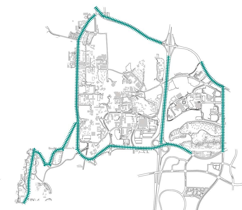
The Open Space Framework provide a campus wide structures for organizing various scales of open space.
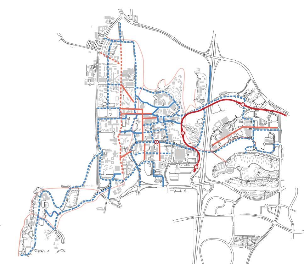
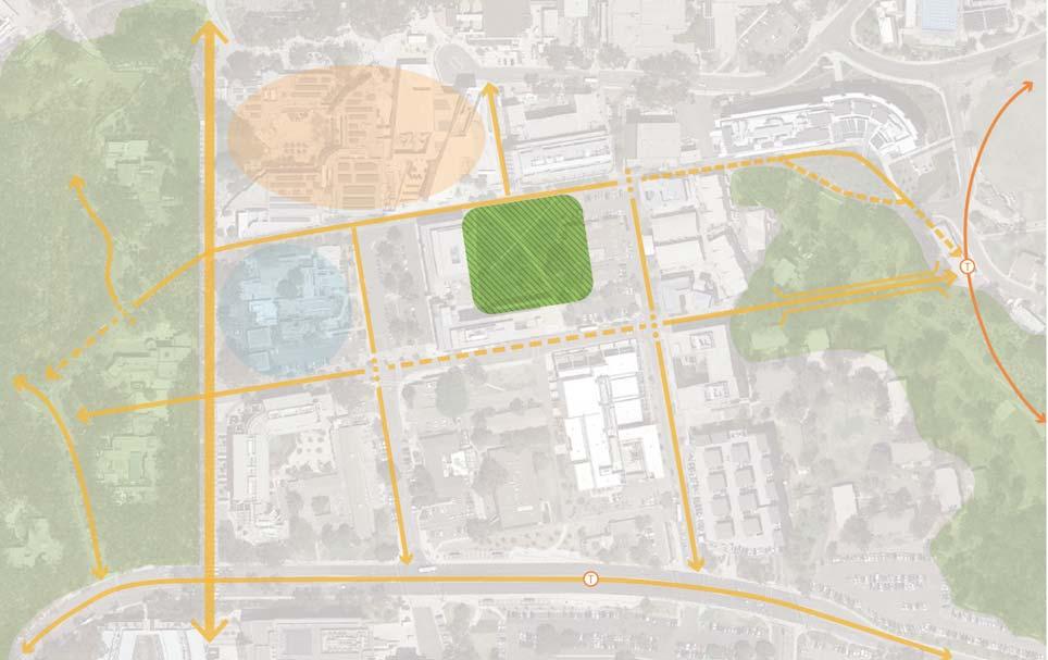
Chapter 3 includes several diagrams to outline open space rela onships at the campus scale. Each sec on contains diagrams of the geographic manifesta on of the framework and outlines its defini on and guiding principles. The Campus Open Space Framework includes:
• Entries
• Seams
• Circula on
• Loop Road
• Grove Reserve
• Restora on Lands
• Ecological Reserve
• Stuart Collec on
• Historic Places
• Landscape Plan ng Typologies
The Campus Places Sec on, while not a prescrip ve guide, iden fies strengths of each open space “Place” that contribute posi vely to the campus iden ty as a whole. The term “Places” suggests these are iden fiable loca ons that warrant specific a en on. In select loca ons, the plan explores poten al improvements that embody the principles discussed in the OSMPS with conceptual graphics and analyses. Chapter Four includes these descrip ons with associated analysis and conceptual graphics. All of the campus public places are not outlined in this document, however, that does not make them less important to campus iden ty.
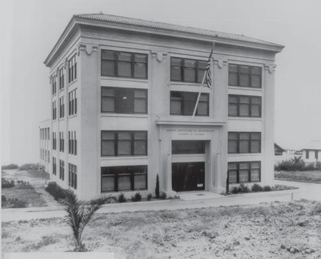
UC San Diego’s rich beauty is complemented by an interes ng history. UC San Diego began as the Scripps Ins tu on of Oceanography which formalized in 1925. In 1955, the San Diego City Council offered the land that was occupied by Camp Ma hews to the University of California. In 1959, a Bill of Congress was introduced to transfer Camp Ma hews to the University of California Campus. Roger Revelle, the Scripps Ins tu on Oceanography Director at the me, along with other scholars, were instrumental in the recruitment of professors and administrators and the crea on of the University of California, La Jolla, later renamed University of California San Diego.
From coastal bluff and military base to one of the world’s premier research universi es, several important historical elements that exist on campus today are markers of the evolu on of UC San Diego.
From the 1987 Open Space Study to the 2004 Long Range Development Plan, UC San Diego has conducted planning studies to guide everything from detailed design to long range planning. Previous plans have been referenced in order to remain consistent with open space planning principles that exist in other documents. For instance, the open space principles outlined in the 1989 Master Plan are s ll valid today, including preserva on of the Grove, Ecological Reserve and Restora on Lands. Main forms of pedestrian circula on outlined in the plan are s ll important circula on routes for students. Neighborhood plans provide historical background, areas of change and primary framework elements for specific campus places that relate to academic and housing centers.
However, this plan also revisits some evolving concepts that differ from previous plans. While the concept of preserved open space is valid from previous plans, the idea of the Grove and its plant material is evolving to reflect approaches more relevant today.
This plan is part of the pre-planning for the Long Range Development Plan Update (an cipated comple on in 2018). Addi onally, the document serves to meet the goals of the UC San Diego Strategic Plan. Exis ng and planned open spaces will help facilitate the goals of the plan, par cularly Goal 4, “Manage the Campus Landscape...” and Goal 5, “Guide Future Developments.” These goals align with the Open Space Planning Principles men oned later in the document.
Physical campuses are not sta c en es. They may be changed drama cally by single projects yet also may be shaped slowly over me by external forces. For example, leaders respond to new opportuni es for investment in student centered facili es and infrastructure. Challenges presented by climate change are another driver for campus renewal. Goals to reduce greenhouse gas emissions have catalyzed transit programs, bringing people to campus in new ways and points of arrival. Green infrastructure—the use of plan ng areas to filter and cleanse stormwater runoff—promotes new thinking about how campus open spaces can be mul func onal. This plan describes open space principles that are drivers for a more resilient campus and provides more detailed place descrip ons to guide future projects.
Open space is the space not occupied by buildings.
The UC San Diego Open Space Master Planning Study focuses on all exis ng and planned campus open spaces. These spaces are important to the iden ty of campus in the present and the future as outlined previously in the 1989 Master Planning Study. Rather than referring to them as spaces, they are referred to as Places in this document, dis nguishing them as important parts of the overall campus open space framework. This document provides descrip ons of each of these open spaces and how they relate to the larger campus framework. Addi onally, several campus Places have been selected for a more in-depth observa on and conceptual design inves ga on. These places have been chosen due to their improved func on or as part of a preserva on strategy to strengthen campus iden ty.
Addi onally, this document gives special considera on to landscapes that are iden fied in the 1989 Master Planning Study. The Ecological Reserve is a high quality landscape consis ng of na ve plant and biological communi es. Sustainable management of this area is required by the 2004 UC San Diego Long Range Development Plan Environmental Impact Report (LRDP EIR). The Grove Reserve is a cultural landscape and a significant part of the campus aesthe c.
This document supports the goals of the Strategic Plan and will inform future updates to the LRDP. Addi onally, this study is meant to guide ongoing development so that new buildings and their rela onship to exis ng or future development is addressed in all projects moving forward. Projects as small
as replacing ligh ng on a paved path and those as large as designing a new district for campus should consult this OSMPS, as everything on campus that exists outside of buildings is part of the open space referenced in this document.
Finally, this document is meant to outline objec ves to protect and preserve both exis ng and planned open spaces, recognizing the importance of present and future spaces on campus.
Utilities, lighting, bike facilities, etc. are all considered integral components of the campus open space.
1 identify campus public places
GUIDELINE: This plan should provide descriptions and context maps of campus places.
This document is focused on describing campus public places, how they are designed and maintained. The planning guidelines in this document should be applied to all of these places in different capaci es. Each descrip on highlights what makes these places special, exis ng condi ons and the overall concept for the use of the space. For several places, the planning ideas are applied to show a conceptual design.
2 guide overall campus open space framework
GUIDELINE: Campus places should be part of a larger open space network that addresses mobility, campus identity and legibility.
The open space framework is part of a larger landscape rela onship to the campus that relates to mobility, neighborhood iden ty and legibility. Addi onally, those places that are part of the Grove, Restora on Lands and Ecological Reserve should be preserved in order to preserve an integral part of the campus framework. The framework should also take into account new developments and modes of transporta on, providing a network for comfortable travel to and from campus.
3 document UC San Diego’s landscape identity
GUIDELINE: Outline present and future landscape typologies including plant and material palettes and identify the unique elements that make open spaces authentically UC San Diego.
Place character at UC San Diego is o en manifested as part of a strong landscape plan ng and material pale e. These pale es should be made clear in order to serve as a guideline for new landscapes and the maintenance of exis ng ones.
4 manage the campus landscape to preserve
GUIDELINE: Specific places should be managed and preserved as part of the larger open space framework.
Special campus places containing historic landscapes, those with Stuart Collec on artwork and sensi ve ecologies should have specific outlines for maintenance and preserva on. This is important to the diversity of places on campus and should be preserved to promote a strong campus landscape iden ty.
GUIDELINE: Guide future developments and how they interface with campus places and the larger landscape framework.
Each project should address campus places directly surrounding the building as well as the larger campus open space framework. These opportuni es offer a cri cal opportunity to reinforce campus open space objec ves. This builds on the 1989 Master Planning Study Principle of Connec ons.
6 highlight donor opportunities
GUIDELINE: Outline donor opportunities for funding and maintenance of open space.
Several alumni and friends of the University have expressed interest in funding future landscape projects as well as contribu ng the redesign and maintenance of exis ng campus places. This document highlights these opportuni es.
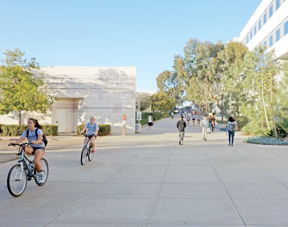
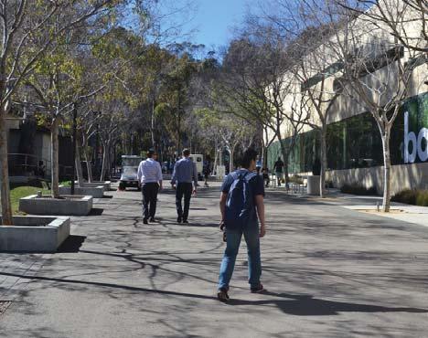
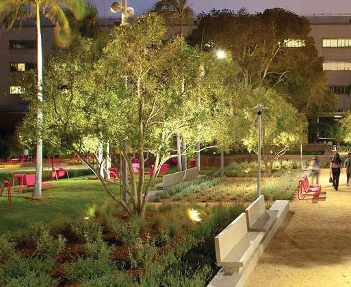
The experience of entering and circula ng within the en re UC San Diego campus should be facilitated and enhanced by the effec ve use and sequencing of districts, outdoor spaces, wayfinding, plan ng, ligh ng, and furnishings

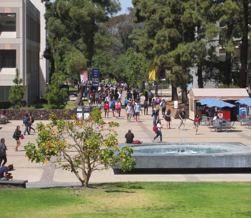
– Legibility of the campus refers to those physical features circulatory routes, vegeta on, signage, plazas, etc. – which can be easily read to guide to one’s experience of the f campus. New students and visitors benefit from clarity o access for wayfinding and orienta on. Addi onally, clear access fosters a strong sense of visibility that contributes to campus safety goals. Entries that are well marked, consistent plan ng that reinforces the campus framework, and direct f paths that organize the campus are important types o features to reinforce clarity. The en re campus: staff, faculty, undergraduate and graduate students, visitors and alumni take pride in a well-organized campus that fosters a strong sense of place. A readable hierarchy of circula on routes, gathering spaces that promote ac vity, logical campus and neighborhood centers, and long vistas support campus legibility goals to these users. Legible features are memorable. Landscape elements can contribute to intui ve wayfinding and provide legibility with visual cues and sequencing. Alumni may recall with nostalgia the iconic place of grandeur and equally, the quiet glade where studying was completed in solitude. The open spaces of the campus – large such as Town f Square or small such as the in mate eucalyptus glade west o Warren Mall—should read as a diversity of dis nct spaces that contribute to the overall campus network of places through func on and the vegeta on character they reinforce.
• The UC San Diego campus should be legible from its f perimeter as described in the seam and entry sec ons o the framework chapter in this document.
• Zones such the University Center which serves as the “downtown” of the campus should be defined as a district with consistent treatments such as paving, trees, furnishings, and lights.
• Neighborhoods should read as dis nct areas through signage and general open space character.
• Major cross-campus paths should have clear iden ty to dis nguish from local areas. Secondary walks serving a local neighborhood or district should receive consistent treatments to improve legibility.
• Wayfinding should be incorporated into circula on routes
• Vegeta on, furnishings, and paving should be appropriately used to help define districts, streets, and campus open spaces regardless of project boundaries or buildings.
• Project boundaries should respond to and incorporate the elements required to further define open space.
The campus open space should convey a posi ve image of the University to support its mission as a student centered, research focused public university consistent with the UC San Diego Strategic Plan
The quality and character of the open spaces of the campus Thequalityandcharacteroftheopenspacesofthecampus reflect the iden ty of the University. While a legible environment is one that is easily read, the iden ty an environment fosters is the subject of this principle. UC San Diego has described in its strategic plan the emphasis on students, research, and public service. In this way, campus treatments should promote ideas that transform UC San Diego into a living, learning university. Campus outdoor spaces and furnishings should be comfortable and adaptable to student lifestyle. Design and maintenance quality should be considered in parallel with academic quality, ins lling pride in students and visitors. Features that highlight the campus as a living learning laboratory par cularly relate to this principle. Places that can engage users and model best prac ces of resiliency, energy f produc on, ecological processes, restora on, and mi ga on o human impacts are central to the University ’s iden ty. Campus vegeta on also reflects the University ’s iden ty. With early roots in the natural coastal se ng and a proximity to world class beaches, adap ng contextual ecological influences into the campus landscape is appropriate. In dense campus cores and courtyards, applica on of the urban San Diego character of plan ng which draws on the diverse Mediterranean climate appropriate pale es, is equally relevant.
• Open space and the specific places at UC San Diego should be considered integral to the iden ty of the campus to promote Strategic Plan importance of students, research, and public service.
• f Plan ng should be used to communicate a sense o place and connec on to the ecological zones beyond the campus.
• Designs for new spaces and maintenance of exis ng ones should reinforce the imageability of campus.
• Perimeter treatments including those along seams, should create a clear iden ty for the university
• Entry signage should be consistent and unique to UC San Diego.
• Landscape treatments such as trees, plan ng, sidewalks, lights, walls, and furnishings should be u lized to establish campus iden ty and reinforce a legible campus organiza on.
• Wayfinding should be employed to provide clear, easy to understand guidance on how to move through the campus, and to reinforce a high quality image for the campus.
• Plan ng pale es should reinforce campus iden ty zones such as neighborhoods and natural areas.

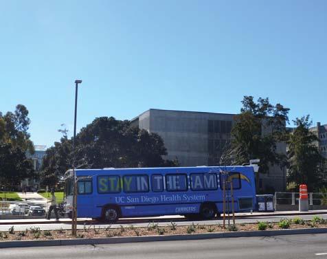
Maximizing connec vity and accessibility by providing clear and efficient routes for all travel modes including pedestrians, bicycles, transit and vehicles, is the best strategy for minimizing unnecessary vehicle trips, enhancing public safety, and encouraging use of transit op ons
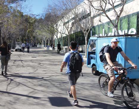
Recognizing the value of mul modal access and the importance f of integra on into the campus open space is a principle o the OSMPS. Legible pathway layout and wayfinding, reduced conflict points, accessible surfaces, and comfort are factors of campus open space and safety considered by the OSMPS.
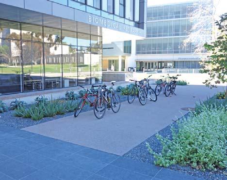
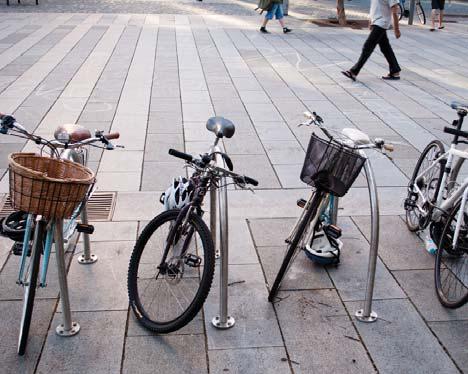
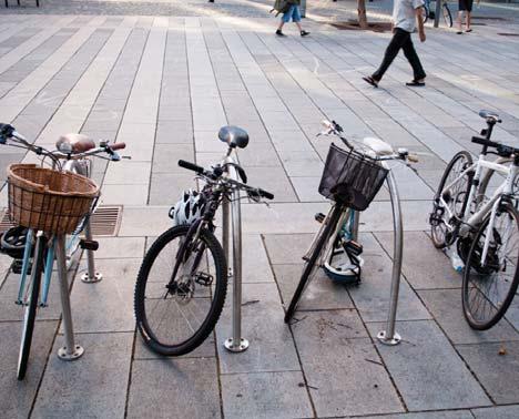
Path design, material selec on, and the organiza on of bicycle parking are addi onal components of mobility planning important to the campus open space.
Provisions for ac ve transporta on choices on the campus can be considered in rela on to the principle of resiliency. The open space should accommodate a path network which provides direct access for bicyclists and pedestrians while minimizing f points of conflict with vehicles and each other. These forms o mobility reduce carbon gas emissions and encourage healthy exercise. By integra ng pedestrians and bicycles with transit through access and sta on enhancements, mobility op ons are again expanded further, reducing vehicle trips. As stated in the 1989 Master Planning Study, “...reinforce connec ons among neighborhoods and between them and the University Center.”
Addi onally, implementa on of improvements to pedestrian walks such as the Campus Meander, Osler Walk, Lyman Lane, and others should be more legible in order to facilitate more informal pedestrian linkages around campus.
• Mobility components should be clear and consistent across the University in order to manifest campus iden ty and create legible circula on routes.
• Enhanced transit facili es should provide comfort, ligh ng, signage and real me traffic informa on.
• Direct and legible formal and informal walking routes on campus should be as comfortable as they are accessible.
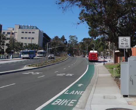
• Dedicated and shared bike routes should be established to maximize efficiency and safety for users.
• The 2012 Bicycle and Pedestrian Master Plan should be considered in guiding design for new and exis ng open spaces including enhancing campus bike lanes and secure bike parking
• Bike share should be provided at cri cal mul -modal points and be available for students, faculty and university visitors, especially near regional transit sta ons.
• Parking areas should be defined to avoid conflict with circula on and to avoid damage to plan ng.
• The University is endeavoring to create a plan for cart circula on in order to ensure safety for all users.
• Vehicular circula on around campus should be designed for safety and be restricted in areas that are predominately bicycle and pedestrian networks.
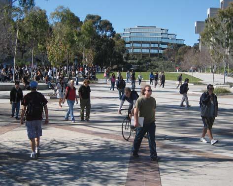
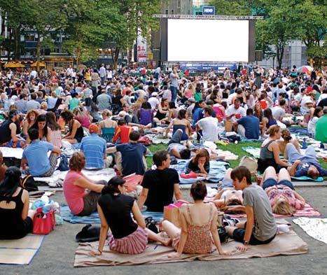
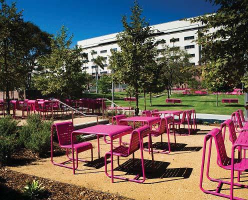
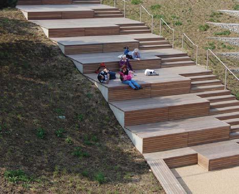
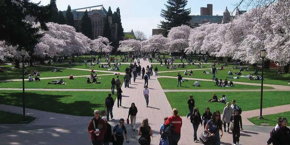
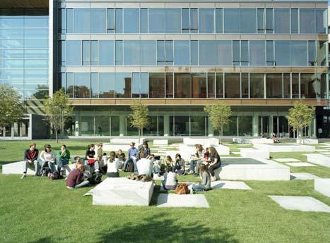
Outdoor places for gathering, collabora on, mee ng, and entertainment offer students and faculty the opportunity to interact around research, academics, and for the general enjoyment of the campus experience
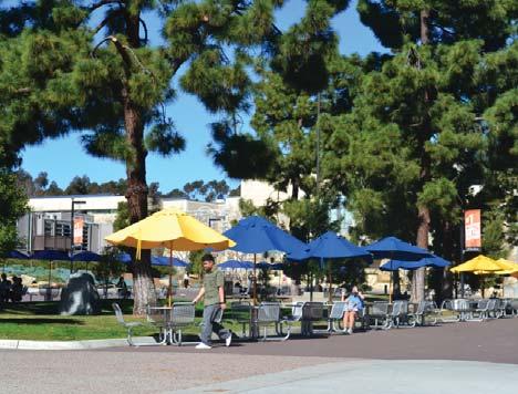
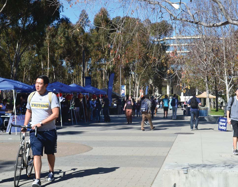
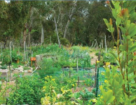
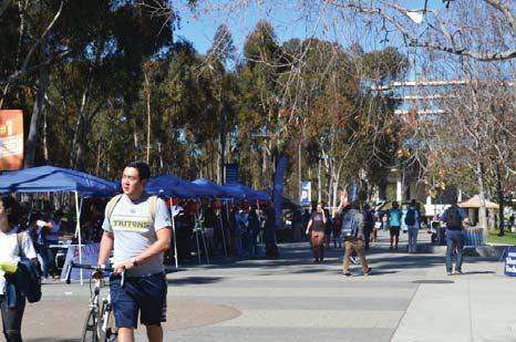
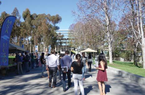
The year round climate of San Diego encourages students to spend me outdoors as part of their academic and entertainment pursuits. The campus open space hosts loca ons for academic learning, collabora on, ac ve recrea on, demonstra ons, school spirit ac vi es, and contempla on. It is the purpose of this study to strengthen the func on of outdoor spaces for use by students, faculty, staff, and the public for improved learning and con nued safety. Outdoor classrooms that allow groups to bring their subject ma er outside are encouraged. Spaces where professors and students mix casually or schedule mee ngs foster opportuni es for academic advancement. Community gardens foster stewardship and interac on.
The study recognizes the role of large common spaces for events and socializing. The campus quad is a feature of many universi es and central to student life tradi ons. Several spaces are iden fied on campus to serve as neighborhood centers for special programmed events.
When students, faculty, and visitors are not in classrooms or a ending campus events, they occupy the variety of social spaces on campus. These places are necessary in order to provide a range of places for the diversity of users. From informal recrea on to outdoor performance space, different design considera ons should be considered.
In designing new social spaces and considering those that already exist, the importance of variety should be kept in mind. Places such as Ma hews Quad provide quiet solace in a f bustling district, while Library Walk facilitates the gathering o student groups and socializing
• Gathering spaces should be provided to vary in size and scale in order to accommodate individual or small group ac vi es and large group events.
• Some social spaces should relate to surrounding building uses such as housing or performance art in order to facilitate more meaningful outdoor programming and user engagement
• Outdoor spaces should be organized to address hierarchy of overall campus, neighborhoods, building clusters, and discrete, semi-private spaces.
• Select open spaces should provide ameni es to encourage interac on between diverse groups such as faculty and students.
• Technology such as Wi-Fi, interac ve displays, and apps should be explored to provide ways to connect people with campus places, research, historic informa on, and current events through their personal devices.
A changing global climate requires greater a en on to conserva on strategies and management of the landscape to reduce resource inputs and maximize ecological func on
Climate change requires campus leaders to consider s f to make UC San Diego more resilient. Recent decades o drought and rising labor maintenance costs have challenged tradi onal plan ng approaches that require high water input and a robust maintenance regiment. The campus has made good progress to define and promote low water use plan ng strategies and implement xeriscape treatments that reduce maintenance needs.
trategies
Assessing resiliency of campus open spaces involves understanding which areas can evolve and which require maintenance to sustain a par cular func on. Lawns, for example, require extensive water resources and mowing While elimina ng obstacles is key to overall water conserva on strategies, grass fields that specifically support ac ve recrea on are highly valued and may be worth the
resources. Eucalyptus forests are managed with very li le resource inputs and are valued as an iconic campus landscape typology. The forests lock up carbon and have beneficial stormwater a ributes. During excep onally dry periods, some supplemental irriga on might be considered due to the long term environmental benefits the forest provides. A very long term view might contemplate how a new plant community might serve a similar func on. In these ways, each landscape area should be evaluated according to its resource requirements and func ons with an understanding of how it may evolve and change over me.
If the campus should serve as a model for other universi es, se ng the standard for sustainable open spaces that react to inputs including limited resources and climate change while retaining the character of the university.
A changing global climate requires greater a en on to conserva on strategies and management of the landscape to reduce resource inputs and maximize ecological func on
energy use and resource extrac on
• The campus should be carbon neutral by 2025. Open spaces should be designed and maintained for energy efficiency and use renewable energy when possible.
• Greenhouse gas emissions should be targeted for reduc on through public transit and ac ve transporta on ini a ves such as bicycling and walking.
• Exis ng open spaces should be evaluated for their resource use and modified accordingly through changing plant pale es, maintenance prac ces, and material selec on.
• Management of exis ng landscape assets should be evaluated periodically to allow evolu on with changing environmental condi ons such as climate change.
water use
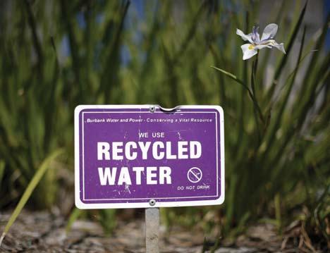
• Open space design and upkeep should con nue to reduce potable water use and increase grey water and recycled water irrigated landscapes.
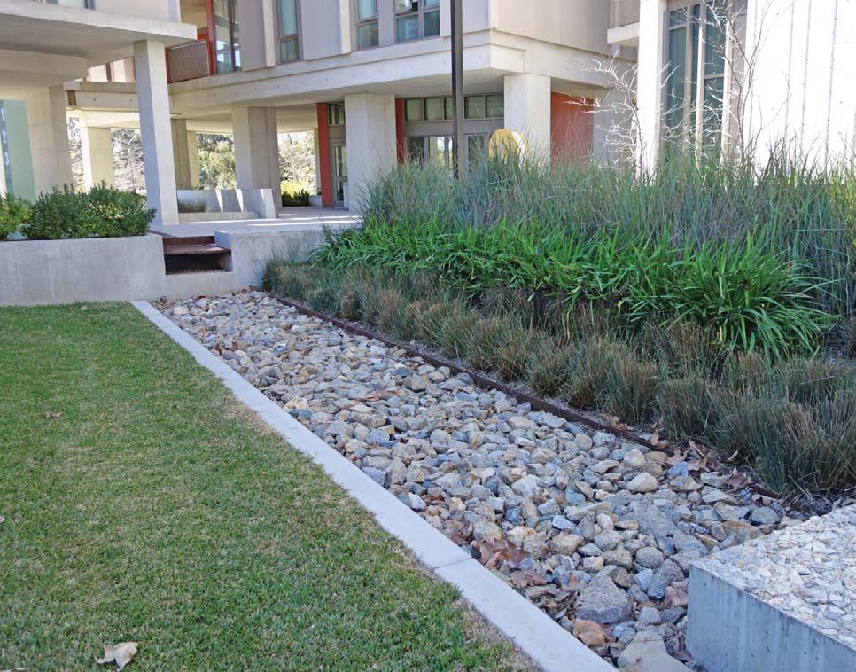
• Stormwater should be viewed as a resource and designs should include resources for treatment, deten on and storage of stormwater.
• Campus plan ng should feature low water use plants that are appropriate to an urban campus landscape. Similarly, cultural needs and maintenance prac ces should reflect
resiliency strategies.
• When possible, low maintenance and xeriscaping should be incorporated into exis ng open spaces and designs for future plant pale es in order to decrease resource inputs.
ecosystem crea on and restora on
• Campus plan ng should feature vegeta on that supports the larger San Diego coastal ecosystem.
• Educa onal programs should be featured to promote the campus environment as a living laboratory
• Focus on projects in the restora on lands in order to revitalize habitats and create open spaces that contribute to the San Diego ecosystem.
landscape as infrastructure
• Campus open space should incorporate green infrastructure programs to func on as treatment areas and to capture stormwater.
• Open spaces should be thought of for the u lity as well as aesthe c quality. Working landscape features should be incorporated into exis ng and proposed open spaces as much as possible.
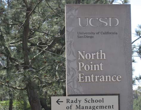
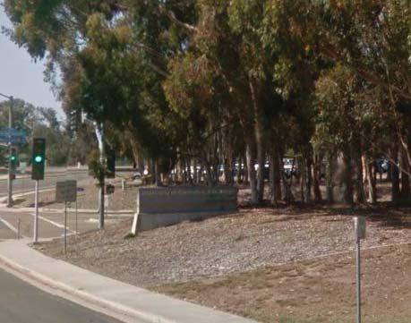
Entries are the gateways into the campus. They should reflect the unique character of the University, assist in wayfinding, and contribute to a sense of place. Consistent treatments reinforce the legibility of the campus open space. Although plan ngs in these areas should be culturally complementary with those plan ngs found along the campus seams, they should also be dis nct. Campus entry iden ty can be shaped by tree species, understory character, and topography.
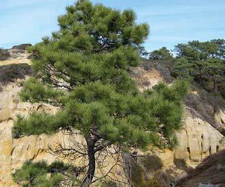
• Due to its unique silhoue e and character, the na ve Torrey Pine has been iden fied as the dominant campus entry tree. These should be planted at all campus entries where adequate space exists. Dense groupings in these areas are appropriate to create stately, conspicuous and welcoming campus entries.
• In loca ons where a strong open space iden ty already exists, such as at Revelle College Drive, the incorpora on of other trees may be considered.
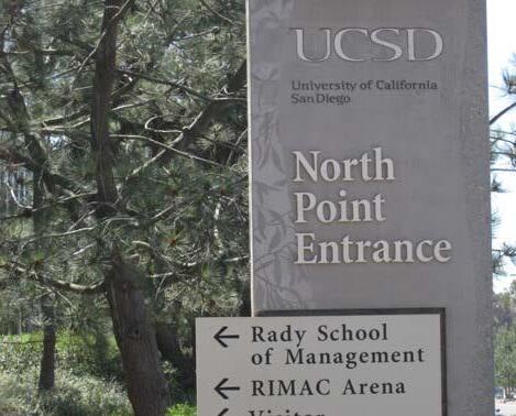
• Each entry has a corresponding signage element appropriate to its hierarchy as described in both the 1998 SIO and West Campus Comprehensive Signage Program and 2015 East Campus Signage Study.
• Entries should incorporate both wayfinding and iden ty in signage and vegeta on.
UC San Diego is bordered and bisected by various streets that serve as the interface between the campus and the surrounding community. These seams establish the physical presence of the University within the local community and shape the public’s percep on of the campus. They should serve as a space where the campus iden ty is established while also integra ng the character of the surrounding natural landscape. The seam’s aesthe cs should promote UC San Diego’s goals for iden ty and resiliency. For example East Campus exerts influence on the campus perimeter treatments along Regents Road through its style of signage and plan ng.
• Balance consistent treatments to unify the seam with site specific ecological influences such as Grove, Restora on Lands, and Ecological Reserve.
• Encourage neighborhood character to inform the treatment of each seam.
• Recognize non-University jurisdic on over right of way and need to partner with others to achieve goals.
• Consistency of vegeta on along seams should exist to reinforce University character and regional ecology.
• Each seam should Incorporate entries, and iden ty signage.
• Retaining walls, building surface treatments, and open spaces should be seen as opportuni es for enhancements.
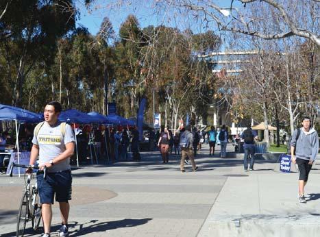
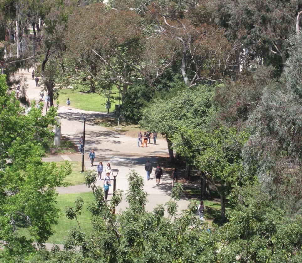
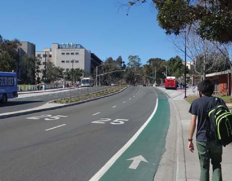
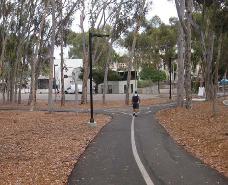
The circula on system at UC San Diego is an integral part of the Open Space Framework. The design of circula on integrates several aspects of open space design. For instance, the same road that transports people on mul ple modes also filters stormwater, and serves as growing medium for plants and trees. The physical design of these func onal components make up a significant part of the open space area. UC San Diego is in constant mo on- bicyclists, pedestrians, transit riders, and vehicle drivers are all an important part of this circula on network.
• Develop invi ng and accessible transit areas that incorporate a variety of uses and ac vi es that incorporate all transit modes and the needs associated with them.
• Ensure that the circula on network con nues to provide accessibility for all modes of transit with the crea on and maintenance of strong, legible connec ons.
• Evaluate the network for those circula on connec ons that may be considered unnecessary in the future.
• Create circula on networks that enhance human scale and embraces the campus landscape iden ty.
• Pedestrian circula on on the campus should be intui ve, safe, and well defined.
• Infrastructure including transit shelters, dedicated lanes, symbols and informa onal signage should con nue to be installed around campus in order to facilitate ridership.
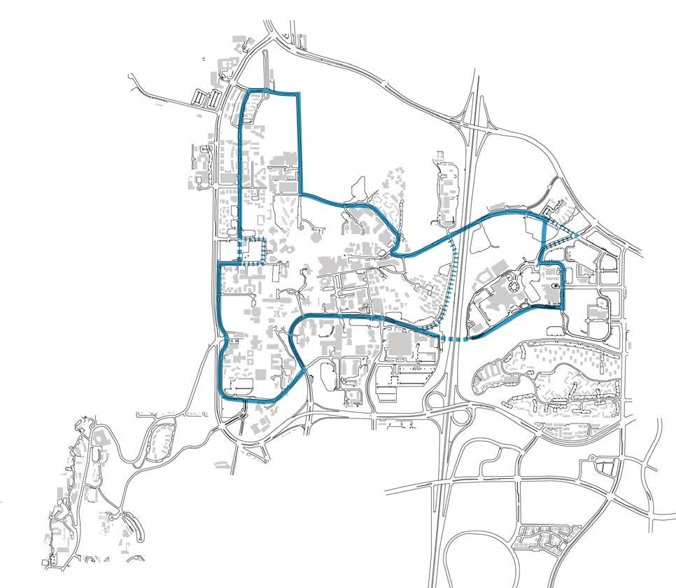
The Loop Road, also known as “The Loop,” is a circula on element iden fied in the 1989 Master Plan Study that was established to efficiently move people around the campus and maintain a pedestrian core void of vehicular traffic. It is the major circula on route for campus shu les and cars but is also used extensively by bicyclists and pedestrians. The Loop Road should have unique wayfinding and branding to reinforce it as one of the campus’ major circula on features. Sycamore Trees are part of the Loop Road pale e and should be used where there is space and the species is appropriate. Within a par cular neighborhood or campus district, plan ng should be used to reinforce the Loop Road as well to reflect the surrounding landscape character.
• Mul ple design tools should iden fy and strongly brand “The Loop” in terms of wayfinding, shu le stops, lights, banners and vegeta on.
• The Loop Road should have a dis nct branding and mul modal way finding treatment.
• Features such as way finding should unify the Loop Road appearance while plan ng should respond to the local context of the campus area.
• Planned Loop Road alignment changes include a bridge extension of Gilman over I-5 to the east campus, the realignment of Scholars Drive to Muir College Drive, and the realignment of Campus Point Drive.
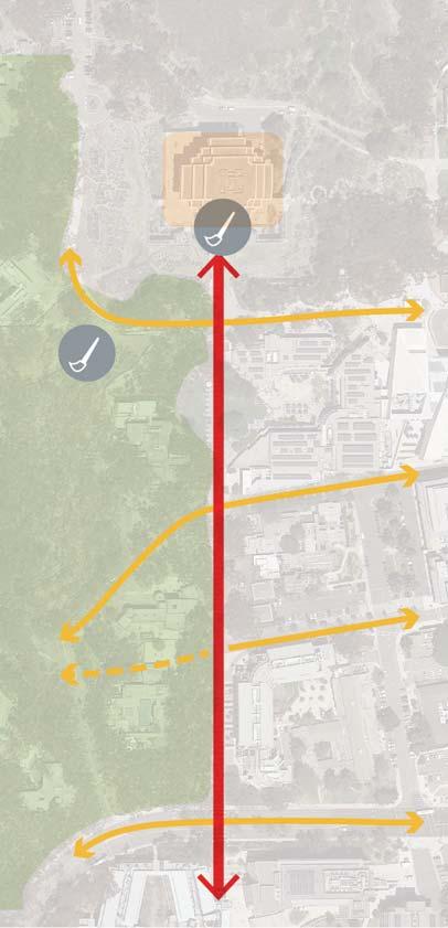
Through the development of the OSMPS, the individual land use designa ons of the Grove Reserve, Ecological Reserve and Restora on Lands have been elevated to reflect the dis nct and unique character of each of these areas. The 1989 Master Planning Study grouped all of these land uses within the Park. The OSMPS iden fies these land uses separately in order to best plan and manage these lands in a manner consistent with current campus plans and in conjunc on with the an cipated 2018 LRDP update.
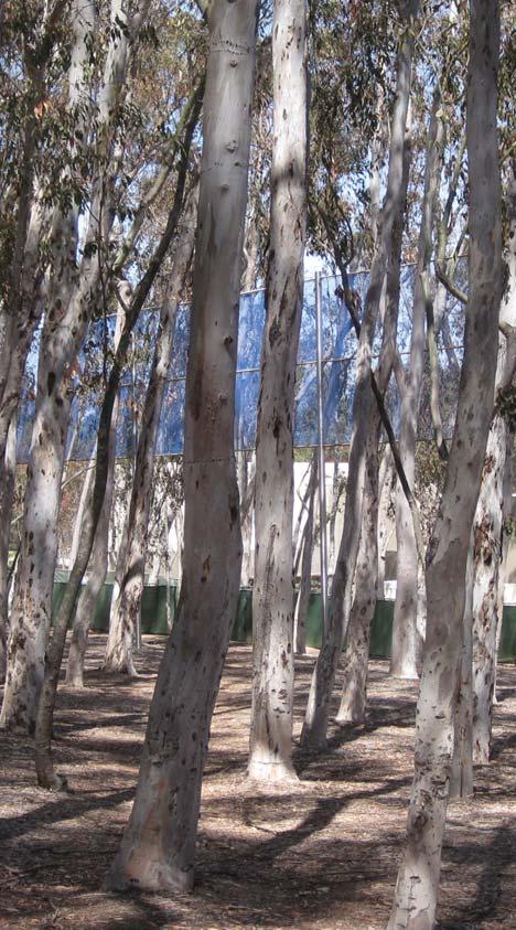
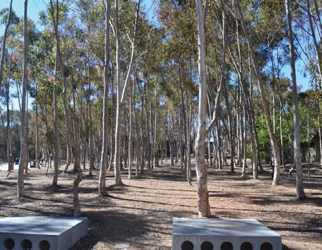
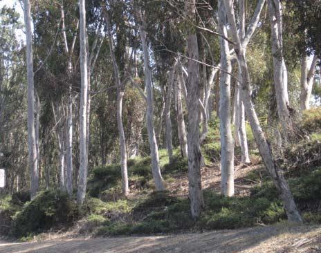
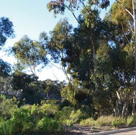
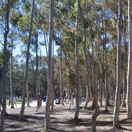
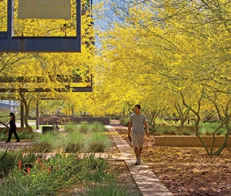
The Eucalyptus Grove is a significant part of the campus’ cultural landscape. It was developed within an exis ng stand of Eucalyptus trees, which predated the University by over sixty years. The University has embraced the Grove as part of the campus iden ty and seeks to protect the aesthe c and physical quality that has been created within the Grove. However, years of deferred maintenance, compe on, disease and drought have le many parts of the Grove in poor condi on. If the Grove is to thrive and serve its envisioned purpose as a defining physical feature of the campus, measures must be take to iden fy where The Grove is to remain and commitments need to be made to fund the maintenance and reforesta on. However, the Grove is a changing idea. The campus should retain the spirit of the Master Plan, while incorpora ng the Open Space Principle of Resiliency.
• Con nue to envision The Grove as one of the defining physical features of the UC San Diego Campus.
• Iden fy successful Grove restora on areas and evaluate their applica on to other areas of need.
• Recognize the changing nature of the Grove and con nue to diversify and strengthen it as an asset.
Through the development of the OSMPS, the individual land use designa ons of the Grove Reserve, Ecological Reserve and Restora on Lands have been elevated to reflect the dis nct and unique character of each of these areas. The 1989 Master Planning Study grouped all of these land uses within the Park. The OSMPS iden fies these land uses separately in order to best plan and manage these lands in a manner consistent with current campus plans and in conjunc on with the an cipated 2018 LRDP update.
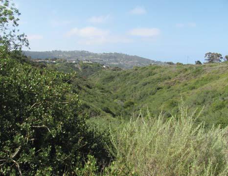
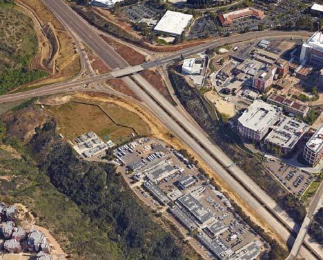
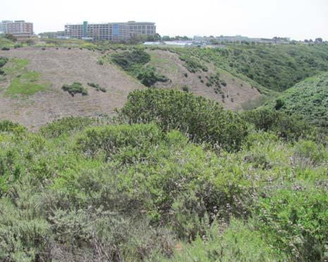
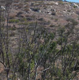
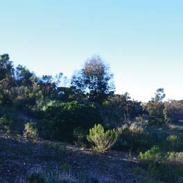
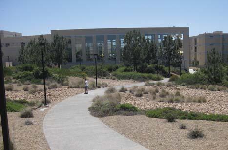
Restora on Lands are open spaces that have been diminished through development, pre-university military use, or contain non-na ve or invasive plant species. As the campus con nues to develop, these areas provide an opportunity for restora on and crea on of na ve plant habitats. Through development of the campus infrastructure, it is envisioned that Restora ons Lands can be used to meet environmental mi ga ons. In the future and as funds become available, Restora on Lands will be restored to a condi on consistent with a designa on of Ecological Reserve.
• Educate the students, faculty, visitors and neighbors on the importance of restoring the areas designated as Restora on Lands.
• Evaluate the priority areas of restora on and strategically restore those zones.
• Con nue to discover areas that could be designated as Restora on Lands.
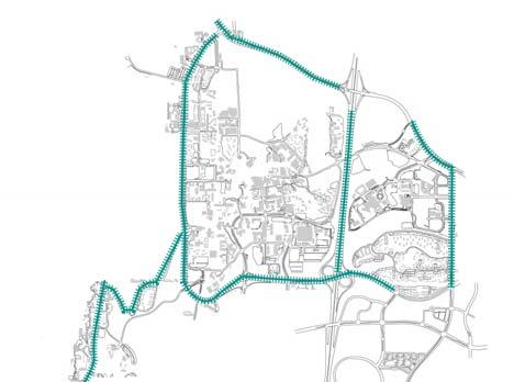
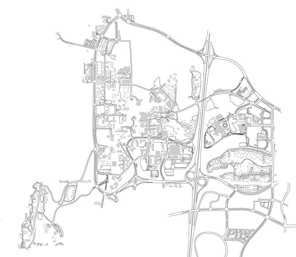
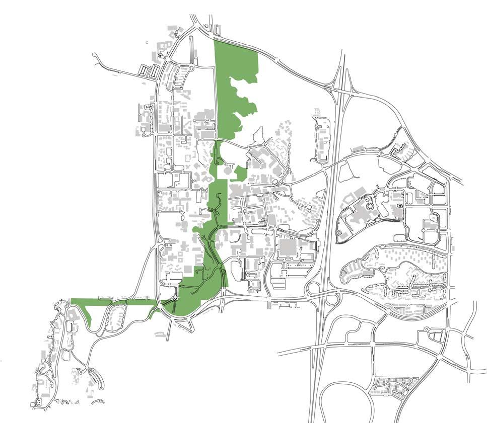
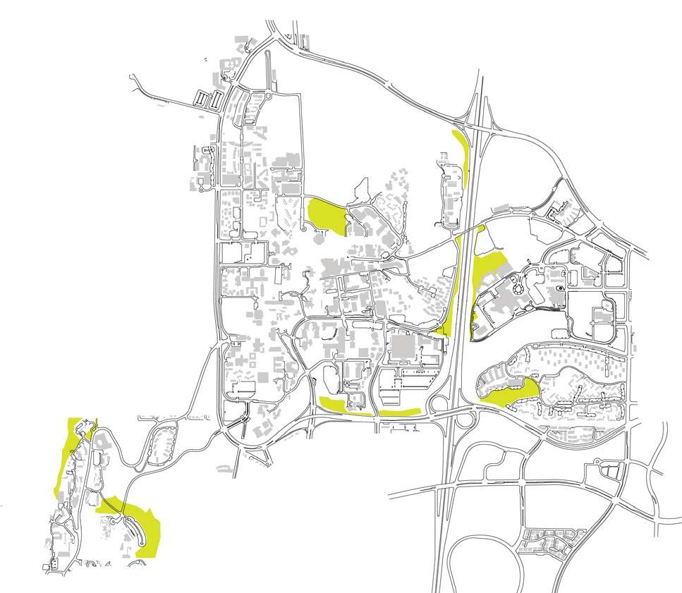
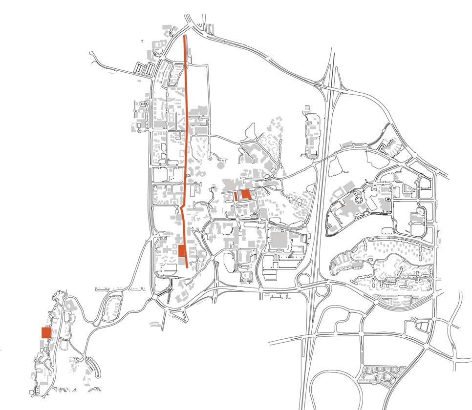
loca on map
2004 LRDP RESTORATION LANDS
“The Restoration Lands include slopes on both the east and west frontages of Interstate 5, the canyon north of Geisel Library, the canyons and slopes east of Interstate 5, the ocean bluffs at the Scripps Institution of Oceanography campus, and the slopes adjacent to the Birch Aquarium and Museum..”
2018 LRDP update will contain most current Grove Reserve, Ecological Reserve and Restoration Lands mapping. Contact Physical & Community Planning Office for most current LRDP area boundaries.
Through the development of the OSMPS, the individual land use designa ons of the Grove Reserve, Ecological Reserve and Restora on Lands have been elevated to reflect the dis nct and unique character of each of these areas. The 1989 Master Planning Study grouped all of these land uses within the Park. The OSMPS iden fies these land uses separately in order to best plan and manage these lands in a manner consistent with current campus plans and in conjunc on with the an cipated 2018 LRDP update.
The Ecological Reserve contains na ve flora and fauna that are unique to our region. In recogni on of the higher quality and biological sensi vity of the na ve habitats located there, an open space management program (OSMP) was developed in 2004 in conjunc on with the LRDP and EIR. The OSMP was not a mi ga on for the 2004 LRDP EIR, but rather to provide a framework for the ongoing maintenance or enhancement the exis ng biological values within the Ecological Reserve. The OSMP outlines general management, maintenance and monitoring guidelines that when implemented serves to protect and maintain the sensi ve resources present in the Ecological Reserve; the implementa on tool is the 2010 UC San Diego Habitat Management Plan (HMP). The HMP iden fies specific management tasks, the ming of those tasks, associated costs, and repor ng requirements. There is also a public awareness and educa on component. HMP implementa on has been consistently funded each year since 2010.
• Create a pilot project that will serve as an educa onal resource for UC San Diego and outsiders.
• Con nue to evaluate exis ng species and their importance and survivability in this zone as it relates to the Open Space Planning Principle of Resiliency.
• Raise awareness about the ecological reserve.
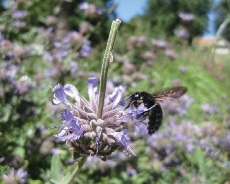
“... the Ecological Reserve lands include most of UCSD’s stands of native vegetation, this area when
can serve as an important resource for teaching and research.”
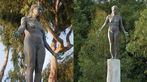
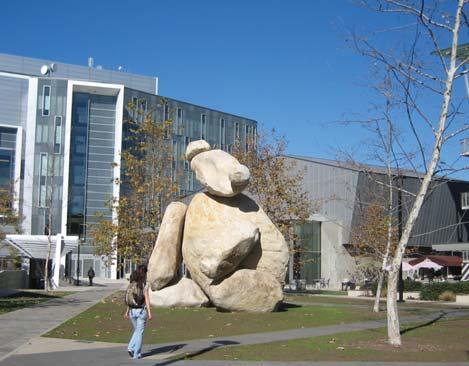
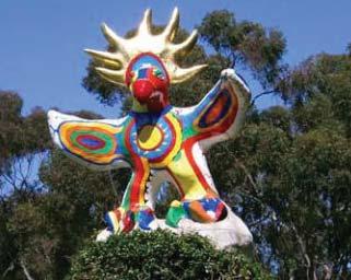
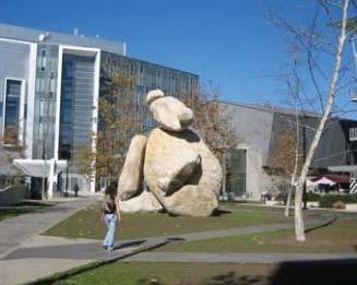
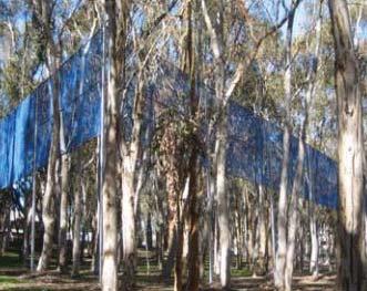
The Stuart Collec on is a unique aspect of the UCSD built environment that incorporates art through indoor and outdoor installa ons around UCSD. The art that is placed around buildings and open spaces provides points of interest throughout the campus. Some of the pieces could be categorized as land art, while others can be described as large sculptures and building treatments. Examples include “Bear” placed in the middle of a passive Quad and “Two Running Violet V Forms” wrapped around eucalyptus trees in the Grove. The Stuart Collec on pieces are surrounded by areas of influence that serve to further merge the campus open space with the art work it hosts.
Celebrate and educate about exis ng
Several historic campus places exist at UC San Diego and contribute to its unique iden ty. These places are established as culturally historic, however the term “historic” should not be interpreted in a manner that requires state, local and federal regula on. From old Camp Ma hews parade grounds, to an historic Highway 1 Eucalyptus tree alee, a diverse array of historic places dot the campus, each varies in their level of preserva on. These historic places should be celebrated and recognized as important open spaces on campus. In some cases, informa onal signage may be appropriate to display and educate the public on the significance of the space. Other places are s ll well used and elements should be restored in order to improve their longevity and con nue their place in the public realm.
• Incorporate signage and other forms of educa on about historic places.
• Restore elements in historic places as necessary.

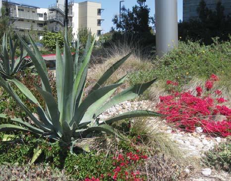
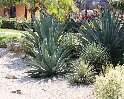
Vegeta on is a primary material in the iden ty of campus open space. As part of the overall landscape, plant species composi ons express a par cular character such as history, geography, formality, aridity, and ecology. Landscape, like architecture, is one way a campus can exhibit its own iden ty or brand. Similarly, plan ng composi ons convey a specific geography. UC San Diego has the benefit of a mild climate and diversity of ecotones from coastal bluffs to coastal chaparral canyons to protected courtyards with eclec c tropical. This plan iden fies broad plan ng typologies that exist on the campus having been conceived over me by designers, maintenance personnel, and hor culturists. The plan is not prescrip ve about recommending par cular strategies or species, however the sec on can serve as a guide to campus open space enthusiasts and visi ng designers.
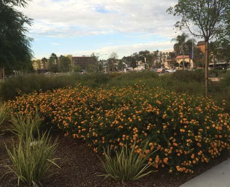
Stormwater drives our plant choices in various loca ons on campus. These plants need to serve mul ple purposes including filtering and storing stormwater. Muhlenbergia, Carex and Festuca are a few in a long list of species appropriate for this purpose. This relates back to the principle of resiliency, and plant choices should support the larger San Diego ecosystem.
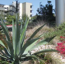
Species:
Agave spp.
Bougainvillea spp.
Aloe spp.
Baccharis, spp.
Muhlenbergia, spp.
Several plazas and larger places on campus have a pale e that evokes the dry desert areas around San Diego. These plan ngs include rock mulch and some mes stormwater management, could be described as having an ‘urban chic’ character.
Species:
Salvia, spp.
Baccharis, spp.
Ceanothus, spp.
Erigonum, spp.
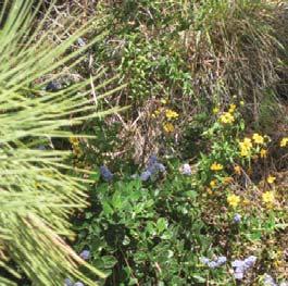
This typology exists along and near the coastal areas of campus. They include mostly na ve species such as Eriogonum sp., Ribes sp. and Bacharris sp.
Species:
Ulmus parvifolia
Pinus canaryensis
Cedrus deodara
Eucalyptus, spp.
Pi osporum, ssp.
Lawn
This tradi onal canopy tree and leafy understory is found around the University Center neighborhood and other dense areas of campus.
Species:
Caesalpinia gilliesii, spp.
Yucca, spp.
Rosemary, spp.
Euphorbia, spp.
Echium, spp.
Aloe, spp.
The subtropical zones are located in smaller plazas and squares throughout campus that dis nguish themselves from other public zones. Species vary depending on design intent.
Species:
Pinus Torreyana
Arctystaphylos spp.
Ceanothus spp.
Baccharis, spp.
Species include: Eucalyptus spp. and various groundcovers
Species:
Eucalyptus, spp.
Pinus torreyana
Quercus agrifolia
This typology is seen on N. Torrey Pines Road and extends into seams and edges on North Campus.
Species: Plants na ve to the San Diego region.
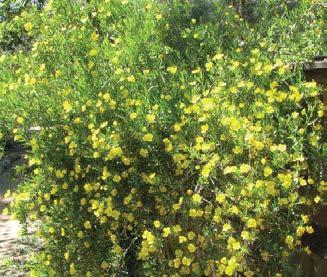
Eucalyptus Forests exist where there are groves of Eucalyptus Trees that are not classified as “The Grove.”
Species: Eucalyptus spp.
Lawns for informal recrea on and events.
Species: Dudleya brevifolia
Heteromeles arbu folia
Ribes spp.
Erigonum spp.
Rhus integrifolia
Restora on lands have a dis nct boundary laid out in this document. Species include na ve trees, shrubs and groundcover that foster the restora on of na ve habitat.
The Grove is a well documented Eucalyptus Forest spanning across the campus with dis nct boundaries. Natural bark mulch replaces most understory plan ng.
Na ve flora and fauna that are unique to the San Diego Region including chaparral.
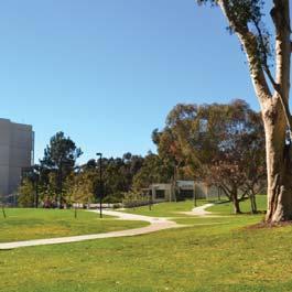
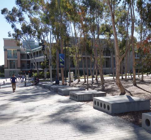
The following campus public places are a selec on of open spaces that exist on campus. However, this is not a comprehensive list of valued open spaces on campus, these are only a sample of places where principles and frameworks can be applied to open space. Each place is located in the key map and corresponds with frameworks explained in the previous chapter. These places were chosen as open spaces that illustrate a variety of condi ons on campus, from streetscapes and entries, to historic plazas and open spaces. All of the places sec ons contain descrip ons of exis ng condi ons along with key observa ons and some suggested site improvements when necessary. The places outlined in this chapter can be subdivided into two categories. One category is successful open spaces, examples of places that demonstrate UC San Diego’s iden ty and are enjoyed by students, faculty and visitors. The other categories are those places that have a poten al for change, with conceptual recommenda ons at a variety of scales.
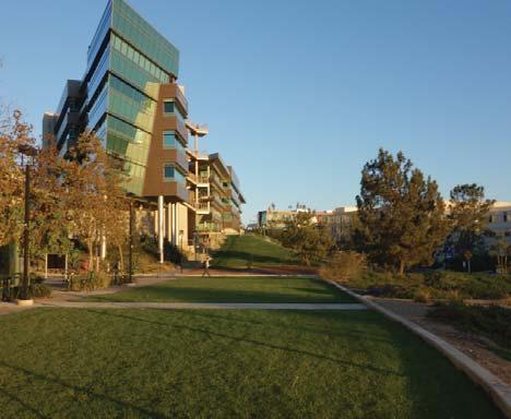
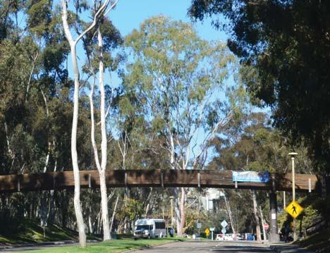
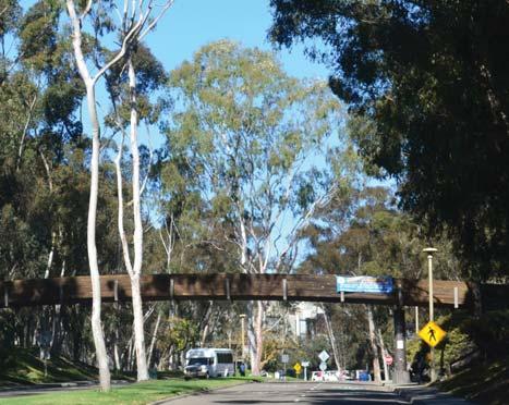
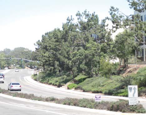
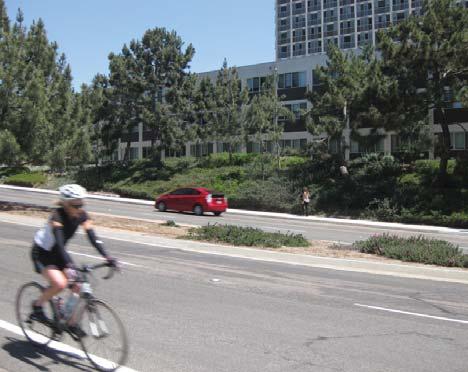
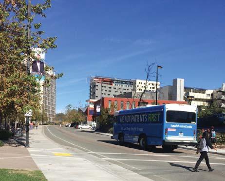
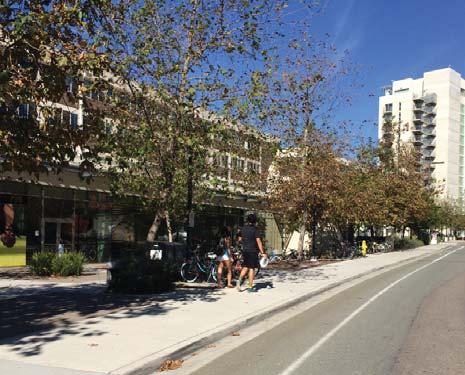
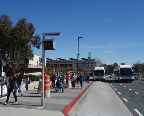
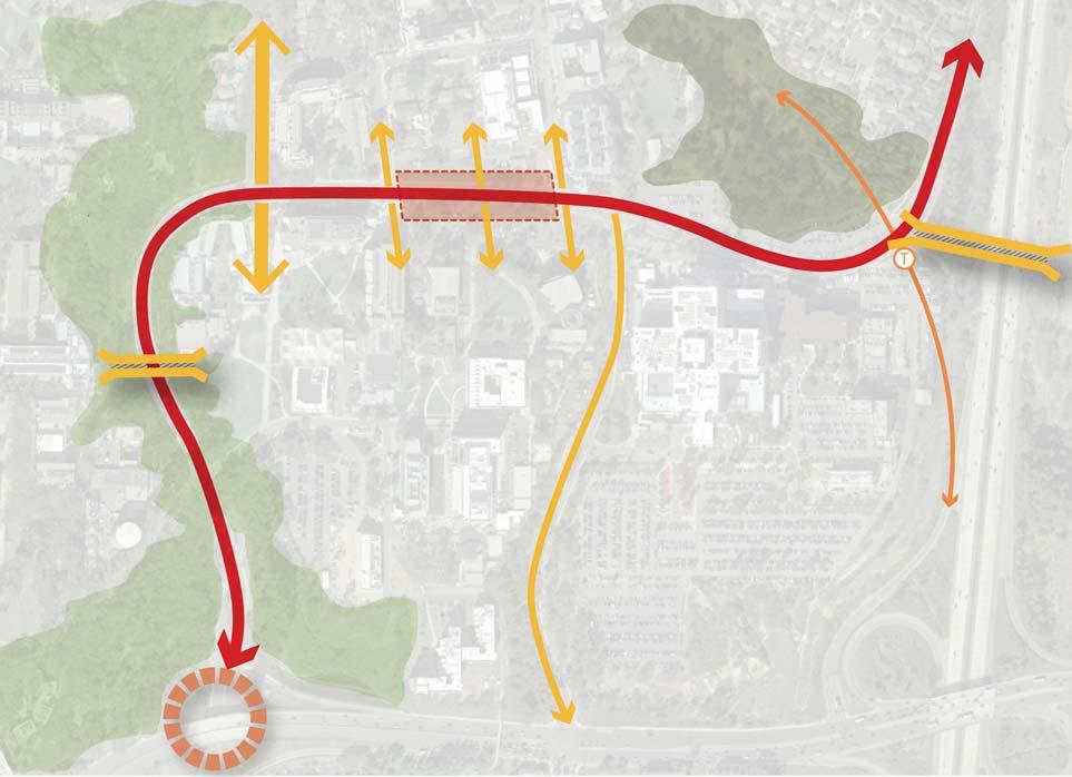
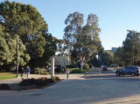
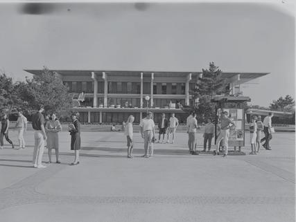
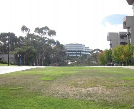
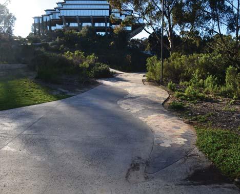
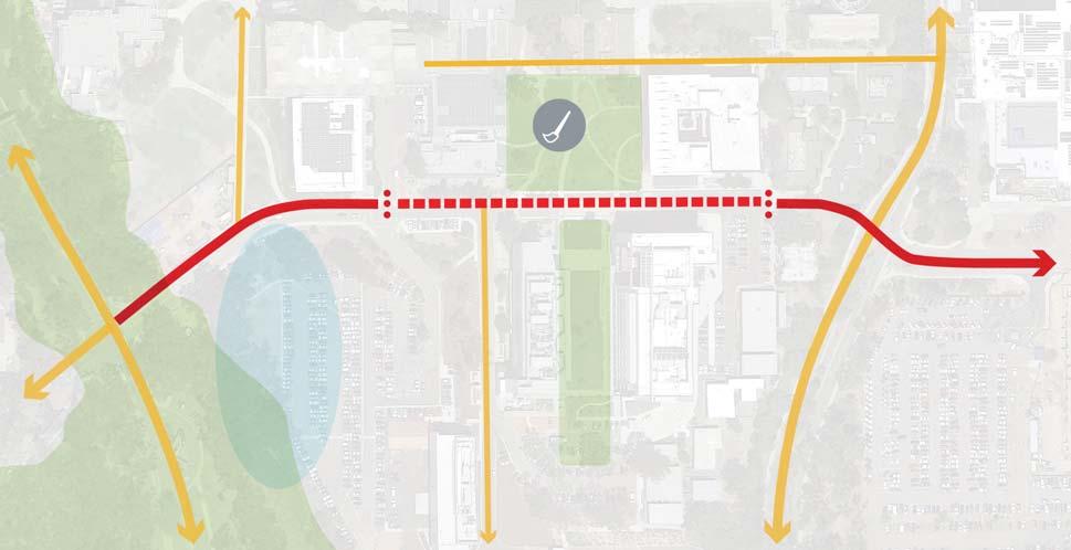
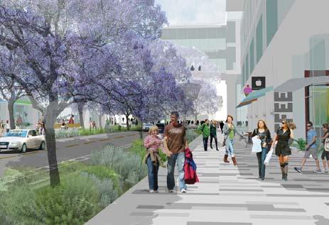
Gilman Drive is a primary entry to the campus, with a sense of arrival that provides a truly authen c UC San Diego experience. This entry moves through the Grove Reserve, for many it is their first introduc on to the iconic Eucalyptus imagery of the campus. . It is this type of imagery that is central to the master planning principle of “Park” outlined in the 1989 Master Planning Study. The sense that the campus is part of this grove is a landscape aesthe c that the University seeks to maintain. In its central por on, it transforms into a street that also serves as an important transit hub for the campus. Gilman Drive crosses through the Grove, traverses the Health Sciences and University Centers Neighborhoods before it turns and parallels Interstate 5 with a future planned connec on via a bridge to the East Campus. Each of these segments is characterized by different condi ons from the Grove to building edges and transit shelters. Along the street itself, transit will become a main priority due to shu le connec ons to nearby future LRT sta ons.
An
concept explora on
Due to Gilman Drive’s mul -modal role on west campus, the street design should keep in mind how bicyclists, pedestrians and vehicles arrive to campus. There are several entries along Gilman Drive, each of these entries should be legible and demonstrate a strong iden ty in their design. Planted edges and building setbacks from Gilman in the University Center area will create a dis nct, unifying character for this street.
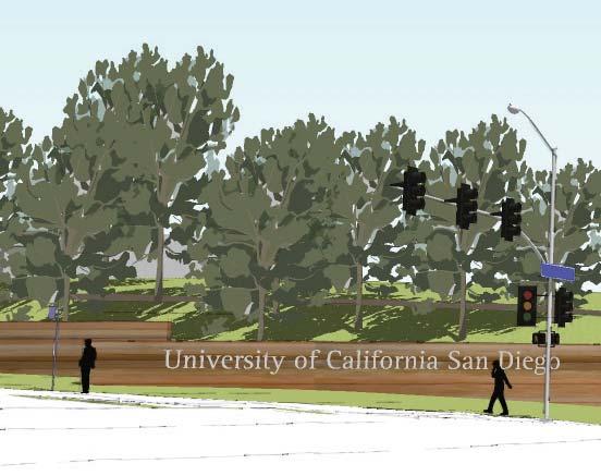
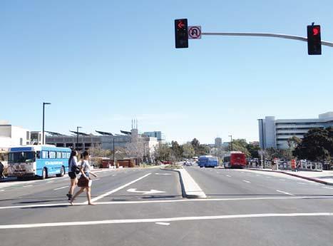
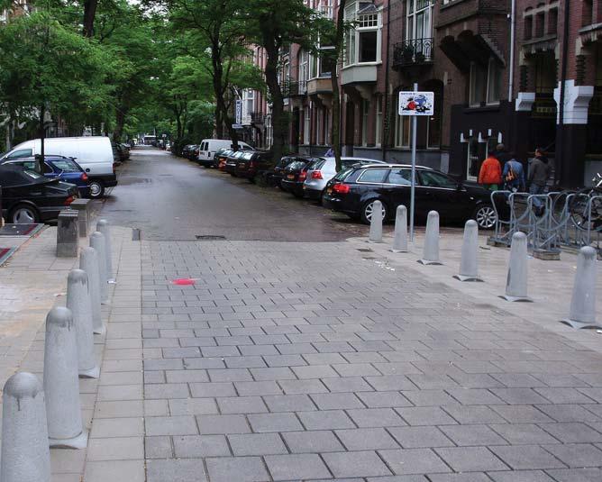
In crosswalks, including the one pictured, having legible crosswalks will improve mobility and pedestrian connec ons. The future connec on at East Campus via the Gilman Bridge must be considered as well, in order to facilitate mul modal users to move from east to west safely and seamlessly.
view of exis ng condi ons and proposed interven ons
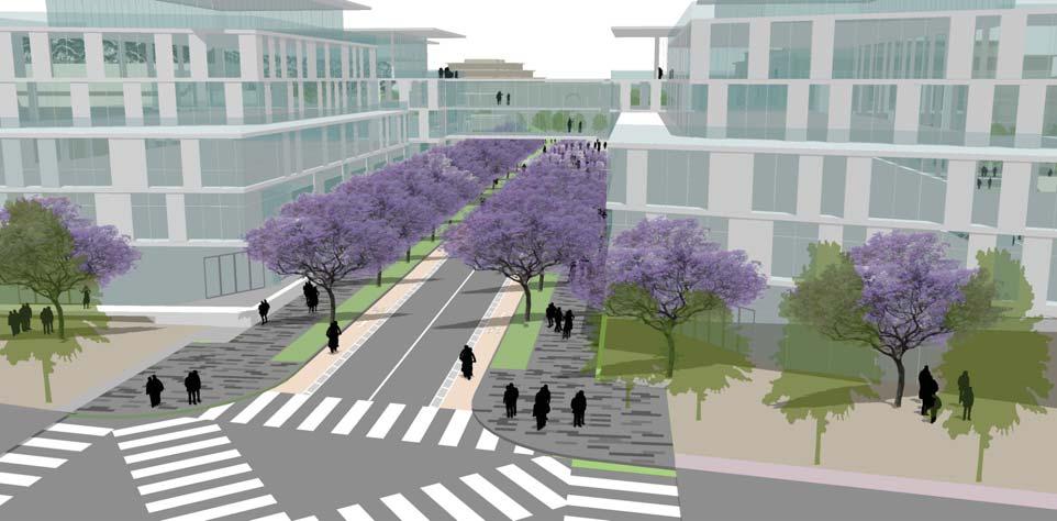
The above rendering shows a new, pedestrian friendly cross-walk at Gilman Drive and Myers Lane, special paving along Myers Lane and a vegetated buffer and building setbacks along Gilman.
The exis ng photos from le to right illustrate two diverse condi ons along Gilman Avenue. Le photograph illustrates the current condi on at the University Core, looking east. Right picture shows the Gilman Pedestrian Bridge through the Grove, a familiar visitor entry for many UCSD students and returning visitors.
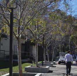
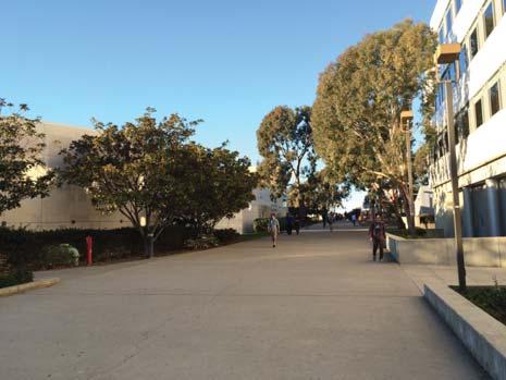
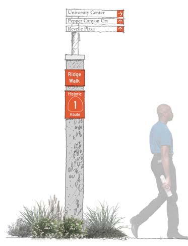
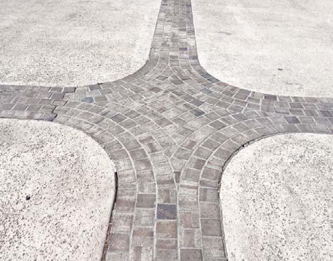
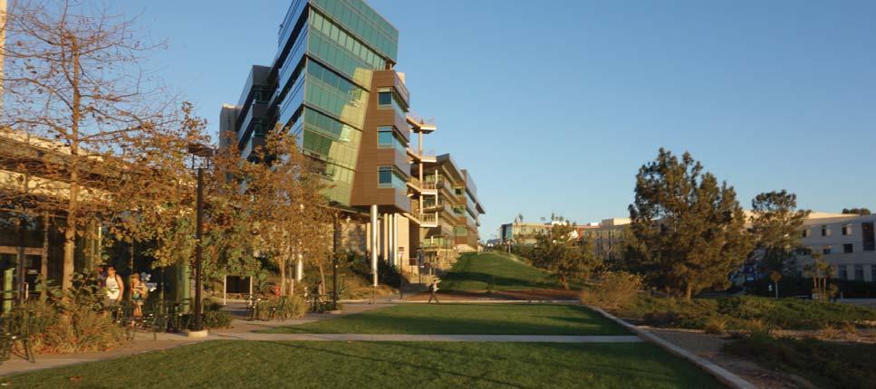
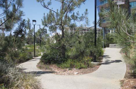
Ridge Walk is one of the primary non-vehicular circula on routes on campus, traversing north and south through four of the six colleges on campus. It is a major bicycle and pedestrian thoroughfare serving the west campus and local access to buildings, housing, and recrea onal fields. The Walk passes through Revelle, Muir, Marshall, Roosevelt, and North Campus neighborhoods. Each extends its character influencing the context along Ridge Walk. For example, at Muir College, the path meanders around lawn covered mounds that typify the historic neighborhood open spaces. Organic paving textures from the surrounding area mark path intersec ons along the walk. Vegeta on varies by neighborhood. The plant pale e of North Campus features Torrey Pines and an eclec c understory. At the far south end, the Grove character envelopes the Walk. Overall the pale e is mixed and reflects localized decision making rather than a comprehensive plan ng approach. Social spaces occur intermi ently, o en adjacent in small plazas, courtyards, or buildings.
Ridge Walk is an early coastal alignment of Highway 1.
The mature Eucalyptus tree allée at the far north end is a remnant of the corridor’s past. The walk is also historically significant; at the highest eleva on of campus, along Ridge Walk, where once expansive views occurred, Roger Revelle described his vision for the campus to colleagues. The spot is adjacent to the Wedge where a view corridor to the ocean remains.
A historic & well used campus circulation route.
Ridge Walk is a pedestrian and bicycle path that traverses very diverse condi ons along campus, therefore a design framework should address all of these different condi ons.
An adaptable toolkit should be deployed to address the en re Walk, providing a series of consistent elements. The consistent elements could include: paving material, markers and wayfinding signage. A basic, consistent paving material could signify that Ridge Walk is a singular en ty, separate from other roads and paths. Markers and wayfinding signage that evoke the history of Ridge Walk can be a consistent element that provide a layer of iden ty and legibility.
Flexible elements are necessary along Ridge Walk in certain areas that allow for new development, wider paths and planters and other varied condi ons. These elements include: path of travel width, ligh ng, plan ng, furnishing, sea ng and interpre ve signage. The flexible elements create larger gathering spaces on Ridge Walk in certain places, enhancing consistent elements and crea ng dis nct spaces.
The Ridge Walk Plant Pale e will be provided to consultants who are engaged in projects along Ridge Walk. This plant pale e is not prescrip ve, rather a concept for plan ng along Ridge Walk. Campus Planning Documents envision a “Revelle Entry Quad” at the south terminus of Ridge Walk. This will provide a pedestrian oriented campus entry at the southern end of the campus. The northern terminus of Ridge Walk is at Genessee. These two loca ons provide the space and opportunity to establish a Ridge Walk Plant Pale e. This pale e can then be used in part or whole to reinforce
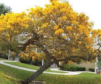
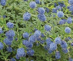
the Ridge Walk design. Large specimen trees including California Live Oak can be used at these loca ons. In concept, a pale e of low water, low maintenance, yellow and blue flowering plant materials will be used. These plan ngs will help to create a unique landscape along the length of the Walk and further will highlight the University’s commitment to conserva on and sustainable development. The use of California na ve species will be encouraged to create a sense of place and to e this landscape to the Coastal Scrub plant communi es located just to the west.
• paving material
• markers and wayfinding signage
• path of travel width
• ligh ng
• plan ng
ng pale e
• Acacia spp.
• Cercidium floridum
• Pinus Torreyana
• Quercus agrifolia
• Theve a theve oides
• Tabebuia caraiba
• Agave a enuata
• Agave vilmoriniana
• Aloe striata
• Arctostaphylos ‘Howard McMinn
• Arctostaphylos ‘Sunset’
• Ceanothus ‘Julia Phelps
• Ceanothus spp.
• Dendromecon rigida
• Cistus spp.
• Echium fastuosum
• Fremontodendron californicum
• Heteromeles arbu folia
• Lantana spp.
• Leono s leonurus
• Mahonia aquifolium
• Arctostaphylos spp.
• Armeria mari ma
• Baccharis p. ‘Pigeon Point’
• Ceanothus griseus horizontalis
• Coprosma kirkii
• Muhlenbergia capillaris
• Mimulus guta us
• Rhamnus spp.
• Rhus integrefolia
• Rosmarinus ‘Tuscan Blue’
• Salvia clevelandii
• Salvia leucophylla
• Scenecio mandraliscae
Three typologies are shown that demonstrate the common condi ons on Ridge Walk. These typologies illustrate to certain areas, however they are not limited to those specified. Each of these typologies addresses exis ng condi ons related to plan ng, paving and surrounding building context.
1
Exis ng historical material and vegeta on interface
2
Building entrance interface
wayfinding marker
Ridge Walk trees and planting to blend with local context
unique paving at path intersection
Ridge Walk trees and planting to buffer select building uses and create consistency seating and active ground floor uses
wayfinding marker
pedestrian cross walk building entry engages ridge walk, can be set back slightly
dedicated class 1
bike path
Planted buffer interface
Ridge Walk trees and planting to buffer building uses and create consistency
wayfinding marker seating located clearly off path bicycle parking
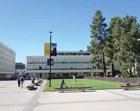
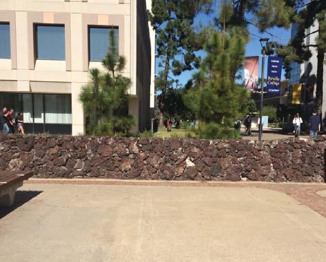
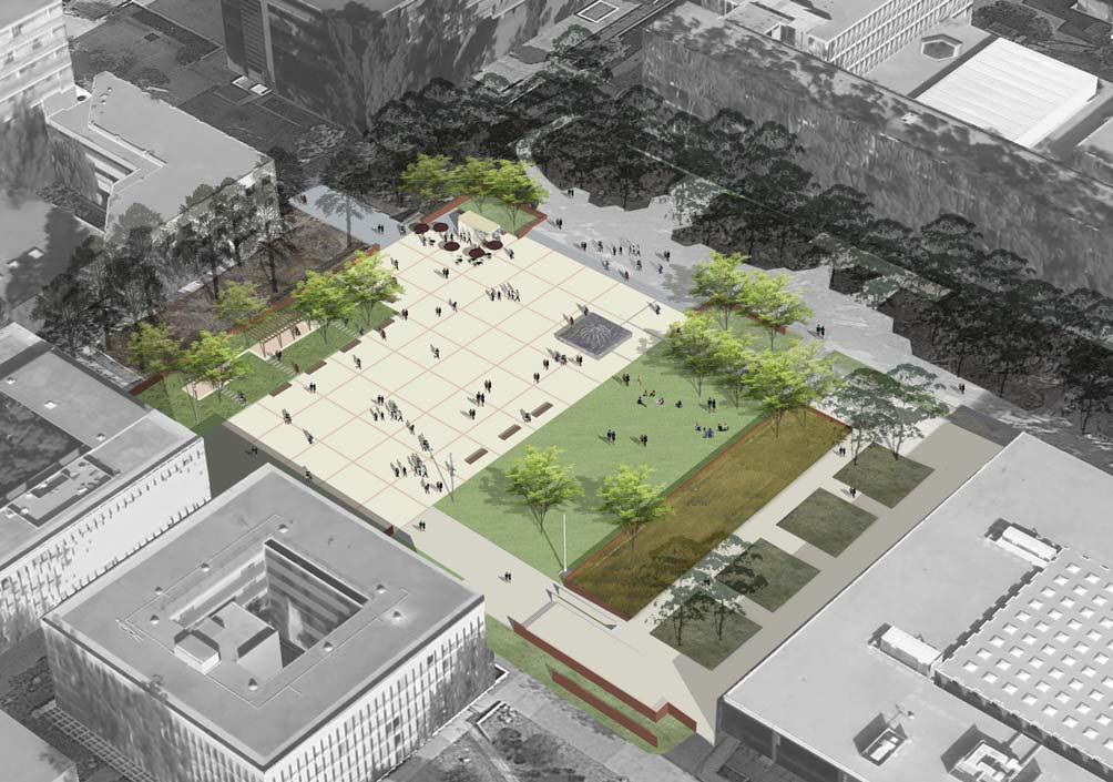
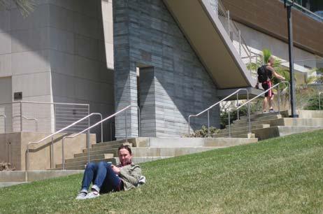
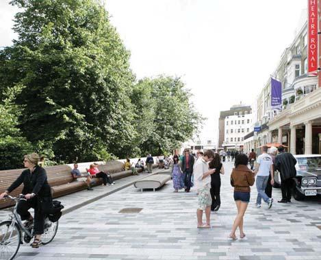
Revelle Plaza is one of the most historic places on campus. It was at its incep on the central open space for the newly established UC San Diego campus It con nues to serve this purpose for the Revelle College. Surrounded by the original college buildings,Revelle Plaza is an integral space for outdoor campus ac vi es. In the 1960s and 1970s, the plaza played host to important speakers and protests of those mes. Today, it is an op mal place for large scale informal and formal events. It is surrounded by modernist buildings, mature Eucalyptus trees and links to the southern sec on of Ridge Walk. The exis ng materiality of Revelle Plaza includes historic rock walls, pavers and benches. Several landscape elements provide both historic context and are defining features of the Plaza. Lava rock walls border the central por on of the Plaza and extend through open space adjacent Galbraith Hall. Unique brick paving is used at the central paved por on of the plaza while large lawns provide suitable informal gathering spaces. Recently, original benches have been repaired with new ipe wood tops. While por ons of the adjacent plan ngs are well kept, the paving is in disrepair and should be restored.
A historic & revitalized public plaza.
pa
in
in several
While historic architectural elements should be restored, new interven ons in Revelle Plaza should be evaluated for their appropriateness in this historic se ng.
Due to Revelle Plaza’s historic nature, important elements of the landscape should be preserved while s ll func oning as a modern plaza. The paving and plan ng areas should be preserved. For all paving preserva on work, a study by Heritage Architecture and Planning, UC San Diego- Revelle Plaza Historic Treatment Recommenda ons, should be referenced. Elements such as the fountain and lava walls should be kept intact or restored as they contribute to the strong iden ty of thePlaza.
New framework elements for the Plaza are meant to enhance the space and provide greater u lity, while strenthening its historic nature. Strategically placed new shade trees can allow for recrea on and places to sit. Reloca ng the flagpole to the corner of the lawn will create a more usable open space for gathering. Some of the lawn can be converted to plan ng as a conscience effort to reduce water use and introduce new plant material to the Plaza. Outdoor study rooms in the north lawn can provide shaded sea ng for a range of ac vi es. Ligh ng will make the space more usable at night. In the northwest corner, a development site was established in the Revelle and Muir Colleges Neighborhood Plan, the informal sea ng and outdoor study rooms can accomplish the goals of a formal gathering space in the interim and provide outdoor sea ng for uses that border the Plaza. sacred elements LEGEND


Organizing an outdoor movie on Revelle Plaza ac vates and u lizes the plaza.
A fes val or fair with individual tents organized on the central paving area is big enough for several stalls while leaving the lawn as a unprogrammed space.
A ceremony or recep on is also possible on Revelle Plaza.
CEREMONY OR RECEPTION
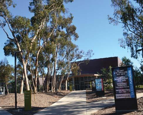
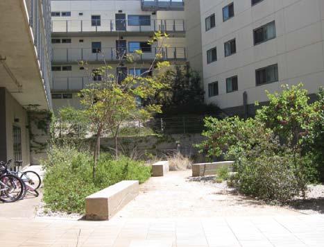
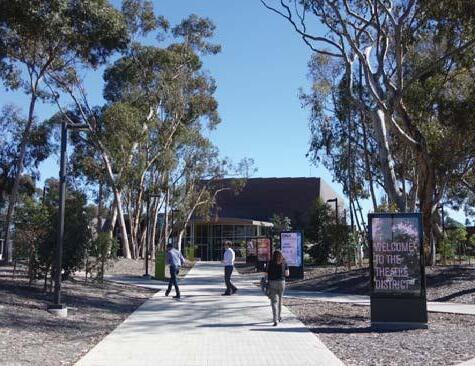
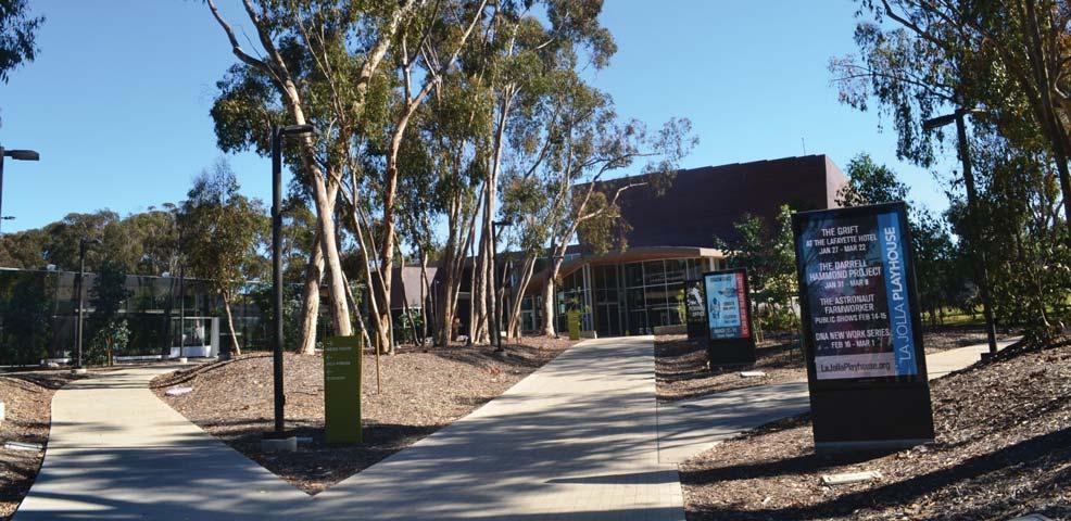
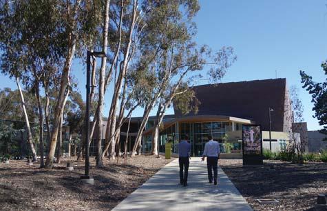
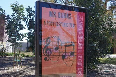
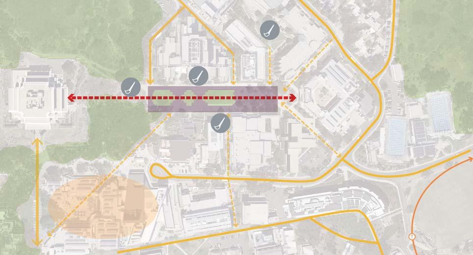
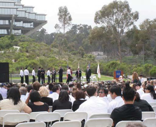
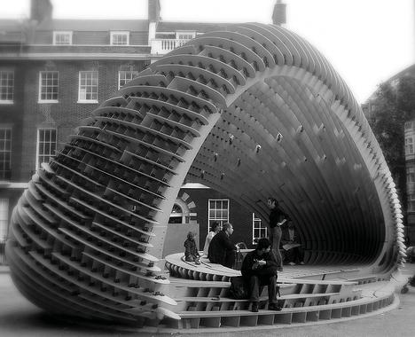
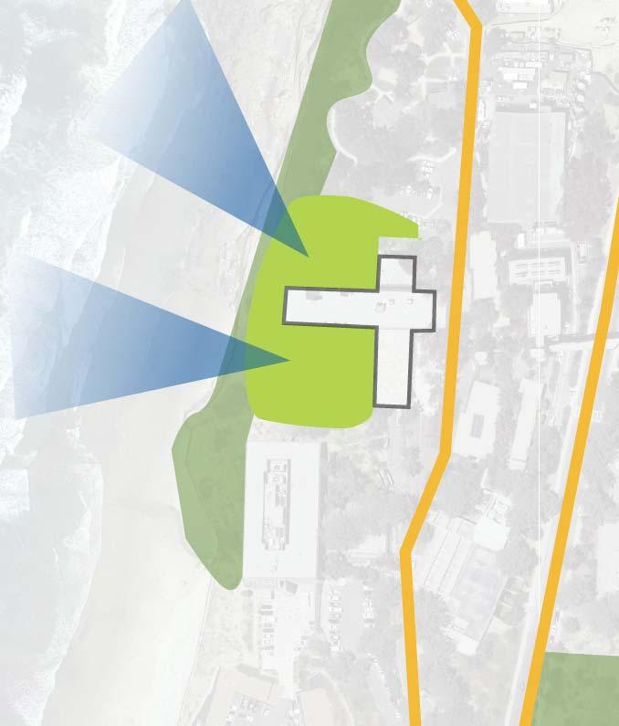
At the southern terminus of Ridge Walk, accessed off of North Torrey Pines Road, the Theatre District provides a unique opportunity for UCSD to interact with the public and surrounding community. Home to a cluster of buildings that serve both the La Jolla Playhouse and UC San Diego Department of Theatre and Dance, the area serves as a community interface for UC San Diego. Set in the historic Eucalyptus Groves, the landscape provides con nuity and a strong sense of place. This is a major point of entry for the campus primarily for pedestrians and cyclists entering the campus from neighboring communi es to the south. In addi on to performance art, the Theatre District is also home to three significant public art installa ons that are part of the interna onally renowned Stuart Collec on. Current plans include a stormwater project will address the site south of Revelle College Drive. that will showcase the University’s commitment to sustainable and resilient landscape design.


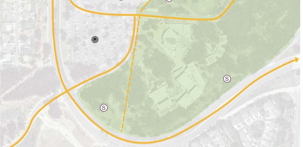
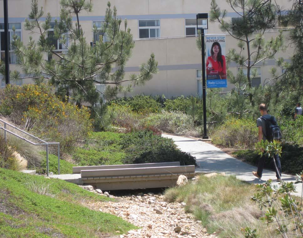
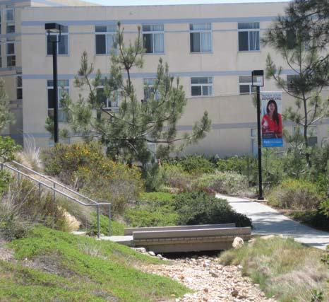
The highest eleva on of the campus is located not far from where the Wedge terminates at Ridge Walk. Magnificent westerly views are framed by buildings north of the Wedge providing a drama c visual connec on of the campus to the Pacific Ocean. The high point of the campus at Ridge Walk adjacent the Wedge is well documented as a loca on that was used by Roger Revelle as he recruited new faculty to the fledgling campus. Three significant circulatory spines traverse the Wedge. North Torrey Pines Road provides the most public exposure to the site, while a por on of the Campus Loop Road along Scholars Drive and Ridge Walk provide important internal circula on north and south through the campus. The Wedge serves both an internal and public func on. It provides an open planted space within a densely populated center for student housing. Further, it visually so ens the campus edge along North Torrey Pines Road. The plant pale e is rus c and na ve to reflect the adjacent na ve plant communi es of the coastal scrub and chaparral. There is a formality to the paths closest to the development on the north, informality to the paths located south and meandering through the space. Addi onally, this area contains stormwater features to help clean and slow runoff of adjacent development. A resiliency opportunity exists as noted on the context map; design ideas include stormwater treatment and solar energy collec on.
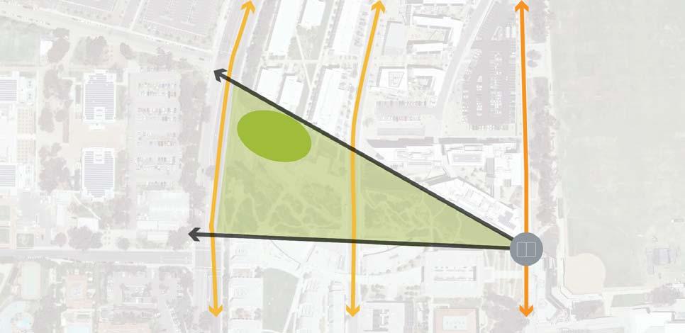
“Can’t you see a great campus rising all around here?”- Roger Revelle, 1959
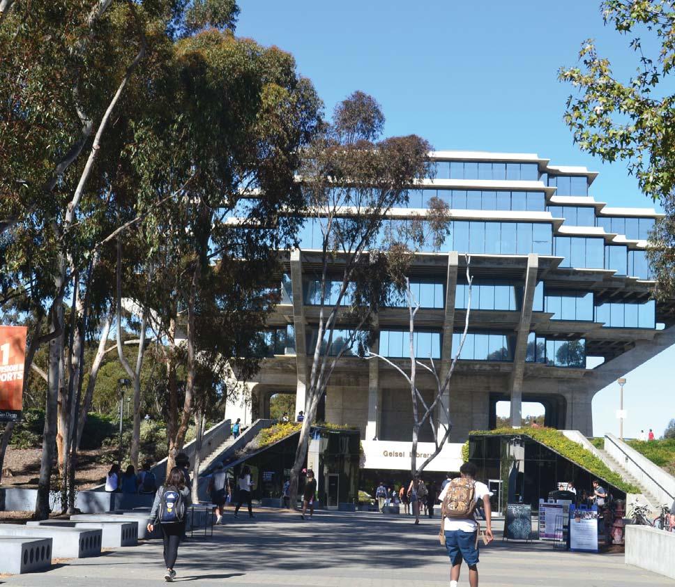
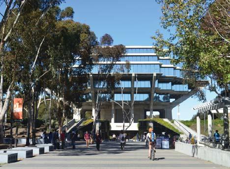
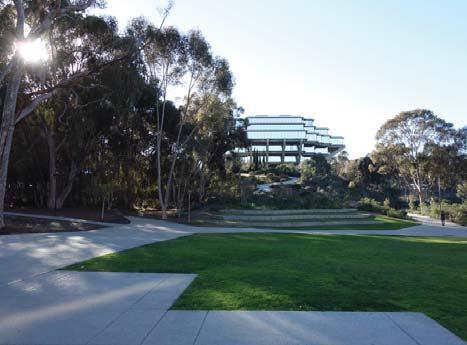
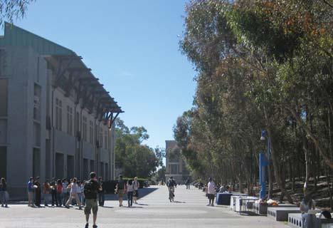
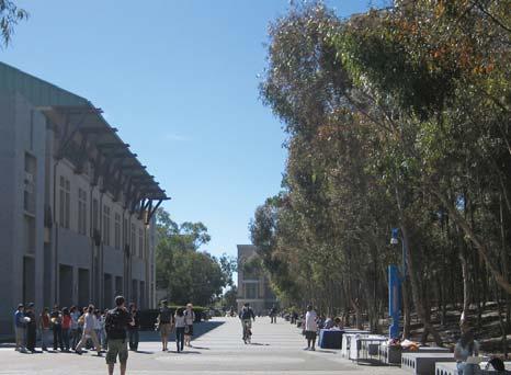
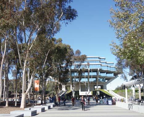
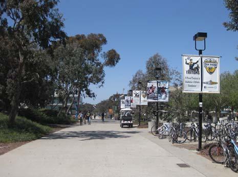
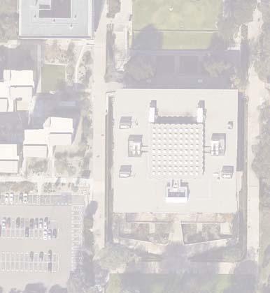
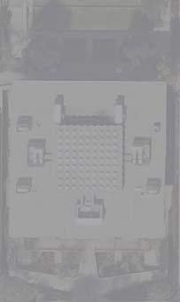
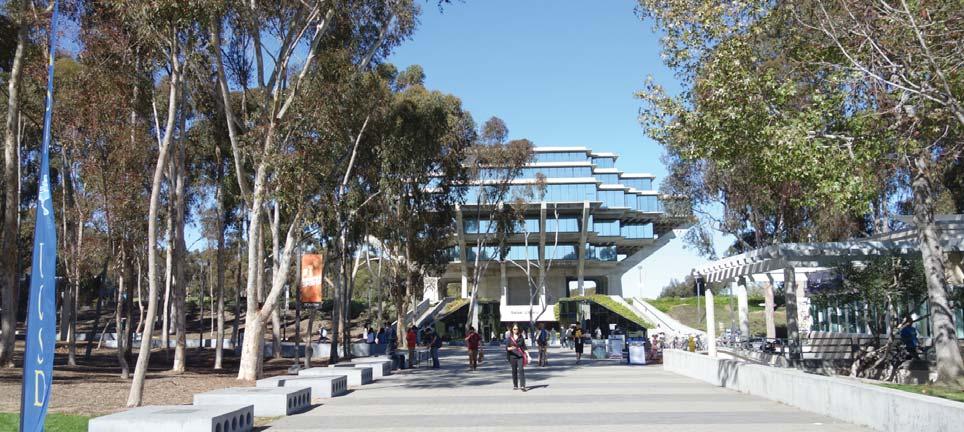
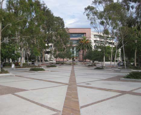
Library Walk is the iconic campus open space and one of the most successful and func onal landscape features at UC San Diego. The Walk provides structure and a strong wayfinding feature to a densely populated area. A mul -func onal open space, it serves as a loca on for campus gatherings and fairs throughout the year. Library Walk is a north and south pedestrian spine that runs through the heart of the campus and terminates at Geisel Library, surrounded by the Grove on the west side and University Center on the east. Future plans include various enhanced pedestrian and bike paths that will intersect the Walk accommoda ng circula on to and from the planned LRT Sta on. Important views of Geisel Library originate from the campus entry corridor along Gilman Drive. Larger buildings to the east and the historic Eucalyptus Groves on the west provide the frame to these views and define Library Walk. Grove Trees, special paving, lights along the corridor and a consistent sea ng element are the main materials that compose Library Walk.
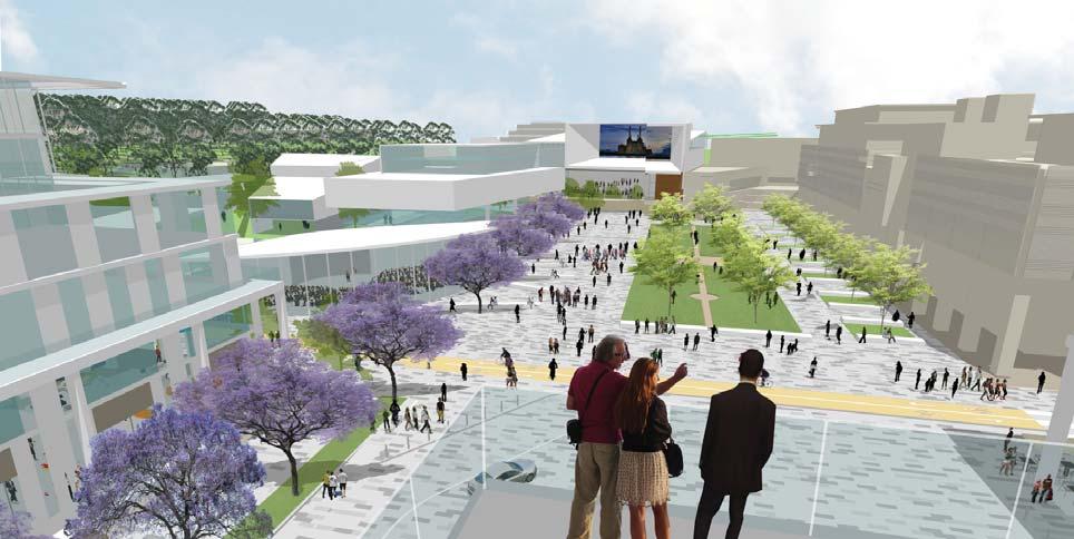
One of the clearest landscape features
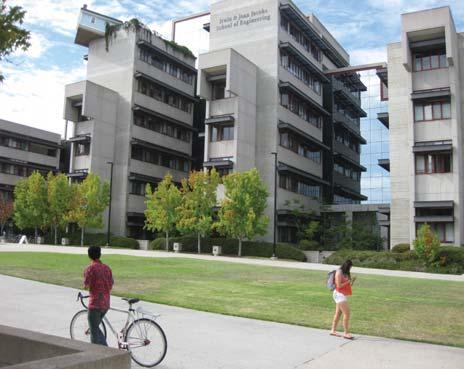
Warren Mall is a large scale, formal open space framed to the west by the sculptural Library atop the hill and termina ng to the east at the engineering building and courtyard. Art and engineering buildings front the sides of the space. Topography accentuates views along the corridor. The high point occurs at the west end near the entry to the Jacob’s Engineering Building where views stretch each direc on. At any point along the Mall, the library is a clear point of reference and gives iden ty to the space. Plan ng consists of a par al alleé of Eucalyptus citriodora and panels of lawn. At the west end near the library, coastal scrub covers the hill. To the east and along the corridor, tree and understory is varied as part of local buildings and related site landscape planning. Paving and furnishings are basic and are in need of repair. The original vision for its design, described later, was only par ally implemented.
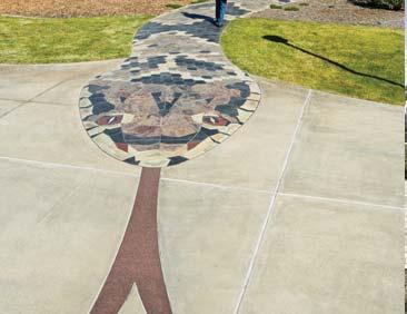
The narra ve of the Mall builds on the Paradise Lost art installa on by Alexis Smith. The piece conceptualizes a serpent seeking knowledge in the form of a winding path moving towards Warren Mall. The overall space bridges between the arts and the Engineering Building with its metaphorically themed forecourt and courtyard landscape design. The original vision explored the connec on between arts and science in the measured precision (circle and bollards) of the forms in the courtyard of EBU II. The forecourt displayed a botanical collec on of climate appropriate trees. The rest of the mall was envisioned to be fully lined with trees and be enlivened by adjacent housing.
While the vision for the Mall was celebrated in the 1990’s, some elements were not implemented as planned and adjacent uses were developed with less ac ve connec ons than hoped. Never-the-less, the Mall hosts popular events such as art shows and gradua on par es in addi on to accommoda ng casual sea ng on the lawn. The visual connec on to the library remains strong. To enhance Warren Mall, these crea ve origins can be revisited and its program updated to be er serve the campus popula on.
A grand scaled mall with a narrative of culture and knowledge.
This study recommends a series of strategic enhancements to strengthen the Mall as an important campus landscape. The framework for Warren Mall addresses programming needs while keeping the integrity of the long, linear space, preserving views and site axes. A Eucalyptus tree allée extension achieves a consistent vegetated edge along each side of the en re mall. A dis nc ve cafe structure –glass or metal—with outdoor sea ng provides a locus of ac vity in the center of the Mall at the highest point. Sculptural pavilions envisioned to accommodate student/faculty mee ngs, or study groups, will create visual interest and provide sheltered gathering spaces outdoors. Renovated paving and circula on paths at the east end clarify circula on and access and can house events such as the Ring Gradua on Ceremony. Seatwalls and the lawn amphitheater face the library steps and allow for specta ng and performance, working with the lawn’s topography.
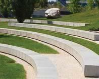
A small amphitheater addresses slope challenges on a site while managing to create human-scale spaces.
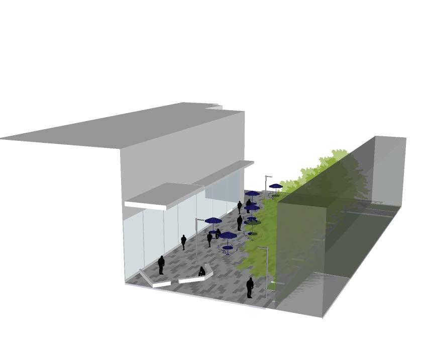
Osler Lane is a major east-west transit route within the Health Sciences Neighborhood. Currently, Osler Lane is u lized by vehicles, however plans call for this to evolve towards a pedestrian mall with only limited vehicular access. Osler Walk should include ample bicycle parking, generous sidewalks and plan ng that create a path through the Academic Mall. In the future, with the development of an LRT sta on to the east and a parking structure to the west, ac ve circula on along Osler Walk will be drama cally increased. As future projects are developed design should seek to strengthen pedestrian and bicycle safety while providing service and emergency access to adjacent buildings. Further the importance of Osler Walk will be elevated, as the Osler/ Gilman Intersec on and the Osler/Villa La Jolla intersec on will be important drop off loops/entries that allow vehicles to enter from busy streets. Future projects in this area should consider mul -modal design that allows for safe and comfortable crossings At high traffic intersec ons.
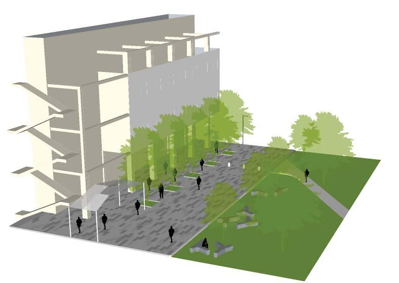
Academic Mall is the heart of the Health Sciences Neighborhood. It serves as the main north/south circula on network for pedestrians. The Mall is organized as a linear space with a series of formal lawns flanked by ac ve building edges and stormwater infiltra on on either side. Addi onally, site lines are clear, with views to the Stuart Collec on piece by Kiki Smith to the north and views of the Rita L. Atkinson residences to the south. The Mall is an example of a resilient space; Its formal lawns and plan ng contrast with the Grove and Eucalyptus forest that borders the Health Sciences Neighborhood to the west. The “special study area,” noted here is a temporary landscape condi on that could use an interim design un l the development of the two southern building sites complete the southern por on of the Mall. Clear, accessible paths and plan ng that inhibits cross circula on will help define the space and foster stronger connec vity to the north.
Specific plan ng can provide visual interest and deter people from veering off of the preferred path.
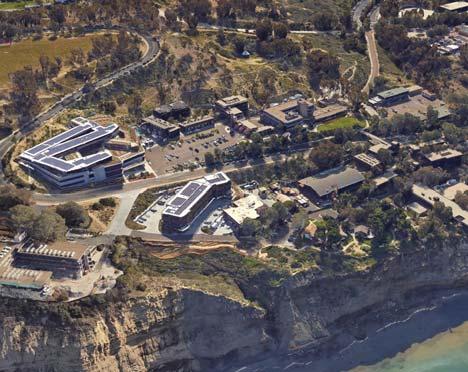
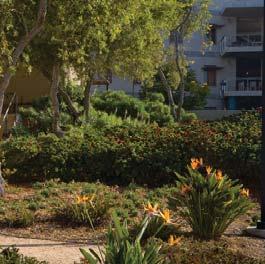
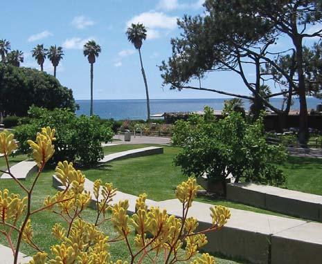
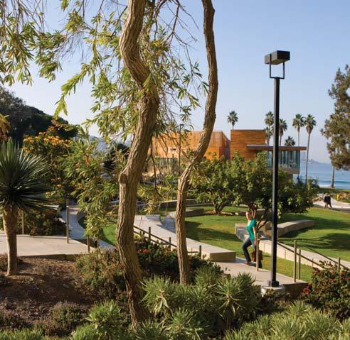
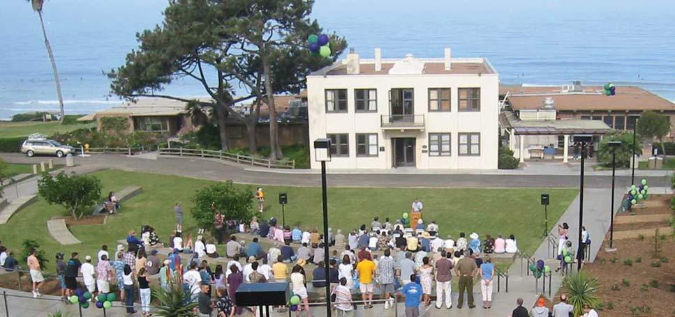
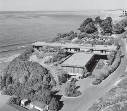
Pawka Green provides a central open space for the Scripps Ins tu on of Oceanography Neighborhood. Pawka Green is op mally sited to frame views across the Pacific on either side of the historic Director’s Office which is listed on the Na onal Register of Historic Places.. It provides mulfunc onal gathering space for informal and more formal events. Sea ng can be provided for up to 400 people via incorporated seat walls. Addi onally, the grass terraces can be used for sea ng and other events. Pawka Green is par ally defined by several internal pedestrian paths that allow for circula on between various adjacent buildings. Exis ng plan ngs in this area reflect the coastal influence and are also low water and low maintenance.
Any future plan ngs contemplated for this area should be guided by the principles set forth in this document. Resiliency in landscape design should be of par cular importance at this site given the very public nature of the space and the cu ng edge research and science conducted at Scripps Ins tu on of Oceanography.
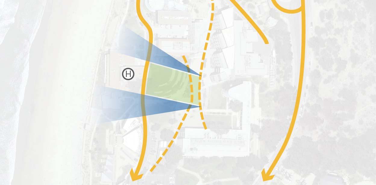
A central open space at the heart of the Scripps Institution of Oceanography Neighborhood.
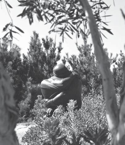
The gardens at the Ins tute of Geophysics and Planetary Physics (IGPP) are a series of informal, historic gardens nestled in the landscape above the coastal bluff that surrounds the building. The design of both the building and landscape are closely ed to both Judy and Walter Munk The gardens are notable for their integra on of indoor and outdoor space created through the design of both the building and surrounding landscape. Very careful a en on was paid to the si ng of this building to ensure the integrity of the views from the building and integra on of exis ng site topography. These gardens provide a discrete se ng to the lab, offices and conference room providing a physical extension of the buildings environment. The garden at the northwest corner of the site contains a sculpture by world renowned sculptor Donal Hord. “Spring S rring”.
Historic gardens that overlook the pacific ocean.
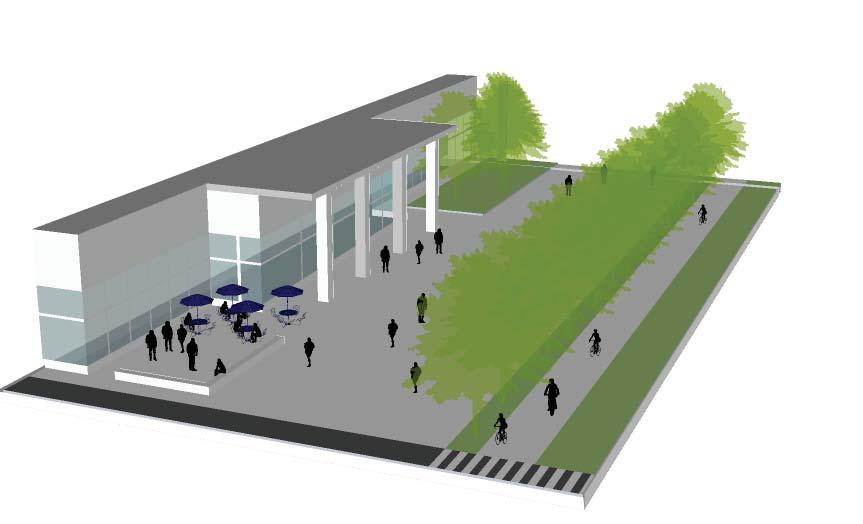
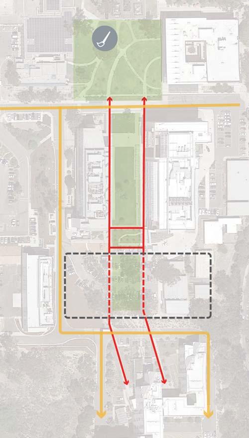
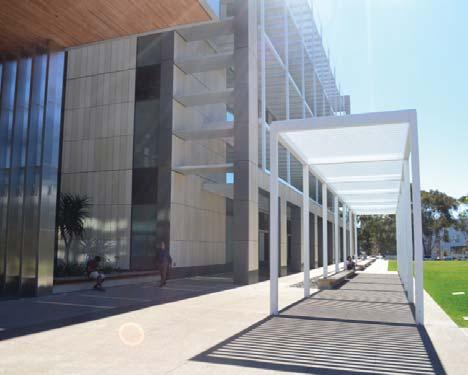
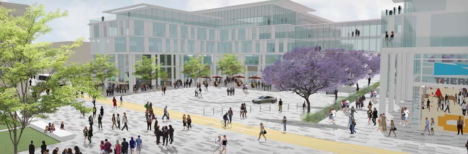
Lyman Lane is an east-west corridor bordered by University Center buildings including the Price Center, and open spaces such as Ma hews Quad and Town Square. Some buildings back entrances face Lyman Lane, crea ng a service street environment. Lyman Lane allows restricted vehicular access but is also used as a campus bike and pedestrian route. Consistent tree pale es exist in segments of Lyman Lane, mostly at recently completed building entries. The paving is varied on Lyman Lane with asphalt and concrete interspersed throughout. Lyman Lane transi ons to Lyman Avenue west of Library Walk, with areas for bicyclists, pedestrians and service vehicles.
An important linear plaza through University Center.
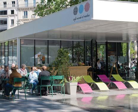
The concept for Lyman Lane envisions the area as a linear plaza in the University Center Neighborhood, favoring pedestrian circula on. Lyman Lane will bring the ac vi es that occur inside various buildings, including the Price Center and Student Services Center outside. This concept explores enhanced paving, furnishing, human scaled ligh ng and shade structures to create a unified pedestrian space.

Three typologies demonstrate the various condi ons on Lyman Lane. While the concept explores a pedestrian mall, it interfaces with exis ng buildings and other open spaces that are addressed below. Lyman Avenue varies in its condi on as it is situated within the Grove and will be used by pedestrians, bicyclists.
Ma hews Quad and Exis ng Building
seatwalls form activity zones around building entries
cafe tables and outdoor informal seating decorative paving
benches along Matthews Quad north edge shade structure
trees and planters with seating along building edge decorative paving bollards to prevent vehicle use
tables and chairs around Price Center steps
decorative paving
shade structure
vehicular access
two-way, dedicated bicycle lane
separation of vehicles and pedestrians
pedestrian path
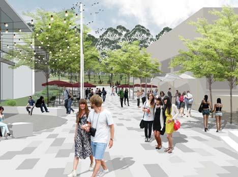
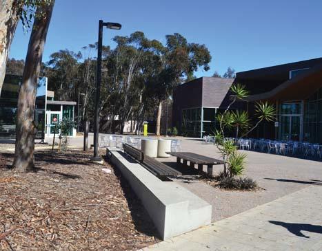
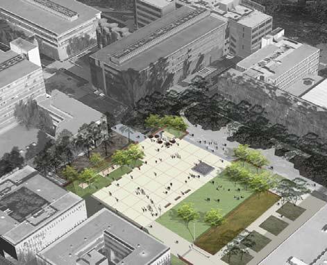
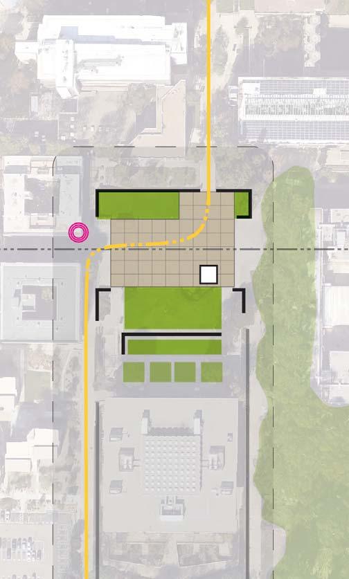
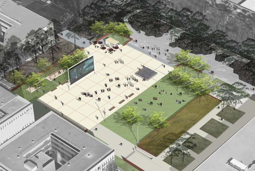
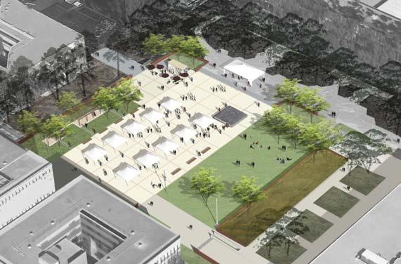
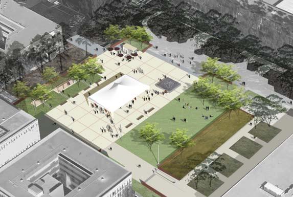
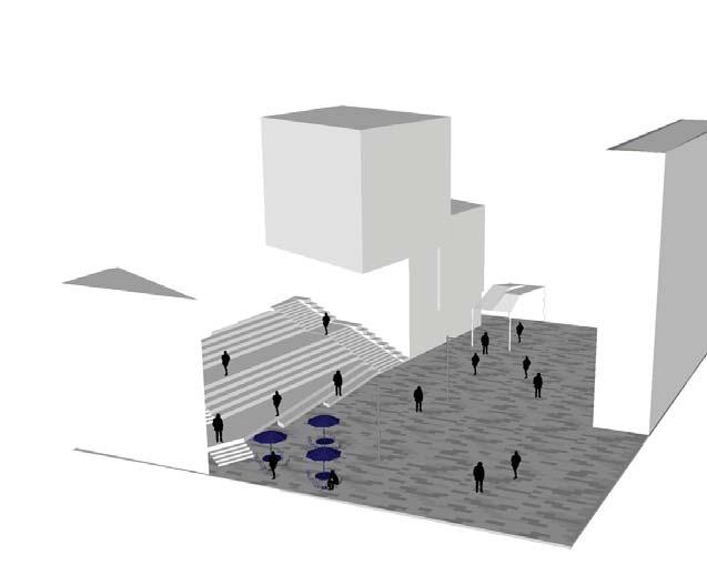
Town Square is at the heart of the University Center Neighborhood surrounded by student ac vity centers such as the Price Center, and Student Services Center. It is bordered by major pedestrian circula on routes including Lyman Lane and Rupertus Lane. Myers Drive, a key entry from Gilman to the University Center, terminates at the square.. Currently, Town Square is an asphalt paved area populated with tables and umbrellas. The Farmer’s Market is a popular program at Town Square. Michael Asher’s Stuart Collec on piece is an Important exis ng feature within the site that acknowledges the historic past of this loca on
There are challenges to the Square’s success as a public place.. While geographically it lies at the center of an ac ve district, many of those surrounding buildings are oriented away from the Square. The Price Center for example presents a three story blank façade to Town Square. The Chancellors
Complex to the west is not a center of ac vity and is buffered by a planted slope. This topography extends across the Square as a cross slope making one side awkwardly higher than the other. The Asher art piece while significant for its historic reference is not well integrated into the Square’s func on. The space lacks sufficient sea ng, some site features are in disrepair, and the surrounding curb is le over from a me when vehicles dominated the space. Despite the lack of energy from surrounding buildings the Square, tables and chairs are well used and events are held that are well a ended.
context map
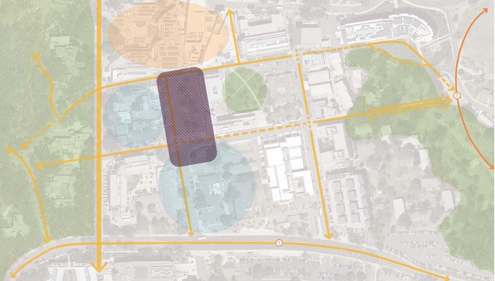
Future development sites to the west and south offer opportunity for revitaliza on of the Square. Each would offer ac va on of the ground floor and resolu on of grading challenges. The LRT sta on at Pepper Canyon will route pedestrians and bicyclists up Rupertus to Town Square, further ac va ng the space.
An active social space at the center of the University
The concept for Town Square explores preserving and enhancing the Stuart Collec on piece, while crea ng a more ac ve pubic space to host various programs and ac vi es.
A focus of the design is to engage new ac ve use buildings fron ng on the Square, including an alumni center and performance space. The lawn shape is expanded slightly and returned to its historic rectangle form. Curbs are removed.
The area bordering the Student Services center will mimic the regular columns on the building with a regimented allée of trees and bench sea ng.
Myers plaza is a newly defined space at the intersec on of Myers and Rupertus. It is conceived as a sub area of Town Square, sharing a common design aesthe c. The Plaza serves several key func ons including courtyard for a new “Gateway” building, pedestrian link from Myers, outdoor space for ground floor uses, and turnaround for vehicles entering the campus at Myers.
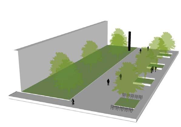
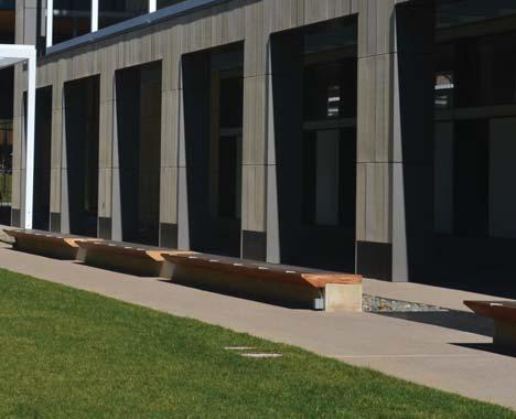
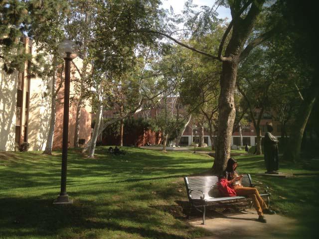
Ma hews Quad is a historic open space that serves as a passive respite amongst the high ac vity University Center Neighborhood. Named a er the historic Camp Ma hews that occupied this space un l 1964, the Quad has several historic trees that were planted during its occupa on by the U.S. Marine Corps. Ma hews Quad is bordered by Lyman Lane, the Student Services Center and to the east, future development opportuni es. The Student Services Center edge has outdoor sea ng and a balcony that overlooks the Quad. The main circula on path arcing through the space traces the historic design of the quad and connects Rupertus Lane to Lyman Lane.
A
The concept for Ma hews Quad keeps the integrity of the historic quad as a passive space, with large lawns and mature trees. Edge ac va on along Lyman Lane is suggested. Lyman Lane is planned as a future pedestrian mall, therefore, the northern part of Ma hews Quad will engage with a por on of Lyman Lane and provide grouped benches for ac vity that transi ons to Lyman Lane. The remainder of Ma hews Quad will be preserved as a passive quad, and mature trees should be monitored and replaced when necessary. With the introduc on of the LRT Sta on at Pepper Canyon, there will be increased pedestrian circula on from Rupertus to Lyman through the main path at Ma hews Quad. There is a need to improve the connec on of Ma hews Quad to Rupertus Lane in order to foster this connec vity. With that in mind, cart parking should be relocated from areas around Ma hews Quad to an area with less pedestrian and bicycle traffic.
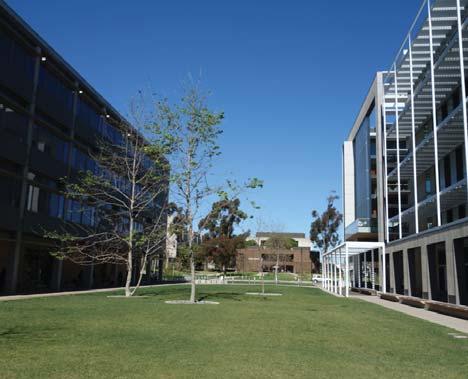
The precedent image above illustrates the poten al of Ma hew’s Quad’s passive lawn and mature trees as a peaceful place to walk through and sit.
The le picture illustrates new paving and furnishing that can exist along the edge of Ma hews Quad at Lyman Lane. Restored passive open spaces can celebrate history and provide tranquility, pictured on the right.
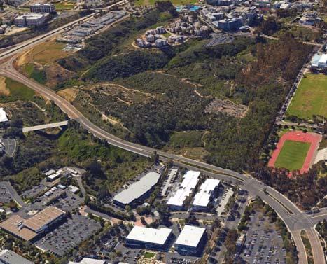
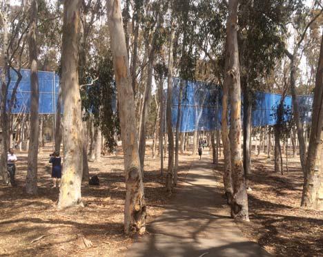
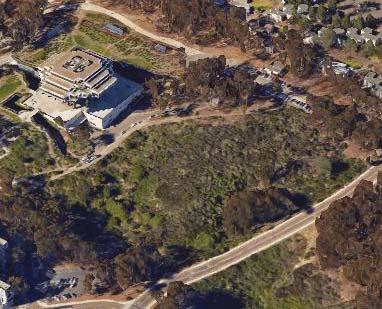
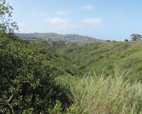
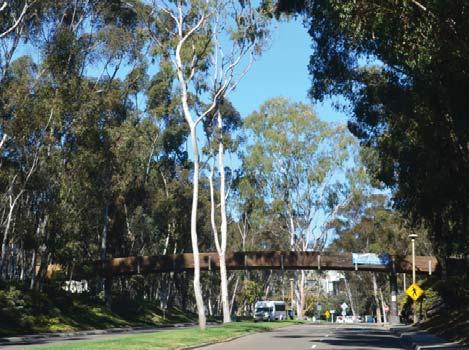
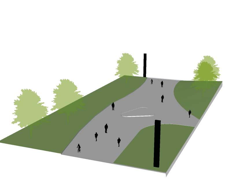
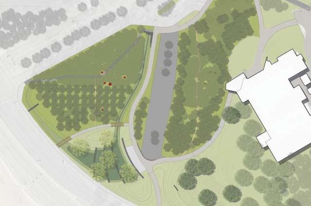
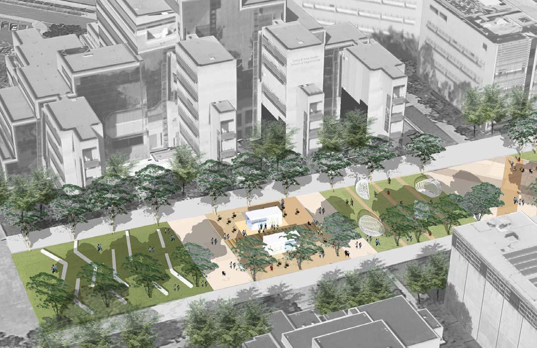
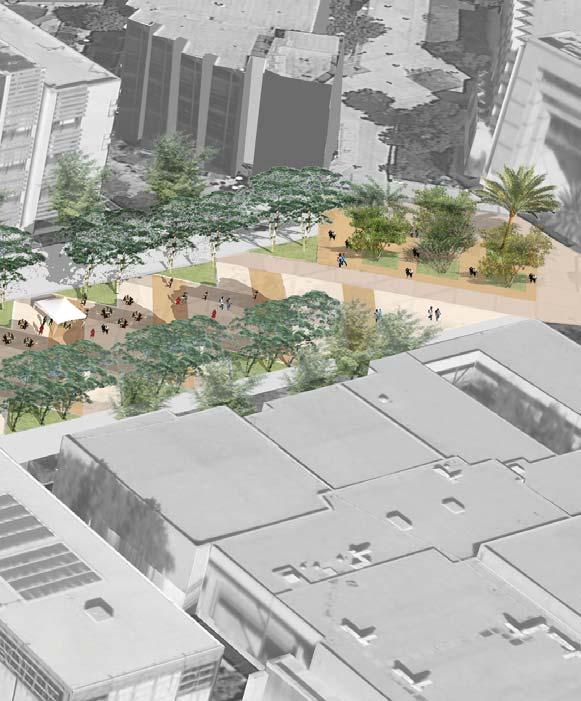
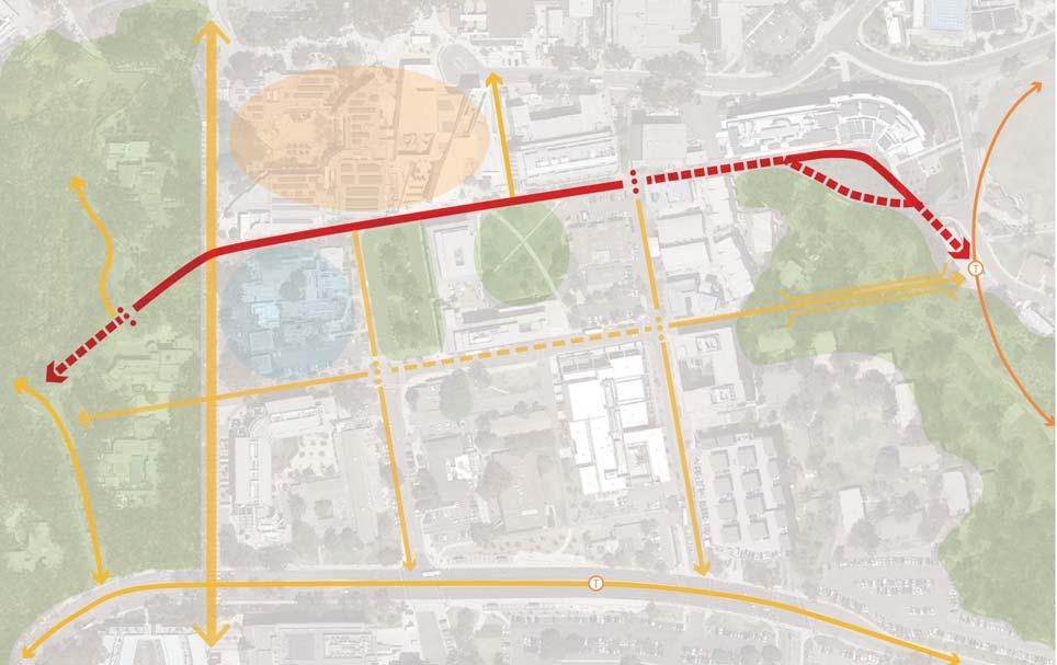
Pepper Canyon is a natural canyon within the Sixth College Neighborhood. With steep, forested terrain, it separates parts of the college. Historically, the canyon hosted indigenous plant species and seasonal drainage. Today vegeta on consists mostly of Eucalyptus and non-na ve understory. The upper area of the canyon transi ons into a less rus c condi on and is framed by major research buildings such as the Structural Materials & Engineering building which creates an overlook. Exis ng housing along the canyon rim benefits from the quiet se ng but does li le to integrate with the canyon landscape. A Rim Walk trail has been proposed to provide visitors a canyon experience and serve as secondary access from adjacent uses. With the new light rail elevated track and sta on planned at Pepper Canyon and a bridge planned to connect passengers from the sta on to Rupertus, the canyon will be significantly impacted by construc on ac vi es and its context changed. The planned infrastructure will require removal of most vegeta on and major regrading of the canyon slopes. The pedestrian bridge will define an upper sec on with new uses. This area will be known as Pepper Bowl and link the rus c canyon landscape to the rest of the campus.
context map
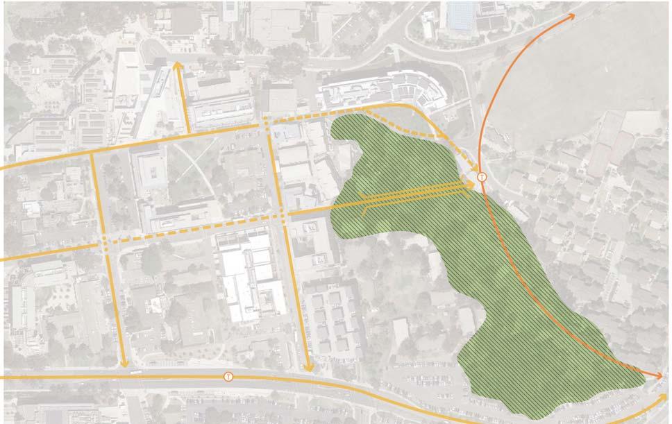
A natural canyon feature housing a major Light Rail Station.
Conceptual ideas for Pepper Bowl and Canyon include important changes to vegeta on, access, and program.
The canyon should be enhanced as a place of nature with emphasis on habitat and canyon character. Vegeta on should include local na ves while recognizing the cultural significance of other species such as California Pepper, Eucalyptus, agave, and palms. Passive uses such as sea ng, walking ,and viewing are most appropriate with the poten al for a bike trail or climbing structure in a manner consistent with the conserva on program. So and hard surface trails can provide all weather access to explore the canyon and navigate its rim. Stormwater treatment can be integrated as a green infrastructure component.
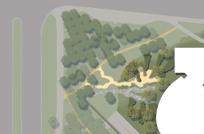
The experience of arriving by trolley to the University at Pepper Canyon should be a driver for design of this open space. As a major point of arrival this area should be treated as a major campus entry. Desire for views to the campus should be balanced with the poten al for high canopy trees that screen the structure and give a sense of mystery as passengers descend from the pla orm, like the campus introduc on for vehicles at Gilman Drive. Similar mutual
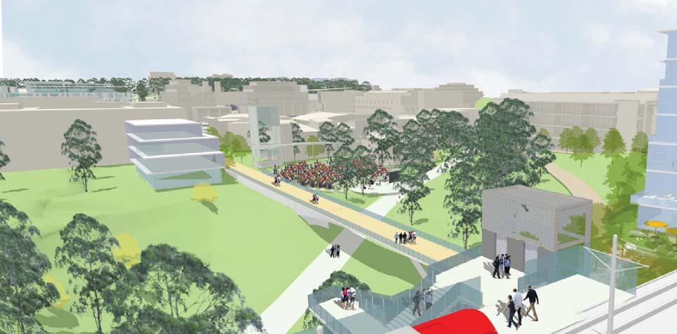
proposed interven ons and precedent images goals exist for the pedestrian bridge experience as people traverse the canyon and Bowl area.
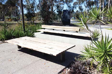
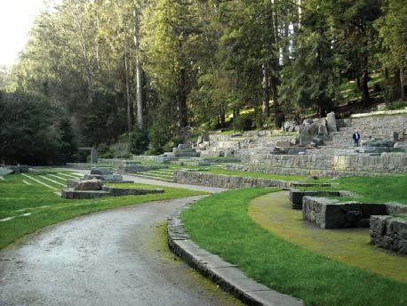
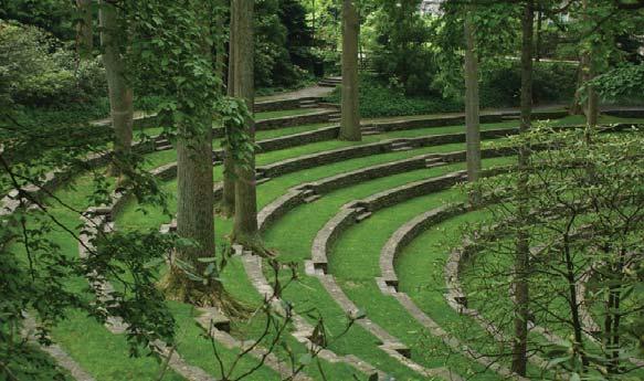
More ac ve uses and a less natural appearance is proposed for the upper area. At the Pepper Canyon Bowl, the canyon transi ons to accommodate more ac ve uses and a developed park feel with paths, plan ng areas, and new programs. Central to the Bowl, is the outdoor performance venue tucked into the grade near the new pedestrian bridge and the visual arts complex. The facility should preserve the open space feel by integra ng the larger landscape – paths, vegeta on, views, ligh ng, and topography—into the design.
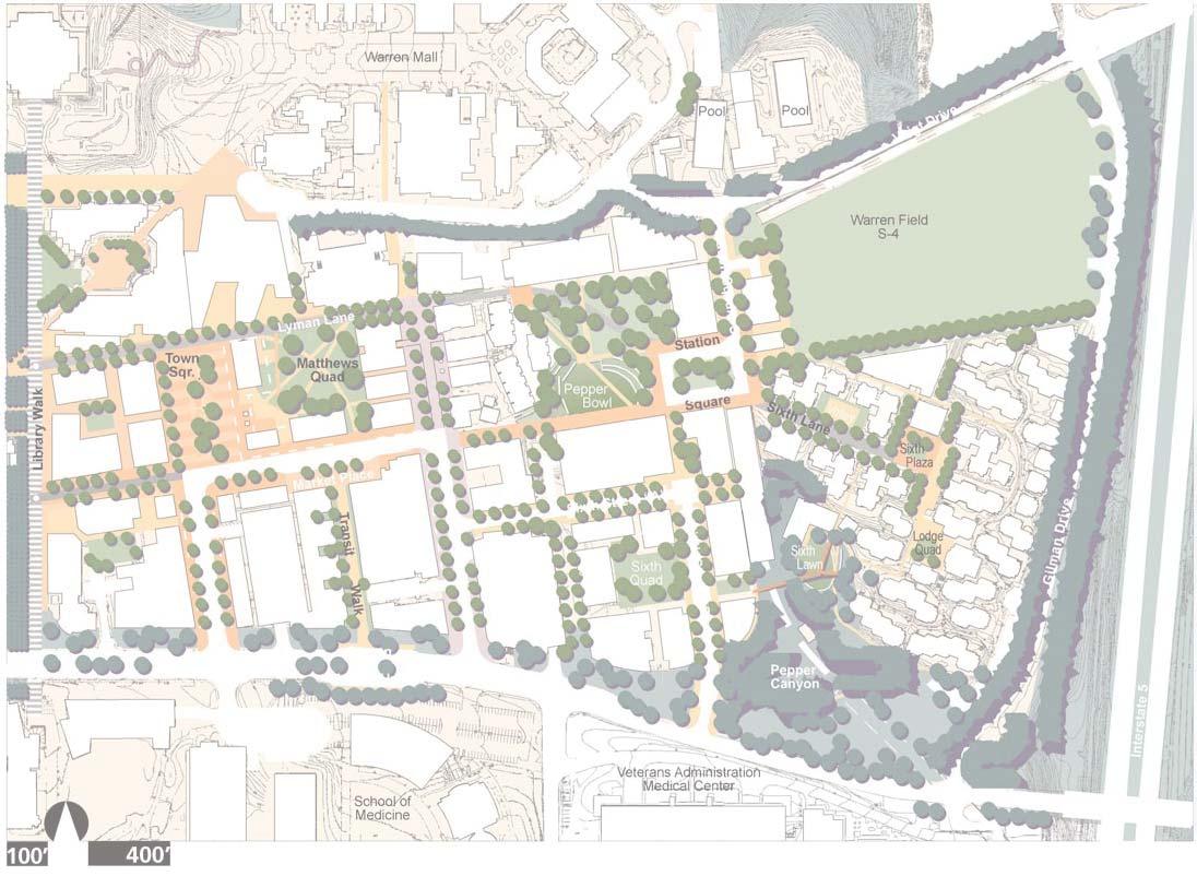
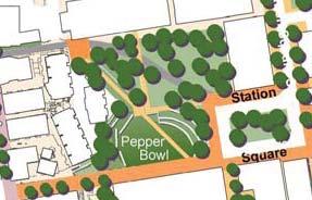
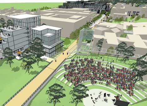
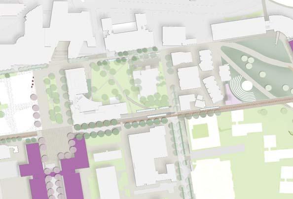


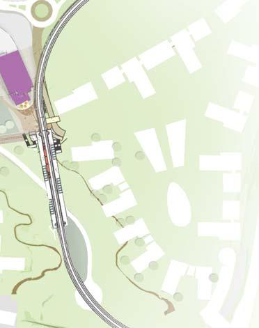
This view of the future Rupertus Bridge shows how Pepper Bowl can be used as an event space with the bridge from the LRT to the le .
Current planning shows the alignment of the proposed LRT and sta on and concepts for Pepper Bowl.
The welcome plaza in this rendering shows a cafe next to the future phase of Structural Materials and Engineering.
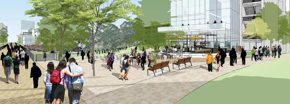
Rupertus is an east-west corridor spanning between Library Walk and Russel Lane through the University Center Neighborhood. For the eastern por on, it serves vehicles including shu les, service, and those of the general public. The two traffic lanes are very wide and shared with bicycles. Pedestrian access occurs on narrow sidewalks where vehicles are present. The por on between Myers Drive and Library Walk serves pedestrians, bicycles, and carts. The street is bordered by several important func ons that shape its iden ty. The student services building fronts Rupertus Lane with a massive arcade. Prebys Music Center, where programs are held, is an ac vity center with performance spaces facing the street. Rupertus crosses Myers and the edge of Town Square, the formal, central quad of the campus.
With the new light rail sta on planned at Pepper Canyon and a bridge planned to connect passengers from the sta on to Rupertus, circula on demand of the corridor is poised to be significantly redefined. The vehicle dominated road configura on will not adequately serve the pedestrian and bicycle users accessing the campus from the transit sta on.
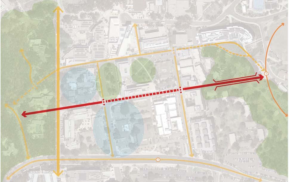
The east-west promenade of University Center.
To serve transit riders and to revitalize the University Center Neighborhood, Rupertus should be transformed from a vehicle service street to an ac ve, safer, mul modal corridor. The conceptual design converts Rupertus to a one way vehicular loop from Myers to Russell with a con nuous cycle track for bicyclists. Emergency vehicle clearance is provided within the combined bike and car lane. Wide sidewalks on both sides accommodate pedestrians. Where no vehicles exist, the corridor converts to a shared space with bicycle lanes designated. Street trees are planted along the corridor where u li es allow. Shade trellises with flowering vines such as bougainvillea extend the exis ng arcade concept to the full corridor landscape. Several future development sites exist along the street sugges ng opportunity for change and implementa on associated with building projects. Each provides opportunity for new ground floor uses that ac vate the street. Of significance is the Gateway building envisioned to promote food, outdoor dining, and a welcome center where Rupertus meets Myers and Town Square. At Russell, new buildings can ac vate the corner and be er connect Ma hews Quad with Rupertus.

The precedents
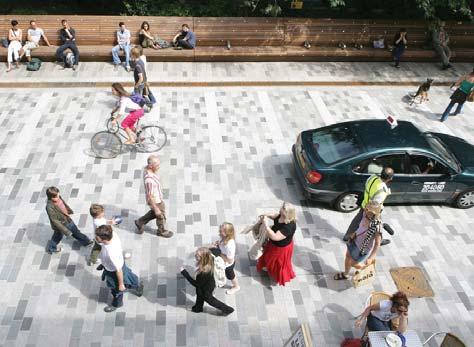
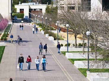
Wellness Walk is the main pedestrian spine for East Campus. It is centrally located in high traffic areas of east campus and traverses through buildings, open spaces and parking areas. Various vegeta on edges, planters and sea ng exist along the walk to reflect the various condi ons of the edges. For instance, areas through parking lots provide trees and planters as iden fiers, while wider por ons of the walk are created through unifying paving and low plan ng.
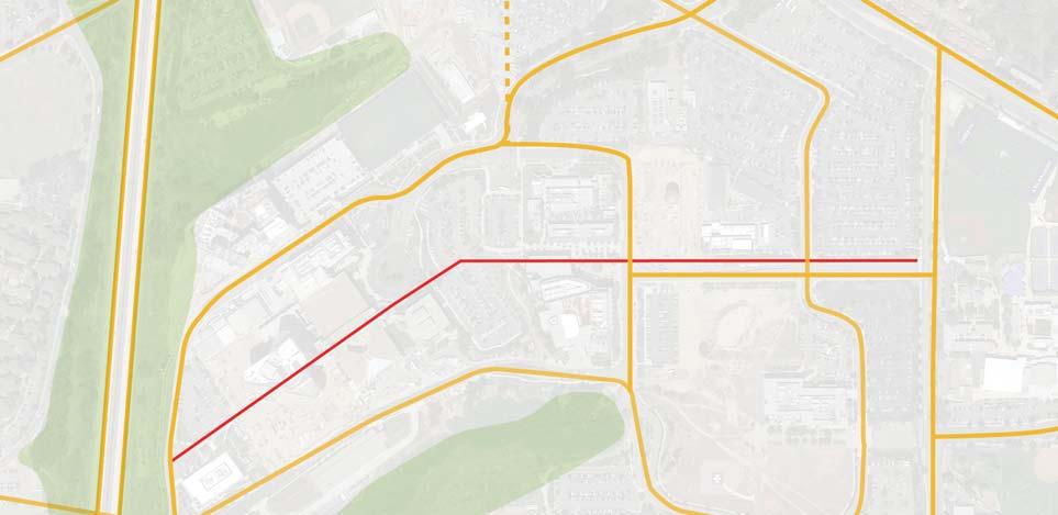
The pedestrian spine of East Campus.
New design guidelines for Wellness Walk Include:*
• Integra on of the rus c landscape of the surrounding canyons to ground the neighborhood in its natural context
• Organizing the paths and routes to des na ons to improve campus connec on
• Making des na ons memorable and high func oning
• Respec ng the poten ally compromised state of mind of health services clients
• Crea ng a posi ve impression of environment
* East Campus Neighborhood Planning Study by Spurlock Poirier
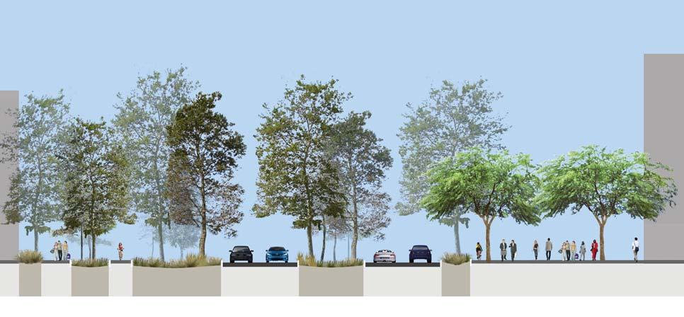
The sec on illustrates the main arrival of Wellness Walk, courtesy of Spurlock Poirier.
Wellness Walk provides access and circula on through building interiors and parking lots as pictured here.
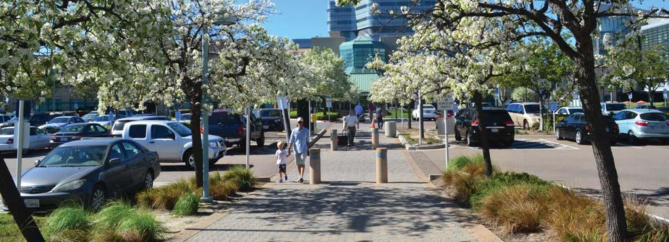
Allen's diverse talents and experiences are highlighted in his first outdoor project, Trees, for the Stuart Collec on. He remarks upon the con nual loss of natural environment at UCSD by salvaging three eucalyptus trees from a grove razed to make way for new campus buildings. Two of these trees, preserved and encased in skins of lead, stand like ghosts within a eucalyptus grove between the Geisel Library and the Faculty Club. Although they ostensibly represent displacement or loss, these trees offer a kind of compensa on: one emits a series of recorded songs and the other a lively sequence of poems and stories created and arranged specifically for this project.
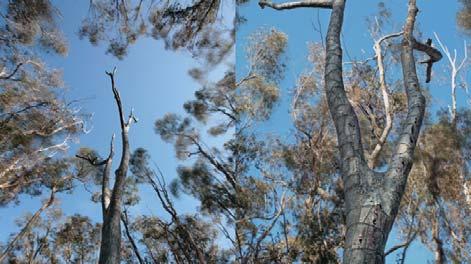
This func onal, polished, granite drinking fountain is an exact replica of commercial metal fountains typically found in business offices and government buildings. Instead of its usual context as interior office furniture, the fountain is placed monument like on a grass island in the center of Myers Drive next to the university administra on offices and the Price Center. The si ng of his work is fundamental to its meaning; it is juxtaposed with a large American flag and a granite landmark commemora ng Camp Ma hews, a World War II training center and ar llery and rifle range which occupied the land on which UCSD now stands.
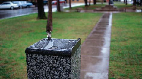
This func onal, polished, granite drinking fountain is an exact replica of commercial metal fountains typically found in business offices and government buildings. Instead of its usual context as interior office furniture, the fountain is placed monument like on a grass island in the center of Myers Drive next to the university administra on offices and the Price Center. The si ng of his work is fundamental to its meaning; it is juxtaposed with a large American flag and a granite landmark commemora ng Camp Ma hews, a World War II training center and ar llery and rifle range which occupied the land on which UCSD now stands.
For this research center Ferrara designed a series of three dis nct spaces: a small south terrace enclosed on three sides; a central area dominated by the stairs leading up to the building entrance and conference tower; and a large enclosed north terrace. Each area is paved with a similar linear pa ern of green, red, and black slate and surrounded by compacted gravel. Each has a unique character, but the terraces flow into one another becoming one con nuous space.
For UCSD he created a one-word poem installed at one edge of the north playing field between the Humani es Building and the student apartments of Thurgood Marshall College.UNDA consists of five stone blocks into which are carved, in various sequences, the le ers U, N, D, A, and an S-like mark which is the editor’s nota on for “transpose these le ers.” The le ers on each block in the sequence carry out the transposi ons indicated by this curved mark so that regardless of the order of the le ers, each block ul mately spells out UNDA.
Fleischner’s La Jolla Project, completed in 1984 and the third work in the Stuart Collec on, is located on the Revelle College lawn south of Galbraith Hall. Seventy-one blocks of pink and gray granite are arranged in configura ons that refer to architectural vocabulary: posts, lintels, columns, arches, windows, doorways, and thresholds. Like players on a field or game pieces (Fleischner made a series of small gamelike sculptures in the late six es), these elements transform an ordinary, nearly flat lawn into a space with allusions ranging from an ancient ruin to the contemporary construc on site.
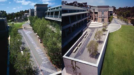
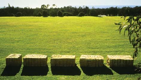
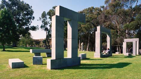
For the Stuart Collec on, Tim imagined a bear constructed of boulders. Eight granite stones - torso, head, ears, arms, and legs - were found locally. Together they make a bear 23’6” feet high with a total weight of 180 tons. Bear sits in the spacious Academic Courtyard formed by three signature engineering buildings: Atkinson Hall of the California Ins tute for Telecommunica ons and Informa on Technology, the Computer Science and Engineering Building, and the Powell-Focht Bioengineering Hall. First proposed in 2001, assembly of the sculpture took place onsite in May 2005 and the landscaping was completed in November 2005.
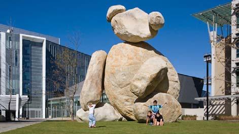
For the Stuart Collec on, Holzer has created Green Table, a large granite picnic or refectory table and benches inscribed with texts. Several temporary projects also were realized on the campus, including incorpora ng texts into exis ng electronic signs and into the Geisel Library computer system. Faux ads were inserted during television commercial breaks, and posters and a series of cast aluminum plaques were installed throughout the campus. Like many of the works in the Stuart Collec on, Holzer’s table and benches, sited in the Muir College quad, monumentalize an ordinary and func onal set of objects. Like all tables, Holzer’s work serve as an informal gathering place for students and faculty to eat, study, or play.
For his contribu on to the Stuart Collec on, Two Running Violet V Forms (his first permanent installa on in California) Irwin was drawn to the eucalyptus groves east of the Mandeville Center and adjacent to the Faculty Club. The contradic on inherent in this manmade forest appealed to him; the geometric regularity of the grid of trees is balanced by the infinite variety of light and detail which the natural se ng nevertheless provides. Irwin installed two fencelike structures in V-forms amidst the trees. The “fences” are blue-violet, plas c-coated, small gauge chain-link fencing supported by stainless steel poles which average twenty-five feet in height.
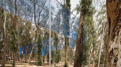
Her work, Another is in the vast atrium of the Price Center East, a 2008 addi on to the original student center. Making a visual interven on at this complex site which combines dining, studying, shopping and socializing, was both a challenge and an opportunity. The large interior wall that dominates the central space now bears a massive double image of clocks which is punctuated by terrazzo-like areas that contain the following phrases: ANOTHER DAY, ANOTHER NIGHT, ANOTHER IDEA, ANOTHER DREAM, ANOTHER SONG, ANOTHER FEAR, ANOTHER JOB, ANOTHER EXAM, ANOTHER SMILE, ANOTHER BOOK, ANOTHER SWEATER, ANOTHER CAR, ANOTHER LOVE, ANOTHER LIFE.
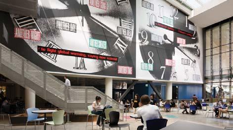
Constructed over the course of 1996 in Murray’s New York studio, Red Shoe has brought to life a formerly forgo en corner of campus. It is an alluring place for children to climb, its smooth exterior giving way to a roughly hull-like interior, hin ng at the enclosure of a nest or fort. Narra ves come to mind as fantasy evokes the resonance of childhood rhymes and tales. In the words of Robert Storr, Dean of the Yale University School of Art, “Reason presides over universi es; it remains for ar sts to give substance to those areas of consciousness that reason has not and perhaps cannot ar culate.”
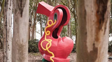
Nauman’s Vices and Virtues for the Stuart Collec on consists of seven pairs of words superimposed in blinking neon, which run like a frieze around the top of the Charles Lee Powell Structural Systems Laboratory. Seven vices alternate with seven virtues: FAITH/LUST, HOPE/ENVY, CHARITY/SLOTH, PRUDENCE/PRIDE, JUSTICE/AVARICE, TEMPERANCE/GLUTTONY, and FORTITUDE/ANGER.
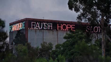
Paik’s Something Pacific for the Stuart Collec on was his first permanent outdoor installa on. This work relates specifically to its site, which includes the lobby of the university’s Media Center as well as the lawns surrounding the building. Outdoors, the work features several ruined televisions embedded in the landscape; some are paired with Buddhas, and one, a ny Sony Watchman, is topped by a miniature reproduc on of Rodin’s Thinker. In striking contrast to this video graveyard, the lobby of the Media Center houses one of Paik’s lively interac ve banks of TV monitors.
De Saint Phalle’s Sun God was the first work commissioned by the Stuart Collec on and was her first outdoor commission in America. The exuberantly colored, fourteen-foot bird is placed atop a fi eenfoot concrete arch and sited on a grassy area between the Faculty Club and Mandeville Auditorium.
Smith’s work for the Stuart Collec on, Snake Path, consists of a winding 560-foot-long, 10-foot-wide footpath in the form of a serpent, whose individual scales are hexagonal pieces of colored slate, and whose head is inlaid in the approach to the Geisel Library. The tail wraps around an exis ng concrete pathway as a snake would wrap itself around a tree limb. Along the way, the serpent’s slightly crowned body circles around a small “garden of Eden” with several fruit trees including a pomegranate.
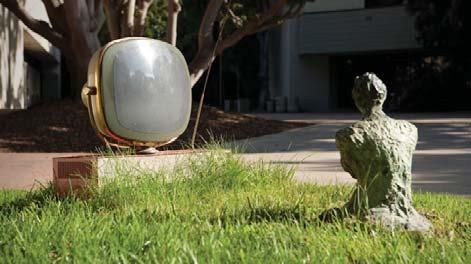
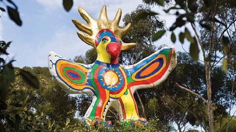
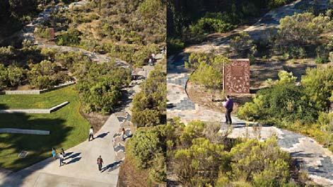
Smith’s vision of the body as a fluid vehicle for in ma ng life - and death - suggested the School of Medicine as fer le territory for Standing, her Stuart Collec on project. From the beginning her ideas evolved in rela on to the site between the Medical Teaching Facility and the Basic Sciences Building amidst eucalyptus trees, sloping lawns and curving pathways. There is a sense of quiet in macy that is ac vated by the flow of foot traffic between classes.
Suh’s small “home” has perhaps been picked up by some mysterious force and appears to have landed or crashed onto the seventh floor of Jacobs Hall at the Jacobs School of Engineering. The roof garden is part of his design and the whole creates a space with panoramic views for small groups to gather and readjust.
For the Stuart Collec on Wegman created his first major outdoor permanent sculpture: he installed a scenic - or nonscenic - overlook at one edge of the campus, near the loca on of the university’s theater and dance complex. The site commands a view not of the Pacific Ocean, visible from the other side of the university, or some other pris ne wilderness view, but of La Jolla’s suburban sprawl. The centerpiece of La Jolla Vista View is a long bronze map; it transposes from Wegman’s idiosyncra c drawing the supposed “points of interest” discernible from the overlook.