Two Cities One Centre


We acknowledge the traditional owners of the land, the Burramatagal people, of the Dharug Clan, and pay respect to their elders, past, present, and emerging. We recognise the Australian Aboriginal and Torres Strait Islander people’s contribution to the land, its people and their rich culture, traditions, and history.
Parramatta is one of the earliest Aboriginal culture sites in history, and this plan is strongly influenced by the role this history has played in the growth of Parramatta. Based on the principles of Designing for country, this plan understands that country is the core of the Aboriginal identity and when we care for country, country cares for us.
Aboriginal people have been part of this land since time immemorial and this plan acknowledges their immense knowledge and understanding of the land being planned. Parramatta Park, the river and the lake have been their home for thousands of years, and all planning has taken inspiration from the rich cultural and heritage values that have emerged over the years.
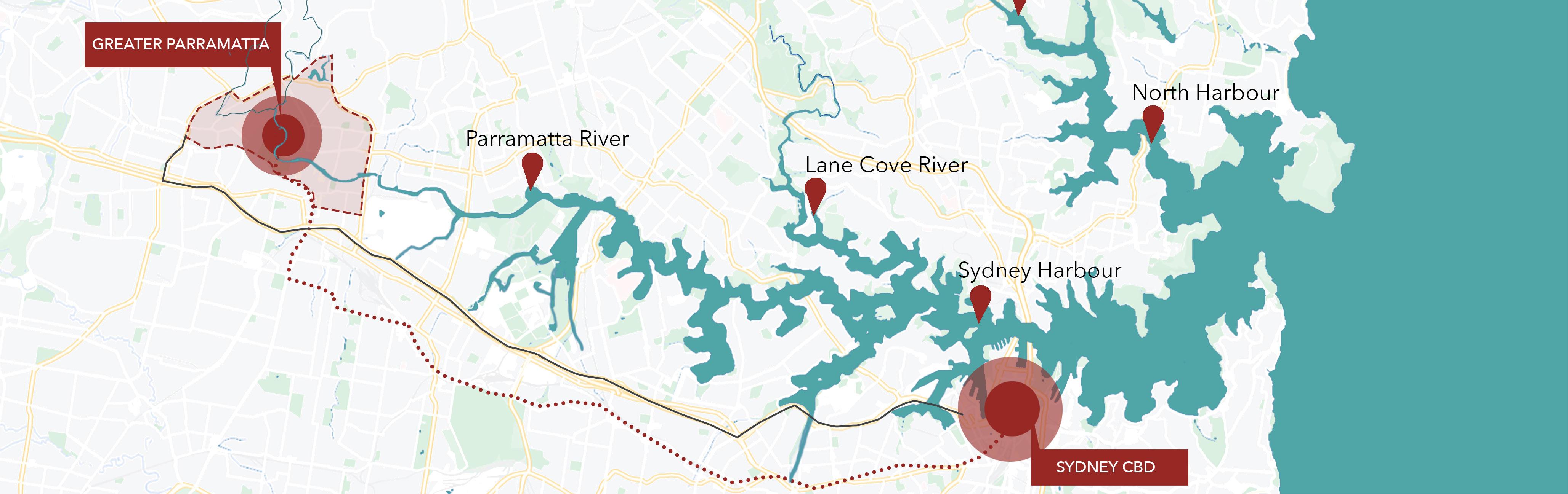
Located in the centre of the Greater Sydney region, Parramatta is the heart of Sydney and New South Wales. This plan focuses on the area spanning along a major part of the Parramatta River covering Parramatta CBD to Westmead and the environs precinct of the City of Parramatta. This region is complex but at the same time diverse, vibrant and leaks of high potential. Being the centre of the city, it is of high interest to a range of stakeholders and is a major contender for development. With numerous plans proposed for its various sectors, this area lacks a strategic plan that is comprehensive and specific to Parramatta and Westmead. This draft strategic plan will enhance the precinct’s strengths, play to its opportunities, build up on its weakness and help triumph in the glory that it deserves. It aims to make the unique precinct of Parramatta and Westmead one of its kind as its supposed to be.
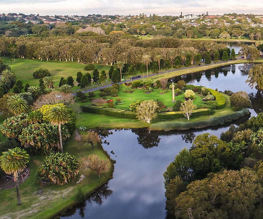
With Parramatta River flowing to the east, Parramatta Park radiating in the centre and Parramatta Lake towards the north, the site under study truly basks in rich resources and history. No other place can you find that this plethora of environment and heritage. This plan emphasises on the history, culture and heritage of this place and aims at enhancing the existing resources to make it a true national centre. This plan believes that Parramatta is already rich in its social, environmental, and cultural resources and only focuses on ‘developing’ these resources to create a city that is best fit to live, work and play. Respecting the rich heritage, the aboriginal values, and designing for the people forms the core of this strategic plan.
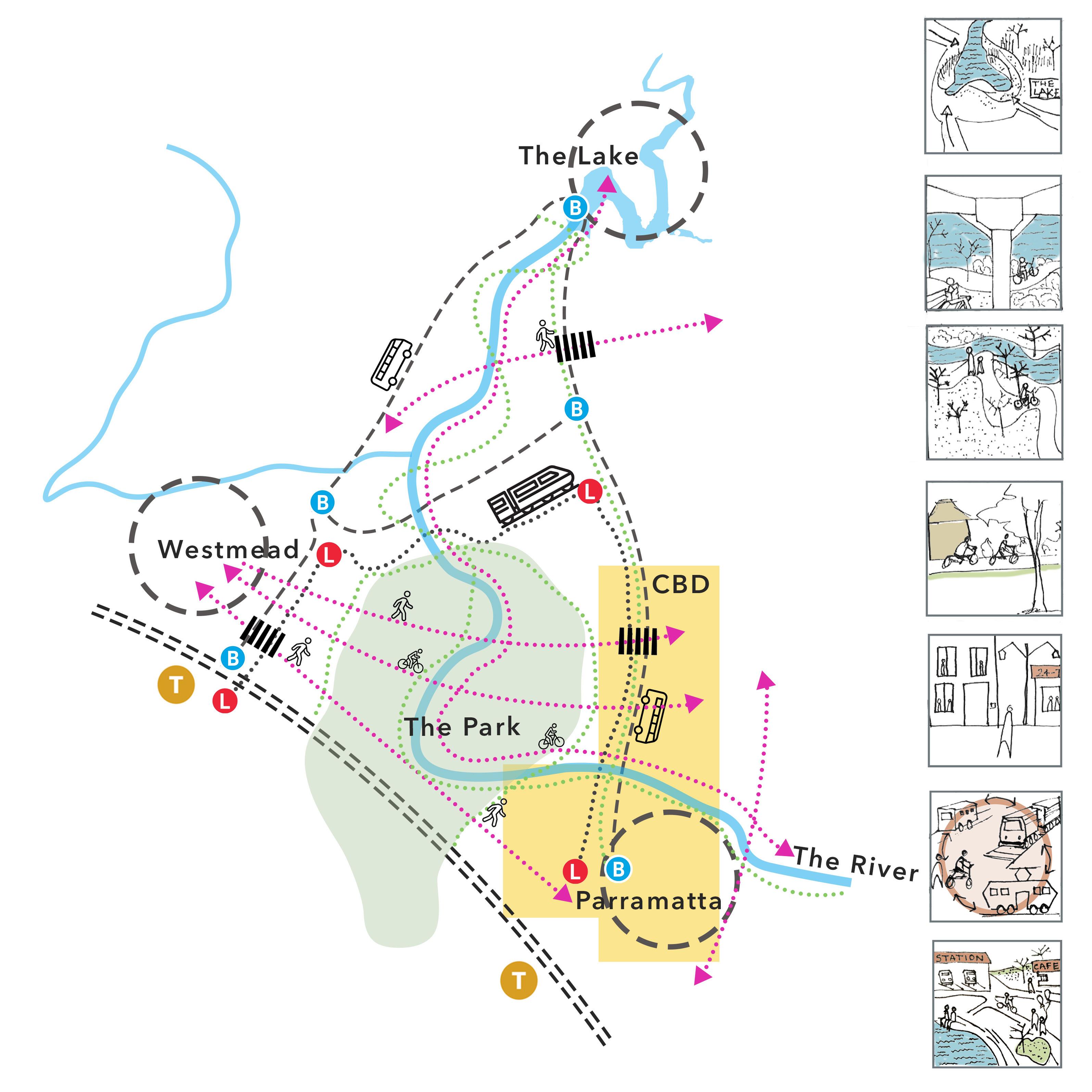
As the three major environmental features on site, the park, the river, and the lake form the basis of this design process. Using this as the driving force, the plan leaned towards providing a better connection between Parramatta and Westmead and integrating the two cities to make one centre that is vivacious, purposeful and liveable. Developing on detailed research and analysis, the themes and objectives are strongly focused on this idea. A detailed site analysis and observations across the site helped identify focus points that would guide towards achieving this goal. It was clear that the main features of the area can be the generators of change and connectivity. Identifying the strengths and weaknesses of these areas highlighted how they can become primary connectors of the precincts and help make the centre more prominent on the map of Sydney.
Parramatta is also one of the three centres proposed in the Metropolis of three Cities Plan. However, despite being a major centre, it lacks the qualities that would attract more people to visit and stay. Westmead, at the same time, is one of the biggest health precincts in the state, but almost nothing beyond that. Integrating it to Parramatta can help bring it up as a precinct. Together both the cities have the potential to accommodate facilities that can help make it a livelier place for people to live as well as visit. Parramatta Park and the river lie in the middle of both these areas and are thus important features that can contribute to this development. They are also primary heritage sites that deserve more recognition and can contribute to the development of the site. Using the strengths of the health precinct, the existing CBD and prominent natural features, the study area will aim to become one of Sydney’s most vibrant and attractive tourist destination.
Preliminary research and analysis established the vision of integrating Parramatta and Westmead with each other as well as with the other parts of the city. It developed the idea of building “one” central precinct instead of looking at them separately. By integrating Parramatta and Westmead, the vision of this plan is to improve accessibility, connectivity and become a hub for business, education, and entertainment.
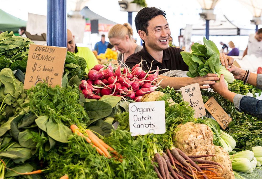
The vision works in tandem with existing government policies aimed at achieving larger-scale social and economic goals. Parramatta is regarded as the centre of Greater Sydney, which unites the city’s three major districts. As a result, access to and within Parramatta is a critical issue that will influence the flow of people into the city. Through careful planning, this plan aims to connect Parramatta and Westmead internally as well as improve its access to the entire city. Parramatta Park and the river, with its rich heritage, will help bring people from all walks of life together to establish a stronger and more dynamic community. The plan will work in line with guidelines of existing heritage management plans and will aim to conserve and protect it in the best way possible. The Health Precinct in Westmead will be designed to redefine the concept of health in a built environment while also strengthening the community’s livability. The plan prioritises the community and all development is focused on benefiting the people that live and work in Parramatta as well as the people that will visit the area. This includes building safe, pedestrian friendly streets and maximise amenities.
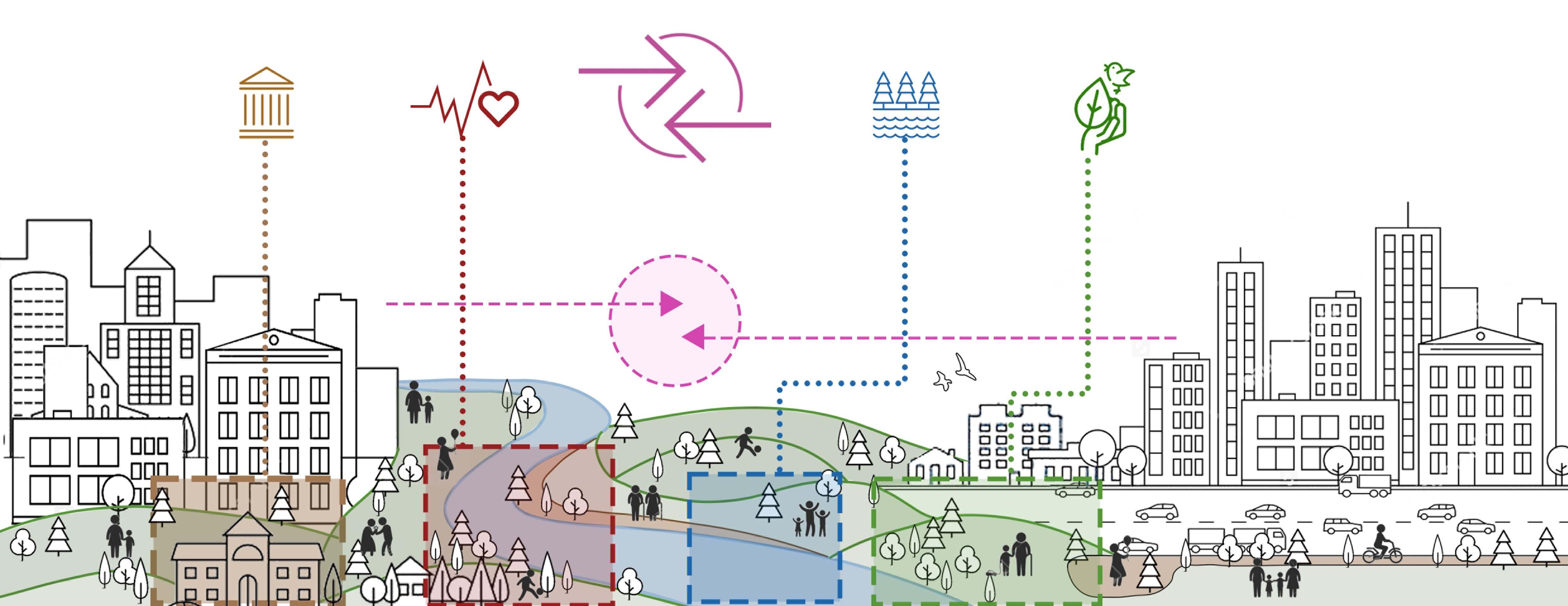
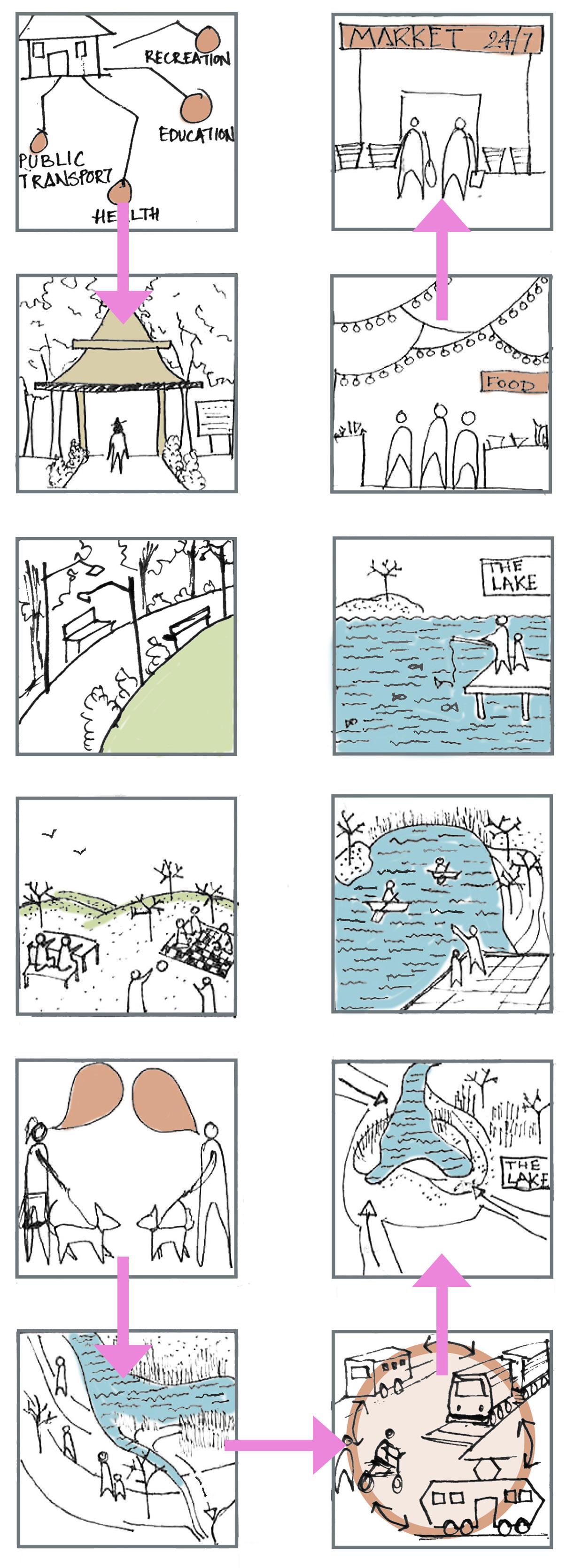
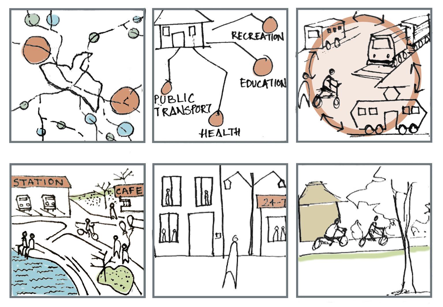
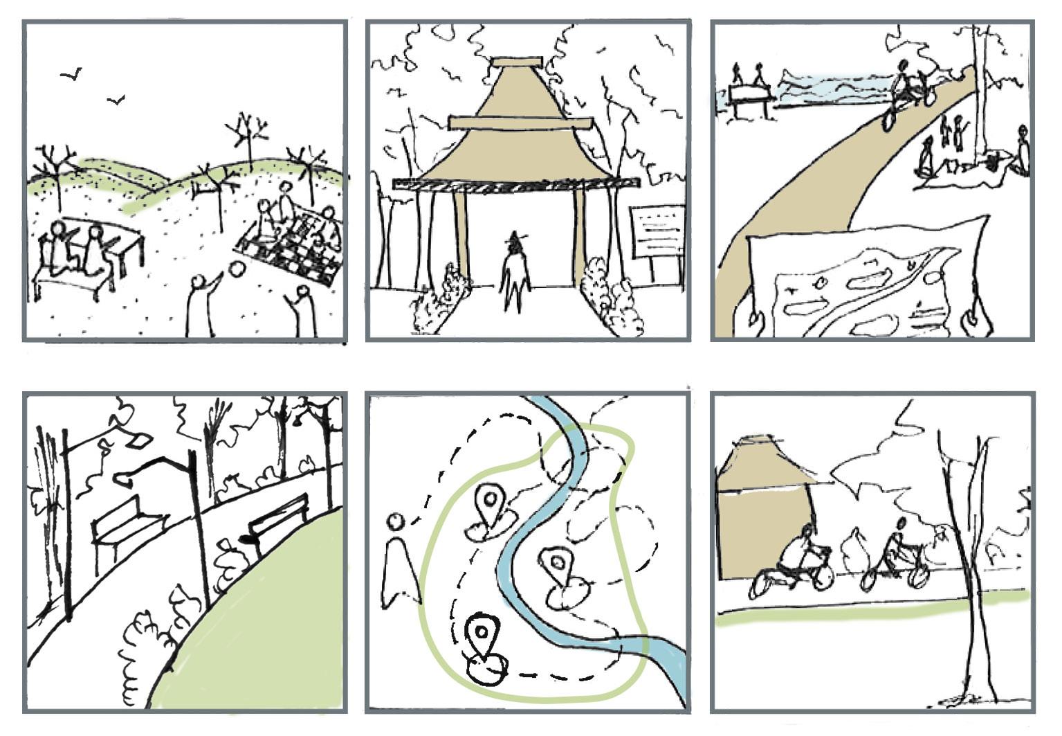
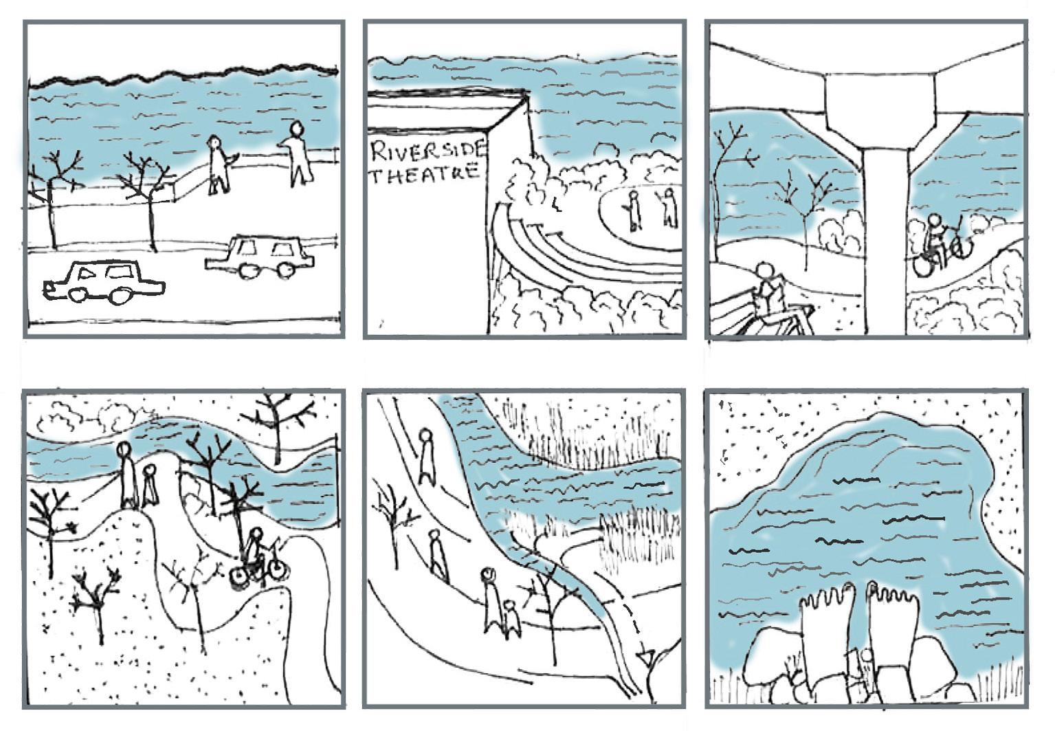
Since the vision of this plan focuses on enhancing the rich background of this precinct, the plan has been developed as a wholesome experience of the precinct. The plan tells the story of the two regions and how the experience within makes it the destination in the vision. To do so, this strategic plan has been divided into themes based on the three focus areas – the park, the river, and the lake. It shows how the journey through these areas will ease the way people move and live within Parramatta and Westmead. This journey also pays close attention to diverse demographics of the city. It looks at the people who have been living in Parramatta for years, to the people who are new, the people who visit every day for work, and even the plethora of people that will be visiting the region on a daily basis. This demographic also caters to the various age groups of people that are expected to embark on this journey. To understand this, the plan details out the journey for the family, the visitor, and the student. The plan takes the form of a storyline through the eyes of our users and how they perceive the city. This makes it easy to comprehend the extent of the plan, making it more accessible for the people of the region.
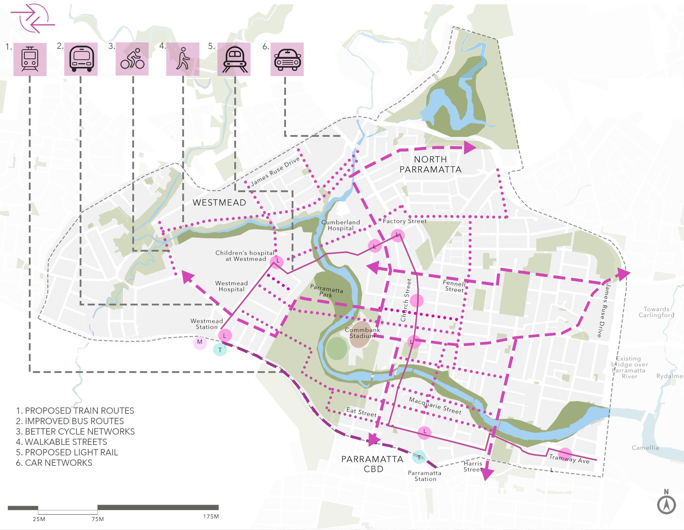
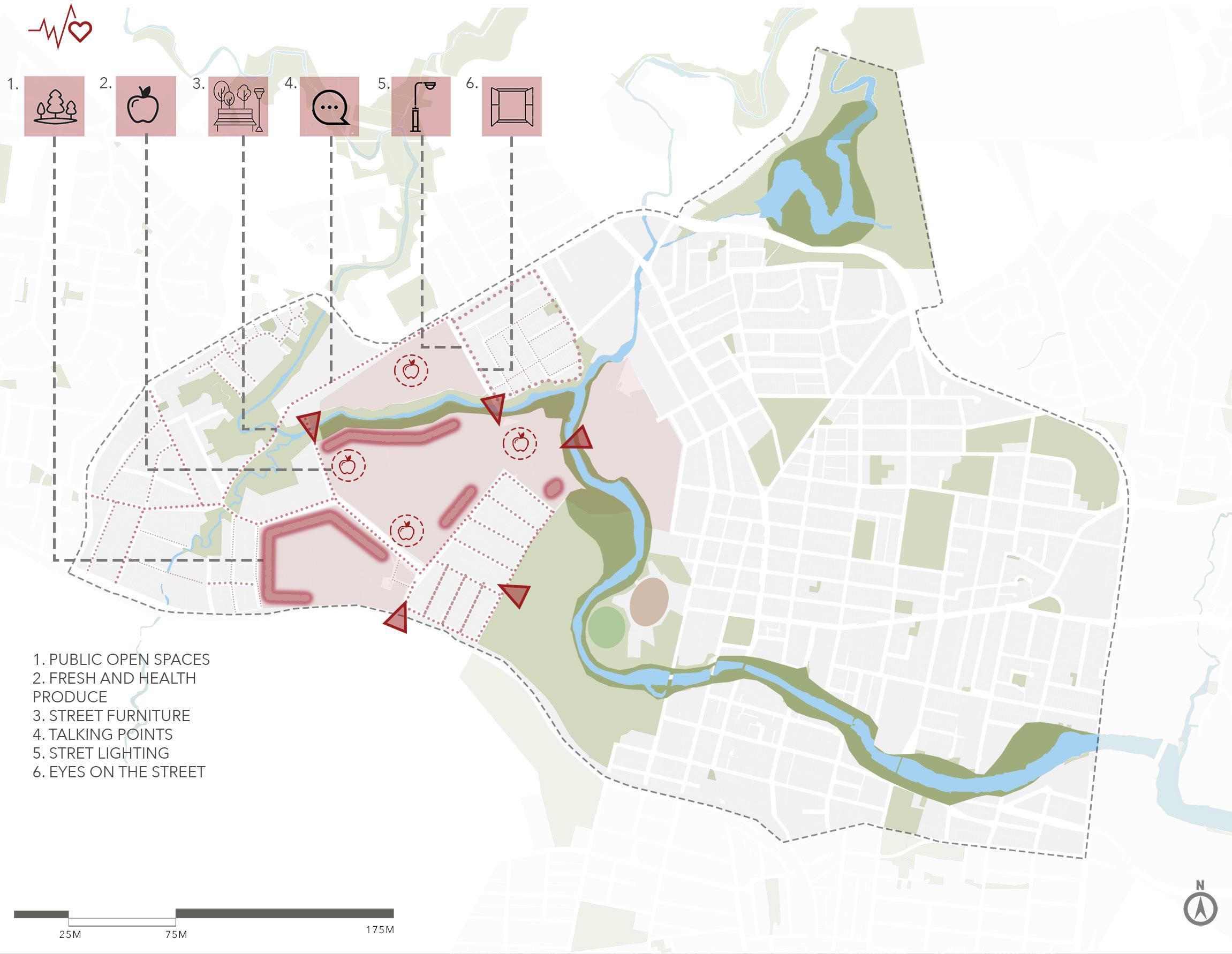
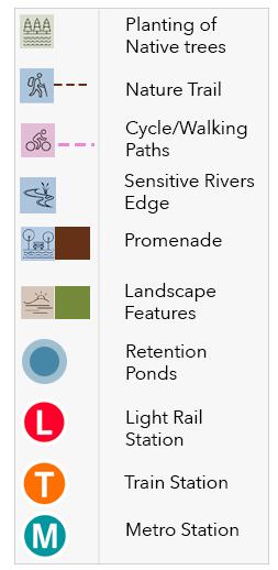
As for the themes that have driven the development in the said focus areas, five factors that are vital to the enhancement of this region have been taken into consideration. The heritage values of the focus areas have been acknowledged and any development will be done only after thorough research of the heritage management plans to ensure that none of these values are compromised in any manner. Integration of Westmead and Parramatta, which forms the primary factor of development and focuses on making connectivity accessible, safe, and convenient. Keeping in mind the rich biodiversity of Parramatta and Westmead, an effort has been made to conserve, protect, and promote the overall biodiversity of the region. This involves a thorough environmental action plan with a primary focus on native species of biodiversity. By doing this, the plan also promotes a healthy built environment for the people. Health and wellbeing in this plan is not just about giving access to medical health, but developing the region in a way that everything that contributes to a healthy living is made equally accessible to everyone. This includes public transport, active transport, fresh produce, safety, and recreation. Parramatta riverfront will also be developed to support the vision of a more vibrant region, along with paying close attention to the risks of flooding. Key objectives and actions help detail out these themes to ensure suitable delivery. These themes together form the base of this strategic plan and will be brought together to make the two cities into one centre.
Parramatta Park plays a vital role in this plan to integrate the two regions, and this has been done with a careful study of documents such as the Burra Charter, Australian world heritage and heritage management plans for the park that help understand the importance of the park and the possible changes that can be done in the process. But integration also means improving the existing connections within the region. This includes proposing better access to public transport, promoting the upcoming light rail and metro connections, proposing more bus routes in both areas, better streetscapes that provide safe pedestrian and bike movements, and livening the transport interchange nodes. With a primary focus on shared transport modes, this plan encourages people to walk, cycle and avoid the use of private vehicles as much as possible.
Other developments such as better recreational facilities, day and night cultural activities, markets and entertainment points will also encourage movement across the two regions not only within Parramatta but also attract people from across the nation. This will also help build the economy and help in the overall growth of Parramatta. A stage wise development is proposed to ensure realistic outcomes as part of the implementation process. Starting with the light rail and metro in 2023, the growth of the plan is planned to span towards 2040. Landscape and environmental developments are expected to extend until 2040 as it involves planting of native trees and plants. Smaller, more achievable goals will be the focus of preliminary development and is expected to be implemented by 2035. This staging plan, with appropriate monitoring and stakeholder investment will help successfully plan the city that this should be.
Two cities – One Centre, as the name suggests establishes an elaborate plan to integrate the two regions that are Parramatta and Westmead. Both these regions are important centres of Sydney that, although located next to each other seem rather disconnected. This plan envisions bringing them together to create a vibrant, diverse, and thriving centre right at the heart of Sydney. With multiple infrastructure projects already lined up, this area shows immense potential to become Sydney’s most buzzing area. The upcoming light rail and metro projects aim to improve the connectivity of this region to the other parts of Sydney, and this plan will add more value to this expansion. The plan aims to celebrate the existing potential of this plan, to help Parramatta and Westmead stand out on the map. It envisions this region as a better place to live, work, thrive and relax in.
Thorough research and study of the strengths and weaknesses of the area, this plan aims to simply provide solutions where required and boost the areas that are weak. It is built on the belief that this city has everything it needs and has its own identity which sets it apart from all other parts of the greater city. This is thus a plan to make this region more accessible and enjoyable for its residents and encourage a plethora of visitors. From a rich history, a diverse culture, vibrant economy, lush natural resources to an abundance of health and educational resources, this city has everything a city needs to thrive. Through realistic objectives, goals, and proper implementation this plan can transform Parramatta and Westmead to what it truly deserves to be. A centre of dreams, and a centre for dreams.


As a response to detailed research and analysis, this plan takes a collaborative approach with the local council and the state government. Informed by existing strategic plans, council projects, and appropriate policy document, this plan aims to work around the proposed development for the region without causing hindrance or proposing drastic changes to the area. It adopts major elements from Greater Sydney and the state governments strategic plans such as The Metropolis of Three Cities, the plan for Greater Parramatta and Olympic Peninsula or the Central City District Plan. The plan establishes a cohesive vision that will support the proposed developments.
Keeping in mind the rich culture and heritage of Parramatta, this plan works around the ongoing research and development surrounding the multiple heritage sites that lie within. Plans such as the Burra Charter, the Heritage Management Guide as well as the Parramatta Park Trust’s Heritage Management documents will support the successful delivery of this vision. Community engagement and aboriginal consultation will also guide the plan in every step and any development will primarily ensure growth for the people of the region.
Two Cities: One Centre, is informed by the strategic planning framework set in the higher-level plans for Greater Sydney. The Metropolis of Three Cities, Greater Parramatta and Olympic Peninsula and the Central City District Plan. Considering Parramatta has been considered one of the major centres in all of these plans, vital information has been adopted and materialised into the vision of Two Cities One Centre.
Common themes include Infrastructure, Liveability, Productivity and Sustainability and these form the foundation on which the plan Two Cities, One Centre has been built. Keeping these primary themes in mind, this plan aims to dive deeper into the needs of the community in Parramatta and Westmead in a hope to create a cohesive, collaborative, serviceable city to live and work in.
The Metropolis of Three Cities is the region plan for Greater Sydney developed by the Greater Sydney Commission in collaboration with other plans such as Future Transport 2056 and the State Infrastructure Strategy. This plan seeks to transform Greater Sydney into a Metropolis of Three Cities: Western Parkland City, Central River City, and the Eastern Harbour City. The vision brings new thinking to land use and transport patterns to boost Greater Sydney’s liveability, productivity, and sustainability by spreading the benefits of growth (Greater Sydney Commission 2018). The Central River City mentioned above refers to the river city of Parramatta and has informed Two Cities One Centre in better understanding the development in the region.
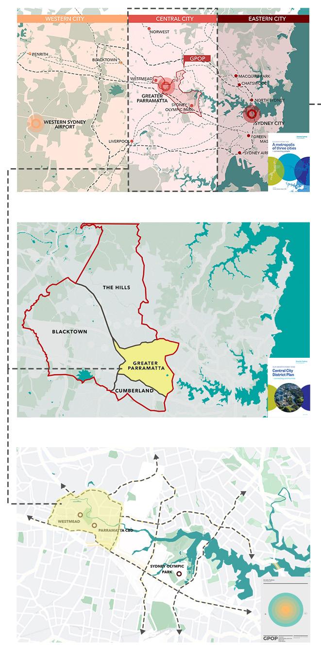
Greater Parramatta and Olympic Peninsula or GPOP is the centre of Greater Sydney, and this is a comprehensive plan by the Greater Sydney Commission to enhance this centr. It has the prospect to gather people from all parts of Greater Sydney — to work, live, be educated, access services, and take part in leisure activities. Parramatta CBD and Westmead Health and Education Precinct are vital parts of this strategic plan. This plan envisions Parramatta CBD to become “a strong commercial core interwoven with the river” (Greater Sydney Commission 2016). It also aims to transform Westmead into a “proud ‘health city’ and international innovator” (GSC 2016). Two Cities One Centre adopts highly from this plan’s vision of North Parramatta to become a “creative, heritage and entrepreneurial hub” and to create “a green connector” through Parramatta Park (GSC 2016).
The Central City District Plan by the Greater Sydney Commission is an elaborate plan for Greater Parramatta and surrounds. As a major metropolitan city centre, Parramatta along with its surrounding LGAs; Blacktown, Cumberland, and The Hills, is envisioned to grow into a primary economic, social, and environmental centre. With an elaborate set of directions and planning priorities, this plan aims to achieve this through a 20-year management plan. The elaborate transport network, it aims to improve the connections within Parramatta as well as connect the region to the other parts of Greater Sydney.
Parramatta Park and Parramatta River both hold significant historical values and aboriginal people have occupied these lands for over 60,000 years. Present day Parramatta thus boasts of the earliest presence of aboriginal history in all of Greater Sydney and thus Parramatta’s history is directly linked to the history of the traditional owners of the land. The Burramattagal people, belonging to the clan of the Dharug, lived along the Parramatta River and relied on it for all their daily needs. Their name is said to be translated to a ‘place where eels lie down’ and still holds major significance in the activities of Parramatta City. Western Sydney is also known to have the largest aboriginal and Torres Strait Islander population of Australia. Even today, Aboriginal and Torres Strait Islander people form a vital part of the community in Parramatta continuing to contribute to the growth and development of the city.
The Native Institution, the Parramatta Gaol, and the Women’s Factory are some of the important institutions within the region that have a special connection with the aboriginal history of Parramatta till date. The river and its banks served as a major source of food and shelter for the early owners of the land, and depiction of native foodstuffs, plants and fishing activities can still be found along the foreshores of this area. Some of the major pockets of bushland in Parramatta Park were known to be created by the Burramatta clan, and most of the native trees and plants in the park have prevailed for years before European settlements. The character areas referred to in this plan; the park, the river, and the lake are thus centre to the glorious history of Parramatta, and this plan thrives to celebrate this rich culture and history, respecting it and promoting it in the best way possible.
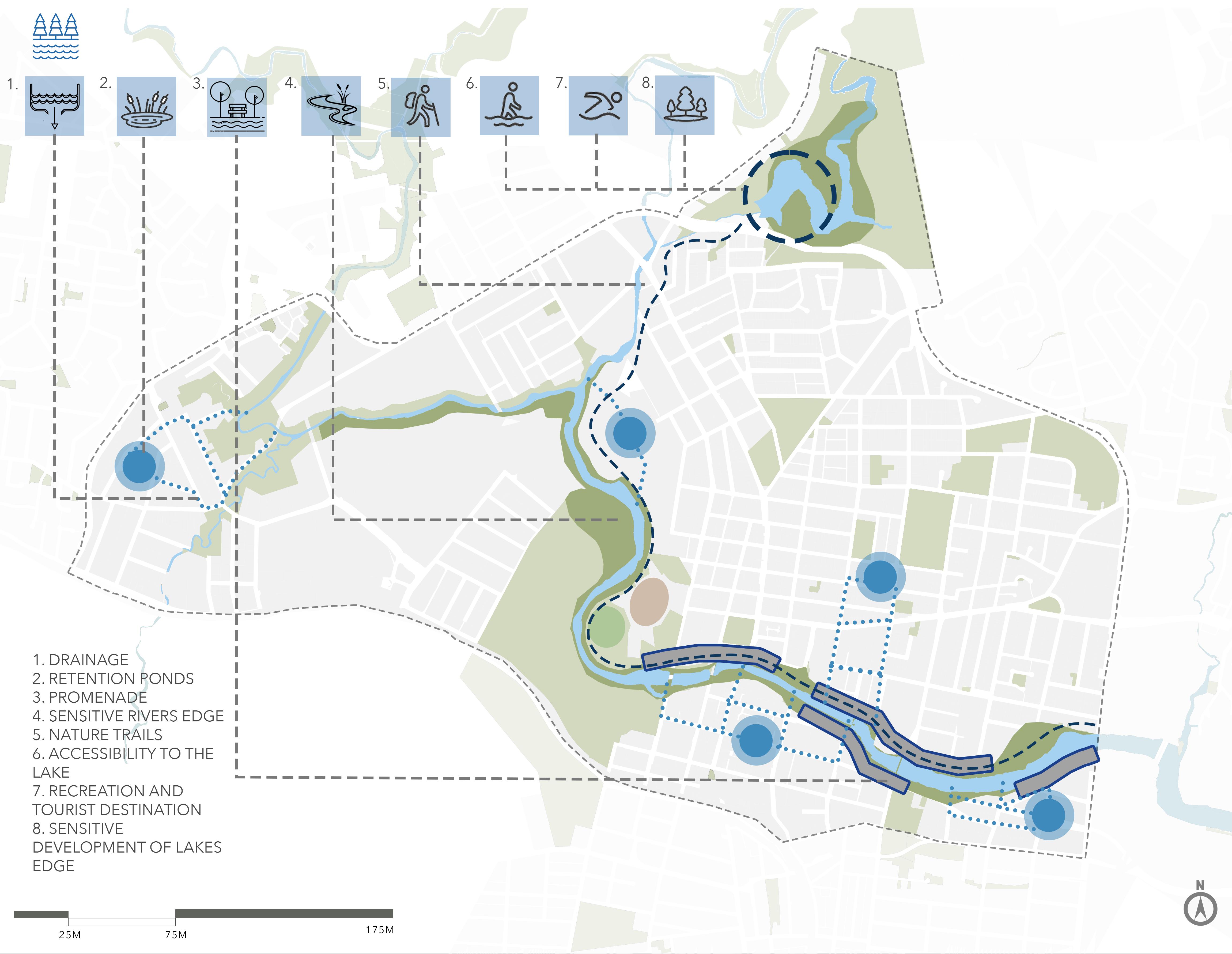
- Strong heritage background.
- Major water body flowing through the site.
- Health and education precinct.
- Upcoming Transport Network
- Diversity
- Parramatta Park
- Lack of green pockets
- Poor accessibility
- Underutilized Parramatta Lake and River
- Increased UHI effect. (Highest in Westmead. Source: Parramatta Heat Maps)
- Poor active infrastructure.
- Lack of amenities & activities.
- Upcoming Light Rail.
- Revitalization of Parramatta Park, improve green grid.
- Utilizing riverfront. Improve integration between Parramatta and Westmead.
- Awareness about history and heritage.
- Enhance cultural activities & amenities.
- Activating grey zones.
-Major green spaces are heritage items or fall under heritage conservation areas
- Environmental risk because of development.
- Disconnection from the city
- Overshadowing
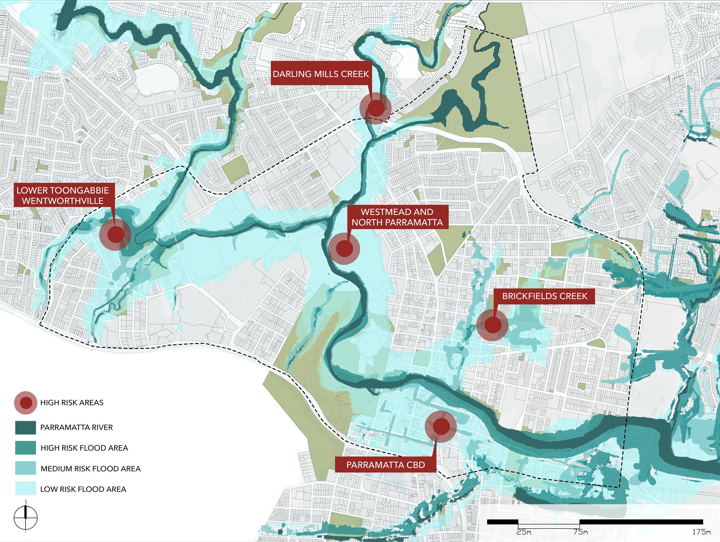
- Risk of flooding.
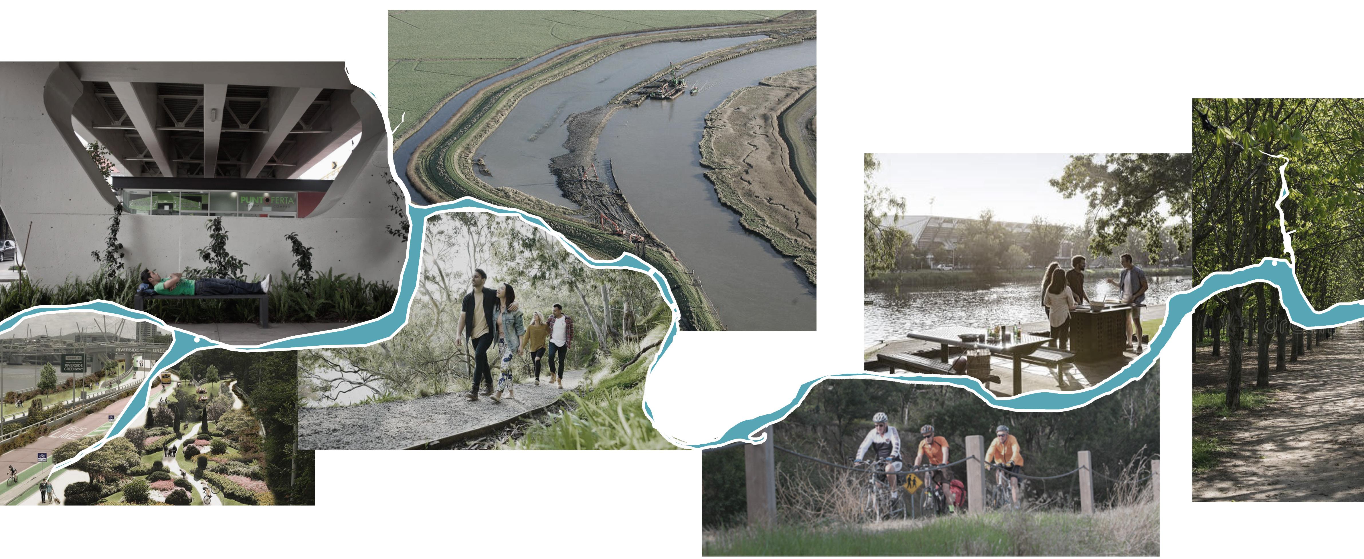
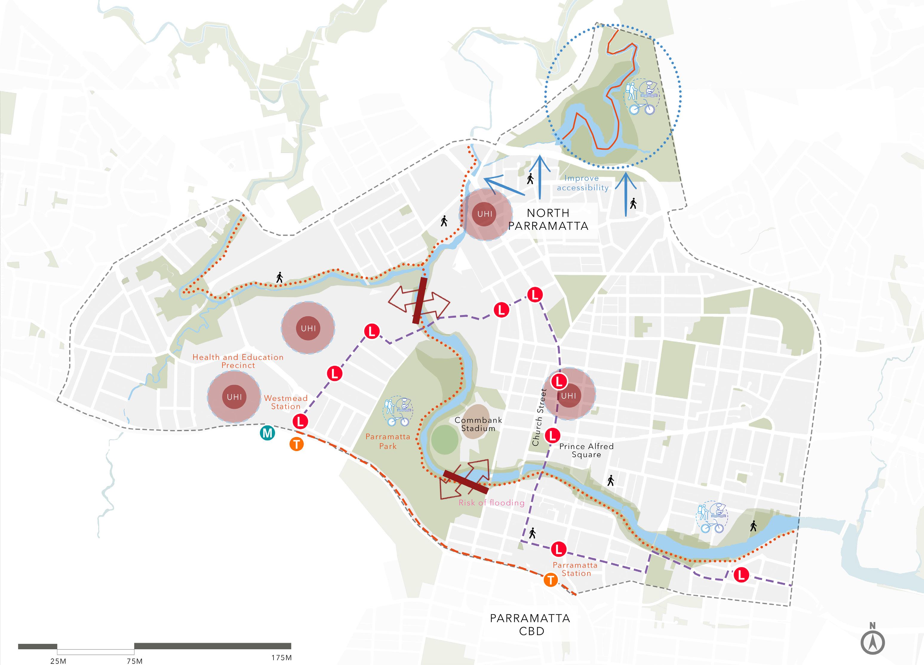
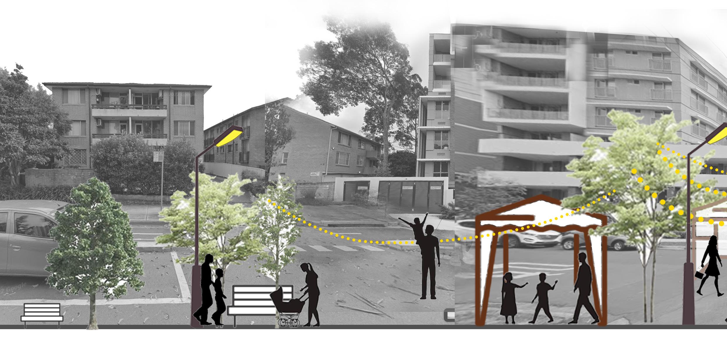
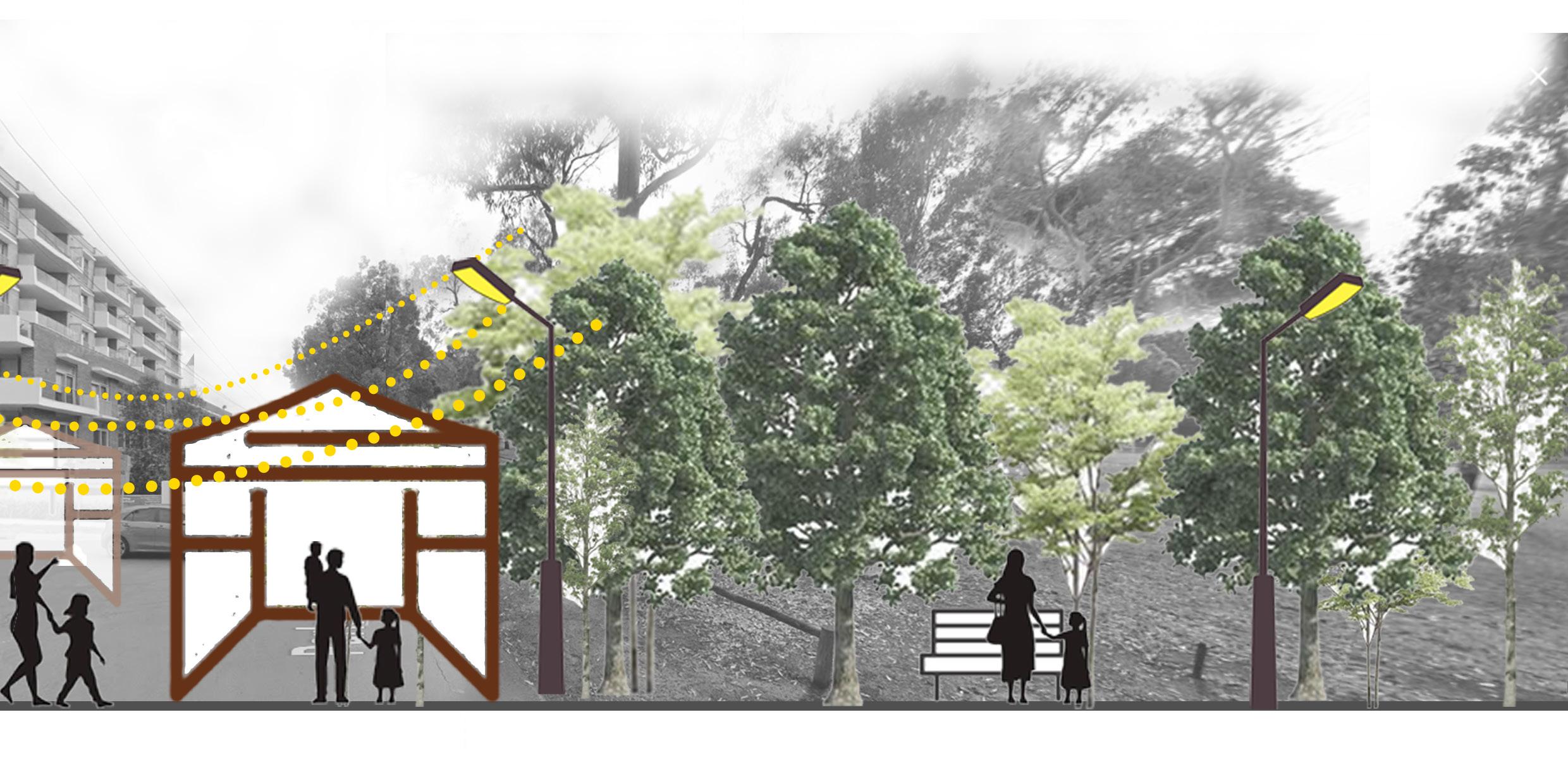
The study area as established before, covers the regions from Parramatta CBD to the precinct of Westmead. A detailed research and analysis of the study area entailed a series of observations that forms the foundation of this plan. The site analysis was carried out in phases and involved site visits, research of the history, understanding the existing developments and developing a SWOT analysis to gain a deeper understanding of what the site needs most. This analysis helped decide what areas needed focus and pen the emerging narrative of this plan. The key environmental, social, and economic data were analysed in depth to realise the potential of the region and supported the entire project of strategic planning. Preliminary site visits resulted in the primary observations of land use and connectivity within the two areas. Some of the major observations included the lack of active connectivity between Parramatta CBD and Westmead, and the grey zones created in major shared spaces. The narrative of this plan was thus conceptualised to connect Parramatta to Westmead in a way that both regions are enhanced to create a livelier and buzzing centre.
The river and park were observed to be the glue that held the regions together and thus became the primary factors that would support this development. Considering that the site included major areas that were part of state or local heritage, a thorough study was conducted to establish the scope of development possible within the area. After keen observation of these sites, it was decided that the plan will strive to bring this heritage to life and spread awareness about these sites in the best way possible. As the river was deemed to be one of the focus areas of this plan, the underlying issues of flooding were considered and informed the design and planning decisions for the area. Parramatta Lake was also included into the site boundaries as it played an important role in the history of the city and can contribute to the vision of this plan. The study area is home to a diverse range of cultures, with people from a variety of backgrounds. With a median age range of 34, this region houses people belonging to all ages and family structures. The plan is thus built to cater to this diverse community and serve every individual that makes up the demographic of this area.

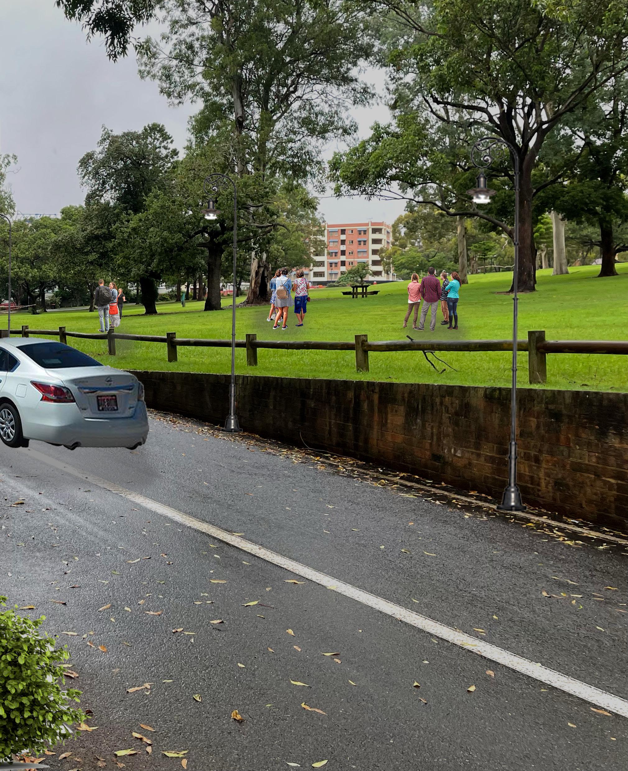
Other observations that helped direct the objectives of the plan included a lack of open spaces and gathering spaces throughout the site. To make the region a healthy living space for the community, It is important to brighten the existing open and green spaces and make them more accessible to the public. More trees, greening the grey zones, making the streets into shared spaces were all derived from the study undertaken on the site. Enhancing the green spaces will also help control the urban heat island effect that was observed across the area. The transport networks can better connect Parramatta and Westmead. The upcoming light rail and metro projects will support this process, but the plan also focuses on improving the access to these connections by improving streetscapes to encourage walking and cycling. Transport interchange nodes such as Parramatta Station need to be enhanced to ease the experience of travelling within and into Parramatta. Better accessibility to public transport and better road safety will encourage the public to spend more time outside and will help create a safe and healthy built environment.
The poor access to Parramatta Lake was noticed during subsequent site visits and helped further strengthen the objectives of this plan. Lack of pedestrian access, safe crossings, low number of bus stops all reflected the reliance on private transport to access this part of the site. This helped strengthen the objectives of the plan. Deriving from all these major factors and undergoing a thorough study of the strengths, weaknesses, opportunities, and threats (SWOT), this plan aims to provide better solutions to improve what is already one of the major metropolitan centres of the city. Strategic options were weighed through a detailed multiCriteria analysis to decide on the ideal choice for the success of this plan. The site analysis thus helped realise the issues of connectivity, green cover, place-making, and the lack of a healthy built environment and helped conclude the results of the criteria analysis. The emerging themes, objectives and action are solely based on this study and will strive to transform the study area into the most attractive part of Greater Sydney and probably the nation. LEGEND
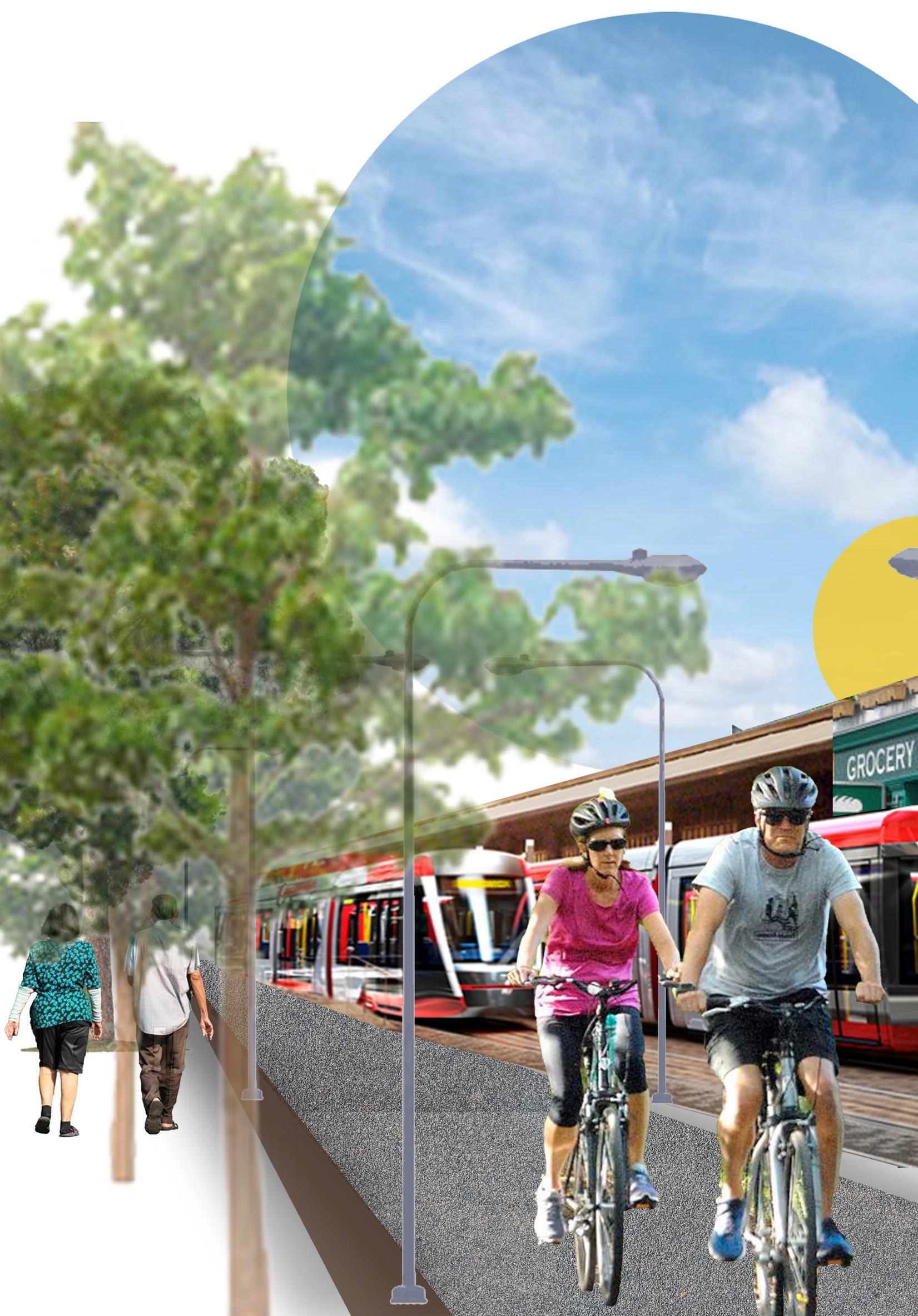
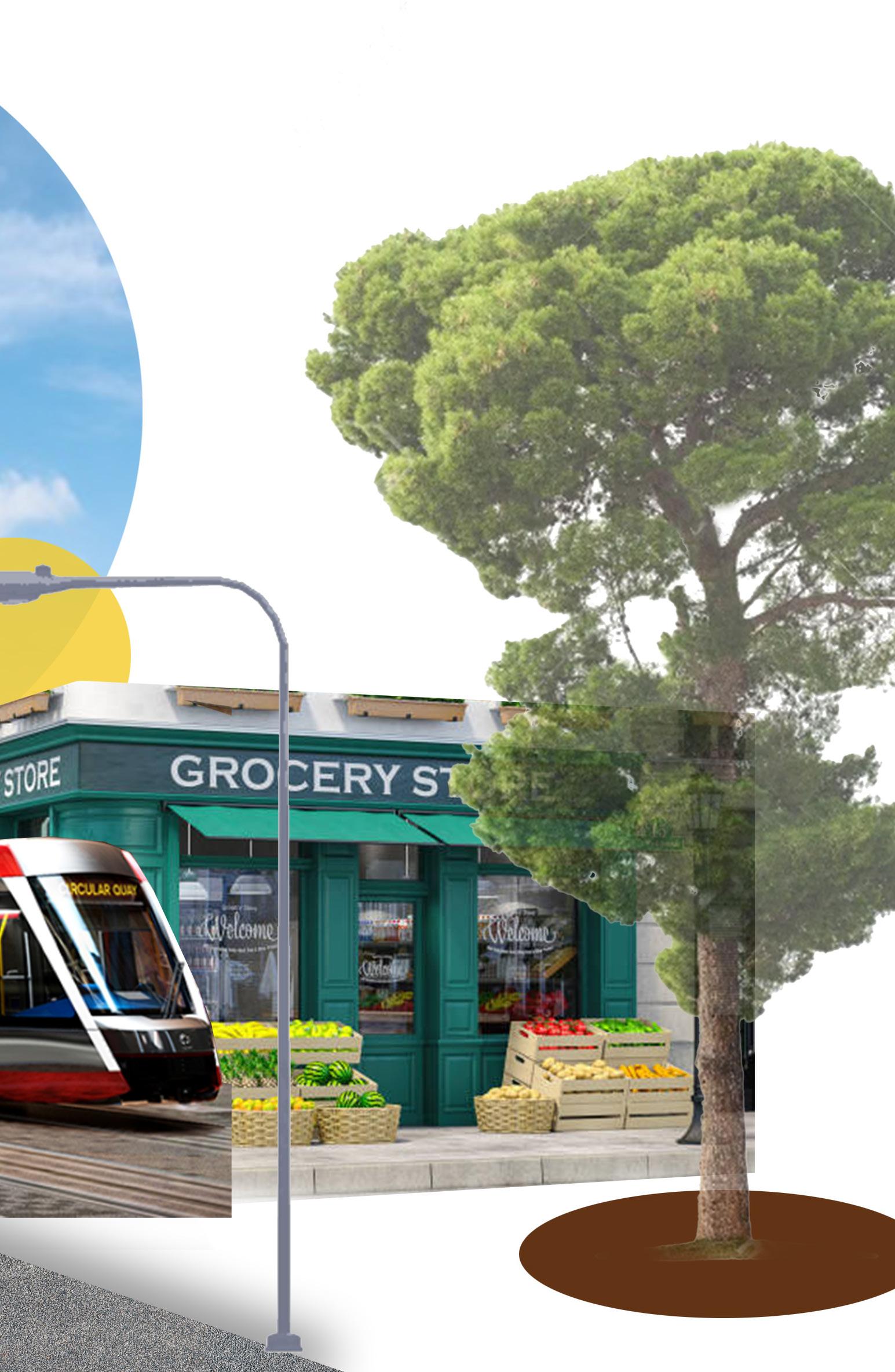
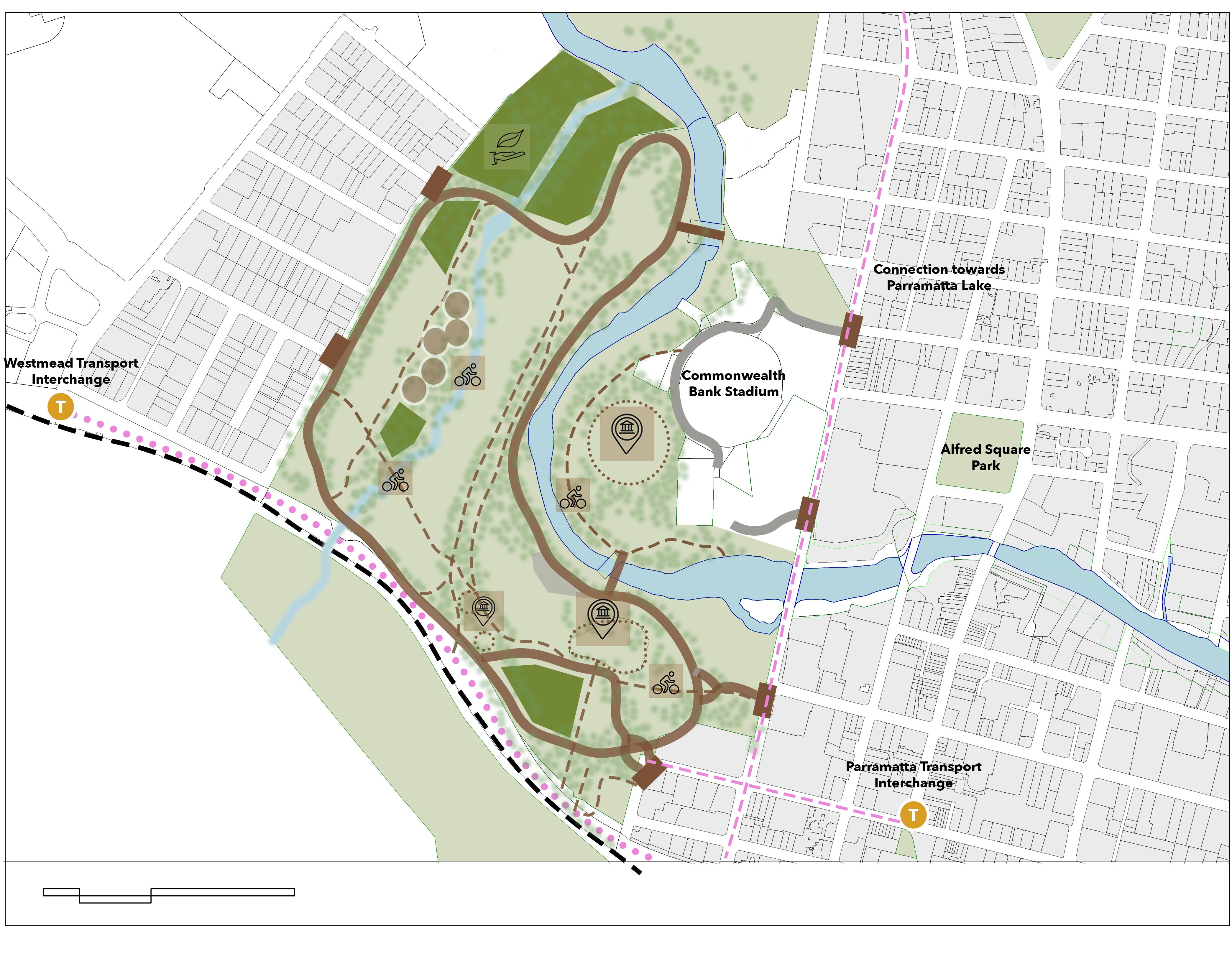
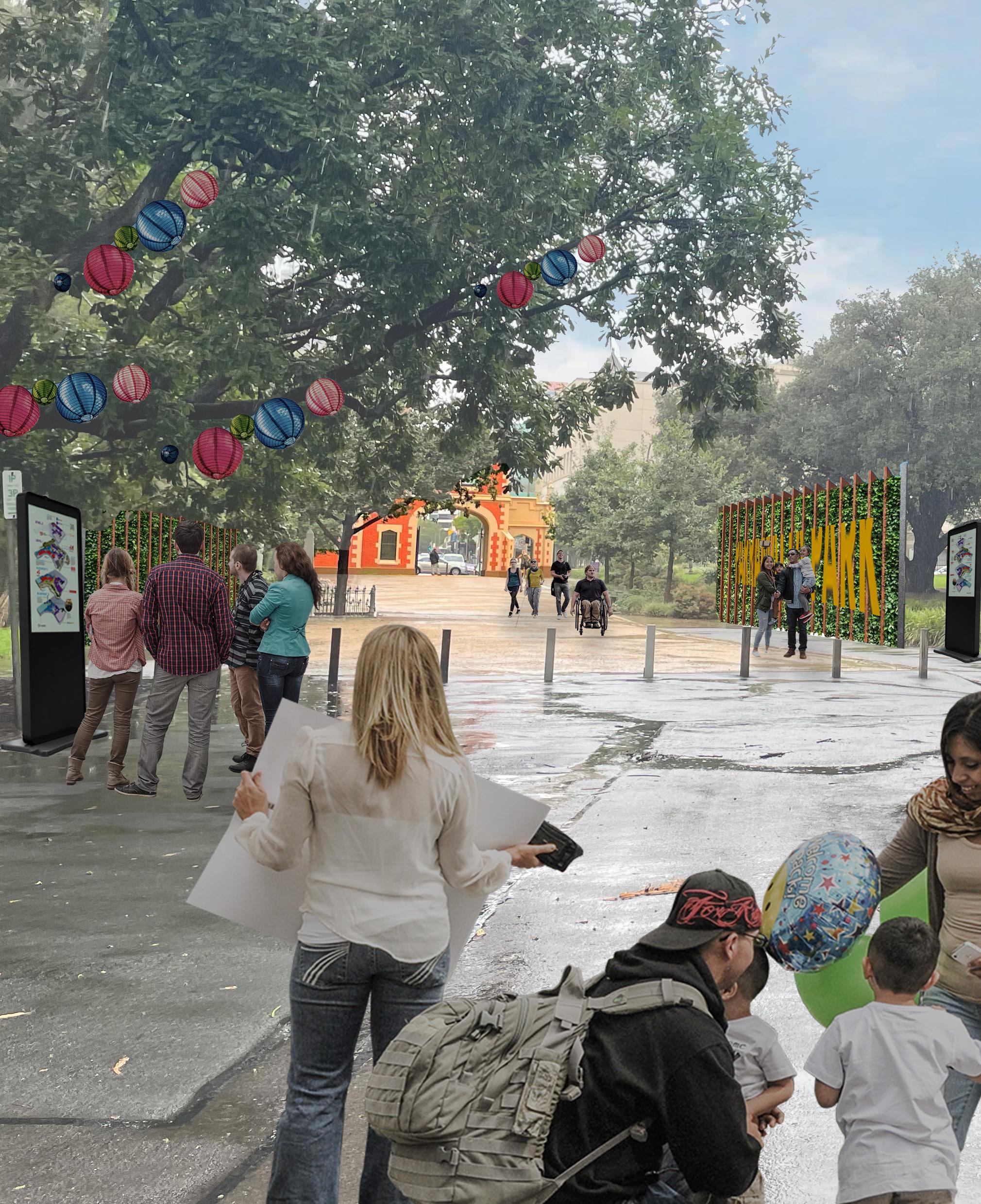
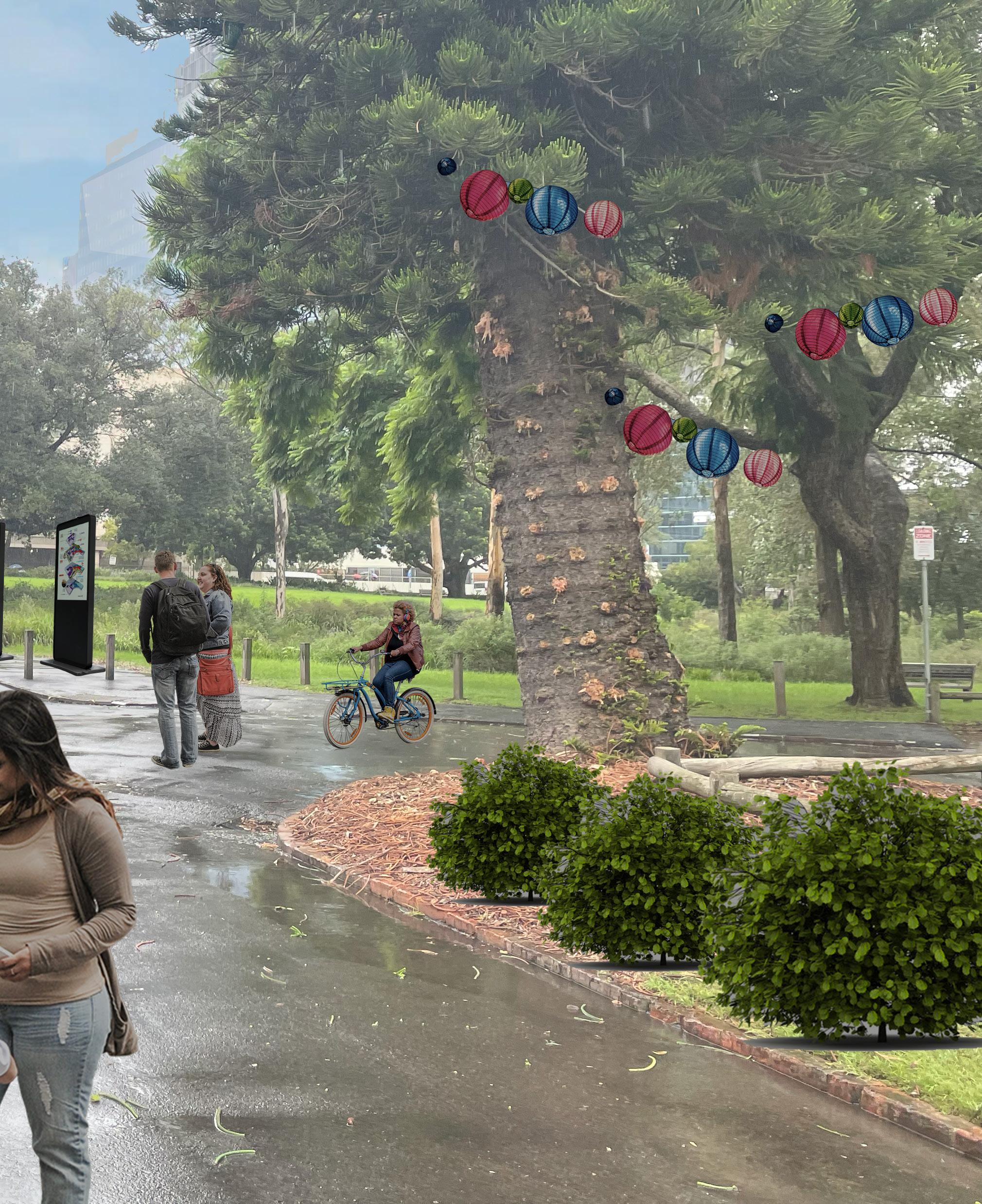
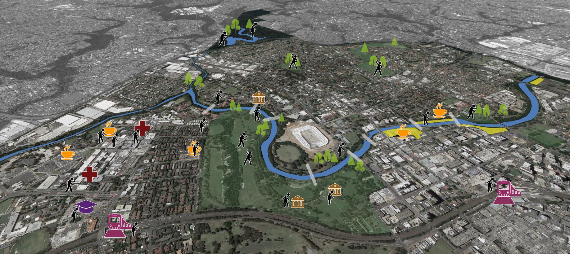
The vision of this plan is to connect the central city and make it more accessible for all of Sydney and beyond. Parramatta and Westmead are two precincts with very high potential, and this plan aims to connect the vibrant centre of Parramatta to the growing health and education precinct that is Westmead and make it One Destination to live, work and prosper. This will be done by enhancing and protecting the proud features that are unique to this region – The park, the river, and the lake. These historically significant features lie in the centre of the site and are what make Parramatta and its surroundings different from all other Central CBDs. With minimum intervention and thoughtful strategic planning, these will be the primary connectors that will support and forge this vision.
 Img 07: Vision. Source: Author
The research and analysis undertaken in this plan established the vision of integrating Parramatta and Westmead with each other as well as with the world beyond. Instead of looking at them separately, it focuses on the strategic planning issues of both the areas together and dealing with them as one. This will help improve accessibility, connectivity, business, education, and entertainment of both these areas together. Parramatta Park will act as a major enabler of integration between these areas. The rich heritage and history will create a sense of belonging for the community as well as attract the masses to the Precinct. It will also be the core of a proposed green grid that can help control the urban heat effects in the area.
Developing the riverfront to manage flood risk, activating grey zones, and helping realise the importance of the river in connecting the past to the present. Promoting a Healthy Built Environment for the community and redefining the concept of a Health Precinct. This will be done by providing opportunities for recreation (both physical and mental), encouraging social interactions through built spaces, safe streetscapes that encourage walking and cycling, and providing equal access to health amenities.
Based on these themes and objectives, the vision proposed at the start of the research remains intact and perhaps becomes clearer. These elements together aim to tell a story of a single wholesome precinct that combines Parramatta and Westmead. It will be a city that reconnects the land to its history, its people, and the environment. A major tourist destination, a handbook for healthy lifestyle, social and economic centre: that is the long-term goal for the study region. The structure of this strategic plan will follow the storyline woven by these themes.
For the successful development of this storyline, the plan takes the form of a journey through the focus areas, and this journey is experienced by the users that make any plan successful. These users comprise of the visitor, the family, and the student. The challenge however will be to bring this story to life, that is execute the themes through appropriate strategic choices. The research will thus be converted into a detailed list of criteria that will form the basis of proper execution of this plan. It will aim to solve each problem one step at a time, so as to ensure a successful achievable vision to create a destination of dreams.
Welcoming, attractive, vibrant.
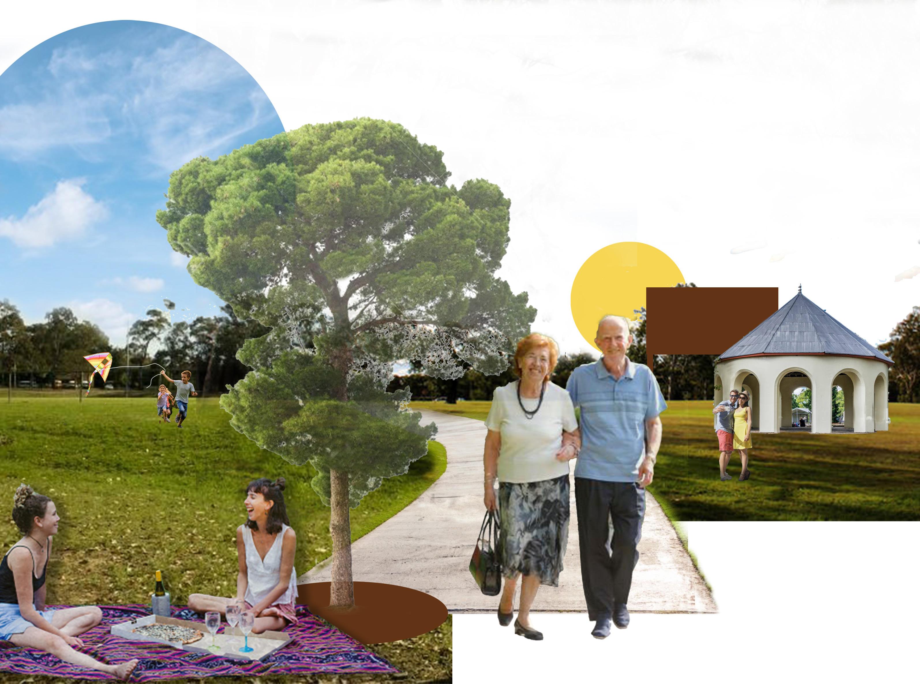
To make Parramatta and Westmead a primary destination and a buzzing centre for entertainment, work and recreation, this plan focuses on creating the ultimate experience for anyone who visits the region. This experience is designed to cater to a range of visitors belonging to different age groups, cultures, and backgrounds.
For a visitor, the journey starts at the Parramatta Transport interchange.
The Parramatta Train station will be designed to serve as a major transport interchange for all of Sydney.
To make the entrance to Parramatta welcoming, this transport interchange will be served by information kiosks, cafes, eateries, and street furniture that will ensure a smooth transit into the city.
A walk to the park will take them through the buzzing church street, the commercial core and major shopping centres giving a feel of what Parramatta has to offer.
Any one of the historic gatehouses of Parramatta Park will mark the beginning of what is a tour of the rich cultural heritage and history of Parramatta.
Interactive activities, nature trails, riverwalks and guided heritage tours will slowly move forward their journey to Westmead.
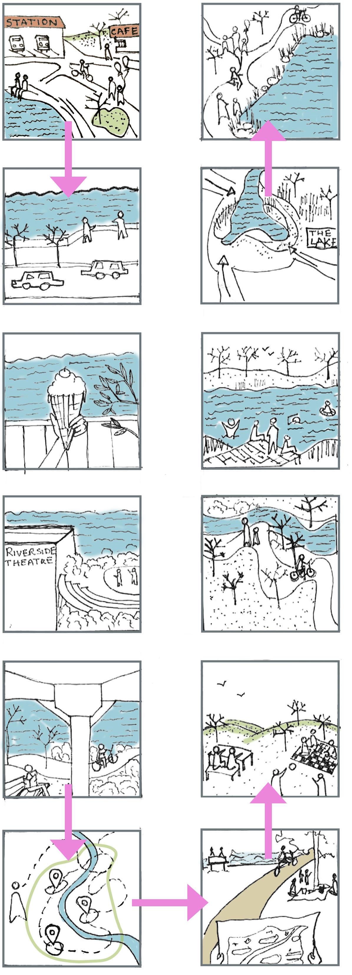
Walking, cycling options for those interested in an immersive experience; easy access to public transport for others – all ways to reach Westmead to continue their experience of the city.
Although primarily a healthcare precinct, Westmead will welcome visitors with its shopping and entertainment zones – day/night markets that promote local businesses, local street food, cultural festivals, and public recreational hubs.
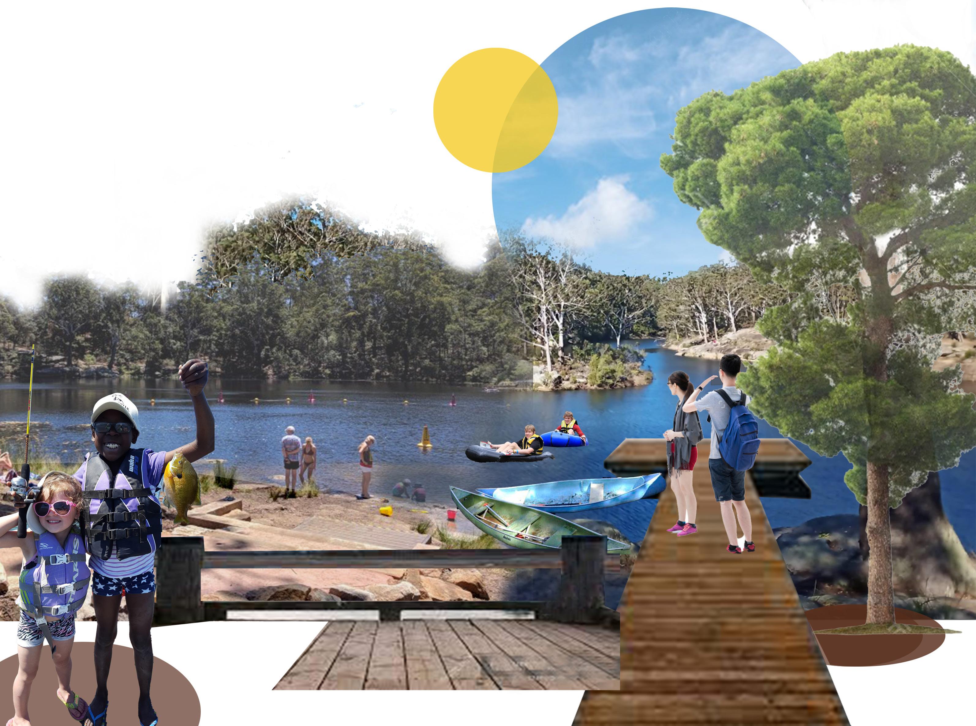
Parramatta Lake – primary destination for visitors to enjoy nature trails, physical activities, gatherings, fishing and much more – just a bus ride away.
This plan caters to families that not only lives in the region but also to the families that will visit to experience the city in all its glories. From young families with children, to couples, to the elderly, this plan caters to the diverse range of family structures that form the demographic of Parramatta, Westmead as well as in the larger context.
The transport interchange at the start of Parramatta will be equipped with all the necessities for children as well as the elderly, with ramps and safe pedestrian pathways and crossings.
The activities right at the start will give a necessary buffer for the families visiting Parramatta.
For a family that lives in Parramatta or Westmead, all public services will be within walking or cycling distances.
Keeping in mind that cars are the most preferred routes for families, parking facilities and shared roads will facilitate moving around. However, easy access to public transport and intermodal connections will reduce car dependency.
Parramatta Park, with its interesting activities and rich heritage values will be a prime recreational destination for all age groups.
Children Play areas, boating, fishing along with safe pedestrian movements will all be incorporated in the park’s development plan.
Westmead’s residential area will provide a vibrant community living experience. Parks for recreation and social activities, occasional health drives, mental health workshops will together create a healthy liveable environment.
Supermarkets that produce fresh produce, and local markets will ensure a healthy life for all residents.
Being a health and education precinct, Westmead will also be a hub for the best schools, universities as well as medical centres.
The improved connectivity options between Parramatta and Westmead will also make journey to work a better experience.
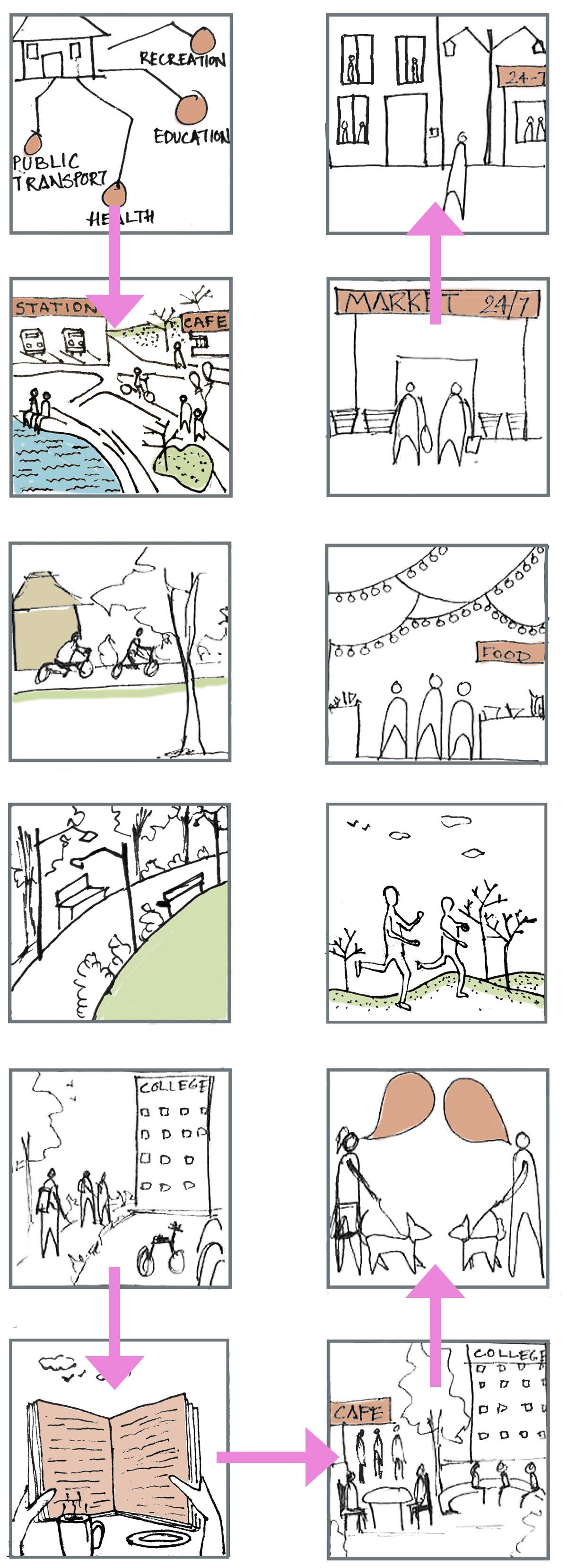
A prime destination for health, research and education, students form a vital part of the demographic in this region. It is thus also important to ensure that the city provides an atmosphere that makes the experience better for a student who lives in or travels to this region every day. A safe transit, social study spaces, recreational activities and an active 24hour neighbourhood will enhance this experience and help support this experience.
With a varied option of educational facilities, Parramatta and Westmead will become the primary hub for students studying in all fields.
Easy public transport connections to and from both Parramatta and Westmead will make travel seamless for any student living within or coming every day.
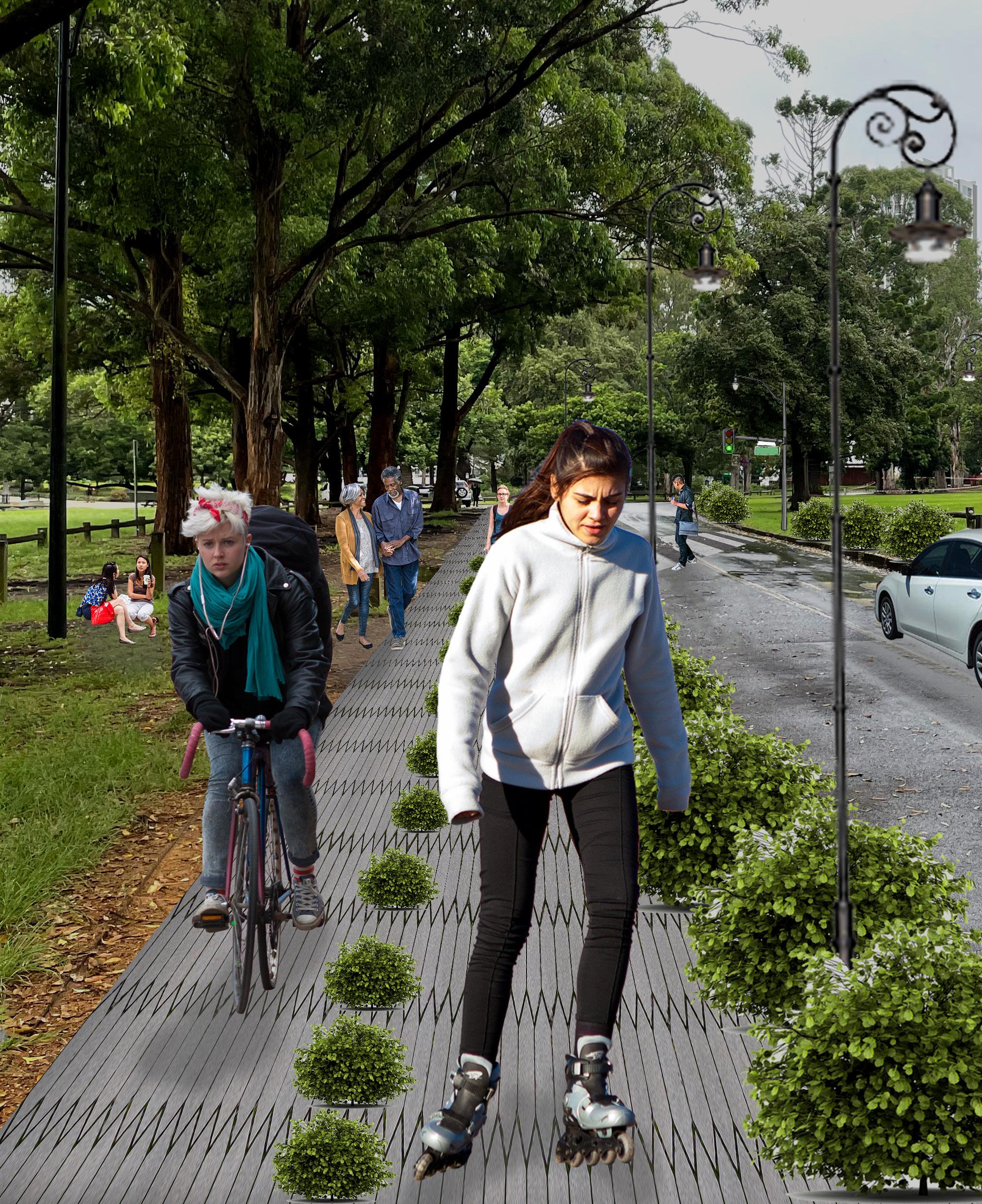
Safe pedestrian and cycling pathways through the park ensure easy connection between Parramatta and Westmead. Cycle parking, e-scooter or e-bike facilities will encourage cycling to school and help build a healthy lifestyle.
Living and studying in a region rich in its cultural values, will encourage and enlighten students to respect their history and make an effort to protect and conserve it for years to come.
Recreational spaces within the park, river and lake and exciting night markets will provide an entertainment and vibrant culture for students to live in.
Smart seating spaces near educational institutions and in open areas will encourage interaction as well as provide study spaces for those who like them.
More streetlights, an active nightlife and improved residential areas will ensure safe travel at all times.
It is important to identify the core outcome areas of planning that would help achieve and execute the vision for the study area. Based on the aims laid out the themes identified were Heritage, Integration, Environment and biodiversity, Health and Well-being and Riverfront Development. Each of these themes were developed as a result of the detailed study of the site. The SWOT analysis done previously helped identify key areas that needed to be focused on and formed the basis of the strategic plan. Firstly, it was observed that Parramatta Park and the river are key heritage sites and developing around these would be a challenge. It thus became important to study the heritage aspects of these sites in further detail and indulge in the appropriate management and conservation of the same to facilitate the long-term vision. Once this is achieved, the plan can move to the primary goal that is, integration. Integration in this plan will be primarily focused on improving the accessibility and connectivity within Parramatta and Westmead as well as to and from the rest of the city. With the river and park being the major facilitators of integration, environment and biodiversity plays an important role in achieving the success of this plan. Protecting the existing biodiversity as well as introducing sufficient green cover to facilitate a environment-friendly connectivity within the region is the key motive behind this theme. Westmead is home to some of the top hospitals and medical research centres, but health and well-being does not solely depend on them. Preventing health issues is as important as treating them, if not more. A healthy built environment can facilitate a healthy lifestyle within a community which is outlined as part of the theme of health and well-being. Finally, the vision involved using the river as a major connector between Parramatta and Westmead and through this theme the plan aims to activate the riverfront to accommodate activities and promote recreation.
OBJECTIVE 1: To conserve and protect the natural and cultural values of the park in a better way.
•Protect biodiversity
•Planting Native Trees
•Landscape Features
OBJECTIVE 1: To improve the connection between Parramatta and Westmead. Integrate them as one city.
•Bus Routes
•Transport Interchange
•Ride Sharing
•Designing for emergency vehicles
OBJECTIVE 2: Connecting neighbourhoods and centres; improving external connections.
•Identify preferred travel routes and modes
•Improve Ferry services
OBJECTIVE 2: To promote the historic, cultural and heritage significance of the park while making it an important tourist destination.
•Sporting and Recreation
•Interactive Tours
•Public Art and Installations
•Visibility and access
•Promoting existing heritage structures

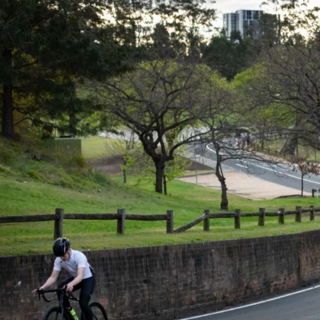
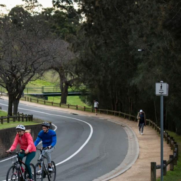
OBJECTIVE 3: Improve access throughout Parramatta and Westmead. Encourage Walking and Cycling.
•Develop priniciple cycling network

•Promote cycling within community
•Vibrant, safe and walkable streets
•Infrastructure that promote use of public transport
•Safe crossings and pick up/drop off zones
OBJECTIVE 1: Retaining existing biodiversity and enhancing it ,creating awareness of native trees.
•Protect existing flora and fauna

•Biodiversity and native trees along park and river
•Increasing tree cover
•Grey to green zones
•Introduce Biodiversity trail
•Spread Awareness
OBJECTIVE 1: Providing equal access to health amenities including fresh produce, mental and physical health.
•Access to the health precinct
•Access to healthy and fresh produce

•Physical and Mental health
OBJECTIVE 1: Improve the riverfront areas of the river in Parramatta and Westmead.
•Promenades as public spaces
•Sensitive development of the river’s edge
OBJECTIVE 2: Reducing the heat island effect.
•Trees for cooling
•Shading on streets
OBJECTIVE 2: Promoting social interaction among the people of Parramatta and Westmead.
•Public open spaces
•Introducing “Talking Points” and street furniture.
OBJECTIVE 3: “Eyes on the street”Providing safe streetscapes.
•Better Lighting on streets
•“Eyes on the Street”
•Active nightlife
OBJECTIVE 2: Create awareness about the history and importance of the river
•Nature trails
•Promoting history through the storyline
OBJECTIVE 3: Enhance the Lake as an integral part of the river so as to help attract activity to the precinct.
•Accessibility to Parramatta Lake
•Recreational spaces
•A tourist destination
•Sensitive development around the lake
OBJECTIVE 3: Areas for managing the flood.
•Natural Flood risk management

•Manmade barriers to manage floods
•Sensitive development around the lake

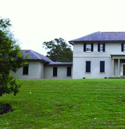 Img 8: Old Government House, Susan Tanya Macdonald (February 2014)
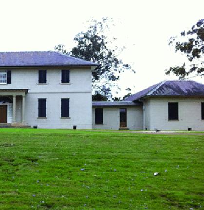
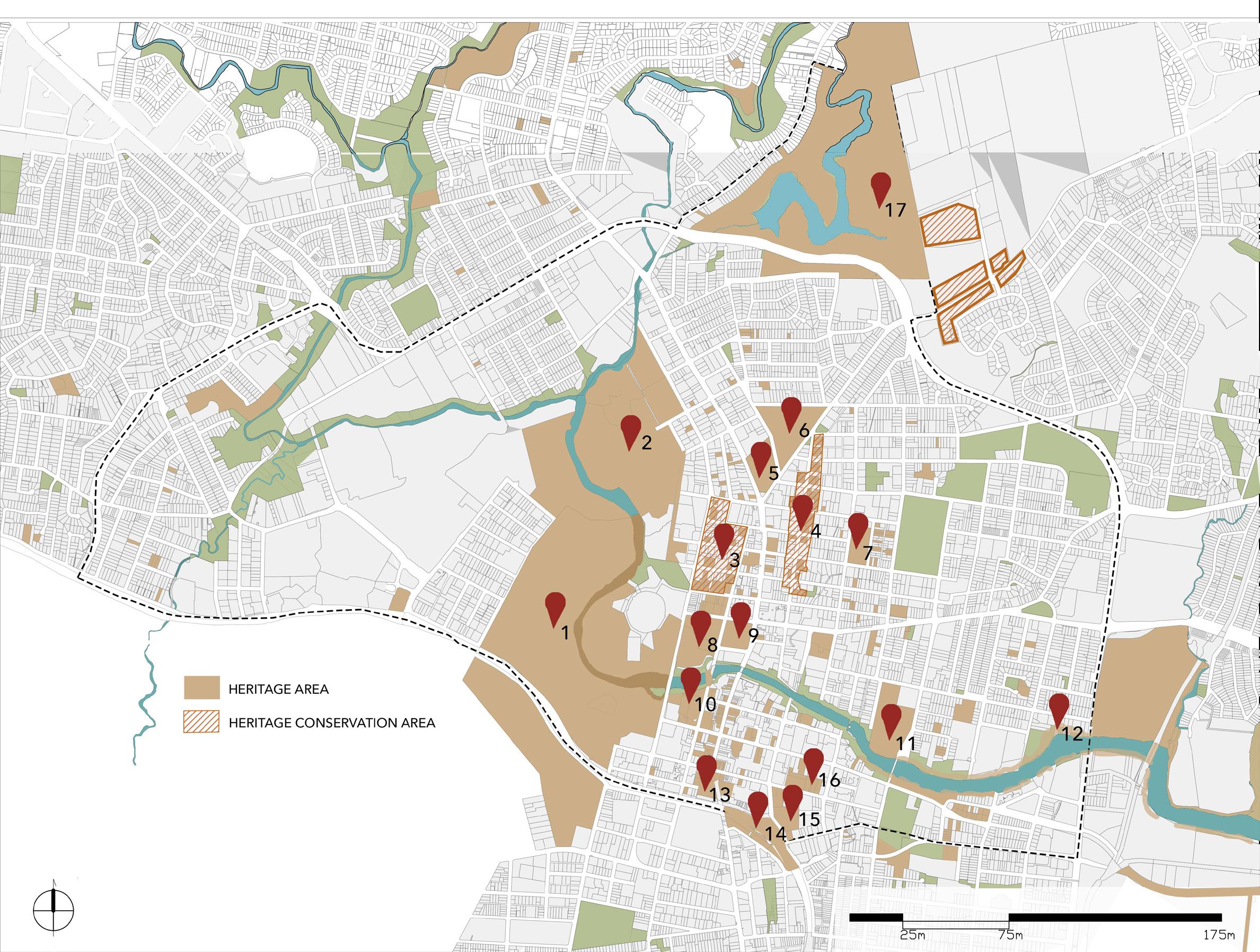
The Parramatta Park Conservation and Management Plan prepared by the Parramatta Park trust states the significance of the park to NSW as well as Australia. The Gatehouses, dairy precinct, Rangers Cottage, are all important elements that contribute to the heritage value of the park (Parramatta Park Trust 2008). It represents the history of the Burramatta clan of the Darug People, holds remnants of European settlements in Parramatta, is the place of the establishment of early Government enterprise and is also associated with multiple historical milestones (Parramatta Park Trust 2008). The plan is a major element of the vision of this plan and is primary connector of the precinct. To ensure that any development carried out respects and considers the requirements around its heritage values, this plan has been informed by the various available documents that help guide design development on heritage sites.
Firstly, to understand the basic concepts of heritage management and conservation, The Burra Charter was the primary document that supported the planning process. Article 2 (2.4) states that “Places of cultural significance should be safeguarded or put at risk or left in a vulnerable state” (Australia ICOMOS & International Council on Monuments and Sites 2013, p.3). It explains the importance of conserving heritage sites in a way that its cultural significance is maintained and enhanced. This proposals in this plan have been developed by the principles stated in the Burra Charter, and it is mainly focused on enhancing and celebrating the existing features of the park rather than intervening in any manner. In line with Parramatta Park Trust’s conservation plan and supporting documents such as NSW Heritage Manual and the Burra Charter, this plan will ensure that the heritage significance of the park and across the precinct is protected, celebrated and conserved.
The concept of the five C’s highlighted in UNESCO’s World Heritage Management guidelines have helped build the base of these plan and are as follows:
Through Heritage Management and conservation, the plan aims to highlight Parramatta Park’s rich cultural heritage. The aim is to educate the people of Parramatta as well as visitors about the historic development of the park and its significance to the state.
Through this theme the plan proposes conservation, management and enhancement of the rich culture and heritage of the region. This needs to be done in a way that it attracts people from all aspects of life and becomes a prominent tourist destination. The history of this region is directly linked to the aboriginal history of this place and all development will involve the age-old knowledge and experience that the aboriginal people bring to this land.
For the efficient conservation and protection of the heritage sites, it was important to identify the features that are most significant and highlight their significance to the public. With efficient management and conservation in place, Parramatta Park has the potential to become one of the leading tourist destination sites in the world.
This case study focuses on the Centennial Park, which was established in 1888 as a gift to the town to commemorate the 100th anniversary of European settlement in the area. Hence, it is the birthplace of modern Australia which hosted the inauguration of the Federation of Australia in 1901. It is one of the most historically enriched and socially remarkable urban spaces in Australia. The Centennial Park Master Plan 2040 recognises the Park’s natural and cultural qualities, responds to the community’s growing and diversified recreational needs, evaluates existing transportation, access, and parking plans, and identifies future possibilities. Some key features of the Plan, that can also be implied for the design of Parramatta Park, are as follows:
1. Preserving the existing constructed fabric inside the Park.
2. Recreational options are being proposed, improved and expanded.
3. Improving the overall experience of landscaping, treescape and nature.
4. Increasing visitor safety and convenience.
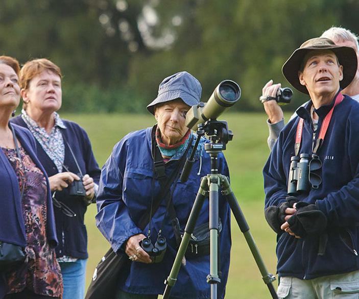
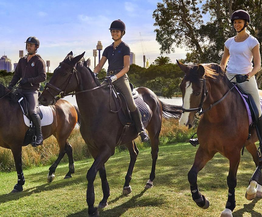
The Park also focuses on Cycling-safety issues, off-road cycling and on events that promotes artistic, cultural, entertainment and culinary events. The Centennial Park currently facilitates various activities that can be incorporated in Parramatta Park, which will enhance the urban fabric of the Parramatta Park, its cultural values and promote heritage significance. They include horse riding, bird-watching, rollerblading, shared cycle-ways, play areas for children, heritage tours, picnics, cafes, restaurants, bars and twice-a-week farmer’s market.

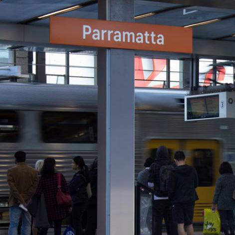 Img 13: Parramatta station, Amanda Hoh (nd)
The goal of this plan’s integration is to promote accessibility and connectivity. This entails enhancing transportation networks between Parramatta and Westmead to increase linkages. It also entails connecting the region’s surrounding neighbourhoods and hubs, so increasing the region’s external linkages and fostering a better flow of people.
To deliver the accessibility and connectivity vision, the main objective was to improve the connections between Parramatta and Westmead. Connecting these areas to external neighbourhoods and centres is another important aspect of integrating the study area with the rest of the city. Accessibility also involves providing adequate facilities that will encourage the people of the place to venture out and activate the spaces around them.
This involves creating a safe and accessible pedestrian friendly street throughout the precinct. The proposal also involves using the Parramatta River as a major connector across the precinct. This involves riverfront development which has been covered more in detail as a separate theme.
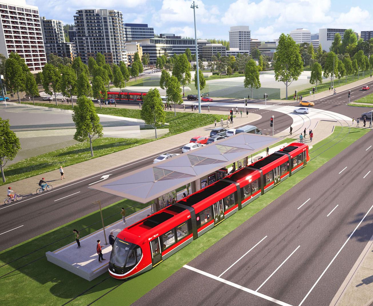
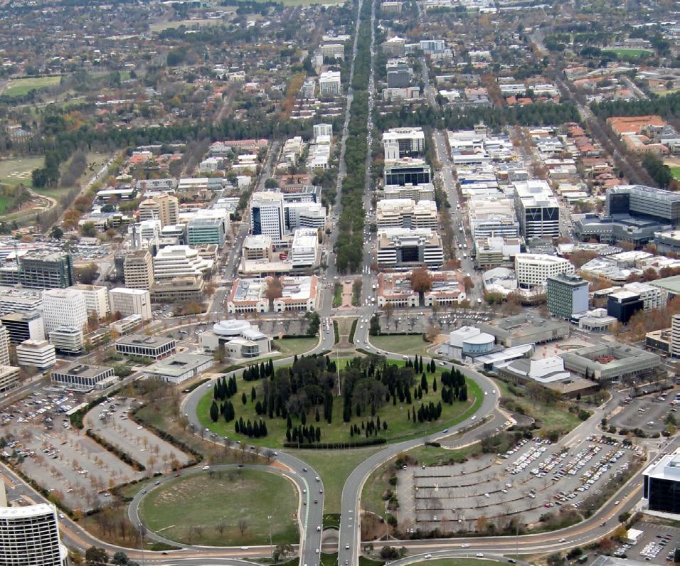
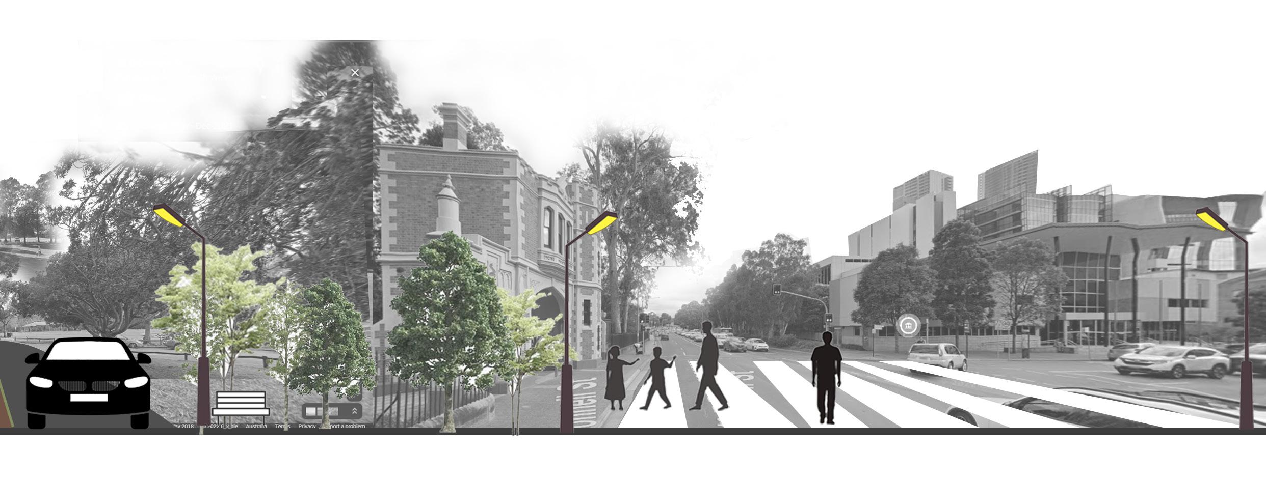
Northbourne Avenue is a major north-south road that connects the commercial and the residential parts of Canberra. The planning approach combines four modes of transportations - general traffic, public transport, cycling and pedestrians with road space between them. The landscaping enhances the built form, provides attractive setting for the user and mitigates heat island effect. The introduction of light rail towards the city centre provides an intensive for the corridor’s development, encourages the use of public transport and supports walking and cycling. Upon community consultation, footpaths were increased along with bus priority, cycleway, tree plantation, additionalpavements for dedicated bus lanes and widened pavements. It also encourages two-way cycle paths on both sides of the road,few pedestrian crossings and a better accessibility to any street for pedestrians and cyclists.
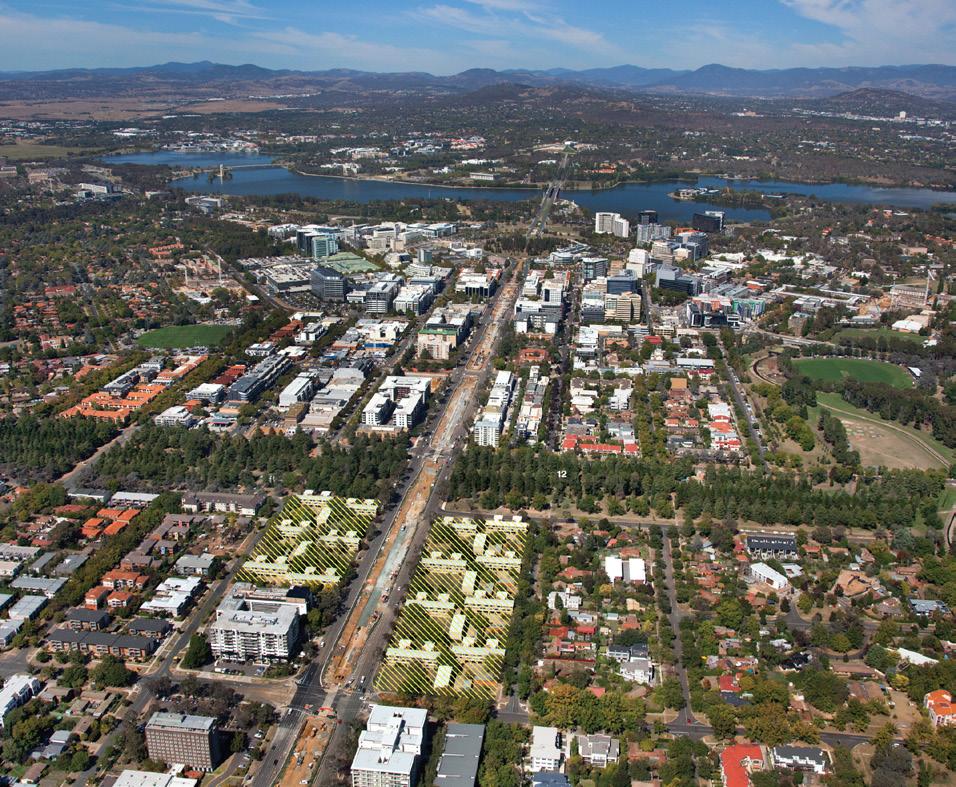
This urban development can be inspirational for roads throughout Parramatta since both the sites have a rich heritagebackground, mixed-use commercial and residential development, limited small open spaces, wide main roads, major transport interchange at key points. Other important characters of the Northbourne Avenue include introduction of signalised intersections, pedestrian operated crossing, driveways, biscycle lanes and encouraging active transportation. It also recognised nationally significant streetscapes and design elements as a critical part of planning.
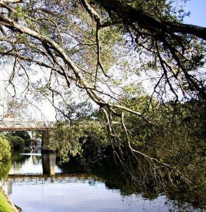
 Img 18: Parramatta River (nd)
The analysis showed a lack of green cover across the study area, and through appropriate planning, this plan aims to rebuild the environmental quality of the area. The goal is to identify native elements of the environment, protect them, introduce more native green cover where necessary and spread awareness about these within the community.
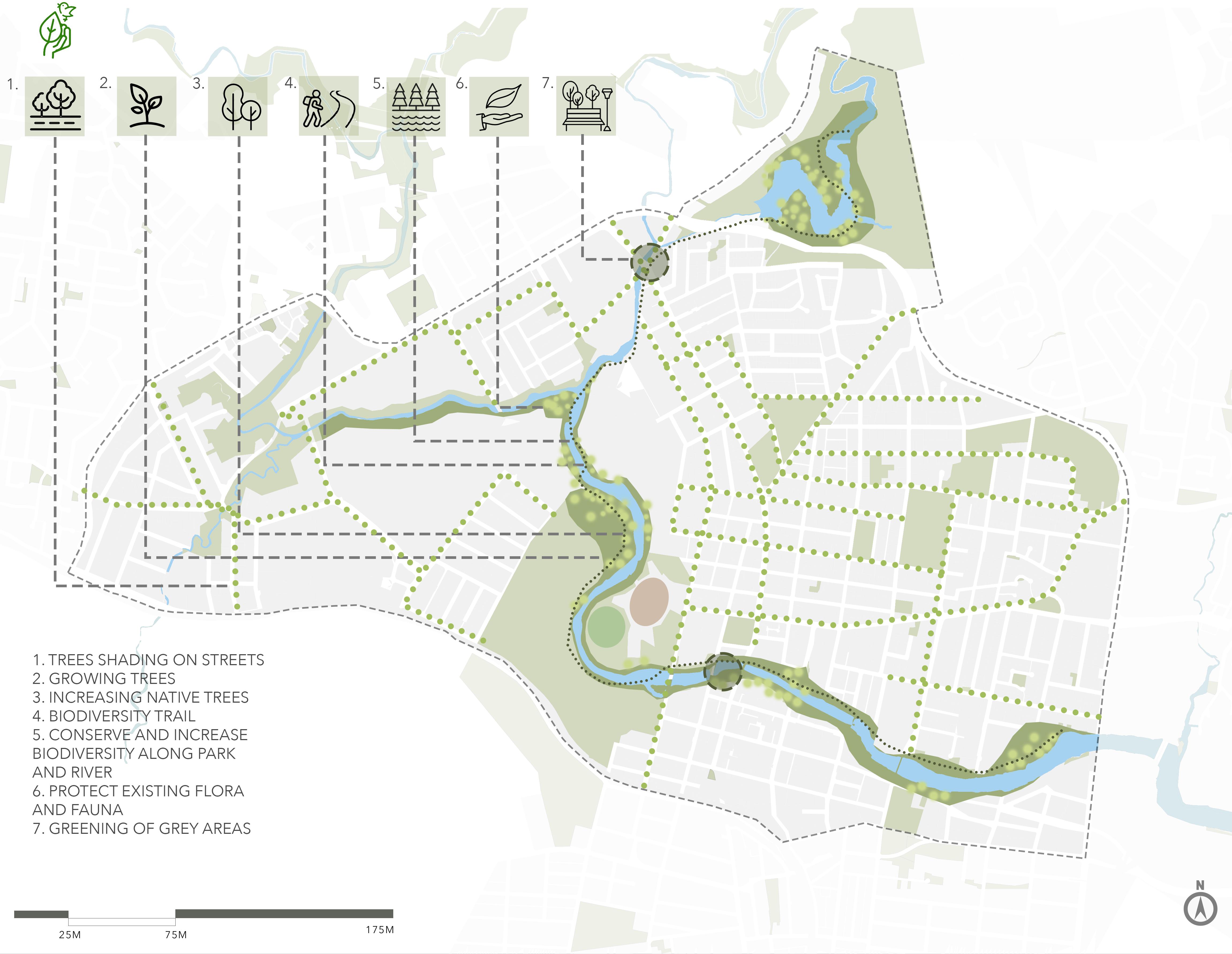
Due to the lack of green spaces, open spaces and green cover, there is a need to increase this green cover and biodiversity of the region.
There is a need to protect the existing fauna and flora of the region preserving of the existig biodiversity and creating awareness of species around the area will lead to more connectivity to the environment and the outside. Incresing tree cover as connection between open spaces will reduce the temperature of the surroundings and promote walkability in the neigbourhoods.
The introduction of a biodiversity trail will also add to the region as a different kind of recreation activity that will connect the people to nature. Increasing the flora and fauna as well as making the community more aware of their surrounding environ,emt and increasing the need to preserve green cover.
Identifying a lot of grey spaces that can be turned into green recreation or open spaces for the community to gather and interact as well as spaces for exercise and everyday activities.
Edmonton is a metropolis with a significant population concentrated in the city centre, as well as several river valley parks that improve and maintain valuable ecosystems. The Cities Biodiversity Index measures three types of biodiversity: Diversity of plants and animals species; services provided by species to the city; and how the city supports biodiversity. The city has prioritised biodiversity conservation by incorporating biodiversity issues into urban design and community involvement strategies. Because habitat fragmentation contributes significantly to biodiversity loss, the City has integrated biodiversity and urban design into a “biologically sensitive approach” for infrastructure development. The City has implemented urban planning and design strategy to tackle the loss of natural areas, as well as an ecological strategies to increase the possibility for large-scale biodiversity conservation. The need to assess performance by evaluating implementation, overall effectiveness and the execution influence was observed. The City has prioritised that the community understands biodiversity and that the communications are targeted to reach the maximum number of individuals. This dedication is evident in a number of efforts launched by the City, to raise biodiversity awareness among various populations. The team is educated on diverse plant species and restoration strategies by city employees and local specialists. Through the ability to engage with other local naturalists, programmes have developed a hub, or network, for local action which can help the City move ecologically forward.

 Img 23: Biking in Parramatta Park, Wolter Peters (nd)
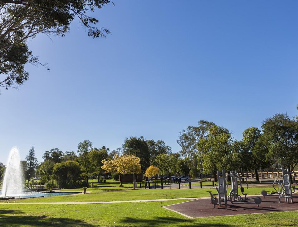
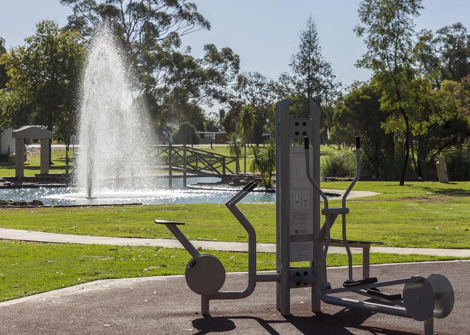
A healthy built environment can help prevent illnesses within the community as well as improve the livability of any place. While proposing a healthy city for all the plan focuses on safety and equitable access for all. This involves access to health amenities including fresh produce, mental health facilities as well as sports and recreation.
Img 24: Health and Wellbeing plan
Source: Author
Promoting social interaction among residents through recreational facilities will encourage them to use the outdoors thus contributing to a healthy lifestyle. To ensure the success of this goal, it is critical that the residents irrespective of their gender, age or social background feel safe to venture out into public spaces. The objective is thus to design safe, accessible spaces and streets for all.
Westmead is one of Australia’s major integrated health, research, education, and training zones, serving over ten percent of the country’s population. However, this is not enough to build a healthy ‘precinct’ for the community. It is important to ensure that every person, irrespective of gender, age, social or economic background can access these health facilities along with amenities such as fresh produce, food as well as mental and emotional health awareness.
Another way of ensuring a healthy lifestyle is to encourage social interaction among the people in a neighbourood. Introducing spaces that would promote this interaction and create a lively precinct. It is also important that people feel safe to step out into public spaces at any time of the day or night. Although the problem addresses all, it is the most common fear specifically among women, children, the elderly and the disabled.
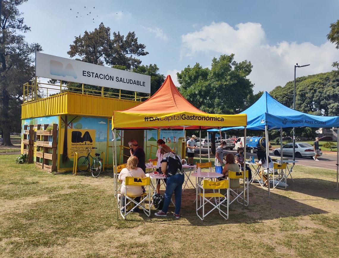
Estaciones Saludables (Health Stations) is a program that promotes a healthy food and lifestyle among the residents in order to prevent obesity, malnutrition, and other chronic diseases induced by an unhealthy lifestyle. The stations are strategically placed around major parks and squares, with varying timings to make healthy habits consultation services available to inhabitants in various neighborhoods.
Adelaide, South Australia
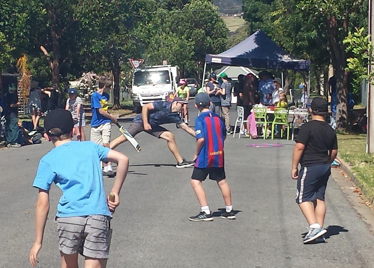
Sunday Street Play concept entails blocking local streets to traffic on Sundays for two hours to allow for safe outdoor play for the health and wellbeing of the society. It encouraged local folks to step outside, socialize, and engage in safe active play that contributed to physical and mental well-being. Few objectives from various other urban health assessments, that could provide a healthly built infrastructure in Parramatta and Westmead:
1. Providing vital information about food, its origin, health benefits and risks, production, nutritional properties etc. through media outlets or newspapers.
2. Encouraging mindful and healthy shopping in shopping centres, through advertising outlets and pamphlets.
3. Provision of free sports gear near parks and open spaces to encourage and attract sporting activities, especially for kids.
4. Providing fruit vending machines, organizing weekly markets and temporary shops that supply fresh produce throughout the year.

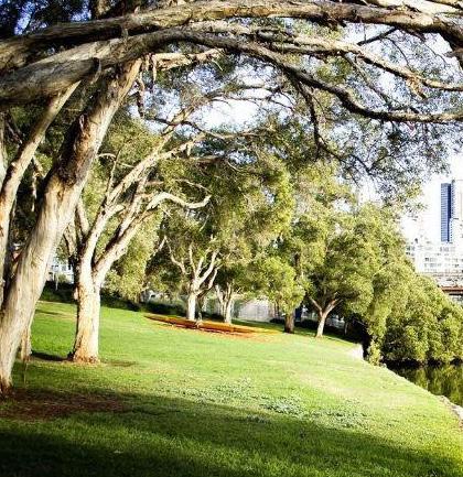
 Img 28: Parramatta River, Lana Endermar (nd)
To accommodate the connection of the two cities through the river, it is important that people are attracted to use it to move within the city. Parramatta is prone to massive floods, and to achieve this goal it is important to understand the water flow patterns and propose solutions to control and manage the same.
A vibrant design development on the riverfront will encourage more people to visit the area and improve connections within the city. To promote the river as a major connector across the precinct, the objectives focus on designing the riverfront in a way that it contributes to the activation of the entire precinct as a prominent cultural destination.
Parramatta Lake is added to the study area as an important part of the river. It has immense potential to add to the activation of the precinct through appropriate intervention and design. Parramatta is majorly flood prone and the areas near the river are the first to be affected and flood durations are longest in these areas.
Any riverfront development thus requires careful consideration of flood regions and its management plans. A part of the river that flows through Parramatta Park falls under heritage listing and it is important to identify and highlight its importance as part of the development.
The Swan Hill Riverfront Masterplan proposes a strategic plan for future developments along the riverside in order to revitalise the public open space and increase its social, environmental, cultural, and economic significance. It aspires to establish an appealing and inclusive recreational elements along the Murray River, where residents and tourists may meet, shop or play near the riverfront. As part of the masterplan, several projects were introduced such as cleaning of the Riverside’s Park pond, realignment and renovation of pathways. Other initiatives include the construction of six outdoor exercise stations, drinking fountains, a Murray Codshaped bike rack, creative recycle bins, and car park developments, all of which have helped to create a destination that stimulates activity and engagement across the neighbourhood. LED energy-efficient lighting has been erected as part of the masterplan’s lighting strategy, comprising 23 light poles and lights, 12 tree up-lights, and five solar lights along the riverside from the wetlands to Brian Street. This has not only enhanced the area’s safety, but also provided more accessibility, encouraging community members to enjoy the riverside all year. Riverside Park has seen an increase in community activities as a result of the riverside upgrades, which make full use of the new amenities. A weekly Farmers Market, the Swan Hill triathlon, and the Color Your Run event are all part of this. Riverside Park’s annual Harmony Day, New Year’s Eve, and Australia Day events draw up lots of visitors.
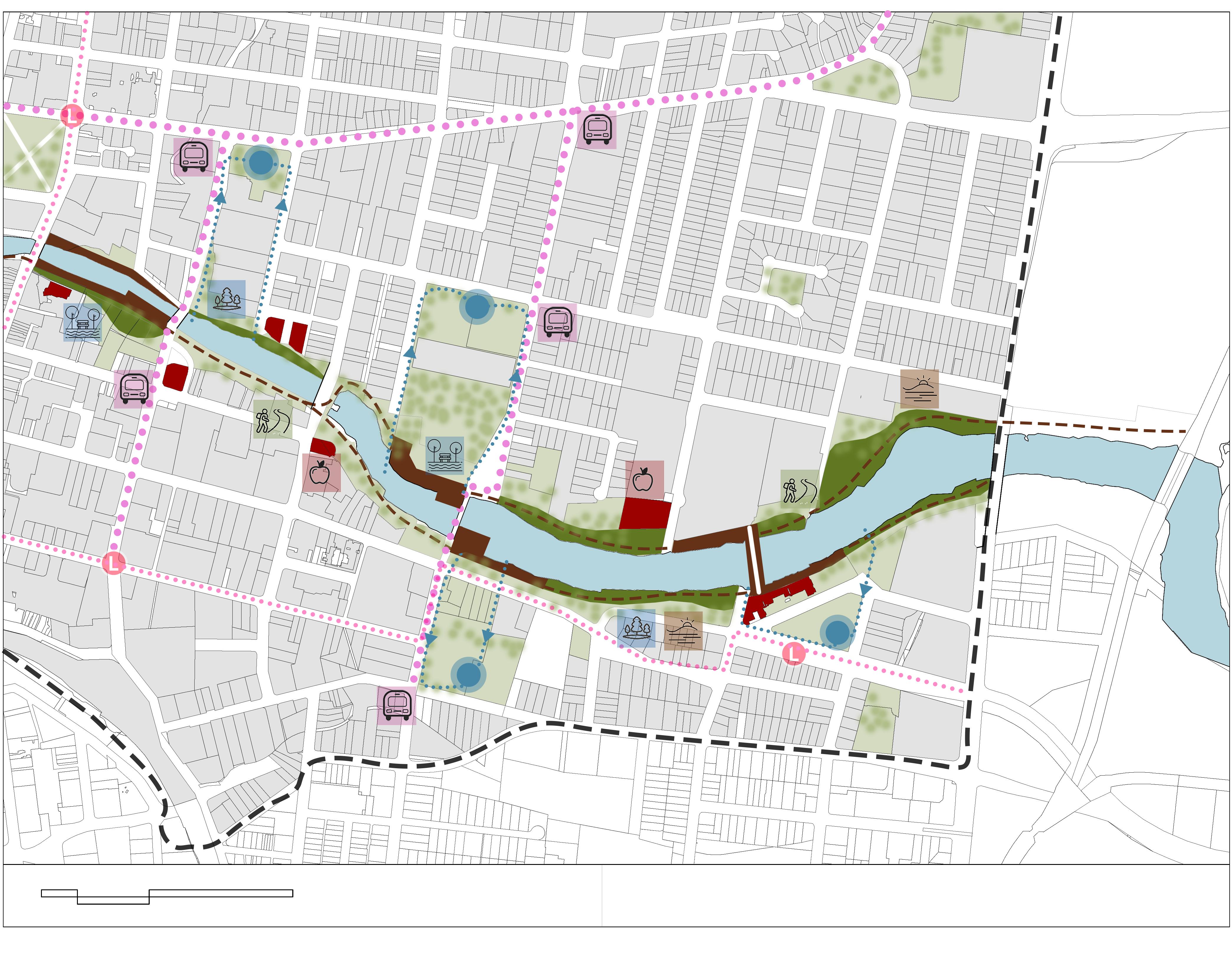
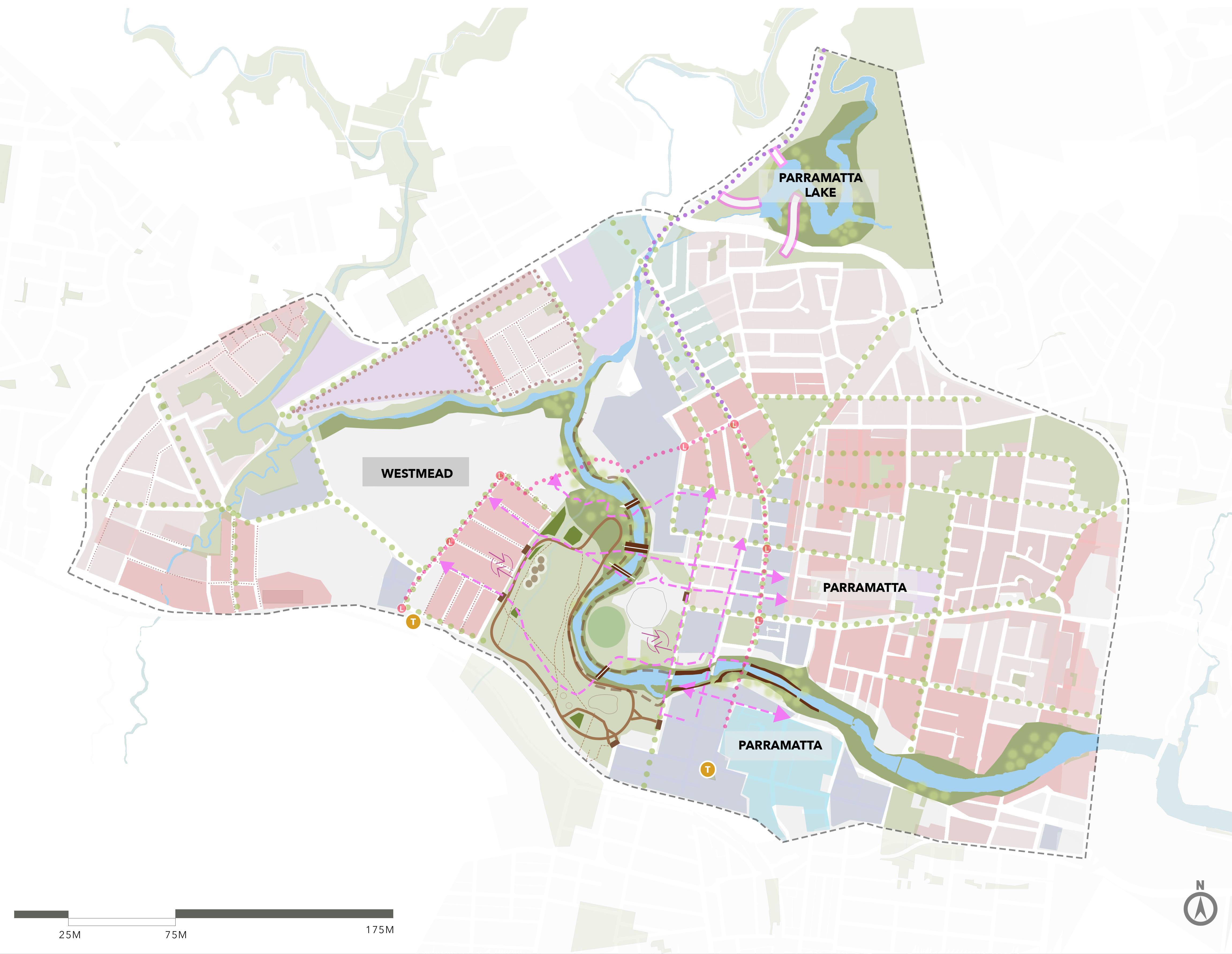
The primary focus area of this plan is an integration of both Parramatta and Westmead. As established earlier in this plan, this section is focused on how the plan will bring the two regions together and propose a seamless connection between the two. Keeping the primary themes in mind, the process of integration responds to all the aspects of heritage, transport, environment as well as health. The connection proposed are built on the weaknesses and threats observed in this area, and an effort has been made to convert them into strengths and opportunities that guide the experience envisioned. This focus area forms the core of development and will be the primary focus of delivery.
Integration.psd Img 33: Integrating Parramatta and Westmead. Source: Author
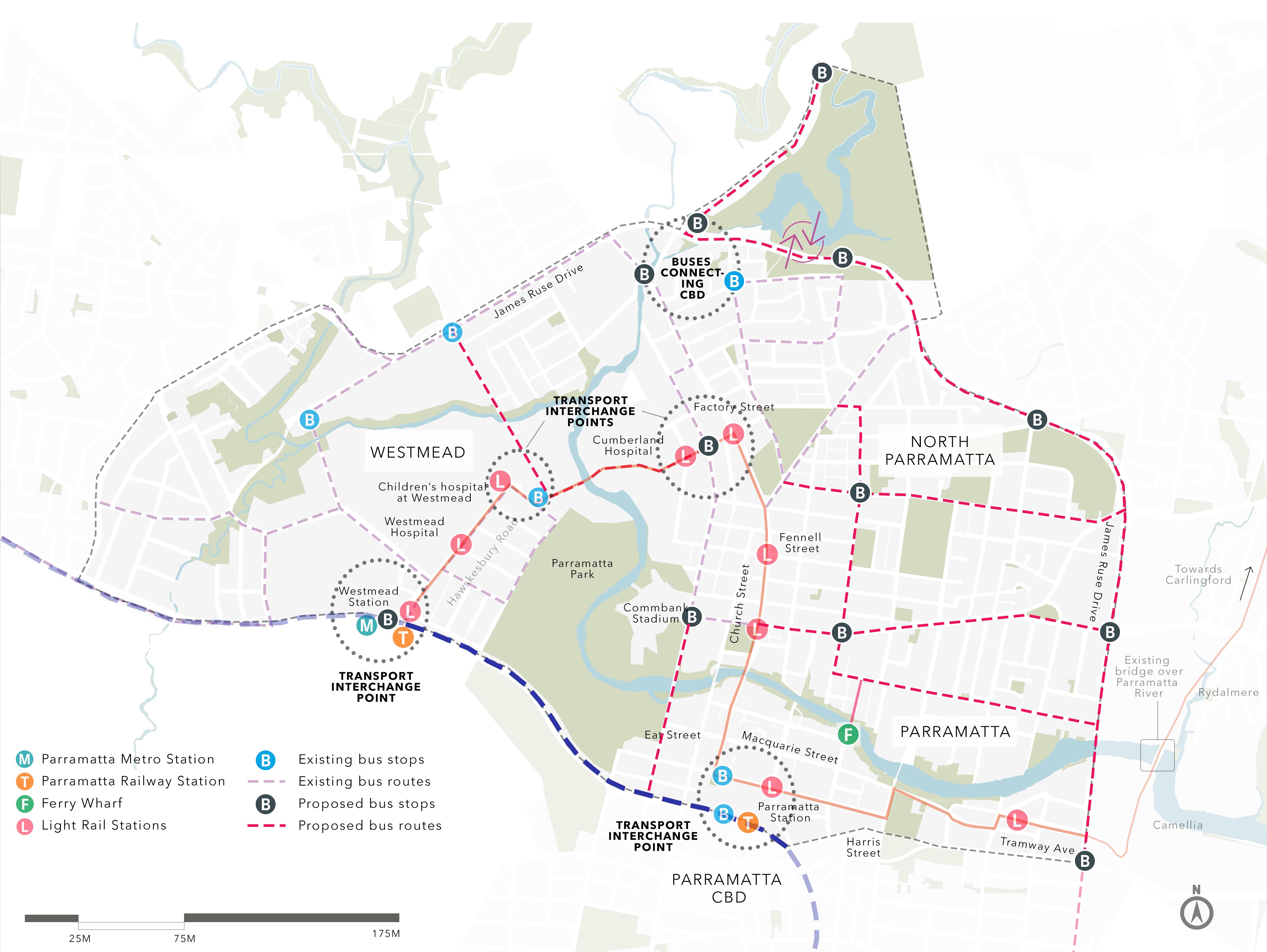
The major nodes that form the transit points of this integration are Parramatta CBD and the railway station, Westmead precinct and additionally Parramatta Lake. The different modes of commute will use these nodes as vantage points for travel. Additional bus routes and stops have been added that also creates a transport interchange point near the Parramatta Lake, Parramatta railway station and Westmead railway station. The upcoming Parramatta Light Rail route also plays a key role in connecting the bus routes and Ferry to the main railway lines.

1. Propose public transport corridors that will help connect Parramatta and Westmead in a more efficient way.
2. Monitor commuter travel behaviour to identify preferred travel routes and modes.
3. Propose simplified transport interchange at important nodes. Prepare wayfinding strategies for ease in the interchange of transport networks.
4. Implement ride sharing apps that will promote the reduced use of private vehicles.
5. Work in line with GPOP to propose simplified transport interchanges in Parramatta CBD and Westmead
6. Implement easy intermodal connectivity between buses, trains, light rail, ferries as well as active transport between Parramatta and Westmead.
7. Promote accessibility to public transport in the regional areas as well as in social housing precincts in both Parramatta and Westmead.
8. Design and implement street infrastructure that will promote walking and cycling at all times of the day.
9. Implement more crossings and safer pick-up and dropoff zones in prime public spaces across Parramatta and Westmead.
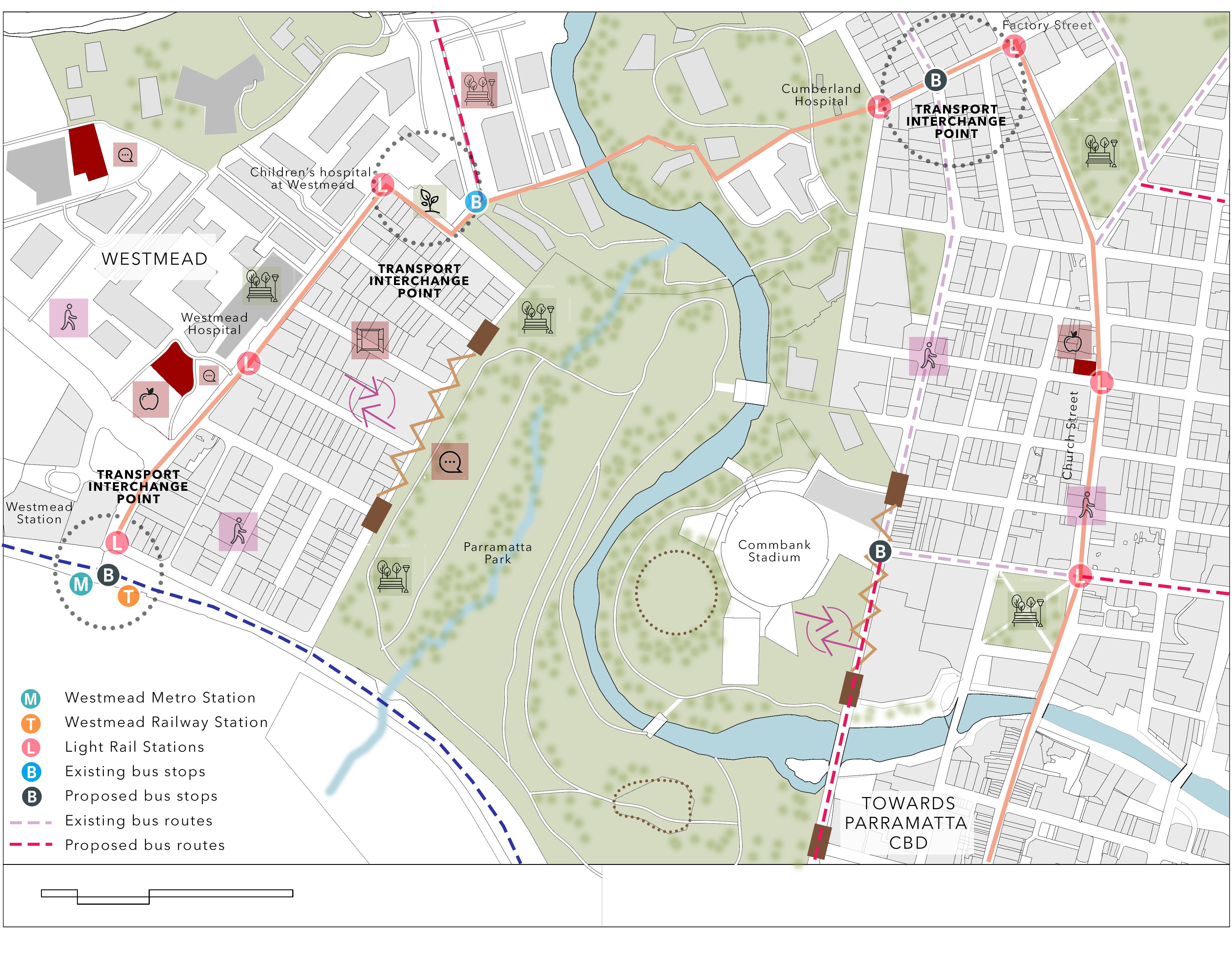
• Parramatta Park and Parramatta River service major pedestrian connections with their walkover bridges.
• Additional bridges provided in this area will ensure a seamless transit across the park to the two precincts.
• The upcoming light rail as well as the metro will improve the connection between the two regions.
• To facilitate better access to these facilities, streetscapes will be designed for shared pedestrian and cyclist access, cycle parking points and better crossings near these nodes.
• Bus routes will be served by more stops and frequency for the buses will be increased for buses connecting the CBD to Westmead, the CBD to the lake and Westmead to the lake.

• The transport interchange node at Parramatta and Westmead will both be enhanced by better facilities and eateries, that will further enhance the experience of travel between the regions.
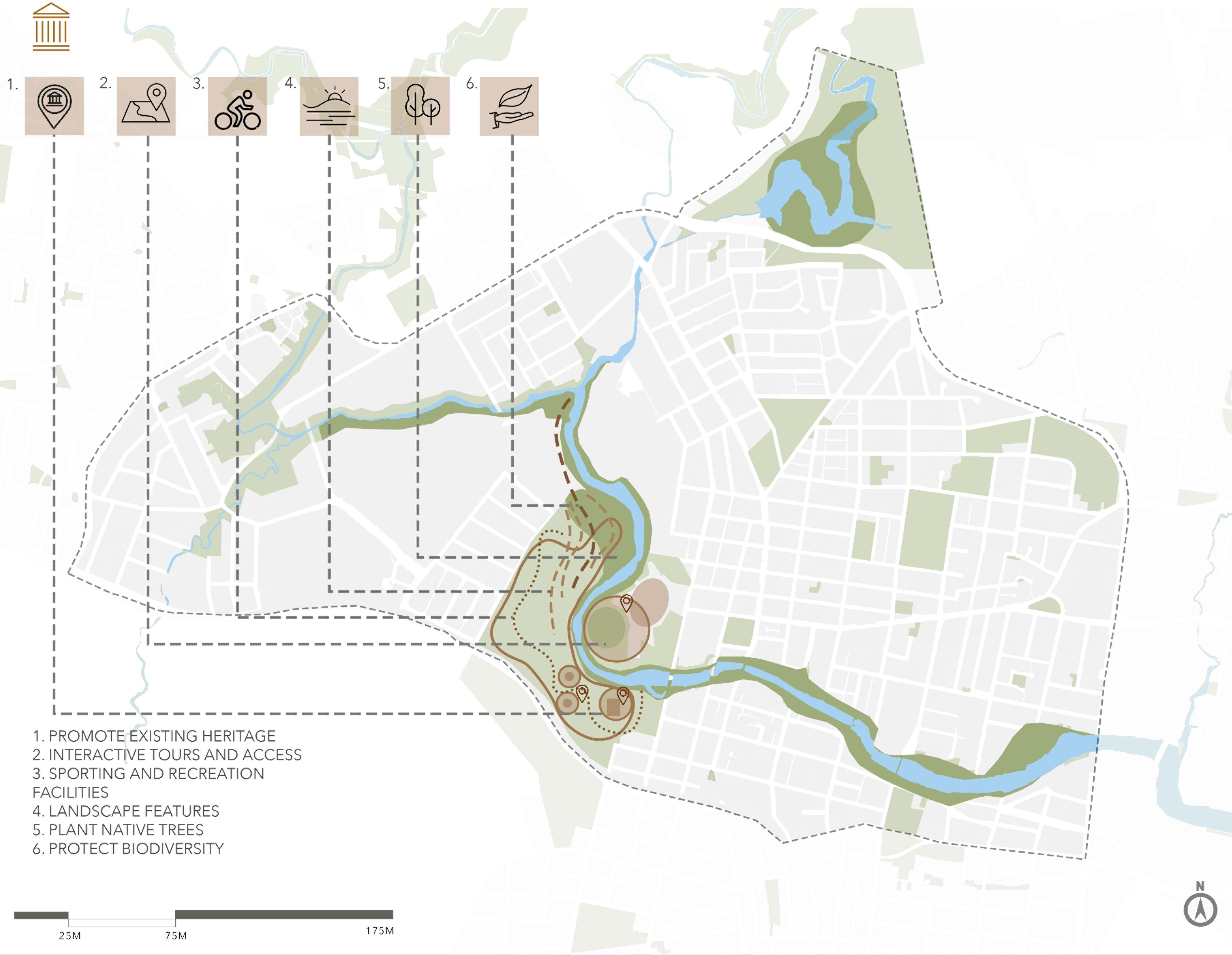
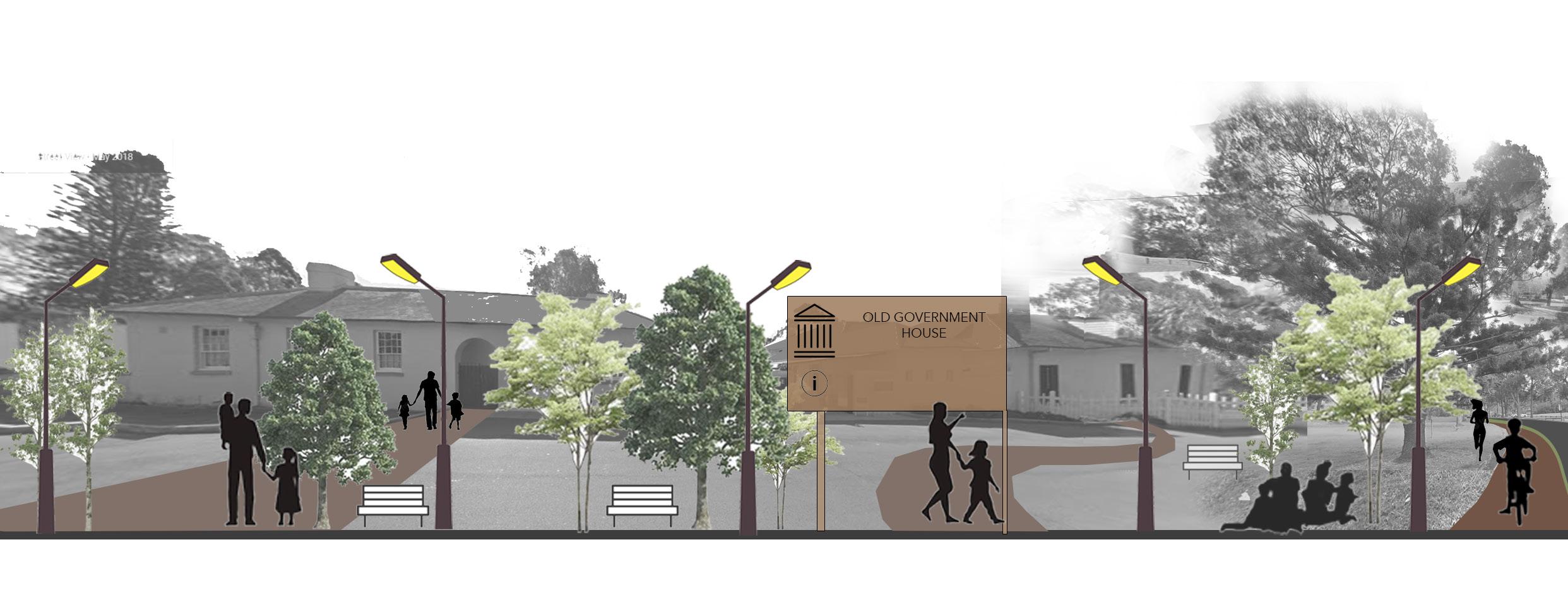
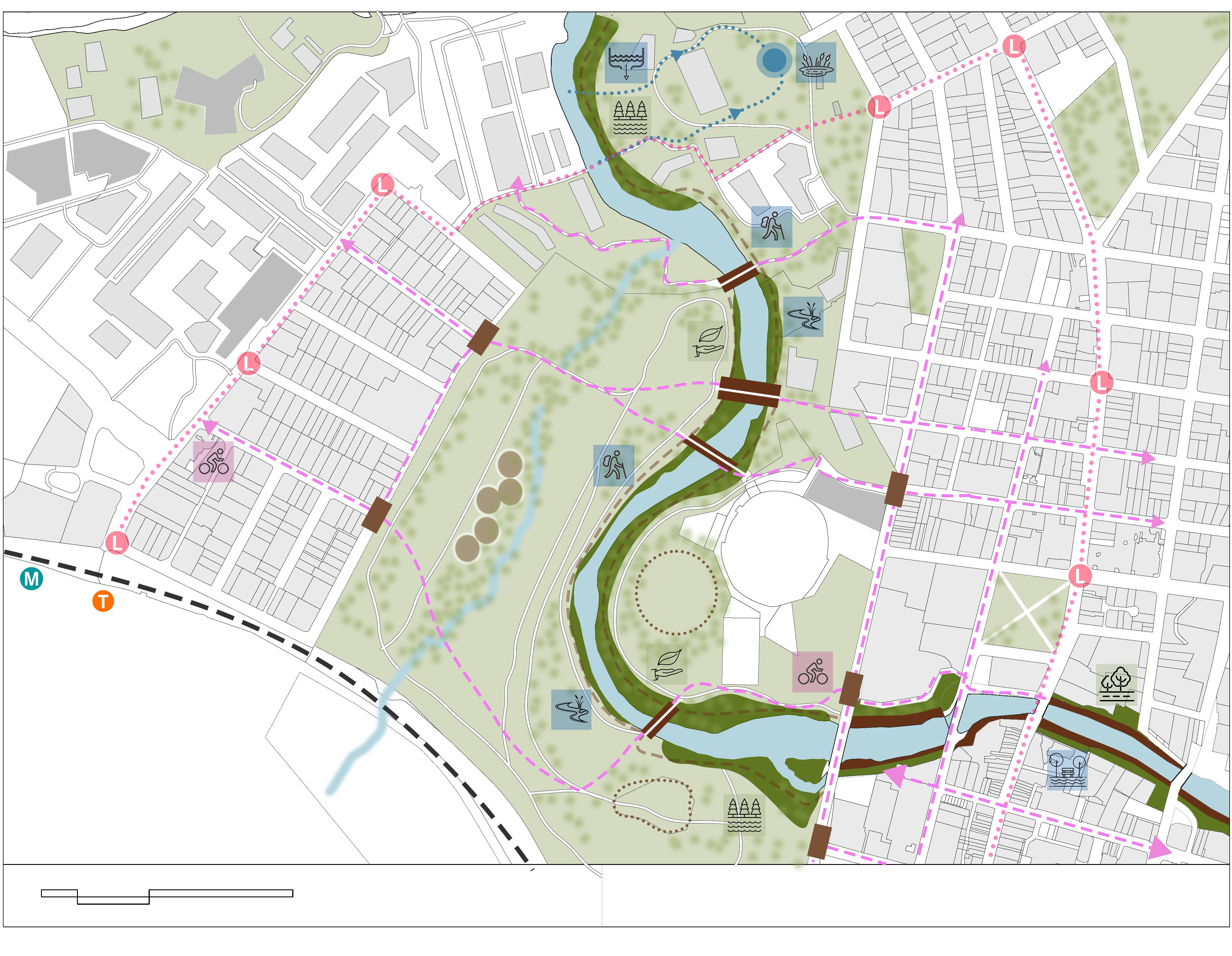
The next character area in this plan is Parramatta Park. Lying in the centre of the region, Parramatta Park serves as the central bond that brings together all the other areas. Not every city can boast of a central green space that holds significant historic, aboriginal and heritage values. The park will thus be a celebration of the entire precinct and fulfill its role as the primary connector of the region. It will provide the perfect transition between primary nodes and act as a recreational destination for all of Sydney. The heritage and history of the park will be celebrated across the nation and beyond. Based on the guidelines specified in the Burra Charter, the NSW Heritage Manual and the Australian Government’s website on world heritage, this plan proposes changes that will not interfere with the park’s heritage values. Working in collaboration with Parramatta Park Trust, this plan aims to enhance the existing features of the park rather than introducing new design changes.
The existing pathways within the park will be modified to make way for better and safe pedestrian and cycle access. The smaller pathways can serve as sole pedestrian pathways that will provide heritage tours and nature walks as part of the experience. The heritage buildings in the park will be surrounded by information kiosks and occasional events such as workshops and public art displays that will educate people of their significance. Children’s play areas, water activities and social gathering spaces will be spread across various pockets of the park.
1. Work with the Parramatta Park Trust to conserve and protect the heritage of Parramatta Park.
2. Consult and work with the Council and the Parramatta Park Trust to understand the existing biodiversity of the park and conserve it
3. Prepare detailed landscape plans for the park
4. Propose and prepare detailed plans for activities and amenities that will help promote the heritage and culture of the park
5. Work with the heritage council to propose activities through the river and riverfront
6. Propose strategies for the occasional use of the park to accommodate public activities such as art shows and concerts.
7. Introduce native plants and trees along the edges of the park.
8. Design and implement street infrastructure that will promote walking and cycling at all times of the day.
9. Improve the quality of open public spaces by constant maintenance to encourage physical health activities and social interaction in neighbourhoods.
10. Propose recreational activities such as nature trails and walks along the riverfront near the park
• Parramatta Park will form the major integration point for the entire precinct along with being the primary destination for recreation.
• Every step undertaken in the development of Parramatta Park will be in collaboration with the heritage authorities as well as the aboriginal community. Their knowledge and guidance will ensure the successful development of the park and help it be celebrated for what it is.
• The native biodiversity of the park will be protected, and efforts will be made to introduce more native species wherever possible.
• As a primary recreational hub, Parramatta Park will be the ambassador for healthy living not only for its community but for the nation.
• Parramatta Park and the river will be interlinked to serve the community and be the central force that brings the entire precinct together.
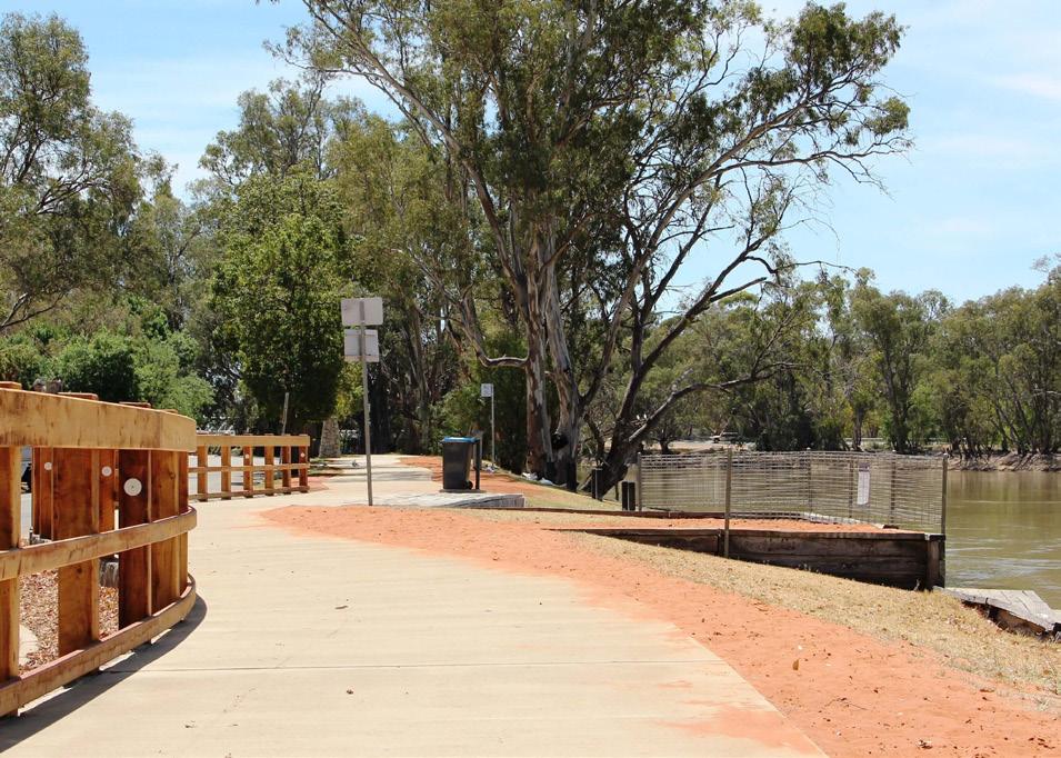
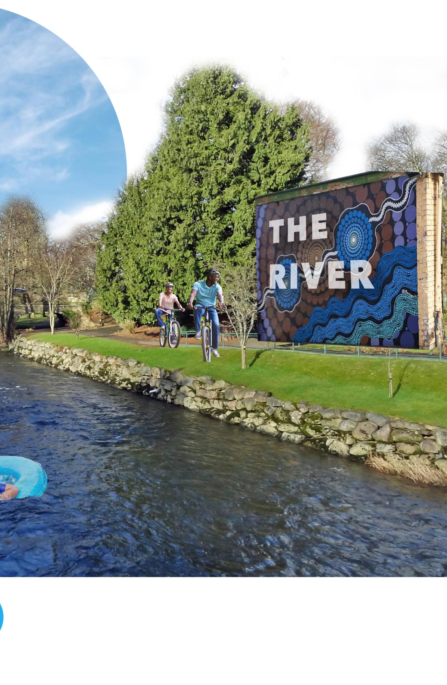
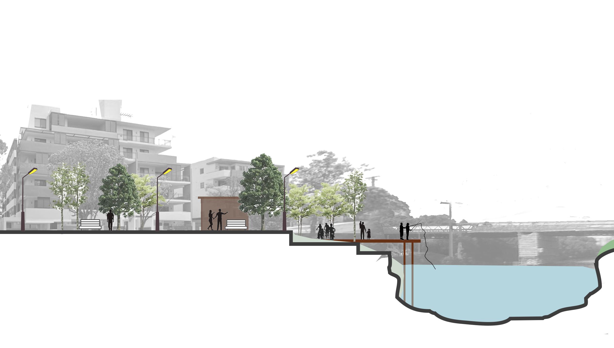
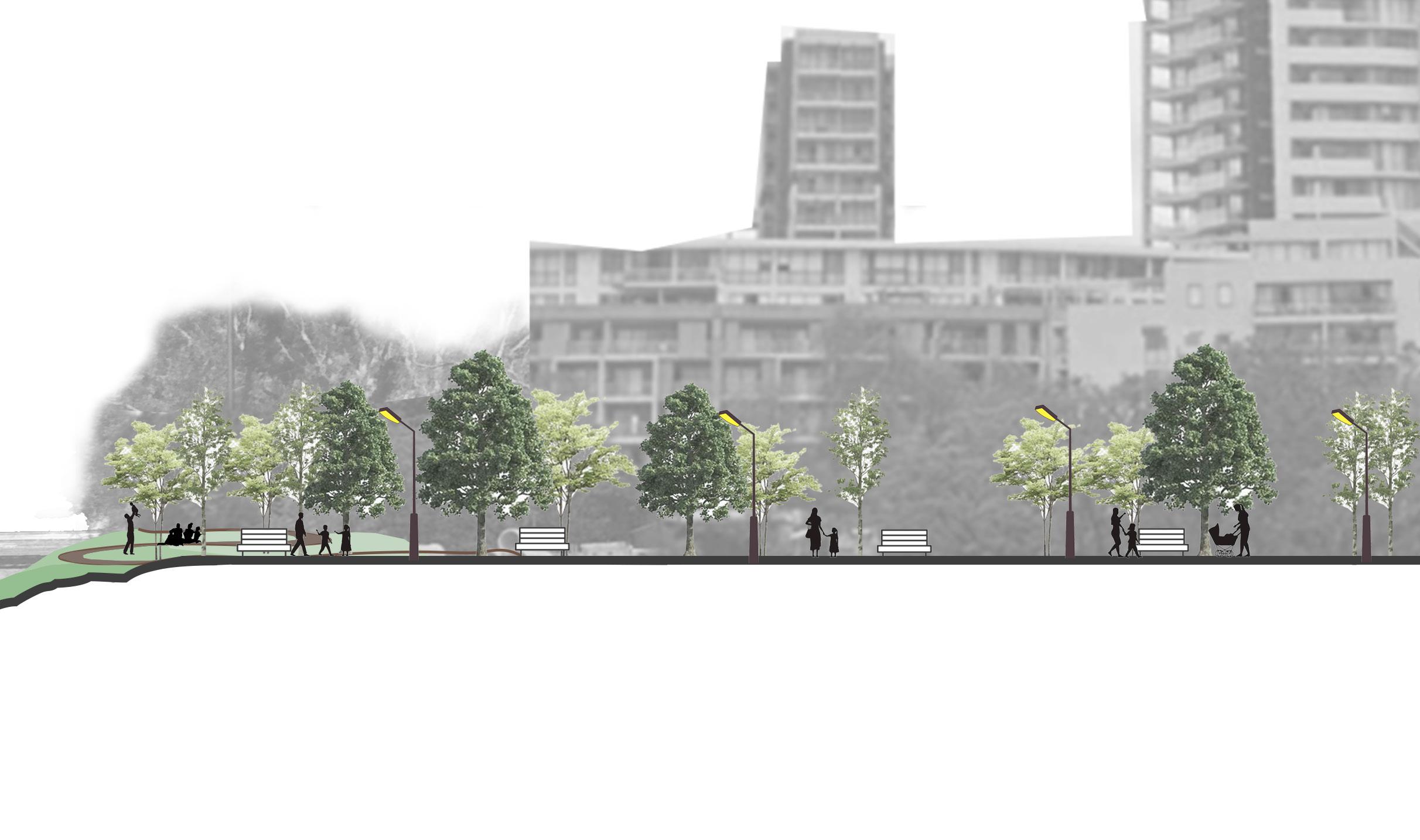
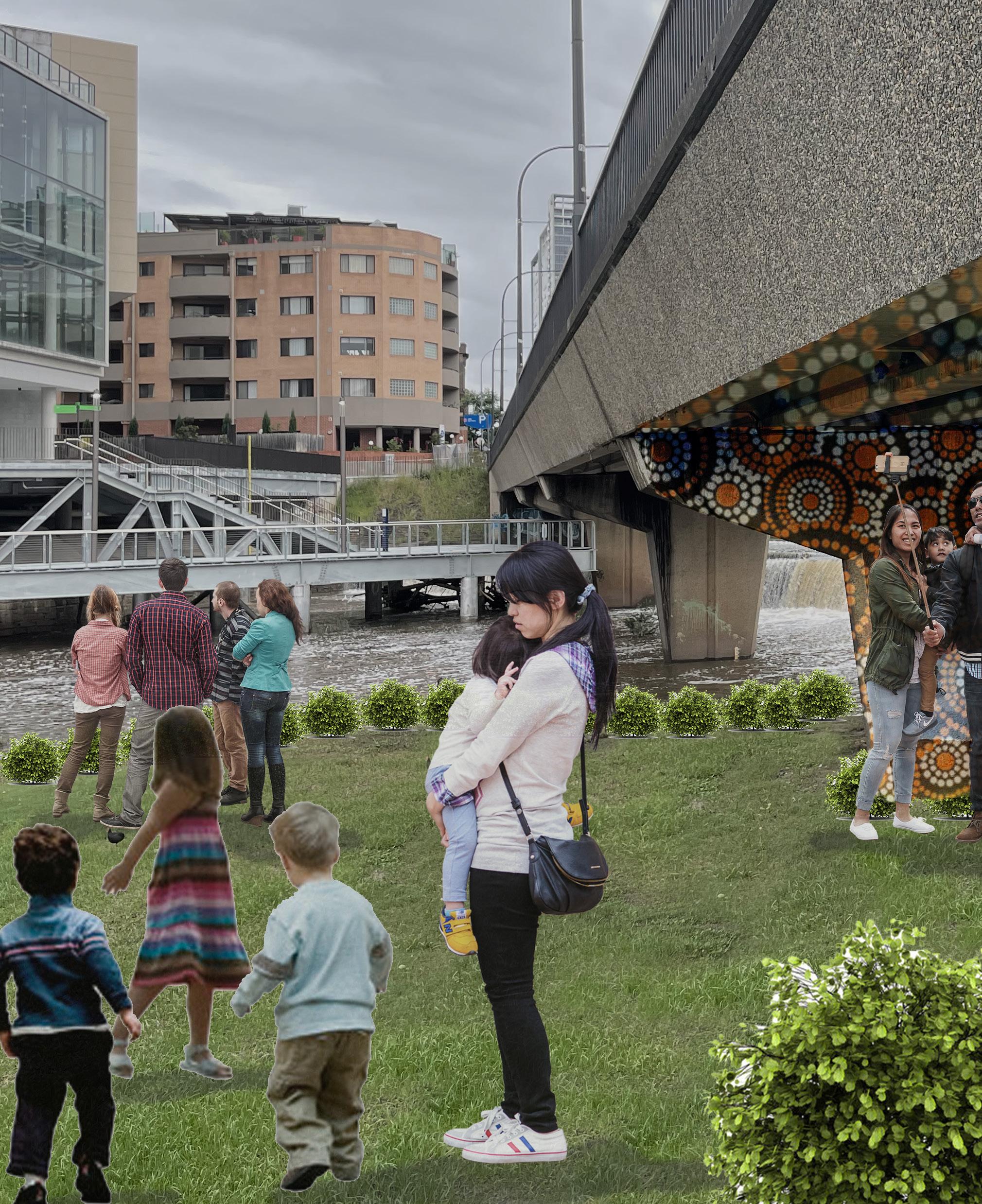
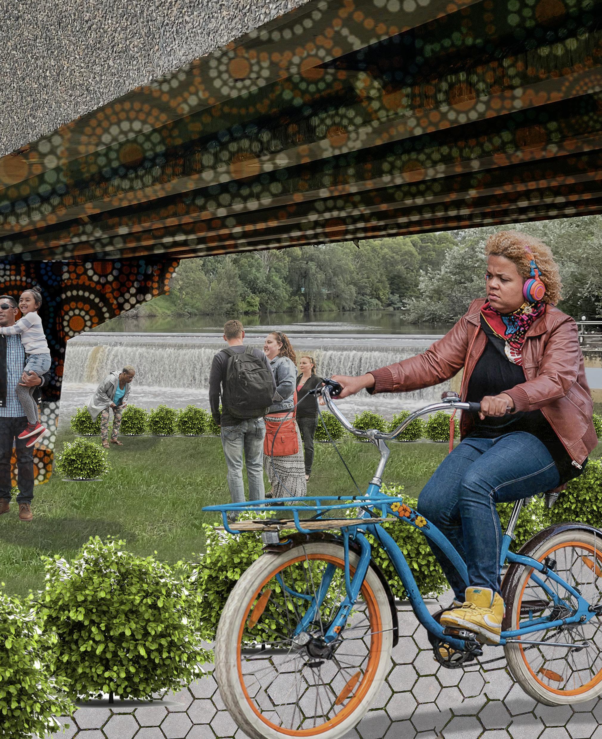
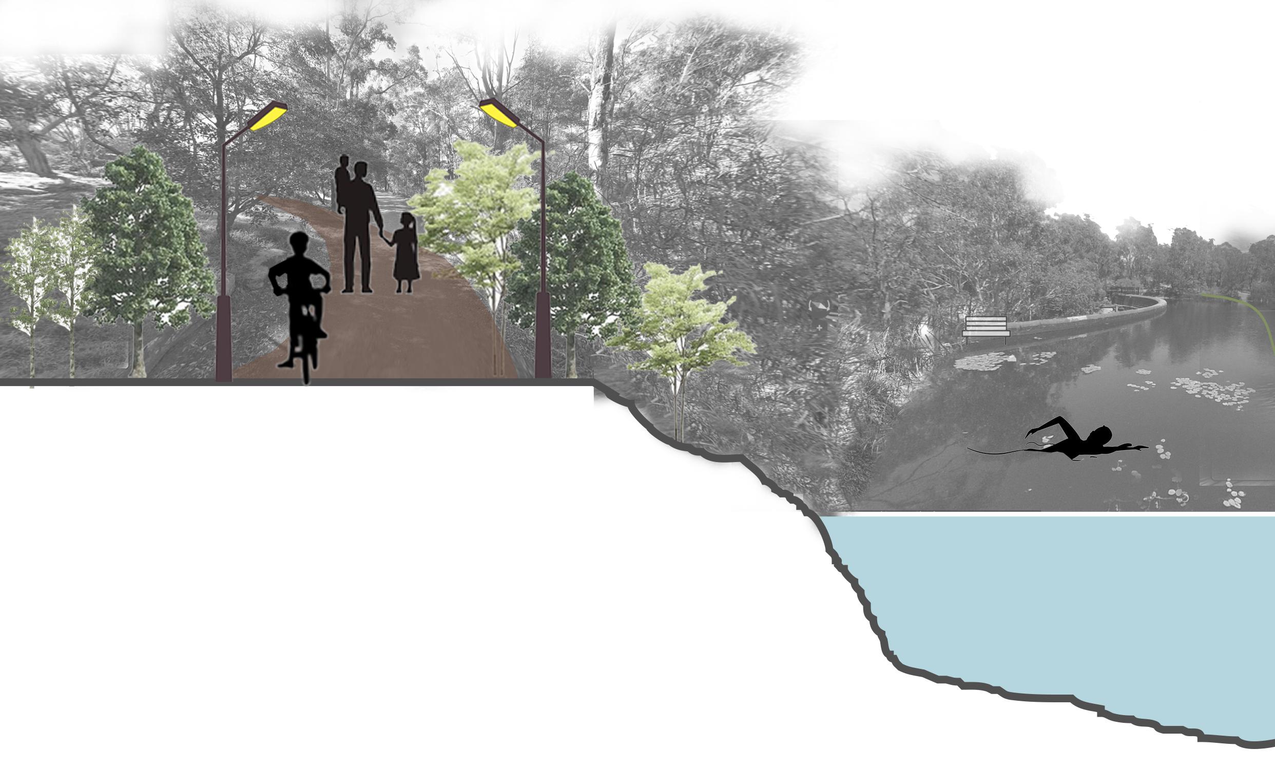
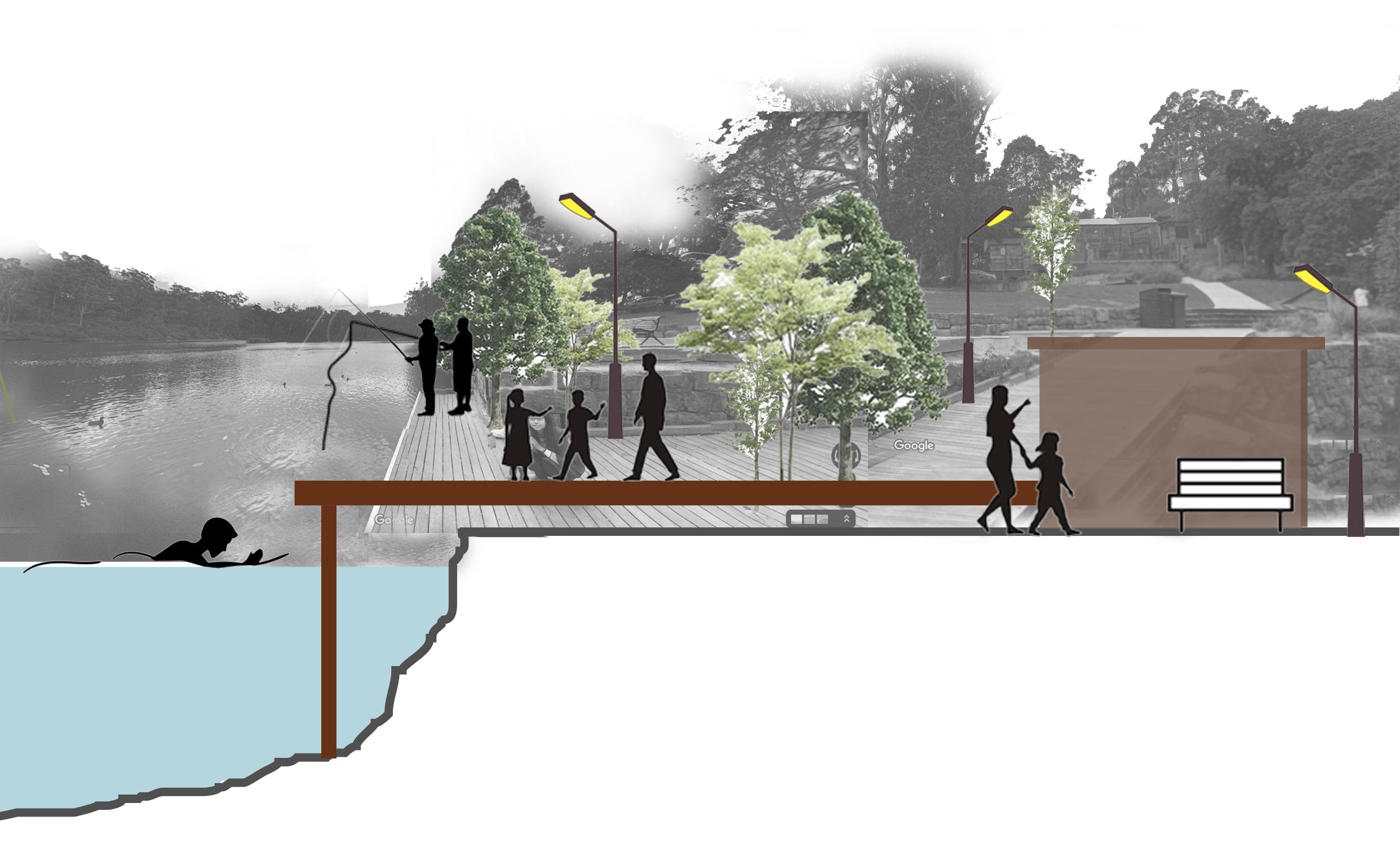
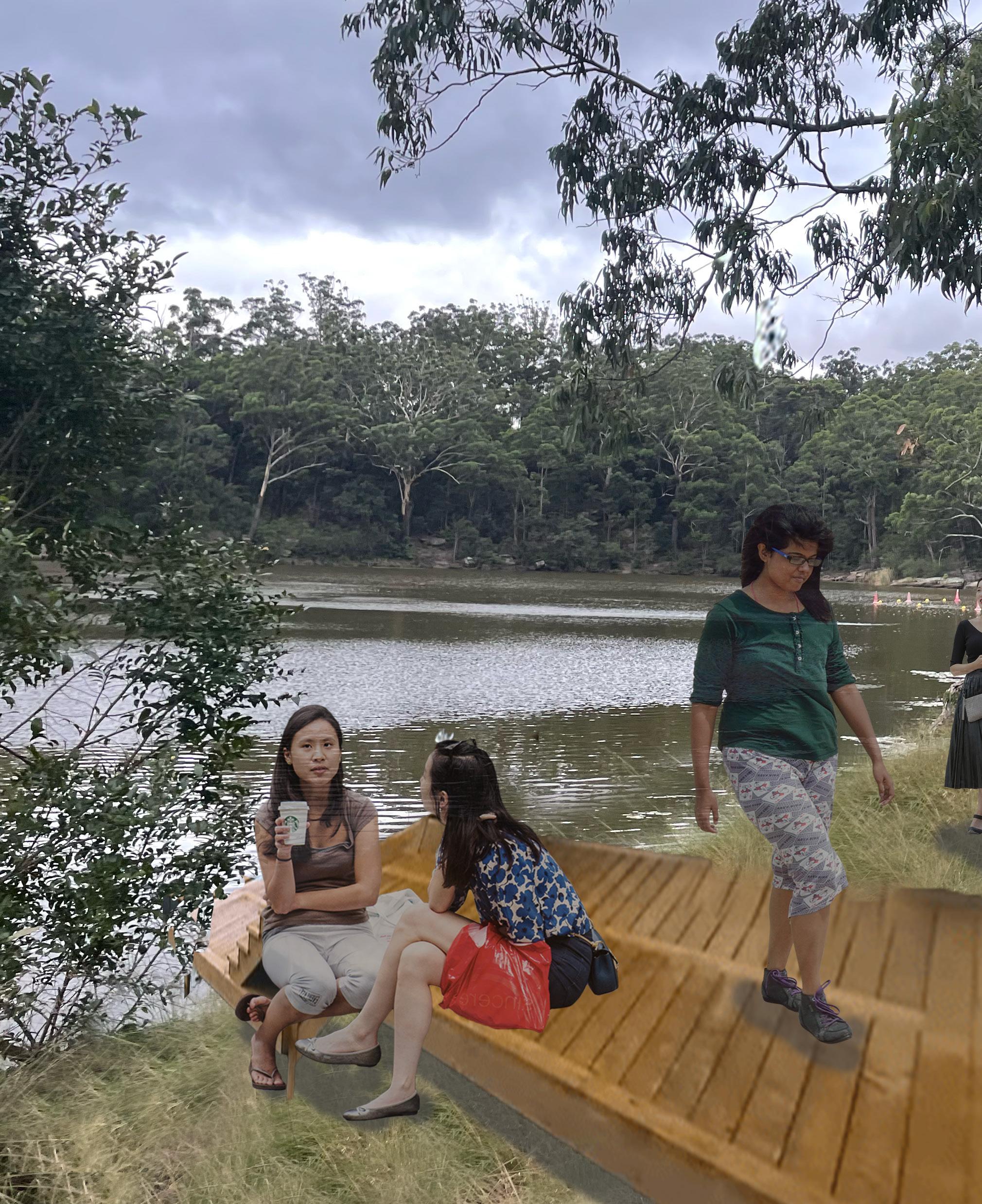
Parramatta River plays just as important a role in connecting the precinct as much as the park does. Gently making its way across the site, the river is quite literally the thread that stitches the precinct together. It was a vital part of the growth of Parramatta right from the beginning and this plan hopes to celebrate and enhance it for what it really is. Flooding has been a major issue in Parramatta, and all development proposed in this plan is primarily built around controlling this problem and possibly eradicating it with time. Suitable drainage plans, creating barriers on the river’s edge and permanent precautionary measures across vulnerable areas will be the starting point of any development along the river. With this in mind, the river will be brought to life by designing activities and regenerating the river without disturbing any natural landform.
This development involves introducing more walkover bridges across the river in areas that need more connections and activating the existing connections to make them more visible and accessible. Riverfront activities and nature trails along the river will help liven the riverfront. Activities on the river’s edge as well as within the waterbody will also be carried out occasionally in areas that are not heritage protected. Regular maintenance and monitoring will ensure that no harm occurs to the water or the river’s edge at any cost.

Img 44: Vision for River
Source: Author
1. Implement methods to protect the existing flora and fauna
2. Work with the heritage council to propose activities through the river and riverfront
3. Prepare detailed designs for the introduction of promenades along the river, and ensure sensitive development across the river’s edge
4. Propose recreational activities such as nature trails and walks along the riverfront near the park
5. Prepare detailed designs for the introduction of promenades along the river and ensure sensitive development across the river’s edge.
6. Prepare an advertising strategy of the various activities at the Lake and River to promote and encourage tourism in Parramatta and Westmead.
7. Prepare detailed strategies for the safe management of the increased floods in Parramatta due to the river. This includes the ideas of sustainable drainage and manmade barriers to prevent floods.
• Cutting through the site, the river aims to be a major facilitator of connections between Parramatta, Westmead as well as the lake.
• The history and heritage of the river will be respected at all times, and efforts will be made to spread awareness and educate the community about the same.
• The native species of biodiversity that thrive along the river will be protected and no development will hinder their existence.
• The activation of the river will encourage more social gatherings and promote recreation for the community in the precinct. This will contribute to the goal of creating a healthy built environment in Parramatta and Westmead.
• Overall, this plan aims to merely uplift what is already an integral asset towards the development of the precincts of Parramatta and Westmead.
Img 45: Section through River
Source: Author
Source: Author
As Parramatta River forms one of important linkages of this plan, it was unviable to complete the plan without including Parramatta Lake into the integration process. Lying towards the north of the site, it binds the plan together and ‘closes the circle’. Parramatta Lake is a valuable asset to the precinct, and the research and study conducted highlighted the poor conditions of its existence. Improving the accessibility towards the lake and activating it to become more attractive would help towards achieving the overall vision of this plan. The themes and objectives laid out in the plan will make Parramatta Lake and its reserve a major tourist destination that it is striving to be.
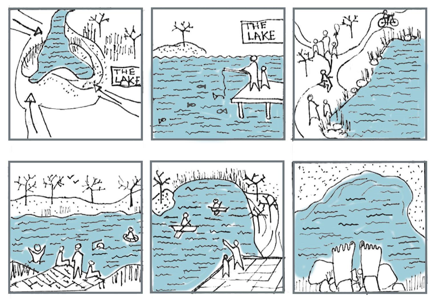
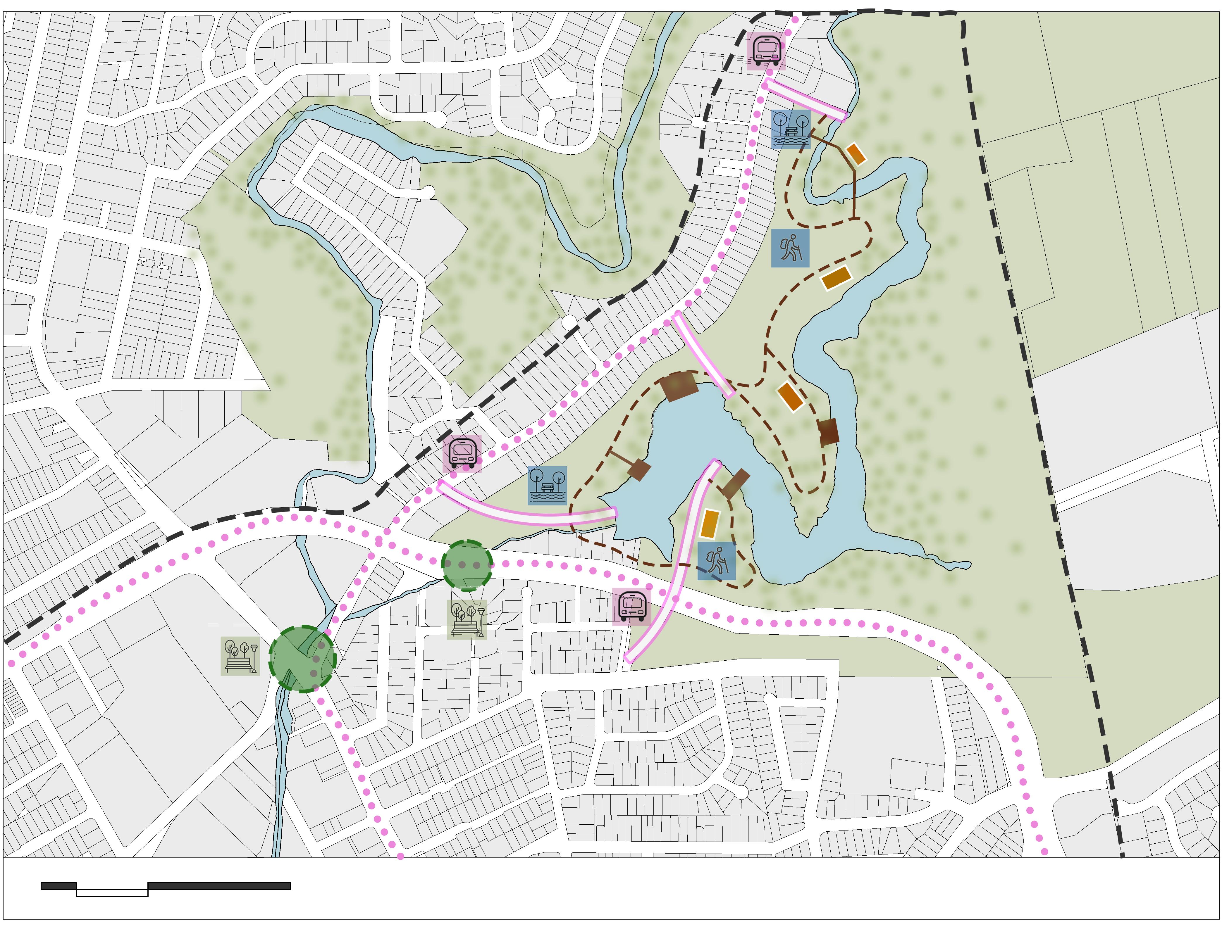
To achieve this, the bus link to Parramatta Lake from the CBD as well as from Westmead will be renewed with more stops at the various possible entry points of the lake. The streets will be designed to provide better pedestrian and cyclist access to these points, and safe crossings and street furniture will encourage the use of shared modes of transport in contrast to the current reliance on private cars to reach the site. The existing reserve will be maintained on a regular basis and the addition of recreational activities will ensure a larger turnup of visitors and residents alike.
Source: Author
1. Implement methods to protect the existing flora and fauna
2. Work with the heritage council to propose activities through the river and riverfront
3. Prepare detailed designs for the introduction of promenades along the river, and ensure sensitive development across the river’s edge
4. Propose recreational activities such as nature trails and walks along the riverfront near the park
5. Prepare detailed designs for the introduction of promenades along the river and ensure sensitive development across the river’s edge.
6. Prepare an advertising strategy of the various activities at the Lake and River to promote and encourage tourism in Parramatta and Westmead.
7. Prepare detailed strategies for the safe management of the increased floods in Parramatta. This includes the ideas of sustainable drainage and manmade barriers to prevent floods.
• The lake forms one of the three nodes that connects the precinct and will be one of the major attractions to the people visiting the precinct.
• The existing biodiversity in and around the lake will be protected at all costs and no development will hinder the natural habitat of the native species of the area. Regular maintenance will ensure that the waterbody and surrounding landscape are not harmed as a result of the expected footfall.
As the major source of recreation and rejuvenation, the lake will contribute in spreading awareness about the importance of a healthy living.
The river and the lake together will provide the ultimate experience for all embarked on the journey of this precinct.

Bringing together the themes, objectives, actions and design ideas, Two Cities One Centre will have achieved the goals set out in the vision to its full potential. The next step of this is proper implementation and delivery. To achieve this plan in its entirety, a staging plan has been developed that proposes steps spread across 20 years. These steps are divided based on their priority for development as well as their projected time of completion. Community consultation, feedbacks and stakeholder investments will support the delivery process. In collaboration with the local councils, heritage authorities, aboriginal community and higher levels of government, this plan will ensure regular monitoring and management of all developments. This process will be carried out with minimum discrepancies to the residents of Parramatta and will guarantee that any concerns from the community is taken into consideration and acted upon.
The three primary nodes celebrated in the plan, form the foundation to the vision of connecting Parramatta and Westmead. Parramatta CBD and the lake will mainly be connected by the appropriate development of the existing roads and streets. There will be additional bus routes that will serve the various entry points of the lake. Designing streetscapes to ensure safe pedestrian and cyclist access will be a major part of this process. This will also ensure a better access to the lake. A better public transport connection from the CBD will encourage more visitors to visit Parramatta Lake.
The plan itself will reflect a better-connected precinct between Parramatta and Westmead. The main centres of both the areas will be served by multiple public transport options as well the experiential journey through Parramatta Park. The improved access to bus connections from Parramatta Railway Station, the upcoming light rail and metro, and an improved pedestrian access will all merge together to provide the best travel experience for visitors and residents alike. The plan assesses the demographics and movement in detail to ensure convenient travel indiscriminate of their backgrounds or purpose.
To complete the connection, the centre of Westmead and Parramatta Lake will also be served by better public transport connections. This connection will majorly focus on highlighting the different modes of access that the river and park provide. It will be the connection that promotes and celebrates the concept of a healthy built environment. It will encourage people to reduce dependency on private vehicles and increase the use of shared modes of transport. This will liven up the residential zones within Westmead and improve the experience of the health and education precinct within.
Img 51: The “In Betweens”
Source: Author
Img 52: Landuse. Source: Author


Delivering a well-coordinated approach and taking necessary actions is essential when implementing a plan, especially to realise the vision and purpose of the study. Changes to the site through statutory planning controls will allow the development to occur with accordance to various local and State planning controls or development. The Parramatta Development Control Plan (DCP) 2011 was adopted by the Council in 2011, and introduced new requirements with regards to the Division 6 of Part 3 of the Environment Planning & Assessment Act 1979 (EP&A Act). Two Cities One Centre is in accordance with the Parramatta DCP and EP&A Act, and various other relevant planning policies elaborated in this section, which will ensure a smooth transition and process of implementation of the plan in the area.
The actions and implementations of Two Cities One Centre will be carried through a mix of planning controls, development evaluation, projects and campaigning. The actions will commence and acknowledge the Metropolis of Three Cities, Greater Parramatta to Olympic Peninsula (GPOP) and The Central City District Plan. Community engagement strategy through Local Councils as well as at a greater context can help in delivering programs and operational plans needed for implementation.
The efficacy can be assessed on an on-going basis as well as annually as a part of “Integrated Planning and Reporting”. The document’s effectiveness will be measured using key indicators such as the number of Development Applications that have reported improved planning and community outcome as a result of vision and strategic objectives outlined in Two Cities One Centre; result of online polls and community consultation that can also act a strategic guiding document for the enhancement of the area.
This process of constant reviewing can simplify, modernise and improve the efficiency and usefulness of the Plan, that will ensure the steps taken are heading in the right direction and at the right time. Because the city is expanding at such a quick pace, Two Cities and One Centre Plan will be thoroughly evalutaed every 5 years. The Plan may also conduct more regular evaluations in the interim between comprehensive assessments to ensure on-track progression.
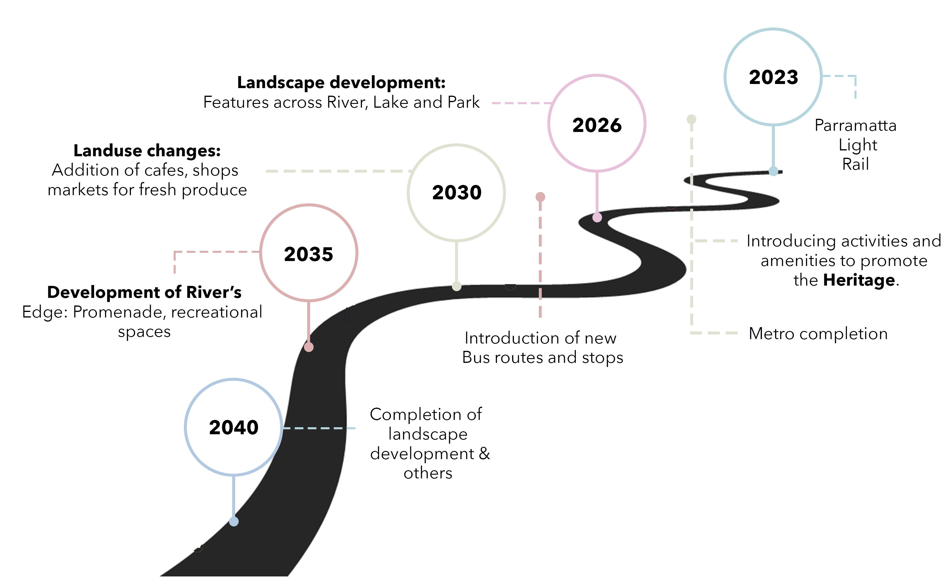
Since various developments have been proposed, each of them will have different stages iof implementation, as shown in figure. The most recent being the upcoming Parramatta Light Rail in 2023, during which activities and amenities to promote Heritage will be implemented. The Parramatta Metro is also set to complete before 2026 which will be coupled with the development for landscape across River, Park and Lake. By 2030, additional landuse changes will be implemented followed by development of the River front by 2035. Lastly, all implementations, additions and completions will be fulfilled by 2040 and will realise the vision set for Parramatta and Westmead as one strategic centre in the future.
Delivering a coordinated approach through defined actions to realise the vision as one centre.
The following gives an approximate timeline to acheive the objectives and actions, for each of the themes. HERITAGE
DPIE= Department of Planning and Environment
To conserve and protect the natural and cultural values of the park in a better way
To promote the historic, cultural and heritage significance of the park while making it an important tourist destination
To improve the connection between Parramatta and Westmead; Integrate them as one city
Connecting neighbourhoods and centres; improving external connections
preferred travel routes and modes
Develop principle cycling network
Promote
years Safe crossings and pick up/drop off zones
0-2 years
Providing equal access to health amenities including fresh produce, mental and physical health
among
“Eyes
–Providing safe streetscapes
Australia ICOMOS & International Council on Monuments and Sites 2013, The Burra Charter: the Australia ICOMOS charter for places of cultural significance 2013, viewed 1 March 2022, <http://australia.icomos.org/wp-content/uploads/The-Burra-Charter-2013-Adopted-31.10.2013.pdf>
Greater Sydney Commission 2018, A Metropolis of Three Cities - Connecting People, viewed 15 March 2022, < https://www.planning.nsw.gov. au/plans-for-your-area/a-metropolis-of-three-cities/a-metropolis-of-three-cities>
Greater Sydney Commission 2018, Greater Parramatta and Olympic Peninsula, viewed 15 March 2022, <https://www.planning.nsw.gov.au/Plansfor-your-area/Priority-Growth-Areas-and-Precincts/Greater-Parramatta-Growth-Area>
Parramatta Park Trust 2008, Parramatta Park Conservation and Management Plan, viewed 10 March 2022, < https://www.parrapark.com.au/ assets/Uploads/Resources/plans-of-management/PPT-Conservation-and-Management-Plan-Final-v2-2007.pdf>
Img 08: Susan Tanya Macdonald (February 2014), Old Government House, Getty Conservation Institute, Viewed on 2nd June, 2022 < https://www.researchgate.net/publication/340418260_The_Role_of_Public-Private_Partnerships_and_the_Third_Sector_in_Conserving_Heritage_Buildings_Sites_and_Historic_Urban_Areas>
Img 10: Horse Riding (nd), Centennial Parklands, Centennial Parklands Equestrian Centre, Viewed on 29th May, 2022 <https://www.centennialparklands.com.au/visit/things-to-see-and-do/horse-riding>
Img 11: Aerial view of Centennial Parklands (nd), Centennial Park Master Plan 2040, Viewed on 29th May, 2022 <https://www.centennialparklands.com.au/about-us/planning/centennial-park-master-plan-2040>
Img 12: Tours, Centennial Parklands (nd), Centennial Parklands Tour, Viewed on 29th May, 2022 < https://www.centennialparklands.com.au/visit/things-to-see-and-do/tours>
Img 13: Amanda Hoh (nd), Parramatta station, ABC News, Viewed on 28th June, 2022 <https://www.abc.net.au/news/2016-06-27/parramatta-station/7540910?nw=0 >
Img 15: Aerial view of Northbourne Avenue (nd), ACT Government City Renewal Authority, Viewed on 29th May, 2022 < https://www.act.gov.au/cityrenewal/places/northbourne-avenue/northbourne-avenue-news>
Img 16: Light Rail Station (nd), Transport Canberra, Viewed on 29th May, 2022 < https://www.act.gov.au/cityrenewal/places/northbourne-avenue/northbourne-avenue-news>
Img 17: Aerial view of Northbourne Avenue looking North from Civic (nd), Wikipedia, Viewed on 29th May, 2022 < https://en.wikipedia.org/wiki/Northbourne_Avenue>
Img 18: Parramatta River (nd), City of Parramatta, Viewed on 2nd June, 2022 < https://atparramatta.com/discover/see-and-do/nature-and-parks/parramatta-park-the-peoples-park>
Img 20: Edmonton (nd), Biophillic Cities, Viewed on 29th May, 2022 < https://www.biophiliccities.org/edmonton>
Img 21: Aerial view of Edmonton (nd), Biophillic Cities, Viewed on 29th May, 2022 < https://www.biophiliccities.org/edmonton>
Img 22: Ravine Cycle Path (nd), Wikipedia, Viewed on 29th May, 2022 < https://commons.wikimedia.org/wiki/File:Ravine-Cycle-Path-Edmonton-Alberta-Canada-01A.jpg >
Img 23: Wolter Peters (nd), Biking in Parramatta Park, The Sydney Morning Herald, Viewed on 05th June, 2022 < https://www.smh.com.au/national/nsw/game-changer-push-on-to-expand-historic-parramatta-park-northwards-20220127-p59rl7.html>
Img 25: Weekly Parklands (nd), Centennial Parklands - Cambridge Markets, Viewed on 29th May, 2022 < https://www.centennialparklands.com.au/visit/things-to-see-and-do/eat-drink-shop-stay/cambridge-markets-eq>
Img 26: Sunday Street Play (nd), Campbelldown City Council, Viewed on 29th May, 2022 < https://www.healthyactivebydesign.com.au/case-studies/sunday-street-play>
Img 27: Wellness Stations (nd), The Buenos Aires city government, Viewed on 29th May, 2022 < https://www.nycfoodpolicy.org/buenos-aires-wellness-stations/>
Img 28: Lana Endermar (nd), Parramatta river in the Parramatta Park, Shutterstock, Viewed on 10th June, 2022 < https://www.shutterstock. com/image-photo/parramatta-river-park-western-suburb-sydney-1578800002>
Img 30: Outdoor Gym (nd), Swan Hill Riverfront Development Plan, Viewed on 29th May 2022,< https://www.healthyactivebydesign.com.au/ case-studies/swan-hill-riverfront-master-plan>
Img 31: Promenade (nd), Swan Hill Riverfront Development Plan, Viewed on 29th May 2022,< https://www.healthyactivebydesign.com.au/ case-studies/swan-hill-riverfront-master-plan>
Img 32: Swan Hill Park (nd), Swan Hill Riverfront Development Plan, Viewed on 29th May 2022,< https://www.healthyactivebydesign.com.au/ case-studies/swan-hill-riverfront-master-plan>