

News News Vol. 66, No. 4 – Program with Abstracts AEG2023 Conference –Portland, OR Program with Abstracts














Associatio AEG 6 nofEnvironme An 67th ental&Enginee nual M eringGeologist eeting ts by Phila are its ch ” s triumpha ’ immorta rt of seum y Sylvester u adelphia M and the steps of the A Stallone p heesesteaks s lized ant e Historic District and s hotel is located on the and Society Hill at Hilt Septe epte Park, nts s teps from n e waterfront in Center City’ The . Penn’s Landing iladelphia ton Ph is less than a mile away emberr1014202 r 10-14, 202 2 ns 24 AE Envi tion of Associa A TH EG 68 onmental & Engineering r M ANNUAL Geologists EETING althy yline. all Chi estin Chica W Illinois | ,icago September 23-27, th t 2025 ago River Nor eloton. t
AEG News (ISSN 0899-5788; USPS 954-380) is published by the Association of Environmental & Engineering Geologists (AEG), 3053 Nationwide Pkwy., Brunswick, OH 44212, four times a year in April, July, and December with the Annual Report and Directory in March. The Annual Meeting Program with Abstracts is published only digitally, in September, and the digital copies are distributed at the AEG Annual Meeting. Association members receive an electronic copy of all five issues of AEG News as part of their dues. Print subscription for Association members, which includes all three regular issues of the AEG News and the Annual Report and Directory issue, is $40 in addition to annual membership dues. Nonmember annual subscription is $50. Back copies of AEG News regular issues are $12 each. Inquiries should be sent to AEG Headquarters: Association Manager, 3053 Nationwide Parkway, Brunswick, OH 44212 330-578-4900.

Periodical Postage paid at Brunswick, OH, and additional mailing offices: POSTMASTER: Send address changes to AEG News, 3053 Nationwide Pkwy., Brunswick, OH 44212.
© 2023 Association of Environmental & Engineering Geologists—All Rights Reserved.
Views expressed in this publication are not necessarily those officially representing the Association of Environmental & Engineering Geologists except where expressly stated.
AEG News Editors
Acquisitions Editor: Martha Whitney, Principal Engineering Geologist, Whitney Geologic, news@aegweb.org
Content Editor: Bill Roman, Woodsman, bill.roman.bretz@gmail.com
Managing Editor/Production: Andrea Leigh Ptak, Communicating Words & Images, 206-300 -2067, andrealeighptak@me.com, www.andrealeighptak.com
Submission Information
In order of preference:
1. Send files via email, preferably as attachments, to both email addresses above. Optimum file format is MSWord. Users of other software programs should convert their file to ASCII or text only. Photos and other images, charts, graphs, etc.) should be sent as separate images but may be included in the Word.doc for placement purposes.
2. Images should be sent as high-resolution (250 dpi at 4” wide or larger) jpeg or tiff files and should be named with a strong identifier such as HF-TexasJohn Jones—NOT P204679.jpg. Corresponding photo captions should be included in the text along with an attribution of the source/photographer.
3. The policy of AEG News editorial staff is to limit the credentials of an individual to two. No effort will be made by the AEG News editorial staff to determine if individuals whose credentials are missing from the submitted copy actually have academic or professional credentials, nor will the staff verify the existence or correctness of the credentials submitted.
For detailed guidelines visit: https://aeg.memberclicks.net/assets/docs/aeg_news_style_guide_0713.pdf
Advertising in the News
Contact AEG Headquarters at advertising@aegweb.org.
Submission Deadlines
https://www.aegweb.org/aeg-news-2
AEG 66th Annual Meeting – Program with Abstracts
Table of Contents
The association
2022–23 Officers
President: NATHAN SARACENO
Senior Geologist, DiGioia Gray and Associates, Monroeville, Pennsylvania president@aegweb.org
Vice President/President Elect: SARAH KALIKA
Consulting Geologist, DiabloGeo Environmental, San Ramon, California, VP@aegweb.org
Treasurer: RENEE WAWCZAK
Hydrogeologist, Norridge, Illinois, treasurer@aegweb.org
Secretary: PAUL WEAVER
Senior Transportation Geotechnical Project Manager, ESP Associates, Inc., Greensboro, NC, secretary@aegweb.org
Past President: MADDIE GERMAN
Consulting Geologist, Fort Myers, Florida, PP@aegweb.org
Association Contacts Headquarters:
Association Manager: SHERI MASKOW
J&M Business Solutions
3053 Nationwide Parkway, Brunswick, OH 44212 330-578-4900, manager@aegweb.org
AEG Foundation—President: DUANE KREUGER, president@aegfoundation.org
AEG 2023 ANNUAL MEETING September 2023 AEG 66th Annual Meeting Program with Abstracts 3
Canada Agreement number: PM40063731; Return Undeliverable Canadian Addresses to: Station A, PO Box 54; Windsor, ON N9A 6J5; Email: returnsil@imex.pb.com
Table of Contents Marriott Portland Downtown Waterfront Meeting Space 4 Schedule of Events 5 Technical Session Numbers and Names 8 Planning Committee 9 Special Thanks 10 Welcome Letter – AEG President, Nate Saraceno 11 Welcome Letter – AEG 2023 Co-chairs, Mike Marshall and Mark Swank 12 Welcome Letter – Governor, Tina Kotek 13 Welcome Letter – Oregon State Geologist, Ruarri J. Day-Stirrat 14 Welcome Letter – Portland Mayor, Ted Wheeler 15 AEG 2023 Awardees 16 AEG Foundation 2023 Scholars 18 Exhibitors 21 Sponsors 27 2023 Technical Program Keynote Speaker 33 The 2022–23 AEG/GSA Richard H. Jahns Distinguished Lecturer 33 The 2023–24 AEG/GSA Richard H. Jahns Distinguished Lecturer 34 Outstanding Environmental & Engineering Geologic Project 37 Technical Program Schedule 2023 Virtual Day – Schedule 51 2023 Virtual Day – Abstracts 52 Wednesday, September 20 56 Thursday, September 21 58 Friday, September 22 61 Poster Sessions 65 Meeting Abstracts 67 Author and Title Index 112 Index to Advertisers 26 On the Cover — The Willamette River in downtown Portland, with the AEG Annual Meeting venue in the background.
PHOTO BY JOHN SAGER
New News
Marriott Portland Downtown Waterfront
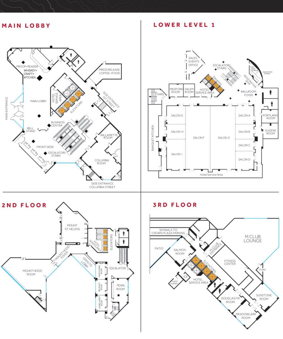
AEG 2023 ANNUAL MEETING 4 AEG 66th Annual Meeting Program with Abstracts September 2023
Schedule of Events
(Please see the AEG 2023 Annual Meeting Mobile App for schedule changes)
and Engineering Geology in the Columbia River Gorge
by Weyerhaeuser Company
Living with Giant Landslides in Portland, Oregon
by Cornforth Consultants, Inc.
Dam Engineering Geology in the Cascadia Subduction Zone
by AEG Foundation, AEG Oregon Chapter, Aspect Consulting, University of Pennsylvania, Weyerhaeuser Company, Rick Kolb, and Morley Beckman
WEDNESDAY, SEPTEMBER 20
(Mark Swank and Mike Marshall)
Foundation President Duane Kreuger)
Sponsored by AEG Carolinas Chapter AEG Outstanding Environmental & Engineering Geologic Project Award – Historic Columbia River Highway and State Trail (Historic US Route 30)
2022/2023 AEG/GSA Richard H. Jahns Distinguished Lecturer: Vincent Cronin
2023/2024 AEG/GSA Richard H. Jahns Distinguished Lecturer: Cynthia Palomares
AEG 2023 ANNUAL MEETING EVENT PLACE TIME
SEPTEMBER 19 New! AEG Virtual Day Online Only 7:30am–3:00pm Registration Ballroom Foyer 7:00am–7:00pm Field Course #1:
Meet in the Lobby 8:00am–5:30pm Sponsored
Field Course #2:
Meet in the Lobby 8:00am–5:30pm Sponsored
Field
Scoggins
Meet in the Lobby 8:00am–3:00pm AEG Executive Council Meeting Portland 8:00am–5:00pm AEG Foundation Board Meeting Eugene 8:00am–5:00pm Joint Luncheon – AEG EC and
Foundation Board
Salon A 12:00pm–1:00pm Student/Professional Networking Reception Mt. Hood 5:15pm–6:15pm Sponsored by
Welcome (Icebreaker) Exhibit Hall 6:30pm–8:30pm Sponsored
Young
Heart
Portland State University 8:00pm–10:00pm Sponsored
TUESDAY,
Landslides
Course #3:
AEG
(Invitation Only)
Schnabel Engineering
by Pali Consulting
at
Student/Professional Special Event (Ticketed Event)
Speakers’/Moderators’ Breakfast Sponsored by PBS USA Mount St. Helens 6:30am–7:30am Registration Ballroom Foyer 7:00am–5:00pm Speaker Preparation Room Medford 8:00am–5:00pm Exhibitors Exhibit Hall 7:30am–5:00pm Committee Room Portland 10:00am–5:00pm Guest Get Together Portland 9:00am–10:00am Poster Session Presentations Ballroom Foyer 8:00am–4:00pm Opening Session – Sponsored by
Salon GHI 8:00am–12:00pm Opening Session Welcome
Salon GHI 8:00am–8:05am Meeting Co-Chair Welcome
Salon GHI 8:05am–8:10am AEG Volunteer Recognition Award Salon GHI 8:10am–8:25am AEG Foundation Awards
Salon GHI 8:25am–9:00am Keynote Speaker:
Burns Salon GHI 9:00am–9:40am Oregon State Geologist Ruarri Day-Stirrat Salon GHI 9:40am–10:00am Morning Break Exhibit Hall 10:00am–10:20am
Salon GHI 10:20am–11:00am
Gannett Fleming
(AEG President Nate Saraceno)
(AEG
Dr. Scott
Salon GHI 11:00am–11:30am
Salon GHI 11:30am–12:00pm Exhibitor Hosted Lunch Exhibit Hall 12:00pm–1:30pm Sponsored
AEG Dams and Levees
Portland 12:00pm–1:30pm
by Exponent
TWG Meeting
September 2023 AEG 66th Annual Meeting Program with Abstracts 5
WEDNESDAY, SEPTEMBER 20 …continued
#1: DEIC Symposium: DEI – Doing the Work
Sponsored by Weyerhaeuser Company
Sponsored by Brierley Associates and Aldea Services
#3: Geophysical Techniques and Investigations Relevant to Dams and Levees
by PanGEO
by Lettis Consultants International
THURSDAY, SEPTEMBER 21
by PBS USA
Data for Assessment of Potential Hazards Using
Surface and Subsurface Methods Symposium, Part 1
by Aspect Consulting
#6: Environmental Symposium – Portland Harbor Superfund Site
by Bryan Environmental
Sponsored by RJH Consultants
Part I
#8: Post-Fire Debris Flow Symposium, Part I
Sponsored by Geosyntec
Sponsored by AEG Carolinas Chapter
AEG Inclusion Luncheon (Ticketed Event)
Sponsored by Susan Steele Weir
on Your Own for Attendees
Technical Session #9: Collecting Geologic Data for Assessment of Potential Hazards using Multiple Surface and
Subsurface Methods Symposium, Part II
Sponsored by Aspect Consulting
Technical Session #10: Dams and Levees Symposium, Part II
Technical Session #11: Post-Fire Debris Flow Symposium, Part II
Technical Session #12: Naturally Occurring Asbestos
Afternoon Break
Poster Reception and Happy Hour
Sponsored by EMSL Analytical
Annual Banquet (Ticketed Event)
Sponsored by PLI Systems
AB
GH
I
CD
Foyer
AEG 2023 ANNUAL MEETING 6 AEG 66th Annual Meeting Program with Abstracts September 2023 EVENT PLACE TIME
Technical
Salon A-B 2:00pm–5:00pm
Technical Session
Salon C-D 2:00pm–5:00pm
Technical Session
Symposium Salon I 2:00pm–5:00pm Technical Session #4: Geomorphology Salon GH 2:00pm–5:00pm Sponsored
Afternoon Break Exhibit Hall 3:00pm–3:20pm AEG Foundation Open House Portland 3:00pm–4:00pm Landslides TWG Portland 4:00pm–5:00pm Special Event
“Wine
Departs from Lobby 6:00pm–10:00pm Sponsored
Session
#2: Tunneling
–
and Terroir” Wine Dinner
Speakers’/Moderators’ Breakfast Mount St. Helens 6:30am–7:30am Sponsored
Registration Ballroom Foyer 7:00am–5:00pm Speaker Preparation Room Medford 8:00am–5:00pm Exhibitors Exhibit Hall 7:30am–3:20pm Committee Room Portland 8:00am–5:00pm Poster Session Presentations Ballroom Foyer 8:00am–4:00pm Technical Session #5: Collecting Geologic
Salon AB 8:00am–12:00pm Multiple
Technical Session
Salon CD 8:00am–12:00pm Sponsored
Technical Session #7: Dams
Levees
Salon
8:00am–12:00pm
Sponsored
and
Symposium,
GH
Salon I 8:00am–12:00pm
Technical Session
AEG Foundation Open
Portland 9:00am–10:20am Morning
Exhibit Hall 10:00am–10:20am
House
Break
Mt. Hood 12:00pm–1:30pm
12:00pm–1:30pm
Lunch
Salon
1:40pm–5:00pm
Salon
1:40pm–5:00pm
Salon
1:40pm–5:00pm
Salon
1:40pm–5:00pm
Exhibit
3:00pm–3:20pm
Hall
Ballroom
5:00pm–6:30pm
Mt.
7:00pm–10:00pm
Hood
– SCHEDULE OF EVENTS
FRIDAY, SEPTEMBER 22
SATURDAY, SEPTEMBER 23 Field Course #4: Mt St Helens – Highlights of the 1980 Eruption and Engineering Geology after
SUNDAY, SEPTEMBER 24
Guest Get-Together!
Here’s a Chance to Get to Know Your Fellow Guest Attendees!
All Guest Registration attendees are invited to join us for an informal coffee/tea meet-and-greet on Wednesday morning from 9–10:00 am in the Portland Meeting Room.
ANNUAL MEETING WIFI ACCESS:
NETWORK CODE:
USER: Marriott_CONFERENCE PASSWORD: AEG_2023
Wifi is available in the exhibit hall and public areas of the hotel.
LEAVE THE PAPER BEHIND!
AEG2023 GOES MOBILE!
Schedule, Maps, Networking and more on your mobile device – completely free! We will be sending all attendees the QR Code and complete details to download the app ONE WEEK before the meeting.
AEG 2023 ANNUAL MEETING September 2023 AEG 66th Annual Meeting Program with Abstracts 7 EVENT PLACE TIME
Speakers’/Moderators’ Breakfast Mt. Saint Helens 6:30am–7:30am Sponsored by PBS USA Registration Ballroom Foyer 7:00am–1:30pm Speaker Preparation Room Medford 8:00am–3:00pm Committee Room Portland 8:00am–3:00pm Technical Session #13: Landslides, Part I Salon AB 8:00am–12:00pm Sponsored by Geosyntec Technical Session #14: Land Subsidence Symposium, Part I Salon CD 8:00am–12:00pm Sponsored by Brierley Associates Technical Session #15: Dams and Levees Symposium, Part III Salon GH 8:00am–12:00pm Technical Session #16: Earthquakes and other Natural Hazards Salon I 8:00am–12:00am Sponsored by GRI AEG Foundation Open House Portland 9:00am–10:20am Morning Break Ballroom Foyer 10:00am–10:20am Past President’s Luncheon (Invitation Only) Mt. Saint Helens 12:00pm–1:00pm Lunch on Your Own for Attendees 12:00pm–1:00pm Technical Session #17: Landslides, Part II Salon AB 1:00pm–2:40pm Technical Session #18: Hazards and Human Society Salon I 1:00pm–2:40pm Technical Session #19: Environmental Topics Salon GH 1:00pm–2:40pm Technical Session #20: Land Subsidence Symposium, Part II Salon CD 1:00pm–2:40pm Sponsored by Brierley Associates Afternoon Break Ballroom Foyer 2:40pm–3:00pm AEG’s Corporate Business Meeting and Closing Session Mt. Hood 3:00pm–5:00pm Sponsored by DiGioia Gray Closing Beer/Wine Reception Mt. Hood Foyer 5:00pm–6:00pm
Sponsored by DiGioia Gray
Departs from Lobby 8:00am–5:30pm AEG Board of Director’s Meeting Mt. Hood 8:00am–5:00pm
AEG Board of Director’s Meeting Mt. Hood 8:00am–12:00pm AEG 2022 ANNUAL MEETING – SCHEDULE OF EVENTS
Technical Session Numbers and Names
(Please see the AEG 2023 Annual Meeting Mobile App for schedule changes.)
AEG/GSA Richard H. Jahns Distinguished Lecturer: Cynthia Palomares
DEIC Symposium: DEI – Doing the Work – Sponsored by Weyerhaeuser Company
#2: Tunneling – Sponsored by Brierley Associates and Aldea Services
#3: Geophysical Techniques and Investigations Relevant to Dams and Levees Symposium
THURSDAY, SEPTEMBER 21
FRIDAY, SEPTEMBER 22
Session #13: Landslides, Part I – Sponsored by Geosyntec
Session #14: Land Subsidence Symposium, Part I – Sponsored by Brierley Associates
and other Natural Hazards – Sponsored by GRI
– Sponsored by Brierley Associates
AEG 2023 ANNUAL MEETING 8 AEG 66th Annual Meeting Program with Abstracts September 2023
SESSION PLACE TIME
SEPTEMBER 19 New! AEG Virtual Day Online Only 7:30am–3:00pm
SEPTEMBER 20 Opening Session - Sponsored by Gannett Fleming Salon GHI 8:00am–12:00pm Opening Session Welcome (AEG President Nate Saraceno) Salon GHI 8:00am–8:05am Meeting Co-Chair Welcome (Mark Swank and Mike Marshall) Salon GHI 8:05am–8:10am AEG Volunteer Recognition Award Salon GHI 8:10am–8:25am AEG Foundation Awards (AEG Foundation President Duane Kreuger) Salon GHI 8:25am–9:00am Keynote Speaker: Dr. Scott Burns Salon GHI 9:00am–9:40am Oregon State Geologist Ruarri Day-Stirrat Salon GHI 9:40am–10:00am AEG Outstanding Environmental & Engineering Geologic Project Award – Historic Columbia River Highway Salon GHI 10:20am–11:00am and State Trail (Historic US Route 30) 2022/2023 AEG/GSA Richard H. Jahns Distinguished Lecturer: Vincent Cronin Salon GHI 11:00am–11:30am 2023/2024
Salon GHI 11:30am–12:00pm Technical Session
Salon A-B 2:00pm–5:00pm Technical
Salon C-D 2:00pm–5:00pm Technical
Salon I 2:00pm–5:00pm Technical Session #4: Geomorphology – Sponsored by PanGEO Salon GH 2:00pm–5:00pm
TUESDAY,
WEDNESDAY,
#1:
Session
Session
Technical Session #5: Collecting Geologic Data for Assessment of Potential Hazards Using Multiple Surface and Salon AB 8:00am–12:00pm Subsurface Methods Symposium, Part I – Sponsored by Aspect Consulting Technical Session #6: Environmental Symposium – Portland Harbor Superfund Site – Sponsored by Bryan Environmental Salon CD 8:00am–12:00pm Technical Session #7: Dams and Levees Symposium Part I – Sponsored by RJH Consultants Salon GH 8:00am–12:00pm Technical Session #8: Post-Fire Debris Flow Symposium Part I – Sponsored by Geosyntec Salon I 8:00am–12:00pm Technical Session #9: Collecting Geologic Data for Assessment of Potential Hazards Using Multiple Surface and Salon AB 1:40pm–5:00pm Subsurface Methods Symposium, Part II – Sponsored by Aspect Consulting Technical Session #10: Dams and Levees Symposium Part II Salon
1:40pm–5:00pm Technical Session
Salon
1:40pm–5:00pm Technical Session #12:
Salon
1:40pm–5:00pm
GH
#11: Post-Fire Debris Flow Symposium Part II
I
Naturally Occurring Asbestos
CD
Salon
8:00am–12:00pm Technical
Salon
8:00am–12:00pm Technical Session #15: Dams and Levees
Salon
8:00am–12:00pm Technical Session
Earthquakes
Salon
8:00am–12:00am Technical
Landslides,
Salon
1:00pm–2:40pm Technical
Salon
1:00pm–2:40pm Technical Session
Salon
1:00pm–2:40pm Technical Session
Salon CD 1:00pm–2:40pm
Technical
AB
CD
Symposium, Part III
GH
#16:
I
Session #17:
Part II
AB
Session #18: Hazards and Human Society
I
#19: Environmental Topics
GH
#20: Land Subsidence Symposium, Part II
The Planning Committee
AEG’s 66th Annual Meeting would not be possible without the hard work and dedication of the following Committee Chairs and the many more volunteers that serve on these committees.
Annual Meeting Co-Chairs
Mark Swank, Aspect Consulting
Mike Marshall, GRI
Finance
Niall Henshaw, Parsons
Field Courses
Tim Shevlin, Geobrugg
Nick Farney, WFL
Poster Session
Chip Barnett, Aspect Consulting
Special Event
Jason Hinkle, Weyerhaeuser
Adam Reese, Earth Engineers, Inc.
Sponsorship
John Sager, Cornforth Consultants, Inc.
Student Coordination
Rachel Pirot, Weyerhaeuser
Technical Program
Marty Goff, United States Army Corps of Engineers
Nancy Calhoun, Oregon Department of Geology and Mineral Industries
Darren Beckstrand, Cornforth Consultants
Meeting Management
Heather Clark, AEG Meeting Manager
AEG Headquarters
Sheri Maskow, AEG Association Manager
Becky McWilliam, AEG Association Administrator
CREATING BETTER GEOTECHNICAL & GEOHAZARD SOLUTIONS, TOGETHER.

Dams & Hydropower
Roadways & Structures
Transit & Rail | Natural Resources
Facilities | Construction Services
AEG 2023 ANNUAL MEETING September 2023 AEG 66th Annual Meeting Program with Abstracts 9
Special Thanks
AEG wishes to acknowledge the following companies for their support by allowing their employees to assist with the planning of the 2023 Annual Meeting:
Aldea Services, Inc.
Asbestos TEM Labs
Aspect Consulting
Brierley Associates
Bryan Environmental Consultants
Colorado School of Mines
Earth Engineers, Inc.
Exponent
Cornforth Consultants, Inc.
Department of Natural Resources
DiabloGeo Environmental
FHWA
Gannett Fleming
Geobrugg
GeologistWriter
Geosyntec
Green Diamond Resource Co.
GRI
KPFF Portland Civil + Survey
Mott MacDonald
Nuclear Regulatory Commission
Oregon Department of Geology and Mineral Industries
Portland State University
RJH Consultants
Schnabel Engineering
Slate Geotechnical Consultants
Tenessee Valley Authority
United States Army Corps of Engineers
USBR
USGS
Washington Geological Survey
Weyerhaeuser
AEG wishes to thank the following individuals for their assistance with the planning of the 2023 Annual Meeting:
Nate Saraceno, AEG President
Sarah Kalika, AEG Vice President/President-Elect
Renee Wawczak, AEG Treasurer
Paul Weaver, AEG Secretary
Maddie German, AEG Past President
Andrea Ptak, AEG News Managing Editor/Production
Field Course Leaders
Scott Burns, Portland State University
Kate Mickelson, Washington Geological Survey
Douglas A. Anderson, FHWA
Charlie Hammond, Cornforth Consultants/Landslide Technology
Tom Westover, Cornforth Consultants/Landslide Technology
Cody Sorensen, Shannon and Wilson
Seth Sonnier, Shannon and Wilson
Bryan Simpson, USBR
Ray Wells, USGS
Symposium Conveners and Technical Session Moderators
Mitchell Allen, Department of Natural Resources
Mark Bailey, Asbestos TEM Labs
James Borchers, Consulting Hydrologist
Matt Brunengo, Portland State University
Patricia Bryan, Bryan Environmental Consultants
David Carpenter, Schnabel Engineering
April Fontaine, United States Army Corps of Engineers
Edwin Friend, USACE
Brian Greene, Gannett Fleming
Deborah Green, GeologistWriter
Paul Headland, Aldea Services, Inc.
David Hibbard, Brierley Associates
Matt Huebner, Tennessee Valley Authority
Ike Isaacson, Brierley Associates
Courtney Johnson, Slate Geotechnical Consultants
Sarah Kalika, DiabloGeo Environmental
Loren Lasky, NJ Department of Environmental Protection, retired
Linda Mark, KPFF Portland Civil + Survey
Kate McKinley, THG Geophysics
Kate Mickelson, Washington Geological Survey
Kevin Mininger, RJH Consultants
Kathryn Murdock, Exponent
Mike Piepenburg, Mott MacDonald
Paul Santi, Colorado School of Mines
Gerry Stirewalt, Nuclear Regulatory Commission
Julien Waeber, Exponent
Jared Warner, Geosyntec
Jason Woodward, Green Diamond Resource Co.
AEG 2023 ANNUAL MEETING 10 AEG 66th Annual Meeting Program with Abstracts September 2023
Welcome to the City of Roses…
On behalf of the Association of Environmental & Engineering Geologists (AEG), it is my distinct honor and privilege to welcome you to the 66th Annual Meeting, held here in the City of Roses: Portland, Oregon. Our gathering promises to be an enriching and inspiring experience, bringing together geo-professionals from all over who are committed to advancing the fields of environmental and engineering geology.
Nestled in the heart of the Pacific Northwest, Portland offers an awe-inspiring backdrop for our conference, characterized by its unique and diverse geologic setting. From the high-rising volcanic peaks of the Cascade Range to the intricate patterns of the Columbia River Gorge, the region’s landscapes have been shaped by tectonic forces, earthquakes, eruptions, landslides, and flood— a testament to the Earth’s dynamic history.
The 66th Annual Meeting features an array of engaging activities designed to foster exchange of knowledge and professional growth. Our field courses will provide you with hands-on experiences in various geological settings such as the Cascadia Subduction Zone and Mount Saint Helens, enhancing your practical skills and enriching your understanding of geological processes. The technical sessions will cover a broad spectrum of topics, including geohazards assessment, environmental site characterization, and cutting-edge technologies in geoscience.
This Annual Meeting not only serves as a platform for knowledge exchange but also as a unique opportunity to foster meaningful connections with fellow professionals who share your passion for advancing the geosciences. I encourage you to take advantage of the many networking events we’ve planned to actively engage in discussions, network with peers, and explore collaborative opportunities that will contribute to the growth of our disciplines. This includes spending some time visiting the Exhibitors to learn about new technology, products, services, and organizations that may help advance your own professional pursuits.
As we gather in Portland, I eagerly anticipate your contributions to the vibrant tapestry of ideas and experiences that define the AEG Annual Meeting. Together, we will continue to drive the advancement of environmental and engineering geology, striving for a sustainable and resilient future.
Finally, I would like to thank the many individuals who made this event possible. Our Planning Committee volunteers, Meeting Chairs, Meeting Manager, and Headquarters staff, most of whom have been working on this meeting for over six years! There are too many to list here, but their names are included elsewhere in this Program. If you see any of these individuals, please be sure to thank them for their time and efforts in making this conference a reality!
Once again, I extend my warmest welcome to you and look forward to meeting you in person at the 66th AEG Annual Meeting.
Sincerely,
Nathan R. Saraceno, PG AEG President, 2022–23

AEG 2023 ANNUAL MEETING September 2023 AEG 66th Annual Meeting Program with Abstracts 11
Welcome…
...to Portland, The City of Roses!
The 66th AEG Annual Meeting
We are so pleased to have everyone joining us at this year’s Annual Meeting—Take 2, the Post-Covid Event—and looking forward to welcoming back the many past attendees and introducing new folks to our unique and eclectic city. Keep Portland Weird isn’t just for bumper stickers!
Our meeting slogan Hazards in Hindsight – Lessons for the Future defines remarkably well our area’s ever-developing understanding of our geologic and seismic history of Portland and Oregon—that as recently as the 1980s was generally considered aseismic by many. Today, with mounting research and abundant evidence of imminent subduction zone earthquakes capable of generating Mw 9.3, significant local faults, and the associated geohazards, we continue to rapidly adapt our views on development and construction while grasping the risks and thoroughly enjoying the natural beauty and landscapes that come with such dynamic geology.
Portland, the largest city in Oregon and nicknamed the “City of Roses” due its preferential weather, sits at the confluence of the Willamette River and Columbia River. Settled in the 1840s and initially called “Stumptown” and “The Clearing” because of the many trees cut down to allow for its growth, the city was named Portland after a bestout-of-three coin toss over Boston. Although originally known for its timber industry, the area grew heavily industrial during the 1930s and 1940s and renown for churning out Liberty Ships during WWII. Today, Portland is a varied mix of high-rises, industrial and in-transition waterfronts, surrounded by residential areas within the city limits and is better known for its donuts, over sixty breweries, and local wineries.
Our hotel, the Marriott Portland Downtown Waterfront, is a great location to connect and start a walk along the Willamette River that separates the downtown core and on the west side from the unique, older Portland on the east side. The hotel is in close proximity to all those breweries, the Lan Su Chinese Garden at the Oregon Zoo, and one of the country’s best-known independent bookstores—Powell’s Books—with easy access to light rail.
Our Keynote Speaker, Dr. Scott Burns from Portland State University and venerable AEG member, will give us a great background on the geology of Oregon and also be the main host at our Special Event at the Oswego Winery—providing an enthralling background on terroir while enjoying the wine and scenery.
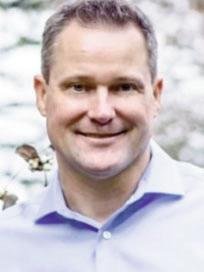
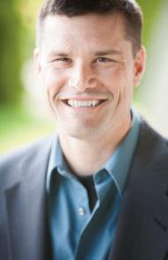
A special thanks to the numerous members of our Steering Committee and Technical Programs Committee, and a thank you to our superb Meeting Manager, Heather Clark.
We can’t wait to see you here in September!
Mike Marshall and Mark Swank, General Co-Chairs
AEG 2023 ANNUAL MEETING 12 AEG 66th Annual Meeting Program with Abstracts September 2023
September 2023
TINA KOTEK GOVERNOR
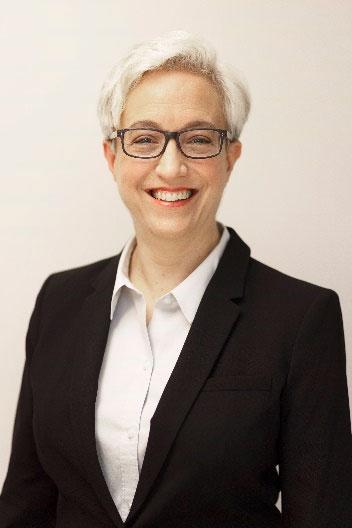
As Governor of the beautiful state of Oregon, I am pleased to welcome you to Portland for the Association of Environmental & Engineering Geologists 66th Annual Meeting.

Oregon has it all – beaches, mountains, valleys, and high desert plateaus. I hope you will have time to take full advantage of the wide range of experiences you will find here. From the snow-capped peak of Mt. Hood to the Pacific Ocean, you will be hard-pressed to leave this state without some very fond and unique memories. And be sure to enjoy the Portland area’s great food and craft beverage scene!
I am certain you will enjoy Portland as the site for your annual meeting. Again, on behalf of all Oregonians, I welcome you.
Sincerely,
 Governor Tina Kotek

AEG 2023 ANNUAL MEETING September 2023 AEG 66th Annual Meeting Program with Abstracts 13
254 STATE CAPITOL, SALEM OR 97301 4047 (503) 378 3111 FAX (503) 378 8970 WWW.GOVERNOR.OREGON.GOV



AEG 2023 ANNUAL MEETING 14 AEG 66th Annual Meeting Program with Abstracts September 2023
June 1, 2023

Dear AEG Members,
Welcome to Portland, the City of Roses.

the Association of Environmental & Engineering Geologists chose our city for your 2023 Annual Meeting.
From September 19 th to 24th, your conference will be held at the Portland Marriott Downtown Waterfront. Our city center will offer you much in terms of nationally recognized dining, entertainment, and shopping.
I hope you find time to explore our diverse and vibrant city, as each neighborhood has its own special character and should be visited.
Our city boasts many natural wonders, from the 5,200 acres of Forest Park, one of the largest urban forests in the nation, to the wonderful views from Mount Tabor Park. spaces are world-renowned and offer endless opportunities for exploration.
Portland truly has something for everyone.
Thank you for visiting our city, we hope you find time to visit again.
Best,
Mayor Ted Wheeler

AEG 2023 ANNUAL MEETING September 2023 AEG 66th Annual Meeting Program with Abstracts 15
1221 SW Fourth Avenue, Suite 340 Portland, Oregon 97204 MayorWheeler@PortlandOregon.gov
Office of Mayor Ted Wheeler City of Portland
AEG 2023 Awardees
The recipents will be accepting their awards at the Awards Ceremony on Thursday, September 21 from 7:00–10:00pm
Honorary Member
William McCormick
AEG confers an honor of such high esteem that the distinction is recognized as a membership class: Honorary Member. This recognition is given to those whose careers have exemplified the ideals of AEG.
Karl and Ruth Terzaghi Mentor Award
Paul Santi
Established in 2008, it recognizes outstanding individuals for their achievements as mentors throughout their career. The recipient should be an individual who has made lifelong efforts in providing professional, ethical, and technical mentoring for environmental and engineering geologists.
Schuster Medal
(Awarded at the CGS meeting)
Dr. Stephen G. Evans

A joint award from AEG and the Canadian Geotechnical Society that recognizes excellence in geohazards research in North America (NA). Nominees must be residents of NA and meet at least two of the following criteria: professional excellence in geohazards research with relevance to NA, significant contribution to public education regarding geohazards, international recognition for a professional career in geo-hazards, influential geohazards research or development of methods or techniques, or teacher of geohazards students.
Floyd T. Johnston Service Award
Dale Andrews
This award is presented to a member for outstanding active and faithful service to AEG over a minimum period of nine years to coincide with Floyd T. Johnston’s tenure as Executive Director.
Douglas R. Piteau
Outstanding Young Member Award: No Award Given in 2023
This award, established in 1985, is named in honor of Douglas R. Piteau is presented to a Member who is age 35 or under and has excelled in the following areas: Technical Accomplishment, Service to the Association, and Service to the Engineering Geology Profession.
Richard H. Jahns Distinguished Lecturer in Engineering Geology — 2023–24
Cynthia Palomares
A joint committee of AEG and the Engineering Geology Division of the Geological Society of America selects the Jahns Lecturer, who presents an annual series of lectures at academic institutions in order to increase awareness of students about careers in Engineering Geology.

Claire P. Holdredge

No Award Given in 2023
The Association’s highest publication award, the Claire P. Holdredge Award, is presented to an AEG Member who has produced a publication within the past five years that is adjudged to be an outstanding contribution to the Environmental and Engineering Geology Profession.
AEG Corporate Business Meeting & Closing Session
Friday, Sept. 22 – 3:00–5:00pm
This session will highlight AEG’s 2023 accomplishments and upcoming goals and projects for 2024.
We will also be introducing our new Executive Council and honoring AEG Awardees for 2023.
AEG 2023 ANNUAL MEETING 16 AEG 66th Annual Meeting Program with Abstracts September 2023
AEG 2023 Awardees
In addition to honoring outstanding AEG Members, AEG also recognizes the following:
AEG Publication Award
This award was established by the Association in 1968 and is presented to the author(s) of the most outstanding paper published in any AEG publication during the fiscal year. Winning papers can be viewed online at GeoScienceWorld.
Shallow Landslide Erosion Rates on Industrially Managed Timberlands: Key Factors Affecting Historical and Contemporary Rates
Jason S. Woodward, Green Diamond Resource Co.
Environmental & Engineering Geoscience Journal, Volume XXIX, No. 2, pp. 115–131
Environmental & Engineering Geoscience Journal Outstanding Reviewer Award
First presented in 2007, this award is given to an individual who has provided extended service by reviewing numerous manuscripts, including critical evaluations, detailed comments, corrections of grammar and syntax, thoughtful suggestions for changes to improve the quality of the manuscript, and guidance to the editors in making a decision regarding the manuscript.
Paul Santi, Colorado School of Mines
Outstanding Student Professional Paper No Award Given
Outstanding Chapter Award
This award was established by the Board of Directors in 2001 to honor a Chapter of the Association judged to excel in a number of areas including professional activities, communications, membership, and networking.
Winner will be announced at the Annual Meeting.
AEG Outstanding Environmental & Engineering Geologic Project Award
Historic Columbia River Highway and State Trail (Historic US Route 30)
See page 00…
Volunteer Recognition
We recognize those volunteers within AEG that have worked so hard on helping to move AEG forward over the past year or so. These awards will be handed out during the Opening Session on Wednesday morning.
Jennifer Bauer, Appalachian Landslide Consultants, PLLC
NOMINATE a Deserving AEG MEMBER for One of Our 2023 AWARDS
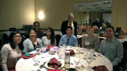
These are just a few of the AEG awards that recognize the contributions our members make to the Association and to the profession. For a complete list of the awards and requirements for each, visit https://www.aegweb.org/awards-scholarships
AEG wants to hear your voice on how we can be more inclusive for all and how that can support you in your work environment. Bring your smartphone/device if you have one, but we’ll find one for you if you don’t. This will be interactive—using Jamboard to capture ideas and spark conservation in real time. If you want to participate, but finances are a barrier, let us know, scholarships are available. See you there!
Buy your tickets at registration!
AEG 2023 ANNUAL MEETING September 2023 AEG 66th Annual Meeting Program with Abstracts 17
Inclusion Luncheon – Share Your Voice! Thursday, September 21, 2023 from 12:00–1:30pm $55/person. Join us for the thought shower/brainstorm/engaging, fun, and filling Inclusion Luncheon!
AEG Foundation 2023 Scholars
The recipients will be honored at the Opening Session on Wednesday, September 20.
Beardsley-Kuper Field Camp Scholarship
Allie Faunce Wilkes University
Susan Steele Weir (Women of “Steele”) Scholarship

Elise Chan Middlebury College
Grant Bradbury
Idaho State University
Kawner Sistrunk
Idaho State University
The Beardsley-Kuper Field Camp Scholarship Fund supports expenses for geology field camps with applied environmental and engineering geology components that will be useful to the students’ future profession as an environmental or engineering geologist. The scholarship was established in 2009 by Cathryne Beardsley with her daughter Dorian Kuper and son-in-law Tom Kuper.
Carolinas Scholarship
Sarah Holloway
UNC-Charlotte
Established in 2015 with a gift from the Carolinas Chapter, this scholarship supports geologic studies by undergraduate students enrolled in a geology or geoscience program at an accredited university in North Carolina or South Carolina.
Marliave Scholarship
No Award Bestowed in 2023
The Marliave Scholarship Fund was established in 1968 to honor the late Chester E. Marliave, Burton H. Marliave, and Elmer C. Marliave, outstanding engineering geologists and supporters of AEG. The funds are distributed as grants, which are intended to support academic activity and reward outstanding scholarship in Engineering Geology and Geological Engineering.
The Susan Steele Weir Scholarship Fund was established by the AEG Foundation in 2017 to create a scholarship fund that promotes and supports the continued development and advancement of women in the profession of engineering geology.



Robert J. Watters Great Basin Chapter Scholarship
Mohsen Takhtravan

University of Nevada, Reno
The Robert J. Watters Great Basin Chapter Scholarship Fund supports geoscience studies by students at the undergraduate and graduate levels.


Martin L. Stout Scholarship
William Hazeltine
University of Wisconsin - Madison
Rio Baran
Princeton University
Toluwaleke
Ajayi

Baylor University
Dr. Martin L. Stout was Professor of Geology at California State University, Los Angeles from 1960 to 1990. He is remembered by his students for his passionate and insightful instruction in engineering geology. Dr. Stout was known for his expertise on landslides, his travels, his good humor, and his gracious manner. This scholarship supports his legacy.
AEG 2023 ANNUAL MEETING 18 AEG 66th Annual Meeting Program with Abstracts September 2023
Christopher C. Mathewson Scholarship


Toluwaleke Ajayi
Baylor University
Established in 2007 as the Texas Section Scholarship, the Scholarship was renamed in 2011 to honor Dr. Christopher C. Mathewson. Recipients of the scholarship are undergraduate or graduate students enrolled in an accredited Texas college or university, or graduate students conducting field studies in Texas.
Shlemon Quaternary Engineering Geology Scholarship
Molly McCreary
University of Utah
Gonzalo Ronda

Colorado School of Mines
The Shlemon Quaternary Engineering Geology Scholarship supports graduate geology students conducting Quaternary engineering geology research. Initial funding for the Scholarship was provided by a gift from Roy J. Shlemon, Honorary Member of the AEG.




Diversity Scholarship
Ronikka Hubert Delta State University
West-Gray Scholarship
Elise Chan
Middlebury College
Undergraduate Division
Justin Coley
University of North Carolina at Charlotte
Post-Graduate Division – Masters
Established in 2014 with initial funding provided as a gift from AEG Past Presidents Terry R. West and Richard E. Gray, this fund supports undergraduate and graduate geology students studying in the eastern half of the United States.
Norman R. Tilford Field Study Scholarship

Reid Jansen

University of Miami
Undergraduate Division
Rio Baran
Princeton University
Undergraduate Division
Justin Coley
University of North Carolina at Charlotte
Post-Graduate Division – Masters
Established by the AEG Diversity, Equity, and Inclusion Committee (DEIC) in 2021, this $5,000 scholarship is awarded annually to one student who is a geoscience major in their sophomore, junior, or senior year at an accredited college or university. The successful applicant will have a GPA of 2.9 or better.
The Tilford Scholarships are awarded to both undergraduate and graduate students for the summer field season, and were established in memory of Norman R. Tilford, who was a leader in engineering geology and a professor at Texas A&M University. Norm died in 1997 while flying his small aircraft to meet a student field trip. Norm was dedicated to teaching geology in the field and these scholarships support his legacy.
AEG 2023 ANNUAL MEETING September 2023 AEG 66th Annual Meeting Program with Abstracts 19








AEG 2023 ANNUAL MEETING 20 AEG 66th Annual Meeting Program with Abstracts September 2023
Exhibitors
Our exhibitors offer an excellent platform to interact one-on-one with you and your company. Your active interest and participation during the exhibit hours will help to ensure that vendor support will remain strong during the years to come. Remember, without these exhibitors, the AEG 66th Annual Meeting would not be successful.
Icebreaker Welcome
Tuesday, Sept. 19, 6:30–8:30pm – Exhibit Hall
Join us in the Exhibit Hall to meet the Exhibitors and socialize with your fellow attendees. We will have light appetizers and a cash bar (one drink ticket included for full, guest, and student registrations).
Exhibitor–Hosted Luncheon
Wednesday, Sept. 20 12:00–1:30pm – Exhibit Hall
The Exhibitor-Hosted Luncheon is a great way to connect with colleagues, gather information about innovations in the industry, and relax with friends old and new over a delicious meal. FREE for all full, Wednesday one-day, and student registrations
Association of Environmental & Engineering Geologists (AEG) Booth – Registration Area
Sheri Maskow, manager@aegweb.org
www.aegweb.org
AEG welcomes you to Portland! We hope your stay is filled with informative technical sessions, great meals, and of course lots of networking. Stop by our booth to see some of the latest publications and merchandise available. We will also have information on the various committees and what each has been working on to advance the AEG and the profession.
AEG 2024 Annual Meeting – Philadelphia, PA – Registration Area
Curt Schmidt, schmidtcas.aeg@gmail.com
Niall Henshaw, Niall.Henshaw@parsons.com
Mark your calendar to join us for the 67th AEG Annual Meeting at the Hilton Philadelphia Penn’s Landing, September 10–14, 2024. Stop by our booth to get all the details.
AEG Foundation Booth and Silent Auction –Exhibit Hall Entrance
Alex Vazquez, staff@aegfoundation.org
www.aegfoundation.org
Established by three Past Presidents of the Association of Engineering Geologists (AEG) in 1992, the AEG Foundation plays a key role in the success of our profession. The AEG Foundation’s vision is to create a culture of giving back to the profession,
EXHIBIT HALL HOURS:
Tuesday, Sept. 19 6:30pm–8:30pm
Wednesday, Sept. 20 7:30am–5:00pm
Thursday, Sept. 21 7:30am–3:20pm
and to instill complete confidence in donors that their money is well-invested and well-spent. Our core programs emphasize scholarship, research, and professional development to improve professional practice. We support outreach to increase the public’s appreciation of environmental and engineering geology in geo-hazard evaluation and risk reduction.
California Department of Water Resources –Booth #27
Nicholas Hightower, Nicholas.Hightower@water.ca.gov water.ca.gov
DWR manages California’s water resources, systems, and infrastructure, including the State Water Project (SWP), in a responsible, sustainable way.
CASCADE Drilling L.P. – Booth #10
Pete Larsen, PLarsen@cascade-env.com
www.cascade-env.com
CASCADE is the leading provider of environmental and infrastructure drilling, site characterization, and environmental remediation applications. We are the only nationwide integrated field services firm with expert technical capabilities and fleet to provide seamless environmental and geotechnical solutions, from concept to completion.
Collier Geophysics, LLC. - Booth #25
Roy Bowling, roy@colliergeophysics.com
www.colliergeophysics.com
Collier Geophysics (Collier) is a world-class provider of nearsurface geophysics. Collier supports many industries across the nation with subsurface characterization for both federal and commercial clients. Collier has numerous geophysical leaders with a depth of experience in each of the industries that we support.
ConeTec, Inc. – Booth #29
Bruce Miller, bmiller@conetec.com
www.conetec.com
In Situ Testing contractor specializing in CPTu, SCPTu, HPT, UVOST, MIP, DMT, PMT, and other surface and in situ testing methods for geotechnical, environmental and marine site characterization.
AEG 2023 ANNUAL MEETING September 2023 AEG 66th Annual Meeting Program with Abstracts 21
Delve Underground – Booth #14
James Struthers, struthers@delveunderground.com
www.delveunderground.com
Delve Underground is a leader in heavy civil engineering, serving the transportation, water, wastewater, and energy industries. We offer comprehensive design, construction management, and dispute resolution capabilities. Our expertise includes civil, structural, and geotechnical engineering. Founded in 1954, as Jacobs Associates, Delve Underground is an employee-owned firm with 22 offices and 350 team members throughout the United States, Canada, Australia, and New Zealand.
DiGioia Gray – Booth #15
Nate Saraceno, nsaraceno@digioiagray.com
724-498-0984
www.digioiagray.com
DiGioia Gray & Associates engineers and designs solutions for your most challenging projects! Our experienced geotechnical engineers and geologists are your trusted partners for geology, hydrogeology, soil and rock mechanics, landslides, and geohazard services include risk assessments, karst, mine subsidence, and more!
EMSL Analytical, Inc. – Booth #24
Chris Nardozzi, cnardozzi@emsl.com
www.EMSL.com
EMSL Analytical, Inc. is one of the leading testing laboratories with over fifty locations throughout the United States and Canada. EMSL is a nationally recognized and locally focused provider specializing in fast laboratory results. Additionally, EMSL maintains an extensive list of accreditations from leading organizations, as well as state and federal regulating bodies.
Exponent – Booth #3
Julien Cohen-Waeber, jwaeber@exponent.com
www.exponent.com
Exponent is a leading engineering and scientific consulting firm comprised of scientists, engineers, physicians, and regulatory consultants from over ninety disciplines. Our technical excellence, objectivity, and disciplinary diversity allow us to solve some of the toughest science, engineering, and business problems in industry and government—from forensic analysis to risk assessment. We use our expertise to contribute safe, healthy, and sustainable solutions in the most complex environments.
Field Environmental Instruments, Inc. –Booth #16
Kelsey Waltman, kwaltman@fieldenvironmental.com
www.fieldenvironmental.com
Started in 1996, Field Environmental Instruments (FEI) is an employee-owned and operated business headquartered in Pittsburgh, Pennsylvania. FEI offers an extensive inventory of environmental instrumentation and monitoring equipment, supplies, and unmatched service to help its customers. The company’s operating partners have a combined fifty-plus years of environmental and customer service experience and understand firsthand what it takes to help their customers be successful.
Gannett Fleming – Booth #19
Matt Morris, mmorris@gfnet.com
www.gannettfleming.com
Geological services are a cornerstone of Gannett Fleming. From dams and groundwater resources to building sites and transportation corridors, we perform exploration, analysis, and design related to soil, rock, and groundwater. Whatever the terrain, our experienced team provides stabilization and protection systems that minimize risk, and we leverage cutting-edge technology, ingenuity, and award-winning solutions to achieve your project goals.
Geobrugg North America, LLC – Booth # 5
Tim Shevlin, tim.shevlin@geobrugg.com
www.geobrugg.com
Innovative solutions that provide comprehensive protection from natural hazards. We’re the right, highly sustainable, and economical choice for every situation. Along with easy installation, we offer total support during installation and beyond. Geobrugg, where safety is our nature.
GEOKON – Booth #28
Nolan Seles, sdedker@geokon.com
www.geokon.com
GEOKON, a 100 percent employee-owned company located in Lebanon, New Hampshire, is a leading manufacturer of geotechnical sensors and instrumentation used for a wide range of industries including tunnels, dams, mines, piles, bridges, pipelines, landfills, embankments, transportation, and wind turbines.
Geovert – Booth #4
Steve Farrand, janice.wycoff@geovert.com
www.geovert.com
Geovert is a specialist construction contractor specializing in difficult-access slope stabilization and rockfall solutions. As a global leader, Geovert offers a wide range of services that address complex geotechnical challenges in various industries.
AEG 2023 ANNUAL MEETING 22 AEG 66th Annual Meeting Program with Abstracts September 2023
Global Rope Access - Booth #21
Josh Wagner, Josh.Wagner@globalropeaccess.com www.globalropeaccess.com
Global Rope Access (GRA) performs work at heights utilizing modern rope access techniques and tools to position our workforces on complex construction projects and hard-to-reach worksites. GRA’s Geohazard Mitigation division is experienced in scaling and the installation of anchors (bolts, dowels, cable anchors, soil nails), mesh systems (draped, pinned, attenuated), and barriers (rockfall and debris flow). Headquartered in Redmond, Oregon, GRA can deploy highly specialized and SPRAT-certified crews to projects throughout the Western United States.
Holt Services, Inc. – Booth #9
Stephen Rasmussen, srasmussen@holtservicesinc.com www.holtservicesinc.com
Bring on your drilling projects. We are your environmental, geotechnical and clean water drilling professionals. From simple one day projects to complex, multi-faceted extended drilling programs, you can count on your team at Holt Services, Inc. to do what it takes to complete your drilling project on schedule, to your specifications, and with your total satisfaction. With three different office locations in Edgewood and Vancouver, Washington, and Caldwell, Idaho, we’ve got most of the western United States covered.
Jensen Drilling – Booth #8
John Starcevich, johns@jensendrilling.com www.jensendrilling.com
Jensen Drilling Company (JDC) is the premier horizontal drain contractor for landslide stabilization/mitigation, and open pitmine stability and groundwater control. We have extensive experience in municipal water well construction and have established ourselves as the “go-to” contractor for difficult-access drilling, ground and rock anchors, micropiles, earth retention, and construction dewatering systems. Our technical capabilities include air and mud rotary drilling, air-assisted reverse and flooded-reverse circulation drilling, sonic coring, wireline drilling and rock coring. Although we are founded and based in Eugene, Oregon, we work across the United States (including Alaska and Hawaii) and around the world.
Johnson Screens – Booth #26
Andre Fiedler, Andre.Fiedler@johnsonscreens.com
www.johnsonscreens.com
Manufacturer of a complete line of Vee-Wire stainless steel and PVC well screens, slotted PVC screens, PVC drop pipe, casings, and accessories. Other offerings include Shur-A-Lock and Shur-Grip Spline, pre-packed Muni-Pak screens, NuWell well development and rehabilitation chemicals, and Shur-Pack glass beads. Publisher of Groundwater and Wells, 3rd edition.
Lettis Consultants International, Inc.
Booth #20
Melody Wade, wade@lettisci.com
www.lettisci.com
Lettis Consultants International, Inc. (LCI) offers high-technology, innovative Earth science consulting services to clients around the world. LCI geologists, seismologists, and engineers have comprehensive worldwide experience providing earthquake hazard analyses, engineering geology and geotechnical services, water resources expertise, and licensing and regulatory strategy and compliance.
Maccaferri – Booth #18
Michael Koutsourais, m.koutsourais@maccaferri.com
www.maccaferri.com
Maccaferri’s extensive engineering capabilities and range of products help clients overcome challenges associated with geohazards, landslides, and other natural disasters. Maccaferri, known for its Double-Twist Wire Mesh Gabions, has developmental product lines for rockfall mitigation, retaining wall and soil reinforcement, natural disaster response, and other critical infrastructure needs. We are global engineers with 140 years’ experience, providing local solutions for complex projects around the world.
National Drilling Association – Booth #11
Sheri Maskow, sheri@jmbsohio.com
www.nda4u.com
The National Drilling Association is a nonprofit trade association of contractors, manufacturers, and affiliated members from the drilling industry representing the geotechnical, environmental, and mineral exploration sectors of this industry. The NDA mission is to promote the use of professional drilling contractors and their methods. Founded in 1972, NDA has more than 200 member companies, some of which are international.
Pali Consulting, Inc. – Booth #17
Tim Blackwood, tim@pali-consulting.com
www.pali-consulting.com
Pali Consulting provides geotechnical services in the Pacific Northwest and the Hawaiian Islands. Our services include geologic hazard assessments, landslide and rockfall mitigation, geotechnical data and design reports, foundation and slope stabilization, forest practices geotechnical assessments, mse, boulder and gravity retaining wall design, foundation design and stabilization, and geotechnical forensics.
AEG 2023 ANNUAL MEETING September 2023 AEG 66th Annual Meeting Program with Abstracts 23
–
PLI Systems – Booth #23
Peter Karp, peter@plisystems.com
www.plisystems.com
Since 1989, PLI Systems has led the industry in soil and foundation stabilization, coring, drilling, pile driving and much more using the very latest in cutting edge technology.
Pyramid Geophysics – Booth #12
Eric Cross, eric@pyramidenvironmental.com
www.PyramidGeophysics.com
Pyramid Geophysical Services offers a full line of geophysical capabilities to North Carolina and across the United States. We have experience in a wide variety of geographical areas and projects, including hazardous waste sites, underground storage tanks, landfills, groundwater studies, and geotechnical investigations. We design geophysical surveys that meet the client’s needs in the most efficient and cost-effective manner possible.
Rocscience Inc. – Booth #13
Robert Bradford, robert.bradford@rocscience.com
www.rocscience.com
Since 1996, Rocscience has envisioned and built world-class solutions for civil, mining, and geotechnical engineers. We have created a solid foundation of software development that brings research and innovation together, building a suite of eighteen tools capable of handling your most challenging rock and soil problems. Our mission is to continue developing geotechnical software solutions that work for you today and evolve with your needs tomorrow.
Schnabel Engineering – Booth #22
Hawkins Gagnon, jgagnon@schnabel-eng.com
336-274-9456
www.schnabel-eng.com
Schnabel is a leading provider of dam, tunnel and geotechnical engineering solutions nationally and abroad, with risk management rounding out a full-service approach. Our 450+ employee/owners in 23 locations have a passion for client service and tough technical challenges.
Scintrex Ltd. – Booth# 7
Bill Male, bmale@scintrexltd.com
905-669-2280, X 343
www.scintrexltd.com
Scintrex, the gravity specialist. Our CG-6 Autograv™ Gravity Meter is an effective instrument to help identify karst hazards or subsurface anomalies. Our gPhone-X Monitoring Gravity Meter can track changes in the volume of ground water.
Shannon & Wilson, Inc. – Booth #2
Cody Sorensen, cody.sorensen@shanwil.com
www.shannonwilson.com
Shannon & Wilson is an employee-owned consulting firm committed to technical excellence and high-quality service. Our dynamic team provides integrated geotechnical engineering, engineering geology, environmental, and natural resource services for clients worldwide. Since 1954, we have delivered comprehensive engineering and environmental solutions for the most challenging infrastructure planning, design, permitting, and construction conditions.
University of Pennsylvania – Masters in Applied Geoscience Online – Booth #1
Tony Sauder, sauder@sas.upenn.edu
www.lps.upenn.edu/degree-programs/msgo
Advance your career and make an impact in environmental geology, hydrogeology, and engineering geology with an online master’s degree. Whether you are an experienced geoscientist or preparing to expand your science or engineering experience, you can advance in the field without relocating or interrupting your career. Penn’s rigorous Master of Science in Applied Geosciences program is now online.
Washington Geological Survey – Booth #6
Kate Mickelson, kate.mickelson@dnr.wa.gov
www.dnr.wa.gov/geology
The Washington Geological Survey is a team of more than fifty people who combine diverse backgrounds, perspectives, and skills to produce and publish geologic information about Washington for the benefit of everyone in our state. Our team includes geologic mappers, geophysicists, tsunami scientists, landslide geologists, geothermal scientists, carbon sequestration geologists, mine inspectors, mine reclamation geologists, hydrogeologists, editors, GIS and data specialists, cartographers, lidar specialists, web developers, administrative staff, and program managers.
University of Washington – Booth #30
Kathy Troost, ktroost@uw.edu
ess.uw.edu
ESS offers outstanding disciplinary and interdisciplinary education at both the undergraduate and graduate levels. The department’s scope extends from the center of Earth to the rim of the solar system, and its activities cut across traditional disciplines of physics, chemistry, biology, geology, and mathematics. Our faculty, students, and staff examine Earth’s interior structure, chemistry, motion, and dynamics; geologic hazards; processes affecting the surface environment; the surrounding space environment; planetary processes; and geobiology. We provide a foundation for interdisciplinary teaching and research that is based on the geologic record, and on rigorous observation and modeling of Earth’s present state.
AEG 2023 ANNUAL MEETING 24 AEG 66th Annual Meeting Program with Abstracts September 2023
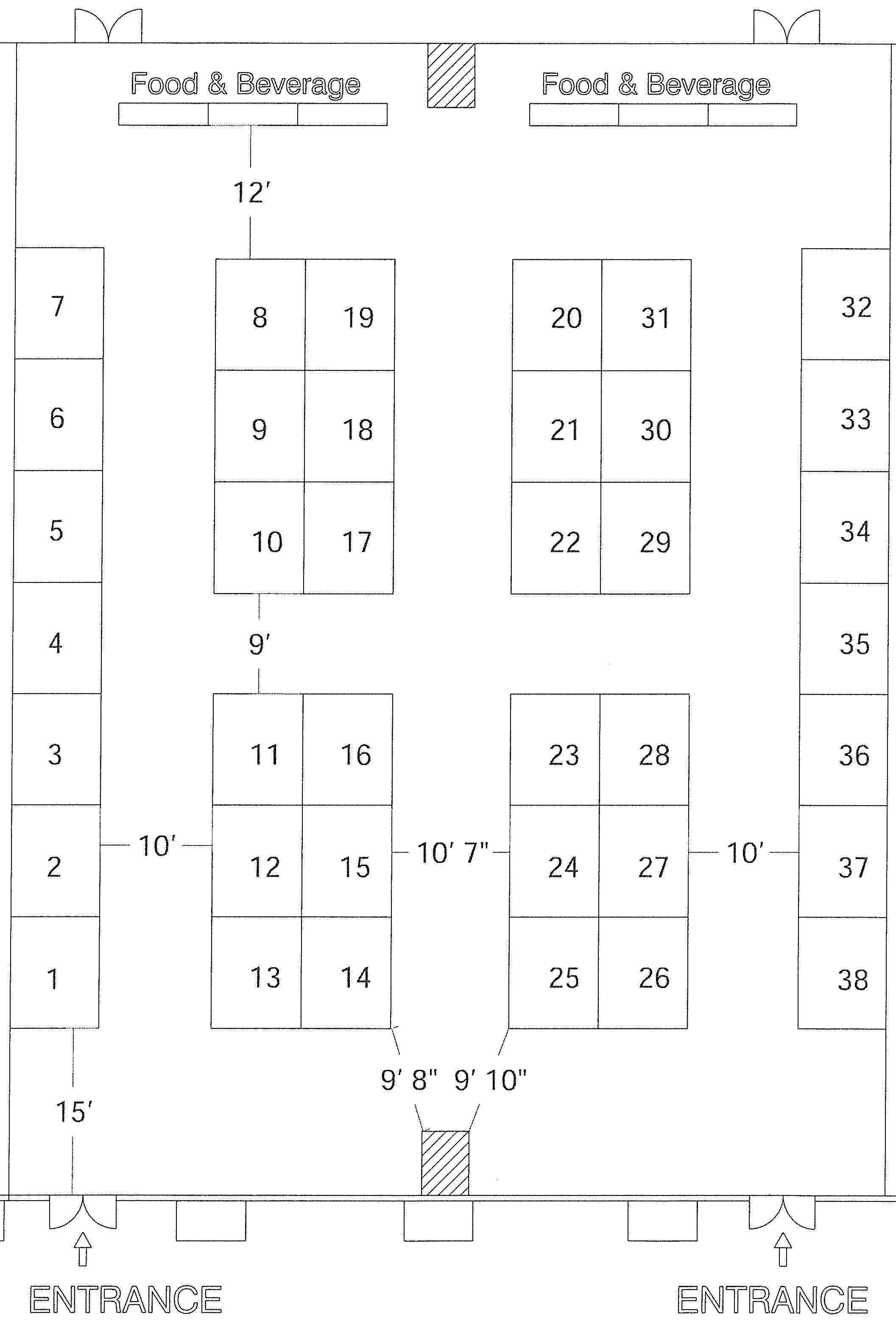














AEG 2023 ANNUAL MEETING September 2023 AEG 66th Annual Meeting Program with Abstracts 25 AE 7 6 9 8 Ha Exhibit 2023 EG ll 25 24 20 21 6 7 16 17 12 13 5 4 27 26 3 2 10 Tables Cocktail 14 18 22 29 28 1 11 1519 23 30 Station Water SilentAuction
F & E
AEG
Foundation
Salon
Exhibit Hall

AEG 2023 ANNUAL MEETING Index to Advertisers Advertiser Page AEG 2024 Annual Meeting Inside Front Cover AEG 2025 Annual Meeting Inside Front Cover AEG Corporate Sponsors 32 AEG E&EG Journal 125 AEG Foundation Silent Auction 36 DiGioia Gray EMSL Analytical, Inc. 64 Exponent 64 Gannet Flemming 9 GASH Symposium 111 Geobrugg 50 Geophysical Techniques & Investigations Relevant to Dams and Levees Symposium 20 Global Rope Access 26 Lettis 124 Maccaferri 50 Pali Consulting 50 Advertiser Page Portland Harbor Superfund Site Symposium 55 Schnabel 36 Scintrex 20 University of Pennsylvania Back Cover Icebreaker Welcome Tuesday, September 19 6:30–8:30pm – Exhibit Hall Join us to meet the exhibitors and socialize with your fellow attendees. We will have light appetizers and a cash bar. One drink ticket included for full, guest, and student registrations 26 AEG 66th Annual Meeting Program with Abstracts September 2023
Sponsors
Without the help and financial support of the following individuals and companies, it would be impossible to plan the quality meeting to which AEG members have become accustomed.
PREMIUM SPONSORS
Opening Session
Gannett Fleming
Matt Morris, mmorris@gfnet.com
www.gannettfleming.com
Geological services are a cornerstone of Gannett Fleming. From dams and groundwater resources to building sites and transportation corridors, we perform exploration, analysis, and design related to soil, rock, and groundwater. Whatever the terrain, our experienced team provides stabilization and protection systems that minimize risk, and we leverage cutting-edge technology, ingenuity, and award-winning solutions to achieve your project goals.
Giveaway
Scintrex Ltd.
Bill Male, bmale@scintrexltd.com
905-669-2280, X 343
www.scintrexltd.com
Scintrex, the gravity specialist. Our CG-6 Autograv™ Gravity Meter is an effective instrument to help identify karst hazards or subsurface anomalies. Our gPhone-X Monitoring Gravity Meter can track changes in the volume of ground water.
Lanyard
Global Rope Access
Josh Wagner, Josh.Wagner@globalropeaccess.com
www.globalropeaccess.com
Global Rope Access (GRA) performs work at heights utilizing modern rope access techniques and tools to position our workforces on complex construction projects and hard-to-reach worksites. GRA’s Geohazard Mitigation division is experienced in scaling and the installation of anchors (bolts, dowels, cable anchors, soil nails), mesh systems (draped, pinned, attenuated), and barriers (rockfall and debris flow). Headquartered in Redmond, Oregon, GRA can deploy highly specialized and SPRAT certified crews to projects throughout the Western US.
GOLD SPONSORS
Icebreaker
Pali Consulting, Inc.
Tim Blackwood, tim@pali-consulting.com
www.pali-consulting.com
Pali Consulting provides geotechnical services in the Pacific Northwest and the Hawaiian Islands. Our services include geologic hazard assessments, landslide and rockfall mitigation, geotechnical data and design reports, foundation and slope stabilization, forest practices geotechnical assessments, mse, boulder and gravity retaining wall design, foundation design and stabilization, and geotechnical forensics.
Exhibitor Lunch Exponent
Julien Cohen-Waeber, jwaeber@exponent.com
www.exponent.com
Exponent is a leading engineering and scientific consulting firm comprised of scientists, engineers, physicians, and regulatory consultants from over ninety disciplines. Our technical excellence, objectivity, and disciplinary diversity allow us to solve some of the toughest science, engineering, and business problems in industry and government—from forensic analysis to risk assessment. We use our expertise to contribute safe, healthy, and sustainable solutions in the most complex environments.
SILVER SPONSORS
AEG Corporate Business Meeting & Closing Reception
DiGioia Gray
Nate Saraceno, nsaraceno@digioiagray.com
724-498-0984
www.digioiagray.com
DiGioia Gray & Associates engineers and designs solutions for your most challenging projects! Our experienced geotechnical engineers and geologists are your trusted partners for geology, hydrogeology, soil and rock mechanics, landslides, and geohazard services include risk assessments, karst, mine subsidence, and more!
AEG 2023 ANNUAL MEETING September 2023 AEG 66th Annual Meeting Program with Abstracts 27
Poster Reception
EMSL Analytical, Inc.
Chris Nardozzi, cnardozzi@emsl.com
www.EMSL.com
EMSL Analytical, Inc., is one of the leading testing laboratories with over fifty locations throughout the United States and Canada. EMSL is a nationally recognized and locally focused provider specializing in fast laboratory results. Additionally, EMSL maintains an extensive list of accreditations from leading organizations, as well as state and federal regulating bodies.
Special Event
Lettis Consultants International, Inc.
Melody Wade, wade@lettisci.com
www.lettisci.com
Lettis Consultants International, Inc. (LCI) offers high-technology, innovative Earth science consulting services to clients around the world. LCI geologists, seismologists, and engineers have comprehensive worldwide experience providing earthquake hazard analyses, engineering geology and geotechnical services, water resources expertise, and licensing and regulatory strategy and compliance.
Annual Banquet
PLI Systems
Peter Karp, peter@plisystems.com
www.plisystems.com
Since 1989, PLI Systems has led the industry in soil and foundation stabilization, coring, drilling, pile driving and much more using the very latest in cutting edge technology.
Student/Professional Networking Session
Schnabel Engineering
Hawkins Gagnon, jgagnon@schnabel-eng.com
336-274-9456
www.schnabel-eng.com
Schnabel is a leading provider of dam, tunnel, and geotechnical engineering solutions nationally and abroad, with risk management rounding out a full-service approach. Our 450+ employee/owners in 23 locations have a passion for client service and tough technical challenges.
Speaker/Moderator Breakfast
PBS USA
Nicole
Hergert, Nicole.Hergert@pbsusa.com
pbsusa.com
PBS Engineering and Environmental Inc. has an excellent reputation with developers, businesses, government agencies, and lenders—equipping us to simplify the most challenging environmental and engineering projects. Our clients value our rapid response, experience with regulatory processes, and our professional technical team. At each of our regional offices, clients will find experienced environmental and geotechnical staff with a unique understanding of local geologic conditions, hydrogeology, familiarity with local resources, and the ability to work hand-in-hand with lenders, developers, regulatory agencies, and expert resources throughout the company. As part of your project, we will work closely with your team to deliver the highest levels of technical expertise, matched only by our enthusiasm and desire to create viable, long-term geotechnical solutions.
All Day Coffees
Tuesday All Day Coffee and Student Mini Grant
AEG Oregon Chapter
aegoregon.org
The mission of AEG Oregon Chapter is to provide leadership in the development and application of geologic principles and knowledge to serve engineering, environmental, and public needs.
Wednesday
Aspect Consulting
Mark Swank, mswank@aspectconsulting.com
www.aspectconsulting.com
Aspect Consulting’s engineering and environmental geologists and geotechnical engineers are strategic advisors serving a range of projects for public and private clients and owners. They couple strong expertise in investigations dynamic subsurface conditions, with a focus on risk management to deliver solutions in environmental and engineering services for water, energy, mining, transportation, coastal and waterfront, and commercial and industrial development markets.
AEG 2023 ANNUAL MEETING 28 AEG 66th Annual Meeting Program with Abstracts September 2023
Thursday
AEG Sacramento Chapter
aegsacto.wordpress.com
The Sacramento Chapter of AEG was the original and founding section of AEG in 1957 and proudly supports the 2023 AEG Annual Meeting and the many dedicated members of AEG across the nation.
Student Mini-Grant GeologistWriter
D. J. Green, deb@geologistwriter.com
www.geologistwriter.com
Geologists study the earth and the processes that shape it. Writers study the human heart and the processes that shape it. The GeologistWriter builds a bridge between the two. And coming in April 2024, available for pre-order now at https://www.bkwrks.com/book/9781647426163 is No More Empty Spaces. How many novels have you read with an engineering geologist hero? Will Ross has signed on to work on a troubled dam in a remote, rugged part of Turkey. Once there, he struggles for control—of his family, his work, the landscape, and ultimately, himself. and
Weyerhaeuser Company
Jason Hinkle, jason.hinkle@weyerhaeuser.com
www.weyerhaeuser.com
For more than a century, Weyerhaeuser has been growing trees and manufacturing wood products that are essential to everyday life. Founded in 1900 and headquartered in Seattle, Washington, we are one of the largest private owners of timberlands in the world, and also one of the largest wood products manufacturers in North America, and we manage every step of our operations on a fully sustainable basis to ensure that our forests—and all the benefits they provide—last forever.
Inclusion Luncheon Steele and Associates, LLC
Susan Steele Weir, steeleweir@aol.com
303-333-6071
Steele and Associates, LLC, is a small woman-owned engineering geologic consulting firm providing peer review of dam and tunnel construction projects and consultation on slope stabilization projects.
Field Courses
#1 – Landslides and Engineering Geology in the Columbia River Gorge, and Student Mini Grant Weyerhaeuser Company
Jason Hinkle, jason.hinkle@weyerhaeuser.com
www.weyerhaeuser.com
For more than a century, Weyerhaeuser has been growing trees and manufacturing wood products that are essential to everyday life. Founded in 1900 and headquartered in Seattle, Washington, we are one of the largest private owners of timberlands in the world, and also one of the largest wood products manufacturers in North America, and we manage every step of our operations on a fully sustainable basis to ensure that our forests—and all the benefits they provide—last forever.
#2 – Living with Giant Landslides in Portland, Oregon Cornforth Consultants, Inc.
Charles Hammond, charlie.hammond@ccilt.com
www.ccilt.com
Cornforth Consultants, Inc., and its division Landslide Technology, is a geotechnical firm currently celebrating its fortieth year in operation. CCI/LT specializes in dam and levee safety, landslide investigation and stabilization, rock slope engineering and rock mechanics, emergency response, and earthquake engineering. With talented staff located in Portland, Oregon; Olympia, Washington; and Boise, Idaho, CCI/LT works on exciting projects located throughout the Pacific NW, Mountain States, and Alaska.
Technical Sessions
#1 – Symposium Diversity, Equity, and Inclusion (DEI) – Doing the Work Weyerhaeuser Company
Jason Hinkle, jason.hinkle@weyerhaeuser.com
www.weyerhaeuser.com
For more than a century, Weyerhaeuser has been growing trees and manufacturing wood products that are essential to everyday life. Founded in 1900 and headquartered in Seattle, Washington, we are one of the largest private owners of timberlands in the world, and also one of the largest wood products manufacturers in North America, and we manage every step of our operations on a fully sustainable basis to ensure that our forests—and all the benefits they provide—last forever.
AEG 2023 ANNUAL MEETING September 2023 AEG 66th Annual Meeting Program with Abstracts 29
#2 – Tunneling Aldea Services, Inc.
Paul Headland, pheadland@aldeaservices.com
www.aldeaservices.com
Aldea specializes in the design and construction of underground structures and has worked on some of the most challenging and important underground infrastructure projects in North America. Aldea’s vast experience in managing large tunneling and heavy civil engineering projects enables us to provide unrivaled support to our clients and confidence in our work. Our work spans throughout the United States and also extends around the world. We are equipped with the best minds in the industry providing leadership and direction in all facets of heavy civil engineering project management.
and Brierley Associates
Ike Isaacson, iisaacson@brierleyassociates.com www.brierleyassociates.com
“Creating Space Underground” is our mission and our passion. Our tunnel, trenchless, and geostructural practice combines our knowledge of subsurface conditions, ground behavior, and site constraints with a keen understanding of the risks in underground construction. Constructability, efficiency, and practicality are central to every project we undertake. Our staff’s real-world experience helping our contractor clients solve the challenges of underground construction informs our design solutions for project owners.
#4 – Geomorphology PanGEO
Stephen Evans, sevans@pangeoinc.com 206-262-0370
www.pangeoinc.com
PanGEO is a full-service geotechnical consulting firm based in Seattle, Washington. We provide geotechnical studies for infrastructure on public and private projects, including bridges, highrise buildings, seismic retrofit, and landslide stabilization efforts.
#5 and #9 – Collecting Geologic Data for Assessment of Potential Hazards Using Multiple Surface and Subsurface Methods Symposium, Part I and Part II
Aspect Consulting
Mark Swank, mswank@aspectconsulting.com
www.aspectconsulting.com
Aspect Consulting’s engineering and environmental geologists and geotechnical engineers are strategic advisors serving a range of projects for public and private clients and owners. They couple strong expertise in investigations dynamic subsurface conditions, with a focus on risk management to deliver
solutions in environmental and engineering services for water, energy, mining, transportation, coastal and waterfront, and commercial and industrial development markets.
#6 – Environmental Symposium – Portland
Superfund Site
Bryan Environmental Consultants, Inc.
Patricia Bryan, pbryan@bryanenv.com
www.bryanenv.com
Industry Expertise. Rapid Response. Woman Owned. Founded in 2014, Bryan Environmental Consultants, Inc., provides full-service environmental consulting services to private clients and municipalities. With its deep industry and technical expertise, Bryan Environmental Consultants provides quality, cost-effective environmental consulting services. We help advance your project with focused field investigations that keep your objectives in mind, clearly written reports that identify relevant environmental issues, expert regulatory advice and strategies, sensible recommendations, and realistic cost estimates.
#7 – Dams and Levees Part I Symposium
RJH Consultants, Inc.
Kevin Mininger, kmininger@rjh-consultants.com
www.rjh-consultants.com
RJH Consultants, Inc. (RJH) is a geotechnical and water resources firm specializing in evaluation, civil design, and construction engineering for raw water supply systems; dams, reservoirs, and appurtenant facilities; and water conveyance infrastructure. RJH projects range from small geotechnical explorations to large embankment dam design and construction. RJH manages projects with overall costs ranging from several thousand dollars to more than $200 million.
#8 – Post-Fire Debris Flow Symposium and #13 – Landslides
Geosyntec Consultants
Jared Warner, PG, CEG, CPG, jwarner@geosyntec.com
www.geosyntec.com
Since 1983, Geosyntec has served municipalities and government agencies providing services in water resources, civil engineering and design, environmental consulting, geotechnical engineering, and construction management. Geosyntec provides specialized geotechnical and geological services for public and private sector clients nationwide. We are a practicecentered business with a strong desire for continuous selfimprovement and ongoing reinvention to meet the evolving needs of our current clients and to productively engage with new ones.
AEG 2023 ANNUAL MEETING 30 AEG 66th Annual Meeting Program with Abstracts September 2023
#14 and #20 – Land Subsidence Symposium Part I and Part II
Brierley Associates
David Hibbard,dhibbard@brierleyassociates.com
www.brierleyassociates.com
“Creating Space Underground” is our mission and our passion. Our tunnel, trenchless, and geostructural practice combines our knowledge of subsurface conditions, ground behavior, and site constraints with a keen understanding of the risks in underground construction. Constructability, efficiency, and practicality are central to every project we undertake. Our staff’s real-world experience helping our contractor clients solve the challenges of underground construction informs our design solutions for project owners.
#16 – Earthquakes and other Natural Hazards
GRI
Christina Villeneuve, cvilleneuve@gri.com www.gri.com
Geotechnical, Geologic, & Pavement Firm
Technical Session Breaks
Wednesday and Thursday Morning
AEG
Carolinas Chapter
www.aegcarolinas.org
We serve the environmental and engineering geology profession for the Carolinas.
Young at Heart Student/Young Professional Event
Aspect Consulting
Mark Swank, mswank@aspectconsulting.com
www.aspectconsulting.com
Aspect Consulting’s engineering and environmental geologists and geotechnical engineers are strategic advisors serving a range of projects for public and private clients and owners. They couple strong expertise in investigations dynamic subsurface conditions, with a focus on risk management to deliver solutions in environmental and engineering services for water, energy, mining, transportation, coastal and waterfront, and commercial and industrial development markets.
and AEG Oregon Chapter
aegoregon.org
The mission of AEG Oregon Chapter is to provide leadership in the development and application of geologic principles and knowledge to serve engineering, environmental, and public needs. and
Weyerhaeuser Company
Jason Hinkle, jason.hinkle@weyerhaeuser.com
www.weyerhaeuser.com
For more than a century, Weyerhaeuser has been growing trees and manufacturing wood products that are essential to everyday life. Founded in 1900 and headquartered in Seattle, Washington, we are one of the largest private owners of timberlands in the world, and also one of the largest wood products manufacturers in North America, and we manage every step of our operations on a fully sustainable basis to ensure that our forests—and all the benefits they provide—last forever. and
AEG Foundation
Alex Vazquez, staff@aegfoundation.org
www.aegfoundation.org
Established by three Past Presidents of the Association of Engineering Geologists (AEG) in 1992, the AEG Foundation plays a key role in the success of our profession. The AEG Foundation’s vision is to create a culture of giving back to the profession, and to instill complete confidence in donors that their money is well-invested and well-spent. Our core programs emphasize scholarship, research, and professional development to improve professional practice. We support outreach to increase the public’s appreciation of environmental and engineering geology in geo-hazard evaluation and risk reduction.
and
University of Pennsylvania –Masters in Applied Geoscience Online
Tony Sauder, sauder@sas.upenn.edu
www.lps.upenn.edu/degree-programs/msgo
Advance your career and make an impact in environmental geology, hydrogeology, and engineering geology with an online master’s degree. Whether you are an experienced geoscientist or preparing to expand your science or engineering experience, you can advance in the field without relocating or interrupting your career. Penn’s rigorous Master of Science in Applied Geosciences program is now online.
and Rick Kolb
rick.kolb1@gmail.com
and Morley Beckman
morley.beckman@gmail.com
AEG 2023 ANNUAL MEETING September 2023 AEG 66th Annual Meeting Program with Abstracts 31
2022–23Corporate Sponsors
DENALI
Geobrugg
Tim Shevlin
Tim.Shevlin@geobrugg.com
(503) 423-7258
www.geobrugg.com

Maccaferri North America
Mike Koutsourais
10303 Governor Lane Blvd Williamsport, MD 21795 301.641.8072
www.maccaferri.com/us

m.koutsourais@maccaferri.com
Scintrex
Bill Male
bmale@scintrexltd.com
(905) 669-2280 ext 343
https://scintrexltd.com
University of Pennsylvania
lps@sas.upenn.edu
(215) 898-7326
https://www.lps.upenn.edu/hs/msgo
Glacier Peak
BGC Engineering Inc.
Tony Monasterio tmonasterio@bcgengineering.ca

208-559-6050
www.bcgengineering.ca
Bryan Environmental Consultants


Patricia Bryan pbryan@bryanenv.com http://www.bryanenv.com
DiGioia Gray

Nate Saraceno nsaraceno@digioiagray.com
(724) 498-0984
www.digioiagray.com
GeoStabilization International

Dru Miller dru.miller@gsi.us www.geostabilization.com
Kilauea
Earth Consultants International Eldon Gath gath@earthconsultants.com
{714) 412-2653
www.earthconsultants.com
ADD YOUR COMPANY TO THIS LIST OF SUPPORTERS
An investment in AEG is an investment in the future of engineering and environmental geology. For information on sponsorship opportunities: https://aegweb.org/corporate-sponsors-and-advertising
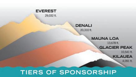
Connect with over 2,000 members online, in-person, and through AEG’s publications. This is the best way to support the profession while growing visibility for your business.
Base Benefits Include:
■ Logo with website link on AEG’s homepage
■ Listing in four issues of AEG News and the Annual Meeting Program with Abstracts
■ Recognition at the AEG Annual Meeting
Other Benefits by Level:
■ Social Media Shout-Outs
■ Sponsor Spotlight in the Insider
■ Booth at the Annual Meeting
■ Ads in all AEG News and Program with Abstracts
AEG 2023 ANNUAL
32 AEG 66th Annual Meeting Program with Abstracts September 2023
MEETING
2023 Technical Program
Opening Session
Wednesday, September 20, 8:00am–12:00pm
Keynote Speaker –
Dr. Scott Burns
Professor Emeritus of Engineering Geology
Portland State University
Past President AEG
Scott Burns is excited to give the keynote talk this year because he wants to welcome everyone to this incredible geological environment. He is a sixth-generation Oregonian who has been teaching at the university level for fifty-three years. He has two degrees from Stanford and a PhD from the University of Colorado in geology. He taught in Switzerland, New Zealand, Washington, Colorado, and Louisiana before returning to Portland in 1990 where he has been teaching for thirty-three years. He has supervised forty-nine graduate students in specialty areas like landslides, soils, environmental geology (radon and heavy elements), Missoula Floods, soils, and the study of the terroir of wine.
In addition to being a past president of AEG, from 2014–18 Scott served as the first American to be president of IAEG (International Association of Engineering Geologists and the Environment), an organization with over 4,900 engineering geologists from around the world. He is the editor of the

weekly electronic newsletter for IAEG that goes out to their full membership list.
Scott is still active in engineering geology giving over sixty talks in the community and around thirty media interviews each year. He still teaches every spring and is the advisor for the AEG Student Chapter at Portland State University. He has been married for forty-nine years to Glenda and they have three children and two grandchildren. Scott’s keynote promises to be both enlightening and entertaining:
Keynote Abstract
Welcome to the Dynamic Geological History of the Pacific Northwest
One of the most exciting places in the world to study and practice engineering geology in the world is the Pacific Northwest of the United States. It is a plate boundary so active earthquakes dominate the area. Lots of rainfall in the western part leads to active landslides and floods. The geological history of the area has been dynamic for over the past 200 million years. Wherever you are in this region, there is a story of the past and a prediction for the future of what is to come. From the incredible volcanic history of the Cascades, to the active Juan de Fuca plate, to the incredible Missoula Floods, to the incredible rivers like the Columbia, to the super active coastline of the Pacific Ocean, engineering geology is exciting and alive. Join Professor Scott Burns as he weaves a talk on life in this active environment.
2022–23 AEG/GSA Richard H. Jahns Distinguished Lecturer – Vince Cronin
Sustaining a Community of Geoscientists Working in the Public Interest
We face a warming world in which rising seas, the increasing frequency and intensity of extreme weather, landslides, floods, droughts, wildfires, and uncertain supplies of potable water will strain human society. We hear reports that an increasing number of colleges and universities no longer support bachelor’s or master’s programs in geology or geophysics at a time of increasing need for practical expertise in applied geoscience. Where will the next generation of geoscientists come from who have the geoethical commitment, knowledge, and technical skills we need to sustain safe and stable communities and a healthy Earth ecosystem?
We must be intentional and persistent in our efforts to revitalize the mutually beneficial ties between professional organizations, governmental regulators and funding agencies, colleges and universities, the geoscience workforce, and society. Professional organizations like AEG, AGU, GSA, AIPG, and others have work to do in supporting the development of a diverse community of geoscientists working practically in the public interest. Governmental actors at all levels need to be educated continually about the utility of supporting qualified licensed professionals who work within a system of intelligent and well-administered codes to ensure the quality and safety of
AEG 2023 ANNUAL MEETING September 2023 AEG 66th Annual Meeting Program with Abstracts 33
structures constructed on or in a dynamic Earth environment. The National Science Foundation should broaden its funding parameters to include the needs of applied environmental and engineering geology, specifically aimed to encourage universities to revive BS and MS programs to develop practical applied geoscientists.
Through its Chapters and regional sections, AEG has the opportunity to partner with community colleges, colleges, and universities to support geoscience student development. The success of local geoscience programs can be enhanced by applied geoscientists who are willing to serve as mentors, guest speakers, lecturers, alumni board members, sponsors of student sections, and organizers of student-centered field trips, along with companies that can offer internships and job opportunities for novice geologists/geophysicists.
Without access to adequate geoscience expertise, it will be difficult for future generations to prevail and thrive in a warming world. Well-educated applied geoscientists, supported throughout their careers by professional organizations, are essential to society.
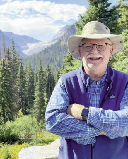
2023–24 AEG/GSA Richard H. Jahns Distinguished Lecturer – Cynthia Delaney Palomares, PG, PE, Adjunct Instructor (retired), Texas A&M University, Texas Engineering Extension Service (TEEX), College Station, Texas

As an adjunct instructor, Palomares conducted training courses for environmental professionals for certification of Hazardous Waste Operations and Emergency Response. Prior to working for TEEX, she was a Project Manager at Texas Commission on Environmental Quality, Austin, TX, from 1993–2016. As a project manager in the Industrial & Hazardous Waste Permits Section, Palomares reviewed and evaluated hazardous waste permit applications, compliance reports, and notices of waste management activities for both regulatory and technical completeness to ensure compliance with applicable hazardous waste, radioactive waste, and Texas Risk Reduction Program rules and regulations. In addition, she was a member of the Waste Permits Division Disaster Response team and was also a project manager for RCRA Authorization rule projects that adopt EPA hazardous waste amendments into Texas Administrative Code regulations. Prior to her position as a project manager in the I&HW Permits Section, Palomares conducted technical reviews and processed applications for underground injection control (UIC) and in situ leachate uranium mining facilities in the UIC/Radioactive Waste Section of the TCEQ. In 2016, she was recognized for twenty-five years of service with the State of Texas.
Prior to employment with the TCEQ, Palomares was employed as a staff scientist for Westinghouse Hanford Company in Richland, Washington, for three years. In 1987, she earned a BS in Engineering Geology from Texas A&M University, and an MS in Engineering Geology in 1990 from the same institution. She is certified as both a Licensed Professional Geologist and Licensed Professional Engineer in Texas.
Palomares joined AEG in 1986 as a student member of the Lone Star student chapter at Texas A&M University. In 1990, she was awarded the “Best Student Presentation Award” at the Texas Section Spring Meeting. In 2011, she was awarded the “Floyd T. Johnston Outstanding Engineering Geologist Award” at the Texas Section Fall Meeting. In 2022, she was awarded the Association-level “Floyd T. Johnston Outstanding Engineering Geologist Award” at the AEG Annual Awards Banquet in Las Vegas, Nevada. Service to AEG includes the following positions: Lone Star Student Chapter Officer (1986–1990), Washington Section Field Trip Coordinator (1991–1993), Texas Section
AEG 2023 ANNUAL MEETING 34 AEG 66th Annual Meeting Program with Abstracts September 2023
Vince Cronin
Treasurer (2001–2003), Texas Section Vice-Chair (2004–2006), Texas Section Chair (2007–2009), Texas Section Past Chair (2010–2012), 2010 Shlemon Specialty Conference Chair on “Gulf Coast Subsidence and Sea-level Rise”, Governance Committee member (2010-2012), Section/Chapter Support Committee Chair (2012–2014, 2015 to present), AEG Strategic Planning Committee Co-Chair (2014–2016) , AEG Executive Council (2016–2021), Floyd T. Johnston Outstanding Engineering Geologist Award (2022).
On Being a Jahns Lecturer…
I am honored and humbled to be awarded the AEG/GSA Richard H. Jahns Lectureship for 2023–2024. The Richard H. Jahns Distinguished Lecturer award was established in 1988 in co-sponsorship between the Environmental and Engineering Geology Division (EEGD) of the GSA and the AEG to provide funding for a distinguished Environmental and Engineering Geologist to present an annual series of lectures at academic institutions in order to increase awareness of students about careers in Applied Geology.
While President of AEG in 2020, I planned to visit various AEG Chapters around the country to interact with professionals and students and to offer a technical presentation on Hazardous Waste Management. I was able to visit five chapters before the COVID-19 pandemic resulted in cancellation of any planned remaining visits. Since I was unable to visit many of AEG’s chapters, including student chapters, due to the pandemic, this will be a great opportunity to promote engineering and environmental geology to practicing professionals and students (and finish the job I set out to do.)
My planned presentations will give students an idea of what practicing in the applied geosciences entails and may help guide them on a specific path in the applied geosciences profession. In addition, these presentations may energize students to seek out an applied geosciences professional society to join. Student members, and subsequent young professional geoscientists that are a member of a professional society are more likely to maintain successful long term careers within the geosciences.
My goal is to visit at least twenty colleges or universities during the one-year Jahns Lectureship tenure. I would like to focus on both colleges or universities in areas where GSA and/or AEG local Chapters are located, so that I can then visit Chapter events as well as local colleges and universities. In addition, I plan to focus on visiting historically black colleges and universities (HBCU’s), and predominately Hispanic and Native American colleges and universities, whether they offer a geology program or not.
At the end of my one-year tenure, I plan to provide a summary of my visits (location, audience, and perceived impact) to both AEG and GSA.
Proposed Presentations for 2023–2024
Jahn’s Lectureship
Why Join a Professional Society? (15 minutes)
The mission of a professional society is to educate and inform by defining and setting standards, developing professional excellence, raising public awareness and providing awards and scholarships. The Association of Environmental & Engineering Geologists (AEG) and the Geological Society of America (GSA) are the premier professional societies in applied geoscience fields and support the application of the practice of geology to engineering, environmental concerns, public health, and safety. Joining either of these organizations will provide resources to new members, from a network of students, young professionals, academia, practitioners and friends.
Regulatory Requirements for Hazardous Waste Management Units (45 minutes)
The Resource Conservation and Recovery Act (RCRA) outlines the federal regulatory requirements that apply to siting, design, operation and closure of hazardous waste management units. Location standards that apply to land-based hazardous waste management units include considerations for seismic hazards and satisfactory mitigation of locations in flood-plains. Unsuitable site characteristics include prohibitions for locations in wetlands, recharge zones of sole-source aquifers and highly permeable geologic formations. A case study is provided to review location standards for permitting of a mixed-waste landfill in West Texas.
Hazardous Waste Operations and Emergency Response (HAZWOPER) Review or “How to stay awake during HAZWOPER training?” (30 minutes)
Hazardous Waste Operations and Emergency Response (HAZWOPER) training and certification is required for onsite workers for clean-up operations at hazardous waste sites, voluntary cleanup operations, operations involving hazardous waste, and emergency response operation for releases. Pre-emergency planning includes emergency recognition and prevention, training, and communication. A summary is provided for procedures and equipment used for handling routine and emergency incidents that involve hazardous materials or at hazardous waste sites.
Diversity, Equity and Inclusion in the Geosciences: What Can We Do? (20 minutes)
According to Nature Geoscience (April 2018), there has been little progress in diversity in the geosciences profession in forty years. Both AEG and GSA are members of the National Science Foundation-funded Associated Societies Committed to Ending Non-Diversity (Geo ASCEND) which includes twenty-eight societies and is spearheaded by a consortium of academia and GSA. Geo ASCEND is committed to increasing diversity within the Geosciences profession. Much more can and needs to be done to encourage and support diversity in both geoscience education and geoscience professions. A summary of where we are in terms of diversity in the geosciences and what we can do to increase diversity will be discussed.
AEG 2023 ANNUAL MEETING September 2023 AEG 66th Annual Meeting Program with Abstracts 35
How Climate Change Impacts Infrastructure? (40 minutes)
The terms global warming and climate change are often used interchangeably, but the two phenomena are different. Global warming is the rise in global mean temperature due to the release of heat trapping gasses like carbon dioxide and methane. Climate change is a more general term that refers to changes in many climatic factors (such as temperature and precipitation) from the global to the local scale. These changes are happening at different rates and in different ways in response to global warming. The timing and amount of rainfall is changing, which is generally resulting in more severe storms. In addition, global warming and associated climate change is shrinking ice caps, melting glaciers, causing water shortages, causing sea level to rise and increasing wildfire risk. The climate is becoming more extreme in response to global warming. As a result, infrastructure (e.g. buildings, roads, power supplies) are being impacted at an alarming rate. A record number of hurricanes, wildfires and floods cost the world $210 billion in damage in 2020. Specific weather related impacts, and potential mitigation to infrastructure will be discussed.
2023 AEG Foundation Silent Auction
The On-Line Silent Auction for 2023 Is Now Live!
This year, the AEG Foundation is proud to promote the Marliave Fund as the featured fund for this year’s auction.
Recognizing Outstanding Scholarship and Professional Dedication by Students in Engineering Geology or Geological Engineering
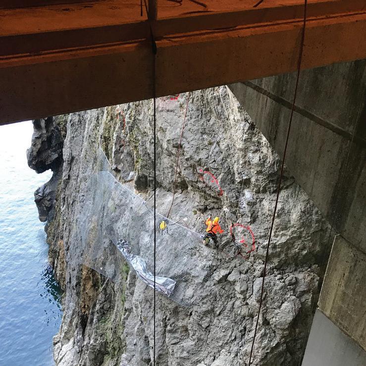
In 1968 The Association of Engineering Geologists (AEG) created its Marliave Fund to honor the memory, work, and contributions of Elmer C. Marliave. The first Marliave Scholarship was awarded by the AEG in 1986. The AEG Foundation assumed responsibility for the Marliave Fund in 1995. The Marliave Fund supports graduate and undergraduate scholarships and educational workshops in Engineering Geology and Geological Engineering.



Help us honor the memory of Elmer Marliave by promoting the fund with those you know who may benefit from applying for and receiving a Marliave Award. Please consider making a
donation to, or bidding on items for, the Marliave Fund via the Silent Auction.
There are several ways to participate in the Silent Auction:
Donate
You may donate an item on-line at any time; please send a photo and a brief description to amichael@creekrun.com
You may donate an item in-person in Portland; please send a photo and a brief description to amichael@creekrun.com. There will be tables set up in the Exhibitor’s Hall and Alex Vazquez (our Operations Manager) will be nearby to assist you. You may send information on your item before the Annual Meeting, but please let Abby know that it is intended to be displayed for in-person viewing.
Bid

Bids will only be accepted on line. Bids for all items will be accepted starting September 1, and will close at 12:00 pm Pacific on Thursday, September 21.
You can find our tax information on our website here: https://www.32auctions.com/AEGFOUNDATION2023

AEG 2023 ANNUAL MEETING 36 AEG 66th Annual Meeting Program with Abstracts September 2023 Proud
Geotechnical Engineering, Dam and Levee Engineering, Water Resources, Risk Management, Tunnel Engineering, and Construction and Contractor Support Get in touch: 336.274.9456 or jgagnon@schnabel-eng.com
to be a Silver Sponsor
AEG Outstanding Environmental & Engineering Geologic Project Award
Historic Columbia River Highway and State Trail (Historic US Route 30)
WSP USA - Kenneth A. Johnson, PhD, CEG; John Horne; Matthew Fowler; Cornforth Consultants, Inc. – Brent Black, CEG, RG; David Evans and Associates, Inc. – Kevin Bracy; Western Federal Lands Highway Division – Nicholas Farny, LEG, LG; Douglas A. Anderson, LEG, LG; Matthew Miller, PE, PMP
Project Design Teams
Mitchell Point Crossing; WSP USA and Foundation Engineering, Inc.; Viento to Mitchell Point; David Evans and Associates, Inc.; and Cornforth Consultants, Inc. (CCI)
Primary Agencies Involved with Both HCRH State Trail Corridor Projects
Western Federal Lands Highway Division (WFLHD), Oregon Department of Transportation (ODOT), US Forest Service, Oregon State Parks and Recreation Department
National and International Significance of the Project
The Historic Columbia River Highway (HCRH) is a National Historic Landmark, an All-American Road, and the United States’ first scenic highway (Figure 1). When the HCRH was dedicated at Multnomah Falls in 1916, it had overcome all odds garnering the nickname “King of Roads” and spawning hotels,
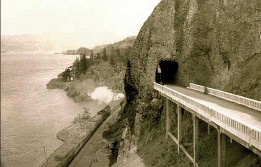
restaurants, resorts, and other businesses. It remained the only paved road connecting Portland to communities in the Columbia River Gorge until the 1950s, when the State Highway Department severed sections of the Historic Columbia River Highway to accommodate the construction of what is now Interstate 84 (I-84).
History of Project Need
Over the past twenty-five years, the Western Federal Lands Highway Division of the Federal Highway Administration in partnership with the Oregon Department of Transportation, Oregon State Parks and Recreation Department, and United States Forest Service has delivered the design and administered construction for a series of projects aimed at restoration of the HCRH in the Columbia River Gorge National Scenic Area (CRGNSA). These projects are part of an effort to restore and reconnect the seventy-three-mile HCRH and State Trail (Historic US Route 30) between Troutdale and The Dalles, Oregon, either via roadway or a shared multi-use paved path. To date, sixty-eight of the original seventy-three miles of the HCRH are now open to travel by motor vehicle (historic highway or county road) or by foot and bicycle (state trail). Funded primarily by the Federal Lands Access Program (FLAP) since 2013, the project corridor is nearing completion.
Users of the paved State Trail include people walking, cycling, and using mobility devices, as well as first responders, who will be able to drive emergency vehicles on the trail to access hikers and recreationists on the many hiking trails through the Gorge. The CRGNSA receives 2.1 million visits and 3.2 million site visits on National Forest Land
AEG 2023 ANNUAL MEETING September 2023 AEG 66th Annual Meeting Program with Abstracts 37
Figure 1. The historic roadway tunnel through Mitchell Point
annually, according to the US Forest Service—a number that has been steadily increasing over the past decade.
State Trail Overview
Recent projects on the State Trail center on eleven miles of the trail between Exit 51 on I-84 (Wyeth, Oregon) and Ruthton County Park (Hood River, Oregon). This trail alignment is divided into eight Segments (A through H) to facilitate a phased project approach and support civil, geotechnical, and structural design efforts and construction.
Completed State Trail Projects
Segments A through D (Wyeth, Oregon, to Starvation Creek) consist of a four-mile section of the trail that starts at Exit 51 on I-84 and ends at Starvation Creek State Park.
Construction for Segments A through D started in the summer of 2017 and was completed in the fall of 2019. For this segment, over 3,000 linear feet of low-deflection, flexible rockfall barrier without upslope tiebacks was constructed. It included over 4,000 square yards of contoured draped mesh with breakaway pinning to reduce the “waterfall” effect of draped mesh, 1,750 square yards of mid-slope rockfall attenuators, and over 425 linear feet of rock bolts. Other challenging geotechnical elements for this segment included: over 2,000 linear feet of MSE walls and reinforced soil slopes, a tied-back gravity wall, a 750-foot-long viaduct supported on spread footings with micropile and tie-downs, a 400-foot-long soldier pile tie-back wall, one micropile supported bridge, and one bridge on conventional footings. In addition, a segment of the trail was constructed on an 850-foot-long bench that was excavated within a near-vertical rock cliff using controlled blasting techniques.
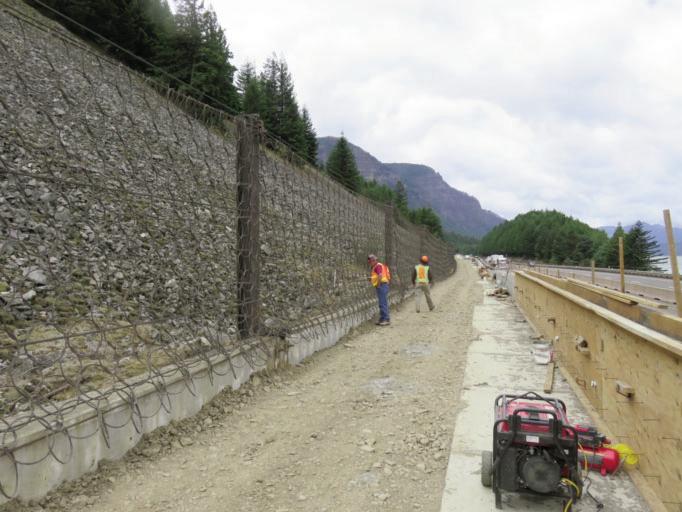
The Eagle Creek Fire that occurred in the fall of 2017 hampered construction efforts and increased the concerns associated with rockfall and hazard trees. An approximately 200-foot-wide section of the extensive talus slope along Shellrock Mountain mobilized during the fire and moved up to fifteen feet beyond the original toe of the talus slope, which required the trail grade to be raised approximately five feet through this area (Figures 2 and 3).
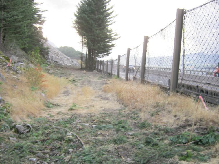
Current State Trail Projects
This article focuses on the two most recent State Trail projects; the Mitchell Point Crossing project (Segment F) and the Viento to Mitchell Point project (Segment E). These two projects have presented a number of unique challenges during planning, design, and construction. The constraints include steep topography, environmental considerations, historic context, traffic management during construction alongside a major interstate, railroad coordination, aesthetic requirements, and varied geologic hazards. These constraints necessitated the implementation of a wide variety of engineering geology and geotechnical related analyses and design elements.
The following sections provide a summary of the engineering geologic principles and design elements applied in each project.
The Mitchell Point Crossing Project Overview
The primary component of the Mitchell Point Crossing project is a new pedestrian trail tunnel through the promontory known as Mitchell Point. The intent of the tunnel is to recreate the historic roadway tunnel through Mitchell Point, which was
AEG 2023 ANNUAL MEETING 38 AEG 66th Annual Meeting Program with Abstracts September 2023
Figure 2. View Looking west at existing fallout area along Shellrock Mountain (the Trail was constructed in the fallout area.)
Figure 3. View looking west at the installed low-deflection rockfall barrier on the inboard edge of the new Trail alignment along Shellrock Mountain
in service from 1915 until 1953 when portions of it were removed during I-84 construction. This tunnel contained adits to the open face of Mitchell Point to provide both light to the roadway and scenic views of the Columbia River Gorge.
This new Mitchell Point Tunnel connects segments of the HCRH to the east and west and was excavated in basaltic rocks that comprise the Mitchell Point promontory (Figure 4). In addition to the tunnel construction, this segment also includes rockfall mitigation measures due to the sheer cliffs exposed at Mitchell Point on either side of the tunnel.
All the project work required careful consideration of the existing sensitive conditions at the site including biologic and botanical resources as well as the travelling public along I-84 and the operating railroad activity. In keeping with the preservation goals of the CRGNSA, the tunnel alignment aimed to use as much of the original roadbed from the historic road (aka “the bench”) as practical. A sinuous alignment in plan was chosen to provide a consistent lateral offset from the cliff face which provides similar adit lengths and uniform natural illumination. The west portal location was chosen to minimize impacts to mapped populations of Douglasia Lavigata, an endemic plant species that grows on the cliffs around Mitchell Point. The east portal location was chosen at a natural break in the steep cliffs overhead, thereby minimizing the amount of rockfall protection required above the rest of the east bench. The portal architecture makes use of prominent basalt blocks and other details that reflect Works Projects Administrationera tunnels in Oregon.
Geology of Mitchell Point
The geology of the Mitchell point vicinity is dominated by the Columbia River Basalt (CRB) flows, supplemented by sedimentary rock units including the Troutdale Formation. A geologic map and cross section are presented in Figures 5 and 6, respectively.
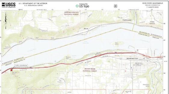

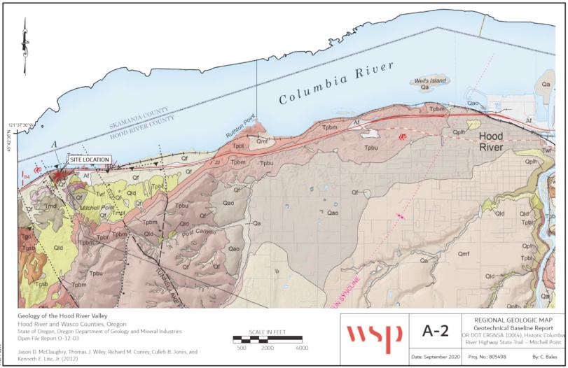
Mitchell Point consists of a series of Tertiary basalt flow deposits that have been tilted toward the southeast exhibiting dips of 20 to 30 degrees. Specific members of the Columbia River Basalts that are represented at the site include (from
oldest to youngest) the Ortley member of the Grande Ronde Basalt, the Winter Water Member of the Grande Ronde Basalt, the Sentinel Bluffs member of the Grande Ronde Basalt, the Priest Rapids member of the Wanapum Basalt, and the Pomona Member of the Saddle Mountains Basalt. In between the youngest two basalt members lies the distinct Troutdale Formation consisting of well lithified sands and gravels. Within the basalt units, a number of flow structures are also observed at the site including entablature, colonnade, and flow-top features. The overall condition of the rock mass in many of these flows is generally fractured, sometimes highly fractured. Site investigation for the project included drilling of seven rock core holes (three vertical holes from a bench and four horizontal holes
to evaluate rock conditions along the tunnel alignment). Cores produced during the investigation were reviewed to select samples for laboratory testing. Specific tests performed on the samples included uniaxial compressive strength tests, point load tests, punch penetration tests, Cerchar abrasivity tests,
AEG 2023 ANNUAL MEETING September 2023 AEG 66th Annual Meeting Program with Abstracts 39
Figure 5. Geologic map of project vicinity
Figure 6. Geologic section through Mitchell Point
Figure 4. Mitchell Point Crossing project location
Indirect (Brazilian) Tensile Strength tests, and petrographic microscopy. Additional field data was collected regarding slope and outcrop observations along with oriented downhole fracture surveys using an optical borehole televiewer (Crux Oriented Borehole Logging system).
In addition to the rock mass observations above, the site is crossed by a number of faults and shear zones that cut across the rock mass creating zones of potential weakness within. The tunnel design anticipated the impact of these zones as they are shown in Figures 7 and 8.
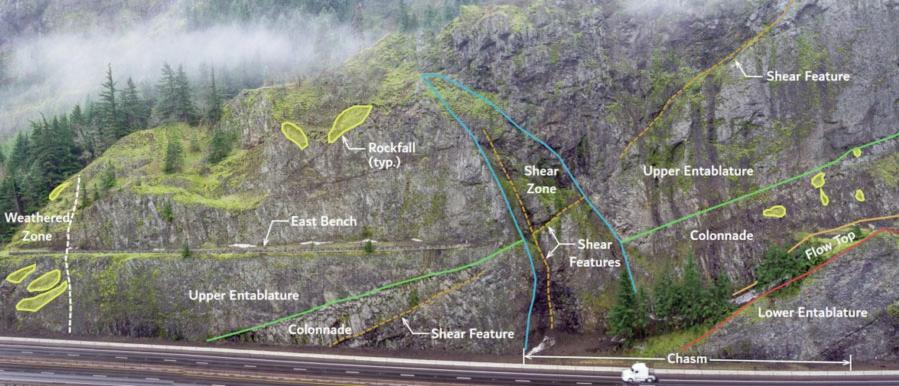
Based on the geologic data described above, the ground conditions expected in the tunnel are shown in Figure 9. These data formed the basis for the tunnel design, slope stability evaluations, and rockfall hazard evaluations.
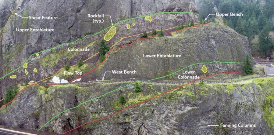
AEG 2023 ANNUAL MEETING 40 AEG 66th Annual Meeting Program with Abstracts September 2023
Figure 7. Oblique view of geologic structures, East Bench
Figure 8. Oblique view of geologic structures, West Bench
Tunnel Design
Rock Mass Properties
Rock mass properties for design were developed using the results of project-specific geotechnical data, as well as standard correlations (Hoek-Brown, 1997) and regional data for
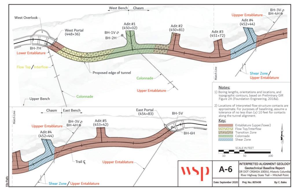
Table 1 - Rock Mass Properties
similar rock units (Schultz and Watters, 1995). Rock mass properties used for modelling included mean (best estimate) and lower bound strength (LB) parameters for typical ground conditions as well as further reduced strength parameters for the shear zone.
Rock Quality Designation (RQD)
RQD is defined as the percentage of recovered core in a core run consisting of sound rock greater than four inches in length. The average RQD and the linear distribution of ranges of RQD
values have been determined for the two primary rock structures encountered within the CRB at the site: colonnade and entablature. The averages and distribution are provided in Table 2.
AEG 2023 ANNUAL MEETING September 2023 AEG 66th Annual Meeting Program with Abstracts 41
Figure 9. Anticipated tunnel geology
Parameter Unit UCS of Young’s GSI Poisson’s mi Rock mass Modulus of mb s a Type Weight, intact Modulus of Ratio uni. Comp. Deformation, pcf rock intact rock Strength ksi (GPA) ksi (MPa) ksi (GPa) ksi (MPa) Basalt (LB) 155 2 (13.8) 700 (4.8) 50 0.25 25 0.12 (0.83) 215.0 (1.5) 4.1919 0.0039 0.5057 Basalt (Mean) 4 (27.6) 1400 (9.6) 55 0.32 (2.20) 571.6 (4.0) 5.0115 0.0067 0.5040 Shear Zone 2 (13.8) 700 (4.8) 40 0.07 (0.48) 111.7 (0.8) 2.933 0.0013 0.5114
Table 2 - Rock Quality Designation
Geologic Strength Index (GSI)
The Geological Strength Index (GSI), introduced by Hoek in 1994, provides another pseudo- quantitative rock mass classification system. The GSI system uses either a qualitative chart or a correlation with estimated joint conditions and discontinuity frequencies (using Q-system joint condition ratings) to estimate a value which can be used to reduce the intact rock compressive strength to obtain the approximate strength of the rock mass. The average GSI values and the associated rock structure descriptions for both colonnade and entablature rock structures are presented in chart form in Figure 10.
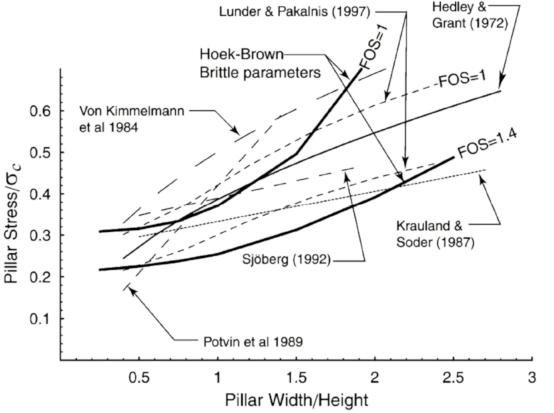
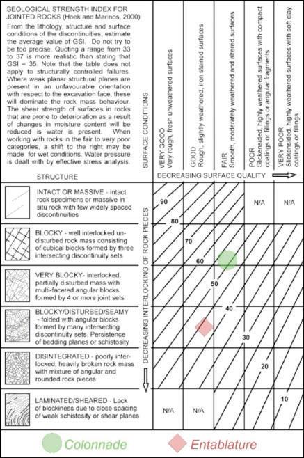
Global Tunnel Stability
Global stability of Mitchell Spur was evaluated at two locations along the tunnel alignment: 1) At the location of maximum rock height, and, 2) Within an identified shear zone. Global stability was evaluated using the finite difference numerical modelling software FLAC (Fast Lagrangian Analysis of Continua; Itasca, 2016). The primary ground support components are modelled explicitly using cable elements for rock dowels and beam elements for fiber reinforced shotcrete lining. The modelling results indicate that the tunnel is not expected to induce largescale instability within the rock mass.
Local Tunnel Stability
The stability of the rock pillars, which are identified as the rock units on the outboard side of the tunnel extending between the viewing adits, was evaluated using numerical methods (FLAC) and compared against empirical methods in general conformance to the approach outlined by Martin and Maybee (2000). The analysis results indicate that a pillar width of 15 feet is the minimum acceptable to achieve the desired factor of safety of 1.4 (See Figures 11 and 12). The design pillar widths are greater than 15 feet, therefore, the design is considered acceptable.
AEG 2023 ANNUAL MEETING 42 AEG 66th Annual Meeting Program with Abstracts September 2023
Rock Average Distribution of RQD (Horizontal Boreholes) Structure RQD <10% 10–20% 20–30% 30–40% 40–50% 50–60% 60–70% 70–80% 80–90% 90–100% Colonnade 32% 17% 14% 10% 13% 27% 6% 9% 3% 0% 0% Entablature 16% 50% 12% 14% 7% 3% 6% 5% 1% 0% 0%
Figure 10. GSI values for rock mass units
Figure 11. General pillar stability chart
Ground Support Performance
Ground support elements contained in the design include pattern rock dowels and fiber reinforced shotcrete. These ground support elements were evaluated in relation to the anticipated ground response following tunnel excavation, which is expected to impart axial forces to the rock dowels and induce bending moments in the shotcrete. The analysis results indicate that the ground support elements will have sufficient capacity to provide support for the tunnel opening.
Estimated Tunnel Deformations
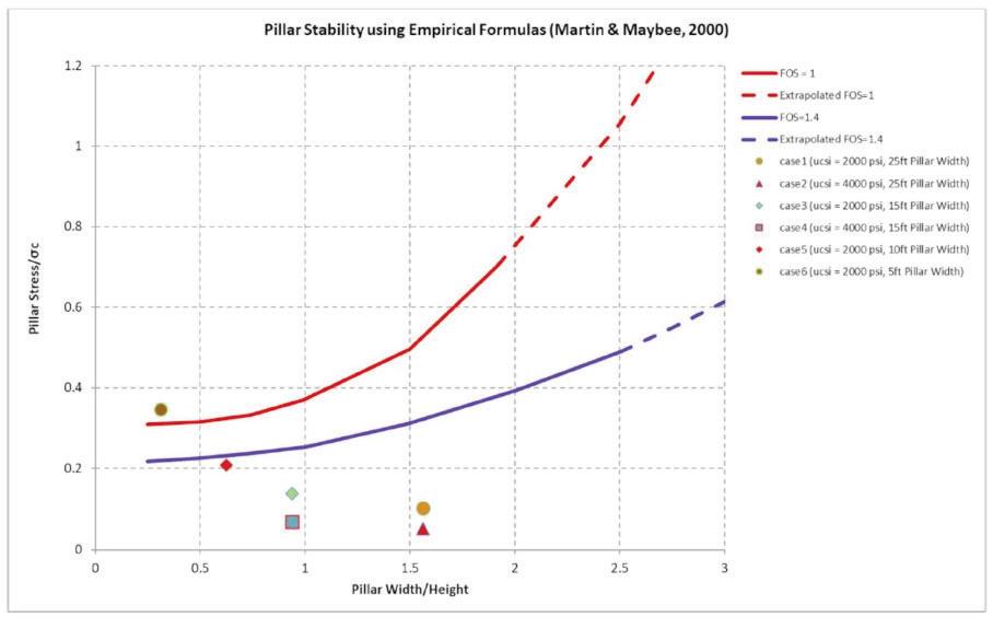
Tunnel deformations were estimated using numerical methods with assumed ground relaxation factors and construction sequencing. Deformations were estimated for both section locations at the maximum rock height and at the shear zone. Modelling results indicate that only minor radial displacements are expected along the tunnel alignment, with the maximum being about ¾-inch of crown displacement at the shear zone and less than ½-inch of crown displacement estimated at the maximum rock height when using lower bound basalt parameters. When using mean basalt parameters at the maximum rock height, less than 1/10-inch of crown displacement is estimated to occur.
Rockfall Hazard Design
Rockfall presents a persistent hazard at the site. In order to increase public safety during the use of the new trail, multiple rockfall mitigation measures will be incorporated as part of the project, including rock bolts, attenuator fences and draped mesh. Figure 13 shows the general locations of these rockfall risk reduction measures.
Rock bolts were installed in the cliff face above the West Portal (above the rockfall protection fences). The rock bolts are installed in a rough pattern consisting of three staggered rows spaced at approximately ten feet on center, though final rock bolt locations were selected in the field. The area where rock bolt reinforcement was installed is roughly 20 feet to 30 feet in height and 130 feet in length and contains rock overhangs and open joints.
Hybrid rockfall protection fences (also known as midslope rockfall attenuators) were installed above both the East and West Portals. Fence heights range from about six to ten feet.
Draped wire mesh was installed on the near-vertical faces below the rockfall protection fences. The mesh is connected to a top cable strung between the rockfall protection fences’ support posts and terminates about twenty feet above the East and West Benches.
AEG 2023 ANNUAL MEETING September 2023 AEG 66th Annual Meeting Program with Abstracts 43
Figure 12. Site pillar factor of safety
Construction
Mining, Excavation, and Ground Support
The contractor was authorized to begin work on January 13, 2021. The new Mitchell Point Tunnel and viewing adits were primarily excavated using controlled drill-and-blast techniques conducted from both portals.
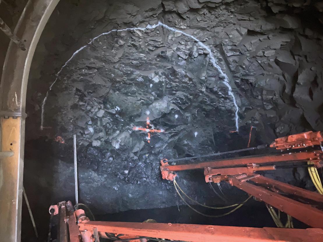
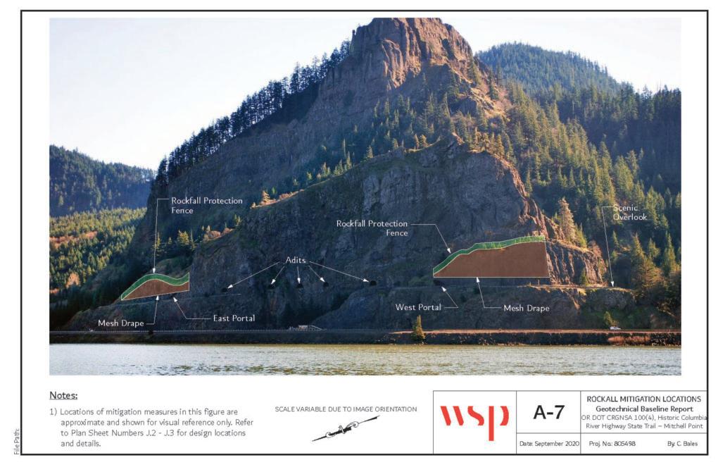
Controlled blasting utilizes a closely spaced array of holes loaded with limited amounts of explosives per charge delay. First, a pattern of holes is drilled (Figure 14) into the excavation face and holes are loaded with explosives. Then the explosives are detonated, and the blasting gases are ventilated. Following the blast, the excavation is checked for complete denotation, and any unstable rock wedges in the crown are removed. Finally, the blasted rock is mucked out and the initial ground support is installed.
Mechanical methods of excavation were generally used when daylighting the adits and/or at locations where overbreak is to be kept to a minimum. Mechanical methods included the use of larger, manned equipment, such as a roadheader or a hoe ram, or smaller, hand-held tools. Mechanical excavation methods were used exclusively in some locations and in conjunction with drill-and-blast methods in other locations.
The initial excavation of the tunnel was staged from the east and began at the east portal. The excavation of the tunnel
and adits continued west to a point in between Adit 3 and 4, and then the staging and operations moved to the west end. The remaining tunnel and adits were then excavated from the west until reaching the end of the previous stage of excavation.
AEG 2023 ANNUAL MEETING 44 AEG 66th Annual Meeting Program with Abstracts September 2023
Figure 13. Rockfall hazard mitigation layout
Figure 14. Drilling blast holes near the west portal November 30, 2021; note blocky collonade structure layout.
Initial and permanent ground support generally utilized a combination of rock bolts (Figure 15), rock dowels and shotcrete, with some locations also utilizing support from conventional steel sets.
Adit Mining

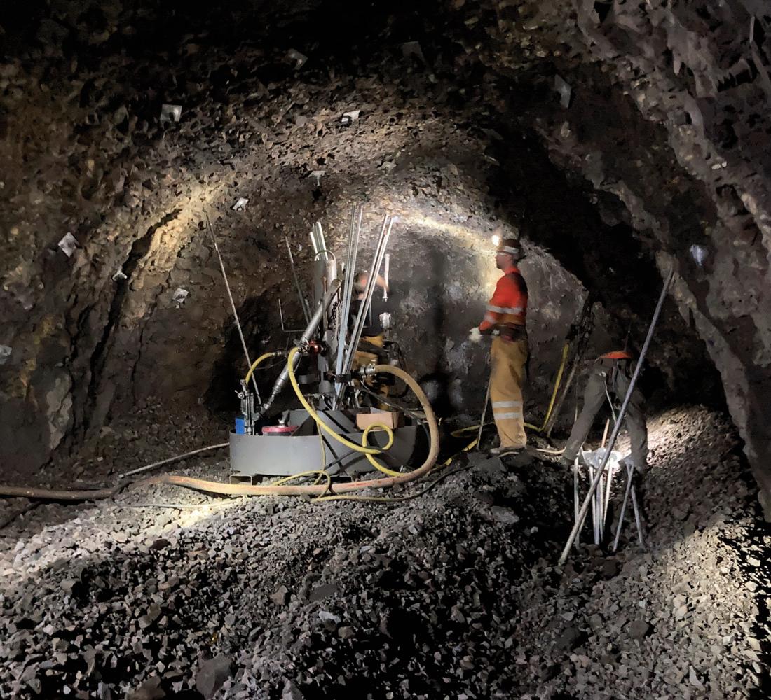
It was required that the adits daylighting into the chasm between the East and West Benches be driven outward from within the tunnel in order to lessen surface impacts and the need for drilling from suspended baskets or platforms. The remaining adits were accessible either from the benches or
the tunnel and were driven outward from the tunnel or inward from the bench, or by some combination of the two. Drill-andblast methods were limited to a distance of no less than six feet from the cliff face to lessen the risk of fly rock. This distance from the adit heading to the cliff face was typically determined by a probe hole or similar methods. Upon reaching six feet from the cliff face, mechanical excavation methods were specified (Figures 16 and 17).
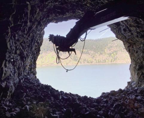
Traffic Mobility During Construction
As with other segments of the HCRH, construction-related blasting of rock in the proximity of operating highways and railways required special measures to ensure public safety. Use of blasting curtains and rolling closures prior to planned blasting events were used to minimize impacts to the traveling public during key periods of construction.
Portal Masonry Installation
In accordance with the overall historical design guidelines, the portal structures were designed with masonry detailing (Figure 18) reminiscent of the design for the nearby historic Toothrock Tunnel, which accommodates eastbound I-84 approximately seventeen miles to the east of Mitchell Point. Masonry placement activities are shown in Figure 19). Masonry sourcing, fabrication, and placing was performed by Guinette Masonry.
AEG 2023 ANNUAL MEETING
September 2023 AEG 66th Annual Meeting Program with Abstracts 45
Figure 15. Installing radial bolts near the east portal above spring line within entablature on February 10, 2022; note consistent as-blasted gradation from the entablature basalt.
Figure 16. Excavation of adit number 3
Figure 17. Excavation of adit number 3, looking out over the Columbia River
Projected Completion
The Mitchell Point Tunnel is scheduled for substantial completion in Fall 2023, with full opening of the tunnel for the public in early 2024.
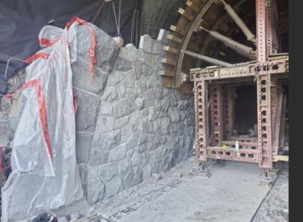

The Viento to Mitchell Point Project Overview
This segment (designated as Segment E) of the State Trail is located along a 2.5-mile stretch of I-84. The alignment includes a 2.7-mile section of the trail that starts at Viento Trailhead and ends at Mitchell Point. This portion of the trail has been subdivided into seven rockfall-prone segments that ranged between 200- and 1,450-feet-long, with rock slope heights up to 280 feet above the trail grade.
Due to space constraints, the HCRH State Trail alignment in this area lies within the I-84 rockfall catchment ditch for many of the existing rock slopes (Figure 20). The goal for rockfall risk reduction was precluding 99% of direct impact rockfalls and 90% of rolling rockfalls, as defined by the Rockfall Catchment Area Design guide by ODOT, 2001, from reaching the trail and I-84. Due to the location of the trail relative to the rock slopes, risk reduction measures such as draped mesh, mid-slope rockfall attenuators, and enlarging the rockfall catchment area are effective techniques that would normally be implemented on a conventional transportation project. However, since the trail is
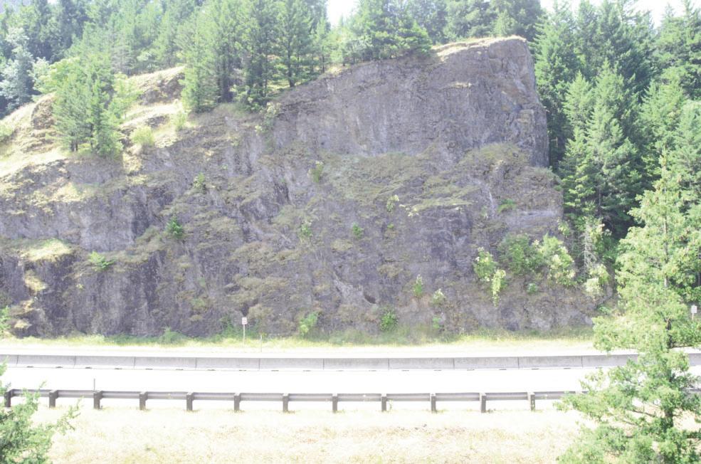
located in a national scenic area, aesthetics of rockfall risk reduction measures are critical to stakeholders. To the greatest extent possible, risk reduction measures with low visual impacts were utilized in the design. In particular, on-slope items such as contoured draped mesh and mid-slope attenuators were used only where no other feasible options were available. Based on feedback from the trail stakeholders, risk reduction measures located at the base of the slope were given preference over on-slope methods.
Geology of the Viento to Mitchell Point Project
The CRB Group dominates the regional geology. The basalt flows present in the CRB Group are from the Miocene Epoch (approximately 16.7 to 5.5 million years ago (Ma)) with the majority of the flows occurring during an approximate 1.1-million-year period (16.7 to 15.6 Ma). Estimated volumes of the basalt flows are up to 1,000 km3. The area covered by the flows is approximately 200,000 km2 in Oregon, Washington and Idaho. The flows are thought to have originated from what is now the Yellowstone Hotspot, previously located in what is now northeastern Oregon, eastern Washington, and western Idaho. North-northwest trending linear fissures on the order of tens to hundreds of kilometers long released low viscosity basalt lava multiple times during the Miocene Epoch. The molten rock flowed westward from the fissures to form a series of overlapping basalt flows. Uplift, faulting and downcutting from the Columbia River and Missoula Floods have formed
AEG 2023 ANNUAL MEETING 46 AEG 66th Annual Meeting Program with Abstracts September 2023
Figure 18. Portal design concepts
Figure 19. Portal masonry construction
Figure 20. View looking south at rock slope designated as the “Bench Cut”
the outcrops, cliffs, and natural rock benches observed throughout the Columbia River Gorge in present day.
At the western end of Segment E of the HCRH State Trail, the Grande Ronde Formation of the CRB is present, including the Grande Ronde Upper (Normal and Reverse Polarity Flow) members, as well as the Grande Ronde Lower member. The upper flows are exposed on the upper cliffs and overlay the lower flows typically near and below the elevation of I-84. Moving to the east end of Segment E, exposures of the Frenchman Springs member of the Wanapum Formation and the Pomona member of the Saddle Mountain Formation are present. The flows on the east end of Segment E are overlain by The Dalles Formation which consists of upper Miocene volcaniclastic and sedimentary deposits of breccia, tuff, conglomerate, and sandstone to mudstone. The basalt flows on the east end of Segment E are found at the top of the exposed cliffs to below highway elevation, with The Dalles Formation found on the upper plateau.
Rockfall Risk Reduction Design
Quantitative Risk Assessment
A Quantitative Risk Assessment (QRA) was performed on select rock slopes in Segment E to further evaluate the need for rockfall risk reduction measures. The QRA tool was developed as a joint effort by WFLHD and the National Park Service as part of the Unstable Slope Management Program (USMP) for Federal Land Management Agencies (FLMAs). The QRA tool can be accessed on the USMP website (https://usmp.info/client/qra.php) and is discussed in detail in the Federal Lands Highway USMP for FLMAs Manual.
The QRA is a probabilistic model for rockfall risk. The benefit of this model is comparing the relative hazard and risk of rockfall to other published societal risks. This can then be compared to the relative reduction in rockfall hazard and risk if rockfall risk reduction measures are implemented. For nearly all rock slopes evaluated along Segment E, the calculated risk posed by constructing the trail beneath the rock slope without any rockfall risk reduction measures resulted in calculated risks deemed unacceptable by the project stakeholders.
Rockfall Modeling
The behavior of future rockfall events was modeled using computer software. Rockfall models were calibrated to the performance of existing slopes using data provided by ODOT maintenance personnel and on-site observations. Input parameters related to the characteristics of rockfall debris, slope conditions, and rockfall source areas were based on observations made during slope reconnaissance. Rockfall risk reduction measures were inserted into the model to evaluate the type, size, and location of measures required to meet the rockfall design criteria (retention of 99 percent of direct impact rockfalls and 90 percent of rolling rockfalls on the HCRH State Trail and I-84).
From these analyses, rockfall risk reduction measures were designed and constructed. This was accomplished using a combination of scaling, rock bolting and doweling, horizontal drains, gabion basket walls, contoured, draped high-tensile
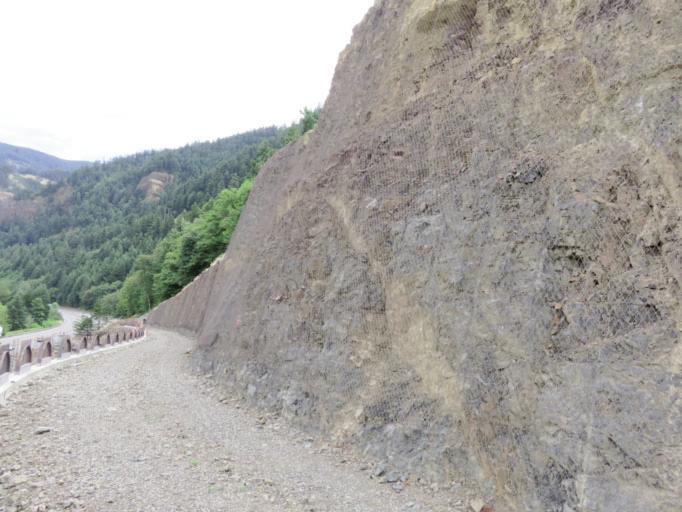
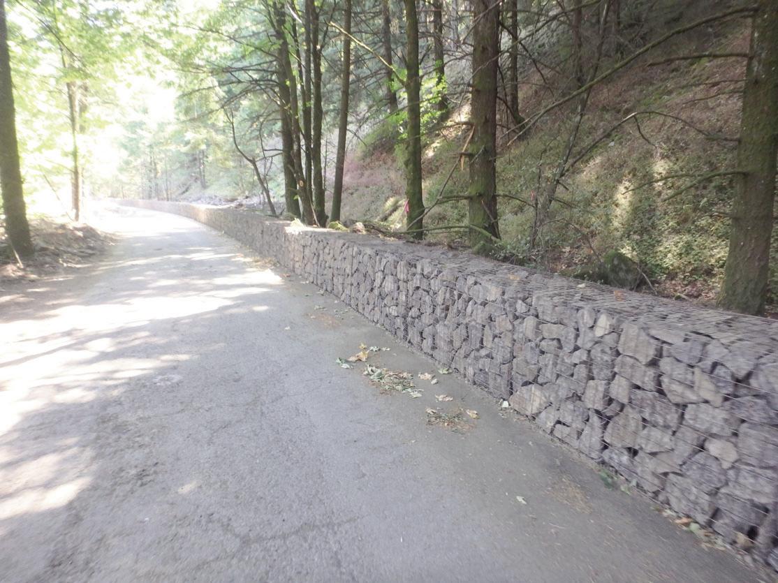
strength mesh, mid-slope attenuator fences, and low-deflection rockfall barriers depending on site conditions. Context sensitive measures were incorporated into the design to reduce the visual impacts of the rockfall risk reduction elements. They included the staining of all metal components, rock-faced gabion baskets (Figure 21), and contouring draped mesh sections so it conforms to the slope shape, reducing the tendency for draped mesh to “waterfall” over rock ledges and overhangs.
Construction
Construction for Segment E started in Fall 2021 and is currently nearing completion. For this segment over 1,000 linear feet of low-deflection, flexible rockfall barrier without upslope tiebacks was constructed. In addition, over 11,000 square yards of contoured draped mesh with breakaway pinning (contouring) to reduce the “waterfall” effect (Figures 22
AEG 2023 ANNUAL MEETING September 2023 AEG 66th Annual Meeting Program with Abstracts 47
Figure 22. View looking east at the Bench Cut following excavation (the slope was draped with high-tensile strength mesh that was contoured to minimize the “waterfall” effect).
Figure 21. View looking east at stacked gabion basket walls used for rockfall mitigation along Shellrock Existing Highway (this wall was nearly 400 feet long.)
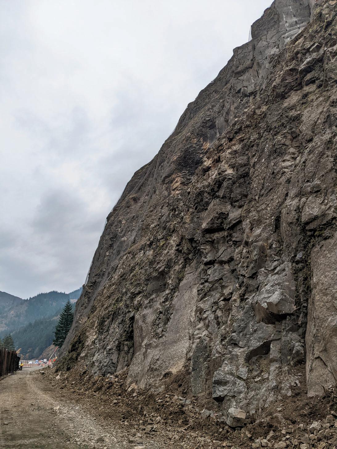
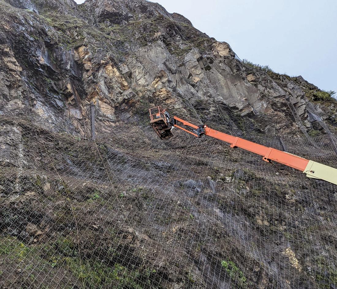

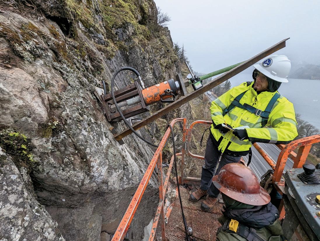
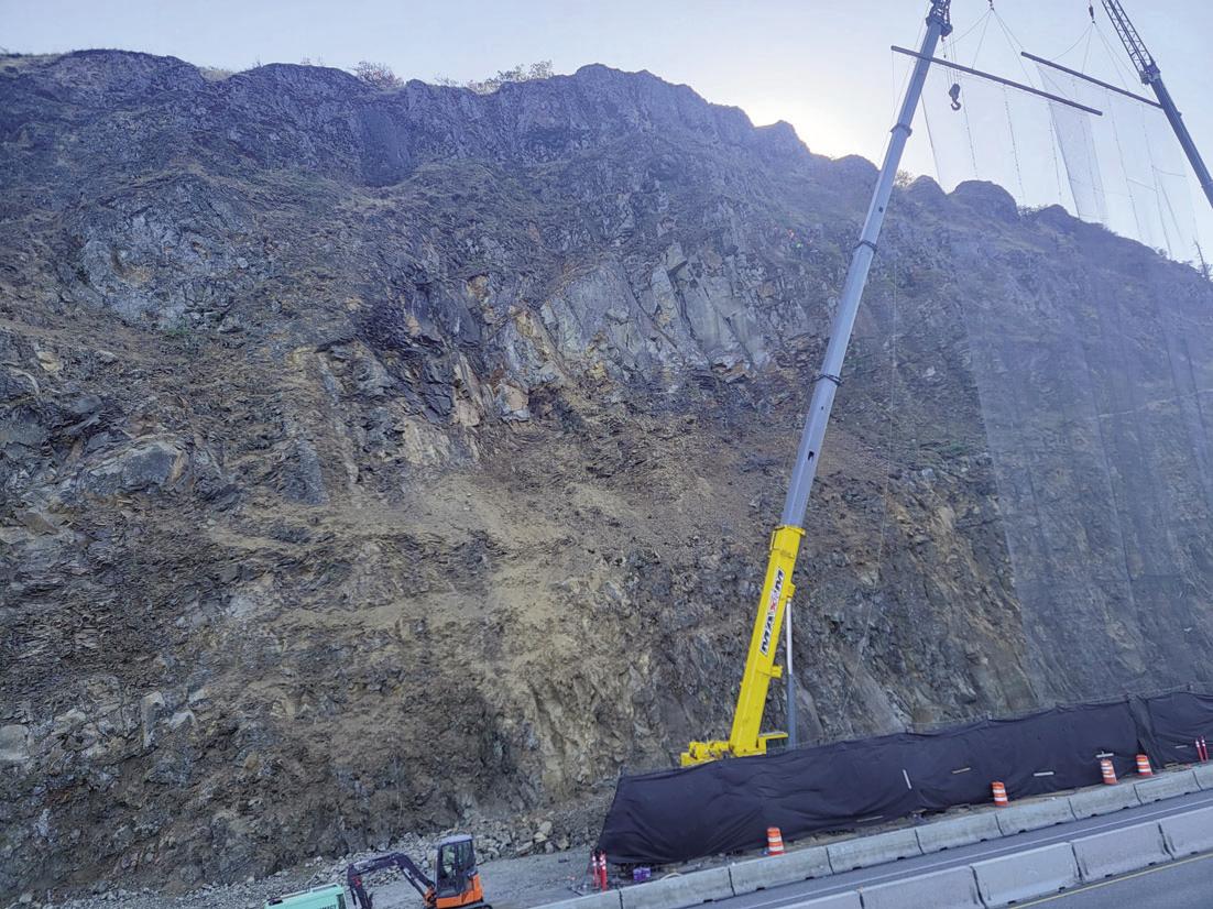
AEG 2023 ANNUAL MEETING 48 AEG 66th Annual Meeting Program with Abstracts September 2023
Figure 23.View looking east at contoured mesh at the rock slope designated as “Stepped Cut”
Figure 26. WLFHD personnel testing a rock bolt at Stepped Cut
Figure 25. View looking east at the midslope attenuator at the rock slope designated as “Hackly Cut”designated as “Stepped Cut”
Figure 24. Stepped Cut where the contoured mesh meets the midslope attenuator
Figure 27. TRRP used at Stepped Cut during scaling k
and 23), 16,400 square yards of mid-slope attenuators (Figures 24 and 25), over 2,100 linear feet of rock dowels and bolts (Figure 26), and 500 linear feet of unlined drain holes were installed.
Over 1,800 hours of hand scaling was performed for both segments while traffic was allowed to pass on the I-84, which has an average annual daily traffic volume between 20,000 and 30,000. This was accomplished by scheduling one-lane closures during the shoulder seasons and the extensive use of Temporary Roadway Rockfall Protection (TRRP) which consisted of crane-suspended rockfall containment nets (RCNs) (Figures 27 and 28), moveable flexible rockfall barriers (Figure 29), and concrete barrier rails. The RCNs were a combination of rolled cable nets and mesh 150-foot in length suspended by highcapacity cranes. Multiple moveable 12-foot-tall flexible rockfall barriers (MRBs) mounted on steel plates were positioned behind the RCNs during scaling operations with concrete barrier rails installed between the MRBs and the traveling public.

One day of rolling slow-downs was required to scale several large rock columns at Segment E (Figure 30).
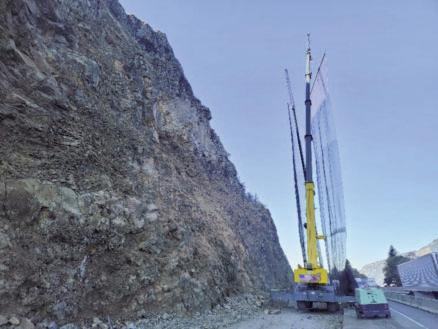
Closing
The remaining segments of the State Trail project are currently in development. The HCRH is already attracting many visitors, and the landscape views alone create a sense of awe that turns into several pauses at overlooks to take it all in. The HRCH State Trail brings people together from far and near to experience the raw geology of the Columbia River Gorge with the beautifully restored bridges, viaducts, tunnels, rock walls, picnic areas, and scenic overlooks.
References
Hoek, E. and Brown, E.T., 1997, Practical estimates or rock mass strength. International Journal of Rock Mechanics and Mining Sciences. 34(8), 1,165–1,186.
FHWA – Federal Lands Highway Division, 2019, Unstable Slope Management Program for Federal Land Management Agencies, Publication No. FHWAFLH-19-002.
Foundation Engineering, 2019, Geotechnical Data Report, Historic Columbia River Highway, Mitchell Point, OR DOT CRGNSA 100(4), Hood River County, Oregon. Prepared for WSP USA, Inc. June 28, 2019.
Itasca, 2016, Fast Lagrangian Analysis of Continua (FLAC), Version 8.0, Itasca Consulting Group, Minneapolis, Minnesota.
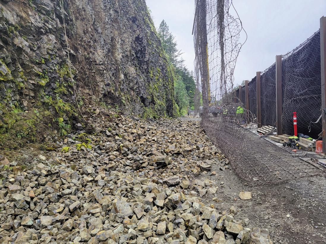
AEG 2023 ANNUAL MEETING September 2023 AEG 66th Annual Meeting Program with Abstracts 49
Figure 28. TRRP used at Stepped Cut during scaling
Figure 29. Scaled debris at Hackly Cut
Figure 30. Scaling at Stepped Cut with a rolling slow down on I-84
Martin C.D., Maybee W.G., 2000, The strength of hard-rock pillars, International Journal of Rock Mechanics & Mining Sciences 37, 1,239–1,246.
Oregon Department of Transportation, 2001, Rockfall Catchment Area Design Guide, Report No. FHWA-OR-RD-02-04m
Schultz and Watters, 1995, Elastic buckling of fractured basalt on the Columbia Plateau, Washington State, Rock Mechanics, Balkema, Rotterdam, ISBN 9054105526..
WSP, 2020, Geotechnical Baseline Report (GBR), OR DOT CRGNSA 100(4), Historic Columbia River Highway State Trail – Mitchell Point. Prepared for the Federal Highway Administration and the Oregon Department of Transportation. September 21, 2020
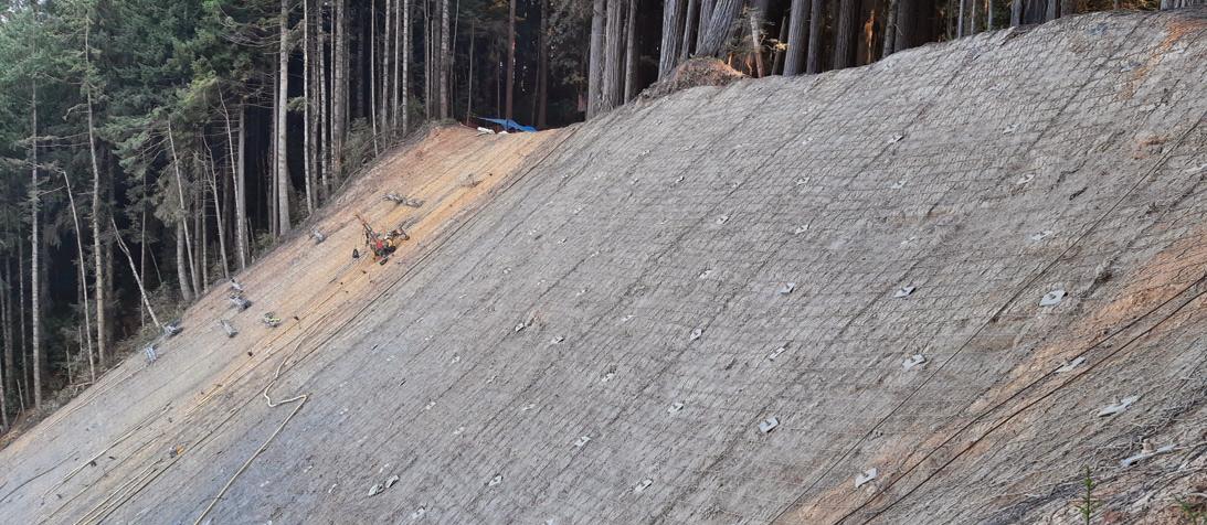
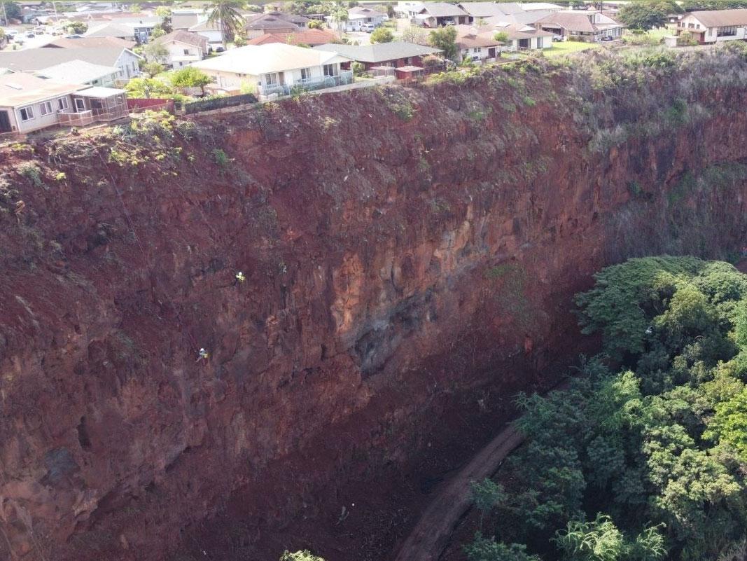

Presentation
The project will be presented and awarded at the Annual Meeting during the Opening Session on September 20 from 10:20–11:00am.
Presenters:
Mathew Miller (FHWA-WFLHD) and Terra Lingley (ODOT) will present the project background and corridor significance.

Kenneth Johnson (WSP) will highlight Mitchell Point geologic and geotechnical design and construction section challenges.
Brent Black (Cornforth Consultants, Inc.) will highlight other geologic and geotechnical design and construction section challenges and considerations within the corridor


California’s Redwood Hwy 101, Last Chance Grade


Owner: Caltrans
Product: Maccaferri RockMesh 3030 Pinned Drapery


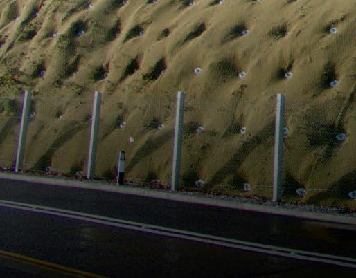


www.maccaferri.com/us

AEG 2023 ANNUAL MEETING 50 AEG 66th Annual Meeting Program with Abstracts September 2023 IN ON E O R I O N P OS R E TIO T Z I IL B A S T A TECCO ® GREEN Slope S C TI ON TE ND N A tabilization www.geobrugg.com/tecco Geobrugg North America, LLC 22 Centro Algodones Algodones, NM 87001 USA •LANDSLIDES •ROCKFALL •TRANSPORTATION •INFRASTRUCTURE •DEVELOPMENT •FORESTRY OREGON WASHINGTON HAWAII www.pali-consulting.com 503-502-0820
Virtual Day Schedule
Virtual Day

Tuesday, September 19, 2023

7:30am – 3:00pm Pacific
$100 AEG Members/$150 Non-members (Included with Annual Meeting Full and Student Registrations)
TIME TITLE AUTHOR
7:30–7:40am Welcome Executive Council
7:40–8:10am CM Oversight of the Upper Llagas Creek Flood Protection Project Phase 2A Stormwater Bypass Tunnel Scott Ball
8:10–8:40am The Emerging Challenge of Naturally Occurring Asbestos in Europe: Recent Legislative Procedures in the European Union Ambra Hyskaj

8:40–9:10am Evaluating the Efficacy of Manmade Canals at Maintaining Lake Habitats for Salmon and Birds Using Seasonal Variations Adrian Jimenez in Isotopes of Meteoric Water
9:10–9:40am Geological Engineering Conditions Controlling Rio Coca Regressive Erosion and Potential Mitigation Alternatives, Todd Loar San Luis, Ecuador
9:40–10:10am Towards a Multiscale Integrated Approach to Assess the Potential Risk of NOA
10:10–10:30am – Break
Jasmine Rita Petriglieri
10:30–11:00am Update on Precise Tree-Ring Dating of Selected Subfossil Forests in Cascadia—Tree Victims of Geologic Events Patrick Pringle and Environmental Disturbances
11:00–11:30am Tunneling in Seattle – The Good, The Bad and The Ugly
11:30–12:00pm Constructed Dam Safety Modification for Risk Reduction at the Isabella Dam Safety Modification Project
12:00–1:00pm – Lunch
1:00–1:30pm Evaluating the Controls on Post-Fire Debris Flows in the Pacific Northwest
1:30–2:00pm Geotechnical Properties of Crowley Ridge Loess at Bear Creek Dam, Marianna, Arkansas
2:00–2:30pm Yes, You Can! Working for Yourself as a Sole Proprietor in the Geosciences
2:30–3:00pm Panel Discussion
Join
Robert (Red) Robinson
David Serafini
David Sousa
Egboche Unobe
Jennifer Wilson
All presentations will be recorded for later viewing.
The session will begin with a welcome from AEG’s Executive Council. They will provide a quick overview of AEG’s 2023 accomplishments
6 PDHs will be available for this session.
AEG 2023 ANNUAL MEETING September 2023 AEG 66th Annual Meeting Program with Abstracts 51
This will be an online-only day of technical presentations for those that would like to participate in the Annual Meeting, but are unable to attend.
us for the first AEG Annual Meeting Virtual Day
Virtual Day Abstracts
CM Oversight of the Upper Llagas Creek Flood Protection Project Phase 2A Stormwater Bypass Tunnel Ball, Scott, Mott MacDonald, scott.ball@mottmac.com; Joseph Ang, joseph.ang@mottmac.com
The Upper Llagas Creek Flood Protection Project Phase 2A, is a farreaching flood protection project. The project will provide 100-year flood protection to homes, businesses, schools, streets, and highways within Morgan Hill and Gilroy, California. This project includes approximately 2,150 linear feet of 14-foot-high by 12-foot-wide underground stormwater bypass tunnel beneath Nob Hill, 1,600 linear feet of 10foot-wide by 9-foot-high twin reinforced concrete box culverts upstream and downstream of the tunnel, creek widening and deepening to carry low stormwater flows, utility relocation, well abandonment and public outreach. This presentation presents the comparison of baseline (Geotechnical Baseline Report) rock quality, ground classification, and ground behavior vs. that encountered during excavation. Bedrock was composed of Franciscan (bimrock) formation that ranged from highly weathered to fresh, very weak to very strong and highly to slightly fractured. Three ground classifications (GCI, GCII and GCIII) were presented in the GBR. These were established in the GBR based upon the physical characteristics, laboratory test data, and estimations of the linear feet of tunnel that was expected to be encountered for each ground class. Preliminary and final design of initial support for each of these three ground classifications was performed by the designer and the tunnel excavation contractor. Bedrock was primarily excavated using a roadheader however, drilling and blasting was utilized for sections of the tunnel where fresh, very strong, slightly fractured bimrock was encountered. Ground conditions encountered during excavation and initial support of the tunnel excavation were documented by mapping and classifying the ground condition of each tunnel face and recording the initial support installed for each round of tunnel excavation. Face mapping and initial support forms were prepared, including photos, and this data was entered into a tunnel tracking Excel document.
The Emerging Challenge of Naturally Occurring Asbestos in Europe: Recent Legislative Procedures in the European Union Hyskaj, Ambra, Eotvos Lorand University, Department of Mineralogy, Budapest, Hungary, ambra.hyskaj@ttk.elte.hu; Tamas G. Weiszburg, Erzsebet Harman-Toth
Asbestos, a globally recognized hazardous material, prompted the European Union to enforce a total asbestos ban in 2005. Despite this critical step, the risk of asbestos exposure remains due to existing built-in asbestos and the largely unaddressed issue of naturally occurring asbestos (NOA). The recent European Green Deal has brought attention to occupational health concerns, particularly hazardous material exposure. With the implementation of the Renovation Wave Strategy, there is an expected increase in asbestos exposure, leading the European Commission to propose measures aimed at better protecting individuals from asbestos exposure, specifically in occupational settings, through an amendment to Directive 2009/148/EC. However, it is important to note that the current legislative review actions of the European Union only address NOA exposure concerning workers of specific, traditional rock related industrial activities (mining and quarrying, tunnel excavation, road building) overlooking other occupational activities like agriculture. Additionally, the potential impact of NOA on the public, and particularly on local communities residing in areas dominated by specific NOA geological settings, is not being addressed in
the current stage of amending the existing regulations. While some activities unavoidably cause NOA disturbance, other actions such as keeping the community better informed about the risk areas are essential to prevent unnecessary exposure to asbestos. Unlike the extensive regulations on the built-in asbestos, NOA remains a grey zone within European regulations. This presentation aims to provide a comprehensive overview of the European Parliament’s actions in protecting asbestos workers, acknowledging the commendable progress made, while also shedding light on the emerging challenge of NOA. Our stance emphasizes the urgent necessity to bridge this policy gap, stressing the need for proactive management strategies and regulatory advancements to protect people from NOA exposure. Drawing from the successes and lessons in managing asbestos, we emphasize the role of NOA recognition and management to ensure a safe Europe regarding asbestos exposure, moving beyond aspirations of an asbestos-free Europe.
Evaluating the Efficacy of Manmade Canals at Maintaining Lake Habitats for Salmon and Birds Using Seasonal Variations in Isotopes of Meteoric Water
Jimenez, Adrian, Portland State University, ajime2@pdx.edu; John Bershaw, bershaw@pdx.edu; Mae Saslaw, mae.Saslaw@stonybrook.edu; Scott Gall, scott@wmswcd.org; Emma Rahalski, rahalski@pdx.edu
We investigated whether hydrologic restoration at Sturgeon Lake, Oregon, is effectively maintaining the lake habitat for juvenile salmon and waterfowl through increased water flux and reduced stagnation. This 19.2km2 lake is a pivotal environmental feature in the area, providing a haven for salmon on the Columbia River before reaching the Pacific Ocean and winter habitat for hundreds of thousands of waterfowl and migratory birds on the Pacific Flyway. The Oregon Conservation Strategy names restoring natural hydrology to Sturgeon Lake as a key step toward conservation in this area. We use stable isotopes of water from the lake, surrounding water bodies, and precipitation to understand the restoration work’s efficacy and whether further efforts are necessary to maintain healthy habitats. Because of its importance to bird migration and salmon spawning, we focus on seasonal patterns in the hydrology of the lake. We determined that approximately 36.5 and 9.5 percent of water input was lost to evaporation during the summer and winter, respectively, after restoration. We estimate the residence time of water in the lake to average ~43.2 days during the study period. Based on these results, we determined that the lake habitat is being adequately maintained in the winter, when it is most valuable to local fauna, but that some stagnation and potential ecosystem degradation occurs in the summer. Neither juvenile salmonids nor migratory birds utilize the lake during the summer, therefore the restoration work is effective at maintaining habitat for these species, but further summer-focused work could be beneficial.
AEG 2023 ANNUAL MEETING 52 AEG 66th Annual Meeting Program with Abstracts September 2023
Geological Engineering Conditions Controlling Rio Coca Regressive Erosion and Potential Mitigation Alternatives, San Luis, Ecuador
Loar, Todd, USACE, Risk Management Center, todd_loar@yahoo.com; Chris Haring, christopher.p.haring@usace.army.mil
The US Army Corps of Engineers is assisting the Ecuadorian State Corporation Electric del Ecuador (CELEC) in evaluating a water resource and hydropower infrastructure issue involving active regressive channel erosion along the Rio Coca River valley that may jeopardize the structural integrity and operations of the Coca Coda Sinclair (CCS) hydropower system. In the study area, the river flows along the southeastern flank of the active Reventadore Volcano, which has experienced a complex history and sequence of alluvial, lacustrine, geomorphic, slope, and volcanic processes, depositional accumulations, and erosional episodes over its evolution. Until 2020 the river flowed naturally over the 140–150-m(460-500 ft)-high San Rafael waterfall, which was formed by an andesite lava flow that blocked the river valley perhaps 5–10K years ago. The lava dam accumulated on older alluvial soils and volcaniclastic materials (i.e., lahars, debris breccias, and remnant flank-landslide deposits) that exhibited significant columnar fracturing along the base. In early February 2020 the natural lava dam collapsed from concentrated leak erosion piping below and through the lava flow foundation and open columnar fractures. The rapid drop in river grade resulted in unprecedented and rapid regressive head-cut erosion and widening that migrated upstream as the river attempted to re-establish an equilibrium channel through the easily erodible and weak valley infill materials given the variable geologic conditions and river discharge flows over the last three years. The purpose of this presentation is to communicate the complex site conditions and processes that are related to and control the dramatic regressive erosion that followed the lava dam collapse; the subsequent slowing of the erosional front and magnitude over time; and development of mitigation alternatives to reduce or slow the long-term river degradation to protect the CCS hydropower facility with engineered drop structures and riverbed armoring.
Towards a Multiscale Integrated Approach to Assess the Potential Risk of NOA
Petriglieri, Jasmine Rita, Department of Earth Sciences, University of Torino, jasminerita.petriglieri@unito.it; Luca Barale, luca.barale@igg.cnr.it; Maria Cristina Di Carlo, mariacristina.dicarlo@uniroma1.it; Cecilia Gomiero, cecilia.gomiero@unito.it; Maura Tomatis, m.tomatis@unito.it; Fabrizio Piana, fabrizio.piana@cnr.it; Paolo Ballirano, paolo.ballirano@uniroma1.it; Elena Belluso, elena.belluso@unito.it; Antonella Campopiano, a.campopiano@inail.it; Alessandro Pacella, alessandro.pacella@uniroma1.it; Francesco Turci, francesco.turci@unito.it
The natural occurrence of asbestos and asbestos-like minerals (NOA) poses a risk to the environment and human health, notably when natural processes and anthropic activities promote fiber dispersion. Hundreds of potentially hazardous elongate mineral particles (EMPs, NIOSH 2011 definition) exist, and their toxicological profile is often unknown. We aim here to define a general approach, from field analysis to nano-structural investigation, to assess whether a fibrous mineral occurring in a specific site could pose a risk to human health. To evaluate the hazard associated with NOA, a multi-scale and multianalytical integrated approach was adopted. Specifically, the geological factors that control the occurrence and distribution of NOA on site, and the mechanisms of formation and liberation of airborne fibers were investigated. In parallel, we explored the key bulk and surface properties of several natural mineral fibers and defined crystallographic, chemical, and morphological aspects that should be consid-
ered during hazard assessment. Also, the effect of standardized mechanical stress was used to quantitatively evaluate the potency of NOA-bearing exposed rock to generate inhalable fibers. This property was connected with the mineral characteristic, the rock fabric, and the rock erosion rate. Isolated fiber specimens were used to assess solubility in simulated body fluids, surface reactivity, and toxicological endpoints in vitro and in vivo. Taken together, these findings allowed us to build a multidimensional description of the hazard parameters of mineral fiber and paved the way for a science-based risk assessment in an unexplored NOA site.
Update on Precise Tree-Ring Dating of Selected Subfossil Forests in Cascadia—Tree Victims of Geologic Events and Environmental Disturbances
Pringle, Patrick, Centralia College, buried_forest@yahoo.com
Bark-bearing, old-growth tree victims of past earthquakes, landslides, and volcanic eruptions and lahars allow wiggle-matching of radiocarbon dates and higher precision ages, which helps narrow the focus of treering cross correlations. Cross dating using old growth tree-ring measurements and other proxy methods has yielded precise calendric ages of the late(?) 1781–early 1782 CE eruption and Old Maid lahar from Mount Hood (Pringle et al., 2010, Sheppard et al., 2010, Pierson et al., 2011), the late 1507 CE Electron Mudflow from Mount Rainier (Pringle et al., 2022), the late 1446–early 1447 CE Bonneville landslide (Pringle et al, 2021), and the early 920s CE rupture of the Seattle and Saddle Mountain Faults (Black et al., in review). Subfossil wood samples obtained with borers and saws were mounted, polished, and scanned at 0.01mm resolution. Image analysis software was used for tree-ring measuring, and programs CDendro, Cofecha, and Arstan for analysis along with visual examination and cross-dating methods, such as noting narrow rings, low-density “light rings,” and isotopes. Oral stories of the indigenous peoples have memorialized all these geologic events and their associated environmental disturbances.
Tunneling in Seattle – The Good, The Bad and The Ugly Robinson, Robert A., Shannon & Wilson, Inc., Red.Robinson@shanwil.com
Seattleites have been constructing tunnels for the last 150 years for sewers, water supply, railroads, light rail transit, and highways. Over 170 tunnels have been constructed in the Seattle area, ranging from 5 feet to 65 feet in diameter and with a combined total length of over 80 miles. As more tunnels have been constructed, the technology has evolved from excavation with picks, shovels and wheelbarrows with a crew of 100 or more for the Great Northern Railroad Tunnel in 1905 to the present day closed-face tunnel boring machines (TBMs) operated by a crew of 10 to 15 and advancing at initial rates of about 50 feet per day and working up to 200 feet per 2- or 3-shift day. However, in many cases the impact of Seattle’s complex glacial and interglacial geology has been under-appreciated, resulting in heavy abrasion by sand and gravel to the cutterhead, clogging of the cutterhead with sticky clay, and localized over-excavation and the formation of voids or loosened ground over the advancing tunnels. These voids and loosened ground often eventually progress upward to ground surface to form sinkholes. Case histories demonstrate that even with today’s advanced tunneling technologies of earth pressure balance and slurry pressure balance TBMs, over-excavation and sinkholes may still occur unless muck volumes and face pressures are continuously monitored and controlled, and the impacts of geologic conditions and variability are recognized and understood by the design and construction teams.
AEG 2023 ANNUAL MEETING September 2023 AEG 66th Annual Meeting Program with Abstracts 53
Constructed Dam Safety Modification for Risk Reduction at the Isabella Dam Safety Modification Project
Serafini,
David, USACE Dam Safety Modification
Center, david.c.serafini@usace.army.mil; Cassandra M. Wagner, cassandra.M.Wagner@usace.army.mil; Michael E. Ruthford, michael.E.Ruthford@usace.army.mil
Recent dam safety modifications to the Isabella Main and Auxiliary Dam were constructed to address actionable potential failure modes. Isabella Lake is located on the Kern River 34 miles upstream of the City of Bakersfield in Kern County, California. Isabella Dam has been designated as a Dam Safety Action Class (DSAC) I project by the US Army Corps of Engineers (USACE), requiring action to reduce probabilities of failure and associated consequences. Isabella Dam construction began in 1948 and was completed in 1953; the project consists of two embankment dams that provide flood control, water supply, power generation and recreation benefits to the region. The modifications were required to address actionable potential failure modes identified over three primary areas of deficiency, including hydrologic overtopping, internal erosion of the foundation, and seismic instability from strong ground motion and/or fault rupture. This presentation will highlight the identified risks that were actionable for USACE and the risk process through design and construction. This will include summarizing the application of the Risk Informed Design process and adjustments made to the project. Finally, the presentation will detail steps in the USACE Post implementation Evaluation (PIE) process to evaluate the risk reduction gained from the executed modifications; including, characterization, modification, and risk confirmation to address the hazards and potential risk. An emphasis will be placed on the geologic and geotechnical driven failure modes.
Evaluating the Controls on Post-Fire Debris Flows in the Pacific Northwest
Sousa, David, Oregon State University, marianof@oregonstate.edu; Peyton Presler, preslerp@oregonstate.edu; Maryn Sanders, msander9@uoregon.edu; Nicolas Mathews, nmathews@usgs.gov; Ben Leshchinsky, ben.Leshchinsky@oregonstate.edu; Josh Roering, jroering@uoregon.edu; Francis Rengers, frengers@usgs.gov; Benjamin Mirus, bbmirus@usgs.gov; Bill Burns, bill.burns@dogami.oregon.gov; Michael Olsen, michael.olsen@oregonstate.edu; Kevin Bladon, kevin.bladon@oregonstate.edu
Wildfire is known to amplify the likelihood and magnitude of debris flows in steep terrain. Post-fire debris flows typically occur during the winter wet season, suggesting that rainfall-driven erosion is a strong control on in-channel preconditioning and triggering of these hazards in the immediate year or two following fire. However, in the cool, wet climates of the Pacific Northwest (PNW), debris flows frequency seems to remain elevated following the first several winters owing to infiltration-driven debris flows controlled by shallow landslides. The longerterm potential for shallow landslides and their associated post-failure mobility appears to be enhanced by the decay of root systems associated with tree mortality. However, the timescales of this amplification or attenuation of post-fire debris flow likelihood and magnitude are poorly-constrained in the PNW. An interagency team of academic and government researchers are working to evaluate the temporal controls on post-fire debris-flow initiation and their impact on transportation infrastructure. This research focuses on 1) monitoring the hydrological and climatic conditions associated with landslides in several burn scars in western Oregon, 2) physical characterization of soil and root strength following wildfire, and 3) interpretation of topographic change in select areas of extensive debris-flow activity. This recently launched
four-year project is intended to better characterize controls on the delayed triggering of post-fire landslides and their associated debris flows and improve existing models that reflect the amplification and subsequent attenuation of this hazard with landscape recovery.
Geotechnical Properties of Crowley Ridge Loess at Bear Creek Dam, Marianna, Arkansas
Unobe, Egboche, Schnabel Engineering, LLC, eunobe@schnabel-eng.com (TS #7)
Loess deposits of the Lower Mississippi Valley (LMV) are unique soils comprised of loosely held silt and clay sized particles deposited by wind-action over large areas of southeastern United States. LMV loess have been extensively studied but it is important to note that even genetically related loess may exhibit dissimilar geotechnical properties due to local variation in moisture content, calcium carbonate or clay contents. An often-quoted property of undisturbed loess is its propensity for sudden strength loss when loaded and upon meaningful interaction with groundwater. On the opposite side of the coin is the ability of loess materials to support steep, near-vertical slopes in cuts. Bear Creek Dam in Marianna, Arkansas, is an earthen embankment dam with a reinforced concrete chute spillway. It impounds a dissected valley of Crowley Ridge—an erosional north-south trending landform that extends from southeastern Missouri to east central Arkansas. Crowley Ridge stratigraphy is comprised of Eocene-age clastics, overlain by Pliocene-age sands and gravels and Pleistocene-age loess. Data collected from in-situ standard and cone penetration tests, index and mechanical laboratory tests performed on loess in the footprint of the primary spillway of Bear Creek Dam will be examined to provide insight into the susceptibility of site materials to mechanisms such as settlement, erosion, and liquefaction. The dam’s proximity to the New Madrid Seismic Zone (NMSZ) represents an obvious hazard while recent evidence of quaternary deformation in the area may be further cause for concern.
Yes, You Can! Working for Yourself as a Sole Proprietor in the Geosciences
Wilson, Jennifer, Six Rivers Geosciences, jwilson@sixriversgeosciences.com
There are many reasons why choosing the career path of self-employment, or sole proprietorship, may be appealing. Greater flexibility in schedule and work location, direct control over your earnings potential, and the ability to choose to work on the projects you are most passionate about are just a few motivators. But how do you begin to explore the path towards sole proprietorship and assess whether that path is a good fit for you and your professional interests and goals? There are several important factors to consider, including starting capital, service offerings, business and work location, professional licensure, prospective clients, and professional liability insurance. There are also numerous resources available to support sole proprietors, small business owners and entrepreneurs achieve their business goals. Membership in scientific, professional, and community organizations can also help to expand your network, provide access to additional support and resources, and help increase your visibility in the community.
AEG 2023 ANNUAL MEETING 54 AEG 66th Annual Meeting Program with Abstracts September 2023
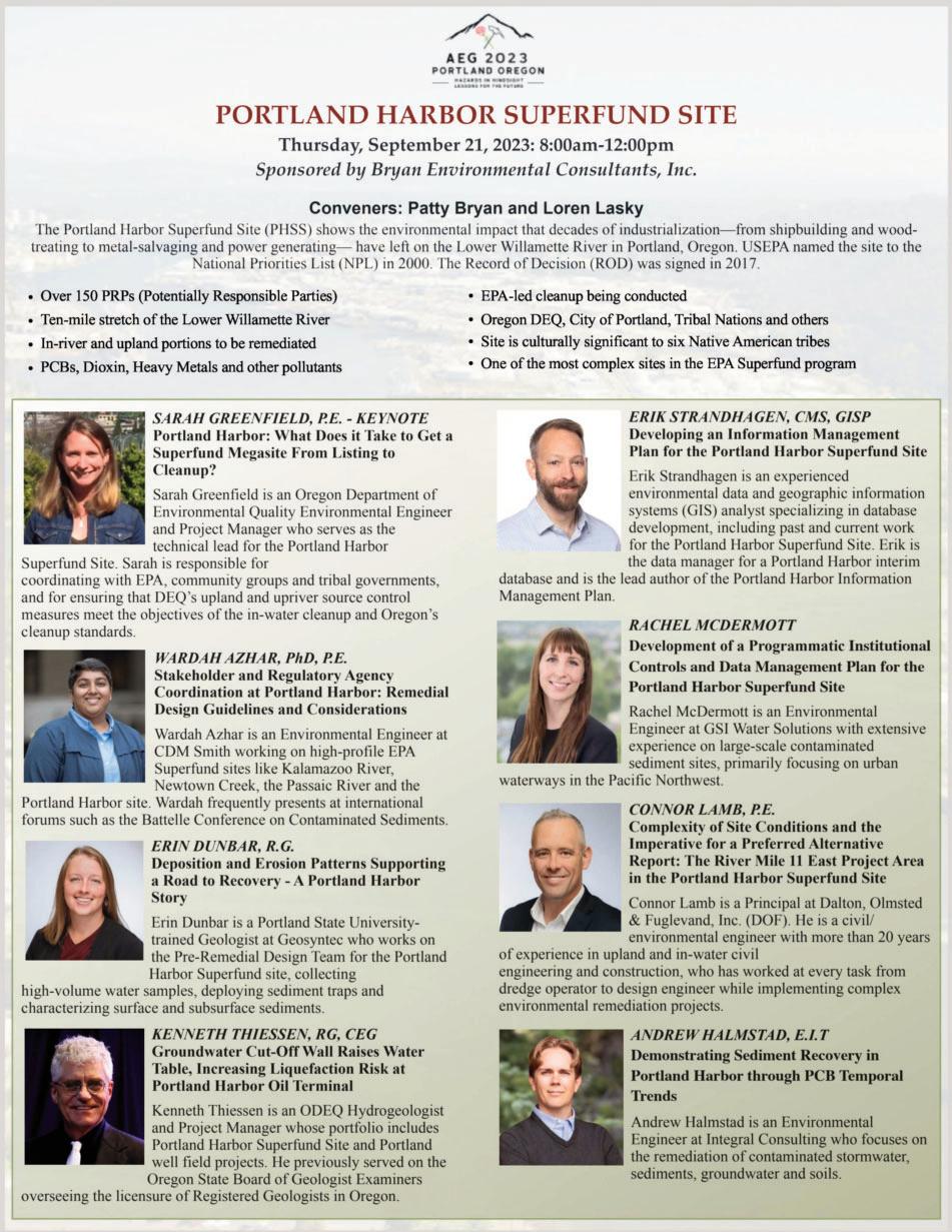
Technical Program Schedule
WEDNESDAY, SEPTEMBER 20 – AFTERNOON

Technical Session #1
DEIC Symposium: DEI – Doing the Work
Sponsored by Weyerhaeuser Company
From school to alumni to work groups. From the personal to the professional. This symposium brings speakers from a range of backgrounds and experience together to talk about diversity, equity, and inclusion issues, and working through them, in the STEM fields, specifically the geosciences. We’ll wrap up in a panel discussion with all the speakers. Come contribute and learn as we strive to make our profession more welcoming for all.
Convener: Deborah Green Room: Salon AB
Time Speaker Title
2:00–2:40
2:40–3:00
3:20–3:40
3:40–4:00
4:00–4:20
4:20–4:40
4:40–5:00
Masai Lawson Strategies to Improve Business Performance Through Workplace Equity
Visty Dalal Increasing Enrollment of Underrepresented Students in STEM Education
Matt Buche How to Start a Geology Alumni Society: A Western Oregon University Case Study of Common Values and Collaboration
Anna Saindon Hidden Disabilities
Tiffany Smith We are Still HERE: Amplifying Indigenous Languages and Knowledges in STEM
Sarah Kalika Intentional Inclusion and AEG
Panel Discussion
Technical Session #2
Tunneling
Sponsored by Aldea Services and Brierley Associates
Moderators: Paul Headland, Ike Isaacson, and Mike Piepenburg Room: Salon CD
Time Speaker Title
2:00–2:40
2:40–3:00
3:20–3:40
3:40–4:00
4:00–4:20
4:20–4:40
4:40–5:00
Red Robinson Tunneling in Seattle – The Good, The Bad and The Ugly
Kenneth Johnson Mitchell Point Tunnel – Resurrection of the Tunnel of Many Vistas, Hood River County, Oregon
David Sackett Tailoring Geotechnical and Geoscientific Investigations for Properly Assessing Tunnel Design Parameters
Nick Strater Bedrock Characterization Requirements for Microtunneling
Scott Ball
CM Oversite of the Upper Llagas Creek Flood Protection Project Phase 2A Stormwater Bypass Tunnel (Presented by Joseph Ang)
Daisy Herrman A Systematic Analysis of the Schmidt Hammer for Field Assessment of Rock Strength
Riccardo Tortini Best Practices for Satellite InSAR Monitoring in Tunneling
WANTS YOUR MEETING PHOTOS!
Please submit your BEST SHOTS of field trips, guest tours, technical sessions, social gatherings, and people just having fun. See page 3 for photo requirements. We also welcome REPORTS on the various field trips and other events for possible publication in the meeting summary in the Winter issue of AEG News Submit photos to news@aegweb.org.
AEG 2022 ANNUAL MEETING 56 AEG 65th Annual Meeting Program with Abstracts September 2022
Technical Session #3
Geophysical Techniques and Investigations Relevant to Dams and Levees Symposium
In partnership with Society of Exploration Geophysicists (SEG)
The Geophysics and Dams and Levees Technical Working Groups are pleased to present a panel discussion during Technical Session #3: Geophysical Techniques and Investigations Relevant to Dams and Levees featuring Drs. Lew Hunter, Matt Huebner, Koichi Hayashi, and Mitchell Craig. They will present several short case studies from their experiences as geologists and geophysicists working on dams and levees, highlighting the conditions and resolution particular geophysical methods can be used to determine targets, addressing uncertainties, and communicating results to varied audiences.
Convener: Kathryn Murdock Room: Salon I
Time Speaker Title
2:00–2:20
2:20–2:40
2:40–3:00
3:20–3:40
3:40–4:00
4:00–4:20
4:20–5:00
Greg Hempen Geophysics for Dam Safety Investigations
Matt Huebner
Applications of Multi-Channel Analysis of Surface Waves (MASW) to Dam Safety – Targets, Objectives, and Results from Different Geologic Settings
James Perry The Use of L-Band SAR in the Monitoring of Safety for Earth Dams, Levees, and Tailings Storage Facilities
David Carpenter
Non-Invasive Evaluation of a Distressed Earthen Dam Using Multiple Geophysical Methods
Roy Bowling Geophysics Outside the Box: Examples and Perspectives on Nonstandard Applications of Geophysics to Dams and Dam Sites
Jeremy Strohmeyer Geophysical Investigations at a Distressed Dam in the Cascade Range
Panel Discussion With Lew Hunter, Matt Huebner, Koichi Hayashi, and Mitchell Craig, Moderated by Kathryn Murdock
Technical Session #4
Geomorphology
Sponsored by PanGeo, Inc.
Moderator: Linda Mark Room: Salon GH
Time Speaker Title
2:00–2:20
2:20–2:40
2:40–3:00
3:20–3:40
3:40–4:00
4:00–4:20
4:20–4:40
4:40–5:00
Sam Bartish A Geomorphic Change Assessment of the Strawberry Point Drift Cell
William Haneberg
William Haneberg
Geomorphometric Thresholding and Machine Learning Approaches to Surficial Engineering Geologic Mapping
Downstream Attenuation of Extreme Flood Recurrence Intervals – An Example from the 2022 Eastern Kentucky Floods
Sarah Johnson Machine Learning for Mapping Surficial Geology in Kentucky
Rory Robinson Processing of InSAR Data to Enhance Geologic Interpretation for Highway Alignment Studies on OR22, Polk County, Oregon
Scott Yehl Characterizing and Mapping Alluvial Fan Deposits in Eastern Nevada Using a LidarBased Approach
Isaac Pope Forget About Base Level: The Impact of Volcanogenic and Glaciogenic Floods to Knickpoints in Washington and Oregon
Lee MacDonald
Management-Related and Long-Term Erosion Rates in Two Intensively-Managed Forested Watersheds in Northwestern California (Presented by Jason Woodward)
Young at Heart
Student/Professional Special Event
Tuesday, September 19, 2023 – 8:00pm–10:00pm
Portland State University Geology Department
This social event is a great way to start your week in Portland. Make or Mingle with friends in environmental and engineering geology. Just an 8-block walk from the hotel, this event is an excellent opportunity to build connections with peers, mentors, senior fellows, and potential employers. We encourage students and young professionals to join the event and welcome experienced professionals who are “young at heart!”
(Included with full and student registrations)
AEG 2022 ANNUAL MEETING September 2022 AEG 65th Annual Meeting Program with Abstracts 57
THURSDAY, SEPTEMBER 21 – MORNING
Technical Session #5
Collecting Geologic Data for Assessment of Potential Hazards using Multiple Surface and Subsurface Methods Part I
Sponsored by Aspect Consulting LLC
The Geologic and Seismic Hazards Technical Working Group (GASH TWG) of AEG will convene a symposium titled “Collecting Geologic Data for Assessment of Potential Hazards Using Multiple Surface and Subsurface Methods” at the 66th Annual Meeting in coordination with AEG’s Geophysics TWG. Speakers from academia, consulting firms, technical specialty companies, a national laboratory, state geologic surveys, and Federal and State agencies will discuss various methods for data collection and present practical examples illustrating how the data were used to evaluate potential hazards. Methods include use of trenching, geologic mapping, surface and subsurface geophysics, geotechnical data, soil borings, Digital Surface Models, Unmanned Aerial Vehicles, lidar, and Interferometric Synthetic Aperture Radar for evaluating hazards related to faulting, volcanism, landslides, subsidence, slope failures, debris flows, rockfall, and earthquake and tsunami sources in the Cascadia Subduction Zone. A Thursday morning Keynote speaker will discuss the multiple methods applied to assess volcanic hazards in the Cascade Range. A Thursday afternoon Keynote speaker will explain how geologic mapping and geophysical data were integrated to locate and connect active faults in southwestern Washington State.
Conveners: Gerry L. Stirewalt and Kate McKinley Room: Salon AB
Time Speaker Title
8:00–8:40
8:40–9:00
9:00–9:20
9:20–9:40
9:40–10:00
10:20–10:40
10:40–11:00
11:00–11:20
11:20–11:40
11:40–12:00
Weston Thelen Keynote: Multi-Disciplinary Approaches to Assessing Volcanic Hazards Across the Cascade Range
Stephen Angster Paleoseismic Evidence for Late Pleistocene and near Historic Ruptures on North-verging Faults within the Seattle Fault Zone: Implications for Complex Hanging Wall Deformation
Colin Chupik Advantages of Ultra-High-Resolution Imagery from UAVs For Analyzing Surface Fault Ruptures
Josh Wagner Visual Storytelling: Imagery’s Role in Consulting Geology and Geohazard Mitigation
Rich Koehler Assessment of Slow Slipping Faults: Recent Examples from the Northern Walker Lane, California and Nevada
Chris Slack Using Satellite-derived Digital Surface Model (DSM) for Quaternary Fault Investigations in a SCR Environment –Western Cape, South Africa
Ryan Coppersmith Evaluating Lidar and Satellite Imagery Datasets for Characterizing Faults at INL and Northwest of the Eastern Snake River Plain
Neill Marshall Earthquakes and Active Faulting of the South Caspian Region (Azerbaijan and Türkmenistan)
Alfredo Rocca InSAR – Orbital Radar Evolution
James McCalpin Reconstructing Sackung Displacement Histories by Trenching
Technical Session #6
Environmental Symposium – Portland Superfund Site
Sponsored by Bryan Environmental
The Portland Harbor Superfund Site (PHSS) shows the environmental impact that 150 years of industrialization—from shipbuilding and wood-treating to metalsalvaging and power generating—have left on the Willamette River in Portland, Oregon. USEPA added a contaminated 10-mile stretch of the Lower Willamette River to the National Priorities List (NPL) in 2000. The Portland Harbor site includes all the environmental components from the river and adjacent sediments, to the upland soils and groundwater. With over 150 Potentially Responsible Parties (PRPs) involved, the Portland Harbor Site is considered to be one of the most complex sites in the Superfund program. The most significant contaminants include PCBs, Dioxins/Furans, the pesticide DDT, PAHs and heavy metals, with PCBs posing the greatest potential risk to human health and wildlife. Speakers from the Oregon DEQ and environmental consultants conducting the EPA-lead cleanup will recap the history and current status of this megasite.
Conveners: Patty Bryan and Loren Lasky Room: Salon CD
Time Speaker Title
8:00–8:40
8:40–9:00
9:00–9:20
9:20–10:00
10:20–10:40
10:40–11:00
11:00–11:20
11:20–11:40
Sarah Greenfield Portland Harbor: What Does it Take to Get a Superfund Megasite from Listing to Cleanup?
Wardah Azhar
Erin Dunbar
Stakeholder and Regulatory Agency Coordination at Portland Harbor: Remedial Design Guidelines and Considerations
Deposition and Erosion Patterns Supporting a Road to Recovery – A Portland Harbor Story
Kenneth Thiessen Groundwater Cut-Off Wall Raises Water Table, Increasing Liquefaction Risk at Portland Harbor Oil Terminal
Erik Strandhagen
Rachel McDermott
Developing an Information Management Plan for the Portland Harbor Superfund Site
Development of a Programmatic Institutional Controls and Data Management Plan for the Portland Harbor Superfund Site
Connor Lamb Complexity of Site Conditions and the Imperative for a Preferred Alternative Report: The River Mile 11 East Project Area in the Portland Harbor Superfund Site
Andrew Halmstad Demonstrating Sediment Recovery in Portland Harbor through PCB Temporal Trends
AEG 2022 ANNUAL MEETING
58 AEG 65th Annual Meeting Program with Abstracts September 2022
Technical Session #7
Dams and Levees Symposium, Part I
Sponsored by RJH Consultants, Inc
The Dams Technical Working group is pleased to host this year’s three-part Dams and Levee Symposium! We have a great lineup of wide-ranging talks including lessons learned from recent and ongoing large dam construction projects, seismic characterization and designs, foundation treatment, paleoflood analyses, application of risk informed decision making, and updates to regulatory guidelines that will impact the industry. Our symposium will kick off with a Keynote Presentation on Cascadia Subduction, Block Motions, and Seismic Hazards, by Dr. Ray Wells (USGS). We’ll have a second keynote presentation on the Isabella Dam Rehabilitation Project, by David Serafini (USACE). We hope you will join us!
Conveners: Kevin Mininger and Matt Huebner / Moderator: April FontaineRoom: Salon GH
Time Speaker Title
8:00–8:40
8:40–9:00
9:00–9:20
9:20–9:40
9:40–10:00
10:20–10:40
10:40–11:00
11:00–11:20
11:20–11:40
11:40–12:00
Ray Wells Keynote: Cascadia Subduction, Block Motions, and Seismic Hazards, Northwest USA
Justin Pearce Phase 1 Site Characterization of Two Potentially-Liquefiable Sand and Gravel Embankment Dams in the Willamette Valley, Oregon
Christopher Goetz Surface Fault Displacement Characterization and Mitigation for the Tinemaha Dam Replacement Project, Inyo County, California
Matt Skakun Geologic Considerations for the Syphon Reservoir Improvement Project, Orange County, California
Egboche Unobe Geotechnical Properties of Crowley Ridge Loess at Bear Creek Dam, Marianna, Arkansas
Kate Zeiger Hazards in Hindsight: Complex Geologic Lessons Learned from California’s Largest Dam Construction Project of the Last 30 Years
Michael Gray Improving Water Storage and Reliability – Feasibility Evaluation: Geologic and Seismic Evaluations for a New Proposed Reservoir, Stanislaus County, California
Drew Kennedy
Scott Walker
The Role of the Geo-Professional as a Detective in Dam Safety: Case Studies in How It Pays to Dig Deep
A Tale of Two Rockfill Dams (and a Little about a Third)
Francisco Saldana Part 2, Conclusions from a Water Year of Data: A Closer Look at Instrumenting Old Casagrande Piezometers with New Vibrating-Wire Sensors?
Technical Session #8
Post-Fire Debris Flow Symposium Part I
Sponsored by Geosyntec Consultants
The Landslides Technical Working Group is pleased to present the Post-Fire Debris Flow Symposium during Technical Sessions #8 and #11 of the 66th Annual Meeting. Presenters from academia, consulting firms, and Federal and State agencies will discuss debris flow assessments, various case studies, modeling, analysis methods, and mitigation strategies. The sessions will include several talks on post-fire debris flows throughout western North America including British Columbia, California, Colorado, Oregon, and Washington.
Conveners: Jared Warner, Kate Mickelson, and Mitchell Allen Room: Salon I
Time Speaker Title
8:00–8:20
8:20-8:40
8:40–9:00
9:00–9:40
9:40–10:00
10:20–10:40
10:40–11:00
11:00–11:20
11:20–11:40
11:40–12:00
J. Gartner Regional Risk Assessment of Steep Creek Fans in the Squamish Lillooet Regional District
Jared Warner Post-Wildfire Geohazard Assessments Along Natural Gas Pipeline Corridors
Cody Stopka Post-Fire Debris Flow Hazard Assessment for Trail Rehabilitation Utilizing UAV Photogrammetry
Michael Zimmerman Keynote: Mosquito Creek Debris Flows: Risk and Mitigation, Historic Columbia River Highway, Oregon
Cody Chaussee Bolt Creek Fire: Post-Wildfire Debris Flow Risk Assessment and Barrier Design on US 2, Near Grotto, WA
Saleh Feidi Flexible Ring Nets as a Solution for Debris Flow Protection for Post Fire & Environmentally Sensitive Areas
Kerry Cato Use of Mobile Lidar and sUAV to Document Debris Flows from the 2019 El Dorado Fire, San Bernardino Mountains, California
Emilie Richard Post-fire Debris Flow Monitoring and Observations from 2022 in Washington State
Nancy Calhoun Investigating Pre- and Post-Fire Debris Flow Processes in Oregon Using Field Work, Lidar Differencing and Orthoimagery
Andrew Graber Relating Postfire Debris-Flow Occurrence to Satellite-Derived Estimates of Vegetation State
AEG 2022 ANNUAL MEETING September 2022 AEG 65th Annual Meeting Program with Abstracts 59
THURSDAY, SEPTEMBER 21 – AFTERNOON
Technical Session #9
Collecting Geologic Data for Assessment of Potential Hazards Using Multiple Surface and Subsurface Methods, Part II
Sponsored by Aspect Consulting LLC
Conveners: Courtney Johnson and David Carpenter Room: Salon AB
Time Speaker Title
1:40–2:20
2:20–2:40
2:40–3:00
3:20–3:40
3:40–4:00
4:00–4:20
4:20–4:40
4:40–5:00
Megan Anderson Keynote: The Doty Fault System: Finding and Connecting Active Faults by Integrating Geologic Mapping and Geophysical Data in SW Washington State
Greg Stock Using Various Remote Sensing Imagery Methods to Understand Rockfall Processes in Yosemite National Park
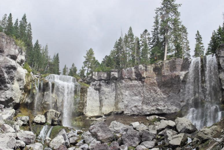
Stephanie Briggs Sinking Land – Untangling Subsidence in California’s Central Valley
Julian Chesnutt Subsurface Methods for Environmental Assessment of Landslide Hazards
Janet Sowers Fault Investigations to Site a Geothermal Landfill in the Imperial Valley
Chad Pritchard Building a Cross Sectional View of Porcupine Bay Road Landslide Using Drones, Geophysics, and Soil Borings, Lincoln County, Eastern Washington
William Burns Using Lidar to Better Understand Landslide and Debris Flow Hazards in Oregon
Alex Grant Combining Lidar and Geotechnical Data to Constrain Paleoshaking Intensities in the Cascadia Subduction Zone Using Landslides, Liquefaction, and Fragile Geologic Features
Technical Session #10
Dams and Levees Symposium, Part II
Conveners: Kevin Mininger and Matt Huebner / Moderator: Ed FriendRoom: Salon GH
1:40–2:00
2:00–2:20
2:20-2:40
2:40–3:00
3:20–3:40
3:40–4:00
4:00–4:20
4:20–4:40
4:40–5:00
April Fontaine Updates to USACE Drilling Guidance ER 1110-1-1807
Christopher Humphrey Engineering Geologists Roles in the New FERC Part 12D Dam Safety Process
Edwin Friend Risk Informed Design For Dams and Levees – Not Just a Buzz Phrase
Sasaki Yasuhito Geo-Risk Management of Flood Control Dams in Japan – Current Status and Issues Geo-Risk Management of Flood Control Dams in Japan – Current Status and Issues
Amy LeFebvre Paleoflood Analysis of the White River Near Beaver, Table Rock, and Bull Shoals Dams, Arkansas, and Missouri
Keith Kelson Regional Paleoflood Analysis of the Willamette River Basin, Central Oregon: Approach and Initial Characterization
Visty Dalal Lessons learned: Embankment Protection (HydroTurf®) on a High Hazard Dam in Maryland
Charlie Magill Using the USDA SITES Erosion Model to Evaluate Emergency Spillway Scour Potential at Oglala Dam, South Dakota
Dirk Grahl Variability in the Results for Permeability Test Methods at a Large Reservoir Project in South Texas
AEG 2022 ANNUAL MEETING 60 AEG 65th Annual Meeting Program with Abstracts September 2022
Time
Title
Speaker
Technical Session #11
Post-Fire Debris Flow Symposium, Part II
Conveners: Jared Warner, Kate Mickelson, and Mitchell Allen Room: Salon I
Time Speaker Title
1:40–2:00 David Sousa Evaluating the Controls on Post-Fire Debris Flows in the Pacific Northwest
2:00–2:20
Francis Rengers Post-Wildfire Debris Flow Sediment Provenance, Erosion, and Deposition Patterns, Black Hollow Watershed, Colorado
2:20–2:40 Michael Zimmerman Sources of Post-Fire Debris Flows in the Land of Columbia River Basalt: It’s Not the Basalt. Examples From Oregon
2:40–3:00
3:20–3:40
3:40–4:00
4:00–4:20
Carie-Ann Lau Observations and Hazard Assessment of the 2021 Lytton Creek Fire in British Columbia, Canada
Hazel Wong Post-wildfire Debris-flow Early Warning Systems – Case Study from Interior British Columbia
Kara Jacobacci Of Mudflows and Mudfloods: Understanding FEMA’s Policies and Practices Around Post-Fire Flooding
Caleb Ring Hydraulic Geometry and Scaling Relationships for Channels Cut by Runoff- and Landslide Generated Debris Flows
Technical Session #12
NOA Technical Session
Moderators: Sarah Kalika and Mark Bailey Room: Salon CD
Time Speaker Title
1:40–2:00
2:00–2:20
2:20–2:40
2:40–3:00
3:20–4:00
4:00–4:20
4:20–5:00
Mark Bailey Case Study Response to an NOA-containing Rockfall on Highway 95 near Riggins, Idaho in the Western Idaho Ultramafic BelC
Mark Bailey Sepiolite and Palygorskite: Magnesium Silicate Chrysotile Look-alike Minerals, Their Occurrence in Nature, and Identification
Sarah Kalika When Regulations Don’t Match Reality
Bodie McCosby Preliminary Naturally Occurring Asbestos (NOA) Screening for Quarry Expansion: Field and Structural Studies in the Ingalls Ophiolite Complex, Central Cascades, Washington (Presented by Alec Melone)
Aaron Fitts Managing Naturally Occurring Asbestos in Landslide Sediments and Debris Flows-Swift Creek, Whatcom County, Washington
Robyn Ray Heat Altered Asbestos
Discussion
FRIDAY, SEPTEMBER 22 – MORNING
Technical Session #13
Landslides, Part I Sponsored by Geosyntec Consultants
The Landslides Technical Working Group will convene three sessions at the 66th Annual Meeting. Speakers from academia, consulting firms, technical specialty companies, and Federal and State agencies will discuss various case studies, analysis methods, and inventory strategies. The sessions have an emphasis on west coast landslides, to include several talks on landslides/rockfall in Alaska, Oregon, and Washington, and landslides associated with the 2023 atmospheric river events in California.
Moderators: Paul Santi and April Fontaine Room: Salon AB
Time Speaker Title
8:00–8:20
8:20–8:40
8:40–9:00
9:00–9:20
9:20–9:40
9:40–10:00
10:20–10:40
10:40–11:00
11:00–11:20
11:20–11:40
11:40–12:00
Gonzalo Ronda Linking Inca Terraces with Landslide Occurrence in the Moquegua Region, Peru
Nishanthi Perera Tracking Rockfall Trajectories in 4D
Ashton Killen
Landslide Inventory-Based Hazard Investigation in El Paso County, Colorado (Presented by Paul Santi)
Yonathan Admassu Use of the CloudCompare Software for Semi Automated Rockfall Hazard Rating
Jennifer Bauer Out of My Head and Into the Database – Does “Geologic Setting” Have a Place in Landslide Inventories?
Jack Carrigan The Geology and Evolution of the Brenot Creek Landslide
Margaret Darrow CONTACT! Documenting the Collision of Frozen Debris Lobe A and the Dalton Highway, Brooks Range, Alaska
Sebastian Dirringer Seward Highway Rockfall Mitigation, Anchorage, Alaska
Charles Hammond Haines 2020 Beach Road Landslide Failure
Charles Hammond Oregon Highway 58’s Blue Pool Landslide: a Glacial-Age Giant
Katelyn Card Investigating Potential Trigger Mechanisms of a Deep-Seated Landslide at Rialto Beach, Washington State, Using Surface Roughness Analysis, Relative Age Dating, Limit-Equilibrium Modeling, and Newmark Analysis
AEG 2022 ANNUAL MEETING September 2022 AEG 65th Annual Meeting Program with Abstracts 61
Technical Session #14
Land Subsidence Symposium, Part I
Sponsored by Brierley Associates
The AEG Subsidence Working Group convenes AEG’s fifth Symposium on Land Subsidence as part of the 66th annual meeting of AEG. A keynote presentation by Virginia Tech Professor Dr. Manoochehr Shirzaei will discuss the implications of coastal land subsidence in the United States—its effects on infrastructure, flooding, ecosystems, and communities. Subsequent speakers will discuss land subsidence site studies, monitoring, modeling, and remediation in areas where groundwater and hydrocarbon extraction, mining, and karst collapse have affected stability of the land surface. Presentations from the United States, Caribbean and Africa illustrate the global extent of subsidence issues. This symposium will be convened annually at the AEG meeting. The next symposium will convene in Philadelphia, September 2024. Contact the AEG Land Subsidence Working Group to join the group or to participate in the annual Land Subsidence Symposium (hydrogeobro@gmail.com).
Convener: James Borchers Room: Salon CD
Time Speaker Title
8:00–8:40
8:40–9:00
9:00–9:20
9:20–9:40
9:40–10:00
10:20–10:40
10:40–11:00
11:00–11:20
11:20–12:00
Manoochehr Shirzaei Keynote: US Coastal Land Subsidnece and Implications for Communities, Infrastructure, Ecosystem Exposure to Flooding Hazards
John Ellis
Ian McGregor
The Land Surface—Groundwater Nexus: A Case Study on the Brownwood Subdivision, the Science, and Why It Matters
Analysis of USACE River Gauge Data to Evaluate Land Subsidence in Southern Louisiana
Brian Conway Arizona Department of Water Resources Land Subsidence Monitoring Program – 20 Years of Using Interferometric Synthetic Aperture Radar (InSAR) Data
Mehdi Nemati Impact of Land Subsidence on Housing Sales Value: Evidence from California
Ryan Smith Modeling Sinkhole Failure due to a Sharp Decline in Groundwater Levels in Dover, Florida
Sarah Missenda Lessons Learned: Blairsville Sinkhole Repairs
Christopher Hughes Evaluation and Characterization of Karst for Large Scale Photovoltaic Developments
James Borchers Busted Casings and Broken Dreams: Subsidence Damaged Wells in California
Technical Session #15
Dams and Levees, Part III
Conveners: Kevin Mininger and Matt Huebner / Moderator: Brian GreeneRoom: Salon GH
Time Speaker Title
8:00–8:40
8:40–9:00
9:00–9:20
9:20–9:40
9:40–10:00
10:20–10:40
10:40–11:00
11:00–11:20
11:20–11:40
11:40–12:00
David Serafini Keynote – Constructed Dam Safety Modification for Risk Reduction at the Isabella Dam Safety Modification Project
James Martin Geologic Mapping and Photogrammetry for Foundation Documentation, Lake Isabella Dam Safety Modification Project Lake Isabella CA
James Martin Foundation Treatment under Hydraulic Structures and Zoned Embankment Construction at the Lake Isabella Dam Safety Modification Project Lake Isabella, California
Henri Mulder Onsite Quarry and Processing for Dam Safety Embankment Modifications
Dan Meier So You Have a ULASZ in Your Dam Foundation? Forewarned is Forearmed!
Kristi Ainslie Determining Treatment Requirements for High-Permeability Faults in a Dam Raise Foundation
Kyle Kittle Chimney Hollow Dam Foundation Grouting Program, Larimer County, Colorado
Melina Lazar Investigation of Fracture Networks in Dam Carbonate Foundations in Northeastern Oklahoma
Hannah Maas Utilizing GIS for Geologic Foundation Mapping for Priest Rapids Dam
Erik James Cutter Soil Mixed Element Vertically Challenges and Successes for a Deep Seepage Cutoff Wall on the Natomas Reach a Levee Project
AEG 2023 ANNUAL MEETING 62 AEG 66th Annual Meeting Program with Abstracts September 2023
Technical Session #16
Earthquakes and Other Natural Hazards
Sponsored by GRI
Moderator: Gerry Stirewalt Room: Salon I
Time Speaker Title
8:00–8:20
8:20–8:40
8:40–9:00
9:00–9:20
9:20–9:40
9:40–10:00
10:20–10:40
10:40–11:00
11:00–11:20
11:20–11:40
11:40–12:00
Samuel Narveson Surface Fault Rupture Hazard Investigation Challenges in Urban Environments of Southern California
Elizabeth Davis Recurrence Interval of Large Seattle Fault Earthquakes Inferred from Submerged Terraces in Puget Sound
Kelsay Stanton Potentially Active Forearc Faults along the Cascadia Coastline in Southwestern Washington
Jason Patton Cascadia Subduction Zone Probabilistic Tsunami Hazard Assessment: USGS Tsunami Sources Powell Center Working Group on Tsunami Sources
Issa El-Hussain Tsunami Hazard Assessment for Important Power Facilities near Qalhat, in the Northeast Coast of Oman
Shant Minas Opportunities for Professional and Academic Collaboration: A Regional Scale Fault Study on the Mission Hills Fault Zone, and subsequent Academic Research Paper on Regional Geologic Structure of the Sylmar Basin, Proposed OSHPD Nursing Care Facility, Mission Hills Fault System, Los Angeles, California
Francisco Gomez Preliminary Investigation of Pre-Historic Earthquakes in the Grand River Tectonic Zone of North-Central Missouri
Owen Callahan Unoccupied Aerial Systems and Travertonics in the Central Nevada Seismic Belt
Elson T. Barnett
Application of Sea level rise estimates to slope stability evaluation of marine bluffs, Swinomish Indian Reservation, La Conner Washington
Jeffrey Keaton Natural Hazard Risk Assessments in Enterprise Risk Management Context
Charles McCrackin
3D Resistivity Survey Over Mapped Caves in Eogenetic Karst Terrane, West-Central Florida, USA
FRIDAY, SEPTEMBER 22 – AFTERNOON
Technical Session #17
Landslides, Part II
Moderator: Jason Woodward Room: Salon AB
Time Speaker Title
1:00–1:20
1:20–1:40
1:40–2:00
2:00–2:20
2:20–2:40
William McCormick
Margaret Parks
Sergio Sepúlveda
2023 Atmospheric Rivers and Landslide Effects in Northern California
The California Geological Survey’s 2023 Statewide Landslide Event Response
Earthquake-induced Landslides in Subduction Zones: Insights from the Central-Southern Andes
Brent Ward Evolution and Timing of the 2019 Koidern River Landslide, Yukon, Canada
Julia Yeakley
Technical Session #18
3D Modeling to Expedite Design for Emergency Landslip: Case Study in Eastern Ohio
Hazards and Human Society
Moderator: Julien Cohen-Waeber Room: Salon I
Time Speaker Title
1:00–1:20
1:20–1:40
1:40–2:00
2:00–2:20
2:20–2:40
Rory Robinson Liquefiable Gravels below the Southbound I-5 Santiam River Bridge and Possible Implications for the Greater Willamette Valley, Oregon
Jeffrey Keaton Is Schema for Stable Ground a Step Toward Enabling Landslide Insurance?
James Arthurs How Much Did Your Investigation Cost
George Freitag Engineering Geology of the Coos Bay Channel, Oregon-New Ships and Shipwrecks
Julien Cohen-Waeber Engineering Geology in the Court Room: Navigating Expert Driven Litigation
AEG 2023 ANNUAL MEETING September 2023 AEG 66th Annual Meeting Program with Abstracts 63
Technical Session #19
Environmental Topics
Moderator: Matt Brunengo Room: Salon GH
Time Speaker Title
1:00–1:20
1:20–1:40
1:40–2:00
2:00–2:20
2:20–2:40
William Gottobrio
Joan Smyth
Scalable Groundwater Model Workflow for CCR Sites

Who Will Take My Leachate? The Ripple Effect of PFAS Regulation on Landfill Facilities
Kenneth Myers Use of Stream Restoration in Land Reclamation
Stephen Evans
Sean Buchanan
Technical Session #20
All Mixed Up – or The Geotechnical Aspects of an Insitu Soil Stabilization Remediation Project




Advanced Methods for Effectively Modeling and Collaborating around Your Contaminant Plume with Dispersed Project Teams and Stakeholders


Land Subsidence Symposium, Part II

Sponsored by Brierley Associates


Moderator: David Hibbard Room: Salon CD
Time Speaker Title




1:00–1:20
1:20–1:40
1:40–2:00
2:00–2:20
2:20–2:40
Shane Zentner
David Knott
Oliver Barker
Josh Zimmerman
The Merging of GIS and Remote Sensing; Disciplines Used in Monitoring, Analyzing, and Detecting Subsidence Features

Coal Mining and Mine Subsidence Features in the Field
The Impacts of Artisanal Mining on Township Development: From Wawasi in Ghana to Randfontein in South Africa –Traps Set for Town Planners – Solved by Engineering Geologists
Challenges of Reactivating a Hardrock Mine with Extensive Historic Underground Mine Workings

Robert Millar Application of High Mobility Grout in Rubblized Conditions of the Glenrock 1 and 2 Coal Mines


AEG 2023 ANNUAL MEETING 64 AEG 66th Annual Meeting Program with Abstracts September 2023
MATERIAL ASBESTOS QUALITY TESTIN LS SCIENCE SILICA S NG SERVICES FOR E A R VISIT EMSL AT BOOTH #24
PREMIUMENGINEERING&SCIENTIF Candidates & Exponent Is S ONSULTINGFICC Postdocs eeking Ph.D. 90+ T f 640+ Doctor Profeessio Teechnical Disciplines
an indispensab ofamultidisciplinaryte al Level onals le part eamthat ak of a multidisciplinary team that makes bre kthrough insights and innovations happen.
www.EMSL.com
Become
Poster Sessions
(Each poster author will post their schedule on their poster for when they will be available for questions)
Vote for Your Favorite Poster!
We will once again be holding a student poster competition. There will be three cash prizes ($200, $100, and $50) for the top three vote recipients of the student poster sessions. Voting will be conducted exclusively through the Mobile App, so bring your mobile device to vote for your favorite. Winners will be awarded at the Poster Reception on Thursday, September 21, 2023, from 5:00–6:30pm. All poster presenters will be at their posters during the poster reception.
Wednesday, September 20 – 8:00am–4:00pm
Collecting Geologic Data for Assessment of Potential Hazards Using Multiple Surface and Subsurface Methods
Speaker Title
Anita Bauer Building a Geophysical Model of the Bald Hill Quadrangle Using Gravity and Magnetic Potential Fields
Aleigha Dollens Geophysical Imaging of the Motagua Fault at La Laguna and Gualàn in Guatemala Using Electrical Resistivity Tomography
Steph Garcia-Rosabel At the Intersection of Land Use Change, Flooding, and Social Vulnerability: A Case Study of New Orleans, Louisiana
Lauren Guido Putting More PEP in Landslide Analyses: An Introduction to a Parameter Estimation Protocol for Data-Sparse Settings
Jessica Hiatt Underground Coal Fire Detection through Multispectral Analysis, Terrain Subsidence Assessment, and Geospatial Analytics
Sean Polun Establishing Surface Age of Inaccessible Faulted Geomorphological Features for Slip Rate Estimation: Examples and Challenges from Southeastern California
Isaac Pope When the Earth Crumbles: Two-Pronged Hazards from Rotational Slides in the Moquegua Region, Peru
Dams and Levees
Speaker Title
Jessica Baker Evaluation for Internal Erosion Potential at Chickamauga Dam
Ana Vargo Sinkhole Investigation of Turkey Creek 8 Dam, Dickinson County, Kansas
Thursday, September 21 – 8:00am–4:00pm
Landslides
Speaker Title
Chelsea Bush Washington Boulevard Landslide Stabilization
Jason Connelly Statistical Landslide Susceptibility Assessment in the Mount Meager Volcanic Complex, British Columbia (Student)
Natalie Culhane Finding Extent: A New Data Set of Global Coseismic Landslide Runout Lengths (Student)
Elizabeth Davis Landslides, Tectonic Uplift, and Coastal Erosion of the Past Several Hundred Years at Rialto Beach, Washington: Geologic Evidence and Implications for Geohazards along the Northwest Coast (Student)
Justin Marchlewicz Using Landslide Inventory to Identify Historic Earthquake Location: An Example from Northern Colorado (Student)
Groundwater Modeling, Fault Studies, Subsurface Databases and Remote Sensing
Speaker Title
Recep Cakir Expanded Subsurface Database for Washington State
Ricardo Jaimes Palomera Evaluation of the Tidal Anacostia River Surface Water-Groundwater Interaction Using Flow and Transport Numerical Modeling
Ellen Lamont Preliminary Results from Paleoseismic Investigations of the Bitterroot Fault System, Southwestern Montana
Xochitl Montano-Soriano The Groundwater Model of the District of Columbia and Its Use to Assess the Effects and Environmental Impact of Construction Dewatering
AEG 2023 ANNUAL MEETING September 2023 AEG 66th Annual Meeting Program with Abstracts 65
Gravity for:


Aquifer Studies


Sink Hole Dectectio
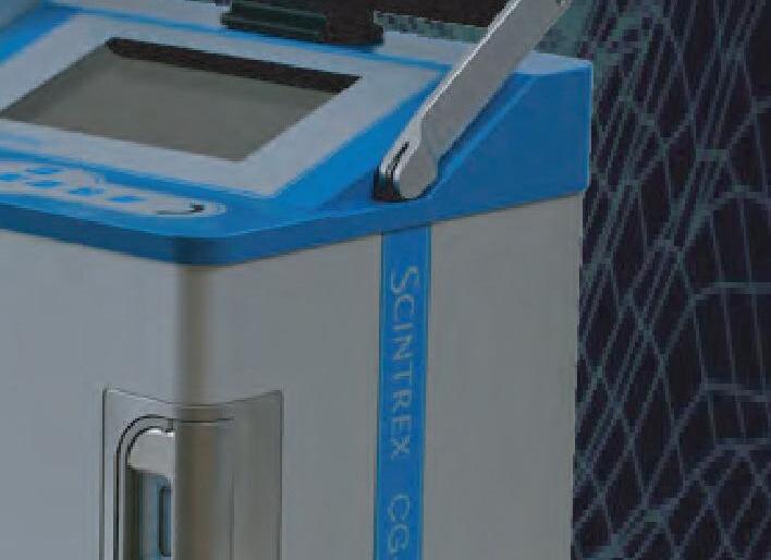
Locating Under V






FindingKarstHazard oids/Cavity Dectecti o ound T gr g



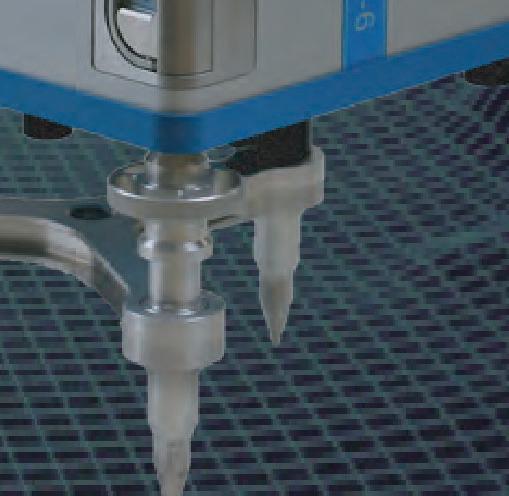


Finding Karst Hazar

n
s ioon anks
av Gr he T a Speci y t i st i l
Use of the CloudCompare Software for Semi Automated Rockfall Hazard Rating
Admassu, Yonathan, James Madison University, admassyx@jmu.edu (TS #13)
Geotechnical asset management of rock slopes include evaluation of hazard and risk of rockfall events. Traditionally rock slopes are evaluated for their risk of rockfall generation using the rockfall hazard rating system (RHRS), which was first deployed by the Oregon department of transportation. The RHRS evaluates geologic factors that lead to rockfall generation and other rockfall impact factors. The extent (in the order of thousands of miles) of rock slopes in mountainous states makes it extremely difficult to evaluate rock slopes using the rockfall hazard rating system which requires physical evaluation of a given slope. That would entail an enormous amount of time and money making it impossible to make temporal evaluations. Vehicle mounted lidars cans can collect point cloud data from rock slopes that can be used to evaluate kinematic potentials of rockfall generation. The most common modes of kinematic potentials include plane, wedge, topple, and undercutting-induced failures. The CloudCompare free software, which was originally designed for comparison between two sets of point cloud, has now grown to the point that several rock mechanics parameters including discontinuity orientation, depth of undercutting, and length can be measured. In this research, we show how the tools and plugins in CloudCompare can be used to identify sites of possible rockfall releases that correlate with rockfall risk. Lidar acquired from a vehicle can collect point cloud data in a short time and semi-automated routines using CloudCompare provides efficient methodologies to evaluate the geologic controls of rockfall generation.
Determining Treatment Requirements for High-Permeability
Faults in a Dam Raise Foundation
Ainslie, Kristi, AECOM Technical Services, kristi.ainslie@aecom.com; Doug Yadon, douglas.yadon@aecom.com; Felipe Garcia, felipe.garcia@stantec.com; Paulo Virreira, paulo.virreira@denverwater.org (TS #15)
Denver Water is expanding Gross Reservoir by raising the curved gravity dam by 131 feet. The raise will result in Gross Dam becoming the highest RCC dam raise in the world. During original dam construction in the 1950s, geologic mapping of the Precambrian granitic foundation (led by engineering geologist Ernie Wahlstrom) revealed a series of what became known as the “alphabet faults.” Among these faults the parallel “C” and “D” couplet form a 10- to 15-foot-wide zone of highly weathered and sheared rock with increased permeability in the mid right abutment. The faults were treated in the original foundation with additional excavation up to 25 feet. Higher grout takes and tighter hole spacing through the fault zone combined to achieve closure in the original grout curtain. Foundation investigations for the Gross Reservoir Expansion project (GRE) identified the “C”–“D” fault couplet as one of the high-priority targets in the right abutment. In addition to reconnaissance geologic mapping and an inclined 312-foot-long HQ3 core hole, existing foundation drains were televiewed and seismic refraction tomography (SRT) profiles crossing these features were scrutinized. Since GRE construction began in 2022, detailed mapping of the dam raise foundation has located these faults. Treatment of these features at the foundation surface has included additional excavation and replacement with treatment concrete. Televiewing and packer testing of existing foundation drains was performed as the basis for an ongoing assessment of the need for stitch grouting of the “C”–”D” couplet to supplement the original grout curtain in this area.
The Doty Fault System: Finding and Connecting Active Faults by Integrating Geologic Mapping and Geophysical Data in Washington State Anderson, Megan, Washington Geological Survey, megan.anderson@dnr.wa.gov; Todd Lau, todd.lau@dnr.wa.gov; Andrew Sadowski, andrew.sadowski@dnr.wa.gov; Michael Polenz, michael.polenz@dnr.wa.gov; Alex Steely, alex.steely@dnr.wa.gov; Wesley von Dassow, wvondassow@usbr.gov, Tabor Reedy, treedy@usbr.gov; Alison Horst, ahorst@gri.com; Chelsea Amaral, camaral@usgs.gov (TS #9)
The Washington Geological Survey StateMap team finds and characterizes potentially active crustal faults to evaluate natural hazards. This task is challenging due to abundant vegetation and Quaternary sediment cover across western Washington. Therefore, we are sewing together the patchwork of geologic exposure into geologic maps with the aid of geophysical thread using gravity and geomagnetic data. This requires people within two areas of expertise: in collection and interpretation of: 1) new geologic mapping data, and 2) gravity and magnetic data, along with relevant rock physical properties. Through this collaboration, we create geologic maps and cross sections that are constrained by a wealth of geoscience data: field geologic observations, petrology, age dating, geochemistry, gravity, aeromagnetics, rock density, and rock magnetic data. The methods we apply have proven effective for decades. The novelty of our approach is the close collaboration of geologists and geophysicists that enables us to more confidently characterize crustal faults. The addition of geophysical data to classical geologic mapping and analysis gives more precise fault characterization, including fault tip location, dip, and lateral extent. The newly mapped Doty Fault system in southwestern Washington is an example of this work. Prior maps completed in the 1950s characterized the geology well, but left major faults disconnected and without explanation for their termination. With our joint geologic and geophysical work, we have filled in the fault network, adding new strands and extending/confirming others. Our models of fault tip location enabled shallow seismic and electrical resistivity surveys to identify Quaternary offset and provides better constraint on fault dip for improving estimates of seismic hazard potential.
Paleoseismic Evidence for Late Pleistocene and near Historic Ruptures on North-Verging Faults within the Seattle Fault Zone: Implications for Complex Hanging Wall Deformation
Angster, Stephen, US Geological Survey, sangster@usgs.gov; Brian Sherrod, bsherrod@usgs.gov; Jessie K. Pearl, jessie.pearl@TNC.org; Lydia Staisch, lstaisch@usgs.gov; Wes Johns, wjohns@nevada.unr.edu
(TS #5)
The Seattle fault zone (SFZ) preserves a long-term deformation record of north-directed thrust faulting, although the majority of paleoseismic studies show evidence for multiple Holocene ruptures on ancillary bedding plane back thrusts within the hanging wall of the master structure. These paleoseismic studies elucidate the complex nature of hanging wall deformation within the SFZ and motivates our approach for evaluating thrust fault systems for seismic hazard. Here, we present new data from paleoseismic investigations of recently identified fault scarps within the SFZ that, unlike the south-facing scarps of the north-dipping bedding plane reverse faults, are north-facing and spatially correlative with main fault strands of the SFZ. Trenches across the scarps along with geomorphic analysis and geochronology provide stratigraphic and structural evidence for at least three new
AEG 2023 ANNUAL MEETING September 2023 AEG 66th Annual Meeting Program with Abstracts 67
Abstracts
events within the SFZ; two of which overlap in time during the late Pleistocene and the youngest event occurred during late Holocene, which may be historically recorded. To understand the structural significance of these faults, we combine our paleoseismic observations with ground-based magnetic transect data collected perpendicular to the western-most studied scarp and other east-trending scarps on Bainbridge Island, Washington. The magnetic data combined with prior stratigraphic mapping reveal distinct magnetic signals that reflect bedding composition of the underlying Tertiary bedrock and display spatial correlations between magnetically high coarser (conglomerate bearing) beds and the ancillary fault scarps. Together, our observations suggest mechanical stratigraphic controls that may limit the extent of ancillary faulting and a new style (a forelimb thrust) of hanging wall faulting within the SFZ.
How Much Did Your Investigation Cost?
Arthurs, James, FHWA, james.arthurs@dot.gov (TS #18)
Geotechnical engineers and engineering geologists often face the task of justifying their investigations costs to project stakeholders. Investigations can be a significant expense to a project, especially in areas with difficult access. Conversely, a lack of subsurface information during design can impose high-cost risks to a project. These increased costs can be related to overly conservative design or unforeseen ground conditions encountered during construction. This presentation presents a case study from the Beartooth Ravine Bridge, a complex bridge project located at a remote site in rugged, mountainous terrain. The Beartooth Ravine Bridge was constructed as part of a multiphase program of reconstruction of US Highway 212 (Beartooth Highway) in northwestern Wyoming. The highway provides access to Yellowstone National Park and Shoshone National Forest, and is designated as a National Park Approach Road, a Scenic Byway, and an All-American Road. The Beartooth Ravine Bridge was proposed to improve roadway geometry and safety. The bridge was planned as a three-span bridge that included a reverse curve. Project development and design took place from 1998 to 2019, with construction in 2019 to 2022. Site investigations were performed by multiple consultants over multiple mobilizations, many (but not all) prior to finalization of the bridge geometry. Lack of investigations at the actual bridge foundation locations led to significant cost overruns in drilled shafts.
Stakeholder and Regulatory Agency Coordination at Portland Harbor: Remedial Design Guidelines and Considerations
Azhar, Wardah, CDM Smith, azharw@cdmsmith.com; Hunter Young; Madi Novak; Josie Clark; Louisa Orr; Sean Sheldrake (TS #6)
Background/Objectives. The Portland Harbor Superfund Site (Site) is an approximately 10-mile reach of the lower Willamette River in Portland, Oregon, for which a Record of Decision (ROD) was signed in 2017. The state and tribal stakeholders at the site include the Oregon Department of Environmental Quality, the Confederated Tribes and Bands of the Yakama Nation, the Confederated Tribes of the Grand Ronde Community of Oregon, the Nez Perce Tribe, the Confederated Tribes of Siletz Indians of Oregon, the Confederated Tribes of the Umatilla Indian Reservation, and the Confederated Tribes of the Warm Springs Reservation of Oregon. These stakeholders, the National Oceanic and Atmospheric Administration, the US Department of the Interior, and the Oregon Department of Fish and Wildlife entered into a 2001 Memorandum of Understanding after the Site was listed on the National priorities list. With all of these stakeholders and numerous performing parties engaged in remedial design (RD) lending to the complexity of implementing the selected remedy, the Remedial Design Guidelines and Considerations (RDGC) document was developed to
define EPA expectations for RD, provide general guidelines to promote consistency throughout the site, and inform performing parties and stakeholders on the overall process for RD activities. Approach/Activities. The RDGC clarifies ROD requirements and supplements relevant information and general guidance for the design and construction of sediment remedies to effectively, efficiently, and permanently achieve remedial action objectives both on small and large spatial scales once construction begins at the site. The document was developed to effectively communicate design requirements to stakeholders and performing parties to maintain consistency amongst the nineteen different project areas within the site. In addition to general design requirements consistent with the ROD, it currently includes technical guidelines and considerations for capping, dredging, flood-rise evaluation, seismic design, climate change considerations, cap and dredge construction monitoring, performance monitoring, and long-term monitoring of the selected remedy. Two RD workshops were conducted by EPA to solicit input from the stakeholders and performing parties with the goal of informing the guidelines and considerations that were incorporated in the RDGC. Results/Lessons Learned. The RDGC has been well received by performing parties, stakeholders, and regulatory agencies. Early drafts of the RDGC have been requested by other EPA regions to serve as templates for RD at their sediment sites. Consistency in RD across the site can be maintained and effectively communicated to performing parties and stakeholders using the RDGC. The RDGC is a living document intended to be updated with new information and “lessons learned” as RD progresses at the Site and specific details are developed for design topics that are anticipated to be encountered and addressed during site wide RD efforts. Additional RD workshops with stakeholders and performing parties will be conducted to collaboratively work through technical design concerns at the Site and the resulting conclusions will continue to be incorporated in the RDGC.
Case Study Response to an NOA-containing Rockfall on Highway 95 Near Riggins, Idaho in the Western Idaho Ultramafic Belt Bailey, R. Mark Asbestos TEM Labs, mark@asbestostemlabs.com; Bradley Erskine, erskine.geo@gmail.com
The emergency mitigation following two large rockfalls in July 2020 on steep cliffs of NOA-containing serpentine rock and schist that closed US Highway 95, the only N–S highway north central Idaho, was an extremely challenging project. It required the Idaho Transportation Department to deploy a crew of seasoned rock climbers (both geologists and construction workers), drill rigs that could be suspended down the side of cliffs, experienced landslide blasting teams, helicopters, and drone pilots. Mitigation efforts included drilling and blasting of unstable overhangs, removal of debris and hanging of steel cable drapes with the aid of a helicopter. A comprehensive geologic investigation to assess the distribution of NOA and other EMPs was initiated requiring geologists to rappel down sheer cliff faces to collect samples. TEM and PLM analysis of the schist unit exposed at the site detected actinolite at up to 5.8 wt. percent by weight and 2.0 billion fibers per gram (BFG), and hornblende at up to 0.7 wt. percent and 1.6 BFG. In the serpentinite, chrysotile was present in one bulk sample at 0.42 percent and 26.7 BFG, and antigorite present as high as 26.3 percent and 19.2 BFG. Air monitoring of workers at the site found low levels of asbestos below the OSHA PEL of 0.1 fiber/cc as an 8-hour TWA. Perimeter monitoring also showed low levels of NOA with running average maximum asbestos concentrations typically below 0.015 fibers/cc. The project was completed in November 2020, after a major effort of over twenty-five companies to reopen the roadway.
AEG 2023 ANNUAL MEETING 68 AEG 66th Annual Meeting Program with Abstracts September 2023
Sepiolite and Palygorskite: Magnesium Silicate Chrysotile LookAlike Minerals, Their Occurrence in Nature, and Identification
Bailey, R. Mark, Asbestos TEM Labs, mark@asbestostemlabs.com
Sepiolite and palygorskite/atapulgite minerals mimic chrysotile fiber morphologies (tubular structure) and chemistry (magnesium silicates) and not infrequently co-occur with chrysotile and tremolite/actinolite in the natural geologic environment. The geologic environments where sepiolite and palygorskite/atapulgite occur include: a) paleo alkali lakebed and alluvial fan environments such as are found in the Basin and Range of California and Nevada, particularly in regions with dolomite and serpentine bedrock; b) alteration products of serpentine rocks, particularly in hydrothermally affected areas and shear zones; c) occurrences in dolomites due to hydrothermal alteration and/or biogenic activity; and, d) talc deposits, particularly those developed from metamorphosed dolomites. Identification of sepiolite and palygorskite/atapulgite by transmission electron microscopy has been used by the author as powerful technique to differentiate these fibrous materials from chrysotile asbestos on a submicroscopic fiberby-fiber basis.
Evaluation for Internal Erosion Potential at Chickamauga Dam
Baker, Jessica, Geosyntec, jbaker@geosyntec.com; Jenny Ramirez, jenny.Ramirez@geosyntec.com; John Barrett , jbarett@geosyntec.com; Andy Stallings; astallings@geosyntec.com; Matt Huebner, mthuebner@tva.gov (Poster)
Chickamauga Hydroelectric Project was originally constructed between 1936 and 1941 on the Tennessee River and is owned and operated by the Tennessee Valley Authority (TVA). It is composed of a south and north rolled earth-fill embankment, a powerhouse, an 18-bay spillway, and a navigation lock. The embankments are founded on alluvial soils and contain a cutoff trench through the alluvium and into rock. The foundation bedrock primarily consists of deformed carbonate strata with locally extensive karst features. To assist TVA with reducing uncertainty associated with the risks of internal erosion into the karst, the authors performed an Issue Evaluation Study (IES) which included a detailed review of historic documentation, an assessment of the filter compatibility of naturally occurring soils and their resistance to erosion, remote sensing techniques, and visualization of the results utilizing the three-dimensional (3D) software, RockWorks®. This poster will focus on the building blocks of our assessment, namely the collection of geophysical surveys, Interferometric Synthetic Aperture Radar (InSAR), Light Detection and Ranging (lidar), bathymetric surveys, digitization of original construction records, and the visualization of these items for the purpose of performing dam safety vulnerability assessments. The developed 3D model demonstrates how visualization of geo-referenced original construction documents greatly informs the interpretation of new monitoring and investigation techniques and how this information must be incorporated, where available, in modern dam safety evaluations.
CM Oversight of the Upper Llagas Creek Flood Protection Project
Phase 2A Stormwater Bypass Tunnel
Ball, Scott, Mott MacDonald, scott.ball@mottmac.com; Joseph Ang, joseph.ang@mottmac.com (Presented by Joseph Ang) (TS #2)
The Upper Llagas Creek Flood Protection Project Phase 2A, is a farreaching flood protection project. The project will provide 100-year flood protection to homes, businesses, schools, streets, and Highways within Morgan Hill and Gilroy, California. This Project includes approximately 2,150 linear feet of 14-foot-high by 12-foot-wide underground stormwater bypass tunnel beneath Nob Hill, 1,600 linear feet
of 10-foot-wide by 9-foot-high twin reinforced concrete box culverts upstream and downstream of the tunnel, creek widening and deepening to carry low stormwater flows, utility relocation, well abandonment and public outreach. This presentation presents the comparison of baseline (Geotechnical Baseline Report) rock quality, ground classification, and ground behavior vs. that encountered during excavation. Bedrock was composed of Franciscan (bimrock) formation that ranged from highly weathered to fresh, very weak to very strong and highly to slightly fractured. Three ground classifications (GCI, GCII and GCIII) were presented in the GBR. These were established in the GBR based upon the physical characteristics, laboratory test data, and estimations of the linear feet of tunnel that was expected to be encountered for each ground class. Preliminary and final design of initial support for each of these three ground classifications was performed by the designer and the tunnel excavation contractor. Bedrock was primarily excavated using a roadheader. However, drilling and blasting was utilized for sections of the tunnel where fresh, very strong, slightly fractured bimrock was encountered. Ground conditions encountered during excavation and initial support of the tunnel excavation were documented by mapping and classifying the ground condition of each tunnel face and recording the initial support installed for each round of tunnel excavation. Face mapping and initial support forms were prepared, including photos, and this data was entered into a tunnel tracking Excel document.
The Impacts of Artisanal Mining on Township Development: From Wawasi in Ghana to Randfontein in South Africa – Traps
Set for Town Planners – Solved by Engineering Geologists
Barker, Oliver B, Banzi Geotechnics cc, Parktown, Johannesburg, RSA, obb@banzi.co.za (TS #20)
Under evaluation of mining land has dire consequences on township development. We profile two mines investigated—one in Obuasi, Ghana and one in Randfontein, South Africa. The artisanal mining (AM) history of these towns is interestingly similar but vastly different in age, starting in Ghana in 1875 to the early 1900s and in the Witwatersrand on a large scale in the 1990s. The two areas have different climates and geology. Both settings gave rise to AM resulting in significant impacts on surface development: In Wawasi, the AM, left extensive, oval ‘stopes’, at irregular intervals: In South Africa AM mining is from ‘shafts’ sunk through aeolian sand or through highly weathered quartzite. In Ghana, shafts were obliterated by subsequent hill wash and infilling and the areas were reforested naturally until Obuasi was established as a full scale mine. Modern housing for staff was then built over these, now blanketed, shafts. The shafts started to produce circular sinkholes in the late 1990s. In Randfontein town planners ignored the presence of the undermined ground both in the old formal mines and in areas mined by AMs and laid out a 2,000+ house scheme. Expectedly, roads and services have failed, differential settlements are widespread. Solutions include: 1) In Ghana, houses were demolished, laterite was mined, and backfilled ground was rehabilitated for new housing; 2) In SA, remedial options are being designed and will include: Compaction (DC); Soil matrasses (with reinforcing); Cast insitu concrete pillars; Backfilling with soil\cement; the redesign of affected areas to suit geotechnical constraints; and, implementation of flexible services and housing designs to accommodate differential settlement.
AEG 2023 ANNUAL MEETING September 2023 AEG 66th Annual Meeting Program with Abstracts 69
Application of Sea Level Rise Estimates to Slope Stability Evaluation of Marine Bluffs, Swinomish Indian Reservation, La Conner Washington
Barnett, Elson T., Aspect Consulting, LLC, ebarnett@aspectconsulting.com; Aaron A. Fitts, afitts@aspectconsulting.com; Catey D. Ritchie, critchie@swinomish.nsn.us; Jessica M. Côté, jessica@gobluecoast.com; Karen J.R. Mitchell, kmitchell@swinomish.nsn.us; Erik O. Andersen, eandersen@aspectconsulting.com; Bo Ward, bward@aspectconsulting.com (TS #16)
Sea level rise has the potential for long term impacts to slope stability of marine bluffs that have historically experienced slope movement. The Swinomish Indian Tribal Community in western Washington has endeavored to evaluate these impacts within their tribal lands along the Salish Sea (Puget Sound) and on community members for current and future generations. This effort included standard slope stability analysis coupled with wave run-up modeling to more fully assess bluff stability. Aspect conducted slope stability analyses incorporating sealevel rise driven bluff toe erosion for specific marine bluffs within Swinomish Tribal lands. The marine bluffs consist of a variety of geologic including very dense glacially consolidated outwash and till and loose to medium dense drift deposits. The hillslopes range from less than 30 percent to locally greater than 70 percent with varying degrees of vegetative cover. Sea level rise derived wave run-up modeling was developed by Blue Coast Engineering for the years 2035 and 2048 at a variety of beach profile locations for the approximately 1.5-mile-long project alignment. Ten slope stability profiles were evaluated on slopes that are currently stable (factor of safety > 1) and unstable (factor of safety < 1). Modeling of the current slope geometries under static and dynamic conditions, as well as incorporating the impacts of forecasted slope toe erosion caused by sea level rise for the years 2035 and 2048. The typical reduction in future factor of safety values range from 0.00 up to 0.01.
A Geomorphic Change Assessment of the Strawberry Point Drift Cell
Bartish, Sam, University of Washington, sambartish@gmail.com; Kathy Troost: ktroost@uw.edu; Eric Grossman, egrossman@usgs.gov (TS #4) Discrepancies between feeder bluff sediment input and downdrift beach accretion provide insight into how the large, prograding Skagit River delta enacts change upon cross-channel shorelines. Using repeat Structure from Motion (SfM) photogrammetry and cross-shore transect surveys, this study aims to identify geomorphic change along the nearshore of northeast Whidbey Island and to understand the potential causes of that change. This study finds that the low tide terrace (LTT) aggraded by as much 1.5 m in some locations near Dugualla State Park between the years of 2008 and 2014, while eroding in updrift areas to the south. Lidar and SfM analyses indicate that the feeder bluffs sediment production was insufficient to explain the LTT aggradation observed, suggesting another source may be responsible. Comparisons of older surveyed transects show deposition coincided with an avulsion of the North Fork Skagit River that began in 2003 during a 30-year fluvial flood event. After the avulsion channel width continued to grow until stabilizing in 2015, overlapping the period of deposition along the LTT. It is likely that Skagit River sediment is only deposited along the nearshore of Whidbey Island due to behavior of sedimentladen plumes caused by extreme storm or avulsion events. As the frequency of these events increase in response to the changing climate, the environment of the shoreline may continue to change, resembling similar geomorphic alterations as observed in this study. Paleo-fluvial Skagit River deposits on the west side of Whidbey Island indicate that
the river and its delta once extended west across into the Strait of Juan de Fuca. If the Skagit River continues to fill the modern-day bay with sediment, it will alter the surrounding environment. Monitoring the interactions between tidal currents, SLR, and sediment input is important to help decision-makers maintain resilient shorelines in the area.
Building a Geophysical Model of the Bald Hill Quadrangle Using Gravity and Magnetic Potential Fields
Bauer, Anita, Washington Geological Survey, anita.l.bauer@gmail.com; Todd Lau, Todd.Lau@dnr.wa.gov; Michael Polenz, michael.polenz@dnr.wa.gov; Frank Hladky, fhladkys@gmail.com; Megan Anderson, Megan.Anderson@dnr.wa.gov (Poster)
The Bald Hill quadrangle is located on the southeastern edge of the Puget Lowland at the boundary between the Tacoma basin and the Cascade foothills in Washington. This quadrangle is a part of a Washington Geologic Survey (WGS) State Map (USGS) program funded geologic mapping project. It was identified as a mapping priority by state stakeholders due to outstanding questions in regional geology, the growing population, and the potential for seismic hazards related to the enigmatic “Olympia structure.” As an intern for the WGS, I collected and processed new gravity data and produced a 2D subsurface geophysical block model for the Bald Hill quadrangle and vicinity. The model was developed through an iterative forward modeling process constrained by gravity, aeromagnetics, measurements of rock density and magnetic susceptibility, and by geologic field observations from colleagues at the WGS. Key findings include: Offset of approximately 2 km of Crescent Formation basement beneath overlying Eocene sediments is required to match the observed gravity gradient. I present two possible mechanisms for this offset: 1) gradual folding, or 2) down-to-the-north normal faulting. Thicker Eocene sediment in the north end of the Tacoma basin than the south end of the basin suggests that most of the basin deepening, and N-down offset occurred during the Eocene. Bald and Green hills were likely formed by overlapping volcanic eruptions resulting in andesitic lavas interbedded with volcaniclastic vent-proximal pyroclastic flow deposits. Aeromagnetic highs (including at Bald and Green hills) can be explained by igneous near-surface intrusions or mafic flows. The southeastern extent of the Olympia structure remains largely unclear. The structure either terminates in the Bald Hill quadrangle where the gravity and magnetic anomalies disperse, or bends to the south (outside of our study area and data) to connect with the Doty Fault. Additional data is required to resolve this possibility.
Out of my Head and Into the Database – Does “Geologic Setting” Have a Place in Landslide Inventories?
Bauer, Jennifer, Appalachian Landslide Consultants, PLLC, jennifer@appalachianlandslide.com; Stephen Fuemmeler, stephen@appalachianlandslide.com; Philip Prince, philip@appalachianlandslide.com; Rebecca Latham, latham@appalachianlandslide.com; Aras Mann, aras@appalachianlandslide.com (TS #13)
Creating a landslide inventory is an opportunity to convey landslide information about particular locations to people who may never see the site. Oftentimes, inventories include information about the type of material and movement, how the data was collected, sometimes there is information about the slope geometry. But these simple categories do not capture the more variable and harder to define slope setting categories. These categories may include geomorphological setting, landform, vegetation, or geologic setting. Including setting categories may help to bring empirical information out of the heads of experienced landslide mappers and into a database for use in developing future susceptibility models. When reviewing the results of landslide
AEG 2023 ANNUAL MEETING 70 AEG 66th Annual Meeting Program with Abstracts September 2023
inventory mapping in Transylvania County, North Carolina, patterns began to emerge relating to landslide locations, historical rainfall, and unique slope settings. Transylvania County is located in the southern part of the North Carolina Blue Ridge Mountains. The Blue Ridge Escarpment defines the southern border of the county (and the NC/SC line), while high ridges define the northern border. The Brevard Fault Zone extends through the center of the county, contributing to the geologic, and therefore topographic, variability in the county. Furthermore, portions of the county are dominated by variably-weathered intrusive rocks, changing the character of the slopes and hydrology as well. The high relief and steep slopes, combined with weather patterns and tropical systems that track over the WNC mountains, create the conditions for abundant heavy rainfall and the resulting landslides. This talk will present some of the geologic setting patterns observed in the county, as well as discuss the potential for additional slope setting categories that could be useful in future landslide inventories.
Busted Casings and Broken Dreams: Subsidence Damaged Wells in California
Borchers, James, Water Matters LLC, jimborchers@sbcglobal.net (TS #14)
Extraction of subsurface fluids, water and hydrocarbons, from sedimentary deposits has damaged extraction wells by collapsing their casings. Between 1960 and 1965, 1,000 water wells were damaged in the Santa Clara Valley. Steel casing were ruptured in 275 water wells between 1950 and 1961 in the area of maximum subsidence in the San Joaquin Valley; 60 well casings collapsed on one farm in the western San Joaquin Valley. Casing damage at producing hydrocarbon wells can be extensive often due to aggressive production of oil and saline formation water. In addition to substantial damage caused by vertical compression and shearing of well casings, 515 oil wells in the Wilmington Oil Field were damaged by earthquakes triggered by shearing stresses that developed in deep weak shale layers in response to depressurization in production zones. During the mid-1980s 15–20 percent of producing wells at the South Belridge Field in the San Joaquin Valley were destroyed per year. At the Lost Hills Oil Field well head piping and concrete pads disappeared into subsidence craters and were not recovered after sites were excavated to 50 ft. An empirical assessment of 317 downwell video surveys in water wells in the southwestern Sacramento Valley determined that damaged wells were indeed in areas of known maximum subsidence. Initially the videos suggested that wells drilled by the reverse rotary method might be less susceptible to damage from vertical compression in subsiding areas than wells drilled by other methods—conventional mud rotary or cable tool. But, subsequent acquisition of water-level records showed that because the reverse rotary method was a more recent development, wells drilled by this method post-dated the time when drought-induced over pumping had lowered water levels substantially below the preconsolidation head of compacting aquifer system sediments. Thus, drilling of reverse-rotary wells postdated the time of maximum subsidence.
Geophysics Outside the Box: Examples and Perspectives on Nonstandard Applications of Geophysics to Dams and Dam Sites
Bowling, Roy, Collier Geophysics, LLC, roy@colliergeophysics.com (TS #3)
Remote sensing and the use of geophysics has become a common and even standard practice for site characterization of dams and dam sites. Seismic methods are commonly used to determine important geotechnical parameters such as depth to bedrock, rock quality, average shear wave velocity, etc. Electrical and electromagnetic methods are frequently used for investigating dam seepage, and subsurface lithology mapping. Precision non-destructive techniques,
including ground penetrating radar, are ubiquitously used to investigate engineered features of dams. Standard implementations of geophysical techniques provide subsurface information along dam alignments, toes, crests, abutments, spillways, etc. However, the success of these standard implementations can lead to a narrow focus on how, why, and where geophysics is used at dams. This presentation aims to highlight some of the atypical or novel applications of geophysical methods used at dam sites. Specific examples include: dual-purposed inclined borings for rock mass characterization, distributed-array passive seismic for 3D Vs models, multi-hole cross-hole seismic for targeted dam rehabilitation, true-3D seismic modeling of internal dam structures, as well as deep-sensing electromagnetics for stored water vs groundwater interactions. Each of these examples was borne out of needs to obtain tailored and precise subsurface information at each site. Geophysics is not a set of prescribed test methods, but rather a suite of techniques which are adaptable and extensible. The goal of this presentation is to foster continued discussion and challenge geologists/geotechnical engineers and geophysicists alike to think outside the box and craft bold solutions to subsurface characterization for dam projects.
Sinking Land, Untangling Subsidence in California’s Central Valley
Briggs, Stephanie M., Lettis Consultants International, briggs@lettisci.com; Hans AbramsonWard, abramsonward@lettisci.com; Richard Ortiz, ortiz@lettisci.com; Chantel Jensen, jensen@lettisci.com; Christopher Bloszies, bloszies@lettisci.com; Andrew Tate, Andrew.Tate@water.ca.gov; Chad Carlson, Chad.Carlson@water.ca.gov; Holly J. Nichols, Holly.Nichols@water.ca.gov (TS #9)
The California Aqueduct conveys water over hundreds of miles from the Sacramento-San Joaquin River Delta in northern California through the San Joaquin Valley to population centers in Southern California. Between the 1920s and construction of the Aqueduct in the 1960s, locations in the San Joaquin Valley experienced up to 30 feet of subsidence. The subsidence has continued at variable rates throughout the life of the Aqueduct, requiring adjustments to design during construction, several subsequent repairs and embankment raises. Ongoing subsidence is now reducing the capacity of the Aqueduct to deliver water. To support design of potential rehabilitation solutions for a central portion of the Aqueduct, DWR has collected a large volume of subsurface and surficial data on the foundation materials, including hollow-stem auger drill holes, CPTs and hand auger drill holes. Most of the San Joaquin Valley subsidence has been attributed to groundwater withdrawal due to pumping for agricultural use, while in some locations significant amounts of subsidence were recorded due to hydrocompaction of shallow soils upon initial wetting prior to and during construction of the aqueduct. We are examining the results of this exploration and geotechnical testing, combined with original construction-era drill hole data, modern and historical subsidence records, and recent geomorphic mapping of the alluvial fan complexes that host the Aqueduct. This analysis aims to understand the influence alluvial fan stratigraphy and foundation materials may have on subsidence patterns for a 20-mile reach of the Aqueduct near Coalinga, California.
AEG 2023 ANNUAL MEETING September 2023 AEG 66th Annual Meeting Program with Abstracts 71
Advanced Methods for Effectively Modeling and Collaborating Around Your Contaminant Plume with Dispersed Project Teams and Stakeholders
Buchanan, Sean, Seequent, sean.buchanan@seequent.com; Stephanie Vanos, stephanie.vanos@seequent.com; Noel Packer, noel.packer@seequent.com (TS #19)
Developing and conveying accurate, auditable, and reproducible contaminant models is challenging, time consuming, and an iterative process. Furthermore, communication within a project team, ensuring proper data management with the most accurate dataset, and delivering clear and comprehensive conclusions to stakeholders is a proven battle. Communication streams amongst dispersed project teams during the model-building process and how results are delivered to stakeholders is evolving. Using recent software developments, we showcase a more integrated approach to building and sharing complex subsurface models. Successfully integrating an array of datatypes and technical expertise into a cohesive contaminant model requires a truly multidisciplinary approach. Utilizing recent advancements in cloud technology and 3D web-based visualization, we can effectively and efficiently collaborate through the lifespan of a model. A cloud-enabled environment democratizes the modeling process for all geoscientists and stakeholders involved. By enabling increased collaboration and communication through this technology, domain-biased decisions are reduced and replaced with more informed solutions. We demonstrate a workflow that interconnects multiple geoscientists utilizing implicit 3D geologically-constrained contaminant modeling through a cloud-based data and model management solution. This solution is scalable and can be used for large- and small-scale projects alike. This discussion employs an evolved approach when conveying contaminant models to both non-technical and geoscientific audiences. We limit inconsistencies in the modeling process by using the proper tools to construct and organize a multi-dimensional contaminant model. This solution provides a complete history of the contaminant modeling project, visibility to all stakeholders and an auditable trail for your team. Consequently, when these results are shared with interactive visualization tools, we engage and strengthen understanding and cooperation.
How to Start a Geology Alumni Society: A Western Oregon University Case Study of Common Values and Collaboration Buche, Matt, Gannett Fleming, mbuche@gfnet.com; Jeff Templeton, templej@wou.edu; Steve Taylor, taylors@wou.edu; Rachel Pirot, rachel.Pirot@weyerhaeuser.com; Dane Wagner, dane.Wagner@geobrugg.com; Nicole Niskanen, nniskanen@centralgeotech.com (TS #1)
In 2020, a small collective of Western Oregon University Earth and Environmental Science Department alumni and faculty took the first steps towards creating a science focused alumni group to support the Department and its students. After forming a steering committee and developing mission-vision-values statements and operating principles, the Earth Science Alumni Society established under the university’s foundation during the 2021–22 academic year. The mission of the Society, supporting the Department to promote student success and career outcomes in the geosciences, and its values of inclusion, integrity, shared knowledge, collaboration, and sustainability, naturally align with those of the University and professional associations like AEG, including Diversity, Equity, and Inclusion efforts. This presentation will share the startup story of the Earth Science Alumni Society, emphasize the common values that encourage collaboration and benefit students and the higher education and geoscience communities, and discuss the potential of creating similar organized alumni groups as a strategic vehicle for meaningful, positive action and change.
Using Multitemporal Lidar to Better Understand Landslide and Debris Flow Hazards in Oregon Burns, William, Oregon Department of Geology, bill.burns@dogami.oregon.gov; Nancy Calhoun, nancy.CALHOUN@dogami.oregon.gov; Maryn Sanders, msander9@uoregon.edu; Josh Roering, jroering@uoregon.edu; Nicolas Mathews, nmathews@usgs.gov; Francis Rengers, frengers@usgs.gov; Ben Leshchinsky, ben.Leshchinsky@oregonstate.edu; Michael Olsen, michael.Olsen@oregonstate.edu; David Mariano De Sousa, david.sousa@oregonstate.edu (TS #9)
The geology, relief, and precipitation in the Columbia River Gorge (CRG) result in a debris flow prone landscape with many recorded historic events occurring during the past 100 years. In 2017, the Eagle Creek wildfire burned ~50,000 acres in the western section of the CRG on the Oregon side. Airborne lidar was collected before the fire in 2009 and post-fire in 2018. In January 2021, a strong atmospheric river (AR) triggered debris flows in the Eagle Creek burn area. Sixteen debris flows were inventoried through field work performed during the two weeks following the storm. Post-event lidar data was collected in 2021. In January 2022, one year later, another strong AR soaked the same burned area in a rain-on-snow event following a rapid rise in temperature. This event again triggered many debris flows; 17 were identified in the field. Again, post-event lidar was collected in 2022. These four lidar datasets were differenced to examine the hillslope processes occurring during strong AR storms in the post-fire landscape. The lidar difference mapping revealed over 200 mass wasting events had occurred during the January 2021 storm. Spatial analyses between the mapped landslide polygons and the differenced lidar datasets allowed for quantification and observation of changes along the flow paths. Factors examined included elevation, geology, slope, total and incremental volume change, minimum and maximum flow depth, erosion depth, yield rate, and hillslope process type. Lidar data allowed detailed investigation of each of these factors continuously along the entirety of the flow paths.
Washington Boulevard Landslide Stabilization
Bush, Chelsea, Aspect Consulting, cbush@aspectconsulting.com; Andrew J. Holmson aholmson@aspectconsulting.com (Poster)
Washington Boulevard traverses a steep coastal bluff on the eastern shoreline of Puget Sound in Kingston, Washington, as it leads into the town center and regional ferry terminal. Part of the road crosses a large deep-seated landslide complex that periodically reactivated after heavy rains, creating road closures, requiring emergency repairs, and frequently cutting off twenty-two homes from access to the town and emergency services. In the winter of 2006, a period of extreme rainfall triggered significant landslide movement and damage to the roadway. Kitsap County (County) engaged Aspect Consulting, LLC (Aspect) to complete detailed geologic investigations to characterize the nature of the landslide, conduct emergency monitoring, help the County understand the risks the landslide posed to the roadway, and develop viable stabilization alternatives. After years of active monitoring and management, the increasingly frequent road closures and need for repairs due to landslide movement prompted County decision-makers to start design and construction of the preferred stabilization alternative. The preferred alternative included a horizontal drain system to dewater the body of the landslide, roadway stormwater improvements, and a mechanically stabilized earth (MSE) slope. Post-construction monitoring and maintenance of the horizontal drains, including jetting of the drains and monthly monitoring of slope stability and groundwater levels, suggest the landslide dewatering is successful.
AEG 2023 ANNUAL MEETING 72 AEG 66th Annual Meeting Program with Abstracts September 2023
Expanded Subsurface Database for Washington State
Cakir, Recep Washington Geological Survey, recep.cakir@dnr.wa.gov; Corina Allen, corina.allen@dnr.wa.gov; Daniel Eungard, Daniel.eungard@dnr.wa.gov; Ashley Cabibbo, Ashley.Cabibbo@dnr.wa.gov (Poster)
Subsurface borehole data, including logs of borings and test pits, are vital for geotechnical analysis and civil engineering applications. This poster presents the process and challenges involved in collecting, managing, and sharing geotechnical reports and subsurface information by the Washington Geological Survey. The workflow of the subsurface data generation begins with identifying data sources and digitizing paper records. Then, we georeferenced maps available in the reports, containing borehole locations, all captured in a GIS database environment. The subsurface database is hosted on the Washington Geologic Information Portal which allows users to access and download the data online. This database is useful for preserving and disseminating subsurface data and developing derivative products of the data. Our subsurface geodatabase stores the data, offering spatially located information with quick attribute retrieval, relational classes, and web services. Currently, the database holds over 150,000 boreholes, test pits, and water/monitoring wells, along with 66,255 geotechnical reports. The Washington Geological Survey receives an average of 50–100 new reports per month from counties across Washington that are uploaded in the database. The subsurface data enables various applications such as liquefaction assessments, depth-to-bedrock analysis, geologic mapping, 3D geologic modeling, and aggregate availability mapping. The Washington Geological Survey is expanding the subsurface borehole database and establishing partnerships with cities and counties to provide publicly available data to support engineering evaluations, hazard and resource mapping and a better understanding of subsurface geology.
Investigating Pre- and Post-Fire Debris Flow Processes in Oregon Using Field Work, Lidar Differencing and Orthoimagery
Calhoun, Nancy, Oregon Department of Geology and Mineral Industries, nancy.CALHOUN@dogami.oregon.gov; William (Bill) Burns, bill.burns@dogami.oregon.gov; Brittany Selander, bselander@usgs.gov; Francis Rengers, frengers@usgs.gov; Jason Kean, jwkean@usgs.gov; Fletch O’Brien, fletcher.obrien@dogami.oregon.gov (TS #8)
The devastating 2020 Labor Day megafires in western Oregon burned over 800,000 acres of predominantly steep terrain within the Cascade Mountains. Most of this terrain is susceptible to debris flows, even without the influence of wildfire. The Oregon Department of Geology and Mineral Industries (DOGAMI) field surveyed the Riverside, Lionshead-Beachie Creek, Holiday Farm, Archie Creek, and Eagle Creek (2017) burn areas from 2020-present for debris flow activity. In conjunction, we used post-fire NAIP orthoimagery to identify debris flow extents and initiation sites. We also used pre-fire, historical NAIP orthoimagery to map debris flow initiation points, transport lines and depositional areas, creating a 27-year inventory within four of the five burn areas. We present a novel use of NAIP orthoimagery to compare initiation styles of pre- and post-fire debris flows. At Eagle Creek, lidar was collected before and after the fire, as well as before and after the 2021 and 2022 winter seasons which had widespread debris flow events. This multitemporal lidar data create opportunities for detailed mapping using differenced elevation models, highlighting where erosion and deposition of mass wasting events occurred. Additionally, we present precipitation data associated with known debris flows, discussing challenges encountered using existing rainfall data for this regional-scale work. Used together, the field surveys, pre- and post-fire
orthoimagery, and multitemporal lidar allow for detailed mapping and comparison between pre-fire and post-fire debris flow processes.
Unoccupied Aerial Systems and Travertonics in the Central Nevada Seismic Belt Callahan, Owen A., En Échelon Geosolutions, ocallahan@eegeos.com; Cassandra A. P. Brigham, cbrigham@uw.edu; Katharine Huntington, kate1@uw.edu; Juliet G. Crider, criderj@uw.edu (TS #16)
The growth and deformation of hot spring travertine and sinter deposits record coupled hydrothermal, climatic, and tectonics processes. Recent advances in unoccupied aerials systems (UASs) and model generation using structure from motion (SfM) software enable rapid morphometric analysis and high-resolution mapping of these deposits. We present results from several sites in the northern Central Nevada Seismic Belt, including large, intrabasin travertine mounds, range-front deposits with distinct stratigraphic boundaries, and travertine and sinter deposits offset by or occupying Quaternary faults. Highlights include: 1) geomorphic evidence that hydrothermal flow at Hyder Hot Springs has persisted since at least the Late Pleistocene; 2) detailed mapping of textural, structural, and mineralogical boundaries at Sou Hot Springs; 3) quantitative analysis of the role of cementation and hydrothermal alteration on fault scarp morphology in the Stillwater Seismic Gap; and 4) constraints on the interaction between Quaternary faulting in the Buena Vista Valley fault zone and hydrothermal fluid flow at Kyle Hot Springs. Areas >1.2 km2 (>300 acres) were acquired with less than half a day of surveying and flying, producing orthorectified photomosaics and DEMs with average resolution of <3 cm/pixel and <10 cm/pixel, respectively. These tools were instrumental in subsequent field investigations including the siting of shallow (<4 m) core holes and geochemical sampling campaigns. The imagery and models are freely available from the NSF-EAR-funded data facility OpenTopography (https://portal.opentopography.org/datasets) for use in commercial, academic, and educational applications, with attribution.
Investigating Potential Trigger Mechanisms of a Deep-Seated Landslide at Rialto Beach, Washington State, Using Surface Roughness Analysis, Relative Age Dating, Limit-Equilibrium Modeling, and Newmark Analysis
Card, Katelyn, Department of Earth and Space Sciences, University of Washington, kcard@uw.edu; Kathy Troost, ktroost@uw.edu; Stephen Newman, newmans@wsdot.wa.gov; Crider, Juliet G., criderj@uw.edu (TS #13)
Landslides are common along the Pacific coast of Washington; a better understanding of the triggering mechanisms of these landslides is critical to assessing related hazards. We characterize the failure mechanism of a deep-seated landslide at Rialto Beach, located in Olympic National Park. Prior work constrains the age of the landslide to between 125–370 cal. years B.P., which suggests that the landslide may have been triggered by the 1700 M9 Cascadia Subduction Zone (CSZ) earthquake. We conducted surficial and subsurface geologic investigations of the landslide, as well as a remote geomorphic analysis using airborne lidar. Using surface roughness as a proxy for landslide age, we established relative ages of multiple landslides in the vicinity of the subject landslide. and identified an apparent temporal cluster that suggests the primary landslide was triggered at approximately the same time as several other landslides along the coast. Using limit-equilibrium numerical analysis, we constructed 2D model to conduct a Newmark analysis of the primary landslide, using ground acceleration from the 2011 Tohoku earthquake as an analog for the 1700 CSZ earthquake. The
AEG 2023 ANNUAL MEETING September 2023 AEG 66th Annual Meeting Program with Abstracts 73
analyses indicate that pore water pressures alone are unlikely to generate deep-seated failure and that dynamic seismic loading is likely necessary for deep-seated landslide displacement to occur. Seismic accelerations from a CSZ-like earthquake could induce landslide displacements more than 23 inches. Safety factors associated with seismic forces between 1 and 2 g far exceed the critical threshold of failure. These analyses suggest that the primary landslide occurred co-seismically during the 1700 CSZ earthquake.
Non-Invasive Evaluation of a Distressed Earthen Dam Using Multiple Geophysical Methods
Carpenter, David, Schnabel Engineering, dcarpenter@schnabeleng.com; Jacob Sheehan jsheehan@schnabel-eng.com (TS #3)
The history of this earthen dam shows distresses from seepage and material slumping along the dam crest and downstream slope over time. The dam was constructed in the 1960s, raised in the 1980s and again in early 2000s. The 1980s raise was completed by adding embankment material and increasing the size of the clay core. In the early 2000s, the dam was raised again by adding additional material to the dam crest along with driving a sheet-pile wall through the dam and into the core. Several areas of sloughing and seepage along the right abutment were observed in 2012 that were attributed to flow through near surface fractured rock. In remediation efforts, a grouting program of the right abutment was completed in 2013. However, two years later additional slumping was observed along the dam crest and embankment that is currently ongoing. Multiple geophysical methods were deployed to better understand the current condition of the dam. Frequency Domain Electromagnetics (FDEM) was first used to screen about eight acres along the dam and abutments to map soil saturation variations which might indicate seepage. The FDEM results were used to target areas with Seismic Refraction (SR), Multi-Channel Analysis of Surface Waves (MASW), and Electrical Resistivity Imaging (ERI). The results of the multi-method geophysical investigation indicated two potential issues, one possibly within the dam and another potentially related to the karstic bedrock beneath the dam. Close collaboration with the engineering team for the dam was critical to the overall success of this project.
The Geology and Evolution of the Brenot Creek Landslide Carrigan, Jack, Simon Fraser University, jack_carrigan@sfu.ca; Brent Ward, bcward@sfu.ca; Marten Geertsema, marten.Geertsema@gov.bc.ca; Sergio A. Sepúlveda, sergio_sepulveda@sfu.ca (TS #13)
The Brenot Creek landslide in northeastern British Columbia, Canada, reactivated in September 2014, impacting water quality downstream. The landslide is located within the Peace River lowland, a broad undulating plain with deeply incised stream-cut valleys. Landslides are ubiquitous on valley walls, as valley downcutting has de-buttressed and undercut valley slopes, promoting bedrock and surficial instability, particularly in areas of buried valleys where Quaternary deposits are the thickest. The Quaternary deposits reflect a glacial history of multiple Cordilleran sourced glaciers from the west and the Laurentide Ice Sheet from the east. Regionally, deep-seated landslides in glaciolacustrine sediments tend to undergo episodic movements, with only a few examples of rapid long runout flows. The Brenot Creek landslide is one such unusual example. After a relatively long dormancy, it reactivated with successive, extremely rapid, mobile flows. Groundwater fluctuations seem to be driving retrogression through saturation, piping and main scarp collapse, which leads to occasional rapid mobilization of saturated materials. Since 2014 the landslide has retrogressed approximately 120 m contributing over 500,000 m3 of sediment into Brenot
Creek causing elevated heavy metal concentrations. The main scarp is nearly 60 m tall, with fresh, vertically and laterally extensive exposure of Late Pleistocene glacial sediments, much of which is a silty sand glaciolacustrine deposit. Stratigraphic evidence supports refinements to the understanding of the regional glacial history and provides a basis for understanding the unusual landslide. This presentation will summarize the geology and the evolution the Brenot Creek landslide.
Use of Mobile Lidar and sUAV to Document Debris Flows from the 2019 El Dorado Fire, San Bernardino Mountains, California Cato, Kerry, California State University- San Bernardino, kerry.cato@csusb.edu; Sevag Injean, sevagi@groupdelta.com; Seth Saludez, ssaludez@ramboll.com; Andrew Suarez, suareza@amgt.com (TS #8)
Accurately monitoring debris flow activity has traditionally relied on preflow topographic or line surveys followed by repeating this activity after flow occurrence with the limitation of surveying only small areas of a portion of the affected drainage basin or stream. Subsequently, burned areas are typically imaged by traditional airborne lidar, but this product is expensive and not readily available until weeks or months after the fire. This study relates the use of mobile lidar and sUAV (drone) imagery to monitor drainage basin and creek channel changes over several storm periods to document detailed geomorphic changes over time. Combined with hydrologic loading we are working to document the required load to initiate the flow of debris from the initial rill formation in the upper basin, to transport in the channel, and to deposition as overbank deposits or on alluvial fans. The detailed digital imagery is processed using the structure for motion analysis software to produce 3D surfaces that can be visually displayed to landowners and policymakers to demonstrate where sediment originated, was deposited, and what damage occurred. The value is not only that a visual record is produced of these geomorphic surfaces, but it is an accurate measuring tool that can potentially reveal before- and afterflow cross-sections of creek channels that allow depositional volumes to be calculated. An advantage of these methods is that the affected geomorphic surface is measured rather than only a topographic line survey and that a visual image is produced as the record. Limitations are that if the basin is large, a combination with traditional lidar or aerial photography is necessary. However, the detail that can be attained with these methods, especially in evaluating the effect on Values at Risk suggests these methods have a place in the professional’s toolbox.
Bolt Creek Fire: Post-Wildfire Debris Flow Risk Assessment and Barrier Design on US 2, Near Grotto, Washington Chaussee, Cody, WSDOT State Geotechnical Office, codychaussee@gmail.com (TS #8)
Post-wildfire debris flow hazards created by the Bolt Creek Fire warranted rapid response from the US Forest Service (USFS), Washington Geologic Survey (WGS), and Washington State Department of Transportation (WSDOT), to analyze and mitigate the risk of debris flows reaching US 2. The 2022 Bolt Creek Fire burned over 14,000 acres of forest along US 2 between approximate mileposts 40 and 50, creating debris flow hazards within the preexisting drainage network upslope. The Bolt Creek Fire burned area is on the western slopes of the North Cascades, where the surface geology is composed of alluvial soils, Mesozoic metasedimentary, and Tertiary intrusive rock. The incised drainage network extends from US 2 approximately 4,000 feet upslope to the crest of Grotto Mountain. Post-wildfire assessments by the USFS, USGS, and WGS highlighted points of concern for WSDOT with elevated risk, based on burn severity, and mapped alluvial fans inter-
AEG 2023 ANNUAL MEETING 74 AEG 66th Annual Meeting Program with Abstracts September 2023
secting US 2 and the town of Grotto, WA. WSDOT provided rapid response, completing site specific evaluations of each point of concern. Evaluating available catchment and sediment delivery potential, WSDOT identified two locations with the highest risk of debris reaching US 2. To reduce the risk of debris flow impacts to the highway, WSDOT is designing recommendations for construction of post-supported debris flow barriers at both locations. Rapid response, design, and construction times are required to construct the debris flow barriers in a timely manner, considering the estimated 1-to-5-year timeline in which the post-fire debris flow risks are the greatest.
Remote Sensing, Surface, and Subsurface Methods for Environmental Assessment of Landslide Hazards
Chesnutt, Julian, PNNL, julian.chesnutt@pnnl.gov; Corey M. Scheip, CScheip@bgcengineering.ca; Karl W. Wegmann, kwwegmann@ncsu.edu; Fred Day-Lewis, frederick.day-lewis@pnnl.gov; Adam R. Mangel, adam.mangel@pnnl.gov (TS #9)
We are advancing techniques to detect, characterize and monitor landslide hazards. Integrating multiple techniques can create synergy, allowing for an insightful analysis of the subsurface and mass-wasting phenomena. These lines of effort are surface geophysical, remote sensing-based, and statistical methods. Our work relies heavily on time-lapse Electrical Resistivity Tomography (ERT) using multi-channel arrays to reconstruct the bulk electrical conductivity changes associated with moisture dynamics. Remote sensing technologies include synthetic aperture radar (SAR), digital elevation models (DEM), and lidar methods to monitor for topographic changes, mass movement, and changing vegetation patterns. Finally, statistical methods, such as regression tree analysis, are used to develop predictors of landslides. Existing landslide runouts threaten continued movement, especially when infrastructure has been built on or around the landslide runout, as is the case of the Bonneville Dam in the Columbia River Valley. The time-lapse ERT effectively measures spatially distributed subsurface water content, which could warn of reactivation or initial slope failure. Also, time-change detection methods using Google Earth Engine are an effective and low-cost remote sensing object based-method for detecting reactivated movement. In this presentation, we review the components of the integrated approach and discuss recent applications of geophysics and remote sensing to mass-wasting geohazards. A recent statistical assessment of historical landslides using regression trees on Colorado’s Grand Mesa is presented; this work provides a roadmap for future cataloging of past landslides in the Columbia and Snake River Valleys and the development of predictors for future risk.
Advantages of Ultra-High-Resolution Imagery from UAVs for Analyzing Surface Fault Ruptures
Chupik, Colin, Bureau of Reclamation, cchupik@usbr.gov; Jessica Thompson Jobe, jjobe@usgs.gov (TS #5)
The documentation and analysis of surface ruptures is commonly complicated by wide fault zones comprising multiple anastomosing and discontinuous rupture traces. Here, we present the advantages and limitations of using ultra-high resolution aerial imagery collected from unmanned aerial vehicles (UAV) for horizontal pixel correlation of strikeslip surface ruptures. We perform horizontal pixel correlation for 8.6 km of the southern extent of the 2019 Ridgecrest, California, earthquake sequence using post-event UAV imagery and pre-event aerial imagery from the National Agricultural Imagery Program (NAIP) in 2018. We use COSI-Corr to conduct the image correlation and compare the results to the network of fractures revealed in the high-resolution UAV images (~1 – 20 cm/pixel). We estimate 160 horizontal displacements and compare the results to geologic field measure-
ments to quantify off-fault deformation. At one location on the Mw6.4 rupture, field measurements only captured 43 percent of our coseismic displacement estimate. Our results demonstrate the advantages of using high-resolution aerial imagery to characterize secondary fault ruptures that are otherwise too small to see in satellite imagery and whose many traces are too cumbersome to document in the field. There are numerous limitations in using UAV imagery for pixel correlation including challenges in georeferencing and coregistering of the UAV imagery to pre-event imagery. The results of this study show the value of collecting high-resolution aerial imagery following an earthquake to better inform our understanding of the deformation zone of surface-rupturing earthquakes, which is necessary in developing realistic fault displacement hazard models.
Engineering Geology in the Court Room: Navigating Expert Driven Litigation
Cohen-Waeber, Julien, Exponent, jwaeber@exponent.com (TS #18)
Engineering geologists are no strangers to post failure investigations and analysis. However, few likely have the opportunity to experience the legal disputes that are a common development after structures (earth and otherwise) fail. Engineering geologists are regularly called upon to investigate the cause and origin of ground failures, analyze ongoing hazards using advanced technologies and construct physical models based on a variety of historical, remotely sensed and field observations. As technical experts involved in dispute resolution, Engineering geologists are required to apply those same principles, present opinions regarding specific facts in the controversy to the triers of fact and defend their opinions upon scrutiny of other experts and/or counsel. Understanding the process of expert driven litigation, how it changes from state to state, and the challenges that experts are commonly faced with are important factors when providing expert testimony. Prospective technical experts benefit from understanding how their work and the tools they utilize may be challenged. Drawing on some key case histories, we will discuss best practices and lessons learned.
Statistical Landslide Susceptibility Assessment in the Mount Meager Volcanic Complex, British Columbia
Connelly, Jason, Simon Fraser University, Department of Earth Sciences, jpc19@sfu.ca; Sergio A., Sepúlveda, sepulveda@sfu.ca; Glyn Williams-Jones, glynwj@sfu.ca (Poster)
Over the last 60 years, six landslides with volumes greater than 100,000 m3 have occurred around the Mount Meager Volcanic Complex (MMVC), located in British Columbia. Most recently, the 2010 Mount Meager rock avalanche travelled 7.8 km, causing damages estimated in the order of 10 million dollars. To assess landslide susceptibility in the MMVC, a statistical landslide susceptibility model was developed using the logistic regression statistical method. Penalized logistic regression was implemented to remove insignificant predictor variables and reduce collinearity in the model. Slides and avalanche movements consisting of debris and rock were identified for the landslide inventory, but debris flows were excluded. Landslides were identified using ground-based field work, images acquired during helicopter overview flights, satellite imagery and existing literature. Landslides included in the inventory were restricted to those with source zone widths greater than 30m. Thematic variables were included to capture a wide range of effects which may impact landslide occurrence, including geomorphological, geological, hydrological, climatic and land cover categories, taking into account the distinct characteristics of a volcanic environment. Thematic variables were derived from a high-resolution digital elevation model, satellite imagery, or acquired from
AEG 2023 ANNUAL MEETING September 2023 AEG 66th Annual Meeting Program with Abstracts 75
existing government databases. Preliminary results indicate that thematic variables such as slope gradient, Normalized Difference Vegetation Index (NDVI) and curvature have strong controls on landslide susceptibility around the MMVC. Results from the statistical landslide susceptibility study will be used along with existing interferometric synthetic aperture radar data and published literature to determine locations around the complex for detailed slope stability modelling.
Arizona Department of Water Resources Land Subsidence Monitoring Program – 20 Years of Using Interferometric Synthetic Aperture Radar (InSAR) Data
Conway, Brian, Arizona Department of Water Resources, bdconway@azwater.gov (TS #14)
The Arizona Department of Water Resources (ADWR) land subsidence monitoring program has been greatly enhanced by the use of Interferometric Synthetic Aperture Radar (InSAR). ADWR’s InSAR program started in 2002 with the awarding of a three-year NASA Earth Science grant, allowing ADWR the opportunity to develop the InSAR program. Since 2003, ADWR has been collecting and processing monthly SAR data from various satellites, producing Level-2 and 3 InSAR-derived products for the State of Arizona. Since 2003 the program has developed important partnerships with numerous State, County, and Local Agencies, Water Districts and Water Companies who provide annual contributions to help support the data collection costs. ADWR has identified more than twenty-eight active land subsidence features that cover an area of 4,300 square miles, determining the spatial extent, deformation rates, and time-series history of each land subsidence feature. The process of collecting, processing, and interpreting InSAR data has resulted in ADWR producing land subsidence maps for each land subsidence feature covering different time periods. There currently are 750 land subsidence maps available for download on ADWR’s website, https://new.azwater.gov/hydrology/field-services/land-subsidencearizona. With the recent launching of higher-resolution SAR satellites, such as the Sentinel-1, and the expected launch of NISAR in early 2024 ADWR has seen and will continue to see an increase in data availability (spatially and temporally). Engineers, hydrologists, geologists, GIS professionals, and scientists involved in the fields of water resources, structural engineering, geological engineering, hydrological engineering, land-use planning, floodplain management, and surveying greatly benefit from the InSAR data to identify and evaluate areas of land subsidence, uplift, earth fissures, faults, and many other geologic features.
Evaluating Lidar and Satellite Imagery Datasets for Characterizing Faults at INL and Northwest of the Eastern Snake River Plain Coppersmith, Ryan, Coppersmith Consulting Inc., ryan@coppersmithconsulting.com; Glenn Russell, glenn.russell@inl.gov (TS #5)
As part of the New Data Collection and Analysis (NDCA) program for the Idaho National Laboratory Senior Seismic Hazard Analysis Committee Level 3 (INL SSHAC L3) probabilistic seismic hazard analysis (PSHA), 1 m-spatial resolution Digital Elevation Models (DEMs) were interpreted. These included a 1m-resolution sitewide digital terrain model from light detection and ranging (lidar) data from 2016 and 1m resolution digital surface model (DSM) acquired during this study from satellite data for selected reaches of the Lost River, Lemhi, and Beaverhead faults. The elevation datasets strategically overlapped for about 1km to provide a seamless base map for GIS-based remote mapping. Further, the juxtaposition and overlap of the two elevation datasets provided a unique opportunity to assess the similarities and differences between the two types of elevation data. The outcomes of the study resulted in a refinement of the mapping of the southern extent of the Lost River and Lemhi faults to aid in the assessment of the continuity
and extent of tectonic faulting into the Eastern Snake River Plain, assessment of the continuity of geomorphic surfaces that were used to assess the seismogenic probability of postulated seismogenic fault sources, and measurements of vertical separations of geomorphic surfaces of varying ages. In addition to the technical conclusions derived from working with these datasets. the study found that satellite-derived elevation model provided an efficient and cost-effective path to supplement, or in certain environments replace, aerial lidar datasets for remote fault scarp mapping and geomorphic interpretation.
Finding Extent: A New Data Set of Global Coseismic Landslide Runout Lengths
Culhane, Natalie, Western Washington University, culhann@wwu.edu (Poster)
Predicting risk from landslides caused by earthquakes, or coseismic landslides, depends on both the size and the horizontal extent of slope failure. International coseismic landslide inventories have provided valuable input on landslide size for such probabilistic models. However, many fail to map and include the runout length of these landslides, forcing modelers to use either aseismic landslide data or computationally expensive runout simulations. We present an automated method of measuring runout length from existing inventories, developed and validated using 1,579 coseismic landslides from a range of international inventories with measured lengths. Our approach utilizes a series of straightforward topographic and geometric constraints. We have applied this method to an international repository, producing a novel data set of over 80,000 coseismic landslide runout lengths. Preliminary analysis of this data suggests landslides caused by earthquakes do not follow mobility trends seen in aseismic landslides, suggesting revised modeling is needed to more accurately identify the extent and impacts of these natural hazards. We will present the results from our method, as well as propose potential explanations for the non-linear trends observed between coseismic landslide size and mobility. We anticipate our data set will provide a valuable basis for future probabilistic modeling of the risk associated with earthquake-triggered landslides.
Increasing Enrollment of Underrepresented Students in STEM Education
Dalal, Visty, Maryland Dam Safety Program, visty.dalal@maryland.gov; Matthew H. Davis, matthew.h.davis@wilmu.edu; Linda A. Hurlburt, linda.a.hurlburt@wilmu.edu (TS #1)
In the 21st century, the exponential growth of Science, Technology, Engineering, and Math (STEM) education and the corresponding critical need for STEM graduates in the profession have both outpaced the number of STEM graduates joining the workforce. This is a global problem, one to which the US can relate. A literature review of research published across the world suggests that disparities and biases in STEM education may be the fundamental problem limiting the enrollment of competent students in STEM programs at higher education institutions. My doctoral dissertation research accomplished two goals: determined that inherent biases exist in the enrollment process in STEM at a higher education institution in Maryland, and secondly, provided an array of “STEM Intervention Practices” that would mitigate some of the enrollment barriers underrepresented students encounter in their pursuit of STEM education.
AEG 2023 ANNUAL MEETING 76 AEG 66th Annual Meeting Program with Abstracts September 2023
Lessons Learned: Embankment Protection (HydroTurf®) on a High Hazard Dam in Maryland
Dalal, Visty, Maryland Dam Safety Program, visty.dalal@maryland.gov (TS #10)
The Gerwig Lane Dam in Howard County, Maryland, is located adjacent to the state Route 32 highway. The project was permitted by the Maryland Dam Safety Program for modifications to an existing water quality facility, replacing the principal spillway, and stabilizing the outfall and downstream channels. The dam breach analysis indicated the potential for Route 32 highway beneath the dam to be inundated by breach floodwater. As a result, the dam was classified as a “high” hazard. To meet the Code of Maryland Regulations (COMAR) requirements for high-hazard dams, the inflow design storm for this embankment was the PMF event. Due to site constraints and the magnitude of the PMF event, attenuating the design hydrograph was impractical. Therefore, a geosynthetic earth fill embankment revetment system (HydroTurf®) was installed to protect the embankment in the event of an overtopping to safely convey the PMF storm. Since this was the first deployment of HydroTurf® protection on an earthen dam in Maryland, several important lessons were learned during and after HydroTurf® deployment.
CONTACT! Documenting the Collision of Frozen Debris Lobe A and the Dalton Highway, Brooks Range, Alaska Darrow, Margaret, University of Alaska Fairbanks, mmdarrow@alaska.edu (TS #13)
Landslides are often fast-moving events that catch the general public off-guard. The slower ones, although potentially just as destructive, can provide us with opportunities to investigate their nature of movement. Frozen debris lobe A (FDL-A) is a slow-moving landslide in permafrost and is one of hundreds of FDLs in the Alaskan Brooks Range. FDL-A has taken the center stage among its counterparts, however, as it is the closest to the Dalton Highway, which is the only land access to the oil and gas fields along Alaska’s North Slope. Recognizing its looming proximity, the Alaska Department of Transportation and Public Facilities realigned the Dalton Highway downslope in 2018, leaving a portion of the original embankment in place downhill of FDL-A. This, and FDL-A’s rate of motion (measured at 8.3 m yr-1 in 2021/22), presented a unique opportunity to document the effects of a landslide colliding with an engineered structure. During the summer of 2020 when FDL-A was ~13 m away from the old alignment, we installed instrumentation within the embankment to measure temperature, water pressure, horizontal displacement, and earth pressure as the FDL impacted the abandoned highway. In the fall of 2022, FDL-A made contact with the toe of the embankment and has since continued to impact the embankment structure. This presentation provides an overview of FDL-A’s composition and movement, and current research results including landslide and embankment displacement as indicated by inclinometer data.
Recurrence Interval of Large Seattle Fault Earthquakes Inferred from Submerged Terraces in Puget Sound Davis, Elizabeth, University of Washington, edav@uw.edu; Juliet G. Crider, criderj@uw.edu (TS #16)
Submarine terraces in Puget Sound, deformed across the Seattle Fault Zone, may hold clues to the number of earthquakes that have occurred in the past 11,000 years. The Seattle Fault Zone, which crosses the city of Seattle, produced a M~7.5 earthquake about 1,100 years ago, resulting in cascading hazards across the region that would be devastating if they occurred today. Mitigating the hazard
of a future earthquake depends in part on producing earthquake recurrence intervals grounded in geologic evidence. Current hazard estimates allow for a 5,000-year recurrence interval for such events, though hypotheses based on offset of glacial shorelines (by Thorson, 1981 and Haugerud, 2017) suggest the recurrence interval could be twice that long. To evaluate recurrence, we turn to submerged benches in Puget Sound, which have been attributed to shorelines produced by a sea-level lowstand at least 11,000 years ago. Beaches on land were uplifted ~6 m in the earthquake 1100 years ago; shorelines ten times that old might be expected to record an amount of uplift consistent with however many earthquakes have happened in that time. We paired existing NOAA bathymetry with new and legacy seismic reflection data to map the submarine terraces, measure their depths, and estimate the amount of sediment cover to extract amounts of deformation. Preliminary results show upward offset within the Seattle Fault Zone consistent with one or two earthquakes in the past 11,000 years, and that the pattern of offset is different on east and west sides of Puget Sound.
Landslides, Tectonic Uplift, and Coastal Erosion of the Past Several Hundred Years at Rialto Beach, Washington: Geologic Evidence and Implications for Geohazards along the Northwest Coast
Davis, Elizabeth, University of Washington, edav@uw.edu; Kathy Troost, ktroost@uw.edu; Chelsea Bush, cbush@aspectconsulting.com; Mary Alice Benson, bensonmaryalice@gmail.com; Elise Freeman, elisecfreeman@gmail.com; Monica Hill, moniker92@live.com; Katelyn Card, kcard2@uccs.edu (Poster)
Marine terraces along the Washington coast provide insights into regional tectonics, coastal evolution, and slope stability. At Rialto Beach in Olympic National Park, a Holocene marine terrace sits 1–3 meters above the modern beach, below a steep slope that is peppered with landslides. The terrace is eroding rapidly toward the slope and hosts an established-but-dying Sitka spruce forest. We have mapped and dated stratigraphy in the terrace and landslides and have developed ongoing shoreline monitoring protocols to evaluate coastal change and measure the rate of terrace retreat. The terrace consists of sand and gravel deposits above a wave-cut bedrock surface, which we interpret as a stranded shoreline. Radiocarbon ages and dendrochronology indicate that this shoreline emerged at least 3m out of the surf zone within the past ~100-600 years. The age rules out sea-level variations other than tectonic uplift, but whether the uplift is a result of coseismic or interseismic strain along the Cascadia Subduction Zone or an unmapped crustal structure is a topic of continued study. The uplift followed several deep-seated landslides on the upper slope, two of which have been mapped for slope stability studies. Trees growing on the landslides and terrace are mostly younger than ~100 years old, post-dating the Great Olympic Blowdown of 1921, a giant windstorm that razed a 30-km wide swath of forest. Modern debris flows from gullies that traverse the slope cap the terrace and trigger readjustments on flanks of the older deepseated slides. Repeated high-resolution beach and terrace edge surveys show that the upper beach and terrace are eroding on the order of 1.2 meters/year. If retreat continues steadily at its current rate, the terrace may retreat to the edge of the slope within the next few decades leading to more landslides as the toe of the slope is undercut by waves.
AEG 2023 ANNUAL MEETING September 2023 AEG 66th Annual Meeting Program with Abstracts 77
Seward Highway Rockfall Mitigation, Anchorage, Alaska Dirringer, Sebastian, Cornforth Consultants, Inc/Landslide Technology, sebastian.dirringer@ccilt.com; Ben George, ben.george@ccilt.com; Rachel Hunt, rachel.hunt@ccilt.com (TS #13)
The Alaska Department of Transportation & Public Facilities (DOT&PDF) retained Landslide Technology (LT) to develop rockfall mitigation for seven rock slopes adjacent to the Seward Highway (Hwy) south of Anchorage, between mile posts (MP) 104 and 114. The Seward Highway project area lies along the north bank of the Turnagain Arm of the Cook Inlet and runs approximately 13 to 23 miles southeast of Anchorage, Alaska. The project lies in the western foothills of the Chugach Mountains near Rainbow Peak, South Suicide Peak, and Indian House Mountain. The Hwy has experienced rockfall safety concerns since its construction, resulting in an increased risk to roadway users and increased maintenance efforts. Rockfall mitigation was installed in 1992 to address safety concerns at several slopes adjacent to the highway. Since construction, rockfall activity has either permanently damaged or destroyed some of the mitigation. DOT&PF Maintenance & Operations (M&O) personnel has also observed increased activity and potential rockfall sources at sites in addition to those mitigated in 1992. During the 2018 magnitude 7.1 earthquake several of the slopes along the Seward Highway produced rockfall. This was especially true for sites at MP 111.3 and MP 113.9. This talk will describe the process DOT&PF followed to select sites based on safety considerations, hazards observed during site investigations, mitigation measures that were developed in cooperation with the DOT & PF Materials personnel on a fast paced schedule, and construction progress to date.
Geophysical Imaging of the Motagua Fault at La Laguna and Gualàn in Guatemala Using Electrical Resistivity Tomography
Dollens, Aleigha, University of Missouri- Kansas City, akdxff@umsystem.edu; Ivana Torres Ewert, iftbmb@umkc.edu; Jejung Lee, leej@umkc.edu; Trenton McEnaney, tmfnc@mst.edu; Luis Teos, luisangel.teosz@gmail.com; Tina Niemi, niemit@umkc.edu (Poster)
The present study is to explore the Motagua fault at La Laguna and Gualan in Guatemala using the electrical resistivity tomography (ERT). ERT data were collected along the western and central parts of the 1976 M7.5 Guatemala earthquake ground rupture. A Wenner array was adopted and electrode positions surveyed with an RTK GNSS system. We conducted the ERT using RES2DINV to develop inverse models with topographic corrections. The La Laguna ERT line traversed a limestone gravel alluvial fan in the south, crossed fluvial terraces in the middle of the valley, and ended on volcanic tuff. Two vertical discontinuities separate a 30-m-wide high resistivity from low resistivity and define a fault zone near the road in the center of the valley. The high resistivity suggests a faultbound bedrock sliver or buried shutter ridge. A north-tilting, low resistivity wedge within the upper 4 m of the high resistivity zone may represent alluvium deposited along the active fault. At a paleoseismic site northeast of Gualán, three ERT lines were collected across the Motagua fault and adjacent to the trench locations. A 100 m line was oriented perpendicular to the fault scarp and traversed from the upper terrace, across the low-lying depression, and onto the northern terrace. Two vertical discontinuities separate a 25-m-wide zone of mid-resistivity and define a fault zone. The decrease in resistivity suggests saturated soil and fine-grained sediment fill the sag depression between the terrace sand and gravels. A second transect collected in two lines about 190 m to the west shows a 20-m-wide low resistivity zone and confirms that the sag depression is bound on the north and south side by faults. While
the historical photographs of the 1976 rupture define a single narrow rupture mole track, the ERT survey shows additional parallel strands of the fault accommodate the deformation.
Deposition and Erosion Patterns Supporting a Road to Recovery – A Portland Harbor Story
Dunbar, Erin, Geosyntec Consultants, edunbar@geosyntec.com; Keith Kroeger, kkroeger@geosyntec.com; Luke Smith, luke.smith@geosyntec.com; Anne Fitzpatrick (TS #6)
Background/Objectives. The Willamette River is a dynamic waterbody that flows 187 miles north to its confluence with the Columbia River. The Portland Harbor Superfund Site (PHSS) covers 9.9 miles of the lower Willamette River from River Mile (RM) 1.9 to 11.8. The PHSS was listed on the National Priorities List in 2000, and the EPA Record of Decision (ROD) was issued in 2017 targeting 365 acres of capping and dredging and 28 acres of enhanced natural recovery. The rest of the 2,000+ acre site is subject to natural recovery with deposition of new (cleaner sediments) and source control. Several physical factors affect the rate of recovery including river flow dynamics, sediment deposition and erosion, river cross-sectional area, channel width and depth. Because the lower Willamette River is a “highly dynamic and heterogeneous” system, the ROD outlined a post-ROD sampling effort to evaluate and update site conditions prior to remedial design. To confirm that newly deposited (cleaner) sediments are covering and/or mixing with the older surface sediments and that natural recovery is occurring in many areas, a site-wide bathymetric survey and sediment sampling effort was completed in 2018. Approach. The study design included a high resolution PHSS-wide bank-to-bank bathymetry survey from RM 1.9 to 11.8. Multi-beam sonar readings were collected and supplemented with single-beam data collected by jet skis in areas difficult to access. The bathymetric data were used to create a digital terrain model of the riverbed morphology from which hillshade images were generated. Following completion of the 2018 survey, mudline elevations were compared against historical bathymetry surveys (1995, 2000, 2002, 2004, and 2009) in GIS showing elevation changes over time. Surface sediment samples were collected as 3-point composites at 655 locations from 0 to 30 centimeters and analyzed for focused chemicals of concern (COCs) identified in the ROD (PCBs, PAHs, DDx, and three dioxins/furans). Spatially weighted average concentrations (SWACs) were calculated at various spatial scales. The 2018 sediment results were compared to nearby historical samples. Results/Lessons Learned. The 2018 bathymetry study and comparison of sediment bed elevations over time show that the PHSS is net depositional, with approximately 5 million cubic yards (cy) of sediment deposited over the surveyed area, averaging about 1.5 ft of accumulation, over 14 years (1.3 inch/year). Changes in bed elevation (2004/2018) were classified as net depositional, net erosional, and net neutral (with greater or less than 1.2 ft gain/loss). System-wide patterns of deposition and erosion have remained relatively consistent throughout years of study and support the understanding of bed stability over time. Depositional and erosional patterns vary in localized areas, especially in the shallow to intermediate regions where water levels fluctuate, riverbanks differ in slope, in-water structures (docks and piers) are present, and maintenance dredging has occurred. SWACs for PCBs, PAHs, and DDx generally decreased by more than 60 percent in depositional areas distributed throughout the PHSS since 2004. The 2018 SWACs (for PCBs, PAHs, and DDx) were all lower in net depositional areas compared to net neutral and net erosional areas.
AEG 2023 ANNUAL MEETING 78 AEG 66th Annual Meeting Program with Abstracts September 2023
Tsunami Hazard Assessment for Important Power Facilities near Qalhat, in the Northeast Coast of Oman
El-Hussain, Issa, Sultan Qaboos University, elhussain@squ.edu.om (TS #16)
This study examines the impact of possible tsunamis coming from the Makran Subduction Zone, on the important power plants located near Qalhat along the northeastern coast of Oman. It uses deterministic (DTHA) and probabilistic (PTHA) methods to assess the risk. DTHA takes into account worst-case scenarios of earthquakes, while PTHA uses a variety of possible tsunami sources in order to estimate the likelihood of exceeding certain tsunami metric thresholds. To simulate tsunami effects on the coastal sites, a validated nonlinear numerical code for shallow water is used. The study found that the study area's coastal area was more tsunami-prone due to the eastern Makran earthquake. The sites in the coastal area are subject to wave heights between 2.5 and 4.7m. This causes a maximum rise of 3.1m along the coast. In the coastal area, maximum inundation does not exceed 100 m on land. The PTHA findings show that there is a high probability at the study area of a tsunami wave height exceeding 1 m, with probabilities in 1,000 years of 70 percent. The study emphasizes the importance of assessing the tsunami hazards and developing options for mitigation in the economic, population and environmental sectors. The study recommends a maximum protection limit of 4m for the area. This corresponds to a safety factor of 150 percent to the average maximum aggregated run-ups.
The Land Surface—Groundwater Nexus: A Case Study on the Brownwood Subdivision, the Science, and Why It Matters
Ellis, John, INTERA, jellis@intera.com (TS #14)
The plight of Brownwood, a suburb in Baytown, Texas, gained national attention in the 1960s and 1970s after four hurricanes and three tropical storms caused repeated widespread flooding and eventually the demise of the neighborhood. Although the suburb was abandoned in 1983 after Hurricane Alicia, the roots of the problem began more than 60 years prior. The devastating flooding between 1961 and 1983 was only partly due to the series of storms that struck the neighborhood. In the background, the subdivision had been irreversibly slipping into the sea year after year. This subsidence began slowly with little notice by the residents and surrounding community. However, by 1959 subsidence had left the neighborhood perilously close to sea level and largely sealed the fate of the suburb—before construction was complete. At the peak of the subsidence rate between 1971 and 1973, the suburb was subsiding nearly half a foot per year—the greatest subsidence rate ever recorded in the greater Houston area. This is the story of Brownwood with a discussion on the implications for the greater Houston area.
All Mixed Up – or The Geotechnical Aspects of an Insitu Soil Stabilization Remediation Project
Evans, Stephen, PanGEO, Inc., sevans@pangeoinc.com (TS #19)
During WW-2 an area along the Seattle Ship Canal, east of Fort Lawton, was developed as a bulk oil storage and transfer facility, known as Time Oil. Oil storage operations ceased around 2001, and the site was identified as a MTCA cleanup site by Washington State Department of Ecology. A number of projects have been carried out to characterize the extent of contamination on the property, starting as early as 1991. Despite the environmental issues, this site was the last large, contiguous waterfront property along the Lake Washington Ship Canal, and in 2020 the property was purchased by Cantera Development Group. A remediation plan was developed and approved by the Washington State
Department of Ecology. The approved plan called for selective cells where deep soil mixing would stabilize and fix residual contamination in place, and for other cells where the contaminated material would be over-excavated and replaced with compacted structural fill. PanGEO, Inc., was brought on board to oversee and monitor the geotechnical aspects of the remediation plan. Construction was begun in July 2021, and continued through December 2021. PanGEO representatives were on site as needed throughout that period, acting as Special Inspectors nominated by the City of Seattle. In that capacity, we were mandated with various geotechnical functions, such as observing the construction of and monitoring the stability of two soldier pile wall that protected vital infrastructure, observing the stability of excavations and the placement and compaction of replacement backfill. We also provided consulting for geotechnical issues that arose during construction. This talk provides a case study overview of the process of site remediation through insitu soil stabilization and covers PanGEO’s activities on site during remediation.
Flexible Ring Nets as a Solution for Debris Flow Protection for Post Fire & Environmentally Sensitive Areas
Feidi, Saleh, Geobrugg North America, LLC, saleh.feidi@geobrugg.com; William Kane, william.kane@kanegeotech.com (TS #8)
Debris flow events occur generally in remote, undeveloped areas with extreme topographic relief and water channelization. Post fire areas are very susceptible to debris flow events. Due to the fact that all the vegetation has been burnt. These areas are also the natural habitat and water resource to a large population of wildlife. These areas are often adjacent to densely populated areas. Once a fire occurs there is not enough time to construct large, permanent debris basins and ridged structures such as Sabo dams are not an option for debris flow mitigation. However, options are available for mitigation that can have very little impact to the environment and are time sensitive for construction. One of these is the installation of flexible debris flow nets within the debris channels. Flexible debris nets are designed to allow the natural flow of the stream and smaller sediment to continue the unabated down-stream. They will also retain material during large events. These nets are installed by anchoring wire rope anchors into the sides of the channels and hanging flexible ring nets from support ropes attached to the wire rope anchors. Following an extremely large debris flow event in January 2018 due to the Thomas fire, a system of flexible debris nets was designed for five canyons above the town of Montecito, California. Environmental constraints required that no disturbance of the channel was allowed. Due to the large channel widths, and the fact that foundations could not be constructed for posts, wide, flexible debris flow nets, “Super VX” were designed. These Super VX debris nets have a larger bottom opening to allow the flow of water and sediment to continue down-stream. Fish and wildlife pass beneath the nets while offering protection against the threat of another large debris flow event.
Managing Naturally Occuring Asbestos in Landslide Sediments and Debris Flows – Swift Creek, Whatcom County, Washington Fitts, Aaron, Aspect Consulting, LLC, afitts@aspectconsulting.com (TS #12)
The headwaters of Swift Creek in northern Whatcom County, Washington, includes an extremely large (68 million cubic yard) landslide complex. Recently, landslide movement ranging between 13 and 121 feet per year and associated debris flows, combined with normal alluvial processes, have caused chronic sedimentation problems to downstream properties. Average annual sedimentation rates typically exceed 100,000 cubic yards—extreme events can produce as much
AEG 2023 ANNUAL MEETING September 2023 AEG 66th Annual Meeting Program with Abstracts 79
as 1,000,000 cubic yards of material. Sediments discharged from the Swift Creek landslide have been found to contain naturally occurring asbestos and heavy metals, which are toxic to fish and flora. Direct mitigation of the active landslide has been deemed impossible and cost-prohibitive. The Swift Creek Sediment Management Plan aims to trap the asbestos-laden debris flows and sediments before they can impact downstream properties by constructing sediment management structures, including in-stream traps, a debris flow deflection berm, and fine sediment collection basins. As sediment management structures fill up, they are designed to allow the removal of the asbestosladen materials, which will then be transported to and disposed of within a purpose-built landfill on Sumas Mountain adjacent to the creek.
Updates to USACE Drilling Guidance ER 1110-1-1807
Fontaine, April, US Army Corps of Engineers, april.l.fontaine@usace.army.mil; Thomas Terry, thomas.a.terry@usace.army.mil (TS #10)
There are many examples of poor investigation techniques causing damage to dams and levees. Care must be taken when approaching this type of work to minimize the risk of hydraulic fracture of this critical infrastructure. USACE ER 1110-1-1807 is a critical document for planning safe investigations near dams and levees. This ER went through a major overhaul and was most recently published in 2014, but many lessons learned since then have resulted in another update this year. Some of the most critical updates include:
• Establishes a minimum FS for hydraulic fracture of 1.3. Previous version was silent.
• Requires documentation of two methods to calculate that FS. There are several potential equations that can be used, but none are ideal. Previous version was silent on method and did not require calculation submissions.
• Applied to not just embankments, but all dams and levees.
• Changed Drilling Program Plan to Drilling and Invasive Program Plan since this ER also applies to test pits and other non-drilling activities.
• Added a license requirement for preparer of DIPPs (not previously required).
• Clarified experience requirements for drillers.
• Clarified the construction exemption – for drilling that has undergone ATR/SAR.
• Clearly stated that approval of a DPP (now DIPP) is a federal action that triggers NEPA. This presentation will summarize the changes and rationale behind them.
Engineering Geology of the Coos Bay Channel, Oregon –New Ships and Shipwrecks
Freitag, George, GRI, gfreitag@gri.com; Marshall, Mike, mmarshall@gri.com; Horst, Alison, ahorst@gri.com (TS #18)
In 1854 200 tons of coal was shipped from Coos Bay to San Francisco. By 1896 90,000 tons were exported but by 1915 only 700 tons. However, lumber exports continued to increase, as did the need to maintain a shipping channel which was first dredged in 1899. The US Army Corps of Engineers (USACE) first constructed a jetty at Fossil Point in 1893, the North Jetty in 1901, and South Jetty in 1929. In 1996 the Entrance Channel to Guano Rock at RM 1 was deepened to 47 feet mean lower low water (MLLW) and to 37 feet MLLW to RM 15. Below modern sand deposits, the lower channel is underlain by Miocene Empire Formation sandstone and conglomerate (RM 0-4), Eocene Bastendorff Formation siltstone and mudstone (RM 4-6), and Eocene Coaledo Formation sandstone and mudstone (above RM 6). The rock units dip northeast and form the west limb of the South Slough syncline. Geophysical data reveal an angular unconformity
between the Empire and Bastendorff and no offset of channel sand associated with the Pony Slough lineament. In 1957 the USACE hopper dredge William T. Rossell was struck while operating at the entrance channel by another vessel and sank with four lost lives. The Rossell remains on the channel floor and is a design consideration for future channel modifications for larger vessels. In 2008 winter erosion on the North Spit uncovered a wooden ship, the lumber transport vessel George L. Olson that had crashed and washed onto the beach in 1944.
Risk Informed Design for Dams and Levees –
Not Just a Buzz Phrase
Friend, Edwin, United States Army Corps of Engineers, Risk Management Center, Edwin.r.friend@usace.army.mil; Kevin Miniger, kmininger@rjh-consultants.com (TS #10)
Risk Assessment as a component of dam safety and has been the state of the practice in Federal agencies starting over 30 years ago and has rapidly gained acceptance in industry over the last decade. The next advancement in the dam safety profession is to leverage our risk assessments with deterministic evaluations to create risk informed designs. While this may sound intimidating to those without an extensive risk assessment background, it’s actually a practical way to illuminate potential problems that aren’t easily identified using typical standards-based design. The concept is not complex, and many practitioners are actually performing some form of risk informed design without using the term. The presentation will provide the state of the practice within the US Army Corps of Engineers, guidance for practitioners, and examples of the application of risk informed design with project benefits.
At the Intersection of Land Use Change, Flooding, and Social Vulnerability: A Case Study of New Orleans, Louisiana Garcia-Rosabel, Steph, Colorado School of Mines, garciarosabel@mines.edu; Wendy Zhou; wzhou@mines.edu (Poster)
New Orleans has an extensive history of Flooding, the frequency and magnitude of which varies depending on precipitation amount, storm intensity, and the condition of flood protection structures. To address this issue, it is necessary to analyze the changes in land use and land cover (LULC) over time in relation to flood hazard mapping. The study area was analyzed over a period of 18 years (2005–2023) to map and analyze four major land cover types: open water, wetlands, vegetation, and developed areas. To estimate land cover changes between 2005 and 2023, a post-classification LULC change detection method was employed. This approach allowed for the analysis of changes between the following time periods: 2005–2010, 2010–2015, 2015–2020, 2020–2023, and 2005–2023. In addition to LULC analysis, the study assesses the impact of flooding on socially vulnerable communities. Social vulnerability refers to the predisposition of a population to harm from catastrophic events. It encompasses various factors that can make communities more susceptible to negative impacts, such as economic status, age, and access to resources. A comprehensive analysis was conducted on demographic and socioeconomic data to assess the potential changes in social vulnerability from 2005 to 2023 in New Orleans. These data were subsequently mapped to provide an overview of the distribution of vulnerable populations throughout the city. This study aims to identify potential causes of the increased flood risk in the city of New Orleans, which can provide insights into practical strategies for addressing the needs of the city's vulnerable populations.
AEG 2023 ANNUAL MEETING 80 AEG 66th Annual Meeting Program with Abstracts September 2023
Regional Risk Assessment of Steep Creek Fans in the Squamish Lillooet Regional District
Gartner, J., BGC Engineering Inc., jgartner@bgcengineering.com; Kris Holm, kholm@bgcengineering.ca; Carie-Ann Lau, clau@bgcengineering.ca; Caleb Ring, cring@bgcengieering.com; Ethan Faber, efaber@bgcengineering.com (TS #8)
The Squamish Lillooet Regional District (SLRD) in southwestern British Columbia, Canada encompasses mountainous terrain with abundant geohazards that have impacted local communities for over a century and First Nations since time immemorial. With wildfires occurring every year across the SLRD, communities are increasingly concerned about post-wildfire debris-flow and debris-flood risk and would like to be proactive about understanding and managing these risks in a changing climate. This study presents a regional geohazard risk assessment of alluvial fans in the SLRD that compares baseline and wildfire-adjusted conditions. We compiled a hazard inventory by mapping alluvial fans with lidar and aerial imagery. Risk was estimated as a function of geohazard likelihood, impact likelihood, intensity and exposure. The wildfire-adjusted risk assessment incorporated estimates of wildfire probability and post-wildfire debris-flow magnitude into the geohazard likelihood and intensity estimates. Geohazard likelihood estimates were based on historical information, geomorphic evidence and Burn P3 modeling of wildfire probability. Impact likelihood was based on Flow R modeling. Geohazard intensity was estimated using empirical models for flow magnitude and rainfall runoff models. Hazard exposure ratings reflect the overall exposure of diverse elements at risk, including historically under-represented populations and building stock on First Nations reserves. Risk assessment results were provided in an interactive web application. The results assist the SLRD to make regulatory decisions about land use and allocate resources for more detailed risk identification, evaluation and control. The compiled data can also be incorporated into more detailed post-wildfire hazard assessments in the event of a future wildfire.
Surface Fault Displacement Characterization and Mitigation for the Tinemaha Dam Replacement Project, Inyo County, California Goetz, Christopher, AECOM, christopher.goetz@aecom.com; Christopher Heron, chris.heron@ladwp.com; Scott Lindvall, lindvall@lettisci.com; Kevin Mass, kevin.mass@ladwp.com (TS #7)
Tinemaha Dam is an earthen embankment built in 1928 that is 5,850’ long and 36’ high. There are several issues with the dam and appurtenant works including a seismically unstable embankment, foundation, and outlet tower, and an active fault that crosses the dam’s right abutment. Consequently, the LADWP plans to replace the dam with a new dam and appurtenant works that meet current design standards. The right (west) side of the replacement dam will span the active Owens Valley fault (OVF). An evaluation of the fault displacement parameters recommended 3.3 meters of oblique slip be considered the maximum slip that could potentially occur beneath the dam. Field investigations were undertaken to locate the fault zone beneath the dam and at the right abutment, where alternative locations for a new outlet tower were proposed. The field investigations included geologic/geomorphic mapping, core drilling, acoustic televiewer surveys, seismic refraction surveys, and fault trenching. The investigations found that the easternmost strand of the fault is located ~34 meters east of the west end of the dam, and that several secondary strands of the fault cut through the proposed locations of the new outlet tower. The fault location and estimates of displacement were used to develop fault rupture mitigation concepts. The replacement dam will be a zoned earthfill embankment with thicker downstream filter zones at the west end of the dam where it crosses the OVF to accommodate displacements. An
inclined filter will be constructed upstream of the core to act as a “crack-stopper” if transverse core cracking occurs. Because fault trenching showed that the right abutment is crossed by several fault strands, the decision was made to relocate the outlet tower to the dam’s left abutment, away from the OVF.
Preliminary Investigation of Pre-Historic Earthquakes in the Grand River Tectonic Zone of North-Central Missouri Gomez, Francisco, Geological Sciences / University of Missouri, fgomez@missouri.edu; S. Polun, polunsg@missouri.edu; T. Bidgoli, tandis.bidgoli@csusb.edu (TS #16)
Although the primary sources of large (M > 7) earthquakes affecting mid Missouri are typically considered within the New Madrid Seismic Zone (NMSZ), other potentially seismogenic structures warrant investigation. One such structure is the Grand River Tectonic Zone (GRTZ), which strikes NW-SE from the northern NMSZ. Along the GRTZ, where the lower Grand River Valley intersects the Missouri River in north-central Missouri, observations suggest Holocene liquefaction. Geomorphic mapping facilitated by lidar data has identified multiple Holocene terraces, including an extensive early Holocene surface herein called the “Triplett terrace.” Soil character mapping from overhead imagery shows areas throughout the Triplett terrace having mottled, chaotic characteristics, suggesting irregular sandy deposits—likely sand blows. The edge of the terrace also shows possible evidence of lateral spreading and cut banks along the lower Grand River also expose clastic dikes in Holocene alluvium. Additionally, the Triplett terrace shows hints of deformation, with an overall northward tilt opposing the regional flow direction of the Grand River. There is also a subtle linear ridge southwest of the village of Triplett, MO, that may reflect localized warping of the Triplett surface. This is further supported by a lesser degree of apparent warping of a lower, younger terrace along the same trend. These observations suggests that this site experienced strong shaking from a proximal source during the Holocene. This site is being investigated with field studies that include detailed surveying of cut banks along the lower Grand River, as well as geophysical investigations of the subsurface structure associated with the deformed Holocene terraces.
Scalable Groundwater Model Workflow for CCR Sites
Gottobrio, William, WSP, william.gottobrio@wsp.com; Jonathan Gutsche, jonathan.gutsche@wsp.com; Cliff Baines, cliff.baines@wsp.com
(TS #19)
Changes in legislation and legal requirements have added additional scrutiny to groundwater flow models for Coal Combustion Residuals (CCR) sites. The additional scrutiny of these projects emphasizes the importance of a model development framework that is both welldefined and defendable. WSP has developed a scalable workflow for creating groundwater models that can be used to support multiple planning phases for Coal Combustion Residuals (CCR) projects, including CCR impoundment closure design, construction dewatering, corrective action, and litigation support. Each model incorporates a high level of detail and complexity, where necessary, while maintaining flexibility for future updates and modifications. The scalable nature of the workflow allows it to be used for a wide range of model scales and complexities. The workflow includes:
• Hydrogeologic database and 3D CSM construction.
• Large regional model domain construction with area(s) of high-resolution grid refinement.
• Mapping of stratigraphic surfaces and lithologic voxel-based data directly to BCs, model grid and property zones.
AEG 2023 ANNUAL MEETING September 2023 AEG 66th Annual Meeting Program with Abstracts 81
• Model calibration through a combination of manual and automated techniques.
• Predictive modeling based on proposed engineering designs.
• Rigorous internal and external model review
Each model is subjected to rigorous internal and external peer review process to ensure they meet client and industry guidelines, including recent EPRI model construction guidelines. The standardization and streamlining of data collection for model building has allowed the modeling team to accurately build out model grids and environments with a defendable level of accuracy, despite the project size or scope. Lessons learned from CCR specific models have been transferable to simpler model builds.
Relating Postfire Debris-Flow Occurrence to Satellite-Derived Estimates of Vegetation State
Graber, Andrew P., United States Geological Survey, agraber@usgs.gov; Matthew A. Thomas, matthewthomas@usgs.gov; Jason W. Kean, jwkean@usgs.gov (TS #8)
Debris flows can be a deadly and destructive hazard in steep burned areas for up to several years following wildfire. Post-fire vegetation and soil-hydraulic recovery are thought to reduce debris-flow susceptibility over time, but the temporal controls on these processes are poorly understood. In this study, we evaluate the connection between debrisflow occurrence and post-fire vegetation state by relating a multiyear catalog of runoff-generated debris flows from fires across the western United States to satellite-derived leaf area index (LAI) within the burned area at the time of the debris flows. Specifically, we calculate vegetation recovery as a ratio of post-fire LAI to pre-fire LAI. We find that most flows occurred before the burned area reached post-fire LAI equal to two thirds of average pre-fire LAI. We conclude that cessation of runoff-generated debris flow susceptibility generally occurs well before complete vegetation recovery and that a straightforward empirical recovery metric like the one we present here may be a useful predictor of susceptibility in the years after fire.
Variability in the Results for Permeability Test Methods at a Large Reservoir Project in South Texas
Grahl, Dirk, Kleinfelder, dgrahl@kleinfelder.com (TS #10)
A reservoir encompassing an approximately 2,200-acre parcel is proposed for a major chemical corporation in south Texas. As part of the investigation for this reservoir, Kleinfelder performed three different types of permeability tests at nine locations across the interior of the proposed reservoir. These methods consisted of tube permeameter testing with undisturbed samples collected from the infiltration stratum and falling head and constant head tests performed in open standpipe wells installed at the test locations. The results of the test methods showed generally the slowest infiltration rates being observed in the laboratory tests and the fastest infiltration rates being seen in the constant head tests. Up to 5 orders of magnitude differences were seen between these methods. Additionally, dissipation data from 13 CPT dissipation tests was compared to the data found in the laboratory, constant head and falling head testing. While the CPT tests were not performed in the same locations as the other tests, similar strata were tested. The CPT test results were in the middle portion range of results obtained using the other methods. The discrepancy is likely due to the highly anisotropic nature of the tested materials, as well as in scale effects from the discreet tested materials in the laboratory to the larger areas tested in situ.
Combining Lidar and Geotechnical Data to Constrain Paleoshaking Intensities in the Cascadia Subduction Zone Using Landslides, Liquefaction, and Fragile Geologic Features Grant, Alex, US Geological Survey, agrant@usgs.gov; Lahusen, Sean, slahusen@usgs.gov; McPhillips, Devin, dmcphillips@usgs.gov (TS #9) While the occurrence, and approximate recurrence rates, of large magnitude (~M8 – 9) earthquakes along the Cascadia Subduction Zone (CSZ) are supported by a wealth of geologic evidence, the intensity of earthquake shaking onshore is highly uncertain. Some studies have suggested CSZ earthquakes may not generate strong onshore shaking, which would greatly reduce earthquake risk across the Pacific Northwest, while others—including physics-based modeling—predict highly destructive shaking. To address this uncertainty, we present three separate geologic proxies of shaking intensity to begin constraining the minimum and maximum shaking of past CSZ earthquakes derived from lidar and geotechnical data. Slope stability analyses of rotational landslides along marine terraces in Washington and Oregon to identify signatures of earthquake-triggered landslides and associated shaking intensities were combined with geotechnical triggering modeling of paleoliquefaction sites to develop two independent constraints on minimum shaking intensities from past CSZ earthquake ground motions. Stability modeling of fragile geologic features (e.g., sea stacks) derived from terrestrial lidar and photogrammetry was conducted to estimate maximum shaking intensities during past earthquakes coincident with our coastal landslide study. Collectively, these results provide over 200 new paleoshaking intensity constraints along the Oregon and Washington coast. Persistent shaking minima of 0.3–0.5g peak ground accelerations from landslides and liquefaction, and maxima of 1–2g from the fragile geologic features show very good agreement with physics-based earthquake simulation models of M9 scenarios and may allow hazard models to rule out persistent “weak” earthquakes along the CSZ that would not generate strong, damaging, shaking onshore.
Improving Water Storage and Reliability – Feasibility Evaluation: Geologic and Seismic Evaluations for a New Proposed Reservoir, Stanislaus County, California
Gray, Michael G., Gannett Fleming, Inc., mgray@gfnet.com; Dina B. Hunt, dbhunt@gfnet.com; William F. Cole, wcole@gfnet.com (TS #7)
The Del Puerto Water District (DPWD) and the San Joaquin River Exchange Contractors Water Authority (Exchange Contractors) supply CVP water to highly productive farmlands in five counties in California. To improve water reliability and storage in their service area, a new reservoir in Stanislaus County, California, is proposed that would provide about 82,000 acre-feet of locally controlled off-stream storage. Water would be conveyed from the Delta-Mendota Canal (DMC) to the reservoir and then, as the need arises, discharged back to the DMC for irrigation, groundwater recharge, or wildlife-beneficial uses. The feasibility-level study included completing a review of published data and aerial photographs, geologic site reconnaissance, desktop fault study, preliminary field investigation and laboratory testing program, and ground motion assessments including Deterministic and Probabilistic Seismic Hazard Analysis. The study confirmed that the project satisfied the Water Infrastructure Improvements for the Nation (WIIN) Act guidelines for a Stateled feasibility evaluation using a modified USBR Design, Estimating, and Construction Review process. The proposed project is located on the eastern flank of the Diablo Range, part of the northwest-trending Coast Ranges, and along the western margin of the San Joaquin Valley, California. Two Quaternary-active fault systems were evaluated: 1) strike-slip faults associated with the San Andreas fault system located west of the project area, and 2) local faults along the Diablo Range front. The
AEG 2023 ANNUAL MEETING 82 AEG 66th Annual Meeting Program with Abstracts September 2023
assessment evaluated geologic and seismic hazards for critical safety aspects of the reservoir facilities. The primary geologic hazards assessed included landslides—rim stability, subsidence, seepage, and shrink-swell potential of foundation rock. Seismic hazards evaluated centered on the presence/absence of active faults, surface fault rupture/permanent ground deformation, strong ground shaking, reservoir-triggered seismicity, and liquefaction. The approaches used to evaluate the geologic and seismic hazards including interpretations developed of the feasibility-level study will be presented.
Portland Harbor: What Does it Take to Get a Superfund Megasite from Listing to Cleanup?
Greenfield, Sarah, Oregon Department of Environmental Quality, Sarah.Greenfield@deq.oregon.gov (TS #6)
Portland Harbor is a Superfund Megasite that extends nearly 10 miles along a heavily industrialized stretch of the Willamette River. The US Environmental Protection Agency listed Portland Harbor as a Superfund site in 2000. After over 15 years of study, EPA issued a final cleanup plan called a Record of Decision in 2017. EPA is now working with responsible parties to design cleanup of the contaminated riverbed and adjacent riverbanks. DEQ oversees cleanup of the adjacent upland properties and control of potential sources to the river. The site has over 100 responsible parties and remedial design is underway at 16 individual project areas. Each project area faces unique technical challenges that must consider current facility operations, infrastructure, contamination extent and mobility, impacts to wildlife and habitat, and future uses. Simultaneously, DEQ is working to complete source control at the remaining 52 of the 175 sites identified to prevent recontamination of the sediment remedy. Following remedial design, construction is estimated to take 17 years or more to complete. This presentation will highlight the challenges for implementing a cleanup at a complex multi-party Superfund site and identify some of the key technical and administrative hurdles for getting from Superfund listing to construction completion.
Putting More PEP in Landslide Analyses: An Introduction to a Parameter Estimation Protocol for Data-Sparse Settings
Guido, Lauren, Colorado School of Mines, laurenmiller@mines.edu; Paul Santi, psanti@mines.edu (Poster)
Slope stability analyses rely on detailed data, accurate materials testing, and careful model parameter selection. However, required information is not always readily available, and estimations must be made, introducing uncertainty and error to the final slope stability analysis results. The most critical slope stability parameters that are often missing or incompletely constrained include slope topography, depth to water table, depth to failure plane, and material strength parameters. The goal of this research is to develop a standard engineering design approach for the estimation of these parameters when they cannot be directly measured, or when the accuracy of the measured values is in question. Though estimation of these values is common practice, there is limited guidance for this important step in the analysis. This research builds on previous guidance provided for the estimation or critical landslide parameters using open-source data, literature review, and novel rules of thumb. The efficacy of the parameter estimation protocol is demonstrated for three landslides of variable sizes in Colorado. We found that the sensitivity to various parameters depends on the type of landslide (translational or rotational), the depth of the failure plane, and the height to length ratio. In all cases, landslide analyses were most sensitive to uncertainty in depth to water table, followed by friction angle for most translation landslide cases and cohesion for most rotational landslide cases.
Workflows are proposed for the systematic estimation of critical parameters based primarily on slide type and scale.
Oregon Highway 58’s Blue Pool Landslide: a Glacial-Age Giant Hammond, Charles, Cornforth Consultants, Inc. and Landslide Technology, charlie.hammond@ccilt.com; Chris Carpenter, chris.carpenter@ccilt.com; Curran Mohney, curran.e.mohney@odot.oregon.gov; Michael Tardif, michael.w.tardif@odot.oregon.gov; Michael Bunn, michael.bunn@ccilt.com; Justin McCarley, justin.mccarley@ccilt.com (TS #13)
Oregon Highway 58 (Willamette Pass) is a primary transportation route over the Cascade Mountains. Blue Pool Landslide near Blue Pool Campground on Salt Creek (Middle Fork Willamette River) has a history of damaging the highway. This landslide was recently evaluated for potential impacts due to earthquake-induced movements. In 2020, Oregon DOT developed a lidar data set, the first for the Salt Creek drainage. The new lidar unveiled a glacial-age, ~1.9-square mile (~1,200 acres) landslide complex of intertwined debris flows and mudflows. A model of the landslide was developed by engineering geologists and geotechnical engineers, based on reconnaissance, lidar interpretation, subsurface investigation, and instrumentation monitoring. The complex manifests as a series of nested landslides which divide, coalesce, and then override each other across a fan-shaped toe that impinges on nearly 2 miles of Salt Creek. Individual flows range from approximately 100 to 600 feet wide and are nearly 4.5 miles long with their source at an apparent glacial cirque’s terminal moraine. The moraine sediments were deposited on Miocene and Oligocene volcanics that are predominantly decomposed to low strength clay. The flow slides are typically 30 to 50 feet deep, but multiple slides have buried Salt Creek to depths over 140 feet. Geotechnical instrumentation monitored for one year reveals the debris flows and mudflows are not currently active, but portions of the fan-shaped toe are. Active areas encompass multiple flow slides, which indicates the current movements are related to erosion at Salt Creek.
Haines 2020 Beach Road Landslide Failure
Hammond, Charles, Cornforth Consultants, Inc. and Landslide Technology, charlie.hammond@ccilt.com; Benjamin George, ben.george@ccilt.com; George Machan, george.machan@ccilt.com; Brent Black, brent.black@ccilt.com; Darren Beckstrand, darren.beckstrand@ccilt.com; Adam Koslofsky, adam.koslofsky@ccilt.com; Logan Allender, logan.allender@ccilt.com; Sebastian Dirringer, sebastian.dirringer@ccilt.com; Michael Bunn, michael.bunn@ccilt.com; Justin McCarley, justin.mccarley@ccilt.com (TS #13)
On December 2, 2020, a large rockfall and debris flow landslide occurred in Haines Borough, Southeast Alaska. Tragically, this catastrophic event took the lives of two residents as it destroyed homes and cut off access to the Beach Road neighborhood. An area up to 350 feet wide, 900 feet long and 40 feet deep failed and moved over 2,300 feet. Landslide Technology as a sub to R&M Consultants was retained to assist the Borough with post emergency geotechnical services that included investigating, monitoring, analyzing and reporting on the geologic hazard and stability of the landslide and adjacent slopes. This talk will present results of the geotechnical interpretations. The north-facing slopes of Mount Riley on the Chilkat Peninsula are comprised of Cretaceous layered ultramafic and mafic rocks (clinopyroxenite and gabbro) intruded by felsic dikes (diorite, granodiorite, and tonalite). The site’s geologic history features tectonic activity, glaciation, mechanical weathering, and glacial rebound. The rock slopes are highly fractured and with layers that are susceptible to flexural bending and toppling. An organic-rich soil supports a lush, maritime forest that
AEG 2023 ANNUAL MEETING September 2023 AEG 66th Annual Meeting Program with Abstracts 83
partially masks the slopes. Stress relief and rock creep led to open fractures in the rock, which allowed infiltration of rainfall and snowmelt. The infiltrated water fed wetland seeps and springs at lower elevations with ephemeral streams that flow into Chilkoot Inlet. Over time the fracturing rock slopes transitioned into accumulations of colluvium, and continual creep downslope formed lobate deposits that intersperse with rock exposures and debris flow fans. The trigger for this tragic event appears to be a spike in groundwater pressure resulting from an extreme rain-on-snow event. Stability analyses modeled conditions of a large colluvium lobe that sloughed and liquefied, retrogressing upslope into colluvium and rock materials causing sliding and toppling of large rock blocks.
Demonstrating Sediment Recovery in Portland Harbor through PCB Temporal Trends
Halmstad, Andrew ahalmstad@integral-corp.com; Kat Ridolfi, Integral Consulting Inc., USA, kridolfi@integral-corp.com; Nicole Ott; Linda Baker; Melanie Edwards; Eben Pendleton; Debbie Deetz Silva (TS #6)
Background/Objectives. PCB sediment cleanup levels and remedial action levels (RALs) for the Portland Harbor Superfund Site (PHSS) in Oregon are among the most restrictive of any CERCLA site. The 2017 Record of Decision (ROD) calls for more than 350 acres of active remediation to achieve these low levels. The sediment data used in decision-making for the ROD was collected between 1997 and 2011, over a 14-year period in the dynamic Willamette River system. The surface sediment data that the US Environmental Protection Agency (EPA) used to delineate cleanup areas were treated as temporally equivalent, with 85 percent of the data being more than 10 years old at the time. Following the ROD, the 2018 Predesign Investigation (PDI) surface sediment sampling (655 samples in PHSS) showed significant recovery since 2004; however, this finding was dismissed by EPA. To assess the validity of this dismissal, data across the full 25-year period of available data in the RM2E Project Area (1997- 2021) were evaluated temporally to document the extent of ongoing natural recovery. While active remediation is necessary in specific areas, continued sediment recovery and the use of only current data for decision-making supports a more cost-effective, yet still protective, remedy from what was proposed in the ROD. Approach/Activities. The 2018 sitewide PDI work documented recovery of PHSS sediment at several spatial scales, including ROD-specified sediment decision units, which are similar to the project areas forming the basis for current design work. The Willamette River widens as it enters the PHSS and is depositional across several areas. PHSS-wide bathymetric surveys conducted over several years demonstrate generally consistent depositional patterns and accrual of sediment over time. Similarly, River Mile 2 East (RM2E)wide bathymetric data demonstrate accumulation of nearly 200,000 cubic yards of sediment within this project area between 2018 and 2022. We evaluated the surface sediment chemistry data in RM2E over the full range of available data (1997 to 2021) through the use of Mann-Kendall trend analyses to understand temporal trends in PCB concentrations. Additional analysis evaluated temporal concentration changes between proximate sampling locations. This provided a finescale assessment of temporal trends within RM2E. Results/Lessons Learned. PCB concentrations in RM2E sediment decreased significantly over time. This recovery demonstrates that PHSS in general, and RM2E specifically, is constantly changing, primarily through the influence of upstream-sourced sediment. Therefore, remedial decisionmaking, including the identification of RALs and an allowance for application of enhanced natural recovery, should be based on the most recently available sediment data, rather than an amalgamation of data collected over an 18-year span.
Geomorphometric Thresholding and Machine Learning Approaches to Surficial Engineering Geologic Mapping
Haneberg,
William, Independent Consultant, bill@haneberg.com (TS #4)
The increasing availability of high-resolution digital elevation data through publicly funded regional acquisitions or proprietary project-specific surveys is giving rise to unprecedented opportunities for innovation, improved efficiency, and quantification of uncertainties in a wide range of surficial geologic maps useful to engineering geologists. On land, airborne and UAV-based lidar, structure from motion (SfM) photogrammetry, and interferometric synthetic aperture radar (IfSAR) can all be used to produce accurate and georeferenced high-resolution digital elevation data. Offshore, bathymetric lidar, multibeam echosounder (MBES), and 3D seismic survey seafloor returns can generate highresolution digital bathymetric data. One of the keys to leveraging the value of high-resolution digital elevation data is understanding that map units or features must be delineated based upon surface shape, texture, continuity, and position within the landscape that, together, may be linked to specific surface process domains. Map units can be successfully delineated using heuristic thresholds based on geometric or textural criteria, physics-based calculations, or professional judgement. Map units can also be delineated using a variety of machine learning techniques that provide robust estimates of uncertainty associated with map unit assignments. In supervised machine learning, the accuracy of the resulting maps is assessed relative to human categorizations comprising the teaching dataset. Unsupervised classification can avoid the influence of human subjectivity; however, the resulting map units may be statistically valid but bear little resemblance those delineated by a geologist. We illustrate similarities and differences between heuristic geomorphometric thresholding and machine learning using a series of terrestrial and marine examples.
Downstream Attenuation of Extreme Flood Recurrence Intervals—An Example From the 2022 Eastern Kentucky Floods
Haneberg, William, Independent Consultant, bill@haneberg.com (TS #4)
A multi-day rain event with a recurrence interval greater than 1,000 years over part of eastern Kentucky during late July 2022 gave rise to catastrophic floods along the North Fork of the Kentucky River that killed forty-five people, damaged or destroyed hundreds of homes, and was associated with at least 1100 new landslides and debris flows. Preliminary analysis of publicly available flood hydrograph and historical streamflow data yielded multi-hundred-year recurrence intervals for a gauge in the headwaters of the North Fork. Gauges farther downstream along the North Fork recorded higher stages and discharges but less extreme recurrence intervals. Peak annual stage and discharge data yielded quantitatively different recurrence intervals—which may be an artifact of rating curve extrapolation beyond measured ranges for extreme events—but the same qualitative trends persisted. The observed downstream decrease of flood recurrence intervals and increase in stage or discharge can be conceptually understood using a simple probabilistic flow accumulation model with uncorrelated headwater tributary discharges simulating extreme rainfall events with high spatial variability. Flow in high order streams will be influenced by flow from lower-order headwater tributaries; however, because peak annual flows among the headwater streams are uncorrelated in the model, downstream flows will in most cases reflect a combination of high and low flows from the headwaters. Only in rare cases will enough headwater streams simultaneously experience extreme flows to produce a similarly extreme flow in downstream.
AEG 2023 ANNUAL MEETING 84 AEG 66th Annual Meeting Program with Abstracts September 2023
Geophysics for Dam Safety Investigations
Hempen, Gregory, EcoBlast, LC, greg@ecoblst.com; Ahmed Ismail (TS #3)
Varied issues impact each dam’s modes of failure. Older dams may have been designed with little geological input. Adequate geologic data may not exist from the original design, or the construction and engineering data may not have been fully retained. Newer dams may need to consider modes of failure previously unanticipated or may develop some adverse concern to their safe use. A multitude of surficial, downhole and overwater geophysical procedures have been continually improved that may allow safety investigations of dams to be less extensive, more solution oriented, shorter in duration, and less expensive. These investigations certainly require the ground truth of geologic data and engineering testing, but would likely benefit from the acquisition of geophysical interpretation to guide the acquisition of expensive facts. A broad range of geophysical methods, several of which are less typical, that may be beneficial in safety investigations will be presented.
A Systematic Analysis of the Schmidt Hammer for Field Assessment of Rock Strength
Herrman, Daisy, University of Alaska Fairbanks, dmherrman@alaska.edu; Margaret Darrow, mmdarrow@alaska.edu (TS #2)
The Schmidt hammer is a widely used and inexpensive field instrument for quickly estimating rock strength both in the lab and in the field. Strength values obtained from this device can be integrated into rock mass assessment and rockfall analysis. As part of a larger research project on rockfall, the goal of the research presented here is to assess the accuracy and repeatability of the Schmidt hammer to determine rock strength. We used two Schmidt hammer devices (i.e., the N-Type and L-type) to conduct a systematic comparison at multiple rock slope locations with differing lithologies and along the Parks and Glenn Highways in Alaska. This study included: 1) comparing testing results obtained by multiple individuals to identify any potential measurement bias; 2) comparing results from two different hammers for the same test location; 3) conducting repeated testing for a specific measurement location to determine any changes in the apparent rock strength; 4) identifying systematic changes as a function of moisture content through broad sampling of a rock slope; and 5) evaluating the effects of anisotropy on results, such as systematically testing with and against bedding or foliation. We also performed uniaxial compressive strength tests on representative rock samples taken from field sites to compare with Schmidt hammer results. In this presentation, we summarize the pros and cons of using the Schmidt hammer in the field and provide rock strength data for a suite of Alaskan slopes prone to rockfall.
Underground Coal Fire Detection through Multispectral Analysis, Terrain Subsidence Assessment, and Geospatial Analytics
Hiatt, Jessica, Department of Geology and Geological Engineering, Colorado School of Mines, jhiatt@mines.edu; Zhou, Wendy, wzhou@mines.edu (Poster)
The Lewis and Marshall coal mine fires, located south of Boulder, Colorado, pose an imminent risk to the environment and human safety. The continued expansion of the Wildland Urban Interface and lack of substantial understanding of the distribution and the behaviors of these fires increases the likelihood of a costly disaster. Climate change will only exasperate the adverse impacts underground coal fires pose to our environment through pollution, depletion of energy resources, and provoking geohazards that alter landscapes and damage infrastruc-
ture. Remotely sensed data provide an accessible and inexpensive tool to capture the physical and chemical changes induced by coal fires. Detectable characteristics include changes in the magnetoelectric properties of the rock, surface subsidence, and surface infrared radiant flux. These fires can thus be investigated through terrain analyses by detecting subsidence and abnormal radiant flux features to delineate the extent of the fires’ spread. The Normalized Difference Coal Fire Index (NDCFI) derived from short wave infrared Sentinel-2 imagery, lidar-derived surface terrain subsidence occurring from 2013 to 2020, magnetometer measurements, and historic mine working maps were analyzed in ArcGIS to detect and delineate underground coal fires across the Lewis and Marshall region. Anomalous NDCFI and subsidence values correlated to 2013 active fire measurements, tending to propagate away from known actively burning regions. Produced maps outline the probable location of coal fire presence based on identified anomalies and help characterize the spatial-temporal propagation of coal combustion underground.
Applications of Multi-Channel Analysis of Surface Waves
(MASW) to Dam Safety – Targets, Objectives, and Results from Different Geologic Settings
Huebner, Matthew, Tennessee Valley Authority, mthuebner@tva.gov; Joshua Shinpaugh, jeshinpaugh0@tva.gov (TS #3)
This presentation focuses on the use Multi-Channel Analysis of Surface Waves (MASW) surveys at Tennessee Valley Authority (TVA) dams in varying geologic settings throughout the Tennessee Valley, outlining the benefits and limitations of this technique given the differences in geology and intended objectives. TVA recently performed MASW surveys at the concrete chute spillways of three dam sites located in crystalline rocks of the Blue Ridge physiographic province. The primary objective of these surveys was to inform general foundation characteristics, including depth to competent rock. The results demonstrate that shear wave velocity (Vs) profiles derived from the MASW data are consistent with available subsurface data and can qualitatively characterize the degree of weathering within the foundation with high confidence. The resulting weathering profile informs potential erodibility and allows for more reasonable estimates of potential breach geometries. As compared to Seismic Refraction (SR) data in this geologic setting, the MASW method more accurately illustrates the complex and irregular weathering profile typically present at sites founded on deformed crystalline rocks. In contrast, TVA performed a variety of geophysical techniques on the grass-lined spillway of a dam site founded on late Cretaceous strata of the Coastal Plain province. Both SR and MASW provided useful information for characterization of the nearly horizontal foundation strata that is consistent with available subsurface data. However, MASW provided a much clearer picture of an irregular, diagenetic iron-cemented sand layer within the foundation, which is critically important to estimating erodibility and breach parameters.
Evaluation and Characterization of Karst for Large-Scale Photovoltaic Developments
Hughes, Christopher, ANS Geo, chris.hughes@ansgeo.com; Vatsal Shah, Vatsal.Shah@ansgeo.com (TS #14)
The solar industry’s continued rapid expansion, with an estimated average annual growth of 21 percent through 2027, drives solar farms to continue development into challenging, previously overlooked areas, specifically those underlain by karst. Karst is known to be formed by the dissolution of soluble rocks such as limestone, dolomite, and gypsum, which can create subsurface voids, irregular
AEG 2023 ANNUAL MEETING September 2023 AEG 66th Annual Meeting Program with Abstracts 85
topography, sinkholes, and other design challenges for these expansive, large-scale developments. Karst landscapes present a unique challenge for solar projects because these developments can span several hundred or thousand acres compared to a discrete structure, which may be an acre or less. In addition to design challenges, the constant evolution of the ground surface present in active karst landscapes can cause significant complications across solar farms during operation and maintenance. These complications can result in the shifting of racking systems and foundations, microcracking of the silicone glass solar panels and burn-out of buried cabling, and even loss of power production for entire areas of development. When potential developments in karst-susceptible areas are being considered it is critical to conduct a subsurface investigation to evaluate and characterize the risk of karst anomalies throughout the project area. This presentation will describe and outline an investigation workflow for the evaluation of karst for solar developments to evaluate the presence or absence of karst and create a risk profile that can be used for subsequent investigation. The presentation will discuss investigation methods such as desktop research, ground truthing, geophysical and geotechnical investigations, and subsequent engineering analyses.
Engineering Geologists Roles in the New FERC Part 12D Dam Safety Process
Humphrey, Christopher, Federal Energy Regulatory Commission, christopher.humphrey@ferc.gov (TS #10)
The Division of Dam Safety and Inspections of the Federal Energy Regulatory Commission (FERC) is charged with regulating the safety of non-federal hydropower projects in the United States. In 2022, the FERC issued revised rules (Code of Federal Regulations, Title 18, Part 12D) governing the Part 12D inspection process. These rules were accompanied with the issuance of three new Chapters to the FERCs Engineering Guidelines; Chapters 16 through 18. These chapters outline how Part 12D independent consultant (IC) inspections should be conducted, as well as guidance for conducting a Potential Failure Mode Analysis (PFMA) and a Level 2 Risk Analysis (L2RA). The Part 12D rules now require two types of inspections, a comprehensive assessment (CA) and a periodic inspection (PI), each being performed at 10-year intervals with the PI occurring midway between the CAs. The rules also clarify the qualifications of the IC, as well as the IC team in which engineering geologists will have key roles. The Part 12D rule revisions are significant and full implementation will take several years to ensure that project Licensees and their dam safety consultants can accommodate the new requirements, especially related to the new IC teams that will require an infusion of qualified dam safety professionals into the Part 12D process. This presentation will summarize the new rules and provide an opportunity to gain information about how these rules may impact the dam safety community, focusing on the key IC team roles of engineering geologists.
Of Mudflows and Mudfloods: Understanding FEMA’s Policies and Practices Around Post-Fire Flooding
Jacobacci, Kara, FEMA Region 10, kara.jacobacci@fema.dhs.gov (TS #11)
Post-fire events are not universally covered under the National Flood Insurance Program. To be eligible for reimbursement, a property must be affected by an event that meets the criteria for a mudflood or mudflow. This typically means a fluidized event; however, debris flows are not always considered eligible. The Standard Flood Insurance Policy lists “mudflow” as one of the definitions for flood but contains a provision that mudflows are “A river of liquid and flowing mud on the surfaces of normally dry land areas, as when earth is carried by a current
of water. Other earth movements, such as…a saturated soil mass moving by liquidity down a slope, are not mudflows.” Researchers and practitioners should take note of this distinction and be sure to use precise language when describing events in official documentation. After an event, FEMA can provide updated hydraulic and hydrologic modeling after a fire. Outputs can include post-fire discharge rates and changes in inundation area. Additionally, FEMA grants may support state and federal partners who are conducting post-fire analyses.
Evaluation of the Tidal Anacostia River Surface Water-Groundwater Interaction Using Flow and Transport Numerical Modeling
Jaimes Palomera, Ricardo J., DC Department of Energy and Environment, ricardo.jaimes@dc.gov; Xochitl Montano-Soriano (Poster)
The District of Columbia developed a detailed 3D flow and solute transport groundwater (GW) model for the Tidal Anacostia River. The model has been constructed using a collection of data from the existing potential environmental cleanup sites (PECS). Detailed analysis of all the available hydrogeological information, including deep representative soil borings, and the results of the remedial investigation of the Anacostia Sediment Project, were also used to design the GW Model. The results of the model indicate that the groundwater is discharging into the Tidal Anacostia River. The groundwater contributes therefore to sediment and surface water contamination, being locally significant, depending on the contaminant mass flux, which is defined as the concentration of chemicals of concern in groundwater discharging to surface water multiplied by the rate of the groundwater discharge. The results confirm that some of the PECS are part of DC main locations with contaminant mass flux with GW contribution. Additional assessment and potential groundwater corrective action may be necessary at some of those sites.
Cutter Soil Mixed Element Vertically Challenges and Successes for a Deep Seepage Cutoff Wall on the Natomas Reach a Levee Project
James, Erik, USACE Sacramento District, Erik.W.James@usace.army.mil; Kylan Kegel, USACE Sacramento District, kylan.A.Kegel@usace.army.mil; Franco De Paola Prato, franco.A.DePaolaPrato@usace.army.mil; Shawn Orgill, shawn.Orgill@aecom.com (TS #15)
Maintaining adequate connection between vertical elements of a seepage cutoff wall constructed using soil mixing methods is necessary to provide a low permeable barrier to mitigate backward erosion piping. Gaps between elements or thin connections lead to undesired seepage through the seepage cutoff wall. The Natomas Reach A project utilizes cutter soil mixing (CSM) to construct a deep wall of about 145 ft in depth through Holocene Alluvium sand and gravel aquifer to tie into an older alluvium clay stratum, from a levee embankment working platform 15 ft above natural grade. These great depths create a challenge in maintaining element to element overlap due to accumulation of deviations as a typical soil mixing rig head is advanced. The CSM rig provides ability to steer the rig within limits and positional telemetry of cutting head. A demonstration section prior to production work was constructed in 2022 in the deepest portion of the wall. Rig telemetry was recorded by instrumentation, and subsequent analysis of the rig telemetry showed that the contractor was able to maintain adequate overlap within the tight tolerances required by the specifications despite the extreme depths.
AEG 2023 ANNUAL MEETING 86 AEG 66th Annual Meeting Program with Abstracts September 2023
Mitchell Point Tunnel – Resurrection of the Tunnel of Many Vistas,
Hood River County, Oregon Johnson, Kenneth, WSP USA, kenneth.johnson@wsp.com; Brooke Running, bkr@foundationengr.com; Tim Pfeiffer, t.pfeiffer@comcast.net; Nicholas Farny, nicholas.farny@dot.gov; Michael Zimmerman, michael.j.zimmerman@odot.oregon.gov; John Horne, john.horne@wsp.com; Matt Fowler, matt.fowler@wsp.com (TS #2)
The Historic Columbia River Highway (HCRH) is nearly completely restored between Troutdale and The Dalles, OR. One of the last segments to be complete is the reconstruction of a tunnel through the rock promontory of Mitchell Point. The Mitchell Point Tunnel is one of the most prominent features of the HCRH and State Trail in the Columbia River Gorge National Scenic Area (CRGNSA) in Hood River County, Oregon. Funded by the Federal Lands Access Program, the design and construction of this unique, bike/pedestrian tunnel is being delivered by the Federal Highway Administration Western Federal Lands Highway Division in partnership with the Oregon Department of Transportation, Oregon State Parks, and the United States Forest Service. The geologic conditions at Mitchell Point comprise a sequence of multiple flood basalt flows of the Columbia River Basalt Group throughout the tunnel section, with Troutdale Formation flanking the east side of Mitchel Point. Investigations for the tunnel project involved basalt structure mapping, horizontal and vertical borings, and optical downhole televiewer. The structural geologic observations, lithologic core data, and laboratory testing of rock samples informed the tunnel design. Kinematic stability analysis and rockfall hazard evaluations were performed at the portal areas. Tunnel design incorporated many historic features for the portals and view adits. The tunnel has been mined using conventional drill and blast methods with additional ground support from rock dowels and shotcrete. The steep nature of the site and proximity to I-84 presented challenges during exploration and construction. The final product is a site to behold.
Machine Learning for Mapping Surficial Geology in Kentucky
Johnson, Sarah, Northern Kentucky University, johnsonsa@nku.edu; William Haneberg, bill@haneberg.com (TS #4)
Surficial geologic maps contribute to decisions regarding natural hazard mitigation, land-use planning, and infrastructure development. However, geologic maps may not adequately convey the uncertainty inherent in the information shown. In this study we use machine learning and lidar elevation data to produce surficial geologic maps for parts of two quadrangles in Kentucky. We tested eight supervised machine learning methods by comparing overall accuracy and F1 scores for each geologic unit. Surficial geologic units include residuum, colluvium, alluvial and lacustrine terraces, high level alluvial deposits, modern alluvium, and fill. The importance of 31 moving-window geomorphic variables, including slope, roughness, residual topography, curvature, normalized topographic position, and standard deviation of elevation, was measured by perturbing each variable in turn and measuring the resulting loss of accuracy. We found that the gradient boosted trees method produced maps with accuracies of 86.5 to 93.1 percent in areas of simple geology, and 78.3 to 79.5 percent in areas with more complex geology. The model produced F1 scores of up to 96.3 percent for colluvium but was not as good at distinguishing between units found in the same geomorphic position, such as high-level alluvium and residuum, which are both found on ridgelines. Uncertainty values for each unit are conveyed using gradations of color and eliminate the need for drawn boundaries between units. Machine learning may be used to create accurate surficial geologic maps in areas of simple geology but in more complex areas, additional information obtained in the field is necessary to distinguish between units.
Intentional Inclusion and AEG
Kalika, Sarah, DiabloGeo Environmental Consulting, sarah@georx.net (TS #1)
Just because we have women, racial diversity, and LGBTQIA+ among our membership does not mean we’re inclusive. In an inclusive organization, everyone needs the opportunity and acceptance to do their best work, participate, and contribute. A truly inclusive AEG is an association where everyone feels part of the group and that their contributions are valued and appreciated. An inclusive AEG is one where the Board, Executive Council (EC), and Chapter leadership welcome geologists from all backgrounds and encourage their participation. An inclusive AEG is one where membership is comfortable speaking out, sharing their stories and experiences, and taking risks. Having a diverse leadership pool among AEG’s Board, EC, and Chapter Boards will make us all stronger leaders. Active support for diverse viewpoints not only helps potential leaders recognize that they will be accepted and encouraged with AEG but encourages membership to share opinions from the perspective of their backgrounds, providing valuable realtime feedback and ideas from a differing angle. What does “Diversity” even mean when it comes to the composition of AEG’s leaders, including the Board of Directors and our EC? Diversity is represented by more than skin color and gender. AEG’s Nomination Committee currently strives to include as much diversity as possible when suggesting potential members to serve on the EC. Things like physical location (state/region represented), age, and employment status (retired vs. full-time) are ways that the EC represents the various backgrounds of our membership. This diversity is a GOOD THING because it ensures that decisions made by the EC and Board are considerate of the various interests of our members. This presentation explains intentional inclusivity at an Association-level where our inclusion practices are led by the grassroots efforts of individual members and includes a discussion on what you can do to support AEG's efforts.
NOA – When Regulations Don’t Match Reality
Kalika, Sarah, DiabloGeo Environmental Consulting, sarah@georx.net (TS #12)
Naturally Occurring Asbestos (NOA) is a term for six regulated fibrous minerals that have been mapped in at least 25 states, but only a few have specific requirements for testing, laboratory analysis, and mitigation measures to protect public health. This does not mean that NOA is unregulated outside these specific states and jurisdictions. OSHA covers workers exposed to asbestos in every state. This presentation will discuss the OSHA language that essentially regulates worker exposure to NOA in every state, the analytical method to use when assessing rock or soil, OSHA-compliant methods for assessing worker exposure, limitations of OSHA’s worker protection regulations, and what resources exist that you can use in preparing your own mitigation measures and project specifications. We’ll also discuss what happens when regulations are not evenly applied to all industries and geographies.
Natural Hazard Risk Assessments in Enterprise Risk Management Context
Keaton, Jeffrey, WSP USA, jeff.keaton@gmail.com; Rosalind Munro; rosalind.munro@wsp.com (TS #16)
Enterprise Risk Management (ERM) is a systematic risk framework for identifying, analyzing, responding to, and controlling internal and external sources of risk to a business enterprise. Decision makers and stakeholders may be appropriately informed of likely impacts from earthquake and many weather-related hazards by current risk assessment methods. However, current methods for assessing risks from
AEG 2023 ANNUAL MEETING September 2023 AEG 66th Annual Meeting Program with Abstracts 87
landslide and volcanic hazards are insufficient. Federal Emergency Management Agency's National Risk Index (NRI) consists of ten weather, four weather-triggered, one earthquake-triggered, and three geologic hazards. Earthquake and some weather-related hazards include regional design requirements for acceptable building performance and accurate forecasting is available for evacuation in advance of extreme weather. Engineers and scientists examine building- and infrastructure-performance following earthquakes, hurricanes, tornadoes, and floods. Lessons learned from performance reviews become integrated into building-codes. Landslides are local hazards because topography, geology, and land-use control damage, and building codes have no ground deformation design provisions. Post-landslide observations focus on ground deformation without considering building performance. Possible effects of volcanic activity range from tranquil lava flow to violent ash eruption. The NRI considers volcanic effects close to volcanos; damaging ash from Mt. St. Helens’ 1980 eruption in southwest Washington was excluded even though it settled from western Colorado to northern Minnesota. Considering all possible natural hazard effects at a site from an ERM site-location perspective could be as beneficial as performing Potential Failure Mode Analyses (PFMA) or Semi-Quantitative Risk Analyses (SQRA) for high-hazard facilities. Properly trained geologists are well suited to lead natural hazard analysis tasks of this type.
Is Schema for Stable Ground a Step Toward Enabling Landslide Insurance?
Keaton, Jeffrey, WSP USA, jeff.keaton@gmail.com; Richard Roth, Jr., richardrothjr@gmail.com (TS #18)
Detailed study of landslides is important research by geologists employed by government agencies, universities, and private companies. Professional society conferences commonly have well-attended landslide sessions and professional societies typically have committees or commissions focused on unstable slopes and runout zones. A recent communication to committee members from a federal agency geologist stated intent to develop national landslide inventory schema and invited assistance and expertise from colleagues. The authors of this abstract, an engineering geologist and an insurance actuary, began collaborating nearly 20 years ago to prepare an abstract for the First North American Symposium on Landslides that focused on the absence of insurance coverage for landslide damage. Unlike insurable earthquake damage, landslide damage is local and often progressive. In a 2008 paper, the authors identified scheme for private insurance to develop landslide damage insurance products in areas where the hazard is nil. This concept was presented to a small group of geologists in Golden, Colorado, and led to a 1-km^2 prototype landslide hazard map of the conterminous United States, which was presented at the Second North American Symposium on Landslides in 2012. As effects of climate change increased over the subsequent decade, the Federal Emergency Management Agency developed The National Risk Index (NRI) that identified communities most at risk to 18 natural hazards, including landslide. NRI Hazard 15, Landslide, references the 2012 paper and displays the hazard as “negligible” and “some” susceptibility. “Negligible” must be quantified to enable insurance; “stable ground” schema is a step in that direction.
Regional Paleoflood Analysis of the Willamette River Basin, Central Oregon: Approach and Initial Characterization
Kelson, Keith, US Army Corps of Engineers (USACE), keith.i.kelson@usace.army.mil; Ryan Clark, ryan.l.clark@usace.army.mil; Erica Medley, erica.a.medley@usace.army.mil; Frank Dworak, frank.j.dworak@usace.army.mil (TS #10)
USACE paleoflood analyses (PFA) are conducted when results are expected to improve confidence and reduce uncertainties in hydrologic loadings and therefore inform dam safety risk assessments. USACE PFA involve an integrated program of geologic, hydrologic, and hydraulic analyses for characterizing paleoflood magnitudes and chronologies, which then provide longer hydrologic records. The Willamette River basin consists of multiple large watersheds draining the central Western Cascade Range, including the South Santiam (SSR), McKenzie (MKR), and the Middle Fork Willamette (MFWR) rivers. Initial PFA completed in 2017 and 2020 along the MFWR and SSR yielded flood chronologies supporting at least one or two previously unknown extreme floods. Discernable chronologies along the two rivers were inconsistent, despite being only 50 km apart. Subsequent, ongoing analyses are being completed to: (a) refine and improve resolution of the MFWR and SSR flood chronologies, (b) develop a paleoflood chronology in the intervening MKR watershed, (c) construct a regionally consistent hydraulic model for paleodischarge estimation, and (d) integrate results from parallel regional-skew and precipitation-frequency analyses with the project team. This multidisciplinary approach is intended to develop a robust, defensible regional paleoflood chronology for use in developing unregulated flow-frequency analyses, and hence reservoir stage-frequency analyses for multiple dams in the Western Cascades. Updated results indicate the occurrence of at least two large late Holocene floods within the Willamette River basin, and perhaps one or two older, comparable events. The interpreted regional contemporaneity of floods suggests extreme events are controlled by regional meteorology, as influenced by watershed-specific runoff processes.
The Role of the Geo-Professional as a Detective in Dam Safety: Case Studies in How it Pays to Dig Deep
Kennedy, Drew, Gannett Fleming, Inc., dkennedy@gfnet.com; Jerry Pascoe, jpascoe@gfnet.com (TS #7)
The geo-professional (engineering geologist and/or geotechnical engineer) plays an important role in dam safety with respect to the foundations of all types of dams and the embankment conditions of earth dams. One of the challenges often encountered by the geo-professional when evaluating dam performance and/or conducting dam safety reviews is the availability of design and construction documentation. New guidelines for federally mandated dam safety inspections require comprehensive review and evaluation of the original design basis and construction. For older dams, especially those that have had more than one owner in its life, the available records are often limited, particularly construction records related to foundation excavation and treatment, borrow areas, embankment materials and placement, and design changes during construction to account for actual field conditions, material shortages, and/or to accommodate contractor proposed changes. In these cases, the geo-professional must assume the role of detective and “dig deep” into other potential sources of information. This presentation provides several case studies where geo-professionals have utilized construction photographs, inspection reports, news articles, and other information sources to better understand the foundation and embankment conditions, to identify conditions that may not be accurately reflected on the as-built record drawings, and to inform thorough evaluations of dam performance and the development of risk estimates for potential failure modes.
AEG 2023 ANNUAL MEETING 88 AEG 66th Annual Meeting Program with Abstracts September 2023
Landslide Inventory-Based Hazard Investigation in El Paso County, Colorado
Killen, Ashton, Colorado School of Mines, ashtonkillen@mines.edu; Paul Santi, psanti@mines.edu (TS #13) (Presented by Paul Santi)
Landslides in Colorado cause millions of dollars of damage, destroy homes and infrastructure, and cause loss of life. Within the state, the area of Colorado Springs within El Paso County has been identified as an area that needs immediate and/ or ongoing attention due to the severity of landslide risk. In Colorado Springs, many people pay premium rates for houses in the foothills and on mesas, yet many of these areas are either mapped landslide deposits or are areas on top of the Pierre Shale that are susceptible to landslides. Most research into the failure mechanisms and prediction of landslide locations in Colorado Springs has been focused only on the geology and slope angle, and sometimes including limited and geographically clumped geotechnical data from boreholes. This study expands on potential predictive factors, evaluating geology, slope angle, aspect, terrain roughness, curvature, plan curvature, elevation, and topographic wetness index. These parameters were calculated using a 1-meter DEM and geologic maps for El Paso County, and then calibrated to a landslide inventory of 561 landslides created by the Colorado Geological Survey. The significant parameters will be identified using logistic regression, and these parameters will then inform a landslide susceptibility model for El Paso County. This will be the first model for the area that relies on the new landslide inventory, and the first model to rely on the broader range of GIS-derived predictive factors.
Chimney Hollow Dam Foundation Grouting Program, Larimer County, Colorado
Kittle, Kyle, Stantec, kyle.kittle@stantec.com; Riley, Don, Stantec, don.riley@stantec.com (TS #15)
The Chimney Hollow Reservoir Project is located approximately 8 miles southwest of the city of Loveland in Larimer County, Colorado. The project is a component of the Windy Gap Firming Project, operated by the Municipal Subdistrict of the Northern Colorado Water Conservancy District. When completed the reservoir will impound 90,000 ac-ft of water and will help ensure a reliable water supply for over 800,000 people in Northern Colorado. The main dam will be a rockfill asphalt core dam with an embankment height of 355 ft and a crest length of about 3,674 ft. Construction began in August of 2021 and filling of the reservoir is planned to begin in 2025. Construction cost is estimated to be $510 million. The project is located in a north-south trending valley along the Front Range of the Rocky Mountains. Foundation bedrock along the main dam alignment consists of a Paleozoic sedimentary unit (Fountain Formation) that is underlain by Precambrian metamorphic and igneous rock (gneiss, amphibolite, and pegmatite). The grouting program for the main dam is using the split-spacing procedure to install multiple blanket rows and a double-row grout curtain. Drilling and grouting are performed from a concrete plinth that is located along dam centerline. Rotary and percussion drilling methods are used for grout hole drilling and stable grout mixes are utilized for injection of all stages.
Coal Mining and Mine Subsidence Features in the Field
Knott, David L, DiGioiaGray, dknott@digioiagray.com; Mark R. Brashear, mbrashear@pasoilrock.com; Daniel B. Sanger, dsanger@pasoilrock.com (TS #20)
Identifying coal mining and mine subsidence features are a key in the assessing mining conditions at a site. The presentation provides examples of mining features that indicate the presence of mining nearby, such as company towns, beehive coke ovens, coal refuse piles, mine entries, slopes, shafts, and foundations for infrastructure and subsidence features such as sinkholes, troughs, and ground cracks, with examples of impacts to houses and infrastructure. In addition, examples of acid mine drainage and mine fires will be provided. Images of mining features from the time of active mining will also be provided to allow a comparison of what they looked like then and now. Features will also be tied to mine maps to show mine level conditions. Illustrations of subsidence mechanisms and coal mining regions will also be provided.
Assessment of Slow Slipping Faults: Recent Examples from the Northern Walker Lane, California and Nevada
Koehler, Rich, Nevada Bureau of Mines and Geology, rkoehler@unr.edu (TS #5)
The northern Walker Lane extends along the boundary of the Sierra Nevada and Basin and Range provinces north of Reno, Nevada and accommodates ~5-7 mm/yr of relative shear related to Pacific/North American plate motion. In this area, oblique transtensional deformation is accommodated by a combination of slip partitioning between parallel strike-slip and dip-slip faults and block rotations that produce left-lateral faults and basins. Paleoseismic observations on faults within the northern Walker Lane are difficult to obtain due to a combination of slow slip rates, long recurrence intervals, and small displacements that lead to low preservation of tectonic geomorphic features. Here I present examples of active fault studies from the North Valleys area of Reno and the Truckee/Dog Valley fault system in California and elucidate some of the challenges of assessing seismic hazards in low slip rate regions. The studies show that accurately mapping subtle geomorphic features is a key component of defining fault traces and identifying sites for detailed paleoseismic assessment.
Complexity of Site Conditions and the Imperative for a Preferred Alternative Report: The River Mile 11 East Project Area in the Portland Harbor Superfund Site
Lamb, Connor, Dalton, Olmsted & Fuglevand, clamb@dofnw.com (TS #6)
Background/Objectives. The River Mile 11 East (RM11E) project area lies between approximately river mile (RM) 10.9 and RM 11.6 along the east bank of the Willamette River within the larger Portland Harbor Superfund Site in Portland, Oregon. The shoreline area presents a unique set of challenges due to its complex site conditions, which include two active marine terminals, numerous active waterfront structures, remnant structures, steep unstable slopes, public and private stormwater outfalls, and limited space between in-water and upland operating areas. These features combined with the depth and location of contaminated sediment identified in the project area necessitated a thorough evaluation of potential remediation approaches to remedial action. This presentation will discuss the critical factors that make the site complex and highlight the need for developing a Preferred Alternative Report (PAR) before—and ultimately as the first step of—initiating remedial design.
AEG 2023 ANNUAL MEETING September 2023 AEG 66th Annual Meeting Program with Abstracts 89
Preliminary Results from Paleoseismic Investigations of the Bitterroot Fault System, Southwestern Montana
Lamont, Ellen, US Bureau of Reclamation, elamont@usbr.gov; Yann Gavillot, ygavillot@mtech.edu; Sylvia R Nicovich, snicovich@usgs.gov; Colleen Elliot, CElliott@mtech.edu; Amanda M Rossi, arossi@mtech.edu; Ralph Klinger, RKlinger@usbr.gov (Poster)
The Bitterroot Valley is a north-trending, extensional half graben on the eastern edge of the Bitterroot Range in southwestern Montana. Although extension began in the Eocene along the low-angle Bitterroot detachment, recent studies have recognized evidence for late Quaternary extension east of the detachment on the ~100-km-long, highangle Bitterroot fault system. Lidar-based surficial mapping from recent studies reveals fault scarps along Pinedale (15–20 ka) and Bull Lake (>100 ka) age glacial deposits, as well as pediment surfaces of varying ages, suggesting repeated Quaternary surface-rupturing earthquakes. Published results from10Be cosmogenic nuclide dating of vertically separated glacial deposits indicate late Quaternary fault slip rates of 0.1-0.3 mm/yr for the Bitterroot fault; however, fault characteristics such as recurrence and magnitude estimates remain unconstrained. Because the Bitterroot fault system is the primary fault source impacting seismic hazard in the Bitterroot and Missoula valleys, representing the second most populous region of Montana, paleoseismic investigations were conducted across several proposed rupture strands of the Bitterroot fault system to better characterize fault rupture history. Multiple trench sites in the Bitterroot Valley have been excavated across scarps through Quaternary alluvial fan surfaces. Preliminary results from each paleoseismic trench shows evidence for one to two seismic events with a second or third implied by stratigraphic relationships. Age dating analyses from optically stimulated luminescence, radiocarbon, and tephra samples collected from event horizons and colluvial wedge deposits are forthcoming to establish earthquake history. Earthquake timing and recurrence results anticipated from these studies will be used to characterize the Bitterroot fault source in future seismic hazard assessments.
Observations and Hazard Assessment of the 2021 Lytton Creek Fire in British Columbia, Canada
Lau, Carie-Ann, BGC Engineering, clau@bgcengineering.ca; Hazel Wong, hwong@bgcengineering.ca; Joseph Gartner, gartner@bgcengineering.ca; Kevin McCoy, kmccoy@bgcengineering.ca; Matthias Jakob (deceased) (TS #11)
Between June and August 2021, The Lytton Creek Fire burned 84,000 hectares of the traditional territory of the Nlaka'pamux Nation in Interior British Columbia (BC), Canada. In the year following the wildfire, hundreds of post-wildfire debris flows were triggered during ten different rainfall events, including the historic November 2021 atmospheric river. These debris flows damaged houses, blocked transportation infrastructure (highways and railways), damaged agricultural assets, and hampered community resiliency. We examined characteristics of selected debris flows and found that measured debris-flow volumes were smaller than volumes predicted by the current United States Geological Survey (USGS) emergency assessment volume model for equivalent conditions, by factors ranging from 1 to 25. To account for observed overestimation, we estimated future post-wildfire debris-flow volume by reducing the USGS model by a factor of 0.25 to 0.5. Hazard assessments completed in BC also differ from the USGS model for post-wildfire debrisflow hazard likelihood as it lacks data on soil erodibility, which is readily-available in the US and is used as an input in the model. To overcome this, we developed a preliminary likelihood model that is instead based on ranked burn severity and watershed morphometry
characteristics (Melton ratio, watershed stream length). By combining the likelihood and magnitude models, we developed a quantitative combined hazard map of post-wildfire debris flows in BC. This BC-specific rapid assessment procedure has since been deployed to prioritize several detailed assessments for communities and infrastructure in interior BC.
Strategies to Improve Business Performance Through Workplace Equity
Lawson, Masai, Gannett Fleming, Inc., mlawson@gfnet.com (TS #1)
Why this Session: Much has been written and discussed in the AEC industry about the importance of diversity, equity, and inclusion, also referred to as DEI. While we have made great strides in promoting DEI, most of the emphasis has been on the D & I. Tackling equity in the workplace requires dismantling existing processes, disrupting organizational structures and examining behaviors that create barriers to promote equity. All of this without question is uncomfortable; however, businesses must lean into the discomfort of change if they wish to remain relevant and competitive. Session Description: Equity in the workplace means ensuring that all employees are receiving the support they need to thrive, which can lead to more diverse leadership in the future. Data shows that employees who feel that they belong have a 34 percent higher likelihood to remain with their employer and are 167 percent more likely to recommend their company. Not only does workplace equity have the potential to lead to increased employee engagement and employee retention rates; on average companies are 25 percent more likely to have above average profitability. Taking the time to invest in ensuring sustainable workplace equity could directly impact the company brand, increasing an organization’s ability to attract and retain a more diverse and talented workforce. This session will offer effective strategies to promote workplace equity, while also connecting the dots between equity and its impact on business performance.
Investigation of Fracture Networks in Dam Carbonate Foundations in Northeastern Oklahoma
Lazar, Melina, Oklahoma State University; Grand River Dam Authority, melina.lazar@okstate.edu; Daniel Lao-Davila, daniel.lao_davila@okstate.edu; Steve Jacoby, steve.jacoby@grda.com (TS #15)
Carbonate bedrock under three dam facilities in NE Oklahoma experiences post-flooding seepage events, undermining the foundations and possibly diminishing their containment efficacy. The internal erosion related to natural discontinuities threatens the safety of the dams, as they indicate a potential for changes in the structural conditions of the foundation. In carbonate rocks, these discontinuities often consist of complex fracture networks due to their heterogenous origin, evolution, and geometry. These networks often employ controls on fluid flow, where the fractures can act as conduits. From the geologic perspective, the three facilities have minimal historical information; hence, characterizing the bedrock at each facility is essential. New high-resolution digital elevation models and orthophotos were used as base maps to map the geology and structures exposed at each facility, with the subsurface geology characterized using cores drilled at the dams. Detailed structural mapping using a fracture sampling method was applied to several exposures chosen based on the best representation of fractures available in the outcrop. The bedrock at each facility consists primarily of interbedded limestone and chert. Mapping revealed that joints along bedding planes, systematic joint sets, fractured chert beds, and dissolution surfaces contribute the most to the permeability of the rocks and that the fracture intensity varies depending on lithology. The chert beds have an average fracture intensity of 26 m/m2, while the limestone beds have an average
AEG 2023 ANNUAL MEETING 90 AEG 66th Annual Meeting Program with Abstracts September 2023
fracture intensity of 14 m/m2. Six fracture networks are present. These structures intersect at high angles to form fracture networks that allow fluid passage.
Paleoflood Analysis of the White River Near Beaver, Table Rock, and Bull Shoals Dams, Arkansas, and Missouri
LeFebvre, Amy, US Army Corps of Engineers Risk Management Center, amy.f.lefebvre@usace.army.mil; Keith Kelson, keith.i.kelson@usace.army.mil; Reuben Sasaki, reuben.a.sasaki@usace.army.mil; Brian Breaker, brian.k.breaker@usace.army.mil; Alex Parola, alessandro.parola@usace.army.mil; Edmund Howe, edmund.m.howe@usace.army.mil; Allen Avance, allen.avance@usace.army.mil; Sharon Schulz, sharon.schulz@ferc.gov (TS #10)
Information on the timing and magnitude of large, pre-historic and early historic floods is being developed to better understand how three dams along the Whiter River (AR, MO) might be loaded in the future. These paleoflood analyses lengthen the effective record, reduce uncertainties, and thereby improve confidence in hydrologic loading for the dam safety risk assessments. These uncertainties are related to a limited period of gaged streamflow records and the occurrence of several poorly characterized historical floods. Geomorphic analyses of aerial imagery and high-resolution topographic data identified extents of fluvial terraces and identified multiple sites for characterization of flood-related stratigraphy. The fluvial terraces are correlated based on height above the river, geomorphic position, relative soil development, and stratigraphy of associated alluvial deposits. The ages of distinct flood deposits on multiple inset terraces are estimated through relative and numerical methods including relative geomorphic position, relative soil-profile development, and optically stimulated luminescence (OSL) and radiometric (14C) analyses. Paleodischarges corresponding to the various terraces are estimated from 2D hydraulic modeling using HECRAS software and lidar-derived elevations. Uncertainties in paleodischarges are captured through consideration of variability in topographic and hydraulic data, sensitivities in hydraulic model parameterization, and estimated water depths based on flood-deposit characteristics. This analysis establishes the occurrence of at least two middle- to late-Holocene large floods along the White River. This paleoflood analysis provides hydrologic data for refining the dams’ inflow frequency curves, for improving confidence in the hydrologic loading information, and for evaluating potential failure modes in dam safety risk assessments.
Utilizing GIS for Geologic Foundation Mapping for Priest Rapids Dam
Maas, Hannah, Stantec, hannah.maas@stantec.com; Zac Haffenreffer, Zachary.haffenreffer@stantec.com; Cory Bolen, cory.bolen@stantec.com; Eric Zimmerman, eric.zimmerman@stantec.com (TS #15)
The Priest Rapids Right Embankment Improvement Project broke ground in October 2021. The project consists of construction of a new Roller-Compacted Concrete (RCC) Dam downstream of a section of the existing Embankment Dam that was founded on potentially liquefiable alluvial deposits. The RCC dam will be connected to the existing dam using a secant pile cut-off wall constructed with plastic concrete. In order to expedite and streamline the foundation mapping process during foundation preparation, a GIS application was developed for geologic mapping, allowing for easier processing of data and allowing for quicker approvals from regulators to avoid delaying foundation preparation and the overall construction schedule. This presentation will present and demonstrate the GIS application-based process, the mapping results and additional uses of the geological database that was created along with lessons learned.
Management-related and Long-term Erosion Rates in Two Intensively-Managed Forested Watersheds in Northwestern California
MacDonald, Lee, Green Diamond Resource Co, Matthew J. House, mhouse@greendiamond.com; Jason S. Woodward, jwoodward@greendiamond.com (Presented by Jason S. Woodward) (TS #4)
Sediment inputs from timber management and roads are a major concern because of their potential adverse effects on water quality, aquatic habitat, and fisheries. The objectives of this study were to estimate and compare the relative magnitudes of legacy, current, and background sediment inputs for two 15 km2, coastal redwood watersheds in northwestern California that are only used for timber production. The two watersheds are virtually identical other than the Lower South Fork (LSF) is long and narrow, and the adjacent Upper South Fork (USF) is dendritic. Nearly all of the old growth was harvested between 1910 and 1929 using railroads and steam donkeys, and harvesting of the second growth began in the mid-1970s using tractors and a rapidly-expanding road network. Streamflow and suspended sediment measurements began in 2004, and this roughly coincided with declining rates of timber harvest, road improvements, and a shift to primarily shovel and cable logging. Management-related sediment inputs are postulated to have peaked during the intensive tractor-logging period, and there is little current evidence for legacy sediment storage and inputs, or large sediment inputs from current management. Long-term erosion rates using beryllium-10 are more than double the estimated mean annual sediment yield, and the long-term rate is consistent with the estimated uplift. We postulate that long-term sediment yields are dominated by periodic large inputs of sediments from shallow landslides following some combination of large earthquakes and high rainfall. Peak streamflows and annual suspended sediment yields are more than twice as high in the LSF than the USF, and different geologic controls are believed to cause these differences. Salmonid fish populations and outmigrant rates are about three times higher in the LSF than the USF despite the higher peak flows and suspended sediment yields, implying that these two factors are not a key control on fisheries in these two watersheds.
Using the USDA SITES Erosion Model to Evaluate Emergency Spillway Scour Potential at Oglala Dam, South Dakota Magill, Charlie, GEI Consultants, cmagill@geiconsultants.com; Chris Slack, cslack@geiconsultants.com; Michael George, mgeorge@bgcengineering.ca; William Shuter, william.shuter@bia.gov (TS #10)
Oglala Dam is a homogenous earthfill embankment dam impounding White Clay Creek on the Pine Ridge Indian Reservation in southwestern South Dakota. Potential dam safety issues observed in March 2019 lead to a value engineering study which, in part, identified the need for improvements to the earthen emergency spillway on the right abutment. The emergency spillway is founded on a broad alluvial terrace with 40 ft of relief above the active channel downstream. Based on the findings of a 2021 geotechnical investigation, the spillway stratigraphy consists of an approximately 10-ft thick silty unit overlying a silty clay unit which extends approximately 50–60 ft to bedrock. Samples of the alluvial material were submitted for JET erosion testing which indicated the silty unit is highly erodible and likely susceptible to scour during a flood event. To supplement an erodibility study which used the Erodibility Index Method (EIM) of Annandale, a spillway headcutting evaluation was performed using the USDA SITES spillway erosion model. SITES was used to estimate the expected extents of headcutting and the possibility of a spillway breach across a range of modeled flood
AEG 2023 ANNUAL MEETING September 2023 AEG 66th Annual Meeting Program with Abstracts 91
magnitudes. Sensitivity analyses were also performed to account for geologic uncertainty and to evaluate the influence of stratigraphic parameter selection on the modeled headcutting extents. This presentation provides an overview of the geologic conditions at the Oglala Dam emergency spillway, the results of the SITES erodibility study, and how SITES was used to inform a spillway PFMA and selection of scour mitigation measures.
Using Landslide Inventory to Identify Historic Earthquake Location: An Example from Northern Colorado Marchlewicz, Justin, Colorado School of Mines, jmarchlewicz@mines.edu; Paul Santi, psanti@mines.edu (Poster)
In 1882, a magnitude 6.6 earthquake occurred in northern Colorado/southern Wyoming and caused significant damage to the surrounding communities. Unfortunately, a rupture from this earthquake did not daylight, so the location of the epicenter/fault is based on estimates from reported damage. The aim of this study will be to better constrain the location of the epicenter using a centroid gathered from an inventory of landslides likely to have been initiated by the 1882 earthquake. To begin, a landslide inventory will be created using US Geological Survey data in the region bounded by an ellipsoidal area constrained by previous researchers, and then using lidar data to enhance the inventory for an area of 36 kilometers in diameter around the published location for the epicenter. Next, accessible landslides will be verified in the field, recording physical parameters, and collecting soil samples for potential future C-14 dating. Geomorphic characteristics will be recorded as an initial method to constrain age, and landslides with the potential to have been generated by the 1882 earthquake will be set into a separate group from the other observed landslides. Finally, a statistical analysis will be conducted to resolve whether the potential 1882 earthquake landslides are clustered a really more than the clustering of landslides within the ellipsoidal study area presumed to be unassociated with the earthquake. Assuming that this is true, a centroid will be generated from the suspected landslides and an epicentral location for the 1882 earthquake will be postulated.
Earthquakes and Active Faulting of the South Caspian Region (Azerbaijan and Türkmenistan)
Marshall, Neill, University of Oxford, neill.marshall@earth.ox.ac.uk; Richard Walker,richard.walker@earth.ox.ac.uk; Ian Pierce, ian.pierce@earth.ox.ac.uk; Robert Mirzin, Sabina Kazimova, sabina.k@mail.ru; Ed Rhodes, ed.rhodes@sheffield.ac.uk (TS #5)
The South Caspian Basin is an aseismic block that moves independently of its surrounds sitting at the northern margin to the ArabianEurasian collision. The inherent seismic hazard associated with the active tectonics remains a major issue in the region. By undertaking active fault studies on the major regional structures, we build new source parameter datasets to help characterize the regional seismic hazard. On the western margin of the South Caspian Basin, topography in the form of pressure ridges and mud volcanoes delineate fault structures at the surface. From paleoseismic trenching of the Sirvan fault zone (Azerbaijan) we observe evidence for at least three earthquakes in the Holocene. We show, from unmanned aerial survey and Pléiades satellite data, that active faulting is dominated by right-lateral strike-slip motion. By measuring offsets in geomorphic surfaces and using Quaternary dating methods we provide constraint on the geologic slip-rate. The eastern margin of the South Caspian Basin is bound by Main Köpetdag Fault (Türkmenistan), which is a major continental strike-slip fault. We find evidence for multiple earthquakes in and around Ashgabat (with a current population of 1 million). By reanalyzing the devastating 1948 Ashgabat earthquake, we show a new focal
mechanism and evidence for a significant multiple fault rupturing event. Our geomorphic studies constrain slip-rates and evidence for historic large earthquakes.
Geologic Mapping and Photogrammetry for Foundation
Documentation, Lake Isabella Dam Safety Modification Project Lake Isabella, California
Martin, F. James, US Army Corps of Engineers, f.james.martin@usace.army.mil; Rachel Martindale, Rachel.J.Martindale@usace.army.mil (TS #15)
The Lake Isabella Dam Safety Modification Project (DSMP) is a US Army Corps of Engineers (USACE) project consisting of an emergency spillway (labyrinth weir structure and unlined spillway chute), modifications to the main dam, the auxiliary dam, and existing spillway (service spillway), the foundations of which all had to be geologically mapped and inspected by USACE geologists. Geologic documentation of project foundations for permanent historical record is a key objective during construction of civil works projects by the USACE. The digital photogrammetry was also utilized during construction for permanent documentation, to aid in slope stability design work for spot treatments as well as various other tasks. All foundations that were to receive concrete or zoned embankment had to have their foundations approved first. The USACE geologists and geotechnical engineers performed these inspections prior to every placement. Consistent requirements had to be met by the Contractor for approval to be given. This included but was not limited to removal of all loose material, debris, additional scaling, and dental mortar. This presentation will summarize the digital photogrammetry geologic mapping process.
Foundation Treatment under Hydraulic Structures and Zoned Embankment Construction at the Lake Isabella Dam Safety Modification Project Lake Isabella, California
Martin, F. James, US Army Corps of Engineers, f.james.martin@usace.army.mil; Rachel Martindale, Rachel.J.Martindale@usace.army.mil, Henri V. Mulder, henri.v.mulder@usace.army.mil (TS #15)
The Lake Isabella Dam Safety Modification Project (DSMP) is a US Army Corps of Engineers (USACE) project consisting of an emergency spillway (labyrinth weir structure and unlined spillway chute), modifications to the main dam, the auxiliary dam, and existing spillway (service spillway), the foundations of which all required treatment of the mapped foundations on both soil and rock by the USACE team. Foundation treatment was required under each of the hydraulic structures and under the modification for both embankment modifications. This presentation will summarize the foundation preparation and final approval processes utilized for the Lake Isabella DSMP. This presentation will highlight the spot treatments required for dental mortar and dental concrete, shaping of the foundation for proper placements, and subgrade preparation of non-rock foundations.
Reconstructing Sackung Displacement Histories by Trenching
McCalpin, James, GEO-HAZ Consulting, Inc., mccalpin@geohaz.com
(TS #5)
Sackungen have been observed to form from earthquake shaking and from non-seismic processes, but the landforms appear identical. How do we test if prehistoric sackungen were coseismic? Test #1: Do trenches show evidence of creep or episodic displacement? If creep, they are not coseismic. To date the only creep signatures in my trenches were at Aspen Highlands ski area, Colorado, a nonseismic area. Test #2: If displacement was episodic, how does the displace-
AEG 2023 ANNUAL MEETING 92 AEG 66th Annual Meeting Program with Abstracts September 2023
ment chronology compare with chronologies on nearby active faults? Since 1994 the author has trenched 15 sackung scarps in USA (AK, CA, CO, NV), Slovak Republic, and Andorra. Most scarps exhibit multiple, discrete events, with the NV example (Stillwater Scarp) exhibiting six events. Due to their ridge-top locations datable carbon is scarce, meaning that in early trench studies, every displacement horizon could not be tightly bracketed. With the advent of OSL dating tighter age constraints are possible, especially where sackungen trap fine-grained sediments. Test #3 asks whether sackungen up and down a mountain ridge moved simultaneously, which suggests a coseismic origin. If crestal sackungen show much younger ages than lower down, it looks more like postglacial stress migration upwards from the glacial trimline to the ridge crest (also like Aspen Highlands). Some outstanding issues remain. First, can sackung recurrence intervals stand on their own in predictive models, without knowing which fault generated the ground shaking? I think they can, just as in EQ-induced liquefaction and landslides. Second, is the coefficient of variation in sackung recurrence larger than on a single fault, given that multiple active faults may have caused the sackungen? Third, do all sackungen eventually fail catastrophically? And if so, when in their recurrence history will this occur?
2023 Atmospheric Rivers and Landslide Effects in Northern California
McCormick, William, Kleinfelder, bmccormick@kleinfelder.com (TS #17)
Atmospheric rivers, long narrow regions in the atmosphere that transport tropical moisture as intense precipitation over long periods of time, occurred in Dec/Jan and again in March in The San Francisco Bay Area causing thousands of new and reactivated landslides in the region. Rainfall totals ranged from 120–175 percent of normal, with the record rainfall amounts occurring in these months. Early season events consisted of relatively shallow debris flows and translational slides, followed by deeper and more varied types of landslides with more time. A pictorial review of various landslides, as well as procedures to provide emergency assessment of relative risk and mitigation schemes for civic organizations for FEMA documentation will be presented.
3D Resistivity Survey Over Mapped Caves in Eogenetic Karst
Terrane, West-Central Florida
McCrackin, Charles, S&ME, cmccrackin@smeinc.com; Henok G. Kiflu, henigkif@gmail.com; Sarah E. Kruse, skruse@usf.edu; Philip E. van Beynen vanbeyne@usf.edu; Jason S. Polk, jason.polk@wku.edu; Ben Miller (TS #16)
This study assesses the capability and practical applications of quasi-3 Dimensional (3D) Electrical Resistivity Tomography (ERT) for mapping air-filled conduits in eogenetic karst. A high-resolution quasi-3D ERT survey, consisting of multiple parallel 110m-long 2D profiles, was conducted over two mapped cave systems on the Brooksville Ridge, Florida. The irregularly shaped caves have diameters ranging up to 4 m and span depths from 3 to 11 m below ground surface. Dipoledipole array geometries with L2 (least squares) rather than L1 (“robust”) inversion produced the best fits of resistivity highs with the mapped cave locations. As expected, 3D inversions of sets of parallel lines produced better results than 2D inversions of individual transects. Better imaging was obtained of a cave over which cave-parallel profiles were run in addition to cross-cave profiles. However, even with the best acquisition and processing steps, there are significant misfits in the apparent size of the large cave sections, and narrower conduits are not imaged. Resolution decreased significantly with depth, as expected given the method limitations and the site constraints on pro-
file lengths. 3D visualization techniques are explored and found helpful in examining the data and comparing mapped caves and 3D resistivity data sets. However, when applied to eogenetic karst terrain ERT has limited capacity to detect smaller cavities which may require the additional use of other geophysical methods. With sinkholes continuing to be of concern to residential and urban development in West Central Florida, the results of this research show the potential of quasi-3D ERT methods to map and characterize the potential hazards posed by karst terrain. Of interest is to identify additional applications such as: landfill delineations, plume mapping, landslides, slope failures, etc. where the quasi-3D ERT method may be beneficial.
*This paper has been published in the Journal of Cave and Karst Studies in 2022, v.84, no.1,p 1-13.
Development of a Programmatic Institutional Controls and Data Management Plan for the Portland Harbor Superfund Site McDermott, Rachel, GSI Water Solutions, Inc., rmcdermott@gsiws.com; Kathy Roush; Dawn Sanders (TS #6)
Background/Objectives. The Portland Harbor Superfund Site (Site) is one of the most complex sediment cleanup sites in the nation. The Site covers 10 miles of the Willamette River, a river that flows through the Portland, Oregon metropolitan area. The Site has been affected by a variety of contaminants including polychlorinated biphenyls (PCBs), polycyclic aromatic hydrocarbons (PAHs), dioxins/furans, metals, and pesticides. The US Environmental Protection Agency (EPA) has identified over 150 potentially responsible parties for the Site. EPA’s selected remedy for the Site, as presented in the 2017 Record of Decision (ROD), uses active remedial methods, monitored natural recovery, and institutional controls (ICs) to address contaminated sediments and shoreline. Area-specific and harbor-wide ICs will be a key element of the remedy for protecting human health and the environment, as well as maintaining the long- term integrity of the engineered components. The size and complexity of the Site warrant a programmatic approach to assure harbor-wide and area-specific ICs across the mega site are tracked, monitored, maintained, and enforced for years to come. Approach/Activities. The State of Oregon (State) and the City of Portland (City) developed a harbor-wide programmatic IC implementation and assurance plan (PICIAP) and Information Management Plan (IMP). This programmatic approach is the first of its kind for a large multi- party Superfund site. The PICIAP is a coordination document for ICs associated with the entire Site and a framework for individual area-specific IC plans. The PICIAP and IMP guide the design and content of an information management system that will house both cleanup data and IC information associated with harbor-wide and areaspecific activities. The diversity of Site stakeholders (including businesses, community members, government agencies, performing parties, and tribal governments) necessitates information related to ICs be accessible and valuable to users both relatively unfamiliar with environmental data, as well as advanced data users. As part of the project, the State and City conducted a needs assessment of Site stakeholders. Based on the needs assessment, the City and Stated identified the types of environmental data stakeholders require, necessary components of an IC Registry, and the IC information agencies need to avoid permitting work in the future that could negatively impact the remedy. Results/Lessons Learned. The PICIAP outlines the harbor-wide ICs to be maintained and creates an overarching process for all the Site’s responsible parties to plan, execute, and maintain area-specific ICs consistently across multiple remedial areas in both riverbank and in- water areas. The PICIAP includes a comprehensive assemblage of area-specific ICs applicable to the Site and beneficial for protecting remedies, the function and requirements for the
AEG 2023 ANNUAL MEETING September 2023 AEG 66th Annual Meeting Program with Abstracts 93
harbor-wide ICs, and requirements for comprehensive area-specific and harbor-wide IC monitoring and reporting. It standardizes IC planning, monitoring requirements, reporting, and information submittal processes. Remedy and IC information will be available to all stakeholders in various formats, including data visualizations and interactive maps. Further, the PICIAP identifies opportunities for IC informationsharing between government agencies for permit coordination that helps protect the integrity of ICs.
Analysis of USACE River Gauge Data to Evaluate Land
Subsidence in Southern Louisiana
McGregor, Ian, LCI, mcgregor@lettisci.com; C. Bloszies, bloszies@lettisci.com; J. Unruh, unruh@lettisci.com (TS #14)
We analyzed long (>60 years) water-surface records managed by the US Army Corp of Engineers (USACE) and other agencies in southern Louisiana to derive time histories of land subsidence, and subsidence rates for specific time periods. These records document water-surface elevation (stage height) relative to a survey monument on an hourly, daily, or monthly basis. We assume that these records of stage height are primarily influenced by sea level and tides in the Gulf of Mexico; if no alteration has been made to the channel profile, then a measured stage height increase is recording local subsidence of the land surface, an increase in sea level, or some combination of both. We calculated time histories of residual stage height at 15 sites in southern Louisiana by first correcting for known elevation changes of the survey monument or measurement datum (calibration adjustments), and then by subtracting a global mean sea-level timeseries (Dangendorf et al., 2019). We interpret the resulting residual time histories as records of land-surface elevation change that reveal spatial and temporal variations in subsidence rate across broad areas of southern Louisiana. Rates of vertical change calculated between 2000–2015 closely match local subsidence rates derived from coeval GPS measurements. Significantly higher subsidence rates observed between 1965–1980 may support the hypothesis of Morton et al. (2005) that increased coastal land loss occurred during peak hydrocarbon production in southern Louisiana. Further, we tentatively identify spatial “hot-spots” associated with locally higher rates of subsidence.
So, You Have a ULASZ in Your Dam Foundation? Forewarned is Forearmed!
Meier, Dan, AECOM, dan.meier@aecom.com; Doug Yadon, doug.Yadon@aecom.com; Aled Hughes, aled.Hughes@stantec.com; Casey Dick, casey.Dick@denverwater.org (TS #15)
Denver Water is expanding Gross Reservoir by raising the curved gravity dam by 131 feet. The raise will result in Gross Dam becoming the highest dam in Colorado. In the 1950s, during original dam construction, engineering geologist Ernie Wahlstrom recognized a significant shear zone in the granitic rock just above the left end of the dam. In anticipation of a major future raise of the original 340-foot-high dam, Wahlstrom guided additional drilling and excavation in the upper left abutment. Investigations to support final design of the long-awaited raise began in 2018. With the base of information provided by Wahlstrom and interim feasibility-level investigations, a multifaceted study began of what came to be known as the Upper Left Abutment Shear Zone (ULASZ). This study included thorough review of prior investigations, detailed geologic mapping, seismic refraction tomography (SRT) profiling, HQ3 diamond core drilling, and downhole seismic logging. The results of this focused effort to understand the ULASZ led to the design of a foundation treatment involving excavation to remove sheared and highly weathered rock within and adjacent to the ULASZ
and replace it with mass concrete. 2D FEM analyses were employed to determine the lateral extent and depth of excavation and replacement required to accommodate the loading of the dam raise. Construction of the project began in 2022, and detailed geologic mapping of the ULASZ treatment excavation has confirmed the extent of the ULASZ affected area and validated the treatment measures to address this critical geologic structure.
Preliminary Naturally Occurring Asbestos (NOA) Screening for Quarry Expansion: Field and Structural Studies in the Ingalls Ophiolite Complex, Central Cascades, Washington Melone, Alec, Aspect Consulting, LLC, amelone@aspectconsulting.com; Mark Swank, mswank@aspectconsulting.com; Joseph Bodie McCosby, bmccosby@aspectconsulting.com (TS #12)
As part of a 50-acre quarry expansion project in the Wenatchee Mountains, the Washington State Department of Natural Resources (DNR), the agency responsible for surface mining permit reviews and approvals, requested an initial assessment on the potential presence of naturally occurring asbestos (NOA) in the geologic units at the site. The site lies within the Ingalls Tectonic Complex, a polygenetic Cretaceous-Jurassic ophiolite complex located within the Central Cascades. Locally, the expansion area is mapped as diabase and gabbro (KJid), foliated and massive serpentinite, serpentinized peridotite, and metaserpentinite and metaperidotite (KJisp), Cretaceous-Jurassic metabasalt (greenstone), tuff, and breccia (KJim), and argillite, phyllite, sandstone, metasandstone and conglomerate, metamorphosed flows and breccias, and minor chert and marble (KJiar). The Ingalls Tectonic Complex contains serpentine and amphiboles that are potential sources of NOA. Our studies were intended to determine the presence and extent of NOA bearing rocks at the site for quarry expansion permitting and planning. Through geologic and structural mapping, sample collection, and laboratory testing in accordance with California Air Resources Board (CARB) 435 methods, we determined that the rocks present in the proposed expansion area were non-detect for NOA. We are continuing to work to advance the permitting process with these non-hazardous findings.
Application of High Mobility Grout in Rubblized Conditions of the Glenrock 1 and 2 Coal Mines
Millar, Robert, Brierley Associates, rmillar@brierleyassociates.com; Cole Archer, carcher@brierleyassociates.com; Dave Hibbard, dhibbard@brierleyassociates.com (TS #20)
This presentation covers the application of variable high mobility grout mix designs in abandoned coal mine subsidence mitigation in Glenrock, WY. Sufficient understanding of the mine geometry, subsidence propagation mechanics, overburden rock strengths and geology determine the mitigation approach used by the geologists and engineers. This project encountered design hurdles when standardized, coarsegrained high mobility (CHM) grout mix provided difficulty effectively penetrating tight rubblized conditions within failing overburden rock. Field testing determined a fine-grained high mobility (FHM) grout mix with a higher ratio of cement permeated effectively tight rubble, while exceeding required strength specifications. The decrease in aggregate size and aggregate volume increased flowability within propagated rubble of the overburden rock. With the new adjusted grout mix, an improved confidence of effective mitigation efforts was observed and substantially increased the injected grout volumes. The flexibility of construction management methods and variability of the mix designs enabled the effective mitigation of these compromised tight condi-
AEG 2023 ANNUAL MEETING 94 AEG 66th Annual Meeting Program with Abstracts September 2023
tions. This presentation will discuss basics of the mix design process, methodology of grout-injection in relation to active subsidence, and the lessons learned.
Opportunities for Professional and Academic Collaboration: A Regional Scale Fault Study on the Mission Hills Fault Zone, and subsequent Academic Research Paper on Regional Geologic Structure of the Sylmar Basin, Proposed OSHPD Nursing Care Facility, Mission Hills Fault System, Los Angeles, California Minas, Shant, Applied Earth Sciences, shant@aessoil.com; Yuval Levy uvlevy@gmail.com; Thomas Rockwell trockwell@sdsu.edu (TS #16)
From 2017 through 2020, Applied Earth Sciences conducted a regional-scale fault study of a large site in northern San Fernando Valley, for a proposed OSHPD nursing care and assisted living facility. The study involved several trenches in an approximate north-south axis, large diameter borings, continuous core borings, geophysical study, and preparation of several geologic and geotechnical reports for the proposed project. Minor inactive faults were found in our study, but based on our study it appeared that the primary Mission Hills fault is located just south of the study area. However, we did encounter folded Saugus and Pacoima formation deposits over Modelo formation shale bedrock in the study area, steep fill slopes, and locally shallow fault-controlled groundwater, which presented several geotechnical challenges for the proposed construction. At the conclusion of our multi-year field study, an academic research paper was prepared in 2021 regarding the geologic structure of the Sylmar Basin and Mission Hills fault system, with the help of research scientists at SDSU. This presentation will discuss the geologic field study as it related to the proposed project, the academic paper that resulted from the study, and future opportunities for professional and academic cooperation with respect to the advancement of geologic science.
Lessons Learned: Blairsville Sinkhole Repairs
Missenda, Sarah, US Army Corps of Engineers, sarah.j.missenda@usace.army.mil; Greg Braun, gregory.d.braun@usace.army.mil (TS #14)
During March 2016 a sinkhole was observed in an embankment adjacent to Sulfur Run, a tributary to Conemaugh Lake, in Blairsville, Pennsylvania. During the following months the borough of Blairsville undertook emergency measures to prevent additional failure. Heavy rains during May 2–16 lead to progressing of the sinkhole into a full embankment failure, impacting a 10-ft-diameter stone arch culvert that transmitted Sulphur Run through the embankment. Conditions worsened while stakeholders teamed to determine the appropriate authorities to support repairs at this location. The over- steepened failure surface continued to undergo sloughing to the point that undercutting required an emergency closure of the street. Following funding, USACE pursued a two phased repair. Temporary stabilization of the failure surface was achieved via an emergency contract, halting the ongoing failure and prevent loss of utilities and/or damages to the surrounding private properties. The design team was tasked with repairing the embankment, which included replacing the failed culvert and stabilizing the culvert upstream of the failure to prevent any future failures on government fee. Specific challenges associated with permanent repairs included conflicting details from original construction, little to no geotechnical characterization, ongoing deterioration of the brick culvert, an accelerated schedule, and the presence of an active sanitary sewer line embedded in the culvert floor. After working through several design alternatives, a contract for permanent repairs was awarded in September 2017. Construction was completed during fall
2018. This presentation will detail the obscure project history and the challenges experienced by the geotechnical engineering team during design and construction, providing both procedural and technical lessons learned from this unique project.
The Groundwater Model of the District of Columbia and its Use to Assess the Effects and Environmental Impact of Construction
Dewatering
Montano-Soriano, Xochitl, DC Department of Energy and Environment, xochitl.montano@dc.gov; Ricardo Jaimes Palomera (Poster)
The District of Columbia developed a 3D groundwater model which objective is the quantification of the flow, distribution, recharge, discharge to surface water, and water quality of groundwater resources within the District of Columbia. The main objective was to provide detailed and quantitative knowledge of the groundwater resources in the District to understand the contribution of groundwater to the base flow and to address the seepage of non-point source pollution in the District. This poster will illustrate with one example how this groundwater model has been very useful to support the review of applications of dewatering wells for depressurization of the main aquifer of DC for the construction of tunnels, and how the model help to assess the environmental impact and effects caused by the construction dewatering or depressurization.
Onsite Quarry and Processing for Dam Safety Embankment Modifications
Mulder, Henri V., US Army Corps of Engineers, henri.v.mulder@usace.army.mil; F. James Martin, f.james.martin@usace.army.mil; David C. Serafini, David.C.Serafini@usace.army.mil, Michael E. Ruthford, michael.E.Ruthford@usace.army.mil (TS #15)
Recent Dam Safety modifications to the Isabella Main and Auxiliary Dam were constructed to address actionable potential failure modes. Isabella Lake is located on the Kern River 34 miles upstream of the City of Bakersfield in Kern County, California. Isabella Dam has been designated as a Dam Safety Action Class (DSAC) I project by the US Army Corps of Engineers (USACE), requiring action to reduce probabilities of failure and associated consequences. Isabella Dam construction began in 1948 and was completed in 1953; the project consists of two embankment dams that provide flood control, water supply, power generation and recreation benefits to the region. The modifications were required to address actionable potential failure modes identified over three primary areas of deficiency, including hydrologic overtopping, internal erosion of the foundation, and seismic instability from strong ground motion and/or fault rupture. This presentation includes an overview of the project and the dam safety modifications and focuses on the on-site quarry and blasting operations in granitic rock to produce zoned embankment materials. The quarry operations included excavation of over 3 million cubic yards of on-site rock, which primarily resulted in end products of sand filter, drain rock, transition material, rockfill, riprap, concrete aggregates, and derrick stone. The presentation includes specifics on the gradations of the embankment zones, summaries of the quarry operations, the primary and secondary processing plant for aggregates, and placement requirements for the embankment.
AEG 2023 ANNUAL MEETING September 2023 AEG 66th Annual Meeting Program with Abstracts 95
Use of Stream Restoration in Land Reclamation
Myers, Kenneth, The MINES Group, Inc./Geo-Logic Associates, kmyers4978@aol.com (TS #19)
Stream restoration techniques are finding more application in all areas of land reclamation from highly impacted urban waterways, to stream relocation and diversion channels, to mine reclamation, and mitigation of both riparian and aquatic habitat. One of the benefits of geomorphic design and channel restoration is that the channel is no longer a single purpose feature (i.e., not just a ditch to pass water). It is now a selfsustaining and self-maintaining stream with aquatic habitat consistent with unimpacted natural channels. One can even incorporate features like riffles for the production of invertebrate communities (fish food). Vegetation can often be used to create self-sustaining erosion protection and to create riparian habitat that will allow the stream corridor to function near its peak potential. Water quality can be improved by minimizing bed and bank erosion. This presentation will provide numerous examples of the application of stream restoration techniques in different environments for different land reclamation purposes.
Surface Fault Rupture Hazard Investigation Challenges in Urban Environments of Southern California
Narveson, Samuel, Group Delta Consultants, samueln@groupdelta.com (TS #16)
Surface fault rupture is one of the primary geologic hazards affecting the built environment in Southern California. The State of California
Alquist-Priolo Earthquake Fault Zoning Act of 1972 prohibits the construction of buildings for human occupancy on active earthquake faults. Many of Southern California’s active earthquake faults cut through densely populated urban centers, affecting potential redevelopment projects in many neighborhoods. Pursuant to state regulations, fault investigations performed by licensed geologists are required for projects within mapped Alquist-Priolo Earthquake Fault Zones in order to obtain building permits. However, performing fault evaluations in dense urban areas presents unique challenges, including existing buildings and improvements, active city streets, lack of Holocene-age sediments, property boundary restrictions, and lack suitable age-dating material to determine whether a fault is active. This paper discusses some common challenges and successful investigation methods for urban areas from recent projects.
Impact of Land Subsidence on Housing Sales Value: Evidence from California
Nemati, Mehdi, School of Public Policy, University of California Riverside. mehdin@ucr.edu; Michelle Sneed, micsneed@usgs.gov; Ariel Dinar, adinar@ucr.edu (TS #14)
Land subsidence is the gradual settling or sudden sinking of the land surface and is caused mainly by the removal of groundwater from compressible aquifer systems. Land subsidence has wide-ranging economic and social impacts, including damaged infrastructure; reduced water- storage capacity of affected aquifer systems; increased flood risk; degraded ecosystems; and lowered sale value of houses. Despite extensive research on explaining and measuring subsidence rates in different locations across the globe, few studies estimate the economic and social costs of land subsidence impacts across various sectors of society. Approximately 12 million km2 of land surface worldwide is currently at subsidence risk, with an exposed GDP of $9.78 trillion. Urban areas are particularly vulnerable to the effects of subsidence, and although the extent of urban land subsidence is well-documented, there is limited information on its dollar value. This study measures part of the economic impact of land
subsidence by examining its effect on the market value of singlefamily residential houses in California from 2015 to 2021. The study utilizes data on housing transactions and vertical land-surface displacement data from Interferometric Synthetic Aperture Radar techniques in California. Additionally, the study calculates the proportion of land with designated agricultural use within 5-kilometer radii of each property and identifies properties located within selected groundwater sub-basins in the San Joaquin Valley, California, study area. It also identifies properties that do not have access to piped drinking water and calculate the distance from each property’s centroid to the nearest highway and major city boundary. Our results show that land subsidence was correlated with a 1 to 6.8 percent decrease in house sale values, with the largest decreases occurring in areas with highdensity irrigated agricultural activity supplied by groundwater sources. These findings have critical implications for groundwater pumping management and can help guide policymakers in policy design and allocation of public investments to reduce the causes and damages of land subsidence.
The California Geological Survey’s 2023 Statewide Landslide Event Response
Parks, Margaret, California Geological Survey, margaret.parks@conservation.ca.gov; David Slayter: david.slayer@conservation.ca.gov; W. Paul Burgess: paul.burgess@conservation.ca.gov (TS #17)
A series of nine atmospheric rivers from late December 2022 through January 2023 impacted the state of California, causing flooding and landslides and leading to a Presidential Disaster Declaration for 43 counties. An additional five atmospheric rivers caused flooding and landslides in March 2023 and another Presidential Disaster Declaration. Over this period, intense rainfall from atmospheric rivers and other winter storms triggered thousands of landslides statewide. The California Geological Survey (CGS) staffed the State Operations Center in the Advance Planning Unit to provide daily briefings to the leadership at the Governor’s Office of Emergency Services (CalOES) and the Federal Emergency Management Agency along with responsive information about potential landslide occurrence across the state. With partners at the United States Geological Survey Landslides Hazards Program, the CGS activated a Landslides Triage Team (LTT) to develop real-time situational awareness of landslide events with information gathered from state partner agencies, social media, news, and other reports. The data gathered by the LTT was used in a GIS dashboard to inform leadership, as well as to create a public awareness campaign. The campaign included an emergency response website, daily updates of a landslide event density map, and a statewide deep-seated landslide “barometer” map. The CGS also supported local community recovery by deploying field teams at the request of CalOES to landslide events for fourteen Mission Tasks statewide. This presentation will summarize the events and the CGS response, as well as lessons learned for future statewide geologic events.
AEG 2023 ANNUAL MEETING 96 AEG 66th Annual Meeting Program with Abstracts September 2023
Cascadia Subduction Zone Probabilistic Tsunami Hazard Assessment: USGS Tsunami Sources Powell Center Working Group on Tsunami Sources
Patton, Jason R., California Geological Survey, jason.patton@conservation.ca.gov; Marie C. Eble marie.c.eble@gmail.com; Christodoulos Kyriakopoulos, christos.k@memphis.edu; Patrick J. Lynett lynett@usc.edu; Dmitry J. Nicolsky, djnicolsky@alaska.edu; Stephanie L. Ross, sross@usgs.gov; Kenny J. Ryan, 0k.ryan0@gmail.com; Hong Kie Thio, hong.kie.thio@aecom.com; Rick I. Wilson, Rick.wilson@conservation.ca.gov (TS #16)
The subduction zones, convergent plate boundaries, that encircle the Pacific Ocean subject US states and territories to tsunami generated from these tectonic tsunami sources. Using probabilistic seismic hazard assessment as a conceptual framework, Probabilistic Tsunami Hazard Analysis (PTHA) is adopted as a process that helps society mitigate impacts along coastlines through improved products for decision making for evacuation planning and through informed engineering approaches for structural design in tsunami hazard areas. The PTHA process includes four basic steps: source characterization, logic tree development (e.g., source rate distribution), tsunami modeling, and tsunami hazard mapping. The US Geological Survey (USGS) John Wesley Powell Center’s working group on tsunami sources hosted a week-long meeting in May 2022 that focused on the source characterization of the Cascadia subduction zone (CSZ), a primary disaggregated contributor for tsunami hazard along the west coast of the continental United States. A major goal for the meeting was to develop a draft a logic tree for CSZ tsunami sources based solely on peer reviewed literature. Meeting participants included subject matter experts from academia, private industry, and state and national government agencies. The meeting included presentations about how subduction zones slip and deform during earthquakes (rupture dynamics), the structural evidence that may reveal how the CSZ may coseismically deform (informed by estimates of variation in megathrust seismogenic locking, the potential for splay faulting, etc.), and the spatiotemporal variation of prehistoric earthquakes along the margin. Together these informed the design of a draft logic tree with branches representing the range of possibilities, from known to unknown instances of CSZ tsunamigenesis. Where there was not consensus, participants assigned branch weights via an anonymous online poll. Parts of the logic tree are aligned with the USGS National Seismic Hazard Model. Future work will include developing guidance for probabilistic tsunami hazard and risk assessments.
Phase 1 Site Characterization of Two Potentially-Liquefiable Sand and Gravel Embankment Dams in the Willamette Valley, Oregon
Pearce, Justin, USACE Risk Management Center, Justin.T.Pearce@usace.army.mil; Erica Medley, Erica.A.Medley@usace.army.mil; Cheyne Aiken, Cheyne.L.Aiken@usace.army.mil (TS #7)
Blue River Main and Auxiliary Dams are sandy gravelly embankments constructed during the mid-late 1960s in the Willamette Valley, east of Eugene, Oregon. The dams may be subjected to intense long-duration seismic loading from a Cascadia Subduction Zone (CSZ) plate interface (megathrust) earthquake with significant potential life safety consequences. A Semi-Quantitative Risk Assessment (SQRA) found potential seismic deficiencies in both the Main Dam and Auxiliary Dam, and the project was advanced to a Quantitative Risk Assessment (QRA) to further define dam safety risks. Phase 1 site character-
izations are on-going to provide a basis for analyses that will inform the QRA. Phase 1 site characterization includes surface geophysical survey at the Auxiliary Dam, as well as compilation of design memoranda, foundation completion reports, and construction photographs. Research at the regional National Archives / Federal Records Center yielded crucial site construction control test data and site inspection reports. These data collectively are synthesized to characterize the means, methods, materials, and challenges during embankment construction for both dams. Preliminary results suggest the presence of the clay mineral halloysite likely adversely affects the Main Dam sand zones. Importantly, construction control test data (e.g., gradations, Cu, unit weights, relative density) are analyzed to inform risk-based seismic modeling of the embankments that quantifies potential failure modes (i.e. internal shears, crest loss). In addition, in tandem with project drawings and logs, construction control data are used to develop a three-dimensional geospatial model for each embankment. This 3D model serves as a basis to assist with identifying potentially unsatisfactory materials and/or compaction locations within the dam, among others. Future Phase 2 investigations will likely consist of sitespecific field investigations to complete remaining engineering data gaps and reduce epistemic uncertainty
Tracking Rockfall Trajectories in 4D
Perera, K. Nishanthi, University of Washington, knpe0125@uw.edu; Joseph Wartman, wartman@uw.edu; Nicki Shobert, sns4@uw.edu (TS #13)
Rock falls are often unpredictable with destructive or disastrous outcomes. If rockfalls are better understood, the amount of destruction caused by these disasters may be mitigated. Therefore, it is important to develop field procedures and calibration protocols to track the 4D trajectory of a projectile (which, at the basic level, mimics a rock) with a high degree of accuracy. This research attempts to develop a field procedure that is easy to implement and a calibration protocol using lightweight, inexpensive GoPro Cameras. The research team successfully tracked the trajectories of standard shape projectiles (e.g., balls) using the software platform Argus. Preliminary results show that when the field data was used to back-calculate gravitational acceleration, the percent error was minimal (less than 1 percent), indicating that a successful simple model has been developed. The subsequent analysis of the data provides coefficients of restitution. The procedure will be used in future field experiments at rock slope sites to obtain data needed to calibrate rock fall runout models.
The Use of L-Band SAR in the Monitoring of Safety for Earth Dams, Levees, and Tailings Storage Facilities
Perry, James, ASTERRA, james@asterra.io (TS #3)
Recent commercial applications of L-Band SAR in the water industry, primarily for detecting water leaks, have prompted the development of its use in the ground engineering industry. It can determine the concentration of subsurface soil moisture, which is an indicator of potential issues in earthwork assets, road pavements, and rail beds. L-Band SAR has also been explored for use in earth dam and tailings storage facilities (TSF) monitoring and safety. Internal erosion of earth dams and TSF is one of the major causes of failure, the consequences of which are far-reaching including loss of life, environmental disaster, loss of reputation, and significant financial penalties. Signs of internal erosion do not often manifest themselves at the surface, hence visual inspection and nontargeted investigations or instrumentation, are unlikely to detect the tell-tale signs that seepage or erosion is present. L-Band SAR can detect moisture below the ground surface and determine the presence of high soil moisture concentrations which may be
AEG 2023 ANNUAL MEETING September 2023 AEG 66th Annual Meeting Program with Abstracts 97
indicative of areas of internal seepage, in advance of this manifesting itself at the surface. This crucially provides the operator with time. The time required for targeted inspection, investigation, and the design of intervention measures, to prevent potential catastrophic failure of their assets. Following the devastating failure of the Brumadinho TSF in Brazil (2019), those responsible for any earth dams are keen to demonstrate their full understanding of their assets, relative to safety and risk. This presentation will present a case study where L-Band SAR-derived solutions were used to monitor these assets.
Establishing Surface Age of Inaccessible Faulted Geomorphological Features for Slip Rate Estimation: Examples and Challenges from Southeastern California
Polun, Sean, University of Missouri, polunsg@missouri.edu; Francisco Gomez, fgomez@missouri.edu; Taylor Murphy, trmurphy@mail.missouri.edu; Tandis Bidgoli, tandis.bidoli@csusb.edu (Poster)
While site specific studies rely upon the general accessibility of a given geological feature, broader slip rate studies may require data from regions beyond the area of interest. For our research, the eastern segments of the Garlock fault in southeastern California is inaccessible due to the military presence at Fort Irwin and Naval Air Warfare Station China Lake, and 50+ years of unexploded ordnance located along the fault. The Garlock fault is a major left-lateral fault in southeastern California with a uncertain relationship with the Eastern California Shear Zone, Walker Lane, and the North American – Pacific plate boundary. This fault displays ample neotectonic evidence for significant seismicity throughout the Holocene but lacks historical seismicity or any geodetic strain. Determining slip rates on the eastern sections of the Garlock fault may help elucidate the full regional context of the fault, but will more importantly help better define the seismic hazard the fault poses to the region. We use a combination of remote sensing data, including lidar, SAR backscatter, and multispectral VNIR-SWIR, in conjunction with previously dated surfaces throughout the region to assess the ages of faulted landforms in the vicinity of the Quail Mountains, around the intersection of the Garlock, Brown Mountain, and Owl Lake faults. We use these data for relative age assessments, degradation modeling of scarp and scarp-like landforms, and as input into a machine learning framework. Our results provide initial constraints on the slip rate of this easternmost section of the Garlock fault. Ongoing efforts aim to refine the uncertainty on our initial slip rate / age estimates.
Forget About Base Level: The Impact of Volcanogenic and Glaciogenic Floods to Knickpoints in Washington
and Oregon Pope, Isaac E., Colorado School of Mines, ipope@mines.edu (TS #4)
An integral component of many streams, knickpoints are often related to the effects of sea level rippling upstream, thereby connecting local processes to global trends. However, an increasing number of waterfalls are being recognized as resulting from disrupting events rather than stabilizing processes. Consider those among the highest density of waterfalls in the world: the Columbia River Gorge along the Washington/Oregon border. These many waterfalls are commonly hanging valleys left along the channel rim by the Wisconsin-age Missoula floods, yet these are but a sample of the variety of knickpoints found throughout these two states. Dry Falls, produced as the Missoula floods raged across Eastern Washington, would have been three times wider and twice as high as Niagara Falls during its peak. With its linear channels both entering and departing the knickzone, Dry Falls has massive plunge pools at its base and many circular indentations that mark the impact of kolks. These underwater vortices commonly transported large boulders that aided in drilling into the hard basalt rim, leaving the circular pits. These features are common to waterfalls
across the region. Waterfalls produced by or significantly impacted by lahars from the 1980 eruption of Mount St. Helens commonly have these circular pits entering the knickzone and sometimes retain the boulder(s) that were instrumental in forming the pit. Likewise, waterfalls at nearby Mount Rainier along previous lahar paths also have this characteristic flooding topography. These common features can help identify other prior volcanogenic and glaciogenic floods alike, such as a previously undescribed potential late Pleistocene glacial outburst flood eroding the characteristic flooding topography found at Lucia Falls near Yacolt, Washington. As such, many waterfalls of Washington and Oregon may result not from responses to a changing sea level but from the intermittently chaotic geologic history of the region.
When the Earth Crumbles: Two-Pronged Hazards from Rotational Slides in the Moquegua Region, Peru
Pope, Isaac E., Colorado School of Mines, ipope@mines.edu; Gonzalo Ronda, gronda@mines.edu; Paul Santi, psanti@mines.edu (Poster)
With the threat landslides pose to agriculture, this study identified landslides impacting the agricultural terraces around San Cristobal in the Moquegua Region of Peru. Utilizing Google Earth satellite, over 100 polygons were mapped encompassing mass wasting events and associated erosional zones, as described in Ronda et al (this volume). Tightly constrained by soft volcaniclastics, rotational slides with their close association to terraces pose the dominant mass wasting threat to agriculture, yet these appear to be but the first prong of attack. Indeed, Potentially Eroded Landslide Terrains (PELTS) are commonly associated with rotational slides and share a strong correlation to soft volcaniclastic sediment. PELTs retain an arcuate headscarp but have a deeply incised rill and gully topography. This topography is similar to that mapped in Accelerated Erosion Zones (AEZs), which are slopes dominated by rill and gully topography likely resulting from cliff sapping and overland flow processes in weak volcaniclastic sediment. Though having no clear connection to landslides, these AEZs share a similar erosion fingerprint with the PELTs and are controlled by the same lithology. This suggests that after initial failure, rotational slides in this lithology become dominated by cliff sapping and overland flow processes, causing the headscarp to retreat and envelope the surrounding slopes until they evolve into AEZs beyond potential agricultural use. As such, PELTs formation poses a second, long-term prong of attack that could last generations. Further study will evaluate this correlation and potential preventative measures such as intentional revegetation efforts to reduce hillslope erosion.
Building a Cross Sectional View of Porcupine Bay Road
Landslide Using Drones, Geophysics and Soil Borings, Lincoln County, Eastern Washington
Pritchard, Chad, Eastern Washington University, cpritchard@ewu.edu; Rex Lloyd, rlloyd@budingerinc.com; John Finnegan, jfinnegan@budingerinc.com; Ethan Ducken, educken@ewu.edu (TS #9)
The Porcupine Bay Road Landslide initiated in April 2017, following one of the wettest Februarys on record, destroying about 125 meters of roadway to residences and a popular camping site along Lake Roosevelt Natural Recreation Area, north of Davenport, Lincoln County, Washington. To assess the large translational slide cross sections were developed from soil borings, inclinometer readings, electrical resistivity tomography, lidar images, thermal imaging and 3D models built from sUAS (drone) systems. During construction of retaining structures as repair of the first incident a second mass wasting event occurred in the lower 40 meters which triggered a smaller third landslide in the upper scarp but did not impact the road or improvements under construction. The approximately 210-meter-long slide complex
AEG 2023 ANNUAL MEETING 98 AEG 66th Annual Meeting Program with Abstracts September 2023
occurred in unconsolidated sand and gravel deposited by Pleistocene megafloods interbedded with fine grained deposits that settled out of glacial Lake Columbia. The sedimentary strata can be up to 60 meters thick and overlie coherent Cretaceous granite. The greatest concern was the nearly vertical face of lacustrine clay that perches shallow groundwater as can be seen as a spring and from thermal imaging. The road was restored using soldier pile retaining walls consisting of drilled shafts, soil anchors, shotcrete, drainage facilities, and high-performance turf reinforcement mat, and re-vegetation. The roadway rehabilitation earned Lincoln County the 2020 WSDOT-FHWA Best County Project award and is now fully operational to residents and recreationalists.
Heat Altered Asbestos
Ray, Robyn, EMSL Analytical Inc., rray@emsl.com (TS #12)
Building materials that contain asbestos may at times be exposed to high temperatures or chemicals. Asbestos insulation samples applied to boilers, furnaces, steam pipes, etc., are exposed to very high temperatures for extended periods of times. All types of building materials may be exposed to very high temperatures in fires of all types (wildfires, building fires, etc.). This exposure can eventually alter the asbestos present, changing slightly or not so slightly, the crystal structure and chemical composition of the fibers. Other scenarios, such as exposure to acids, can also have similar effects on asbestos fibers, but by far, the most common example is the alteration of the asbestos by high temperatures. This presentation discusses the analysis considerations for heat altered asbestos samples.
Post-Wildfire Debris Flow Sediment Provenance, Erosion, and Deposition Patterns, Black Hollow Watershed, Colorado Rengers, Francis, USGS, frengers@usgs.gov; Jason Stoker, jstoker@usgs.gov; Samuel J. Bower, sjb00020@mix.wvu.edu; Katherine R. Barnhart, krbarnhart@usgs.gov; Jason W. Kean, jwkean@usgs.gov (TS #11)
Creating an accurate appraisal of debris flow hazards in burned areas is dependent upon correctly predicting the total volume of sediment that will be transported in potential debris flows. This study focuses on a post-wildfire debris flow in the Black Hollow watershed (17 km2), which burned in the 2020 Cameron Peak wildfire. The debris flow on 20 July 2021 resulted in four fatalities and a large fish kill that wiped out the trout population for 16 miles downstream in the Cache La Poudre River. We examined the in-channel sediment dynamics using airborne lidar data collected in August/September 2020 and again in August 2021. Field and lidar data suggest that the vast majority of sediment was supplied from in-channel erosion; however, local patches of hillslope showed signs of extensive rilling. In addition, the lidar-derived channel elevation difference reveals zones of alternating erosion and deposition, such that the net sediment volume reaching the watershed outlet was a fraction of the total volume that was eroded and internally deposited. We identified three primary mechanisms controlling transitions between erosion and deposition in the channel: channel widening, tributary sediment input, and large wood jams. Moreover, field observations combined with lidar differencing suggest that the debris flow discharge downstream may have been amplified by a temporary wooden dam that formed and subsequently broke during the rainstorm. This case study contributes to the larger goal of more accurately predicting the volume of sediment that can be expected at the outlet of burned watersheds by accounting for potential in-channel storage mechanisms.
Post-Fire Debris Flow Monitoring and Observations from 2022 in Washington State
Richard, Emilie, Washington Geological Survey, emilie.richard@dnr.wa.gov; Mitch, Allen, mitchell.allen@dnr.wa.gov; Kate, Mickelson, kate.mickelson@dnr.wa.gov; Kara, Fisher, kara.fisher@dnr.wa.gov (TS #8)
To date, there has been relatively little research on post-fire debris-flow processes in Washington State. Initial work in other areas of the Pacific Northwest indicates that current models used for emergency post-fire debris-flow hazard assessment, which were developed with data from outside the region, may be less accurate for Washington’s geology and climatology. The Washington Geological Survey (WGS) is working to better understand post-fire debris-flow processes in Washington State to (1) improve models for hazard assessment in the region, and (2) refine estimates of triggering rainfall thresholds that are used for early warning in the years following a fire. To accomplish this work, WGS is currently building an inventory of debris flow activity in recent burn areas in Washington State and collecting associated rainfall data. We monitored 9 burn scars over the course of 2022. In our first year of monitoring, we recorded 23 debris flows and 32 hyperconcentrated flows on 6 of the burn scars. Our plan is to continuing monitoring these areas and collect associated rainfall data for several years post-fire.
Hydraulic Geometry and Scaling Relationships for Channels Cut by Runoff- and Landslide-generated Debris Flows
Ring, Caleb, University of Nevada, cring@nevada.unr.edu; Scott W.
McCoy, scottmccoy@unr.edu; David B Cavagnaro, davidcavagnaro@nevada.unr.edu
(TS #11)
Studies of fluvial systems around the world have demonstrated that river channel geometries increase with discharge and drainage area according to power laws. While it is understood that debris flows pose hazards to downslope communities and impact landscape evolution, little work has been done to develop similar scaling relationships for steep valley networks where debris flows are thought to be important. Using high-resolution satellite imagery, aerial imagery, and lidar differencing, we measured scoured channel widths of rainfall-runoffgenerated debris flows at four recently burned areas across California, as well as from landslide-generated debris flows in Oregon and North Carolina. When plotting scoured channel width versus upstream drainage area for study sites with runoff-generated debris flows, we observe a power law relationship with an exponent similar to that of fluvial systems. For debris flows initiated from landslides, scoured channel width does increase with drainage area, but at slower rate than runoff-generated debris flows. While there is variation between study sites, the multiplicative constant is notably larger than fluvial systems, indicating that debris flows scour channels that are systematically wider than their fluvial counterparts. We also examined the relationship between width and depth for cross-sections measured in the field or by lidar. We observe a relatively constant width-to-depth ratio for both initiation mechanisms, suggesting a characteristic width to depth ratio of self-formed debris-flow channels. Our results provide a new empirical description of a key aspect of upper-network channel geometry that will be useful for modeling event-scale hazards and quantitative landscape evolution.
AEG 2023 ANNUAL MEETING September 2023 AEG 66th Annual Meeting Program with Abstracts 99
Tunneling in Seattle – The Good, The Bad and The Ugly Robinson, Robert A., Shannon & Wilson, Inc., Red.Robinson@shanwil.com (TS #2)
Seattleites have been constructing tunnels for the last 150 years for sewers, water supply, railroads, light rail transit, and highways. Over 170 tunnels have been constructed in the Seattle area, ranging from 5 feet to 65 feet in diameter and with a combined total length of over 80 miles. As more tunnels have been constructed, the technology has evolved from excavation with picks, shovels and wheelbarrows with a crew of 100 or more for the Great Northern Railroad Tunnel in 1905 to the present day closed-face tunnel boring machines (TBMs) operated by a crew of 10 to 15 and advancing at initial rates of about 50 feet per day and working up to 200 feet per 2 or 3-shift day. However, in many cases the impact of Seattle’s complex glacial and interglacial geology has been under-appreciated, resulting in heavy abrasion by sand and gravel to the cutterhead, clogging of the cutterhead with sticky clay, and localized over-excavation and the formation of voids or loosened ground over the advancing tunnels. These voids and loosened ground often eventually progress upward to ground surface to form sinkholes. Case histories demonstrate that even with today’s advanced tunneling technologies of earth pressure balance and slurry pressure balance TBMs, over-excavation and sinkholes may still occur unless muck volumes and face pressures are continuously monitored and controlled, and the impacts of geologic conditions and variability are recognized and understood by the design and construction teams.
Processing of InSAR Data to Enhance Geologic Interpretation for
Highway Alignment Studies on OR22, Polk County, Oregon Robinson, Rory, Oregon Department of Transportation, Tony.Robinson@odot.oregon.gov; Larry Robinson, Larry.Robinson@odot.oregon.gov; Michael Tardif, Michael.W.Tardif@odot.oregon.gov; Joe Fassio, Joe.Fassio@odot.oregon.gov; Brian Cook, Brian.J.Cook@odot.oregon.gov (TS #4)
An ongoing Oregon Department of Transportation project includes planning a new 4-way interchange between west-trending OR22 and northtrending OR51. The terrain located north of OR22 includes the southern flanks of the Eola Hills, which rise 370 to nearly 525 feet above the roadbed. Geologically, these hills are underlain by middle- to upperEocene to lower-Oligocene age marine sedimentary rocks, which in turn are overlain in part by units associated with the Columbia River Basalt Group. Satellite-based InSAR consisting of 20 scenes of ascendingorbital L-band scans obtained between July 9, 2015 and July 1, 2021 from the ALOS-2 satellite were acquired. Upon analysis, both slope angle and vegetative cover (as measured by Normalized Difference Vegetation Index or NDVI) have strong negative effects on the measurement of data point quality. The Linear Displacement Rate is of paramount importance to understanding and interpreting InSAR results. The observed increase in the variance of this linear displacement rate at lower point qualities is directly related to increasing values of slope angle and NDVI. Given the dataset, it was concluded that the best practice is to utilize grid-based area averaging of the linear displacement rate data for the preparation of aerial maps for use in geologic interpretation. Visualization of grid cell data density along with area averaged movement rates provides good context for interpreting potential areas of concern. The optimal grid cell size to apply for this type of area averaging will likely vary, based on many factors including the data density, the size of the features that are attempting to be delineated, the overall noise in the dataset, and the scale of the map being produced; however, for this study, a square 90-foot grid size was found to be optimal for presentation of the area averaged linear displacement rate map.
Liquefiable Gravels below the Southbound I-5 Santiam River Bridge and Possible Implications for the Greater Willamette Valley, Oregon
Robinson, Rory, Oregon Department of Transportation, Tony.Robinson@odot.oregon.gov; Brad, Hayes, Brad.L.Hayes@odot.oregon.gov; Michael Tardif, Michael.W.Tardif@odot.oregon.gov; Larry Robinson, Larry.Robinson@odot.oregon.gov; Joe Fassio, Joe.Fassio@odot.oregon.gov; Brian Cook, Brian.J.Cook@odot.oregon.gov (TS #18)
An advanced subsurface investigation (consisting of 7 drill holes) was performed on the southbound I-5 Santiam River Bridge, which spans between Marion and Linn Counties. Highlights of this investigation include: sonic coring, mud-rotary drilling, triple-barrel core sampling, and P-S suspension logging to record the in-situ seismic compressional and shear wave velocities of the soil profile. Underlying the surficial alluvium is an approximately 40-foot-thick deposit of Quaternary Alluvium, which overlies deeper lacustrine deposits and weathered bedrock belonging to the Eugene Formation. Groundwater is shallow and in good communication with the Santiam River. Quaternary alluvium is comprised of sandy gravels to sandy cobbly gravels. Field N-values demonstrate excessive scatter consistent with disturbance from clasts; values range from very high (i.e. 10 samples over 50 bpf) to relatively low (8 samples below 20 bpf). Such SPT-based blow count data obtained within gravelly deposits is commonly affected by contact between the probe and individual rock clasts during driving, which can cause an overestimation of the penetration energy and a corresponding underestimation of the liquefaction risk (Rinehart et al., 2016). Based on the P-S suspension logging, the alluvium below the northern abutment exhibited shear-wave velocity of between 373 and 1,930 ft/sec, while the alluvium below the southern abutment exhibited shear-wave velocities of between 753 and 1,886 ft/sec. In general terms, shear-wave velocities of less than 656 ft/sec. can be used as a threshold to estimate the existence of liquefaction risk (Kayen et al., 2013). Liquefaction assessment of the shear-wave velocity data was performed in accordance with Andrus, Stokoe and Juang (2004). The results indicate that during a Life Safety design level seismic event, liquefaction within the Quaternary alluvium is possible within a depth range of between 24.8 to 60.9 feet (bgs), with an estimated cumulative settlement magnitude of approximately 8.9 inches.
InSAR – Orbital Radar Evolution
Rocca, Alfredo, EO59 LLC, alfredo@eo59.com; Allen Cadden, acadden@schnabel-eng.com; Matthew Lopez, mlopez@schnabel-eng.com (TS #5)
Over the last 30 years the ever-greater availability of radar images provided by satellite Synthetic Aperture Radar (SAR) sensors at global coverage has proven to be a unique tool for Earth Observation. The continuous development of new technologies and data analysis strategies based on the Interferometric technique (InSAR) have allowed the scientific community to have increasingly accurate tools for the quantitative detection and measurement of ground deformation processes. The investment by National and International Space Agencies, aided by policies that have facilitated access to data, has helped to bring these orbital technologies closer to the community of engineers and geologists. Today, after 20 years of continuous development, InSAR and Multi-Temporal (or Advanced) InSAR (A-DInSAR) represents an operative tool commonly used in many different projects all around the world. Thanks to its unique capability to observe ground and infrastructure deformation occurred in the past, InSAR based technologies are used for a variety of applications: detection and characterization of natural hazards active today or in the past for diagnostic purposes (landslides,
AEG 2023 ANNUAL MEETING 100 AEG 66th Annual Meeting Program with Abstracts September 2023
subsidence, etc.), support to the design of new infrastructures, monitoring of known deformation phenomena, monitoring of geotechnical assets and infrastructures, support to the operations for dams, mining industries, new constructions, transportation corridors, etc. In this presentation we will examine the basic principle of InSAR technologies contributing to address specific needs in cases related to the monitoring of bridges, road embankments, long road corridors in complex geotechnical context, tunneling projects, tailing dams, hydroelectric dams and unstable slopes. Finally, we will take note of the different characteristics of the primary operational satellites today as well as those planned; and how this variety of data at our disposal represents an invaluable resource to find the most suitable solution to challenges offered by different projects and contexts.
Linking Inca Terraces with Landslide Occurrence in the Moquegua Region, Peru
Ronda, Gonzalo, Colorado School of Mines, gronda@mines.edu; Isaac Pope, ipope@mines.edu; Paul Santi, psanti@mines.edu (TS #13)
Terracing techniques have been used globally to increase the area and quality of croplands in mountain communities, but recent investigations have concluded that terracing and irrigation techniques could enhance landslide risk in these areas. This study evaluates this connection for Inca terraces in the remote Andes of Peru. We applied remote sensing and GIS methods to assess the spatial coherence of landslide occurrence and Inca terraces in a 250 km2 area located in the wet valleys of San Cristobal, Moquegua district, southern Peru. First, we generated a landslide inventory using Google Earth and following common landslide recognition criteria. A collection of >200 landslides was generated, including information on location, type, geometry, and activity. The inventory was validated against an inventory developed by Peru’s national geological survey and through field work. Next, we applied a confusion matrix approach to understand the correlation between landslides, taken as the true class, and terraces, taken as the predicted class. To avoid polygon-size effects, true positives and false negatives were normalized to the total area of landslides. In contrast, the false positives were normalized to the total area of terraces, and true negatives were normalized to the total area under analysis. Our preliminary results show that the occurrence of landslides in the area of interest strongly correlate with the existence of terraces with a 84 percent precision, an 95 percent recall, 87 percent accuracy and an F-1 factor of 89 percent, results that strongly suggest that there is a high spatial correlation between both features.
Tailoring Geotechnical and Geoscientific Investigations for Property Assessing Tunnel Design Parameters
Sackett, David M., Brierley Associates Corporation, dsackett@brierleyassociates.com (TS #2)
Geotechnical and geoscientific investigations are used for a wide variety of construction projects, and since they are relatively common, there are many industry standards available to assist in designing these studies. However, tunnels, trenchless, and other underground structures require specialized geoscientific information that is not as easily standardized and should generally be customized to the proposed structure and anticipated subsurface conditions. Critical information required for proper design of underground structures include rock mass characterization, en masse soils assessment, groundwater permeability evaluation, ground behavior modeling, tunneling performance indicators, and an understanding of the presence of contaminants. Factors which control selecting appropriate field investigations include the dimensions and lengths of the proposed structure, the anticipated subsurface conditions, the construction methodology,
structure life expectancy, and the requirements for post-construction maintenance during the life of structure. Methods of targeted field and laboratory investigations for the proposed structures, anticipated subsurface conditions and construction methods are summarized.
Hidden Disabilities
Saindon, Anna, Geotechnology/UES, rmsain@gmail.com (TS #1)
Did you realize that globally it is estimated that one in seven people live with a disability, and 80 percent of them have hidden disabilities? That means almost one out of every ten people you meet are living with a disability that significantly impairs normal activities of daily living and you can’t see it. This talk is not designed to be a deep dive into all the hidden disabilities out there. This talk will discuss common examples and simple ways to make life easier for those with hidden disabilities that you work with every day, without them having to expend the energy to explain their disability yet again or feel embarrassed. Better yet, it costs you little effort or money to make life more accessible for those with disabilities, hidden and otherwise.
Part 2, Conclusions from a Water Year of Data: A Closer Look at Instrumenting Old Casagrande Piezometers with New VibratingWire Sensors?
Saldana, Francisco, Gannett Fleming, Inc., fsaldana@gfnet.com; Matt Buche, mbuche@gfnet.com; Casey Smith, casmith@gfnet.com; Rob Clark, rclark@geokon.com; Josh Brown, jbrown@campbellsci.com (TS #7)
Observation wells and Casagrande piezometers (or open-standpipe piezometers) are commonly installed in embankment dams and levees for measuring water levels and pore water pressures, respectively, for the purpose of modeling phreatic and piezometric surfaces. In June 2022 a collective research team of dam safety professionals and geotechnical instrumentation vendors began an investigation into observed and reported field discrepancies between manual and automated vibrating-wire piezometer water level measurements of openstandpipes (or Casagrande piezometers), sometimes several magnitudes greater than the specified accuracies of the sensor. A field laboratory was established for comparing manual and automated water level measurements at a 6inch diameter, 82-feet-deep boring, unlined except for the top 14 feet, in gabbroic rock along a topographic ridge in the Northern California foothills. A water-level indicator tape is used for manual measurements, and one vented and one sealed vibratingwire piezometer are measured every 15 minutes by a datalogger. The datalogger uses a weather station to measure atmospheric pressure and correction of the sealed vibrating-wire piezometer. It also measures precipitation rates for correlation of water level measurements and groundwater recharge. An overview of the laboratory and preliminary findings were presented at the 2022 AEG Annual Meeting. This presentation, Part 2, will draw conclusions from data collected over the 2022–2023 water year, surmise potential causes for discrepancies between manual and automated measurements, and suggest practical recommendations for improving accuracy of and monitoring open-standpipe piezometers at embankment dams.
AEG 2023 ANNUAL MEETING September 2023 AEG 66th Annual Meeting Program with Abstracts 101
Earthquake-Induced Landslides in Subduction Zones: Insights from the Central-Southern Andes Sepúlveda, Sergio A., Simon Fraser University, ssepulve@sfu.ca (TS #17)
Landslides are a major seismic hazard in mountain zones. In subduction tectonic settings, different types of earthquakes – interplate, inslab and shallow crustal- can induce landslides with different distribution patterns and failure characteristics in mountain ranges close to the plate contact, such as the Andes or the Cascadia range. This paper reviews research and field survey observations from different earthquakes in the last few decades in the highly seismically active subduction zone of the Nazca-South American plates in the central-southern Andes of Chile and Argentina. While shallow soil slides and rock falls are common to all earthquakes, large-volume landslides in bedrock are more related to shallow crustal seismicity, in which topographic amplification effects and pre-existing progressive failure seem more significant. This observation may explain the presence of a large amount of prehistoric, large landslide deposits close to active faults in both the Chilean and Argentinean sides of the Andes, not observed in recent subduction earthquakes but that are consistent with a seismic trigger. Also, a much larger landslide density can be found for earthquakes produced on inland faults compared with megathrust earthquakes. Furthermore, geotechnical laboratory investigations in soft, brittle rocks and volcanic soils affected by the large Mw 8.8 interplate 2010 earthquake in Chile show how the shear strength varies with seismically-induced dynamic loading, especially for shallow landslides. These observations can be helpful as an orientation for current and future research on coseismic landslide hazards in the Cascadia region and are being used in present investigations in the coastal area of British Columbia.
Constructed Dam Safety Modification for Risk Reduction at the Isabella Dam Safety Modification Project
Serafini, David, USACE Dam Safety Modification Center, david.c.serafini@usace.army.mil; Cassandra M. Wagner, cassandra.M.Wagner@usace.army.mil; Michael E. Ruthford, michael.E.Ruthford@usace.army.mil (TS #15)
Recent Dam Safety modifications to the Isabella Main and Auxiliary Dam were constructed to address actionable potential failure modes. Isabella Lake is located on the Kern River 34 miles upstream of the City of Bakersfield in Kern County, California. Isabella Dam has been designated as a Dam Safety Action Class (DSAC) I project by the US Army Corps of Engineers (USACE), requiring action to reduce probabilities of failure and associated consequences. Isabella Dam construction began in 1948 and was completed in 1953; the project consists of two embankment dams that provide flood control, water supply, power generation and recreation benefits to the region. The modifications were required to address actionable potential failure modes identified over three primary areas of deficiency, including hydrologic overtopping, internal erosion of the foundation, and seismic instability from strong ground motion and/or fault rupture. This presentation will highlight the identified risks that were actionable for USACE and the risk process through design and construction. This will include summarizing the application of the Risk Informed Design process and adjustments made to the project. Finally, the presentation will detail steps in the USACE Post implementation Evaluation (PIE) process to evaluate the risk reduction gained from the executed modifications; including, characterization, modification, and risk confirmation to address the hazards and potential risk. An emphasis will be placed on the geologic and geotechnical driven failure modes.
US Coastal Land Subsidence and Implications for Communities, Infrastructure, Ecosystem Exposure to Flooding Hazards
Shirzaei,
Manoochehr, Virginia Tech, shirzaei@vt.edu (TS #14)
Protecting the interests of individuals, communities, and the natural environment along the coasts from the impacts of relative sea level rise is of great importance. The consequences of these impacts are often elusive, particularly when trying to quantify them on a larger scale, such as the entire US coasts. Tracing environmental changes from a local to a global scale over several decades is increasingly fulfilled by Earth-observing (E.O.) satellites, in particular, radar imaging instruments. We will discuss recent advances in modern multitemporal Interferometric SAR algorithms for monitoring coastal environments. Next, we will present examples demonstrating the value of high-resolution Radar E.O. satellite data for mapping vertical land motion with implications for relative sea-level rise, flooding hazards, wetland vulnerabilities, and asset management along the US coasts. We find that by 2050, a total land area between 1,515 and 2,089 km2 will be lost, and a minimum population of 1.9 million people will be displaced from about 1 million properties. We also estimate that 50 percent of infrastructures, such as roads, railways, airports, dams, and levees in major cities such as New York, Baltimore, and Norfolk, are subject to subsidence rates of more than 1 mm/year. We further estimate that 58 to 100 percent of East coast marshes are losing elevation relative to sea level. These sets of case studies highlight the importance of E.O. satellite data for developing management, adaptation, and resilience plans promoting coastal environmental justice and security.
Geologic Considerations for the Syphon Reservoir Improvement Project, Orange County, California Skakun, Matt, AECOM, matt.skakun@aecom.com; Christopher Goetz, christopher.Goetz@aecom.com, Paul Salter, paul.Salter@aecom.com; Yuval Levy, yuval.Levy@aecom.com (TS #7)
Syphon Reservoir Improvement Project (SRIP) will increase the capacity of the existing Syphon Reservoir, which is part of Irvine Ranch Water District’s (IRWD) recycled water system. The SRIP will allow IRWD to store more recycled water to meet seasonal and future needs. The existing 59-foot-high dam will be removed, and a new 138foot-tall zoned earthfill embankment dam will be constructed to impound a 5000-acre-foot reservoir. The reservoir valley is a southward draining, alluvial filled valley that feeds sediment from the Santa Ana Mountains to the Los Angeles Basin. The hills that form the ridges and abutments of the dam rise ~200 feet above the valley bottom and are underlain by post Cretaceous sedimentary rock. The Eocene to Miocene undifferentiated Vaqueros and Sespe Formations (Tvs) underly the ridge that forms the northwestern side of the valley, and the Paleocene Silverado Formation (Tsi) underlies the ridge that forms the southeastern side of the valley. An unnamed bedrock fault, with ~1100 feet up-to-the-east displacement, forms the contact between the Tvs and the Tsi. The fault contact is concealed by alluvium/slope wash that is up to 35 feet thick in the valley bottom. Geologic considerations that could influence the design of the dam and reservoir include possible presence of landslides, liquefiable soils, activity of the unnamed fault, bedrock seepage paths, and availability of suitable borrow materials for the dam embankment. Site investigations including geologic mapping, borings, fault trenches, test pits, surface and downhole geophysical surveys were performed to facilitate project design. The geologic exploration identified borrow sources for the dam embankment and supported the geotechnical design of the dam and its appurtenant facilities. This presentation will provide a summary of the findings from the geologic exploration.
AEG 2023 ANNUAL MEETING 102 AEG 66th Annual Meeting Program with Abstracts September 2023
Using Satellite-Derived Digital Surface Model (DSM) to Target Quaternary Fault Investigations in a Challenging SCR Environment – Western Cape South Africa
Slack, Christopher, GEI Consultants Inc., cslack@geiconsultants.com; Ryan Coppersmith, ryan@coppersmithconsulting.com; Hayley Cawthra, hcawthra@geoscience.org.za; Neo Moabi, nmoabi@geoscience.org.za; Melvin Sethobya, msethobya@geoscience.org.za (TS #5)
Field and desktop mapping was conducted in the stable continental region in the Western Cape Province of South Africa to characterize potential evidence of fault activity of six fault systems. The geologic studies performed were in support of an Enhanced Level 2 Probabilistic Seismic Hazard Analysis (PSHA) for the Duynefontyn Nuclear Site. Previous studies performed in 2007 by the Council for Geosciences along the West and South Coast areas of South Africa suggested that evidence of near-surface co-seismic deformation may be present. This study reviewed the locations of these previously mapped faults with the goal of identifying the recency of movement, slip-rate, geometry, and other factors relevant to fault source characterization in a PSHA. To aid in the desktop interpretation of the previous work and better target field sites, this study utilized on-demand satellite derived dataset “DEMSA2 L1” that included a digital surface model and aerial imagery for the 6 map areas, totaling over 900 square kilometers of data at 2m resolution. Limited Quaternary cover overlying ancient bedrock units and structures, resulted in difficulty constraining the activity along the potential fault sources. However, the desktop review of the data and field mapping generally found there to be a lack of evidence of activity within at least the last 10 ka years at all of the potential fault source locations, and most likely in excess of 100–300 ka. Cosmogenic Nuclide samples were collected from discrete drainages throughout the Western Cape to better understand regional long-term uplift and variability across possible block boundaries.
We are Still HERE: Amplifying Indigenous Languages and Knowledges in STEM
Smith, Tiffany, AISES, tsmith@aises.org (TS #1)
Due to the tumultuous history of colonists’ seeking to “save the man and kill the Indian,” Indian education was created to assimilate Indigenous peoples and strip us of our cultures, languages and traditions. Consequently, Indigenous peoples still have a distrust of westernized educational systems. As sovereign nations, we exercise our self-determination to take care of our own tribal peoples. WE ARE STILL HERE, thanks to the resilience and wisdom of our ancestors. Maori scholar Linda Tuhiwai Smith (2012) asserts that “the past, our stories local and global, the present, our communities, cultures, languages and social practices – all may be spaces of marginalization, but they have also become spaces of resistance and hope” (p. 4). Our connection to place – to include the land, waters, and cosmos – is one which is unmatched as first peoples. Our relationships and commitment to building up our nations give us strength, and unique strengths in STEM fields, particularly. Ignorance around Indigenous peoples and deficit statistics continue to cause harm to our communities today. Changing the narrative by amplifying our words, and our stories, the presenter will share the problem with the “American Indian asterisk” in statistics, and ways in which Indigenous scholars are combatting these through a decolonizing lens and bringing our gifts to the STEM fields. As a Cherokee and Muscogee scholar who has employed Indigenous methodologies in her own research toward liberation, I will share how our epistemologies and methodologies are a gift to the westernized ideologies guiding STEM fields and careers.
Who Will Take My Leachate? The Ripple Effect of PFAS Regulation on Landfill Facilities
Smyth, Joan, Smith Gardner, Inc., joan@smithgardnerinc.com (TS #19)
Modeling
Sinkhole Failure due to a Sharp Decline in Groundwater Levels in Dover, Florida Smith, Ryan, Colorado State University, ryan.G.Smith@colostate.edu; Nicholas Smith, nick.a.smith@wsu.edu (TS #14)
Sinkholes are a significant hazard in many karst regions of the world, yet their failure mechanisms are difficult to understand due to challenges in monitoring their properties and conditions prior to failure. One mechanism for sinkhole failure is rapid lowering of groundwater levels in karst systems, which removes the support of pressurized water within clay voids. While this mechanism has been documented in numerous regions, few models exist to quantify the behavior. In this study, we develop a finite element model that relates the loss of buoyancy, the delayed drainage of clay surrounding the void, and effective stress along and near the void to better understand the processes that drive sinkhole failure during rapid drawdown events. We apply this model in Dover, Florida, where extreme drawdown caused over 100 sinkhole failures in 2010. We find that our model is able to characterize regions in Dover with higher risk of sinkhole failure, and this failure is driven by a combination of factors including the depth of the limestone-clay interface, the radius of the void, the tensile strength, the permeability of the clay and the rate of drawdown. This study presents a framework for not only hindcasting sinkhole failure events, but also better constraining the risks associated with drawdown in regions prone to cover collapse events.
Per and poly fluoroalkyl substances, also knowns as PFAS or Forever Chemicals, are ubiquitous in our world. They can be found in a staggering number of household items such as carpets, food wrappers, cosmetics, shampoos, dental floss, etc. The US Environmental Protection Agency (EPA) has recently set MCL standards and hazard indices for a few of this class of chemicals. Additionally, the EPA is proposing to list PFOA and PFOS, two of the over eight thousand PFAS class of chemicals, as hazardous wastes. These regulations have already had an effect on the landfill industry and the proposed regulations will have an even greater effect on how waste is managed. This presentation will provide a summary of PFAS regulations, both promulgated and proposed, including the proposal to classify PFOA and PFOS as hazardous constituents. PFAS concentrations in common household items, their fate within a landfill, and their concentrations in landfill leachate from a variety of studies will also be reviewed. Finally, I will summarize anticipated effects and operational issues and questions from the regulations in the short and long term. This will include a review of remedial strategies to remove PFAS from leachate, and challenges added to these strategies by the proposed hazardous classification.
AEG 2023 ANNUAL MEETING September 2023 AEG 66th Annual Meeting Program with Abstracts 103
Evaluating the Controls on Post-Fire Debris Flows in the Pacific Northwest
Sousa, David, Oregon State University, marianof@oregonstate.edu; Peyton Presler, preslerp@oregonstate.edu; Maryn Sanders, msander9@uoregon.edu; Nicolas Mathews, nmathews@usgs.gov; Ben Leshchinsky, ben.Leshchinsky@oregonstate.edu; Josh Roering, jroering@uoregon.edu; Francis Rengers, frengers@usgs.gov; Benjamin Mirus, bbmirus@usgs.gov; Bill Burns, bill.burns@dogami.oregon.gov; Michael Olsen, michael.olsen@oregonstate.edu; Kevin Bladon, kevin.bladon@oregonstate.edu (TS #11)
Wildfire is known to amplify the likelihood and magnitude of debris flows in steep terrain. Post-fire debris flows typically occur during the winter wet season, suggesting that rainfall-driven erosion is a strong control on in-channel preconditioning and triggering of these hazards in the immediate year or two following fire. However, in the cool, wet climates of the Pacific Northwest (PNW), debris flows frequency seems to remain elevated following the first several winters owing to infiltration-driven debris flows controlled by shallow landslides. The longerterm potential for shallow landslides and their associated post-failure mobility appears to be enhanced by the decay of root systems associated with tree mortality. However, the timescales of this amplification or attenuation of post-fire debris flow likelihood and magnitude are poorly-constrained in the PNW. An interagency team of academic and government researchers are working to evaluate the temporal controls on post-fire debris-flow initiation and their impact on transportation infrastructure. This research focuses on 1) monitoring the hydrological and climatic conditions associated with landslides in several burn scars in western Oregon, 2) physical characterization of soil and root strength following wildfire, and 3) interpretation of topographic change in select areas of extensive debris-flow activity. This recently launched four-year project is intended to better characterize controls on the delayed triggering of post-fire landslides and their associated debris flows and improve existing models that reflect the amplification and subsequent attenuation of this hazard with landscape recovery.
Fault Investigations to Site a Geothermal Landfill in the Imperial Valley
Sowers, Janet, Fugro, j.sowers@fugro.com; Niles, John, j.niles@fugro.com; and Shaw, Kelley, kshaw@slategeotech.com (TS #9)
Avoidance of active faults was a primary consideration in siting the expansion of an existing geothermal landfill in the Imperial Valley. California regulations for this Class 2 landfill require a 200-foot setback from any active fault. The current landfill site is on the west side of the valley between the East Kane Spring and the West Elmore Ranch faults which experienced surface rupture in the 1987 Superstition Hills earthquake sequence. Active folding and faulting are associated with strikeslip motion along the San Jacinto fault, the Superstition Hills fault, and the San Andreas fault. The active setting and proximity to historical surface ruptures mandated a careful fault investigation. The property is covered by a veneer of Holocene alluvium and lake sediments over a thick sequence of gently folded lacustrine and deltaic sediment of the early to middle Pleistocene Brawley Formation. Previous fault trenching identified north-trending faults on both the west and east sides of the existing landfill. Our fault investigation program focused on areas to the northeast of the eastern fault and to the west of the western fault. Seismic reflection surveys imaged the planar strata of the Brawley Formation and showed areas of suspected faulting as well as areas where faulting could be precluded. Subsequent excavation of fourteen fault trenches revealed two north- to northwest trending fault zones west of the existing landfill, separated by a sufficient acreage to
site the expansion. Due to the thin, discontinuous nature of the Holocene sediments, recency of activity could not be evaluated.
Potentially Active Forearc Faults along the Cascadia Coastline in Southwestern Washington Stanton, Kelsay, University of Washington, kelsst@uw.edu; Juliet G. Crider, criderj@uw.edu; Megan Anderson, megan.anderson@dnr.wa.gov; Todd Lau, todd.lau@dnr.wa.gov; Lydia Staisch, lstaisch@usgs.gov (TS #16)
Active faults within the overriding plate of a subduction zone present regional seismic hazards separate from the megathrust. Several studies indicate active faults near the Olympic Mountains, with the potential for producing earthquakes M>7, and whether similar earthquakes could occur elsewhere along the Cascadia coastline is an outstanding question. Prior mapping near Willapa Bay shows that late Pleistocene marine sediments are uplifted above sea level while previous seismic studies suggest that offshore Holocene sediments are offset. To investigate the potential underlying mechanisms for uplift and the deformation observed along the SW Washington coastline, we employ geophysical modeling using observations from potential fields geophysics that reveal previously unmapped faults underlying Quaternary deposits. These faults collocate with topographic lineaments and may control the observed active deformation.
Using Remote Sensing Imaging to Investigate Rockfalls and Rockfall Susceptibility in Yosemite National Park Stock, Greg M., National Park Service, greg_stock@nps.gov; Brian D. Collins, bcollins@usgs.gov; Michel Jaboyedoff, michel.jaboyedoff@unil.ch (TS #9)
Yosemite National Park experiences frequent rockfalls, with >1,500 events documented since 1857. Rockfalls are integral to landscape evolution but also pose significant hazards. Considering those hazards, as well as the scale of rockfall-prone terrain in Yosemite (>50 km2 of cliffs in Yosemite Valley alone), we have increasingly relied on remote sensing techniques to detect rockfalls, map rockfall susceptibility, and improve our understanding of rockfall triggering mechanisms. Terrestrial lidar has formed the basis of our remote sensing activities since 2007. Repeat lidar scans identify rockfall locations and quantify rockfall volumes, geometries, and structural controls. Lidar-based surface models allow for structural analyses of cliffs and mapping of rockfall susceptibility. Structure-from-Motion (SfM) photogrammetry complements lidar data and can also be used to derive historical point clouds; for example, helicopter photographs taken of Yosemite Valley in 1976 yielded SfM-based point clouds for El Capitan and Middle Brother that, when compared against more recent lidar scans, reveal more than four decades of rockfall activity. Remote sensing methods also show promise in detecting partially detached exfoliation sheets, a primary source of rockfalls in Yosemite. Thermal image time series can identify exfoliation sheets based on their more rapid cooling than adjacent intact rock. Thermal modeling of the spatial pattern of cooling pinpoints rock bridges that connect these exfoliation sheets to intact bedrock, critical to maintaining stability. For example, thermal imaging determined that the Boot Flake, an iconic feature on “The Nose” climbing route on El Capitan, is 92 percent detached from the cliff, held in place by a single rock bridge. More recently, we have explored the use of interferometric radar to detect mm-to-cm-scale diurnal deformation of exfoliation sheets, another important factor in destabilization. Collectively, these remote sensing methods have significantly advanced our understanding of rockfall processes and susceptibility in Yosemite, with application to many other settings.
AEG 2023 ANNUAL MEETING 104 AEG 66th Annual Meeting Program with Abstracts September 2023
Post-Fire Debris Flow Hazard Assessment for Trail Rehabilitation Utilizing UAV Photogrammetry
Stopka, Cody, WSP, cody.stopka@wsp.com
(TS #8)
In 2020, the Grizzly Creek Fire burned ~131 square kilometers within the White River National Forest, heavily affecting Glenwood Canyon which is located east of Glenwood Springs, Colorado. As a result, a very large burn scar was developed and the following heavy rains during the summer of 2021 spurred off multiple large-scale debris flows that destroyed parts of the Hanging Lake Trail. This includes severe damage to parts of the trail and bridges as well as burying parts of the trail in debris flow material. As a result, the Hanging Lake Trail, which is one of the most popular hiking trails in Colorado, was closed until late Summer of 2022 following trail rehabilitation and new bridge construction. During the summer of 2022, the USFS identified the need for an in-depth geohazard assessment of the Hanging Lake Trail prior to the upcoming redesign of the Hanging Lake Trail and reopening to the public. In addition to the previously collected post-fire lidar data, new UAV photogrammetry was collected to supplement areas with little-to-no data throughout the Hanging Lake Trail. From here, point clouds were created to better identify and map rockfall and debris flow areas, paths, and runouts and compared to the existing trail location to create a hazard decision map. Areas most susceptible to debris flows can then be address by the USFS and aid in the future (and on-going) trail redesign. Here, we will provide an overview of data collection methods, processing and analysis, and final hazard decision map.
Developing an Information Management Plan for the Portland Harbor Superfund Site
Strandhagen, Erik, GeoEngineers, estrandhagen@geoengineers.com; Amanda Spencer, aspencer@geoengineers.com; Dreas Nielsen, dnielsen@integral-corp.com (TS #6)
Effective information management is crucial for environmental cleanup projects, particularly at complex sites such as the Portland Harbor Superfund Site. GeoEngineers recently published a comprehensive Information Management Plan (IMP) for the Portland Harbor Superfund Site on behalf of the Oregon Department of State Lands and the City of Portland, which establishes a framework for a centralized information management system to inform stakeholders as sampling and remediation work progresses. The objective of the IMP is to coordinate long-term maintenance of, and access to, site information, environmental data, and institutional controls in a centralized IMS. The IMP presents a structure for the environmental data management system that will house data collected during the superfund cleanup and will play a crucial role as the Environmental Protection Agency plans the next steps in this decades-long cleanup effort. In addition to authoring the IMP, GeoEngineers also manages the Portland Harbor Interim Database (PHIDB), an enterprise database that currently serves as a centralized repository for environmental characterization data, ensuring that data collected by various parties are stored in a consistent structure until the IMS’s environmental data management system is developed. This presentation will discuss the steps involved in producing the IMP, including a stakeholder-specific needs assessment, evaluation of IMS design and functionality options, identification of IMS requirements, and data management practices that may be applicable to other cleanup sites.
Bedrock Characterization Requirements for Microtunneling
Strater, Nick, Brierley Associates, nstrater@brierleyassociates.com (TS #2)
Microtunnel installations are becoming increasingly common in bedrock, even in igneous and metamorphic lithologies. However, accurate intact and rock mass rock characterization is critical for assessment of construction risk, equipment selection, cutter wear prediction, and estimating penetration rates. Consequently, the risk of adverse schedule impacts and differing site condition claims increases significantly when adequate bedrock characterization is not completed prior to design. This paper presents recommended minimum bedrock exploration and testing measures, and geotechnical parameters recommended for planning successful microtunnel installations. We also provide suggestions for representing the data in the contract documents to mitigate the risk of cost and schedule impacts for both the contractor, and the owner.
Geophysical Investigations at a Distressed Dam in the Cascade Range
Strohmeyer, Jeremy, hydroGEOPHYSICS, Inc., jstrohmeyer@hgiworld.com; McNeill, Michael, hydroGEOPHYSICS, Inc., mmcneill@hgiworld.com (TS #3)
Geophysical methods including electrical resistivity, self-potential (SP), seismic refraction, multi-channel analysis of surface waves (MASW), and borehole imagery were used to help characterize a dam site in the Cascade Range. Several depressions had formed inside the reservoir, and there were concerns that pathways may be opening up to voids or lava tubes in the underlying basalt bedrock. Understanding the subsurface conditions at the site was required to determine what, if any, mitigation measures were needed to prevent a failure at the reservoir. The investigation commenced with electrical resistivity and SP surveys along the dam, with some resistivity lines extending into the reservoir over several of the depressions that had formed. This part of the investigation was focused on looking for possible seepage pathways. After some possible depressions were located downstream of the dam, seismic refraction and MASW surveys were performed along the dam and over the possible depressions to understand the material strengths and identify variations in soil stiffness and weathered/voided bedrock. Borings were then advanced to supplement the geophysical characterization, and borehole imagery was collected to provide in-situ rock quality information. The electrical resistivity and SP data improved understanding of possible seepage pathways from the existing depressions, as well as possible seepage through or underneath the dam. The seismic refraction and MASW data provided information on soil stiffness and rock quality along and downstream of the dam. The borehole imagery provided information on the extent of voids encountered in the underlying basalt bedrock.
Multi-Disciplinary Approaches to Assessing Volcanic Hazards
Across the Cascade Range
Thelen, Weston, USGS Cascades Volcano Observatory, thelenwes@gmail.com (TS #5)
The United States Geological Survey (USGS) Cascades Volcano Observatory is responsible for assessing the threat that volcanoes within the Oregon and Washington Cascades pose to nearby people and infrastructure. This requires a multidisciplinary approach that spans a multitude of timescales, including geologic studies to assess the types and frequency of eruptions, as well as monitoring geophysical and geochemical signals occurring at the volcano in real time. Based on our understanding of past hazards from volcanic eruptions and mass
AEG 2023 ANNUAL MEETING September 2023 AEG 66th Annual Meeting Program with Abstracts 105
wasting events, instrumentation has been prioritized to mitigate the hazard by providing warnings of impending activity. The instrumentation includes seismometers, Global Navigation Satellite Systems (GNSS/GPS), infrasound sensors, webcams and multi-gas instruments. We discuss the assessment of volcanic hazards within the Cascades using two recent examples: the inflation near South Sister, Oregon, and the Rainier Lahar Detection System. At South Sister, a persistent intrusion of magma was detected as early as 1995 and has had renewed vigor since 2021. At Mount Rainier, Washington, the potential of an unheralded lahar, or volcanic mudflow, on the west side of the volcano has driven the development of the Rainier Lahar Detection System, that aims to identify and characterize a large surface flow from the volcano to initiate evacuations from downstream communities as fast as possible. These two examples highlight the Cascade Volcano Observatory’s recent multi-disciplinary approaches to assessing volcanic hazards and mitigating their associated potential hazards.
Groundwater Cut-Off Wall Raises Water Table, Increasing Liquefaction Risk at Portland Harbor Oil Terminal
Thiessen, Kenneth, Oregon Department of Environmental Quality, kenneth.Thiessen@deq.oregon.gov (TS #6)
A petroleum bulk fuel terminal within the Portland Harbor Superfund Site (PHSS) has a 1,325-foot-long groundwater cut off wall installed in 1981 to prevent the previous migration of petroleum fuel to the Willamette River. When installed, the groundwater cut off wall used eight pumped wells to remove impounded groundwater and petroleum products. After about 20 years, the dewatering pumps were shut off as petroleum recovery became minimal. After pumping stopped, the water table in the area upgradient of the wall raised by about 10 feet, beneath the active bulk fuel terminal. The resulting depth to the water table is now seasonally about 10 feet below the ground surface. The bulk fuel terminal is constructed on sandy, dredge spoil fill 25- to 30-ftthick and is mapped as being vulnerable to liquefaction and lateral spreading during seismic shaking. Dredge spoil fill material was hydraulically placed onto this site about 100 years ago. The original bulk fuel tank farm was constructed here in 1928. This talk will evaluate changes to the factor of safety resulting from the artificially elevated water table with respect to liquefaction risk to the bulk fuel tanks and other infrastructure as well as project management solutions going forward.
Best Practices for Satellite InSAR Monitoring in Tunneling
Tortini, Riccardo, TreAltamira, riccardo.tortini@tre-altamira.com (TS #2)
Satellite InSAR is now often added to the suite of monitoring techniques used for tunneling projects. Over the past decade, multiple tunneling projects across North America have implemented InSAR, gaining valuable insight into ground displacements, including historical displacement trends, wide area subsidence due to dewatering, settlements along the alignment during tunnel excavation as well as any post-tunneling settlement trends. This talk will emphasize the lessons learned from past projects, identify the key considerations, and present guidelines and best practices for implementing InSAR monitoring for tunneling projects. These will include a discussion on how to select the appropriate satellite imagery, the data collection frequency for the different stages of the project, and the optimal extent of the area of interest. Examples will be pulled from different tunneling projects around the world to illustrate the unique contributions provided by InSAR.
Geotechnical Properties of Crowley Ridge Loess at Bear Creek Dam, Marianna, Arkansas
Unobe, Egboche, Schnabel Engineering, LLC, eunobe@schnabel-eng.com (TS #7)
Loess deposits of the Lower Mississippi Valley (LMV) are unique soils comprised of loosely held silt and clay sized particles deposited by wind-action over large areas of southeastern United States. LMV loess have been extensively studied but it is important to note that even genetically related loess may exhibit dissimilar geotechnical properties due to local variation in moisture content, calcium carbonate or clay contents. An often-quoted property of undisturbed loess is its propensity for sudden strength loss when loaded and upon meaningful interaction with groundwater. On the opposite side of the coin is the ability of loess materials to support steep, near-vertical slopes in cuts. Bear Creek Dam in Marianna, Arkansas is an earthen embankment dam with a reinforced concrete chute spillway. It impounds a dissected valley of Crowley Ridge – an erosional north-south trending landform that extends from southeastern Missouri to east central Arkansas. Crowley Ridge stratigraphy is comprised of Eocene-age clastics, overlain by Pliocene-age sands and gravels and Pleistocene-age loess. Data collected from insitu standard and cone penetration tests, index and mechanical laboratory tests performed on loess in the footprint of the primary spillway of Bear Creek Dam will be examined to provide insight into the susceptibility of site materials to mechanisms such as settlement, erosion, and liquefaction. The dam’s proximity to the New Madrid Seismic Zone (NMSZ) represents an obvious hazard while recent evidence of quaternary deformation in the area may be further cause for concern.
Sinkhole Investigation of Turkey Creek 8 Dam, Dickinson County, Kansas
Vargo, Ana, USDA NRCS, ana.vargo@usda.gov; Ted Huscher, theodore.huscher@usda.gov, Jessica Nichols, Jessica.nichols@usda.gov, and Lea Tipton, lea.tipton@usda.gov (Poster)
Turkey Creek 8 Dam, a floodwater retarding structure in Dickinson County, Kansas, has experienced damage due to the development of sinkholes. Completed in 1974, the dam is an earthen embankment with a cutoff trench 5–8-ft-deep cut into alluvium deposited on the Permian Wellington Formation. The Wellington Formation is a shale with beds of anhydrite, argillaceous limestone, and a 10–15-ft-thick gypsum bed. Soil mechanics results indicate the embankment is clay with no soluble salts. In 2015 sinkholes were noted on the right downstream toe, with a measured strike of N105°E. In 2019, after several heavy precipitation events, new sinkholes were observed on the embankment. A second line of sinkholes on the left abutment formed a line that strikes about N35°E. Beneath the embankment sinkholes, EM-34 and AEMP-14 electromagnetic surveys showed conductive anomalies at about 30 to 40 feet below the top of the embankment. Electrical Resistivity Imaging (ERI) results displayed characteristic low resistivity signatures of likely fractures and dissolution occurring at 1270 to 1280 feet elevation, or depths of 30 to 40 feet below top of embankment. These anomalous zones were further confirmed by the HVSR passive seismic technique using a Tromino seismograph. Collectively the data indicate sinkhole development is originating at depths where gypsum dissolution is occurring, and the features align with the orientation of interpreted fractures within the bedrock. Rates of gypsum dissolution may be exacerbated by changes in pressure and hydraulic flow in the presence of the dam and fractures.
AEG 2023 ANNUAL MEETING 106 AEG 66th Annual Meeting Program with Abstracts September 2023
Visual Storytelling: Imagery's Role in Consulting Geology and Geohazard Mitigation
Wagner, Josh, Global Rope Access, josh.wagner@globalropeaccess.com (TS #5)
The use of imagery as a means of visual storytelling is critical in helping geologists communicate the presence, activity, and scale of a geohazard. Oftentimes, written word alone is not sufficient to adequately describe geohazards or the risks they pose to people and infrastructure. Similarly, the use of simple ground-based photography may fall short of being able to provide an appropriate sense of scale or perspective. With the low-cost availability of digital elevation data for hillshade imagery, drone based or aerial imagery, and satellite imagery, the modern geologist has all the tools necessary to tell a visual story and readily communicate a sense of scale and risk to clients/stakeholders. This presentation will provide a brief overview of imagery and outline the importance roles that scale and perspective play in storytelling.
A Tale of Two Rockfill Dams (and a Little about a Third)
Walker, Scott, Tennessee Valley Authority, srwalker3@tva.gov (TS #7)
Watauga and South Holston Dams in far northeast Tennessee and Tims Ford Dam in Middle Tennessee are among the five rockfill dams constructed by the Tennessee Valley Authority throughout its history. Watauga was completed in 1948 on the Watauga River and is 314 feet tall. It has a central core, morning glory spillway with a tunnel through the right abutment, and is founded on quartzite, argillite, and arkose of the lower Cambrian Unicoi Formation. Tims Ford on the Elk River was completed in 1970, is 175 feet tall with a sloping core, and is founded on Paleozoic-age (Ordovician to Mississippian) carbonates and shale. The spillway is on the right abutment and includes a concrete gravity control section with three radial gates and a superelevated concrete chute. South Holston on the South Fork Holston River is 285 feet tall and was completed in 1950. The main embankment has a central core and is founded on sandstone, shale, and conglomerate of the Ordovician-age Tellico Formation. A saddle dam on the right rim is founded on Cambrian to Ordovician-age carbonates. South Holston and Watauga were authorized simultaneously and constructed on parallel schedules. The projects share many design elements, including spillway type and the use of “coyote tunnel blasting” in the rockfill quarries. This case history presentation will focus on Watauga and Tims Ford, including the influence of geology on the final configuration of each project. Riprap production will also be covered, including a blast at South Holston that used over 1.3 million pounds of explosives.
Evolution and Timing of the 2019 Koidern River Landslide, Yukon, Canada
Ward, Brent, Simon Fraser University, bcward@sfu.ca; Kristen Kennedy, resource.manager@kfn.ca; Panya Lipovsky, panya.Lipovsky@yukon.ca; Camille Brillon, camille.brillon@canada.ca; John Cassidy, john.cassidy@canada.ca; Rosie Cobbett, rosie.Cobbett@yukon.ca
(TS #17)
An ~1 M m3 rock avalanche with significant mobility occurred on Dec. 19, 2019 within faulted and fractured mafic and felsic intrusive in SW Yukon. The landslide lies within the traditional territories of the Kluane First Nation and the White River First Nation. The landslide is ~2.1 km long with an elevation drop >450 m. The landslide moved in three phases and transported molards. It initially crossed a small tributary valley, running up and banking downslope toward the Koidern River, before spreading out on a mid-slope bench. Material deposited in the tributary valley then remobilized as a more fluid flow, crossing and
blocking the Koidern River. This caused depletion of thick material deposited directly below the initiation zone. Finally, a smaller failure from the headscarp occurred. The remobilization of the slide debris was likely caused by frictional melting of snow and seasonal ice; there is evidence of short-lived ponds on the surface and a gully eroded in the glacial sediments on the bench. Tension cracks in the headscarp indicate more material is likely to fail. Abundant molards suggest that blocks of frozen material were rafted on the surface of the landslide. They preserve stratigraphy in unconsolidated materials, and many are capped with the 1250BP White River Tephra. Some molards reactivated and slid along organic rich soil into the remobilization depletion zone. The landslide was first reported in July 2020 by David Dickson, a local guide who had not observed it in November, 2019. An early spring timing was suspected, however, detailed satellite and radar analysis by others suggested December. Two well-recorded and longduration, 90 s and 30 s, pulses, recorded to distances of just over 500 km, are most likely the seismic signals associated with this landslide. Data suggest initial failure was at 5:17 PM on Dec 19, with a second smaller failure approximately 2 minutes later.
Post-Wildfire Geohazard Assessments Along Natural Gas Pipeline Corridors
Warner, Jared, Geosyntec Consultants, JWarner@Geosyntec.com; Alexander Greene, AGreene@Geosyntec.com (TS #8)
Existing infrastructure within California are located in or extend through rural and undeveloped natural terrain. Given the increasing propensity for wildland fires (wildfires) within these non-urbanized areas in the western United States and specifically California, existing utility infrastructure is often subject to adverse impacts resulting from post-fire conditions. Significant wildfires such as the Thomas Fire (2017), Woolsey and Hill Fires (2018), Saddle Ridge Fire (2019), Silverado Fire (2020), the Alisal Fire (2021), and most recently the Route Fire (2022) have burned across major natural gas transmission corridors or facilities. Direct impacts from wildfire to buried pipelines and support facilities are often minimal, however post-fire conditions in high intensity burn areas can result in secondary affects from loss of vegetation and hydrophobic soil conditions for periods of 2–5+ years following a wildfire. These secondary affects may result in Geohazards which can potentially compromise critical infrastructure resulting from landslide or hydrotechnical hazard damage mechanisms such as dynamic loading, impact loading, fatigue, and increased strain from mass movements of soil and debris or water. This presentation will discuss a qualitative approach to rapid hazard assessments for the identification of critical areas of interest using case studies and highlight examples of engineered mitigation.
Cascadia Subduction, Block Motions, and Seismic Hazards, Northwest United States
Wells, Ray E., US Geological Survey, rwells@usgs.gov (TS #7)
Subduction of the Juan de Fuca plate beneath the Pacific Northwest has produced great earthquakes on the Cascadia megathrust, active deformation of the upper plate, and volcanic eruptions in the Cascade arc. The GPS velocity field of Oregon and Washington documents the regional pattern of deformation, including east-directed compression along the coast and clockwise rotation of the upper plate. Deformation models derived from this data reveal 1) a locked Cascadia megathrust just offshore; and 2) secular clockwise rotation of upper plate blocks, with northward migration of the forearc at ~ 7 mm/yr at Astoria, Oregon. Future slip on the megathrust is expected (14 percent in 50 yr), given its history of great earthquakes occurring about every 500 years, derived from records of episodic coastal subsidence and offshore turbidites. Hazards from Mw 9 simulations on the megathrust
AEG 2023 ANNUAL MEETING September 2023 AEG 66th Annual Meeting Program with Abstracts 107
include damaging coastal tsunami and strong ground shaking extending inland to the urban corridor, where sedimentary basins amplify shaking. Northward forearc velocities from GPS models match the 6–8 mm/yr at Astoria predicted by paleomagnetically-based microplate models, suggesting that the modern block motions are persistent and permanent. Composite fault plane solutions from > 400 fault slip measurements in the forearc show that forearc blocks have been moving north for at least 16 m.y. and are being squeezed against the Canadian Coast Mountains. Paleoseismic studies from 30 trenches across active faults have documented: 1) multiple Holocene thrust earthquakes on the E-W oriented Seattle Fault and related structures in the Puget Lowland, 2) similar thrusting in the Yakima fold belt, 3) multiple Holocene earthquakes on the right-lateral Gales Creek Fault at Scoggins Dam west of Portland, and 4) Holocene normal faulting in the Oregon Cascades graben, all consistent with microplate models. Many new upper plate earthquake faults are included in the upcoming 2023 USGS National Seismic Hazard Model.
Post-Wildfire Debris-Flow Early Warning Systems – Case Study from Interior British Columbia
Wong, Hazel, BGC Engineering Ltd., hwong@bgcengineering.ca; Joseph Gartner, jgartner@bgcengineering.ca; Dave Gauthier, dgauthier@bgcengineering.ca; Matthias Jakob (deceased) (TS #11)
Post-wildfire debris flows can occur with very little warning and within minutes of heavy rainfall occurring in a burned watershed. By the time a debris flow is observed, there is often too little time to warn and evacuate communities or workers. An early warning system can provide some mitigation of the hazard through advanced notification. This is accomplished by compiling forecasted rainfall intensities and comparing them to site-specific rainfall threshold models and producing a hazard bulletin for that day and/or a timeframe in the future. This information can be used by emergency managers to inform decisions to issue a warning or order evacuations for communities or a shut-down for linear infrastructure (e.g. roads). Early warning systems have been incorporated into both community-based and province-wide emergency management programs in BC and elsewhere, as well as for transportation corridors and pipelines. However, this approach presents several challenges, including limited data availability for actual rainfall intensities during storms, providing an appropriate level of warning to decisionmakers given the uncertainty of forecast data, and properly characterizing changes in the hazard likelihood over time. We present a case study of a debris-flow early warning system developed for a small community following the 2021 Two Mile Road Fire near Sicamous, British Columbia. We highlight the methods used to define rainfall thresholds and carry out the warning system. Throughout this work, the importance of collaboration and communication between geoscience practitioners, software engineers, emergency managers and other decision makers, and affected communities is evident.
Geo-Risk Management of Flood Control Dams in Japan –Current Status and Issues
Yasuhito, Sasaki, Japan Dam Engineering Center, yasuhito@msi.biglobe.ne.jp (TS #10)
Japan belongs to the Pacific Ring of Fire, and the geology is generally weak or highly cracky. Therefore, there are many geo-risks on dam such as active faults, landslides, creep deformation of foundation, high permeability and leakage of reservoir water, erosion of dam foundation, etc. Furthermore, these risks develop not only in construction stage but also in maintenance and redevelopment stages. In Japan, many dams have been constructed during the period of rapid economic growth after the Second World War. Now, these dams get older,
problematic dams are increasing by the deterioration of dam structures and/or foundations. In this presentation, we introduce some problematic cases, current status and issues on geo-risk management of dams in Japan.
3D Modeling to Expedite Design for Emergency Landslip: Case Study in Eastern Ohio
Yeakley, Julia, Gannett Fleming, jyeakley@gfnet.com; Thomas L. Monaco, tmonaco@gfnet.com (TS #17)
Intense rainfall events of 2022 increased water flow in Cross Creek, eroding the toe of the slope of a previously remediated county road in Jefferson County, Ohio, and triggered an emergency slip. The existing 105-foot-long soldier pile wall, consisting of steel piles and timber lagging with dead men tiebacks, experienced intense erosion below the timber lagging, reducing the passive resistance of the wall. The erosion exposed some of the existing wall below the dredge line, essentially, lowering the dredge line five feet or more and destabilizing the slope supporting the road. Due to the urgent circumstances and limited budget for survey, drone footage was utilized to create a 3D model of the area and generate the most recent topography. Using Bentley’s Context Capture suite, we were able to create accurate cross sections and model the soil and rock profile for global stability analyses. The new remediation consists of the stabilization of the existing wall with rock anchors, the installation of a toe wall to protect the existing wall from further erosion and loss of passive support, as well as the installation of two walls at each end of the existing wall and the armoring of the streambank within the limits of the proposed remediation. From emergency onsite reconnaissance to concept and design, let’s discuss overcoming the expedited process using drone technology.
Characterizing and Mapping Alluvial Fan Deposits in Eastern Nevada using a Lidar-Based Approach
Yehl, Scott, GEI Consultants, Inc., syehl@geiconsultants.com (TS #4)
We map a faulted, late Quaternary alluvial fan sequence and assign relative ages in Eastern Nevada using high-resolution lidar and aerial imagery. The lidar data were manipulated to develop a variety of surfaces used to evaluate fan morphology and surface characteristics, such as slope, topography, roughness, aspect, and flow direction. These derivative surfaces were used to develop a map of late Quaternary deposits and surfaces in the study area, which were used to preliminarily assess the recency of faulting along the range front and target paleoseismic trenching sites.
Hazards in Hindsight: Complex Geologic Lessons Learned from California’s Largest Dam Construction Project of the Last 30 Years
Zeiger, Kate, AECOM, kate.zeiger@aecom.com; Phil Respess, phil.respess@aecom.com; Susan Hou, shou@sfwater.org; Tedman Lee, tlee@sfwater.org (TS #7)
The $800 million Calaveras Dam Replacement Project is the largest and most complex project of the SFPUC’s Water System Improvement Program. The original dam—constructed in 1925—was replaced with a new, 220-foot-high embankment dam due to seismic stability concerns. Substantial construction was completed in 2018 with initial filling of the reservoir completed in 2023. The dam is designed to remain functional after a M7.25 maximum credible earthquake on the Calaveras fault, located 0.3 miles from the dam. The project site is located in a complex geological setting that presented significant challenges during design and construction.
AEG 2023 ANNUAL MEETING 108 AEG 66th Annual Meeting Program with Abstracts September 2023
Multiple differing site conditions were encountered during construction including:
• A large ancient landslide complex in the left abutment—not observed during design-phase geotechnical investigations—was discovered during construction excavations.
• A lack of geomorphic evidence, due in part to disturbance from the construction of the previous dam, led the design team to consider an alternate geologic interpretation (ridgetop shattering) for the condition of ‘bedrock’ material observed in pre-construction left abutment borings. Some planned borings that would have identified the landslide were not drilled in sensitive habitat because there appeared to be no compelling rationale to include these locations in the environmental permit.
• The Project site is underlain by Franciscan Complex containing rock with naturally occurring asbestos.
• The unanticipated extensive presence of sheared shale in the borrow area resulting in slope stability issues for the design cut excavation.
• The left abutment foundation was exposed for an extended period due to construction delays caused by the landslide, resulting in a higher-than-expected rate of weathering and deterioration of weaker foundation material.
These geologic complexities required expeditious evaluation during excavation and design of remedial measures to minimize cost and schedule impacts. These lessons learned are already being implemented for similar projects.
The Merging of GIS and Remote Sensing: Disciplines Used in Monitoring, Analyzing, and Detecting Subsidence Features Zentner, Shane, Brierley Associates, dhibbard@brierleyassociates.com; Cory Ott, cott@brierleyassociates.com; Cliff Simmons, csimmons@brierleyassociates.com; Dave Hibbard, dhibbard@brierleyassociates.com (TS #20)
The monitoring of subsidence features is an ever-evolving process with remote sensing playing an integral part in investigation. The subsidence features generally investigated are surficial depressions, historic mine shafts, portals, shallow groundwater, and overlying infrastructure. Use of photogrammetry, lidar, and thermal image mapping are integral during the investigation. GIS is utilized to store, analyze, share, display, and convert remotely sensed data into a usable format and products, which are provided to a team of engineers and geologists to enhance investigation and analysis. This remote sensing program runs entirely on the use of sensors mounted onto unmanned aerial systems (UAS) that incorporate the use of ground control points and Real Time Kinematic precision for enhanced vertical and horizontal accuracies. ESRI technology is utilized to build web-based field collection applications which draw data from a custom GIS Enterprise geodatabase built exclusively for Wyoming’s Abandoned Mine Lands program. 3D products are generated using ESRIs Site Scan and are used in third-party modeling software in conjunction with lidar data to enhance the geomorphological environment. The benefits of using remote sensing products infused into an Enterprise GIS, allow for a full suite of products that can be used to assimilate and decipher not only subsidence features, but all collected spatial mapping data. Use of this technology has greatly contributed to bridging the gap between the two disciplines – aerial mapping and GIS.
Challenges of Reactivating a Hardrock Mine with Extensive Historic Underground Mine Workings Zimmermann, Josh, Brierley Associates, dhibbard@brierleyassociates.com (TS #20)
In the early 20th century, hard rock mining operations utilized underground excavation techniques, such as stope mining to excavate potentially lucrative ore bodies to surface for processing. These mining and historic processing techniques were typically inefficient by modern standards or were inefficient at economically retrieving a majority of desirable metals. Historically processed ore would typically be reused as backfill to help stabilize the excavated underground workings, while mining operations continued deeper underground until the ore body appeared to be exhausted. With the prices of many metals dramatically increasing over the past several decades, some companies are looking at these historic sites as proven reserves that can now be viably mined with modern techniques. However, these sites pose unique risks due to being historically abandoned and structurally unsound. These mines can pose a variety of risks to future onsite operations, including sudden sinkhole development, large settlement, highwall failure, and a variety of other hazards. One of these historic sites is located at an abandoned gold mine in southwestern Nevada. With mining operations in the area mostly halted in the early 1920’s, its underground stopes, tunnels, shafts, pits, and highwalls provide a unique challenge to modern day open pit mining techniques, in addition to current exploratory efforts to confirm the quality and quantity of the historically mined ore body. With historic exploratory data spanning back to the 1960’s and a multitude of geologic interpretations, it was difficult for the new owner to determine the true nature of these existing hazards. Therefore, Brierley Associates was tasked to help identify potential areas of high risk pertaining to the abandoned underground workings. Through the incorporation of GIS solutions, data sleuthing, modeling, and extensive background research, Brierley was able to plan and execute a focused geological investigation and geotechnical campaign to determine geohazardous risk.
Mosquito Creek Debris Flows: Risk and Mitigation, Historic Columbia River Highway, Oregon Zimmerman, Michael, Oregon Department of Transportation, michael.j.zimmerman@odot.oregon.gov; George Machan george.machan@ccilt.com (TS #8)
Over 30 debris flows deposited on the Historic Columbia River Highway (HCRH) at this location during a two-month period in the winter of 2020–2021. Debris flows inundated the HCRH, reached the adjacent Union Pacific Railroad (UPRR) and encroached on the shoulder of Interstate I-84 before a temporary barrier was placed on the HCRH to contain debris. Initial cleanup and containment of debris flow deposits was a cooperative effort between Oregon Department of Transportation (ODOT) and UPRR. ODOT performed emergency response to reopen the HCRH and initial mitigation by diverting the creek channel and debris flow paths to an adjacent quarry site. The mitigation plan was expanded to further reduce the risk of debris flows reaching the HCRH. This presentation will summarize the geologic history of the Columbia River Gorge and ancient river channel related to the large source area landslide seated on weathered hyaloclastic sandstone, and the possible correlation between renewed movement of a portion of the landslide and elevated groundwater following the 2017 Eagle Creek Fire. This presentation will provide an overview of the ODOT response to the debris flows, emergency mitigation efforts during the winter and spring of 2021, design of more robust debris flow mitigation within the constraints of the Columbia River Gorge
AEG 2023 ANNUAL MEETING September 2023 AEG 66th Annual Meeting Program with Abstracts 109
National Scenic Area, construction of mitigation in 2022–2023, and the successful diversion of debris flows to sediment basins during the winter of 2022–2023.
Sources of Post-Fire Debris Flows in the Land of Columbia River Basalt: It’s Not the Basalt. Examples From Oregon Zimmerman, Michael, Oregon Department of Transportation, michael.j.zimmerman@odot.oregon.gov (TS #11)
Rocks of the Columbia River Basalt Group (CRBG) form dramatic and scenic cliffs along the Columbia River Gorge and Clackamas River in northwest Oregon. Weathering of CRBG basalts typically yields angular gravel to boulder-sized fragments, forming colluvial soils and talus debris fields. These well-drained angular materials are seemingly unlikely sources for debris flows. However, significant debris flows have reached the regional highways in multiple locations underlain by Columbia River Basalt within areas burnt by wildfires over the
past decade. Beware the flat ground! Source areas for debris flows within these fire areas include sedimentary interbeds within the Columbia River Basalt Group, landslides seated on decomposed hyaloclastic sandstones deposited in ancient channels of the Columbia River, younger volcanic rocks capping the basalt, and areas where perched groundwater collects in shallow colluvial soils that mantle steep basalt slopes. Several significant debris flows have initiated from the margins of large landslides colloquially misnomered as “ancient.” This presentation will provide an overview of debris flows along the Columbia River Highway (I-84) corridor between Cascade Locks and Corbett, Oregon, and the Clackamas River Highway (OR-224) east of Estacada, Oregon. Debris flows have occurred following the 2017 Eagle Creek Fire along the Columbia River. The area of the 2014 36-Pit Fire along the Clackamas River was re-burnt by the much larger Riverside Fire in 2020. The increase in debris flow activity within the re-burnt area will be discussed and compared to areas burned only by the Riverside Fire.
Thursday 5:00–6:30pm in the Ballroom Foyer
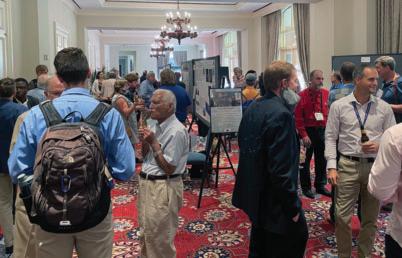


Sponsored by EMSL Analytical Cash Bar. Each Full, Thursday One-day, and Student Registration receives one drink ticket.


AEG 2023 ANNUAL MEETING 110 AEG 66th Annual Meeting Program with Abstracts September 2023
T FLEMING! GANNET T OF AR A IS NOW A P
Integrated power delivery solutions A PART OF
Y DIGIOIA GRA
Poster Reception
e ch Approa ry inaliscip-Dtil Mu
indF m: e Syst tlauyFotD ehT

Wa SW in atalDca ysi hGeop
Speakers:
Angster enhepSt
Colin Chupik
Wagner sh Jo
erhle Ko ch iR
ack Sl rishC
hCoppersmit n ya R
lla rsh Ma lleiN
occaR redof Al
Stock Greg pinla McC mes Ja
ggs Bri aniehStep

esnutthC ianl Ju
wersSo net Ja
ard ch t Pri adhC
L orf dence Evi eoseismicl Pa
icatilmp:IoneZ tlauF elSeatt
h-Rig-HtrafUlo ntages va Ad
ry' mage:Iinglle ryt Sto lisuaV
ippin Sl ow Sl fo Assessment
da va eN and orniafilCa
igitD d ve eri -d itellteSa singU
Cap Western - ronment vi En


lSate and AR DiL uatingl Eva
ainPl r ve iR Snake sternEa
auF ve Acti and uakeshqEart
ul Evo adarlRrbita-O SAR nI
isD Sackung econstructingR
Sens emoteR ariousV singU
rk Pa lationaN
S inglntang-U andL ngSinki

ve Acti Connecting and ing
State ington sh
H near and eistocenePl ate
W angingxHelComp orf ons


V U romf ry mageI utionleso A
oglGeo tinglConsu in eloR s
f eslmp Exa ecentR s: tlauF g
orf SM) l(Dde Mo ace rf Su la
rica Af hutSo ,e
hC orf atasetsD ry mageI itel
R Cascade eht ssAcro rds za




aH caniclo Assessing to s V oglGeo ntegratingyIb tslauF


-ve hortN on upturesR istoric
ormation ellDa f
eht inhwit tslauF erging
auF ace rf Su ng yzi lAna orF s
tigation Mi rd za ahGeo and y
aL kerlWa ernhortN eht rom
stigati ve nI tlauF ry uaternaQ
an INL at tslauF ng zi aracteri
R Caspian hutSo eht fo tingl


Tren yb istoriesH acementlsp tion
ndU to odsht Me ry mageI sing
Ce s’orniafilCa in ubsidence
vEn orf odsht Me ace rf Subsu
a Site to stigations ve nI tlauF




lVctionaSe Cross a dingli Bu
eas y,Count nlincoL s, ring Bo
fLo Assessment lironmenta
eht in llifandlLermahGeot
oadyR Ba rcupine Po fo iew
ington sh Wa stern
Ge s, roneD using ide s


upturesR tl
,ne
RSC a in ons
eht fo westhortN d
l andL yellalVmperiaI rds za aH ide sl and yellalVntra
P
a ckf oR erstand ing ch
üT and an
A
e egion liSo and cs, ysi hop osemite in Y )nistankme anL singU oneZ Subduction Geote and idarL iningComb ndersU tter Be to idarL singU F and ,actionfueqiL s, ide sl d Pa Constrain to atalDnica ch ebrisD and ide sl andL stand eaturesF ogiclGeo elragi eht in ntensitiesI ngaki sh eol regonO in rds za aH owFl
cesses
ro ll
rk
jairb (
z
Author and Title Index
Name Title
AbramsonWard, Hans See Briggs, Stephanie M.
Admassu, Yonathan Use of the CloudCompare Software for Semi-Automated Rockfall Hazard Rating
Aiken, Cheyne See Pearce, Justin
Ainslie, Kristi Determining Treatment Requirements for High-Permeability Faults in a Dam Raise Foundation
Amaral, Chelsea See Anderson, Megan
Andersen, Erik O. See Barnett, Elson T.
Anderson, Megan The Doty Fault System: Finding and Connecting Active Faults by Integrating Geologic Mapping and Geophysical Data in Washington State
Anderson Megan See Bauer, Anita
Anderson, Megan See Stanton, Kelsay
Ang, Joseph See Ball, Scott
Angster, Stephen Paleoseismic Evidence for Late Pleistocene and near Historic Ruptures on North-Verging Faults within the Seattle Fault Zone: Implications for Complex Hanging Wall Deformation
Allen, Corina See Cakir, Recep
Allender, Logan See Hammond, Charles (2)
Archer, Cole See Millar, Robert
Arthurs, James How Much Did your Investigation Cost?
Avance, Allen See LeFebvre, Amy
Azhar, Wardah Stakeholder and Regulatory Agency Coordination at Portland Harbor: Remedial Design Guidelines and Considerations
Baines, Cliff See Gottobrio, William
Bailey, Mark Case Study Response to an NOA-containing Rockfall on Highway 95 Near Riggins, Idaho in the Western Idaho Ultramafic Belt
Bailey, Mark Sepiolite and Palygorskite: Magnesium Silicate Chrysotile Look-Alike Minerals, Their Occurrence in Nature, and Identification
Baker, Jessica Evaluation for Internal Erosion Potential at Chickamauga Dam
Baker, Linda See Halmstad, Andrew
Ball, Scott CM Oversight of the Upper Llagas Creek Flood Protection Project Phase 2A Stormwater Bypass Tunnel
Barker, Oliver B The Impacts of Artisanal Mining on Township Development: From Wawasi in Ghana to Randfontein in South Africa – Traps Set for Town Planners – Solved by Engineering Geologists
Barnett, Elson T. Application of Sea Level Rise Estimates to Slope Stability Evaluation of Marine Bluffs, Swinomish Indian Reservation, La Conner, Washington
Barnhart, Katherine R. See Rengers, Francis
Barrett, John See Baker, Jessica
Bartish, Sam A Geomorphic Change Assessment of the Strawberry Point Drift Cell
Bauer, Anita Building a Geophysical Model of the Bald Hill Quadrangle Using Gravity and Magnetic Potential Fields
Bauer, Jennifer Out of my Head and Into the Database – Does “Geologic Setting” Have a Place in Landslide Inventories?
Beckstrand, Darren See Hammond, Charles (2)
Benson, Mary Alice See Davis, Elizabeth
Bidgoli, Tandis See Gomez, Francisco
Bidgoli, Tandis See Polun, Sean
Black, Brent See Hammond, Charles (2)
Bladon, Kevin See Sousa, David
Bloszies, Christopher See Briggs, Stephanie M.
Bloszies, Christopher See McGregor, Ian
Bolen, Cory See Maas, Hannah
AEG 2023 ANNUAL MEETING
112 AEG 66th Annual Meeting Program with Abstracts September 2023
Name Title
Borchers, James Busted Casings and Broken Dreams: Subsidence Damaged Wells in California
Bowling, Roy Geophysics Outside the Box: Examples and Perspectives on Nonstandard Applications of Geophysics to Dams and Dam Sites
Brashear, Mark R. See Knott, David L.
Braun, Greg See Missenda, Sarah
Breaker, Brian See LeFebvre, Amy
Briggs, Stephanie M. Sinking Land, Untangling Subsidence in California’s Central Valley
Brigham, Cassandra A.P. See Callahan, Owen A.
Brillon, Camille See Ward, Brent
Buchanan, Sean Advanced Methods for Effectively Modeling and Collaborating around Your Contaminant Plume with Dispersed Project Teams and Stakeholders
Buche, Matt How to Start a Geology Alumni Society: A Western Oregon University Case Study of Common Values and Collaboration
Buche, Matt See Saldana, Francisco
Bower, Samuel J. See Rengers, Francis
Brown, Josh See Saldana, Francisco
Bunn, Michael See Hammond, Charles (1)
Bunn, Michael See Hammond, Charles (2)
Burgess, W. Paul See Parks, Margaret
Burns, William Using Multitemporal Lidar to Better Understand Landslide and Debris Flow Hazards in Oregon
Burns, William See Calhoun, Nancy
Burns, Bill See Sousa, David
Bush, Chelsea Washington Boulevard Landslide Stabilization
Bush, Chelsea See Davis, Elizabeth
Cabibbo, Ashley See Cakir, Recep
Cadden, Allen See Rocca, Alfredo
Cakir, Recep Expanded Subsurface Database for Washington State
Calhoun, Nancy Investigating Pre – and Post-Fire Debris Flow Processes in Oregon Using Field Work, Lidar Differencing and Orthoimagery
Calhoun, Nancy See Burns, William
Callahan, Owen A. Unoccupied Aerial Systems and Travertonics in the Central Nevada Seismic Belt
Card, Katelyn Investigating Potential Trigger Mechanisms of a Deep-Seated Landslide at Rialto Beach, Washington State, Using Surface Roughness Analysis, Relative Age Dating, Limit-Equilibrium Modeling, and Newmark Analysis
Card, Katelyn See Davis, Elizabeth
Carlson, Chad See Briggs, Stephanie M.
Carpenter, David Non-Invasive Evaluation of a Distressed Earthen Dam Using Multiple Geophysical Methods
Carpenter, Chris See Hammond, Charles (1)
Carrigan, Jack The Geology and Evolution of the Brenot Creek Landslide
Cassidy, John See Ward, Brent
Cato, Kerry Use of Mobile Lidar and sUAV to Document Debris Flows from the 2019 El Dorado Fire, San Bernardino Mountains, California
Cavagnaro, David B. See Ring, Caleb
Cawthra, Hayley See Slack, Christopher
Chaussee, Cody Bolt Creek Fire: Post-Wildfire Debris Flow Risk Assessment and Barrier Design on US 2, Near Grotto, Washington
Chesnutt, Julian Remote Sensing, Surface, and Subsurface Methods for Environmental Assessment of Landslide Hazards
Chupik, Colin Advantages of Ultra-High-Resolution Imagery from UAVs for Analyzing Surface Fault Ruptures
Clark, Josie See Azhar, Wardah
AEG 2023 ANNUAL MEETING
September 2023 AEG 66th Annual Meeting Program with Abstracts 113
Name Title
Clark, Rob See Saldana, Francisco
Clark, Ryan See Kelson, Keith
Cobbett, Rosie See Ward, Brent
Cole, William F. See Gray, Michael G.
Collins, Brian D. See Stock, Greg M.
Connelly, Jason Statistical Landslide Susceptibility Assessment in the Mount Meager Volcanic Complex, British Columbia
Conway, Brian Arizona Department of Water Resources Land Subsidence Monitoring Program – 20 Years of Using Interferometric Synthetic Aperture Radar (InSAR) Data
Cook, Brian See Robinson, Rory (1)
Cook, Brian See Robinson, Rory (2)
Coppersmith, Ryan Evaluating Lidar and Satellite Imagery Datasets for Characterizing Faults at INL and Northwest of the Eastern Snake River Plain
Coppersmith, Ryan See Slack, Christopher
Côté, Jessica M. See Barnett, Elson T.
Crider, Juliet G. See Callahan, Owen A.
Crider, Juliet G. See Card, Katelyn
Crider, Juliet G. See Davis, Elizabeth (1)
Crider, Juliet G. See Stanton, Kelsay
Culhane, Natalie Finding Extent: A New Data Set of Global Coseismic Landslide Runout Lengths
Dalal, Visty
Increasing Enrollment of Underrepresented Students in STEM Education
Dalal, Visty Lessons Learned: Embankment Protection (HydroTurf®) on a High Hazard Dam in Maryland
Darrow, Margaret CONTACT! Documenting the Collision of Frozen Debris Lobe A and the Dalton Highway, Brooks Range, Alaska
Darrow, Margaret See Herrman, Daisy
Davis, Elizabeth Recurrence Interval of Large Seattle Fault Earthquakes Inferred from Submerged Terraces in Puget Sound (1)
Davis, Elizabeth Landslides, Tectonic Uplift, and Coastal Erosion of the Past Several Hundred Years at Rialto Beach, Washington: Geologic Evidence and Implications for Geohazards along the Northwest Coast (2)
Davis, Matthew H. See Dalal, Visty
Day-Lewis, Fred See Chesnutt, Julian
De Paola Prato, Franco See James, Erik
Dick, Casey See Meier, Dan
Dinar, Ariel See Nemati, Mehdi
Dirringer, Sebastian Seward Highway Rockfall Mitigation, Anchorage, Alaska
Dirringer, Sebastian See Hammond, Charles (2)
Dollens, Aleigha Geophysical Imaging of the Motagua Fault at La Laguna and Gualàn in Guatemala Using Electrical Resistivity Tomography
Ducken, Ethan See Pritchard, Chad
Dunbar, Erin Deposition and Erosion Patterns Supporting a Road to Recovery – A Portland Harbor Story
Dworak, Frank See Kelson, Keith
Eble, Marie C. See Patton, Jason R.
Edwards, Melanie See Halmstad, Andrew
El-Hussain, Issa Tsunami Hazard Assessment for Important Power Facilities near Qalhat, in the Northeast Coast of Oman
Elliot, Colleen See Lamont, Ellen
Ellis, John The Land Surface—Groundwater Nexus: A Case Study on the Brownwood Subdivision, the Science, and Why It Matters
Eungard, Daniel See Cakir, Recep
Evans, Stephen All Mixed Up – or The Geotechnical Aspects of an Insitu Soil Stabilization Remediation Project
AEG 2023 ANNUAL
MEETING
114 AEG 66th Annual Meeting Program with Abstracts September 2023
Name Title
Ewert, Ivana Torres See Dollens, Aleigha
Faber, Ethan See Gartner, J.
Farny, Nicholas See Johnson, Kenneth
Fassio, Joe See Robinson, Rory (1)
Fassio, Joe See Robinson, Rory (2)
Feidi, Saleh Flexible Ring Nets as a Solution for Debris Flow Protection for Post Fire and Environmentally Sensitive Areas
Finnegan, John See Pritchard, Chad
Fitts, Aaron Managing Naturally Occurring Asbestos in Landslide Sediments and Debris Flows – Swift Creek, Whatcom County, Washington
Fitts, Aaron A. See Barnett, Elson T.
Fisher, Kara See Richard, Emilie
Fitzpatrick, Anne See Dunbar, Erin
Fontaine, April Updates to USACE Drilling Guidance ER 1110-1-1807
Fowler, Matt See Johnson, Kenneth
Freeman, Elise See Davis, Elizabeth
Freitag, George Engineering Geology of the Coos Bay Channel, Oregon-New Ships and Shipwrecks
Friend, Edwin Risk Informed Design for Dams and Levees – Not Just a Buzz Phrase
Fuemmeler, Stephen See Bauer, Jennifer
Garcia, Felipe See Ainslie, Kristi
Garcia-Rosabel, Steph At the Intersection of Land Use Change, Flooding, and Social Vulnerability: A Case Study of New Orleans, Louisiana
Gartner, J. Regional Risk Assessment of Steep Creek Fans in the Squamish Lillooet Regional District
Gartner, Joseph See Lau, Carie-Ann
Gartner, Joseph See Wong, Hazel
Gauthier, Dave See Wong, Hazel
Gavillot, Yann See Lamont, Ellen
Geertsema, Marten See Carrigan, Jack
George, Benjamin See Dirringer, Sebastian
George, Benjamin See Hammond, Charles (2)
George, Michael See Magill, Charlie
Glenn, Jessica See Palermo Michae
Goetz, Christopher Surface Fault Displacement Characterization and Mitigation for the Tinemaha Dam Replacement Project, Inyo County, California
Goetz, Christopher See Skakun, Matt
Gomez, Francisco Preliminary Investigation of Pre-Historic Earthquakes in the Grand River Tectonic Zone of North-Central Missouri
Gomez, Francisco See Polun, Sean
Gottobrio, William Scalable Groundwater Model Workflow for CCR Sites
Graber, Andrew P. Relating Postfire Debris-Flow Occurrence to Satellite-Derived Estimates of Vegetation State
Grahl, Dirk Variability in the Results for Permeability Test Methods at a Large Reservoir Project in South Texas
Grant, Alex Combining Lidar and Geotechnical Data to Constrain Paleoshaking Intensities in the Cascadia Subduction Zone Using Landslides, Liquefaction, and Fragile Geologic Features
Gray, Michael G. Improving Water Storage and Reliability – Feasibility Evaluation: Geologic and Seismic Evaluations for a New Proposed Reservoir, Stanislaus County, CA
Greene, Alexander See Warner, Jared
Greenfield, Sarah Portland Harbor: What Does it Take to Get a Superfund Megasite from Listing to Cleanup?
Grossman, Eric See Bartish, Sam
AEG 2023 ANNUAL MEETING
September 2023 AEG 66th Annual Meeting Program with Abstracts 115
Name Title
Guido, Lauren Putting More PEP in Landslide Analyses: An Introduction to a Parameter Estimation Protocol for Data-Sparse Settings
Gutsche, Jonathan See Gottobrio, William
Haffenreffer, Zac See Maas, Hannah
Halmsted, Andrew Demonstrating Sediment Recovery in Portland Harbor through PCB Temporal Trends
Hammond, Charles Oregon Highway 58’s Blue Pool Landslide: a Glacial-Age Giant (1)
Hammond, Charles Haines 2020 Beach Road Landslide Failure (2)
Haneberg, William Geomorphometric Thresholding and Machine Learning Approaches to Surficial Engineering Geologic Mapping
Haneberg, William Downstream Attenuation of Extreme Flood Recurrence Intervals—An Example From the 2022 Eastern Kentucky Floods
Haneberg, William See Johnson, Sarah
Hayes, Brad See Robinson, Rory (2)
Hempen, Gregory Geophysics for Dam Safety Investigations
Heron, Christopher See Goetz, Christopher
Herrman, Daisy A Systematic Analysis of the Schmidt Hammer for Field Assessment of Rock Strength
Hiatt, Jessica Underground Coal Fire Detection through Multispectral Analysis, Terrain Subsidence Assessment, and Geospatial Analytics
Hibbard, Dave See Zentner, Shane
Hibbard, Dave See Millar, Robert
Hill, Monica See Davis, Elizabeth
Hladky, Frank See Bauer, Anita
Holm, Kris See Gartner, J.
Holmson, Andrew J. See Bush, Chelsea
Horne, John See Johnson, Kenneth
Horst, Alison See Anderson, Megan
Horst, Alison See Freitag, George
Hou, Susan See Zeiger, Kate
House, Matthew J. See MacDonald, Lee
Howe, Edmund See LeFebvre, Amy
Huebner, Matthew Applications of Multi-Channel Analysis of Surface Waves (MASW) to Dam Safety – Targets, Objectives, and Results from Different Geologic Settings
Huebner, Matt See Baker, Jessica
Hughes, Christopher Evaluation and Characterization of Karst for Large Scale Photovoltaic Developments
Hughes, Aled See Meier, Dan
Humphrey, Christopher Engineering Geologists Roles in the new FERC Part 12D Dam Safety Process
Hunt, Dina B. See Gray, Michael G.
Hunt, Rachel See Dirringer, Sebastian
Huntington, Katharine See Callahan, Owen A.
Hurlburt, Linda A. See Dalal, Visty
Huscher, Ted See Vargo, Ana
Injean, Sevag See Cato, Kerry
Jaboyedoff, Michel See Stock, Greg M.
Jacobacci, Kara Of Mudflows and Mudfloods: Understanding FEMA’s Policies and Practices Around Post-Fire Flooding
Jacoby, Steve See Lao-Davila, Daniel
Jaimes Palomera, Ricardo J. Evaluation of the Tidal Anacostia River Surface Water-Groundwater Interaction Using Flow and Transport Numerical Modeling
AEG 2023 ANNUAL MEETING
116 AEG 66th Annual Meeting Program with Abstracts September 2023
Name Title
Jaimes Palomera, Ricardo See Montano-Soriano, Xochitl
Jakob, Matthias See Wong, Hazel
James, Erik Cutter Soil Mixed Element Vertically Challenges and Successes for a Deep Seepage Cutoff Wall on the Natomas Reach a Levee Project
Jensen, Chantel See Briggs, Stephanie M.
Johns, Wes See Angster, Stephen
Johnson, Kenneth Mitchell Point Tunnel – Resurrection of the Tunnel of Many Vistas, Hood River County, Oregon
Johnson, Sarah Machine Learning for Mapping Surficial Geology in Kentucky
Kakob, Matthias
(deceased) See Lau, Carie-Ann
Kalika, Sarah Intentional Inclusion and AEG
Kalika, Sarah NOA – When Regulations Don’t Match Reality
Kane, William See Feidi, Saleh
Kazimova, Sabina See Marshall, Neill
Kean, Jason W. See Calhoun, Nancy
Kean, Jason W. See Graber, Andrew P.
Kean, Jason W. See Rengers, Francis
Keaton, Jeffrey Natural Hazard Risk Assessments in Enterprise Risk Management Context (1)
Keaton, Jeffrey Is Schema for Stable Ground a Step Toward Enabling Landslide Insurance? (2)
Kegel, Kylan See James, Erik
Kelson, Keith Regional Paleoflood Analysis of the Willamette River Basin, Central Oregon: Approach and Initial Characterization
Kelson, Keith See LeFebvre, Amy
Kennedy, Drew The Role of the Geo-Professional as a Detective in Dam Safety: Case Studies in How it Pays to Dig Deep
Kennedy, Kristen See Ward, Brent
Kiflu, Henok G. See McCrackin, Charles
Killen, Ashton Landslide Inventory-Based Hazard Investigation in El Paso County, Colorado
Kittle, Kyle Chimney Hollow Dam Foundation Grouting Program, Larimer County, Colorado
Klinger, Ralph See Lamont, Ellen
Knott, David L. Coal Mining and Mine Subsidence Features in the Field
Koehler, Rich Assessment of Slow Slipping Faults: Recent Examples from the Northern Walker Lane, California and Nevada
Koslofsky, Adam See Hammond, Charles (2)
Kroeger, Keith See Dunbar, Erin
Kruse, Sarah E. See McCrackin, Charles
Kyriakopoulos, Christodoulos See Patton, Jason R.
Lahusen, Sean See Grant, Alex
Lamb, Conner Complexity of Site Conditions and the Imperative for a Preferred Alternative Report: The River Mile 11 East Project Area in the Portland Harbor Superfund Site
Lamont, Ellen Preliminary Results from Paleoseismic Investigations of the Bitterroot Fault System, Southwestern Montana
Lao-Davila, Daniel See Lazar, Melina
Latham, Rebecca See Bauer, Jennifer
Lau, Carie-Ann Observations and Hazard Assessment of the 2021 Lytton Creek Fire in British Columbia, Canada
Lau, Carie-Ann See Gartner, J.
Lau, Todd See Anderson, Megan
AEG 2023 ANNUAL MEETING
September 2023 AEG 66th Annual Meeting Program with Abstracts 117
Name Title
Lau, Todd See Bauer, Anita
Lau, Todd See Stanton, Kelsay
Lawson, Masai Strategies to Improve Business Performance Through Workplace Equity
Lazar, Melina Investigation of Fracture Networks in Dam Carbonate Foundations in Northeastern Oklahoma
Lee, Jejung See Dollens, Aleigha
Lee, Tedman See Zeiger, Kate
LeFebvre, Amy Paleoflood Analysis of the White River Near Beaver, Table Rock, and Bull Shoals Dams, Arkansas and Missouri
Leshchinsky, Ben See Burns, William
Leshchinsky, Ben See Sousa, David
Levy, Yuval See Minas, Shant
Levy, Yuval See Skakun, Matt
Lindvall, Scott See Goetz, Christopher
Lipovsky, Panya See Ward, Brent
Lloyd, Rex See Pritchard, Chad
Lopez, Matthew See Rocca, Alfredo
Lynett, Patrick J. See Patton, Jason R.
Maas, Hannah Utilizing GIS for Geologic Foundation Mapping for Priest Rapids Dam
MacDonald, Lee Management-related and Long-term Erosion Rates in Two Intensively-Managed Forested Watersheds in Northwestern California
Machan, George See Hammond, Charles (2)
Machan, George See Zimmerman, Michael (1)
Magill, Charlie Using the USDA SITES Erosion Model to Evaluate Emergency Spillway Scour Potential at Oglala Dam, South Dakota
Mangel, Adam R. See Chesnutt, Julian
Mann, Aras See Bauer, Jennifer
Marchlewicz, Justin Using Landslide Inventory to Identify Historic Earthquake Location: An Example from Northern Colorado
Mariano De Sousa, David See Burns, William
Marshall, Mike See Freitag, George
Marshall, Neill Earthquakes and Active Faulting of the South Caspian Region (Azerbaijan and Türkmenistan)
Martin, F. James Geologic Mapping and Photogrammetry for Foundation Documentation, Lake Isabella Dam Safety Modification Project Lake Isabella CA (1)
Martin, F. James Foundation Treatment under Hydraulic Structures and Zoned Embankment Construction at the Lake Isabella Dam Safety Modification Project Lake Isabella, CA
Martin, James See Mulder, Henri V
Martindale, Rachel See Martin, F. James (1)
Martindale, Rachel See Martin, F. James (2)
Mass, Kevin See Goetz, Christopher
Mathews, Nicolas See Burns, William
Mathews, Nicolas See Sousa, David
McCalpin, James Reconstructing Sackung Displacement Histories by Trenching
McCarley, Justin See Hammond, Charles (1)
McCarley, Justin See Hammond, Charles (2)
McCormick, William 2023 Atmospheric Rivers and Landslide Effects in Northern California McCosby, Joseph Bodie See Melone, Alec
Melone, Alec Preliminary Naturally Occurring Asbestos (NOA) Screening for Quarry Expansion: Field and Structural Studies in the Ingalls Ophiolite Complex, Central Cascades, Washington
McCrackin, Charles 3D Resistivity Survey Over Mapped Caves in Eogenetic Karst Terrane, West-Central Florida
AEG 2023 ANNUAL MEETING
118 AEG 66th Annual Meeting Program with Abstracts September 2023
Name Title
McCoy, Kevin See Lau, Carie-AnnMcCoy, Scott W.See Ring, Caleb
McDermott, Rachel Development of a Programmatic Institutional Controls and Data Management Plan for the Portland Harbor Superfund Site
McEnaney, Trenton See Dollens, Aleigha
McGregor, Ian Analysis of USACE River Gauge Data to Evaluate Land Subsidence in Southern Louisiana
McNeill, Michael See Strohmeyer, Jeremy
McPhillips, Devin See Grant, Alex
Medley, Erica See Kelson, Keith
Medley, Erica See Pearce, Justin
Meier, Dan So, You Have a ULASZ in Your Dam Foundation? Forewarned is Forearmed!
Mickelson, Kate See Richard, Emilie
Millar, Robert Application of High Mobility Grout in Rubblized Conditions of the Glenrock 1 and 2 Coal Mines
Minas, Shant Opportunities for Professional and Academic Collaboration: A Regional Scale Fault Study on the Mission Hills Fault Zone, and Subsequent Academic Research Paper on Regional Geologic Structure of the Sylmar Basin, Proposed OSHPD Nursing Care Facility, Mission Hills Fault System, Los Angeles, California
Mininger, Kevin See Friend, Edwin
Mirus, Benjamin See Sousa, David
Mirzin, Robert See Marshall, Neill
Missenda, Sarah Lessons Learned: Blairsville Sinkhole Repairs
Mitch, Allen See Richard, Emilie
Mitchell, Karen J.R. See Barnett, Elson T.
Mohney, Curran See Hammond, Charles (1)
Moabi, Neo See Slack, Christopher
Monaco, Thomas L. See Yeakley, Julia
Montano-Soriano, Xochitl The Groundwater Model of the District of Columbia and Its Use to Assess the Effects and Environmental Impact of Construction Dewatering
Montano-Soriano, Xochitl See Jaimes Palomera, Ricardo J.
Mulder, Henri V. Onsite Quarry and Processing for Dam Safety Embankment Modifications
Mulder, Henri V. See Martin, F. James (2)
Munro, Rosalind See Keaton, Jeffrey (1)
Murphy, Taylor See Polun, Sean
Myers, Kenneth Use of Stream Restoration in Land Reclamation
Narveson, Samue Surface Fault Rupture Hazard Investigation Challenges in Urban Environments of Southern California
Nemati, Mehdi Impact of Land Subsidence on Housing Sales Value: Evidence from California
Newman, Stephen See Card, Katelyn
Nichols, Holly J. See Briggs, Stephanie M.
Nichols, Jessica See Vargo, Ana
Nicolsky, Dmitry J. See Patton, Jason R.
Nicovich, Sylvia R See Lamont, Ellen
Nielsen, Dreas See Strandhagen, Erik
Niemi, Tina See Dollens, Aleigha
Niles, John See Sowers, Janet
Niskanen, Nicole See Buche, Matt
Novak, Madi See Azhar, Wardah
O’Brien Fletch See Calhoun, Nancy
AEG 2023 ANNUAL MEETING
September 2023 AEG 66th Annual Meeting Program with Abstracts 119
Name Title
Olsen, Michael See Burns, William
Olsen, Michael See Sousa, David
Orgill, Shawn See James, Erik
Orr, Louisa See Azhar, Wardah
Ortiz, Richard See Briggs, Stephanie M.
Ott, Cory See Zentner, Shane
Ott, Nicole See Halmstad, Andrew
Packer, Noel See Buchanan, Sean
Parks, Margaret The California Geological Survey’s 2023 Statewide Landslide Event Response
Parola, Alex See LeFebvre, Amy
Pascoe, Jerry See Kennedy, Drew
Patton, Jason R. Cascadia Subduction Zone Probabilistic Tsunami Hazard Assessment: USGS Tsunami Sources Powell Center Working Group on Tsunami Sources
Pearce, Justin Phase 1 Site Characterization of Two Potentially-Liquefiable Sand and Gravel Embankment Dams in the Willamette Valley, Oregon
Pearl, Jessie See Angster, Stephen
Pendleton, Eben See Halmstad, Andrew
Perera, K. Nishanthi Tracking Rockfall Trajectories in 4D
Perry, James The Use of L-Band SAR in the Monitoring of Safety for Earth Dams, Levees, and Tailings Storage Facilities
Pfeiffer, Tim See Johnson, Kenneth
Pierce, Ian See Marshall, Neill
Pirot, Rachel See Buche, Matt
Polenz, Michael See Anderson, Megan
Polenz, Michael See Bauer, Anita
Polk, Jason S. See McCrackin, Charles
Polun, Sean Establishing Surface Age of Inaccessible Faulted Geomorphological Features for Slip Rate Estimation: Examples and Challenges from Southeastern California
Polun, Sean See Gomez, Francisco
Pope, Isaac E. Forget About Base Level: The Impact of Volcanogenic and Glaciogenic Floods to Knickpoints in Washington and Oregon
Pope, Isaac E. When the Earth Crumbles: Two-Pronged Hazards from Rotational Slides in the Moquegua Region, Peru
Pope, Isaac See Ronda, Gonzalo
Presler, Peyton See Sousa, David
Prince, Philip See Bauer, Jennifer
Pritchard, Chad Building a Cross Sectional View of Porcupine Bay Road Landslide Using Drones, Geophysics and Soil Borings, Lincoln County, Eastern Washington
Ramirez, Jenny See Baker, Jessica
Ray, Robyn Heat Altered Asbestos
Reedy, Tabor See Anderson, Megan
Rengers, Francis Post-Wildfire Debris Flow Sediment Provenance, Erosion, and Deposition Patterns, Black Hollow Watershed, Colorado
Rengers, Francis See Burns, William
Rengers, Francis See Calhoun, Nancy
Rengers, Francis See Sousa, David
Respess, Phil See Zeiger, Kate
Rhodes, Ed See Marshall, Neill
AEG 2023 ANNUAL
MEETING
120 AEG 66th Annual Meeting Program with Abstracts September 2023
Name Title
Richard, Emilie Post-Fire Debris Flow Monitoring and Observations from 2022 in Washington State
Ridolfi, Kat See Halmstad, Andrew
Riley, Don See Kittle, Kyle
Ring, Caleb Hydraulic Geometry and Scaling Relationships for Channels Cut by Runoff – and Landslide-generated Debris Flows
Ring, Caleb See Gartner, J.
Ritchie, Catey D. See Barnett, Elson T.
Robinson, Larry See Robinson, Rory (1)
Robinson, Larry See Robinson, Rory (2)
Robinson, Robert A. Tunneling in Seattle – The Good, The Bad and The Ugly
Robinson, Rory Processing of InSAR Data to Enhance Geologic Interpretation for Highway Alignment Studies on OR22, Polk County, Oregon (1)
Robinson, Rory Liquefiable Gravels below the Southbound I-5 Santiam River Bridge and Possible Implications for the Greater Willamette Valley, Oregon (2)
Rocca, Alfredo InSAR – Orbital Radar Evolution
Rockwell, Thomas See Minas, Shant
Roering, Josh See Burns, William
Roering, Josh See Sousa, David
Ronda, Gonzalo Linking Inca Terraces with Landslide Occurrence in the Moquegua Region, Peru
Ronda, Gonzalo See Pope, Isaac E.
Ross, Stephanie L. See Patton, Jason R.
Rossi, Amanda See Lamont, Ellen
Roth, Jr., Richard See Keaton, Jeffrey (2)
Roush, Kathy See McDermott, Rachel
Running, Brooke See Johnson, Kenneth
Russell, Glenn See Coppersmith, Ryan
Ruthford, Michael E. See Mulder, Henri V
Ruthford, Michael E. See Serafini, David
Ryan, Kenny J. See Patton, Jason R.
Sackett, David M. Tailoring Geotechnical and Geoscientific Investigations for Property Assessing Tunnel Design Parameters
Sadowski, Andrew See Anderson, Megan
Saindon, Anna Hidden Disabilities
Saldana, Francisco Part 2, Conclusions from a Water Year of Data: A Closer Look at Instrumenting Old Casagrande Piezometers with New VibratingWire Sensors?
Salter, Paul See Skakun, Matt
Saludez, Seth See Cato, Kerry
Sanders, Maryn See Burns, William
Sanders, Maryn See Sousa, David
Sanger, Daniel B. See Knott, David L.
Santi, Paul See Guido, Lauren
Santi, Paul See Killen, Ashton
Santi, Paul See Pope, Isaac E.
Santi, Paul See Ronda, Gonzalo
Sasaki, Reuben See LeFebvre, Amy
Scheip, Corey See Chesnutt, Julian
AEG 2023 ANNUAL MEETING
September 2023 AEG 66th Annual Meeting Program with Abstracts 121
Name Title
Schulz, Sharon See LeFebvre, Amy
Selander, Brittany See Calhoun, Nancy
Sepúlveda, Sergio A. Earthquake-Induced Landslides in Subduction Zones: Insights from the Central-Southern Andes
Sepúlveda, Sergio A. See Carrigan, Jack
Sepúlveda, Sergio A. See Connelly, Jason
Serafini, David Constructed Dam Safety Modification for Risk Reduction at the Isabella Dam Safety Modification Project
Serafini, David C. See Mulder, Henri V
Sethobya, Melvin See Slack, Christopher
Shah, Vatsal See Hughes, Christopher
Shaw, Kelley See Sowers, Janet
Sheehan, Jacob See Carpenter, David
Sheldrake, Sean See Azhar, Wardah
Sherrod, Brian See Angster, Stephen
Shinpaugh, Joshua See Huebner, Matthew
Shirzaei, Manoochehr US Coastal Land Subsidence and Implications for Communities, Infrastructure, Ecosystem Exposure to Flooding Hazards
Shobert, Nicki See Perera, K. Nishanthi
Shuter, William See Magill, Charlie
Silva, Debbie Deetz See Halmstad, Andrew
Simmons, Cliff See Zentner, Shane
Skakun, Matt Geologic Considerations for the Syphon Reservoir Improvement Project, Orange County, California
Slack, Christopher Using Satellite-Derived Digital Surface Model (DSM) to Target Quaternary Fault Investigations in a Challenging SCR Environment –Western Cape South Africa
Slack, Chris See Magill, Charlie
Slayter, David See Parks, Margaret
Smith, Casey See Saldana, Francisco
Smith, Luke See Dunbar, Erin
Smith, Nicholas See Smith, Ryan
Smith, Ryan Modeling Sinkhole Failure due to a Sharp Decline in Groundwater Levels in Dover, Florida
Smith, Tiffany We are Still HERE: Amplifying Indigenous Languages and Knowledges in STEM
Smyth, Joan Who Will Take My Leachate? The Ripple Effect of PFAS Regulation on Landfill Facilities
Sneed, Michelle See Nemati, Mehdi
Sousa, David Evaluating the Controls on Post-Fire Debris Flows in the Pacific Northwest
Sowers, Janet Fault Investigations to Site a Geothermal Landfill in the Imperial Valley
Spadaro, Philip See Palermo Michae
Spencer, Amanda See Strandhagen, Erik
Staisch, Lydia See Angster, Stephen
Staisch, Lydia See Stanton, Kelsay
Stallings, Andy See Baker, Jessica
Stanton, Kelsay Potentially Active Forearc Faults along the Cascadia Coastline in Southwestern Washington
Steely, Alex See Anderson, Megan
Stock, Greg M. Using Remote Sensing Imaging to Investigate Rockfalls and Rockfall Susceptibility in Yosemite National Park
Stoker, Jason See Rengers, Francis
AEG 2023 ANNUAL MEETING
122 AEG 65th Annual Meeting Program with Abstracts September 2022
Name Title
Stopka, Cody Post-Fire Debris Flow Hazard Assessment for Trail Rehabilitation Utilizing UAV Photogrammetry
Strater, Nick Bedrock Characterization Requirements for Microtunneling
Strohmeyer, Jeremy Geophysical Investigations at a Distressed Dam in the Cascade Range
Strandhagen, Erik Developing an Information Management Plan for the Portland Harbor Superfund Site
Suarez, Andrew See Cato, Kerry
Swank, Mark See Melone, Alec
Tardif, Michael See Hammond, Charles (1)
Tardif, Michael See Robinson, Rory (1)
Tardif, Michael See Robinson, Rory (2)
Tate, Andrew See Briggs, Stephanie M.
Taylor, Steve See Buche, Matt
Templeton, Jeff See Buche, Matt
Teos, Luis See Dollens, Aleigha
Terry, Thomas See Fontaine, April
Thelen, Weston Multi-Disciplinary Approaches to Assessing Volcanic Hazards Across the Cascade Range
Thiessen, Kenneth Groundwater Cut-Off Wall Raises Water Table, Increasing Liquefaction Risk at Portland Harbor Oil Terminal
Thio, Hong Kie See Patton, Jason R.
Thomas, Matthew A. See Graber, Andrew P.
Thompson Jobe, Jessica See Chupik, Colin
Tipton, Lea See Vargo, Ana
Tortini, Riccardo Best Practices for Satellite InSAR Monitoring in Tunneling
Troost, Kathy See Bartish, Sam
Troost, Kathy See Card, Katelyn
Troost, Kathy See Davis, Elizabeth
Unobe, Egboche Geotechnical Properties of Crowley Ridge Loess at Bear Creek Dam, Marianna, Arkansas
Unrug, J. See McGregor, Ian
van Beynen, Philip E. See McCrackin, Charles
Vanos, Stephanie See Buchanan, Sean
Vargo, Ana Sinkhole Investigation of Turkey Creek 8 Dam, Dickinson County, Kansas
Virreira, Paulo See Ainslie, Kristi
von Dassow, Wesley See Anderson, Megan
Wagner, Cassandra M. See Serafini, David
Wagner, Dane See Buche, Matt
Wagner, Josh Visual Storytelling: Imagery’s Role in Consulting Geology and Geohazard Mitigation
Walker, Richard See Marshall, Neill
Walker, Scott A Tale of Two Rockfill Dams (and a Little about a Third)
Ward, Bo See Barnett, Elson T.
Ward, Brent Evolution and Timing of the 2019 Koidern River Landslide, Yukon, Canada
Ward, Brent See Carrigan, Jack
Warner, Jared Post-Wildfire Geohazard Assessments Along Natural Gas Pipeline Corridors
Wartman, Joseph See Perera, K. Nishanthi
Wegmann, Karl W. See Chesnutt, Julian
AEG 2023 ANNUAL MEETING
September 2023 AEG 66th Annual Meeting Program with Abstracts 123
Name Title
Wells, Ray E. Cascadia Subduction, Block Motions, and Seismic Hazards, Northwest USA
Williams-Jones, Glyn See Connelly, Jason
Wilson, Rick I. See Patton, Jason R.
Wong, Hazel Post-Wildfire Debris-Flow Early Warning Systems – Case Study from Interior British Columbia

Wong, Hazel See Lau, Carie-Ann
Woodward, Jason S. See MacDonald, Lee
Yadon, Doug See Ainslie, Kristi
Yadon, Doug See Meier, Dan
Yasuhito, Sasaki Geo-Risk Management of Flood Control Dams in Japan – Current Status and Issues
Yeakley, Julia 3D Modeling to Expedite Design for Emergency Landslip: Case Study in Eastern Ohio
Yehl, Scott Characterizing and Mapping Alluvial Fan Deposits in Eastern Nevada Using a LidarBased Approach
Young, Hunter See Azhar, Wardah
Zeiger, Kate Hazards in Hindsight: Complex Geologic Lessons Learned from California’s Largest Dam Construction Project of the Last 30 Years
Zentner, Shane The Merging of GIS and Remote Sensing: Disciplines Used in Monitoring, Analyzing, and Detecting Subsidence Features
Zhou, Wendy See Hiatt, Jessica
Zhou, Wendy See Garcia-Rosabel, Steph
Zimmerman, Eric See Maas, Hannah
Zimmermann, Josh Challenges of Reactivating a Hardrock Mine with Extensive Historic Underground Mine Workings
Zimmerman, Michael Mosquito Creek Debris Flows: Risk and Mitigation, Historic Columbia River Highway, Oregon (1)
Zimmerman, Michael Sources of Post-Fire Debris Flows in the Land of Columbia River Basalt: It’s Not the Basalt. Examples From Oregon
Zimmerman, Michael See Johnson, Kenneth
AEG 2023 ANNUAL MEETING 124 AEG 66th Annual Meeting Program with Abstracts September 2023
Call for Case Histories,Technical Notes, and Research Papers
Environmental & Engineering Geoscience (E&EG)

The Journal of the Association of Environmental & Engineering Geologists and the Geological Society of America
Why Publish in E&EG?
◆ To reach more than 20,000 engineering geology professionals.
◆ To give your work visibility among other researchers in your field.
◆ To keep the body of knowledge current.
◆ To make your work accessible to a wider audience.
◆ To make your work more discoverable through on-line search engines.
◆ To take advantage of the new Open Access feature.
◆ To become eligible for the AEG Publications Award presented annually to the person or persons responsible for the most outstanding paper published in Environmental & Engineering Geoscience.
Instructions for Authors are in the Style Guide: https://aeg.memberclicks.net/assets/EEG/E%26EG%20Style%20Guide%20Jan%202022.pdf


Instructions for Submitting Files: https://www.editorialmanager.com/eeg
If you have questions, please contact a Co-Editor: Abdul Shakoor (ashakoor@kent.edu) or Eric Peterson (ewpeter@ilstu.edu).
AEG 2023 ANNUAL MEETING September 2023 AEG 66th Annual Meeting Program with Abstracts 125
With an online degree from Penn, you can take the lead in applied geosciences

With Penn’s online Master of Science in Applied Geosciences, you can make an impact in environmental geology, hydrogeology, or engineering geology.
• Learn from experienced industry experts
• Prepare for your next professional move ahead
Details at: www.upenn.edu/msag


 Governor Tina Kotek


