


Association of Environmental & Engineering Geologists

Chicago is one of the top tourist destinations in the United States for a reason. It’s a welcoming city with plenty of world-class attractions. Located on Lake Michigan in Illinois, Chicago is famed for its bold architecture. In addition to engineering geology, the AEG 2025 Annual Meeting will focus on sustainability, health, climate change, and environmental geology.
The Westin is located in the middle of downtown and walking distance to local restaurants, attractions, boutique shops, and local breweries. After a day of sessions, enjoy southern cuisine at the hotel restaurant or the rooftop restaurant and bar. All rooms include large windows with views of the mountains or downtown.
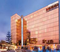
The Meeting Hotel – Located in the heart of downtown Chicago in the prestigious River North neighborhood of the city, the Westin Chicago River North’s location makes it a perfect base to explore the historic and energetic Windy City with nearby attractions including Millennium Park, Chicago theatre district, and the vibrant Chicago Riverwalk. Refreshed in early 2020, the flexible event space offers the perfect setting for meetings. Recharge in your choice of accommodations, from traditional rooms to luxury suites, all with a view of the Chicago River or the downtown skyline. Maintain your health goals with the delicious and healthy on-site dining at 320 RiverBar and the state-of-the-art WestinWorkout fitness studio. Enjoy complimentary fitness classes as well as Rise + Ride with Westin and Peloton.
September 23-27, 2025
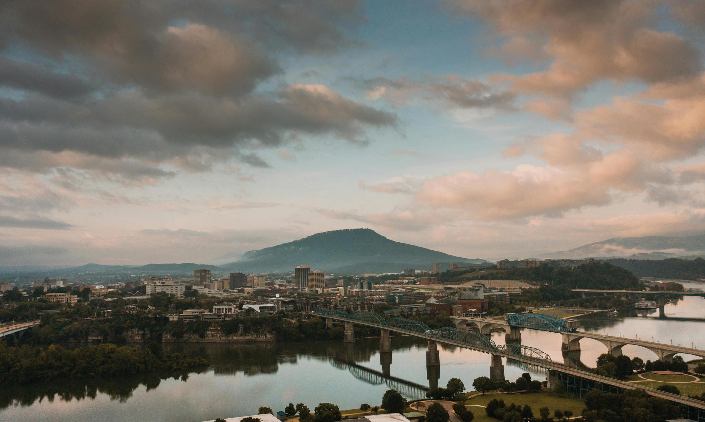
Chicago, Illinois | Westin Chicago River North

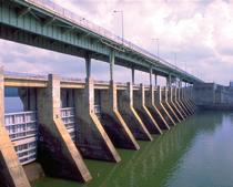
Tennessee River dinner cruise on the Southern Belle Riverboat. The highlight will be locking through Chickamauga Dam.


AEG News (ISSN 0899-5788; USPS 954-380) is published by the Association of Environmental & Engineering Geologists (AEG) four times per year: in April, July, and December, with the Annual Report and Directory in March. The Annual Meeting Program with Abstracts is published only digitally, in September, and the digital copies are distributed at the AEG Annual Meeting. Association members receive an electronic copy of all five issues of AEG News as part of their dues. Print subscription for Association Members, which includes all three regular issues of the AEG News and the Annual Report and Directory issue, is $40 in addition to annual membership dues. Nonmember annual subscription is $50. Back copies of AEG News regular issues are $12 each. Inquiries should be sent to manager@aegweb.org . © 2024 Association of Environmental & Engineering Geologists—All Rights Reserved
Views expressed in this publication are not necessarily those officially representing the Association of Environmental & Engineering Geologists except where expressly stated.
AEG News Editors
Acquisitions Editor: Martha Whitney, Principal Engineering Geologist, Whitney Geologic, internationalaeg@aegweb.org
Content Editor: Bill Roman, Woodsman, bill.roman.bretz@gmail.com
Managing Editor/Production: Allie Boman and Whitney Larson, Boman Editing, 765-543-4191, allie@bomanediting.com, www.bomanediting.com
In order of preference:
1. Send files via email, preferably as attachments, to both email addresses above. Optimum file format is MSWord. Users of other software programs should convert their file to ASCII or text only. Photos and other images, charts, graphs, etc. should be sent as separate images but may be included in the Word.doc for placement purposes.
2. Images should be sent as high-resolution (250 dpi at 4” wide or larger) jpeg or tiff files and should be named with a strong identifier such as HF-TexasJohn Jones —NOT P204679.jpg. Corresponding photo captions should be included in the text along with an attribution of the source/photographer.
3. The policy of AEG News editorial staff is to limit the credentials of an individual to two. No effort will be made by the AEG News editorial staff to determine whether individuals whose credentials are missing from the submitted copy actually have academic or professional credentials, nor will the staff verify the existence or correctness of the credentials submitted.
For detailed guidelines visit: https://aeg.memberclicks.net/assets/docs/aeg_news_style_guide_0713. pdf
Contact AEG at president@aegweb.org
https://www.aegweb.org/aeg-news-2 Canada Agreement number: PM40063731; Return Undeliverable Canadian Addresses to: Station A, PO Box 54; Windsor, ON N9A 6J5; Email: returnsil@imex.pb.com
Alexander Calder’s 37-foot-tall bronze statue of William Penn, founder of the Colony of Pennsylvania, has greeted visitors to the City of Brotherly Love since its installation atop Philly’s City Hall in 1894.
2023–2024 Officers
President: SARAH KALIKA
Consulting Geologist, DiabloGeo Environmental, San Ramon, CA, president@aegweb.org
Vice President/President Elect: RENEE WAWCZAK Hydrogeologist, Norridge, IL, renee.wawczak@gmail.com
Treasurer: PAUL WEAVER
Geotechnical Geologist–Retired, Greensboro, NC, pmweaver187@gmail.com
Secretary: MARK SWANK
Senior Engineering Geologist, Aspect Consulting, Vancouver, WA, markswank@comcast.net
Past President: NATHAN SARACENO
Senior Geologist, DiGioia Gray and Associates, Monroeville, PA, nrsaraceno@gmail.com
Association Contacts
Headquarters:
Association Manager: EVELYN NEALE ARDEN SOLUTIONS
2480 West Bay Dr. #141, Belleair Bluffs, FL 33770-2620
727-940-2658 x 2004, manager@aegweb.org
AEG Foundation—President: ANNA SAINDON, rmsain@gmail.com

Apple App Store
• Search for “AEG’s 66th Annual Meeting” or scan the QR code
• You should see “AEG’s 66th Annual Meeting” in the results
• Click on ‘GET’
• Download the app to your phone
• Open the app
• Click the profile icon located at the top right of the app home page to log in
• Follow the prompts on the screen to obtain an access code
• Make sure to use the email you registered with
• Enter the access code sent to your email
• You should now have access to the event
• Now that you’re logged in, you can make edits to your profile by clicking on the profile button at the top right of the home page

Google Play Store
• Search for “AEG’s 66th Annual Meeting” or scan the QR Code
• You should see “AEG’s 66th Annual Meeting” in the results. If the app does not appear in the search results, use quotes around the app name.
• Click on ‘Install’
• Download the app to your phone
• Click on ‘open’
• Click the profile icon located at the top right of the app home page to log in
• Follow the prompts on the screen to obtain an access code
• Make sure to use the email you registered with
• Enter the access code sent to your email
• You should now have access to the event
• Now that you’re logged in, you can make edits to your profile by clicking on the profile button at the top right of the home page
The Journal of the Association of Environmental & Engineering Geologists and the Geological Society of America
◆ To reach more than 20,000 engineering geology professionals.
◆ To give your work visibility among other researchers in your field.
◆ To keep the body of knowledge current.
◆ To make your work accessible to a wider audience.
◆ To make your work more discoverable through on-line search engines.
◆ To take advantage of the new Open Access feature.
◆ To become eligible for the AEG Publications Award presented annually to the person or persons responsible for the most outstanding paper published in Environmental & Engineering Geoscience.
Instructions for Authors are in the Style Guide: https://www.aegweb.org/e-eg-supplements
Instructions for Submitting Files: https://www.editorialmanager.com/eeg
If you have questions, please contact a Co-Editor: Thomas Oommen (toommen@olemiss.edu) or Eric Peterson (ewpeter@ilstu.edu).
(All times are Eastern Time. See the mobile app for final schedule changes.)
MONDAY, SEPTEMBER 9
AEG Virtual Day Online Only 10:00am–4:00pm
TUESDAY, SEPTEMBER 10
EVENT
Field Course #1: Conowingo Dam Meet in the Lobby 8:00am–4:00pm
Sponsored by AEG Carolinas Chapter
Field Course #2: Wissahickon Valley Meet in the Lobby 8:30am–12:00pm
Field Course #3: Absecon Island & Brigantine Island, Atlantic County, New Jersey Meet in the Lobby 8:30am–4:30pm
Field Course #4: Edelman Fossil Park - Canceled Meet in the Lobby 1:00pm–4:30pm
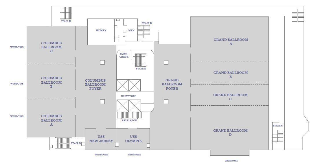
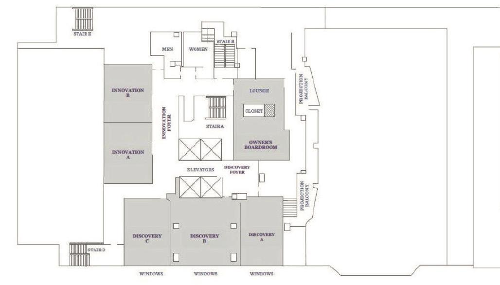
AEG Executive Council meeting Owner’s Boardroom 8:00am–5:00pm
AEG Foundation Board meeting USS New Jersey 8:00am–5:00pm
Joint luncheon—AEG EC and AEG Foundation Board (invitation only) Admiral’s Quarters 12:00pm–1:00pm
Student/professional networking reception Discovery 5:15pm–6:15pm
Sponsored by Schnabel Engineering
Welcome (icebreaker) Exhibit Hall 6:30pm–8:30pm
Sponsored by Field Environmental Instruments, Inc
Young @Heart student/professional event Moshulu Tall Ship 8:00pm–10:00pm
Sponsored by AEG Foundation, Verdantas, University of Pennsylvania, and Rick Kolb
Speakers/moderators breakfast
6:30am–7:30am Registration
Foyer 7:00am–5:00pm
Speaker preparation room Owner’s Boardroom 7:00am–5:00pm
Exhibitors
Coffee & tea available all day in the exhibit hall Sponsored by Spotlight Geophysical Services
Committee room USS New Jersey 10:00am–5:00pm
Guest get together USS New Jersey 9:00am–10:00am
Poster session presentations
Opening session
Sponsored by Gannett Fleming / TranSystems
8:00am–4:00pm
Ballroom 8:00am–12:00pm
Opening Session Welcome (AEG President Sarah Kalika) Columbus Ballroom 8:00am–8:03am
Meeting Co-Chair Welcome (Curt Schmidt and Niall Henshaw) Columbus Ballroom 8:03am–8:07am
AEG Volunteer Recognition Award (Courtney Johnson and Gerry Stirewalt) Columbus Ballroom 8:07am–8:15am
AEG Advocacy Award (John McPhee) Columbus Ballroom 8:15am–8:25am
AEG Foundation Awards (Foundation President Dr. Anna Saindon) Columbus Ballroom 8:25am–9:00am
Pennsylvania State Geologist (Dr. Gale Blackmer)
Keynote Speaker (David Haymes, NJDEP Assistant Commissioner)
Columbus Ballroom 9:00am–9:30am
Columbus Ballroom 9:30am–10:00am
Morning Break Exhibit Hall 10:00am–10:20am
Sponsored by AEG Sacramento Chapter
AEG Outstanding Environmental & Engineering Geologic Project Award Columbus Ballroom 10:20am–11:00amPaw Paw Slope Stabilization Project—Chesapeake & Ohio Canal National Historic Park (Joseph Reed and Nick Strater)
2023-24 AEG/GSA Richard H. Jahns Distinguished Lecturer Cynthia Palomares Columbus Ballroom 11:00am–11:30am
2024-25 AEG/GSA Richard H. Jahns Distinguished Lecturer Dr. John Kemeny Columbus Ballroom 11:30am–12:00pm
Exhibitor-hosted lunch Exhibit Hall 12:00pm–1:30pm Sponsored by Enviroprobe Service Incorporated
Dams and Levees TWG meeting USS New Jersey 12:00pm–1:00pm
Technical Session #1: Diversity, Equity, and Inclusion Symposium—Shine the Light Columbus A 2:00pm–5:00pm Sponsored by Arcadis
Technical Session #2: Tunneling Symposium Columbus B 2:00pm–5:00pm Sponsored by Brierley Associates & Aldea Services
Technical Session #3: Karst Symposium Columbus C 2:00pm–5:00pm In partnership with Society of Exploration Geophysicists (SEG)
Technical Session #4: Coastal Hazards Innovation 2:00pm–5:00pm Sponsored by Aspect Consulting
AEG Foundation town hall USS New Jersey 3:00pm–4:00pm
Afternoon break Exhibit Hall 3:00pm–3:20pm
Sponsored by AEG Carolinas Chapter
Special event: “A Night of Geology and American History at Carpenters’ Hall” Departs from Lobby 6:30pm–10:00pm Sponsored by GEOVision
Student and young professional event: Silent disco Admiral’s Quarters 7:00pm–9:00pm Sponsored by Curt Schmidt and Niall Henshaw
THURSDAY, SEPTEMBER 12 EVENT
Speakers/moderators breakfast
6:30am–7:30am Registration Ballroom Foyer 7:00am–5:00pm
Speaker preparation room
Coffee & tea available until 3:20pm in the exhibit hall and after 3:30pm in the ballroom foyer Sponsored by AEG Sacramento Chapter
7:30am–3:20pm
Committee room
Poster session presentations
Technical Session #5: GASH Case Histories for Evaluation of Geologic and Seismic
8:00am–3:20pm
A 8:00am–12:00pm Hazards, part I Sponsored by PanGEO
Technical Session #6A: Environmental Site Characterization Symposium
Technical Session #6B: Environmental and Mining Topics
Technical Session #7: Dams and Levees Symposium, part I
8:00am–10:00am
10:20am–12:00pm
B 8:00am–12:00pm Sponsored by RJH Consultants
Technical Session #8: Land Subsidence Symposium, part I
C 8:00am–12:00pm Sponsored by Harris-Galveston Subsidence District
Morning break
AEG Inclusion luncheon (ticketed event)
Sponsored by Susan Steele Weir
12:00pm–1:30pm
Lunch on your own for attendees 12:00pm–1:30pm
Technical Session #9: GASH Case Histories for Evaluation of Geologic and Seismic
A 1:40pm–5:00pm Hazards, part II
Technical Session #10: Dams and Levees Symposium, part II
B 1:40pm–5:00pm Sponsored by Schnabel Engineering
Technical Session #11: Land Subsidence Symposium, part II Columbus C 1:40pm–5:00pm
Technical Session #12: Engineering Geology in Southwest Pennsylvania Innovation 1:40pm–3:00pm
Technical Session #13: Geophysical and Site Investigations, part I
3:20pm–5:00pm
AEG Foundation town hall USS New Jersey 3:00pm–4:00pm
Afternoon break
3:00pm–3:20pm
Landslide Technical Working Group meeting USS New Jersey 4:00pm–5:00pm
Poster reception and happy hour Ballroom Foyer 5:00pm–6:30pm
Annual banquet (ticketed event) Grand Ballroom CD 7:00pm–10:00pm Sponsored by Exponent
EVENT
Speakers/Moderators breakfast
Coffee & tea available all day in the Grand Ballroom Foyer Sponsored by DiabloGeo
6:30am–7:30am
Speaker preparation room Owner’s Boardroom 8:00am–3:00pm
Committee room USS New Jersey 8:00am–3:00pm
Technical Session #14: Landslides in the Eastern U.S./Inventories and Columbus A 8:00am–12:00pm Susceptibility Mapping
Technical Session #15: GASH/Dams & Levees/Geophysics Symposium Columbus B 8:00am–12:00pm
Technical Session #16: Presentation and Discussion of Award-Winning Columbus C 9:00am–11:30am
Film American River, about a journey down New Jersey’s Passaic River, with Filmmaker Scott Morris
AEG Foundation town hall USS New Jersey 10:00am–11:00am
Morning break
Foyer 10:00am–10:20am
Technical Session #16: Columbus B 11:30am–12:00pm
Short Film: Mystery of Mélange by Johnathann Reyes and Devin Moore
Past presidents luncheon (invitation only) Discovery 12:00pm–1:00pm
Lunch on your own for attendees 12:00pm–1:00pm
Technical Session #17: Landslides in the Western U.S. Columbus A 1:00pm–2:40pm
Technical Session #18: Geophysical and Site Investigations, part II Columbus B 1:00pm–2:40pm
Technical Session #19: Tectonic Studies Columbus C 1:00pm–2:40pm
Afternoon break Ballroom Foyer 2:40pm–3:00pm Don’t miss the famous 4th Street cookies
AEG’s corporate business meeting and closing session Grand Ballroom CD 3:00pm–5:00pm
AEG president-hosted closing beer and wine reception
Grand Ballroom Foyer 5:00pm–6:00pm Hosted bar, light appetizers
SATURDAY, SEPTEMBER 14
EVENT LOCATION TIME
Field Course #5: Valley Forge Departs from Lobby 8:30am–4:30pm
AEG Board of Directors meeting Discovery B 8:00am–5:00pm
SUNDAY, SEPTEMBER 15
AEG Board of Directors meeting Discovery B 8:00am–12:00pm
MONDAY, SEPTEMBER 9
AEG Virtual Day—Eastern Time Online Only 10:00am–4:00pm
WEDNESDAY, SEPTEMBER 11
Opening Session Columbus Ballroom 8:00am–12:00pm Sponsored by Gannett Fleming / TranSystems
Opening Session Welcome (AEG President Sarah Kalika) Columbus Ballroom 8:00am–8:03am
Meeting Co-Chair Welcome (Curt Schmidt and Niall Henshaw) Columbus Ballroom 8:03am–8:07am
AEG Volunteer Recognition Award (Courtney Johnson and Gerry Stirewalt) Columbus Ballroom 8:07am–8:15am
AEG Advocacy Award (John McPhee) Columbus Ballroom 8:15am–8:25am
AEG Foundation Awards (Foundation President Dr. Anna Saindon) Columbus Ballroom 8:25am–9:00am
Pennsylvania State Geologist (Dr. Gale Blackmer) Columbus Ballroom 9:00am–9:30am
Keynote Speaker (NJDEP Assistant Commissioner David Haymes) Columbus Ballroom 9:30am–10:00am
AEG Outstanding Environmental & Engineering Geologic Project Award: Columbus Ballroom 10:20am–11:00am Paw Paw Slope Stabilization Project—Chesapeake & Ohio Canal National Historic Park (Joseph Reed)
2023/2024 AEG/GSA Richard H. Jahns Distinguished Lecturer Cynthia Palomares Columbus Ballroom 11:00am–11:30am 2024/2025 AEG/GSA Richard H. Jahns Distinguished Lecturer Dr. John Kemeny Columbus Ballroom 11:30am–12:00pm
Technical Session #1: Diversity, Equity, and Inclusion Symposium—Shine the Light Columbus A 2:00pm–5:00pm Sponsored by Arcadis
Technical Session #2: Tunneling Symposium Columbus B 2:00pm–5:00pm Sponsored by Brierley Associates & Aldea Services
Technical Session #3: Karst Symposium Columbus C 2:00pm–5:00pm In partnership with Society of Exploration Geophysicists (SEG)
Technical Session #4: Coastal Hazards Innovation 2:00pm–5:00pm Sponsored by Aspect Consulting
THURSDAY, SEPTEMBER 12
Technical Session #5: GASH Case Histories for Evaluation of Geologic and
A 8:00am–12:00pm Seismic Hazards, part I
Sponsored by PanGEO
Technical Session #6A: Environmental Site Characterization Symposium
Technical Session #6B: Environmental and Mining Topics
8:00am–10:00am
10:20am–12:00pm
Technical Session #7: Dams and Levees Symposium, part I Columbus B 8:00am–12:00pm Sponsored by RJH Consultants
Technical Session #8: Land Subsidence Symposium, part I Columbus C 8:00am–12:00pm Sponsored by Harris-Galveston Subsidence District
Technical Session #9: GASH Case Histories for Evaluation of Geologic and Columbus A 1:40pm–5:00pm Seismic Hazards, part II
Technical Session #10: Dams and Levees Symposium, part II Columbus B 1:40pm–5:00pm Sponsored by Schnabel Engineering
Technical Session #11: Land Subsidence Symposium, part II Columbus C 1:40pm–5:00pm
Technical Session #12: Engineering Geology in Southwest Pennsylvania
Technical Session #13: Geophysical and Site Investigations, part I
1:40pm–3:00pm
3:20pm–5:00pm
FRIDAY, SEPTEMBER 13
Technical Session #14: Landslides in the Eastern U.S./Inventories and Columbus A 8:00am–12:00pm Susceptibility Mapping
Technical Session #15: GASH/Dams & Levees/Geophysics Symposium Columbus B 8:00am–12:00pm
Technical Session #16: Presentation and Discussion of Award-Winning Columbus C 9:00am–11:30am
Film American River, about a journey down New Jersey’s Passaic River, with Filmmaker Scott Morris
Technical Session #16 Short Film: Mystery of Mélange by Johnathann Reyes and Devin Moore Columbus C 11:30am–12:00pm
Technical Session #17: Landslides in the Western U.S. Columbus A 1:00pm–2:40pm
Technical Session #18: Geophysical and Site Investigations, part II Columbus B 1:00pm–2:40pm
Technical Session #19: Tectonic Studies Columbus C 1:00pm–2:40pm
AEG’s 67th Annual Meeting would not be possible without the hard work and dedication of the following committee chairs and the many more volunteers that serve on these committees.
Annual Meeting Co-Chairs
Curt Schmidt, H2M
Niall Henshaw, Parsons Corporation
Finance
Niall Henshaw, Parsons Corporation
Field Courses
Visty Dalal, Maryland Department of the Environment
Joelle Freeman, Verdantas
Mia Painter, Schnabel Engineering
Curt Schmidt, H2M
Keynotes
Tom Cumello, Dewberry
Special Event
Niall Henshaw, Parsons Corporation
Get to know your fellow guest attendees!
All guest attendees are invited to join us for an informal coffee/tea meetand-greet on Wednesday morning from 9:00am to 10:00am to plan your week’s fun excursions together.
Technical Program
Marty Goff, United States Army Corps of Engineers
At Large
Rose Delorenzo, LSRP Consulting, LLC
Jim Peterson, Princeton Geoscience
Fran Schultz
Ted Toskos, Jacobs
Meeting Management
Heather Clark, AEG Meeting Manager
Evelyn Neale, AEG Association Manager
Kindra Bess, AEG Headquarters
Jennifer Breitenbach, AEG Headquarters
ANNUAL MEETING WIFI ACCESS:
NETWORK: HILTON_MEETING ACCESS CODE: AEG2024
LEAVE THE PAPER BEHIND! AEG2024 GOES MOBILE!
Schedule, maps, networking, and more on your mobile device—completely free!
AEG wishes to acknowledge the following companies for their support by allowing their employees to assist with the planning of the 2024 Annual Meeting:
Dewberry H2M
Jacobs
LSRP Consulting, LLC
Maryland Department of the Environment
Parsons Corporation
Princeton Geoscience
Schnabel Engineering
United States Army Corps of Engineers (USACE)
Verdantas
AEG wishes to thank the following individuals for their assistance with the planning of the 2024 Annual Meeting:
Sarah Kalika, AEG President
Renee Wawczak, AEG Vice President/President-Elect
Paul Weaver, AEG Treasurer
Mark Swank, AEG Secretary
Nate Saraceno, AEG Past President
Field Course Leaders
Dr. Visty Dalal, Maryland Department of the Environment
Kimberly McKenna, Stockton University Coastal Research Center
Dr. Natalie P. Flynn, Earth and Environmental Science Department, Temple University
Dr. Eric Pyle, James Madison University and “Department of the Geographer” of the Continental Army
Nelson Abrams, Distinct Engineering Solutions, Inc., and “Department of the Geographer” of the Continental Army
Bethany L. Dhunjisha, Valley Forge National Historical Park
Symposium Conveners and Technical Session Moderators
James Arthurs, Federal Highway Administration
James Borchers, Hydrologist
David Carpenter, Schnabel Engineering
Luke Ducey, WSP
Hawkins Gagnon, Schnabel Engineering
William Godwin, Salinian Geoconsulting
Deborah Green, GeologistWriter
James Hamel, Hamel Geotechnical Consultants
Paul Headland, Aldea Services, Inc.
Matt Huebner, Tennessee Valley Authority
Ike Isaacson, Brierley Associates
Courtney Johnson, Slate Geotechnical Consultants
Sarah Kalika, DiabloGeo Environmental
Rick Kolb, Dunklee & Dunham
Kevin McCoy, BGC Engineering
Kathryn Murdock, Exponent
Mia Painter, Schnabel Engineering
Mike Piepenburg, Mott MacDonald
Scott Sochar, California Geological Survey
Josh Shinpaugh, Tennessee Valley Authority
Danielle Smilovsky, Conrad Blucher Institute
Gerry Stirewalt, Nuclear Regulatory Commission
Cassie Wagner, USACE
Corporate Business Meeting and Closing Session
Friday, September 13, 2024, 3:00pm–5:00pm
Free with all registration types.
The Corporate Business Meeting and Closing Session is a time for Association officers, board members, and committee members to participate, report on their activities, witness the installation of new officers, the transition of the outgoing and incoming presidents, and the presentation of some of the AEG awards. President-hosted Closing Reception to follow. Celebrate a successful meeting with a hosted beer and wine bar, light appetizers, and famous Philadelphia pretzels .
Welcome to Philadelphia and AEG’s 67th Annual Meeting! Thank you to co-chairs Curt Schmidt and Niall Henshaw for assembling our outstanding team of 2024 Annual Meeting planning committee volunteers. AEG is truly grateful for the countless hours of work by the committee members to organize field courses, the special event, technical sessions, student events, and more!
We have a fantastic assemblage of 19 technical sessions on topics including Landslides on the West and East Coasts, Environmental Site Characterization, Land Subsidence, Geologic and Seismic Hazards, Karst, Environmental & Mining, Tunneling, Dams & Levees, Diversity Equity & Inclusion, and more—planned by our Technical Working Groups.
Don’t miss our field courses to hydroelectric power producer Conowingo Dam, the Wissahickon Valley schist deposit, the “Jersey Shore” to view coastal resilience of Atlantic County New Jersey, and the geology and history of Revolutionary War battle site Valley Forge
Tuesday, after the Icebreaker reception, join us for Young @Heart on the Moshulu —the world’s oldest and largest square-rigged ship still afloat. The event is walkable from the hotel and features drinks and appetizers.
To begin our sessions on Wednesday morning, join us for our Opening Session, which will feature AEG Foundation Awards and Scholarships presented to deserving students, keynote speakers including Dr. Gale Blackmer (state geologist of Pennsylvania), David Haymes —assistant commissioner of contaminated site remediation & redevelopment for the New Jersey Department of Environmental Protection), current Richard H. Jahns Distinguished Lecturer Cynthia Palomares, introduction to our incoming Jahns Lecturer Dr. John Kemeny, and presentation of the Outstanding Environmental & Engineering Geology Project to the team who worked on the Paw Paw Slope Stabilization Project at Chesapeake & Ohio Canal National Historic Park in Oldtown, MD.
On Wednesday night, our ticketed Special Event will take you into the “room where it happened” at Carpenters’ Hall, the location of the First Continental Congress held in 1774. If you prefer to hang out at the hotel, join us for the new Silent Disco, where you can choose a music playlist on your headphones and dance among friends!
Vote for your favorite student poster in the meeting app and celebrate our student poster authors during the Thursday afternoon reception. And, if you donated to the AEG Foundation this past year, join us for a donor reception on Thursday evening! On Thursday night, our Annual Banquet, we’ll honor AEG’s outstanding award winners, including Honorary Member inductees Elaine Hanford and William “Bill” Cole, Floyd T. Johnston Service Awardee Kerry Cato, Douglas Piteau Young Member Jessica Goodwin, Claire P. Holdredge Publication Awardees, Karl and Ruth Terzaghi Mentor Susan Steele Weir, and Schuster medalist Paul Santi. Our final presentation of the evening will be from our incoming president, Renee Wawczak, who will introduce herself and her plans for the coming year!
Sarah Kalika, AEG President
You can find me at our Inclusion Luncheon on Thursday and the Closing Session on Friday afternoon, where we will present awards to our Outstanding Student Chapters, Chapters of the Year, and Environmental & Engineering Geoscience Journal Outstanding Paper & Editor Awards, and officially welcome our incoming Association President Renee Wawczak. Join me afterward for a president-hosted happy hour and toast to a great year! Our Annual Meetings are always strongly supported by our exhibitors and sponsors, so please help me welcome our exhibitors by stopping by their booths during the Icebreaker reception, Exhibitor’s Luncheon, and during our morning and afternoon breaks! Thank you to our generous sponsors who help make this meeting successful.
The Greek verb phileo means to love, and the noun adelphos means brother, the City of Brotherly Love.
We are so pleased to welcome everyone to this year’s 67th AEG Annual Meeting and especially any of you visiting Philadelphia for the first time.
Named our nation’s first World Heritage City, Philadelphia enjoys a rich and colorful history:
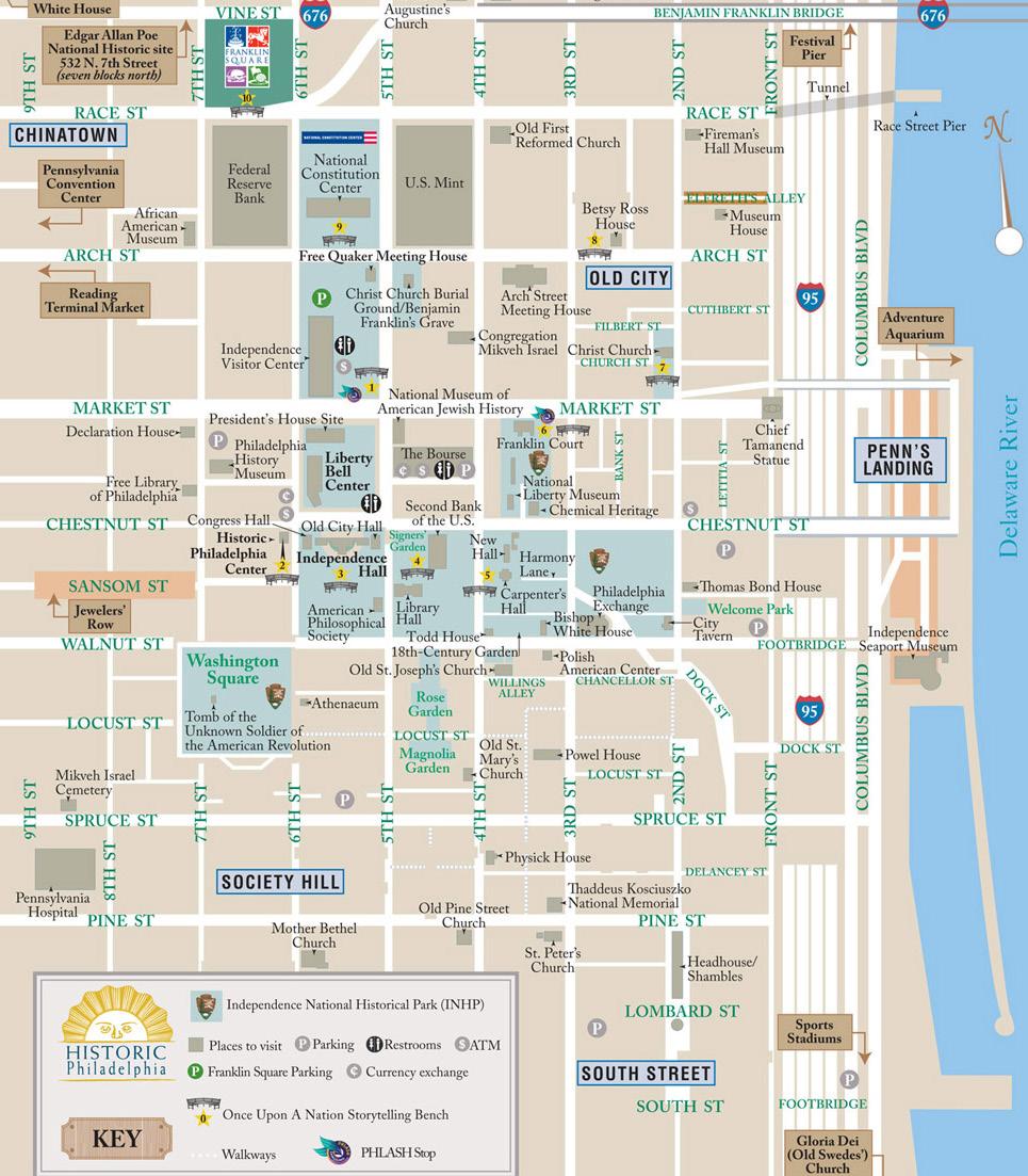
Hosted the First Continental Congress at Carpenters’ Hall, in 1774—250 years ago!
Home to our first great scientist, printer, statesman, and patriot: Benjamin Franklin
· Preserved the Liberty Bell
Hosted the Second Continental Congress, in the original PA State House (now Independence Hall), during which the founders signed the Declaration of Independence
· The U.S. Constitution was later ratified in Independence Hall at the Philadelphia Convention of 1787
Philadelphia remained the nation’s largest city until 1790 and served as the nation’s first capital from May 10, 1775, until December 12, 1776, and four subsequent occasions during and following the American Revolutionary War
Hosted the first World’s Fair, the 1876 Centennial Exposition, at West Fairmount Park, an epic gathering showcasing how our young nation had become a leader in the world’s scientific, technical, and industrial development. Introduced Alexander Graham Bell’s invention, the telephone; the latest mining and survey equipment; the first Remington typewriter; the first mechanical calculator; and a double-decker steam driven monorail, along with Hires Root Beer, sugar popcorn, bananas, and Heinz ketchup!
Home of soft pretzels, Philly Cheesesteaks, and Rocky’s famous run up the 72 steps of the Philadelphia Museum of Art
· Founded on the banks of the Delaware River; lies on the “Fall Line,” a geological boundary between the Piedmont Plateau and the Coastal Plain Philadelphia, New Jersey, and New York were the Crossroads of the American Revolution, our nation, and our nation’s development!
The Annual Meeting will allow an exploration of both the history of our country and the birth of modern geology, which occurred around the same time (late 1700s). Our Special Event this year will take place at Carpenters’ Hall on Wednesday, September 11th, 2024, exactly 250 years from when the original founders were in the same room discussing the formation of our soon-to-be new country. To be in the same room as John Adams, Samuel Adams, John Jay, Patrick Henry, George Washington, and other 49 delegates will be a wonderful experience.
Thank you to all of the members of the Planning Committee, the AEG Executive Committee, and all who worked tirelessly to make this Annual Meeting come to fruition. Many, many thanks to our wonderful Meeting Manager, Heather Clark.
Let’s see what our AEG membership and colleagues will introduce at this august gathering!
Curt Schmidt and Niall Henshaw General Co-Chairs 2024 Annual Meeting Committee


August 2024
Dear AEG Members,
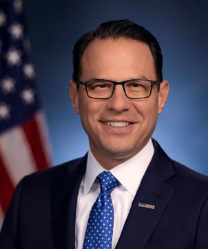
Welcome to Pennsylvania! On behalf of the Pennsylvania Geological Survey and the Department of Conservation and Natural Resources, I am pleased to welcome the AEG Annual Meeting to the Keystone State.
Pennsylvania does indeed occupy the crossroads in many senses. Culturally, we sit at the transition between North and South, and stretch from the East Coast to the Midwest. Blessed with an abundance of natural resources, at various periods from colonial times to the present, Pennsylvania has been a center of production for iron, chromium, lead-zinc minerals, coal, oil, and natural gas. Now the wastes from two centuries of mineral exploitation are being investigated for critical minerals and our subsurface geology explored for carbon storage, placing us squarely in the transition to new energy sources and a lower carbon economy. Geologically, Pennsylvania spans the entire Appalachian orogen from the metamorphic core in the southeast to the far edges of the foreland in the west, linking the northern Appalachians and the southern Appalachians.
AEG has planned an excellent program that will certainly stimulate much productive learning and conversation. Still, I hope you can find a moment to take in some of our beautiful geology and important historic sites, and to grab an authentic Philly cheesesteak or pretzel.
Sincerely,

Gale C. Blackmer, Ph.D., P G Director and State Geologist Bureau of Geological Survey Department of Conservation and Natural Resources
William Cole
Elaine Hanford
AEG confers an honor of such high esteem that the distinction is recognized as a membership class: Honorary Member. This recognition is given to those whose careers have exemplified the ideals of AEG.

Susan Steele Weir
Established in 2008, this award recognizes outstanding individuals for their achievements as mentors throughout their career. The recipient has made lifelong efforts in providing professional, ethical, and technical mentoring for environmental and engineering geologists.

Jessie Goodwin
This award, established in 1985, is presented to a Member who is age 35 or under and has excelled in technical accomplishment, service to the Association, and service to the engineering geology profession.

Dr. John Kemeny
A joint committee of AEG and the Engineering Geology Division of GSA selects the Jahns Lecturer, who presents an annual series of lectures at academic institutions to increase students’ awareness about careers in engineering geology.
Holger Kessler
Dr. Michiel J. van der Meulen
Keith Turner (Deceased)
(Awarded at the CGS meeting)
Dr. Paul Santi
A joint award from AEG and the Canadian Geotechnical Society that recognizes excellence in geohazards research in North America (NA). Nominees must be residents of NA and meet at least two of the following criteria: professional excellence in geohazards research with relevance to NA, significant contribution to public education regarding geohazards, international recognition for a professional career in geohazards, influential geohazards research or development of methods or techniques, or teacher of geohazards students.
Dr. Kerry Cato
This award is presented to a member for outstanding active and faithful service to AEG over a minimum period of nine years to coincide with Floyd T. Johnston’s tenure as Executive Director.
The Association’s highest publication award, the Claire P. Holdredge Award, is presented to an AEG Member who has produced a publication within the past five years that is adjudged to be an outstanding contribution to the environmental and engineering geology profession.
John McPhee

For outstanding accomplishments in advocating for geology and the natural world. He received the Award in Literature from the Academy of Arts and Letters in 1977; the Pulitzer Prize for general nonfiction for Annals of the Former World in 1999; and the George Polk Career Award in 2008, for his “indelible mark on American journalism during his nearly half-century career.”
In addition to honoring outstanding AEG Members, AEG also recognizes the following:
This award was established by the Association in 1968 and is presented to the author(s) of the most outstanding paper published in any AEG publication during the fiscal year. Winning papers can be viewed online at GeoScienceWorld
“Possible Role of Internal Erosion for the Development of Ground Fissures Around Lake Ziway, Ethiopia,” Environmental & Engineering Geoscience, 30(1-2), pp. 45-58.
Dr. Yonathan Admassu
Dr. Trufat Gugsa
2024 Environmental & Engineering Geoscience Journal Outstanding Reviewer Award
First presented in 2007, this award is given to an individual who has provided extended service by reviewing numerous manuscripts, including critical evaluations, detailed comments, corrections of grammar and syntax, thoughtful suggestions for changes to improve the quality of the manuscript, and guidance to the editors in making a decision regarding the manuscript.
Dr. Visty Dalal
Thursday, September 12, 2024, 12:00–1:30pm, $55/person
Sponsored by Susan Steele Weir
For over 40 years, the Annual Meeting has included a meal focused on networking and support of people seeking greater representation in AEG. The Women in AEG Breakfast/Luncheon for women and allies at the Annual Meeting was a great opportunity for many women to make connections with their peers and friendships for life within the organization. In 2021, the Women in AEG meal evolved into the Inclusion Luncheon. This year’s Inclusion Luncheon activity will once again be use Jamboard, a virtual collaborative whiteboard, to allow everyone to contribute their thoughts on AEG’s current direction and ideas on how we can make AEG more inclusive.
This award was established by the Board of Directors in 2001 to honor a Chapter of the Association judged to excel in a number of areas including professional activities, communications, membership, and networking.
San Francisco Bay Chapter
Runner Up
New York/Philly Chapter
Wake Tech
Portland State University
AEG Outstanding Environmental & Engineering Geologic Project Award
Paw Paw Slope Stabilization Project—Chesapeake & Ohio Canal National Historic Park
We recognize those volunteers within AEG that have worked hard to move AEG forward over the past year. These awards will be given during the Opening Session on Wednesday morning.
Courtney Johnson
Gerry Stirewalt
These are just a few of the AEG awards that recognize the contributions our members make to the Association and to the profession. For a complete list of the awards and requirements for each, visit https://www. aegweb.org/awards-scholarships
The recipients will be honored at the Opening Session on Wednesday, September 11.
Aleigha Dollens
University of Missouri-Kansas City
Issac Pope
Colorado School of Mines

Julia Rudlaff
Michigan State University
The Beardsley-Kuper Field Camp Scholarship Fund supports expenses for geology field camps with applied environmental and engineering geology components that will be useful to the students’ future profession as an environmental or engineering geologist. The scholarship was established in 2009 by Cathryne Beardsley with her daughter Dorian Kuper and son-in-law Tom Kuper.
Isaac Bauer
University of North Carolina at Chapel Hill

Established in 2015 with a gift from the Carolinas Chapter, this scholarship supports geologic studies by undergraduate students enrolled in a geology or geoscience program at an accredited university in North Carolina or South Carolina.
Caleb Ring
University of Nevada, Reno
The Marliave Scholarship Fund was established in 1968 to honor the late Chester E. Marliave, Burton H. Marliave, and Elmer C. Marliave, outstanding engineering geologists and supporters of AEG. The funds are distributed as grants, which are intended to support academic activity and reward outstanding scholarship in Engineering Geology and Geological Engineering.
Nishanti K. Perera
University of Washington
The Susan Steele Weir Scholarship Fund was established by the AEG Foundation in 2017 to create a scholarship fund that promotes and supports the continued development and advancement of women in the profession of engineering geology.


Angelique DePauw
University of Nevada, Reno
The Robert J. Watters Great Basin Chapter Scholarship Fund supports geoscience studies by students at the undergraduate and graduate levels.
Parinaaz Zubin Patel
Anne Arundel Community College
Lauren Elizabeth Guido
Colorado School of Mines

Korei Dawn Patterson Teer
University of Arkansas

Dr. Martin L. Stout was Professor of Geology at California State University, Los Angeles from 1960 to 1990. He is remembered by his students for his passionate and insightful instruction in engineering geology. Dr. Stout was known for his expertise on landslides, his travels, his good humor, and his gracious manner. This scholarship supports his legacy.
Ashley Aguilar
University of Texas at San Antonio
Established in 2007 as the Texas Section Scholarship, the Scholarship was renamed in 2011 to honor Dr. Christopher C. Mathewson. Recipients of the scholarship are undergraduate or graduate students enrolled in an accredited Texas college or university, or graduate students conducting field studies in Texas.
Andrew Swift
Colorado School of Mines
The Shlemon Quaternary Engineering Geology Scholarship supports graduate geology students conducting Quaternary engineering geology research. Initial funding for the Scholarship was provided by a gift from Roy J. Shlemon, Honorary Member of the AEG.
Estefani Diana Ruiz Toro University of HoustonDowntown

Established by the AEG Diversity, Equity, and Inclusion Committee (DEIC) in 2021, this $5,000 scholarship is awarded annually to one student who is a geoscience major in their sophomore, junior, or senior year at an accredited college or university. The successful applicant will have a GPA of 2.9 or better.
Megan Elizabeth Palmer East Tennessee State University

Dylan Toh University of North Carolina at Charlotte
Established in 2014 with initial funding provided as a gift from AEG Past Presidents Terry R. West and Richard E. Gray, this fund supports undergraduate and graduate geology students studying in the eastern half of the United States.
Camryn Parker
Northern Illinois University
Korei Patterson-Teer University of Arkansas


Nishanti K. Perera University of Washington
The Tilford Scholarships are awarded to both undergraduate and graduate students for the summer field season, and were established in memory of Norman R. Tilford, who was a leader in engineering geology and a professor at Texas A&M University. Norm died in 1997 while flying his small aircraft to meet a student field trip. Norm was dedicated to teaching geology in the field and these scholarships support his legacy.
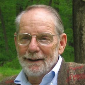
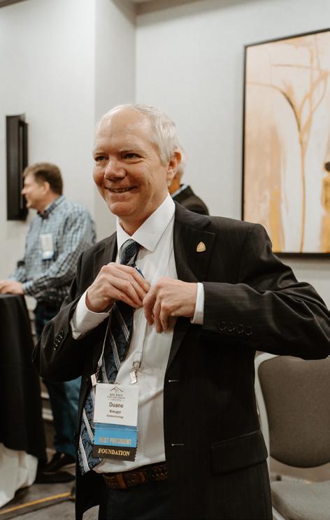
April 26, 1970–May 26, 2024
Submitted
by Anna
Saindon
On May 26, 2024, AEG lost one of its most loyal and dedicated volunteers and friends. Duane joined AEG in 1996 and became active at the Section level soon after, including serving as a Field Trip Leader and preparing Field Trip Guidebooks. Duane was the Field Trip Coordinator for the 2001 AEG Annual Meeting, and he served as an officer of the St. Louis Section from 1999 to 2005.
Duane became active at the Association level in 2003, when he became Chair of the St. Louis Section and began serving on the AEG Board of Directors. Duane was always prepared and engaged at the Board Meetings, of which he attended more than two dozen because of his tenures as St. Louis Section Chair, Co-Chair of the Governance Committee, and on the Executive Council (EC) and Strategic Planning Committee. For the last several years, Duane served on the AEG Foundation Board and as Foundation President from 2023 to 2024. He received the AEG Douglas R. Piteau Outstanding Young Member Award (2004) and Floyd T. Johnston Service Award (2014). Listed below are the numerous officer, liaison, and committee leader positions he filled for AEG, in addition to a summary of his education, professional experience, and service to the profession in roles outside of AEG.
However, listing Duane’s positions, though lengthy, only tells part of the story. Have you noticed how many times the word “serve” was used in the opening paragraphs? Duane’s service to the Association, and to the profession, was exemplary. He was the person so many AEG volunteers called when they needed to brainstorm an idea, have a document reviewed, solve a problem, or lead a committee. Duane was the person who stepped in to steer an Annual Meeting when a planning committee was off course. Duane did the research when state regulations changed and AEG’s organizational status changed because of it. He was the one who drafted the required wording and finalized it with the attorney. Duane negotiated and renegotiated contracts. He took the phone calls from disgruntled members when something went wrong and gave the credit to someone else when something went right. Duane dedicated countless hours to AEG, often working the equivalent of two full-time jobs, one at Geotechnology/UES and one at AEG. He recruited new AEG members by being a welcoming presence, and he encouraged their participation by the example he set. Duane also motivated and inspired the old guard AEG volunteers. He was always appreciative of others’ efforts, and self-effacing about his own. Duane was a quiet man whose actions spoke louder than his words, and by word and deed he was a stalwart leader of the Association. More than anything, Duane was a friend, a listening ear, and quick to make us
laugh. He will be greatly missed by AEG and by those of us left to carry his memory forward.
Professional Experience:
Duane received his BS in geology from the University of Illinois Urbana-Champaign. He was a registered professional geologist in Missouri and Illinois. He spent 29 years with Geotechnology, Inc., in increasingly responsible positions, starting as a driller’s helper, progressing to project geologist and project manager, then environmental group manager, St. Louis branch manager, and operations manager over four Geotechnology offices throughout the Midwest. He assisted with the transition when Geotechnology was acquired by UES. He recently retired from UES.
Service to the Profession:
• Chartered and Chaired the Missouri Geologists’ Consortium (2013–2024)
• Organized Student Subsurface Exploration Workshops (2009 and 2011)
• Volunteered on science projects and field trips for the Cub Scouts and Boy Scouts
Service to the Association:
• Board member (2020–2024) and President (2023–2024) of the AEG Foundation (AEGF)
• Led the launch and implementation of AEG’s Needs Assessment (2012–2014)
• Co-authored the grant application to the AEGF for the Needs Assessment (2012)
• Co-chaired the Strategic Planning Committee (Spring 2012–Jan 2014)
• Chaired/Co-chaired the Advertising/Sponsorship/Exhibitor Committee (2011–2014)
• Served on the Ad-Hoc Association Manager Selection Committee (2012)
• Served as the AEG liaison to the Geoprofessional Foundation (2011–2013)
• Led and/or served on the EC Nominations Committee (2011–2013)
• Served on the Terzaghi Mentor Award Selection Committee (2011–2013)
• Served on the Jahns Distinguished Lecturer Selection Committee (2011–2012)
• Served on the Honorary Member Selection Committee
(2011–2012)
• AEG President (Sept 2009–Sept 2010)
• Member of AEG’s Executive Council (Sept 2006–Sept 2011)
• Served as EC liaison to Annual Meeting Planning Committees (2010–2011)
• Drafted the Memorandum of Understanding utilized by AEG and the Annual Meeting Planning Committees (2010)
• Worked with the Governance Committee and Attorney to rewrite the AEG Bylaws to conform with new CA laws (2010)
• Sponsored events and field trips for numerous Annual Meetings
• Drafted the charter for the Terzaghi Mentor Award (2008)
• Co-chaired the Governance Committee (2004–2006)
• Served on the Section/Chapter Support Committee (2004–2005)
• Served on the AEG Board of Directors (2003–2005)
• Chaired the AEG St. Louis Section (2003–2005)
• Chair of Field Trips, Annual Meeting, St. Louis, MO (2001)
• Officer of the AEG St. Louis Section (1999–2005)
Duane talked about AEG a lot. Almost as much as fishing. He really loved the whole organization. My guess is that his love for this kind of activity was sown into him as a child and then a young man. For example, the Boy Scouts had a huge impact on him (both of us really), as it relates to being outdoors, respecting the environment, working toward merit badges and rank progressions. We went on many trips with the Scouts, including the Philmont High Adventure Base in Cimarron, NM. He loved it so much he made a scrapbook of it that I now have and had long forgot about. Our grandparents took us to Mammoth Cave in Kentucky while we were mid-teens. But most importantly, would have been his involvement with the Geology Club in high school. Mr. Turley ran that club and was also a math professor. The trips they took, and the stories Duane told about those trips, firmly placed him on the geologist path. This was further enhanced of course as he pursued his geology degree at U of I, as he then got to do even more of this. He used to talk about how they would sneak in alcohol on these trips and drink with the professor. And how they would then cook bacon on a cast iron skillet while watching the sun rise over the mountains. He most enjoyed taking trips to see firsthand geology at work in different parts of the country. So it was only natural that he joined organizations such as AEG and the Missouri Geologists Consortium.
From Daren Kreuger, Duane’s brother:
Our exhibitors offer an excellent platform to interact one-onone with you and your company. Your active interest and participation during the exhibit hours will help to ensure that vendor support will remain strong during the years to come. Remember, without these exhibitors, the AEG 67th Annual Meeting would not be successful.
Icebreaker Welcome
Tuesday, September 10, 6:30–8:30pm – Exhibit Hall
Join us in the Exhibit Hall to meet the exhibitors and socialize with your fellow attendees. We will have light appetizers and a cash bar (one drink ticket included for full, guest, and student registrations).
Exhibitor-Hosted Luncheon
Wednesday, September 11, 12:00–1:30pm –Exhibit Hall
The Exhibitor-Hosted Luncheon is a great way to connect with colleagues, gather information about innovations in the industry, and relax with friends old and new over a delicious meal. Free for all full, Wednesday one-day, and student registrations
AEG Registration Area www.aegweb.org
AEG welcomes you to Philadelphia! We hope your stay is filled with informative technical sessions, great meals, and of course lots of networking. Stop by our booth to see some of the latest publications and merchandise available. We will also have information on the various committees and what each has been working on to advance the AEG and the profession.
Booth #14
Sarah Kalika, sarah@georx.net
Renee Wawczak, renee.wawczak@gmail.com
Mark your calendar to join us for the 68th AEG Annual Meeting at the Westin Chicago River North, September 23–25, 2025. Stop by our booth to get all the details.
Alex Vazquez, staff@aegfoundation.org www.aegfoundation.org
Established by three past presidents of AEG in 1992, the AEG Foundation plays a key role in the success of our profession. The AEG Foundation’s vision is to create a culture
Tuesday, September 10 6:30pm–8:30pm Wednesday, September 11 7:30am–5:00pm Thursday, September 12 7:30am–3:20pm
of giving back to the profession and to instill complete confidence in donors that their money is well invested and well spent. Our core programs emphasize scholarship, research, and professional development to improve professional practice. We support outreach to increase the public’s appreciation of environmental and engineering geology in geohazard evaluation and risk reduction.
William S. Schenck, dsneyd@asbog.org
www.asbog.org
The National Association of the State Boards of Geology (ASBOG) serves as a connective link among the individual state geologic registration licensing boards for the planning and preparation of uniform procedures and the coordination of geologic protective measures for the general public. One of its principal services is to develop standardized written examinations for determining qualifications of applicants seeking licensure as professional geologists. State boards of registration are provided with uniform examinations that are valid measures of competency related to the practice of the profession. Examination candidates are provided with a copy of the Professional Geologist Candidate Handbook, which delineates the format and outline for the exam.
Brenna Garmon, bgarmon@cascade-env.com www.cascade-env.com
Cascade Environmental is the leading field services provider of environmental and geotechnical drilling, site investigation, and remediation. We offer the full suite of drilling technologies, including sonic, auger, rotary, and direct push. Our crews are experienced in traditional and highresolution site characterization technologies for groundwater sampling and analysis, contaminant mass and distribution, and other in situ data for detailed and accurate conceptual site models. We also offer a line of injectable amendments designed to help you reach site closure faster and more costeffectively.
Mario Carnevale, mcarnevale@colliergeophysics.com
www.colliergeophysics.com
Collier Geophysics is a service-disabled, veteran-owned small business founded in 2018 with offices in Texas, California, Colorado, Georgia, Massachusetts, North Carolina, Oklahoma, Tennessee, and Wisconsin.
Bruce Miller, bmiller@conetec.com
www.conetec.com
ConeTec operates a full-service fleet of site investigation equipment for in situ testing, drilling, sampling, and geophysical profiling. Our truck, track, amphibious, overwater, and limited-access rigs are deployed from over 30 locations around the world. With offices in Canada, the United States, South America, Africa, Europe, and Oceania, we are well positioned to provide our services globally. With an unrelenting focus on safety and innovation, ConeTec’s goal is to assist our clients to build and develop sustainably by using high-quality, trusted, site characterization data. Better Information, Better Decisions.
Robert C Carvalho, robc@eaienviro.com www.eaienviro.com
EAI, Inc., specializes in environmental contracting services, vapor intrusion mitigation systems, foundation coatings, and other specialty contracting services.
Matt McMillen, mattm@enviroprobe.com www.enviroprobe.com
Enviroprobe Service, Inc., is a state-of-the-art geophysical exploration and drilling company offering modern approaches to investigative needs in civil, geotechnical, and environmental applications.
Julien Cohen-Waeber, jwaeber@exponent.com www.exponent.com
Exponent is a leading engineering and scientific consulting firm composed of scientists, engineers, physicians, and regulatory consultants from over 90 disciplines. Our technical excellence, objectivity, and disciplinary diversity allow us to solve some of the toughest science, engineering, and business problems in industry and government—from forensic analysis to risk assessment. We use our expertise to contribute safe, healthy, and sustainable solutions in the most complex environments.
Ed Burshich, Ebursich@fieldenvironmental.com www.fieldenvironmental.com
Started in 1996, Field Environmental Instruments (FEI), headquarted in Pittsburgh, PA, is employee owned and operated. FEI offers an extensive inventory of environmental instrumentation, monitoring equipment, and supplies, and unmatched service for its customers. Its operating partners have a combined 50+ years of environmental and customer service experience and understand firsthand what it takes to help their customers succeed.
Matt Morris, PG, Geotechnical Practice Leader, mmorris@ GFNET.com
gannettfleming.com
Geological services are a cornerstone of Gannett Fleming / TranSystems. From dams and groundwater resources to building sites and transportation corridors, we perform exploration, analysis, and design related to soil, rock, and groundwater. Whatever the terrain, our experienced team provides stabilization and protection systems that minimize risk, and we leverage cutting-edge technology, ingenuity, and award-winning solutions to achieve your project goals.
Tim Shevlin, tim.shevlin@geobrugg.com www.geobrugg.com
Geobrugg offers innovative solutions that provide comprehensive protection from natural hazards. We’re the right, highly sustainable, and economical choice for every situation. Along with easy installation, we offer total support during installation and beyond. Geobrugg, where safety is our nature.
Beth Culver, bculver@geokon.com www.geokon.com
GEOKON is a recognized world leader in the manufacture of structural and geotechnical instrumentation. Founded in 1979, GEOKON has grown to 170+ associates. It offers a full complement of instrumentation, including tunnels, dams, mines, piles, bridges, pipelines, landfills, embankments, transportation, and wind turbines. GEOKON incorporates state-of-the-art manufacturing processes and equipment to produce the highest-quality and best-performing products on the market. Mechanical, electrical, and software engineering teams collaborate to develop the most innovative, accurate, and reliable instrumentation in the industry. Visit our website, email us at teamsales@geokon. com, or call +1-603-448-1562.
Darin Pendergraft, dpendergraft@geovision.com
www.geovision.com
Since May 1995 GEOVision has specialized in the application of geophysics to engineering and environmental investigations. GEOVision services include geophysical measurement, analysis, and monitoring. We specialize in noninvasive methods of investigation that may reduce the overall cost and liability in engineering and environmental projects. The use of geophysics can provide a better understanding of the source, location, and migration of subsurface contaminants; subsurface geologic and hydrologic conditions; subsurface infrastructure; engineering properties of soil and rock; and earthquake hazards.
Yasuhito SASAKI, sasaki@jdec.or.jp https://www.jseg.or.jp/ https://www.jseg.or.jp/r_new/jsege_2017/index.html
The Japan Society of Engineering Geology (JSEG) was established in 1958, and now has about 2,000 members. JSEG also acts as the International AEG Japan National Group. We hosted the first Asian Regional Conference (ARC) in 1995 and the 10th ARC in 2015. Our goal is to facilitate exchange of knowledge and technology among the researchers and professionals of engineering geology, and also to pursue interdisciplinary and comprehensive research, as well as technological development, and to contribute significantly to the development of science, technology, and culture. Japan belongs to the Ring of Fire and the Asian Monsoon Zone; it has 10% of strong earthquakes and 7% of active volcanoes in the world. The geology is fragile and susceptible to climate change. Technology for disaster risk reduction and sustainable development under vulnerable situations will contribute to well-being of people around the world, including those in the United States. Visit us at our booth to talk about networking and collaboration with AEG and JSEG for improving engineering geology!
Michael Koutsourais, m.koutsourais@maccaferri.com www.maccaferri.com
Maccaferri is a worldwide leader in rockfall protection and geohazard mitigation systems. With over 60 years’ experience, Maccaferri offers a wide range of rockfall protection and natural hazard mitigation systems for stabilizing rock faces, soil slopes, and snow masses, reducing risks to people and infrastructure. Maccaferri’s wide variety of engineered systems provide the highest level of performance in the industry. Product offerings include SteelGrid and RockMesh drapery systems, High
Energy Absorption (HEA) cable nets, Rockfall Barriers, Embankments and Attenuators, Debris Flow Barriers, and Avalanche Protection.
Dr. Michael Rosenmeier, Michael.rosenmeier@rizzointl.com www.rizzointl.com
RIZZO International is a client-centric engineering and earth sciences consulting firm with expertise in specialty civil, geotechnical, and structural analysis and design, hydrologic and hydraulic modeling, probabilistic and deterministic seismic hazard analysis, field and office-based geologic and hydrogeologic investigations, testing and inspection, construction management, surety management, and corresponding quality assurance and quality control oversight. Our team has provided engineering services for technically challenging dams and water resources, infrastructure, and power generation projects throughout the United States and across much of the globe.
Robert Bradford – robert.bradford@rocscience.com https://www.rocscience.com
Since 1996, Rocscience has envisioned and built world-class solutions for civil, mining, and geotechnical engineers. We have created a solid foundation of software development that brings research and innovation together, building a suite of 18 tools capable of handling your most challenging rock and soil problems. Our mission is to continue developing geotechnical software solutions that work for you today and evolve with your needs tomorrow.
Hawkins Gagnon, jgagnon@schnabel-eng.com 336-274-9456 https://www.schnabel-eng.com/
Schnabel is a leading provider of dam, tunnel, and geotechnical engineering solutions nationally and abroad, with risk management rounding out a full-service approach. Our 450+ employee/owners in 23 locations have a passion for client service and tough technical challenges.
Bill Male, bmale@scintrexltd.com, 905-669-2280, X 343 www.scintrexltd.com
Scintrex, the gravity specialist. Our CG-6 Autograv ™ Gravity Meter is an effective instrument for identifying karst hazards or subsurface anomalies. Our gPhone-X Monitoring Gravity Meter can track changes in the volume of groundwater.
David Adcock, david@tablogs.com
www.tablogs.com
TabLogs is an innovative platform revolutionizing traditional industry software. We streamline borehole logging in the field, provide powerful analysis, and generate professional reports tailored to your company’s preferences. With seamless integration and 24/7 accessibility, TabLogs empowers geotechnical and environmental engineers to enhance their projects. Experience the future of engineering with TabLogs today!
Alison Starr, astarr@terean.com www.terean.com
Terean provides seismic software and related services for geotechnics, engineering, mining, energy, and research. Our solutions save practitioners both costs and time, providing a way to stay competitive while meeting project demands. As an example, Terean gives you the tools to acquire and QC seismic data, then produce an ASCE 7-22–compliant Vs100 report at every project site in less than an hour. Additional applications include locating faults, liquefaction analysis, rippability, and finding overburden and depth to bedrock. Visit us at our booth to talk about how you can reduce costs and improve results!
Tony Sauder, sauder@sas.upenn.edu
https://www.lps.upenn.edu/degree-programs/msgo
Advance your career and make an impact in environmental geology, hydrogeology, and engineering geology with an online master’s degree. Whether you are an experienced geoscientist or preparing to expand your science or engineering experience, you can advance in the field without relocating or interrupting your career. Penn’s rigorous Master of Science in Applied Geosciences program is now online.
Lou Russo & Alissa Ruccatano lrusso@yorklab.com & aruccatano@yorklab.com
ASSOCIATION OF ENVIRONMENTAL & ENGINEERING GEOLOGISTS
67th Annual Meeting September 10 - 14, 2024 Hilton Penn's Landing, Philadelphia, PA
York is the laboratory of choice for environmental professionals throughout New Jersey, New York, and Connecticut. Effective April 1, 2024, York has joined ALS Limited and its global network of environmental testing laboratories. This expands its number of laboratories and client service centers, with a geographic footprint out to western Pennsylvania and northern New York state. York offers the entire continuum of expert testing and analysis of air, wastewater, drinking water, stormwater, soil, solids, and hazardous waste. In 2019, York opened New York City’s first and only PFAS laboratory to analyze PFAS in soil, groundwater, wastewater, and drinking water.


● Geophysical Borehole Logging
● Seismic Refraction
● MASW
● Electrical Resistivity
● Micro-Gravity Surveys
● Void Detection
● EM31 & EM61 Surveys
● Magnetometer Surveys
● Ground Penetrating Radar (GPR)
● Utility Markouts/Mapping
● Geotechnical Drilling
● Split Spoon & Rock Coring Services
● (4) SONIC Drill Rigs
● Environmental Drilling
● Licensed Drillers in NJ, PA, NY, MD, DE, & FL
● Monitoring Well Installations/Repairs
● Soil/Groundwater Sampling
● Vacuum Excavation Northeast
Tuesday, September 10 6:30pm–8:30pm – Exhibit Hall Join us to meet the exhibitors and socialize with your fellow attendees. We will have light appetizers and a cash bar. Each
Without the help and financial support of the following individuals and companies, it would be impossible to plan the highquality meeting to which AEG members have become accustomed.
Gannett Fleming / TranSystems
Matt Morris, mmorris@gfnet.com www.gannettfleming.com
Geological services are a cornerstone of Gannett Fleming / TranSystems. From dams and groundwater resources to building sites and transportation corridors, we perform exploration, analysis, and design related to soil, rock, and groundwater. Whatever the terrain, our experienced team provides stabilization and protection systems that minimize risk, and we leverage cutting-edge technology, ingenuity, and award-winning solutions to achieve your project goals.
Scintrex Ltd.
www.scintrexltd.com
Bill Male, bmale@scintrexltd.com
905-669-2280 X 343
Scintrex, the gravity specialist. Our CG-6 Autograv™ Gravity Meter is an effective instrument for helping identify karst hazards or subsurface anomalies. Our gPhone-X Monitoring Gravity Meter can track changes in groundwater volumes.
Maccaferri, Inc.
Michael Koutsourais, m.koutsourais@maccaferri.com www.maccaferri.com
Maccaferri is a worldwide leader in rockfall protection and geohazard mitigation systems. With over 60 years’ experience, Maccaferri offers a wide range of rockfall protection and natural hazard mitigation systems to stabilize rock faces, soil slopes, and snow masses, reducing risks to people and infrastructure. Maccaferri’s wide variety of engineered systems provide the highest level of performance in the industry. Product offerings include SteelGrid and RockMesh drapery systems, High Energy Absorption (HEA) cable nets, Rockfall Barriers, Embankments and Attenuators, Debris Flow Barriers, and Avalanche Protection.
Field Environmental Instruments, Inc.
Kelsey Waltman, kwaltman@fieldenvironmental.com www.fieldenvironmental.com
Field Environmental Instruments rents air, water, and soil monitoring equipment and carries a complete inventory of supplies and safety products.
Enviroprobe Service, Inc.
Matt McMillen, mattm@enviroprobe.com www.enviroprobe.com
Enviroprobe Service, Inc., is a state-of-the-art geophysical exploration and drilling company offering modern approaches to investigative needs in civil, geotechnical, and environmental applications.
Darin Pendergraft, dpendergraft@geovision.com www.geovision.com
Since May 1995 GEOVision has specialized in the application of geophysics to engineering and environmental investigations. GEOVision services include geophysical measurement, analysis, and monitoring. We specialize in noninvasive methods of investigation that may reduce the overall cost and liability in engineering and environmental projects. The use of geophysics can provide a better understanding of the source, location, and migration of subsurface contaminants; subsurface geologic and hydrologic conditions; subsurface infrastructure; engineering properties of soil and rock; and earthquake hazards.
Julien Cohen-Waeber, jwaeber@exponent.com www.exponent.com
Exponent is a leading engineering and scientific consulting firm comprised of scientists, engineers, physicians, and regulatory consultants from over ninety disciplines. Our technical excellence, objectivity, and disciplinary diversity allow us to solve some of the toughest science, engineering, and business problems in industry and government—from forensic analysis to risk assessment. We use our expertise to contribute safe, healthy, and sustainable solutions in the most complex environments.
Hawkins Gagnon, jgagnon@schnabel-eng.com 336-274-9456
https://www.schnabel-eng.com/
Schnabel is a leading provider of dam, tunnel, and geotechnical engineering solutions nationally and abroad, with risk management rounding out a full-service approach. Our 600+ employee/owners in 23 locations have a passion for client service and tough technical challenges.
Wednesday
Spotlight Geophysical Services
Ronald Kaufmann, ron@spotlightgeo.com www.spotlightgeo.com
Spotlight Geophysical Services provides innovative geophysical services for geotechnical and environmental applications. Since 2009, Spotlight has carried out hundreds of land and marine geophysical surveys to characterize complex subsurface conditions. We own and maintain an inventory of state-of-the-art geophysical tools, including microgravity, EM, seismic, GPR, and ERI. Spotlight Geophysical Services is available for projects throughout the United States and abroad. Based in South Florida, we are conveniently located for quick response to projects in the Southeastern U.S., the Caribbean, and Latin America.
https://aegsacto.wordpress.com/
The Sacramento Chapter of AEG was the original and founding section of AEG in 1957 and proudly supports the 2024 AEG Annual Meeting and the many dedicated members of AEG across the nation.
Sarah Kalika, skalika@diablogeo.com www.diablogeo.com
DiabloGeo Environmental Consulting is a California-based woman-owned independent consultancy who provides over 20 years of expertise in naturally occurring asbestos, Phase I ESAs, asbestos & lead prerenovation/demolition surveys, and health & safety training (on-site or remote). Contact us for teaming opportunities and small projects. Licensed as a PG, CAC, and CDPH lead paint inspector/assessor/supervisor in California.
Taylor Arias, tarias@dewberry.com www.dewberry.com
Dewberry is a leading, market-facing firm with a proven history of providing professional services to a wide variety of public- and private-sector clients. Dewberry is an industry leader in managing and resolving environmental challenges. Our professional expertise spans environmental science, engineering, and technology—focusing on environmental clearance for the National Environmental Policy Act (NEPA), hazardous material investigation and remediation, aquatic resource delineation and mitigation, archaeology and historic architecture, environmental impact assessments, compliance audits, environmental management systems, and a host of other services.
Susan Steele Weir, steeleweir@aol.com 303-333-6071
Steele and Associates, LLC, is a small, woman-owned engineering geologic consulting firm providing peer review of dam and tunnel construction projects and consultation on slope stabilization projects.
Technical Session #1: Diversity, Equity, and Inclusion Symposium – Shine the Light Arcadis
Logan Reynolds, logan.reynolds@arcadis.com www.arcadis.com
Arcadis is a leading global design, engineering, and consultancy firm, committed to enhancing quality of life and sustainability. With a strong focus on delivering innovative solutions to complex challenges in the built and natural environment, Arcadis collaborates with clients to create resilient and future-ready solutions. By integrating expertise in areas such as infrastructure, water, environment, and buildings, Arcadis strives to shape a sustainable and thriving world for generations to come. Embracing diversity and inclusion, Arcadis is dedicated to fostering a workplace that values and celebrates differences, recognizing that a diverse workforce drives creativity, innovation, and success in delivering solutions that reflect the needs of global communities.
Paul Headland, pheadland@aldeaservices.com www.aldeaservices.com
Aldea specializes in the design and construction of underground structures and has worked on some of the most challenging and important underground infrastructure projects in North America. Aldea’s vast experience in managing large tunneling and heavy civil engineering projects enables us to provide unrivaled support to our clients and confidence in our work. Our work spans the United States and extends around the world. We are equipped with the best minds in the industry providing leadership and direction in all facets of heavy civil engineering project management.
and
Ike Isaacson, iisaacson@brierleyassociates.com www.brierleyassociates.com
“Creating Space Underground” is our mission and our passion. Our tunnel, trenchless, and geostructural practice combines our knowledge of subsurface conditions, ground behavior, and site constraints with a keen understanding of the risks in underground construction. Constructability, efficiency, and practicality are central to every project we undertake. Our staff’s real-world experience helping our contractor clients solve the challenges of underground construction informs our design solutions for project owners.
Alison J Dennison, alison.dennison@aspectconsulting.com www.aspectconsulting.com
Founded in 2001, Aspect Consulting is an earth science and engineering consulting firm whose 120 professionals work from seven offices across the Pacific Northwest. Aspect’s geologists, hydrogeologists, and geotechnical engineers specialize in conducting geotechnical shoreline assessments, subsurface explorations, and environmental due diligence; leading feasibility studies and alternatives analyses; developing options for infrastructure design with considerations for managing contaminated media and minimizing impact to sensitive habitats; and providing hydrogeologic expertise for water resource issues. Aspect became part of the Geosyntec Family of Companies in 2023, joining over 2,000 science and engineering colleagues across the United States and abroad.
Technical Session #5 – GASH Case Histories for Evaluation of Geologic and Seismic Hazards Part I PanGEO, Inc
Stephen Evans, sevans@pangeoinc.com www.pangeoinc.com
PanGEO is a Seattle-based geotechnical consulting firm, established in 1999, and currently has 25 employees. We provide geotechnical and seismic engineering support for private- and public-sector clients, including state and federal agencies and local municipalities. PanGEO has completed geotechnical engineering studies for a wide range of projects, including but not limited to landslides, retaining walls, bridges, pavements, building foundations, roadway embankments, trenching and shoring, trenchless utility installation, pump stations, waterfront developments, port facilities, and third-party reviews of developer-submitted geotechnical studies, among others. More information can be seen on our website: www.pangeoinc.com.
Technical Session #7: Dams and Levees Symposium Part I
Kevin Mininger, kmininger@rjh-consultants.com www.rjh-consultants.com
RJH Consultants, Inc., is a geotechnical and water resources firm specializing in evaluation, civil design, and construction engineering for raw water supply systems; dams, reservoirs, and appurtenant facilities; and water conveyance infrastructure. RJH projects range from small geotechnical
explorations to large embankment dam design and construction. RJH manages projects with overall costs ranging from several thousand dollars to more than $200 million.
Technical Session #8: Land Subsidence Symposium Part II
Harris-Galveston Subsidence District
Ashley Greuter, greuter.ashley@gmail.com
In 1975, the Texas Legislature created the Harris-Galveston Subsidence District (HGSD), the first political subdivision of its kind in the United States, to regulate groundwater withdrawal in order to cease subsidence in Harris and Galveston counties. The HGSD continues its mission to prevent subsidence in our area by enforcing reasonable groundwater regulation, providing water conservation programs, and conducting science-based water planning so that future water demands can be fulfilled while minimizing the risk of subsidence.
Technical Session #10: Dams and Levees Symposium Part II
Schnabel Engineering
Hawkins Gagnon, jgagnon@schnabel-eng.com
336-274-9456
https://www.schnabel-eng.com/
Schnabel is a leading provider of dam, tunnel, and geotechnical engineering solutions nationally and abroad, with risk management rounding out a full-service approach. Our 600+ employee/owners in 23 locations have a passion for client service and tough technical challenges.
Wednesday Morning
AEG Sacramento Chapter
https://aegsacto.wordpress.com/
The Sacramento Chapter of AEG was the original and founding section of AEG in 1957 and proudly supports the 2024 AEG Annual Meeting and the many dedicated members of AEG across the nation.
Wednesday Afternoon
AEG Carolinas Chapter
Walt Plekan, walt.plekan@aecom.com http://aegcarolinas.org/
Join AEG and get involved.
Friday Morning WSP
Jeffrey Keaton, jeff.keaton@wsp.com www.wsp.com
Young @Heart Student/Young Professional Event
AEG Foundation
Alex Vazquez, staff@aegfoundation.org www.aegfoundation.org
Established in 1992 by three past presidents of AEG, the AEG Foundation plays a key role in the success of our profession. The AEG Foundation’s vision is to create a culture of giving back to the profession, and to instill complete confidence in donors that their money is well invested and well spent. Our core programs emphasize scholarship, research, and professional development to improve professional practice. We support outreach to increase the public’s appreciation of environmental and engineering geology in geohazard evaluation and risk reduction.
Rick Kolb rick.kolb1@gmail.com
Co-chair of the Student & Young Professional Support Committee
Tony Sauder, sauder@sas.upenn.edu https://www.lps.upenn.edu/degree-programs/msgo
Advance your career and make an impact in environmental geology, hydrogeology, and engineering geology with an online master’s degree. Whether you are an experienced geoscientist or preparing to expand your science or engineering experience, you can advance in the field without relocating or interrupting your career. Penn’s rigorous Master of Science in Applied Geosciences program is now online.
Joelle Freeman, jfreeman@verdantas.com www.verdantas.com
Launched in the whirlwind year of 2020, Verdantas is a unique consulting firm focused on the environment and solving tough problems in a sustainable way. Our talented team of over 1,000 staff has skills in engineering, planning, digital, scientific research, and solution development—and all things environment—arming us with the know-how to help our clients achieve their ambitious goals around sustainability, climate resilience, social good, and strategic infrastructure.


Robert Carvalho robc@eaienviro.com www.eaienviro.com
Geobrugg
Tim Shevlin
Tim.Shevlin@geobrugg.com www.geobrugg.com
Maccaferri


Mike Koutsourais m.koutsourais@maccaferri.com www.maccaferri.com/us
Scintrex
Bill Male
bmale@scintrexltd.com https://scintrexltd.com


University of Pennsylvania lps@sas.upenn.edu https://www.lps.upenn.edu /hs/msgo

BGC Engineering, Inc
Tony Monasterio tmonasterio@bgcengineering.ca www.bgcengineering.com

Dave Decker dave@swgeophys.com https://swgeophys.com/
Sarah Kalika skalika@diablogeo.com diablogeo.com

Earth Consultants International
Eldon Gath gath@earthconsultants.com www.earthconsultants.com

An investment in AEG is an investment in the future of engineering and environmental geology. For information on sponsorship opportunities: https://aegweb.org/corporate-sponsors-and-advertising
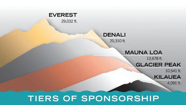
Connect with over 2,000 members online, in-person, and through AEG’s publications. This is the best way to support the profession while growing visibility for your business.
Base Benefits Include:
■ Logo with website link on AEG’s homepage
■ Listing in four issues of AEG News and the Annual Meeting Program with Abstracts
■ Recognition at the AEG Annual Meeting
Other Benefits by Level:
■ Social Media Shout-Outs
■ Sponsor Spotlight in the Insider
■ Booth at the Annual Meeting
■ Ads in all AEG News and Program with Abstracts
Opening Session
Wednesday, September 10, 8:00am–12:00pm
KEYNOTE SPEAKER –DR. GALE BLACKMER
Gale Blackmer is a native of northern Delaware who has lived and worked in Pennsylvania essentially since she went to college. She has a BA from the University of Pennsylvania and an MS and PhD from Pennsylvania State University, all in geology. She entered graduate school with the intention of becoming an engineering geologist. However, events conspired and ultimately, she realized her great passion was for structural geology and tectonics. After short stints in the geotechnical world and as a visiting professor, she landed at the Pennsylvania Geological Survey. She made geologic maps in southeastern Pennsylvania until management duties took over. Gale has been director and state geologist since 2015, the first woman to hold that title in Pennsylvania.
As Mapping Committee Chair for the Association of American State Geologists, Gale works with the U.S. Geological Survey (USGS) National Cooperative Geologic Mapping Program to maximize beneficial program results for both federal and state agencies. She is the vice-chair of the 3DEP subcommittee of the National Geospatial Advisory Committee. Gale represents the Secretary of the Department of Conservation and Natural Resources on the Pennsylvania State Geospatial Coordinating Board, where she was recently appointed chair.
Gale loves to share her enthusiasm for Pennsylvania’s fascinating geology and the work of the state geological survey with anyone who will listen.
Every era presents unique challenges for engineering geology, and today we face the dual pressures of climate change adaptation and a rapidly evolving energy landscape. In regions like Pennsylvania and the broader Appalachian area,
these challenges manifest in issues such as karst formations, landslides, extreme stream discharge events, and the complexities of surface and subsurface energy infrastructure, including new pipeline developments. Addressing these challenges requires the combined expertise of AEG members and the invaluable contributions of state geological surveys. State surveys provide essential geologic maps, data, and local insights that are critical for informed decision-making and effective problem-solving. In this presentation, we will explore specific examples, mostly from Pennsylvania, illustrating the indispensable role of state geological surveys in navigating these pressing engineering geology challenges.
Commissioner, Contaminated Site Remediation and Redevelopment
New Jersey Department of Environmental Protection
New Jersey Department of Environmental Protection Contaminated Site Remediation & Redevelopment 401 E. State Street, 6th Floor, East Wing P.O. Box 420, Mail Code: 401-06 Trenton, NJ 08625 P: 609-292-1250, F: 609-777-1914
David Haymes has worked for the New Jersey Department of Environmental Protection since 1989 as a geologist, a technical coordinator, and a section chief. From 2010 to 2017, David was executive assistant to the assistant commissioner for the Site Remediation & Waste Management Program. David also served as director of the Division of Enforcement, Technical, & Financial Support and Administrator of the New Jersey Spill Compensation Fund from January 2018 to July 2022. David was appointed the assistant commissioner of contaminated site remediation & redevelopment in August 2022.
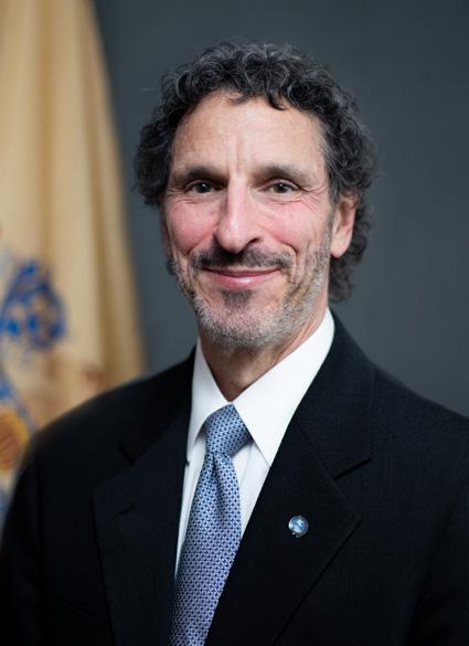
Throughout his career, David has been actively involved in writing regulations, guidance, and legislation that form the framework for site remediation in New Jersey. David has also
been active in developing strategies and policies related to contaminants of emerging concern, including PFAS, and the department’s ongoing litigation efforts to have polluters clean up contaminated sites and to reimburse the state for cleanups conducted using public funds. David has a BA from Colgate University and an MA in geology from the University of Illinois.
Charged with reversing decades of industrial, commercial, and household waste mismanagement that resulted in discharges of hazardous substances into the environment, Contaminated Site Remediation & Redevelopment implemented a progressive cleanup program to address contaminated sites and protect public health, safety, and the environment. Join Assistant Commissioner Haymes as he renews commitment to remediation and redevelopment in communities affected by multiple brownfields and discusses the success of Contaminated Site Remediation & Redevelopment, including the Licensed Site Remediation Professional (LSRP) Program, and the upcoming regulation of PFAS in soil. He will also describe the steps taken towards improving the remedial action permitting process and the inspection of remedial phase documents as part of the Remediation Process Improvement Initiative.
Considering Climate Change When Siting Hazardous Waste Facilities
The terms “global warming” and “climate change” are often used interchangeably, but the two phenomena are different. Where global warming is the rise in global mean temperature, climate change is a more general term that refers to changes in many climatic factors (such as temperature and precipitation rates) from the global to the local scale. These changes are happening at different rates and in different ways in response to global warming. The timing and amount of rainfall is changing, which is generally resulting in more severe storms. As a result, existing waste management facilities are being impacted at an alarming rate due to severe weather events.
Location standards under the Resource Conservation and Recovery Act (RCRA) that apply to land-based hazardous waste management units include considerations for satisfactory mitigation of locations in flood-prone areas. Location standards, including considerations for specific weather-related impacts for waste management facilities, will be discussed. In addition, a case study is provided to review location standards for permitting of a mixed waste landfill in west Texas.
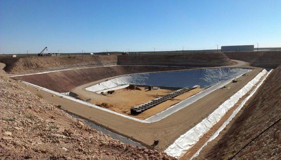
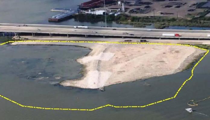
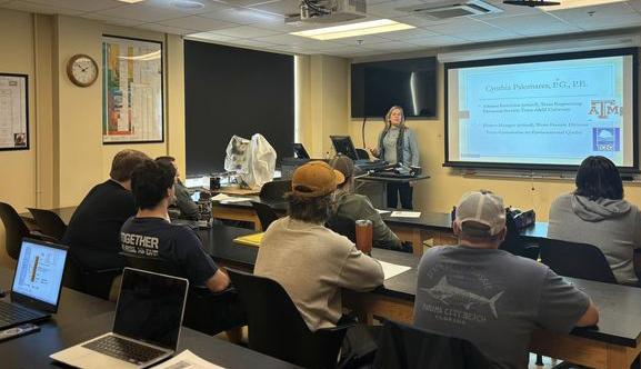
Professor (retired), University of Arizona; cofounder, Split Engineering (acquired by Hexagon Mining)

Dr. John Kemeny has over 40 years of experience in the applied geoscience fields through a career that has included work at a geomechanics consulting company, a postdoc at the Lawrence Berkeley National Lab, 33 years as professor at the University of Arizona, and cofounding a successful startup company that became a world leader in vision-based rock fragmentation measurement software and point cloud-based rock mass characterization software. He earned BS degrees in geology and math from the University of California, Santa Barbara, in 1977, and he earned ME and PhD degrees focusing on rock mechanics from the University of California, Berkeley, in 1982 and 1986. He began his career in the Department of Mining and Geological Engineering at the University of Arizona in 1989, retiring as emeritus professor in 2022. At the University of Arizona, Dr. Kemeny published over 170 papers, gave over 80 invited technical talks and workshops, and graduated 15 PhDs and more than 50 master’s students, with research and teaching focused on rock mechanics, slope stability, rock fracture mechanics, numerical simulation in rock mechanics, and developing 3D imaging and sensing technologies for geotechnical applications. In 1998, he co-founded Split Engineering with three students, a spinoff company focused on new technologies for measuring rock fragmentation and point cloud processing software for slope and underground stability. The company had offices in the U.S., Chile, Peru, South Africa, and Australia and was acquired by Hexagon Mining in 2019. Since retiring from the University of Arizona, Dr. Kemeny has recently started another company involved with integrating AI into the applied geology fields to help combat the increasing hazards due to climate change.
I am honored to have been selected for the AEG/GSA Richard H. Jahns Lectureship for 2024–2025, and I will do my best to use the lectureship to inform and inspire students and
young professionals on the merits of a career in the applied geosciences, as well as the importance of participating in the AEG and GSA professional societies. In my travels and presentations, I plan to emphasize the importance of innovation and creativity in the applied geoscience fields, which is particularly important given the rapid increase in natural and manmade hazards associated with climate change. Even though incredible new technologies and methods have been developed in the past decade to predict and prevent hazards and to save lives, it is often difficult to export these expensive technologies to third world countries, where they may be needed the most. Innovation and creativity are needed, along with AI, to develop cost effective approaches, and this will be discussed in some of my Jahns lectures. In some of the Jahns lectures, I will also discuss the concept of “everyday” geo-based technologies and methods, where students, professionals, and hobbyists can now conduct on a casual field trip what 15 years ago would have taken significant field time, geospatial skills, and equipment expense. I also think that entrepreneurship is an important and exciting way to rapidly develop effective geo-technologies for the changing world, and in some of the Jahns lectures, I hope to inspire students and young professionals to consider a career path that involves a small business startup. Finally, I am open and excited to giving Jahns lectures across the country at both large and small colleges and universities as well as GSA and/ or AEG local chapters. In addition to presenting in geo-based departments such as geology, mining, and geological engineering, the applied geoscience fields need help from a variety of non-geoscience graduates. I hope to use some of the Jahns lectures to inspire non-geoscience students in departments such as computer science, systems engineering, and business to consider a career in the applied geoscience fields.
Here are examples of lectures that I am preparing for my Jahns lectureship. Note that a specific Jahns talk can be some combination of the topics mentioned below, and it could also include unmentioned topics in which I have some experience. Some of the lectures will also include hands-on demonstrations.
Monitoring and characterization of natural and manmade geologic environments are important aspects of applied geology, and these techniques can include monitoring water flow or rock movement or characterizing the condition of a rock slope or debris flow path. I am currently involved with utilizing neural networks to develop some new monitoring and characterization strategies to help combat the increas-
ing geologic and hydrologic hazards associated with climate change. This research is particularly needed in third-world countries, where utilizing technologies developed for the mining, petroleum, or civil industries is often cost prohibitive. The lightbulb moment for me was listening to a podcast in 2021 given by Pete Warden, who was then the head of Google Brain, a deep learning artificial intelligence research division at Google. Warden spoke about TinyML, which is the concept of embedding sophisticated neural net routines on very small microcontrollers, which are highly energy efficient and can form the basis for field sensors that not only collect data but also analyze, classify, and communicate the results of its findings—a flood warning, for example. The Jahns talk will cover the kinds of AI used in TinyML, the potential applications of TinyML to monitor and characterize geologic and hydrologic hazards, and hands-on examples of how easy it is to train a neural net routine and embed it on a small microcontroller. An example we are currently developing is a small sensor that only utilizes sound to characterize water flow in a stream or urban environment, with installations as simple as hanging the sensor from a tree or light pole.
Cloud
Geospatial includes remote sensing 3D imaging technologies such as lidar, photogrammetry, and multispectral and thermal imaging. These technologies can produce high resolution 3D point clouds, from which point cloud processing software is used to extract detailed and, in some cases, automated rock mass characterization and slope stability outputs. When I started in this field in the early 2000s, 3D imaging and point cloud processing was expensive and time consuming: lidar scanners cost $100k–$200k, a lidar survey required numerous surveyed ground control points, and point cloud processing was a manual and time-consuming process. This limited its use to companies that could afford the time and expense. Today, high resolution registered point clouds can be obtained in minutes using iPhone lidar or smartphone pictures, and semi-automated point cloud processing procedures in open-source software are now routinely used to extract rock characterization information. Photos from inexpensive drones can produce very high-quality point clouds of large areas, and these surveys can be repeated to monitor degradation and movement. In this Jahns lecture, I will discuss modern “everyday” geospatial tools that are transforming many aspects of applied geology, and I will give examples of the step-by-step process involved to go from field imaging to final rock mass characterization and slope stability. I will also mention an online class that I teach to students around the world, where students conduct field scanning and point cloud processing in the area where they live. I invite students and young professionals in the Jahns lectures I give to participate in this class at no cost.
Rock slope stability and rockfall are very interesting subjects, and they traditionally involve terms like plane and wedge failure, joint friction angle, pore pressure, and freezethaw. We also use terms like factor of safety and probability of failure. A term often missing in traditional slope stability is time: when will the slope fail, or how will the factor of safety change with time. If we monitor a large rock slope or hanging rock block using surveyed prisms or radar, we can sometimes predict time of failure using inverse velocity techniques. But in such a rock slope or hanging block, what is changing with time that causes the inverse velocity behavior? In this Jahns talk, I will first briefly review traditional slope stability, including plane and wedge failure and the subjects of factor of safety, probability of failure, and the inverse velocity technique for predicting time-of-failure. I will then discuss two concepts that are central to the time dependence of rock failure: time-dependent crack growth and rock bridges. Rock bridges are intact sections along a discontinuity that must be broken in order for slope instability to occur. Rock bridges are often under high stress, and these bridges can fail due to time-dependent crack growth. Talking about these subjects requires discussing the complex subject of fracture mechanics, which I will do as carefully as I can (and with examples). I will show several interesting cases studies, such as the example of rockfall in Yosemite, where hanging blocks held up by intact rock bridges have been monitored using thermal imaging and the stability has been analyzed using fracture mechanics.
This is a great time to start an innovative geo-based small business. First, the occurrence of geologic and hydrologic hazards around the world is rapidly increasing, requiring creative thinking and the rapid development of useful new tools and methods, for which a small startup is wellsuited. Second, technologies that could form the basis of a geo-based company are now booming, such as geospatial technologies, drones, and software tools such as point cloud processing, finite element modeling, and web tools. Third, it has been shown that AI can reduce the funding required to produce a working proof of concept (POC), meaning that with AI, a small business can get to market much quicker and with less capital investment than previously necessary. In this Jahns talk, I will discuss what geo-based companies do today, what they could do in the future, and the overall climate for geo-based startups in the next few years. I will then talk about some entrepreneurship basics that include startup valuation, equity splits, raising capital, and making an effective pitch. I will encourage students to take an entrepreneurship class if such a class is available at their
college or university. I will also discuss some strategies for partnering that are important in building a successful team. I will give several examples of successful geo-based startups, including my own experience with the two startups in which I have been involved.
Rock Mechanics, Geomechanics, Rock Engineering: What’s It All About?
Rock mechanics, also referred to as geomechanics and rock engineering, is an exciting applied geology topic that is central to geological, mining, civil, and petroleum engineering. It is about how and why rocks fail, at both the field scale (rock masses), as well as in the laboratory, and it includes important applications to surface slopes, underground excavations, and dam and bridge foundations. This Jahns lecture is an introduction to rock mechanics that I have given to newly entering mining and geological engineering students at the University of Arizona. It includes the topics of rock strength, stresses in rock masses, discontinuities, field characterization, rock mass classification, factor of safety and probability of failure, and some slope and underground examples. It will also cover the important topics of new field technologies and numerical modeling. This talk would be of interest to students in college or university departments that do not offer a full rock mechanics course (other than topics offered in a structural geology class). I also talk about job opportunities for students with skills in rock mechanics and mention important rock mechanics conferences that they can attend, as well as the student chapter sponsored by the American Rock Mechanics Association (ARMA).
To schedule a Jahns Lecture for the 2024–2025 season, email John at kemeny@arizona.edu
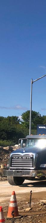
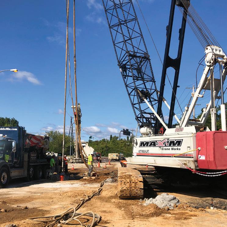
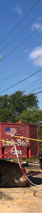
Proud to be a Silver Sponsor Geohazards, Water Resources, Geotechnical Engineering, Geophysics, Dam and Levee Engineering, Risk Management, Tunnel Engineering, and Construction and Contractor Support
Get in touch: www.schnabel-eng.com/contact
The On-Line Silent Auction for 2024 Is Now Live!
The AEG Foundation (AEGF) is excited to announce both a virtual and in-person Silent Auction! The virtual auction will be live September 1, 2024, at 9:00am EST and will end September 12, 2024, at 1:00pm EST. The in-person auction will begin during the Ice Breaker on September 10, 2024, and end at 1:00pm
EST on September 12, 2024. The proceeds from the Silent Auction will benefit the Diversity Funds. As a reminder, you can make a donation to the AEGF at any time by clicking on the “Quick Donate” button at https://aegfoundation.org

National Park Service – Joseph Reed, PE, CFM; Susannah Noppenberger
Drill Tech Drilling & Shoring – Bob Stier; Jason Reinhardt, PE
Brierley Associates – Nick Strater, PG; Devon Switser
Gannett Fleming / TranSystems – Andrew Li, PE, CCM
National Park Service – Owner / Project Management
Drill Tech Drilling & Shoring – Prime Contractor
Brierley Associates – Engineer of Record Gannett Fleming – Construction Management/Inspection
Originally constructed 1828–1850, the Chesapeake & Ohio (C&O) Canal was one of the first large-scale civil works projects funded by the U.S. government, with supplemental funds from Maryland and Virginia. The canal’s navigational system stretched along the Potomac River for 184.5 miles from Washington, DC, to Cumberland, MD. The C&O Canal’s navigational system was primarily comprised of locally sourced materials such as stone, earth, timber, mortar, and brick. Collectively, the C&O Canal’s navigational system was comprised of 74 lift locks, seven dams, over 168 culverts, and 1 wooden and 11 stone aqueducts, which traversed along its course with an overall change in elevation of 605 feet, and included one tunnel (Paw Paw Tunnel) that carried the canal through a mountain.
The Paw Paw Tunnel was constructed by the C&O Canal Company in lieu of building over 6.7 miles of canal along the Potomac River (referred to as the Paw Paw Bends). This shortened the river route through the Paw Paw Bends of the Potomac River to 1.5 miles via an alternative inland route. The tunnel is approximately 3,118 linear feet (LF) long and 25 feet wide, is composed of over six million bricks (which serve as a liner), and
includes open cuts through the interbedded shale and siltstone on both sides of the approaches to the tunnel entrances. Although it was originally anticipated to take only two years to construct this section of the canal, because of labor shortages, outbreaks of disease, work stoppages, and the arduous nature of the work, the project took 14 years (1836–1850). This excavation through the project area was made through the Tunnel Hill Ridge and valley of Mill Run (a stream that still conveys water through the cut in the form of waterfalls). After the full section of canal through the project area was opened to Cumberland in 1850, the canal remained operational for 74 years until 1924.
Today, the Paw Paw Slope Stabilization Project is located in one of the most remote portions of the C&O Canal National Historical Park, approximately 155 river miles upstream of Washington, DC, in Oldtown, MD. The C&O Canal National Historical Park is a U.S. Department of Interior, National Park Service (NPS) unit. Figure 1 shows a map of the region and local project area.
There is a rich history of rock fall and slope instability within the cut on the downstream approach to the tunnel. This is due to a combination of site-specific geology, gravity, weathering of the rock over time, freeze–thaw activity from water intrusion, and other drivers. Multiple rockslide events have occurred since the canal’s completion in 1850, with the largest and most recent slide occurring in May 2016. Prior to the current project, multiple ad hoc efforts were completed over the last decade or so as interim risk reduction measures, including one constructed in 2013 and another between 2017 and 2019. The 2013 effort included installing a short length of rockfall barrier fence in Rock
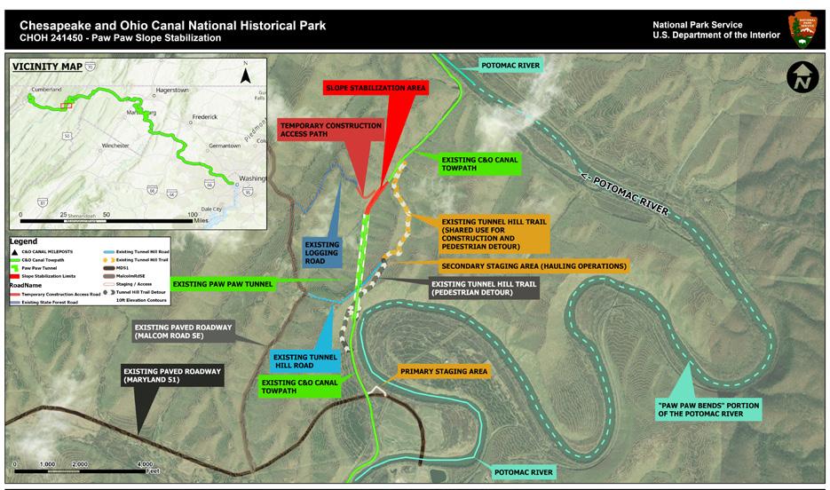
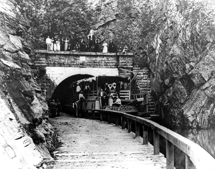
Fall (RF) Area 9. The 2017–2019 effort included limited rock scaling, installation of rock bolts, use of precast reinforced concrete shear blocks, draped mesh, and weep drains within RF Areas 2–7. Figure 2 shows the North Portal of the Paw Paw Tunnel through the “open cut” approach, and Figure 3 shows the slope stabilization work in the 1950s. The extent of rockslide that occurred in 2016 is included in Figure 4 and shown in aerial footage in Figure 5. It should be noted that an additional area of potential slope instability was identified by the contractor after initial award of the design-build contract.
The current project was delivered via a design-build contract awarded to Drill Tech Drilling and Shoring, Inc. (DTDS). The engineer of record was Brierley Associates. Construction management and onsite inspection was provided by Gannett Fleming. Overall contract administration was done by the NPS Denver Service Center. The owner is the NPS C&O Canal National Historical Park, which also provided technical services to support the project throughout its life cycle. The design-build construction contract was awarded in September 2020, construction physically began in August 2021, and the towpath (C&O Canal’s primary trail) reopened August 25, 2023. The contractor demobilized after completing all on-site project tasks in late 2023. Total construction cost was approximately $10 million, which was paid for by the NPS Line Item Construction Program.
The Paw Paw Rock Slope Stabilization Project’s components included removal of the existing debris field from the May 2016 rock


slide and stabilization of the highest-risk rock slope areas along approximately 1,000 LF of canal, using a combination of rock scaling, rock bolting, pinned mesh, and shear keys (reinforced concrete sculpted shotcrete) by improving drainage (internal rock drains as well as surface drains at the top of bank). The project also included replacement of the wooden boardwalk that carries pedestrian traffic through the canal. These components collectively achieved the project’s goals of improving drainage of water through the canal to reduce the freeze–thaw cycling on the historic Paw Paw Tunnel, decreasing the risk of rock fall hazard, improving the safety of tunnel access, enhancing the visitor experience, and maintaining the towpath’s (C&O Canal’s primary trail system) continuity.
Throughout construction, NPS and its contractors continued to refine the design and construction methods to minimize the impact to the cultural and natural resources that are widespread in this unique area. This included protecting historic structures, minimizing impacts to rare, threatened, and endangered species in a variety of habitats (including the globally rare central Appalachian shale barrens); working to limit visual impacts to the cultural landscape; and ensuring compliance with all applicable laws, regulations, and agency policies. The engineered features were designed and constructed to minimize the visual impact to the cultural landscape by painting hundreds of the newly installed rock bolts and multiple internal rock drains to match the existing geology, coloring installed rock fall mesh to blend with the adjacent rock hues, and sculpting/coloring the 15 shotcrete shear keys to blend in with the adjacent geologic features. This project not only used conventional heavy equipment but also utilized a fleet of articulated dump trucks and had some material deliveries by helicopter. Collectively, the project team delivered a project that will continue to preserve this site for the current and future generations
This section of the canal provides unparalleled access to a unique historic engineering marvel (Paw Paw Tunnel) that serves as a focal point of the western portion of the towpath. It is a destination for group biking and camping. This area is also a key field site for the C&O Canal’s curriculum-
based K–12 Canal Classrooms education program, where park rangers engage thousands of students in experiential learning field trips centered on the historic and natural resources of the canal. The towpath through the tunnel and project area serves a critical link on the 184.5-mile C&O Canal, between Washington, DC, and Cumberland, MD; the 327.5-mile Potomac Heritage National Scenic Trail; the 335-mile Greater Alleghany Passage (GAP); and the 6,800+ mile-long American Discovery Trail. Without the project, the work area would be closed, necessitating an arduous detour that extends 1.5 miles and an elevation change of approximately 400 feet. This region is notorious for having limited communication coverage and difficult rescue capability due to its remoteness. It is estimated that approximately 250,000 annual visitors (many with heavy loaded bicycles) traverse through this area.
The project vicinity is located within the heart of the Valley and Ridge physiographic province. The bedrock in this area includes Ordovician to Mississippian marine and terrestrial sedimentary lithologies that were deposited within the Appalachian Basin and subsequently deformed during the late Paleozoic Allegheny orogeny.
The rock slopes within the work area comprise bedded shale, siltstone, and sandstone of the Upper Devonian Brallier Shale (Formation), which represent submarine turbidity flow deposition. The bedrock has been folded, resulting in an anticlinal structure. The axis of the anticline is located immediately above the north tunnel portal and within the eastern rock slope bordering the work area, and trends approximately northeast–southwest, consistent with the broader Valley and Ridge trends. Flexural slip movement during folding resulted in slickenslided bedding surfaces and a distinct axial cleavage, which trends northeast–southwest and dips at steep angles to the northwest.
Within the work area, the bedding of the bedrock dips to the northwest, which has resulted in planar sliding failure of blocks on the southeast slope. A conjugate joint set dips to the southeast, which encourages planar sliding failure of blocks on the northwest (opposite) slope. This pattern can be seen in Figure 6. This conjugate joint set was determined to be the cause of the 2016 slope failure. In addition, a concentration of cleavage joints results in spalling and toppling failures along the upper portions of the southwest slope and near the tunnel portal.
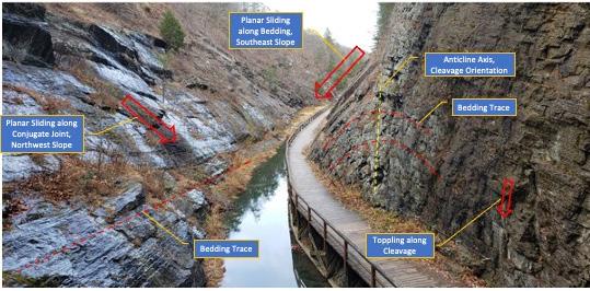
The design-build package developed for the original request for proposal was assembled by NPS with the help of consulting services from Vanasse Hangen Brustlin, Inc., and Terracon. The design-build request for proposal package included details developed to the schematic design (SD) level or approximately 30% design level. As part of the SD development, a slope stability risk assessment was developed to prioritize 13 different discrete RF areas within the 1,000-linearfoot-long section of canal on the northwest and southwest slopes within the project area. These RF areas were carried through the subsequent stages of design-construction and used to determine appropriate treatments and prioritizations.
The design-build phase of the project was awarded to DTDS in September 2020, and following an intensive site reconnaissance, Brierley developed a slope remediation design that would include a combination of scaling (rock removal), pattern and spot bolts, pinned mesh, water features (internal drains and surface swale improvements), and anchored shear buttresses. A distinct remediation approach was developed for each RF zone, specific to the surface morphology, structural geology, and previous slope behavior in that area.
Following an extensive scaling program and removal of the 2016 slide debris, isolated rock blocks would be supported by spot anchors, whereas laterally extensive rock slabs would be addressed through application of a pattern anchor system. In each case, the anchor design was developed to accommodate the block or slab size and slope geometry, and localized testing of anchors was completed to confirm capacity. For areas where upslope anchor installation might be problematic, anchored shotcrete shear buttresses were designed to provide supplemental support of both blocks and slabs. Rock drains were included in the remedial design to reduce hydrostatic loading of the rock mass.
A pinned mesh concept was developed for the upper portions of the southwest slope, and for a near-vertical section of the rock slope adjacent to the north tunnel portal, where pedestrians often stop for photographs or rest after completing the tunnel hike on the wooden boardwalk below. The mesh was
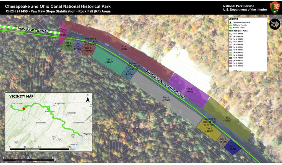
intended to reduce rockfall potential caused by spalling and toppling of smaller blocks along the pervasive cleavage joints exposed in this area.
During initial site reconnaissance, an active rockslide was identified to the immediate south-southwest of the 2016 failure (Figures 4 & 5). The active slide was estimated to be about 125 feet (measured along slope) by 65 feet (measured up- and downslope) in plan dimensions, and approximately 5–10 feet thick. The upslope limit of the active slide was defined by a tension crack and down drop scarp, and field measurements suggested that this mass already slid downslope by about 1–3 feet. Given its size and degree of apparent movement, in-place stabilization of the active rockslide mass was not considered practical, safe, or cost-effective, and a plan for removal was developed.
DTDS could not start construction until the entire design was completed by Brierley Associates and environmental permits from Maryland Department of the Environment and U.S. Army Corps of Engineers were obtained by DTDS with the assistance of KCI Technologies, Inc. DTDS also performed additional slope monitoring of the active slide area during the design and permit acquisition phases.
Preservation of existing historic features throughout the project site were critical to all parties. Sauls Seismic, LLC, performed preconstruction assessment of all existing historic features along the existing 3,118-foot-long Paw Paw Tunnel, the approximate 4 miles of canal towpath, and Tunnel Hill Trail. Seismographs were installed at each of the Paw Paw Tunnel portals and at the midway point of the tunnel. The solar-powered seismographs continually monitored vibration and air overpressure to ensure the construction operations did not impact the integrity of the brick-lined Paw Paw Tunnel and associated portals. Automated alerts were disseminated via email if vibrations and/or air overpressure were detected above the thresholds of concern.
The project required over 110,000 square feet (SF) of rock slope scaling, the removal of 5,000 SF of preexisting draped mesh, and the removal of trees and vegetation. All scaling and removals were completed via rope access utilizing Society of Professional Rope Access Technician (SPRAT)–certified workers. The contractor estimated approximately 500 cubic yards (CY) of rock was removed from the slopes during the scaling process. The scaled material was
removed from the site during the removal of the existing (2016 slide) slide material, which was estimated by DTDS at approximately 2,900 CY.
Once scaling was completed in each of the designated RF areas, the installation of pattern and spot anchors began. The majority of the pattern anchors consisted of 8-footlong #10 galvanized threaded steel bars placed on an 8-foot x 8-foot pattern. While the design called for resin encapsulation of the bolts, some of the anchors required cement encapsulation because of the weathered nature of the bedrock. Spot anchors consisted of 10- to 20-foot-long #10 galvanized threaded bars. It was originally envisioned that the rock bolts would be installed utilizing a Pegasus Drill staged at the bottom of the canal. However, because of the unforeseen active slide that had to be removed, the only area that was able to utilize the Pegasus Drill was RF011. The majority of the anchors were installed utilizing wagon drills with rope access and rope access drill technicians (Figure 8). In all, DTDS installed over 10,000 LF of anchors.
The design-build contract originally envisioned RF protection mesh in the areas downstream of the North Portal in RF04–RF08 and not directly adjacent to the historic portal of the Paw Paw Tunnel. After detailed analysis by Brierley Associates, it was determined that additional RF protection mesh would be required in RF02 and RF03, directly above the boardwalk carrying the C&O Canal towpath and adjacent to the Paw Paw Tunnel North Portal. Elevations of the bottom of the RF mesh were carefully coordinated to try to limit accessibility for unauthorized climbing by park visitors, while balancing the need to mitigate the potential for spalling rock to endanger the traveling public. A Geobrugg Tecco® mesh was utilized and powder coated in a hue to blend into the existing rock face geology in order to minimize the visual impact. Over 30,000 SF of Tecco® mesh was installed between RF002 and RF08, also by rope access drill technicians (Figure 9).
The design-build contract required the removal and stabilization of the 2016 rockslide in area RF012, estimated at an area of approximately 7,000 SF and having an in-place volume of about 2,600 CY. Once the slide material was removed, spot and pattern rock anchors would be installed for long-term stabilization. However, removal of the 2016 rockslide was complicated by the discovery of the active slide to the south (Figures 4 & 5). Because of safety concerns, the active slide was monitored for movement using an array of survey targets. As noted, because of its size and unstable nature, the active slide needed to be removed. A supplemental survey completed by DTDS determined that the
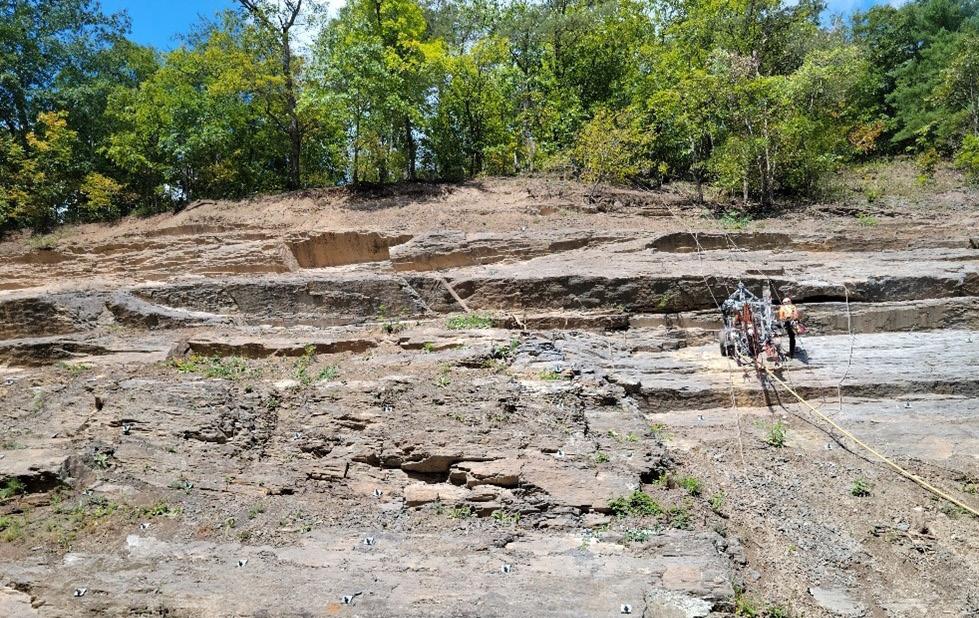
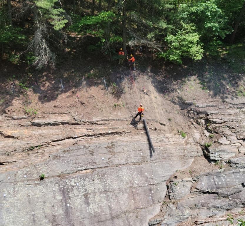
2016 and active slide had a combined area of approximately 27,000 SF, and that 10,000 CY of in situ material would need to be removed.
Initially it was decided that the safest and quickest way to remove the active slide was through blasting, and a detailed drill-and-blast plan was developed by DTDS and Beckley Drilling and Blasting (BDB). This would involve drilling a series of blast holes upslope of the active slide, parallel to and below the estimated slide failure plane. A new access path was pioneered into this area by DTDS in cooperation with NPS and the State of Maryland by using a portion of an existing logging road through Green Ridge State Forest and NPS lands (see Figures 1 & 10). To facilitate access, materials were also mobilized by helicopter to provide the necessary erosion and sediment controls in the canal. Because of the presence of natural resources, ground disturbance was limited and a temporary mulch access roadway installed, which was removed at the end of the project. Once the mulch road was installed, BDB mobilized and began drilling. Unfortunately, the drill holes encountered zones of poor-quality rock and soil-filled layers and would not remain open, and the plan to complete the blasting was abandoned.
In close coordination with Brierely, NPS, and DTDS, it was decided to mechanically remove the active slide material rock utilizing hydraulic excavators and breakers. To access the active slide from the north, switchbacks were installed within RF13 utilizing existing scaled/fallen rock to allow the excavators to reach the upper limits of the slide (Figure 11). This work became the critical path of the project and extended the schedule.
The rock was downsized with breakers so that it could be transported up Tunnel Hill Trail, utilizing three Hydrema 912 off-road dump trucks. Tunnel Hill Trail is an existing historic haul road that dates back to the tunnel and canal’s original construction era. It has a width of about 9 feet and the Hydremas have a width of 8 feet, 4 inches—making the trip time consuming and precarious. Multiple measures to mitigate damage to the existing historic features along the roadway were implemented, including bridging over historic stone retaining walls and using crane mats to distribute wheel loads on the haul route. The rock was then transferred to a secondary staging area near the intersection of Tunnel Hill Trail and Tunnel Hill Road (see Figure 1) and loaded into standard dump trucks for removal to an offsite location. In all, DTDS
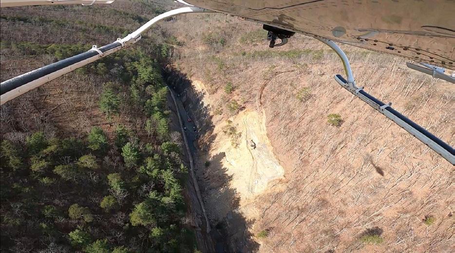
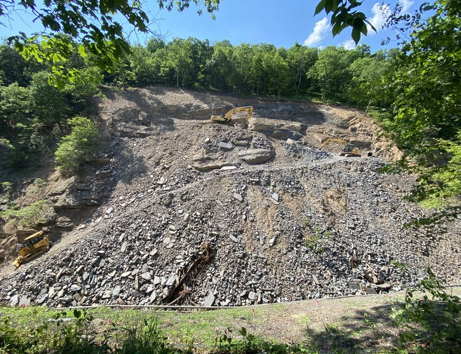
estimated that about 13,000 CY of rock was removed from the slide area, downsized, and removed from the site. Since the through-traffic on the towpath had to be maintained continually, DTDS had to ensure the traveling public was kept safe, which required maintaining trail detours and establishing shuttles. During hauling operations, hikers and bikers were held at the top and bottom of Tunnel Hill Trail until it could be determined the haul trucks were not operating. While hauling was underway, DTDS provided a shuttle service using specially equipped side-by-side utility task vehicles (UTVs) that allowed for bikes to be transported with the hikers and bikers. When hauling was not underway, park visitors were directed to use the Tunnel Hill Detour, which was originally established for the 2017–2019 project and entails traveling approximately 1.5 miles with an elevation change of approximately 400 feet.
The lateral and upslope extent of the exposed rock slabs within RF11 necessitated the installation of shear blocks to provide additional support. The original schematic design included in the request for proposal envisioned large, discrete cast-in-place steel-reinforced concrete wedges spaced at regular intervals. DTDS submitted a request to use hand sculpted shotcrete along the entire length of each proposed shear block location, and a full-scale mock-up was created at the DTDS laydown area. The approved shear block concept included rock anchors installed at the toe of the slabs, along with rebar, welded wire mesh, and drainboard to reduce the buildup of hydrostatic pressures.
Once it was determined that the sculpted shotcrete shear blocks could be utilized, an additional mockup was constructed whereby NPS personnel could observe the appearance of the finished product. A water-based stain was used to result in hues that, in combination with the sculpting, blended so well into the adjacent geology that some visitors to the site had difficulty identifying the locations of the newly installed shear blocks. The sculpted and stained shotcrete was utilized on the remainder of the shear blocks with great success, minimizing the impact to the cultural landscape. A comparison of the appearance approximately one week after initial staining to that with approximately 11 months of weathering/patina is included in Figure 12.
The design-build contract called for the demolition and reinstallation of an approximately 700-foot-long wooden boardwalk connecting the portal of the tunnel to the rock towpath to the north of the site. Boardwalk construction occurred at the end of the project, once stabilization of the adjacent slopes was completed. The boardwalk design met the most recent codes and standards, most notably installing the vertical support posts on 8-foot centers with proper cross-and-angle braces. Greenway Bridge Company, the boardwalk subcontractor, was required to cut each of the deck boards within a tight tolerance to match the uneven rock face along the length of the boardwalk (Figure 13). Close coordination and adaptative design were required to avoid damaging the historic features that were to remain; including the
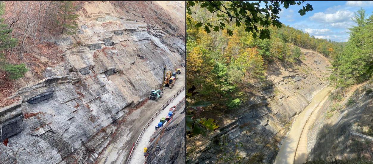
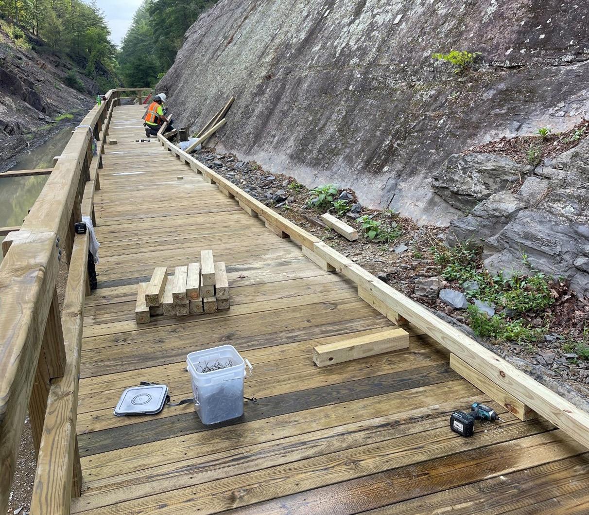
rope burns in the rock face and the historic remnant of the towpath that was recovered at the southern end of the boardwalk. The final boardwalk construction was completed with no quality issues and to the satisfaction of the entire team.
The Paw Paw Slope Stabilization Project advanced to the point of being able to reopen the park’s primary trail system (C&O Canal Towpath/Boardwalk) 1,066 days after award of the design-build contract. Throughout construction the project team had to remain adaptive to the constraints of the project while maintaining a sensitivity and awareness to the natural and cultural resources, as well as the engineering. Overcoming logistical hurdles and technical challenges, and including measures to minimize impacts to the exceptionally rare resources in the project areas; the project team successfully delivered a project to stabilize
the slopes on both sides of the canal for the approximately 1,000 LF of the north approach to Paw Paw Tunnel and in doing so preserved it for the current and future generations. Visitors can continue to visit the storied and historic Chesapeake & Ohio Canal and the notable Paw Paw Tunnel to learn more about not only the historic engineering of this marvel but also the fascinating geology that makes this setting so unique. This project exemplifies the potential of the design-build model for sites with challenging and varied conditions. Preconstruction conditions are compared with the postconstruction product in Figures 14–19.
Southworth S., Brezinski D., Orndorff R., Repetski, J., and Denenny, D., 2008, Geology of the Chesapeake and Ohio Canal National Historical Park and Potomac River Corridor, District of Columbia, Maryland, West Virginia, and Virginia. U.S.G.S Professional Paper 1961.
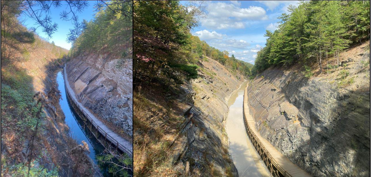

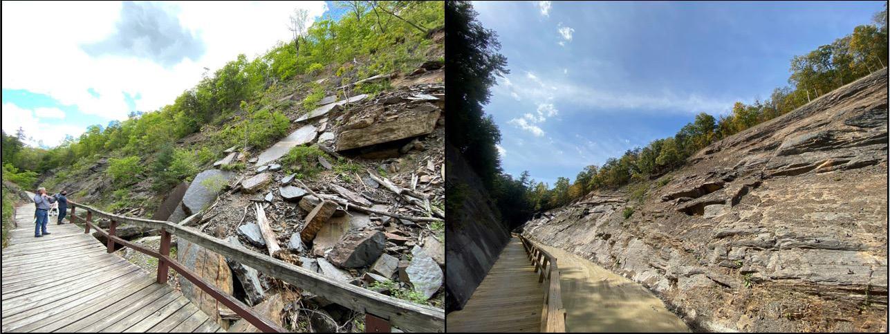
This project will be presented and awarded at the Annual Meeting during the Opening Session on September 11, 2024, from 10:20am to 11:00am
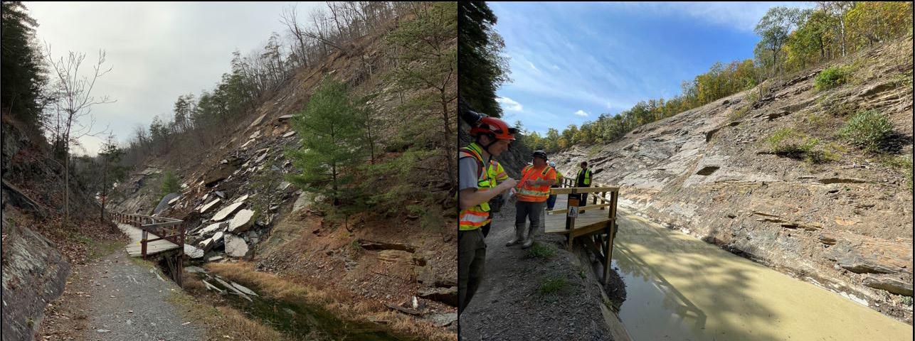
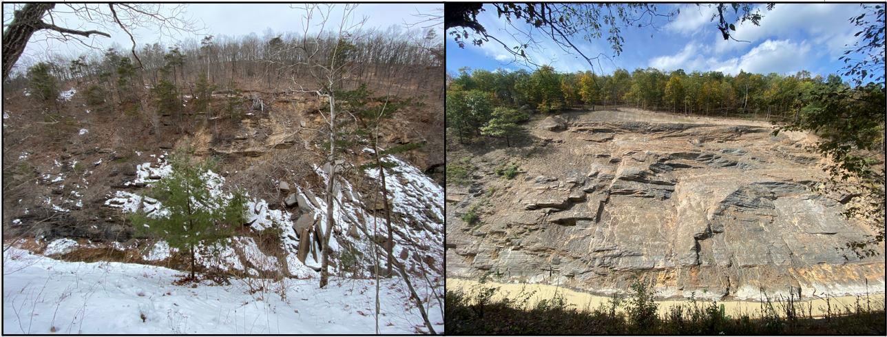
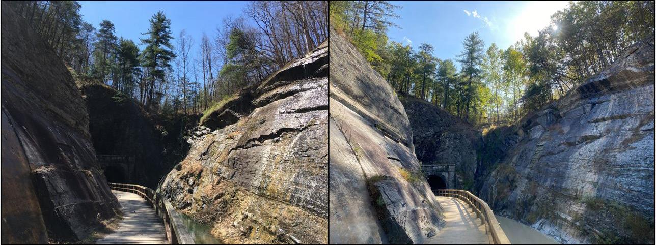


Joseph (Joe) Reed, PE, CFM, has been with the Chesapeake & Ohio Canal National Historical Park (C&O Canal NHP) since November 2016. Mr. Reed is currently chief of Professional Services Division at the C&O Canal NHP, a unit of the U.S. Department of Interior National Park Service (NPS). Prior to coming to NPS, Mr. Reed worked 8 years for the U.S. Army Corps of Engineers Baltimore District, where he rose to the position of senior civil engineer, working on large-scale civil works projects; he was also manager of the Baltimore District Levee Safety Program (which provided for the inspection, assessment, evaluation, and communication of risk for over 148 miles of federally constructed flood risk management projects spread across five states & Washington, DC).
Mr. Reed has a bachelor’s of science in engineering with a concentration in civil engineering from Geneva College and a master’s of science in environmental engineering and science from the Johns Hopkins University. He is a registered professional engineer in Maryland and a certified floodplain manager by the Association of State Floodplain Managers. He was recently honored as the 2022 National Park Service Federal Engineer of the Year from the National Society of Professional Engineers. Mr. Reed is a self-declared aficionado of engineering in the outdoors, all things related to water resources, historic preservation, learning, and dynamic work environments.
Nick Strater, PG, is a principal at Brierley Associates and has over 30 years of engineering geology and geotechnical consulting experience. He’s served as senior engineering geologist and project manager for a large variety of projects located throughout the United States, Canada, and Central and South America. His specialties include rock and soil tunnels, trenchless technologies, rock slope design and remediation, rock blasting, and forensic geology. He received both his bachelor’s and master’s of science in geology from the University of Rhode Island.
Mr. Strater is a frequently invited lecturer on the topics of geotechnical characterization and design, trenchless method selection, forensic evaluation and risk management. He’s authored over 25 technical papers on these topics.
•
•
•
•
•


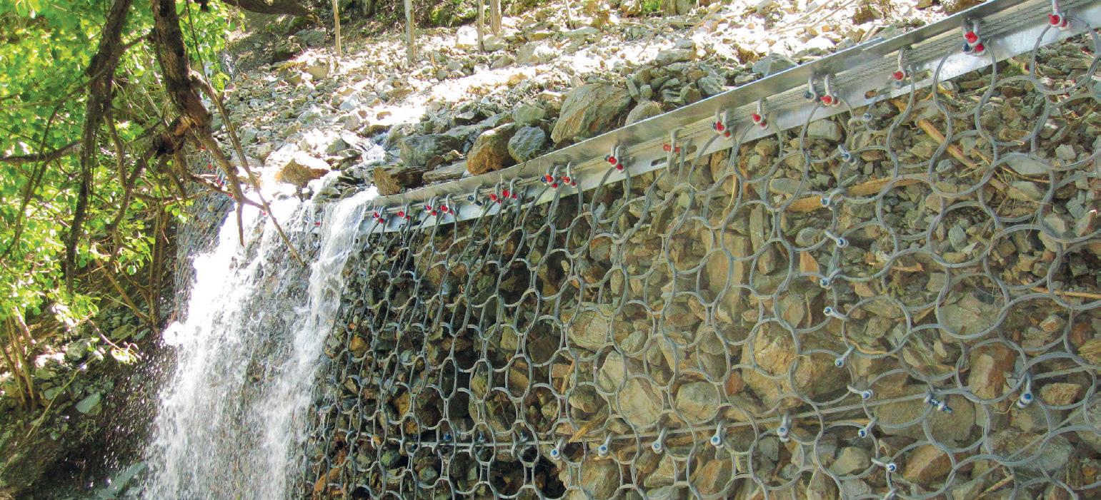
AEG 2024 Virtual Day Monday, September 9, 2024
10:00am–4:00pm (Eastern) Register Now (https://aeg.memberclicks.net/24-am-virtual)
$100 members/$150 nonmembers (included with Annual Meeting full and student registrations)
Join us for AEG’s Annual Meeting Virtual Day. This will be an online only day of technical presentations for those who would like to participate in the Annual Meeting but are unable to attend. Registration for this event will be included with all Annual Meeting full and student registrations. Presenters for this session will receive a free virtual day registration. All presentations will be recorded for later viewing. 4 PDHs will be available for this session.
10:00am–10:30am Welcome from AEG Executive Council, Meeting Co-Chairs and Marty Goff (introduction of speakers)
10:30am–11:00am Transitional Modeling from Construction to Closure Phases with Example for Waste Facilities, Roselyne Laboso
11:00am–11:30am Level with Me: Advanced Data Mining for Estimating PFAS Ambient Concentrations, Skyler Sorsby
11:30am–12:00pm ASR in Concrete, New England, Steven Stokowski
12:00pm–12:45pm Lunch break
12:45pm–1:00pm Introduction of speakers
1:00pm–1:30pm Wartime Cousins with Karst Foundations: TVA’s Cherokee and Douglas Dams, Scott Walker
1:30pm–2:00pm Updates of Asbestos Regulations in the European Union, Ambra Hyskaj
2:00pm–2:30pm Coastal Sediments Topics for USACE North Atlantic Division, Lynn M. Bocamaz
2:30pm–3:00pm PFAS Overview (within USACE), Nicole Toth
3:00pm–3:30pm Heavy Rare Earth (HREE) Resources Cretaceous Lithium Laccolith, El Paso, Texas, Samuel Epstein
3:30pm–4:00pm Q&A for all presenters

Be sure to attend the Student/Professional Networking Reception on Tuesday, September 10, 2024, 5:15–6:15pm.
This fun and relaxed event is the perfect place for you to make new friends and meet future employers/employees! You don't want to miss it! Sign up on your registration form.
Lynn Bocamazo, US Army Corps of Engineers – North Atlantic Division, Lynn.M.Bocamazo@usace.army.mil
This presentation will cover offshore sediment borrow areas and offshore wind energy siting considerations, long-term sediment budgets (e.g., Manasquan Inlet), beneficial use of dredge material for coastal resilience, and coastal systems portfolio initiative—a database of all coastal projects with respect to sediment quantities placed and beach conditions.
Ambra Hyskaj, Eötvös Loránd University, ambrahyskaj@gmail.com
Directive (EU) 2023/2668, enacted in November 2023, introduces significant updates to European Union (EU) regulations on worker protection from asbestos exposure. This directive amends Directive 2009/148/EC by lowering the occupational exposure limit (OEL) to 0.001 fibers per cubic centimeter (f/cm³) over an eight-hour period. It has also introduced stricter requirements for risk assessments, enhanced worker training, and rigorous decontamination protocols. Continuous health surveillance is required for workers, even postemployment, to monitor long-term effects. The presentation will outline these regulatory changes, focusing on updated exposure limits, analytical techniques, asbestos exposure classification, and the importance of information sharing. Additionally, it will provide a timeline of regulatory and legislative actions in the EU related to asbestos and a summary of parliamentary activities, including questions from members of the European Parliament and answers from the European Commission related to asbestos from 1995 to 2023. Finally, it will highlight the persistent oversight of naturally occurring asbestos (NOA) in current EU frameworks, despite its relevance. NOA remains present in several EU member states such as Italy, France, Spain, Romania, and Finland. While this initiative represents progress, it still does not show any intention to extend to NOA so far, leaving a critical area of asbestos management unregulated. The presentation will emphasize the importance of integrating NOA considerations into these regulatory frameworks to enhance human health protection across all sources of asbestos exposure.
Laccolith, El Paso, Texas
Samuel Epstein, Geoval Consulting, epsteinepstein@yahoo.com; P Althaus; Jeffery Shammah
The Round Top Mountain rhyolite (RTMR) is a laccolith intrusion during the Lower Cretaceous, contemporaneously emplaced during Buda limestone deposition. Contact metamorphism has resulted in a high concentration of Be. The Texas Bureau of Economic Geology estimates the mass at 1.6 billion tons, constituting the largest HREE deposit in the United States. Regionally, RTMR, a member of the Texas Lineament, characterized by thrusting, faulting, felsic subduction magmatism and post Basin and Range extension, and enriched mantle melts. The HREE deposits are homogeneously distributed (Ni-43-101 Preliminary Economic Assessment). reflected
in 180,000 feet of cores, mapped with extensive gravity surveys, enriched in HREE Yn, Li, Gd, Tb, Dy, Ho, Er, Tm, Yb, Lu, Be, Ga, Sn, Nb, U, Th, as well as technology metals Be, Hf, H, Zr, and industrial metals Mn and Al. RTMR hosts 16 of 17 rare elements and contains 13 of the 35 minerals critical deemed critical by the U.S. Department of the Interior. Lithium accounts for 32 % of the resource. Potassium feldspar, plagioclase, and quartz grains comprise bulk mass. USA Rare Earth plans to mine the Round Top deposit and recovery by low cost heap bleach processes that are environmentally benign with the infrastructure in place, increasing the per ton yield from $11 to $70, significantly increasing the project payout (1.4 years), internal rate of return (70%), and margins (70%), comparable to and exceeding riskadjusted overall valuations to those of the oil and gas fields of the Permian Basin, TX.
Roselyne Laboso, WSP USA Inc., roselyne.laboso@wsp.com; William Gottobrio, william.gottobrio@wsp.com; Cliff Baines, clifford.baines@ wsp.com; Skyler Sorsby, skyler.sorsby@wsp.com
A groundwater model to simulate major construction activities may be useful to assess site conditions and potential impacts to groundwater flow patterns during and after construction. Details of site construction activities and schedule are needed to simulate site conditions accurately. The schedule of construction activities may include changes to site topography, existing or reclaimed surface water features, dam buttress construction details, drain features, dewatering activities and rates of dewatering, installation of cover liner and progression of installation, to name a few. However, details of the construction schedule may not always be available at the time of groundwater model preparation. Here, we present an example of a construction phase model to transition modeled parameters and hydraulic conditions from construction to post-closure groundwater model conditions. The construction model results show progress of dewatering activities, impact of cover liner installation, and changing hydraulic conditions related to the reduction of saturated medium behind a dam buttress. Incorporating construction design element details to the extent possible provided reasonable starting conditions and parameters for a post-closure model run. This increased confidence in post-closure model results.
Skyler Sorsby, WSP USA Inc., skyler.sorsby@wsp.com; Ying Wang, yi.wang@wsp.com; Kenneth Takagi, kenneth.takagi@wsp.com; Paul Hurst, paul.hurst@wsp.com
Per- and polyfluoroalkyl substances (PFAS) are a class of anthropogenic fluorinated organic chemicals with varying toxic effects and diminutive cleanup goals. The mobility of PFAS in atmospheric particulate matter and water can result in diffuse non-point contributions to environmental matrices, necessitating estimation of site-specific recontamination risk due to ambient concentration levels. The traditional approach to estimating ambient levels involves targeted sampling at an established reference area
that is demonstrably unaffected by site activities. Hypothesis tests and comparisons are typically used to address extreme values (i.e., potential outliers), and values below the detection limit (BDL), after which confidence limits are calculated to represent statistical thresholds. If a clear reference area is lacking or does not reflect the full range of nonpoint-source variability, alternative approaches must be considered. This study employs gaussian mixture modeling (GMM), a sophisticated data-mining technique, to estimate ambient levels for multiple PFAS compounds simultaneously. We applied a BDL-aware variant of GMM to the USGS Pennsylvania surfacewater PFAS dataset as a case study. The findings distinguish PFAS distributions for rural/headwater streams from urban areas. Nonlinear relationships with hydroclimate and anthropogenic variables clarify potential controls on PFAS occurrence and inform a conceptual model for the PFAS distribution in Pennsylvania surface waters. The predictive nature of GMM and related algorithms are furthermore amenable to the classification of new samples. These insights have the potential to strengthen the conceptual site model, inform remediation conversations early in the project lifecycle, and improve engineering designs.
Steven Stokowski, Stone Products Consultants, sstokowski@yahoo.com
Alkali-silica reactivity in concrete is typical in New England states. The ASR occurrences in concretes from 25 to 90 years old are of the “late/slow, silica/silicate” category. Reactions occur sooner with rare minerals. Coarse-aggregate reactions are present in pavement, building piers, bridge piers, bridge walls, bridge beams, highway retaining walls, dams, a church steeple, building retaining walls and stairs, and high-rise and single-story buildings. Fine-aggregate reactions are present in dams, within bridge piers and building piers under an old mill warehouse, in retaining walls, and in high-rise buildings. Continuously wet structures (dams, piers) deteriorate the most, but deterioration also occurs in relatively dry concrete buildings. Reactive rock types in both natural gravel and crushedstone coarse aggregates, as well as fine aggregates, include: 1. Sandstone; 2. Slate, phyllite, metasiltstone, quartzite, and schist; 3. Granulated and associated strained quartz in meta-granites, granulites, and granite gneisses; 4. Fine-grained, quartzose rock in the greenstone metamorphic facies; 5. Meta-tuffs and metarhyolite; 6. Rhyolite; 7. Vein quartz; 8. Weathered potassium feldspar; and 9. Rare opal. In the early phase of deterioration, the concrete has increased strength. Once cracking occurs, damage accelerates because of increased water penetration and the associated freeze/ thaw cracking that may rubblize the concrete.
Nicole Toth, USACE, Nicole.L.Toth@usace.army.mil
The presence of PFAS in the environment is a national issue because of its widespread use in many industrial and consumer products. Consistency is key when it comes to actions by the U.S. Army Corps of Engineers (USACE) related to PFAS. To accomplish this, the agency has an enterprise-wide policy that requires any PFAS-related work be approved by USACE Headquarters.
Wartime Cousins with Karst Foundations: TVA’s Cherokee and Douglas Dams
Scott Walker, Tennessee Valley Authority, srwalker3@tva.gov
Just above Knoxville, the mainstem Tennessee River begins at the confluence of the Holston and French Broad rivers. Cherokee Dam is located at Holston River mile 52.3 and Douglas Dam is located at French Broad River mile 32.3. The Tennessee Valley Authority (TVA) initially constructed both projects on a crash schedule to supply electricity for industrial needs leading up to and during World War II. Cherokee Dam is a 175-foot-tall, 6,760-foot-long composite structure, and Douglas Dam is a 202-foot-tall, 1,705-foot-long concrete gravity dam. Both projects include several saddle dams, the largest of which (Douglas Saddle Dam 1) is a 102-foot-tall, 1,920-foot-long earth embankment. The Cherokee Project was completed on December 5, 1941—one day before the attack on Pearl Harbor—after a construction period of 16 months, 5 days; Douglas was constructed in just 12 months, 17 days, with completion on February 19, 1943. This presentation will cover the background and history of both projects, including how karst features were treated during construction.
Thursday 5:00–6:30pm in the Ballroom Foyer
Cash Bar. Each Full, Thursday One-day, and Student Registration receives one drink ticket.
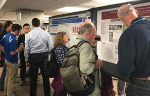
WEDNESDAY, SEPTEMBER 11—MORNING OPENING
Sponsored by Gannett Fleming / TranSystems
Moderator: AEG President Sarah Kalika
Room: Columbus Ballroom
TIME SPEAKER
8:00am–8:07am Welcome: Sarah Kalika, Curt Schmidt and Niall Henshaw
8:07am – 8:15am AEG Volunteer Recognition Award: Gerry Stirewalt and Courtney Johnson (Citationist: Sarah Kalika)
8:15am – 8:25am AEG Advocacy Award: John McPhee (Citationist: Deborah Green)
8:25am –9:00am AEG Foundation Awards: Dr. Anna Saindon
9:00am –9:30am Keynote Speaker: Dr. Gale Blackmer, Pennsylvania State Geologist
9:30am –10:00am Keynote Speaker: David E. Haymes, Assistant Commissioner, Contaminated Site Remediation & Redevelopment, New Jersey Department of Environmental Protection
10:00am–10:20am Morning Break
10:20am–11:00am OEEG Project Award: Paw Paw Slope Stabilization Project—Chesapeake & Ohio Canal National Historic Park: Joseph Reed
11:00am–11:30am 2023/2024 AEG/GSA Richard H. Jahns Distinguished Lecturer: Cynthia Palomares
11:30am–12:00pm Introduction of AEG/GSA Richard H. Jahns Distinguished Lecturer: Dr. John Kemeny
WEDNESDAY,
Sponsored by Arcadis U.S., Inc
In AEG’s fourth annual DEI Symposium, we will shine the light on issues as diverse as the problems with, and solutions to, making the geosciences more diverse, equitable, and inclusive. From how to recruit and retain students in STEM, specifically the geosciences; to making our schools, professional organizations, and companies more inclusive; to how companies recruit in this fast-changing environment—we will learn and discuss the challenges facing the geosciences in education and professional practice.
Convener: Deborah Green
Room: Columbus A
TIME SPEAKER TITLE
2:00pm–2:40pm Garrison, Zenobia Looking from Within: An Equity Centric Approach to Increasing Student of Color Representation in the Geosciences
2:40pm–3:00pm Guido, Lauren Fostering Community Engagement and Access in Geology Fieldwork: Strategies and Outcomes
3:20pm–3:40pm Boss, Stephen Illuminating Pathways to Greater Inclusion in AEG
3:40pm–4:00pm Reynolds, Logan Strength in Solidarity: How Local 2SLGBTQ+ Employees and Allies Affect Change on a Regional and Global Scale
4:00pm–4:20pm Lawson, Masai
The Impact of AI in Talent Acquisition: Opportunities and Ethical Implications
4:20pm–5:00pm Panel Discussion
Sponsored by Aldea Services and Brierley Associates
Engineering Geology & Underground Space. Tunnels provide long-term solutions to a variety of infrastructure projects ranging from constructing roadways or pipelines through difficult terrain to free up valuable surface space in dense urban areas. In recent years, the rapid expansion of metropolitan areas has led nations around the world to give more consideration to the upfront investment of tunneling projects in order to promote more efficient use of surface space and to recognize the significant benefits of underground space to society at large. Engineering geologists’ insights into subsurface and conditions often make the difference between success and failure of these projects.
Convener: Todd Loar Room: Columbus B
TIME SPEAKER TITLE
2:00pm–2:40pm O’Rourke, Thomas Keynote: Geohazards and Large, Geographically Distributed Systems
2:40pm–3:00pm Akeju, Victor Mixed-Rock Conditions and Tunneling
3:20pm–3:40pm Allen, Katherine Geologic Mapping and Photogrammetry for Tunnel Inlet and Outlet Characterization, Lowell Creek Flood Diversion System Project, Seward, Alaska
3:40pm–4:00pm Davidson, Thomas Optimizing the Lowell Creek Tunnel and Slope Design Through Phased Investigations
4:00pm–4:20pm Askins, Dennis The Geology of the Hudson Tunnel Project (Gateway) Between New York and New Jersey
4:20pm–4:40pm Ciancia, Mala Tunnel Alternative Selected for Last Chance Grade, Del Norte County, California (Co-presented with Byron Anderson)
4:40pm–5:00pm Q&A
In partnership with Society of Exploration Geophysicists (SEG)
Conveners: Mia Painter and Kathryn Murdock Room: Columbus C
TIME SPEAKER TITLE
2:00pm–2:20pm Yeskoo, Andrew Reducing Sinkhole Risk Along Rail in Saudi Arabia
2:20pm–2:40pm Rupert, Sarah Morton The Integral Role of Geophysics in Dam Safety
2:40pm–3:00pm Painter, Mia Using Geophysics for Geotechnical and Environmental Projects in Karst Regions
3:20pm–3:40pm Behr, Rose-Anna Towards an Updated Karst Hazard Map of Pennsylvania Using Lidar-Derived Closed Depressions: Benefits and Challenges
3:40pm–4:00pm Denton, Robert The Use of Morphologic Character Analysis to Determine Sinkhole Risk for Solar Site Development
4:00pm–5:00pm Panel Discussion (Sponsored by AEG Geophysical Technical Working Group and SEG)
Tuesday, September 10, 2024 – 8:00pm–10:00pm
This social event is a great way to start your week in Philadelphia. Take the opportunity to meet many of our Student Members in the environmental and engineering geology sciences while you enjoy free appetizers and a free drink ticket! Just a short walk from the hotel, this event is an excellent opportunity to recruit future Chapter members, meet potential employees, find a student to mentor, and see the future of AEG. We encourage young professionals to join the event and welcome experienced professionals who are “young at heart!”
(Included with full and student registrations)
Sponsored by Aspect Consulting
Coastal systems are changing and how we respond to those changes and impacts have become essential to all coastal communities and their interests. The Coastal Hazards session is an opportunity to share the latest research and practical applications for reducing and addressing coastal hazards and impacts.
Moderator: William Godwin Room: Innovation
TIME SPEAKER TITLE
2:00pm–2:20pm Dennison, Alison Geocoastal and Geotechnical Analyses of Shoreline Processes
2:20pm–2:40pm Epstein, Samuel New York City Synthetic Coastal Dune Construction-Comparisons to Jurassic Sand Dune: Sea-level Fluctuations in the Gulf of Mexico (Presented by Peggy Epstein)
2:40pm–3:00pm Epstein, Samuel Environmental Implications of Climatic Changes to the New York Bight
3:20pm–3:40pm Godwin, William Natural Sediment Management vs. Structural Solutions to Mitigate Coastal Erosion
3:40pm–4:00pm Styles, Richard Role of Seasonal Vegetation on Sediment Retention in a Coastal Splay
4:00pm–4:20pm Isphording, Wayne Natural Depositional Hazard in Mississippi Sound? A Question of Liability!
4:20pm–4:40pm Coor, Jennifer L. Boom and Gloom: The Effects of Munitions and Explosives of Concern on Florida Dredging Projects (Co-presented with Nicholas McCarroll)
4:40pm–5:00pm Lashley, Justin Responding to Oversized Material Entrained by Engineered Beach Fill
THURSDAY, SEPTEMBER 12 MORNING
Technical Session #5: GASH Case Histories for Evaluation of Geologic and Seismic Hazards, Part I
Sponsored by PanGEO
This fun, information-filled, full-day symposium, organized and convened by AEG’s Geologic and Seismic Hazards Technical Working Group (GASH TWG), showcases exciting presentations by 18 invited speakers from academia, consulting companies, a federally owned electric utility, government agencies, a national laboratory, and a state geological survey. Presentations include case histories related to evaluation of potential geologic and seismic hazards that specifically address faulting investigations and related seismic hazards in California, New Zealand, Oman, the Pacific Northwest, South Carolina, Virginia, and Wyoming; rock fall hazard in Virginia; karst hazards in Tennessee; volcanic hazards in Idaho; subsurface conditions and licensing at a nuclear power plant site in Georgia; and analysis of mass wasting features on Mars. Data collection and analysis methods applied include field studies involving critical geologic observation and mapping associated with faulting investigations; probabilistic seismic hazard analysis (PSHA); geophysical investigations and core borings to evaluate seismic risks at bedrock and surface levels in Oman; 3D ground motion simulations for evaluation of potential hazard related to Cascadia megathrust earthquakes; seismic reflection and refraction studies for evaluating active faulting and intraplate earthquake potential in Wyoming; kinematic analysis for evaluating a rock fall site in Virginia; numerical models for probabilistic volcanic hazard analysis (PVHA) in the Eastern Snake River Plain (ESRP) of Idaho and a deep core boring from the ESRP for evaluating volcanic hazards; and a seismic ground array and aerial magnetic geophysical surveys for evaluation of an earthquake swarm near Elgin, SC. Two presentations discuss state-of-the-art methods for acquiring data. The first presenter discusses near real-time monitoring of subsidence and landslide hazard using remote sensing and a cloud-based computing platform. The second speaker discusses data acquisition for understanding subsurface physics and structure associated with landslides using next-generation electrical and electromagnetic geophysical surveying techniques. The symposium will allow additional time for Q&A, comments, and discussion at the end of both the morning and afternoon sessions. “Don’t miss it” is the suggestion of enthusiastic convenors G. Stirewalt and C. Johnson, chairs of the GASH TWG.
Conveners: Gerry L. Stirewalt and Courtney Johnson Room: Columbus A
TIME
8:00am–8:20am Shumway, Allison
8:20am–8:40am Dunham, Audrey
8:40am–9:00am Furlong, Kevin
The U.S. Geological Survey’s National Seismic Hazard Model
The Next Generation of 3D Ground Motion Simulations for Cascadia Megathrust Earthquakes
Discovering “Hidden” Seismic Hazards in the Complex Tectonic Environments of the Northern San Andreas and Kaikoura, New Zealand
9:00am–9:20am Gomez, Paco Active Faulting and Intraplate Earthquake Potential in the Northern Wind River Basin of Wyoming
9:20am–9:40am Maguire, Sydney
9:40am–10:00am Bobyarchick, Andy
Evaluation of Slip Along the Garlock Fault Zone at Timescales of 10 4 to 10 6 Years Since 2 Ma
Superposed Ductile Shear and Brittle Faulting in the Mountain Run Fault Zone in the Western Virginia Piedmont
10:20am–10:40am Morrow, Robert The Elgin, South Carolina, Earthquake Swarm: Implications for Seismic Hazard Along the Eastern Piedmont Fault System
10:40am–11:00am El-Hussain, Issa Comprehensive Seismic Hazard Assessment and Microzonation in the Musanah Region, Oman
11:00am–11:20am Huebner, Matthew Karst Hazards at Tennessee Valley Authority Dams: Foundation Treatment, Major Modifications, and Targeted Investigations
11:20am–11:40am Syms, Frank Vogtle Excavation Mapping Program Review—A License Commitment to Confirm Subsurface Conditions
11:40am–12:00pm Q&A, comment, and discussion period for the morning presentations
Just as a geologist develops a conceptual site model using a variety of tools and data, this symposium presents several topics and procedures used to characterize a site and reveal its challenges in assessment and remediation. We expect a few people in the audience have advanced a boring through a utility line on a site, even after the private locator has cleared the location.
Conveners: Sarah Kalika and Rick Kolb Room: Innovation
TIME SPEAKER TITLE
8:00am–8:20am Kalika, Sarah What’s in that Soil? Site Characterization, Sampling Hazards, and PPE
8:20am–8:40am Moe, Minda Utility Locates for Environmental Drilling – Introduction and Case Studies
8:40am–9:00am Heeren, James Route 295/42, Missing Moves
9:00am–9:20am Gannon, Patrick A Tale of Two Discrete Fractured Networks: CVOC Impacted Bedrock Aquifers in Upstate New York
9:20am–9:40am Gottobrio William Empirical Forecasting Methods for Practical Dewatering Assessments l
9:40am–10:00am Toskos, Theodoros Green, Sustainable, and Resilient Remediation
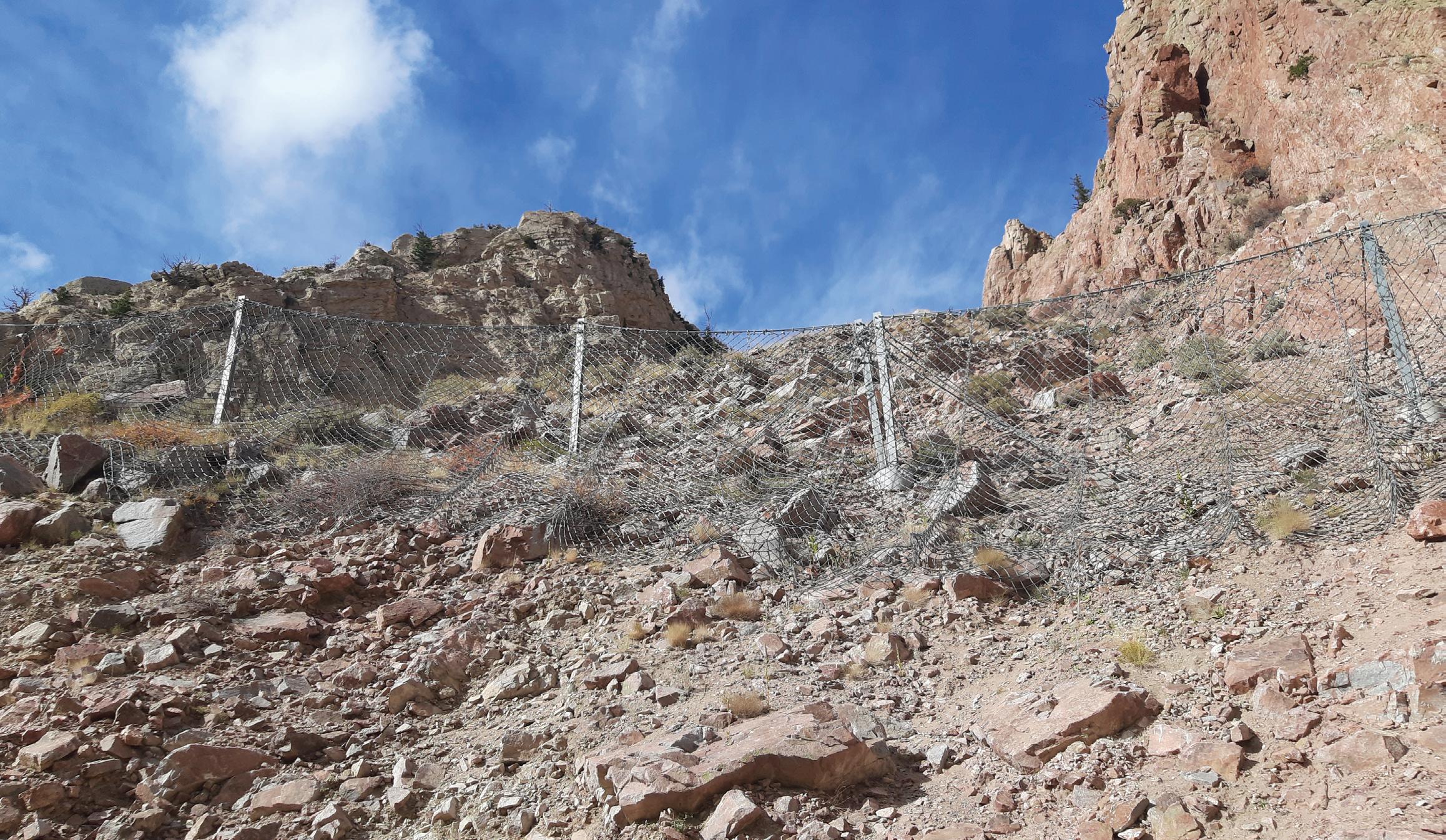
PROJECT: Wyoming Dept. of Transportation Yellowstone Park Attenuators along Chief Joseph Highway
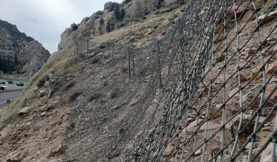
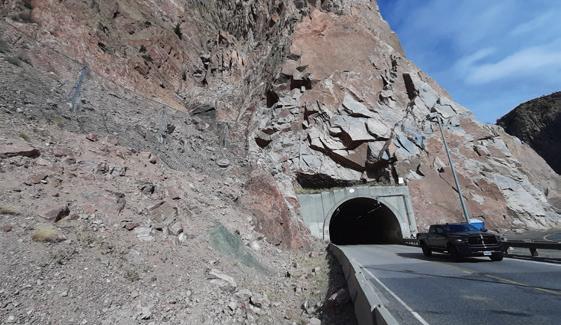
REFERENCES: Arndt, B., Ortiz, T., and Turner, A., 2009. Colorado’s Full-Scale Field Testing of Rockfall Attenuator Systems. Transportation Research Circular E-C141, Oct, 2009.

DID YOU KNOW that the Maccaferri HEA Attenuator outperformed all other products tested?

Though the moderator is not a mining geologist, the presentation titles piqued his interest. Dave’s and Bill’s talks may raise more questions than provide answers to address issues with mining practices past and present. Maybe we should have a keg of beer during these talks to stimulate some wide-ranging conversations and questions about the future of mining and its effect on the environment.
Moderator: Rick Kolb Room: Innovation
TIME SPEAKER TITLE
10:20am–10:40am Hiatt, Jessica Characterizing Underground Coal Mine Surface Hazards via Geomorphic Analysis Using Remote and Ground-Based Techniques
10:40am–11:00am Stowers, Kirk A Novel Approach for the Remediation, Reclamation, and Development of the Three Kids Mine Site for Residential Reuse
11:00am–11:20am Bieber, David W. Tailings Impoundments—Where Do We Go from Here?
11:20am–11:40am Haneberg, William C. Mountaintop Removal Coal Mining and Flood Severity
11:40am–12:00pm Q&A with all presenters
Sponsored by RJH Consultants, Inc
The Dams & Levees Technical Working Group is pleased to host this year’s two-part Dams and Levees Symposium on Thurs, Sept 12! We have a great lineup of wide-ranging talks, including case histories, lessons learned from recent and ongoing large dam construction projects, cutoff walls, hydraulic fracturing, and presentations from members of the Japan Society of Engineering Geology (JSEG). Our symposium will kick off with a keynote presentation by Visty Dalal (Maryland Dam Safety Program) on Conowingo Dam (which follows the Monday field course to the dam—don’t forget to register!). The second keynote presentation will cover the practical challenges of hydrofracturing, given by Kathleen Bensko (FERC). We hope you will join us!
Conveners: Cassie Wagner and Hawkins Gagnon Room: Columbus B
TIME SPEAKER TITLE
8:00am–8:40am Dalal, Visty Keynote: History, Geology, and Construction of the Conowingo Dam, Maryland
8:40am–9:00am Dalal, Visty Druid Lake Water Tank Project, Baltimore City, Maryland
9:00am–9:20am Pearce, Justin Geology of Prado Dam Spillway: Framework for an Anchor Testing Program
9:20am–9:40am Friend, Edwin Anchor Test Program for Prado Dam Spillway Rehabilitation
9:40am–10:00am Kolb, Dakota The Arkabutla Dam Emergency: A Geologic Approach
10:20am–10:40am Riley, Don Chimney Hollow Reservoir Project Dam Foundation Grouting Programs, Larimer County, Colorado
10:40am–11:00am Greene, Brian Lessons Learned From the Austin Dam Failure of 1911, Austin, Pennsylvania
11:00am–11:20am Sasaki, Yasuhito Collaborations of Engineering Geologists for Dams in Japan: Toward Improving the Quality of Geological Investigations
11:20am–11:40am Watatani, Hiroyuki Introduction to the Activities of the Civil Engineering and Geology Research Subcommittee Dam Working Group in JSEG
11:40am–12:00pm Murai, Masanori A Case Study of Geological Bodies and Risks in the Dam Working Group of the Japan Society of Engineering Geology
Sponsored by Harris-Galveston Subsidence District
The AEG Subsidence Working Group convenes AEG’s sixth annual symposium on land subsidence as part of the 67th Annual Meeting. The symposium will begin with a summary of global land subsidence as reported in the online media during 2023 –2024. Sessions will address applications of InSAR technology to land subsidence assessment in areas where subsidence exacerbates the effects of sea-level rise, and where subsidence results from groundwater and hydrocarbon extraction, postglacial rebound, and surface loading. Speakers will discuss land subsidence in volcanic terrane, due to decomposition of peaty soils, from collapse of mines and in karst areas. Subsidence monitoring and modeling at site and regional scales are included.
Conveners: James Borchers and Danielle Smilovsky Room: Columbus C
TIME SPEAKER TITLE
8:00am–8:20am Borchers, James Subsidence Around the World 2023–2024
8:20am–9:00am Smilovsky, Danielle Exploring Case Studies and the Future of Remote Sensing InSAR Technology Applications: Hydrocarbon Production Fields of West Texas, Coastal Bend of Texas, and Land Subsidence Zones in the Arizona Willcox Basin
9:00am–9:20am Shirzaei, Manoochehr Ground Zero: Navigating the Risks, Hazards, and Solutions of Land Subsidence in the Central Atlantic Coastal Plain
9:20am–9:40am Sauber, Jeanne Sources of Spatiotemporal Variability in Coastal Subsidence Rates: Eastern U.S. Compared to American Samoa
9:40am–10:00am Osmanoglu, Batuhan NASA-ISRO Synthetic Aperture Radar (NISAR) Mission
10:20am–10:40am Chu, Tianxing Texas Coastal Land Subsidence: Presence, Severity, and Attribution
10:40am–11:00am Greuter, Ashley Continuing the Legacy: Monitoring Land Surface Deformation from Leveling to GNSS Surveys in the Houston, Texas, Region
11:00am–11:20am Zhou, Xin Land Subsidence in Chesapeake Bay: Insights from 15 Long-Term Tide Gauge Records
11:20am–11:40am Godwin, William Subsidence and Sea Level Rise on Risk to Disposal Sites—Some U.S. Case Studies
11:40am–12:00pm Montgomery-Brown, Volcanic Subsidence Emily
THURSDAY, SEPTEMBER 12—AFTERNOON
Technical Session #9: GASH Case Histories for Evaluation of Geologic and Seismic Hazards, Part II
Conveners: Gerry Stirewalt and Courtney Johnson Room: Columbus A
TIME SPEAKER TITLE
1:40pm–2:00pm Grahl, Dirk Geologic Mapping and Kinematic Analysis of a Rock Fall Site in Northern Virginia
2:00pm–2:20pm Chesnutt, Julian Landslides, Lobate Debris Aprons, Talus Cones, and Slump Blocks of Sacra Mensa, Kasei Valles, Mars: A Mass Wasting Inventory and Analysis
2:20pm–2:40pm Thompson, Jenise Adapting Successful Hazard Analysis Approaches to New Hazards at the Nuclear Regulatory Commission
2:40pm–3:00pm Cline, Michael Approach to Assessing Volcanic Hazards for Siting a Nuclear Power Plant
3:20pm–3:40pm Raszewski, Douglas Stratigraphy and Geochronology From a Borehole on the Eastern Snake River Plain, Idaho, for Assessing Volcanic Hazards
3:40pm–4:00pm Hastings, Mitchell Application of Numerical Models for Probabilistic Volcanic Hazard Assessment on the Eastern Snake River Plain, Idaho
4:00pm–4:20pm Royer, Patrick Near Real-Time Monitoring for Subsidence and Landslide Hazards Using Remote Sensing and a Cloud Computing Platform
4:20pm–4:40pm Taubman, Matthew Next Generation Electrical and Electromagnetic Geophysical Surveying for Geohazards
4:40pm–5:00pm Q&A, comment, and discussion period for the afternoon presentations
Sponsored by Schnabel Engineering
Conveners: Matt Huebner and Josh Shinpaugh Room: Columbus B
TIME SPEAKER TITLE
1:40pm–2:20pm Bensko, Kathleen Hydrofracturing—A Perspective of the Practical Challenges to be Overcome
2:20pm–2:40pm James, Erik Dam and Levee Seepage Cutoff Wall National Guide Specification Development
2:40pm–3:00pm Terry, Thomas USACE Hydraulic Fracturing Toolbox
3:20pm–3:40pm Ueda, Hirokazu
Comparative Model Study of Shear Strength Evaluation on a Complex Weak Layer Underneath a Gravity RCC Dam
3:40pm–4:00pm Kon, Shusaku The Mechanism of Concrete Deterioration and its Progression Caused by Laumontite
4:00pm–4:20pm Czajkowski, Cole 3D Visualization Aids in Risk Identification of Subsurface Conditions for Dam Sites
4:20pm–4:40pm Missenda, Sarah East Branch Dam—Issues and Emergency Response During Cutoff Wall Construction
4:40pm–5:00pm Loar, Todd Geological Engineering Conditions Controlling Rio Coca Regressive Erosion and Potential Mitigation Alternatives, San Luis, Ecuador
Convener: James Borchers Room: Columbus C
TIME SPEAKER TITLE
1:40pm–2:00pm Ellis, John Subsidence in the Southern Central Valley, California—Where We’re at and What’s Next? A DataDriven and Modeling Perspective
2:00pm–2:20pm Culkin, Sean Monitoring and Modeling of Subsidence and Settlement From Groundwater Pumping at the Millennium Tower property—San Francisco, California
2:20pm–2:40pm Sasowsky, Ira Insights From a Long Record of Induced Sinkhole Development Related to Quarry Dewatering in Bucks County, Pennsylvania (Presented by Tony Rana)
2:40pm–3:00pm Missenda, Sarah Lessons Learned: Blairsville Sinkhole Repairs
3:20pm–3:40pm van der Meulen, Michiel Subsidence in the Dutch Lowlands
3:40pm–4:00pm Stouthamer, Esther Land Subsidence Mechanisms and Their Interaction: Organic Matter Oxidation, Shrinkage, and Creep (Presented by Pepijn van Elderen)
4:00pm–4:20pm van Elderen, Pepijn Enhancing Land Subsidence Modelling: Improved Creep Parameterization for Peat
4:20pm–4:40pm Welch, Jennifer Unveiling the Hidden Threat: Drought-Induced Inelastic Subsidence in Expansive Soils
4:40pm–5:00pm Q&A
Technical Session #12: Engineering Geology in Southwest Pennsylvania
Moderator: James Hamel Room: Innovation
TIME SPEAKER
TITLE
1:40pm–2:00pm Gray, Richard Understanding of Geotechnical Problems in Both Eastern and Western Pennsylvania
2:00pm–2:20pm Hamel, James Prehistoric Landslides of the Upper Ohio Valley
2:20pm–2:40pm Heinzl, Brian SR68 Midland Road Emergency Landslide Repair: Let’s Try Something Different
2:40pm–3:00pm Hamel, James Tectonic Faults in Near-Surface Rocks of Southwestern Pennsylvania
Technical Session #13: Geophysical and Site Investigations, Part I
The Geophysical Assessments & Investigation Session will cover the latest in the application of geophysical methods and technology for complex evaluations. This session will cover how we determine challenges to data collection and the best solutions to address those challenges. The goal is to have the most comprehensive evaluation tool possible.
Moderator: Luke Ducey Room: Innovation
TIME SPEAKER TITLE
3:20pm–3:40pm Daniel, Joel Investigation of Shallow Conditions Beneath a Concrete Floor with SIR, GPR, and MASW Geophysical Methods
3:40pm–4:00pm Granda, Daniel Usage of Drones and Technologies in Dam Inspections
4:00pm–4:20pm Epstein, Samuel Geological Assessment of Upper Devonian Bluestone Resources, Orange County, New York
4:20pm–4:40pm Diehl, John Improving Geologic Fault Mapping in Urban Environments Using Shear Wave Reflection
4:40pm–5:00pm Louie, John Simplified Seismic Surveys for Non-Intrusive ASCE 7-22 Compliant Site Class, Rippability, Fault Location, and Design
Technical Session #14: Landslides in the Eastern U.S./Inventories and Susceptibility Mapping
Moderator: James Arthurs Room: Columbus A
TIME SPEAKER TITLE
8:00am–8:20am Chan, Elise Distribution of Landslides Triggered During Extreme Storms in Vermont: Tropical Storm Irene vs. July 2023
8:20am–8:40am Krupansky, Joseph Rock Slope Stabilization in High Traffic Railroad Corridors
8:40am–9:00am Comuso, Christina A Detailed Discussion on the Rockfall Mitigation Efforts and History at Rt 46 in Knowlton Township, New Jersey
9:00am–9:20am Bauer, Jennifer It’s in the Details—Site Characterization for Landslide Mitigation on SR32, Cocke County, Tennessee
9:20am–9:40am Jones, Jacob Applying Pipeline In-Line Inspection Data to Identify Landslide Impacts in Eastern Tennessee
9:40am–10:00am Scheip, Corey Using Computer Vision to Identify Recent Landslides From Lidar Change Detection Data: A Case Study From Eastern Kentucky, USA
10:20am–10:40am Monaco, Thomas Case Study: Multi-faceted Approach to Remediate an Emergency Landslip in Jefferson County, Ohio
10:40am–11:00am Leffel, Victoria Mapping Indiana’s Landslide Hazards: Integrating GIS Analysis for Understanding Geological and Anthropogenic Influences
11:00am–11:20am Bown, Todd Establishing Slope Monitoring Alarm Thresholds for Remediation of a Hazardous Waste Disposal Site
11:20am–11:40am Keaton, Jeffrey Stability Classification of Slopes and Landslides Updated to Include Level Ground 11:40am–12:00pm Q&A with all of the presenters
This session combines different geohazard investigation methods and approaches relevant to dam and levee projects. The symposium will provide an excellent opportunity for speakers to discuss case histories that illustrate cross-discipline collaboration and innovative methods and approaches for characterizing and remediating potential natural hazards associated with geologic features, including seismicity.
Conveners: Hawkins Gagnon and David Carpenter Room: Columbus B
TIME SPEAKER TITLE
8:00am–8:20am Gagnon, Hawkins Lewis Ridge Pumped Storage Project—Site Characterization of What Is and What Isn’t, Part 1
8:20am–8:40am Carpenter, David Lewis Ridge Pumped Storage Project—Site Characterization of What Is and What Isn’t, Part 2
8:40am–9:00am Huebner, Matthew Recent Geophysical Investigations at Tennessee Valley Authority Dams Focused on Karst Foundations
9:00am–9:20am Shinpaugh, Joshua Leveraging Multi-Channel Analysis of Surface Waves (MASW) to Inform Modification Design and Communicating Results
9:20am–9:40am Rupert, Sarah Morton Subslab Void Spillway Investigation Using Time-Lapse Ground Penetrating Radar
9:40am–10:00am Gray, Mike McCloud Dam Spillway Replacement: Successful Planning and Execution of a Complex Field Investigation
10:20am–10:40am Carnevale, Mario Multi-Method Geophysical Investigations for Assessment of Earth Dam Structures
10:40am–11:00am Mirecki, June Brackish Groundwater Dynamics in Response to Seepage Barrier Construction, Herbert Hoover Dike at Lake Okeechobee, Florida
11:00am–12:00pm Panel Discussion
Room: Columbus C
9:00am–11:30am
11:30am–12:00pm
Presentation and Discussion of Award-Winning Film American River, about a journey down New Jersey’s Passaic River, with Director and Filmmaker Scott Morris.
Presentation of Film Mystery of Melange, a short form documentary by Johnathann (Jay) C. Renna Reyes and Devin Moore
Technical Session #17: Landslides in the Western U.S.
Moderator: Kevin McCoy Room: Columbus A
TIME SPEAKER TITLE
1:00pm–1:20pm Taylor, Gabriel South Coldwater Creek Bridge Debris Flow—Emergency Response and Risk Evaluation
1:20pm–1:40pm Zhu, Yichuan Uncertainty Quantification of Negative Samples and Model Structures in Landslide Susceptibility Characterization Based on Bayesian Network Models
1:40pm–2:00pm Darrow, Margaret But at What Cost? Summarizing the Initial Response to Three Fatal Landslide Events in Southeast Alaska
2:00pm–2:20pm Fontaine, April Landslides and Climate Change—An Alaska Peer Exchange
2:20pm–2:40pm Anovick, Claire Slow and Steady: LiDAR Change Detection of Frozen Debris Lobe Mass Movement Within the Brooks Range, Alaska
Technical Session #18: Geophysical and Site Investigations, Part II
Moderator: Luke Ducey Room: Columbus B
TIME SPEAKER TITLE
1:00pm–1:20pm Knott, David The Development and Value of Coal Mining Desktop Studies
1:20pm–1:40pm Dougherty, John The Application of Environmental Sequence Stratigraphy During Remedial Design at the Puchack Well Field Superfund Site
1:40pm–2:00pm Barnett, Elson Channel Migration Zones Reduced by Levees, Revetments, and Infrastructure for Site Development in Washington State
2:00pm–2:20pm Stohr, Christopher Role of Engineering Geologists in Controversial Climate Change Legislation: CO2 Sequestration
Technical Session #19: Tectonic Studies
Moderator: Scott Sochar Room: Columbus C
TIME SPEAKER TITLE
1:00pm–1:20pm Epstein, Samuel Seismic Vulnerability of Potential Earthquakes in New York Metropolitan Area (Presented by Dennis Askins)
1:20pm–1:40pm Starr, Alison Identifying Hidden Tectonic Structures (Faults) in Urban Development: Central Las Vegas Valley, Nevada, USA
1:40pm–2:00pm Epstein, Samuel Punctuated Tectonic Equilibrium Chicxulub and Chesapeake Bay Toms River Asteroid Impacts— Baltimore Canyon U.S. Offshore
Each poster author will post a schedule on their poster for when they will be available for questions.
We will once again be holding a student poster competition. There will be three cash prizes ($200, $100, and $50) for the top three vote recipients of the student poster sessions. Voting will be conducted exclusively through the mobile app, so bring your mobile device to vote for your favorite. Winners will be awarded at the poster reception on Thursday, September 12, 2024, from 5:00pm to 6:30pm. All poster presenters will be at their posters during the poster reception.
Wednesday, September 11, 2024, 8:00am–4:00pm
GASH Case Histories for Evaluation of Geologic and Seismic Hazards
SPEAKER
TITLE
Student poster presenters (eligible for the student poster competition)
Dollens, Aleigha Using Electrical Resistivity Tomography to Place Paleoseismic Trenches Along the Motagua Fault
Emick, Tami Geochemistry and Magnetic Susceptibility of Upper Devonian Catskill Formation Paleosols, North-Central Pennsylvania
Farris, Carla Maria Create a 3D Finite-Element Model for the Mexican Subduction Zone and Assessing Seismic Hazard
Langford, Elizabeth A Spatiotemporal Modeling Approach to Explore the Relationships Between Zoonotic Disease and Extreme Weather Events
McCourt, Scarlett Glacial Diamictites—Past and Present
Morgan, Nathan Evaluation of Glass Cullet as a Sediment Source for Dune Restoration in Coastal South Jersey
Pope, Isaac Factors Influencing the Use of Surface Degradation and Smoothing as a Tool to Evaluate Potential Hazards From Lava Flows
Professional poster presenters
Jensen, Chantel Geomorphic Mapping of the Alluvial Fan Complexes That Host the California Aqueduct in the San Joaquin Valley
Lebo, Julia Automated Methodology for Monitoring Contaminant Attenuation at Large Industrial Sites
Martinez, Sabrina Proposed Landslide Mapping Protocol and Schema for the United States and Territories
Thursday, September 12, 2024, 8:00am–3:20pm
SPEAKER
TITLE
High school student poster presenters
Hasa, Arli Increased Use of Radiography in the Aviation Industry Can Improve Safety
Jamna, Alaina Investigating the Impact of Climate Change on Habitat Loss, Species Extinction, and Northward Migration in the Arctic Leon, Elise Private Jets: Friend of our Celebrities and Enemy of our Earth
Leon, Elise How Can Various Countermeasures Used in Aviation to Control Bird Strikes be Improved to be More Environmentally Friendly?
Meher, Nazifa
Investigating the Relationship Between Particulate Matter Emissions Closer to Major Airports in the USA and Their Possible Effects on the Common Public Health
Ramnauth, Avishai Investigating the Impacts of War on Carbon Dioxide Levels and the Environment
University student poster presenters (eligible for the student poster competition)
Rahaman, Mustafizur Bridging the Gap: Energy, Environment, and Education for a Sustainable Future
Smith, Margi Mapping Surficial Deposits at Mockingbird Gap, NM, Using Small Unmanned Aerial Vehicles and Low-Altitude Remote Sensing
Professional poster presenters
Slaughter, Stephen Overview of the New U.S. Geological Survey Cooperative Landslide Hazard Mapping and Assessment Grant Program
Stuby, James Ground Penetrating Radar Survey of Former Fort Halifax, Halifax, Pennsylvania
Thacker, Hayden Advancing Remedial Decision-Making: The Role of Machine Learning in Biogeochemical Data Analysis
Gravity for: Aquifer Studies
Sink Hole Dectection
Locating Underground Tanks
Voids/Cavity Dectection
Finding Karst Hazards
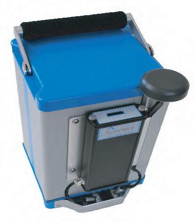
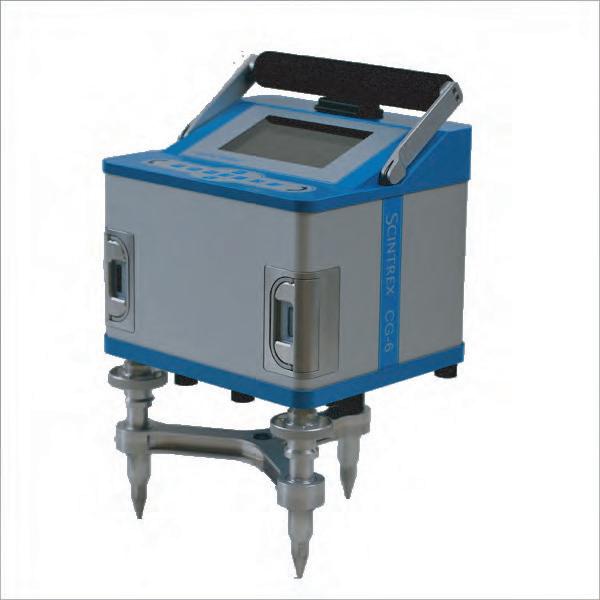
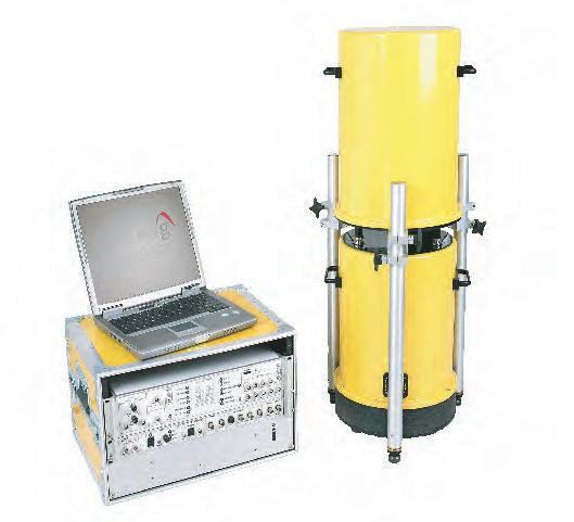
Akeju, Victor, Brierley Associates, vakeju@brierleyassociates.com; Tom Pullen, tpullen@brierleyassociates.com (TS #2)
Tunnel excavations in mixed-rock sedimentary stratigraphy can impose challenges on underground projects if not adequately evaluated. Mixed-rock sedimentary stratigraphy exists when there are alternating layers of sandstone, siltstone, shale, and limestone. Independently, these rocks have highly variable responses to tunnel excavation at the micro- and macro-scale. For instance, sandstone depending on the type and degree of cementation can have a wide range of expectations with respect to excavatability, stand-up time, and permeability. On the micro-scale, the individual grain characteristics of the sandstone can be highly variable with respect to the abrasivity and pumpability of slurry spoils. Shales and siltstones can exhibit a wide range of behavior depending on a multitude of characteristics such as type and amount of clay content, depositional dynamics, load cases, lamination, stratification, etc. These variations can directly impact excavation performance and support. Similarly, with limestone, the geologic history, geo-chemistry, micro- and macro-joint characteristics, permeability, etc., can alter excavation performance and expectations if not accounted for during project planning. The challenges compound when these rocks exist as alternate layers and the task of predicting the ground behavior during tunneling becomes more difficult. Depositional cyclic sedimentation plays a major role in the variability of mixed-rock conditions in sedimentary rocks. This presentation explores how the knowledge of the depositional environment can help practitioners understand and mitigate excavation performance in these conditions. Two case studies will be presented to highlight the behavior and challenges of tunneling in mixed-rock conditions of sedimentary rocks.
Geologic Mapping and Photogrammetry for Tunnel Inlet and Outlet Characterization, Lowell Creek Flood Diversion System Project, Seward, Alaska
Allen, Katherine L., U.S. Army Corps of Engineers, Katherine.L.Allen@usace.army.mil; James F. Martin, f.james.martin@usace.army. mil; Sharon L. Gelinas, sharon.l.gelinas@usace.army.mil; Twain M. Cacek, twain.m.cacek@usace.army.mil; Meaghan C. Gould, meaghan.c.gould@usace.army.mil; Thomas A. Davidson, thomas.a. davidson@usace.army.mil; Mike Arles, Michael.A.Arles@USACE.army. mil; Cassandra Wagner., Cassandra.M.Wagner@usace.army.mil (TS #2)
The Lowell Creek Flood Diversion System located in Seward, AK, was built by the U.S. Army Corps of Engineers (USACE) in 1940 to reroute Lowell Creek around the city of Seward via a tunnel through Bear Mountain and discharging to Resurrection Bay. USACE is currently in the process of designing a new diversion structure and tunnel adjacent to the existing structures. Geologic conditions were characterized at the locations of the new tunnel inlet and outlet by concurrently utilizing traditional field mapping techniques and photogrammetry software analysis with digital terrain model generation. Rock mass discontinuity orientations, spacing, and other characteristics were defined using the photogrammetry software and combined with geologic data from field mapping to obtain a detailed description of geologic conditions for portal slope stability and tunnel support system design. The combination of digital terrain
models with other geospatially referenced datasets provides the team with unparalleled site visualization and broadens post-investigation, off-site design and analysis capabilities. This presentation will summarize the digital photogrammetry geologic mapping and its site characterization applications.
Anovick, Claire, University of Alaska Fairbanks, ckanovick@alaska. edu; Margaret M. Darrow, mmdarrow@alaska.edu (TS #17)
Initially deemed inactive in the 1970s, slow-moving permafrost–landslide features—now known as frozen debris lobes (FDLs)—were identified in the Alaskan Brooks Range during the construction of the Trans Alaska Pipeline System (TAPS) and the Dalton Highway. Since 2008, UAF-affiliated researchers have monitored FDLs along the highway corridor, which are characterized by their post-glacial catchments; elongated lobate shapes; frozen silty sand with gravel composition; and boreal forest vegetation. Research efforts have included drilling, sampling, measuring surface movement and strain rates, and analyzing long-term and seasonal advancement rates using light detection and ranging (lidar) and interferometric synthetic aperture radar (InSAR) data. Building on previous analyses of FDL mass movement rates, here we present a change detection of four epochs of lidar-derived digital elevation models (DEMs) from 2011, 2015, 2020, and 2023. By differencing the DEMs of nine FDLs, we identified both significant and subtle changes over the 12-year collection interval. Within a GIS environment, we identified geomorphic features characteristic of FDLs and confirmed these interpretations through field efforts to document surface changes, such as sediment transport, permafrost degradation, and retrogressive thaw slumps. Findings from this research will quantify volumetric mass movement—one metric that can be used to evaluate potential mitigation alternatives associated with FDLs and their future interactions with downslope infrastructure.
Geology of the Hudson Tunnel Project (Gateway) Between New York and New Jersey
Askins, Dennis, M&J Engineering PC, nygeol1@yahoo.com; Samuel Epstein, Epstein.samuel58@gmail.com (TS #2)
Mega construction geotechnical projects in New York City (NYC) and the adjacent New Jersey metropolitan area consist of skyscrapers, bridges, and tunnels that were built within the last century until the present time. The geology of this metropolitan area is complex and spans more than 1.1 billion years. An understanding of the geology is important in planning and design and construction of any of these construction projects. The aging of these engineering structures and the population growth has impacted these man-made construction marvels. The transportation of rail and vehicle traffic has been increasing at a rapid rate while these mega structures have not kept pace with repairs, upkeep, and new construction. A new project, known as the Hudson Tunnel Project, is moving forward this year. The project is a joint venture of both New York and New Jersey, and it will be built just south of the original 100-year-old North River Rail Tunnel under the Hudson River. This will allow for repairing the aging North River Tunnel, which sustained additional damage during Hurricane Sandy. The project will also allow the popular passenger
rail route between New York and New Jersey to continue serving the more than 200,000 passengers who pass through Penn Station in NYC every day. We will show the complex geology that the tunnel boring machine (TBM) will encounter in the construction of this new tunnel, including the various bedrock types (lithology), unconsolidated soils and deposits, tectonics, structural geology, and stratigraphy as well as the seismic history of this area. Most important is the subsurface groundwater encountered in both bedrock aquifers and surficial aquifers that can cause numerous water issues. The geology of the Hudson Tunnel Project is presented with geologic maps and geologic profiles as well as the geological and geotechnical engineering parameters and data.
Channel Migration Zones Reduced by Levees, Revetments, and Infrastructure for Site Development in Washington State Barnett, Elson, Aspect Consulting, chip.barnett@aspectconsulting. com; Alec Melone, Alec.Melone@aspectconsulting.com; Chelsea E. Bush, Chelsea.Bush@aspectconsulting.com (TS #18)
Identifying channel migration zones (CMZ) is important for both natural and built environments. Several Washington state counties have completed mapping of CMZ for selected drainages for more than 20 years and have implemented guidance for permitting development on properties that lie within areas potentially subject to lateral migration from nearby channels. There are a variety of tools available to evaluate CMZ, including review of aerial photo images dating back to the 1930s, Government Land Office (GLO) maps, and light detection and ranging (lidar) data that help evaluate channel behavior. The Washington Department of Ecology (DOE) has developed a tool to provide a standardized approach for estimating lateral migration based on channel centerline observations over the period of record. These estimates are used to evaluate the potential for lateral migration over a projected 100-year period. Levees and revetments can reduce CMZ widths effectively by 10s to more than 100 ft but must be maintained. We present project examples including one in which the proposed site development was allowable under the rules identified by the local county and a second site where the risk from lateral migration precluded site development. We also discuss the observed local effects of bank hardening on CMZ width.
It’s in the Details—Site Characterization for Landslide Mitigation on SR32, Cocke County, Tennessee
Bauer, Jennifer, Appalachian Landslide Consultants, PLLC, jennifer@ appalachianlandslide.com; Jesse Hill, jesse@appalachianlandslide. com (TS #14)
The slope at log mile 28.32 on Tennessee State Route 32 in Cocke County has a history of sliding dating back to the 1980s or earlier. Triggered by heavy rains, the north end of the 800-ft-long site began to subside in July 2023. After an unsuccessful attempt to reconfigure drainage and patch the pavement, the Tennessee Department of Transportation (TDOT) Geotechnical Engineering Unit engineers decided that the entire length of the unstable slope needed mitigation. To protect the stable inside lane of the roadway while determining mitigation options, TDOT opted for a two-pronged approach: temporary shoring and long-term mitigation. The northern portion of the slope was shored up with a 14- to 16-ft high, three-tiered soil nail wall. Installation of the soil nails took place at the same time as the geotechnical investigation and instrumentation monitoring to determine the most feasible mitigation options. Appalachian Landslide Consultants, PLLC (ALC) was the prime consultant that led a team of geologists and engineers from Landslide Technology and WSP Inc.
The team conducted characterization of the site and landslide using remote sensing and aerial photography coupled with field observations, detailed surface and subsurface soil and rock observations, and analyses of the slope inclinometer and vibrating wire piezometer data. This data was combined with the receding lake level elevations to gain a better understanding of the groundwater/slide plane interaction. After the team recommended a variety of mitigation options, TDOT chose a soldier pile and lagging wall that are anchored into the underlying bedrock. They commissioned a second round of drilling operations to collect information that would provide the retaining wall contractor with a better understanding of the subsurface for anchor and pile installation. The ALC team presented these findings and recommendations for retaining wall design and guidelines to be used by the contractor.
Behr, Rose-Anna, Pennsylvania Geological Survey, rosbehr@pa.gov (TS #3)
Karst feature density mapping is vital for geohazard assessment, risk mitigation, and groundwater protection. Closed depressions were identified using a modified, semi-automated method described by Doctor and Wall (2018). Closed depressions greater than 9 m2 and over 0.2 m deep were identified using a 1-m digital elevation model (DEM) then individually examined using slope shade, hillshade, aerial imagery, and nominal field reconnaissance. The depressions were categorized as karst, anthropogenic, alluvial, or natural non-karst features. Karst features were subdivided into closed depressions, springs, or swallets. A confidence level was assigned to each. A density map was created based on weighted natural log of volume for each county completed. This approach provides several benefits over previous remote mapping techniques. Pennsylvania’s earlier karst mapping involved examining historical air photos and transferring points to a digital platform with potential transfer errors. The air photo technique was hampered by tree canopy whereas the bare earth DEMs are not. This lidar-based technique can pick out more subtle topographic depressions. The new karst-feature density maps will provide a heat ramp for level of hazard, instead of the single points that are currently available for much of the state. This approach to remote closed depression identification faces several challenges. Significant time is required to categorize all the closed depressions. This technique does not work well in densely populated areas where many false sinks exist, and development has eliminated many depressions. Mantled karst, whether glaciated or covered in thick residuum or colluvium, contained enigmatic closed depressions. These may be periglacial pattered ground, solifluction landforms, or actual karst features. Future development, including pipeline and infrastructure work, land stability evaluation, and groundwater protection efforts, need to be aware of risks associated with karst. The new maps should be easier for property owners, planners, engineers, and developers to understand.
Bensko, Kathleen, Federal Energy Regulatory Commission, Division of Dam Safety and Inspections, kathleen.bensko@ferc.gov (TS #10)
Structural and foundation damage of water retaining structures from hydrofracturing is a problem with which the dam safety community is often faced. Many water-retaining structures have been subjected to hydrofracturing caused by drilling, grouting, and other intrusive activities. So how do we minimize the risk that we are imposing on these structures and their foundations from these activities? The solution is complex and includes many factors that are typically involved with the investigation, design, and remediation of the structures. A pragmatic and widely inclusive approach may serve to produce the best results in lowering this risk.
Bieber, David W., david@biebergems.com (TS #6B)
Mine tailings impoundments represent a major hazard associated with active and abandoned mine sites. Conventional tailings storage facilities feature a dam or series of dams to contain tailings, which are typically placed as a slurry. These dams can exceed 300 m in height and are generally of earthen construction. As such, they are subject to failure by causes that include piping, liquefaction, seismicity, and overtopping. The 2019 Mount Polley mine in British Columbia that released 4.5 million cubic meters of waste into the Fraser River basin and the 2019 Brumadinho tailings dam failure in Brazil that killed 259 people are examples of the hazards posed from these failures. These disasters resulted in the 2019 Global Action on Tailings Initiative, which sought to have mining companies disclose details of their tailings impoundments worldwide. In 2020, the International Council on Mining and Metals (ICMM) developed its Global Industry Standard on Tailings Management that strives “to achieve the ultimate goal of zero harm to people and the environment.” The challenge is how to mitigate potential impacts from existing tailings impoundments and design future impoundments to achieve ICMM’s goal. Opportunities include the development of ways to stabilize tailings in situ, advances in the design of tailings dams, and alternative ways to dispose of tailings.
Bobyarchick, Andy, University of North Carolina at Charlotte, AndyBobyarchick@charlotte.edu (TS #5)
The Mountain Run orogen-parallel shear zone is at the Piedmont–Blue Ridge boundary in western Virginia. This shear zone is a possible continuation of the Brevard fault zone in a similar structural setting in the Southern Appalachian Mountains. These fault zones contain one or more mylonitic overprints and, in places, show brittle deformation as breccia and discrete faults. The Mountain Run fault zone trends northeast into the Mesozoic Culpeper Basin. The Everona fault is in the Mountain Run fault zone in Orange County, Virginia. An excavation near Everona exposed an unconformity between highly weathered mylonitic rocks and an overlying colluvial/ fluvial sequence of pebble gravel and massive, ferruginous loamy sand. These deposits are reminiscent of higher terrace deposits in the greater Rapidan River basin. This unconformity is faulted, and the sedimentary deposits are warped into an antiform above several reverse faults. Some of these faults show reverse dip-slip movement with up-to-the-southeast displacement. Thus, there is a system of related, reverse-motion, near-surface tectonic faults with
dip-slip motion and near horizontal northwest-southeast trending P-axes. Observed throws are on the order of a couple of meters. The coincidence of faulted sedimentary deposits with a ridge- and stream terrace-forming soil (the Hiwassee series) derived from these deposits suggests that the deformation is geologically young. The unconsolidated cover materials are lithologically similar to terrestrial Triassic rocks in the Culpeper basin, but their position and weak lithification suggest Pliocene or younger deposits. Although the brittle faulting is geologically “young,” the Everona fault is not known to be historically seismic (M>1.5) and is outside the normal extent of the Central Virginia seismic zone. The excavation site, however, is only 44 km from the epicenter of the Mineral, Virginia, earthquake of August 23, 2011.
Borchers, James, Hydrologist, jborcher@outlook.com (TS #8)
This presentation, which introduces AEG’s 2024 Land Subsidence Symposium, summarizes land subsidence as reported in the news media worldwide. Subsidence during the past year occurred from groundwater extraction, hydrocarbon production, hydrocompaction, tunneling, loading of squishy sediment, drought-induced soil shrinkage, thawing permafrost, karst, mining, and other causes. News reports described the magnitude and areal extent and damage from subsidence and its effects on infrastructure at various locations in the U.S., England, Ireland, India, Iran, China, Indonesia, Vietnam, Russia, and elsewhere.
Boss, Stephen K., Department of Geosciences, University of Arkansas, sboss@uark.edu (TS #1)
Surveys of student motivations to enter STEM careers indicates that clear majorities desire engagement in jobs that “help the environment,” “help society,” and “ensure employment.” As such, interest in traditional extractive industries is waning as students perceive these as “the problem” rather than “the solution.” These perceptions are particularly expressed among students from groups underrepresented in geosciences. As the premier professional organization representing environmental and engineering geoscientists, AEG can capitalize on these student perceptions. To diversify professional representation in environmental and engineering geoscience careers, AEG should commit to a focused, 10-year campaign to develop awareness and build community with identity-serving geosciences organizations (a.k.a., affinity groups). To initiate this campaign, AEG may gain access to organizations serving diverse identities by participating in two National Science Foundation-sponsored projects: Geosciences Associated Societies Committed to Enhancing & Normalizing Diversity (Geosciences ASCEND) and Utilizing Professional Societies to Achieve a Reciprocating Transformative Culture (UPSTART Culture). Through these NSF-sponsored projects, AEG can make contact with large numbers of aspiring geoscientists with diverse identities, enroll them in AEG via student memberships, and build community by participating in annual conferences of identity-serving geoscience organizations (e.g., National Association of Black Geoscientists, Geoscience Alliance, Asian-Americans and Pacific Islanders in Geosciences, American Indian Science and Engineering Society, GeoLatinas, Black in Geoscience, and others). Within AEG, the organization should emphasize incorporating inclusive practices to ensure all individuals feel welcomed, valued, and respected. There should be annual efforts to create inclusive programming for diverse identities within
AEG: annual professional development workshops to aid career progress of individuals should be offered at multiple venues, and AEG should seek to create opportunities for diverse representation in leadership and committees. Finally, AEG can build capacity for a more diverse workforce by developing internships for diverse individuals seeking careers in the environmental and engineering geosciences industry.
Bown, Todd, GZA GeoEnvironmental, todd.bown@gza.com; Douglas Roy, douglas.roy@gza.com (TS #14)
From the 1920s through the 1950s, a landfill alongside a ravine operated in upstate New York, accepting deleterious materials, such as incinerator ash as well as other types of refuse from local industries. Waste material was pushed into the ravine from the landfill. Over time, the buried waste material leached metal and semi-volatile compounds within the ravine’s downstream watershed, and the site has been classified as an inactive hazardous waste disposal site. Currently, a large remedial program is underway to encapsulate contaminated soil and sediment within the 7-acre site funded by the New York State Department of Environmental Conservation (NYSDEC). The refuse along the ravine’s slope is a heterogenous mixture overlying bedrock. The ravine’s slopes were characterized approximately at 1.5H:1V, and the remedial design classified the existing slope as unstable and required in situ telemetry monitoring of the slope with a recommended alarm threshold of 1 inch. The remedial program’s first phase required grading the existing slope to 2H:1V and stockpiling approximately 20,000 cubic yards excavated fill material above the regraded slope. The stockpiled fill acting as a surcharge load on the underlying waste material decreasing the regraded slope’s stability. The specified slope-monitoring instrumentation was installed, and independent slope stability modeling was performed to verify remedial design requirements for alarm settings. Modeling of existing slope conditions indicated a factor of safety of less than one, while modeling of the remedial design stages provided a factor of safety greater or equal to one. Deformation modeling was completed using finite element software to analyze total movement of slope for all remedial design phases and to develop quantifiable alarm settings. This presentation will summarize the instrumentation program and the analysis required to establish alarm threshold for an automated monitoring system.
Carnevale, Mario, Hager GeoScience (A Collier Geophysics Co.), mcarnevale@colliergeophysics.com (TS #15)
Many of the small earth dam structures in New England are the result of several stages of construction or alteration as far back as colonial times. Current projects to assess the integrity of or to rehabilitate these dams require investigations focused on understanding their internal components, materials, and, in some cases, archaeological significance. In this regard, the complexity of earth dam investigations is related to the physical and chemical properties of the investigative targets, thereby requiring geophysical methods that measure these properties. Such targets include core structure components and geometry, shell structure components and geometry, toe drain structures, dam foundations, and seeps or other anomalous conditions. The quest for rehabilitation contracts among engineering firms is quite competitive. Consequently, the budgets
allocated to the small dam investigations are tight and attempt to constrain the investigations to single geophysical methods. However, single geophysical method approaches provide limited information on structural characteristics or defects within these types of dams. Therefore, the preferred approach is a multi-method one combining low-frequency ground-penetrating radar (GPR) with more labor-intensive seismic and electrical methods. This presentation will use case histories from several states to illustrate the contribution that 2D and 3D multi-method geophysical investigations provide to the assessment of earthen dam integrity.
Carpenter, David, Schnabel Engineering, dcarpenter@schnabel-eng. com, Hawkins Gagnon, jgagnon@schnabel-eng.com; Sandy Slayton, sandy@ryedevelopment.com; Ushakar Jha, ushakar@ryedevelopment.com (TS #15)
As discussed in the previous presentation by Hawkins Gagnon, Lewis Ridge Pumped Storage Project aims to transform a former coal mining site into a pumped storage hydroelectric facility. Currently in the early stages of design, permitting, interconnection, and Federal Energy Regulatory Commission (FERC) licensing stages, the project involves constructing an upper dam and reservoir, penstocks, a powerhouse, lower dam and reservoir, electrical substation, and transmission lines. Since January 2023, Schnabel has been conducting geologic and geophysical studies to optimize the design, addressing significant geologic and geotechnical challenges posed by the site’s history of surface and underground mining. The challenges related to the site’s historical mining activities include mountaintop removal mining, contour and auger mining, and underground mining, necessitating thorough site characterization. An initial geophysical survey was conducted in February 2023, which included seismic refraction targeting the unknown depth to rock due to mountaintop removal beneath the proposed upper reservoir and multi-channel analysis of surface waves (MASW) and seismic refraction along the proposed centerline of the lower reservoir dam. The seismic data was collected along seven lines and covered approximately 11,500 linear ft. In spring of 2024, a robust geophysical program was conducted that included additional seismic refraction, MASW, and a pilot seismic reflection survey. This phase of seismic data was collected along more than 30 geophysical lines, which totaled an additional 8 mi. of data coverage across the site that will be utilized to optimize the project configuration and individual project structures. This presentation will focus on the geophysical studies and results conducted at the site to date. The geophysical results have shown variable depth to rock, extents of previous mining activities, and areas of greater or less-competent bedrock. The geophysical results will be compared and presented with relevant information from desktop studies of existing mine workings, geologic reconnaissance, and geotechnical drilling.
Distribution of Landslides Triggered during Extreme Storms in Vermont: Tropical Storm Irene vs. July 2023
Chan, Elise, Middlebury College, Colorado School of Mines, eliseylchan@gmail.com (TS #14)
In July 2023, a 48-hour period of intense rainfall led to one of the most catastrophic flooding events of Vermont’s recent history, on par with Tropical Storm Irene in 2011 and the Great Vermont Floods of 1927. The upper Winooski River watershed, which encompasses Montpelier and Barre, was among the hardest hit areas of the state both in terms of amount of precipitation and damage to infrastructure and livelihoods. This damage was primarily caused by the impacts of flooding and landslides. This study aims to understand the spatial and physical factors that determined the distribution of landslides during the July 2023 storm in the upper Winooski River watershed. First, an inventory of slides activated during the 2023 floods was compiled from satellite imagery and site visits. Based on general trends of landslide distribution in central Vermont, variables such as reactivation, geology, and antecedent precipitation were included in regression models to understand the significance of these variables in the context of extreme precipitation events. The recurrence of rain and flooding of this magnitude only 12 years after Tropical Storm Irene highlights the importance of preparing Vermont for this heightened landslide hazard due to the probable increase in frequency of episodic storms into the future.
Lobate
Aprons, Talus Cones, and Slump Blocks of Sacra Mensa, Kasei Valles, Mars: A Mass Wasting Inventory and Analysis
Chesnutt, Julian, PNNL, julian.chesnutt@pnnl.gov; Paul Byrne, Paul. Byrne@WUSTL.edu; Karl Wegmann, Karl_Wegmann@ncsu.edu (TS #9)
We explore the massive Sacra Mensa, which is located in the middle of the channels of Mars’s Kasei Valles. We offer an examination of four types of mass-wasting landforms on Sacra Mensa: 142 talus cones, 24 slump blocks, 17 lobate debris aprons (LDAs), and 72 landslides, of which 55 were previously described by Crosta et al. (2018). We find that these landforms exhibit both striking variations and fascinating commonalities in a number of different dimensions, including type, volume, location, frequency, and spatial density. Our survey finds that the mass wasting of the Mensa exhibits a considerable asymmetry, with most of the volume concentrated in the southern flank. Nonetheless, the Southern Kasei Valles contribute significantly to the overall mass wasting in the Sacra Mensa Study Area (SMSA) when taking into account the quantity of sloping terrain. The south’s abundance of sloping terrain is the main cause of this difference. This directional mass asymmetry is probably caused by the South Kasei Valles channel’s deeper depth and stronger stream power. Furthermore, the caprock of the Sacra Mensa exhibits a clear mass-wasting asymmetry, with more than half of the landslides in the study area occurring in one large fossa. This specific “Landslide Fossa” is surrounded by degraded terrain and is much deeper than other fossae. Additionally, our study indicates that coalescing talus cones and LDAs share similar geomorphological traits, suggesting that in some circumstances, these seemingly diverse landform types may represent different stages of the same landform’s development.
Chu, Tianxing, Texas A&M University at Corpus Christi, Tianxing.Chu@ TAMUCC.edu; Xiaojun Qiao, xqiao@islander.tamucc.edu; Evan Krell, ekrell@islander.tamucc.edu; Philippe Tissot, philippe.tissot@tamucc. edu; Seneca Holland, seneca.holland@tamucc.edu; Mohamed Ahmed, mohamed.ahmed@tamucc.edu; Danielle Smilovsky, danielle. smilovsky@tamucc.edu (TS #8)
Coastal subsidence, the downward movement of the land surface near the sea, contributes to increased risks of flooding and shoreline erosion from extreme events such as hurricanes and storm surges. Accurately estimating subsidence and identifying its underlying causes is crucial for understanding subsidence processes and guiding decision-making. However, subsidence estimation and interpretation are challenging due to spatiotemporal variability, limited observability, and the complexity arising from both natural processes and human activities. This study utilized synthetic aperture radar interferometry (InSAR) techniques along with other satellite and terrestrial geodetic methods to identify locations and severities of land surface subsidence along the Texas Gulf Coast, a region known for its rapid subsidence rates in the context of rising sea levels across the U.S. Hotspot sinking locations were identified within the study area, including the Houston–Galveston area, Karnes City, and San Leon, among others. High subsidence rates of over 30 mm/yr were measured in parts of these hotspots, with significant spatial variability observed. Explainable artificial intelligence (XAI) methods were employed to identify the predominant features responsible for subsidence hotspots in the Texas Gulf Coast. A range of features related to natural terrain variations and anthropogenic activities, such as fluid extraction, soil moisture, and growth faults, were considered as potential attributes explaining subsidence. The data-driven analysis indicated that anthropogenic activities (e.g., hydrocarbon extraction and groundwater withdrawal) were the most relevant factors contributing to subsidence in the study area.
Ciancia, Mala, HNTB Corporation, mciancia@hntb.com; Byron Anderson, BAnderson@kleinfelder.com; Raymond Sandiford, rsandiford@ hntb.com (TS #2) (Co-presented with Byron Anderson)
In June 2024, the California Department of Transportation (Caltrans) selected an alternative that includes a 6,000-ft tunnel as a long-term solution for a landslide-prone coastal stretch of U.S. 101 known as Last Chance Grade. The highway is a vital artery in Del Norte County, connecting Crescent City with communities to the south. An extended roadway closure due to landsliding would require a 450-mi. detour. Both culturally and environmentally sensitive, the project area is a World Heritage Site in Redwood National and State Parks, with stands of large-diameter, old-growth redwood trees. HNTB and Kleinfelder have been supporting Caltrans in studying and characterizing site conditions and advancing alternative designs for a permanent solution to improve reliability, reduce highway maintenance costs, and protect the area’s economy, natural resources, and cultural landscapes. The selected two-lane highway tunnel alternative would bypass the majority of active slide zones, reduce the impacts of coastal erosion, and minimize potential effects of climate change. This presentation will summarize results of efforts to characterize the complexities of the site’s Franciscan Complex geology and its multiple types of nested landslides, irregular groundwater regime, and high seismic hazard potential. These factors, as well as the site’s
cultural and environmental sensitivities, bring special challenges for tunnel design and construction. Among these are the limited access for subsurface investigations, requirements for alignment selection and space proofing, and a portal approach structure in an active earthflow. As currently conceived, the two-lane tunnel would be a single curvilinear bore constructed using the Sequential Excavation Method (SEM). Construction is anticipated to begin in 2030.
Cline, K. Michael, RIZZO International, Michael.cline@rizzointl.com; Jeffrey Kimball, Jeffrey.kimball@rizzointl.com; Michael Rosenmeier, Michael.rosenmeier@rizzointl.com; William Hackett, wrhackett@ comcast.net; Mitchell Hastings, Mitchell.hastings@rizzointl.com; James Wilson, james.wilson@rizzointl.com; Charles Connor, cbconnor@usf.edu; Doug Raszewski, doug.raszewski@rizzointl.com (TS #9)
A site-specific volcanic hazard analysis (VHA) was completed for a proposed nuclear power project at the north margin of the Eastern Snake River Plain (ESRP), Idaho, USA. The VHA was designed to support a license application for construction and operation of a small modular reactor (SMR) per requirements the U.S. Nuclear Regulatory Commission’s (NRC) Regulatory Guide (RG) 4.26 for assessing volcanic hazards for proposed nuclear power plant sites. A tectono-magmatic conceptual model (TMCM) was developed in accordance with RG 4.26 to describe/forecast future volcanic events that pose hazards within the site region. This included identifying Quaternary volcanic features and associated phenomena. The ESRP is a distributed volcanic field where basaltic through rhyolitic volcanic features are expressed at the surface. This volcanic field and site region yields 180 volcanic phenomena (ground deformation, lava flows, tephra fall, etc.) initially evaluated, 64 of which are present in 7 different volcanic features (dikes, shield volcanoes, scoria cones, etc.) that required either bounding calculations or numerical modeling to quantify their hazard. The VHA included surface and subsurface field investigations to characterize and constrain volcanic processes present in the site region. These datasets were used in screening hazards and to develop a suite of numerical and statistical models for describing the probability of impact from the different volcanic features. Spatial and temporal models were developed to quantify the probability of where and when future volcanism may occur on the ESRP, and combining these models with the impact models yields the total hazard for the given volcanic feature. The results of the volcanic hazard analysis are presented as annual exceedance probabilities for each volcanic feature impacting the net primary productivity (NPP) site within a 1 km site radius and reported as a distribution that can be used by a probabilistic risk analysis team for facility design.
A Detailed Discussion on the Rockfall Mitigation Efforts and History at Rt 46 in Knowlton Township, New Jersey Comuso, Christina, New Jersey Department of Transportation, Christina.Comuso@dot.nj.gov; Steven Tapanes, Steven.Tapanes@dot.nj.gov; Amanda McElwain, Amanda.McElwain@dot.nj.gov (TS #14)
The New Jersey Department of Transportation (NJDOT) Engineering Geology Unit is responsible for overseeing more than 440 rock slopes throughout the state. Among these slopes is Rt 46 in Knowlton Township, rated as an “A” slope on the NJDOT Rockfall Hazard Management System (RHMS). Located along the Delaware River, this slope is comprised of Martinsburg Shale overlain with alluvium and stream terrace deposits. Geologic and hydrologic factors in this
area have created an elevated risk for mass wasting, making this slope one of the most active in the state. An award-winning proprietary rockfall fence was constructed in 2014 within the 1-mi.-long project limits to minimize the severity and frequency of rocks and debris entering the roadway. Early rockfall mitigation efforts will be detailed in this presentation along with several past slope failures. These include a historic mass-wasting event that washed out a major railroad in the early 1900s, another event in 2023 in the same location, and a minor upper slope failure in 2022 that damaged two rock fence panels. This presentation will also focus on the early railroad infrastructure of this corridor, along with the local controversy related to rockfall mitigation efforts. Finally, the presentation will discuss the outlook for the future of this project area in addition to highlighting the lessons learned through the mitigation efforts at Rt 46 and how those lessons were applied to other rockfall sites throughout the state of New Jersey.
Coor, Jennifer L., U.S. Army Corps of Engineers, Jacksonville District, Jennifer.L.Coor@usace.army.mil; Nicholas R. McCarroll, Nicholas. Mccarroll@usace.army.mil (TS #4)
Munitions and explosives of concern (MEC) are military munitions that may pose unique explosives safety risks and include unexploded ordnance (UXO), partially exploded ordnance, inert ordnance, ordnance fragments, discarded military munitions (DMM), material possibly presenting an explosive hazard (MPPEH), munition debris (MD), and munitions constituents present in high enough concentrations to pose an explosive hazard. The state of Florida was used extensively for war preparations in the 1940s and is home to several formerly used defense sites (FUDS). More information on the FUDS program and sites throughout Florida can be found at the below web address, https://www.usace.army.mil/Missions/Environmental/ Formerly‐ Used‐Defense ‐Sites/FUDS ‐ GIS/. FUDS are not the only source of MEC along the coastline of Florida. MEC may be found along the entire coastline of Florida, both on land and in state and federal waters. The militaries of the U.S. and other countries have conducted live ‐fire training and combat operations at sea for centuries, and commonly disposed of excess, obsolete, and unserviceable munitions in coastal waters. This presentation will discuss the presence of FUDS throughout the state, recent encounters of MEC on federal shore protection projects (SPP/HSDR/CSRM) and updated ways that the federal government is addressing the risk of encountering MEC on projects within the Jacksonville district. These efforts include coordination with the USACE Military Munitions Design Center of expertise (MMDC) for MEC probability assessments to identify and characterize potential risks, more significant material screening processes (with potential implications for the South Atlantic Regional Biological Opinion), and on‐site inspection and monitoring by UXO technicians trained in the identification, management, and handling of MEC. This new implementation is likely to have significant scope and cost implications for many federal shore protection projects—and potentially navigation projects—in the state of Florida.
Francisco, California
Culkin, Sean, Upland Hydrogeology Consulting, sculkin@uplandhydro. com (TS #11)
Structural issues affecting the Millennium Tower, a large, residential building in downtown San Francisco, offered a unique opportunity to combine high-resolution monitoring and instrumentation, three-dimensional geologic modeling, groundwater modeling, and geotechnical modeling, to evaluate the causes and mechanisms of consolidation-related settlement and subsidence within a coastal marine/alluvial groundwater basin. The tower, the foundation of which was built into a mixture of fill, mud, and clay material, was observed to have sunk several inches and was continuing to sink as well as tilt as of 2016. Consolidation and compression of subsurface materials were identified as primary mechanism for these problems, and a detailed monitoring program including satellite data and on-site instrumentation was implemented to monitor conditions at the building. Dewatering of the subsurface aquifer units at several very large excavations in the vicinity of the tower, including the Salesforce Transit Center and Salesforce Tower, were also identified as key drivers of consolidation. By linking available groundwater monitoring data to a detailed time history of construction progress, a model reliably linking dewatering to aquifer consolidation and building tilt/settlement was developed. This groundwater model output was linked to geotechnical monitoring data and tied to the boundary conditions of a fast lagrangian analysis of continua (FLAC) model to aid in detailed simulation of consolidation at the property. These efforts supported legal allocation and mediation efforts that led to a favorable outcome for the stakeholder clients. This case study demonstrated the effective linking of well-established quantitative hydrogeologic methods to geotechnical and structural engineering practices both to show the controlling mechanisms of subsidence, as well as to validate predictive models of aquifer compression. The nexus of these methods has direct applicability to water supply and other infrastructure affected by ongoing aquifer consolidation and subsidence within coastal regions of the U.S. and beyond.
Czajkowski, Cole, Schnabel Engineering, cczajkowski@schnabel-eng. com; Egboche Unobe, eunobe@schnabel-eng.com; Qiana Milner, qmilner@schnabel-eng.com (TS #10)
Greenbrier Creek Dam is a zoned earthen embankment dam constructed in the 1960s to provide water to the city of Mount Sterling, Kentucky. Since original construction, the height of the dam has been raised twice to increase the storage capacity of the reservoir. The dam was initially designed with a maximum height of 45 ft. An initial raise in 1986 was accomplished by placing additional fill to increase crest height by 10 ft. In 1988, seepage was documented flowing through the rock abutments resulting in slope failures downstream of the dam. The dam was raised an additional 10 ft in 2001 by installing a sheet pile wall along the crest. Remedial grouting was performed in 2013 to mitigate increased seepage noted after the 2001 raise. Despite these efforts, additional areas of instability, including sinkholes and slope failures, have been observed on the downstream slope of the embankment since 2015. Since 2022, Schnabel has been working with the owners of the dam to evaluate, monitor, and mitigate ongoing slope failures. In addition to ground deformation and piezometric data, available exploratory information
includes design drawings, geotechnical boring logs, geophysical seismic and electrical resistivity data, seepage dye tests, and remedial grouting records. Using 3D rendering technologies like Leapfrog and 3DPDF, we have consolidated the various datasets into a single work product for a holistic approach to visualizing and evaluating existing conditions. This presentation will show some of the work that goes into developing 3D models and how these various datasets interact in 3D space to allow for the identification of risks that may not be possible when viewing each dataset independently.
Dalal, Visty, Maryland Dam Safety Program, visty.dalal@maryland. gov; John Campbell, Jay.Campbell@Constellation.com (TS #7)
The Conowingo Dam in Conowingo, Maryland, resides in the Lower Susquehanna River about 9.9 mi. from the Chesapeake Bay—the second largest estuary in the world. It is a masonry gravity dam built in 1928 and is currently owned by Constellation Energy. In 1925, Philadelphia Electric Company awarded the construction contract to Stone & Webster of Boston. Construction started in 1926 and was completed in 1928. During that time, it was the second largest hydroelectric project in the U.S. after Niagara Falls. The total length of the dam is 4,649 ft with a height of 94 ft, and it supports a 9,000-acre reservoir with an active capacity of 71,000 ac ft. The impounded river forms the 14-mi.-long Conowingo Reservoir. The lake is used for water supply to Baltimore and Chester Water Authority, as well as for the cooling plant at Peach Bottom Nuclear Power Facility. The dam has 11 turbines that generate 548 megawatts electricity at 13,800 volts that is used by Philadelphia, PA. The dam has 53 flood gates that are selectively operated when the reservoir levels rise due to storm events. The maximum water depth in the lake is 105 ft. Porphyritic granite gneiss forms the westerly half of the foundation, while dark-colored dioritic to meta gabbroid rocks form the easterly half of the foundation. Also dikes and schistose bands are encountered, especially in the easterly section. Joints and foliation ranging from moderately inclined in the granite rocks to comparatively steep in other portions of the formation were also observed. Susquehanna is the East Coast’s longest river and is the best spot in the U.S. for seeing bald eagles. From November through January, eagle-eyed birdwatchers arrive from far-flung destinations to view hundreds of the birds that have migrated from New York and Canada.
Dalal, Visty, Maryland Dam Safety Program, visty.dalal@maryland.gov; Charles Wallis, Charles.wallis@charles.wallis@maryland.gov: Timothy Wolfe, Timothy.wolfe@baltimorecity.gov (TS #7)
Participating in a nationwide movement to provide large parks to urban dwellers, Druid Hill Park was developed during the mid-1800s. Druid Lake was one of the first major earth-filled dams in the country. In 1971, the dam was designated as an engineering landmark by the American Society of Civil Engineers. The city’s drinking water system has been constructed over an extended period, beginning in the early 1800s, and includes several open reservoirs that contain water that has been treated and is ready to deliver to customers through the pipeline network that distributes potable water to Baltimore City and Baltimore County customers. These open finished water storage facilities include Druid Lake. Concerns about contamination of drinking water in open finished water reservoirs from air-borne contaminants or waterfowl or from malevolent attacks
such as terrorism led to more stringent regulation by the Environmental Protection Agency (EPA) and the Maryland Department of the Environment (MDE). The Safe Drinking Water Act, enacted in 2006, requires that systems with open reservoirs like Druid Lake either cover the reservoirs or provide additional treatment of the water in them before the water enters the distribution piping. Therefore, the city signed a consent order with the EPA to address all the open finished water reservoirs in its water system including Druid Lake, Ashburton Lake, Guilford Reservoir, Towson Reservoir, and the Montebello Plant 2 Reservoir. The tanks at Druid Lake are 550 and 400 ft in diameter and have a side wall height of approximately 20 ft in each tank with a total combined covered water storage of 46 million gallons. Connecting piping will convey water from an existing 72-inch diameter pipe on the north side of the reservoir to the new tanks, and then to Druid Park Lake Drive, where the pipe reconnects to the existing water transmission system. The open reservoir was taken offline, and tank storage was accomplished on December 21, 2023.
Investigation of Shallow Conditions Beneath a Concrete Floor with SIR, GPR, and MASW Geophysical Methods
Daniel, Joel, ARM Group, LLC, jdaniel@armgroup.net; Evan Filion, efilion@armgroup.net (TS #13)
The conditions of concrete slabs and subgrades are important considerations for the addition of heavy loads. The presence of sub-slab voids, soft soils, or even insufficient concrete thickness can present substantial risks to these additions, and these conditions should be evaluated. Geophysical and nondestructive testing methods are typically utilized along with follow-up coring focused in the most advantageous locations to properly assess these conditions. We present a case study where a combination of ground-penetrating radar (GPR), slab impulse response (SIR), and multisurface analysis of surface waves (MASW) were used to assess sub-slab conditions at a manufacturing facility prior to the addition of new equipment.
But at What Cost? Summarizing the Initial Response to Three Fatal Landslide Events in Southeast Alaska
Darrow, Margaret M., University of Alaska Fairbanks, mmdarrow@ alaska.edu (TS #17)
Southeast Alaska is renowned for its steep-sided fjords, lush coastal forests, and persistent rainfall. While these characteristics each contribute to the beauty of the area, they also can combine to form deadly geohazards. Over the past decade, southeast Alaska has experienced three fatal landslide events. In August 2015, multiple landslides occurred around Sitka as a result of heavy rainfall and high winds, with one debris flow taking the lives of three residents as it moved through a residential area. An atmospheric river and rain-on-snow event with record-breaking rainfall in December 2020 caused more than 50 landslides and widespread flooding throughout the area, which impacted more than one-third of the residents of Haines. Just as that storm was abating, a debris avalanche/ debris flow initiated, killing two people. Three years later, in November 2023, a significant winter storm triggered multiple landslides throughout southeast Alaska, including one in the community of Wrangell that took the lives of six people, including a family of five. All of these landslides occurred on steep, forested slopes with high precipitation and/or wind as the likely triggers. Most of southeast Alaska’s communities are not accessible by roads, requiring either boat or air travel for access. This inaccessibility makes responding to disasters logistically difficult and expensive. This presentation
summarizes these three devastating landslide events and explores the costs and emergency response considerations for geohazards in remote communities.
Optimizing the Lowell Creek Tunnel and Slope Design Through Phased Investigations
Davidson, Thomas, U.S. Army Corps of Engineers, thomas.a.davidson@usace.army.mil; Sharon Gelinas, sharon.l.gelinas@usace.army. mil; Joe Kissane, joesph.a.kissane@usace.army.mil; Mike Arles; micheal.a.arles@usace.army.mil; Cassie Wagner cassandra.m.wagner@usace.army.mil, Coleman Chalup, coleman.j.chalup@usace. army.mil; Katherine Allen, katherine.l.allen@usace.army.mil (TS #2)
The existing Lowell Creek Flood Diversion System diverts flows to Resurrection Bay prior to those flows entering the city of Seward. A new proposed tunnel will provide redundancy necessary to increase flow capacity and allow for routine operation and maintenance of the diversion structure. The proposed tunnel will be construction within the Valdez Group, which are complexly deformed and intruded metasedimentary graywacke, siltstone, shale, and phyllites derived from turbidite sequences. Rock structure is steep to near vertical along the tunnel alignment and bedding generally ranges from a few centimeters to a few meters thick. The proposed tunnel is approximately 300 ft south from the existing tunnel, which was built in 1946. There is limited description of rock conditions encountered during the drill and blast construction. The original design required no additional tunnel support. Stand-up times for the 11-ft drill and blast excavation were over a year until the concrete liner was installed, and it is assumed that there was little to no side pressure. The proposed tunnel diameter is 20 ft plus excavation, which increases the tunnel span and leads to reductions in stand-up time and need for rock support. Due to the remote nature of the site, Phase 1 investigations were limited to the inlet and outlet portal areas. Three different rock mass characterization systems are being used for portal and tunnel design and include the rock mass rating (RMR) system, geologic strength index (GSI), and the Q-system. Additional investigations will be completed to optimize the current portal inlet, outlet, and tunnel designs, which are currently between the 35–65 percent phases.
Dennison, Alison, Geosyntec Consultants, Inc., doing business as Aspect Consulting (Aspect), Alison.Dennison@aspectconsulting.com (TS #4)
Thirty-one adjoining single-family residential properties along the Puget Sound shoreline of Mutiny Bay sit just above and behind the ordinary high-water mark (OHWM). Rising sea level, stronger storm events directed from different directions, and higher king tides all put the residences, septic systems, and other appearances at risk of falling into the ocean. Hard armoring (bulkheads) has severely damaged ecological function over the last 50–75 years, which has harmed the sea life from the bottom of the food chain to the salmon and the orca. How can the homes be protected while still protecting ecological function? How can geologists help solve this problem? This presentation will discuss the qualitative geologic investigation and quantitative analysis used to help answer some of these questions, but others will remain unanswered.
Denton, Robert, Terracon Consultants Inc., robert.denton@terracon. com; Joshua Valentino, joshua.valentino@terracon.com (TS #3)
Construction in karst terrains can present a challenge to development, and the solar energy industry has become increasingly aware of the potential impact to both site infrastructure, human health, and the environment that may result from the mismanagement of construction activities at solar sites. These impacts include development of new karst features or accelerated growth of existing features, damage to water supply wells and springs, and potential negative impacts to the habitat of stygobiont taxa. Prior site studies have often depended on the subjective evaluation of individual features by a karst specialist. However, at large sites (>1,000 acres) with high concentrations of sinkholes, the analysis of the risk these features present is time-consuming and often inaccurate. To address this, we have been developing a method using morphologic character analysis in an attempt to reduce subjectivity in karst feature evaluation. The process involves an initial desktop review to identify suspect karst features, followed by a field survey during which feature risk is determined based on the systematic coding of documented characters including: 1) parapet characteristics, 2) the presence of an open throat, 3) degree of soil raveling, 4) drainage type, and 5) presence and characteristics of vegetation. Each karst feature is assigned a risk category where the recommendations detail approaches for each karst risk level. We then work with project engineers to assist in designing appropriate measures intended to minimize the impact to planned infrastructure and the karst resource. The talk will also include a brief introduction to D8512-23, the new ASTM standard practice for preliminary karst assessment for site development.
Improving Geologic Fault Mapping in Urban Environments Using Shear-Wave Reflection
Diehl, John, GEOVision Geophysical Services, jdiehl@geovision.com; JB Shawver, jbshawver@geovision.com (TS #13)
The accurate delineation of geologic faults is critical for understanding seismic hazards in urban settings. Traditional geophysical imaging techniques are often constrained in environments where cultural interferences limit the determination of fault geometry and detection of subtle fault-related structures. Recent case studies are presented that demonstrate the improvement of geologic fault mapping via high-energy and high-resolution shear-wave reflection surveys. The shear-wave reflection method provides improved accuracy in fault delineation, enhanced identification of fault-related structures, and a better understanding of subsurface fault behavior. Depth estimates for shear-wave reflection surveys are greatly improved by traditional shallow borehole velocity logging. These findings have significant implications for earthquake hazard assessment in urban environments. Several examples are shown with co-located compressional-wave reflection, ground penetrating radar, and/or electrical resistivity data to highlight the advantages and limitations of the shear-wave approach.
Using Electrical Resistivity Tomography to Place Paleoseismic Trenches Along the Motagua Fault
Dollens, Aleigha, University of Missouri–Kansas City, akdxff@umsystem.edu; Christoph Grütnzer, christoph.gruetzner@uni-jena.de, Carlos Pérez Arias, ingemateriales@hotmail.com; Omar Flores Beltetón, omar_floresb@yahoo.com; Tina Niemi, niemit@umkc.edu (Poster)
The present study is to utilize electrical resistivity tomography (ERT) to locate future paleoseismic trench sites along the Motagua Fault in Guatemala. ERT is a noninvasive geophysical tool that has proven to be useful in locating future trench sites in areas that are on farmland or private property. A site in Estanzuela is located just west of the highway CA10 road offset near Zacapa where a sinistral displacement of >60 cm was measured following the 1976 M7.5 earthquake (Plafker, 1976). Aerial photographs from a helicopter reconnaissance following the 1976 earthquake show the mole track of the ground rupture makes a left step or bend to form a sag pond called Laguneta Los Yajes. The site is currently on the property of a melon plantation and packing plant. Using a Ground Tester Model 6472 configured in a Wenner Array, a 232 m ERT profile ran perpendicular to the fault scarp at the interval of 2 m, 4 m, 8 m, 16 m, and 32 m. An inverse image was developed using RES2DINV software that showed a block of low resistivity. A second, high resolution 24 m profile was then conducted within the low resistivity value to have a better estimate of exact faulting location. The 24 m high resolution profile shows a vertical discontinuity at around 10 m, followed by a section of low resistivity from 10 m to 20 m. A 10 m trench was placed along the vertical discontinuity exposed in the image. This method resulted in a trench that was dug precisely within the fault zone, reducing trenching costs and damages to the farmland. Utilizing ERT tools prior to digging paleoseismic trenches is beneficial in understanding fault structures by noninvasive means and is a useful tool in planning paleoseismic trench placement.
The Application of Environmental Sequence Stratigraphy During Remedial Design at the Puchack Well Field Superfund Site
Dougherty, John N., CDM Smith, doughertyjn@cdmsmith.com; Morgan Simon, simonme@cdmsmith.com; Ben Yezuita, yezuitabd@ cdmsmith.com; Lucinda Pype, pypelj@cdmsmith.com; William Wallace, William.C.Wallace@usace.army.mil; Conrad Bonney, Conrad.H.Bonney@usace.army.mil; Rachel Griffiths, griffiths.rachel@ epa.gov; Joe Von Uderitz, jvonuderitz@eaest.com (TS #18)
Environmental sequence stratigraphy (ESS) was applied to improve the geologic model at the Puchack Well Field Superfund Site. ESS is a powerful tool to optimize well screen placement, thereby improving the quality of data collection and remediation. The site is near Camden, New Jersey, and is underlain by the Potomac-Raritan-Magothy system. In the 1980s, the well field was shut down by hexavalent chromium contamination. A lithostratigraphic geologic model of the site has been applied to guide placement of extraction, injection, and monitoring well screens. The remedial action (RA) involves the injection of sodium lactate to reduce hexavalent chromium to trivalent chromium. The U.S. Environmental Protection Agency (USEPA) performed an ESS analysis of the site to assess depositional facies at the site. During the phase II RA, CDM Smith prepared grain size logs (GSLs) for all 158 phase II RA borings and selected remedial investigation (RI) and phase I RA borings. In support of the phase III remedial design (RD), CDM Smith used the work completed by USEPA, the newly prepared GSLs, and natural gamma logs to define hydrostratigraphic units to improve the geologic model of the site with a focus on the intermediate sand, which is the target of the phase III remediation. Cross sections were prepared, which incorporated all 20 of the planned phase III extraction wells and 40 of the planned injection and monitoring wells (28 percent of the planned total of 215 wells). The ESS analysis showed that the intermediate sand consists of fluvial channel bars separated by splay and overbank deposits and estuarine and coastal clay. The ESS analysis indicated that one (5 percent) of the 20 planned extraction wells may
be screened in estuarine and coastal clay. The analysis indicated that up to 10 percent (about 20) of the planned 215 wells may be screened in estuarine and coastal clay or on the flank of a channel.
Dunham, Audrey, U.S. Geological Survey, University of Washington, adunham@usgs.gov; Erin Wirth, ewirth@usgs.gov; Alex Grant, agrant@usgs.gov; Arthur Frankel, artdfrankel@gmail.com; Ian Stone, istone@usgs.gov; Marc Eberhard, eberhard@uw.edu; Jeffrey Berman, jwberman@uw.edu (TS #5)
The Cascadia subduction zone (CSZ) has the potential to host great megathrust earthquakes (M ~8–9), as demonstrated by extensive on- and off-shore paleoseismic evidence. The last great Cascadia earthquake occurred in 1700 AD, before the advent of modern seismic instrumentation. Therefore, to quantify hazard along this seismically quiescent margin, we use numerical simulations of hypothetical Cascadia earthquake scenarios to calculate a range of expected ground motions. These synthetic ground motions can be used for a variety of practical applications, such as for improving bridge and building codes, as well as hazard preparedness efforts to increase community resilience. Here, we present preliminary results from updated 3D broadband (up to 10 Hz) ground motion simulations for the CSZ, building off the work of Frankel et al. (2018) and Wirth et al. (2018). These broadband ground motions are generated by combining low frequency (<1 Hz) waveforms simulated in a 3D seismic velocity model using SPECFEM3D and high frequency (1–10 Hz) waveforms modeled using a stochastic approach. We build earthquake scenarios using a logic tree that varies the event magnitude (M8.7–9.2), the down-dip and up-dip limits of slip (including rupture onto secondary splay faults), and the slip distribution. Using these synthetic ground motions, we explore the competing and coupled effects of 3D earth structure, including the impacts of basin and offshore sediments, directivity, and megathrust geometry on shaking intensities. Ultimately, these simulations will be used to quantify the impacts to infrastructure and cascading hazards, such as tsunamis, landslides, liquefaction, and land-level change, with a focus on coastal communities in the Pacific Northwest.
El-Hussain, Issa, Sultan Qaboos University, Oman, elhussain@squ. edu.om; Ahmed Deif, adeif@squ.edu.om; Adel Mohamed, geotec@ squ.edu.om; Yousuf Al-Shijbi, alshijbi@squ.edu.om; Abdullah Ansari, a.ansari@squ.edu.om (TS #5)
This study undertakes a comprehensive probabilistic seismic hazard assessment (PSHA) and microzonation for strategic sites in the Musanah region of Oman, employing the Cornell-McGuire approach to evaluate seismic risks at bedrock and surface levels. The analysis involved generating a detailed seismic catalog, revising regional seismotectonic settings, and employing ground-motion prediction equations (GMPEs) validated for the Middle East. The hazard assessment included 475-year and 2,475-year return periods at multiple locations. Geophysical investigations were conducted across multiple sites, utilizing techniques such as microtremor measurements and geotechnical borehole data, integrated with SHAKE91 software for site response analysis. Key results highlight varied seismic risks across the region, with specific sites exhibiting significant amplification effects due to shallow soil layers and others showing minimal site effects due to rocky conditions. This study provides
seismic hazard maps that illustrate spatial variations in peak ground acceleration (PGA) and spectral accelerations, which are crucial for future developments and risk management. The results emphasize the necessity for tailored seismic design codes and infrastructure resilience strategies in the region, highlighting areas of significant concern and potential seismic impact.
Subsidence in the Southern Central Valley, CA—Where We’re at and What’s Next? A Data-Driven and Modeling Perspective Ellis, John, INTERA Incorporated, jellis@intera.com; Andres Prieto-Estrada, aestrada@intera.com; Nathan Hatch, nhatch@intera.com; Leila Saberi, lsaberi@intera.com (TS #8)
Land subsidence, driven predominantly by groundwater extraction, presents complex challenges for many areas of California. Subsidence in the Tule subbasin was recognized by 1935—third in time only to Houston’s Goose Creek oilfield in 1918 and the Santa Clara Valley the same year. This subsidence reached as much as 5 ft by 1940 due to large water level declines of as much as 125 ft. Substantial water level declines continued through 1953, culminating in more than 9 ft of cumulative subsidence—among the greatest amounts of subsidence in California at the time. Surface water contracts implemented in 1951 resulted in a rapid water level recovery beginning the following year, and the subsidence rate decreased from more than 0.4 ft per year to less than 0.02 ft per year. The subsidence lesson was learned—or was it? Funding for subsidence research in the early 1980s decreased substantially due to slowing subsidence rates observed at the six historical Poland-era extensometers in Pixley, Richgrove, and other areas of California. As a result, the operation of these six extensometers was discontinued by 1982. However, subsidence did not cease in the Tule subbasin. Rather, in the background, subsidence persisted year after year. Benchmark resurveys beginning in 2019 have revealed large amounts of subsidence since the early 1900s in areas where subsidence was previously thought to have been mitigated. The historical subsidence record was reconstructed and extended through 2024 at several benchmark sites in the southern Central Valley. This long-term dataset provides a crucial context for decision-making, allowing comparison of historical and current subsidence rates. One-dimensional models using the MODFLOW code were calibrated to this dataset and used to predict subsidence through 2040. The results indicate that long-term subsidence datasets can improve the reliability of subsidence forecasts and scenario results, leading to more informed management decisions.
Catskill Formation Paleosols, North-Central Pennsylvania
Emick, Tami, Rowan University, emickt48@students.rowan.edu; Lily S. Pfeifer, pfeiferls@rowan.edu (Poster)
The Catskill Formation redbeds in the northern Appalachian foreland basin (north-central Pennsylvania) record Late Devonian (Famennian) terrestrial paleoclimate. Major element geochemical data from Catskill Formation paleosols preserve evidence of moderate silicate weathering (chemical index of alteration values 63 –79), with an up-section increase that perhaps reflects enhanced Upper Famennian seasonality related to the onset of end-Devonian glaciation in the subtropics. To test whether this trend is consistent with a temporal shift to more humid climate conditions overall, or instead, an intensification of seasonality in the Upper Devonian, X-ray fluorescence (XRF) geochemical data and magnetic susceptibility (MS) data were acquired on two ~15 –20 m-thick mudstone-paleosol
intervals from core (Lackawanna County, PA). Both datasets were measured at a 20-cm sampling interval with handheld XRF and MS instruments. Preliminary results show a correlation between XRF and MS records. These new data, together with companion detailed (cm-scale) stratigraphy, allow for a high-resolution evaluation of variation in the chemical weathering signal related to climatic change during the uppermost Famennian. Further analysis is necessary 1) to evaluate whether increased seasonality is consistent with pre- to early mountain glaciation in the Appalachian hinterland, and 2) to assess the influence of geodynamic effects on the chemical weathering signal, especially given the tectonically dynamic and orogen-proximal setting of the Appalachian basin during this time.
New York City Synthetic Coastal Dune Construction— Comparisons to Jurassic Sand Dune: Sea-level Fluctuations in the Gulf of Mexico
Epstein, Samuel A., Geoval Consulting LLC NY, Epstein.samuel58@ gmail.com; Peggy Epstein, epsteinepstein@yahoo.com; Roger Sassen, rsassen@verizon.net, Alan Benimoff, alan.benimoff@gmail.com (Presented by Peggy Epstein) (TS #4)
The Rockaway Peninsula is in the 100- and 500-year flood zone, with potential sea level rise of 31 inches (78.7 cm) from 2000–2050. The Peninsula contains 124,000 residences, with cumulative real estate assets worth $15 billion. In 2012, Super Storm Sandy removed 1.5 million cubic ft of sand from the peninsula. Massive construction and population increases have continued on the peninsula. In 2013, a study of future steps for coastal protection was done under thenMayor Bloomberg utilizing a team of geologists and engineers who concluded a dune field would significantly protect the coastline. The U.S. Army Corps of Engineers, New York District, is constructing rock jetties and synthetic dunes over the 10-mi. coastline at a cost of more than $700 million. Over 2 million cubic yards of sand have been redeposited from dredging to the beach from nearshore accumulations. A massive undertaking including the multistep synthetic dune construction, involving a cement and sand bag nucleus covered by sand and salt tolerant greenery for dune anchoring. Provenance of the Rockaway Peninsula is due to Hudson River transport, erosion from the metamorphic Cambro–Ordovician Manhattan Schist, Fordham Gneiss, and Inwood Marble, part of the Northern Appalachians. Surface sediment samples contain well-sorted quartz and other material grains. In comparison, the Jurassic Norphlet Formation contains quartz grains rounded to subangular derived from the southern Appalachian forelands. Sensitivity of dunes to sea level fluctuations can be analogous to the well bore cores (15,000 ft) Jurassic dune fields of the Norphlet Formation in the Gulf of Mexico, which reflect significant dune migration from a transgression lowstand to highstand system tract facies.
Epstein, Samuel A., Geoval Consulting LLC, Epstein.samuel58@gmail. com (TS #4)
An identified threat to the marine and bird life off the Rockaway Peninsula and further to the east on Southern Long Island (Long Beach, Atlantic Beach, etc.,), is the occurrence of a significant dumpsite 12 mi. from the Rockaway Beach and 6 mi. from Sandy Hook, New Jersey. Previous core studies at 11 locations demonstrate high levels of total organic carbon, various organic compound hydrocarbons derived along with low pH and high Eh levels, along with hydrogen sulfide, suggest an oxygen-reducing environment.
Recent sub-bottom photographs over 4 years (1998 –2002) suggest repopulation of epifauna and benthonic fauna. Sub-bottom floatation studies along with shear velocity lift capabilities suggest the dump site located in 20 m of water is within an area of high probability (80 percent) of resuspension during storms and offers a threat to the shallow waters and coastal beaches. The predicted temperature increase of 4°F for the year 2100 may alter the annual summer–winter thermocline positioning of upwelling cycles. Currently resuspension of the chemical and organic waste affects the animal life for a relatively short duration due to the efficient annual cool pool circulation patterns on the shelf. However, cold pool circulation pattern alteration due to water temperature increases would create stagnation and more long-term toxicity in the water column.
Epstein, Samuel A., Geoval Consulting LLC NY, Epstein.samuel58@ gmail.com; Dennis Askins, nygeol1@yahoo.com, Joseph Corso, josephcorso21@hotmail.com (TS #13)
There are 97 active bluestone mines in New York state, a majority being 10 acres in size. This study documents the high probability of a deposit located at the Corso Property, Deerpark, Orange County, New York, to be one of the largest (500 acres) in New York state. We have utilized geological, topographic, aerial, fault pattern, drainage maps, and published geological literatures. The evaluated area contains no overburden and is in the Genesse Group, Oneonta Formation. Overlying is the Sonyea Group, Walton Formation—an equivalent of the Rhinestreet Formation, the major rocks of the bluestone mined in Pennsylvania. Field work of the area, the Corso Property, concurs with regional maps of the Upper Devonian Genesse Group, Oneonta Formation, of fine-grained sandstone/ mudstone with cross-bedded sandstones and channel deposits (340 Ma). The Genesse Formation is between 900–3200 ft thick. It was deposited as nonmarine facies of the Paleozoic Catskill depositional system. A regressive sequence is interpreted for this group. The Genesse Group was deformed during the Alleghenian Orogeny (318 Ma) resulting in a plunging synclinorium to the northwest. Aerial photography reveals beds dipping 30 degrees. Topographic maps demonstrate 500 ft of relief, with an evaluated area of 7,200 ft width, 3,600 ft in length. There are preexisting mining exposures from the 1860s–1920s, with 4 mines or terrace platforms and an additional 4 platforms for mining. A conservative 600 ft of thickness is assigned (75 ft per terrace). Volumetric estimation using a stone weight calculator resulted in 1.01 billion tons of bluestone and 500 million tons of low risk bluestone from exposed mining, with an estimated 10 million tons of bluestone pilings.
Epstein, Samuel A., Geoval Consulting LLC NY, Epstein.samuel58@ gmail.com; Dennis Askins, NYGEOL1@yahoo.com (Presented by Dennis Askins) (TS #19)
In New Jersey and New York, the continued tectonic plate motion of perpetual slow drift of the North American Plate (NAP) holds residual compressive stresses on Mesozoic and Paleozoic fault systems. Focused seismicity occurs where of Ordovician Plutons in New York resist crustal drift pinning the crust to the mantle (Herman, 2015, 2022; Sykes 2005). On April 4, 2024, an earthquake of 4.8 as estimated by the U.S. Geological Survey (USGS) occurred, its epicenter located in Tewksbury Township, New Jersey. It was felt in the
New York City area. The purpose of our presentation is to describe earthquake vulnerability, engineering, and architecture aspects of the New York metropolitan area. We will utilize the work of Askins Gateway Tunnel Project New York Analysis Report of 2022. We will examine USGS, New York and New Jersey states, and local map databases of subsurface rock cores, depth to bedrock, thickness of overburden, faulting, soil type, and seismic building codes to evaluate risk assessment of select areas.
Punctuated Tectonic Equilibrium Chicxulub and Chesapeake Bay Toms River Asteroid Impacts—Baltimore Canyon U.S. Offshore
Epstein, Samuel A., Geoval Consulting LLC NY, Epstein.samuel58@ gmail.com; Gregary Herman, gcherman56@yahoo.com; Roger Sassen, rsassen@verizion.net (TS #19)
A significant amount of bolide energy (KE) may be converted to shock and seismic energy (Kseis). Punctuated tectonic equilibrium describes the sudden effects of impact events altering the steadystate tectonic process, providing a solution to unanswered structural problems and anomalies. Impact-tectonic far-field (ITFF) crustal-strain fields are caused by refracted shock waves surface, shear (S), and compressional (P-) waves returning to the surface at remote distances off the asthenosphere (660 km), lower mantle (1600 km), and outer core (2900 km) (Chicxulub and Chesapeake impacts with calculated seismic events of 10.3 and 8, respectively). The Baltimore Canyon is within ITFF strain fields of the Chicxulub (2900 km) and Chesapeake Bay/Toms River (660 km). The area contains overlapping ITFF from the three respective impacts. In the Baltimore Canyon Trough (BCT), located offshore U.S., the interior shelf structural belt formed during the Lower Cretaceous, highlighted by the emplacement of the Great Stone Dome intrusion. Faulting to the top of the Eocene reflected in well correlation cross sections and seismic lines. Exploration drilling has encountered migrated gas in Cretaceous- and Jurassic-age rocks, evidenced by the diamondoids generated at much deeper depths. Thermal maturation modelling and core samples show gas generation from Jurassic-age rocks since 120 Ma. Both the Chicxulub CBI and Toms River Impacts caused reactivation of fault planes, salt mobilization, and hydrocarbons expulsion in previously trapped reservoirs. In the BCT, 28 dry holes out of 32 wells were drilled. The Bureau of Ocean Energy Management’s (BOEM) assignment of an extremely low probability of success (.10) attests to trap risk, whereas overall petroleum system abilities (.72) suggesting capabilities in generation and expulsion with reservoir presence.
Create a 3D Finite-Element Model for the Mexican Subduction Zone and Assessing Seismic Hazard
Farris, Carla Maria, The College of New Jersey, carlafarr28@gmail. com (Poster)
To further our understanding of the seismically hazardous Mexican Subduction Zone (MSZ), we created a 3D finite-element model with a layered earth and heterogeneous material properties. This represents a more realistic model compared to previous homogenous earth representations. Data from high-precision GPS instruments, which measure the deformation of the crust, are used to constrain the movement along the plate interface, a megathrust fault. Here we present estimates for the slip location and magnitude during slow slip events (SSEs), periods of earthquake-like slip over the course of months rather than seconds. Observations suggest earthquakes along the MSZ tend to be preceded by SSEs, but not
all SSEs lead to an earthquake. Here we investigate these slow-slip events to determine how they may relate to the occurrence of seismogenic ruptures. Results have important seismic hazard assessment implications and may help in understanding the complexity of this subduction zone.
Fontaine, April, U.S. Army Corps of Engineers, april.l.fontaine@usace. army.mil (TS #17)
Climate change is occurring, and owners/agencies are seeing the impact of warming temperatures and extreme weather on landslides and other geohazards across the globe. Asset management is becoming more important and more challenging with the rapidly changing environment. State and federal agencies need to collaborate and partner on new ways to address these challenges; designs with one-size-fits-all engineering solutions won’t work effectively anymore. Alaska is an obvious nexus of these issues as they are experiencing observable and measurable impacts from climate change in real time. Landslides and climate (as well as resilience) are significant administration priorities, and it is beneficial to understand how other agencies are approaching today’s challenges. These topics were explored at a peer exchange meeting in Alaska in August 2023. Key takeaways from that exchange include the need to understand the inventory of hazards; the context of each agency and their key differences in strategy, policies, and priorities; the constraints that will drive risk reduction versus risk mitigation; the need to evaluate the system rather than look at each individual hazard; and the criticality of relationships across organizational boundaries—no one agency can solve these challenges on their own. Strategies used by various agencies in Alaska can inform practices in other regional settings with their own distinct climate and extreme event challenges and project characteristics.
Friend, Edwin, U.S. Army Corps of Engineers, Risk Management Center, Edwin.r.friend@usace.army.mil; Justin Pearce, Justin.T.Pearce@usace.army.mil (TS #7)
In 2021, a final design effort was initiated to rehabilitate the existing spillway and raise the crest of the Prado Dam spillway to increase flood storage. This presentation will build upon the “Geology of Prado Dam Spillway: Framework for an Anchor Testing Program” being presented by Justin Pearce. Topics to be addressed will include the investigations, testing, evaluations, and results of the anchor test program, which was performed to inform the design of the over 4,000 passive foundation rock anchors that will be installed as a portion of the comprehensive rehabilitation and will increase reservoir storage capacity. The test program evaluated different anchor types and depths, anticipated and measured grout to bedrock bonds stress, impacts from the complex and varied geologic foundation conditions, and results and potential geologic influence on water pressure testing.
Furlong, Kevin P., Penn State University, kpf1@psu.edu (TS #5)
Complex tectonic regions such as plate boundaries host well-understood seismic hazards. In addition to the more obvious or well-understood hazards, other important hazards can exist that are generally hidden or underappreciated. The San Andreas plate boundary hosts
numerous well-recognized seismic features that have been studied in great detail. However, new understandings of the evolution of this plate boundary point out several additional but generally unrecognized features with the potential to host significant earthquake events. The plate tectonic evolution of this fundamental plate boundary has led to a complex 3D plate boundary structure with localized shear/fault zones connecting shallow faults. As a counterpoint to the San Andreas example, the transition region between subduction and transpression along the Pacific-Australia plate boundary in New Zealand provides an additional example of an earthquake hazard that goes beyond the simple plate boundary expectations. The 2016 Kaikoura earthquake sequence provides an example of unexpected extreme fault-slip on upper-plate faults above the subduction interface. Here we explore the existence and earthquake potential of several of these features, and we describe ways to assess their earthquake potential and understand their underlying causes.
Gagnon, Hawkins, Schnabel Engineering, jgagnon@schnabel-eng. com; David Carpenter, dcarpenter@schnabel-eng.com, Sandy Slayton, sandy@ryedevelopment.com; Ushakar Jha, ushakar@ryedevelopment.com (TS #15)
The proposed Lewis Ridge Pumped Storage Project will repurpose land historically used for coal mining into a closed-loop pumped storage hydroelectric facility. The goals of the project are to demonstrate an innovative application of pumped storage hydropower, a proven technology, to economically revitalize coal communities and expand the availability of climate-friendly, cost-effective, largescale energy storage in the U.S. The Lewis Ridge project is in the initial stages of design, permitting, interconnection, and the Federal Energy Regulatory Commission (FERC) licensing process. Since January of 2023, Schnabel has been performing geologic studies to optimize the project design. The project includes an upper dam and reservoir, above-ground penstocks, shoreline powerhouse, lower dam and reservoir, electrical substation, and necessary transmission lines. There are many geologic and geotechnical challenges associated with design and construction of any project of this magnitude, but the Lewis Ridge project has specific challenges related to the long history of both surface and underground mining that have shaped the site. The history of mining at the site includes mountain top removal (MTR) mining at the location of the upper reservoir, contour and auger mining along the slopes between the reservoirs, and underground mining beneath all major project features. As a result, site characterization is critical in identifying optimized configurations that minimize required earthwork moving and the size/ height of project features as well as minimizing the risk imposed by potential subsidence of existing underground mining features. This presentation will be focused on introducing the proposed project and describing the completed, ongoing, and proposed geologic and geotechnical efforts. Completed efforts include desktop studies of existing mine works, geologic field reconnaissance, and a range of surface geophysics.
Gannon, Patrick, EA Engineering, Science, and Technology, Inc., PBC, pgannon@eaest.com; Michael Thornton, mthornton@eaest.com; Emily Cummings, ecummings@eaest.com; Chris Sanson, csanson@ eaest.com (TS #6A)
Discrete fractured matrix bedrock systems present intricate challenges for understanding the fate and transport of chlorinated solvent contamination at environmental sites. In this study, we introduce two conceptual site models developed in New York state, shedding light on the behavior of chlorinated volatile organic compounds (CVOCs) within fractured bedrock aquifers. The bedrock geology of upstate New York is characterized by the Laurentian Paleozoic depositional system, with significant Paleozoic-Mesozoic structural deformation, notably increasing towards the southern and eastern portions of the state. We focus on two sites: one located in western New York and another located in the capital region of New York. Our investigation employs a combination of analytical and geophysical methods to refine the discrete fractured network (DFN) at both sites. Analytical tools include fixed laboratory analysis and field measurements using the FROG 5000 portable gas chromatograph. Downhole geophysical techniques utilized at both sites include fluid profiling, gamma ray logging, caliper logging, optical and acoustic televiewer logging, and the utilization of a heat pulse flow meter to characterize fracture and hydraulic properties. Case study one reveals persistent CVOC contamination, potentially indicative of dense nonaqueous phase liquid (DNAPL), being transported offsite through a major hydraulic fracture. Case study two reveals offsite CVOC contaminant migration is facilitated by eastward dipping fractures located beneath the site. RockWorks modeling software was employed in both cases to construct high-resolution conceptual site models (CSMs) for each site, revealing the potential fate and transport mechanisms of CVOC concentration found offsite. These high-resolution CSMs have proven to be invaluable during the feasibility study and remedial design phases, allowing for targeted and cost-effective remediation strategies. This presentation summarizes the methodologies applied in both case studies and showcases the developed CSMs as examples of effectively navigating discrete fractured networks to develop high-resolution site models.
Garrison, Zenobia M., Success Transitions, LLC; zenobia.m.garrison@ gmail.com (TS #1)
Many students aspire to pursue STEM careers due to high salary-earning potential; however, the meager prospect of marginalized ethnic and racial student groups successfully entering the geoscience field is evident. The percentages of bachelor’s degrees earned in geosciences among this student population is far lower than the percentages earned for these students in other physical sciences and broader disciplines (Beane et al., 2021). To this end, two-fifths of geoscience programs struggle to graduate more than one student of a marginalized racial group each year (Beane et al., 2021), which underscores the very small number of students of color represented in the field relative to white students. Although this point in question is both daunting and challenging, it is not impossible to contend with. Typically, diversity solutions that focus on increasing access to the field are at the forefront to address this issue at hand. However, the adaptation of this approach solely without any consideration for how to support marginalized students of color throughout their
educational experiences, which are often times racialized, only results in more students brought into unequal pathways that hamper success (McNair et al., 2020). It is critically important for institutions of higher learning and employers of private and public sectors to also adopt equity-minded strategies for success; the focus should be not only attracting and recruiting this vulnerable student population to the geosciences, but also retaining them. This equity-centric approach focuses on redirecting resources to inequitable pathways with the greatest need to address barriers and intentionally provide support to produce more equitable outcomes (CEU, 2020). This session will explore common problems of practice that perpetuate equity gaps and exacerbate racial disparities pertaining to degree completion and successful entry into geoscience fields. Strategies for how to mitigate these missteps will also be outlined.
Godwin, William, Salinian Geoconsulting, godwinbillh@gmail.com; Cheryl Hapke, c.hapke@fugro.com (TS #4)
Engineering geologists have historically addressed mitigation of coastal landslides and erosion along rocky coastlines with engineered solutions such as rock revetments, concrete walls, soil nails with shotcrete, and other structural means. Although these approaches can achieve short-term stability and peace of mind for landowners, the structures eventually succumb to wave action, resulting in undermining and eventual failure. Additionally, unintended consequences such as disturbance of natural currents and sand transport, loss of habitat, and accelerated erosion are common. Researchers studying this problem have identified alternative, holistic, and nature-based solutions for natural beach sediment replenishment, increased sediment transport from river systems, and defensible green solutions. At issue is that local governments, realtors, construction, and property rights advocates are often difficult to convince that the use of nature-based approaches not only can slow erosion but are beneficial to the environment. This presentation will look at this problem in the context of sea level rise and the role practicing geoscientists have in informing citizens that live in the dynamic coastal regions of the U.S.
Godwin, William, Salinian Geoconsulting, godwinbillh@gmail.com (TS #8)
Given the concentration of urban and industrial development along the coastline of the U.S., it is not surprising that sea level rise should impact various disposal sites. Proximity of both regulated and unregulated facilities to the coast reflects the historic development of cities and factories. Many military bases, in particular naval facilities, are concentrated along the coast. Use of nuclear fuel and technology has resulted in on-site storage and disposal facilities that contain hazardous radionuclide substances, pollutants, and contaminants. A case study in San Francisco Bay will show how these are susceptible to flooding from sea level rise. Refining of petroleum products requires storage and conveyance of products in tanks and pipelines. Spills and burial of petroleum by-products tend to concentrate near coastal refineries and docking facilities. A case study near Baytown, Texas, and the Houston Ship Channel show how flooding from groundwater withdrawal and sea level rise contribute to subsidence. Poor disposal practices such as “dump and push” and design standards for liners, leachate collection, and caps have
impacted many industrial areas close to densely populated areas of our country. These obsolete facilities are at risk of release of hazardous substances. The Meadowlands area in New Jersey provides a case study for impacts of sea level rise on municipal landfills sited over wetlands and soft sediment.
Faulting and Intraplate Earthquake Potential in the Northern Wind River Basin of Wyoming
Gomez, Francisco (Paco), University of Missouri, fgomez@missouri. edu; Sean Polun, polunsg@missouri.edu; Ryan Owens, rkodc9@ missouri.edu; Eric Sandvol, sandvole@missouri.edu (TS #5)
The Wind River Basin of Wyoming contains multiple active WNW–ESE faults as evidenced by subtle but distinct fault scarps in late Quaternary alluvium. Along the northern boundary of the Wind River Basin, the WNW-ESE striking Stagner Creek Fault is expressed as fault scarps in numerous Late Quaternary geomorphic surfaces, both east and west of the Boysen Reservoir. East of the reservoir, near Birdseye Creek, a single, colinear scarp has developed in different late Quaternary alluvial surfaces. A high-resolution digital surface model of the study area was constructed using low-altitude digital photogrammetry. A notable result is identification of a fault-related scarp within the Holocene-age surface—a previously undocumented result that changes the estimate of timing for the last surface-rupturing event. The 30 cm height of the scarp suggests a paleoseismic event of magnitude 6.0–6.2. Shallow seismic reflection profiles demonstrate the deformed nature of the Wind River formation, including north-dipping faults below the surface scarp. Shallow seismic reflection profiles were obtained using a rolling-spread technique with geophone spacing of 2 m and shot spacing of 6 m. A fixed-spread seismic refraction line was also obtained for use in creation of a seismic velocity model for the area. West of Boysen Reservoir, the fault system consists of a broader zone of multiple scarps in alluvial fan surfaces. Analysis of recently available lidar data allows more detailed mapping and assessment of scarp morphology. The geometry of these scarps is consistent with secondary, bending moment faulting above the hanging wall of a fault or the hinge zone of an anticline. Due to the high-angle nature of this reverse faulting observed in the seismic data, its proximity to the adjacent Owl Creek Mountains, and the tectonic setting of the Wind River Basin, this faulting likely involves reactivation of an inherited Laramide-age structure.
Gottobrio, William, WSP USA Inc., William.Gottobrio@wsp.com; Skyler Sorsby, Skyler.Sorsby@wsp.com; Cliff Baines, Clifford.Baines@wsp. com; Roselyne Laboso, Roselyne.Laboso@wsp.com (TS #6A)
Dewatering timeframe prediction is often a key consideration for various applications from hard rock mining sites to landfill closures. These predictions are commonly done with groundwater flow models. Models are inherently simplified versions of reality. Unless explicitly addressed, stochastic elements can be difficult to simulate and may remain inadequately represented in model predictions. Moreover, long-term flow models lack the granularity to incorporate high-frequency patterns. To address these challenges, empirical time-series models offer a valuable supplemental line of evidence. Widely used in economics, these models introduce stochastic elements to enhance forecasts. Here, we apply classical time-series methods (ETS, ARIMA) to forecast potential future groundwater levels, including seasonal variations. When applied to a real-world
dewatering operation, time-series forecast predicted seasonal high-water patterns that could potentially rewet overlying materials multiple years after the flow model predicted desaturation. In this way, high-resolution variability and uncertainty are leveraged to inform more generalized model predictions and add an empirical check on the dewatering timeframe. Time-series models have a comparatively quick runtime, permitting rapid forecasting without the need to iteratively run large numerical simulations, and they may enhance modeling efforts as an additional line of evidence. These attributes make time-series models a compelling choice for vetting groundwater model predictions.
Geologic Mapping and Kinematic Analysis of a Rock Fall Site in Northern Virginia Grahl, Dirk, Kleinfelder, dgrahl@kleinfelder.com (TS #9)
After a second rockfall event nearly destroyed a guy wire anchor block for a 500 kV transmission tower, an electrical utility company retained Kleinfelder to perform geologic mapping and a kinematic analysis of the bedrock exposure below this tower site. The geologic mapping revealed a double fold below the tower and above the guy wire anchor block location. Due to the orientation of the bedding and several joint sets in the rock outcrop, the kinematic analysis found a high probability of additional rockfalls at this location. Kleinfelder presented several options to save the tower, including relocation of the anchor or protection of the existing location. The client ultimately opted for a complete redesign and replacement of the transmission tower using a design that would not require guy wires.
Granda, Daniel, Verdantas, dagranda@verdantas.com; Joel Morin, jmorin@verdantas.com (TS #13)
For the vast majority of the 20th century, geologists and engineers could only walk to inspect dams. When inspecting a rock wall, we have been limited to safety regulations regarding rock falls. When inspecting dams, we have been restricted to being on the ground and not being able to see entire sites from above. Aerial images have been limited to satellite images from public domains, never showing enough details for us to make decisions or show reliable data for analysis and evaluation. Underwater inspections are cost-prohibitive, and we end up making assumptions due to these limitations. Our team is working on changing all of this. We are experimenting with aerial drones and underwater drones to inspect dams and geological sites. Aerial drones not only offer the ability to take a nice photograph but can be used to develop 3D models of rock walls, slopes, dams, and terrains. Underwater drones are an inexpensive way to finally see what we never get to see due to diving costs. To improve dam safety inspections, the usage of all technologies should be considered. Open-source software like WebODM can allow for cost-free and effective ways of developing models for analysis and communication. We have compiled and continue to compile data from aerial drones and underwater drones. We intent to present what is possible today and the effects this new technology can have in dam inspections, geological engineering, and safety. We will discuss open-source software we used to generate 3D models of geologic features and dams, and we will discuss our view of the future of dam inspections in the coming decade.
McCloud Dam Spillway Replacement: Successful Planning and Execution of a Complex Field Investigation
Gray, Michael, Principal Geologist, Gannett Fleming, Inc., mgray@
gfnet.com; Alma Luna, aluna@gfnet.com; Jerry Pascoe, jpascoe@slategeotech.com; Cory Wallace, cwallace@gfnet.com (TS #15)
Following the Oroville Dam Spillway incident in February 2017, the Federal Energy Regulatory Commission (FERC) and the California Department of Water Resources, Division of Safety of Dams (DSOD), mandated dam owners perform detailed assessments of similar concrete chute and unlined spillways at dams classified as high and significant hazard potential. In response, PG&E performed systematic detailed assessments of spillways at 36 dams, including McCloud Dam in Shasta County, CA. The focused spillway assessment for McCloud identified deficiencies in the lower concrete chute slab and hydraulic capacity of the chute, necessitating modification or replacement of the spillway. Constructed in the mid-1960s, documentation from the original exploration and construction is limited, especially around the spillway. To mitigate potential design delays, the investigation plan applied a “design envelope approach,” with the “envelope” encompassing the estimated horizontal and vertical extents of the proposed alternatives before selecting the preferred alternative. Consistent with FERC’s guiding principle of “do no harm,” the investigation scope and methodology focused on obtaining the information necessary to develop the site geotechnical model while balancing potential risks. The presentation describes lessons learned, the development of the plan, and obtaining regulatory acceptance. The planning and execution of the field investigation and laboratory testing programs are described, which included geologic mapping; drilling of 4,900 ft of embankment fill, concrete, and rock; borehole testing; and instrumentation installation within and adjacent to the spillway. Also discussed is the completion of test pits in the spillway to inspect the reinforced concrete, foundation rock, and interface conditions, pull-test rock anchors, and restoration of the slab. Most explorations were in areas requiring innovative application of scaffolding systems for gathering the necessary information while ensuring personnel safety with near-daily helicopter support. The initial submittal of the plan to the completion of the drilling spanned only 14 months, with no incidents.
Gray, Richard, Gannett Fleming, wsherer@gfnet.com (TS #12)
The Philadelphia area, like most regions, has challenging geotechnical problems related to its geology and coastal location. We will undoubtedly hear of these problems during this meeting. A few of us from western Pennsylvania suggested to the meeting program committee that papers on common geotechnical problems in our region be presented so that you can expand your understanding of geotechnical problems in both eastern and western Pennsylvania. I will focus on only the major problems in western Pennsylvania. These are mine subsidence and landslides. Mining of Anthracite coal is prevalent in eastern Pennsylvania. However, the area undermined in the Bituminous coal of western Pennsylvania is much greater. The Appalachian Plateau is by far the largest red area on the landslide map of the U.S. Coal mining is conducted in two ways—longwall or room and pillar. Longwall mining involves complete extraction of the coal over large areas. Subsidence occurs as the coal is extracted. Room and pillar mining involves removing much of the coal while leaving coal pillars for mine roof support and surface control. In some room and pillar mines, the coal pillars are eventually mined, resulting in surface subsidence. Evaluating the possibility of subsidence requires study of mine maps (if available), drilling to evaluate if coal pillars are intact, and borehole photography. If the potential subsidence is at shallow depth, drilled piers may be used to support
structures. Deeper mines may be stabilized by a grid of grout holes to minimize subsidence damage. Weathering of the predominantly shale slopes in the Appalachian Plateau produces a clayey colluvial soil. Creep of this soil in wet periods results in slickensided zones of low strength and many landslides.
Greene, Brian, Gannett Fleming, Inc., bgreene@gfnet.com (TS #7)
The Austin Dam (or Bayless Dam) located in north central Pennsylvania was a 50-ft high concrete gravity structure constructed in 1909. The dam failed catastrophically on September 30, 1911, less than two years after it was placed into service to supply water for a downstream paper mill. Several engineering evaluations of the failure have been made following the disaster. Engineers and engineering geologists involved in the post-failure forensic evaluation of the dam recognized early on that the dam failed by sliding on its rock foundation. The dam was constructed on horizontal, interbedded sedimentary rocks, and its foundation was taken to a depth of approximately 4 ft. Although studies of the orientation of the failed blocks of the dam and other site evidence pointed to a sliding failure, quantitative studies needed to be performed. Test pit excavations revealed that the critical interface for sliding was a sandstone/shale contact located at a shallow depth below the base of the dam. Stability analyses based on shear-strength tests of the different interfaces of the foundation (concrete/sandstone, sandstone/sandstone, sandstone/ shale, and shale/shale) indicated that the dam was safe against a bearing capacity failure, but unsafe with respect to sliding and overturning. From a back-calculated stability analysis, the lowest factor of safety of 0.6 corresponded to the sandstone/shale interface found just below the base of the dam. The major factors believed to have contributed to the failure of the dam include low shear strength of the weakest foundation rock, under-seepage, and inadequate provisions for reducing uplift pressure. The project stands as one of the worst dam failures in the U.S. in terms of loss of life, thus this case history provides many lessons learned regarding dam safety.
Continuing the Legacy: Monitoring Land Surface Deformation From Leveling to GNSS Surveys in the Houston, Texas, Region Greuter, Ashley, Harris-Galveston Subsidence District, agreuter@ subsidence.org; David Zilkoski, davezilkoski@gmail.com; Michael J. Turco, mturco@subsidence.org; Seneca Holland, seneca.holland@ tamucc.edu; Jeff Ketchum, jeff.ketchum@mbcoengineering.com; Daniel Prouty, daniel.prouty@noaa.gov (TS #8)
Land and geodetic surveys from conventional spirit leveling to global navigation satellite system (GNSS) surveys have been conducted in the greater Houston region since the early 1900s. The data collected from these repeated surveys aided in the determination of land subsidence. In the greater Houston region, specifically in the Gulf Coast Aquifer System, abundant groundwater withdrawal causes compaction of aquifer material resulting in land subsidence. The Harris–Galveston Subsidence District (HGSD) was established in 1975 to regulate groundwater withdrawal to prevent subsidence. HGSD has performed six large-scale surveys across the Houston region from 1978–2022 to monitor land surface deformation. The recent 2022 GNSS survey continued the tradition of surveying through the collaboration amongst university researchers, federal agencies, and private surveying firms to occupy over 150 benchmarks across 12 counties in less than one month. This effort was
significant since the National Geodetic Survey (NGS) de-validated over 7,000 benchmarks in this region in 2021 due to suspected vertical motion. The 2022 GNSS survey not only provided recent elevation data for historical benchmarks, some of which have been observed since 1906, but also validated such benchmarks in the NGS integrated database for public use. The 2022 GNSS survey data were compared to measured elevations during the 2000 survey to determine land surface deformation across the study area. Results of this comparison show the success of HGSD’s groundwater regulatory plan in minimizing land subsidence within Harris and Galveston counties. Additionally, the data obtained from this survey can be applied in future HGSD research and utilized by local planners to consider land subsidence impacts for decision-making and water planning in the greater Houston region.
Guido, Lauren, Colorado School of Mines, laurenmiller@mines.edu (TS #1)
The increasing focus on enhancing accessibility to fieldwork within the geosciences demands careful consideration of attitudes, community dynamics, and engagement levels within organizations. Recognizing the pivotal role of fieldwork in both geological education and professional growth, this presentation explores the implementation of strategies geared towards facilitating accessibility, fostering year-round community development, and removing barriers to entry for aspiring field geologists within university environments. Through a comprehensive examination of sustained community engagement initiatives, improvements in gear accessibility, and collaborative endeavors aimed at demystifying the challenges of fieldwork, this presentation investigates the impacts of these interventions. This presentation highlights the establishment of a field-gear library, fieldwork office hours, and the development of a culture-based transparency around fieldwork for students unfamiliar with it. Furthermore, the reduction of harassment and discrimination during fieldwork as a result of increased community transparency is addressed. By drawing upon qualitative data collected from participants, the presentation underscores the critical importance of community-driven approaches in nurturing an environment that is supportive of learning and field skill development. Additionally, it illustrates the effectiveness of initiatives designed to democratize access to essential resources and foster a culture of inclusivity within the field of geology. Ultimately, this presentation provides valuable insights and actionable recommendations for educators, institutions, and companies interested in promoting equitable access to fieldwork opportunities for both students and early-career geoscientists.
Hamel, James, Hamel Geotechnical Consultants, jvhamel3918@ gmail.com (TS #12)
Very few tectonic faults have been reported in near-surface sedimentary rocks of southwestern Pennsylvania in older geologic literature, which described general stratigraphy and structure with emphasis on mineral resources. Also, very few faults in near-surface rocks are shown on available geologic maps. Recent engineering projects involving dams and sewage treatment plants have disclosed numerous faults in near-surface Pennsylvanian- and Mississippian-age rocks of this region. Other faults have been reported in surface and underground mines and caves. Locations of engineering projects,
mines, and caves show the geographic extent of faults extending from moderately folded rocks of the Allegheny Mountains westward to a “Transition Zone” with more gently folded rocks along the east side of the Pittsburgh Plateaus. Many of these locations indicate that faults are ubiquitous in this region and most streams here developed along faults. Surface manifestations of these faults are often obliterated or obscured by erosion or construction activities. Faults can sometimes be recognized from ground lineations, sharp bends in streams and rivers, and irregular topography on air photos, topographic maps, and in the field. Lidar maps are particularly useful for fault identification. Faults are indicated in the field by resistant sandstone features—scarps, ground fissures, pressure ridges, scattered boulders, and boulder piles. Faults may be discovered in surface and subsurface exploration programs, but their extents and characteristics can only be determined from exposures in large surface or underground excavations. Where such faults exist, they have both geologic and engineering implications. Geologic implications include tectonics of the region; erosional patterns and landforms; groundwater flow; rock breakdown, weathering, and erosion; and soil and cave formation. Engineering implications include layout and interpretation of subsurface exploration programs; rock excavation and support, both surface and underground; slope stability; groundwater flow, dewatering, and water supply; and foundation preparation, treatment, and support characteristics.
Prehistoric Landslides of the Upper Ohio Valley Hamel, James, Hamel Geotechnical Consultants, jvhamel3918@ gmail.com (TS #12)
At the Geological Society of America Annual Meeting in Cincinnati, Ohio, in 1961, Shailer Philbrick (later AEG honorary member) presented a paper “Old Landslides in the Upper Ohio Valley.” He noted that these landslides can be reactivated during construction by excavations and fills: displacements occur in soil near the bedrock surface along old, variably wet, slickensided slide plane zones with subparallel rock fragments, and these landslides move slowly when reactivated. Radiocarbon dating of wood from slide planes at two West Virginia sites gave ages of 9,000 to 10,000 years. This presentation updates and extends Philbrick’s observations with information we have learned over the past sixty years regarding what are now called prehistoric landslides in the upper Ohio Valley. Real progress in understanding and dealing with these landslides in the Ohio Valley and elsewhere began with the residual strength concepts of Skempton (1964). Landslide displacements reduce shear strength along failure surfaces to residual values. Creep and intermittent sliding over time tend to keep strengths at or near residual levels. The landmark project involving these concepts in the upper Ohio Valley involved a slope at a steel mill expansion in Wheeling, West Virginia, circa 1965. The next major project, which extended our understanding of prehistoric landslide behavior, involved reactivated prehistoric landslides along Interstate Route 79 near Pittsburgh, Pennsylvania, in 1968 –1969. Unfortunately, this understanding did not extend one mile southeast of the I-79 slide area to a site where a commercial development reactivated a large prehistoric landslide in 2006. The most important thing in dealing with prehistoric landslides is recognizing them. If they are recognized, steps can be taken to avoid them, minimize interference, or stabilize them. Alternatively, they can simply be lived with, performing maintenance as needed. Problems arise when prehistoric landslides are unrecognized and reactivated during or after construction.
Haneberg, William C., Geological and Geohazards Consultant, bill@ haneberg.com (TS #6B)
Mountaintop removal and valley fill coal mining—often referred to as MTRVF mining or simply mountaintop removal mining—have disturbed more than 3200 km2 of land in central Appalachia since 1985. Studies of the effects of mountaintop removal mining on downstream flood severity have been equivocal because the effects of mining are conflated with topographic, geologic, and precipitation variability across affected areas. Observational studies are limited by data and most focus on normal, not extreme, conditions. Modeling studies are complicated by parameterization requirements and assumptions. Using data from the July 2022 rain and flood event in eastern Kentucky—for which some rainfall recurrence intervals exceeded 1,000 years—this presentation illustrates how radar precipitation maps, lidar-based digital elevation models, and mining footprint maps derived from satellite images can be used in a GIS setting to support a computationally simple cumulative stream discharge model. Binary mined vs. not-mined land use categorization combined with watershed-scale cumulative stream discharge and precipitation data yield a linear relationship constraining all possible combinations of absorption coefficients for the two classes, which can be used as the basis for comparative simulations to evaluate the potential effects of mountaintop removal mining on flood severity. Application of the cumulative discharge approach to the 2,852 km2 North Fork Kentucky River watershed above the Jackson, Kentucky, stream gage—for which the mined proportion averages 17 percent and individual subwatersheds range from 12 to 25 percent—using discharge and rainfall data from the 2022 event shows that mining may have increased cumulative discharge up to 28 percent along the main stem of the North Fork Kentucky River, up to 41 percent along a tributary known as Troublesome Creek, and more than 100 percent in small tributaries adjacent to mined areas, compared to a scenario with mined and unmined areas having identical absorption coefficients.
Hasa, Arli, Brooklyn Technical High School and JFKR Aviation and Aeronautics Academy, alketahasa77@gmail.com; Chaahat Prasad, prasadchaahat@gmail.com; Andrew Singh, asingh1@york.cuny.edu; Somdat Kissoon, somdatk@gmail.com (Poster)
Although radiography is mainly used in medicine, x-raying may be beneficial in the field of aviation. Wings and other parts of the airplane experience stress and can potentially be damaged. While aircraft manufacturers have established recommended ranges of motion, it is still possible to have problems within the aircraft components. It is expensive and dangerous to dismantle the airplane, which is why x-rays can be a useful tool in assessing the condition of the aircraft. Aircraft crashes from improper maintenance and design failures cause tragedies that may be avoided with proper testing and maintenance by utilizing x-rays. NASA states that “radiographic testing provides a permanent visual record of the defects for possible future use.” X-radiation gives us a record of the discrepancies in an aircraft that we can use as a reference in the future and also makes it easier to find the fault. During flight, any maneuver that causes acceleration or deceleration increases the forces and stresses the wings and fuselage. Tension, compression, shear, bending, and torsion are issues that airframes must endure during flight. With
cycles of parts being used due to the material, there is a chance that fatigue cracks could go unchecked, as they can occur randomly and variably. Aircraft need many maintenance hours to be safe to fly, and approximately 3,600 radiographic images are taken by a manufacturer when inspecting its parts. Faults in the structural integrity of the aircraft can be detrimental to safety. X-raying aircraft is the future for aircraft engineers to examine aircraft hardware without damaging the airplane, as the X-ray allows for direct viewing of the components of the aircraft. Direct viewing of the components of the aircraft will allow for less maintenance time and for most of the issues with the aircraft to be addressed and fixed.
of
for Probabilistic Volcanic Hazard Assessment on the Eastern Snake River Plain, Idaho, USA
Hastings, Mitchell, Mitchell.hastings@rizzointl.com; James Wilson, james.wilson@rizzointl.com; Michael Cline, michael.cline@rizzointl. com; Chuck Connor, cbconnor@usf.edu; William Hackett, wrhackett@ comcast.net; Laura Connor, ljconnor@gmail.com; Jeffrey Kimball, jeffrey.kimball@rizzointl.com; Ali Fatehi, ali.fatehi@rizzointl.com; Michael Rosenmeier, michael.rosenmeier@rizzointl.com; Doug Raszewski, doug.raszewski@rizzointl.com (TS #9)
Volcanic hazards accompany phenomena associated with a volcanic event. The style, rate, and composition of volcanism controls the types of hazards present within a volcanic field. The Eastern Snake River Plain (ESRP) is a distributed volcanic field, where eruptions can occur anywhere on the plain. Additionally, the volcanism on the ESRP manifests in compositions ranging from basaltic to silicic, which produces a broad range of volcanic features and associated phenomena/hazards. These features include shield volcanoes, lava fields, dike-induced surface deformation, scoria cones, fissure eruptions, lava domes/cryptodomes, and hazardous phenomena such as lava flows, ground uplift and dilation, tephra fall, degassing, ballistics, and more. These hazards were assessed as a tripartite probability, which requires quantifying how often volcanic events occur, where events are likely to occur, and the range/magnitude of the event’s impact. Data were collected on the locations of volcanic vents, their feature types, isotopic ages, paleomagnetic inclination and declination, and stratigraphic relationships among events. The location and eruptive relationship data was used to develop spatial-density models of volcanic vents/events describing the probability of volcanic events to occur at locations on the ESRP. The isotopic age and stratigraphic data were used to develop a temporal model of eruption history to quantify recurrence rates of volcanism. The probability of impact given an event was assessed by developing hazard footprints describing the impact range and magnitude of volcanic processes as a function of distance. These footprints were created by applying statistical models to volcanic-feature data and the results of numerical models. Integrating the product of the spatial models, recurrence rates, and hazard footprints results in an annual exceedance frequency for a given volcanic feature impacting a site. This approach includes alternative temporal, spatial, and impact models to capture the center, body, and range of technically defensible interpretations.
Heeren, James, Dewberry Engineers Inc., jheeren@dewberry.com (TS #6A)
The New Jersey Department of Transportation’s (NJDOT) evaluation of the Route 295/42/I-76 interchange identified several operational deficiencies, including the lack of direct connection between routes 295 and 42. As a result, motorists were forced to utilize the local roadway network, which increased congestion on one of the largest and most congested roadways in southern New Jersey. The $180 million Route 295/42, Missing Moves project eliminated this deficiency by constructing ramps linking Route 295 with Route 42, enhancing traffic flow within the adjacent interchange, improving safety, and alleviating traffic congestion on the local roads. The project was designed using sustainable transportation-planning initiatives including a regional transportation link, minimizing impacts to local communities, mitigating impacts to wetlands, and using recycled material. In addition, seven New Jersey Department of Environmental Protection (NJDEP) regulatory permits were obtained as part of the design. Best management practices for stormwater consisted of two bioretention basins, one lined retention basin to avoid infiltration of stormwater into the adjacent former landfill, and mechanical treatment devices. We mitigated impacts on wetlands and riparian zones through the purchase of credits at Abbot Creek Mitigation Bank. The project was completed as a NJDEP Linear Construction Project (LCP). Approximately 2,730 tons (1,800 cubic yards) of contaminated soil was removed. The bulk of this material was reused on site beneath the roadway embankments, which was cost-effective and contributed to the project’s sustainability. The project is in the New Jersey Coastal Plain Physiographic Provence and overlies portions of the Cape May Formation, Salt Marsh and Estuarine Deposits, and Alluvium. The underlying material was classified as recent or old alluvium and consists predominantly of silt, sometimes of organic origin. The alluvial formations are underlain at relatively shallow depths by clay with varying amounts of silt and sand. Consolidation of this saturated underlying clay layer limited the roadway design options.
Midland Road Emergency Landslide Repair, Let’s Try Something Different
Heinzl, Brian F., Gannett Fleming, Inc., bheinzl@gfnet.com; Jonathan Moses, jmoses@pa.gov (TS #12)
The Pennsylvania Department of Transportation partnered with Gannett Fleming, Inc. to perform an emergency landslide repair of a 1-mi. stretch of two-lane roadway in Ohioville Borough, Beaver County, PA. This stretch of roadway had been failing along State Route 68 and the adjacent Norfolk Southern (NS) property into the Ohio River for more than 30 years. The subsurface conditions had been extensively investigated and instrumented by NS. On July 5, 2018, the landslide impacted the 4,000 vehicle-per-day roadway, including 12 percent truck traffic, causing a sudden shift in the eastbound lane. This failure prompted an immediate closure of 500 ft of roadway, restricting traffic to one alternating lane controlled by a temporary signal. Investigations quickly concluded that the landslide occurred through a colluvial mass upwards of 50 ft in depth. This condition prompted the team to evaluate potential design solutions seldom considered in the generally steeply incised valleys with shallow, albeit sometimes very weak sedimentary bedrock lithologies of western Pennsylvania. In this instance, the designers broke out the deep soil mixed-columns from the geotechnical toolkit, and in cooperation with the owner, were able to successfully apply this in
situ soil improvement technique to stabilize the area and restore the transportation corridor to a serviceable condition with a cost-efficient solution.
Hiatt, Jessica, Colorado School of Mines, jhiatt@mines.edu; Wendy Zhou, wzhou@mines.edu; Lesli Wood, lwood@mines.edu (TS #6B) Abandoned underground coal mines pose significant hazards to the built and natural world. Mining infrastructure such as adits, shafts, underground excavations, and access roads are frequently lost and buried over time due to vegetation growth and continuous landform evolution. Location uncertainty of historic coal mine infrastructure hinders reclamation efforts and poses significant risks to public safety. Identifying historic features in the Grand Hogback coalfield, located west of Glenwood Springs, CO, is further complicated by high topographic relief, which is prone to landslides and mudslides that drastically alter the landscape. Mine openings and access roads cut into the terrain, potentially provoking further slope instability. While subsidence is indicative of underground voids or removal of subsurface support and differential settlement of fill material, the spatial relationship between these surficial features and subsurface consolidation processes is commonly ill-defined. Integrating geomorphic analysis with remote sensing and multi-source ground-based monitoring techniques can be used to identify coal mining infrastructure and characterize the dynamic nature of hazards associated with abandoned underground coal mines, facilitating enhanced decision-making for strategic hazard management and mitigation. Furthermore, designing effective extinguishing methods for underground coal mine fires requires a comprehensive understanding of the subsurface fire extent and architecture, a challenge that has been compounded by unknown mine excavations and openings. Lidar collected in 2016 across the Grand Hogback region was used to generate high-resolution topographic parameters, including elevation, slope, roughness, curvature, and aspect. A geomorphic analysis was then employed to discern surface patterns and processes due to mine infrastructure deterioration, subsidence, and slope movement. Incorporating historic mining records, field observations, and aerial imagery enables the mapping of historic infrastructure, supporting a systematic evaluation of hazard formation and evolution while aiding accurate georeferencing of underground excavations for further incorporation into mitigation design.
Huebner, Matthew, Tennessee Valley Authority, mthuebner@tva.gov; Joshua Shinpaugh, jeshinpaugh0@tva.gov (TS #15)
The Tennessee River watershed covers a broad range of physiographic provinces in the southern Appalachians and foreland. Several of these provinces are dominated by successions of carbonate rocks exposed at the surface, upon which many of the dams owned and operated by the Tennessee Valley Authority (TVA) are founded. TVA Dam Safety recently completed several issue-evaluation studies at multiple dams to address uncertainty regarding identified potential failure modes related to foundation karst. Geophysical data acquisition is a primary component of these investigations, comprising multiple methods to characterize potential subsurface karst hazard or seepage pathways; these typically include microgravity, self-potential, electromagnetic, electrical resistivity imaging,
and seismic refraction surveys. While this presentation focuses on results of geophysical techniques, these investigations also included compilations of available data, acquisition of new data (borehole, remote sensing, InSAR), and limited geologic mapping. Areas that could possibly represent potential seepage paths or karst dissolution were identified using this integrated approach, which effectively informs efforts for future investigations, targets locations for additional performance instrumentation, and highlights areas on which to focus during routine dam safety inspections and future risk assessments. The results of these studies demonstrate the importance of understanding geologic setting, the benefits of comprehensive data compilations, and the value that implementing multiple geophysical techniques provides to investigations focused on karst hazards.
Huebner, Matthew, Tennessee Valley Authority, mthuebner@tva.gov; Joshua Shinpaugh, jeshinpaugh0@tva.gov (TS #5)
Many of the dams owned and operated by the Tennessee Valley Authority (TVA) are founded on carbonate rocks known for their susceptibility to the development of karst features. Construction-era records reveal the severity of karst encountered in these foundations, and the thoroughness and extent of the mitigation measures employed to ensure an effective cutoff. Several case histories demonstrate the challenges TVA faced during the construction of such dams. This presentation focuses on 1) geologic conditions and impacts of geologic setting on karst development; 2) construction-era exploration and site characterization, including the use of geophysical techniques as early as 1930s; 3) site-specific approaches to foundation treatment and cutoff; 4) specific case histories and major modifications; and 5) TVA’s current approach to characterization of karst in dam foundations.
Isphording, Wayne, Tierra Consulting, isphordingw@bellsouth.net (TS #4)
Anthropogenic contribution to conditions that fall within the definition of “coastal hazards” include a wide range of activities, such as oil spills, discharge of industrial and municipal contaminants (both offshore and in marginal wetlands), as well as other activities that may impact adjacent water bodies (bays, lagoons, estuaries, etc.). While many of these events may be of a “nuisance nature,” others may involve considerable economic loss to individuals and/or state or municipal governments. A recent example of this involved a multimillion-dollar damage suit filed against the State of Alabama. The owners of a large, aquaculture site in Mississippi Sound alleged that the State of Alabama was “remiss in their responsibility” to prevent bottom mud associated with a dredging operation from being carried a distance of several miles to a large, commercial man-created oyster reef, destroying the “planted fauna” at the site! While evidence certainly indicated that the fauna at the reef site had been negatively impacted by large quantities of mud, incontrovertible evidence was presented by the defense to rebut the source of the mud. This included polarizing light microscopy (PLM) and X-ray diffractometry (XRD) of heavy minerals and clay minerals present in the muds at the reef site, which were clearly different from those at the dredge site. Evidence was also presented by the defense that unequivocally indicated that discharge from a stream less than 1,000 ft from the reef carried sediments whose mineralogy was
nearly identical with that found at the aquaculture site. A modest offer to settle the case, previously offered to the plaintiff, was quickly accepted by the plaintiff following review of the evidence offered by the defense.
and Levee Seepage Cutoff Wall National Guide Specification Development
James, Erik, U.S. Army Corps of Engineers, Sacramento District, erik.w.james@usace.army.mil (TS #10)
The U.S. Army Corps of Engineers (USACE) has established a working group for dam and levee seepage cutoff walls within the geotechnical, geology, and materials community of practice. This group is tasked with maintaining the best practices of cutoff wall design and construction across its enterprise, given the challenges of small, isolated pockets of expertise spread across the nation. Its first task as a newly formed group is to establish national guide specifications for cutoff walls. Currently, the Federal Highway Commission (FHWA) has guide specifications for soil mixing for ground improvement, and USACE has a guide specification for soil-bentonite slurry trenches; however, no guide specification exists for various types of cutoff walls. The effort will result in the multiple guide specifications for deep soil mixed walls, slurry walls with self-hardening slurry of various types, element walls, and jet grouting. The group will also revisit the existing soil-bentonite slurry wall guide specification and bring it and the new specifications into a consistent form, which will be available for public use. USACE has gathered existing specifications from across the country, as well as practitioners with a wide range of experience, and USACE will provide the guide specifications for public review prior to publication.
Investigating the Impact of Climate Change on Habitat Loss, Species Extinction, and Northward Migration in the Arctic Jamna, Alaina, The JFK Redevelopment Aviation and Aeronautics Academy at York College (JFKR AAA), alainajamna@gmail.com; Singh, Andrew, asingh1@york.cuny.edu; Jamna, Isaiah, zaejam@gmail.com (Poster)
It was hypothesized that the increase in greenhouse gas emissions is expected to increase arctic sea levels and lead to vast CO2 release into the atmosphere. This potentially disrupts natural habitats, leading to the northern migration and extinction of many arctic species. As greenhouse gas emissions rise, the Arctic and Antarctic regions are warming more than twice as fast as the rest of the world (Bamber, 2022). Earth’s increasing temperature led to ice caps melting at faster rates, forcing species such as polar bears and North Atlantic right whales to migrate northward into regions of higher land density, escaping from warming oceans and rising sea levels as food sources become scarce. Reputable sources were utilized to investigate the relationship between increasing greenhouse gas emissions and rising arctic sea levels to explain how climate change impacts arctic species. The National Science Foundation (NSF) Ice Core Facility measured CO2 levels in Greenland ice cores, correlating greater ice depths in the Northern Hemisphere with greater CO2 concentrations, which consequently is released into the atmosphere when ice melts. United Nations Educational, Scientific and Cultural Organization (UNESCO) gives access to sea level data taken from stations across the Northern Hemisphere. Data taken from Prudhoe Bay, AK, within the previous 30 days supported that sea levels are generally on the rise, causing certain marine and arctic species to migrate northward due to habitat loss. The International Union for Conservation of Nature (IUCN) Red List of Threatened Species
provides data on vulnerable populations and habitats, labeling polar bears as vulnerable since 2015 due to severe weather causing habitat shifting and North Atlantic right whales as critically endangered since 2020 due to rapid population decline. Current data supports the statement that climate change is a major threat to arctic species by causing their populations to decline as they are losing their habitats and food sources, forcing northward migration in search of colder environments.
Geomorphic Mapping of the Alluvial Fan Complexes That Host the California Aqueduct in the San Joaquin Valley Jensen, Chantel, Lettis Consultants International Inc., jensen@lettisci. com; Stephanie M. Briggs, briggs@lettisci.com; Hans AbramsonWard, abramsonward@lettisci.com; Christopher Bloszies, bloszies@lettisci. com; Holly J. Nichols, Holly.Nichols@water.ca.gov; Chad Carlson, Chad.Carlson@water.ca.gov; Theodore Bibby, bibby@lettisci.com (Poster)
The California Aqueduct conveys water over hundreds of miles from the Sacramento–San Joaquin River Delta in northern California through the western San Joaquin Valley to agricultural interests and population centers in southern California. Most of the subsidence within the San Joaquin Valley has been attributed to widespread groundwater withdrawal due to irrigation pumping; however, some localized areas have experienced additional subsidence due to hydrocompaction of shallow soils. This process was recognized when irrigation patterns in the early half of 20th century led to differential subsidence in the valley. Because of this, the California Department of Water Resources and the U.S. Bureau of Reclamation extensively treated parts of the aqueduct alignment to mitigate hydrocompaction, but other areas may still be susceptible. Much of the aqueduct is underlain by alluvial fans with sediment sourced from the Coast Ranges west of the Central Valley. We studied the influence that alluvial fan stratigraphy, source lithology, and the composition of sediment may have on subsidence patterns. We have mapped the major alluvial fan complexes along a 200-mi. stretch of the aqueduct. Ultimately, the aqueduct is built on sediment from multiple bedrock sources including a mixture of coarse siliciclastic sandstones and fine-grained mudstones. Within the alluvial fans, mudflow deposits sourced from the weaker, fine-grained mudstones are relatively susceptible to hydrocompaction due to their low dry density and high void ratio. However, many other factors, including irrigation history, depositional process, and fan slope have all been found to play an important role in the collapse potential of the underlying soils, and bedrock source alone is not enough to identify areas of future potential hydrocompaction.
Impacts in Eastern Tennessee Jones, Jacob, BGC Engineering, Inc., jjones@bgcengineering.ca; Tony Monasterio, tmonasterio@bgcengineering.ca; Cole Rosenbaum, crosenbaum@bgcengineering.ca; Casey Dowling, cdowling@bgcengineering.ca; Cody Duckworth, cduckworth@bgcengineering.ca (TS #14)
This work presents a case study on identifying landslide impacts to a buried pipeline in eastern Tennessee using a suite of modern technologies. Active landslide identification is critical for managing and protecting buried pipelines in regions prone to landsliding, such as the Ridge-and-Valley province of eastern Tennessee. Here, the steep, colluvium-blanketed slopes are underlain by steeply dipping bedrock, promoting landslides that may be difficult to detect with-
out high frequency lidar acquisitions or in situ instrumentation. However, other innovative techniques such as repeat in-line inspections can be used to identify active landslides impacting buried pipelines. Repurposing in-line pipeline inspection data, including inertial measurement unit data and bending strain change reported between tool runs, BGC identified a bending strain pattern along the pipeline consistent with landsliding at this location. Analysis of high-resolution lidar indicated muted landslide morphology near the toe of the slope in the area coincident to the strain feature. Additionally, the interpretation of hi-fidelity lidar change detection results identified a potentially active landslide present over the pipeline. A field inspection was completed and confirmed the presence of muted landslide morphology near the toe of the slope, as well as a 0.5-m headscarp upslope of the identified bending strain feature, suggesting the buried pipeline was likely impacted from ground movement. Following confirmation, BGC conducted a subsurface investigation, including boreholes and near-surface geophysics and installed instrumentation to monitor movement of the landslide at a near-real-time frequency. BGC recommended landslide mitigation at this site based on findings from the investigation. By leveraging commonly collected in-line inspection data and validating the interpretations with advanced tools, BGC demonstrated a robust approach to identify and characterize landslides actively impacting infrastructure.
Kalika, Sarah, DiabloGeo Environmental Consulting, skalika@diablogeo.com (TS #6A)
As consultants, we are often in the field logging soil from a drill rig, collecting samples of soil or groundwater, but are we adequately protecting ourselves from what we are touching? How can we tell what we are handling prior to collecting our actual samples? We will discuss various subsurface hazards and basic ways we can understand the potential contaminant or naturally occurring hazards of an area, and we will provide suggestions for proper personal protective equipment (PPE) that should be used to prevent inhaling, ingesting, and bringing these materials home from your project.
Keaton, Jeffrey, WSP USA, Inc., jeff.keaton@wsp.com; Rosalind Munro, rosalind.munro@wsp.com (TS #14)
A 2002 stability classification of slopes and landslides had five classes: 1) unstable slopes, 2) slopes with inactive landslides, 3) potentially unstable slopes, 4) apparently stable landslides, and 5) apparently stable slopes. A 2012 prototype landslide hazard map of the conterminous U.S. focused on areas of nil landslide hazard and labeled all other parts of the country as having “some” landslide hazard. The value of the 2012 nil landslide hazard map was recognized outside the US with production of a nil landslide hazard map of Italy and the Mediterranean region in 2014 and expanded in 2021 to the globe between latitudes 56° S and 60° N. The 2012 prototype nil landslide hazard map of the U.S. was used by the Federal Emergency Management Agency for the landslide hazard in its 2021 National Risk Index, which considered 18 natural hazards, including landslide. Recognizing that the terrain ranges from vertical and even overhanging cliffs to perfectly level playa lakebeds, we propose a modification of the 2002 stability classification to add nearly level ground and recognize some natural and anthropogenic subsurface
conditions that can produce disruption at ground surface, such as shrink-swell of expansive soils, collapse into dissolution karst cavities, subsidence and collapse into underground mine workings, and regional subsidence and earth fissures induced by groundwater decline. An updated stability classification of essentially level ground, slopes, and landslides would be comprehensive and comparable to earthquake hazard maps that include the full range of ground motion with complete coverage.
Knott, David L, Gannett Fleming, dknott@gfnet.com; Mandy Searle, msearle@gfnet.com (TS #18)
Identifying coal mining issues upfront is important in site selection, as it could indicate a fatal flaw or the need for additional effort on a preselected site. A desktop study also helps in developing an investigation program, assessing potential subsidence mechanisms and magnitudes, and developing mitigation options. A variety of online and published information is available. A typical desktop study includes
• Data Collection and plotting
• Locate the site on surface mapping.
• Obtain mine map(s) from governmental agency websites.
• Georeference mine map(s) to surface mapping. In some cases, this has been performed. If not, it can be performed using features common to the mine and surface maps to “tie’ them together. In addition, older U. S. Geological Survey (USGS) mapping and aerial photos may indicate mining features that are not shown on current imagery. Also, the scale of scanned mine maps may need to be corrected.
• Review published geologic and mining information. This information could help to indicate if mining occurred and provide information on the coal seam(s) and stratigraphy.
• Develop structure contour plans for the coal seam(s) and sections or profiles. This helps to assess the depth to mining for subsidence estimation.
• Check for information on mine pools and fires. They can have a significant impact on the subsidence assessment.
• Assessing potential subsidence types
• Sinkholes and/or troughs can occur from mining. Deformation magnitudes can be estimated initially using empirical methods to assess the issue. More detailed analyses can be performed later if needed.
• Assessing mitigation options
• Over-excavation, grouting, or structural options should be assessed to determine an appropriate mitigation option. After a desktop study has been completed and reviewed, a way forward can be developed. Data examples and their presentation will be provided to illustrate the value of a desktop study.
Kolb, Dakota, U.S. Army Corps of Engineers, Dakota.j.kolb@usace. army.mil (TS #7)
In April 2023, it was suspected that foundation flaws at Arkabutla Dam, MS, were leading to gradual settlement of the conduit and backward erosional piping causing sinkholes on the downstream toe. It was discovered that the under-slab drain, operating as a passive
pressure relief system, was compromised and discharging foundation sand. To avoid any potential breach, the Vicksburg District initiated emergency action response, building, and mobilizing multidisciplinary teams to resolve the issues at Arkabutla. Implementation of interim risk reduction measures and the subsequent dam safety modification study conducted in response to the emergency at Arkabutla Dam continues to be a nationwide collaborative effort within USACE. Many of the risk management plans require a thorough understanding of geotechnical soil parameters and their distribution and continuity in the subsurface. This abstract aims to discuss the phased geologic approach taken to address the workflows used in foundation mapping to visualize potential failure modes. The initial effort to visualize the extent of the problem based on existing instrumentation was accomplished by generating a series of pressure contour maps from piezometer data highlighting pressure regimes across the structure. To understand the geospatial relationship of these pressures, a geophysical survey was conducted to visualize anomalies in the subsurface that might influence or identify zones of concern. Once these tasks had been completed, a drilling campaign was planned to probe the subsurface for voids and to run laboratory analysis that would inform the relief well design, which was intended to operate as a new pressure relief system for the dam. With nearly a hundred years of geotechnical data consolidated into a centralized database, a 3D geologic model and derivative numeric models were developed. These models have assisted the Vicksburg District and the dam safety modification group in developing various risk management plans and in selecting a tentative plan forward.
The Mechanism of Concrete Deterioration and its Progression Caused by Laumontite
Kon, Shusaku, Public Works Research Institute, Japan, kon-s573bt@ pwri.go.jp; Shuji Anan, anan-s@pwri.go.jp (TS #10)
Minerals that adversely affect the quality of concrete (hereinafter referred to as “harmful minerals”) are known to exist in multiple forms in nature, and the deterioration phenomena and mechanisms caused by these harmful minerals vary depending on the type of mineral. In reference to one of these minerals, laumontite, ASTM has indicated that concrete deterioration occurs due to volume changes caused by repeated wetting and drying, and laumontite use has been minimized to avoid this problem. However, there is debate as to whether the primary deterioration phenomenon caused by laumontite—surface spalling—represents progressive deterioration into the internal concrete. If the deterioration is limited to the surface, it can be said that there are no structural issues, allowing for the use of the aggregate with the understanding of surface deterioration. In this presentation, we will report on the evaluation of the deterioration mechanism of concrete surfaces caused by laumontite observed through a scanning electron microscope and its progression into the internal structure. Additionally, we would like to discuss the conditions for the use of rock aggregates containing laumontite.
Krupansky, Joseph, Gannett Fleming, Inc., jkrupansky@gfnet.com; Matthew Morris, mmorris@gfnet.com (TS #14)
Projects involving potentially unstable rock slopes are widely recognized in infrastructure engineering as very challenging because of the complexities associated with investigation, evaluation, and ultimately mitigation. The Southeastern Pennsylvania Transportation Authority (SEPTA) operates within corridors that pass through historic steep-sided, unstable rock and soil cuts that are difficult
to access and maintain. Mitigation of slope instabilities in these corridors requires a sufficient level of effort to collect the data required to adequately evaluate the geohazard issues and develop a comprehensive slope stabilization strategy. In addition to the stabilization design, mitigative schemes must account for nongeological project constraints such as right-of-way limitations, construction access, environmental sensitivities, and protection of the public and stakeholder property. Best practices are constantly evolving given innovations in investigative methods and technologies, advances in analytical and visualization software, and progressive construction techniques. This presentation includes an illustration of investigation and construction techniques based on knowledge gained and lessons learned through recent rock slope stabilization projects along SEPTA rail lines.
Langford, Elizabeth, University of Missouri–Kansas City, lrlh79@ umsystem.edu; Aaron Reed, reedaw@umkc.edu; Majid Bani Baniyagho, ubm@umkc.edu; JeJung Lee, leej@umkc.edu; Barsha Saha, bsfmt@umkc.edu; Sudhiksha Kumar, sakhpb@umkc.edu (Poster)
Zoonotic diseases account for over 2 million deaths each year. AIDS, SARS-CoV, SARS-CoV-2, and Ebola are examples of zoonotic diseases, according to the U.S. Centers for Disease Control and Prevention. Understanding how zoonotic diseases spread is crucial to predict and prepare for future zoonotic epidemics. Weather and extreme weather events have been shown to affect zoonotic spillover rates. Implementing weather and species data into current mathematical models increases our understanding of the spatial distribution and movement of zoonotic disease and its relationship with extreme weather events. Population estimates were done on five species, prairie voles (Microtus ochrogaster), cotton rats (Sigmodon hispidus), white-footed mice (Peromyscus leucopus), deer mice (P. maniculatus), and harvest mice (Reithrodontomys megalotis), which inhabited the University of Kansas Nelson Environmental Study Area during 1973 –2003. The species population estimates, the extreme rainfall, and the heat from the same area were the variables integrated into the model. Our pilot study shows that the extreme rainfall and drought events are highly correlated to different species. The present spatiotemporal modeling approach is applicable to other environmental and engineering issues related to extreme weather events.
Lashley, Justin, U.S. Army Corps of Engineers, Justin.M.Lashley@ usace.army.mil (TS #4)
A nourishment project in Florida is discussed with an emphasis on project grain size constraints. Grain size drives the design of engineered beaches and associated offshore borrow areas. The range of grain sizes considered in design is constrained in part by environmental considerations, constructability, and legal requirements. Florida’s so-called “sand rule” is one such legal constraint. We look at a project utilizing an offshore borrow site with discrete inclusions of shell material of a grain size proscribed by the sand rule. The shell was encountered unexpectedly during dredge operations and incorporated into the fill material. The response to the discovery of the shell included a focused site investigation, utilization of fluidized rock extractors, and remediation of the affected beach. Beneficial use of
the shell material as potential shorebird habitat required successfully navigating a complex administrative and legal ruleset.
Lawson, Masai, Gannett Fleming, mlawson@gfnet.com (TS #1)
In the war for talent, staying ahead of the competition is crucial. Companies are now turning to generative AI to revolutionize their recruitment and talent management process. This innovative approach is transforming the way organizations attract and engage top talent. Generative AI software in the realm of human resources is led by the recruiting and selection segment, capturing 28 percent of the market share. While AI offers significant benefits to the recruitment process, we cannot lose sight of the ethical concerns that accompany the power of AI, particularly in terms of bias and impartiality. As our use of generative AI continues to unfold, it is imperative that organizational leaders develop a profound understanding of the mechanics of this game-changing technology and take steps to address ethical considerations and mitigate bias to ensure fair and unbiased decision-making. In this presentation, we will delve into the opportunities presented by leveraging generative AI in recruitment and talent management, such as streamlining and enhancing efficiency, using predictive analytics to make better hiring decisions, and improving and personalizing the overall candidate experience. We will also explore best practices to ensure fairness and transparency in the process, balancing innovation while upholding impartiality.
Lebo, Julia, WSP USA, Inc., julia.lebo@wsp.com; Skyler Sorsby, skyler. sorsby@wsp.com; Brian Congiu, brian.congiu@wsp.com; Allen Kane, allen.kane@wsp.com (Poster)
Groundwater remedies at industrial sites require multiple lines of evidence to demonstrate effective contaminant attenuation. Time-series graphs of contaminant exceedance concentrations are a key component of the monitoring effort. For industrial sites with substantial amounts of data, construction of these graphs is often time-consuming and riddled with potential human error. Here, we showcase an automated method for the generation of key contaminant time-series graphics that focuses on specific chemicals of concern (COCs) and groundwater elevation using a salient decision matrix. The decision matrix includes a systematic comparison against environmental limits, recency of exceedances, and a site-specific list of COCs. The outcome of this decision matrix leverages the powerful R statistical language and the grammar of graphics paradigm to automatically process and generate report figures. Results from this effort include a complete set of custom high-quality report figures designed to characterize reduction of COCs over time. This automated workflow reduces the time needed to generate expansive report appendices, improves accuracy by minimizing manual errors, and ensures repeatable results for successive reporting efforts with well-documented computer code. Moving towards a code-based data reporting paradigm offers the possibility for each of these benefits, as well as the flexibility to enhance the analysis down the road (e.g., with time-series statistics, interactive deliverables, or machine learning).
Leffel, Victoria, Indiana Geological and Water Survey, vleffel@iu.edu (TS #14)
In this study, the Indiana Geological and Water Survey leveraged Indiana’s high-resolution, 1-m lidar digital elevation model in conjunction with aerial and orthoimagery and state transportation records to systematically map and integrate landslide data into one inventory. This initiative led to the development of a consolidated GIS data layer, encompassing historical and recent landslide areas across Indiana’s transportation infrastructure. Our preliminary analysis explored the relationships between landslide occurrences and a spectrum of geological factors, including bedrock formations and seismic activity. Additionally, we explored anthropogenic influences, such as highway construction methodologies and coal mining activities, drawing insights from various state-specific GIS datasets. The presentation will delineate the spatial distribution trends of landslides throughout Indiana and illustrate the geologic and human-induced factors that impact landslide dynamics in the region.
Leon, Elise, JFKR Aviation and Aeronautics Academy, Elisemleon@ outlook.com; Diamond Haynes, qrqeqrwdr@gmail.com; Alan Propisnoy, propalan08@gmail.com; Isaiah Jamna, zaejam@gmail.com; Somdatk Kissoon, somdatk@gmail.com; Andrew Singh, asingh1@york. cuny.edu (Poster)
Private jets emit over 5 times more pollution per passenger than commercial airplanes. Aviation emissions alone contribute to 17 percent of early deaths around the world. Despite the harm these flights cause to our environment and health, private flights are on the rise and carbon emissions are rising with it. Public figures have added a cumbersome amount of pollution into the environment, often using private jets on small distances that could be achieved in a 2-hour car ride. For famous individuals, riding a commercial airplane can be a great risk and inconvenience. Many simply want privacy, which cannot be attained in shared aircrafts. In some cases, it is the most sensible way to travel as mentioned by Halkias et al. (2024). Nevertheless, the potential for private jet emissions to cause damage to the environment should not be overlooked. There are many sustainable ways to travel that do not compromise safety or add unnecessary amounts of CO2 into the environment, such as hydrogen-powered or electric planes (Saha et al., 2024). Private jets may be necessary on some occasions, especially for major politicians. However, for most scenarios, it simply just is not economical.
Leon, Elise, JFKR Aviation and Aeronautics Academy, Elisemleon@ outlook.com; Ethan Leon, Ethanmleon@outlook.com; Diamond Haynes, qrqeqrwdr@gmail.com; Alan Propisnoy, propalan08@gmail. com; Isaiah Jamna, zaejam@gmail.com; Somdat Kissoon, somdatk@ gmail.com; Andrew Singh, asingh1@york.cuny.edu (Poster)
Birds are a vital part of our ecosystem. They are also the most common wildlife threat to airplane landing and takeoff. Some airports will kill thousands of birds annually to preserve commercial airplanes and the lives of passengers, which are at significant risk due to bird strikes. Most of the wildlife prevention methods being used today, such as habitat modification, shooting, trapping, repellants, toxicants, and many others, do not take into consideration how
it will negatively affect the birds and the environment we live in. An innovative solution to mitigate bird strikes involves utilizing drones to mist bird repellent in areas prone to bird activity around airports. Citrus oil, while fettering birds due to its strong scent, is nonharmful to avian species, ensuring the well-being of wildlife in the vicinity. The misting process, carried out by drones, allows for precise and targeted application, reducing the overall environmental impact. Additional ideas such as augmenting radar-based systems with artificial intelligence to allow for more accurate bird detection and avoidance strategies are considered. Using sustainable materials and production processes can contribute to an overall environmentally friendly solution. This combination of precision, eco-friendly components, and bird-friendly outcomes makes it a promising and sustainable method to enhance aviation safety.
Geological Engineering Conditions Controlling Rio Coca Regressive Erosion and Potential Mitigation Alternatives, San Luis, Ecuador
Loar, Todd N., U. S. Army Corps of Engineers–Risk Management Center, Denver, CO, USA, todd.n.loar@usace.army.mil; Chris Haring, christopher.p.haring@usace.army.mil; Paul Boyd, paul.m.boyd@ usace.army.mil (TS #10)
The U.S. Army Corps of Engineers is assisting the Ecuadorian State Corporation Electric del Ecuador (CELEC) in evaluating a water resource and hydropower infrastructure issue involving significant active regressive channel erosion along the Rio Coca River valley that may jeopardize the structural integrity and operations of the Coca Coda Sinclair (CCS) hydropower system. In the study area, the river flows along the southeastern flank of the active Reventador volcano, which has experienced a complex history and sequence of alluvial, lacustrine, geomorphic, slope, and volcanic processes, depositional accumulations, and erosional episodes over its evolution. Until 2020, the river flowed naturally over the 140 –150 m-high (460 –500 ft) San Rafael waterfall, which was formed by an andesite lava flow that blocked the river valley perhaps 5 –10K years ago. The lava dam accumulated on older alluvial soils and volcaniclastic materials (i.e., lahars, debris breccias, and remnant flank landslide deposits) that exhibited significant columnar fracturing along the base. In early February 2020, the natural lava dam collapsed from concentrated leak erosion piping below and through the lava flow foundation and open columnar fractures. The rapid drop in river grade resulted in unprecedented and rapid regressive head cut erosion and widening that migrated upstream as the river attempted to reestablish an equilibrium channel through the easily erodible and weak valley infill materials given the variable geologic conditions and river discharge flows over the last three years. The purpose of this presentation is to communicate the complex site conditions and processes that are related to and control the dramatic regressive erosion that followed the lava dam collapse; the subsequent slowing of the erosional front and magnitude over time; and development of mitigation alternatives to reduce or slow the long-term river degradation to protect the CCS hydropower facility with engineered drop structures and riverbed armoring.
Compliant Site Class, Rippability, Fault Location, and Design
Louie, John, Terēan, jlouie@terean.com; Alison Starr, astarr@terean. com; Bill Honjas, bhonjas@terean.com (TS #13)
The American Society of Civil Engineers Structural Engineering Institute (ASCE SEI) standard 7-22 is in progress for adoption by states
and municipalities all over the U.S. in 2025. Chapter 20 describes new standards for determining seismic site class that encourage geophysical surveying rather than cone penetrometer or standard penetration testing. Invasive methods can fail to achieve compliance because of refusal or difficulty for intrusive methods to access sites. For nonintrusive geophysical surveying to achieve code compliance, it is important for geotechnical engineers to employ geophysical survey methods effective at determining the time-averaged shearwave velocity from the surface to 30 m (100 ft) depth, known as Vs30. Without such measurements, taking the default seismic site class may lead to overdesign of building structures, inflated construction costs, and extended project timelines. Code allowance of seismic surface-wave-arrays offers engineers the opportunity to perform one geophysical survey yielding Vs30 and site class along with a more comprehensive site investigation, including assessments of rippability, depth to bedrock, fault location, and even P-wave velocity and Poisson’s ratio. ASCE 7-22-compliant surface-wave surveys, when processed and interpreted with Terēan ReMi 2dS™ software, will provide this full range of results while saving projects cost and time. Most sites require less than one hour to complete, including narrative report generation. This technology increases the ease of data collection with an untethered, triggerless hammer; increases the ability for the same array of 24 4.5-Hz geophones to collect S- and P-wave data simultaneously; and simplifies seismic data acquisition by eliminating the need for hammer cables and surveying. Many case histories at scales from 5–1000 m (15–3000 ft) serve to demonstrate these rapid and comprehensive results. Simpler geophysical surveys with more comprehensive results allow engineers to more efficiently complete geotechnical assessments.
Evaluation of Slip Along the Garlock Fault Zone at Timescales of 104 to 106 Years Since ~2 Ma
Maguire, Sydney, Columbia University, smaguire@ldeo.columbia. edu; Eric Kirby, ekirby@unc.edu; J. Douglas Walker, jdwalker@ ku.edu; Matthew Heizler, matt.heizler@nmt.edu; Yemane Asmerom, asmerom@unm.edu; Victor Polyak, polyak@unm.edu (TS #5)
In eastern California, the question of how throughgoing dextral shear of the Eastern California Shear Zone (ECSZ) passes across the orthogonal Garlock fault zone (GFZ) still remains uncertain. Since the late Miocene, the GFZ has accommodated ~65 km of left-lateral displacement at average rates of 6 –7 mm/yr. Shear along ECSZ faults has been established for at least ~4 Ma and yet there is an absence of cross-cutting structures, which could suggest that the GFZ is passively rotating with distributed shear. Here, we present new estimates of slip along the central segment of the Garlock fault over timescales ranging from ~10 ka to ~2 Ma to capture greater fault system behavior and long-term accommodation of regional strain. This work includes the first markers of slip along the GFZ to evaluate the pace of fault slip at timescales of 105 –106 years since the initiation of regional dextral shear. We utilize both radiocarbon and U-series dating of lacustrine carbonate to date the 93 ± 6 m offset of a paleoshoreline and record slip rates of 5.5 –7.7 mm/ yr since 14.4 ± 1.5 ka. Over longer timescales, we exploit 40Ar/ 39Ar dating of detrital sanidine from alluvial fan and fanglomerate deposits whose provenance can be reconstructed to unique watersheds along the El Paso Mountains (Carter, 1994). Sanidine age populations provide a maximum depositional age (MDA) for three different deposits, which are used to estimate minimum slip rates since ~200 ka, ~767 ka, and ~1.8 Ma. Statistical modeling of these results implies that while interval slip rates may have been elevated in the past 0.8 Ma, slip rates along the Garlock fault have remained
relatively constant over the past ~2 Ma, despite accumulated shear along ECSZ faults.
Proposed Landslide Mapping Protocol and Schema for the United States and Territories
Martinez, Sabrina, U.S. Geological Survey, snmartinez@usgs.gov; Stephen Slaughter, sslaughter@usgs.gov (Poster)
Landslide inventories are spatial catalogs of landslide locations that typically include one or more additional observations of landslide characteristics; they can be used to better understand landslide occurrence and, in turn, inform landslide risk reduction efforts. The U.S. Geological Survey (USGS) currently maintains a national landslide inventory compilation, but using this database for national-scale analyses has proven challenging due to disparities among the constituent inventories. The new USGS Cooperative Landslide Hazard Mapping and Assessment Grant Program provides financial assistance to state, local, tribal, and territorial governments seeking projects to reduce landslide risk, which can include building landslide inventories. For grant-funded inventories, the USGS will require standardized data collection for consistency and rapid ingestion into the USGS national landslide inventory compilation. Here, we solicit feedback on our proposed landslide mapping protocols and schemas for program participants. Our protocol and schema are guided by a framework that ensures digital data are findable, accessible, interoperable, and reusable (FAIR). Inventories developed by program participants will be findable and accessible because they will be ingested into the national landslide inventory compilation that is hosted on a trusted digital repository (ScienceBase). To ensure interoperability, we are developing geographic information system geodatabases that contain mapping schemas. Each schema corresponds to a particular inventory type, with carefully defined fields and attributes (for example, Field: Landslide Material, {Potential attribute: Debris}). We present an example of schemas meant to be used for landslide mapping from light detection and ranging elevation data and historic orthoimagery. To ensure that data are reusable, we also provide suggestions for best practices regarding quality control and advocate for transparency regarding data sources, quality, and mapping extent. To summarize, our goal is to receive feedback on our effort to incentivize development of findable, accessible, interoperable, and reusable landslide inventories within the U.S.
McCourt, Scarlett, Rowan University, mccourts18@icloud.com; Lily Pfeifer, pfeiferls@rowan.edu
Aaron Barth, bartha@rowan.edu (Poster)
Detecting past glaciation in the geological record typically relies on striations (glacially polished bedrock surfaces) or moraine deposits that include striated clasts, which are not uncommon in relatively recent (Last Glacial Maximum; LGM) deposits. However, despite many prolific icehouse climates in Earth’s deep past (hundreds of millions-to-billions of years ago), the sedimentary record primarily records paleoenvironmental conditions in regions that were characterized by subsidence, or regions below base level that are protected by erosional processes, which remove geologic evidence thus creating “gaps in time.” Therefore, direct evidence of ice contact, from paleo “upland” (mountainous) regions, for example, is very rarely preserved. To study ancient climate conditions, we rely on ice-associated strata from glaciated regions that are preserved in adjacent sedimentary basins. We will present preliminary results of this study, including image analysis (from outcrop to grain-scale) of
glacial diamictite deposits from the recent (LGM) record in northern New Jersey, and hypothesized glacial diamictite deposits from the ancient (Devonian, ~360 Ma) record. We will apply our observations and data from recent analogs to test the paleoclimatic origins of the hypothesized ancient diamictite, and in the process, develop new methods by which to differentiate glacial vs. nonglacial sedimentary deposits) in the ancient record.
Investigating the Relationship Between Particulate Matter Emissions Closer to Major Airports in the USA and Their Possible Effects on the Common Public Health
Meher, Nazifa, Stuyvesant High School, nazifameher14@gmail.com; Noora Nizar, nn2612@columbia.edu; Andrew Singh, asingh1@york. cuny.edu (Poster)
In America, thousands of aircraft fly daily. Each of these planes emits pollution into the atmosphere. One particular pollutant is “fine inhalable particles, with diameters that are generally 2.5 micrometers and smaller” (or PM 2.5; EPA, 2023). The World Health Organization (WHO) has set a recommended daily air quality guideline (AQG) of 15 µ g/m3. An Federal Aviation Administration article from 2022 cites several studies noting adverse respiratory effects due to ambient and aviation related PM 2.5 emissions. One cited study attributed “16,000 premature deaths per year globally to global aviation emissions, with 87 percent attributable to PM 2.5 [and…] about a third of these mortalities are attributable to PM 2.5 exposures within 20 kilometers of an airport.” Our hypothesis was that the closer the sample site is to a major airport, the higher the PM 2.5. Major international, high-traffic airports were chosen for study. All available EPA outdoor air quality sample data were used. The distance of each site from the airport was compared to the average annual PM 2.5 data. In general, the closer the EPA sample site was from the airport, the higher the average annual PM 2.5 concentration. The correlation that was found was weak. However, the highest r2 values were as follows: DeKalb–Peachtree, 27 percent; Dallas Fort Worth, 41 percent; and Los Angeles, 60 percent. This partially supports the hypothesis that the closer a location is to a major airport, the higher the particulate matter emission rate. However, it is not as substantial as we had expected. Future study will address the limitations of this study by sampling the airports in person after gaining permission, checking more states, and checking more pollutants that previous researchers have studied, such as sulfate, elemental carbon, NO2, SO2, ammonium, and nitrate.
Groundwater Dynamics in Response to Seepage Barrier Construction, Herbert Hoover Dike at Lake Okeechobee, Florida
Mirecki, June, U.S. Army Corps of Engineers, June.E.Mirecki@usace. army.mil; Jacob Russell, Jacob.Russell@usace.army.mil (TS #15)
Herbert Hoover Dike is a 143-mi. embankment around Lake Okeechobee that protects the communities in four surrounding counties. To improve stability, a seepage barrier was constructed along 112 mi. of the highest risk embankment crest. The seepage barrier penetrates the surficial aquifer, in which deeper portions are brackish. The change in groundwater gradient resulting from seepage barrier construction may result in upwelling of brackish groundwater, which could impact surface water quality in irrigation canals. An ongoing monitoring program consisting of electromagnetic induction (EMI) logging and chloride analyses at 52 wells at 19 stations shows brackish groundwater elevation changes from 2011–2024. Fifteen stations characterize aquifer conditions before, during, and
after construction. Bulk conductivity values from EMI logs clearly show the brackish groundwater interface in the mixed permeable quartz and limestone sediments of the surficial aquifer. Typically, the brackish groundwater elevation becomes shallower during and after construction (1–18 ft) accompanied by increasing chloride concentration. The brackish groundwater elevation then remains the same or deepens within 3 years at most stations. Stations showing a more dynamic interface are located closer to the seepage barrier and have greater contrast between overlying fresh and deeper brackish groundwater quality. Stations located farther from the seepage barrier show more subtle responses in bulk conductivity and chloride concentrations.
Missenda, Sarah J., U.S. Army Corps of Engineers, Pittsburgh District sarah.j.missenda@usace.army.mil; Audrey Wingate, audrey.b.wingate@usace.army.mil; Andrea Pickrell, andrea.l.pickrell@usace.army. mil (TS #10)
East Branch Dam is a 1,725-ft-long earthen embankment located in north central Pennsylvania. The project was originally constructed between 1948 and 1952. Following original construction, a seepage incident occurred in 1957, requiring draining of the reservoir. Emergency grout repairs were undertaken, and the dam was returned to service later that year. During 2010, a dam safety modification study was completed, resulting in a recommendation to construct a full-depth concrete cutoff wall to arrest ongoing seepage. The construction contract included preconstruction grouting. In some areas, grouting was designed to function as a permanent seepage barrier, while grouting in other areas was designed to ensure excavation stability during subsequent barrier wall construction. Following grouting, excavations were performed in a controlled manner to a depth of up to 250 ft using bentonite slurry for excavation stability. The contractor and the government partnered to enact a robust monitoring scheme to ensure dam safety, including visual monitoring and instrumentation. Several unique grout and slurry shows were observed at various times during construction activities. This presentation will provide an overview of the project history, the design methodology, and the history associated with selected grout and slurry shows. Construction history will summarize visual monitoring, instrumentation observations, and the on-site response activities during these shows. The rapid response by on-site personnel prevented dam safety and environmental incidents from occurring over the course of the seven-year construction contract.
Missenda, Sarah J., U.S. Army Corps of Engineers, Pittsburgh District, sarah.j.missenda@usace.army.mil; Gregory D. Braun, Gregory.d.braun@usace.army.mil (TS #11)
During March 2016, a sinkhole was observed in an embankment adjacent to Sulfur Run, a tributary to Conemaugh Lake, in Blairsville, PA. During the following months the borough of Blairsville undertook emergency measures to prevent additional failure. Heavy rains during May 2–16 led to progression of the sinkhole into a full embankment failure, impacting a 10-ft diameter stone arch culvert that transmitted Sulphur Run through the embankment. Conditions worsened while stakeholders teamed to determine the appropriate authorities to support repairs at this location. The overly steepened failure surface continued to undergo sloughing to the point that undercutting required an emergency closure of the street. Following funding, the U.S. Army Core of Engineers (USACE) pursued a
two-phased repair. Temporary stabilization of the failure surface was achieved via an emergency contract, halting the ongoing failure and prevent loss of utilities and/or damages to the surrounding private properties. The design team was tasked with repairing the embankment, which included replacing the failed culvert and stabilizing the culvert upstream of the failure to prevent any future failures on government fee. Specific challenges associated with permanent repairs included conflicting details from original construction, little to no geotechnical characterization, ongoing deterioration of the brick culvert, an accelerated schedule, and the presence of an active sanitary sewer line embedded in the culvert floor. After working through several design alternatives, a contract for permanent repairs was awarded in September 2017. Construction was completed during fall 2018. This presentation will detail the obscure project history and the challenges experienced by the geotechnical engineering team during design and construction, providing both procedural and technical lessons learned from this unique project.
Moe, Minda, Arcadis U.S., Inc, Minda.Moe@arcadis.com (TS #6A)
Draw a circle on the ground and roll the dice—is there a utility there? What is the worst thing that can happen if you hit it? A comprehensive utility locate can tip the scales to keep your crews safe, but they depend on operator competency and your project team’s understanding of the limitations of the line-locating equipment. This presentation will introduce common utility locating techniques I have encountered in my first five years as a field geologist and some of the pitfalls and lessons learned for each instrument. The tail end of the presentation will include case studies on some interesting and career-changing utility conflict situations that reinforce the importance of a thorough utility locate.
Monaco, Thomas L., Gannett Fleming, tmonaco@gfnet.com; Eric Hilty, erichilty@jeffersoncountyoh.com (TS #14)
Heavy rainfall in 2022 increased water flow in Cross Creek, eroding the toe of the slope of the recently remediated (2015) County Road 74 in Jefferson County, Ohio. This triggered an emergency landslip, exposing the existing 105-ft-long soldier pile and timber lagging wall with deadman tiebacks and endangering several hundred feet of roadway on either side of the landslide. The loss of the soil mass in front of the existing wall exposed up 15 ft of the existing wall, which removed much of the mass supporting the embedded soldier piles. Without this soil mass, the wall was primarily supported by the deadman that is partially within the slide mass. Various repair alternatives were evaluated and considered; however, some alternatives were dismissed due to geometric constraints, difficult constructability, or cost feasibility. In the end, multiple engineered approaches were utilized to remediate the slip and protect the cut bank from future instabilities. Gannett Fleming worked as a team with Jefferson County Engineer’s Office to expedite the design and develop plans for the project. To cost-effectively remediate the slope, the design was broken into several components: fortifying the existing wall with a tieback system; installing a second wall to protect from toe erosion; creating a solider pile lagging wall extending beyond the limits of the existing wall; and placing durable dump rock along the remediated area to minimize future erosion and provide additional passive resistance to the remediation. This presentation will focus on the technical design and obstacles overcome during construction.
Montgomery-Brown, Emily K., U.S. Geological Survey Cascades Volcano Observatory, emontgomery-brown@usgs.gov (TS #11)
Land subsidence can originate from many processes, including tectonic and volcanic sources, with consequences ranging from inconsequential to hazardous. Subsidence events have been documented at volcanoes across the globe, some of which have caused damage to buildings and infrastructure, while others have been subsiding slowly for decades without any significant impacts. For example, the massive 2018 eruption of the Kīlauea volcano, Hawaii, resulted in nearly a cubic kilometer of magma being withdrawn from the summit reservoir over the course of the 3-month eruption. The episodic collapse of the summit deepened the existing caldera by nearly 400 m and seismic shaking irrecoverably damaged the nearby Hawaiian Volcano Observatory. On the other hand, Lassen Volcanic Complex has been subsiding for decades, as the magma reservoir from the 1914–1917 eruption continues to cool and contract, resulting in about 1 cm/yr of subsidence. Other global examples of volcanic subsidence include Mt. Etna, Campi Flegrei, Medicine Lake, and Yellowstone.
Montgomery-Brown, Emily K., U.S. Geological Survey Cascades Volcano Observatory, emontgomery-brown@usgs.gov (TS #11)
Long Valley Caldera is a restless volcanic system with many geologic and anthropogenic processes contributing to deformation. The reactivation of this volcanic area was first discovered in 1980 following a series of M6 earthquakes. Levelling surveys in the same year recorded uplift near Long Valley’s centrally located resurgent dome. Since the 1980s, both ground-based and satellite-based geodetic monitoring have revealed additional deformation details and identified new processes. These processes include cycles of volcanic deformation, fault motion, annual seasonal subsidence during winter snowfall, annual seasonal uplift during spring snowmelt, regional multi-year drought-induced uplift, and subsidence from geothermal power production. All these sources have implications when interpreting volcanic activity in the context of other observations like underlying geology, triggered earthquakes, precipitation, and streamflow.
Morgan, Nathan, Rowan University, morgan123@students.rowan.edu; Lily Pfeifer, pfeiferls@rowan.edu; Charles Schutte, schutte@rowan. edu (Poster)
Coastal habitats from tidal wetlands to barrier islands are threatened by the combined stressors of human development and sea level rise. Enormous amounts of resources in the state of New Jersey are devoted to projects like beach nourishment, dune restoration, and thin-layer placement of dredged material: all of which rely on hundreds of thousands of tons of outside sources of sediment like mined or dredged sand. But mining and dredging sand is expensive, destructive to other environments, and the sand supplied is not always of the appropriate grain size or texture to meet project restoration targets. We present the preliminary results of our study to test the function of crushed glass cullet as a supplemental sediment source for dune restoration, as a substrate for dune plant growth, and as a medium for the microbial functions that support dune ecosystems. New data includes tracking the summer-long
growth, metabolism, and reproduction of plugs of American beach grass after being planted in varying substrate—including natural beach sand, mined sand, and crushed glass—within an active dune system. We also perform detailed particle size and morphology (shape) analyses of the three sediment types tested to assess the similarities and differences in their physical characteristics. This study represents the first field-based experiment to test the performance of crushed glass as a source of sediment for beach nourishment, and as a substrate for supporting the resiliency of adjacent vegetated sand dunes. Future work includes laboratory-based incubations of sediment (collected after the summer-long deployment) to measure sediment microbial process rates.
Morrow, Robert H., IV, South Carolina Department of Natural Resources Geological Survey, Morrowr@dnr.sc.gov; Steven C. Jaume, JaumeS@cofc.edu; Zhigang Peng, zpeng@gatech.edu; C. Scott Howard, HowardS@dnr.sc.gov (TS #5)
An earthquake swarm consisting of hundreds of low magnitude (<M3.6) seismic events has occurred near the town of Elgin, SC, since December 2021. Elgin is located within the fall zone, the geomorphological boundary between the southern Appalachian Piedmont and Atlantic Coastal Plain physiographic provinces. The town is built upon nearly 150 ft (45 m) of Coastal Plain sediments that unconformably overlie Piedmont crystalline rock. Here, the Piedmont consists of the Carolina terrane, a package of Neoproterozoic to Cambrian island arc rocks that accreted to Laurentia during the middle Paleozoic. Crosscutting the Carolina terrane is the eastern Piedmont fault system (EPFS), a group of ductile-brittle dextral faults that propagated during the late Paleozoic Pangean collision. Mesozoic and Cenozoic reactivation of EPFS has offset the Coastal Plain strata, and the system clearly is a locus for modern seismicity. While no damage has been reported from the Elgin swarm thus far, a M4.1 earthquake near Edgefield, SC, in 2014 caused minor structural damage. The South Carolina Geological Survey, U.S. Geological Survey, and academic partners are working to further understand the architecture of the EPFS, its contribution to the Elgin earthquake swarm, and its potential for seismic hazard. High-resolution airborne magnetic geophysical surveys, detailed geologic mapping, and the deployment of a portable seismic array are aiding these efforts. The magnetic data and the seismic array have identified a NNE-striking, westward dipping dextral fault that may be responsible for the Elgin swarm. New mapping has identified previously unrecognized faults along strike that have the same orientation and sense of displacement, and the seismic array results show that the swarm event continues with numerous, less than M1.5 events in the Elgin area. While the magnitude of the Elgin swarm events is below the threshold of causing structural damage, there may be potential for larger magnitude events within the EPFS.
Case Study of Geological Bodies and Risks in the Dam Working Group of the Japan Society of Engineering Geology Murai, Masanori, Shimizu Corporation, m.murai@shimz.co.jp; Sasaki Yasuhito, sasaki@jdec.or.jp; Watatani Hiroyuki, watatani@ctie.co.jp; Ueda Hirokazu, uedahr@newjec.co.jp (TS #7)
The stable continental massifs of Europe and the U.S. present a geologic environment with widely distributed homogenous geological features and relatively few faults, which supports straightforward dam construction. In stark contrast, Japan’s geology features
a complex mosaic of granites, volcanic and sedimentary rocks, alongside numerous faults and active volcanoes, complicating dam engineering significantly. These conditions introduce frequent challenges, including instability due to faults, susceptibility to landslides, and volcanic activities. To address these complexities, the Dam Working Group of the Japan Society of Engineering Geology (JSEG) has advanced the field through the publication of a series titled “Essentials of Civil Geological Survey in Geological Bodies” within the JSEG journal. This initiative aims to equip professionals with the requisite knowledge to mitigate risks in dam construction by providing a comprehensive exploration of various geological formations—including normal sediments, accretionary complexes, volcanic, plutonic, and metamorphic rocks. This strategic approach emphasizes thorough risk assessment and visualization processes, ensuring improved safety and productivity in dam construction projects while optimizing national land use under varied geological backgrounds. This presentation will delve into effective strategies for tackling geologic complexities in dam construction, drawing from firsthand experiences in Japan.
O’Rourke, Thomas, Cornell University, tdo1@cornell.edu (TS #2)
In our project-specific work challenges, we often focus solely on the impacts of our individual project components, such as the effect of tunneling-related subsidence on the overlying utilities and structures. However, these smaller components are often part of larger geographical distribution systems or networks that are affected (sometimes in different manners) by a range of potential regional geohazards such as earthquakes, floods, and hurricanes. Understanding of the larger systems and regional impacts appears to be playing an increasingly important role in the development and implementation of the smaller components within the region of study, as is the ability to anticipate and predict impacts to the systems. This topic will be presented by Dr. O’Rourke as part of a presentation prepared for the 49 th Rankine lecture (2010) regarding geohazards and large geographically distributed systems. In addition, Dr. O’Rourke will be looking back at his long and varied career and the development of these regional ideas with colleagues including Drs. Ralph Peck, Ed Cording, and Ed Idriss, as well as prominent British geotechnical experts such as Lord Robert Mair.
Osmanoglu, Batu, National Aeronautics and Space Administration (NASA) Goddard Space Flight Center (GSFC), batuhan.osmanoglu@ nasa.gov; Bawden, Gerald, gerald.bawden@nasa.gov (TS #8)
The NISAR (NASA–ISRO Synthetic Aperture Radar) will be launched in early 2025, offering an unprecedented view of the Earth’s changing surface. This new mission is optimized for global interferometric research applications including measuring human-induced land subsidence, understanding seismic, volcanic, and landslide hazards, as well as tracking icesheet and glacier motion. The extensive global geospatial dataset collected by the NISAR satellite twice every 12 days will be free and available to the public (https://asf.alaska. edu) and will include capabilities such as measuring motions of the Earth’s surface at the sub-centimeter level. NISAR’s L-band (24 cm wavelength) SAR system is ideal at identifying and tracking land subsidence in coastal and vegetated environments, which are challenging for the shorter C-band (6 cm wavelength) missions. NISAR will collect data over all global land surface on every orbit, with the
exception of northernmost Greenland and Canada, thereby enabling the detection of subtle subsidence signals through time-series analysis. In this presentation, we will introduce the NISAR mission, provide information about the SAR data and its many uses, and offer ideas for how the AEG community can get involved in exploring and interpreting synthetic aperture radar data as we prepare for the upcoming NISAR launch.
Painter, Mia A., Schnabel Engineering, mpainter@schnabel-eng.com (TS #3)
Geotechnical and environmental projects in karst regions typically have a higher geohazard risk compared to sites in non-karst regions. Karst features that require consideration in these projects include variable bedrock depth with shallow bedrock pinnacles adjacent to deep soil-filled cutters, floating boulders, and overhanging ledge rock; variable soil and rock conditions including very soft clays and highly weathered zones at the soil-rock interface; and features that may collapse or settle that often originate with voids in rock that may be filled with soil, water, or air. These features result in sudden or slow ground subsidence such as sinkholes and closed depressions and unpredictable hydrogeologic pathways, and they can lead to complications with foundation element installation and effectiveness. These in turn can result in differing condition claims, schedule delays, material overruns, and safety concerns. Projects in karst regions require a more thorough site characterization because engineers and geologists cannot rely on interpolating subsurface conditions between test borings as is typically done in non-karst regions. Site characterization methods in karst may include a thorough desk study, including fracture-trace analysis and review of available sinkhole maps and historic aerial photographs; site reconnaissance; geophysical methods; and more extensive, intrusive investigation methods including test borings, test pits, and air-track probes than would be conducted on a typical non-karst site. Geophysical investigations can be designed to gain knowledge about site conditions for a variety of site investigations. These may range from a screening-level survey across a potential development site as part of due-diligence and/or to assist with site civil layouts, to a high-resolution survey focusing on a particular site feature such as a recurring sinkhole or specific structure footprint to add information for the final design of foundation elements. Common geophysical methods utilized in karst regions for civil engineering projects include electrical resistivity imaging (ERI), multi-channel analysis of surface waves (MASW), and electromagnetics (EM). This presentation will focus on several case histories of geotechnical and environmental projects in karst regions in Pennsylvania, Delaware, Virginia, and Maryland where geophysical investigations were conducted, along with other site characterization methods, to better characterize the site. Two sites were roadways underlain by dolomite with multiple frequent recurrent sinkholes where MASW was used to estimate the extent of the karst zone for designing a grouting program. At one site, the MASW survey was also repeated after grouting to estimate its effectiveness. At another site, MASW was used to estimate the bedrock surface below disintegrated marble in an area where environmental sampling showed gaps in dense non-aqueous phase liquid (DNAPL) contaminant movement. The geophysics helped determine the locations and depths of well screens to delineate the contaminant. Other sites in dolomite/limestone bedrock regions were screened for site selection purposes using a desk study along with EM and ERI to understand the general subsurface site conditions.
Pearce, Justin, U.S. Army Corps of Engineers, Risk Management Center, Justin.T.Pearce@usace.army.mil; Edwin, Friend, Edwin.r. friend@usace.army.mil (TS #7)
In 2019, the USACE Risk Management Center’s (RMC) national concrete chute spillway review identified critical deficiencies in Prado Dam’s spillway, which was completed in 1941 but has never operated. A subsequent risk assessment revealed the absence of modern defensive measures such as slab anchors, drainage systems with filter-compatible material, and water stops and control joints between chute slabs, among others. These deficiencies, combined with expansive bedrock units in the foundation, caused slab joint offsets into the direction of flow and created potential for stagnation pressures, posing a risk of significant damage or failure if the spillway were to operate. The dam safety risk assessment was informed through field investigations consisting of geophysical surveys, geologic mapping, test pits, and subsurface drilling with laboratory testing. The site characterization demonstrated near-vertically dipping beds of erodible, non-cemented sandstone interbedded with siltstone to sandy-siltstone of the Sycamore Canyon member of the Puente Formation, which is crosscut by tectonic faults and shear zones. To support the 2021 preconstruction engineering and design (PED) of a rehabilitated spillway chute, RMC engineering geologists and geotechnical engineers worked closely to develop an anchor testing field program using the site geology as a framework. The development and results of the anchor testing program are discussed in the subsequent presentation: “Anchor Test Program for Prado Dam Spillway Rehabilitation” being presented by Ed Friend.
Pope, Isaac E., Colorado School of Mines, ipope@mines.edu; Paul M. Santi, psanti@mines.edu; Wendy A. Bohrson, bohrson@mines.edu (Poster)
Lava flows pose a significant hazard to communities surrounding active and dormant volcanoes, and understanding the age of flows and their paths across various sectors of the volcano over time is essential to predicting areas of high hazard. Recent research has demonstrated that surface roughness can be used for relative age dating of certain young and topographically disruptive landforms like landslides, as the surfaces will generally smooth over time as surface irregularities are weathered. Such an approach for relative age dating has not yet been applied to lava flows even though the theoretical basis is logical: over time, lava flows will develop soil mantles, and sharp youthful irregularities will be smoothed by surface degradation. However, due to compositional and morphological differences among lava flows, a variety of complicating variables must be assessed to document the relationship between surface roughness and age. The first step in this analysis is to identify factors that influence surface roughness upon initial lava flow emplacement, such as flow type (e.g., pahoehoe), viscosity, composition, position in the flow (chilled margins vs. flow interiors), original slope during emplacement, among others. By careful parsing of datasets, the variability generated by these factors can be reduced so that flows or parts of flows that minimize all differences except age can be compared using surface roughness to establish relative ages. Finally, calibration to published absolute ages may permit the development of a relative chronology of lava emplacement for multiple flows in a
volcanic field based on only a few absolute ages. Once this analysis is complete, a hazard zonation map can be developed to show the chronology of lava flow emplacement, together with an assessment of the likelihood of flow inundation in sensitive (e.g., populated) areas. Mount Adams in central Washington state is the focal area of my initial study.
Bridging the Gap: Energy, Environment, and Education for a Sustainable Future
Rahaman, Mustafizur, Department of Civil and Environmental Engineering, Rowan University, rahama16@rowan.edu; Jessica Carroll, carrol65@students.rowan.edu; Jillian Jankowski, jankow58@students. rowan.edu; Zhiming Zhang, zhangz@rowan.edu (Poster)
Greenhouse gas emissions exacerbate climate change, leading to more frequent extreme weather events and rising sea levels. Conventional energy sources like fossil fuels are finite and contribute to environmental degradation. Transitioning to renewable energy sources and reducing carbon emissions are vital for sustainability. This study investigates the relationship between energy consumption, environmental impact, and education’s role in fostering a sustainable future. It examines the correlation between temperature, CO2 emissions, and sea level rise, highlighting the consequences of climate change driven by greenhouse gases. Analysis of global temperature and CO2 concentration data revealed a strong correlation (R2 = 0.931), indicating a relationship between observed and predicted trends. Similarly, the correlation between temperature and sea level rise was significant (R2 = 0.974), showing that as global temperatures increase, so does sea level. Data also demonstrated a robust correlation between CO2 emissions and sea level rise (R2 = 0.958). Additionally, the study assesses the potential of renewable energy sources for increased clean energy production by exploring tidal height and wind velocity in local areas. By educating individuals about the environmental impact of their energy choices, the study aims to promote sustainable practices and environmental stewardship, advocating for action to mitigate climate change.
Ramnauth, Avishai, Queens Gateway to Health Sciences, keenanrmnauth@gmail.com; Singh, Andrew, asingh1@york.cuny.edu (Poster)
For centuries, wars have been like a plague on our planet, with endless deaths and destruction. Today we will look at the impacts of war and the military on our planet. We will look at carbon dioxide (CO2) levels in the atmosphere and deaths across various regions and time periods. CO2 levels rose during the Houthi insurgency war in Yemen that took place between 2004 to 2014 (Macrotrends, 2018). An average of 700,000 people died in this war. Wars may directly or indirectly cause damage to the environment and humans, not just through loss of life, but also by contributing to CO2 emissions. During this discussion we will answer several important questions: how does the military influence CO2 levels? What are the impacts of war on the environment? According to our figure 5, 5 billion acres of land were destroyed during the Vietnam War, which killed 50 percent of the mangrove population in that area and killed 2 million people. The bombing of Nagasaki and Hiroshima killed in total 105,000 innocent people. Temperatures in the direct blast in Hiroshima reached 7,200 °F. All infrastructure, flora, and fauna were destroyed instantly due to the high temperatures. Wars cause direct and indirect damage to the environment, snuff out human life, and contribute to CO2 levels in a variety of ways. Military activity appears
to contribute to CO2 levels, especially during war. The impacts of war on the environment as seen by the examples given would be a spike in CO2 levels, deforestation, loss of human lives, pollution, and higher temperatures.
Stratigraphy and Geochronology of a Deep Borehole on the Eastern Snake River Plain, Idaho: Implications for Assessing Volcanic Hazards
Raszewski, Douglas A., RIZZO International, Inc., doug.raszewski@ rizzointl.com; K. Michael Cline, michael.cline@rizzointl.com; Michael F. Rosenmeier michael.rosenmeier@rizzointl.com; William R. Hackett, wrhackett@comcast.net; Matthew T. Heizler matt.heizler@nmt. edu; Julia Ricci, julia.ricci@nmt.edu; Michael S. Petronis, mspetro@ nmhu.edu; Marine S. Foucher, marinefoucher@nmhu.edu; Shannon Kobs-Nawotniak, shannonkobs@isu.edu (TS #9)
A 1,538-ft-deep borehole located on the Eastern Snake River Plain (ESRP), Idaho, revealed a nearly continuous sequence of basaltic lava flows extending 4–739 ft below the ground surface. Below the basalt flows were a ~400-ft-thick package of predominantly unconsolidated to moderately consolidated diamictite, formed from alluvial-fan deposits shed from the adjacent Arco Hills. The alluvium overlies a ~245-ft-thick rhyolitic ash flow and air fall tuff, another ~125-ft-thick package of conglomeratic alluvium, and another rhyolite deposit in the bottom ~25 ft of the borehole. Paleomagnetic analysis of 194 core samples from 26 basalt flows and 40Ar/ 39Ar radiometric dating of a subset of 10 basalt flows were completed to quantify the volcanic history and eruptive episodes at this location on the ESRP. Paleomagnetic-inclination measurements and geologic mapping correlate the youngest lava flow group in the boring to the Crater Butte volcanic vent ~9 km E-SE of the borehole. Argon isotopic dating indicates a plateau age of 0.231 ± 0.014 Ma for this flow group. The immediately underlying flows are correlated to the Pond Butte volcanic vent dated to 0.305 ± 0.053 Ma, ~12 km E-SE of the borehole near Crater Butte. Collectively, 42 lava flows were interpreted, comprising 15 separate flow groups, i.e., discrete volcanic events, over the last 1 Ma. These lava-flow groups have been correlated with surface vents and buried lava flow groups at the Idaho National Laboratory. The recurrence interval of lava flow inundation events at this location was calculated to be ~55 ka over the Brunhes Normal Polarity Chron (<780 ka), but the record indicates the recurrence interval has slowed to ~98 ka over the last four inundation events.
Strength in Solidarity: How Local 2SLGBTQ+ Employees and Allies Affect Change on a Regional and Global Scale
Reynolds, Logan, Arcadis U.S., Inc. logan.reynolds@arcadis.com; Isaac Quelly, P., isaac.quelly@arcadis.com; Minda Moe, Minda.Moe@ arcadis.com (TS #1)
Arcadis is a global design, engineering, technology, and management consulting firm that embodies its “people first” core value through global, regional, and local employee affinity groups (EAGs). Pride, the EAG for 2SLGBTQ+ Arcadians and allies strives to improve the quality of life both inside and outside of the organization. They champion inclusive business operations, communications, and policy/benefits to support 2SLGBTQ+ employees in their everyday lives. Pride organizes educational and celebratory events and messaging for Pride month and other awareness days throughout the year. Pride frequently partners with other EAGs (e.g. North America Indigenous Employee Network, Pan-Asian Alliance) to explore intersectional topics and ensure a variety of voices and perspectives
are featured. In recognition of Pride’s accomplishments, Arcadis has consecutively earned a perfect score on the Human Rights Campaign Foundation’s Corporate Equality Index benchmarking assessment of LGBTQ+ workplace equality for the last three award cycles (2021, 2022, 2023/4). Speakers will discuss how the NA Pride EAG has empowered its members to push traditional industry boundaries by bringing bold and thought-provoking events to their community and how this has gained critical support from senior leadership. Additionally, presenters will focus on how the global and regional Pride groups interface and share lessons learned to better support employees throughout the organization.
Chimney Hollow Reservoir Project Dam Foundation Grouting Programs, Larimer County, Colorado Riley, Don, Stantec, don.riley@stantec.com; Alex Frank, alexander. frank@stantec.com; Kyle Kittle, kyle.kittle@stantec.com (TS #7)
The Chimney Hollow Reservoir Project is a component of the Windy Gap Firming Project, operated by the Municipal Subdistrict of the Northern Colorado Water Conservancy District. The project will create a 90,000-ac ft reservoir that will help ensure a reliable water supply for over 800,000 people in northern Colorado. The reservoir, located approximately 8 mi. southwest of the city of Loveland, will be contained by two dams that are being constructed at each end of a north–south trending valley along the Front Range of the Rocky Mountains. The main dam is an asphalt core rockfill dam with a height of 355 ft and crest length of 3,674 ft. The saddle dam is a clay core rockfill dam that will be 1,300 ft long and 60 ft high. Construction started in August 2021 with reservoir filling scheduled to begin in 2025. Construction cost is currently estimated to be $560 million. Bedrock beneath the dams consists of sedimentary, metamorphic, and igneous rock. Design objectives established for the grouting programs were conservative in order to limit seepage losses. A post-grouting hydraulic conductivity goal of 3 Lugeons was adopted because the water is considered valuable. Therefore, an intensive grouting effort that included double line grout curtains of inclined borings on maximum 10-ft centers was specified for both dams. Split-spacing procedures were used to install the curtains at both dams and four blanket rows at the main dam. Rotary and percussion drilling methods were used to drill over 33 mi. of grout holes during both programs. Stable grout mixes were utilized for injection of all stages. Verification core holes drilled into the right abutment of the main dam revealed that some high grout takes occurred along high angle joints that are oriented roughly perpendicular to the axis.
Royer, Patrick, Pacific Northwest National Laboratory, patrick.royer@ pnnl.gov; Tycko Franklin, Tycko.franklin@pnnl.gov (TS #9)
The May 2017 partial collapse of the PUREX tunnel, which holds eight rail cars loaded with highly radioactive contaminated equipment at the Hanford Site, underscored the need for continuous monitoring for geologic subsidence and landslide at cleanup sites. Current ground-based monitoring is time-consuming, often performed ad hoc, and expensive to perform across large areas. Investigation of indirect monitoring methods that are less costand time-prohibitive has emerged as a research priority. The work presented here highlights both the technical approach using remote sensing from a variety of datasets, and the tool developed for end-to-end automation and near real-time processing. Remote
sensing technologies, including aerial, space-borne multispectral and hyperspectral imagery, synthetic aperture radar (SAR), and light detection and ranging (lidar) were used to provide early warning for many types of waste site compromise. Satellite-based SAR was acquired automatically from the European Space Agency’s application programming interface (API) as new scenes became available. This data was processed in concert with other remotely sensed datasets to characterize elevation change on an ongoing basis at waste sites across the Hanford site. Geostatistical analysis and anomaly detection was performed on the fly and waste site management was immediately alerted. Advanced remote sensing image user interface (ARIUS), a web-based application that performs full end-to-end automated acquisition of remote sensing datasets, was developed for this effort. ARIUS was developed using the Amazon web service (AWS) cloud computing platform. The tool streamlines complex workflows and processes satellite data pertaining to variation in both ground surface elevation and variation in ground surface temperature. To our knowledge, this capability does not exist elsewhere, and Pacific Northwest National Laboratory (PNNL) is working to patent this technology. Ongoing monitoring using remotely sensed datasets is an effective approach to site management and could be useful across numerous domains.
Rupert, Sarah L. Morton, Bureau of Reclamation, srupert@usbr.gov; Trevor Stockton-Salas, tstocktonsalas@usbr.gov; Roy Bowling, roy@ colliergeophysics.com (TS #15)
Time-lapse ground penetrating radar (GPR) surveys were performed across a concrete spillway in Nebraska to image and monitor void development. Voids and their continued growth are an ongoing challenge affecting many concrete spillways. As voids grow laterally, greater lengths of concrete slab become unsupported, which increases the risk of failure if proper corrective action is not taken. GPR surveys were first performed in 2020 to map the extent of a known void as well as evaluate the sub-slab conditions beneath the entire 400-ft-long spillway chute. In addition to the void toward the lower section of the spillway, a potential second large void was imaged on the left side of the spillway that was not previously known. Based on observed GPR anomalies, concrete coring was performed in 2021 to confirm whether these anomalies were or were not related to voids, and helical piles were installed to support the larger, known void. Coring results were used to calibrate interpretation of GPR anomalies to enhance detection efforts during another GPR investigation performed in 2023. The 2020 and 2023 results were used to generate a difference model that was then used to estimate the amount of lateral void growth beneath the spillway. This difference model was also used to make recommendations for additional concrete coring locations and further enhance our understanding of anomalous GPR signals related to voids at this facility.
Rupert, Sarah L. Morton., Bureau of Reclamation, srupert@usbr.gov (TS #3)
Near-surface geophysical datasets have been continuously used to image and monitor the development of sinkholes and other subsidence events at reclamation facilities. These noninvasive surveys are relatively low-cost and provide information over large volumes compared to other in situ testing. Ground penetrating radar (GPR), p-wave and s-wave seismic imaging, and electrical resistivity
tomography (ERT) are often used to evaluate the spatial characteristics of these features and to determine if the surrounding support infrastructure is being adversely affected. Case studies from four sites in the western U.S. are presented to highlight the various ways geophysical results are utilized in dam safety investigations.
Sasaki, Yasuhito, Japan Dam Engineering Center, sasaki@jdec.or.jp; Hiroyuki Watatani, watatani@ctie.co.jp; Takashi Isomura, tk-isomura@ yachiyo-eng.co.jp (TS #7)
In Japan, the quality of geological surveys and the safety of designs for flood control dams are examined by the Ministry of Land, Infrastructure, Transport and Tourism (MLIT). However, the number of engineering geologists in the public sector in organizations such as MLIT and the Public Works Research Institute who conduct technical checks on the safety of dam designs is very small; in particular, there are few engineering geologists employed by local governments or offices overseeing dam construction. In addition, engineering geologists in the private sector, such as those employed by construction consulting firms, are very busy; thus, it is difficult for them to find time to hone their engineering geological skills on their own. The following three measures have therefore been taken to ensure the quality of geological surveys and designs. First, the Act on Promoting Quality Assurance in Public Works was revised in 2019. This revision establishes an obligation on the public and private sectors to ensure the quality of geological survey work, but its main purpose is to improve the work environment. Second, because it is important to improve geological survey skills, training programs collaborated by older engineering geologists in the education of young engineering geologists have been established. These include training programs sponsored by the Japan Society of Applied Geology (JSEG) and private sector collaborations (Tatsujin Group, where Tatsujin means “elder masters”), as well as by JSEG and Tatsujin in collaboration with each other. Third, direct assistance has been provided to local governments and offices overseeing dam construction. For example, specialist engineers and geologists at the Japan Dam Engineering Center check the quality of geological survey and design works conducted by the private sector and provide relevant technical advice. In this paper, we introduce some educational opportunities and technical assistance activities provided by collaborations with engineering geologists.
Insights from a Long Record of Induced Sinkhole Development Related to Quarry Dewatering in Bucks County, Pennsylvania
Sasowsky, Ira D., Department of Geosciences, University of Akron, ids@uakron.edu; Michael Byle, MJByle@yahoo.com; Anthony J. Rana, ajranahydro@gmail.com (TS #11) (Presented by Tony Rana)
Collapse sinkholes frequently form where karstic carbonate aquifers are stressed by dewatering. In equilibrium conditions, the creation of new sinkholes, or the growth of existing ones, is generally a slow process. However, if conditions are changed by human activities, formerly stable land surfaces may be stressed and subside or collapse, a process of induced sinkhole development. Depending on conditions, this may be relatively benign or it may develop into a threat to property and human safety. Induced sinkhole development is frequently associated with surface-water drainage changes and/ or large groundwater withdrawals. Induced sinkholes occurred over a 25-year period in a small drainage basin in eastern Pennsylvania (Primrose Creek). The site is unique in that 1) it has clear topo -
graphic demarcated basin boundaries and geologic control; 2) the stressor—the expansion and dewatering of a carbonate bedrock quarry—is extreme and has been identified; 3) groundwater withdrawals and water level elevations have been heavily monitored; and 4) the historical record of land conditions goes back a century or more. The water level data for wells monitored for the longest period are compared to quarry mining, dewatering, and the occurrence of sinkholes. The long-term monitoring indicates an episodic reduction in water levels together with lateral and vertical expansion of the quarry and episodic occurrence of collapse sinkholes. The collapse sinkhole occurrence, and locations are compared with mining activity including mining through geologic features and areas of varying karst permeability and dewatering. The resulting correlation is complex depending in part on sediment transport processes within karst features. The data show no clear correlation between collapse sinkhole development and distance from the quarry. After cessation of dewatering from the open-pit limestone operation, it was hoped that collapses would abate. Unfortunately, this has not been the case and sinkholes continue to form as the groundwater recovers.
Rates: Eastern U.S. Compared to American Samoa
Sauber, Jeanne, Geodesy and Geophysics Laboratory, NASA Goddard Space Flight Center, Jeanne.M.Sauber-Rosenberg@nasa.gov, Stacey Huang, Stacey.A.Huang@nasa.gov, Richard Ray, Richard.D.Ray@ nasa.gov (TS #8)
Due to the high population density in the near coastal region of the East Coast of the U.S. and the limited habitable land on American Samoa, there is an urgent need to characterize ongoing trends in local and regional subsidence and constrain future behavior to inform the development of effective coastal resilience measures. The contrasting contributors to relative sea level change in these two regions highlight the major sources of temporal and spatial variability of vertical land motion. In the tectonically active American Samoa, we have leveraged Sentinel-1 InSAR, continuous GPS, tide gauge, and radar altimetry data to track changes in subsidence rates in time and space. In this talk, we contrast the similarities and differences between the results of our detailed case study of vertical land motion on the island of Tutuila, American Samoa, compared to vertical land motion results based on a review of numerous subsidence studies of the East Coast of the U.S.
Using Computer Vision to Identify Recent Landslides from Lidar Change Detection Data: A Case Study from Eastern Kentucky, USA
Scheip, Corey, BGC Engineering USA, cscheip@bgcengineering.com; Aron Zahradka; Aron.Zahradka@cambioearth.com; Luke Weidner, LWeidner@bgcengineering.ca; Matthew M. Crawford, mcrawford@ uky.edu; Alex Graham, Alex.Graham@cambioearth.com; Susan Winters, Susan.Winters@cambioearth.com; Richard Carter, rcarter@ bgcengineering.ca (TS #14)
In late July 2022, a series of convective storms in eastern Kentucky resulted in 350 – 400 mm of rainfall over a six-day period, with a maximum 24-hour precipitation accumulation exceeding 250 mm (greater than a 1 in 1,000-year storm). The rainfall caused record-breaking flooding, property damage, numerous road closures, and triggered thousands of landslides across an area of approximately 2,000 km2. Initial field- and remote sensing-based reconnaissance mapping by the Kentucky Geological Survey identified more than 1,000 landslides from the event. Most of the rapidly
identified landslides were located near roads, homes, or other built-up areas. In 2024, BGC Engineering obtained lidar point clouds acquired in 2017 and 2023 by Kentucky’s Division of Geographic Information and produced high-quality lidar change detection results. For an area of approximately 1,800 km2, BGC aligned the point clouds and produced a 3-dimensional change product. The change detection results have since been used to identify thousands of previously unmapped landslides. Lidar change detection permits the rapid identification of landslides that were active in the change detection period by identifying areas of erosion, subsidence, cracking, bulging, and deposition relative to stable ground. However, the primary means of mapping landslides from these data remains manual analyst review. In this work, we explore using object detection and segmentation algorithms to identify landslides from high-quality lidar change detection data, potentially offering a new workflow for rapidly producing landslide inventories after a landslide event.
Shinpaugh, Joshua, Tennessee Valley Authority, jeshinpaugh0@tva. gov; Bernie Auld, bauld@tva.gov; Kevin Hon, kevin-hon@utc.edu; Nadia Fantello, nfantello@smeinc.com (TS #15)
As part of an ongoing modification study, Tennessee Valley Authority (TVA) Dam Safety completed multiple multichannel analysis of surface waves (MASW) surveys to inform subsurface conditions surrounding the existing concrete-lined spillway at Chatuge Dam near Hayesville, NC. Shear-wave velocity (Vs) profiles derived from the investigations were found to be highly effective in characterizing the complex weathering profile at the site. The Vs profiles have been used to inform multiple components of the current study, including: 1) potential breach geometry for the current spillway, 2) siting and feasibility of considered alternative remediation plans (ARMPs), and 3) estimates of excavation methods and quantities for ARMP construction. Our experience with this project demonstrates the obstacles of communicating results of such efforts to a joint project team (JPT) comprised of roughly 30 cross-functional members. We discuss opportunities for future improvements regarding stakeholder engagement, conveying limitations of the method, and ensuring appropriate data usage.
Shirzaei, Manoochehr, Virginia Tech, shirzaei@vt.edu (TS #8)
Protecting the interests of individuals, communities, and the natural environment along the coasts from the impacts of relative sea level rise is essential. The consequences of these impacts are often elusive, particularly when trying to quantify them on a larger scale, such as the U.S. Atlantic coast. Tracing environmental changes from a local to a global scale over several decades is increasingly fulfilled by Earth observing satellites, in particular, radar imaging instruments. In this talk, I will leverage high-resolution Earth observation data to map vertical land motion and quantify the synergistic impact of land subsidence and sea level rise on flooding hazards, wetland vulnerabilities, and asset management along the U.S. Central Atlantic Coastal Plain.
The U.S. Geological Survey’s National Seismic Hazard Model Shumway, Allison, U.S. Geological Survey, ashumway@usgs.gov (TS #5)
The U.S. Geological Survey’s (USGS) National Seismic Hazard Model (NSHM) project produces probabilistic seismic hazard models for the 50 states and inhabited U.S. territories that forecast where and how much the ground could shake from earthquakes. The models yield hazard curves and ground motion values at sites used by engineers. The two main inputs to the NSHMs characterize sources of earthquakes (i.e., faults and locations of historic earthquakes) and potential ground shaking and soil amplification (i.e., ground motion models). Datasets and underlying models used in the NSHMs include seismicity catalogs; declustering and smoothed seismicity models; geologic and geodetic deformation models; magnitude-area relationships; multi-fault ruptures; ground motion models; basin effects; and site response. The NSHMs are a link between science and public policy. The NSHMs are considered in construction codes for buildings, bridges, highways, railroads, pipelines, and other infrastructures, as well as for insurance and risk applications, and by local, state, and federal agencies for policy decisions. Computer codes used to produce the NSHMs are publicly available on GitLab, and results are also available from the USGS Earthquake Hazard Toolbox, an interactive web application for querying and computing seismic hazard using the NSHMs. Here I present an overview of the NSHMs and discuss what they are; how they are developed; who uses them and how; related products; and user resources.
Overview of the New U.S. Geological Survey Cooperative Landslide Hazard Mapping and Assessment Grant Program Slaughter, Stephen L., U.S. Geological Survey/Natural Hazards Mission Area, sslaughter@usgs.gov; Sarah Hall, srhall@usgs.gov (Poster)
The U.S. Geological Survey (USGS) Landslide Hazards Program administers competitive grants that provide opportunities for governments to pursue landslide risk reduction activities including communication, planning, coordination, mapping, assessments, and data collection related to landslide hazards. State, territorial, local, and tribal governments are eligible to apply for financial assistance to reduce landslide risk within their jurisdictions. First authorized in the National Landslide Preparedness Act (Public Law 116-323) in 2021, the grant program was appropriated $1 million in 2023 and opened the first 60-day application period in April 2024. Applicants can request financial assistance up to $300,000 and select a period of performance of 12 or 24 months. Proposals are asked to focus on a range of risk reduction priority areas (RRPA) that underlie the priorities of the National Landslide Preparedness Act and the National Strategy for Landslide Loss Reduction (USGS Open-File Report 2022–1075). Additionally, proposals are asked to focus on areas that support the mission of the Landslide Hazards Program, which is to reduce loss of lives and property from landslides and improve public safety and the community resilience of the nation. The RRPA for the first round of landslide grants include a range of topics: 1) landslide hazards mapping and assessment (e.g., landslide inventory mapping); 2) planning and coordination (e.g., building a city landslide emergency response plan) and 3) education and outreach (e.g., landslide educational material for the public). The RRPA can be modified to support a broad range of potential topics such as reflecting advances in science, working with underserved communities, etc. The grant program is funded for a second year and the open application period is expected to begin in autumn 2024 for projects
starting in summer 2025. This presentation introduces and provides an overview of the grant program to government entities interested in reducing landslide risk in their communities.
Exploring Case Studies and the Future of Remote Sensing InSAR Technology Applications: Hydrocarbon Production Fields of West Texas, Coastal Bend of Texas, and Land Subsidence Zones in the Arizona Willcox Basin
Smilovsky, Danielle, Conrad Blucher Institute, danielle.smilovsky@ tamucc.edu (TS #8)
An advanced remote sensing technique called interferometric synthetic aperture radar (InSAR) is used to detect, analyze, and measure land deformation within the West Texas Permian Basin, the coastal bend of Texas, and the Arizona Willcox Basin. Comparative time-series analyses and statistical methods are applied to evaluate results and dissect patterns and anomalies for each case study area. The Permian Basin holds large, dense, active hydrocarbon production fields showing a tremendous increase in production alongside human-induced seismicity and earthquakes over the last decade since the advancement of hydraulic fracturing and horizontal drilling. While the oil and gas boom may be great for business, this activity is unsustainable for the long term. Land subsidence along the Texas coast is among the worst in the U.S. with rates measured at several centimeters per year. This area’s subsidence rates vary due to local geological conditions, hydrocarbon production activities, groundwater withdrawal, salt dome movements, and other anthropogenic activities. Specific areas along the Texas coast could face elevated flooding risks during high tides and storm events due to subsidence rates relative to rising sea levels. The Willcox Basin has been experiencing the highest land subsidence rates in Arizona due to continual groundwater withdrawal from local agricultural operations, and groundwater levels have been declining in this area for more than 50 years. This activity not only threatens water resources, but earth fissuring can also occur, which impacts the local environment, communities, and valuable infrastructure. This growing water shortage has driven locals to fight for state regulation, but they have been unsuccessful. These study areas have ongoing land deformation due to human activities, making them socially and environmentally relevant today. InSAR technology is increasingly important with the upcoming deployment of a new radar satellite that will revolutionize our understanding of land deformation.
Mapping Surficial Deposits at Mockingbird Gap, NM, Using Small Unmanned Aerial Vehicles and Low-Altitude Remote Sensing
Smith, Margi, University of Missouri, mhsqh6@umsystem.edu; Francisco Gomez, fgomez@missouri.edu (Poster)
Small, unmanned aerial vehicles allow detailed imaging and mapping of study sites for a variety of applications. The aim of this study is to assess the utility of low-altitude remote sensing for mapping surficial deposits associated with an archeological site at Mockingbird Gap, NM. The Mockingbird Gap site, located southeast of Socorro, NM, is known for hundreds of Clovis artifacts found by archeologists since the site’s discovery in the 1950s. The site lies adjacent to the Chupadera Wash, which flows southwestward into the basin’s floor, possibly extending to what once was paleolake Trinity. The location is composed of a mix of varying surficial units including eolian sand and a moderately developed soil, as well as diverse array of vegetation. To identify and map surficial deposits of the area, multiple data types were acquired using a small unmanned aerial vehicle: 1)
Visible and near-infrared imagery were collected calibrated using a reflectance target; 2) A dense lidar point cloud was acquired to help classify vegetation using the point cloud structure; 3) Finally, thermal images were acquired in part of the study area at sunrise and sunset to assess possible difference in thermal inertia of different surface materials. On the ground, we also used thermistors to collect temperature profiles in sand and soil cover, in order to ground truth thermal imagery. The data were combined and analyzed using classification tools in ArcGIS to produce a detailed map of ground cover. Mapping areas with soil cover can potentially guide subsequent archeological excavations. In addition, the lidar images help identify artifact caches from prior field studies.
Identifying Hidden Tectonic Structures (Faults) in Urban Development: Central Las Vegas Valley, Nevada, USA
Starr, Alison, Terēan, astarr@terean.com; Bill Honjas, bhonjas@ terean.com; Justin Stratton, justin@swgeo.us; John Louie, jlouie@ terean.com; Lauren Sankovitch, lsankovitch@terean.com (TS #19)
Two-dimensional refraction-microtremor surveys of a heavily urbanized building site in Las Vegas revealed possible Neogene faulting, along with areas unbroken by faulting. Southwest Geotechnical conducted six surveys across possible fault traces previously mapped by dePolo and Bell in 2000 between W. Lake Mead Blvd. and N. Rancho Drive. Valley-floor Neogene lacustrine and alluvial deposits with frequent caliche cementation dominate this area. The six 24-channel surface-wave arrays imaged seismic shear-wave velocity structure noninvasively from the surface. Terēan ReMi 2dS™ software produced shear-velocity cross sections from the microtremor array recordings. Three of the six arrays spanned 755 ft at a station spacing of 32.8 ft, yielding sections 380 ft long with velocity control to ~185 ft depth. The other three spanned 377 ft at a spacing of 16.4 ft, for sections 185 ft long with control to ~92 ft depth. Each array took less than 90 minutes to deploy and record by a field team of two. All six sections show multiple layers of 1200 –2500 ft/s caliche-cemented soil 5 –30 ft thick, often underlain by somewhat thicker, soft 250 –500 ft/s lacustrine sediments. One of the surveys clearly shows a hard-caliche-over-soft-lacustrine sequence, vertically offset by 22–32 ft, down to the west, without major changes in thickness. The vertical offset, potentially a fault, has a position accuracy of 32 ft. Two of the surveys show complex anastomosing caliche-over-lacustrine geometries that cannot rule out faulting. Three of the surveys showed consistent depth and stratigraphy over most of their length that rule out the possibility of significant (>5 ft) vertical fault offsets. Altogether, the network of six surveys located three potential fault strands without invasive trenching or drilling. This information allowed the developer to build on the site while respecting the required fault setbacks.
Stohr, Christopher, Mahomet Aquifer Council, cstohr@illinois.edu (TS #18)
Whereas site characterization is normally performed in the context of local and regional geology for engineers and planners familiar with foundations designs and groundwater, characterization for large, novel techniques such as geologic sequestration of carbon dioxide involves experts from many disciplines and oversight by multiple government agencies. As with disgusting but necessary structures such as waste fills, carbon capture and sequestration (CCS) projects are often met with public challenges. Geologic seques-
tration is part of a national strategy for reducing atmospheric CO2 emissions. However, the long-term storage of CO2 produced from ethanol, gas-fired power plants, and fertilizer production is controversial not only as an undesired local structure but also because of doubts about the veracity of human-caused climate change. Working geologists are uniquely qualified to advise legislators and interest groups. Avoiding advocacy and maintaining neutrality is challenging. Conflicts with all parties are frequent as misinformation and suspicion are common. The act of educating parties includes correcting misinformation about geology, engineering, chemistry, and geophysics, and this requires diplomacy and patience. Four of the eight geologic sequestration projects in Illinois are planned beneath the Mahomet sole-source Aquifer. In 2016 corrosion of a well in the Manlove Gas Field released methane into the Mahomet Aquifer, alarming rural residents who are still receiving bottled water for drinking eight years after the leak. The contamination of the sole-source aquifer raises doubt about the safety of groundwater in rural areas where confidence in science, government, and industry institutions is already low. Misinformation is difficult to correct particularly when advocates want to stop projects even where geology is suitable. Most legislators and elected officials are part-time, nonscientists who rely upon information from several sources including lobbyists for industry, government, and interest groups, but they want to hear from knowledgeable sources who are not advocating for personal or business gain.
Stouthamer, Esther, Department of Physical Geography, Faculty of Geosciences, Utrecht University, Utrecht, The Netherlands, e.stouthamer@uu.nl; Pepijn van Elderen, p.vanelderen@uu.nl, Bente Lexmond, b.r.lexmond@uu.nl; Gilles Erkens, gilles.erkens@deltares.nl (Presented by Pepijn van Elderen) (TS #8)
Land subsidence in the shallow subsurface of Holocene deltas, including the unsaturated and upper part of the saturated zone and mainly consisting of peaty and clayey deposits, is caused by oxic and anoxic decomposition of organic matter (OM), irreversible shrinkage, and compaction, including an instantaneous compression, consolidation, and viscous compression (or creep) phase. Due to these processes, soil properties may change, hence the susceptibility of the material for these processes and their contribution to land subsidence. In the NWALOSS project (nwa-loss.nl), these processes are studied in one work package. This enables the team to also study their interaction and their contribution to total land subsidence. Our aim is to show new insights obtained from this study and how these insights are implemented in a 1D numerical land subsidence model that will be upscaled to a 3D model and used for nationwide predictive land subsidence modelling in the Netherlands. One example of the interaction between shrinkage, changing material properties, oxidation, and land subsidence potential is that irreversible shrinkage leads to a decrease in porosity and, consequently, less oxidation of OM and a lower shrinkage potential. First results from drying and rewetting laboratory experiments with field samples to determine and quantify the shrinkage behavior show that irreversible shrinkage of clay samples from the fluvial dominated part of the Holocene Rhine-Meuse delta (located in the Netherlands) varies between 14 percent and 45 percent and with silt content [1]. A second example is the viscous compression, which may contribute significantly to the total compression of peat, and hence land subsidence. Physical and chemical material properties determining the amount and rate of viscous compression of peat over time are affected by the decom-
position of OM due to microbial activity. In general, decomposition weakens the peat structure and facilitates particle reorientation, which enhances its susceptibility to compression [2]. References [1] Lexmond, B.R., van Dam, B., Hockin, C.V., Erkens, G., Griffioen, J. & Stouthamer, E. Measuring shrinkage of expansive soils using a novel automated high-frequency set-up. Submitted to Soil Science Society of America. [2] Van Elderen, P., Erkens, G., Zwanenburg, C., Middelkoop, H., Stouthamer, E. Viscous compression of soft peat and clay. Submitted to Earth-Science Reviews.
A Novel Approach for the Remediation, Reclamation, and Development of the Three Kids Mine Site for Residential Reuse Stowers, Kirk, Broadbent & Associates, Inc., kstowers@broadbentinc. com; Karen Gastineau kgastineau@broadbentinc.com (TS #6B)
The Three Kids Mine site, located near Las Vegas, is a former open pit manganese mine and mill site that operated from 1917 to 1961. The site is 1,165 acres, a mix of federal land and private land. The remedial objective is to restore the land for residential reuse. The 2014 Three Kids Mine Remediation and Reclamation Act authorizes the transfer of the federal land to the City of Henderson Redevelopment Agency at fair market value discounted by the cost of the environmental remediation and reclamation, to be conducted voluntarily by Lakemoor Ventures, LLC. Lakemoor will be reimbursed for remediation and reclamation costs by property taxes generated by the homes constructed within the redeveloped area, but the risk of future development trends is solely on Lakemoor rather than the city of Henderson. The arrangement could serve as a precedent for similar sites across the country to enable abandoned mine cleanups that may otherwise never be accomplished.
Note: This unique methodology for financing the cleanup of a former mine site required an act of Congress, but it may serve as a model for other mine cleanups in the U.S.
Stuby, James, Stuby Subsurface Investigations, LLC, jim@stubysubsurface.com; Jonathan Burns, burns@juniata.edu (Poster)
The former Fort Halifax was located along the Susquehanna River from 1756 to 1757 during the French and Indian War period. The approximate shape and dimensions of the fort are known from historical documents, but its exact location is not known. Archaeological excavations run by one of us in 2021 and 2023 revealed what is likely to be the foundation of a structure located near one of the four bastions of the fort. Other documents suggest the presence of a well within or near the northeast bastion. A ground penetrating radar (GPR) survey was conducted in November 2023 to search for the well and other architectural anomalies, using a 900 MHz antenna in a 50 m by 50 m area. Results suggest that the well is approximately 1.5 m in diameter and about 30 cm below the surface. Excavations planned for June 2024 are expected to conduct ground truthing.
Syms, Frank, Lettis Consulting International, Inc., syms@lettisci.com; Stephanie Briggs, Lettis Consulting International, Inc., briggs@lettisci. com (TS #5)
The process to license a new power reactor has numerous activities including geologic and geotechnical investigations of the surface
and subsurface conditions. These conditions are characterized for design and construction purposes but also to identify any potential geologic hazards. Much of this work is done with borings, soundings, and geophysical surveys, which require correlation between points of data. The Plant Vogtle Units 3 and 4 subsurface investigation was completed as part of the license application stage, which presented anticipated subsurface conditions. The Nuclear Regulatory Commission review process required the applicant to commit to confirming subsurface conditions described in the application by mapping the excavations to document actual conditions.
Taubman, Matthew S., Pacific Northwest National Laboratory, matthew.taubman@pnnl.gov; Frederick D. DayLewis, frederick. day-lewis@pnnl.gov; Anton S. Sinkov, Anton.Sinkov@pnnl.gov; Esteban J. Bowles-Martinez, esteban.j.bowles-martinez@pnnl.gov; Patrick D. Royer, patrick.royer@pnnl.gov; Amoret L. Bunn, Amoret.Bunn@ pnnl.gov; Luke A. Placzek, luke.placzek@pnnl.gov; Herbert T. Schaef, todd.schaef@pnnl.gov; John E. Smart, je.smart@pnnl.gov; Timothy C. Johnson, TJ@pnnl.gov; Piyoosh Jaysaval, Piyoosh.Jaysaval@pnnl.gov; Lisa L. Newburn, lisa.newburn@pnnl.gov (TS #9)
Research into remote sensing of geologic hazards has become increasingly crucial in today’s world. This is especially so in understanding subsurface physics and structure associated with landslides and other phenomena driving natural catastrophes. As climate patterns shift, leading to variations in temperature and rainfall, for example, the stability of subsurface strata undergoes medium to long-term change. Consequently, there is an urgent need to identify, quantify, monitor, and predict these changes in order to avoid or mitigate their potential consequences. In this presentation, we delve into the latest advancements in powerful techniques poised to revolutionize data acquisition in this field. Among these techniques are 1) high-speed electrical resistance tomography (ERT), 2) fieldscale spectral induced polarization (SIP), and 3) separated transmitter-receiver multi-frequency electromagnetic (EM) surveys. These techniques are being aggressively explored, with prototype testing for deployment underway at Pacific Northwest National Laboratory (PNNL). These cutting-edge methods offer unprecedented opportunities to gather vital data swiftly and accurately over large areas, some without the need to physically imbed sensors into the subsurface or put human operators in harm’s way. We provide insights into the fundamental operations, advantages, and current status of these innovative techniques, highlighting their potential to enhance our understanding of subsurface dynamics and improve hazard mitigation efforts.
Styles, Richard, U.S. Army Corps of Engineers, richard.styles@usace. army.mil (TS #4)
River deltas are maintained by a continuous supply of terrestrial sediments that provide critical land building material to help sustain and protect coastal communities. Efforts aimed at developing new insight into sediment pathways and accretion can inform coastal flood protection management strategies to better plan for future land use practices in the context of global sea level rise. To examine the mechanisms of sediment delivery and retention on a coastal splay, a field study was conducted at Wax Lake Delta (WLD) located in St. Mary Parish, LA. WLD was chosen because it is one
of only a few deltas actively accreting sediment. Instrumented platforms equipped with wave, current, tide, and sediment sensors were installed on Mike Island, an interdistributary island located near the centerline axis of the delta complex. The results suggest multiple regimes of sediment transport based on seasonal differences in climate and biological activity. In the spring, increased river discharge inundates the island, producing lateral flows and increases in suspended sediment concentrations that supply large quantities of terrestrial sediment to interior regions. Simultaneous wave activity promotes increased stirring of sediment to produce higher concentrations in the water column despite reductions in sediment supply. The emergence of American lotus (Nelumbo lutea) in summer forms a dense canopy over the island, reducing wave energy, and thereby increasing the potential for sediment deposition. These findings suggest that the timing between peak river discharge and the emergence of vegetation may have a strong influence on rates of progradation in seasonally vegetated delta splays, whereby sediments delivered by flood events that extend late into summer may be governed by hydrodynamics that favor particle deposition; those delivered prior to the summer may be more prone to remain in suspension and bypass the delta complex. Through engineering with nature approaches, judicious use of vegetation in combination with natural forcing may help reduce flooding hazards of vulnerable coastal communities.
Taylor, Gabriel, LEG, Washington State Department of Transportation, taylorg@wsdot.wa.gov (TS #17)
On May 14, 2023, following a week of unusual warmth, over 300,000 cubic yards of volcanic debris deposited during the 1980 Mt. St. Helens eruption catastrophically failed and mobilized down South Coldwater Creek, forming a large debris flow. The debris flow impacted Washington State Route 504 near the Johnson Ridge Observatory, swept the South Coldwater Creek bridge off its foundations, and buried the highway. Twelve people were evacuated from the visitor center by helicopter the following morning. Geologists from the Washington State Department of Transportation (WSDOT), U.S. Geological Survey (USGS), and U.S. Forest Service immediately started collecting information to determine the magnitude and mechanism of the debris flow and to evaluate the risk of subsequent failures. A rapid snow melt and saturation mechanism was hypothesized, and evidence was gathered over the following week to test the hypothesis. Remote sensing data (unmanned aircraft systems [UAS] and airborne lidar), geologic reconnaissance, geotechnical lab testing of samples, and limit equilibrium analysis provided support for this hypothesis. Geologists were able to determine that the risk of subsequent and similar failures from the same source was low. Emergency repairs proceeded, included removing the debris, constructing a bypass around the destroyed bridge, and the installating two 72-in diameter culverts. The bypass was constructed for approximately $1.2M over 28 days. This allowed for recovery of stranded vehicles and access for the scientists to the Johnson Ridge Observatory. Power and communications were also restored to the observatory, which had been operating on battery backup power. Several months later the bypass culverts failed, and once again access to Johnson Ridge was severed for several days until the failed culverts could be replaced for an additional $225,000. Geotechnical investigation and design are ongoing for the replacement bridge, which is scheduled to be completed in 2026, and it will coincide with the public reopening of the Johnson Ridge visitor center.
Terry, Thomas, U.S. Army Corps of Engineers, thomas.terry@usace. army.mil (TS #10)
The U.S. Army Corps of Engineers Risk Management Center has developed a hydraulic fracturing toolbox to help estimate hydraulic fracturing pressures as part of submissions for drilling permits at dams and levees. The purpose of the tool is to get consistent reproducible results with verified calculations, and it can be used for both drilling fluids and grout. The tool can calculate four commonly used methods to estimate hydraulic fracturing pressures, all using the same basic inputs. Material properties for the fluids and soil or rock properties are input using standard Excel spreadsheet format, which should be checked as part of the normal QA process. It can produce tables and graphs of the estimated pressures versus depth. The toolbox can be used to meet regulatory submission requirements; however, we will describe some limitations so users will have a better appreciation of its use.
Thacker, Hayden, WSP, hayden.thacker@wsp.com; Andrew Madison, andrew.madison@wsp.com; Skyler Sorsby, skyler.sorsby@wsp.com (Poster)
Biogeochemical and physicochemical processes are crucial in determining attenuation rates at contaminated sites and designing effective remediation strategies. Despite a growing body of evidence illustrating the impact of biological processes on contaminant fate, traditional site assessments focus instead on physicochemical processes. Over the past two decades, molecular biological tools (MBTs) like gene sequencing and quantitative polymerase chain reaction (qPCR) have been increasingly used to directly assess biogeochemical mechanisms at contaminated sites. However, the generation of high-dimensional biogeochemical data and the complexities of environmental microbiology pose challenges in effectively extracting actionable biogeochemical insights. Machine-learning algorithms capable of wide datasets with many parameters offer new ways to synthesize data and support remedial decision-making. Algorithms like sparse partial least squares (sPLS) and sparse redundancy analysis (sRDA) can reduce data multidimensionality to identify site-specific trends, key contaminant-degrading microorganisms, and potential limitations to contaminant biodegradation. A case study focusing on the application of these models to a hydrocarbon groundwater plume will be highlighted. Baseline samples collected from representative areas across the plume showed distinct differences in microbial communities. Unsupervised sPLS and sRDA algorithms identified key microorganisms involved in contaminant degradation and important biogeochemical processes. This machine-learning approach avoids deterministic rules-of-thumb and data reduction methods, favoring data-driven trends that better reflect actual site conditions. It efficiently evaluates small datasets with many analyzed parameters common to environmental datasets. Machine-learning applications assessing biogeochemical data, including MBTs, have the potential to shift the traditional site assessment paradigm, enhance knowledge of field-scale microbiological processes, improve engineered bioremediation approaches, and ultimately achieve bioremediation goals and site closure.
Thompson, Jenise, Nuclear Regulatory Commission, Jenise.Thompson@nrc.gov (TS #9)
The U.S. Nuclear Regulatory Commission (NRC) has the statutory role to regulate civilian use of nuclear materials in the U.S. Their duties include a safety review of geologic, hydrologic, meteorological, seismic, and volcanic hazards, as well as geotechnical engineering factors that have the potential to adversely impact the safe operation of the proposed facility. With advances in nuclear technology, the NRC recognizes that some advanced reactor designs may be capable of assuring that safety-related functions are maintained under external hazard conditions, and it is actively engaged in adapting the review process to adequately perform external hazards safety reviews commensurate with the radiological risk of the proposed facility while ensuring applicable regulations are met. One approach is to consider whether the methods used to assess one hazard may be applicable to other hazards within the regulatory framework.
The NRC has a long successful history of using the Senior Seismic Hazard Analysis Committee (SSHAC) process to inform the regulatory review of seismic hazards at proposed nuclear sites. Based on this history, the SSHAC approach was endorsed for use in volcanic hazards assessments in regulatory guide (RG) 4.26. Additionally, RG 4.26 proposed the use of engineering judgment to demonstrate acceptable performance of safety-related structures, systems, or components (SSCs) under a maximum magnitude volcanic hazard to which a nuclear site may be exposed. This consideration of engineering judgement is proposed to assess flooding hazards for advanced reactor technologies in Appendix K to a draft revision of RG 1.59, revision 3, published for public comment as DG-1290. Considering how to adapt successful hazard assessment approaches from one hazard to another allows the NRC to focus safety reviews on hazards with a direct nexus to safety, ensure adequate protection of public health and safety, and adapt to the changing nuclear technologies as a modern, risk-informed regulator.
Toskos, Theodoros, Jacobs, theodoros.toskos@gmail.com (TS #6A)
Traditionally, contaminated site remediation had been focusing on attaining remediation standards for affected media without considering adverse environmental impacts from associated construction activities, the loss of valuable resources, or the interactions of the finished remedy with the ambient surroundings. Conventional remediation strategies, such as dig and haul or pump and treat, ignore secondary environmental and socioeconomic impacts. In recent years, regulators have started to focus on these issues, beyond simply complying with remediation standard. Policy and technical guidance have been issued by state and federal regulators. Simple techniques, such as the substitution of fuels and materials and incorporating green or sustainable elements in designs, such as use of porous pavement or plantings, can provide the same protectiveness as conventional technologies, like asphalt paving, but with reduced secondary impacts. Reuse of materials such as concrete from facility demolition reduces the volume of materials heading to landfills and reduces the amount of raw materials, such as gravel, that must be extracted from the environment. Finally, consideration must be given to the effects of extreme weather and climate change on remedial actions. Extreme weather events have been demonstrated to adversely affect site cleanup by destroying equipment and infrastructure. Examples from regulatory and technical practice will be provided.
Ueda, Hirokazu, NEWJEC Inc., uedahr@newjec.co.jp; Iseki Hirotaka, h-iseki@wec.or.jp; Nakamura Kazuo, nakamura.kazuo@c5.kepco. co.jp; Yoshizu Yoichi, yoshizuyc@newjec.co.jp (TS #10)
Persistent discontinuous planes in rock-mass, especially low-angled planes (referred to as “weak layer”) can potentially cause significant failures in dam foundation. In stability calculations for sliding on weak layers, a conservative value of shear strength is generally designated as representative for the entire weak layer. However, weak layers across a dam site occasionally exhibit various conditions such as geometry, filling materials, and strengths of rock walls. Evaluation of weak layer strength impacts dam construction projects, especially economical aspects. This study aims to determine a more rational design shear strength for weak layer than traditional conservative design. For this purpose, we selected a weak layer that appeared on an excavated face of a large gravity roller-compacted concrete (RCC) dam in Laos for a case study, and we applied six profiles of weak layer, such as 1) densely jointed, 2) planar, 3) planar with infilling, 4) undulated, 5) undulated with infilling, and 6) a combined model of 1) to 5), based on a detailed sketch. When examining variation of shear strengths on the six profiles, we noted that geometric effect adding to shear strength is smaller when the normal stress on a weak layer is lower in cases where the weak layer is intercalated with infilling material. The combined model, which approximately matches the actual weak layer, indicates that shear strengths increase by 50 percent or more compared with the strength of infilling material, regardless of normal stress. This study can quantitively show shear strength evaluation of weak layer with geometric effect and that the combined models are more appropriate for the higher dam.
Van der Meulen, Michiel J., TNO—Geological Survey of the Netherlands, michiel.vandermeulen@tno.nl; Kay Koster, kay.koster@tno. nl; Thibault Candela, thibault.candela@tno.nl; Chris Geurts, chris. geurts@tno.nl (TS #11)
Subsidence in the Netherlands started many centuries ago as the unforeseen but inevitable by-product of land use and water management in the country’s extensive fluvial and coastal lowlands. Diking resulted in sediment starvation in areas that would otherwise be silting up. Cultivation and drainage cause compaction of fine-grained flood basin deposits and the oxidation of peat. Apart from that, peat mining—especially in the 18th and 19 th centuries—resulted in vast ponds, some of which eventually needed to be reclaimed as their inherently vulnerable shores eroded and retreated. Coal mining, salt mining and hydrocarbon extraction have led to subsidence since the late 19 th, early 20th and late 20th century, respectively. Due to the protection offered by a highly effective flood defense system, subsidence has never been considered a real problem in the Dutch lowlands, and building on unstable ground was a source of pride rather than a cause for concern. However, in the broader context of an evidently changing climate and projected sea level rise, the public mood and debate are changing. In areas where adverse ground conditions, subsidence due to water management, and subsidence due to mining coincide, it is becoming increasingly difficult to decide if, how, and by whom property-owners should be compensated in case of building or flooding damage. Moreover, as an extension of today’s problems, the long-term habitability of the Dutch lowlands has gradually become a matter of national concern. The first govern-
ment policies have come into effect that stipulate considering ground and hydrological conditions in land use planning. We present an overview of subsidence-related research and information services of the Geological Survey of the Netherlands and its parent organization TNO, the Netherlands Organization for Applied Scientific Research.
van Elderen, Pepijn, Department of Physical Geography, Faculty of Geosciences, Utrecht University, p.vanelderen@uu.nl; Gilles Erkens, gilles.erkens@deltares.nl; Esther Stouthamer, e.stouthamer@uu.nl (TS #8)
Soft soils consist mostly of peat and clay and typically have a high initial porosity and permeability. In combination with low structural strength, uncompacted soft soils have a high compaction potential. Of the three processes leading to compaction in the saturated zone, which are instantaneous compression, consolidation, and viscous (or secondary) compression/creep, creep acts at constant effective stress over long time scales and causes irreversible deformation of the soil. Creep can contribute significantly to land subsidence. For example, Mesri and Funk (2015) describe accounting for 4.6 of 24 m expected settlement at Kansai Airport in Osaka in 2100 [1]. A literature review shows that the mechanisms of creep of clay are also active in peat: micropore water expulsion, changing adsorbed water layer, and particle interactions like surface resistance. Additionally, a control for peat is the decomposition of organic matter (OM). Therefore, we hypothesize that the prediction of creep of peat can be improved by incorporating decomposition through OM levels in the determination of creep rate. To further investigate the influence of OM on the creep behavior/ rate, existing compression test (oedometer) data of peat and organic rich clay has been analyzed. Samples were taken in the low-lying Holocene coastal and fluvial depositional areas of the Netherlands at various depths. The secondary compression coefficient and creep parameter, both representing change in creep rate, were determined from the test data. These two parameters have been related to water content (WC) and bulk density (BD). Both creep parameters show low values for the clayey samples and high values for the peaty samples. The trend in this data implies that ongoing decomposition leading to lower OM content could change the creep parameter values assigned to samples or subsurface layers. These results can be used to improve the modelling of creep in land subsidence models by including changing OM over time. References: [1]: Mesri, G., & Funk, J. R. (2015). “Settlement of the Kansai International Airport islands.” Journal of Geotechnical and Geoenvironmental Engineering, 141(2).
Introduction to the Activities of the Civil Engineering and Geology Research Subcommittee Dam Working Group in JSEG Watatani, Hiroyuki, CTI Engineering Co., Ltd. watatani@ctie.co.jp (TS #7)
The Civil Engineering Geology Research Subcommittee within the Japan Society of Engineering Geology is organized by 33 engineering geologists from Japan, and it is in its 13th year of activity. Its main activities include conducting research on appropriate survey plans based on geological risks associated with the construction of civil engineering structures as well as conducting site tours and minicourses for the purpose of technical training. We also carry out collaborative activities with other academic societies and outreach activities for the general public. The Civil Engineering and Geology Research Subcommittee has two working groups that conduct research on dams and tunnels. These working groups divide the geology distrib -
uted in Japan into five geological bodies: normal sediments, accretionary prizm, volcanic rocks, plutonic rocks, and metamorphic rocks, and they then analyze geological risks that take into account the performance required of each civil engineering structure. We are currently considering a Dam Working Group, which is made up of 20 geological engineers including myself, which would target the geological distribution, fault distribution, and rock class classification of the foundation excavation surfaces of the 11 completed dams, and analyze estimated content before construction begins and detailed information at the time of construction. By comparing the results with the observed facts and analyzing the relationship between survey density and concordance rate, we found that there are certain trends depending on the characteristics of the five geological bodies. Currently, we are examining the geological risk factors and geological risk events inherent in each geological body, and we are also considering points to keep in mind when formulating an appropriate survey plan. Furthermore, we are conducting outreach activities for the general public, such as creating and distributing dam geology cards containing geological information and stories about 11 dams. We are also writing a book for dam mania.
Welch, Jennifer, University of Houston, jcwelch2@uh.edu; Guoquan Wang, gwang@uh.edu; Yan Bao; Shuangcheng Zhang; Guanwen Huang; and Xie Hu (TS #11)
Expansive soils present a significant challenge in geotechnical engineering, particularly in coastal regions, where traditional research has primarily focused on their elastic properties. This study shifts the focus to the overlooked aspect of inelastic subsidence during prolonged droughts, utilizing decade-long GPS datasets from the University of Houston Coastal Center. Our findings reveal substantial subsidence, approximately one to two decimeters, during the summer droughts of 2018, 2020, 2022, and 2023, due to compaction within the upper 4 m of expansive soils. Inelastic subsidence constitutes roughly 10 percent of the total subsidence, leading to step-like permanent land elevation loss over time. Notably, drought-induced subsidence is prominent in open-field areas with expansive soils but is minimal in built-up areas or regions with non-expansive soils. This inelastic subsidence challenges traditional assessments of relative sea level rise and coastal flooding, highlighting the need to incorporate it into coastal infrastructure planning for enhanced resilience against climate uncertainties. Our research underscores the importance of a more comprehensive approach in geotechnical assessments and infrastructure design to better mitigate the risks associated with expansive soils in coastal areas.
Yeskoo, Andrew, Geocomp, Andrew.YESKOO@geocomp.com (TS #3)
Geocomp, together with its parent company, Sercel, and its local partner, Saudi Geophysical, is providing consulting and monitoring services to address sinkhole hazard along a 1.5 km segment of freight train line in Saudi Arabia. Geocomp’s work involved an investigation into the causation of the observed sinkholes, modeling of the effects of those sinkholes on the rail line operation, and a real-time monitoring system to reduce the risk of sinkhole related soil movement. The initial investigation was performed using a combination of geophysical and geotechnical techniques, including electrical resistivity tomography (ERT) and seismic survey. Once the underlying hazard was characterized, Geocomp and Saudi Geophys-
ical designed a multitiered monitoring system, combining multiple technologies to monitor both surface subsidence and collapse along the rail line, as well as seismic imaging of the subsurface to identify changes in the underlying weaker materials. The monitoring system includes passive seismic survey using distributed acoustic sensing (DAS) fiber optic sensing, deflection monitoring using fiber optic strain sensing, a wire-break system utilizing time domain reflectometry (TDR), and periodic InSAR scans of the area.
Zhou, Xin, Morgan State University, Department of Civil and Environmental Engineering, xin.zhou@morgan.edu; Yi Liu, yi.liu@morgan.edu (TS #8)
The relative sea level (RSL) measured by tide gauges combines local land subsidence (LS) and global/regional absolute sea level (ASL). This study integrates tide gauge data, satellite altimetry, and a mathematical model synthesizing absolute sea level rise due to global warming and land subsidence due to Earth’s interior changes. We isolate the LS trend from the RSL records by subtracting the ASL contribution. For measurements before 1992, we use a linear ASL trend of 1.10 mm/year, and for measurements after 1992, we apply a compound ASL trend that includes a quadratic acceleration rate of 0.12 mm/year² along with the continuing linear rate. We present the reconstruction of the LS components from 15 tide gauge observations in the Chesapeake Bay area. The LS trend is decomposed into three components: bedrock subsidence, primary consolidation subsidence, and secondary consolidation subsidence. The bedrock subsidence ranges from 1.92 to 2.31 mm/year, as shown on the contour map. Primary consolidation subsidence, ranging from 0 to 0.87 mm/year, is mainly attributed to groundwater pumping in the area. The secondary consolidation subsidence is almost negligible, less than 0.01 mm/year, due to the thin Quaternary sedimentation (less than 50 m). A high LS rate of 1.31 mm/year between 1960–1990 was observed at the Chesapeake Bay Bridge Tunnel tide
Join us for a chance to connect with colleagues, learn about industry innovations, and dine with old and new friends.
Free for all full, Wednesday one-day, and student registrations!
Wednesday, Sept 11, 12:00pm–1:30pm, Exhibitor Hall
gauge, indicating LS induced by construction activities. This study utilizes well logging, groundwater levels, GPS measurements, and infrastructure construction data to enhance the model’s validity; the understanding is vital for the development of community resilience strategies in response to the challenges posed by rising sea levels.
Zhu, Yichuan, Temple University, yichuan.zhu@temple.edu; Sahand Khabiri, sahandkhabiri@temple.edu (TS #17)
Landslide susceptibility mapping (LSM) characterizes landslide potential, which is essential for assessing landslide risk and developing mitigation strategies. Despite the significant progress in LSM research over the past two decades, several long-standing issues, such as uncertainties related to training samples and model selections, remain inadequately addressed in the literature. In this study, we employed a physically based susceptibility model, PISA-m, to generate four different non-landslide data scenarios and combine them with mapped landslides from Magoffin County, KY, for model training. We utilized two Bayesian network model structures, Naïve Bayes (NB) and Tree-Augmented Naïve Bayes (TAN), to produce LSMs based on regional geomorphic conditions. After internal validation, we evaluated robustness and reliability of the models using an independent landslide inventory from Owsley County, KY. The results revealed considerable differences between the most effective model in internal validation, which used non-landslide samples extracted exclusively from low susceptibility areas predicted by PISA-m, and their unsatisfactory performance in external validation, highlighting the potential overfitting problem that is largely overlooked by previous studies. Additionally, our findings also indicate that TAN models consistently outperformed NB models when training datasets were the same, due to the ability to account for variables dependencies by the former.
Abiodun, Afolayan See Olatunji, Kayode
AbramsonWard, Hans See Jensen, Chantel
Ahmed, Mohamed See Chu, Tianxing
Akeju, Victor Mixed-Rock Conditions and Tunneling
Al-Shijbi, Yousuf See El-Hussain, Issa
Allen, Katherine L. Geologic Mapping and Photogrammetry for Tunnel Inlet and Outlet Characterization, Lowell Creek Flood Diversion System Project, Seward, Alaska
Allen, Katherine L. See Davidson, Thomas
Anan, Shuji See Kon, Shusaku
Anderson, Byron See Ciancia, Mala
Ansari, Abdullah See El-Hussain, Issa
Arias, Carlos Pérez See Dollens, Aleigha
Arles, Mike See Allen, Katherine L.
Arles, Mike See Davidson, Thomas
Anovick, Claire Slow and Steady: LiDAR Change Detection of Frozen Debris Lobe Mass Movement Within the Brooks Range, Alaska
Askins, Dennis The Geology of the Hudson Tunnel Project (Gateway) Between New York and New Jersey
Askins, Dennis See Epstein, Samuel A. (3) and (4)
Asmerom, Yemane See Maguire, Sydney
Auld, Bernie See Shinpaugh, Joshua
Baines, Cliff See Gottobrio, William
Baines, Cliff See Laboso, Roselyne
Baniyagho, Majid Bani See Langford, Elizabeth
Bao, Yan See Welch, Jennifer
Barth, Aaron See McCourt, Scarlett
Bauer, Jennifer It’s in the Details—Site Characterization for Landslide Mitigation on SR32, Cocke County, Tennessee
Bawden, Gerald See Osmanoglu, Batu
Behr, Rose-Anna Towards an Updated Karst Hazard Map of Pennsylvania Using Lidar-Derived Closed Depressions: Benefits and Challenges
Beltetón, Omar Flores See Dollens, Aleigha
Benimoff, Alan See Epstein, Samuel A. (1)
Bensko, Kathleen Hydrofracturing—A Perspective of the Practical Challenges to be Overcome
Berman, Jeffrey See Dunham, Audrey
Bibby, Theodore See Jensen, Chantel
Bieber, David W. Tailings Impoundments—Where Do We Go From Here?
Bloszies, Christopher See Jensen, Chantel
Bobyarchick, Andy Superposed Ductile Shear and Brittle Faulting in the Mountain Run Fault Zone in the Western Virginia Piedmont Bohrson, Wendy A. See Pope, Isaac E.
Bonney, Conrad See Dougherty, John N.
Borchers, James Subsidence Around the World 2023-24
Boss, Stephen K. Illuminating Pathways to Greater Inclusion in AEG
Bowles-Martinez, Esteban J. See Taubman, Matthew S.
Bowling, Ron Rupert, Sarah L. Morton
Bown, Todd Establishing Slope Monitoring Alarm Thresholds for Remediation of a Hazardous Waste Disposal Site
Boyd, Paul See Loar, Todd N.
Braun, Gregory See Missenda, Sarah J. (2)
Briggs, Stephanie M. See Jensen, Chantel
Briggs, Stephanie M. See Syms, Frank
Bunn, Amoret L. See Taubman, Matthew S.
Burns, Jonathan See Stuby, James Bush, Chelsea E. See Barnett, Elson
Byle, Michael See Sasowsky, Ira D.
Byrne, Paul See Chesnutt, Julian
Cacek, Twain M. See Allen, Katherine L. Campbel, John See Dalal, Visty (1)
Candela, Thibault See Van der Meulen, Michiel J.
Carlson, Chad See Jensen, Chantel
Carnevale, Mario
Multi-Method Geophysical Investigations for Assessment of Earth Dam Structures
Carpenter, David Lewis Ridge Pumped Storage Project—Site Characterization of What Is and What Isn’t
Carpenter, David See Gagnon, Hawkins
Carroll, Jessica See Rahaman, Mustafizur
Carter, Richard See Scheip, Corey
Chalup, Coleman See Davidson, Thomas
Chan, Elise Distribution of Landslides Triggered during Extreme Storms in Vermont: Tropical Storm Irene vs. July 2023
Chesnutt, Julian Landslides, Lobate Debris Aprons, Talus Cones and Slump Blocks of Sacra Mensa, Kasei Valles, Mars: A Mass Wasting Inventory and Analysis
Chu, Tianxing Texas Coastal Land Subsidence: Presence, Severity, and Attribution
Ciancia, Mala Tunnel Alternative Selected for Last Chance Grade, Del Norte County, California
Cline, K. Michael Approach to Assessing Volcanic Hazards for Siting a Nuclear Power Plant
Cline, K. Michael See Hastings, Mitchell
Cline, K. Michael See Raszewski, Douglas A.
Comuso, Christina A Detailed Discussion on the Rockfall Mitigation Efforts and History at Rt 46 in Knowlton Township, New Jersey
Congiu, Brian See Lebo, Julia
Connor, Charles See Cline, K. Michael
Connor, Chuck See Hastings, Mitchell
Connor, Laura See Hastings, Mitchell
Coor, Jennifer L. Boom and Gloom: The Effects of Munitions and Explosives of Concern on Florida Dredging Project
Corso, Joseph See Epstein, Samuel A. (3)
Crawford, Matthew M. See Scheip, Corey
Culkin, Sean Monitoring and Modeling of Subsidence and Settlement from Groundwater Pumping at the Millennium Tower Property— San Francisco, California
Cummings, Emily See Gannon, Patrick
Czajkowski, Cole
3D Visualization Aids in Risk Identification of Subsurface Conditions for Dam Sites
Dalal, Visty History, Geology, and Construction of the Conowingo Dam, Maryland (1)
Dalal, Visty Druid Lake Water Tank Project, Baltimore City, Maryland (2)
Daniel, Joel Investigation of Shallow Conditions Beneath a Concrete Floor with SIR, GPR and MASW Geophysical Methods
Darrow, Margaret M. But at What Cost? Summarizing the Initial Response to Three Fatal Landslide Events in Southeast Alaska
Darrow, Margaret See Anovick, Claire
Davidson, Thomas Optimizing the Lowell Creek Tunnel and Slope Design Through Phased Investigations
Davidson, Thomas A. See Allen, Katherine L.
DayLewis, Frederick D. See Taubman, Matthew S.
Deif, Ahmed See El-Hussain, Issa
Dennison, Alison Geocoastal and Geotechnical Analyses of Shoreline Processes
Denton, Robert The Use of Morphologic Character Analysis to Determine Sinkhole Risk for Solar Site Development
Diehl, John Improving Geologic Fault Mapping in Urban Environments Using Shear Wave Reflection
Dollens, Aleigha Using Electrical Resistivity Tomography to Place Paleoseismic Trenches Along the Motagua Fault
Dougherty, John N. The Application of Environmental Sequence Stratigraphy During Remedial Design at the Puchack Well Field Superfund Site
Dunham, Audrey The Next Generation of 3D Ground Motion Simulations for Cascadia Megathrust Earthquakes
Eberhard, Marc See Dunham, Audrey
El-Hussain, Issa Comprehensive Seismic Hazard Assessment and Microzonation in the Musanah Region, Oman Ellis, John Subsidence in the Southern Central Valley, CA—Where We’re at and What’s Next? A Data-Driven and Modeling Perspective
Emick, Tami Geochemistry and Magnetic Susceptibility of Upper Devonian Catskill Formation Paleosols, North-Central Pennsylvania
Epstein, Peggy See Epstein, Samuel A. (1)
Epstein, Samuel A. New York City Synthetic Coastal Dune Construction-Comparisons to Jurassic Sand Dune: Sea-level Fluctuations in the Gulf of Mexico (1)
Epstein, Samuel A. Environmental Implications of Climatic Changes to the New York BIGHT (2)
Epstein, Samuel A. Geological Assessment of Upper Devonian Bluestone Resources, Orange County, New York (3)
Epstein, Samuel A. Seismic Vulnerability of Potential Earthquakes New York Metropolitan Area (4)
Epstein, Samuel A. See Askins, Dennis
Epstein, Samuel A. Punctuated Tectonic Equilibrium Chicxulub and Chesapeake Bay Toms River Asteroid Impacts—Baltimore Canyon U.S. Offshore (5)
Erkens, Gilles See Stouthamer, Esther
Erkens, Gilles See van Elderen, Pepijn
Fantello, Nadia See Shinpaugh, Joshua
Farris, Carla Maria Create a 3D Finite-Element Model for the Mexican Subduction Zone and Assessing Seismic Hazard
Fatehi, Ali See Hastings, Mitchell
Filion, Evan See Daniel, Joel
Fontaine, April Landslides and Climate Change—an Alaska Peer Exchange
Foucher, Marine S. See Raszewski, Douglas A.
Frank, Alex See Riley, Don
Frankel, Arthur See Dunham, Audrey
Franklin, Tycko See Royer, Patrick Friend, Edwin Anchor Test Program for Prado Dam Spillway Rehabilitation
Friend, Edwin See Pearce, Justin
Froese, Corey See Carter, Richard
Furlong, Kevin P. Discovering “Hidden” Seismic Hazards in the Complex Tectonic Environments of the Northern San Andreas and Kaikoura, N.Z.
Gagnon, Hawkins Lewis Ridge Pumped Storage Project—Site Characterization of What Is and What Isn’t
Gagnon, Hawkins See Carpenter, David
Gannon, Patrick A Tale of Two Discrete Fractured Networks: CVOC Impacted Bedrock Aquifers in Upstate New York
Garrison, Zenobia M. Looking from Within: An Equity Centric Approach to Increasing Student of Color Representation in the Geosciences
Gastineau, Karen See Stowers, Kirk
Gelinas, Sharon L. See Allen, Katherine L.
Gelinas, Sharon L. See Davidson, Thomas
Geurts, Chris See Van der Meulen, Michiel J.
Godwin, William Natural Sediment Management vs. Structural Solutions to Mitigate Coastal Erosion (1)
Godwin, William Subsidence and Sea Level Rise on Risk to Disposal Sites—Some U.S. Case Studies
Gomez, Francisco (Paco) Active Faulting and Intraplate Earthquake Potential in the Northern Wind River Basin of Wyoming
Gomez, Francisco (Paco) See Smith, Margi
Gottobrio, William Empirical Forecasting Methods for Practical Dewatering Assessments
Gottobrio, William See Laboso, Roselyne
Gould, Meaghan C. See Allen, Katherine L.
Graham, Alex See Scheip, Corey
Grahl, Dirk Geologic Mapping and Kinematic Analysis of a Rock Fall Site in Northern Virginia
Granda, Daniel Usage of Drones and Technologies in Dam Inspections
Grant, Alex See Dunham, Audrey
Gray, Michael McCloud Dam Spillway Replacement: Successful Planning and Execution of a Complex Field Investigation
Gray, Richard Understanding of Geotechnical Problems in Both Eastern and Western Pennsylvania
Greene, Brian Lessons Learned From the Austin Dam Failure of 1911, Austin, Pennsylvania
Greuter, Ashley Continuing the Legacy: Monitoring Land Surface Deformation from Leveling to GNSS Surveys in the Houston, Texas, Region
Griffiths, Rachel See Dougherty, John N.
Grütnzer, Christoph See Dollens, Aleigha
Guido, Lauren Fostering Community Engagement and Access in Geology Fieldwork: Strategies and Outcomes
Hackett, William See Hastings, Mitchell
Hackett, William See Cline, K. Michael
Hackett, William Raszewski, Douglas A.
Hall, Sarah See Slaughter, Stephen L.
Hamel, James Tectonic Faults in Near-Surface Rocks of Southwestern Pennsylvania
Hamel, James Prehistoric Landslides of the Upper Ohio Valley
Haneberg, William C. Mountaintop Removal Coal Mining and Flood Severity
Hapke, Cheryl See Godwin, William (1)
Haring, Chris See Loar, Todd N.
Hasa, Arli Increased Use of Radiography in the Aviation Industry Can Improve Safety
Hastings, Mitchell Application of Numerical Models for Probabilistic Volcanic Hazard Assessment on the Eastern Snake River Plain, Idaho, USA
Hastings, Mitchell See Cline, K. Michael
Hatch, Nathan See Ellis, John
Haynes, Diamond See Leon, Elise (1) and (2)
Heeren, James Route 295/42, Missing Moves
Heinzl, Brian F. SR68 Midland Road Emergency Landslide Repair, Let’s Try Something Different Heizler, Matthew T. See Maguire, Sydney
Heizler, Matthew T. See Raszewski, Douglas A. Herman, Gregary See Epstein, Samuel A. (5)
Hiatt, Jessica Characterizing Underground Coal Mine Surface Hazards via Geomorphic Analysis Using Remote and Ground-Based Techniques
Hill, Jesse See Bauer, Jennifer Hirokazu, Ueda See Murai, Masanori
Hirotaka, Iseki See Ueda, Hirokazu
Hiroyuki, Watatani See Murai, Masanori
Hilty, Eric See Monaco, Thomas L. Holland, Seneca See Greuter, Ashley Holland, Seneca See Chu, Tianxing
Hon, Kevin See Shinpaugh, Joshua Honjas, Bill See Starr, Alison Honjas, Bill See Louie, John Howard, C. Scott See Morrow, Robert H.
Hu, Xie See Welch, Jennifer Huang, Guanwen See Welch, Jennifer
Huang, Stacey See Sauber, Jeanne
Huebner, Matthew Recent Geophysical Investigations at Tennessee Valley Authority Dams Focused on Karst Foundations (1) Huebner, Matthew Karst Hazards at Tennessee Valley Authority Dams: Foundation Treatment, Major Modifications, and Targeted Investigations (2)
Isomura, Takashi See Sasaki, Yasuhito
Isphording, Wayne Natural Depositional Hazard in Mississippi Sound? A Question of Liability! James, Erik Dam and Levee Seepage Cutoff Wall National Guide Specification Development
Jamna, Alaina Investigating the Impact of Climate Change on Habitat Loss, Species Extinction, and Northward Migration in the Arctic Jamna, Isaiah See Jamna, Alaina Jamna, Isaiah See Leon, Elise (1) and (2) Jankowski, Jillian See Rahaman, Mustafizur
Jaume, Steven C. See Morrow, Robert H. Jaysaval, Piyoosh See Taubman, Matthew S. Jensen, Chantel Geomorphic Mapping of the Alluvial Fan Complexes that Host the California Aqueduct in the San Joaquin Valley Jha, Ushakar See Carpenter, David Jha, Ushakar See Gagnon, Hawkins
Johnson, Timothy C. See Taubman, Matthew S. Jones, Jacob Applying Pipeline In-Line Inspection Data to Identify Landslide Impacts in Eastern Tennessee
Kalika, Sarah What’s in that Soil? Site Characterization, Sampling Hazards, and PPE
Kane, Allen See Lebo, Julia Kazuo, Nakamura See Ueda, Hirokazu
Keaton, Jeffrey Stability Classification of Slopes and Landslides Updated to Include Level Ground
Ketchum, Jeff See Greuter, Ashley
Khabiri, Sahand See Zhu, Yichuan
Kimball, Jeffrey See Cline, K. Michael
Kimball, Jeffrey See Hastings, Mitchell
Kirby, Eric See Maguire, Sydney
Kissane, Joe See Davidson, Thomas
Kissoon, Somdat See Hasa, Arli
Kissoon, Somdat See Leon, Elise (1) and (2)
Kittle, Kyle See Riley, Don
Knott, David L.
The Development and Value of Coal Mining Desktop Studies
Kobs-Nawotniak, Shannon See Raszewski, Douglas A.
Kolb, Dakota The Arkabutla Dam Emergency: A Geologic Approach
Kon, Shusaku The Mechanism of Concrete Deterioration and its Progression Caused by Laumontite
Koster, Kay See Van der Meulen, Michiel J.
Krell, Evan See Chu, Tianxing
Krupansky, Joseph Rock Slope Stabilization in High Traffic Railroad Corridors
Kumar, Sudhiksha See Langford, Elizabeth
Laboso, Roselyne Transitional Modeling from Construction to Closure Phases with Example for Waste Facilities
Laboso, Roselyne See Gottobrio, William
Langford, Elizabeth A Spatiotemporal Modeling Approach to Explore the Relationships Between Zoonotic Disease and Extreme Weather Events
Lashley, Justin Responding to Oversized Material Entrained by Engineered Beach Fill
Lawson, Masai
Lebo, Julia
Lee, JeJung
The Impact of AI in Talent Acquisition: Opportunities and Ethical Implications
Automated Methodology for Monitoring Contaminant Attenuation at Large Industrial Sites
See Langford, Elizabeth
Leffel, Victoria See Mapping Indiana’s Landslide Hazards: Integrating GIS Analysis for Understanding Geological and Anthropogenic Influences
Leon, Elise Private Jets: Friend of our Celebrities and Enemy of our Earth (1)
Leon, Elise How Can Various Countermeasures Used in Aviation to Control Bird Strikes be Improved to be More Environmentally Friendly? (2)
Leon, Ethan See Leon, Elise
Lexmond, Bente See Stouthamer, Esther Liu, Yi See Zhou, Xin
Loar, Todd N.
Geological Engineering Conditions Controlling Rio Coca Regressive Erosion and Potential Mitigation Alternatives, San Luis, Ecuador
Louie, John Simplified Seismic Surveys for Non-Intrusive ASCE 7-22 Compliant Site Class, Rippability, Fault Location, and Design
Louie, John See Starr, Alison
Luna, Alma See Gray, Michael
Madison, Andrew See Thacker, Hayden
Maguire, Sydney Evaluation of Slip Along the Garlock Fault Zone at Timescales of 104 to 106 years since 2 Ma
Martin, James F. See Allen, Katherine L.
Martinez, Sabrina Proposed Landslide Mapping Protocol and Schema for the United States and Territories
McCarroll, Nicholas R. See Coor, Jennifer L. McCourt, Scarlett Glacial Diamictites—Past and Present
McElwain, Amanda See Comuso, Christina
Meher, Nazifa
Investigating the Relationship Between Particulate Matter Emissions Closer to Major Airports in the USA and their Possible Effects on the Common Public Health
Melone, Alec See Barnett, Elson
Milner, Qiana See Czajkowski, Cole
Mirecki, June Brackish Groundwater Dynamics in Response to Seepage Barrier Construction, Herbert Hoover Dike at Lake Okeechobee, Florida
Missenda, Sarah J. East Branch Dam—Issues and Emergency Response During Cutoff Wall Construction (1)
Missenda, Sarah J. Lessons Learned: Blairsville Sinkhole Repairs (2)
Moe, Minda Utility Locates for Environmental Drilling—Introduction and Case Studies
Mohamed, Adel See El-Hussain, Issa
Monaco, Thomas L. Case Study: Multi-faceted Approach to Remediate an Emergency Landslip in Jefferson County, Ohio
Montgomery-Brown, Emily K. Volcanic Subsidence
Moe, Minda See Reynolds, Logan
Morgan, Nathan Evaluation of Glass Cullet as a Sediment Source for Dune Restoration in Coastal South Jersey
Morin, Joel See Granda, Daniel
Morris, Matthew See Krupansky, Joseph
Morrow, Robert H. The Elgin, South Carolina Earthquake Swarm: Implications for Seismic Hazard Along the Eastern Piedmont Fault System
Moses, Jonathan See Heinzl, Brian F.
Munro, Rosalind See Keaton, Jeffrey
Murai, Masanori A Case Study of Geological Bodies and Risks in the Dam Working Group of the Japan Society of Engineering Geology
Newburn, Lisa L. See Taubman, Matthew S.
Nichols, Holly J. See Jensen, Chantel
Niemi, Tina See Dollens, Aleigha
Nizar, Noora See Meher, Nazifa
Olatunji, Kayode Assessment of Dust Pollution in Mount Olive Granite Quarry and Neighborhood in Eyenkorin, Ilorin, Nigeria
Orelope, Oluwashina See Olatunji, Kayode
O’Rourke, Thomas Geohazards and Large, Geographically Distributed Systems Osmanoglu, Batu Updates on the NASA-ISRO Synthetic Aperture Radar (NISAR) Mission
Owens, Ryan See Gomez, Francisco (Paco)
Pascoe, Jerry See Gray, Michael Pearce, Justin Geology of Prado Dam Spillway: Framework for an Anchor Testing Program Pearce, Justin See Friend, Edwin
Peng, Zhigang See Morrow, Robert H.
Petronis, Michael S. See Raszewski, Douglas A.
Pfeifer, Lily S. See Emick, Tami
Pfeifer, Lily S. See McCourt, Scarlett
Pfeifer, Lily S. See Morgan, Nathan Pickrell, Andrea See Missenda, Sarah J. (1) Placzek, Luke A. See Taubman, Matthew S.
Polun, Sean See Gomez, Francisco (Paco)
Polyak, Victor See Maguire, Sydney
Pope, Isaac E. Factors Influencing the Use of Surface Degradation and Smoothing as a Tool to Evaluate Potential Hazards from Lava Flows
Propisnoy, Alan See Leon, Elise (1) and (2)
Prasad, Chaahat See Hasa, Arli
Prieto-Estrada, Andres See Ellis, John
Prouty, Daniel See Greuter, Ashley
Pullen, Tom See Akeju, Victor
Pype, Lucinda See Dougherty, John N. Qiao, Xiaojun See Chu, Tianxing
Quelly, Isaac P.
See Reynolds, Logan
Rahaman, Mustafizur Bridging the Gap: Energy, Environment, and Education for a Sustainable Future Ramnauth, Avishai Investigating the Impacts of War on Carbon Dioxide Levels and the Environment
Rana, Anthony J. See Sasowsky, Ira D.
Raszewski, Douglas A. Stratigraphy and Geochronology of a Deep Borehole on the Eastern Snake River Plain, Idaho: Implications for Assessing Volcanic Hazards
Raszewski, Doug See Cline, K. Michael
Raszewski, Doug See Hastings, Mitchell
Ray, Richard See Sauber, Jeanne
Reed, Aaron See Langford, Elizabeth
Reynolds, Logan Strength in Solidarity: How Local 2SLGBTQ+ Employees and Allies Affect Change on a Regional and Global Scale
Riley, Don Chimney Hollow Reservoir Project Dam Foundation Grouting Programs, Larimer County, Colorado
Rosenmeier, Michael See Cline, K. Michael
Rosenmeier, Michael See Hastings, Mitchell Rosenmeier, Michael See Raszewski, Douglas A.
Roy, Douglas See Bown, Todd
Royer, Patrick Near Real-Time Monitoring for Geologic Subsidence and Landslide Hazard Using Remote Sensing and Cloud-Based Serverless Compute Framework
Royer, Patrick D. See Taubman, Matthew S.
Rupert, Sarah L. Morton Subslab Void Spillway Investigation Using Time-lapse Ground Penetrating Radar
Rupert, Sarah L. Morton The Integral Role of Geophysics in Dam Safety
Russell, Jacob See Mirecki, June
Saberi, Leila See Ellis, John
Saha, Barsha See Langford, Elizabeth
Sandiford, Raymond See Ciancia, Mala Sandvol, Eric See Gomez, Francisco (Paco)
Sankovitch, Lauren See Starr, Alison Sanson, Chris See Gannon, Patrick Santi, Paul M. See Pope, Isaac E.
Sasaki, Yasuhito Collaborations of Engineering Geologists for Dams in Japan: Toward Improving the Quality of Geological Investigations
Sasowsky, Ira D. Insights from a Long Record of Induced Sinkhole Development Related to Quarry Dewatering in Bucks County, Pennsylvania
Sassen, Roger See Epstein, Samuel A. (1) and (5)
Sauber, Jeanne Sources of Spatiotemporal Variability in Coastal Subsidence Rates: Eastern U.S. Compared to American Samoa
Schaef, Herbert T. See Taubman, Matthew S.
Scheip, Corey Using Computer Vision to Identify Recent Landslides from Lidar Change Detection Data: A Case Study from Eastern Kentucky, USA
Schutte, Charles See Morgan, Nathan
Searle, Mandy
See Knott, David
Shawver, JB See Diehl, John
Shinpaugh, Joshua Leveraging Multi-Channel Analysis of Surface Waves (MASW) to Inform Modification Design and Communicating Results
Shinpaugh, Joshua See Huebner, Matthew (1)
Shinpaugh, Joshua See Huebner, Matthew (2)
Shirzaei, Manoocheh Ground Zero: Navigating the Risks, Hazards, and Solutions of Land Subsidence in the Central Atlantic Coastal Plain
Shumway, Allison
The U.S. Geological Survey’s National Seismic Hazard Model
Simon, Morgan See Dougherty, John N.
Singh, Andrew See Hasa, Arli
Singh, Andrew See Jamna, Alaina
Singh, Andrew See Leon, Elise (1) and (2)
Singh, Andrew See Meher, Nazifa
Singh, Andrew See Ramnauth, Avishai
Sinkov, Anton S. See Taubman, Matthew S.
Slaughter, Stephen L.
Overview of the New U.S. Geological Survey Cooperative Landslide Hazard Mapping and Assessment Grant Program
Slaughter, Stephen See Martinez, Sabrina
Slayton, Sandy See Carpenter, David Slayton, Sandy See Gagnon, Hawkins
Smart, John E. See Taubman, Matthew S.
Smilovsky, Danielle Exploring Case Studies and the Future of Remote Sensing InSAR Technology Applications: Hydrocarbon Production Fields of West Texas, Coastal Bend of Texas, and Land Subsidence Zones in the Arizona Willcox Basin
Smilovsky, Danielle See Chu, Tianxing
Smith, Margi Mapping Surficial Deposits at Mockingbird Gap, NM, Using Small Unmanned Aerial Vehicles and Low-Altitude Remote Sensing
Sorsby, Skyler See Gottobrio, William
Sorsby, Skyler See Laboso, Roselyne
Sorsby, Skyler See Lebo, Julia
Sorsby, Skyler See Thacker, Hayden
Starr, Alison Identifying Hidden Tectonic Structures (Faults) in Urban Development: Central Las Vegas Valley, Nevada, USA
Starr, Alison See Louie, John
Stockton-Salas, Trevor See Rupert, Sarah L. Morton
Stohr, Christopher Role of Engineering Geologists in Controversial Climate Change Legislation: CO2 Sequestration
Stone, Ian See Dunham, Audrey
Stouthamer, Esther Land Subsidence Mechanisms and Their Interaction: Organic Matter Oxidation, Shrinkage and Creep
Stouthamer, Esther See van Elderen, Pepijn
Stowers, Kirk A Novel Approach for the Remediation, Reclamation, and Development of the Three Kids Mine Site for Residential Reuse
Stratton, Justin See Starr, Alison
Stuby, James Ground Penetrating Radar Survey of Former Fort Halifax, Halifax, Pennsylvania
Styles, Richard Role of Seasonal Vegetation on Sediment Retention in a Coastal Splay
Syms, Frank Vogtle Excavation Mapping Program Review—A License Commitment to Confirm Subsurface Conditions
Tapanes, Steven See Comuso, Christina
Taubman, Matthew S. Next Generation Electrical and Electromagnetic Geophysical Surveying for Geohazards
Taye, Afolabi See Olatunji, Kayode
Taylor, Gabriel South Coldwater Creek Bridge Debris Flow—Emergency Response and Risk Evaluation
Terry, Thomas USACE Hydraulic Fracturing Toolbox
Thacker, Hayden Advancing Remedial Decision-Making: The Role of Machine Learning in Biogeochemical Data Analysis
Thompson, Jenise Adapting Successful Hazard Analysis Approaches to New Hazards at the Nuclear Regulatory Commission
Thornton, Michael See Gannon, Patrick
Tissot, Phillippe See Chu, Tianxing
Toskos, Theodoros Green, Sustainable and Resilient Remediation
Turco, Michael J. See Greuter, Ashley
Ueda, Hirokazu
Comparative Model Study of Shear Strength Evaluation on a Complex Weak Layer Underneath a Gravity RCC Dam
Unobe, Egboche See Czajkowski, Cole
Valentino, Joshua See Denton, Robert
Van der Meulen, Michiel J. Subsidence in the Dutch Lowlands
van Elderen, Pepijn Enhancing Land Subsidence modelling: improved Creep Parameterization for Peat van Elderen, Pepijn See Stouthamer, Esther
Von Uderitz, Joe See Dougherty, John N.
Wagner, Cassandra See Allen, Katherine L.
Wagner, Cassandra See Davidson, Thomas Walker, J. Douglas See Maguire, Sydney
Wallace, Cory See Gray, Michael
Wallace, William See Dougherty, John N.
Wallis, Charles See Dalal, Visty (2) Wang, Guoquan See Welch, Jennifer
Watatani, Hiroyuki Introduction to the activities of the Civil Engineering and Geology Research Subcommittee Dam Working Group in JSEG Watatani, Hiroyuki See Sasaki, Yasuhito
Wegmann, Karl See Chesnutt, Julian
Weidner, Luke See Scheip, Corey
Welch, Jennifer Unveiling the Hidden Threat: Drought-Induced Inelastic Subsidence in Expansive Soils
Wilson, James See Cline, K. Michael
Wilson, James See Hastings, Mitchell
Wingate, Audrey See Missenda, Sarah J. (1)
Winters, Susan See Scheip, Corey
Wirth, Erin See Dunham, Audrey
Wolfe, Timothy See Dalal, Visty (2)
Wood, Lesli See Hiatt, Jessica
Yasuhito, Sasaki See Murai, Masanori
Yeskoo, Andrew Reducing Sinkhole Risk Along Rail in Saudi Arabia
Yezuita, Ben See Dougherty, John N.
Yoichi, Yoshizu See Ueda, Hirokazu
Zahradka, Aron See Scheip, Corey
Zhang, Shuangcheng See Welch, Jennifer
Zhang, Zhiming See Rahaman, Mustafizur
Zhou, Wendy See Hiatt, Jessica
Zhou, Xin Land Subsidence in Chesapeake Bay: Insights from 15 Long-Term Tide Gauge Records
Zhu, Yichuan Uncertainty Quantification of Negative Samples and Model Structures in Landslide Susceptibility Characterization Based on Bayesian Network Models
Zilkoski, David See Greuter, Ashley

Advance your career and make an impact in environmental geology, hydrogeology, and engineering geology—all online.
• Expand your applied geoscience or engineering geology knowledge
• Learn from experienced industry experts
• Prepare for your next professional move ahead
Earn a master’s degree, complete a graduate certificate, or take a class.
Details at: www.upenn.edu/msag