4 minute read
Linear Park

06
LINEAR PARK
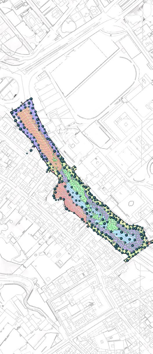
The narrow stretch of site for the park is located in Sarria, Barcelona. These narrow site is a concrete underpass with stretches of greenary on either sides. The aim of the proposal was to design an urban park with a freeflowing arrangement of spaces for public activities such as kids’ play areas, lush green areas for picnics, recreation trails, canopies and lighting. The park was designed with respect to its immediate context, where the site was extended to include the open areas that envelope the immediate buildings. This helped determine the organic allocation of spaces within the park.
Project Type // Planning and Landscape
Team
Mentors // Gerard Bertomeu, Marc Serra
Organic.
// Abiodun Shonibare, Arshita Ravindranathan, Bindhuja A. Reddy, Nerea Gardner Egusquizaga
Workflow // Program
Concept
The concept is to have free-flowing spaces where a medial axis would divide the park into public and semipublic zones. The main idea is to encroach the immediate context to open the site and break the linearity. One of the approaches to the design was to include the local species of lawn grass, flowering bushes and trees to create a green environment nested within the urban environment.


The main constraints while designing the park are: topography, drainage, wind direction, light and shadows, axis and circulation, and vegetation suitability.
Goals
• Create a buffer between the adjacent roads and the park
• Bringing in playfulness with colours and textures
• Creating spaces with a sense of safety
Methodology
New Terrain: Creating a new site where the site is extended, with an organic boundary
Layering: Building the site in layers with terraced slabs > cavities > intermediate site > final terrain
Analysis: Affects of the site slopes, drainage pattern, radiation, noise
Space Allocation: Defining the spaces with respect to results from the previous analyses
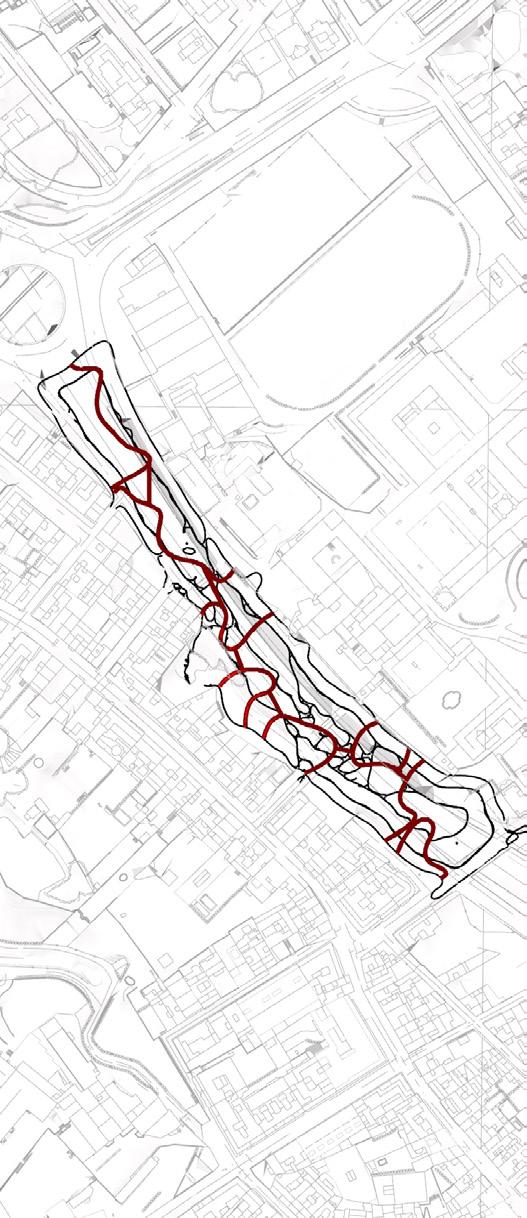
Path Definition: Main pedestrian axis for circulation, motorways, running tracks etc
Planting Pattern Definition: To understand the types of vegetation (grass cover-shrubstrees) using the height difference between the two surfaces (existing and proposed)
aerial view // overall site
layer 1 // terraced slabs // 450mm thick
layer 2 // cavities // 75x50mm modules layer 3 // intermediate surface // existing layer 4 // final surface // proposed site


SITE // LAYERING
Zone III picnic areas, lawns
Zone II rainwater harvesting ponds
Zone I
jogging, cycling tracks
Zone IV playground, sports areas
Zone III open air theatre
Zone II therapeutic or healing gardens
Path I
pedestrian (red coloured main axis to accentuate the paths)
Path II vehicular (mixed paving)
Entry vehicular only
Entries/exits pedestrian only // multiple
vegetation clustering // defining paths // space allocation


Design Features
Paths // Vegetation
The types of paths defined are pedestrian, tracks for jogging, cycling and walking, and motorways. The pedestrian and vehicular paths are accessed throughout the site from all four directions to reduce walking distances. The exercising tracks are placed in a slightly secluded place to separate the public and semi-public activities.


The patterning for vegetation is defined by clustering using factors like heights between intermediate and final surfaces, results from slope-drainageradiation analysis. The species were allocated using Lands Design.

Activity Allocation: Zoning
Zone I: Exercise zone like jogging tracks

Zone II: Natural zone like basins (ponds), therapeutic gardens, zen mounds
Zone III: Leisure zone like amphitheaters, picnic areas, lawns, sculptures
Zone IV: Recreation zone like sports areas, kids’ playgrounds, rock climbing installations etc
Activity Allocation: General
Some interesting components that can be used to create points of interest and to redirect focal points are:

1. Coloured canopies
2. Rock-climbing installations
3. Small fountains along the rainwater ponds/ basins
4. Interactive installations in the form of seating, sculptures, components for play areas
5. Playful mounds along picnic and play areas
Z2.Natural Zone // pond 1
Z4.Recreation Zone // play area 2

Z3.Leisure Zone // amphitheatre 3


Z3.Leisure Zone // picnic area 4


