
MONCKS COMPREHENSIVECORNERPLAN2017 Planning Commission Adopted May 16, 2017


TOWN STAFF
Tobie Mixon (Co-Chair)
James N. Law Jr.
Jeff Lord - Town Administrator
MONCKS CORNER TOWN COUNCIL
Mattie Gethers
Charlotte A. Cruppeninck (PC Ex-officio member)
Chadwick D. Sweatman Dr. Tonia A. Taylor
With assistance of the Berkeley-Charleston-Dorchester Council of Governments
MONCKS CORNER PLANNING COMMISSION
Johna T. Bilton
David A. Dennis, Mayor Pro-Tem
Doug Polen - Community Development Director
Rev. Robin McGhee-Frazier (Co-Chair)
Marilyn Baker - Clerk Treasurer
ACKNOWLEDGEMENTS
The 2017 Moncks Corner Comprehensive Plan was developed by a collaboration of the following:
Chris
KarynConnorRoscoeGriffinHaynesRyanNelsonSalisburyGrooms(Alternate)
Mayor Michael A. Lockliear


Pg. i2017 Moncks Corner Comprehensive Plan CONTENTS INTRODUCTION .......................................................................................................................................... 1 Background ...................................................................................................................................................................................... 1 Purpose 1 EXECUTIVE SUMMARY ............................................................................................................................... 3 Community Vision 3 Guiding Principles 3 Opportunities and Challenges .................................................................................................................................................... 3 Population Goals and Policies 4 Housing Goals and Policies 5 Cultural Resource Goals and Policies 6 Natural Resource Goals and Policies 7 Community Facilities Goals and Policies 8 Transportation Goals and Policies 10 Economic Goals and Policies 11 Land Use Goals and Policies ........................................................................................................................................................ 12 Priority Investment 17 Capital Improvement Projects 17 Program Initiatives 17 POPULATION .............................................................................................................................................. 19 Introduction 19 Population Trends 19 Demographic Characteristics 21 Households and Families ........................................................................................................................................................... 22 Educational Attainment 23 Income and Poverty 24 Projected Population and Household Growth 26 Population Growth in the Surrounding Area 28 Projected Household Growth 28 Population Goals and Policies 29 HOUSING ...................................................................................................................................................30 Introduction ................................................................................................................................................................................... 30 Housing Stock 30 Household Types 32
Pg. ii 2017 Moncks Corner Comprehensive Plan Future Housing Needs and Opportunities 34 Housing Goals and Policies 35 CULTURAL RESOURCES 36 Area History 36 Historic Structures and Sites ...................................................................................................................................................... 37 Cooper River Maritime Heritage Trails 42 Religious Institutions 42 Educational Institutions 43 Libraries and Museums 43 Recreational Facilities and Scenic Resources 43 Cultural Resource Goals and Policies 44 NATURAL RESOURCES ............................................................................................................................. 45 Climate ............................................................................................................................................................................................ 45 Endangered Species 45 Wetlands 47 Floodplains 49 Watershed 50 Aquifer 50 Geology and Soils 51 Berkeley County Green Infrastructure Plan 53 Tree Protection Ordinances ....................................................................................................................................................... 54 Natural Resource Goals and Policies 54 COMMUNITY FACILITIES .......................................................................................................................... 56 Introduction 56 Water Supply 56 Sewage and Wastewater Treatment 56 Private (on-site) Water and Wastewater Systems 57 Solid Waste and Recycling 58 Stormwater Management ......................................................................................................................................................... 58 Public Safety 58 Government Facilities 62 Health Care 63 Educational Facilities 63 Community Facilities Goals and Policies 65
Pg. iii2017 Moncks Corner Comprehensive Plan TRANSPORTATION .................................................................................................................................... 66 Introduction 66 Road Network 66 Transportation Alternatives 69 Bike and Pedestrian Infrastructure 69 Public Transit 70 Rail Network 72 Airports ........................................................................................................................................................................................... 72 Transportation Goals and Policies 73 ECONOMICS.............................................................................................................................................. 74 Introduction 74 Current Economic Base 74 Work Force/Labor Force Profile................................................................................................................................................. 76 Economic Goals and Policies 88 LAND USE ................................................................................................................................................. 89 Introduction 89 Existing Land Uses 89 Land Use Classifications 90 Existing Zoning 90 Future Land Uses 91 Land Use and Development Principles ..................................................................................................................................... 91 Implementation 94 Infill of Vacant Areas 94 Land Use Goals and Policies 95 PRIORITY INVESTMENT ELEMENT ........................................................................................................... 97 Enabling Legislation 97 Priority Investment 97
Moncks Corner Comprehensive Plan
Since Moncks Corner last updated its Comprehensive Plan in 2012, the Town has undergone a significant amount of growth – both residential and commercial. Based on recent and anticipated continued growth, the Town is taking proactive steps to nurture, guide, and direct future growth to maintain its high quality of life for Moncks Corner residents. A comprehensive plan provides a vision, clearly stated and shared by all, that describes the future of the community. It protects private property rights and also encourages and supports economic development. The plan inventories the Town’s existing conditions and amenities and assesses their functionality and relationship to one another. This inventory enables the Town to take stock of where they are today (strengths and weaknesses) and where they want to go (opportunities and challenges).
Background
The Town of Moncks Corner is approximately 33 miles from downtown Charleston, South Carolina. Moncks Corner is the county seat of Berkeley County and is also part of the Charleston-North Charleston Metropolitan Statistical Area (MSA). This MSA has experienced rapid growth over recent decades; from 2000 to 2010, the population swelled from 549,033 to 664,607, a 21.1% growth rate. As the Charleston region is growing rapidly, Moncks Corner has begun to experience significant population growth. According to the U.S. Census, the Town’s population grew from 7,885 to 9,307, from 2010 to 2016, which represents an 18.0% increase in less than a Outsidedecade.the
Town, Berkeley County is poised to add to current growth in the Charleston MSA with the arrival of the Volvo manufacturing plant, expected to be completed in 2018. Other manufacturers, such as AudioTechnica, an audio manufacturing company, have recently opened distribution centers near Moncks Corner.
The basis of the comprehensive planning process is in the South Carolina Local Government Comprehensive Planning Enabling Act of 1994 (SC Code §6-29-310 through §6-29-1200), which repealed and replaced all existing state statutes authorizing municipal planning and zoning. The 1994 Act establishes the comprehensive plan as the essential first step of the planning process and mandates that the plan must be systematically evaluated and updated. Elements of the plan must be reevaluated at least once every five years, and the entire plan must be updated at least once every ten years.
This plan was developed through a collaborative effort involving the Moncks Corner Planning Commission, community leaders, citizen input, and data research and analysis. Based on a study of existing conditions and public workshops, the Town has identified and defined its vision, goals, policies, priorities and implementation strategies. Purpose The comprehensive plan provides a primary basis for evaluating all future development, redevelopment and land use decisions in Moncks Corner, and assists the community in achieving the development patterns it desires, such as traditional neighborhoods, infill development, and those creating a sense of place, providing transportation alternatives, permitting mixed uses, protecting natural resources and accommodating
Pg. 12017
As of June 2016, Berkeley County has recruited $1.1 billion in new economic investments with more than 4,100 jobs announced in only 18 months.
INTRODUCTION
The plan is “long-range” in that it has a planning horizon of 20 years, and is “comprehensive” in that it covers the entire Town limits, plus it encompasses all the functions that make a community work and considers the of these functions. The Comprehensive Plan is based on the principle that if the Town knows where it wants to go, it possesses better prospects of getting there. It is intended to generate local pride and enthusiasm about the future of the community, thereby ensuring that citizens are involved with the of the by South
Carolina Planning Enabling Act, the following nine elements are included: • Population Trends and Characteristics • Housing • Economic Development • Natural Resources • Cultural Resources • Community Facilities • Transportation and Mobility Systems • Land Use • Priority Investment
Pg. 2 2017 Moncks Corner Comprehensive Plan economic growth.
plan. As directed
interrelatedness
the
implementation
A vision statement is a broad, overarching declaration of the desired future for the Town of Moncks Corner; it is a set of ideals to which the Town aspires. The following vision statement was developed based on input from the Planning Commission and other residents in the community: In the face of inevitable change, the Town of Moncks Corner will strive to remain a place where people live and work by choice, not by chance. By preserving its history and promoting its livability, recreational opportunities, and focus on the importance of family, the Town will maintain its small town character, values, and quality of life while accommodating the residents, visitors, and businesses brought by the region’s growth.
Community Vision
2. Moncks Corner will manage the development and expansion of infrastructure systems that adequately serve current and future residents
4. Moncks Corner will promote reinvestment in existing residential and commercial neighborhoods in order to provide options to a diverse population
1. Moncks Corner will maintain the family-oriented, small-town feel of the community that appeals to existing and future residents of all ages
EXECUTIVE SUMMARY
Guiding Principles
6. Moncks Corner will encourage and enhance recreational diversity and availability
5. Moncks Corner will maintain an exceptional level of safety and security for residents, as well as the protection and preservation of natural and cultural resources
3. Moncks Corner will support the development of businesses to give residents access to daily needs and provide jobs and opportunities
Through a deep assessment of the Town’s existing conditions; its challenges in meeting growing demands on facilities and services and its opportunities to continue enhancing the quality of life provided to residents, the Town’s Planning Commission has developed multiple goals, policies and recommended strategies for their implementation. A summary of the elements and recommended goals and policies are provided on the following pages. Timeframes for each: Ongoing, Short-term (1-3 years), Mid-term (5-10 years) and Long-term (10+ years) and responsible parties are identified.
Opportunities and Challenges
The vision is broken down into six guiding principles and, in later sections, into more detailed goals and policies for each element of the plan. As the comprehensive planning process was conducted, these guiding principles provided a unifying direction for the comprehensive plan and its implementation strategies. They are intended to be concise and to provide clear direction for the future of the Town of Moncks Corner. Guiding Principles applied in development of the 2017 Comprehensive Plan are:
Pg. 32017 Moncks Corner Comprehensive Plan
Population Goals and Policies
Population Goal: The Town seeks to balance new population growth with the natural environment and other resources that contribute to the community’s quality of life.
Population Policy 4: The Town will strive to increase the visibility of local police and engage law enforcement representatives in neighborhood and community (HOA) meetings to retain and enhance a sense of community in all neighborhoods.
P2.1 Prioritize planning for enhanced services and facilities that capitalize on the natural environment. Town Council Ongoing P2.2 Provide support to the Town’s Recreation Director in planning and implementation of programs identified as a need for current and future residents.
P1.3 Host public forums to discuss options for accommodating growth in ways that will least affect the community’s character and quality of life.
Population Policy 1: The Town will strive to plan for the expansion of residential areas to accommodate anticipated population growth by identifying areas where additional residences can be accommodated with minimal impacts on the environment and demand for extension of infrastructure.
PlanningTownCommissionCouncil Short-term
policies and implementation strategies:
Population Policy 2: The Town will strive to provide programs for residents of all ages at the senior center, recreation complex and schools to ensure that all demographic groups enjoy the quality of life that existing residents enjoy.
The Town’s population grew 32.5% during the first decade of the 21st century, outpacing growth in neighboring Goose Creek and Berkeley County as a whole. It is anticipated that the population will continue to grow as Moncks Corner becomes more integrated into the urbanized area of the region and new employment uses are developed with proximity to the new Volvo facility only 16 miles away. It is estimated that the population had already grown another 18% reaching over 9,300 residents in 2016. As such, it has adopted the following goals,
Pg. 4
PlanningTownCommissionCouncil Short-term
P1.2 Consider adoption of incentives to promote development in those areas preferred for development to protect the natural environment.
STRATEGIES RESPONSIBLE PARTIES TIMEFRAME
PlanningTownTownCommissionCouncilAdministrator Ongoing
PlanningTownTownCommissionCouncilAdministrator Ongoing
P1.1 Identify areas for infill development or potential annexation, planning for the provision of infrastructure accordingly.
2017 Moncks Corner Comprehensive Plan
STRATEGIES RESPONSIBLE PARTIES TIMEFRAME
Population Policy 3: The Town aspires to expand community facilities and services as needed to accommodate a growing population.
STRATEGIES RESPONSIBLE PARTIES TIMEFRAME
Housing Goals and Policies
STRATEGIES RESPONSIBLE PARTIES TIMEFRAME
Planning Commission Short-term H1.2 Research options and opportunities for development of housing appropriate in sizes and locations to enable seniors to “age in place”.
Housing Goal: The Town strives to ensure there will be adequate and affordable housing opportunities for residents of all ages and socio-economic status
PlanningTownCommissionCouncil Short-term
Town Administration Ongoing H2.3 Ensure that code enforcement is applied consistently to minimize the existence of inhabitable structures and unkempt vacant lots, including demolition and removal of condemned properties as needed.
Housing Policy 3: The Town will strive to encourage new development that is appropriate and compatible with neighboring uses to mitigate any potential negative impacts
PlanningTownCommissionCouncil Ongoing
Town Administration Ongoing
As the Town’s population increases and changes, the Town’s inventory has grown but not diversified. More significantly, the affordability of housing has decreased, with median home values that are only affordable to households earning 118% of the Town’s median household income. As such the Town has adopted the following goals, policies and implementation strategies:
H1.1 Review zoning districts allowing for residential uses to ensure these allow for a diversity of housing types at various densities and lot sizes. E.g. Amend PD district to allow for smaller units and higher densities
Housing Policy 2: The Town will strive to protect and enhance the quality of existing housing structures within the community
Housing Policy 1: The Town’s plans for future development will accommodate for the provision of diverse housing types, including workforce and senior housing.
H2.1 Conduct community wide assessments of existing neighborhoods to identify needed infrastructure repairs and upgrades in older neighborhoods to address potential health and safety issues as well as to protect property values
STRATEGIES RESPONSIBLE PARTIES TIMEFRAME
Town Staff Town Council Ongoing H2.2 Pursue grant funding for identified infrastructure needs in neighborhoods that qualify for CDBG funding and identify funding sources for neighborhoods that do not qualify.
H3.1 Provide sidewalks to ensure connectivity between neighborhoods
Pg. 52017 Moncks Corner Comprehensive Plan
CR1.1 Work with the historical society to promote public awareness of the Town’s historic nature and the value of historic structures.
CR3.1 Support collaborative efforts between the historical society and Corner Renaissance to establish historical based events (seasonal festivals, railroad depot activities, antique tours)
Cultural Resources Goal: The Town will participate in and support collaborative efforts to preserve and enhance its cultural resources for the benefit of future generations that will foster an even greater sense of community.
Cultural Resources Policy 3: The Town will strive to create new opportunities for cultural sites, events, and traditions in order to better meet the cultural and economic needs of the community.
STRATEGIES RESPONSIBLE PARTIES TIMEFRAME
Town Council Local Historical society Short-term
As Moncks Corner continues to evolve from a small rural town to part of the region’s urbanized area, its cultural resources provide a link to its heritage. Retention and preservation of these resources enable residents and visitors to understand what makes Moncks Corner unique. As such the Town has adopted the following goals, policies and implementation strategies:
Cultural Resources Policy 1: The Town will support efforts to re-establish the historical society as a vital organization.
CR1.2 Collaborate on identifying funding and resources to establish a historic marker program.
CR2.1 Support and assist in identification of resources to support assessment and designation and inclusion of various historic resources, including WPA housing and churches, on the National Register.
Cultural Resources Policy 2: The Town will support efforts to pursue available state and federal designations to protect its historic and cultural resources
CR2.2 Identify and consider adoption of incentives that promote maintenance, renovation and repair of identified historic structures and properties.
Town Council Short-term CR3.2 Promote efforts to create oral history presentations. Town Council Short-term
TownTownAdministrationCouncil Short-term
Pg. 6 2017 Moncks Corner Comprehensive Plan
Planning TownTownCommissionCouncilAdministration Short-term
Cultural Resource Goals and Policies
CR2.3 Consider the impact of new land development on identified and designated historic and archaeological or cultural resources to prevent damage or destruction during review of new development.
STRATEGIES RESPONSIBLE PARTIES TIMEFRAME
STRATEGIES RESPONSIBLE PARTIES TIMEFRAME
PlanningTownCommissionCouncil Ongoing
Planning TownTownCommissionCouncilAdministration Ongoing
CR3.4 Work with the S.C. Battleground Preservation Trust to enhance the Town’s standing as a Revolutionary War preserve. Town Council Local Historical Society Short-term
Pg. 72017 Moncks Corner Comprehensive Plan
CR3.3 Encourage well-planned, inclusive “community oriented” activities that promote a sense of identity and community pride among existing and future residents. Town PlanningAdministrationCommissionTownCouncil Ongoing
STRATEGIES RESPONSIBLE PARTIES TIMEFRAME
PlanningTownCommissionCouncil Ongoing
Town Council Short-term
As Moncks Corner and surrounding areas continue to develop, natural resources that protect its water, air, and natural habitats are threatened. Additionally, a number of threatened and endangered species in the area that rely on these habitats are increasingly in danger of becoming extinct. Retention and preservation of these natural resources also protect the community’s health and quality of life. As such, the Town has adopted the following goal, policies and strategies:
Town PlanningAdministrationCommissionTownCouncil Short-termongoingand
STRATEGIES RESPONSIBLE PARTIES TIMEFRAME NR2.1 Continue support of beautification planning and environmental protection efforts by the community.
Natural Resource Goals and Policies
STRATEGIES RESPONSIBLE PARTIES TIMEFRAME NR3.1 Consider establishment of a Tree Committee to promote and oversee a tree banking/planting program.
NR3.2 Review the Town’s tree protection ordinance for opportunities to further achieve its objectives.
STRATEGIES RESPONSIBLE PARTIES TIMEFRAME
NR1.1 Collaborate with Berkeley County to employ the Green Infrastructure model and identify areas within and surrounding Town for conservation.
Pg. 8 2017 Moncks Corner Comprehensive Plan
NR1.2 Identify development options to promote that will protect identified natural and wildlife habitat areas (e.g. conservation subdivisions) for inclusion in Town ordinances.
Town Council Town Administration Ongoing NR2.2 Develop and implement land development incentives for individual developers to create green spaces within each new neighborhood.
PlanningTownCommissionCouncil Short-term NR2.3 Explore ways to improve accessibility to natural resources in the vicinity of the town.
PlanningTownCommissionCouncil Short-term NR1.3 Market the benefits and opportunities of outdoor recreation activities that take advantage of the abundant natural resources surrounding the town such as boating, fishing, and bird watching
Natural Resources Goal: Future development of the Town will maintain a balance between development associated with growth and its natural resources
Town PlanningAdministrationCommissionTownCouncil Ongoing
Natural Resources Policy 2: The Town will collaborate to identify and implement strategies that create and enhance green spaces and passive parks within the community
Natural Resources Policy 3: The Town will consider adopting policies and programs comparable to those required for designation as a Tree City USA as a means of protecting and enhancing its tree canopy.
PlanningTownCommissionCouncil Short-term
Natural Resources Policy 1: The Town will collaborate with other public and private entities to preserve natural areas and green spaces within the community.
Town Council Town Administration Short-term NR3.4 Require street and roadside trees as part of road improvements and adjacent to new developments (U.S. 52 median plantings).
NR3.3 Collaborate with the downtown merchants and Main Street program to plant trees along Main Street for shade.
Town Council Town Administration Short-term NR4.2 Review Land Development regulations to ensure soil and erosion control structures, etc. are addressed.
PlanningTownCommissionCouncil Short-term
STRATEGIES RESPONSIBLE PARTIES TIMEFRAME
Pg. 92017 Moncks Corner Comprehensive Plan
NR4.1 Develop and disseminate public information on the benefits of wetland and floodplain area protection.
STRATEGIES RESPONSIBLE PARTIES TIMEFRAME
Natural Resources Policy 4: The Town will strive to provide information on applicable federal, state and county regulations to ensure that sensitive natural areas are conserved and/or impacts mitigated during adjacent land development activities
PlanningTownCommissionCouncil Short-term
Town Council Planning Commission Town Administration Ongoing
subdivision
STRATEGIES RESPONSIBLE PARTIES TIMEFRAME
Pg. 10 2017 Moncks Corner Comprehensive Plan
Community Facilities Goals and Policies
TownBerkeleyTownCommissionCouncilCountyEngineeringPublicWorks
• Inventory and identify areas of need for expansion of sidewalks in existing neighborhoods, coordinating with the regional bike/ped plan
The Town is committed to managing the development and expansion of its infrastructure to serve current and future residents, including available and diverse recreation facilities. It is also committed to providing an exceptional level of safety and security for its residents. As such the Town has adopted the following goal, policies and strategies:
Planning
Community Facilities Goal: High levels of public service through needed infrastructure and programs to meet the needs of a growing population will be provided by the Town.
Community Facilities Policy 2: Town departments responsible for public safety and other facilities will periodically assess demands and identify needs for expansion of personnel, equipment and/or facilities to ensure protection of residents and properties.
CF2.2 Coordinate with county and state agencies to enforce stormwater management regulations, maintain ditches and streets, and expand hiking/walking facilities to serve Establishresidentsaninventory of easements recorded to ensure access to ditches and public accessways
CF1.1 Identify areas for infill development or potential annexation, planning for the provision of infrastructure accordingly.
STRATEGIES RESPONSIBLE PARTIES TIMEFRAME
CF2.1 Coordinate and maintain a Capital Improvement Program for needed infrastructure upgrades and improvements (see Priority Investments) such as, but not limited to:
• Maintenance, repair and improvement of neighborhood park facilities, including playground equipment, and passive recreation areas
Town PlanningAdministrationCommissionTownCouncil Short-term/Ongoing
Community Facilities Policy 1: The Town will collaborate with responsible agencies to plan for the expansion of public infrastructure to accommodate anticipated population growth, while ensuring existing infrastructure is maintained, repaired and upgraded where needed.
• Completion of the Regional Recreation Complex to include basketball facilities and an amphitheater/ performing arts space
• Construction of Fire Station 2 in the Foxbank
Ongoing
Town Administration Ongoing CF2.4 Evaluate Town and County requirements to ensure developers provide adequate recreation areas and facilities in each new subdivision.
PlanningTownCommissionCouncil Short-term/Ongoing
Town Council Ongoing
CF3.2 Collaborate with Trident Technical College to identify potential labor force demands in upper Berkeley County and provide programs for required certifications or coursework to increase utilization of the existing campus.
Pg. 112017 Moncks Corner Comprehensive Plan
STRATEGIES RESPONSIBLE PARTIES TIMEFRAME
Town Council Local Chamber Short-term CF3.3 Pursue partnerships to expand residents’ access to four-year post-secondary educational programs.
CF3.1 Support efforts by private healthcare providers to expand services in the Town limits.
Town Council Ongoing
STRATEGIES RESPONSIBLE PARTIES TIMEFRAME
CF2.3 Coordinate needs identified by Town departments with available funding sources, including but not limited to CDBG grants for infrastructure in identified lowmoderate income neighborhoods
Community Facilities Policy 3: The Town will collaborate with other agencies to support development of adequate healthcare and educational institutions within the community.
PlanningTownCommissionCouncil Short-term T1.4 Ensure the Town’s public works department has resources to maintain street lighting for vehicular and pedestrian safety.
Pg. 12 2017 Moncks Corner Comprehensive Plan
TownTownPublicAdministration/WorksCouncil Ongoing
Transportation Policy 1: The Town will coordinate with SCDOT, Berkeley County, and CHATS to plan and develop transportation system improvements
T1.2 Participate in development of the CHATS LRTP to ensure inclusion of transportation improvements needed within the Town environs and region, including alternative evacuation routes.
PlanningTownCommissionCouncil Short-term T1.3 Consider adopting requirements for joint access agreements between commercial properties along the Town’s major arterials/commercial corridors.
Town Administration Short-term Transportation Policy 2: The Town will promote use of programs to reduce the travel demand generated by its residents and consequently improve its mobility.
STRATEGIES RESPONSIBLE PARTIES TIMEFRAME
STRATEGIES RESPONSIBLE PARTIES TIMEFRAME
T2.1 Support TriCounty Link’s services by distributing information on the regional transit systems, particularly commuter services to the public.
T1.1 Coordinate with Berkeley County and SCDOT on an annual basis to review pavement conditions of the existing network and prioritize resurfacing projects
Transportation Goals and Policies Encouraging a multimodal transportation system that promotes community and economic development and provides a sustainable balance between pedestrian, bicycle and automotive traffic is critical to the future of the Town. As such the Town has adopted the following goal, policies and strategies:
TownTriCountyTownAdministrationCouncilLink Ongoing T2.2 Distribute information to residents on options for reducing reliance on individual vehicles, including use of the Trident Rideshare program. TownTriCountyTownAdministrationCouncilLink Ongoing
Transportation Goal: The Town will be served by a multimodal transportation system to accommodate existing and projected travel demands.
Town Council Ongoing T1.5 Coordinate with the CHATS WalkBikeBCD plan to identify gaps in the existing sidewalk system and potential funding sources for construction of new or improved sidewalk facilities particularly for linkages to school and transit stop locations.
PlanningTownCommissionCouncil Short-term T1.6 Coordinate with TriCounty Link to identify and secure needed park-n-ride facilities.
Pg. 132017 Moncks Corner Comprehensive Plan
Transportation Policy 3: Conduct community-wide assessments of existing neighborhoods to identify needed mobility infrastructure repairs and upgrades in older neighborhoods to address potential health and safety issues as well as to protect property values
STRATEGIES RESPONSIBLE PARTIES TIMEFRAME
T3.1 Pursue grant funding for identified infrastructure needs in neighborhoods that qualify for CDBG support. Town Council Ongoing
STRATEGIES RESPONSIBLE PARTIES TIMEFRAME
Town COGTownAdministrationCouncilMobilityManager Ongoing
T2.3 Provide information to businesses and employers in the Town on options for reducing demands on the transportation by their employees such as carpooling, vanpooling, flex scheduling, and telecommuting.
Economic Goals and Policies
Economics Goal: There will be adequate employment opportunities within the Town and a labor force that meets the needs of those industries.
Town PlanningAdministrationCommissionTownCouncil Ongoing
STRATEGIES RESPONSIBLE PARTIES TIMEFRAME E1.1 Identify and make available resources to support local entrepreneurs seeking to start or expand businesses. (Incubators, accelerators, capital investment support)
Pg. 14 2017 Moncks Corner Comprehensive Plan
Economics Policy 1: The Town will collaborate with its partners, including the Berkeley County’s Economic Development department and Berkeley Chamber, to identify and recruit new industries to existing industrial facilities that will increase employment opportunities within the Town limits.
E1.3 Identify industries that will complement larger regional industries (e.g. Volvo, Boeing, Daimler) for recruitment to available sites within or adjacent to the Town TownTownAdministrationCouncil
Town PlanningAdministrationCommissionTownCouncil
Short-term E1.5 Encourage the redevelopment of vacant and/or underutilized land and structures within established commercial corridors and the downtown to maintain and/or foster stability of these areas
E1.4 Identify land for annexation (e.g. Gates Rubber) adjacent to or within close proximity to attract potential employers (industrial, etc.) within the Town and approach owners about annexation
Ongoing
STRATEGIES RESPONSIBLE PARTIES TIMEFRAME E2.1 Collaborate with the Berkeley County School District to offer curriculums that prepare High School graduates to enter the labor force Town Council Ongoing
As major employment centers are developed closer to the Town, there will be increased opportunities to recruit new employers to locations within or adjacent to Town that can employ its existing and future labor force. Attracting employers requires collaboration to market available site and facilities while developing and retaining a labor force with relevant training and skills. As such the Town has adopted the following goals, policies and strategies:
TownTownAdministrationCouncil Ongoing E1.2 Retain a business-friendly environment to support potential entrepreneurs and businesses through licensing and permitting processes (information, application processes, etc.)
Ongoing
TownTownAdministrationCouncil
Economics Policy 2: The Town will support and participate in development of workforce development initiatives to ensure its labor force is prepared for employment in growing industrial sectors within or near the Town through educational or training programs.
STRATEGIES RESPONSIBLE PARTIES TIMEFRAME
Economics Policy 3: The Town will re-establish its downtown area as a community focal point providing a mix of retail, service, and residential uses in a pedestrian friendly environment
PlanningTownCommissionCouncil Ongoing
E3.1 Implementation strategies recommended in the final report of the Corner Renaissance report will be supported by the Town in collaboration with the downtown merchants association
STRATEGIES RESPONSIBLE PARTIES TIMEFRAME
Pg. 152017 Moncks Corner Comprehensive Plan
E2.2 Collaborate with Trident Technical College to identify potential labor force demands in the Town and upper Berkeley County and provide programs for required certifications or coursework to increase utilization of the existing campus
PlanningTownCommissionCouncil Short-term
Town PlanningAdministrationCommissionTownCouncil Short-term/Ongoing
E2.3 Coordinate with TriCounty Link to develop and provide transportation options to ensure access to training programs and future employers.
LU2.1 Develop and implement an annexation strategy that is supported by the Comprehensive Plan and Future Land Use Map to achieve a cohesive approach towards infrastructure concurrency Town Council Short-term
LU2.2 Encourage future development and expansion of the town in areas contiguous to developed areas in concert with a utility extension policy/plan that is sequential and phased.
Land Use Policy 2: The Town will continue efforts to guide the growth of land adjacent to existing boundaries.
Pg. 16 2017 Moncks Corner Comprehensive Plan
STRATEGIES RESPONSIBLE PARTIES TIMEFRAME
Land Use Goals and Policies
Town PlanningAdministrationCommissionTownCouncil Ongoing LU1.4 Review, update and maintain zoning ordinance and land development regulations that support the Comprehensive Plan and ensure new growth reflects the density and quality of development desired by the Town as stated in the Plan
Town PlanningAdministrationCommissionTownCouncil Ongoing
LU1.1 Plan and provide infrastructure in accord with land use areas depicted on the Future Land Use map to ensure adequate and efficient support of anticipated growth
Land Use Policy 1: The Town will guide land use patterns, encourage new growth, in areas that maximize efficient use of existing infrastructure and investments in expanded infrastructure.
STRATEGIES RESPONSIBLE PARTIES TIMEFRAME
The Plan does not attempt to predict exactly how many homes or businesses will locate in a certain land use area, but identifies areas suitable for the development of certain land use types with a goal of accommodating anticipated growth in a coordinated and orderly fashion. As such, the Town has adopted the following goals, policies and strategies to guide this development: Land Use Goal: The Town will plan for inevitable growth by promoting orderly and efficient land use patterns and development that will enhance the quality of life for future generations.
Town PlanningAdministrationCommissionTownCouncil Short-term/Ongoing
PlanningTownCommissionCouncil Short-term/Ongoing
Town PlanningAdministrationCommissionTownCouncil Ongoing
Town PlanningAdministrationCommissionTownCouncil Ongoing LU1.3 Encourage infill and redevelopment of vacant and/or blighted properties to maximize use of existing infrastructure, to fill existing and light industrial spaces where available, and to transition existing manufactured housing areas to permanent structures.
LU2.3 Collaborate with Berkeley County planning to ensure new development in areas surrounding the town are consistent with abutting land uses within the Town.
LU1.2 Coordinate public facilities and services plans with land use planning to promote more compact development and encourage infill and redevelopment opportunities when possible.
LU3.1 Review plans for new development to ensure consistency in character and scale with the future land use map and neighboring developments Review zoning and land development regulations to ensure procedures are in place to ensure this consideration is given to applications
Town PlanningAdministrationCommissionTownCouncil Ongoing LU3.5 Coordinate with Berkeley County and SCDOT to establish parameters for requiring sidewalks within new developments
STRATEGIES RESPONSIBLE PARTIES TIMEFRAME
Land Use Policy 3: The Town will promote development that is appropriate and compatible with neighboring uses
STRATEGIES RESPONSIBLE PARTIES TIMEFRAME
LU2.4 Collaborate with Berkeley County on zoning issues that have direct impact on the Town
Short-term
Short-term
STRATEGIES RESPONSIBLE PARTIES TIMEFRAME
See Moncks Corner Future Land Use Map on page 19
Town PlanningAdministrationCommissionTownCouncil
Consider adoption of shared “extra territorial jurisdiction” within a one mile radius of the Town limits
Land Use Goal: The Town will continue to develop with well-planned, inclusive communities and neighborhoods that provide residents with a sense of identity and promote the small-town character for which Moncks Corner desires to be known.
Town PlanningAdministrationCommissionTownCouncil
Short-term LU3.2 Review and develop, if needed, regulations that encourage densities and designs for new development that improve and enhance existing conditions in all areas of the town Town PlanningAdministrationCommissionTownCouncil Short-term
Short-term
Pg. 172017 Moncks Corner Comprehensive Plan
PlanningTownCommissionCouncil
Land Use Policy 4: The Town will promote development that is sensitive to identified green infrastructure areas and balances the built environment with its natural resources
LU4.1 Encourage conservation of natural and green spaces as part of new developments where appropriate as a means of providing areas for exercise, mitigating incompatibilities, or managing stormwater
PlanningTownCommissionCouncil Ongoing
LU3.4 Continue to implement lot and building standards, along with landscaping and buffering requirements, to ensure impacts from adjacency of incompatible uses are mitigated.
LU3.3 Provide incentives for developments creatively providing housing in close proximity to existing and future employment centers (inclusionary development).
Town PlanningAdministrationCommissionTownCouncilCountyEngineering
STRATEGIES RESPONSIBLE PARTIES TIMEFRAME
LU5.3 Encourage larger, auto-oriented uses to locate in other existing commercial areas as identified on the Future Land Use Map
Town PlanningAdministrationCommissionTownCouncil Ongoing
Pg. 18 2017 Moncks Corner Comprehensive Plan
LU5.1 Continue to invest in support of the Main Street program and its adopted objectives.
TownTownAdministrationCouncil Ongoing
LU5.5 Continue to identify opportunities to ensure provision of adequate public parking and recommended streetscaping improvements in the downtown Town PlanningAdministrationCommissionTownCouncil Short-term
PlanningTownCommissionCouncil Short-term
Land Use Goal: The Town will re-establish downtown area as a community focal point providing a mix of retail, service, and residential uses in a pedestrian friendly environment
Land Use Policy 5: The Town will focus on strengthening its Town Center to serve as a focal point for community and commercial activities
LU4.2 Consider requirements for “set asides” during land development review that are appropriate and dedicated toward expansion of neighborhood recreational amenities
PlanningTownCommissionCouncil Short-term
LU5.4 Explore methods and programs for assisting local business owners in making private investments in the downtown area, such as information on storefront rehabilitation grants and loans.
LU5.6 Pursue opportunities to implement the planning and design recommendations of the Corner Renaissance charrette, adopting recommended design guidelines
TownTownAdministrationCouncil Short-term
LU5.2 Establish land use regulations that encourage uses in the downtown area that serve residents and attract visitors, including retail, professional office/service, and residential uses.
PlanningTownCommissionCouncil Ongoing
Town PlanningAdministrationCommissionTownCouncil Short-term
LU4.3 Encourage new development in locations that are suitable for development in an effort to minimize impacts to natural or cultural resources, particularly areas identified in the County’s Green Infrastructure Plan.
STRATEGIES RESPONSIBLE PARTIES TIMEFRAME
Pg. 192017 Moncks Corner Comprehensive Plan Note: See Land Use section for description of Future Land Use areas X REMBERT C DENN I S BLVD L I V E O A K A V O 6 O 402 £ ¤ 52 £ ¤ 17A £ ¤ 17A REMBERTC DENNIS BLVD Proposed Future Land Use (FLU) Areas HD Residential Nodes Recreation Node Commercial Nodes X Mixed Use Node Low Density Residential Medium Density Residential High Density Residential Corner Renaissance Commercial Employment Public/Institutional Recreation/Open S pace Proposed Employment Proposed High Density Residential Proposed Recreation/Open S pace Berkeley County Future Land Use Conservation/Recreation Constrained Residential Growth Employment Low Density S uburban Moderate Density S uburban M o n c k s C o r n e r F u t u r e L a n d U s e M a Mp o n c k s C o r n e r F u t u r e L a n d U s e M a p¯ 0 1 02 5 Miles Main St LiveOakAve Disclaimer: This map is graphical representation of data obtained from various sources. All efforts ha been made to warrant the accuracy of this map. However, the BCD Council of Governments disclaims all responsibility and liability for the use of this map. 5790 CASPER PADGETT WAY N. CHARLESTON, SC 29406 TEL (843) 529-0400 WWW.BCDCOG.COM


The Town has prioritized certain capital improvements and programs for investment using likely federal, state and local funds available during the next ten years. These recommendations should be coordinated with adjacent and relevant jurisdictions and agencies affected by or that have planning authority within the Town of Moncks Corner.
Capital Improvement Projects
Recreation Facilities: Several recreation-related projects have been identified in development of this plan which might be eligible for various funding opportunities through the SCPRT. In addition to potential funding for completion of the Regional Recreation Complex and/or neighborhood park facilities, SCPRT administers a “Sports Tourism Advertising and Recruitment Grant” program that can be used to develop and/or implement strategies aimed at recruitment of new large-scale sporting events to use the venue. The purpose of this grant is to provide financial assistance for the recruitment of new sporting events that will generate a significant additional economic impact to local communities. The Department’s smaller Park and Recreation Development (PARD) fund is a noncompetitive, reimbursable grant program for local government to provide enhanced recreational opportunities. More specifically, the Department’s Recreational Trails Program (RTP) is designed to help provide and maintain recreational trails for both motorized and non-motorized recreational trail use to implement recommendations for facilities in the Town outlined in the regional Bike/Ped Master Plan WalkBike BCD.
Priority Investment
Pg. 20 2017
Program Initiatives
Economic and Workforce Development: Feasibility studies for development of an incubator or accelerator facility to support local entrepreneurs or to develop/redevelop large industrial sites in the Town may be eligible for funding from the U.S. Economic Development Agency (EDA) planning and technical assistance program. Such studies may assess the feasibility of job development, develop a site master plan, or an economic development strategy to recruit businesses and promote job creation within the Town’s commercial or employment areas.
Infrastructure Repairs and Upgrades: As noted in the Community Facilities element, the infrastructure in several of the Town’s neighborhoods is aged and inadequate. In those areas where a majority of households are designated as Low-to-Moderate Income (LMI), HUD Community Development Block Grant funding can be sought to fund significant repairs or upgrades of water, sewer, drainage and/or sidewalk facilities. Similarly, these funds may be used for “community enrichment projects” that seek to incentivize infill and redevelopment of neighborhoods with significant vacant properties and/or blight.
Transportation Improvements: Significant road improvements that improve mobility along the Town’s major arterials, which play a role in the regional transportation network, may be funded through the Berkeley County Transportation Sales Tax program, C-Funds allocated to the County by the SCDOT and/or CHATS Guideshare funding allocations. Currently SC6 (Main Street), as well as portions of 17A, are slated for repaving through use of the County’s two funding programs. During development of the CHATS Long Range Transportation Plan, projects of significance should be identified for priority ranking to be listed in the LRTP making them eligible for Guideshare funding in the future. Likewise, the Town should continue to seek funding for improvement of other transportation facilities including sidewalks, crosswalks, etc. that enhance mobility for non-motorists in the downtown area.
Cultural and Natural Resources: The Town’s historic resources have generally been included in the County’s historic survey. The last countywide survey was conducted in the late 1980s. Historic Preservation Grants are federal funds from the U.S. Department of the Interior, National Park Service, and administered by the South
Moncks Corner Comprehensive Plan
Downtown Development: The downtown revitalization initiative, Corner Renaissance, is in the process of finalizing a program of initiatives that will address the design and development of the downtown area. In addition, this program will address recruitment of new businesses and the branding and marketing of the Town’s Main Street. Funding for these initiatives can be sought from many of the sources discussed in this element – SCDOT and Transportation Sales Tax funding for streetscape improvements, potential EDA and SCPRT funding of marketing efforts and CDBG funding for community enrichment projects.
Carolina Department of Archives and History, State Historic Preservation Office (SHPO). Applications for funding of historic resource survey and planning projects are accepted annually. The Town might seek these funds individually, or in collaboration with the County, to conduct an updated survey of resources. Protection and enhancement of the Town’s tree canopies has been discussed as an element that could not only contribute to management of stormwater, but to provide shade and visual improvements in public spaces. The S.C. Forestry Commission’s Community Forestry program may offer technical assistance in development or improvement of a comprehensive tree protection and planting program for the Town.
Pg. 212017 Moncks Corner Comprehensive Plan
Source:
Introduction
Data from the population element helps determine how current and projected population growth may affect housing, land use, economic development, community facilities, and more.
Population characteristics and growth trends provide essential information that guides the comprehensive planning process. Reviewing the Town’s historic and current population figures helps to develop an understanding of how community needs change as demographics shift. Tracking population changes also helps to project future population and anticipate necessary revisions to goals and policies established in previous comprehensive plans and other studies. The population element presents Moncks Corner’s population trends and demographics including diversity, household characteristics, educational attainment, income and poverty, and more. This element serves as a basis to assess current and future needs of the Town in subsequent sections of this comprehensive plan.
Historic Population Trend: 1880-2010
US Census Bureau
Population Trends
118 202 232 309 623 1,165 1,818 2,030 2,314 4,179 5,607 5,952 7,8858,0004,0003,0002,0001,00005,0006,0007,0009,000 1890 1900 1910 1920 1930 1940 1950 1960 1970 1980 1990 2000 2010
Pg. 22 2017 Moncks Corner Comprehensive Plan: Population
Although it lies within the rapidly growing Charleston-North Charleston, SC Metropolitan Statistical Area (MSA), Moncks Corner has remained a small, mostly rural town up until recent decades. The Historic Population Trend Chart shows population growth dating back to the 1890 U.S. Census, shortly after the Town’s charter in 1885. Population grew gradually through the early- to mid-20th Century, but began to experience higher rates of population growth beginning in the 1970s. The largest increase was from 2000 to 2010 when the Town’s population increased from 5,952 to 7,885 residents. A significant portion of the growth during that time period can be attributed to the annexation of new areas being developed with residential subdivisions during that period.
POPULATION
The chart below compares population growth in Moncks Corner to Berkeley County since 1890. The chart uses different scales for the left and right y-axes in order to compare the change in population for the two geographic areas. The Town and County have experienced similar growth rates since 1970. Berkeley County’s growth can be attributed primarily to the growth of its larger municipalities; Goose Creek and Hanahan and the portions of Summerville and Charleston, which fall in Berkeley County. The Town of Moncks Corner is located in a transition area between the urbanized area of the Charleston Metro area and the rural areas in the northern half of the County.
Population Growth: 1890-2010 Moncks Corner Berkeley Co unty 1890 55118,428 1900 30202,454 1910 23232,487 1920 22309,558 1930 22623,236 1940 271,165,128 1950 301,818,251 1960 382,030,196 1970 562,314,199 1980 944,179,727 1990 125,6078,770 2000 145,9522,650 2010 177,8857,840 20,00 US
Pg. 232017 Moncks Corner Comprehensive Plan: Population
Source: US Census Bureau Moncks Goose Creek Summ ervill e County
Berkeley
According to the U.S. Census Bureau, the household population of Moncks Corner was 5,607 in 1990, 5,952 in 2000, and 7,885 in 2010, representing an increase of 6.2% between 1990 and 2000 and an increase of 32.5% between 2000 and 2010. As can be seen in Population Change Chart, Moncks Corner’s population growth between 2000 and 2010 outpaced Berkeley County and Goose Creek, but was lower than the 56.4% growth experienced by Summerville, a large Town that falls in both Berkeley and Dorchester Counties.
Census Bureau Population Change: 2000-2010 32.5% 23.0% 56.4% 24.7%6050403020100%%%%%%%
2001801601401201080,060,040,0000000000,000,000,000,000,000,000 0 108,4,3,2,1,0000000000005,0006,0007,0000009,000,000 Moncks Corner Berkeley County Source:
Corner
Source: US Census Bureau, 2010-2014 American Community Survey
Pg. 24 2017 Moncks Corner Comprehensive Plan: Population
Demographic Characteristics
According to 2014 American Community Survey 5-Year Estimates, the median age of Moncks Corner residents is 35.8, which is slightly younger than the national median age of 37.4. The chart below shows the age distribution of residents by gender in Moncks Corner. The Town has slightly more females than males. This difference is attributed to a couple of the older age groups, which are primarily skewed more towards females.
An age-sex pyramid with an hourglass shape would typically indicate slow, or even negative, growth; however, with recent annexations and migration into the Town, the population is still likely to climb even if birth rate and family size decrease.
The diversity of a community can be described in terms of the distribution of age, sex, and race of its residents.
MALE FEMALE Age Distribution by Gender: Comparison (2014 ACS) Under 5 5 to 9 year s 10 to 14 year s 15 to 19 year s 20 to 24 year s 25 to 34 year s 35 to 44 year s 45 to 54 year s 55 to 64 year s 65 to 74 year s 75 to 84 year s 85 years and Over
Pg. 252017 Moncks Corner Comprehensive Plan: Population
Households and Families
Average household size, however, remained stable at about 2.6-2.7 persons per household, with just a slight decrease over the past decade. This is in line with a long-standing national trend towards smaller households, which has been driven by an increased prevalence of one-member households and families electing to have fewer children. Racial Composition (2010)
The Racial Composition Chart, below, depicts the Town’s racial composition as of the 2010 U.S. Census.
Over half of the population is White Alone (58%) and just over one-third of the population is Black or African American Alone (36%). The remaining 6% is divided between: American Indian or Alaska Native Alone (less than half of one percent), Asian or Pacific Islander Alone (1%), Some other Race (3%), or Two or More Races (2%). Over 5% of residents (of any race) were of Hispanic or Latino ethnicity.
Source: US Census Bureau, 2010-2014 American Community Survey
Household and family information help describe how the population of an area is distributed among occupied housing units. A family consists of a householder and one or more other persons living in the same household who are related to the householder by birth, marriage or adoption (U.S. Census Bureau). A household includes all the persons who occupy a housing unit. The occupants may be a single family, one person living alone, two or more families living together, or any other group of related or unrelated persons who share living arrangements (U.S. Census Bureau).
As seen in the Households Characteristics chart, the number of households and families living within the Town has increased over the past two decades. The number of households increased from 2,017 in 1990 to 2,103 in 2000 to 2,851 in 2010, while the number of families increased from 1,473 in 1990 to 1,492 in 2000 to 1,999 in 2010.
White Alone Black or AmericaAmericaAfricannAlonenIndian or Alaska Native Alon e Asian or Pacific Islander Alone Some Other Race TwAloneoor More Races 58% 36% 0%1%3% 2%
Pg. 26 2017 Moncks Corner Comprehensive Plan: Population Educational Attainment Educational attainment measures the highest level of education achieved by an individual. This statistic is important to existing and potential employers. Companies are attracted to areas with residents whose education, experience, and skills match their needs as an employer. This relationship is explored more in the Economic element, however as shown in the professionalhaveCornerdegree.sortaboutschoolhaveCorneraboutAttainmentEducationalchart,85.6%ofMoncksadultresidentscompletedhighoraboveand35%havesomeofpost-secondary4%ofMoncksresidentsagraduateordegree. Household Characteristics Households Families Household Size 199 0 200 0 201 0 Households 2,017 2,103 2,85 1 Families 1,47 3 1,492 1,99 9 Household Size 2.69 2.61 2.6 3.2.2.1.1.0.0.05050501,50000001,5002,0002,5003,000 Source: US Census Bureau Educational Attainment: Moncks Corner (2014) 6.0%8.4% 34.5% 30.5% 9.2% 7.4% 4.0% Less than 9th grad e 9th to 12th grad e (no diploma) High school graduate (includes equivalency) Some college (no degree) Associates degree Bachelor's degree Graduate or professional degree Source: US Census Bureau
Summerville and Goose Creek are closer to the major job centers in the Charleston metro area, which likely accounts for their higher household incomes. As a point of reference, the rural Berkeley County towns of Bonneau ($38,646) and Jamestown ($40,000) have median household incomes that are below Moncks Corner.
Source: US Census Bureau, 2010-2014 American Community Survey
Educational Attainment: Comparison
$40,$30,$20,$10,000000000000$50,000$60,000$70,000
Pg. 272017 Moncks Corner Comprehensive Plan: Population
Less than 9th grade 9th to 12th grade (no diploma) High school equivalency)(igraduatencludes Some college (no degree )
The Educational Attainment Comparison chart compares educational attainment of Moncks Corner to nearby municipalities, Berkeley County, and South Carolina. Moncks Corner displays lower levels of educational attainment at the post-secondary level, especially looking at the percentage of residents who have attained a bachelor’s degree or higher.
Income and Poverty
The estimated median household income in Moncks Corner for 2014 was $44,828. This figure is close to the median for the state of South Carolina ($45,033), but falls below the median amounts for Berkeley County ($51,844), Summerville ($55,290), and Goose Creek ($62,107).
35.0%30.0%25.0%20.0%15.0%10.0%5.0%0.0%
Associatesdegree Bachelor'sdegree Grad uate or professionaldegree
Moncks Corner Goose Creek Summ ervill e Berkeley County South Carolina
$44,828 Moncks Corner $62,107 Go ose Creek $55,290 Summ erville $51,844 Berkeley Co unty $45,033 South Carolina
Source: US Census Bureau, 2010-2014 American Community Survey
Median Household Income: Comparison
Census Bureau determines poverty thresholds based on three criteria: size of family, number of related children, and age of householder. According to 2014 American Community Survey estimates, 16.7% of (1,390 individuals) of Moncks Corner residents are living below the poverty level. Out of these 1,390 individuals, 31% are under 18 years old and 4% are 65 years and over.
Income Comparison:
$40,$30,$20,$10,000000000000$50,000$60,000$70,000
Source: US Census Bureau, 2010-2014 American Community Survey
The(34.2%).U.S.
18 years31% 18 to 64 years65% Age
200
However, the median household income in Moncks Corner had the most significant increase between 2000 and 2014 compared to the rest of Berkeley County municipalities with a 47.4% increase. By comparison, Goose Creek households also had a median income increase (38.3%) greater than that of Berkeley County as a whole
Moncks Corner Go ose CreekSummerville Berkeley Co unty South CarolinaUSA
Pg. 28 2017 Moncks Corner Comprehensive Plan: Population
65 years and over 4%
Family Income 201
Source: US Census Bureau, 2010-2014 American Community Survey Under Distribution
Median Family 2000 & 2014 0 Me dian 4
Me dian Family Income
of Town Residents Living in Poverty: 2014
The South Carolina Revenue and Fiscal Affairs Office estimates that Berkeley County’s population will increase another 23% from 177,843 in 2010 to 219,100 by 2030. As the job centers and economic hubs of Charleston, North Charleston, and Summerville grow, it can be expected that towns on the urban fringe such as Moncks Corner will experience similar growth as housing demand increases. Likewise as opportunities for employment increase within and nearby Moncks Corner, such as the Volvo manufacturing plant set to open in Berkeley County 16 miles from the center of town by 2018, even more significant growth in Moncks Corner than previously experienced is anticipated.
The United States Department of Transportation (DOT) Federal Highway Administration (FHWA) uses traffic analysis zones (TAZs) as a basic geographic unit for inventorying demographic data and land uses within a study area. The Berkeley Charleston Dorchester Council of Governments (BCDCOG) and the Charleston Area Transportation Study (CHATS) maintain a travel demand model that forecasts demographic changes based on AlthoughTAZs. the boundaries of the Town of Moncks Corner do not identically correspond to a discrete TAZ or set of TAZs, projecting demographic growth for the TAZs that capture the majority of Moncks Corner helps to depict forecasted changes in population, households and employment within the Town and its immediate surrounding area. The Moncks Corner TAZ Map below depicts projected population in various areas of the Town and immediate surrounding in 2040. 7,885 9,307 10,437 0 2,00 0 4,00 0 6,00 0 8,00 0 10,0 00 12,0 00 2010 2016 2021 Population Projections in Moncks Corner (2000-2021)
Source: US Census Bureau, 2010-2014 American Community Survey; ESRI Business Analyst
The US Census Bureau’s American Community Survey data estimates that the population of the Town had already grown to 9,307 in 2016 (an 18% increase). According to ESRI Business Analyst Online (BAO), Moncks Corner’s population is projected to grow to 10,437 residents by 2021, an increase of 1,130 or another 12%. Given ACS data is collected for estimations of one, three and five-year periods through survey, this method limits the projection horizon. Another method that is also commonly used for population projections is the utilization of a travel demand model based on traffic analysis zones (TAZs), which captures surrounding population growth adjacent, but outside the Town limits.
Pg. 292017
Moncks Corner Comprehensive Plan: Population Projected Population and Household Growth
The population could also increase more substantially if the Town continues to extend its boundaries through annexation. While Moncks Corner has annexed areas served by water and sewer providers other than Town, annexations typically occur if property owners or developers of proposed subdivisions adjacent to the Town limits want services provided by the Town (such as water, sewer, and public safety).
Pg. 30 2017 Moncks Corner Comprehensive Plan: Population 0 1 2 03 .5 Mil es Legend Majo r Road way 1 5 00 501 1 ,0 00 1,00 1 2 ,0 00 2,00 1 or mo re Wate r Bod y 2 0 4 0 P o p u l a t i o n P r o j e c t i o n s b y T A 2Z 0 4 0 P o p u l a t i o n P r o j e c t i o n s b y T A Z¯ Disclaimer: This map is a graphical representation of data obtained from various sources. All efforts have been made to warrant the accuracy of this map. However, the BCD Council of Governments disclaims all responsibility and liability for the use of this map. 5790 CASPER PADGETT WAY N. CHARLESTON, SC 29406 TEL (843) 529-0400 WWW.BCDCOG.COM

Moncks Corner
then to
18,353 24,694 27,483 29,307 0 5,00 0 10,0 00 15,0 00 20,0 00 25,0 00 30,0 00 201 0 202 0 203 0 204 0 Population
Travel
The cumulative population of the TAZs capturing Moncks Corner in 2010 was 18,353. That number is projected to grow to 24,694 in 2020 to 27,483 in 2030 and to 29,307 in 2040. Several of the TAZs are projected to more than double between 2010 and 2040. The map above shows population growth in each respective TAZ within the Town.
Moncks
Analysis
projected to grow to 9,800 by
Source: CHATS Travel Demand Model, BCDCOG
households
and
6,926 9,800 10,910 11,642 0 3,00 0 6,00 0 9,00 0 12,0 00 201 0 202 0203 0 204 0 Households
Projected Household Growth
The cumulative number of in the Moncks Corner area TAZs in 2010 was 6,926. That number is 2020, 10,910 by 2030, to 11,642 in 2040. Projection: Corner Traffic Zones (2010-2040)
Source: CHATS Demand Model, BCDCOG Projection: Traffic Zones (2010-2040)
Pg. 312017 Moncks Corner Comprehensive Plan: Population Population Growth in the Surrounding Area
Analysis
P2.1 Prioritize planning for enhanced services and facilities that capitalize on the natural environment.
As the Town anticipates its population will continue to grow for several reasons attributable to its location on the fringe of the Charleston metropolitan area and proximity to new major employment areas, the Town seeks to retain its character as a family oriented community that serves the diversity of residents with an exceptional level of resources and services. As such, it has adopted the following goals, policies and implementation strategies:
Pg. 2017 Moncks Corner Comprehensive Plan: Population
P3: The Town aspires to expand community facilities and services as needed to accommodate a growing population.
P4: The Town will strive to increase the visibility of local police and engage law enforcement representatives in neighborhood and community (HOA) meetings to retain and enhance a sense of community in all neighborhoods.
GOAL: The Town seeks to balance new population growth with the natural environment and other resources that contribute the community’s quality of life.
P1.1 Identify areas for infill development or potential annexation, planning for the provision of infrastructure accordingly.
P1.2 Consider adoption of incentives to promote development in those areas preferred for development to protect the natural environment.
P1: The Town will strive to plan for the expansion of residential areas to accommodate anticipated population growth by identifying areas where additional residences can be accommodated with minimal impacts on the environment and demand for extension of infrastructure.
Population Goals and Policies
32
P2: The Town will strive to provide programs for residents of all ages at the senior center, recreation complex and schools to ensure that all demographic groups enjoy the quality of life that existing residents enjoy.
P2.2 Provide support to the Town’s Recreation Director in planning and implementation of programs identified as a need for current and future residents.
P1.3 Host public forums to discuss options for accommodating growth in ways that will least affect the community’s character and quality of life.
0 200 0201 0
Source: US Census Bureau, 2010-2014 American Community Survey
Total Housing Units: Moncks Corner (1990-2010)
A relatively small proportion of housing units in town were built prior to 1960, when the Town’s population began to increase. Almost one-quarter (22%) were built in the 1960s and 1970s, and then another 23% were built in the 1980s. Similar to the population, the housing inventory continued to climb at a slower rate during the 1990’s. However, it appears that another 25% were again added to the total number of units during the first decade of this century (2000-2009), despite the economic recession at its tail end.
The quality and composition of a community’s housing stock is a key indicator of livability. The housing element assesses how the current housing stock suits the needs of residents and projects how new housing will be provided that meets future demand and assesses trends in the market.
The number of housing units within the Town increased significantly (over 40%) between 2000 and 2010 compared to an 11% increase during the previous decade. Building permit activity indicates that the inventory has increased another 22.1% with an additional 745 units in the past five (5) years (2011-2015). Many of those permits have been issued for units in newer subdivisions, recently annexed into the town. However, extrapolating from that permit activity, the housing stock in 2020 will be double that which existed twenty years earlier.
Housing Stock
Introduction
Pg. 332017 Moncks Corner Comprehensive Plan: Housing HOUSING
2,334 2,9793,002,001,00500001,50002,50003,500
Housing units within the Town are not significantly diversified. Almost three-quarters of the housing is single-family detached housing, typically inhabited by families. A relatively high percentage of housing is manufactured homes. Of the 745 units permitted since 2010, 657 (88%) were for single family dwellings. There were also an additional 48 units in a three-building apartment development and 40 duplex units. As a result, the balance of unit types has not been significantly changed. 2,170
199
Pg. 34 2017 Moncks Corner Comprehensive Plan: Housing
Survey Housing Occupency 13% 56% 31% Vacant Ow ner Occupied Renter Occupied Types of Housing Units: Moncks Corner (2014) 2.0% Single Family (detached) Single Family (attached) Mobile Home Multi Family 73.8% 18.4% 5.8%
or later 4% Built
An overwhelming majority of housing units (84%) within the Town are occupied; and of those occupied units, most are owner-occupied. Of those units that are vacant, almost all are vacant rental units. This high occupancy rate indicates two things: there is a greater demand for new housing to purchase and the higher demand for these can lead to higher pricing.
Source: US Census Bureau, 2010-2014 American Community Survey
The average household size in the Town is reportedly 2.60 persons, who would tend to live in single-family dwellings. However with 30% of the Town’s households classified as non-families and/or one-person households, it may be surprising that the proportion of multifamily housing units is relatively low (<6%).
Built 2010 2000 to
Source: US Census Bureau, 2010-2014 American Community
2009 25% Built 1990 to 1999 14% Built 1980 to 1989 23% Built 1970 to 1979 12% Built 1960 to 1969 10% Built 1950 to 1959 6% Built 1940 to 1949 2% Built 1939 or earlier 4% Year Structure Built: Moncks Corner (2014)
A high percentage of householders (74%) have moved into their current housing within the past 15 years. This is most likely attributable to the Town’s over 70% increase in housing units during the same period of time. Types
American Community Survey Maried73Couple%HouseholdeMaler5% HouseholdeFemaler22% Proportions of Family Household Types FamiliesChildrewithn33%ChildrenFamilieswithout67% Households: Families and Children
The majority of family households in the Town are headed by married couples, but a lower proportion of these households have children under the age of 18 living with them. Only 7.2% of family households are occupied by persons 65 years or older. Of the non-family households, the alone and 9.6% of those householders are 65 years of age or
American Community Survey 1 person29% 2 persons32%3persons17%4 or personmores22% Household Size Family70% Non-family30% Household Type
older.
Pg. 352017 Moncks Corner Comprehensive Plan: Housing
Household
Source: US Census Bureau, 2010-2014 American Community Survey US Census Bureau, 2010-2014
Source: US Census Bureau, 2010-2014
majority live
Year Householder Moved into Unit: Moncks Corner (2014) 1969 or earlier 1970 to 1979 1980 to 1989 1990 to 1999 2000 to 2009 2010 or later 3% 6% 6% 11% 46%28% Source:
Source: US Census Bureau, 2010-2014 American Community Survey Costs as Moncks Corner (2014)
Pg. 36 2017 Moncks Corner Comprehensive Plan: Housing
Median
Moncks Corner Goose CreekSumm County Carolina Home Value: Moncks Corner Comparison (2014)
South
The reported median home value in Moncks Corner is slightly above the county’s as a whole, but slightly lower than older urbanized areas of the County. Based on the median household income of $44,828 (discussed in the population section) the median home value could indicate an affordability issue. According to the U.S. Department of Housing and Urban Development (HUD), a unit is deemed affordable for its inhabitants if 30 percent or less of the household’s income is used for monthly housing costs (homeowner costs include utility and other bills related to the home). The latest census estimates indicate about 37% of the Town’s households have housing costs that exceed what is considered affordable.
Homeowner
Percentage of Monthly Income:
erville Berkeley
31% 19% 6%13% 31% Less than 20 percent 20 to 24.9 percent 25 to 29.9 percent 30 to 34.9 percent 35 percent or more $160,900 $167,600 $179,000 $151,100 $137,600 $25 ,000 $50 ,000 $75 ,000 $10 $20$15$120,0005,0000,000$175,0000,000
Future Housing Needs and Opportunities
According to ACS data gathered from 2010 to 2014, housing occupancy characteristics within the Town have indicated significant changes that could aid in guiding future housing needs for Moncks Corner. Family households make up 66% of the Town and the remaining 34% are nonfamily households. Overall, there has been an 8.6% decrease in family households since 2010. In addition to overall family decline, families with children under 18 have decreased by 26%, with only 33% of families having children. Despite these decreases, married-couple families are gradually increasing across a majority of the census-categorized age groups, especially those 65 and over. Furthermore, there has been a 43% decrease in single-mother households across all ages and an 18% increase in single male households, specifically for 35 to 64-year-olds. As family households have experienced a slight decline, the number of nonfamily households have increased, especially for householders living alone who are 35 to 64 years old and 65 years or older. Assuming these household characteristics continue their respective trends, development of housing types such as multifamily and single-family attached (townhomes, etc.) should be a priority, as single family detached homes continue to be built. Specifically, with the rise of the Town’s population of those 65 and older, this demographic could require smaller homes or apartments with less upkeep and maintenance. New senior care facilities or retirement communities could also aid in housing this age group as well.
As a result, new housing construction will more likely be attractive to prospective residents, looking for options that are affordable relative to the older urbanized areas of the region. In the economic element, trends in occupations and related salaries are assessed for comparison to determine the affordability of what is being added to the housing stock.
Pg. 372017 Moncks Corner Comprehensive Plan: Housing
Source: US Census Bureau, 2010-2014 American Community Survey $228,371
$254,495 $262,664 $257,997 $273,377 $20 0,000 $21 0,000 $22 0,000 $23 0,000 $24 0,000 $25 0,000 $26 0,000 $27 0,000 $28 0,000 201 1 201 2 201 3 201 4 201 5 Average Permit Value: SF Homes 201 1 201 2 201 3 2014 2015
Most recent permit values indicate an even greater disparity between housing costs and affordability. Typically permit values do not include the land cost, which means new homes permitted for construction are increasing the median home values creating a greater gap in affordability.
H1.1: Review zoning districts allowing for residential uses to ensure these allow for a diversity of housing types at various densities and lot sizes. E.g. Amend PD district to allow for smaller units and higher H1.2:densitiesResearch
H3.1: Provide sidewalks to ensure connectivity between neighborhoods
options and opportunities for development of housing appropriate in sizes and locations to enable seniors to “age in place”.
GOAL: The Town strives to ensure there will be adequate and affordable housing opportunities for residents of all ages and socio-economic status
H2.3: Ensure that code enforcement is applied consistently to minimize the existence of inhabitable structures and unkempt vacant lots, including demolition and removal of condemned properties as needed.
As the Town’s population increases and changes, it is anticipated that residents’ housing needs will increase and change. Providing an adequate housing stock that is suitable and affordable to a range of household incomes is critical to maintaining a quality of life for the community. Concurrently, retaining the Town’s character requires maintenance and reinvestment in existing residential neighborhoods, while ensuring that new neighborhoods are diverse and cohesively integrated within the community. As such the Town has adopted the following goals, policies and implementation strategies:
H1: The Town’s plans for future development will accommodate for the provision of diverse housing types, including workforce and senior housing.
Pg. 38 2017 Moncks Corner Comprehensive Plan: Housing
Housing Goals and Policies
H2: The Town will strive to protect and enhance the quality of existing housing structures within the community.
H2.1: Conduct communitywide assessments of existing neighborhoods to identify needed infrastructure repairs and upgrades in older neighborhoods to address potential health and safety issues as well as to protect property values
H2.2: Pursue grant funding for identified infrastructure needs in neighborhoods that qualify for CDBG funding and identify funding sources for neighborhoods that do not qualify.
H3: The Town will strive to encourage new development that is appropriate and compatible with neighboring uses to mitigate any potential negative impacts
Area History
Cultural resources may include entire communities, areas of a particular community, singular structures or objects or sites that are either historically, architecturally, archaeologically, socially or culturally significant. These resources provide several benefits to the community in which they are located. Preserving historical resources provides citizens of the community with a link to the past through which they can understand their heritage. Cultural resources can distinguish a particular community as unique from another and help to foster civic pride. If properly retained, these unique characteristics can also contribute an economic benefit by helping attract new residents, businesses and visitors.
The Lowcountry Native American tribes were small in population and relatively weak, and their numbers declined as contact with Europeans increased. Captured Natives were enslaved and shipped to the Caribbean and the Northern colonies. The diseases the Europeans brought with them, for which the Natives had no natural immunities, devastated the native population. For example, the Wando tribe was nearly destroyed by smallpox by 1700. Berkeley County was named for two of the original eight Lords Proprietors who were granted charter to the province of Carolina, the brothers Sir William Berkeley (16051677) and Lord John Berkeley, first Baron Berkeley of Stratton (1602-1678). Following the establishment of Charles Town in 1670 the Lords Proprietors ordered three counties to be laid out in 1682. The middle of the three – Berkeley County – was to lie between Awendaw Creek and the mouth of the Stono River. A fourth county, southwest of Colleton, was added in In1684.1768,
Pg. 392017 Moncks Corner Comprehensive Plan: Cultural Resources
CULTURAL RESOURCES
Prior to European settlement, the area which is now Berkeley County was the home of small agrarian and hunting tribes of Native Americans. These tribes included the Etiwan or Eutaw, who occupied the vicinity of the Cooper River. The Wando resided near the Wando River, the Santee occupied the banks of the Santee River, and the Seewee extended from Seewee Bay inland to present day Moncks Corner.
South Carolina eliminated all counties, and it wasn’t until 1882 that Berkeley County in its present form was re-established.
Unplanned or haphazard development patterns often have devastating effects on historic and cultural resources. In order to preserve these unique qualities for future generations, those worthy of preservation must be identified and a plan for protection must be created and implemented. Through the planning process, the community should be involved as much as possible in order to create public awareness and appreciation. The historic and cultural elements discussed here must then be considered when deciding matters of land use, zoning, and development.

Pg. 40 2017 Moncks Corner Comprehensive Plan: Cultural Resources
Eighteenth century Moncks Corner was a typical crossroads settlement of stores and taverns in close proximity to Stony Landing, the principle transfer point for travelers on the Cooper River. Simon Theus, a Swiss immigrant, is thought to have opened the first store about 1739. There was a horse racing track in 1749. A powder magazine was established at Moncks Corner in 1760 and the village was occupied as a store depot by the British during the Revolutionary War. The opening of the Santee Canal in 1800 made Stony Landing obsolete and resulted in the decline of Moncks Corner. After a station was built in 1856 for the Northeastern Railroad, about a mile from the original corner, the station became the center of development. The Ebaugh mill machinery manufactory was relocated from the old village in 1856. The town was incorporated in 1885 and became county seat in 1895 after Mt. Pleasant was annexed into Charleston County. Growth was relatively slow until the development of the Santee Cooper project in 1939-1940.
In 1680 a nobleman with the title of Landgrave (equivalent to a Marquis) named Joseph West was granted 1,500 acres of land adjoining the Fair Lawn Barony, a subsection of Berkeley County. West sold the land in 1686 to a French immigrant named James Le Bas. Le Bas’ grandson, also named James, conveyed 1,000 of those acres to Thomas Monck on August 22, 1735. Monck named his land Mitton Plantation. The road from Charleston to the eastern Santee area and a road from Stoney Landing to Nelson’s Ferry, known as the Congaree Road, crossed on Mitton Plantation. This crossing came to be known as Monck’s corner upon its settlement. It was renamed Monck’s Corner with a capital C in 1754. The apostrophe was finally dropped in 1856 when the North Eastern Rail Road Company established its scheduled stop on March 15, 1856. 1
The Area History section is largely adapted from Historic Resources of Berkeley County South Carolina, prepared by Preservation Consultants, Inc. in association with Robert P. Stockton; sponsored by Berkeley County, Berkeley County Historical Society, and S.C. Dept. of Archives and History; 1990.
1 Largely adapted from Monck’s Corner: Berkeley County, South Carolina; Maxwell Clayton Orvin; 1950; self-published
Pg. 412017 Moncks Corner Comprehensive Plan: Cultural Resources Source: SC Department of Archives and History - BCDCOG ! ! ! ! !( ( ! ! ! !( ( ! ! ! ( ! ! Collenton House Gippy Plantation Fort Fairlawn ( 4 Corners) Stony Landing Plantat ion Moncks Corner Train Depot Dean Hall P lantation (Cypress Gardens) White Churc h Mulberry Plantation Biggin Church Ruins Lewisfield Plantation Cainhoy Histor ic Dis tr ict Quinby Plantation Halidon Hill Old Santee Canal OPark ld Santee Park § ¨ I-26 § I 26 £ ¤ 52 £ ¤ 78 £ 17A £ ¤ 176 £ 52 O 6 O 41 O P 402 ! Nation al Registry S ite s ! Oth er Cu ltura l Resources Interstate US Highway SC Highway Local road Moncks Corn er Boundary ¯ H i s t o r i c C u l t u r a l R e s o u r c e Hs i s t o r i c C u l t u r a l R e s o u r c e s 0 24 Miles Disclaimer: This map is a graphical representation of data obtained from various sources. All efforts ha been made to warrant the accuracy of this map. However, the BCD Council of Governments disclaims all responsibility and liability for the use of this map. 5790 CASPER PADGETT WAY | N. CHARLESTON, SC 29406 TEL (843) 529-0400 WWW.BCDCOG.COM


A 1979 Berkeley County Historic Preservation Inventory listed several historic buildings and sites in or near Moncks Corner:
Historic Structures and Sites
Pg. 42 2017 Moncks Corner Comprehensive Plan: Cultural Resources
Battle of Biggin Bridge also known as the Battle of Monck’s Corner was fought on April 14, 1780. The City of Charleston was under siege by British forces during the Revolutionary War. The Loyalist British Legion, under the command of Lieutenant Colonel Banastre Tarleton, surprised an American force stationed at Monck’s Corner, and drove them away. The action cut off an avenue of escape for the besieged Continental Army under the command of General Benjamin Lincoln. The British killed or wounded 20 soldiers and captured 67 prisoners and 184 horses, including 82 trained cavalry mounts. Within a month General Lincoln was forced to surrender Charleston and more than 5,000 troops – the worst American loss until the First Philippines Campaign of World War II. The ruins of Biggin Church still stand just outside Moncks Corner. Established in 1706, Biggin was the parish church of St. John’s, Berkeley. The current ruins were constructed ca. 1756. The Church was torched to the ground by retreating British forces when attacked by General Thomas Sumter in July 1781.
Fort Fairlawn from the Historical Marker located at Old Santee Canal State Park: “Fair Lawn Plantation was an enormous property granted to Sir Peter Colleton, oldest son of Sir John Colleton, one of the original eight Lords Proprietors of the Carolina colony. During the Revolutionary War, the British army first occupied the plantation in July 1781, turning the mansion, known as Colleton House, into a hospital and armory. Over the course of the summer, British troops (and probably black slaves from the area) fortified Colleton House with an abates – a row of sharp stakes pointed outward to defend against an attack – and
Battle of Kitfield Plantation also known as the Third Battle of Moncks Corner was fought on January 31, 1781. Capt. John Postell, Jr. (Kingstree Regiment) led two other companies and they raided the British garrison here, killed two British guards, wounded two, and captured two surgeons, one quartermaster, one wagon master, one steward, and 25 non-commissioned officers/privates. They also burned fourteen wagons loaded with soldiers’ clothing and baggage and twenty hogsheads of rum. They took seven other wagons and the prisoners. Dean Hall Plantation (c. 1720): Alexander Nesbitt was given 3,100 acres on the east side of the Cooper River, and built his house in 1725. The plantation as named after Nesbitt’s homeland of Dean, Scotland. In 1909 Benjamin Kittredge purchased the plantation, modernized the house, and created what is known today as Cypress Gardens. In the early 1990’s the Gardens were turned over to Berkeley County, which continues to maintain them for public use.


Gippy Plantation was created from Fairlawn Barony as a 1,875 acre tract in 1821, sold by the fourth Baronet Colleton to John S. White. Gippy Plantation House was constructed for White ca. 1852. Stony Landing Plantation was created from Fairlawn Barony. It is named for marl outcroppings that occur at the site. John Dawson, a planter, bought 2,319 acres in 1839 and had Stony Landing Plantation House built ca. 1848. During the Civil War the property was owned by Dr. St. Julien Ravenel, and the semi-submersible torpedo boat Little David was built at Stoney Landing.
Pg. 432017
Moncks Corner Comprehensive Plan: Cultural Resources
Halidon Hill Plantation: The Quinby Plantation House, located on Halidon Hill Plantation, was constructed around the turn of the nineteenth century on the eastern branch of the Cooper River. It was built either for Roger Pinckney or the Shubrick family; both were prominent South Carolina planters. In the 1950s, in order to save Quinby Plantation from destruction, the owners moved it approximately four miles to Halidon Hill Plantation. Halidon Hill Plantation is historically associated with the lowcountry rice culture and was historically part of Middleburg Plantation, which is listed as a National Historic Landmark. Lewisfield Plantation was created in 1767 when Sir John Colleton conveyed 1,000 acres, part of Fairlawn Barony, to Sir Sedgewick Lewis. The House was constructed ca. 1774 and was used by the British as a landing during the Revolutionary War. The site was attacked in 1781 by Colonel Wade Hampton, capturing 78 prisoners. Lewisfield Plantation is listed on the National Register.
constructed Fort Fairlawn about half a mile away. Of primarily earthen construction and garrisoned by about fifty soldiers, Fort Fairlawn was designed to guard the plantation’s Cooper River landing. In September 1781, the plantation was an important staging ground for the Battle of Eutaw Springs, and afterwards it was one of the few posts outside of Charleston where the British maintained a strong presence. On November 17, when Whig militiamen under the command of Col. Hezekiah Maham and Col. Isaac Shelby attacked Colleton House, the outnumbered troops inside Fort Fairlawn made no move to defend their comrades. On November 24, the British abandoned the fort. Among the few Revolutionary War structures in South Carolina that are still visible, the well-preserved remains of Fort Fairlawn are currently under private ownership.”


Old Santee Canal Historic District: Listed in the National Register May 5, 1982, the Santee Canal was constructed between 1793 and 1800 under the direction of Col. John Christian Senf, South Carolina State Engineer. Conceived to provide a shorter, safer water route from inland South Carolina to Charleston, the canal was one of the earliest important canals in the United States and perhaps the earliest major internal improvement project in the state. Originally intended as a delivery route for foodstuffs, the advent of successful cotton production made the canal more useful for transporting cotton bales. In 1830, during its most
Mulberry Plantation - South: was created as a separate plantation in 1809 when Philip Broughton inherited the tract from his father Thomas. South Mulberry Plantation House was constructed ca. 1835 for Dr. Sandford Barker, son-in-law of Philip Broughton and a noted botanist.
Pg. 44 2017 Moncks Corner Comprehensive Plan: Cultural Resources
Mulberry Plantation (ca. 1714) Thomas Broughton, the builder, acquired more than 4,400 acres, already known as Mulberry Plantation, from Sir John Colleton in 1679. Broughton, a Councilman in Proprietary government, was Lieutenant Governor and Governor of the Royal government. The property remained in his family until 1820, when it was acquired by Thomas Milliken, and was later sold to Clarence Chapman of New York in 1915. The house was used as a fort in the Yemassee War of 1715, and is listed on the National Register of Historic Places.
Moncks Corner - Original Site: This stone engraving marks where the provincial town of Moncks Corner, deriving its name from Thomas Monck, an Englishman, who in 1735 purchased Mitten Plantation, and upon whose land the Town was settled. This location marks the important commercial center it served as before the Revolutionary War. Moncks Corner Train Depot was built ca. 1915 by the Atlantic Coast Line Railroad and was the social and commercial center of the Town. It served as a space for town government, local businesses and farmers to market their foods beyond Moncks Corner. The building is now the home of the Moncks Corner Visitors Center.


• Church of Jesus Christ of Latter-Day Saints • Moncks Corner Baptist Church
The Town also has other places of worship such as Fuquara International, an Islamic mosque. Mepkin Abbey: While not located within the Town limits, Mepkin Abbey is a popular destination for Catholics and anyone seeking a bit of solitude. Mepkin Abbey is a community of Roman Catholic monks established in 1949 on the site of the historic Mepkin Plantation located on the Cooper River, approximately seven miles southeast of the Town. Founded by the monks of Gethsemani in Kentucky, the brothers of Mepkin belong to the worldwide Order of Cistercians of the Strict Observance popularly known as Trappist. Following the Rule of St. Benedict, the monks at
Moncks Corner Comprehensive Plan: Cultural Resources
• Church of the Nazarene • Moncks Corner Pentecostal Holiness Church
Given its smaller size, Corner has a large number of Below is a list of within the Town:•Berkeley
churches.
• First Presbyterian Church • Pointe North Community Church
• Heart to Heart International Ministries • St. Phillip Benizi Catholic Church
Moncks
churches
Religious
The Cooper River Maritime Heritage Trail features six underwater archaeological sites for divers to explore. These sites consist of shipwrecks, two landings, and a chine-log barge. Sites date from the 18th to the late 19th/early 20th century. Approximately 2 1/2 miles long, divers can complete a dive on each site in a day. The Division obtained a National Recreational Trails Program grant from the U.S. Department of Transportation’s Federal Highway Administration administered through the South Carolina Department of Parks, Recreation, and Tourism. Division staff, Berkeley County government, local businesses, and many volunteers helped with establishing the trail. Underwater moorings with informational placards, guidelines, and attached buoys mark each site. The buoys also function as a tie-off for vessels so as not to drop anchor on sites and destroy archaeological integrity. Since the completion of the trail in 1998, the trail has been augmented with several historic anchors from around the state as well as the rudder assembly of the Mepkin Plantation shipwreck. Institutions
Cooper River Maritime Heritage Trails
Pg. 452017
Church of Christ • Moncks Corner AME
prosperous period, 720 boats arrived in Charleston bearing about 70,000 bales of cotton via the canal. The canal route was twenty-two miles long, beginning two miles below Greenwood Swamp on the Santee River and entering the Cooper River at Stoney Landing, approximately two miles east of Moncks Corner. The canal was thirty-five feet wide at the top and five and one half feet deep, sloping to a bottom width of twenty feet. With the exception of a wooden tidal lock, all the locks were made of brick and stone. In addition to the canal itself, there were several warehouses, keepers’ houses, and other ancillary buildings along the route. All associated outbuildings, turning basins, lock bridges and the wooden lock have been destroyed. The towpaths are visible for large parts of the canal. The remains of the canal are overgrown with vegetation and are rapidly deteriorating.
• Freedom Church • Solid Rock of Jesus
• Grace Reformed Episcopal Church • St. Michael Lutheran Church
• First Baptist Church of Moncks Corner • Moncks Corner United Methodist Church

3
Libraries and Museums
Located in the County seat, the Berkeley County School District Office is located in the Town, which oversees all schools throughout the county. Six of these schools are located in the Town. These schools include Berkeley Elementary School, H.E. Bonner Elementary School, Whitesville Elementary School, Berkeley Intermediate School, Berkeley Middle School and Berkeley High School.
The Berkeley County Museum and Heritage Center is a 5,600 square foot exhibit building located at Old Santee Canal Park. The museum focuses on the 12,000 year history of the County, ranging from the early Native American settlements to English colonization to today. Exhibitions include a Santee Cooper exhibit, highlighting the New Deal in South Carolina and a replica of a Confederate semisubmersible torpedo boat, called The David.
Educational Institutions
Recreational Facilities and Scenic Resources
The Moncks Corner Library is currently the only library located within the Town and is the main library of the Berkeley County Library System. Other locations within the System are in Daniel Island, Goose Creek, Hanahan, Moncks Corner, St. Stephen and Sangaree.
Moncks Corner Comprehensive Plan: Cultural Resources
4 Old Santee Canal Park. 2016. “About.” http://www.oldsanteecanalpark.org/About/index.aspx
Mepkin Abbey devote their lives to prayer, spiritual study, work and hospitality. The Abbey is open to tours Tuesday through Sunday, and Sunday Mass is open to all.
While not all offered at the Berkeley Campus, programs of study include: business, industrial and engineering technology, aeronautical studies, healthcare and many more.2
A popular scenic resource in the Town is Old Santee Canal Park. As named, the park is situated around the site of the Santee Canal, the first canal in the nation, built in 1800. During its use the canal was 22 miles long and had a total of ten locks. The 195-acre, existing park was built in 1989 and commemorates the area’s rich history and habitat. Other attractions within the park include the Stony Landing House and Interpretive center. A variety of recreation also happens within the park such as bird watching, hiking and kayaking.4
2 Trident Technical College. 2016. “About TTC.” http://www.tridenttech.edu/about/index.htm
For those seeking higher education, the Berkeley campus of Trident Technical College is located within Moncks Corner. Trident Tech currently has more than 15,000 enrolled at its eight campuses and offers more than 150 programs of study, including transfer programs for those continuing at four-year colleges and beyond.
3 Visit Berkeley County Website. 2016. “Berkeley County Museum and Heritage Center.” http://visitberkeleycounty.com/berkeleymuseum/
Existing recreation facilities in the Town include Lacey Park, Martin Luther King Park, Moncks Corner Youth Fields and Unity Park. The Town also recently opened the Moncks Corner Regional Recreation Complex in September 2015. The complex was built over an old lumber mill on the 50-acre site and now houses four baseball fields, football and soccer fields, concession stand, and a walking and biking trail. A baseball field for those with special needs, basketball courts and tennis courts are slated for construction by 2020. In addition to active recreational opportunities, the complex hosts a weekly farmers market, picnic areas and playgrounds.
Pg. 46 2017

CR1.2: Collaborate on identifying funding and resources to establish a historic marker program.
CR3.2: Promote efforts to create oral history presentations
CR3.1: Support collaborative efforts between the historical society and merchants association to establish historical based events (seasonal festivals, railroad depot activities, antique tours)
As Moncks Corner continues to evolve from a small rural town to part of the region’s urbanized area, its cultural resources provide a link to its heritage. Retention and preservation of these resources enable residents and visitors to understand what makes Moncks Corner unique. As such the Town has adopted the following goals, policies and implementation strategies: Goal: The Town will participate in and support collaborative efforts to preserve and enhance its cultural resources for the benefit of future generations that will foster an even greater sense of community.
CR2.2: Identify and consider adoption of incentives that promote maintenance, renovation and repair of identified historic structures and properties
CR2.3: Consider the impact of new land development on identified and designated historic and archaeological or cultural resources to prevent damage or destruction during review of new development.
CR3.3: Encourage well-planned, inclusive “community oriented” activities that promote a sense of identity and community pride among existing and future residents
Cultural Resource Goals and Policies
CR3: The Town will strive to create new opportunities for cultural sites, events, and traditions in order to better meet the cultural and economic needs of the community.
CR2.1: Support and assist in identification of resources to support assessment and designation and inclusion of various historic resources, including WPA housing and churches, on the National Register.
CR1: The Town will support efforts to re-establish the historical society as a vital organization.
CR3.4: Work with the S.C. Battleground Preservation Trust to enhance the Town’s standing as a Revolutionary War preserve
Pg. 472017
Moncks Corner Comprehensive Plan: Cultural Resources
CR2: The Town will support efforts to pursue available state and federal designations to protect its historic and cultural resources
CR1.1: Work with the historical society to promote public awareness of the Town’s historic nature and the value of historic structures.
One of the best natural features of the Moncks Corner area is the climate. Winters are generally mild. Spring, summer, and fall are generally well suited to outdoor activities and outdoor plant growth. The average annual temperature is 65.2 degrees Fahrenheit. The average temperature during January is 47 degrees Fahrenheit, while the average temperature in July is 82 degrees Fahrenheit. The average date for the first frost is November 20th, with the average date for the last frost being March 11th. Precipitation averages approximately 50.6 inches per year. There is a peak of rainfall in the summer months with the occurrence of afternoon thunderstorms. The greatest amount of rainfall usually occurs in August with an average of 7.3 inches for that month. Rainfall is usually at its minimum in November with an average for the month of 2.5 inches. One of the most serious weather concerns for Moncks Corner is the occurrence of tropical storms and hurricanes. The height of hurricane season lasts from late summer to early fall. Hurricanes bring threats of high winds, flooding, and strong wave action on the lake. The last major hurricane to affect the tri-county area was Hugo, which made landfall in September 1989. The most recent hurricane to affect the area was Hurricane Matthew in October 2016.
NATURAL RESOURCES
Natural resources include any elements that naturally occur in the environment such as water features, soil types, vegetation, wildlife, and more. Evaluation of a community’s natural resources is an important part of the Comprehensive Plan for several reasons. Most importantly, because natural resources are relied upon by a community and they improve the quality of life for residents. The community should identify and preserve natural resources that are vital to their survival and enjoyment. Some elements of the natural environment may inhibit development while others aid in growth. These elements must therefore be explored in order to determine the appropriateness of future development.
Climate
Pg. 48 2017 Moncks Corner Comprehensive Plan: Natural Resources
Endangered Species
The Federal Endangered Species Act of 1973 is designed to protect critically imperiled species from extinction due to the consequences of development. The wide ranging act was developed to protect these species and their habitats. Species of animals and plants known or believed to occur within Berkeley County and listed by the federal government as endangered or threatened are listed and depicted on the following page:
Pg. 492017 Moncks Corner Comprehensive Plan: Natural Resources ANIMAL STATUS Shortnose Sturgeon Endangered Frosted Flatwoods Salamander Threatened Red Wolf Endangered Red-Cockaded Woodpecker Endangered West Indian Manatee Endangered Wood Stork Threatened PLANT STATUS American Chaffseed Endangered Canby’s Dropwort Endangered Pondberry Endangered Source: US FWS


Species listed as threatened or endangered by the South Carolina Department of Natural Resources and known to occur in Berkeley County are listed below.
ANIMAL STATUS
Least Tern Threatened
Wetlands
Rafinesque’s Big Eared Bat Endangered Spotted Turtle Threatened Source: SCDNR
Bald Eagle Threatened
Pg. 50 2017 Moncks Corner Comprehensive Plan: Natural Resources
Wetlands are areas inundated or saturated by surface or ground water at a frequency and duration sufficient to support vegetation typically adapted for life in saturated soil conditions. Swamps and non-tidal marshes are the two predominant types of wetlands located throughout Moncks Corner. Non-tidal marshes are dominated by grassy plants and occur in poorly drained depressions, floodplains, and shallow water areas along the edges of lakes and rivers. Swamps are fed by surface water and are dominated by trees and shrubs. They are characterized by very wet soils during the growing season and standing water other times of the year. Wetland areas in Moncks Corner provide many benefits and continue to thrive. As development and population growth persist, these areas are altered and benefits are diminished. Due to the tremendous ecological benefits of wetlands listed below, extreme care must be taken to insure their continued existence. Protection of these areas and their benefits can be achieved through planning.
Gopher Frog Endangered
• Flood Protection: Wetlands slow down and help absorb excess water during and after storms, reducing peak flows downstream and therefore, also reducing the chance of flooding.
• Erosion Control: Wetlands vegetation located between streams or lakes and land reduce the strength of waves that hit the shoreline, reducing erosion while binding soil in place.


Pg. 512017 Moncks Corner Comprehensive Plan: Natural Resources £ ¤ 52 £ ¤ 17A £ ¤ 17A O 6 O 402 Forested Wetland s Non fore sted Wetla nds MC Boundary In terstate US Highway SC Highway Local r oad W e t l a n d s i n M o n c k s C o r n e Wr e t l a n d s i n M o n c k s C o r n e r¯ 0 12 Mile s Source: National Wetlands Inventory Disclaimer: This map is a graphical representation of data obtained from various sources. All efforts have been made to warrant the accuracy of this map. However, the BCD Council of Governments disclaims all responsibility and liability for the use of this map. 5790 CASPER PADGETT WAY N. CHARLESTON, SC 29406 TEL (843) 529-0400 | WWW.BCDCOG.COM


• Natural Products: Wetlands are the natural producers of a wealth of products, such as rice and cranberries, enjoyed by humans. Forested wetlands produce resilient tree species such as cypress that is a superior yet rapidly diminishing building material.
Floodplains
The US Army Corps of Engineers provides maps as guides for the location of flood plains. Any building development within flood plain areas must be accompanied by a flood plain certificate indicating the structure’s position in relation to the base flood elevation. Flood zone designations determine the type of construction that a jurisdiction should permit without jeopardizing the community’s rating for flood insurance through the National Flood Insurance Program. Since Moncks Corner is located inland from the coast, most of its buildable land allows residents to build without flood insurance. However, Moncks Corner is still prone to the effects of hurricanes that could bring expansive flooding outside those zones. Residents should be encouraged to consider using flood insurance and consider the possibility of flooding prior to construction in close proximity to streams and rivers.
• Natural Habitat: Wetlands provide protection, breeding grounds, and food for fish and aquatic wildlife and nesting areas for migratory birds.
• Recreation: Wetlands provide a wealth of recreational opportunities such as nature observation, fishing and boating. They also provide areas where they are located an unparalleled beauty that often attracts homebuyers as well as visitors.
Since the enactment of the Federal Clean Water Act and because of their environmental significance, permits from the US Army Corps of Engineers must be obtained prior to commencement of any activities such as filling, dredging, draining, mining, as well as dock or boat ramp building that may affect these wetlands. Most agricultural and forestry related activities are exempt. As Moncks Corner continues to develop, there will be pressure to build as close as possible to wetlands because of the recreational and aesthetic benefits. Due to their environmental significance, sufficient preservation and protection mechanisms should be implemented for any development in close proximity to wetlands.
A floodplain is a natural extension of a body of water (e.g. stream or river) that is inherently susceptible to flooding. By storing floodwaters, floodplains effectively reduce the potential of flooding. They also function to replenish groundwater, increase water quality, and support diverse populations of plants and animals. When structures are built within a floodplain, its ability to store floodwaters is reduced, leading to more intense and farther reaching floods. Flood Hazard Areas are delineated by the Federal Emergency Management Agency (FEMA) and categorized by the levels of flooding that is expected to occur within a certain period of time.
• Water Quality Maintenance: Wetlands located between land and bodies of water intercept runoff and naturally filter out pollutants to purify water before it enters streams, lakes or oceans.
Pg. 52 2017 Moncks Corner Comprehensive Plan: Natural Resources
Pg. 532017 Moncks Corner Comprehensive Plan: Natural Resources £ 52 £ ¤ 17A £ ¤ 17A O 6 O 402 Wate r 100 Ye ar Flo od 500 Ye ar Flo od MC B oundary In te rstate US High way SC High way Loca l roa d ¯ F l o o d p l a i n s i n M o n c k s C o r n e Fr l o o d p l a i n s i n M o n c k s C o r n e r 0 12 Mile s Source: FEMA Disclaimer: This map is a graphical representation of data obtained from various sources. All efforts have been made to warrant the accuracy of this map. However, the BCD Council of Governments disclaims all responsibility and liability for the use of this map. 5790 CASPER PADGET T WAY | N. CHARLESTON, SC 29406 TEL (843) 529-0400 WWW.BCDCOG.COM


The Tailrace Canal (California Branch, Old Santee Canal) flows out of Lake Moultrie’s Pinopolis Dam and merges with Biggin Creek to form the West Branch of the Cooper River. The Cooper River West Branch then accepts drainage from the Wadboo Creek Watershed, Mepkin Creek, Molly Branch (Stony Branch), Wappoola Swamp, Durham Canal and Durham Creek before merging with the East Branch Cooper River Watershed at “The Tee” to form the Cooper River. The Cooper River then accepts drainage from the Back River, Goose Creek, the Wando River, and the Ashley River before flowing into Charleston Harbor and the Atlantic Ocean.
“The problem of adequate groundwater supplies and declining water levels in the Coastal Plain of NC and SC date back to the early part of the 20th century. For example, groundwater from the Middendorf aquifer had been used since 1879 to supply water to the Charleston, SC, area. When water levels and production began to decline in the 1920’s, however, Charleston was forced to abandon use of the aquifer and switch to a surface-water source to ensure a sufficient supply of water for Charleston’s population.” (From “Groundwater Availability of the Atlantic Coastal Plain Aquifers of North & South Carolina,” USGS Project Number 2519-BC701)
Aquifer Moncks Corner is located on the Santee Limestone/Black Mingo aquifer system within the larger Middendorf aquifer. To avoid potential declines in the availability of groundwater, the SC Department of Health and Environmental Control is working with water providers and industries to draft a groundwater management plan for the region. Concerns about aquifer levels have been cited below: “Middendorf aquifer levels in eastern Berkeley County have declined by approximately 55 ft. since the early 1990s. In southern Florence County and southern Lexington County, water levels have declined by approximately 10 ft. in the Middendorf aquifer with little to no recovery after the 1998-2002 and 2007-2008 droughts. Similar declines are noted in the Middendorf aquifer in Aiken, Allendale, and Barnwell Counties, where water levels have dropped 3 to 10 ft. since the mid-1990s.” [From “Water-Level Trends in Aquifers in South Carolina,” Scott Harder, et al., Journal of South Carolina Water Resources, June, 2014]
A watershed is an area of land in which all of the water existing under it or draining off of it flows to the same place, that being the lowest point within the watershed. The protection of watersheds is vital to storm water and water quality management. The removal of natural vegetation and development of impervious surfaces accelerate and increase runoff, resulting in contamination of surface water and water supply. Moncks Corner is located within the Cooper River/Charleston Harbor Watershed of the Santee River Basin. The watershed is located in Berkeley, Charleston, and Dorchester Counties and consists primarily of the Cooper River and its tributaries draining into the Charleston Harbor. The watershed occupies 206,457 acres of the Lower Coastal Plain and Coastal Zone regions of South Carolina. Land use/land cover in the watershed includes: 26.9% forested land, 25.9% urban land, 20.3% forested wetland (swamp), 10.5% non-forested wetland (marsh), 10.3% water, 4.6% agricultural land, and 1.5% barren land.
Moncks Corner Comprehensive Plan: Natural Resources
Pg. 54 2017
The Cooper River provides a habitat for an abundant number of plants and animals to make up a unique ecosystem. Fish such as shad, herring, striped bass, sturgeon, and eel are the predominant fish found in the Cooper River. The river is also utilized for many other purposes. The Cooper River is relied upon for its deep water access by numerous container ships that travel up stream to the North Charleston Port location.
Watershed
Pg. 552017 Moncks Corner Comprehensive Plan: Natural Resources £ £ 52 ¡ ! 17 A Soil Type AQ UIC UDIFLUVEN TS BO RROW PIT CLAY LOAM COMPLEX FINE SAND FINE SANDY LOAM LOAM LOAM Y FIN E SAND LOAM Y SAND UDORTHENTS WATER US Highway SC Highway Local road Town Lim its S o i l T y p e s i n M o n c k s C o r n e Sr o i l T y p e s i n M o n c k s C o r n e r¯ 0 12 Miles Source: Berkeley County Soil and Conservation District Disclaimer: This map is a graphical representation of data obtained from various sources. All efforts have been made to warrant the accuracy of this map. However, the BCD Council of Governments disclaims all responsibility and liability for the use of this map. 5790 CASPER PADGETT WAY N. CHARLESTON, SC 29406 TEL (843) 529-0400 WWW.BCDCOG.COM


UD Udorthents Sandy Clay Loam Varies
Pg. 56 2017 Moncks Corner Comprehensive Plan: Natural Resources
Geology and Soils Soil is formed by the geography and topography of an area. Soil characteristics are one of the major factors that influence land use; from practical and economic standpoints, certain soils are best suited for certain types of land Moncksuses.Corner
Mg Meggett Dark Gray Loam Poor
SOIL NAME ABBREVIATION&
Boa Bonneau Very Dark Grayish Brown Loamy Sand Moderately Well Drained
DESCRIPTION DRAINAGE
GoA Goldsboro Dark Grayish Brown Loamy Sand Moderately Well Drained Le Lenoir Black Fine Sandy Loam Somewhat Poor
DuA
Cu Coxville Black Fine Sandy Loam Poor
NoA Norfolk Dark Grayish Brown Loamy Sand Well Drained Oc Ocilla Dark Grayish Brown Loamy Fine Sand Somewhat Poor
Duplin Grayish Brown Fine Sandy Loam Moderately Well Drained
Ly Lynchburg Black Fine Sandy Loam Somewhat Poor
According to the “Soil Survey of Berkeley County, S.C., by the U.S. Department of Agriculture Soil Conservation Service and Forest Service, 1980”, “Most of Berkeley County consists of broad areas of nearly level to gently sloping, dominantly loamy and clayey soils. The soils on the flood plains of the rivers and smaller streams are subject to frequent flooding. The major soils in the county are in the Meggett, Goldsboro, Bonneau, Craven, Wahee, Duplin, Bethera, and Tawcaw series. Ninety-five percent (95%) of the soils in Berkeley County have excess water in the profile. A small part of the acreage has been artificially drained by ditches and tile.”
Pe Pantego Black Fine Sandy Loam Very Poor Ra Rains Black Fine Sandy Loam Poor Sa Santee Black Loam Very Poor
consists mainly of large swaths of Meggett surrounded by smaller areas of a wide variety of soils, detailed below.
Be Bethera Dark Gray Loam Poor
Lo Leon Black Fine Sand Poor
Wa Wahee Dark Gray Loam Somewhat Poor
Pg. 572017 Moncks Corner Comprehensive Plan: Natural Resources
Berkeley County Green Infrastructure Plan
Significant natural areas of significance in the Moncks Corner area include Old Santee Canal Park, Lake Moultrie, the Cooper River, the Bonneau Ferry Wildlife Management Area, Little Hellhole Bay, and the Francis Marion National Forest. By overlaying the County’s Green Infrastructure map, the Town can identify less obvious, yet still sensitive natural areas that are better suited to provide environmental benefits to residents than development. Conservation of this green infrastructure will enhance the community’s quality of life and mitigate impacts of hazards due to major natural events.
§ I 26 § 526 £ ¤ 176 £ ¤ 52 £ ¤ 17A £ 176 O 6 O P 41 O 402 O 45 O 311 O 86 O 6 0 10 520 Miles Habitat Cores Habi at Fragmen Large Med um Sma l H a b i t a t C o r e s i n B e r k e l e y C o u n t Hy a b i t a t C o r e s i n B e r k e l e y C o u n t y¯ £ 52 £ ¤ 17A £ ¤ 17A O 6 O 402 Habitat Cores Hab ta Fragment Large Med um Smal Moncks Corner Boundary H a b i t a t C o r e s W i t h i n t h e T o w n o Hf a b i t a t C o r e s W i t h i n t h e T o w n o f M o n c k s C o r n e Mr o n c s C o r n e r 0 1 2 3 04 5 Mi es ¯ Disclaimer: This map graphical representation of data obtained from various sources. All efforts ha all responsibility and liability for the use of this map. TEL (843) 529-0400 WWW been made to warrant the accuracy of this map. 5790 CASPER ADGET WAY N. CHARLESTON, SC 29406
Funded by the SC Forestry Commission, a model for was created for ranking and mapping South Carolina’s highest-value landscapes using Berkeley County as the pilot jurisdiction. Based on the model runs, a template plan was also developed for the County, highlighting various natural attributes like geography, water features and systems, and flora and animal species. It also looked at the County’s cultural landscape, such as history and identified significant areas of “green infrastructure”.
1 Firehock, Karen. 2015. “Evaluating and Conserving Green Infrastructure Across the Landscape: A Practitioner’s Guide.” Pgs. 87-93. http://www.state.sc.us/forest/gic-sc15.pdf
Through a mapping process utilizing Geographic Information Systems (GIS), consultants identified and prioritized “intact core habitats” (natural places that are connected by corridors that allow for species movement) in the County (pictured below). With core habitats identified, these were inserted in a base map to show other assets such as water quality, recreation, working lands and others. This process of “overlaying” was utilized to identify overlapping assets, assessing risks and opportunities and developing priorities for natural resource management.1


Natural Resource Goals and Policies
NR1.2: Identify development options to promote that will protect identified natural and wildlife habitat areas (e.g. conservation subdivisions) for inclusion in Town ordinances
NR1.3: Market the benefits and opportunities of outdoor recreation activities that take advantage of the abundant natural resources surrounding the town such as boating, fishing, and bird watching
NR2.1: Continue support of beautification planning and environmental protection efforts by the NR2.2:communityDevelop and implement land development incentives for individual developers to create green spaces within each new neighborhood
NR3.3: Collaborate with the downtown merchants and Main Street program to plant trees along Main Street for shade
NR3: The Town will consider adopting policies and programs comparable to those required for designation as a Tree City USA as a means of protecting and enhancing its tree canopy
NR2.3: Explore ways to improve accessibility to natural resources in the vicinity of the town
NR1.1: Collaborate with Berkeley County to employ the Green Infrastructure model and identify areas within and surrounding Town for conservation
Moncks Corner Comprehensive Plan: Natural Resources
the Town’s tree protection ordinance for opportunities to further achieve its objectives
Pg. 58 2017
Article 8, Tree Protection, in the Town’s zoning code lays out the rationale and specific requirements to preserve existing trees and tree canopies throughout Moncks Corner. Generally, the ordinance “recognizes the importance of preserving the natural landscape through the protection of existing trees and to promote the public health, safety and general welfare to lessen air pollution, increase dust filtration, reduce noise and heat, prevent soil erosion, etc.” In section 8.2.6 (a), tree removal is prohibited to destroy or remove any trees in excess of six inches diameter breast height without approval. Approval is only granted through a tree removal permit, which is obtained through the planning office. Further detail can be found in the Moncks Corner zoning ordinance, under Section 8.
Tree Protection Ordinances
As Moncks Corner and surrounding areas continue to development, natural resources that protect its water, air, and natural habitats are threatened. Additionally, a number of threatened and endangered species in the area that rely on these habitats are increasingly in danger of becoming extinct. Retention and preservation of these natural resources also protect the community’s health and quality of life. As such, the Town has adopted the following goal, policies and strategies: Goal: Future development of the Town will maintain a balance between development associated with growth and its natural resources
NR1: The Town will collaborate with other public and private entities to preserve natural areas and green spaces within the community.
NR2: The Town will collaborate to identify and implement strategies that create and enhance green spaces and passive parks within the community
NR3.1: Consider establishment of a Tree Committee to promote and oversee a tree banking/planting
NR3.2:programReview
NR4.1: Develop and disseminate public information on the benefits of wetland and floodplain area
Land Development regulations to ensure soil and erosion control structures, etc. are addressed
NR4.2:protectionReview
2017 Moncks Corner Comprehensive Plan: Community Facilities Pg. 59
NR3.4: Require street and roadside trees as part of road improvements and adjacent to new developments (U.S. 52 median plantings)
NR4: The Town will strive to provide information on applicable federal, state and county regulations to ensure that sensitive natural areas are conserved and/or impacts mitigated during adjacent land development activities.
COMMUNITY FACILITIES
As a member of the Santee Cooper Regional Water System, Moncks Corner Water Works purchases its water from the Santee Cooper Water Treatment Plant in Moncks Corner. Currently, the total capacity of the water system is 36 million gallons per day (MGD), exceeding the peak daily demand of 2.5 million gallons. The Town of Moncks Corner maintains two elevated water storage tanks with a total capacity of 1.25 million gallons. In addition, there are two elevated storage tanks located within the unincorporated area of the greater Moncks Corner area. In addition to the elevated storage tanks, Moncks Corner Water Works maintains over 67 miles of waterlines, many of which are concrete with joints subject to leaking or small (1-2 inch) lines that need upgrading to support additional hydrants. Furthermore, Moncks Corner Water Works maintains nearly 450 fire hydrants to ensure the safety of residents. Further acquisition of existing Charleston Water Systems infrastructure into the Moncks Corner Water Division may be necessary if additional areas outside the town are annexed. Sewage and Wastewater Treatment Public sewage collection is provided for properties within the Town of Moncks Corner by either Moncks Corner Water Works or Berkeley County Water and Sanitation. Moncks Corner Water Works maintains nearly 61 miles of sewer lines and fourteen (14) pump stations, which collect and direct sewage to processing stations. There are six (6) pump stations privately maintained by individuals, homeowners associations, industrial parks and facilities, commercial facilities, religious establishments, and residential subdivisions.
2017 Moncks Corner Comprehensive Plan: Community Facilities Pg. 60
Introduction Community Facilities include those utilities and services available to residents of the community, including basic infrastructure, educational resources, recreation, and health. Other community facilities discussed in this section include services related to public safety, such as police and fire protection, and emergency medical services. Adequate access to these facilities has a direct effect on the quality of life for Town residents and is therefore essential to the vitality of a community.
Currently, potable water is provided to the majority of the Town’s incorporated areas by the Moncks Corner Public Works Commission, also known as the Moncks Corner Water Works. Berkeley County Water and Sanitation (BCWS) provides public water to the greater Moncks Corner area, including a limited number of subdivisions annexed south of the Town along US52. The Santee Cooper Regional Water System, of which both Moncks Corner Water Works (MCWW) and BCWS are members, draws water from Lake Moultrie, a 60,000 acre freshwater lake that is part of the Catawba-Santee water basin. Santee Cooper owns the system’s treatment plant as well as the pump stations and facilities north of Town near Lake Moultrie’s Lions Beach. The regional water system monitoring for 2015 by SCDHEC for contaminants in drinking water did not detect any levels that were in violation of acceptable ranges of state and federal agency standards.
Water Supply
Both Moncks Corner Water Works and Berkeley Water and Sanitation are Designated Management Agencies (DMAs), which have responsibility for carrying out provisions of the regional 208 Water Quality Plan within their respective service areas. Berkeley County operates three water reclamation facilities with greater capacities than the Town’s, yet with a much larger service area. Moncks Corner Water Works operates one
2017 Moncks Corner Comprehensive Plan: Community Facilities Pg. 61
£ £ 2 £ £ 17A £ £ 6 U T p o p o HWY52 MAIN V OA RE BE EN H Y HW 5 2 MHWY52 oncks Corner Water Works Berke ey County Water and Sanitat on p MC Water Works U p o BCWS BCWS Wa er Ma ns MCWW Water Ma ns US Highway SC Highway Moncks Corner¯ Water Systems Serving Moncks Corner 0 1 02 5 Miles £ £ 52 £ £ 1A £ £ U p HWY52 MA N LIV OA R MB T EN W HWY HWY 2 Berke ey County Water and Sani at on U p o BCWS BCWS Sewer Mains MCWW Sewer Ma ns US H ghway SC H ghway Moncks Corner¯ Sewer Systems Serving Moncks Corner 0 1 02 5 Miles Y N. CHARLES TEL (843) 529-0400 WWW N. CHARLES TEL (843) 529-0400 WWW
In cases where public water and sewer is not provided to properties within the Town and the surrounding planning area, private wells and septic systems are utilized. South Carolina’s Department of Health and Environmental Control (DHEC) regulates and permits private wastewater systems. Many residents are averse to switching from on-site systems to public water and/or sewer because of the additional monthly bill. However, on-site systems are subject to contamination if not installed and maintained correctly. Therefore, it is imperative that septic systems are pumped regularly to avoid underground water contamination, and contamination of nearby wells. Moreover, wells should be tested regularly as groundwater contamination would pose a health risk to residents. Water testing kits are available from the SCDHEC. Some jurisdictions have established wastewater management districts that regularly monitor on-site septic systems. Where the use of these systems are limited in number, other towns establish a “tickle file” of properties with on-site systems, and provide reminders to property owners on scheduled years to voluntarily pump out their systems to ensure proper maintenance.
Source: Berkeley County GIS Private (on-site) Water and Wastewater Systems
water reclamation facility with approval to discharge up to 3.2 MGD into the Cooper River. The utility has an agreement with Berkeley County Water and Sanitation to serve a defined area of unincorporated Berkeley County. Recently annexed neighborhoods south on US 52 are serviced by BCWS. If Moncks Corner desired to provide service within Berkeley County Water and Sanitation’s service area, both agencies would have to agree to the modified DMA boundary.


Ladder Ferrara - 1,500 Engine 1,250 Squad
UNIT # ASSIGNED YEAR/MAKE/MODEL Ford
The Town of Moncks Corner Fire Department fleet is comprised of three full size fire trucks and one service truck, in addition to command vehicles.
1 Suppression 2010 Ferrara Intruder 2
Stormwater refers to water that originates during precipitation events and is not absorbed into the ground. Stormwater management is of concern for two main reasons: one related to the volume and timing of runoff relative to drainage facilities for control of nuisance flooding and the other related to the management of potential contaminants carried by stormwater. Therefore, managing the quality and quantity of stormwater is important to protect, maintain and enhance water quality, the environment, health and safety of the Thecommunity.CleanWater
77’ Quint
Three (3) fire departments serve the Greater Moncks Corner Area: The Town of Moncks Corner Fire Department, the Moncks Corner Rural Fire Department, and the Whitesville Rural Volunteer Fire Department.
3 Suppression 1995 Spartan -
Public Safety Fire
GPM Pump
Act (CWA) established by the federal Environmental Protection Agency (EPA) in 1972, created the basic structure for regulating discharges of pollutants into surface waters. All stormwater engineering for new construction is reviewed by Berkeley County. Ditches and stormwater easements are then maintained by the developer or individual property owners. The Town has no “official responsibility” for the maintenance of drainage within the public rights of way, but coordinates with Berkeley County and the SC Department of Transportation (SCDOT) Maintenance Division to help keep ditches free of debris and to facilitate resolution of complaints regarding drainage and flooding throughout the corporate limits.
The Town of Moncks Corner does not provide services for the collection or disposal of commercial solid Recyclingwaste. is an important and growing component of solid waste management. Beginning in 2012, the Town awarded bids to a third party contractor to conduct curbside collection of recyclables. Curbside recycling is single stream, which means a variety of recyclable materials can be placed in a single roll-out cart. For those residents who opt not to use this service, the drop off recycling convenience centers within the Town of Moncks Corner remain open free of charge.
1 Suppression 2006
1 Suppression 2012 Ford 550 Crew Cab
Solid Waste and Recycling Solid Waste collection is provided to residents in the Town of Moncks Corner through a contractual agreement with a third party. This contractor is responsible for curbside solid waste collection, processing, and disposal.
2017 Moncks Corner Comprehensive Plan: Community Facilities
Engine - 1,500
The Town of Moncks Corner Fire Department consists of fourteen (14) full-time and nine (9) part-time paid personnel, all of who have met or exceeded National Fire Prevention Association minimum training qualifications. All firefighters are also trained Emergency Medical Technicians.
Pg. 62
GPM Pump
Stormwater Management
F-1 Command 2016 Chevrolet Tahoe F-4 Fire Marshall 2010
F150 Extended Cab
GPM Pump
2017 Moncks Corner Comprehensive Plan: Community Facilities
WRVFD operates out of two stations, located at 112 Sunview Lane and 370 Gants Road.
Pg. 63
The Town Fire Department operates out of a single fire station adjacent to Town Hall on Carolina Avenue. In order to accommodate growth in both the town’s population and department staff, plans have been in place for years to expand the station and construct additional office space, a weight training room, and additional storage. The Fire Chief plans to see the planned expansion completed by 2021.
The ISO (Insurance Services Office) is the leading supplier of statistical, actuarial, and underwriting information for the property/casualty insurance industry. Based on factors such as water supply, hydrant location/ proximity to residences, and quality of the fire department service including response time, the ISO fire insurance rating for a community is the foundation on which most insurers determine coverage. The lower the ISO fire rating of a community, the lower the insurance premiums are for residents. The Town of Moncks Corner Fire Department currently has an ISO rating of “3 or 4” depending on location. Plans to improve that rating include construction of a second station (Fire Station 2) slated to begin in the Foxbank Plantation subdivision in 2017. This station will better serve growth areas by annexations in the southern part of the town. Areas surrounding and adjacent to the Town’s incorporated area are serviced by two rural fire departments. The Moncks Corner Rural Fire Department consists of 49 volunteers, one rescue unit and tower truck, as well as four engines. Currently, the Moncks Corner Rural Fire Department deploys fire services from one station, located at 1201 Edward Drive. The Whitesville Rural Volunteer Fire Department consists of 47 members and 3 Engines, 1 ladder truck, 2 squad trucks, a rescue truck and a mass casualty bus.


CRIME RANK BERKELEY COUNTY STATE Violent Crime 5 28.6 50.7 Murder 7 (t) 0.3 0.6 Sexual Battery 5 (t) 2.4 4.8 Robbery 16 (t) 5.2 8.5 Aggravate Assault 4 20.7 36.9 Property Crime 14 287.3 370.8 Breaking & Entering 13 77.3 87.6 Larceny 7 185.0 256.0 Motor Vehicle Theft 29 25.1 27.1 Source: 2013 SLED Uniform Crime Report
2017 Moncks Corner Comprehensive Plan: Community Facilities Pg.
Berkeley County EMS provides support to the Town of Moncks Corner Fire Department when assistance is needed. The Town will provide space for an EMS unit at its Foxbank Fire Station. Police The Town of Moncks Corner Police Department, which consists of 38 sworn officers and three (3) civilian employees, is divided into four divisions: Uniformed Patrol, Criminal Investigations, Narcotics, and School Resource Officer Operations. In addition to its standard provisions, the Town of Moncks Corner Police Department provides additional special services, which include a Reserve Officer Program, Victim Services, and Youth Programs.
Emergency64
Medical Services
Berkeley County Emergency Medical Services (EMS) responds to provide emergency response within the Town of Moncks Corner. While the Town’s fire department is considered the first responder with trained EMTs, the trained staff of Berkeley County’s EMS responds to approximately 14,000 medical emergencies each year. The annual budget of $3.8 million, a third of which comes from billing procedures, allows Berkeley County EMS to participate in rescue operations, establish routine procedures for children and adults, and plan for future growth. The County employs 120 Certified Medics. EMS Personnel per Berkeley County Citizen is 1 to 1,225.
While comparative data for incorporated areas is difficult to obtain, Berkeley County compares favorably with other South Carolina counties for a number of crime statistics. For example, per the 2013 SLED Uniform Crime Report, Berkeley County ranked 5th in the state for lowest violent crime rate, at 28.6 per 10,000 population. The state’s rate for violent crimes that year was 50.7 per 10,000 persons. In fact, Berkeley is well-below average for all crime types with the exception of motor vehicle theft, where the county ranks 29th out of South Carolina’s 46 counties.


TermLong
hurricane, hail,wind,high earthquake
StaffOngoing
Ongoing reviewscity anonregulations
ofenforcementContinue High-17and6 basisongoing tornado,Flood, highhurricane, andhailwind, OngoingHigh-13and1LongTerm tornado,Flood,
2017 Moncks Corner Comprehensive Plan: Community Facilities Pg. 65 PreparednessEmergency andtypesvariousforagenciesandindividualsofresponsibilitiesandtaskingtheaddresses2015,inupdatedPlanMitigationHazardBerkeleyThe center,operationemergencytheforproceduresresponsedirectincludePlanthewithinincludedsectionsIndividualemergencies.disasterofphases MoncksofTownTheresidents.ofevacuationandtransportationservices,medicalservices,rescueandfireinformation,publiccommunications, anddamagestormmitigatehelptopagefollowingtheonoutlinedmeasuresprotectiveincludeswhichplan,thisadoptedandendorsedhasCorner storms:tropicalandhurricanesfromflooding AGENCYLEADACTIVITYTYPE FUNDING SOURCE GOAL(S) ADDRESSED PRIORITYSTATUSTIMEFRAME HAZARDS BYADDRESSED ACTION PA ofadministrationContinue theofeditioncurrentthe CodesBuildingInternational Building Department General Fund
High-17and6
earthquake PA enforcementContinue regulations,zoningof LandandSubdivision RegulationsDevelopment Building Department General Fund
OngoingHigh-11LongTerm
DevelopmentLandthe FloodandRegulations theofguidelinesManagement OrdinanceZoning Planning General Fund
tornado,Flood, hurricane, hail,wind,high earthquake PA coordinatetoContinue EngineeringCountythewith StormwaterenforcetoOffice RegulationsManagement Town/County Engineering General Fund
withcoordinates agenciesother stormontraining practiceswater FloodTermLong PA
• Regional Recreation Complex – Located at 418 E. Main Street, the complex was built over an old lumber mill on the 50-acre site and now houses four baseball fields, football and soccer fields, concession stand, and a walking and biking trail. A baseball field for those with special needs, basketball courts and tennis courts are slated for construction by 2020. In addition to active recreational opportunities, the complex houses a weekly farmers market, picnic areas and playgrounds.
Timeframe: Proposed Action Plan elements are scheduled as Short-term (S), 1 to 3-years to initiate; Long-term (L), 3 to 5-years to initiate; or Ongoing (O) in the case of Completed (C) activities that are maintained and/or sustained over time by the local jurisdiction.
The Town of Moncks Corner maintains four parks and recreation facilities, as follows:
The Town has participated in development of the Regional Master Bicycle/Pedestrian Plan for the region –WalkBike BCD. During its development, a number of corridors were identified where bicycle and pedestrian facilities should be established to improve the mobility of residents as well as providing safe paths for pedestrian exercise. A map of those corridors is included in the Transportation assessment.
Type: Preventive Activities (PA), Property Protection Activities (PP), Natural and Beneficial Functions/ Resource Preservation Activities (NB), Emergency Services Activities (ES), Structural Projects Activities (SP), Public Information Activities (PI), and Geographic Information Systems Activities (GIS).
Moncks Corner Town Hall is located at 118 Carolina Avenue, just off of Main Street. Built in 1994, Town Hall houses most professional and support staff except the Fire Department, which is located in a separate fire station building in the same complex. Public service employees are housed at a workshop behind Unity Park on White Street. As the Town grows, a new town hall building is envisioned to be constructed at the Recreational Complex or possibly another location in town.
Status: Action Plan elements are indicated as Completed (C) if the activity has been successfully initiated, executed, and substantially completed; Unchanged (U) if the action plan element is unaltered or otherwise remains the same as previous reporting periods; Deferred (D) if the lack of adequate funding, staff or other resources dictates that no immediate (i.e., short-term) action may be taken.
The Town of Moncks Corner Public Service Department handles all maintenance and landscaping of public spaces in the Town. Like drainage, the Town coordinates with Berkeley County and SCDOT to maintain streets within the Town. This department is responsible for little control, periodic street sweeping and maintenance of rights of way, including street signs and removal of dead animals therein.
Public Service Department
2017 Moncks Corner Comprehensive Plan: Community Facilities Pg.
• Unity Park – Located on the 300 Block of East Main Street, Unity Park has a water fountain and a gazebo that can be rented for small events
Mitigation66
• Youth Fields – Located at 663 Water Plant Road, the Youth Fields feature five ball fields as well as batting cages
Parks & Recreation
Action Plan Abbreviations:
Government Facilities Town Hall
• Lacey Park – Located at 115 W. Main Street, Lacey Park has two picnic shelters, tennis courts, and a playground
SCHOOL ENROLLMENTESTIMATEDSY16/17 ENROLLMENTPROJECTED2021 CAPACITYCURRENT STATEABSOLUTERATING Berkeley Elementary 703 731 *600 Excellent Berkeley Intermediate 628 750 750 Good Berkeley Middle 1,195 1,416 *1,200 Average Berkeley High 1,520 1,669 *1,600 Excellent Berkeley Middle College 118 102 *100 N/A Whitesville Elementary 1,141 1,306 *758 Average Source: BCSD Rendering of planned hospital at Carnes Crossroad
The Town of Moncks Corner is served by the Berkeley County public school system. Increasing from an estimated enrollment of 3,700 in the 2008-2009 school year to the enrollments shown below for SY16/17, enrollment in schools serving Moncks Corner have increased by almost 43%. A new elementary school, located in the Foxbank subdivision, is slated to open in 2019 and will accommodate 780 students. Other school facilities improvements are planned by the BCSD to address those schools that currently are or will be exceeding capacity in the next five years.
2017 Moncks Corner Comprehensive Plan: Community Facilities Pg. 67
In addition to numerous independent health care providers, the Town of Moncks Corner has two larger health care centers: Roper Hospital - Berkeley and Trident Health - Moncks Corner Medical Center. Due to the increasing population in and around Moncks Corner, Roper St. Francis has announced plans to construct a new full-service hospital in Berkeley County which is expected to be open in 2019. This 50-bed, 140,000 square foot hospital will be located ten miles south of town along US17A in the Carnes Crossroads area. Likewise, Trident has suggested that it may go forward with plans to build a similarly sized hospital within the town limits of Moncks Corner. Such a placement would fulfill a long-standing goal of the Town and its citizens.
Educational Facilities Library Resources Moncks Corner is the home of the Berkeley County Library System, with the main library and administrative offices located at 1003 N. Highway 52. Public Schools
Health Care
In addition to these recreational facilities, a private golf course (Berkeley Country Club) and abundant natural resources, including Lake Moultrie, the Cooper River, and Tail Race Canal, provide opportunities for boating, fishing and birdwatching for residents and visitors.
Within close proximity to Moncks Corner, residents can pursue other higher education degrees at Charleston Southern University, the College of Charleston, the Citadel, Medical University of South Carolina, and Lowcountry Graduate Center. The Berkeley County branch campus of Trident Technical College is located in Moncks Corner. in a of fields at the Main Campus.
number
The following are offered at the Berkeley Campus: • Associate in Sciences • Associate in Arts • Aircraft Maintenance Technology • Avionics Maintenance Technology • Cosmetology/Nail Technology • Pre-Health Sciences • Pre-Nursing • Veterinary Technology
2017 Moncks Corner Comprehensive Plan: Community Facilities Pg. Private68 Schools
Associate degrees and certificates are offered
St. Johns Christian Academy, located on the western edge of town was established by a Board of Directors as Lord Berkeley Academy, opening its doors to 140 students in 1998. The school’s enrollment has more than doubled since its first graduating class in 1999 to a current enrollment of over 330 students. The school is a member of and participated in athletic and academic competitions through the South Carolina Independent School Association (SCISA).
Higher Education Facilities
• Inventory and identify areas of need for expansion of sidewalks in existing neighborhoods, coordinating with the regional bike/ped plan
CF1.1: Identify areas for infill development or potential annexation, planning for the provision of infrastructure accordingly
• Maintenance, repair and improvement of neighborhood park facilities, including playground equipment, and passive recreation areas
CF2: Town departments responsible for public safety and other facilities will periodically assess demands and identify needs for expansion of personnel, equipment and/or facilities to ensure protection of residents and properties.
CF3.1: Support efforts by private healthcare providers to expand services in the Town limits
Goal: High levels of public service through needed infrastructure and programs to meet the needs of a growing population will be provided by the Town.
• Completion of the Regional Recreation Complex to include basketball facilities and an amphitheater/ performing arts space
CF3: The Town will collaborate with other agencies to support development of adequate healthcare and educational institutions within the community.
Establish an inventory of easements recorded to ensure access to ditches and public accessways
CF3.3: Pursue partnerships to expand residents’ access to four-year post-secondary educational programs
CF2.1: Coordinate and maintain a Capital Improvement Program for needed infrastructure upgrades and improvements (see Priority Investments) such as, but not limited to:
2017 Moncks Corner Comprehensive Plan: Community Facilities Pg. 69
As the Town anticipates population growth, so will expectations for the maintenance and expansion of existing community facilities. The Town is committed to managing the development and expansion of its infrastructure to serve current and future residents, including available and diverse recreation facilities. It is also committed to providing an exceptional level of safety and security for its residents. As such the Town has adopted the following goal, policies and strategies:
CF1: The Town will collaborate with responsible agencies to plan for the expansion of public infrastructure to accommodate anticipated population growth, while ensuring existing infrastructure is maintained, repaired and upgraded where needed.
Community Facilities Goals and Policies
CF2.4: Evaluate Town and County requirements to ensure developers provide adequate recreation areas and facilities in each new subdivision
CF3.2: Collaborate with Trident Technical College to identify potential labor force demands in upper Berkeley County and provide programs for required certifications or coursework to increase utilization of the existing campus
CF2.2: Coordinate with county and state agencies to enforce stormwater management regulations, maintain ditches and streets, and expand hiking/walking facilities to serve residents
• Construction of Fire Station 2 in the Foxbank subdivision
CF2.3: Coordinate needs identified by Town departments with available funding sources, including but not limited to CDBG grants for infrastructure in identified low-moderate income neighborhoods
Introduction
TRANSPORTATION
A road network is comprised of a variety of road types, ranging from high-speed interstates to rural highways to local neighborhood roads. The Federal Highway Administration (FHWA) has an established Functional Classification System that categorizes road and highways with similar characteristics based on the service they are intended to provide.
2017 Moncks Corner Comprehensive Plan: Transportation Pg. 70
The transportation system serving Moncks Corner affords its residents with opportunities to work in larger employment centers, while residing in a community that has an established quality of life. As the community continues to grow, it must ensure that the transportation system will be able to support an acceptable level of service on the road network and provide a supportive non-vehicular system. The existing transportation network in and around the Town of Moncks Corner includes roads, sidewalks, transit, air and rail. Road Network
As illustrated, in the figure to the left, local facilities emphasize the land access functions, while arterials emphasize a high level of mobility for through transportation of people and goods.
As part of a network, each road serves interdependent yet independent purposes. Map T-1 on the following page identifies components of the principal transportation system within the Town. While neither of the two interstate highways that serve the BCD region runs through the Town of Moncks Corner, two major arterials (US52 and 17A) connect the Town to those interstates and/or other areas of the Roadsregion.within the Town are largely owned and maintained by the South Carolina Department of Transportation (SCDOT) and Berkeley County. On occasion, newer subdivisions may construct roads to be owned and maintained by the developer or HOA and yet most are constructed to DOT standards with the goal of having them eventually accepted into the state or county system, these systems are at capacity.
The ability to travel or be mobile, by a variety of transportation modes, is critical to ensuring a healthy and livable community for current and future residents, as well as an environment supportive of businesses and industries. Transportation facilities must not only support travel by automobiles; but also by transit, cyclist and pedestrians, freight, and more. Residents should be able to travel without impediments between residential areas and areas of employment, education, shopping, and recreation both within and outside the Town.
2017 Moncks Corner Comprehensive Plan: Transportation Pg. 71 Source: BCDCOG HWY 5 2 LIVEOAK MAIN 17A HWY 6 52 HIGHWAY402REMBERT C DENN I S HWY52 HWY52 HWY52 52 T - 1 : P r i n c i p a l T r a n s p o r t a t i o n S y s t e Tm - 1 : P r i n c i p a l T r a n s p o r t a t i o n S y s t e m Railr oad Road Types Local Collector Minor Arterial Major Arterial Roads ¯ 0 1 02 .5 Miles Disclaimer: This map is a graphical representation of data obtained from various sources. All efforts ha been made to warrant the accuracy of this map. However, the BCD Council of Governments disclaims all responsibility and liability for the use of this map. 5790 CASPER PADGETT WAY N. CHARLESTON, SC 29406 TEL (843) 529-0400 WWW.BCDCOG.COM


2017 Moncks Corner Comprehensive Plan: Transportation Pg. 72 Source: BCDCOG CHATS Travel Demand Model T - 2 : M o n c k s C o r n e r R o a d w a y L e v e l o f S e r v i c Te - 2 : M o n c k s C o r n e r R o a d w a y L e v e l o f S e r v i c e ( L O S ) 2 0 4 (0 L O S ) 2 0 4 0¯ LOS Rating LOS A (0 00 0 16) LOS B (0 17 0 34) LOS C (0 35 0 53) LOS D (0 54 0 73) LOS E (0 74 1 01) LOS F (1 02 2 68) Roads 0 1 02 5 Miles Disclaimer: This map is a graphical representation of data obtained from various sources. All efforts have been made to warrant the accuracy of this map. However, the BCD Council of Governments disclaims all responsibility and liability for the use of this map. 5790 CASPER PADGET T WAY | N. CHARLESTON, SC 29406 TEL (843) 529-0400 | WWW.BCDCOG.COM


Levels of Service (LOS) are rated like a report card: a LOS of “F” is failing. While there are currently no roadways in Moncks Corner that experience high V/C ratios, the following map depicts projected levels of service for principal roadways in the Town’s network based on anticipated growth.
Prior to being added to the CHATS planning area, road improvements for the Moncks Corner area were programmed in the State Transportation Improvement Program (STIP). These projects include Phase III paving improvements to 17A up to and including improvements at the 17A/SC6 intersection. Federal funding is often leveraged with the County’s one-cent transportation sales tax to ensure implementation of priority projects.
2017 Moncks Corner Comprehensive Plan: Transportation Pg. 73
As the V/C approaches 1.0, it is indicated that the roadway has a propensity to be congested. It may operate acceptably for much of the day, but is likely to be congested during peak periods. A V/C greater than 1.0 indicates a roadway that is carrying more traffic than for which it was designed. Roadways with high V/C are generally very congested, especially in the peak periods, and may operate in stop-and-go conditions.
Transportation Alternatives Transportation planning no longer focuses solely on roadway solutions, but strives to enhance the mobility and livability of the communities via a multimodal transportation network. One common theme of any livable community is how well it accommodates pedestrians, bicyclists and other alternative modes of transportation. As the Town identifies projects for inclusion in the CHATS and/or the County sales tax funding programs, an important consideration is their integration of bike, pedestrian and transit facilities as components to create “complete streets.” A well-designed street accommodates more than just motor
As the Town of Moncks Corner is within the CHATS (Charleston Area Transportation Study) Metropolitan Planning Organization (MPO) urbanized area of the BCD region, it is also included in the CHATS travel demand modeling area. A recent assessment of congested corridors in the region shows that the Town’s principal roadway network is projected to maintain a LOS better than “D” through 2040 with the exception of the US52 Bypass and Black Tom Road as it crosses 17A to US52 south of town. Roadway Improvements and Design
The South Carolina Department of Transportation (SCDOT) reports average daily traffic counts for state roads, as well as other heavily trafficked roads within the state on an annual basis. These annual average daily traffic (AADT) counts are used to monitor their use and determine when system improvements are necessary. The level of congestion on a roadway can be indicated by the volume/capacity ratio (V/C). V/C is the measure of the amount of traffic on a given roadway in relation to the amount of traffic the roadway is designed and currently constructed to handle. A V/C less than 0.8 generally indicate a roadway that is operating acceptably.
Traffic Volumes and Capacity
The CHATS Long Range Transportation Plan (LRTP) identifies and prioritizes transportation projects within the urbanized areas of Berkeley, Charleston, and Dorchester counties that will be funded with federal highway allocations. Moncks Corner was added to the region’s urbanized area after the 2010 census and a subsequent revision of the CHATS area, thus there are no projects in the current (2035 LRTP) within the Town or surrounding area. However, CHATS is currently conducting the 5-year update of the LRTP for a horizon year of 2040. During this process, road projects to address areas of congestion in and around Moncks Corner will be proposed, considered and prioritized for federal funding.
Berkeley County recently released its list of priority projects for use of the renewed sales tax funding and none of the priority capacity or intersection improvement projects were located within the Town of Moncks Corner.
Providing safe, efficient routes that promote walking and biking helps to enhance mobility, improve public health, and reduce the need for vehicular traffic. Like ridesharing, wwalking and bicycling have numerous personal, societal, and environmental benefits. The Town has made it a priority to develop a bicycle/pedestrian trail system to enhance this mode of mobility within the community. Coupled with sidewalk improvements, a coordinated system will aid in the connectivity of the overall community. A $400,000 grant from the SCDOT Transportation Enhancement grant program (now referred to as the Transportation Alternatives program) was used to construct multi-use paths and ADA compliant sidewalk projects within the Town in the recent years; one connecting Main Street with President Street, the other along local streets to connect Berkeley Middle School with the new recreational complex. The Berkeley Charleston Dorchester Council of Governments (BCDCOG) has been leading development of the regional bike/ped master plan, WALK/BIKE BCD, which includes an assessment of existing and potential facilities throughout the region, including Moncks Corner. This initiative has presented an opportunity to identify corridors that can be part of a complete multi-use trail and sidewalk system providing connections between existing neighborhoods to schools, recreation and commercial areas. Development and inclusion of these corridors and potential projects within the comprehensive plan and WALK/BIKE BCD plan supports applications for future funding from the SCDOT Transportation Alternatives or SC Parks and Recreation Department (SCPRT) trail programs.
Bike and Pedestrian Infrastructure
vehicles moving at high speed. Complete streets are those that serve everyone – cyclists, pedestrians, disabled persons, transit and drivers. As part of promoting a healthy livable community, the Town of Moncks Corner should support the “complete streets” concept for full accommodation of non-motorized travel.
As part of the Region’s Mobility Management Program, employers are encouraged to allow employees to telecommute and/or have flexible hours so they commute during off-peak hours, while encouraging employees to take transit, carpool, van pool, walk, or bicycle to work.
The benefits of ridesharing are numerous, not only alleviating traffic congestion, but also providing economic and environmental savings by reducing miles traveled by an individual car and reducing pollution. To help bring together commuters, the BCDCOG administers Trident Rideshare, a free and convenient web-based service at www.tridentrideshare.com that connects commuters looking to share vehicle, taxi, transit, bicycle or walking trips in Berkeley, Charleston and Dorchester Counties. Trident Rideshare now offers an Emergency Ride Home program as an additional incentive to utilize alternative transportation modes. Emergency Ride Home offers reimbursement for rides taken by registered Trident Rideshare members who rely on alternate transportation modes and need an unscheduled ride home due to an emergency or unexpected event.
The Berkeley-Charleston-Dorchester Council of Governments (BCDCOG) coordinates with municipalities and counties in the region, as well as employers, on the implementation of Travel Demand Management (TDM) strategies and policies to reduce travel demand, most particularly the use of single-occupancy private vehicles.
There are a number of benefits to developing and maintaining efficient bike and pedestrian infrastructure.
Travel Demand Management / Mobility Management
Public Transit Public transit is another important component of the Town’s transportation network. By providing mobility options for those without access to vehicles, public transit helps enhance quality of life by allowing users to reduce vehicle miles traveled, save money otherwise spent on rising gas costs, and encourages transitoriented development around planned transit station areas.
2017 Moncks Corner Comprehensive Plan: Transportation Pg. 74
2017 Moncks Corner Comprehensive Plan: Transportation Pg. 75 £ ¤ 52 £ ¤ 17A ¬ « 402¬ « 6 Roads SCDOT 2018 Proposed New Sidewalk Proposed Improve Exis ting Sidewalk ! BCD Walk/Bike Plan Spot Improv ements Road Tow n 0Boundary 1 02 5 Miles ¯ T - 3 : M o n c k s C o r n e r B i k e - P e d P l a Tn - 3 : M o n c k s C o r n e r B i k e - P e d P l a n Disclaimer: This map is a graphical representation of data obtained from various sources. All efforts have been made to warrant the accuracy of this map. However, the BCD Council of Governments disclaims all responsibility and liability for the use of this map. 5790 CASPER PADGETT WAY N. CHARLESTON, SC 29406 TEL (843) 529-0400 WWW.BCDCOG.COM

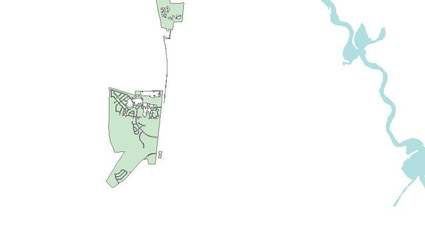

2017 Moncks Corner Comprehensive Plan: Transportation Pg. 76 Æ £ £ 52 ¡ ! 17A SLIVEOAKDR O L D H I G H W A Y 5 2 CYPRESS GARDENS RD OAKLEYRD W MAIN ST PIMLICOBLVD P I NOPOL I S RD GAILLARD RD B R O U G H T O N R D O L D W H I T E S V I L L E RD DENNISBLVD WHITESVILLERD WAPPAOOLAHRD N MULBERRY DR SMULBERRYDR OLDCHERRYHILLRD E MAIN ST N LIVE OAK DR O T WALLACE BLVD EDWARDDR REMBERT C DENN I S BLVD ALBERTSTORMAV A I R P O R T D R CHAV I S LN MCCRAEDR MOUNTAIN PINE RD WEST END DR KE L L Y L N B R A N C H R D HEATLEY ST ELLOISEDR UMPS LN MURPHYLN ALTMAN ST LOISCIR CHURCHILLRD MEPKIN ABBEY RD COLONY POST LOOP MAPLEWOOD RD HUNTCLUBRD LISENBY DR HAYNESVILLE RD GARBARLN B I G C R E E K D R WASHINGTONCLUBRD SPRINGGROVEDR YEMAR LN TRAMST TOM HILL RD EVAST OTTO LN OAKLAWN DR DIAL LN DANGERF I ELD DR T U R N A R O U N D C T CHAFF LNMAYWOODDR TriCounty Link Routes B 101 B 102 B 104 B 105 CS 1 CS 3 CS 4 CS 5 D 305 Æ Airport Railroad MC Boundary Roads ¯ 0 1 02 5 Miles T - 4 : T r i C o u n t y L i n k R o u t e s i n M o n c k s C o r n e Tr - 4 : T r i C o u n t y L i n k R o u t e s i n M o n c k s C o r n e r Source: BCDCOG Disclaimer: This map is a graphical representation of data obtained from various sources. All efforts ha been made to warrant the accuracy of this map. However, the BCD Council of Governments disclaims all responsibility and liability for the use of this map. 5790 CASPER PADGETT WAY N. CHARLESTON, SC 29406 TEL (843) 529-0400 WWW.BCDCOG.COM


The TriCounty Link rural transportation system, operated from a location on Heatley Street, is comprised of nine (9) regular fixed routes and four (4) commuter routes that provide service to rural residents of Berkeley, Charleston and Dorchester counties. The current fleet consists of 49 vehicles that seat from 14 to 32 passengers. All TriCounty Link vehicles are ADA compliant and include wheelchair lifts, and on average, two wheelchair tie-down positions per vehicle. Map T-4 shows the current TCL routes serving residents of Moncks ThreeCorner.of the fixed routes and one commuter service route in Berkeley County connect residents and employees in the Town with other areas of Berkeley County up and around Lake Moultrie, as well as major employment areas near Summerville and the cities of North Charleston and Charleston. Included in this is the “Lunch Link,” which transports Santee Cooper employees to and from their offices to downtown Moncks Corner. Two park-n-ride and transfer stations are located within the town as well. A study of the system conducted in 2013 found that over 5,000 riders are served by the Berkeley County routes every month. Rail Network
The existing rail line was recently considered as an option for what could be part of a regional passenger (commuter) rail service. However, as the Port expands, CSX anticipates that the volume of freight moved along this line will also increase which will require significant coordination to balance freight movement with additional passenger transport. Whether CSX will be transporting more goods or passengers, there are several at-grade crossings for the railroad within the town which can cause delays in mobility and safety concerns. It is important that the Town and CSX collaborate in maintaining the arm gates and warning lights at these crossings for safety concerns.
Airports
Critical to the movement of goods is access to a Class I railroad. Access to rail for freight movement is an important economic development component. Companies such as Volvo and Boeing consider rail access when they site large production centers. A major line of the CSX (Class I) railroad parallels US52 moving goods from the Port of Charleston north and west, passing through Moncks Corner.
This CSX line is also leased to Amtrak for passenger service along the east coast between New York and Miami known as the Silver Service/Palmetto route. The depot in Moncks Corner is no longer a stop, but residents have the option of boarding the train in either North Charleston or Kingstree for trips to points north or south of the region.
2017 Moncks Corner Comprehensive Plan: Transportation Pg. 77
The Charleston International Airport is a joint civil-military airport located in North Charleston that provides passenger service and cargo/freight service to a variety of destinations. The airport has two runways, 7,000 feet and 9,000 feet long. In 2011, CHS emplaned more than 2.5 million people on the scheduled, commuter and charter airlines serving the airport. With the addition of Southwest Airlines in March 2011, CHS now offers direct flights to 15 destinations, including Chicago, Baltimore, Houston and Nashville. Construction began in late 2012 by the Airport Authority on a comprehensive Terminal Redevelopment and Improvement project, which is almost complete. The purpose of this multi-million dollar project is to accommodate the current and growing passenger volumes, as well as improve space efficiency for the airlines and tenants. Additional public parking is also included as part of the overall redevelopment plan.
The Berkeley County Airport, located just south of the town off US 17A, is operated by the County. Open daily, this airport provides a base for individual private flights and offers numerous aeronautical services.
T1.4: Ensure the Town’s public works department has resources to maintain street lighting for vehicular and pedestrian safety
T2.2: Distribute information to residents on options for reducing reliance on individual vehicles, including use of the Trident Rideshare program
T2.3: Provide information to businesses and employers in the Town on options for reducing demands on the transportation by their employees such as carpooling, vanpooling, flex scheduling, and telecommuting
Transportation Goals and Policies
T2: The Town will promote use of programs to reduce the travel demand generated by its residents and consequently improve its mobility.
T1.6: Coordinate with TriCounty Link to identify and secure needed park-n-ride facilities
T1.3: Consider adopting requirements for joint access agreements between commercial properties along the Town’s major arterials/commercial corridors
T1.1: Coordinate with Berkeley County and SCDOT on an annual basis to review pavement conditions of the existing network and prioritize resurfacing projects
2017 Moncks Corner Comprehensive Plan: Transportation Pg. 78
T1.5: Coordinate with the CHATS WalkBikeBCD plan to identify gaps in the existing sidewalk system and potential funding sources for construction of new or improved sidewalk facilities particularly for linkages to school and transit stop locations
T3: Conduct community-wide assessments of existing neighborhoods to identify needed infrastructure repairs and upgrades in older neighborhoods to address potential health and safety issues as well as to protect property values
T2.1: Support TriCounty Link’s services by distributing information on the regional transit systems, particularly commuter services
T1: The Town will coordinate with SCDOT, Berkeley County, and CHATS to plan and develop transportation system improvements
T1.2: Participate in development of the CHATS LRTP to ensure inclusion of transportation improvements needed within the Town environs and region, including alternative evacuation routes
T3.1: Pursue grant funding for identified infrastructure needs in neighborhoods that qualify for CDBG support
As the Town’s population increases and demographics change, it is important to allow for modes and patterns of mobility to adjust. Encouraging a multimodal transportation system that promotes community and economic development and provides a sustainable balance between pedestrian, bicycle and automotive traffic is critical to the future of the Town. As such the Town has adopted the following goal, policies and strategies: Goal: The Town will be served by a multimodal transportation system to accommodate existing and projected travel demands.
A strong, diversified economy is critical to the well-being of Moncks Corner residents and the surrounding region. A strong economy expands the tax base, which contributes to maintaining and enhancing the quality of life and strengthens the appeal of the community to prospective residents and employers. The Economics Element looks at existing conditions, trends and projections for industries and services, the available labor force and prospective employment opportunities; commuting trends and other issues that are relevant to the local Monckseconomy.Corner’s
Current Economic Base Summary of Various Incomes
Median Household Income: Comparison
$44,828 Moncks Corner $62,107 Go ose Creek $55,290 Summ erville $51,844 Berkeley Co unty $45,033 South Carolina
As mentioned in the Population Element, the estimated median household income in Moncks Corner for 2014 was $44,828. As shown on the next page, this median income falls just short of the state of South Carolina median of $45,033 (by only $205) and well below the region’s median of$52,517 and national median of $65,443. Regionally, Moncks Corner is below the median household incomes of Berkeley County ($51,844),
Source: US Census Bureau, 2010-2014 American Community Survey
$40,$30,$20,$10,000000000000$50,000$60,000$70,000
Summerville ($55,290) and Goose Creek ($62,107). Moncks Corner’s per capita income is $20,620, which remains slightly lower than Berkeley County’s per capita income of $21,263.
Summerville and Goose Creek’s closer proximity to the Charleston metro area, and major job centers, more than likely contributes to higher median wages. As the Town has annexed areas closer to major employment centers and additional employment centers are developed further out in the region (e.g. Volvo plant), Moncks Corner incomes should increase accordingly.
economic base has evolved over the past three centuries from an early 18th century agricultural hub of plantations producing rice, indigo, and other crops that were globally exported. Later that century, the Town began to experience negative growth because residents relocated out of the area during summer months to avoid health issues associated with living near swamp land. The negative growth was amplified by the Civil War which brought an end to slavery and dramatically changed the operation of local plantations. Throughout the early 20th century, the community consisted of small farms, lumber mills, and a few general stores. The Town was later influenced mid-century by the post-World War II military base development in neighboring Goose Creek. Over the past several decades, Moncks Corner has experienced suburbanization with residential subdivisions and strip commercial centers on the Town’s periphery, creating sometimes unsurmountable competition for small shops and restaurants in the town’s historic downtown.
ECONOMICS
Introduction
2017 Moncks Corner Comprehensive Plan: Economics Pg. 79
in median household incomes since
shown below
the chart dating from FY 2011 to FY 2015. Revenue grew by 27% during the past five year period,
an upward growth trend,
Town Revenues Town revenues have
The chart below illustrates growth 2000, after recovering from the recession. The median household growth for Moncks Corner households was 41.4%. This growth exceeded that of the nearby jurisdictions and Berkeley County, and was almost twice that of the state of South Carolina. continued as in which
2017 Moncks Corner Comprehensive Plan: Economics Pg. 80
is a positive sign of slow, but steady economic growth. REVENUES BY SOURCE FY 2011 FY 2012 FY 2013 FY 2014 FY 2015 Property Taxes 1,395,793 1,433,475 1,427,250 1,588,334 1,666,890 Business License 1,385,056 1,327,971 1,415,936 1,596,699 1,562,170 Building Permits 150,594 216,640 234,564 302,775 398,785 Local Option Sales Taxes 836,250 890,000 900,000 1,114,817 1,113,627 Hospitality Taxes 622,100 639,394 662,852 726,693 795,762 Accommodation Taxes 64,029 68,408 58,382 75,601 74,920 Franchise Fees 622,686 648,509 773,120 970,048 678,352 Charges for Services 529,376 528,593 516,087 568,235 608,013 Fines and Forfeitures 260,152 260,903 253,942 237,347 309,859 Intergovernmental 387,907 414,447 783,753 714,573 454,289 Miscellaneous 236,823 156,557 178,527 425,620 548,287 Total Revenues $6,490,766 $6,584,897 $7,204,413 $8,320,742 $8,210,954 Source: Town of Moncks Corner Median Household Income Comparison, 2000 & 2014 $40,$30,$20,$10,000000000000$50,000$60,000$70,000 Source: US Census Bureau, 2010-2014 American Community Survey 200 0 Me dian Household Income 201 4 Me dian Household Income Moncks Corner Go ose CreekSummerville Berkeley Co unty South Carolina USA
attainment has been shown to have a direct impact on earning potential. Earning potential directly translates to the ability of residents to purchase goods and services, supporting the local economy. The following table provides a snapshot of median earnings of the Moncks Corner labor force (2014) based on educational attainment.
According to the 2010 Census Estimates, over 66% percent of Moncks Corner residents, ages sixteen years and older, are in the labor force, an increase of nearly 4% from 2000. As the labor force has increased, so has the number of people in the labor force with a higher education. Educational Attainment Education is one of the fundamental factors of economic development, as it raises the labor force’s income earning potential, as well as promotes entrepreneurship and technological advances. A high level of education affects not only the economic future and prosperity of individuals, but also the prosperity of entire community, as labor force demographics are used to market the town and/or county to prospective Asemployers.seeninthe
Number of Business Licenses and Revenue Generated by Year (2011-2015) 52 6866646260585654000000000$0 $2 $8$6$400,00000,00000,00000,000 $1 ,0 00,000 $1 ,2 00,000 $1 ,4 00,000 $1 ,6 00,000 $1 ,8 00,000 20 11 20 12 20 13 20 14 20 15 Business License Revenue No. of Business Licenses Source: Town of Moncks Corner
Educational Attainment chart on the following page, about 85.6% of Moncks Corner’s adult residents – ages 25 or older - have completed high school or some higher education and about 21% have some type of post-secondary degree. Four percent (4%) of Moncks Corner residents have a graduate or professional Educationaldegree.
One of the most important attributes businesses consider when looking to expand or select a new location is the availability and accessibility of an educated, highly and broadly skilled workforce.
2017 Moncks Corner Comprehensive Plan: Economics Pg. 81
Revenues from Business Licenses in particular indicate growth in industries. Work Force/Labor Force Profile


High school graduate (includes equivalency)
High school graduate (includes equivalency) $21,164
Educational Attainment: Moncks Corner (2014) 6.0%8.4% 34.5% 30.5% 9.2% 7.4% 4.0% Less than 9th grad e 9th to 12th grad e (no diploma)
Source: U.S. Census Bureau, 2010-2014 American Community Survey
2017 Moncks Corner Comprehensive Plan: Economics Pg. 82
Graduate or professional degree $43,359
Source: US Census Bureau Labor Force Participation of Residents 16 and Older: Moncks Corner (2014) 4,538 2,285 In Labor Force Not in Labor Force
Total Workforce Total: $26,119
Labor Force Participation of Residents 16 and Older
Source: US Census Bureau, 2010-2014 American Community Survey
Some college or associate’s degree $30,152
In 2000, the number of people aged 16 and older in the Town of Moncks Corner labor force was 3,738; constituting approximately 63% of the total population. According to 2010 Estimates by the U.S. Census Bureau, the number of people in the Town’s labor force had increased to 5,257 and approximately 66.7% of the total population, meaning the labor force increased at a slightly higher rate than the Town’s total population.
MEDIAN INCOME BY EDUCATIONAL ATTAINMENT
Less than high school graduate $15,647
Bachelor’s degree $37,557
Some college (no degree)
Associates degree Bachelor's degree Graduate or professional degree
The information on class of workers gathered by the US Census Bureau refers to the job as a respondent’s industry and occupation, categorizing workers according to the type of ownership of the employing organization, such as private wage and salary worker, and self-employed. Relatively speaking, a very small percentage of the Town’s labor force (<1%) are non-civilians. According to ACS 2014 Estimates, more than three quarters (78%) of Moncks Corner’s workers were classified as Private Wage and Salary Workers, an 8.7% increase from 2000. In contrast, only 17% were classified as Government Workers in 2010, a 33% decrease from 2000.
According to the U.S. Census Bureau, Moncks Corner’s unemployment rate in 2015 was about half that of the unemployment rate (9.7%) in 2010, which was during the national economic recession and continues to fall. Unemployment rates for Moncks Corner and Berkeley County varied slightly between 2000 and 2008, but closely followed both the national and state trends. Both the Town and County have however remained below the South Carolina average. In 2010 Berkeley County had an annual unemployment rate of ten percent (10%), which fell between the state (11.2%) and national (9.6%) averages.
Source: US Census
YEAR Moncks Corner Unemployment Trend 2000-2015 2000 2002 2004 2006 2008 2010 2012 2014 2001 2003 2005 2007 2009 2011 2013 2015 3.2 4.4 4.5 5.4 5.5 5.4 5.5 4.7 6.1 10.4 9.7 9.1 7.9 6.6 5.5 4.710842612PERCENTAGE
Class of Workers
According to the U.S. Census Bureau’s ACS 2014 data, of the total 16 and older (6,823) population, approximately two-thirds (4,538) are currently in the labor force. 4,508 employees make up the civilian workforce and only 30 workers are employed in the military.
The unemployment rate is also an indicator of the community’s economic stability. Unemployment rates are calculated as a percentage of all individuals currently in the labor force who are actively looking for work by dividing the number of unemployed individuals (all those actively looking for work, not including those who have chosen not to work) by all individuals currently in the available labor force. In 2014, it was estimated that 3,937 workers (of the 4,538 in the labor force) were employed, while there were 571 members (8.3%) of the Moncks Corner labor force that were unemployed. The remaining 2,285 residents of the total potential workforce were not in the labor force for other reasons.
2017 Moncks Corner Comprehensive Plan: Economics Pg. 83
Bureau
Employment and Incomes by Occupation who perform similar tasks are grouped in the although they or not work in the As seen in the table on the by Industry:
2017 Moncks Corner Comprehensive Plan: Economics Pg. Employment84 by Industries While occupation refers to a set of activities or tasks for which employees are paid, industries by which persons are employed refers to groups of establishments that produce similar products or provide similar services. Moncks Corner labor force appears to be employed in a well-balanced diversity of industries.
may
next page, Moncks Corner’s labor force is balanced and diversified in terms of occupations. Employment
same occupation,
same industry.
Employees
may
Moncks Corner (2014) 9.5% 11.7%2.5%8.5% 6.5% 3.4% 3.7% 14.5% 15.3% 13.6% 4.8% 6.1% Agriculture, Forestry, Fishing & Hunting, an d Mining: 0% WholesaleMaConstructionnufacturingTradeRetailTrade Transportation & Warehousing, and InformatioUtilitiesn Finance & Insurance, and Real estate & Rental & Leas ing Prof., Scientific, Management, Administrative, and Waste Mgmt. Servi ce s Educat ional Services, Health Care, and Social AssistanceArts,Entertainment, Recreation, and Accommodation & Food Services Ot her Services, except Public Administration Public Administration *
2017 Moncks Corner Comprehensive Plan: Economics Pg. 85 MEDIAN INCOME BY OCCUPATION IN MONCKS CORNER ANNUALINCOME % OFFORCELABOR Management, business, science, and arts occupations: 51,125 28% Management, business, and financial occupations: 53,295 Management occupations 53,182 Business and financial operations occupations Computer, engineering, and science occupations: 66,085 Computer and mathematical occupations Architecture and engineering occupations 65,663 Life, physical, and social science occupations Education, legal, community service, arts, and media occupations: 36,518 Community and social service occupations Legal Education,occupationstraining, and library occupations 22,051 Arts, design, entertainment, sports, and media occupations Healthcare practitioners and technical occupations: 65,114 Health diagnosing and treating practitioners, other technical occupations Health technologists and technicians 48,833 Service occupations: 29,212 27% Healthcare support occupations Protective service occupations: 38,869 Firefighting and prevention, and other protective service workers/ supervisors 41,923 Law enforcement workers including supervisors Food preparation and serving related occupations 30,370 Building and grounds cleaning and maintenance occupations 29,345 Personal care and service occupations 20,931 Sales and office occupations: 42,705 17%Sales and related occupations 51,159 Office and administrative support occupations 37,813 Natural resources, construction, and maintenance occupations: 45,577 16%Farming, fishing, and forestry occupations Construction and extraction occupations 32,235 Installation, maintenance, and repair occupations 51,422 Production, transportation, and material moving occupations: 33,667 12%Production occupations 43,558 Transportation occupations Material moving occupations Source: U.S. Census Bureau, 2010-2014 American Community Survey
Residents Work? 39.1% 25.9%
2017 Moncks Corner Comprehensive Plan: Economics
Pg. Access86 to Employment
Source: US Census Bureau, 2010-2014 American Community Survey
Where
Just as important as the availability of well-paying jobs in the region is whether or not the Town’s labor force can be employed within a relatively close proximity to residential areas. Less than 40% of Moncks Corner residents are employed by industries and businesses within the Town limits. A little over one-quarter of residents (25.9%) work outside the town, but within Berkeley County. Just over a third (35.0%) work outside of Berkeley County.
Travel Time to Work: Moncks
Source: US Census Bureau, 2010-2014 American Community Survey Corner
(2014) 30252015105.0.0%0%.0%.0%.0%.0%.0% 29.1% Less than 10 minute s 10.0% 10 to minute14s 7.3% 15 to minute19s 5.2% 20 to minute24s 3.4% 25 to minute29s 15.6% 30 to minute34s 8.5% 35 to minute44s 16.9% 45 to minute59s 4.1% 60 or minutemores
Distance to employment is important because commuting costs can be as much as 15% of a household income, which is often not accounted for in assessing housing costs. The Center for Economic Studies at the U.S. Census Bureau reports that a large number of Moncks Corner residents employed outside of Town are working in (in order): Goose Creek, Summerville, Charleston, North Charleston, and Mount Pleasant. Those employed in other counties are working in (in order): Charleston, Dorchester, Georgetown, Horry, and Orangeburg counties. Since Moncks Corner is located away from the region’s major work centers, almost half of Moncks Corner residents (45.1%) spend 30 minutes or more (each-way) to get to work. However, it is important to note that 29.1 percent of the population spends less than 10 minutes to reach work, which indicates the relative availability of jobs in Town. do Moncks Corner 35.0% Within Moncks Corner Outsid e Town, Within Berkeley County Outsid e Berkeley County
It is important to note that travel time to work does not always translate to the distance traveled, and thus cost of commuting because congestion has to be factored in. However, it does give an indication of how much additional time residents can attribute to working, rather than enjoying other aspects of life.
Distance to employment also dictates what options are available for transportation to work. Although almost one-third of the Town’s employed travel less than 10 minutes each way to work, an overwhelming majority of Moncks Corner’s workforce relies completely on the automobile for their work commute. With 82.8% of residents driving alone to work and 8.5% of residents carpooling, less than 10% of residents are using other means, such as walking (1.9%), biking (0.9%), telecommuting-working at home (4.9%), or other means such as using public transportation. It is suspected that this is attributable to a combination of preference and limited options available to residents.
2017 Moncks Corner Comprehensive Plan: Economics Pg. 87
Existing Major Industries and Employers Those members of the Town’s labor force working within the Town may be employed at one of the top 10 employers listed below: MONCKS CORNER TOP 10 EMPLOYERS NO. OF EMPLOYEES Berkeley County School District 3,650 Santee Cooper 1,750 Berkeley County Government 850 Wal-Mart 550 C.R. Bard 355 Berkeley County Electric Co-operative 254 Home Telecom 200 Town of Moncks Corner 102 Marvin’s 54 Cohen’s Dry Wall 41 Source: Moncks Corner Chamber of Commerce Commuter Characteristics: Moncks Corner (2014) 82.8% 8.5% 1.9%0.9% 4.9% 1.0% Drove OtWorkedBicWalkeCarpooAloneleddycledatHomeherMeans Source: US Census Bureau, 2010-2014 American Community Survey
of
(2002-2012) 2002 200 7 2012 05 10 15 20 25 30 35 Wholesale Trade Retail InformatioTraden Finance & Insurance, and Real Estate and Rental and Leasing Prof., Scientific, Management, Administrative, an d Waste Management Services Educational Services, He alth Care, and AssistSocialance Arts, Entertainment, Recreation,andAccommodation,FoodServices Other serv ices , except Public Administration Transportation & Warehousing, and Utilities Manufacturing Source: US Census Bureau, Economic Census
Projections
2017 Moncks Corner Comprehensive Plan: Economics Pg. Employment88
Previous charts indicated industries within which the town’s labor force is employed. As shown below, the ACS reports that growth in the primary industries employing the Town’s labor force has generally slowed over the past fifteen years. Notably those industries currently employing a relatively small percentage of the Town’s labor force in the past; manufacturing (11.7%), finance and insurance and real estate (3.7%), Transportation and warehousing (96.5%) and Information (3.4%) have experienced greater growth during the same time period.
The region’s travel demand model forecasts the number of jobs located within traffic analysis zones (TAZs). Between 2010 and 2030, the model projects an increase in the number of jobs, within the TAZs that include the Town of Moncks Corner, of approximately 16% per decade. It is therefore important to look at what industries are forecasted to grow in the region to determine what skills and education the Town’s labor force needs to Percent Industry Growth
maintain a
The Berkeley County’s Economic Development Department provides a wide range of support to businesses interested in relocating to the Moncks Corner area, including new incentives planning. The Town is also a member of the Berkeley County Chamber of Commerce, which is governed by a Board of Directors and works to help attract new industries to the area. County’s work hand-in-hand to vibrant
Berkeley
business retention, expansion and recruitment efforts
business
and site
2017 Moncks Corner Comprehensive Plan: Economics Pg. 89 become or stay relevant in the job market, as well as to target industries to locate within the Town so residents can spend less time commuting. In collaboration with the region’s three county economic development departments, including Berkeley County, the Charleston Regional Development Alliance (CRDA) has identified industry clusters projected for growth in the region. Those clusters are: Aerospace, Automotive, Information Technology, Advanced Logistics, and Life Sciences. Likewise, EMSI projects additional jobs being created by industries that fall within these clusters as shown in the table below: PROJECT JOB GROWTH BY INDUSTRY CLUSTER Industry Cluster Jobs 2015 JobsAdditional‘15-’20 1 Software / Info. Tech.: Software Sales & Programming 2922 5372 2 Retail: Department & Misc. Stores 1750 588 3 Government: Local Education & Hospitals 4008 397 4 Transportation & Logistics: Trucking 1070 371 5 Construction: Building Construction 2888 365 6 Transportation & Logistics: Postal & Couriers 579 346 7 Construction: Construction Materials Sales 957 298 8 Telecom Services: Telecommunications 1148 270 9 Entertainment: Restaurants & Bars 3239 236 10 Professional Services: Architecture & Engineering 1469 220 11 Healthcare: Care Centers & Services 1026 213 12 Healthcare: Physicians & Dentists Offices 813 188 13 Back Office: Building Security & Maintenance 829 144 14 Retail: Personal & Health Care Stores 755 135 15 Research: Management Consulting 360 123 16 Education: Technical Schools 324 121 17 Industrial Machinery: Repair Services 260 115 18 Metalworking: Steel & Aluminum Manufacturing 2149 114 19 Government: Local Government 2041 102 20 Finance: Banking 564 88 Source: EMSI Economic Development Resources and Initiatives
local economy. Business retention and expansion programs address such issues as availability of public services and facilities, permitting procedures, property taxes, and labor-training programs, all of which affect
Retail and Other Commercial Services
• Job Tax Credits: Provide companies with a credit against their corporate income tax liability for new jobs created, depending on the number of jobs created, the type of business, the location, and the wage rate. Based on Berkeley County’s designation (TIER 1) and compensation amount, employers creating new jobs in Berkeley County receive job tax credits between $1,500 and $2,500 per job.
Beyond employment, a town’s economic health and stability, as well as its character, can be measured by the vitality of its downtown. Corner Renaissance was established for the Town of Moncks Corner in 2015. This association is the result of a “Downtown Walking Tour/Audit,” which took place in November 2014. Through the participation of downtown merchants and other stakeholders, citizens identified key assets that exist
2017 Moncks Corner Comprehensive Plan: Economics Pg. 90
decisions by established businesses and industries to remain or expand. Recruitment programs largely focus on attracting industrial users as a major economic development strategy. Retaining, expanding and attracting industrial businesses are important because they generally provide higher-paying jobs.
The following are some of the State incentives for qualified projects as determined by the South Carolina Department of Commerce (SCDOC) or the South Carolina Department of Revenue (SCDOR).
• Property Tax Incentives: Companies locating in South Carolina with an investment of $50,000 or more, receive an abatement of the County ordinary portion of their property taxes for a period of five years. In general, this will result in a savings of between 25 and 30 percent on a company’s property taxes. Companies investing $5 million or more in South Carolina within a five-year period may negotiate fee-in-lieu of property taxes (FILOT) with the County to obtain a reduced assessment, and a lower than normal millage rate can be negotiated for a period of up to 30 years with a fixed rate. In addition, a Special Source Revenue Credit (SSRC) can be added to further reduce property taxes. (South Carolina Department of Revenue, Tax Incentives for Economic Development, 2011 Edition).
• Residential and Commercial Infrastructure Rebates: Developments investing in new residential developments that are annexed into the town or new commercial investments in Town may qualify to receive rebates of the cost to provide infrastructure to such development. 100% of infrastructure costs may be rebated over a 10 year period (15 year period for investments in the downtown) providing developments meet certain criteria.
• Corporate Headquarters Credits: Companies that meet specific job requirements establishing a corporate or division headquarters in South Carolina are eligible for a credit equal to 20 percent of their lease cost for five years, or 20 percent of the building design/construction costs. This credit may be used to eliminate the company’s corporate income tax liability for up to ten years.
• Investment Tax Credit: As a designated Economic Impact Zone, Berkeley County can give companies locating there a credit against their corporate income tax liability of up to 5%of their investment in new production equipment. This credit can be applied without limits against corporate tax liability and may effectively eliminate it. Unused credits may be carried forward for ten years.
• Sales Tax Exemptions: South Carolina levies a six-percent sales tax statewide, and Berkeley County levies an additional one percent local option sales tax used for property tax relief. Industries investing more than $35 million are eligible for an exemption on material handling equipment. Exemptions include equipment used in the production process, electricity and fuels used in the production process, raw materials, repair parts, and packaging materials. An additional incentive that can be utilized and marketed by the Town to help expand existing companies and attract new ones at the discretion of Berkeley County includes:
Source: The Town of Moncks Corner Moncks Corner’s downtown or central business district has experienced the unfortunate, but typical, decline as consumer shopping preferences changed. As the downtown once was affected by the development of commercial strips and shopping centers along major arterials, retailers in these same commercial corridors now face the negative impacts of competition with internet shopping. Both trends have the same results: obsolete buildings and centers, with corresponding low rents, high vacancies, deteriorating buildings and general decay. Long term economic sustainability demands reuse of the Town’s aging commercial corridors and downtown areas. As stated in the Town’s 2012 Comprehensive Plan, because reinvestment in town centers and central business districts is vital to the local economy, the Town should focus efforts on its future downtown redevelopment strategy to create a community focal point and to ensure the long-term occupancy of businesses in the area. In 2015, the Town was designated as one of South Carolina’s Main Street communities. Over the next three years, Corner Renaissance will receive assistance from the SC Main Street program in visioning, setting a work program, and implementation strategies for the downtown area.
2017 Moncks Corner Comprehensive Plan: Economics Pg. 91
downtown (Regional Recreation Complex, Farmer’s Market, etc.) which could be leveraged to stimulate revitalization of the area. Respondents also identified other assets of the downtown as its “unique historic appearance,” BBQ Festival, street dance and Halloween Festival and indicated areas for improvement such as vacant, dilapidated buildings and building aesthetics and maintenance that need to be addressed in order to create a stronger downtown environment.

A multi-day charrette was done to looking at developing a branding and marketing program for businesses in the downtown by consulting firm Arnett, Muldrow and Associates. Recommendations were made for marketing, advertising and economic development based on a complete market analysis of existing and prospective customers. In addition, a complete branding toolkit was developed for the community to use. Design and planning strategies resulting from the charrette will complement some of the major goals in the Land Use element of this plan to promote infill development, encourage proper maintenance of buildings, and improve the aesthetics of the Town’s Central Business District.
2017 Moncks Corner Comprehensive Plan: Economics Pg. 92
Economic Goals and Policies
Goal: There will be adequate employment opportunities within the Town and a labor force that meets the needs of those industries.
E2.3: Coordinate with TriCounty Link to develop and provide transportation options to ensure access to training programs and future employers
E3: The Town will re-establish its downtown area as a community focal point providing a mix of retail, service, and residential uses in a pedestrian friendly environment
2017 Moncks Corner Comprehensive Plan: Economics Pg. 93
As major employment centers are developed closer to the Town, there are increased opportunities to recruit new employers to locations within or adjacent to Town that can employ its existing and future labor force. Attracting employers requires collaboration to market available site and facilities while developing and retaining a labor force with relevant training and skills. Concurrently the Town seeks to retain and develop businesses that give residents access to daily needed goods and services. As such the Town has adopted the following goals, policies and strategies:
E1: The Town will collaborate with its partners, including the Berkeley County’s Economic Development department and Berkeley Chamber, to identify and recruit new industries to existing industrial facilities that will increase employment opportunities within the Town limits.
E2.1: Collaborate with the Berkeley County School District to offer curriculums that prepare High School graduates to enter the labor force
E1.3: Identify industries that will complement larger regional industries (e.g. Volvo, Boeing, Daimler) for recruitment to available sites within or adjacent to the Town
E1.4: Identify land for annexation (e.g. Gates Rubber) adjacent to or within close proximity to attract potential employers (industrial, etc.) within the Town and approach owners about annexation
E2.2: Collaborate with Trident Technical College to identify potential labor force demands in the Town and upper Berkeley County and provide programs for required certifications or coursework to increase utilization of the existing campus
E1.5: Encourage the redevelopment of vacant and/or underutilized land and structures within established commercial corridors and the downtown to maintain and/or foster stability of these areas
E1.1: Identify and make available resources to support local entrepreneurs seeking to start or expand businesses. (Incubators, accelerators, capital investment support)
E1.2: Retain a business-friendly environment to support potential entrepreneurs and businesses through licensing and permitting processes (information, application processes, etc.)
E2: The Town will support and participate in development of workforce development initiatives to ensure its labor force is prepared for employment in growing industrial sectors within or near the Town through educational or training programs.
E3.1: Implementation strategies recommended in the final report of the Corner Renaissance report will be supported by the Town in collaboration with the downtown merchants association
BCDCOG
2017 Moncks Corner Comprehensive Plan: Land Use Pg. 94
An analysis of existing land uses within the Town of Moncks Corner serves as an important guide for identifying what land uses may be needed in the future and where they should be located within the community. In addition to planning long-range growth and development, it also assists a community in planning for capital improvements and the provision of public services.
Source: Berkeley County Assesor’s Office,
The figure below depicts how land uses are currently distributed within the Town limits. This information is calculated based on land use classifications applied by the Berkeley County Assessor’s Office. The County assigns each parcel a single land use, so even if there are multiple uses in a single parcel, only the primary use is listed. The assessor’s menu of land use classifications is much more limited than what is typically used for land use planning. For example, all multifamily, commercial and industrial uses are all in one category. Therefore, the uses depicted were initially based on the assessor’s database, then field-checked to be more specific.
Existing Land Use Distribution 0.3%3.4% 21.1% 14.6% 31.5% 7.3% 20.7% 1.1% Agri cultur e VacantSingPublicOpenMixedMulti-FamilyCommercialUseSpaceFacilitiesleFamilyResidential
The Land Use Element provides an inventory of existing land uses within the Town and also gives a framework for future public and private development in and around the Town. Future land uses are proposed for areas within current Town limits, as well as outlying areas with annexation potential. The goals and objectives outlined in this element provide the foundation for applied zoning and land development regulations and development decisions made by the Town. This element should be referred to by both public officials and private developers in making decisions regarding the type, density and location of future development.
LAND USE
Introduction
Existing Land Uses
• Industrial (M): Industrial land is used for manufacturing and other facilities that convert raw materials into finished products, including construction, transportation, communication, utilities and wholesale trade. No distinction has been made between commercial and industrial land for existing uses, rather heavy commercial and light industrial have been identified as “employment” uses.
• Vacant/Open Space: Vacant land that is undeveloped has been distinguished from land that is designated open space or a conservation area to the extent possible.
• Public/Institutional/Utilities: Public/institutional lands are used for nonprofit or public uses, such as schools, prisons, utilities, large medical facilities, government buildings, churches and religious based facilities.
• Commercial (C): Commercial land is used for the provision and purchase of goods and services. This category includes all commercial, warehouse, professional and office uses. These uses are typically found in downtowns, along major highway corridors and at higher volume intersections.
• Downtown: The traditional downtown area was identified as a distinct commercial land use area where a mix of retail, service and residential uses pedestrian accessible are encouraged to locate. Although Moncks Corner is transitioning into a larger town, somewhat separated, but not immune to suburban growth of the region, a majority of the land is classified by the county assessor as “agriculture” (21.1%) or “open space” (31.5%). Twenty percent (20.7%) of the land is identified as being used for single family residential dwellings, while less than one-percent (0.3%) is identified as multifamily. The County assessor identifies only 1.1% of land within the Town as vacant; however where there is a lack of vacant land, there is an abundance of land areas that lend themselves to redevelopment. Existing Zoning Zoning categories and the application thereof provide options for the development of land within each land use category. The Town of Moncks Corner Zoning Ordinance, which was adopted in 2012, defines thirteen (13) zoning districts. More than one zoning district may be applied to a particular land use category. In the description of Future Land Uses, examples of zoning districts that might be applied to implement the Town’s future land use map are suggested.
• Agricultural (AG): Agricultural land is used for the production or maintenance of plants and animals; this classification also includes agricultural forest. Typical uses accommodated in the zoning of agricultural lands include cultivating crops, raising livestock, nurseries and greenhouses, production of forestry products and other natural resource management. Many of the larger parcels currently identified as agricultural may not be used for such purpose and present potential development opportunities in the future.
Land Use Classifications
The Existing Land Use Map reflects how land within the Town limits is currently being used, regardless of its zoning designation. Using aerial photography, land use classifications from the Berkeley County Assessor’s Office, input from Town staff and planning commission members, and field verification, land uses were classified according to the following standard land use classifications: Agricultural, Residential (Single Family and Multifamily), Commercial, Industrial, Public/Institutional and vacant. Below are brief descriptions of these land use categories:
• Residential (R): Residential land is used for dwelling and shelter. Distinction is made between types of residential uses to assess the distribution of residential densities and proximity to services, as well as supportive infrastructure.
2017 Moncks Corner Comprehensive Plan: Land Use Pg. 95
Downtown (Corner Renaissance area): The historic “downtown” of Moncks Corner is designated as the primary location for future development/establishment of mixed land uses that accommodate commerce, employment, and civic activities (see image on next page). Nonresidential uses, supported by higher density residential uses, should be focused in this area to foster re-establishment of a balanced downtown. This is the area where residential and nonresidential uses can easily be developed as mixed us buildings and/or parcels and integrated to create a pedestrian friendly self-sustaining development with a mix of housing options.
Future Land Uses
Residential (low density): These areas are designated for development of predominately single family detached neighborhoods ranging from one (1) to four (4) dwelling units per acre. Neighborhoods should promote a sense of community providing a transition from agricultural areas outside of Town to higher density residential and commercial areas. Where abutting areas designated as conservation or green space, and where supportive infrastructure can efficiently be provided, developers should be encouraged to mitigate potentially adverse impact on natural resources by creating clustered subdivisions with smaller lots sizes, conserving comparable open spaces (up to 50%) in easements or designated HOA lands.
The Future Land Use Map provides a framework for the distribution of various land uses both within the current Town boundaries and adjacent unincorporated areas. Although the Town does not have direct authority to enact zoning in these areas, it is possible that land could be annexed into the Town and the Future Land Use Map helps provide direction for how annexed land might be utilized and zoned if brought into the Town of Moncks Corner. Additionally, as Berkeley County reviews and updates its land use and zoning, the map can serve as a reference to show how the Town of Moncks Corner envisions development around the Town.
2017 Moncks Corner Comprehensive Plan: Land Use Pg. 96
The Future Land Use designations depicted on the Future Land Use map or FLUM are comparable to those on the existing land use map. However, land use “areas” are identified as generic activity types anticipated within these areas. Town policies may allow for more than one land use within a designated area, thus more than one zoning district may be appropriate to apply. Below are descriptions and development objectives for the various land use categories depicted on the Future Land Use Map legend (map on page 93).
Land Use and Development Principles
Residential (medium density): These areas that are designated for development of neighborhoods with a mix of residential uses, predominately single family detached or single family attached dwellings (aka townhomes), ranging from four (4) to eight (8) dwelling units per acre. These areas provide a transition from the low-density suburban neighborhoods to already developed residential and commercial areas with potential to serve as infill developments. New neighborhoods should strive to be walkable communities with a system of interconnected trails or sidewalks that provide access to parks, recreation and open space areas. These also should, to the extent possible, be within on-half mile of neighborhood centers of nonresidential development.
Residential (high density): These are areas that are predominately single family attached neighborhoods and/or multifamily developments with densities greater than eight (8) dwelling units per acre. New high density neighborhoods should be integrated with nonresidential developments as walkable sub-communities with both internal and external connectivity to establish nodes at appropriate locations within Town.
Commercial: Commercial areas or corridors are designated to accommodate auto-oriented commercial uses, principally retail and service uses that are incompatible with neighborhoods, such as destination oriented retail, hotel and restaurant services. Designation of commercial areas is limited to those where major transportation infrastructure exists and where future transit nodes might develop. These areas should be developed with standards to enhance mobility while creating inviting entrances to the centers. Smaller commercial areas outside to serve residents’ daily needs should be developed as walkable or pedestrian oriented “neighborhood centers”.
Employment: Employment areas are designated centers for development of large scale (non-retail) commercial and industrial uses occupied by a major employer or a concentration of multiple employers with a mix of supporting or ancillary uses. Clustering of buildings in employment centers is preferred to preserve open space within the development site. Employment areas may also be developed with large labor intensive industrial and commercial uses that produce noxious externalities. Where new development is proposed in an employment area with a more intensive use, sites should be large enough to include buffers. While not conducive to mixed-use developments, less intensive industrial or more intensive commercial uses, and supportive uses may be co-located within employment areas.
Public/Institutional: Public and institutional designated areas within the Town accommodate single uses and activities that already exist, including but not limited to government and educational facilities and larger religious institutions. The characteristics and locational requirements of institutional uses varies on an individual basis, but wherever possible new institutional facilities should be co-located with connectivity to other uses and have adequate accessibility for the volumes of traffic associated with each use.
Recreation/Conservation or Green Spaces: These areas are prioritized for greater protection from development activities in order to maintain natural habitats, provide flood protection and protect water quality. These areas are also prioritized for recreational activities and facilities. Any development permitted in these areas should be constrained to minimize impacts to the natural features.
Neighborhood Centers are community-oriented, as compared to destination oriented, that serve the needs of nearby neighborhoods. They are an integral part of the residential communities they serve (e.g. the corner store), particularly when established as part of a planned development. The size and scale of a neighborhood center should relate to the community/communities it is intended to serve. Those serving a single community are appropriately co-located with residential in a designated residential area.
2017 Moncks Corner Comprehensive Plan: Land Use Pg. 97

2017 Moncks Corner Comprehensive Plan: Land Use Pg. 98 X REMBERT C DENN I S BLVD L I V E O A K A V O P 6 O P 402 £ ¤ 52 £ ¤ 17A £ ¤ 17A REMBERTC DENNIS BLVD Proposed Future Land Use (FLU) Areas HD Residential Nodes Recreation Node Commercial Nodes X Mixed Use Node Low Density Residential Medium Density Residential High Density Residential Corner Ren aissance Commercial Employment Public/Institutional Recreation/Open S pace Proposed Employment Proposed High Density Residential Proposed Recreation/Open S pace Berkeley County Future Land Use Conservation/Recreation Constrained Residential Growth Employment Low Density S uburban Moderate Density S uburban M o n c k s C o r n e r F u t u r e L a n d U s e M a Mp o n c k s C o r n e r F u t u r e L a n d U s e M a p¯ 0 1 02 5 Miles Main St LiveOakAve Source: BCDCOG Disclaimer: This map is a graphical representation of data obtained from various sources. All efforts have been made to warrant the accuracy of this map. However, the BCD Council of Governments disclaims all responsibility and liability for the use of this map. 5790 CASPER PADGETT WAY N. CHARLESTON, SC 29406 TEL (843) 529-0400 WWW.BCDCOG.COM
2017 Moncks Corner Comprehensive Plan: Land Use Pg. 99
Commercial: C-2 Employment: M-1 M-2
Recreation/Conservation or Green Spaces: All districts Infill of Vacant Areas
Residential (low density): R-1, R-2
FUTURE LAND USE DESIGNATION IMPLEMENTING ZONING DISTRICTS
Downtown (Corner Renaissance): Corner Renaissance Overlay
Residential (medium density): R-3 Residential (high density): R-3, PDR-3
Public/Institutional: All districts
There are several parcels within the Town limits that are vacant or underutilized relative to adjacent uses. Some of these parcels may fall within established and stable neighborhoods where public infrastructure and services are available. These lots may be located between different and incompatible land uses or where there are incompatibilities between sites due to building orientation, parking locations, traffic generation, etc. These areas offer opportunities for redevelopment or infill development. Infill development can help achieve the most efficient use of land where infrastructure like roads, sidewalks, and utilities already exist. To achieve this goal, the Town must have a strategy for encouraging development of these parcels with uses complementary to those found on adjacent sites and in a manner that is consistent with the Future Land Use Map in this plan.
Implementation Town policies may allow for more than one land use within a designated area, thus more than one zoning district may be appropriate to apply. The following chart provides in concept how to apply existing zoning districts to implement the Future Land Use Plan/Map:
A majority of Moncks Corner’s land is classified as residential. Recognizing that there is great potential for development in and around the Town of Moncks Corner, the Future Land Use map demonstrates how residential, commercial, and other types of development could be arranged in a way that maintains the Town’s character while accommodating growth. The Plan does not attempt to predict exactly how many homes or businesses will locate in a certain land use area or exactly how many acres these uses will occupy. The plan also does not imply that the Town will not be open to any flexibility regarding the proposed land use boundaries on the Future Land Use Map. Requests for significant deviations from the Future Land Use Map will be considered as an amendment to the comprehensive plan. The Town has adopted the following goals, policies and strategies to guide this development:
LU1.3: Encourage infill and redevelopment of vacant and/or blighted properties to maximize use of existing infrastructure, to fill existing and light industrial spaces where available, and to transition existing manufactured housing areas to permanent structures
LU1.2: Coordinate public facilities and services plans with land use planning to promote more compact development and encourage infill and redevelopment opportunities when possible
Consider adoption of shared “extra territorial jurisdiction” within a one mile radius of the Town limits
Land Use Goals and Policies
LU2.2: Encourage future development and expansion of the town in areas contiguous to developed areas in concert with a utility extension policy/plan that is sequential and phased
LU1: The Town will guide land use patterns, encourage new growth, in areas that maximize efficient use of existing infrastructure and investments in expanded infrastructure.
LU2.3: Collaborate with Berkeley County planning to ensure new development in areas surrounding the town are consistent with abutting land uses within the Town
Goal: The Town will continue to develop with well-planned, inclusive communities and neighborhoods that provide residents with a sense of identity and promote the small-town character for which Moncks Corner desires to be known
2017 Moncks Corner Comprehensive Plan: Land Use Pg. 100
LU3.1: Review plans for new development to ensure its consistency in character and scale with the future land use map and neighboring developments
LU2.1: Develop and implement an annexation strategy that is supported by the Comprehensive Plan and Future Land Use Map to achieve a cohesive approach towards infrastructure concurrency
LU1.4: Review, update and maintain zoning ordinance and land development regulations that support the Comprehensive Plan and ensure new growth reflects the density and quality of development desired by the Town as stated in the Plan
LU2: The Town will continue efforts to guide the growth of land adjacent to existing boundaries
Goal: The Town will plan for inevitable growth by promoting orderly and efficient land use patterns and development that will enhance the quality of life for future generations.
LU1.1: Plan and provide infrastructure in accord with land use areas depicted on the Future Land Use map to ensure adequate and efficient support of anticipated growth
LU2.4: Collaborate with Berkeley County on zoning issues that have direct impact on the Town
LU3: The Town will promote development that is appropriate and compatible with neighboring uses
LU4: The Town will promote development that is sensitive to identified green infrastructure areas and balances the built environment with its natural resources
LU4.1: Encourage conservation of natural and green spaces as part of new developments where appropriate as a means of providing areas for exercise, mitigating incompatibilities, or managing
LU4.2:stormwaterConsider requirements for “set asides” during land development review that are appropriate and dedicated toward expansion of neighborhood recreational amenities
LU4.3: Encourage new development in locations that are suitable for development in an effort to minimize impacts to natural or cultural resources, particularly areas identified in the County’s Green
• Review zoning and land development regulations to ensure procedures are in place to ensure this consideration is given to applications
LU5.2: Establish land use regulations that encourage uses in the downtown area that serve residents and attract visitors, including retail, professional office/service, and residential uses
LU5.1: Continue to invest in support of the Main Street program and its adopted objectives
LU5.5: Continue to identify opportunities to ensure provision of adequate public parking and recommended streetscaping improvements in the downtown
LU3.3: Provide incentives for developments creatively providing housing in close proximity to existing and future employment centers (inclusionary development)
LU5.6: Pursue opportunities to implement the planning and design recommendations of the Corner Renaissance charrette, adopting recommended design guidelines
2017 Moncks Corner Comprehensive Plan: Land Use Pg. 101
LU5.4: Explore methods and programs for assisting local business owners in making private investments in the downtown area, such as information on storefront rehabilitation grants and loans
LU3.4: Continue to implement lot and building standards, along with landscaping and buffering requirements, to ensure impacts from adjacency of incompatible uses are mitigated
Infrastructure Plan
Goal: The Town will re-establish downtown area as a community focal point providing a mix of retail, service, and residential uses in a pedestrian friendly environment
LU3.2: Review and develop, if needed, regulations that encourage densities and designs for new development that improve and enhance existing conditions in all areas of the town
LU5: The Town will focus on strengthening its Town Center to serve as a focal point for community and commercial activities
LU3.5: Coordinate with Berkeley County and SCDOT to establish parameters for requiring sidewalks within new developments
LU5.3: Encourage larger, auto-oriented uses to locate in other existing commercial areas as identified on the Future Land Use Map
2017 Moncks Corner Comprehensive Plan: Priority Investment Pg. 102
Projected Funding Sources
In 2007 the General Assembly passed the Priority Investment Act. The Act includes several amendments to the 1994 Comprehensive Planning Enabling Act, including a requirement for comprehensive plans to add a Priority Investment Element. The Act reads as follows: “A priority investment element that analyzes the likely federal, state, and local funds available for public infrastructure and facilities during the next ten years, and recommends the projects for expenditure of those funds during the next ten years for needed public infrastructure and facilities such as water, sewer, roads, and schools. The recommendation of those projects for public expenditure must be done through coordination with adjacent and relevant jurisdictions and agencies. For the purposes of this item, ‘adjacent and relevant jurisdictions and agencies’ means those counties, municipalities, public service districts, school districts, public and private utilities, transportation agencies, and other public entities that are affected by or have planning authority over the public project. For the purposes of this item, ‘coordination’ means written notification by the local planning commission or its staff to adjacent and relevant jurisdictions and agencies of the proposed projects and the opportunity for adjacent and relevant jurisdictions and agencies to provide comment to the planning commission or its staff concerning the proposed projects. Failure of the planning commission or its staff to identify or notify an adjacent or relevant jurisdiction or agency does not invalidate the local comprehensive plan and does not give rise to a civil cause of action.”
PRIORITY INVESTMENT ELEMENT
Priority Investment
This element offers an analysis of likely federal, state and local funds available for public infrastructure and facilities during the next ten years and recommends the projects in the Town that should seek to use those funds. These recommendations should be coordinated with adjacent and relevant jurisdictions and agencies affected by or that have planning authority within the Town of Moncks Corner. Typical projects identified for funding include public infrastructure and facilities such as water, sewer, roads, schools and community facilities.
A member of the Charleston Area Transportation Study (CHATS) since the 2010 Census, Moncks Corner will be participating in composition of the CHATS Long-Range Transportation Plan (LRTP) for the BerkeleyCharleston-Dorchester Region. The LRTP identifies road construction and upgrade projects to be undertaken using a variety of funding sources, including Berkeley County Transportation Sales Tax funds, Federal Highway (FHWA) and Transit (FTA) Funds allocated through CHATS. The Town of Moncks Corner is also eligible to seek funding of park and recreation facilities through the SC Department of Parks Recreation and Tourism grant programs. In addition, infrastructure in specific areas or neighborhoods in the Town that are found to have a majority of Low-to-Moderate Income (LMI) households may be funded by the SC Department of Commerce’s suballocation of Federal Housing and Urban Development (HUD) Community Development Block Grant (CDBG) funding. Other agencies that offer funding for initiatives discussed in the Plan include the US Economic Development Agency (EDA), SC Department of Archives and History (SCDAH), and the SC Forestry Commission (SCFC).
Enabling Legislation
Infrastructure Repairs and Upgrades: As noted in the Community Facilities element, the infrastructure in several of the Town’s neighborhoods is aged and inadequate. In those areas where a majority of households are designated as Low-to-Moderate Income, HUD Community Development Block Grant funding can be sought to fund significant repairs or upgrades of water, sewer, drainage and/or sidewalk facilities. Similarly, these funds may be used for “community enrichment projects” that seek to incentivize infill and redevelopment of neighborhoods with significant vacant properties and/or blight.
Transportation Improvements: Significant road improvements that improve mobility along the Town’s major arterials which play a role in the regional transportation network may be funded through the Berkeley County Transportation Sales Tax program, C-Funds allocated to the County by the SCDOT and/or CHATS Guideshare funding allocations. Currently SC6 (Main Street) as well as portions of 17A are slated for repaving through use of the County’s two funding programs. During development of the CHATS Long Range Transportation Plan, projects of significance should be identified for priority ranking to be listed in the LRTP making them eligible for Guideshare funding in the future. Likewise, the Town should continue to seek funding for improvement of other transportation facilities including sidewalks, crosswalks, etc. that enhance mobility for non-motorists in the downtown area.
Program Initiatives
Cultural and Natural Resources: The Town’s historic resources have generally been included in the County’s historic survey. The last countywide survey was conducted in the late 1980s. Historic Preservation Grants are federal funds from the US Department of the Interior, National Park Service, and administered by the South Carolina Department of Archives and History, State Historic Preservation Office (SHPO). Applications for funding of historic resource survey and planning projects are accepted annually. The Town might seek these funds individually, or in collaboration with the County, to conduct an updated survey of resources. Protection and enhancement of the Town’s tree canopies has been
2017 Moncks Corner Comprehensive Plan: Priority Investment Pg. 103
Economic and Workforce Development: Feasibility studies for development of an incubator or accelerator facility to support local entrepreneurs or to develop/redevelop large industrial sites in the Town may be eligible for funding from the US Economic Development Agency planning and technical assistance program. Such studies may assess the feasibility of job development, develop a site master plan, or an economic development strategy to recruit businesses and promote job creation within the Town’s commercial or employment areas.
Capital Improvement Projects: Recreation Facilities: Several recreation-related projects have been identified in development of this plan which might be eligible for a various funding opportunity through the SCPRT. In addition to funding completion of the Regional Recreation Complex and/or neighborhood park facilities, the department administers a “Sports Tourism Advertising and Recruitment Grant” program that can be used to develop and/or implement strategies aimed at recruitment of new large-scale sporting events to use the venue. The purpose of this grant is to provide financial assistance for the recruitment of new sporting events that will generate a significant additional economic impact to local communities. The Department’s smaller Park and Recreation Development (PARD) fund is a noncompetitive reimbursable grant program for local government to provide enhanced recreational opportunities. More specifically, the Department’s Recreational Trails Program (RTP) is designed to help provide and maintain recreational trails for both motorized and nonmotorized recreational trail use to implement recommendations for facilities in the Town outlined in the regional Bike/Ped Master Plan WalkBike BCD.
2017 Moncks Corner Comprehensive Plan: Priority Investment Pg. 104
discussed as an element that can not only contribute to management of stormwater, but to provide shade and visual improvements in public spaces. The SC Forestry Commission’s Community Forestry program may offer technical assistance in development or improvement of a comprehensive tree protection and planting program for the Town.
Downtown Development: The downtown revitalization initiative, Corner Renaissance, is in the process of finalizing a program of initiatives that will address the design and development of the downtown area. In addition, this program will address recruitment of new businesses and the branding and marketing of the Town’s Main Street. Funding for these initiatives can be sought from many of the sources discussed in this element – SCDOT and Transportation Sales Tax funding for streetscape improvements, potential EDA and SCPRT funding of marketing efforts and CDBG funding for community enrichment projects.
