WORKING TOGETHER TOWARDS KAWONGO'S RESILIENT FUTURE
SUZANNE BRUGMANS
Suzanne Brugmans
suzanne.brugmans@gmail.com
Master Landscape architecture
Amsterdam Academy of Architecture
August 2024
Committee
Maike van Stiphout (Mentor)
Remco Rolvink
Jandirk Hoekstra †
Exam committee
Roel Wolters
Kim Kool
Special thanks to
Africa wood grow foundation
NHBOS foundation
PREFACE AND SUMMARY
The route to Umu
Before you lies my graduation booklet After following the different courses at the academy of architecture in Amsterdam, the final step of the study program is the graduation project.
The graduation project will showcase all that I have learned over the past years in one project. To find out about this project and I hereby present this booklet.
I would like to extend my heartfelt thanks to everyone who helped me during this project. Without their support, I could not have achieved the results I have today.
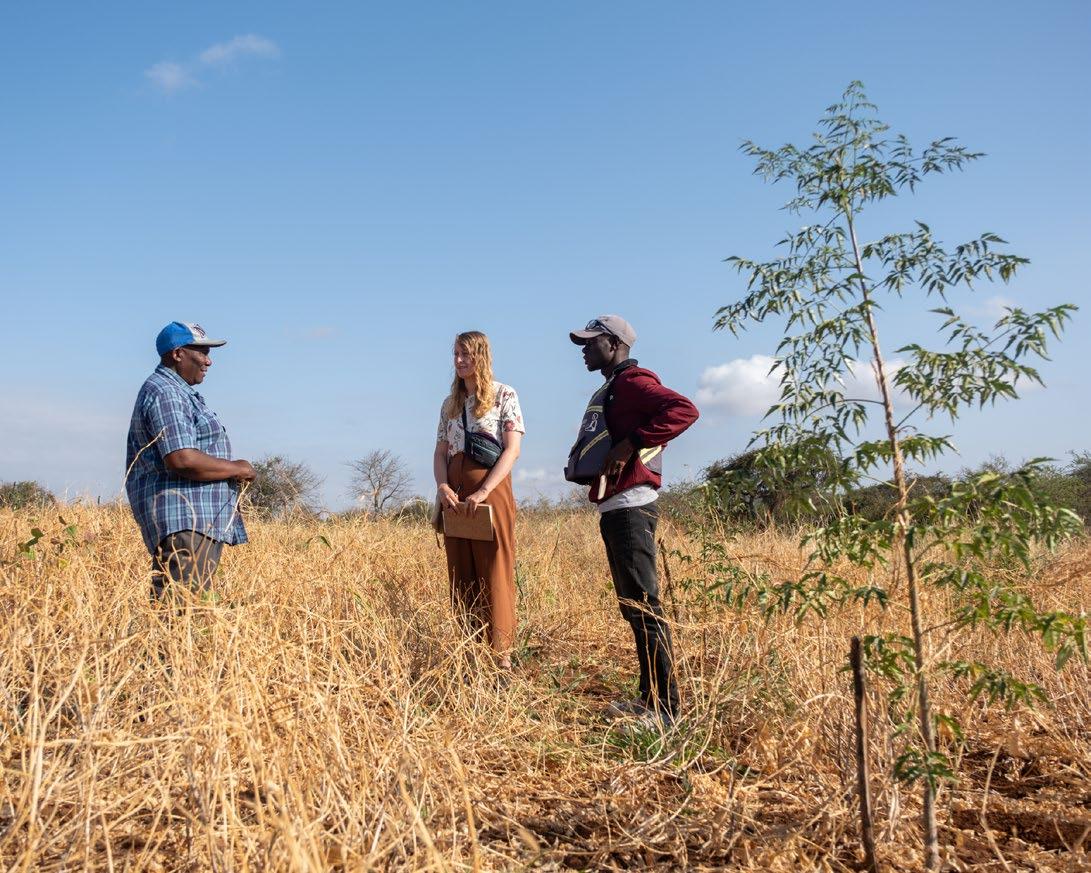
Thank you to the community of Kathome and the Kamiti CommunityBased Organization for being so welcoming and open to all my questions. I am also grateful to Africa Wood grow for allowing me to visit and for the people working there that helped me explore the rich area.
A special thanks to my teachers at the Amsterdam Academy of Architecture, Maike van Stiphout, Remco Rolvink, and Jandirk Hoekstra†, for challenging me to think critically and pushing me toward achieving the best results for this project.
I would also like to thank the NHBOS Foundation for helping fund my visits to the area.
Marlies Doesburg, thank you for joining me on my explorations and for taking many of the beautiful photographs used in this report.
And lastly, I am very thankful to all my friends and family for their unwavering support and help throughout this projects process.
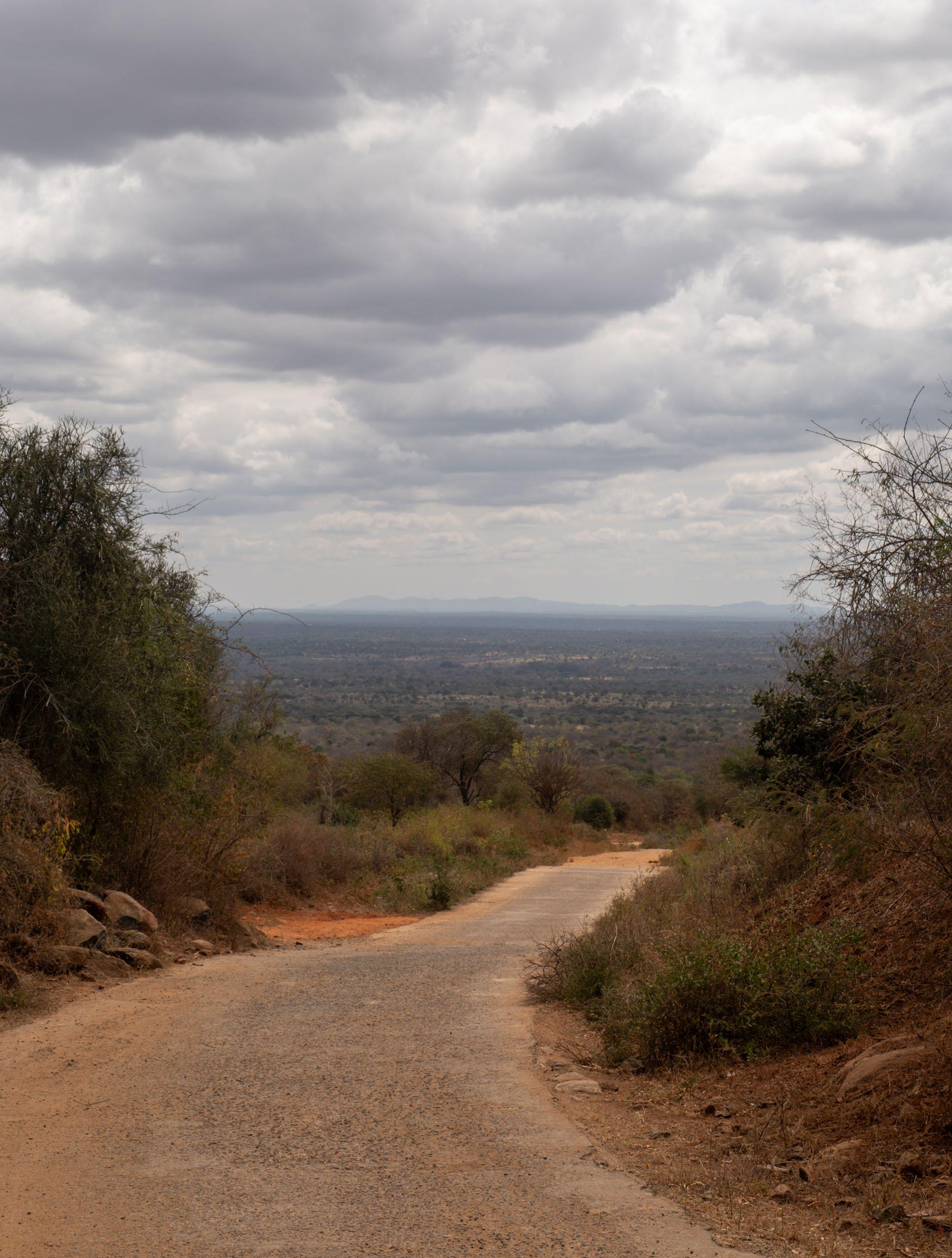
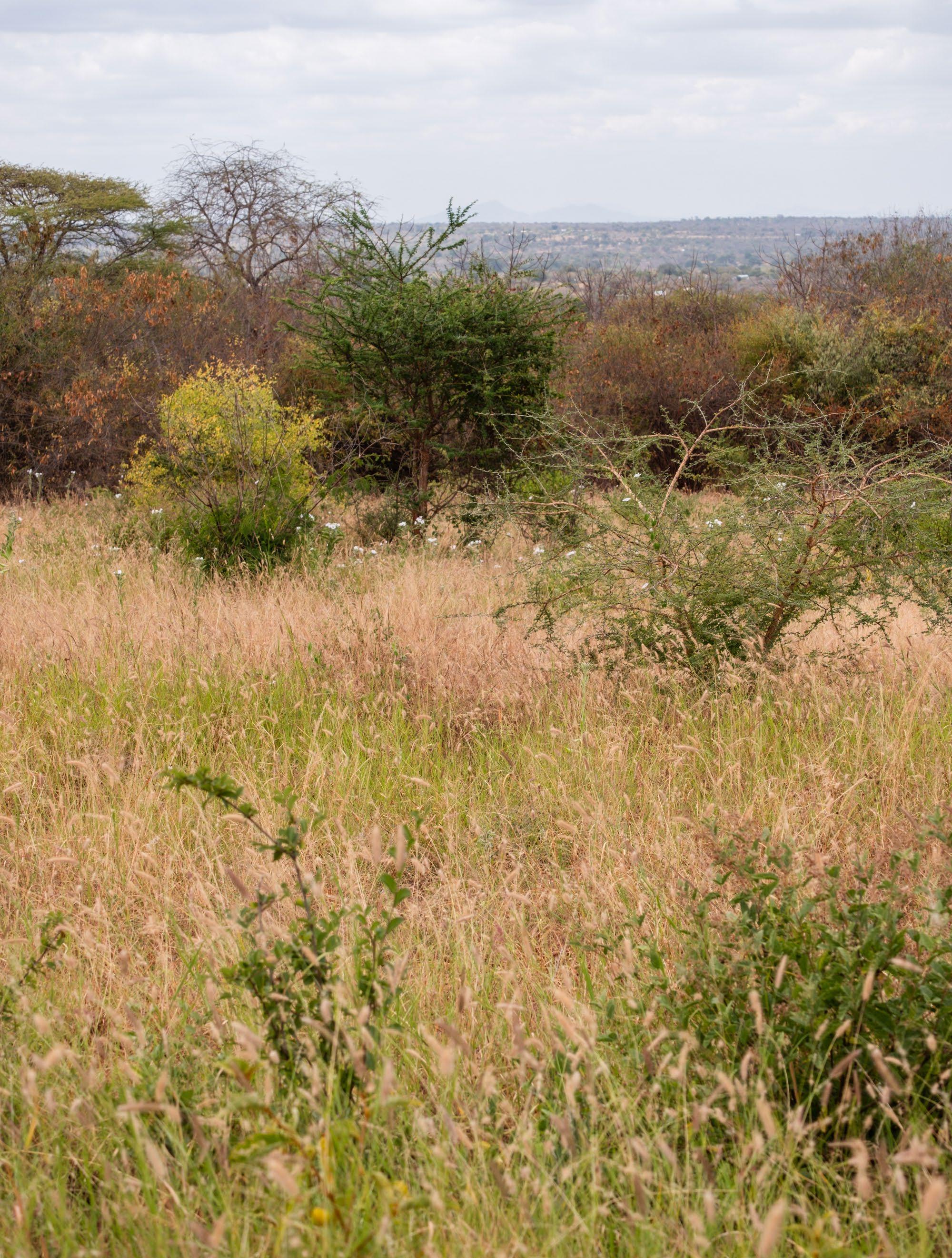
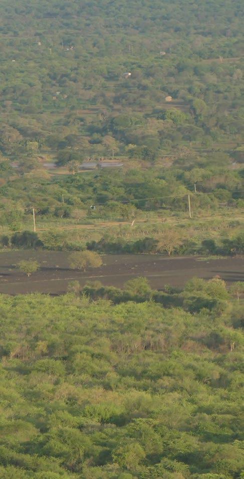
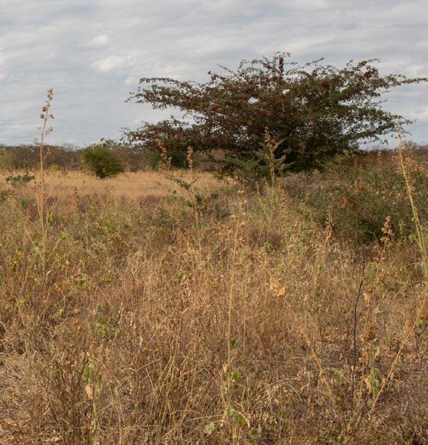
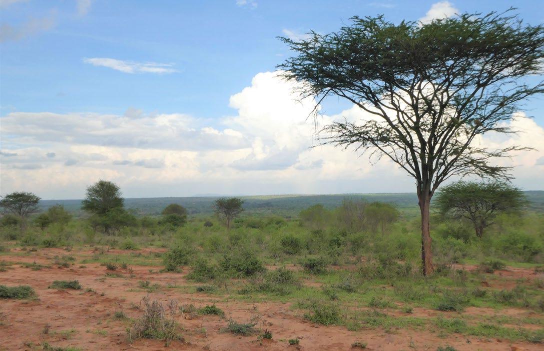
(Previous spread) [Image 1] View from Umu hill (Brugmans, 2023)
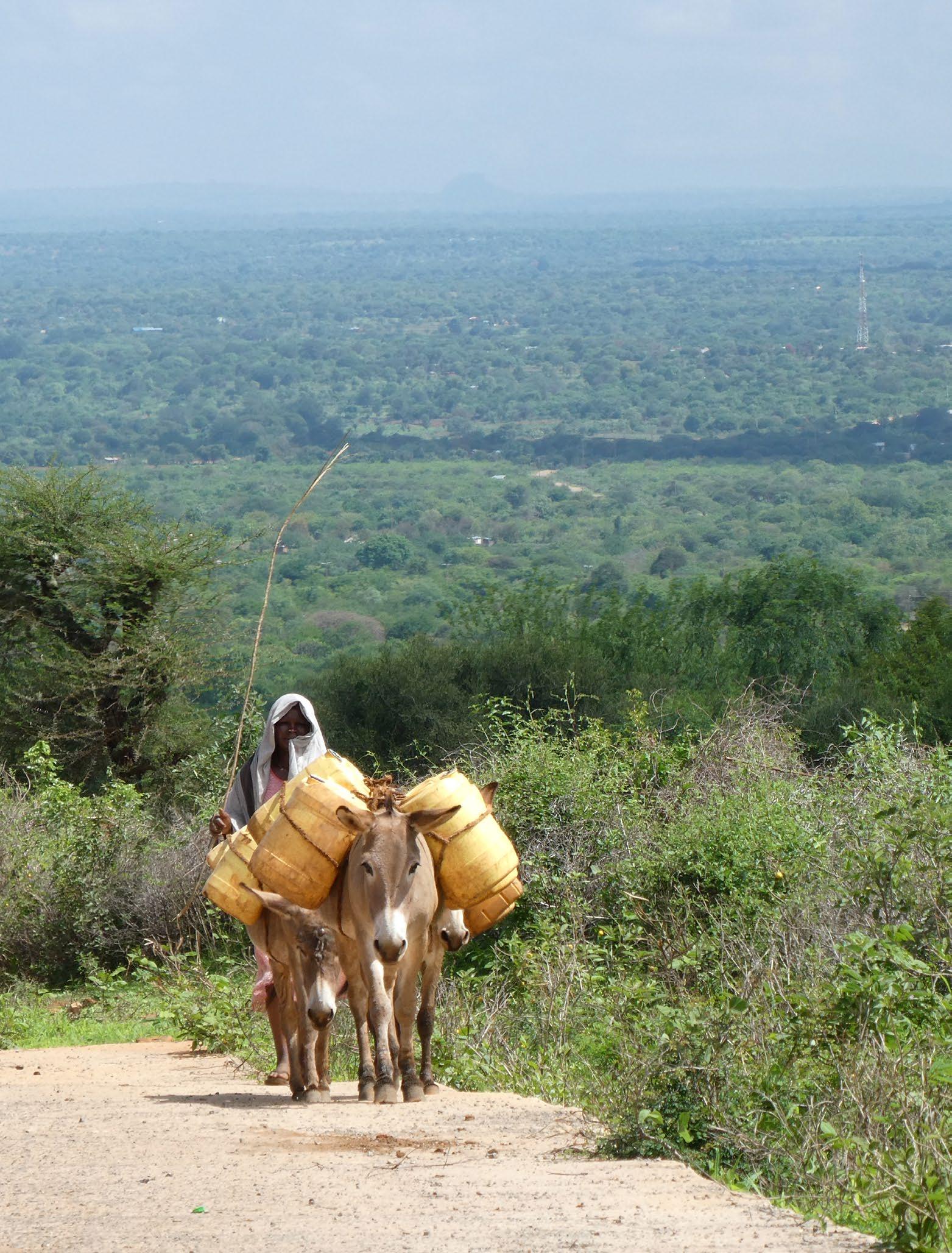
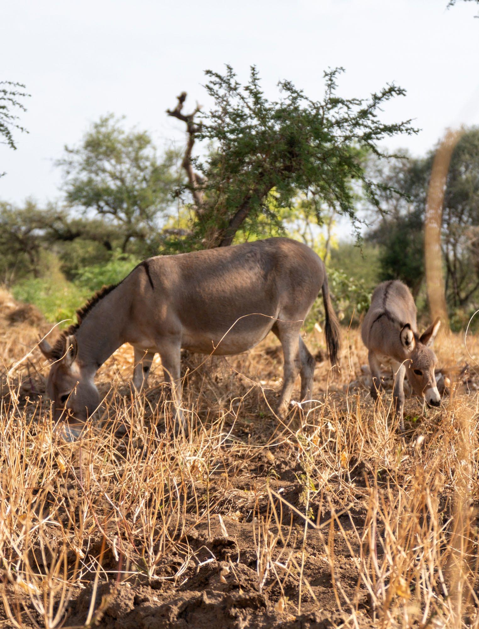
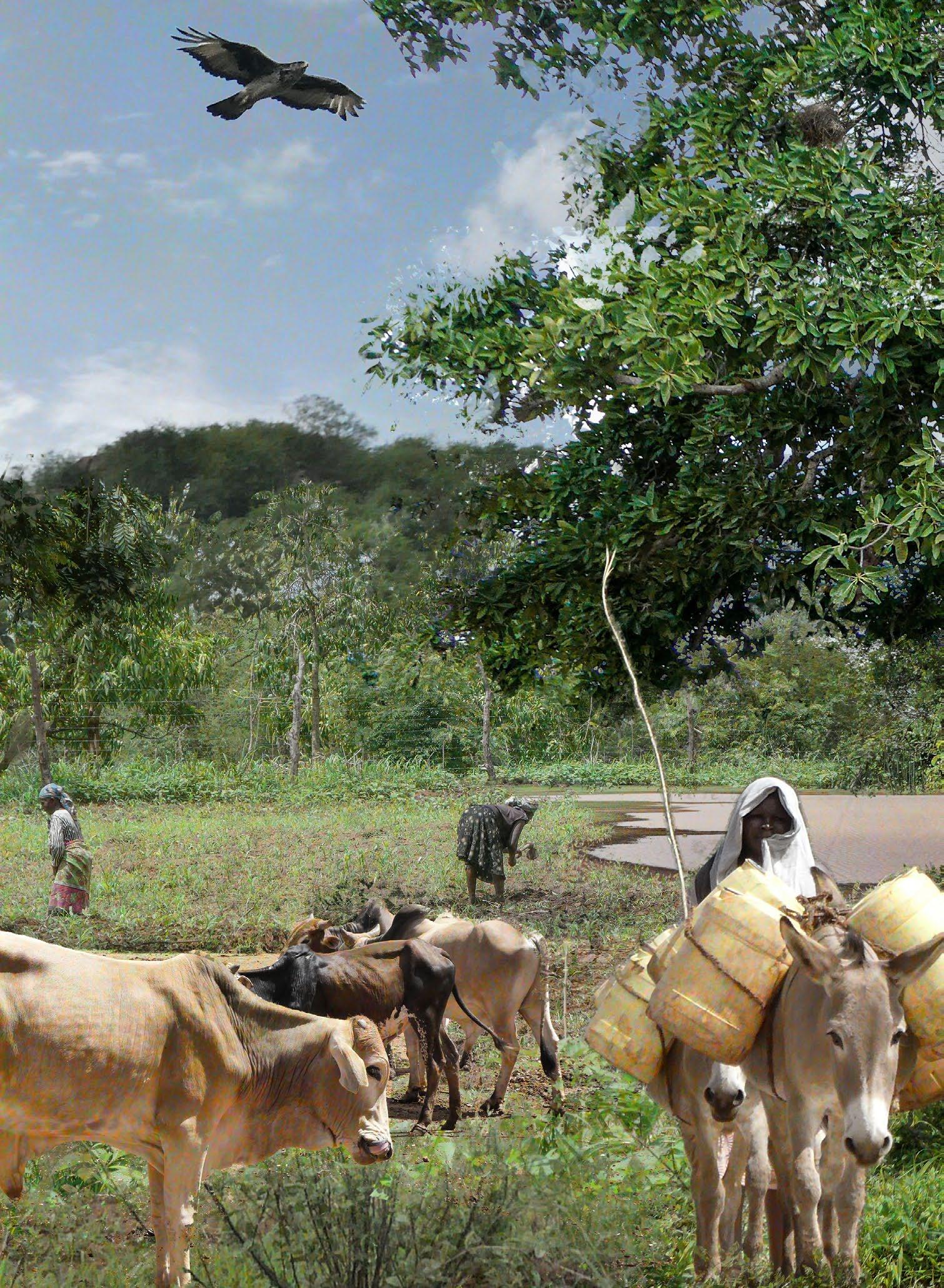
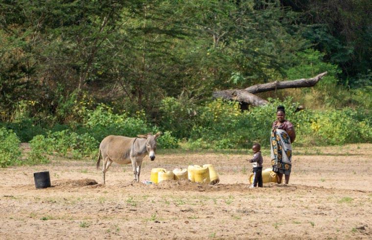
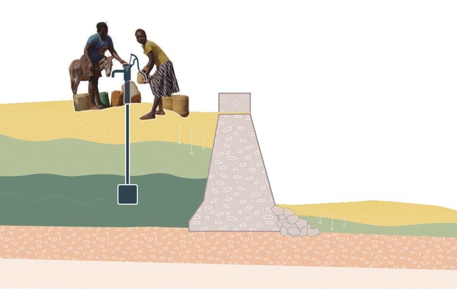
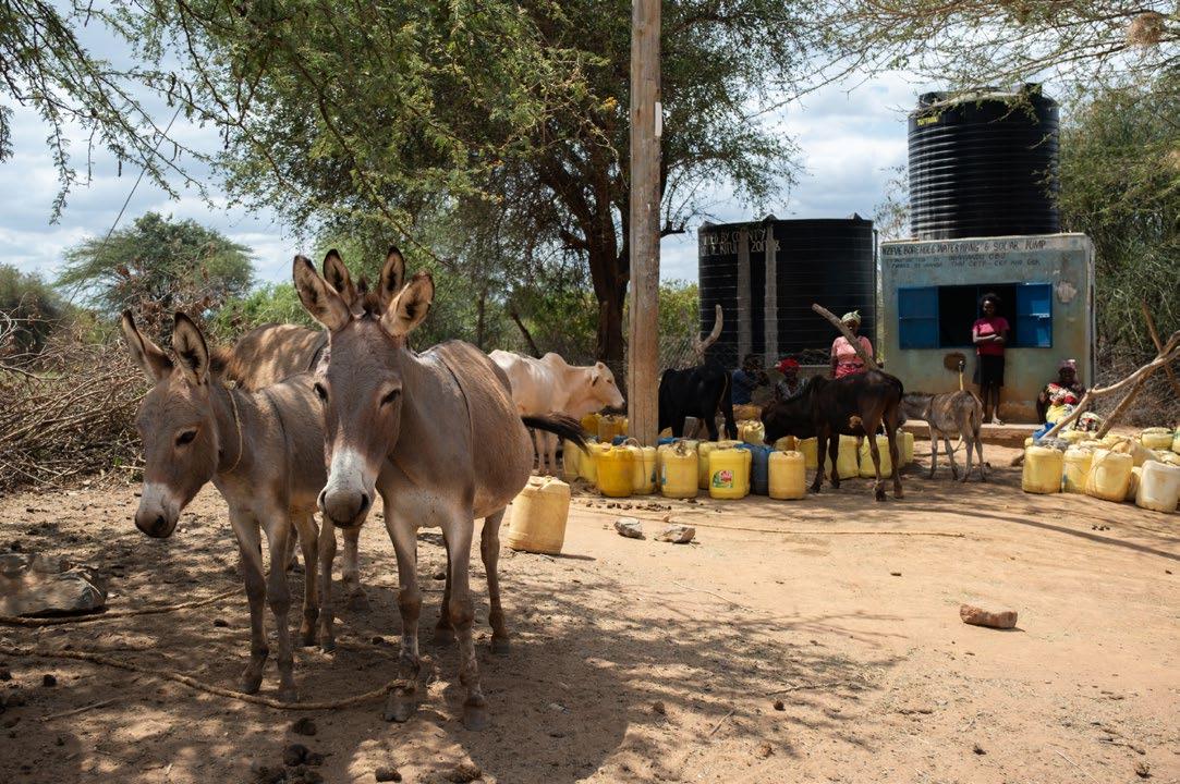
(Previous page) [Image 2] A women leading her donkeys up the Yatta plateau from a trip downhill to get water (Brugmans 2022)
Summary
Throughout history, many people settled in the river regions of Kenya because the fertile soils offered a great opportunity for agriculture. However, this opportunity is now turning into a burden due to climate change and intensive farming.
Natural processes have been disrupted and have become extreme. The Tiva river system experiences severe flooding during the rainy season and large water shortages during the dry season. Additionally, intensive agriculture has led to soil degradation and a significant loss of biodiversity. The combination of these issues forces local species and residents to either leave the once fertile lands around the river or find alternative ways to survive. Without intervention, these issues will continue to become worse in the region.
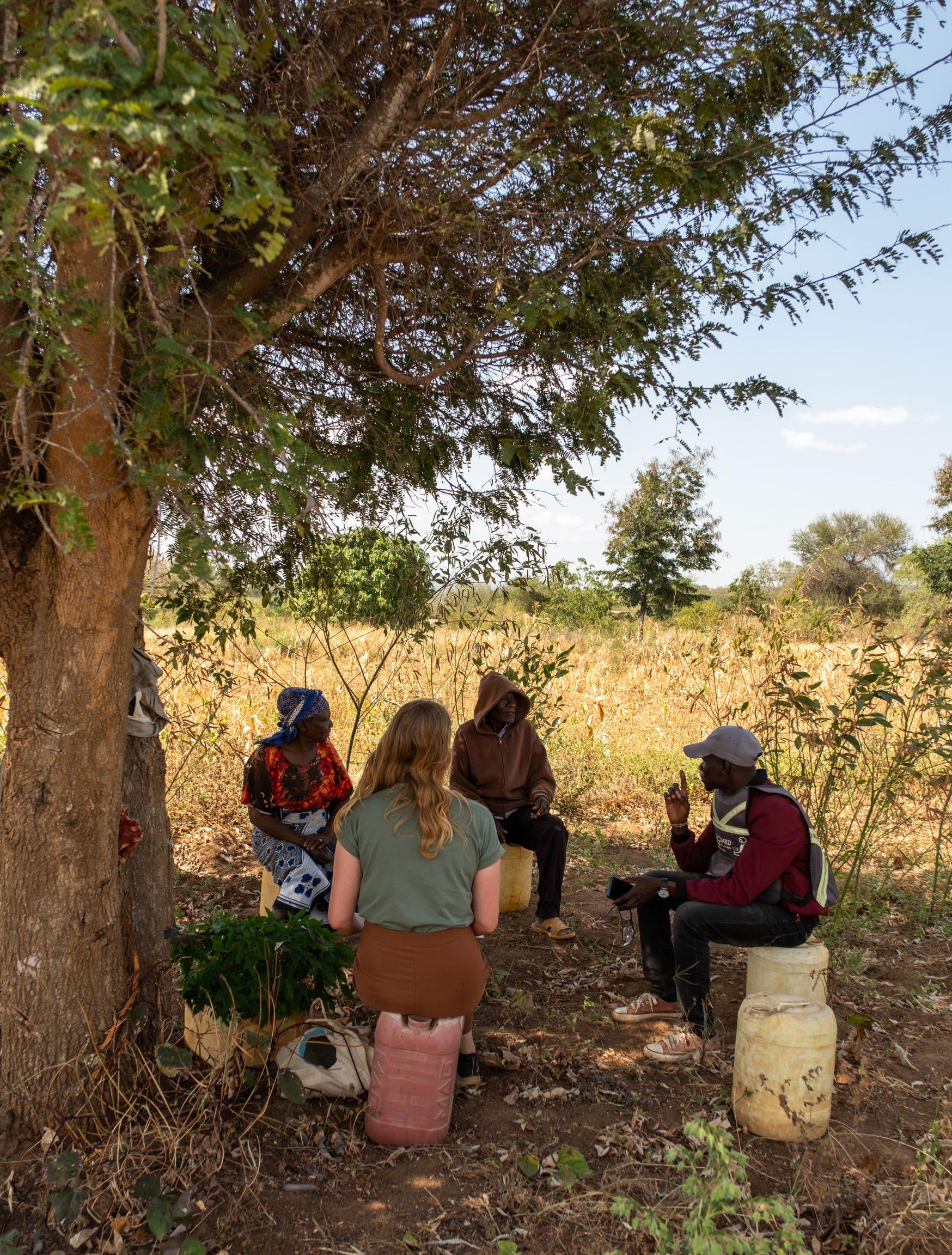
The area that is chosen for the project is the area of Kawongo. To ensure that the plan can be grounded in its location and can be implemented in the area, I visited twice to experience the area firsthand and to speak with local landowners and organizations. Collaborating and learning from the local knowledge was essential for the success of this project.
The primary goal of this project is to develop a resilient landscape system for the area. This new system aims to create a turning point regarding the increasing problems of soil erosion, water scarcity, and biodiversity loss. Through my project, I hope to provide the local community with tools to work towards a more sustainable future.
While the local population is eager to move towards sustainability, they currently have limited opportunities to address these issues. Resources are only available to tackle the most urgent problems on a small scale. Therefore, the plan includes not only physical landscape interventions but also measures to offer (social) economic opportunities. Next to that I used various scales and timed steps in the plan. This way of thinking will, in turn, create space for a step by step development of a sustainable landscape system.
The plan focuses on three key components: soil, water, and biodiversity health. These elements are essential for counteracting the climate change effects the area faces. Healthy conditions can also help harnesses the opportunities that are already present in the area. The future landscape framework will in the end not only solve existing problems but also create a foundation for sustainable growth and development for the community.
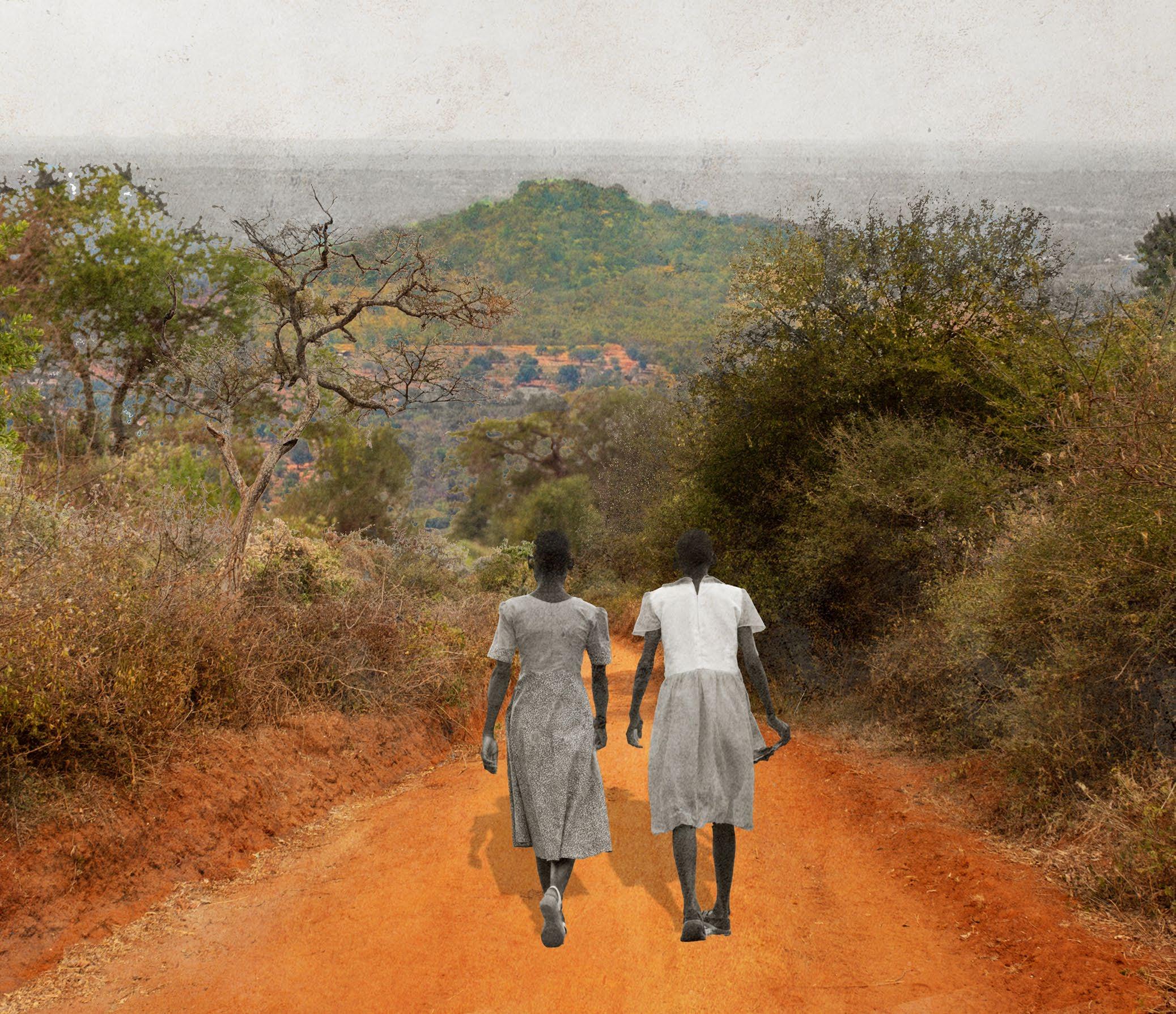
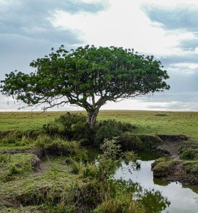
At the centre of the plan lays Umu hill. A local biodiverse landmark that symbolises the historic roots of the people and the area of Kawongo but also shows the way forward by becoming a beacon of hope for a better future for the next generation.
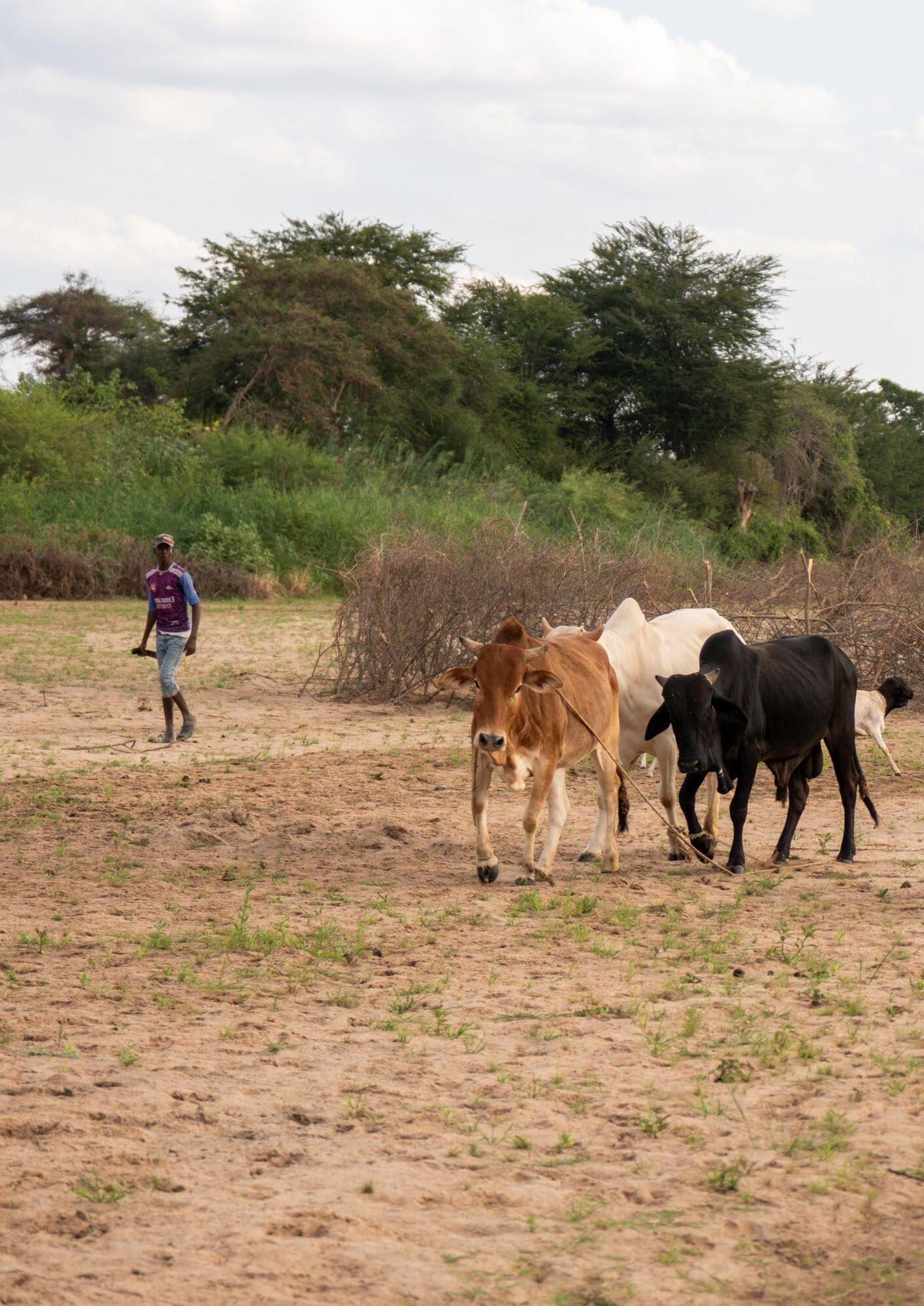
(Previous spread) [Image 3] A farmer is bringing his cattle to the Tiva river scoophole. (Doesburg, 2023)
'Water is life'
This is the one sentence I kept on hearing during my two visits in Kenya. I had heard this saying before, but it was in Kitui that I truly understood the weight of it.
Water provides life.
Life is dependant on it.
But livelihood can also be endangered by it.
Over the past years I have searched for what it is I see myself doing in the field of landscape architecture. This graduation project is the opportunity to showcase what I have learned and to fully dive into a project that is suited to my fascinations.
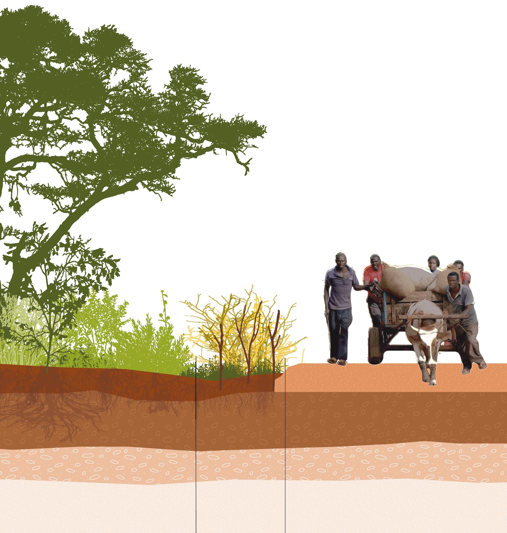
To give some background about myself: I grew up in the Dutch countryside of Noord-Brabant. There I lived enclosed by the rich nature of the Dommel river area with its forests and meadows. When I started my bachelors in Landscape architecture I moved to the city of ‘s-Hertogenbosch, where I first discovered what it is like to live in a city and to be living close to so many people. When I started my Master at the Academy of architecture I moved to Utrecht to be right in between Noord-Brabant and my study in Amsterdam.
This divide of my rural upbringing and my life in the city has translated into my work. That translation is seen in the two things that often come forward in my designs. The space for nature, and the people that will experience or make use of my designs. In this project these two elements will also be very important.
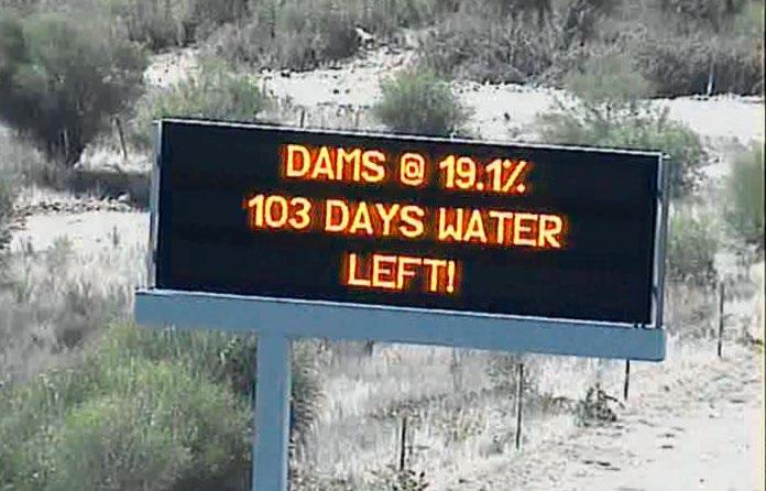
When I did my an intern ship in the field of Landscape architecture in South-Africa my views on the field started to broaden. At the moment when I was staying there was a severe draught happening. There where signs on the highway counting down the days until the water would run out. The idea that a city with almost 5 million inhabitants could run out of water really shocked me.
Because of that I had my first realisation that maybe I as a landscape architect can use my expertise to help combat the effects of climate change and maybe provide a sustainable livelihood for the future.
These experiences led me to choose an area for my graduation project where I could combine my interest in the relationship between humans and nature with my concerns about climate change and the inequality of its impacts. The area I decided to study during this is the region around the Tiva River in Kitui, Kenya. For the design, I further focused on the area surrounding the village of Kawongo.
To ensure that my plan could be effectively implemented, I visited the area twice. These visits allowed me to experience the situation first-hand and to speak with local landowners and organizations. Collaborating with and learning from the local knowledge was essential for the success of this project.
During the project I will research on different scales and subjects. My final project goal is to design a robust and functioning landscape system for the Kathome area in the Tiva river basin. I hope to provide the area an helping hand in becoming more resilient in the future.
[Image 5] Signs at the highway warning people that the dam near Cape
[Image 4]The Dommel river (Brugmans, 2023)
Town is running out of water. (SApeople, 2017)
BACKGROUND ON THE CLIMATE PROBLEM
1.1 - Global climate change
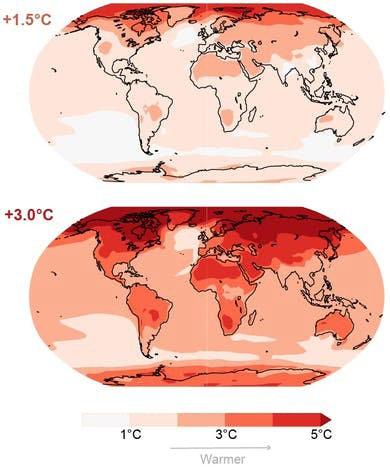
Human activity is irreversibly changing the Earth’s climate. Within the next two decades, global temperature is on its way to rise by more than 1.5C. This will breach the ambition of the 2015 Paris climate agreement, and bring widespread devastation and extreme weather. (Harvey, 2021)
In the summer of 2021 we were confronted with a case of this extreme weather with the flooding in Limburg, Belgium and Germany. European society is able to bounce back from this fairly quickly. But there is also places in the world where disasters like this happen with more severity and where people do not have the means to recover so quickly.
There is a large divide between the severity of disastrous effects of climate change we experience here versus what people in developing countries experience. (Swaby, 2021) These people are stuck with the effects of our pollution.
The IPCC (intergovernmental Panel on Climate Change) assesses the current climate change. They also dive into the division between the extend of how much climate change effects are noticed across the globe. Climate change effects vary over time and regions. For some regions the increase in temperature can even be beneficial. But for other regions temperature rise can be devastating. The effects of climate change are already more visible in certain areas then in others. (IPCC, 2013)
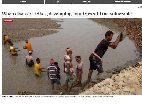
The already irreversible effects of climate change are disproportionately being felt across the world. Especially developing and low income countries are struggling to keep up with them and they are more vulnerable to the effects of climate change. The BBC states that organizations representing 90 countries already say that those countries cannot keep up with the climate induced disasters that are already happening.
According to the International Institute for Environment and Development the amount of countries that have a climate adaptation plan is increasing. (80% of developing countries are already trying to formulate and implement some sort of adaptation plan). But only 54% of the less developed countries have the actual means to take action against the things they are most vulnerable to. Extreme events like drought, flooding and storms. (Khadka, 2021)
At the time of writing this the Horn of Africa is going through one of the most severe droughts in recent history. The rainy season that was supposed to provide water for the rest of the year kept out, leaving more than 15 million people food insecure in Ethiopia, Kenya and Somalia. This is already the third time in 10 years that the people of this region have to endure severe drought. (ReliefWeb, 2022) That’s why, during this project I want to look at the more vulnerable places in the world, to see if there is something that I as a landscape architect can do to make them less vulnerable for the effects of climate change.
(Previous spread)
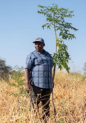
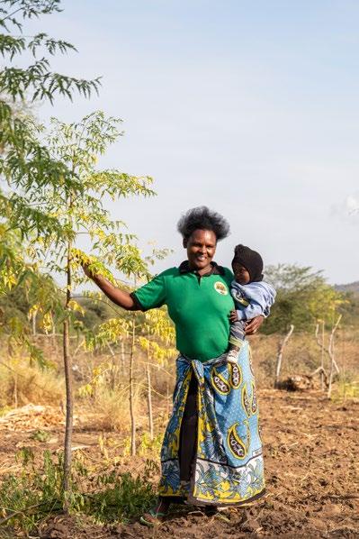
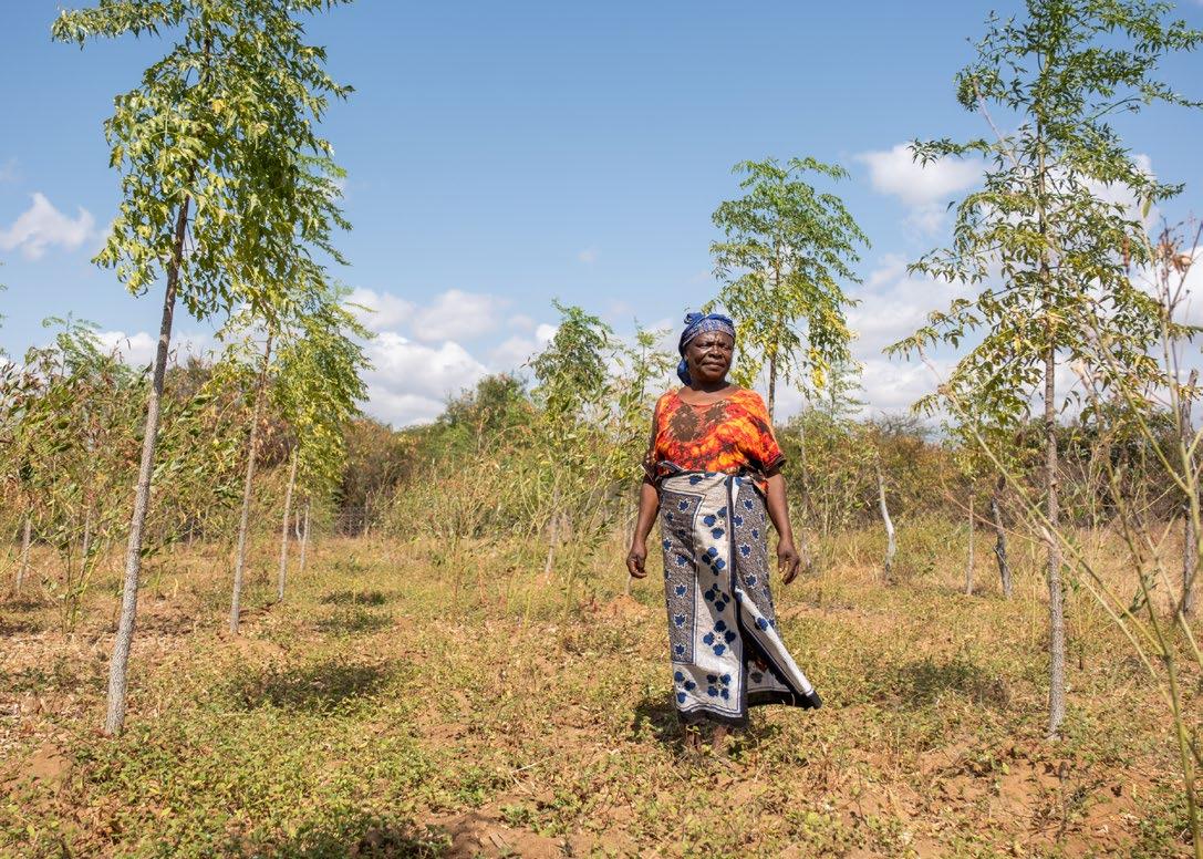
[Image 7] Farmer, Peninal, growing trees to work towards a better future for her children (Doesburg, 2023)
(Previous page)
[Image 6] A woman and child digging up water from the Tiva riverbed (Brugmans, 2023)
A specific type of area that is often most effected are river basins. River bank soils are very fertile and the best place to produce crops. This is drawing more and more people to those areas. Only now because of climate change the water is becoming so scarce that it is not enough for the amount of people that settled there. Opposing that, during the rainy season there is an increasing amount of heavy rains. It is so much water in a short amount of time which makes riverside settlements and farms the main victim of intense flooding.
It is important to figure out how water systems across the globe can be made more robust so the people who live there don’t have to deal with the different type of disasters created by the effects of climate change. For this project I want to look into a water system that is under a lot of stress because of climate change and see what I as a Landscape architect can do to provide help.
Water is one of our main sources of life. The availability and security of it is key for human survival.
The main cause of climate change is the emission of greenhouse from human activity. Manly burning fossil fuels. But also large scale deforestations has increased the concentration of greenhouse gasses in the atmosphere. Even with large scale action and interventions to slow the emission of greenhouse gasses we still will face the large scale effects of climate change.
There is no longer any doubt that we are inducing climate change. The question only is how big is the impact of our activity actually going to be? Over the past century the earth’s surface temperature has increased by 0.75 degrees Celsius. (floodlist, 2021)
The current predictions range between another rise of temperature between 2 and 5 degrees Celsius, but it is not excluded that it can even be more. The UN Secretary general António Guterres also hast stated that The disruption to our climate and our planet already is worse than we thought, and it is moving faster than predicted. (UN, 2021)
The bigger the rise in temperature the bigger the magnitude of the effects of climate change will have. The rise in temperature will have an impact on human welfare and the natural ecosystems. The rising temperatures are already fuelling devastating extreme weather events around the world, with escalating impacts on economies and societies. We already have had five times the amount of the recorded weather disasters then we had in 1970. (UN, 2021)
There is still a lot of debate about the specifics of the effects of climate change. But some facts are certain. The UN states that the following things should always be taken into account when discussing climate change: Climate change is happening now, and it is and will have effects within our lifetimes.
There is a chance that climate change will accelerate in ways that are not easily predictable and many of the induced changes will be irreversible. While climate change is a global phenomenon, its impact on countries and communities will be very different, with developing countries likely to be the most adversely affected.
Some communities will be affected very strongly and very negatively within the next two to three decades; for some countries, climate change could have catastrophic effects.
[Image 8] Global warming en perspiration change (Floodlist,2022)
1.2 - The effects of climate change
The effects of climate change can be divided into drivers of the change, changes to the system and the impact those changes have. During this project I am mainly going to focus on the effects that influence extreme weather.
The different changes to the climate system consist out of multiple aspects those aspects are:
Changes in the hydrological cycle/ water cycle intensification
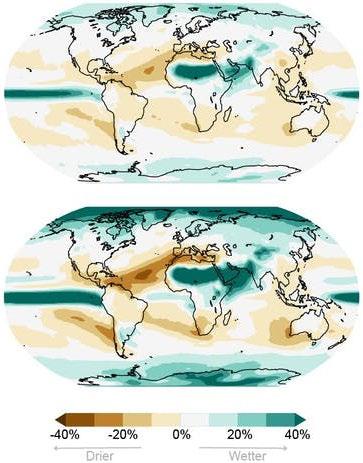
One of the effects of climate change is the intensification of the water cycle. Because of the temperature rise the atmosphere will be able to keep more moisture in the air which will result in more rain. The intensification also results in bigger differences in the water cycle itself. The amount of rain falling at one point of time will increase but there will also be more and longer dry periods.
These large differences in the water cycle will cause more extreme flooding and drought. So understanding the water cycle will also help to see what needs to be done to cope with those disasters.
Water is essential for survival, It helps thrive ecosystems and society’s. But to little or too much of it will cause disasters.
The IPCC assessment report predicts that extreme precipitation events will start happening 7% more often for every one degree the global temperature increases. (floodlist, 2021) Which will impact the water resources of billions of people. (Niang & Ruppel, 2014)
Warmer land and air temperatures
Over the past century the earth’s surface temperature has increased by 0.75 degrees Celsius. (floodlist, 2021)
More extreme weather
Often extreme weather events because of climate change are the things affecting us the most. They can effect general well-being. Measurements over time show that there is an increasing amount of warm days and a large variability in rainfall. (Met Office, 2019)
Other aspects include:
- Melting of global Arctic and glaciers
- Sea-level rise
- Ocean acidification
- Global greening
- Changes in ocean currents
Infrastructure damage
Forest mortality and increased ris of fires
Impacts
Risk to water supplies
Changes in the hydrogical cycle
Changes to theclimatesystem
Driversofclimate
Habitable region of pests expand
Change in seasonality Heat stress
Biodiversity loss
Conflict and climate migrants
Fisheries failing
Flooding of coastal regions
Damage
ecosystems
[Image 9]
The different changes in the climate system and their impact
(Next Page) [Image 10] A collection of news articles about climate problems in developing countries
1.3 - Distribution of climate change effects
In recent decades the temperatures across the globe have been rising. There is an increase in hotter days and heat waves. Rainfall is in certain areas also either increasing or decreasing. These climate change effects are influencing main sectors of wellbeing. Agriculture, biodiversity, settlements, infrastructure, food and water security, health and socioeconomic development. (Babugura, 2022)
Drought
The United Nations World Food Program says that because of climate change almost 60 million people in Eastern Africa are having to deal with food insecurity.
Across multiple eastern African countries including Kenya, Several back to back droughts have made it difficult to sustain crops and cattle. In Kenya more than 80% of the country is suffering from extreme dry conditions. Between 2011 and 2012 Eastern Africa was even faced with the worst drought in 60 years. (Babugura, 2022)
Because of the drought and food insecurity a lot of people had to leave their homes in search of better conditions. Nowadays the border region of Kenya and Somalia is still home to overcrowded refugee camps. The last reported drought was in 2019 and a new one is happening at the moment since the start of 2022. At the time of writing this (June 2022) Kenya is experiencing extremely dry conditions and 3.5 million people are facing severe hunger. (ReliefWeb, 2022) Next to that the changes in climate are also resulting in major biodiversity decline across multiple countries.
Flooding
After the extreme drought of 2019 the climate shifted for a short while. In 2020 multiple countries received at least double the amount of rainfall of a normal season. This resulted in record high river and lake levels and severe flooding. (Babugura, 2022) In Kenya 285 people were killed and over 800.000 people were affected and displaced by flooding in May 2020.
The flooding also resulted to large scale crop loss which than again resulted into food insecurity. (Celestial, 2022)
This vicious cycle of extreme drought and flooding keeps on repeating seemingly without a pause to let the vulnerable, affected people take a breath. That’s why it is so urgent to start figuring out if there is a way to make it better.
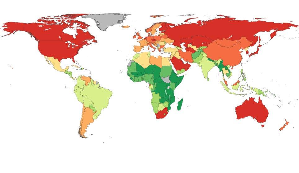
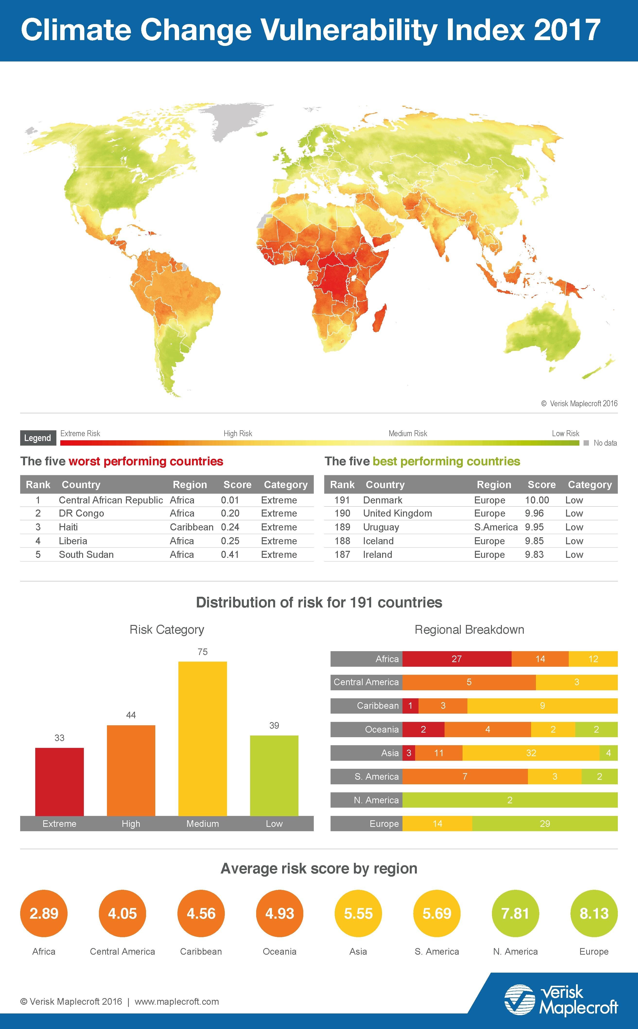
[Image 11] On the left a map of the CO2 pollution per capita, on the right a map of climate vulnerability. The maps are the opposite of each other.
(worldbank, 2011) (verisk
maplecroft, 2016)
1.4 - Responsibility and vulnerability
There is a pattern to be found in the way CO2 emission and climate change vulnerability are spread around the world.
When looking at who is responsible for climate change the left map on the previous spread shows a clear divide. The darker red the colour is the bigger the amount of CO2 emission per capita in that country.
The map on the right shows the vulnerability because of climate change. Here, the more red the colour is the more risk people have to experience or be vulnerable for extreme climate change effects.
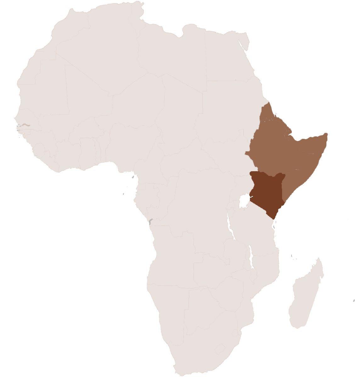
The maps are almost the opposite of each other. Which shows that the places that produce the most CO2 emission also are less vulnerable to experience the effects of climate change. The places with the least amount of emission that are actually the most vulnerable. Breaking that down into continents the continent of Africa shows to have the most risk to be vulnerable to the effects of climate change.
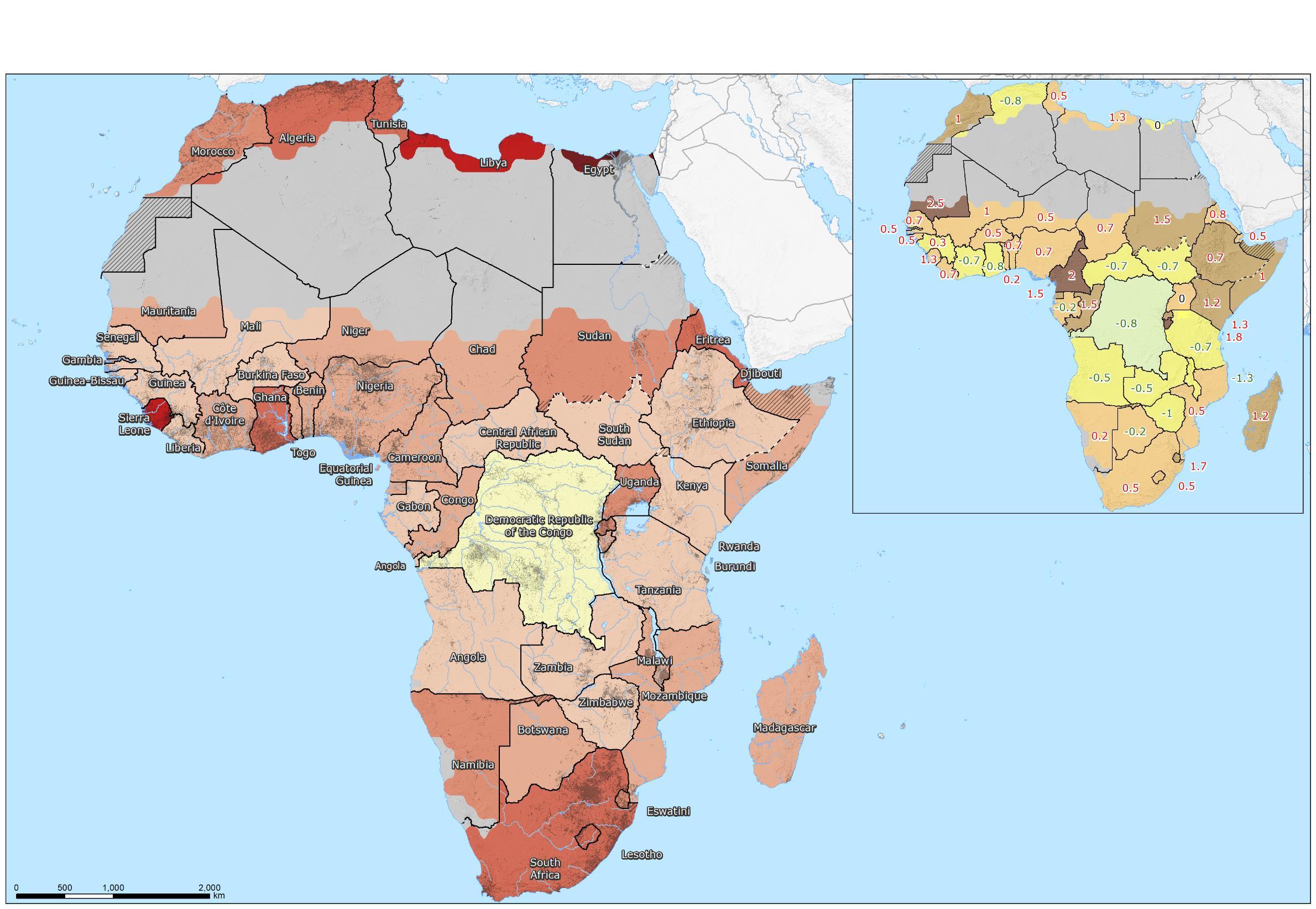
That’s why during this project I am choosing to work on a site in Africa. Because there, they are more vulnerable to the effects of the climate change that we are causing in Europe and North America.
I feel like it is necessary for us as Europeans to also start worrying about the effects of climate change that are already happening in other places because we are the cause of them. We need to do something before it is to late!
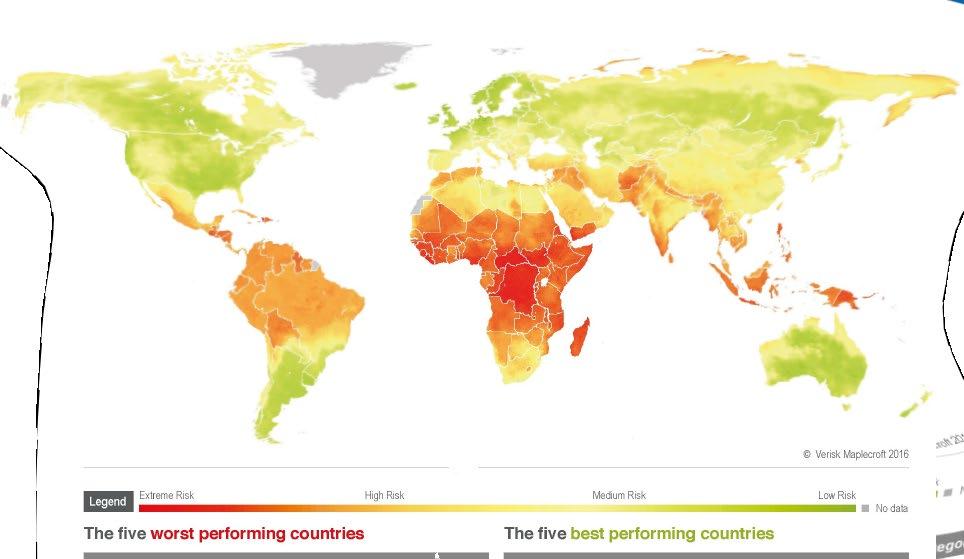
[Image 12]
Vulnerability and risks per continent
(Verisk maplecroft 2016)
FINDING A SITE
KITUI COUNTY
KAWONGO AREA
(Previous spread) [Image 14] Tiva river pumps (Doesburg, 2023)
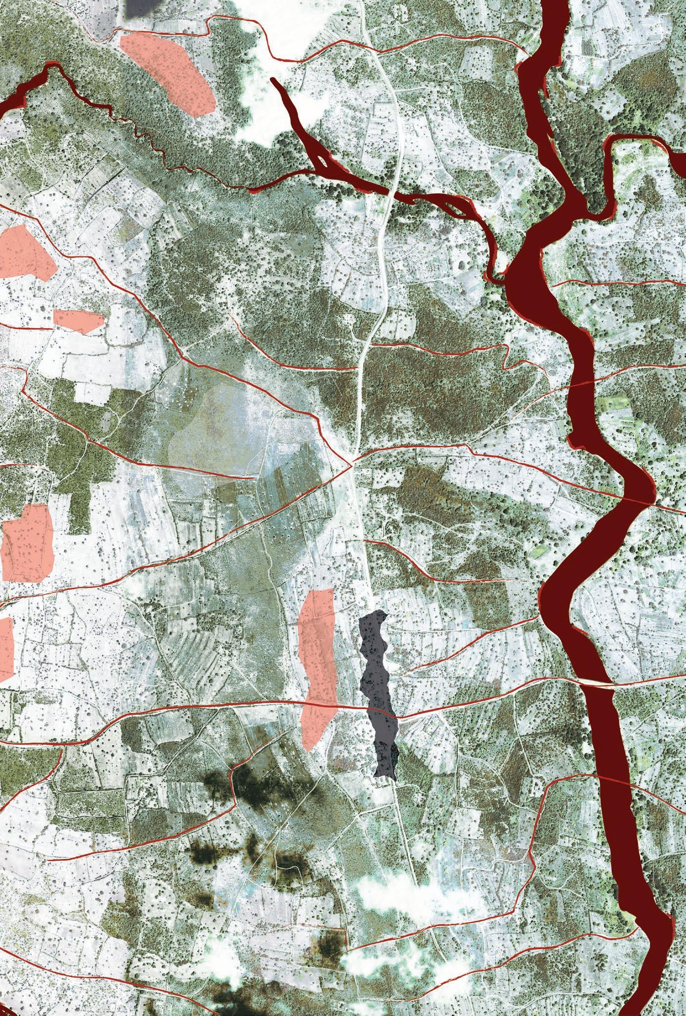
[Image 13] Zooming in to find a project site (Brugmans, 2023)
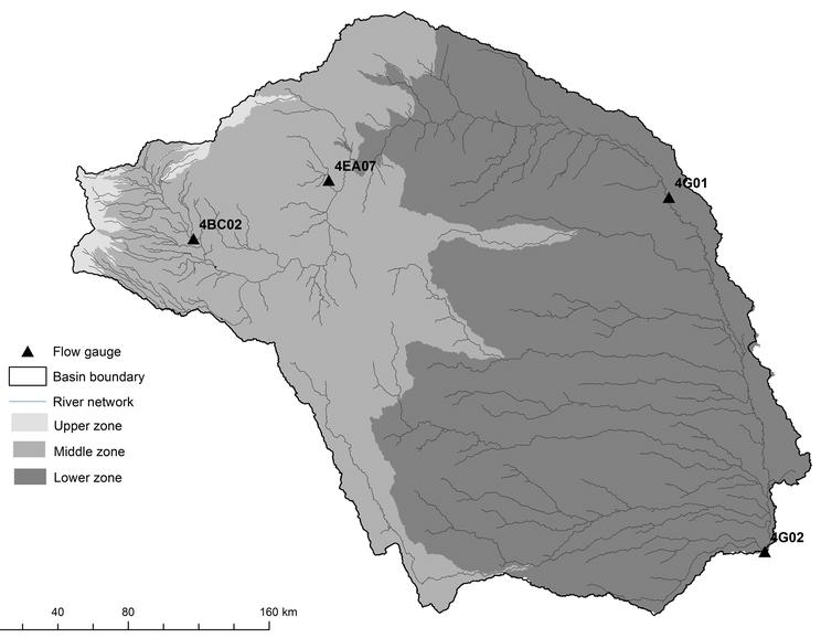
TIVA CATCHMENT AREA
NORTH ATLANTIC OCEAN
Drought frequency comparison between 2010-2019 and 1950-2009
Source: JRC GDO Increase (+2.5)
( 1.3)
The time series of 2010-2019 of the drought frequency and severity was used to represent the drought, and its trends in comparison with the previous period 1950-2009.
Increased drought frequency (during 2010-2019, compared to 1950-2009) was experienced by the majority of countries throughout the whole continent, particularly in Mauritania (the largest increase), Cameroon, and Burundi Increased drought severity was experienced also in this case by the majority of countries, particularly by northern countries (Egypt reports the largest increase), and South Africa
Combining frequency and severity, it is possible to identify "hotspots" affected more frequently and more severely by drought during 2010-2019, compared with previous decades: northern countries such as Morocco, Mauritania, Libya, and Sudan, as well as Sierra Leone, Rwanda, and Madagascar.
1Severity represents the severity of drought events per decade (per country), and uses the Standardized Precipitation-Evapotranspiration Index at the 3-months accumulation period (SPEI-3)
The difference between SPEI-3 values and a threshold is computed for all events, and the results are summed overall to obtain the severity
2Frequency represents the number of events per decade (per country), and uses the SPEI-3 A drought event starts once the SPEI-3 falls below the threshold for at least two consecutive months, and ends when the SPEI-3 turns above 0.
3Area with Aridity Index (AI) < 0.2. Computed drought severity and frequency does not take into account this Arid/Hyper-arid area (regarding countries that contain it).
More info and references: JRC GDO (Global Drought Observatory), Spinoni et alii, 2019, 2014, JRC WAD (World Atlas of Desertification). Not analysed countries/territories: Canary Islands (ES), Cape Verde, Comoros, Madeira (PT), Mauritius, Mayotte (FR), Réunion (FR), São Tomé and Príncipe
As stated before, the effects of climate change are disproportionally being felt across the globe. To find a specific site I want to work on during my graduation I am zooming in. I first started on the global scale. Then I zoomed into Sub-Sahara Africa. Here people are the most vulnerable to the risks of climate change effects as shown on the previous pages.
Sub sahara Africa
The maps on this page show two examples of an effect of climate change. Drought and flooding.
In the map on image 15 it can clearly be seen that in most countries, there has been an increase in the frequency of meteorological droughts. This shows that the effects of climate change are becoming more and more visible.
The map in image 16 shows the correlation between poverty and flood risk. The map shows that there are few areas where the flood risk and poverty are both on the lower scale in Sub-Sahara Africa. This shows the vulnerability of the people in the affected areas.
The horn of Africa
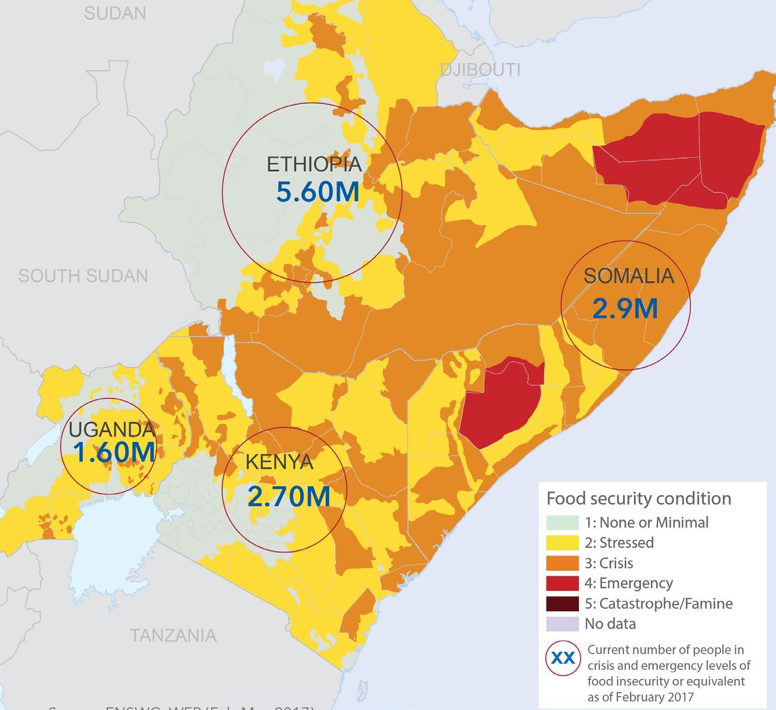
Zooming in further the Horn of Africa comes into view. This region of Africa is currently undergoing extreme drought. (ReliefWeb, 2022)
The map in image 15 on the previous page shows that this area is more frequently affected by droughts. Next to that flooding is also becoming more severe here. (See image 16) in all the countries combined about a million people have been displaced because of flooding in 2020 alone. (Emergency Response Coordination Centre, 2020)
The Food security situation is also becoming worse because of drought. The drought is forcing more people to leave their homes.
Because there is a difference between the different countries in the horn of Africa climate refugees have also started to cross the border between countries.
This movement is starting to cause social problems. Because it creates conflict between refugees and residents of areas that people are starting to flee to. In Kenya’s Tana River Basin there has been know conflict between local farmers and Somalian refugees. (United Nations High Commissioner for Refugees, 2022)
(Previous page)
[Image 15] Drought frequency in Sub-Sahara Africa (Reliefweb, 2021)
[Image 16] Flood risk compared to poverty in Sub-Sahara Africa (Madden, 2022)
[Image 17] Food insecurity because of drought in the horn of Africa (FNSWG, 2017)
Horn of Africa | Floods
TANZANIA
Kenya
Kenya is located on the eastern coast of Africa and the most southern point of the horn of Africa. Kenya’s geography is very varied and it has (if it happens) a rainy season from March until May and from October until December.
The country has about 48 million inhabitants of which 97% of population is of African descent. This group consist out of over 70 different tribal groups. Kenya’s primary languages are English and Swahili but each tribe can also have its own language. The biggest practiced religion is Christianity. It is a big part of peoples culture (Geographia, 2007)
Brief history
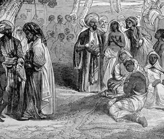
The Horn of Africa has been known to be a migratory region. The Portuguese arrived at the end of the 15th century, dominating the region until 1729. They were replaced by Arabs. This Arab leadership lasted until the end of the 18th century, when Kenya was transferred British governance. The country became independent in 1963. Kenya has in recent years been moving toward a more stable, multi-party political system. (Geographia, 2007) A more detailed time line of important events in Kenya can be found on Page 38.
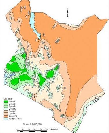
Kenya’s climate zones and risks
80% of the country is semi-arid to very arid. These zones are mostly inhabited by pastoralists and agro-pastoralists. They support about seven million people and more than 50% of the country’s livestock. These areas are difficult for rain fed cultivation due to physical limitations such as aridity and poor vegetation. (Ministry of foreign affairs, 2018) Nonetheless farmers still try to make a living with crop farming making it their biggest source of income.
Agro- Alpine
High potential
Medium potential
Medium potential
Semi- Arid
Arid
Very arid
Water bodies 0
[Image 19] Agroecological zones Kenya with the Tana and Tiva river basins marked (Ministry of foreign affairs, 2018)
Pastoralism hunters and gatherers
Kitui, the place where iron goods are made
First Kamba people Settled in the area and started trading
First Europeans in the area of Kitui Arabs took over the trading
Chief Kivoi Mwendwa important role in history
Chief Kivoi died in a expedition guiding European colonizers
1883’s
Start of rule
[Image 20] Time line of important events in the history of Kenya and Kitui (Brugmans, 2024)
Resource based economy. The British government forced inhabitants into native reserves and created game land.
Large scale land use increase, 100000 hectares of bushland cleared Working towards a better future
2000
Battle against climate change becomes more and more urgent
Now
Large scale restoration strategy, national parks are protected
1964
2010
Kenya is declared independent Africa wood grow comes to the area of kawongo
British colonial
Tiva river basin
The country can be divided into five major river basins. For this project, I have chosen to focus on the Tiva River basin, which is part of the larger Tana River basin area. This basin is a compelling case study due to the variety of climate-related challenges it currently faces.
Despite these challenges, the Tiva River basin holds significant potential for agriculture and biodiversity. The area's diverse ecosystems and fertile lands make it an ideal subject for studying the interplay between climate change effects and the opportunities for sustainable livelihood development.
The main challenges of the area are The intensification of the water cycle by the changing climate and biodiversity decline because of the growing population and pressure on the landscape.
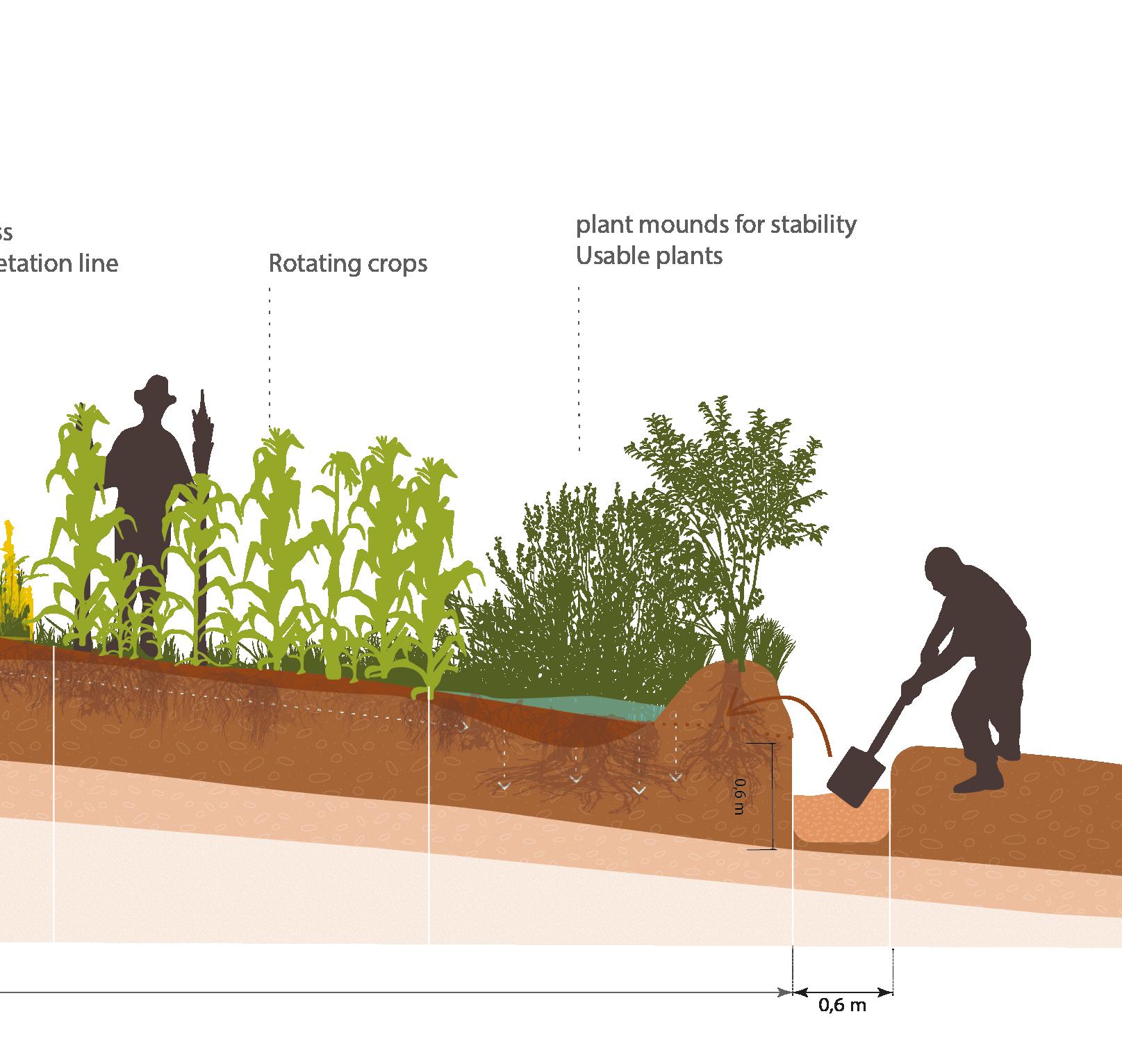
Water cycle intensification
The Tiva River (the red line in image 21) is a seasonal river flowing through Kitui County. Historically, the fertile soil and easy access to water of the Tiva River basin have drawn people to the area. However, due to extreme weather caused by climate change, the water that was once welcomed is becoming more dangerous. Historical trends indicate that rainfall in the region will continue to increase, with predictions suggesting a rise of 43% by the end of this century (Muthuwatta et al., 2018).
This increase in rainfall will result in higher peaks of precipitation and a disproportionate rise in water flow throughout the entire river basin. Additionally, there will be more severe dry periods, such as the one that occurred in 2022. These two extremes will lead to greater variability, with an increased frequency and severity of both soil eroding floods and livelihood threatening droughts. (Muthuwatta et al., 2018).
The increase in rainfall threatens the agricultural-based livelihoods that people in the area rely on. The water, once beneficial, is becoming a burden because it cannot be properly harnessed. As the population living near the river has grown over time, more people are now at risk of losing their livelihoods due to these changing conditions. The promising area their ancestors once settled in is no longer as viable as it used to be.
Despite these challenges, the increased rainfall could potentially help reduce water scarcity during dry periods in the future, aiding irrigation and water supply diversions. However, turning the extreme amounts of water into an opportunity requires effort. Resilient water resource management systems will be needed to adapt to the increased water flow and greater variability caused by droughts (Muthuwatta et al., 2018).
Biodiversity decline
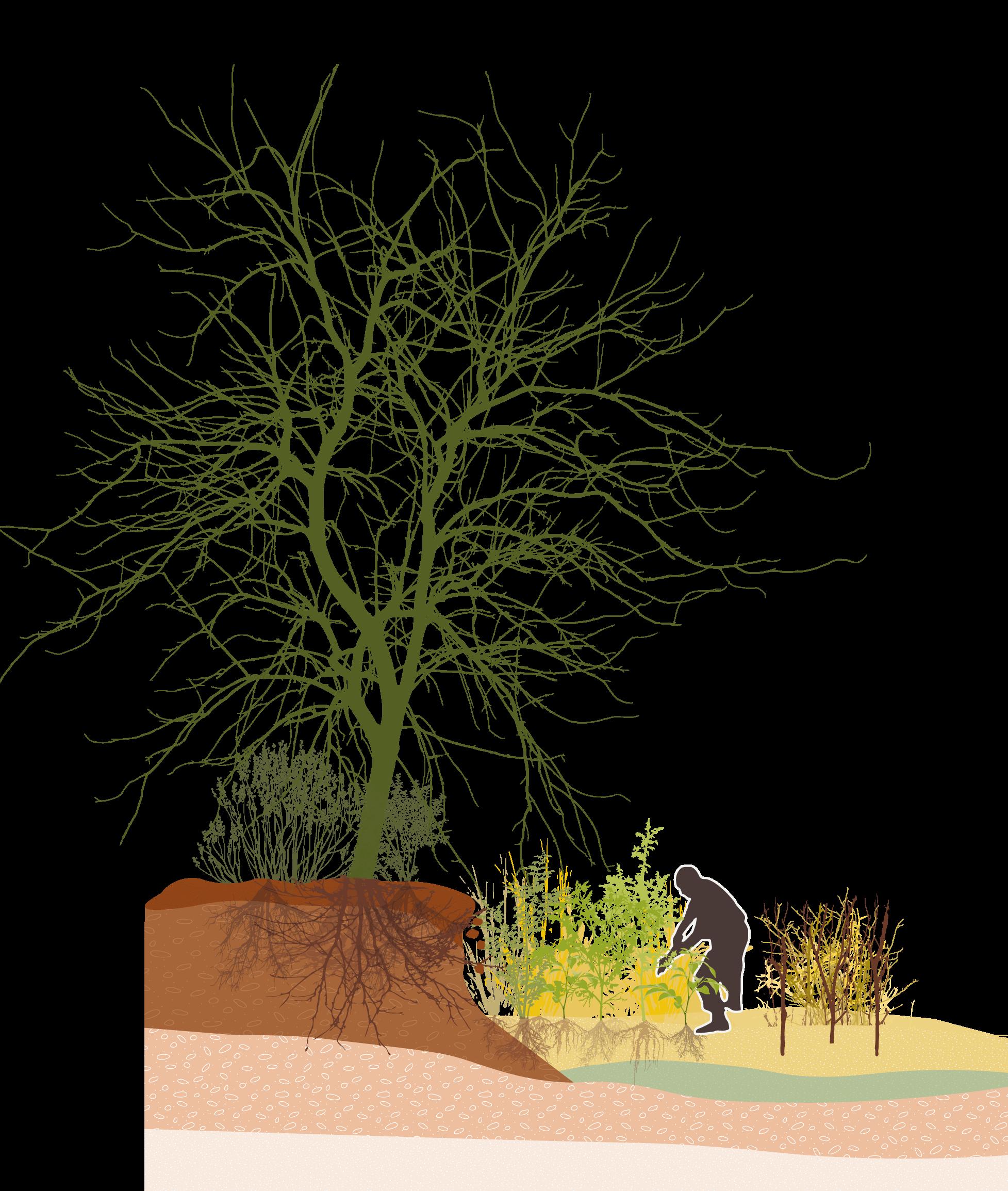
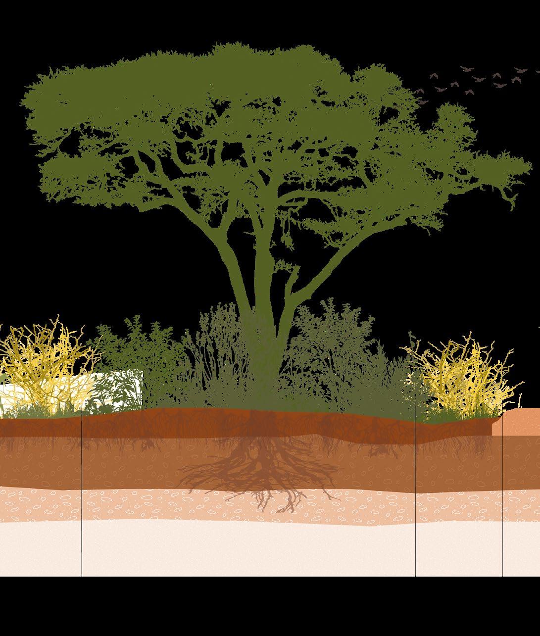
Biodiversity decline is often linked to land degradation, and this is also true for the Tiva River basin. A significant portion of the landscape has been converted into agricultural land, which provides short-term benefits to the local people. However, higher biodiversity can also support farmers in the long term by, for example, increasing the presence of pollinators like bees and preserving trees that help retain soil moisture. Additionally, greater biodiversity can help mitigate the effects of climate change.
Intense agriculture is not the only factor contributing to biodiversity decline. The global rise in temperature also plays a significant role. Research indicates that a temperature increase of 2 degrees Celsius could lead to the loss of habitats for an average of 38% of birds and 31% of mammals in the Tana River basin. If the temperature rise reaches 4.5 degrees Celsius, it is predicted that 65% of birds, 54% of mammals, and 56% of current plant species could be lost from the basin (Jenkins et al., 2021).
Currently, certain reserves have been designated by the Kenyan government to protect biodiversity, one of which is Tsavo National Park. The Tiva River is a crucial water source for this national park, making it essential for the survival of the wildlife living there. Due to extreme weather conditions, wildlife organizations have already been forced to provide supplemental feeding for the animals in these parks. Having to supply water as well would be an almost impossible task.
A resilient change of the landscape system of the Tiva river would be benefsial to the local farmers and the larger ecosystem.
[Image 21]Three different zones of the Tana River Basin and the Tiva river (Muthuwatta et al., 2018)
KAWONGO
(Previous spread)
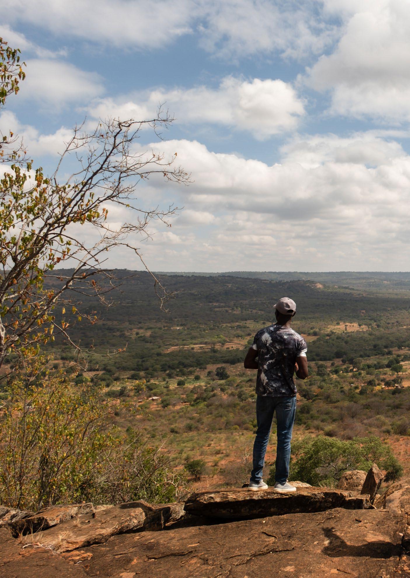
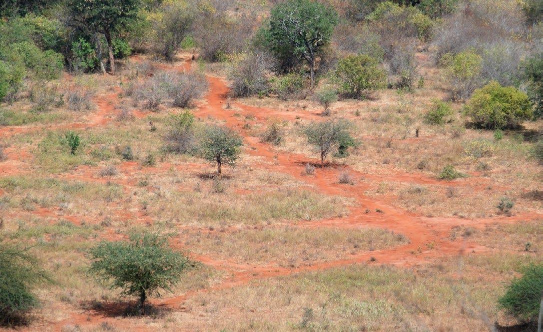
[Image 23] Climbing Umu to have an overview of the area (Doesburg, 2023)
(Next page)
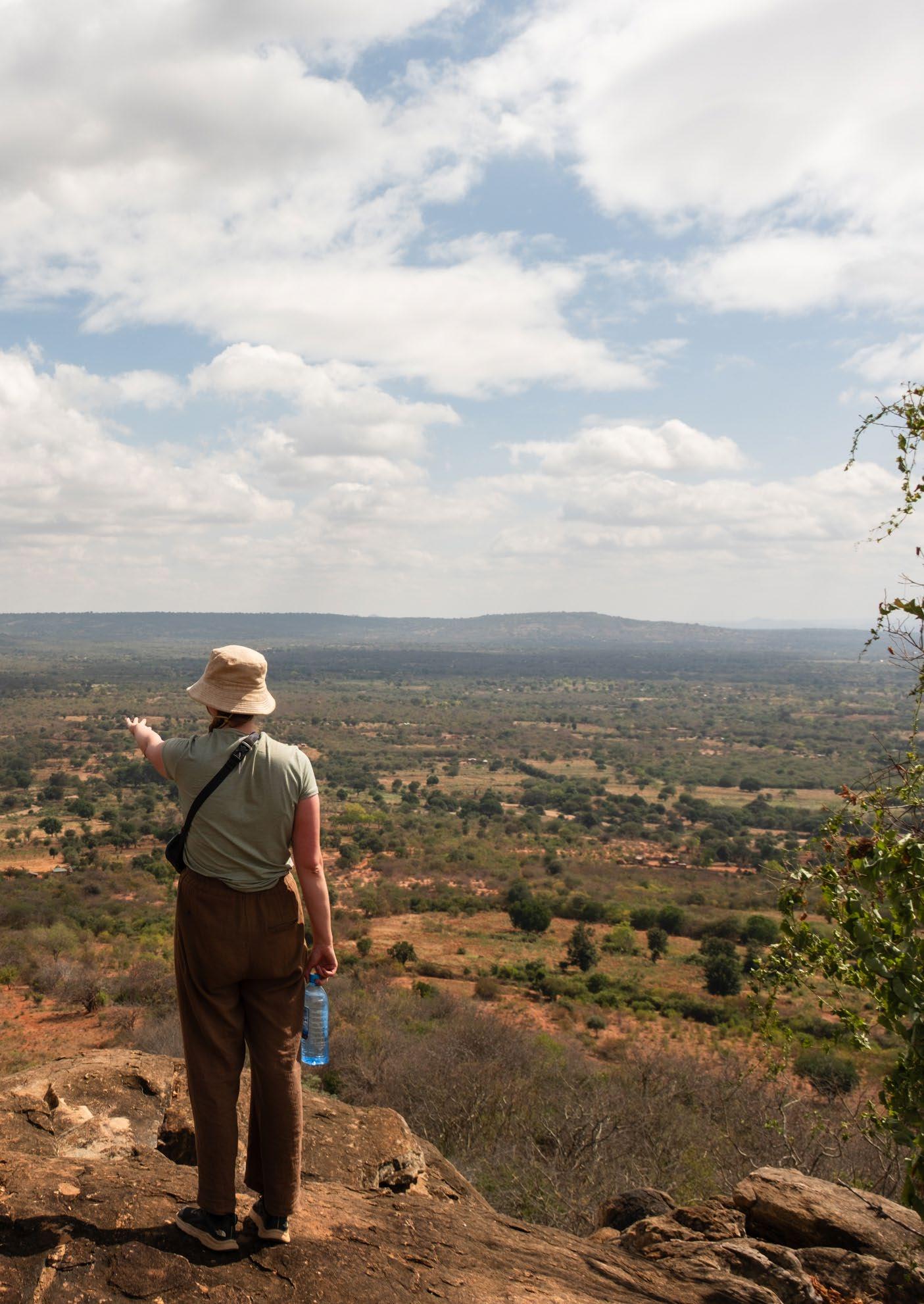
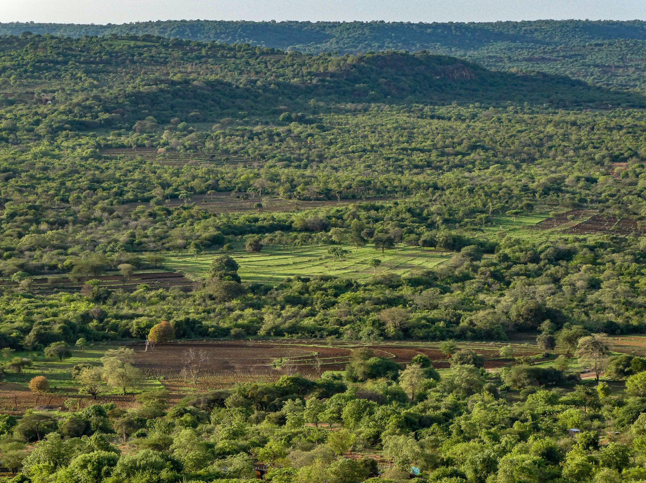
[Image 22] View over Kawongo from the Yatta plateau (Doesburg, 2023)
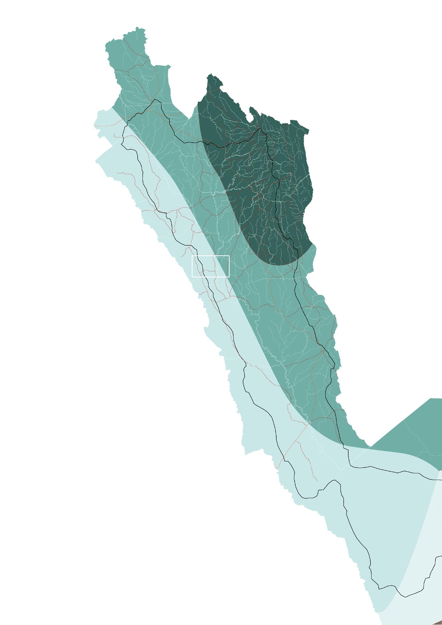
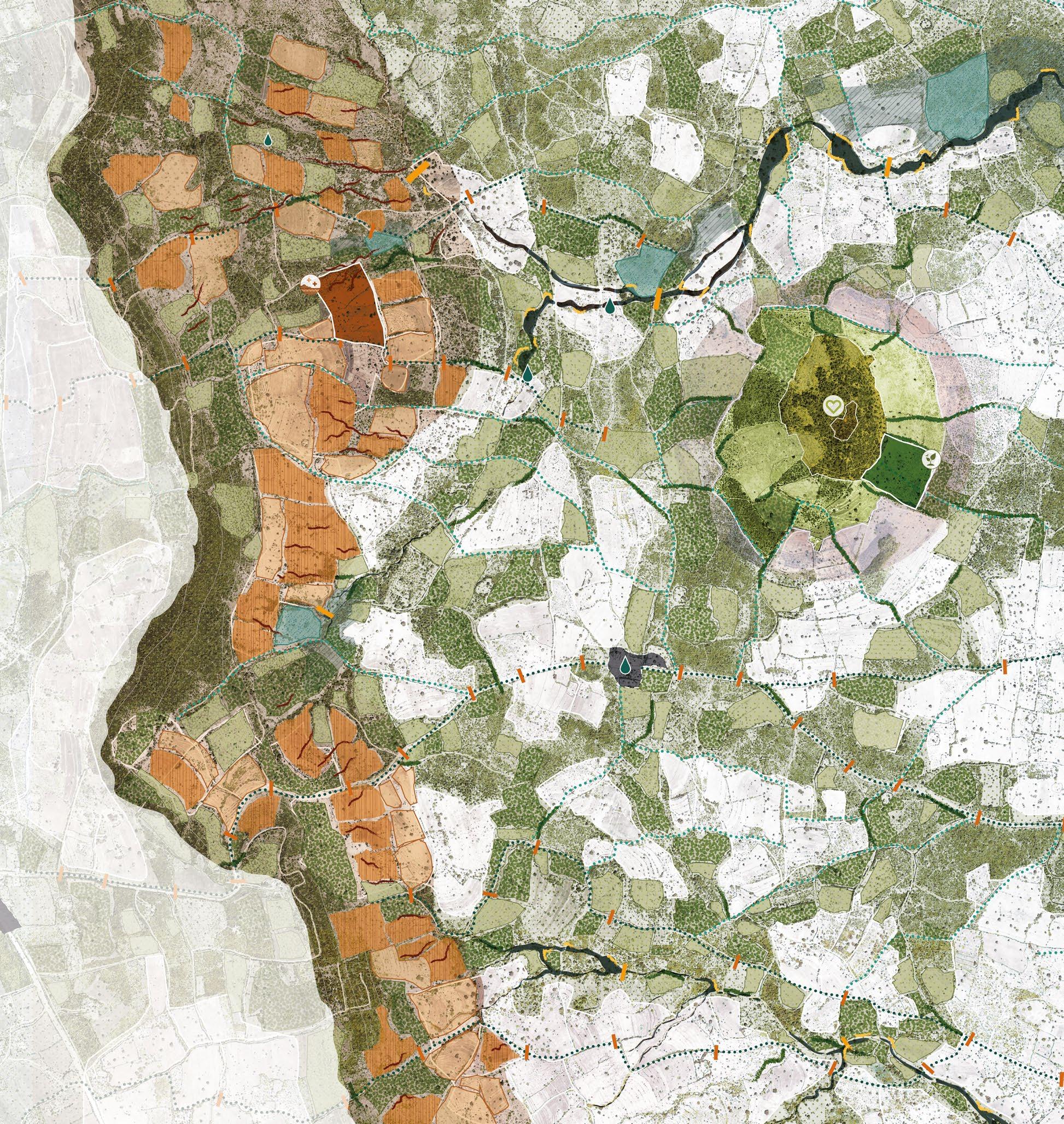
3.1 - The Kawongo area
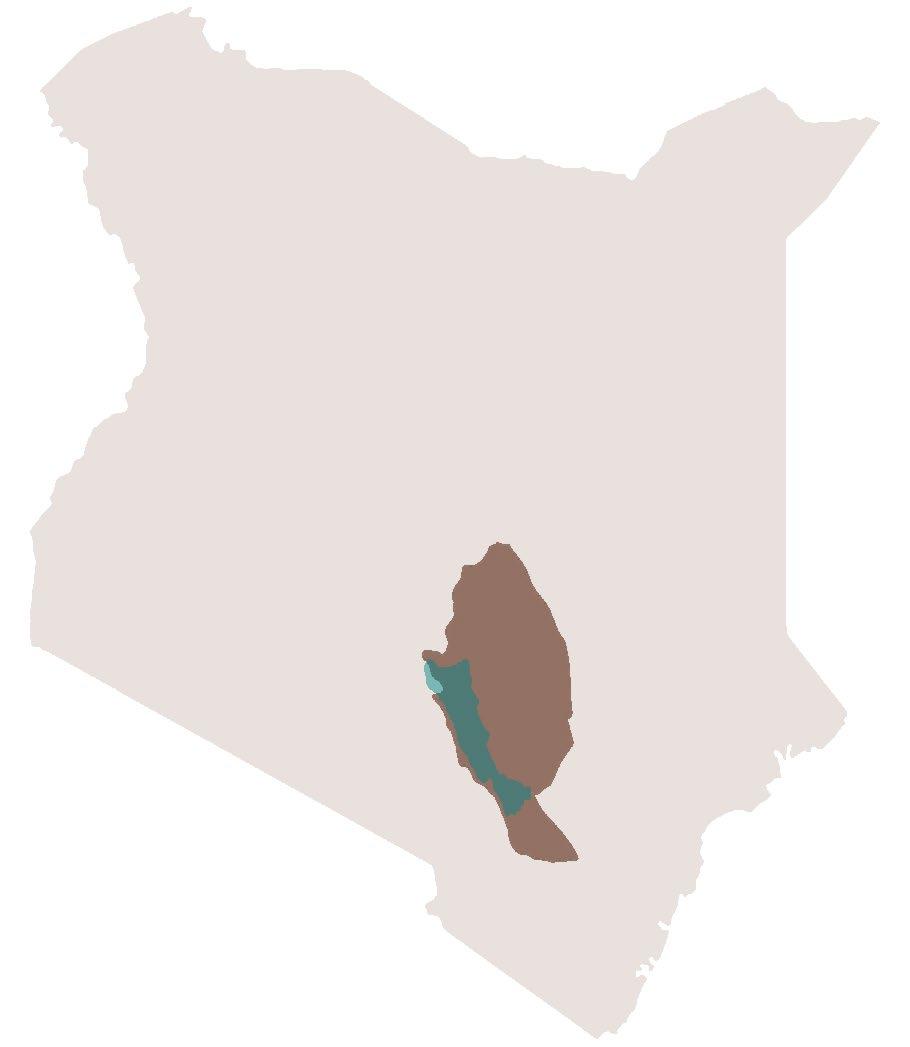
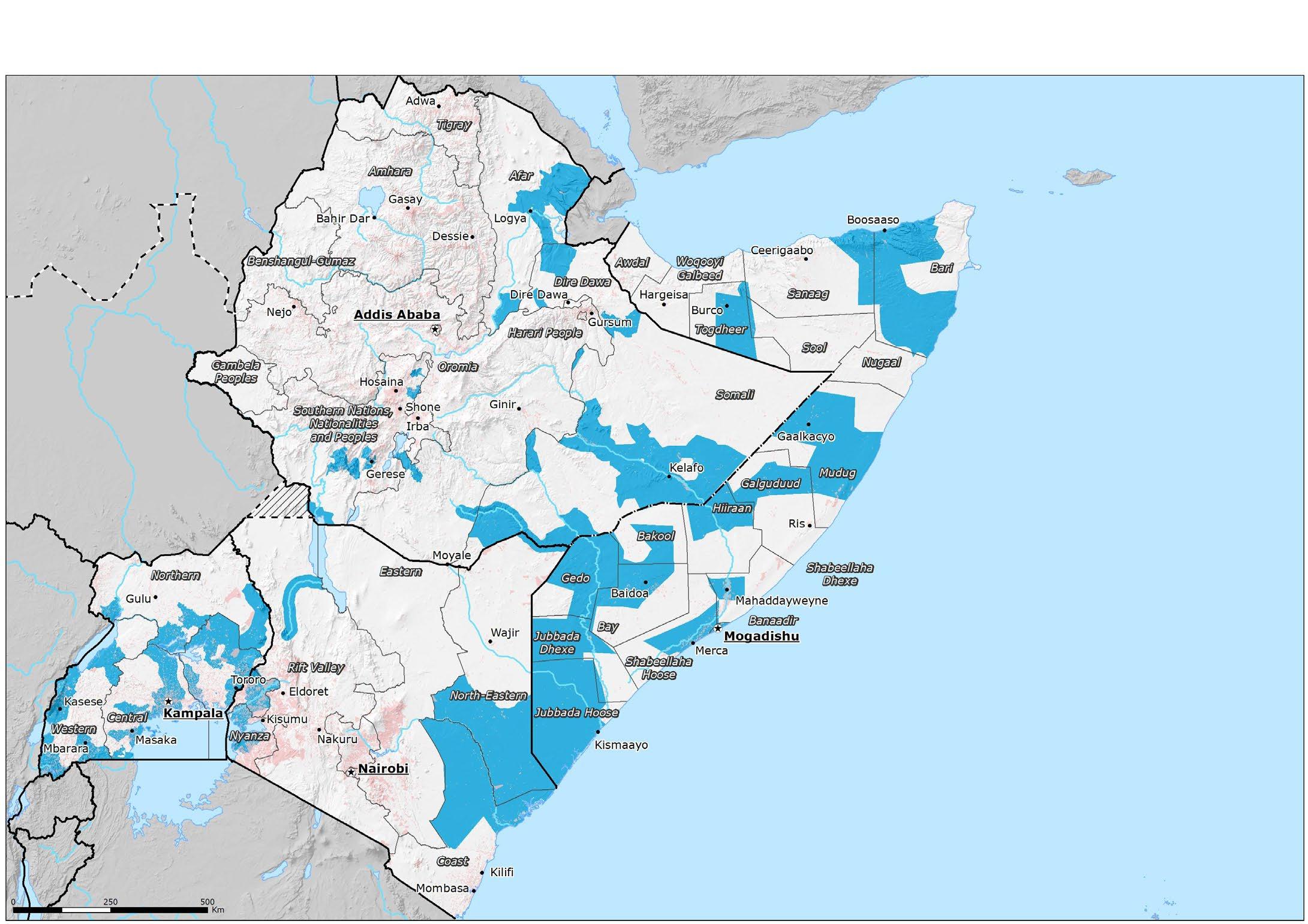
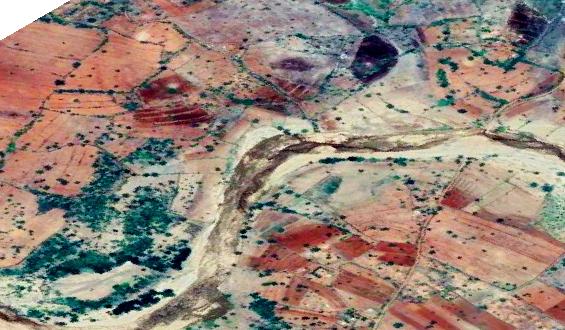
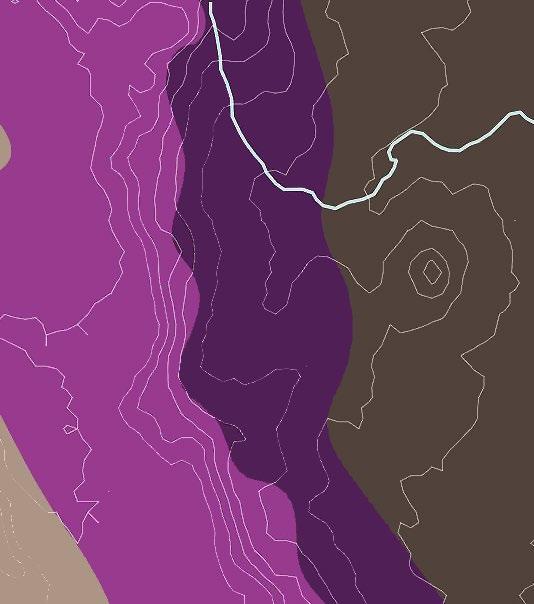
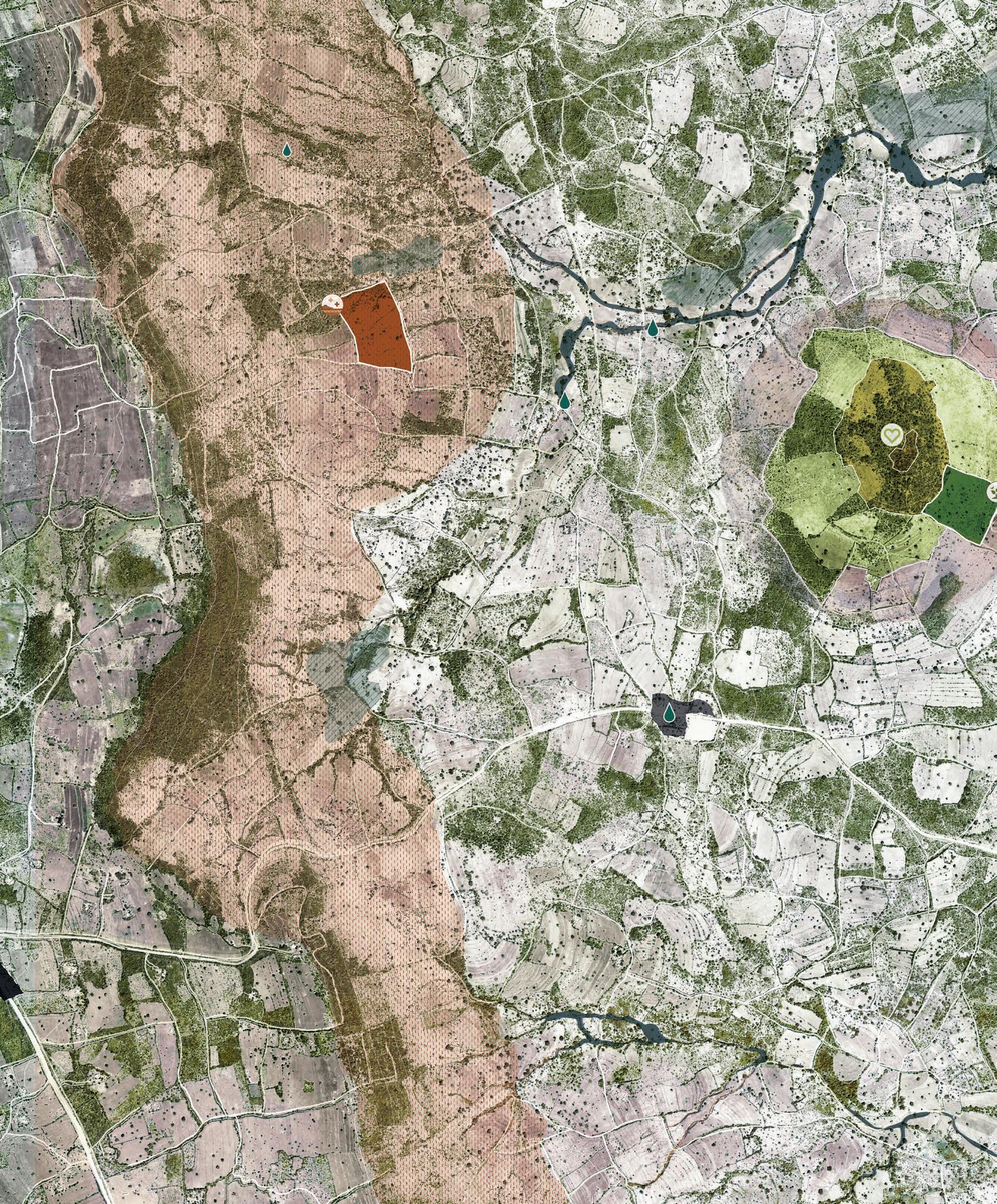
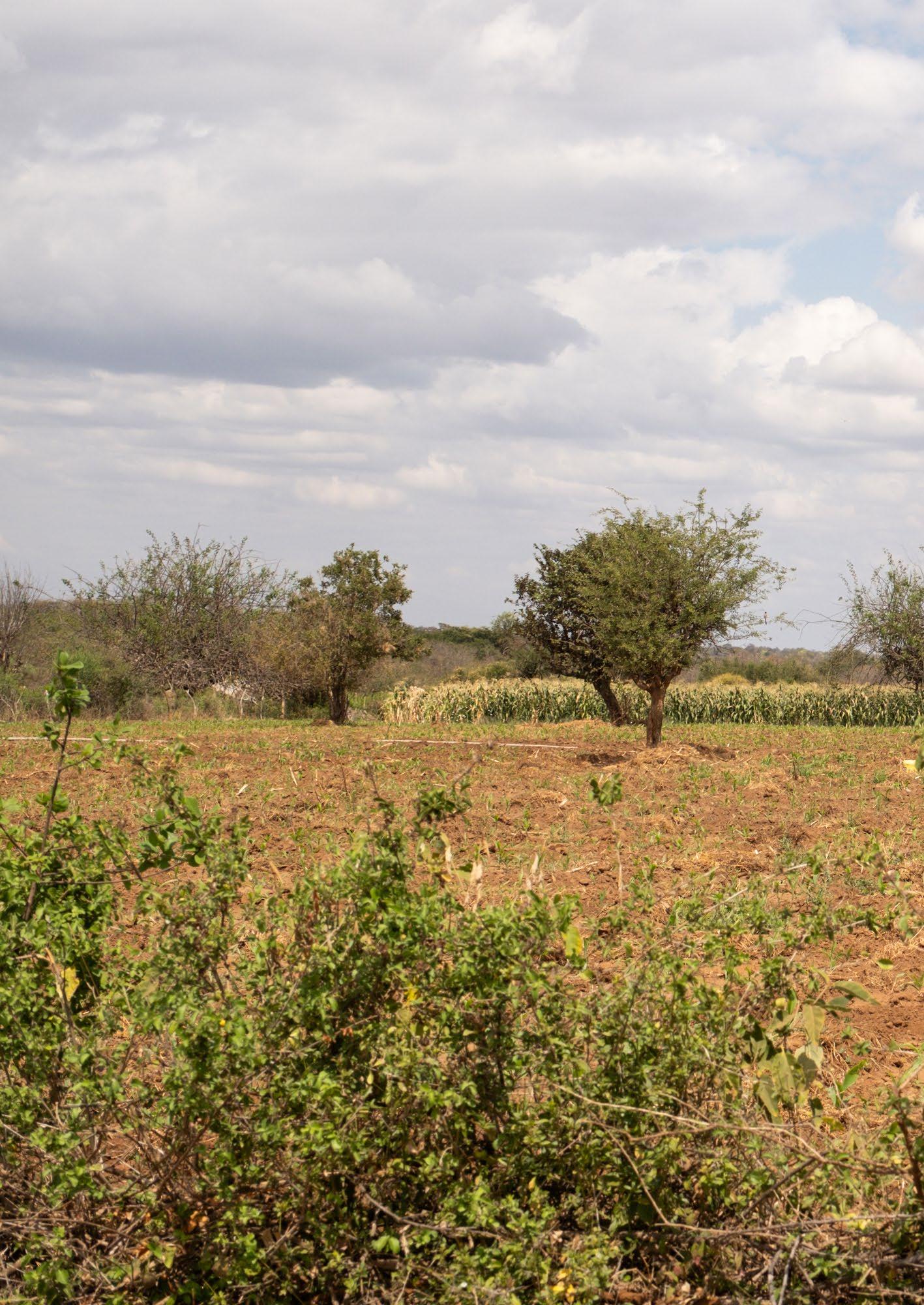
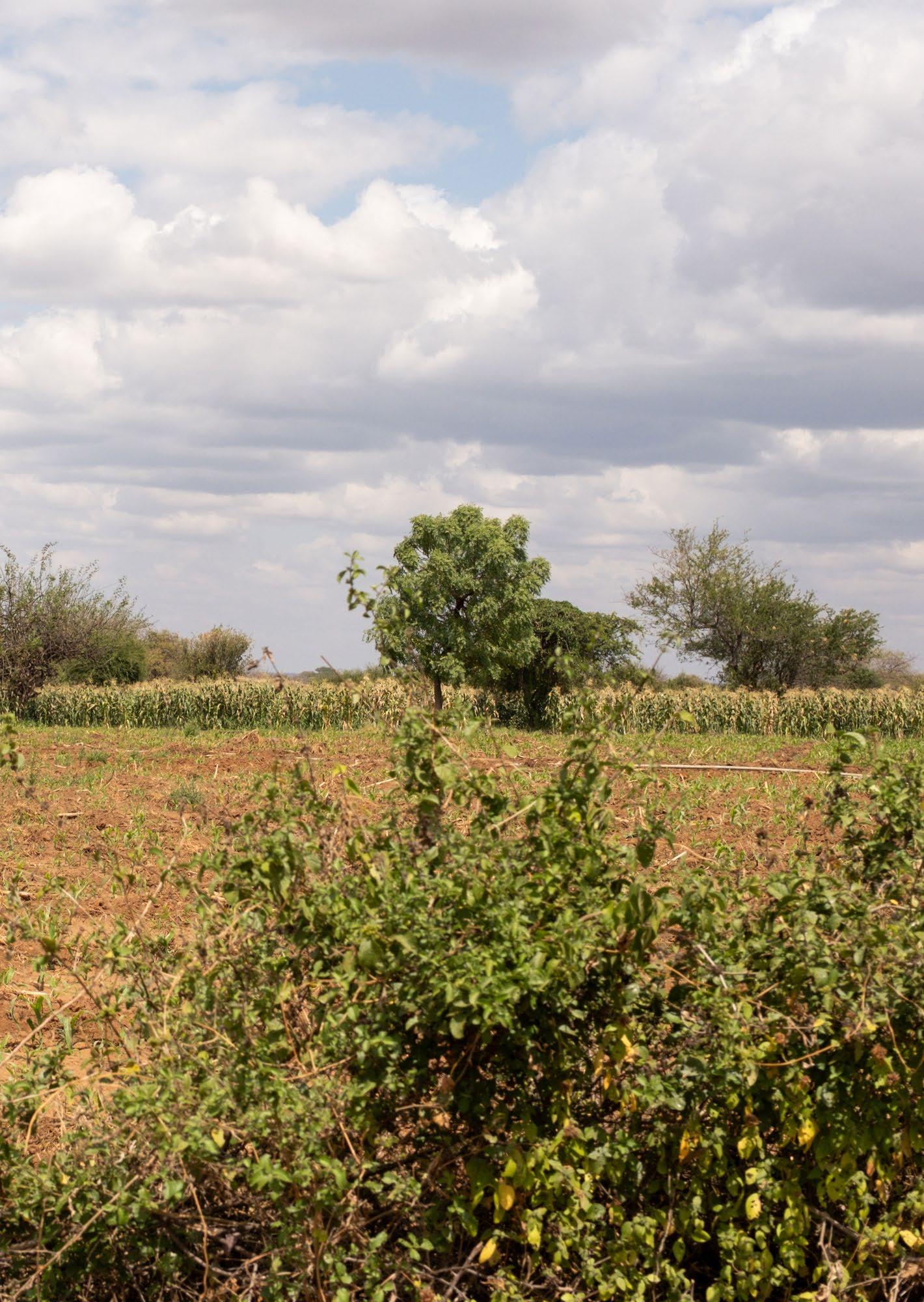
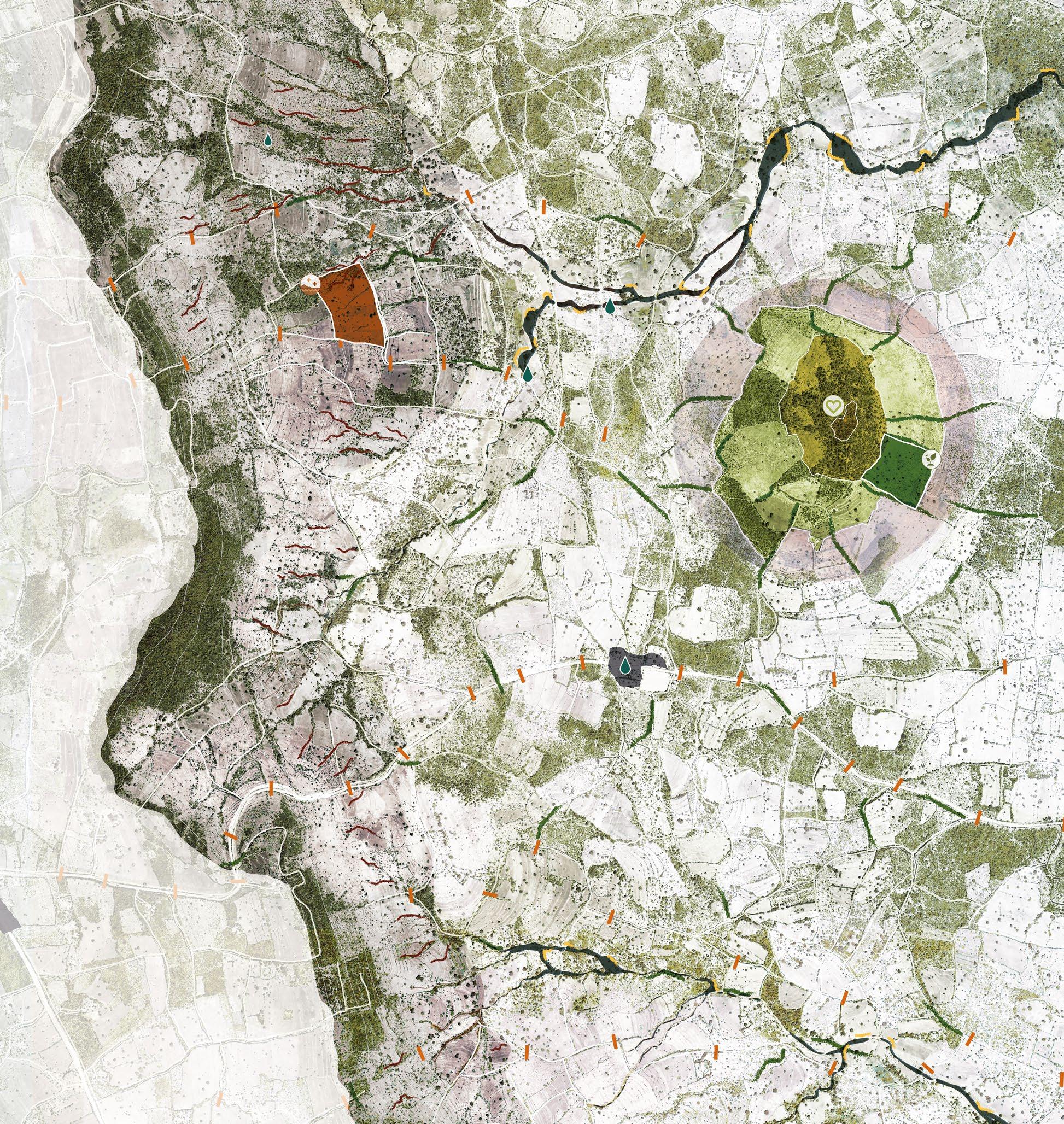
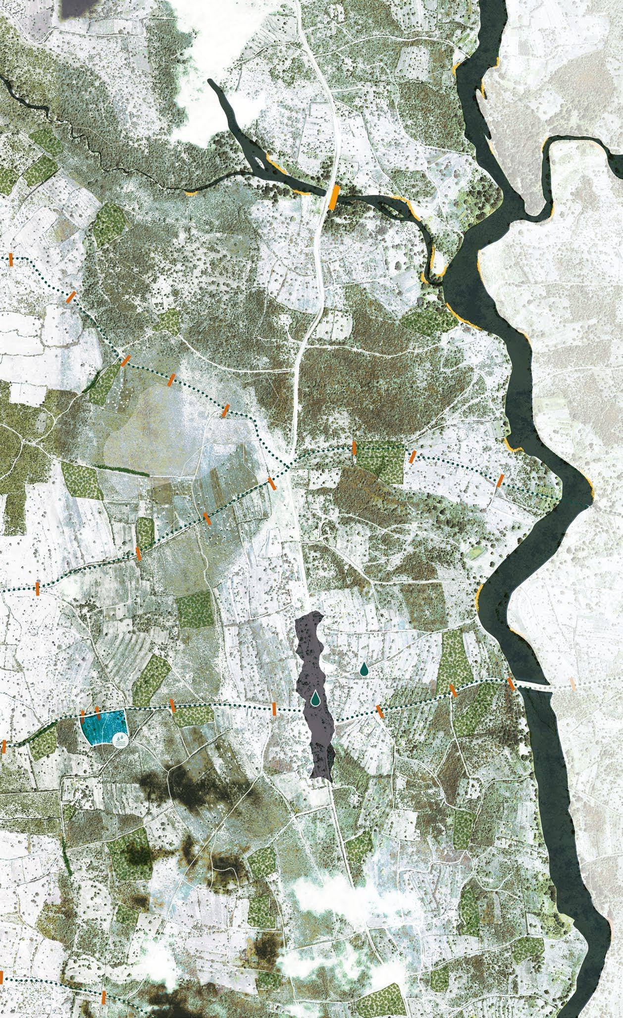
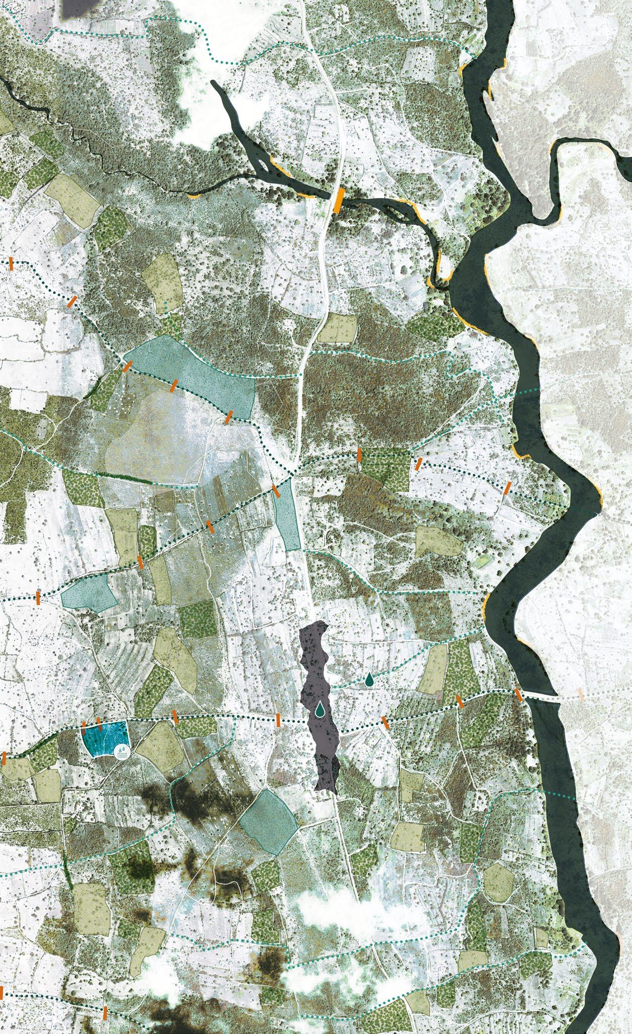
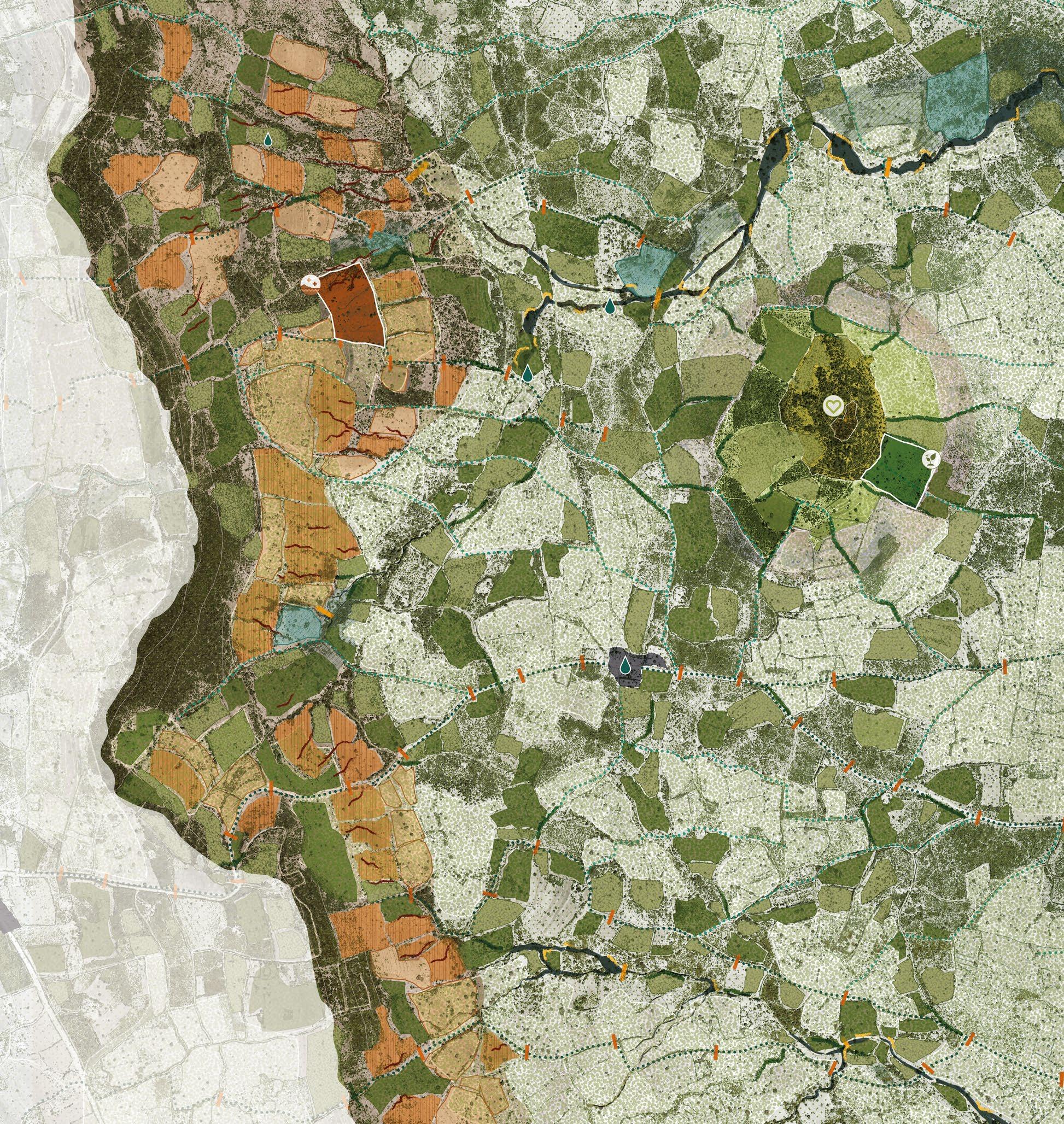
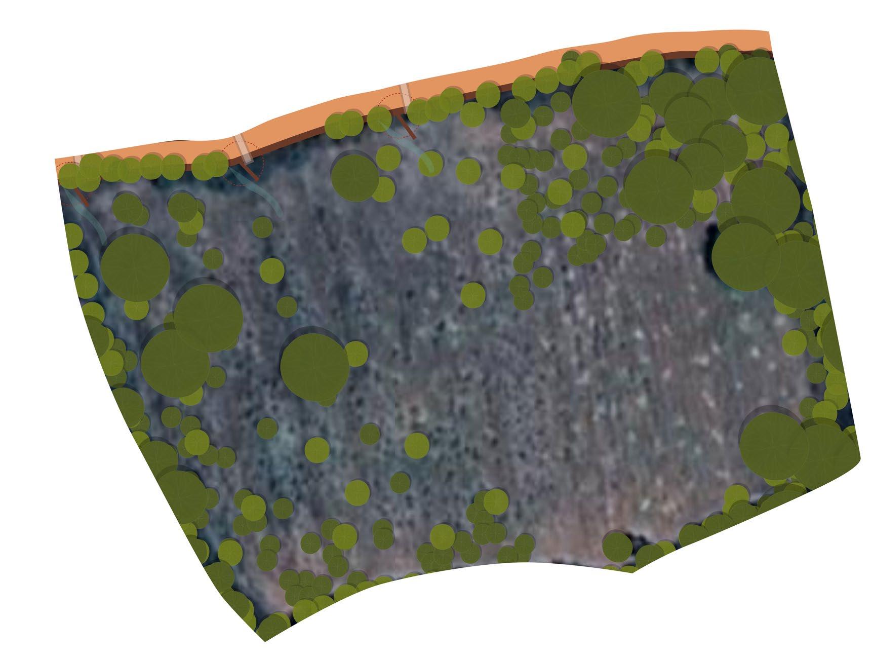
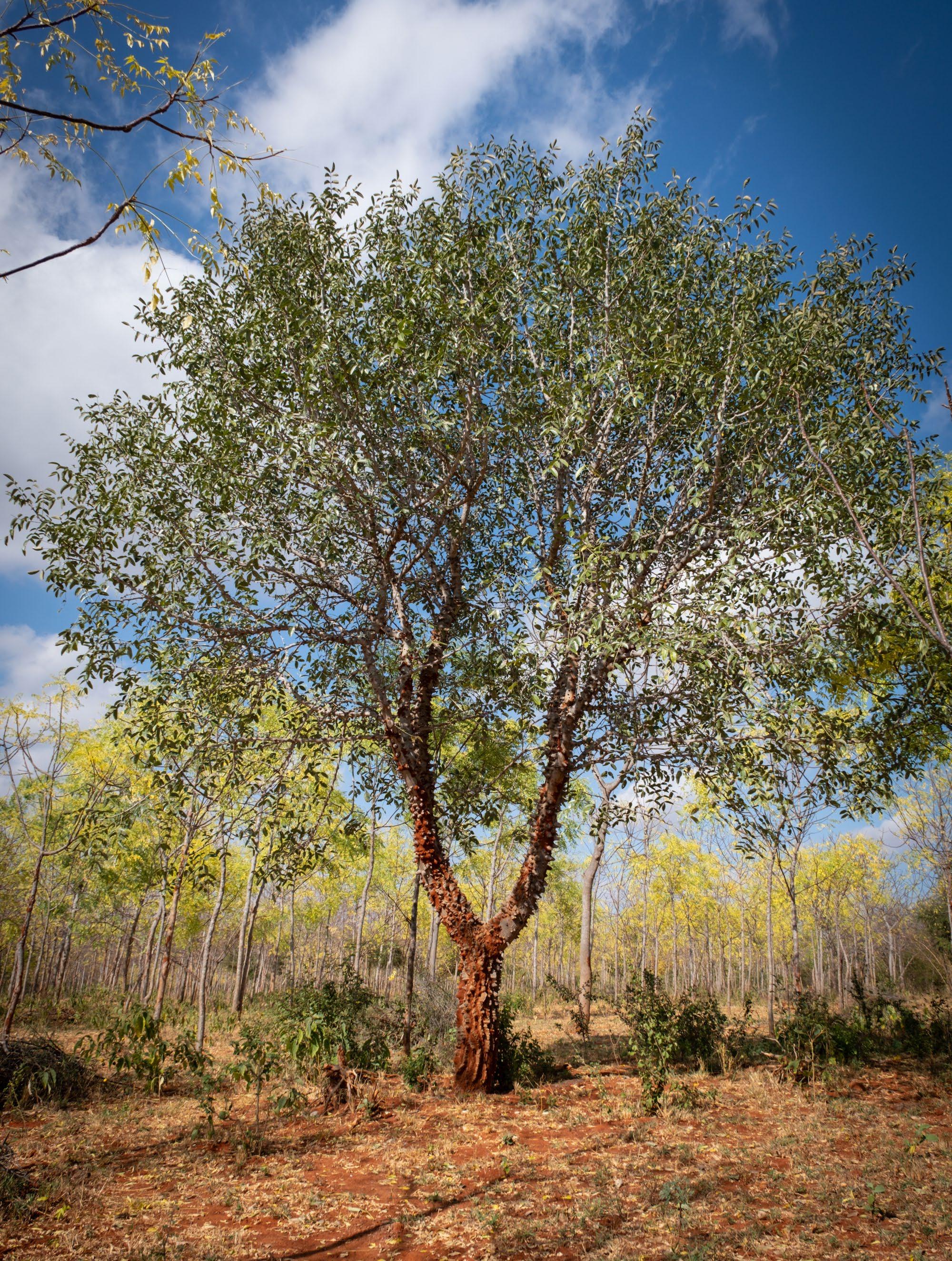
In the province of Kitui, Kenya, between the Yatta Plateau and the Tiva River, lies the quaint area of Kawongo/Kathome. In the middle rests Umu Hill, a central landmark known by the entire community.
In the past the Kamba people settled in this area to start agricultural practices on the rich soils. It has also been said that the soil was rich in iron and it used to be common practice to make iron goods in the area. Nowadays traces of iron can still be found in the dried riverbeds in the area.
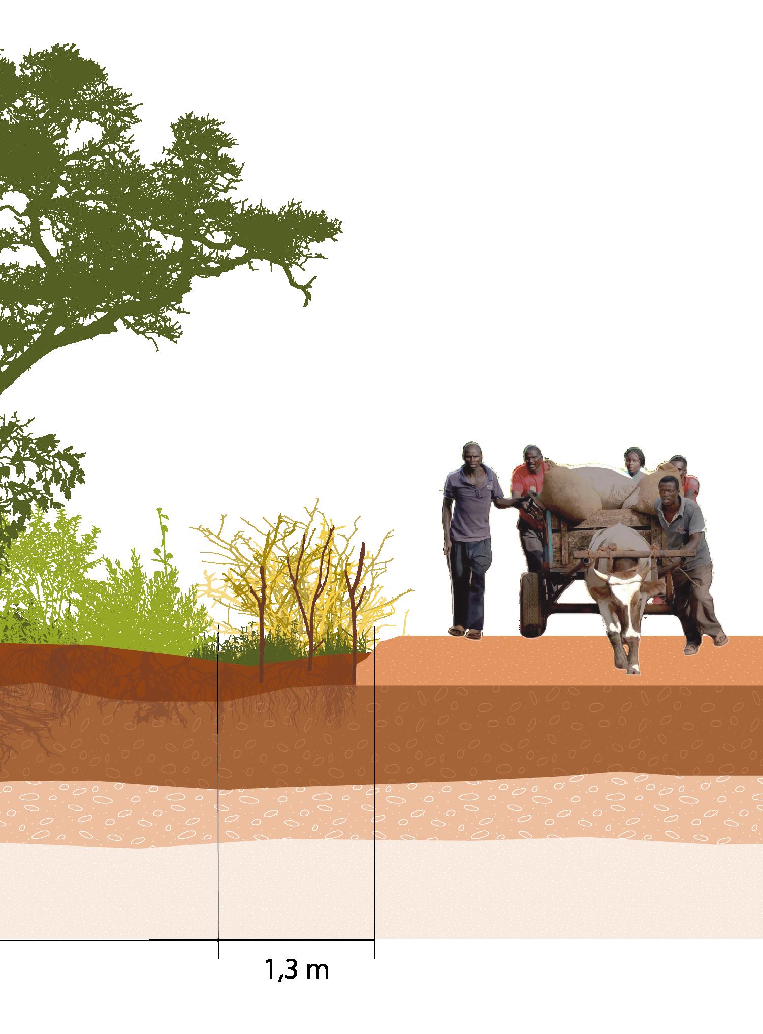
There are three main landscape features that shape the area: the Yatta Plateau, Umu Hill, and the Tiva River. The people in the area live scattered across the landscape in their shambas (farms) and are concentrated in three villages: Nthongoni on the Yatta Plateau, Nzeve next to Umu Hill, and Kawongo next to the Tiva River.
The area of Kawongo lies between the Yatta Plateau and the Tiva River. On the left, the Yatta Plateau is an interesting landscape feature. It is a plateau formed by an eruption in the Chyulu Hills, which are about a hundred kilometres south of Kawongo in Tsavo National Park. This eruption took place 13.5 million years ago. The plateau is the world's longest lava-formed plateau, with a total length of 290 kilometres. The plateau rises about 1,200 meters above sea level (Wichura et al., 2010).
On the right, the Tiva River borders the area. The Tiva River is a seasonal river that runs dry during the dry season. The widest part of the river is about one hundred meters, making it hard to cross during the rainy season. Next to Kawongo village, one drift allows people to cross the river to go toward Kitui town. The riverbed lies at an elevation of 925 meters above sea level. The tributaries from the river run from the Yatta Plateau to the river across the landscape.
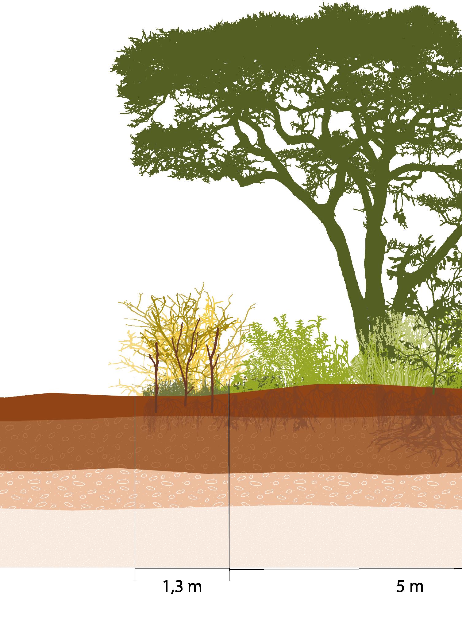
Umu Hill lies at about 1,070 meters above sea level, making it stand out from the surrounding landscape. Hills in this region often hold cultural significance for the local communities. They may be associated with local legends, used as landmarks, or serve as sites for traditional rituals and ceremonies. This is also the case for Umu Hill. Local stories tell about rituals that took place on top of the hill, and people in the area often use it as a landmark.
Umu Hill is also significant in another aspect. Because of its cultural significance, it is one of the few places left untouched by local people, making it a hotspot for biodiversity, an aspect worth treasuring.
Nthongoni village
Nzeve village
Yatta plateau
[Image 24] The area of Kawongo between the Yatta plateau and the Tiva river (Brugmans, 2024)
Kawongo village
Umu hill
Tiva river
Yatta plateau
1155 m
1020 m
1010 m
Nzeve village
Nthongoni village
[Image 25] Elevations of the area of Kawongo (Brugmans, 2024)
Umu hill Tiva river
(Next page) [Image 26] Average rainfall per year and distribution through the year in the Tiva basin (Brugmans, 2023)
3.1 – Changing climate of the area
Extreme climate change effects are the reason for this project. Therefore one of the first things to look into is the climate in the area.
The climate now
The climate in the region can be described as arid to semi-arid, characterized by a low amount of annual rainfall (Seasonal Calendars for a Typical Year: Kenya, n.d.). Rain that does fall in Kawongo occurs during its two rainy seasons: the long rainy season and the short rainy season. The long rainy season happens between January and June. During this time, the temperature in the area is higher, and the rain is distributed throughout the months, with a peak during March and April.
January and February are ideal months for planting most crops because there is still a lot of moisture left in the soil from the short rainy season, and the rain is not heavy enough to wash away new plants.
The short rainy season officially starts in August, but the actual rain often arrives in October. November is typically the month with the most rainfall. The dry period lasts from June until September, during which temperatures drop slightly. The dry period is the time for harvesting many crops (Kioko et al., n.d.).
Future climate
The climate in the area is slowly changing. Farmers in the region are starting to notice that the October rains are not arriving as expected. This extends the dry period and makes it harder to have enough food to last through the entire dry season. Plants are also struggling because of this change.
Although the dry period is expanding, the yearly amount of rain is also increasing. This results in heavier rains in April and November, which can cause flooding and soil erosion. This is an example of how global climate change is making local climates more extreme. Often, people assume that climate change merely results in an increase in temperature. However, the aspect that actually affects local communities the most is the intensification of the water cycle, which creates larger differences and extremes to deal with.
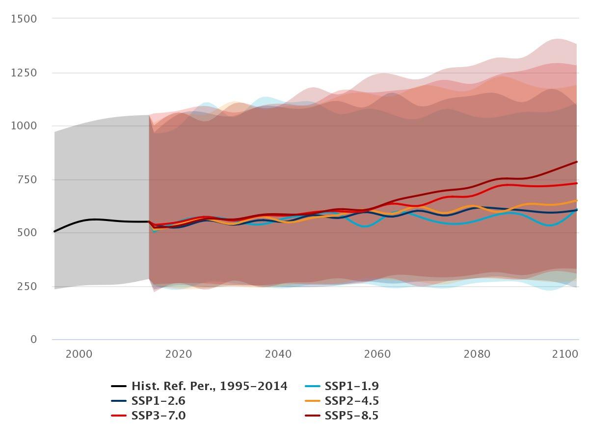
The World Bank has created multiple scenarios regarding future rainfall patterns. These predictions are shown on the following pages.
[Image 27] Different climate scenarios and the predicted precipitation amount per year for eastern Kenya (Worldbank, 2023)
[Image 28] Projected precipitation anomaly for 2020-2039 (Worldbank, 2023)
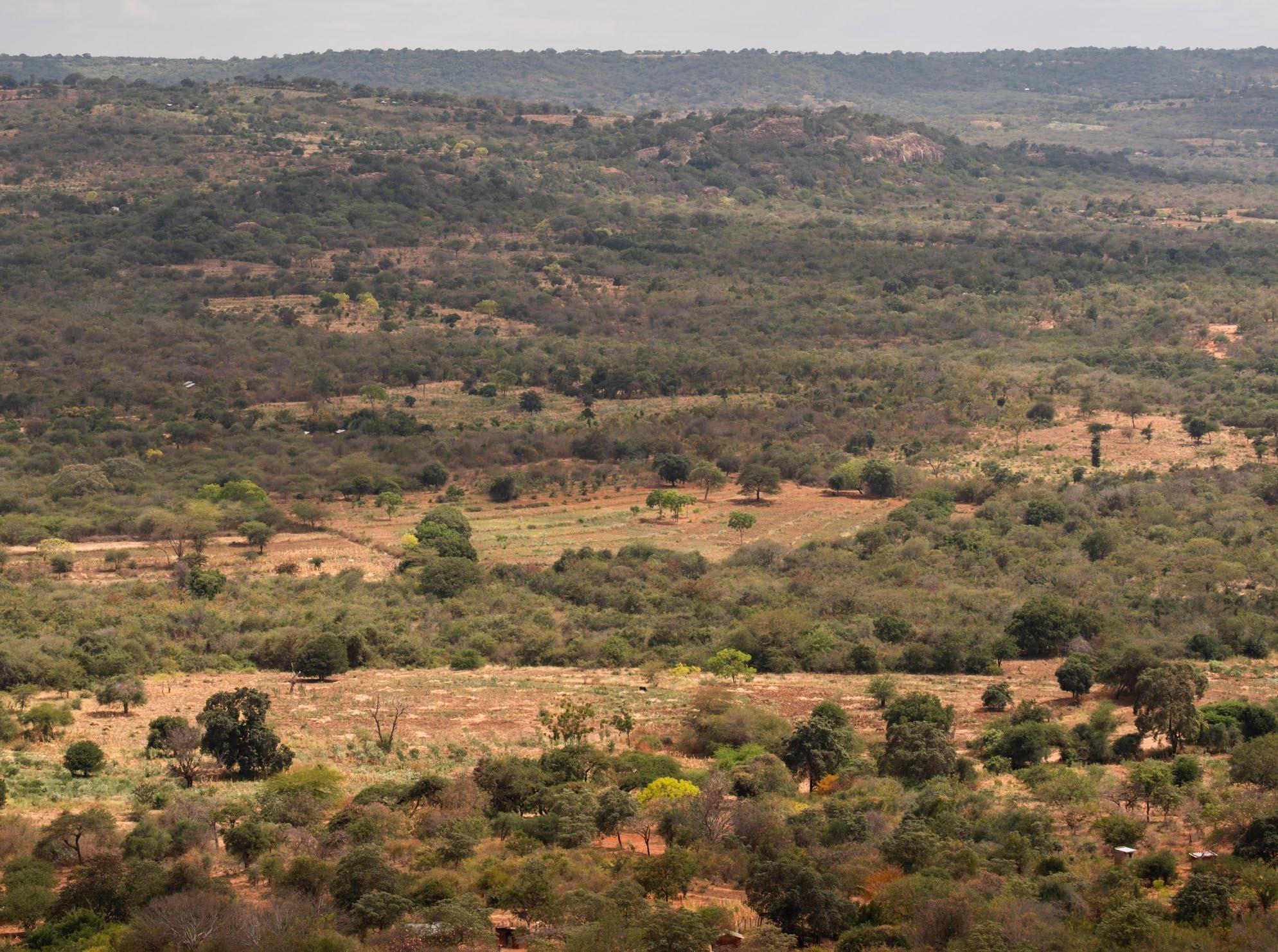
[Image 29] View from Umu hill towards the Yatta plateau during the rainy season (Brugmans, 2022)
[Image 30] View from Umu hill towards the Yatta plateau during the dry season (Brugmans, 2023)
Tsavo
Kawongo
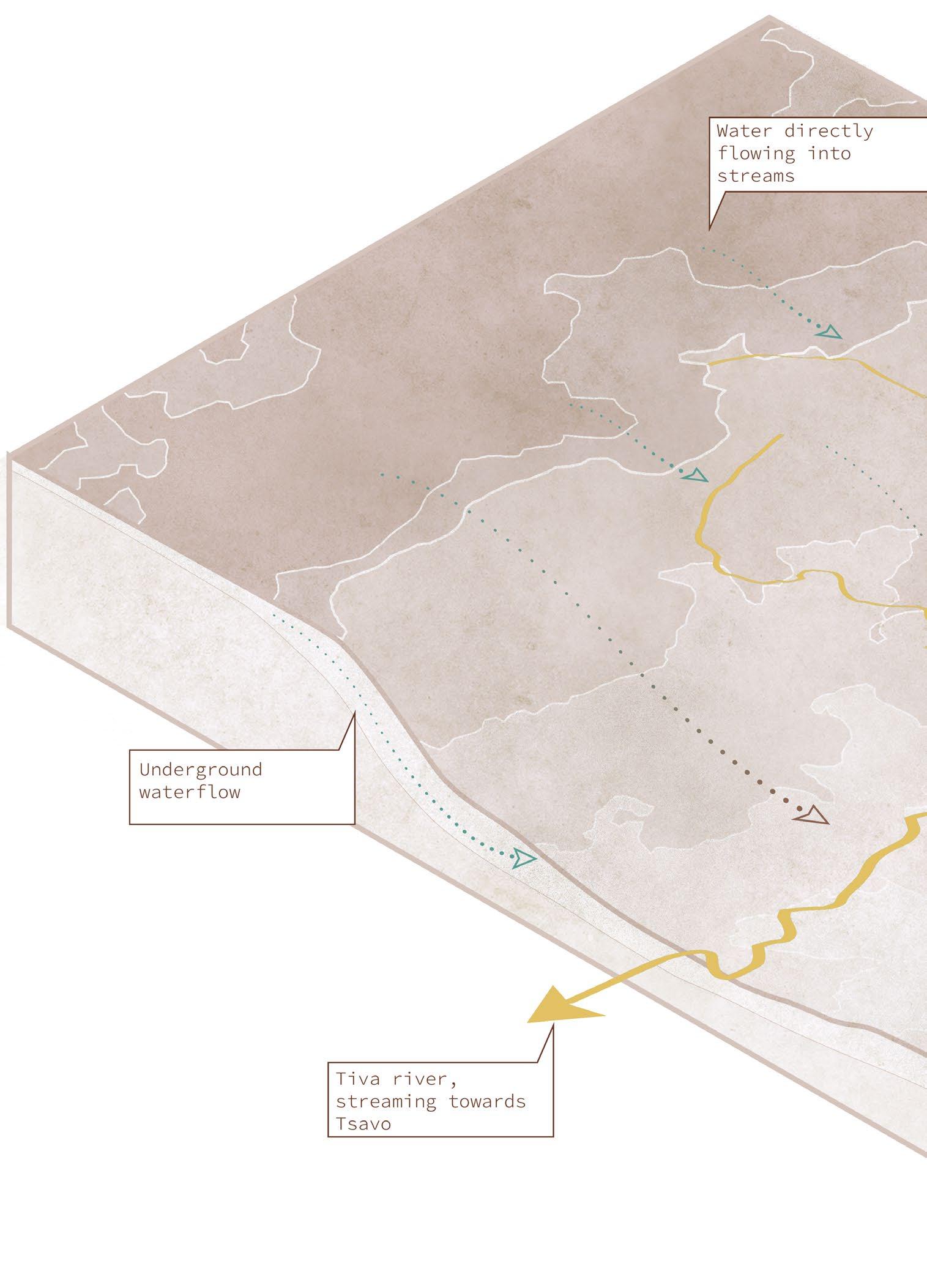
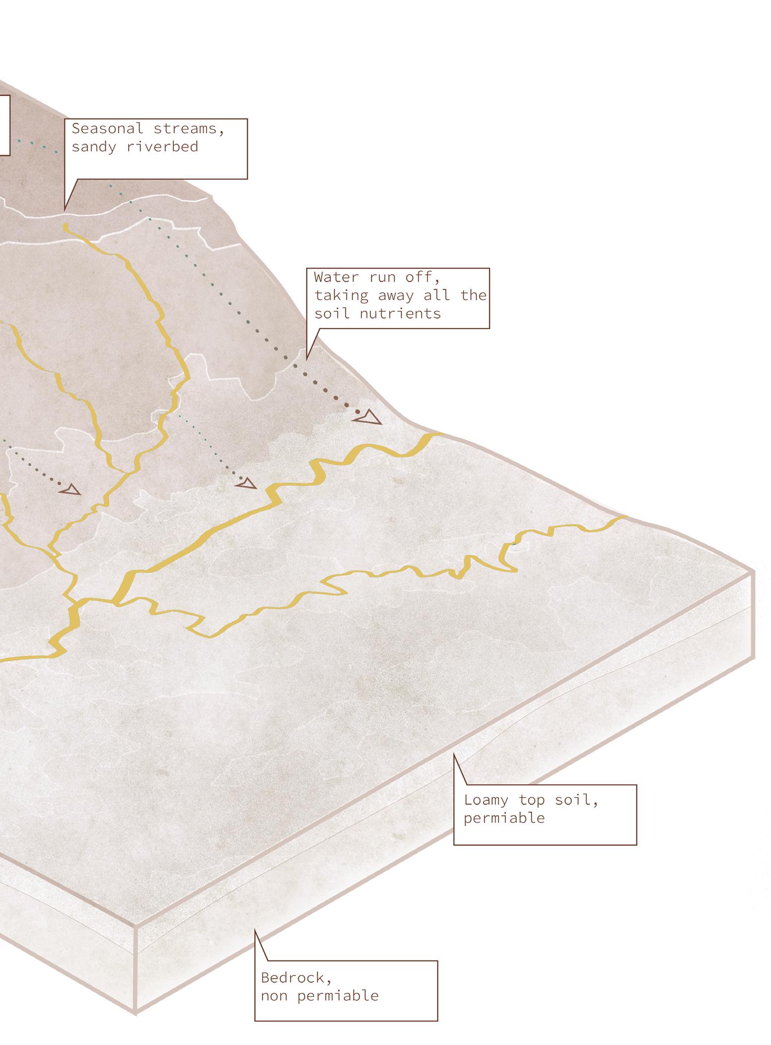
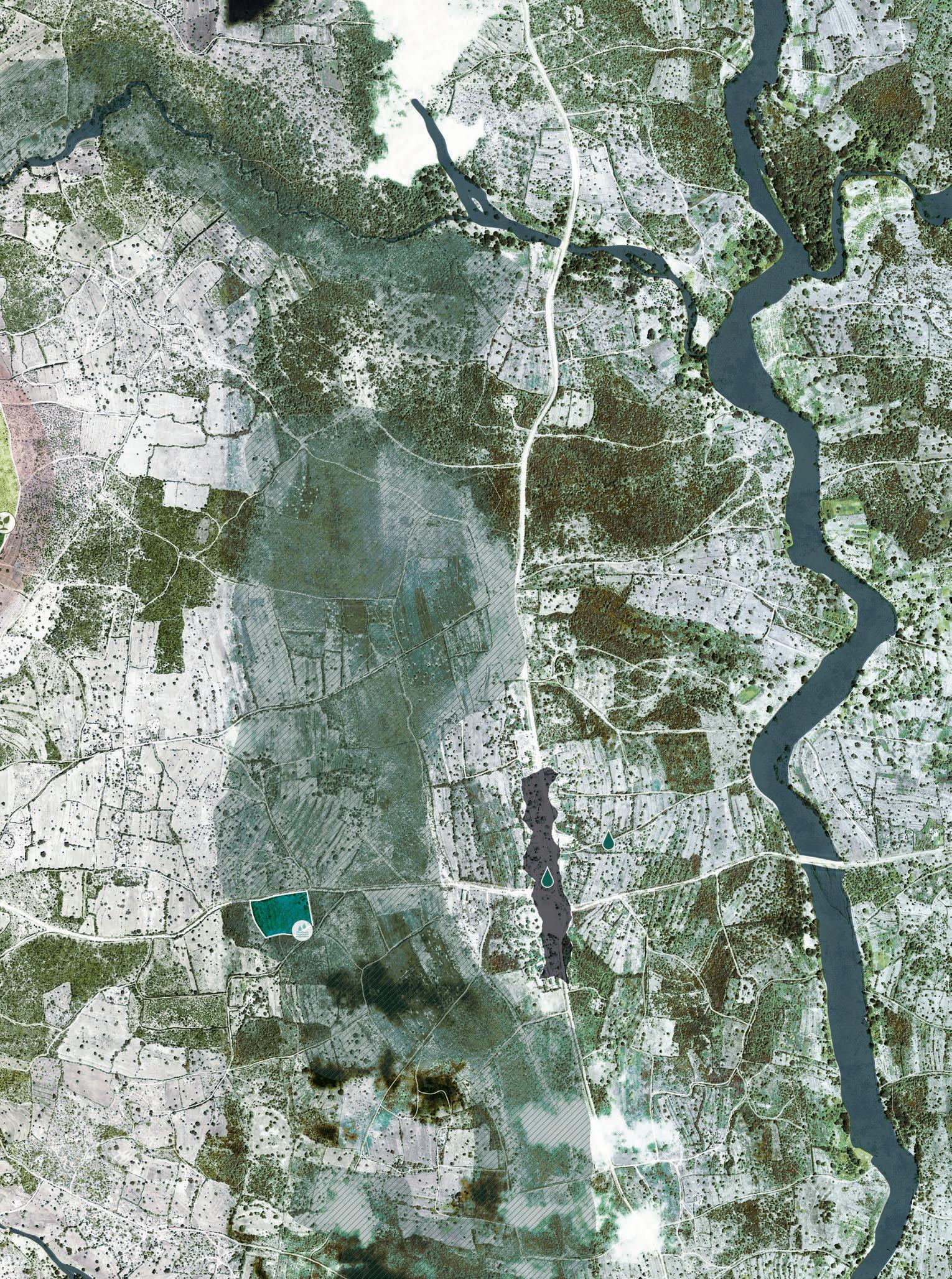
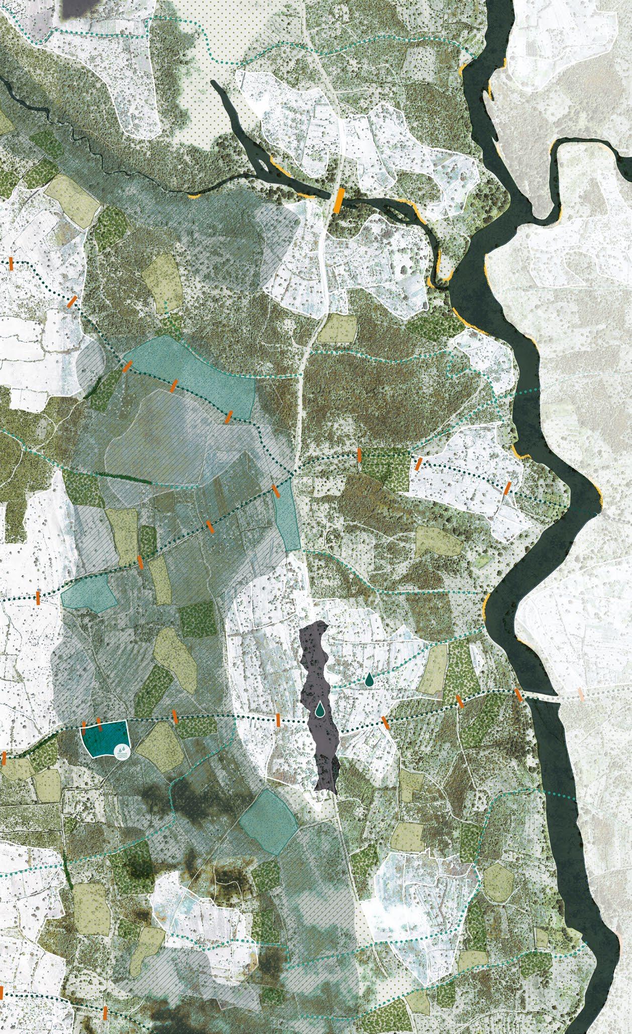
3.2 - Watersystem and flows
As discussed in the previous paragraph the long and short rainy season provide the area with water two times a year. This paragraph shows how this rainwater moves through and effects the area.
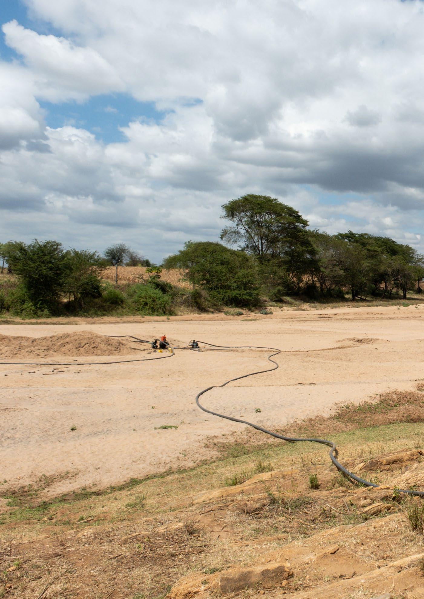
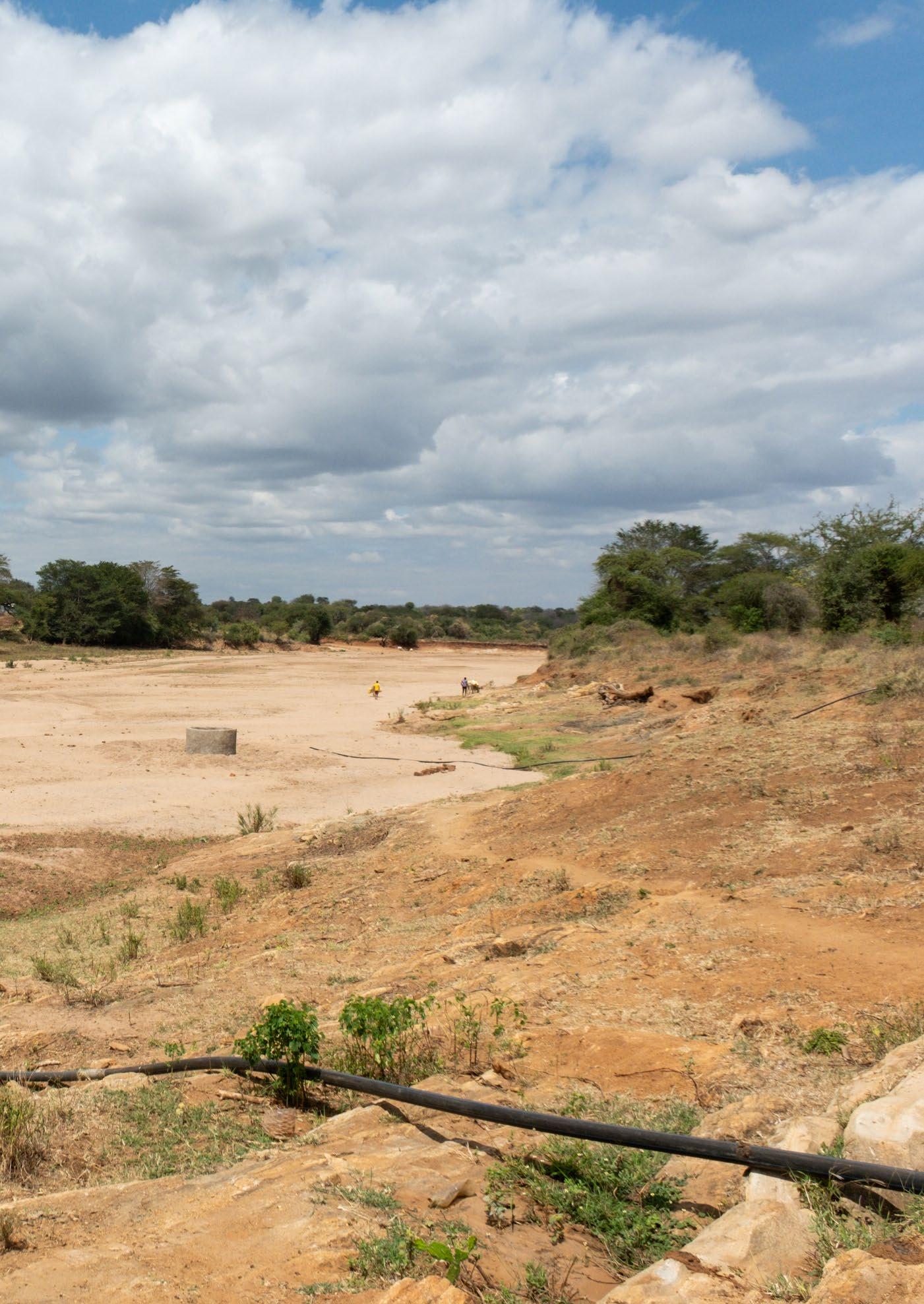
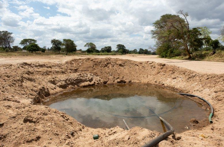
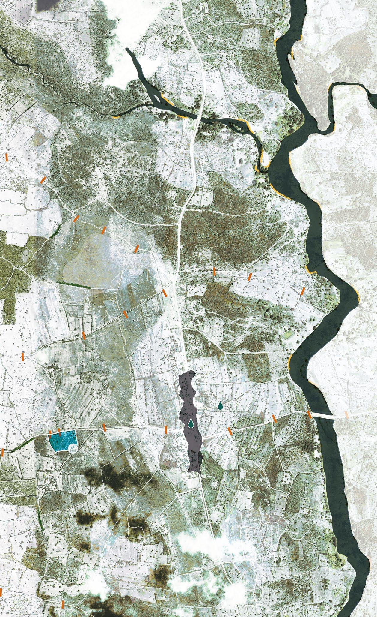
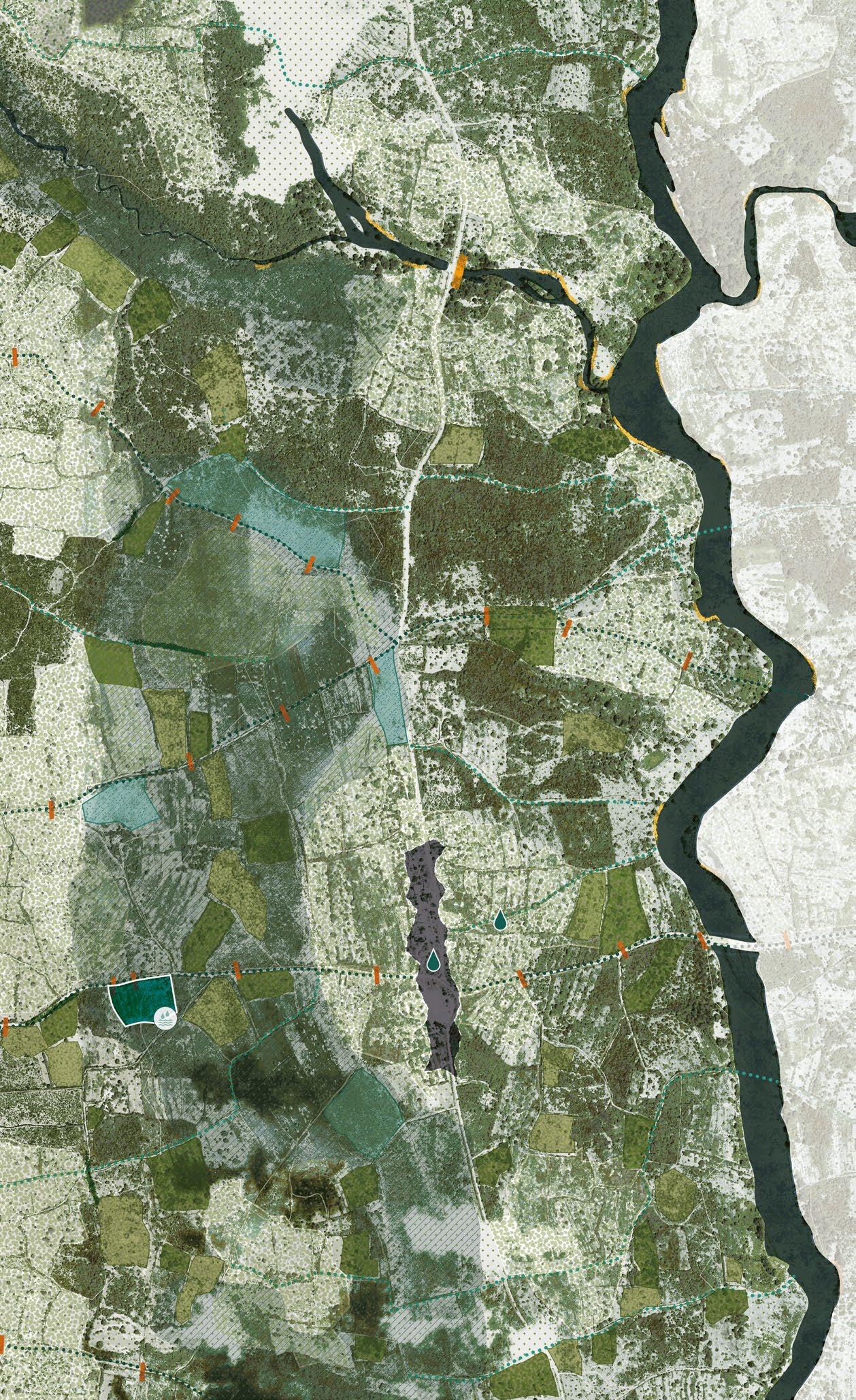
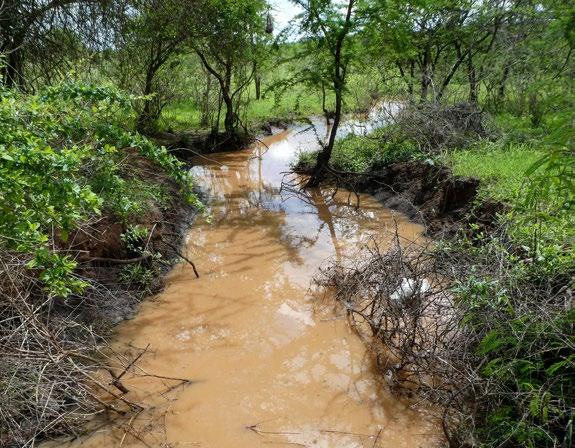
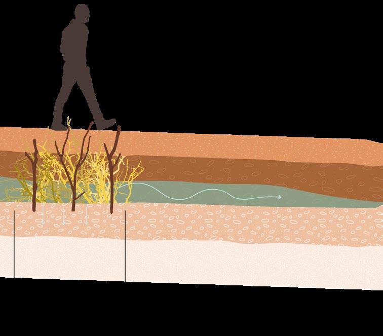
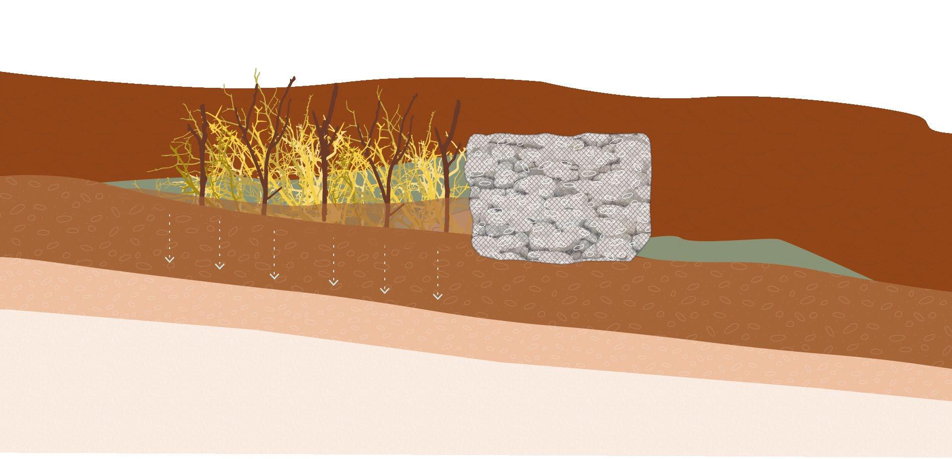
The area of Kawongo is located in the Tiva River basin. The Tiva River is often called "The River of Sand." This name is fitting because, for a large part of the year, the Tiva River bed does not show any surface water. However, appearances can be deceiving. Even though no surface water is visible, the sandy riverbed is full of water. Residents of the area dig holes in the dry riverbed to access the water hidden underneath.
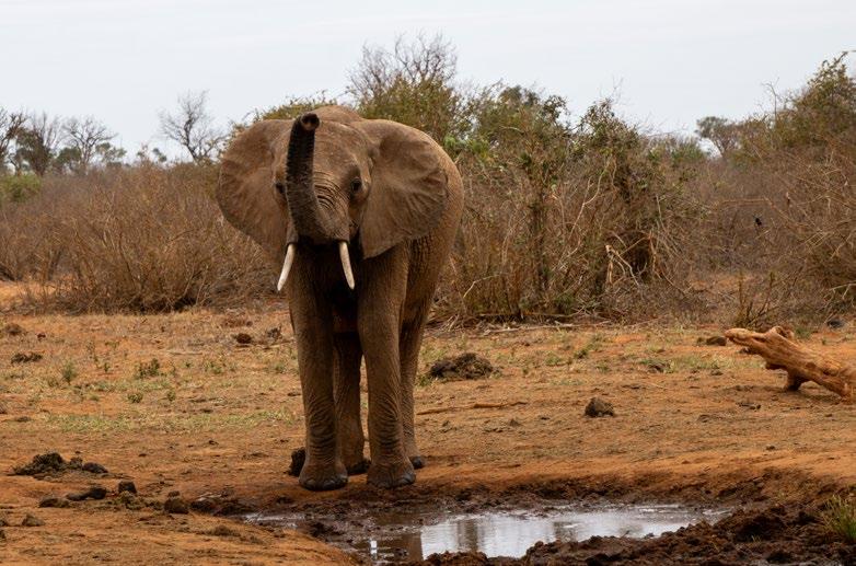
During the rainy season the river looks very different . On pages 62 and 63 a side by side view of how the river looks during the different seasons is shown. From Kawongo, the water moves further south towards Kenya's biggest national park, Tsavo National Park. Here, it is not the people who dig for water, but the elephant population that lives there. The river is one of the main sources of water in the national park and is essential for the survival of its wildlife.
Before the rainwater reaches the riverbeds of the Tiva River and its tributaries, it moves through the area, starting at the highest point of the Yatta Plateau. The significant height difference creates a slope that funnels the water toward the riverbeds during the rainy season.
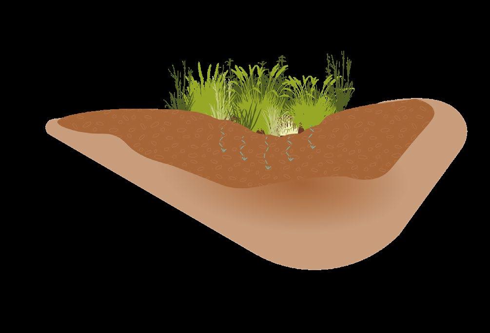
However, due to climate change and the intensification of the water cycle, the grounds between Yatta and Tiva are starting to have difficulties coping with the increased amount of water. The rainwater also moves across the farms scattered throughout the area. The grounds are not always able to withstand the large amount of water, which sweeps away soil nutrients that are essential to the farmers in the region. This process is illustrated in the drawings on the next pages.
The water dug up from the dry riverbed is generally very clean. However, the water that flows above ground during the rainy season, on the other hand, carries away all the manure, pesticides, and trash that have accumulated during the dry season in the area and upstream towns. This water needs to be managed carefully and used selectively.
(Previous page)
[Image 31] Water being pumped up from beneath the surface of the Tiva river (Brugmans, 2023)
[Image 32] An elephant that found and dug up water from below the surface (Brugmans, 2023)
Yatta Plateau
Kawongo village
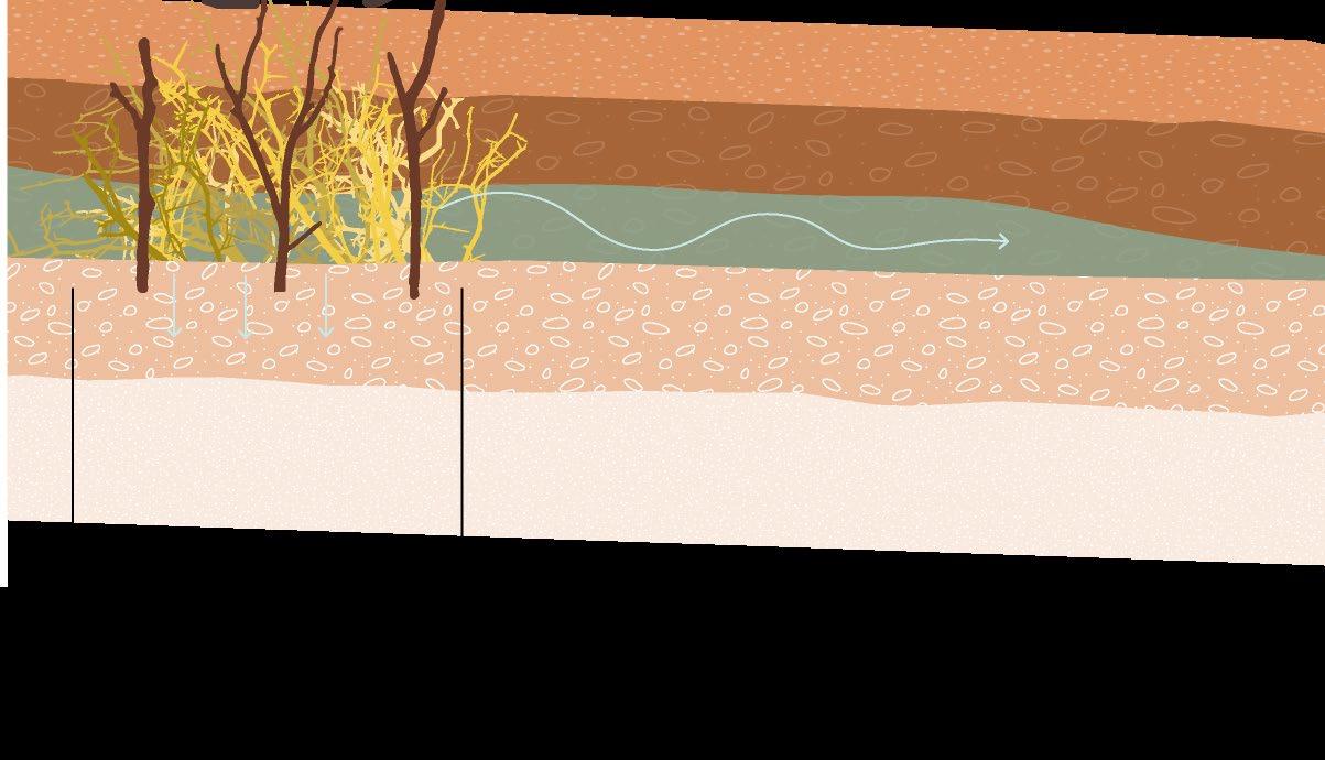
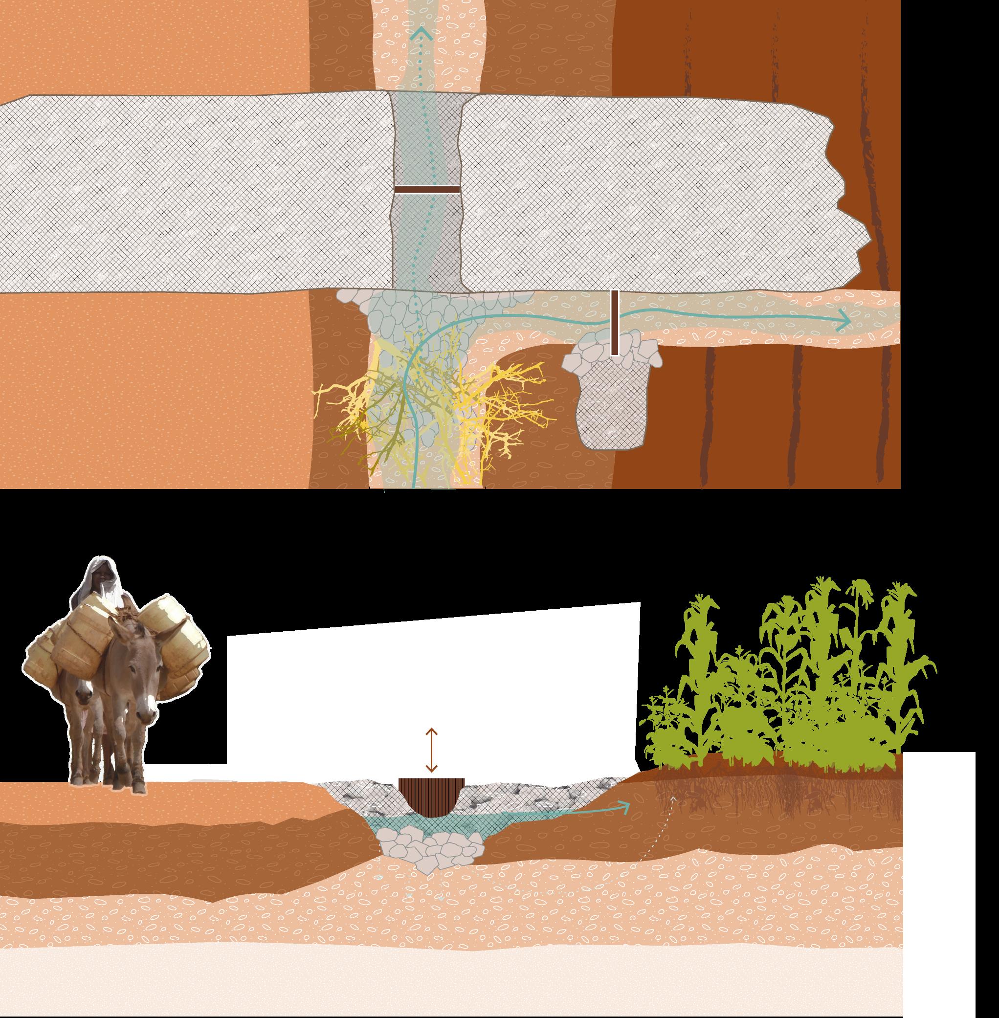
[Image 33] The movement of water through the Kawongo area (Brugmans, 2023)
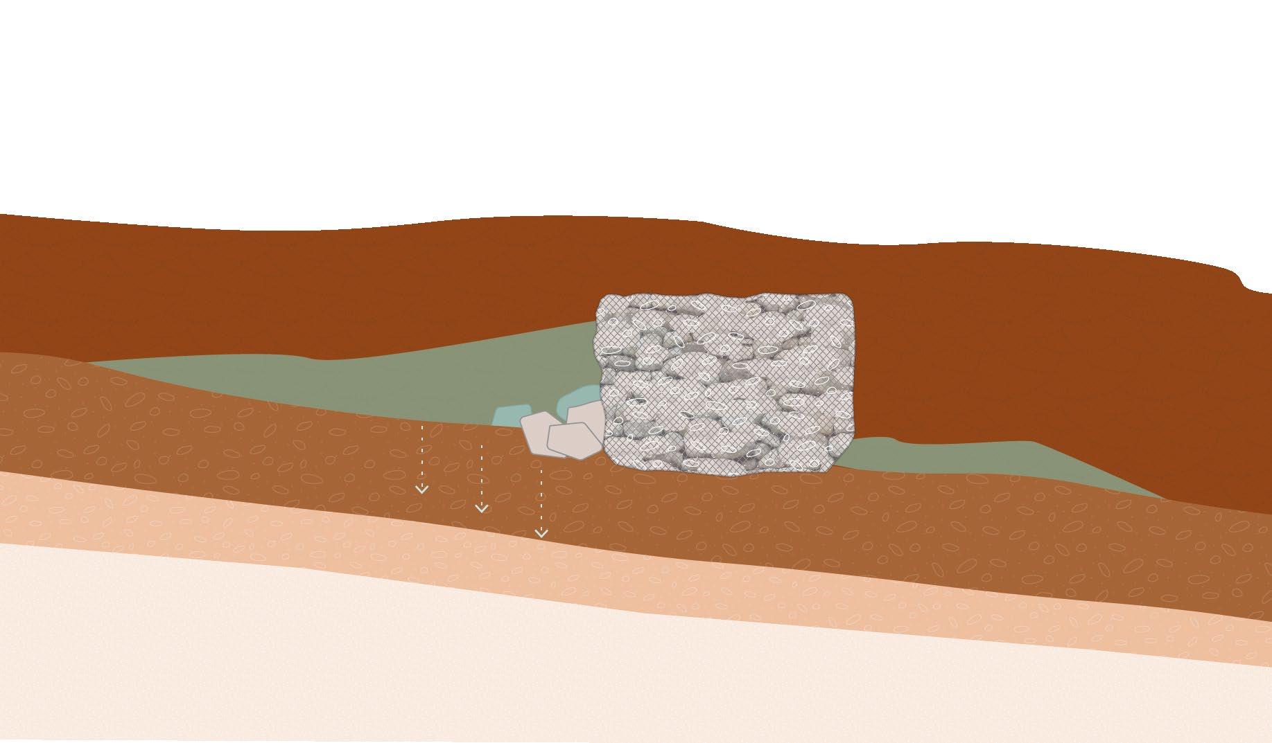
Underground waterflow towards river
Vegetation slows down water run off, leaving soil intact
Underground River, sandy riverbed
Water runoff, Eroding soil
runoff, soil
River meandering taking away fertile soil from banks
River meandering Adding Nutrient low sand to banks
[Image 34] The functioning of the seasonal riverbank (Brugmans,
Bedrock, non permiable
Loamy top soil, permiable
2023)
[Image 35] The
during the start of the rainy season (Brugmans,2023)
[Image 36] The
during the middle of the rainy season (Brugmans, 2023)
[Image 37] The
during the dry season (Brugmans, 2023)
Tiva river
Tiva river
Tiva river
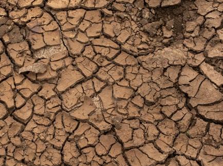
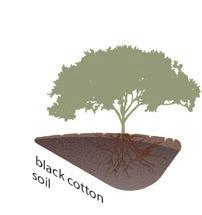
[Image 38] Black cotton soils (Brugmans, 2022)
(Next page)
[Image 39] Different soil types in the Tiva basin (Brugmans, 2023)
3.3 - Soils and erosion
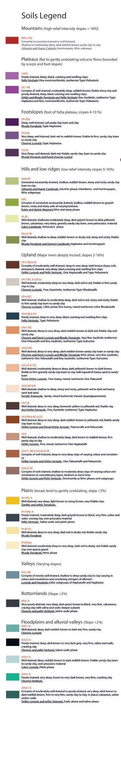
To understand how the water moves through the area and how land use is determined the different soil types of the area play a vital role.
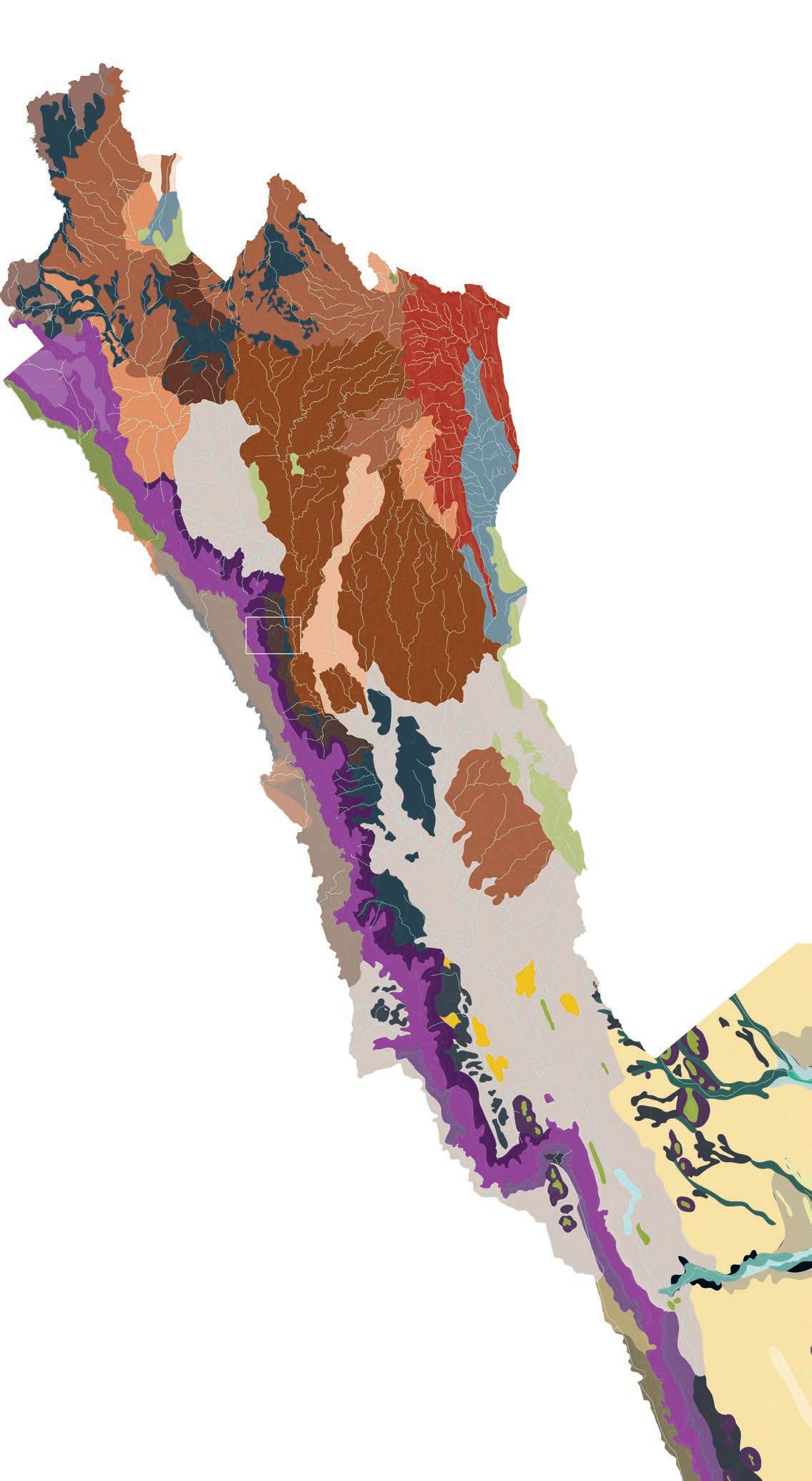
The entire Tiva River basin consists of a large variety of soil types (shown in the map on the right). A map of the soils in the Kawongo area can be found on the next page. The different soils are categorized by depth and complexity. Some soil types, for example, consist of different soil groups stacked together.
The soils in the Kawongo area include:
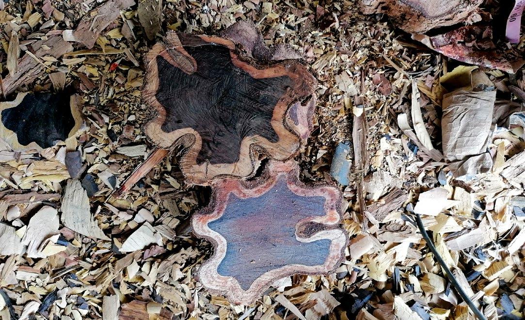
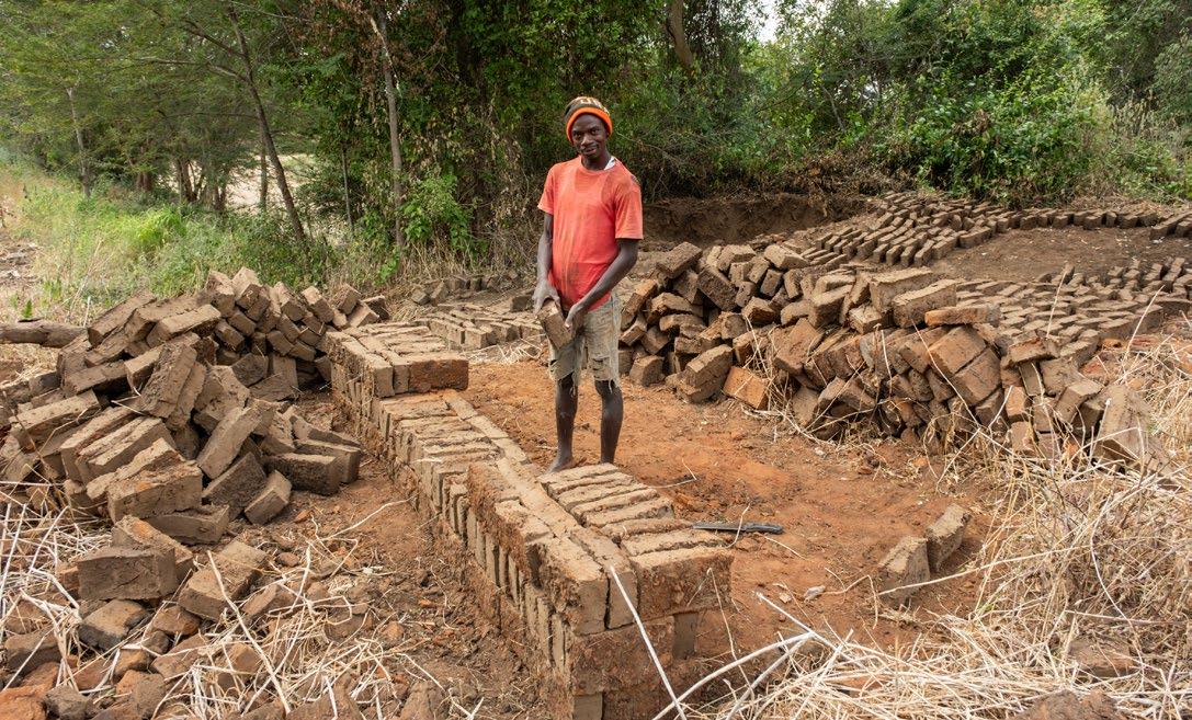
1. Orthic Luvisols and Ferral-Orthic Acrisols: Well-drained, deep to very deep, dark reddish-brown to yellowish-red, friable sandy clay loam to clay. This type of soil is great for making bricks.
2. Orthic and Rhodic Ferralsols and Pellic Vertisols: A complex of welldrained, moderately deep, reddish-brown, friable stony clay and poorly drained, deep, black cracking and swelling clays. This type of soil is unpredictable due to its different textures hidden beneath the surface.
3. Rhodic Ferralsols: Deep, well-drained, red sandy clay loam and clay.
4. Acri-Orthic Ferralsols: Well-drained, deep to very deep, brownishyellow to yellowish-red, friable clay. These two (3&4) soil types are often seen as the most suitable for agriculture.
5. Pellic Vertisols: Poorly drained, deep to very deep, black cracking and swelling firm clays. This heavy clay is also known as black cotton soil. It is hard to work with but may have water-storing potential due to its low permeability.
Umu hill
Yatta plateau
UU2 0-16% slopes
Well drained, deep to very deep, dark reddish brown to yellowish red, friable sandy clay loam to clay
Orthic luvisols and Ferral-Orthic Acrisols: Paleustralfs and Paleustults
LIC 0-5% slopes
Complex of well drained, moderately deep, reddish brown, friable stony clay and poorly drained, deep, black cracking and swalling clays:
Orthic and Rhodic Ferralsols and Pellic Vertisols: fine, Kaolinitic, isothermic Typic Haplustox and fine, montmorillonitic, isothermic Typic Pellusterts
FXr 2-15% slopes
Deep, well drained, red sandy clay loam and clay
Rhodic Ferralsols; Typic Haplustox
UU1 2-5% slopes
Well drained, deep to very deep, brownish yellow to yellowish red, friable clay
Poorly drained, deep to very deep, black cracking and swelling firm clays
Pellic Vertisols: Typic Pellusterts
[Image 40] Soils of the Kawongo area (Brugmans, 2024)
Tiva river
[Image 41] Vertisol black cotton, heavy clay (Brugmans, 2023)
[Image 42] River bed (Brugmans, 2022)
[Image 43] Ferrasol, red and Sandy loamy (Brugmans, 2022)
[Image 44] Luvisol, red clay loamy (Brugmans, 2022)
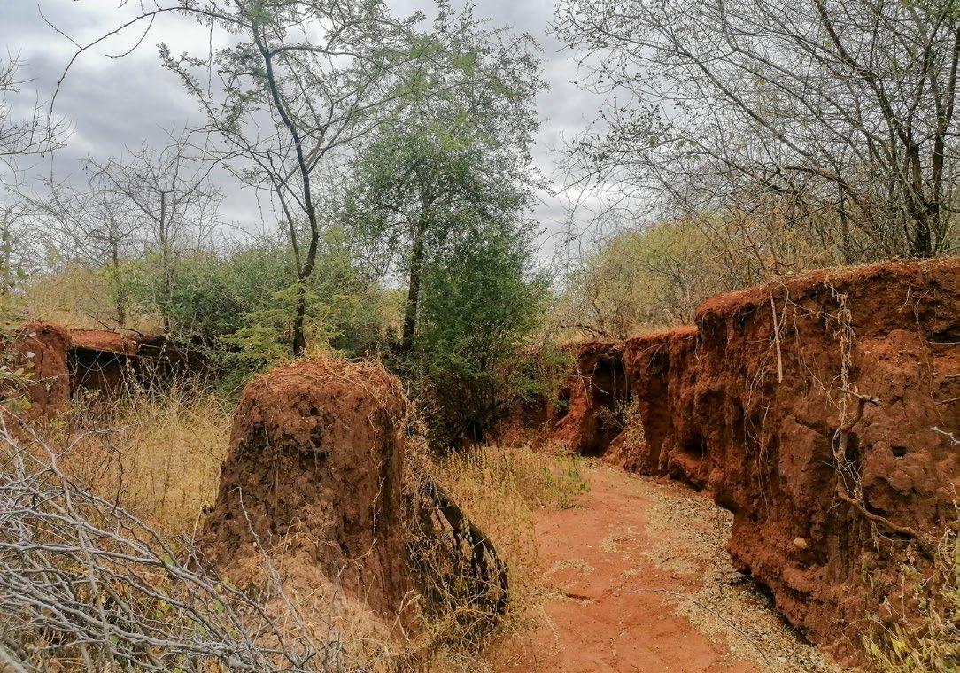
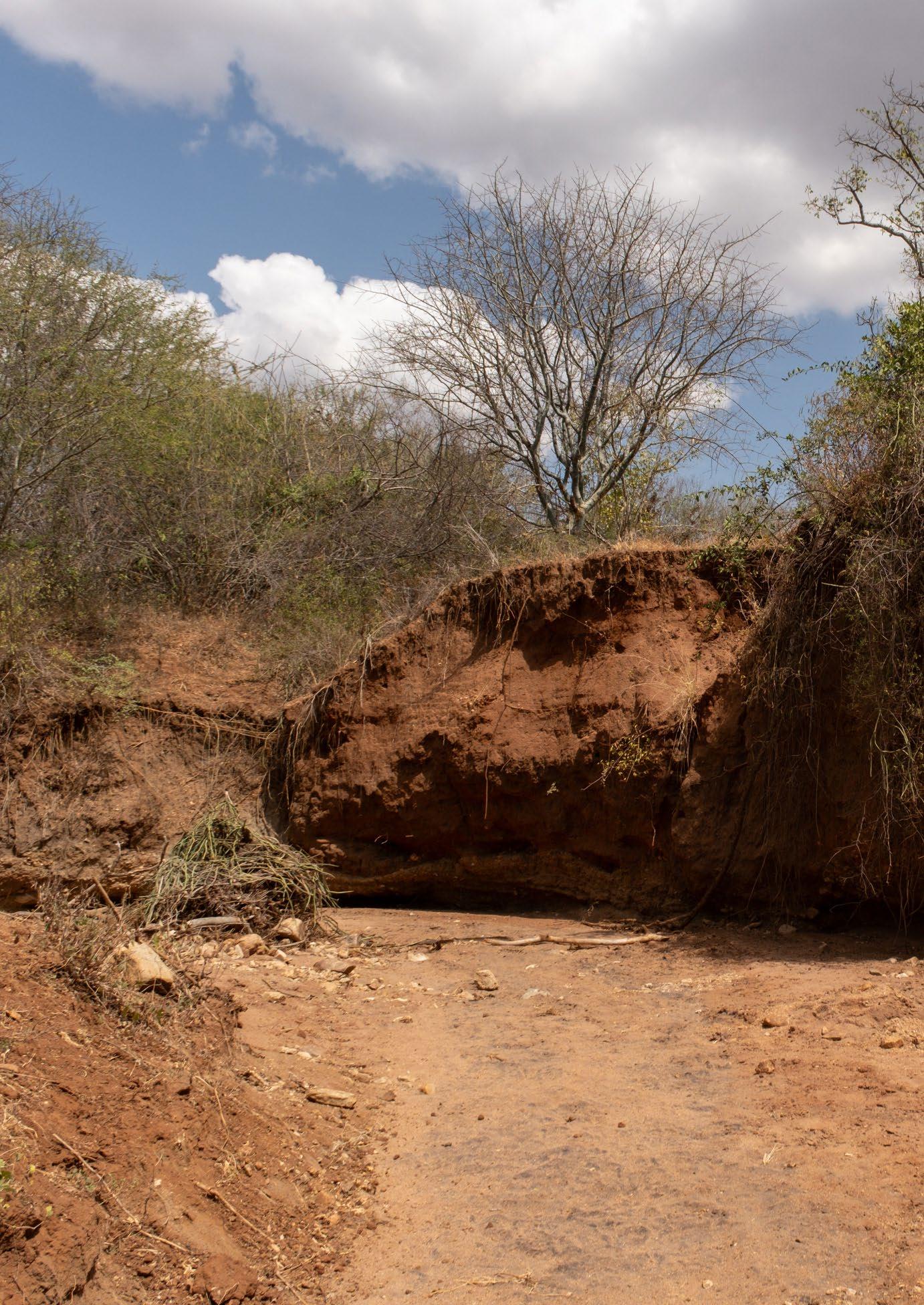
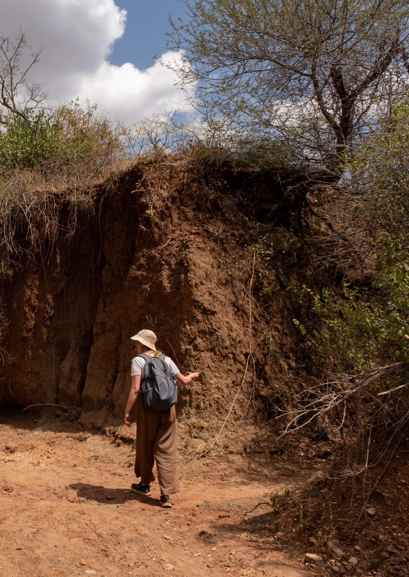
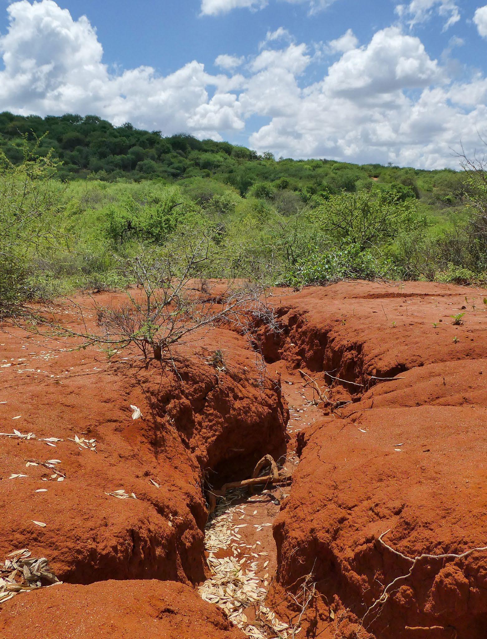
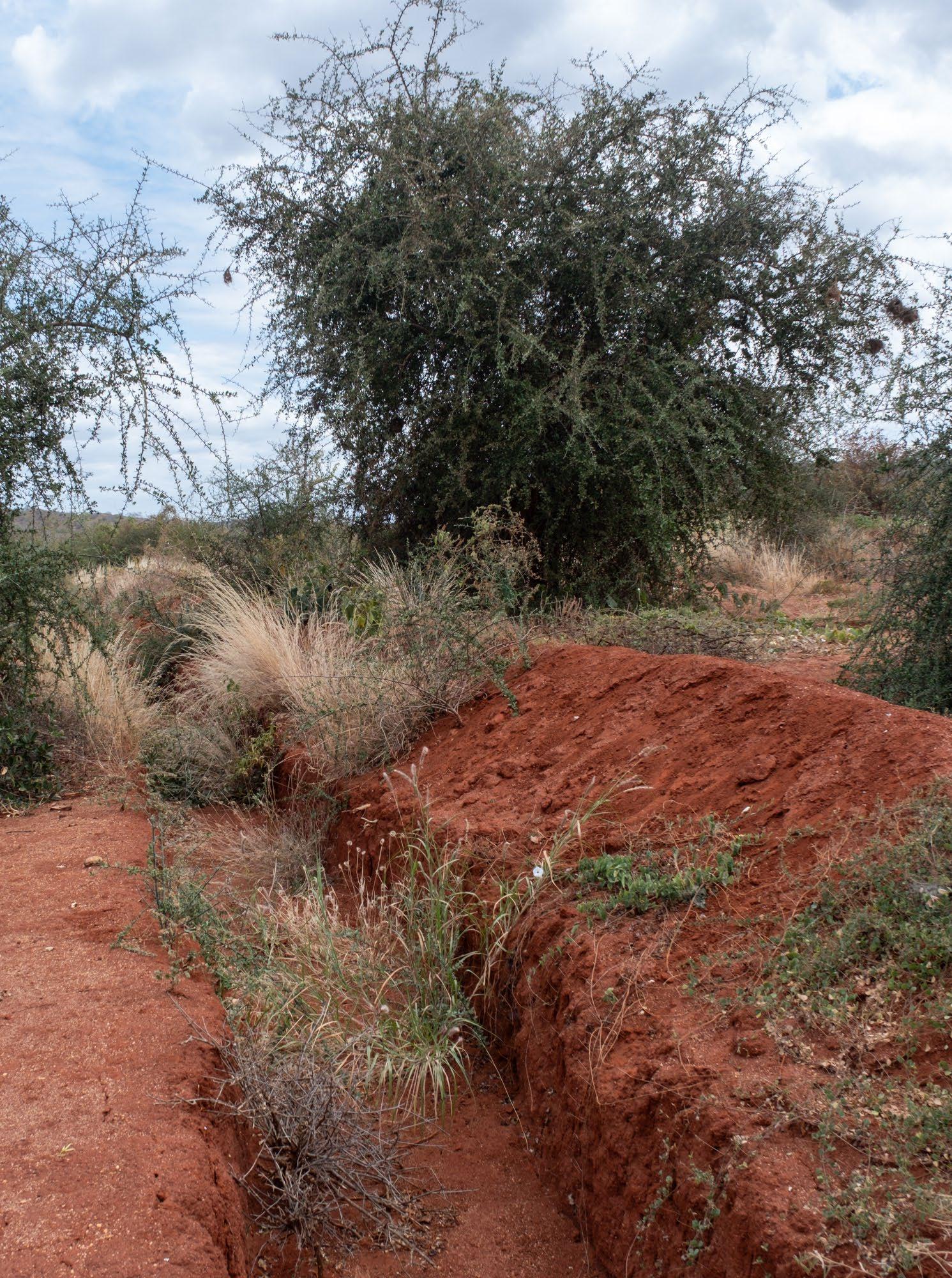
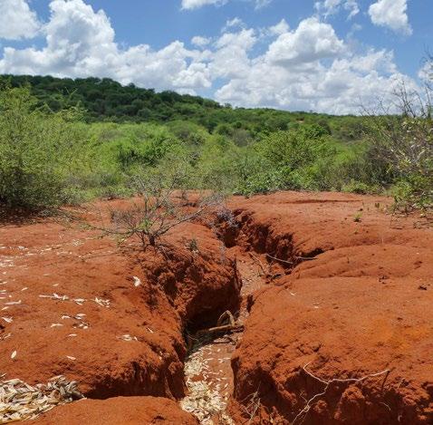
[Image 45] Deep gully in the area (Brugmans, 2023)
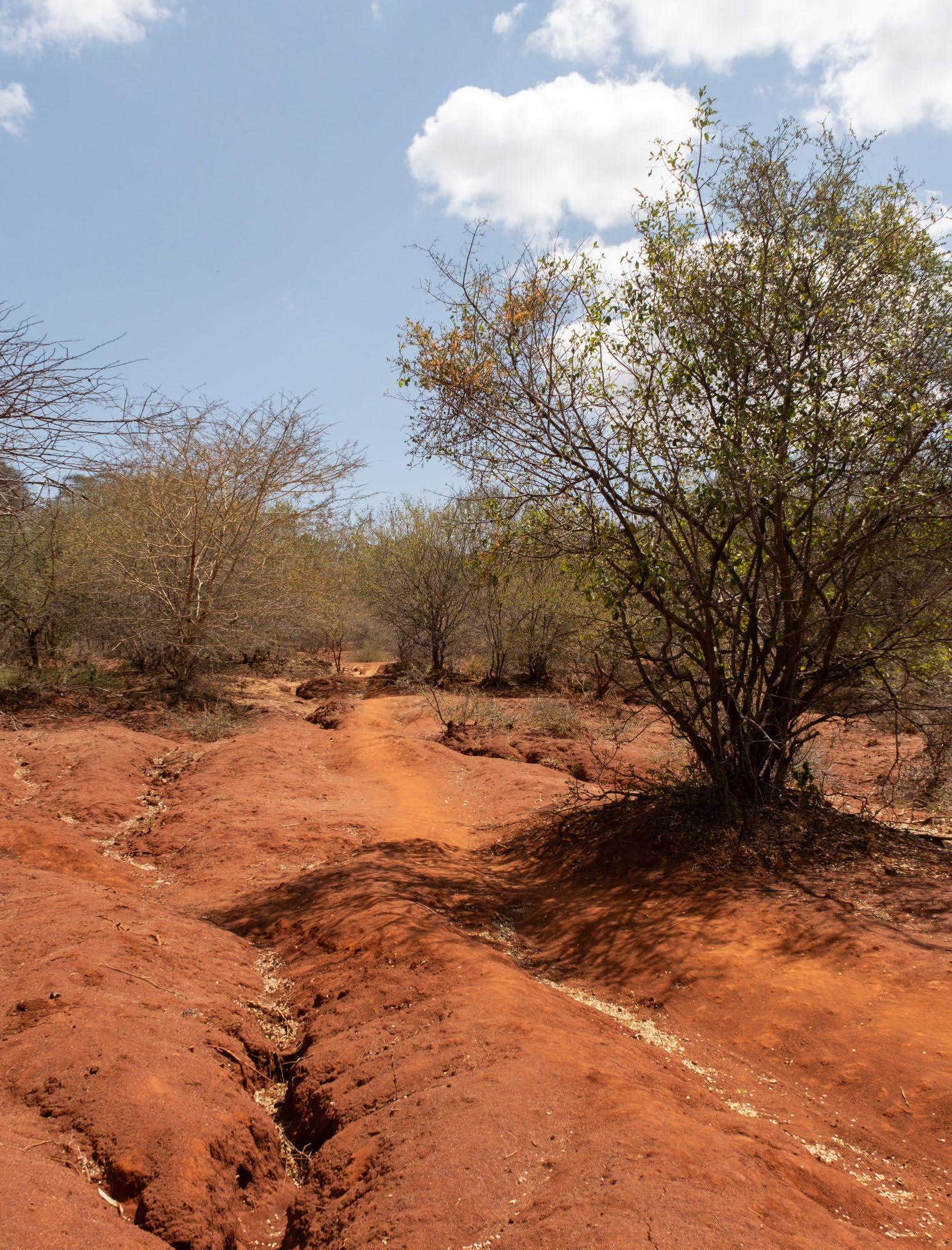
Soil erosion
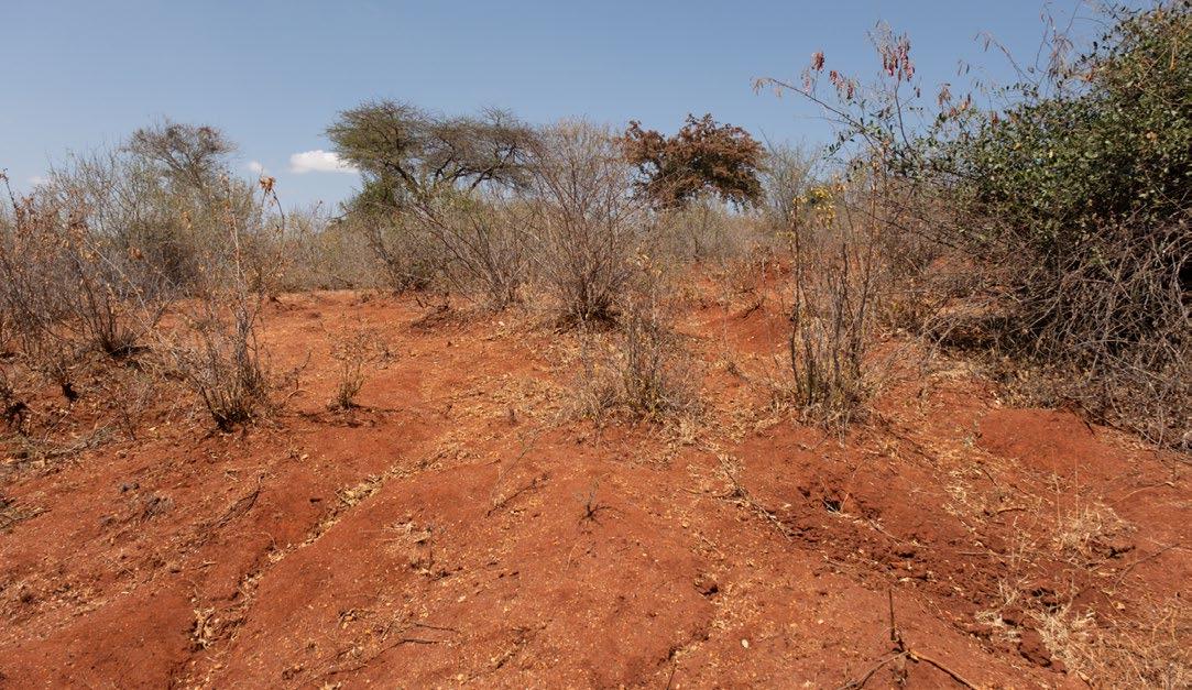
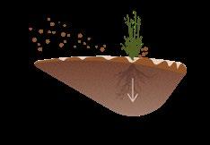
In the previous paragraph about the water cycle, it was mentioned that heavy rains affect the soils in the area. Soil erosion is an increasing problem due to the combination of intense land use, steep slopes, and the extreme climate. Rain during the rainy season is not the only cause of soil erosion. Wind in the dry season also creates dust storms that blow away the top layer of soil.
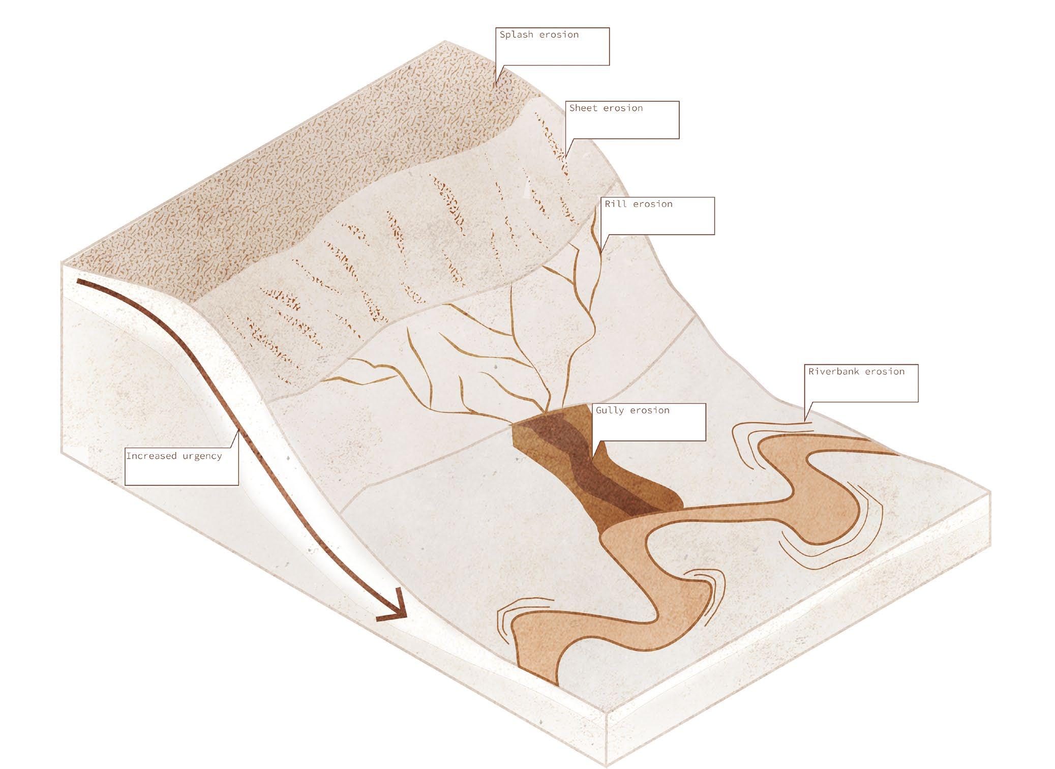
Soil erosion develops in different stages, becoming worse over time. These stages are:
1. Splash erosion: The initial loosening of the topsoil layer by rain.
2. Sheet erosion: The loose topsoil is blown away by the wind.
3. Rill erosion: Small channels start to form from rainwater streaming downhill.
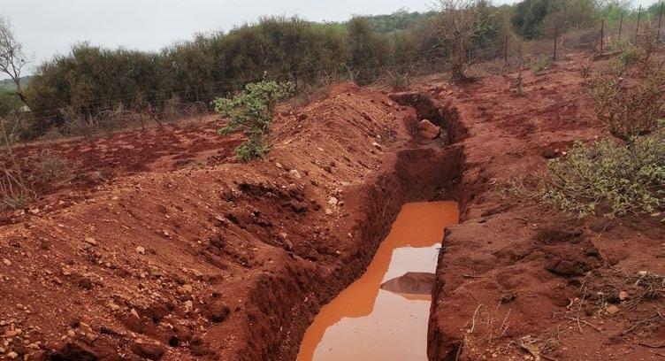
4. Gully erosion: Rill erosion continues to expand until deep gullies form. In the area, these gullies can reach depths of up to 5 meters.
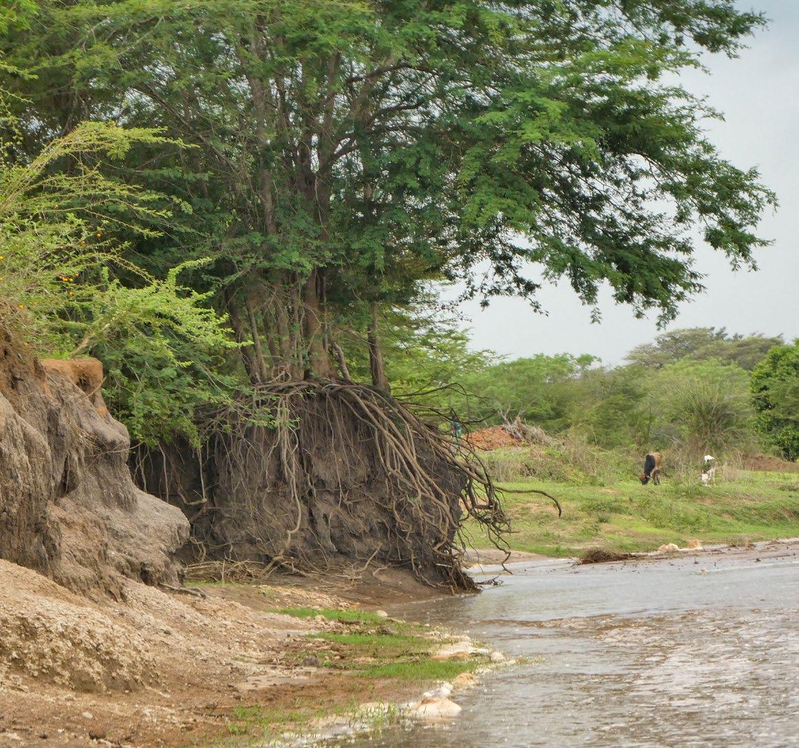
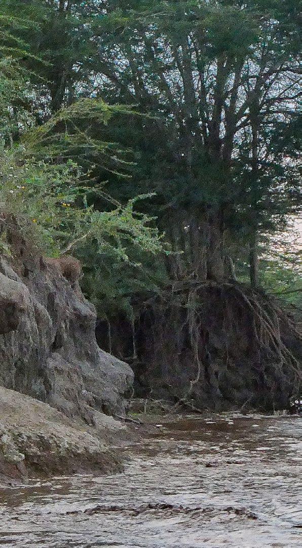
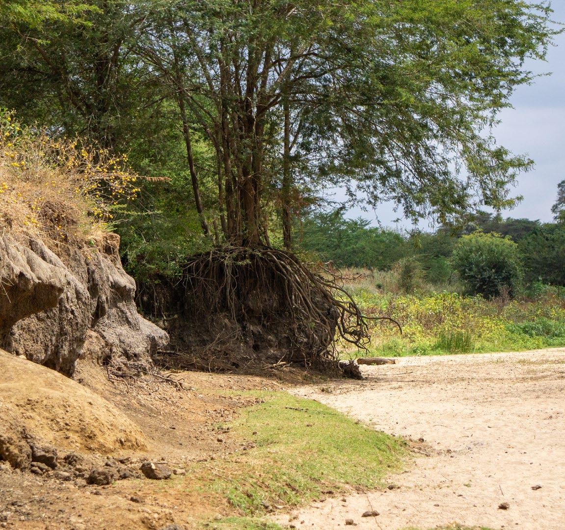
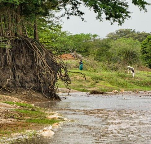
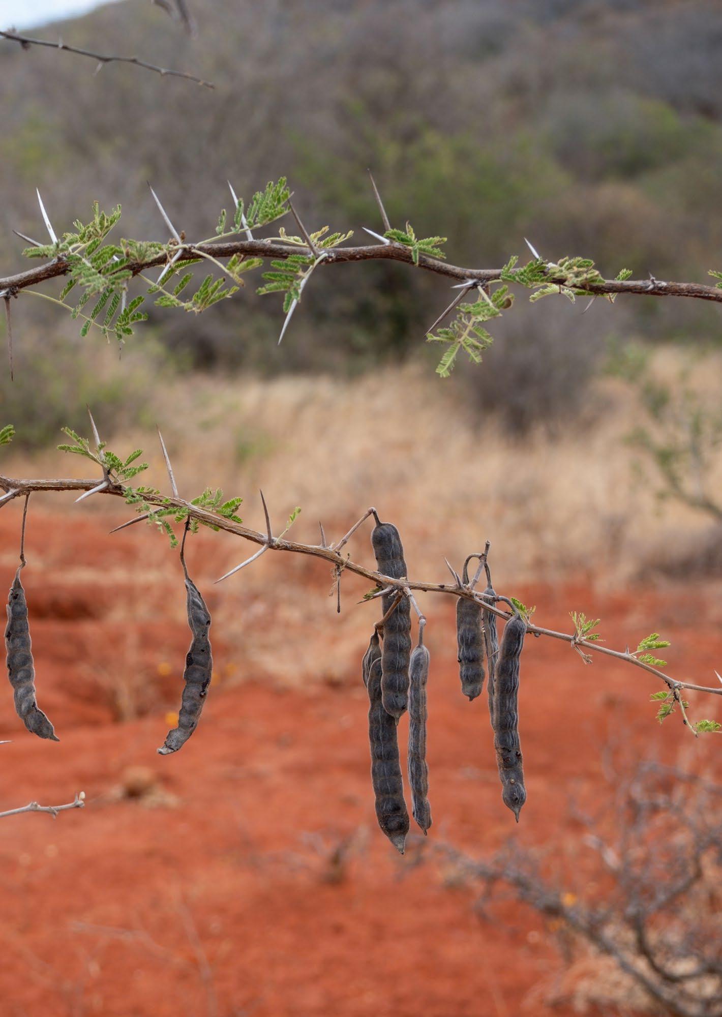
In addition to these general types of soil erosion, the soil is also eroded due to the expanding Tiva River. The meandering of the river continues to widen the sandy riverbed, taking away fertile soils and greenery from one side of the riverbank and depositing sand in its place.
People in the area report that the riverbed has already doubled in size in some places. Images 36 to 38 show an example of a steep riverbank that is about to be swallowed by the water flowing through the river.
[Image 46] Erosion stages in the area (Brugmans, 2024)
3.4 - The Kawongo community
The people in the area live scattered through the landscape on their farms and some live close to each other in the villages. Different organisations bring the community together. in general there are 80 people per square kilometre (Kitui annual development plan, 2020) The Kawongo/Kathome area has about 500 households led by 50 village elders.
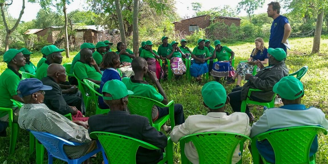
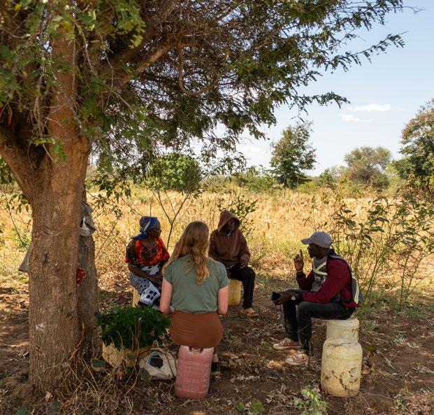
The community in Kawongo is very active, and has strong social ties where everybody knows each other. There are frequent gatherings, and people often work together on farms. Some tasks are too challenging for a farmer to complete alone. For example, local farmer Peninal hires workers when her plot needs plowing. The community can then come to the rescue.
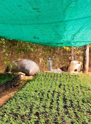
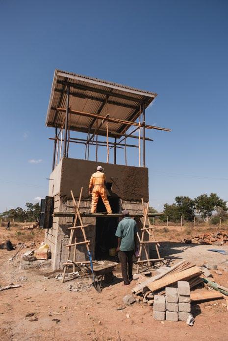
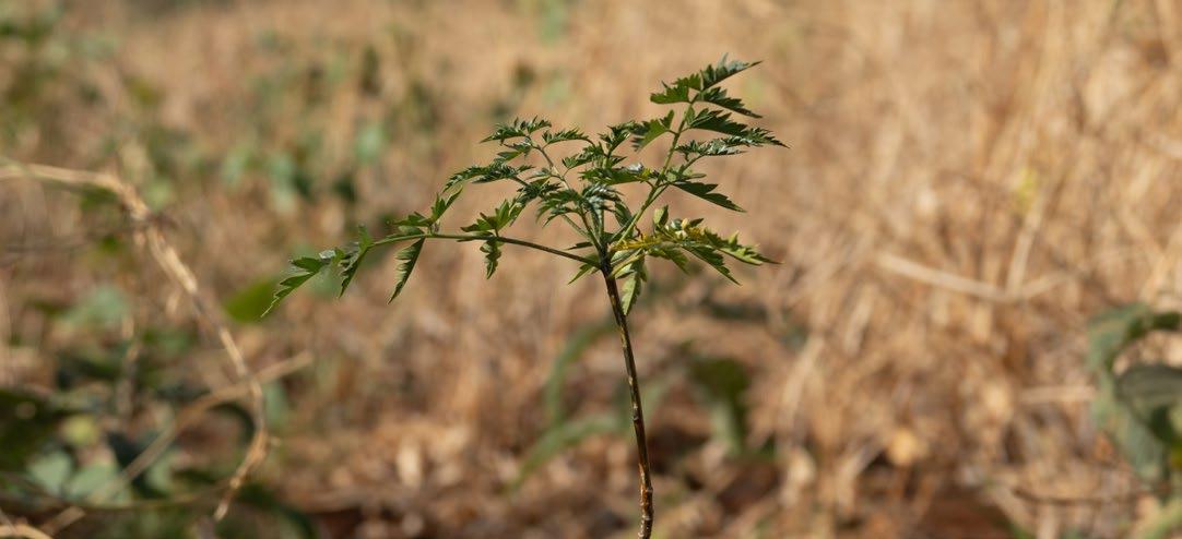
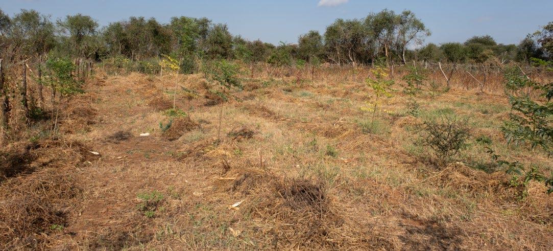
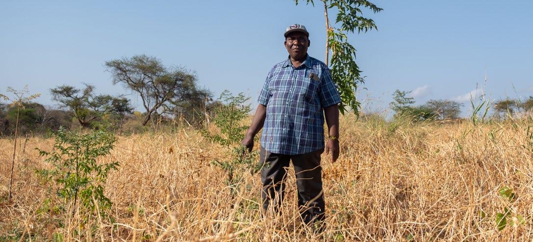
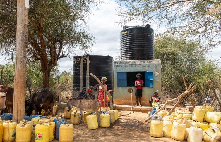
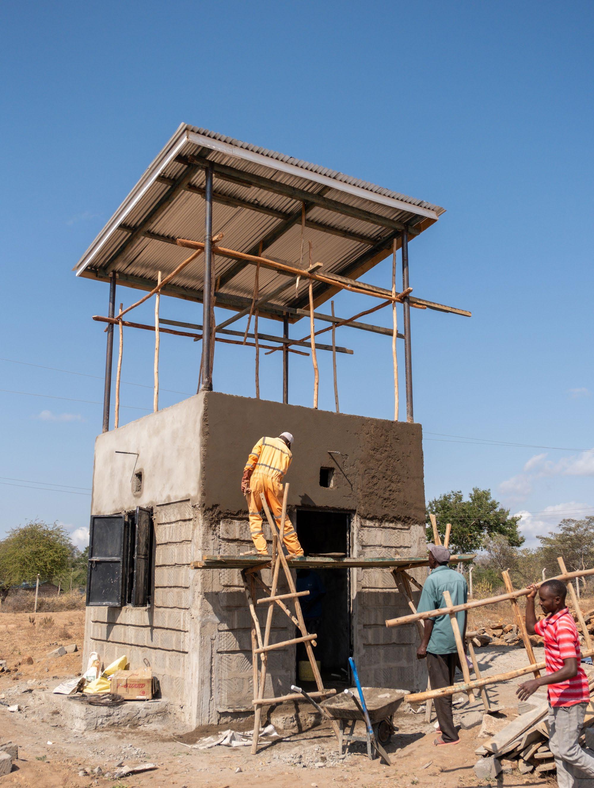
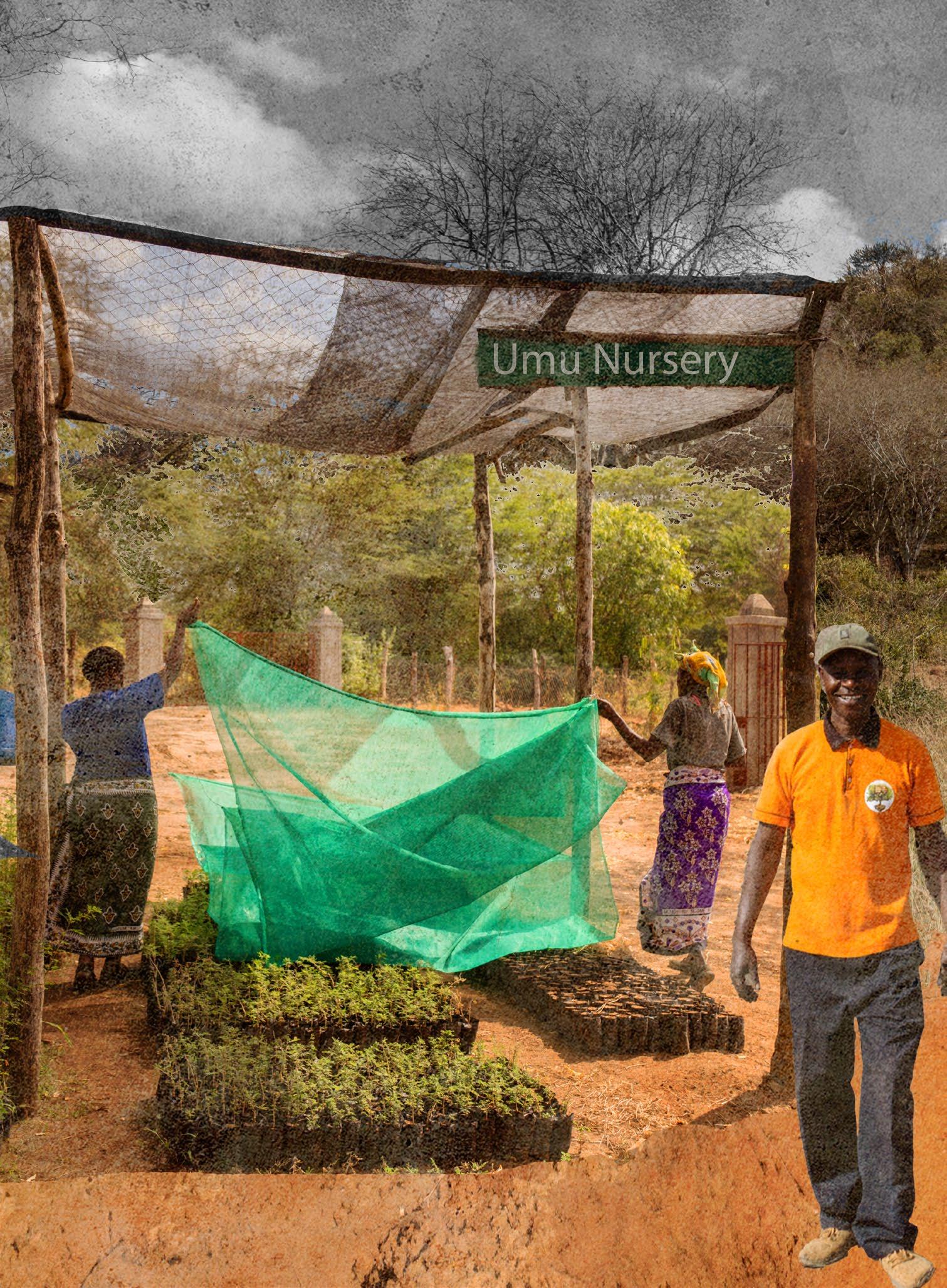
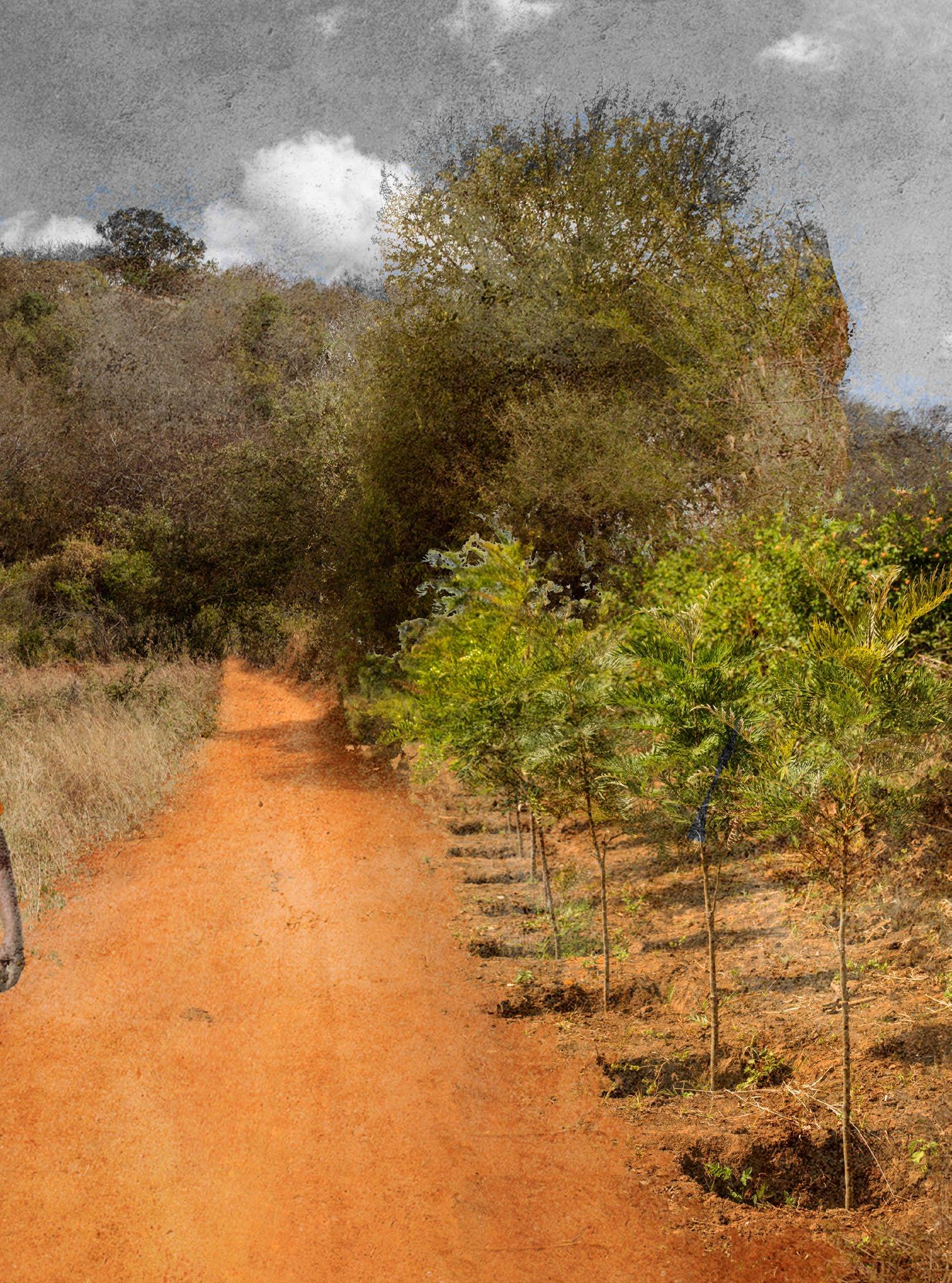
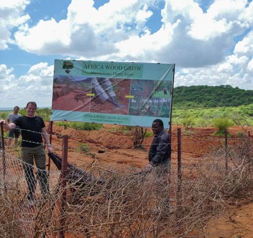
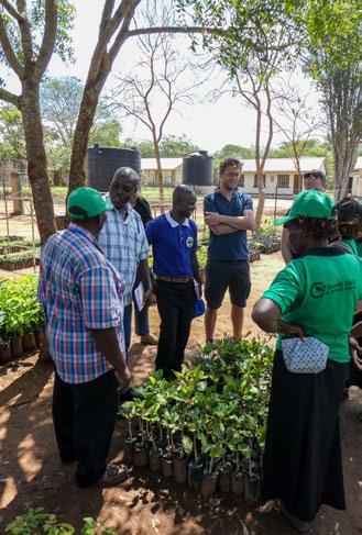
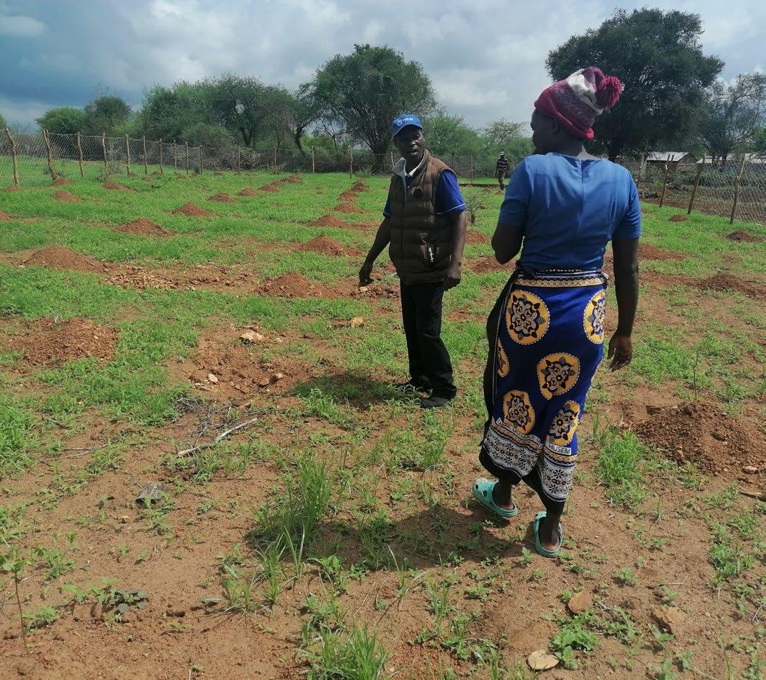
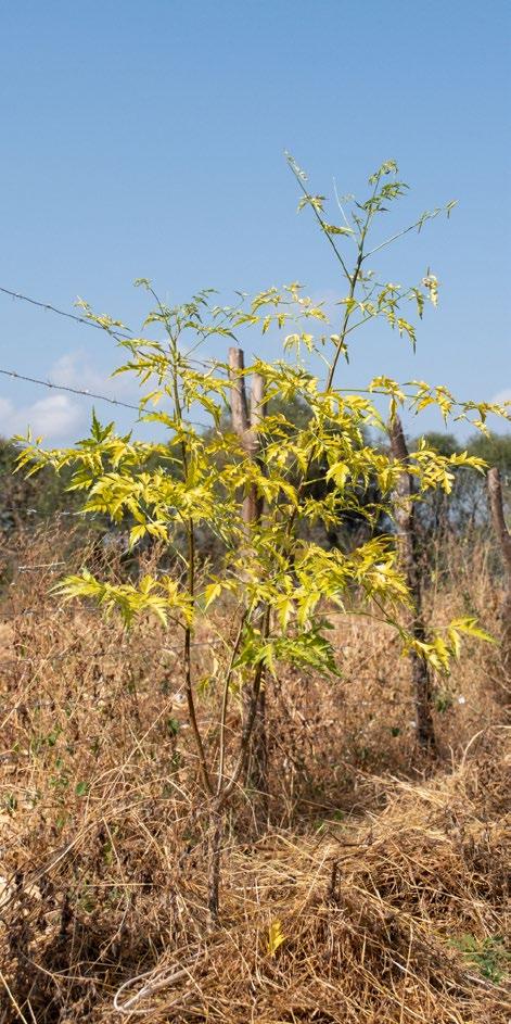
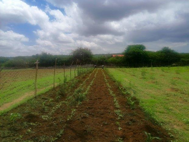
Two organizations play a significant role in connecting community members: Africa Wood grow and the Kamiti Community-Based Organization. These organisations are helping farmers to start practicing agroforestry. Interested farmers can receive support from these organizations to obtain their first trees. In 2022, Africa Wood grow bought a new plot next to the village of Kawongo. This plot will host a water tower and a community hub where local farmers can learn about agroforestry. Africa wood grow already has helped 210 farmers with starting to add trees to their farming practices. (africa wood grow, 2021)
Kawongo village also features a market structure for the weekly market, which serves as a central hub for trade and social interaction. Additionally, the area around the shop fronts is a popular spot for passers-by to stop and chat.
The Christian church is also a place where a lot of people come together. Faith is a big part of the communities identity. Even during official meetings it is very common to first start with a prayer, asking for the meeting to be fruitful.
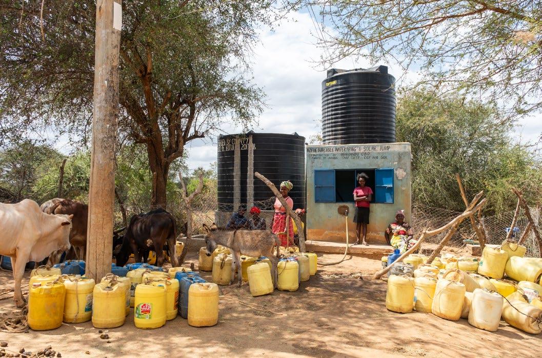
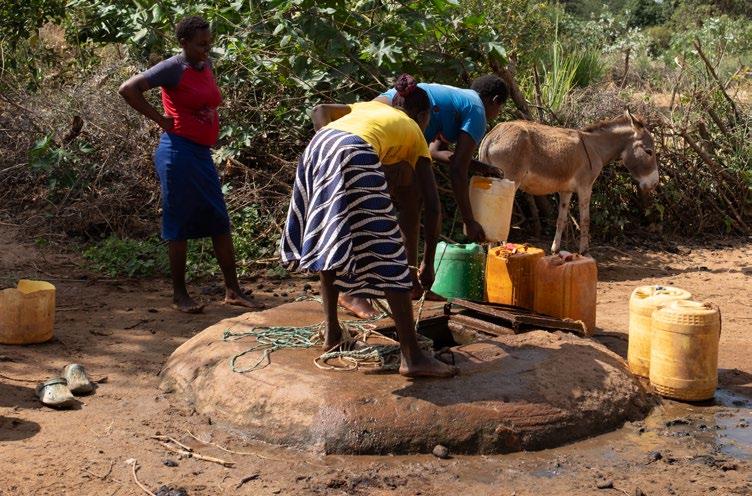
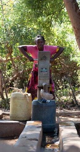
Lastly, the access to water is a vital aspect that unites the community. The limited water points, which include dams, boreholes, sand dams, and water towers, are used by everyone, making them ideal places for people to meet and connect. However, some of these water points are owned by large NGOs that charge for access. For instance, the borehole located in Nzeve village requires a fee of 2 Kenyan shillings for 25 litres of water. During times of drought, farmers in the area face a difficult choice: pay for water, risk crop failure, or spend the entire day fetching free water from the Tiva riverbed.
(Previous page)
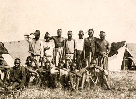
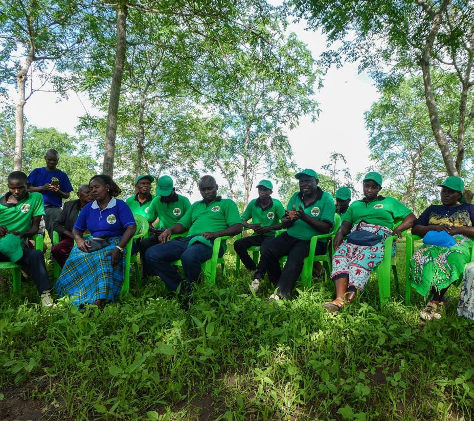
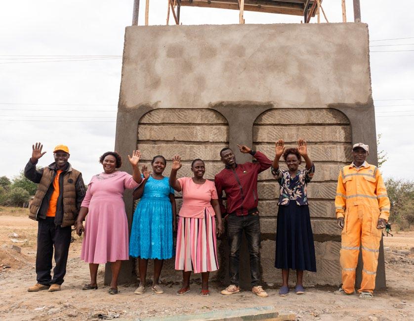
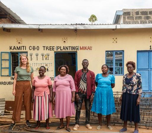
[Image 47] The board members of the Kamiti CBO (Doesburg, 2023)
(Next spread)
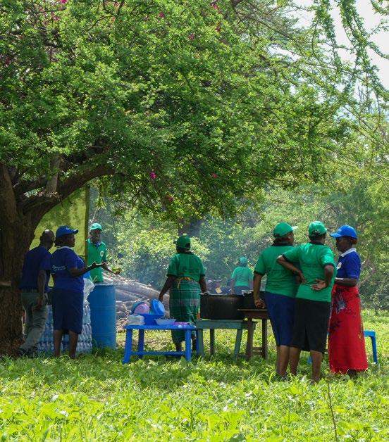
[Image 48] A collage of the vibrant Kawongo community (Brugmans, 2023)
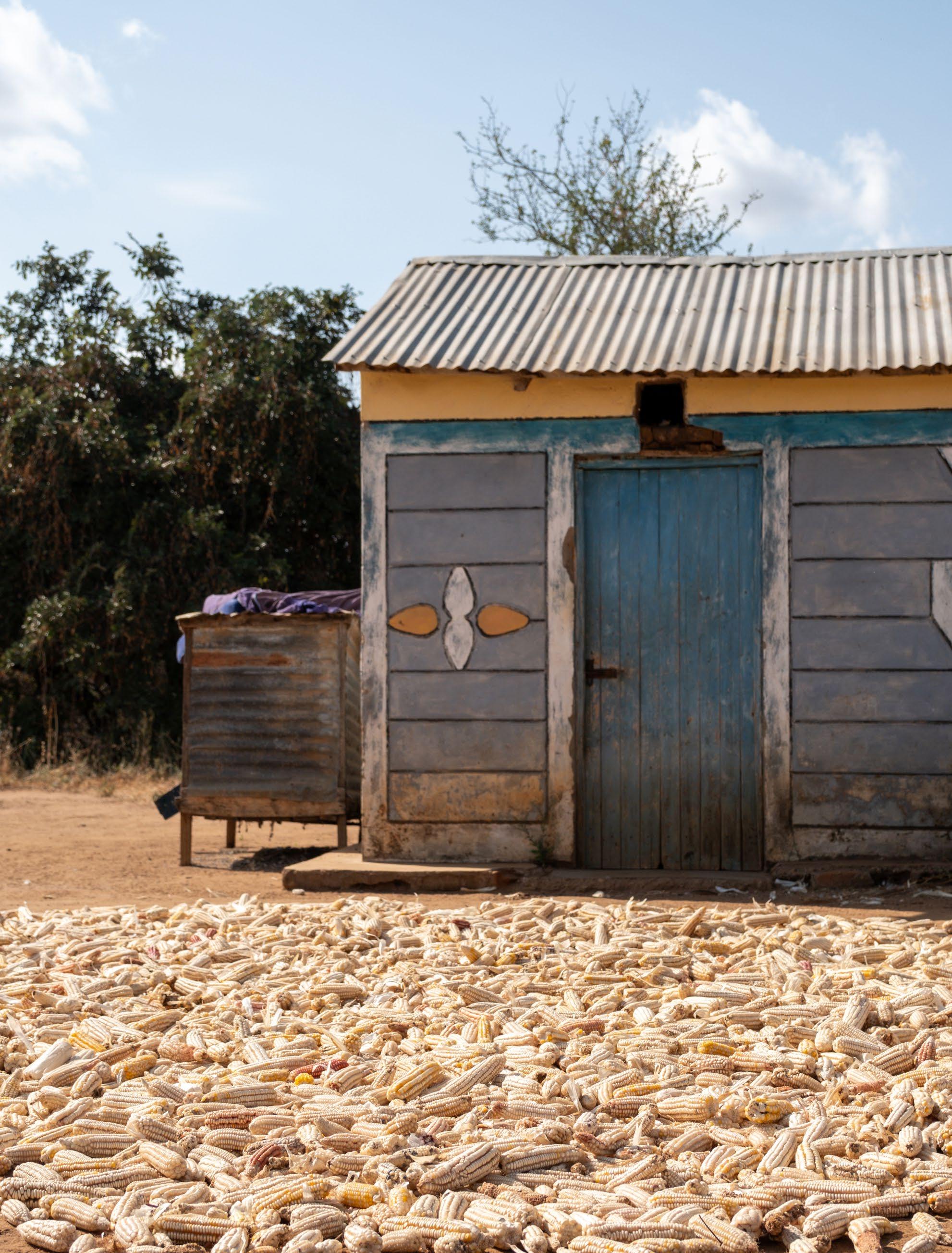
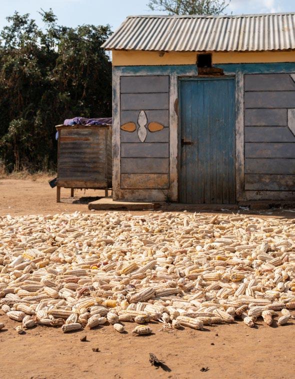
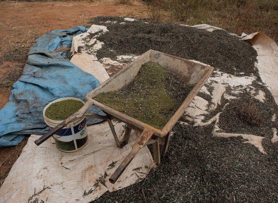
(Next page) [Image 49] Collecting maize after the harvest (Doesburg, 2023)
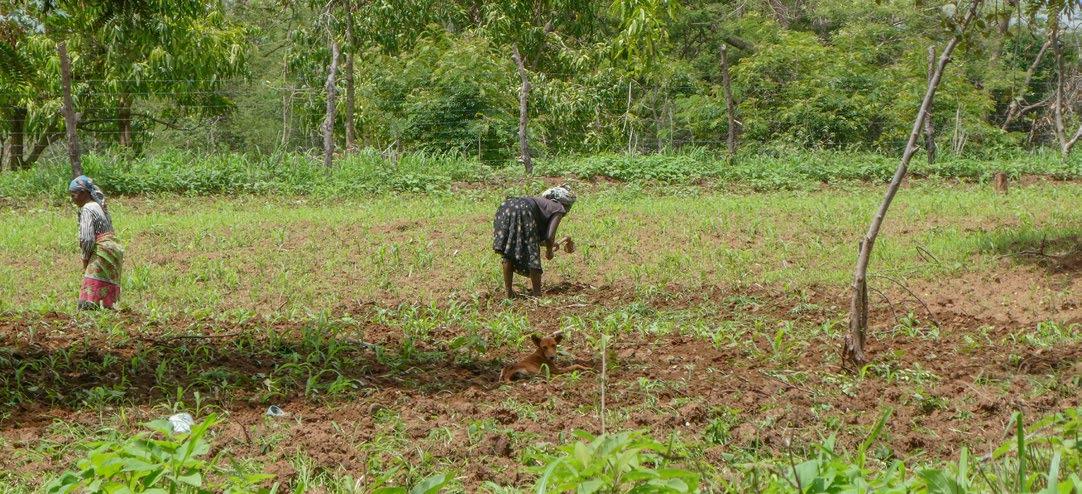
3.5 - Agricultural land use
Generations ago the Kamba people changed their way of living. They moved away from pastoralism and started to settle in different areas like Kawongo. These settlements became hubs for trade and farming. Nowadays agriculture is what generates about 93% of the families in Kitui their income. (Ministry of Agriculture, Livestock, Fisheries and Cooperatives, Kenya, 2021)
Farming remains the main source of income for the residents of Kawongo. The methods of farming have evolved over time, with each generation passing down knowledge from parent to child while also discovering new ways to sustain themselves.
An example of this is how pests are controlled. Sila Mutinda, a farmer in the area, explained that he sprays his crops weekly to protect against pests. This is the easiest and cheapest way to save his harvest. Before him, his ancestors used cow dung and honey to repel insects.
Depending on the size of their plot and family, a specific percentage of the farm's harvest is either sold or kept for consumption. A small portion is saved as seeds for the next season.
Certain crops can be easily sold at local markets, while others are sold to large corporations. Farmers calculate which route is easiest to earn the most money. Most farms use fertilizer to provide extra nutrients to their crops and spray against pests. This clearly shows that without human intervention, the soils and the area itself are difficult to farm.
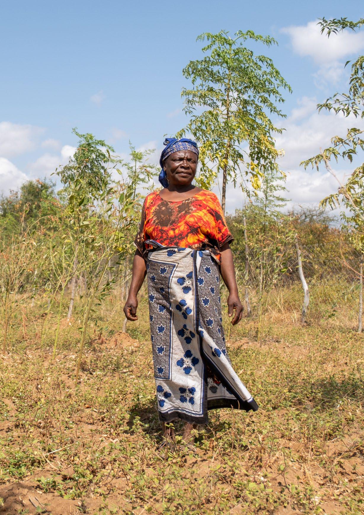
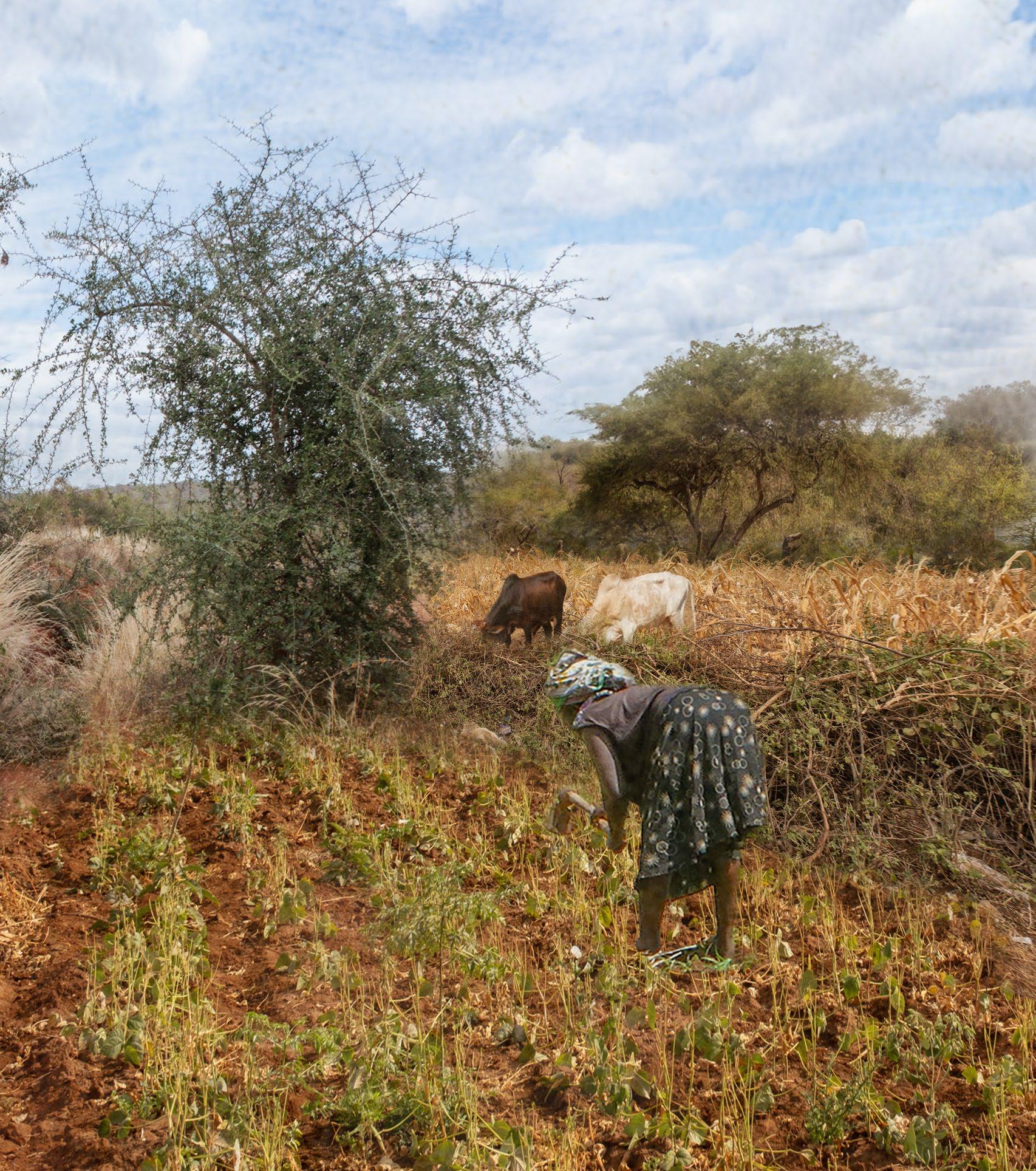
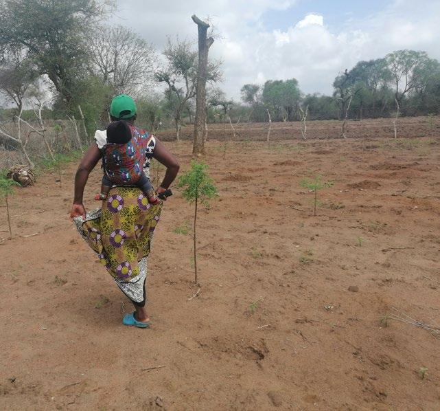
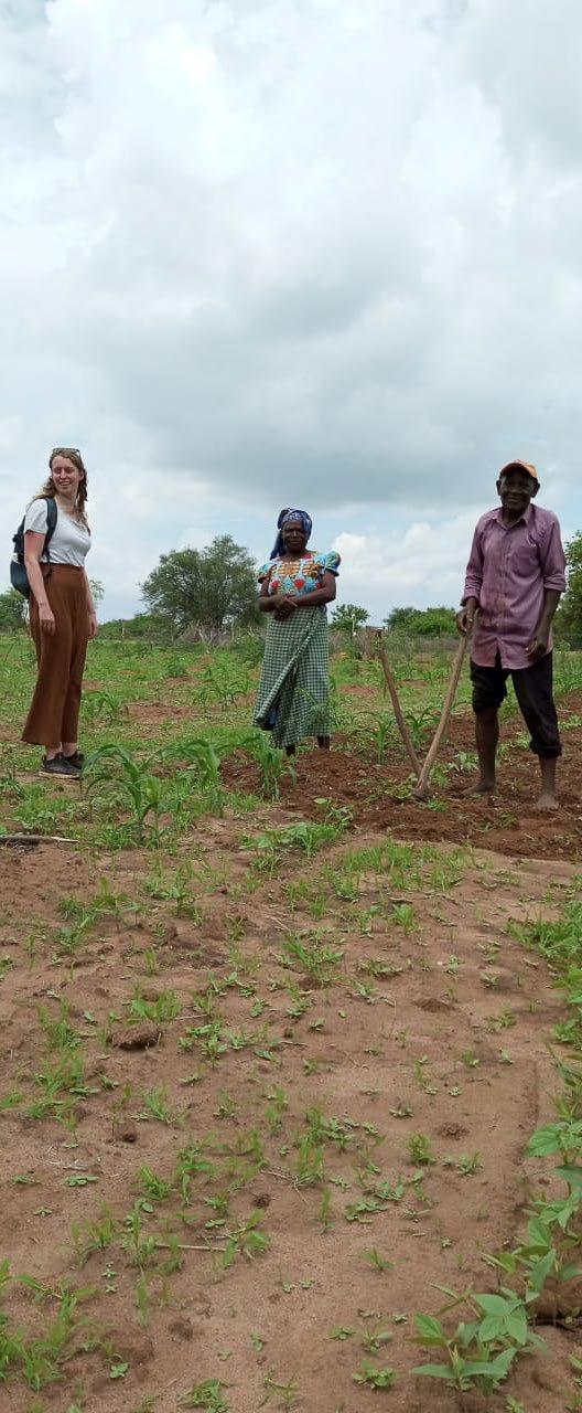
Peninal, a farmer with her shamba near Umu Hill and the borehole in Nzeve village, talks about her farming methods. She says that she farms a variety of crops, which proved very beneficial last year when some crops failed due to heavy rains. The variety of species makes her farm more resilient to climate change.
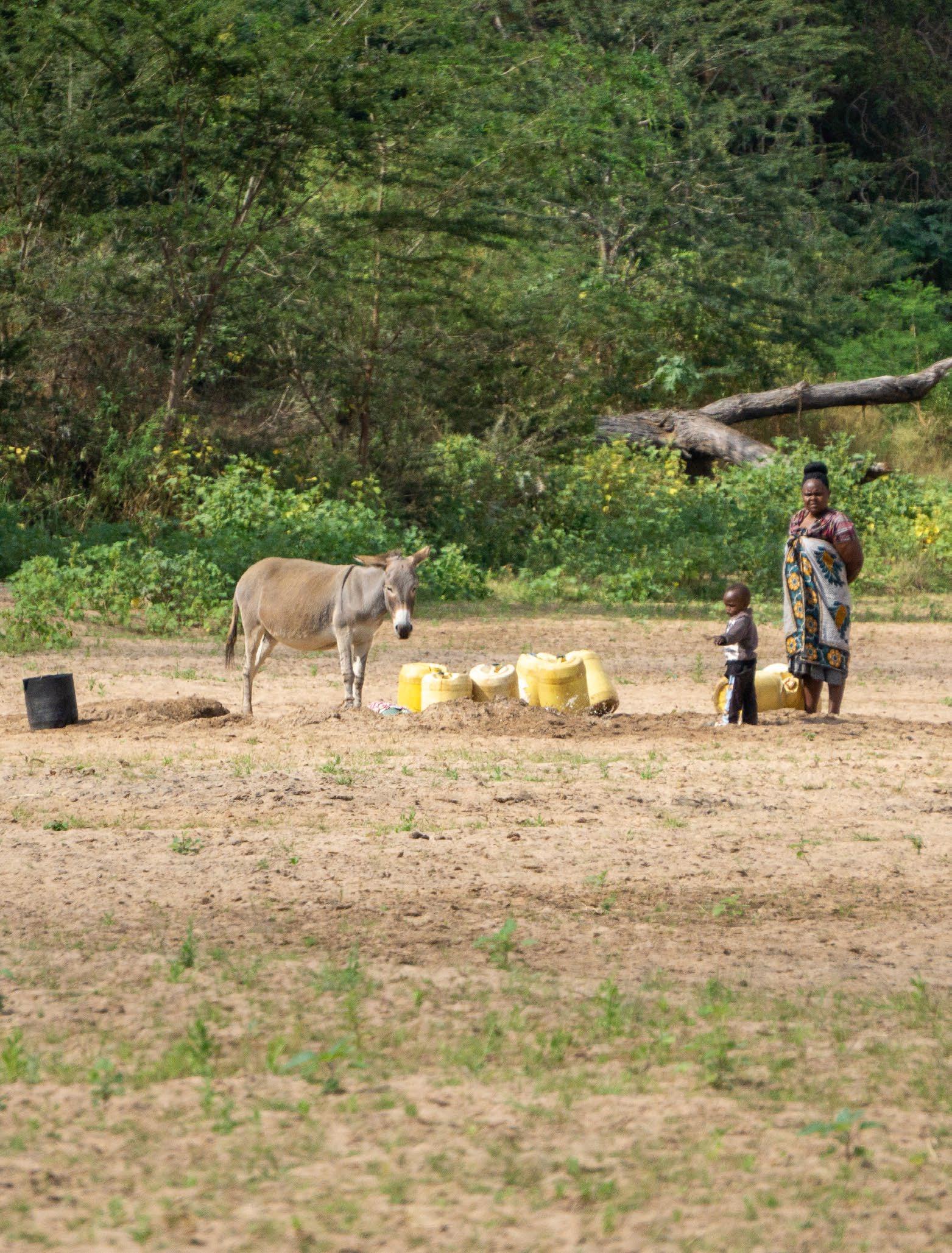
Angeline farms closer to the Tiva River. Even though she is nearer to the river than Peninal, she has to travel farther to get water for her farm. She has to travel with her donkeys to fetch water and says that water access is one of her main challenges. Angeline keeps most of her crops for herself and her family, as do most farms in the area. Her annual yield of green grams is an exception; she is able to harvest about 400 kg of green grams but keeps only 50 kg for herself.
Different methods used for farming in the area are summarized on the next spread.
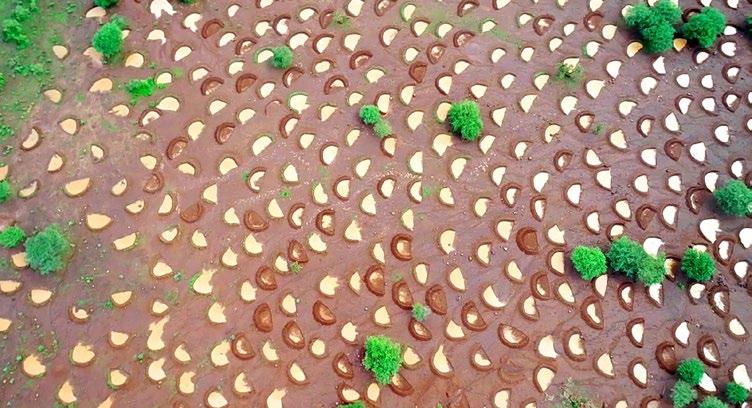
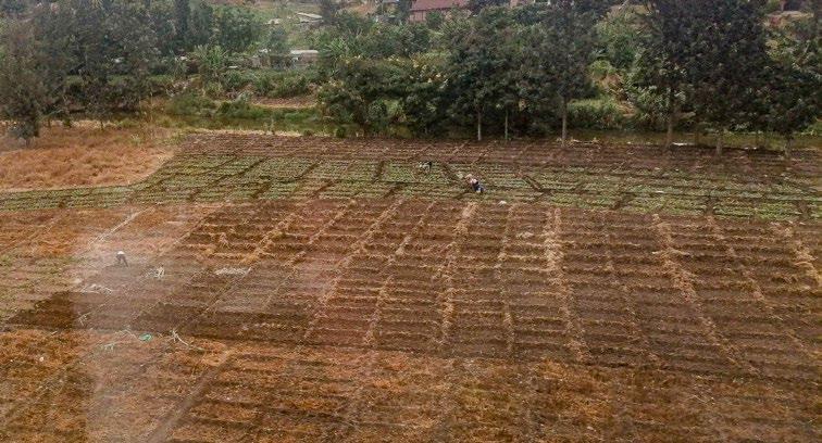
Raised bed farming
[Image 50] Doesburg, 2023
Increase soil moisture and nutrients
Farmland
· Short to long term
Small scale
Zai pits
[Image 51] Brugmans, 2022
Water capture to increase growing conditions
Farmland
· Short term
Extra small scale
Planting mounds
[Image 52] Brugmans, 2022
Water capture to increase growing conditions
Farmland
Short term
· Extra small scale
Plowing/ top soil distribution
[Image 53] Brugmans, 2022
Increase growing conditions
Farmland
Short term
Medium scale
Methods used for farming
· Small scale intercropping
[Image 54] Doesburg, 2023
· Increase soil moisture and nutrients
Farmland
Short to long term
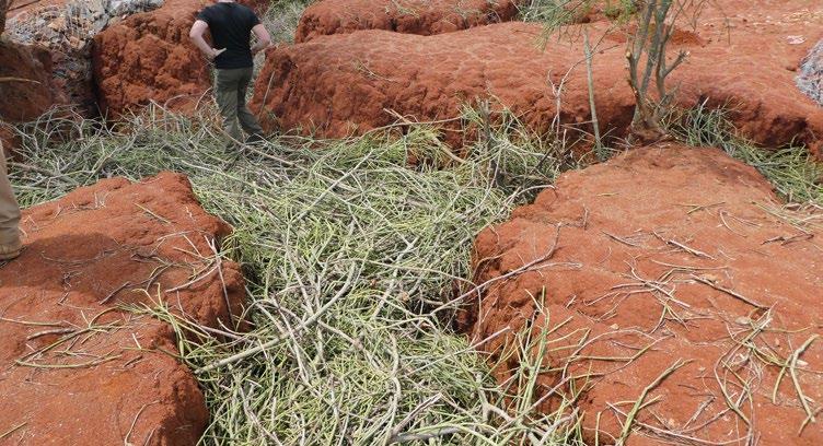
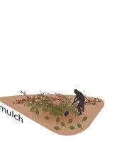
Mulching
[Image 55] Doesburg, 2023
Increase soil moisture and nutrients
Farmland and natural land
· Short to long term
Medium scale
Cover planting/ cropping
[Image 56] Doesburg, 2023
Increase soil moisture and nutrients
Farmland
Short to long term
Medium scale
Fertilizers
[Image 57] Doesburg, 2023
· Increase soil fertility
Farmland
Short term
Medium scale
3.6
- Different Income methods
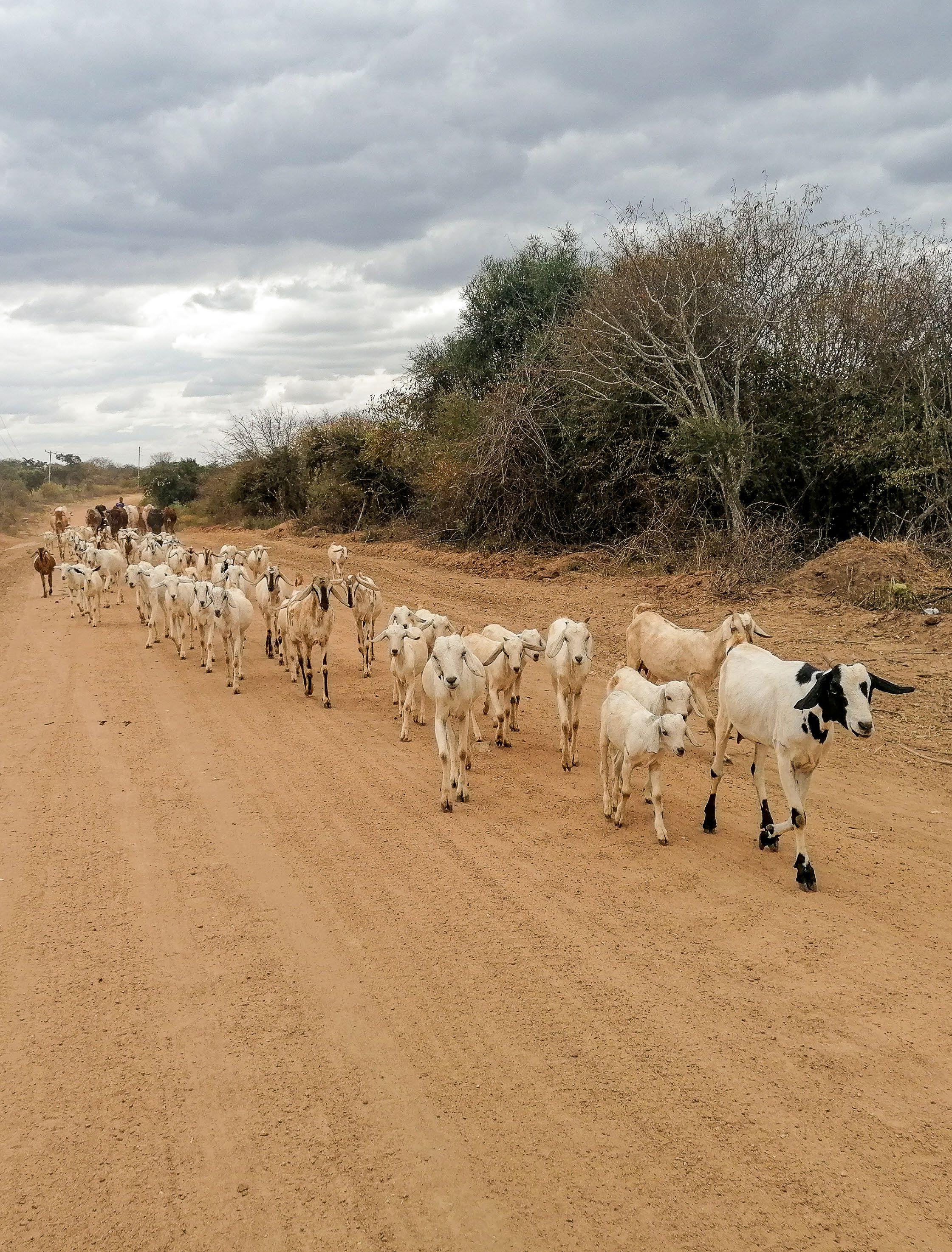
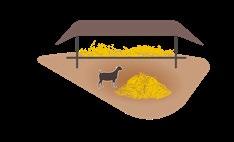
The next pages give an overview of the different ways people in the area provide for themselves and their families. Next to crops, livestock is also a big part of the culture.
Farming crops is the main source of income for the residents of Kawongo. Farmers cultivate a wide variety of crops to ensure a diverse diet throughout the year. They aim to be self-sustainable, purchasing only the extra items they cannot produce themselves from the market. Farms that are close to the river or other water sources can irrigate their crops and provide the community with food that not everyone can grow on their own.
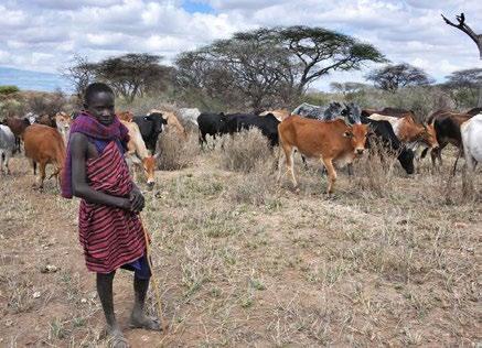
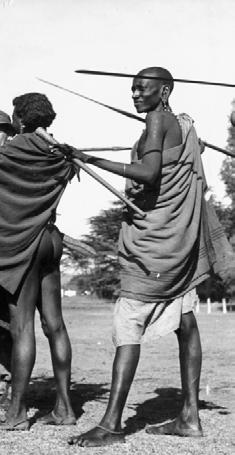
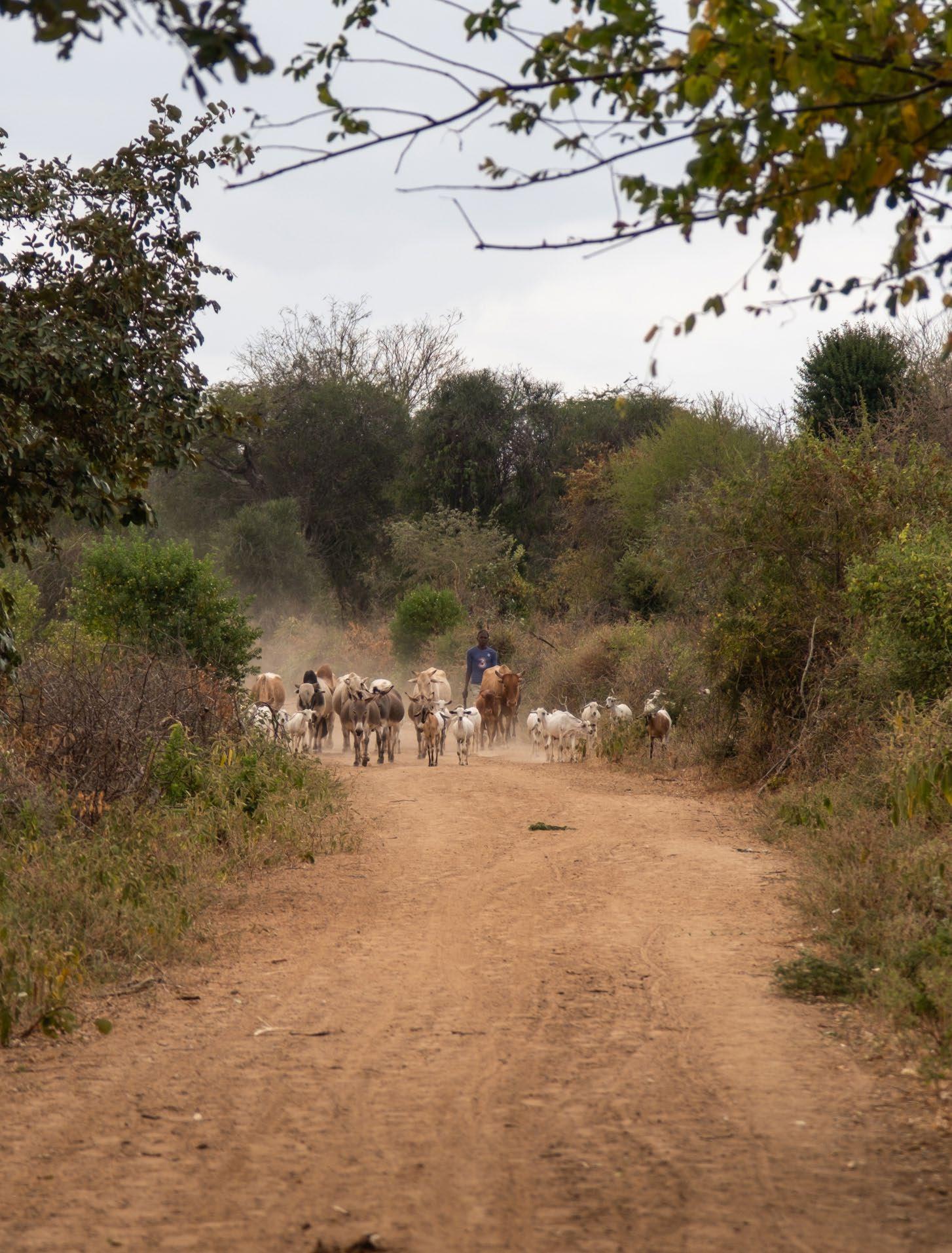
Raising livestock is also a significant part of Kamba culture, a remnant from the time when herding was the primary way of life. The Maasai in other parts of Kenya still follow this traditional lifestyle, building temporary housing and moving with their animals. However, the space to move around freely has greatly diminished. In Kawongo, almost every piece of land is owned by someone, making it impossible to sustain the traditional methods of raising livestock.
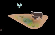
Despite this, people still feel the need to have their own herds. They view livestock as a form of savings; if crops or other sources of income fail, they can always sell their animals. Farmers mainly keep their cattle on their own land, only letting them out to get water or to go to the weekly cattle market.
According to the local veterinarian, the average family owns about:
• 5 cows
• 20 chickens
• 10 to 50 goats
• 2 donkeys (This is the maximum number of donkeys allowed)
If farming or raising livestock fails, people often resort to hired labour or crafting goods. The need to change their means of livelihood often depends on access to water. Research by Vrije Universiteit Amsterdam has explored this issue in detail. A summary of their findings can be found on page 84.
(Previous page) [Image 58] Mixed farming system cattle can graze left over plants Doesburg, 2023)
[Image 64] Building a firepit for bricks (Doesburg, 2023)
In times of little water
Selllivestock
Water nearby
Water far away
[Image 65] What do households fall back on during drought when they are close or far away from a water source (VU Amsterdam, Nd)
PROBLEM & GOAL
4.1 - Problem statement
Climate change is causing irreversible shifts in the environment, and immediate action is crucial to prevent severe consequences for many regions around the world. Some areas are more vulnerable due to either the visible impacts of climate change or limited resources, making them less able to adapt.
One affected area is Kawongo, situated next to the Tiva river. Historically, this region thrived due to its rich agricultural potential. However, extreme climate conditions are now threatening peoples livelihood. Intensification of the water cycle has turned into a significant challenges for both the local people and wildlife.
Extreme climate circumstances are destroying peoples livelihood. Severe flooding destroys crops whilst extreme drought leaves farmers with no water to irrigate their crops, sometimes forcing them to abandon their land. Next to that, the changes in the climate also change wildlife habitats making them uninhabitable for the species that used to live there.
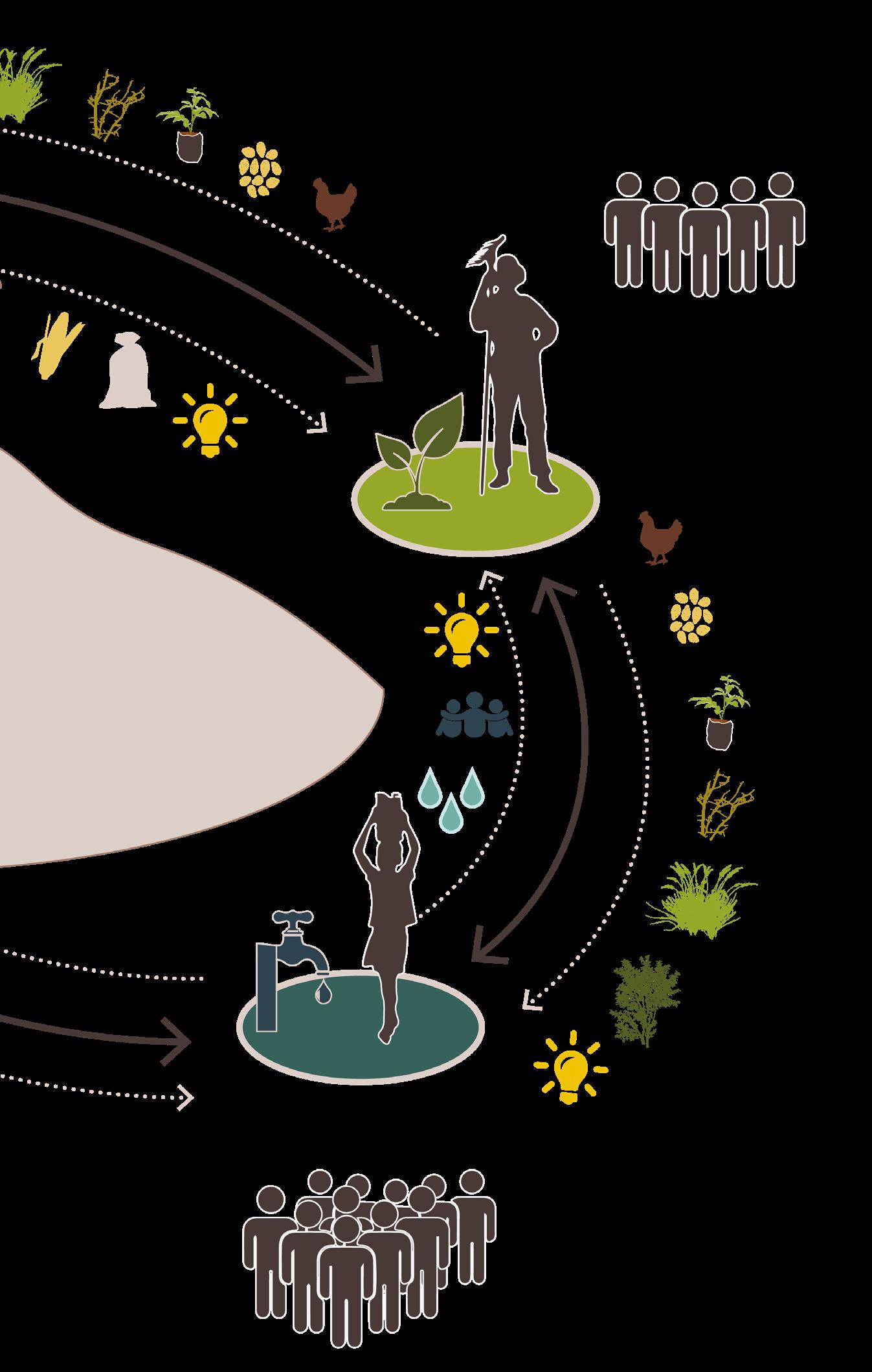
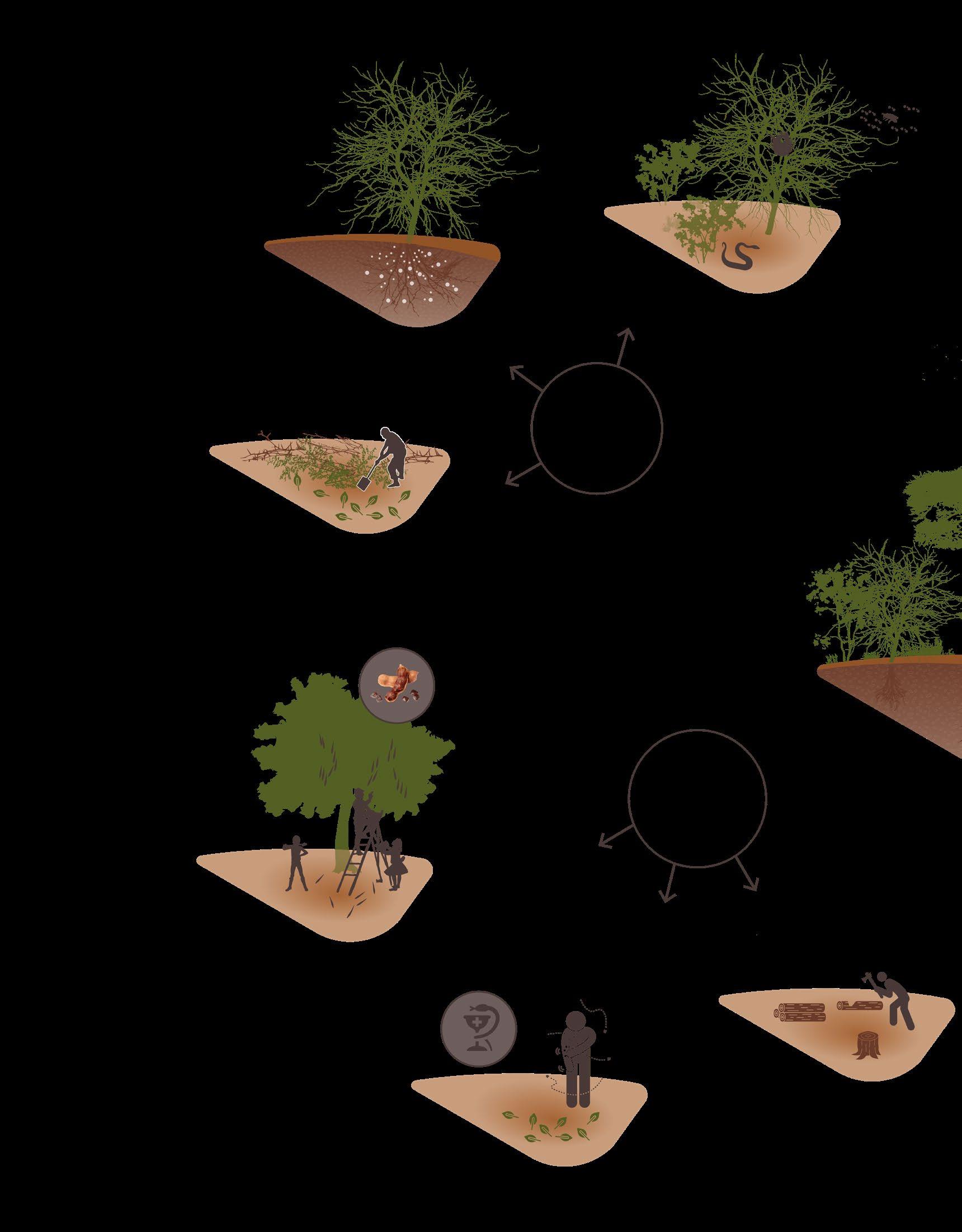
The diagram on the next spread shows the interplay between extreme physiographic issues and intensified human land use, which exacerbate soil, water, and biodiversity problems. To build resilience, the landscape needs to adapt to changing conditions, such as extreme variations in water flow. Without intervention, the amount of problems will only increase. The cycle of degradation must be broken!
In this project, I will explore solutions to disrupt this cycle. Various strategies exist to mitigate climate change effects, ranging from largescale policies to small-scale local interventions. For Kawongo, a combination of both approaches is essential. Given the limited resources available, starting with small-scale interventions is the way to go. Over time, these can be integrated into a larger, resilient system.
This graduation project aims to research and design ways to restore Kawongo to its former status as an opportunity-rich area. By addressing both immediate and long-term needs, the community can work towards creating a more resilient and sustainable environment for future generations.
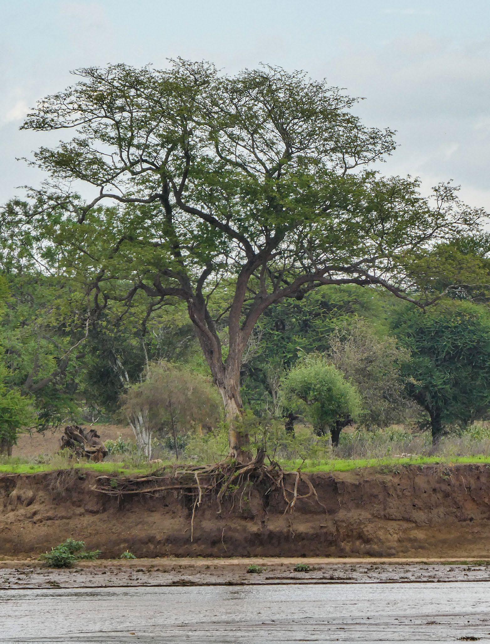
Previous page) [Image 67] A tree almost falling into the Tiva river because of riverbank erosion (Brugmans, 2023)
Problem analysis
Extreme Physiographical processes
Increased severity because of climate change - Geology - Rainfall - Wind - Vegetation - Climate extremes
No measures taken
Problems increase
Soil, water & biodiversity problems
Bad circumstances for the ecosystem and a difficult livelihood for residents of the area.
Restorative measures needed!
Better livelihood for the residents and a good functioning ecosystem.
What processes need to change over time to create a better livelihood?
Increased severity because of population growth
Human processes
- Deforestation
- Poor farming methods
Measures taken
Problems decrease
- Monoculture
- Soil exhaustion
- Sand harvesting
- Use of pesticides
- Use of artificial fertilizer
- Lost indigenous knowledge
- Charcoal burning
- Selling wood
- Excess grazing
- Creating farmland
- Building housing
Human - nature balance is lost
Restorative measures needed!
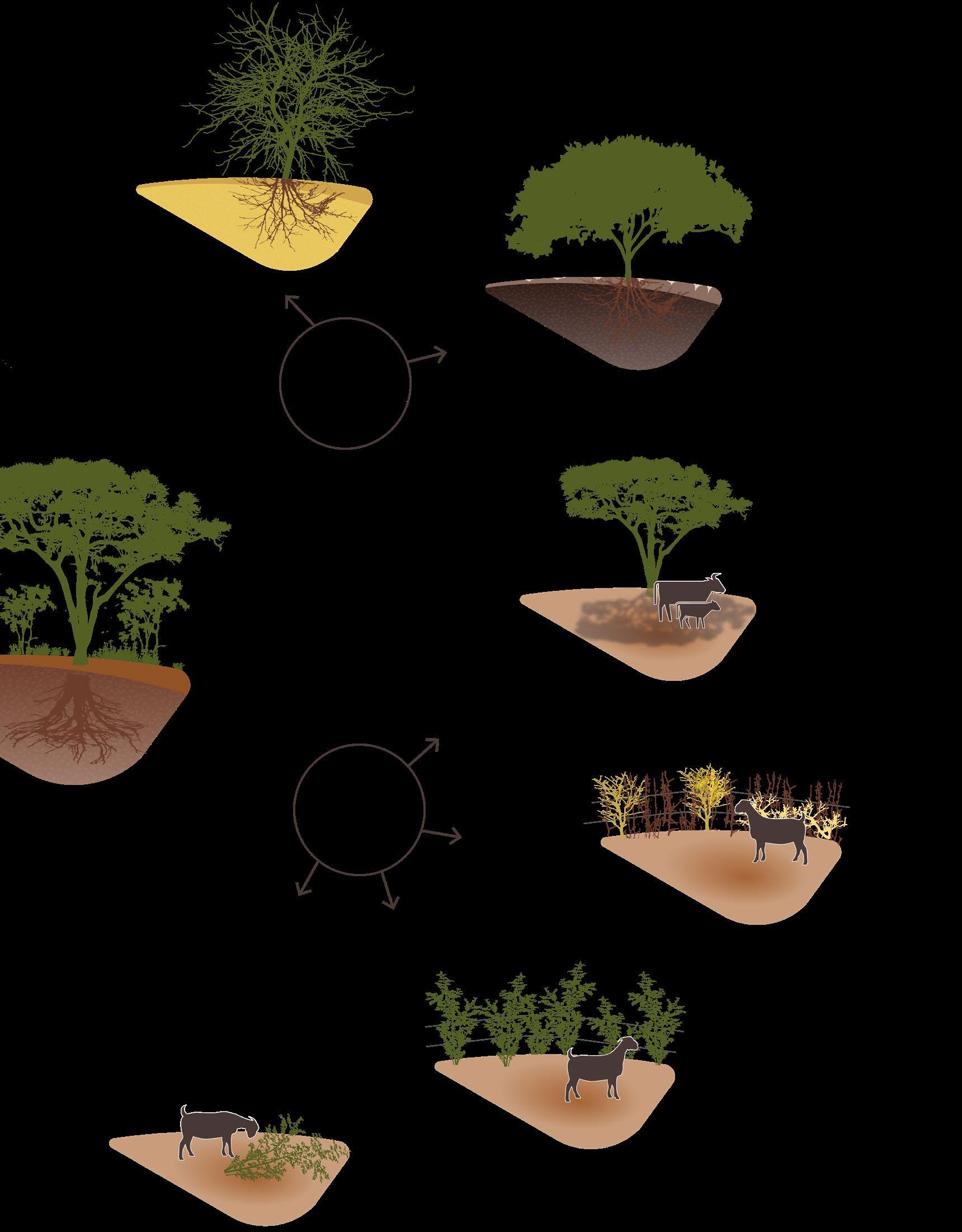
4.2 - Cycle of soil water and biodiversity
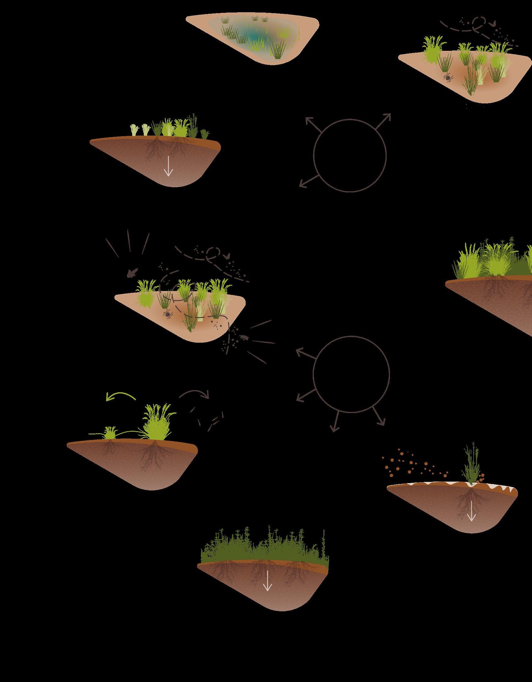
The diagram in the previous paragraph shows that the interplay between physiographical processes and human land use is the cause of a lot of problems in the area. These problems can be mostly categorised into three main problem areas: soil, water and biodiversity.
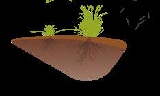
Even though these problems are discussed separately, they are interrelated and together they worsen conditions for both the ecosystem and the local livelihoods. When one of these elements fails, it often leads to failures in the others.
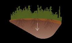
For example, soil erosion. This issue is most pronounced during the rainy season, when heavy rainfall flushes away the soil. Areas that are most vulnerable to erosion are typically those that are barren and lack vegetation because plant roots play a crucial role in stabilizing the soil.
This situation is worsened by the increased rainfall driven by climate change, which in turn then amplifies the erosion threat to the area.
On the other hand, eroded soils retain less moisture, making the area more susceptible to drought during the dry season. Thus, soil erosion not only worsens the impact of heavy rainfall but also increases vulnerability to drought conditions, creating a cycle of degradation that threatens both the ecosystem and local livelihoods.
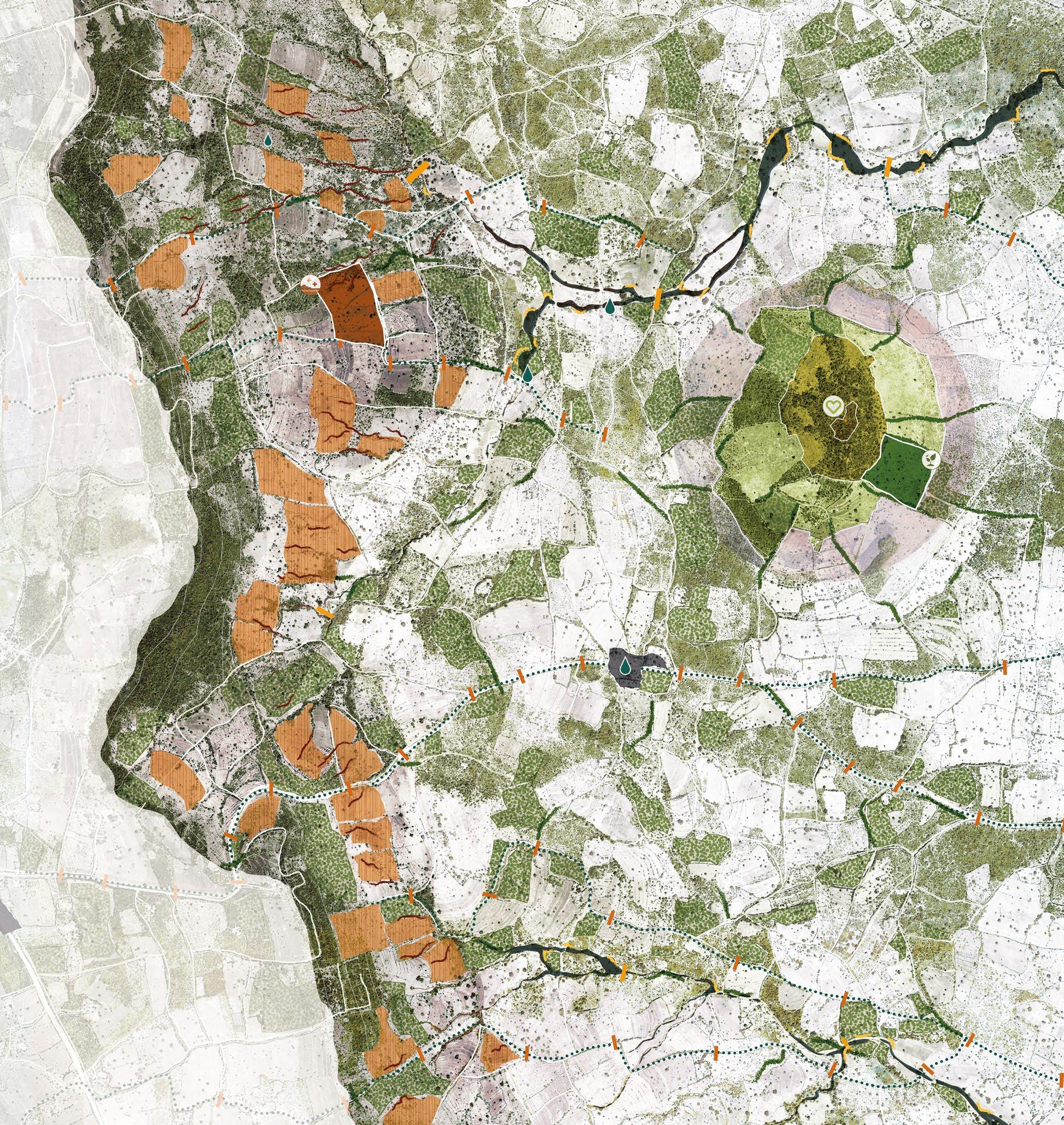
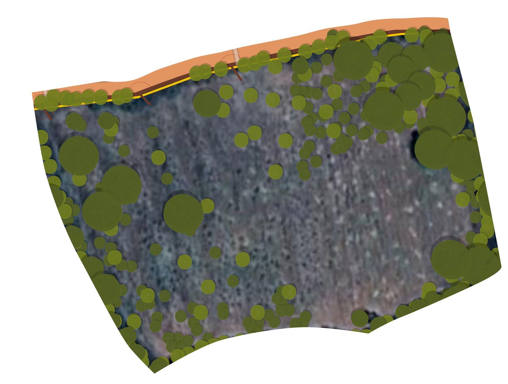
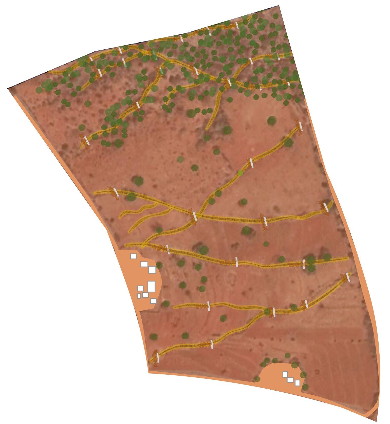
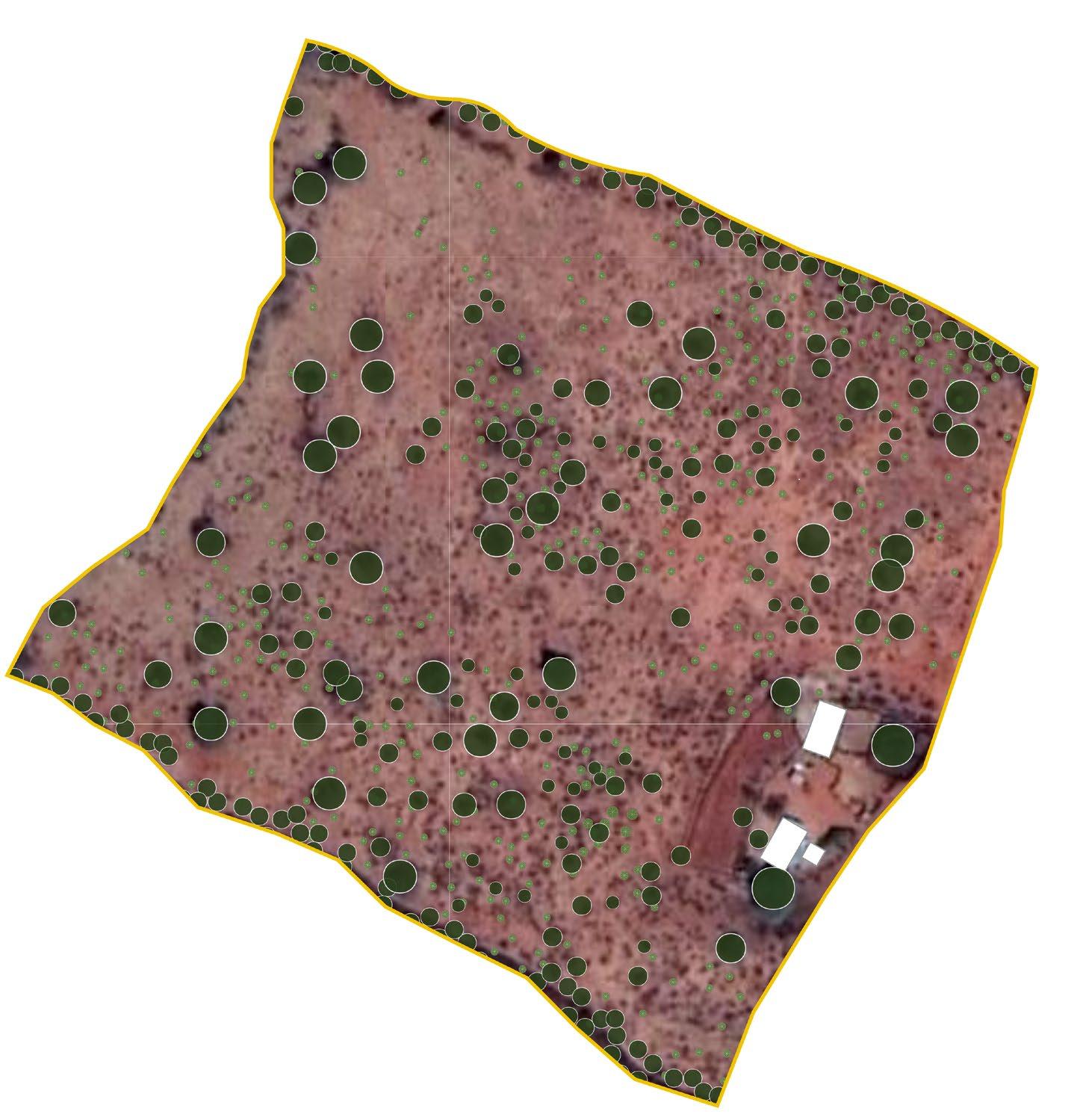
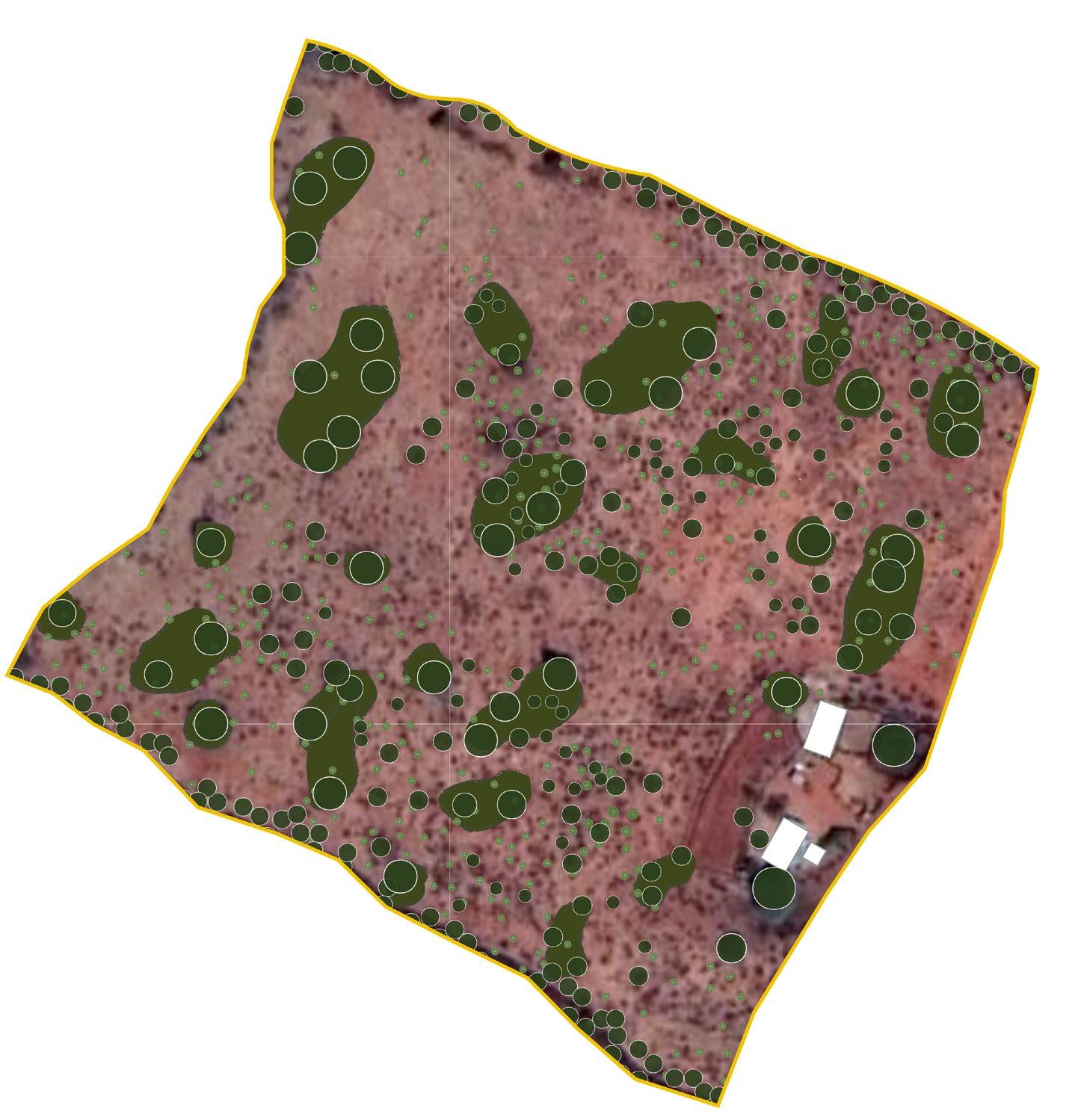
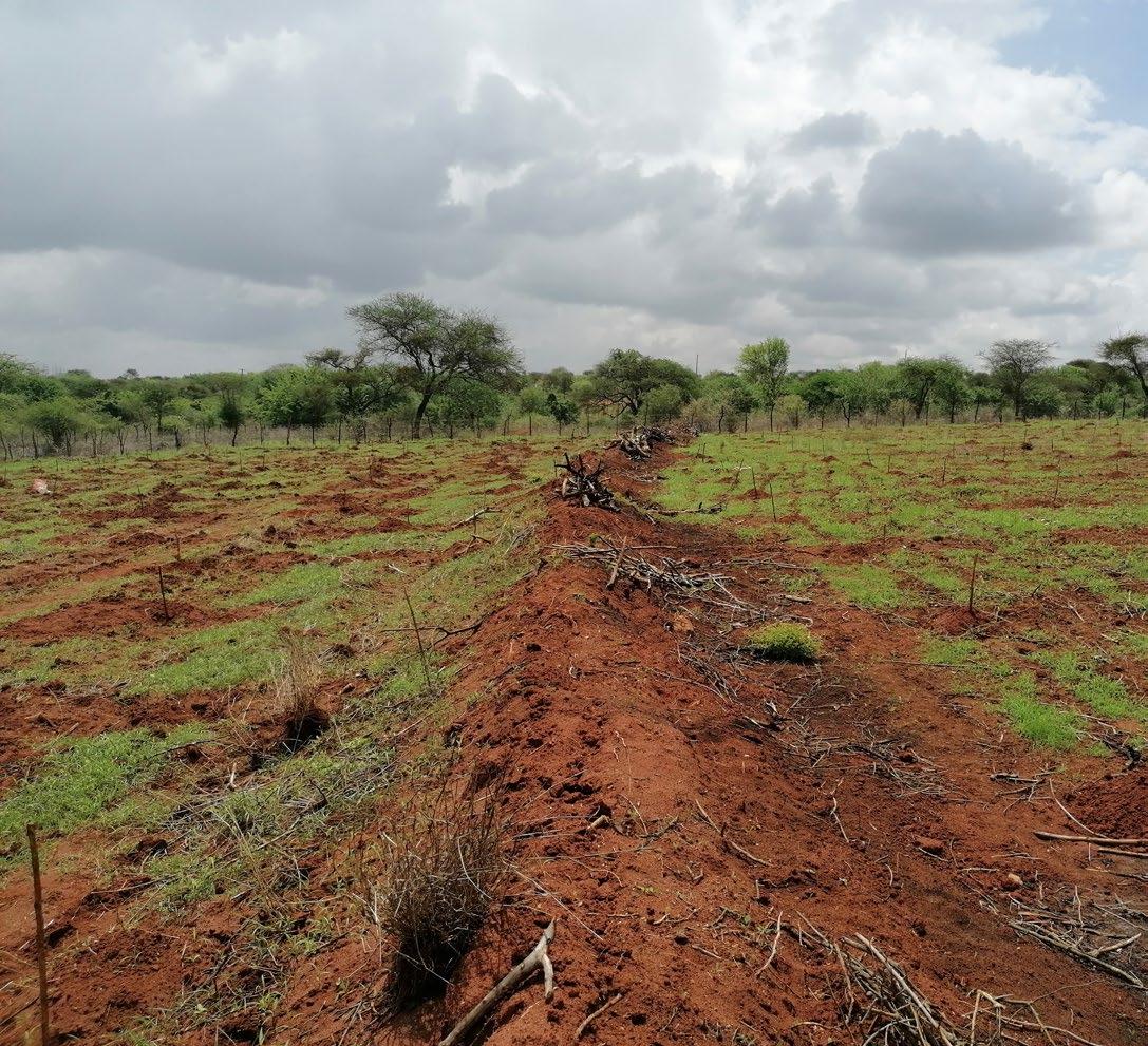
During my visits to the area I tried to map out the areas that are degrading the most. The map on the next page shows these areas.
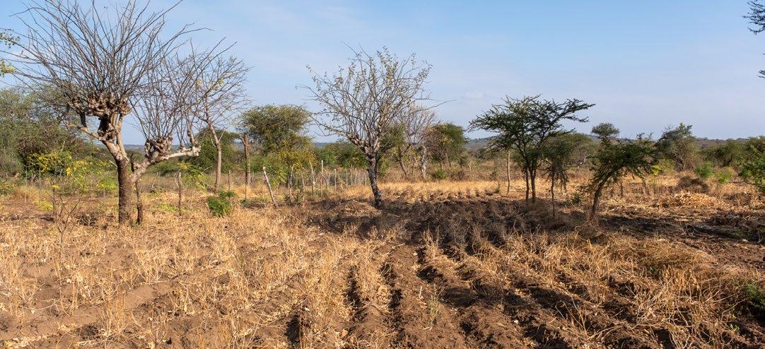
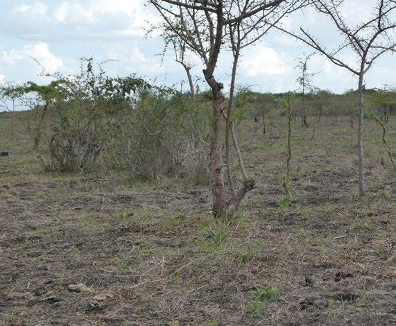
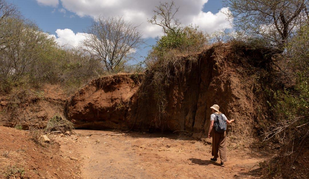
(Previous page) [Image 68] A gully forming on barren land (Brugmans, 2023)
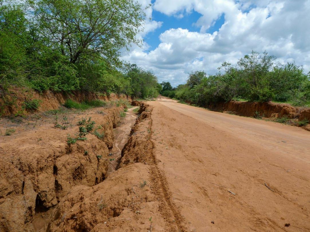
[Image 69] A gully forming next to the road (Brugmans, 2023)
Most degraded and eroded land
70] Areas with land degradation and erosion. (Brugmans,
[Image
2023)
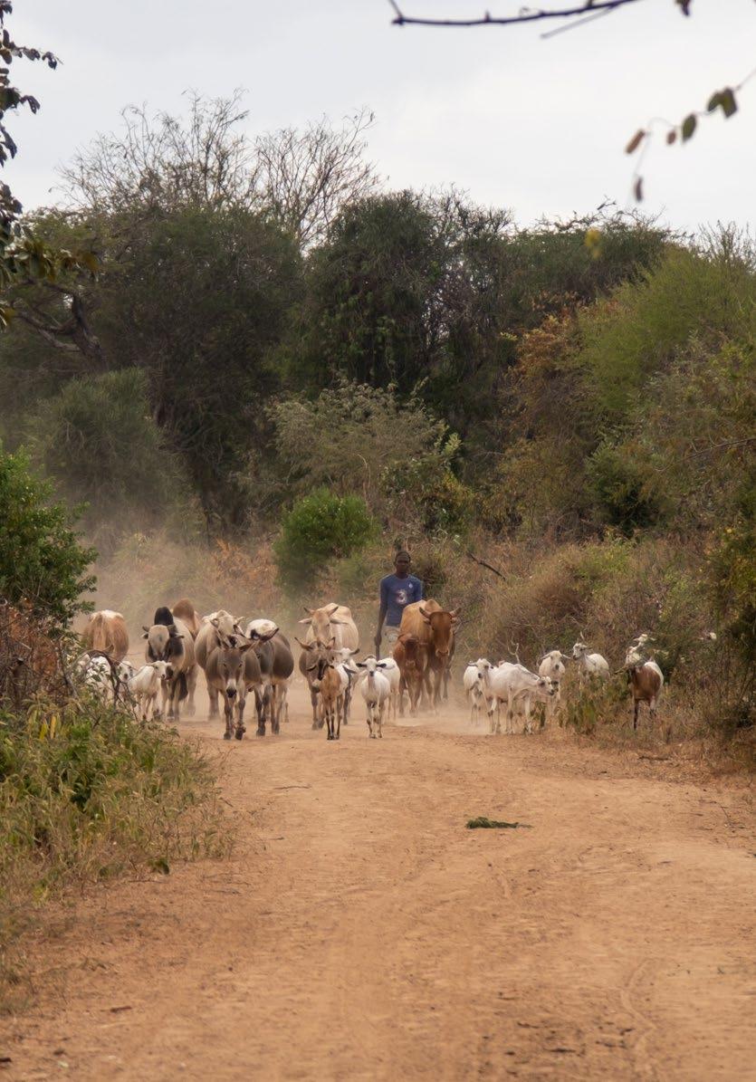
(Next page) [Image 71] A farmer walking his cattle to the cattle market (Brugmans, 2023)
4.3 - Human influence on the landscape
Since people first settled in the area, the landscape has undergone significant changes due to new methods of land use. The growing population is beginning to deplete the area's resources, a fact that is well understood by the residents. However, taking action to address this issue is challenging because everyone is focused on managing their immediate needs as best as they can.
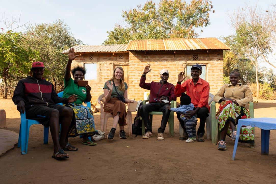
During an interview with the Kamiti CBO board members, an interesting observation emerged. Initially, it was hypothesized that overgrazing by farmers, who allowed their goats to roam freely and consume all available vegetation, was a primary issue in the area.
However, it became apparent that this is not always the case. Farmers generally confine their cattle to their own farms, where the animals deplete the resources of their own land. When farmers notice that their land has become barren and unproductive, they often either sell it or leave it to erode further. This creates a cycle of land use that increases soil water and biodiversity problem, leading to an increasing amount of barren, depleted land in the area.
Another problematic farming practice in the area is the increasing amount of large-scale monoculture. While these large plots yield a significant short-term harvest, they rapidly deplete soil fertility due to the intensive land use. This leads to diminished land profitability over time whilst also increasing soil, biodiversity and water problem.
To build a better future, it is important for the community of Kawongo to reassess their current farming practices. The current farming methods need to shift from being a source of the area's problems to becoming part of the solution. By adopting sustainable farming methods, the community can help address the various challenges facing the region and work towards a more resilient and productive environment. The next chapter already shows examples on how this is done.
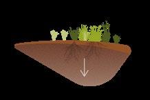
Increasing amount of negative processes and problems
[Image 72] Create a tipping point in the increase of climate related problems (Brugmans, 2023)
Create a tipping point
4.4 - Project goal
'Necessity is the mother of all invention'
- Kamiti CBO farmer
The goal of this project is to create a tipping point for the area, shifting from struggling under the increasing pressures of climate change to developing a thriving, resilient landscape system. With this transformation, the region and its community will be better equipped to cope with the climate-related challenges they face in the future. This project aims to help counteract problems such as water scarcity, flooding, biodiversity loss, soil fertility depletion, and erosion.
To achieve this, it is essential to develop a landscape vision that considers both physical and socio-economic aspects. This approach focuses not only on restoring the landscape and its ecosystem but also on creating new economic opportunities for the local community amidst a changing climate.
Aligning resilient, systematic landscape changes with economic benefits is crucial to gaining community support for this shift. Many people in Kathome do not have the luxury to think about long-term solutions while they are still focused on meeting their immediate needs and providing for their families.
The plan will help to:
• Enhance local knowledge and structures: Adapting the livelihood methods of residents to align with the region's needs will allow the community to thrive in the future, providing new ways of utilizing the landscape for the next generation of farmers.
• Restore degraded soil: Improving soil quality will enhance its ability to store water, support new plant growth, and sustain these benefits over time.
• Create a robust water system: Developing a water management system capable of handling the predicted extremes of drought and flooding will ensure steady access to water for the community.
• Provide animals and plants with a resilient ecosystem: Enhancing ecosystem resilience will support local biodiversity, contributing to the overall climate resilience of the area.
By focusing on these objectives, the project aims to provide the people and the area of Kathome with a proposal for a way to work towards a sustainable and (climate) resilient future, where both the people and the ecosystem can thrive.
4.5 - Mutual respect and empowerment
‘Indigenous people have always seen their environment as an integral part of their identity, A part that is essential to their cultural survival and understanding of how the world shapes.’
(J. Hernandez,2022)
‘Never forget that anywhere you go that it is not your home, it is someone’s home, and you must pay them respect and build relationships with the land and the people to be welcome in their home. Otherwise you are walking into their home as an unwelcome cast.’ (J.Hernandez, 2022)
This is a quote from the book Fresh Banana Leaves by Jessica Hernandez. In this book she describes her view as an indigenous person on the way western conservationism is not working. The book divers in the relationship between western knowledge and indigenous knowledge and how it is important to empower the latter.
Non indigenous people have to continue working hard to dismantle the through history instated settler colonialism whilst not co-opting or stealing indigenous knowledge, movements or ways of life. For a non-indigenous person, becoming a welcomed guest is a lifelong journey because they inherit the role of settlers. (J.Hernandez, 2022)
Working on a project in Kenya as a person from Europe I need to be aware of my position. I need to be respectful towards the different local and indigenous cultures and knowledge. Working together with and empowering local people is the key to the success of this project. That is why I want to explicitly convey this message.
Indigenous knowledge
Local indigenous knowledge can play a vital role in improving the development of developing countries. It can provide the foundation for solving problems in local communities because it is easily accessible and can be applied daily in society. It is the knowledge that communities can resonate with. (Kibe.L, 2021) In the past, development strategies in Kenya were often influenced by western viewpoints. (Watson et al., 2019)
The protected nature reserves in the country an example of this. To try to conserve nature, the government of Kenya has founded reserves where people are not allowed to disrupt nature. But in doing this one big contributor to the conservation and increase of biodiversity, the Maasai nomads, where forced to change their way of life. They had to move out of the newly ‘conserved’ areas.
Because of the nomadic lifestyle and the way the Maasai live together with their environment they actually increase biodiversity wherever they go. The short increase in soil fertility from the manure of their cattle creates ecological hotspots on the spots they stay and ecological corridors on the paths they move on. The result of the governments conservation areas is that the Maasai are now limited in their movement and unable to help increase biodiversity by their way of life. The result is biodiversity loss in de conservation areas. This case shows that in Kenya the western way of conservation is not always the best way. (Watson et al., 2019)
Nowadays Kenya’s Vision 2030 aims to transform the country into a middle-income economy by integrating indigenous knowledge into their strategy. However, inadequate integration of indigenous knowledge (like the case of the nature conservation area’s and the Maasai nomads) is still happening.
(Previous page) [Image 73] Visiting the farm of Peninal and Kasisye (Doesburg, 2023)
Local collaboration in this area
Bottom up approach
A Bottom up approach emphasises the participation of the local community in development initiatives so that they can select their own goals and the means of achieving them. It also ensures community ownership, and commitment to a project. (Dailystar, 2022)
During this project a bottom up approach is the key to a well functioning collaboration with the local community. By using a bottom up approach I can work together with locals and learn from their indigenous and local knowledge.
The area I’m working on is their land and if my final project needs to become something that is connected to and grounded in it, I need to learn from the people that have been living there for generations.
Whilst working on this project there are certain challenges I need to keep in mind on the subject of working with indigenous knowledge.
The ongoing impact of colonialism.
Through history colonial powers used brutal policies and methods to subjugate indigenous people. These policies and methods consisted out of inferiorisation and stigmatisation of indigenous cultures. Even up to today, indigenous knowledge is by many considered as backward, outdated and inferior to scientific or western knowledge. This attitude affects the use of the valuable indigenous knowledge that is actually there.
Protecting indigenous knowledge
With the growing globalization and ICT use, people tend to isolate indigenous knowledge and practices. That’s why it is important to mainstream and empower it. It can, for example, be shared or preserved through videos and social media in local languages.
There is a challenge in identifying the true owners of the indigenous knowledge and how to guard their intellectual property rights.
Some indigenous knowledge is specific for a community and cannot be transferred from one community to another. Some knowledge from one community can be inappropriate and not usable in another community because of differences in orientation. Indigenous knowledge outside its original cultural context, can be harmful and could lead to dis-empowerment of indigenous people. (Kibe.L, 2021)
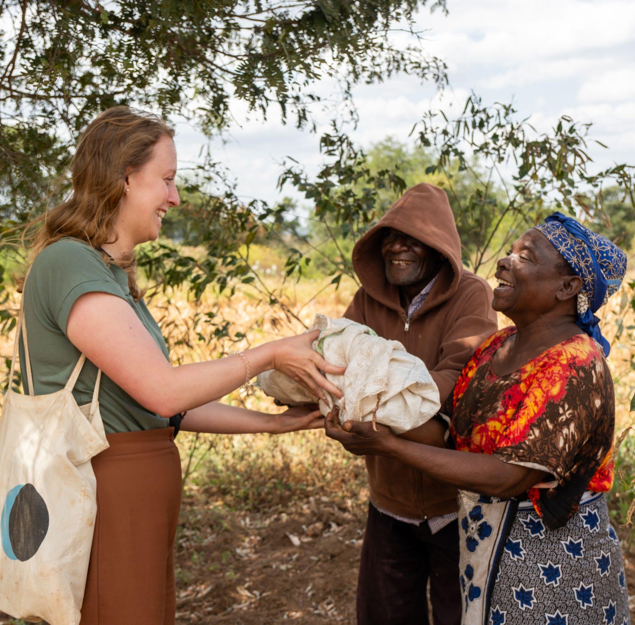
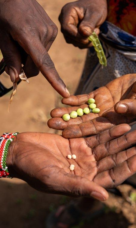
[Image 74] It is good luck to give visitors a gift, in this case some beans. (Doesburg, 2023)
[Image 75] Dream image for the future. Functioning ecosystem with nature and agriculture working together. (Brugmans, 2023)
GETTING INSPIRED
5
(Previous spread)
[Image 76] Tree roots holding the riverbank together (Brugmans, 2022)
[Image 77] Mural at the Kamiti CBO office (Brugmans, 2022)
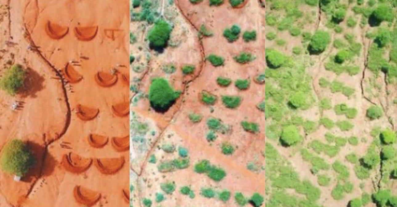
[Image 78] re-greening land (Jusdtiggit, 2022)
5.1 - Inspiring projects
Africa wood grow & Kamiti CBO
These two organisations work together to start up a new agroforestry based economy in the area of Kathome/ kawongo. Whilst working on enhancing the local ecosystem and knowledge.
Just Diggit
During my first visit to Kenya I had the pleasure to visit the Main office of Just Diggit in Nairobi. Just Diggit is a non-profit organisation that focusses on re-greening and restoring degraded barren land.
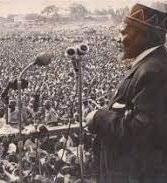
Wangari Maathai
Was an environmental activist from Kenya who has won the Nobel peace price for her contribution to sustainable development and peace. She founded the green belt movement which is a movement that strive to plant trees all across the continent of Africa to combat desertification.
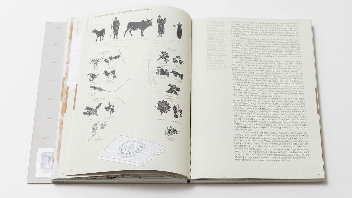
Wrote the book Lo-tek which dives into all sorts of indigenous methods of land-use and construction across a wide array of different indigenous cultures. One example in the book is about the maasai from Kenya.
[Image 79] Wangari
[Image 80] A page in the Lo-tek book (Watson, 2020)
Maathai (Getty, n.d.)
Julia Watson
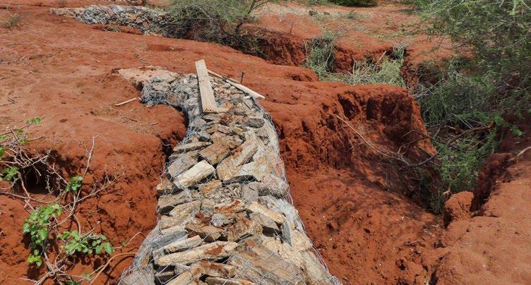
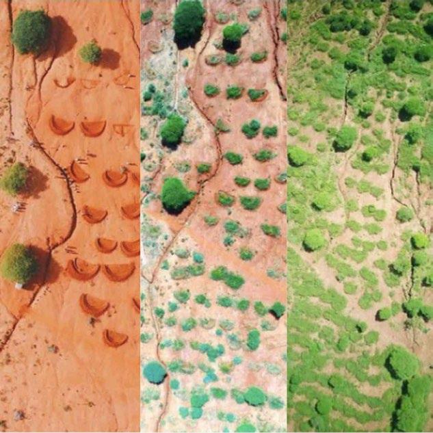
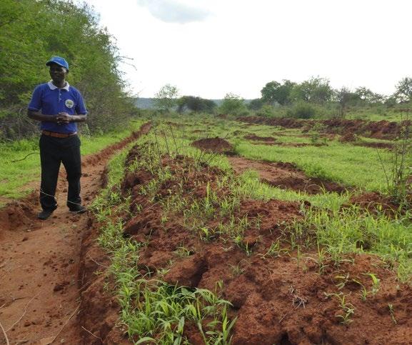
(Next page) [Image 81] Contour terrace built by Africa wood grow (Brugmans, 2023)
5.2 - Local ingenuity
On the countrywide scale the government of Kenya has climate adaptation as one of its top priorities. They recently passed a Climate Change Bill, National Climate Change Action Plan and National Climate Change Strategy. They are also working on a National Climate Change Framework Policy and Climate Finance Policy.
With these national policies the government can start establishing specific projects and institutions to actually implement change. (Parry & Terton, 2016) Next to the countrywide scale a lot is happening locally because of actions taken by farmers. In this paragraph examples of actions people have taken in Kawongo are shown.
Farmers keep on re-inventing ways to make their farming practices more resilient to climate change.
Dams have been constructed to distribute the water evenly among the seasons. The dams slow down the speed of the water flow of creeks and rivers. They also store sand. This sand prevents evaporation and causes water to percolate underground, where it stays available for future use. When flooding occurs flood water is stored and let go gradually. This practice is commonly called water harvesting (Parry & Awuor, 2016)
Next to the management of the water farmers also keep experimenting with different kinds of crops that are either more resilient to flooding or drought. In the drier area’s maize is more common. (Parry & Awuor, 2016) On the following pages methods of soil conservation, water mitigation and biodiversity protection that are currently being used in the area are shown.
Water pits
[Image 82] (Brugmans, 2022)
Water capturing and limiting soil erosion.
· Sandy eroded soils
Short term
Small scale
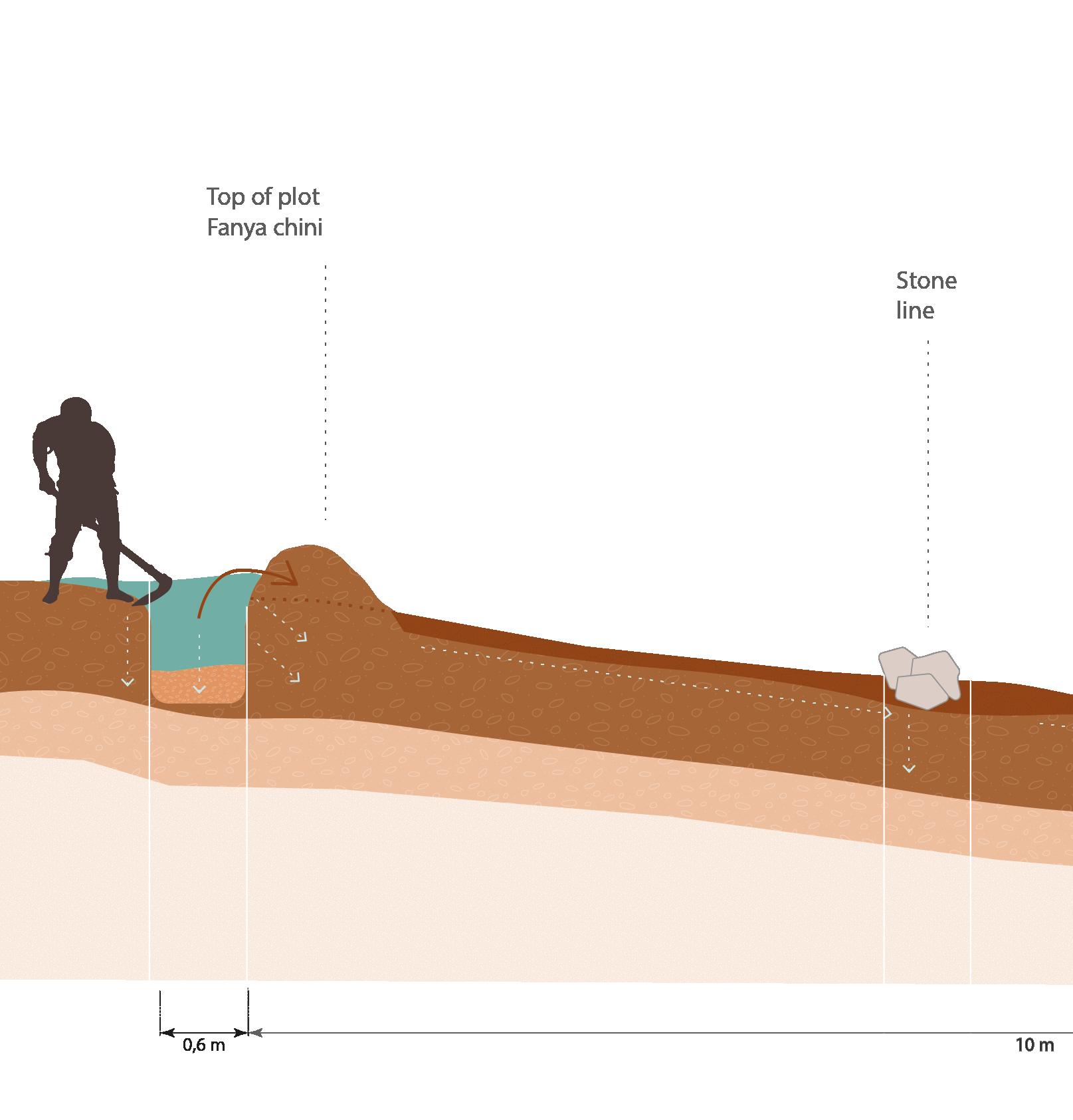
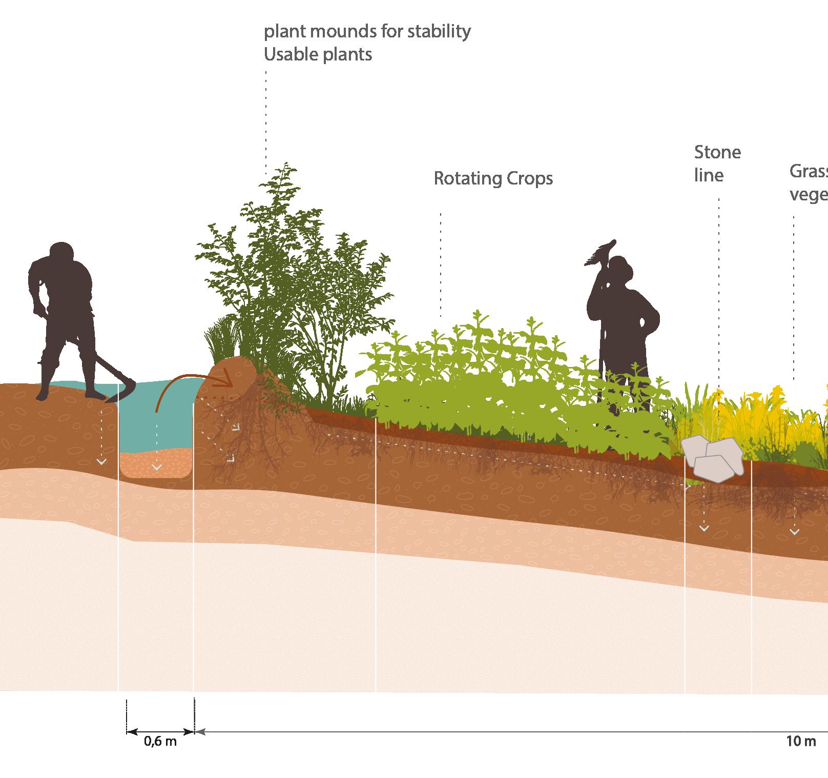
Stone lines
[Image 83] (Brugmans, 2022)
Water distribution and managing soil erosion
Farmland and natural land
Short to long term
· Small scale
Vegetation lines
[Image 84] (Doesburg, 2023)
Water distribution and managing soil erosion
Farmland and natural
land
Short to long term
Small scale
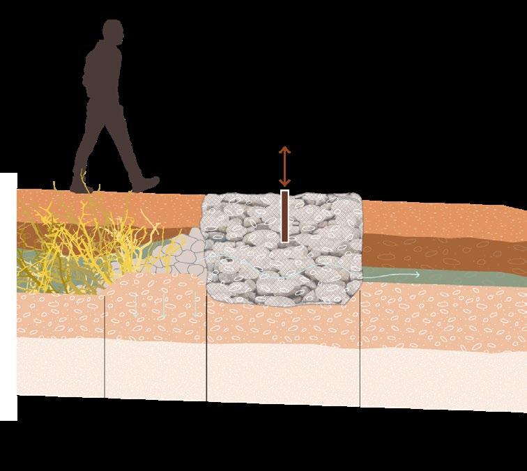
Check dams/ gabians
[Image 85] (Brugmans, 2022)
Underground water harvesting and counteracting soil erosion
Across existing gullies
Short to long term
Small to medium scale
Riverbank planting
[Image 86] (Brugmans, 2023)
Limit riverbank erosion
Along water flows
Short to long term
Small scale
Soil conservation methods
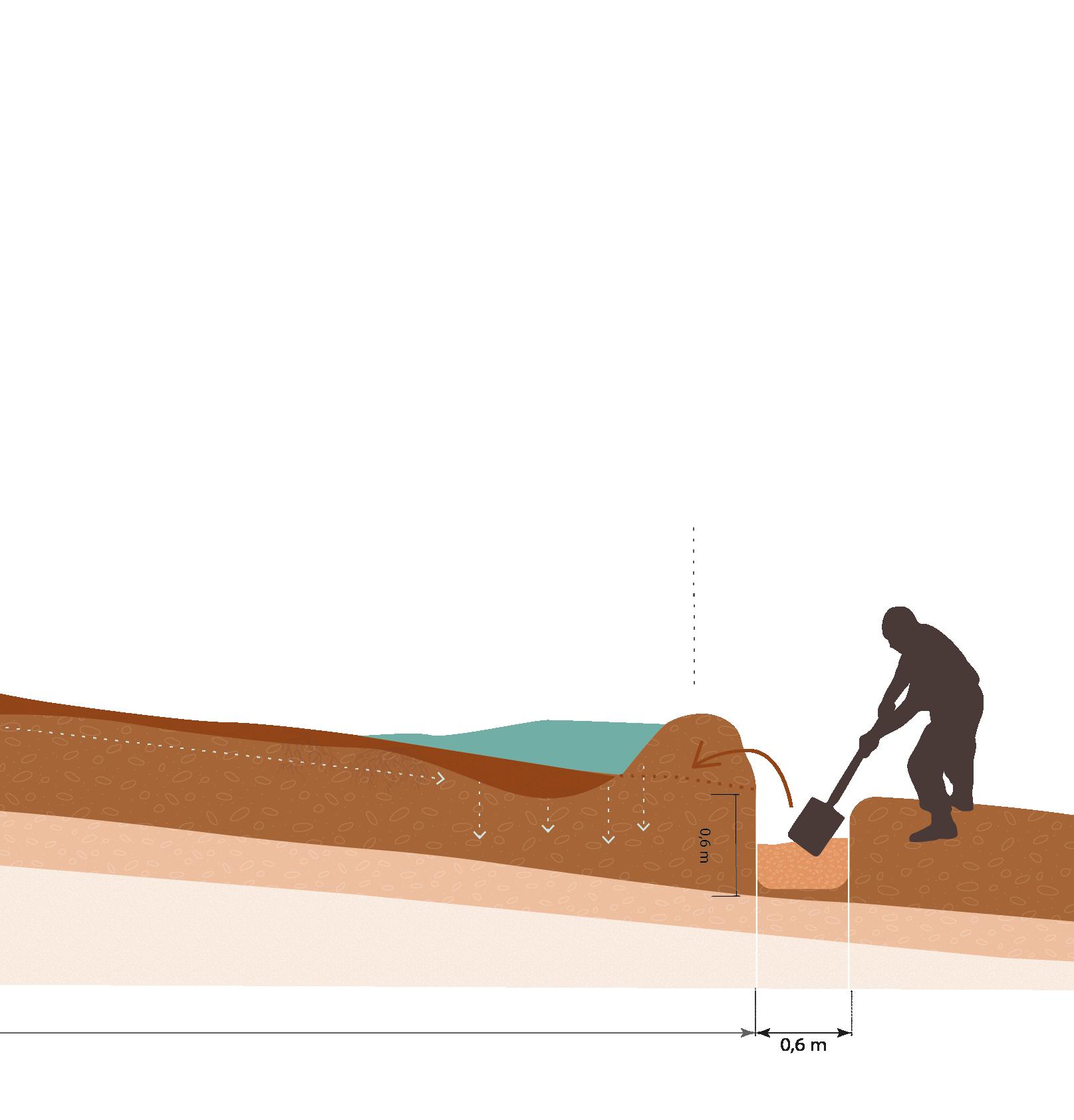
Fanya juu/ Fanya Chini
[Image 87] (Brugmans, 2023)
Water capture and runoff reduction
Steeper sloped farmland and natural land.
Short and long term
· Medium to large scale
Roadwater harvesting
[Image 88] (Brugmans, 2023)
Slow down roadside erosion
· Farms and communal land
Short and long term
Small scale
Water spreading bunds
[Image 89] (Just diggit, 2022)
Runoff reduction
Steep slopes, natural and farm land
· Short and long term
Large scale
Branches slowing erosion
[Image 90] (Brugmans, 2022)
Counteracting soil erosion, increasing soil nutrients in existing gullies
Short to Long term
Depending on gully
Check board barries
[Image 91] (Brugmans, 2023)
Increase soil moisture and nutrients
Farmland
Short to long term
Small scale
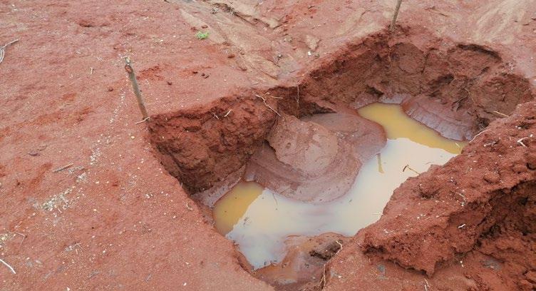
Scoopholes
[Image 92] (Brugmans, 2023)
Water harvesting
In dry sandy riverbeds
Short term, during dry periods
Small scale
Riverbed well
[Image 93] (Doesburg, 2023)
Water harvesting and storage
In dry sandy riverbeds
Long term, during dry periods
· Small scale
Earthdam
[Image 94] (Brugmans, 2022)
Water harvesting and storage
· Places where water accumulates.
Long term
Large scale
Roadwater harvesting
[Image 95] (Brugmans, 2023)
Water storage and distribution
Places where the community can reach it easily
· Long term
Medium scale
Increasing water availability
Borehole
[Image 96] (Doesburg, 2023)
Underground water harvesting and storage
High ground with little water accessibility
Long term
· Medium scale
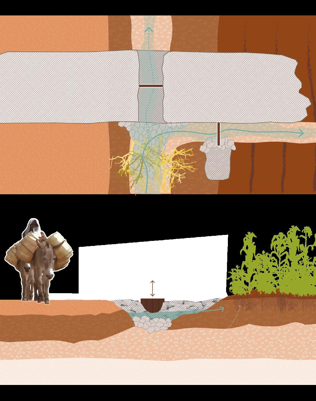
Sanddam with pump
[Image 97] (Doesburg, 2023)
Water harvesting and storage
In dry sandy riverbeds.
Long term
· Small scale
Roof water harvesting
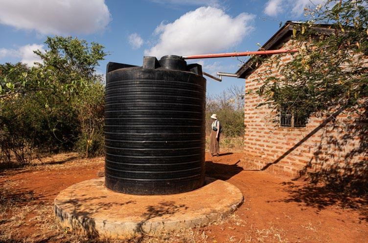
[Image 98] (Doesburg, 2023)
Water harvesting and storage and distribution
Farms and other buildings
Short and long term
· Small scale
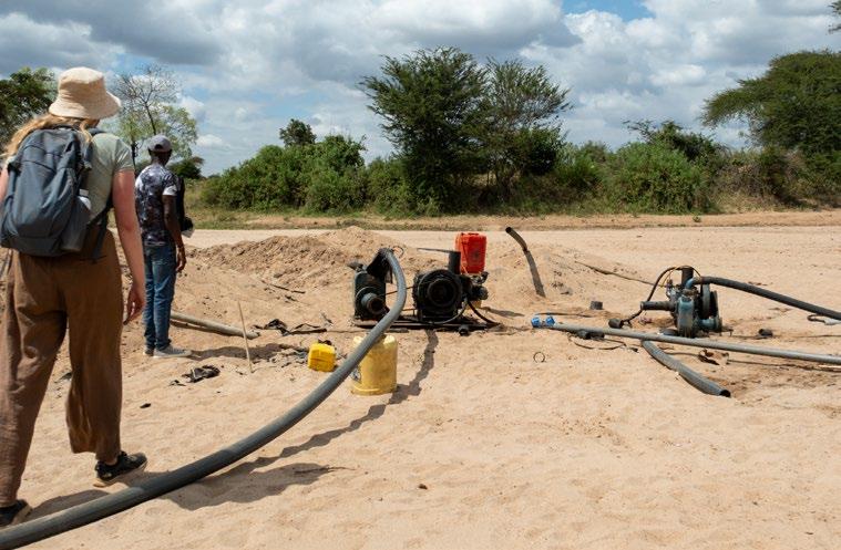
Pipe and pump systems
[Image 99] (Doesburg, 2023)
Water harvesting
Riverbeds during dry period
Short and long term
Small scale
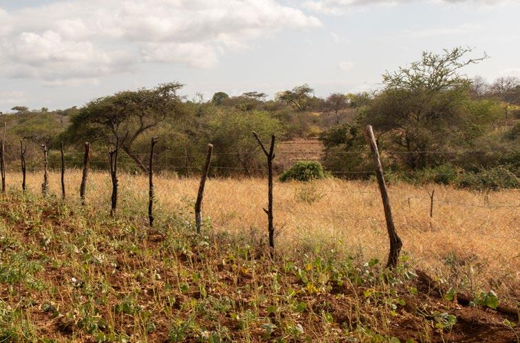
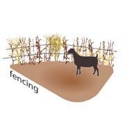
Fencing
[Image 100] (Brugmans, 2022)
Protecting developing soils and plants
Farmland and natural land
Short to long term
· Small to large scale
Biodiversity protection
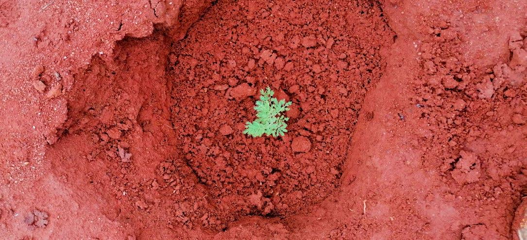
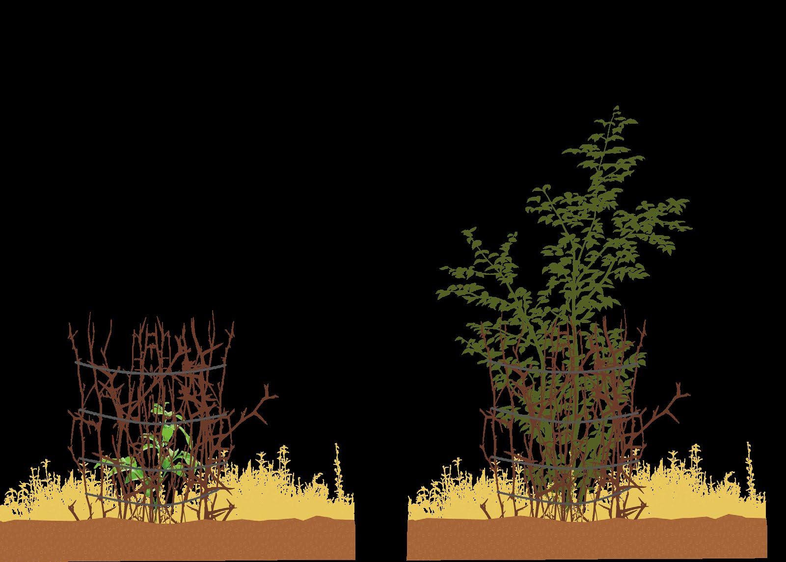
Kisiki hai/ seedling protection
[Image 101] (Brugmans, 2023)
Protecting developing plants
Farmland and natural land
Short term
Small scale
Invasive species control
[Image 102] (Brugmans, 2023)
Protecting natural ecosystem
· Farmland and natural land
Short to long term
Small to large scale
Beekeeping Wildlife protection
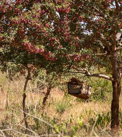
[Image 103] (Brugmans, 2023)
Protecting natural ecosystem
Farmland and natural land
Short to long term
· Small to large scale
Grazing management
[Image 107] (Doesburg, 2023)
Protect from overgrazing
· Farmland and natural land
Short to long term
Small to large scale
Native plant seeding
[Image 104] (Doesburg, 2023)
· Increase biodiversity
Attract local flora and fauna
Farmland and natural land
Small scale to large scale
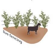
Branches as fence (boma)
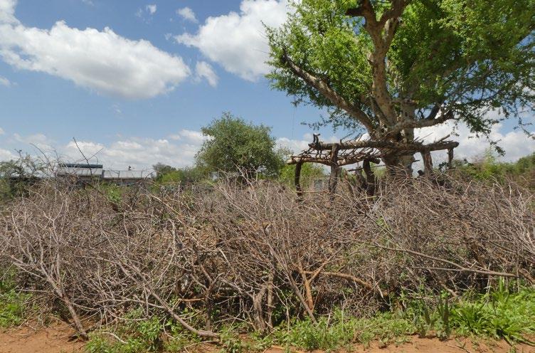
[Image 105] (Brugmans, 2022)
Protect from overgrazing
Farmland and natural land
Short to long term
· Small to large scale
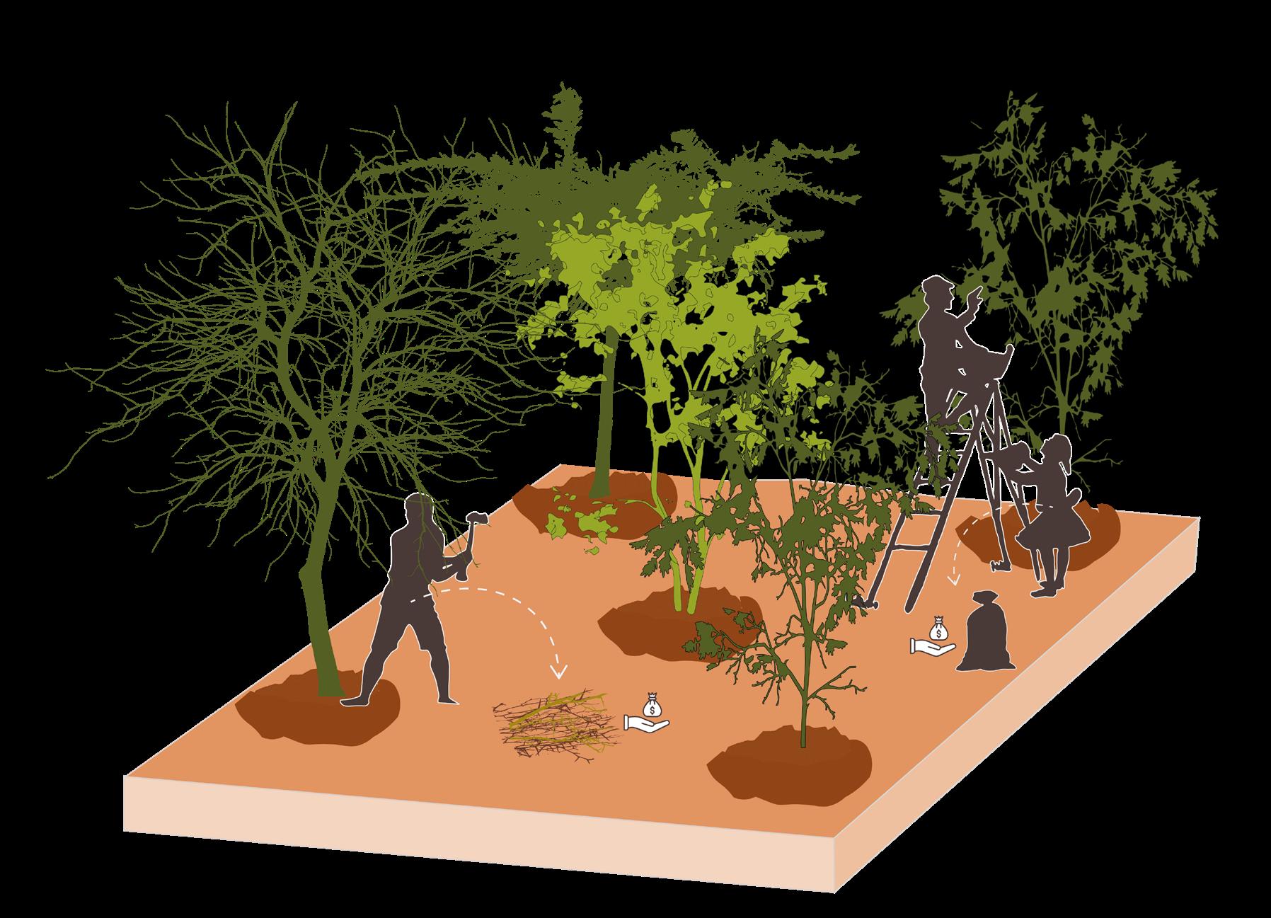
Tree planting
[Image 106] (Doesburg, 2023)
Increase soil moisture and nutrients
Farmland and natural land
Long term
Medium to large scale
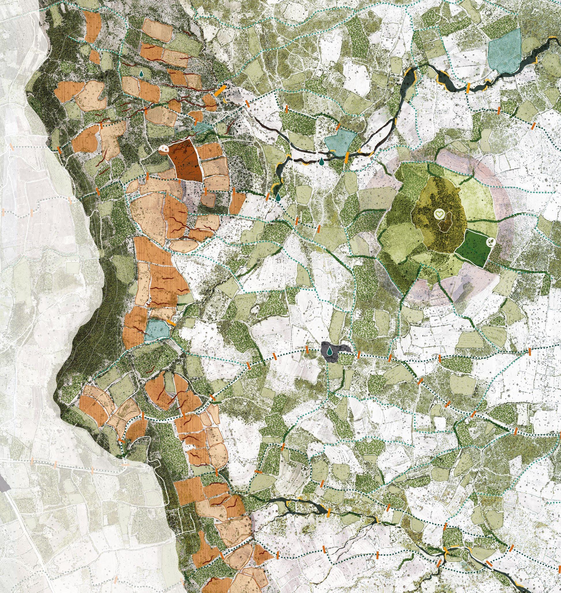
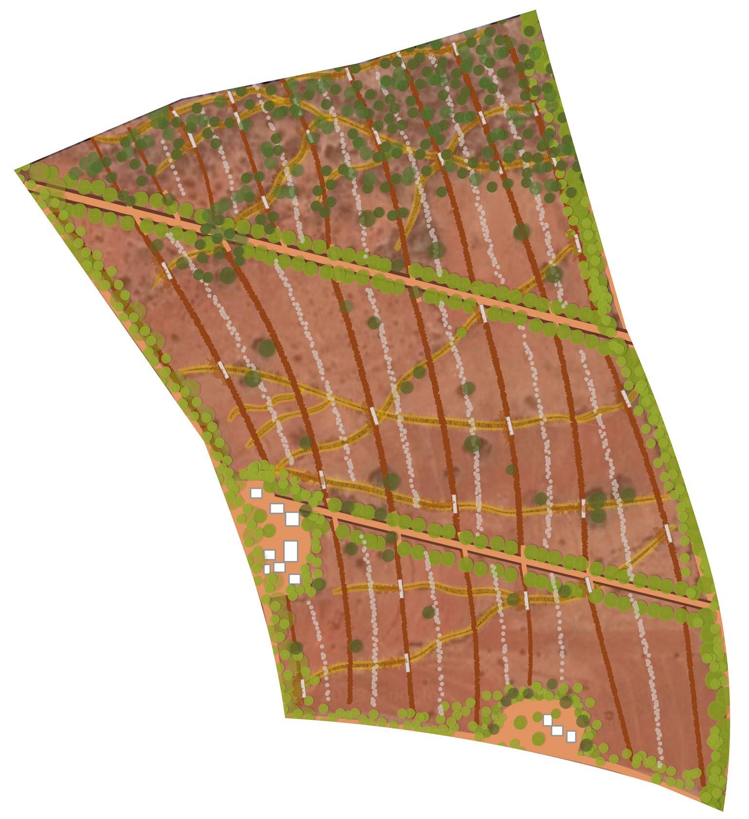
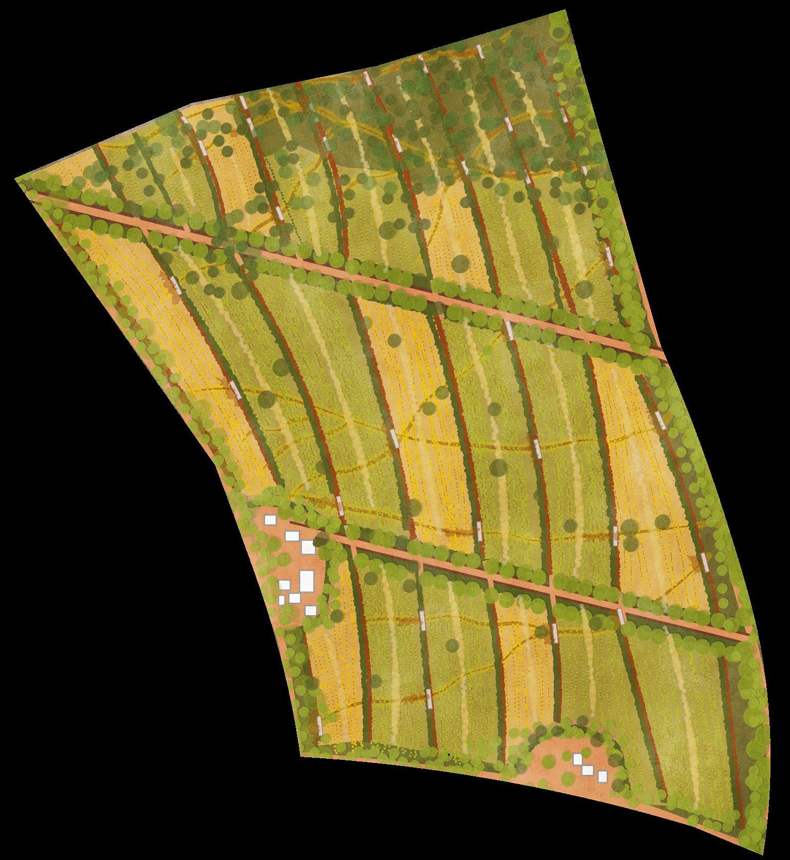
DESIGN STRATEGY
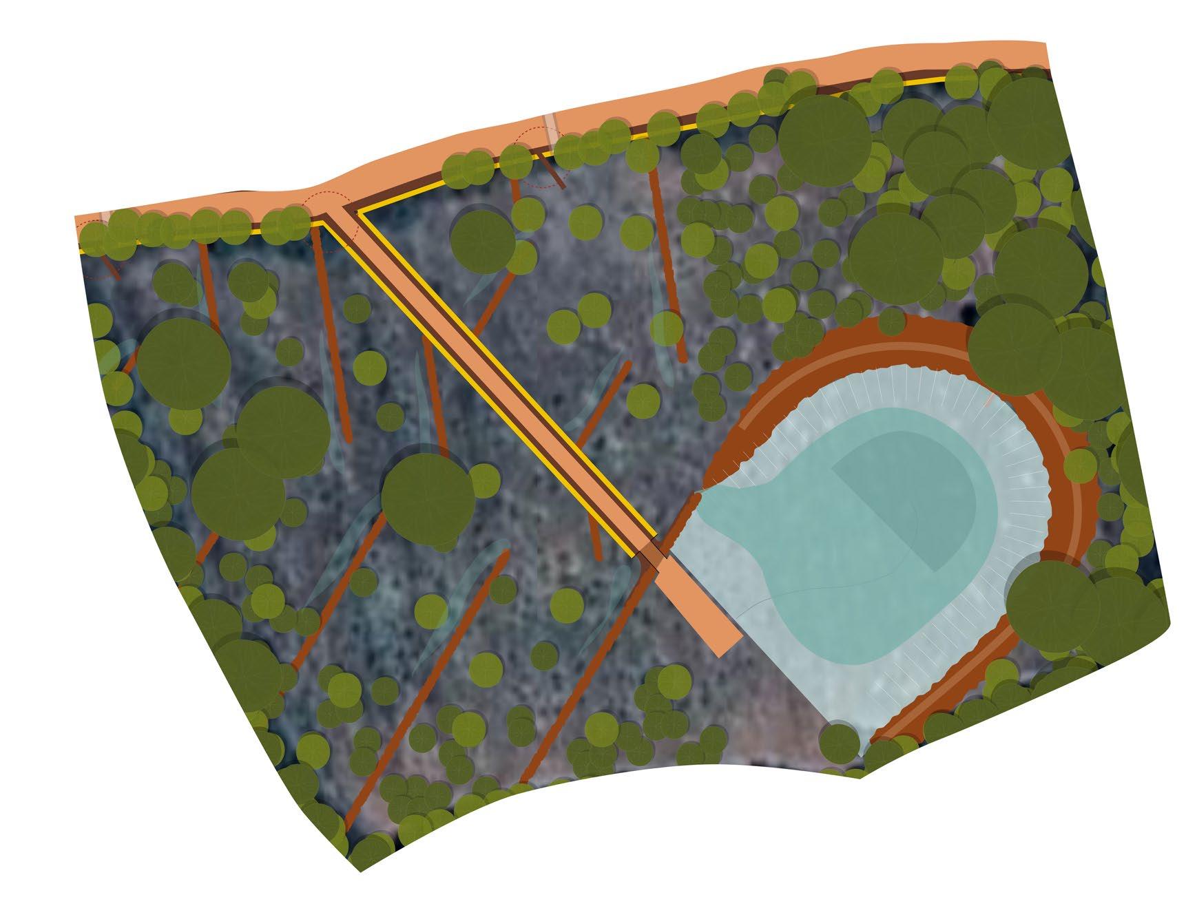
(Previous spread) [Image 109] A view towards Umu hill (Brugmans, 2023)
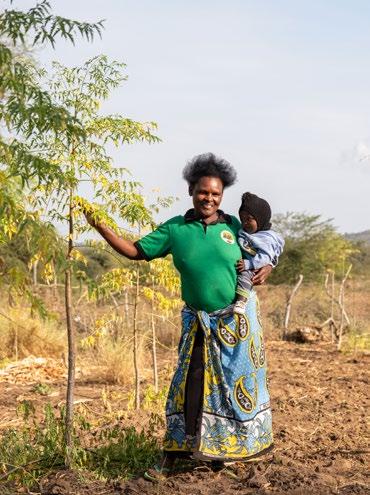
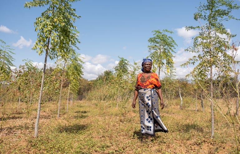
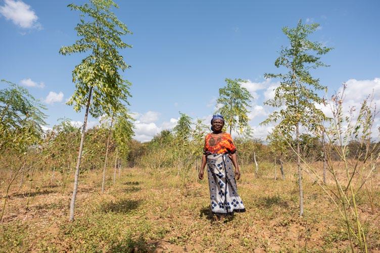
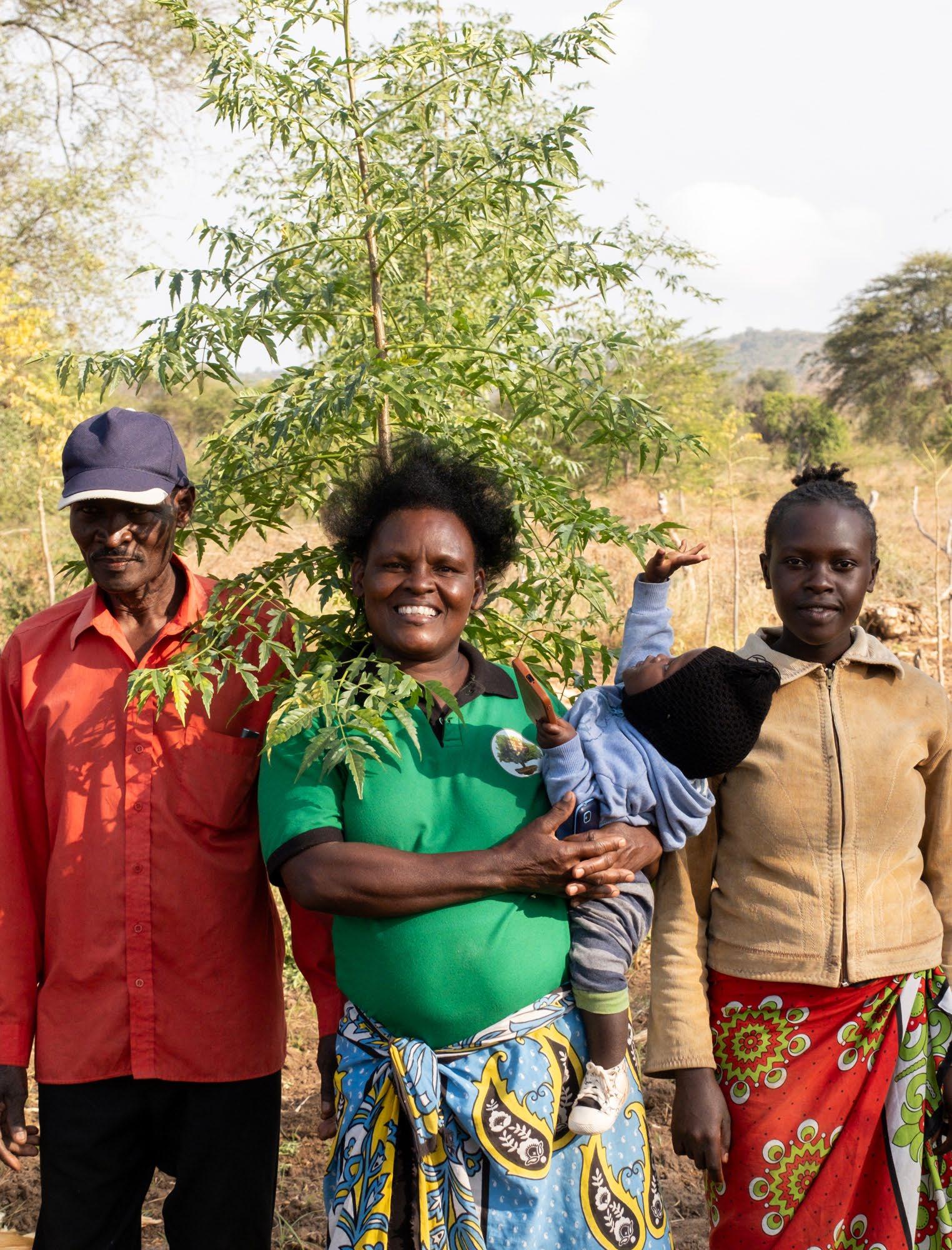
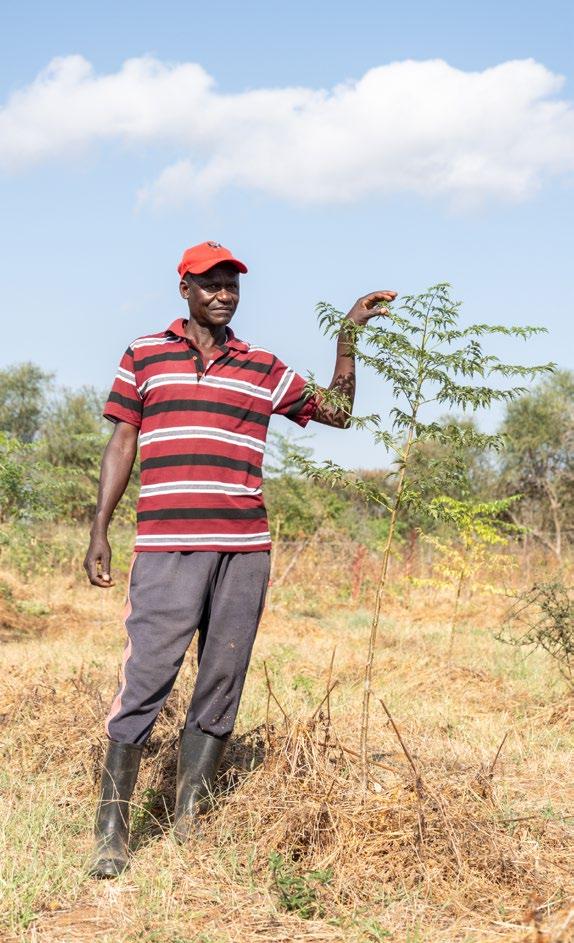
(Next page) [Image 108] Farmer Angeline and her family proudly grow trees to work towards a better future for their children (Doesburg, 2023)
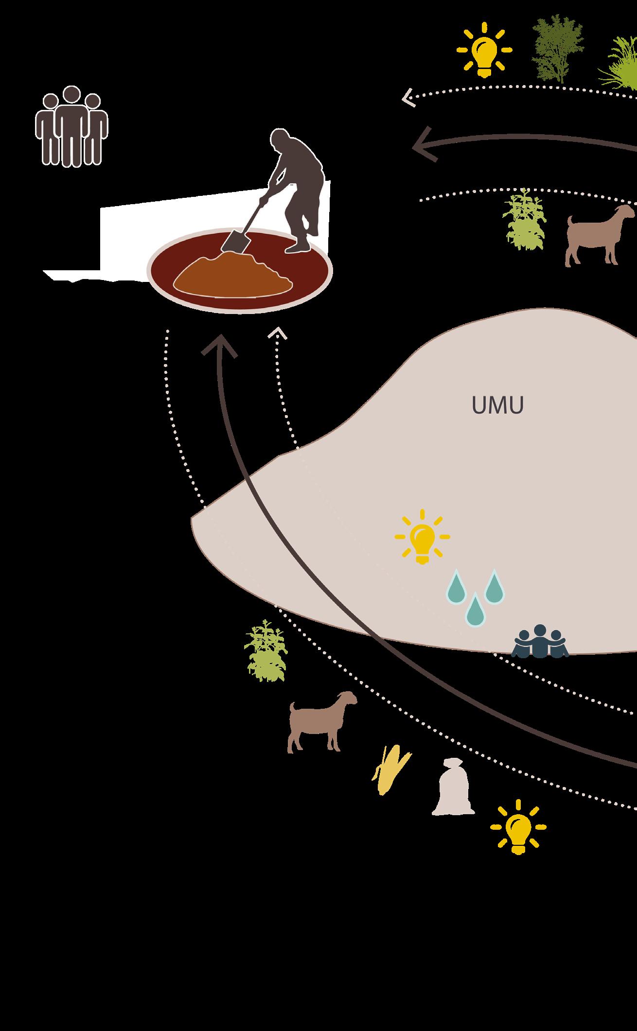
Strategy for a better future
The title of this project reflects the strategy that forms the foundation for the final design. Umu is a central landmark in the area, well-known to all local residents, and serves as a point of connection within the community.
Umu presents the history of the area. The way the hilltop was historically used for rituals and ceremonies highlights its significance to the people who first settled in this region—the ancestors of those who live here today.
Umu also symbolizes the future of the area. The hill serves as a beacon of what the region could become if the local community's interaction with the landscape evolves and the relationship between the land and its people is strengthened, paving the way for a more resilient future.
The strategy for the future resilient landscape is build on four main pillars to make sure it is able to be implemented in the area by the local community , making it functional and sustainable.
• Working with the different landscape types and problems
Provide solutions and interventions that are suited to the unique characteristics and challenges that are present in different parts of the Kawongo area.
• Working on different scales
Applying interventions on different scales from smaller than farm level to regional scale. This allows the community to start with small interventions where they can build upon when the have the time and resources.
• Working with steps towards a future system
A stepped approach that allows a gradual change towards a better landscape system over time. Using small short term opportunities to create a large change.
• Create a collaborative system
Engaging the local community in a way that the systematic changes can become economic opportunities that enhance livelihood and strengthen the community.
Working with the different landscape types and problems
Existing biodiversity areas
Umu
Quickly degrading and eroding soil (on the slope of the Yatta plateau)
Barren overly used land
Expanding riverbed with quickly disappearing water and riverbank erosion
0 200 400 800 m
[Image 110] Work with the different landscape types of the area (Brugmans, 2023)
Difficultly cultivated black cotton soils
[Image 111] Riverbank protection with grasses (Doesburg, 2023)
[Image 112] Farming method of conserving moisture (Doesburg, 2023)
[Image 113] Zai pit (Brugmans, 2022)
Scaled approach- do what is possible
Kawongo area
Large scale vision on the area of Kawongo between the Yatta plateau and the Tiva river.
Shamba scale
A detailed design for three farms in the area positioned strategically in the large scale landscape plan, connecting to Umu and containing small scale interventions.
Small scale interventions
Interventions that are accessible to the residents of the area to do without having to invest a lot of time or money.
Timed approach- A resilient future for the next generation
1. Pinpricks
Short term, small scale interventions that can help lessen the soil, water and biodiversity problems.
These interventions are the first step to creating a large scale resilient landscape system.
For now these interventions mainly help putting out the fires. By doing this in time space will open up to start thinking about larger scale changes.
2. Enlarging interventions
The first interventions are starting to take effect. Now the moment is here to expand those interventions. By doing this systematic changes are becoming reachable.
3. Create a new landscape framework
Now the most urgent problems are resolved the community can start to look towards the future.
There is space to figure out hat will be the future pillars of the landscape of kawongo.
Which corridors are important, What needs to be protected and what structures can be enhanced.
4. Filling in the landscape framework
After the Landscape framework becomes visible it is possible to start filling in the framework.
What type of interventions are necessary on what locations?
5. Look towards the future
The resilient landscape system is functional. It is important to keep working on this resilient system to make sure it will still be resilient in the future.
Next to that the economical aspect is important. What income can be generated in this new system and how will it keep being profitable to provide the people in the area with the things they need to stay there.
Community collaboration
Each of the farms provides something the other farmers and the community need. This creates a collaberative system where everybody is an important contributer for the entire community.
Soil saver
Showcase how to restore soil
Reduce loss of soil life
Reduce erosion
Create a sustainable way of farming
Produce food for the community
[Image 114] Resilient collaboration between different farmers (Brugmans, 2024)
Biodiversity pioneer
Enhancing biodiversity, creating corridors
· Showcase how to grow indigenous plants
Bring back old costumes
Sell indigenous plants to the community to plant
Water winners
· Showcase ways for getting clean water
Place for the community to gather
Provide clean water for farms and the community
Reduce flood and drought problems
LANDSCAPE PLAN
7.1 - The route to Umu
The landscape plan will be a way forwards. It will be a strategic framework that aims to create a resilient and sustainable future for the Kawongo area.
At the centre of the plan lays Umu hill. Umu hill symbolises the historic roots of the people and the area of Kawongo but also shows the way forward.
This plan brings together the comprehensive analysis of the area, the design strategy and the local knowledge of the community. By integrating these elements, the design plan will become a clear way towards a resilient future.
To make systematic changes in the area, the plan emphasizes the importance of using small interventions that can be placed in the bigger landscape. It is important to look at all the different interventions that can help the area to become more resilient and to determine the most beneficial locations for these interventions.
The need for a step-by-step approach is key to let the community gradually adapt and invest with the limited resources they have. This method helps to make changes manageable for the community and sustainable over time. On the next pages, 5 maps show how the area can change step by step.
The plan focuses on three key components: soil, water, and biodiversity health. These elements are essential for counteracting the climate change effects the area faces. Healthy conditions can also help harnesses the opportunities that are already present in the area. The future landscape framework will in the end not only solve existing problems but also create a foundation for sustainable growth and development for the community.
In paragraph 7.2 interventions that take place in the public communal realm are shown. Demonstrating how public areas can be enhanced for the benefit of the community.
In the next chapter, three example farms show interventions that farmers are encouraged to implement on their own plots. These examples are fundamental for understanding how individual actions can contribute to the broader landscape strategy. Each farmer can have a specific role in filling in the framework. Some focussing more on managing soil erosion, other working toward becoming key in the biodiverse network that will frame the landscape.
If a plot is marked for a certain purpose it does not mean that it cancels out other developments. It is mainly a guide for the farmer to think about contributing to the larger landscape strategy. A farmer focussing on biodiversity can already accomplish change by just developing the edge of his plot. Whilst a farmer focussing on soil can also add measures to increase biodiversity if he wants to benefit from those as well.
In the end if the entire community works together towards the large scale landscape framework that will manifest over time.
(Previous Spread) [Image 115] View of a farm that is enclosed by a live fence (Doesburg, 2023)
[Image 122] A farmer walking his cattle towards water (Doesburg, 2023)
7.2 - Small interventions in the larger landscape
The large scale landscape strategy can mostly be accomplished by farmers making adjustments to their plots and their way of farming.
Some proposed interventions need to take place in the public realm. These interventions can be found in this paragraph. The public areas that have proposed interventions are:
Rivers and roads
The erosion of rivers and roads in the Kawongo area is a big problem. But these areas can also be looked at as opportunities for sustainable water harvesting and management. By adding interventions on strategic spots, the community can reduce erosion, capture runoff, and improve water availability.
Plot edges used as biodiverse corridors
The plot edges are now often overlooked. Being fences that cut of farms from connecting to the bigger landscape. The idea is to transform the often-overlooked plot edges into vital ecological corridors. These spaces can connect habitats, forming a large-scale biodiversity network that also helps to decrease erosion, enhances biodiversity, and improves water retention.
Rivers
Extra sand dams
Building additional sand dams can provide more people with access to water closer to their homes. These dams should be strategically positioned at points where river tributaries converge. This approach maximizes water harvesting and targets areas that are prone to erosion, as these are often the spots where two streams meet.
Constructing additional sand dams also helps slow the flow of water during the rainy season, which in turn reduces further riverbank erosion. Building a sand dam requires significant effort, so farmers near the ideal locations can collaborate to construct the dam. This cooperative effort ensures water availability for themselves and their close neighbours, creating a sense of communal ownership of the dam.
Riverbank planting
Planting vegetation along strategic spots on the riverbank can help slow down and counteract erosion. When riverbank erosion occurs, farmers often lose portions of their land, making those whose properties border the river near erosion-prone areas most likely to support this measure. The planting can include grasses, trees, or shrubs, with Chapter 9 providing an overview of the most suitable species.
It is also important to fence off the new growth, as riverbanks are commonly used by people grazing their livestock. Without protection, the new growth would soon be gone.
[Image 123] New sanddams for slowing down and accessing water (Brugmans, 2024)
[Image 124] Riverbank planting against erosion (Brugmans, 2024)
Roads
Slowing down and harvesting road water
Farmers at the moment are afraid to harvest road water. They think they will not be able to control the water flow into their plot and fear that in times of heavy rain all their crops will drown.
The first short term intervention used in this plot is a new, controlled way of harvesting road water.
Gabians and branches are put in the gullies that are formed parallel to the roads that go downhill. The gabians are still permeable so water is only slowed down. On the edge of the plot an extra gabians is placed. This one also has a sluice in it which can be opened and closed depending on the demand.
If a farmer needs water he can open up the small canal going towards his plot. If he is fearful of flooding he can close it and protect is land. The water will then just flow further down the road towards the Tiva river.
[Image 125] Gabians and branches slow down roadwater (Brugmans, 2024)
[Image 126] Gabians for roadwater harvesting (Brugmans, 2024)
Resilient plot edges and biodiverse corridors
If designed properly, plot edges can play a crucial role in connecting different biodiversity hotspots. They can be the first small scale interventions to work towards a larger green network across the entire area of Kawongo. A list of suitable plant species can be found in Chapter 9. When selecting species, it is important to consider the plot's location and soil type.
To create a resilient edge, it is recommended to use a mix of at least 5 to 10 different species, depending on the size of the plot. At least half of these species should be ones that are suitable for a live fence, which will create a robust, impenetrable boundary for the farm to protect it from overgrazing. The remaining species can be chosen by the plot owner based on their specific needs.
Branches as a temporary protective barrier to protect new plants from being destroyed.
Planted edge: minimal of 5 meters to provide enough space for new growth.
Shrub mix as a live fence. In time the branches will become unnecessary.
[Image 128] Grasses on an Africa wood grow plot. (Doesburg, 2023)
(Previous spread)
[Image 129] Africa wood grow plot near Umu hill (Doesburg, 2023)
8.1 - Exemplary plot designs
To give an idea to people in the area how they can contribute to working towards the large scale landscape system, 3 example plots are developed according to the tree main elements of the landscape plan, water, soil and biodiversity. The locations of these plots are chosen strategically to become a starting point for the large scale plan
The new farms are:
A community waterpoint
A community build, shared, waterpoint where the community can experience a way of clean water capture and come together to share ideas.
A soil saving example
A farmer that will provide food for the community by creating new farming opportunities in combination with the development of healthy soils.
A biodiversity pioneer
An indigenous plant nursery that can provide the rest of the community with plants to start creating biodiverse corridors and use plants in different ways that are also economically beneficial.
Just like how Umu hill can be seen as the future hope of the area these plots can become a glimpse towards the future. Each of the plots will be linked to Umu by creating sightliness toward the hill. So when entering, leaving or moving through the farm the person there will always have a (sub)conscious look at the past and the future. Planting new seeds for though in the minds of the people of the Kawongo community.
8.2 - Water connecting the community
The plot is located on the black cotton soils near Kawongo village. It will be a community build waterpoint where people can come together and share ideas.
This location is chosen for its central position in the area. It is located next to the main road leading up to the Yatta plateau where a lot of people pass by and can see what is being done.
The water plot will be a place created by the community and for the community. It will be a place where people can come together and share ideas about the future of the area.
The most important use of this plot will be water purification and storage. It will be an exemplary place showcasing how water can be captured during the rainy season, stored and stay clean until the dry season when the need for it is biggest.
Because this plot will become community owned a lot of the interventions that will be used will be in public space. That is why some of them will be the same or similar to the public space interventions mentioned in the previous chapter.
(Previous page)
[Image 130] Construction of the water tower in Kawongo village (Doesburg, 2023)
[Image 131] Collection of pictures of the plot now. (Brugmans, 2023)
[Image 132] Future waterpoint for the community (Brugmans, 2024)
Step 1
Slowing down road water and moving it towards the plot
Farmers at the moment are afraid to harvest road water. They think they will not be able to control the water flow into their plot and fear that in times of heavy rain all their crops will drown.
The first short term intervention used in this plot is a new, controlled way of harvesting road water.
Gabians and branches are put in the gullies that are formed parallel to the roads that go downhill. The gabians are still permeable so water is only slowed down. On the edge of the plot an extra gabians is placed. This one also has a sluice in it which can be opened and closed depending on the demand.
If a farmer needs water he can open up the small canal going towards his plot. If he is fearful of flooding he can close it and protect is land. The water will then just flow further down the road towards the Tiva river.
This water plot will showcase how this system works to farmers can look at it first hand and see the value of it.
1:1500
[Image 133] Step 1 (Brugmans, 2024)
[Image 134] Slow down and harvest roadwater (Brugmans, 2024)
Step 2
Making the plot inaccessible for cattle so the water stays clean.
Now the water can freely flow towards the plot it important to start protecting it. The first step for this is to fence of the plot. By doing this cattle and other polluting influences have less chance of polluting the newly captured water. The quickest way to close of the plot is by using branches. Metal fencing can also be used. In time when there are more resources available the edges can be planted to become a live fence.
1:1500
[Image 135] Step 2 (Brugmans, 2024)
[Image 136] Branches as natural fence (Brugmans, 2024)
1:1500
The new most important framework elements That will be constructed in the plot are an earthdam and water spreading bunds. To get to the future earthdam location a road is added for transporting building material to the earthdam site. This road is pointed in the direction of Umu to reference the hope for the futre.
Water spreading bunds
These features in the landscape are designed to slow down and direct water flow across the plot. The bunds work by intercepting water runoff, allowing it time to infiltrate into the soil before continuing downhill towards the earth dam. The earth dam, which is discussed on the next page, serves as a key component for water storage and management. Step 3
[Image 137] Step 3 (Brugmans, 2024)
[Image 138] Water spreading bunds (Brugmans, 2024)
Earth dam
The earth dam collects rainwater during the rainy season and stores it for use during the dry season. An outflow is positioned at the far end of the dam to release excess water, allowing it to flow further downhill towards the Tiva River if necessary.
The construction of the dam includes a concrete core with a layer of soil on top. The soil is stabilized with an additional layer of rocks or concrete on the catchment side and antelope grass on the back side. The bottom of the water storage area should be deepest near the dam to minimize surface water evaporation, as deeper water is less prone to evaporation.
[Image 139] Earthdam stores water (Brugmans, 2024)
Step 4 & 5
Water station
With the plot and earth dam now fully functional, the next step is to build a water station. This station will pump water from the earth dam and serve as a central location for residents living further uphill to access water. The station will be a place build by and for the community where people will come together often and can share stories amongst neighbours.
Planting to purify and slow down further.
Plants will start growing on the plot spontaneously because it is closed of from human interventions. These plants will help slow down water flows even further which in turn also helps purifying the water.
Replace branch fence with planted live fence
The branches that were used as fence before can slowly be replaced by live fencing. This transition will provide a more sustainable, long-term solution. The road will be planted with a lane of Commifora trees. With their blue bark they will accentuate the route to the waterpoint. The road moves through the revitalised plot so people visiting the waterpoint can experience how the water slowly moves through the plot towards the dam. When they go back home the road is pointed towards Umu giving a reminder of the hope towards the future.
1:1500
[Image 140] Step 4 (Brugmans, 2024)
[Image 141] Species that will grow on the plot (different grasses and comnifora trees on the main road) (Brugmans, 2024)
[Image 142] Waterpoint will become green beacon for the community (Doesburg, 2023)
8.3 - Soil saving shamba
On the steep, eroded soils of the Yatta plateau, we identified a highly eroded plot that is ideal for soil development interventions. Addressing erosion here is crucial because the steep slopes of the plateau are particularly prone to erosion, and as the highest point in the area, erosion debris from here will flow downward, increasing problems throughout the region.
This plot will serve as a model for how farmers can interact more sustainably with their land and environment. By implementing these changes, farmers can continue to make a living while also stabilizing their earnings over time. As climate-related challenges are decreased the farmer's income will become more resilient to climate extremes, showcasing a sustainable path forward for agriculture on the plateau slopes.
Because the plot is located on the plateau it overlooks the entire area. Including Umu.
(Previous page)
[Image 143] The plot with Umu hill in the background (Doesburg, 2023)
[Image 144] Images of the erosion on and next to the plot (Brugmans, 2023)
[Image 145] Impression of the new soil conservation plot (Brugmans, 2024)
1:2000
Step 1
Check dams
The deeply eroded gullies that can be found in the plot need to be closed to bring a stop to the erosion process. Checkdams are placed on strategic spots. These gabians act as barriers that slow down water flow, allowing sediment to accumulate in the gullies rather than being washed away downstream. This helps stabilize the soil and restore the landscape, preventing further erosion and promoting healthier land conditions.
[Image 146] Step 1 (Brugmans, 2024)
Filling gullies with branches
Once the immediate water flow is halted with check dams, branches can be added to further slow down the water. These branches will extend the area where sediment can settle, enhancing the overall sedimentation process. As the branches become covered with sediment and eventually decay, they will naturally decompose, providing valuable nutrients to the soil and acting as a natural fertilizer.
[Image 147] Check dams and branches in gullies to slow down erosion (Brugmans, 2024)
1:2000
Step 2
Grass seeding in gullies
With the gullies beginning to close up, the next step is to seed grasses along them. Although the gullies still accumulate water and remain prone to flooding, planting grasses will help stabilize the soil. The roots of the grasses will reinforce the soil structure, further reducing erosion and enhancing overall soil stability.
[Image 148] Step 2 (Brugmans, 2024)
[Image 149] Grass seeding in gullies with suitable species (Brugmans, 2024)
1:2000
Step 3
Making the framework
The framework for the new plot will include green corridors, terraces, and stonelines. The terraces will help slow down water flow by creating pauses in the downward stream, reducing erosion and promoting water infiltration. The first terrace will feature additional space for water buffering, which will protect the initial lines of crops from heavy rains.
Stonelines will be implemented as extra measures to create microcatchments on the terraces, further aiding in water retention and soil stabilization.
Two routes will move downhill through the plot, making it accessible for the landowners and creating an easy divide between different parts of the plot. Again these tree lined roads will guide the view towards Umu. Giving the farmer a daily reminder of what he is working towards.
[Image 150] Step 3 (Brugmans, 2024)
Step 4
Filling in the framework
The terraces and stonelines will be planted with shrubs and grasses to enhance stability against water flows. The farmer can select the plant species according to their preferences.
Additionally, the first crops can be planted. It is important to diversify the crops to build a resilient income system and prevent the exhaustion of the revitalized soils. (Step 5)
[Image 151] Step 4 (Brugmans, 2024)
[Image 153] Step 3 Making terraces (Brugmans, 2024)
[Image 152] Planting the terraces (Brugmans, 2024)
Step 5
Use of a rotating crop system
One of the ways the soils in the area deplete is because large scale, intense agriculture does not give any opportunities for the soils to regain lost nutrients after harvest. That’s why it is important to also let it rest in between. This crop rotating system can be implemented twice a year with the different growing periods shown on the next spread.
It is also important to try to plough the field as little as possible. Livestock can help to clear the fields after harvest. They will leave the soil intact but create space for the next growing cycle.
Growing season 2
Crops
Harvest season 2
Crops
Growing season one Grass
Harvest season one Grass
[Image 154] Crop rotation through the seasons (Brugmans, 2024)
Land preparation
Different periods in the year need different tasks
Planting
Green harvest
Main harvest
2nd harvest
Grazing leftovers
Dry period
Long rainy season
Maize, sorghum, millet
Maize, sorghum, millet
Beans, greengrams, peas
Beans, greengrams, peas
[Image 155] Growing calendar per year (Brugmans, 2024)
Short rainy season
Crops to rotate with:
- Maize
- Beans
- Cow peas
- Pigeon peas
- Pumpkin
- Cassava
- Millet
- Sorghum
- Sweet potato
- Green grams
Step 5
Multiple income methods
Different types of crops combined with other methods provide a steady income.
Rotating the different crops on the plot during the seasons will improve soil stability.
Maize
Green grams
Peas
[Image 156] Resilient food crops (Brugmans, 2024)
[Image 157] Other income methods (Brugmans,
Potatoes
Sourghum/grains
Poultry
Livestock
2024)
Grasses for fodder:
8.4 - Biodiversity pioneer
This plot located right next to Umu hill. It is one of the first places that could become a new important link in the larger biodiverse landscape network.
It will function as both a biodiverse sanctuary and a nursery for indigenous crops and plants. Providing farmers with access to new plant varieties. The plot will demonstrate how biodiversity can be economically beneficial beyond just providing firewood. Different plant species offer various values, showcasing their potential uses.
In essence, this plot serves as a starting point and miniature model of the larger green network outlined in the landscape plan, illustrating how smaller-scale initiatives can contribute to a broader biodiverse and resilient landscape.
(Previous page) [Image 158] Weaver nests in an African olive tree near Umu (Doesburg, 2023)
[Image 159] [Image 160]What the plot looks like now (Brugmans, 2023)
[Image 161] Impression of the entrance to new Umu nursery (Brugmans, 2024)
1:2000
[Image 162] Step 1 (Brugmans, 2024)
Step 1
Protect the current biodiversity
Biodiversity conservation is crucial for addressing the area's challenges. Without vegetation growth, soil erosion and water evaporation issues would only worsen. Therefore, the first step for this plot is to protect the existing plants. These plants will play a key role in enhancing future biodiversity and helping to stabilize the environment. They are the pioneers that need to be treasured.
Trees support each other's growth. By planting new trees next to older ones, the mature plants offer protection from harsh sunlight and other climate influences.
Planting can be done using Zai pits, a local method that aids newly planted seedlings. Each seedling is placed in a pit filled with a layer of manure for nutrients, followed by a layer of sand to stabilize the roots, and topped with a layer of mulch to reduce moisture evaporation.
To help the developing corridors grow and establish themselves as part of the new plot framework, they need to be protected with temporary fencing (shown in the section on the next page).
The corridors will extend towards Umu, creating a passage for local indigenous fauna. When integrated into the larger strategy with the plot edges, they will contribute to establishing a diverse network across the entire Kawongo area. Creating biodiverse routes to Umu throughout the area.
[Image 166] Step 3 (Brugmans, 2024)
[Image 167] Ecological corridors carry the farm (Brugmans, 2024)
1:2000
Step 4
Matured corridors and further planting
The framework of the plot will be defined by established, mature biodiverse corridors. These corridors will protect the young plants from animals and harsh climate conditions.
In the spaces between the corridors, new plants can be grown. The plants used are grasses or shrubs that are harvested in the short term, providing quick economic returns (For example by selling grass seeds) while the surrounding corridors offer protection and long term income and stability.
[Image 168] Step 4 (Brugmans, 2024)
[Image 169] Divers corridor switch plants in different growing stages (Brugmans, 2024)
Step 5
Maintenance and income strategy
The farm's income will be generated through multiple uses of indigenous plants. The new plants will be planted closely together, allowing some seedlings to be sold to local farmers once they mature. The remaining plants will provide additional sources of income, such as branches for fencing or fruits.
As the trees grow older, they can be used for firewood, creating space for a new cycle of agroforestry growth. This approach ensures a continuous and diverse income stream while maintaining the farm's sustainability.
This nursery farm can become the supplier of new indigenous trees to other farms in the area whilst also showcasing how trees and shrubs can also be useful to generate income in a short term.
[Image 170] Planting distance and income from seedling sales (Brugmans, 2024)
[Image 171] Different income methods from the plants that are left (Brugmans, 2024)
[Image 172] Grass types suitable for this plot (Brugmans, 2024)
PLANTS
(Previous spread)
[Image 174] White thorn acacia (Doesburg, 2023)
(Next page)
[Image 173] A Knobwood tree in the background Melia trees (Doesburg, 2023)
9.1 - Choosing the right species by value
There are a lot of factors that have influence on the choice of plant species for the area. But the most important thing is to have a wide variety of species to enhance the resilience and stability of the ecosystem.
In this chapter, an overview is provided of the different species that are either already growing in the Kawongo area or are suitable for growth there. The overview includes species of trees, shrubs, and grasses so that a significant portion of the ecosystem can be catered to.
Each species has its own uses and growing preferences. In paragraph 9.2, an overview of the uses and qualities for different trees, shrubs and grasses is shown. Following this, in paragraph 9.3, various tables show the uses for each individual species.
The plant list can be seen as a practical 'shopping list'. Depending on the needs of the area and the farmer's preferences, different species can be selected from the list. It is important to choose a variety of species, as this will make the ecosystem more resilient against pests, diseases, or climate effects. If only one species is used, the risk of losing all the plants becomes significant.
9.2 - Different qualities per category
- Helpful with restoring soils - Nitrogen capture - Soil stabilisation by root systems - Wind break
- Can be used for creating mulch - Branches and leaves create a natural fertilizer and counteract evaporation
- Extra useful for increasing biodiversity - Bee forage, fruits and food for other animals, shelter for animals
- Fruits or other parts are edible
[Image 175] categories for Trees and shrubs(Brugmans, Doesburg, 2024)
Used in traditional medicine
-Can be grown for wood production
- Use as beams, poles, carvings, furniture and sometimes termite resistant
- Can also be burned for fuel or charcoal
Can grow close to seasonal rivers and can be used to restore riverbanks
- Can be used to feed livestock - Pods, foliage, young shoots and branches
Especially suitable to grow on black cotton soils
- Dense canopy, - Useful to provide shade for younger plants livestock and people
- Can be planted on the edge of plots, - When properly grown it will become an impenetrable live fence
- Can be used as temporary fencing, - Prickly branches that are impenetrable
Suitable to grow on designated soil restoration plots
Suitable to grow on designated water plots
Provides in some way to fauna in the area
Spreads fast through different means (for example, seeds or runners)
[Image 176] Quality categories for grasses (Brugmans, Doesburg, 2024)
Keep soil stable by fast development or dense growth
Suitable to grow on designated biodiversity plots
Establishes quickly often on disturbed ground
Can be reproduced and cultivated easily. (for example by seeds)
Can grow and stabilise riverbanks
Can grow on waterlogged black cotton soils
Is grazed early after the rains and often not when dry
Can easily be stored as hay
Is grazed in the dry season when other species are gone
Trees
9.3 - Plant lists
Latin name
Acacia polyacantha
Acacia gerrardii
Acacia nilotica
Acacia polyacantha
Acacia seyal
Acacia sieberia
Acacia tortilis
Acacia xanthophloea
Adansonia digitata
Albizia amara
Albizia anthelmintica
Albizia coriaria
Albizia gummifera
Berchemia discolor
Balanites aegyptiaca
Boscia angustifolia
Boscia coriacea
Bridelia micrantha
Combretum fragrans
Combretum molle
Commiphora africana
Commiphora baluensis
Commipholra samharensis
Cordia monoica
Croton macrostachyus
Delonix elata
Dobera glabra
Dombeya kirkii
Erythrina abyssinaca
Euclea divinorum
Euphorbia nyikae
Faidherbia albida
Ficus glumosa
Ficus syconmorus
Ficus thonningii
Kigelia africana
Lannea schweinfurthii
Lanchocarpus eriocalyx
Maerua angolensis
Maerua triphylla subsp. Johannis
Maesa lanceolata
Markhamia lutea
Melia volkensii
Milicia excelsa
Mimusops kummel
Moringa stenopetala
Newtonia hildebrandtii
Olea europaea subsp. Africana
engLish name
Flat-top acacia
Gerards acacia
Egyptian thorn, scented-pod acacia
falcons claw acacia
White thorn
Paperbark thorn, flat-topped thorn
Umbrella thorn
Fever tree, yellow-barked acacia
Baobab
Bitter albizia
White albizia
Giant albizia
Peacock flower
Wild almond
Desert date
Rough-leaved shepherd’s tree
Shepherd’s tree
Bridelia, Black sweetberry
Four-leaved combretum
Velvet bushwillow
Commiphora
Blue barked commiphora
Commiphora
Sandpaper tree
Croton
Creamy peacock flower
Dombeya
Flame tree
Euclea
Euphorbia
Apple-ring acacia
African rock fig
Sycamore fig
Wild fig
Sausage tree
Fals marula
Long bead bean
Small bead-bean
Maesa
Markhamia
Melia
Milicia
Red milkwood
Moringa
Newtonia
Wild olive, brown olive
Fodder Fencing Live fence Food Wood Soil Mulch Bl cotton Riverside Bio Medicine Shade
Trees
Latin name
Pappea capensis
Piliostigma thonningii
Pittosporum viridiflorum
Sclerocarya birrea subsp. Caffra
Senna singuena
Sterculia africana
Strychnos henningsii
Strychnos spinosa
Syzygium guineese
Tamarindus indica
Terminalia brownii
Terminalia kilimandscharica
Terminalia prunioides
Terminalia spinosa
Thespesia garckeana
Vangueria madagascariensis
Vepris simplicifolia
Vitex payos
Ximenia americana
Zanthoxylum chalybeum
Zanthoxylum usambarense
Ziziphus abyssinica
Ziziphus mauritiana
engLish name
Cape pappea
Camel’s foot tree
Cheesewood, Pittosporum
Marula
Sticky pod
African star-chestnut, Tick tree
Red bitterberry
Elephant orange, spiny monkey ball
Waterberry
Tamarind
Red pod terminalia
Purple-pod terminalia
Spiny terminalia
Tree hibiscus
Wild medlar
Teclea
Black plum
Wild plum, sour plum, false sandelwood
Lemon scented knobwood
Zanthoxylum, knobwood
Abyssinian jujube, catch thorn
Indian jujube, Geb
Fodder Fencing Live fence Food Wood Soil
Mulch Bl cotton Riverside Bio Medicine Shade
Shrubs
Latin name engLish name
Acacia brevispica
Acacia drepanolobium
Acacia mellifera
Acacia senegal
Annona senegalensis
Aspilia pluriseta
Bauhinia taitensis
Caesalpinia trothae
Capparis cartilaginea
Carissa spinarum
Carphalea glaucescens
Cassia abbreviata subsp. Abbreviata
Combretum aculeatum
Commiphora edulis subsp. Boiviniana
Croton dichogamus
Dalbergia melanoxylon
Dichrostachys cinerea
Dombeya burgenssiae
Dovyalis macrocalyx
Erythrochlamys spectabilis
Euphorbia heterochroma
Flueggea virosa
Gnidia latifolia
Grewia fallax
Grewia nematopus
Grewia similis
Grewia villosa
Harrisonia abyssinica
Lannea alata
Lycium europaeum
Maerua decumbens
Maytenus senegalensis
Ochna inermis
Ocimum gratissimum
Ormocarpum kirkii
Osyris lanceolata
Pavetta crassipes
Rhus natalensis
Rhus tenuinervis
Rhus vulgaris
Rumex usambarensis
Salvadora persica
Senna didymobotrya
Senna longiracemosa
Solanum arundo
Thespesia danis
Thylachium thomasii
Vangueria infausta subsp. Rotundata
Vernonia amygdalina
Vernonia lasiopus
Withania somnefera
Wait-a-bit acacia
Whistlin thorn
Hook-thorn acacia
Three-thorned acacia
Wild custard apple
Aspilia
White bauhinia
Caesalpinia
Carissa
Long-pod cassia
Combretum
Commiphora
Orange-leaved croton
African blackwood/ african ebony
Sickle bush
Pink wildpear
Bristly sourberry
Dryland purple bush
White-berry bush
Orange-flowered gnidia
Black berry
Grewia
Grewia
Mallow raisin
Lannea
Lycium
Confetti tree
Boat-fruit plane
Ocimum
Small caterpillar pod
East African sandalwood
common bride’s bush
Natal karree
Hairy-leaved rhus
Common rhus
Rumex, sorrel
Toothbrush tree
Candle bush
Senna
Solanum
False medlar
Bitter-leaf vernonia
Vernonia
Winter cherry
Fodder Fencing Live fence Food Wood Soil Mulch Black cotton Riverside Bio Medicine Shade
Grasses
Latin name
Bothriochloa insculpta
Brachiaria eruciformis
Brachiaria lachnantha
Brachiaria leersioides
Cenchrus ciliaris
Choris virgata
Cynodon dactylon
Cynodon nlemfuensis
Dactyloctenium aegyptium
Digitaria abyssinica
Digitaria ciliaris
Digitaria milanjiana
Digitaria velutina
Dinebra retroflexa
Echinochloa pyramidalis
Eleusina coracana
Enneapogon desvauxii
Enteropogon macrostyus
Eragrostis amabilis
Eragrostis ciliaris
Eragrostis rigidior
Eragrostis superba
Heteropogon contortus
Hyperthelia dissoluta
Lintonia nutans
Loudetia simplex
Panicum atrosanguineum
Panicum coloratum
Pennisetum mezianum
Perotis patens
Phragmites australis
Pogonarthria squarrosa
Setaria pumila
Setaria verticillata
Sorghum versicolor
Sporobolus pyramidalis
Tetrapogon roxburghiana
Tetrapogon tenellus
Themeda triandra
Tragus berteronianus
Urochloa panicoides
Sweet-pittet Grass
Sweet Signal grass
Hairy signal grass
Dryland signal grass
Buffel grass
Feather-top Chloris
Couch grass
Star grass
Common crawfoot grass
African couch grass
Hairy finger grass
Milanje finger grass
Long- plumed finger grass
Catstail vlei grass
Antelope grass
Finger millet
Silvery bottlebrush grass
Needle grass
Feather love grass
Wolly love grass
Curly-leaf love grass
Saw-toothed love grass
Tall spear grass
Yellow thatching grass
Red lintonia
Sour grass
Red-seed guinea grass
Small guinea grass
Pom-pom wire grass
Bottlebrush grass
Common reed grass
Herringbone grass
Yellow bristle grass
Bur-bristle grass
Wild sorghum
Catstail dropseed grass
Plume grass
Tender finger grass
Red oat grass
Carrot-seed grass
Garden urochloa
REFLECTION
(Previous spread [Image 177] The way forward (Brugmans, ,2024)
With my plan I hope to inspire the community of Kawongo in a way that will be useful in paving a way towards a resilient future for the area.
To sum up, this project is all about inspiring and empowering the Kawongo community to create a sustainable and resilient future for the generations to come. By tackling the main environmental challenges they face and by changing the way they are working with the landscape at the moment.
The focus of this project lays on soil health, water management, and biodiversity, I have, in collaboration with local knowledge, developed a landscape plan with practical solutions tailored to the area's specific needs. This project represents a vital step towards revitalizing and sustaining the Kawongo area. This by establishing a resilient landscape system centred around the landmark of Umu Hill. In the plan Umu hill symbolises the historic roots of the people and the area of Kawongo. Umu hill also symbolises the way forward. Showing that with a difference in land use the rest of the area can also become the green biodiverse hotspot Umu hill is now.
The three main problems that were found during the analysis of the area are addressed in a landscape strategy consisting out of large and small scale interventions and their best locations. For soil issues, the project concentrates on areas most affected by erosion, like riverbeds and steep slopes, introducing methods to reduce erosion and improve soil quality. To address water cycle intensification the plan proposes capturing and storing water during the rainy season in regions with black cotton soils and sandy riverbeds. This will ensure that there is enough water during the dry season. Lastly the plan proposes to create a network across the area consisting out of green spaces to boost biodiversity, help control erosion, and retain water in the soil for the entire area.
This project isn’t just about solving environmental problems. It is about empowering the community to take charge of their own and their children’s future. By building skills and encouraging ownership, the people of Kawongo can implement the proposed changes and help create a more sustainable environment for generations to come.
Seeing the community's eagerness to think about climate change and their future has been truly inspiring. I have learned a lot from these people in the short time I've met them. Even with limited resources, their determination to tackle climate issues is clear.
This project highlights how important it is for all of us to work together and prioritize sustainable practices, both locally and globally. Because if we don't do something now, the future for these type of areas can be devastating.
I hope this project can serve as a wake up call for people here and be an inspiration for other areas that are being affected by climate change in the same way as Kawongo.
Let make a positive impact on the world together!
1. - References 1/2
Africa wood grow. (2021, June 16). Het gebied. Stichting Africa Wood Grow. https://africawood grow.org/het-gebied-2/ Assabi, L. (2016). Flooded river haïti [Picture]. Flooded River Haïti.
Babugura, B. A. (2022, January 4). Climate Change and the Global South: The Case of Africa. The Cairo Review of Global Affairs https://www.thecairoreview.com/essays/climate-change-and-the-global-south-the-case-of-africa/ Brock, H. (2012). CLIMATE CHANGE: Drivers of Insecurity and the Global South. https://www.files.ethz.ch/isn/146109/ Climate%20Change%20and%20Insecurity%20in%20the%20Global%20South.pdf
Celestial, J. (2022, March 4). Floods kill 285, affect more than 800 000 in Kenya — crop loss may lead to food insecurity. The Watchers. https://watchers.news/2020/05/28/floods-kill-285-affect-more-than-800-000-in-kenya-crop-loss-may-lead-to-foodinsecurity/?utm_source=slipcase&utm_medium=affiliate&utm_campaign=slipcase
Center for global development. (n.d.). Climate Change. Center for Global Development. Retrieved March 17, 2022, from https:// www.cgdev.org/topics/climate-change
De Grote Bosatlas (01 ed.). (2022). Noordhoff Uitgevers.
Department of Information and Knowledge Management The Technical University of Kenya (Ed.). (2020). The role of Indigenous knowledge in attaining Kenya’s Vision 2030
Dharani, N. (2002). Field guide to common trees & shrubs of East Africa. https://www.amazon.com/Field-Guide-CommonShrubs-Africa-ebook/dp/B0089MQ03W
Dorothee Spuhler (seecon international gmbh) & Nina Carle (seecon international gmbh). (n.d.). Crop Selection. SSWM - Find Tools for Sustainable Sanitation and Water Management! https://sswm.info/sswm-solutions-bop-markets/improving-water-and-sanitationservices-provided-public-institutions-0/crop-selection
Emergency Response Coordination Centre. (2020, June 5). Horn of Africa floods [Illustratie]. Horn of Africa Floods.
Eytan Gur (seecon international gmbh) & Dorothee Spuhler (seecon international gmbh). (n.d.). Sand Dams and Subsurface Dams. SSWM - Find Tools for Sustainable Sanitation and Water Management! https://sswm.info/sswm-solutions-bop-markets/improvingwater-and-sanitation-services-provided-public-institutions-0/sand-dams-and-subsurface-dams floodlist. (2021, August 14). Water Cycle Is Intensifying as Climate Warms. Floodlist. Retrieved April 10, 2022, from https:// floodlist.com/climate/water-cycle-intensifying-climate-warms
FloodList News. (2020, May 7). Kenya – Flood Death Toll Rises, 100,000 Displaced. Floodlist. Retrieved May 13, 2022, from https://floodlist.com/africa/kenya-flood-update-07-may-2020
Geeraert, N., Omengo, F. O., Tamooh, F., Marwick, T. R., Borges, A. V., Govers, G., & Bouillon, S. (2017). Seasonal and interannual variations in carbon fluxes in a tropical river system (Tana River, Kenya). Seasonal and Inter-annual Variations in Carbon Fluxes in a Tropicalriver System. https://doi.org/10.5194/bg-2017-31
Greener Land – ASSISTING YOU IN CHOOSING THE RIGHT LANDSCAPE INTERVENTION FOR LANDSCAPE RESTORATION. (n.d.). Greener Land. https://www.greener.land/
Harvey, F. (2021, August 25). Major climate changes inevitable and irreversible – IPCC’s starkest warning yet. The Guardian. Retrieved March 10, 2022, from https://www.theguardian.com/science/2021/aug/09/humans-have-caused-unprecedented-andirreversible-change-to-climate-scientists-warn
Hernandez, J., PhD. (2022). Fresh Banana Leaves: Healing Indigenous Landscapes through Indigenous Science. Adfo Books. Holthaus, E. (2020). The Future Earth: A Radical Vision for What’s Possible in the Age of Warming. HarperOne.
Hurford, A., McCartney, M., Harou, J., Dalton, J., Smith, D., & Odada, E. (2020). Balancing services from built and natural assets via river basin trade-off analysis. Ecosystem Services, 45, 101144. https://doi.org/10.1016/j.ecoser.2020.101144
hydrotech-group. (n.d.). Less flooding and more efficient agriculture: how water harvesting helps Kenya. Hydrotech. https://www. hydrotech-group.com/blog/less-flooding-and-more-efficient-agriculture-how-water-harvesting-helps-kenya
Infonet Biovision, I. B. (n.d.). AEZs: Kenya System | Infonet Biovision Home. Infonet Biovision. https://infonet-biovision.org/ EnvironmentalHealth/AEZs-Kenya-System
Jenkins, R. L. M., Warren, R. F., & Price, J. T. (2021). Addressing risks to biodiversity arising from a changing climate: The need for ecosystem restoration in the Tana River Basin, Kenya. PLOS ONE, 16(7), e0254879. https://doi.org/10.1371/journal.pone.0254879
Justdiggit, J. (2021, December 15). Restoring degraded landscapes | What we do. Justdiggit. https://justdiggit.org/what-we-do/ landscape-restoration/ Kenya (ASAL). (n.d.). IUCN. https://iucn.org/our-work/topic/ecosystem-restoration/restoration-initiative/projects/kenya-asal
Khadka, B. N. S. (2021, August 8). Climate change: Low-income countries “can’t keep up” with impacts. BBC News. https://www. bbc.com/news/world-58080083
Kioko, J., STATE DEPARTMENT FOR CROP DEVELOPMENT, & MINISTRY OF AGRICULTURE AND LIVESTOCK DEVELOPMENT. (n.d.). [Overview of Kenyan Agriculture]. In MINISTRY OF AGRICULTURE AND LIVESTOCK DEVELOPMENT [Report]. https://unctad.org/system/files/ non-official-document/cw070823_p04_Kenya.pdf
Maathai, W. (2021). The world we once lived in. Penguin UK.
Madden, P. (2022, March 9). Figure of the week: Flood risk and poverty in sub-Saharan Africa. Brookings. Retrieved June 11, 2022, from https://www.brookings.edu/blog/africa-in-focus/2020/10/29/figure-of-the-week-flood-risk-and-poverty-in-sub-saharan-africa/ Martins, D. J. (2022). Grasses of East Africa
Met Office. (2019, December 2). Effects of climate change. https://www.metoffice.gov.uk/weather/climate-change/effects-ofclimate-change
Milman, O. A. W. (2021, October 13). The climate disaster is here this is what the future looks like. The Guardian. Retrieved February 12, 2022, from https://www.theguardian.com/environment/ng-interactive/2021/oct/14/climate-change-happening-now-statsgraphs-maps-cop26
Ministerie van Infrastructuur en Waterstaat. (2022, May 31). Ruimte voor de rivieren. Rijkswaterstaat. https://www. rijkswaterstaat.nl/water/waterbeheer/bescherming-tegen-het-water/maatregelen-om-overstromingen-te-voorkomen/ruimte-voor-derivieren
Ministry of Agriculture, Livestock, Fisheries and Cooperatives, Kenya. (2021, September 1). Kenya County Climate Risk Profile: Kitui County. https://cgspace.cgiar.org/items/578e65ed-dbef-4b12-b0d6-ed06ccec6afd
Muthuwatta, L., Sood, A., McCartney, M., Silva, N. S., & Opere, A. (2018). Understanding the Impacts of Climate Change in the Tana River Basin, Kenya. Proceedings of the International Association of Hydrological Sciences, 379. https://doi.org/10.5194/ piahs-379-37-2018
Niang, I., & Ruppel, O. C. (2014). Climate Change 2014: Impacts, Adaptation, and Vulnerability. Part B: Regional Aspects. Contribution of Working Group II to the Fifth Assessment Report of the Intergovernmental Panel on Climate Change. Climate Change 2014: Impacts, Adaptation, and Vulnerability. Part B: Regional Aspects. Contribution of Working Group II to the Fifth Assessment Report of the Intergovernmental Panel on Climate Change. https://www.ipcc.ch/site/assets/uploads/2018/02/WGIIAR5-Chap22_FINAL.pdf
Nyamweru, C. (2021). Some traditions of the Akamba of Kenya
OPTIONS FOR BIODIVERSITY IN EASTERN AND SOUTHERN AFRICA. (n.d.). https://apps.worldagroforestry.org/Units/Library/Books/ Book%2006/html/index.htm?n=0
1. - References 2/2
Parry, J., & Awuor, C. (2016, January 16). Enhancing resiliency to drought in Kenya's arid and semi-arid lands. International Institute for Sustainable Development. https://www.iisd.org/publications/guide/enhancing-resiliency-drought-kenyas-arid-and-semi-aridlands
Parry, J., & Terton, A. (2016, November 21). How Are Vulnerable Countries Adapting to Climate Change? International Institute for Sustainable Development. Retrieved March 17, 2022, from https://www.iisd.org/articles/adapting-to-climate-change Pew center on global climate change. (2002). Climate Change Mitigation in Developing Countries. https://www.c2es.org/ document/climate-change-mitigation-in-developing-countries-brazil-china-india-mexico-south-africa-and-turkey/ Pixelpanters. (2024, February 7). Home - Africa Wood Grow. Africa Wood Grow. https://africawood grow.org/ PRACTICE MANUAL FOR SMALL DAMS PANS AND OTHER WATER CONSERVATION STRUCTURES IN KENYA 1 .pdf - PRACTICE MANUAL FOR SMALL DAMS PANS AND OTHER | Course Hero. (2023, August 1). https://www.coursehero.com/file/209260589/PRACTICEMANUAL-FOR-SMALL-DAMS-PANS-AND-OTHER-WATER-CONSERVATION-STRUCTURES-IN-KENYA1pdf/ Provincie utrecht. (n.d.). Natuurnetwerk Nederland (NNN). Provincie Utrecht. https://www.provincie-utrecht.nl/onderwerpen/ natuur/natuurnetwerk-nederland-nnn#bescherming
Raxworthy, J. (2020). Lo-tek: Design by radical indigenism. Landscape Architecture, 110(5), 114–120. https://dialnet.unirioja.es/ servlet/articulo?codigo=7552633
ReliefWeb. (2022, May 21). Kenya Hunger Crisis 2021-2022. ReliefWeb. https://reliefweb.int/report/kenya/kenya-hunger-crisis2021-2022-appeal-no-mdrke049-operational-strategy-18-july-2021-31-july-2023
Reliefweb, R. (2021, January 29). Africa | Meteorological drought 2010-2019 - DG ECHO Daily Map | 29/01/2021 - Algeria ReliefWeb. https://reliefweb.int/map/algeria/africa-meteorological-drought-2010-2019-dg-echo-daily-map-29012021
Rijksoverheid. (n.d.). Begrenzing van het Natuurnetwerk en de Natura 2000-gebieden | Compendium voor de Leefomgeving. Clo. https://www.clo.nl/indicatoren/nl142503-begrenzing-van-het-natuurnetwerk-en-natura-2000-gebieden
Seasonal calendars for a typical year: Kenya. (n.d.). https://fews.net/sites/default/files/2024-07/KE-Seasonal-Calendar-202406. pdf
Sommer, L. (2021, November 11). Developing nations say they’re owed for climate damage. Richer nations aren’t budging. NPR. Retrieved March 17, 2022, from https://choice.npr.org/index.html?origin=https://www.npr.org/2021/11/11/1054809644/climate-changecop26-loss-and-damage?t=1647196976209&t=1647523575512
Swaby, G. (2021, April 12). 2020 in review: climate impacts in the least developed countries. International Institute for Environment and Development. Retrieved March 17, 2022, from https://www.iied.org/2020-review-climate-impacts-least-developedcountries
The COAST Media Group Limited. (2019, April 13). TARDA avails Sh70 m to revive the Tana Delta Irrigation Schemes. The Coast Media Group. https://www.thecoast.co.ke/2019/04/13/tarda-avails-sh70-m-to-revive-the-tana-delta-irrigation-schemes/03/23/agriculture/ thecoast/492/17/
The County Government of Tana River. (2021). Tana County flood early warning communication strategy
UN. (2021, October 11). ‘Tipping point’ for climate action: Time’s running out to avoid. UN News. Retrieved May 20, 2022, from https://news.un.org/en/story/2021/09/1099992
United nations Climate Change Secretariat. (2020). How developing countries are addressing hazards, focusing on relevant lessons learned and good practices. United nations. https://unfccc.int/sites/default/files/resource/ac_synthesis_report_hazards.pdf
United Nations, & Dervis, K. (n.d.). Devastating For The World’s Poor: Climate Change Threatens The Development Gains Already Achieved. United Nations. Retrieved March 17, 2022, from https://www.un.org/en/ chronicle/article/devastating-worlds-poor-climate-change-threatens-development-gains-already-achieved United Nations High Commissioner for Refugees. (2022). One million people displaced by drought in Somalia. UNHCR. https://www.unhcr.org/news/press/2022/8/62f4c3894/million-people-displaced-droughtsomalia.html
Van Beukering, P., & De Moel, H. (2015). The Economics of Ecosystem Services of the Tana River Basin (No. R15-03). IVM Institute for Environmental Studies.
Wamari, J. O., & Okoti, M. (2011). IMPLICATIONS OF CHANGING CLIMATIC FACTORS IN NORTHERN KENYA. ResearchGate. https://www.researchgate.net/publication/279866590_IMPLICATIONS_OF_CHANGING_ CLIMATIC_FACTORS_IN_NORTHERN_KENYA
Ward, R. A. (1998). Flooding on the Tana River [Foto]. Flooding on the Tana River. https://en.wikipedia. org/wiki/File:Photograph_of_flooding_on_the_Tana_River,_1998.JPEG
Watson, J., studio, W―E, & (F), T. (2019). Julia Watson. Lo―TEK. Design by Radical Indigenism TASCHEN.
Wichura, H., Bousquet, R., & Oberhänsli, R. (2010). Emplacement of the mid-Miocene Yatta lava flow, Kenya: Implications for modelling long channelled lava flows. Journal of Volcanology and Geothermal Research, 198(3–4), 325–338. https://doi.org/10.1016/j.jvolgeores.2010.09.017
Winkler, H. (2005). Climate change and developing countries. South African Journal of Science, 101 https://media.africaportal.org/documents/05Winkler_CC_Developing_Countries.pdf
World Bank Climate Change Knowledge Portal. (n.d.). https://climateknowledgeportal.worldbank.org/ country/kenya/climate-data-projections
Zenebe, M., Fleskens, L., Ritsema, C., & Steenbergen, F. V. (2021). Enhancing traditional floodwater governance for inclusive and resilient flood-based livelihood systems in Tana river floodplains, Kenya. Journal of Environmental Planning and Management, 65(4). https://doi.org/10.1080/09640568.2021.1897973
2. - List of Interviews and visits
Just diggit - Nairobi headquarters
Africa wood grow
Kathome headquarters and different farms
Dickson Kyalo
Victor Okuku
Daniel Muvali
Roeland Lelieveld
Josje Hoefsloot
SASOL Kitui
Kenya forestry research institute (Kitui)
Kamiti CBO annual farmers meet up
Kamiti CBO board members
CBO office Diana Mutisia, Stella Isaac, Rose Mula, Priscah Mutia
Each farm was visited twice. One time during the rainy season and one time during the dry season. To see how the different seasons affect farming methods.
Asked in each farmer interview:
Questions about farming methods:
What different crops do you grow?
What is your biggest source of income?
How much of you harvest do you sell?
Do you use a mixed farming system? What methods are lost in time?
3. - Kamiti CBO Farmer visits
Angeline Mutei and her family
Questions about livestock: how much livestock do you own?