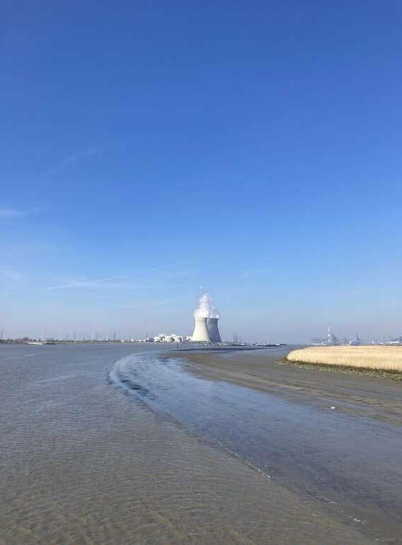
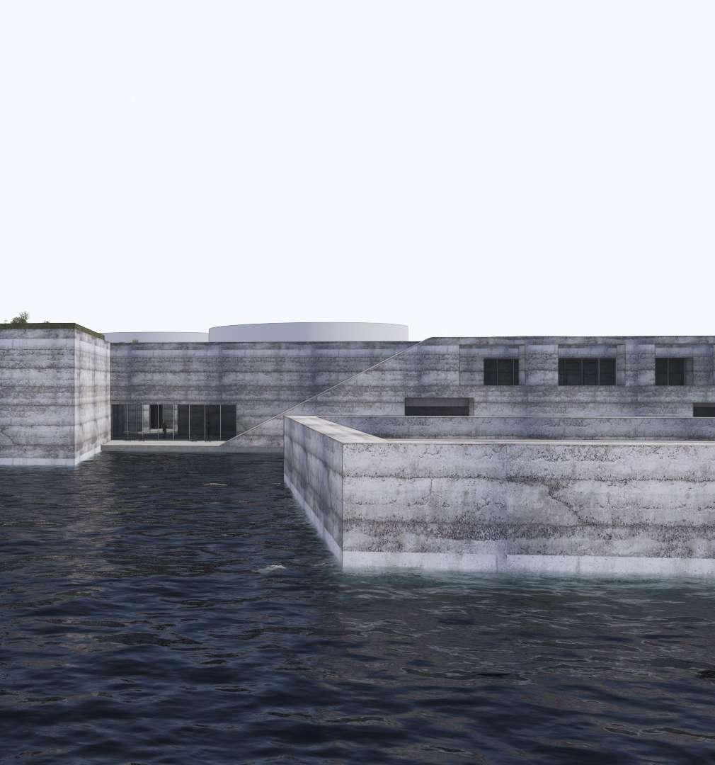
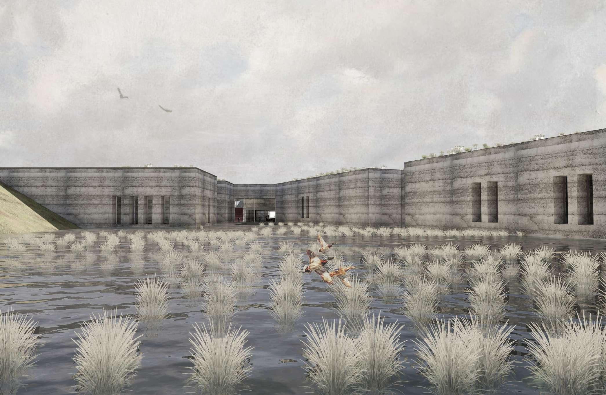
Nestled along the right bank of the Scheldt River near the city of Antwerp lies the former historic Sint-Filips Fortress. In a lush natural landscape in the middle of the harbor unfolds a harmonious interplay of water and land. The design of the building honors the dynamic tidal movement and the river's fluctuating presence.
The building hosts a future drinking water plant that taps into brackish river water. This place invites the public to wander through its halls, frames views along the river and celebrates this unique place. The building consists of spaces of water and light offering a glimpse into treatment process. In the building water can be experienced in all its facets, from its source to drinking water and refreshing swimwater.
A series of outdoor swimming pools fulfill the joy of living next to one of the busiest rivers in Europe, each embracing the lingering warmth born from the purification process.
DRINKWATER PLANT
Synonyms
Water treatment plant, WTP, drinking water facility, water purification plant, water production facility, drinking water plant
Definition
A water production facility is an industrial plant dedicated to extracting, treating, and producing water that meets the necessary standards for human consumption. This includes filtering, purifying, and conditioning water from natural sources such as rivers, lakes, or groundwater to make it suitable for drinking purposes and distributing it to consumers.
Noun
Between infrastructure and atmosphere
Establishes infrastructure as works of art.
How to adapt architecture to the fluctuating presence of water?
Industrial architecture
Water factory
CELEBRATING RIVER WATER
Construction is solid matter, while water is liquid. The balance between the two can be a source of challenges. To allow for a dialogue between water and architecture, the presence of the water must be strengthened rather than eliminated.
The treatment process as a theater
The presence of the closed form in the built environment
New type of water infrastructure
A necklace of rooms at the scale of the city
Ensemble of spaces
Landscape integration
Water in architecture, architecture of water
Water spaces
Material spatial configuration
The allure of water
Instead of just being a purely functional engineering structure, this piece of architecture is an reinterpretation of a water treatment plant
WATER TEMPLE
Forgotten infrastructure
WATER ROOMS
Industrial Shed
Technical activity in the sign of nature
ROOMS OF WATER
The theater of the everyday Bodies of water
A safe waterfront access
This demonstrate not only processes in the watertreatment plants, but also new opportunities in the design of treatment plants.
Monument for water treatment
May ‘23 Keywords as a start to describe the project outline.
WATER AND ARCHITECTURE
I have always been fascinated by water and architecture. During a visit to Venice in 2017, I was struck by how water can transform a place. The San Marco Square in the heart of the city is submerged with sea water up to 100 times a year due to tidal influences. The once busy, solid stone surface evolved due to the rising water level into a dynamic sheet water. Gradually, the water takes over the square. This water not only mirrored the details of the surrounding buildings but also influenced the way people navigated in this public space, guiding their movements around the ever-changing waterline.
After this trip, I began exploring the work of architects whom I consider masters of integrating water into their designs, such as Carlo Scarpa, Tadao Ando, and Steven Holl. These architects consciously incorporate water elements within, on, or around their architecture. As Steven Holl once said in an interview: "Water is a poetic reality, as is light. Water has the same potential. It is a basic element.”
‘17
March
Photographs taken during a the trip to Venice.
WATER IS THE NEW GOLD
Belgium is facing the threat of water bankruptcy. Climate change, marked by more frequent droughts and shifting rainfall patterns, is straining both groundwater and surface water availability. At the same time, population growth and intensive agriculture are increasing water demand, further depleting these resources.
As freshwater resources become more strained, water has become the new gold. Fresh water will be the 21st century’s oil—a much sought-after but dwindling natural resource. The key difference: a world without oil is possible; a world without water is not.
In regions like Flanders, groundwater levels struggle to recover due to limited rainfall and constant demand. Surface water, too, faces challenges, including contamination from agricultural runoff and industrial discharge. To address these issues, Belgium is exploring alternative water sources, such as desalinating seawater and enhancing water recycling technologies. By diversifying its water supply, Belgium aims to build a more resilient and sustainable system for the future.
DRINKWATER BANKRUPTCY
‘Drinking water extraction further dehydrates our nature: “This is unsustainable’
- De Standaard, 2024
‘If the Meuse continues to subside, Flanders will run out of water’
- H20, 2022
WATER SACRITY
‘Yes, it rains often – yet our tap water is not so certain’
- De Standaard, 2024
‘There are only 22 countries in the world with a greater drinking water shortage than Belgium’
- De Morgen, 2022
Residents of eleven Flemish municipalities receive an urgent call to be economical with water
Het Laatste Nieuws, 2020
‘There are only 22 countries in the world with a greater drinking water shortage than Belgium’
- De Morgen, 2022
WATER STRESS
'The Maas provides 7 million people with drinking water, but it is becoming increasingly drier'
- De Morgen, 2019
'Drinking water may soon run out'
- De Tijd, 2020
‘Extreme water scarcity affects a quarter of the world’s population, Flanders also scores poorly’
- VRT, 2019
THE ‘BLUE’ PLANET
The image we have of Earth is misleading—the “blue planet.” While our planet is covered in vast oceans, only 3 percent of all the water on Earth is fresh water and therefore usable for humans.
Nearly 70 percent of that small fraction is locked away in ice caps, glaciers, and permafrost, making it inaccessible. This means that humans and animals can only survive on a mere 30 percent of all the sweet water on the planet. Most of this crucial resource is stored in underground water reservoirs, which are not always easy to access (29,7%).
Conserving and managing our limited fresh water resources is essential for ensuring that future generations have enough to survive. While the Earth may appear rich in water, the truth is that the portion we can actually use is alarmingly scarce.
March ‘24 Front page of the newspaper De
Standaard.
March ‘24 Front page of the
newspaper De Standaard.
DAILY WATERPRODUCTION
1 153 000 m3/day
WATERPRODUCTION IN FLANDERS
Flanders’ drinking water landscape is characterized by a diverse mix of sources including groundwater, surface water, and imported water.
Groundwater is a crucial resource, drawn from various aquifers throughout the region, but its availability is increasingly stressed due to high demand and limited recharge.
Surface water, sourced from rivers and reservoirs, also plays a significant role, although it is subject to pollution and fluctuating levels.
A small part of the drinkwater is imported from neighboring regions and countries.
GROUND WATER
SURFACE WATER 531
IMPORTED WATER
TAPPING INTO THE NORTH SEA
To ensure water security, Flanders is increasingly turning to the North Sea. By tapping into North Sea water as an alternative source for drinking water, we are accessing a new endless resource that supports the development of a climate-resilient water supply.
This initiative is crucial for meeting the rising demand for drinking water and is closely aligned with the Blue Deal—a Flemish government initiative aimed at addressing water management challenges.
‘In Nieuwpoort, for the first time ever, drinking water was made from seawater from the North Sea: “A milestone’
- Het Nieuwsblad, 2022
‘Belgium converts North Sea water into drinking water’
- De Telegraaf , 2022
Will we soon be drinking purified water from the sea? Three water companies start pilot project in Nieuwpoort
- De Morgen, 2022
‘Will North Sea water soon be coming out of our taps? If it were up to De Watergroep, yes’
- Het Nieuwsblad, 2019
‘Knokke-Heist wants to make drinking water from seawater’
- De Standaard, 2020
“We must spread our water production to make it as resistant to climate fluctuations as possible.”
- Hans Goossens, (genral director Water Group).
New drinking water source and nature problem solved
- Waternet, 2022
Brackish water as a possible solution for increasing drinking water demand
- Drinkwaterplatform, 2021
‘De Watergroep wants to extract drinking water from the North Sea’
- De Standaard, 2019
'Focus on seawater desalination'
- De Telegraaf, 2022
Unique pilot project in Nieuwpoort: North Sea water, fresh and brackish water are purified into drinking water
- VRT, 2022
DRINKWATER INFRASTRUCTURE
Architects, contractors, urban planners, and engineers have long been involved in designing structures and systems for drinking water, evolving from the grandeur of Roman aqueducts to modern tap water systems within buildings. From slow sand filters to advanced technologies, each development represents a crucial milestone in our ongoing relationship with water. The history of civilizations and cities is deeply connected to the availability of water.
In recent decades, advancements in technology have dramatically improved the quality of drinking water, enhancing public health and eliminating many diseases. This progress underscores water’s increasing value, making it a critical resource in an era marked by climate challenges.
Egyptians constructed wells that were deep enough to tap into groundwater.
Roman Aqueducts 600 BC
Systems of channels and bridges to transport clean water from sources to cities.
Sedimentation 1500 BC
Particles and contaminants in water to settle at the bottom over time.
Hippocratics sleeve 500 BC
Use of cloth sleeve through which water was poured to remove impurities.
sand filters
Filters that allow water to slowly pass through a sand bed to remove impurities.
Activated Carbon Filtration 1960
Use of activated carbon to remove chemical contaminants and odors.
Use of activated carbon to remove chemical contaminants and odors.
Due to its porous of clay the pot helps to purifying water.
Set of basins treat the water setp by step into drink and swimwater.
Water filter 1500 BC
This device purifies water by heating it and then condensing the steam.
Indian step water wells 1400
Frequently used for water storage and irrigation.
Use of chlorine to water to disinfect it and kill harmful bacteria and viruses.
Use of ultraviolet light to kill microorganisms in water.
Nanofiltration 1990
Advanced technology that removes contaminants at the nanoscale.
WATER ENCYCLOPEDIA
a comprehensive collection of historical water purification techniques.
Egyptian
Matka pot 1900 BC
Persian Quant 1500
Underground channels that direct water from mountains to villages.
Slow
1827
Reverse Osmosis 1960
UV desinfection 1970
Chlorination 1900
Water treatment plant 1804
The first official water treatment plant.
Egyptian water well 3000 BC
Ancient river waterplant 1 BC
HISTORY OF WATER PURIFICATION
a timeline to articulate the most prominent steps through history in terms of water treatment.
India and Ancient Greece 2000 BC.
Aesthetics of water were most important (smell and odor)Aluminium added to the water.
Roman aqueducts 600 B.C
The method of transporting water from one place to another. By harnessing the power of gravity throughout the 10 meters high and 300 meters long structures.
Aqueducts were built underground to keep impurities and chemicals from contaminating the water system.
Hippocrates 500 B.C
Cloth bagThe ‘Hippocratic sleeve’ The water was boiled and poured through the cloth, which trapped the sediments that were causing the bad taste and smell…’
Archimedes screw 250 BC
5001500 MIDDLE AGES
Water contamination became a prevalent issue during the dark ages. Many people suffered and died because of waterborne diseases.
The microscope 1595
Francis Bacon 1627
The system used a series of earth material filters to purify waterIn this system, water passed from a stone-filled channel into a settling basin then moved successively through a gravel filter and a sand filter prior to entering a central water storage basin.
First water treatment plant 1804
In 1804 the first actual municipal water treatment plant designed by Robert Thom, was built in Scotland. The water treatment was based on slow sand filtration, and horse and cart distributed the water. Some three years later, the first water pipes were installed.
Water treatment Paris 1806
James Simpson 1827
Sand filter to purify drinkwater.
1920 First attempt to use membrane development, flocculation, coagalation methods.
1980 Membrane development for reverse osmosis
1750 INDUSTRIAL REVOLUTION
19TH CENTURY
Water diseases ere connected to water impurity drinking water treatment improved through the development of fast and slow sand filters, and the first applications of chlorine and ozone for water disinfection.
1990 INTREST WATER TREATMENT
RWZI in Flanders 1995 RWZI in Wallonia 2003
ANCIENT DRINKWATER TREATMENT PLANT
There are numerous examples of water purification facilities and buildings that have been constructed throughout history. While we often view water treatment as a modern practice, it has actually been in use for centuries. The drinking water plants we are familiar with today have undergone significant evolution over time.
A historical example that aligns seamlessly with this project is the remarkable Singverapure in India. The drawing depicts an ancient water treatment system in Uttar Pradesh, which harnesses the seasonal rise of the river during heavy monsoon rains. River water is channeled into a series of basins (1-7), with each basin representing a step in the purification process. Through each stage of this process, the water is transformed from its natural state into water suitable for drinking (basin 5) and swimming (basin 6).
The installation utilizes the natural flow, the gravitational line and the self-leveling properties of water. This makes it a prime example of low-tech river infrastructure.
May ‘23 The water runs in a low-tech way into the set of basins, drinkwater from basin 5, swimwater in basin 6.
REDEFINING A DRINKWATERPLANT
This project redefines the traditional concept of a drinking water facility by opening it to the public, blending architecture with infrastructure to create a space that educates and inspires.
Unlike typical drinking water buildings, which are often anonymous boxes placed on top of the landscape, this project breaks with the traditions by opening parts of the building, offering views over the Scheldt landscape, and allowing public access.
By showcasing the technology and processes behind water purification, the plant not only highlights the importance and fragility of our water resources but also offers a unique opportunity for visitors to appreciate clean drinking water.
Moreover, it serves as a central hub where the Scheldt River becomes a focal point, bringing together institutions and communities to learn, collaborate, and foster sustainable water management practices.
September‘23 The first image, a conceptual collage.
“Almost all my project engage with water deliberately in some way. It’s a poetic reality, as is light. I think water has the same potential. It is a basic element.”
- Steven Holl (architect)
(1) Alvaro Siza Building on water.
(2) Oppenheim Drinkwater treatment plant.
(3) Tadao Ando Sayamaike museum.
THE COLLECTION OF WATER TREATMENT PLANTS
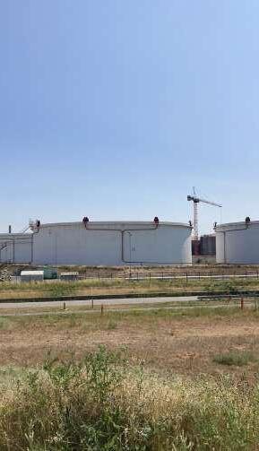
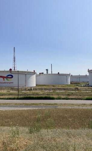
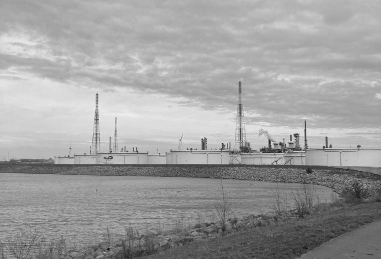
At the beginning of the project, an analysis was conducted by examining a collection of water treatment facilities. To gain deeper insights, some of these facilities were also visited.
This led to the identification of key principles that water production companies consider when designing or renovating their sites and buildings.
Henning Larsen, DK
Oppenheim architecture, Muttenz/ZW
Public, Schelet/CA
Arte Charpentier, Orleans/FR
MMAA, Levanto/IT
Node architecture, Shezhen/CN
C+S associati, Venice/IT
Aires Mateus, Lisbon/PT
Miller Hull, Wilsonville/US
Marcy Wong Donn, California/US
Hertzberger, Amsterdam/NL
PNA, San Claudio/SP
Campo, Utrecht/NL
Quist, Berenplaat/NL
Quist, Kralingen/NL
Otxotorena, Benidorm/SP
Ennaid architects, New york/US
AWP, Evry/FR
Steven Holl, US
Turf design, Syndney/AU
Public, Schelet/CA
PLANTS ORGANIZED BY SCALE
DRINKWATER
All aerial photographs of the drinking water treatment sites are presented to the same scale and oriented towards the north. The collection is organized based on the scale and capacity of each facility.
C+S associati 0.5 ha
Oppenheim 0.8 ha (5 M m3/year)
Molter-Linnenmann 1.4 ha
Mainstreet architects 2.7 ha
Afflech de la riva architects 4.1 ha
Quist 12 ha (36 M m3/year)
Quist 28 ha (50 M m3/year)
Factor architecten 9.5 ha (8 M m3/year)
Steven Holl 6 ha
Aspect studio 47 ha (164 M m3/year)
Water link 46 ha (109 M m3/year)
Miller Hull 5.7 ha (20 M m3/year)
DRINKWATER PLANT TYPOLOGIES
By compiling a reference list of water treatment facilities, three distinct typologies were identified: as a city, as a park, and as a building. Each of these typologies handles organization, the relationship between interior and exterior spaces, and interaction with the landscape in its own distinct manner.
In the city typology, the site is characterized by a collection of buildings, each serving a distinct water treatment function. Roads and various access points are interspersed between these structures. This arrangement demands considerable space and results in notable gaps within the master plan.
In the parc typology, the natural (water) landscape is integrated into the building’s layout. Underground sections are often utilized to minimize the visual impact of the facility. Occasionally, these sites are connected to public interaction through the presence of a park, enhancing the overall experience.
In the building typology, all treatment facilities are housed within a single, compact structure. This form is often associated with the park typology, where the building and landscape collaborate more closely. The design typically features a limited number of access points, and some parts of the building are accessible to the public.
VISIT OF A DRINKWATER PLANT
During week of Water in March, it was possible to visit a drinking water plant. The normally closed-off sites opened their doors to the public.
Key observations included the repetitive nature of similar elements, the extensive use of concrete and sealing joints, and the numerous inspection hatches scattered across the various systems.
INTERVIEWING PROCESS ENGINEERS
JP/ Jan Peter van der Hoek professor TU Delft / drink water engineer
AH/ Aniek Haamberg RWB water / process engineer
MB/ Mark Boers Evides / process engineer
SR / Steven Raes Sweco/ bio engineer – sustainability manager
DG/ David Geysen Pidpa/ procestechnoloog
SN/ Sam van Nevel water-link / procestechnoloog
Is a water treatment plant considered infrastructure or industry? Is there a specific term for what type of building this is?
MB: Everything that is underground is considered infrastructure, and from the moment it enters the building, we refer to it as industry.
What steps are involved in converting brackish surface water into drinking water?
MB: The initial steps involve filtering out larger particles from the water (sometimes we even find a bucket of mussels in the filters from the reservoirs). In some cases, the water is sent through reverse osmosis (RO) twice to make it even cleaner. RO is essential and cannot be avoided. A mixed bed is also sometimes used as an additional step.
How long does such a process typically take?
JP: On average, the process takes about 6 hours, except for the reservoir, where water can remain for a longer period. This depends on how the reservoir is used within the water cycle.
AH: The process itself doesn’t take very long. A rough estimate is that once the water is pumped up, the purified water can be ready in as little as 10 minutes. However, this depends on how the process is set up. There are often some storage tanks in the process to accommodate any fluctuations, which can extend the duration. In my opinion, the pumping of the brackish water takes the longest, as the water has to be drawn from deep underground.
What impact does daylight have in these buildings? (example of Quist)
MB: Daylight doesn’t need to be completely excluded, but at a certain point, it can no longer be allowed. There’s a point at which daylight is no longer permissible, but in the early stages, it can still be acceptable. For certain types of water (such as demineralized water), even oxygen can be detrimental.
Do the specific shapes of a water treatment
facility have a function?
JP: Each shape of a water treatment facility is designed with a specific function in mind.
AH: The shape of a settling tank does indeed make a difference. Settling in a round settling tank, for example, has the following advantages over a rectangular one: More efficient settling. The round tank shape promotes a uniform flow of water, resulting in more effective settling of suspended particles. Less sludge buildup. Because the tank has no corners, there is less chance of sludge accumulating in dead zones, which makes maintenance and cleaning easier. The round shape is better at withstanding external pressure and loads. However, settling in a round tank also has the following disadvantages compared to a rectangular one: More ground area, limited flexibility because modifications and capacity expansions are more difficult to implement in a round tank, higher construction costs. Note that settling is not always used in the process of treating brackish water to process water. It is common in the treatment of wastewater or sewage.
MB: Process water is often used in a circular manner. This avoids ‘dead spots’ and ensures a more even distribution. You want to minimize variations in residence times. Reverse osmosis (RO) systems are round because this shape handles pressure better. In square shapes, water enters at one spot, but you want different series in the shape. This is more about flow. The goal is to purify water in stages in this way. In a square tank, you eventually want the conditions to change.
How are elevation differences used in a water treatment facility?
JP: Certain filters require elevation to function properly (sometimes up to 4 meters). Additionally, some processes need specific pressure levels, which means that the water must be pumped upward initially, requiring extra height.
Is drinking water land-bound?
MB: We are not allowed to work for drinking water companies in Belgium just like that. What we do with industrial water is more company-specific and does not fall under land-bound principles.
Are there functions that can be built underground?
AH: Building underground can save space. However, considerations must be made regarding temperature, especially for reverse osmosis (RO) systems. When certain components are built above or below ground, the engineering must account for this. The pump’s lift height needs to be designed accordingly. The greater the elevation difference between components, the harder the pump must work.
What functions are needed to design a water treatment plant, from main functions to secondary functions?
Reception/entrance building/information point, restrooms.
JP: A small laboratory, warehouse/maintenance service/storage space.
MB: A laboratory is not used on-site; we have a separate external laboratory for industrial water. Additional functions include a control room, a room with flexible workspaces, a meeting room, restrooms, a workshop, and a storage area (for spare parts and a warehouse). A large part of our water treatment plants are fully automated, with these processes managing their own dosages to keep the system clean. About 90 percent of the costs are associated with secondary functions, while only 10 percent are related to the essential processes.
How many people work on average at a water treatment facility?
JP: Very few people work at a water treatment facility. Many components are operated remotely. During the day, there are a few employees on-site, but at night, the facility is empty.
AH: This depends on the size of the facility. Often, employees work at multiple facilities. In large treatment plants, there can be between 10 to 100 staff members, though this is not very common. The number of employees also depends on the level of automation at the facility.
MB: At a process water plant, we operate by regions. For example, 6 operators, 1 team leader, and 2 technicians manage 3 drinking water plants in a region. This seems like a small number because the plant is fully automated, so we don’t need shift work. Berenplaat is a very large plant that provides a significant amount of drinking water, and it is staffed at all times.
How can the landscape itself contribute to pretreatment?
MB: In the Biesbosch, we use storage basins with a total capacity of 800,000 cubic meters of water. This serves as an initial step in the purification process, primarily for sedimentation. Some dosing is applied to allow calcium to settle out. Fish and birds also inhabit these areas. Dunea utilizes dunes as a kind of sand filter, and we do something similar in Zeelandic Flanders by allowing water to seep through a forest. We manually ensure a high groundwater level there, which helps to fill a sand layer in a natural way. Various types of plants, such as reeds, also help remove metals from the water.
Is it necessary to make the site accessible for car/ truck traffic? If so, why?
JP: There is a lot of material being delivered and removed. Heavy truck traffic is essential for the operation.
AH: Normally, a treatment facility must be accessible for cars and trucks, for example, in case of emergencies, as well as for maintenance, inspections, and sludge removal.
MB: Everything comes in either by truck or by pipeline.
DRINKWATER PLANT PRINCIPLES
Drinking water plants share several general characteristics that inform their design:
Closed volumes
Water production facilities prioritize hygiene and water safety by limiting public access to the building. The production areas are often fully enclosed to protect the technology from external elements. This enclosure also helps prevent direct sunlight, which could otherwise have a negative impact on the quality of the drinking water.
Reliability
A water production facility operates 24/7 and focuses on ensuring reliable water supply. To achieve this, the technology is arranged in repetitive lines that do not all operate simultaneously. This setup allows for switching to an alternate line in the event of a malfunction, ensuring that the reliability of the water supply.
Maintanability
These buildings require continuous maintenance. Therefore, they are equipped with maintenance areas where parts are stored and workspaces are provided for adjusting components. The handling and processing of products are central to the operation of such facilities.
Robustness of materials
The exterior materials need to be robust and resistant to external influences. Materials with many joints are preferably avoided, which eliminates a significant amount of facade materials.
Visual maintenainance
For water bearing aeras (spaces where open water is present), light colors are recommended to make impurities in the water more noticeable.
FROM ESTUARY TO SITE
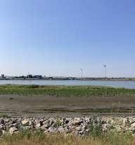
To understand the characterics of the location, the conditions of the river was analyzed from the macro scale of the estuary towards micro scale of the site.
The site of Fort Sint-Filips was chosen not only for its spatial conditions, as drinking water facilities require vast amounts of space, but also for the unique characteristics of the river.
ESTUARY NORTH SEA
During high tide, seawater is pushed inland, causing the water level to rise. During low tide, water flows from inland back to the sea. The tide current is dominant and much stronger than the ebb current.
RIVER SCHELDT
The Scheldt River passes three countries. Originating in France, where it flows through Belgium, including Antwerp, and reaches its mouth in the Netherlands.
CITY ANTWERP
Near Antwerp, the Scheldt River forms a funnel shape, which causes a large volume of water to flow through a narrower passage. This results in the Scheldt near Antwerp having a strong current, making swimming both dangerous and prohibited.
SITE
SINT FILIPS FORTRESS
The site is located on the inner bend of the Scheldt River, which is typically the shallow area where the river has more space to overflow compared to the outer bend.
FLUCTUATED PRESENCE OF WATER
The tidal range of the Scheldt River is quite extraordinary. Compared to other estuaries of the North Sea, the Scheldt experiences a difference of 5 to 6 meters.
In contrast, the Thames passing through London sees a range of 4 to 5 meters, the Elbe near Hamburg varies by 3 to 4 meters, and the Maas along Rotterdam only fluctuates by 2 to 3 meters.
Antwerp SCHELDT Hamburg ELBE
Rotterdam MAAS
NORTH SEA
TIDAL ACTION
The Scheldt is not a static object, but a dynamic system that is constantly adapting and changing. The river has a bidiurnal tide. With a bidiurnal tide, there are high tides and low tides twice a day.
Twice a day, the site transforms from a waterscape to a landscape, and this transformation is echoed within the building itself. In this project time acts as a forth dimension. Therefore the conditions of the surroundings change each time you visit the building. The river has a bidiurnal tide. With a bidiurnal tide, there are high tides and low tides twice a day.
1 x / 2, 10-100, 100- 1000 YEARS
Storm tide (situation 4 + storm) is the situation in which the sea water is extra high due to the combination of high tide and storm coming from the sea.
2 x / MOUNTH
When the sun and moon are in line with each other on the same side of the earth, the gravitational pull they exert on the earth increases. This happens during the full and new moon. Spring tides then occur about 2 days later: the high water is extra high and the low water extra low.
2 x / DAY
The tide is the periodic change of water level, and associated tidal current, that occurs on Earth due to the gravitational pull of the Moon.
2 x / DAY
The tide is the periodic change of water level, and associated tidal current, that occurs on Earth due to the gravitational pull of the Moon.
DOODTIJ / NEAP TIDE
2 x / MOUNTH
When the sun and the moon are perpendicular to each other and the water is ‘pulled’ from 2 different sides. This occurs during the first and last quarter of the moon (crescent). The effect is noticeable a few days later. During high tide, the water does not rise as high as normal and when it is low tide, it sinks less. We call this neap tide.
STORM TIDE
SPRINGTIJ / SPRING TIDE FLOW
24H50
The daily tidal cycle spans 24 hours and 50 minutes, slightly longer than a day, which lasts 24 hours. As a result, high tide and low tide occur at different times each day. Shifting every moment you will visit the building.
FACES OF THE SCHELDT RIVER
The Scheldt river area is one between two territories: one still wild, the other fully controlled by man. The combination of these two faces creates the unique setting of the projects surroundings. Wild versus controlled, natural versus artificial and landscape versus industrial.
The further north you go, the more intertidal areas there are, while these areas become fewer and smaller as you move south as is the river. This is why the project site was eventually chosen to be in the north of Antwerp.
PORTRAITS
Bicycle tours were undertaken to better understand the Scheldt estuary. These tours were alternated with boat trips, allowing exploration of both sides of the river.
“Antwerp residents only had to put their hand in the Scheldt to connect with the world.”
THE BLUE VEIN OF ANTWERP
The Scheldt is a 350 kilometer long river that rises from the French commune of Gouy in northern France and flows through Belgium and the southwest of the Netherlands into the North Sea.
During its trip to the sea, the river grows from a small stream into a five kilometer wide estuary. It is a river where recreation, economy, culture and nature coexist.
LOCATION SITS BETWEEN CITY AND INDUSTRY, BETWEEN SEA AND CITY
INDUSTRIAL
LANDSCAPE
NORTH SEA
CHARACTERISTICS OF THE SITE
Military history
The design honors this heritage by integrating elements of military architecture into the structural and aesthetic of the factory. This symbolizes a bridge between past and present, honoring the historical value of the place.
Sightlines
The site’s strategic position, stemming from its military past, ensures that sightlines over the river are well-considered.
The industrial landscape
The context of the site is defined by its rounded forms, large architectural gestures, and lack of human scale, plays a significant role as a backbone to the project.
River’s fluctuated presence
The intertidal zone forms a dynamic landscape that is continuously changing.
MILITARY HISTORY
Strategic location
SIGHTLINES
from sea to city
INDUSTRIAL ACTIVITY
Port infrastructure
INTERTIDAL AREA tidal cycle
MAPPING
Mapping the location reveals its diverse visual and structural characteristics. The analysis highlights variations in landscape features, from natural elements like waterways and topography to human-made structures such as buildings and infrastructure.
MOBILITY - slow traffic
MOBILITY - fast traffic
MOBILITY - water traffic
WATER TYPES - sweet water
WATER TYPES - dock water (type A)
WATER TYPES - Scheldt river water (brackish)
AREA - Scheldt fortress
AREA - Industry
AREA - Building environment
RIVER CHARACTERISTICS - LW
SIGHT DETERMING ELEMENTS- sght lines
RIVER CHARACTERISTICS - HW
SIGHT DETERMING ELEMENTS - orientation
RIVER CHARACTERISTICS - stream
SIGHT DETERMING ELEMENTS- elements
WATER AND LAND
The interaction between water and land is everchanging. Day and night, ebb and flow, continuously reshape the landscape, with each moment bringing subtle transformations. The tides expose and submerge the land, creating a dynamic balance that reflects the passage of time.
FLOOD / evening
FLOOD / day
EBB / day
FLOOD / evening FLOOD / day
EBB / day
The Scheldt is not a static object, but a dynamic system that is constantly adapting and changing. Twice a day, the site transforms from a waterscape to a landscape, and this transformation is echoed within the building itself. In this project time acts as a forth dimension. Therefore the conditions of the surroundings change each time you visit the building. The river has a bidiurnal tide. With a bidiurnal tide, there are high tides and low tides twice a day.
STORM TIDE extraordinary
A surge of water associated with storms, exacerbating high tides and leading to significant flooding and erosion.
HIGH TIDE daily
The highest water level in a tide cycle, influenced by the moon and sun, potentially causing flooding.
LOW TIDE daily
Daily Low Water The lowest water level, exposing more of the riverbed or seabed and impacting navigation and ecosystems.
NEAP TIDE twice a month
Occurs when the tidal range is smallest, during the first and third quarters of the moon, due to the moon and sun being at right angles.
SPRING TIDE twice a month
Happens when the tidal range is largest, around new and full moons, caused by alignment of moon, earth and sun.
OUTSKIRT OF THE CITY
The site is located 7 km from the city center.
It is nestled between industry and the city, surrounded by industrial grandeur, small remnants of polder villages, the ever-changing Scheldt River and bustling port activities.
PART OF THE FORTRESS BELT
The landscape around the city of Antwerp is characterized by various rings of fortresses. In 16th century, they played a crucial role in defending the city of Antwerp from invaders. The Defense Line of Antwerp was a military defense belt around Antwerp consisting of two rings of forts.
Notably, Fort Sint-Filips was an essential link within the Scheldt fortifications, as it guarded an important bending of the river, the last line of defense, before reaching Antwerp. These Scheldt fortresses were designed together with other opposite forts working together to protect the city from invaders.
Today, the fortresses have lost their military importance, and most have disappeared due to the expansion of the harbor. Only a few forts have been repurposed with various urban functions.
LAST BENDING BEFORE ANTWERP
DESIGNED TO WORK TOGETHER WITH OPPOSITE FORTS TO PROTECT THE CITY FROM INVADERS.
TRANSFORMATION OF THE SITE
The site of Fort Sint-Filips was marked by a series of notable changes that transformed the land and fort.
1567 STAR FORT
Fort Sint-Filips, one of the oldest forts around Antwerp, was built in the 16th century by a Spanish general to defend the Scheldt river. Constructed as a twin fortress with Fort Sint-Marie, it occupied a strategic location on the last bend before Antwerp’s city center.
1890 BUNKER FORT
In the 19th century, a new defense line for Antwerp was established. This new fort, a bunker fort, was built on top of the old foundations of the 16thcentury fort.
1980
LOST MILITARY IMPORTANCE
The harbor began to develop. After WWII, the petroleum industry emerged, characterized by distinctive round basins. New docks and locks transformed the polder landscape into an industrial harbor. This period is considered a “black page” in Antwerp’s history due to large-scale pollution within the fort from the harbor activities.
2021
The city of Antwerp took steps to create more space for the Scheldt River by partially demolishing the polluted fort, and the outlines of the two fort contours were represented as land art on the grass field. Part of the area was transformed into a larger intertidal zone, and a new hook-shaped structure was added to protect and enhance the surrounding land and river flow.
TREASURES ON SITE
The project is infrastructure to serve the harbor, but even more an infrastructure to host biodiversity.
During the visits, the treasures of the locations were revealed. Each time the water receded, nature triumphed, drawing birds to the area. A seal, various birds, and geese were spotted, showcasing the vibrant wildlife of the estuary.
You might expect that natural sounds at such locations would be overshadowed by industrial activity, but the opposite was true. Each site visit revealed the overwhelming presence of local biodiversity.
seagull 10/03/2024
seal 01/01/2024
godwit 19/06/2023
grey goose 10/03/2024
EACH TIME THE WATER RECEDED, NATURE TRIUMPHED, DRAWING BIRDS TO THE AREA.
IMPLEMENTATION
Fortress of Sint-Filips is surrounded by bustling port activities, small remnants of polder villages and the ever-changing Scheldt River.
ONE ALIGNED, ONE TILTED, ONE DRIFTED
The architectural composition consists of directions, each with a specific orientation. One volume is aligned parallel to the street. Another is tilted towards the fort, creating a connection to the historical site. The third volume appears to drift away, adding a sense of movement to the design.
1. Block parallel to the street. Giving the dike an extension, the building a face on the industry side.
2. Enlarged the block to the needs of WTP
3. Creating air into the massive block to create an inner world and voids into the building
4. Tilted part of the block to create a big view over the landscape
5. Going in dialogue with the water by detaching part of the progam in the tidal water, to create spaces that fill with water.
TIME IS THE FOURTH DIMENSION
In the visuals and presentation, different timeframes have been utilized to illustrate the movement of the river and its impact on the building and overall experience. This approach demonstrates how the river’s changing flow affects both the building’s structure and the surrounding environment throughout various times of the day and seasons.
16:00 flood
It is 10 o’clock, and the building opens its doors to visitors. As the doors swing open, the first guests begin to arrive.
The water has completely receded, leaving the building surrounded by a mudflat landscape. Birds flock in and out, taking advantage of the exposed wetland to feast on the rich offerings of the mud.
14:00
At noon, the bar fills up with visitors and cyclists stopping for a lunch break. The swimming pool also becomes busier as people enjoy the facilities.
The water has advanced by 2 meters, yet it still hasn’t reached the building.
12:00
At 2 o’clock in the afternoon Dockworkers pass over the rooftop landscape after a day’s work, heading towards the boat stop that will take them to the city.
The water has nearly reached the building. Birds have moved to the salt marshes, adapting to the changing environment as the tide continues to rise.
10:00 ebb
A group of visitors, guided by a tour leader, makes their way to the original fort.
It is flood, the water reached the building. The interior experience changes completely. It feels as though the Scheldt is rolling inside, with the building almost submerged. The scene becomes a flirtation with high tide, blurring the boundaries between the river and the structure.
10:00 ebb
16:00 flood
PROGRAM
The program of the building is primarily focused on water purification, integrating a series of specialized treatment processes within its infrastructure. These purification functions are carefully organized within the building, each dedicated to a specific stage of water treatment. This setup ensures that the essential task of producing clean drinking water is executed efficiently.
In addition to its technical role, the building also incorporates a public layer that invites visitors to engage with and learn about the water treatment process. By opening parts of the facility to the public, the design not only educates but also creates a unique space where the community can connect with the importance of clean water.
48 400 m2
This building, with 48,400 square meters of total floor area, is larger than the Louvre Abu Dhabi but smaller than both the Rijksmuseum in Amsterdam and the Centre Pompidou in Paris.
48
48
ORGANISATION CHART
The entrance hall is used to merge dike and street entrance. At the same time connecting a sightlines over the treatment landscape.
RIVER ARRIVAL
STREET ARRIVAL
DIKE ARRIVAL
LANDSCAPE VERSUS BUILDING
Site program
The program can be clarified by using two scales. The first is the site scale, which includes a landscapebased treatment, a technical treatment, and the fort.
Building program
The building encompasses three distinct functions, all combined into a single structure. The structure integrates three primary functions: treatment functions, service functions, and recreational functions.
ORGANISATION
The challenge was to house two distinct functions within a single building and connect them in a way that ensures seamless integration without compromising safety or functionality.
The program is carefully organized to guide the public around the treatment functions, allowing for interaction between the professional and recreational areas while maintaining the integrity of the drinking water.
SCHELDT BALCONY
DIKE
SCHELDELAAN
DIKE
Scheldt balcony
0
-1
STRUCTURAL PRINCIPAL
The structural principle is deeply integrated with the building’s overall organization. The corridors, designed as open spaces, link the large halls to enclosed areas that serve as support functions for both the museum and water treatment processes.
A two-way structural system is utilized within these halls, enabling larger spans without the need for additional support points. This approach enhances openness and flexibility within the space. The small rooms at the corners play a vital role in supporting the structural framework, contributing to the overall stability of the building.
The decision to keep the structural elements fully exposed was influenced by the intriguing interplay between the building’s volume and structure. In the halls, this structural framework is left visible.
In the corridors and in-between spaces, a lighter construction is used, which remains hidden from view.
FLOORPLAN -1
FLOORPLAN 0
FLOOD LEVEL
FLOORPLAN +1
ROOF AS THE FIFTH FACADE
The roof extends from the dike, becoming an integral part of the public space and the major cycling network around Antwerp. Designed as a habitable area, it connects people from the dike level to the entrance of the building, the water and to the fortress. The roof creates a physical connection to the historical context of the location.
The roofscape functions as both a physical and visual link across the site and its surroundings. It features a network of green roofs, seamlessly connecting walkways and cycling paths. The design continues the forms of the halls into the roof, creating a cohesive architectural language. Lookout points offer expansive views from the sea to the city, forming a Scheldt balcony with wide perspectives.
Emergency overflow systems are connected to the roof level, creating a cascading effect during rainfall. These systems are visible from within the building, particularly in the corridors that open onto the water garden.
FLOORPLAN ROOF
ROUTING
Visitors meander through the building, where a series of halls showcase different purification processes. Simultaneously, they maintain visual connections with the surroundings, creating a seamless integration between indoor and outdoor spaces.
The building serves various users, each with a different route within and across the structure. We identify 4 distinct user groups: water, visitor, employee and supplier.
ROUTING OF WATER
Landscape treatment
Analyzing the Scheldt River revealed that the northern part of the site is a crucial inlet for the treatment process. During high tide, seawater naturally flows inland, and the river’s current efficiently channels the water into the facility.
A large 12-hectare landscape area in the north diverts 120,000 cubic meters of water from the river for pretreatment before it enters the facility. This landscape pre-treatment zone serves as a low-tech stage to prepare the water for the subsequent high-tech purification process.
The area is designed with an ingenious system that channels Scheldt water during high tide, allowing it to calm after its turbulent journey from the sea. The water carries a significant number of particles due to tidal and river movements. By allowing the water to settle, these particles sink to the bottom.
The zone is configured with small height differences that guide the water through a series of sand and reed filters. Through the force of gravity, the water is guided through these filters, where it undergoes a first purification. The water remains in this area for seven days before proceeding to the next stage of treatment.
(1) Inlet
(2) Reedfilters and sandfilters
(3) Building inlet
Residence time of water
Water production involves a combination of slow and fast processes, with the landscape-based treatment phase being particularly slow.
The water remains in this phase for five days, while it only spends six hours within the building itself.
ROUTING OF WATER
Technical treatment
Water enters the building through an inlet on the north facade. From there, it flows through various halls, each dedicated to a specific stage of the purification process. This systematic layout ensures the efficient and precise treatment of the water, transforming it into high-quality drinking water.
(1) Cascades
This involves the aeration of water by allowing it to flow down a series of steps or stages. The cascading action increases oxygen levels in the water and helps to remove certain dissolved gases and volatile compounds.
(2) Flocculation and coaggalation
These are chemical processes used to remove suspended particles from water. Coagulants are added to the water to neutralize charges, and flocculants cause the particles to clump together, forming larger particles (flocs) that can be easily removed.
(3) Settler tank
Also known as a sedimentation tank, this is where the flocculated water is allowed to stand so that the flocs can settle to the bottom, separating from the clear water above.
(4) Microstainer
A fine mesh filter used to remove small particles from
water. It is often used after sedimentation to catch any remaining flocs or larger particles.
(5) Intermediary tank
A storage tank where water is held temporarily between different stages of treatment. This allows for the regulation of flow and ensures a steady process through the treatment stages.
(6) UV filtration
A disinfection process where water is exposed to ultraviolet (UV) light, which kills or inactivates harmful micro-organisms by disrupting their DNA.
(7) Ulta filtration
A membrane filtration process that removes very small particles, including bacteria and some viruses, from water. It is often used as a final filtration step before disinfection.
(8) Revers osmosis
An advanced filtration method that uses a semipermeable membrane to remove a wide range of contaminants, including dissolved salts, organics, and other impurities, from water. This is often used to produce high-purity water.
(9) Reservoir
The reservoir is smaller compared to other water treatment facilities because water at this location is consumed almost immediately. The reservoir is only used in cases of overproduction, which is a rare occurrence.
WATER PRODUCTION
Every day, 50,000 cubic meters, or fifty million liters—equivalent to 20 Olympic-sized swimming pools—of water are processed at the plant and immediately integrated into Antwerp’s water network.
This amount is sufficient to supply approximately 138 888 residents of Antwerp. The districts served include the city center, Borgerhout, Deurne, Antwerp South, and Antwerp North.
5 0 0 0 0
m 3 / d a y
5 0 0 0 0
m 3 / d a y
2 0
o l y m p i c p o o l s
2 0
o l y m p i c p o o l s
5 0 0 0 0 0 0 0
l i t e r w a t e r
5 0 0 0 0 0 0 0
l i t e r w a t e r
1 3 8 8 8 8
i n h a b i t a n t s
1 3 8 8 8 8
i n h a b i t a n t s
ROUTING OF THE VISITOR
Route as a visitor/ water treatment
The corridors are intentionally designed to be wider than necessary, allowing them to house exhibition spaces within. These spaces transform from passageways into open areas where larger elements are displayed, creating dynamic transitions throughout the building. A deliberate combination of compression and decompression highlights key elements along the way.
The circulation pattern has been carefully studied, resulting in a meandering path that seamlessly integrates technology and museum exhibits. This thoughtfully crafted route not only guides visitors through the space but also tells a complete and informative story, with sightlines and circulation meticulously planned to enhance the overall experience.
01 ENTRANCE
Visitors access the building through two central entrances, converging in the heart of the structure. This design accommodates mobility from different elevations. The dike brings cyclists and boat traffic directly to the building, while street-level access accommodates public transportation and vehicular traffic.
Street Entrance: Located on the street side, this entrance serves visitors arriving by car, bus, or other public transportation.
01 ENTRANCE
Visitors access the building through two central entrances, converging in the heart of the structure. This design accommodates mobility from different elevations. The dike brings cyclists and boat traffic directly to the building, while street-level access accommodates public transportation and vehicular traffic.
Dike Entrance: This entrance is characterized by two successive staircases that create a visual connection with a large window, linking the outdoor landscape with the interior space.
A wide corridor leads to a spacious cloakroom area, providing a transitional space for visitors to prepare before beginning the museum tour.
CLOAKROOM
04
TREATMENT HALL
The first treatment hall is showcased through windows in the interior walls, allowing visitors to observe the technology from an elevated perspective. The corridors surrounding this area provide additional information about the techniques used, enhancing the educational aspect of the visit.
05 EXPO SPACES
The service spaces within the building house various auxiliary functions, including the lecture hall. This space is designed for films, lectures, or video presentations, seamlessly integrating multimedia elements into the overall tour.
The exhibition halls emerge between the circulation spaces, varying in size to accommodate different displays. These halls serve as dynamic areas where visitors can engage with more detailed aspects of the water treatment process.
06 EXPO HALL
The tour concludes at the bar on the first floor. Panoramic windows are installed to enhance the expansive view, providing visitors with a breathtaking finale to their visit, overlooking the surrounding landscape.
This thoughtfully designed route ensures that each step of the journey through the water treatment facility is not only informative but also an engaging and immersive experience.
ROUTING OF A VISITOR swimming pool
In the building, two primary axes converge in the central hall, from where both the museum route and the swimming route begin. Swimming takes place on the southern side, facing the city, providing a unique connection between the water and urban landscape.
ENTRANCE TO THE SWIMMING POOL
The entrance to the swimming pool is subtly integrated into the main building. Visitors descend via a lowered platform, moving beneath the Scheldt’s water level to access the pool area.
The dressing room is conveniently located near the entrance, offering a smooth transition from the main building to the swimming area.
CLOACKROOM
The pool itself is positioned on the southern side, allowing swimmers to enjoy views of the city while they swim.
SWIMMING POOL
10
ROUTING TO THE BAR
The bar can be accessed by an exterior route during low tide. However, this path is cut off during high water, adding a dynamic element to the experience.
F: fortress of Sint-Filips
S: swimming pool
M: main building
W: water long
R: river scheldt
FACES OF THE BUILDING
The building features various spatial conditions, each façade reflecting a distinct character depending on its orientation and the adjacent site.
DIKE ELEVATION
The façade runs parallel to the roadway, forming the building’s public face from the street and engaging in a dialogue with the industrial elements of the surrounding area. Large structural components extend from the parking level to the roof, shaping the circulation flow to and from the underground parking. This structural principle is expressed externally, offering a preview of the interior. The grandeur is mirrored in the double-height covered outdoor space, where buses arrive and depart, creating an ideal gathering spot sheltered from the elements.
Various windows provide glimpses into the underlying treatment processes.
The roof structure is elevated in certain areas to create a guiding play of light and drawing attention to the building’s main entrance.
The building’s design incorporates pivot doors as main entrance. When the doors are open, they can almost be seen as structural elements. When closed, these doors align flawlessly with the exterior wall, ensuring a smooth, uninterrupted facade.
RIVER ELEVATION
The riverside is fully subject to the tides, with the waterline shifting twice a day from high to low tide.
SEA ELEVATION
The facade runs parallel to the roadway, forming the building’s public face from the street and engaging in a dialogue with the industrial elements of the surrounding area. Large structural components extend from the parking level to the roof, shaping the circulation flow to and from the underground parking. This structural principle is expressed externally, offering a preview of the interior. The grandeur is mirrored in the double-height covered outdoor space, where buses arrive and depart, creating an ideal gathering spot sheltered from the elements.
Various windows provide glimpses into the underlying treatment processes.
The roof structure is elevated in certain areas to create a guiding play of light and drawing attention to the building’s main entrance.
The building’s design incorporates pivot doors as main entrance. When the doors are open, they can almost be seen as structural elements. When closed, these doors align flawlessly with the exterior wall, ensuring a smooth, uninterrupted facade.
CITY ELEVATION
The city-facing elevation, where the swimming pool is located, is oriented to the south. The view towards the city is framed by this side of the building, enhancing the connection between the pool area and the urban landscape.
MAS CATHEDRAL
VISUAL CONNECTION TO THE CITY
From the site of Fortress Sint-Filips in Antwerp, there is a clear visual connection to the city. Notably, the Boerentoren and the Cathedral of Our Lady are visible landmarks. These iconic buildings represent the city on this outskirt of the city.
BOERENTOREN
OUDAAN
CATHEDRAL
CATHEDRAL BOERENTOREN
OUDAAN
MAS
MAS
OUDAAN
DOORS AND WINDOWS
Doors and windows
INTERIOR DOORS
WINDOW TYPE 1
WINDOW
TYPE 2
ENTRANCE HALL
LANDSCAPE TREATMENT
WINDOW TYPE 3
EXPO HALL
MATERIAL GESTURE
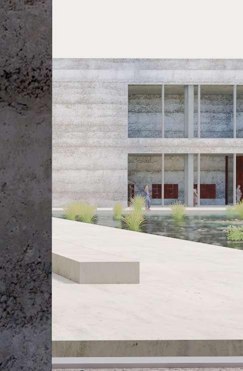
The materials for the project were carefully selected with a focus on minimizing joints, opting for concrete due to its impermeability and its reference to exposed cast-in-place concrete.
This approach also allowed for a seamless connection between the interior and exterior, with materials extending continuously between the two spaces, creating a cohesive and unified design.
EMBRACING THE RIVER’S TOUCH
The façade cladding reveals a dynamic character over time. The brackish waters of the Scheldt continually apply new layers to the surfaces.
Green deposits will prevail, gradually overtaking the horizontal lines of the formwork. As time and tide pass, these green layers become a testament to the building’s interaction with its environment.
MATERIALIZATION
The building is crafted from robust materials like stamped concrete and corten steel, each embracing the influence of the Scheldt. Over time, the river’s touch will leave its mark, enriching the building’s character.
The exterior’s resilience resonates indoors by integrating these dark green tones. Reflecting the river’s natural hues.
01 stamped concrete
polished concrete
khaki-colored accents
soft yellow collor
mahonie wood
corten steel
THE COLOR OF WATER
The color of water is ever-changing, influenced by light, the underlying surface, and the tides. At times, it reflects a clear, bright blue under a sunny sky, while at other moments, it takes on the dark green hues of the surrounding vegetation. The sandy or rocky bottom can lend it a golden or grayish tint. As the tides ebb and flow, the water’s color shifts, mirroring the dynamic interplay between nature and time.
TIME AND TIDE
The façade cladding reveals a dynamic character over time. The brackish waters of the Scheldt continually apply new layers to the surfaces.
Green deposits will prevail, gradually overtaking the horizontal lines of the formwork. As time and tide pass, these green layers become a testament to the building’s interaction with its environment.
FLOW 16h00
INBETWEEN 13h00
EBB 10h00
FLIRTING WITH THE TIDE
The facade cladding reveals a dynamic character over time. The brackish waters of the Scheldt continually apply new layers to the surfaces.
Green deposits will prevail, gradually overtaking the horizontal lines of the formwork. As time and tide pass, these green layers become a testament to the building’s interaction with its environment.
TRANSFORMED BY NIGHT FALL
As night falls, the landscape undergoes a transformation. The river becomes a dark void, while the industrial lights come to life. The water forms a black mirror, reflecting every artificial light, creating a mesmerizing interplay between nature and industry.
PROCESS
DRAWING AND CYCLING
Bicycle tours were undertaken to better understand the Scheldt estuary. These tours were alternated with boat trips, allowing exploration of both sides of the river.
THE JOURNEY OF MODELLING
The project explored how architecture approaches the landscape through the creation of form studies. By investigating various shapes and structures, the study aimed to understand the relationship between built environments and their natural surroundings.
EXPLORING THE DESIGN THROUGH SKETCHING
The project explored how architecture approaches the landscape through the creation of form studies. By investigating various shapes and structures, the study aimed to understand the relationship between built environments and their natural surroundings.
EXTERNAL EXPERTS
A total of three categories of external experts will be consulted: architecture/ structure (red), water purification(green) , and landscape (blue).
The size of the circles indicates how frequently they have been involved in the project.
Architecture
Lisette Plouvier
Jo Barnett
Bruno Vermeersch
Pnina Avidar
Anna Zan
Material
Tectoniek
Water treatment
Organizations
Water circle
Water quality
Vlaamse milieu maatschappij
Hydraulic engineer
Process engineer
David Geysen (Pidpa)
Sam Van Nevel (Water-link)
Aniek Haamberg (rwb-water)
Jan Peter van der Hoek (TU Delft - Professor)
Bio-engineer
Steven Raes (Sweco/bio-engineer)
Landscape
Yttje Feddes
Anne Nieuwenhuis
Jana Crepon
Coen Pronk
Scheldt River expert
Yves Plancke (Waterbouwkundig laboratorium)
Marien traffic
Sander Steel
Frans Doomen
Yttje Feddes Landscape architect
Lisette Plouvier Architect
Jo Barnett Architect
Committee
Steven Raes Sweco/ bio-engineer
Anne Nieuwenhuyse Landscape architect
Edwin Vermeulen / tectoniek Expert / centrum voor beton
Jan Peter van der Hoek Professor TU Delft / drink water engineer
Aniek Haamberg RWB water / process engineer
Coen Pronk Architect
Martin Meerkerk KWR water
Jana Crepon Landscape architect
David Geysen Pidpa/ process engineer
Sam Van Nevel Water-link / process engineer
Frans Doomen Marine pilot - Scheldt river
Bruno Vermeersch Architect
Ana Zan Architect
Mark Boers Evides / process engineer
Sander Steel Marine pilot - Scheldt river
Yves Plancke Scheldt expert
GLOSSARY
River
A river is a natural watercourse and acts as the visible drainage system for the excess water in a given area.
Eb/flow
High tide is a phase of the tide where the water of the sea rises or rises. The phase of descending or descending water is called ebb. Both flood and ebb are caused by the influence of the masses of the Moon and the Sun.
Estruarium
Funnel-shaped estuary, with water movement under the influence of the tide.
TAW
The Tweede algemene Waterpassing (TAW) is the reference height against which height measurements in Belgium are expressed.
Tidal movement
The North Sea has a bidiurnal tide. With a bidiurnal tide, there are high tides and low tides twice a day. A tidal cycle lasts 12 hours and 25 minutes.
BIBLIOGRAPHY
Literature
AMERY, D., DECLEER, M., MEIRE, P., ‘De Schelde: van bron tot monding’, Brussel: ASP, 2015, 263 pages.
BOGONI, B., ‘Paulo David, the lesson of the continuity’, AMAG Publishers, 135 pages.
BREAM., R., ‘Het lelijkste land ter wereld’, Academic and scientific publishers, 95 pages.
CLAES, J., ‘Van mensen en steden’, 2003, Pelckmans, 184 pages.
LAUWERS, F., ‘Garnizoen Antwerpen 18311970: het leger in het dagelijks leven van de Antwerpenaar’, 2010, The history press, 128 pages.
LOMBAERDE, P., ‘Antwerpen versterkt 2’, pages.
HOLL, S., ‘Parallax, working with doubts’, Birkhäuser-Publishers for Architecture, 2000, 212 pages.