
2 minute read
Ridge and Furrow


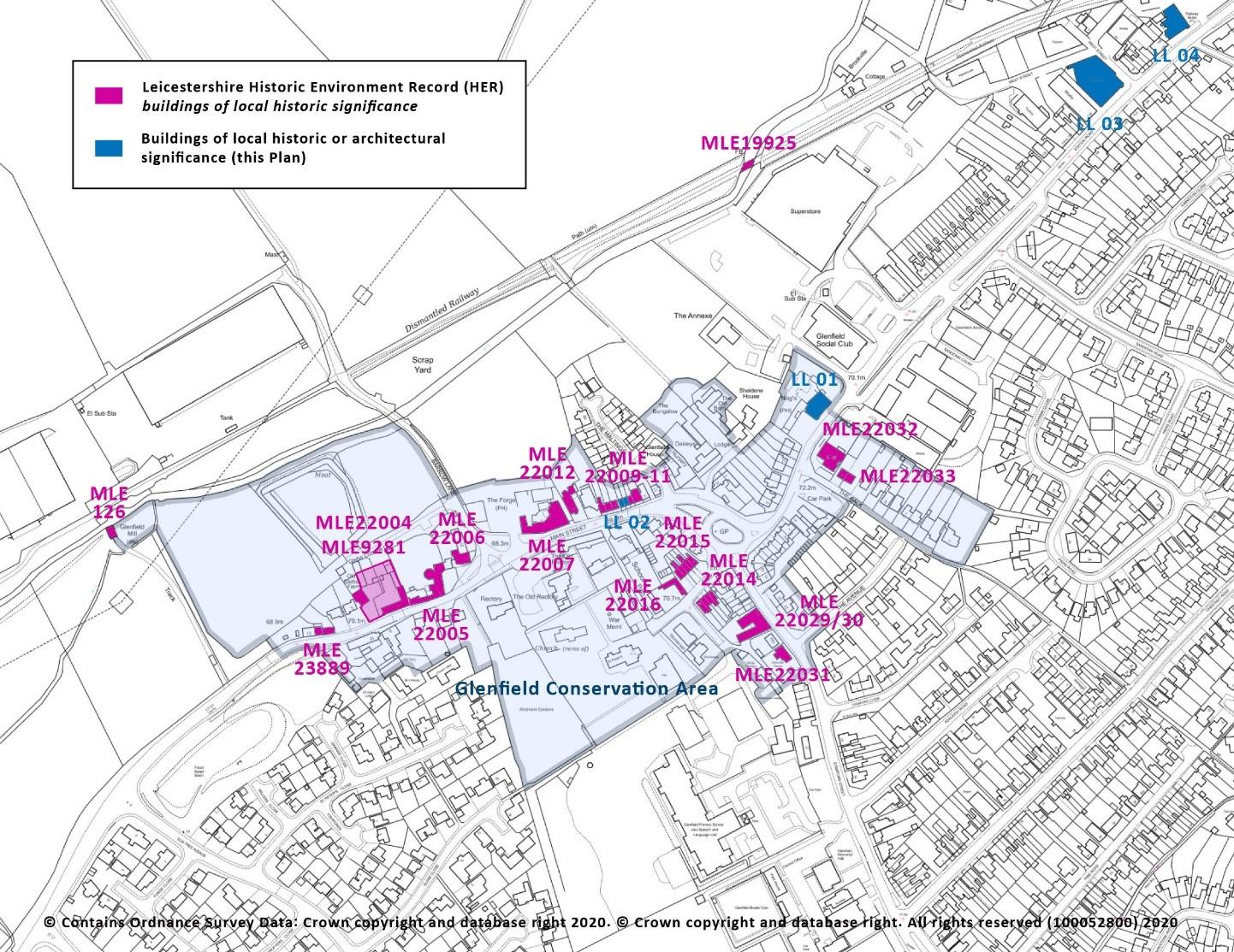
Figure 14.1: Local Heritage Assets, northern area For key see figure 14.2
Figure 14.2 Local Heritage assets, central area
Advertisement
45
As mentioned in ‘historic environment’, Glenfield’s medieval economy was based on farming. The village’s fields were mainly to its west, and for some 1000 years they were worked using a rotation system of arable crops, livestock and fallow in three large open fields. Cultivation was by simple (nonreversible) plough drawn by oxen, which, through centuries of regular ploughing of the same furlongs, produced strips of parallel ridges and troughs with a height difference of up to 1.5 metres. When this traditional way of farming was eventually ended, culminating in the enclosures of the 18th century, the plough strips were preserved under the new pastoral landscape of permanent grass fields, to become the earthworks feature now known as ridge and furrow.
This was the situation until after the end of the second World war (figure 15), at which time – as well as the start of the main expansion of Glenfield – the UK and later European governments encouraged a switch back to arable farming. Modern ploughs have since obliterated some 90% of ridge and furrow across England, along with the permanent pasture under which it was protected. By 1999, when Historic England (then English Heritage) commissioned a countrywide survey, the original (estimated) 120 hectares in Glenfield had been reduced to c.28 ha (figure 16).
In 2020, when re-surveyed for this Neighbourhood Plan, only two small areas (6.7 ha) survived (figure 17). This represents a 98% loss by area since 1947 in the Plan Area. Any further, avoidable, loss will now be irreversibly detrimental in the context of Glenfield’s heritage. In conformity with paragraph 194 of the National Planning Policy Framework (including footnote 63) and following the recommendation of Historic England, the surviving ridge and furrow in the Plan area should now be regarded as non-designated heritage assets and taken into account as a valid part of sustainable development in the planning system; these fields are the visible evidence of an element of national heritage arguably comparable in significance to that of our medieval parish churches.
POLICY ENV 10: RIDGE AND FURROW – The areas of ridge and furrow earthworks mapped in Figure 17 are non-designated local heritage assets.
Development proposals that would detrimentally affect or destroy the areas of ridge and furrow earthworks shown in Figure 17 will not be supported, unless it can be demonstrated that the proposed development delivers substantial public benefits that would outweigh the damage to or loss of the heritage asset.
46
Figure 15: Ridge and furrow in c.1947 as reconstructed by R.F. Hartley (Leics. CC) from aerial photographs and fieldwork (map re-formatted for this Plan) Figure 16: Ridge and furrow in c.1999: Leics. CC Historic Environment Record data from Turning the Plough survey (Historic England et al)
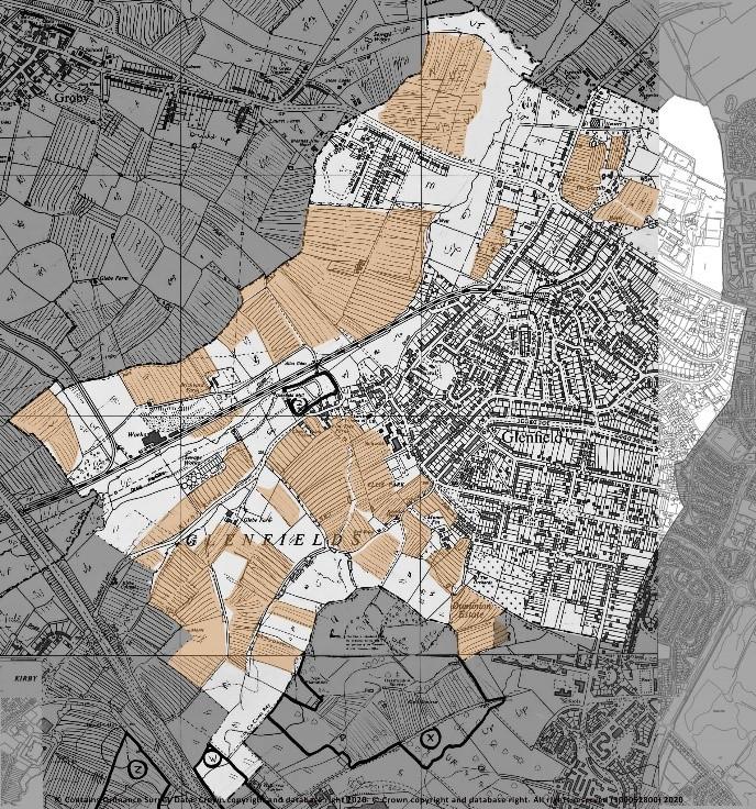
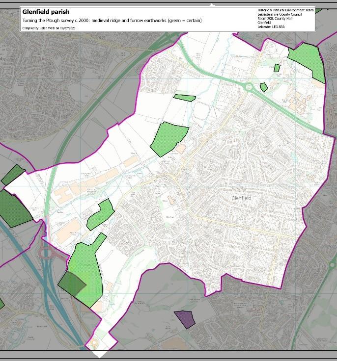
Figure 17: Surviving ridge and furrow in 2020 (this Plan)

47


