1 minute read
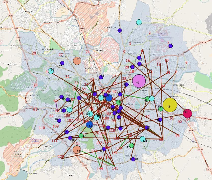
Figure 5: Inter and intra ward travel patterns of cycling commuters in Pune


Inter and intra ward travel patterns of cycling commuters in Pune
A visualization of the spatial patterns of cycling trips in Pune is presented below. This is based on the origins and destinations reported in the Household Survey. The method of sub-division of the city as Electoral Wards of 2007-2012 is the basis for this visualization, as the geographic population distribution of Pune as per the 20111 Census is linked to these 144 Electoral Wards. The start points and end points of all trips were allocated the centroids of the particular ward they originated or destined in, respectively. The coloured circles represent intra-ward trips The lines represent inter-ward trips The patterns indicate: Local trips are well distributed throughout the city Certain locations like Yerwada, Hadapsar Industrial Estate, Sinhagad Road, University/ Aundh
Advertisement
Road show a higher number of local trips. There are a higher number of trips between north-west and south-east Pune, and central Pune and south-east Pune. Cycle trips also take place between central Pune and south-west Pune.


