
12 minute read
1 INTRODUCTION


1.1 What is a Plan of Management?
A Plan of Management provides the framework for managing public land. Itsetsout how public land is intended tobe used, managed, maintained and enhanced inthefuture.
Advertisement
The NSW Local Government Act 1993 requiresa Plan of Management to be preparedfor all public land that is classified as community land under the Act. Thisrequirement applies to community land owned by a Council, and Crown land for which Council is Crown Land Manager. The Crown Land Management Act 2016 authorises local Councils appointed as Crown Land Manager tomanage dedicated or reserved Crown land under the Local Government Act.
This Plan of Management for Timbrell Park meets therequirements of the Crown Land Management Act 2016 and Local Government Act 1993. Upon adoptionthis Plan of Management will supersede all previous Plans of Managementfor the study area.
1.2 Land to which this Plan of Management applies
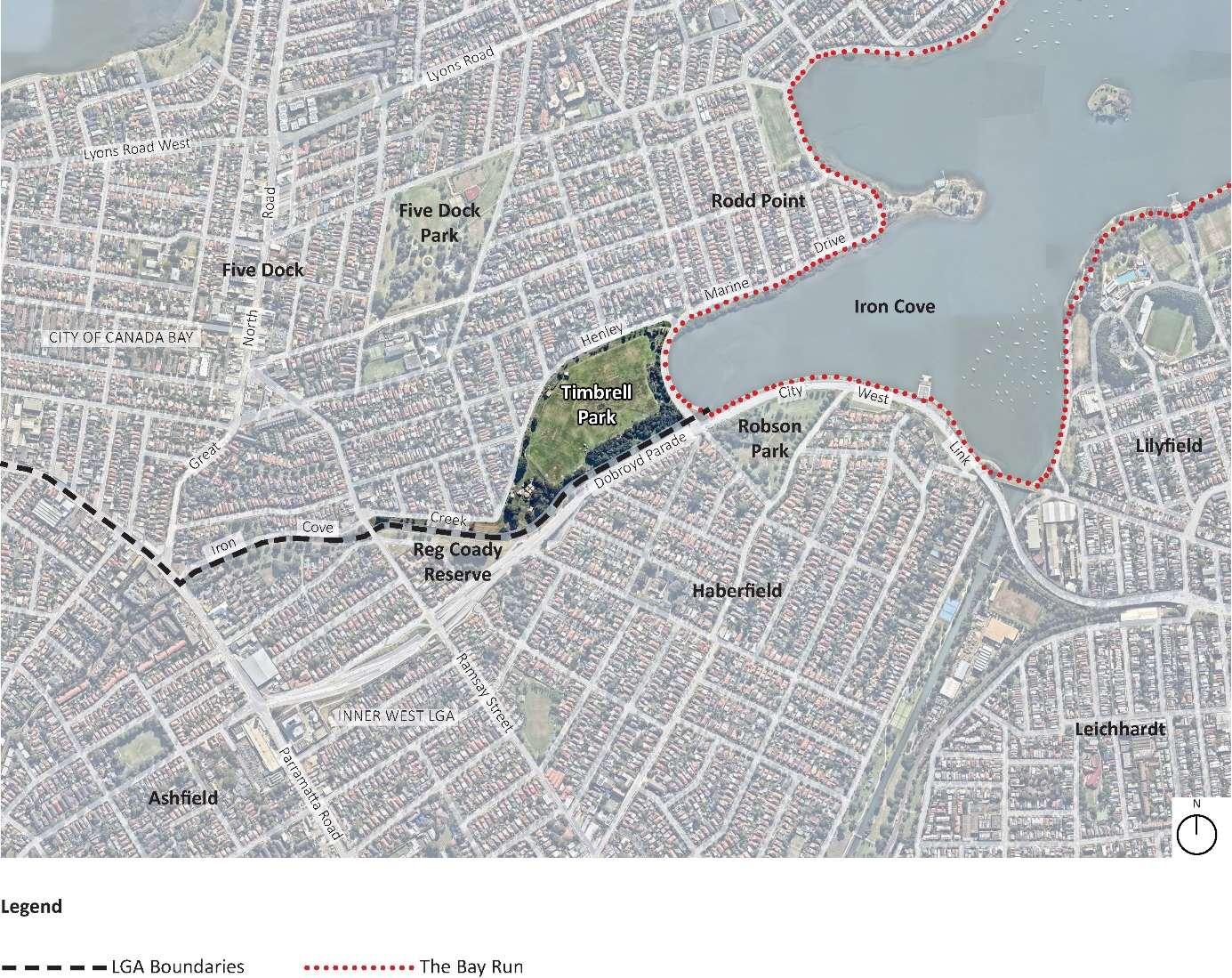
This Plan of Management applies to Timbrell Park in Five Dock, as shown in Figure 1.
This Plan of Management applies tothe community land of Timbrell Park contained within Reserve R.71318 managed by Council as the appointed CLM, Lot 1 DP 356799 owned by City of Canada Bay, androad reserve.
Key features of Timbrell Park are:
Livvi’s Place, an inclusive regional playground
Livvi’s Café
several multi-use district sportsgrounds used year round
barbecue and picnic facilities

dog off leasharea
trees and gardens
bushland
walking and cycling paths
BMX cycle track
a
1.3 Background to this Plan of Management
The first Plan of Management for Timbrell Park was prepared by Drummoyne Council in 1994.


Timbrell Park was then included in theCanada Bay Generic Plan of Management for community land which was adopted in 2007.
The gazettal of the Crown Land Management Act 2016 andthe subsequent changesto the management of Crownreserves requires local Councils which are the appointed Council Manager for aCrown Reserve, suchas TimbrellPark, to prepare a Plan of Management for that reserve as ifit were community land under the Local Government Act 1993.
As such this Plan of Management will replace the2007 Generic Plan of Management as it applies to Timbrell Parkwhen it is adopted by City ofCanada Bayand approved by the Minister.
1.4 Objectives of this Plan of Management
This Plan of Management and Masterplanwill provide a holistic framework for the ongoing management and use ofTimbrell Parkfor the next 10years. To achieve this aim, the following objectives of this plan are to:
comply withrelevant legislation, particularlythe Crown Land Management Act 2016, Native Title Act 1993, and the Local Government Act 1993
reflect the values and desired outcomes of engagement with the community, user groups, local residents, and other stakeholders
identify, consider and balance cultural heritage, environmental, open space and recreational values
include clear and achievable management actions which reflect Council’s strategic goals
provide a frameworkto guide the future use, management and improvement of Timbrell Park
identify priorities for theallocation of resourcestoinform future capital works and maintenanceprogramsconsistent with identifiedcommunity needs
include a Masterplantodirect future upgrade projects.
1.5 Process of preparing this Plan of Management
The process of preparing this Plan of Management, engagement with stakeholders and the community,and documents produced at each stage, are shownin Figure2.

Engagement with the community is an important part of the preparation of this Plan of Management. It gives everyone in the community the chance tohavean input into the planning process so Council has a better understanding of the range of values, issues and concerns, and desired improvementsto consider when preparingthePlan of Management. For more detail pleaserefer to theseparate Community and Stakeholder Engagement Report (Parkland Planners, 2020) which canbe viewed here.
The Crown Land Management Amendment (Plan of Management) Regulation 2021 exempts Council fromthe requirement tohold apublic hearing into the proposed categorisationof Crown land in accordance with Section 40(A) of the Local Government Act 1993
1.6 Requirements for contents of a Plan of Management
Requirements for aPlan of Management for community land, and for Crown land managed by a Council, areas provided by the Local Government Act 1993. These requirements and where they canbe foundin this Plan, are listed in Table 1.
Table 1
Contents of a Plan of Management for community land
Requirement of the Local Government Act
Adescriptionoftheconditionoftheland,andofanybuildingsorother improvementsonthelandasatthedateofadoptionofthePlanof Management
Adescriptionoftheuseofthelandandanysuchbuildingsorimprovementsas atthedateofadoptionofthePlanofManagement.
Categorisationofcommunityland
Coreobjectivesformanagementoftheland
Thepurposesforwhichtheland,andanysuchbuildingsorimprovements,will bepermittedtobeused.
Thepurposesforwhichanyfurtherdevelopmentofthelandwillbepermitted, whetherunderleaseorlicenceorotherwise.
Adescriptionofthescaleandintensityofanypermitteduseordevelopment.
Authorisationofleases,licencesorotherestatesovercommunityland.
Objectivesandperformancetargets.
Meansbywhichtheplan’sobjectivesandperformancetargetswillbe achieved.
Meansforassessingachievementofobjectivesandperformancetargets.
How this plan satisfies the Act
Section2
Section2, AppendixB
Section3
Section4
Section5
Section5
Section5
Section5
Section6
Section6
Section6
This Plan of Management has been preparedaccording to therequirements of the Crown Land Management Act 2016. A Plan of Managementwill satisfythe Crown Land Management Act 2016 ifthe points in Table 2areaddressed.
Table 2 Contents of a Plan of Management required bythe Crown Land ManagementAct 2016
A Planof Managementprepared bya Council crown land manager satisfies the Crown Land Management Act if:
Itisconsistentwiththepurposesthelandhasbeen reservedordedicated.
(Sections 3.13 and 2.12 of the Act)
Ithasbeenpreparedunderthe Local Government Act 1993 andisclassifiedcommunitylandthatis eitherdedicatedorreservedCrownland.
(Sections 3.32 (1)(b) and Section 3.23 (6)
PlansofManagementforthelandaretobeprepared andadoptedinaccordancewiththeprovisionsof Division2orPart2ofChapter6ofthe Local Government Act 1993
(Section 3.23 (7) (d)
IfthedraftPlanofManagementaltersthecategories assignedasprovidedbythissection,thecouncil managermustobtainthewrittenconsentofthe Ministertoadopttheplanifthere-categorisation wouldrequireanadditiontothepurposesforwhich thelandisdedicatedorreserved
Holdpublichearingundersection40Aofthe Local Government Act 1993
(Section 3.23 (7) (d)
How this plan satisfies the Act
ThisPlanhasbeenpreparedconsistentwith thepurpose(s)ofthereservesand dedications.
AllCrownlandthatthisPlanofManagement hasbeenpreparedforiseitherdedicatedor reservedCrownlandunderthemanagement ofCityofCanadaBayCouncil,oris communitylandunderthe Local Government Act 1993 andtherefore requiredtohaveaPlanofManagement.
ThisPlanhasbeenpreparedtosatisfythe requirementsofthe Local Government Act 1993
Noadditionalpurposesofreservedor dedicatedlandareproposed.
Exceptingwheretherelevantlandisexcludedland, thewrittenadviceofatleastoneCouncil’sNative TitleManagerthatitcomplieswithanyapplicable provisionsofthenativetitlelegislationhasbeen obtained.
(Section 8.7 (1) (d)
Councilmustcomplywithanyrequirementsofthe nativetitlelegislationinrelationtotheland
(Section 8.10)
The Crown Land Management Amendment (Plan of Management) Regulation 2021 exemptsCouncilfromtherequirementto holdapublichearingintotheproposed categorisationofCrownlandinaccordance withSection40(A)ofthe Local Government Act 1993
Councilhasreceivedtheadviceofanative titlemanagerthattheplancomplieswiththe Native Title Act 1993 (Cwth).
ThePlanofManagementhasbeen preparedtoensureanyimpactsonnative titlewillbeappropriatelyaddressedunder thefutureactprovisionsofthe Native Title Act 1993
CouncilshallmeetthenotificationrequirementsofSection24JBofthe Native Title Act 1993 inrelationtotheconstructionor establishmentofapublicworkpriorto furtherapproval.
2 Description Of Timbrell Park
2.1 Locational context
Timbrell Park is locatedin Five Dock, at the south-eastern border of Canada Bay local government area (LGA) with Inner West LGA.
Timbrell Park is adjoined by Timbrell Drive, the Bay Run andIron Coveto the east;Iron Cove CreekIron Cove Creek and DobroydParade/City West Link to the south; and Henley Marine Drive and residencesto the north-west.

2.2History
2.2.1Indigenoushistory
ThetraditionalownersoftheareaaretheWangalclanoftheDharugAboriginalpeople.City ofCanadaBayrecognisestheconnectionoftheWangaltoCountrythroughsignageat prominentlocationsinTimbrellPark.
ThelandcomprisingTimbrellParkwasonceawetlandsituatedattheheadofIronCreekat IronCove.DominicSteeleConsultingArchaeology(2020)identifiedthatthelandatIron CovehasrecognisednaturalvaluesandAboriginalculturalheritagesensitivityasan embaymentandcreeksystemformingpartofatraditionalAboriginalriverculturalheritage landscape.
HistoricalrecordsindicateIronCovewasanimportantlocationinAboriginalSydney geographyin1788,andanumberof(mostlikely)prehistoricAboriginalarchaeological heritagesitessurviveinthelocallandscape.


AsiteregisteredontheAboriginalHeritageInformationManagementSystem(AHIMS)on15 June2017assitenumber45-6-3322hasbeeninvestigatedbyCouncil.HeritageNSW recentlyadvisedCouncilthatsitenumber45-6-3322ontheAHIMSindicates“notasite”and thatdocumentationresultingfromtheinvestigationbyCouncilhasbeenaddedtothe electronicrecordintheAHIMS.CouncilhasadvisedAboriginalstakeholdersaccordingly.
2.2.2Historicalevents
AhistoryofTimbrellParkanditsuseisinAppendixA.

A portion of theeasternedge of the now Timbrell Parkwas a part of a480-acreCrownGrant to Nicholas Bayley on 9August 1803.
Since that time TimbrellPark has beenreclaimed from Iron Cove.
During WorldWar II four gun emplacements andpossibly a radar station were located in the park.
Inmorerecent yearsLivvi’s Place inclusive playground, Livvi’s Café andthe BMX track have expanded recreation opportunities available in thepark.
2.2.3 Cultural heritage
Timbrell Park adjoins theIron Cove Foreshore Drive comprising Timbrell Drive and Henley Marine Drive which has local heritage significance in theCanada BayLocal Environmental Plan 2013.
2.3 Land ownership, management and tenure
2.3.1 Ownership
Figure 4 shows theland parcels included in this Plan of Management. Property details for these land parcelsare listed in Table 3.
Figure4 Ownership of land in Timbrell Park

Timbrell Park is zoned RE1 Public Recreation inthe Canada Bay Local Environmental Plan 2013.
2.3.2 Native title and Aboriginal land claims
Table 4 shows thenative titlestatus of Lot 7010 DP 93651 (R.71318) at 14November 2019.
Table 4 Native title andAboriginal land claims
2.3.3 Management
Timbrell Park is managed by Cityof Canada Bay Council, which is responsible for:
development and management of Timbrell Park
managing leases, licences and otheruse agreements
liaising with user groups about wetweather arrangements, improvements to facilities
allocation ofresources (financial, human and physical) for park development and maintenance
liaising with authorities which have responsibilities relevant to developmentand management of infrastructureand services associated with the park, suchas Sydney Water.
Council is also responsible for review of this Planof Management when necessarytoenable changing circumstances and community needs tobe considered and incorporated.
2.3.4 Key stakeholders
Several organisations have a responsibility and/or an interest in Timbrell Park.
Table 5 Key stakeholders in Timbrell Park
Stakeholder Responsibility / interest in Timbrell Park
CityofCanadaBayCouncil Landowner Management
Assetmanagement
Communityandstakeholderengagement
Communitysafety Bookings
Maintenance Funding
MinisterforPlanningand PublicSpaces
DepartmentofPlanningand Environment–CrownLands
Landowner/manager
Useoftheparkaccordingtopublicpurpose
Nativetitleprovisions
LeasesoverCrownland
RoadsandMaritime Services Partlandowner
AboriginalHeritageOffice Aboriginalinterests
TouchedbyOlivia
Foundation/Variety
FriendsofLivvi’sPlaceFive Dock
Livvi’sPlaceinclusiveplaygroundandLivvi’sCafé StoryTimeteam
Keysportingusers Seasonalandcasualuseagreements
CanadaBayBicycleUser Group(BUG) Parkusers
Localresidents Neighbours Users
InnerWestCouncil AdjoiningCouncilacrossIronCoveCreek
Co-ownerofpedestrianbridgesacrossthecanallinkingTimbrellPark withHaberfield
SydneyWater
IronCoveCreekIronCoveCreek,naturalisationproject
NSWPolice Crimeprevention
2.3.5 Use agreements
Use agreements in place at Timbrell Park are in Table 6.
Table 6 Use agreements at Timbrell Park
Agreement Organisation Activity Land area Period of agreement Development approval Touchedby Olivia Socialenterprisecafé Employmentforpeople withdisabilities
Livvi’sCafé 5years17October2016 –16October2021 (currentlyinholdover)
Licence Various CommunitySport–SeasonalLicence By sportsground Consistentwith legislativerequirements
2.4 Physical description
2.4.1 Climate
The long-term temperature,rainfall and wind averages for Sydney Olympic Park1, the closest meteorological station to Timbrell Park near Sydney Harbour, shows:
a meanannual maximum temperature of 23.6oC, peaking at 28.4oC in January.
mean annual minimum temperatureof 13.9oC, with mean lowest temperatures below 10oC from June toAugust.
mean annual rainfall of912 mm, with highest average rainfall occurring inFebruary (110 mm) and lowest averagerainfall in September (53 mm).
the dominant winddirection at 3pm is east, south-east and south during the spring, summer and autumnmonths. Wind direction inwinter is predominantly from the south, west and north-west.
2.4.2 Geology, soils and topography
Geology
The underlying geologyof the land currently occupied by Timbrell Park is Quaternary Rh Hawkesbury Sandstone, HQ sedimentary with a high proportion of quartz (EcoLogical, 2019). Prior toreclamation and infilling unconsolidated sedimentsrepresenting alluvial environments interdigitated with estuarine saline swamps andsandy beach deposits (Dominic Steele Consulting Archaeology, 2020).
Soils
The majority of the footprint of Timbrell Park wasan embayment withan inter-tidal zone comprising sand, mudflats, mangroves and possibly saltmarsh wetlands. The land wasfilled from the 1920s as part of a broader program of sea-walling and embayment reclamation across Sydney Harbour (Dominic Steele Consulting Archaeology, 2020).The most common reclamationmethod wasto construct a sandstone sea wall and infill behind the barrier often with domestic garbage, industrial waste, and sediments from the floor of the adjacent bay. Due toreclamation and levelling to create the park in the early 20th century the soil landscape is described by Chapman and Murphy (1989) asDisturbed Terrain.
Dominic Steele Consulting Archaeology (2020) identified that Timbrell Park is surrounded by three natural soil landscapes which aredisturbed to varyingdegrees by urbanisation. These natural soil landscapeswere potential sources of sediment intoTimbrell Park inthe form of residual erodedsoils (Blacktown andGymeasoil landscapes) and alluvial sediments (Birrong soil landscape).
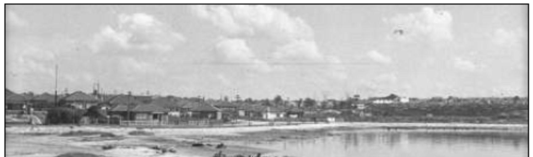
Reclamation works at Timbrell Park in the early 1940s are shown in Figure 5. The reclamationworks appear to havebeen completed by 1951.
The Canada Bay Local Environmental Plan 2013 Acid Sulfate Soils Mapshows that Timbrell Park has Class 2 acid sulfate soils.
EnvironmentalInvestigation Services (2010) found that contaminants in the soils at Timbrell Park are TPH(C10-C36) and PAHs (including total PAHs and benzo(a)pyrene). Elevated concentrations of lead are present across the site, encounteredin boreholes toa depth of0.5 to 2metres, which may extend across the site.
Sources:StateLibraryofNSW2019inDominicSteeleConsultingArchaeology(2020)
EnvironmentalInvestigationServices(2010)recommendedthatallfillmaterialencountered atthesiteshouldbetreatedascontaminatedunlesslaboratorytestingprovedotherwise. Exposuretocontaminatedfillisreducedbymaintainingagrasscoverovermostofthesite, andbymulchingexposedsoil.
Topography
TimbrellParkhasarelativelyflattopographydominatedbysportingfields,withminorslopes between1oand2o.Grassedbatters1.0to1.5metresinheightslopedownintothepark fromHenleyMarineDriveatslopesfrom3oto5o(EnvironmentalInvestigationServices, 2010).
Councilisproposingtolevelthesportingfieldsto0.75%toevenoutundulationsinthe surfaceofthesportingfieldsandtoimprovefielddrainage.
2.4.3Hydrologyanddrainage
Thefirst-ordertributaryofIronCoveCreekonthesouthernboundaryofTimbrellPark drainedintoIronCovebeforethecreekwasconfinedtoarelativelystraightconcrete-lined stormwatercanalpriorto1951.IronCoveCreekinturndrainsintotheParramattaRiver.
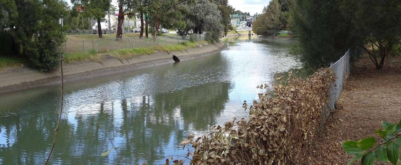

IronCoveCreekatTimbrellParkishighlytidalwithasignificantdifferencebetweenlowand hightidelevel.
Thereisanecdotalevidenceofpoordrainageofthesportsfieldswhichincreasestowardthe bikefacilityinthesouth-easternareaofthepark.
2.4.4Floraandfauna
Flora
VegetationpresentinTimbrellParkconsistsofplantednativeandexotictreesandshrubsin landscapedareas.ThereisnoremnantorsignificantvegetationwithinTimbrellPark.The CanadaBayBiodiversityFrameworkidentifiesTimbrellParkasaprioritysupportinghabitat (area6)withcriticalhabitat.
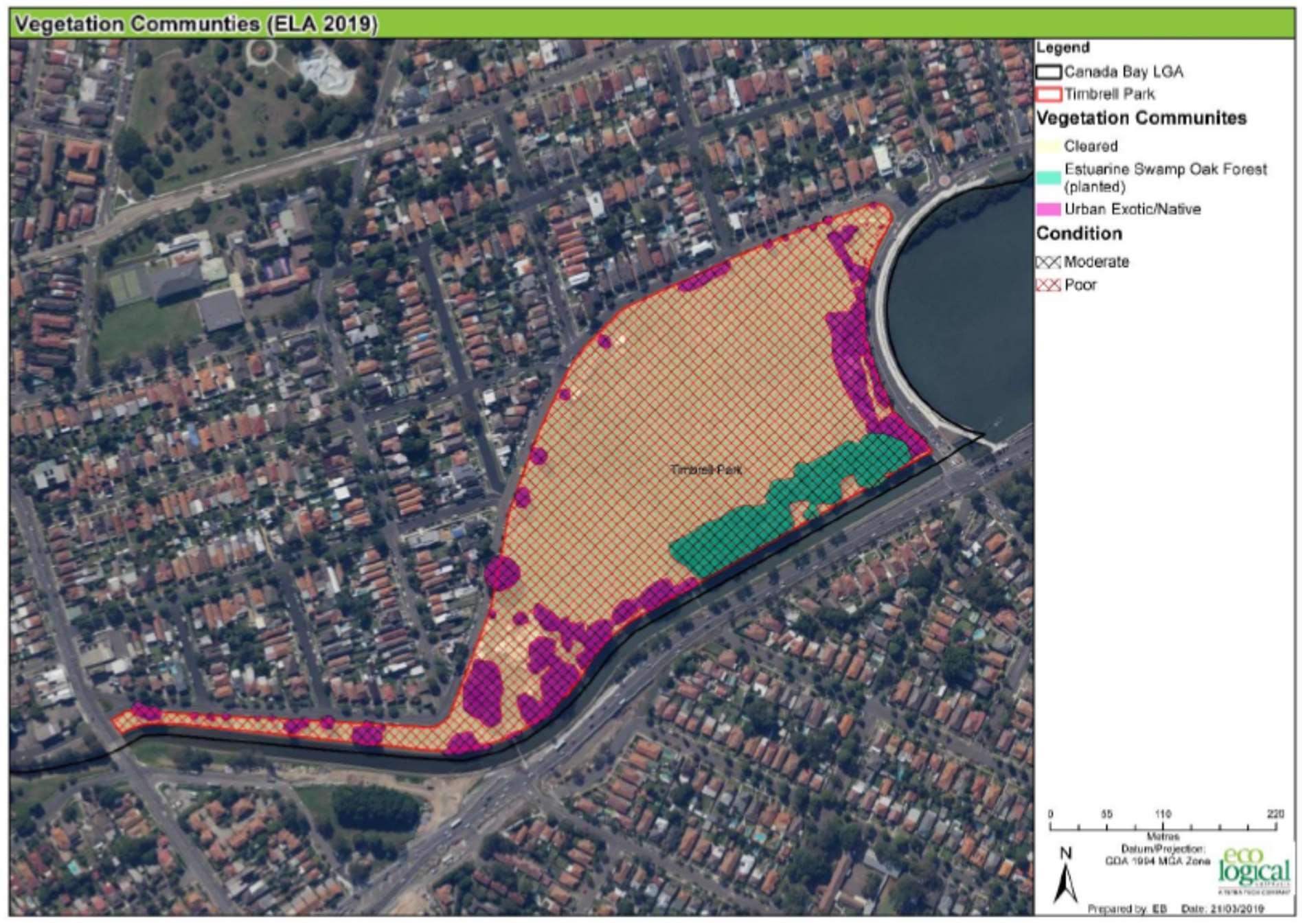
ThevegetationcommunitiesinTimbrellParkasshowninFigure6are:
Cleared–turfgrasswhichismownforsportingfieldsanddiamonds,andforinformal recreationuse
UrbanExotic/NativeasmappedbytheOfficeofEnvironmentandHeritage(2016)in poorcondition.
EstuarineSwampOakForest(planted)inmoderatecondition.Thiscommunityis established(15-25yearsold)plantingsofSwampShe-Oak,Paperbark,BrushBoxand Bangalay(Eucalyptusbotryoides).
Commented[BK1]:IwouldnoteherethattheCanada BiodiversityFrameworkidentifiesTimbrellParkasapriority supportinghabitat(area6)withcriticalhabitat.Theplanhas alsoidentifiedthefloodlightingasapotentialimpactforfauna intheareaandthereisavarietyofactionstoincreasetree canopyandunderstoryinthepark.Agreethereisnoremnant orsignificantbutwouldbegoodtoincludehere.
CurrentcanopycoverinTimbrellParkis19.5%.TheCanadaBayBiodiversityFramework identifiesactionstoincreasetreecanopyandunderstoryinthepark.Councilhasidentified additionalplantingintheparklandareatoachieveacanopycoverapproaching25%inthe parklandsections(notincludingthesportsfields)ofTimbrellPark.
Notable trees in TimbrellPark include the Fig withextensive rootsadjacenttothebaseball clubhouse.


The small clump of vegetation in themiddle of thesporting fields is Lomandra longifolia.
The proposed naturalisation of the canal will introduce saltmarshspecies to the park.
Fauna
Eco Logical Australia (2019) describes the fauna habitat onthe easternand southern sides of Timbrell Park as Supporting Habitat as shown in Figure 7.
Source: Eco Logical Australia (2019)
Insight Ecology (2014) conducted a terrestrial and aquatic avifaunasurvey at three locations in Timbrell Park in spring 2013 and autumn 2014. They foundthat birds inhabiting open parkland sitesare resilient native and introducedspecies adaptedtothe rigour of urban living including frequent disturbance by humansand dogs, andtight competition for resources from other birds and somemammals. Such species found within Timbrell Park in the survey include Australian WoodDuck, Welcome Swallow, Grey-headed Flying Fox, and domestic cats.

Isolated patches of mangrove forest along the south-westernforeshoreof Iron Cove provide important bird habitat area, withrecords of Bush Stone-curlew atIron Cove. A BioNet search in 2018 showed that threatened and migratory fauna species have been recorded in Timbrell Park (Eco Logical Australia, 2019).
Nest boxes targeting possums have been installed in trees inthe park.
Threatstobiodiversity inTimbrell Park arethe impacts of artificial lighting on microbatsand other nocturnal fauna, and loss of shrubs, understorey, rocks and logs in some parts ofthe park (Eco Logical Australia, 2019).
Eco Logical Australia (2019) identifiedwildlife corridor opportunitiesforTimbrell Park which include:
potential fauna/green bridges toconnect the two sides of thecanal
planting moretrees, shrubs and understorey in the riparian zone, and naturalisation of the canal edge

planting moretrees along Henley Marine Driveto provide habitat for birds and arboreal fauna
placing rockstructures and logs toincrease habitat, foodavailability and refuge for small birds, mammalsand reptiles.
2.4.5 Access, circulation and connectivity
Vehicle access
Accessto Timbrell Parkby vehicle is directly served by City West Link / Westconnex, Timbrell Drive, Henley Marine Drive,and by local roads.
There is no on sitecarparking. On-street parking is available in surrounding streets which can become an issue for local residents at peak sporting use times.

Accessible parking spaces are locatedoutsideLivvi’s Café.
Emergency vehicle access to the park is available off Henley Marine Drive west of the playground.
Pedestrian and cycle access andcirculation
Pedestrian and cycle access is available to Timbrell Park via TheBay Run and local streets.
The Iron Cove Creek and Dobroyd Parade/CityWest Link restrict pedestrian access to Timbrell Park from Haberfield tothe south. A small bridge acrossthe canal facilitates pedestrian access. Transport for NSW has proposed a pedestrianoverpass from Haberfield over the City West Linkto south of Livvi’s Place.
Public transport
Public bus routes link Timbrell Park with Ashfield railway station (directly) and Burwood railway station (indirectly). Other bus routes link the park with Five Dock,Leichhardt, Drummoyne andAbbotsford.
2.4.6 Visual
The park has an open quality which affords expansive views across the large portion of the park and thesportsfields toSydney Harbour.
The park hasview corridors to the eastover the tree line to the Sydney CBD and beyond. Residents north ofthepark onHenley Marine Drive have longviews across thesportsfields tothe south and west with the view terminated bythe woodlandrunning along the edge of the canal.
Views to the west across thesportsfields aretothe vegetated backdrop flanking the Iron Cove Creek canal.
There are closeviews from the mountain biketrail area to Iron CoveCreek and to the Parramatta River beyond.

2.4.7 Utilities and services
Utilities and services which are providedtoandthrough Timbrell Park areshown in Figure 9. A high pressure gas main in particular has implications for any works undertakenover the area. Locations of services may needtochange over time.
2.4.8 Condition of the land and built structures
Major structures in Timbrell Park are shown in Figure 10. The condition of land in the park and its structuresat the date of adoption of the Plan of Management is inAppendix B.
2.4.9 Proposed capital works projects
Timbrell Park is currently subject toseveral planned capital works projects and proposals including:
levelling and upgrading the playingfields
regional cycleway
The Living Room community space
widening and naturalisation of the stormwater canal by SydneyWater.
The Transport for NSW (TfNSW)Co-Designed Bicycle NetworkBlueprint includes a Tier 2 regional connectivity route along Iron Creek, with funding throughthe TfNSW Active Transport Program.
TfNSW is also proposing to construct anew pedestrian bridge connecting Timbrell Park south of Livvi’s Place with Reg Coady Reserve and Haberfield across Iron Cove Creek and Dobroyd Parade/City West Link. The existing bridge acrossthe canalin this location will remain.
Commented [PM2]: Pleasereference‘PlayingFields’ withoutreferencetospecificactivities

2.5 Park uses and activities
2.5.1 Organised active recreation
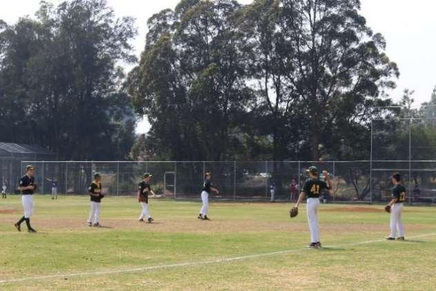
Timbrell Park is usedfor competition and training for organisedcommunitysport (including football, touchfootball, cricket, baseball) and school sport (field and diamond sports, and cross country).

2.5.2 Informal recreational activities
Timbrell Park is usedfor a wide rangeof informal recreation activities, making use of the space, facilities andsettings offeredby thepark.
Such activitiesinclude:
walking
running and jogging, including Pram Runners members
cycling, including using the BMX track,and the paths by BAYBUG members
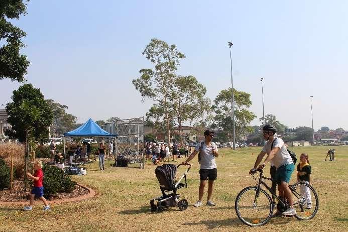
dog walking on leash, and off leash in thedesignated areafronting Henley Marine Drive tothe south. This area will be significantly reduced when the stormwater canal naturalisation occurs.
fitnessand exercising
children’s play, and barbecues and parties inthe playground
storytime in the playground on Mondays at 10am during school term
enjoying food and drinksat the café
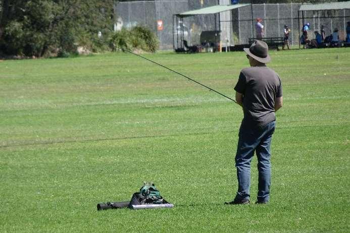
Sydney Fly Rodders Club – casting practicemonthly on Sunday mornings.
2.6 Maintenance and inspections
The mainmaintenance responsibilities of City ofCanada Bay, contractors and user groups associated with Timbrell Park are:
2.6.1 Council and contractors
Maintenanceis carried out according to Council’s Asset Management Plan, and includes:
mowing theplaying surface and other sportsfield maintenance
opening and closingthe public toilets
cleaning the public toilets
wastemanagement
clearing leaves
mulching thegarden beds on the park perimeterand at Livvi’s Place
initial line marking for field sports
removinggraffiti as required.
general maintenance and repairstobuildings, plumbing, locks, lights, fences etc. is carried out asrequired.
Playground repairs are undertaken monthly by staff members who are qualified playground inspectors. A quarterly audit of all playgroundassets isdone by an external qualified playground inspector.
2.6.2 User groups
User groups areresponsible for:
minor maintenance, including subsequent line-marking, spreading clay for baseball
informing Council of any maintenanceand repairrequirements
inspecting the sportsgrounds to ensure they are fit for purpose before each use.
2.7 Income and expenditure
Sources offunding for Timbrell Park arerate revenue, field hire fees, and grant funding.
Hire fees charged are listed in the ‘Schedule of Fees and Charges’ in Cityof Canada Bay’s annual Operational Plan.
Expenditure on Timbrell Park includes maintenance, renovation, andcapital improvements.

