
Independence, m I ssour I | 2013
Englewood Station Arts District Circulation Plan
The planning sustainable places program (psp) combined funds dedicated to the creating sustainable places demonstration projects and the Livable communities surface Transportation/ Bridge program awards to provide financial support to local governments. This funding will advance detailed local planning and project development activities that further the creation of VIBrAnT places that offer a mix of options for housing, jobs, services and recreation; connecTed places with a variety of transportation options; and Green places that support healthy living and a healthy natural environment. The projects’ goals will be consistent with those of creating sustainable places and the region’s long-range transportation plan, Transportation outlook 2040.
The grantees are located within the mArc metropolitan planning organization boundary and are either:
• Jurisdictions (cities, counties and states) and transportation agencies or
• nonprofit organizations, economic development organizations, public transportation/transit agencies, or community-based organizations partnered with a local jurisdiction sponsor
program details of psp’s history, process and funding can be found at http://www.marc.org/ sustainableplaces/psp.htm.


Independence, mI ssour I | 2013 929 Walnut, suite 700 Kansas city, missouri 64105 (816) 756-5690 office of economic development Independence city Hall 111 e maple Ave Independence, missouri 64050 (816) 325-7796 233 s .W. Greenwich drive, #127 Lee’s summit, missouri 64082 (816) 739-7916 Englewood Station Arts District Circulation Plan
STEERING COMMITTEE
mary Hunt city of Independence community dev. department
Ann smith-Tate city of Independence economic dev.
scott Green city of Independence public Works
Tammy parsons B-Vogue
russ Lawrence changing seasons
monte short property/Gallery owner
stacie short property/Gallery owner
cindy Foster Vivalore/property owner
Ann Kendall detour coffee shop
Bob spradling maywood Baptist church
scott cauger cauger properties
Becky meadows neighbor
cindy engleman neighbor
david raasch neighbor
Travis ritchey neighbor
marcie Gragg councilmember
execu TIV e summ A ry 02 01 | commun IT y V I s I on 06 02 | sIT e A n ALys I s 14 03 | d es IG n recommend ATI ons 30 04 | p HA sed pro G ress 56 Append I x A 64 T A bl E O f C ONTENTS
1 -- e n GL e W ood sTATI on A r T s d I s T r I c T cI rcu LATI on pLA n - Independence, mo
Executive Summary
In 2012, the city of Independence was awarded a grant to fund a planning sustainable places (psp) project called The englewood Arts district circulation plan (plan). steering committee members from the englewood Business Association (eBA) and city of Independence evaluated proposals from several design firms. The Vireo team was chosen to complete this study.
While the study boundary is limited to the core of the district (along Winner road, a half block north and south, from sterling Avenue to northern Avenue) it is important to remember the district extends beyond the study boundary, reaching into and mingling with surrounding neighborhoods.
The object of this plan is to provide eBA and Independence a strategy for drawing people to, and circulating people within, the district. To enhance business feasibility, this is first a plan for people. With people come cars, yet the cars should not be considered more relevant to building business than the people who drive them.
Therefore, the goal is not to focus on accommodating more through-traffic at higher speeds, but to slow the drivers down and encourage them leave their cars behind to spend time within a rich, eclectic, and inviting streetscape. Bringing people to the district will necessitate improvements to personal comfort through walking, biking, transit, and street crossing environments that slow vehicular traffic down, enhance safety, and create an outdoor
space where people want to be. Bringing more business will necessitate additional vehicle parking provisions and safe, visible, walking connections from neighborhoods with clear navigational guidance.
A rich public-participatory process is requisite for meeting the needs of all constituents within the plan area. The consultant team engaged the public on July 19th, during the month’s Third Friday Art Walk in englewood and obtained their votes for the most important improvements they seek in the district. Voting and comment results were compiled and brought into a two-day workshop with the plan’s steering committee in early August and presented as base information upon which to begin building the plan. Within the workshop, there were meetings on key topics, open design sessions and additional opportunities for public input at the end of each day where the day’s findings and progress were reported out. public input was sought at each report-out and cycled back into the workflow to assist in guiding the plan.
While having a plan that demonstrates design consensus among the constituent parties is essential, steps beyond consensus are needed to make the plan useful in kicking-off construction of the recommendations. The plan will also provide phasing and anticipated opinions of cost. It is expected that the plan will be used in concert with grant applications to garner funding for the improvements.
3 -- e n GL e W ood sTATI on A r T s d I s T r I c T cI rcu LATI on pLA n - Independence, mo
01
Community Vision
5 -- e n GL e W ood sTATI on A r T s d I s T r I c T cI rcu LATI on pLA n - Independence, mo
Community Vision
As the first suburban shopping district in Kansas city, englewood station Arts district has history to share. With ties to Walt disney and personal historic and arts memorabilia collections to boast, englewood is an eclectic treasure trove of inspiration and education waiting for the opportunity to draw patrons from all over the world. Homespun businesses with broad appeal are already in place and serving their local community. The district awaits implementation of a cohesive vision for their outdoor spaces; one that will draw and retain more visitors who will spend time and dollars within their storefronts, and create a draw for more businesses to fill the empty buildings.
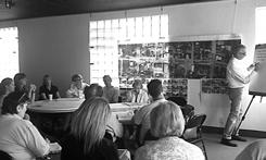
To establish a vision for englewood, the consultant team engaged the public and business owners for their view of what is working and what changes could occur. There were two components to this method of establishing a common vision: a public outreach effort during englewood’s Third Friday Art Walk, and a steering committee driven planning and design session during a two-day charrette workshop. Through enthusiastic participatory involvement, the public and steering committee brought forth common themes to establish a vision for englewood.

Showcase the rich history and artistic appeal of Englewood Station, build business and create spaces enhanced for lingering pedestrian patrons by: increasing safety; promoting history, art and education; reinvesting in the parkway infrastructure, small businesses and housing; and improving the social and environmental benefits of the streetscape.
Go AL s THAT emer G ed T o suppor T THI s VI s I on A re:
• support neighborhood identity and diversity through improvements to the public realm.
• engage the englewood community and business owners in the design process.
• design streets that emphasize safe and comfortable walking and biking.
• create new opportunities for reinvestment with area property owners.
• stimulate healthy choices through safer and more convenient walking environments, healthy food options, and environmentally friendly public projects.
• Bolster community arts, culture and education through partnerships and hands-on projects.
7 -- e n GL e W ood sTATI on A r T s d I s T r I c T cI rcu LATI on pLA n - Independence, mo
T H e V I s I on:
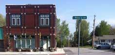

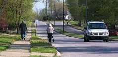
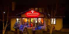
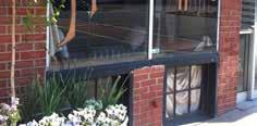
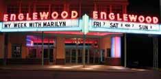
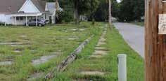
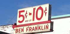
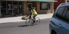
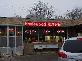
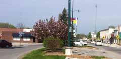
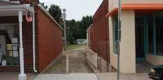
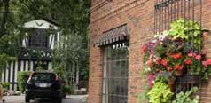
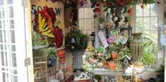

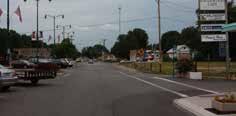
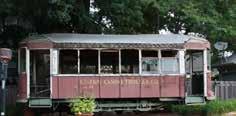
b EAUTY HISTORY OPPORTUNITY
P U bl IC E NGAGEMENT : T HIRD
fRIDAY A RT W A lk
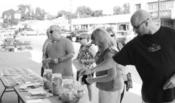
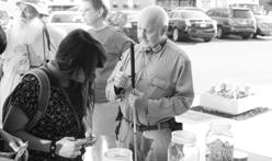
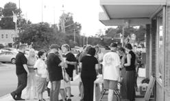
on July 19th, the consultant team set up camp on the new walk outside of englewood’s Boxcar Gallery during the month’s Third Friday Art Walk festivities. our purpose was to find the public pulse on potential streetscape improvements desired within the district. one hundred degree outdoor temps and un-shielded sun rays ramped up the heat of the concrete and brick environment, keeping many Art Walk patrons away until the sun began to set behind the buildings. Though participant numbers started small, as the ambient outdoor temperature decreased, the participant numbers increased. enthusiasm generously spilled from each person as they picked out amenities they want to see on the street where they stood. Before the team wrapped up the night, input was garnered from around 100 members of the public.
To poll the public on their highest priorities for englewood, the consultant team gave each voter $30 to “spend” on what they found most important to improve. They were given four categories of improvement types to choose from:
1. expanded Transit
• more transportation options
• Better access to transit stops
• depend less on cars in the neighborhood
2. Improved parking and roads
• more parking spaces
• easier access to events and businesses by car
• safer intersections
• Better road conditions
3. natural systems
• reduce flooding
• reduce energy costs
• reduce road and sewer costs
• reduce damage to streams
• recharge local groundwater
• Increase habitat for birds and butterflies
4. more people-friendly
• easier to stroll
• places to relax
• shade and benches provided
• easier to walk across the street
• places to park bicycles
• outdoor cafe spaces
9 -- e n GL e W ood sTATI on A r T s d I s T r I c T cI rcu LATI on pLA n - Independence, mo 2500 2000 1500 1000 500 0
$2370 $970 $680 $530
People-friendlyNaturalSystemsImprovedParking&RoadsExpandedTransit
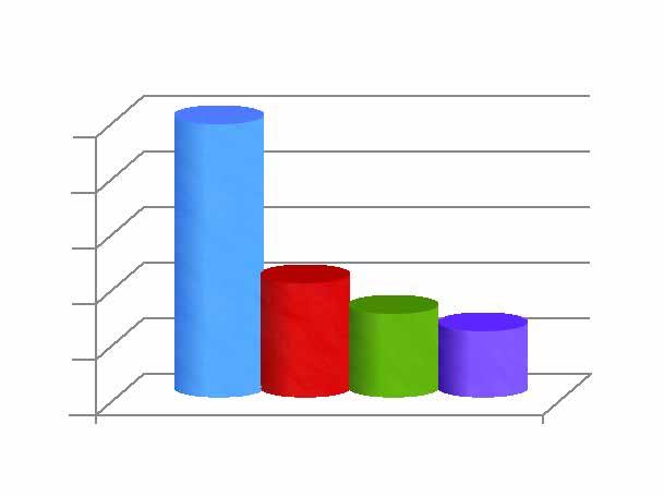
The results of the public polling area presented in the graph below.
Figure 1 | priority public spending
making englewood more “people-friendly” was the people’s choice (by more than double the vote of the next runner-up). This indicated there is a perceived lack of comfort making it less desirable than it could be to spend time in the Winner road streetscape.
The most common comments received during this public engagement process include:
• We want street trees, landscape and shade!
• reopen the Theater!
• slow the cars down – particularly at the crosswalks
• Add architectural character to the buildings
• create safer turns at the medians
• Get rid of the ugly street signs
• Turn vacant lot at Appleton Avenue and Winner road into green space. some of the ideas generated:
• community garden
• Farmer’s market
• outdoor park/theater
• dog park
• more public art
S TEERING C OMMITTEE AND PU bl IC E NGAGEMENT T WO - DAY C HARRETTE W OR k SHOP
steering committee members provided their own feedback in a two-day charrette workshop. overall, the public and steering committee’s perceptions of the current state of the district correlate with one another. A few additional emphases were added by the steering committee, which consisted of englewood business owners, neighbors, city
of Independence staff and an Independence city council member. Added priorities included:
• Accommodate bicyclists in the district (committee members echoed a similar public sentiment, and underscored it to give it a broader voice due to the number of cyclists in the area and the potential draw for business.)
• don’t lose parking at the building faces.
• Keep the parking in the center of the rightof-way - this is sacred to the historic charm of englewood where cars have parked in the center since the trolley lines were removed.
• ensure zoning, applicable codes and available programs are fitting well with current needs
• Fix stormwater problems.
• Bring in more businesses!
From these engagement processes, a complete street neighborhood vision takes shape; rich in architectural diversity and charm, with a cohesive corridor aesthetic that enhances visitor-ship and increases dollars spent in the district.
11 -- e n GL e W ood sTATI on A r T s d I s T r I c T cI rcu LATI on pLA n - Independence, mo
Site Analysis 02
WinnerRoad
13 -- e n GL e W ood sTATI on A r T s d I s T r I c T cI rcu LATI on pLA n - Independence, mo
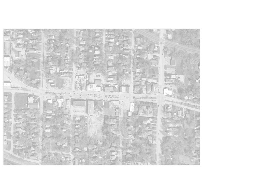
2 | proJecT AreA project Boundary 1 englewood Theater marquee
Ben Franklin 5 and 10 store 3 Green dog Art Gallery 4 englewood cafe 5 puppetry Arts Institute 6 englewood Theater 7 Boxcar Gallery 8 Home sweet Home Bakery and cafe 10921 1804 11200 1800 1734 10901 1847 1829 1837 0 1846 10628 10812 1607 10900 10923 1832 1814 1717 1830 1814 1710 1808 1632 1855 1706 1815 1813 1810 1701 1728 1810 1720 1720 1801 1716 1627 1620 1706 1704 1619 1825 1836 1634 10917 1704 1802 1817 1620 1821 1703 10801 1705 1836 1701 1710 1605 1702 1714 1826 1832 1830 1705 1714 10815 1700 1805 1809 1603 1808 1714 1840 1722 1614 11000 1822 1826 11100 11104 1703 1708 1801 1610 1844 10819 1616 1802 1817 1705 1618 10903 1834 1718 1733 11105 10702 1822 1828 1824 11211 1836 1846 1840 1844 1623 1700 1813 1827 1716 1711 1820 1837 1822 1829 1833 1839 1823 1817 11213 1821 1839 1825 1715 1822 1704 1702 1827 1701 1721 1712 1809 1830 1703 1828 1833 1707 1616 1719 1827 1818 1717 1610 1839 1612 1807 1619 1824 1826 1723 1824 1710 10710 1835 1625 1715 10815 1837 1710 11109 1615 1712 1826 1833 1717 1819 10817 1837 1831 1814 1625 1820 1714 1816 1704 10909 1819 1719 1829 1821 1707 1710 1825 1709 1825 1716 1700 1607 1704 1717 1617 10701 1811 1823 1625 1621 1631 1708 1623 1700 1629 1700 1843 1620 1827 1620 1702 1606 1833 1861 1618 1829 1831 1609 1833 10912 1607 1706 1611 10804 10808 10800 10812 10809 11112 1701 1622 10617 10716 10811 1701 11025 10912 11108 1831 11222 10821 11216 1608 1832 1830 1609 11022 1707 11112 1609 11224 10920 1707 1838 1725 1610 1866 1852 11224 1605 1808 1841 1829 1810 1615 1812 1814 1824 11014 10624 1855 1834 11026 10710 1842 1836 11018 11000 10718 11202 11204 1091010910 11228 1612 1614 1613 1601 10714 Sterling Avenue Harvard Street Harvard Street Harris Avenue Appleton Avenue Appleton Avenue Hedges Avenue Northern Blvd Northern Blvd 19th Street 18th Street Winner Road
Figure
2
1 2 3 4 5 6 7 8 NORTH
Site Analysis
HISTORY O f THE PRO j ECT AREA
englewood station Arts district is located along a four block stretch of Winner road between sterling Avenue and northern Avenue, within the limits of the city of Independence, missouri (see Figure 3, page 13). When englewood station was first developed in the late 1800’s, it began as a retail area, touted as the metro’s first suburban shopping district, catering to the passengers of the trolley link between the eastern edge of Kansas city and the western edge of Independence. The trolley brought Kansas citians to Willard Winner’s amusement park in the mount Washington area. Winner road was originally designated with a 100 foot right-of-way; wide enough to accommodate the trolley down the centerline.
Land was divided, residential neighborhoods began to develop and retail establishments grew throughout the early and mid-20th century. With the increasing availability of motor cars, the trolley line’s ridership declined enough by the 1940’s that the line was shut down, tracks removed and the space allocated to automobile parking.
englewood Theater was constructed in 1949 and by the late 1950’s, the district boasted more than 60 businesses that catered to the residents’ basic needs, including restaurants, hardware, barber, laundry, bakery, automobile filling and service stations, and an array of medical services.
In the 1970’s, englewood’s retail viability began to decline with the competition it found in new, larger suburban shopping centers in outlying areas. englewood Theater also felt the decline. In the late 1970’s it closed, then under new ownership, reopened for a time in the 1980’s as the Kc opry. The 80’s and 90’s saw further decline as more of the remaining long-term businesses closed their doors.
In the early 21st century, englewood has been embraced in its state of economic uncertainty by a
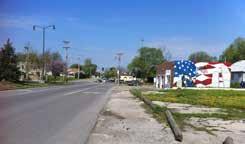
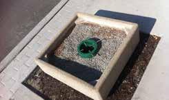
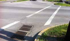
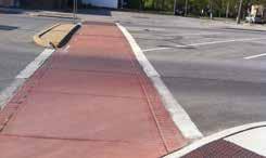
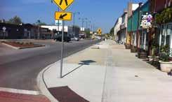 Figure 3 | Top photo: sidewalk installed in 2012. second photo: existing crosswalk. Third photo: unplanted tree pits. Fourth photo: only break in sidewalk between Van Horn High school and Independence square. Fifth photo: stormwater grate in crosswalk.
group of constituents willing to fight for a revitalized englewood station. While there are vacant buildings dotting the streetscape, several of englewood’s long-term businesses remain, continue to thrive and are now joined by new ventures that have taken up shop in the community. Business owner alliance has carried the eBA, originally formed in 1946, forward as an active collaborative entity for the district.
despite success during a short opening run, the englewood Theater closed its doors again in 2005. The Theater remains closed today due to needed renovations and the challenges of running a singlescreen movie theater.
new decorative street lights were installed within Winner road’s right-of-way as a joint effort between englewood, Independence and the missouri department of Transportation (modoT) in 2007.
on september 19, 2011, the eBA, Independence council for economic development (Iced) and the city of Independence successfully ushered englewood to an Independence city council-designated Arts district.
As an Arts district, englewood is now in a position to promote the artisan culture that has recently permeated retail establishments, and to celebrate a rich history and treasury of culture already hiding behind the brick building facades.
preliminary streetscape improvements on the north side of Winner road were completed in the fall of 2012, using missouri department of Transportation (modoT) Transportation enhancement Grant Funds. This $304,174 project widened the sidewalks to 17 feet, relocated a portion of the parking, and offered
increased Americans with disabilities Act (AdA) accessibility to business’ front doors and throughout the improved stretch of sidewalk. The most dynamic improvement to the streetscape is the new ability to host events with tents and tables along the walkway, facilitating arts and entertainment festivities indicative of the Arts district.
N EIGH b ORHOOD D EMOGRAPHICS
englewood station Arts district is located in the western portion of Independence, missouri in an area that experiences lower income and education levels than the rest of the city. population within a one mile radius of englewood has been declining steadily since 2000, and the housing market has seen a decline in owner occupancy by seven percent.
With streetscape rehabilitation and an injection of vitality in the local marketplace, it is important to be mindful of the surrounding neighborhood’s current spending capacity, and future changes to the local demographics. The goal: not to price the businesses’ products, housing and services out of the reach of current and future residents.
The figures on the following pages illustrate background data for the district including demographics, zoning, density of population, current stormwater infrastructure, and an analysis of the opportunities and current activity patterns that exist to guide design decisions.
15 -- e n GL e W ood sTATI on A r T s d I s T r I c T cI rcu LATI on pLA n - Independence, mo
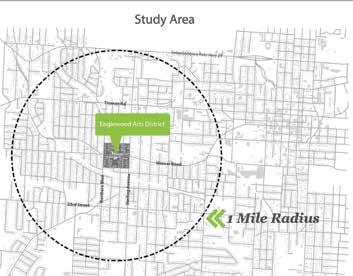
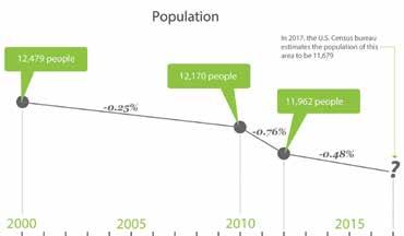
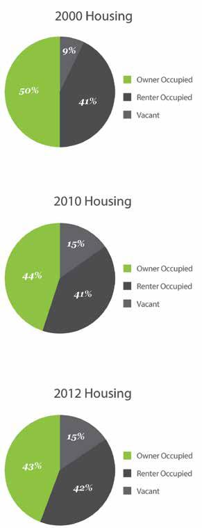
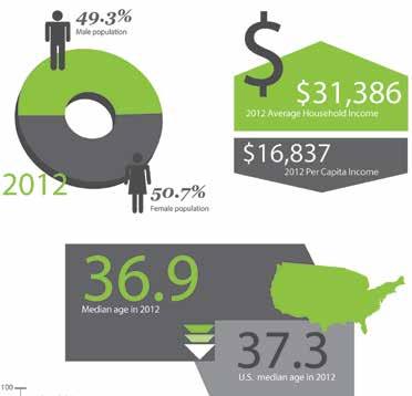 Figure 4 | since 2000, housing stock within a one mile radius of the study area has seen a 7% decline in owner occupied homes; more a result of increasing vacancy rates than an increase in rental units.
Figure 5 | demographics shown are according to 2012 figures and account for the population within a one-mile radius of the study area.
,
WinnerRoad
project Boundary
Building Footprints
Arts district
c-2 General commercial district
r-12 Two Family residential
r-18/pud moderate density residential/planned unit development overlay

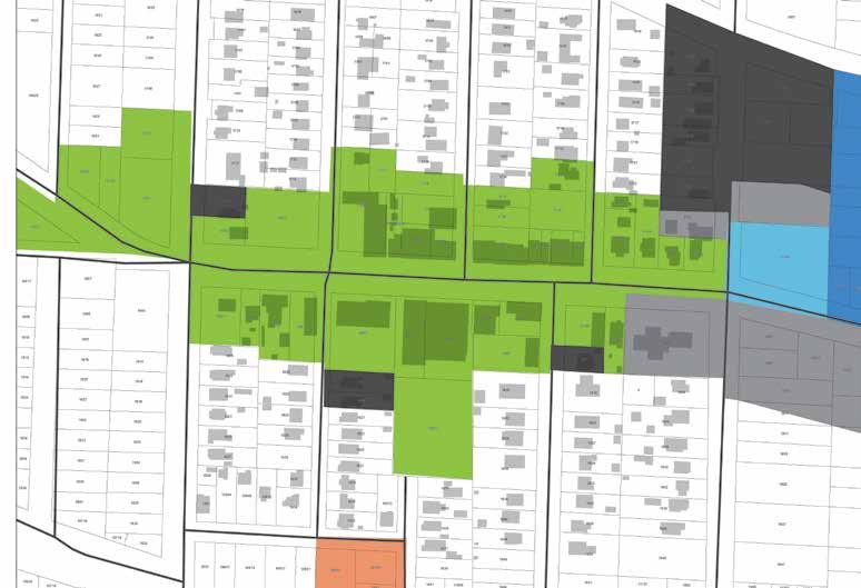
r-30/pud High density residenial/planned unit development overlay
r-6 single Family residential
17 -- e n GL e W ood sTATI on A r T s d I s T r I c T cI rcu LATI on pLA n - Independence, mo
Figure 6 | proJecT AreA ZonInG The majority of the study area is zoned Arts district and is surrounded by two-family residential and some general commercial lots.
Sterling Avenue
19th Street 18th Street
Harvard Street Harvard Street Harris Avenue Appleton Avenue Appleton Avenue Hedges Avenue Northern Blvd Northern Blvd
Winner Road
NORTH

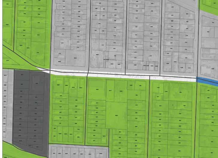
Sterling Avenue Harvard Street Harvard Street Harris Avenue Appleton Avenue Appleton Avenue Hedges Avenue Northern Blvd Northern Blvd 19th Street 18th Street Winner Road WinnerRoad 0-3 people/Acre 3-7 people/Acre 7-11 people/Acre 11-15 people/Acre
project Boundary NORTH
Figure 7 | proJecT AreA densITy The northern half of the study area is more densely populated than the southern half. All of the study area is more densely populated than the city of Independence as a whole which averages 2.3 people/acre.
WinnerRoad
project Boundary surface Water Flow direction

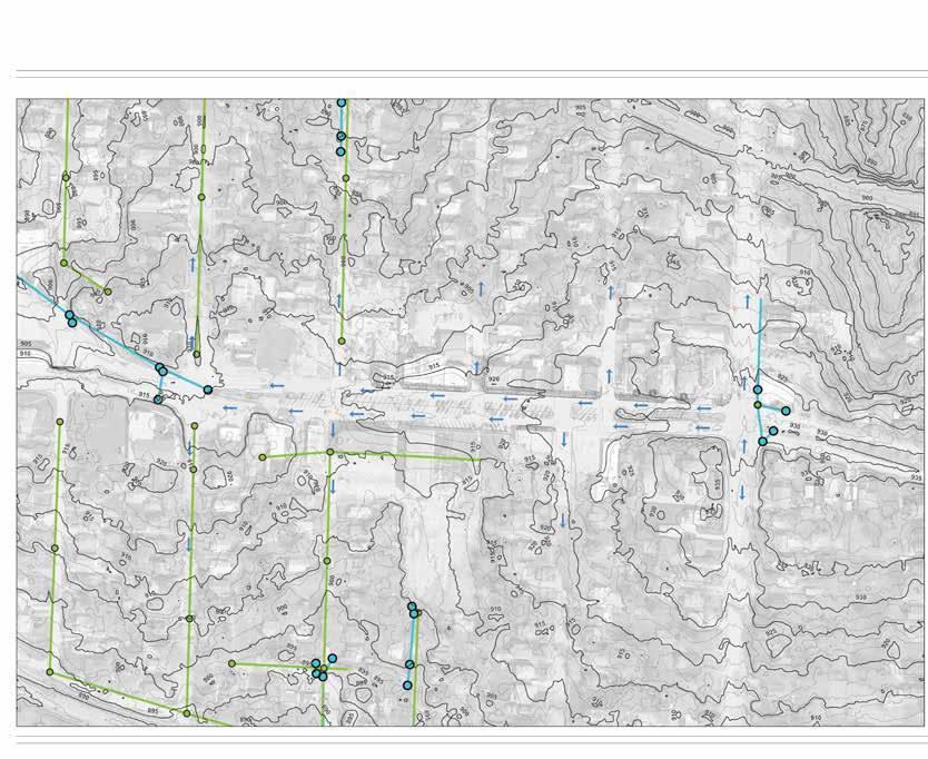
sanitary sewer pipe
stormwater sewer pipe
manhole drain Inlet
19 -- e n GL e W ood sTATI on A r T s d I s T r I c T cI rcu LATI on pLA n - Independence, mo
Sterling Avenue Harvard Street Harvard Street Harris Avenue Appleton Avenue Appleton Avenue Hedges Avenue Northern Blvd Northern Blvd 19th Street 18th Street Winner Road
Figure 8 | proJecT AreA WATer InFrAsTrucTure Winner road functions as a ridge within the watershed, channeling stormwater from east to west along Winner road that then breaks course to flow north or south at each road intersection. stormwater stays on the surface throughout the plan area except for water that reaches the inlet at the intersection of Winner road and northern Avenue on the far west end.
NORTH
WinnerRoad
Figure 9 | opporTunITIes significant opportunities exist within the district for environmental and cultural enhancements. details are included within the key.
project Boundary
existing off-street parking Area
Bicycle and pedestrian streetscape improvements.
existing bus stop with opportunity for improved safety and comfort.
previously-improved sidewalk section. potential for shade, architectural, bicycle and street furnishing improvements.
potential for sidewalk, shade, architectural, bicycle and street furnishing improvements.
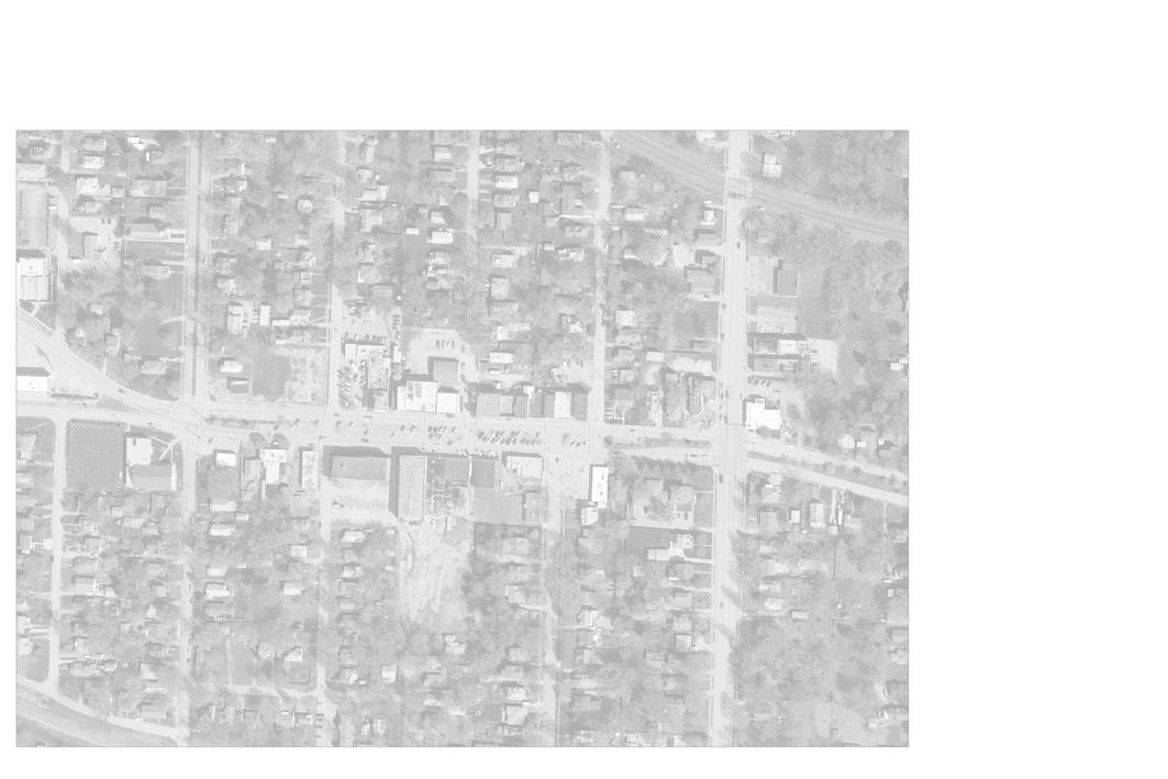
High intensity node for green infrastructure strategies based on cultural and social impact.
High intensity node for green infrastructure strategies based on water quality and quantity impact.
Five-way intersection with potential for improved traffic flow.
10921 1804 11200 1800 1734 10901 1847 1829 1837 0 1846 10628 10812 1607 10900 10923 1832 1814 1717 1830 1814 1710 1808 1855 1706 1815 1813 1810 1701 1728 1810 1720 1720 1801 1716 1627 1620 1706 1619 1825 1836 1634 10917 1704 1817 1620 1821 1703 10801 1705 1836 1701 1710 1605 1702 1714 1826 1832 1830 1705 1714 10815 1700 1805 1809 1603 1808 1714 1840 1722 1614 11000 1822 1826 11100 11104 1703 1708 1801 1610 1844 10819 1802 1817 1705 10903 1834 1718 1733 11105 10702 1822 1828 1824 11211 1836 1846 1840 1844 1623 1700 1813 1827 1716 1711 1820 1837 1822 1829 1833 1839 1823 1817 11213 1821 1839 1825 1715 1822 1704 1702 1827 1701 1721 1712 1809 1830 1703 1828 1833 1707 1616 1719 1827 1818 1717 1610 1839 1612 1807 1619 1824 1826 1723 1824 1710 10710 1835 1625 1715 10815 1837 1710 11109 1615 1712 1826 1833 1717 1819 10817 1837 1831 1814 1625 1820 1714 1816 1704 10909 1819 1719 1829 1821 1707 1710 1825 1709 1825 1716 1700 1607 1704 1717 1617 10701 1811 1823 1625 1621 1631 1708 1623 1700 1629 1700 1843 1620 1827 1620 1702 1606 1833 1861 1618 1829 1831 1609 1833 10912 1607 1706 1611 10804 10808 10800 10812 10809 11112 1701 1622 10617 10716 10811 1701 11025 10912 11108 1831 11222 10821 11216 1608 1832 1830 1609 11022 1707 11112 1609 10920 1707 1838 1725 1610 1866 1852 1605 1808 1841 1829 1810 1615 1812 1814 1824 11014 10624 1855 1834 11026 10710 1842 1836 11018 11000 10718 11202 11204 1091010910 1614 1613 1601 10714 Sterling Avenue Harvard Street Harvard Street Harris Avenue Appleton Avenue Appleton Avenue Hedges Avenue Northern Blvd Northern Blvd 19th Street 18th Street
Winner Road NORTH
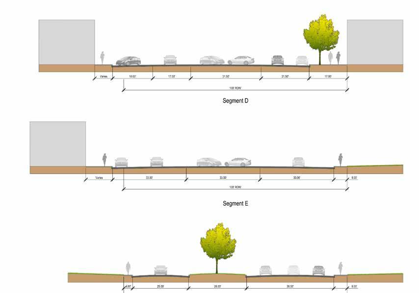
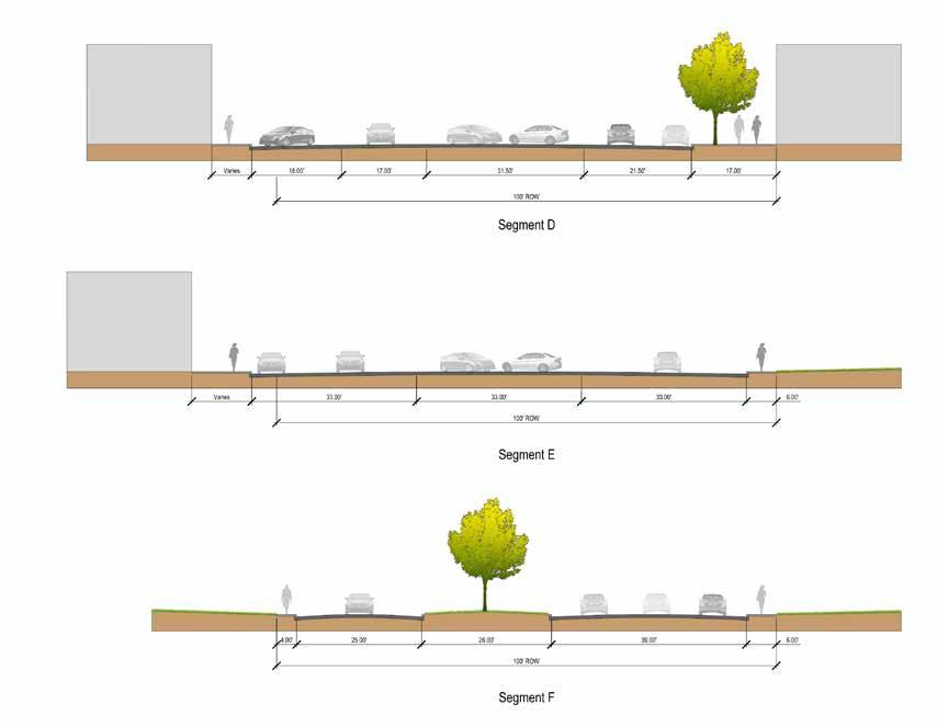
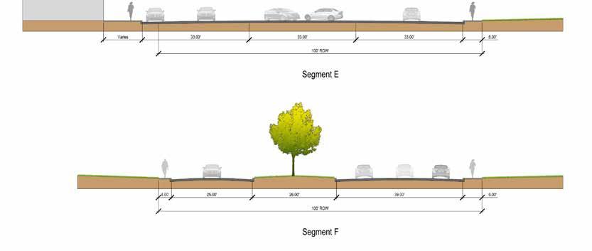
Segment D
Winner Road
Northern Avenue
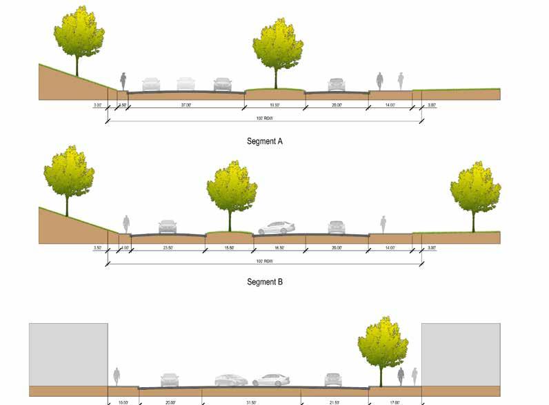
Segment A Looking West
Segment A
Segment B Looking West
Segment C Looking West
Segment B
Segment C
Segment C
Segment D
Segment D Looking West
Segment E Looking West
Segment F Looking West
Segment E
Segment F
Segment Sterling Avenue

Segment
NORTH
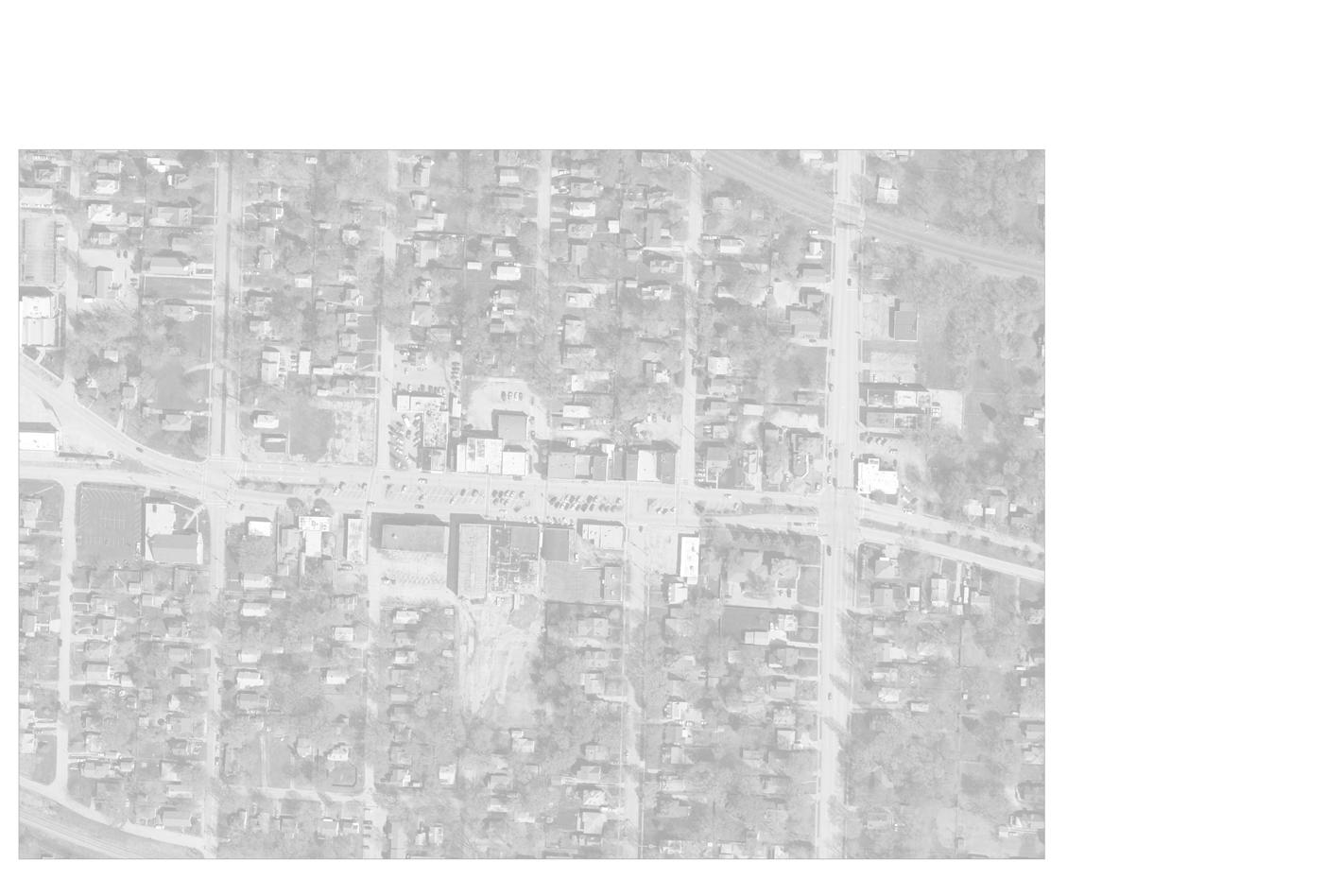
2 number of people observed entering store / restaurant / office observed path from parked car to Building entrance Bike and pedestrian observed path
10921 1804 11200 1800 1734 10901 1847 1829 1837 0 1846 10812 1607 10900 10923 1717 1830 1814 1710 1808 1855 1815 1813 1810 1701 1720 1716 1620 1706 1619 1825 1836 1634 10917 1817 1620 1821 1703 10801 1705 1701 1710 1605 1702 1714 1826 1832 1830 1705 1714 10815 1700 1809 1603 1808 1714 1840 1722 1614 11000 11100 11104 1703 1801 1610 10819 1802 1817 1705 10903 1834 1718 1733 11105 1822 1828 1824 1836 1846 1840 1844 1623 1700 1813 1827 1716 1711 1820 1837 1822 1829 1833 1839 1823 1817 1821 1825 1715 1822 1704 1702 1827 1701 1721 1712 1809 1830 1703 1828 1707 1616 1719 1818 1717 1610 1839 1612 1619 1824 1826 1723 1824 1710 10710 1835 1625 1715 10815 1837 1710 11109 1615 1712 1826 1833 1717 10817 1831 1814 1820 1714 1816 1704 10909 1819 1719 1821 1707 1710 1709 1825 1716 1700 1607 1704 1717 1811 1823 1625 1708 1700 1700 1827 1620 1702 1606 1833 1861 1618 1829 1831 1609 1833 10912 1607 1706 1611 10804 10808 10800 10812 10809 11112 1701 10811 1701 11025 10912 11108 1831 10821 1608 1832 1830 1609 11022 1707 11112 1609 10920 1707 1725 1610 1866 1852 1605 1841 1829 11014 1855 11026 1842 11018 11000 10718 11202 1091010910 1613 1601 1 BIKER 2 WALKERS CHANGING SEASONS VIVALORE CORK & BARREL PUPPETRY ARTS DINER SALON SALON SALON 2 BIKERS 6 WALKERS 2 BIKERS 7 WALKERS 1 WALKER RESTAURANT MARKET TANNING SALON ANTIQUE STORE POLICE STATION 23 4 7 8 5 32 3 6 2 40 1 9 2 13 4 3 2 1 WALKER 3 2 1 Sterling Avenue Harvard Street Harvard Street Harris Av enue Appleton Avenue Appleton Avenue Northern Blvd Northern Blvd 19th Street NORTH project Boundary
S UMMARY O f A NA l YSIS
englewood is a historic place with a lot to offer a wide cross-section of patrons. At this time, much of what englewood has to offer is currently either unavailable to the public or is hidden behind an environment that doesn’t reveal the true beauty of the district. englewood is a well-kept secret that is ready to be unveiled.
1. Improvements to circulation for those who walk, ride in wheelchairs, push strollers, bicycle, ride transit and drive vehicles are needed.
• Vehicular speeds must be slowed.
• Travel lane width must be consistent, clear and appropriate.
• unnecessary pavement to be removed. Winner road can undergo a road diet throughout the district, with narrower or, in some cases, completely removed lanes.
• parking in the center of Winner road’s right-of-way is historically significant and must remain here.
• safe, accessible walks must be completed along Winner road and provided in locations where they reach into the surrounding neighborhoods. They must connect people to the district from homes and auxillary parking areas.
• Auxillary parking areas to the rear of businesses are vital to growth in englewood. The lots are currently privately owned and in need of rehabilitation for safety, comfort and access.
• crosswalks must be clearly visible and cause vehicles to slow to allow pedestrian crossing.
• Vehicle to vehicle and vehicle to pedestrian conflicts at the 5-way intersection of Winner road and northern Avenue can be addressed with road and walk improvements.
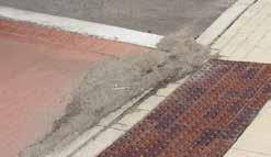
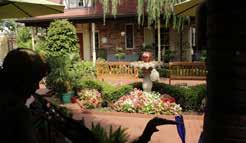
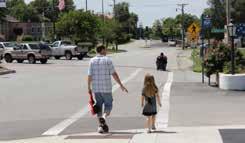
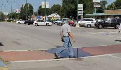
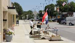 Figure 12 | Top photo: stormwater standing in crosswalk. second photo: storm flows deposit sand and silt in streetscape. Third photo: Wheelchair in street, father/ daughter using crosswalk at englewood cafe. Fourth photo: An example of respite in englewood. sun and shade areas both available to patrons of Vivalore.
opposing traffic on Winner road. second photo: Bikes bring employees to englewood even though no bike parking is available. Third photo: Buses stop here, but due to heat; riders don’t stand here. Fourth photo: unwarranted right turn lane at northern. Fifth photo: confusing 5-way intersection at northern.
2. Improvements to the streetscape must be made to create a microclimate of comfort for people. slowing people down and making them want to stay in the district longer is a key to boosting business.
• Increasing vegetated surface area will decrease the heat island effect the district currently experiences.
• Adding tree wells with (appropriately chosen) shade trees will protect visitors from heat and the sun’s rays, and provide a comfortable, vertical separation from moving street traffic.
• Inserting benches, seat walls, cafe tables and other furnishings will convey to visitors they are welcome to spend more time in the district.
• Transit stops need shade and benches.
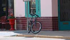
• encouraging public art installations will add character to the district, giving visitors visual variety and lending culture to the space.
• street signage, business signage, light fixtures, ash butlers, trash receptacles, recycling containers, transit stop shelters, benches and other commonspace furnishings should reflect a consistent, recognizable image that is attractive and complementary in design for an Arts district.
3. stormwater flows deposit sand and debris at the front of businesses. Flows that turn north or south onto the cross streets concentrate, speed up and are directed into private property. erosion and flooding occur as a result.
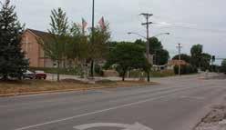
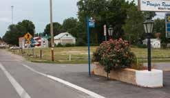
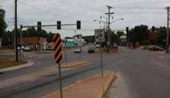
• Green infrastructure methods of slowing, cleaning and infiltrating storm flows will fit well with the existing infrastructure, minimizing the cost of installation vs. conventional storm sewer systems.
• Grade changes created during street and sidewalk improvements should eliminate puddling areas and direct sand and sediment to infiltration basins along the streetscape.
• Green infrastructure improves site aesthetics.
25 -- e n GL e W ood sTATI on A r T s d I s T r I c T cI rcu LATI on pLA n - Independence, mo
Figure 13 | Top photo: Bicyclist
4. examine regulations put in place that may be impeding beautification and development efforts in the district.
• The creation of an architectural review committee may be beneficial for carrying proposed policy variations to the city for consideration.
• The city may consider the request of district business/property owners to rescind the liability of property owners for sidewalk repair within the city’s right-of-way. Holding property owners liable for the deterioration of city property can be detrimental to economic development in the district.
5. englewood is comprised of a set of constituents (residents, business owners, property owners, members of the englewood Business Association) who are actively involved in the promotion and improvement of the district.
• Future design and planning processes should incorporate the established consensus and continued input from this group.
• discussions are underway within this group to form a non-profit 501(c)3 entity to reopen and run the englewood Theater.
• consideration is also being given to forming a community Improvement district (cId) for the area to generate funds to complete on-going maintenance and renovations.
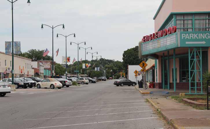
Figure 14 | englewood Theater is a treasure for the district. With its doors closed, the district is missing out on the regional traffic this historic place is capable of drawing. There is much support from the public and effort by the business owners to get this gem reopened.
27 -- e n GL e W ood sTATI on A r T s d I s T r I c T cI rcu LATI on pLA n - Independence, mo
03 Design Recommendations
29 -- e n GL e W ood sTATI on A r T s d I s T r I c T cI rcu LATI on pLA n - Independence, mo
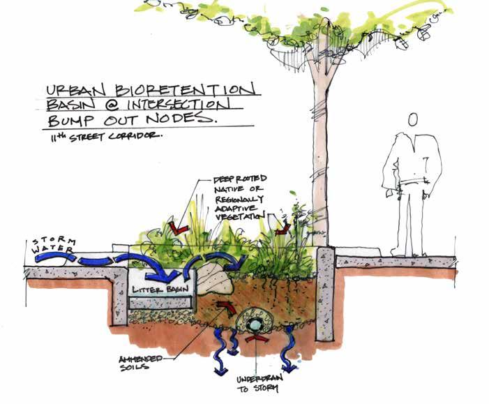
Figure 15 | This sketch of a green infrastructure solution shows how a bioswale planted with native plants can collect stormwater from the street and infiltrate it to the ground below.
Design Recommendations
Four primary categories emerged for design strategies as input from stakeholder meetings was combined with site analysis:
1. Improved Winner road lane and parking configurations
2. Better site accommodations for people
3. remodeled stormwater management
4. refined and rejuvenated linkages between the district and neighborhoods
The project team synthesized all stakeholder feedback and site analysis information about englewood station Arts district and identified key locations to implement new design options. The following pages show overall strategies for the area and how key locations would look if these design options were applied. each location has the potential to layer multiple strategies and meet all of the established community goals.
Ex P l ANATION O f TERMS
some of the design strategies use terminology that requires some explanation for clarity of purpose. Following are a few definitions for terms that will be commonly used in describing the design strategies:
Complete street: a street and sidewalk design that includes all modes of transportation and gives priority to the most vulnerable modes, pedestrians and bicyclists, through traffic calming and lane widths conducive to crossing.
Green infrastructure solutions: strategies which include capturing stormwater through native landscaping and beds that channel stormwater flow through a series of stages that slow and filter
the water of impurities before it is absorbed into the ground. These strategies allow less stormwater to enter storm drains or sewers and therefore reduce the strain on the city’s existing stormwater system. Further, these systems reduce flooding and erosion in adjacent neighborhoods.
Pervious surfaces: surfaces that allow water to flow or soak through the material and into the ground or a retaining area.
Infiltration Basin: an area of native plantings designed in such a way that stormwater flow is directed into vegetated areas. The plants selected for these basins serve the function of cleaning the stormwater of pollutants as they slow the water and allow it to infiltrate into the ground.
Right-of-way: city owned land on which roadway, curb, gutters and walks are constructed.
Sharrows: painted designations on streets that require drivers to share the road with bicyclists but do not provide separated bike lanes.
Sight Triangles: A triangle at an intersection, formed by the two roads or rights-of-way and a third line, which must be kept clear of obstructions such as hedges so that people on one road can see cars approaching on the other.
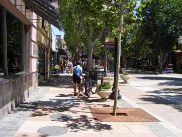
Figure 16 | As a complete street example, historic murphy Avenue in sunnyvale, california is designed for safe and enjoyable bicycle and pedestrian transportation.
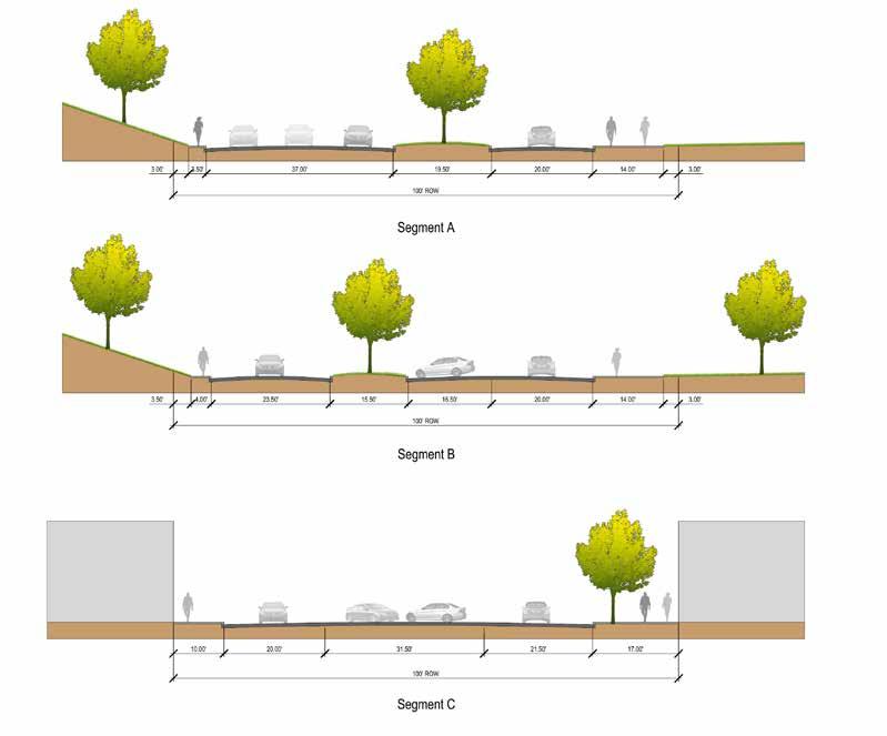
Figure 18 illustrates existing and proposed Winner road cross sections. The top section shows a typical existing condition of the six types currently present. (To see all six types, please refer back to Figure 11.) This cross section sufficiently represents the current condition of the majority of the 1/4 mile stretch Winner road.
It shows that Winner road is typically very wide and includes parking in both directions in the center of the street. Although it only has two designated driving lanes, the lanes are wide enough for four lanes of traffic which often tempts drivers to pass others who are driving the speed limit. The streetscape has a narrow walk on the south side, a newly widened sidewalk on the north side and no bicycle travel designation.
P ROPOSED DESIGN
Key design approaches employed to meet the goals of the district include:
• decreasing travel lane widths to impose a sense of being squeezed, which in turn causes a driver to slow down.
• reducing the length of pedestrian crossing distances to create safer crossings.
• Increasing sidewalk width on the south side of Winner road to provide safe travel and amenity zones for pedestrians.
• Boosting safety at intersections by limiting obstructions in sight triangles.
• reducing the land area of impervious surfaces and replacing them with pervious surfaces that absorb rainfall.

• Adding trees and other vegetation to create a more comfortable climate and soften the hardscape.
• Installing planter/infiltration basins to treat the stormwater.
• Adding bicycle accommodations like sharrows and bike parking.
31 -- e n GL e W ood sTATI on A r T s d I s T r I c T cI rcu LATI on pLA n - Independence, mo
Figure 17 | These photos from Kansas city, mo (top) and Greensburg, Ks (bottom) show how green infrastructure solutions can be incorporated into the amenity zone of the street right-of-way.
The proposed cross section widens the sidewalk on the south side of Winner road and reduces the travel lanes from 20-22 feet wide to 14 feet wide, which accommodates a large fire truck, yet doesn’t resemble two lanes of available pavement to smaller vehicles. Fourteen feet is a generous width designed to accommodate the backing out of parked vehicles from the median, and shared lane use of car and bicycle traffic. Though 14 feet is considered generous, it is still narrow enough


to create that feeling of being squeezed that is necessary for slowing vehicles.
At the posted 20 mpH speed limit, bicycles are capable of keeping up with vehicular traffic, therefore bicycles and cars can safely share the road. This allows reduced pavement widths which will assist in slowing traffic and calls for the provision of sharrows within traffic lanes.
1 1 2 2 2 3 3 2 4 4 3 5 1 1
proposed design section | 1. sidewalk 2. Amenity zone 3. shared-use lane 4. 45 degree angle parking 5. Green median
existing road section | 1. sidewalk 2. drive lane 3. 60 degree angle parking
Figure 18 | streetscape design sections
To create a greener streetscape that handles stormwater better and provides needed shade, the center parking is rotated from the current 60 degree angle parking to 45 degree parking which takes up less right-of-way width. This, in concert with travel lane width reduction, allows a green median generous enough to support shade trees and other lower-maintenance landscape.
Additional landscape is provided within the amenity zone of sidewalks and is put to work filtering and infiltrating stormwater, supplying shade and building energy savings, reducing pollution, and providing a backdrop for public art.
With the new streetscape arrangement, all parallel and angled parking at the business fronts (right side of the drive aisles) are removed to make room for pedestrians and to create a consistent drive aisle width throughout the corridor.
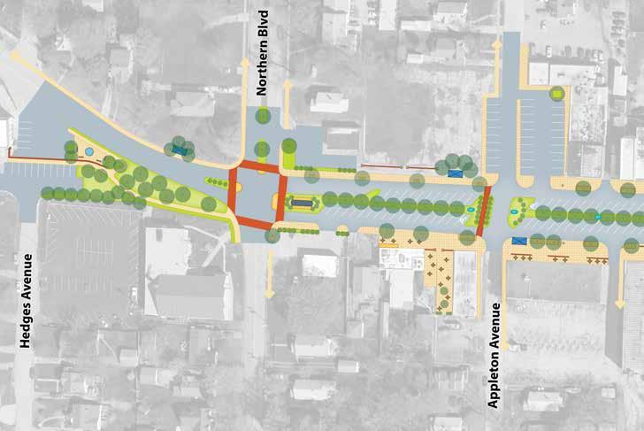
While the drive aisle and parking location will remain constant through the corridor, the pedestrian zone will see some fluctuation in widths between buildings. This is due to variations in depth from the edge of the right-of-way to the face of the buildings, particularly on the south side of Winner road. This variation will produce pockets of interest and supply space for additional pedestrian zone amenities such as patios for cafe spaces
33 -- e n GL e W ood sTATI on A r T s d I s T r I c T cI rcu LATI on pLA n - Independence, mo
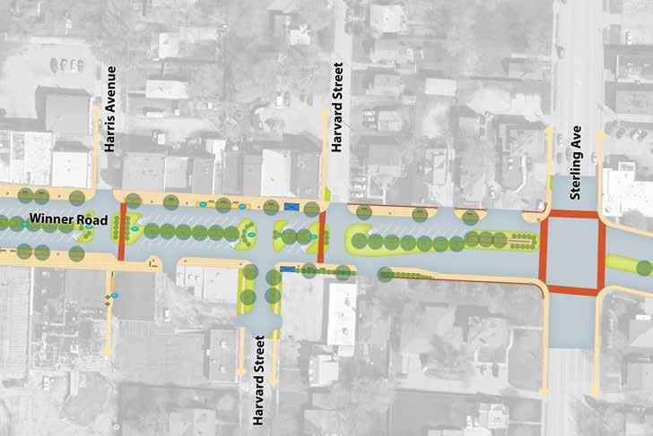
Figure 19 | plan view of proposed streetscape design
and park-like bench seating areas. In all building setback locations there will be a minimum of 10 feet between the curb face and building face which is ample for pedestrian movement.
S IGHT T RIANG l ES
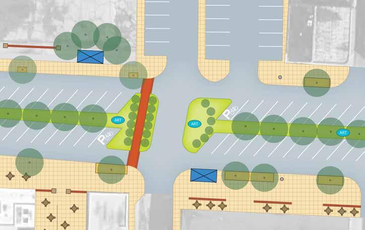
At the intersections of Harvard, Harris and Appleton, sight triangle obstructions are prevented by designating the first parking stall in each triangle as bicycle parking (Figure 20). This also gives bicycling patrons a clear, safe and equal parking opportunity. The remainder of site triangle conflicts are reduced by designating the second, third and fourth parking stalls as compact car parking only.
clear sight triangles do not mean unplanted medians, they simply mean median spaces within the designated sight triangles must not be obstructed by anything (plant or non-plant) that is greater than 36 inches in height. clearing sight triangles like this will boost turn safety, reducing accidents in the district.
N ORTHERN A VENUE AND W INNER R OAD I NTERSECTION
The design team was asked to look at circulation options for the intersection at Winner road and northern Avenue. Winner and northern’s 5-legged intersection can be a source of confusion for many
NORTH
Winner Road
drivers, particularly those who are not familiar with the area.
Winner road’s west bound lanes split into a north turning lane, a center lane and a south turning lane. This configuration dates back to when there existed an elementary school in the current post office location on northern. since the school is no longer there, the traffic volume has diminished, making the north-bound turning lane unnecessary. streetscape improvements will capitalize on the removal of this lane and reconfiguring for pedestrian enhancements, including sidewalk which does not currently exist here.
Further, the peak traffic volumes turning southbound on northern Avenue from west-bound Winner road, suggest the left turn lane’s length is currently overexaggerated. shortening this lane provides more room for green median and potential parking.
All lane widths around this intersection or overly wide suggesting the streetscape would benefit from a road diet, narrowing lanes and giving more prominence to the pedestrian zone and green space.
18th Street
Traffic counts completed for this study suggest 10% of traffic through this intersection uses 18th street (the fifth leg).
due to the awkward nature of the intersection, the small volume of traffic using 18th, and that the low traffic volume can be accommodated on Hedges and ralston Avenues, the team looked at two improvement options that involve closing access to and from 18th street.
Intersection Configuration Option One
The first option keeps traffic signals and modifies the layout as shown in Figure 21. These modifications allow safer pedestrian crossings and
35 -- e n GL e W ood sTATI on A r T s d I s T r I c T cI rcu LATI on pLA n - Independence, mo
sight Triangle
sight Triangle
Figure 20 | plan view of Appleton Avenue and Winner road center turn sight triangles
NORTH
Appleton Avenue
WinnerRoad
This design keeps the same vehicle Level of service (Los) rating of “B” (on a scale of A to F, with A being best) that the intersection currently enjoys. peak traffic delays at today’s traffic level are estimated to be an average of 12.5 seconds per vehicle. In 20 years, this same intersection will have higher rates of traffic, but will continue to provide “B” Los with an estimated average of 13.4 seconds per vehicle. (see Appendix A: Transportation conditions Analysis memorandum for additional information.)
Intersection Configuration Option Two
When this study began, there was a good deal of buzz in the district about a proposed round-a-bout. The excitement spurred the team to look at a round-a-bout as a design option for the intersection (Figure 22). The team found that removing traffic signals and bringing all traffic in and out of the
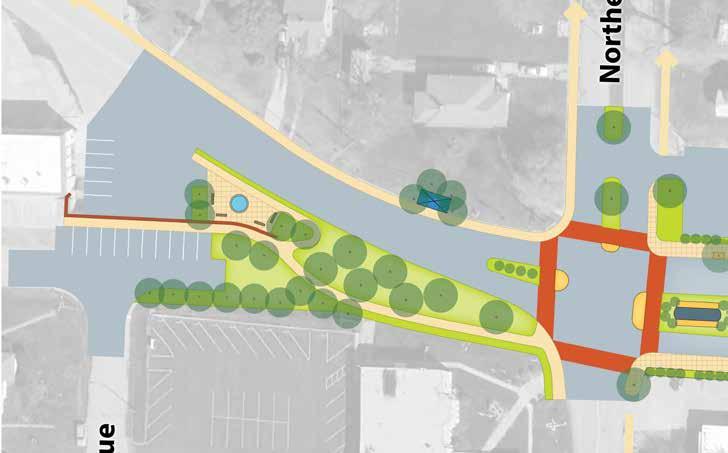
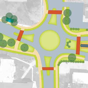 Figure 21 | option one Winner road and northern Avenue intersection design, depicting the closing of 18th street access.
new sidewalks on the south side of Winner road, west of northern.
|
NORTH NORTH
Figure 22
option Two round-a-bout
design
Northern Avenue
intersection with a single lane width roadway improved the Los for the intersection to an “A” rating. current and future delay measurements shift to 5.25 seconds and 6.4, respectively.
In addition to reducing traffic delays, a roundabout would aid in:
• Slowing vehicles as they enter the District. stoplights add to a driver’s perception of losing time which encourages them to speed away at a green signal. round-abouts keep drivers moving, leaving delays (and the perception of delays) behind.
• Clears the air of traffic signal arms. The steering committee expressed interest in emptying the overhead clutter near this intersection.
• Reduces lane width at crosswalks, increasing pedestrian safety.
• Promotes a green gateway experience, which is important to the members of the steering committee.
The round-a-bout can accommodate large truck traffic, a primary concern of business owners in the district. Additional details are provided in Appendix A.
S TER l ING A VENUE AND W INNER R OAD I NTERSECTION
Because of the higher volumes of traffic which flow through the sterling Avenue intersection with Winner road, turn lanes are appropriate as provided. The proposed design does suggest narrowing lanes to reduce speeds.
G ATEWAY O PPORTUNITIES
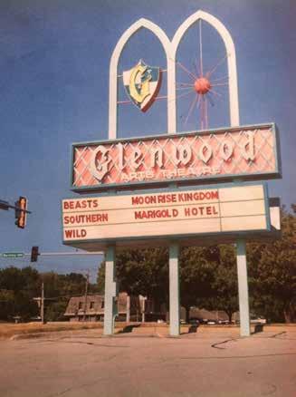
northern and sterling Avenues frame the district’s core retail area and provide excellent gateway opportunities. The steering committee agreed on appropriate gateway monuments for each intersection. one business owner in the district is willing to donate the historic Glenwood Theater
neon sign for use as the sterling Avenue gateway monument (see Figure 25). The steering committee has approved it’s use and location here (contingent upon the closing of the Glenwood Theater), with reconfiguring of the sign’s “Glenwood” letters to read “englewood”.
Another business owner within the district is in possession of a turn-of-the-20th-century trolley car that is of the same era that was used on the line in Winner’s median when englewood first came to be (see Figure 26). The steering committee is in agreement that this trolley should be restored and placed within the median near the northern Avenue intersection, forming the western gateway to the district.
P AR k ING AND CIRCU l ATION STUDY
W I nne R R O a D S TR ee TSC a P e Pa R k I n G
In its current (2013) configuration, the Winner road streetscape provides approximately 122 parking stalls at the front of businesses. proposed streetscape design alterations reconfigure the parking from the existing 60 degree angle to 45 degrees and narrow the stalls to the city of Independence’s minimum width of 8.5 feet. The new configuration makes room for pedestrians, green infrastructure and artwork, and still provides 115 stalls in the streetscape. To correct site triangle safety impedances that come with placing parking in the median, 8 of those stalls should be designated for bicycle parking, and 22 more should be limited to compact car parking. (see Figure 23)
As the district continues to redevelop, the eBA and other stakeholders may consider converting a few of the compact parking stalls to electric vehicle charging stations. opportunities may exist to generate income for the district from such facilities.
during focus group meetings, it was mentioned that the 130 stall englewood Theater parking lot may be available to turn into public parking. Bringing this
37 -- e n GL e W ood sTATI on A r T s d I s T r I c T cI rcu LATI on pLA n - Independence, mo
lot up to standard as a city facility would more than double the current available parking in englewood, and would be a great push in the back-of-house improvement movement.
englewood cafe’s front parking lot is modified in the design concept to increase the ease of use and safety. In the design, it is converted from it’s current one-way angled parking alignment to two-way, 90 degree parking. The concept takes the current 13 regular spaces and 7 under-sized spots partially within the city right-of-way/Appleton Avenue drive aisle, and places them all into one, two-bay lot; all spaces served by a single center drive aisle.
currently, drivers shortcut through Winner road median parking to access the cafe’s one-way front lot driveway. The new configuration allows patrons to approach the lot from Winner road and Appleton Avenue, meaning easy access whether traveling from the east or west on Winner road to get there. This design allows room near the front doors of the cafe for creation of an entrance plaza, where standing room, seating, shade and comfort come into play.
Further, there is room in the width of the parking lot to provide a buffer between the lot and the edge of Appleton, or conversely, additional space between the edge of parking and the building face.
nose-in parking can also be provided on the west side of Appleton Avenue to give patrons access to the cafe or future redevelopment of the currently vacant lot at the corner of Appleton Avenue and Winner road.
B IGG e R P ICT u R e Pa R k I n G an D C IRC ulaTIO n
In order to make the district viable, we must zoom out from the Winner road streetscape and look at how the whole system of connecting side streets, sidewalks and parking lots work together with the streetscape to form a self-supporting network.
We heard from the public and the steering committee that the system has seen better times when back lots, driveways and alleys functioned in concert with front doors, when business was booming. over time, pavements buckle, asphalt spreads where it shouldn’t be, weeds grow up and maintenance costs outweigh the perceived benefit.
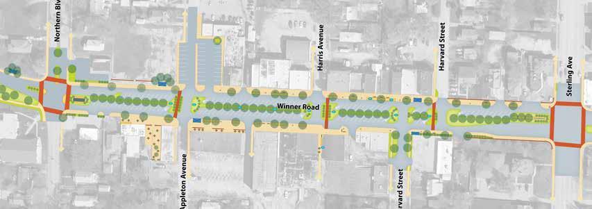 Figure 23 | parking restriction Areas. purple polygons indicate location of bicycle and compact only parking due to sight triangle conflicts.
NORTH
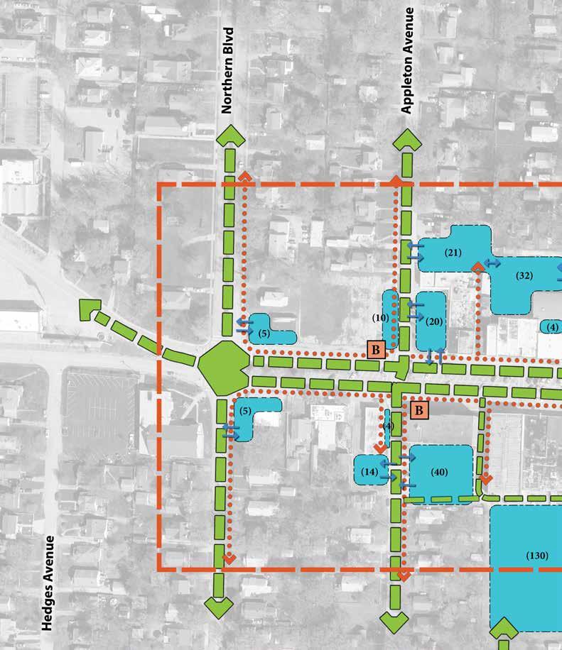
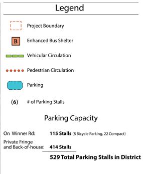
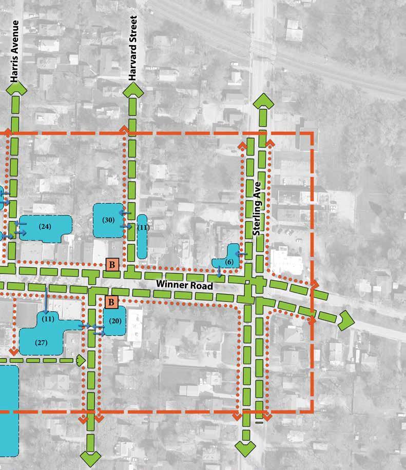
39 -- e n GL e W ood sTATI on A r T s d I s T r I c T cI rcu LATI on pLA n - Independence, mo Figure 24 | district-wide circulation plan
NORTH
Figure 24 illustrates a way
re-connect parking behind the businesses with the circulation network in englewood. This re-connection is essential for englewood to support full capacity business with full capacity customers to easily find additional, well marked, off-street parking.
As illustrated in the diagram, parking on Winner road is only a small portion of the whole picture and should not be the primary focus, nor the limiter of business. The district offers more than 400 additional parking spaces behind the buildings. This is more than three times the current parking on Winner road.
reconnecting will involve partnerships between property owners and cooperation in directing traffic through each others’ properties and parking areas. It is essential to the growth of the district that this common ground cooperative methodology be embraced because public rightsof-way do not extend beyond the side streets and Winner road.
There are no alleys in englewood, only privatelyowned driveways. customers will need access to back lots. It’s important for the property owners to remember that today, customer x’s access through his or her property may not benefit their business, but it may tomorrow. And it certainly will in the future when customer x remembers how easy it was to move from lot to lot to find that well-lit, clean, easily accessible and safe parking spot behind the businesses in englewood.
Bringing the system back into alignment with the needs of a profitable work, live and play district isn’t difficult, but at the beginning may be overwhelming. yet, the only way to eat an elephant is by taking one bite at a time.

The constituents in place in the district recognize the challenges and the benefits of working together, and certainly have what it takes to make the district viable and interconnected again.
41 -- e n GL e W ood sTATI on A r T s d I s T r I c T cI rcu LATI on pLA n - Independence, mo
to
Figure 25 | Historic Glenwood Theater sign to be repurposed as eastern gateway monument in englewood
Figure 26 | Historic trolley car to be restored and placed on display as the district’s western gateway monument.
Examples of Design Implementation
The following pages provide before and after representations of key areas within the district.
each before image is supplied with an explanation of the location’s particular set of assets and challenges. each after image lists the opportunities that are offered with design implementation.
These images are provided to give the reader the true sense of the potential vibrancy of the district.
The englewood Station arts District has a story to tell: from history with Walt Disney’s early animation learning years, to the business dealings and property ownership of Jesse’s brother Frank James, to the historic movie memorabilia of current property owners, and secret gardens already greeting visitors beyond business storefronts. So much hidden behind the District’s hard exterior is ready to burst forth and find its showcase moment within a grand District replete with monuments, museums and works of public art. now is the time for englewood to find its renewal and create a place that celebrates its rich past and promising future.
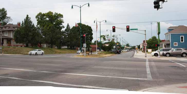
Sterling and Winner Road Gateway
assets
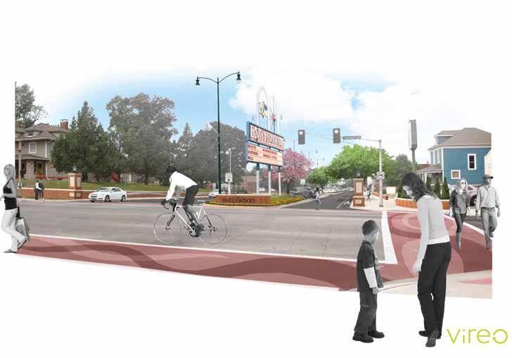
This is a high visibility intersection that offers a gateway experience into the district. current amenities include a landscaped median with ornamental street lighting. The gateway is framed by large architecturally and historically attractive homes.
challenges
Because of high traffic speeds on sterling Avenue, englewood can be missed entirely. The current aging englewood sign is oriented to be read from the north and south. drivers traveling east and west may not see the sign.
The intersection is large and daunting to pedestrians. Traffic speeds make crossing feel treacherous.
43 -- e n GL e W ood sTATI on A r T s d I s T r I c T cI rcu LATI on pLA n - Independence, mo
opportunities
• The donation of the historic Glenwood Theater sign is a boon for englewood. The sign could be repurposed as a monumental gateway feature with retro appeal.
• Artistic treatment of the crosswalks catches the motorist’s eye and alerts them to pedestrian traffic, and allowing them to feel they have entered into a special place.
• Brick walls serve dual functions; allowing the south walk along Winner road to be widened enough for two people to walk comfortably side-by-side, while signalling your entry into the Arts district.
EnglEwood ThEaTEr
assets
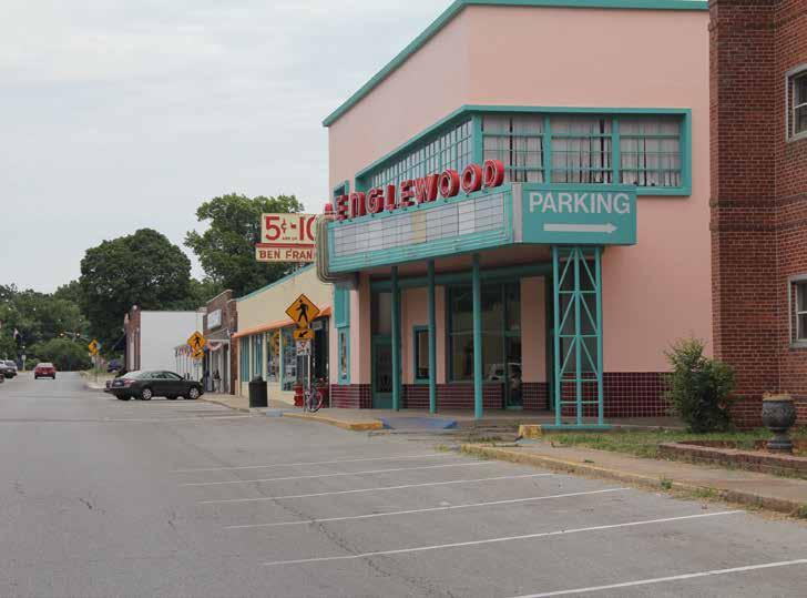
englewood Theater has been an anchor for the district. Its doors are curently closed, but district constituents are working in support of reopening the grand beauty.
challenges
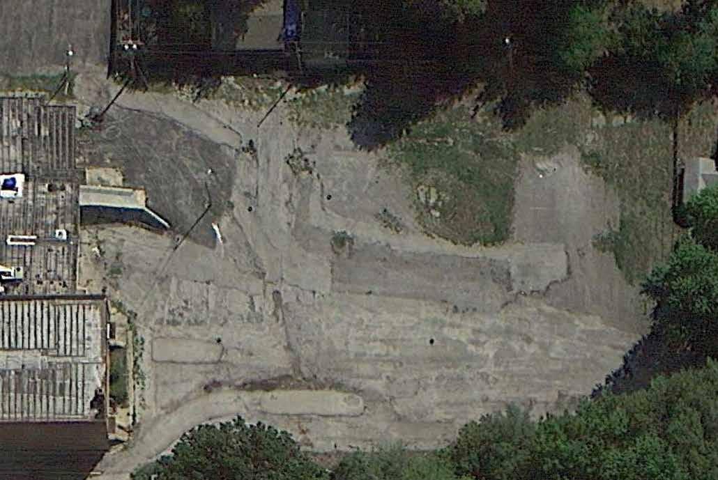
Age and expanding cost of rehabilitation have worked against efforts to reopen the theater by its owner. off-street parking is available on the property but is in poor condition. Acres of room for cars leaves little space for people, and the harshness of the built environment is uninviting.
parking access is present, but impeded by the marquee support and confusing as it is provided by both neighboring property owners and segregated by a concrete wall at the property line.
unsafe slopes exist between the sidewalk and former medical building facade.
45 -- e n GL e W ood sTATI on A r T s d I s T r I c T cI rcu LATI on pLA n - Independence, mo
opportunities
• narrowing driving lanes, adding green infrastructure solutions and more pedestrian space naturally calms traffic while also reducing crossing distances for pedestrians.

• providing drop off and waiting space in front of the theater enhances use. reducing the amount of impervious surface reduces polluted stormwater runoff.
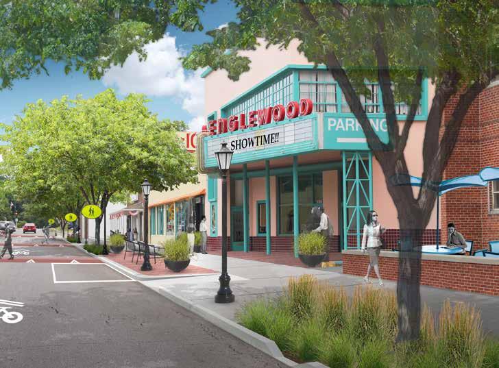
• driveway access to parking behind the buildings is maintained and consolidated to a single oneway lane, while preserving the Theater marquee supports and providing a pedestrian plaza.
• steep slopes in front of the former medical building are filled in, providing gathering space.
winnEr road and applETon avEnuE
assets
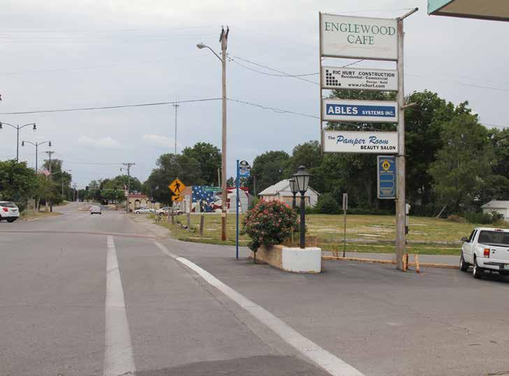
Lots of space is available here to be reclaimed for pedestrian use. The vacant land in the background is privately owned, and being considered for public gardens.
challenges
The wide streets, high speed of car travel, and obstructed sight triangles likely make this the most challenging intersection in the district. This stretch of streetscape is the only break in sidewalk between Van Horn High school and the Independence square, which presents safety issues for pedestrians. The large amount of hardscape also creates a scorching environment for bus riders.
47 -- e n GL e W ood sTATI on A r T s d I s T r I c T cI rcu LATI on pLA n - Independence, mo
opportunities
• The provision of sidewalks, trees, pedestrianscale lighting and signage improvements bring the charm back into this shopping area.
• The bus stop is moved to the next block where there is room to provide an appealing shade and weather sheltering structure.
• The vacant lot becomes public open space for outdoor theater, live music and gardens.
• englewood cafe’s parking lot gets an upgrade with two-way drive aisle, new pavement and green areas to buffer hard lines.
puppETry arTs/BEn Franklin accEss
assets
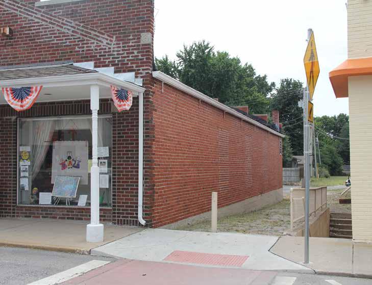
This is a major pedestrian access point between the store fronts and the parking at the rear of the buildings. This area has the potential to become a key social hub of activity.
challenges
The breezeway is privately owned, therefore property owner cooperation and investment is important to redevelopment of this space, as well as the areas it connects.
49 -- e n GL e W ood sTATI on A r T s d I s T r I c T cI rcu LATI on pLA n - Independence, mo
opportunities
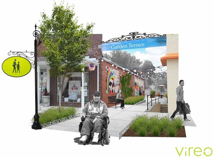
When you feel invited, you want to explore an area like this to see where it leads you. In this case, it can lead you to more activity behind the buildings and safe, clean, attractive parking areas.
Including clean, accessible walkways, benches, lighting and artwork as well as garden elements can make this access point inviting.
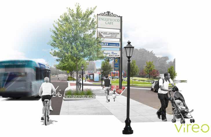
winnEr road sTrEETscapE
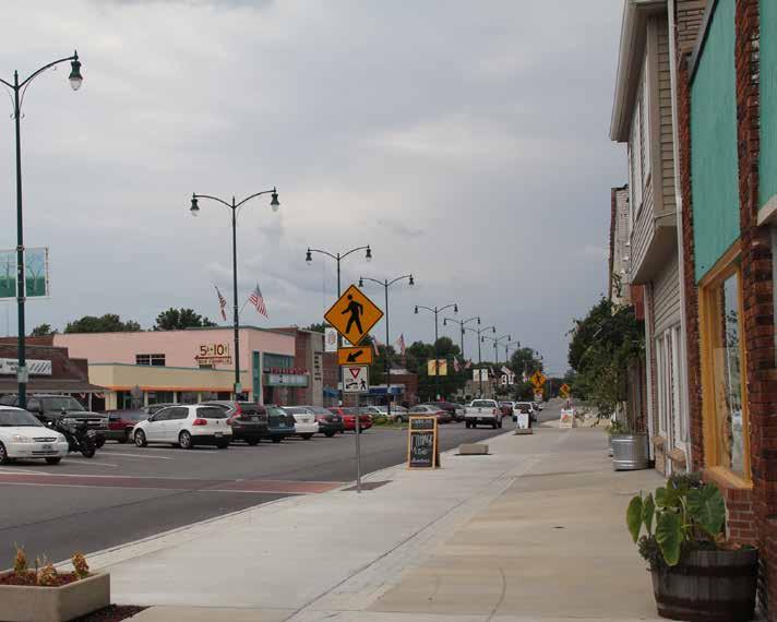
assets
city and district investment has already begun in englewood. new, wider concrete walks provide improved AdA access to businesses on the north side of Winner road have already been installed. decorative median lighting is relatively new and in great shape.
challenges
The streetscape is currently barren and needs street trees, art, and public furnishings that bring the site down to a comfortable pedestrian scale, softening hard edges and shading sweltering summer heat.
51 -- e n GL e W ood sTATI on A r T s d I s T r I c T cI rcu LATI on pLA n - Independence, mo
opportunities
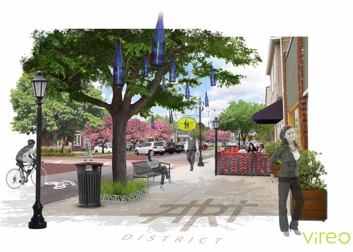
creating an enticing atmosphere with public gathering spaces, attractive and comfortable street furniture, pedestrian-scale lighting, trees and art, fills the street with people who are eager to spend time (and money) within the district.
Artistic treatment of pedestrian crosswalks and crossing signs further demonstrates to the patron that they are within a special place.
53 -- e n GL e W ood sTATI on A r T s d I s T r I c T cI rcu LATI on pLA n - Independence, mo
Phased Progress 04
55 -- e n GL e W ood sTATI on A r T s d I s T r I c T cI rcu LATI on pLA n - Independence, mo
Phased Progress
A clearly defined plan is important to maintain momentum and community ownership of the revitalization of the district. At the request of the project steering committee, this phased approach to implementing design options for the area consists of block-by-block construction phasing. each phase includes the proposed design for each block and a menu of probable costs associated with the improvements shown in that portion of the district.
It is important to note that cost estimates are based upon best understanding of construction prices at this time and a wide range of assumptions regarding existing conditions and bidding scenarios. The numbers are rough at best, but offer a ball-park estimate of what the improvements may cost. All estimated numbers are based on 2013 dollars and should be adjusted for inflation in future construction scenarios.
Improvements included in each phase are encircled with a blue line. The exception to this is in areas where the blue line stops at the edge of the map. In these areas, sidewalk improvements (on the cross streets) are priced as extending 175 feet beyond the back edge of the Winner road streetscape improvements to follow the recommendation of connecting the neighborhoods with the district.
englewood Improvements Opinion of Cost
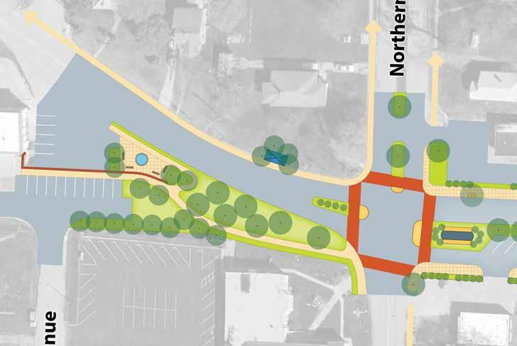
northern Avenue and Winner road signalized intersection, 18th street improvements
contractor General costs (mobilization, staking, removal of existing structures, erosion and traffic control)
and removal of existing pavements to a 3' depth
asphalt and base .....................................................................................................................................................................
Tree well with tree, drainage, irrigation, fence and electricity .............................................................................................. $12,000.00
Tree planting (w/o well) ................................................................................................................................................................... $12,000.00
ornamental landscape (shrubs and perennials) $30,000.00
Benches $10,000.00
Trash and recycling receptacles $3,000.00
Bicycle rack $600.00
pedestrian street Lights (50' on center) ..................................................................................................................................... $8,000.00
Bus stop shelter (upgrade from standard)................................................................................................................................ $20,000.00
permanent street signage ............................................................................................................................................................... $2,400.00
Traffic signals ................................................................................................................................................................................ $250,000.00
Gateway monument installation (Trolley)(Glenwood sign) $30,000.00 utilities (burial of overhead lines & misc.) $300,000.00 Total: $1,051,395.00
57 -- e n GL e W ood sTATI on A r T s d I s T r I c T cI rcu LATI on pLA n - Independence, mo
ITeM OPInIOn OF COST
road
$2,660.00 milling
curb
$21,000.00 driveway
sidewalk
$78,000.00 excavation
$132,000.00
and asphalt overlay ............................................................................................................................................................. $31,500.00
and gutter .................................................................................................................................................................................
apron.................................................................................................................................................................................... $5,625.00
4" thick over 4" base $40,500.00 AdA ramps $9,600.00 concrete landscape curb within median $10,000.00 pavement marking stripes $510.00 pavement marking sharrow ................................................................................................................................................................ $250.00 soil placement ................................................................................................................................................................................... $41,250.00
seeding $500.00
NORTH
englewood Improvements Opinion of Cost
alTeRnaTe - northern Avenue and Winner road round-a-bout intersection, 18th street improvements


ITeM OPInIOn OF COST contractor General costs (mobilization, staking, removal of existing structures, erosion and traffic control) $60,000.00 excavation and removal of existing pavements to a 3’ depth $147,000.00 road asphalt and base ..................................................................................................................................................................... $2,660.00 milling and asphalt overlay ............................................................................................................................................................ $29,250.00 curb and gutter ................................................................................................................................................................................. $21,000.00 driveway apron.................................................................................................................................................................................... $5,625.00 sidewalk 4” thick over 4” base $38,700.00 AdA ramps $9,600.00 concrete landscape curb within median $14,000.00 pavement marking stripes $510.00 pavement marking sharrow ................................................................................................................................................................ $250.00 soil placement ................................................................................................................................................................................. $44,000.00 Tree well with tree, drainage, irrigation, fence and electricity .............................................................................................. $12,000.00 Tree planting (w/o well) ................................................................................................................................................................... $12,000.00 ornamental landscape (shrubs and perennials) $40,000.00 seeding $500.00 Benches $10,000.00 Trash and recycling receptacles $3,000.00 Bicycle rack $600.00 pedestrian street Lights (50’ on center) ..................................................................................................................................... $8,000.00 Bus stop shelter (upgrade from standard)................................................................................................................................ $20,000.00 permanent street signage ............................................................................................................................................................... $2,400.00 Gateway monument installation (Trolley)(Glenwood sign) .................................................................................................... $30,000.00 utilities (burial of overhead lines & misc.) $300,000.00 Total: $812,895.00 NORTH
englewood Improvements Opinion of Cost
Winner road from northern Avenue to Appleton Avenue centerline ITeM
note: opinion of cost includes improvements on Appleton Avenue extending to the south edge of medical building parking lot.
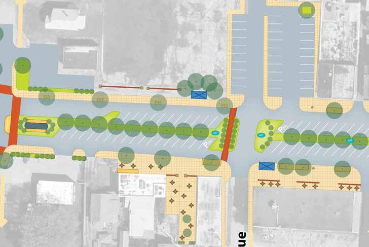
contractor General costs (mobilization, staking, removal of existing structures, erosion and traffic control) $35,000.00 excavation and removal of existing pavements to a 3’ depth $60,000.00 unclassified excavation ..................................................................................................................................................................... $1,500.00
road asphalt and base ................................................................................................................................................................... $24,500.00
milling and asphalt overlay ............................................................................................................................................................ $25,500.00
curb and gutter ................................................................................................................................................................................ $25,025.00
driveway apron $4,125.00
sidewalk 4” thick over 4” base $37,350.00
AdA ramps $4,800.00
concrete landscape curb within median $10,400.00
pavement marking stripes ................................................................................................................................................................... $533.00
pavement marking sharrow ................................................................................................................................................................ $500.00
soil placement ...................................................................................................................................................................................$27,500.00
Tree well with tree, drainage, irrigation, fence and electricity ............................................................................................. $36,000.00
Tree planting (w/o well) $4,800.00
ornamental landscape (shrubs and perennials) $35,000.00
Benches $5,000.00
Trash and recycling receptacles $3,000.00
Bicycle rack $600.00
pedestrian street Lights (50’ on center) ................................................................................................................................... $20,000.00
Bus stop shelter (upgrade from standard)................................................................................................................................ $20,000.00
permanent street signage ................................................................................................................................................................ $1,600.00
utilities (burial of overhead lines & misc.) ................................................................................................................................. $25,000.00
Total: $407,733.00
59 -- e n GL e W ood sTATI on A r T s d I s T r I c T cI rcu LATI on pLA n - Independence, mo
OPInIOn OF COST
NORTH
englewood Improvements Opinion of Cost
Winner road from Appleton Avenue centerline to Harris Avenue centerline
note: opinion of cost includes improvements on Appleton Avenue and shared driveway extending to the south edge of medical building parking lot.
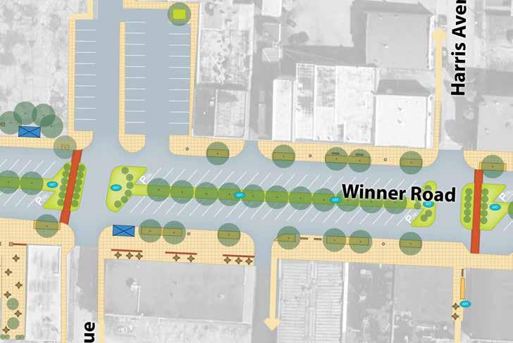
ITeM OPInIOn OF COST contractor General costs (mobilization, staking, removal of existing structures, erosion and traffic control) $40,000.00 excavation and removal of existing pavements to a 3’ depth $56,400.00 unclassified excavation .................................................................................................................................................................... $9,000.00 road asphalt and base ...................................................................................................................................................................... $7,280.00 milling and asphalt overlay ............................................................................................................................................................$58,500.00 curb and gutter ................................................................................................................................................................................. $48,125.00 sidewalk 4” thick over 4” base $79,650.00 AdA ramps $2,400.00 concrete landscape curb within median $15,100.00 pavement marking stripes $1,000.00 pavement marking sharrow ................................................................................................................................................................ $500.00 soil placement .................................................................................................................................................................................. $25,850.00 Tree well with tree, drainage, irrigation, fence and electricity ............................................................................................ $84,000.00 Tree planting (w/o well) .................................................................................................................................................................... $4,400.00 ornamental landscape (shrubs and perennials) $30,000.00 Benches $10,000.00 Trash and recycling receptacles $6,000.00 Bicycle rack $1,200.00 pedestrian street Lights (50’ on center) $36,000.00 Bus stop shelter (upgrade from standard)................................................................................................................................ $20,000.00 permanent street signage ............................................................................................................................................................... $2,400.00 utilities (burial of overhead lines & misc.) ................................................................................................................................. $25,000.00 Total: $562,805.00
NORTH
englewood Improvements Opinion of Cost parking lot behind englewood Theater
ITeM
contractor General costs (mobilization, staking, removal of existing structures, erosion and traffic control) $25,000.00
milling and asphalt overlay $82,500.00
pavement marking stripes ............................................................................................................................................................... $2,500.00
excavation and removal of existing pavements to a 3’ depth .............................................................................................. $60,000.00
road asphalt and base ................................................................................................................................................................... $35,000.00
unclassified excavation .................................................................................................................................................................... $6,000.00
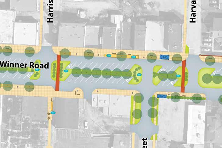
concrete landscape curb $16,000.00
soil placement $55,000.00
Tree planting (w/o well) $8,000.00
ornamental landscape (shrubs and perennials) $20,000.00
parking street Lights (60’ on center) ......................................................................................................................................... $30,000.00
Total: $340,000.00
61 -- e n GL e W ood sTATI on A r T s d I s T r I c T cI rcu LATI on pLA n -
Independence, mo
OPInIOn
COST
OF
NORTH
englewood Improvements Opinion of Cost
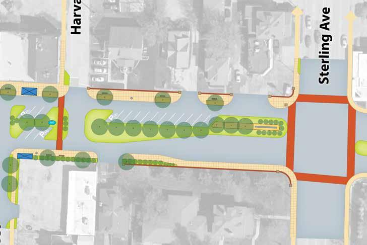
ITeM OPInIOn OF COST contractor General costs (mobilization, staking, removal of existing structures, erosion and traffic control) $47,000.00 excavation and removal of existing pavements to a 3’ depth $102,000.00 unclassified excavation .................................................................................................................................................................... $4,600.00 milling and asphalt overlay ............................................................................................................................................................ $43,500.00 curb and gutter .................................................................................................................................................................................... $6,125.00 driveway apron.................................................................................................................................................................................. $15,825.00 sidewalk 4” thick over 4” base $45,000.00 AdA ramps $4,800.00 concrete landscape curb within median $16,600.00 pavement marking stripes $550.00 pavement marking sharrow ................................................................................................................................................................ $500.00 soil placement ................................................................................................................................................................................. $60,500.00 Tree well with tree, drainage, irrigation, fence and electricity ............................................................................................. $35,000.00 Tree planting (w/o well) .................................................................................................................................................................... $5,600.00 ornamental landscape (shrubs and perennials) $95,000.00 Benches $30,000.00 Trash and recycling receptacles $9,000.00 Bicycle rack $2,400.00 pedestrian street Lights (50’ on center) $40,000.00 Bus stop shelter (upgrade from standard)............................................................................................................................... $40,000.00 permanent street signage ................................................................................................................................................................$3,200.00 utilities (burial of overhead lines & misc.) ................................................................................................................................. $25,000.00 Total: $632,200.00 NORTH
Winner road from Harris Avenue centerline to north Harvard Avenue centerline
englewood Improvements Opinion of Cost
Winner road from north Harvard Avenue centerline to sterling Avenue
63 -- e n GL e W ood sTATI on A r T s d I s T r I c T cI rcu LATI on pLA n - Independence, mo
ITeM OPInIOn OF COST contractor General costs (mobilization, staking, removal of existing structures, erosion and traffic control) $41,000.00 excavation and removal of existing pavements to a 3’ depth $88,320.00 unclassified excavation $1,800.00 milling and asphalt overlay ............................................................................................................................................................ $52,500.00 curb and gutter .................................................................................................................................................................................. $20,125.00 driveway apron................................................................................................................................................................................... $4,200.00 sidewalk 4” thick over 4” base..................................................................................................................................................... $22,500.00 AdA ramps ............................................................................................................................................................................................ $7,200.00 concrete landscape curb within median $12,500.00 retaining wall with brick veneer 3’ high $27,950.00 pavement marking stripes $475.00 pavement marking sharrow $500.00 soil placement .................................................................................................................................................................................. $46,750.00 Tree well with tree, drainage, irrigation, fence and electricity .............................................................................................. $21,000.00 Tree planting (w/o well) .................................................................................................................................................................... $4,400.00 ornamental landscape (shrubs and perennials) ....................................................................................................................... $70,000.00 seeding $1,250.00 Benches $10,000.00 Trash and recycling receptacles $4,500.00 Bicycle rack $600.00 pedestrian street Lights (50’ on center) $32,000.00 permanent street signage ............................................................................................................................................................... $2,400.00 Gateway monument installation (Trolley)(Glenwood sign) .................................................................................................... $30,000.00 utilities (burial of overhead lines & misc.) .................................................................................................................................$50,000.00 Total: $551,970.00 NORTH
Next Steps
constituents from the study’s steering committee are already working out methods toward additional progress in englewood. development is currently underway for the formation of a not-for-profit that could be in charge of running the englewood Theater; opening its doors back up to movie and event go-ers. Additional thoughts are being directed toward organizing the not-for-profit to coordinate the festivities, maintenance and improvement activities throughout the district.
As provided for in missouri law and in cooperation with the city of Independence, the district has additional avenues for improving funding and management. A few of these are outlined below.
COMMUNITY IMPROVEMENT DISTRICT*
a community Improvement district (cId), which would allow the district to impose sales tax, special assessments or real property tax to fund improvements and services that benefit the property and business owners within the district.
missouri state statute allows for the following uses to be funded by a cId:
• convention centers, arenas, meeting facilities, pedestrian or shopping malls and plazas
• paintings, murals, fountains or kiosks
• parks, lawns, gardens, trees or other landscapes
• streetscapes, lighting, benches, marquees, awnings, canopies, trash receptacles, walls
• Lakes, dams and waterways
• sidewalks, streets, alleyways, bridges, ramps, tunnels, traffic signs and signals utilities, drainage works, water, storm and sewer systems and other site improvements
• parking lots, garages
• child care facilities and any other useful, necessary or desired improvement
• operating or contracting for the operation of parking facilities, shuttle bus services
• Leasing space for sidewalk café tables and chairs
• providing trash collection and disposal services
• With consent of the municipality, prohibiting, or restricting vehicular and pedestrian traffic and vendors on streets
• Within a designated “blighted area”, contract with any private property owner to demolish, or rehabilitate any building or structure owned by such property owner
• providing or contracting for security personnel, equipment or facilities
NEIGH b ORHOOD IMPROVEMENT DISTRICT*
A neighborhood Improvement district can impose a special assessment to fund infrastructure improvements within the district. The englewood district utilized the nId tool fund the street lights throughout englewood. nIds can also be used to fund infrastructure improvements such as:
• Acquisition of property
• Improvement of streets, sidewalks, crosswalks and all related components
• drainage, storm and sanitary sewer systems and service connections from utility mains, conduits and pipes
• Improvement of streetlights and street lighting systems
• Improvement of waterworks
• Improvement of parks, playgrounds and recreational facilities
• Improvement of flood control works
• Improvement of pedestrian and vehicle bridges, overpasses and tunnels
• Landscaping streets or other public facilities including improvement of retaining walls and area walls on public ways
• Improvement of property for off-street parking *source:
http://www.missouridevelopment.org/
CHAPTER 353 REDEVE l OPMENT*
property tax abatement up to ten years is currently available for property owners making “urban redevelopment” improvements on their property. Abatement amounts are reflective of investment made by the property owners. Businesses within the district are eligible under the Fairmont carlisle 353 tax abatement “blighted area” ruling.
residential properties are also eligible for property tax abatement.
TA x INCREMENT f INANCING*
Tax Increment Financing (TIF) is a development tool designed to help finance certain eligible improvements in designated redevelopment areas (TIF districts) by utilizing new or incremental tax revenues generated by the project after completion. under TIF, property taxes within the area are frozen up to 23 years, the property owners then make payments In Lieu of Taxes (pILoTs) to a “special allocation fund”. Additionally, 50% of any new local economic Activity Taxes (eATs) generated from the project are also paid into the fund while the district is in effect. The proceeds of the fund are then used to reimburse the developer for eligible project costs. When the area is improved, it is assumed the property taxes will increase with the value of the property and the increase can be used to pay for the improvements made. TIFs can be used to pay for items such as:
• professional services such as studies, surveys, plans, financial management, legal counsel
• Land acquisition and demolition of structures
• rehabilitating, repairing existing buildings on site
• Building necessary new infrastructure in the project area such as streets, sewers, parking, lighting
TRANSPORTATION DEVE l OPMENT DISTRICT*
A Transportation development district (Tdd) may be formed to manage and finance one or more
transportation related facilities within the district. Funding of Tdd projects may be accomplished through the creation of district-wide special assessments or property or sales taxes with a required majority voter or petition approval. The Tdd may also issue bonds, notes, and other obligations if granted such authority. Tdds may fund projects such as:
• street, highway, road, interchange, intersection, bridge, traffic signal light or signage;
• Bus stop, terminal, station, wharf, dock, rest area or shelter;
• Airport, river, or lake port, railroad, light rail or other mass transit and any similar or related improvement or infrastructure.
GRANT f UNDING
COMM un ITY D e V el OPM en T B l OC k GR an T
The u.s. department of Housing and urban development (Hud) offers community development Block Grants under a few program areas that apply to the district. The city of Independence is a registered entitlement community within the entitlement communities program of the cdBG and it may qualify for funding within the neighborhood stabilization program.
P lann I n G S u STa I na B le P la C e S PROGR a M
The mid-America regional council currently administers the planning sustainable places program (psp) which leverages funds from Hud and state and federal transportation authorities to support planning and design of sustainable community improvements. This study and report were funded by a psp grant.
Implementation Activities funding provides money for locations that had a previously developed local plan for an area or activity center which developed the core elements required of a sustainable places plan. The intent is to advance specific strategies and/or recommendations that have
*source: http://www.missouridevelopment.org/
65 -- e n GL e W ood sTATI on A r T s d I s T r I c T cI rcu LATI on pLA n - Independence, mo
been developed through previous planning efforts. Having this plan in hand makes the district eligible for further funding through psp.
S u RFa C e TR an SPORTaTIO n PROGR a M (STP)**
The surface Transportation program (sTp) is one of the main sources of flexible funding available for transit or highway purposes. sTp provides the greatest flexibility in the use of funds. These funds may be used for public transportation capital improvements, fringe and corridor parking facilities, bicycle and pedestrian facilities, and bus facilities. other eligible projects under sTp include transit safety improvements and most transportation control measures.
state and local governments are eligible grantees, so the district would cooperate with the city to acquire this funding.
CO n G e STIO n MITIG aTIO n an D a IR Q ual ITY IMPROV e M en T (CM a Q) PROGR a M**
The other major source of flexible transportation funding is from the congestion mitigation and Air Quality Improvement program (cmAQ). cmAQ has the objective of improving the nation’s air quality and managing traffic congestion, by providing support for transportation projects that contribute to emissions reductions of carbon monoxide, particulate matter, and ozone and its precursors.
eligible activities under cmAQ include transit system capital expansion and improvements that are projected to realize an increase in ridership; travel demand management strategies and shared ride services; pedestrian and bicycle facilities and promotional activities that encourage bicycle commuting.
state and local governments and private sector elements through a public sponsor are eligible for this type of grant.
TR an SPORTaTIO n en H an C e M en T a CTIVITI e S**
Transportation enhancement (Te) activities offer funding opportunities to expand transportation choices and enhance the transportation experience through 12 eligible Te activities related to surface transportation, including pedestrian and bicycle infrastructure and safety programs, scenic and historic highway programs, landscaping and scenic beautification, historic preservation, and environmental mitigation. Te projects must relate to surface transportation and must qualify under one or more of the 12 eligible categories.
each state develops its own procedures to solicit and select projects for funding. states may make funds available to Federal, Tribal, state, or local government agencies. A few states allow private nonprofit organizations to apply in partnership with a government agency.
**source: http://www.dot.gov/livability/grants-programs
Opportunities for the advancement of the District extend beyond those listed within this document. It’s important, as federal funding opportunities may dwindle in the future, to also get creative in developing strategies for raising money for improvements and management. The District’s current diverse and cooperative structure is well-developed for this effort. Public events already planned within the District offer opportunities to raise awareness and promote fundraising activities.
67 -- e n GL e W ood sTATI on A r T s d I s T r I c T cI rcu LATI on pLA n - Independence, mo
Appendix A: Transportation Conditions analysis Memorandum
To: Ms. Lara Justesen
From:
CC:
Shashi Gannavaram, P.E, PTP, AICP, PTOE
Date: 9/24/2013
Re: Transportation conditions analysis for the Englewood Arts District
1 Introduction
R^3C Design Group, LLC was requested to assist in transportation planning and traffic engineering elements for developing a Circulation Plan for the Englewood Arts District in Independence, Missouri. The Englewood Arts District is on E. Winner Road between Northern Boulevard and Sterling Road.


In particular the existing roadway system in the district is evaluated, including crash rates, the unique median parking and sight-distance challenges. Because the intersection of E. Winner Road and Northern Boulevard, on the west edge of the district, is a complicated five-legged intersection, much of this document describes the inherent challenges of this area and offers positive alternatives for improving the intersection. Finally, priorities are presented for improving the overall traffic flow through the districtboth auto and non-motorized.
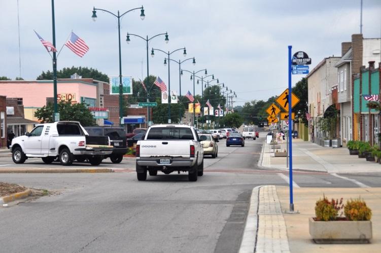
The arts district is predominantly commercial, including only a few residences on the western end of the project, near Northern Boulevard. The commercial district is comprised mostly of small, personally-owned and operated businesses, providing a wide range of services The corridor’s key attraction is the now-closed Englewood Theater, which has no immediate plan to reopen.
The sidewalks and northern curb line between Sterling Road and Appleton Avenue have been recently improved by the City of Independence. This project also included new crosswalks and
memo Page 1 of 27
Exhibit 1: Looking west along E. Winner Road
pedestrian signs at key intersections. There are no immediate Capital Improvement Projects planned on E. Winner Road.
2 Roadway system
2.1 Crash analysis
Crash data from 2010 to July 2013 was obtained from the City of Independence and analyzed to detect any unsafe conditions. The crash data was on E. Winner Road between Northern Avenue and Sterling Avenue. The data is summarized in Exhibit 3 below.
The following observations were noted:
• 36-percent (4 of 11) of the crashes resulted in injuries.
• There were no pedestrian –vehicle crashes in the corridor.
• Failing to yield resulted in 45% (5 of 11) crashes.
• In the last three years, the Northern Avenue intersection has seen no crashes. The closest crash occurred 50 feet east of Northern Avenue as a car was merging into traffic.
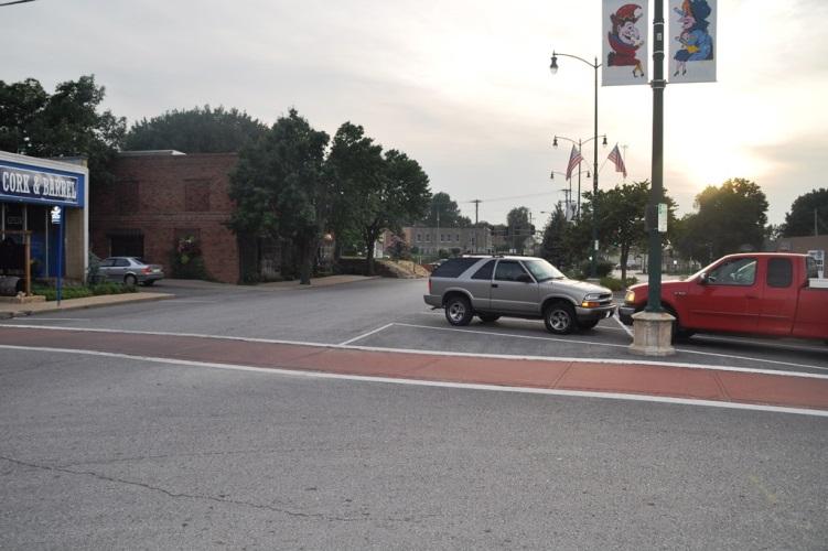
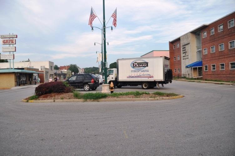
• The Appleton Avenue intersection experienced 45% (5 of 11) crashes in the corridor.
o Police reports indicated that two of the crashes resulted from obscured vision due to a parked car on the west side of the intersection.
Further review of the Appleton Avenue intersection reveals the following:
• Sight distance restrictions – Sight distance restrictions are primarily due


memo Page 2 of 27
Looking east at Appleton Avenue
Looking west at Appleton Avenue
Exhibit 2: Sight distance challenges due to parked vehicles at Appleton Avenue
to the angled parking along on-street medians. Since sight triangles are not strictly observed at this location, cars in the median are not able to view traffic on E. Winner Road during the turn. An example of these restrictions is shown in Exhibit 2.
2.2 On-street median parking


A very unique feature of the Englewood Arts District, specifically E. Winner Road, is the onstreet angled median parking Business owners on E. Winner Road consider this long-standing feature sacred and strongly oppose any change to this parking pattern. However, significant challenges are posed by the on-street median parking.
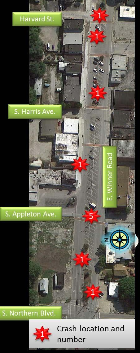
memo Page 3 of 27
Year Location Severity Number of vehicles Type Cause Notes 50 feet east of Northern PDO 2 Sideswipe Failure to yield Winner Road - midblock INJ 2 Head on Too fast Appleton at Winner PDO 2 Right angle Failure to yield Vision obscured by parked car on west side Appleton at Winner INJ 2 Right angle Failure to yield Vision obscured by parked car on west side 45 feet east of Harris PDO 2 Parked car Improper backing Bad pull out from parking stall Appleton at Winner PDO 2 Angle Improper signal + inattention Appleton at Winner PDO 2 Sideswipe Improper passing Harvard at Winner INJ 2 Angle Failure to yield Winner Road at alley near Englewood Café PDO 1 Drive into construction zone Inattention Appleton at Winner INJ 2 Angle Failure to yield 2013 50 feet west of Harvard PDO 2 Parked car Poor lane use 2010 2011 2012 Notes: 1. PDO = Property damage only reported 2. INJ = Injury crash 3. Crash reports between January 1, 2010 and July 22, 2013 summarized
• Adjoining lane width: The 60-degree angled parking results in a very wide lane width for vehicular traffic. In some locations, each lane on E. Winner Road is about 22 feet wide. Even though this section of the roadway is posted at 20 miles per hour (mph), the excessive pavement increases the comfort of the driver, and higher speeds tend to prevail.
• Sight distance: The median parking restricts the sight triangle particularly for vehicles turning onto the side streets. This is one of the primary factors for the higher crash rate at the Appleton Avenue intersection. The crash rates are discussed in a prior section.
• Crossing E. Winner Road: Business patrons park in the median and conveniently cross the street in front of their car at mid-block locations. Oncoming drivers must be unduly cautious of pedestrians stepping out from behind a parked car in the median.
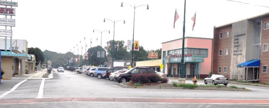

Because of the wide lane width, a suggestion was presented to the steering committee to reduce the angle of the parking from the current 60 degrees to 45 degrees. This angle reduction also reduces the required lane width to 12 feet, with a stall width of 8 feet, a depth of 18.5 feet and skew width of 11.3 feet. However, it should be noted that the current city standard for parking stall width is 9 feet.
By reducing the parking angle and lane widths pedestrian safety is improved because of the shorter walking distance and exposure time in mid-block locations. Significantly, the spatial restrictions perceived by drivers will assist in slowing the vehicular traffic.
While this solution does not address the concerns listed above, it does maintain the desired onstreet parking while providing some safety enhancements.
2.3 Sight distance
A significant cause for concern and safety is the sight distance challenges posed by large vehicles parking in the median near side street intersections. The plane of the sight triangle is encroached upon, causing vision challenges for traffic crossing E. Winner Road. This vision challenge must be recognized by those implementing future roadway improvements, and appropriate guidelines must be followed. These are provided in the “A Policy on Geometric Design of Highways and Street,” published by the American Association of State Highway and

memo Page 4 of 27
Exhibit 4: On-street median parking
Transportation Officials (AASHTO), 2004 (commonly referred to as the green book) The criteria are as follows:

• Left turn from stop (Exhibit 9-55 of the green book) –
o 280-feet for 25 mph
o 225 feet for 20 mph
• Crossing maneuver (Exhibit 9-58 of the green book) –
o 240-feet for 25 mph
o 195 feet for 20 mph
During concept plan development, the guidelines were used to determine the triangle at each crossing point. Because business owners were unwilling to give up three or four parking spots at each crossing, an alternative plan was developed to minimize the sight triangle encroachment. This plan utilized green space and parking spaces specifically designated to compact cars and bicycles. . Exhibit 5 shows the final concept developed for the Appleton Avenue intersection.
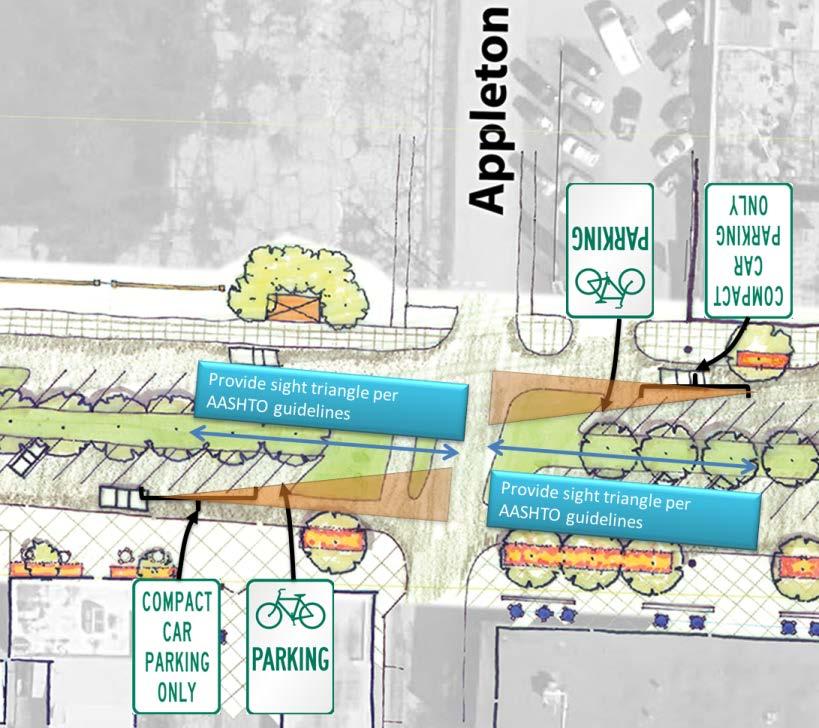
3 E. Winner Road at Northern Avenue Intersection
E. Winner Road at Northern Avenue, located on the west edge of the study area, is a nonstandard five-legged intersection. An in-depth analysis is being completed for this intersection to determine possible improvements and create a gateway entrance to the arts district.

memo Page 5 of 27
Exhibit 5: Parking concept at Appleton Avenue intersection
3.1 Existing traffic counts


Traffic counts were collected in July 2013 during the morning and afternoon peak hours. Pedestrian activity was also recorded during the same time periods. These counts are shown in Exhibit 6 below.
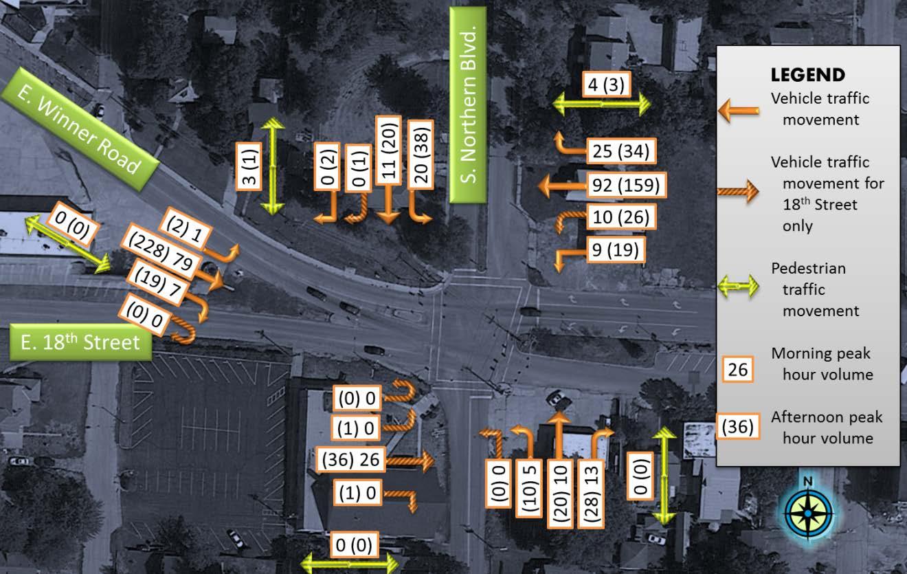
From these traffic counts we observe the following:
• Pedestrian activity is minimal during both peak auto-traffic periods. While the intersection is a non-standard five-legged intersection, it is believed to be relatively simple to access and cross. Although the existing signal has pedestrian indications, no push-buttons are provided for pedestrian actuation
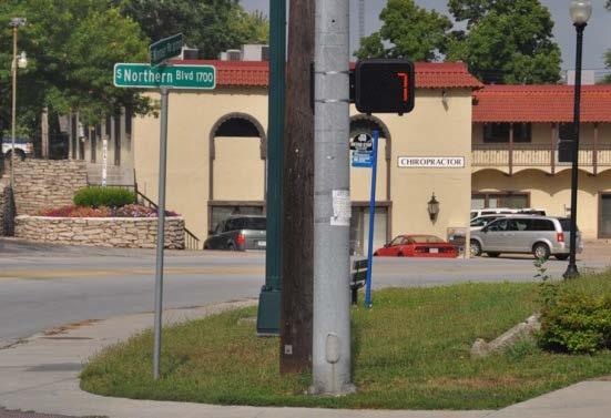
memo Page 6 of 27
Exhibit 7: No pedestrian actuation at E. Winner Road and Northern Boulevard
• Traffic flow is not directional – the volume of traffic east or westbound on E. Winner Road is of the same magnitude during both peak periods.
• Minimal traffic is turning onto E. 18th Street. Most of the E. 18th Street traffic continues as through traffic from the east leg of E. Winner Road.
• During field observations, it was noted that the majority of the traffic to E. 18th Street is turning one block west at S. Ralston Avenue.

3.2 Capacity analysis
When evaluating modifications to an intersection its operational level must be established. Based upon the delays experienced by its users, a baseline is set and improvement ideas are analyzed. Any alternatives developed should exceed this baseline level of operations. The “Highway Capacity Manual”, published by the Transportation Research Board (TRB), 2010 provides guidelines for completing an operational analysis at the intersection. The analysis
results in a letter grade called the Level of Service (LOS). LOS ranges from A through F where LOS A implies drivers experience no delays while LOS F indicates a complete breakdown at the intersection. For signalized intersections, the criteria for the LOS grade are shown in the adjacent table.
A
B
C >20 to 35 Stable flow
D >35 to 55 Tolerable delay
E >55 to 80 Intolerable delay
F >80 Jammed conditions
Exhibit 8: Signal intersection level of service criteria
Because this intersection is fivelegged, it should be noted that the HCM 2010 methodology does not analyze it. HCM 2000 methodologies were used to complete the analysis. The criteria used for determining the LOS is the same using both methodologies. However, minor modifications do exist in how the delay is calculated.
The analysis is completed using software called Synchro, released by Trafficware, version 8. The results of the analysis are shown in Exhibit 9. Outputs from the software are included in the appendix. The following conclusions are made from the analysis results.
memo Page 7 of 27
Level of Service (LOS) Delay (seconds per vehicle)
description
General
≤
Free flow
10
>10 to 20 Stable flow
Exhibit 9: Existing capacity analysis summary
From Exhibit 9 it is observed that the intersection can meet its present traffic demand. The levels-of-service are indicative of minimal delays. Further, it is believed that sufficient spare capacity is available to accommodate future growth.
3.3 Alternative development
This phase was primarily completed during the charrette on August 5 and 6, 2013. The steering committee and the Transportation Focus Group were presented with the existing conditions. During the discussions, it was noted that the E. 18th Street leg of the intersection was primarily funneling traffic to and from E. Winner Road. Good connectivity within the network allows traffic to turn onto E. 18th Street from S. Ralston Avenue to the west and E. 19th Street to the south.
Simplifying the intersection was a primary desire of the steering committee and a suggestion was made to close E. 18th Street at S. Hedges Avenue. This would force S. Hedges Avenue traffic to use E. 18th Street to the west, using S. Ralston Avenue to connect to E. Winner Road.

The advantages of this approach are:
1. The five legged intersection of S. Northern Boulevard and E. Winner Road becomes a standard four legged intersection.
2. Traffic coming to and from S. Hedges Avenue has a standard four-way intersection at S. Ralston Avenue.
memo Page 8 of 27 Existing Capacity Analysis results Peak hour/ item Approach Intersection 18th St. Eastbound Winner Rd. Westbound Northern Northbound Northern Southbound Winner Eastbound Morning Delay * 15.6 11.8 4.4 4.4 16.8 12.1 LOS B B A A B B Afternoon Delay * 11.9 9.4 6.9 7.1 15.4 11.4 LOS B A A A B B
in
* - delay is measured
seconds per vehicle
However, a disadvantage is that S. Hedges Avenue traffic must travel an extra distance to get to E. Winner Road. Traffic heading east on E. Winner Road will be the most inconvenienced with this approach.
The overall approach of closing E. 18th Street between S. Hedges Avenue and E. Winner Road was very well received by the steering committee. This modified intersection is shown in Exhibit 10.
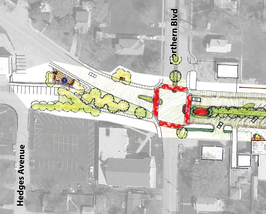
Because the intersection is now converted to a standard four-way intersection, options for traffic control are discussed. A desire of the focus group is to convert this intersection into a gateway to the Englewood Arts District. The two options that present themselves are:

1. Improve the signal layout at the intersection or

2. Install a single-lane roundabout at the intersection.
These are shown in Exhibit 11. Because of the overwhelming support for standardizing the intersection by closing the E. 18th Street leg, further analysis and alternative testing is being completed using each of these two alternatives.
memo Page 9 of 27
Note: these drawings are conceptual and are not to scale.
r Road and Northern Boulevard intersection
Advantages and disadvantages for each method of traffic control were briefly presented during the charrette. A few of these are summarized in Exhibit 12. Despite the disadvantages of a roundabout, the steering group and the charrette attendees unanimously prefer a roundabout for this intersection.

Signal intersection
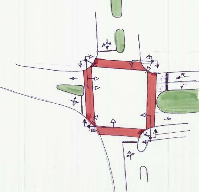
Roundabout Advantages Disadvantages Advantages Disadvantages
32 points of conflict between vehicles and pedestrians
Safer
• Reduced vehicle speed
• Reduction in conflict points
Shorter walking distance for the pedestrian
Increased exposure for pedestrians
Increased congestion
Maintenance for life of signal
Increased fuel use and pollution
Reduced exposure for pedestrians Increased walking distance for a pedestrian
Reduced congestion
Reduced maintenance costs – primarily landscaping

Reduced fuel use and pollution
Users are used to signals – no learning required.

Not used to a roundabout –learning curve required

memo Page 10 of 27
Exhibit 12: Advantages and disadvantages of intersection control
3.4 Alternative testing
Alternative testing uses current counts to determine operational performance levels These are compared to the existing levels-of-service, from Exhibit 9, and a suitable approach for traffic control at the intersection is selected. The two tested alternatives are:
1. Standard four-way intersection with a signal
2. Standard four-way intersection with a single lane roundabout.
Results of this analysis are summarized in Exhibit 13. For both scenarios, the results indicate the intersection will operate at a high level of service. The intersection is projected to operate at LOS B with a signal control and LOS A with a roundabout.
To ensure that the intersection option will fulfill demand needs for the design life of 20 years, the two scenarios are tested by increasing existing traffic volumes at a two-percent (2%) annual growth rate. This increases the traffic by about 50% over the 20-years. These results are summarized in Exhibit 14. In 20 years the intersection is projected to continue operating at LOS B with signal control and LOS A with a roundabout in place.
Roundabout parameters used for analysis are as follows:
• Because the available diagonal pavement at the intersection is approximately 95 feet, the outside diameter of the roundabout was set at 90-feet.
• The circulatory lane width is set at 15 feet.
• The inside circle diameter is 60 feet
• All approach radii are set at a 50 feet radius
• Lane width for approaching and exiting lanes is set at 12 feet, due to Kansas City Area Transportation Authority (KCATA) busses that use E. Winner Road
• Pedestrian crosswalks are set 25 feet behind the yield line for each approach
• Roundabout analysis was completed using the software SIDRA, released by Ackelick and Associates, version 6.

memo Page 11 of 27


memo Page 12 of 27 18 th Street removed Capacity Analysis results Signal intersection Existing traffic counts Peak hour/ item Approach Intersection Winner Rd. Westbound Northern Northbound Northern Southbound Winner Rd. Eastbound Morning Delay * 13.4 4.2 4.3 15.2 12.3 LOS B A A B B Afternoon Delay * 12.7 7.4 7.4 14.8 12.7 LOS B A A B B 18 th Street removed Capacity Analysis results Roundabout intersection Existing traffic counts Peak hour/ item Approach Intersection Winner Rd. Westbound Northern Northbound Northern Southbound Winner Rd. Eastbound Morning Delay * 4.5 4.0 4.0 4.5 4.4 LOS A A A A A Afternoon Delay * 5.7 5.4 4.8 6.9 6.1 LOS A A A A A
Exhibit 13: Proposed four-legged intersection capacity analysis summary
4 Priorities
The existing transportation conditions analysis for the Englewood Arts District was completed by the R^3C Design Group, LLC. The focus was on the existing roadway conditions, crash rates, median parking and the sight distance restrictions caused by the on-street parking. However, the primary charge was to develop alternatives for the five-legged intersection at E. Winner Road and Northern Boulevard.


memo Page 13 of 27 18 th Street removed Capacity Analysis results Signal intersection 20year traffic volumes Peak hour/ item Approach Intersection Winner Rd. Westbound Northern Northbound Northern Southbound Winner Rd. Eastbound Morning Delay * 13.0 5.1 5.2 15.3 12.4 LOS B A A B B Afternoon Delay * 13.4 10.1 10.1 17.0 14.4 LOS B B B B B 18 th Street removed Capacity Analysis results Roundabout intersection 20year traffic volumes Peak hour/ item Approach Intersection Winner Rd. Westbound Northern Northbound Northern Southbound Winner Rd. Eastbound Morning Delay * 5.1 4.4 4.4 5.1 4.9 LOS A A A A A Afternoon Delay * 6.9 5.7 6.6 9.4 7.9 LOS A A A A A
Exhibit 14: 20-year capacity analysis summary
4.1 Roadway system
Field observations and the analysis indicate an excessive amount of pavement for accommodating one lane of traffic in each direction. At some locations the pavement was as wide as 22 feet, where a 12-feet lane width is adequate for traffic movement.
A cause of this wide pavement is the angled median parking. Because the entry angle is 60degrees, wider pavement width is required to negotiate the parking spot. By reducing this parking angle to 45-degrees, a narrower lane width is used by the through vehicles. An added benefit is the shorter distance and time that it takes for the pedestrians to cross E. Winner Road.
As part of this section, the crash rates and the predominant causes of crashes on E. Winner Road are examined. The high crash location is at Appleton Avenue and the main cause of the crashes is a lack of sight distance for traffic turning onto Appleton Avenue from E. Winner Road. When cars are parked in the median parking spots, the sight triangle is penetrated and turning vehicles are unable to see approaching traffic.
4.2 E. Winner Road and Northern Boulevard intersection
The data reveals that the traffic proceeds through this intersection because of the complicated nature of making a turn. The preferred turning location is S. Ralston Street, one block to the west. After considering the data and input from the steering committee and charrette participants, the E. 18th Street connection between S. Hodges Road and E. Winner Road is eliminated
This change improves the intersection to a standard four-way intersection, while causing only a minor inconvenience to the traffic on S. Hodges Avenue, as they are routed along S. Ralston Avenue to get to E. Winner Road.
Using the four-legged intersection as a basis, two alternatives for traffic control are evaluated and discussed in the charrette. A capacity analysis for both alternatives reveals that the intersection would operate with no delays regardless of the intersection control. However, charrette participants overwhelmingly approved the roundabout concept because of the inherent safety features.

memo Page 14 of 27

memo Page 15 of 27
5 Appendix
5.1 Existing
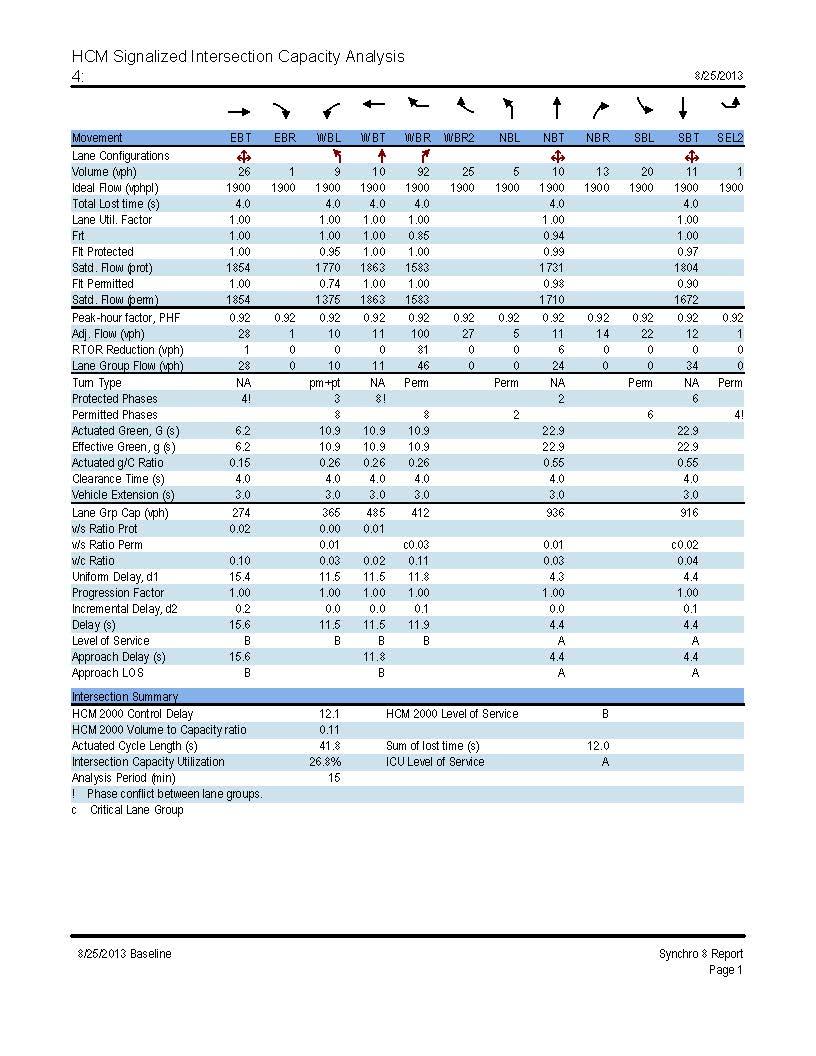
5.1.1 Morning peak hour

memo Page 16 of 27

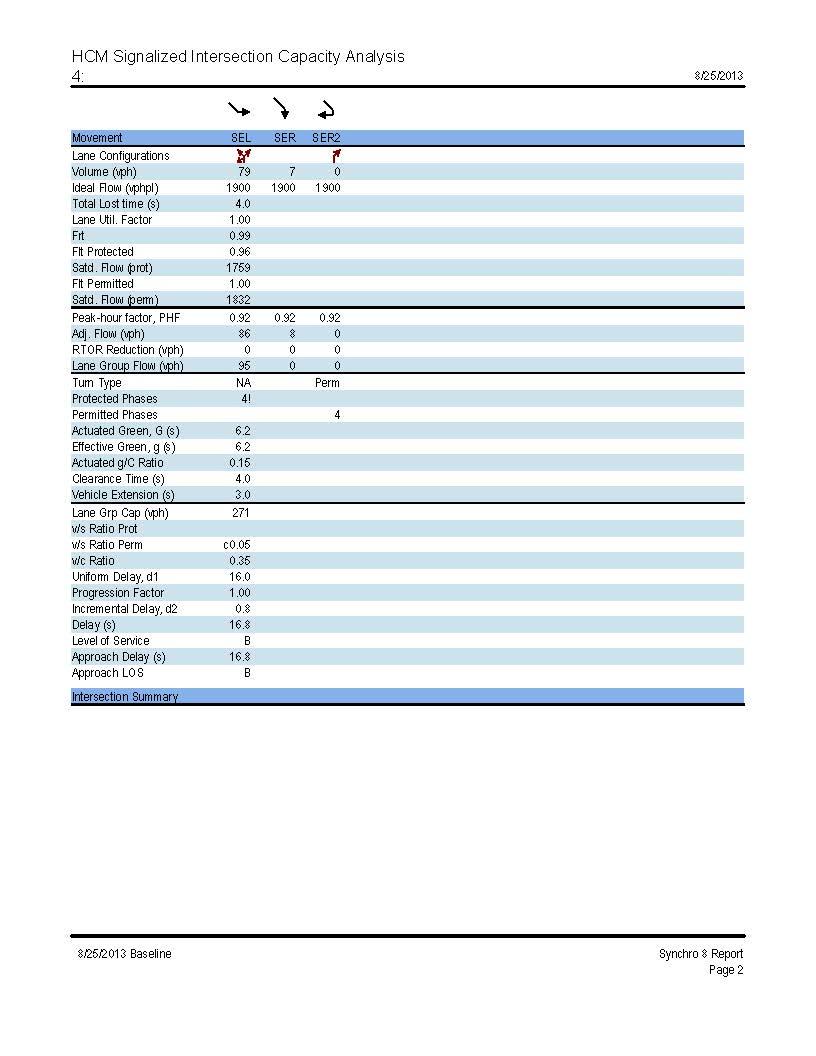
memo Page 17 of 27
5.1.2 Afternoon peak hour
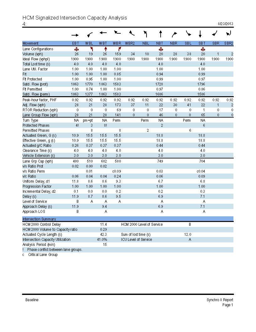

memo Page 18 of 27

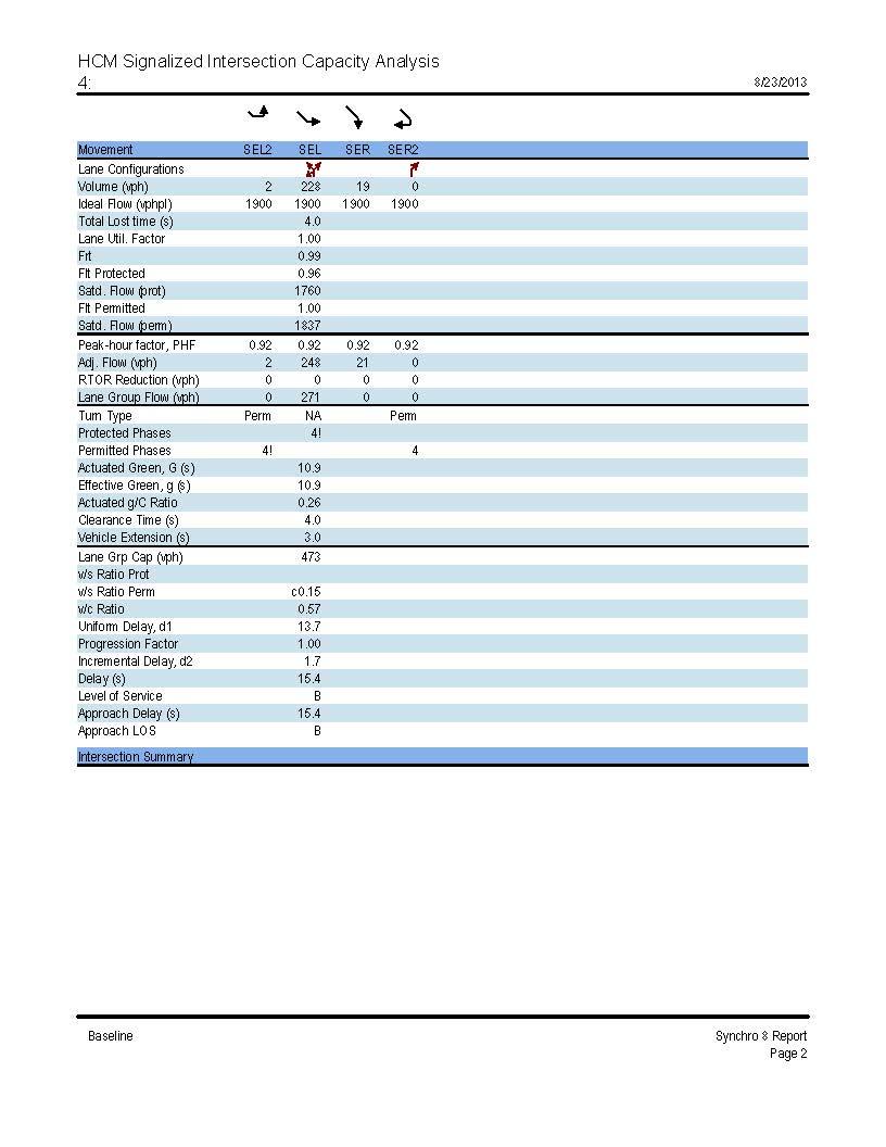
memo Page 19 of 27
5.2 18th Street removed with current year traffic counts
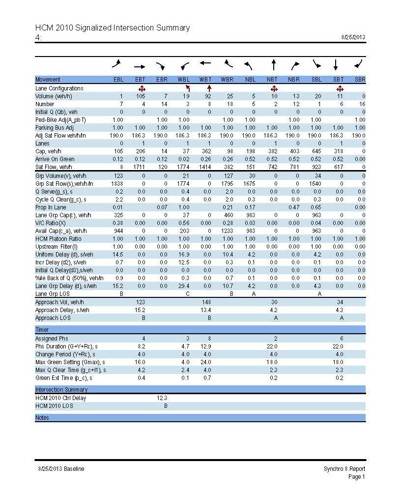
5.2.1 Signal control
5.2.1.1 Morning peak hour

memo Page 20 of 27
5.2.1.2 Afternoon peak hour
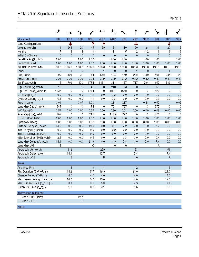

memo Page 21 of 27
5.2.2 Roundabout control

5.2.2.1 Morning peak hour
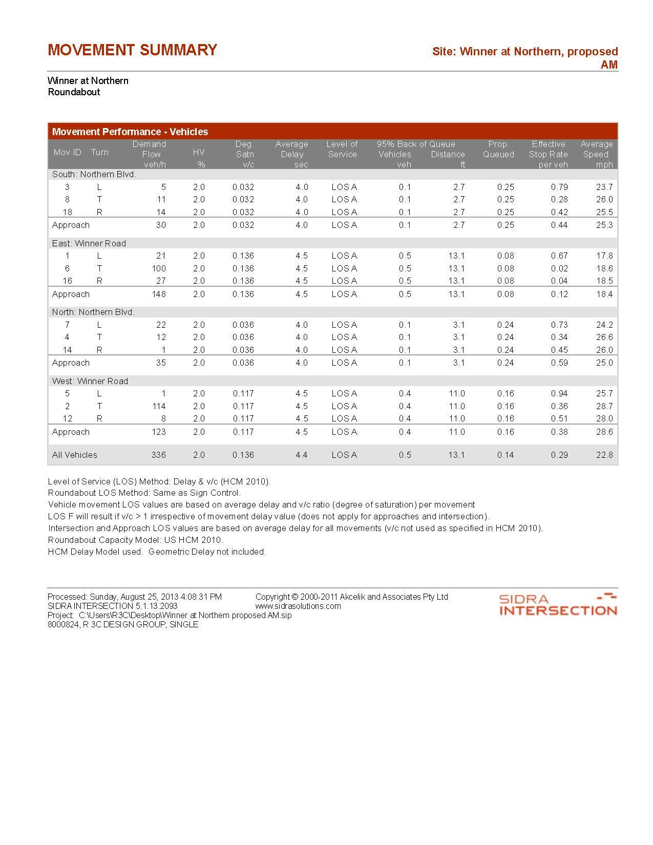
memo Page 22 of 27
5.2.2.2 Afternoon peak hour
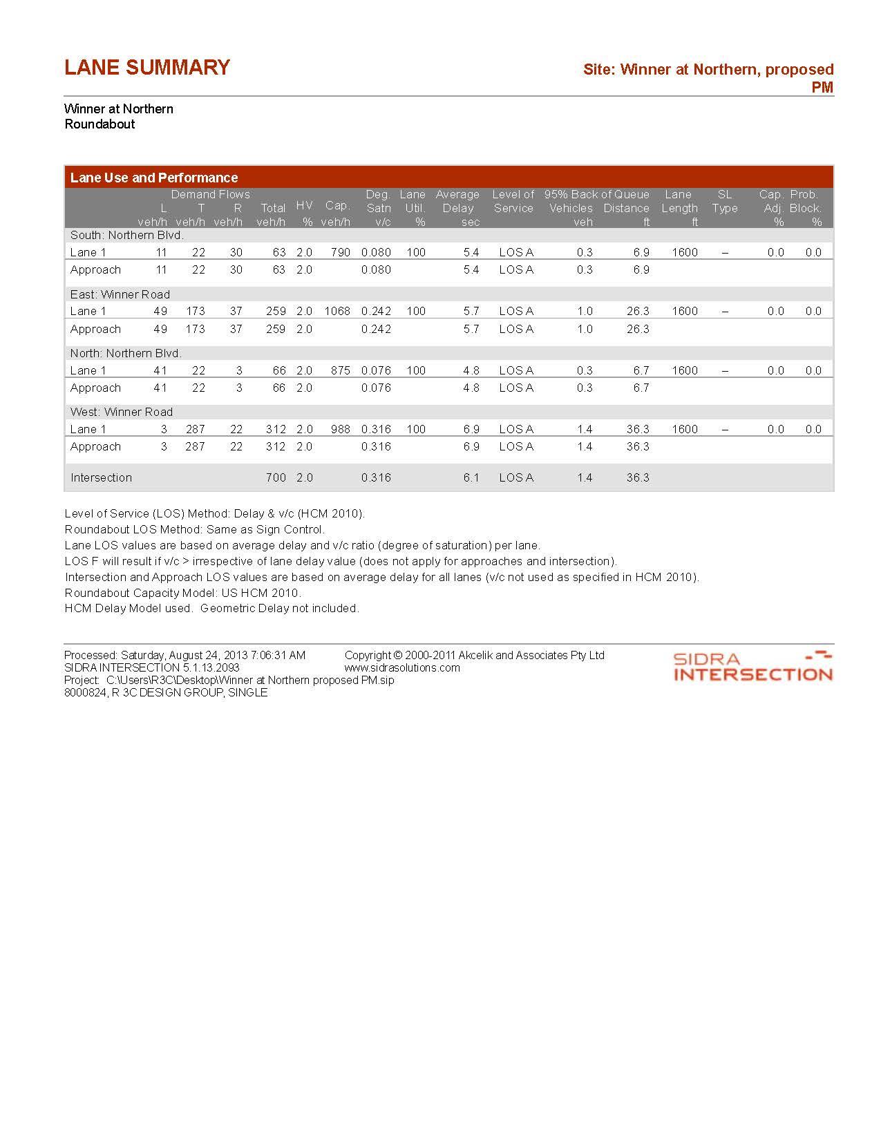

memo Page 23 of 27
5.3 18th Street removed and 20 year traffic projections
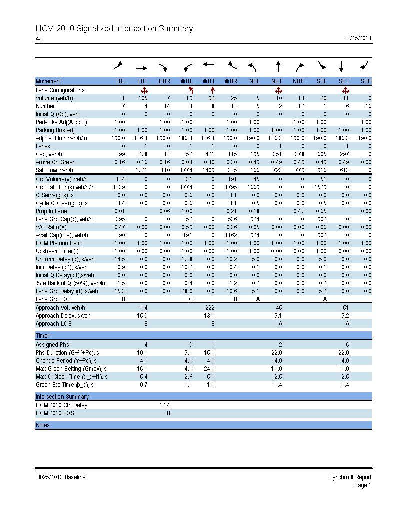

5.3.1 Signal control
5.3.1.1 Morning peak hour
memo Page 24 of 27
5.3.1.2 Afternoon peak hour
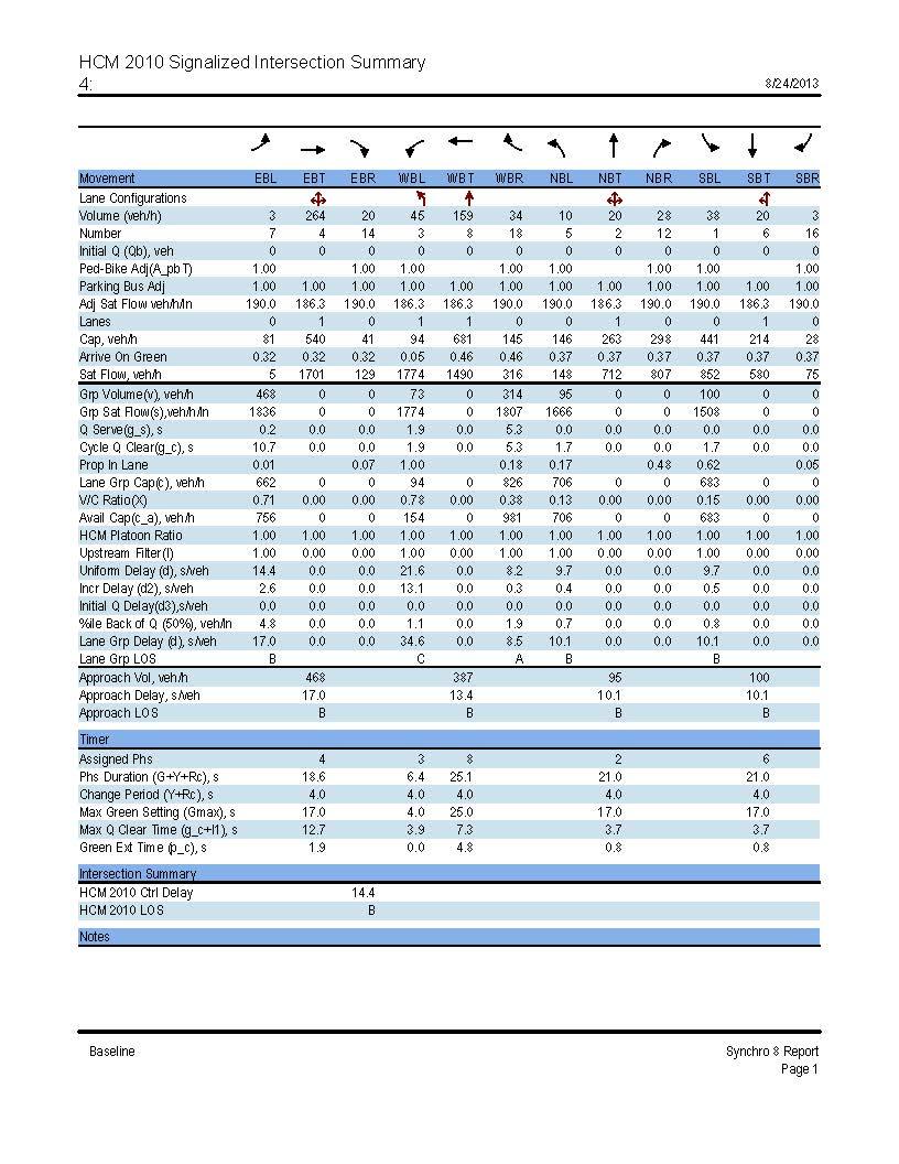

memo Page 25 of 27
5.3.2 Roundabout control

5.3.2.1 Morning peak hour
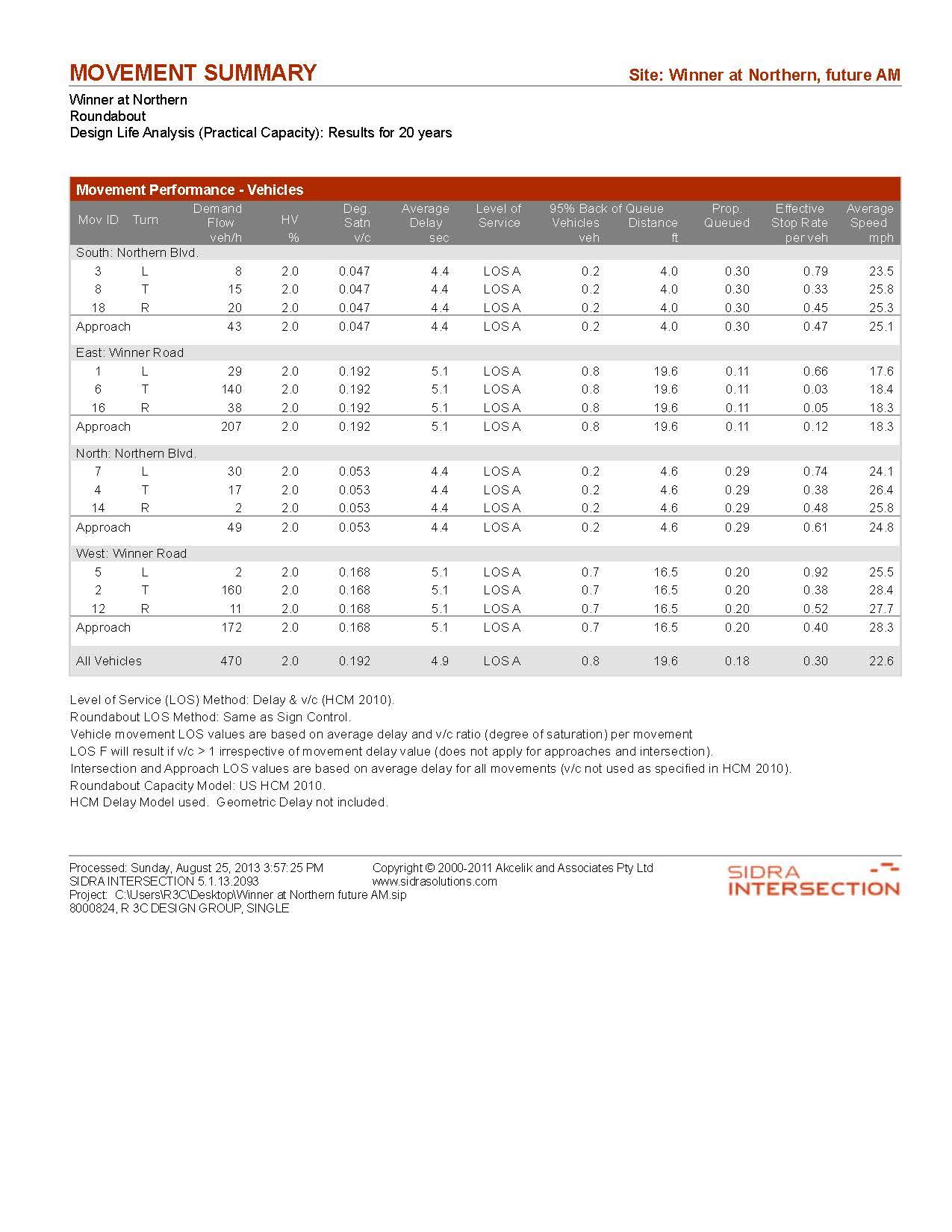
memo Page 26 of 27
5.3.2.2 Afternoon peak hour
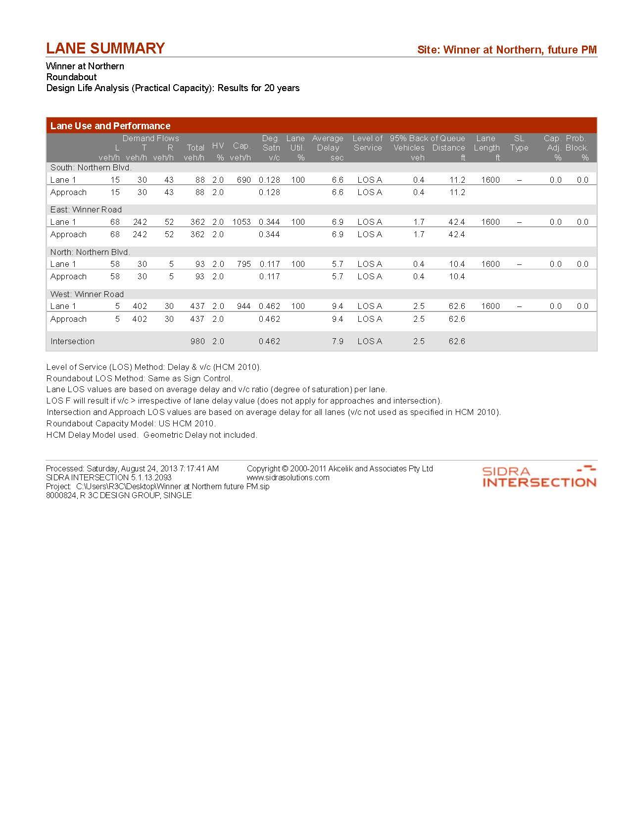

memo Page 27 of 27
VIreo


 Figure 3 | Top photo: sidewalk installed in 2012. second photo: existing crosswalk. Third photo: unplanted tree pits. Fourth photo: only break in sidewalk between Van Horn High school and Independence square. Fifth photo: stormwater grate in crosswalk.


 Figure 4 | since 2000, housing stock within a one mile radius of the study area has seen a 7% decline in owner occupied homes; more a result of increasing vacancy rates than an increase in rental units.
Figure 5 | demographics shown are according to 2012 figures and account for the population within a one-mile radius of the study area.
,


 Figure 12 | Top photo: stormwater standing in crosswalk. second photo: storm flows deposit sand and silt in streetscape. Third photo: Wheelchair in street, father/ daughter using crosswalk at englewood cafe. Fourth photo: An example of respite in englewood. sun and shade areas both available to patrons of Vivalore.


 Figure 21 | option one Winner road and northern Avenue intersection design, depicting the closing of 18th street access.
new sidewalks on the south side of Winner road, west of northern.
 Figure 23 | parking restriction Areas. purple polygons indicate location of bicycle and compact only parking due to sight triangle conflicts.
NORTH


