Natural and Nature-Based Solutions Job Aid for Streambank Stabilization in Puerto Rico
This page intentionally left blank
Prepared for:
FEMA Joint Recovery Office (JRO)
50 State Road PR-165, 2nd Floor, West Wing Guaynabo, Puerto Rico
Prepared by:
AECOM
19219 Katy Freeway, Suite 100 Houston, TX 77094
aecom.com
Disclosure:
Responsibility for the information provided herein, including any recommendations, is solely that of the authors and FEMA. FEMA must review all applications to ensure that proposed activities comply with all applicable statutory, regulatory, and programmatic requirements. Therefore, certain information must be provided with the grant application for FEMA to make an eligibility determination
Collaborators: The Nature Conservancy and, Protectores de Cuencas, Inc.
Acknowledgments: Eng. Gregory L. Morris, from Gregory L. Morris Engineering-Coop (GLM-Coop).
We gratefully acknowledge the contributions of Eng. Gregory L. Morris, Ph.D., and GLM Engineering Corp. for their assistance and support with FEMA PR JRO capacity building efforts. Their expertise has greatly enhanced our understanding of the benefits of Nature-Based Solutions in addressing streambank stabilization challenges in Puerto Rico. We also extend our thanks to Todd Bridges, Ph.D., founder and former National Lead of the USACE Engineering With Nature Initiative, and his team, for their pioneering work and ongoing commitment to sustainable engineering practices.
Quality information
Prepared by Checked by Verified by Approved by
AECOM The Nature Conservancy
Protectores de Cuencas, Inc.
AECOM The Nature Conservancy FEMA PR Joint Recovery Office
Revision History Revision
Distribution List
Figures
Figure 1-1: Schematic representation of river channel cross-section showing hydrological zones, vegetation distribution, and the effects of varying water levels on streambank stability. ................................................................................................................ 2
Figure 1-2: Conceptual profile showing a migrating river or stream channel through its floodplain over the years, while maintaining its channel’s dimension or flow capacity. Source: DNER, 2010................................................................................................ 3
Figure 1-3: Trapezoidal channel concrete walls failing along the Quebrada Buena Vista Stream, between the Jardines Metropolitanos residential building complex and the Ramón Nevarez community in San Juan. (2023)................................................................................ 6
Figure 1-4: Example illustration of three types of streambank stabilization NNBS discussed in this guide. Solutions can work together to benefit both the natural riverine system and communities. 9
Figure 2-1: Hydroseeding performed by Protectores de Cuencas to help restore the banks of the Rio Loco in Yauco (Photo credit: PDC) ........................................................................... 12
Figure 2-2: Typical section for using vegetation only for stabilization. ................................................... 17
Figure 2-3: Typical design for a live stake, which are installed in an evenly spaced matrix along the bank to create a network of roots. Adapted from McCullah and Gray, 2005. .............. 21
Figure 2-4: Typical section of coconut fiber rolls with plantings and herbaceous plugs. Adapted from McCullah and Gray, 2005. 23
Figure 2-5: Typical section of vegetated riprap. Adapted from McCullah and Gray, 2005. 28
Figure 2-6: Typical section of vegetated rock vanes. Adapted from McCullah and Gray, 2005. 30
Figure 2-7: Typical section of articulated concrete blocks. The top shows a cross-sectional view; the bottom is a plan view of that cross-section. Adapted from McCullah and Gray, 2005. 32
Figure 2-8: Typical section of vegetated stone toe protection. The top shows a plan view; the bottom is a cross-section. Adapted from McCullah and Gray, 2005. ................................. 34
Figure 2-9: Typical section of an ELJ through LWB. The left side shows the typical orientation in the stream in plan view, the right top shows a zoomed-in configuration of the LWD, and the bottom shows a cross-sectional view. Adapted from McCullah and Gray, 2005. 38
Figure 3-1: Hydroseeding along the Rio Loco channel banks.12 41
Figure 3-2: Debris removal locations along Rio Loco 42
Figure 3-3: The chosen alternative for the stabilization of Río Canóvanas, whose design involved constructing a rock bench and vanes, and relocating the channel thalweg....... 44
Tables
Table 2-1: Comparative analysis of NNBS methodologies for streambank stabilization ......................11
Table 2-2: Plants categorized by streambank zone, habit, wetland status, and their applications for streambank stabilization. For a detailed definition of each plant habit and wetland status, see the appendix of this document. ...........................................................18
Table 2-3 Native Puerto Rican plant species categorized by zone, best uses, uses in naturebased solutions, and maintenance and operation requirements. Adapted from Urban Hydrologics, 2024. 19
Table 2-4: Tree and shrub species that can grow from live stakes or poles 21
Table 2-5: Cost estimates for NNBS measures 24
Table 2-6: Cost estimates for vegetated structural measures ...............................................................
Table 2-7: Cost estimates for engineered log jams .................................................................................
1. Introduction
This job aid is designed to equip FEMA personnel and stakeholders with the necessary knowledge and field-oriented, practical advice for successful streambank stabilization works in Puerto Rico through the application of Natural and Nature-Based Solutions (NNBS). This involves restoring, protecting and enhancing riparian buffers and vegetation along the streams in Puerto Rico, especially those with repetitive loss, consistent with FEMA's strategic objectives for enhancing climate resilience.
Rivers and streams provide many critical ecosystem services to the island’s population, and some of the most noteworthy of those services are related to floodwater conveyance and public water supply. However, riverine and stream ecosystems in Puerto Rico have been affected by urban development, agriculture and other land modification activities, and the urgency for sustainable and resilient streambank management practices is clearly evident. Increasing and evolving challenges associated with climate change make this aim more necessary than ever.
1.1. Objectives of This Job Aid
To increase understanding and awareness of NNBS and their role in streambank stabilization and disaster risk reduction.
To illustrate the benefits and effectiveness of NNBS in mitigating streambank erosion, safeguarding against natural disasters and enhancing community resilience to such events.
To provide technical guidance on implementing NNBS for streambank stabilization.
To facilitate informed decision-making in selecting and applying NNBS in various riverine contexts that may qualify for FEMA mitigation-related funding, especially in areas with repetitive losses.
To align streambank stabilization efforts with FEMA's strategic objectives, specifically aimed at reducing threats from natural disasters through sustainable and resilient infrastructure practices.
This guide does not cover the detailed hydraulic analysis required for designing stabilization projects. Such analyses are crucial and should be conducted by qualified professionals to ensure the sustainability and effectiveness of any proposed interventions. These analyses consider the broader hydrological and geomorphological contexts of the river system, which are critical to understanding the dynamics at play before initiating any stabilization efforts. Without a thorough assessment of the river's cross-sections and patterns, while keeping overarching restoration goals in mind, stabilization efforts can lead to ineffective and unsustainable outcomes.
1.2. Background on Streambank Erosion
The size, form and flow of stream channels are directly related to the area it drains, including land use, geology and resulting soil types, topography and climate within its watershed. The combination of these factors defines natural processes leading to erosion, soil transport and sorting and deposition of alluvial and other materials by stream and river flows.
Bankfull discharge is the water level, or stage, at which a stable stream or river reaches the top of its banks, and any further rise results in water spilling onto the floodplain. The bankfull stage has been shown to be strongly correlated to a channel’s effective discharge and represents that flow stage that passes most of the annual sediment load over time. As such, it is the discharge or river flow that forms and maintains the channel’s form. Average High Water (AHW) refers to the average position of the high water mark over a prolonged period of time. Also known as Ordinary High Water, it represents the boundary between the aquatic and terrestrial environments in federal law under the US Clean Water Act. Average Low Water (ALW) is the counterpart to AHW. ALW marks the average position of the low water mark over an extended period, corresponding to the elevation where the water surface is at its lowest average level, often visible as a distinct line on the streambank.
Bankfull, AHW, and ALW stages are shown in Figure 11
1-1: Schematic representation of river channel cross-section showing hydrological zones, vegetation distribution, and the effects of varying water levels on streambank stability.
Figure
Natural streams have sequences of riffles, pools and steps that maintain channel slope and stability. Riffles are streambed features formed by gravel or larger rock particles where the water depth is relatively shallow, and the slope is steeper than the average slope of the channel. Pools are located on the outside bends of meanders and curves between riffles and are much deeper than the stream’s average depth. At low flows, pools are depositional features and riffles are scour features. At high flows, however, pools undergo scour, and bed material deposits on the riffle. The inside of the meander or bend is a depositional feature called a point bar, which also helps maintain channel form. Steps are vertical drops often composed of large boulders, exposed bedrock and downed trees. Deep pools are also found at the bottom of each step. The step serves as a grade control and the pool dissipates energy. The spacing of step pools shortens as the channel slope increases.
Natural streams are rarely straight. They tend to follow a sinuous path, forming curves or meanders on their way across the landscape; these meanders generally increase as the stream channel slope decreases through valleys and coastal plains. Even if a river channel is “stable,” it does not imply that the river does not move laterally within its floodplain, but rather that its channel depth and width section and profile remain basically constant (Figure 1-2). Naturally stable streams must be able to transport sediment materials such as sand, silt, clay, detritus, as well as cobbles and gravel supplied by the watershed. Erosion on the outside bend of the meander is compensated by the deposition of sediment on the point bar located inside the meander. The rate of lateral migration of the channel depends on the frequency of large floods and the resistance provided by the streambank. The root system of trees, shrubs and other vegetation further help to strengthen the streambank against scour by holding soil in their intertwined root mat system.
1-2: Conceptual profile showing a migrating river or stream channel through its floodplain over the years, while maintaining its channel’s dimension or flow capacity. Source: DNER, 2016. 1
Streambank instability occurs when scouring causes the channel bed and walls to erode (degrade) or excessive deposition causes the channel bed to rise (aggrade). This process can happen naturally on a regular, temporary basis due to significant rain events, after which the channel reaches a new equilibrium. Streambank erosion contributes to the increased vulnerability of adjacent communities
1 Department of Natural and Environmental Resources [DNER]. (2016). Guía para mantener la conectividad ecológica en las estructuras de cruce en ríos y quebradas de Puerto Rico.
Figure
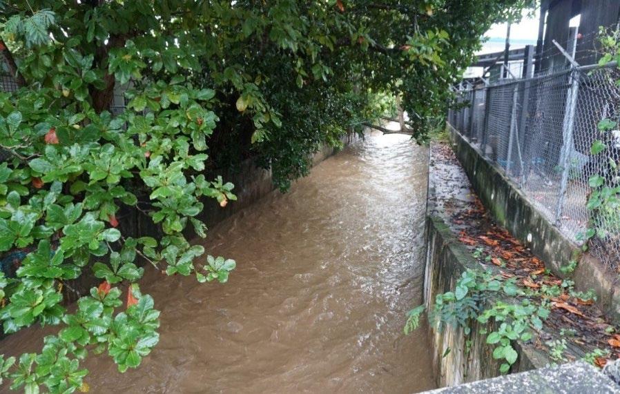
to flooding, as eroded banks can lead to the widening or migration of river channels and reduced channel capacity. Sediment impairment can become a critical issue, when excess eroded materials from higher elevations accumulate in riverbeds, altering streamflow dynamics and habitats. Moreover, the high shear stress and flow velocity during storm events can strip riverbanks of vegetation, exacerbating sediment displacement. The lack of habitat and disconnection from the floodplain further impair the stream's ecological functions.
However, streambank erosion can also be caused or exacerbated by human activities, with chronic or long-lasting effects. The extraction or mining of materials from the riverbed ends up lowering its levels, causing or accelerating channel incision and bank erosion, and reducing sand that would otherwise nourish downstream areas and beaches. Agricultural activities that involve heavy tillage or grazing near streambanks can weaken soil and make it more prone to being washed away. Urban development also facilitates sedimentation of streambeds due to the removal of vegetation and land movement during construction activities, allowing exposed soil to be easily transported by runoff.
But once the construction phase is completed, the contrary happens. Runoff is unable to access and carry soil particles buried beneath paved surfaces, and as a result, stormwaters reach streams and rivers not only faster, but also with a higher capacity to remove and transport soft and loose materials from the riverbed and its channel walls, which could lead to scouring.
Paradoxically, river flows become lower between rain events after urbanization. Paved surfaces act as barriers that isolate the soil, preventing the infiltration of rainwater that otherwise would have gradually discharged from the ground and into streams days later, a process that is critical for maintaining base flows. Water reservoirs that have been built in-stream to obstruct river flows and store water also trap sediments transported from upstream areas within the watershed. This causes the river to entrench immediately downstream, leading to significant scouring of its bed and channel walls.
1.3. Stream Channel Conditions in Puerto Rico
Puerto Rico’s central mountain range exhibits high degrees of slope to the south and east, while the north slopes are heavily eroded with numerous river valleys. The south slopes tend to be dry much of the year owing to the orographic or rain shadow effect caused by the island’s topography and the trade winds. During extraordinary rain events, streams and rivers in the south coast tend to react faster than those in the north, swelling and becoming rapid torrents able to flood extensive areas. Most rivers on the north side are larger in volume and length since they have larger drainage basins. Channel gradients are steep, stream valleys tend to be well-incised and narrow, and major storms tend to be intense but brief. Flooding generally occurs rapidly after significant rain events, with peak discharges several orders of magnitude above base discharge, but floodwaters recede quickly. The island’s diverse topography, coupled with its varied geological settings and rainfall regimes, defines streambank dynamics, making some areas more susceptible to rapid soil loss, channel configuration changes and overflows.
Streambank erosion presents a significant geomorphological challenge in Puerto Rico with direct implications for flood management, water quality and public supply, and ecological stability. Most streams and rivers on the island have experienced significant alterations due to historical land use changes along their courses and their watersheds. These have been affected by direct (e.g., channelization) and indirect (e.g., watershed deforestation) human-caused modifications, initially related to intensive agricultural activities, and later to urban development.
Many floodplains and streambanks have been filled to make way for the construction of dwellings and other urban structures, encroaching on rivers and restricting their flows, and thereby significantly changing those conditions that maintain river channel stability. In response, various temporary and hard infrastructure measures have been widely adopted across the island to compensate for these modifications and their resulting effects on streambanks. However, in many instances, these practices have aggravated erosion and scouring problems farther downstream, in addition to degrading or destroying the natural attributes of those stream segments where the measures have been built. Some of these practices include:
“River Cleaning”: Under Puerto Rico Law, (Act No. 49 of 2003, as amended), river cleaning activities should be limited to removing foreign material from the riverbed without altering its natural configuration. However, activities often extend to the removal of all vegetation within the channel while leaving the remaining soil completely exposed, excavating riverbed bars, filling sediment ponds and straightening meanders, effectively channelizing the rivers. This approach not only alters the floodplain but also leads to excessive erosion and widening of the river section, increasing sediment deposition in the immediate riverbed and downstream segments, which could potentially require repeated sediment removal from the channel itself.
Gabions: These wire mesh baskets filled with stones, originally designed for the stabilization of steep slopes, are frequently used to control bank scouring. However, they often fail over time due to the wire mesh’s susceptibility to corrosion, abrasion and the impact of hydraulic forces during flood events, which destroy or dislodge the gabions from their position or location, leading to further changes in the stream profile.
Traditional Hard Armoring: This practice involves placing large rocks attached together with Portland cement, constructing concrete bottoms and vertical walls, or installing sheet steel pilings along riverbanks to prevent erosion, or even completely encasing the stream in buried pipelines, in many instances creating an impermeable funnel or canal. While effective as a shortterm way to manage peak flows, these practices alter natural river dynamics and habitats by inhibiting the natural migration of rivers and isolating them from the surrounding floodplain. Their lack of rugosity leads to faster flows, causing severe erosion and scouring immediately downstream, which in turn leads to sedimentation farther downgradient. In addition, the altered, armored stream segment usually requires regular maintenance because it will tend to collect sediment due to the lack of frequent, strong flows that would otherwise wash materials downstream; in some instances, culverts can become completely blocked by sediment Furthermore, these walls can fail and fall into the stream channel, leading to sudden, catastrophic effects: the fallen wall can obstruct flow and/or cause the adjacent downstream
panels of the walled section to be undermined and detach, leaving the remaining steep slope and soil surface exposed to severe scouring. An example of this is shown in Figure 1-3
community in San Juan. (2023).
These hard infrastructure measures, especially those that isolate a stream channel from its floodplain and surrounding landscape, severely hamper or eliminate the functions and values that these natural systems provide, such as reducing and dissipating floodwater velocities, and sustaining flows for public water supply, including that needed to maintain fish and wildlife habitat and associated wildlife corridors, outdoor recreational activities, and reducing nearby ambient temperatures. Maintaining or improving these ecological services is more vital than ever before to safeguard the wellbeing of communities, especially against the increasing impacts associated with climate change. These include, among others, very intense or extreme rain events with significant dry spells or droughts in between, compounded by a reduction of between 13% and 22% in the annual average precipitation for the whole island by the year 2050 compared to that recorded for the period between 1986 and 2005.
1.4. Role of NNBS in Streambank Stabilization
Streambank NNBS or bioengineering measures rely on natural processes that combine structural, biological and ecological principles to construct living structures for slope stabilization, reduced soil erosion, revegetation and flood control. This job aid focuses on providing guidance for streambank
Figure 1-3: Trapezoidal channel concrete walls failing along the Quebrada Buena Vista Stream, between the Jardines Metropolitanos residential building complex and the Ramón Nevarez
NNBS stabilization techniques that can be implemented within existing channel dimensions to assist in maintaining a balanced level of bank erosion and sediment deposition; that is, maintaining erosion process along banks that are expected to be in equilibrium with the stream’s hydrology for a certain channel type. This means acknowledging the dynamic interplay between hydrological stages (i.e., bankfull, AHW, and ALW) and the geomorphic characteristics of streambanks, which dictate the erosional resilience and the necessity for tailored NNBS in streambank stabilization strategies. In doing so, the chances for sudden alterations in channel dimensions can be significantly reduced within a relatively limited area of their floodplains by also strengthening the capacity of streambanks and riverbeds to resist the full erosion effects of hydraulic, abrasion, attrition, and solution forces.
The fundamental principle employed here is Natural Channel Design (NCD), which aims to restore the dimension, pattern, and profile of disturbed river systems by emulating stable, natural streams. Understanding erosion, sediment transport and deposition processes driven by hydrologic actions is essential for designing interventions that are both effective and sustainable. The principles of streambank stabilization include process-driven design, which advocates for accommodating the river's evolutionary changes over time. It is essential to design interventions that adapt to these dynamic systems in both spatial and temporal contexts. Additionally, maintaining or restoring balance in water discharge and sediment transport reduces the need for extensive hard structures and is crucial for preventing bank failure.
Another key principle is stable bank geometry, which is fundamentally about shaping streambanks to naturally resist erosion and withstand the forces of flowing water, which reduces the necessity for rigid armoring and encourages bioengineering approaches. For example, when design incorporates native plants, their roots further reinforce the soil, absorbing water and reducing runoff. These plantings can take the form of deep-rooted trees and shrubs that keep soil in place and grasses that form dense mats to protect the soil surface. Together, they create a living armature that is flexible and responsive to changing water levels and flow conditions. In essence, this approach recognizes that a well-designed bank will support a self-sustaining ecosystem that provides not only erosion control but also better water quality for public supply and recreation as well as habitat for a variety of aquatic and terrestrial species.
Many river stabilization projects are unsuccessful because they only address site-specific symptoms without understanding the wider causes of channel and streambank erosion and degradation. Longterm streambank stabilization success needs to recognize the interconnected nature of hydrologic and geomorphic processes across a river’s entire drainage basin. Strategies such as sustainable land use planning and comprehensive watershed management are critical to achieve long-term ecological and community resilience, including that of surface waterflows and their causeways. While the principles and benefits of large-scale interventions such as comprehensive floodplain
management are recognized as essential for the health of waterways and the protection of adjacent communities, it is important to note that these are beyond the scope of this specific job aid. 2
The most cost-effective and efficient measure to address streambank erosion is preventing those activities that cause significant channel modifications, and avoiding or discarding infrastructure that is not water-related (homes, buildings, roads, etc.) in areas exposed to the effects of peak flows, or where natural changes in channel and streambank configurations are to be expected.
The strategies, interventions and solutions described in this job aid employ natural processes to assist in maintaining a balanced level of bank erosion and sediment deposition. These strategies need to be employed after restoring the channel’s dimension, pattern and profile to match watershed hydrology and the valley’s morphology using both NCD analysis and process-based analysis and design methods. Most bank stabilization project designs fail because there was no initial fluvial geomorphic analysis, no analytical evaluation of the channel stability, no hydraulic evaluation of shear stress, velocity or, in some cases, buoyancy to compare against published critical stability thresholds of bank treatments. For bank treatments, being certain that, at the very least, bankfull cross-sectional area is present or is restored before choosing bank solutions, is crucial to their resiliency.
NNBS leverage natural processes and materials, and sometimes structural measures, to address environmental challenges. This promotes the recovery of ecosystems and increases community resilience by integrating ecological functionality with flood management strategies. In the context of streambank stabilization, NNBS includes the restoration of natural vegetation and the construction of living structural barriers to reduce erosion and enhance habitat, contributing to the overall health of the watershed (see Figure 1-4)
The role of NNBS in Puerto Rico is critical given the island's unique ecological diversity and landforms, and the need for solutions that accommodate both environmental and community resilience. By integrating native vegetation through bioengineering practices, creating or restoring riparian buffers and employing techniques informed by NCD, NNBS work to stabilize streambanks, reduce erosion rates and improve water quality.
Community engagement and education are imperative in ensuring that restoration projects are culturally relevant and supported by local stakeholders. This approach fosters a connection and sense of belonging between communities and their natural environment, promoting stewardship and sustainable land management practices that can reduce the impact of streambank erosion over the long term.
3
2 For specific NNBS that can help address stormwater runoff in urban areas of Puerto Rico, please review the FEMA Puerto Rico Joint Recovery Office Stormwater Management NNBS Job Aid.
3 Implementing NNBS for streambank stabilization in Puerto Rico will also ultimately involve promoting erosion control best practices and integrating vegetation and soil remediation to ensure the sustainability of interventions. These practices include the promotion of soil remediation efforts such as composting and mulching, particularly in upland
Figure 1-4: Example illustration of three types of streambank stabilization NNBS discussed in this guide. Solutions can work together to benefit both the natural riverine system and communities.
2. NNBS Conceptual Methodologies and Designs
Streambank NNBS can be divided into two general approaches: riparian vegetation management (also known as plant-based bioengineering measures) and vegetated structural measures (also known as structural-based bioengineering). These approaches are divided based on intended function, material type and ability to dynamically change over time. As the name suggests, plantbased bioengineering uses riparian plants to provide long-term bank stability and strength by using root systems to bind soil particles and impart cohesion to the soil and resistance to erosional loss. This type of treatment is flexible and dynamic and can be used on sites that do not require a static bank line protection where bank erosion is expected during high flows. Selecting the appropriate vegetation for different hydrologic zones is key to streambank stabilization, from drought-tolerant species in the upper bank to wetland plant species in lower areas. Maintaining the viability of the vegetation against variable water flows and extreme weather impacts, particularly until these
areas with bare ground that require vegetation and forest cover. Implementing erosion control best practices among farmers and other landowners, especially on steep slopes and erosion-prone areas, is necessary to reduce land disturbance and sediment runoff. The use of herbicides in such areas should be limited to preserve the existing root structures that stabilize the soil.
become fully established after planting, is also very important. Examples of plant-based treatments include regrading and hydroseeding, brush trenches, reforestation and live plant materials.
Maintenance activities to control the growth of vines from suffocating the vegetation that has been planted especially woody vegetation is essential until these can develop enough canopy to suppress vine growth. Maintenance activities also include the control of invasive species that could outcompete native vegetation. However, control measures should not be exclusively focused on the elimination of all exotic or introduced plant species, but the management of these based on their potential benefit to the project. The African tuliptree (Spathodea campanulata), the woman’s-tongue tree (Albizia lebbeck) and the tall albizia (Albizia procera), for example, are introduced tree species that have become widely distributed throughout the island due to their fast growth rates and ability to colonize highly disturbed soils. These species have behaved like pioneer species by promoting the production of leaf litter, which in turn increases topsoil organic content and moisture, all of which support successional processes that eventually benefit the establishment of native flora. Therefore, careful identification and elimination of undesirable introduced plant species should be carried out so that such action doesn’t eliminate potential benefits of allowing these, at least initially, at the project site.
Structural-based bioengineering uses structural materials such as native in situ rocks, riprap, logs, manufactured products or inert material for channel stabilization. This type of treatment is designed to create quasi-static banks that remain stable under high velocity water flows or constant inundation. This treatment is used on river channels and bank slopes that are exposed to scouring, requiring more than vegetation to withstand the hydrodynamic forces of high flows and sediment loads. Additional engineering and structural-based design approaches are required to treat eroding banks that are intended to be static and/or high-risk sites where bank movement is unacceptable (e.g., adjacent to bridges, highways or urban corridors). Structural-based bioengineering can be combined with plant-based treatments to impart greater resistance to erosional loss. However, it is important to choose plant species that are quick to establish and robust enough to survive high flow events. Examples of structural-based treatments include soil-covered riprap, riprap toe and in situ boulder cobble toe protection, vegetated riprap, boulders, joint planting, engineered log jams and rootwad or tree revetments.
Managing sedimentation is crucial for either of the two NNBS designs, since excessive sediment deposition can lead to the formation of channel bars that obstruct water flows, increasing the risk of flooding. Excessive sedimentation can also cause the concentration of flows along a limited section of the channel, potentially leading to scouring, all resulting in the degradation of river habitats.
In this section, NNBS for streambank stabilization are described, from the establishment of robust riparian buffers to the integration of structural measures with vegetative growth. Each method is presented with its applicable conditions, construction materials, typical sections and cost estimates. Planning for the implementation of these methods should strategically aim for the dry season and outside of the hurricane season, when conditions are more stable and the risk of immediate erosion or damage from storms is significantly reduced. The suitability of environments for each NNBS method is described, considering factors such as slope, hydrology and the required vegetation's
habitat needs. Table 2-1 summarizes the capabilities and limitations of each NNBS method, providing a quick reference for their appropriate application in streambank stabilization efforts. Each method is evaluated across several aspects, including suitability for bank, toe and in-stream applications; permissible inundation frequency; flow velocities; and whether the approach is nonstructural or hybrid.
Table 2-1: Comparative analysis of NNBS methodologies for streambank stabilization
2.1. Riparian Vegetation Management
2.1.1. DESCRIPTION OF SOLUTIONS AND OBJECTIVES
Bioengineering through riparian vegetation management in Puerto Rico aims to leverage native plant species' natural resistance to hydraulic stresses and their ability to establish robust root systems
that anchor sediment. The primary objective is to stabilize streambanks and toes with minimal intervention, creating a riparian buffer that reduces erosion while enhancing the ecological integrity and biodiversity of aquatic ecosystems. This approach involves the strategic selection and placement of vegetation to provide natural reinforcement for banks and to create habitats for local wildlife. The choice of plants should consider the frequency and duration of inundation, soil type and the velocity of water flow to ensure that the vegetation can establish and thrive.
This bioengineering approach to riparian vegetation management encompasses a spectrum of techniques, ranging from purely vegetative solutions to the integration of bio-based materials like stakes and coir products for additional anchoring and stability of the establishing vegetation.
This strategy encompasses:
Stabilizing streambanks and toes by leveraging the root systems of native plants, which not only resist hydraulic forces but also bind soil particles together, reducing erosion.
Hydroseeding (Figure 2-1) can be an efficient technique for rapidly establishing vegetation cover on streambanks and slopes and has a history of success in Puerto Rico. 4 Hydroseeding involves spraying a mixture of seeds, mulch, fertilizer and water directly onto the soil. This method is particularly effective in high slope areas or locations where traditional planting is challenging. Hydroseeding stabilizes the soil temporarily, providing a protective layer that reduces erosion and supports the growth of vegetation. When used in tandem with other practices, such as the strategic placement of native plants and coir products, hydroseeding contributes to both immediate soil stabilization and the long-term enhancement of ecological integrity.
Figure 2-1: Hydroseeding performed by Protectores de Cuencas to help restore the banks of the Rio Loco in Yauco (Photo credit: PDC)
4 Strum, “Guánica Hydroseeding”.
Enhance the ecological integrity and biodiversity of riparian zones through the strategic selection and placement of native vegetation, creating habitats for local wildlife and promoting biodiversity.
Utilize coir products as an intermediate stabilization measure, offering a biodegradable substrate that supports the establishment of vegetation by providing soil protection and moisture retention near the water's edge. Coir is a natural fiber extracted from the husk of coconuts often used in products like mats, ropes and nets. Pole planting techniques integrated with rock layers further increase stability and provide immediate aquatic habitat benefits.
The use of live stakes, dead stakes and post plantings to enhance the stability and vegetative growth along streambanks. Live stakes are inserted into the ground to root and grow, providing immediate stabilization and long-term reinforcement. Dead stakes offer temporary structural support for the soil and assist in the establishment of other vegetation. Post plantings involve larger cuttings that serve as anchors in the soil, supporting the growth of a robust vegetative cover.
These approaches represent the “greenest” techniques in riparian zone management, focusing on creating a living, self-sustaining system that evolves over time without structural intervention.
2.1.2. SUITABLE ENVIRONMENTS FOR SUCCESSFUL IMPLEMENTATION
The efficacy of vegetation management strategies is highly contingent upon the environmental context and the adaptability of selected plant species. Optimal settings for these strategies support a diverse array of native vegetation, including grasses, forbs, shrubs and trees, each playing a vital role in soil stabilization and habitat provision at different zones of the stream. Prioritizing native plants is advisable due to their evolutionary adaptation to local conditions and their ecological contributions. Employing a variety of species that span different root depths and exhibit diverse tolerances to moisture and sunlight can forge a more robust vegetative cover that is capable of enduring assorted environmental challenges.
Key considerations for effective vegetation implementation encompass:
Streambank Slope: Vegetation thrives best on slopes that range from flat to moderately steep (up to 1V:2H). 5 For slopes that are too steep and at risk of imminent failure, it is advisable to first lay back the slope to a more manageable gradient before planting vegetation. This preparatory step can significantly enhance plant viability by creating a more stable environment. In cases where adjusting the slope gradient is not feasible, or even after slope adjustment, supplementary methods like erosion control fabrics or staking may be necessary to ensure the successful establishment and sustainability of the vegetation on steeper inclines.
5 McCullah and Gray, “Environmentally Sensitive Channel- and Bank-Protection Measures”
Hydrologic and Geomorphic Setting: Plant selection should align with existing and anticipated hydrological conditions, such as AHW, ALW, and bankfull stages, alongside the streambank's geomorphic characteristics. Aquatic plants are suited for zones below the ALW level, while various species of grasses, forbs and woody plants are appropriate for areas reaching up to and beyond the bankfull mark, adapting to different flow velocities and shear stress conditions. 6
Soil Type and Condition: The success of vegetation largely depends on the soil's suitability. Engineered or compacted soils, often devoid of organic content, might need enhancements to foster plant growth. Integrating native topsoil or organic amendments such as composting and mulching can significantly boost plant establishment prospects. These soil remediation efforts are particularly critical in areas with bare ground that require reforestation and an increase in vegetation cover, ensuring that the soil environment is conducive to the growth of both native and desired plant species.
Moisture Availability: Consistent and adequate moisture is crucial, particularly during the initial growth phase. While certain species withstand drought, others may necessitate irrigation for their moisture needs. The use of soil polymers in dry areas can significantly enhance moisture retention in the soil, thereby increasing plant survival rates. Soil polymers absorb and retain water, releasing it gradually to the plant roots, making them an effective solution for maintaining moisture availability in arid conditions and reducing the need for frequent irrigation.
Sunlight and Shade: Light exposure levels can influence plant growth and survival, with areas receiving partial to full sunlight being ideal for most grasses and forbs. Conversely, some shrub and tree species may adapt to or prefer shaded environments.
Timing of Construction: The timing of construction and vegetation efforts is crucial to avoid the challenges posed by hurricane seasons or wet periods. Implementing projects during drier times of the year can reduce the risk of erosion and plant washout, ensuring that stabilization measures have the best chance of success. However, doing so may require frequent irrigation to offset the chances of desiccation until the wet season arrives. Planning around these periods is essential for the effective establishment of vegetation and the long-term stability of streambanks.
2.1.3. CONSTRUCTION MATERIALS AND EQUIPMENT
The selection of construction materials and equipment is essential for successful riparian vegetation management. These materials must support the establishment, growth and long-term stability of vegetation on streambanks. Key materials include:
Native Plants: A selection of species tailored to the different zones of the riparian area is crucial for effective streambank stabilization. In choosing plants, it's essential to consider both plant habit the general growth form or structure of the plant, such as tree, shrub or grass and
6 US Department of Commerce, “High Water Level Terminology.”
wetland status, which indicates a plant's likelihood of occurrence in wetland versus non-wetland areas. Plant habit influences how well a plant can contribute to erosion control, habitat provision, and aesthetic value in its specific placement along the streambank. Wetland status, ranging from obligate wetland (OBL) species that thrive in wet conditions, to facultative (FAC) plants that are equally likely to occur in wetlands or non-wetlands, to upland (UPL) species that prefer drier soil, guides the selection of species based on their moisture preferences, ensuring they are suited to the environmental conditions of their planting zone.
Native plants are chosen for their adaptability to local conditions and ecological benefits. This selection includes a variety of grasses, sedges, shrubs, and trees for the upper bank areas, where soil conditions tend to be drier and more stable; herbaceous and shrub species to provide slope stability and habitat diversity on mid-slopes; and wetland plants suited for such conditions of the toe of the bank or riparian zones. Table 2-2 provides examples of native Puerto Rican plants applicable to each zone of the bank or toe, categorized by both plant habit and wetland status to aid in selecting vegetation. For a detailed definition of each plant habit and wetland status, see the appendix.
Hydroseeding: Hydroseeding is an efficient way to cover large areas quickly and requires a specialized slurry mixture composed of grass seeds, mulch, water and sometimes soil amendments or fertilizers, which are sprayed over prepared soil using a hydroseeding machine. Equipment for hydroseeding includes the hydroseeding machine itself, which mixes and sprays the slurry, and other tools for site preparation and post-application care, such as irrigation systems to ensure the seeded area receives adequate moisture for germination and establishment. This technique is especially valuable in riparian vegetation management, especially in areas where conventional planting techniques may not be feasible or effective, or where soil cover is urgently needed.
Coir Products: Coir mats, logs and rolls, derived from the fibrous husks of coconuts, provide temporary structural support. They promote sediment deposition and vegetation growth by offering a medium that retains moisture and protects soil from erosion. These biodegradable materials are especially beneficial in areas where immediate stabilization is needed to support the establishment of native vegetation.
Geotextiles: Geotextiles, some of which are biodegradable, are employed to reinforce soil and support plant and root integration. They serve to prevent erosion, enhance moisture retention, and provide a growth medium for roots. Geotextiles are selected based on permeability and soil retention needs, with options such as woven and non-woven fabrics to accommodate various environmental conditions and project goals.
Live Stakes and Cuttings: Cuttings from species with rapid root development capabilities and soil stabilization properties are valuable for immediate stabilization and contribute to the long-term reinforcement of the bank. However, in Puerto Rico, the selection of species suitable for this practice requires careful consideration, as few native species may possess the ideal traits for live staking. Woody species that are propagated by cuttings often lack a strong main or anchor root,
making such individuals more susceptible to tree failure and falling. Furthermore, it is important to address concerns related to the propagation of planting material by vegetative means. Such methods can impact genetic diversity negatively and increase the species’ vulnerability to diseases. To mitigate these risks, it is crucial to diversify the genetic sources of cuttings and possibly integrate a variety of species into stabilization projects. This approach not only helps preserve genetic diversity but also enhances the ecosystem's resilience to pests and diseases.
Planting Supplies: Supplies include mulches for moisture retention and weed suppression, stakes for supporting young plants and tree shelters to protect saplings from wildlife. Mulching materials, such as wood chips or straw, are selected based on their ability to conserve soil moisture, provide temperature moderation, and enhance soil fertility as they decompose. Soil polymers can be a valuable addition to these supplies, especially in dry areas or for plants with high moisture needs. These polymers absorb water and release it slowly, ensuring consistent moisture availability to the plants and reducing the need for frequent watering.
Landscaping Tools and Equipment: Basic tools such as shovels, trowels and rakes are required for site preparation and plant installation. For larger-scale projects, mechanized equipment like backhoes may be necessary for site grading, excavation and material transportation.
2.1.4. TYPICAL SECTIONS
Vegetation Only
In Figure 2-2, a typical section showing the “vegetation only” strategy for riparian stabilization is illustrated, incorporating specific planting techniques suited to the hydrological and soil conditions of each bank zone. When planning for vegetation across these zones, environmental considerations such as expected water elevations, flow velocities, soil type and bank steepness must inform the design. The integration of structural support with vegetative techniques helps increase the resilience of the vegetative cover against erosive forces. Table 2-2 provides an overview of plant habits, wetland status and their applications for streambank stabilization across different zones. Table 2-3 breaks down specific native species, detailing their habits, best uses, heights, soil types, root types, uses in nature-based solutions and maintenance requirements. For a detailed definition of each plant habit and wetland status, see the appendix of this document.
Figure 2-2: Typical section for using vegetation only for stabilization. Adapted from McCullah and Gray, 2005. 7
Upper Bank (Upland Plants Zone): The highest zone, inundated by only the most extreme floods, calls for species adapted to dry, infrequently saturated soils. For this upper bank area, it is recommended to prioritize tree species, such as wild banyantree (Ficus citrifolia), Santa Maria (Calophyllum antillanum), and pink trumpet tree (Tabebuia heterophylla) over other plants like shrubs. These trees provide stability and erosion control, and are suitable for the drier conditions near the bank's top. Hydroseeding, a planting process that uses a slurry of seed and mulch, can establish a first line of defense with a blend of seeds, mulch and stabilizers that adhere to the soil surface. In cases where the existing soil is an engineered type lacking organic richness, rooted transplants such as Puerto Rican native grasses, including species like pink muhly grass (Muhlenbergia capillaris), may be introduced into enhanced soils.
Mid-Lower Bank (Obligate Wetland Plants Zone): Transitioning to the mid-lower bank, the introduction of deeply planted cuttings facilitates the establishment of species that favor seasonally wet soils. This area benefits from native vegetation that is fast-growing; has deep root systems for erosion control; and can be easily propagated from plantings, cuttings or poles, as applicable. After taking root, this vegetation bolsters the bank against shear stresses up to 30 newtons per square meter (N/m²) (0.6 pounds per square foot [lb/sq ft]), which is comparable to established reed plantings. These plants not only stabilize the bank but also enrich the riparian habitat.
Toe (Inundation Zone): At the water's edge, the focus shifts to species that can survive permanently saturated soil conditions and frequent submersion. Here, plants must resist shear stresses equivalent to those withstood by established reed plantings, up to 30 N/m² (0.6 lb/sq ft), and flow velocities potentially over 1.5 meters pers second (m/s) (5 feet per second [ft/s]). 8 Additional structural support, such as erosion control blankets, may be necessary to protect the
7 McCullah and Gray, “Environmentally Sensitive Channel- and Bank-Protection Measures”.
8 McCullah and Gray, “Environmentally Sensitive Channel- and Bank-Protection Measures”
vegetative cover from vigorous water flows. Suitable plantings in this zone include Puerto Rican varieties of grass and sedges, which excel in constant wet conditions and contribute to the natural filtration of waterborne pollutants.
Table 2-2: Plants categorized by streambank zone, habit, wetland status, and their applications for streambank stabilization. For a detailed definition of each plant habit and wetland status, see the appendix of this document.
Table 2-3 Native Puerto Rican plant species categorized by zone, best uses, uses in nature-based solutions, and maintenance and operation requirements. Adapted from Urban Hydrologics, 2024. 9
9 Urban Hydrologics (2024) “Recomendación de Plantas para la Estabilización de Riberas en Ríos y Quebradas de PR”.
Live Staking
Live staking, depicted in Figure 2-3, is a bioengineering practice that utilizes live cuttings that are inserted into the bank soil to promote root growth and vegetative cover. This process provides structural soil reinforcement and erosion control. The cuttings, once rooted, create a living root mat that binds soil particles and reduces erosion potential. Table 2-3 presents tree and shrub species that can grow from live stakes or poles and are recommended for the establishment of riparian buffers or corridors in Puerto Rico. 10
Figure 2-3: Typical design for a live stake, which are installed in an evenly spaced matrix along the bank to create a network of roots. Adapted from McCullah and Gray, 2005. 11
Table 2-4: Tree and shrub species that can grow from live stakes or poles 12
English name Scientific name
Turpentine tree Bursera simaruba
Florida boxwood Schaefferia frutescens
Cocoplum Chrysobalanus icaco
Pitch apple Clusia rosea
Gregorywood Terminalia buceras
10 USDA Forest Service, US Fish and Wildlife Service, Puerto Rico Department of Natural and Environmental Resources and Envirosurvey, Inc., “Guía de Árboles Nativos Para Prácticas de Conservación En Puerto Rico e Islas Vírgenes Americanas.”
11 McCullah and Gray, “Environmentally Sensitive Channel- and Bank-Protection Measures”.
12 USDA Forest Service, US Fish and Wildlife Service, Puerto Rico Department of Natural and Environmental Resources and Envirosurvey, Inc., “Guía de Árboles Nativos Para Prácticas de Conservación En Puerto Rico e Islas Vírgenes Americanas.”
English name Scientific name
West Indian locust Hymenaea courbaril
River koko Inga vera
White fiddlewood Vitex divaricata
Silk-cotton tree Ceiba pentandra
Bastard cedar Guazuma ulmifolia
Fig tree Ficus trigonata
Shortleaf fig Ficus citrifolia
White fig Ficus americana
Cedro macho Hieronyma clusioides
Greenheart Colubrina arborescens
Rabo de ratón Casearia arborea
To prepare and install live stakes effectively, 13 begin by selecting cuttings that are typically between 20 and 75 millimeters (0.75 and 3 inches) in diameter and at least 0.5 meters (18 inches) long. Remove side branches while keeping the bark intact to maintain the stake's integrity. The basal (bottom) end of each stake should be cut at an angle to facilitate insertion into the soil, while the apical (top) end is cut square to prevent water collection, which could lead to decay.
When installing the stakes, place them so that the angled cut end faces downward, ensuring the correct growth direction. Insert the stakes deeply into the soil, with about 80% of their length planted to reach into the vadose zone below the water table. This depth maximizes the likelihood of successful rooting and takes advantage of soil moisture for initial growth.
Space the stakes 2 to 3 feet apart using a triangular spacing pattern. This spacing helps create a network of roots that will stabilize the soil. Firmly pack the soil around each stake after installation to secure them. Optionally, geotextile fabric can be used on slopes prone to erosive inundation, with the stakes installed through the fabric. This method is particularly effective for repairing small earth slips and slumps and is beneficial for areas where construction time is limited.
The implementation of live staking should consider the shear stress and flow velocities associated with the specific streambank location. The rooted stakes are expected to withstand shear stresses, contributing to the bank's resistance to erosive forces. Generally, allowable shear stress for this
13 Eubanks and Meadows, “A Soil Bioengineering Guide for Streambank and Lakeshore Stabilization”
technique is approximately 120 N/m2 (2.5 lb/sq ft ) and allowable velocity is about 0.9 m/s (3 ft/s). 14
Coconut Fiber Rolls
Figure 2-4 illustrates the use of coconut fiber rolls, also known as coir rolls, which are made from coconut husk fibers bound within a geotextile netting. They serve as soft armoring at the toe or banks of streambanks to protect against erosion and encourage vegetative growth, especially in areas of low to moderate flow shear stress.
Figure 2-4: Typical section of coconut fiber rolls with plantings and herbaceous plugs. Adapted from McCullah and Gray, 2005. 15
To install the coconut fiber rolls effectively, 16 begin by excavating a shallow trench at the toe of the slope, slightly below the AHW level to ensure proper engagement with water flow and sediment dynamics. Place the coconut fiber roll within this trench, ensuring it conforms to the curvature of the streambank. Secure the rolls using 2-inch-square wooden stakes, driven deeply into the bank material for stability, spaced 2 to 4 feet apart depending on expected water velocities. In areas where the stakes need to be reinforced, these can be notched on either side of the fiber roll and secured with 16-gauge wire, or alternatively, use cables with duckbill anchors. Backfill the trench with soil to support the roll's stability and install rooted herbaceous plugs into the rolls and adjacent bank area to enhance plant establishment and root system development, thereby boosting the stabilization and ecological function.
The coconut fiber rolls are intended to contribute to channel and shoreline stabilization in areas with moderate water velocities. Vegetation establishment around the fiber rolls increases surface roughness, which can slow water velocity and foster sediment accretion, aiding in bank stability and habitat creation.
14 Fischenich, “Stability Thresholds for Stream Restoration Materials”
15 McCullah and Gray, “Environmentally Sensitive Channel- and Bank-Protection Measures”
16 Eubanks and Meadows, “A Soil Bioengineering Guide for Streambank and Lakeshore Stabilization”
When choosing plants for insertion into the coconut fiber rolls, it is crucial to select species that can handle the specific shear stress and flow conditions of the site, as well as the local climatic and soil conditions. Vegetated coir mats are capable of enduring shear stresses up to 383.6 N/m² (8 lb/sq ft) and velocities of 2.9 m/s (9.5 ft/s), while coir rolls on their own can resist shear stresses up to 239.8 N/m² (5 lb/sq ft) and velocities of 2.4 m/s (8 ft/s). 17
2.1.5. MONITORING AND ADAPTIVE MANAGEMENT
Effective management of non-structural streambank stabilization techniques, such as vegetation planting, live staking and coconut fiber rolls, necessitates ongoing monitoring and adaptive management to ensure successful establishment and longevity. In Puerto Rico, plants do not have a distinct growing season but react strongly to significant rain events, often producing new leaves and branches. This dynamic growth pattern requires flexible maintenance schedules. Initial inspections should occur weekly during the first month post-installation to closely monitor the early stages of vegetation and live stake growth, ensuring their rooting and development. After this initial period, biweekly inspections are recommended until the system has established itself after the first year. During periods of heavy rainfall, additional inspections may be necessary to assess and support rapid growth responses. Coconut fiber rolls demand attention throughout their functional life, typically between 6 and 10 years, to monitor their condition and the successful integration of the vegetation.
Additionally, following any significant rain event, it is recommended to conduct a special inspection of the stabilization measures to assess their condition and integrity. This helps in identifying and addressing any immediate issues caused by the rain event, such as sediment deposition, plant or material displacement, or unexpected erosion.
Maintenance activities should include prompt replacement of non-viable plants, adequate irrigation tailored to the vegetation's needs during the establishment phase and protective measures against potential damage from wildlife. Corrective action is required when monitoring activities reveal structural weaknesses, such as compromised anchoring in coconut fiber rolls or erosion at critical points This may involve reinforcing stakes, adjusting the position of fiber rolls or implementing soil amendments.
2.1.6. COST ESTIMATES
Cost estimates for NNBS measures are listed in Table 2-4.
Table 2-5: Cost estimates for NNBS measures Typical Section
17 Fischenich, “Stability Thresholds for Stream Restoration Materials.”
Typical Section
Deep-rooted grass
Hydroseeding
Live stakes
Coir/jute mesh
Planting beds preparation, backfill planting pit, on-site topsoil, by hand
Soil preparation, structural soil mixing, spread topsoil, skid steer loader, and hand dressing
CY = cubic yard; SY = square yard
2.2. Vegetated Structural Measures
2.2.1. DESCRIPTION OF
$5.22 per SY
$115.00 per SY
$2.50 per stake
$1.11 per CY
$57.17 per hour
$10.73 per hour
SOLUTIONS AND OBJECTIVES
Vegetated structural measures are hybrid techniques that combine the mechanical protection of structures with the ecological benefits of vegetation to stabilize streambanks and enhance habitat. These measures combine hard engineering with green infrastructure, integrating native vegetation into protective structures to create living systems that are more resilient than inert structural materials alone. These measures typically include vegetated riprap, vegetated articulated concrete blocks, and rock vanes that incorporate live plant materials. The objectives are to provide immediate structural stability to banks and slopes while also establishing vegetative cover for continuous erosion control and habitat creation. Vegetated structural measures are designed to withstand the forces exerted by water flow and the gravitational challenges posed by moderate to high slopes.
The key vegetated structural measures recommended for effective streambank stabilization include:
Vegetated Riprap: This traditional erosion control method involves arranging stones of varying sizes along banks or slopes. Vegetation is planted among the stones to provide additional stabilization, root reinforcement and ecological habitat, making riprap an effective solution for areas with moderate to high flow velocities. Plant species are selected based on their ability to grow among rocks and withstand periodic submersion. Native plants like Barbas de Indio have grassy structures that stabilize soil and are capable of withstanding moderate to high flow velocities.
Vegetated Articulated Concrete Blocks: Vegetated articulated concrete blocks are interlocking concrete units with spaces that allow soil and plants to be established within them. These blocks provide immediate bank protection and a medium for plant growth. Native species are planted within the openings of the blocks. Over time, the roots of these plants grow to further secure the blocks and improve the bank's resistance to erosion.
Rock Vanes with Plantings: Rock vanes are structures made from large rocks placed in the stream to direct flow away from the bank. When vegetated, they redirect flow while providing habitat and bank stabilization. The selection of vegetation for rock vanes includes species that can survive in the dynamic conditions of a streambed and that can be established in the gaps between rocks.
Vegetated Longitudinal Stone Toe Protection: This is a technique that places stones along the streambed at the toe of a bank, stabilizing the toe area to prevent further erosion. This method is effective in both preserving existing bank vegetation and encouraging additional vegetation growth, aiding in the overall stabilization of the bank slope. It's designed to stabilize the toe with minimal disruption to the upper bank, encouraging natural processes to achieve upper bank stabilization through vegetation regrowth.
2.2.2. SUITABLE ENVIRONMENTS FOR SUCCESSFUL IMPLEMENTATION
Suitable environments for vegetated structural measures are areas where the balance between the need for robust erosion control and ecological benefits is critical. These environments often face challenges like high water flow velocities or frequent fluctuations in water levels, where standalone planting might not suffice for bank stabilization. Here, the integration of native vegetation with structural support provides dual benefits of immediate protection against erosion and establishment of habitat over time.
Vegetated longitudinal stone toe protection, for example, places stones along the streambed at the toe of a bank, stabilizing the toe area to prevent further erosion. It is particularly effective in environments with higher velocity flows, as the robustness of stone can withstand the forces exerted by moving water better than more flexible materials like coconut fiber rolls. Coconut fiber rolls are more suited to areas with moderate flow velocities and where biodegradable material is preferred to integrate seamlessly with the natural bank material over time. While both serve to protect and stabilize streambanks, the choice between vegetated longitudinal stone toe protection and coconut fiber rolls largely depends on the specific hydraulic conditions and environmental considerations of the site.
These hybrid systems are particularly effective in urban or suburban waterways, where space for extensive riparian zones is limited, or in agricultural regions where runoff is significant and can contribute to bank erosion. In restored or naturalized areas that require reinforcement to prevent erosion, vegetated structural measures offer a sustainable solution.
In Puerto Rico, the focus would be on selecting native species, described in further detail in the above Riparian Vegetation Management section, capable of withstanding the local conditions, including heavy rains and associated peak flows. The chosen plant species should be those that can root among the rocks of riprap, within the spaces of articulated concrete blocks or alongside other structural materials while providing the necessary ecological functions.
2.2.3. CONSTRUCTION MATERIALS AND EQUIPMENT
Construction materials and equipment typically involve locally sourced stones to match hydraulic needs, native plants selected for environmental conditions, tiebacks for additional stability, and heavy machinery for the movement and placement of structural elements.
Stones: The primary material for riprap and stone toe protection is locally sourced stones, selected based on size and weight to match the specific erosion control needs and hydraulic forces of the stream. The stones are placed to form a protective layer along the toe, often requiring machinery for placement due to their weight.
Self-Launching Stones: These specially chosen stones are graded to ensure they can interlock and adjust over time, naturally settling into scour holes or areas where the streambed is eroding. Their ability to "launch" or move slightly with the flow allows the structure to adapt to changing hydraulic conditions without compromising stability. This dynamic interaction between the stones and water flow minimizes maintenance needs and enhances the longevity of the erosion control measures.
Vegetated Articulated Concrete Blocks (ACBs): A hybrid erosion control system designed for highvelocity and shear stress areas, ACBs are interconnected blocks bonded to geotextile fabric, providing durable protection against erosion. Installation involves bank grading, placing ACB mats with keying below the anticipated bank toe level, and integrating vegetation through live cuttings inserted into the soil above the AHW mark. This system not only offers robust protection but also promotes ecological benefits by facilitating vegetation growth, enhancing the aesthetic appeal and habitat value of the area.
Vegetation: Native plant species should be selected for their ability to thrive in the local environment and to complement the stone structure. These may include deep-rooted trees and shrubs for upper bank stability and herbaceous plants for immediate soil stabilization.
Tiebacks: In areas with highly erodible banks, tiebacks made from stones or other durable materials are installed at intervals to anchor the structure and prevent erosion behind the stone toe.
Installation Equipment: Installation equipment includes heavy machinery for moving and placing stones, hand tools for planting vegetation, and if needed, watercraft for accessing difficult-toreach areas along a river.
2.2.4.
TYPICAL SECTIONS
Vegetated Riprap
The typical section shown in Figure 25 depicts methods for constructed vegetated riprap. This method incorporates hard rock riprap with live vegetation to establish a dynamic revetment system, which functions effectively between the AHW and ALW levels of the water body it protects.
Figure 2-5: Typical section of vegetated riprap. Adapted from McCullah and Gray, 2005. 18
The riprap system begins with a solid foundation of rock toe protection. This protection consists of a graded stone assembly installed at the ALW mark, which serves as the frontline defense against erosion. Construction starts by laying the bank slope back to an angle slightly less than the desired final slope and, if necessary, a toe trench is dug and filled with key rocks, with filter gravel placed between the soil and rocks, extending 0.9 to 1.2 meters (3 to 4 feet) up the bank.
Above this foundational rock layer, saplings are recommended for planting in the upper parts of streambanks to enhance both the structural integrity and ecological value of the bank up to the AHW mark. This strategic placement boosts both the structural integrity and ecological value of the bank up to the AHW mark. Additionally, the integration of these saplings within the riprap structure enhances stabilization. As the saplings mature, their roots will weave into the riprap, significantly increasing the bank's resistance to erosion and shear forces. This method also allows the lower parts of the bank to naturally fill with diverse vegetation, utilizing sediment from the adjoining stream or material from rock weathering. Over time, this natural colonization secures the soil, creating a dynamic stabilization system that is adaptable to environmental changes and enhances the riprap's effectiveness.
In areas where long-term durability is needed, and design discharges are high and pose a significant threat to life or high-value property, the deliberate planting of specific native species or even controlled use of naturalized non-native species might be considered to expedite stabilization.
18
McCullah and Gray, “Environmentally Sensitive Channel- and Bank-Protection Measures”
However, such decisions should be made with caution, considering the ecological impacts and the ultimate goal of fostering a diverse and resilient riparian habitat. Vegetative techniques employed in the vadose zone the unsaturated area above the normal waterline include brush layering and live siltation. Brush layering involves the strategic placement of cuttings laid horizontally on the soil, angled back at 45 degrees, with their butt ends within the moist environment to promote rooting and growth. Live siltation utilizes the sediment-trapping properties of the riprap, where live cuttings are inserted within accumulated sediment, reinforcing the bank structure with new vegetation
Root systems from these plantings provide a mat that prevents the loss of fines from the underlying soil base, improving drainage and quickly establishing riparian vegetation. Beneath this living network, a layer of graded granular filter, or in some cases geotextile fabric, is laid out to prevent the loss of fine soil particles beneath the riprap. The preference often leans toward filter gravel due to its ease of installation and its ability to facilitate root penetration, unlike geotextile fabric, which may need modifications to accommodate plant growth.
Self-launching or self-filtering stones are strategically included within the riprap matrix, chosen for their capacity to settle into and fill scour holes naturally, bolstering the revetment's resilience to changing water levels between the AHW and ALW marks.
The construction process ensures that the vegetative elements extend deep into the capillary fringe where groundwater wicks upward to keep the soil consistently moist and into the vadose zone above. This deliberate placement maximizes the potential for robust root development, which in turn solidifies the bank's stabilization and fosters a thriving riparian habitat.
Rock Vanes with Plantings
Figure 2-6 depicts a typical section for constructed rock vanes with plantings, a series of angled structures placed in streams to reduce erosion and protect riverbanks. The rock vanes are illustrated in both plan (top) and cross-sectional views (bottom).
19
The diagram's plan view highlights the strategic placement of rock vanes extending into the channel, oriented upstream at an angle of 20° to 30° from the bank. This orientation is critical because it determines the vane’s effectiveness in redirecting flow, reducing bank scour, and facilitating sediment deposition in targeted areas. The vanes’ length, typically 1/4 to 1/3 of the bankfull width, is designed to provide sufficient coverage without excessively narrowing the channel.
In the cross-section, the detailed structure of the vane and its incorporation into the bank can be seen. The rock vane is constructed with a key trench excavated into the bank, extending a minimum of 3 meters (about 10 feet) from the top of the bank (TOB) down to the AHW mark. This key trench is crucial for anchoring the structure and providing immediate stability to the system.
The crest slope of the vane is designed to allow for overtopping by all but the lowest flows, with a recommended slope of 3 to 7% from the bank toward the tip of the vane. The vane's elevation at the
Figure 2-6: Typical section of vegetated rock vanes. Adapted from McCullah and Gray, 2005.
19 McCullah and Gray, “Environmentally Sensitive Channel- and Bank-Protection Measures”
bank end should match the bankfull or AHW stage, ensuring that the structure functions effectively during a range of flow conditions.
Rocks used in the construction are carefully selected based on size and gradation, with a preference for self-launching stone that can settle into any scour holes that develop, thereby stabilizing the vane’s toe. These rocks are placed atop the underlying soil, forming a strong and interlocking structure that resists the forces of flowing water. Additional footer rocks may be used to provide a stable foundation, especially in sandy or gravel-bed streams where extra depth and a closer placement of rocks counteract potential scour.
The spaces between the vanes are as crucial as the structures themselves. These gaps are typically set to be twice the channel width, allowing for a natural flow pattern and avoiding excessive turbulence that could lead to further erosion.
The incorporation of plantings serves multiple purposes. They provide ecological benefits, enhance the vane’s stability by reinforcing the soil with root structures and improve the riparian habitat Vegetation is strategically placed within the key trench and along the bank to exploit moisture availability.
Vegetated Articulated Concrete Blocks
Vegetated ACBs, as depicted by the typical section in Figure 27, are a hybrid erosion control system designed for areas subject to high velocities and shear stresses where softer armoring methods are not feasible. These blocks, interconnected or bonded to geotextile fabric, offer durable protection against erosion, and can be integrated with biotechnical planting methods.
Figure 2-7: Typical section of articulated concrete blocks. The top shows a cross-sectional view; the bottom is a plan view of that cross-section. Adapted from McCullah and Gray, 2005. 20
Installation begins with grading the bank to a stable angle and preparing the site. The pre-assembled mats of ACBs are laid down, ensuring that each is keyed into the bank with a minimum of two blocks below the anticipated finished bank toe level to secure the system against flanking or subgrade loss. This keying process locks the blocks into position, providing a more uniform and stable revetment capable of resisting the forces exerted by water and wave action.
To mitigate the potential for the geotextile to restrict root growth, live cuttings are inserted through the blocks and fabric into the soil to help ensure root penetration and initiate the process of vegetation establishment above the AHW mark, as planting below this level would not be sustainable. The integration of vegetation within the ACBs is vital for both ecological and structural as well as aesthetic reasons: it provides habitat, enhances the system’s resistance to lift and shear forces by increasing the friction between blocks and softens the appearance of the hard armor
20
McCullah and Gray, “Environmentally Sensitive Channel- and Bank-Protection Measures”.
Anchoring into the top of the bank and employing a woven geotextile provides adaptability to the topography and enhances the system's resilience.
Saplings are also recommended for planting at the upper reaches of the streambanks. This strategic placement not only enhances the structural integrity and ecological value of the bank up to the AHW mark but also facilitates the integration of these saplings into the structure. Over time, the roots of these saplings will grow to interlock further with the ACB system, strengthening the bank’s resistance against erosion and shear forces. This focused approach allows the lower parts of the bank to be naturally colonized by other vegetation, filling every available space with plants that utilize sediment from the adjoining stream or material from rock weathering. This natural colonization helps to anchor the soil further, providing a dynamic stabilization system that adapts to changes in the environment.
Constructing vegetated ACBs is a moderately complex task that requires careful preparation of cuttings and the bank itself. However, once in place, the system provides robust protection while allowing for the incorporation of vegetation. The design must ensure that the blocks are well interlocked, adequately keyed in and that any vegetative components, such as grasses, forbs, or woody cuttings, are appropriately integrated to avoid impeding the overall functionality of the ACB system.
Vegetated Longitudinal Stone Toe Protection
Figure 28 depicts a typical section for longitudinal stone toe protection. The diagram details a crosssection of such a structure, demonstrating its alignment with the AHW level, positioning within the vadose zone, and its integration with live plantings for ecological enhancement. The structure is designed to be integrated to the existing ecological conditions, with the intention of preserving overbank vegetation. By avoiding unnecessary grading or reshaping of the bank, the longitudinal stone toe protects the streambank while minimizing the disturbance to existing plant life and habitat, offering a blend of structural defense and environmental consideration.
Figure 2-8: Typical section of vegetated stone toe protection. The top shows a plan view; the bottom is a cross-section. Adapted from McCullah and Gray, 2005. 21
At the core of the longitudinal stone toe is a formation of graded rock. This rock layer is positioned along the toe of the streambank parallel to it, effectively armoring it against erosion and undercutting. The weight and arrangement of the stones are carefully considered to ensure these can adjust to scour through self-launching. The stone toe does not need to precisely follow the bank toe but is designed to form an improved or "smoothed" alignment through the stream bend. This "smoothed" alignment enhances flow dynamics near the toe, reducing turbulence and erosive forces.
Above the stone toe, within the vadose zone the area of the ground above the water table where the soil is not saturated with water vegetation can be introduced. The roots of these plants enhance soil cohesion and contribute to the overall stability of the streambank. These plantings are also part of a system designed to facilitate the establishment of a stable bank angle that will be rapidly colonized by vegetation, leading to long-term stabilization.
Like other structural methods, 'keying' in the stone toe is critical. This involves embedding the stone deeply into the bank at strategic intervals along the protection system, ensuring that the toe is
21 McCullah and Gray, “Environmentally Sensitive Channel- and Bank-Protection Measures”
anchored securely and resistant to the forces of flowing water. Keying helps prevent the undermining of the stone toe and the subsequent erosion of the bank it protects.
The design of the stone toe, whether by weight per unit length specification or to a specific crest elevation, is particularly important in areas with an uneven streambed or evident deep scour holes for ensuring the toe's self-launching capability. Environmental benefits, such as habitat creation through stone interstices and revegetation, play a crucial role in the structural and ecological success of the stone toe. The construction process is carried out from upstream to downstream, minimizing disturbance to existing bank vegetation.
2.2.5. MONITORING AND ADAPTIVE MANAGEMENT
To ensure the effectiveness and longevity of vegetated structural measures like riprap, longitudinal stone toes and rock vanes, regular monitoring coupled with adaptive management is essential. After significant flow events, a visual inspection should target weak points, signs of erosion or rock displacement, with annual low-flow assessments to verify the stability of these structures. It's critical to observe any changes in channel morphology or habitat conditions that might stem from the installation, addressing any issues with additional plantings or structural adjustments. Keeping detailed records of inspections and interventions is key to tracking the health of these measures and enabling informed management decisions for ongoing bank protection and ecological integrity.
2.2.6. COST ESTIMATES
Cost estimates for vegetated structural measures are listed in Table 2-5.
Typical Section
Drilling and blasting rock, 300 HP dozer, 0.5 CY to 1 CY, 300' haul, bury boulders on site
Planting beds preparation, backfill planting pit, on site topsoil, by hand
Coir/jute mesh
CY = cubic yard; HP = horsepower
$13.64 per CY
$1.78 per CY
$1580.06 per day
$48.83 per ton
$5.22 each
$57.17 per hour
$1.11 per CY
Table 2-6: Cost estimates for vegetated structural measures
2.3. Engineered Log Jams
2.3.1.
DESCRIPTION OF SOLUTIONS AND OBJECTIVES
Engineered log jams (ELJ), also known as debris groins, rootwad composites and rootwad deflectors, utilize large woody debris (LWD) in-stream to mimic natural systems for river training and stream restoration. These aim to redirect, deflect or dissipate erosive flows, enhancing bank stabilization and aquatic habitat by creating structural and hydraulic complexity. ELJs are designed to support pool formation, in-stream cover and habitat diversity, addressing the historical decline of LWD in streams due to various anthropogenic activities.
Key ELJ measures recommended for effective streambank stabilization include:
Log and Rootwad Structures: Utilize large logs with rootwads attached, strategically placed to mimic natural debris accumulations. These structures absorb and dissipate energy from water flow, protect banks from erosion and provide habitats for fish and other aquatic organisms.
Pre-vegetated Log Structures: Incorporate live cuttings or saplings of native plant species into the construction of log jams. This technique encourages vegetation growth directly on the logs, enhancing the structure's stability and ecological value over time.
Integrated Log Vane Structures: Construct vanes from logs positioned in the stream to redirect flow away from vulnerable banks. Adding vegetation to these structures further stabilizes the bank and offers additional habitat.
While ELJs offer significant benefits for stream restoration, they also pose challenges that require careful planning and implementation to mitigate. These structures can fail, become detached, or be undermined by extreme water flows if not adequately secured. Therefore, it is critical to ensure robust anchoring. ELJs must be deeply embedded in the streambed with adequate anchoring systems to withstand the hydraulic pressures of varying flow regimes. This involves using both mechanical fasteners and natural weighting from sediment accumulation. To maintain the functionality and integrity of ELJs, regular inspections and maintenance are crucial. This includes checking for signs of movement, detachment or structural weakening, particularly after significant flow events, and making necessary adjustments or reinforcements.
2.3.2. SUITABLE ENVIRONMENTS FOR SUCCESSFUL IMPLEMENTATION
ELJs are most effective in environments that historically contained large woody debris. They are applicable across a range of hydrologic and geomorphic settings, including both resistive and redirective contexts, and can be designed for specific stream sections such as the in-stream, toe, mid-bank and top of the bank areas. Suitable sites typically exhibit varying flow regimes, from slowmoving sections to those with moderate velocities, where ELJs can withstand hydraulic pressures without significant maintenance.
These structures are well-suited for:
Small, Rural and Wilderness Streams: Where preserving or enhancing the natural character is a priority and human interference is minimal.
Intermittent Streams: To address channel erosion and improve water quality and biodiversity within intermittent streams, providing that the flow isn’t significant or strong enough to dislodge the logs. Dislodged logs can become an obstruction to flow farther downstream, especially if stuck in culverts and between bridge pilings and columns.
Agricultural Landscapes: To reduce streambank erosion and improve water quality by filtering runoff.
Before the implementation of ELJs, especially in urban waterways, it is crucial to conduct a comprehensive hydraulic study. This involves determining the appropriate type, size, position and spacing of ELJ structures tailored to specific site conditions and project objectives. This study ensures that the placement of these bulky materials does not lead to adverse impacts, such as increased flooding, which is of particular concern in densely populated or developed areas.
Understanding the potential hydraulic impacts is essential to prevent exacerbating existing water management challenges and to ensure the long-term success and sustainability of these installations.
2.3.3. CONSTRUCTION MATERIALS AND EQUIPMENT
The construction of ELJs primarily utilizes natural and locally sourced materials, emphasizing the adaptation to local hydrological and ecological conditions:
Logs and Rootwads: The backbone of ELJs, selected for their size, durability and suitability to the specific site conditions. These materials are often sourced from local tree removal activities to minimize environmental impact.
Native Vegetation: Includes riparian plants known for their root strength and adaptability to local conditions. These species are integrated into the log structures to provide additional stabilization and ecological benefits.
Anchoring Systems: To secure logs and rootwads in place.
Installation Equipment: Typically requires heavy machinery for moving and placing large logs and rootwads, along with smaller tools for planting and securing vegetation.
2.3.4.
TYPICAL SECTIONS
The typical design for an ELJ through LWD integrates key members and racked members to stabilize streambanks and enhance aquatic habitats (Figure 2-9). The key members are installed parallel to the stream flow, acting as the primary structural supports. They are typically larger logs or timbers that are anchored into the streambed, forming the backbone of the ELJ. Perpendicular to the stream
flow, the racked members are positioned to capture and accumulate debris and sediment. This feature of the design serves to increase the ELJ's structural complexity and promotes sediment deposition, which is crucial for the stability of the ELJ.
Figure 2-9: Typical section of an ELJ through LWB. The left side shows the typical orientation in the stream in plan view, the right top shows a zoomed-in configuration of the LWD, and the bottom shows a cross-sectional view. Adapted from McCullah and Gray, 2005. 22
The overhead plan view of a typical design in Figure 29 shows the strategic spacing between the key and racked members. This specific 2x2-meter spacing is critical to the design's functionality, allowing for controlled water flow and the strategic collection of sediment and organic material. Such accumulation is essential for creating pools and varied habitat features that support diverse aquatic life. The cross-sectional view in Figure 29 details how the key members are set at a depth from 2 to 3 meters, which allows the ELJ to interact effectively with water at different levels, accommodating a range of flow conditions from low to high. This is particularly important for adapting to fluctuating
22
McCullah and Gray, “Environmentally Sensitive Channel- and Bank-Protection Measures”
water levels and ensuring that the ELJ remains functional during different seasonal flows and weather events.
Vegetation is an integral part of the ELJ design. Plantings of native species provide ecological benefits such as root systems that further stabilize the banks and offer habitat for wildlife. Additionally, these plantings can contribute to the overall health of the stream ecosystem by improving water quality and providing cover for fish.
The design should also consider the natural flow of the stream, aligning the ELJ with stream flow direction to work harmoniously with the directional movement of the river or stream. This consideration is essential for the ELJ’s effectiveness in redirecting erosive forces and shaping sediment deposition.
2.3.5. MONITORING AND ADAPTIVE MANAGEMENT
Effective monitoring and adaptive management are crucial for maintaining the functionality and longterm success of ELJs. Monitoring should occur annually and after significant hydrological events or major seasonal changes (e.g., hurricane season) that could impact ELJ stability.
Key monitoring activities include conducting structural integrity checks on the stability and condition of logs, rootwads and anchoring systems for signs of movement or degradation, evaluating the growth and health of vegetation integral to the ELJ's stability and ecological function, and monitoring the presence and activity of aquatic species to gauge the ecological impact of the ELJs. Additionally, sediment deposition and erosion patterns around the ELJs should be checked to assess their effectiveness in promoting bank accretion and habitat complexity.
Adaptive management strategies may involve adjusting the position of logs or enhancing anchoring mechanisms if shifts or settling occur, supplementing or replanting vegetation to ensure robust growth and coverage and fixing or replacing damaged parts of the ELJ to ensure continued functionality.
The cost of large woody debris can vary considerably from free for locally salvaged wood to large-diameter, full-length trees, which may have to be sawn for transport and later re-assembled. The large woody debris can vary between a few hundred dollars to a thousand dollars per piece
In Puerto Rico, streambank and river interventions are regulated under specific laws aimed at balancing environmental conservation with development needs. The Puerto Rico Water Law (Act No. 136 of June 3, 1976, as amended) entrusts the Department of Natural and Environmental Resources (DNER) with the authority to plan, regulate and manage the use, conservation and development of the archipelago’s water resources, providing essential technical guidance for fluvial management. 23
Other significant regulations include the Comprehensive Water Resources Plan (PIRA, by its Spanish acronym), which outlines current and future uses of water bodies in alignment with the needs of Puerto Rico's natural, social and economic systems. 24 Act No. 49 of January 3, 2003, as amended, further establishes public policy on the conservation of rivers and streams and sets guidelines for flood control and the designation of public-use green strips. 25 The Planning Board Regulation No. 13 of January 9, 2021, adopts FEMA's flood zone definitions to regulate the use of flood-prone lands, aiming to prevent construction in high-risk areas.26
For activities involving the deposit or dredging of material in U.S. waters, a permit from the U.S. Army Corps of Engineers is required by 33 CFR Part 323, Permits for Discharges of Dredged or Fill Material Into Waters of the United States. 27
23 Government of Puerto Rico, Office of the Governor, and Department of Natural and Environmental Resources, “Puerto Rico Water Quality Standards Regulation”
24 Government of Puerto Rico, Office of the Governor, and Department of Natural and Environmental Resources, “Plan Integral de Recursos de Agua de Puerto Rico”
25 Government of Puerto Rico, Office of the Governor, and Department of Natural and Environmental Resources, “Puerto Rico Water Quality Standards Regulation”.
26 Government of Puerto Rico, Office of the Governor, & Puerto Rico Planning Board.
27 Office of the Federal Register, “33 CFR 323 – Permits for Discharges of Dredged or Fill Material into Waters of the United States”.
3. Case Studies
3.1. Río Loco Restoration – Guánica, Puerto Rico
Following the strategic guidelines set by the 2008 "Guánica Bay Watershed Management Plan,” an initial study was conducted by the Center for Watershed Protection for the National Oceanic and Atmospheric Administration (NOAA) Coral Reef Conservation Program and the Puerto Rico DNER, marking a significant milestone in watershed management and conservation efforts in the region. 26 The Guánica Bay watershed was the first drainage basin designated as a priority by the US Coral Reef Task Force, a collaborative group of 13 federal agencies, underscoring its critical importance for coral reef protection. In this pivotal role, the nongovernment organization Protectores de Cuencas, Inc. (PDC) was funded by NOAA’s Coral Reef Conservation Program to serve as the watershed managers, spearheading on-ground actions to restore and stabilize the banks along the Rio Loco using NNBS.
The 2008 study represented a collaborative effort, bringing together insights from local experts, federal government staff from agencies including NOAA, United States Geological Survey, DNER, United States Department of Agriculture (USDA) / Natural Resources Conservation Service and academicians from the University of Puerto Rico, along with the local community. This diverse team assessed the watershed's condition and identified key management actions aimed at mitigating sedimentation, improving water quality, enhancing streambank stability and restoring natural habitats through extensive fieldwork. The designation of the Guánica Bay watershed as a priority by the US Coral Reef Task Force and the involvement of PDC in managing the watershed underscore the national and local commitment to conserve Puerto Rico’s marine and terrestrial ecosystems.
PDC’s bioengineering strategies marked a departure from conventional hard engineering approaches, opting instead for sustainable, ecologically friendly solutions. 27 One of the notable interventions was the application of hydroseeding across the restoration sites, a technique involving the spraying of a slurry of seeds, mulch and soil stabilizers, aimed at quickly establishing vegetation
26 Center for Watershed Protection, “Guánica Bay Watershed Management Plan: A Pilot Project for Watershed Planning in Puerto Rico”
27 Viqueira Ríos, “Implementation of the Guánica Bay Watershed Management Plan”
Figure 3-1: Hydroseeding along the Rio Loco channel banks. (Photo credit: PDC)
cover to combat erosion and enhance the riparian buffer (Figure 3-1). In addition to vegetationfocused strategies, the project addressed structural issues contributing to habitat degradation and stream instability. The removal of obsolete and abandoned irrigation infrastructure from within the river was a critical step toward restoring natural flow patterns and reducing sediment buildup, helping in mitigating flooding and erosion risks and playing a part in improving the overall ecological health of the river system (Figure 3-2).
Sediment retention basins were another key feature of the Río Loco restoration project. Designed to trap and hold sediment before it could be carried downstream, these basins serve as a buffer, protecting the river from excessive sedimentation, which is a major contributor to poor water quality and habitat degradation.
The conditioning of existing irrigation infrastructure within the Río Loco floodplains, in partnership with the Puerto Rico Department of Agriculture, illustrated a holistic approach to watershed management. By improving water management practices, the project aimed to reduce the erosive forces acting on the riverbanks, further stabilizing the area and preventing sediment transport.
These actions underscored the project's commitment in utilizing NNBS for streambank stabilization and watershed management. Through a blend of bioengineering techniques, vegetation promotion, and structural adjustments, the Río Loco restoration project not only aimed at immediate bank stabilization but also at fostering long-term resilience and sustainability within the Guánica Bay watershed. This initiative stands as a testament to the effectiveness of integrating Nature-Based Solutions in addressing complex environmental challenges.
3.2. Río Canóvanas Rock Vane Bank Stabilization Project – Canóvanas, Puerto Rico
Gregory L. Morris Engineering Coop (GLM) designed and implemented streambank stabilization techniques in a segment of the Río Canóvanas to avoid further scouring that threatened various residential structures in the River Gardens community in Canóvanas (Figure 33).
Figure 3-2: Debris removal locations along Río Loco. (Photo credit: PDC)
The project used several vegetated structural stabilization measures to manage bank erosion. The selected design involved constructing a rock bench and vanes and relocating the channel thalweg. The rock bench, positioned along the previously vertical segment of the river’s right bank, was designed with its crest at bankfull stage to provide an anchoring point for rock vanes. These vanes were installed to reorient erosive currents toward the channel's center, a strategy to protect the vulnerable bank from further degradation.
Stone, as opposed to other considered materials typically utilized in Puerto Rico such as gabions, sheet pile and concrete, emerged as the superior option due to its durability and less detrimental impact on the environment, facilitating re-vegetation and reducing near-bank flow velocity. Despite the inherent environmental disruptions during construction, the use of stone was deemed the most advantageous in balancing longevity and minimizing ecological disturbance.
GLM highlights that a significant constraint on the project was a nearby raw water intake dam, which accumulates sediment and serves as grade control for the Río Canóvanas. This feature was crucial in shaping the design approach and required consideration to prevent lowering riverbed elevations.
The incorporation of vegetation on the rock vanes provided additional benefits beyond structural stabilization. Planting native species on these structures not only contributed to reducing erosion by reinforcing the soil but also enhanced habitat diversity and water quality through natural filtration processes. By leveraging the compounded protection offered by structural and vegetative elements, projects like this can achieve a more sustainable balance between human needs and environmental integrity. Future endeavors could benefit from considering such integrations from the outset, ensuring that efforts to protect infrastructure and property also contribute to the restoration and preservation of natural riverine ecosystems, though the project's emphasis on minimizing environmental impact during the selection of stabilization methods highlights a conscious move toward more sustainable practices. However, the success of such a project is not measured solely by immediate post-construction assessments. Ongoing monitoring is essential to evaluate the project's continued effectiveness. The tracking of geomorphic and topographic changes will inform any required adjustments and ensure the stability and integrity of the riverbanks within the River Gardens residential community.
Figure 3-3: The chosen alternative for the stabilization of Río Canóvanas, whose design involved constructing a rock bench and vanes, and relocating the channel thalweg.
4. References
Center for Watershed Protection. “Guánica Bay Watershed Management Plan: A Pilot Project for Watershed Planning in Puer to Rico.” 2008. Prepared for the NOAA Coral Reef Program and DNER. Ellicott City, MD. 39 p. https://www.drna.pr.gov/wpcontent/uploads/2020/12/Guanica_Watershed_Management_Plan_Final.pdf.
Eubanks, C.E., and D. Meadows. A Soil Bioengineering Guide for Streambank and Lakeshore Stabilization. U.S. Department of Agriculture Forest Service, n.d.
Fischenich, Craig. “Stability Thresholds for Stream Restoration Materials.” Vicksburg, MS: U.S. Army Engineer Research and Development Center, 2001. https://www.marincounty.org//media/files/departments/pw/mcstoppp/residents/fischenichstabilitythresholds.pdf
Government of Puerto Rico, Office of the Governor. Puerto Rico Water Quality Standards Regulation, Pub. L. No. Law No. 416-2004, 98 (2022).
Government of Puerto Rico, Office of the Governor, and Department of Natural and Environmental Resources. Plan Integral de Recursos de Agua de Puerto Rico (2016). https://drna.pr.gov/wp-content/uploads/formidable/PIRA -2016.pdf
McCullah, John, and Donald Gray. Environmentally Sensitive Channel- and Bank-Protection Measures. NCHRP Report 544. Washington, D.C.: Transportation Research Board, National Academies, 2005. https://doi.org/10.17226/13556
Office of the Federal Register, National Archives and Records Administration. “33 CFR 323 – Permits for Discharges of Dredged or Fill Material into Waters of the United States.” Government. govinfo.gov. Office of the Federal Register, National Archives and Records Administration, July 1, 2023. https://www.govinfo.gov/app/details/CFR-2023-title33vol3/https%3A%2F%2Fwww.govinfo.gov%2Fapp%2Fdetails%2FCFR-2023-title33vol3%2FCFR-2023-title33-vol3-part323.
Urban Hydrologics. “Recomendación de Plantas para la Estabilización de Riberas en Ríos y Quebradas de PR (Plant Recommendation for Riverbank Stabilization)”. 2024. Ríos y Quebradas - Puerto Rico - Soluciones Basadas en la Naturaleza. 7 p.
U.S. Army Corps of Engineers. “National Wetland Plant List,” 2020. https://cwbiapp.sec.usace.army.mil/nwpl_static/v34/home/home.html
U S Department of Commerce, NOAA. “High Water Level Terminology.” NOAA’s National Weather Service. Accessed March 20, 2024. https://www.weather.gov/aprfc/terminology
USDA Forest Service, US Fish and Wildlife Service, Puerto Rico Department of Natural and Environmental Resources and Envirosurvey, Inc. “Guía de Árboles Nativos Para Prácticas de Conservación En Puerto Rico e Islas Vírgenes Americanas/ Guide to Native Trees for Conservation Practices in Puerto Rico and the US Virgin Islands,” 2022. https://guiadearboles.org/.
“USDA Plants Database.” Accessed March 20, 2024. https://plants.usda.gov/.
Viqueira Ríos, R.A. “Implementation of the Guánica Bay Watershed Management Plan.” Yauco, Puerto Rico: Protectores de Cuencas, 2018.
Axelrod, F. S. (2011). A Systematic Vademecum to the Vascular Plants of Puerto Rico. BRIT Press. 428 p.
Department of Natural and Environmental Resources [DNER]. (2016). Guía para mantener la conectividad ecológica en las estructuras de cruce en ríos y quebradas de Puerto Rico (Guide for maintaining the ecological connectivity along river and creek crossings in Puerto Rico). 31 p. Available at: https://www.drna.pr.gov/wp-content/uploads/formidable/Gu%C3%ADa-paramantener-la-conectividad-ecol%C3%B3gica-en-las-estructuras-de-cruce-en-r%C3%ADos-yquebradas-de-Puerto-Rico.pdf.
DNER. (2016).Plan Integral de Recursos de Agua de Puerto Rico. Available at: https://drna.pr.gov/wp-content/uploads/formidable/PIRA -2016.pdf.
DNER. (2022). Puerto Rico Water Quality Standards Regulation, Pub. L. No. Law No. 416-2004, 98 (2022). Available at: https://www.epa.gov/sites/default/files/201412/documents/prwqs.pdf
Doll, B. A., Grabow, G. L., Hall, K. R., Halley, J., Harman, W. A., Jennings, G. D., Wise, D. E. (2003). Stream restoration: a natural channel design handbook. North Carolina Stream Restoration Institute and North Carolina Sea Grant. 82 p. Available at: https://repository.library.noaa.gov/view/noaa/36133
Eubanks, C.E., and D. Meadows. (2002). A Soil Bioengineering Guide for Streambank and Lakeshore Stabilization. U.S. Department of Agriculture Forest Service. FS-683. 187 p. Available at: https://babel.hathitrust.org/cgi/pt?id=umn.31951d022485889&seq=1.
Federal Interagency Stream Restoration Working Group. (1998). Stream Corridor Restoration: Principles, Processes, and Practices. Available at: https://www3.uwsp.edu/cnrap/UWEXLakes/PublishingImages/resources/restorationproject/StreamRestorationHandbook.pdf (637 pages).
FEMA. (2021). Building Communities Resilience with Nature Based Solutions - A Guide for Local Communities: https://www.fema.gov/sites/default/files/documents/fema_riskmap-naturebased-solutions-guide_2021.pdf.
FEMA. (2023). Building Community Resilience with Nature-Based Solutions - Strategies for Success: https://www.fema.gov/sites/default/files/documents/fema_nature-based-solutions-guide-2strategies-success_2023.pdf.
Fischenich, Craig. (2001). “Stability Thresholds for Stream Restoration Materials.” Vicksburg, MS: U.S. Army Engineer Research and Development Center. https://www.marincounty.org//media/files/departments/pw/mcstoppp/residents/fischenichstabilitythresholds.pdf.
Government of Puerto Rico, Office of the Governor, & Puerto Rico Planning Board. Flood Hazard Zone Regulation (Planning Regulation No. 13). 59 (2001).
Harman, W., R. Starr. (2011). Natural Channel Design Review Checklist. US Fish and Wildlife Service, Chesapeake Bay Field Office, Annapolis, MD and US Environmental Protection Agency, Office of Wetlands, Oceans, and Watersheds, Wetlands Division. Washington, D.C. EPA 843-B-12005. 96 p. Available at: https://www.epa.gov/sites/default/f iles/201507/documents/ncd_review_checklist.pdf
Iowa’s Department of Natural Resources. (2018). Iowa’s River Restoration Toolbox for Best Management Practices. Available at: https://www.iowadnr.gov/EnvironmentalProtection/Water-Quality/River-Restoration/River-Restoration-Toolbox
Lugo, A.E., Garcia-Martino, A., Quiñones-Marquez, F. (2011). La Cartilla del Agua. Acta Cientifica. Vol. 25(1-3): 138 p. Available at: https://www.fs.usda.gov/research/treesearch/44177.
Más, E. G. y O. García-Molinari. (2006). Guía Ilustrada de Yerbas Comúnes en Puerto Rico/Illustrated Guide on the Common Grasses in Puerto Rico. 2da. Edición Ampliada y Revisada/2nd. Revised Edition. Universidad de Puerto Rico, University of Puerto Rico, Recinto Universitario de Mayagüez/Mayagüez Campus. USDA Servicio de Conservación de Recursos Naturales. Natural Resources Conservation Service. Área del Caribe/Caribbean Area. 312 p. Available at: https://www.nrcs.usda.gov/resources/guides-and-instructions/guia-ilustrada-de-yerbascomunes-en-puerto-rico
Más, E. G. & M. de L. Lugo-Torres. 2013. Malezas Comunes en Puerto Rico & Islas Vírgenes Americanas/Common Weeds in Puerto Rico & U.S. Virgin Islands. Universidad de Puerto Rico, University of Puerto Rico, Recinto Universitario de Mayagüez/Mayagüez Campus. USDA Servicio de Conservación de Recursos Naturales. Natural Resources Conservation Service. Área del Caribe/Caribbean Area. 395 p. Available at: https://www.nrcs.usda.gov/plantmaterials/common-weedsmalezas-comunes.
McCullah, John, and Donald Gray. Environmentally Sensitive Channel- and Bank-Protection Measures. NCHRP Report 544. Washington, D.C.: Transportation Research Board, National Academies, 2005. https://doi.org/10.17226/13556.
Morris, L. G., Portalatín, J., de Jesús, R., Ramos, M., and T. Toledo. (2010). Management Guide for the Rivers of Puerto Rico [Guía para el Manejo de los Ríos de Puerto Rico]. 143 pages. Available in Spanish at: https://www.drna.pr.gov/documentos/guia-para-el-manejo-de-riosen-puerto-rico-2/.
National Oceanic and Atmospheric Administration. (2024). High Water Level Terminology. US Department of Commerce National Weather Service. Accessed March 20, 2024. https://www.weather.gov/aprfc/terminology
Office of the Federal Register, National Archives and Records Administration. “33 CFR 323 - PERMITS FOR DISCHARGES OF DREDGED OR FILL MATERIAL INTO WATERS OF THE UNITED STATES.” Government. govinfo.gov. Office of the Federal Register, National Archives and Records Administration, July 1, 2023. https://www.govinfo.gov/app/details/CFR-2023-title33vol3/CFR-2023-title33-vol3-part323
Office of the President. (2023). Nature-based Solutions Resource Guide 2.0 (Compendium of Federal Examples, Guidance, Resource Documents, Tools and Technical Assistance). 70 p. Available at: https://www.whitehouse.gov/ostp/news-updates/2023/12/09/nature-based-solutionsresource-guide-2-0/.
Para La Naturaleza. (n.d.). Guía digital de árboles nativos de Puerto Rico (Guidebook to native trees of Puerto Rico): https://www.paralanaturaleza.org/para-la-naturaleza-presenta-nueva-guiadigital-de-arboles-nativos-de-puerto-rico/.
Rojas-Sandoval, J., & Acevedo, P. (2015). Naturalization and invasion of alien plants in Puerto Rico and the Virgin Islands. Biological Invasions. 17. 10.1007/s10530-014-0712-3. Available at: https://link.springer.com/article/10.1007/s10530-014-0712-3.
Rosgen, D. (1996). Applied River Morphology. 2nd edition. Pagosa Springs, Colo: Wildland Hydrology, 1996.
Terrasa-Soler, J. J. (2016). Recommended Species for Rain Gardens, Bioswales, and Bioretention Cells in Puerto Rico and the Caribbean Islands. San Juan, Puerto Rico: The Office of Marvel & Marchand Architects. 15 p. Available at: https://jterrasa.wordpress.com/2016/02/05/recommended-species-for-greeninfrastructure-in-the-caribbean/
The Federal Interagency Stream Restoration Working Group. (2001). Stream Corridor Restoration Guidebook (Principles, Processes and Practices). 637 p. Available at: https://www3.uwsp.edu/cnr-ap/UWEXLakes/PublishingImages/resources/restorationproject/StreamRestorationHandbook.pdf.
The Nature Conservancy & AECOM. (2021). Promoting Nature-based Hazard Mitigation Through FEMA Mitigation Grants. 57 p. Available at: https://www.fema.gov/emergencymanagers/risk-management/climate-resilience/nature-based-solutions.
US Army Corps of Engineers [USACE] Engineering with Nature. (2022). The Application of Engineering With Nature® Principles in Colorado Flood Recovery. Engineer Research and Development Center. ERDC /TNE WN-22-2. 17 p. Available at: https://ewn.erdc.dren.mil/publications/archive/the-application-of-engineering-with-natureprinciples-in-colorado-flood-recovery/
USACE Engineering with Nature. (2022). Symposium: Nature Based Solutions for Puerto Rico. San Juan, Puerto Rico. May 4-5, 2022. Available at: https://ewn.erdc.dren.mil/engagements/event/nature-based-solutions-for-puerto-rico/
USACE. (2020). “National Wetland Plant List,” 2020. Available at: https://cwbiapp.sec.usace.army.mil/nwpl_static/v34/home/home.html.
US Bureau of Reclamation. (2015). Bank Stabilization Design Guidelines. Albuquerque Area Office, Science and Technology. Policy and Administration (Manuals and Standards). Yuma Area Office. US Department of the Interior. Report No. SRH-2015-25. 331 p. Available at: https://www.usbr.gov/tsc/techreferences/mands/mands-pdfs/A -BankStab-final6-252015.pdf.
U.S. Department of Agriculture Natural Resources Conservation Service. (2007). Stream Restoration Design, National Engineering Handbook Part 654. Available at: https://www.epa.gov/system/files/documents/202211/U.S.%20Department%20of%20Agriculture%2C%20Stream%20Restoration%20Design.pd f (54 pages).
USDA Forest Service, US Fish and Wildlife Service, Puerto Rico Department of Natural and Environmental Resources and Envirosurvey, Inc. (2022). Guía de árboles nativos para prácticas de conservación en Puerto Rico e Islas Vírgenes Americanas. p. 202. Available at: https://guiadearboles.org/
USDA Natural Resources Conservation Service [NRCS]. (2005). Terminology and Definitions Associated with Revegetation. Technical Note #9. Available at: https://www.nrcs.usda.gov/plantmaterials/wapmctn6333.pdf.
USDA NRCS and University of Puerto Rico Agricultural Service Extension. (2006). Guia Ilustrada de Yerbas Comúnes en Puerto Rico (Illustrated guide to common grasses in Puerto Rico). 312 p.
Available at: https://caribbeanclimatehub.org/wpcontent/uploads/2019/08/GuiaIlustradadeYerbasComunesenPuertoRico_2006.pdf
USFWS. (n.d.). Guidance for Repair, Replacement, and Clean-up of structures in Streams and Waterways of Puerto Rico and US Virgin Islands. Available at: https://www.fws.gov/media/guidance-repair-replacement-and-clean-structures-streams-andwaterways-puerto-rico-and-us.
Viqueira Ríos, R.A. (2018). “Implementation of the Guánica Bay Watershed Management Plan.” Yauco, Puerto Rico: Protectores de Cuencas, 2018. Available at: https://www.ncei.noaa.gov/data/oceans/coris/library/NOAA/CRCP/NOS/OCM/Projects/397 /ViqueiraRios2018_Guanica_Watershed_Management_Implementation.pdf
Warne, A.G., Webb, R.M.T., and Larsen, M.C. (2005). Water, Sediment, and Nutrient Discharge Characteristics of Rivers in Puerto Rico, and their Potential Influence on Coral Reefs: U.S. Geological Survey Scientific Investigations Report 2005-5206, 58 p. Available at: https://pubs.usgs.gov/sir/2005/5206/SIR2005_5206.pdf
Yochum, S. E. (2018). Guidance for Stream Restoration. U.S. Department of Agriculture, Forest Service, National Stream & Aquatic Ecology Center, Technical Note TN-102.4. Fort Collins, CO. 112 p. Available at: https://www.fs.usda.gov/biology/nsaec/assets/yochumusfs-nsaectn102-4guidancestreamrestoration.pdf.
Appendix
Definition of Plant Habits
Habit
Definition
Fern Ferns are non-flowering plants with feather-like leaves that thrive in moist, shaded environments.
Vine Vines are climbing or groundspreading plants that can provide ground cover or climb up structures and vegetation.
Forb Forbs are herbaceous flowering plants that are not graminoids (grasses, sedges, and rushes).
Graminoid This category includes grasses, sedges, and rushes, plants with linear leaves and often fibrous root systems.
Shrub Shrubs are woody plants with multiple stems and a relatively low height.
Shrub/Tree These are plants that can be categorized either as a large shrub or a small tree, depending on their size and form.
Tree Trees are large, woody plants with a single main stem or trunk.
Palm Palms are a diverse group of plants, often characterized by their large, evergreen leaves.
Best For
Lower slopes and riparian zones where moisture is consistent.
Various zones, especially useful for covering ground quickly on lower slopes or providing additional stability by intertwining with other vegetation on mid-slopes.
Upper and mid-slopes where their diverse root systems can help with soil stabilization and attract beneficial pollinators.
Across all zones, particularly effective at soil stabilization and erosion control due to their dense root mats.
Upper banks and mid-slopes, providing habitat and contributing to soil stability.
Transition zones between the upper bank and the surrounding landscape, offering structure and habitat.
Upper bank areas, providing shade, habitat, and significant root systems for soil stabilization.
Depending on the species, palms can be suited for upper banks offering structural diversity and erosion control.
Wetland Status Definitions
Wetland Status Abbreviation Definition
Upland UPL
Facultative Upland FACU
Facultative FAC
Facultative Wetland FACW
Obligate Wetland OBL
Adapted from USACE National Plant List 29
Plants found almost exclusively (>99% occurrence) in non-wetland areas under natural conditions.
Plants usually found (67%–99% occurrence) in nonwetlands, but can occasionally appear in wetlands.
Plants equally likely to occur in wetlands or non-wetlands (34%–66% occurrence).
Plants usually found (67%–99% occurrence) in wetlands, but can occasionally appear in non-wetlands.
Plants found almost exclusively (>99% occurrence) in wetlands under natural conditions.
29
U.S. Army Corps of Engineers, “National Wetland Plant List.”