S U M M E R 20 1 7
PRO D UC ED F O R :
Town of Danbury, North Carolina
PRO D UC ED BY :
815 West King Street Boone, NC 28607 828.386.1866 www.DbDplanning.com
ACKNOWLEDGEMENTS TOWN OF DANBURY
STOKES COUNTY
Janet S. Whitt, Mayor
Jimmy Walker, Chairman
Gary East, Council Member
Ernest Lankford, Vice Chairman
David Hoskins, Council Member
James D. Booth, Commissioner
Wendi Spraker, Council Member
Ronda Jones, Commissioner
Steve Shelton, Council Member
Ronnie Mendenhall, Commissioner
W. Eugene Russell, Town Attorney
Rick Morris, County Manager
Mike Barsness, Town Administrator
David Sudderth, Economic Development & Planning Director
N.C. DIVISION OF PARKS AND RECREATION Robin Kalish, Supt., Hanging Rock State Park
Tory Mabe, Information Technology Analyst
Smith Raynor, State Trails Planner Scott Crocker, NC Trails Program Manager
FRIENDS OF THE MOUNTAINS TO SEA TRAIL
PIEDMONT TRIAD REGIONAL COUNCIL
Kate Dixon, Executive Director
Elizabeth Jernigan, Senior Regional Planner
Don Bergey, Board Member
Joseph Furstenburg, Planner
TABLE OF CONTENTS Chapter 1: Introduction 3
Chapter 6: Implementation 51
Background & Purpose
Implementation Priorities and Partner Agencies
Plan Goals
Project Phasing
Planning Process
Implementation Matrix and Estimated Costs
Plan Organization
Chapter 2: Existing Conditions and Analysis
Appendix 58 11
Appendix A: Project Fact Sheet Appendix B: Funding Sources
Study Area Natural Environment
List of Maps
Built Environment
Map 1: Study Area Framework
Preliminary Route Analysis: Map and Photo Series
Map 2: Existing Conditions and Analysis
Chapter 3: Public Engagement
23
Public Workshop
Map 3: Recommendations
List of Exhibits
Results
Exhibit 1: Hanging Rock State Park
Chapter 4: Greenway and Trail Character
29
Exhibit 2: Mountains to Sea Trail
Pathway and Surface Types
Exhibit 3: Social Media: The New Word of Mouth
Social Media
Exhibit 4: Main Street Sidewalk at Sheeprock Road
Chapter 5: Recommendations 35
Exhibit 5: Scott Branch Creek Bridge
Recommendations Overview
Exhibit 6: Scott Branch Greenway @ Retreat at Hanging Rock
Project Recommendations by Type
Exhibit 7: Southern Gateway Exhibit 8: Economic Impact of Trails and Greenways
1 INTRODUCTION THE CONNECT DANBURY MASTER PLAN DEFINES AN INTERCONNECTED PEDESTRIAN AND BICYCLE NETWORK THAT LINKS MULTIPLE UNIQUE ASSETS THROUGHOUT THE TOWN. The walk/bike master plan serves as a road map for establishing an integrated pedestrian and bicycle system in Danbury, North Carolina. This chapter provides background information and outlines the plan’s purpose, goals, process, and organization.
IN THIS CHAPTER: A Background and Purpose B Plan Goals C Planning Process D Plan Organization
Background and Purpose In 2015, Stokes County partnered with the Towns of Danbury, Walnut Cove, and King to publish the Stokes 2035 Vision Plan. This comprehensive plan was the first of its kind for Stokes County. The plan provided a unified strategic direction for land use, economic development, recreation, transportation, and infrastructure. A key recommendation for recreation was to conduct a greenway feasibility analysis for the Town of Danbury that targets the following connections:
1 Hanging Rock State Park to Downtown Danbury
2 Danbury Town Hall to Stokes County Government Campus
3 Danbury Town Hall to Moratock Park
The Connect Danbury Master Plan accomplishes this objective. Several other recreation, economic development, and transportation recommendations relating directly to pedestrian and trail infrastructure included: Mountains to Sea Trail (MST)
2 Work with NCDOT to create pedestrian-oriented transportation and streetscape improvements at targeted downtown area
and wayfinding signage in downtown Danbury to create a safer, pedestrianfriendly environment
CONNECT DANBURY
F O R
P U B L I C
R E V I E W
PLEASE SEND COMMMENTS TO ERIC WOOLRIDGE Eric@dbdplanning.com eco
nroemcicr
edaetvieolonp m
828.386.1866
ent
re c r e a t i o n
rtreacnrsepaorttiaotnion
in f r a
STOKES COUNTY
str u cture
1 Support the development of the
3 Implement traffic calming measures
4
DRAFT 04.14.15
rleacnrde a tisoen u
m
STOKES COUNTY
TOWN OF DANBURY
o
v
i
TOWN OF WALNUT COVE
n
g
t
o
2035 g
e
t
h
e
r
CITY OF KING
The Stokes 2035 Vision Plan proposed 14 recommendations for recreation, including a bicycle and pedestrian facilities plan for the Town of Danbury.
Since the adoption of the Stokes 2035 Vision Plan, the Danbury community has united around a shared vision for a walkable town where residents and visitors of all ages and abilities enjoy opportunities for physical activity, active transportation, and a high quality of life. Now, more than ever, local government
and community leaders are prepared to take steps toward realizing this vision. Connect Danbury is a complete guide to establishing an interconnected pedestrian and bicycle system that links Danbury’s many unique assets including the downtown, the Stokes County Government Center, the MST,
Hanging Rock State Park, and Moratock Park. The plan presents an analysis of existing conditions, public outreach efforts, recommended routes, implementation strategies, and estimates of probable cost.
Since the adoption of the Stokes 2035 Vision Plan, the Danbury community has united around a shared vision of a walkable town where residents and visitors of all ages and abilities enjoy opportunities for physical activity, active transportation, and a high quality of life.
Chapter 1: Introduction
5
Plan Goals 1 SPECIFIC AND FEASIBLE
INTERCONNECTED ROUTES. Achieve connectivity by identifying routes that allows residents and visitors to comfortably travel to community destinations on foot or bicycle.
2 VISUAL PLAN. Provide photo-realistic renderings to demonstrate greenway character and opportunities to incorporate streetscape improvements of the Stokes 2035 Vison Plan.
3 PRIORITIZE SAFETY. Reduce the potential for vehicle and pedestrian/bicycle conflicts by recommending routes that separate bicycles and pedestrians from motor vehicle travels lanes.
4 SUPPORT OTHER
COMMUNITY GOALS. Leverage trail investment to support other community goals including public health, environmental stewardship, and economic development. Connectivity between Danbury’s unique assets was a primary goal of this plan.
6
CONNECT DANBURY
Planning Process 1 RESEARCH AND INVENTORY | NOVEMBER 2016 The planning team met with local trail and government leaders to generally discuss environmental constraints and opportunities for connectivity.
2 PRELIMINARY PLAN DEVELOPMENT | DECEMBER 2016-MARCH 2017 The planning team collected and evaluated existing data on current conditions to develop draft routes for an interconnected bicycle and pedestrian system.
3 COMMUNITY WORKSHOP | APRIL 2017 The planning team conducted a “drop-in” style public workshop to present and receive feedback on draft routes, renderings, and project prioritization.
4 FINAL PLAN AND ADOPTION | MAY-JUNE 2017 The final plan is published for review by the public, stakeholders, and the Town Council.
PROJECT TIMELINE PHASE 3
PHASE 4
dec. 2016 - mar. 2017
April 2017
May - June 2017
Research and inventory
november 2016 • Stakeholder Kick-off Meeting 22
•21Preliminary Environmental Inventory 19 • Preliminary Research 20
13 17
RIVER ROCK COMMERCIAL AREA
16 9 15 12 11
10
13
12
11
7
• Extensive study area analysis THE RETREAT • Map opportunities, constraints, AT HANGING ROCK and preliminary routes 5 10
9
• Drop-in Public Workshop • Re-evaluate routes and priorities based on feedback
8
final plan development
PHASE 2
UNDEVELOPED COUNTY PROPERTY
COmmunity Workshop
18
preliminary plan development
PHASE 1
• Final routes • Project Prioritization • Estimate of probable cost
MORATOCK PARK
4
D a n Ri ver
6 7 8
5 6
3 4
2 2 1 3
14
1 KEY
Gateway
Floodplain Utility Easement Mountains
Chapter 1: Introduction
7
Plan ORGANIZATION
Chapter 1: INTRODUCTION This chapter outlines the plan’s background, purpose, goals, process, and organization.
8
CONNECT DANBURY
Chapter 2: EXiSTING CONDITIONS AND ANALYSIS This chapter provides a comprehensive analysis of the opportunities and constraints within the study area including an assessment of the built and natural environments. The chapter concludes with a map and photographic series that highlights opportunities for connectivity as well as challenges.
Chapter 3: PUBLIC ENGAGEMENT This chapter provides an overview of the drop-in public workshop and reports the feedback received during the event.
GUARD RAIL
2’-3’ SHOULDER
8’ PAVED ASPHALT
2’-3’ SHOULDER
Chapter 4: GREENWAY AND TRAIL CHARACTER This chapter identifies various surface and design types for sidewalks, trails, and the greenway.
Chapter 5: RECOMMENDATIONS
Chapter 6: IMPLEMENTATION
This chapter divides the recommended routes into specific projects for implementation. Recommendations are supported by photo-renderings that demonstrate the character of the walk/bike network.
This chapter prioritizes projects and provides implementation details for each project.
Chapter 1: Introduction
9
2 EXISTING CONDITIONS AND ANALYSIS THE TOWN OF DANBURY CONTAINS SEVERAL CULTURAL, CIVIC, AND RECREATIONAL DESTINATIONS THAT PRESENT SIGNIFICANT OPPORTUNITIES FOR CONNECTIVITY. This chapter provides a brief description of the study area followed by a comprehensive discussion of the natural and built environments and their implications for pedestrian and bicycle suitability and design. In addition, an extensive map and photographic series identify opportunities and constraints to sidewalk and trail development for multiple preliminary routes.
IN THIS CHAPTER: A The Study Area B The Natural Environment C The Built Environment D Preliminary Route Analysis
Cre stvi ew
Rd
GOVERNMENT CENTER D
STUDY AREA
A
MOUNTAIN CU
N BU RY TO W
LIBRARY
N LIM
1
ITS
nd Isla en Sev
R Old School Rd
Mil
COUNTY OFFICES
Ma
t in S
Sheep Rock Rd
END OF DRIVE
st R d
1
M /4
ill R rd M
She p pa
C ir
cle
MOUNTAINS TO SEA TRAIL CURRENT ROUTE
i le THE RETREAT AT HANGING ROCK Ca mp ing C
kF o re
oc
PROPOSED AMPHITHEATER
Ki
nd R Isla
d
SEE INSET
d
RIVER ROCK COMMERCIAL AREA
k ree
She
Mill Creek ow Rd
COUNTY OFFICES
Ci
g
Ce me
t
er
0
rc l e
y Rd
DAN RIVER BRIDGE TO BE REPLACED IN 2022, NEW BRIDGE WILL PROVIDE BICYCLE / PEDESTRIAN FACILITIES
Rd
END OF DRIVE
t Main S Kin
Sheep Rock Rd
n I s la
d
RECOMMENDATIONS MAP
Ca m
pi
ek Cre ng
GING ROCK ATE PARK
KEY
Mill Creek
Gateway Hicks Farm Rd
Floodplain 0
HANGING ROCK STATE PARK
12
CONNECT DANBURY
D A N R I VE R
Da n
Old Church Rd
DAN RIVER BRIDGE TO BE REPLACED IN 2022, NEW BRIDGE WILL PROVIDE BICYCLE / PEDESTRIAN FACILITIES
Rd
M ead
ppa
h
MORATOCK PARK
Ri ve r
nc
Ln
ra tB
Retreat Run
Scot
rd M
ill R
Han
R
Old Church Rd
ng
LIBRARY
g gi n
ART MARKET
Island R d
Rd
ry
1
Seven
Ce m e t e
GOVERNMENT CENTER
d
e
S Mill Hill St
UNDEVELOPED COUNTY PROPERTY
1/2
HISTORICAL SOCIETY
Rd
SHEEP ROCK TRAILHEAD
TOWN GREEN
HISTORIC COURTHOUSE
Camping Creek Is. Rd.
s Cre
d wR tvie
ill S t
TOWN HALL
Ri ve r
M eadow Rd
ill H
Courthouse Cir
p Rock Trail
ott
Br
Da n
Sc
1
NM
ch
le
an
Mi
Island R d
Ln
Seven
Retreat Run
RIVER ROCK COMMERCIAL AREA
4 3/
DOWNTOWN INSET MAP
THE RETREAT AT HANGING ROCK
d
500
1,000
1,500 Feet
FRAMEWORK MAP
Utility Easement Mountains to Sea Trail
375
The study area encompasses a zone within a three-quarter mile radius from the center of downtown Danbury near the historic Stokes County Courthouse. The study area extends beyond the town limits in some areas to include connections to key destinations such as Hanging Rock State Park. Significant points of connectivity include the downtown, Stokes County Government Center, the MST, Hanging Rock State Park, Moratock Park, the River Rock commercial area, the Retreat at Hanging Rock subdivision, and the town’s Southern Gateway near the Danbury General Store. The study area was analyzed for sidewalk, greenway, and trail suitability.
Preliminary and alternate routes were determined based on an analysis of the natural and built environments.
Chapter 2: Existing Conditions and Analysis
13
THE NATURAL ENVIRONMENT The opportunities and constraints found within the natural environment are imperative for identifying suitable trail locations for feasible routes, ideal user experiences, construction costs, and necessary permits.
This section explores the implications of the study areas natural environment for establishing new pedestrian and bicycle infrastructure in five parts: 1) Floodplain 2) Wetlands and Hydric Soils 3) Rivers, and Streams; 4) Steep Slopes; and 5) Rare Flora and Fauna
FLOODPLAINS Floodplain areas provide both an opportunity and constraint for trail development. Since traditional development is often not suitable within floodplain areas, private landowners are often more willing to provide access for public trails within these areas. Also, these scenic areas often attract wildlife, which creates an engaging trail experience. Within the study area, much of the floodplain areas along Scott Branch Creek and the Dan River corridor are ideal for greenway development. Although development is regulated within the floodplain, greenways and trails are allowed and can be permitted. Sound trail engineering techniques are necessary to ensure trails can sustain flooding. To the extent possible, green-
14
CONNECT DANBURY
way alignments should be avoided within the floodway.1
the study area, however, does not reveal any significant, inventoried wetland areas.
WETLANDS AND HYDRIC SOILS
STREAMS, LAKES, AND RIVERS
The study area is not characterized by prevalent wetland zones. Wetland areas are located primarily along the Dan River as identified on the National Wetland Inventory (NWI). According to NWI, there may be smaller wetland occurrences within the study corridor that are not indicated within their inventory that could impact final greenway and trail alignments. Hydric soils in combination with wetland plant species and wetland hydrology are considered indicators of a wetland, which require costly permitting if impacted.2 Preliminary analysis of
The County, State, and Federal government regulate the waterbodies found throughout the study area. The Dan River and its tributaries including Scott Branch Creek are the most important waterways found within the study area. Scott Branch is classified by the NC Department of Environmental Quality as a Class C surface water protected for recreation. The Dan River is classified as a Water Supply V (WS-V), indicating that is it protected as water that drains to a drinking water source. There are permitting implications for crossing and bridging both of these water bodies.3
STEEP SLOPES
RARE FLORA AND FAUNA
The study area is characterized by the topography and geology of the nearby Sauratown Mountains. Steep slopes and rock outcroppings are frequent occurrence throughout the study area. However, gently rolling topography along Scott Branch Creek corridor provides an opportunity to avoid impacting steep slopes. The most challenging slope s are found in multiple locations adjacent to Main Street, near the banks of the Dan River opposite Moratock Park, and southwest of the town toward Hanging Rock State Park. To the extent possible, the greenway and sidewalks should provide for grades under 5 percent. Natural surface trails can vary up to 10 percent slope Proposed alignments may require a wider trail corridor to ensure a more gradual trail grade.
The State Natural Heritage Program provides data identifying the state’s most sensitive environmental areas. Also, rare flora and fauna species can also exist outside of these designated areas, which can alter final trail alignments prior to construction. The State Natural Heritage Program has identified 147 rare species in Stokes County as of June 2017. Four of these species are identified as Threatened or Endangered by the U.S. Fish and Wildlife Service:
1 Northern Long-eared Bat
Coordination with the U.S. Fish and Wildlife (USFWS) is an important aspect of the design process. Involving USFWS early on in the process can help avoid potential planning obstacles related to federally protected species. Additionally, permits like Section 401 and 404 (described previously in Wetland and Streams sections) will initiate the review of the State Natural Heritage Program database. If species are found within the project area, State or Federal requirements may dictate avoidance or mitigation.
2 Virginia Spinymussel 3 Schweinitz’s Sunflower 4 Small-anthered Bittercress
Northern Long-eared Bat photo by others
1
Avoid disturbance in the floodway. Avoid placement of structures or disturbance within the floodway. Floodways are regulated locally and by the Federal Emergency Management Agency (FEMA). Fill, structures (walls, kiosks, etc), and impervious services are discouraged. Any structures located within the floodway require a no-impact/no-rise certification through FEMA. These studies can vary on cost but can range from $2,500$15,000 depending on complexity. 2
If wetlands are unavoidable, utilize elevated boardwalk systems. Boardwalks allow for travel over flat, poorly draining soils, standing water, and wetland features and have significantly less impact than other options. A section 404 (Clean Water Act) Permit may be required if the wetland is considered jurisdictional by the USACE. This means that the wetland is not isolated and part of a broader lake or water system. A small boardwalk for a non-isolated wetland with limited fill or dredging may qualify for a programmatic Nationwide Permit. Nationwide Permits are designed to streamline the permitting process for actions with limited disturbances. In addition to permitting, disturbances exceeding a tenth ( 0.1) of an acre would require mitigation which can increase project costs. Impacts under a tenth (0.1) of an acre do not trigger mitigation fees. 3
Plan for permits related to waterway Impacts. Federal 401/404 Certifications will likely be required in cases where any stream or waterway alterations occur. These alterations would be most likely in conjunction with bridge improvements or addition of structures near waterways. Triggers for the permit include disturbance to the stream bed, banks, damming of the waterway, or placement of material within the waterway (i.e. culverts/ pipes).
Chapter 2: Existing Conditions and Analysis
15
THE BUILT ENVIRONMENT
The opportunities and constraints found with the human and built environment are critical for determining suitable trail locations, feasibility, and construction and permitting costs. The establishment of a continuous network of sidewalks and crosswalks extending from downtown creates an inviting, pedestrianoriented environment that supports a vibrant main street.
This section highlights land use and infrastructure in Danbury and their implications for developing new pedestrian and bicycle facilities
TOWN OF DANBURY Danbury is a historic small town located in the heart of Stokes County. The town is uniquely situated between Hanging Rock State Park and the Dan River. As the county seat, the downtown is a focal point for governmental and professional services as well as a growing arts scene. Main Street (NC Highway 89) is characterized by historic one and two-story buildings that contain a variety of civic and commercial uses. Constructed in 1904, the stately Stokes County Courthouse anchors the center of downtown. The courthouse square features an internal sidewalk system opposite
16
CONNECT DANBURY
a recently completed streetscape project with sidewalks. Currently, this is the only block with sidewalks. The footprint of a historic flagstone walkway on the south side of Main Street extending west from downtown provides evidence of past pedestrian infrastructure. The east and west ends of the town are anchored by commercial uses: the Danbury General Store and River Rock development. A significant opportunity exists to link these destinations to downtown in order to provide the intervening residential neighborhoods with bicycle and pedestrian travel routes.
Danbury’s Land Use Framework map from the Stokes 2035 Vision Plan suggests areas of low to medium density growth surrounding Danbury to facilitate the transition between the downtown and Hanging Rock State Park, a key driver of visitation to the town.
UTILITIES Danbury boasts a complex matrix of utility lines including electricity, water, and sewer lines. Electric service is provided by Duke Power. Multiple overhead transmission and service lines through downtown could conflict with pedestrian facilities on Main Street. Water and sewer utilities in the town are operated by Stokes County. Sewer lines are often compatible with greenways and trails since existing easements preclude development. Sewer lines are frequently located in floodplains which can also provide an ideal location for greenways. In Danbury, the sewer easement adjacent to Scott Branch Creek presents an opportunity for a greenway corridor provided the easement is amended to include use for a public trail.
facilitate pedestrian crossing over the Dan River and entry to Moratock Park. Examination of NCDOT crash data revealed no occurrences of vehicle and pedestrian/bicycle accidents in Danbury or on the roads immediately surrounding the town. Nonetheless, pedestrian safety is a primary goal of this plan.
MORATOCK PARK Stokes County’s Moratock Park is located southwest of Danbury along the Dan River. The 46 acre park features approximately 4,000 feet of river frontage in addition to picnic shelters,
ball fields, a playground, and bathrooms. The park is well-known as the site of the Moratock Iron Furnace, a Civil War era stone furnace that is listed on the National Register of Historic Places. The primary park area adjacent to the river is located in the floodway and is bisected by Sheppard Mill Road. Pedestrian access is accommodated under the Sheppard Mill Road bridge. In considering the unique opportunities and challenges associated with the park’s site, Stokes County completed a master plan in 2010 that identified several key improvements aimed at establishing the park as a major destination.
TRANSPORTATION Analysis of the study area included a review of North Carolina Department of Transportation (NCDOT) right-of-way, existing plans, and infrastructure. NCDOT and the Piedmont Triad Rural Planning Organization completed an update to the Stokes County Comprehensive Transportation Plan (CTP) simultaneous to the development of Connect Danbury. The CTP was updated to include the recommendations of this plan. Further analysis of NCDOT plans revealed that the Sheppard Mill Road bridge will be replaced in 2022 and will include pedestrian facilities. The bridge replacement will Moratock Iron Furnace
Chapter 2: Existing Conditions and Analysis
17
HANGING ROCK STATE PARK
Located less than a quarter mile southwest of Danbury’s town limits, Hanging Rock State Park is an iconic destination within the Sauratown Mountain range. The nearly 8,000 acre State Park offers a multitude of activities including hiking, mountain biking, camping, rock climbing, paddle access to the Dan River, and canoeing and fishing on a 12 acre lake. The park recently acquired the former Camp Sertoma property which provides additional camping, cabins, trails, and athletic fields as well as other
18
CONNECT DANBURY
amenities. Hanging Rock State Park is a major outdoor recreation destination attracting over 650,000 visitors per year. A pedestrian connection from downtown Danbury to the park’s trail network presents a significant tourism development opportunity for the town.
QUICK FACTS ESTABLISHED: 1936 ANNUAL VISITORS (2016):
651,942
MILES OF HIKING TRAILS:
20
MILES OF MOUNTAIN BIKING TRAILS:
8.4
MOUNTAINS TO SEA TRAIL
The Mountains to Sea Trail is North Carolina’s flagship State Trail spanning almost 2000 miles across the state. With more than 40 percent of the state’s population living in one of the 33 counties through which the MST passes, the trail attracts thousands of hikers per year. Approximately 26 miles of the Mountains to Sea Trail are located in Stokes County within the Sauratown Mountains and Hanging Rock State Park. A significant opportunity exists to extend the MST
within Hanging Rock State Park east through the park to connect to downtown Danbury. This extension of the MST would increase the number of trail miles within the park and provide hikers with an offroad connection to the town.
QUICK FACTS STATE TRAIL DESIGNATION:
2000
TOTAL MILES:
1,175
COMPLETE MILES:
608
COMPLETE MILES IN STOKES COUNTY:
26
Chapter 2: Existing Conditions and Analysis
19
PRELIMINARY ROUTE ANALYSIS The planning consultant team conducted an extensive site visit of the entire study area and explored possible alternative sidewalk, greenway, and trail alignments. The result of this analysis is the identification of extensive trail development opportunities and constraints. Opportunities include environmental features or community assets that are optimal for sidewalk or trail development and connectivity. Constraint include natural or built features that present challenges to sidewalk or trail development, but do not necessarily preclude development.
18 UNDEVELOPED COUNTY PROPERTY
22
THE RETREAT AT HANGING ROCK
21
5
19 20
13 17
RIVER ROCK COMMERCIAL AREA
10
9
16
8 9
MORATOCK PARK
4
15
D a n Ri ver
12 11
10
13
12
6 7 11
7
8
5 6
3 4
2 2 1
1 3 14
KEY
Gateway
Floodplain Utility Easement 0
500
1,000
1,500 Feet
Mountains to Sea Trail Opportunity
HANGING ROCK STATE PARK
20 CONNECT DANBURY
OPPORTUNITIES AND CONSTRAINTS
Constraint
OPPORTUNITIES
CONSTRAINTS NC8 & 89 road crossing at intersection with Sheppard Mill Road.
1
Moratock Park connection via Dan River Bridge upgrades with bike/ped facilities.
1
2
Utilize wide, flat bench along Dan River to connect to bridge with bike/ped upgrades.
2 Steep Shoulder on east side of Main St./
3
High visibility gateway – Main St. & Sheppard Mill Road.
3 Wide driveway cut at intersection of Old
4
Existing bridge over Scott Branch creek.
5
Trail connection could provide amenity to new residen-
6
Utilize wide, flat shoulder on south side of Main St./NC 89.
7
Connect to multiple downtown points of interest.
8
Utilize existing sidewalk and streetscape on south side
9
Church Road and Main St./NC 89.
6
Accessibility challenges with sidewalk on east side of the historic courthouse.
8 Narrow right-of-way due to steep topog-
13 Pathway could utilize wide, flat shoulder on north side of Sheeprock Road and existing dirt road bed.
14 Connect to Hanging Rock State Park via proposed MST route.
Accessibility challenges with sidewalk grade change.
Main St./NC 89.
Multi-use path could take advantage of existing Stokes County Sewer Easement.
12 Trailhead opportunity at Sheeprock Road.
3
High visibility gateway at Main Street and Sheppard Mill Road.
6
5 Steep embankment on the north side of
7 Accessibility challenges with historic
Utilize existing historic stone sidewalk right-of-away.
Trailhead opportunity at Sheeprock Road
could conflict with pedestrian facilities.
of Main Street NC89.
bike/ped bridge crossing.
12
4 Utility lines, drainage, and steep terrain
tial development.
10 Low-lying area west of existing bridge is suitable for 11
NC 89.
stone sidewalk.
raphy on N. Mill Hill Street.
Utility lines, drainage, and 4 steep terrain could conflict with
pedestrian facilities
9 Narrow bridge serving single landowner. 10 Private drive; Town maintenance ends. 11
Existing retaining wall at Danbury Baptist Church on north side of Main St./NC 89.
12 Steep topography on south side of Main St./NC 89.
13 Seven Island Road Crossing.
Wide driveway cut at 3 intersection of Old Church
15 Gateway at NC89/Main St. and Meadow St signals transition to downtown core.
16
Trailhead opportunity at Seven Island Road
21
Gateway opportunity at Stokes County Government Center
Road and Main St./NC 89
16 Trailhead opportunity at Seven Island Road. 17 Connect to possible trail network. 18 Opportunity for new recreation trail network on undeveloped Stokes County Government Center property.
19 Wide, flat shoulder along both sides of Main St./NC 89. 20 Connect to new River Rock commercial development. 21 Gateway at Stokes County Government Center and new River Rock commercial center.
22 Existing Stokes Government Center and Library walking path.
20
Connect to new River Rock commercial development
22
Existing walking path in front of Stokes Government Center
Chapter 2: Existing Conditions and Analysis
21
3 PUBLIC ENGAGEMENT PUBLIC INPUT REGARDING PROJECT PRIORITIZATION WAS A FUNDAMENTAL COMPONENT OF THE PLANNING PROCESS. The environmental analysis in the previous chapter was critical for determining physically feasible locations for sidewalk and greenway development. The public engagement process balances the evaluation of physical features with community preferences, desires, and priorities. This chapter provides an overview of community engagement efforts centered on a public workshop.
IN THIS CHAPTER: A Public Workshop B Results
Public Workshop
24 CONNECT DANBURY
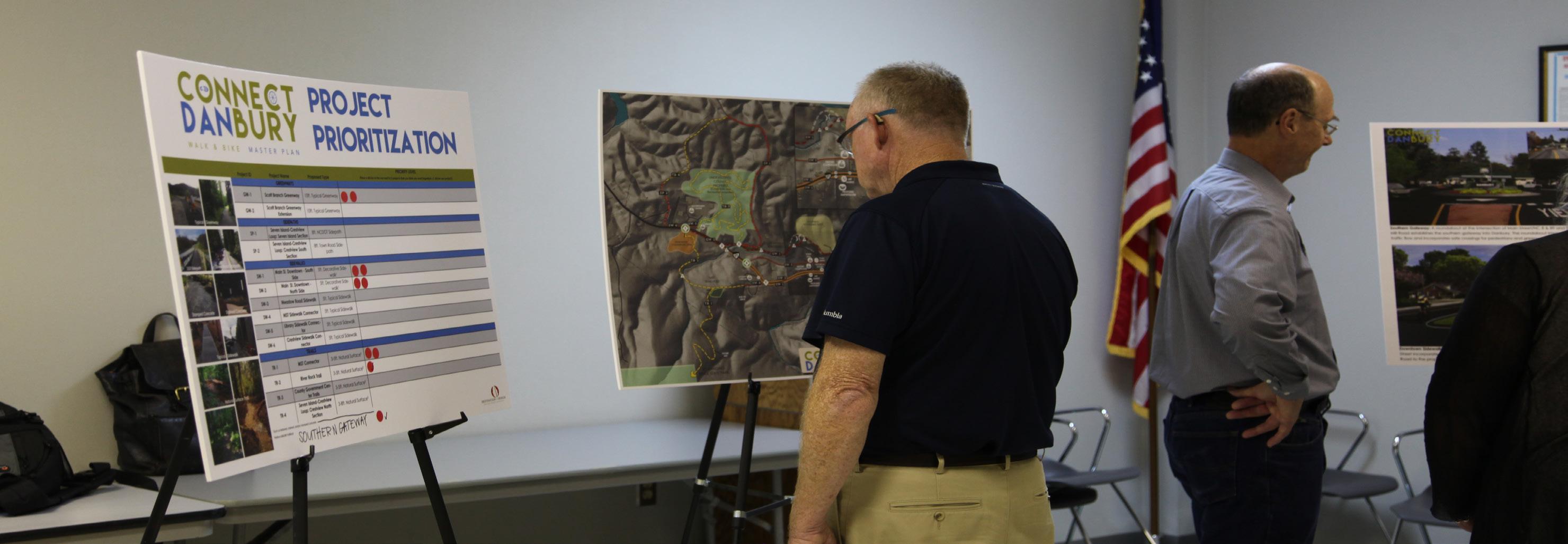
The Connect Danbury public workshop was held in the evening on Wednesday April 26, 2017 at the Danbury Public Library. Each property owner in the town received an invitation to the workshop in the mail. Additionally, the event was advertised on the town’s website. Approximately 25 citizens and stakeholders, including elected officials, attended the workshop. The public workshops were conducted using an open-house format that allowed participants to attend at any time over a two-hour period. The workshops featured four main stations: Information and Learning, Visualization, Project Prioritization and General Comments. The planning team and Danbury staff were on-hand to facilitate discussion and answer questions.
Visualization
General comments
The draft recommendations map illustrated multiple proposed routes broken up into multiple succinct projects. Project recommendations were accompanied by a series of four photo-realistic renderings depicting new pedestrian and bicycle infrastructure at key locations throughout town.
Comment cards provided workshop participants with the opportunity to leave general comments regarding the proposed routes.
Information and Learning Project Prioritization Display boards featuring the environmental Activity opportunities/constraints map and photographic series (Chapter 2) allowed attendees to view the analysis and add to the list of considerations.
A Project Prioritization board listed each pedestrian and multi-use project along with precedent images illustrating surface type. Citizens cast their “vote” for the three highest-priority projects using stickers to indicate their preference.
Chapter 3: Public ENGAGEMENT
25
Results Overall feedback on proposed routes, projects, and surface types was positive. As a result of the workshop, alternate routes for the Scott Branch Greenway were added to provide greater flexibility to property owners.
Project Prioritization The project prioritization activity revealed strong community consensus on the four highest-priority projects: 1) Scott Branch Greenway; 2) Main Street Sidewalks, South Side; 3) MST Connector trail; and 4) the Southern Gateway. The Scott Branch Greenway surpassed all other projects as the highest-priority. The three subsequent projects were prioritized equally by citizens.
26 CONNECT DANBURY
Project prioritization GW-1 / Scott Branch Greenway SW-1 / Main St. Sidewalk South Side TR-1 / MST Connector Southern Gateway SW-2 / Main St. Sidewalk North Side
PROJECT
GW-2 / Scott Branch Greenway Extension SP-1 / 7 Island-Crestview: 7 Island section SP-2 / 7 Island-Crestview: South Section SW-4 / MST Sidewalk Connector SW-5 / Library Sidewalk Connector TR-2 / River Rock Trail SW-3 / Meadow Rd. Sidewalk SW-6 / Crestview Sidewalk Connector TR-3 / Government Center Trails TR-4 / 7 Island-Crestview: North Section 0
2
4
6
8
10
12
14
16
PRIORITY VOTES
At the Public Workshop, citizens ranked their top priority projects. The results are displayed in the graph above.
Chapter 3: Public ENGAGEMENT
27
4 GREENWAY AND TRAIL CHARACTER THIS CHAPTER PROVIDES DESIGN DETAILS FOR VARIOUS PATHWAY TYPES AS WELL AS PRECEDENT IMAGES DEPICTING VARIATIONS IN SURFACE TYPE AND STYLE. Specific path and surface types are applied throughout the study area to ensure compatibility with existing surroundings, minimal maintenance, and the best user experience. This chapter defines four pathway types within the study area. This chapter also provides a series of precedent images that illustrate the surface types and style elements for sidewalks, sidepaths, greenways, and trails. This chapter concludes with recommendations for social media marketing.
IN THIS CHAPTER: A Pathway and Surface Type B Social Media
Pathway and Surface Type A specific pathway type is proposed according to its surrounding environment, location in a town or natural area, and opportunity to create a meaningful user experience. Four types of pathways are proposed within the study area: Typical Greenway, NCDOT Sidepath, Town Street Sidepath, and Natural Surface Hiking Trail. In the downtown core, trails and multi-use pathways transition into sidewalks. NCDOT SIDE PATH User Group: Multi-use
Average Construction Cost: $120/ln. ft.
Material: Paved asphalt
Preferred Easement Width: 25’
Preferred Width: 8’
Minimum Easement Width: 25’
8’ PAVED ASPHALT
HIKING-ONLY 3’ NATURAL SURFACE User Group: Hikers Material: Crushed Gravel Fines Preferred Width: 3’
Avg. Construction Cost: $6/ln. ft. Preferred Easement Width: 25’
GUARD RAIL
Note: Trail to be approved in accordance with NCDOT encroachment agreement.
IN-TOWN SIDEPATH User Group: Multi-use
Average Construction Cost: $80/ln. ft.
Material: Paved asphalt
Preferred Easement Width: 25’
Preferred Width: 8’
Minimum Easement Width: 25’
8’ PAVED ASPHALT
TYPICAL GREENWAY 10’ PAVED ASPHALT User Group: Multi-use Material: Paved Asphalt Preferred Width: 10’
Average Construction Cost: $90/ln. ft. Preferred Easement Width: 50’ Minimum Easement Width: 20’
30 CONNECT DANBURY
Note: Trail to be approved in accordance with municipal encroachment agreement as necessary..
2’-3’ SHOULDER
8’ PAVED ASPHALT
2’-3’ SHOULDER
These images provide examples of the various trail and surface types recommended throughout Danbury. Decorative sidewalk (stamped or stained) is recommended in the downtown core to enhance aesthetics, improve visibility, and add interest to the pedestrian experience.
STAMPED CONCRETE
TYPICAL SIDEWALK 1
TYPICAL GREENWAY 1
STAINED CONCRETE
TYPICAL SIDEWALK 2
TYPICAL GREENWAY 2
NATURAL SURFACE
NCDOT SIDEPATH
TOWN SIDEPATH
Chapter 4: GREENWAY AND TRAIL CHARACTER
31
Greenway and trail users should be encouraged to utilize social media to share their experiences with their friends and “followers.” Trailhead map kiosks and signage can include a statement to encourage users to post pictures of themselves or their friends that were taken while enjoying the Scott Branch Greenway and the MST through Danbury. After all, who better to market destination-quality pedestrian facilities than the users themselves? Let’s take advantage of social media--the new word of mouth. Use of hashtags allows local tourism leaders to curate local photos and content that can be shared on website and re-posted through other social media platforms. Consider the following hashtags for Danbury’s greenway and trails: #scottbranchgreenway #connectdanbury Danbury, NC
Cross Promote with Other Notable Tags: #mountainstoseatrail #ncmst #hangingrockstatepark @ncparks The Southern Gateway into beautiful Danbury! #connectdanbury
# CON N E C T DA N B U RY 32 CONNECT DANBURY
EXHIBIT 3: SOCIAL MEDIA: THE NEW WORD OF MOUTH
SOCIAL MEDIA: THE NEW WORD OF MOUTH
5 RECOMMENDATIONS THIS CHAPTER IS THE HEART OF THE CONNECT DANBURY PLAN. Specific alignments for multi-use and pedestrian pathways are provided for the study area. Trailheads, bridges, road crossings, and key town gateways are also identified. Recommendations are supported with photo-renderings that demonstrate trail character at key design locations.
IN THIS CHAPTER: A Recommendations Overview B Project Recommendations by Type
Recommendations Overview Proposed pedestrian and multi-use paths within the study area are broken up into 14 Projects. The geographic extent of each project is defined by a beginning and ending terminus that features a key asset or significant connectivity point. Each project represents a continuous route that can be feasibly developed independently, providing a logical method for implementation as funding, landowner-willingness, and political capital allow.
ABOUT THE RECOMMENDATIONS MAP The Connect Danbury Recommendations Map highlights proposed pedestrian and multi-use routes and associated features. The proposed routes are identified as either greenway, sidepath, sidewalk, or trail. These routes are the result of extensive analysis including environmental feasibility and landowner insights provided by local government leaders.
Noted trail features include the physical infrastructure and facilities that support the proposed routes. Feature include trailheads, stream crossings/bridges, major and minor road crossings, and key gateways. These features are highlighted on the map and provide critical information for developing an estimate of probable cost for each project.
Trailheads provide for parking and trail user orientation. Road crossings indicate the need to provide for traffic calming measures and appropriate signage for both trail users and motorists. Major bridges indicate a significant stream crossing.
CONNECT DANBURY: BY THE NUMBERS
11-14
>>
2 7
>> TRAILHEADS
>>
DANBURY’S 14 PROJECTS ARE CATEGORIZED BY TYPE: GREENWAY, SIDEPATH, SIDEWALKS, AND TRAILS. THIS CHAPTER IS ORGANIZED ACCORDINGLY.
36 CONNECT DANBURY
6
TOTAL MILES OF NETWORK
>>
ROAD CROSSINGS MAJOR BRIDGES
D
Cre stvi ew
Rd
GOVERNMENT CENTER
A
MOUNT
N BU RY TO W
LIBRARY
N LIM
1
9
Old School Rd
t in S
SW-1
(Future Trails and Recreation Amenities)
Sheep Rock Rd
Ki
RY TO W
ra tt B
4
M ead
COUNTY OFFICES
1
SW-4
t
er
HISTORIC COURTHOUSE
n St Mai
ART MARKET
SW-1
PROPOSED AMPHITHEATER
6
Old Church Rd
Ci
y Rd
D A N R I VE R
0
rc l e
7
KEY
Rd la n
d
GREENWAYS (GW) Gateway
Ca m
DAN RIVER BRIDGE TO BE REPLACED IN 2022, NEW BRIDGE WILL PROVIDE BICYCLE / PEDESTRIAN FACILITIES
Mill Creek
Floodplain
Utility Easements
a-# Hicks Farm Rd Project I.D. 0
500
1,000
1,500 Feet
FUTURE MST
TO HANGING ROCK STATE PARK
10’ Typical Greenway
RECOMMENDATIONS MAP
pi
ek I s Cre ng
HANGING ROCK STATE PARK
DAN RIVER BRIDGE TO BE REPLACED IN 2022, NEW BRIDGE WILL PROVIDE BICYCLE / PEDESTRIAN FACILITIES
6
g
Ce me
END OF DRIVE
TR-1
TOWN GREEN HISTORICAL SOCIETY
MORATOCK PARK
Kin
Sheep Rock Rd
Mill Creek
SW-3
ow Rd
SW-2 5
ill R d
h
S Mill Hill St
MST TRAILHEAD
nc
Courthouse Cir
1
Sco
ill S t par dM
TR-2
ill H
She p
NM
TOWN HALL
d
4
GW-1
SEE INSET
Retreat Run Ln
3
Ca mp ing C
tR
es Fo r
2
d
ITS
3
2
5
SCOTT BRANCH TRAILHEAD
nd R Isla
LIM
d
N
GW-2
k ree
Da n
wR Cre stvie
BU
THE RETREAT AT HANGING ROCK
LIBRARY
1
RIVER ROCK COMMERCIAL AREA
8
N
g
k
cle
A
Han
oc
C ir
D
SW-5
PROPOSED AMPHITHEATER
Old Church Rd 7
ng
END OF DRIVE
SW-6
6
6
Island Rd
Rd
ry
d
Seven
Ce m e t e
TR-3
GOVERNMENT CENTER
5
ART MARKET
S Mill Hill St
Ma
Camping Creek Is. Rd.
SW-2
COUNTY OFFICES
HISTORICAL SOCIETY
4
2 3
UNDEVELOPED COUNTY PROPERTY
SP-2
HISTORIC COURTHOUSE
Rd
SHEEP ROCK TRAILHEAD
TR-4
TOWN GREEN
Ri ve rR
1
10
Ln
SW-3
M eadow Rd
SP-1
ill S t
TOWN HALL
Courthouse Cir
Sheep Rock Trail
ill H
Ri ve r
an
S co
r tt B
Da n
NM
ch
4
Retreat Run
Island R d
GW-1
R ing
MAP 1: RECOMMENDATIONS
d
Seven
Sh
ITS
R nd Isla en S ev
5
RIVER ROCK COMMERCIAL AREA
1
DOWNTOWN INSET MAP
THE RETREAT AT HANGING ROCK
RECOMMENDATIONS MAP
#
Major Road Crossings
#
Minor Road Crossings
#
Stream Crossings
Greenway Alternate Routes
TRAILS (TR) 3-5’ Natural Surface
SIDEPATHS (SP) 8’ Town Rd. Sidepath 8’ NCDOT Sidepath
SIDEWALKS (SW) 5’ Sidewalk 5’ Decorative Sidewalk
Chapter 5: Recommendations
37
375
Project Recommendations by Type greenway
SCOTT BRANCH GREENWAY (GW-1 AND GW-2) The Scott Branch Greenway stretches from the east end of Danbury to the west end providing a safe, off-road route for both walkers and cyclists. The greenway is divided into two projects. The primary section extends from
The Southern Gateway to the proposed Scott Branch Trailhead. The greenway here makes use of the existing sewer easement along the creek. A spur from the Southern Gateway connects to Moratock Park over the Sheppard Mill Road bridge. The second project is an extension of the greenway from the Scott Branch
Trailhead to the River Rock commercial area and Gateway. The Scott Branch Greenway is the top priority project according to community feedback provided at the public workshop.
QUICK FACTS APPROX. LENGTH: 1.4 MILES START POINT: SOUTHERN GATEWAY (NC89 AND SHEPPARD MILL ROAD) END POINT: SCOTT BRANCH TRAILHEAD TYPE: 10 FT. TYPICAL GREENWAY BRIDGES/STREAM CROSSINGS: 4 MAJOR ROAD CROSSINGS: MAIN STREET (#2) AND SEVEN ISLAND ROAD (#3) CONNECTIVITY: MORATOCK PARK SOUTHERN GATEWAY RETREAT AT HANGING ROCK COUNTY GOVERNMENT CENTER RIVER ROCK COMMERCIAL AREA AND GATEWAY
38 CONNECT DANBURY
Existing sewer easement corridor along Scott Branch Creek.
EXHIBIT #4: SCOTT BRANCH GREENWAY @ RETREAT AT HANGING ROCK
Scott Branch Greenway @ Retreat at Hanging Rock
The greenway utilizes a sewer easement parallel to Scott Branch Creek within the Retreat at Hanging Rock subdivision providing a serene, wooded setting for greenway users. Chapter 5: Recommendations
39
EXHIBIT #5: SCOTT BRANCH BRIDGE
BRIDGE OVER SCOTT BRANCH CREEK
EXISTING
The greenway crosses Scott Branch Creek just upstream from the creek’s confluence with the Dan River. A ramped bridge access allows bicycles to cross in addition to walkers and joggers.
40 CONNECT DANBURY
SIDEPATHS SEVEN ISLAND-CRESTVIEW LOOP (SP-1, TR-4, AND SP-2) Recreation is the primary purpose of the Seven Island-Crestview loop, but it also provides a safe, active-transportation route into town for residents on Seven Island and Crestview Roads.
QUICK FACTS
The loop is divided into three projects. The first project is an NCDOT sidepath along Seven Island road from the Scott Branch Trailhead north to Crestview Road. The second project utilizes the unimproved Crestview Road private right-of-way as a natural surface trail until reaching the beginning of town-maintenance on Crestview. The third project extends south
as a sidepath along Crestview Road to its intersection with Main Street. The Seven Island-Crestview loop is a longterm recommendation. Construction of the sidepath at either the beginning or end point of the loop should occur prior to construction of the trail connector within the unimproved right-of-way.
APPROX. LENGTH: 1.6 MILES START POINT: SEVEN ISLAND ROAD TRAILHEAD END POINT: INTERSECTION OF CRESTVIEW RD. AND MAIN ST. TYPE: NCDOT SIDEPATH NATURAL SURFACE TOWN ROAD SIDEPATH BRIDGES/STREAM CROSSINGS: NONE IDENTIFIED MAJOR ROAD CROSSINGS: NONE IDENTIFIED CONNECTIVITY: SEVEN ISLAND-CRESTVIEW NEIGHBORHOOD COUNTY GOVERNMENT CENTER RIVER ROCK COMMERCIAL AREA AND GATEWAY
Seven Island Road existing
Chapter 5: Recommendations
41
SIDEWALKS MAIN STREET-SOUTH SIDE (SW-1) Decorative sidewalk on the south side of Main Street builds upon the success of the recent streetscape improvements in front of the Stokes County Arts Council and Artist’s Way Bakery. Remnants of a historic flagstone walkway on the south side of Main Street pro-
vide precedent for the sidewalk connecting downtown assets to residential areas on the west end of town. Continuous sidewalk on the south side of Main Street also provides an opportunity to route the Mountains to Sea Trail
through downtown Danbury from Hanging Rock State Park. Decorative sidewalk along the south side of Main Street was a top scoring priority project at the public workshop.
QUICK FACTS APPROX. LENGTH: .8 MILES START POINT: SOUTHERN GATEWAY END POINT: SCOTT BRANCH GREENWAY TYPE: 5 FT. DECORATIVE SIDEWALK BRIDGES/STREAM CROSSINGS: 1 MAJOR ROAD CROSSINGS: SHEEPROCK ROAD (#5) CONNECTIVITY: SOUTHERN GATEWAY DOWNTOWN DANBURY MOUNTAINS TO SEA TRAIL MEADOW ROAD GATEWAY SCOTT BRANCH GREENWAY Historic flagstone path along the south side of Main Street.
42 CONNECT DANBURY
EXHIBIT #6 –MAIN STREET SIDEWALK AT SHEEPROCK ROAD
Main Street Sidewalk at Sheeprock Road
EXISTING
Decorative sidewalk along the south side of Main Street incorporates elements of the historic flagstone walkway. Pedestrians can take Sheeprock Road to the proposed MST Trailhead and hiking trails.
Chapter 5: Recommendations
43
SIDEWALKS (Continued) MAIN STREET-NORTH SIDE (SW-2)
QUICK FACTS APPROX. LENGTH: .7 MILES START POINT: SOUTHERN GATEWAY END POINT: MEADOW ROAD GATEWAY TYPE: 5 FT. DECORATIVE SIDEWALK
Sidewalk construction on the north side of Main Street is faces more constraints than the south side due to grade changes and steep slopes. Old Church Road poses an additional challenge to pedestrian safety due to a wide road apron and limited sight distance for vehicles turning right onto the street. Both the north and south sides of Main Street will likely require the relocation of utility poles to provide for a sidewalk.
MEADOW ROAD (SW-3)
BRIDGES/STREAM CROSSINGS: NONE MAJOR ROAD CROSSINGS: OLD CHURCH ROAD (#6) CONNECTIVITY: SOUTHERN GATEWAY SCOTT BRANCH GREENWAY DOWNTOWN DANBURY MEADOW ROAD GATEWAY
QUICK FACTS
44 CONNECT DANBURY
QUICK FACTS APPROX. LENGTH: .1 MILES / 378 FT. START POINT: INTERSECTION OF SHEEPROCK ROAD AND MAIN STREET END POINT: MST CONNECTOR TRAIL (END OF TOWN MAINTENANCE ON SHEEPROCK RD.) TYPE: 5FT. TYPICAL SIDEWALK BRIDGES/STREAM CROSSINGS: NONE
APPROX. LENGTH: .5 MILES START POINT: DOWNTOWN INTERSECTION OF MEADOW ROAD AND MAIN STREET END POINT: MEADOW ROAD GATEWAY TYPE: 5 FT. TYPICAL SIDEWALK
The long term vision for downtown Danbury is a double-loaded sidewalk system on both sides of Main Street. Decorative sidewalk on the north side complements sidewalk on the south side and allows pedestrians to safely navigate the downtown entirely on foot. A pedestrian-friendly environment is critical for Danbury to expand tourism development from Hanging Rock and generate private investment in the downtown.
MST SIDEWALK CONNECTOR (SW-4)
BRIDGES/STREAM CROSSINGS: NONE MAJOR ROAD CROSSINGS: MAIN STREET (#4) CONNECTIVITY: DANBURY TOWN HALL TOWN GREEN STOKES COUNTY COURTHOUSE MEADOW ROAD GATEWAY
MAJOR ROAD CROSSINGS: NONE CONNECTIVITY: MOUNTAINS TO SEA TRAIL DOWNTOWN DANBURY COUNTY OFFICES The MST Sidewalk Connector transitions the MSTfrom natural surface into the downtown sidewalk system. This project should be constructed once upon re-route of the MST toward downtown Danbury via the MST Connector Trail (project TR-1).
LIBRARY SIDEWALK CONNECTOR (SW-5)
QUICK FACTS
CRESTVIEW SIDEWALK CONNECTOR (SW-6)
QUICK FACTS
APPROX. LENGTH: .07MI. / 378 FT.
APPROX. LENGTH: .13 MILES / 686 FT.
START POINT: DANBURY PUBLIC LIBRARY
START POINT: INTERSECTION OF CRESTVIEW ROAD AND MAIN STREET
END POINT: RIVER ROCK GATEWAY
END POINT: RIVER ROCK GATEWAY AND GOVERNMENT CENTER DRIVEWAY
TYPE: 5 FT. TYPICAL SIDEWALK BRIDGES/STREAM CROSSINGS: NONE MAJOR ROAD CROSSINGS: NONE CONNECTIVITY: DANBURY PUBLIC LIBRARY COUNTY GOVERNMENT CENTER RIVER ROCK COMMERCIAL AREA AND GATEWAY
The Library Sidewalk Connector project will enhance an existing crushed-gravel walkway between the library and government center by paving it and adding ADA accessible curbramps. Given that the connection between the two sites has already been established, this project is a short-term recommendation that should be completed in the near future.
TYPE: 5 FT. TYPICAL SIDEWALK BRIDGES/STREAM CROSSINGS: NONE
Meadow Road
MAJOR ROAD CROSSINGS: NONE CONNECTIVITY: COMPLETES THE SEVEN ISLANDCRESTVIEW LOOP
Stokes County Govt. Center
Chapter 5: Recommendations
45
TRAILS MST CONNECTOR (TR-1)
QUICK FACTS APPROX. LENGTH: 1.3 MILES TO HANGING ROCK STATE PARK; 4.5 MILES TO EXISTING MST IN HANGING ROCK START POINT: END OF TOWN MAINTENANCE ON SHEEPROCK ROAD/ MST SIDEWALK CONNECTOR END POINT: CURRENT MST ROUTE IN HANGING ROCK STATE PARK BRIDGES/STREAM CROSSINGS: NONE IDENTIFIED MAJOR ROAD CROSSINGS: NONE CONNECTIVITY: MST TRAILHEAD HANGING ROCK STATE PARK DOWNTOWN DANBURY
day-hikers with a location to start and end their hikes, and through-hikers with access to the town for re-supply. The MST Connector Trail was a top scoring priority project according to community feedback provided at the public workshop.
RIVER ROCK TRAIL (TR-2)
QUICK FACTS
46 CONNECT DANBURY
QUICK FACTS APPROX. LENGTH: 2-4 MILES START POINT: STOKES COUNTY GOVERNMENT CENTER END POINT: STOKES COUNTY GOVERNMENT CENTER
APPROX. LENGTH: .4 MILES
TYPE: NATURAL SURFACE
START POINT: MST TRAILHEAD
BRIDGES/STREAM CROSSINGS: NONE IDENTIFIED
END POINT: RIVER ROCK COMMERCIAL AREA TYPE: NATURAL SURFACE
MAJOR ROAD CROSSINGS: NONE CONNECTIVITY:
BRIDGES/STREAM CROSSINGS: 1
COUNTY GOVERNMENT CENTER
MAJOR ROAD CROSSINGS: NONE
SEVEN ISLAND CRESTVIEW SIDEPATH
CONNECTIVITY: MST TRAILHEAD
The MST Connector will link Danbury to Hanging Rock State Park. The plan proposes that the current MST route in Hanging Rock State Park be extended through the eastern end of the park via the proposed MST Connector Trail. This trail will take advantage of soon-tobe acquired state park land to provide a direct off-road connection to downtown Danbury. The MST Connector and Trailhead will provide
GOVERNMENT CENTER TRAILS (TR-3)
MOUNTAINS TO SEA TRAIL RIVER ROCK COMMERCIAL AREA AND GATEWAY
SCOTT BRANCH GREENWAY
Approximately 42 acres of undeveloped land at the Stokes County Government Center presents an opportunity for multi-use hiking and mountain bike trails. Development of this trail system is a long-term recommendation of this plan.
TRAILHEADS Two new trailheads are proposed within the study area: the Scott Branch Trailhead and MST Trailhead.
SCOTT BRANCH TRAILHEAD
MST TRAILHEAD
The Scott Branch Trail is located between Seven Island Road and Scott Branch Creek. This trailhead provides a critical point of connectivity for the Scott Branch Greenway on the western end of Danbury. Proposed improvements include a paved parking area, picnic shelter, map kiosk of the bicycle/pedestrian network, and landscaping.
The MST Trailhead is located on land proposed for future acquisition by Hanging Rock State Park. The area is currently accessed by gravel road that continues beyond the end of town maintenance on Sheeprock Road. The MST
Trailhead will serve day-hikers to Hanging Rock State Park as well as local residents interested in completing a walking loop through town. Proposed improvements include a pervious parking area, picnic shelter, and map kiosk.
View of existing dirt road bed at the split of proposed MST Connector and River Rock Trail routes near the proposed MST Trailhead.
Chapter 5: Recommendations
47
GATEWAYS Three gateway areas are identified in the study area: River Rock, Meadow Road, and the Southern Gateway at NC 89 and Sheppard Mill Road. A “gateway” refers to an area of transition or point of arrival to a destination.
RIVER ROCK
MEADOW ROAD
SOUTHERN GATEWAY
The River Rock Gateway signals the transition from rural Stokes County into the Town of Danbury. The area is defined by the River Rock commercial development at Crawford Street and the Stokes County Government Center. Proposed improvements include a town monument sign and landscaping to provide a sense of arrival into Danbury from the west
The Meadow Road Gateway provides an opportunity to visually indicate a transition into Danbury’s downtown core using elements such as signage and landscaping to complement the proposed sidewalk network.
The Southern Gateway into Danbury is located at the intersection of NC 89 and Sheppard Mill Road adjacent to the Dan River. This location presents a significant opportunity to establish a sense of arrival and address traffic flow issues. A proposed roundabout defines the entrance to the town, improves vehicular flow, and provides a crossing refuge for pedestrians traveling from the greenway into downtown or Moratock Park.
River Rock Gateway, existing
48 CONNECT DANBURY
EXHIBIT #7 – SOUTHERN GATEWAY
SOUTHERN GATEWAY
EXISTING
A roundabout at the intersection of Main Street/NC 8 & 89 and Sheppard Mill Road establishes the southern gateway into Danbury. The roundabout improves vehicular traffic flow and incorporates safe crossings for pedestrians and greenway users.
49
CONNECT DANBURY
Chapter 5: Recommendations
49
6 IMPLEMENTATION THE PURPOSE OF THIS CHAPTER IS TO POSITION THE TOWN OF DANBURY AND LOCAL STAKEHOLDERS FOR ACTION BY IDENTIFYING KEY STRATEGIES FOR IMPLEMENTATION. This chapter summarizes details for each project, establishes responsibilities and priorities, and proposes phases for implementation.
IN THIS CHAPTER: A Implementation Priorities and Partner Agencies B Project Phasing C Project Matrix and Estimated Costs
Implementation Priorities and Partner Agencies The table below provides key implementation information associated with the top priority projects. Key Challenges include a summary of the most difficult barriers to implementation in each location. Many of these barriers include costly features or recognize the need to acquire trail easements from private landowners. Most importantly the table assigns project responsibility to partnering agencies.
Distance (miles)
Key Challenges
Estimated Trail Cost
Partner Agencies
Scott Branch Greenway (GW-1)
1.1
Scott Branch Creek crossings (4); securing private landowner easements
$406,560
Town of Danbury, Stokes County
Main Street Sidewalk South Side (SW-1)
0.8
Utility lines; Sheeprock Road Crossing; steep slope at west end of Town (4)
$334,400
Town of Danbury, Stokes County
MST Connector Trail (TR-1)
4.5
Possible terrain challenges; avoid impact to significant Natural Heritage Areas in Hanging Rock State Park
$142,560
Town of Danbury, Stokes County, NC Division of Parks and Recreation, Friends of the MST
Southern Gateway
n/a
Right of Way acquisition
$150,000 to $250,000
Town of Danbury, NCDOT
Library Sidewalk Connector (SW-5)
0.1
slope of Government Center property
$17,010
Town of Danbury, Stokes County
Priority Project
*Cost estimates do not include bridges, road crossings, easement/acquisition costs, or permitting costs
52 CONNECT DANBURY
Project Phasing Creating a high-quality, interconnected pedestrian and bicycle network in Danbury will require a significant commitment from the town and its partner agencies. To manage implementation of the fourteen projects identified in this plan, each project has been categorized into one of three phases: short term; mid-term; and long term. Phasing provides a concise, clear direction for strategically allocating resources to the projects that are the highest community priorities.
SHort term • • • • •
Scott Branch Greenway (GW-1) Main St. Sidewalk South Side (SW-1) MST Connector Trail (TR-1) Library Sidewalk Connector (SW-5) Southern Gateway
Mid Term • • • • • •
Scott Branch Greenway Ext. (GW-2) Main St. Sidewalk North Side (SW-2) MST Sidewalk Connector (SW-4) River Rock Trail (TR-2) Scott Branch Trailhead MST Trailhead
long term • • • • •
Meadow Rd. Sidewalk (SW-3) Seven Island-Crestview Loop (SP-1, SP-2, TR-4, SW-6) Government Center Trails (TR-3) River Rock Gateway Meadow Road Gateway Chapter 6: IMPLEMENTATION
53
Implementation Matrix and Estimated Costs The table below provides details on each project as well as all proposed trailheads, gateways, bridges, and road crossings. Estimates of probable cost are provided for each project or feature.
CONNECT DANBURY PROJECTS MATRIX UNIT OF MEASUREMENT (approx.) Project ID GW-1 GW-2
Project Name
Start Point
Scott Branch Greenway
Southern Gateway
Scott Branch Greenway Extension
Intersection of Scott Branch Greenway & Main St.
Linear Feet
Approx. Cost per Linear Foot
Total Estimated Cost
Short Term
10ft. Typical Greenway
1.1
5808
$70
$406,560
X
10ft. Typical Greenway
0.3
1,742
$70
$121,940
8ft. NCDOT Sidepath
0.85
4488
$65
$291,720
X
8ft. Town Road Sidepath
0.25
1320
$50
$66,000
X
5ft. Decorative Sidewalk1
0.8
4,180
$80
$334,400
5ft. Decorative Sidewalk1
0.7
3,696
$80
$295,680
5ft. Typical Sidewalk
0.5
2,640
$45
$118,800
5ft. Typical Sidewalk
0.1
528
$45
$23,760
5ft. Typical Sidewalk
0.07
378
$45
$17,010
5ft. Typical Sidewalk
0.13
686
$45
$30,870
Type GREENWAYS
Intersection of Seven Island Rd. & Main St. River Rock Gateway/Govt. Center Driveway
PHASING
Miles
End Point
Mid Term
Long Term
X
SIDEPATHS SP-1 SP-2
Seven Island-Crestview Loop: Seven Island Section Seven Island-Crestview Loop: Crestview South Section
Seven Island Road Trailhead Intersection of Crestview Rd. & Main St.
End of NCDOT maintenance at beginning of Crestview Rd. End of Town maintenance on Crestview Rd.
SIDEWALKS SW-1
Main St. Downtown - South Side
Southern Gateway
SW-2
Main St. Downtown - North Side
Southern Gateway
SW-3
Meadow Road Sidewalk
SW-4
MST Sidewalk Connector
Scott Branch Greenway Extension (GW-2) Meadow Road Gateway
Intersection of Meadow Rd. & Main St. Intersection of Sheeprock Rd. & Main St.
SW-5
Library Sidewalk Connector
Danbury Public Library
SW-6
Crestview Sidewalk Connector
Intersection of Crestview Rd. & Main St.
Meadow Road Gateway End of Town Maintenance on Sheeprock Rd. River Rock Gateway/Govt. Center Driveway River Rock Gateway/Govt. Center Driveway
X X X X X X
TRAILS TR-1
MST Connector Trail
TR-2
River Rock Trail
End of Town Maintenance on Sheeprock Rd. MST Trailhead
TR-3
County Government Center Trails
TR-4
Seven Island-Crestview Loop: Crestview North Section
Project Name
MST in Hanging Rock State Park
3-5ft. Natural Surface2
4.5
23,760
$6
$142,560
River Rock Commercial Area
3-5ft. Natural Surface2
0.4
2,112
$6
$12,672
Undeveloped County Land
Undeveloped County Land
3-5ft. Natural Surface2
2 to 4
10,560 to 21,120
$6
$63,360 to $126,720
X
End of Town maintenance on Crestview Rd.
Beginning of NCDOT maintenance on Seven Island Rd.
3-8ft. Natural Surface
0.5
2640
$6 to $10
$15,840 to $26,400
X
Type/Details
Estimated Cost
Short Term
2
Location
PHASING Mid Term
X X
Long Term
TRAILHEADS Scott Branch Trailhead
North side of Scott Branch Creek, south side of Seven Island Road
Paved parking, picnic shelter, map kiosk, landscaping
$100,000 to $150,000
X
MST Trailhead
South side of MST Connector Trail (TR-1)
Pervious parking, picnic shelter, map kiosk
$60,000 to 100,000
X
GATEWAYS River Rock Gateway (Major Rd. Crossing 1)
Intersection of Main Street and Govt. Center Driveway/Crawford Street
Landscaping, monument sign
$12,000 to $15,000
Meadow Road Gateway (Major Rd. Crossing 4)
Western Intersection of Main Street and Meadow Road
Landscaping, signage
$8,000 to $12,000
Southern Gateway (Major Rd. Crossing 7)
Intersection of Main Street and Sheppard Mill Road
Roundabout with landscaping and monument sign
$150,000 to $250,000
X X X
BRIDGES Bridges
6 crossings of Scott Branch Creek
$45,000 to $80,000 each
Constructed in conjunction with associated Project Routes
MAJOR ROAD CROSSINGS
54
Major Road Crossing 2
Scott Branch Greenway at Main Street
Striped crosswalk and signage to signal approaching crossing to vehicles and greenway users
Major Road Crossing 3
$4,000 to $8,000
CONNECT DANBURY Major Road Crossing 5
Scott Branch Greenway at Seven Island Rd.
Striped crosswalk and signage to signal approaching crossing to greenway users
$2,500 to $5,000
Intersection of Main St. and Sheeprock Road
Striped pavement with ADA curb ramps
$1,500 to $5,000
Major Road Crossing 6
Intersection of Old Church Road and Main Street
Grade road shoulder & curb extension on south side of Old Church Rd.; retaining wall along Main St; striped crosswalk
$55,000 to $70,000
X X X X
Project ID
Project Name
Start Point
End Point
GW-1
Scott Branch Greenway
Southern Gateway
GW-2
Scott Branch Greenway Extension
Intersection of Scott Branch Greenway & Main St.
Type GREENWAYS
Intersection of Seven Island Rd. & Main St. River Rock Gateway/Govt. Center Driveway
Miles
Linear Feet
Short Term
Mid Term
Long Term
10ft. Typical Greenway
1.1
5808
$70
$406,560
10ft. Typical Greenway
0.3
1,742
$70
$121,940
X
8ft. NCDOT Sidepath
0.85
4488
$65
$291,720
X
8ft. Town Road Sidepath
0.25
1320
$50
$66,000
X
5ft. Decorative Sidewalk1
0.8
4,180
$80
$334,400
5ft. Decorative Sidewalk1
0.7
3,696
$80
$295,680
5ft. Typical Sidewalk
0.5
2,640
$45
$118,800
5ft. Typical Sidewalk
0.1
528
$45
$23,760
5ft. Typical Sidewalk
0.07
378
$45
$17,010
5ft. Typical Sidewalk
0.13
686
$45
$30,870
X
SIDEPATHS SP-1 SP-2
Seven Island-Crestview Loop: Seven Island Section Seven Island-Crestview Loop: Crestview South Section
Seven Island Road Trailhead Intersection of Crestview Rd. & Main St.
End of NCDOT maintenance at beginning of Crestview Rd. End of Town maintenance on Crestview Rd.
SIDEWALKS SW-1
Main St. Downtown - South Side
Southern Gateway
SW-2
Main St. Downtown - North Side
Southern Gateway
SW-3
Meadow Road Sidewalk
SW-4
MST Sidewalk Connector
Scott Branch Greenway Extension (GW-2) Meadow Road Gateway
Intersection of Meadow Rd. & Main St. Intersection of Sheeprock Rd. & Main St.
SW-5
Library Sidewalk Connector
Danbury Public Library
SW-6
Crestview Sidewalk Connector
Intersection of Crestview Rd. & Main St.
Meadow Road Gateway End of Town Maintenance on Sheeprock Rd. River Rock Gateway/Govt. Center Driveway River Rock Gateway/Govt. Center Driveway
X X X X X X
TRAILS TR-1
MST Connector Trail
TR-2
River Rock Trail
End of Town Maintenance on Sheeprock Rd. MST Trailhead
TR-3
County Government Center Trails
TR-4
Seven Island-Crestview Loop: Crestview North Section
Project Name
MST in Hanging Rock State Park
3-5ft. Natural Surface2
4.5
23,760
$6
$142,560
River Rock Commercial Area
3-5ft. Natural Surface2
0.4
2,112
$6
$12,672
Undeveloped County Land
Undeveloped County Land
3-5ft. Natural Surface2
2 to 4
10,560 to 21,120
$6
$63,360 to $126,720
X
End of Town maintenance on Crestview Rd.
Beginning of NCDOT maintenance on Seven Island Rd.
0.5
2640
$6 to $10
$15,840 to $26,400
X
Type/Details
Estimated Cost
Short Term
2
3-8ft. Natural Surface
Location
PHASING Mid Term
X X
Long Term
TRAILHEADS Scott Branch Trailhead
North side of Scott Branch Creek, south side of Seven Island Road
Paved parking, picnic shelter, map kiosk, landscaping
$100,000 to $150,000
X
MST Trailhead
South side of MST Connector Trail (TR-1)
Pervious parking, picnic shelter, map kiosk
$60,000 to 100,000
X
GATEWAYS River Rock Gateway (Major Rd. Crossing 1)
Intersection of Main Street and Govt. Center Driveway/Crawford Street
Landscaping, monument sign
$12,000 to $15,000
Meadow Road Gateway (Major Rd. Crossing 4)
Western Intersection of Main Street and Meadow Road
Landscaping, signage
$8,000 to $12,000
Southern Gateway (Major Rd. Crossing 7)
Intersection of Main Street and Sheppard Mill Road
Roundabout with landscaping and monument sign
$150,000 to $250,000
X X X
BRIDGES Bridges
6 crossings of Scott Branch Creek
$45,000 to $80,000 each
Constructed in conjunction with associated Project Routes
MAJOR ROAD CROSSINGS Major Road Crossing 2
Scott Branch Greenway at Main Street
Striped crosswalk and signage to signal approaching crossing to vehicles and greenway users
$4,000 to $8,000
Major Road Crossing 3
Scott Branch Greenway at Seven Island Rd.
Striped crosswalk and signage to signal approaching crossing to greenway users
$2,500 to $5,000
Major Road Crossing 5
Intersection of Main St. and Sheeprock Road
Striped pavement with ADA curb ramps
$1,500 to $5,000
Major Road Crossing 6
Intersection of Old Church Road and Main Street
Downtown Sidewalk Surface Crossings
Old School Rd. (#1); Courthouse Circle (#2 & #4); Camping Creek Island Rd. (#3); Mill Hill St. (#5 & #6); King Circle #7 & #8)
Striped crosswalk with ADA curb ramps
$1,500 to $5,000 each
Scott Branch Greenway Minor Crossings
North Mill Hill St. (#9) and Retreat Run Lane (#10)
Striped crosswalk and signage to signal approaching crossing to greenway users
$1,500 to $5,000 each
1
such as textured, stained, and/or stamped concrete
2
Native soils/dirt trailbed
Grade road shoulder & curb extension on south side of Old Church Rd.; retaining wall along Main St; striped crosswalk with ADA curb ramps MINOR ROAD CROSSINGS
X X X
$55,000 to $70,000
X
Constructed in conjunction with projects SW-1 and SW-2 X
TOTALS Miles of Multi-Use Greenway Miles of Sidepath Miles of Sidewalk Miles of Trail Total Mileage of Network
1.4 1.1 1.5 7.4 to 9.4 11.4 to 13.4
Chapter 6: IMPLEMENTATION
55
EXHIBIT #8: ECONOMIC IMPACT OF THE GREENWAYS& TRAILS
Economic Impact of the Greenways and Trails
An interconnected network of greenways and trails is a powerful economic development tool. Trails and greenways impact local and regional economies in several ways by enhancing quality of life for residents, increasing nearby property values, lowering healthcare costs, and providing a venue for community events. Most significantly, greenways, trails, and sidewalks serve as the catalyst for stimulating private investment and recreation tourism. Greenways and trails stimulate small business development and private investment by attracting a new customer base. This new customer base increases consumer spending in existing businesses along the trail and also attracts new trail or greenway related
56
CONNECT DANBURY
businesses such as bicycle rental and repair or an outfitter. As local businesses are patronized by trail users, they purchase supplies and services from manufacturers in other sectors of the economy, thereby multiplying the impact of the trail throughout the county The boost to local economies provided by trails and greenways is considerable. A study of greenways totaling 35 miles in Orange County, Florida reported a $42.6 million dollar impact to the area. Similarly, an economic impact study of the Swamp Rabbit Trail in South Carolina stated that the trail generated a $6.7 million dollar return on investment in its first three years. Residential properties located near a trail
or greenway also benefit from a significant increase in property values. The greenway is an amenity that commands a higher price for nearby homes. The Little Miami Scenic Trail in Ohio is associated with higher property values up to one mile away from the trail. For every foot closer to the Little Miami trail, single-family home value increases by $7. Home premiums increase near trails because they are an attractive amenity to families and professionals looking to relocate. As a result, homes near greenways also sell faster. The National Association of Homebuilders states that “Trails consistently remain the number one community amenity sought by prospective homeowners”.
AP P EN D I X A : P RO J E CT FACT SHEET
>> W A L K
&
B I K E
M A S T E R
FACT SHEET
P L A N
PURPOSE
PLANNING PROCESS
LET’S IMPROVE WALKING AND BIKING OPPORTUNITIES THROUGHOUT THE TOWN OF DANBURY!
THE PROJECT TEAM WILL LEAD A FOUR-PART PLANNING PROCESS THAT WILL CONCLUDE IN JUNE 2017:
The Connect Danbury Master Plan will outline priorities for improving walking and biking opportunities throughout the Town. Sidewalks and greenway trails are important amenities for locals, visitors, and businesses! The Town of Danbury has many unique assets that should be connected with paths in coming years. The plan will explore improvements to the downtown sidewalk network and its connectivity with the Mountains-toSea Trail, Hanging Rock State Park, Stokes County Government Center and library, Moratock Park, and more. After preliminary routes are identified, a public workshop will provide an opportunity for citizens to provide insights for additional connectivity opportunities and priority projects.
P R O J E C T C O N TA C T ERIC WOOLRIDGE, AICP
MIKE BARSNESS
Principal
Town Administrator
Destination by Design
Town of Danbury
www.DbDplanning.com
townofdanbury@ embarqmail.com
eric@dbdplanning.com 828.386.1866
336.593.2002
1 RESEARCH AND INVENTORY NOVEMBER 2016 Conduct a field assessment with the consultant team to identify environmental constraints and opportunities for connectivity.
2 PRELIMINARY PLAN DEVELOPMENT DECEMBER 2016–MARCH 2017 Collect and evaluate existing data on current conditions and develop draft routes for an interconnected bicycle and pedestrian system. Recommendations will incorporate streetscape improvements proposed in the adopted Stokes 2035 Vision Plan.
3 COMMUNITY MEETING APRIL 2017 Conduct a two-hour “drop-in” public meeting to present draft concepts, renderings, and routes for public review.
4 FINAL PLAN AND ADOPTION MAY–JUNE 2017 Present a final plan that incorporates all public comments, outlines phases for completing the network, provides an estimate of probable costs, and identifies funding sources.
AP P ENDI X B: FUNDING SOURCES
Partnership Funding Agency
Natural and Built Environment Implications
Maximum Amount
Duke Energy Water Resources Grant
Must protect water quality or relate to public access to waterways
$100,000
Clean Water Management Trust Fund (www.cwmff.net)
Matching Funds Required
$0 (preference given if match provided)
Based on 6/2015 Land Acquisition: Fee Simple or discussion with staff, a Easement. Must protect Not specified, but $750K multi-year floodplain areas. Greenway trails 20% is competitive application would be and other park areas are allowed. welcome.
Deadlines
April 1st to May 1st and Oct. 1st to Nov. 1
February 1st
NC Water Resources (www.ncwater.org)
River access areas or greenways along rivers
N/A
50%
January 1st and June 1st
Recreation Trails Program (ncparks.gov/About/grants/main.php)
All types of trails and greenways
$100,000.00
25%
February 1st
Parks and Recreation Trust Fund (ncparks.gov/About/grants/main.php)
All types of parks, trails, and recreation facilities
$500,000.00
50%
February 1st
People for Bikes Community Grant
Trails and Greenways
$10,000.00
20%
May 24th
NCDOT Transportation Plan For Bike and Pedestrian Projects
Bike and Pedestrian Projects- both engineering and construction
N/A (for major projects)
20% generally
N/A
W A L K
&
B I K E
M A S T E R
P L A N