
action plan
action plan
Produced For:
Carolina Land and Lakes
Resource Conservation and Development
United States Forest Service
Pisgah National Forest
Grandfather Ranger District

Produced By:
Destination by Design

a cknowledgments
Project Oversight Committee
Melissa Patton, Carolina Land & Lakes Resource Conservation and Development
Lisa Jennings, US Forest Service
Nick Larson, US Forest Service
Wes Waugh, A Clean Wilson Creek
Kevin Colburn, American Whitewater
Kelsey Wallace, Caldwell County Chamber of Commerce
Shelley Stevens, Caldwell County Planning Department
Shane Prisby, Foothills Conservancy of North Carolina
Jon Lane, G5 Trail Collective
Sandra Aguirre, Latinos Aventureros en las Carolinas
Ryan Jacobs, North Carolina Wildlife Resources Commission
Doug Besler, North Carolina Wildlife Resources Commission
Nikki Malatin, Northwest NC Mountain Bike Alliance
Jackie Greene, Trout Unlimited
Kevin Massey, Wild South
e xhibits
EXH 01: Public Land Boundaries ....... 36
EXH 02: Wilson Creek Corridor Gateway Sign ......................... 43
EXH 03: Adako Site Plan ..................... 44
EXH 04: Lower Gorge Site Plan ......... 49
EXH 05: Bathtub Site Plan ................... 51
EXH 06: Middle Gorge Site Plan ........ 53
EXH 07: Thunderhole Site Plan .......... 55
EXH 08: Wilson Ridge Site Plan ......... 57
EXH 09: Lady on the Rock Site Plan . 59
EXH 10: Paddler Put-in Site Plan ....... 63
EXH 11: Creekside Site Plan ................ 65
EXH 12: Deerhorn Site Plan ................. 68
EXH 13: Confluence Site Plan .............. 71
EXH 14: Craig Creek Site Plan ............. 73
chapter 1: Introduction & Background
The Wilson Creek Action Plan provides a vision for outdoor recreation infrastructure development along the Wilson Creek Wild and Scenic River corridor.
IN THIS CHAPTER:
1.1 Background
1.2 Plan Goals
1.3 Planning Process
1.4 Plan Organization
1.1 b ackground
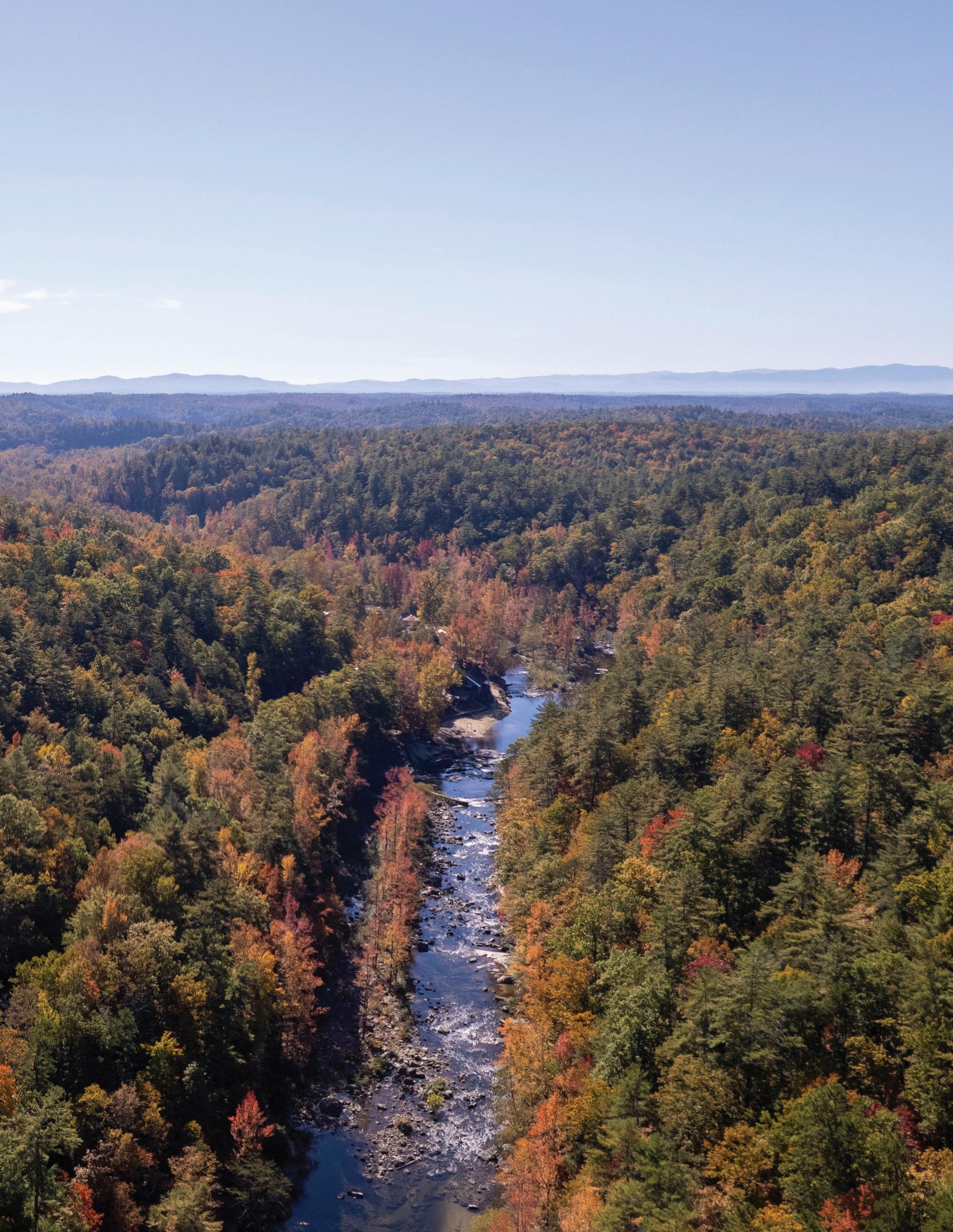
Wilson Creek, located in Avery and Caldwell Counties, stretches approximately 23 miles from the mountains to the foothills of western North Carolina. The river begins on densely forested inaccessible mountain slopes before transitioning into large tracts of Pisgah National Forest. When Wilson Creek reaches the bottom of the Blue Ridge Escarpment near the community of Edgemont, gravel roads and low density residential development provide more access to the stream.
Wild & Scenic River Designation
The Wild and Scenic Rivers Act was passed in 1968 to “select rivers of the Nation which, with their immediate environments,
possess Outstandingly Remarkable scenic, recreational, geologic, fish and wildlife, historic, cultural, or other similar value, shall be preserved in free-flowing condition, and that they and their immediate environments shall be protected for the benefit and enjoyment of present and future generations.” Wilson Creek, from its headwaters in Avery County to its confluence with the Johns River in Caldwell County, was added to the National Wild and Scenic River System on August 18, 2000. The stream qualifies for all three classifications of rivers in the National Wild and Scenic Rivers System - Wild, Scenic, and Recreational. The Wilson Creek Action Plan focuses on the recreational segment of the river, where management is focused on river-oriented recreational use in a naturally-appearing setting.

The Conservation Story
Foothills Conservancy of North Carolina (FCNC) and other partners with interests in the river corridor have worked together to protect lands and educate the public about the natural resources found along Wilson Creek. As surrounding counties have experienced significant growth and development, the partners’ efforts have ensured that wildlife, aquatic habitats, and the recreational experience remain protected. Through grant funding and generous private landowner donations, FCNC has acquired over 1,500 acres of protected land that links Pisgah National Forest to the Wilson Creek corridor.
Edgemont Fishing Club members and FCNC protected 135 acres and roughly one mile of Wilson Creek by signing a permanent conservation easement assigning subdivision, timber, and other natural resource rights to CWMTF. The club donated the upstream half of their property to The Nature Conservancy in the mid 1990s for further protection.
In 2008, in response to the threat of a 250-home development, FCNC actively worked with landowners on a wide array of conservation efforts within the corridor to preserve Wilson Creek’s wild and scenic qualities. The Elams couple sold their 73acre tract after funds were made available as a result of a riparian corridor conservation study, deeming the tract significant to protect.
Expanded federal tax incentives for conservation easement donations were extended until the end of 2009, motivating private land donations. In 2009, FCNC,
on behalf of the N.C. Wildlife Resources Commission (NCWRC), secured a contract to purchase a 649-acre development tract for $7 million with funding from the N.C. Natural Heritage (NHTF) and the N.C. Clean Water Management (CWMTF) Trust Funds. Big Camp Creek tract, 136-acres, was donated to the conservancy in 2009. In 2010, the conservancy was able to purchase a 170-acre tract at the confluence of Wilson Creek and Lost Cove Creek as well as a 730-acre upland tract in Edgemont touching Wilson Creek through grants awarded by the CWMTF and NHTF.
An additional 332 acres of land was donated by Tim Sweeny in 2021, and in 2022 state grant and private conservationist funds allowed FCNC to acquire 93-acres along 1.5 miles of Wilson Creek. Today, Foothills Conservancy of North Carolina and its public and private partners have helped protect 9 miles of the river for watershed and habitat protection, public access, and public use.
A Need to Sustainably Manage Use
With the addition of protected lands and increased accessibility to Wilson Creek, recreational use in the corridor has steadily increased. Local residents and visitors can be found picnicking, fishing, and swimming in the river throughout the summer months. The number of people and vehicles consistently surpasses the capacity of existing parking areas and other outdoor recreation infrastructure within the corridor. The significant amount of use creates a number of challenges for visitor and natural resource management.
1.2 p lan g oals

ANALYSIS
Conduct a thorough assessment of the study area to evaluate significant opportunities and constraints for outdoor recreation infrastructure development.
COMMUNITY
Engage stakeholders, government and community leaders, and the public to encourage collaborative efforts and promote a shared vision that will support organizational and community goals.
EXPERIENCE
Create an environmentally, socially, economically, and managerially sustainable experience that provides equitable access for all.

EDUCATION
Encourage advocacy, stewardship, and appropriate use for protection of and access to the natural environment.
PUBLIC SAFETY
Guide and disperse use through infrastructure development that provides a safe experience and adequate access for emergency response.
p lanning p rocess
Phase 1: Research and Preliminary Analysis
January - March 2024
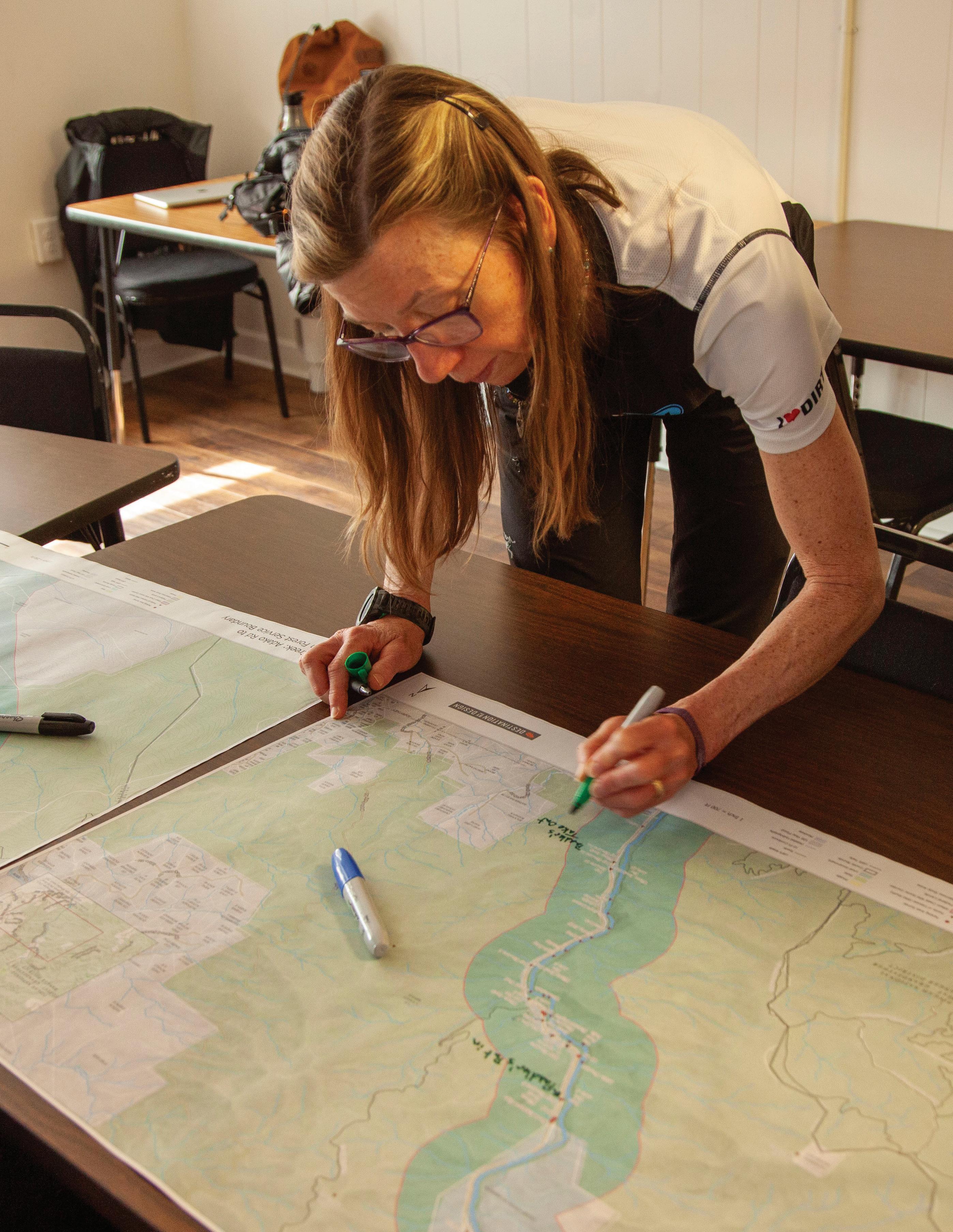
The consultant team conducted a kick-off meeting with project partners to understand the history of the corridor, status of land management, opportunities and constraints, and overall vision. A preliminary analysis of the study area was completed by reviewing past planning efforts, collecting GIS data, and conducting a comprehensive field analysis.
Phase 2: Stakeholder and Public Engagement
March - April 2024
A series of focus group meetings and interviews with key stakeholders to understand concerns, listen to insights, and collect ideas was conducted. The G5 Trail Collective collaborated with project partners to create a website that served as a portal for distributing project information. It also offered an opportunity to gather public input through an online survey.
Phase 3: Plan Development
April - June 2024
The consultant team developed a plan framework with guidance from project partners, stakeholders, and the public, that highlighted analysis findings and presented preliminary outdoor recreation infrastructure recommendations for parking areas, river accesses, and support facilities. Project partners met to offer feedback and develop consensus for finalizing plan details.
Phase 4: Final Plan Development
July - September 2024
A final plan document featuring visual site plans and perspective illustrations that support plan recommendations was created. It included an estimate of probable cost and implementation schedule. The plan was made available for the public to view on the G5 Trail Collective website.


p lan o rganization


Chapter 1 - Introduction & Background:
The first chapter introduces the project background and outlines project goals, planning process, and plan organization.
Chapter 2 - Research & Analysis:
This chapter provides an overview and analysis of the study area. A description of the study area, summary of previous planning efforts, and discussion of the natural and built environments are included.
Chapter 3 - Public Engagement:
The third chapter summarizes the significant efforts made to engage key stakeholders, community members, and the public to increase awareness of the project and gain insight into their concerns, needs, and desires.
Chapter 4 - Recommendations:
This chapter outlines recommendations for outdoor recreation infrastructure development in the Wilson Creek Wild and Scenic River corridor.

Chapter 5 - Implementation:
The final chapter provides general implementation recommendations and a summary of site specific recommendations with an estimate of probable cost and implementation schedule.
chapter 2: Research & Analysis
The analysis begins with a brief overview of the study area followed by a review of previous planning efforts. The chapter concludes with a discussion of the natural and built environments.
IN THIS CHAPTER:
2.1 Study Area Description
2.2 Previous Planning Efforts
2.3 Natural and Built Environment Analysis
s tudy a rea d escription
The Pisgah National ForestGrandfather Ranger District covers approximately 192,000 acres primarily in McDowell, Burke, and Caldwell Counties. It includes the Linville Gorge Wilderness, Curtis Creek Area, and Wilson Creek Wild and Scenic River. The forest hosts a variety of recreational activities to include hiking, mountain biking, climbing, camping, and off-highway vehicle camping and riding.
The study area is located in the foothills of western North Carolina within Caldwell County. It lies near the Burke and Caldwell County border and is most easily accessed from the cities of Morganton and Lenoir. The area is approximately two hours from the larger metropolitan areas of Charlotte and the Piedmont Triad. Boone, Blowing Rock, Marion, Wilkesboro, and Hickory are within a one hour drive. A collection of rural paved and gravel roads lead to the study area from Interstate 40 and US Highways 64, 221, and 321.
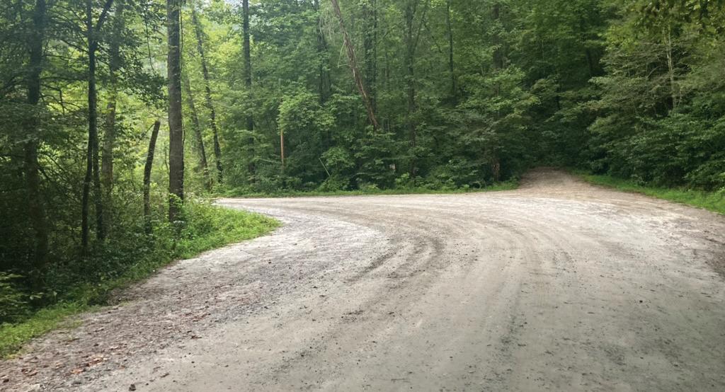
The study area stretches approximately nine miles along the Wilson Creek Wild and Scenic River corridor from Adako Road to NC 90 in Mortimer. The US Forest Service, NC Wildlife Resources Commission, and Caldwell County manage a majority of the undeveloped land within the corridor. Private, low-density, residential development is scattered throughout the corridor and adjacent lands. Brown Mountain Beach Road parallels the river and provides access for recreation. Existing outdoor recreation infrastructure development is limited to developed and dispersed gravel parking areas and river accesses.


AVERY COUNTY CALDWELL COUNTY

NCWRC
Pisgah
Unpaved
Mortimer Campground
The Old Mill Harper Creek Trailhead
Wilson Creek Visitor Center
WilsonCreek
Deerhorn
p revious p lanning eFF orts
The consultant team reviewed previous planning efforts that may have implications on outdoor recreation infrastructure analysis and development within the study area. This section provides a brief summary of each plan.
Nantahala and Pisgah National Forests Final Land Management Plan (2023)

This plan guides future management of the National Forests in western North Carolina and prioritizes sustainable recreation in addition to focusing on ecosystem health. The plan recognizes that a quality recreation experience and equitable access to the outdoors is important to local economies, tourism, and community well-being. It specifically addresses Wild and Scenic River Management Areas and includes goals to continue working with partners to maintain a quality recreation experience, reduce erosion and sedimentation, restore aquatic organism passage, improve fisheries, and reduce non-native invasive species within the Wilson Creek watershed.
Wilson Creek Day Use Area Access and Parking Assessment (2019)

The USDA Forest Service Grandfather Ranger District produced this report that details the assessment of the Wilson Creek Day Use area. USFS recreation specialists conducted a preliminary analysis of current parking spaces and river access points as well as potential improvements. The report makes recommendations for improvements that will meet the following goals: reduce traffic congestion and improve parking along Brown Mountain Beach Road; minimize negative impacts to the Wild and Scenic River from erosion and concentrated use; and accommodate for continued visitor use and enjoyment of the area.
Wilson Creek National Wild and Scenic River Comprehensive River Management Plan (2005)

This Comprehensive River Management Plan establishes programmatic management direction for the National Forest lands within the Wilson Creek National Wild and Scenic River corridor. This plan guides all development, management, and restoration activities on public lands within the river corridor. It also establishes management and development goals and objectives for Wilson Creek and defines desired characteristics of specific river segments.
2.3 n atural and b uilt
e nvironment a nalysis
TThis section highlights site analysis findings pertaining to the natural and built environment, including those pertaining to topography, hydrology, land use, historic resources, roads, and outdoor recreation infrastructure.
Topography
The Wilson Creek corridor is a gorge or narrow valley with a river running through it. The surrounding ridges rise to a height of approximately 2,400 feet above sea level. The bottom of the gorge drops from approximately 1,500 feet above sea level at Mortimer to 1,060 feet above sea level at Adako Road. The valley floor spans from 100 to 900 feet wide, with an approximate average width of 250 feet.
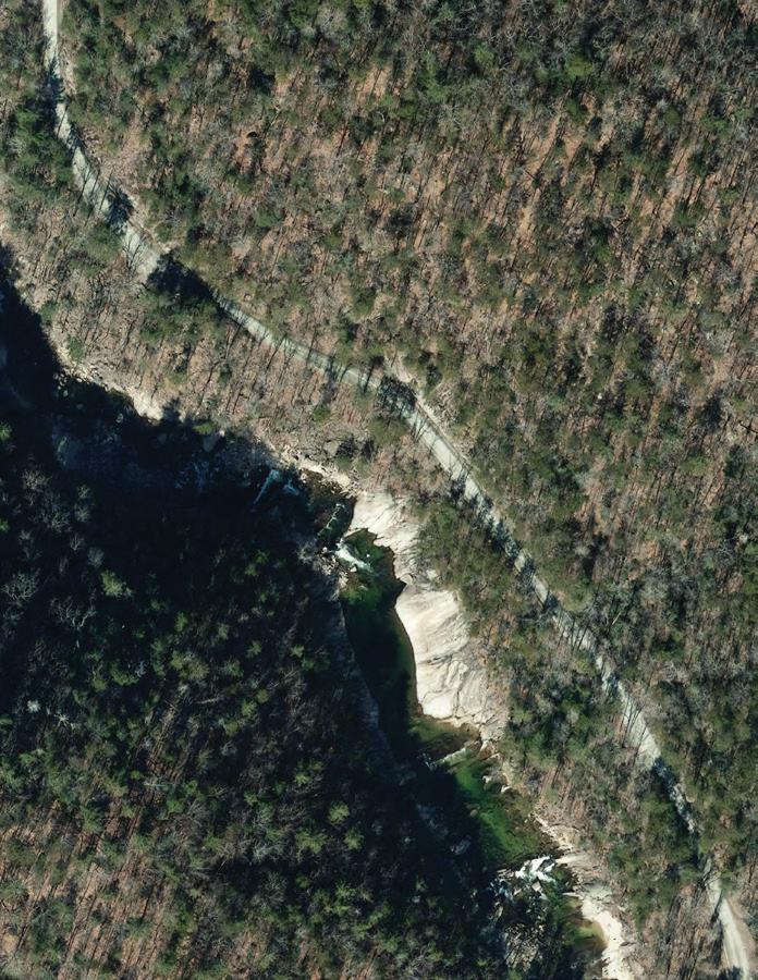
Rivers and Streams
Several tributaries flow into Wilson Creek within the study area. Estes Mill and Thorpes Creeks flow into the river from the north and east near Mortimer at an elevation of approximately 1,500 feet above sea level. Harpers Creek and Philips Branch join Wilson Creek from the west approximately two miles downstream. Craig Creek flows into the river from the west just south of Craig Creek Road at an elevation of 1,400 feet above sea level. Carroll Mill Creek joins Wilson Creek from the east at an elevation of approximately 1,060 feet above sea level near the southern end of the corridor at Adako Road.

Land Use
The US Forest Service and NC Wildlife Resources Commission manage a majority of the undeveloped land within the study area. USFS lands border Wilson Creek in a majority of the lower half of the study area and surround public and private lands in the upper half of the study area. NCWRC property located in the upper quarter of the study area are managed as public game lands primarily used for fishing. Both areas include minimally developed outdoor recreation infrastructure to include trails, parking, and river access.
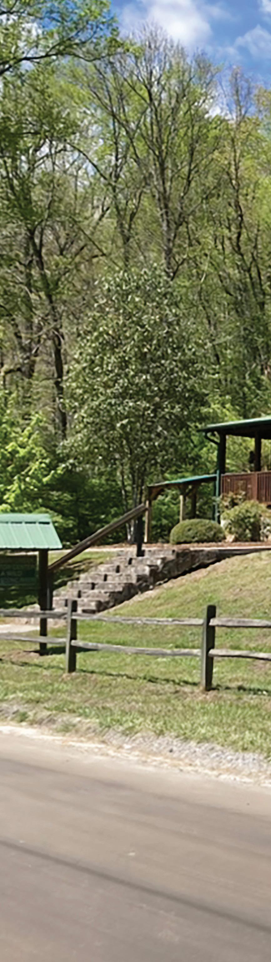
Caldwell County manages a total of approximately 13 acres of land between two separate sites within the study area. This includes Deerhorn Park and the Wilson Creek Visitor Center. Deerhorn is surrounded by USFS lands in the lower half of the corridor. The Wilson Creek Visitor Center is located in a cabin next to Brown Mountain Beach Road on property that borders Wilson Creek and private lands.
Lands located in the first and third quarters of the study area between USFS and NCWRC managed lands are private and include low-density development. Permanent residences, vacation homes, campers, and limited commercial development are found in these areas.
Roads
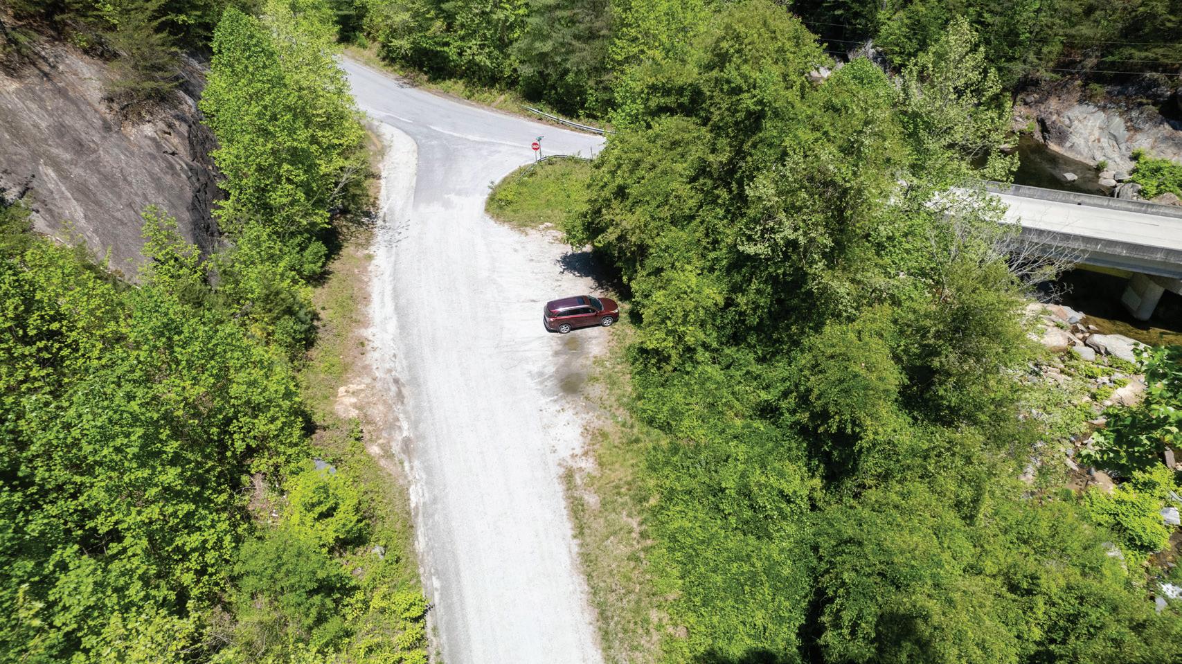
The study area is bounded on the north by NC Highway 90 and on the south by Adako Road (S.R. 1335). Brown Mountain Beach Road (S.R. 1328) connects the two, and it is located in the center of the corridor. Craig Creek Road (FS 982) runs east and west to connect Brown Mountain Beach Road to NC Highway 181. Adako Road and a short segment of Brown Mountain Beach Road near their intersection is paved. The remaining routes are narrow, gravel roads.
Historic Resources
The community of Mortimer was a former mill town created by the Ritter Lumber Company in the early 1900s. It included development typical of early mill towns that supported approximately 800 residents. Timber and textiles were the primary industries that supported the community. A Civilian Conservation Corps (CCC) camp was also located in Mortimer. Significant floods in 1916 and 1940 devastated the community, and most of its residents moved out of the area.
Remnants of the CCC camp, old railroad line, and textile mill still remain on lands managed by the USFS and NCWRC. A flagpole and plaque mark the center of the former town.
Wild and Scenic River Corridor
The Wilson Creek Wild and Scenic River Corridor includes the area approximately 1/4 mile in width from each bank of the creek. It includes public and private properties. Development and management within this corridor on USFS lands is guided by a comprehensive river management plan.
Outdoor Recreation Infrastructure
Existing outdoor recreation infrastructure includes parking, river accesses, and trails. This infrastructure is found along the length of the study area and located on public lands managed by the USFS, NCWRC, and Caldwell County.
Parking areas are categorized into three groups. Developed parking areas are specifically labeled on maps and signed to include six Day Use parking areas located on USFS lands. Wilson Ridge Trailhead and gravel lots located on NCWRC and Caldwell County property are also considered developed parking areas. Designated dispersed parking areas are road-side sites that either currently or in the past have had a USFS post indicating a designated parking area for a specific number of vehicles. Non-designated dispersed parking areas are road-side sites that are used on high-use days but do not allow for vehicles to get fully off the roadway.
River accesses are categorized into two groups. Developed river accesses have constructed stairs and are associated with USFS Day Use parking areas. Dispersed river accesses have well-worn user-created trails that have no improvements.
Wilson Ridge, Pine Ridge, and Harper Creek Trails can be accessed from Brown Mountain Beach Road within the Wilson Creek corridor. Wilson Ridge Trail traverses ridges to the east of the corridor, and it is accessed from a developed parking area on USFS lands between Day Use Areas 3 and 4. Pine Ridge Trail leads to a USFS trail system to the west of the study area, and it leaves from the Wilson Creek Visitor Center. Harpers Creek Trail also connects to the USFS trail system to the west of the corridor, and it is accessed from a designated trailhead located on NCWRC property.

chapter 3: Community Engagement
This chapter summarizes community engagement efforts led by a project oversight committee. The chapter provides an overview of project oversight committee and stakeholder group meetings conducted to gather input on outdoor recreation infrastructure needs in the Wilson Creek corridor. Online community survey results are also presented.
IN THIS CHAPTER:
3.1 Project Oversight Committee
3.2 Public Engagement
3.3 Stakeholder Groups
3.1 p roject o versight c ommittee
Members of the Project Oversight Committee (POC) guided the planning process and included representatives from the US Forest Service, Carolina Land and Lakes Resource Conservation and Development, A Clean Wilson Creek, American Whitewater, Caldwell County Chamber of Commerce, Caldwell County Planning Department, Foothills Conservancy of North Carolina, G5 Trail Collective, Latinos Aventureros en las Carolinas, North Carolina Wildlife Resources Commission, Northwest North Carolina Mountain Bike Alliance, Trout Unlimited, and Wild South.

Kick-off Meeting
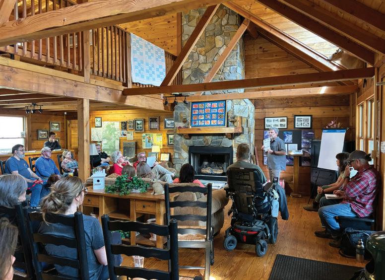
On February 16, 2024, the consultant team held a kick-off meeting for the POC at the office of Foothills Conservancy of NC. The first meeting introduced the scope of work, project schedule, and proposed project goals to committee members. The consultant team led a discussion about public outreach and engagement, and the group reviewed study area maps. Committee members were invited to make notes on each map outlining opportunities and constraints.
Framework Meeting
On April 25, 2024, the Project Oversight Committee met at the Wilson Creek Visitor Center Picnic Shelter to review preliminary recommendations. The consultant team presented research and analysis findings including previous planning efforts, survey results, and stakeholder group takeaways. POC members provided input on preliminary outdoor recreation infrastructure recommendations.
Draft Plan Review Meeting
On August 16, 2024, the POC reconvened to review the draft plan and offer feedback on final plan recommendations.
3.2 p ublic e ngagement
Significant efforts were made to introduce the project to the public and engage community members and stakeholders.
A project specific website, hosted by G5 Trail Collective, was developed to inform the public and stakeholders about the Action Plan. The site provided a link to a community survey, and a project fact sheet provided information about the planning effort in English and Spanish. It provided a map of the study area and links to the project fact sheet and USFS press release. A community survey link was also included on the website. A total of 627 survey responses were collected from March 7 to April 8, 2024.
The USFS created a press release for the Action Plan that was distributed through their typical communication channels. They also worked with partner organizations to distribute information about the project through social media.
SURVEY RESPONSES TOP 5 ZIP CODES
plan de acción
OBJETIVOS DEL PLAN
ANÁLISIS
Llevar a cabo una evaluación exhaustiva del área de estudio para evaluar las oportunidades y limitaciones significativas para el desarrollo de infraestructura de recreación al aire libre.
COMUNIDAD
Involucrar a las partes interesadas, a los líderes gubernamentales y comunitarios, y al público en general para fomentar los esfuerzos de colaboración y promover una visión compartida que apoye los objetivos de la organización y la comunidad.
EXPERIENCIA
Crear una experiencia sostenible desde el punto de vista ambiental, social, económico y administrativo que brinde un acceso equitativo para todos.
EDUCACIÓN
Fomentar la promoción, la administración y el uso apropiado para la protección y el acceso al medio ambiente natural.
SEGURIDAD PÚBLICA
Orientar y dispersar el uso a través del desarrollo de infraestructura que proporcione unaexperiencia segura y un acceso adecuado para la respuesta a emergencias.
PARTNERS
Tierras y Lagos de CarolinaConservación y Desarrollo de Recursos Servicio Forestal de EE. UU. Aguas Bravas Americanas Un Arroyo Wilson Limpio (A Clean Wilson Creek) Cámara de Comercio del Condado de Caldwell Departamento de Planificación del Condado de Caldwell Conservación de las Colinas de Carolina del Norte Sendero Colectivo G5 Latinos Aventureros en
PROPÓSITO DEL PLAN
recomendacionesparaáreasdeestacionamiento,accesosalríoeinstalacionesdeapoyo Eláreadeestudiodelproyecto,ubicadaenelcondadodeCaldwell,CarolinadelNorte, seextiendeaproximadamente9millasdelongitudeincluyeelcorredordelríoWilson CreekWildandScenicdesdelacalleAdakohastaNC90yMortimer.ElDepartamento de Conservación y Desarrollo de Recursos de Tierras
(RC&D), encooperaciónconelServicioForestaldelosEstadosUnidos(USFS),estáfinanciando yliderandoelesfuerzo.
1)
para finalizar los detalles del plan.
4) Desarrollo del Plan Final Crear un documento de plan final con planos visuales del sitio, esquemas e ilustraciones en perspectiva que respalden las recomendaciones


SURVEY RESPONSES - AREAS FOR IMPROVEMENT
HOJA INFORMATIVA


3.3 s takeholder and Focus g roup m eetings
The consultant team conducted three meetings with key stakeholder groups. The purpose of the meetings was to increase awareness of the project and provide an opportunity for input. The key stakeholder groups were identified by the project oversight committee and included the NC Wildlife Resources Commission, local Law Enforcement and Emergency Medical Services, and landowners that lived within the Wilson Creek corridor.
KEY TAKE-AWAYS
• Recreation in the headwaters and upper corridor should focus on dispersed uses like hiking, mountain biking, and fishing.
• Infrastructure that provides turn-around areas for emergency vehicles is needed.
• Access and parking areas should be identified and signed.
• Litter pick-up, collection, and human waste management are significant issues.
• Additional road maintenance is needed.
• Rule and regulation enforcement responsibilities by various agency LE officers is unclear to the public.
• Concerns about long-term sustainability of current management, use, and environmental protection exist.

chapter 4: Recommendations
This chapter serves as the heart of the action plan and outlines recommendations for the Wilson Creek Wild and Scenic River corridor from Adako Road to NC 90. General corridor recommendations address visitor orientation, safety, and experience. Site specific recommendations highlight proposed amenities and are supported by site descriptions, site plans, and precedent images.
IN THIS CHAPTER:
4.1 General Corridor Recommendations
4.2 Site Specific Recommendations
4.1 g eneral c orridor r ecommendations
This section outlines recommendations that address improvements for visitor orientation, experience, and safety. Each public land manager will determine which recommendations can be implemented on their lands based on agency policy and guidelines..
Visitor Orientation
Wilson Creek is a regional destination that attracts visitors from all over the area. The primitive character of the corridor and lack of cell phone service make it challenging to navigate to local communities for food, lodging, and support services.
Regional wayfinding information referencing points of interest, local services, and transportation routes will provide important direction to visitors not familiar with the area. Maps and informational panels at kiosks located at key visitor orientation areas in the corridor will include this wayfinding information. Trailhead kiosks will focus on information specific to the Wilson Creek corridor and include all parking areas, restrooms, developed sites, trails, and points of interest.
Three different public agencies with varying rules and regulations manage land within the corridor. Typical agency area signs will define each land manager’s land boundaries along Brown Mountain Beach Road. Visitors will be able to clearly identify public and private lands throughout the corridor.
exh 01: public land boundaries

Visitor Experience
One goal of land managers within the corridor is to provide an environmentally, socially, and managerially sustainable experience that provides equitable access for all. An exceptional visitor experience will also encourage advocacy, stewardship, and appropriate use.
Infrastructure development will be concentrated into “focus areas” dispersed throughout the
Public land boundaries will be clearly defined along Brown Mountain Beach Road to inform visitors not familiar with the area.
corridor. The proposed locations will spread out use and minimize crowding to reduce resource impact. Primary focus areas will include parking, vault toilets, and bear-proof trash cans to address waste management. Facility design will follow USFS guidelines and have minimal visual impact to visitors on Wilson Creek and Brown Mountain Beach Road. Trail connectivity between focus areas will provide visitors with multiple options to access the river and adjacent public lands.
Visitor Safety
Due to the increasing number of visitors of all ages, abilities, and experience levels to the area, safety is a significant concern. Infrastructure development that provides safe and adequate access for emergency response is important for visitors, community members, and local law enforcement and emergency services staff.
Consistent design specifications for focus areas will include a standard measurement for parking spaces. Each space will be 10 feet wide and 22 feet long and clearly defined by wheel stops. Signage at each focus area will include the site name and typical USFS map symbols to designate allowable uses. Reserved parking for law enforcement and emergency management will be located throughout the corridor and physically separated from visitor parking. These parking spaces can also be used as turn-around areas for emergency vehicles.
The standard road width of Brown Mountain Beach Road will be 20 feet for the length of the corridor. Existing parking in non-designated areas along the road will be eliminated using boulders, guardrails, and road realignment to prohibit access. Local government representatives should advocate for a lower speed limit, currently 45 miles per hour, to increase safety for pedestrians and drivers.
r ecommendation s ummary
Visitor Orientation
• Offer regional wayfinding information at key visitor orientation areas and information specific to the Wilson Creek corridor at trailhead kiosks.
• Clearly define public land boundaries along Brown Mountain Beach Road.
Visitor Experience
• Concentrate infrastructure development into “focus areas”.
• Disperse focus areas along the length of the study area.
• Provide parking, vault toilets, and bear-proof trash cans at each focus area in the USFS dayuse area to address waste management.
• Follow USFS facility design guidelines to minimize visual impacts to visitors on Wilson Creek and Brown Mountain Beach Road.
• Explore trail connectivity between focus areas to provide visitors with multiple options to access the river and adjacent public lands.
•
Visitor Safety
• Use consistent and standard design specifications for focus areas.
• Define each parking space (10 feet X 22 feet) with wheel stops.
• Include signage with site name and allowable use symbols at each focus area.
• Maintain a consisten road width (20 feet) for the length of the corridor
• Provide reserved parking spaces and turn-around areas for law enforcement and emergency management that is physically separated from visitor parking.
• Eliminate parking in non-designated areas using boulders, guardrails, and road realignment.
• Advocate for a lower speed limit.
s ite s peci F ic
r ecommendations
This section highlights outdoor recreation infrastructure development for specific focus areas within the Wilson Creek corridor. It presents recommendations for parking areas, support facilities, and developed sites.
Recommendations Overview
The Wilson Creek corridor study area stretches approximately 9.3 miles from Adako Road to NC 90. The study area is organized according to four (4) planning sections: 1) Lower Wilson Creek; 2) USFS Day Use Area; 3) Middle Wilson Creek; and 4) Upper Wilson Creek. See Map 03: Planning Sections and Focus Areas Overview, page right. Each planning section features a section overview, vicinity map, and “quick facts” that summarize key elements including section length, recommendations summary, land managers, and points of interest.
Recommendations for each planning section are organized according to focus areas. Each focus area includes a vicinity map, site description, and list of proposed amenities. Typical USFS map symbols note the recommended permitted uses at each focus area. Site plans are included for focus areas in the Lower Wilson Creek and USFS Day-Use planning sections. Written recommendation descriptions are provided for focus areas within the Middle Wilson Creek and Upper Wilson Creek planning sections.
All site recommendations fall under one of the following three classifications: visitor orientation area, developed site, and USFS river access trailhead. Visitor orientation areas provide kiosks with maps, rules and regulations, local outdoor recreation information, regional wayfinding information, and temporary parking. Developed sites provide parking areas with multiple amenities to provide a distinct recreational experience for visitors. River access trailheads typically provide visitor parking, restrooms, and bear-proof trash cans.
9.3 Miles of Wilson Creek
8.6 Miles of Brown Mountain Beach Road
44,000 Acres of adjacent USFS lands
687 Acres of adjacent NCWRC lands
13.3 Acres of adjacent Caldwell County lands
938 Acres of adjacent private lands
Creek trailhead mortimer campground
Creek Visitor Center
The Lower Wilson Creek planning section extends approximately one mile from the intersection of Adako and Brown Mountain Beach Roads to the southern end of the USFS Wilson Creek Day Use area. This section is defined primarily by low density private commercial and residential development and includes NCWRC land at its southern end.
1
1 Focus Area
1 Visitor Orientation Area
0 USFS River Access Trailheads
0 Developed Sites
17 Public Parking Spaces Land Managers
• North Carolina Wildlife Resources Commission
• Private Landowners Points of Interest
• River access near the Adako Road bridge
• Brown Mountain Beach Resort

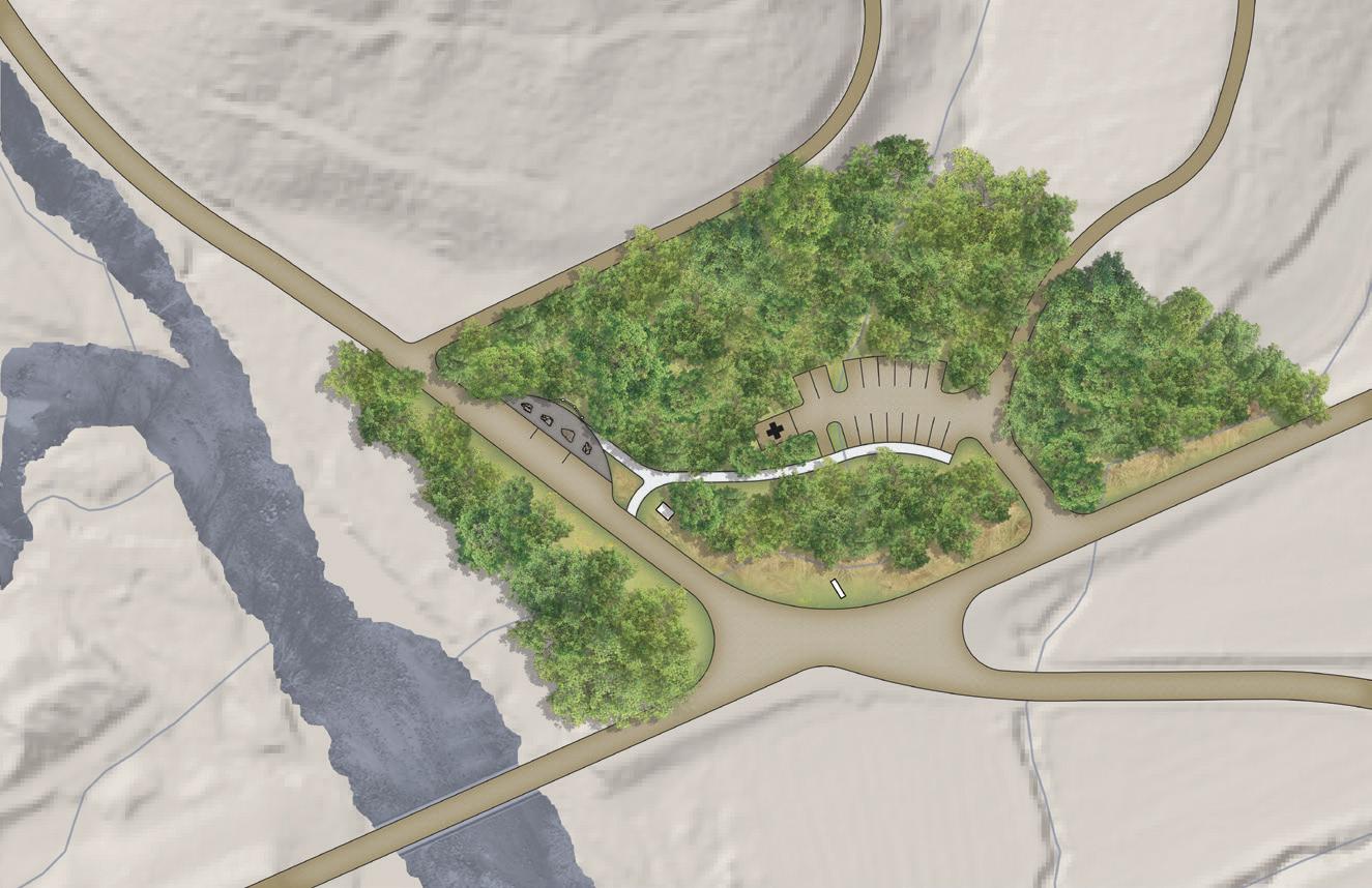
Focus a rea 1: a dako
The Adako focus area is located on NCWRC managed lands at the northeast corner of the intersection of Adako and Brown Mountain Beach Roads. A small non-designated parking area and a short natural surface trail exist at the site.
Key elements at this focus area include gateway sign, 3-panel informational kiosk with temporary parking (3), natural surface trail leading to Wilson Creek, and emergency management staging area/recreational use parking (17).
CALDWELL COUNTY BURKE COUNTY

* These recommendations don’t constitute a commitment from the NCWRC. All development must be consistent with conservation dedication agreements and approved by the NC Natural Heritage Program. map 04: Focus area 1
e xisting c onditions

A gateway sign located on the northeast corner of the intersection of Adako and Brown Mountain Beach Roads will welcome visitors to the Wilson Creek Wild and Scenic River corridor. This sign will utilize traditional outdoor design elements and include the agency logos of all three public land managers within the corridor. The project partners will need to work with local business owners to relocate existing signs.
exh


e xisting c onditions

100-yearfloodplain
brownmountainbeachrd
private drive

3-panel information kiosk exh 03: adako site plan
monument sign
temporary parallel parking (3)
WILSON CREEK
le/ems
parking (20’ x 30’)
private drive
parking (17) • 17 typical
he USFS Day Use planning section extends approximately 3.8 miles from the southern boundary of USFS land to the intersection of Craig Creek and Brown Mountain Beach Roads. This section is defined by undeveloped land primarily owned and managed by USFS with one 2.9 acre area owned and managed by Caldwell County.
3.8 Miles Section Length
11 Focus Areas
1 Visitor Orientation Area
6 USFS River Access Trailheads
4 Developed Sites
226 Public Parking Spaces
Land Managers
• US Forest Service
• Caldwell County Points of Interest
• Bathtub
• Thunderhole
• Wilson Ridge Trail
• Lady on the Rock
• Deerhorn

Focus a rea 2:
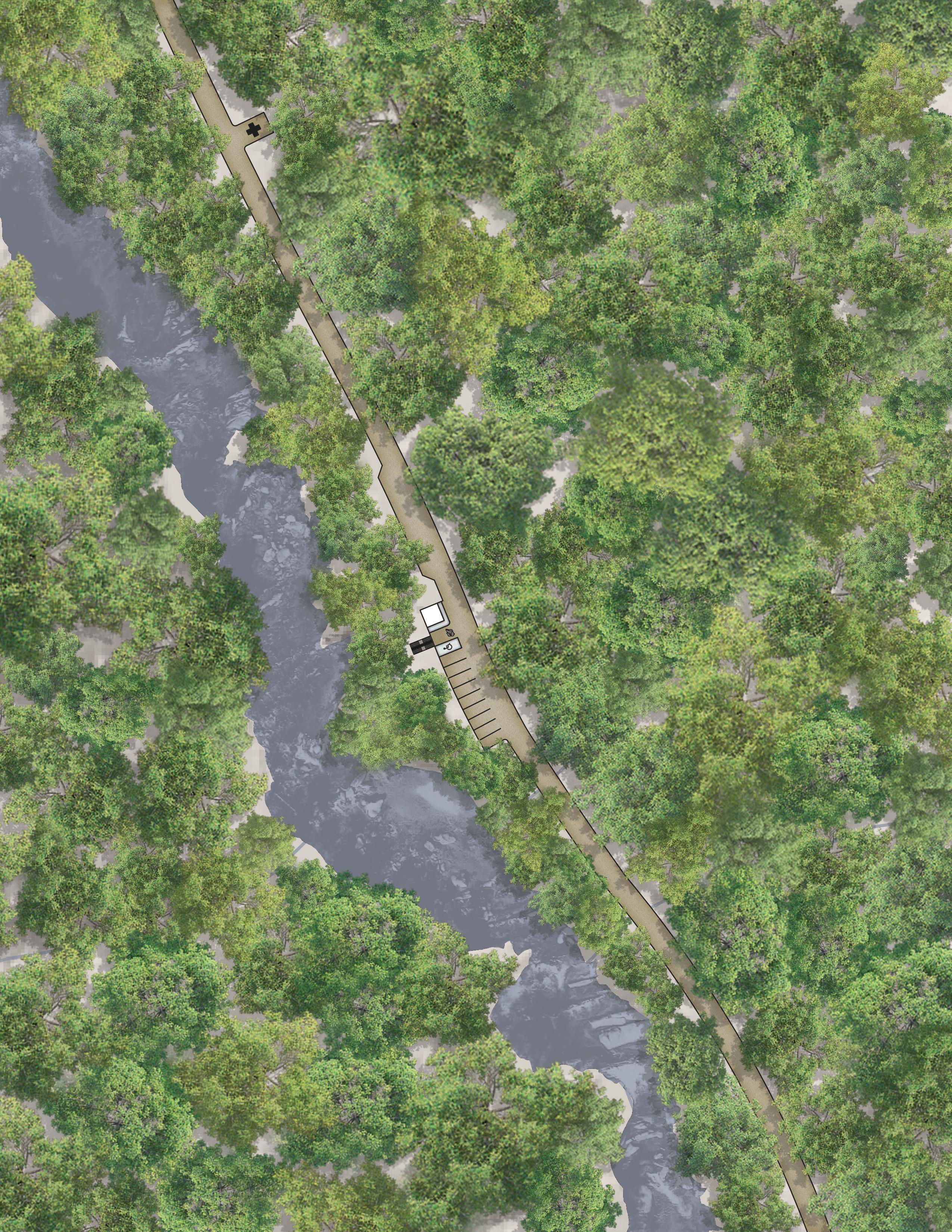
l ower g orge
The Lower Gorge focus area is located on the west side of Brown Mountain Beach Road on USFS managed lands. It includes the existing USFS Day Use Areas 1A and 1B. Currently, developed river access (2), single vault restroom, and bear-proof trash cans (2) are located at the site.
Key elements at this focus area include developed river access (2), single vault restroom, bearproof trash cans (2), changing room, paddler loading zone, parking (15), and emergency services parking.

brownmountainbeachrd
changing room (6’ x 6’)
LOADING ZONE
staircase to river
parking (6)
• 6 typical

WILSON
CREEK
e xisting c onditions

le/ems parking (20’ x 30’)
single vault restroom (11’ x 17’) & trash
staircase to river
parking (9)
• 8 typical
• 1 ada
100yearfloodplain
The Bathtub focus area is located on the west side of Brown Mountain Beach Road on USFS managed lands. Designated dispersed parking and dispersed river access (2) exist at the site.
Key elements include single vault restroom, changing room, dispersed river access, bearproof trash cans, parking (14), and emergency services parking. Additional emergency services parking is located north of this focus area.

le/ems parking (20’ x 30’)

e xisting c onditions
100-year
WILSON CREEK
floodplain
brownmountainbeachrd
le/ems parking (20’ x 30’)
river access
single vault restroom (11’ x 17’), changing room (6’ x 6’), & trash
parking (14) • 13 typical • 1 ada
The Middle Gorge focus area is located on the east and west sides of Brown Mountain Beach Road on USFS managed lands. It includes the existing USFS Day Use Area
2. Designated dispersed parking, developed river access (2), and dispersed river access exist at the site.
Key elements include single vault restroom, developed and dispersed river access, bear-proof trash cans, and parking (23).

WILSON CREEK

100year
parking (10)
• 10 typical

river access
parking (13)
• 12 typical
• 1 ada
single vault restroom (11’ x 17’) & TRASH
brown mountain beach rd
Focus a rea 5: t hunderhole
The Thunderhole focus area is located on the west side of Brown Mountain Beach Road on USFS managed lands. It includes the existing USFS Day Use Area
3. Currently, a developed river access is located at the site.
Key elements include dispersed picnic area, developed river access, restroom, changing room, bear-proof dumpster, and parking (10).


SINGLE vault restroom (11’ x 17’) & TRASH dispersed picnic area
changing room (6’ x 6’)

e xisting c onditions

100-yearfloodplain
staircase to river parking (10) • 9 typical • 1 ada
WILSON CREEK
dumpster
Focus a rea 6:
w ilson r idge
The Wilson Ridge focus area is located on the east and west sides of Brown Mountain Beach Road on USFS managed lands. Designated dispersed parking, dispersed river access (4), and Wilson Ridge Trail access exist at the site.
Key elements include dispersed river access, Wilson Ridge Trail access and one-panel kiosk, single vault restroom, changing room, bear-proof trash cans, and parking (21).

parking (6)
• 6 typical

1 0 0y e a
e xisting c onditions

river access
KIOSK
single vault restroom (11’ x 17’), changing room (6’ x 6’), & trash
wilson ridge trail
parking (15)
• 14 typical
• 1 ada
WILSON CREEK
Focus a rea 7:
l ady on the r ock
The Lady on the Rock focus area is located on the east side of Brown Mountain Beach Road on USFS managed lands. It includes the existing USFS Day Use Areas 4 and 5. Designated dispersed parking, developed river access, and dispersed river access (4) exist at the site.
Key elements include ADA viewing platform and riverside parking, developed and dispersed river access, single vault restroom, bear-proof trash cans, emergency services parking, and parking (26).


parking (25)
• 24 typical
• 1 ada

ada riverside parking
ada viewing platform (12’ x 12’)
single vault restroom (11’ x 17’) & TRASH
river access dispersed picnic area river access
dumpster
le/ems parking (30’ x 40’)
e xisting c onditions

moun t a i n b e a c h r d


Focus a rea 8: paddler p ut- i n
The Paddler Put-In focus area is located on the west side of Brown Mountain Beach Road on USFS managed lands. It includes the existing USFS Day Use Area 6. Currently, developed and dispersed (3) river access is located at the site.
Key elements include paddler loading/unloading zone, single vault restroom, changing room, developed and dispersed river accesses, bear-proof trash cans, and parking (10). Emergency services parking is located between focus areas 8 and 9 on the east side of Brown Mountain Beach Road.

le/ems parking (20’ x 30’)
e xisting c onditions exh

loading zone
Steps & boat launch ramp
single vault restroom (11’ x 17’), changing room (6’ x 6’), & trash
parking (10) • 9 typical • 1 ada river access river access
WILSON CREEK
Focus a rea 9:
c reekside
Creekside focus area is located on the west side of Brown Mountain Beach Road on USFS managed lands. Designated dispersed parking and dispersed river access exist at the site.
Key elements include dispersed river access, dispersed picnic area, single vault restroom, changing room, bear-proof trash cans and dumpster, and parking (30). Emergency services parking is located between focus areas 9 and 10 on the east side of Brown Mountain Beach Road.

parking (30) • 29 typical • 1 ADA

e xisting c onditions

dispersed picnic area river & Beach access
single vault restroom (11’ x 17’), changing room (6’ x 6’), & trash
dumpster
le/ems parking (20’ x 30’)
Focus a rea 10:
d eerhorn
The Deerhorn focus area is currently split by Brown Mountain Beach Road on Caldwell County and USFS managed lands. Designated parking and dispersed river access exist at the site.
The recommendation for this area includes realigning Brown Mountain Beach Road to the east side of the existing corridor. Key elements include developed ADA river access, dispersed river access, picnic shelters (2), dispersed picnic area, event lawn, restrooms, changing room, bearproof trash cans and dumpster, emergency services parking, and parking (40).


ADARIVER ACCESS
Focus a rea 11: c
The Confluence focus area is located on the west side of Brown Mountain Beach Road on USFS managed lands. Currently, there are no amenities located at the site.
Key elements include dispersed picnic area, developed ADA river access, dispersed river access, restroom, changing room, bearproof trash can and dumpster, and parking (28).

e xisting c onditions

dispersed picnicarea brown mountainbeachrd

parking (28) • 27 typical • 1 ada
3-PANEL INFORMATION KIOSK
SINGLE VAULT RESTROOM (11’ X 17’) & TRASH
ENTRANCE SIGN
The Craig Creek focus area is located at the intersection of Craig Creek and Brown Mountain Beach Roads on USFS managed lands. Dispersed parking and river access exist at the site.
Key elements include 3-panel informational kiosk with temporary parking (3), emergency management staging area/recreational use parking (10), and bear-proof dumpster.
e xisting c onditions


le/ems parking
dumpster
temporary parallel parking (3)
3-panel information kiosk
parking (10)
• 10 typical
WILSON CREEK
p lanning s ection 3:
The Middle Wilson Creek planning section extends approximately 2 miles from the intersection of Brown Mountain Beach and Craig Creek Roads to the southern boundary of the NCWRC Lutz Tract Pisgah Game Land. This section is defined by medium density residential development and is primarily owned and managed by private landowners, with one 10.4 acre area owned and managed by Caldwell County.
2 Miles Section Length
1 Focus Area
0 Visitor Orientation Areas
0 USFS River Access Trailheads
1 Developed Site Land Managers
• Private Landowners
• Caldwell County Points of Interest
• Wilson Creek Visitor Center

Focus a rea 13:
w ilson c reek
v isitor c enter
The Wilson Creek Visitor Center focus area is located on Caldwell County managed lands. It currently includes visitor

p lanning s ection
The Upper Wilson Creek planning section extends approximately 2 miles from NCWRC Lutz Tract Pisgah Game Land southern boundary to the intersection of Brown Mountain Beach Road and NC 90 at Mortimer. This section is defined by undeveloped land primarily owned and managed by NC Wildlife Resources Commission.
* These recommendations don’t constitute a commitment from the NCWRC. All development must be consistent with conservation dedication agreements and approved by the NC Natural Heritage Program.
1 Visitor Orientation Area
0 USFS River Access Trailheads
0 Developed Sites
4 NCWRC Managed Sites Land Managers • NC Wildlife Resources Commission
Points of Interest
Old Mill
Mortimer

e merald p ool
The Emerald Pool focus area is located on the west side of Brown Mountain Beach Road north of the confluence of Harper and Wilson Creeks. Currently, there are no amenities located at the site.
Key proposed elements include informational kiosk and parking.
Focus a rea
h arper c reek
The Harper Creek focus area is located on the west side of Brown Mountain Beach Road on NCWRC managed lands and includes the Harper Creek Trailhead. It currently includes a small parking area and Harper Creek Trail sign. In addition to existing elements, key proposed elements include one-panel kiosk, angler access, and parking expansion.

Focus a rea 16:
t he o ld m ill
Mill
chapter 5: Implementation
This chapter includes general implementation recommendations and a review of focus area recommendations with an estimated probable cost range and priority level. The chapter concludes with a review of potential funding opportunities.
IN THIS CHAPTER:
5.1 General Implementation Recommendations
5.2 Site Specific Recommendations Summary, Prioritization, and Estimate of Probable Cost
5.3 Funding Opportunities
5.4 Wilson Creek Improvements Timeline
5.1 g eneral i mplementation r ecommendations
This Wilson Creek Action Plan provides a vision for future outdoor recreation infrastructure development along Wilson Creek and presents recommendations for parking areas, river accesses, and support facilities. The completion of the planning process represents an important first step that should be built on to accomplish implementation. Project partners should continue to engage stakeholder groups, government leaders and staff, affected landowners, and community members, providing regular updates on implementation progress. Governing bodies that represent the local government jurisdictions should show support by adopting the plan.
Recommendations outlined in the Wilson Creek Action Plan will need to go through a formal review process by the affected land managers, including the US Forest Service, NC Wildlife Resources Commission, and Caldwell County. Project partners should seek and secure funding to begin implementation with survey, engineering, and permitting work for high priority focus areas. The USFS should continue to promote and increase public awareness of project progress prior to construction to demonstrate “action”.
The USFS should complete additional research on the feasibility of implementing a permit system for the Wilson Creek corridor once infrastructure development is complete.


5.2 site speciFic recommendations summary, prioritization, and estimate oF probable cost
he project implementation matrix below provides the reponsible land manager, site classification, existing and proposed amenities, and number of existing parking spaces for each focus area. It also includes existing and proposed parking spaces and an estimate of probable cost. The project oversight committee determined implementation priority for each focus area.
• Non-designated Parking
• Natural Surface Trail leading to Wilson Creek Proposed
• Gateway Sign
• 3-Panel Informational Kiosk with Temporary Parking
• Emergency Management Staging Area/Recreational Use Parking
• Developed River Access (2) • Restroom • Bear-Proof Trash Cans Proposed • Changing Room • Paddler Loading Zone • Emergency Services Parking Existing
• Dispersed River Access (2) Proposed
• Restroom • Changing Room
• Bear-Proof Trash Cans
• Emergency Services Parking Existing
• Developed and Dispersed River Access Proposed
• Restroom
• Bear-Proof Trash Cans
Planning Section 2 (Cont’d):
Existing
• Developed River Access
Focus Area 5: Thunderhole
Focus Area 6: Wilson Ridge
Focus Area 7: Lady on the Rock
Focus Area 8: Paddler Put In
Focus Area 9: Creekside
Proposed
• Dispersed Picnic Area
• Restroom
• Changing Room
• Bear-Proof Dumpster
Existing
• Trail Access
• Dispersed River Access
Proposed
• 1-Panel Kiosk
• Restroom
• Changing Room
• Bear-Proof Trash Cans
Existing
• Developed River Access
• Dispersed River Access (4)
Proposed
• ADA Viewing Platform
• ADA Riverside Parking
• Restroom
• Bear-Proof Trash Cans
• Emergency Services Parking
Existing
• Developed River Access
• Dispersed River Access (3)
Proposed
• Paddler Loading/Unloading Zone
• Restroom
• Changing Room
• Bear-Proof Trash Can
• Emergency Services Parking
Existing
• Dispersed River Access
Proposed
• Dispersed Picnic Area
• Restroom
• Changing Room
• Bear-Proof Dumpster
$447,938 $487,494 $540,417 $402,380 $550,783
Planning Section 2 (Cont’d):
Existing
• Dispersed River Access
Proposed
• Developed ADA River Access
• Picnic Shelters (2)
Focus Area 10: Deerhorn Caldwell County
Focus Area 11: Confluence
Focus Area 12: Craig Creek USFS USFS
• Dispersed Picnic Area
• Event Lawn
• Restroom
• Changing Room
• Bear-Proof Trash Cans and Dumpster
• Emergency Services Parking
• Road Realignment
Proposed
• Dispersed Picnic Area
• Developed ADA River Access
• Dispersed River Access
• Restroom
• Changing Room
• Bear-Proof Trash Cans and Dumpster
Existing
• Dispersed River Access
Proposed
• 3-Panel Informational Kiosk With Temporary Parking
• Bear-Proof Dumpster
• Emergency Management Staging Area/Parking
$847,453 $143,493 $2,364,101 Total Cost: $7,545,186
* Existing parking totals include developed and designated dispersed parking areas as outlined in the Wilson Creek Day Use Area Access and Parking Assessment produced by the USDA Forest Service Grandfather Ranger District in February 2019.
** These recommendations don’t constitute a commitment from the NCWRC. All development must be consistent with conservation dedication agreements and approved by the NCWRC and NC Natural Heritage Program.
Planning Section 3:
Focus Area 13: Wilson Creek Visitor Center
County
Planning Section 4:
Focus Area 15:
Existing
• Visitor Center Building
• Picnic Shelters (2)
• Small Parking Areas (2)
• Informational Kiosks (2)
• Picnic Area
• Pine Ridge Trail Access
• Event Lawn
Proposed
• Outside Restroom
• Pine Ridge Trail Trailhead Enhancement
• Amphitheater
• Bear-Proof Dumpster
• Parking Expansion
Proposed
• Informational Kiosk
• Parking
Existing
• Small Parking Area
• Harper Creek Trail Trailhead Sign
Proposed
• 1-Panel Kiosk
• Angler Access
• Parking Expansion
Existing
• Angler Access
• Bear-Proof Trash Cans (4)
• Bear-Proof Dumpster
Proposed
*Explore development of additional recreational amenities with a willing government or non-profit organization partner.
Existing
• Small Parking Area (3)
• Angler Access
• Town Of Mortimer Flagpole and Monument
Proposed
• Gateway Sign
• 3-Panel Informational Kiosk With Temporary Parking (3)
• Interpretive Sign
* Parking totals and estimates of probable cost were not determined for planning sections 3 and 4 due to their location outside the USFS day-use area.
** These recommendations don’t constitute a commitment from the NCWRC. All development must be consistent with conservation dedication agreements and approved by the NCWRC and NC Natural Heritage Program.
Focus Area 14: Emerald Pool
Harper Creek
Focus Area 16: The Old Mill
Focus Area 17: Mortimer
5.3 Funding o pportunities
The Wilson Creek Action Plan focuses on creating outdoor recreation infrastructure in the Wilson Creek corridor that sustainably manages use. Plan recommendations present feasible environmental, recreation, and tourism projects for the US Forest Service and their partners in this effort. Federal, state, and private foundation grants and funding sources that have an environmental,
recreation, tourism, and public lands access focus should be targeted for project funding. (See Exhibit : Grant Funding Opportunities Matrix, page right). Funding sources may have restrictions based on grant applicant, land manager, and project scope. Project partners should develop a grant procurement strategy that leverages grants “against each other” and maximizes the value of local matching dollars.
5.4 w ilson c reek
i mprovements t imeline
February 2019
USFS staff completes the Wilson Creek Day Use Area Access and Parking Assessment.
january - august 2024
Project partners work with a consultant team to complete the Wilson Creek Action Plan.
spring 2025
DOT implements Brown Mountain Beach Road improvements and widening.
2026
USFS begins construction on high priority focus areas.
2025
USFS begins NEPA analysis and engineering.

