


City of Beckley, Town Council
Rob Rappold, Mayor,CityofBeckley
Janine Bullock, Councilman,CityofBeckley
Kevin Price, Councilman,CityofBeckley
Robert Dunlap, Councilman,CityofBeckley
Tom Sopher, Councilman,CityofBeckley
Sherrie Hunter, Councilman,CityofBeckley
Bob Canter, Councilman,CityofBeckley
Cody Reedy, Councilman,CityofBeckley
Billie Trump, Recorder-Treasurer,CityofBeckley
Bill File, Attorney,CityofBeckley
Susan Miller, Secretary,CityofBeckley
Beckley Outdoors Steering Committee
Zach Armentrout, RealEstateManager,Paramount DevelopmentCorporation
Brent Bailey, ExecutiveDirector,WestVirginiaLandTrust
Joe Bevil, GeneralManager,BeaverPropertyCompany
Claire Jarrell, VicePresident,ParamountDevelopment Corporation
Mike Jarrell, ChiefExecutiveOfficer,ParamountDevelopment Corporation
Mitch Lehman, Director,OutdoorEconomicDevelopment,City ofBeckley
Corey Lilly, OutdoorCommunityDevelopmentManager, SmithWVUOutdoorEconomicDevelopment Collaborative
Jeffrey Miller, ExecutiveDirector,WVParkwaysAuthority
Rob Rappold, Mayor,CityofBeckley
Michelle Rotellini, President/CEO,BeckleyRaleighCounty Chamber of Commerce
Kevin Price, Councilman,CityofBeckley
Lisa Strader, ExecutiveDirector,VisitSouthernWestVirginia
T. Ramon Stuart, President,WVUTech
Billie Trump, Recorder-Treasurer,CityofBeckley
Andy Williamson, Director,OutdoorCommunityDevelopment, Smith WVU Outdoor Economic DevelopmentCollaborative
Jennifer Wood, ExecutiveDirector,UniversityRelations,WVU Tech
Video Interviews
Corey Lilly, OutdoorCommunityDevelopmentManager, Smith WVUOutdoorEconomicDevelopment Collaborative
Dave Bieri, ParkRanger,NewRiverGorgeNationalPark
Michelle Rotellini, President/CEO,BeckleyRaleighCounty Chamber of Commerce
Rob Rappold, Mayor,CityofBeckley
Vickie Webb, BeckleyBikeShare
T. Ramon Stuart, President,WVUTech
Tom Sopher, Councilman,CityofBeckley
Vickie Webb, BeckleyBikeShare

The Beckley Outdoors Economic Action Plan serves as the chief planning document to guide the City of Beckley and its partners pertaining to future investments in outdoor economy-related capital infrastructure development. This chapter summarizes the foundation and intent of this important work and provides insight on the plan purpose, goals, process, and overall organization.
In this Chapter:
1.1 Project Background
1.2 Project Goals
1.3 Planning Process
1.4 Plan Organization
City of Beckley elected officials and leaders have a vision to establish Beckley as a premier outdoor destination that celebrates southern West Virginia’s Appalachian heritage. This vision is driven by the confluence of three recent opportunities that impact the region and the city.
The first is the designation of the New River Gorge National Park and Preserve in December 2020. The National Park designation is driving increased tourism and outdoor recreation for the entire New River Gorge region. With Beckley’s proximity to the national park and existing tourism infrastructure, the city is well-positioned to become a premier gateway community to the national park.
The final opportunity is the nation-wide shift towards remote work that occurred after the COVID-19 pandemic. This shift allows remote workers to relocate to communities like Beckley that enable them to work, live, and play close to outdoor recreation opportunities.
Economic Action Plan is a result of over 12 months of intensive planning led by the City of Beckley and its many partners.
The New River Gorge region is a featured community for Ascend WV, a talent attraction program for remote workers seeking a high-quality lifestyle in the mountains of West Virginia, that provides financial resources and other benefits to attract remote workers to the region.
As the economic focus of Beckley has shifted away from resource extraction, the city has experienced a slow decline in residents with 1.8% fewer total population between 2010 and 2020.
The second opportunity is the relocation of West Virginia University Institute of Technology (WVU Tech) to downtown Beckley in the summer of 2017. With approximately 1600 students, the university is an economic driver for the city and the WVU Tech leadership team provides strong partnership in crafting the future vision for Beckley.
A decrease in population can have negative impacts such as fewer schools, a depressed housing market, less care facilities, and fewer businesses. Shifting Beckley’s focus from resource extraction to outdoor recreation will help to improve quality of life, attract new residents, and drive economic growth.
The Beckley Outdoors Economic Action Plan is a result of over 12 months of intensive planning led by the City of Beckley and its many partners. As expressed by stakeholders throughout the planning process, the planning effort is critical to create a community-led vision and 15-year roadmap to build destination-quality outdoor
recreation infrastructure that ignites significant economic impact. With effective leadership and an unwavering execution of this plan’s initiatives, it is certain that visitors from throughout the region, state, and country will come to know Beckley Outdoors.
Inventory existing outdoor recreation economy assets within the City of Beckley and New River Gorge region, and evaluate their current condition and ability to provide for a quality user experience.
Engage government officials, community leaders, and citizens to identify new outdoor recreation infrastructure projects that will fill gaps, support broader community goals, and promote the outdoor economy.
Create an Outdoor Economy Action Plan that generates interest and casts an inspiring vision with compelling renderings, site master plans, and 3-D illustrations to effectively communicate recommendations.
Develop unique partnerships between the City of Beckley, business leaders, and non-profit organizations to implement project recommendations that encourage small business growth, natural resource protection, workforce development, and active living for all ages and abilities.
Provide the City of Beckley and their partners with clear strategies, potential funding sources, and a prioritization schedule for implementing the Outdoor Economy Plan.
As a long-time business owner in Beckley, I was inspired by Beckley planning initiatives to create a climbing gym that provides a fun activity for families, is accessible to all ages and abilities, and complements the world-class climbing available in the New River Gorge area.
~ Kevin Traube, owner Outside-In Climbing Gym

The Beckley Outdoors Economic Action plan represents the culmination of more than a year of analysis, planning, civic master planning, and dozens of meetings and site visits. The planning process involved five major phases, including:
1. Direction Setting & Project Launch
2. Research & Analysis
3. Public Engagement
4. Vision & Plan Framework
5. Final Plan Preparation
DECEMBER ‘22 - APRIL ‘23
Create a unique plan identity and promotional video for Beckley Outdoors that builds excitement with government leaders, community partners, and the public. Host a project website that informs about project goals, opportunities for engagement, and progress.
Research & Analysis
DECEMBER ‘22 - MAY ‘23
Develop a database of existing outdoor recreation assets within the City and New River Gorge region. Review local and regional plans that identify opportunities and gaps within the region. Examine economic data including demographic characteristics, business and industry data, visitor trends, and community infrastructure and assets.
FEBRUARY ‘23 - APRIL ‘23
Conduct a series of interviews and focus groups with government officials, business leaders, and community members to discuss the following themes: outdoor recreation, economic development, arts and culture, natural resource protection, and active living. Gather input from citizens about desired priorities via an online survey and public forums.
APRIL ‘23 - JULY ‘23
Create the plan framework that features preliminary recommendations for improving and expanding Beckley’s outdoor economy-related assets. Share recommendations with community members during public meetings for input.
APRIL ‘23 - MARCH ‘24
Develop an action plan that includes the recommendations determined during the planning process, a phasing schedule, an estimate of probable costs, and an outline for grant funding sources.
Beckley Outdoors is organized into five (5) major chapters:
1. Background & Purpose
2. Discovery & Analysis
3. Public Engagement & Emerging Themes
4. Recommendations
5. Implementation
Background & Pur P ose
This chapter includes a description of the plan’s purpose, goals, process, and organization.

d iscovery & a nalysis
This chapter examines regional context as it pertains to Beckley’s position in the outdoor economy, demographics, and relevant past planning efforts in Beckley. It also provides a high-level overview of anchor assets.
3: Pu B lic e ngagement & e merging t hemes
This chapter discusses tools used for public engagement, highlights stakeholders and organizations involved in the process, and presents the key results from an online survey to the community. The chapter culminates with key emerging themes that guide plan recommendations.

Chapter 4: r ecommendations
This chapter is organized according to six (6) Focus Areas as identified during the planning process: 1) Piney Creek Park & Preserve 2) New River Drive 3) Downtown Beckley 4) McManus Rail Trail 5) Cranberry Creek Adventure Park and 6) Bicycle Connectors. Each Focus Area contains specific projects. This chapter is supported by extensive custom illustrations and design schematics.
Chapter5: i m P lementation
This chapter provides a comprehensive matrix of all infrastructure recommendations, prioritization, implementation strategies, and an outline of grant funding sources.

This chapter examines regional context as it pertains to Beckley’s position in the outdoor economy, demographics, and relevant past planning efforts in Beckley. It also provides a highlevel overview of anchor assets.
In this Chapter:
2.1 Outdoor Recreation Economy
2.2 Regional Context
2.3 Demographics
2.4 Previous Planning Efforts
2.5 Key Assets
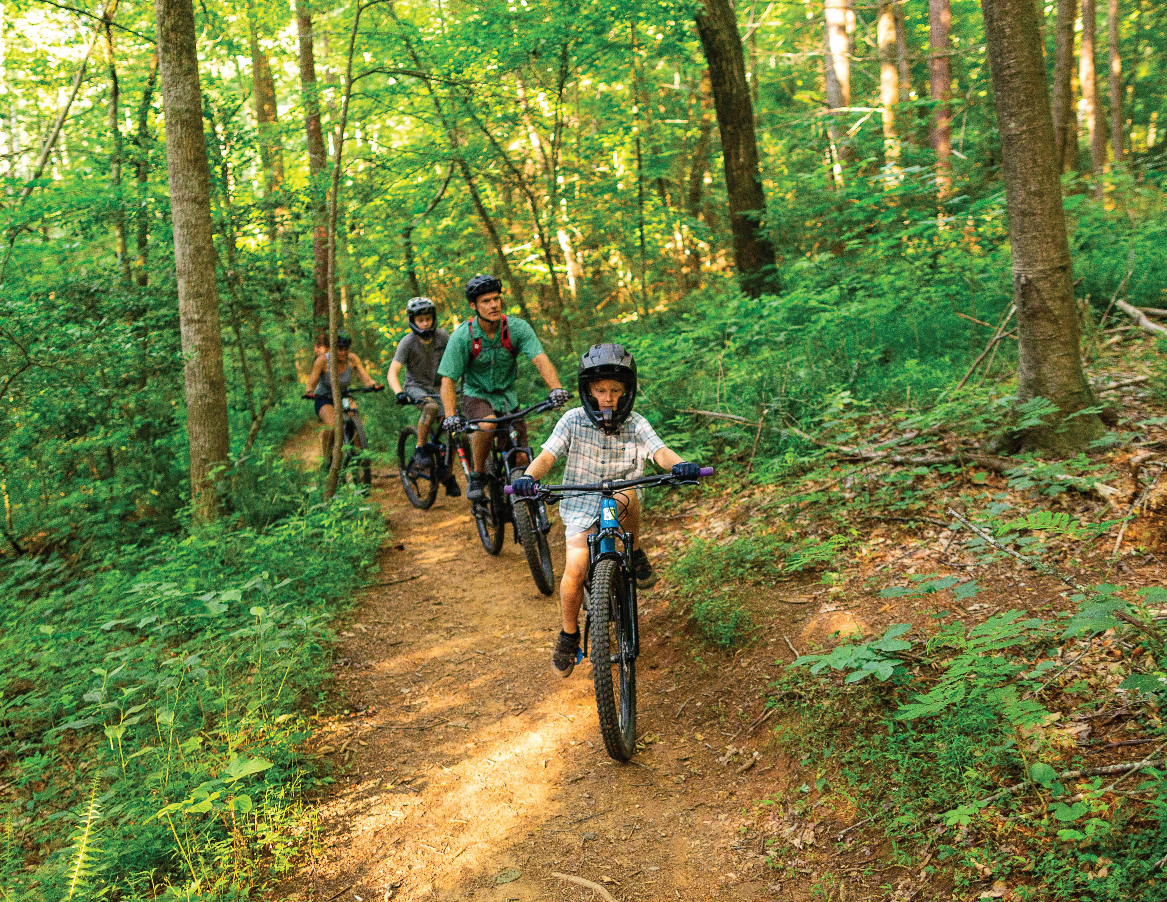
The vision of Beckley Outdoors is to leverage the outdoor assets within and near the city to capitalize on the growing outdoor recreation economy and establish the City of Beckley as a premier outdoor destination. By focusing on creating a vibrant outdoor economy, the city can revitalize downtown, attract and retain residents, increase tourism, and foster economic development.
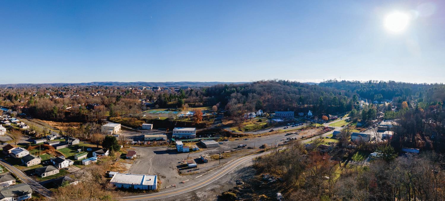
Due to its central location in the state of West Virginia and proximity to the recently designated New River Gorge National Park and Preserve, Beckley is well positioned to become a popular destination for outdoor recreation but it will take significant efforts and investment by the city to make this vision a reality.
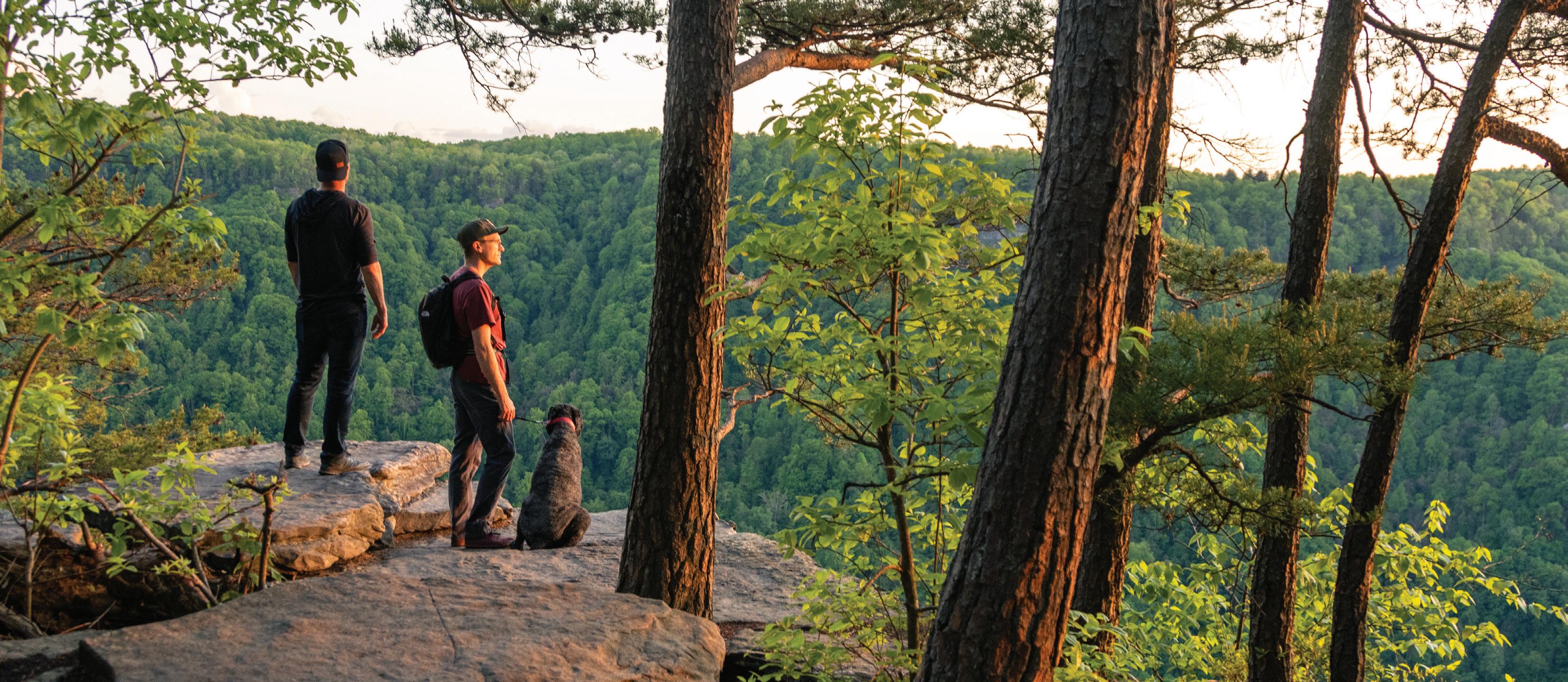
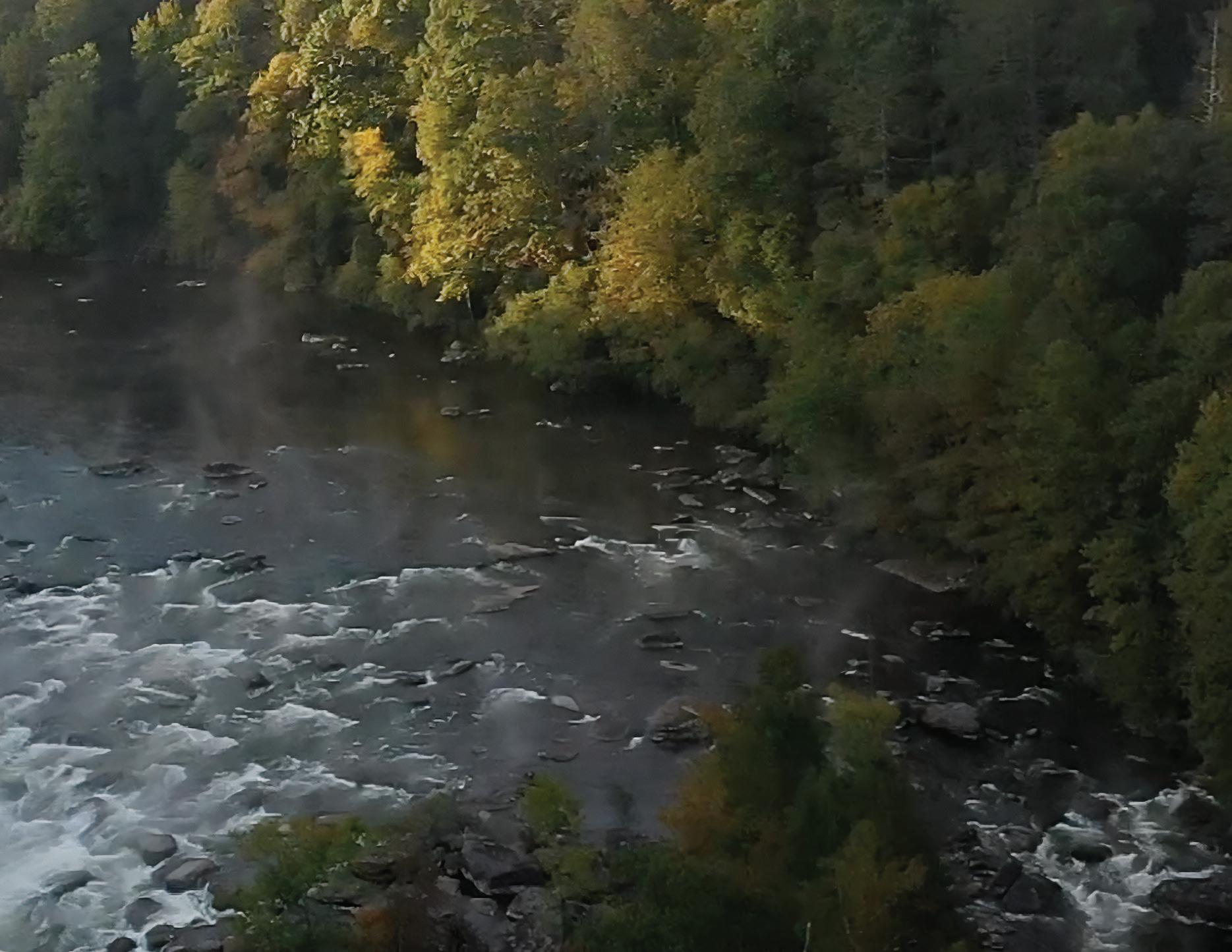
Located just south of New River Gorge National Park, Beckley is already identified as a gateway community for the national park but nearby towns such as Fayetteville and Hinton are currently more popular gateway communities for park visitors. The New River Gorge is renowned for exceptional and wide-ranging outdoor recreation opportunities including whitewater rafting, canoeing, hiking, rock climbing, fishing, hunting,
bird watching, camping, picnicking, and biking. As the infrastructure of the national park becomes more developed and it becomes more well-known, the park is experiencing a steady increase in annual visitors with 1,593,523 visitors in 2022 and 1,707,223 visitors in 2023.
Per the 2022 National Park Visitor Spending Effects report produced by the National Park Service, visitors to national parks have significant economic impact on gateway communities located within 60 miles of a national park. Nationally, 297 million national park visitors spent 20.5 billion and generated 269,900 jobs in gateway communities. (National Park Service, 2022). With a significant investment in outdoor recreation amenities within the city limits, Beckley will establish a stronger outdoor recreation culture that will attract more national park visitors and elevate Beckley as a premier gateway community for the New River Gorge National Park.
In addition to its proximity to the New River Gorge, Beckley is centrally located within West Virginia which has 35 state parks, 107 wildlife management areas, and nine state forests. The New River Gorge region, where Beckley

is located, has 2,023 miles of whitewater; the greatest density of whitewater in the United States (WVU) and offers 3,500 roped climbs and over 1,000 bouldering routes.
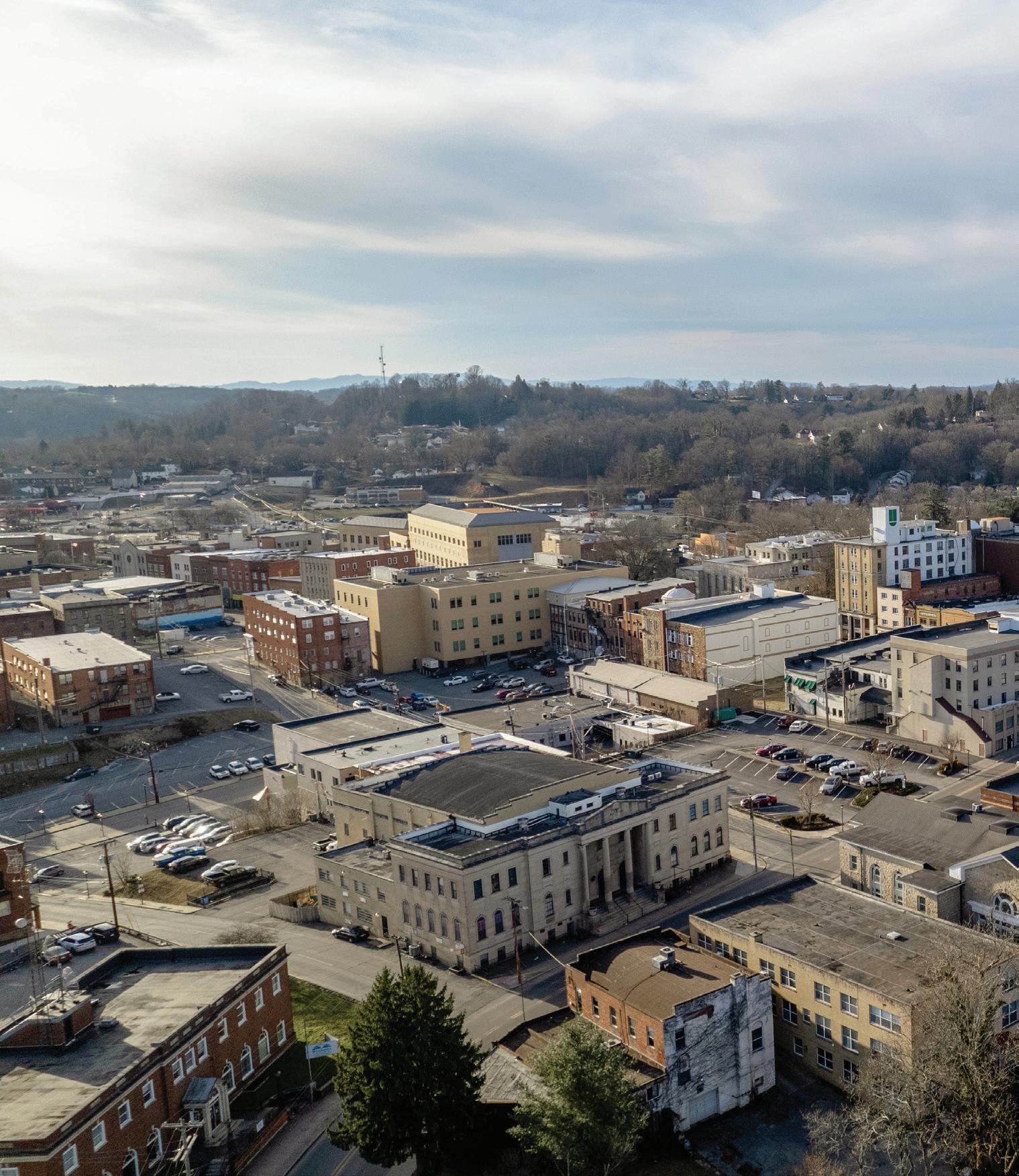
As the ninth largest city in West Virginia, with strong tourism infrastructure including hotels, short-term lodging, restaurants, and shopping, Beckley has exceptional capacity to support a large number of visitors and future residents who seek opportunities to visit or live near outdoor recreation.
The vision of Beckley Outdoors is to leverage the outdoor assets within and near the city to capitalize on the growing outdoor recreation economy and establish the City of Beckley as a premier outdoor destination.
As reported by the Bureau of Economic Analysis, the outdoor recreation economy accounted for 2.2 percent ($563.7 billion) of current dollar gross domestic product (GDP) for the nation in 2022.
According to the Outdoor Foundation’s 2022 Outdoor Participation Trend Report, 164.2 million or 54% of Americans ages 6 and over participated in outdoor recreation at least once. Since March 2020, the number of new and returning outdoor participants has increased by 26%. The most popular outdoor activities are running, hiking, fishing, biking and camping.
As reported by the Bureau of Economic Analysis, the outdoor recreation economy accounted for 1.7 percent ($1,646,988) of current dollar gross domestic product (GDP) for West Virginia in 2022. Per the Outdoor Foundation’s 2022 Outdoor Participation Trend Report, West Virginia is located in the South Atlantic region which has the highest percentage of outdoor recreation participants in the nation. Approximately 67% of West Virginia residents participated in some form of outdoor recreation in 2021.
REVENUE GENERATED BY OUTDOOR RECREATION IN WEST VIRGINIA
$660 MILLION IN STATE AND LOCAL TAX REVENUE
$9.0 BILLION IN CONSUMER SPENDING ANNUALLY
OUTDOOR RECREATION JOB IMPACT IN
91,000 DIRECT JOBS In West Virginia, nearly twice as many jobs depend on outdoor recreation (91,000) as on the coal industry (49,000)
$2.4 BILLION IN WAGES AND SALARIES
18,754
TOTAL OUTDOOR RECREATION EMPLOYEES
Per the National Park Visitor Spending Effects report, 297 million national park visitors across the United States spent $20.5 billion in gateway communities located within 60 miles of a national park in 2021. This spending supported 322,600 jobs nationally and 269,900 of those jobs were located in the nearby gateway communities (National Park Service, 2022)
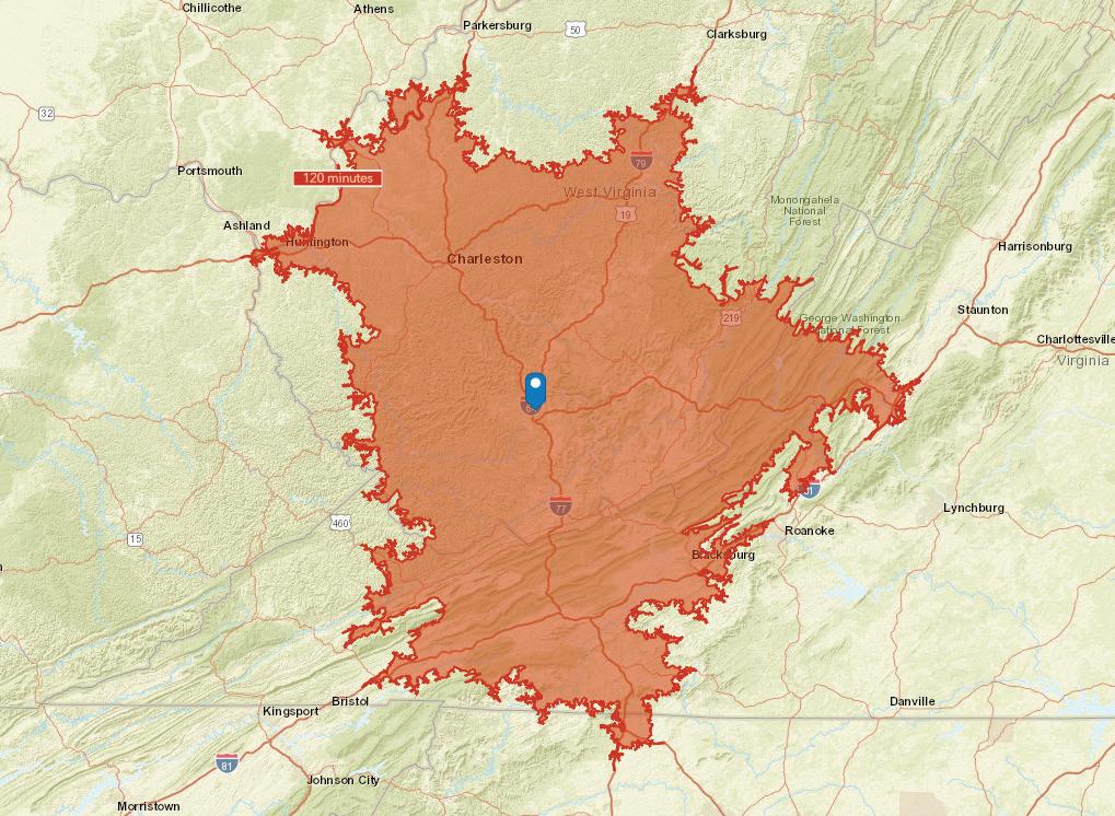
There are 1.5 million people within a 2-hour radius of Beckley
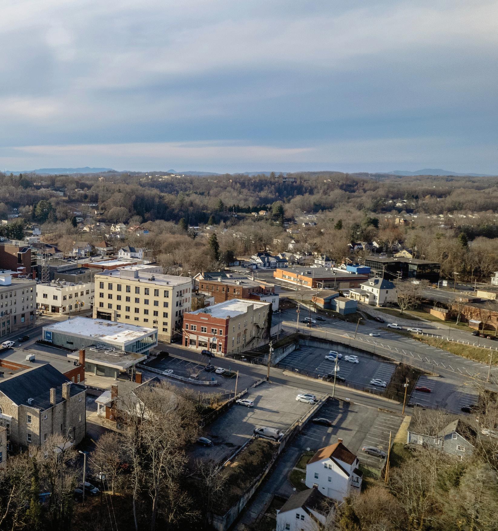
The City of Beckley is the county seat of Raleigh County. It sits on the Allegheny Plateau of the Appalachian Mountains at an elevation of 2400 feet. It is west of the New River Gorge, which is created by the New River. Beckley is almost fully contained within the Piney Creek watershed which feeds into the New River Gorge. Piney Creek flows along the eastern border of the city while Cranberry Creek runs through the northern part of the city.
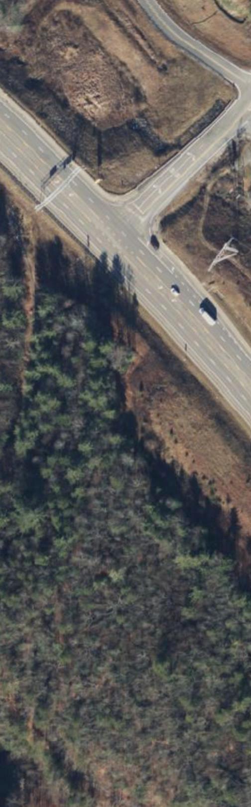
Beckley sits just north of the intersection of Interstate 64 and Interstate 77. From that intersection, the two Interstates run concurrently and travel north along the western border of the city and connect Beckley to both Charleston and Huntington.
The convergence of the two interstates makes Beckley a significant transportation crossroads, providing connections to larger cities in West Virginia and neighboring states including Morgantown in West Virginia, Charlotte and Greensboro in North Carolina, and Roanoke and Lynchburg in Virginia.
US Highway 19 travels north to south through the city and connects Beckley to the other New River Gorge gateway towns including Fayetteville, Oak Hill and Thurmond to the north and Hinton to the southeast.
Beckley sits to the southwest of the New River Gorge National Park and Preserve, making it a gateway town for the National Park with access to multiple entry points along the New River Gorge. There are also four state parks within an hour drive of Beckley including Little Beaver State Park, Camp Creek State Park, Babcock State Park, and Pipestem Resort State Park.
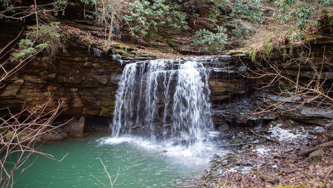
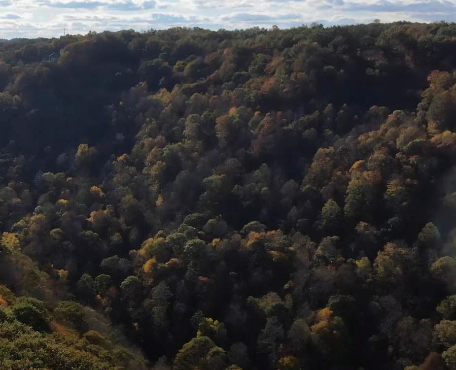
Piney Creek Gorge, which is created as Piney Creek descends into the New River, has multiple waterfalls and is protected as the Piney Creek Preserve by the West Virginia Land Trust. Lake Stephens, a lake park managed by Raleigh County, is just east of Beckley.
This section explores population, income, and employment data for City of Beckley and Raleigh County residents as reported by the U.S. Census Bureau.
According to the 2020 decennial census, City of Beckley is home to 17,268 people making it the ninth largest metropolitan area in West Virginia. Overall the population has decreased over the past decade by 1.8% from 17,614 in 2010 to 17,286 in 2020 but saw an increase of 816 residents from the 2019 American Community Survey (ACS) to the 2020 decennial census.
Of the people living in the city, 74% are White, 17% are Black or African American, 7% are two or more races, and 2% are Asian. Nearly 2% of the population is Hispanic or Latino.
In 2021, the poverty rate in Beckley was 22.9%. This is two percent lower than Raleigh County (24.9%), five percent higher than West Virginia (17.9%), and 10 percent higher than the national rate (12.8%).
Child poverty in Beckley was 31.3% in 2021, which is significantly higher than the state of West Virginia (24%). Poverty is considered to be a root cause of substance abuse, food insecurity, adverse childhood experiences,
and other contributors to poor health. Of the 55 counties in West Virginia, Raleigh County ranks 46th for health outcomes, based on life expectancy and quality of life. The county ranks 37th for health factors when considering health behaviors, clinical care, social and economic factors, and physical environment
Based on various economic criteria, the Appalachian Regional Commission (ARC) classifies Raleigh County as an ‘At Risk’ county which is the second lowest tier of the five tiers identified by the ARC. Within Raleigh County, the ARC identifies eight census tracts as distressed and the City of Beckley is contained within these distressed census tracts.
17,268
Population by age category
Under 18 18 to 64 65 and over
58.2% 18 to 64
Age
43.2
Median age
about 1.5 percent lower than the figure in West Virginia: 43.8
about 10 percent higher than the figure in United States: 39.1
As of 2021, 58% percent of Beckley’s population is of working age, between the ages of 18 to 64. The median age of Beckley residents is 43. Unemployment rates for the city have been steadily decreasing since 2016 (5%) to 2.6% in 2021. This compares to 3.3% for Raleigh County and 3.3% for West Virginia. Households in Beckley have a median income of $40,117, which is significantly lower than both West Virginia ($50,884) and the national median household income ($69,021).
Income
$26,701
Per capita income
about 88 percent of the amount in West Virginia: $30,195
about 75 percent of the amount in United States: $35,384
$40,117
Median household income
about 79 percent of the amount in West Virginia: $50,884
about 58 percent of the amount in United States: $69,021
In 2021, the three industries with the largest share of employment were Educational Services, Health Care and Social Assistance (29.7%); Arts, Entertainment, Recreation, Accommodation, and Food Services (15.3%); and Retail Trade (14.2%). The average commute time for a worker living in Beckley is 19 minutes, which is shorter than the national average of 25 minutes. Beckley has significantly more out-commuters than in-commuters. Beckley’s 8,647 in-commuters are traveling from Fayette, Wyoming, and Mercer counties and the 4,577 out- commuters are traveling to Kanawha, Fayette, and Mercer counties.
This section provides a summary of four previous plans produced for the area including the comprehensive plans for the City of Beckley and Raleigh County, a National Park Service plan focused on connecting National Parks with their gateway communities, and the Fayette County Soft Surface Trails Plan.
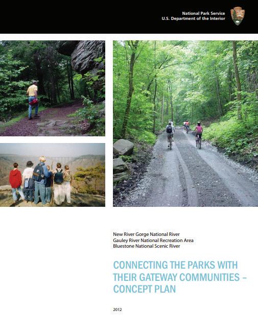
This plan was created after the National Park Service (NPS) Glen Jean, West Virginia office received funding to develop a concept plan for a network of trails that would connect the New River National Park, the Gauley National Scenic River, and the Bluestone National Scenic River with their gateway communities. It provides a shared vision of a regional trail network, a scope of actions, and identifies potential partners for the trails. Beckley is one of the communities within the study area where the NPS proposes a New River connector trail. The trail would follow the Piney Creek Gorge and Little Beaver Creek drainage with portions of the existing trail being the McManus Rail Trail. The NPS identifies multiple partners in the creation of this trail (including the City of Beckley), existing trail conditions, and cost estimates.
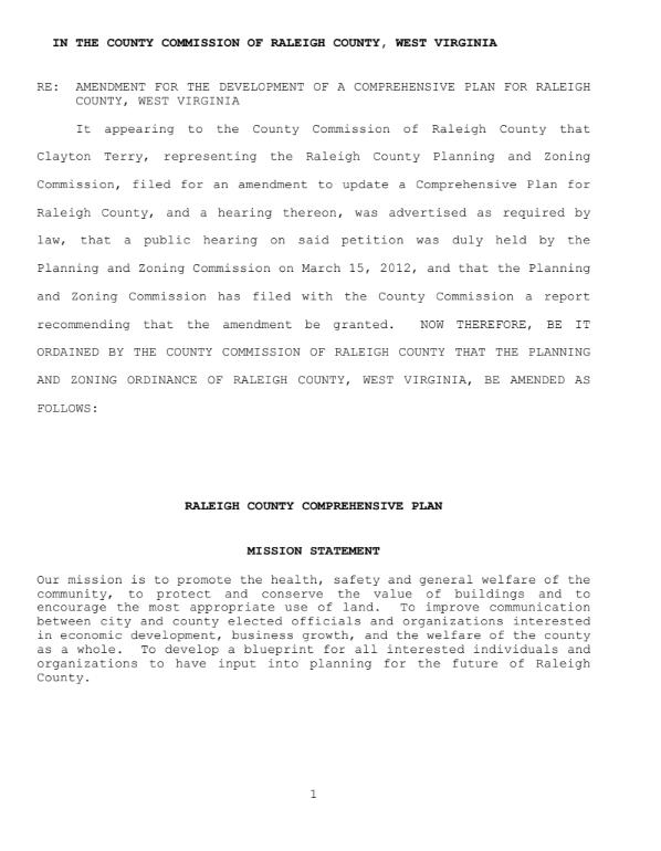
Raleigh County’s most recent comprehensive plan was adopted in 2012. This plan explored existing conditions, and outlined goals, objectives, and action items. It includes an inventory of existing parks in Raleigh County and plans for each. Recreation was mentioned as having an increasingly significant impact on economic development. There were multiple objectives aimed at protecting and expanding recreation assets.
The Beckley Comprehensive Plan was adopted in 2014 to outline Beckley’s goals for future land development. The Recreation chapter addresses Economic Development, Recreation, Urban Design, and preferred development areas. It inventories existing parks including undeveloped recreation areas and recommends improvements to specific park facilities. The Economic Development chapter recommends targeting businesses that appeal to recreation enthusiasts and highlights the opportunity to attract visitors and motivate the area’s residents to recreate locally to avoid leakages in the arts, entertainment, and recreation industries.
With the designation of the New River Gorge National Park and increased visitation to the region, the Fayette Trail Coalition
identified that the lack of purpose-built trails within Fayette County and the region threatens to have negative community and visitor impacts such as overcrowding, resource degradation, visitor dissatisfaction, limited stays, and negative perceptions. This plan outlines four projects that will double current trail opportunities with 30 or more additional miles of soft surface trails. Although these trails are not within Beckley, they are within the New River Gorge region and will positively impact potential Beckley visitors and residents.
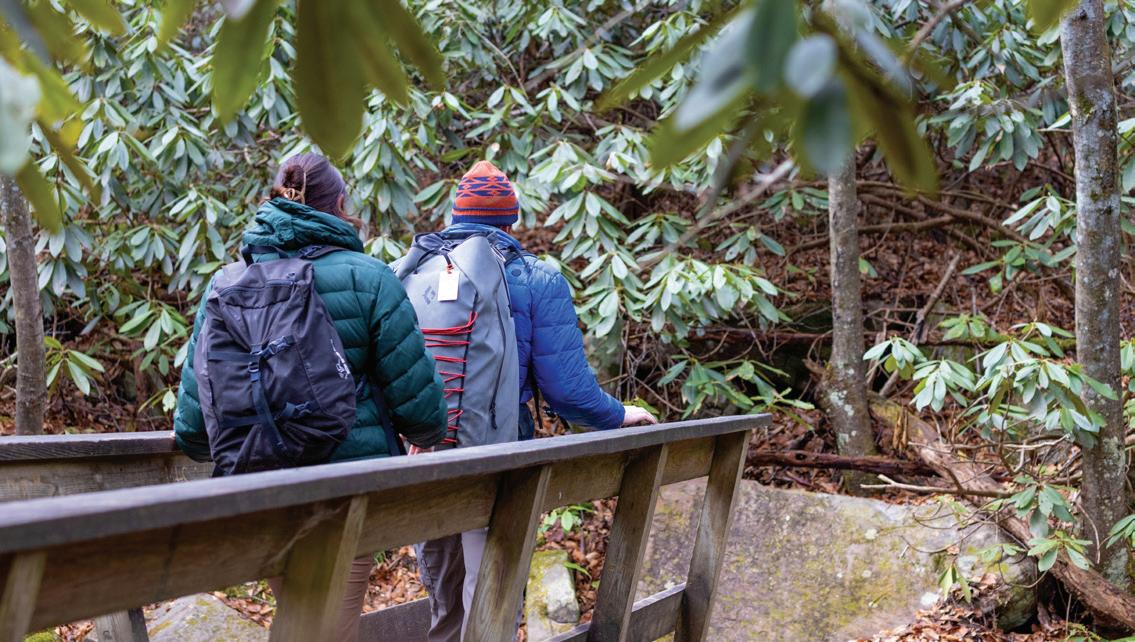
Piney Creek flows into the New River creating a steep gorge and waterfalls on its way. The area currently offers 10-15 miles of trail. It is connected by trail to the YMCA Soccer Complex. The area is utilized for hiking, climbing and fishing. Its proximity to town provides easy access to numerous users (see Exhibit: Piney Creek Preserve, next page).
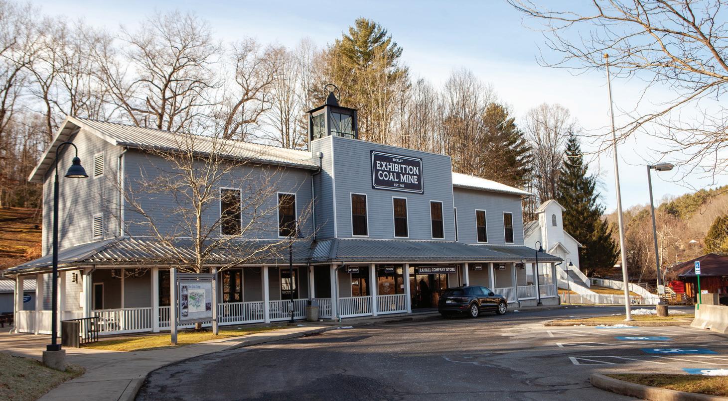
Exhibition Coal Mine is an immersive attraction that allows visitors to tour an underground coal mine, recreated coal camp, and mountain homestead accompanied by a youth museum. It is adjacent to New River Park and McManus Rail Trail, two primary recreation facilities in Beckley.
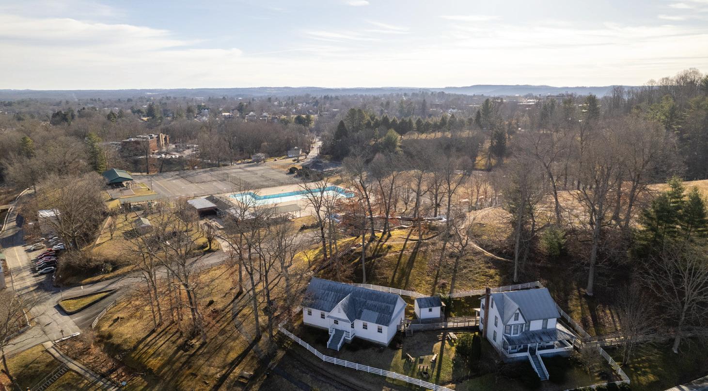
New River Park is the primary recreation facility in Beckley with a playground, public outdoor pool, walking trails, and picnic shelters. It connects to the McManus Rail Trail.
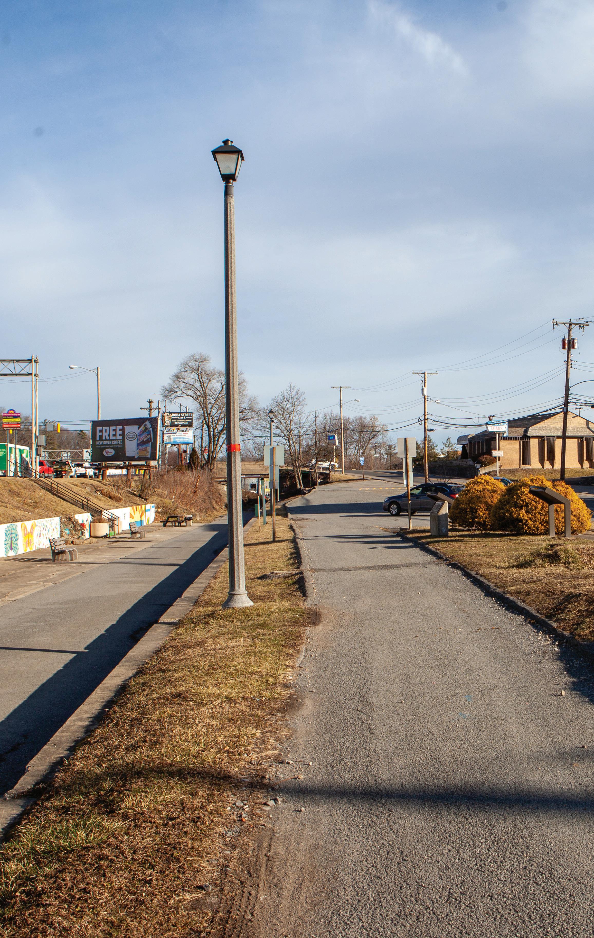
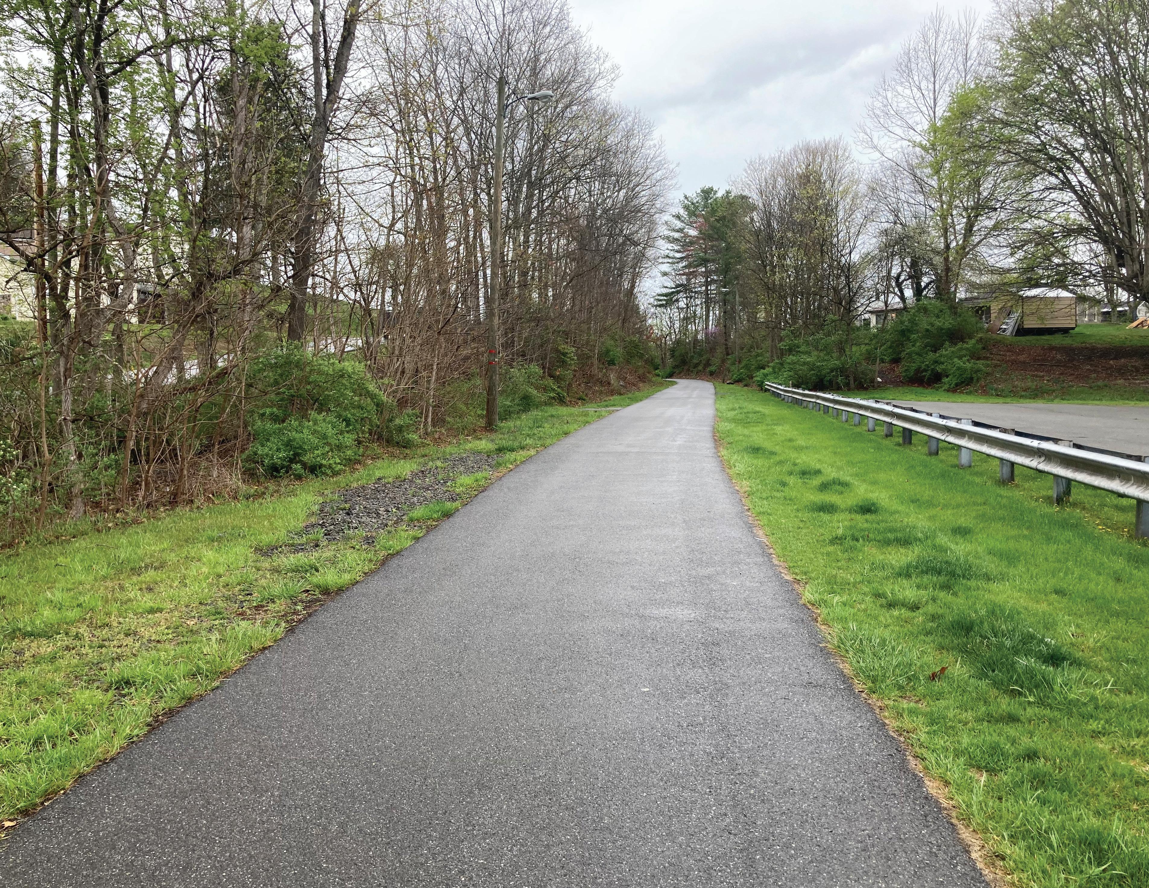
The Lewis McManus Trail, also known as the Beckley Rail Trail, is a notable recreational path in Beckley. This paved trail spans approximately 4.1 miles, connecting Mabscott through the heart of Beckley to the Beckley Crossing Shopping Mall. Following the historic route of the former Piney River & Paint Creek Railroad, which was constructed in 1905 and later taken over by the C&O Railroad (now CSX), the trail has a rich history of hauling coal, freight, and passengers.
Today, the trail serves as a community asset, offering a mix of urban and residential scenery. A notable feature is a restored trestle over Robert C. Byrd Drive, providing access to the popular New River Park. The trail’s surface is a combination of asphalt and crushed stone, making it suitable for activities such as walking, biking, in-line skating, and it is also wheelchair accessible.
The Beckley Mill site is a historic archaeological site that is listed on the National Register of Historic Places. The original mill was established in 1835 by Alfred Beckley. It remained in use into the early 20th century until it was closed and abandoned. It has been turned into a small public park. The site is located off Worley Road near Piney Creek, adjacent to the Gray Flats area. The City of Beckley is working to improve access and connectivity of the Mill Site including installation of trailhead facilities and visitor amenities through significant redevelopment of an adjacent property.

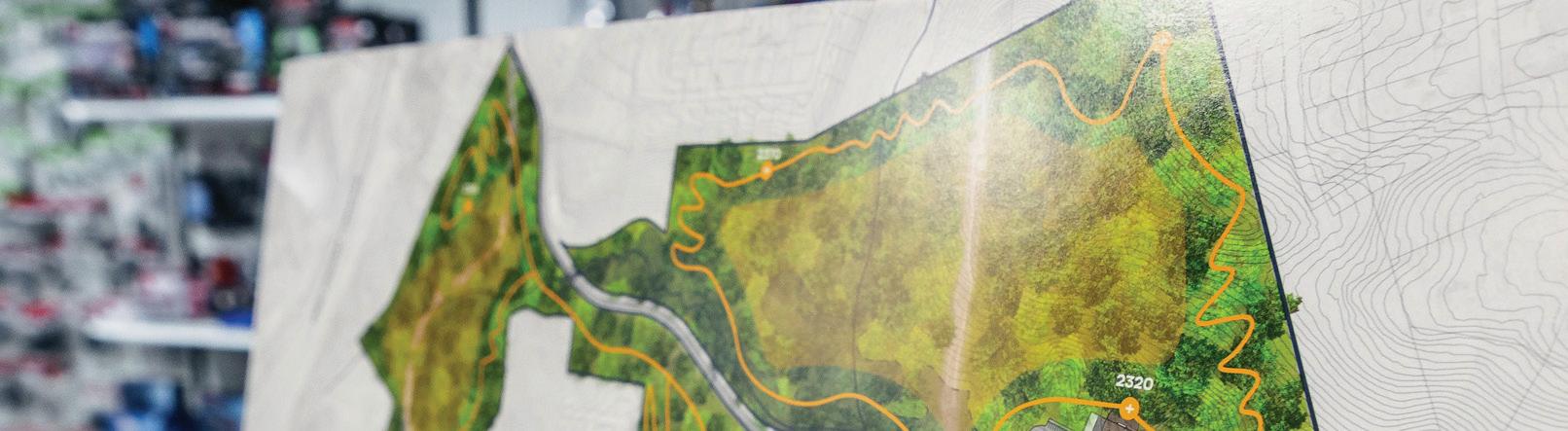
The Piney Creek area in Beckley is a significant natural preserve that is being developed into a recreational and conservation area. Located just minutes from downtown Beckley, the 613-acre Piney Creek Preserve will offer 20 miles of recreation trails for hiking and biking. Once built, the trails will meander through historic coal seams on mine benches and past multiple waterfalls, offering a scenic and immersive outdoor experience.
The preserve is a project of the West Virginia Land Trust, which, in partnership with the City of Beckley and supported by donors and volunteers, aims to open this area to the public for enjoyment and education about the region’s natural beauty and historical significance. Notably, the area is home to Cranberry Creek, which feeds into Piney Creek and eventually reaches the New
River, highlighting the importance of water protection efforts within the preserve to ensure the health of downstream water quality.
One of the first trails opened to the public within the Piney Creek Preserve is the Waterfall Hollow Trail, which grants access to the scenic waterfalls of Little White Stick Falls and Cranberry Creek Cascades. This half-mile trail is part of a larger plan to introduce more than 20 miles of trails within the 613-acre preserve, incorporating elements of the area’s coal mining past with recreational opportunities. The preserve aims to embrace and interpret its coal mining heritage while also conserving its natural beauty, offering a space where the history of coal mining and the landscape’s regeneration can be appreciated.
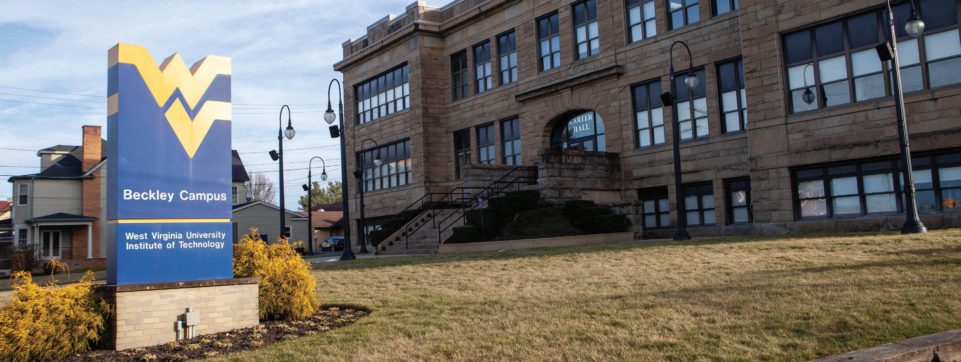
The West Virginia University Institute of Technology (WVU Tech) underwent significant revitalization efforts in 2017 that led to a strategic move of the entire campus to downtown Beckley.
This transition aimed to leverage Beckley’s larger size and accessibility to foster growth and development for WVU Tech. Since the move, the university has seen an increase in enrollment and has been recognized for providing the best return on investment in the state.
WVU Tech offers a dynamic campus environment focused on providing high-quality education in various fields. Its proximity to downtown Beckley connects it to a network of sidewalks that lead to the McManus Rail Trail. Having the campus located near downtown has increased pedestrian activity and is helping to expand the walkability of the city.
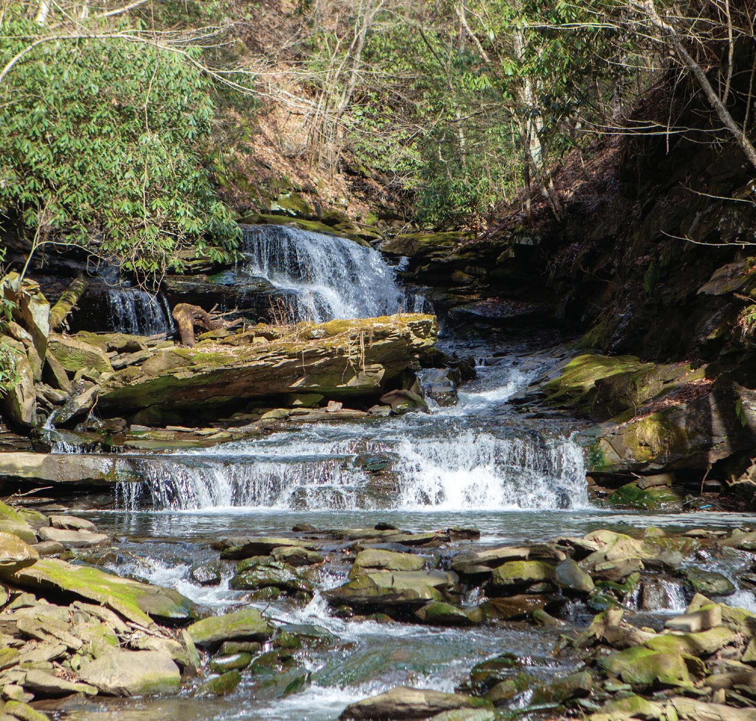
A notable natural attraction is the Cranberry Creek Cascades, located in the downtown Beckley area. This site features beautiful waterfalls that are accessible via a relatively flat trail, showcasing the area’s natural beauty and providing a peaceful retreat for residents and visitors.
This center is a vibrant hub for the arts, offering exhibitions, events, and educational programs. It hosts art exhibitions and provides opportunities for artists, collectors, and art appreciators. The center also offers a variety of visual and performing arts classes, workshops, and private lessons for all ages and skill levels.
Known as the nation’s first showcase of handcrafts, fine art, and regional cuisine, Tamarack Marketplace is one of Beckley’s top tourist attractions. It features a collection of handmade crafts, art, specialty foods, and thousands of one-of-a-kind gifts and keepsakes. The
center also has artisan studios where visitors can observe skilled craftsmen and women at work, and a fine art gallery hosting new exhibitions every six to eight weeks showcasing the best of West Virginia fine art .
Beckley has a rich history that includes its founding by Alfred Beckley and its significance during various historical periods, including its indigenous heritage and its role in the coal mining industry. The city is sometimes referred to as the “Smokeless Coal Capital”, “The City of Champions”, and the “Gateway To Southern West Virginia”.
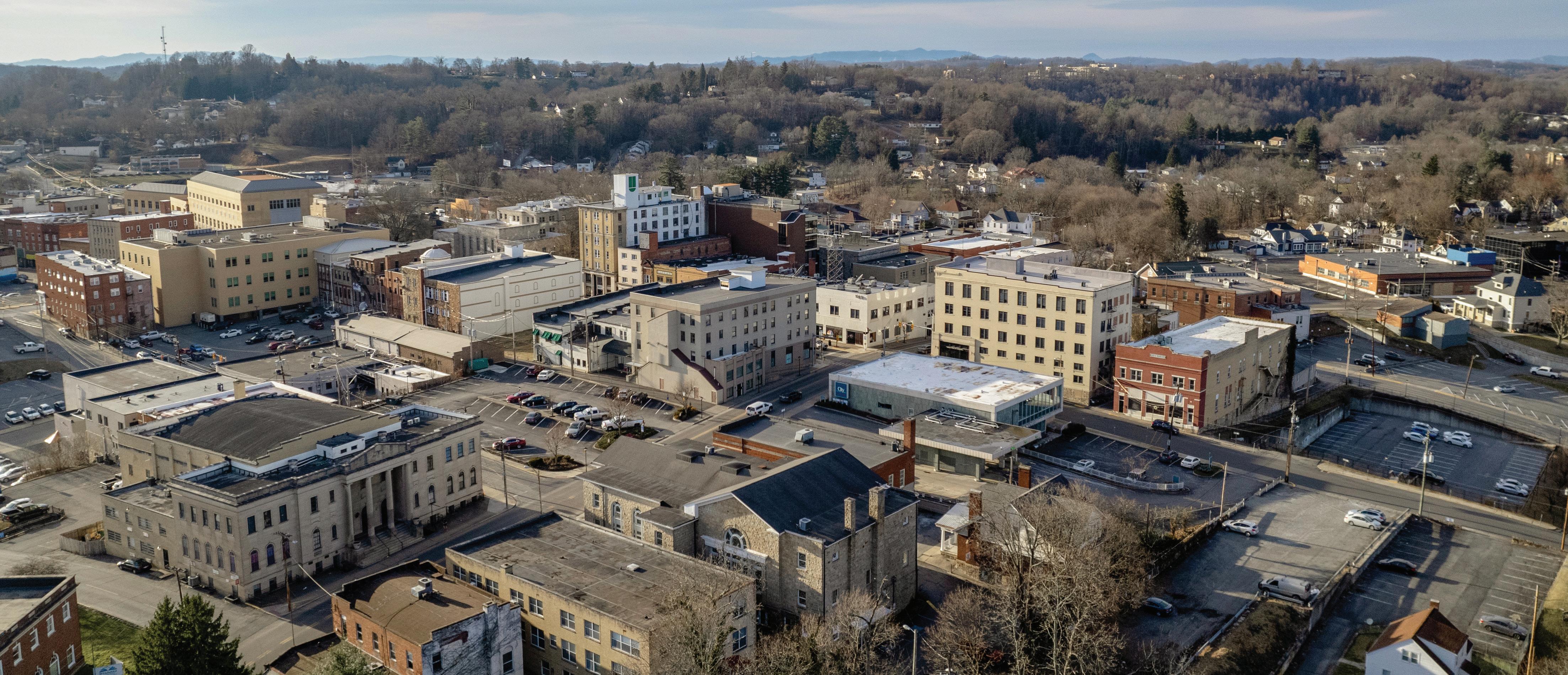
Downtown Beckley experienced significant changes since the 1980s, facing challenges common to many American downtowns with the advent of malls leading to the decline of locally-owned stores. Efforts to revitalize the area have seen mixed success. The area serves as a reminder of the city’s rich history and ongoing efforts to breathe new life into its core.
The Historic Black Knight offers a rich blend of history and modern recreation. Originally established in 1928-29 by Col. Ernest Chilson of Raleigh Coal & Coke, the park spans over 60 acres and was initially reserved for those prominent in coal and related industries. The property features a clubhouse designed by Chilson with Art Deco elements and a nine-hole golf course created by the renowned architect Fred Findlay.
Today, the Historic Black Knight is a municipal park open to the public, offering a variety of amenities including a 9-hole golf course, swimming facilities, dining, and banquet services.
The soccer complex includes a multi-purpose facility, eight full-sized soccer fields, covered picnic shelter, playground, and a 1.5 mile paved walking trail. Natural surface trails, known as Gray Flats, have been developed over time by local residents for hiking and mountain biking but they are not currently maintained.
Trails Edge Cycles was born from the inspiration of the Beckley Outdoors initiative and to bring a top notch bike shop to the Beckley community... Nestled in Beckley, our bike shop fuels a dedication to outdoor adventure, offering premium gear while fostering a vibrant community of enthusiasts. For those seeking thrilling experiences on the trails, Trails Edge Cycles is the ultimate destination.
~
Jeff Webb, owner Trails Edge Cycles


This chapter discusses tools used for public engagement, highlights stakeholders and organizations involved in the planning process, and presents key results from an online survey designed to obtain ideas from the community regarding the outdoor recreation economy and future development priorities for Beckley. The chapter culminates with key emerging themes that guide plan recommendations and is organized into the following sections: In this Chapter:
Tools of Engagement
Community Partners
Community Survey
Emerging Themes and Guiding Principles
The Beckley Outdoors project was initiated and introduced to the public using innovative multimedia techniques. A four-minute promotional video narrated by community leaders showcasing Beckley’s history and landscape, outlined the project goals and ended with a “call to action” to citizens to participate in the community survey. The video was posted to the project website and shared widely on social media platforms.
A project Fact Sheet about Beckley Outdoors was developed to further inform community members and stakeholders. Talking points on the fact sheet included the plan goals, purpose, and planning process. The fact sheet was distributed to stakeholders, community members, and attendees of the public forum.
A community survey was also created to capture public opinion. The link to the survey was posted on the project website. See key survey findings on Page 50.
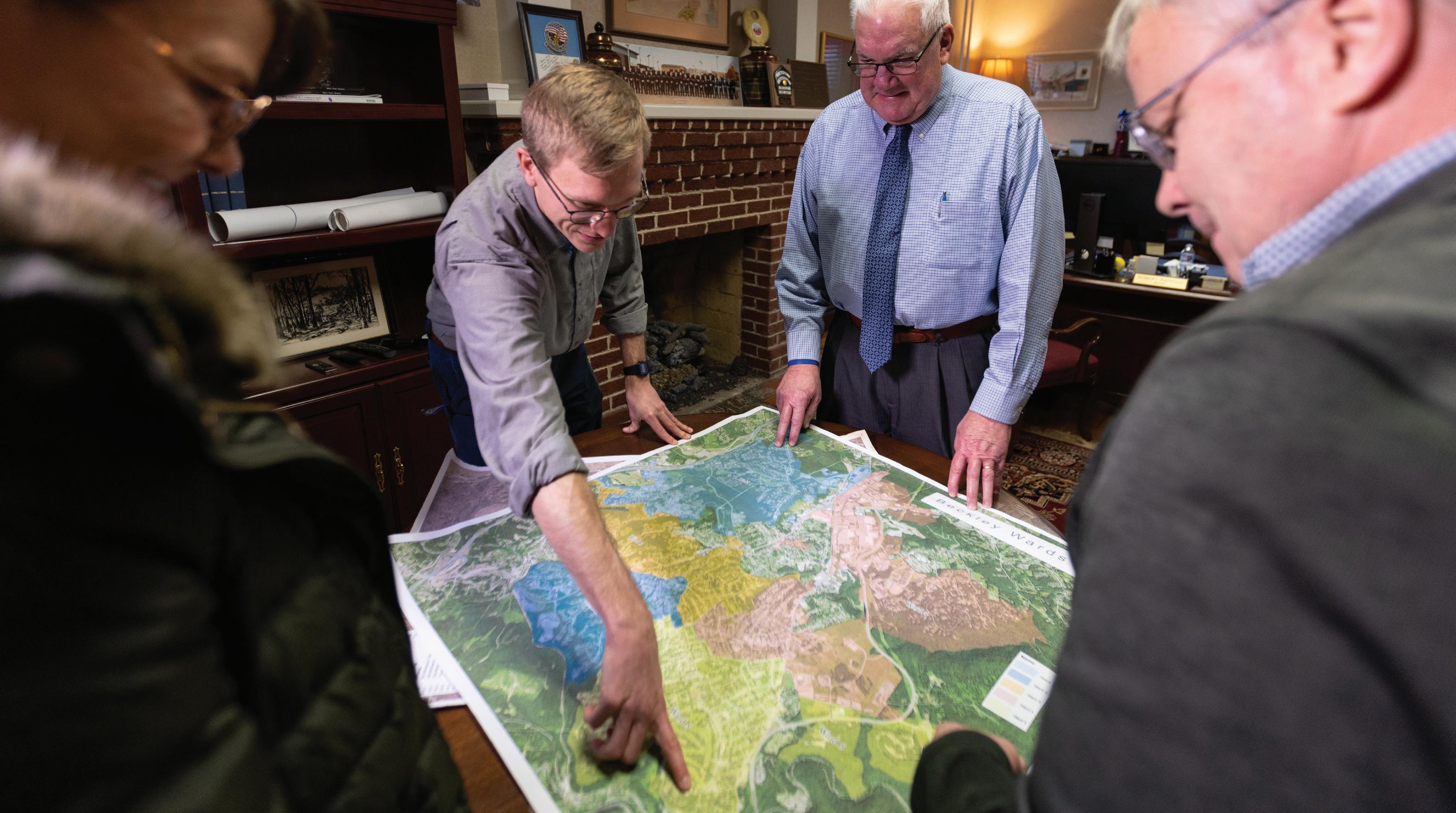
A public meeting was held at New River Park with several interactive ways for residents to share their vision. Maps were on display for participants to make location-specific suggestions as well as open-ended feedback.


The Beckley Outdoors Economic Action Plan planning process included input from the general public and a variety of stakeholder groups including non-profit, government, and quasi-government agencies.
The consultant team engaged stakeholders through a series of interviews, focus groups, walking tours, and public drop-in meetings that resulted in a broad insight into key community opportunities and constraints. The public and coalition of community leaders established the foundation for the cooperative vision and recommendations found within this plan.
The consultant team engaged citizens and community stakeholders to discuss priorities, underutilized assets, and help define the vision of Beckley Outdoors. Many of these answers helped inform the final plan goals and recommendations.
Fourseason visitation
Trail Network connected to city neighborhoods and focus areas (downtowns, workplaces, schools, WVU Tech. etc.).
Transform Beckley into a tourism/ recreation destination.
A place where the local community thrives on outdoor adventure. Safe place where people want to be and travel to.
Safe and Thriving Downtown
Become the EpiCenter of the four entities of the National Park
Focus primarily on infrastructure for residents first - create a place people want to live and others will come.
Celebration of the arts, history and culture that already drives visitors
More family-friendly trails, activities, and outdoor recreation, and more accessibility.
More activities for students to participate in other than self-guided outdoor activities such as classes or more family-friendly events like the Bex Unfair.
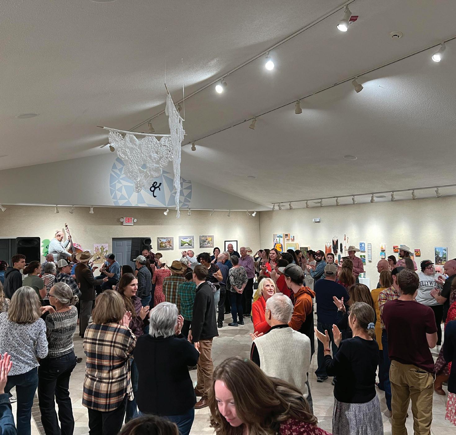
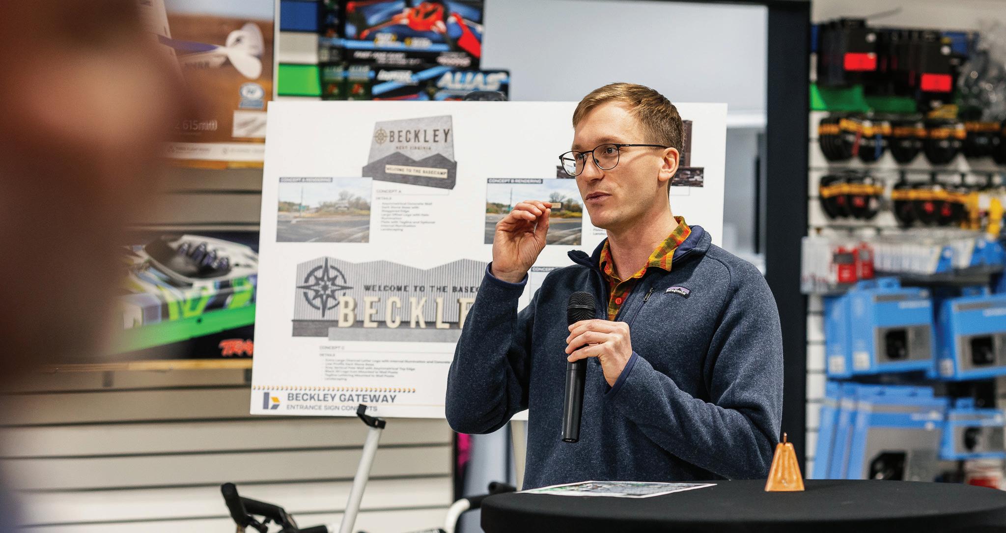
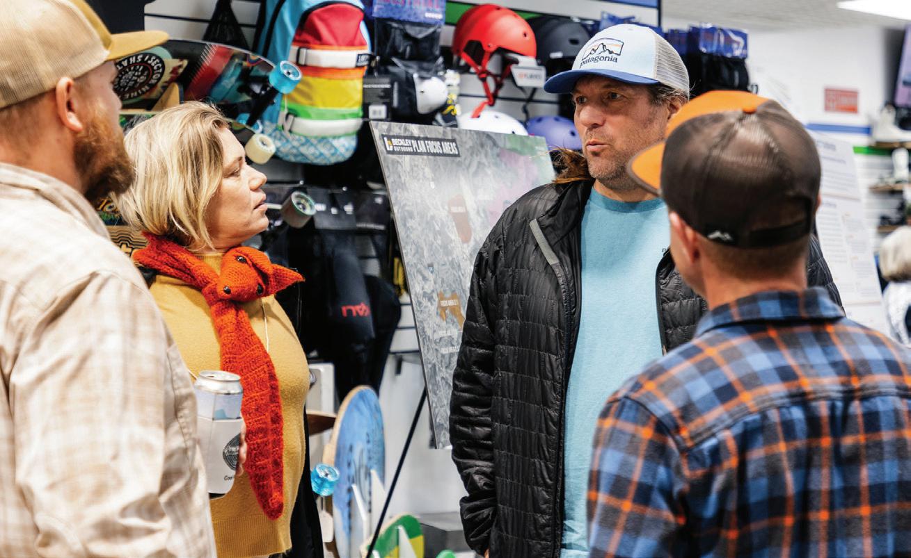
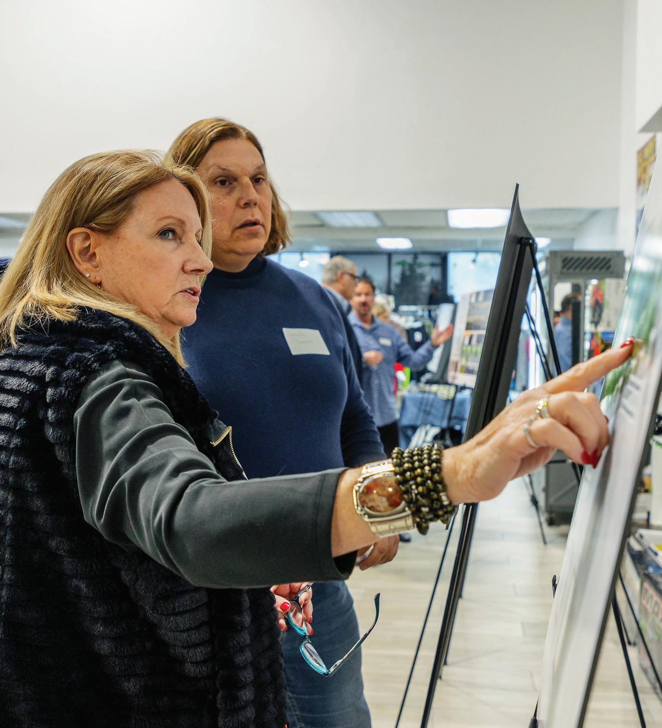
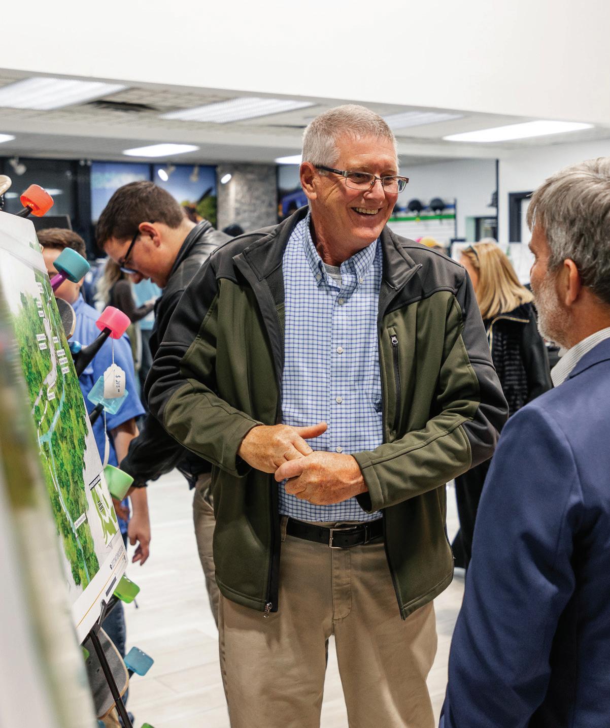
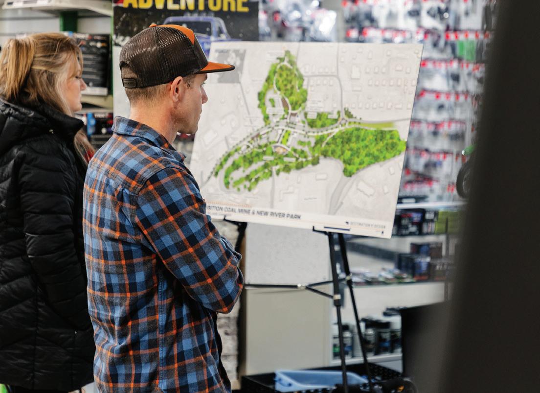
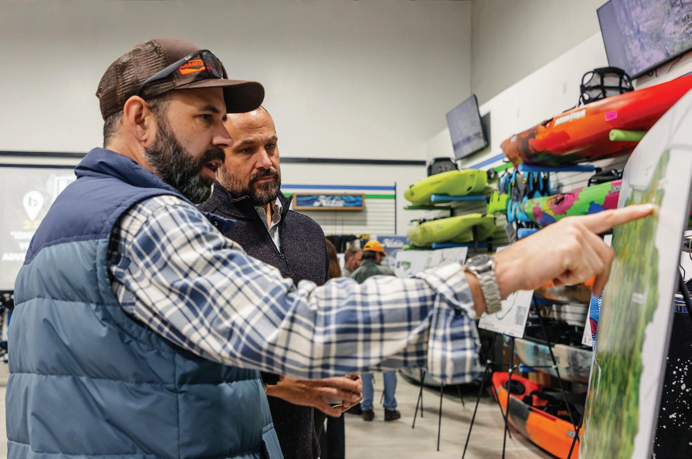
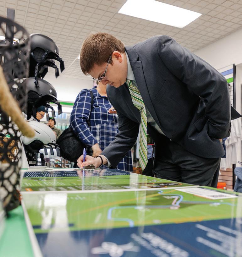
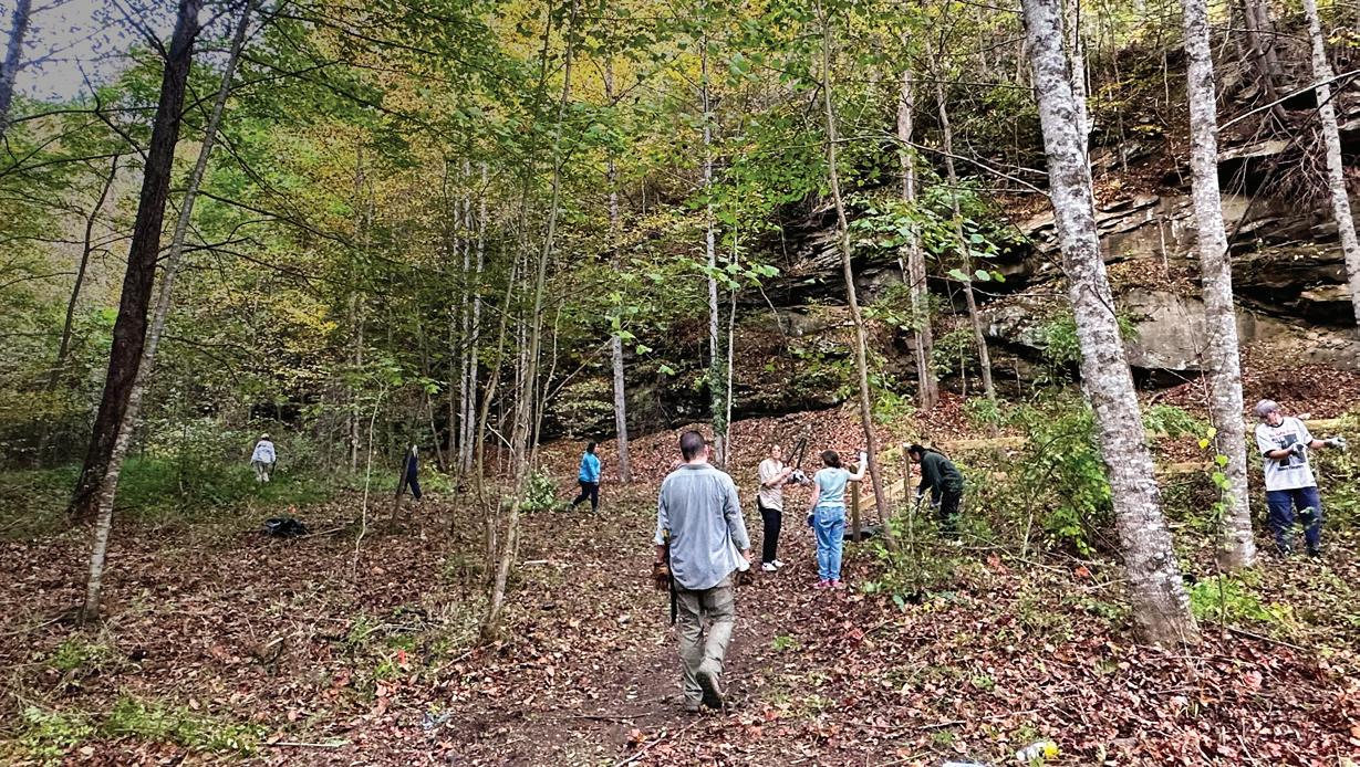
On December 14, 2024 more than 90 members of the community attended the first ever Beckley Outdoor Economy Summit at Elevation Sports in Beckley. Local citizens and regional leaders were invited to review preliminary plans, renderings, and drawings as part of the Beckley Outdoors Economic Action Plan.
Engaged attendees provided feedback on draft plans and discussed ways to enhance the outdoor economy while featuring the unique Appalachian heritage of southern West Virginia. Discussions highlighted opportunities to leverage local natural resources like the New River Gorge National Park and Preserve and Piney Creek Preserve to improve community well-being, attract tourism, and stimulate economic development in the region.


This section summarizes the results of the Beckley Outdoor Economy Plan Community Survey.
A community survey was conducted to hear community members’ vision for Beckley’s outdoor economy and understand opportunities and constraints to developing outdoor economy assets.
The survey was distributed online via email, social media, and available on the project website. It received 430 responses.
WHICH
HIKING
CAMPING
CANOEING
1st 2nd 3rd 4th
HOW WOULD YOU RATE THE QUALITY OF THE FOLLOWING
PUBLIC
BIKE AND PEDESTRIAN ACCESS
PICNIC AREAS
PUBLIC
SAFETY
PUBLIC ART
COMMUNITY
PARKING
LIGHTING
AMENITIES (BENCHES, TRASH CANS, BIKE RACKS)
HISTORIC PRESERVATION
STREET
The Emerging Themes and Guiding Principles provide the framework and rationale for the recommendations made in Chapter 4. These principles will help guide local leaders and decision-makers as they make strategic investments.
The six (6) emerging themes include: 1) Outdoor Recreation; 2) Connectivity; 3) Destination Villages; 4) Arts & Culture 5) Downtown Revitalization; 6) Partnerships
Expand outdoor recreation opportunities to distribute demand across the New River Gorge Region and establish Beckley as an outdoor recreation destination.
Invest in outdoor recreation infrastructure that increases access and connectivity, among natural resources, commercial areas, residential neighborhoods and historic assets.

Create mixed use districts that attract the outdoor recreation enthusiast by being an all inclusive destination with lodging that connects seamlessly with events, recreation and shops.
Promote artistic and cultural assets for residents and visitors to take advantage of while elevating Beckley’s rich history and vibrant artistic community.
Create a vibrant, attractive and walkable downtown that promotes economic activity and encourages safety for visitors and residents
Establish and maintain partnerships between federal state and local government agencies, non profit organizations, and community groups to plan, implement and manage outdoor recreation infrastructure projects.
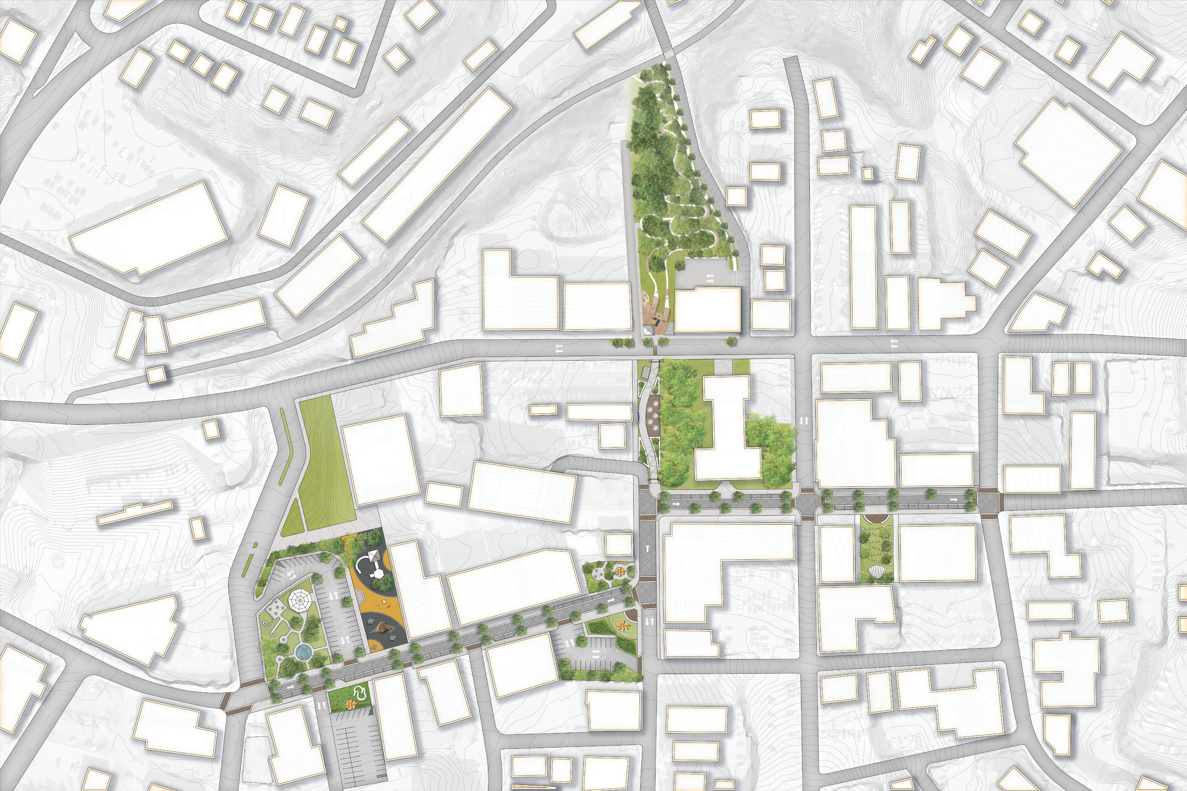
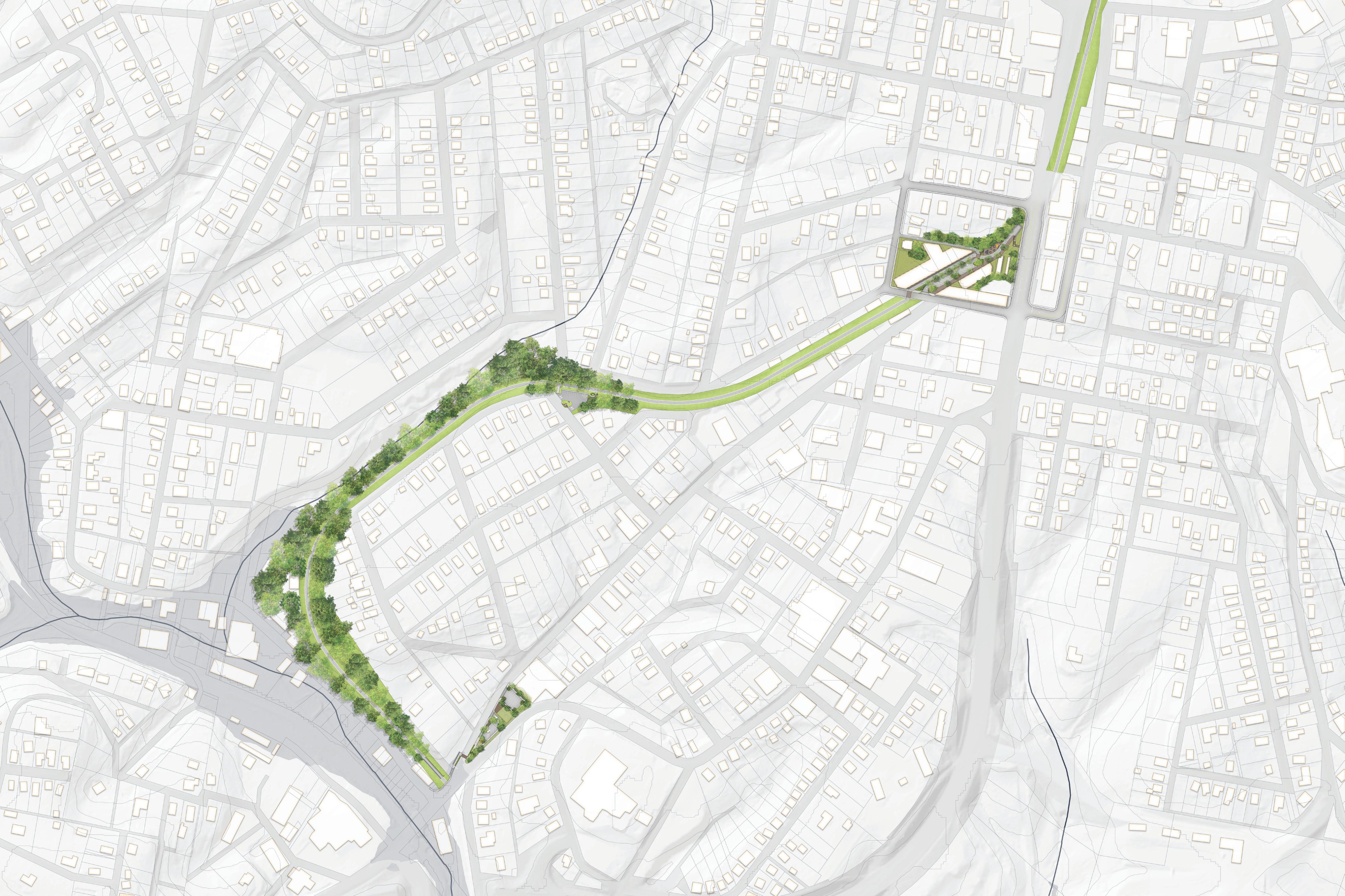
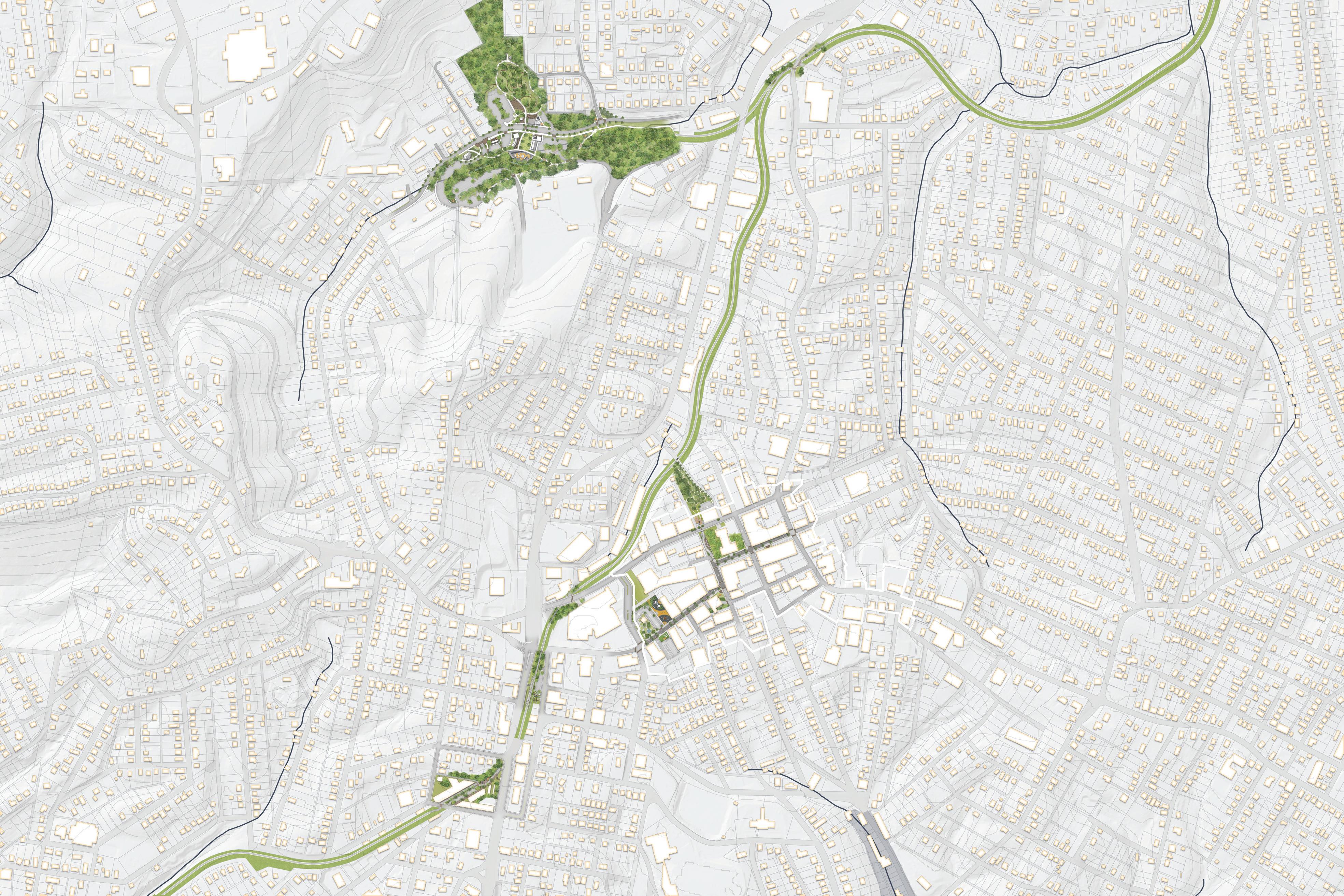
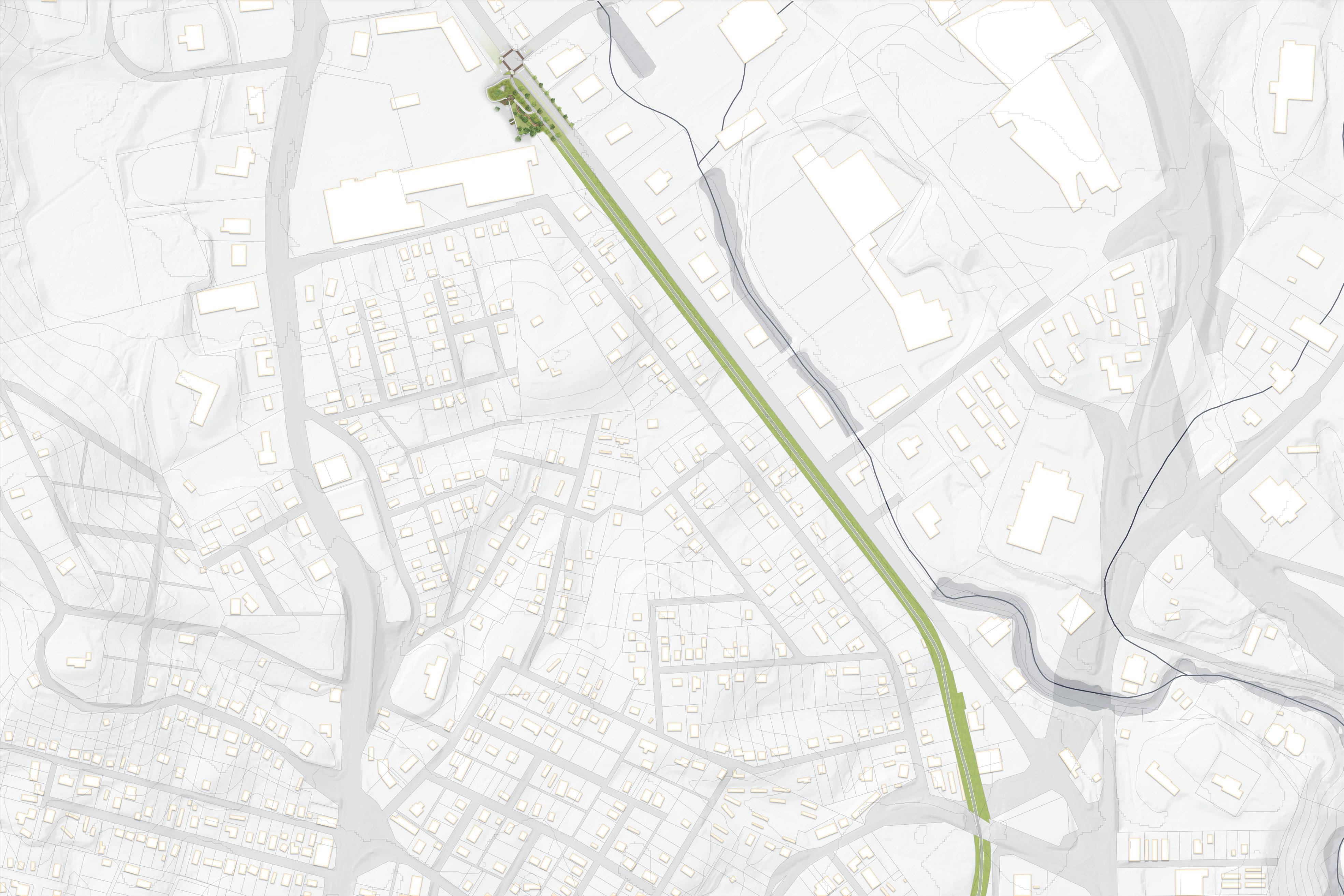
This chapter serves as the heart of the Beckley Outdoors Action Plan and highlights specific capital infrastructure recommendations that describe how the built environment must change over time to best drive growth in the outdoor economy. This chapter is organized according to six (6) geographic Outdoor Economy Focus Areas as highlighted on the Beckley Outdoors Plan Framework (see map next page), including: 1) Piney Creek Nature Preserve; 2) New River Drive; 3) Downtown Beckley; 4) Beckley Rail Trail; 5) Cranberry Creek Adventure Park; and 6) Bicycle Connectors.
In this Chapter:
Focus Area 1: Piney Creek Park & Preserve
Focus Area 2: New River Drive
Focus Area 3: Downtown Beckley
Focus Area 4: McManus Rail Trail
Focus Area 5: Cranberry Creek Adventure Park
Focus Area 6: Bicycle Connectors
The Beckley Outdoors Plan Framework provides an organizational structure for the planning and implementation of capital projects necessary to drive Beckley’s outdoor economy. The Framework presents the various Focus Areas that must be improved to realize the ultimate vision: a well-connected community supported by a network of pathways, trails, and other outdoor recreation amenities, a vibrant downtown, and a compelling arts community. However, extensive work is necessary to bring this vision to fruition, including land acquisition/agreements, planning, design, funding, and political will. Through a unified effort, the City of Beckley has the potential to take its rightful place in the region and country as a leader in the outdoor recreation economy.
The subsequent pages of this chapter highlight each Focus Area, including a general written description, an outline of key project areas found within each geography, and lastly, specific action items and steps necessary to implement proposed capital projects. This chapter is organized according to the following six (6) Focus Areas: 1) Piney Creek Nature Preserve; 2) New River Drive; 3) Downtown Beckley; 4) Beckley Rail Trail; 5) Cranberry Creek Adventure Park; and 6) Bicycle Connectors.

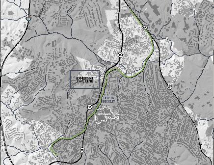
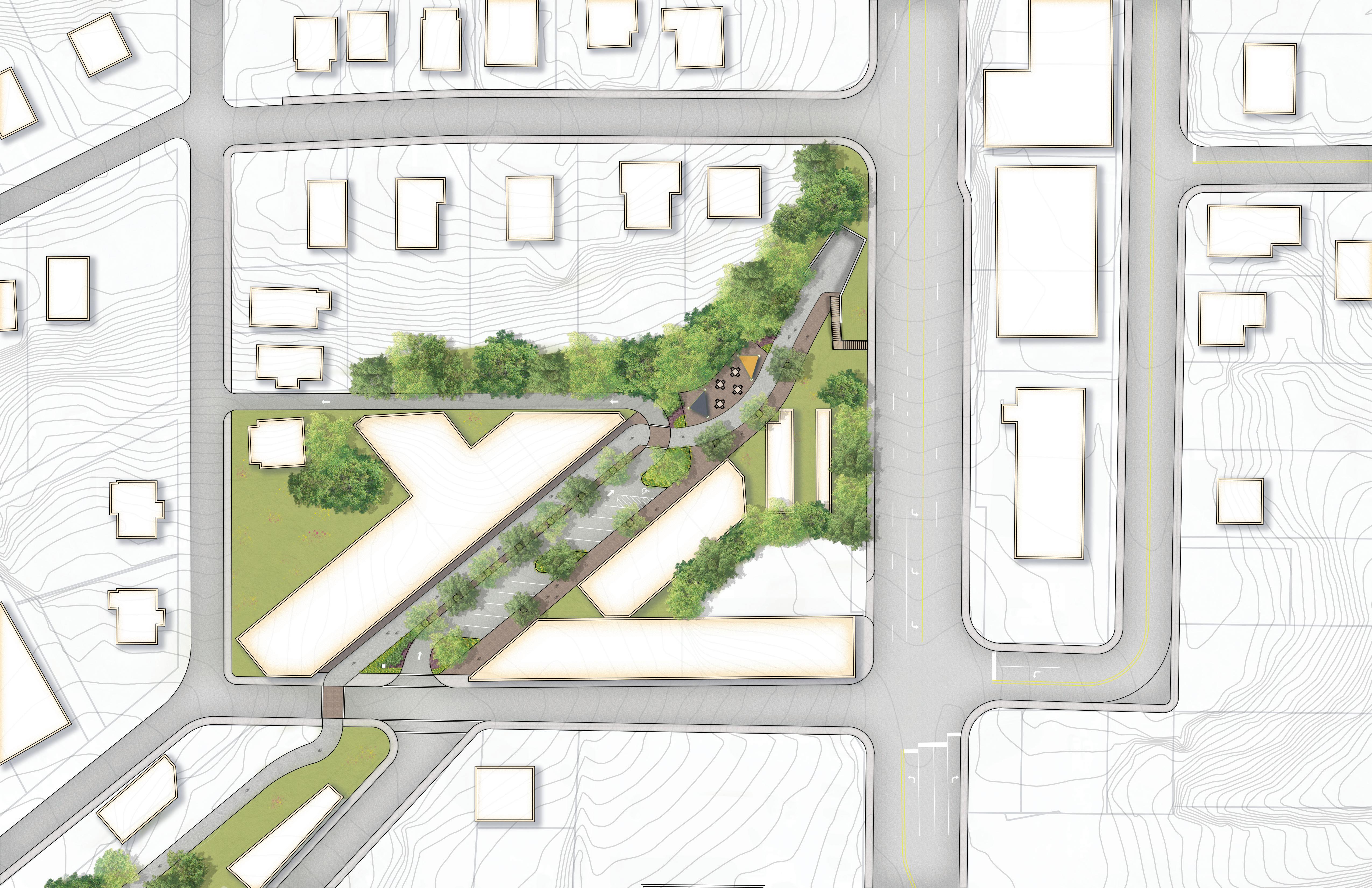
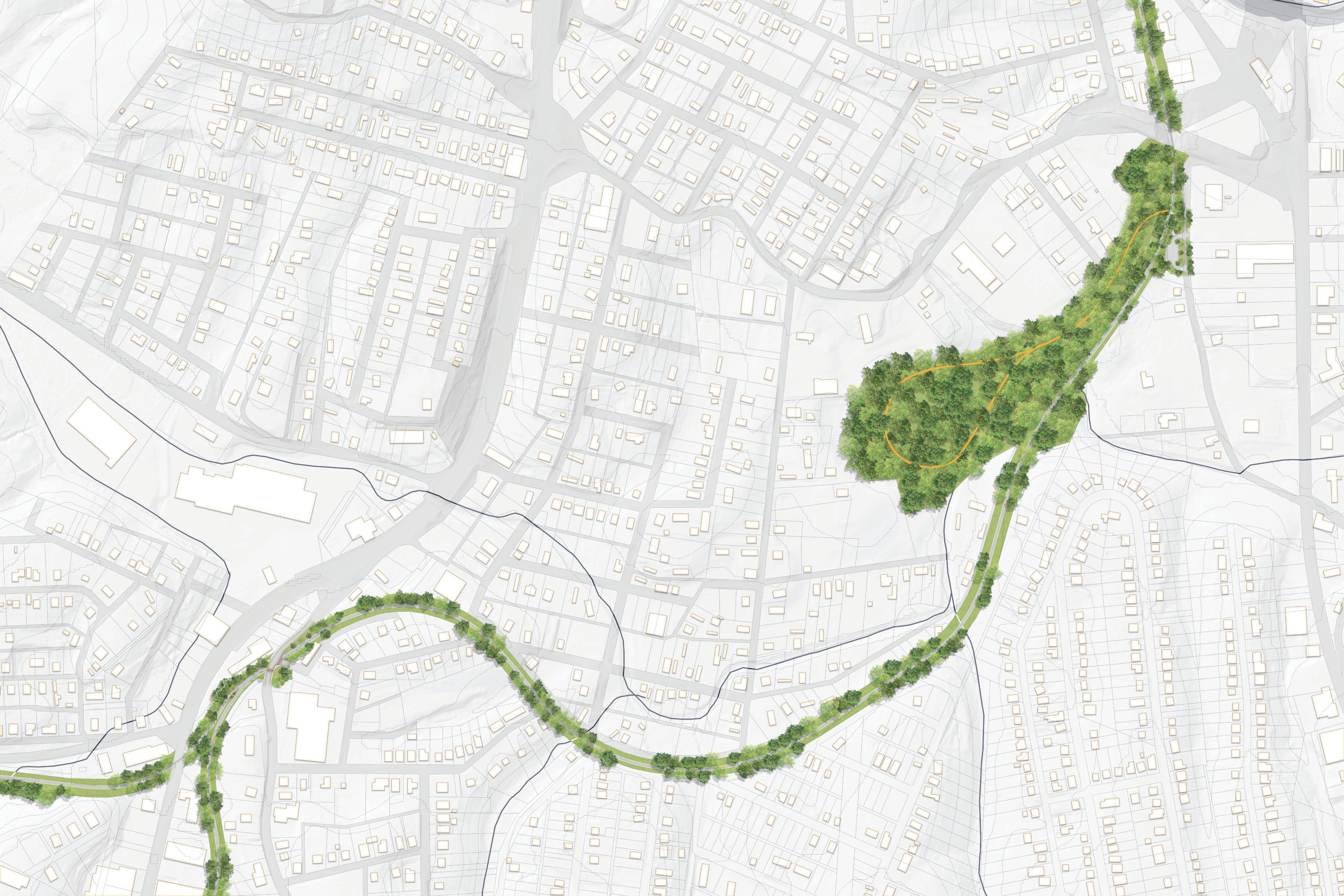
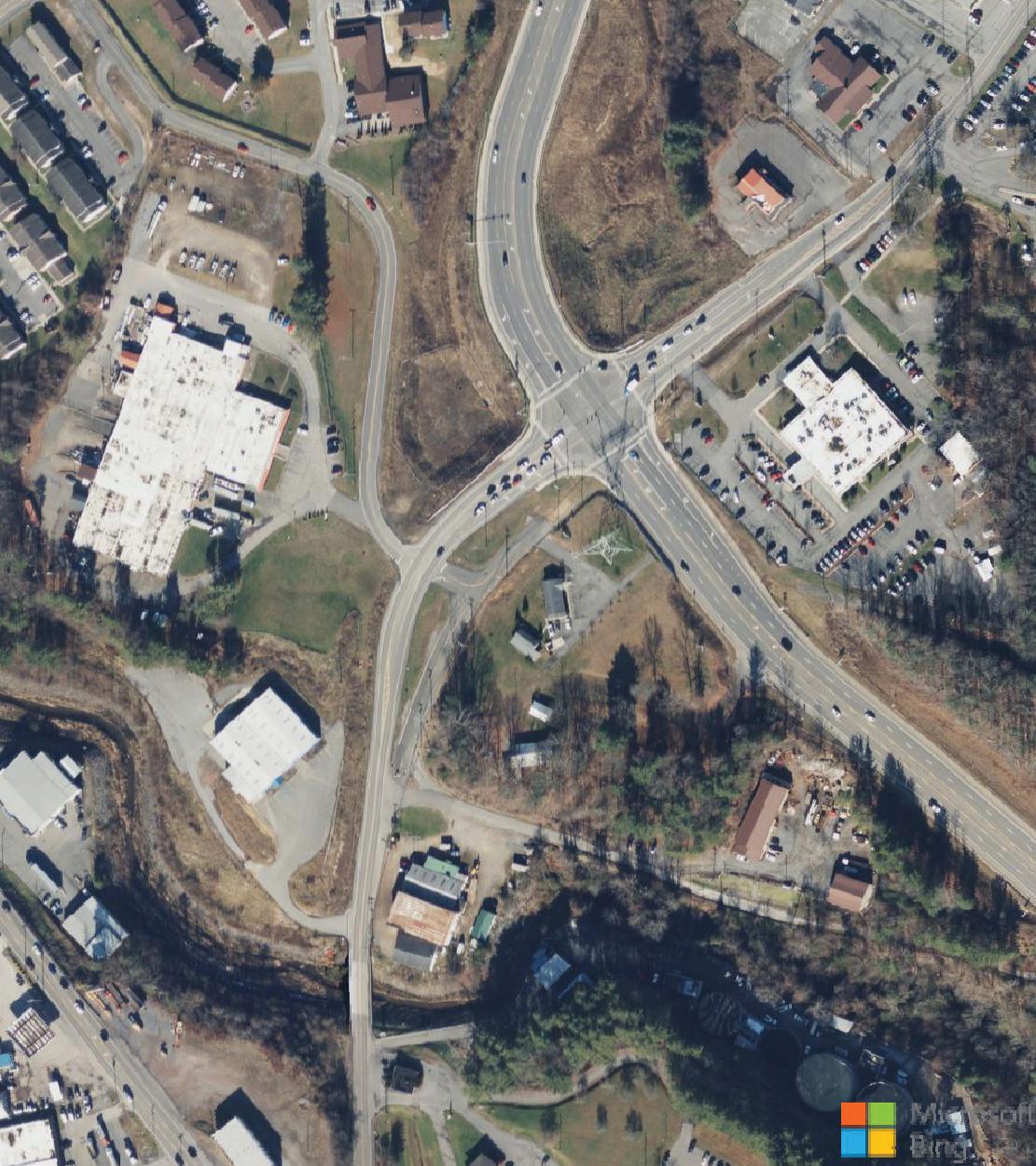
The Piney Creek Gorge corridor provides not only a significant opportunity to develop outdoor recreation assets within the city, but also provides the unique “key” that can unlock a long-time regional goal: link the City of Beckley to the New River Gorge National Park.
Featured within the National Park Service’s 2012 “Connecting the Parks with their Gateway Communities Concept Plan,” the Piney Creek corridor is highlighted as a significant “acquisition” priority in an effort to directly connect the City of Beckley to this national treasure (see Exhibit 04: National Park Service Gateway Connector).
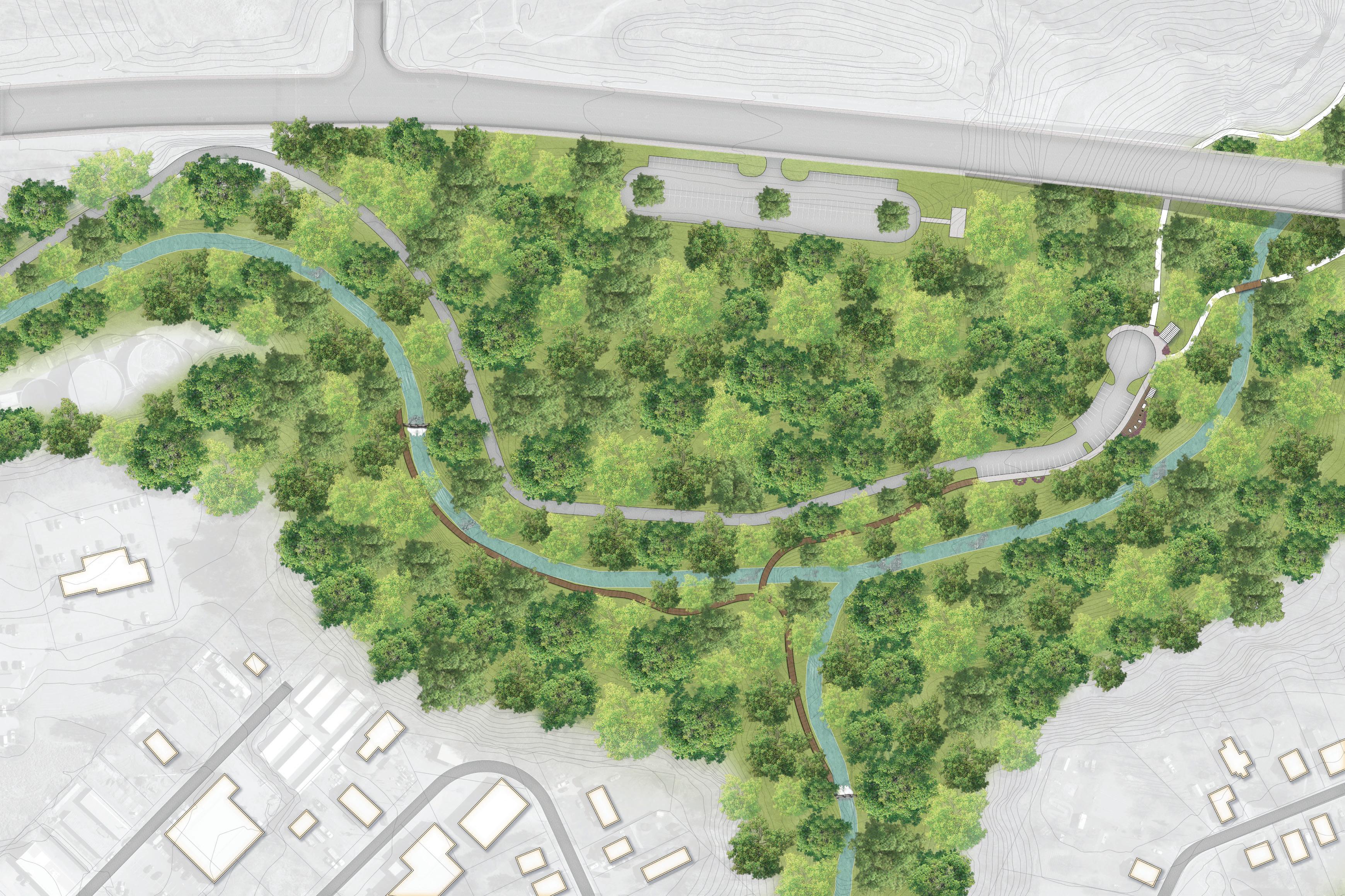
Thanks to the West Virginia Land Trust, the first major property within this corridor was secured in 2023. The 613 acre Piney Creek Preserve provides access to Waterfall Hollow Park, the Wildwood Trailhead, the proposed Wildwood Trail, and Stanaford Grove, which will provide for mountain biking trail development (see map, page right).
Other key features of the Piney Creek Park and Preserve include Gray Flats (the largest existing mountain bike trail network currently in the city), City of Beckley soccer fields and walking track, the Pinecrest Business Park, and property controlled by Raleigh County that provides
climbing and bouldering opportunities. More information about each of these assets are highlighted within this section.
This section highlights specific action items for advancing the Piney Creek Park & Preserve and is organized according to four (4) primary Project Areas, including: 1) Wildwood Trailhead and Waterfall Hollow Park; 2) Stanaford Grove; 3) Gray Flats; 4) Raleigh County.
As highlighted by the National Park Service’s 2012 report, “Connecting the Parks with their Gateway Communities Concept Plan,” the Piney Creek corridor serves as a vital link between Beckley and the planned trail system known as Garden Grounds that is within New River Gorge National Park. Garden Grounds is a key trail system identified in the New River Gorge Ride Center plan.


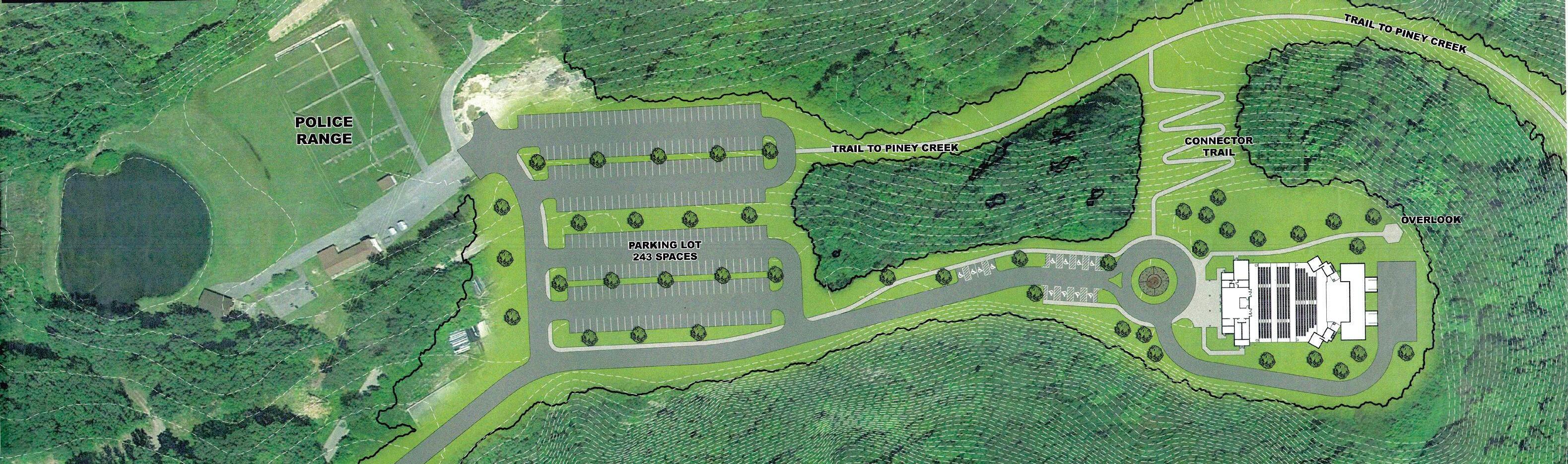
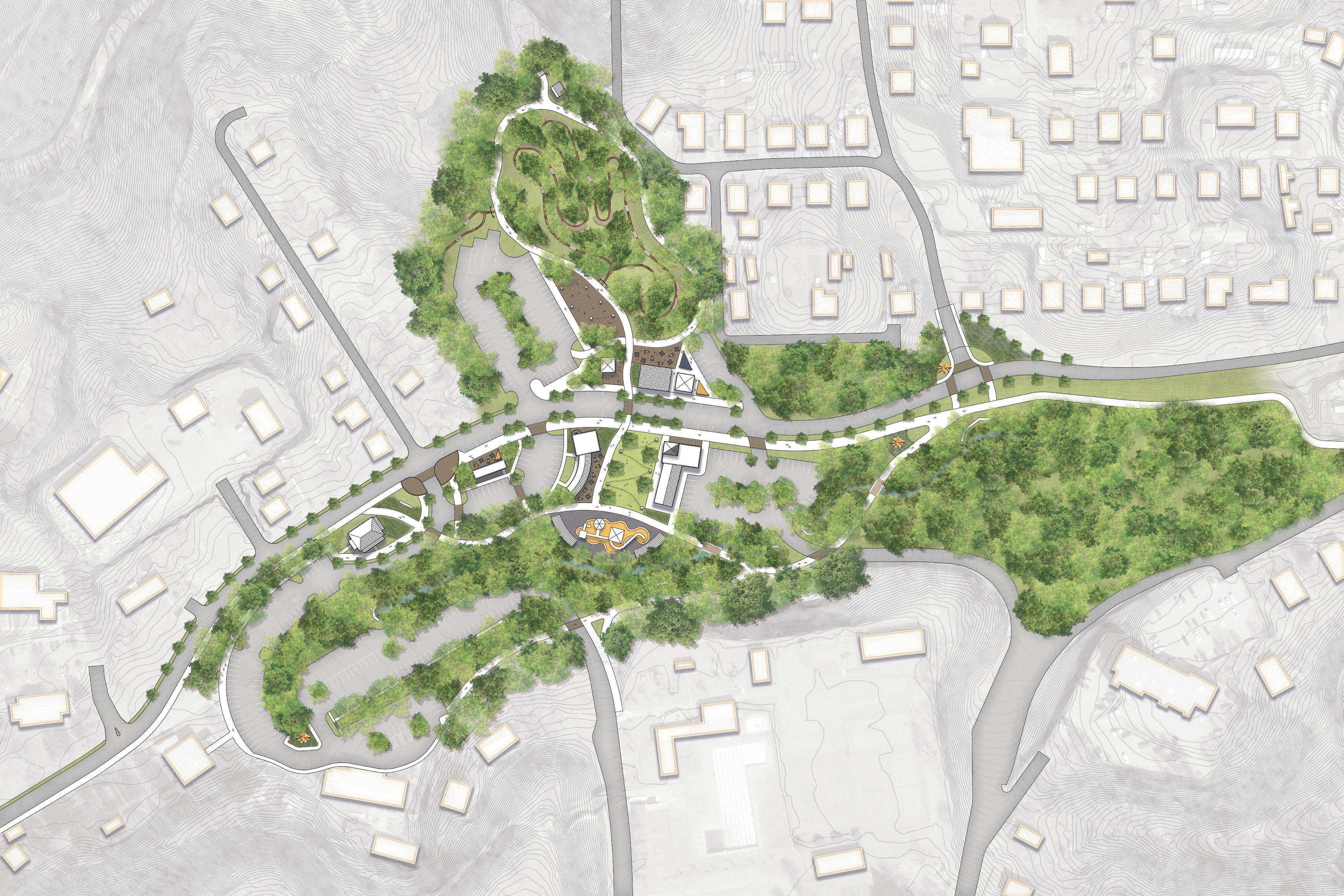
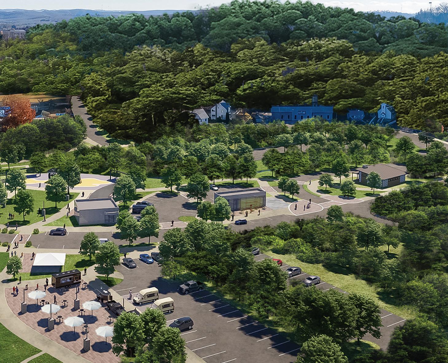
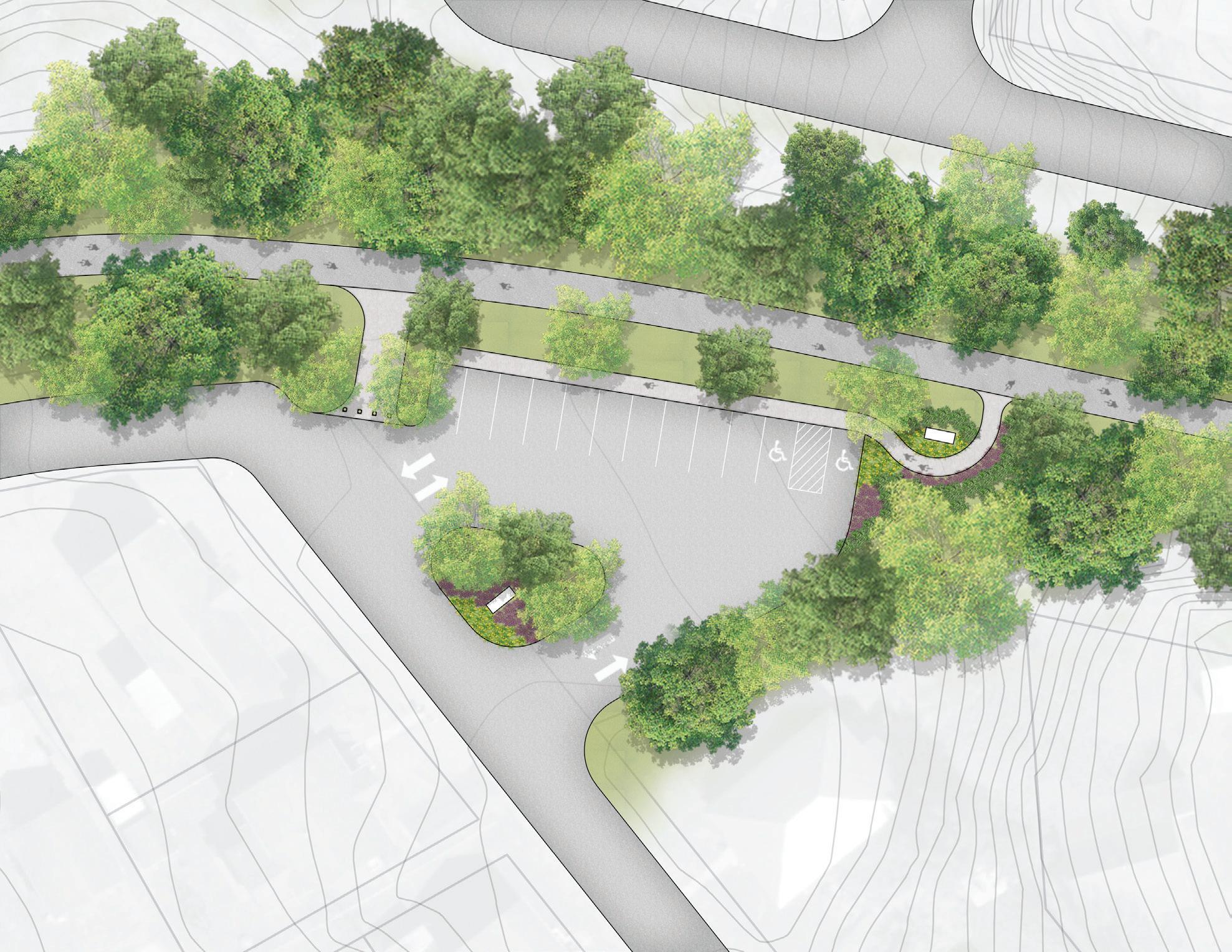
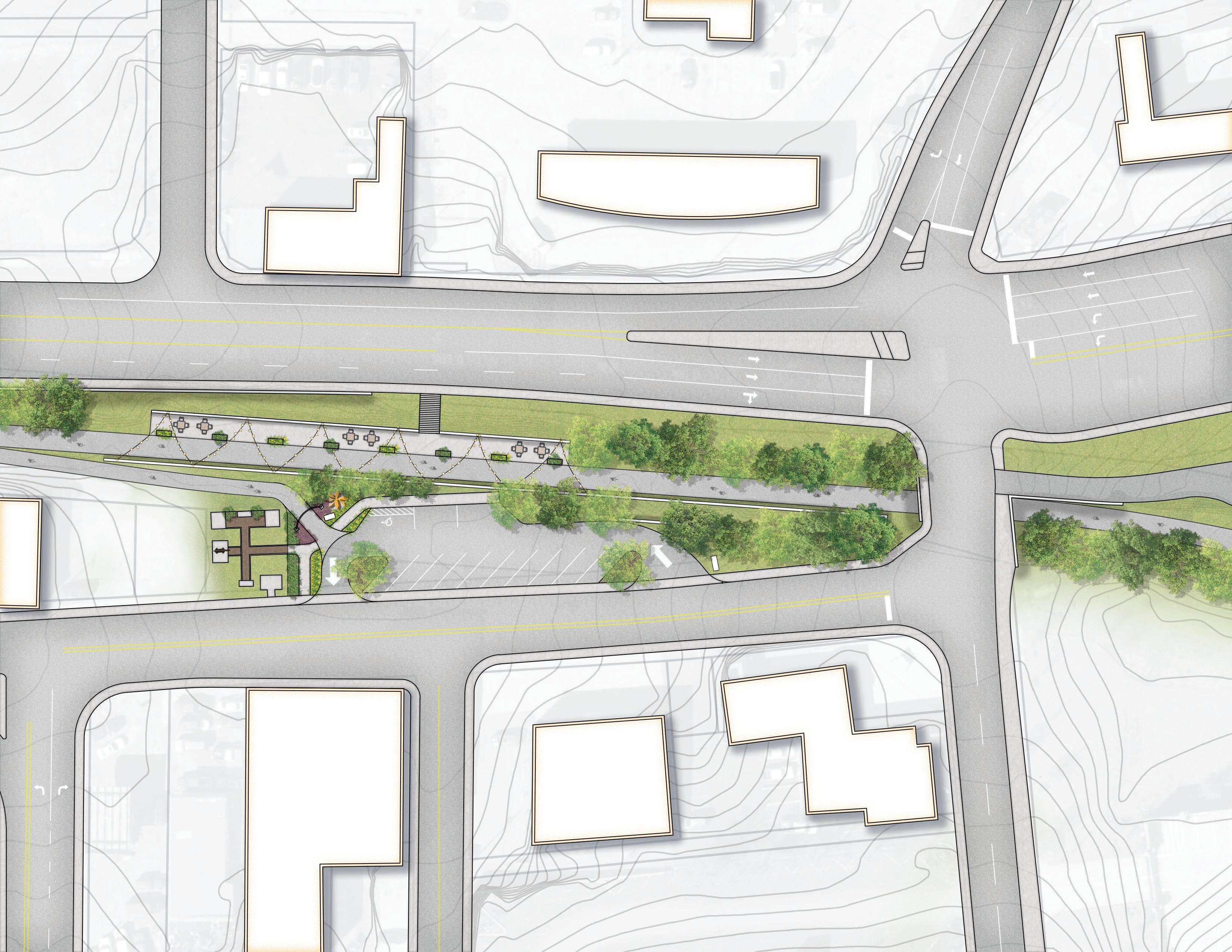
The Wildwood Trailhead serves Waterfall Hollow Park (officially opened in fall 2023 by the West Virginia Land Trust) and will ultimately serve as the southern terminus of the proposed multi-use Wildwood Trail (approximately 3.9 miles) that will connect to Stanaford Grove and eventually to the New River Gorge National Park. This area is part of the West Virginia Land Trust’s 613-acre Piney Creek Preserve.
Specific Beckley Outdoor action items in support of the Wildwood Trailhead and Waterfall Hollow Park Project Area include the following (see Exhibit 05: Wildwood Trailhead Conceptual Master Plan, page right):
1.1.1 Stream Bank Restoration. Implement stream bank restoration and mine reclamation efforts at Wildwood Trailhead.
1.1.2 Access Road Improvements. Improve Stanaford Mine Road, which extends approximately 3,033 feet from Stanaford Road to the Wildwood Trailhead. Improve this old coal mining corridor to ensure adequate access, particularly for emergency services.
1.1.3 Wildwood Trailhead. Construct the Wildwood Trailhead in accordance with the Wildwood Trailhead Conceptual Plan (Exhibit 05). The plan includes more than 40 parking spaces, ADA parking, restrooms, and a proposed swinging bridge that will provide connectivity
to the Gray Flats trail system on the south side of Cranberry Creek.
1.1.4 Wildwood Trail. Construct the 3.9 mile, 14’ wide trail to provide for leisure biking and walking to link Wildwood Trailhead and Waterfall Hollow Park (southern terminus) Stanaford Grove (northern terminus).
1.1.5 Waterfall Hollow. Establish an ADA accessible trail to both falls and install historical and environmental interpretive signage (coal heritage and invasive species) to educate users.
1.1.6 East Beckley Bypass Overlook. Implement the Overlook Park concept plan to include development of parking, a bridge overlook platform, and trail connection to the Wildwood Trail.

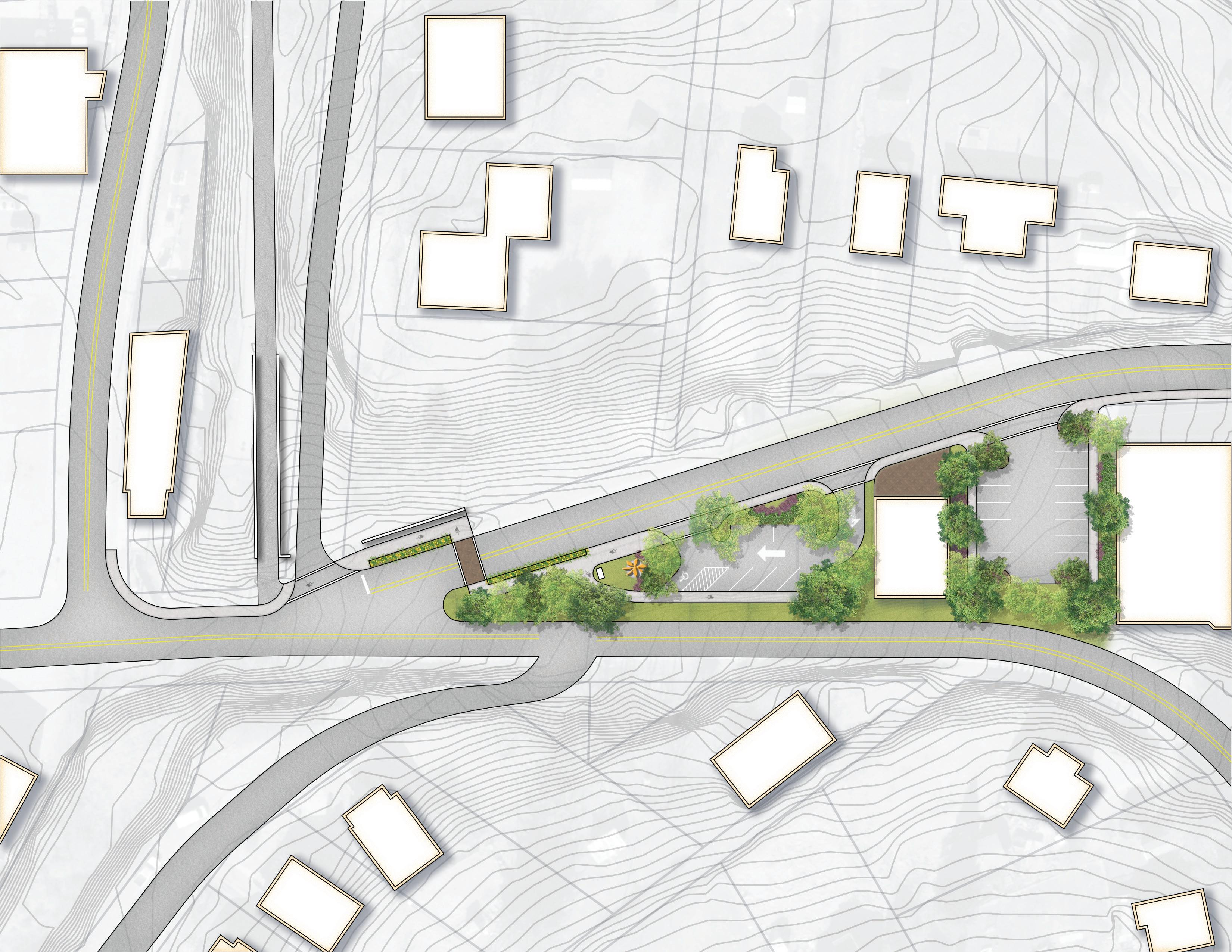
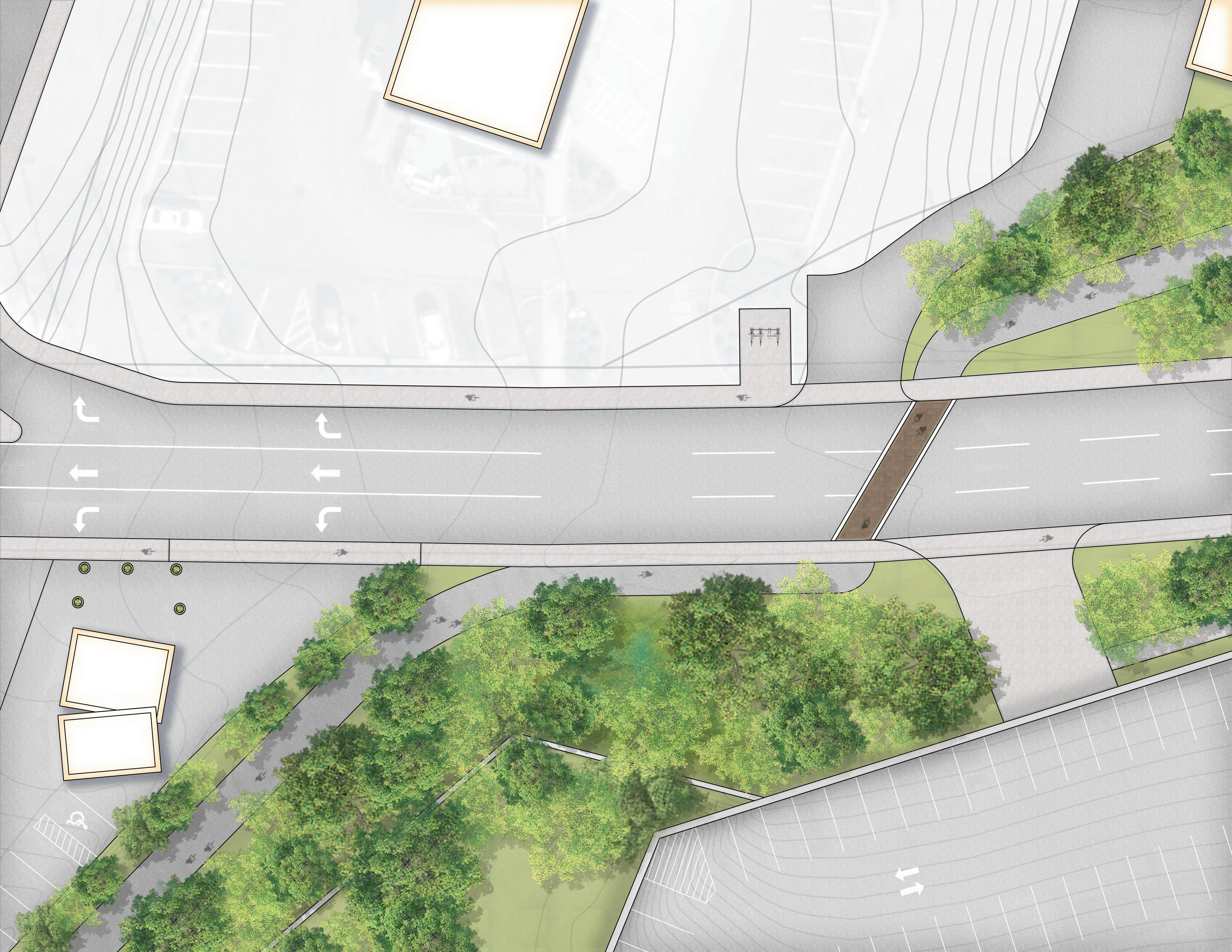
Stanaford Grove is situated within the northern section of the WVLT’s Piney Creek Preserve. This area provides an opportunity to create additional mountain bike optimized trails and connectivity to the Wildwood Trail (see Exhibit 06: Stanaford Grove Trailhead Conceptual Master Plan, page right).
Specific Beckley Outdoor action items in support of the Stanaford Grove Project Area include the following:
1.2.1 Stanaford Grove Trailhead. Construct the Stanaford Grove Trailhead in accordance with the conceptual master plan (exhibit 06). Key features include 58 parking spaces, a kiosk, restrooms, and an opportunity for public art and interpretive signage.
1.2.2 Overlook Trailhead. Construct the Overlook Trailhead in accordance with the conceptual master plan (exhibit 06), which features 16 parking spaces, a kiosk, and a gateway entrance to a significant Piney Creek Gorge overlook.
1.2.3 Trail System Development. Construct a mountain bike optimized trail system (6-8 miles) primarily accessible from the Stanaford Grove trailhead and secondarily accessible from the future multi-use Wildwood Trail. Develop the Overlook Trail.
Trail Difficulty % (70/20/10)
• MTB-specific gravity flow-tech trails
• Front Country, natural, trail hub design
• Beckley to National Park Connection
• Beginner to intermediate progressionbased design for instruction/guide
• Sessionable skill features, natural jumps, and alt tech lines


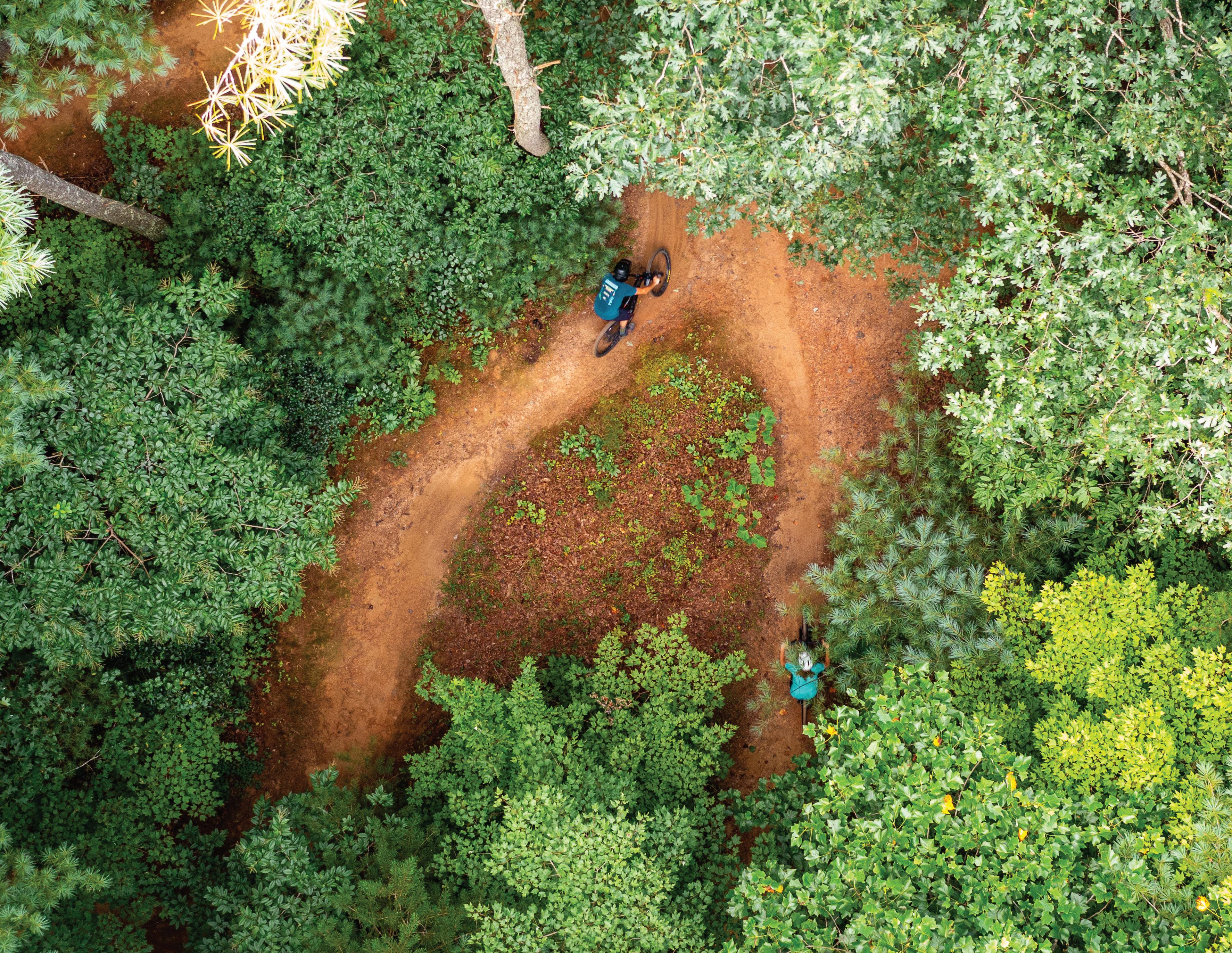
The Gray Flats area borders Cranberry Creek and Piney Creek and is situated south of their confluence. The City of Beckley continues to maintain a strong relationship with Beaver Property Company, which owns significant portions of the Gray Flats project area. Although no formal agreement exists between the two entities, they have worked together to establish the City’s largest mountain bike trail network, which extends approximately 12 miles. In addition, this property provides for legitimate rock climbing opportunities that have been formally established by local outdoor leaders. Other key features include the city’s soccer complex, well-used walking track, and the adjacent Pine Crest Business Park, which provides for numerous outparcel development opportunities. The future of Gray Flats is directly tied to the ultimate success of the Beckley Outdoors initiative.
Specific Beckley Outdoor action items in support of the Gray Flats Project Area include the following:
1.3.1 Landowner Agreement. Plan development efforts should begin with a formal MOU between the City and Beaver Property Company establishing an official publicprivate partnership.
1.3.2 Gray Flats Property Master Plan. Partner with Beaver Property Company to develop a formal master plan for the Gray Flats area that incorporates future development opportunities, a new purpose-built mountain bike trail system, and a custom branding and signage package.
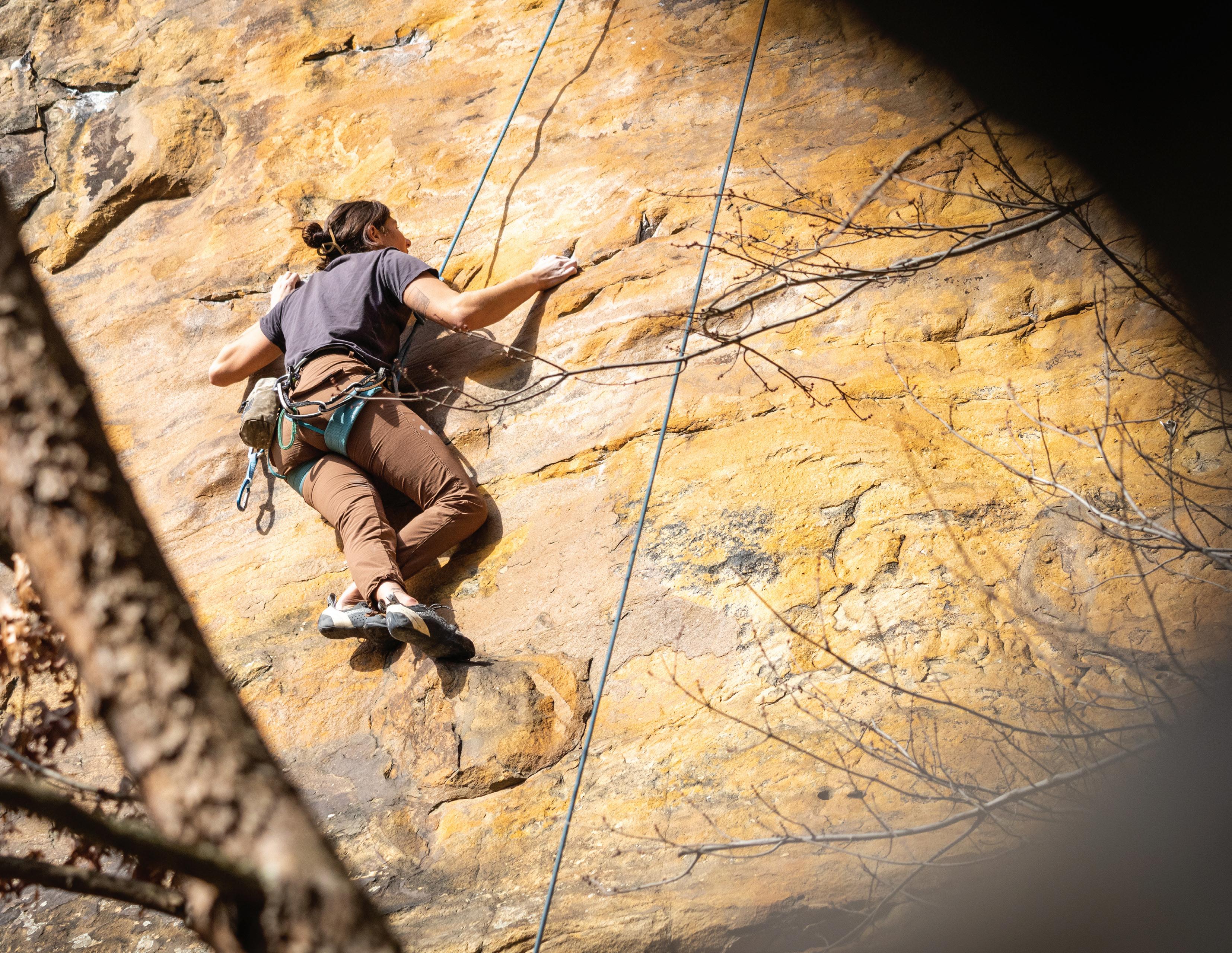
1.3.3 Rock Climbing Development. Evaluate existing and potential rock climbing areas. Develop a plan for expanding rock climbing and rappelling opportunities with a focus on beginner/ family access and progression-based design.
1.3.4 Pine Crest Business Park Connectivity. With the future development of Pine Crest Business Park, ensure its formal connectivity with the Gray Flats trail network.
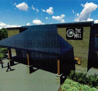
1.3.5 Beckley Mill Connectivity: Partner with NRGRDA to repurpose the property adjacent to the Beckley Mill site and enable better trail connectivity to New River Gorge National Park and Preserve. NRGRDA received $500,000 to assist with brownfield remediation at the former municipal landfill.
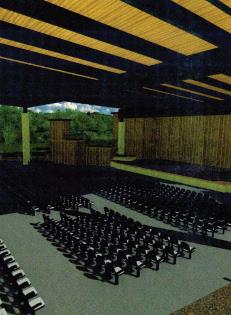
1.3.6 Beckley Mill Visitor Center and Theater: Partner with NRGRDA to repurpose the property adjacent to the Beckley Mill site for a new Visitor Center and open air theater location. NRGRDA received $500,000 to assist with brownfield clean up.
Trail Difficulty % (20/60/20)
• Long descents to Piney Creek
• Points of interest: Vistas, Historical Sites, Boulders, Waterfalls.
• Shared Use Trail System w/purpose-built hiking, biking, and climbing trails.
• NICA/XC Racing Practice Course
• MTB-specific XC trails with occasional hubs for long downhill tech trails
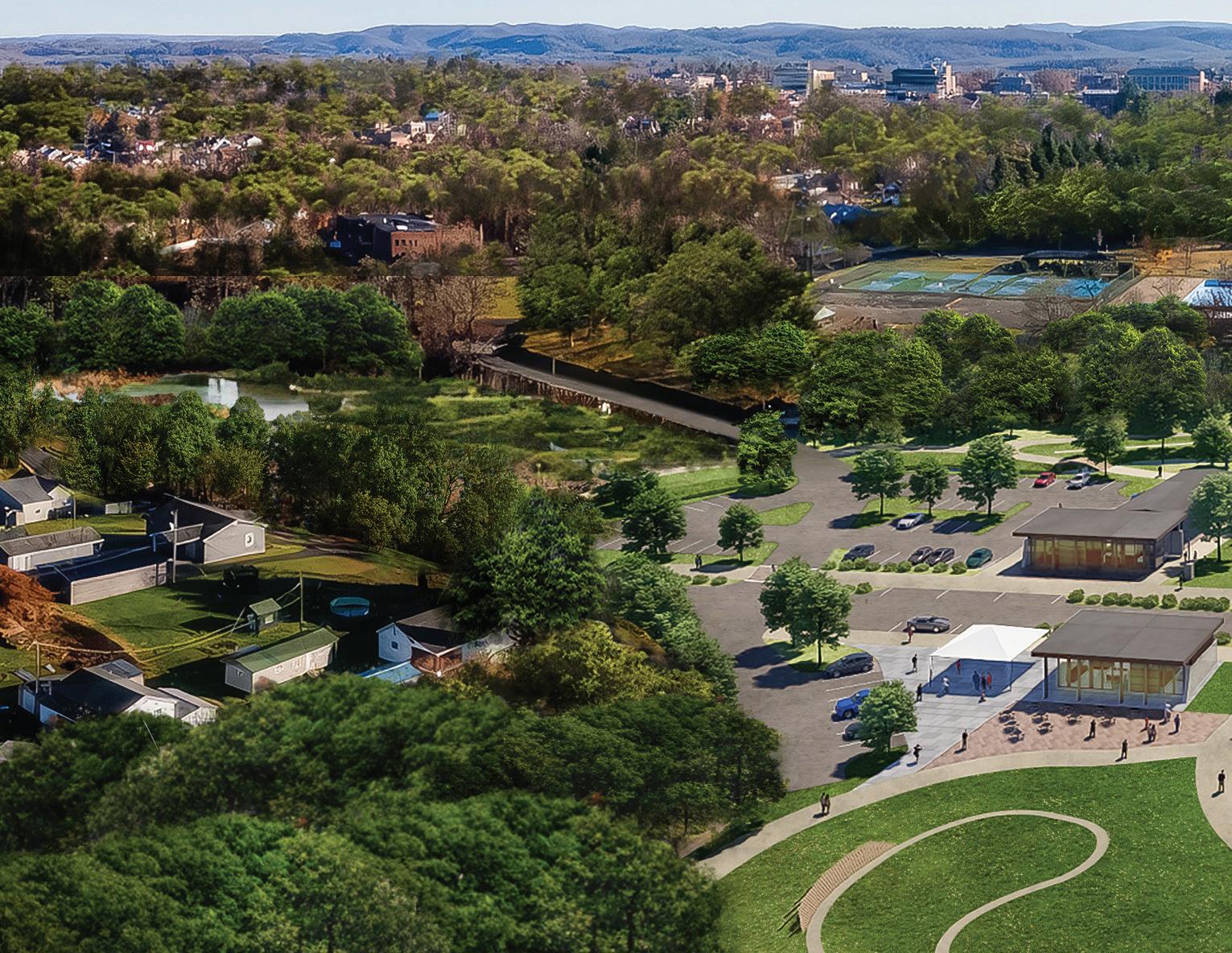
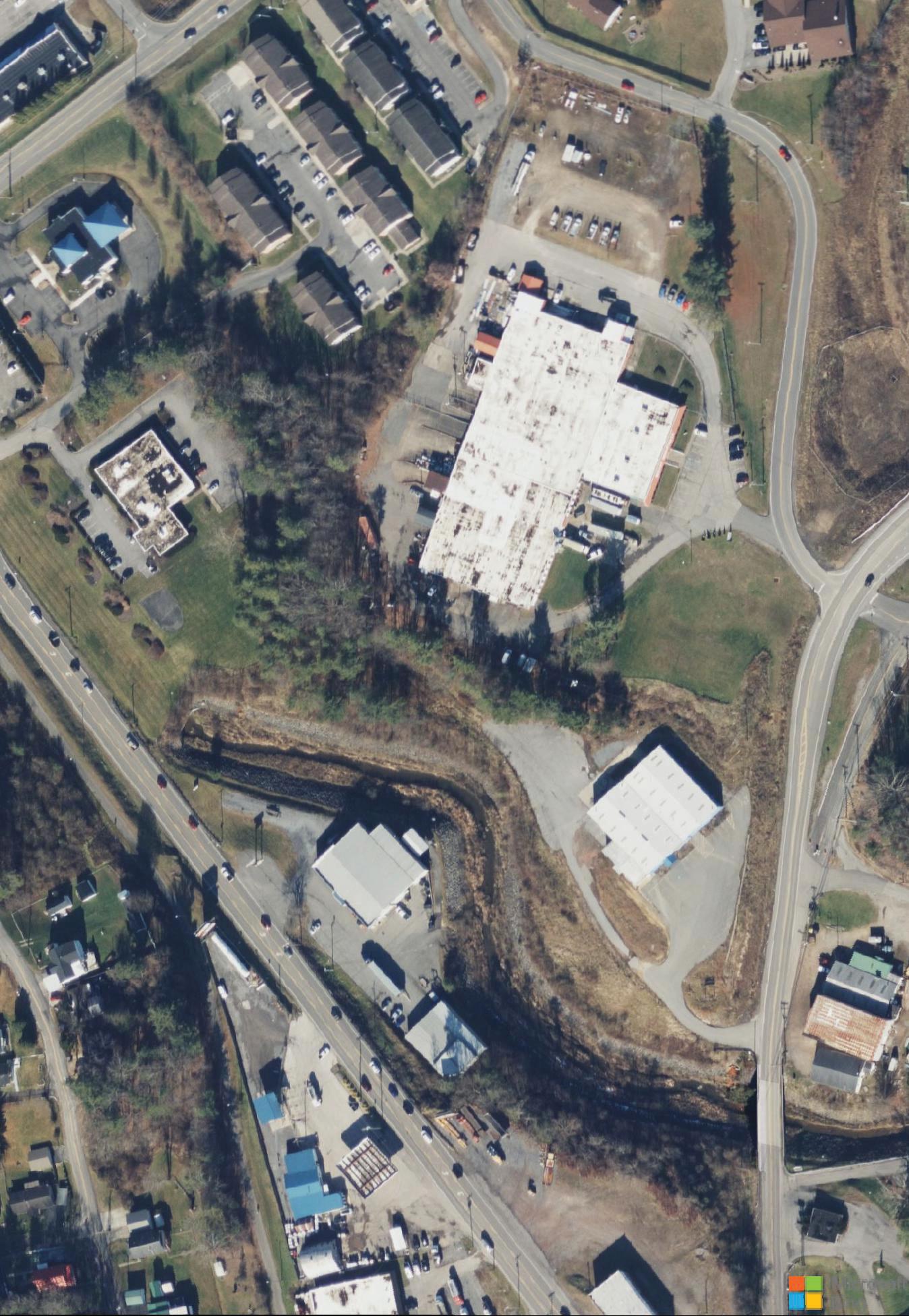
The Beckley Mill site is a historic archaeological site that is listed on the National Register of Historic Places. The original mill was established in 1835 and it remained in use into the early 20th century until it was closed and abandoned. The site is adjacent to Piney Creek Park & Preserve and the Gray Flats area and is currently home to a small public park. The property is a key location for future trail connectivity from the City to the New River Gorge National Park and Preserve. New River Gorge Development Authority (NRGRDA) is working with the City of Beckley to repurpose the property adjacent to the Beckley Mill site to spur economic development. NRGRDA has received $500,000 to assist with brownfield clean up. Future development plans include a new Visitor Center and theater.
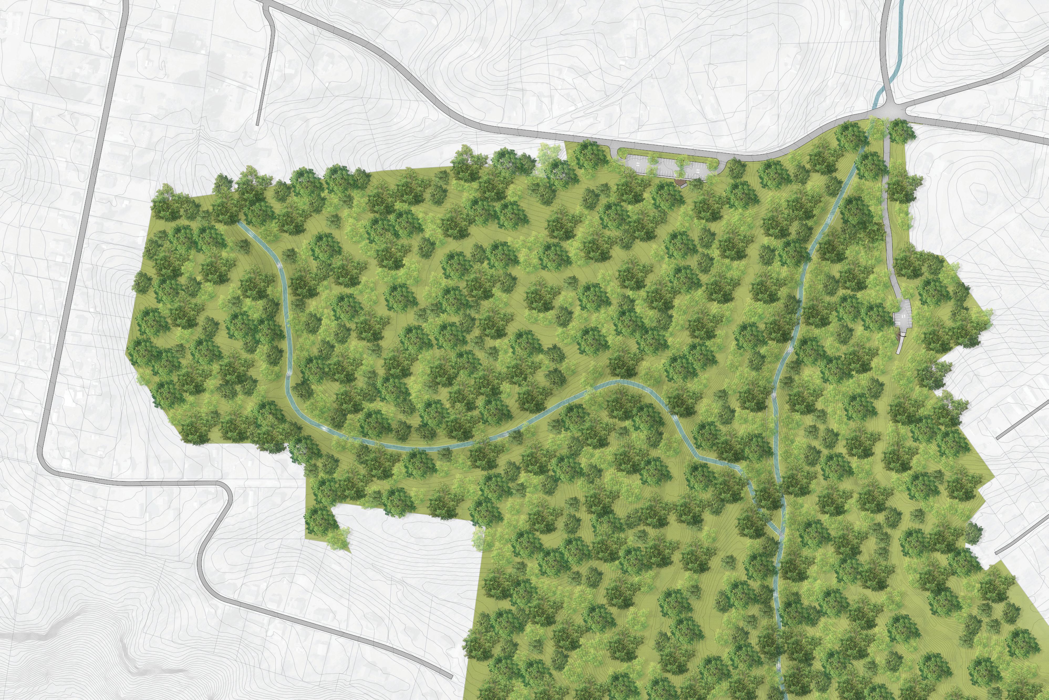
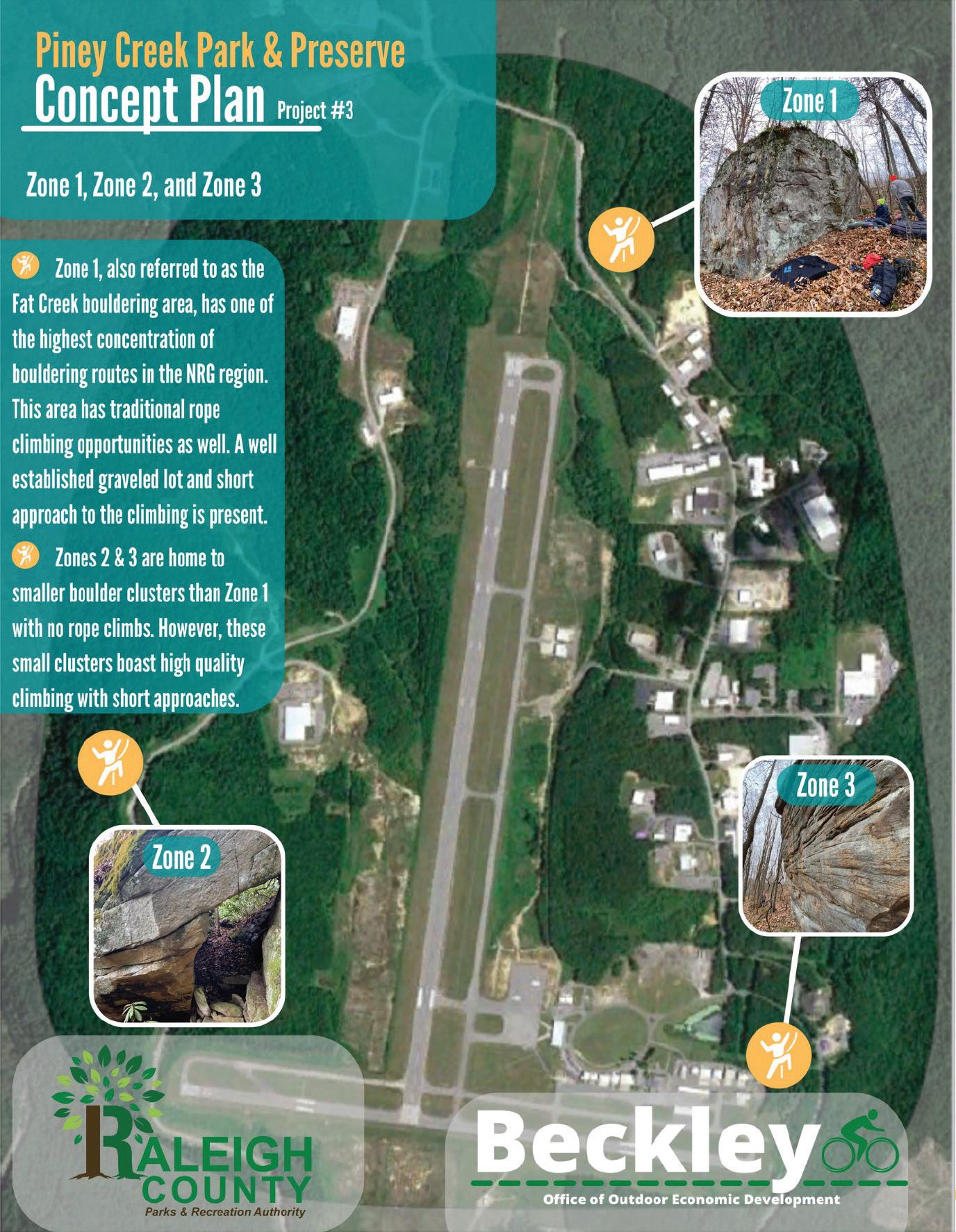
Raleigh County and its airport are located on the east side of Piney Creek; they control approximately 14,520 feet of frontage along Piney Creek. This locally managed public land boasts of numerous bouldering assets (most notably: Fat Creek Bouldering Area) that contribute significantly to the City’s outdoor recreation network. The City and County must continue to partner to strengthen access to these resources.
Specific Beckley Outdoor action items in support of the Raleigh County Project Area include the following:
1.4.1 Formal Access and Signage. Develop formal parking, directional signage, and information kiosks (highlighting safety, conservation, and appropriate use) at the Fat Creek Bouldering Area and other boulder clusters.
1.4.2 Develop Hiking Trails and Access. Develop and promote access to climbing areas via natural surface trails.
Numerous bouldering assets surround the Raleigh County Airport as highlighted by this map produced by City of Beckley’s Office of Outdoor Economic Development.
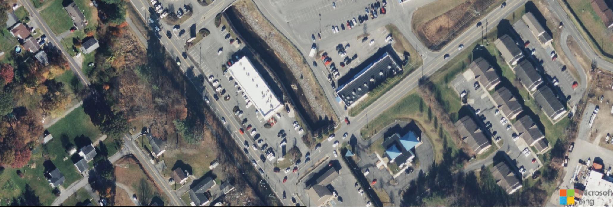
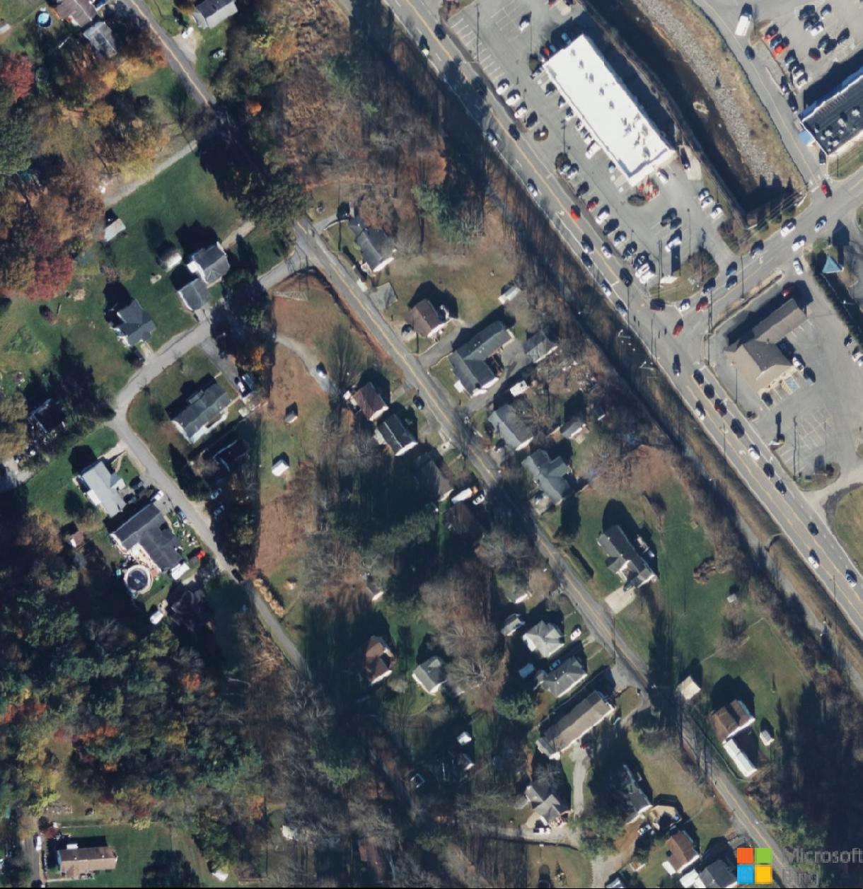
The New River Drive Focus Area (See map, page right) extends from I-64 and Harper Road west to Robert C. Byrd Drive. Adjacent to New River Drive, the Focus Area includes landholdings from Paramount Development Corporation (approximately 148 acres) and Beaver Property Company (approximately 66 acres), two significant Beckley Outdoors partners. South of these landholdings are three additional parcels (approximately 35 acres), which if acquired,
provide connectivity among New River Drive Park, the Lewis McManus Rail Trail, and the Beckley Exhibition Coal Mine (see page right: Map 03: New River Drive Study Area).
This section highlights specific action items for advancing the New River Drive Focus Area and is organized according to two (2) primary Project Areas, including: 1) New River Bike Park; and 2) Exhibition Coal Mine Riders Village.
New River Drive Bike Park offers an exciting opportunity to create a mountain biking system that meets the needs of a wide variety of users. These combined 250 acres provide for 300’ of elevation gain creating opportunities for a variety of mountain biking experiences, including crosscountry, downhill, and flow trails (See page right: Exhibit 09: New River Drive Bike Park Conceptual Design).
Due to positive conversations with private landowners throughout the planning process, this project provides a significant opportunity for implementation and should be given considerable attention within the first 12 months after plan adoption.
Specific action items necessary to support of the development of New River Drive Bike Park include the following:
2.1.1 Landowner Agreements. Secure formal agreements between the City of Beckley and the two agreeable private landowners, Paramount Development Corp. and Beaver Property Company, providing formal authority to plan and develop bike park infrastructure.
2.1.2 Construction Specifications. After a land development agreement is secured, develop a detailed trail plan and engineered specifications for trail support facilities, including parking, restrooms, and signage.
2.1.3 Additional Landowner Outreach. Initiate discussions and work to secure properties currently under private ownership located between Paramount Development Corp.-owned and City-owned properties.
Trail Difficulty % (20/60/20)
• Multi-hub urban design with interconnected trails (Ex: Slaugter Pen, AR)
• Each hub should have easy, more difficult, and advanced lines
• Connection to downtown, WVU Tech, campus, hotels, rail trail, and rider village/ bike park
• Tourism Product: Coal heritage-themed bike trails
• Feature-rich trail system with manufactured jumps, drops, rock gardens, and skinnies
The Exhibition Coal Mine Riders Village is a transformation opportunity that leverages the Exhibition Coal Mine and its 50,000 annual visitors, while providing critical infrastructure to meet the needs of a new and expanding outdoor economy. This project will require a tremendous investment of time and capital, but also serves as a breakthrough initiative that will help transform both the City and region.
The Riders Village project area is approximately 20 acres and 57% is currently controlled by the City. Land acquisition is the imminent priority for advancing this effort. The proposed improvement plan (See page 76: Exhibit 10: Exhibition Coal Mine Riders Village Conceptual Plan) provides for improved access via Ewart Avenue. The Beckley Rail Trail is woven into the site, providing exceptional bike connectivity to downtown Beckley. Additional parking, a new playground, and a variety of building footprints are presented. The Village’s key feature is the large bike park that provides connectivity to New River Drive Bike Park (see Case Study; The Railyard).
Specific action items necessary to support of the development of the Exhibition Coal Mine Riders Village include the following:
2.2.1 Landowner Outreach and Land Acquisition. Begin discussion and negotiations with all property owners located within the study area. Secure all properties of interest.
2.2.2 Explore Public Private Partnerships. Continue to build support among local developers that might be willing to partner with the City and invest in future businesses and infrastructure necessary to realize the vision for Riders Village.
2.2.3 Construction Specifications. After all properties are secured, develop engineered specifications for road networks, utilities, parking, trail infrastructure, playscapes, restrooms, signage, and outparcels.
2.2.4 New River Park Master Plan. Develop a master plan for the City’s existing New River Park that can help guide the future of this important community asset.
Trail Difficulty % (20/60/20)
• A themed hard-surfaced bike park with manufactured jumps and features
• Ideal event space for demo and professional shows
• Tourism products and heavily branded park
• Robust amenities for riders
• The experience intersection of the Mcmanus Rail Trail, Exhibition Coal Mine, and New River Drive Trails.
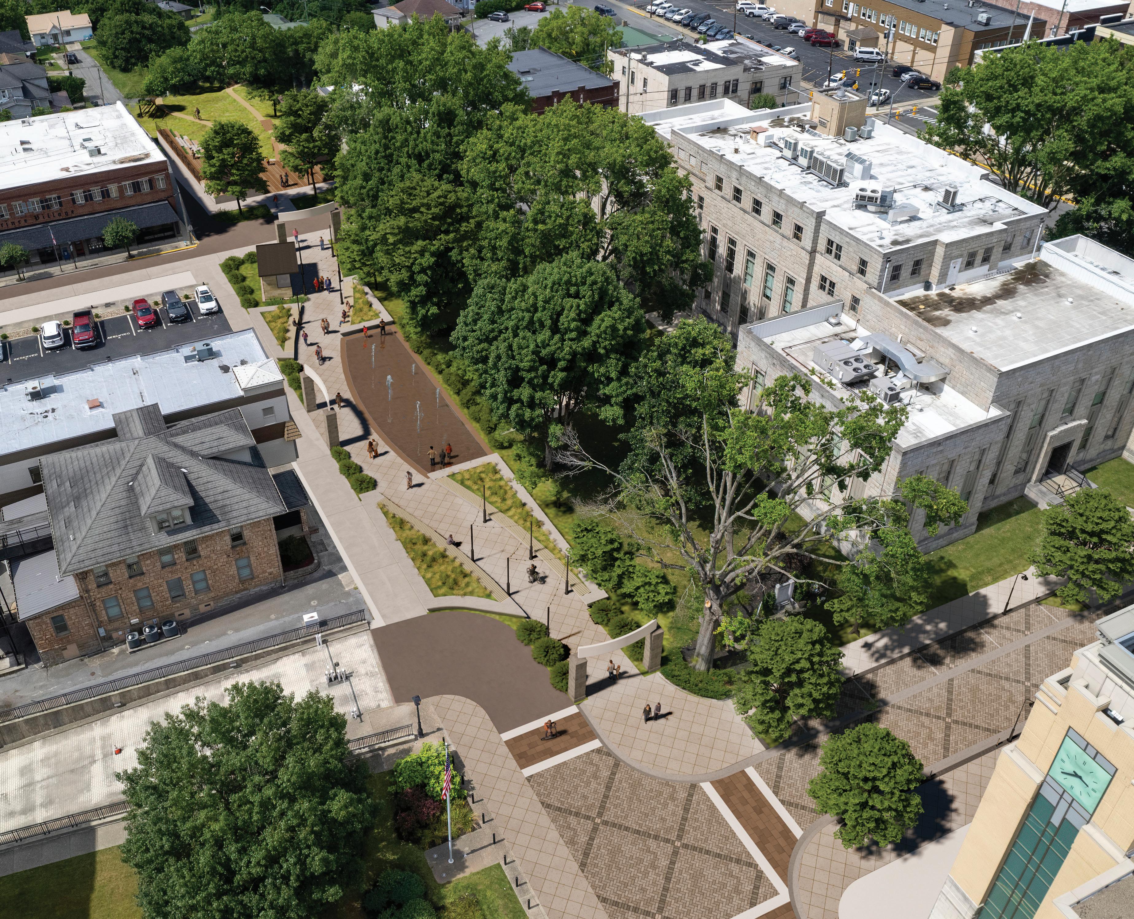
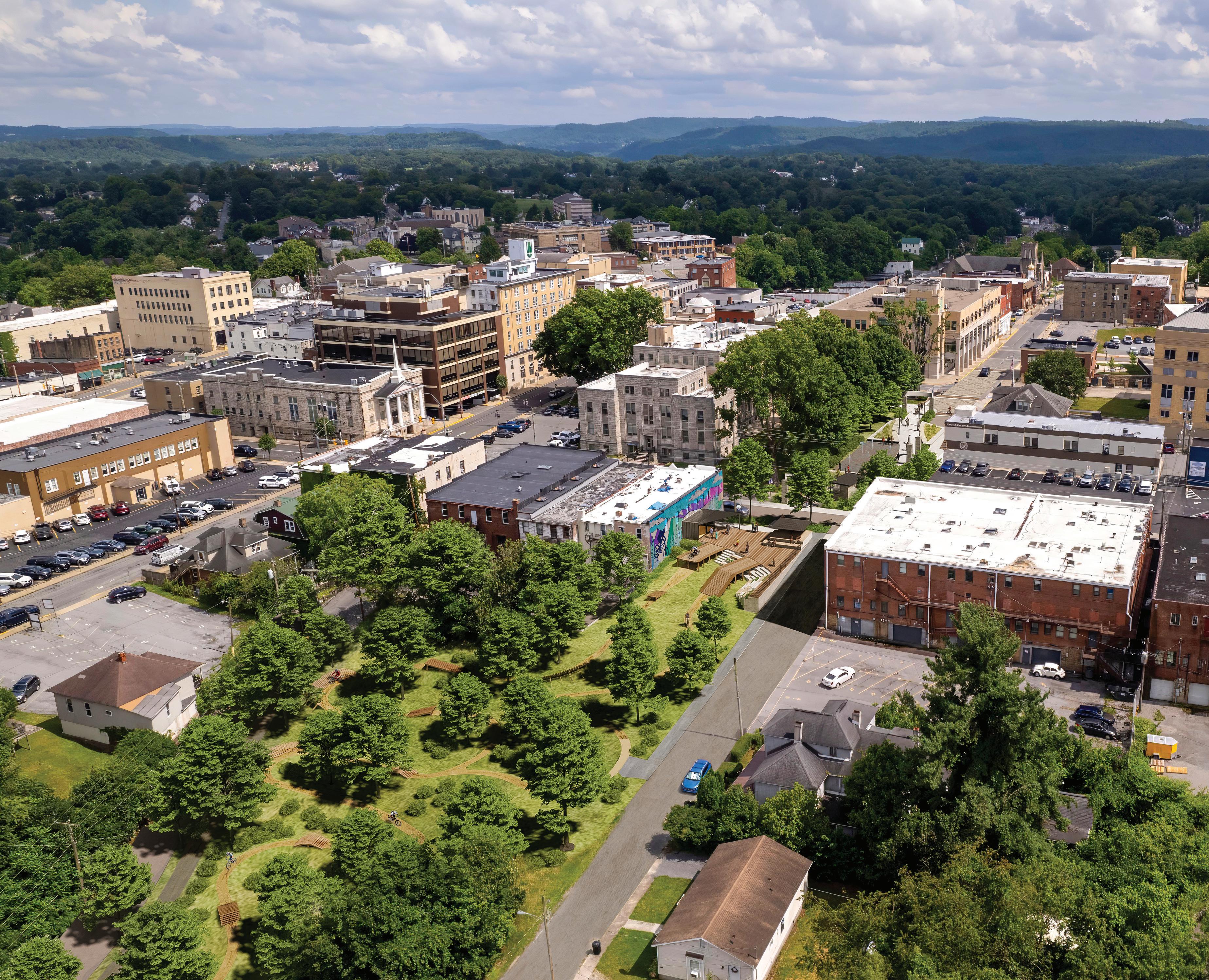
Throughout the Beckley Outdoors planning process downtown Beckley was constantly discussed among stakeholders as an area in need of intensive focus and attention. A bold vision is necessary to transform downtown, change perceptions of safety and vitality, and cultivate the next generation of investors and small businesses required to create a thriving destination. In addition, efforts must include creating an environment in which students from WVU Tech are attracted and integrated within a new, activated downtown. With fortitude and intention, this transformation can happen, and the integration of outdoor recreation can become a significant part of the story.
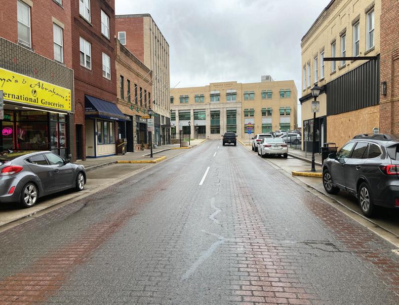
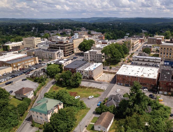
The Downtown Beckley Focus Area extends approximately 0.5 miles along Neville Street and Main Street and incorporates Shoemaker Square Park and the Piney Avenue corridor, which connects to the rail trail (See Map 04: Downtown Beckley Focus Area). Through numerous
focus groups, surveys, and interviews with stakeholders, several key goals emerged for Downtown Beckley:
1. Redevelop the streetscape to allow for improved accessibility and pedestrian movement;
2. Provide streets that can easily accommodate festivals, events, and bicycles;
3. Incorporate compelling public areas, improved public spaces and plazas; and
4. Integrate outdoor recreation opportunities and establish strong connectivity to the rail trail.
This section highlights specific action items for advancing the revitalization of Downtown Beckley and is organized according to two (2) primary Project Areas, including: 1) Neville and Main Streetscape; and 2) Urban Gravity Bike Park.
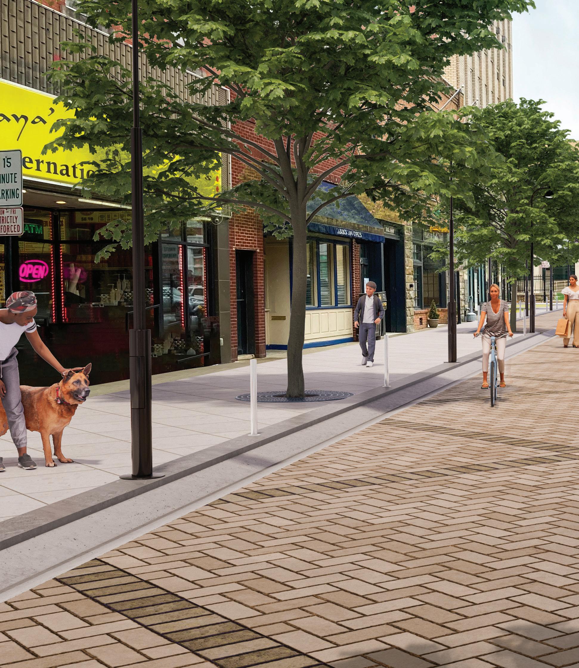
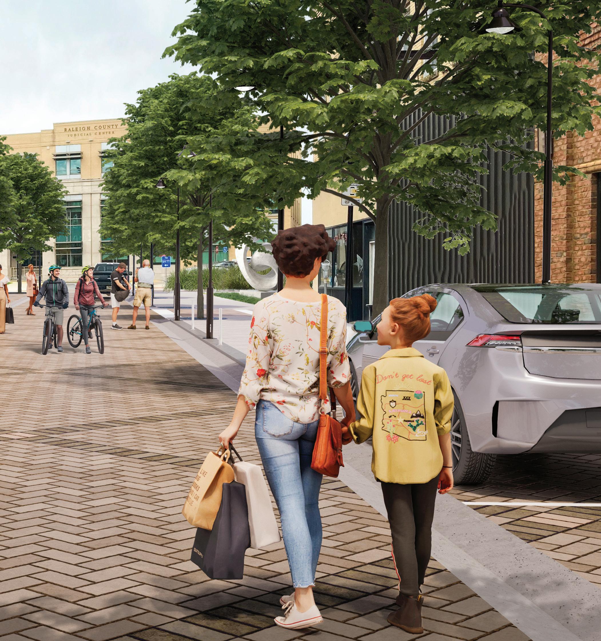
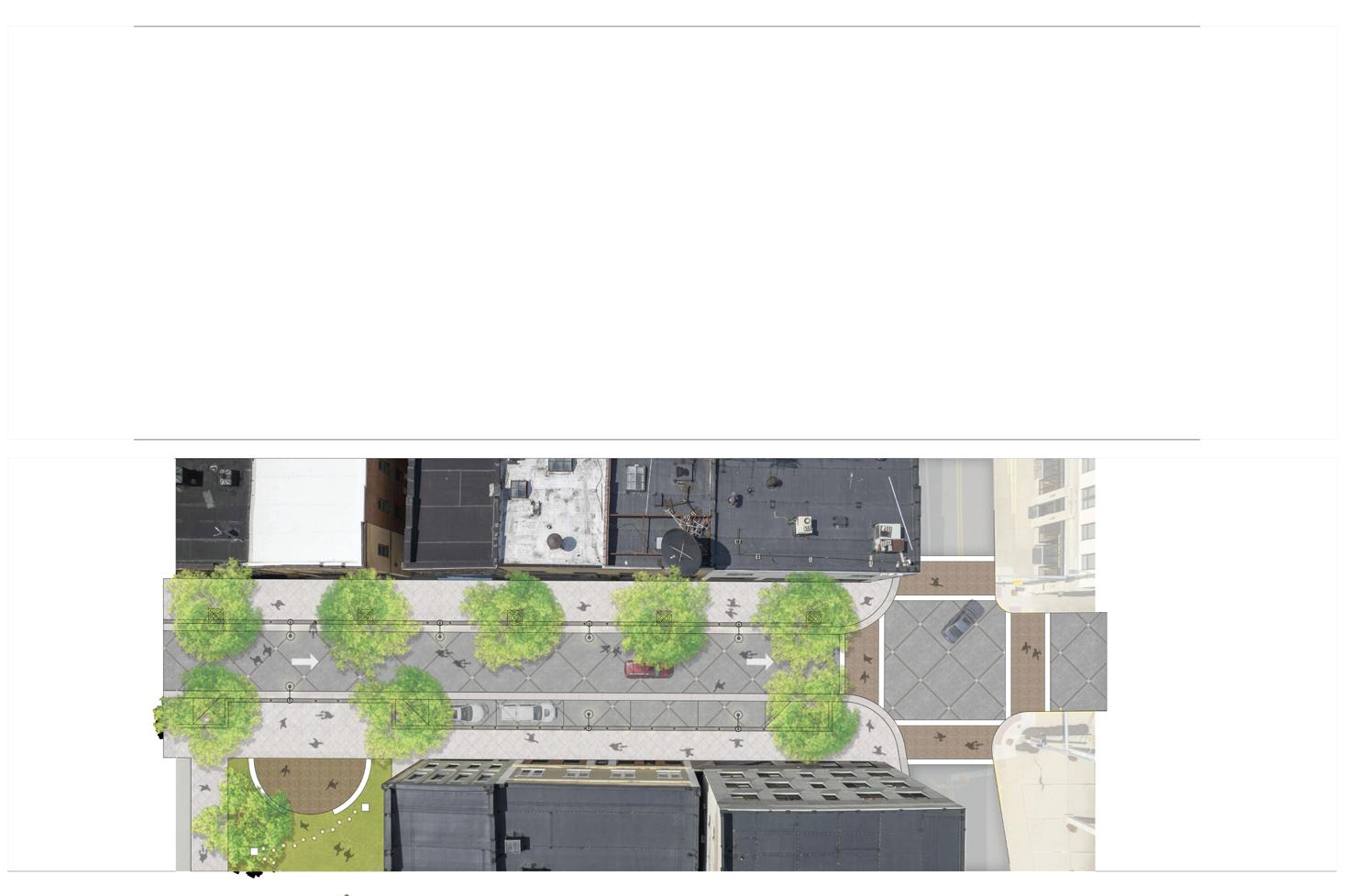
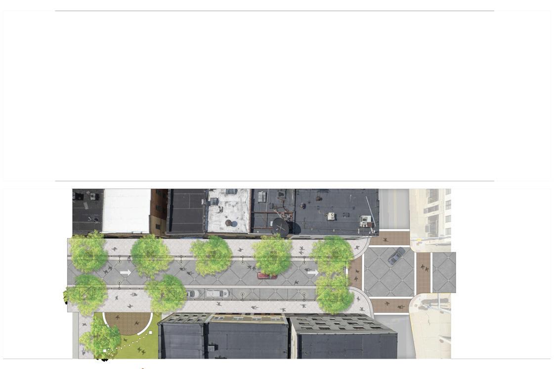
Neville Street and Main Street serve as the primary corridor through the heart of Downtown Beckley. As such, the design and associated accessibility along these streets are critical to the success of downtown. With strategic public investments that improve the streetscape and public spaces, a more activated downtown will result in private investment and new small business.
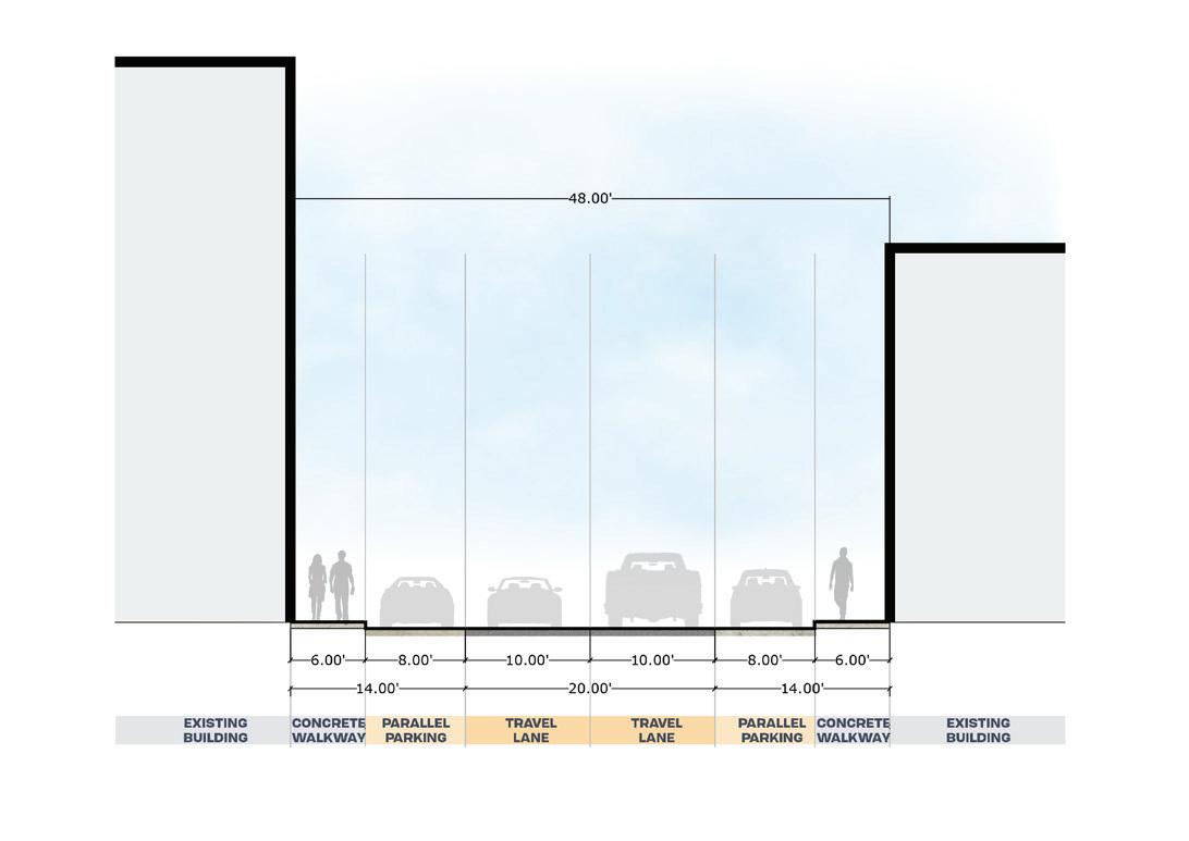
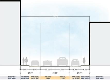
The Neville and Main study area extends from 1st Avenue to Kanawha Street. The existing road conditions provide for two vehicular lanes, both moving in a singular oneway direction. In most cases throughout the study area, the sidewalks are approximately 6’ in width, whereas for a traditional downtown, such as Beckley, sidewalks should be a minimum of 10’ and ideally between 14’ and 16’.
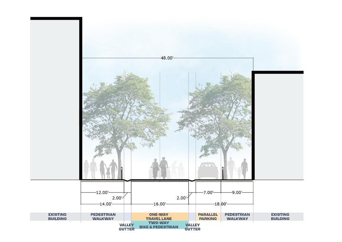
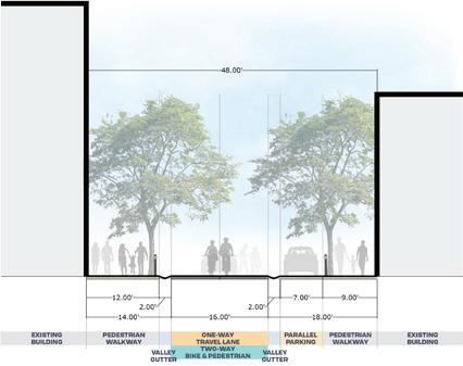
The proposed new street design provides for a single, oneway vehicular lane with sidewalks between 9’ and 16’ with on-street parking. In addition, a curbless, “woonerf,” design is recommended to provide a festival street that provides exceptional accessibility for pedestrians and cyclists (See Case Study: Woonerf Street Design). The subsequent pages feature a series of exhibits highlighting key features of the proposed design.

Specific action items necessary to support the redevelopment of Neville and Main Street include the following:
3.1.1 Preliminary Engineering Report. Obtain surveys and develop a Preliminary Engineering Report that explores a refined design and cost estimates for both the streetscape study area and Shoemaker Park.
3.1.2 Develop a Funding Strategy. Downtown revitalization will require extensive funding, often from numerous sources. The City and New River Gorge Regional Development Authority should work together to identify grants, loans, and other tools necessary to implement the streetscape plan.

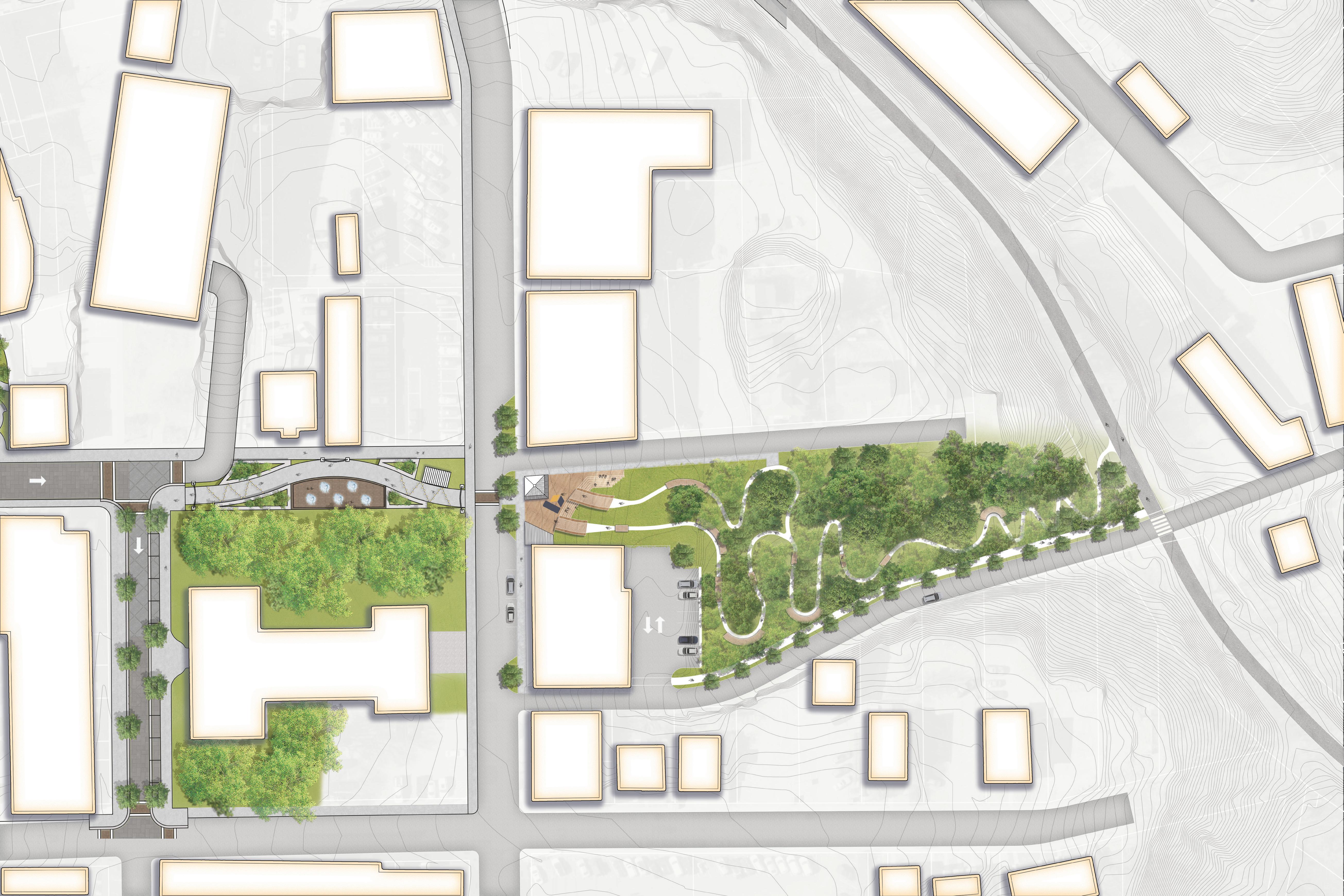
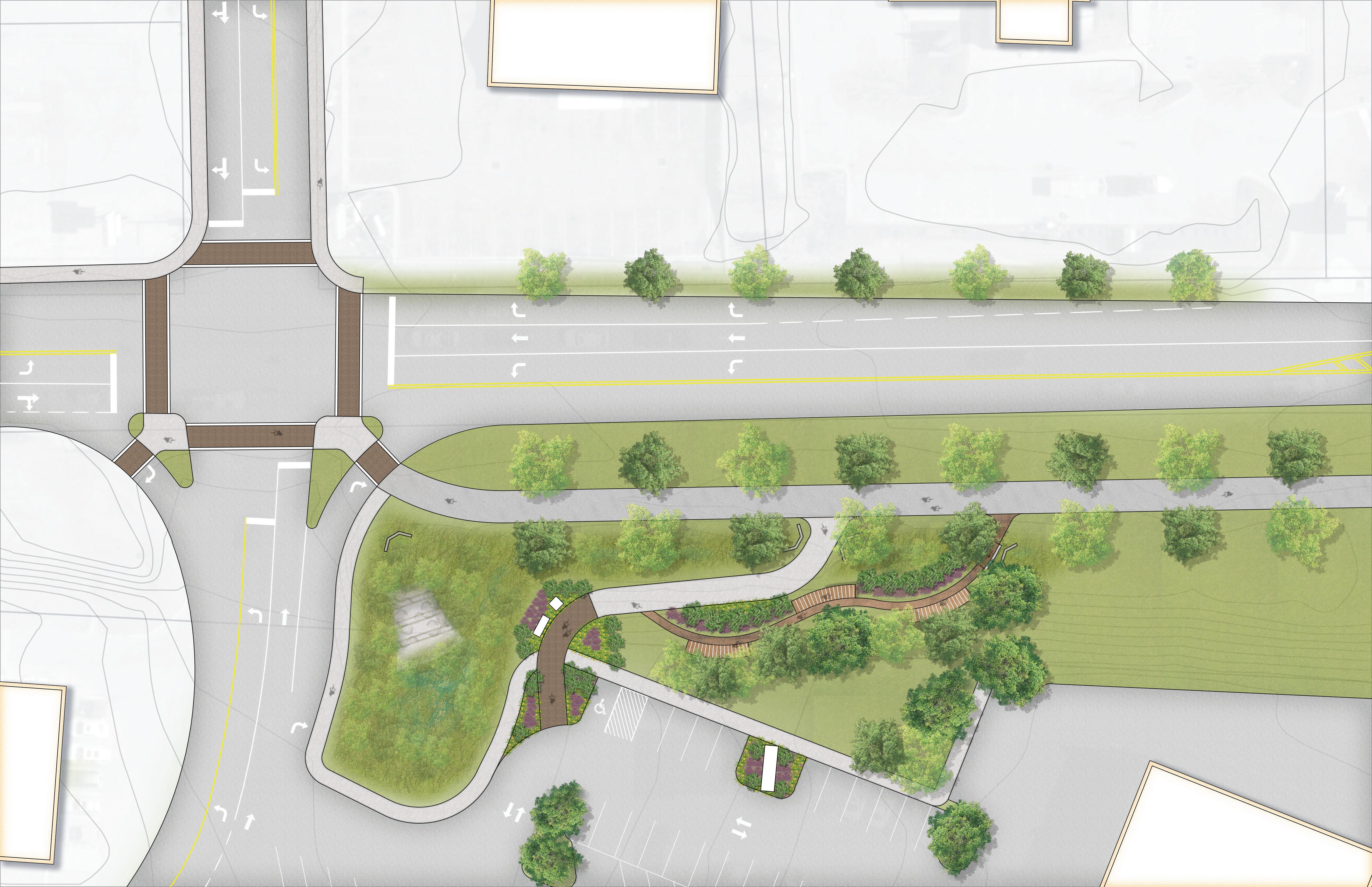
EXH 15: A New Gateway to Downtown Beckley
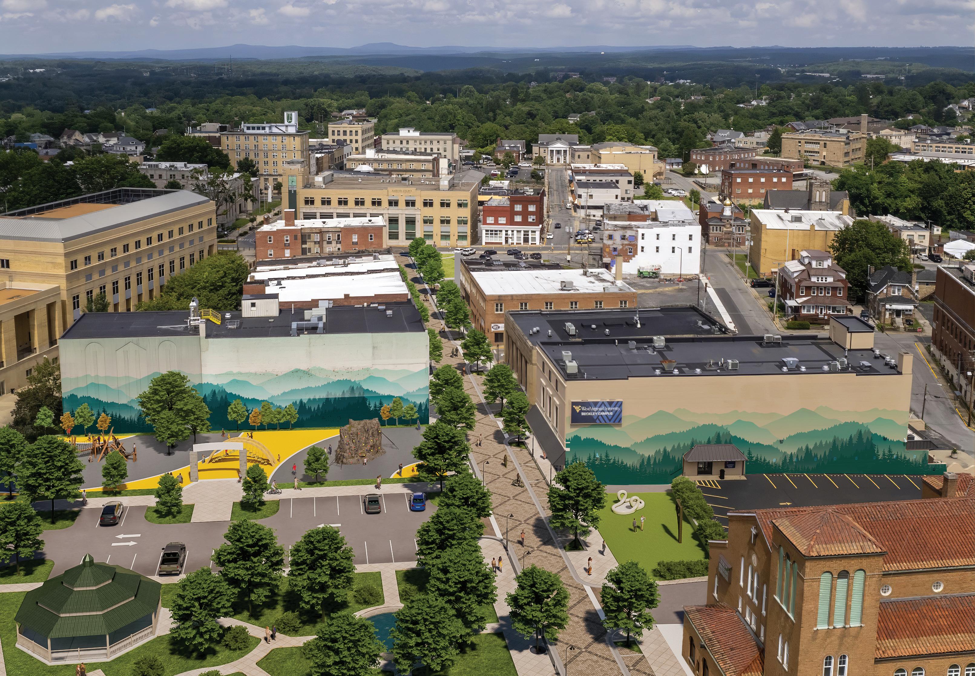


The proposed downtown Urban Gravity Bike Park brings outdoor recreation to the heart of Beckley while providing a meaningful connection between the rail trail and downtown. From downtown, the study area is accessed by Shoemaker Square Park at Prince Street and is located between North Heber Street and Piney Avenue. From Prince Street to the rail trail there is approximately 45 feet of elevation fall.
The conceptual plan (see page right, Exhibit 17: Downtown Gravity Bike Park Conceptual Plan) provides for two alternative downhill trails with varying degrees of difficulty. Upon reaching the rail trail, the user can continue on to explore other trails and assets throughout the city or take the return trail (parallel to Piney Avenue) back to the bike park entrance.
Specific action items necessary to support the development of the downtown Gravity Bike Park include the following:
3.2.1 Land Acquisition. Obtain all properties located within the study area necessary to plan and implement the downtown bike park.
3.2.2 Design/ Build Construction. Due to the nature of this project, the City should pursue a design/build contract from a member of the Professional Trail Builders Association.
Trail Difficulty % (60/40/0)
• Sessionable hardened MTB-specific gravity flow trails
• NRG Ride Center branded tourism product
• Ideal for photo op and marketing content
• Downtown and WVU Tech campus connection
• Urban, art-centric bike park
The Lewis McManus Rail Trail is located in central Beckley along the former Piney River & Paint Creek Railroad. The trail will serve as a central spine for pedestrian and bicycle traffic with connections to downtown Beckley, New River Park, and future recreational asset development along New River Drive and within Piney Creek Preserve and the New River Gorge National Park and Preserve. It is approximately 4.07 miles long and passes through residential, light commercial, downtown, and commercial land uses. Map 05: Lewis McManus Rail Trail (page right) outlines the plan study area.
This section highlights branding, signage, and trail support facilities for the rail trail. Standard road crossing enhancements and rail trail access points are also explored and supported with schematics.
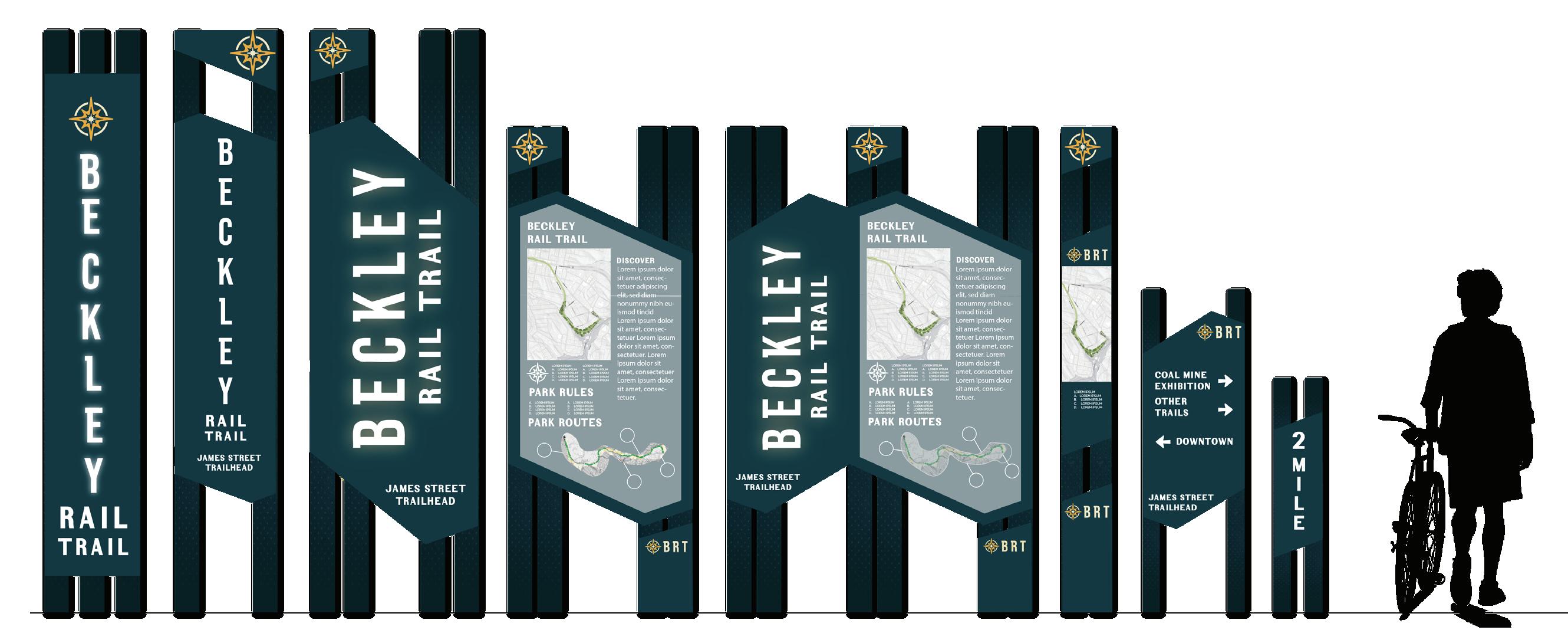
Branding the Lewis McManus Rail Trail as the Beckley Rail Trail will increase awareness of this recreational asset with regional and local visitors. A unique brand incorporated into quality signage and support facilities will create a distinct visual identity and enhance the user experience.
Existing road crossings on the rail trail are designed and signed primarily for trail users. A painted stop line, stop signs, and warning lights caution pedestrians and bikers as they approach the crossing. On the opposite side of the road, signage identifies permitted uses and indicates that motorized vehicles are not allowed.
A standard set of enhancements should be applied at every road crossing to include the following: bollards to prohibit vehicular traffic on the trail, high visibility crosswalk, signs indicating the intersecting street name, and MUTCD compliant vehicular yield for pedestrians and cyclists signage. These improvements will enhance safety for trail users and increase awareness of the trail for drivers.
Informal access paths exist along the trail within the neighborhoods that border the trail and behind commercial businesses located along Robert C. Byrd Drive. These trails should be identified, assessed, and potentially improved as permanent access points for the rail trail. Improvements may include hardening the path surface with asphalt or gravel and adding pedestrian signage for rail trail users that identifies nearby roads.
Neighborhood Accesses:
» Central/Wilkes
» Elm Street
» Dyer Avenue
» Dorcas Avenue
Branded trail support facilities will provide a consistent visual cue to trail users
CUSTOM bicycle parking
� OMBRE POWDERCOAT
� PINCH-STYLE FOR VARYING TIRE SIZES / TYPES
� 5 TYP. SPACES WITH SECONDARY SPACES ON SIDES
� U-SHAPE LOCK SYSTEM


6’ XANTHO BENCH
� MANUFACTURER: IRON AGE
� YELLOW POWDERCOAT
� CUSTOM LASER CUT PATTERN

� MANUFACTURER: LANDSCAPE FORMS
� YELLOW POWDERCOAT
� CUSTOM BRAND LOGO
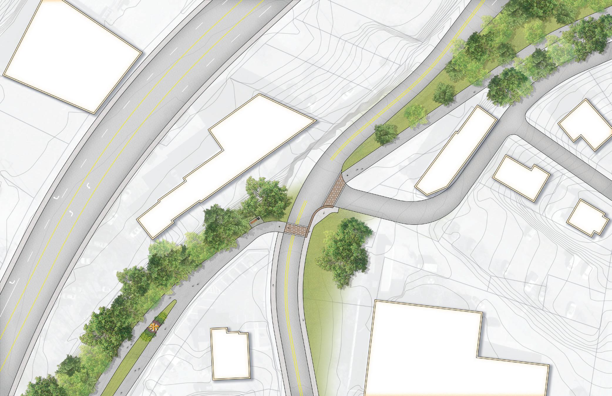
The southern terminus of the rail trail is located at the intersection of City and South Oakwood Avenues. The trail follows a narrow wooded corridor north bordered by residential neighborhoods and light commercial uses as it passes underneath Robert C. Byrd Drive and approaches downtown Beckley. (See Map 06: RecommendationsSection 1, page right.)
4.1.1 Southern Terminus Trailhead. Develop a formal trailhead and provide a high-visibility crosswalk and sidewalk connection at the southern terminus of the rail trail. A formal trailhead located at the southern terminus of the rail trail will include an information kiosk, parking, and public art. A high-visibility crosswalk and sidewalk connection on the north side of City Avenue will provide safe access to the trail. The City will need to acquire land or execute a formal agreement for this trailhead location.
(See Exhibit 20: Southern Terminus Trailhead)
4.1.2 James Street Trailhead. Implement improvements to the existing trailhead to include an entrance sign, information kiosk, landscaping, and parking. The James Street Trailhead provides public access to the rail trail on City-owned property. Existing trailhead improvements will include an entrance sign, information kiosk, landscaping, and parking. The trailhead will provide City staff with vehicular access for maintenance and management. (See Exhibit 19: James Street Trailhead, page 96.)
4.1.3 Central Avenue Redevelopment Area. Implement rail trail corridor improvements by providing a high visibility crosswalk and branded signage and shifting the rail trail alignment to provide an opportunity for the development of commercial business uses in cooperation with private development plans. The Central Avenue Redevelopment Area is located where the Beckley Rail Trail approaches the tunnel underpass of Robert C. Byrd Drive. The trail is currently defined with wooden posts and concrete barriers. A high visibility crosswalk will guide trail users across Central Avenue and branded signage will lead residents and visitors into downtown Beckley as land use transitions from residential to light commercial. The City will explore rail trail corridor improvements through the redevelopment area in cooperation with private development plans.
Section Length: 0.85 miles
Trail Setting:
• Residential
• Light Commercial
Existing Points of Interest:
• S. Oakwood/City Ave. Trailhead
• James St. Trailhead
RECOMMENDATION 1.3CENTRAL AVE REDEVELOPMENT
RECOMMENDATION 1.2JAMES STREET TRAILHEAD
RECOMMENDATION 1.1SOUTHERN TERMINUS TRAILHEAD
The James Street trailhead provides neighborhood access and will include an entrance sign, information kiosk, landscaping, and parking.
The southern terminus trailhead will include an information kiosk, parking, public art, and safe access to the rail trail.
The Central Avenue redevelopment area offers a strategic location for revitalization as the trail transitions into downtown Beckley. Shifting the rail trail alignment north within the existing corridor will provide an opportunity for the development of commercial business uses that will complement the trail and parking.
The Beckley Rail Trail passes through the Robert C. Byrd Drive underpass tunnel and borders the northwestern edge of downtown Beckley. As the trail continues north, light residential development is located to the east and commercial businesses backing up to the rail trail and facing Robert C. Byrd Drive can be found to the west. The New River Park Trail Spur leads west near the rail trail crossing of North Kanawha Street. (See Map 07: Recommendations - Section 2, page right.)
4.2.1 Robert C. Byrd Underpass Tunnel. Create a comfortable and inviting entrance and exit to the commercial district in downtown Beckley with murals, lighting, and branded signage. The Robert C. Byrd underpass tunnel provides an opportunity for the City of Beckley to welcome rail trail users to downtown Beckley and improve the perception of safety along this section of the trail. Murals, lighting, and branded signage will provide a comfortable and inviting entrance and exit to the commercial district in downtown Beckley.
4.2.2 Lewis McManus Park and Trailhead. Rename the Beckley Art Park and implement improvements to include an entrance sign, information kiosk, gateway, planters, and improved parking. The existing Beckley Art Park on 3rd Avenue provides public access to the rail trail in downtown Beckley. The City will rename the park Lewis McManus Park and Trailhead to recognize this influential politician and citizen of Beckley. Existing trailhead
improvements will include an entrance sign, information kiosk, gateway, planters, and improved parking. (See Exhibit 22: Lewis McManus Park and Trailhead,page 100.) Public murals will continue to be encouraged and showcased on the walls bordering the rail trail through the park.
4.2.3 Prince Street Crossing. Move and realign the existing trail crossing and provide a high-visibility crosswalk and branded signage. The Prince Street crossing is located adjacent to the Beckley Welcome Center and Intermodal Gateway Parking. The crossing location will be moved and realigned further east to avoid the existing business entrance and provide a more direct crossing for trail users. Crossing improvements include a high-visibility crosswalk and branded signage. (See Exhibit 23: Prince Street Crossing, page 101.)
Section Length: 1.09 miles + 0.3
New River Park Trail Spur
Trail Setting:
• Downtown
• Commercial
• Residential
Existing Points of Interest:
• Robert C. Byrd underpass tunnel
• Lewis McManus Rail Trail Park and Trailhead
• New River Drive trail spur
RECOMMENDATION 2.5 -
PARALLEL MOUNTAIN BIKE SKILLS PATH
RECOMMENDATION 2.6N KANAWHA ST CROSSING & NEW RIVER SPUR
RECOMMENDATION 2.3PRINCE STREET CROSSING
RECOMMENDATION 2.2LEWIS MCMANUS PARK & TRAILHEAD
RECOMMENDATION 2.1ROBERT C BYRD TUNNEL UNDERPASS
RECOMMENDATION 2.4URBAN DOWNHILL BIKE PARK CONNECTION
3RD AVENUE
The Lewis McManus Park and Trailhead provides rail trail access from downtown Beckley and will include an entrance sign, information kiosk, gateway, planters, and improved parking.
The Prince Street Crossing will provide a more direct crossing for trail users and include a high-visibility crosswalk and branded signage.
Existing Bike Parking
Existing Bioswale
Trail Difficulty % (80/20/0)
• Fun alternate features parallel to the rail trail to break up the extended section.
• Connection to neighborhoods, trail systems, historical sites, grocery stores, and more.
• Historical sites and art featured between downtown and the New River Drive trails
4.2.4 Urban Downhill Bike Park Connection. Develop the proposed urban downhill bike park to provide the primary connection between downtown Beckley and the rail trail.
The proposed urban downhill bike park connection to the rail trail will provide the primary connection between downtown Beckley and the rail trail. Skilled bikers can ride one of two downhill trails from Prince Street to access the trail. Beginner bikers and pedestrians will share the multi-use path along Piney Avenue. (See Exhibit 25: Urban Downhill Bike Park Connection, page right.)
4.2.5 Parallel Mountain Bike Skills Path. Develop skills features parallel to the rail trail that include natural surface or paved berms, pump features, gap jumps, and skinnies.
4.2.6 North Kanawha Street Crossing and New River Park Spur. Realign the rail trail to include perpendicular crossings of both Murray and N. Kanawha Streets and provide high-visibility crosswalks, branded signage, and public art.
The Kanawha Street crossing is located at its intersection with Murray Street. The improved rail trail alignment will include perpendicular crossings of both Murray and N. Kanawha Streets and high-visibility crosswalks. Branded signage and public art will be included at the intersection of the rail trail and New River Park spur. (See Exhibit 24: North Kanawha Street Crossing and New River Park Spur, see below.)
The primary connection between downtown Beckley and the rail trail will be through the urban downhill bike park or along the multi-use path beside Piney Avenue.
The Beckley Rail Trail passes through a primarily residential and woodland setting as it continues north. It crosses Little Whitestick Creek and passes a large wooded area to the west before reaching the Rural Acres Drive bridge. (See Map 08: Recommendations - Section 3, page right.)
4.3.1 Wilkes Road Trailhead and Soft Surface Trail
Development. Develop a formal rail trail trailhead and soft surface trail system in the adjoining woods to provide a trail experience for beginner mountain bikers.
The Wilkes Road trailhead will provide public access to the rail trail on City-owned property before it reaches the commercial corridor along North Eisenhower Drive. The trailhead will include an entrance sign, information kiosk, landscaping, and parking. It will also provide City staff with vehicular access for maintenance and management. Soft surface beginner mountain bike trail development to the west of the rail trail will require land acquisition or a formal agreement with adjoining property owners. (See Exhibit 26: Wilkes Road Trailhead and Soft Surface Trail Development, page 106)
4.3.2 Rail Trail and Wildwood Trailhead Connection. Provide a formal connection between the rail trail and Wildwood Trailhead with pedestrian and bicycle infrastructure and branded wayfinding signage.
A connection between the rail trail and Wildwood Trailhead will provide access to the interconnected trail system located in Piney Creek Preserve that connects to Gray Flats, Stanaford Grove, and eventually the New River Gorge National Park and Preserve. Branded wayfinding signage and pedestrian and bicycle infrastructure along Wilkes Road, old Rural Acres Drive, across North Eisenhower Drive, along Stanaford Road, and Stanaford Mine Road will create a safe connection for pedestrians and bikers. (See Exhibit 27: Rail Trail and Wildwood Trailhead Connection, page 107)
Section Length: 1.1 miles
Trail Setting:
• Residential
• Woodlands
Existing Points of Interest:
• Little Whiteside Creek
• Larger wooded parcels
RECOMMENDATION 3.1WILKES ROAD TRAILHEAD & SOFT SURFACE TRAIL DEVELOPMENT
RECOMMENDATION 3.2RAIL TRAIL & WILDWOOD TRAILHEAD CONNECTION

The Wilkes Road trailhead includes an entrance sign, information kiosk, landscaping, and parking. A soft surface trail system in the adjoining woods will provide a trail experience for beginner mountain bikers.
Entrance Sign
LEWIS MCMANUS RAIL TRAIL
PROPOSED WILDWOOD TRAILHEAD CONNECTOR


The rail trail enters a commercial setting after crossing underneath Rural Acres Drive. Residential neighborhoods are located to the west while the trail parallels North Eisenhower Drive and commercial development on the east. The northern terminus of the rail trail is located at the Beckley Crossing Shopping Center. (See Map 09: Recommendations - Section 4, page right.)
4.4.1 Rail Trail Screening. Enhance existing fence with rail trail branding and assess the need for additional fencing and landscaping to screen residential properties along the rail trail.
An existing fence along the rail trail across from the intersection of North Eisenhower and McCullough Drives will be enhanced with rail trail branding. Additional fencing and landscaping will be considered to screen residential properties along this section of the rail trail.
4.4.2 Beckley Crossing Trailhead. Develop a formal trailhead at the northern terminus of the rail trail and implement Intersection improvements at North Eisenhower Drive and the shopping center entrances.
A formal trailhead located at the northern terminus of the rail trail will include an entrance sign, information kiosk, landscaping, and beginner mountain bike features/play area. Intersection improvements at North Eisenhower
Drive and the shopping center entrances will allow pedestrians and bikers to safely access businesses to the east. The City will need to execute a formal agreement with the shopping center developer for this trailhead location. (See Exhibit 28: Beckley Crossing Trailhead, page 110)
4.4.3 Rail Trail Extension. Develop a future extension of the rail trail along the old rail line to the north and west.
A future extension of the rail trail along the old rail line to the north and west will provide access to existing and future commercial and residential development.
Section Length: 0.73 miles
Trail Setting:
• Commercial
Existing Points of Interest:
• Rural Acres Drive Bridge
• Beckley Crossing Trailhead
BECKLEY CROSSING SHOPPING CENTER
RECOMMENDATION 4.3RAIL TRAIL EXTENSION
RECOMMENDATION 4.2BECKLEY CROSSING TRAILHEAD
RECOMMENDATION 4.1FENCING AND SCREENING
The Beckley Crossing Trailhead includes an entrance sign, information kiosk, landscaping, and beginner mountain bike features/play area. Intersection improvements will provide pedestrian and bike access to businesses along North Eisenhower Drive.
The Cranberry Creek Focus Area (see map, page right) is approximately 1,145 acres and owned by Paramount Development Corp., a key Beckley Outdoors partner. The landholding is just east of US-19, the main road connecting the City of Beckley and New River Gorge National Park, making it a prime location for outdoor recreation infrastructure development. The majority of the landholding is outside the city limits (northeast of Beckley) but a key portion of the focus area, which can serve as the main trailhead village for the Adventure Park, is within the northeast corner of the current city boundary.
Cranberry Creek Adventure Park is an aspirational project that will require direct partnership with the landowner Paramount Development Corp. Due to the size and location of this property, this project offers a unique opportunity to significantly grow outdoor recreation in Beckley and compound initiatives highlighted within this plan. However, to realize a project such as Cranberry Creek, the City must strengthen its relationship with landowners and demonstrate focus and success on other initiatives identified in this plan, such as Piney Creek Preserve, rail trail improvements, and downtown revitalization.
The vision for the Cranberry Creek Adventure Park is to provide a backcountry wilderness mountain biking experience with an extensive trail system that includes cross country, downhill, and flow trails. With 1,145 acres, this location is ideal to build over 30 miles of destinationquality mountain bike trails which will help qualify the New River Gorge region for the Bronze Level IMBA Ride Center designation. In addition, the property is optimal for constructing a premier disc golf course.
Trail Difficulty % (20/60/20)
• MTB-specific XC trails
• Long descents, lengthy mileage, remoteness,
• Backcountry trails for discovery, remoteness, and natural riding experiences
• IMBA Epic opportunity
Specific Beckley Outdoor action items in support of the Cranberry Creek Project Area include the following:
5.1. Landowner Agreements. Secure formal agreements between the City of Beckley and private landowners (Paramount Development Corp.), providing formal authority to plan and develop bike park and disc golf infrastructure.
5.2 Master Plan Development. After a land development agreement is secured, develop a detailed park master plan for trail development, disc golf, and support facilities, including parking, restrooms, and signage. The final master plan will address not only facility design, but also funding strategies, management, and maintenance.
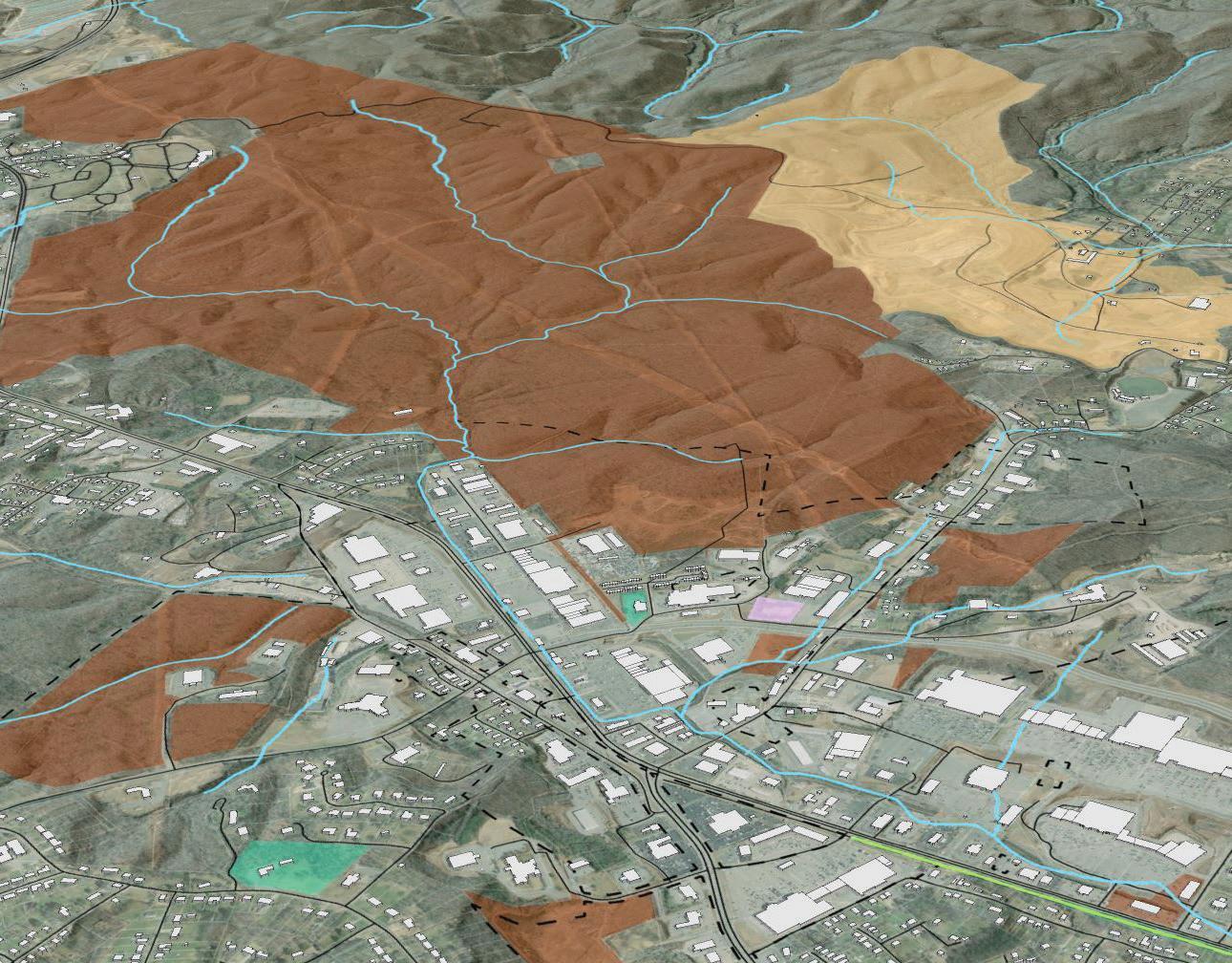
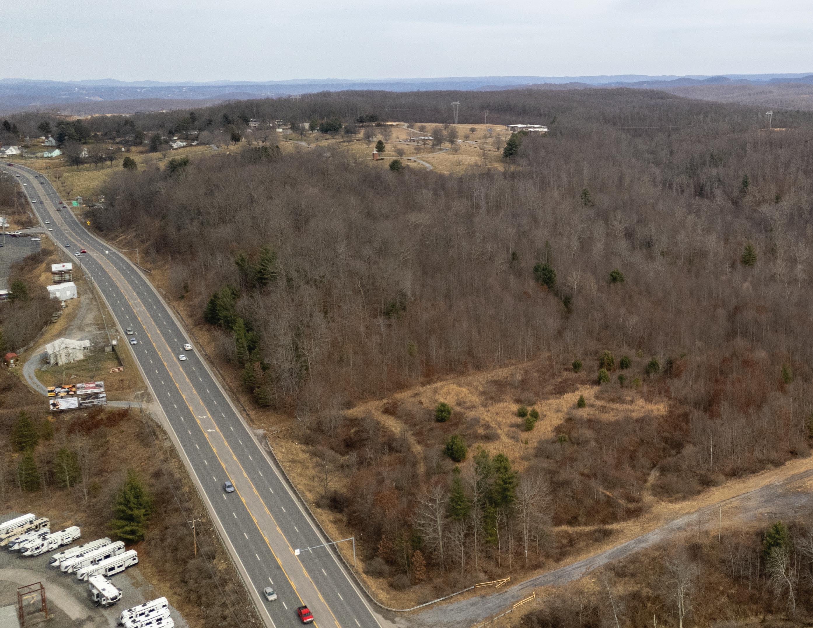
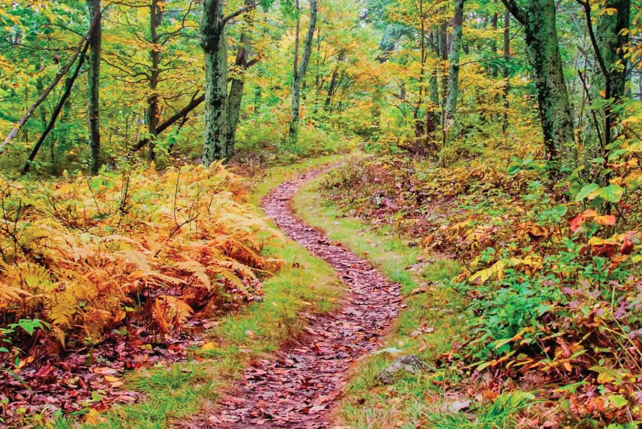
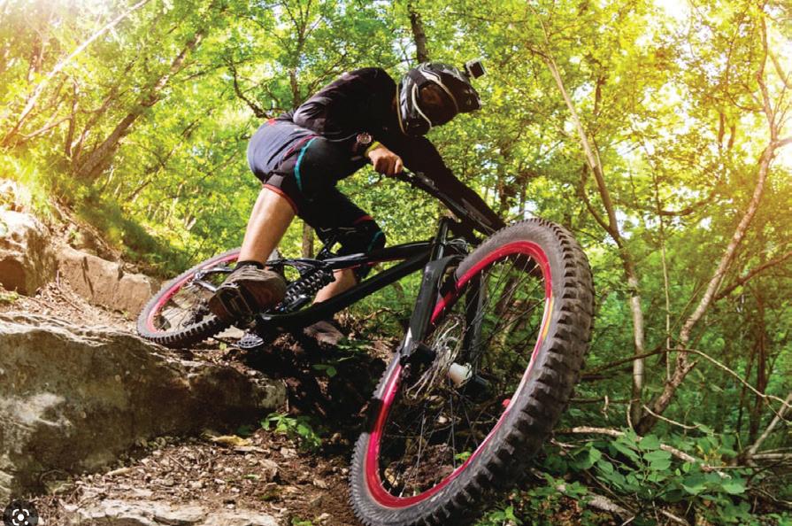
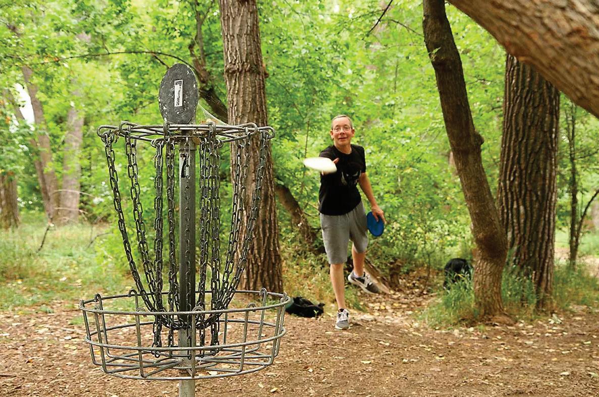
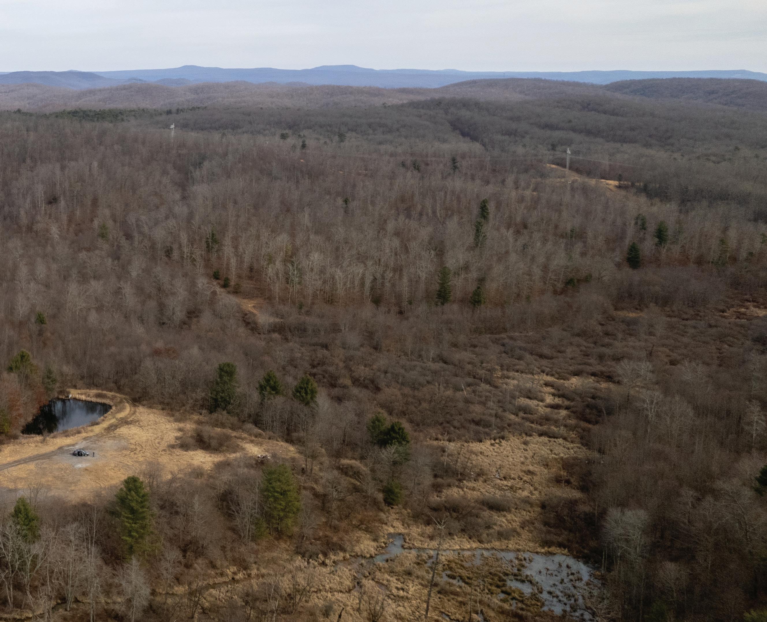

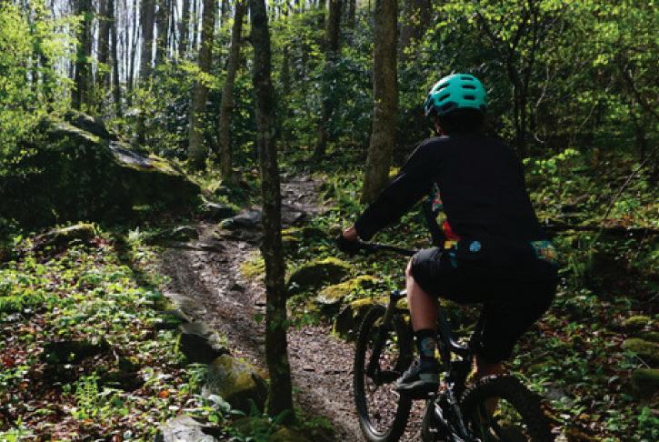
Bicycle connectivity and well-designed bike paths throughout the City of Beckley are essential for bolstering the outdoor economy by fostering mobility, enhancing accessibility to key areas, and promoting healthier lifestyles among residents. This not only contributes to a more activated Beckley, but also stimulates economic growth through increased patronage of local establishments, events, and recreational activities, showcasing the pivotal role of designated bike paths in the City’s growing outdoor economy.
While an in depth bicycle mobility plan is recommended, there are four primary connectors (see Map 11: Primary Bicycle Connectors, page right) that are essential for connecting key assets throughout the City of Beckley. Key facts for each of these connectors are highlighted to the right.
Specific Beckley Outdoor action items in support of the Bicycle Connectors include the following:
6.1. Comprehensive Bicycle Connectivity Plan. Develop a detailed bicycle mobility plan with city and state transportation officials, with a particular focus on the four (4) highlighted connectors.
CONNECTOR 1: BLACK KNIGHT TO WVU TECH CAMPUS/ DOWNTOWN
• Distance: ~2 Miles
• Key Roads: S. Kanawha Street
• Key Features: Black Knight; WVU Tech Campus; Downtown Beckley; Residential Neighborhoods.
CONNECTOR 2: DOWNTOWN TO NEW RIVER DRIVE
• Distance: ~1.75 Miles
• Key Roads: N. Kanawha Street; New River Drive
• Key Features: Downtown Beckley; Beckley Rail Trail; Proposed New River Drive Bike Park
CONNECTOR 3: BLACK KNIGHT TO PINEY CREEK PARK AND PRESERVE
• Distance: ~2.5 Miles
• Key Roads: S. Kanawha Street; Larew Ave.; Jersey Ave.; E. Beckley Bypass
• Key Features: Black Knight; Residential Neighborhoods; Piney Creek Park; Pine Crest Business Park
CONNECTOR 4: PINEY CREEK PARK AND PRESERVE TO PROPOSED CRANBERRY CREEK PARK
• Distance: ~1.75 Miles
• Key Roads: E. Beckley Bypass; Cross Stanaford Road; Beckley Shopping Plaza; Appalachian Drive
• Key Features: Piney Creek Park; Pine Crest Business Park
PROPOSED
CREEK
CITY
BLACK
WVU
PINEY CREEK
LEWIS MCMANUS RAIL
GREY FLATS MTB TRAILS
BIKE/PED CONNECTORS

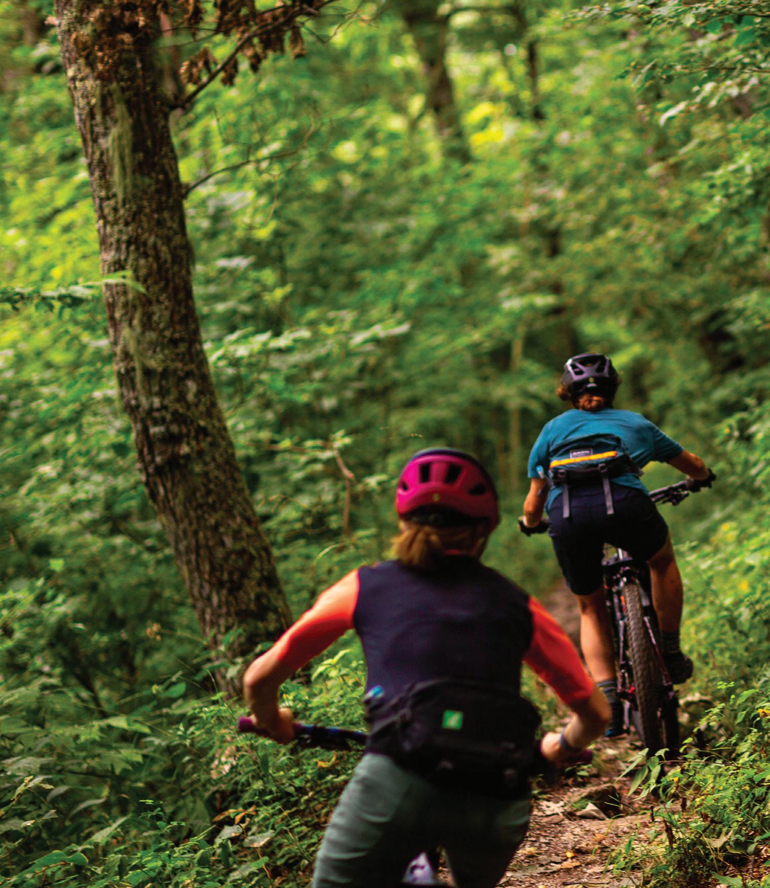

This chapter presents additional general recommendations for implementing Beckley Outdoors, highlights a summary matrix of all action items presented throughout the plan, and key grant funding organizations. This chapter is organized into the following sections:
In this Chapter:
5.1 General Recommendations
5.2 Implementation Matrix
5.3 Natural Surface Trail System Probable Cost Estimate
5.4 Key Grant Funding Opportunities

The Beckley Outdoors Action Plan provides a community-led vision and 15-year roadmap to create and enhance outdoor infrastructure that benefits both residents and visitors. The pursuit of any action or project must be underpinned by one or more of the six (6) guiding principles including: 1) Outdoor Recreation; 2) Connectivity; 3) Destination Villages; 4) Arts & Culture 5) Downtown Revitalization; and 6) Partnerships. The City of Beckley and its partners should consider seven (7) general recommendations as they work to implement the Beckley Outdoors Action Plan, which include the following:
1. BECKLEY OUTDOORS IMPLEMENTATION
COMMITTEE: Establish a Beckley Outdoors Implementation Committee (approximately 6-10 members) composed of representatives from local government, non-profits, key landowners, and other key stakeholder groups. The committee will meet quarterly to prioritize projects, identify appropriate funding sources, and dedicate appropriate staff levels to realize each project.
2. BECKLEY OUTDOORS PLANNER STAFF
POSITION: Beckley has proven itself as a leader in the outdoor economy by dedicating a staff person to this effort. Ensure that this staff position remains; this role is critical for solidifying partnerships with stakeholders, procuring funding, project management, maintenance and management planning, identifying marketing opportunities for completed projects, and generally implementing the Beckley Outdoors Action Plan.
3. BECKLEY PROMOTION: Demonstrate success of Beckley Outdoors by using the name and logo for all press releases, ground-breakings, and ribbon cuttings. Utilize Basecamp Beckley, the new city branding and strategy, for all general marketing and promotion of the
city and outdoor recreation. Partner with relevant CVBs (Convention & Visitors Bureaus) to better market outdoor recreation and trails and spread demand to lesser known areas.
4. ESTABLISH A TRAIL CREW AND MAINTENANCE PLAN: Develop a clear plan for operation and maintenance with the development of each additional asset. Establish a trail crew to help build new trails and maintain existing trails.
5. GATEWAY AND WAYFINDING SIGNAGE: In partnership with the NRG Regional Working Group’s regional wayfinding and branding subcommittee’s efforts, develop and implement detailed signage packages for gateway entrances to the city, vehicular wayfinding, and downtown pedestrian wayfinding.
6. PURSUE IMBA NEW RIVER GORGE RIDE
CENTER: Continue to work with the regional trails group to establish a Bronze Level IMBA Ride Center that is a world-class destination with a diverse range of highquality mountain biking experiences from beginner to expert trails and supports businesses like bike shops, restaurants, and lodging close to trailheads. (see page 124 below)
7. PUBLIC ART: In collaboration with Beckley Arts Council, develop a public art master plan for the city that features local artisans.
8. BECKLEY OUTDOORS SMALL-BUSINESS
INCENTIVE PROGRAM: Partner with NCGRDA to develop an incentive program to incubate and grow small businesses that support the outdoor economy.
9. TRAIL STEWARDSHIP PARTNERSHIP:
Partner with a trail stewardship organization to assist with the design, development and maintenance of the City of Beckley trail network.
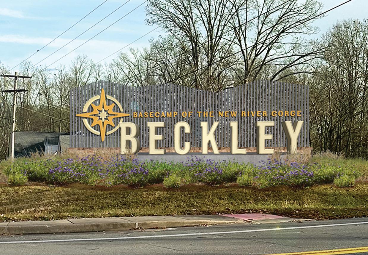
In addition to the opportunities mentioned above, the IMBA New River Gorge Ride Center initiative further propels the City of Beckley’s vision for outdoor excellence. Recognized by the International Mountain Bicycling Association (IMBA), a Ride Center is a world-class destination designed to provide a diverse range of high-quality mountain biking experiences from beginner to expert trails to supporting businesses like bike shops, restaurants, and lodging close to trailheads. This initiative, led by a collaborative regional working group focused on trails, aims to acquire the Bronze Level IMBA Ride Center designation to enhance outdoor recreation opportunities and foster economic growth by attracting mountain biking enthusiasts from far and wide.
Through a New River Gorge Outdoor Recreation Experience Gap Analysis and analyzing national outdoor recreation trends in urban and front country settings, it was apparent that the cycling user group has a significant opportunity to create a considerable positive impact in the City of Beckley.
A study on the Economic Impact of Mountain Biking in West Virginia indicated that spending by 1,000 non-local riders is estimated to generate $113,700 in direct economic impacts. This initial spending will generate an additional $58,700 in secondary impacts as these dollars circulate through the economy. In total, these expenditures would contribute $172,400 in business volume, support two jobs, and generate approximately $60,000 in wage and proprietor income. Tax impacts to the state and local economy are estimated at $13,000.
HUMAN-POWERED ADVENTURE RECREATION
INFRASTRUCTURE WITHIN A 45-MINUTE DRIVE OF BECKLEY.
WINTERPLACE SKI RESORT
3,500+ ESTABLISHED ROPED CLIMBING ROUTES. 2,000+ BOULDERING ROUTES
800+ MILES OF NAVIGABLE STREAMS AND THREE MAJOR LAKES WITH PUBLIC ACCESS (SUMMERSVILLE, PLUM ORCHARD, STEPHENS).
The significance of this initiative became evident when the United States Department of Agriculture (USDA) selected it
as a Rural Partners Signature Project, with the National Park Service serving as the lead supporting federal agency. This appointment is a testament to the initiative’s potential to drive positive regional change. By leveraging federal support and expertise, the Ride Center initiative has played a pivotal role in shaping the Beckley Outdoors Economic Action Plan.
Through collaboration with the local user group stakeholders, The City of Beckley’s Parks and Recreation Department, The Beckley Office of Outdoor Economic Development, and the Brad and Alys Smith Outdoor Economic Development Collaborative, the NRG Ride Center initiative has contributed invaluable insights and resources to the planning process.
Its inclusion in the broader vision for Beckley’s outdoor recreation infrastructure underscores the city’s commitment to embracing innovative approaches and partnerships.
As a result, the Beckley Outdoors Economic Action Plan is comprehensive and reflective of best practices for trail development and emerging trends in outdoor infrastructure and business development.
THE NATIONAL PARK AND SURROUNDING AREA HAS 150+ MILES OF PUBLIC HIKING AND SHARED-USE TRAILS. HOWEVER, THERE IS A REGIONAL LACK OF ADA-ACCESSIBLE TRAIL OFFERINGS, ART-THEMED TRAILS, AND NATURE TRAILS.
CAMPING CAN BE FOUND THROUGHOUT THE NATIONAL PARK AND SURROUNDING AREAS. HOWEVER, RELATIVE TO THE TRAFFIC OF THE NATIONAL PARK, THERE ARE LIMITED RV CAMPING AND PRIMITIVE CAMPING SITES AVAILABLE. MULTI-DAY BACKPACKING TRAILS: NONE
City of Beckley/ Paramount Dev. Corp./ Beaver Property Company
City of Beckley/ Paramount Development Corp.
City of Beckley/ New River Gorge Regional Development Authority/ Beckley Sanitary Board/ WVU Tech
of
PRIMARY INFLUENCER City of Beckley City of Beckley/ Paramount Dev. Corp. City of Beckley City of Beckley City of Beckley/ NRG Working Group
of Beckley/CVBs
of Beckley
DOWNTOWN BECKLEY FOCUS AREA
CRANBERRY CREEK FOCUS AREA
CREEK BIKE PARK
The Appalachian Regional Commission (ARC) is a federal economic development agency focusing on the Appalachian region that partners with states and local communities to make grants supporting a broad range of economic development categories. Investment priorities include projects related to community infrastructure, regional culture and tourism, and building businesses and workforce ecosystems.
The WVDEP’s Office of Abandoned Mine Lands and Reclamation (AML) administers federal funding for economic development projects on abandoned mine lands through its AMLER Program. This program helps projects located on or adjacent to mine sites that ceased operations prior to the signing of the Surface Mine Control and Reclamation Act (SMCRA) on August 3, 1977.
Managed by the West Virginia Department of Economic Development, Community Advancement and Development. LWCF provides matching grants to assist in the planning, acquisition, and development of state and local parks.
Managed by the WV Department of Environmental Protection Division of Water and Waste Management/ Office of Water Resources. The Stream Partners support stream and wetland mitigation projects that require land acquisition, establishment of a conservation easement, assessment, design, development of a final mitigation plan, construction and monitoring over a minimum of a 10 year period.
The Recreational Trails Program is a federal grant program designed to help states develop recreational trails. The West Virginia Department of Transportation administers the program and provides funds to support trail-related projects in local communities including land acquisition, trail construction, trail maintenance, and safety and education programs.
Administered by the WV Department of Economic Development, the TDA tax credit program allows increases in property tax based on the improvement associated with qualified economic development and public improvement projects to assist with their long-term financing.
Small grant to fund quick-action projects that can help communities become more livable for people of all ages.
NCHA grants support community efforts to preserve, interpret and promote the coal mining heritage of southern West Virginia. The National Coal Heritage Area management plan identifies interpretive themes for the area, which include: business of coal mining; working in coal; the company town; mining technology; and crisis and renewal.
A community-based project that aims to improve the health of West Virginians by supporting projects that increase access to physical activity. Funding is focused on improving the health of communities and can be utilized to improve pedestrian and bike infrastructure.
Managed by the WV Division of Highways, TAP is a reimbursable program for nontraditional transportation projects and includes funding for competitively selected projects including design and construction of on road and off road trail facilities for pedestrians, bicyclists and users of other non-motorized forms of transportation.
Community Grant that supports bicycle infrastructure projects and targeted initiatives that make it easier and safer for people of all ages and abilities to bike.