

WINTER 2022 CURRITUCK COUNTY, NC

PREPARED FOR
Currituck County, North Carolina
PRODUCED BY
Currituck County Department of Planning and Community Development AND

136 Furman Rd Suite 6 Boone, NC 28607 828.386.1866 | www.dbdplanning.com


ACKNOWLEDGMENTS
CURRITUCK COUNTY BOARD OF COMMISSIONERS
Mike H. Payment, Chairman
Paul M. Beaumont, Vice Chair Mary “Kitty” Etheridge
Selina S. Jarvis Kevin E. McCord
2040 VISION PLAN STEERING COMMITTEE
Troy Breathwaite Edward Cornet
Steven W. Craddock
Warren D. Eadus
Kimberlee Hoey Barry Lipman
Peggy Lusk Barbara Marzetti
CURRITUCK COUNTY STAFF
Donald “Ike” McRee, Jr. County Manager
Kevin Kemp Development Services Director
Laurie LoCicero, AICP Planning Director
Ben E. Woody, AICP Planning Director (previous)
Jennie Turner, CFM Senior Planner
Jason Litteral, CFM Planner II
Harry Lee, GIS Coordinator
Donna Voliva, CZO Assistant Planning Director
Bob White J. Owen Etheridge
David Palmer
Elizabeth White John Wright Jim Clark
Tammy Glave, CZO Senior Planner
Matt Kirkendall Planner
Savannah Newbern Planner
TABLE OF CONTENTS
INTRODUCTION 1
Background and Purpose 2
Planning Goals 3
Planning Process 4
CHAPTER 1: COUNTY PROFILE 7 History 8 Regional Context 14
Dominant Growth Related Conditions 15 Demographics 19
Land Suitability Analysis 22 Previous Plans 34
CHAPTER 2: PUBLIC ENGAGEMENT & GUIDING PRINCIPLES 41
Community Vision Statement 42
Tools of Engagement 44 Results 47 Guiding Principles 49
CHAPTER 3: RECOMMENDATIONS .................... 51 Chapter Overview 52
Role of Policies 53
Section 1: Planning Elements 54
Section 2: Geographic Focus Areas 70
CHAPTER 4: IMPLEMENTATION 97
Matrix Series 98
LIST OF MAPS:
Map 1: Regional Context 14
Map 2: Land Suitability Analysis 23
Map 3: Public Workshop Locations 46
Map 4: Currituck County Future Land Use 55
Map 5: Geographic Focus Areas 71
Map 6: Northern Mainland 72
Map 7: Northern Mainland Future Land Use 76
Map 8: Lower Currituck 80
Map 9: Lower Currituck Future Land Use 84
Map 10: Corolla 86
Map 11: Corolla Future Land Use 88 Map 12: Off-Road Area, Gibbs Woods, & Knotts Island 92
Map 13: Off-Road Area, Gibbs Woods, & Knotts Island Future Land Use 94
LIST OF EXHIBITS:
Exhibit 1: Planning Process Timeline 4/5 Exhibit 2: Land Suitability Analysis Axonometric Model 22 Exhibit 3: Transect Methodology 54 Exhibit 4: Rural Subdivision 57 Exhibit 5: Transitional Subdivision 57 Exhibit 6: Currituck Station Master Plan 58
Exhibit 7: Historic Moyock Village 59
Exhibit 8: Case Study: Harvesting the Power of Local Farms 62 Exhibit 9: Connect Currituck Pedestrian Master Plan 66
Exhibit 10: Case Study: Planning for Coastal Resilience 68 Exhibit 11: Village Subdivision 77 Exhibit 12: Moyock Village 77
Exhibit 13: Planning for Place: Civic Master Plans 78
Exhibit 14: Consider This: Northwest River Recreation Destination 79 Exhibit 15: Grandy Village 85
Exhibit 16: Corolla Conference Center at the Mid-Currituck Bridge 90 Exhibit 17: Consider This: Water-based Public Transit 90
Exhibit 18: Case Study: Citizen Science Enables Coastal Research 91
APPENDIX A: LSA FACTORS AND WEIGHTS BY GEOGRAPHY II
A.1 Land Suitability Analysis Factors, Rankings, and Weights
A.2 Land Use Development Topics
APPENDIX B: EXISTING CONDITIONS MAPS X
B.1 Fragile Areas and Areas of Environmental Concern
B.2 Soil Suitability for Septic Systems
B.3 Agricultural Soils
B.4 Water Quality Classifications
B.5 Flood Hazard Zones
B.6 Storm Surge Potential
B.7 Conserved Lands
B.8 Existing Land Use
B.9 Historic and Cultural Resources
B.10 Water Supply Network
B.11 Wastewater System
B.12 Transportation Network
B.13 Stormwater Service Districts
B.14 10 Digit HUC Watersheds
APPENDIX C: EXISTING CONDITIONS TABLES & LISTS .................................................................. XXIV
C.1 Permanent and Seasonal Population Projections
C.2 Impaired Waters
C.3 Locations of Recurring Drainage Problems
C.4 Characteristics of Existing Land Use Categories
C.5 Endangered Species
C.6 County Water System Current Conditions & Capacity Tables
C.7 Private Water Systems
C.8 County Water System Capacity Projections
C.9 County Wastewater Systems Current Conditions & Capacity Tables
C.10 Private Wastewater Systems
C.11 County Wastewater System Capacity Projections
C.12 Roads Providing Unacceptable Service
C.13 Currituck County 2012 Comprehensive Transportation Plan Highway Projects
C.14 List of Policies Exceeding Subchapter 7H
C.15 Existing Development Management Program
APPENDIX D: PUBLIC ENGAGEMENT INSTRUMENTS AND RESULTS XXXV
D.1 Fact Sheet
D.2 Summary of Survey Results
APPENDIX E: PRIMARY USERS AND ROLE OF IMAGINE CURRITUCK XLII
APPENDIX F: CAMA MATRIX FOR LAND USE PLAN ELEMENTS XLIV
APPENDICES..............................................................................................................................................................
I


INTRODUCTION
INTRODUCTION

BACKGROUND AND PURPOSE PLANNING GOALS PLANNING PROCESS

BACKGROUND AND PURPOSE
The Coastal Area Management Act requires each of the 20 coastal counties in North Carolina to produce and adopt a local land use plan that sets forth policies for growth. The Imagine Currituck 2040 Vision Plan satisfies this requirement for Currituck County and replaces the 2006 Currituck County Land Use Plan.

Currituck County is experiencing growth, shifting demographics, and increasing opportunities for new development. These factors create a need for a land use plan that incorporates citizen ideas and concerns regarding the changing physical and demographic landscape.
Imagine Currituck provides a framework for land use and development decision-making that updates and further refines policies set forth in the 2006 Land Use Plan. This plan strategically reduces the number of overall policies compared to the 2006 plan while also integrating several key planning elements to produce a comprehensive vision for the future.
THE PLAN IS ORGANIZED INTO FOUR CHAPTERS: 1. COUNTY PROFILE 2. PUBLIC ENGAGEMENT AND GUIDING PRINCIPLES 3. RECOMMENDATIONS 4. IMPLEMENTATION
PLANNING GOALS
This plan conveys a bold, long-range vision for Currituck County; it expresses community aspirations to strategically direct growth while protecting vital natural resources and landscapes.

From the onset of the planning process, four (4) goals were identified:
1. WORK TOGETHER. Engage citizens in a meaningful way through a participatory planning process.
2. STAY ON TARGET. Identify areas appropriate for varying densities of growth to maximize existing infrastructure and the preservation of rural landscapes and sensitive natural areas.
3. MAKE IT VISUAL. Produce a plan that is visually compelling and illustrates opportunities for growth and conservation.
4. KEEP IT REAL. Establish realistic priorities and specific steps for achieving plan recommendations.
// 3
PLANNING PROCESS

The Imagine Currituck Steering Committee and County planning staff achieved


PUBLIC ENGAGEMENT

4 // INTRODUCTION
plan development
MARCH-MAY ‘16 APRIL-JULY ‘16 JUNE-NOV. ‘16 Estab lish citizen Ste ering Committee with county-wide representation Re vie w existing plans Project branding Develop public engageme nt strategy Produce project website and establish ocial media presence
SETTING Identify existing and emerging conditions Develop custom infographics Field Visits Develop conceptual renderings for key growth or infrastructure improvement areas Perform Land Suitability Analysis
groups conducted by County sta
online questionnaire
Ideas, Insights, & Barriers Interactive Map
Media marketing campaign
Workshops conducted by County sta RESEARCH AND PRELIMINARY ANALYSIS
objectives during an extensive process. The plan process included five (5) major phases: 1) Direction Setting; 2) Research and Analysis; 3) Public Engagement and Visioning; 4) Plan Development; and 5) Final Plan Development and Adoption.
DIRECTION
Focus
Launch
Launch
Social
Public


// 5 D E C . ‘1 6 -JUNE ’ 1 7 Present results of research and analysis, public engagement, and conceptual schematics to County Commissioners and Steering Committee Finalize all renderings and schematics based on feedback Prepare and review with Steering Committee P L A N D EVE L OPMEN T JAN.- JULY ‘22 Review final document w Steering Committee Develop final presentation Public survey, hearing, and 45 day public comment period Final revisions after public comment Plan Adoption FIN A L P L A N D EVE L OPMEN T & A DO P T IO N IMAGINE CURRITUCK 2040 VISION PLAN SHINGLE LANDING RD CHURCH ST SUED: 11 16 1 2 2 2 3 3 6 5 5 4 6 TEM, 4 4 IMAGINE CURRITUCK2040 VISIONPLAN SHINGLE LANDING RD CHURCH SSUED:111 16 1 NOTES: 2 2 2 2 3 3 3 3 6 5 5 4 5 WALKABLE ENVIRONMENTORMWATERRAIN GARDEN* MIXED-USEINFILLDEVELOPMENT OUTDOOR DINING ONTREET ARKING PEDE TRIANSCALEDSIGN GE RAINGARDENS BE ONNECTED OFLARGER ORM TER TEM, 4 E T T B E SI G N EXHIBIT: 1

CHAPTER 1: COUNTY PROFILE
This chapter provides a comprehensive profile of Currituck County and includes five (5) parts:

1. HISTORY. The first section examines the County’s history from colonial settlement to its establishment as a “sportsman’s paradise” and present-day vacation destination.
2. REGIONAL CONTEXT. This section provides an overview of Currituck County’s regional context both geographically and spatially as it relates to centers of growth and development.
3. DEMOGRAPHIC TRENDS. An assessment of existing and projected demographic trends reveals some of the County’s greatest challenges for managing future growth.
4. LAND SUITABILITY. The Land Suitability Analysis evaluates the physical environment to identify land most suitable for development.
5. PREVIOUS PLANS. The last section provides a summary of previous planning efforts throughout the County.
A HISTORY OF PROGRESS
COLONIAL SETTLEMENT


Currituck County’s original residents were the Algonquin Native Americans. The name Currituck is derived from the Algonquin word Coratank, meaning “Land of the Wild Goose.” Beginning around 1650, former indentured servants from the colony of Virginia braved the Great Dismal Swamp to settle in what is now Currituck County. The Carolina Charters (1663 and 1665) further attracted settlers with land grants. The County was established soon after in 1668 and is one of the five original ports in North Carolina.
ALBEMARLECHESAPEAKE WATERWAY

Open for commerce in 1859, the Albemarle-Chesapeake Waterway is a canal segment of the Atlantic Intracoastal Waterway that connects the Chesapeake Bay to the Albemarle Sound. The canal divides the Currituck Mainland into northern and southern geographies. The Intracoastal Waterway established a vital shipping route that provides free passage to vessels from Maine to Florida. The Waterway played a significant role in World War II by providing safe passage for military cargo vessels from enemy submarines off the Atlantic.
SPORTSMAN’S PARADISE
Ease of access, facilitated by the Albemarle-Chesapeake Canal, increased visitation to Currituck’s stunning landscapes. By the late 1800’s the County had earned a reputation as a “Sportsman’s Paradise” for its abundance of fish and game, particularly, water fowl. Wealthy industrial capitalists established numerous hunt clubs. The historic Whalehead Club in Corolla is the most well-known.
8 // CHAPTER 1
PHOTO FROM: CURRITUCK CO. DEPT. OF TRAVEL AND TOURISM
PHOTO FROM: CURRITUCK CO. DEPT. OF TRAVEL AND TOURISM
POST WWII
During the Great Depression and World War II, the population of Currituck slightly decreased. Post-war, the population grew modestly with the County experiencing a 12.5 percent increase from 1950 to 1970. In the 1970s, population and residential development began to grow dramatically due to the in-migration of workers and their families from the Hampton Roads area of Virginia. These new residents settled in the Moyock township of northern Currituck in close proximity to their jobs.

Prior to the influx of workers and professionals from Virginia, agriculture was the dominant employment sector for the County. Consistent with the national trend, farming as a career path and lifestyle declined dramatically. Manufacturing, military operations, and trade industries located outside of the County became the primary employers of Currituck residents.
PRESENT DAY
Today, Currituck remains a vacation destination that attracts hundreds of thousands of visitors a year to its beaches, bays, and marshes. Tourism is a major employer and economic driver that has resulted in significant development and infrastructure investment in the Outer Banks community of Corolla. The Off-Road Area north of Corolla has seen limited development due to the absence of road infrastructure and the Coastal Barrier Resources Act (COBRA) designation that prohibits the issuance of federally subsidized flood insurance or other federal investment in the area.
For the Currituck Mainland, the trends of the 1970s persist today. The vast majority of the workforce commutes outside of the County for employment. Development pressure from the Hampton Roads Area has intensified and the growing residential population has created a demand for additional county services.
Conservation is a citizen priority on both the Mainland and the Outer Banks. Balancing this priority with current and impending growth presents both a challenge and an opportunity for Currituck County.

// 9 C OUNT y P RO f ILE
PHOTO FROM: CURRITUCK CO. DEPT. OF TRAVEL AND TOURISM
HISTORIC AND CULTURAL AREAS
HISTORIC PRESERVATION COMMISSION
Currituck County recognizes the value of its historic heritage and in 2017 the Board of Commissioners established a Historic Preservation Commission in order to safeguard county heritage by preserving local landmarks. The Historic Preservation Commission maintains an inventory of properties of historical significance that are eligible to apply for local landmark designation.
NATIONAL REGISTER OF HISTORICAL AND CULTURAL RESOURCES
There are several significant historical and cultural resource sites within Currituck County that are either listed in the National Register of Historic Places or are included in the inventory of Currituck County’s own Historic Preservation Commission (see Map B.9 in Appendix B).
Baum Site
The Baum site contains three Colington phase ossuary burials and is within the traditional Carolina Algonkian distribution. The Baum site is and has been subject to erosion and is located on the Currituck Sound.
frame dwelling with a gable roof. It has two wing additions and a one-story front portico. Also on the property are two outbuildings and a family cemetery.
Currituck Beach Light
Coinjock Colored School
Coinjock Colored School is a historic Rosenwald school building for African-American students, originally located at 4358 Caratoke Highway in Coinjock, the building was moved to the east side of Caratoke Highway in 2016. It was built in 1920, and is a one-story frame, side-gable-roof, two-classroom school building with American Craftsman style design elements. The school was one of three Rosenwald schools built in Currituck County during the period 1921 to 1927 and it housed a school until 1950.
Culong House
Culong, also known as the Thomas Cooper Ferebee House and Forbes House is a historic home located in Shawboro; built in 1812, it is a two-story, three bay by three bay Federal style
First lit in December 1875, the 162 foot high Currituck Beach Lighthouse in historic Corolla Village towers above the northern Outer Banks landscape. Similar to other lighthouses on North Carolina’s Outer Banks, the Currituck Beach Light still serves as a navigational aid and can be seen for eighteen nautical miles. The Currituck Beach Lighthouse was the last major brick lighthouse built on the Outer Banks and to distinguish it from other regional lighthouses, its red-brick exterior was left unpainted. The site was listed in the National Register of Historic Places in 1973 and after extensive maintenance and restoration by the Outer Banks Conservationists (OBC), the lighthouse was opened to the public in 1990. Today this impressive landmark offers adventurous visitors who climb its 220 winding steps a panoramic view of Currituck Sound, the Atlantic Ocean, and the Currituck Outer Banks.
10 // CHAPTER 1
Currituck County Courthouse and Jail
The original two-story section of the courthouse was built about 1842, enlarged in 1897, and a rear wing was added in 1952. An 1897 remodel added a second floor to the original one-story wings and Classical Revival style design elements. The jail was built circa 1857 and is a two-story, rectangular building with 32 inch thick brick walls. It is one of the oldest existing jails in North Carolina.
students and histories of all the Colored Schools in Currituck County, North Carolina.
Currituck Shooting Club (Gone)
Currituck Shooting Club was a historic shooting club located in Corolla. The clubhouse was built between 1879 and 1882, and consisted of three connected sections. Also on the property were a boatmen’s house, and boathouse complex, and scattered outbuildings. The Currituck Shooting Club was formed in 1857, and was the oldest active shooting club in the United States. The complex burned to the ground on March 20, 2003.
Flyway Club
Flyway Club is one of a small number of remaining fowl hunting lodges established in the early twentieth century in the northeast corner of North Carolina. Composed of a large late 1920s farm building and a large two-story, multi-gabled hunting lodge from 1960, it stands on the east shore of the Currituck Sound. The farm building, constructed from 1928 to 1930, is a local example of a substantial outbuilding designed both to contribute to the operation of the estate and to house workers who labored at Flyway Club.
Grandy School
Grandy School is a historic school that was built in 1908. It is a tall, one-story, frame building with Late Victorian and Colonial Revival style design elements. It has a gable roof and features a tall central bell tower.
Shaw House
Shaw House, also known as Cupola House, is a historic home located in Shawboro. It was built about 1885, and is a two-story, three bay by two bay, Italianate style frame dwelling on a brick foundation. It features a three-story tower and has a two-story rear wing.
Twin Houses
Twin Houses is a historic home built circa 1797, it consists of two separate two-story, five bay by two bay, identical Federal style structures, joined by a transverse hall. Col. Henry Shaw and his wife are buried at the property.
Whalehead Club
Jarvisburg Colored School
Jarvisburg Colored School is a historic school building for African-American students. It was in service from 1868 until 1950 when Currituck opened a Consolidated School and closed all the small African American county schools. The Jarvisburg Colored School is a two-story, frame building built of cypress wood with Queen Anne style design elements. It last housed a school in 1950. Today, the Jarvisburg Colored School serves as a Museum to share the stories of former
The Whalehead Club is a 21,000 square foot mansion representing the Art Nouveau style of architecture. The structure was completed in 1925 and subsequently added to the National Register of Historic Places in 1980. Originally situated in an isolated area of the Outer Banks overlooking the Currituck Sound, the home served as a retreat for the owners and their frequent guests. Over the years the site has been repurposed many times, in turn being a Coast Guard recruitment base, educational institution, and aviation test site. Today, the County-owned site has been fully restored and functions as a public museum and
// 11 C OUNT y P RO f ILE
event venue.
Wilson Walker House and Walker-Snowden Store
The 1876 Wilson Walker House and 1895 WalkerSnowden Store are on the south side of Courthouse Road, directly across from the Currituck County Courthouse. The house replaced an earlier 1850 house on the site and several outbuildings on the property were built around the time of the earlier house but remain on the parcel and are contributing resources. The store is a single-story, frame structure with a false front parapet hiding a front gable roof. A small grouping of outbuildings including the 1850 Walker Cottage, 1852 kitchen, 1859 smokehouse, 1950 shed and 1920 office are located to the rear, south and west of the house and store. To the far south of the parcel is a small family cemetery.
12 // CHAPTER 1

// 13 C OUNT y P RO f ILE
REGIONAL CONTEXT
Currituck County is located in the Albemarle region of North Carolina. It is also part of the Hampton Roads, Virginia Metropolitan Statistical Area (MSA) which includes Norfolk, Chesapeake, and Virginia Beach.

Hampton Roads is a major center of commerce, boasting the only deepwater port in the mid-Atlantic region. Currituck County is linked to the Hampton Roads area via Caratoke Highway (NC Highway 168/US Highway 158), the Intracoastal Waterway, and major rail lines.
Bound by the Atlantic Ocean to the east, and Currituck Sound to the west, the Currituck Outer Banks are a major tourist destination. From the seclusion of the Off-Road area to the resort-like atmosphere of Corolla, Currituck’s barrier island attracts tens of thousands of visitors every year. Caratoke Highway provides the primary point of access to the Outer Banks, transporting visitors through the mainland and across the Currituck Sound.
The Currituck Outer Banks is just one of the diverse landscapes that encompass this coastal county. Residential areas and agriculture still dominate the mainland but the nature of those uses vary from north to south along Caratoke Highway. The remote locations of Knotts Island and Gibbs Woods have their own distinct characteristics with long expanses of sound shoreline and marsh. With water separating different geographies of the county, Currituck faces unique challenges as it plans for the future.
CHAPTER 1 14 //
MAP: 1
DOMINANT GROWTH RELATED CONDITIONS
GENERAL
Currituck County’s population has expanded by over 4,500 people between 2010 and 2020, a 19% increase in population. This trend is projected to continue as the county population is expected to grow by nearly 8,000 over the next two decades. Growth is attributable to several factors including close proximity to the metropolitan area of Hampton Roads, Virginia and Dare County, low taxes and housing costs, a high quality of life, good schools, and an abundance of desirable shoreline property. With no incorporated municipalities to provide services, it is the responsibility of the county government to provide most of the public services required by an increase in residents.
Currituck is surrounded by sounds, canals and bays and the landscape is rife with creeks, slues and ditches. As the county grows and develops, a major concern is the impact of new development on the quality of these surface waters as well as groundwater. The mainland is experiencing a conversion from rural farmland to exurban, even suburban, bedroom communities. With this conversion, it is important for the county to provide infrastructure, such as water and sewer, and to regulate stormwater to limit negative impacts to the environment. Being a low-lying coastal county with significant swaths of poor draining soils and a high water table, handling stormwater is a paramount issue for new development. Stormwater management should address runoff quality as well as runoff quantity.
Even with the conversion of farmland to residential neighborhoods, there are large portions of the mainland with active farming and agriculture is still a major driver of Currituck’s economy and culture. As a number of factors make farming less attractive, the trend of losing farmland to
other uses is expected to continue. The effect of this conversion will impact the mainland significantly over the next decade. Balance will need to be achieved between these new uses and Currituck’s traditional rural character and natural environment.
Another factor concerning growth in Currituck is the Mid-County Bridge. The Mid-County Bridge is a proposed transportation project that will connect the mainland in Aydlett to Corolla and continues to be a major issue on both sides of the Currituck Sound. This project has been in the planning stage for decades and has been designated for funding in the 2020-2029 Statewide Transportation Improvement Program. The bridge has been a divisive issue and will certainly change the pace and possibly the character of development both on the Mainland and the beach. Proponents of the bridge believe it is very much needed to improve east-west travel, enhance economic development, and provide better delivery of services to the Currituck Outer Banks. Opponents of the bridge are concerned about environmental impacts and changes to quality of life. In December 2021, the US District Court for the Eastern District of North Carolina ruled in favor of the NC Department of Transportation and Federal Highway Administration (FHWA) for constructing the Mid-Currituck Bridge. This is the most recent legal decision in the history of this project but the decision may be appealed by bridge opponents. After the court decision, NCDOT representatives indicated the Right of Way/Design-Build Let process will be delayed until June 2024 due to the uncertainties about legal challenges.
// 15 C OUNT y P RO f ILE
NORTHERN MAINLAND
The dominant growth related concerns for this area include the conversion of farmland to residential development and the associated challenge of maintaining existing infrastructure and expanding new infrastructure to support this conversion. There is residential growth countywide, but the Northern Mainland is experiencing the most intense residential development pressure. With a close proximity to the military installations and support industries of the Virginia’s Hampton Roads region, northern Currituck County is an attractive place for young families and military retirees to relocate. A majority of the soils on the Mainland have “severe limitations” for on-site septic systems, as illustrated by the Soil Suitability Map (See Appendix B.2). Currently there are four wastewater treatment plants (one private facility and three county-owned facilities) in the Northern Mainland which can serve more than just a single development. The service districts of these four WWTPs are limited but have the ability to be expanded. For public water, the County is
LOWER CURRITUCK
Lower Currituck soils are generally more suitable for on-site septic systems but due to extensive shoreline and wetland areas, there is less land available for development. This geography has not seen the same market demand for residential development as in other areas of the County such as Corolla and Northern Mainland but it is experiencing steady home building. The limited availability of infrastructure, including water and sewer, along with land use classifications established by the Future Land Use map, have influenced development patterns in this area of the county. Water lines are in place along the length of Caratoke Highway for access by future development to but only a small portion of existing neighborhoods are served by County water. One public WWTP is located in the Grandy area of
currently producing 1.6 million gpd at the Maple plant. Expansion of this facility and the associated distribution infrastructure are being planned and budgeted by the County Utilities Department in order to meet demands. Residential growth should be directed toward the existing and planned water and sewer infrastructure to limit the potential negative impact on groundwater quality from development. Drainage and stormwater are also major factors with the residential growth in the Northern Mainland. As impervious surface is increased in an area of poor draining soils and low elevation, there is potential to negatively impact water quality. State stormwater standards address water quality and County standards address water quantity. New residential developments must meet both local and state requirements. The Moyock Stormwater Service District was modified in 2021 to consolidate existing districts and expanded to encompass most of Moyock Township.
Lower Currituck. Agricultural fields dominate segments of Lower Currituck’s landscape along with pockets of neighborhood-scale commercial uses. This region of Currituck has experienced growth for support services for the Outer Banks’ beaches, along with visitor attractions such as the local vineyard, NC’s oldest microbrewery, sound accesses, farm markets, golf courses, and an outdoor waterpark. Because of the location near the Wright Memorial Bridge and few north-south alternative routes, heavy tourist traffic during the summer impacts residents in this geography of the County. A challenge for Lower Currituck is to balance the visitor and support service businesses with enhancing the sense of community for its residents.
16 // CHAPTER 1
COROLLA
The Corolla area of the Currituck Beaches has mostly been developed in Planned Unit Developments (PUDs) to create a resort-type beach community. PUDs are a development type expected to promote a more efficient use of land, a higher level of amenities and more creative design than would otherwise be possible. There are a few undeveloped phases of approved PUDs in Corolla where additional commercial, mixeduse and residential development is expected. A few areas in Corolla were developed as more traditional subdivisions and there is potential for new development or redevelopment in these subdivisions as well. As a county, providing services for tens of thousands of weekly visitors during summer months then scaled down to just over a thousand residents in the off-season can be complicated.
Corolla continues to struggle with stormwater management, traffic, and access to beaches and sound access. Drainage is a major concern with new development as well as existing development. Stormwater issues in older subdivisions such as Whalehead and Ocean Sands, have resulted in the county creating stormwater districts in order to implement infrastructure projects to improve stormwater management for these neighborhoods. Another issue is the demand for larger dwellings with more bedrooms and amenities, both as new structures on vacant lots and as redevelopment in older neighborhoods. Larger houses can result in more summer visitors with increased stresses on infrastructure and services, such as roads, utilities, and beach accesses.
OFF-ROAD AREA, GIBBS WOODS, & KNOTTS ISLAND
The Off Road Area is one of the most unparalleled landscapes in Currituck County. It is only accessible by boat or by driving on the beach strand in a four wheel drive vehicle. Neighborhoods are accessed by sand roads. Much of this land area was subdivided into small sized lots prior to the County’s adoption of subdivision regulations. Since the Off Road has such hindered access, only about 25% of available lots have been developed. Extensive wetlands and natural habitat areas characterize much of the Off Road with an abundance of wildlife and maritime forests. Even without improved roads, this area is struggling with the same growth-related concerns that Corolla is experiencing since residents and visitors alike find this geography tremendously appealing. This portion of the beach has been designated by Congress as a Coastal Barrier Resource Act zone; Federal grants and programs are not available, including federal flood insurance. Recent changes to the adopted FEMA Flood Insurance Rate Maps in 2018 have drastically reduced the Special Flood Hazard Areas and the need for flood insurance to obtain mortgages. This map change has resulted in an increase in development of single-family
homes in the Off-Road Area. With the majority of substandard lots platted prior to regulation, minimum basic infrastructure, and lack of easy access, planning for growth in this subarea of the county is challenging. The entire Off-Road area is zoned for very low density residential use and associated accessory uses. Public safety and utility uses are allowed, while commercial, office, and industrial uses are prohibited.
Gibbs Woods is predominantly residential, with large portions in agricultural use and much undeveloped land. Its transportation linkages tie this area as much to Tidewater Virginia as to Currituck County. Water and sewer infrastructure are not available. The current land use regulations allow creation of larger lots and prohibits most non-residential uses. Due to the proximity to the City of Virginia Beach, Gibbs Woods is seeing the conversion of farmland to large-lot residential development. The area is remote with substantial wetlands along the sound and creek shorelines.
Knotts Island represents the smallest developed subarea of the County with Mackay Island National Wildlife Refuge occupying most of this
// 17 C OUNT y P RO f ILE
territory. Infrastructure concerns and increased density pressures from the Hampton Roads area represent the dominant growth related issues for the residents. Having no central water or sewer system, a very high seasonal water table, limited access, and extensive wetlands on the western half of the island all give reason for lower density development in this area. Additionally, issues
concerning the preservation of the small town rural character and environmental protection are important for residents as pressure for more residential development and limited commercial development continues.

18 // CHAPTER 1
DEMOGRAPHIC TRENDS

This section provides an overview of key demographic factors within Currituck County including population, age, education, income, employment, housing and racial composition.


POPULATION HERE WE GROW!
Currituck County is the fastest growing county in the Albemarle region. The current permanent population is 28,100 (2020 Census). This represents an increase of 19 percent from the the 2010 estimate of 23,547. The permanent population is projected to grow another 21 percent by 2035. This growth rate is consistent with the projected growth rate for North Carolina (20.5 percent).
Currituck County’s visitor population is also projected to continue its upward growth trend. Peak seasonal population in 2015 was estimated at 50,000, including full-time residents.* In 2025, the projected peak seasonal population is 62,924, including full-time residents.*
*Growth rates and totals for permanent and seasonal population projections were derived from the Office of NC State Demographer, county records for certificates of occupancy, and realtor estimates for rental unit occupancy during peak weeks in the outer banks. (see table C.1 in Appendix C for detailed population projections).
By 2035, the 65+ age group is expected to increase by 112 percent and will account for 22 percent of the total population
AGE DISTRIBUTION
THE GENERATION THAT KEEPS ON BOOMING
By 2035, Currituck County’s population is expected to increase by 21 percent or 5,955 persons.

Over the next 15 years, Currituck County is expected to experience growth in every age bracket. The most significant growth is expected to occur in the 65 and older cohort. By 2035, the 65+ age group is expected to increase by 112 percent and account for 22 percent of the total population, slightly higher than state and national rates. The projected increase in adults over the age of 65 demonstrates a need to plan for senior housing and services. Currently, Currituck County’s population is distributed accordingly: ages of 0-19 represent 22.6%; ages 20-34 represent 17.7%; ages 35-54 represent 26.9%; ages 55-64 represent 16.2%; and ages 65+ represent 16.4% of the total population.

// 19 C OUNT y P RO f ILE
EDUCATIONAL ATTAINMENT
Eighty-five percent of Currituck residents over age 25 possess a high school diploma, identical to the statewide rate. The Hampton Roads MSA reports a slightly higher rate, approximately 87 percent. Approximately 19 percent of Currituck County citizens possess a bachelor’s degree compared to 27.8 percent for North Carolina citizens and 25 percent for the Hampton Roads MSA.
EMPLOYMENT AND COMMUTE PATTERNS
The County’s top four industry sectors for employment are Government, Retail Trade, Educational Services, and Accommodation and Food Services. According to 2017 & 2018 data from the North Carolina Department of Commerce, Government sector jobs comprise 14.2% of all industry jobs, Retail & Trade comprise 18.4%, Educational Services comprise 13.7%, and Accommodation and Food Services comprise 12.7%. Together, these four major sectors make up 59% of Currituck County’s Economy. The unemployment rate is among the lowest in North Carolina at 4.5 percent. Currituck
ECONOMY & INCOME
Tourism is the primary driver of the economy and provides a significant job presence in the Retail Trade and Accommodation and Food Services sectors. These sectors, along with Government and Education, account for more than half of the total jobs in Currituck County.
19.2 % O f CURRITUCK COUNT y CITIZENS POSSESS A BACHELOR’S DEGREE COMPARED TO 27.8 % f OR NORTH CAROLINA.
County’s job growth rate has far outpaced the state since 2012.
Eighty-one percent of Currituck’s work force commutes out of the County for employment.* 41% of those who leave the county for work are commuting to the Hampton Roads area of Virginia. High commute rates result in retail leakage in which resident spending occurs outside of the county. This creates an imbalance between the services provided by the county and the sales tax revenues received.
Median household income in Currituck ($69,964) was significantly higher than North Carolina ($54,602) in 2019. Elevated income levels can primarily be attributed to the high percentage of county residents who commute to high-wage maritime commerce and defense jobs in the Hampton Roads area.
20 // CHAPTER 1
*Currituck County workforce commute destinations: 19% to Dare County, NC; 41% to Virginia; 40% to other NC counties
HOUSING
Approximately 67 percent of Currituck’s housing stock is occupied year-round by the County’s permanent population of 28,100 resulting in an average of 2.6 people per dwelling unit. To accommodate the projected permanent population increase, Currituck will need to add 154 dwelling units per year for the next 20 years. According to the number of Certificates of Occupancy issued by the county between 2014 and 2021 there is currently an average of 328 new units being developed per year.

New housing should be encouraged to take a range of forms in order to diversify the current housing stock of predominantly single-family homes. A balanced mix of housing types will position the County to accommodate the needs of the aging population and preferences of young professionals moving to the area.
COST OF LIVING AND COST BURDENED HOUSEHOLDS
Households that spend more than 30 percent of their income on housing are defined as “costburdened.” Over 34 percent of homeowners and 57.5 percent of renters are considered costburdened in Currituck County. Both figures for Currituck are above state and national rates for cost-burdened households.
RACIAL AND ETHNIC COMPOSITION
The population of Currituck County is less racially and ethnically diverse than that of North Carolina. In 2015, 90.4 percent of the population was white, 6 percent was African American, and 3.7 percent identified as Latino or Hispanic. Consistent with
the statewide trend, Latinos represented the fastest growing ethnic group.
THE MEDIAN HOUSEHOLD INCOME O f CURRITUCK RESIDENTS IS 28% GREATER THAN f OR NORTH CAROLINA AS A WHOLE.

// 21 C OUNT y P RO f ILE
*Housing
*(351 UNITS) *(2,270 UNITS) *(13,185) UNITS
type data from 2015-2019 ACS
> NEEDED PER YEAR
LAND SUITABILITY ANALYSIS

The Land Suitability Analysis (LSA) identifies key areas most suitable for development, while highlighting vital areas for conservation.
The LSA evaluates numerous criteria to determine land suitability, including existing development, infrastructure, conservation areas, and hazard areas. The LSA breaks the County into four geographic units of analysis: Mainland; Knotts Island; Corolla; and the Off-Road Area. The analysis weighs each factor within the context of the geographic area. For example, the presence of storm surge areas has greater significance for Corolla, due to its location, than for the Mainland. Differences such as this are accounted for as numeric weights determined by the Steering Committee.
For a complete list of factors, rankings, and weights for each geography, see Appendix A.
The Land Suitability Analysis identifies key areas most suitable for development, while highlighting vital areas for conservation.
CHAPTER 1 22 //
EXHIBIT: 2
THE FACTORS

LSA factors are organized into four major categories: Existing Development; Infrastructure; Environment and Natural Systems; and Hazard Areas.
EXISTING DEVELOPMENT

The LSA includes a detailed inventory of land uses within Currituck County. The analysis identified 43,527 acres of developed land in the County. Residential uses account for the highest percentage of developed land (11%). Proximity to existing development is preferable for new growth and redevelopment. New development can take advantage of an existing infrastructure network which makes the provision of services more cost effective for the County. Concentrating development to a defined area also protects the surrounding rural landscapes and natural habitat that constitute the primary land use for 85 percent of land in Currituck County. See Map B.8 in Appendix B for details on existing land use in the County.

 CURRITUCK KNOTTS ISLAND
OFFROAD AREA
COROLLA
MOYOCK
SLIGO
BARCO
CURRITUCK KNOTTS ISLAND
OFFROAD AREA
COROLLA
MOYOCK
SLIGO
BARCO
POINT
SHAWBORO POWELLS POINT
HARBOR HARBINGER
GRANDY
HIGH SUITABILITY MEDIUM SUITABILITY LOW SUITABILITY LOWEST SUITABILITY MAP: 2
COINJOCK AYDLETT POPLAR BRANCH
JARVISBURG Legend
INFRASTRUCTURE
TRANSPORTATION
Land within close proximity of primary roads scores higher in the suitability analysis because it maximizes the use of existing road infrastructure. Caratoke Highway (US 158/NC168) provides an important connection for commerce and tourism between the Hampton Roads Area, northeast North Carolina, the Currituck Mainland, and the Outer Banks. It bisects the Mainland and carries traffic from the state line to the Wright Memorial Bridge. Several collector roads and rural highways branch off from Caratoke Highway to form the Mainland’s road network.
Two major NCDOT projects are planned that will alleviate traffic and provide essential connections within and through Currituck County: the MidCurrituck Bridge and East-West Connector. See map B.12 in Appendix B.
On mainland Currituck, most development, residential and non-residential, occurs along Caratoke Highway or within easy access to this thoroughfare. In the northern mainland, the majority of commercial uses are located along Caratoke Highway are or easily accessible to the thoroughfare. Residential developments typically occur on secondary roads but near Caratoke Highway for quick access for daily commuters. Commercial uses in the lower portion of the Mainland tend to involve tourist destinations, retail sales, services and warehousing adjacent to Caratoke Highway related to the support of the Outer Banks resort/retirement economy. Several collector roads and rural highways branch off from Caratoke Highway to form the Mainland’s road network, connecting to agricultural and residential areas. Residential neighborhoods in Lower Currituck are located with their main collector road entrance onto Caratoke Highway or to a major secondary road that connects to the highway. The propagation of this interconnected road network in both sections of the mainland
is important to give residents alternative routes during times of heavy tourist traffic along Caratoke Highway.
NC Highway 12 is the primary road corridor serving the Outer Banks. Much like Caratoke Highway on the mainland, development in Corolla occurs on or with close access to NC 12. The corridor links a majority of residential and recreational/conservation land uses with limited commercial uses in Corolla and the surrounding area. Because most drivers use NC 12 in Corolla to move to a destination, it also experiences heavy traffic during tourist season.
The Off-Road Area is accessed by sand roads and by driving on the beach where beach parking is permitted. The area comprises large areas of protected wildlife preserves and is the last remaining habitat of the Corolla Wild Horses.
Gibbs Woods and Knotts Island are rural communities dominated by the presence of conservation lands and are geographically isolated from both the Currituck Mainland and Outer Banks. Knotts Island is accessible via NC615 and the NCDOT Knotts Island Ferry while Gibbs Woods is accessible through a rural road network that links to Hampton Roads area.
Along the Atlantic Intracoastal Waterway in the Coinjock, there are several commercial uses accessible for boaters. Development is clustered in several small communities including Currituck, Maple, and Barco. The Currituck County airport serves the area as well. From small plans with agriculture priorities to use by tourists with small or private jets, the airport is growing and is an impressive asset for a county with a small population.
24 // CHAPTER 1
WATER SUPPLY SYSTEMS
All potable water systems in the County are supplied from ground water sources tapped by public and private water supply systems. Therefore, there are no surface water supply watersheds within the County. There are two public water systems operated by Currituck County: the Mainland System and the Southern Outer Banks Water System (SOBWS). SOBWS became the sole provider of potable water in Corolla after acquiring several private systems in 2011. Collectively, these systems have the capacity to produce approximately 5 million gallons of water per day within existing facilities. At current peak demand, the County produces 4.5 million gallons of water per day. In addition to the County systems, there are four private water supply systems in Currituck. These systems were designed to serve finite demands of specific developments and may not be designed for future expansion. According to NCDWR, there are no documented overflows, bypasses or other problems with the public or private water supply systems that may degrade water quality or constitute a threat to public health.
Peak day usage for the Mainland water treatment plant is 85 percent of maximum capacity and will need to be expanded to meet future needs. To meet these demands, the County will need access to more wells. The Utilities Department is in the process of researching and establishing the location for new wells. Other water system infrastructure will need to be constructed in conjunction with the plant expansion. The County is advancing infrastructure projects to increase water capacity as water demands have increased with the recent residential development and development that will occur in the next five years. These projects include:
» A new well for each water treatment plant
» Expansion of each water plant (new RO train)
» Redundant water main crossing under the Coinjock Canal
» 16” water main on Hwy 168 for the north end of the county
» Sligo Booster Station
» Moyock Booster pump station
» Coinjock Booster pump station
The difficulty in assessing future demands for central water based on population growth particularly for the Mainland is that existing development is not required to connect to this system. However current regulations require that new development within a prescribed distance from the distribution system connect to the County’s system. Because the system is relatively new and the ground water for residential wells is generally abundant, the number of individual households opting to connect to the public system rather than install a private well is hard to predict with any level of certainty. As a result, there are no “planned service areas” for County water. As new development occurs in the future, there is the potential that most of the mainland will need to be served by the County water system. The 2020 Census estimates that there are 28,100 permanent residents in Currituck County. Given the growth projection of 5,712 people for both seasonal and permanent population by 2025 (Appendix C.1 pg. XXIV) and the County’s average of 2.57 people per household (2013-2018 ACS estimate) it can be estimated that approximately 2,222 new households will be established between 2020 and 2025. It is further estimated that each household uses approximately 200 gallons of water per day. Multiplying the projected number of households by the average daily residential water usage translates into a need for the County to produce approximately 444,400 additional gallons of water per day by 2025 not including commercial or industrial users. Additionally, the projected permanent and seasonal population increase between 2025 and 2045 is estimated to total 23,270 . Using the same method above it can be estimated that there will be 9,054 new households between 2025 and 2045, and that Currituck County will need to produce approximately 1,810,800 additional gallons of water per day by 2045. Currently the central distribution line follows US-158 and NC 168 and as opportunities present themselves for expansion into new areas the County and development interest will jointly make improvements to the system.
// 25 C OUNT y P RO f ILE
Peak day usage for SOBWS is 99% percent of maximum capacity. In order to provide for the projected growth in permanent and seasonal populations, SOBWS will require a new reverse osmosis train that can be accommodated within the existing water treatment plant. This new train will be constructed within the next two years. The Utilities Department is researching if the Castle Hayne aquifer can be accessed for additional water supply on the Outer Banks.
Currituck County contains one wellhead protection area (WHP #129), located in Maple. The wellhead protection area serves the Currituck County Mainland Water System, including 31 wells with a service population of 12,494.
WASTEWATER TREATMENT
Wastewater treatment availability is a major growth suitability factor. This is especially true in Currituck County where soils limit the use of septic systems throughout extensive areas of the county. Soils with severe septic system limitations dominate the County. The extent of these soils is depicted on the Soil Suitability for Septic Systems Map in Appendix C. Notably, the Moyock and Gibbs Woods areas have poor soils for septic. Poor soils establish a natural tendency to direct growth towards existing and planned public infrastructure. With improved septic technology and strategic expansion of sewer service, most of the chronic septic issues have been resolved, as noted by Albemarle Regional Health Service staff. In areas outside of central sewer service, the County must rely upon individual septic systems to accommodate development. On the Mainland, the Coinjock Canal tends to be the dividing line, with the southern portion of the county having better soils for septic. Most new development south of the Coinjock Canal will use on-site septic.
Currituck County operates five wastewater treatment facilities. Four are located on the Mainland (Moyock Regional, Moyock Commons, Maple, and Waterside Villages) and one is located in Corolla (Ocean Sands). Collectively, these systems can treat 899,000 gallons of wastewater per day. At peak monthly flow, the County treats 533,596 gallons per day. Currently, the four Mainland wastewater treatment plants are
Currituck County has a wellhead protection plan in place for the Mainland Water System that relies on 31 wells to provide water to approximately 17,317 people. The County intends to develop a wellhead protection plan for the Southern Outer Banks Water System in the future.
It is important that future expansion of the County’s water lines occurs strategically in concentrated areas of existing development and infrastructure to manage growth and encourage conservation of open space. For details on County water systems and a map of facilities, see map B.10 in Appendix B.
operating at 37 percent of maximum capacity. Even with this capacity, population growth projections in the Northern Mainland indicate that maximum treatment capacity north of the Coinjock Canal will need to be expanded to meet future demand. In the Northern Mainland, there are four sewer systems that can serve new development, although service areas are limited in size. These sewer systems are the Eagle Creek/ Mill Run WWTP, Moyock Regional WWTP, Moyock Commons WWTP, and Maple WWTP. Eagle Creek/Mill Run is a privately owned facility that serves the Eagle Creek development and recently expanded the service district to take flow from new neighborhoods. The Moyock Commons, Moyock Regional, and Maple WWTPs are owned and operated by Currituck County. Waterside Villages WWTP is located in Grandy, south of the Coinjock Canal. This plant does have capacity for more flow but is limited by the service district and collection system.
In 2018, the county began the design and build process to expand the Moyock Regional WWTP potentially to 300,000 gallons per day of total capacity. Due to budget constraints, the project has not started. One goal of the Moyock Regional WWTP expansion was to serve the Currituck Station area. Moyock Commons WWTP was brought back on-line in 2020 to help serve the Moyock Regional customers. Until a larger plant is constructed for Moyock Regional, the
26 // CHAPTER 1
future and longevity of the Moyock Commons plant is uncertain. The Maple WWTP serves the county facilities at the Maple Community Park, and the Detention Center. It will also serve the Maple Commerce Park as sites are occupied. In the last two years, the county has completed improvements to the Ocean Sands treatment plants to expand capacity and improve performance.
These three county facilities in the Northern Mainland may be able to serve new development, but the service areas will be limited in size.
By maximizing the use of existing public infrastructure, fewer public dollars are required for system expansion to accommodate new development. For details on County wastewater systems and a map of facilities, see map B.11 in Appendix B. In addition to the County’s facilities there are six private surface treatment plants, including Eagle Creek/Mill Run, and 64 large underground septic systems that serve individual private developments. These facilities typically
STORMWATER MANAGEMENT
Stormwater management and drainage has become increasingly important for Currituck County over the past decade as development continues to convert agricultural and open land into residential subdivisons and supporting commercial uses. As the amount of impervious surface area in the County increases, so does stormwater runoff. An increase in runoff during rain events leads to higher frequency and intensity of flooding and poor water quality. Currituck County’s Unified Development Ordinance and 2012 Stormwater Manual require and regulate the installation of stormwater infrastructure in new development. County standards are intended to ensure that post-development runoff does not exceed pre-development stormwater conditions. These stormwater regulations exceed NCDEQ’s requirements to address water quality for development.
In 2021, the Moyock Stormwater Service district was expanded to 35,025 acres in Moyock
serve only the development with which they were originally designed.
According to NCDEQ Division of Water Resources, there are three wastewater treatment plants in the county the Division noted as having chronic compliance issues which may impact surface water and/or groundwater quality or have documented cases of water quality impacts: Moyock Regional WWTP, and two privately owned facilities, Carolina Village and Eagle Creek. Carolina Village plant is a privately owned plant and can only serve the development of Carolina Village. Currituck County is in the process of planning for the design and construction of an entirely new WWTP to replace the current Moyock Regional Plant. This plant serves about 300 residences, along with several small commercial developments. State agencies are in the process of bringing the other WWTPs into compliance.
Township. Expansion of this district consolidated Guinea Mill and Northwest Watershed Districts into the larger Moyock Watershed Improvement District. The extension of this district will allow for the implementation of a comprehensive drainage maintenance and improvement plan to address system wide drainage and flooding problems.
In some areas that were developed prior to the adoption of stormwater requirements, the County has worked with communities to establish watershed-based Stormwater Service Improvement Districts to fund drainage studies, ditch maintenance, and the installation of groundwater lowering systems. Improvements are funded through a tax program for properties within each district. There are six Stormwater Service Districts in the County (see map B.13 in Appendix B). Additional areas are being considered for new service districts.
// 27 C OUNT y P RO f ILE
ENVIRONMENT AND NATURAL SYSTEMS
NATURAL HERITAGE AREAS, ENVIRONMENTALLY FRAGILE AREAS, AND CONSERVED LANDS
The Fragile Areas Map shows general locations of areas classified as Significant Natural Heritage Areas by the NC Natural Heritage Program (See map B.1 in Appendix B). The Program inventories, catalogues and facilitates protection of the rarest and the most outstanding elements of the natural diversity of our state. These elements of natural diversity include those plants and animals that are so rare, or the natural communities that are so significant, they merit special attention as land use decisions are made. The Natural Heritage Program is not a regulatory program, although some of these sites may be protected or regulated by other state or federal agencies. Many of these sites are unprotected. Significant Natural Heritage Areas in Currituck County include the Great Marsh on Knotts Island; and the Currituck Banks / Swan Island Natural Area, Currituck Banks Corolla Natural Area and Pine Island / Currituck Club Natural Area on the Outer Banks. Major Heritage Areas on the Mainland include the Green Sea in the northwestern tip of the County; the area around Northwest River including the Northwest River Marsh Game Land, Nellie Bell Ponds Marsh and Cedar Swamp, Gibbs Woods / Tull Bay Marshes, Gibbs Point Forests and Marshes and Lower Tull Creek Woods and Marsh; the Buckskin Creek / Great Swamp and Indiantown Creek / North River Cypress Forest west of the community of Maple; the Church Island Marsh, Maple Swamp Gordonia Forest and North River / Deep Creek Marshes and
ESTUARINE SYSTEMS
The NC Coastal Resources Commission (CRC) classifies estuarine systems as Areas of Environmental Concern (AEC) These areas include: estuarine waters; coastal shorelines; and coastal wetlands. Development in close proximity to estuarine systems is highly regulated by the CRC. The LSA ranks these locations as least suitable for development.
Forest near Coinjock; and the Mamie Marshes and Ponds and Harbinger Marshes on the southern tip of the Mainland.
The Land Suitability Analysis does not provide for any form of development on conserved lands. A large percentage of land in Currituck County is protected from development by agencies such as U.S. Fish and Wildlife Service and the NC Coastal Land Trust (see map B.7 in Appendix B). Many of these conservation lands contain Significant Natural Heritage Areas that are designated by the state as essential to preservation of the natural biodiversity of North Carolina. While several Natural Heritage Areas in Currituck are protected, many remain vulnerable to development and should be prioritized for permanent conservation in order to better protect the endangered species located within the county (See Appendix C.5 for more information on endangered species).
Historically, agriculture has been an integral part of Currituck County’s economy, heritage, and physical landscape. Today, agricultural lands in the County are threatened by the rapid conversion of farmland to residential subdivisions at a rate of over 500 acres per year. Much of the land lost to residential development contains prime agricultural soil (see map B.3 in Appendix B). These lands should be targeted for conservation through the County’s farmland preservation program or the NC Farmland Preservation Trust.
Estuarine waters in Currituck County include the Albemarle Sound, Currituck Sound and all bays, channels, and coves, the North River, Northwest River, Tulls Creek, and Shingle Landing Creek.
Two components of the estuarine system AEC are public trust areas and coastal shorelines. Public Trust Areas are the coastal waters and submerged lands that allow public use for activities such as boating, swimming or fishing.
28 // CHAPTER 1
These areas often overlap with estuarine waters and also include many inland fishing waters. The following lands and waters are considered public trust areas: all waters of the Atlantic Ocean and the lands underneath, from the normal high water mark on shore to the state’s official boundary three miles offshore; all navigable natural water bodies and the lands underneath, to the normal high watermark on shore, not including privately owned lakes where the public doesn’t have access rights; all water in artificially created water bodies that have significant public fishing resources and are accessible to the public from other waters; and all waters in artificially created water bodies where the public has acquired rights by prescription, custom, usage, dedication or any other means.
Coastal shorelines include all lands within 75 feet of the normal high water level of estuarine waters, and lands within 30 feet of the normal high water level of public trust waters located inland of the dividing line between coastal fishing waters and inland fishing waters.
Coastal wetlands exist in several locations: adjacent to the Currituck Sound on both the Mainland and Outer Banks including the west side
NON-COASTAL WETLANDS
According to the US Army Corps of Engineers (USACE), wetlands are “areas that are periodically or permanently inundated by surface or groundwater and support vegetation adapted for life in saturated soil.” Wetlands include swamps, marshes, bogs and similar areas. Wetlands serve important functions relating to fish and wildlife; food chain production; habitat; nesting; spawning; rearing and resting sites for aquatic and land species; protection of other areas from wave action and erosion; storage areas for storm and flood waters; natural recharge areas where ground and surface water are interconnected; and natural water filtration and purification functions. While individual alterations of wetlands may constitute a minor change, the cumulative effect of numerous changes often results in major damage to wetland resources. The USACE regulates development in wetlands under Section 404 of the Clean Water Act, which determines
of Knotts Island; the Northwest River at Tulls Bay; the Albemarle Sound: and the west side of the Mainland.
Instances of non-coastal, freshwater wetlands are extensive in Currituck County and are regulated by the US Army Corps of Engineers. These lands are non-tidal, but are inundated with water at a frequency and duration that supports freshwater ecosystems. Freshwater wetlands are important natural filtration and purification systems for groundwater. See map B.1 in Appendix B.
In 2010, the US Army Corps of Engineers and the North Carolina Department of Environmental Quality conducted the Currituck Sound Environmental Restoration Study to examine environmental restoration opportunities within the 153-square mile estuary. The study finds a decrease in waterfowl, fish, and invertebrate populations as well as significant erosion, sediment loading, loss of marsh sheetflow, decline in wetlands, and loss of connectivity with the ocean through inlet closures. The study also identified a historic decline in water quality (i.e. nutrient and sediment loading) from residential development, agriculture, and dredging activities.
which areas qualify for protection as wetlands. The Fragile Areas Map in Appendix B (see page X) shows areas that may be classified as noncoastal wetlands. While this map does not provide a lot-by-lot identification of wetlands, it does provide information as to the general areas that may contain non-coastal wetlands. These areas are extensive in Currituck County and must be determined by onsite investigation. On the Outer Banks non-coastal wetlands are generally located between coastal wetlands and uplands along the Currituck Sound. The largest area of noncoastal wetlands on Knotts Island occurs in the southwestern portion of the subarea. Major areas of non-coastal wetlands on the Mainland occur along the Northwest River, along the western County boundary, and generally on either side of US Highway 158 between the communities of Maple and Grandy.
// 29 C OUNT y P RO f ILE
SOIL CHARACTERISTICS
A detailed soils survey of Currituck County was completed in 1982 by the United States Department of Agriculture’s Natural Resources Conservation Service. According to the survey, the majority of County soils have severe limitations for conventional septic systems. In general, soils in the County limit many uses due to saturation, flooding and high sand content. The widespread presence of poor soils for septic underscores the importance of a concentrated growth strategy that takes advantage of existing sewer infrastructure. For details on soil suitability,
WATER QUALITY
Currituck County lies within the Pasquotank River Basin and contains portions of six watersheds: The North River, Northwest River, North Landing River, Currituck Sound, Sand-Ridge Bodie Island and Albemarle-Croatan Sound. The Pasquotank River Basinwide Water Quality Plan notes that runoff is the most significant factor affecting water quality in Currituck County. However, there are no known outfalls or point sources of discharges of stormwater or wastewater. Currituck County through its zoning and drainage regulations prohibits any direct stormwater discharges into any Sound, river, tributary or stream. Nevertheless, accelerated conversion of farmland to residential subdivisions poses a threat to water quality due to increased impervious surface runoff and lawn runoff that carry pollutants to surface waters.
The NC Division of Water Quality (DWR) classifies all surface waters based on their suitability for aquatic life, recreation, and fish consumption. In Currituck County, surface waters are suitable for supporting aquatic life and for recreation. The North River, fed by Run Swamp Canal and Indiantown Creek, forms the watershed for the western part of the county. Currently there are no DWR ambient monitoring stations or benthic macroinvertebrate sites in this watershed. The North River is classified as a permanent shellfish closure in growing area I-1. Water quality monitoring is being conducted by the Currituck Soil and Water Conservation District (SWCD) in the North River. Significant Natural Heritage Areas
see map B.2 in Appendix B
Despite their lack of suitability for septic systems, much of the County’s soils are highly suitable for agriculture. The Currituck Mainland and Knotts Island contain large areas of prime and important agricultural soils. These soils are responsible for Currituck’s County’s rich agricultural heritage, abundance of farm markets, and availability of fresh, local produce. See map B.3 in Appendix B for details on agricultural soils.
in the North River are characterized by vast, high quality Tidal Freshwater Marshes and CypressGum Swamps, as well as nonriverine wetland communities of Swamp Forest and Atlantic White Cedar.
The Northwest River watershed contains no DWR ambient monitoring stations and one benthic macroinvertebrate site. The benthic macroinvertebrate site (MB11) is located on an unnamed tributary of Cowells Creek. The site was only sampled once in 2005 and received a moderate rating, no ongoing sampling has occurred at this site. Water quality monitoring is being conducted by the Currituck Soil and Water Conservation District in Tulls Bay Near Olmstead Lane.
The Currituck Sound watershed includes two waterbodies (Currituck Sound and Dowdys Bay) that are on the state’s 303(d) list of impaired waters for enterococcus. Both waterbodies are in permanent shellfish closures (growing area I-2 and 1-16) due to potential fecal coliform bacterial levels. The DWR does not have ambient monitoring or benthic macroinvertebrate sampling locations in these waters. Water quality monitoring is conducted by the Currituck SWCD from two sites in Coinjock Bay.
The Albemarle Sound-Croatan Sound watershed includes the Albemarle Sound which is impaired for Copper and pH and remains on the state’s 303(d) list of impaired waters. The Albemarle
30 // CHAPTER 1
Sound is classified as a permanent shellfish closure in growing areas I-2 and I-15. Sanitary surveys in the shellfish growing areas of the Albemarle Sound had been limited due to reductions in staff; therefore, monitoring in areas I-1 through I-16, has been stopped. The Division of Marine Fisheries is pursing efforts to begin sampling areas of the Albemarle Sound again soon (See map B.14 in Appendix B).
The Sand Ridge-Bodie Island and the North Landing River watersheds contain no impaired streams. There are no NPDES wastewater, nondischarge, or animal operations.
None of the surface waters in the County are rated suitable for fish consumption or commercial shellfish harvesting. However, there are four Primary Inland Nursery Areas in the County that are identified by the Marine Fisheries Commission as significant areas for the growth of commerciallyimportant finfish. These areas are located in Deep Creek, Lutz Creek, Tulls Creek, and Tulls Bay (see map B.1 in Appendix B).
HAZARD AREAS
FLOOD HAZARD
The majority of the County is located in the Special Flood Hazard Area, meaning there is a one percent chance of flooding over the course of a year. Development regulation in these floodprone areas requires that the lowest occupied floor of a structure be constructed above the base flood elevation for a 100 year flood event.
STORM SURGE
Nearly all of Currituck County is subject to storm surge associated with hurricanes. Storm surges are characterized by rapid sea level rise caused by high off-shore winds and wind-driven shifts along
OCEAN ERODIBLE AREAS
Currituck’s entire oceanfront coastline is located in the Ocean Erodible Area of Environmental Concern, meaning that it is subject to long-term
According to the 2012 Report of Sanitary Survey, non-point sources of pollution can impact water quality for shellfish. These sources include golf courses, marinas, stormwater, subdivisions and on-site wastewater facilities. For areas that drain to the Albemarle Sound in Lower Currituck, the three golf courses, Kilmarlic, the Carolina Club and Holly Ridge do not have a major impact on water quality. For residential subdivisions, Lower Currituck has not experienced the rate of growth as areas north of the Coinjock Bridge. All new residential development south of the canal utilizes on-site wastewater treatment. The townships of Moyock and Shawboro have experienced significant residential growth with new subdivisions being developed and houses quickly being occupied. The most recent Sanitary Survey is through November of 2012 and there has been substantial residential development in the I-16 watershed area over the last 10 years.
High Hazard Flood areas primarily include beaches and oceanfront lands on the Atlantic coast of the Outer Banks. These areas are subject to high water velocity during a flood event. They are classified by the Coastal Resource Commission as Areas of Environmental Concern. (for details, see map B.5 in Appendix B)
estuarine waters. Property that is further inland is better protected from storm surge thereby ranking it as more suitable for development (for details, see map B.6 in Appendix B).
erosion and shoreline changes. These oceanfront lands are protected from new development by minimum erosion setback lines that extend inland
// 31 C OUNT y P RO f ILE
from the first line of stable vegetation. According to the 2019 CAMA Erosion Rate Maps, the highest rate of erosion is occurring in the Swan Beach area of the Outer Banks at rates of 4.0 - 8.0 feet per year. (Ocean Erodible Area is shown on map B.1 in Appendix B.) There are no public facilities
threatened due to shoreline erosion, but there are three privately owned residential structures that may be considered threatened located between Milepost 15.5 and 16.5 in the Off Road Area. Currently there are no beach nourishment areas in the county.
HAZARDOUS SUBSTANCE DISPOSAL AND NPDES SITES
North Carolina administers National Environmental Protection Agency Programs (NEPA) that regulate Hazardous Substance Disposal and National Pollutant Discharge Elimination System
LSA IMPLICATIONS
The LSA results in the classification of land as High, Medium, Low, or Lowest Suitability within each of the four geographic units of analysis. High suitability land is located outside of natural hazard areas, does not contain sensitive ecological areas, and is located near existing development and public infrastructure.
There are 44,836 acres of Medium and High Suitability land in Currituck County, of which 47.6 percent is undeveloped (21,384 acres). The
(NPDES) Sites. There are very few of these sites in the County. They include water and wastewater treatment plants, and military training sites. Land in and around these sites receives a lower score.
majority of the Medium and High Suitability land is concentrated in Moyock, Maple-Barco, Grandy, Jarvisburg, Powells Point, and Point Harbor.
Most land in Currituck is classified as Low or Lowest Suitability. Low Suitability lands include coastal and freshwater wetlands, conserved lands, floodplains, and Significant Natural Heritage Areas. These lands are less appropriate for development due to environmental constraints and distance from existing infrastructure.
Note: The LSA is not site-specific and individual development projects should be evaluated on a case by case basis.
32 // CHAPTER 1
// 33 C OUNT y P RO f ILE
PREVIOUS PLANS
Currituck County has a strong history of longrange planning. The Imagine Currituck plan incorporates these previous plan efforts and their recommendations where applicable.
CHAPTER 1 34 //
2006 LAND USE PLAN
CURRITUCK COUNTY 2006 LAND USE PLAN


MAPLE-BARCO SMALL AREA PLAN
MOYOCK SMALL AREA PLAN

Submitted to State for Review:March 22, 2006 and August 16, 2006
Agency Comments Received:June 8, 2006
Date of Local Public Hearing:September 18, 2006
Adopted by the County Board of Commissioners:October 2, 2006
Future Land Use Map Revised:November 20, 2006
Submitted to State for Certification:April 17, 2007
Certified by the Coastal Resources Commission:May 18, 2007
Amended by the Board of CommissionersAugust 18, 2008
Certified by the Coastal Resources Commission:September 25, 2008
Amended by the Board of Commissioners:April 20, 2009
Certified by the Coastal Resources Commission:June 24, 2009
Since 2006, the Currituck County Land Use Plan has provided guidance for policy decisions on future development in compliance with the Coastal Area Management Act (CAMA). The plan recommended numerous actions that the County has successfully implemented including completion of a parks and recreation master plan and development of a comprehensive stormwater management program. The 2006 Land Use Plan provides a foundation for the Imagine Currituck plan.
Currituck County’s first small area plan (2009) focused on the neighboring communities of Maple and Barco. The area is anchored by the Currituck County Regional Airport. The plan encourages expansion of the airport and recruitment of aviation related industries and businesses to the area. In accordance with the plan, the County successfully adopted an airport overlay district, created a shovel-ready commerce park with a central wastewater system, expanded the airport runway and taxiway, and amended the Unified Development Ordinance (UDO) to provide for mixed use and building design standards.
Adopted in 2014, the Moyock Small Area Plan expresses the Moyock community’s desire to capitalize on its strategic economic location while balancing growth to enhance the area’s small-town charm. To accomplish this vision, the plan recommends growth management strategies, a multimodal transportation network, a stormwater service district, the expansion of recreation offerings, protection of the community’s rural character, and promotion of Moyock as a prime location for ecotourism, small businesses, and light industrial development. The Plan recommendations were implemented by recent amendments to the County’s UDO, outlining residential development standards that require appropriate density and compatibility with existing surrounding development.

// 35 C OUNT y P RO f ILE
Small Area Plan Department of Planning and Community Development Currituck County, North Carolina
Moyock
COROLLA VILLAGE SMALL AREA PLAN
The Corolla Village Small Area Plan (2011) emphasizes preservation of the historic coastal village character and important natural resources such as old-growth maritime forest. The plan encourages human-scale design for new development, pedestrian and bicycle oriented transportation facilities, low-impact development techniques, and a close partnership with the Currituck Tourism Development Authority (TDA) to promote the village as a destination. Significant plan accomplishments include a successful marketing collaboration between the TDA and the Whalehead Preservation Trust, the completion of a pedestrian and bicycle plan, and a village circulation and wayfinding plan.

CONNECTING COROLLA: COROLLA BICYCLE AND PEDESTRIAN PLAN

In conformity with the Corolla Village Small Area Plan, Currituck County completed Connecting Corolla in 2013 to examine existing bike/ped infrastructure and identify enhancements to improve safety and connectivity. As a result of the plan, several greenway, sidewalk, and boardwalk projects are included in the list of potential capital improvements. Some projects are now complete or currently underway.
COROLLA VILLAGE CIRCULATION AND WAYFINDING PLAN
As a recommendation of the Corolla Village Small Area Plan, the County completed the Corolla Circulation and Wayfinding Plan in 2014. The plan provides a detailed inventory of bicycle and pedestrian related assets and needs. It also identifies potential funding sources and provides marketing recommendations. Since the plan’s completion, wayfinding signage has been installed and pedestrianoriented improvements have been made in Corolla.
36 // CHAPTER 1
Corolla Village Small Area Plan Currituck County Planning Department
Connecting Corolla Bike, Pedestrian, Access & Wayfinding Plan October 21 2013
Connecting Corolla
CURRITUCK COUNTY COMPREHENSIVE TRANSPORTATION PLAN
Prepared by the North Carolina Department of Transportation, in cooperation with Currituck County and the Albemarle Regional Planning Commission, the Comprehensive Transportation Plan was initially completed in 2012 and amended in 2015 to prioritize motor vehicle, bicycle, and pedestrian projects. The highest profile project identified in the plan is the MidCurrituck Bridge. The bridge will span the Currituck Sound from the Mainland to Corolla. When complete, this project will provide a second means of access to the Outer Banks and relieve heavy congestion during tourist season on the County’s existing thoroughfares and the Wright Memorial Bridge. Another priority project is the East-West Connector that will join NC 168 to US 17/Future I-87; this connection will be critical to realize the full vision of Currituck Station. The EastWest connector will connect potential industrial tenants with an interstate quality transportation network.
CURRITUCK COUNTY PARKS AND RECREATION MASTER PLAN


The 2012 Parks and Recreation Master Plan assessed existing park facilities, identified future recreation needs, and developed a plan of action to meet those needs. The study determined that nine ball fields, six outdoor courts for various sports, four playgrounds, seven picnic shelters, a community center, and eight miles of pedestrian trails are needed by 2021. Currituck County has constructed three soccer fields, three ball fields, and a playground at the Maple Community Park in the first phase of plan implementation.
HERITAGE PARK MASTER PLAN
A detailed master plan was completed in 2013 for Heritage Park in Corolla. Plan recommendations call for a new building, additional parking, pedestrian pathways, and public water access. The plan capitalizes on the rich scenic and historic setting by suggesting passive recreational opportunities in the form of walking trails and boardwalks that weave through the property and connect points of interest such as the famous Whalehead Club.
Note: The County’s vision for Historic Corolla Park has evolved since this plan was completed. The County will implement some elements of this plan.

// 37 C OUNT y P RO f ILE Comprehensive Transportation Plan Currituck County May 2012 Comprehensive Parks and Recreation Master Plan Currituck County January 3, 2011
ALBEMARLE REGIONAL BIKE PLAN


This 2013 plan builds on the region’s reputation as a cycling destination where bicycles are used both as a means of transportation and recreation. The plan seeks to enhance cycling infrastructure to increase ridership among residents and visitors. Currituck County’s top priorities include the addition of paved shoulders on Shortcut Road from NC 343 to Tulls Creek Road, and on Caratoke Highway from Tulls Creek Road to Shortcut Road. Other recommendations included a multi-use path along NC 12 (partially complete) and a buffered bike lane along NC 168 from Moyock to Barco.
GREEN SEA BLUEWAY AND GREENWAY MANAGEMENT PLAN

Completed in 2015, this regional plan defines a long-term strategy for the conservation, management, and development of recreational amenities in the Green Sea area of the North Landing River and Northwest River watersheds, including northern Currituck County. The plan recommends the establishment a nonprofit organization to lead implementation efforts supported by the participating local governments.

ALBEMARLE HAZARD MITIGATION PLAN
The Outer Banks Regional Hazard Mitigation Plan (2020) is a regional plan that focuses on the unique coastal hazards of Currituck and Dare Counties, including the municipalities of Dare County. The purpose of the plan is to identify, assess and mitigate hazard risk to better protect the people and property within Currituck and Dare Counties from the effect of natural and human-caused hazards. The plan notes progress on existing hazard mitigation planning efforts, updates the previous plan to reflect current conditions in the Region including relevant hazards and vulnerabilities, increases public education and awareness about the plan and planning process, maintains grant eligibility for the jurisdictions along with compliance with state and federal requirements for hazard mitigation plans and identifies and outlines strategies the participants will use to decrease vulnerability and increase resiliency.

38 // CHAPTER 1
Draft
The Green Sea Blueway and Greenway Management Plan 2015
WILD HORSE MANAGEMENT AGREEMENT
The Wild Horse Management Agreement is a collaborative document created by four stakeholder groups: the Corolla Wild Horse Fund; Currituck County; National Estuarine Research Reserve; and Currituck National Wildlife Refuge. The agreement is updated every five years, most recently in 2015, and provides policy guidance for effective stewardship of the wild horse habitat.
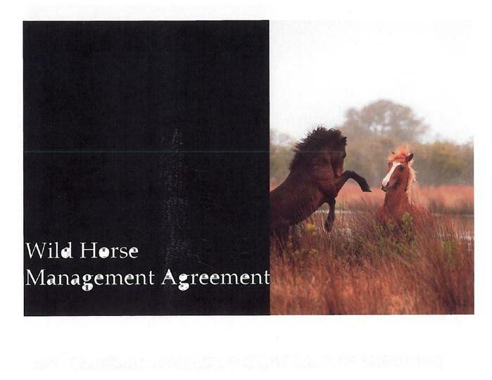
LOWER CURRITUCK VISION PLAN

This plan assesses economic development opportunities for Lower Currituck from Waterlily south to Point Harbor. The study aims to develop community consensus on future development for Lower Currituck. A robust community engagement process and market evaluation revealed that the County should focus its efforts on encouraging improved broadband, the development of concentrated retail and mixed-use villages, local business development, agritourism, and the beautification of the Highway 158 corridor.
CONNECT CURRITUCK: PEDESTRIAN MASTER PLAN

The Connect Currituck Pedestrian Master was approved in 2018. The plan provides recommendations for enhancing pedestrian safety and accessibility throughout the County based on a thorough public engagement process and analysis of existing conditions and pedestrian facilities. Pedestrian network recommendations focused on four major pedestrian hubs. The plan identifies six priority projects for implementation in Moyock, Barco, Grandy, and Corolla.

// 39 C OUNT y P RO f ILE
Economic Development Oppor tunity Assessment for Lower Currituck
Monday, August 22 2016
Brent Lane Deborah Watts
DRAFT

C HAPTER 2 | P UBLIC E NGAGEMENT & V ISION
CHAPTER 2: PUBLIC ENGAGEMENT AND GUIDING PRINCIPLES

This chapter provides a comprehensive overview of all community engagement efforts and culminates with key emerging themes that will guide plan recommendations.
IMAGINE CURRITUCK STEERING COMMITTEE
The Currituck County Board of Commissioners appointed a 12-member Imagine Currituck Steering Committee with representation from across the County to guide plan preparation and provide local perspective and insight. The Steering Committee was highly effective in generating public engagement via online tools and workshops.
The Committee received technical and administrative assistance from County planning staff and the planning consultant team. The Commissioners supported the Committee by providing leadership and direction at strategic benchmarks during plan development.

// 41
COMMUNITY VISION STATEMENT
2026 VISION
Currituck County is a complete community where residents enjoy a high quality of life with ample choices to live, work and play. With its beaches, waterways, and rural vistas, Currituck County is rich with natural assets. Preservation of these abundant environmental resources enhances the rural atmosphere of the County and offers plentiful recreational opportunities for residents and visitors alike.

New development offers a wide range of housing choices and is compatible with its surroundings by providing connectivity between neighborhoods and amenities such as walkways and water access. The County maintains appropriate development densities and discourages encroachment into areas that impact natural assets. Development occurs in areas adequately served by county infrastructure, or occurs concurrently with planned infrastructure improvements.
Economic development ventures support existing residents and create quality jobs in the community. New commercial and employment development diversifies the local economy while maintaining balance with the existing community character. The County fosters business opportunities by maintaining an excellent education system that prepares students for a prosperous future.
42 // CHAPTER 2
» Economic development » Tourism diversity » Business growth » Employment centers » Regionalism » Growth management » Recreation and water access » Transportation access and improvements » Workforce housing » Infrastructure management » Historic, cultural, and natural resource protection
PLAN OPPORTUNITIES
“ THIS IS CLEARLy A COMMUNIT y THAT IS PASSIONATE ABOUT ITS f UTURE AND RECOGNIZES THE VALUE O f BEING PROACTIVE. BECAUSE O f THE EXTENT O f CITIZEN INPUT AND IDEAS, INCLUDING 1,790 SURVE y RESPONSES AND ATTENDANCE AT 22 PUBLIC MEETINGS HELD THROUGHOUT THE COUNT y, IMAGINE CURRITUCK WILL BE f OREVER MARKED AS A TURNING POINT IN OUR COUNT y ’S HISTORy
– LAURIE LOCICERO, PLANNING DIRECTOR, CURRITUCK COUNT y

// 43 P UBLIC E NGAGEMENT AND GUIDING PRINCIPLES
TOOLS OF ENGAGEMENT
WEBSITE & BLOG

www.imaginecurrituck.com
VIDEO
The Imagine Currituck promotional video included dramatic aerial views of the County and highlighted the key planning themes. The video

SOCIAL MEDIA
Facebook and Twitter were used to publish and promote the video, blog, survey, and interactive map. Paid Facebook advertising helped to reach over 28,000 residents and property owners, and resulted in observable spikes in survey responses.
A project website served as the portal for blog posts, project updates, and discussions on planrelated topics. Additionally, the site featured an informational video and key demographic data. The website also housed essential public engagement tools including the online survey and interactive map.
was promoted on Facebook and supported a “call to action” for citizens to engage in the plan development process.
Paid Facebook advertising helped to reach over 28,000 residents and property owners.
44 // CHAPTER 2
SURVEY
An online questionnaire provided an opportunity to collect citizen opinion on a variety of planning topics and community preferences. The survey
INTERACTIVE MAP
A custom interactive map of the County allowed respondents to identify map markers as “ideas, insights, or barriers.” Participant comments were
was a tremendous success with 1,790 responses. Paper copies of the survey were made available at the County’s senior centers and libraries.
provided and associated with each marker. The map proved effective, resulting in the collection of 134 location-specific comments.
A custom interactive map of the County allowed respondents to identify map markers as “ideas, insights, or barriers.”

// 45 P UBLIC E NGAGEMENT AND GUIDING PRINCIPLES
PUBLIC WORKSHOPS: LOCATION AND ATTENDANCE
PUBLIC MEETINGS
Seven (7) public meetings were held throughout the County from October–December 2016. The workshops were open-house style and provided an opportunity for participants to review demographic information, online survey results, respond to conceptual plan renderings, and provide pertinent comments about their specific area.

COMMUNITY MEETINGS
PUBLIC MEETINGS
Shawboro Ruritan Facility
Currituck Middle School Jarvisburg Elementary School Moyock Elementary School
Knott’s Island Elementary School Corolla Library Carova Fire Department
Fifteen (15) focus group meetings were conducted from JuneNovember, 2016 by County planning staff. The focus groups represented a wide range of interests from across the County. Each group identified the top opportunities and challenges for Currituck County.

DATE 10/27/16 11/01/16 11/03/16 11/10/16 11/15/16 11/17/16 11/27/16
FOCUS GROUPS
Planning Board Chamber of Commerce Agricultural Extension Board Lower Currituck Property Owners Off-Road Area Property Owners Soil and Water Board
Corolla Civic Association Board of Historic Jarvisburg Colored School
Walnut Island Property Owners Board of Education J.P. Knapp 10th grade Civics Class Outer Banks Homebuilders Assoc. Knott’s Island Property Owners Moyock Concerned Citizens Senior Center
DATE
06/14/16 07/27/16 07/28/16 08/10/16 08/12/16 08/16/16 08/16/16 08/24/16 09/10/16 09/12/16 09/19/16 09/27/16 10/10/16 10/25/16 11/15/16
46 // CHAPTER 2
MAP: 3
// 47 P UBLIC E NGAGEMENT AND GUIDING PRINCIPLES WE ASKED, YOU RESPONDED! PUBLIC OUTREACH BY THE NUMBERS 1,790 SURVEY RESPONSES 134 INTERACTIVE MAP RESPONSES $860.37 SPENT ON ADVERTISING VIA FACEBOOK 28,043 PEOPLE REACHED VIA FACEBOOK 320 PROMOTIONAL VIDEO VIEWS ON YOUTUBE 15 FOCUS GROUPS 7 PUBLIC WORKSHOPS
PUBLIC WORKSHOPS: SAMPLE COMMENTS
“ Provide expanded vocational opportunities to entice youth to stay in the area.”
“ These concepts are a big improvement to what now looks like blight.”
“ Establish a park area that would give public access to a sandy beach with shallow water for swimming, kayaking, and sailing.”
“ Need better drainage and ditches maintained to alleviate flooding.”
INTERACTIVE MAP: SAMPLE COMMENTS
“ Bridge would be a great economic opportunity. Corolla could develop into a year round community providing tax money for the county.”
“ The downtown, historic area of Moyock should be preserved and restored as a tourist interest area.”
“ Entrance to off road area must be improved if development continues; a permit system may be needed.”
ONLINE SURVE y: SAMPLE COMMENTS
“ 4x4 area could use some parks.”
“ Eventually every township should have their own facilities. At this time concentrate on the fastest growing areas like Moyock.”
“ Land needs to be protected, not developed.”
“ Do not build the mid-county bridge – costly, will bring too much development.”
48 // CHAPTER 2
GUIDING PRINCIPLES
Upon review of all public comments, the steering committee identified seven (7) key guiding principles that should guide future growth.
Each goal and policy identified in the subsequent recommendation chapter correlates to at least one of the guiding principles. Policies within the plan may exceed CAMA’s minimum requirements for land use planning rules, but no policy exceeds the use standards or permitting requirements as determined by CAMA.
NATURAL RESOURCE PROTECTION AND COASTAL RESILIENCE.
Protect and sustain natural assets, rural landscapes, water quality, prime agricultural areas, and biodiversity. Conserve ecologically sensitive areas and wildlife habitat by actively planning for a resilient coastland by encouraging uses that enhance and connect people to the natural environment.
COORDINATED GROWTH. Strategically direct growth toward areas that are accessible to existing or planned transportation networks, water and wastewater infrastructure, and compatible with surrounding land uses. Produce and implement design-focused civic master plans for key growth areas that include an emphasis on natural resource protection.
ECONOMIC PROSPERITY AND RESILIENCE. Cultivate a diverse economy that encourages the growth of traditional sectors while fostering new opportunities for nature-based recreation tourism and small business growth. Provide a range of housing types and land development densities appropriate for attracting quality, environmentally compatible businesses and industries that strengthen the County tax base.
ENHANCED TRANSPORTATION AND MOBILITY. Coordinate highway corridor management with NCDOT to improve vehicular traffic flow while accommodating accessible walking and biking facilities that connect neighborhoods to commercial centers and public open spaces.
EXPANDED
PUBLIC ACCESS TO NATURAL RESOURCES.
Increase public access to the County’s abundant waterways, shorelines, and protected natural areas to provide new opportunities for active and passive recreation and enjoyment of natural landscapes. Ensure that new development preserves physical and visual public access to the watefront.
DESTINATION POINTS. Establish and enhance key destinations throughout Currituck County, including natural and cultural centers. Create walkable, mixed-use neighborhoods and develop destination-quality recreation facilities and trails.
PLACE-MAKING. Create places that are meaningful, compelling, and reflect the unique identity and cultural heritage of Currituck County within their specific context.
// 49 P UBLIC E NGAGEMENT AND GUIDING PRINCIPLES P UBLIC E NGAGEMENT AND GUIDING PRINCIPLES

C HAPTER 3 | RECOMMENDATIONS
CHAPTER 3: RECOMMENDATIONS
CHAPTER 2: PUBLIC ENGAGEMENT AND VISION
This chapter provides recommendations that will guide Currituck County leaders as they make decisions regarding where and how the County will grow to achieve consistency with the Guiding Principles.
THIS CHAPTER PROVIDES A COMPREHENSIVE OVERVIEW OF ALL COMMUNITY ENGAGEMENT EFFORTS AND CULMINATES WITH KEY EMERGING THEMES THAT WILL GUIDE PLAN IMAGINE CURRITUCK

Goals and actions are provided according to six (6) planning elements and four (4) geographic regions of Currituck County.
STEERING COMMITTEE
The Currituck County Board of Commissioners appointed a 12-member Imagine Steering Committee with representation from across the County to guide plan preparation and provide local perspective and insight. The Steering Committee was highly effective in soliciting public engagement via the online
The Committee received technical and administrative assistance from County planning staff and the planning consultant team. The Commissioners supported the Committee by providing leadership and direction at strategic benchmarks
// 51
// 51
IN THIS CHAPTER: 1. PLANNING ELEMENTS » Land Use » Economic Development » Infrastructure and County Services » Transportation » Environment » Parks and Recreation 2. GEOGRAPHIC FOCUS AREAS » Northern Mainland » Lower Currituck » Corolla » Off-Road Area, Gibbs
& Knotts Island
Woods,
HOW TO USE THIS CHAPTER
This chapter serves as the heart of the Imagine Currituck 2040 Vision Plan and is comprised of two sections. The first section emphasizes broad, county-wide goals that are organized according to the six (6) plan elements, including: 1) Land Use; 2) Economic Development; 3) Infrastructure and County Services; 4) Transportation; 5) Environment; and 6) Parks and Recreation.
The second section emphasizes specific goals associated with four (4) geographic regions of Currituck County, including: (1) Northern Mainland; (2) Lower Currituck; (3) Corolla; and (4) Off-Road Area, Gibbs Woods, and Knotts Island.
EXPLORE
EXPLORE COUNTY GOALS ACCORDING TO GEOGRAPHIC REGION
NORTHERN MAINLAND 55
LOWER CURRITUCK 63 COROLLA
OFF-ROAD AREA, GIBBS WOODS, & KNOTTS ISLAND .................... 75
C HAPTER 3 52 //
COUNTY-WIDE GOALS ACCORDING TO THE SIX PLAN ELEMENTS LAND USE 38 ECONOMIC DEVELOPMENT ............... 44 INFRASTRUCTURE AND COUNTY SERVICES 46 TRANSPORTATION ......... 48 ENVIRONMENT ................ 50 PARKS AND RECREATION 52
............................... 69
THE ROLE OF PLAN POLICIES
The Currituck County 2040 Vision Plan will serve both day-to-day and long-range functions. The day-to-day functions relate primarily to the County’s administrative staff on preparation and administration of development management ordinances and the public’s understanding and use of these ordinances for land use and development decisions regarding their own property. Other users of the Plan include the following:
Board of County Commissioners
For the Board of Commissioners, the Plan will be a policy and decision guide on matters related to land use and land development. The plan will be used in the Board of Commissioners’ decision-making on the capital and annual operating budgets. The Board will review the implementation plan periodically and make necessary adjustments based on budgetary considerations, coordination with other projects, and community needs.
County Planning Board
The Planning Board will use the plan and its policies to determine consistency of project plans and development proposals with County goals in making decisions to grant or deny requests, such as a zoning change or to approve project plans. This plan will also be used in making recommendations on text amendments to the UDO.
Property Owners and Developers
The Plan will provide guidance on the types of land uses and development that are desired by the county. The policies will help owners or developers formulate proposals that are consistent with the goals and objectives of the community, thereby increasing the likelihood of approval. In addition, the plan points to basic sources of information that will help owners and developers understand the capabilities and limitations of their property.
County Residents, Generally
The plan will provide information that will allow residents and property owners to better understand plans for public projects or private development and will provide a reference when supporting or opposing such proposals.
County Administrative Staff
The staff of the County will use the plan as a tool for evaluating development proposals and for preparing plans for public facilities. Staff will also check existing ordinances for consistency with the plan and recommend any necessary adjustments to the Planning Board and Board of Commissioners. Staff will also use the plan and implementation strategy when preparing its budget recommendations and will make reference to the plan when preparing applications for grants and other assistance.
North
Carolina Division of Coastal Management/Other State and Federal Agencies
The Division of Coastal Management will use the Plan for consistency determinations on major development permits and by other state and federal agencies on the consistency of their projects and programs with local plans and policies.
// 53 RECOMMENDATIONS // 53
PLANNING ELEMENTS
LAND USE
The Future Land Use Map is a land use policy map intended to provide guidance to Currituck County’s leaders as they make decisions on where and how the County should grow (See pg. 23). It provides the overall structure for orchestrating appropriate patterns of growth and environmental conservation throughout the County. As such, it provides the framework for and is the cornerstone of the Land Use Planning Element.
WHAT DID yOU IMAGINE, CURRITUCK?

“ Prioritize the protection of natural resources and landscapes
“ Encourage small business growth
“ More entertainment and local retail within walking distance of neighborhoods


“ Protect agricultural lands from over-development


“ Strategic growth management
“ Control size and density of homes

The Future Land Use Map is informed by existing development trends and adopted land use policy, including the County’s existing zoning districts, watershed protection areas, and water/ wastewater service delivery areas. In addition to the methodology described herein, the Future Land Use Map is also based on development concepts that the community articulated and prioritized during the public engagement process.
TRANSECT METHODOLOG y
This form of mapping and classification is known as “transect mapping,” and is based on the history of human settlement patterns. The Rural-Urban Transect is a conceptual “slice” through the landscape from rural conditions to urban core, and relates development potential to the ecological conditions and settlement patterns of the land. The transect creates a hierarchy of and provides the primary classification for the environmental and/or built character of the various parts of the County.
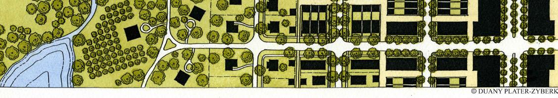
The transect methodology divides land within the study area into six separate classifications or “sectors” (labeled as O-1 through G-4 and further described on the pages that follow). These range from the most natural (Preserved Lands) to the most urbanized areas (Mixed-Use and Villages), with each sector reflecting the appropriate balance between environmental conservation and development intensity for the area.
In addition to providing a framework for balancing conservation and development intensity, the transect methodology can be applied to density regulation by establishing density-averages that correspond with each of the sectors. A key recommendation of this plan is amendment of the Unified Development Ordinance to regulate development density through an appropriate density-average for each future land use transect.
54 // C HAPTER 3
• County Parks • Greenways • Agriculture and Forestry practices related to land management • Public Water Access Areas • Natural Resource based passive recreation • County Parks, public water access, and related amenities • Forestry • Greenways • Cultivated farmland and accessory structures • Limited Single Family Rural Residential • Low Density Residential that prioritizes open space • Agriculture, Agritourism, Ecotourism • Tourism-oriented commercial along Caratoke highway • Limited neighborhood commercial • County Facilities • Forestry and other natural resource based activities Medium-density Single Family Subdivisions • Mixed Residential Development • Limited Multi-Family • Neighborhood Mixed-Use and commercial including beach tourism related businesses • Agritourism and Ecotourism • Civic Uses • Mixed-residential subdivisions • Multi-family Development • Horizontal and Vertical Mixed-Use • Light Industrial • Regional Commercial Centers • Office and Institutional • High Density Mixed Residential and Commercial Use • Civic and Cultural Uses • County Services and Offices • Entertainment Preserved Lands Reserved Lands Low Density Growth Areas Controlled Growth Areas Mixed-Use Centers and Corridors O-1 O-2 O-2 G-1 G-1 G-2 G-2 G-3 G-3 G-4 G-4 RURAL I I I I I I I I I I I I I I I I I I I I I I I I I I I I I I I I I I TRANSECT I I I I I I I I I I I I I I I I I I I I I I I I I I I I I I I I I URBAN Image: Duany Plater-Zyberk & Company EXHIBIT: 3


RECOMMENDATIONS CURRITUCK KNOTTS ISLAND GIBBS WOODS OFFROAD AREA COROLLA WATERLILY MOYOCK SLIGO BARCO SHAWBORO POWELLS POINT POINT HARBOR HARBINGER COINJOCK AYDLETT POPLAR BRANCH GRANDY JARVISBURG EAST-WEST CONNECTORTOI-87 MID-CURRITUCKBRIDGE CURRITUCK COUNT y f UTURE LAND USE MAP MAP: 4
TRANSECT PROFILE
O-1: PRESERVED LANDS
The O-1 classification is comprised of nature preserves, conservation lands, and County parks. This sector includes existing major conservation lands under the control of government or private conservation agencies. Many of these lands provide educational, ecotourism, or limited passive recreation opportunities. This category, indicated in dark green on the Future Land Use Map, comprises lands that are primarily nondevelopable, such as swamps, wetlands, riparian buffers, and parks.
Appropriate Land Uses and Development Types:
» County parks
» Greenways
» Public water-access facilities
» Natural-resource based passive recreation
» Forestry and agricultural practices related to landmanagement by conservation and public agencies
O-2: RESERVED LANDS
The O-2 classification is comprised of wetlands, environmentally sensitive areas, significant natural heritage areas, sensitive habitat areas, and prime agricultural lands that should be targeted for conservation or farmland preservation. The O-2 classification also allows for limited development of low-density single family residential. This area should not be targeted for public or private water and sewer infrastructure or other growth inducing activities.
Appropriate Land Uses and Development Types:
» County parks, public water access, and related amenities
» Greenways
» Forestry
» Cultivated farmland and accessory agricultural structures
» Low-density single family rural residential that prioritizes preservation of open space and natural landscapes
G-1: LOW DENSITY GROWTH
The G-1 classification is intended for agricultural lands and compatible low-density rural residential growth that may be supported by limited smallscale neighborhood retail. Residential and non-residential uses should be in keeping with community character.
Limited municipal-type services, such as fire protection, emergency services, and community water may be available but public or private sewer services are not appropriate.
Special consideration should be given to protect historically agricultural and wooded areas.
Encourage neighborhood commercial to locate near road intersections and existing compatible uses and community facilities.
Appropriate Land Uses and Development Types:
» Agriculture and agritourism destinations and related businesses
» County facilities
» Limited neighborhood commercial
» Low-density residential growth that prioritizes preservation of open space and the natural landscapes
» Tourism-oriented commercial, along Caratoke Highway
» Eco-tourism and water dependent uses
» Forestry and other natural resource based activities
G-2: CONTROLLED GROWTH
The G-2 classification contains medium-density residential developments and neighborhood-scale commercial nodes. This sector is characterized by an interconnected local road network, available water or wastewater, and walkable neighborhoods that connect to parks, open space, commercial nodes, and other neighborhoods.
Appropriate Land Uses and Development Types:
» Medium-density single family subdivisions
56 // C HAPTER 3
» Mixed residential developments that provide a variety of housing types
» Limited multi-family developments
» Neighborhood office and commercial mixed-use including beach-tourism supporting businesses
» Civic uses such as schools or County facilities
» Agritourism
» Eco-tourism
» Encourage neighborhood serving commercial to locate near road intersections, neighborhood serving facilities such as schools and parks and existing compatible commercial uses.
» All new development and redevelopment in G-2 shall connect to county water.
» Medium density residential, commercial and compatible industrial uses are encouraged to locate within the G2 transect areas where both water and wastewater services are available.
RURAL SUBDIVISION
EXHIBIT: 4
Conservation subdivisions are particularly appropriate for the G-1 sector. They can be incentivized by providing density bonuses in exchange for additional open space.
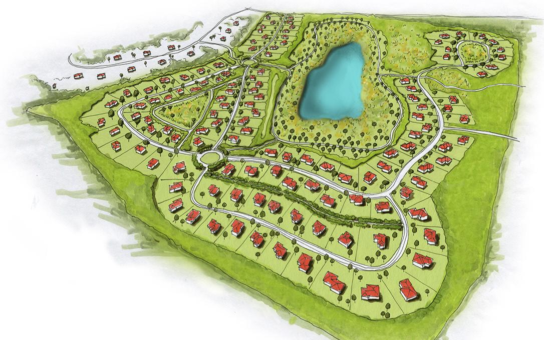
TRANSITIONAL SUBDIVISION
EXHIBIT: 5
Transitional Subdivisions provide for medium density residential growth while preserving one-third of the development area for open space that includes existing wetlands and habitat restoration areas along the perimeter of the subdivision. A key feature of the Transitional Subdivision is an internal greenway system that weaves through preserved open space.

// 57 RECOMMENDATIONS
G-3: MIXED-USE CENTERS AND CORRIDORS
The G-3 classification is supported by major transportation networks, public water and wastewater infrastructure, and a community greenway system that links neighborhoods to mixed use areas. This sector provides for a wide range of uses including mixed residential subdivisions with a variety of housing types and mixed use developments that maximize the efficient use of space. Attractive mixed use development can be achieved by incentivizing multi-story buildings that comply with design standards that emphasize building form, orientation, and architecture.
Appropriate Land Uses and Development Types:
» Mixed residential developments that provide a variety of housing types
» Horizontal and vertical mixed-use development
» Multi-family development
» Office and institutional
» Light industrial facilities
» Regional commercial centers with national brands
» Medium to high residential densities, commercial and compatible industrial uses are encouraged to locate within the G-3 transect areas where both water and wastewater services are available.
CURRITUCK STATION MASTER PLAN: TAKING ADVANTAGE O f REGIONAL GROWTH
Currituck County’s planned Currituck Station is located within the G-3 future land use classification. This mixeduse master planned site is approximately 3,400 acres and will include the development of a diversified residential product; Currituck’s current housing stock consists of more than 80% single family detached, compared to only 60% for the region as a whole. The Currituck Station Master Plan will also include commercial, office, and industrial uses. The ultimate goal is to provide developers and businesses with shovel-ready sites to position Currituck County to effectively compete for job growth.
58 // C HAPTER 3
C r o s s roads O a k Tr ail C e n ter S t a t ion C r o s s roads O a k Tr ail C y p r ess M o y ock R u n J u n c tion C h a r ter N e w t own Pro ect Area Proposed Use Cen er Station Charter Crossroads Cypress Junction Moyock Run Newtown Oak Trai R ght of W ay 0 0 5 1 0 25 M es I Source Es D g a G obe GeoEye Ea hs ar Geographics CNES/A rbus DS USDA USGS AeroGRID IGN and he G S User Commun y Curr uck County EXHIBIT: 6
PRODUCED BY KIMLEY-HORN
G-4: VILLAGE CENTER
The G-4 classification is characterized by a compact street network, a well-developed pedestrian network, and readily-available water or wastewater infrastructure. Village centers should be developed into complete communities with walkable neighborhoods and pedestrianoriented streetscapes. Development in the Village Center should prioritize the preservation and rehabilitation of historic buildings, encourage compatible infill development and locate parking on the street or side and rear of buildings. Architectural standards for the Village Center should be strengthened to ensure appropriate scale, massing, orientation, and location of buildings.
Appropriate Land Uses and Development Types:
» Mixed residential and commercial uses
» Civic and cultural uses
» County services
» Entertainment
» Medium to high residential densities and commercial uses are encouraged to locate within the G-4 transect areas where both water and wastewater services are available.
HISTORIC MO y
OCK
VILLAGE AT SHINGLE LANDING AND CHURCH STREET
A Village Center should be characterized by dynamic, inviting, and safe public spaces that encourage pedestrian activity and vibrant street life. Key features include:
• A walkable environment with wide sidewalks and safe street crossings
• Attractive and comfortable outdoor site furnishings
• Pedestrian-scale signage and lighting
Permanent locations for public art installations
• Landscaping, street trees, and planting beds
// 59 RECOMMENDATIONS
EXHIBIT: 7
LAND USE
GOALS AND POLICIES
1. Encourage development to occur at densities appropriate for their location and consider factors, including but not limited to: environmentally suitable areas; suitable soils; adequate infrastructure; the type and capacity of sewage treatment available to the site; the adequacy of transportation facilities providing access to the site; and compatibility and proximity of the site to existing and planned County services.
1.1 The Future Land Use Map is a guide for decision making, planning for infrastructure and conservation and should not be the sole basis for land use decisions.
1.2 Consider adopted small area plan policies and civic master plans.
1.3 Consider community character and established visions for the community.
1.4 Protect the uniqueness of the County through preservation of farmland, wooded areas, open space and water views from roads, walkways and other public spaces.
1.5 Preserve farmland and open space by protecting historically rural areas using more compact density requirements for new developments that discourage and help prevent urban sprawl.
2. Carefully consider the design and location of intensive and potentially incompatible land uses to mitigate compatibility issues such as environmental quality, safety, overburdening local infrastructure, scale, use, design, location, and adverse effects.
2.1 Continue to encourage businesses to coordinate site design with nearby businesses including shared or connected parking and access, pedestrian and vehicular movement, and consistent signage.
2.2 Continue to prohibit incompatible or poorly planned commercial encroachment near residential areas.
2.3 Encourage new industrial uses to locate in existing or planned industrial sites and locate on suitable land with unique
locational advantages.
2.4 Support the exploration and development of renewable energy producing facilities of environmental quality. Thoughtfully consider all potential impacts, positive and negative, of any renewable energy producing facility.
2.5 Continue to prohibit unclean energy producing facilities including but not limited to: Oil and natural gas wells, associated staging, transportation, refinement, processing or on-shore service and support facilities.
2.6 Proposed residential development that would expose residents to the harmful effects of incompatible land uses or to environmental hazards shall be minimized. For example: proximity to airport or to activities involving excessive noise, light, odors, dust, fertilizers and insecticides (farm operations, mining activities, etc.)
2.7 Protect agriculture and other resource based activities (ex: animal feeding operations) from incompatible land uses.
2.8 Consider adverse effects of a development or land use decision. Adverse effects are negative consequences for the physical, social, or economic environment.
3. Support new and existing commercial developments that adhere to quality community appearance and design standards, including landscaping improvements and signs tailored to achieve a unique community character.
4. Recognize and encourage protection of the County’s architectural, historic and archaeological resources, including adaptive reuse of historic resources.
60 // C HAPTER 3
ECONOMIC DEVELOPMENT
WHAT DID yOU IMAGINE, CURRITUCK?
“ More training for trade and vocational jobs at the community college
Currituck County is working to diversify its economic base while growing its traditional industry sectors. Although the County is challenged with a high workforce commute rate and an aging population, the County possesses an abundance of assets to meet its challenges and realize a sound economic future. Some of the County’s key assets include the provision of shovelready industrial sites, an outstanding natural environment, a multi-modal transportation network, and a booming seasonal visitor population. Accordingly, the Currituck
“ Invest in water, sewer, and broadband infrastructure to support business growth in targeted areas
“ Expand broad natural resource based tourism such as hunting, fishing, paddling, boating, hiking, and cycling
“ Facilitate small business development; more local restaurants and shops
“ Grow the agritourism and ecotourism industries including farm tours, wineries, breweries, farm to table restaurants, and farm stands
economic development strategy must be diverse and support a range of initiatives.
GOALS AND POLICIES
1. Support the retention and expansion of existing businesses and promote the development of new businesses, especially those that help diversify the local economy and are compatible with the county’s natural amenities and environment.
2. Promote sustainable tourism that improves quality of life for residents and preserves the natural and cultural resources of the County so that they may continue to attract visitors to the area.
2.1 Protect natural resources, open space, and biodiversity through a variety of conservation methods including, but not limited to: open space preservation; land acquisition partnerships; and managing coastal resilience issues.
2.2 Encourage establishment of new outdoor recreation amenities, visitor attractions, destinations and eco-tourism opportunities.
2.3 Encourage development of the tourism and educational potential of the county’s architectural, historic and cultural resources
3. Increase value-added agriculture throughout the county and expand agritourism.
3.1 Support the continued operation of farm stands and farmers markets and encourage the sale of local value added products.
3.2 Encourage small-scale aquaculture ventures such as fisheries and crabbing in appropriate areas.
3.3 Encourage agritourism enterprises such as you-pick farms, vineyards/wineries, breweries, and farm tours.
4. Attract new healthcare, service-industry professionals, and businesses.
4.1 Encourage the development of diverse workforce housing for mixed incomes.
5. Attract compatible industrial operations and support existing industries.
5.1 Industrial Development shall be located on land that is physically suitable and has unique locational advantages for industry.
// 61 RECOMMENDATIONS
CASE STUD y: HARVESTING THE POWER O f LOCAL f ARMS ISLAND-GROWN INITIATIVE IN MARTHA’S VINEYARD, MASSACHUSETTS
A 3-year planning effort in Martha’s Vineyard resulted in the establishment of the Island Grown Initiative, a community agency with the mission to create a resilient and equitable local food system in Martha’s Vineyard. The Island Grown Initiative operates a farm hub that provides greenhouse space and land for lease to aspiring farmers; coordinates farm-toschool programs to provide healthy foods to students and a dependable market for farmers; and provides resources such as a mobile poultry-processing trailer and shared cold storage facilities that would otherwise be cost-prohibitive for small farms and start-ups. The Island Grown Initiative also offers an agritourism marketing program and training opportunities for small farmers. Through active web-marketing, direct sales and CSAs more than 3 dozen providers now sell fruits, vegetables, meat, poultry, honey, cheese, oysters and seafood directly to 17,000 year-round residents, vacationers and restaurants on the island and within the region.
- VISION STATEMENT fROM THE CURRITUCK COUNTy ECONOMIC DEVELOPMENT STRATEGy (2017)

62 // C HAPTER 3
EXHIBIT: 8
CURRITUCK COUNT y WILL HAVE THE TOP PER f ORMING DIVERSE ECONOM y IN NORTHEAST NORTH CAROLINA AND WILL BE RECOGNIZED AS THE BEST PLACE TO LIVE, LEARN, PLAy, WORK, AND DO BUSINESS.
INFRASTRUCTURE AND COUNTY SERVICES
The County provides critical infrastructure, amenities, and support services to ensure public safety and welfare. These critical services and infrastructure include: water treatment; wastewater treatment; public works; law enforcement; emergency management; public schools; social services; planning and zoning; and the Currituck Airport. By strategically expanding public infrastructure and services, the County can meet the demands of its growing population and utilize its infrastructure investments to generate private investment.
GOALS AND POLICIES
1. Ensure sufficient provision of services to support associated growth and development and continue to enforce the adequate public facilities ordinance.
1.1 The costs of infrastructure, facilities, and services related to demand created by new growth and development shall be borne, in equitable proportion, by those creating the additional demand. This may include but is not limited to: land transfer tax, development fees, upzoning fees, and user fees.
1.2 Actions concerning infrastructure shall direct new development first to targeted growth areas.
2. Continue to provide satisfactory public safety, law enforcement, and emergency management and response services.
2.1 Support the development and improvement of fire fighting services that enhance the security and safety of life and property and provide the added benefit of lower property insurance rates.
3. Continue to provide satisfactory public water and wastewater service in a fiscally responsible manner that coordinates growth in targeted development areas where infrastructure already exists.
3.1 New development shall connect to the County’s water system at the expense of the developer. (Wherever available and in accordance with County standards.)
3.2 Expansion of utilities shall reinforce targeted growth areas for increased development densities.
3.3 Continue to support efforts to regionalize and interconnect water supply systems.
3.4 Carefully consider use and location of new private package treatment plants for increased development density. These plants shall use the best available technology and allow for assimilation into a centralized system.
3.5 Septic systems in suitable soils are an environmentally acceptable means of treating and dispersing waste from lowdensity development.
4. Improve stormwater management and mitigation throughout the County by continuing to implement a watershedbased approach to stormwater management.
4.1 Support soil and stormwater projects to improve stormwater drainage and to mitigate flooding hazards.
5. Prepare to meet demands of growing senior population.
5.1 Support the development of diverse senior housing including active adult retirement communities, assisted living facilities, nursing homes, granny flats, and accessory apartments.
6. Position the Currituck Airport for sustained economic viability as a regional airport serving both the Mainland and Outer Banks.
6.1 Protect existing and future airport approach-zones from development.
// 63 RECOMMENDATIONS
INFRASTRUCTURE AND COUNTY SERVICES
(CONTINUED)
7. Recognize local schools as valuable community assets that can contribute to Currituck County’s desirability, livability, community vibrancy, and economic competitiveness.
7.1 Work with developers on offers of land for the siting of new schools in desired locations.
7.2 Continue enforcement of adequate public facilities ordinance to ensure sufficient school capacity.
WHAT DID yOU IMAGINE, CURRITUCK?
“ Improved infrastructure to accommodate growth
“ Expanded and upgraded county water and sewer systems in underserved areas
“ Improved drainage infrastructure
“ County-wide broadband access
“ New community and senior centers
“ Expanded vocational education offerings to create workforce for trade jobs
7.3 Plan for new public school locations that serve the greatest number of residents and reinforce growth in targeted growth areas.
8. Ensure that all public services remain at a sufficient level to provide superior service to the growing Currituck County population.
8.1 Strategically locate new public facilities based on opportunities for collocation with existing facilities in targeted growth areas.
8.2 Ensure that the County’s staff capacity can meet demands of growing population.
9. Sustain satisfactory solid waste services and amenities.
9.1 Continue to provide convenient and well-maintained solid waste facilities throughout the County.
9.2 Facilities for disposal of hazardous waste (including but not limited to: chemical, biological, radioactive) shall not be located in Currituck County.
9.3 No solid waste from outside the county shall be accepted for disposal at any site inside the county.
64 // C HAPTER 3
TRANSPORTATION
Currituck County’s transportation system is comprised of its roads, rail, bicycle and pedestrian paths, waterways, and airport. The recommendations below provide general guidance as County leaders continue working with NCDOT on planning and improvements aimed at achieving a well-balanced, multi-modal transportation system.
GOALS AND POLICIES
1. Improve safety, traffic flow, access, and appearance of major highways and roads.
WHAT DID yOU IMAGINE, CURRITUCK?
“ Improved safety and congestion on Caratoke Highway and NC 12
“ Public transportation for aging population
“ Improved and expanded bicycle and pedestrian amenities on both the Mainland and in Corolla
“ Relief from summer tourist traffic
“ Mid-Currituck Bridge
1.1 Support the Mid-County bridge to provide critical traffic relief, to improve emergency access to and evacuation from the Currituck Outer Banks, to promote economic development, and to provide better access to public and private services not readily available to the Outer Banks.
1.2 Collaborate with NCDOT to improve seasonal traffic congestion along 168/158 and NC12.
1.3 Encourage and support regional transportation connections.
1.4 New development along the County’s roadways shall be managed so as to preserve the intended purpose, protect taxpayer dollars invested, and minimize hazardous turning movements in and out of traffic flows. Methods include: limits on frequency of driveway cuts, shared driveway access, minimum lot frontages, connections between adjoining parking lots, central medians, etc.
1.5 Concentrate development density at strategic locations along major corridors, while limiting highway access along intervening stretches of road.
2. Improve and expand pedestrian and bicycle facilities throughout the County.
2.1 New development shall construct pedestrian walkways and multi-use greenways that connect adjacent residential and commercial areas.
“ Strategically planned development at Mid-Currituck bridge landings
“ Interconnected secondary road network between neighborhoods that allows local traffic to avoid Caratoke Highway
“ Improved facilities and increased access to water for boat travel; improved facilities for air travel
“ Improved appearance of Caratoke Highway Corridor
3. Support provision and expansion of a multi-modal transportation system.
3.1 Continue to support operation of Currituck Sound Ferry system.
3.2 Continue to support the Currituck Regional Airport as a means of alternative transportation.
// 65 RECOMMENDATIONS
CONNECT CURRITUCK PEDESTRIAN MASTER PLAN
The Connect Currituck Pedestrian Master Planning process took place during the summer of 2017. The plan provides recommendations for enhancing pedestrian safety and accessibility throughout the County based on a thorough public engagement process and analysis of existing conditions and pedestrian facilities. Connect Currituck makes general policy recommendations, programming recommendations, and identifies specific priority projects at key locations. Currituck County’s top locations for pedestrian facility improvements include: Camelia Road at Highway 158 in Moyock; College Way and Shortcut Road intersection in Barco; Highway 12 intersection at Currituck Clubhouse Drive in Corolla; Poplar Branch and Highway 158 intersection; Walnut Island Boulevard; and Lighthouse Drive and Whalehead Drive.
0
B P y sa d C F m C o a
gy C
L o
S m F m
Sn de A d
le C m t D BeehNek C e F B M d n M c r M M g o a M B
Tat
S e Ce
G DEE CREEK
B H u C b
FERR MLL
N Cu ck M C EXHIBIT: 9
H l C e R 1 4
SmhC n
P Neck
h A g
US 17 W e P
S
Be sad M
m
N h mChu
Gbo
D B Wae ND P K m C b N b Ch e
Riela M Riey PLO O R B D P bo P TES ET O G m b
g m m Pn e S 1 w S a G n V Ab a Smh
Ga L eRi H y
R Ab R b LuaM s R b E ge e R rBidge D N k M H k s D e
u 0 PO ES E 0 M n 43 U 1 0 v P e T u 0 £ ¨ M s M e
wn G
Do be dge
Blu P 0
B ad e !
C S dep t /T g Q S S d ¯ ¯
66 // C HAPTER 3
NETWORK RECOMMENDATIONS ! ! ! ! !! ! ! ! ! ! ! ! ! ! ! !! ! ! ! ! ! ! ! ! ! ! ! ! ! ! ! !! !!! ! Moyock Coro a Sh b Kno ts sland Grandy B Powel s Point Ja v sburg M p Curr tuck Co n ock Ayd ett Pop ar Branch Harb nge Po nt Harbor C p a P LME TO-P ARTR E RE ERV M k d N W d Rg y k H DDEN AKE NAT E RE ERV CSU G D R F T Y HAWK WOOD DNP y C Co c e / F R h N H S C S N R a q o h d C o k B R S d B y o s d K Ch P B W y g a e a o W e Ca oe UCK SR 209 O U 158 S h s C p P e US NEW OP Lamb US 7 S M n No hsi y D O Sand p G a d y WOODVLLE S S hM d o n B Iy ck W C L e y Po d a C Gb W C o S OC AN P dg N LteC k Gade
CURRITUCK COUNTY PEDESTRIAN MASTER PLAN (2017)
R
P
O e Ml JACOCKS
n g ulyad B w K
x p Rdg F BO RAMP R1
m M DDY CRE St
B SR 212 ATKNS
Egan S
B gh m Pi e G m L
C SEEVEW
a HOGNECK D v O
OdUS 7 Sh dne k TE
M ddy s
C p G W W NS ETON
W S
F Boy
and OS
G n o nd m EWBY AY
B c n C OSSNE K Da
ENVIRONMENT
WHAT DID yOU IMAGINE, CURRITUCK?
“ Protect wildlife habitat from encroaching development
“ Mitigate stormwater drainage and flooding issues
“ Minimize beachfront erosion; pursue beach nourishment strategies
Currituck County has an abundance of natural resources including its many bays, rivers, sounds, beaches, marshes, maritime forests, fertile farmland, and wildlife habitat. These environmental features define the County’s unique geography and provide the natural landscapes that have attracted visitors for over two hundred years. The County is home to numerous wildlife sanctuaries, preserves, and game lands of national and regional significance. Continued protection of open space and sensitive natural areas from future development is critical for sustaining a healthy ecosystem and preserving Currituck’s exceptional landscapes.
“ Conserve agricultural lands
“ Protect sand dunes from damage and erosion
“ Prioritize the preservation of open space in new developments.
GOALS AND POLICIES
1. Preserve and protect the County’s environmentally significant and sensitive lands and surrounding areas.
1.1 Preserve coastal and non-coastal wetlands and riparian buffers for their natural resilience benefits.
1.2 Future growth areas shall avoid Natural Heritage Areas.
2. Ensure the protection and preservation of prime agricultural lands to the extent possible.
2.1 Support measures to protect and promote forest and farmland as outlined in the adopted Currituck County Agricultural Development Plan.
2.2 Encourage farmers and timber operators to use best management practices to protect and improve water quality.
3. Ensure the protection and cleanliness of water resources throughout Currituck County.
3.1 Preserve riparian buffers along canals, wetlands, sounds, rivers, and the Atlantic Ocean.
3.2 New development shall not impact ground water quality and shall allow for ground water recharge.
3.3 Quantity and quality of ground water resources shall be protected and
monitored to prevent pollution, saltwater intrusion and excessive draw-downs.
3.4 Preserve use of public trust waters for navigation, fishing, and other uses.
4. Plan for coastal resilience.
4.1 Recognize the risks to life and property that exist within Special Flood Hazard areas and continue to participate in National Flood Insurance Program (NFIP) and Community Rating System (CRS).
4.2 Ensure that critical infrastructure and public facilities are designed and located to minimize risk.
4.3 Maintain an ocean shoreline that provides economic, recreational, aesthetic, natural, and storm protective value.
4.4 Uses approved for location in estuarine waters and coastal wetlands shall be water dependent (public access, docks, piers, erosion control, and other CAMAapproved uses) and be developed to minimize impacts.
4.5 Conserve and protect coastal and non-coastal wetlands for the valuable functions they perform in protecting water quality, absorbing floodwaters, filtering pollutants from stormwater runoff, recharging the ground water table and providing critical habitat for many plant and animal species.
// 67 RECOMMENDATIONS
4.6 Sand dunes, natural shoreline ecosystems and maritime forests shall receive a high level of environmental protection and special consideration.
“COASTAL RESILIENCE MEANS BUILDING THE ABILIT y O f A COMMUNIT y TO ‘BOUNCE BACK’ A f TER HAZARDOUS EVENTS SUCH AS HURRICANES, COASTAL STORMS, AND f LOODINGRATHER THAN SIMPLy REACTING TO IMPACTS.”
- NATIONAL OCEAN SERVICE, NOAA

CASE STUD y: PLANNING f OR COASTAL RESILIENCE
TOWN OF NAGS HEAD PARTNERSHIP WITH THE NC SEA GRANT
In 2015, the Town of Nags Head entered into a partnership with the North Carolina Sea Grant to conduct a community-driven sea-level rise (SLR) Vulnerability, Consequences, and Adaptation Planning Scenarios (VCAPS) process to equip the Town with the research and policy analysis necessary to formulate strategies and actions for adapting to SLR. The town formed a Climate Resiliency and Sea-Level Rise Committee in 2016 to guide policy development. Through the VCAPS process, the committee identified 90 actions for public agencies, including local government, and 35 actions for the private sector (citizens and businesses). The strategies and actions are incorporated into the Town’s Comprehensive Land Use plan for implementation.
The NC Sea Grant is funded by the National Oceanic and Atmospheric Administration to facilitate research, outreach, and education to assist coastal communities on a broad range of topics including coastal hazards and sea-level rise.

68 // C HAPTER 3
Photo by Matt Lusk
EXHIBIT:
10
PARKS AND RECREATION
The provision of public parks, greenways, and natural recreation areas are critical for enhancing quality of life and promoting economic development throughout Currituck County. In addition, accessible and safe recreational amenities help encourage an active lifestyle and human health. As a rural county striving to attract investment, tourism, young families, and retirees, Currituck must continue to provide accessible trails, inviting parks, and connectivity to open space and waterways.
GOALS AND POLICIES
WHAT DID YOU IMAGINE, CURRITUCK?
“ More public water access and swimming areas on the sounds in both Corolla and the Mainland
“ More greenways and trails, especially in natural areas
“ More public beach access points
“ Preserve natural areas for eco-tourism, hunting, fishing, paddling, and hiking
“ Expanded programming and facilities for children and teenagers
“ Multi-use facilities/co-located county services
1. Improve public access to natural resource areas including ocean and estuarine shorelines and public trust waters.
1.1 Plan for additional public access areas with diverse recreation activities including boat, canoe and kayak launches, marinas, docks, scenic outlooks, boardwalks, swimming and crabbing areas.
1.2 Consider property acquisition or easements along shorelines and waterfronts or within marsh areas for increased public access opportunities.
1.3 Develop a strategic plan for acquiring key recreation properties within targeted growth areas.
1.4 Explore opportunities for partnerships with public land managers and conservation agencies to allow more public access to outdoor recreation resource areas.
1.5 New development shall provide public access to recreation and natural resource areas.
1.6 New parks and recreation facilities, as well as improvements to existing facilities, shall give special consideration to the needs of handicapped persons.
1.7 Encourage public and private marinas to locate in upland locations that are compatible with adjacent land uses and compliant with CAMA marina standards.
1.8 Encourage marina operators to participate in Best Practice Operating Programs such as “Clean Marina.”
2. Increase pedestrian and bicycle connectivity by expanding greenways, multi-use paths, and trails
2.1 Continue to require new development to construct pedestrian walkways and multi-use greenways that connect to external adjacent residential, commercial, recreation, and open space areas.
3. Ensure that parks and recreation offerings remain relevant to meet the recreation needs of the population.
3.1 Continue to implement the 2012 Parks and Recreation Master Plan for active recreation.
3.2 Continue to require recreation and park area dedication or fee in lieu of providing recreation amenities.
3.3 Continue to work cooperatively with the school system to maximize use of recreational facilities located at public school sites and to foster joint development of public park facilities at new school sites.
3.4 Continue joint-use agreement with Currituck County Schools that provide for use of school playing fields for recreational programming.
// 69 RECOMMENDATIONS
GEOGRAPHIC FOCUS AREAS
This section emphasizes growth policies according to four (4) specific geographic regions of Currituck County, including: 1) Northern Mainland; 2) Lower Currituck; 3) Corolla; and 4) Off-Road Area, Gibbs Woods, and Knotts Island.
Specific land use policies for each of the four geographic regions are provided in this section.
Each geographic sub-area in this chapter has recommended density ranges that are tailored to serve its unique geographic and environmental conditions. Recommended densities established in this plan may be achieved through local zoning districts and informed by this plan and other officially adopted plans (ex: Civic Master Plans) that are developed in accordance with this plan.
C HAPTER 3 70 //
GEOGRAPHIC f OCUS AREAS


// 71 RECOMMENDATIONS MAP: 5
NORTHERN MAINLAND


Currituck’s Northern Mainland is located south of the Virginia border, west of the Currituck Sound, and north of the Intracoastal Waterway. This area includes the communities of Moyock, Sligo, Currituck, Shawboro, Barco, Maple, and Coinjock.


The Northern Mainland serves as the gateway into the state, the county, and the Outer Banks for thousands of travelers per year. This area is also home to major County services and facilities including the Currituck County Airport, Currituck Community Center, and Currituck Government Center. The Northern Mainland has experienced rapid growth over the past decade due to its proximity to the Hampton Roads, Virginia metro-area. This area is projected to experience substantial growth and development for the next 20 years, establishing a great need for planning that will balance the demands and impacts of a growing population with the historically rural nature of the area.
C HAPTER 3 72 //
MAP: 6
THE NORTHERN MAINLAND SERVES AS A PRIMARy GATEWAy INTO NORTH CAROLINA AND CURRITUCK COUNT y. THIS AREA IS EXPERIENCING SIGNI f ICANT GROWTH PRESSURE DUE TO A GROWING HAMPTON ROADS METRO-AREA.

// 73 RECOMMENDATIONS
LAND USE POLICIES
GENERAL
1. NORTHERN MAINLAND
1.1 Foster growth and development while maintaining the distinctive natural environment (wildlife habitat, natural beauty, critical areas) and rural character of the community (farms and pastures, open space, forests and farmland).
1.2 Encourage attractive, vibrant, walkable communities that support a variety of businesses and recreational activities.
SUB-AREAS
2. MOYOCK
2.1 Properly manage the increased urban level of growth in Moyock.
2.2 Encourage clustered housing developments to preserve the natural environment and rural character.
3. SHAWBORO/CRAWFORD/SLIGO
3.1 Balance residential growth with agricultural operations and remain predominantly rural, with the best and most extensive agricultural lands protected.
3.2 Preserve agriculture and open space as this is not a center of development. Major intersections should be targeted for neighborhood scale commercial development and other areas for low density residential growth.
4. COURTHOUSE AREA
4.1 Encourage growth as a small community center around existing county services and small businesses.
4.2 Prioritize quality development and preservation of open space.
4.3 Encourage preservation of unique historical and architectural features.
5. MAPLE/BARCO/AIRPORT AREA
5.1 Promote area for growth as a significant community center and commerce park.
5.2 Encourage growth as a commercial center that supports mainland businesses and Outer Banks tourism
74 // C HAPTER 3
NORTHERN MAINLAND
6. COINJOCK
6.1 Encourage commercial development on both sides of the canal compatible with existing residential uses that capitalize on the development potential of the canal.
TRANSECT PROFILE
7. O-2: RESERVED LANDS
7.1 Special consideration should be given to protect historically agricultural and wooded areas.
8. G-1: LOW-DENSITY GROWTH
8.1 Conservation subdivisions are valued over other less-compatible development types and density bonuses should be exchanged for the conservation of additional open space in the rural areas around Moyock, Shawboro, and Sligo.
9. G-2: CONTROLLED GROWTH
9.1 This area is best suited for medium-density transitional subdivisions that establish interconnected walkable neighborhoods that link parks and open space in the transitional areas of residential development near Moyock and Currituck.
10. G-3: MIXED USE CENTERS AND CORRIDORS
10.1 Appropriate uses include attractive mixed use developments and multi-story buildings that comply with design standards and village subdivisions that provide a variety of housing types. Densities shall be established in existing and future Civic Master Plans.
10.2 Encourage commercial development on the south side of the canal compatible with existing residential uses that capitalize on the development potential of the canal.
11. G-4: VILLAGE CENTER
11.1 Village Centers are appropriate for historic Moyock and historic Currituck that include walkable neighborhoods and support for a vibrant mix of residential types and village-scale commercial uses.
11.2 Suitable for a small Village Center in Coinjock along the Intracoastal Waterway with a boardwalk & public marina that works in conjunction with canal functions and water access.
11.3 Densities will be subject to existing and future Civic Master Plans.
CIVIC MASTER PLANS ARE RECOMMENDED FOR THE FOLLOWING AREAS:
» Currituck Station (completed)
» Historic Moyock Village
» Historic Currituck Village
» Coinjock Canal Area
// 75 RECOMMENDATIONS


CURRITUCK KNOTTS ISLAND GIBBS WOODS WATERLILY MOYOCK SLIGO BARCO SHAWBORO COINJOCK AYDLETT EAST-WEST CONNECTORTOI-87 MID-CURRITUCK MAP: 7 Subareas O-1 Preserved Lands O-2 Reserved Lands G-1 Low Density Growth G-2 Controlled Growth G-3 Mixed Use Centers G-4 Village Centers Moyock N/A 1 du/ 3 acres up to 1 du/acre up to 2 du/acre up to 12du/acre subject to Currituck Station Master Plan up to 2 du/acre or as established in Civic Master Plan Shawboro/Crawford/Sligo N/A 1 du/ 3 acres up to 1 du/acre up to 1 du/acre N/A N/A Courthouse Area N/A 1 du/ 3 acres up to 1 du/acre up to 2 du/acre up to 2 du/acre or as established in Civic Master Plan up to 2 du/acre or as established in Civic Master Plan Maple/Barco N/A 1 du/ 3 acres up to 1 du/acre up to 2 du/acre up to 2 du/acre or as established in Civic Master Plan N/A Coinjock - North of Canal N/A 1 du/ 3 acres up to 1 du/acre up to 2 du/acre N/A up to 2 du/acre or as established in Civic Master Plan
VILLAGE SUBDIVISION
Village Subdivisions provide for a variety of housing types and lot sizes. A key feature of the Village Subdivision is its connection to a larger community greenway system that provides residents with direct pedestrian and bicycle access to retail and commercial destinations near the Village Center.

MO y OCK VILLAGE
The historic village area of Moyock presents a significant opportunity to establish a vibrant Village Center through infill development and the establishment of a pedestrian-oriented streetscape that respects the historic architecture of existing buildings.
// 77 RECOMMENDATIONS
EXHIBIT: 11 EXHIBIT:
12 NORTHERN MAINLAND
PLANNING f OR PLACE: CIVIC MASTER PLANS
Civic Master Plans are a long-range planning tool for making detailed land use, transportation, and place-making recommendations for a small geographic area. Civic Master Plans will take the recommendations of this plan a step further to visually illustrate the desired future build-out of a specific geographic area. The Currituck Station Master Plan is an example of a Civic Master Plan.
The Currituck Station Master Plan includes diversified housing options, commercial, office, and industrial uses, and a location for a new school within the 3,400-acre site.
PRODUCED BY KIMLEY-HORN
78 // C HAPTER 3
C r o s s roads O a k Tr ail C e n ter S t a t ion C r o s s roads O a k Tr ail C y p r ess M o y ock R u n J u n c tion C h a r ter N e w t own Projec Area Proposed Use Center Stat on Charter Crossroads Cypress Junct on Moyock Run Newtown Oak Trai R ght of W ay 0 0 5 1 0 25 Mi es I Source Esr D g a G obe GeoEye Ea hs ar Geograph cs CNES A bus DS USDA USGS AeroGR D IGN and he G S User Comm n ty C rr ck Co n y
EXHIBIT: 13
CONSIDER THIS:
NORTHWEST RIVER RECREATION DESTINATION
A regional park along the Northwest River could capitalize on the Northern Mainland’s great natural assets by providing a destination-quality park that features both passive recreation through preserved landscapes, and programmed recreation elements such as a themed playground area. A large regional park in this area would also create the opportunity to explore the possibility of a publicprivate partnership for a summer camp program or zipline and ropes-course amenity.
PUBLIC PADDLE ACCESS AND AN INTERCONNECTED NETWORK O f GREENWAy S AND OPEN SPACE WILL ESTABLISH THE NORTHERN MAINLAND AS A PREMIER AREA f OR EXPERIENCING CURRITUCK COUNT y ’S OUTSTANDING NATURAL LANDSCAPES.

// 79 RECOMMENDATIONS
EXHIBIT: 14
LOWER CURRITUCK
NORTHERN MAINLAND


Lower Currituck is comprised of the area west of the Currituck Sound and south of the Intracoastal Waterway. This area includes the communities of Aydlett, Poplar Branch, Grandy, Jarvisburg, Powells Point, Harbinger, and Point Harbor.


Eperrupta cori quaspid qui te est, officiunt qui tem fugia plaut ut eic totas maximus.


Edis sit fugiam esti utatur reperuptati ipiciet lab ipsanto vitincta aspe pel ipsuntur si veroviduntem laceatum si remperrovid quodipidus, sit et, exero toris et pel id excea et as eventur?


Lower Currituck is characterized by a variety of land uses and development. Villages and rural residential communities in the north give way to swaths of active farmland that eventually transition to commercial centers and golf course communities in the south.

Lower Currituck is experiencing substantial commercial growth along the Caratoke Highway Corridor in Grandy. Recently-approved commercial projects, including a waterpark, have positioned the area south of Powells Point for new growth. In sharp contrast to the commercial areas, Jarvisburg is a rural community characterized by agriculture-based businesses and farmland.
Ratur a qui dolorup tatquid ma dessincimusa sit, idus modignam, nimilisqui quiae aut ullaborporum verum nobitium harcienim que pe natum, omnist optatur, sum a quis magnihi llabo. Itat quiae nihit ut ratet modit alis esequam, tempore volorest, vidit vendi dero dolectatur sae intio occus est ipissimintor rem explautemquo vendi auda vendam, et quatis dolorrovit opta cor asitiis evernat urianistius quam, audistotas vellorestion netur ressed eatur audi que consero tem incipsuntum, quunde nimossimus mi, etures sa desenis sedias nitam nescilit fugiatatur? Enis sum inulles torempel maximin usciducitis es il ium rem suntur mi, simil mo mod ent.

Obit, consequate lam reicium et volupta ernat.


Xerrore hendam fugiam id magnisti volloriaspe evelique veligen diassit atiam, sanihiliquia plabore nusant exerum cum quid et facerchil ius que dolupta taquam apeles ium iducillabore lam, inctotat.


Ehent adiate nisimin ciusant quunt, te volesent autem eatur aut veribus, que moluptaquat qui officiis il in


80 //
MAP: 6
C HAPTER 3
LOWER CURRITUCK
IS CHARACTERIZED B y A VARIET y O f LAND USES AND DEVELOPMENT. VILLAGES AND RURAL RESIDENTIAL COMMUNITIES IN THE NORTH GIVE WAy TO SWATHS O f ACTIVE fARMLAND THAT TRANSITION TO COMMERCIAL CENTERS AND GOL f COURSE COMMUNITIES IN THE SOUTH.

// 81
LOWER CURRITUCK
LAND USE POLICIES
GENERAL
1. LOWER CURRITUCK
1.1 Foster growth and development while maintaining the distinctive natural environment and rural character of the community.
1.2 New development and redevelopment should be properly planned so as to not adversely impact the character of the area and the peace and quiet traditionally enjoyed by its residents.
1.3 Support coastal and waterfront communities by allowing a variety of residential development on the waterfront.
1.4 Recognize community desire for additional neighborhood level services, retail, & dining.
1.5 Capitalize on natural and waterfront heritage.
SUB-AREAS
2. AYDLETT/WATERLILY/CHURCHES ISLAND
2.1 Continue to encourage predominately low density residential development.
3. MID COUNTY BRIDGE AREA
3.1 Continue to discourage access from Bridge Road into Aydlett.
3.2 Commercial development should locate near US 158.
3.3 Location and design of development in this area should not compromise traffic moving function of new bridge.
4. GRANDY
4.1 Plan for continued growth as a community center.
4.2 Encourage clustered housing developments, plan for buffering to transition from service areas to more rural and agricultural surrounding areas.
4.3 Plan for growth as a commercial center that supports Outer Banks tourism.
5. JARVISBURG
5.1 Protect rural character and landscape.
5.2 Balance well-planned residential development that allows for continued agriculture and open space uses.
5.3 Encourage compact, village-like clusters near existing community centers (churches, schools, general store).
6. POINT HARBOR
6.1 Conservation subdivisions are valued over less-compatible development types and density bonuses should be considered for the conservation of additional open space.
6.2 Incentivize revitalization of existing businesses to achieve a higher quality business image.
6.3 Encourage year-round tourism-based commercial uses for economic growth.
82 // C HAPTER 3
TRANSECTS
7. G-1: LOW-DENSITY GROWTH
7.1 Conservation subdivisions are valued over other less-compatible development types and density bonuses should be considered for the conservation of additional open space.
7.2 Support the development of agriculture-based businesses, agritourism ventures, production of value-added agricultural products, and markets in Lower Currituck to establish the area as an agritourism destination.
8. G-2: CONTROLLED GROWTH
8.1 Predominantly low to medium residential densities that support a variety of housing types
8.2 Compatible with commercial and mixed use developments at major intersections in Grandy, Point Harbor, and Poplar Branch
8.3 Supports human-scale neighborhood commercial and tourism-oriented uses near major intersections and historically non-residential areas.
9. G-3: MIXED USE CENTERS AND CORRIDORS
9.1 Encourage mixed use development that includes family entertainment and tourismsupporting businesses south of the waterpark in Lower Currituck.
10. G-4: VILLAGE CENTER
10.1 Encourage the development of a mixed use village in Grandy with higher residential density and 2-3 story buildings constructed to architectural design standards.
CIVIC MASTER PLANS ARE RECOMMENDED FOR THE FOLLOWING AREAS:
» Grandy
» Lower Currituck from Wright Memorial Bridge to North Spot Road
» Jarvisburg
» Future Mid-Currituck Bridge landing
// 83 RECOMMENDATIONS
84 // CURRITUCK KNOTTS
GIBBS WOODS OFFROAD AREA COROLLA WATERLILY MOYOCK SLIGO BARCO SHAWBORO POWELLS POINT POINT HARBOR HARBINGER COINJOCK AYDLETT POPLAR BRANCH GRANDY JARVISBURG EAST-WEST CONNECTORTOI-87 MID-CURRITUCKBRIDGE MAP: 9 Subareas O-1 Preserved Lands O-2 Reserved Lands G-1 Low Density Growth G-2 Controlled Growth G-3 Mixed Use Centers G-4 Village Centers Coinjock - South of Canal N/A 1 du/ 3 acres up to 1 du/acre up to 2 du/acre up to 2 du/acre or as established in Civic Master Plan N/A Future Mid-Currituck Bridge Area N/A 1 du/ 3 acres up to 1 du/acre N/A up to 2 du/acre or as established in Civic Master Plan N/A Aydlett/Waterlily/Churches Island N/A 1 du/ 3 acres up to 1 du/acre N/A N/A N/A Grandy N/A 1 du/ 3 acres up to 1 du/acre up to 2 du/acre 3-4 du w/o sewer 6-10 du w/ sewer up to 2 du/acre without sewer up to 4du/acre with sewer or as established in Civic Master Plan Jarvisburg N/A 1 du/ 3 acres up to 1 du/acre N/A N/A N/A Point Harbor N/A 1 du/ 3 acres up to 1 du/acre up to 1.5 du/acre up to 2 du/acre withoutsewer up to 4du/acre with sewer or as established in Civic Master Plan N/A
ISLAND
GRAND y: EVOLUTION O f A VILLAGE
The existing commercial area in Grandy presents a significant opportunity for establishing a mixed use village with higher residential density and multi-story buildings constructed to architectural design standards to enhance village aesthetics. Currently, Grandy is characterized by highway-oriented commercial development that lacks pedestrian infrastructure. Establishment of new streets would provide for infill development over time around existing businesses. Parking for new development should be concentrated at the rear of buildings or on-street, and special attention given to establishing the pedestrian realm in front of businesses. New development should also consider future connections to a larger greenway system.


// 85 RECOMMENDATIONS
EXISTING
VILLAGE INFILL PHASE ONE
EXHIBIT: 15 LOWER CURRITUCK
VILLAGE INFILL PHASE TWO
The Corolla area includes the Outer Banks from the Dare County line north to the OffRoad area beach access. This area includes Corolla Village, residential subdivisions, several planned unit developments, and four concentrated commercial areas along NC Highway 12. In comparison to the other geographic areas of the County, Corolla is densely populated during summer tourist season and highly developed. The area experiences a surge in residents and tourists during the spring and summer months who come to visit Corolla’s outstanding natural resource areas, including the beaches. While Corolla’s economy is driven by tourism, the seasonal increase in visitors often strains the County’s infrastructure. As the annual number of visitors to the County is projected to continue growing over the next several years, strategic planning for transportation, infrastructure, land use, and conservation are critical for ensuring appropriate development, adequate infrastructure, and conservation of sensitive natural areas.

86 // MAP: 10
COROLLA SERVES AS THE BACKBONE f OR CURRITUCK’S TOURISM INDUSTRy THE AREA EXPERIENCES A SURGE IN RESIDENTS AND TOURISTS DURING THE SPRING AND SUMMER MONTHS WHO COME TO VISIT COROLLA’S OUTSTANDING NATURAL RESOURCES AND BEACHES.

// 87
CURRITUCK ISLAND COROLLA WATERLILY SLIGO BARCO SHAWBORO POWELLS POINT POINT HARBOR HARBINGER AYDLETT POPLAR BRANCH GRANDY JARVISBURG MID-CURRITUCKBRIDGE MAP: 11 COROLLA LAND DEVELOPMENT DENSIT y WITHIN THE COROLLA PLANNING AREA SHALL BE AS f OLLOWS: Subareas O-1 Preserved Lands O-2 Reserved Lands G-1 Low Density Growth G-2 Controlled Growth G-3 Mixed Use Centers G-4 Village Centers Corolla N/A N/A N/A N/A 3 du/ 1 acre 3 du/ 1 acre Off-Road Area N/A 1 du/ 3 acres N/A N/A N/A N/A Gibb Woods & Knotts Island N/A 1 du/ 3 acres 1 du/ 3 acres N/A N/A N/A
1.7 Minimize commercial strip development and maximize traffic moving capability by encouraging commercial development to cluster at appropriate locations rather than dispersing along NC12.
1.8 Ensure adequate provision of infrastructure but avoid stimulating inappropriate intensive development in environmentally fragile and hazardous barrier island areas.
TRANSECT
1.9 Sand dunes and maritime forest shall receive a special level of protection and consideration during review of public and private projects.
1.10 Encourage waterfront ecotourism in Corolla along the estuarine shoreline: revisit opportunities to include compatible uses in Historic Corolla Park.

2. G-2 CONTROLLED GROWTH AND G-3 MIXED USE CENTERS AND CORRIDORS
2.1 Concentrate commercial development in existing neighborhood nodes to minimize commercial strip development and maximize the moving capability of NC12.
3. G-4 VILLAGE CENTER
3.1 Continue to preserve the historic character of Corolla Village and allow more human-scale neighborhoods supporting commercial uses in accordance with the Corolla Village Small Area Plan.
2.2 Encourage existing PUDs to continue to develop according to the master plan in order to achieve a more efficient use of land, a higher level of amenities and creative design.
// 89 RECOMMENDATIONS
COROLLA
AN
OCEAN
CON f ERENCE CENTER AT THE MID-CURRITUCK BRIDGE
O f OPPORTUNIT y:
The future Mid-Currituck Bridge landing creates a significant opportunity for the County to capitalize on improved access to Corolla by master-planning the bridge landing to establish a new destination-quality mixed-use area that could include a regional conference center with hotel; retail and restaurant space; and public amenities such as access to the sound and a community center for Corolla.
CONCEPTUAL RENDERING

CONSIDER THIS: WATER-BASED PUBLIC TRANSIT
While coastal communities share many of the transportation-related concerns faced by inland communities, their proximity to water creates distinct transportation challenges as well as opportunities. Many communities wrestle with traffic congestion; in waterfront communities, this congestion can be exacerbated by local topography, bridges, surges in seasonal visitors and residents. Coastal communities, though, can offer water-based transportation options, such as ferries and water taxis, which are unavailable to their landlocked counterparts. When combined with higher density, mixed-use, transit and pedestrian-oriented development on the waterfront, waterbased transportation becomes more attractive to both tourists and commuters (Smart Growth Guide for Coastal Communities). A reliable water-based public transit ferry between Lower Currituck and Corolla could reduce vehicular traffic on the Outer Banks during peak visitor season. Ferry terminals located in conjunction with public water access or the new Mid-Currituck Bridge landings would efficiently use waterfront space to provide additional amenities to citizens and visitors.

90 // C HAPTER 3
EXHIBIT:
17
COROLLA
EXHIBIT: 16
CASE STUD y: CITIZEN SCIENCE ENABLES COASTAL RESEARCH

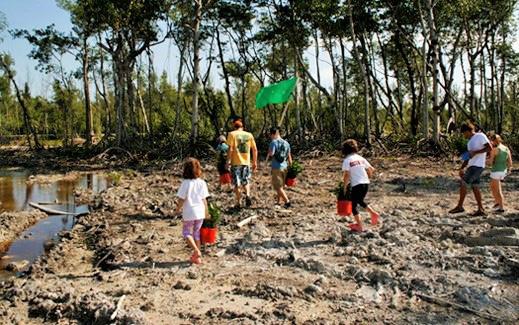
VIRGINIA KEY, FLORIDA
Citizen Science is a crowdsourcing approach to scientific research in which members of the general public collaborate with professional scientists to assist with data collection and analysis to achieve a research goal. At Virginia Key off the coast of Miami, FL a Citizen-Science approach has been successfully employed to monitor habitat restoration and dune health. Volunteers, coordinated by a principal scientist at the Frost Museum of Science, survey for birds, new dune vegetation, and collect water quality data following the reforestation of mangrove wetlands on Virginia Key. The citizen-scientists use free smartphone
// 91 RECOMMENDATIONS
apps to document their findings quickly and effectively.
EXHIBIT: 18 COROLLA
PHOTO BY XAVIER CORTADA
PHOTO BY OTHERS
NORTHERN MAINLAND


OFF-ROAD AREA, GIBBS WOODS, & KNOTTS ISLAND
This section establishes policies and actions for the Off-Road Area, Gibbs Woods, and Knotts Island.


MAP: 6


Eperrupta cori quaspid qui te est, officiunt qui tem fugia plaut ut eic totas maximus.
Edis sit fugiam esti utatur reperuptati ipiciet lab ipsanto vitincta aspe pel ipsuntur si veroviduntem laceatum si remperrovid quodipidus, sit et, exero toris et pel id excea et as eventur?


The Off-Road Area is an exceptionally distinct geography. Located north of milepost 13 on NC 12 on the Outer Banks, it is comprised of large areas of protected wildlife preserves and is the last remaining habitat of the Corolla Wild Horses. The wild horse population attracts thousands of visitors a year and has inspired the establishment of commercial wild horse tours. The Off-Road Area is accessed by driving on the beach and beach parking is permitted. This unique feature is a source of attraction for visitors, but creates an unsafe environment for beachgoers. Development pressure in the Off-Road Area is increasing despite very limited infrastructure. A stable and sustainable future depends on striking the appropriate balance between conservation and maintaining a high quality of life for residents and visitors.
Ratur a qui dolorup tatquid ma dessincimusa sit, idus modignam, nimilisqui quiae aut ullaborporum verum nobitium harcienim que pe natum, omnist optatur, sum a quis magnihi llabo. Itat quiae nihit ut ratet modit alis esequam, tempore volorest, vidit vendi dero dolectatur sae intio occus est ipissimintor rem explautemquo vendi auda vendam, et quatis dolorrovit opta cor asitiis evernat urianistius quam, audistotas vellorestion netur ressed eatur audi que consero tem incipsuntum, quunde nimossimus mi, etures sa desenis sedias nitam nescilit fugiatatur? Enis sum inulles torempel maximin usciducitis es il ium rem suntur mi, simil mo mod ent.


Obit, consequate lam reicium et volupta ernat.


Gibbs Woods and Knotts Island are rural communities dominated by the presence of conservation lands and are geographically isolated from both the Currituck Mainland and Outer Banks. Gibbs Woods is defined by the Northwest River and Northwest River Marsh Game Land. The community of Knotts Island is adjacent to the 9,000+ acre Mackay Island National Wildlife Refuge directly south of the Virginia border. Both communities have been sparsely developed with single family homes.
Xerrore hendam fugiam id magnisti volloriaspe evelique veligen diassit atiam, sanihiliquia plabore nusant exerum cum quid et facerchil ius que dolupta taquam apeles ium iducillabore lam, inctotat.


Ehent adiate nisimin ciusant quunt, te volesent autem eatur aut veribus, que moluptaquat qui officiis il in


92 //
C HAPTER 3
MAP: 12
GIBBS WOODS, KNOTTS ISLAND, AND THE O ff -ROAD AREA ARE RURAL COMMUNITIES DOMINATED B y THE PRESENCE O f CONSERVATION LANDHOLDINGS AND OUTSTANDING COASTAL LANDSCAPES.

// 93
LAND
2. G-1 POLICIES FOR GIBBS WOODS AND KNOTTS ISLAND
C HAPTER 3
Explore the feasibility of public-private partnerships with landowners and conservation agencies to acquire lots in the Off-Road Area for conservation, open space preservation, and stormwater and public safety needs (i.e ponds for fire-fighting capability). 1.2 Continue to prohibit commercial development and avoid growth-inducing policies and infrastructure in the Off-Road Area.
USE POLICIES 1. O-1 PRESERVED LANDS AND O-2 RESERVED LANDS/CONSERVATION: 1.1
2.1 Encourage limited neighborhood commercial uses and ecotourism to locate in areas already zoned or established for commercial use. CURRITUCK KNOTTS ISLAND GIBBS WOODS OFFROAD AREA COROLLA WATERLILY MOYOCK BARCO COINJOCK AYDLETT TOI-87 MID-CURRITUCKBRIDGE O ff ROAD AREA, GIBBS WOODS & KNOTTS ISLAND, f UTURE LAND USE MAP: 13 OFF-ROAD AREA, GIBBS WOODS, & KNOTTS ISLAND Subareas O‐1 Preserved Lands O‐2 Reserved Lands G‐1 Low Density Growth G‐2 Controlled Growth G‐3 Mixed Use CentersG‐4 Village Centers Off‐Road Area N/A 1 du/ 3 acres N/A N/A N/A N/A Gibb Woods & Knotts Island N/A 1 du/ 3 acres1 du/ 3 acres N/A N/A N/A
OFF-ROAD AREA, GIBBS WOODS, & KNOTTS ISLAND
3. GENERAL POLICIES
3.1 Maintain the area’s unique identity by valuing and protecting natural resources, open space, wildlife habitat, and biodiversity through a variety of conservation methods including, but not limited to: open space preservation; land acquisition partnerships; and monitoring marsh health.
3.2 Encourage compatible commercial businesses to locate in existing appropriately zoned areas.
3.3 Encourage additional, compatible ecotourism offerings on Knotts Island.
3.4 Continue to prohibit and discourage growth inducing facilities including centralized water and wastewater in the Off Road Area.
3.5 Continue to protect and preserve vehicular access to the Off-Road area that does not compromise environmental integrity, ecologically sensitive areas or habitat for wild horses.
3.6. Prioritize preservation of open space near marshes and special flood hazard areas to allow for inland retreat of coastal marshes.
A MANAGEMENT STRATEG y f OR BEACH DRIVING IN THE O ff -ROAD AREA IS ESSENTIAL TO ENSURE BOTH SA f ET y f OR BEACH-GOERS AND ADEQUATE ACCESS f OR RESIDENTS.
// 95 RECOMMENDATIONS

CHAPTER 4: IMPLEMENTATION
This chapter summarizes the policies set forth in the previous chapter in a series of five (5) matrices.
The Imagine Currituck 2040 Vision Plan provides a wide-ranging policy framework to guide decisionmaking across all levels and departments of County government. The plan provides direction for future planning efforts, updates to existing regulations, capital improvement projects, internal operating policies, and the establishment of new partnerships.

IN THIS CHAPTER:
» Countywide Implementation Matrix » Northern Mainland Implementation Matrix » Lower Currituck Implementation Matrix » Corolla Implementation Matrix » Off-Road Area Implementation Matrix
IMPLEMENTATION MATRIX SERIES
The first implementation matrix includes over-arching policies that apply throughout the County. The subsequent matrices correspond with each of the four geographic areas introduced in Chapter three.
Within each matrix, recommended policies are organized into five action categories: Capital Project; UDO Amendment; Long Range Planning; County Department Policy; or Community Initiative. Additionally, the matrix series identifies lead departments and specifies years for starting and completing each policy.
Icons in the left columns identify the corresponding Planning Element and Guiding Principles that are supported by the listed policy.
CHAPTER 4 98 //

// 99 IMPLEMENTATION THE COMMUNIT y VISION PRESENTED IN IMAGINE CURRITUCK MUST BE REALIZED COLLECTIVELy THROUGH A CONCERTED E ff ORT f ROM ALL LEVELS O f COUNT y GOVERNMENT, STATE AND NON-PRO f IT PARTNERS, COUNT y RESIDENTS, AND PRIVATE DEVELOPERS.
COUNTYWIDE IMPLEMENTATION MATRIX
CAPITAL PROJECTS
Planning Elements Policy/Action Action -Item
Economic Development
Infrastructure and Services
Expand reliable, high-speed internet service throughout the County to attract home-based/telecommuter, finance, insurance, and real estate professionals and businesses.
CC-ACT-1
Implement the Airport Improvement Program to ensure facility expansion and improvement. CC-ACT-2
Expand airport operations and services according to the Airport Layout Master Plan. CC-ACT-3
Work with NCDOT to create identifiable gateways into and within Currituck County by installing signage, landscaping, and public art at the following locations (in priority order): a. NC 168 at VA border; b. 158/168 at Wright Memorial Bridge in Point Harbor; c. US 158 intersection at Barco; d. NC 12 at Currituck/Dare County line; e. Knott’s Island past Mackay Island refuge; f. Future Mid-County Bridge landings on NC 168/158 and NC 12; g. North and South Gateways to Grandy Village area; h. 168 Gateway into Lower Currituck/ Powell’s Point from North Mainland; i. Future East-West Connector to I-87 Gateway at County line
Transportation
Parks and Recreation
Partner with NCDOT to implement recommendations in the Connect Currituck Pedestrian Master Plan to provide for sidewalks, multi-use paths, bike lanes, and quiet streets along key roads in Poplar Branch, Grandy, Jarvisburg, and Point Harbor.
Encourage and partner with NCDOT to provide pedestrian facilities on the Wright Memorial Bridge, Mid-Currituck Bridge, and Joseph P. Knapp bridge over the Intracoastal Waterway as recommended in Connect Currituck.
Plan for implementation of specific pedestrian projects, as recommended in the Connect Currituck Pedestrian Master Plan.
CC-ACT-4
CC-ACT-5
CC-ACT-6
CC-ACT-7
Partner with NCDOT to provide more locations to safely cross Caratoke Highway/US 158 as identified in the Connect Currituck Pedestrian Master Plan. CC-ACT-8
Identify and secure property for public water access to the County’s rivers, canals, sounds, and beaches. CC-ACT-9
Develop a strategic plan for acquiring key recreation properties within targeted growth areas. CC-ACT-10
100 // CHAPTER 4
Coordinating Agency
Fiscal Year Start
Fiscal Year End
Guiding Principles Policy Foundation
Economic Development Dept. & Chamber of Commerce 2022 2027 ED-4
Airport Advisory Board & Economic Development Dept., Public Facilities 2022 Ongoing ICS-6, TR3.2
Airport Advisory Board & Economic Development Dept., Public Facilities 2022 Ongoing ICS-6, TR3.2
Planning Dept. 2022 2037 TR-1
Planning Dept. 2022 2037 TR-2
Planning Dept. 2022 2037 TR-2, PR-2
Planning Dept. 2022 2037 TR-2
Planning Dept. 2022 2023 TR-2
Parks Dept. 2022 2030 PR-1
Planning Dept. 2022 2025 PR-1
GUIDING PRINCIPLES
Natural Resource Protection Coordinated Growth
Economic Prosperity Enhanced Transportation
Expanded Public Access to Natural Resources
Destination Points Place-Making
// 101 IMPLEMENTATION
COUNTYWIDE IMPLEMENTATION MATRIX
UDO AMENDMENTS
Planning Elements Policy/Action Action -Item
Update UDO, zoning districts, and zoning map to align with the Imagine Currituck Future Land Use Transect Categories and Future Land Use Map. CC-ACT-11
Evaluate and strengthen standards for mining activities. CC-ACT-12
Land Use
Evaluate and strengthen standards to require new development to coordinate site design with nearby existing and future development. CC-ACT-13
Review UDO and amend to allow compatible outdoor recreation amenities and eco-tourism opportunities in appropriate zoning districts.
CC-ACT-14
Review UDO and amend to allow compatible farm-to-table restaurants, farm stands and markets, and agritourism enterprises in appropriate zoning districts. CC-ACT-15
Economic Development
Update UDO to provide incentives for development of a variety of workforce housing for mixed incomes. CC-ACT-16
Provide rolling TRC review for all Planned Urban Development projects in the G-3 and G-4 growth areas to encourage growth in targeted areas with existing infrastructure . CC-ACT-17
Provide expedited permitting in growth areas G-3 and G-4 to encourage targeted growth in areas with existing infrastructure. CC-ACT-18
Update utility extension policies to strengthen the relationship between development densities and targeted growth areas.
Infrastructure and Services
CC-ACT-19
Improve construction standards for private streets to provide for more effective stormwater drainage. CC-ACT-20
Evaluate existing ordinance and establish parameters by which developments may employ use of on-site wastewater treatment.
CC-ACT-21
Strengthen stormwater guidelines to minimize non-point pollution of open water sources. CC-ACT-22
102 // CHAPTER 4
Coordinating Agency Fiscal Year Start
Fiscal Year End
Guiding Principles Policy Foundation
Planning Dept. 2022 2024 LU-1
Planning Dept. 2022 Ongoing LU-2
Planning Dept. 2022 Ongoing LU-2.1
Planning Dept. 2022 2024 ED-2.2, LU-2
Planning Dept. 2022 2024 ED-3 Planning Dept. 2022 2024 ED-4.1
Planning Dept. 2022 Ongoing ED-4
Planning Dept. 2022 Ongoing ED-1
Public Utilities Dept. 2022 2027 ICS-1, ICS-3 County Engineer & Planning Dept. 2022 2027 ICS-4, EN4.5
Planning Dept. & County Engineer 2022 2024 ICS-3.5
Planning Dept. & County Engineer 2022 2024 ICS-4, EN4.10
GUIDING PRINCIPLES
// 103 IMPLEMENTATION
continued
next page
on
Resource Protection Coordinated Growth Economic Prosperity Enhanced Transportation
Public
Natural Resources
Natural
Expanded
Access to
Destination Points Place-Making
COUNTYWIDE IMPLEMENTATION MATRIX
UDO AMENDMENTS
Planning Elements Policy/Action Action -Item
Establish secondary street network to create connectivity between neighborhoods, commercial areas, and community centers by requiring new development to provide for multi-modal connectivity to adjacent existing or future development.
CC-ACT-23
Evaluate and strengthen corridor appearance standards for areas inside of strategic corridors. CC-ACT-24
Transportation
Strengthen standards that require new development to construct pedestrian walkways and multi-use greenways that connect to adjacent residential and commercial areas.
CC-ACT-25
Amend the UDO to incorporate specifications and typical cross sections consistent with Complete Street principles for both public and private streets. CC-ACT-26
Require a Transportation Impact Analysis for uses that will generate a significant increase in vehicle activity. CC-ACT-27
104 // CHAPTER 4
Coordinating Agency
Fiscal Year Start
Fiscal Year End Guiding Principles Policy Foundation
Planning Dept. 2022 2038 TR-1
Planning Dept. 2023 2024 TR-1, LU-3
Planning Dept. 2022 2024 TR-1, TR-2, PR-2
Planning Dept. 2023 2024 TR-1, TR-2
Planning Dept. 2022 Ongoing TR-1
GUIDING PRINCIPLES
// 105 IMPLEMENTATION
continued on next page
Natural Resource Protection Coordinated Growth Economic Prosperity Enhanced Transportation Expanded Public Access to Natural Resources Destination Points Place-Making
COUNTYWIDE IMPLEMENTATION MATRIX
UDO AMENDMENTS
Planning Elements Policy/Action Action -Item
Evaluate effectiveness and update the stormwater ordinance to ensure high water quality and adequate water quantity management.
Prioritize preservation of open space near marshes and special flood hazard areas to allow for inland retreat of coastal marshes and wetlands.
CC-ACT-28
CC-ACT-29
Environment
Amend UDO so that coastal and non-coastal wetlands shall not be considered part of a lot’s acreage for the purpose of determining minimum lot size or development density.
CC-ACT-30
106 // CHAPTER 4
Coordinating Agency Fiscal Year Start
Fiscal Year End
Guiding Principles Policy Foundation
County Engineer & Planning Dept. 2022 Ongoing ICS-4, EN-4.10
Planning Dept. 2023 2025 EN-4, ED-2.1
Planning Dept. 2022 2023 EN-4
GUIDING PRINCIPLES
Natural Resource Protection
Coordinated Growth
Economic Prosperity Enhanced Transportation
Expanded Public Access to Natural Resources
Destination Points Place-Making
// 107 IMPLEMENTATION
COUNTYWIDE IMPLEMENTATION MATRIX
LONG RANGE PLANNING
Planning Elements Policy/Action Action -Item
Develop a unified signage package and installation plan that utilizes the Currituck County brand. Install signage at key gateways, wayfinding points, public facilities, and Villages.
Plan for water and wastewater expansion to encourage business retention and expansion in G-2, G-3, & G-4.
CC-ACT-31
CC-ACT-32
Economic
Development
Create a unique, recognizable visual brand for the County through a community-driven process.
Ensure adequate infrastructure and public services to meet future market demand for residential, commercial, and industrial development in classifications G-2, G-3, G-4.
CC-ACT-33
CC-ACT-34
Develop a County Security Plan. CC-ACT-35
Work to expand the Inter-County Public Transportation Authority services to meet increased demand for senior transit. CC-ACT-36
Infrastructure and Services
Develop a plan for improving and developing new senior centers to serve aging population. CC-ACT-37
Explore expansion of sewer in Grandy to encourage concentrated development. CC-ACT-38
Partner with the NC Sea Grant and DCM to develop an estuarine shoreline management plan that identifies locations and strategies for shoreline stabilization based on the County’s specific shoreline types.
Environment
CC-ACT-39
Partner with the North Carolina Sea Grant and the Nature Conservancy to conduct a community-driven vulnerability assessment and adaptation plan. CC-ACT-40
Commission a beach monitoring and stability assessment to investigate longterm and short-term shoreline and volumetric changes occurring along the oceanfront beaches. CC-ACT-41
Develop a beach and long-term management plan including best management practices for dune preservation and coastal resilience to maintain the beach for it’s economic, recreational, aesthetic, natural and storm protective value.
CC-ACT-42
108 // CHAPTER 4
Coordinating Agency
Fiscal Year Start
Fiscal Year End
Guiding Principles Policy Foundation
Dept. of Travel & Tourism & Planning Dept. 2022 2025 ED-2, TR-1
Public Utilities Dept. & County Engineer 2022 Ongoing ED-1, ICS-1 Dept. of Travel & Tourism & Planning Dept. 2024 2028 ED-2
Public Utilities Dept. 2022 Ongoing ED-1, ICS-1
Emergency Management. 2022 2024 ICS-2
Planning Dept. & ICPTA Advisory Board 2023 2028 ICS-5
Senior Services & Planning Dept. 2023 2028 ICS-5
Public Utilities Dept. & County Engineer 2022 2027 ICS-3
Planning Dept. 2023 2028 EN-4
Planning Dept. & Emergency Services Dept. 2023 2027 EN-4
Planning Dept., County Engineer, Dept. of Travel & Tourism, & Economic Development Dept. 2022 2024 EN-4
Planning Dept., County Engineer, Dept. of Travel & Tourism, & Economic Development Dept. 2022 2025 EN-4, ED-2.1
GUIDING PRINCIPLES
// 109 IMPLEMENTATION
Natural Resource Protection Coordinated Growth Economic Prosperity Enhanced Transportation Expanded Public Access to Natural Resources Destination Points Place-Making
COUNTYWIDE IMPLEMENTATION MATRIX
COUNTY POLICIES
Planning Elements Policy/Action Action -Item
Facilitate a program whereby junked cars may be hauled away and recycled.
Land Use
Encourage neighborhood commercial to locate near road intersections, neighborhood serving facilities such as schools and parks, and existing compatible commercial uses.
Continue to evaluate and recommend updates to the sign ordinance to achieve desired sign design, types and placement.
CC-ACT-43
CC-ACT-44
CC-ACT-45
110 // CHAPTER 4
Coordinating Agency Fiscal Year Start
Fiscal Year End Guiding Principles Policy Foundation
Planning Dept. 2022 2023 LU-2, LU-3
Planning Dept. 2022 Ongoing Transect G-2
Planning Dept. 2022 Ongoing LU-2, LU-3 continued on next page
GUIDING PRINCIPLES
Natural Resource Protection
Coordinated Growth
Economic Prosperity Enhanced Transportation
Expanded Public Access to Natural Resources
Destination Points Place-Making
// 111 IMPLEMENTATION
COUNTYWIDE IMPLEMENTATION MATRIX
COUNTY POLICIES
Planning Elements Policy/Action Action -Item
Support small business growth by establishing a small business development and technical assistance program.
Provide early-stage technical assistance to area entrepreneurs and growing companies in partnership with the NC Small Business and Technology Development Center and the College of the Albemarle Small Business Center. (See pg. 48)
Continue to support and provide free public entertainment such as the existing outdoor concert series, movie nights, and festivals, while establishing new locations for free public entertainment. Consider establishing a grant program for events and festivals.
CC-ACT-46
CC-ACT-47
CC-ACT-48
Economic
Development
Create a unique, recognizable visual brand for the County through a community driven process to use for business recruitment.
CC-ACT-49
Encourage industrial developments to pursue “Certified” designation. CC-ACT-50
Expand workforce training and vocational education at the Currituck County College of the Albemarle campus to include programs of study in healthcare and related fields.
Communicate all potential new business developments or inquiries to the Economic Development Department for follow up contact.
Retain and attract desirable jobs by fostering a skilled and educated workforce.
CC-ACT-51
CC-ACT-52
CC-ACT-53
112 // CHAPTER 4
Coordinating Agency
Fiscal Year Start
Fiscal Year End Guiding Principles Policy Foundation
Economic Development Dept. & Chamber of Commerce 2022 2026 ED-1
Economic Development Dept. & Chamber of Commerce 2022 2029 ED-1
Dept. of Travel & Tourism 2022 Ongoing ED-2
Dept. of Travel & Tourism & Economic Development Dept. 2022 2028 ED-2
Economic Development Dept. & Planning Dept. 2022 Ongoing ED-5
Economic Development Dept. & College of the Albemarle 2022 2028 ED-1, ED-4
All Departments & Agencies 2022 Ongoing
ED-1, 2, 3, 4, 5
College of the Albemarle; Board of Education; 2022 Ongoing ED-1
GUIDING PRINCIPLES
Natural Resource Protection
Coordinated Growth
Economic Prosperity Enhanced Transportation
Expanded Public Access to Natural Resources
Destination Points Place-Making
// 113 IMPLEMENTATION
continued on next page
COUNTYWIDE IMPLEMENTATION MATRIX
COUNTY POLICIES
Planning Elements Policy/Action Action -Item
Update the water system growth plan and extension policy for water systems. CC-ACT-54
Develop standard details for construction of water and wastewater infrastructure to ensure quality, consistency, and adequate volume and pressure for fire suppression. CC-ACT-55
Consider establishing a tiered utility connection fee schedule based on the number of bedrooms for single-family homes. CC-ACT-56
Proactively coordinate with NCDOT to properly maintain or improve drainage infrastructure on state roads through infrastructure retrofit.
CC-ACT-57
Establish watershed-based stormwater service districts that are mapped and funded in order to address the drainage needs of individual watersheds. CC-ACT-58
Implement and update the Outer Banks Regional Hazard Mitigation Plan. CC-ACT-59
Infrastructure and Services
Continue to require new development to connect to the County’s water system at the expense of the developer if it is within a calculated distance from an existing water main, ensuring that the cost of growth is not borne by existing water customers.
CC-ACT-60
Develop a voluntary process for retrofitting existing private development to improve stormwater management. CC-ACT-61
Explore partnerships with public and private agencies such as the Army Corps of Engineers and The Nature Conservancy, to provide technical assistance and funding for retrofitting stormwater infrastructure to include nature-based solutions. CC-ACT-62
Consider establishing a County stormwater permit system for new development. CC-ACT-63
Expand provision of senior services including adult daycare, assisted living, and nutrition programs. CC-ACT-64
Evaluate and strengthen ordinances and parameters relating to the use of new private package treatment plants. CC-ACT-65
114 // CHAPTER 4
Coordinating Agency
Fiscal Year Start
Fiscal Year End Guiding Principles Policy Foundation
Public Utilities Dept. 2022 2032
ED-1, ED-3, ICS-1
County Engineer & Public Utilities Dept. 2022 2032 ICS-2, ICS-3
Public Utilities Dept. 2022 2032 ICS-3
Planning Dept. & County Engineer 2022 Ongoing ICS-4
County Engineer & Planning Dept. 2022 2042 EN-4, ICS-4 Emergency Management Ongoing Ongoing ICS-2
Public Utilities Dept. & Planning Dept. 2022 Ongoing ICS-3.1
County Engineer & Planning Dept. 2022 2042
ICS-4, EN4.5
County Engineer & Planning Dept. 2022 2042 ICS-4, EN4.5
County Engineer & Planning Dept. 2022 2032 ICS-4, EN4.5
Senior Services Dept. 2023 2038 ICS-5
County Engineer & Planning Dept. 2022 2027 ICS-3.4 continued on next page
// 115 IMPLEMENTATION
Natural Resource Protection Coordinated Growth Economic Prosperity Enhanced Transportation Expanded Public Access to Natural Resources Destination Points Place-Making
GUIDING PRINCIPLES
COUNTYWIDE IMPLEMENTATION MATRIX
COUNTY POLICIES
Planning Elements Policy/Action Action
Support the development of affordable senior housing.
Infrastructure and Services
-Item
CC-ACT-66
Continue to identify and evaluate sites for deep wells as needed. CC-ACT-67
Continue to implement utility rate fee increase for usage over 20,000 gallons per month. CC-ACT-68
Upgrade public safety system to a trunked system with additional frequencies. CC-ACT-69
Evaluate communities for curbside household garbage collection, based on a suitability threshold. CC-ACT-70
Construct a central public safety facility (Completed 2021).
CC-ACT-71
Expand airport operations and services according to the Airport Layout Master Plan. CC-ACT-72
Ensure adequate fire fighting capacity through annual evaluation of the need for additional fire stations or improvements to existing fire stations.
CC-ACT-73
116 // CHAPTER 4
Coordinating Agency
Fiscal Year Start
Fiscal Year End Guiding Principles Policy Foundation
Planning, Economic Development, & Senior Services Dept. 2023 Ongoing ICS-5
Public Utilities Dept. 2022 Ongoing ICS-8
Public Utilities Dept. 2022 Ongoing ICS-3, ICS-8
Communications 2022 2023 ICS-2
Public Works Dept. 2022 Ongoing ICS-9
County Manager Complete Complete ICS-2
Airport Advisory Board, Airport Manager Economic Development Dept., Public Facilities 2022 Ongoing ICS-6
Fire & Emergency Medical Services 2022 Ongoing ICS-2
GUIDING PRINCIPLES
Natural Resource Protection
Coordinated Growth
Economic Prosperity Enhanced Transportation
Expanded Public Access to Natural Resources
Destination Points Place-Making
// 117 IMPLEMENTATION
continued
next page
on
COUNTYWIDE IMPLEMENTATION MATRIX
COUNTY POLICIES
Planning Elements Policy/Action Action -Item
Establish parameters by which developments may employ use of on-site wastewater treatment.
Infrastructure and Services
CC-ACT-74
Provide public education and outreach activities that reduce litter and illegal dumping. CC-ACT-75
Develop educational outreach program for existing home and property owners associations to provide information on stormwater responsibility and mitigation strategies. CC-ACT-76
118 // CHAPTER 4
Coordinating Agency
Fiscal Year Start
Fiscal Year End Guiding Principles Policy Foundation
County Engineer & Planning Dept. 2022 2025
ICS-3.4 EN-3
County Engineer 2022 Ongoing ICS-9
County Engineer & Planning Dept., Soil & Water Conservation District 2022 2026
ICS-4, EN4.5
GUIDING PRINCIPLES
Natural Resource Protection
Coordinated Growth
Economic Prosperity Enhanced Transportation
Expanded Public Access to Natural Resources
Destination Points Place-Making
// 119 IMPLEMENTATION
continued on next page
COUNTYWIDE IMPLEMENTATION MATRIX
COUNTY POLICIES
Planning Elements Policy/Action Action -Item
Request that the following Currituck County Strategic Corridors be included in the State Transportation Improvement Program (STIP) (in priority order): a. NC 168/Caratoke Hwy from Virginia border to Puddin Ridge Rd; b. NC 168/ Caratoke Hwy from Maple Road to intersection with NC 158; c. Caratoke Hwy from Wright Memorial Bridge north to Westside Lane; d. US 158/NC 168/ Caratoke Hwy through Grandy; e. NC 12 in Corolla at 4 commercial nodes.
CC-ACT-77
Transportation
Continue limiting driveway cuts on highways and collector roads by the number of driveways per lot and the distance between driveways.
Monitor traffic volume and development on other secondary roads to identify need for driveway cut regulations.
Prioritize emergency evacuation in the development and approval of transportation plans and improvements included in the STIP.
CC-ACT-78
CC-ACT-79
CC-ACT-80
120 // CHAPTER 4
Coordinating Agency
Fiscal Year Start
Fiscal Year End Guiding Principles Policy Foundation
Planning Dept. 2022 2038 TR-1
Planning Dept. 2022 Ongoing TR-1.4
Planning Dept. 2023 Ongoing TR-1.4
Emergency Management 2022 Ongoing TR-1
GUIDING PRINCIPLES
Natural Resource Protection
Coordinated Growth
Economic Prosperity Enhanced Transportation
Expanded Public Access to Natural Resources
Destination Points Place-Making
// 121 IMPLEMENTATION
continued on next page
COUNTYWIDE IMPLEMENTATION MATRIX
COUNTY POLICIES
Planning Elements Policy/Action Action -Item
Evaluate and strengthen corridor appearance standards for areas inside of strategic corridors.
CC-ACT-81
Strengthen minimum architectural design standards for areas outside of strategic corridors. CC-ACT-82
Transportation
Establish a threshold and requirement for a Traffic Impact Analysis for uses that will generate a significant increase in traffic volume and carefully consider the impacts of proposed developments when making land use decisions. CC-ACT-83
Evaluate the expansion of transit services with regional agencies. CC-ACT-84
Explore the expansion of water-based transportation options. CC-ACT-85
122 // CHAPTER 4
Coordinating Agency
Fiscal Year Start
Fiscal Year End Guiding Principles Policy Foundation
Planning Dept. 2022 2025 TR-1, LU-3
Planning Dept. 2022 2025 TR-1, LU-3
Planning Dept. 2022 Ongoing TR-1
Planning Dept., Senior Services 2022 Ongoing TR-3
Planning Dept. 2022 Ongoing TR-3 continued on next page
GUIDING PRINCIPLES
// 123 IMPLEMENTATION
Resource Protection
Growth
Transportation
Natural
Coordinated
Economic Prosperity Enhanced
Expanded Public Access to Natural Resources Destination Points Place-Making
COUNTYWIDE IMPLEMENTATION MATRIX
COUNTY POLICIES
Planning Elements Policy/Action Action -Item
Continue to promote and improve the County’s farmland preservation program and evaluate opportunities to work in conjunction with the NC Farmland Preservation Trust Fund.
CC-ACT-86
Identify regulatory options for decommissioning solar farms and conversion back to agricultural uses (Completed 2019). CC-ACT-87
Partner with agencies such as the NC Sea Grant and the Division of Coastal Management (DCM) to study and map estuarine marsh migration along the Currituck and Albemarle Sounds.
CC-ACT-88
Identify and evaluate critical infrastructure and develop strategies to ensure resilience. CC-ACT-89
Protect dunes and natural shoreline ecosystems by following recommendations of the NC Sea Grant’s Dune Book for best-management practices for vegetation, sand fencing, and pedestrian beach access.
CC-ACT-90
As stormwater service districts are established, consider incentivizing property owners to implement green and blue infrastructure on private property. CC-ACT-91
Environment
Partner with conservation agencies to conserve Significant Natural Heritage Areas through fee-simple acquisition or conservation easements.
Continue to partner with the Corolla Wild Horse Fund, National Estuarine Research Reserve, and Currituck National Wildlife Refuge to implement the management goals and actions of the Wild Horse Management Agreement.
CC-ACT-92
CC-ACT-93
Periodically reexamine water quality classifications and seek to achieve higher quality conditions and ratings. CC-ACT-94
Require the establishment or preservation of riparian buffers in new developments. CC-ACT-95
Develop a beach assessment and long-term management plan including best management practices for dune preservation and coastal resilience to maintain the beach for it’s economic, recreational, aesthetic, natural and storm protective value.
CC-ACT-96
124 // CHAPTER 4
Coordinating Agency
Fiscal Year Start
Fiscal Year End Guiding Principles Policy Foundation
Soil & Water Conservation District, Cooperative Extension Office, & Planning Dept. 2022 2026 EN-2
Planning Dept. Complete Complete EN-2
Planning Dept. 2023 2038 EN-4
Public Utilities, Planning Dept., & Emergency Management 2022 Ongoing EN-4, ICS-1
Planning Dept. & Dept. of Travel & Tourism 2022 Ongoing EN-4
County Engineer & Planning Dept. 2022 2042 ICS-4, EN4.5
Soil & Water Conservation District, Cooperative Extension Office, and Planning Dept. 2023 Ongoing EN-1.2
Planning Dept. 2022 2040
EN-4, EN-4, ED-2.1
County Engineer 2022 Ongoing EN-3
Planning Dept. 2022 2040 EN-3
Planning Dept., County Engineer, Dept. of Travel & Tourism, & Economic Development Dept. 2022 2025 EN-4, ED-2.1
GUIDING PRINCIPLES
Natural Resource Protection
Coordinated Growth
Economic Prosperity Enhanced Transportation
Expanded Public Access to Natural Resources
Destination Points Place-Making
// 125 IMPLEMENTATION
continued on next page
COUNTYWIDE IMPLEMENTATION MATRIX
COUNTY POLICIES
Planning Elements Policy/Action Action -Item
Fully Enforce the stormwater ordinance to help prevent nonpoint source pollution in area waterways.
CC-ACT-97
Monitor water and sewage treatment discharges into the surface waters of Currituck County to help prevent discharges that cause degradation of water quality. CC-ACT-98
Reference the Countywide Land Parcel Prioritization Strategy for Water Quality Enhancement. CC-ACT-99
Improve the County’s Community Rating System (CRS) score with public outreach and higher regulatory standards to make development in the county safer and help reduce premiums for Federal Flood Insurance.
CC-ACT-100
Environment
Educate the public about the use of the least hardened shoreline stabilization method along estuarine shorelines.
Plan for and establish higher regulatory standards for resiliency based on evaluations and considerations of future flood risk, coastal hazards, flood conditions, increased precipitation, and vulnerability.
Protect dunes and natural shoreline ecosystems by following recommendations of the NC Sea Grant’s Dune Book for best-management practices for vegetation, sand fencing, and pedestrian beach access.
Reference the Soil Conservation Service mapping of prime soils in making land use decisions and target prime lands for conservation.
CC-ACT-101
CC-ACT-102
CC-ACT-103
CC-ACT-104
126 // CHAPTER 4
Coordinating Agency
Fiscal Year Start
Fiscal Year End Guiding Principles Policy Foundation
County Engineer & Planning Dept. 2022 Ongoing ICS-4, EN-3
County Engineer, Economic Development Dept., & Planning Dept. 2022 Ongoing EN-3
County Engineer & Planning Dept 2022 Ongoing EN-3
Planning Dept. & Emergency Management 2022 Ongoing EN-4
Planning Dept. 2022 Ongoing EN-4.6
Planning Dept. 2022 Ongoing EN-4
Planning Dept. 2022 Ongoing EN-4, ED-2.1
Soil & Water Conservation District, Cooperative Extension Office, & Planning Dept. 2022 Ongoing EN-2, LU-1.5
GUIDING PRINCIPLES
Natural Resource Protection
Coordinated Growth
Economic Prosperity Enhanced Transportation
Expanded Public Access to Natural Resources
Destination Points Place-Making
// 127 IMPLEMENTATION
continued on next page
COUNTYWIDE IMPLEMENTATION MATRIX
COUNTY POLICIES
Planning Elements Policy/Action Action -Item
Explore opportunities for partnerships with public land managers and conservation agencies to allow more public access to outdoor recreation resource areas.
CC-ACT-105
Ensure that new facilities and access areas are ADA compliant and identify existing facilities that should be retrofitted for ADA compliance. CC-ACT-106
Schedule year-round programming for festivals and events at various County facilities and parks. CC-ACT-107
Require recreation and park area dedication or fee in lieu of providing recreation amenities.
Parks and Recreation
CC-ACT-108
Maintain joint-use agreement with Currituck County Schools that provides for use of school playing fields for recreational programming. CC-ACT-109
Develop programming to reflect projected demographic shift towards large senior population. CC-ACT-110
Plan for additional public access areas with diverse recreation activities including boat, canoe and kayak launches, marinas, docks, scenic outlooks, boardwalks, swimming and crabbing areas and incorporate specific needs into the Parks and Recreation Master Plan
CC-ACT-111
Establish level of service policies to ensure location and capacity of public access is consistent with growth. CC-ACT-112
Educate marina operators about Best Practice Operating Programs such as “Clean Marina.” CC-ACT-113
Establish level of service policies to ensure location and capacity of parks and recreation offerings are consistent with growth. CC-ACT-114
128 // CHAPTER 4
Coordinating Agency
Fiscal Year Start
Fiscal Year End Guiding Principles Policy Foundation
Parks & Planning Depts. 2022 2034 PR-1
Public Facilities & Planning Depts. 2022 Ongoing PR-1.2
Dept. of Travel & Tourism & Parks Dept. 2022 Ongoing ED-2, PR-3.1
Planning Dept. 2022 Ongoing PR-3
Parks Dept. 2022 2041 PR-3.1 Dept. of Travel & Tourism & Parks Dept. 2022 2029 ICS-5
Dept. of Travel & Tourism, Parks Dept., & Planning Dept. 2022 Ongoing PR-1, ED-2
Parks Dept. & Planning Dept. 2022 Ongoing PR-1 Planning Dept., Economic Development Dept., & Parks Dept. 2022 Ongoing PR-1
Parks Dept. & Planning Dept. 2022 Ongoing PR-3
GUIDING PRINCIPLES
Natural Resource Protection
Coordinated Growth
Economic Prosperity Enhanced Transportation
Expanded Public Access to Natural Resources
Destination Points Place-Making
// 129 IMPLEMENTATION
COUNTYWIDE IMPLEMENTATION MATRIX
COMMUNITY INITIATIVES
Planning Elements Policy/Action Action -Item
Establish a system for property or easement acquisitions along shorelines and waterfronts or within marsh areas to increase public access opportunities.
CC-ACT-115
Parks and Recreation
Encourage public access through private sector facilities
CC-ACT-116
Recruit farm-to-table restaurants. CC-ACT-117
Economic Development
Encourage grocery stores and food service business to source local produce and products for sale in stores and for distribution.
Help establish and support the operation of community farmers markets in village centers.
CC-ACT-118
CC-ACT-119
Promote the conservation of potable water through water conservation programs that help reduce consumption, e.g. Limit irrigation use to specific time periods; Encourage drought resistant landscaping; Encourage High Efficiency appliances. CC-ACT-120
Develop educational outreach program for existing home and property owners associations to provide information on stormwater responsibility and mitigation strategies. CC-ACT-121
Infrastructure and Services
Encourage Currituck County Schools to continue pursuing educational excellence. Consider seeking school accreditation from the State Board of Education.
CC-ACT-122
Minimize solid waste by promoting recycling and reuse, composting and mulching. CC-ACT-123
Establish public outreach and education activities that help reduce litter and illegal dumping. CC-ACT-124
130 // CHAPTER 4
Coordinating Agency Fiscal Year Start
Fiscal Year End
Guiding Principles Policy Foundation
Planning Dept. & Recreation Dept. 2022 Ongoing PR-1
Planning Dept. & Recreation Dept. 2022 Ongoing PR-1
Economic Development Dept. Planning Dept., Chamber of Commerce, & NC Cooperative Extension Office 2022 Ongoing ED-3 Economic Development Dept., Planning Dept., Chamber of Commerce, & NC Cooperative Extension Office 2022 Ongoing ED-3
Economic Development Dept., Planning Dept., Chamber of Commerce, & NC Cooperative Extension Office 2022 Ongoing ED-3.1
Public Utilities Dept. & Soil & Water Conservation District 2022 Ongoing ICS-3
County Engineer & Planning Dept., Soil & Water Conservation District 2022 2026 ICS-4, EN-4.5
Economic Development Dept. 2022 Ongoing ICS-7
County Engineer & Public Works 2022 Ongoing ICS-9
County Engineer & Public Works 2022 Ongoing ICS-9
GUIDING PRINCIPLES
Natural
Destination Points Place-Making
// 131 IMPLEMENTATION
continued
page
on next
Resource Protection
Growth
Transportation
Coordinated
Economic Prosperity Enhanced
Expanded Public Access to Natural Resources
COUNTYWIDE IMPLEMENTATION MATRIX
COMMUNITY
INITIATIVES
Planning Elements Policy/Action Action -Item
Promote use of The Nature Conservancy’s Coastal Resiliency app by private property owners, the development community, and planning staff to identify best locations for open space preservation.
Develop an educational outreach program for property owners and residents on the topics of coastal resiliency, storm surge, oceanfront, sound side erosion, and beach management.
CC-ACT-125
CC-ACT-126
Environment
Expand Cooperative Extension Agriculture Awareness programming and promotional campaigns to educate residents on the importance of agriculture.
Expand Cooperative Extension programming on pesticide use and effects on adjacent land.
CC-ACT-127
CC-ACT-128
132 // CHAPTER 4
Coordinating Agency Fiscal Year Start
Fiscal Year End
Guiding Principles Policy Foundation
Planning Dept. 2022 Ongoing ED-2.1, EN-4.6
Planning Dept. 2022 2040 EN-4.45
NC Cooperative Extension Office 2022 2030 EN-2
NC Cooperative Extension Office 2022 2030 EN-3
GUIDING PRINCIPLES
Natural Resource Protection
Coordinated Growth
Economic Prosperity Enhanced Transportation
Expanded Public Access to Natural Resources
Destination Points Place-Making
// 133 IMPLEMENTATION
NORTHERN MAINLAND IMPLEMENTATION MATRIX
CAPITAL PROJECTS
Planning Elements Policy/Action Action -Item
Establish Key Gateways on NC 168 at the following locations: 1) NC/VA state line; 2) Intersection with Puddin Ridge Road; 3) Intersection with US 158 in Barco. NM-ACT-1
Transportation
Parks and Recreation
Partner with NCDOT to implement recommendations in the Connect Currituck Pedestrian Master Plan to provide for sidewalks, multi-use paths, and quiet streets along key roads in Moyock, Currituck, Maple, Barco, and Coinjock.
NM-ACT-2
Partner with NCDOT to provide more locations to safely cross Caratoke Highway/NC 168 as identified in the Connect Currituck Pedestrian Master Plan. NM-ACT-3
Establish public paddle access for Shingle Landing Creek, Tulls Creek, and the Northwest River. NM-ACT-4
Create an interconnected network of greenways and open space in the Moyock area with potential to connect throughout the County and evaluate the UDO to ensure open space/greenway connections where feasible.
Establish a regional park with water access to the Northwest River, trails, and eco-tourism infrastructure near Panther Landing Road.
NM-ACT-5
NM-ACT-6
Provide a pedestrian walkway along the Intracoastal Waterway with Public Marina in Coinjock. NM-ACT-7
Enhance the waterfront area and water access at Veterans Memorial Park in Coinjock. NM-ACT-8
Expand Maple Park to meet the County’s need for traditional recreation facilities as recommended in the Currituck County Parks and Recreation Master Plan. NM-ACT-9
Create a separate water transmission main north of the existing water treatment facility from Maple to Moyock. The transmission main should be designed with fire flow capabilities for expanding commercial areas in Moyock.
Infrastructure and Services
NM-ACT-10
Complete expansion of the Moyock WWTP and plan for future expansion. NM-ACT-11
134 // CHAPTER 4
Coordinating Agency
Fiscal Year Start
Fiscal Year End Guiding Principles Policy Foundation
Planning Dept. 2023 2033 TR-1
Planning Dept. 2023 2041 TR-2, PR-2
Planning Dept. 2023 2041 TR-2, PR-2
Parks Dept. 2022 2023 PR-1
Planning Dept. 2022 2041 PR-2
Parks Dept. 2023 2028 PR-1, ED-2
Planning Dept. & Parks Dept. 2023 2038 PR-1.3, PR-2
Planning Dept. & Parks Dept. 2023 2033 PR-1, ED-2
Parks Dept. 2022 2023 PR-3
Public Utilities Dept. 2022 2042 ICS-1, ICS-2
County Engineer & Utilities Dept. 2022 2028 ICS-3
GUIDING PRINCIPLES
// 135 IMPLEMENTATION
Natural Resource Protection Coordinated Growth Economic Prosperity Enhanced Transportation Expanded Public Access to Natural Resources Destination Points
Place-Making
NORTHERN MAINLAND IMPLEMENTATION MATRIX
UDO AMENDMENTS
Planning Elements Policy/Action Action -Item
Incentivize conservation subdivisions over other less-compatible development types by providing density bonuses to the developer in exchange for the conservation of additional open space in the rural areas around Moyock, Shawboro, and Sligo.
Incentivize medium-density transitional subdivisions that establish interconnected walkable neighborhoods that link parks and open space in the transitional areas of residential development near Moyock and Currituck.
Target the crossroad areas in Sligo and Shawboro for small-scale neighborhood-commercial.
Land Use
NM-ACT-12
NM-ACT-13
NM-ACT-14
Incentivize multi-story buildings that comply with design standards to encourage attractive mixed use developments. NM-ACT-15
Incentivize the development of village subdivisions that provide a variety of housing types at appropriate locations where infrastructure is available. NM-ACT-16
Establish Villages in historic Moyock and historic Currituck with walkable neighborhoods that support a vibrant mix of residential types and villagescale commercial uses.
NM-ACT-17
Establish a small Village Center in Coinjock along the Intracoastal Waterway with a boardwalk & public marina. NM-ACT-18
Strengthen UDO with input from Historic Preservation Commission to help preserve unique historical and architectural features.
Economic Development
Transportation
Environment
NM-ACT-19
Incentivize the development of multigenerational and senior housing. NM-ACT-20
Require large-scale residential development to include a supporting commercial component or an interconnection to existing adjacent business.
NM-ACT-21
Strengthen landscaping requirements for development along Caratoke Highway. NM-ACT-22
Prioritize preservation of open space near marshes to allow for inland retreat of coastal marshes along the Currituck Sound.
Carefully evaluate development proposals in the Barco-Maple area to protect the Currituck Mainland water supply and treatment plant. Ensure that new development effectively treats stormwater on-site, does not impact ground water quality, and allows for ground water recharge.
NM-ACT-23
NM-ACT-24
136 // CHAPTER 4
Coordinating Agency
Fiscal Year Start
Fiscal Year End
Guiding Principles Policy Foundation
Planning Dept. 2023 2025 LU-2
Planning Dept. 2023 2025 LU-2
Planning Dept. 2023 2028 LU-2
Planning Dept. 2022 2025 LU-3
Planning Dept. 2023 2028 ED-4.1
Planning Dept. 2025 2029 LU-2
Planning Dept. 2023 2025 PR-1.3
Planning Dept. 2023 2025 LU-4
Planning & Economic Development Depts. 2023 2033 ED-4.1, ICS-5
Planning Dept. 2023 2025 ED-1
Planning Dept. 2023 2025 TR-1
Planning Dept. 2025 2027 EN-1
Planning Dept., County Engineer, & Public Utilities 2022 2027 EN-3, ICS-3,4
GUIDING PRINCIPLES
// 137 IMPLEMENTATION
Resource Protection Coordinated Growth Economic Prosperity Enhanced Transportation
Public Access to Natural Resources
Natural
Expanded
Destination Points Place-Making
NORTHERN MAINLAND IMPLEMENTATION MATRIX
LONG RANGE PLANNING
Planning Elements Policy/Action Action -Item
Develop a Civic Master Plan for Currituck Station.
Land Use
Infrastructure and Services
NM-ACT-25
Develop a Civic Master Plan for Historic Moyock Village. NM-ACT-26
Develop a Civic Master Plan for Historic Currituck Village. NM-ACT-27
Establish a growth plan for the Mainland Water System.
Evaluate the following sites for a new High School based on location in targeted growth areas and opportunities for collocation with existing facilities: 1) Currituck Station; and 2) Between Caratoke Highway and Tulls Creek Road.
NM-ACT-28
NM-ACT-29
138 // CHAPTER 4
Coordinating Agency
Fiscal Year Start
Fiscal Year End Guiding Principles Policy Foundation
Planning Dept. 2022 2023
Planning Dept. 2027 2029
Planning Dept. 2026 2028
LU-1.2, LU-3, ED-1
LU-1.2, LU-3, ED-1
LU-1.2, LU-3, ED-1
Public Utilities Dept. 2022 2028 ICS-3
Board of Education & Planning Dept. 2022 2029 ICS-7
// 139 IMPLEMENTATION
GUIDING
Natural Resource Protection Coordinated Growth Economic Prosperity Enhanced Transportation Expanded Public Access to Natural Resources Destination Points Place-Making
PRINCIPLES
NORTHERN MAINLAND IMPLEMENTATION MATRIX
COUNTY POLICIES
Planning Elements Policy/Action Action -Item
Create specific service centers and provide a lower density transition between G-1 and G-2, and G-3 and G-4 transects.
Land Use
Infrastructure and Services
Economic Development
Transportation
NM-ACT-30
Promote conservation subdivisions over other less-compatible development types in the rural areas of Moyock, Shawboro, and Sligo. NM-ACT-31
Require water connections based on the formula established by UDO. NM-ACT-32
Consider acquisition of Eagle Creek wastewater system.
NM-ACT-33
Update the water line interconnection agreement with Camden County. NM-ACT-34
Plan for future expansions of the Moyock Waste Water Treatment Plant. NM-ACT-35
Coordinate with NCDOT to develop a process for retrofitting the following infrastructure for improved drainage: 1) Moyock Commons culvert under Highway 168; 2) Culvert under Puddin Ridge Road.
NM-ACT-36 Establish a process for retrofitting existing private development areas to improve stormwater management in the following locations: 1) Subdivisions along Shingle Landing Creek & Northwest River; 2) Subdivisions along Puddin Ridge Road; 3)Tulls Bay Colony subdivision on Tulls Creek Road; 4) Eagle Creek Golf Club; 5) Ranchland subdivision.
NM-ACT-37
Pursue foreign trade zone designation for the Barco-Maple area surrounding the airport to foster economic diversity. NM-ACT-38
Recruit non-residential development and medical service providers and related businesses to locate specifically at Currituck Station. NM-ACT-39
Recruit and facilitate the establishment of new outdoor recreation offerings throughout the Northern Mainland. NM-ACT-40
Market Moyock as an emerging growth area for the retail and service industry. NM-ACT-41
Recruit businesses and increase marketing of the Maple Commerce Park. Target aviation related business and industry as well as local businesses that are expanding. NM-ACT-42
Maintain recruitment efforts for Currituck Station. NM-ACT-43
Advocate for the development of more local access roads to ensure connectivity and provide alternatives to Highway 168/158 for local traffic. NM-ACT-44
140 // CHAPTER 4
Coordinating Agency Fiscal Year Start
Fiscal Year End Guiding Principles Policy Foundation
Planning Dept. 2022 Ongoing LU-1
Planning Dept. 2022 Ongoing LU-2
Planning Dept. 2022 Ongoing LU-1, ICS-3
Public Utilities Dept. 2022 2032 ICS-8
Public Utilities Dept. 2022 2026 ICS-8
Public Utilities Dept. 2022 2027 ICS-3
Planning Dept. & County Engineer 2022 2024
ICS-4.1, TR-1, EN-4.5
Planning Dept. & County Engineer 2022 2027 ICS-4.1, EN-4.5
Economic Development Dept. 2022 2028 ED-5, ICS-6
Economic Development Dept. 2022 Ongoing ED-1, ED-4
Economic Development Dept. 2022 Ongoing ED-2, PR-3
Economic Development Dept. 2022 Ongoing ED-1
Economic Development Dept. 2022 Ongoing ED-1, ED-1.5
Economic Development Dept. 2022 2035 ED-1
Planning Dept. & County Engineer 2022 Ongoing TR-1.4
GUIDING PRINCIPLES
// 141 IMPLEMENTATION
Natural Resource Protection Coordinated Growth Economic Prosperity Enhanced Transportation Expanded Public Access to Natural Resources Destination Points Place-Making
NORTHERN MAINLAND IMPLEMENTATION MATRIX
COUNTY POLICIES
Planning Elements Policy/Action Action -Item
Limit driveway cuts on the following highways and collector roads based on number of driveways per lot and distance between driveways: US 158; NC 168; NC 34; SR 1222 (Tulls Creek Road).
Plan and prepare for the following funded STIP Projects: 1) R-2574 – Widen US 158 to multi-lanes from NC 34 east to NC 168 in Barco (Funding designated – FY 2023); 2) R-5717 – South Mills Rd, widen and intersection improvements from NC 343 in Camden Co. to NC 168 in Currituck (Funding designated – FY 2019); 3) K-4700 – Rest Area at US 158 & NC 168 (Funding Designated – unfunded, beyond 2027)
Support the development of the East-West connector (R-5717) as a priority for the State Transportation Improvement Program (STIP).
NM-ACT-45
NM-ACT-46
NM-ACT-47
Transportation
Environment
Recommend the following projects for inclusion in the STIP: 1) Improve Cooper Garrett Road to create connection between Puddin Ridge Road and South Mills Road as alternate to Caratoke Highway; 2) Expand Puddin Ridge Road to better accommodate existing and future traffic volumes; 3) Expand Tulls Creek Road to better accommodate existing and future traffic volumes.
Improve strategic corridor NC 168/Caratoke Highway from NC/VA line to Puddin Ridge Road by identifying distinct improvement projects for the Albemarle Rural Planning Organization SPOT process and inclusion in the NCDOT STIP.
Work with NCDOT and private developers to provide landscaping along Caratoke Highway.
Monitor traffic volume and development on South Mills Road (SR 1277/1218) and Puddin Ridge Road (SR 1216) to assess need for driveway cut regulations.
Use the Soil Conservation Service mapping of prime soils to target prime agricultural lands for conservation in the Northern Mainland.
Encourage agricultural property owners in the Northern Mainland to preserve their farmland through the County’s farmland preservation program or with a conservation easement through the NC Farmland Preservation Trust Fund.
NM-ACT-48
NM-ACT-49
NM-ACT-50
NM-ACT-51
NM-ACT-52
NM-ACT-53
142 // CHAPTER 4
Coordinating Agency
Fiscal Year Start
Fiscal Year End Guiding Principles Policy Foundation
Planning Dept. 2022 Ongoing TR-1.4
Planning Dept. 2022 2033 TR-1
Planning Dept. 2022 2041 TR-1
Planning Dept. 2022 2038 TR-1
Planning Dept. 2023 2041 TR-1
Planning Dept. 2023 2041 TR-1, LU-3
Planning Dept. 2022 Ongoing TR-1.4
Planning Dept. 2022 2024 EN-2, LU-1.4
Planning Depts. & NC Cooperative Extension Office 2019 Ongoing EN-2, LU-1.4
GUIDING PRINCIPLES
Natural Resource Protection Coordinated Growth
Economic Prosperity Enhanced Transportation
Expanded Public Access to Natural Resources
Destination Points Place-Making
// 143 IMPLEMENTATION
NORTHERN MAINLAND IMPLEMENTATION MATRIX
COMMUNITY INITIATIVES
Planning Elements Policy/Action Action -Item
Encourage farm-to-table restaurants, wineries and craft breweries in Moyock, Currituck, Barco-Maple, and Coinjock.
NM-ACT-54
Encourage small-scale aquaculture ventures such as fisheries and crabbing along the Currituck Sound. NM-ACT-55
Economic Development
Parks and Recreation
Encourage farm stands and markets throughout the Northern Mainland to carry local value-added products.
Encourage agritourism enterprises such as you-pick farms, vineyards/ wineries, and farm tours in the rural areas of the Northern Mainland.
NM-ACT-56
NM-ACT-57
Encourage grocery stores and food service businesses to source local produce and products from nearby farms for sale in stores.
Determine locations for additional camping platforms along the Northwest River, Tulls Creek, and Shingle Landing Creek.
NM-ACT-58
NM-ACT-59
Pursue funding (both local and other sources) for camping platforms. NM-ACT-60
144 // CHAPTER 4
Coordinating Agency Fiscal Year Start
Fiscal Year End Guiding Principles Policy Foundation
Economic Development Dept., Planning Dept., Chamber of Commerce, & NC Cooperative Extension Office 2022 Ongoing ED-3
Economic Development Dept,. Planning Dept., Chamber of Commerce, & NC Cooperative Extension Office 2022 2027 ED-3.2, EN-3.4
Economic Development Dept., Planning Dept., Chamber of Commerce, & NC Cooperative Extension Office 2022 Ongoing ED-3
Economic Development Dept., Planning Dept., Chamber of Commerce, & NC Cooperative Extension Office 2023 Ongoing ED-3.3
Economic Development Dept., Planning Dept., Chamber of Commerce, & NC Cooperative Extension Office 2022 Ongoing ED-3.1
Parks Dept. & Dept. of Travel & Tourism 2022 2023 PR-3, ED-2.2
Parks Dept. & Dept. of Travel & Tourism 2022 Ongoing PR-3, ED-2.2
GUIDING PRINCIPLES
// 145 IMPLEMENTATION
Natural Resource Protection Coordinated Growth Economic Prosperity Enhanced Transportation Expanded Public Access to Natural Resources Destination Points Place-Making
LOWER CURRITUCK IMPLEMENTATION MATRIX
CAPITAL PROJECTS
Planning Elements Policy/Action Action -Item
Transportation
Parks and Recreation
Establish Key Gateways at the following locations: 1) US 158 at the Wright Memorial Bridge landing in Point Harbor; 2) Future Mid-Currituck Bridge landing; 3) Caratoke Highway/168 at Spot Road in Powells Point; 3) North and South Gateways into the Grandy Village area.
LC-ACT-1
Establish new public boat accesses to the North River/Albemarle Sound. LC-ACT-2
Establish public beach area for swimming on the North River/Albemarle Sound.
Establish new public boat access and explore ecotourism initiatives on the Currituck Sound.
Strategically expand water and sewer in Powell’s Point, Harbinger, and Point Harbor to encourage commercial development.
LC-ACT-3
LC-ACT-4
LC-ACT-5
Infrastructure and Services
Economic Development
Construct a water storage reservoir south of Grandy fed by a water transmission main that is not connected to any other sources except the original water source and the water tank.
Explore ecotourism initiatives on the Currituck Sound
LC-ACT-6
LC-ACT-7
146 // CHAPTER 4
Coordinating Agency
Fiscal Year Start
Fiscal Year End Guiding Principles Policy Foundation
Planning Dept. 2022 2038 TR-1
Parks Dept. 2023 2028 PR-1, ED-2
Parks Dept. 2023 2028 PR-1
Parks Dept. 2022 2024 PR-1, ED-2
Public Utilities Dept. 2022 2042 ICS-3
Public Utilities Dept. 2022 2042 ICS-3
Planning Dept. 2022 Ongoing ED-2
// 147 IMPLEMENTATION
Natural Resource Protection Coordinated Growth Economic Prosperity Enhanced Transportation Expanded Public Access to Natural Resources Destination Points Place-Making
GUIDING PRINCIPLES
LOWER CURRITUCK IMPLEMENTATION MATRIX
UDO AMENDMENTS
Planning Elements Policy/Action Action -Item
Incentivize conservation subdivisions over other less-compatible development types by considering density bonuses to the developer in exchange for the conservation of additional open space.
Promote mixed use development that includes family entertainment and tourism-supporting businesses south of the waterpark in Lower Currituck.
LC-ACT-8
Land Use
Promote the development of a mixed use village in Grandy with higher residential density and 2-3 story buildings constructed to architectural design standards.
Economic Development
Transportation
Encourage and consider incentives for the development of a variety of housing.
Evaluate the landscape ordinance and strengthen landscaping requirements for development along Caratoke Highway that prioritizes the use of resilient, native plants.
Work with NCDOT, private landowners, and developers to provide landscaping along Caratoke Highway.
LC-ACT-9
LC-ACT-10
LC-ACT-11
LC-ACT-12
LC-ACT-13
148 // CHAPTER 4
Coordinating Agency
Fiscal Year Start
Fiscal Year End Guiding Principles Policy Foundation
Planning Dept. 2023 2041 LU-2
Planning Dept. & Economic Development Dept. 2022 2041 ED-2
Planning Dept. 2023 2027 LU-3
Planning & Economic Development Dept. 2025 Ongoing ED-4.1
Planning Dept. 2023 2025 TR-1, LU-3
Planning Dept. 2023 2041 TR-1, LU-3
GUIDING PRINCIPLES
// 149 IMPLEMENTATION
Natural Resource Protection Coordinated Growth Economic Prosperity Enhanced Transportation Expanded Public Access to Natural Resources Destination Points Place-Making
LOWER CURRITUCK IMPLEMENTATION MATRIX
LONG RANGE PLANNING
Planning Elements Policy/Action Action -Item
Develop a Civic Master Plan for the Future Mid-Currituck Bridge landing. LC-ACT-14
Develop a Civic Master Plan for Grandy Village. LC-ACT-15
Land Use
Develop a Civic Master Plan for Jarvisburg. LC-ACT-16
Develop a Civic Master Plan for Lower Currituck from Wright Memorial Bridge north to Spot Road. LC-ACT-17
Explore feasibility of a future connection of water and sewer infrastructure between the Currituck Mainland and Corolla across the Mid-Currituck Bridge.
Infrastructure and Services
Transportation
Parks and Recreation
LC-ACT-18
Plan and budget for expansion of wastewater in Grandy to encourage concentrated development. LC-ACT-19
Plan and prepare for the future Mid-Currituck Bridge (R- 2576; Funding Designated in FY 2017) by developing a master plan for the bridge landing. LC-ACT-20
Explore strategies, including public-private partnerships, for creating a destination quality boardwalk system or greenway system through preserved open space along the Currituck Sound.
Plan for a bicycle and pedestrian system through Jarvisburg that connects key destinations including, the Albemarle Sound, Currituck Sound, elementary school, and local agritourism businesses.
LC-ACT-21
LC-ACT-22
Create an interconnected network of greenways and open space in Grandy. LC-ACT-23
150 // CHAPTER 4
Coordinating Agency
Fiscal Year Start
Fiscal Year End
Planning Dept. 2023 2025
Planning Dept. 2025 2027
Planning Dept. 2028 2030
Guiding Principles Policy Foundation
LU-1.2, LU-3, ED-1
LU-1.2, LU-3, ED-1
LU-1.2, LU-3, ED-1
Planning Dept. 2023 2025 LU-1.2, LU-3, ED-1
Public Utilities Dept. 2022 2027 ICS-3
Public Utilities Dept. 2023 2027 ICS-3
Planning Dept. 2022 2041 TR-1, ED-1
Parks Dept., Planning Dept., & Dept. of Travel & Tourism 2025 2035 PR-2, ED-2
Planning Dept. 2023 2038 PR-2, TR-2
Planning Dept. 2023 2041 PR-2
GUIDING PRINCIPLES
// 151 IMPLEMENTATION
Resource Protection Coordinated Growth Economic Prosperity Enhanced Transportation Expanded Public Access to Natural Resources
Points
Natural
Destination
Place-Making
LOWER CURRITUCK IMPLEMENTATION MATRIX
COUNTY POLICIES
Planning Elements Policy/Action Action -Item
Infrastructure
and Services
Explore the feasibility of a future connection of water and sewer infrastructure between the Currituck Mainland and Corolla across the MidCurrituck Bridge.
Improve water and wastewater capacity in Lower Currituck to encourage business retention and facilitate expansion.
Promote Lower Currituck as a family entertainment destination in the area surrounding the water park.
LC-ACT-24
LC-ACT-25
LC-ACT-26
Economic Development
Recruit an eco-resort to Lower Currituck
Recruit and facilitate the establishment of new outdoor recreation offerings, wineries and craft breweries in Lower Currituck.
Limit driveway cuts on the following highways and collector roads by number of driveways per lot and distance between driveways: US 158; NC 136/SR 1131 - Poplar Branch Road
Improve the following strategic corridors by identifying succinct improvement projects for the Albemarle Rural Planning Organization SPOT process and inclusion in the NCDOT STIP: 1) Caratoke Highway from the Wright Memorial Bridge north to West Side Lane; 2) Caratoke Highway through Grandy: appearance, access management, pedestrian facilities
Transportation
LC-ACT-27
LC-ACT-28
LC-ACT-29
LC-ACT-30
Work with NCDOT to provide landscaping along Caratoke Highway. LC-ACT-31
Monitor traffic volume and development on the following roads to assess need for driveway cut regulations: SR 1140 - Aydlett Road; SR 1125 - Grandy Road; SR 1118 - Jarvisburg Road
As neighborhoods develop ensure connectivity and to provide local traffic alternatives to Caratoke Highway.
Work with NCDOT to improve seasonal traffic congestion in Lower Currituck and along NC12.
Strengthen minimum landscaping requirements for development along Caratoke Highway in Lower Currituck.
LC-ACT-32
LC-ACT-33
LC-ACT-34
LC-ACT-35
152 // CHAPTER 4
Coordinating Agency
Fiscal Year Start
Fiscal Year End Guiding Principles Policy Foundation
County Engineer 2022 2027 ICS-3
Public Utilities Dept. 2022 2042 ICS-1, ED-1
Economic Development Dept; Chamber of Commerce 2022 2033 ED-2
Economic Development Dept. 2023 2030 ED-2
Economic Development & Planning Depts. 2022 2027 ED-3.3
Planning Dept. 2022 Ongoing TR-1.4
Planning Dept. 2023 2041 TR-1, TR-2
Planning Dept. 2023 2041 TR-1, LU-3
Planning Dept. 2022 Ongoing TR-1.4
Planning Dept. 2022 Ongoing TR-1.4
Planning Dept. 2022 Ongoing TR-1.2
Planning Dept. 2023 2025 TR-1, LU-3
GUIDING PRINCIPLES
Natural Resource Protection
Coordinated Growth
Economic Prosperity Enhanced Transportation
Expanded Public Access to Natural Resources
Destination Points Place-Making
// 153 IMPLEMENTATION
LOWER CURRITUCK IMPLEMENTATION MATRIX
COMMUNITY INITIATIVES
Planning Elements Policy/Action Action -Item
Allow opportunities to increase the stock of vacation homes in Lower Currituck.
LC-ACT-36
Economic
Development
Land Use
Establish Jarvisburg and other historically agricultural lands in Lower Currituck as agritourism destinations.
Support the development of agriculture-based businesses, agritourism ventures, production of value-added agricultural products, and markets in Lower Currituck to establish the area as an agritourism destination.
LC-ACT-37
LC-ACT-38
154 // CHAPTER 4
Coordinating Agency Fiscal Year Start
Fiscal Year End Guiding Principles Policy Foundation
Planning & Economic Development Depts. 2022 2027 ED-4.1
Planning Dept., Economic Development Dept, & NC Cooperative Extension Office 2023 Ongoing ED-3, EN-2 Economic Development Dept. Planning Dept., Chamber of Commerce, & NC Cooperative Extension Office 2022 Ongoing LU-2.7, ED-2, ED-3
GUIDING PRINCIPLES
// 155 IMPLEMENTATION
Resources
Natural Resource Protection Coordinated Growth Economic Prosperity Enhanced Transportation Expanded Public Access to Natural
Destination Points Place-Making
COROLLA IMPLEMENTATION MATRIX
CAPITAL PROJECTS
Planning Elements Policy/Action Action -Item
Establish Key Gateways at the following locations on NC 12: 1) Currituck/ Dare County line; 2) Mid-Currituck Bridge Landing. COR-ACT-1
Partner with NCDOT and adjacent property owners to complete the Corolla Greenway along the entire length of NC 12 on both sides where possible. COR-ACT-2
Partner with NCDOT to implement recommendations in the Connect Currituck Pedestrian Master Plan to provide for sidewalks and quiet streets that connect areas of residential density to commercial destinations.
COR-ACT-3
Transportation
Parks and Recreation
Partner with NCDOT to provide more safe crossings of NC Highway 12 as identified in the Connect Currituck Pedestrian Master Plan.
COR-ACT-4
Implement the Connecting Corolla Bicycle, Pedestrian, and Access Plan to expand sidewalks, multi-use paths, bicycle facilities, pedestrian amenities, and to establish trailheads COR-ACT-5
Implement recommendations of the Corolla Village Circulation and Wayfinding Plan. COR-ACT-6
Identify and secure property for additional public beach access in Corolla. COR-ACT-7
Expand pedestrian pathways and provide additional public access to the Currituck Sound with boat slips, docking piers, and paddle launch facilities at Historic Corolla Park. COR-ACT-8
Improve existing beach access areas according to the Connecting Corolla plan: Albacore Street; Shad Street; Dolphin Street; and Herring Street. COR-ACT-9
Complete the Corolla Greenway. COR-ACT-10
156 // CHAPTER 4
Coordinating Agency
Fiscal Year Start
Fiscal Year End Guiding Principles Policy Foundation
Planning Dept. 2023 2031 TR-1
Planning Dept., Parks Dept., & County Engineer 2025 2041 TR-2, PR-2
Planning Dept. & County Engineer 2025 2041 TR-2
Planning Dept. & County Engineer 2023 2041 TR-2
Planning Dept. 2025 2041 TR-2, PR-2
Planning Dept., Dept. of Travel & Tourism 2025 2041 TR-2, PR-2
Dept. of Travel & Tourism, Planning Dept., & Parks Dept. 2022 Ongoing PR-1, PR-2
Parks Dept., Planning Dept., Dept. of Travel & Tourism 2025 2040 PR-1, PR-2
Parks Dept., Planning Dept., Dept. of Travel & Tourism 2023 2027 PR-1, PR-2
Parks Dept., Planning Dept., Dept. of Travel & Tourism, & County Engineer 2023 2038 TR-2, PR-2
// 157 IMPLEMENTATION
GUIDING PRINCIPLES Natural Resource Protection Coordinated Growth Economic Prosperity Enhanced Transportation Expanded Public Access to Natural Resources Destination Points Place-Making
COROLLA IMPLEMENTATION MATRIX
UDO AMENDMENTS
Planning Elements Policy/Action Action -Item
Control growth and large residential structures by limiting the square footage per unit per acre for new development.
Incentivize a mix of commercial uses to locate in Corolla Village area between Austin Street and Persimmon Street in accordance with the Corolla Village Small Area Plan.
COR-ACT-11
COR-ACT-12
Land Use
Evaluate UDO and PUD standards to address development intensity by requiring building setbacks that are based on lot width, square footage, and/ or height.
Limit development intensity by establishing a maximum floor-area ratio for new structures.
Economic Development
Incentivize the development of affordable workforce housing in mixed-use and multi-family developments in Corolla.
COR-ACT-13
COR-ACT-14
COR-ACT-15
158 // CHAPTER 4
Coordinating Agency Fiscal Year Start
Fiscal Year End
Guiding Principles Policy Foundation
Planning Dept., County Engineer, & Board of Commissioners 2025 2027 LU-1
Planning Dept. & Economic Development Dept. 2022 2041 LU-1, LU-2, LU-3
Planning Dept. 2025 2027 LU-1, LU-2
Planning Dept. 2025 2027 LU-1, LU-2, LU-3
Planning & Economic Development Depts. 2024 Ongoing ED-4.1
GUIDING PRINCIPLES
// 159 IMPLEMENTATION
Natural Resource Protection Coordinated Growth Economic Prosperity Enhanced Transportation Expanded Public Access to Natural Resources
Points Place-Making
Destination
COROLLA IMPLEMENTATION MATRIX
LONG RANGE PLANNING
Planning Elements Policy/Action Action -Item
Infrastructure
and Services
Explore future connection of water and sewer infrastructure between the Currituck Mainland and Corolla across the Mid-Currituck Bridge.
Develop a master plan for the County’s 10-acre parcel on the Currituck Sound located north of Corolla Bay that provides for public water access and amenities.
Work with NCDOT on the establishment of public water access at the future Mid-Currituck Bridge landing.
COR-ACT-16
COR-ACT-17
Parks and Recreation
Partner with the NC Division of Coastal Management to explore the feasibility of extending the Maritime Forest hiking trail north through the Currituck Banks National Estuarine Research Reserve to connect to the Currituck National Wildlife Refuge and The Nature Conservancy property in accordance with associated public access and stewardship plans.
Economic
Development
Transportation
Explore opportunities to expand paddling, hiking, and cycling at the Pine Island Audubon Sanctuary and the Currituck Banks Maritime Forest Reserve in accordance with their associated master plans and public access plans.
Prepare for the future Mid-Currituck Bridge (R- 2576; Funding Designated in FY 2017) by developing a master plan for bridge landing.
Evaluate the need for a public trolley system that would connect existing private community trolleys.
Develop a beach assessment and management plan to maintain beaches for the economic, recreational, aesthetic, natural, and storm protective value.
COR-ACT-18
COR-ACT-19
COR-ACT-20
COR-ACT-21
COR-ACT-22
Environment
COR-ACT-23
160 // CHAPTER 4
Coordinating Agency
Fiscal Year Start
Fiscal Year End
Guiding Principles Policy Foundation
Public Utilities Dept. & County Engineer 2022 2027 ICS-1, ICS-3
Planning Dept., Parks Dept., Dept. of Travel & Tourism, & County Engineer 2025 2027
LU-1.2, PR-1, ED-2.2
Planning & Parks Depts. 2023 2027 PR-1
Planning & Parks Depts. 2023 2028
Planning & Parks Depts. 2025 2029
PR-1, EN-4, ED-2
ED-2, PR-1, EN-4
Planning Dept. 2022 2041 TR-1
Planning Dept. & Dept. of Travel and Tourism 2024 2025 TR-3, ED-2
Planning Dept. & County Engineer 2022 2028 EN-4, ED-2
GUIDING PRINCIPLES
// 161 IMPLEMENTATION
Resource Protection
Growth
Transportation
Natural
Coordinated
Economic Prosperity Enhanced
Expanded Public Access to Natural Resources Destination Points Place-Making
COROLLA IMPLEMENTATION MATRIX
COUNTY POLICIES
Planning Elements Policy/Action Action -Item
Explore acquisition of private wastewater systems in Corolla.
COR-ACT-24
Evaluate strategies for establishing adequately funded stormwater service districts for Corolla. COR-ACT-25
Establish a water line interconnection with Dare County.
COR-ACT-26
Infrastructure and Services
Ensure emergency response and vehicle access to the beach by enforcing no-parking zones at public beach access areas.
Ensure adequate provision of infrastructure but avoid stimulating inappropriate intensive development in environmentally fragile, hazardous barrier island areas.
Provide paid fire department supported by the fire district tax in Corolla (Completed 2019).
COR-ACT-27
COR-ACT-28
COR-ACT-29
Transportation
Improve the following strategic corridors on NC 12 by identifying distinct improvement projects for the Albemarle Rural Planning Organization SPOT process and inclusion in the NCDOT STIP: 1) Commercial Node at Old Stoney Road and Yaupon Lane intersection; 2) Commercial Node at the Currituck Clubhouse Drive intersection; 3) Commercial Node between Albacore and Dolphin Street; 4) Commercial Node between Austin Street and Persimmon Street. Support these project requests and recommendations with preliminary plans and schematics.
COR-ACT-30
Limit driveway cuts on NC Highway 12 by number of driveways per lot and distance between driveways. COR-ACT-31
Work with NCDOT to improve seasonal traffic congestion along NC 12. COR-ACT-32
Protect dunes and natural shoreline ecosystems by following recommendations of the NC Sea Grant’s Dune Book for best-management practices for vegetation, sand fencing, and pedestrian beach access.
Environment
Partner with Federal, State, and other cooperating agencies to continue monitoring the beach and dune system by collecting data such as, beach elevation, beach erosion, dune erosion or accretion, location of seaward dune toes, dune height, and dune breadth. Explore the development of citizen science programs for data collection and monitoring.
Protect dunes through enforcement of ordinances and evaluate their effectiveness and update as needed to achieve desired level of protection.
Educate the public on ways to improve coastal resilience and hazards of coastal flooding.
COR-ACT-33
COR-ACT-34
COR-ACT-35
COR-ACT-36
162 // CHAPTER 4
Coordinating Agency
Fiscal Year Start
Fiscal Year End
Guiding Principles Policy Foundation
Public Utilities Dept. 2022 2042 ICS-3
County Engineer & Planning Dept. 2026 2027 ICS-4.1, EN-4.5
Public Utilities Dept. 2022 2032 ICS-1, ICS-3
Sheriff’s Office 2024 2025 ICS-2
Planning Dept. & County Engineer 2022 Ongoing ICS-1, EN-4
Administration Complete Complete ICS-2
Planning Dept. 2023 2041 TR-1
Planning Dept. 2022 2041 TR-1.4
Planning Dept. 2022 Ongoing TR-1.2
Planning Dept. & Dept. of Travel & Tourism 2022 Ongoing EN-4
Planning Dept. & County Engineer 2024 Ongoing EN-4
Planning Dept. 2022 Ongoing EN-4
Planning Dept. 2022 Ongoing EN-4
GUIDING PRINCIPLES
Natural Resource Protection Coordinated Growth
Economic Prosperity Enhanced Transportation
Expanded Public Access to Natural Resources
Destination Points Place-Making
// 163 IMPLEMENTATION
COROLLA IMPLEMENTATION MATRIX
COMMUNITY INITIATIVES
Planning Elements Policy/Action Action -Item
Land Use
Educate and work with property owners associations, and real estate management companies to enforce maximum occupancies to ensure compatibility with existing neighborhoods.
Parks and Recreation
Environment
COR-ACT-37
Explore ways to incorporate waterfront eco-tourism at Historic Corolla Park in harmony with the vision of the park and other tourism uses. COR-ACT-38
Educate the public on the benefits of dune enhancement and vegetation for protective capacity.
Preserve and enhance dunes by offering a cost-share program for appropriate dune enhancement methods.
COR-ACT-39
COR-ACT-40
164 // CHAPTER 4
Coordinating Agency Fiscal Year Start
Fiscal Year End
Guiding Principles Policy Foundation
Planning Dept. & Dept. of Travel & Tourism 2023 Ongoing LU-2
Economic Development Dept,. Planning Dept., Chamber of Commerce, & Dept. of Travel & Tourism 2022 2033 PR-3, ED-2
Planning Dept. & Dept. of Travel & Tourism 2022 Ongoing EN-4
Planning Dept. & Dept. of Travel & Tourism 2022 Ongoing EN-4
GUIDING PRINCIPLES
Natural
// 165 IMPLEMENTATION
Resource Protection
Growth
Enhanced Transportation
Coordinated
Economic Prosperity
Expanded Public Access to Natural Resources Destination Points Place-Making
OFF-ROAD AREA, KNOTTS ISLAND, GIBBS WOODS IMPLEMENTATION MATRIX
CAPITAL PROJECTS
Planning Elements Policy/Action Action -Item
Establish a gateway on Knotts Island at the intersection of NC 615/Marsh Causeway and Knotts Island Road.
Work with NCDOT to raise the road bed and improve drainage on Highway 615 on Knotts Island to stop road wash-out during storms.
OGK-ACT-1
OGK-ACT-2
Transportation
Parks and Recreation
Work with NCDOT to implement recommendations in the Connect Currituck Pedestrian Master Plan to provide for a quiet street environment on NC Highway 615.
OGK-ACT-3
Work with NCDOT to provide safe crossings of NC Highway 615 on Knotts Island as identified in the Connect Currituck Pedestrian Master Plan. OGK-ACT-4
Establish a public boat access with parking on Knotts Island Bay at Cason Point Road.
OGK-ACT-5
166 // CHAPTER 4
Coordinating Agency
Fiscal Year Start
Fiscal Year End Guiding Principles Policy Foundation
Planning Dept. 2025 2028 TR-1
Planning Dept. 2023 2041 TR-1
Planning Dept. 2023 2041 TR-2
Planning Dept. 2023 2041 TR-2
Parks & Planning Depts. 2027 2029 PR-1
GUIDING PRINCIPLES
// 167 IMPLEMENTATION
Resource Protection Coordinated Growth Economic Prosperity Enhanced Transportation
Public Access to Natural Resources
Points
Natural
Expanded
Destination
Place-Making
OFF-ROAD AREA, KNOTTS ISLAND, GIBBS WOODS IMPLEMENTATION MATRIX
UDO AMENDMENTS
Planning Elements Policy/Action Action -Item
Evaluate UDO and PUD standards to address development intensity by requiring building setbacks that are based on lot width, square footage, and/or height.
OGK-ACT-6
Land Use
Limit development intensity in the Off-Road Area by establishing a maximum floor-area ratio for new structures. Consider additional regulatory strategies to minimize the impacts of new construction.
Preserve open space near marshes to allow for inland retreat of coastal marshes.
OGK-ACT-7
OGK-ACT-8
Environment
Establish best practices for construction of beach accessways and vehicular drive access.
OGK-ACT-9
168 // CHAPTER 4
Coordinating Agency
Fiscal Year Start
Fiscal Year End
Guiding Principles Policy Foundation
Planning Dept. 2025 2027 LU-1, LU-2
Planning Dept. 2025 2041 LU-1, LU-2
Planning Dept. 2023 2041 EN-1, EN-4
Planning Dept. 2022 Ongoing EN-4, PR-1
GUIDING PRINCIPLES
// 169 IMPLEMENTATION
Resource Protection Coordinated Growth Economic Prosperity Enhanced Transportation Expanded Public Access to Natural Resources
Points
Natural
Destination
Place-Making
OFF-ROAD AREA, KNOTTS ISLAND, GIBBS WOODS IMPLEMENTATION MATRIX
LONG RANGE PLANNING
Planning Elements Policy/Action Action -Item
Land Use
Infrastructure and Services
Develop a small area plan for the Off-Road Area.
Develop a master site plan for future County-owned land at the Off-Road Area access drive. Consider the need for parking, restrooms, emergency service facilities, and other amenities.
OGK-ACT-10
OGK-ACT-11
Environment
Develop a beach assessment, management, and restoration plan to maintain beach for the economic, recreational, aesthetic, natural, and storm protective value.
Partner with the NC Division of Coastal Management to explore the feasibility of extending the Maritime Forest hiking trail north through the Currituck Banks National Estuarine Research Reserve to connect to the Currituck National Wildlife Refuge and The Nature Conservancy property in accordance with associated public access and stewardship plans.
Parks and Recreation
Partner with U.S. Fish and Wildlife to complete a feasibility study for developing a network of hiking trails on publicly held lands within the Currituck National Wildlife Refuge on the Currituck Outer Banks.
OGK-ACT-12
OGK-ACT-13
OGK-ACT-14
170 // CHAPTER 4
Coordinating Agency Fiscal Year Start
Fiscal Year End
Planning Dept. 2024 2026
Guiding Principles Policy Foundation
LU-1.2, LU-3, ED-1
Planning Dept. 2025 2029 ICS-8
Planning Dept. & County Engineer 2023 2029 EN-4, ED-2
Planning & Parks Depts. 2023 2028
Planning & Parks Depts. 2023 2028
PR-1, EN-4, ED-2
PR-1, EN-4, ED-2
// 171 IMPLEMENTATION
Natural Resource Protection Coordinated Growth Economic Prosperity Enhanced Transportation Expanded Public Access to Natural Resources Destination Points Place-Making
GUIDING PRINCIPLES
OFF-ROAD AREA, KNOTTS ISLAND, GIBBS WOODS IMPLEMENTATION MATRIX
COUNTY POLICIES
Planning Elements Policy/Action Action -Item
Prohibit commercial development in the Off-Road and avoid growthinducing policies.
OGK-ACT-15
Land Use
Explore the feasibility of public-private partnerships with landowners and conservation agencies to acquire developable lots in the Off-Road Area for conservation, open space preservation, and infrastructure needs.
OGK-ACT-16
172 // CHAPTER 4
Coordinating Agency Fiscal Year Start
Fiscal Year End Guiding Principles Policy Foundation
Planning Dept. 2022 Ongoing LU-2, EN-4
Planning Dept. 2025 Ongoing LU-2, EN-4, ICS-1 continued on next page
GUIDING PRINCIPLES
Natural Resource Protection
Coordinated Growth
Economic Prosperity Enhanced Transportation
Expanded Public Access to Natural Resources
Destination Points Place-Making
// 173 IMPLEMENTATION
OFF-ROAD AREA, KNOTTS ISLAND, GIBBS WOODS IMPLEMENTATION MATRIX
COUNTY POLICIES
Planning Elements Policy/Action Action -Item
Evaluate strategies for establishing community-driven, adequately funded stormwater and road maintenance service districts for the Off-Road Area.
Establish process for retrofitting existing development throughout the OffRoad Area to improve stormwater management that takes into account the unique site features of development in this area.
Support volunteer fire departments to ensure sufficient response times, fire-suppression equipment and facilities, and emergency services.
OGK-ACT-17
OGK-ACT-18
OGK-ACT-19
Evaluate and improve the safety of driving patterns in the Off- Road Area. OGK-ACT-20
Monitor and improve the vehicle permit parking system in the Off-Road Area. OGK-ACT-21
Infrastructure and Services
Prohibit growth inducing facilities including centralized water and wastewater in the Off Road Area. OGK-ACT-22
Provide Library Services on Knotts Island.
Improve Emergency Services communications.
Protect and preserve vehicular access to the Off-Road area that does not compromise environmental integrity, ecologically sensitive areas or habitat for wild horses.
Prohibit the use of hard surfaced roads in the Off-Road area.
Establish community-driven service districts for road maintenance in the Off-road Area.
OGK-ACT-23
OGK-ACT-24
OGK-ACT-25
OGK-ACT-26
OGK-ACT-27
174 // CHAPTER 4
Coordinating Agency Fiscal Year Start
Fiscal Year End Guiding Principles Policy Foundation
County Engineer & Planning Dept. 2022 Ongoing ICS-4
County Engineer & Planning Dept. 2022 2032 ICS-4, EN-3, EN-4
Fire & Emergency Management 2022 Ongoing ICS-2
Planning Dept. 2022 Ongoing ICS-2
Sheriff’s Office & Planning Dept. 2022 2041 ICS-8
Planning Dept. & County Manager 2022 Ongoing ICS-1
Library 2022 Ongoing ICS-2
Communications 2022 Ongoing ICS-2
All Depts. 2022 Ongoing TR-1, EN-4
Planning Dept. 2022 Ongoing ICS-1, TR-1
Planning Dept. 2022 Ongoing ICS-1, TR-1
GUIDING PRINCIPLES
// 175 IMPLEMENTATION
Natural Resource Protection Coordinated Growth Economic Prosperity Enhanced Transportation Expanded Public Access to Natural Resources
Destination Points Place-Making
OFF-ROAD AREA, KNOTTS ISLAND, GIBBS WOODS IMPLEMENTATION MATRIX
COUNTY POLICIES
Planning Elements Policy/Action Action -Item
Protect dunes and natural shoreline ecosystems by following recommendations of the NC Sea Grant’s Dune Book for best-management practices for vegetation, sand fencing, and pedestrian beach access.
Implement the management goals and recommendations of the Wild Horse Management Agreement.
Pursue partnerships with conservation agencies to conserve Significant Natural Heritage Areas through fee-simple acquisition or conservation easements.
Environment
Partner with Federal and State agencies, and other cooperating entities to continue monitoring the beach and dune system by collecting data such as beach elevation, beach erosion, dune erosion or accretion, location of seaward dune toes, dune height, and dune breadth. Explore the development of citizen science programs for data collection and monitoring.
Develop nature-based solutions to address stormwater management, fire suppression, wild horse habitat, and increased open space.
Protect dunes through enforcement of ordinances and evaluate their effectiveness and update as needed to achieve the desired level of protection.
OGK-ACT-28
OGK-ACT-29
OGK-ACT-30
Parks and Recreation
OGK-ACT-31
OGK-ACT-32
OGK-ACT-33
Regulate commercial Outdoor Tour Operators to minimize impacts to wild horse population, habitat areas, and existing residential neighborhoods. OGK-ACT-34
Provide access to public trust waters in the Knotts Island area. OGK-ACT-35
Provide access to indoor recreation facilities on Knotts Island. OGK-ACT-36
Work with NCNERR to explore feasibility of establishing a public boat access to the sound at Ships Bay. Establish this area as a gateway from the sound into the Off-Road Area.
OGK-ACT-37
176 // CHAPTER 4
Coordinating Agency
Fiscal Year Start
Fiscal Year End Guiding Principles Policy Foundation
Planning Dept. & Dept. of Travel & Tourism 2022 Ongoing EN-4, PR-1
Planning Dept. 2022 Ongoing EN-4, ED-2
Planning Dept. 2025 Ongoing EN-4
Planning Dept. 2024 Ongoing EN-4
Planning Dept., County Engineer, Fire & Emergency Medical Service 2022 Ongoing EN-4
Planning Dept. 2022 Ongoing EN-4
Planning Dept. 2022 Ongoing EN-4, LU-1
Parks Dept. & Planning Dept. 2022 Ongoing PR-1
Parks Dept. 2022 Ongoing PR-3
Parks & Planning Depts. 2026 2028 PR-1, TR-1
GUIDING PRINCIPLES
// 177 IMPLEMENTATION
Natural Resource Protection Coordinated Growth Economic Prosperity Enhanced Transportation Expanded Public Access to Natural Resources Destination Points Place-Making
OFF-ROAD AREA, KNOTTS ISLAND, GIBBS WOODS IMPLEMENTATION MATRIX
COMMUNITY INITIATIVES
Planning Elements Policy/Action Action -Item
Educate the public on the benefits of dune enhancement and vegetation for protective capacity
OGK-ACT-38
Environment
Preserve and enhance dunes by offering a cost-share program for appropriate dune enhancement methods.
OGK-ACT-39
178 // CHAPTER 4
Coordinating Agency
Fiscal Year Start
Fiscal Year End Guiding Principles Policy Foundation
Planning Dept. & Dept. of Travel & Tourism 2022 Ongoing EN-4
Planning Dept. & Dept. of Travel & Tourism 2023 Ongoing EN-4
GUIDING PRINCIPLES
Natural Resource Protection
Coordinated Growth
Economic Prosperity Enhanced Transportation
Expanded Public Access to Natural Resources
Destination Points Place-Making
// 179 IMPLEMENTATION
APPENDICES
WINTER 2022 CURRITUCK COUNTY, NC
APPENDIX A: LAND SUITABILITY ANALYSIS AND LAND USE DEVELOPMENT TOPICS
Coastal Wetlands inside outside Exceptional & Substantial Noncoastal Wetlands inside outside Estuarine Waters inside outside Protected Lands inside outside Beneficial Noncoastal Wetlands inside outside Storm Surge Areas inside outside Soils With Septic Limitations severe moderate slight Flood Zones inside outside Significant Natural Heritage Areas <750' >750' Hazardous Substance Disposal Sites <500' >500'
NPDES Sites <500' >500' Nonvacant Land >.5 mi .25 - .5 mi <.25 mi
Primary Roads >.5 mi .25 - .5 mi <.25 mi Water Infrastructure >.5 mi .25 - .5 mi <.25 mi Wastewater Infrastructure >.5 mi .25 - .5 mi <.25 mi Prime Farmland inside outside
CBRA Zone Designation inside outside Wild Horse Habitat inside outside
» Prime Farmland includes the following soil types: Altavista; Bojac; Munden; State series
» Weights correspond with each factor’s level of significance in affecting the suitability of land for development within each geography:
• 1 = significant
• 2 = higher significance
• 3 = highest significance
II //
SUITABILITY FACTOR Least Suitable Rating Low Suitability Rating (-2) Medium Suitability Rating (+1) High Suitability Rating (+2)
SUITABILITY
A.1 LAND
ANALYSIS FACTORS, RANKINGS, AND WEIGHTS
APPENDICES
Medium High Suitability Rating (+2)
Mainland Assigned Weight
Knotts Island Assigned Weight
Corolla Area Assigned Weight Assigned Weight
Off-road Area
// III APPENDIX A: L AND SUITABILIT y ANAL y SIS AND LAND USE DEVELOPMENT TOPICS
outside n/a n/a n/a n/a outside n/a n/a n/a n/a outside n/a n/a n/a n/a outside n/a n/a n/a n/a outside 1 1 1 1 outside 1 1 2 2 moderate slight 3 3 3 3 outside 3 3 3 3 >750' 2 2 2 2 >500' 3 3 3 3 >500' 2 2 2 2 .25 - .5 mi <.25 mi 2 2 2 2 .25 - .5 mi <.25 mi 2 2 2 1 .25 - .5 mi <.25 mi 3 n/a 3 3 .25 - .5 mi <.25 mi 3 n/a 3 3 outside 2 2 1 1 outside n/a n/a 2 2 outside n/a n/a n/a 2 Suitability Rating (+1)
A.2 LAND USE DEVELOPMENT TOPICS
COUNT Y-W IDE
»
Public Access
» Expand public access to sounds, rivers, canals and beaches.
» Diversify types of public access to include boating/paddling facilities, swimming areas, etc.
» Continue to construct trails, greenways and paths that connect to destinations including public water accesses.
» Encourage land banking and conservation easements for preservation of natural resources.
»
Land Use Compatibility
» Preserve rural character through preservation of water views, open space, farms and pastures, woodland and forests, and wildlife habitat areas for hunting and fishing.
» Maintain a high quality of life to attract new business investment.
» Commercial development should have a quality design, appearance, landscaping and ease of access.
» Continue to focus on small commercial businesses, agriculture, agri-tourism and eco-tourism.
» Additional medical services are needed.
» Locate residential and mixed use developments close to existing services, schools and recreation areas.
» Encourage broad natural resource-based tourism (hunting, fishing, paddling, hiking, biking, etc.)
» Infrastructure Carrying Capacity
» Invest in infrastructure (sewer, water, broadband, etc.) to provide sufficient fire suppression capacity and to attract new business investment with local job opportunities.
» Improve seasonal traffic congestion.
» Improve safety and traffic flow on Caratoke Highway, especially during tourist season and improve connectivity of secondary roads.
» Complete Mid-County Bridge to improve seasonal traffic and provide an additional evacuation route for the Currituck Outer Banks.
» Improve safety and traffic flow on NC12.
» Continue to plan for county services such as emergency response, senior services, parks and recreation amenities, etc.
» Continue to monitor and plan for growth impacts on services.
» Natural Hazard Areas
» Continue to plan for and mitigate the effects of hurricanes, nor’easters and other severe storm and rainfall events.
» Continue and improve stormwater management practices to mitigate impacts of drainage and flooding.
» Continue to monitor and plan for a response to beachfront erosion and dune loss.
» Improve emergency communications and improve disaster response plans.
IV //
APPENDICES
» Water Quality
» Preservation of water quality is crucial for the future of the county because water assets offer economic, recreational, aesthetic, and natural value. Continue to protect water quality for agriculture, fishing, crabbing, etc.
» Continue to protect water quality through stormwater management practices, preservation of riparian buffers, water quality and quantity standards to protect groundwater and prevent pollution, saltwater intrusion and draw-downs.
NORTHERN MAINLAND
» Public Access
» Increase public access to sounds, rivers and creeks including boating/paddling facilities.
» Continue to construct trails, greenways and paths that connect to destinations including public water accesses.
» Expand recreation opportunities.
» Land Use Compatibility
» Preserve agriculture and rural character through preservation of open space, farms and pastures, woodland and forests, and wildlife habitat areas for hunting and fishing.
» Maintain a high quality of life to attract new business investment and local jobs.
» Locate residential development close to schools and recreation areas with ease of access to Caratoke Highway.
» Focus new development into a pattern of communities with a variety of housing, retail and recreation options.
» Manage growth so that residential development does not outpace commercial development.
» Infrastructure Carrying Capacity
» Invest in infrastructure (sewer, water, broadband, etc.) to attract new business investment with local job opportunities.
» Improve safety, traffic flow and interconnectivity on Caratoke Highway and secondary roads. Improve seasonal traffic congestion issues.
» Continue to plan for county services such as emergency response, senior services, parks and recreation amenities, etc.
» Monitor and plan for growth impacts on services.
» Natural Hazard Areas
» Continue to plan for and mitigate the effects of hurricanes, nor’easters and severe storm and rainfall events.
» Stormwater management is a priority - mitigate impacts of drainage and flooding issues.
» Protect natural resources from development.
»
Water Quality
» Continue to protect water quality through preservation of riparian buffers, water quality and quantity standards to protect groundwater and prevent pollution, saltwater intrusion and drawdowns.
» Continue to require stormwater infrastructure to protect water quality.
» Water quality is important for agriculture, fishing, crabbing etc.
// V APPENDIX A: L AND SUITABILIT y ANAL y SIS AND LAND USE DEVELOPMENT TOPICS
LOWER CURRITUCK
» Public Access
» Expand public access to sounds, rivers and creeks.
» Diversify types of access provided to include boating/paddling facilities, swimming areas, etc.
» Construct trails, greenways and paths that connect to destinations including public water accesses.
» Land Use Compatibility
» Preserve rural character through preservation of water views, open space, farms and pastures, woodland and forests, and wildlife habitat areas for hunting and fishing.
» Maintain a high quality of life to attract new business investment and local jobs.
» Commercial development should have a quality design and appearance, landscaping and ease of access.
» Focus on small commercial businesses, agriculture, agri-tourism and eco-tourism.
» Encourage broad natural resource-based tourism (hunting, fishing, paddling, hiking, biking, etc.)
» Infrastructure Carrying Capacity
» Limited infrastructure exists in lower Currituck - invest in infrastructure (sewer, water, broadband, etc.) to attract new business investment with local job opportunities.
» Improve safety and traffic flow on Caratoke Highway, especially during tourist season and improve connectivity of secondary roads.
» Complete Mid-County Bridge to improve seasonal traffic congestion.
» Natural Hazard Areas
» Continue to plan for and mitigate the effects of hurricanes, nor’easters and severe storm and rainfall events.
» Mitigate impacts of drainage and flooding issues.
» Protect natural resources from development.
» Water Quality
» Continue to protect water quality through preservation of riparian buffers, water quality and quantity standards to protect groundwater and prevent pollution, saltwater intrusion and drawdowns.
» Continue to require stormwater infrastructure to protect water quality.
» Water quality is important for agriculture, fishing, crabbing etc.
VI //
APPENDICES
COROLLA
»
Public Access
» Expand public access to the sound and ocean shoreline including boat basin(s) on the Currituck Sound.
» Continue to construct trails, greenways and paths that connect to destinations including public water accesses.
» Encourage land banking and conservation easements for preservation of natural resources.
»
Land Use Compatibility
» Preserve water views, open space, wildlife habitat areas, and natural resources.
» Commercial development should have a quality design and appearance, landscaping and ease of access.
» Protect tourism and preserve a family oriented beach atmosphere.
» There is concern about residential density, over-development and beach crowding.
» Workforce housing is needed.
» Infrastructure Carrying Capacity
» Complete Mid-County Bridge to improve seasonal traffic and provide an additional evacuation route.
» Improve safety and traffic flow on NC12 (consider additional lanes, turn lanes and decel lanes)
» Continue to plan for county services such as emergency response, senior services, parks and recreation amenities, parking, etc.
» Manage infrastructure investments, monitor growth impacts on infrastructure.
»
Natural Hazard Areas
» Preserve and protect oceanfront dune system. Monitor and plan for mitigation of beachfront erosion and dune loss.
» Continue to plan for and mitigate the effects of hurricanes, nor’easters and severe storm and rainfall events.
» Mitigate impacts of drainage and flooding issues.
» Protect natural resources from development.
»
Water Quality
» The county’s water assets offer economic, recreational, aesthetic, natural and storm protective value and preservation of water quality is crucial for the future of the county.
» Continue to protect water quality through preservation of riparian buffers, water quality and quantity standards to protect groundwater and prevent pollution, saltwater intrusion and drawdowns.
» Continue to require stormwater infrastructure to protect water quality.
» Continue to improve and expand stormwater districts.
// VII APPENDIX A: L AND SUITABILIT y ANAL y SIS AND LAND USE DEVELOPMENT TOPICS
OFF ROAD AREA, KNOTTS ISLAND, GIBBS WOODS
» Public Access
» Expand public access to sounds, rivers and beaches.
» Need additional boat access and parking on Knotts Island.
» Encourage land banking and conservation easements for preservation of natural resources.
» Land Use Compatibility
» Preserve rural character through preservation of water views, open space, farms and pastures, woodland and forests, and wildlife habitat areas for hunting and fishing.
» Preserve character of the beach. There is concern about residential density, over-development and beach crowding.
» Continue to limit commercial uses.
» Larger lots are preferred.
» Infrastructure Carrying Capacity
» Continue to implement permit system in Off-Road Area to mitigate beach traffic.
» Improve road maintenance and drainage.
» Continue to plan for county services such as emergency response, senior services, parks and recreation amenities, etc.
» Provide library services on Knotts Island.
» Continue to Improve emergency communication and disaster response.
» Natural Hazard Areas
» Preserve and protect oceanfront dune system. Monitor and plan for mitigation of beachfront erosion and dune loss.
» Continue to plan for and mitigate the effects of hurricanes, nor’easters and severe storm and rainfall events.
» Mitigate impacts of drainage and flooding issues.
» Protect and preserve natural resources and wildlife habitat.
» Water Quality
» The county’s water assets offer economic, recreational, aesthetic, natural and storm protective value and preservation of water quality is crucial for the future of the county.
» Continue to protect water quality through preservation of riparian buffers, water quality and quantity standards to protect groundwater and prevent pollution, saltwater intrusion and drawdowns.
» Continue to require stormwater infrastructure to protect water quality.
VIII //
APPENDICES

// XI APPENDIX B: EXISTING CONDITIONS MAPS Z 1 Miles 1 Kilometers MAP LEGEND SUITABLE SOIL MARGINALLY SUITABLE SOIL NOT SUITABLE SOIL The Preparation of this map was financed in part through a grant provided by the North Carolina Coastal Management Program, Imagine Currituck: 2040 Vision Plan SOIL SUITABILITY FOR SEPTIC SYSTEMS t o h f ro O u ce g a h n th a e n f d u C n o ds as p t r a o l v R i e d s e o d ur b c y e th M e an N a o g rt e h m C e a n r t, ol N in a a ti C o o na a l st O al ce M a a ni n c a a g n e d m A e t nt m A os ct ph of er 19 c 72 Ad as mi a ni m st e r n a d ti e o d n which is administered by the Office NORTH RIVER NORTH LANDING RIVER ATLANTIC OCEAN CURRITUCK SOUND ALBEMARLE SOUND V V II R R G G II N N II A A MOYOCK ! CURRITUCK H SHAWBORO ! COINJOCK ! GRANDY! ! POINT HARBOR ! COROLLA KNOTTS ISLAND ! ! GIBBS WOODS JARVISBURG ! ! WATERLILY ! MAPLE !POWELLS POINT ! SLIGO AYDLETT ! POPLAR BRANCH ! HARBINGER ! SUITABLEMARGINALNOT SUITABLE ALTAVISTAAUGUSTABEACHES-NEWHAN BOJAC DRAGSTONCAPE FEAR CONETOEMUNDENCONABY DUNE TOMOTLEYCOROLLA DUNE-NEWHAN COROLLA-DUCKSTON NEWHAN CURRITUCK NEWHAN-COROLLA DARE STATE SERIES DOROVAN WANDO DUCKSTON NIMMO OSIER OUSLEY PASQUOTANK PONZER PORTSMOUTH ROANOKE UDORTHENTS WAHEE WASDA ! BARCO B.2 SOIL SUITABILITY FOR SEPTIC SYSTEMS
XII // Z 1 M es 1 K lome e s MAP LEGEND PRIME AGRICULTURAL SOIL IMPORTANT AGRICULTURAL SOIL Imagine Currituck: 2040 Vision Plan SOIL CHARACTERISTICS: AGRICULTURAL SOIL The Preparation of th s map was financed in part hrough a grant provided by the North Carol na Coastal Management Program through the funds prov ded by the North Caro ina Coasta Management Act of 1972 as amended wh ch s adm nistered by the Office o Ocean and Coasta Resource Management Nat ona Oceanic and Atmospher c Administration NORTH RIVER NORTH LANDING RIVER ATLANTIC OCEAN CURRITUCK SOUND ALBEMARLE SOUND V V II R R G G II N N II A A MOYOCK ! CURRITUCK H SHAWBORO ! COINJOCK ! GRANDY! ! POINT HARBOR ! COROLLA KNOTTS ISLAND ! ! GIBBS WOODS JARVISBURG ! ! WATERLILY ! MAPLE !POWELLS POINT PRIME IMPORT ANT ALTAVISTA AUGUSTA BOJAC CAPE FEAR MUNDEN CONETOE STATE SERIES DRAGSTON PASQUOTANK PONZER PORTSMOUTH ROANOKE TOMOTLEY ! SLIGO AYDLETT ! POPLAR BRANCH ! HARBINGER ! ! BARCO B.3 AGRICULTURAL SOILS APPENDICES

// XIII APPENDIX B: EXISTING CONDITIONS MAPS Z 1 M es 1 K lome ers MAP LEGEND B Sw C Sw SB SC Imagine Currituck: 2040 Vision Plan SURFACE WATER QUALITY CLASSES The Preparation of this map was financed n part through a grant prov ded by the North Carolina Coastal Management Program through the funds provided by the North Caro ina Coastal Management Ac o 1972 as amended wh ch s adm nistered by the O fice of Ocean and Coastal Resource Management National Ocean c and Atmospheric Admin strat on NORTH RIVER NORTH LANDING RIVER CURRITUCK SOUND ALBEMARLE SOUND V V II R R G G II N N II A A MOYOCK ! CURRITUCK H SHAWBORO ! COINJOCK ! GRANDY! ! POINT HARBOR COROLLA KNOTTS ISLAND ! ! GIBBS WOODS JARVISBURG ! ! WATERLILY ! MAPLE !POWELLS POINT ! SLIGO AYDLETT! POPLAR BRANCH ! HARBINGER ! DATA SOURCE: NCDEQ ! BARCO ATLANTIC OCEAN ! B.4 WATER QUALITY CLASSIFICATIONS
XIV // Z 1 M les 1 Ki ometers MAP LEGEND FLOOD HAZARD ZONE A ZONE AE ZONE VE ZONE X ZONE SHADED X ZONE Imagine Currituck: 2040 Vision Plan NATURAL HAZARD AREAS: FLOOD HAZARD ZONES The Preparation of th s map was financed in part through a grant provided by the North Caro ina Coas a Management Program through the funds prov ded by the North Caro ina Coasta Managemen Ac of 1972 as amended wh ch s adm n stered by the Office of Ocean and Coastal Resource Management Nat ona Oceanic and Atmospheric Administrat on NORTH RIVER NORTH LANDING RIVER ATLANTIC OCEAN CURRITUCK SOUND ALBEMARLE SOUND V V II R R G G II N N II A A MOYOCK ! CURRITUCK H COINJOCK ! GRANDY! ! POINT HARBOR COROLLA ! GIBBS WOODS ! KNOTTS ISLAND ! ! SLIGO SHAWBORO ! MAPLE ! ! WATERLILY AYDLETT ! POPLAR BRANCH ! JARVISBURG ! POWELLS POINT! HARBINGER ! DATA SOURCE: FEMA ! BARCO B.5 FLOOD HAZARD ZONES APPENDICES
// XV APPENDIX B: EXISTING CONDITIONS MAPS Z 1 M es 1 K lome e s MAP LEGEND HURRICANE CATEGORY 1 HURRICANE CATEGORY 2 HURRICANE CATEGORY 3 HURRICANE CATEGORY 4 HURRICANE CATEGORY 5 Imagine Currituck: 2040 Vision Plan NATURAL HAZARD AREAS: STORM SURGE POTENTIAL The Preparat on of this map was f nanced n part through a grant prov ded by the North Caro ina Coasta Managemen Program through he funds provided by he North Carol na Coastal Management Act of 1972 as amended which is administered by the Office of Ocean and Coastal Resource Management National Ocean c and Atmospher c Adm n strat on NORTH RIVER NORTH LANDING RIVER ATLANTIC OCEAN CURRITUCK SOUND ALBEMARLE SOUND V V II R R G G II N N II A A MOYOCK ! CURRITUCK H COINJOCK ! GRANDY! ! POINT HARBOR COROLLA ! GIBBS WOODS ! KNOTTS ISLAND ! ! SLIGO SHAWBORO ! MAPLE ! ! WATERLILY AYDLETT ! POPLAR BRANCH ! JARVISBURG ! POWELLS POINT! HARBINGER ! DATA SOURCE: NOAA ! BARCO B.6 STORM SURGE POTENTIAL

XVI // Z 1 Miles 1 Kilometers MAP LEGEND NATIONAL WILDLIFE REFUGES CURRITUCK BANKS NATIONAL ESTUARINE RESERVE LAND TRUST CONSERVATION PROPERTY STATE GAME LANDS OTHER PROTECTED LANDS O u d m A os ct ph of e m st e Imagine Currituck: 2040 Vision Plan CONSERVED LANDS The Preparation of this map was financed n part through a grant provided by the North Carolina Coastal Management Program, t o h f ro ce g a h n th a e n fu C n o ds as p t r a o l v Re d s e o d ur b c y e th M e an N a o g rt e h m C e a n r t o N in a a ti C o o na ast O a ce M a a n n c a a g n e d m A e t nt r 1 i 9 c 72 Ad as mi a nir n a d t e o d n which is administered by the Office NORTH RIVER NORTH LANDING RIVER ATLANTIC OCEAN CURRITUCK SOUND ALBEMARLE SOUND V V II R R G G II N N II A MOYOCK ! CURRITUCK H SHAWBORO ! COINJOCK ! GRANDY! ! POINT HARBOR ! COROLLA KNOTTS ISLAND ! ! GIBBS WOODS JARVISBURG ! ! WATERLILY ! MAPLE !POWELLS POINT ! SLIGO AYDLETT ! POPLAR BRANCH ! HARBINGER ! ! BARCO B.7 CONSERVED LANDS APPENDICES
// XVII APPENDIX B: EXISTING CONDITIONS MAPS Z 1 M es 1 K ome e s MAP LEGEND EXISTING LAND USE UNDEVELOPED/VACANT: 73,839 ACRES AGRICULTURAL: 45,037 ACRES RECREATIONAL/OPEN/CONSERVATION: 20,068 ACRES RESIDENTIAL: 17,081 ACRES OFFICE/INSTITUTIONAL: 642 ACRES COMMERCIAL: 1,186 ACRES INDUSTRIAL/UTILITIES/TRANSPORTATION: 4,614 ACRES OTHER: 665 ACRES UNKNOWN: 19 ACRES Imagine Currituck: 2040 Vision Plan EXISTING LAND USE The Preparation of h s map was f nanced n part through a grant provided by the Nor h Carolina Coasta Management Program through the funds provided by the North Carol na Coasta Management Act of 1972 as amended which is administered by the Office of Ocean and Coas al Resource Management National Oceanic and Atmospheric Adm n strat on NORTH RIVER NORTH LANDING RIVER ATLANTIC OCEAN CURRITUCK SOUND ALBEMARLE SOUND V V II R R G G II N N II A A UNDEVELOPED 45% AGRICULTURAL 28% CONSERVATION 12% RES DENTIAL 11% NST TUTIONAL 1% COMMERC AL 1% INDUSTRIAL 3% LAND USE AS PERCENTAGE OF TOTAL COUNTY AREA B.8 EXISTING LAND USE

XVIII // c : c : c : c : c : c : c : c : c ^ ! h Z 1 Mi es 1 Ki ometers MAP LEGEND c g NATIONAL REGISTER PROPERTY ! h LOCAL HISTORIC LANDMARK c ^ CULTURAL PLACE c : HUNT CLUB COROLLA WILD HORSE RANGE Imagine Currituck: 2040 Vision Plan HISTORIC AND CULTURAL RESOURCES The Preparation of this map was financed n part through a grant prov ded by the North Caro ina Coastal Management Program through the funds prov ded by the North Caro ina Coastal Management Act of 1972 as amended, which is adm nistered by the Office of Ocean and Coasta Resource Management Nationa Ocean c and Atmospheric Admin stration NORTH RIVER NORTH LANDING RIVER ATLANTIC OCEAN CURRITUCK SOUND ALBEMARLE SOUND V V II R R G G II N N II A A MOYOCK ! CURRITUCK H SHAWBORO ! COINJOCK ! GRANDY ! ! POINT HARBOR ! COROLLA KNOTTS ISLAND ! ! GIBBS WOODS JARVISBURG ! ! WATERLILY ! MAPLE ! POWELLS POINT ! SLIGO AYDLETT ! POPLAR BRANCH ! HARBINGER ! WHALEHEAD IN COROLLA c h c h CURR TUCK BEACH LIGHTHOUSE COMPLEX c h CURRITUCK COUNTY HISTORIC COURTHOUSE AND JAIL c h SHAW HOUSE c h TWIN HOUSES CULONG HOUSE c h c h GRANDY SCHOOL c h HISTORIC JARVISBURG COLORED SCHOOL c ^ OUTER BANKS CENTER FOR WILDLIFE EDUCATION ! BARCO COINJOCK COLORED SCHOOL M C POYNER HOUSE c h WILSON WALKER HOUSE AND WALKER-SNOWDEN STORE APPENDICES B.9 HISTORIC AND CULTURAL RESOURCES
// XIX APPENDIX B: EXISTING CONDITIONS MAPS 3 Q 3 Q ! ! ! ( ! ( ! ! ! ( ! Z 1 M les 1 Ki ometers MAP LEGEND 3 Q COUNTY WATER TREATMENT PLANT ! ( ELEVATED WATER STORAGE TANK EXISTING WATER SYSTEM PIPE MAINLAND WATER SYSTEM SERVICE AREA SOUTHERN OUTER BANKS WATER SYSTEM SERVICE AREA PRIVATE WATER SYSTEM AREA NOT SERVED BY COUNTY WATER Ima gine Cur rituck: 2040 Vision Plan COUNTY INFRASTRUCTURE: WATER SUPPLY NETWORK The Prepara ion of th s map was f nanced in pa hrough a grant provided by he No th Caro ina Coasta Managemen Program, hrough he funds prov ded by the Nor th Ca ol na Coas a Managemen Ac of 1972 as amended which s adm niste ed by the O fice of Ocean and Coasta Resource Managemen Na ona Oceanic and Atmosphe c Adminis rat on NORTH RIVER NORTH LANDING RIVER ATLANTIC OCEAN CURRITUCK SOUND ALBEMARLE SOUND V V II R R G G II N N II A A MOYOCK ! CURRITUCK H SHAWBORO ! COINJOCK ! GRANDY ! ! POINT HARBOR ! COROLLA KNOTTS ISLAND ! ! GIBBS WOODS JARVISBURG! ! WATERLILY ! MAPLE !POWELLS POINT ! SLIGO AYDLETT ! POPLAR BRANCH ! HARBINGER ! ! BARCO SADDLEBROOK AND BACKWOODS RESERVE APPROX MATE SERV CE AREA 96 ACRES CAROLINA VILLAGE MHP APPROX MATE SERV CE AREA 85 ACRES CURR TUCK COUNTY MA NLAND WATER SYSTEM BELLS SLAND MHP APPROXIMATE SERV CE AREA 10 ACRES SANDY PO NT RESORT APPROX MATE SERV CE AREA 66 ACRES CURR TUCK COUNTY SOUTHERN OUTER BANKS WATER SYSTEM PONDEROSA MHP APPROX MATE SERV CE AREA 30 ACRES B.10 WATER SUPPLY NETWORK
XX // " " J " " " J Z 1 M es 1 K lome ers MAP LEGEND " COUNTY WASTEWATER TREATMENT PLANT COUNTY WASTEWATER SERVICE AREA AREA NOT SERVED BY COUNTY WASTEWATER PRIVATE WASTEWATER SERVICE AREA Imagine Currituck: 2040 Vision Plan COUNTY INFRASTRUCTURE: WASTEWATER SYSTEM The Preparat on of this map was f nanced in part through a grant provided by he North Caro ina Coasta Management Program through the funds prov ded by the North Carol na Coas a Management Act of 1972 as amended which s administered by the Off ce of Ocean and Coasta Resource Management Nat onal Oceanic and Atmospher c Adm n stration NORTH RIVER NORTH LANDING RIVER ATLANTIC OCEAN CURRITUCK SOUND ALBEMARLE SOUND V V II R R G G II N II A A MOYOCK ! CURRITUCK H SHAWBORO ! COINJOCK ! GRANDY! ! POINT HARBOR ! COROLLA KNOTTS ISLAND ! ! GIBBS WOODS JARVISBURG ! ! WATERLILY ! MAPLE !POWELLS POINT ! SLIGO AYDLETT ! POPLAR BRANCH ! HARBINGER ! ! BARCO CAROLINA VILLAGE MHP APPROX MATE SERVICE AREA 147 ACRES M LL RUN EAGLE CREEK APPROX MATE SERV CE AREA 924 ACRES H2OBX APPROX MATE SERV CE AREA 97 ACRES VILLAGES AT OCEAN H LL APPROXIMATE SERV CE AREA 147 ACRES MONTERAY SHORES COROLLA L GHT APPROX MATE SERVICE AREA: 627 ACRES CURR TUCK CLUB P NE SLAND APPROX MATE SERV CE AREA 890 ACRES CURR TUCK COUNTY MOYOCK REG ONAL W W TP CURR TUCK COUNTY MOYOCK COMMONS W W TP CURRITUCK COUNTY MAPLE COMMERCE PARK W W TP CURR TUCK COUNTY WATERS DE VILLAGE W W TP CURR TUCK COUNTY OCEAN SANDS W W TP B.11 WASTEWATER SYSTEM APPENDICES

// XXI APPENDIX B: EXISTING CONDITIONS MAPS ââ â â â â â â â â â â â â âââââ ââ â â â â â â â \ \ \ \ \ \ \ \ \ \ \ \ \ \ \ J J J Z 1 Mi es 1 Ki ometers MAP LEGEND J CURRITUCK REGIONAL AIRPORT J FERRY DOCK KNOTTS ISLAND FERRY ROUTE RAILROAD â â â â â â â â COROLLA GREENWAY MULTI-MODAL TRAIL STATE DESIGNATED BICYCLE ROUTE WRIGHT MEMORIAL BRIDGE POTENTIAL MID-CURRITUCK BRIDGE POTENTIAL EAST-WEST CONNECTOR POTENTIAL MOYOCK BYPASS MAJOR HIGHWAY STREET Imagine Currituck: 2040 Vision Plan TRANSPORTATION NETWORK The Preparat on of th s map was financed n part through a gran prov ded by the North Caro ina Coas a Managemen Program through the funds prov ded by the Nor h Carol na Coasta Management Act of 1972 as amended which is administered by the Off ce of Ocean and Coasta Resource Managemen Na ional Oceanic and Atmospher c Administrat on NORTH RIVER NORTH LANDING RIVER ATLANTIC OCEAN CURRITUCK SOUND ALBEMARLE SOUND V V II R R G G II N N II A A MOYOCK ! CURRITUCK H SHAWBORO ! COINJOCK ! GRANDY! ! POINT HARBOR ! COROLLA KNOTTS ISLAND ! ! GIBBS WOODS JARVISBURG ! ! WATERLILY ! MAPLE !POWELLS POINT ! SLIGO AYDLETT ! POPLAR BRANCH ! HARBINGER ! ! BARCO B.12 TRANSPORTATION NETWORK
XXII // Z 1 M es 1 K lome ers MAP LEGEND MAJOR DRAINAGE FEATURE WATERSHED BOUNDARY STORMWATER SERVICE DISTRICT Ima gine Cur rituck: 2040 Vision Plan COUNTY INFRASTRUCTURE: STORMWATER SERVICE DISTRICTS The Prepa a on of h s map was f nanced n par t through a gran prov ded by the Nor h Carol na Coas al Management Program, hrough he unds p ovided by he No h Caro ina Coas al Management Act o 1972 as amended wh ch is admin s ered by he Off ce o Ocean and Coas al Resource Management Nat onal Ocean c and A mospher c Adm nistra ion NORTH RIVER NORTH LANDING RIVER ATLANTIC OCEAN CURRITUCK SOUND ALBEMARLE SOUND V V II R R G G II N N II A A MOYOCK ! CURRITUCK H SHAWBORO ! COINJOCK ! GRANDY! ! POINT HARBOR ! COROLLA KNOTTS ISLAND ! ! GIBBS WOODS JARVISBURG ! ! WATERLILY ! MAPLE !POWELLS POINT ! SLIGO AYDLETT ! POPLAR BRANCH ! HARBINGER ! ! BARCO B.13 STORMWATER SERVICE DISTRICTS APPENDICES

// XXIII APPENDIX B: EXISTING CONDITIONS MAPS North River Pasquotank River Currituck Sound Albemarle Sound-Croatan Sound Northwest River North Landing River Z 1 5 M es 1 K lome ers MAP LEGEND HUC WATERSHED NOT 303(d) LISTED CONTAINS 303(d) LISTED WATERBODIES FOR COPPER AND PH CONTAINS 303(d) LISTED WATERBODIES FOR ENTEROCOCCUS Imagine Currituck: 2040 Vision Plan 10-DIGIT HUC WATERSHED BOUNDARIES The Preparation of th s map was financed in part hrough a grant provided by the North Caro ina Coasta Management Program through the funds provided by the North Carol na Coastal Managemen Act of 1972 as amended which s adm n stered by the Office of Ocean and Coastal Resource Management Nat ona Oceanic and Atmospher c Administrat on V V II R R G G II N N II A A B.14 10 DIGIT HUC WATERSHEDS
APPENDIX C: EXISTING CONDITIONS TABLES & LISTS
C.1 PERMANENT AND SEASONAL POPULATION
PROJECTIONS
Year Permanent Population Seasonal Population Total
2015 25,616 25,384 50,000 2020 28,048 29,164 57,212 2025 29,980 32,944 62,924 2030 32,017 36,724 68,741 2035 34,055 40,507 74,562 2040 36,092 44,287 80,379 2045 38,127 48,067 86,194 2050 40,165 51,847 92,012
*Growth rates and totals for permanent and seasonal population projections were derived from the Office of NC State Demographer, county records for certificates of occupancy, and realtor estimates for rental unit occupancy during peak weeks in the outer banks.
Seasonal Population Projections assume a 3,780 seasonal population increase every 5 years (756 each year) as estimated by Certificate of Occupancy records from 2014 - 2020 and data from realtors in the Outer Banks.
According to area Realtors, each rental unit on the Currituck Outer Banks during a typical summer week is occupied by between 12 and 17 persons. For purposes of establishing a seasonal population figure, it is estimated that each Outer Banks rental unit will average 14 persons. This high number is based on the growing size of “single family” homes constructed over the past five years that have been averaging between 6 and 7 bedrooms per house. This trend has been continuing with some rental homes exceeding 12 bedrooms and over 6,000 square feet of heated space.
Mainland and Knotts Island
Currituck County is in the process of amending regulations to allow new campgrounds to be developed on the mainland and Knotts Island. It is anticipated for the number of campgrounds to increase once these new standards are in place. Changes are also being considered to allow seasonal worker housing with specific criteria. This most likely will impact Lower Currituck with close proximity to beaches. There is also some interest to accommodate a greater variety of housing in areas of appropriate infrastructure.
Outer Banks
Looking at the past five years of Outer Banks building activity, it is estimated that an average of 54 houses per year are added to the rental home inventory of the Currituck Outer Banks. This means that during each 5-year period between 2014 and 2025, an additional 594 residential units will be available for rent in the Corolla and Carova areas.
XXIV //
APPENDICES
C.2 CURRITUCK COUNTY IMPAIRED WATERS
Currituck Sound - enterococcus Dowdys Bay - enterococcus Albemarle Sound - Copper & pH
Sources: Pasquotank River Basinwide Water Quality Plan 2007 (Updated 2021), NC Division of Water Quality 2016 EPA 303(d) submittal list, NC Department of Environmental Quality; Water classifications derived from NCDEQ NC Water Classifications web map.
WATER CLASSIFICATIONS DEFINITIONS
Class B Sw - Primary Recreation Fresh Water Swamp: Classification that designates waters as suitable for recreation activities that may include swimming, diving, water skiing and others. This classification includes a “swamp” class modifier to recognize waters as having a low energy flow rate or current compared to surrounding waters.
Class C Sw - Aquatic Life & Secondary Recreation Fresh Water Swamp: Classification that designates waters as suitable for recreation activities that may include fishing, wildlife and fish consumption, marine biology propagation and others. This class is not typically used for activities that place people or recreation craft in water. This classification includes a “swamp” class modifier to recognize waters as having a low energy flow rate or current compared to surrounding waters.
Class SB - Primary Recreation Saltwater: Classification that designates waters as suitable for recreation activities such as boating, fishing and consumption, and marine biology propagation. In addition, these waters are considered suitable for swimming, diving, and water skiing.
Class SC - Aquatic Life & Secondary Recreation Salt Water: Classification that designates waters as suitable for recreation activities such as fishing and consumption, boating, and marine biology propagation. These waters are not typically associated with swimming, diving, and water skiing.
C.3 LOCATIONS OF RECURRING DRAINAGE PROBLEMS
» Moyock Commons Culvert under Highway 168 » Culvert under Puddin Ridge Road
» Residential subdivisions adjacent to Shingle Landing Creek and the Northwest River » Residential subdivisions on Puddin Ridge Road » Tulls Bay Colony Subdivision » Eagle Creek Golf Club » Ranchland Subdivision » Off-Road Area
C.4 EXISTING LAND USE CATEGORIES
» Residential: single-family homes, duplexes, multifamily housing (apartments, townhouses & condominiums)
» Commercial: retail, convenience stores, personal services, professional services, mixed use, hotels and motels
» Industrial: manufacturing operations, warehousing and distribution establishments, research parks
» Office/Institutional: County offices and buildings, churches, hospitals, schools
// XXV APPENDIX C:EXISTING CONDITIONS TABLES & LISTS
» Agriculture: bona fide farms
» Recreation: public parks, golf courses, beach and estuarine access locations, dedicated open space, land preserved through conservation easements or deed restrictions, federal and state conserved lands or nature preserves
» Undeveloped: land in an idle state and not used for any open-space function; includes forestry
» Other: cemeteries, parking lots, rest areas
C.5 ENDANGERED SPECIES
CURRENTLY ENDANGERED SPECIES:
Red-cockaded Woodpecker (Picoides borealis) -Small Black and white woodpecker with red mark on side of nape (males). Habitat and range include south eastern Atlantic coastal plain-coastal woodlands.
Kemp’s ridley sea turtle (Lepidochelys kempii) -Smallest sea turtle that has an oval-shaped shell that is typically olive-gray in color. Habitat and range include south-eastern Atlantic and Gulf coastline and estuarine marshes.
Leatherback sea turtle (Dermochelys coracea) -Largest sea turtle that has a multi-boned shell covered in a tough rubbery skin that is typically black in color. Habitat and Range include Atlantic, Gulf, and Pacific Coastlines.
Piping Plover (Charadrius melodus) -Light brown and white bird that is less than a foot long. Habitat and range include Atlantic and Gulf coastlines and estuarine waters and portions of the midwest.
CURRENTLY THREATENED AND LIKELY TO BECOME ENDANGERED:
Northern Long-Eared Bat (Myotis spetentrionalis) -Medium sized bat with long ears that is in rapid decline due to a fungal disease known as Whit-nose syndrome. Habitat and range include large swaths of the northeast and midwest.
West Indian Manatee (Trichechus manatus) -Grey colored seal shaped mammal that can weigh up to 1,000 pounds. These manatees are protected from hunting and any harassment by the Marine Mammal Protection Act.
Red Knot (Calidris Canutus Rufa) -Small bird with mottled black, gray, and white back and wings with a cinnamon colored breast and belly. Habitat and range include Atlantic and Gulf Coastal communities and inland regions throughout Texas, Oklahoma, South Dakota, and North Dakota. Other areas include the Great Lakes region and the Lower Missouri River.
Green Sea Turtle (Chelonia mydas) -A large sea turtle with a heart shaped shell that varies in color. Adults typically have yellow markings on the head. Habitat and range include Atlantic coastline and estuarine waters, Texas coastline and estuarine waters, and coastline and estuarine waters between Pensacola and Tallahassee.
Loggerhead Sea Turtle (Caretta caretta) -Large headed turtle with powerful jaws and a heart shaped shell that is reddish brown. Habitat and range include Atlantic and Gulf coastlines and estuarine waters and the Pacific Northwest coast in Oregon.
Seabeach Amaranth (amaranthus pumilus) -Small, low-lying, leafy vegetation that has pink or red stems and green leaves. Habitat and range include partial presence along Atlantic Coastline beaches. Plant communities typically inhabit beach dunes and are often isolated from other plant communities.
XXVI //
APPENDICES
C.6 COUNTY WATER SYSTEM CURRENT CONDITIONS & CAPACITY TABLES
MAINLAND WATER SYSTEM (NORTH AND SOUTH MAINLAND)
Current Peak Demand (gallons per day) 1,600,00
Residential and Commercial Customers 7,319
Current Utilization of Plant (percentage of peak capacity) 85%
Plant Treatment Capacity (gallons per day) 1,886,000
Projected Investment Costs to Add Capacity
$2.0/Mgal/Day
Expansion Capacity at Existing Site (million gallons per day) 4,136,000
The Mainland Water Plant is in very good condition, needed upgrades include a new RO membrane skid plant expansion and deep well plus VFDs.
SOUTHERN OUTER BANKS WATER SYSTEM (COROLLA)
Current Peak Demand (gallons per day) 2,900,00
Residential and Commercial Customers 3,274
Current Utilization of Plant (percentage of peak capacity) 99%
Plant Treatment Capacity (gallons per day) 293,700
Projected Investment Costs to Add Capacity $2.0/Mgal/Day
Expansion Capacity at Existing Site (million gallons per day) 493,700
The SOBTS Water Plant is in good condition. Needed upgrades include roof repairs, a new RO membrane skid plant expansion and deep well, a new salt brine tank and CL2 bulk tank, green sand media replacement and CL2 analyzer.
// XXVII APPENDIX C:EXISTING CONDITIONS TABLES & LISTS
C.7 PRIVATE WATER SYSTEMS
MAINLAND
» Bells Island Campground - Last inspected Sept 2020, no deficiencies cited, system is 37 years old with an approved design capacity of 72,000 gpd. Fair condition.
» Ponderosa Mobile Home Park - Last inspected Sept 2020, no deficiencies cited, system is 41 years old, with an approved design capacity of 86,400 gpd. Fair condition.
» Saddlebrook & Backwoods Reserve - Last inspected March 2021, no deficiencies cited, system is 5 years old with an approved design capacity of 20,160 gpd. Good condition.
» Carolina Village - System is in fair condition, last inspected April 2022, six deficiencies were cited and have been corrected. System infrastructure is 50 years old, there is no approved design capacity but pumping pacity is 86,400 gpd.
KNOTTS ISLAND
» Sandy Point Resort - Last inspected June 2021, no deficiencies cited, system is 44 years old, with an approved design capacity of 36,000 gpd. Fair condition.
C.8 COUNTY WATER SYSTEM CAPACITY PROJECTIONS
FUTURE WATER DEMAND AND 20 YEAR CAPACITY PROJECTION: MAINLAND WATER SYSTEM
DEMAND GALLONS
Current Peak Demand 1,600,000
Additional New Daily Demand 1,640,000
Total New Daily Demand 3,240,000
Current Maximum Production Capacity 1,886,000
*based on average Certificate of Occupancy data and 250 gallons per household per day.
» *This table only addresses the mainland water plant expansion. It does not include any storage tanks, water lines, booster stations or any other water infrastructure needed to be expanded or improved.
» The Mainland Water Plant’s current production capacity needs to be expanded to meet 20 year demand.
FUTURE WATER DEMAND AND 20 YEAR CAPACITY PROJECTION: SOUTHERN OUTER BANKS WATER SYSTEM
DEMAND GALLONS
Current Peak Demand 2,900,00
Additional New Daily Demand 1,574,000
Total New Daily Demand 4,474,000
Current Maximum Production Capacity 2,937,000
*based on average Certificate of Occupancy data and 250 gallons per household per day.
» The Southern Outer Banks Water Plant’s current production capacity must be expanded to meet 20 year demand.
XXVIII //
APPENDICES
C.9 COUNTY WASTEWATER SYSTEMS CURRENT CONDITIONS & CAPACITY TABLES
MAPLE COMMERCE PARK WASTEWATER FACILITY (NORTHERN MAINLAND)
Current Monthly Peak Demand (gallons per day) 9,193
Residential and Commercial Connections 9
Current Utilization of Plant (percentage of peak capacity) 26%
Plant Treatment Capacity (gallons per day) 40,000
Projected Investment Costs to Add Capacity $21.5/Mgal/Day
Expansion Capacity at Existing Site (million gallons per day) 160,000
Maple Commerce WWTP - Good condition, facility compliant.
*Based on $21.50 per gallon
MOYOCK REGIONAL/MOYOCK COMMONS WASTEWATER FACILITIES (NORTHERN MAINLAND)
Current Monthly Peak Demand (gallons per day) 73,234
Residential and Commercial Connections 300
Current Utilization of Plant (percentage of peak capacity) 53%
Plant Treatment Capacity (gallons per day) 139,000
Projected Investment Costs to Add Capacity $54/Mgal/Day
Expansion Capacity at Existing Site (million gallons per day) 640,000
Moyock Regional - Poor condition, facility non- compliant.
*Based on $21.50 per gallon. Moyock Commons -Fair condition, facility non- compliant.
OCEAN SANDS WATER AND SEWER DISTRICT WASTEWATER FACILITY
Current Monthly Peak Demand (gallons per day) 425,000
Residential and Commercial Connections 1002
Current Utilization of Plant (percentage of peak capacity) 71%
Plant Treatment Capacity (gallons per day) 600,000
Projected Investment Costs to Add Capacity
$54/Mgal/Day
Expansion Capacity at Existing Site (million gallons per day) 120,000
Ocean Sands - Good condition, facility non- compliant.
*Based on $21.50 per gallon
// XXIX APPENDIX C:EXISTING CONDITIONS TABLES & LISTS
Waterside Village / Walnut Island - Good condition, non-compliant. *Based on $21.50 per gallon
» Carolina Village MHP - Facility in poor condition, not compliant, Facility permitted for 40,000 gpd, Average flows for 2021 -52,357 gpd.
» Mill Run/Eagle Creek - Facility is in fair condition, considered non-compliant, permitted for 175,000 gpd. Average flows for 2021 - 50,350 gpd.
» H2OBX Waterpark - New facility and is considered compliant
» Villages at Ocean Hill - Facility in poor condition and considered non-compliant, permitted for 160,000 gpd, current flows - 41,366 gpd
» Monteray Shores - Facility is in good condition, considered compliant, permitted for 720,000 gpd. Present flows are 207,427 gpd.
» Currituck Club/Pine Island - Facility is in good condition, considered compliant, permitted for 600,000 gpd. Average 2021 flows are 195,000 gpd.
*Based on the Maple Prison sewer connection at 12,000 gpd and the allocated flow of the Maple Commerce Park at 54,000 gpd.
» Maple WWTP current capacity must be expanded to meet 20 year demand. The expansion can be accommodated at the existing WWTP site.
XXX //
SYSTEM CAPACITY PROJECTIONS
WATERSIDE VILLAGE/WALNUT ISLAND WASTEWATER FACILITIES (SOUTHERN MAINLAND) C.10 PRIVATE WASTEWATER SYSTEMS MAINLAND OUTER BANKS C.11 COUNTY WASTEWATER
FUTURE WASTEWATER TREATMENT DEMAND AND 20 YEAR CAPACITY PROJECTION: MAPLE WASTEWATER TREATMENT PLANTS Current Monthly Peak Demand (gallons per day) 26,170 Residential and Commercial Connections 253 Current Utilization of Plant (percentage of peak capacity) 22% Plant Treatment Capacity (gallons per day) 120,000 Projected Investment Costs to Add Capacity $54/Mgal/Day Expansion Capacity at Existing Site (million gallons per day) 120,000
Current peak daily demand 16,000 GALLONS DEMAND Additional new daily treatment demand
Total new daily demand 82,000 Current maximum daily treatment capacity 40,000
66,000*
APPENDICES
FUTURE WASTEWATER TREATMENT DEMAND AND 20 YEAR CAPACITY
PROJECTION: MOYOCK REGIONAL WASTEWATER TREATMENT SYSTEM
GALLONS DEMAND
Current peak daily demand 38,088
Additional new daily treatment demand 396,000*
Total new daily demand 434,088
Current maximum daily treatment capacity 139,000
*based on projected population growth and average daily use of 60 gallons per person
» Moyock Regional WWTP current capacity must be expanded to meet 20 year demand. The expansion can be accommodated at the existing WWTP site.
FUTURE WASTEWATER TREATMENT DEMAND AND 20 YEAR CAPACITY
PROJECTION: OCEAN SANDS WASTEWATER TREATMENT PLANTS
GALLONS DEMAND
Current peak daily demand 371,000
Additional new daily treatment demand 829,000*
Total new daily demand 1,200,000
Current maximum daily treatment capacity 600,000
*based on buildout of current sewer district plus buildout of undeveloped lots in Ocean Sands
» Ocean Sands WWTP current capacity must be expanded to meet 20 year demand. The expansion can be accommodated at the existing WWTP site.
FUTURE WASTEWATER TREATMENT DEMAND AND 20 YEAR CAPACITY
PROJECTION: WATERSIDE VILLAGE WASTEWATER TREATMENT PLANTS
GALLONS DEMAND
Current peak daily demand 33,000
Additional new daily treatment demand 87,000*
Total new daily demand 120,000
Current maximum daily treatment capacity 120,000
*based on 30,000 gpd allocation to Walnut Island and buildout of Waterside Village
» The Waterside Village/Walnut Island WWTP current production capacity can meet 20 year demand.
// XXXI APPENDIX C:EXISTING CONDITIONS TABLES & LISTS
C.12 ROADS PROVIDING UNACCEPTABLE SERVICE
CURRITUCK COUNTY 2012 COMPREHENSIVE TRANSPORTATION PLAN
“The 2012 Currituck Comprehensive Transportation Plan (CTP) provides that no roads were exceeding capacity as of 2009. The 2012 CTP also provides that the following roads are projected to provide unacceptable service (average vehicles per day near or exceeding capacity) in the year 2035:
» US 158 from Camden County line to Mid-Currituck Bridge
» US 158 from Mid-Currituck Bridge to Dare County line
» NC 168 from VA line to SR 1215
» NC 168 from SR 1215 to NC 34
» NC 12 from Dare County line to North Beach Access Road
» NC 34 from NC 168 to Indiantown Road
» Tulls Creek Road from NC 168 to Guinea Road”
C.13 CURRITUCK COUNTY 2012 COMPREHENSIVE TRANSPORTATION PLAN HIGHWAY PROJECTS
PRIMARY HIGHWAY PROJECTS
» Mid-Currituck Bridge
» US 158 from the Currituck/Camden line to the future Mid Currituck bridge
• Widen to four lanes
» US 158 from the future Mid Currituck bridge to Currituck/Dare County line
• Convert five-lane boulevard to four-lane divided boulevard
» NC 168 from the NC/VA line to US 168
• Convert five-lane thoroughfare to four-lane divided boulevard
» East-West Connector (NC 168 Moyock Bypass)
• New four-lane freeway from NC 168 near NC/VA line to US 158
OTHER HIGHWAY PROJECTS
» NC 34 from Currituck/Camden line to NC 168
• Widen to two-lane major thoroughfare
» NC 615 (Knotts Island)
• Widen lanes to 24 ft. with paved shoulders and turn lanes
» South Mills Road from Currituck/Camden line to future East West Connector
• Widen to four-lane major thoroughfare with paved shoulders and turn lanes
» Cooper Garrett Road from South Mills Road to Puddin Ridge Road
• Widen lanes to 24 ft. with paved shoulders and turn lanes
» Grandy Road extension
• Connect Grandy Road to Colonial Beach Road
» Harbinger Road extension
XXXII //
APPENDICES
• Connect Harbinger Road to Griggs Acre Drive
» Realign Sawyertown Road (SR 1221) to form a crossroads intersection with traffic signal at US 168 and Survey Road (SR 1215)
» Realign Fisher Landing Road (SR 1124) to form a crossroads intersection with traffic signal at US 158 and Forbes Road (SR 1118)
» Coordinate with the Inter-County Public Transit Authority to establish a fixed-route trolley along NC 12. Construct park-and-ride lot at Mid-Currituck Bridge landing
C.14 POLICIES EXCEEDING STANDARDS OF SUBCHAPTER 7H: STATE GUIDELINES FOR AECS
» None
C.15 EXISTING DEVELOPMENT MANAGEMENT PROGRAM
Currituck County’s existing development management program is comprised of codes, ordinances, plans, policies, and programs that regulate, prescribe, or facilitate activities related to land use, development, and service provision.
PLANS
Previously-existing plans listed below are discussed in detail on pages 21-25.
» Currituck County 2006 Land Use Plan
» Maple-Barco Small Area Plan
» Moyock Small Area Plan
» Corolla Village Small Area Plan
» Connecting Corolla: Corolla Bicycle and Pedestrian Plan
» Corolla Village Circulation and Wayfinding Plan
» Currituck County Parks and Recreation Master Plan
» Heritage Park Master Plan
» Albemarle Regional Bike Plan
» Green Sea Greenway and Blueway Management Plan
» Outer Banks Hazard Mitigation Plan
» Wild Horse Management Plan
» Lower Currituck Vision Plan
» Airport Layout Master Plan 2000
» NFIP Community Rating System Plan
» Connect Currituck: Pedestrian Master Plan
// XXXIII APPENDIX C:EXISTING CONDITIONS TABLES & LISTS
UNIFIED DEVELOPMENT ORDINANCE (UDO)
» Subdivision Regulations: sets standards for subdividing land into smaller parcels for sale or development.
» Countywide Zoning: determines the most appropriate use of a given parcel of land, based on many factors of built and natural environments.
» Adequate Public Facilities Ordinance: requires that new development must not overburden the capacity of existing public facilities.
» Flood Damage and Prevention Program: sets standards for development to prevent the loss of life and property due to flooding.
STORMWATER MANUAL
The 2013 Currituck County stormwater manual is used in tandem with the UDO to instruct developers, design professionals, and property owners in the application of stormwater infrastructure to new development projects.
NORTH CAROLINA STATE BUILDING CODE
The County enforces the State Building Code in all areas of Currituck County. Currently, the Mainland Permits and Inspections Office is staffed with one chief building inspector, four building inspectors, a permit coordinator, and three permit officers. The Corolla Permits and Inspections Office is staffed with one building inspector and one permit officer. When needed, Mainland staff will support the Corolla office with inspections and permit applications.
BOARDS AND COMMITTEES
Several boards and committees provide advisory or binding decisions on matters related to land use, development, infrastructure and services, economic development, and recreation.
» Board of Commissioners
» Board of Adjustment
» Carova Beach Road Service District
» Economic Development Board
» Fire & EMS Advisory Boards
» Farmland Preservation Board
» Historic Preservation Commission
» Northeastern Workforce Development
» Planning Board
» Recreation Advisory Board
» Senior Citizens Advisory Board
» Social Services Board
» Technical Review Committee
» Tourism Advisory Board
» DCM Local Permit Officer Program
XXXIV //
APPENDICES
APPENDIX D: PUBLIC ENGAGEMENT INSTRUMENTS AND RESULTS
BACKGROUND
The IMAGINE CURRITUCK: 2040 VISION PLAN will establish a unified vision and serve as a guide for future growth and development in Currituck County for years to come. The Imagine Currituck plan will ultimately establish clear policies according to seven key elements:

LAND USE
ECONOMIC DEVELOPMENT
INFRASTRUCTURE AND COUNTY SERVICES
TRANSPORTATION AND MOBILITY ENVIRONMENT
PARKS AND RECREATION
SENSE OF PLACE
LET’S HEAR FROM YOU!
The Currituck County Planning Department and local leaders invite public comment and involvement throughout the planning process. Citizens are encouraged to get involved in three ways:
1. Steering Committee. Express issues and ideas with planning staff and the Imagine Currituck Steering Committee, which includes citizen representatives from across the county;
2. Online Survey. Take the online survey and express ideas on the interactive map located at the project website (http:// imaginecurrituck.com); and
3. Public Workshop. Attend one of the Imagine Currituck public workshops scheduled for fall 2016.
THE PLANNING PROCESS
The Currituck Planning Department, along with planning consultants, Destination by Design (DbDplanning.com), will lead a three-part planning process that will conclude by June 2017:
1. Research and Analysis (MARCH – JULY 2016)
Identify existing and emerging conditions that impact current and future growth. Develop a public engagement strategy and website.
2. Public Engagement and Visioning (JUNE – NOV. 2016)
Receive ideas from citizens by promoting an online survey and conducting public workshops throughout the county.
3. Plan Development (OCT. – JULY 2017)

Create a highly visual plan that communicates how citizens Imagine Currituck. Present the draft plan to the public and elected officials and develop final document for adoption.
STEERING COMMITTEE REPRESENTATIVES
Troy Breathwaite [Northern Mainland] troydb@coastalnet.com
Edward Cornet [Corolla] ecornet@mac.com
Warren D. Eadus [Southern Mainland] weadus@quible.com
Steven W. Craddock [Southern Mainland] appraisals@appraisenc4u.com
Kimberlee Hoey [Off-Road Area] kkimbrulea@embarqmail.com
Barry Lipman [Southern Mainland] pblipman@aol.com
Peggy Lusk [Northern Mainland] designs@greatbridgedecorating.com
Barbara Marzetti [Corolla] barbara.marzetti@gmail.com
David Palmer [Northern Mainland] dmpsr55@yahoo.com
Elizabeth White [Off-road area] lynxint@aol.com
John Wright [Southern Mainland] john@sanctuaryvineyards.com
Jim Clark [Knotts Island] backbaybas@aol.com
CONSULTANT CONTACT
Eric Woolridge, AICP | Principal, Destination by Design www.DbDplanning.com | Eric@dbdplanning.com | (828) 386-1866
CURRITUCK PLANNING DEPARTMENT CONTACT
Laurie LoCicero, AICP | Assistant Planning Director, Currituck County Laurie.Locicero@CurrituckCountyNC.gov | (252) 232-6028
// XXXV APPENDIX D: PUBLIC ENGAGEMENT INSTRUMENTS AND RESULTS
D.1 FACT SHEET


XXXVI // D.2 SUMMARY OF SURVEY RESULTS Full-Time 62% <3 Months 30% Resident Owner 57% NonResident Owner 35% Resident Renter 5% Short-Term Renter 3% 37% 34% 17% 8% 4% Northern Mainland Corolla Lower Currituck Off-Road Area Knott's Island & Gibb's Woods APPENDICES
// XXXVII APPENDIX D: PUBLIC ENGAGEMENT INSTRUMENTS AND RESULTS 0 10 20 30 40 50 60 70 80 90 100 Allow Variety of Housing Improve Building Appearance More Recreation Opportunities Expanding Water & Sewer Attracting New Business Protecting Natural Resources Percent High Priority or Priority Not a Priority
are the most important issues facing your community? 0 10 20 30 40 50 60 Percent *respondents chose 3
What
XXXVIII // D.2 SUMMARY OF SURVEY RESULTS
should the County’s Economic Development priorities be? 0 10 20 30 40 50 60 70 80 90 Financial incentives for major industries Agriculture-based tourism Reduce regulations for starting/expanding business Traditional Beach tourism Attract new business with high-quality of life Natural-resource based tourism Infrastructure investment Percent High Priority or Priority Not a Priority 58 56 53 45 38 37 11 0 10 20 30 40 50 60 70 Wildlife Habitat with hunting Farms and pastures Woodland and Forests Open water views Wetlands Sparse development Vacant land Percent *respondents chose 3 APPENDICES
What
// XXXIX APPENDIX D: PUBLIC ENGAGEMENT INSTRUMENTS AND RESULTS 0 10 20 30 40 50 60 70 80 90 Manufactured Homes Townhomes, Condos, Apts. Single Family Homes - Small Lots Mixed Residential Developments Retirement Communities with Condos Single Family Homes - Large Lots Percent High Priority or Priority Not a Priority 0 10 20 30 40 50 60 70 Development Severe Storms Beach Erosion Flooding Sea Level Rise Drought Wildfires Percent *respondents chose 3
XL //
SUMMARY OF SURVEY RESULTS Leave it as is Let market forces dictate Focus development to create complete communities Focus development in full-service areas Protect rural character Off-Road Corolla County-wide Responses by Area LOW HIGH PRIORITY Fully Develop Install Access Rd. Permit System Leave As Is Purchase Land for Conservation Limit Residential; Restrict Commercial Off-Road Area Corolla County-Wide Responses by Area LOW HIGH PRIORITY APPENDICES
D.2
// XLI APPENDIX D: PUBLIC ENGAGEMENT INSTRUMENTS AND RESULTS Allow more Commercial Let Market Forces Dictate Leave As Is Protect Natural Resources Limit Size of Vacation Houses Limit Size & Density of Residential Off-Road Area Corolla County-Wide Responses by Area LOW HIGH PRIORITY
APPENDIX E: PRIMARY USERS AND ROLE OF THE Imagine Currituck : 2040 Vision Plan
BOARD OF COUNTY COMMISSIONERS
Imagine Currituck serves as a policy and decision-making guide for the Board of Commissioners on matters related to land use and development, economic development, transportation, and the environment. It will not have the status of a local ordinance or code, except in matters related to development or land use within Areas of Environmental Concern. However, the goals, policies, and the Future Land Use map will guide decisions on the County’s enforceable ordinances and regulations. The plan will lead the Board of Commissioners’ decision-making on the capital and annual operating budgets. The Board will review the Implementation Matrix periodically and make necessary adjustments based on budgetary considerations, coordination with other projects, and community needs.
COUNTY PLANNING BOARD
The Planning Board will use Imagine Currituck to determine consistency of project plans and development proposals with the goals and policies stated in the plan. Consistency with Imagine Currituck will be the primary basis for deciding to grant or deny any request heard by the Planning Board.
PROPERTY OWNERS AND DEVELOPERS
The goals, policies, and Future Land Use Map in Imagine Currituck communicate the types and locations of land uses and development that are desired by the county. The policies will help owners or developers formulate proposals that are consistent with the shared county vision set forth in Imagine Currituck. In addition, the plan points to basic sources of information that will help owners and developers understand the capabilities and limitations of their property.
COUNTY RESIDENTS AND PROPERTY OWNERS
Imagine Currituck provides information that will allow residents and property owners to better understand environmental characteristics relevant to their property, future public infrastructure and transportation projects, and desirable forms of private development. The goals, policies, and Future Land Use Map will help owners understand what uses and development types may be appropriate for their property.
XLII //
APPENDICES
COUNTY STAFF
Imagine Currituck will guide County staff in evaluating development proposals and prioritizing longrange planning tasks. The Imagine Currituck Implementation Matrix identifies policies that require amendments to the UDO as well as policies that direct departmental operations and decision-making. Additionally, the Implementation Matrix identifies lead departments for achieving each policy or action. Staff will use the plan and Implementation Matrix when preparing its budget recommendations and when preparing applications for grants and other partnerships.
County planning staff will annually review Imagine Currituck and lead an update of the plan every five (5) years to reflect completed actions and new opportunities or challenges. Updates to Imagine Currituck may occur sooner than every five years if triggered by unexpected changes in the economy, the environment, traffic congestion, projected growth, or other issues.
NORTH CAROLINA DIVISION OF COASTAL MANAGEMENT/OTHER STATE AND FEDERAL AGENCIES
The Division of Coastal Management will use Imagine Currituck for consistency determinations on major development permits. Other state and federal agencies will use the plan to coordinate their projects and programs with the local plans and policies set forth in Imagine Currituck
// XLIII APPENDIX E: PRIMAR y USERS AND ROLE O f THE I MAGINE C URRITUCK : 2040 V ISION P LAN
APPENDIX F: CAMA MATRIX FOR LAND USE PLAN ELEMENTS
Matrix for Land Use Plan Elements – 15A NCAC 7B .0702
Page Reference(s)
Organization of the Plan
• Matrix that shows the location of the required elements as set forth in this Rule Appendix F: pg. XLIV
Community Concerns and Aspirations
• Description of the dominant growth-related conditions that influence land use, development, water quality and other environmental concerns in the planning area Pgs. 15-18
Description of the land use and development topics most important to the future of the planning area, including:
• Public Access Appendix A.2: pgs. IV-VIII
• Land Use Compatibility Appendix A.2: pgs. IV-VIII
• Infrastructure Carrying Capacity Appendix A.2: pgs. IV-VIII
• Natural Hazard Areas Appendix A.2: pgs. IV-VIII
• Water Quality Appendix A.2: pgs. V-VIII
Community Vision
• Description of the general physical appearance and form that represents the local government’s plan for the future. It shall include objectives to be achieved by the plan and identify changes that may be needed to achieve the planning vision. Pg. 42
Existing and Emerging Conditions
Population, Housing and Economy
Discussion of the following data and trends:
• Permanent population growth trends using data from the two most decennial Censuses Pg. 19
• Current permanent and seasonal population estimates Appendix C.1: pg. XXIV
• Key population characteristics including age and income Pgs. 19-21
• Thirty-year projections of permanent and seasonal population in five-year increments Appendix C.1: pg. XXIV
• Estimate of current housing stock, including permanent and seasonal units, tenure, and types of units (single-family, multifamily, and manufactured) Pg. 21, Appendix C.1: pg. XXIV
• Description of employment by major sectors and community economic activity Pg. 20
Natural Systems
Description of natural features in the planning jurisdiction to include:
• Areas of Environmental Concern (AECs) as set forth in Subchapter 15A NCAC 07H
Pgs. 28-29, 32 Appendix Map B.1: pg. X
• Soil characteristics, including limitations for septic tanks, erodibility, and other factors related to development Pg. 30, Appendix Map B.2: pg. XI, Appendix Map B.3: pg. XII
• Environmental Management Commission (EMC) water quality classifications and related use support designations
Appendix Map B.4: pg. XIII Appendix Map C.2: XXV
• Division of Marine Fisheries (DMF) shellfish growing areas and water quality conditions Pgs. 30-31
• Flood and other natural hazard areas
• Storm surge areas
Pgs. 31-32, Appendix Map B.5: pg. XIV
Pg. 31, Appendix Map B.6: pg. XV
XLIV // APPENDICES
Natural Systems, contd Page Reference(s)
• Non-coastal wetlands, including forested wetlands, shrub-scrub wetlands and freshwater marshes
Pg. 29, Appendix Map B.1: pg. X
• Water supply watersheds or wellhead protection areas Pgs. 25-26
• Primary nursery areas
• Environmentally fragile areas, such as wetlands, natural heritage areas, areas containing endangered species, prime wildlife habitats, or maritime forests
Pg. 31, Appendix Map B.1: pg. X
Pgs. 28-32, Appendix Map B.1: pg. X, Appendix Map B.7: pg. XVI Appendix C.5: pg. XXVI
• Additional natural features or conditions identified by the local government N/A
Environmental Conditions
Discussion of environmental conditions within the planning jurisdiction to include an assessment of the following conditions and features:
• Status and changes of surface water quality; including:
• Impaired streams from the most recent Division of Water Resources (DWR) Basin Planning Branch Reports Pgs. 30-31, Appendix C.2: pg. XXV
• Clean Water Act 303 (d) List
Pgs. 30-31, Appendix C.2: pg. XXV, Appendix Map B.14: pg. XXIII
• Other comparable data Pg. 29
• Current situation and trends on permanent and temporary closures of shell fishing waters as determined by the Report of Sanitary Survey by the Shellfish Sanitation and Recreational Water Quality Section of the DMF
Pgs. 30-31, Appendix C.2: pg. XXV, Appendix Map B.14: pg. XXIII
• Areas experiencing chronic wastewater treatment malfunctions Pg. 27
• Areas with water quality or public health problems related to non-point source pollution Pgs. 29-31, Appendix C.2: pg. XXV, Appendix Map B.14: pg. XXIII
• Areas subject to recurrent flooding, storm surges and high winds
Pgs. 31-32, Appendix Map B.5: pg. XIV, Appendix Map B.6: pg. XV
• Areas experiencing significant shoreline erosion as evidenced by the presence of threatened structures or public facilities Pg. 32, Appendix Map B.1: pg. X
• Environmentally fragile areas (as defined in Part (c)(2)(A)(ix) of this Rule) or areas where resources functions are impacted as a result of development Pgs. 28-29
• Natural resource areas that are being impacted or lost as a result of incompatible development. These may include, but are not limited to the following: coastal wetlands, protected open space, and agricultural land. Pgs. 28-31
Existing Land Use and Development
MAP of existing land use patterns
Appendix Map B.8: pg. XVII
• Description of the existing land use patterns Pgs. 15-18, 23-27, Appendix C.4: pgs. XXV-XXVI
• Estimates of the land area allocated to each land use category
Appendix Map B.8: pg. XVII
• Characteristics of each land use category Appendix C.4: pgs. XXV-XXVI
MAP of historic, cultural, and scenic areas designated by a state or federal agency or by the local government Appendix Map B.9: pg. XVIII
• Descriptions of the historic, cultural and scenic areas Pgs. 8-12
Community Facilities
Evaluation of existing and planned capacity, location and adequacy of community facilities to include:
MAP of existing and planned public and private water supply service areas Appendix Map B.10: pg. XIX
• Description of existing public and private water supply systems to include:
• Existing condition
Pgs. 25-26, Appendix C.6: pg. XXVII, Appendix C.7: pg. XXVIII Appendix C.10: pg. XXX
// XLV APPENDIX f : CAMA MATRIX f OR LAND USE PLAN ELEMENTS
Community Facilities, contd Page Reference(s)
• Existing capacity
Pgs. 25-26, Appendix C.6: pg. XXVII, Appendix C.7: pg. XXVIII Appendix C.10: pg. XXX
• Documented overflows, bypasses or other problems that may degrade water quality or constitute a threat to public health as documented by the DWR Pg. 25
• Future water supply needs based on population projections
Pgs. 25-26, Appendix C.8: pg. XXVIII
MAP of existing and planned public and private wastewater service areas Appendix Map B.11: pg. XX
• Description of existing public and private wastewater systems to include:
• Existing condition
Pgs. 26-27, Appendix C.9: pgs. XXIX-XXX
• Existing capacity Pgs. 26-27, Appendix C.9: pgs. XXIX-XXX
• Documented overflows, bypasses or other problems that may degrade water quality or constitute a threat to public health as documented by the DWR Pg. 27
• Future wastewater system needs based on population projections Pgs. 26-27, Appendix C.11: pgs. XXX-XXXI
MAP of existing and planned multimodal transportation systems and port and airport facilities Appendix Map B.12: pg. XXI
• Description of any highway segments deemed by the NC Department of Transportation (NCDOT) as having unacceptable service as documented in the most recent NCDOT Transportation and/or Thoroughfare Plan Appendix C.12: pg. XXXII
• Description of highway facilities on the current thoroughfare plan or current transportation improvement plan
Appendix C.13: pgs. XXXII-XXXIII
• Description of the impact of existing transportation facilities on land use patterns Pgs. 23-24
• Description of the existing public stormwater management system
• Identification of existing drainage problems and water quality issues related to point-source discharges of stormwater runoff
Future Land Use Policies
Policies that exceed the use standards and permitting requirements found in Subchapter 7H, State Guidelines for Areas of Environmental Concern Policies that address the Coastal Resources Commission’s (CRC’s) management topics:
Public Access Management Goal: Maximize public access to the beaches and the public trust waters of the coastal region.
The planning objectives for public access are local government plan policies that:
• Address access needs and opportunities
• Identify strategies to develop public access
Pg. 27, Appendix Map B.13: pg. XXII
Appendix C.3: pg. XXV, Pg. 30
Policy Citation(s)
Page Reference(s) N/A
PR-1.1 – 1.6 NM-ACT-18 NM-LU-11.2 COR-LU-1.4 COR-ACT-20, OGK-GEN-3.3, 3.5 OGK-ACT-9, 11, 35
PR-1.1, 1.3, 1.4 NM-ACT-4, 6, 7, 8 COR-LU-1.4 LC-ACT-2, 3, 4, 21 COR-ACT-5, 7, 8 9, 17, 18, 19, 33 OGK-ACT-9, 11, 13, 25, 28, 35
Pg. 69 Pg. 136 Pg. 75 Pg. 88 Pg. 160 Pg. 95 Pgs. 168, 170, 176
Pg. 69 Pg. 134 Pg. 88 Pgs. 146, 150 Pgs. 156, 160, 162 Pgs. 168, 170, 174, 176
XLVI // APPENDICES
• Address provisions for all segments of the community, including persons with disabilities PR-1.6
• For oceanfront communities, establish access policies for beach areas targeted for nourishment N/A
Land Use Compatibility Management Goal: Ensure that development and use of resources or preservation of land balance protection of natural resources and fragile areas with economic development, and avoids risks to public health, safety, and welfare.
The planning objectives for land use compatibility are local government plan policies that:
Future Land Use Maps (FLUM)
Pg. 69
• Characterize future land use and development patterns
LU 1-4 ED 1-5 ICS 1, 3, 4 TR 1-3 EN 1-4 PR 1-3 NM-LU-1.2, 2.2, 3.1, 4.1, 4.3, 5.1, 5.2, 6.1, 9.1, 10.1, 10.2, 11.1, 11.2, 11.3 NM-ACT-12 LC-LU-1.1, 2.1, 3.1, 5.1, 5.3, 6.3, 7.1, 7.2, 8.1 COR-LU-1-3 OGK-LU-1-3 OGK-GEN-3.1-3.4, 3.6
Pgs. 55, 74-76, 82-84, 88-89, 94-95
Pg. 60 Pg. 61 Pg. 63 Pg. 65 Pg. 67 Pg. 69 Pgs. 74-75 Pg. 136 Pgs. 82-83 Pgs. 88-89 Pgs. 94-95 Pg. 95
• Establish mitigation criteria and concepts to minimize conflicts
LU 1-4 EN 1.1, 1.2, 2.2, 3.1, 3.4, 4.1-4-5 NM-LU-1.1, 2.1, 3.2, 4.2, 4.3, 6.1, 7.1, 8.1, 9.1, 10.2 LC-LU-1.1, 1.2, 4.1-4.3, 5.1, 5.2, 6.1, 8.2, 9.1, 10.1 COR-LU-1.1, 1.2, 1.8 OGK-LU-1.1, 1.2, 2.1 OGK-ACT-10
Pg. 60 Pg. 67 Pgs. 74-75 Pgs. 82-83
Pgs. 88-89 Pg. 94 Pg. 170
Infrastructure Carrying Capacity Management Goal: Ensure that public infrastructure systems are sized, located, and managed so the quality and productivity of AECs and other fragile areas are protected or restored.
The planning objectives for infrastructure carrying capacity are local government plan policies that:
ICS-1.1,1.2, 3.1, 8, 8.1
NM-ACT-1, 2,3, 5, 10, 1 1, 22, 36,3 7, 44, 46, 47-51
Pgs. 63- 64
Pgs. 134, 136, 140, 142
• Establish service criteria
LC-ACT-1, 5, 12, 13, 19, 20, 22, 23, 25, 29, 30, 32, 34
COR-LU-1.6, 1.8 COR-ACT-5, 6, 27, 28,29 OGK-ACT-3, 4, 10, 11, 18, 19, 20, 21 OGK-GEN-3.4
Pgs. 146, 148, 150, 152
Pgs. 88-89 Pgs. 156, 162 Pgs. 166, 170, 174
Pg. 95
// XLVII APPENDIX f : CAMA MATRIX f OR LAND USE PLAN ELEMENTS
• Ensure improvements minimize impacts to AECs and other fragile areas
Natural Hazard Areas Management Goal: Conserve and maintain barrier dunes, beaches, floodplains, and other coastal features for their natural storm protection functions and their natural resources giving recognition to public health, safety, and welfare issues.
The planning objectives for natural hazard areas are local government plan policies that:
ICS-1.2, 3.4, 3.5 EN-1.1, 1.2, 4.3 NM-ACT-36, 37 COR-ACT-27, 28 OGK-LU-1.2 OGK-ACT-10, 11, 18 OGK-GEN-3.1, 3.6
Pg. 63 Pg. 67 Pg. 140 Pg. 162 Pg. 94 Pgs. 170, 174 Pg. 95
• Establish mitigation and adaptation concepts and criteria for development and redevelopment, including public facilities
LU 1-2 ICS-4.1 EN-1.1, 1.2 EN-4.1-4.5 ED-2.1 COR-LU-1.9 COR-ACT-23, 28, 29, 34, 36 OGK-LU-1.1
Pg. 60 Pg. 63 Pg. 67 Pg. 67 Pg. 61 Pg. 89 Pgs. 160, 162 Pg. 94
• Minimize threats to life, property and natural resources resulting from erosion, high winds, storm surge, flooding, or other natural hazards
LU-1.2 ICS-4.1 EN-1.1, 1.2 EN-4.1-4.5 ED-2.1 COR-LU-1.8 COR-ACT-23, 28 OGK-GEN-3.6
Pg. 60 Pg. 63 Pg. 67 Pg. 67 Pg. 61 Pg. 89 Pgs. 160, 162 Pg. 95
Water Quality Management Goal: Maintain, protect and where possible enhance water quality in all coastal wetlands, rivers, streams, and estuaries.
The planning objectives for water quality are local government plan policies that:
• Establish strategies and practices to prevent or control nonpoint source pollution
LU 1, 2.8 ICS-4.1 ED-2 EN-3, 4.5 NM-ACT-24, 36, 37 COR-ACT-23, 25 OGK-GEN-3.1, 3.6 OGK-ACT-2, 17, 18, 32
Pg. 60 Pg. 63 Pg. 61 Pg. 67 Pgs. 136, 140 Pgs. 160, 162 Pg. 95 Pgs. 166, 174, 176
• Establish strategies and practices to maintain or improve water quality
LU 1, 2.8 ICS-4.1 ED-2 EN-1-4 NM-LU-1-3 NM-ACT-24 LC-LU-1.1 COR-LU-1.3 COR-ACT-23, 25 OGK-GEN-3.1, 3.6
Pg. 60 Pg. 61 Pg. 61 Pg. 67 Pg. 74 Pg. 136 Pg. 82 Pg. 88 Pgs. 160, 162 Pg. 95
XLVIII // APPENDICES
Future Land Use Map Page Reference(s)
MAP of future land uses that depicts the policies for growth and development and the desired future patterns of land use and development with consideration given to natural system constraints and infrastructure Pgs. 55, 76, 84, 88, 94
• Descriptions of land uses and development associated with the future land use map designations Pgs. 56-59
Tools for Managing Development
• Description of the role of plan policies, including the future land use map, in local decisions regarding land use and development Pg. 53
• Description of the community’s development management program, including local ordinances, codes, and other plans and policies Pgs. 34-39, Appendix C.15: pgs. XXXIII-XXXI
Action Plan and Implementation Schedule
• Description of actions that will be taken by the local government to implement policies that meet the CRC’s management topic goals and objectives, specifying fiscal year(s) in which each action is anticipated to start and finish Pgs. 97-179
• Identification of specific steps the local government plans to take to implement the policies, including adoption and amendment of local ordinances, other plans, and special projects Pgs. 97-179
