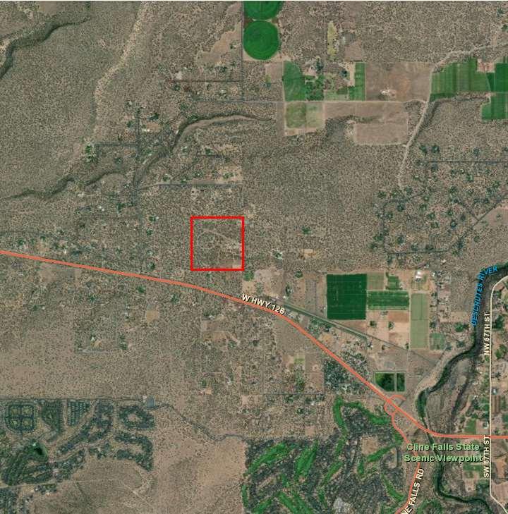
De sc hu t es Cou nt y P rop er
Ove rview Map
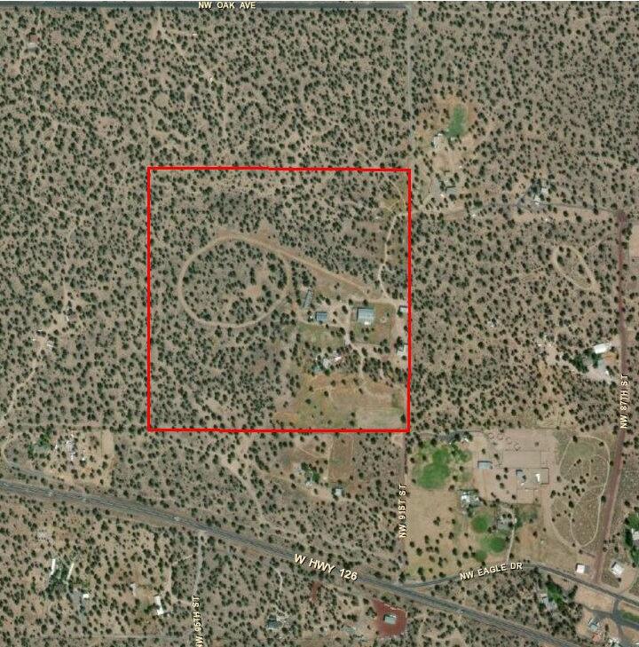

S o ur ce : E s ri , M a x a r, E ar th sta r Ge o g ra p h ics, a n d th e GIS Use r Co m m u n i ty, De sc h u te s C o u n ty GIS
y I nf orm at i on - Di al
t
Map
Ta
ot:
00000200
and
x l
151 21
548-6887*548-2787
WellTestDataSheet
DATE:11/21/23WELLID#:
Testedby:MONTE
OwnersName:
DrillersName:
CASINGSIZE:
DiameterofBowls:3HP
TestPumpSet@:
FlowMeasureUsed:
StaticWaterLevel:
WellLocation:1714NW91STST
DiameterofWell:
BottomofWell:
Diameterofcolunm:
(1)AirLine:N/A
OrificeDia:
TIMESTATIC
(2)ElectricProbe: (3)SonicSounder:
TESTSTART
10:3020.2 10:4519.8 11:0019.7 11:1519.4 11:3019.2 11:4518.9 12:0018.9
TESTEND SAMPLETAKEN
GPM 10:0020.1 10:0520.2 10:1020 10:1520.1
POBOX2130 TERREBONNEOR97760
AbbasPumpService
WellTestDataSheet
DATE:11/21/23WELLID#:
Testedby:MONTE
OwnersName:
DrillersName:
CASINGSIZE:
DiameterofBowls:3HP AbbasPumpService POBOX2130 TERREBONNEOR97760 548-6887*548-2787
TestPumpSet@:
FlowMeasureUsed:
StaticWaterLevel: WellLocation:1714NW91STST-UPPER IRRWELL
DiameterofWell:
BottomofWell:
Diameterofcolunm:
OrificeDia:
(1)AirLine:N/A (2)ElectricProbe: (3)SonicSounder:
GPM 10:3077 10:3576.8 10:4075.3 10:4575.7
TIMESTATIC
TESTSTART
11:0076.9
11:1576.4
11:3075.3 11:4576.5 12:0075.3 12:1575.3
12:3075.4TESTEND
SAMPLETAKEN
CHAPTER 18.60 RURAL RESIDENTIAL ZONE; RR-10
18.60.010 Purposes
18.60.020 Uses Permitted Outright
18.60.030 Conditional Uses Permitted
18.60.035 Destination Resorts
18.60.040 Yard And Setback Requirements
18.60.050 Stream Setback
18.60.060 Dimensional Standards
18.60.070 Limitations On Conditional Uses
18.60.080 Rimrock Setback
18.60.090 Oregon Water Wonderland Unit 2 Sewer District Limited Use Combining Zone
18.60.010 Purposes
The purposes of the Rural Residential Zone are to provide rural residential living environments; to provide standards for rural land use and development consistent with desired rural character and the capability of the land and natural resources; to manage the extension of public services; to provide for public review of nonresidential uses; and to balance the public's interest in the management of community growth with the protection of individual property rights through review procedures and standards.
HISTORY
Adopted by Ord. PL-15 on 11/1/1979
Repealed & Reenacted by Ord. 91-020 §1 on 5/29/1991
18.60.020 Uses Permitted Outright
The following uses and their accessory uses are permitted outright.
A A single-family dwelling, or a manufactured home subject to DCC 18.116.070.
B. Utility facilities necessary to serve the area including energy facilities, water supply and treatment and sewage disposal and treatment.
C Community center, if shown and approved on the original plan or plat of the development.
D Agricultural use as defined in DCC Title 18.
E. Class I and II road or street project subject to approval as part of a land partition, subdivision or subject to the standards and criteria established by DCC 18.116.230.
F Class III road or street project.
G Noncommercial horse stables as defined in DCC Title 18, excluding horse events.
H. Horse events, including associated structures, involving:
1. Fewer than 10 riders;
2 Ten to 25 riders, no more than two times per month on nonconsecutive days; or
https://deschutescounty.municipalcodeonline.com/book/print?type=ordinances&name=CHAPTER_18.60_RURAL_RESIDENTIAL_ZONE;_RR-10
4/20/23, 4 : 20 PM Print Preview Page 1 of 7
3. More than 25 riders, no more than two times per year on nonconsecutive days. Incidental musical programs are not included in this definition. Overnight stays by participants, trainers or spectators in RVs on the premises is not an incident of such horse events.
I. Operation, maintenance, and piping of existing irrigation systems operated by an Irrigation District except as provided in DCC 18.120.050.
J Type 1 Home Occupation, subject to DCC 18.116.280.
K. Accessory Dwelling Units, subject to DCC 18.116.350.
HISTORY
Adopted by Ord. PL-15 on 11/1/1979
Amended by Ord. 91-005 §§30 & 31 on 3/4/1991
Amended by Ord. 91-020 §1 on 5/29/1991
Amended by Ord. 93-043 §8 on 8/25/1993
Amended by Ord. 94-008 §12 on 6/8/1994
Amended by Ord. 2001-016 §2 on 3/28/2001
Amended by Ord. 2001-039 §5 on 12/12/2001
Amended by Ord. 2004-002 §7 on 4/28/2004
Amended by Ord. 2019-009 §2 on 9/3/2019
Recorded by Ord. 2019-009 §2 on 9/3/2019
18.60.030 Conditional Uses Permitted
The following uses may be allowed subject to DCC 18.128:
A. Public park, playground, recreation facility or community center owned and operated by a government agency or nonprofit community organization.
B. Dude ranch.
C Type 2 or Type 3 Home Occupation, subject to DCC 18.116.280.
D. Personal use landing strip for airplanes and helicopter pads, including associated hangar, maintenance and service facilities. A personal use landing strip as used in DCC 18.60.030 means an airstrip restricted, except for aircraft emergencies, to use by the owner and, on an infrequent and occasional basis, by invited guests. No aircraft may be based on a personaluse landing strip other than those owned or controlled by the owner of the airstrip. Exceptions to the activities permitted under this definition may be granted through waiver action by the Aeronautics Division in specific instances. A personal-use landing strip lawfully existing as of September 1, 1975, shall continue to be permitted subject to any applicable regulations of the Aeronautics Division.
E Planned development.
F. Cluster development.
G. Recreation-oriented facility requiring large acreage such as off-road vehicle track or race track, but not including a rodeo grounds.
H Landfill when a written tentative approval by Department of Environmental Quality (DEQ) of
https://deschutescounty.municipalcodeonline.com/book/print?type=ordinances&name=CHAPTER_18.60_RURAL_RESIDENTIAL_ZONE;_RR-10
4/20/23, 4 : 20 PM Print Preview Page 2 of 7
the site is submitted with the application.
I Cemetery.
J. Time-share unit or the creation thereof.
K. Hydroelectric facility, subject to DCC 18.116.130 and 18.128.260.
L. Bed and breakfast inn.
M Golf course.
N. Excavation, grading and fill and removal within the bed and banks of a stream or river or in a wetland subject to DCC 18.120.050 and 18.128.270.
O. Religious institutions or assemblies.
P Public Uses.
Q. Semipublic Uses.
R. Commercial horse stables.
S Private or public school, including all buildings essential to the operation of such a school.
T. Manufactured home park or recreational vehicle park on a parcel in use as a manufactured home park or recreational vehicle park prior to the adoption of PL-15 in 1979 and being operated as of June 12, 1996 as a manufactured home park or recreational vehicle park , including expansion, conversion and combination of such uses on the same parcel, as configured on June 12, 1996.
U. The full or partial conversion from a manufactured home park or recreational vehicle park described in DCC 18.60.030 (T) to a manufactured home park or recreational vehicle park on the same parcel, as configured on June 12, 1996.
V Wireless telecommunications facilities, except those facilities meeting the requirements of DCC 18.116.250(A) or (B).
W. Surface mining of mineral and aggregate resources in conjunction with the operation and maintenance of irrigation systems operated by an Irrigation District, including the excavation and mining for facilities, ponds, reservoirs, and the off-site use, storage, and sale of excavated material.
HISTORY
Adopted by Ord. PL-15 on 11/1/1979
Amended by Ord. 83-033 §5 on 6/15/1983
Amended by Ord. 86-018 §13 on 6/30/1986
Amended by Ord. 90-014 §22 on 7/12/1990
Amended by Ord. 91-005 §32 on 3/4/1991
Amended by Ord. 91-020 §1 on 5/29/1991
Amended by Ord. 92-004 §10 on 2/7/1992
Amended by Ord. 93-043 §§8A and 8B on 8/25/1993
Amended by Ord. 94-008 §13 on 6/8/1994
Amended by Ord. 96-021 §1 on 2/28/1996
Amended by Ord. 96-038 §2 on 6/12/1996
Amended by Ord. 97-017 §3 on 3/12/1997
https://deschutescounty.municipalcodeonline.com/book/print?type=ordinances&name=CHAPTER_18.60_RURAL_RESIDENTIAL_ZONE;_RR-10
4/20/23, 4 : 20 PM Print Preview Page 3 of 7
Amended by Ord. 97-063 §3 on 11/12/1997
Amended by Ord. 2001-016 §2 on 3/28/2001
Amended by Ord. 2001-039 §5 on 12/12/2001
Amended by Ord. 2004-002 §8 on 4/28/2004
Amended by Ord. 2009-018 §2 on 11/5/2009
Amended by Ord. 2020-001 §5 on 4/21/2020
18.60.035 Destination Resorts
Destination resorts may be allowed as a conditional use, subject to all applicable standards of the DR Zone.
HISTORY
Adopted by Ord. 92-004 §11 on 2/7/1992
18.60.040
Yard And Setback Requirements
In an RR-10 Zone, the following yard and setbacks shall be maintained.
A. The front setback shall be a minimum of 20 feet from a property line fronting on a local street right of way, 30 feet from a property line fronting on a collector right of way and 50 feet from an arterial right of way.
B. There shall be a minimum side yard of 10 feet for all uses, except on the street side of a corner lot the side yard shall be 20 feet.
C The minimum rear yard shall be 20 feet.
D The setback from the north lot line shall meet the solar setback requirements in DCC 18.116.180.
E. In addition to the setbacks set forth herein, any greater setbacks required by applicable building or structural codes adopted by the State of Oregon and/or the County under DCC 15.04 shall be met.
HISTORY
Adopted by Ord. PL-15 on 11/1/1979
Amended by Ord. 83-037 §16 on 6/1/1983
Amended by Ord. 91-020 §1 on 5/29/1991
Amended by Ord. 94-008 §21 on 6/8/1994
Amended by Ord. 95-075 §1 on 11/29/1995
18.60.050
Stream Setback
To permit better light, air, vision, stream or pollution control, protect fish and wildlife areas and to preserve the natural scenic amenities and vistas along streams and lakes, the following setback shall apply:
A. All sewage disposal installations, such as septic tanks or septic drainfields, shall be set back from the ordinary high water mark along all streams or lakes a minimum of 100 feet, measured at right angles to the ordinary high water mark. In those cases where practical difficulties preclude the location of the facilities at a distance of 100 feet and the County Sanitarian finds
https://deschutescounty.municipalcodeonline.com/book/print?type=ordinances&name=CHAPTER_18.60_RURAL_RESIDENTIAL_ZONE;_RR-10
4/20/23, 4 : 20 PM Print Preview Page 4 of 7
that a closer location will not endanger health, the Planning Director or Hearings Body may permit the location of these facilities closer to the stream or lake, but in no case closer than 25 feet.
B. All structures, buildings or similar permanent fixtures shall be set back from the ordinary high water mark along all streams or lakes a minimum of 100 feet measured at right angles to the ordinary high water mark.
HISTORY
Adopted by Ord. PL-15 on 11/1/1979
Repealed & Reenacted by Ord. 91-020 §1 on 5/29/1991
18.60.060 Dimensional Standards
In an RR-10 Zone, the following dimensional standards shall apply:
A. Lot Coverage. The main building and accessory buildings located on any building site or lot shall not cover in excess of 30 percent of the total lot area.
B Building Height. No building or structure shall be erected or enlarged to exceed 30 feet in height, except as allowed under DCC 18.120.040.
C. Minimum lot size shall be 10 acres, except planned and cluster developments shall be allowed an equivalent density of one unit per 7.5 acres. Planned and cluster developments within one mile of an acknowledged urban growth boundary shall be allowed a five-acre minimum lot size or equivalent density. For parcels separated by new arterial rights of way, an exemption shall be granted pursuant to DCC 18.120.020.
HISTORY
Adopted by Ord. PL-15 §4.120 on 11/1/1979
Amended by Ord. 92-055 §6 on 8/17/1992
Amended by Ord. 93-034 §1 on 6/30/1993
18.60.070 Limitations On Conditional Uses
The following limitations shall apply to uses allowed by DCC 18.60.030:
A The Planning Director or Hearings Body may require establishment and maintenance of fire breaks, the use of fire resistant materials in construction and landscaping, or may attach other similar conditions or limitations that will serve to reduce fire hazards or prevent the spread of fire to surrounding areas.
B. The Planning Director or Hearings Body may limit changes in the natural grade of land, or the alteration, removal or destruction of natural vegetation in order to prevent or minimize erosion or pollution.
HISTORY
Adopted by Ord. PL-15 on 11/1/1979
Repealed & Reenacted by Ord. 91-020 §1 on 5/29/1991
https://deschutescounty.municipalcodeonline.com/book/print?type=ordinances&name=CHAPTER_18.60_RURAL_RESIDENTIAL_ZONE;_RR-10
4/20/23, 4 : 20 PM Print Preview Page 5 of 7
18.60.080 Rimrock Setback
Setbacks from rimrock shall be as provided in DCC 18.116.160.
HISTORY
Adopted by Ord. PL-15 on 11/1/1979
Amended by Ord. 86-053 §13 on 6/30/1986
18.60.090 Oregon Water Wonderland Unit 2 Sewer District Limited Use Combining Zone
A. Uses Permitted Outright. In the Oregon Water Wonderland Unit 2 Sewer District Limited Use Combining Zone, uses shall be permitted as follows, the following uses and their accessory uses are allowed outright:
1 Agricultural use as defined in DCC Title 18.
2. Propagation or harvesting of a forest product.
3. Ground application of treated effluent.
B Uses Permitted Subject to Site Plan Review. In the Oregon Water Wonderland Unit 2 Sewer District Limited Use Combining Zone, uses shall be permitted as follows, the following uses and their accessory uses are permitted subject to applicable provisions of DCC 18.116, Supplementary Provisions, and DCC 18.124, Site Plan Review:
1. Sewage Treatment Facility.
2 Treated Effluent Ponds.
C. Uses Permitted Conditionally. In the Oregon Water Wonderland Unit 2 Sewer District Limited Use Combining Zone, Wireless telecommunications facilities, except those facilities meeting the requirements of DCC 18.116.250(A) or (B), and their accessory uses are permitted conditionally subject to the applicable provisions of DCC 18.128, Conditional Uses.
D. Definitions. For the purpose of this section, the use Sewage Treatment Facility includes any buildings or structures associated with the operations of a sewer treatment plant including, but not limited to, treatment station or pump station.
E Special Conditions. Pursuant to Deschutes County Comprehensive Plan Section 5.10, an application for site plan review to establish a sewage treatment facility must include a conservation easement and a plan of implementing the conservation easement that provides standards and implementation methods for managing the conservation easement, along with a recorded road maintenance agreement between Oregon Water Wonderland Unit 2 Sewer District and the Beaver Special Road District, with the site plan review application. The road maintenance agreement between the applicant and the Beaver Special Road District shall include Oregon Water Wonderland Unit 2 Sewer District’s pro rata share for the maintenance cost of Foster Road through Section 25.
HISTORY
Adopted by Ord. 2003-012 §1 on 6/2/2003 Amended by Ord. 2010-016 §1 on 4/26/2010
https://deschutescounty.municipalcodeonline.com/book/print?type=ordinances&name=CHAPTER_18.60_RURAL_RESIDENTIAL_ZONE;_RR-10
4/20/23, 4 : 20 PM Print Preview Page 6 of 7

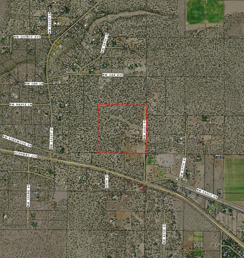


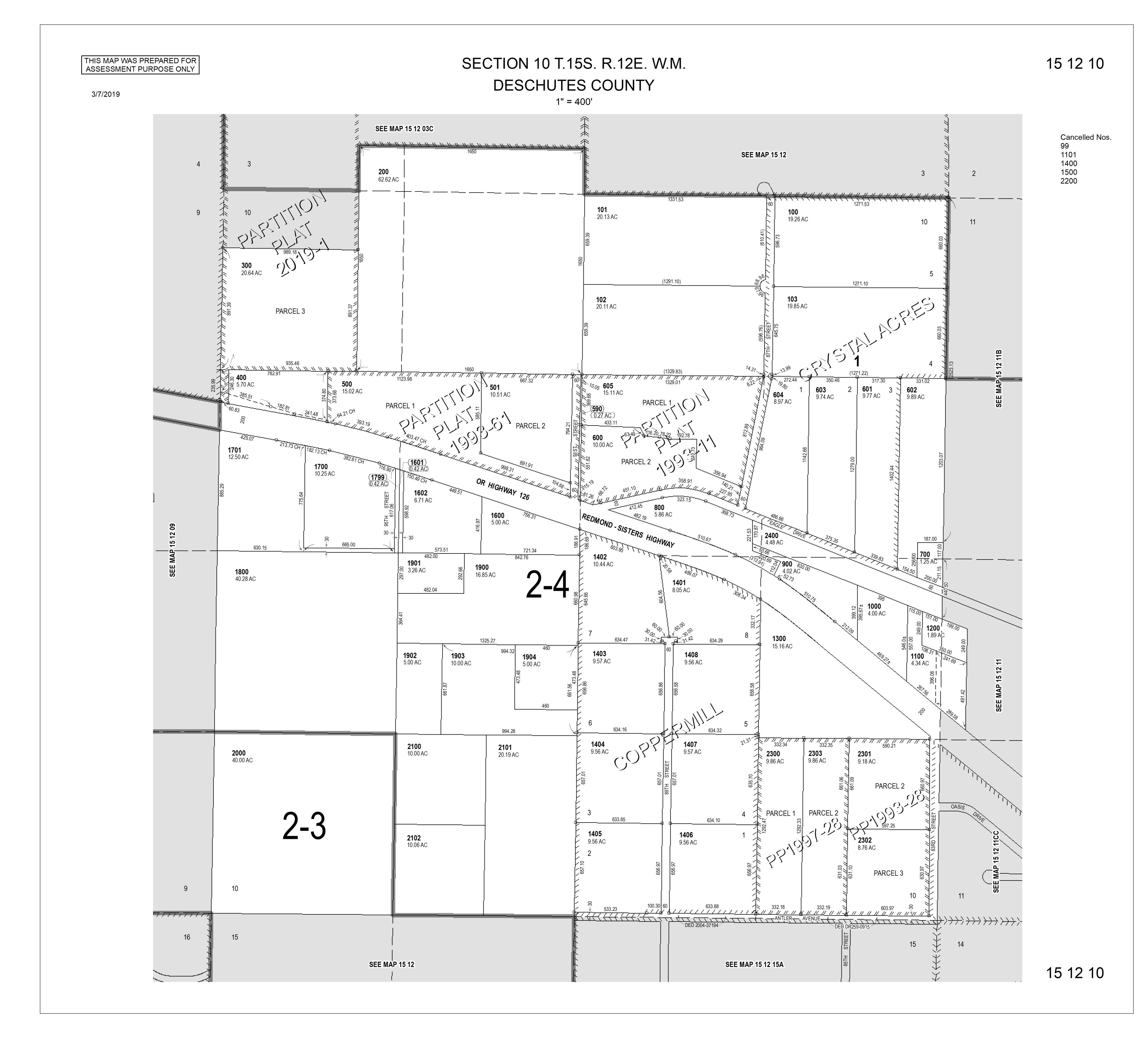


Deschutes County Property Information
Report Date: 7/25/2022 11:51:39 AM
The information and maps presented in this report are provided for your convenience. Every reasonable effort has been made to assure the accuracy of the data and associated maps. Deschutes County makes no warranty, representation or guarantee as to the content, sequence, accuracy, timeliness or completeness of any of the data provided herein. Deschutes County explicitly disclaims any representations and warranties, including, without limitation, the implied warranties of merchantability and fitness for a particular purpose. Deschutes County shall assume no liability for any errors, omissions, or inaccuracies in the information provided regardless of how caused. Deschutes County assumes no liability for any decisions made or actions taken or not taken by the user of this information or data furnished hereunder.
Subdivision:
Warnings, Notations, and Special Assessments
Review of digital records maintained by the Deschutes County Assessor’s Office, Tax Office, Finance Office, and the Community Development Department indicates that there are no special tax, assessment or property development related notations associated with this account. However, independent verification of the presence of other Deschutes County tax, assessment, development, and additional property related considerations is recommended. Confirmation is commonly provided by title companies, real estate agents, developers, engineering and surveying firms, and other parties who are involved in property transactions or property development. In addition, County departments may be contacted directly to discuss the information.
WINGS FAMILY LIMITED PARTNERSHIP 2469 NW GREENWOOD AVE REDMOND,
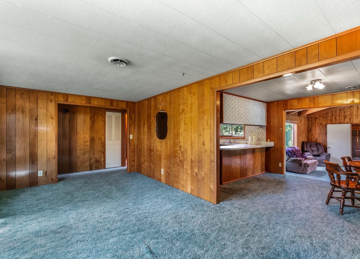
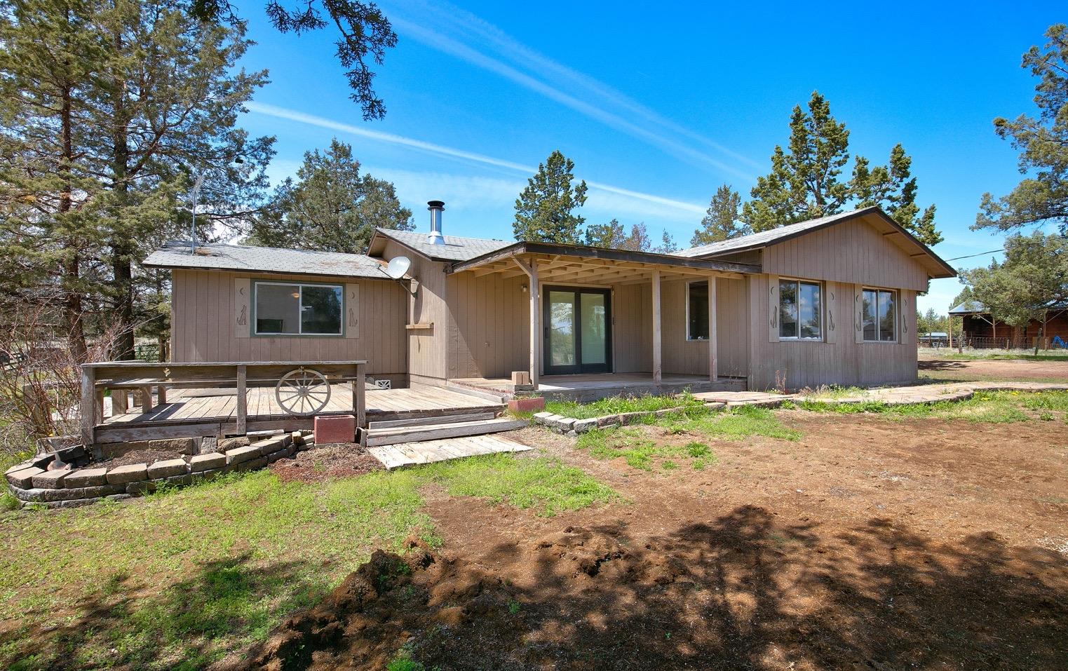
97756 Account Information Ownership Mailing Address: Map and Taxlot: Account: Situs Address: Mailing Name: Tax Status: 1512100000200 124957 1714 NW 91ST ST, REDMOND, OR 97756 WINGS FAMILY LIMITED PARTNERSHIP Assessable Assessor Acres: Property Taxes Assessment Tax Code Area: Current Tax Year: 2004 $7,488.38 62.62 Valuation $493,890 $439,740 Land Structures Total $933,630 Real Market Values as of Jan. 1, 2021 $485,070 $485,070 Maximum Assessed Assessed Value Veterans Exemption Current Assessed Values: Account Summary Property Class: 491 -- TRACT
OR
Lot:
Block:
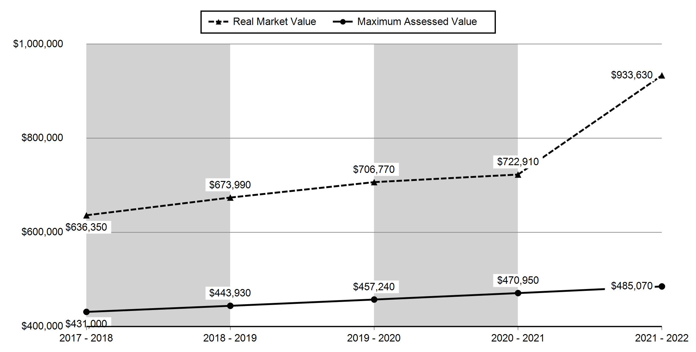
Disclaimer 2017 - 2018 2018 - 2019 2019 - 2020 2020 - 2021 2021 - 2022 Real Market Value - Land $383,400 $390,700 $409,310 $389,770 $493,890 Real Market Value - Structures $252,950 $283,290 $297,460 $333,140 $439,740 Total Real Market Value $636,350 $673,990 $706,770 $722,910 $933,630 Maximum Assessed Value $431,000 $443,930 $457,240 $470,950 $485,070 Total Assessed Value $431,000 $443,930 $457,240 $470,950 $485,070 Veterans Exemption $0 $0 $0 $0 $0 Valuation History All values are as of January 1 of each year. Tax year is July 1st through June 30th of each year. Deschutes County Property Information Report, page 1
Tax Payment History
Year Date Due Transaction Type Transaction Date As Of Date Amount Received Tax Due Discount Amount Interest Charged Refund Interest 2021 11-15-2021 PAYMENT 11-03-2021 11-03-2021 $7,263.73 ($7,488.38) $224.65 $0.00 $0.00 2021 11-15-2021 IMPOSED 10-11-2021 11-15-2021 $0.00 $7,488.38 $0.00 $0.00 $0.00 Total: $0.00 2020 11-15-2020 PAYMENT 11-11-2020 11-11-2020 $6,912.16 ($7,125.94) $213.78 $0.00 $0.00 2020 11-15-2020 IMPOSED 10-09-2020 11-15-2020 $0.00 $7,125.94 $0.00 $0.00 $0.00 Total: $0.00 2019 11-15-2019 PAYMENT 11-08-2019 11-08-2019 $6,589.73 ($6,793.54) $203.81 $0.00 $0.00 2019 11-15-2019 IMPOSED 10-11-2019 11-15-2019 $0.00 $6,793.54 $0.00 $0.00 $0.00 Total: $0.00
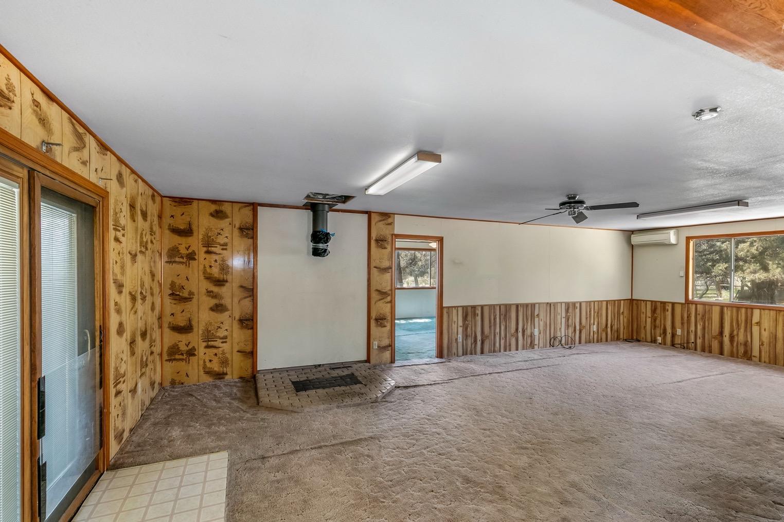
Sale Date Seller Buyer Sale Amount Sale Type Recording Instrument 06/10/1992 MORGAN,VERNON R MORGAN,GERTRUDE J $0 06-GRANTEE IS RELATED/FRIENDS/BUSINES S ASSOCIATES 1992-2672736 Sales History Structures Stat Class/Description Improvement Description Code Area Year Built Total Sq Ft 131 - RESIDENCE: One story 200419711,716 Floor Description Comp % Sq Ft First Floor 100 1,716 Living Dining Kitchen Nook Great Family Bed Full Bath Half Bath Bonus Utility Den Other 1 1 1 0 0 1 3 2 0 0 1 0 0 Rooms Floor Description Comp % Sq Ft Deschutes County Property Information Report, page 2 (For Report Disclaimer see page 1)
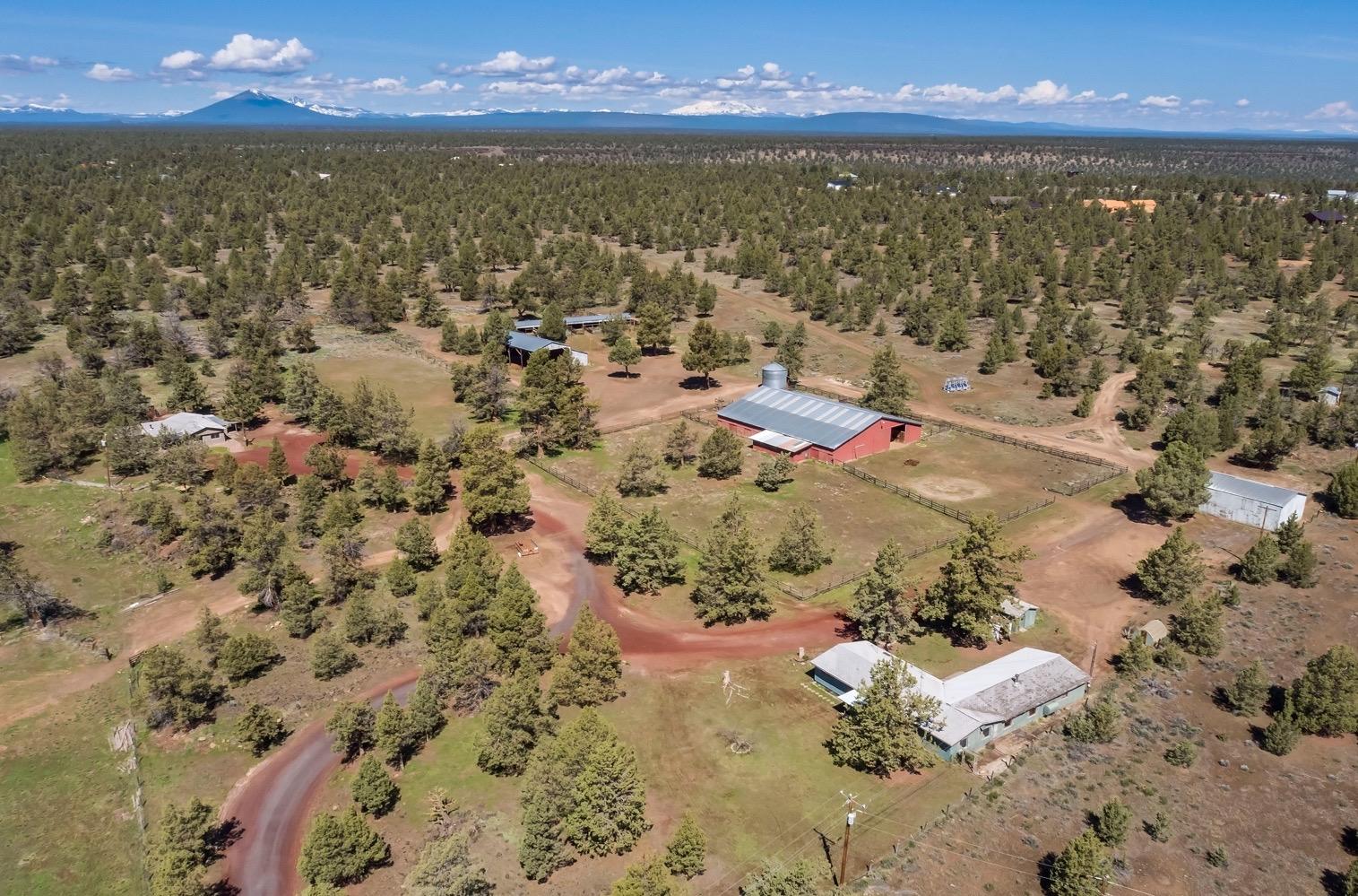
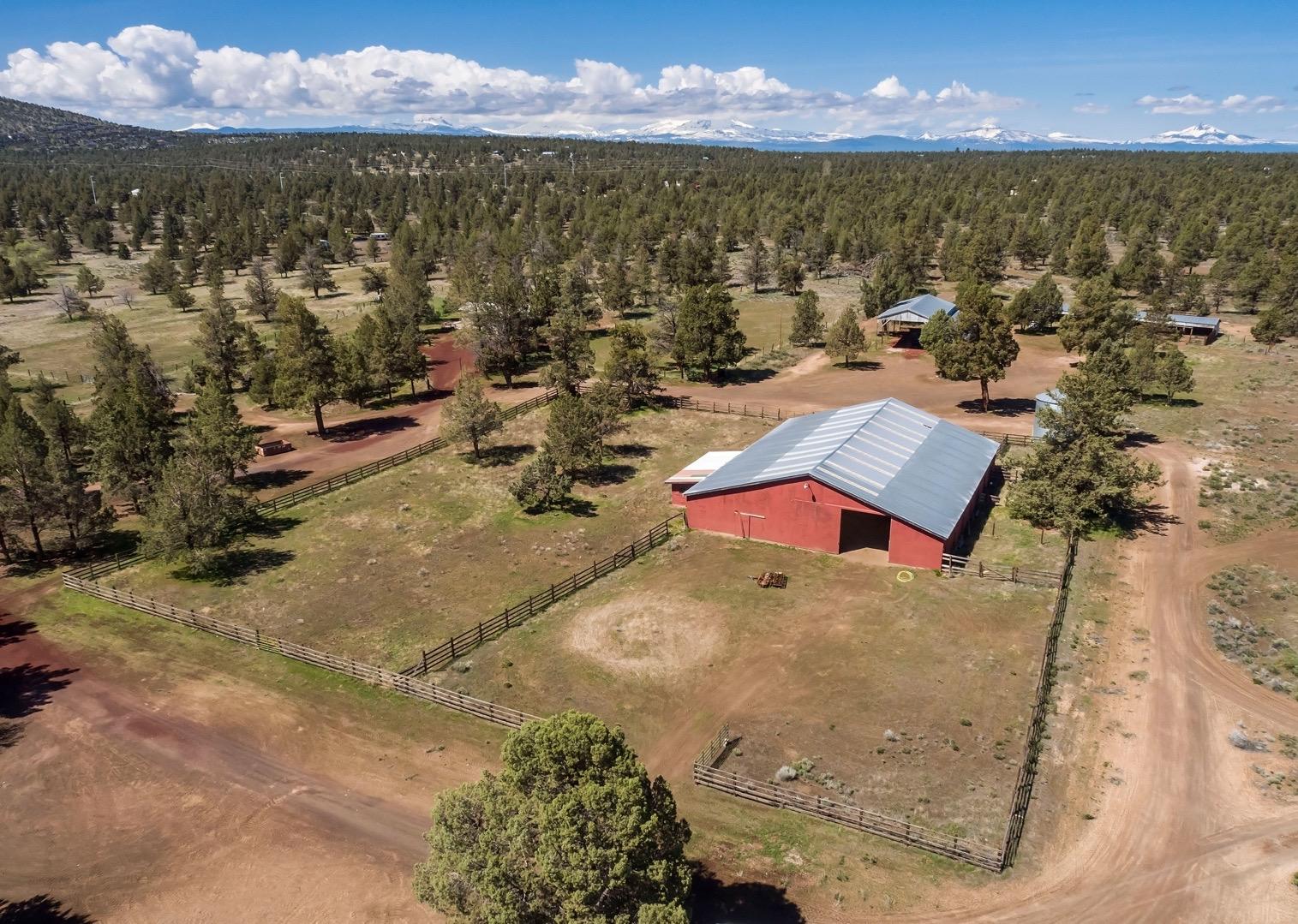
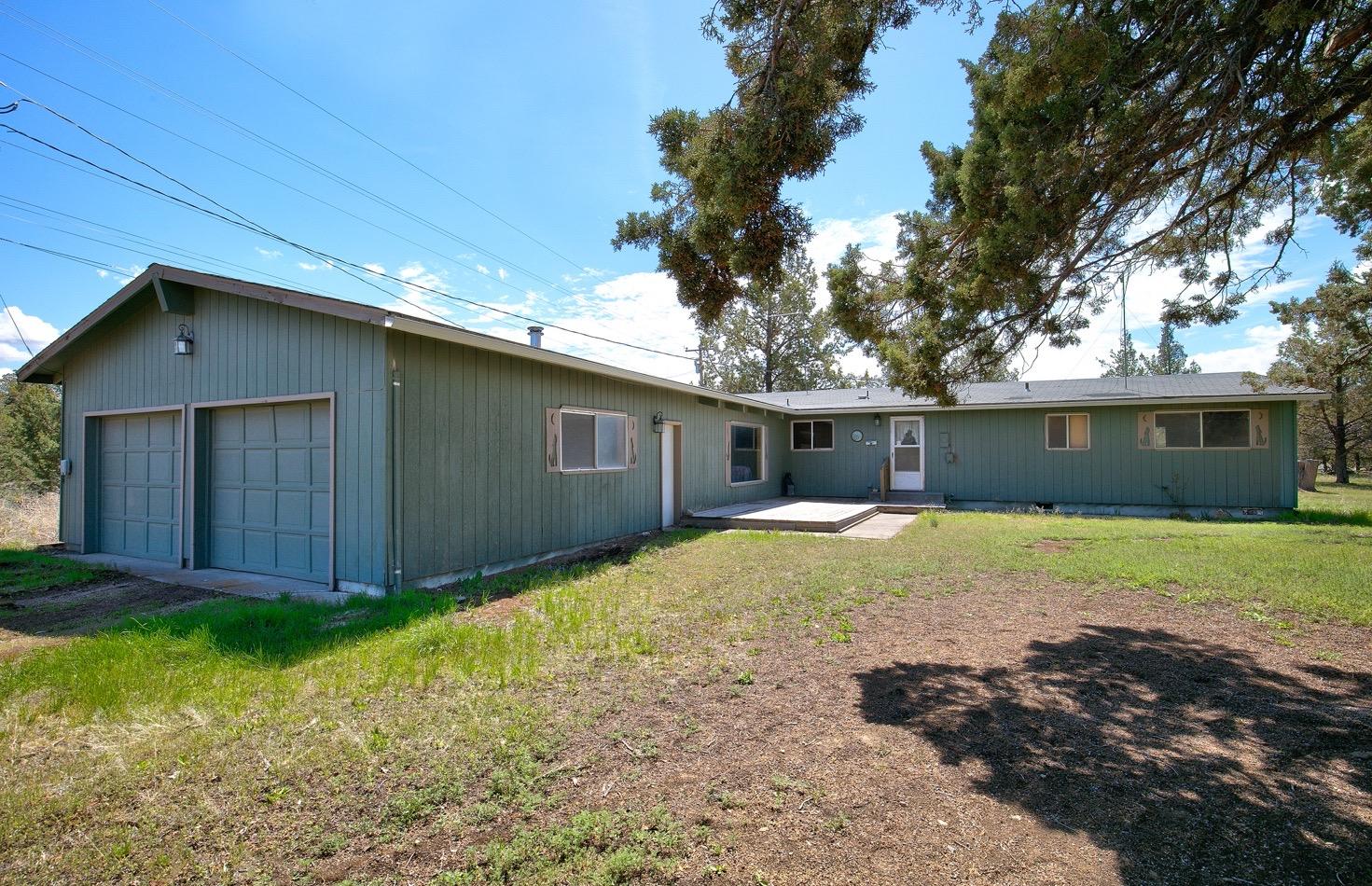
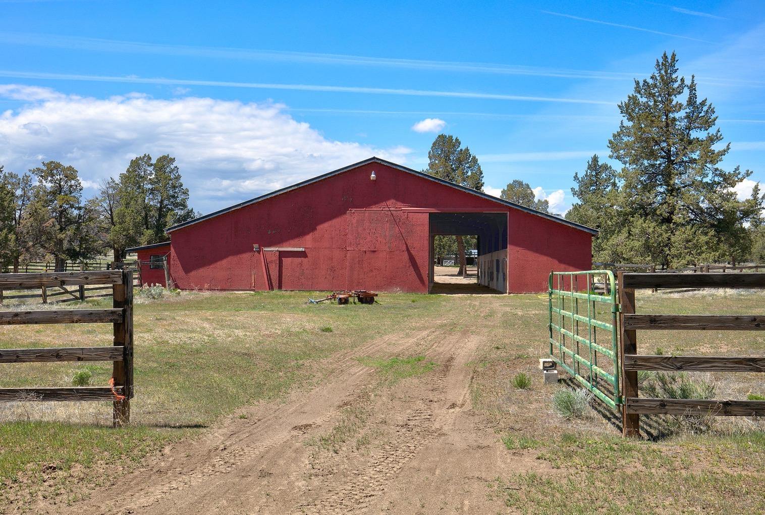
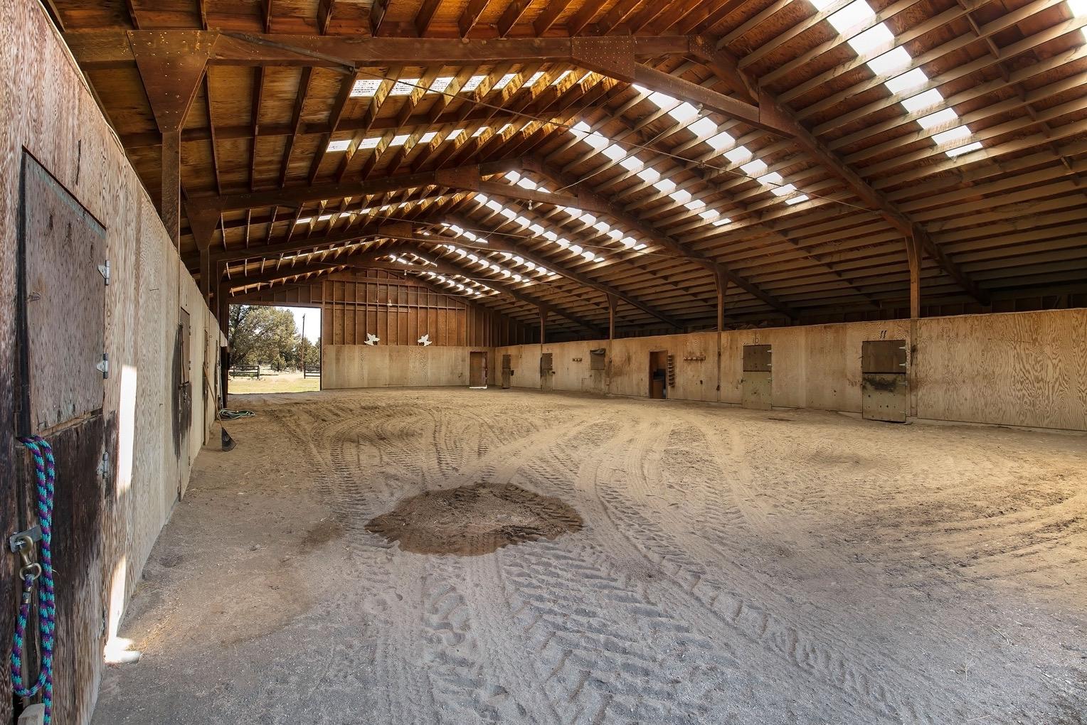
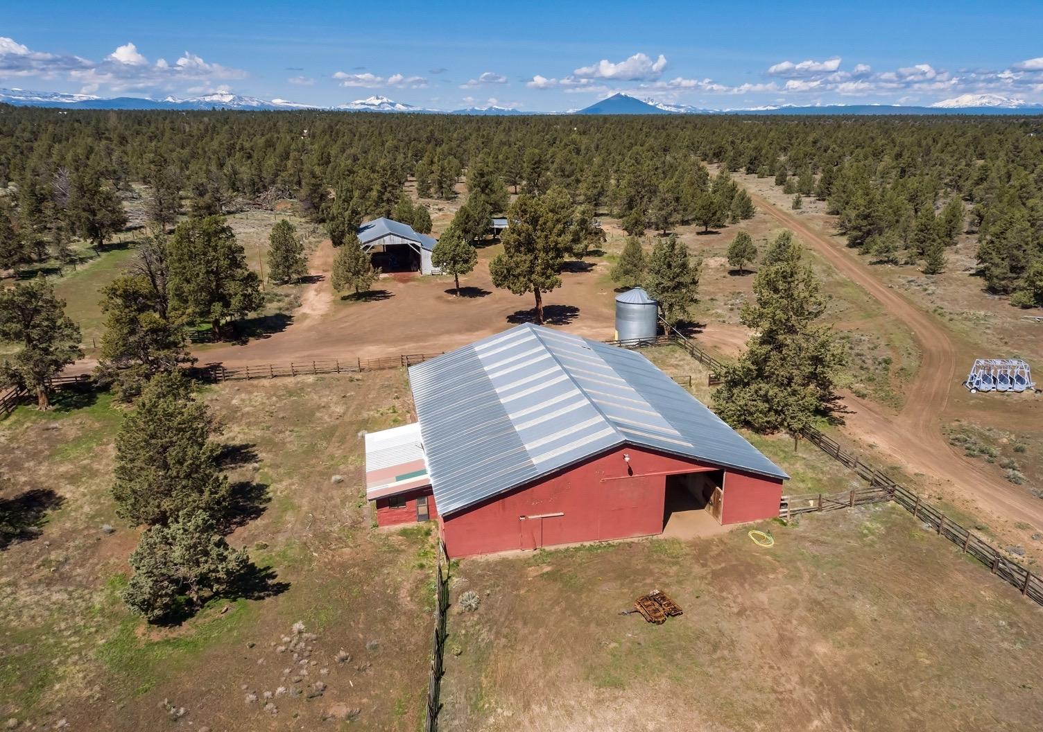
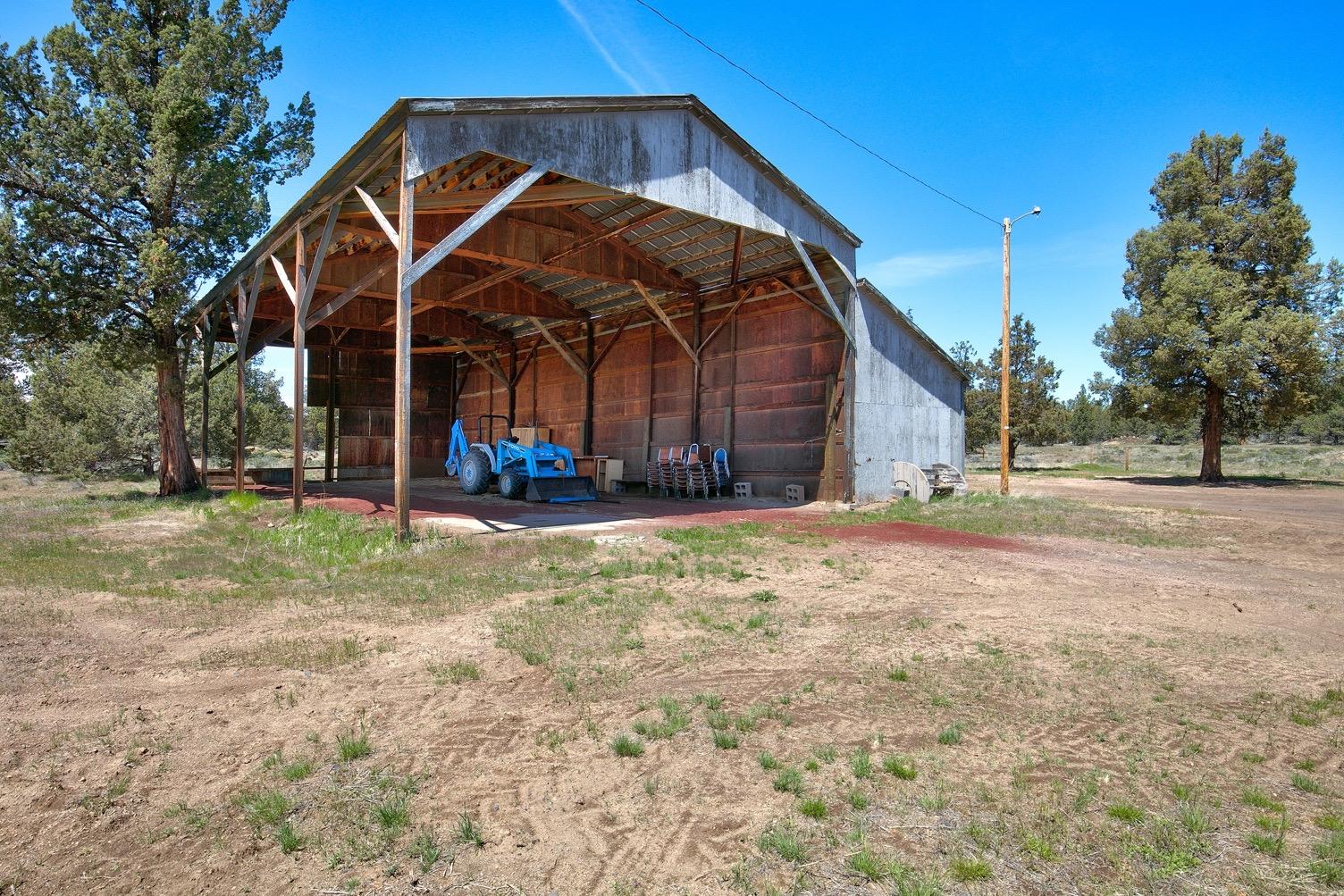
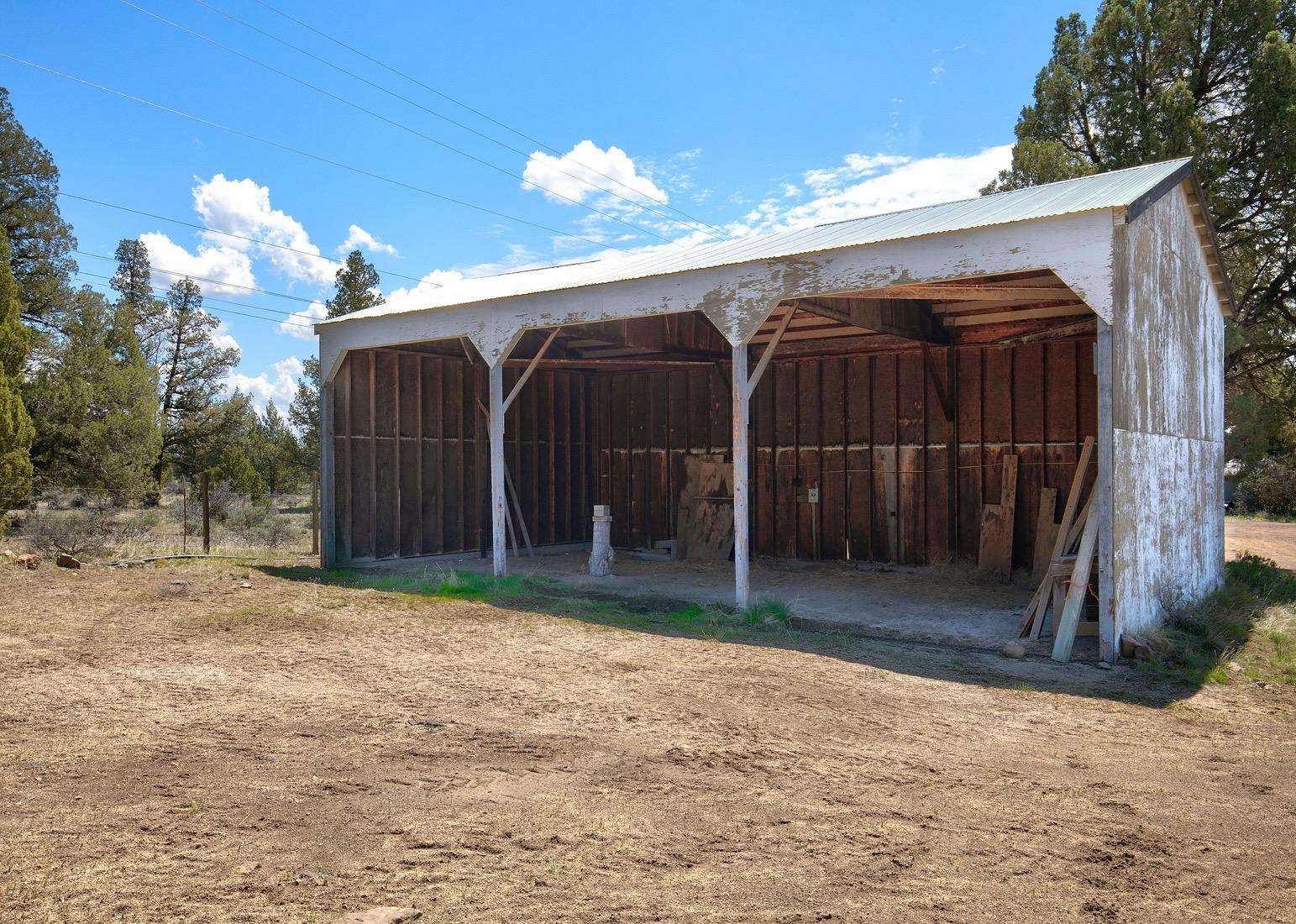
Garage-Attached-Finished 100 576 BATHTUB W/FIBRGL SHWR 2 BSBRD/WALL 1,716 CARPET D.I. RANGE 1 DISHWASHER 1 DRYWALL FOUNDATION - CONCRETE HOOD-FAN 1 KITCHEN SINK 1 LAVATORY 2 ROOF - GABLE ROOF CVR - COMP SIDING - T1-11/PLYWOOD TOILET 2 VINYL FLOOR WATER HEATER 1 WINDOWS - DOUBLE/THERMAL PANE WINDOWS - METAL WOOD STOVE 1 Improvement Inventory Stat Class/Description Improvement Description Code Area Year Built Total Sq Ft 306 - FARM BLDG: Hay Cover Hay Cover - CLASS 4 200419752,312 Floor Description Comp % Sq Ft Building Structure 100 2,312 Stat Class/Description Improvement Description Code Area Year Built Total Sq Ft 307 - FARM BLDG: Machine Shed Machine Shed - CLASS 4 200419602,128 Floor Description Comp % Sq Ft Building Structure 100 2,128 Stat Class/Description Improvement Description Code Area Year Built Total Sq Ft 307 - FARM BLDG: Machine Shed Machine Shed - CLASS 6 200419751,344 Floor Description Comp % Sq Ft Building Structure 100 1,344 Stat Class/Description Improvement Description Code Area Year Built Total Sq Ft 307 - FARM BLDG: Machine Shed Machine Shed - CLASS 4 200419751,088 Floor Description Comp % Sq Ft Building Structure 100 1,088 Stat Class/Description Improvement Description Code Area Year Built Total Sq Ft 312 - FARM BLDG: Feeder Barn Feeder Barn - CLASS 6 200419758,000 Floor Description Comp % Sq Ft Building Structure 100 8,000 Deschutes County Property Information Report, page 3 (For Report Disclaimer see page 1)
Stat Class/Description Improvement Description Code Area Year Built Total Sq Ft 410 - RESIDENCE: Manf. Strct. Accessories 20040 Stat Class/Description Improvement Description Code Area Year Built Total Sq Ft 452 - MANF STRCT: Double wide 200419691,745 Floor Description Comp % Sq Ft First Floor 100 800 Living Dining Kitchen Nook Great Family Bed Full Bath Half Bath Bonus Utility Den Other 0 0 0 0 0 0 3 2 0 0 0 0 0 Rooms Floor Description Comp % Sq Ft Addition 100 945 BATHTUB W/FIBRGL SHWR 2 DRYWALL 0 FORCED AIR HEATING 0 FOUNDATION - WOOD FRAME 120 LAVATORY 2 ROOF - GABLE 0 SIDING - T1-11/PLYWOOD 0 TOILET 2 WINDOWS - DOUBLE/THERMAL PANE 0 Improvement Inventory Accessory Description Sq Ft Quantity MISC IMPROVEMENT PUMP HOUSE 144 PUMP HOUSE 144 DECK-AVERAGE 100 Land Characteristics Land Description Acres Land Classification Rural Tract 62.62 Ownership Name Type Name Ownership Type Ownership Percentage OWNER WINGS FAMILY LIMITED PARTNERSHIP, OWNER No Related Accounts found. Related accounts apply to a property that may be on one map and tax lot but due to billing have more than one account. This occurs when a property is in multiple tax code areas. In other cases there may be business personal property or a manufactured home on this property that is not in the same ownership as the land. NOTE: Related accounts include structures that are related but not included on this account. Please see Improvements to view structures included on this account. Related Accounts Category Name Phone Address COUNTY SERVICES DESCHUTES COUNTY (541) 388-6570 1300 NW WALL ST, BEND, OR 97703 FIRE DISTRICT REDMOND FIRE AND RESCUE (541) 504-5000 341 NW DOGWOOD AVE, REDMOND, OR 97756 SCHOOL DISTRICT REDMOND SCHOOL DISTRICT (541) 923-5437 145 SE SALMON AVE, REDMOND, OR 97756 ELEMENTARY SCHOOL ATTENDANCE AREA SAGE ELEMENTARY SCHOOL (541) 316-2830 2790 SW WICKIUP, REDMOND, OR 97756 MIDDLE SCHOOL ATTENDANCE AREA OBSIDIAN MIDDLE SCHOOL (541) 923-4900 1335 SW OBSIDIAN, REDMOND, OR 97756 Service Providers Please contact districts to confirm. Deschutes County Property Information Report, page 4 (For Report Disclaimer see page 1)
HIGH SCHOOL ATTENDANCE AREA RIDGEVIEW HIGH SCHOOL (541) 504-3600 4555 SW ELKHORN AVE, REDMOND, OR 97756
EDUCATION SERVICE TAX DISTRICT HIGH DESERT EDUCATION SERVICE DISTRICT (541) 693-5600 145 SE SALMON AVE, REDMOND, OR 97756
COLLEGE TAX DISTRICT CENTRAL OREGON COMMUNITY COLLEGE (541) 383-7700 2600 NW COLLEGE WAY, BEND, OR 97703
PARK & RECREATION DISTRICT REDMOND AREA PARK & RECREATION DISTRICT (541) 548-7275 465 SW RIMROCK DR, REDMOND, OR 97756
LIBRARY DISTRICT DESCHUTES PUBLIC LIBRARY (541) 617-7050 601 NW WALL ST, BEND, OR 97703 GARBAGE & RECYCLING SERVICE HIGH COUNTRY DISPOSAL (541) 548-4984 1090
Development Summary
Planning Jursidiction:
Urban Reserve Area: Urban Growth Boundary: Deschutes County No No
County Development Details
Wetland (National or Local): Conservation Easement:
County Zone Description RR10 RURAL RESIDENTIAL - 10 ACRE MINIMUM LM LANDSCAPE MANAGEMENT COMBINING ZONE
TDC/PRC Restrictive Covenant: FEMA 100 Year Flood Plain: Not Within a Mapped Wetland No Conservation Easement Recorded No TDC/PRC Restrictive Covenant Found Not Within 100 Year Flood Plain
Ground Snow Load: 36 #/sq. ft.
Deschutes County Permits
NE HEMLOCK AVE, REDMOND, OR 97756
Permit ID Permit Type Applicant Application Date Status 247-B4826 Building MORGAN,VERNAN 01/01/1978Expired 247-M27376 Mechanical WINGS FAMILY LIMITED PARTNERSHIP 10/06/2003Finaled 247-M45051 Mechanical WINGS FAMILY LIMITED PARTNERSHIP 01/05/2011Expired
Deschutes County Property Information Report, page 5 (For Report Disclaimer see page 1)

FILE NUMBER:
SUBJECT PROPERTY/ OWNER:
FINDINGS AND DECISION
247-23-000343-LR
COMMUNITY DEVELOPMENT
Mailing Name: WINGS FAMILY LIMITED PARTNERSHIP
Map and Taxlot: 1512100000200
Account: 124957
Situs Address: 1714 NW 91ST ST, REDMOND, OR 97756
APPLICANT: Juanita Ryan
REQUEST: Lot of Record Verification
STAFF CONTACT: Rachel Vickers, Associate Planner
Phone: 541-388-6504
Email: Rachel.Vickers@deschutes.org
RECORD: Record items can be viewed and downloaded from: www.buildingpermits.oregon.gov
I. APPLICABLE CRITERIA
Deschutes County Code
Title 18, Deschutes County Zoning Ordinance:
Chapter 18.04, Title, Purpose and Definitions
Title 22, Deschutes County Development Procedures Ordinance
Chapter 22.04, Introduction and Definitions
Chapter 22.40, Declaratory Ruling
NW Lafayette Avenue, Bend,
97703 | P.O. Box 6005, Bend, OR 97708-6005
.org www.deschutes.org/cd
117
Oregon
(541) 388-6575 cdd@deschutes
0DLOL J DWH ULGD - H
II. BASIC FINDINGS
LOT OF RECORD: As described herein, the subject property contains one (1) legal lot of record.
SITE DESCRIPTION: The identified legal lot of record is +/- 62.62 acres in size.
REVIEW PERIOD: Under DCC 22.20.040(D)(3), this Lot of Record verification is exempt from the 150day time limit established by DCC 22.20.040.
III. FINDINGS & CONCLUSIONS
Title 22, Deschutes County Development Procedures Ordinance
Chapter 22.04, Introduction and Definitions
Section 22.04.040, Verifying Lots of Record
D. Findings; Declaratory Ruling … If an applicant is applying for a permit listed in subsection (B)(1) that does not require public notice, or prior to applying for any permit, an applicant may request a declaratory ruling pursuant to DCC Chapter 22.40. If the lot or parcel meets the “lot of record” definition in 18.04.030, the County shall issue the declaratory ruling determining that the lot or parcel qualifies for all permits listed in subsection (B)(1). If the lot or parcel does not meet the “lot of record” definition in 18.04.030, the County shall not issue the declaratory ruling and instead shall provide the applicant information on permit options that do not require verification and information on verification exceptions that may apply pursuant to subsections (B)(2).
FINDING: The applicant has requested a declaratory ruling pursuant to DCC Chapter 22.40 to confirm the subject property meets the “lot of record” definition in DCC 18.04.030.
Chapter 22.40, Declaratory Ruling
Section 22.40.010, Availability of Declaratory Ruling
A. Subject to the other provisions of DCC 22.40.010, there shall be available for the County's comprehensive plans, zoning ordinances, the subdivision and partition ordinance and DCC Title 22 a process for:
…
6. Verifying that a lot of parcel meets the “lot of record” definition in 18.040.030 pursuant to DCC 22.04.040(D).
FINDING: The applicant has requested a declaratory ruling pursuant to DCC Chapter 22.40 to
247-23- 000343-LR Page 2 of 7
confirm that the subject property meets the “lot of record” definition in DCC 18.04.030.
Title 18 of the Deschutes County Code, County Zoning
Chapter 18.04, Title, Purpose and Definitions
Section 18.04.030, Definitions
"Lot of Record" means:
A. A lot or parcel at least 5,000 square feet in area and at least 50 feet wide, which conformed to all zoning and subdivision or partition requirements, if any, in effect on the date the lot or parcel was created, and which was created by any of the following means:
FINDING: Any lots of record identified in this decision are at least 5,000 square feet in area and at least 50 feet wide. Major historical changes in the County’s subdivision, partition, zoning, and building permit requirements are outlined below.
PL-2 – Subdivision Ordinance – September 9, 1970
Required the approval of and recording of a subdivision plat to "Subdivide land", which was defined to mean “to partition a parcel of land into four or more parcels, any one of which, is less than ten (10) acres each for the purpose of transfer of ownership or building development, whether immediate or future, pursuant to O.R.S. 92.010.”
PL-5 – Deschutes County Zoning – November 11, 1972
Provided zoning and minimum lot sizes for parcels created by subdivision. Because no zoning maps were adopted contemporaneously with PL-5’s “approval”, zoning became effective in a piecemeal fashion in the County, as maps were adopted for various geographic regions of the County.
PL-7 1 – Uniform Building Code (UBC) – September 1, 1973
Established the first Deschutes County building permitting requirements. All structures constructed on or after September 1, 1973 required County review and structures started prior to that date were required to be completed by December 30, 1973.
ZM-1 – Zoning Map – November 15, 1972
Applied A-1 countywide agricultural zoning outside the urban areas of Redmond and Sisters, the Bend UGB, the rural service centers of Terrebonne and Tumalo, but not including certain land to the west of Bend, as well as applying PD zoning to Sunriver and Black Butte.
ZM-2 through ZM-11 – Zoning Maps – November 15, 1972 – June 30, 1973
1 Ordnance no. PL-7 was first assigned to the County’s adoption of the Uniform Building and Plumbing Codes in Deschutes County (ref. Commissioner Journals Book 17, Page 122).
247-23-000343-LR Page 3 of 7
PL-7 - Deschutes County Land Partition Ordinance No. PL-7 – April 5, 1977
Required that “no person shall partition an area or tract of land without compliance with the provisions of this ordinance”
PL-14 Deschutes County Subdivision/Partition Ordinance–November 1, 1979
All land division regulated.
PL-15 – Deschutes County Zoning Ordinance of 1979 – November 1, 1979
Updated zoning throughout the County.
Any lot of record identified in this decision conformed to all zoning and subdivision or partition requirements, if any, in effect on the date the lot or parcel was created.
1. By partitioning land as defined in ORS 92;
FINDING: The subject property was not created by partitioning land as defined in ORS 92.
2. By a subdivision plat, as defined in ORS 92, filed with the Deschutes County Surveyor and recorded with the Deschutes County Clerk;
FINDING: The subject property was not created by a subdivision plat, as defined in ORS 92, filed with the Deschutes County Surveyor and recorded with the Deschutes County Clerk.
3. By deed or contract, dated and signed by the parties to the transaction, containing a separate legal description of the lot or parcel, and recorded in Deschutes County if recording of the instrument was required on the date of the conveyance. If such instrument contains more than one legal description, only one lot of record shall be recognized unless the legal descriptions describe lots subject to a recorded subdivision or town plat;
FINDING: The subject lot of record was created by deed or contract in accordance with this criterion and conformed to all zoning and subdivision or partition requirements, if any, in effect on the date the lot or parcel was created.
247-23- 000343-LR Page 4 of 7
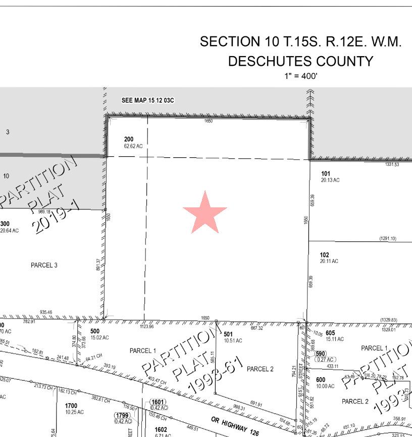
Lot of Record #1: The subject property was created by a Warranty Deed dated January 21, 1972, recorded in Volume 181, Page 695, Deschutes County Book of Records. This lot of record is shown in the figure below.
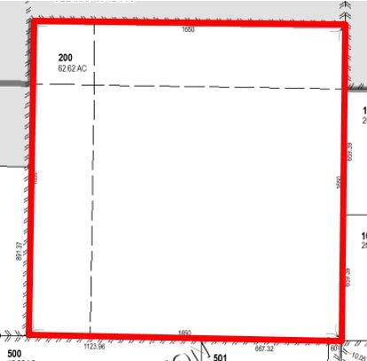
At this time, Deschutes County did not have any zoning or land division requirements for the creation of lot(s)/parcel(s) by deed or contract, as outlined in the findings above. Therefore, staff finds the conveyance of this property conformed to all applicable requirements and the subject property is recognized as one (1) legal lot of record under DCC 18.04.030 Lot of Record (A)(3).
4. By a town plat filed with the Deschutes County Clerk and recorded in the Deschutes County Record of Plats; or
FINDING: The subject property was not created by a town plat filed with the Deschutes County Clerk and recorded in the Deschutes County Record of Plats.
5. By the subdividing or partitioning of adjacent or surrounding land, leaving a remainder lot or parcel.
FINDING: The subject property was not created by the subdividing or partitioning of adjacent or surrounding land, leaving a remainder lot or parcel.
B. Notwithstanding subsection (A), a lot or parcel validated pursuant to ORS 92.176 shall be recognized as a lot of record.
FINDING: The subject property has not been validated pursuant to ORS 92.176.
247-23-000343-LR Page 5 of 7
C. The following shall not be deemed to be a lot of record:
1. A lot or parcel created solely by a tax lot segregation because of an assessor's roll change or for the convenience of the assessor.
2. A lot or parcel created by an intervening section or township line or right of way.
3. A lot or parcel created by an unrecorded subdivision, unless the lot or parcel was conveyed pursuant to subsection (A)(3) above.
4. A parcel created by the foreclosure of a security interest.
FINDING: The subject property does not include a lot of record created by any of these means.
IV. CONCLUSION
Based on the foregoing findings, staff concludes the subject property consists of the lot(s) of record identified herein, if any.
Other permits may be required for development of the property. The applicants are responsible for obtaining any necessary permits from the Deschutes County Building Division and Deschutes County Environmental Soils Division as well as any required local, state, and federal permits.
This decision becomes final twelve (12) days after the date mailed, unless appealed by a party of interest. To appeal, it is necessary to submit a Notice of Appeal, the appeal fee of $250.00 and a statement raising any issue relied upon for appeal with sufficient specificity to afford the Hearings Body an adequate opportunity to respond to and resolve each issue.
Copies of the application, all documents and evidence submitted by or on behalf of the applicant and applicable criteria are available for inspection at no cost. Copies can be purchased for 25 cents per page.
NOTICE TO MORTGAGEE, LIEN HOLDER, VENDOR OR SELLER: ORS CHAPTER 215 REQUIRES THAT IF YOU RECEIVE THIS NOTICE, IT MUST BE PROMPTLY FORWARDED TO THE PURCHASER.
DESCHUTES COUNTY PLANNING DIVISION
 Written by: Rachel Vickers, Associate Planner
247-23- 000343-LR Page 6 of 7
 Reviewed by: Will Groves, Planning Manager
247-23- 000343-LR Page 7 of 7
owner agent inCareOf address cityStZip type cdd id email WINGS FAMILY LIMITED PARTNERSHIP 2469 NW GREENWOOD AVE REDMOND, OR 97756 FD 23-343-LR

NOTICE OF DECISION
COMMUNITY DEVELOPMENT
The Deschutes County Planning Division has approved the land use application described below:
FILE NUMBER: 247-23-000343-LR
SUBJECT PROPERTY/ OWNER:
Mailing Name: WINGS FAMILY LIMITED PARTNERSHIP Map and Taxlot: 1512100000200 Account: 124957
Situs Address: 1714 NW 91ST ST, REDMOND, OR 97756
APPLICANT: Juanita Ryan
REQUEST: Lot of Record Verification
STAFF CONTACT: Rachel Vickers, Associate Planner Phone: 541-388-6504
Email: Rachel.Vickers@deschutes.org
RECORD:
Record items can be viewed and downloaded from: www.buildingpermits.oregon.gov
I. APPLICABLE CRITERIA
Deschutes County Code
Title 18, Deschutes County Zoning Ordinance:
Chapter 18.04, Title, Purpose and Definitions
Title 22, Deschutes County Development Procedures Ordinance
Chapter 22.04, Introduction and Definitions
Chapter 22.40, Declaratory Ruling
DECISION: Staff finds that the subject property is a legal lot of record.
This decision becomes final twelve (12) days after the date mailed, unless appealed by a party of interest. To appeal, it is necessary to submit a Notice of Appeal, the appeal fee of $250.00 and a statement raising any issue relied upon for appeal with sufficient specificity to afford the Hearings Body an adequate opportunity to respond to and resolve each issue.
Box 6005,
97708-6005
117 NW Lafayette Avenue, Bend, Oregon 97703 | P.O.
Bend, OR
(541) 388-6575 cdd@deschutes .org www.deschutes.org/cd
0DLOL J DWH ULGD - H
Copies of the application, all documents and evidence submitted by or on behalf of the applicant and applicable criteria are available for inspection at no cost. Copies can be purchased for 25 cents per page.
NOTICE TO MORTGAGEE, LIEN HOLDER, VENDOR OR SELLER: ORS CHAPTER 215 REQUIRES THAT IF YOU RECEIVE THIS NOTICE, IT MUST BE PROMPTLY FORWARDED TO THE PURCHASER.
This Notice was mailed pursuant to Deschutes County Code Chapter 22.24.
247-23- 000343-LR Page 2 of 2

owner agent inCareOf address cityStZip type cdd id Deschutes County Assessor ELECTRONIC NOD 23-343-LR WINGS FAMILY LIMITED PARTNERSHIP 2469 NW GREENWOOD AVE REDMOND, OR 97756 NOD 23-343-LR GALARNEAU, MICHAEL S ET AL 945 NW 91ST ST REDMOND, OR 97756-6857 NOD 23-343-LR HAWLEY, LANNY L SR 7930 OASIS DR REDMOND, OR 97756 NOD 23-343-LR LIMBECK,RANDALL G 1433 NW 87TH ST REDMOND, OR 97756-8202 NOD 23-343-LR GREEN, SANDRA 514 E GRAND AVE #503 LARAMIE, WY 82070 NOD 23-343-LR JERRY & YVETTE MOORE JOINT REV TRUST 1170 NW 91ST REDMOND, OR 97756 NOD 23-343-LR LIMBECK,RANDALL G & KATHLEEN 1433 NW 87TH ST REDMOND, OR 97756 NOD 23-343-LR THORNTON, ROXIA 9885 W HWY 126 REDMOND, OR 97756 NOD 23-343-LR MILLER, TIMOTHY MARTIN & DEE ANN 9540 NW OAK AVE REDMOND, OR 97756 NOD 23-343-LR JOHNS LIVING TRUST 191 PRINCEVILLE DR EAGLE POINT, OR 97524 NOD 23-343-LR WEAVER, DANIEL R JR & SANDRA M 9470 NW OAK AVE REDMOND, OR 97756 NOD 23-343-LR THOM, TRACY L & JENNIFER J 9202 NW OAK AVE REDMOND, OR 97756 NOD 23-343-LR MARKS, JOSHUA R 647 SW 6TH REDMOND, OR 97756 NOD 23-343-LR

















 Written by: Rachel Vickers, Associate Planner
 Reviewed by: Will Groves, Planning Manager


