DOWNTOWN


County Tourism
County Tourism
County Tourism
County Tourism
County Tourism Opportunities
County Tourism
County Tourism Opportunities
County Tourism
Chasity Schmelzenbach, Executive Director cschmelzenbach@buckeyehills.org
Rick Hindman, Assistant Executive Director rhindman@buckeyehills.org
Sam Miller, Development Director smiller@buckeyehills.org
Michelle Hyer, Program Manager mhyer@buckeyehills.org
Carly Fitz, Development Specialist I cfitz@buckeyehills.org
Jada Riley, Development Specialist III jriley@buckeyehills.org
Madelyn Brewer, Development Specialist III mbrewer@buckeyehills.org
Ryan Collins, Broadband Coordinator rcollins@buckeyehills.org
Kate Perani, RISE Ohio Coordinator kperani@buckeyehills.org
Jason Pyles, Senior Planner jpyles@buckeyehills.org
Melissa Zoller, Transportation Manager mzoller@buckeyehills.org
Kelly Isaly, Mobility Manager kisaly@buckeyehills.org
Julia Hinzman, Mobility Manager jhinzman@buckeyehills.org
Brandi Beaver, Opioid Resource Navigator bbeaver@buckeyehills.org
Principal, Designing Local Ltd.

Matt Leasure Principal, Designing Local Ltd.
This report was prepared in September 2022 by Designing Local Ltd. under the direction of Buckeye Hills Regional Council using Federal funds under award ED20CHI3070076 from the Economic Development Administration, U.S. Department of Commerce and using state funds under the Ohio Department of Transportation’s Regional Transportation Planning Organization program. The statements, findings, conclusions, and recommendations are those of the authors and do not necessarily reflect the views of the Economic Development Administration, the U.S. Department of Commerce, or the Ohio Department of Transportation.
As Southeast Ohio has continued to rebound from the pandemic over the last two years, the many strengths of Buckeye Hills Regional Council and the communities across our member counties were brought to the forefront. As part of this recovery, and in anticipation of the $500 million Ohio BUILDS Appalachian Community Grant Program, we were excited to partner with Designing Local to host a series of Downtown Revitalization Workshops in each of our counties. Through these workshops, local leaders identified strengths and areas for improvement specific to their communities. Across each of the summer workshops, historic preservation and the use of Historic Tax Credits were of much interest. We couldn’t be more excited to see the interest among communities in our region in preserving their distinctive historic properties. This guidebook was created to help capture the themes from those ideas and conversations. We hope it will help guide and inspire you as you work to expand upon your own community’s unique assets. In these pages, you will find paths to boost economic growth by leveraging critical infrastructure investments, state and federal incentive programs, historic preservation, and planning for resilience.
From Ohio BUILDS to the American Rescue Plan Act and the Bipartisan Infrastructure Law, Appalachian Ohio is experiencing unprecedented investment from our state and federal partners for all types of community needs. It is most certainly an opportunity for our region. It is also a challenge. However, we are confident our region can meet that challenge through continued collaboration and a steady focus on our mission to improve the quality of life for the residents of Southeast Ohio.
Sincerely:
 Chasity Schmelzenbach Executive Director
 Ron Moore Executive Committee President
 CALDWELL LAKE Noble County,

The Buckeye Hills region consists of eight counties in Southeast Ohio. The region has significant cultural and natural resources that contribute to its sense of place.
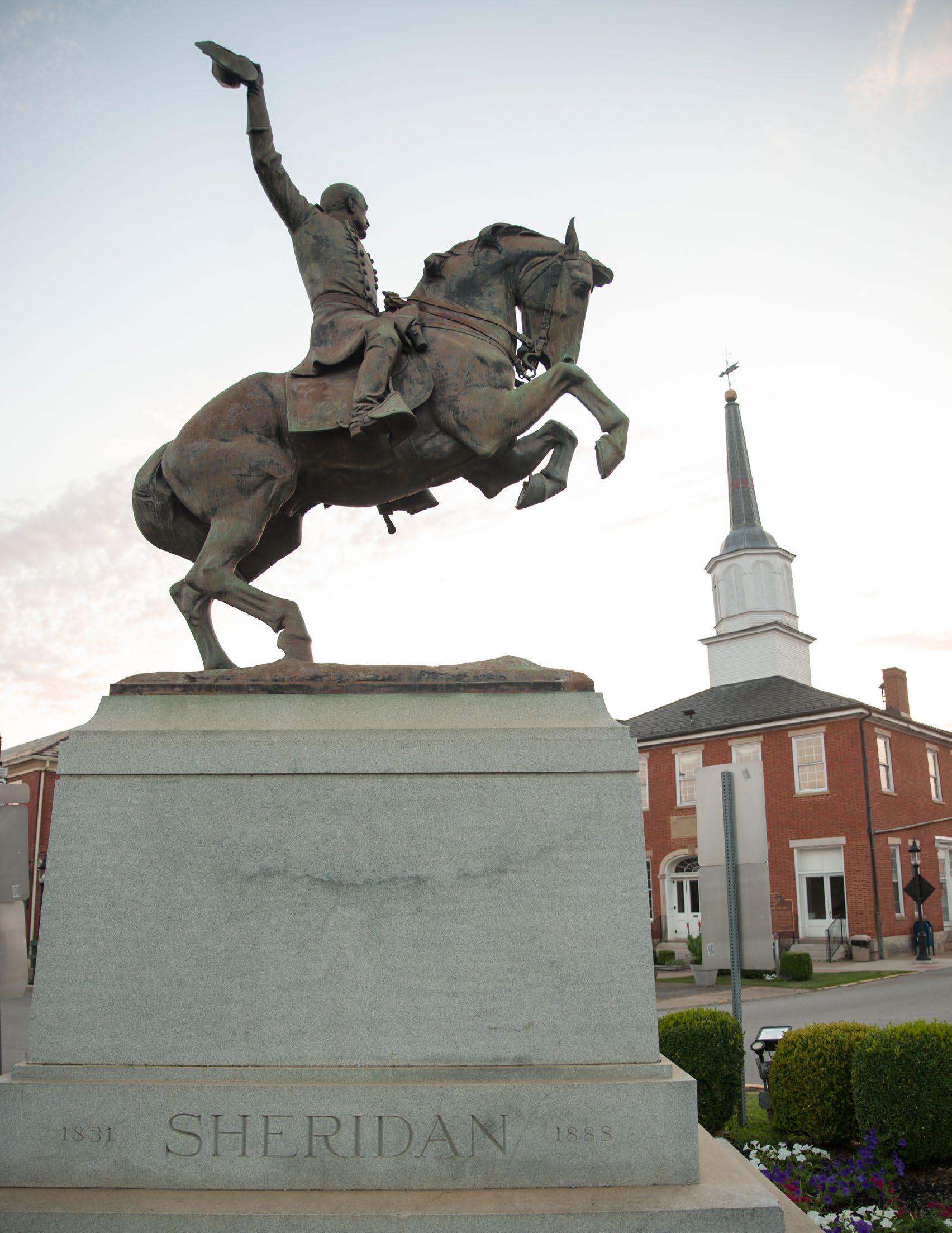
Perry County, Ohio
Michelle Waters for
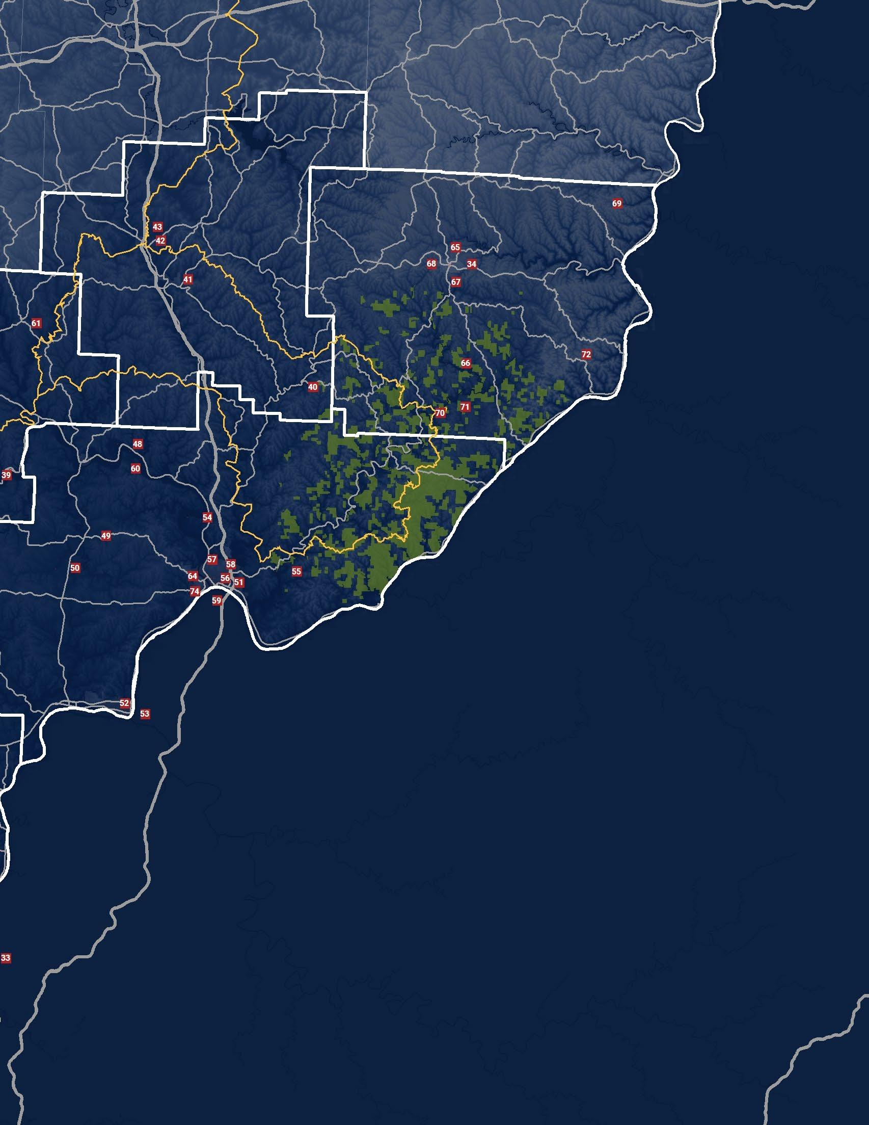
The Buckeye Hills region consists of a large geographic area in Southeast Ohio which includes Athens, Hocking, Meigs, Monroe, Morgan, Noble, Perry, and Washington counties. The region has substantial history of national significance and is foundational to the State of Ohio.
The history and culture of the region is deeply rooted in the early exploration of Appalachia and settlement of the Northwest Territory. Founded in 1788, Marietta is situated at the confluence of the Muskingum and Ohio Rivers and was the first permanent settlement of the Northwest Territory. Marietta is named for Marie Antionette, the Queen of France at the time, due to the debt of gratitude the Revolutionary War veterans who settled here felt to France's support of the fight for independence.

Many of the cities and villages in the Buckeye Hills region date back to the early to mid 1800’s. These communities have significant history that is rooted in early exploration of the Ohio River valley, natural resource extraction, and transportation of goods and services. Many of these communities have historic downtowns that have served as the center of commercial activities and community gathering for over a century.
Established in 1804, Ohio University is the first chartered university in Ohio and is among the oldest universities in the United States. The location in Athens was selected because of its centralized location between Marietta and Chillicothe, the first capital city of Ohio.
There are six additional colleges in the region including Marietta College, Washington State Community College, Hocking College, Hocking College-Logan Campus, TriCounty Career Center, and Washington County Career Center.
The Buckeye Hills region has a rich and diverse history. Many communities, like Albany in Athens County, served as stops along the Underground Railroad as many of those escaping slavery traveled up the Hocking River from the Ohio River. To ensure the education of their children, the growing African American community founded the private Albany Enterprise Academy in 1862. It was the first school in Athens County founded by and for African Americans. It operated until 1886. Notable alumni included educator and activist Olivia Davidson, hotelier Edward Cornelius Berry, and teacher and poet A. J. Jackson.
The communities of Chesterhill in Morgan County and Rendville in Perry County share a history of offering economic opportunities and livelihoods for those looking to escape the racial segregation of the South. The Quakers who settled Chesterhill in 1843 made the village a sanctuary for the formerly enslaved. Established as a racially-integrated mining community in 1879, Rendville produced several important leaders including Richard L. Davis, a prominent labor organizer, Isaiah Tuppins, the first African American mayor in Ohio, and Sophia Mitchell, the first African American woman mayor in Ohio.
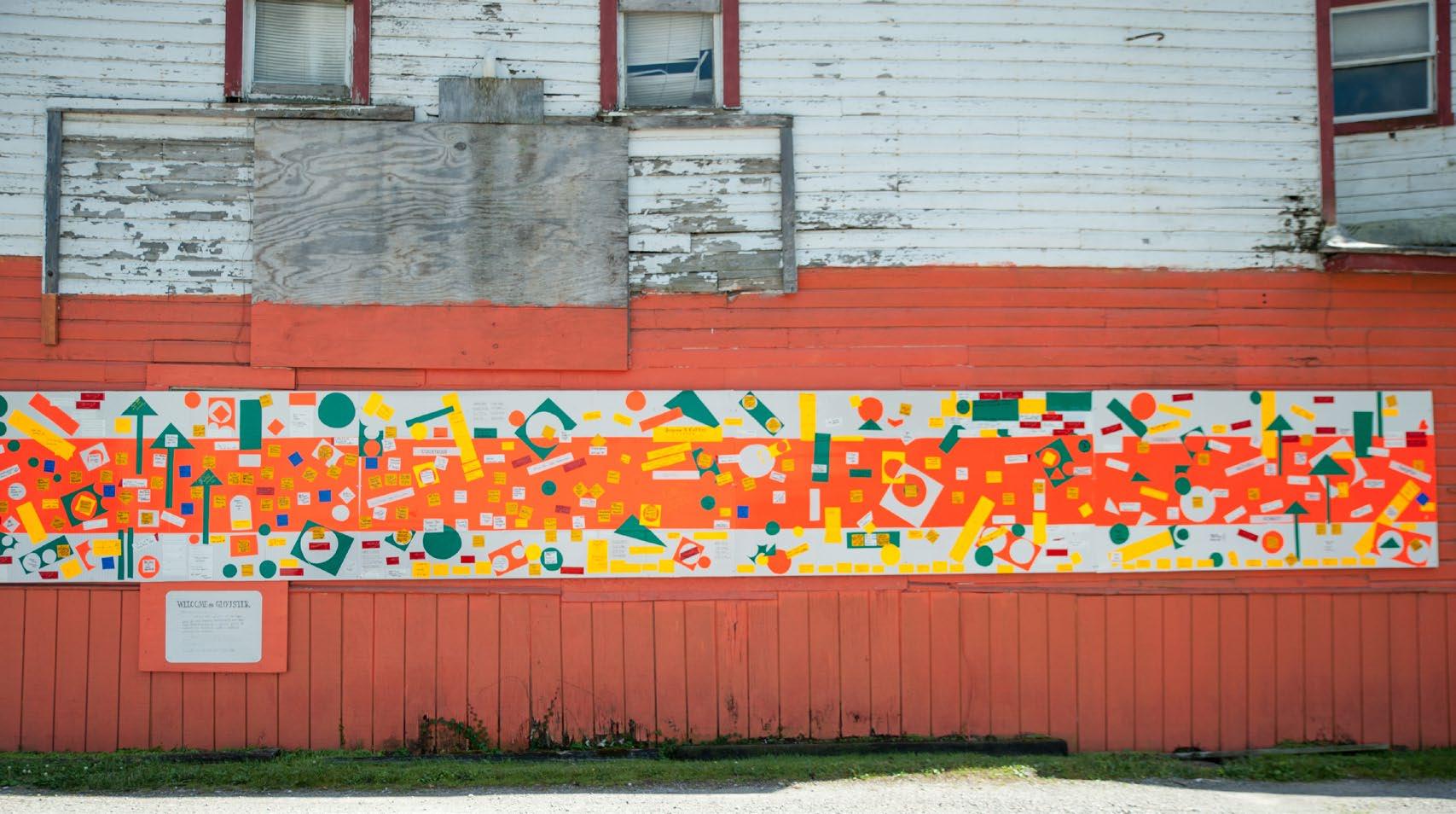
GLOUSTER, OHIO MURAL Athens County, Ohio Image: Michelle Waters for BHRC

County, Ohio
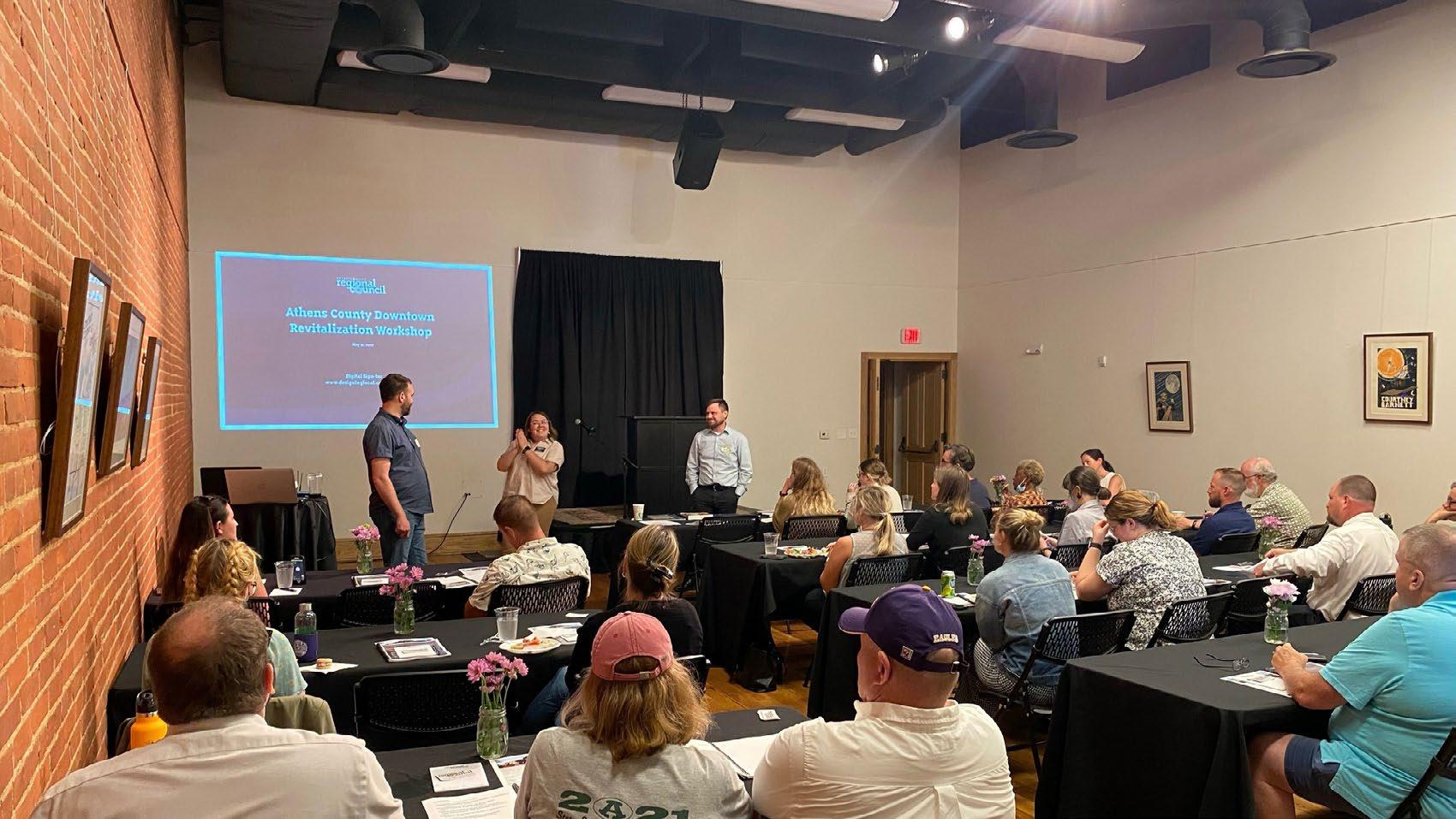
A workshop was held in each of the eight counties, all during June 2022. The workshop covered a range of topics related to downtown revitalization.
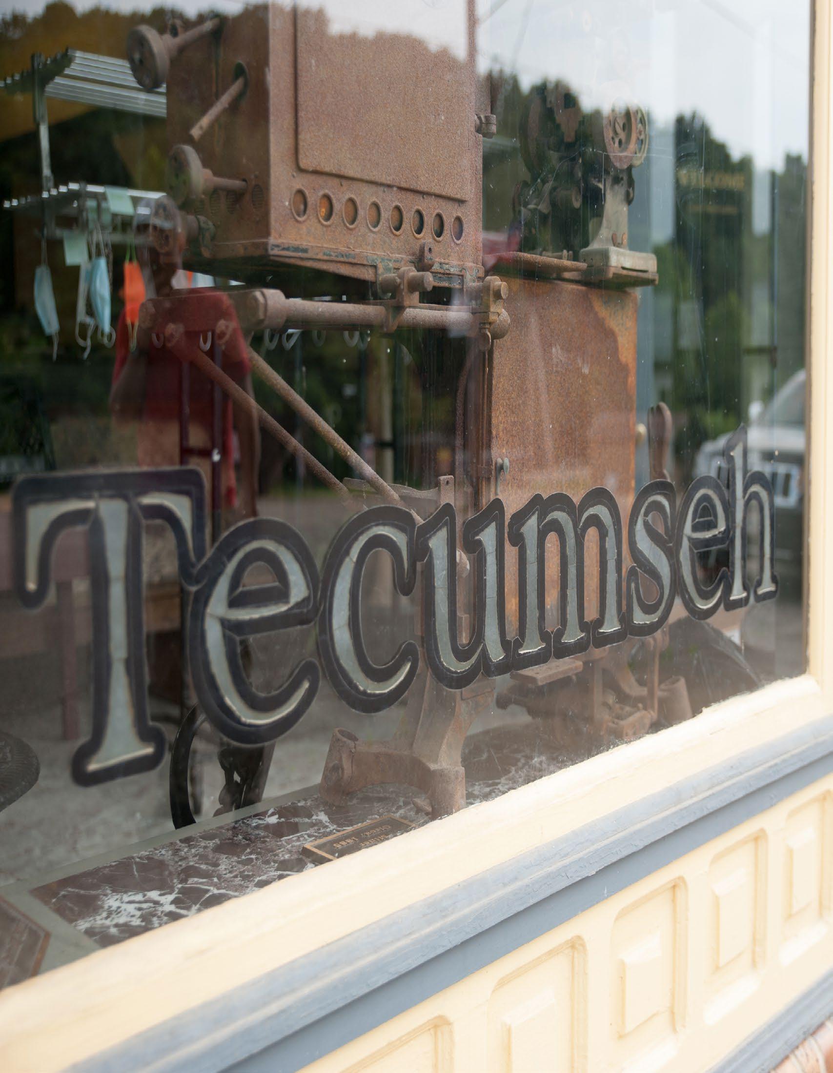
TECUMSEH THEATER, VILLAGE OF SHAWNEE
ATHENS COUNTY WORKSHOP IN NELSONVILLE, OHIO Athens County, Ohio Image: BHRC Staff
IT WAS HELPFUL TO ME AS THE MAYOR OF SHAWNEE TO HELP ME BETTER UNDERSTAND THE ASSETS THAT WE ALREADY HAVE AND HOW TO BETTER PROMOTE OUR COMMUNITY BY USING DIFFERENT STRATEGIES FOR TOURISM, INFRASTRUCTURE AND PRESERVATION. IT WAS VERY HELPFUL TO BE GIVEN A LIST OF FUNDING OPTIONS TO ASSIST WITH THE REVITALIZATION.
Beverly Decore Trovato Mayor of Shawnee
The workshop series provided creative ideas for downtown revitalization that are grounded in technical knowledge and are achievable through available funding resources. This information was communicated through a slideshow presentation. All attendees of the workshop received a workbook that included the slides and space to take notes.

Prior to the start of the workshop series, the workshop team developed several goals to help guide the discussion.
Generate creative ideas which lead to increased vitality and economic activity in area Downtowns.
All eight workshops were well attended with some workshops having upwards of 50 attendees. The workshop attendees put forward relevant questions that advanced the conversation and provided context for issues faced in that particular county.
Each workshop had a variety of questions, but several topics consistently emerged from all the workshops.
Historic Preservation of existing buildings was consistently noted as a challenge. This was often because of a lack of technical skill or available resources. Additionally, many property owners are not maintaining their buildings, leading to an overall poor appearance and eventual demolition of historic resources.
I THOUGHT THAT THE PRESENTATION WAS VERY INFORMATIVE. SOME OF THOSE PRACTICES WE ALREADY HAVE IMPLEMENTED BUT THERE WERE SOME THAT WERE GREAT EXAMPLES OF WHAT OUR VISION IS.
Jen Tinkler Executive Director Marietta MainMost communities were interested in methods and strategies to attract tourists in order to increase vitality and economic development opportunities.
Determining a strategy to pay for these improvements was consistently discussed in each workshop.
1. Empower local community leaders to revitalize their Downtown areas.
Facilitate engagement to determine opportunities and challenges.
Downtown revitalization is an economic development strategy. Investing in downtown areas creates local jobs that require specialized skills and trades. When a strong downtown environment is marketed well and is comfortable for visitors, it leads to a tourism economy.

County, Ohio
Image: Michelle Waters
Ohio has focused on economic development revolving around oil & gas extraction, transportation & logistics, and manufacturing.
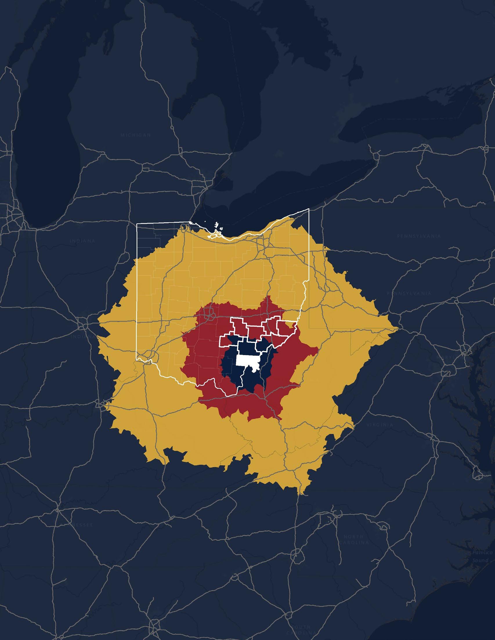
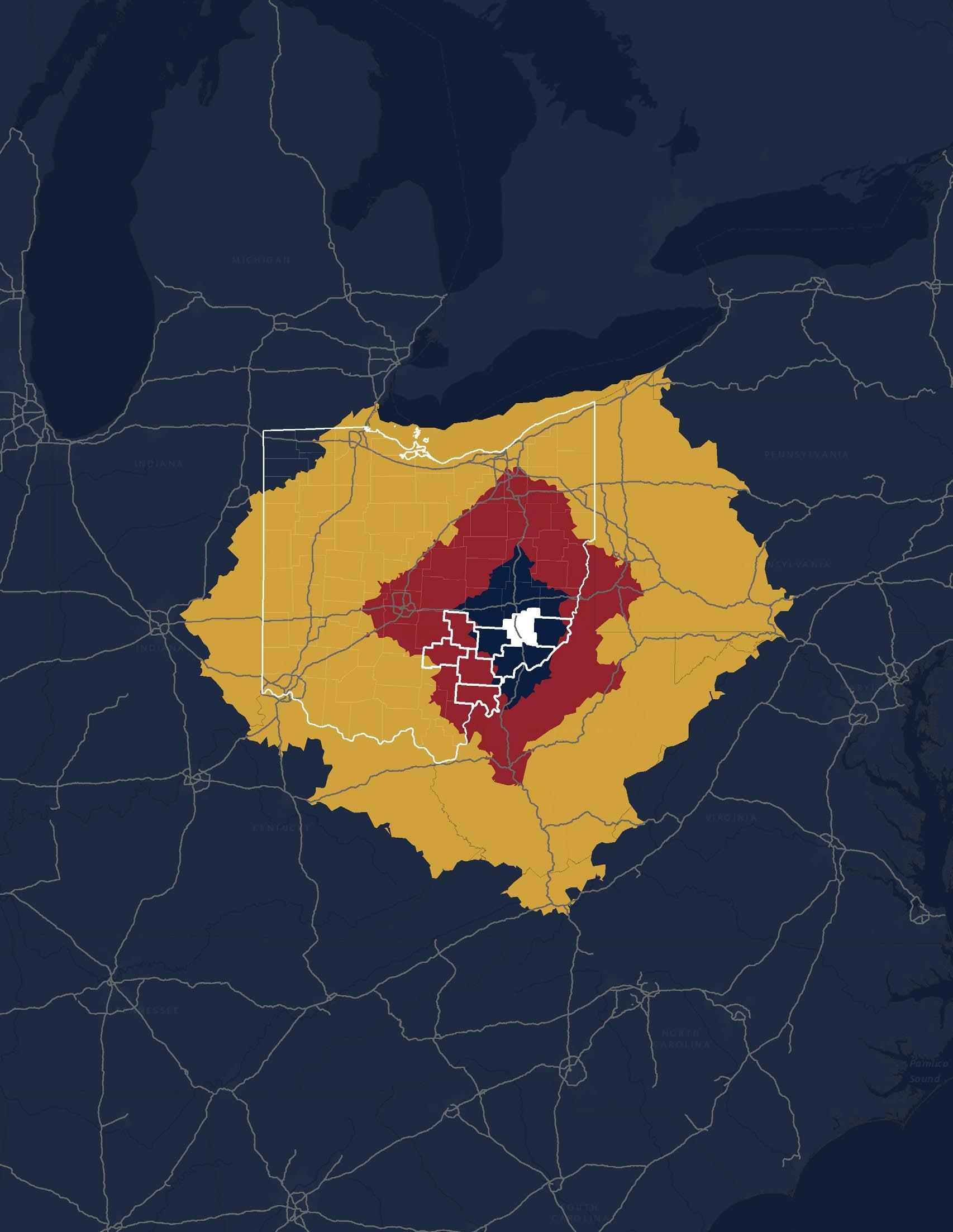
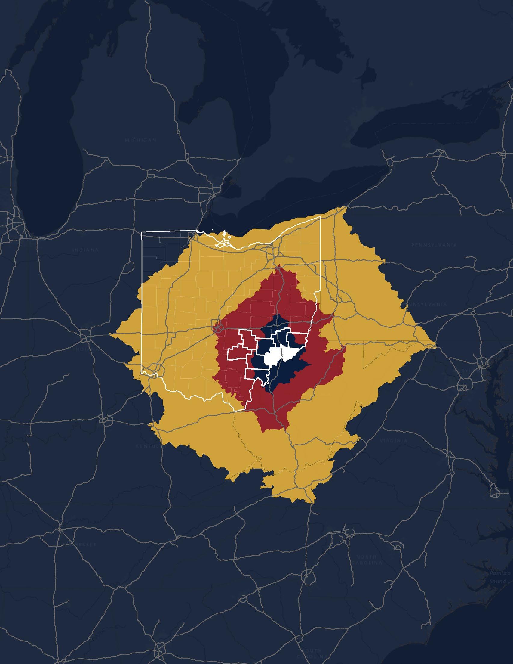
Central Ohio has experienced significant population growth over the last several decades. The region is expected to expand by nearly one million people over the next 30 years, effectively growing in population by 10% per decade.
Additionally, two new Intel chip plants are under construction in Licking County, Ohio. Eventually, this may be expanded with several additional chip plants, leading to substantial job growth. This will undoubtedly lead to significant population growth in Central Ohio and the outlying areas.
These chip plants are located within commuting distance of the northern counties in the Buckeye Hills region, leading to potential population growth in some of these communities.
The remainder of the region is within a short drive of this new growth. New people coming to the region will be looking for recreational opportunities, and the Buckeye Hills region currently offers numerous activities to fill this market, and could have many more.
Contrasting with most other parts of Ohio, the Buckeye Hills region has heavily rolling topography and wide expanses of forested areas. This natural landscape is an important asset and serves as the basis for a growing recreational tourism economy. Hiking, camping, boating, hunting, fishing, and other activities are currently very popular with potential to grow even. Motorized recreation is also very popular with an abundance of ATV trails in the region.
The Ohio, Muskingum, and Hocking Rivers are important resources for recreation. The Hocking River offers water trails for paddle craft. The Muskingum River is the longest navigable river that is situated totally within the State of Ohio. The Ohio River is navigable with numerous boat launches and marinas throughout the region. These are tremendous resources and should be tied into other recreational and cultural amenities.
The Buckeye Hills region includes many historical and cultural sites. These already draw tourists, but they can be incorporated into a coordinated Heritage Tourism strategy.
THE DOWNTOWN REVITALIZATION PROGRAM HOSTED IN NOBLE COUNTY WAS ALSO A KICK-OFF FOR A PLANNING PROJECT FOR THE SMALL VILLAGE OF BELLE VALLEY. AS A “GATEWAY” FROM INTERSTATE 77, BELLE VALLEY’S REVITALIZATION WILL POSITIVELY IMPACT LOCAL RESIDENTS AND GUESTS TO THE AREA. THE INFORMATION AND CONCEPTS SHARED HAVE SPARKED GOOD CONVERSATIONS WITH LOCAL LEADERS ABOUT THE POTENTIAL FOR THE AREA.
Gwynn Stewart Community Development Educator

$200,000+
$150,000 - $199,999
$100,000 - $149,999
$75000 - $99,999
$50,000 - $74,999 $35,000 - $49,999 $25,000 - $34,999 $15,000 - $24,999 $0 - $14,999
Population:
$200,000+
$150,000 - $199,999
$100,000 - $149,999
$75000 - $99,999
$50,000 - $74,999 $35,000 - $49,999
$25,000 - $34,999 $15,000 - $24,999 $0 - $14,999
Population:
$200,000+
$150,000 - $199,999
$100,000 - $149,999
$75000 - $99,999
$50,000 - $74,999
$35,000 - $49,999
$25,000 - $34,999 $15,000 - $24,999 $0 - $14,999


$200,000+
$150,000 - $199,999
$100,000 - $149,999
$75000 - $99,999
$50,000 - $74,999
$35,000 - $49,999 $25,000 - $34,999 $15,000 - $24,999
$0 - $14,999
Population:
$200,000+
$150,000 - $199,999
$100,000 - $149,999
$75000 - $99,999
$50,000 - $74,999
$35,000 - $49,999
$25,000 - $34,999 $15,000 - $24,999
$0 - $14,999
Population:
$200,000+
$150,000 - $199,999
$100,000 - $149,999
$75000 - $99,999
$50,000 - $74,999
$35,000 - $49,999
$25,000 - $34,999 $15,000 - $24,999
$0 - $14,999

$200,000+
$150,000 - $199,999
$100,000 - $149,999
$75000 - $99,999
$50,000 - $74,999 $35,000 - $49,999 $25,000 - $34,999 $15,000 - $24,999 $0 - $14,999
Population:
$200,000+
$150,000 - $199,999
$100,000 - $149,999
$75000 - $99,999
$50,000 - $74,999 $35,000 - $49,999
$25,000 - $34,999 $15,000 - $24,999 $0 - $14,999
Population:
$200,000+
$150,000 - $199,999
$100,000 - $149,999
$75000 - $99,999
$50,000 - $74,999
$35,000 - $49,999
$25,000 - $34,999 $15,000 - $24,999 $0 - $14,999


Population:
$200,000+
$150,000 - $199,999
$100,000 - $149,999
$75000 - $99,999
$50,000 - $74,999 $35,000 - $49,999 $25,000 - $34,999 $15,000 - $24,999 $0 - $14,999
$200,000+
$150,000 - $199,999
$100,000 - $149,999
$75000 - $99,999
$50,000 - $74,999 $35,000 - $49,999
$25,000 - $34,999 $15,000 - $24,999 $0 - $14,999
Population:
$200,000+
$150,000 - $199,999
$100,000 - $149,999
$75000 - $99,999
$50,000 - $74,999
$35,000 - $49,999
$25,000 - $34,999 $15,000 - $24,999 $0 - $14,999


$200,000+
$150,000 - $199,999
$100,000 - $149,999
$75000 - $99,999
$50,000 - $74,999 $35,000 - $49,999 $25,000 - $34,999 $15,000 - $24,999 $0 - $14,999
Population:
$200,000+
$150,000 - $199,999
$100,000 - $149,999
$75000 - $99,999
$50,000 - $74,999 $35,000 - $49,999 $25,000 - $34,999 $15,000 - $24,999 $0 - $14,999
Population:
$200,000+
$150,000 - $199,999
$100,000 - $149,999
$75000 - $99,999
$50,000 - $74,999
$35,000 - $49,999
$25,000 - $34,999 $15,000 - $24,999 $0 - $14,999

$200,000+
$150,000 - $199,999
$100,000 - $149,999
$75000 - $99,999
$50,000 - $74,999 $35,000 - $49,999 $25,000 - $34,999 $15,000 - $24,999 $0 - $14,999
Population:
$200,000+
$150,000 - $199,999
$100,000 - $149,999
$75000 - $99,999
$50,000 - $74,999 $35,000 - $49,999
$25,000 - $34,999 $15,000 - $24,999 $0 - $14,999
Population:
$200,000+
$150,000 - $199,999
$100,000 - $149,999
$75000 - $99,999
$50,000 - $74,999
$35,000 - $49,999
$25,000 - $34,999 $15,000 - $24,999 $0 - $14,999


$200,000+
$150,000 - $199,999
$100,000 - $149,999
$75000 - $99,999
$50,000 - $74,999
$35,000 - $49,999 $25,000 - $34,999 $15,000 - $24,999
$0 - $14,999
Population:
$200,000+
$150,000 - $199,999
$100,000 - $149,999
$75000 - $99,999
$50,000 - $74,999
$35,000 - $49,999
$25,000 - $34,999 $15,000 - $24,999
$0 - $14,999
Population:
$200,000+
$150,000 - $199,999
$100,000 - $149,999
$75000 - $99,999
$50,000 - $74,999
$35,000 - $49,999
$25,000 - $34,999 $15,000 - $24,999
$0 - $14,999

$200,000+
$150,000 - $199,999
$100,000 - $149,999
$75000 - $99,999
$50,000 - $74,999 $35,000 - $49,999 $25,000 - $34,999 $15,000 - $24,999 $0 - $14,999
Population:
$200,000+
$150,000 - $199,999
$100,000 - $149,999
$75000 - $99,999
$50,000 - $74,999 $35,000 - $49,999
$25,000 - $34,999 $15,000 - $24,999 $0 - $14,999
Population:
$200,000+
$150,000 - $199,999
$100,000 - $149,999
$75000 - $99,999
$50,000 - $74,999
$35,000 - $49,999
$25,000 - $34,999 $15,000 - $24,999 $0 - $14,999
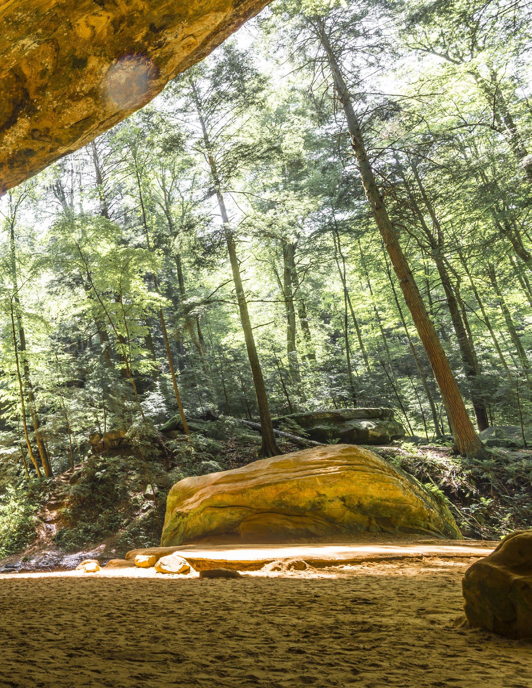
 ASH CAVE, HOCKING HILLS STATE PARK Hocking County, Ohio Image: TourismOhio


County,
A community brand is a visual representation of the sense of place and values that the community desires to portray to the world. This brand will be used in numerous formats including print media, digital communications, and in public space. A well-designed and compelling brand identity will create a positive impression of the community that inspires pride for existing residents and confidence for potential visitors.
A logo is a combination of text and iconography which represents your community. A well designed logo should be distinctive, easy to identify, and should reflect the overall feel of the local culture. This can be communicated using the tone of the graphics, the iconography of the design, and the associated color scheme.
The most critical element of a municipal or place-based logo is the text that is incorporated into the design. Most logos include the name of the community and the type of organization. It is also important to include the word Ohio for smaller communities so that people that are unfamiliar with your community will immediately recognize where the community is and how to find it. Therefore, an effective brand identity for most communities in the Buckeye Hills region should include at least two elements; the name of the community, and the word Ohio. Is also important to identify the type of entity such as Village, City, or County. These elements may be displayed with a varying hierarchy so that the name of the community stands out the most.
The design of the logo should convey the feeling of your community that you want to portray to the world. This overall visual tone will be immediately recognizable to viewers and will likely lead to the first impression of your brand identity, even before they read the words in the logo or look closely at any other elements. Your brand identity could have a fun and light tone which helps potential visitors to understand that your community is friendly and is fun to visit. Conversely, your brand identity could have a historical feel which in turn communicates that there are historical features to explore. It is important to establish the desired visual tone early in the design process as this specific direction will drive many other decisions.
A common strategy is to incorporate a visual icon into the design of the logo. This is referred to as a brand mark. The brand mark can be recognized on its own separate from any text or other supporting elements that are incorporated into the logo design. Many community logos include a representation of distinctive landmark within the community such as a notable building, park, or monument. If your community chooses to include a landmark into the design, it is critical that this feature is truly distinctive so that it does not get confused with a similar landmark from another community.
The selection of a principal color scheme is a critical decision in the process of designing a brand identity. All colors create strong but very different emotional responses, and this emotional response should be used to reinforce the desired visual tone. The principal color scheme of the logo may have one color or several colors. However, most logos do not have more than three colors. This is to minimize print costs and complexity of use.
Many communities have specific colors that are part of the heritage of the place and evoke a specific reaction from local community members that may be different from a nonresident that is unfamiliar with the local history. Additionally, some communities may want to select a color or color scheme which purposely elicits a new response from both community members and potential visitors. In this way, the color scheme is used to create a fresh perspective or to alter the image of the community.
Regardless of the selection of the primary color scheme, both the logo and brand mark should be recognizable and compelling in a monochromatic format. In other words, if the logo is utilized on a color background, it needs to have a clean and strong look in basic white. Conversely if it is printed and black and white, it needs to look appropriate in grayscale.

Colors have the power to evoke vastly different emotional responses. Selecting colors for a brand identity should be based on the desired emotions that visitors and residents will develop toward the community.
Some of the most compelling and well-known brand identities can be recognized almost exclusively by an individual color or a color scheme.
Selecting two or even three different colors in a combination creates an emotional response that may include a range of emotions. This technique should be used carefully but intentionally to create the desired reaction.
Below are some examples of how different colors convey very different emotions.
Red: Power, Confidence, Passion
Orange: Energy, Optimism
Yellow: Happiness, Fun
Peace, Freshness, Nature
Calm, Trust
Wisdom, Compassion
Creative, Energetic
Strength, Sophistication
Gray: Stable, Professional
Tan/Brown: Natural, Comfortable
A cohesive and well-developed brand identity should include numerous additional elements which support the logo and can be used in various types of communications.
The brand identity may include several alternative logos that include additional iconography or variations of the design. For example, the logo may include a horizontal version and a vertical stacked version for use in various formats.
The brand identity may also include alternative logos that do not include the primary brand mark and only include text. Any alternative logo designs must always be recognizable as a part of the family of the brand identity.
The principal color scheme will only include a few colors and will limit the creativity of other types of communication materials. Therefore it is important to provide secondary and tertiary colors that are visually supportive of the principal colors.
Secondary colors should include a range of shades of the primary colors. For example, if the principal colors are a medium blue and red, the secondary color palette should include a light blue, dark blue, light red, and dark red at a minimum.
Tertiary colors include other colors that may be necessary for items like brochures and signs where a range of colors may be necessary to communicate the intended message. Using the example above where the blue and red are the principal colors, tertiary colors may include the yellow, a green, and a violet palette that is visually compatible with the tones of the principal colors.


The Village of Caldwell brand identity was developed using a public survey as a baseline and was refined through discussions with community leaders. The brand identity has a nostalgic flavor which reflects the character and future of the community. The brand identity was adapted into various materials including banners and wayfinding signs.
The brand identity will likely include a principal font used in the logo design. The principal font should be selected to best reinforce the creative intent of the overall brand identity. This font will likely not be a standard font that is readily available, but that is not an issue because this principal font will likely only be used in the logo design itself.
A secondary typeface should be provided for general use in publications, signs, websites, and other communication materials. The secondary typeface should be easy to read in paragraph form and should have multiple variations built into the font such as thin and bold weights. Ideally the font will be a standard available in Microsoft products or will be easy to attain through a free use service like Google Fonts or Adobe Marketplace. Obscure or expensive fonts should be avoided as a secondary typeface.
A brand identity may also include supportive artwork such as patterns or other graphic elements. These items will help to bring visual interest to various documents and signs while creating a consistent visual motif. Patterns can be generated as original custom artwork or can be selected from standard patterns available through services like Adobe Marketplace.
The brand identity should be visible in public space to reinforce the community’s image and to create consistency between print materials, digital communications, and use on signs or graphics.

Various types of signs are excellent locations to feature the elements of the brand identity including the color scheme, the logo, and the typefaces. Signs may be temporary or permanent, but all should have a consistent design quality that fits the brand guidelines.
Site Furnishings such as benches, lights, and litter receptacles may incorporate elements of the brand identity such as colors, typefaces, and patterns. It is important to not overuse the logo and directly placing the logo on site furnishings should be avoided.
The brand identity will certainly be used by the owner of the brand, but it will also be used by many other entities as they communicate to others about the community. It is important to have clear standards in place for how the brand identity should be used so that a consistent and positive message about the community is conveyed.
A brand guidelines document should be developed in conjunction with the brand itself. This document will describe how the various elements of the brand should be used and, perhaps more importantly, should not be used. For example, certain versions of the logo design should not be used with a color background because it will decrease the legibility of the design. Additionally some versions of the logo design should only be used on large-scale print materials and not on small-scale print materials because the fine detail of that version of the logo will be lost.
The municipality should also develop a media kit that is readily available for use by the news media when they are communicating about the community. A media kit may contain various high-resolution versions of the logo as well as high quality images that showcase positive aspects of the community. The media kit could also include key facts about the community, including when it was founded, some of its notable historical facts, and information about elected leadership. The media kit should be readily available on the community’s website so it is easy to find when the media is doing research. The overall goal of the media kit is to provide the media with high-quality communication materials so they are promoting a positive impression of the community.
Social media has become the primary way many people search for and obtain information about community events and news. It is critical that the community promotes itself through social media and provides factual information that is the basis for community conversations. Facebook, Instagram, Youtube, and Twitter are the dominant social media platforms at this time, but other platforms like LinkedIn,Tik Tok and Snapchat are gaining popularity. These platforms generally communicate to different audiences and present information in very different ways. A social media strategy should be developed to best engage residents but to also attract interest from potential visitors.
The tone of media communications is critically important to establish the impression of the community. Many municipalities have a very matter-of-fact tone to their media communications. While this is effective in conveying information, it does not necessarily create a warm and welcoming impression to potential visitors. It is recommended that a positive and friendly tone be
conveyed in all media communications. Additionally, some social media platforms welcome highly creative and even whimsical strategies. If the goal Is to create a new or different impression for the community, then perhaps a more unique and fun social media presence may be deployed.
Because so much information about each community will be attained through social media, it is critical to have readily available high quality images and video. This type of media should be obtained during events and other activities which highlight the best aspects of the community. These images may be posted throughout the year to promote other events and activities and to generate excitement amongst both residents and visitors. If possible, a professional photographer and/ or videographer should be hired to provide visual documentation during prominent events.
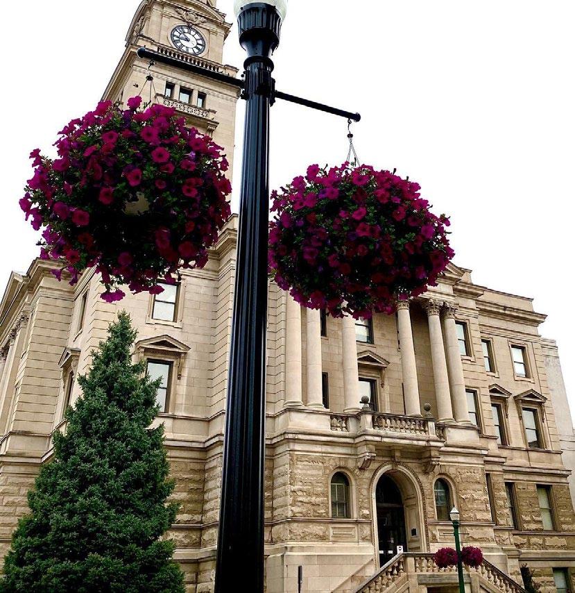
Marietta Main Street facilitates an annual basket program which allows for individual donors to sponsor a flower basket. Each basket sponsorship is $75 and the sponsor is allowed to contribute additional funds. Sponsors are permitted to honor someone if they choose, and this is noted on a tag that is hung from the lamp post. The baskets are hung from early May through late September. To provide additional seasonal interest, the baskets are switched seasonally to a garland/wreath sponsorship during the holiday season.
Image: www.mariettamainstreet.org
Creative placemaking has become a critical strategy for revitalization in communities of various sizes and types. The core idea of creative placemaking is to provide local residents with the opportunity to directly contribute to the vitality of their community through creative activities.

Public art is likely the most straightforward and permanent method to engage creative residents in community improvement activities. Public art implementation includes a broad variety of media, scales, and budgets. A strategy for public art can be developed to achieve numerous goals related to revitalization and community engagement.
It is important to note that most public art improvements are relatively inexpensive and have short timelines for implementation compared to larger infrastructure and construction projects. A public art strategy may be among the better solutions to achieve quick results that are embraced by the community. A public art strategy may also be most appropriate for building momentum towards larger goals that may have higher associated costs.
Public sculptures are generally more expensive and have longer production cycles than public murals and other types of public art. However they can generate significantly more community engagement and have much longer lifespans. Some of the more notable public sculptures include monuments to an individual or a key community event. It's important to explore other subject matters such as key elements of the community's history, geography, or other notable features. Abstract shapes and bold colors should be explored for a highly memorable experience. This will contrast intentionally with a historic downtown environment and create interest and a dynamic quality.
Creative placemaking integrates arts, culture, and design activities into efforts that strengthen communities. Creative placemaking requires partnership across sectors, deeply engages the community, involves artists, designers and culture bearers, and helps to advance local economic, physical, and/or social change, ultimately laying the groundwork for systems change.

The Nelsonville Brick mural was initially installed in 2015 by local artist Barry O'Keefe. The mural features four patterns that were originally cast into bricks that were originally made in Nelsonville. These include the star brick, flower brick, circle brick, and snowflake brick.
The mural is located on the back facade of a building owned by a local law firm. The bright color scheme brings vibrancy to Downtown Nelsonville, and the bold patterns serve as a great backdrop for photos and social media posts.

Public murals can be located on the sides, backs, and even fronts of numerous building types. A highquality mural brings vibrant color and cultural vitality to the public realm. The content of a mural design can be tailored for each site and is a great storytelling opportunity for the community. The most impactful murals often will turn a blank wall into a community landmark. Murals have the ability to achieve incredible results at a relatively low cost and short implementation timeframe.
Many murals are intentionally designed to generate public interaction. This can be achieved through the use of visually expressive forms, bold colors, and other features. When the public interacts with the mural, often they will take a video or image and post it to their social media. This type of interaction creates a positive experience for that individual while also promoting a positive impression of the community to others. This is an important strategy for building interest in tourism, which in turn will generate visitation and economic activity in the community.
While murals have significant benefits, there are some fundamental issues that should be considered. Murals should generally not be painted on the principal facade of a historic building. Additionally, murals should not be painted on historic building facades that have original masonry that has not been previously painted. If there is a sensitive building facade that should not be permanently altered, an adhesive vinyl wall covering may be considered as an alternative strategy.
Murals also have scheduling considerations. Murals are generally painted in the late summer months when the likelihood of inclement weather is the lowest. The schedule should be considered when planning out a mural project.
Image: Michelle Waters for BHRCPublic art will require maintenance throughout its lifespan. Public sculptures will require cleaning and occasional repair if they are damaged. Funding for this type of work should be budgeted through the municipality’s general fund, or a private maintenance endowment should be considered.
There are other creative placemaking strategies that can bring vibrancy to a downtown environment but are not necessarily considered to be permanent public art.

These public space improvements are intended to bring engagement to the community so that residents are directly participating in community improvement. This is critical to building a positive experience for residents so that they feel as though there is an opportunity to shape their own future as well as the overall future of the community.
Crosswalks are intentionally designed to have high visibility within public spaces. While there are regulatory
requirements for crosswalk designs, they can also have bright colors and bold shapes incorporated into the design, bringing additional color and vibrancy to the streetscape. Individual residents can be directly involved in designing and installing a creative crosswalk. These require minimal preparation and are relatively low cost to complete.
As a note, any modification of the public right-of-way should be coordinated with the local municipality. Some corridors are regulated by state and federal entities and will likely not be eligible for creative crosswalk projects.
There are numerous other types of temporary public art that could be explored to bring vitality and visual energy to a downtown environment. This may include items such as custom benches, bike racks, street murals, and temporary signs. These temporary elements may be designed to only last for a few months to several years, but again the purpose is to provide an opportunity for engagement of local residents and to achieve immediate visual interest with a modest initial investment.
The murals in downtown Pomeroy present an opportunity to pay respect to the community’s legacy, as well as work to build a new culture for the community. Pomeroy has worked to establish itself as a tourist destination because of its proximity to the Ohio River. Following the opening of businesses along their Main Street, including River Roasters Coffee Company, local leaders took the steps to use space and buildings as an opportunity to engage with tourists. The mural on the building at 102 W. Main Street is well positioned in the business’s patio area to offer an opportunity for those visiting to take a photo with local art to remember their time in Pomeroy.
CASE STUDY: POMEROY MURALS Image: BHRCTactical Urbanism is a relatively new strategy for community improvement in which residents lead the process of community change through short-term and low cost demonstration projects. The primary goal is to showcase how a potential long-term and permanent infrastructure project will function by testing the strategies of that project using temporary measures. There are numerous project types in which tactical urbanism is applicable.

Making substantial changes to traffic patterns often requires major investments into engineering and construction and can take years to implement. Tactical Urbanism allows community members to test out these potential improvements and determine if they are effective and worthwhile.
An example of utilizing Tactical Urbanism to test traffic improvements involves the addition of pedestrian safety enhancements such as curb extensions. Curb extensions (sometimes called bump-outs) shorten the crossing distance so that pedestrians spend less time in the roadway and therefore have less risk of being hit by vehicles. These curb extensions can be installed using temporary measures such as cones, barriers, and other elements to create the desired effect. Data collected on these temporary curb extensions is examined to see if there are safety improvements. Additionally, motorists can become accustomed to the presence of new infrastructure which eases the impact of change when the permanent physical infrastructure is eventually installed.
In preparation for the first two roundabouts in Morgan County, Ohio Department of Transportation District 10 and Buckeye Hills Regional Council planned a roundabout rodeo at a park in the village of Malta. Many people in Morgan County had never driven a roundabout, and there was concern in the community about them being difficult or confusing to navigate. Using chalk and cones, ODOT constructed a full-scale mockup of the proposed roundabout at the park, allowing drivers to practice entering and leaving the roundabout using their own vehicle and with simulated traffic. ODOT and Buckeye Hills staff gave participants a brief training on navigating the roundabout, and participants could drive through it as many times as they wanted. Many remarked that they felt much more comfortable about the incoming roundabouts after participating in the rodeo.
 Image: Morgan County
Many cities have installed temporary outdoor dining areas within the public right-of-way during the Covid-19 pandemic. These outdoor dining areas proved to be so popular that they were often made permanent when Covid-related restrictions were lifted. This is another example of a Tactical Urbanism approach to demonstrate the value of change with minimal initial public investment. Once the community saw the benefit of converting on-street parking or an existing sidewalk space into dining areas, it became far easier to implement this permanently. This example can be extended to numerous other types of public space improvements such as outdoor seating areas, pedestrian plazas, play areas, and market spaces.
Tactical urbanism can be combined with public art strategies to engage even more residents in the process of demonstrating public space improvements. The curb extension example above could be implemented with on street murals or painted crosswalks as part of the Tactical urbanism strategy. In this instance the temporary facility both demonstrates the value of that infrastructure improvement while also creating visual interest. The added benefit of artist participation creates even more community buy-in to the project.
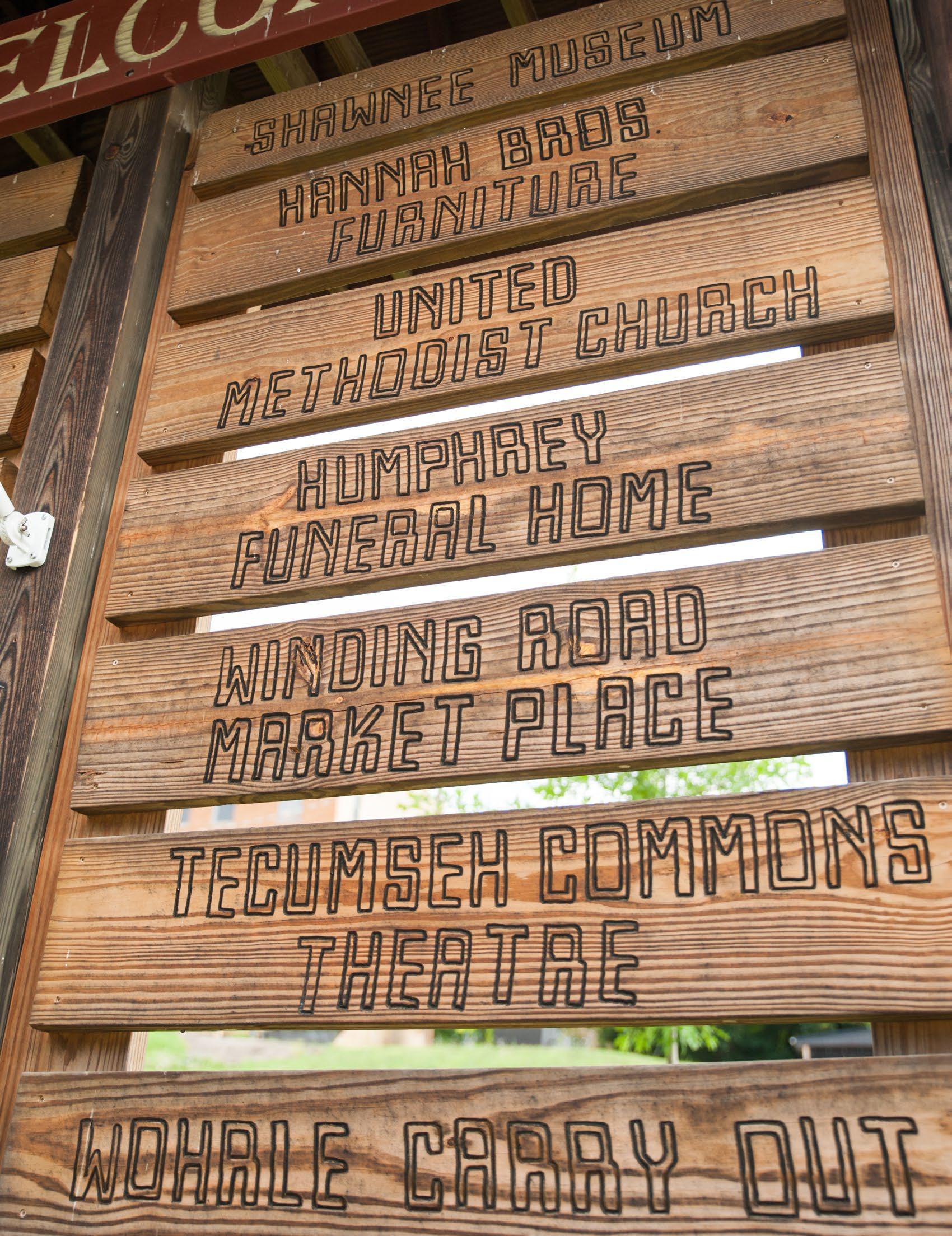
Wayfinding elements in a community can direct both residents and visitors to key destinations that are not necessarily on mapping apps for other directional publications. They also provide an opportunity to bring vitality and visual energy to public spaces while reinforcing your community brand.
County,
Community gateways are located at the outer edge of the municipality or district. Often these gateways are located directly at the boundary line but occasionally they can be located at a more convenient or practical physical location where a large sign can be placed.
The selected locations are critical to announce to visitors that they have officially arrived in the community. These gateway signs help visitors especially to understand that they have officially arrived in your community which instills a positive first impression. For residents, gateway signs can reinforce the community brand and generate community pride.
Because gateway signs are located along roadways that often have high speed limits, the signs need to be relatively large and visually loud. Therefore a sign might be 6 to 8 ft tall and wide or larger in order to create this first impression.

Dating back to 1939, the Logan Gates were constructed to announce the entrance to the community and its key location as the gateway to the Hocking Hills Region. The gates were recently restored through a project sponsored by the Logan High School Class of 1954. The scale of the gates is very large in order to create a strong first impression and sense of arrival in the community. The masonry piers provide a sense of permanence and strength.
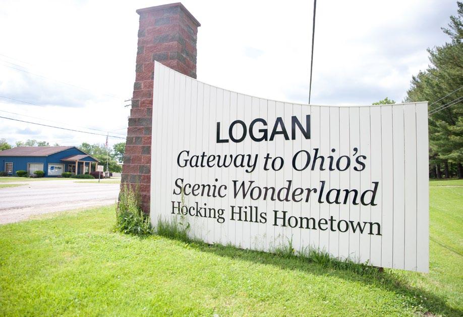 CASE STUDY: LOGAN WOODEN GATES
This mural in Marietta welcomes visitors to the Downtown Area. The mural was funded bythe Marietta Community Foundation and various community individuals. The colorful and bold graphics bring energy to the public realm.
 Image: Sarah Arnold
Directing motorists through your community is an important strategy to make visitors and residents feel comfortable and confident as they navigate streets and roadways.


A well-designed vehicular wayfinding system will create a comfortable and positive experience for visitors. The system should reinforce the overall community brand and the signage should have an attractive design which enhances streetscapes and other public spaces. Text that is placed on vehicular scale signage should be large enough to be seen while traveling at the speed limit of that particular roadway.
Vehicular wayfinding signs allow for the community to direct visitors to places that they would not otherwise discover. Wayfinding signage should clearly navigate motorists towards community landmarks, historical sites, parks, and business districts. This signage should also direct visitors to both convenient on-street parking as well as available overflow parking which has been provided by the community.
Both residents and visitors can benefit from pedestrian wayfinding signs that showcase key community assets.
Pedestrian scale signs should be designed to be visible up to a distance of roughly 50 feet so that they are visible from across the street. The sign should direct visitors to areas that are within walking distance, or roughly a five to ten minute walk away from the sign’s location.
Well-designed pedestrian scale signage should provide significant enhancement to the environment of the public space. The signs themselves should be bold in their design to provide visual interest.
Many communities have utilized their brand identity to create oversized signs that are intentionally designed to initiate public interaction.
These large interactive signs should be placed in a location that is highly visible and easily accessible by the public. Often the sign is placed in front of another community landmark so that the background of any photograph has a well composed image that includes numerous recognizable features of the community.
A landmark interactive sign should serve as a primary location for both residents and visitors to take group photos or selfies. The public should be encouraged to post these photos to their social media accounts in order to promote their own positive experience. The unique image created by a landmark interactive sign demonstrates to others that the community is unique, creative, and fun.

The Nelsonville Music Festival has utilized landmark interactive signs to generate interaction and social media engagement. This sign was painted over the duration of the festival to provide additional interest and engagement.
Image: Jennifer GrimmCommunities should highlight notable facts about their history and key residents in public space through the use of descriptive interpretive signage.
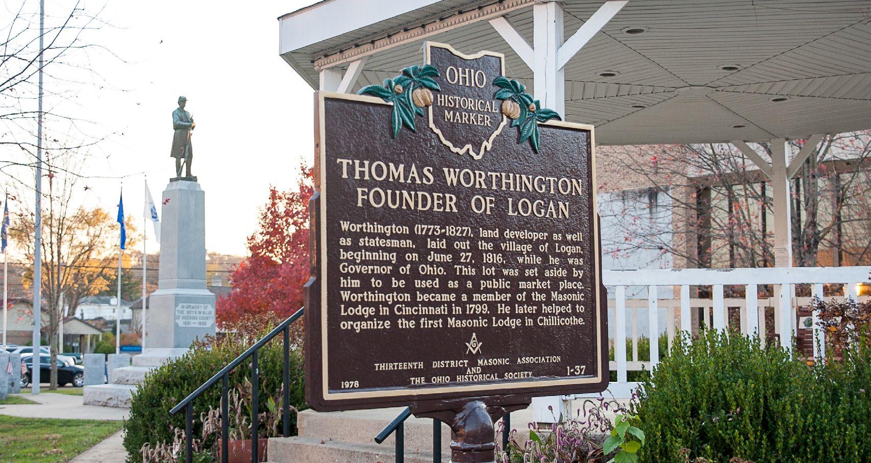
Interpretive signs should highlight specific building sites and other features of the community through providing a short message about that feature. The sign can also include visuals such as historic photographs, diagrams, and other visual elements.
The interpretive sign system should be based on the brand identity and should have a consistent execution throughout the community. The content of the interpretive sign system should also be coordinated in order to provide a cohesive narrative to the public. Additionally, the interpretive message on each sign should be well-researched and factual.
One strategy to create a cohesive interpretive system is to create an overall map of all potential interpretive signs and an accompanying message schedule that includes the complete text for each of the signs. In this way, there will not be duplicative information on individual signs and the public will receive a unique message at each sign.
Additionally, most interpretive system signs will not be installed at the same time. However, with a complete message schedule and sign location map, the implementation of the interpretive system can be phased in a cohesive manner without sacrificing the quality of the overall system.
The Ridges has an excellent wayfinding sign program that includes directional signs, interpretive signs, and other signs that utilize consistent branding and design. This system highlights various natural, historical, and cultural features that enhances the overall visitor experience.
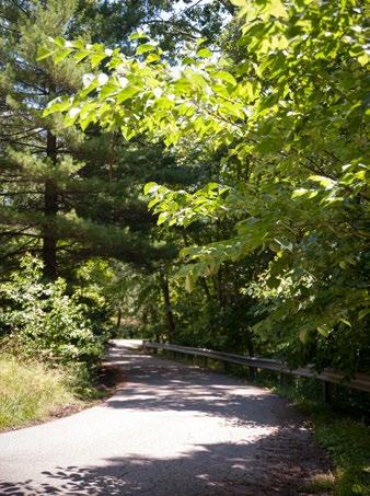

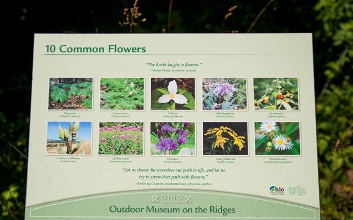
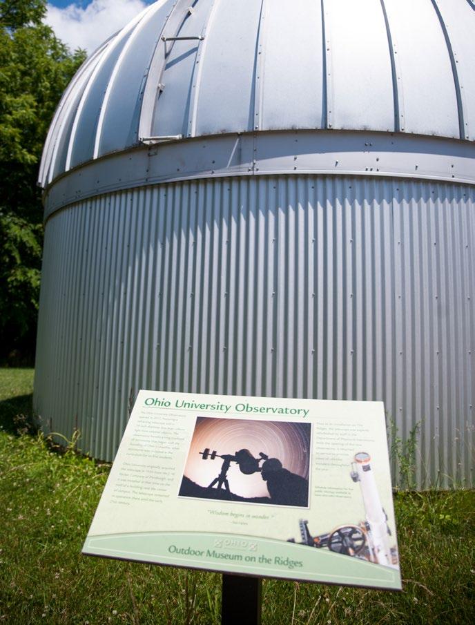
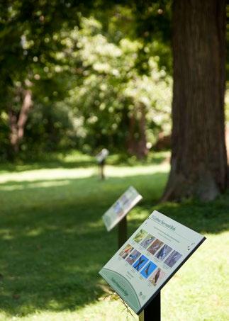
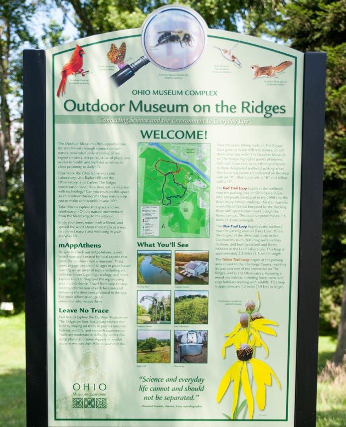 Images: Michelle Waters for BHRC

The improvement of public space can create dramatic results in the appearance and experience of a downtown, leading to increased visitation and vitality.
County, Ohio
Design of a public street includes all of the space within the public right-of-way. In downtown environments, this usually includes the space from the building facade on one side of a street to the building facade on the other. The design process includes balancing numerous factors including utilities, traffic, emergency access, ADA accessibility, and mobility for cyclists, pedestrians and public transit.
Public streets, especially in a downtown area, are among the most important social spaces in the community. These spaces are where spontaneous interactions occur between friends and acquaintances, and ‘people watching’ is a primary activity. When undertaking a streetscape project, enabling social activity should be a priority.
Balancing the various types of mobility that occur within a street environment is one of the most challenging aspects of streetscape design. Generally, it is important that vehicular mobility does not outweigh other priorities, especially pedestrian mobility.
Sidewalk areas are generally at least 12-14’ wide from the back of the curb to the front of buildings. This allows space for a 6’ wide pedestrian zone as well as a 6’ wide amenity zone. The amenity zone should be located between the roadway and the pedestrian zone. The pedestrian zone should be located directly next to building facades so that pedestrians have direct visual access to storefronts.

Logan recently underwent a major streetscape project for Main Street. This included pavement improvements, new light poles, banners, plantings, and a number of additional features. The streetscape creates a comfortable experience for pedestrians as well as significant visual interest and 'curb appeal'. The streetscape includes additional plantings soften edges of parking lots.
Image: Michelle Waters for BHRCRestaurants, coffee shops, and other food service establishments should be encouraged to have outdoor cafe seating in the streetscape because it adds activity and vitality. The seating areas should generally be located against the building in the pedestrian zone. In this case, pedestrian traffic will need to be shifted around the seating area and into the amenity zone. This is a fairly typical situation in streetscape design and can be accommodated with good coordination. It does underscore the need to have a properly proportioned total sidewalk width. If outdoor restaurant seating is a priority in a downtown area, the sidewalk width should be at least 14’ in total width or more.

The design of streetscape projects should include various amenities so that residents and visitors are encouraged to spend time in the downtown environment. Amenities include elements like benches, litter receptacles, pedestrian scale lighting, wayfinding features, shade elements, etc. The amenity zone should be located between the roadway and the pedestrian zone. This creates separation from traffic in the roadway and a strong perception of safety.

Street trees are important elements in a streetscape design because they create shade, help to soften the visual appearance of a street, and add seasonal interest. Trees should be planted approximately 30’-40’ apart from each other and should have significant planting soil volume in either a large below grade planter or in specialized soils that are below pavement.
A well-designed streetscape will also include other plantings such as shrubs, perennials, ornamental grasses, and annuals. This vegetation should be located in planting beds within the streetscape design or in planter pots located throughout the corridor.
There are typically two different types of cyclists; local residents that bike for recreation and transportation and tourists who are biking from one landmark, natural feature, park, or cultural destination to another. Both of these user groups should be encouraged to venture into downtown because they will bring vitality and economic activity without creating any additional parking demand.
Cyclists should feel comfortable and welcome in the Downtown area. This can be accomplished through wayfinding elements and site amenities such as bike racks and tool stations. The best way to welcome cyclists is the presence of other cyclists, so creating a strong cycling environment will build on itself.
Some cyclists will generally ride in mixed-traffic within the roadway while others will only feel comfortable riding on the sidewalk. If space within the street allows, bike lanes or separated bike infrastructure should be considered to create a low-stress environment for all cyclists that reduces conflicts between motorists and pedestrians.
There are a variety of parks and open spaces that may be located in a downtown area. A central town green is often a space that hosts community events and central gatherings. A pocket park is a small space that may consist of a vacant lot between buildings or an underused alley. A waterfront park or larger community park may be located adjacent to a downtown area, and this should be connected through walking paths, shareduse trails, and other features.
Downtown parks should include significant vegetation, benches, and other features to create a welcoming and comfortable environment. Downtown parks should also have unique features that are representative of the community, such as public art, unique shelters, and other features.

The Marietta River Trail is a paved trail and offers scenic views of the river and the surrounding hillsides. The path is used by both cyclists and pedestrians and connects many areas within Downtown Marietta. A well-connected trail network provides an amenity for both local residents and visitors, encouraging Downtown visitation and patronage of local businesses.
Image: Bruce Wunderlich
Establishing infrastructure which supports daily use as well as community events is critical to the success of a downtown. This infrastructure should include new technology as it becomes available and affordable.

Locally hosted free Wi-Fi networks are important infrastructure for downtown areas. As technology has advanced, they have become less expensive to implement and easier to maintain. Monthly service fees have also decreased and service will continue to improve in both speed and reliability.
Free public Wi-Fi in downtown areas allows downtown visitors, workers, and residents to use Wi-Fi on their phone, laptop, or other device in public space. This supports the ability to work or study outside, bringing additional street activity.
When a significant number of visitors attend a downtown event, the local cellular networks can become overloaded. A public Wi-Fi network creates additional capacity for Internet access, allowing for organic social media exposure and publicity.
Perhaps more importantly, vendors that are selling goods and services at a public event must have stable internet access to support their point-of-sale software and equipment. This is a critical amenity to attract vendors because it removes any concern about lack of cellular service interruptions which may limit or stop sales during busy times.
Electric vehicles are becoming increasingly prevalent and will continue to grow in market share over the next several decades. Although the range of electric vehicles continues to expand, they require regular charging. Charging stations will eventually become as popular as gasoline stations, and the infrastructure is currently being planned and funded.
Charging stations generally do not require significant space and they do not have substantial environmental impacts. Therefore, they can be placed in a Downtown area without major alterations or redevelopment considerations.
These charging stations typically have a 15-30 minute duration to completely charge a typical electrical vehicle. During this time, the motorists using the charging become visitors with some limited free time. If these charging stations are located in a Downtown area, these visitors are likely to get a coffee, lunch, or to generally walk around the area. This is a strategy to generate foot traffic and new customers for local businesses.
Charging stations do require access to electrical service. The specific design requirements for each charging station type and capacity will determine the electrical capacity and need for a transformer and other features.

Public parking is composed of on-street parking as well as publicly owned surface parking lots and garages.
The most valuable and high demand parking spaces in a downtown area are typically on-street spaces located directly in front of popular businesses and offices. Businesses in particular depend on these spaces to provide access to customers, and these spaces should have significant turnover throughout the day.
If these spaces are occupied for significant periods of time by office workers or business employees, they preclude customers from convenient access to the businesses. This will eventually lead to a public perception of a “lack of parking” and should be avoided.
The most successful method to manage this issue is to discourage long term parking through metering or time restrictions.
For example, on-street parking spaces directly in front of businesses may have a $.25/hour charge or are restricted to 2-hour parking only. Additionally, parking spaces directly in front of a coffee shop or short term retail business may be free, but have a 30-minute limit. In all cases of metering or time restrictions, periodic enforcement will likely be required.
Many communities are now using mobile “apps” to manage public parking metering. This is a convenient and effective way for the community to manage parking demand through a format that visitors are already accustomed to using.
Residents and downtown businesses will often ask for additional parking spaces near existing destinations. If the downtown has vacant historic buildings, a solution to this issue has often been to demolish the vacant structure and create a surface parking lot. This solution is often repeated several times until the downtown becomes predominantly surface parking lots.
While this solution may resolve a short-term problem, in the long term it will erode the unique qualities and vitality of the downtown. This pattern can be seen in many Ohio downtown areas in which only a few blocks of buildings remain, and these are surrounded by surface parking lots. These downtowns typically feel ‘dead’ and barren, and often struggle to regain any momentum or economic activity.
A better solution to this common problem is to manage premium parking spaces (on-street parking) through meters or parking apps, and to fully use the capacity of existing off-street parking areas (surface lots, parking garages) through wayfinding, awareness campaigns, and other strategies.
In addition to being highly efficient, LED lighting technology has become both affordable and dynamic. Many LED lights now are widely available in RGBW format, supporting the capability to change colors dynamically through a computer program or mobile app.
Public spaces such as town greens and pocket parks can benefit from dynamic lighting to provide new and constantly changing visual interest. The color scheme, sequence, and any dynamic effects could be customized to support specific seasons or events.
Public buildings often have facade lighting systems which highlight unique architectural features. With LED lighting technology, these lights can now have a coordinated RGBW system. This allows for different colors, hues or intensities to highlight different elements of the building. These lights could be programmed to have different compositions which highlight community events such as the 4th of July (red, white, & blue), Halloween (hues of orange), and the Holidays (Red & Green).
As lighting technology advances, a lighting composition itself could become a public art installation. There are numerous examples of this that are being utilized to great success. For example, projection mapping is a technology in which videos are projected onto a 3-dimensional surface. The contours and features of the surface are “mapped” so the projected video appears to look 3-dimensional itself. This technology has been used to great effect as a primary feature of public festivals and events.
As these technologies advance and become more affordable, communities should explore incorporating them into their downtown environment in order to draw more visitation and excitement.
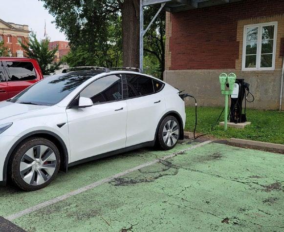
This EV Charging Station was donated by Pickering Energy Solutions. The City maintains the infrastructure and pays for the power usage.
Image: www.plugshare.com
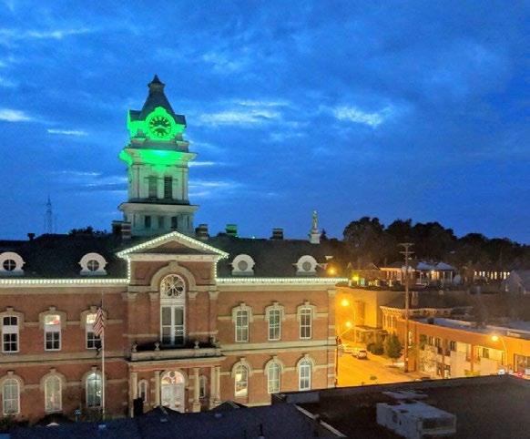
The Athens County Municipal Court features color-changing lights that can be modified throughout the year to allow for seasonal change.
Image: Rob Delach
Many communities in the Buckeye Hills region have historic downtown areas that are composed of historic buildings, streets, parks, and public spaces. These historic resources require both maintenance and revitalization for their long-term viability and vitality.
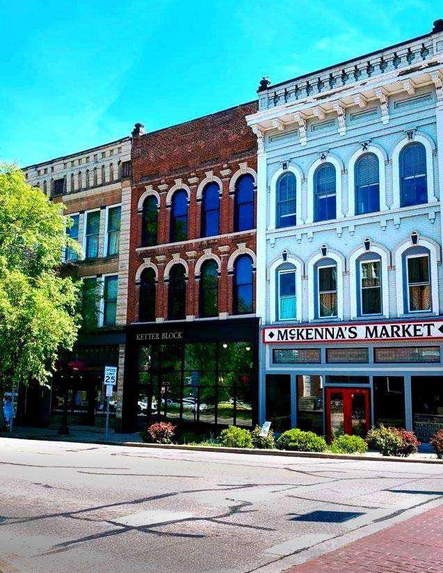
The National Register of Historic Places (NRHP) is a federal program that was started in 1966 through the National Historic Preservation Act. The purpose of the register is to document and highlight sites and resources that are critically important and represent our history.
There are two different pathways to nominate historic resources to the NRHP; individual sites and districts. Sites are individual buildings, parks, monuments, or other elements. A district includes multiple historic resources within a defined geographic area. For example, most downtowns are nominated as districts and include various buildings, parks, monuments, etc. An individual site listing may be geographically separate from a district or is of such significance that it warrants its own individual nomination.
The first step to listing a site on the NRHP is to determine its eligibility. This is called a National Register Criteria for Evaluation. The criteria generally examines a number of elements including the site or district’s age, integrity, and significance. The criteria for evaluation is submitted to the Ohio State Historic Preservation Office (SHPO) which determines if the site is eligible for the National Register of Historic Places. If the site is determined to be eligible, a nomination must be created. A nomination is a heavily researched document that includes text, photos, and other available resources to support the historic integrity of the site. A NRHP nomination is typically completed by a historian or a historic preservation professional, and may take up to a year to complete. Once the nomination document is complete it must be reviewed by the SHPO, which in turn recommends it for review by the Ohio Historic Site Preservation Advisory Board. Once it is approved by both entities, the nomination is then sent to the National Park Service for listing on the NRHP. The NRHP includes all of the nomination information and is permanently available on the National Park Service website and in the National Archives.
A site that is listed on the NRHP is a significant honor and demonstrates the historical and cultural value of the site. Further, having the documentation completed by a historic preservation professional provides a permanent snapshot of the history of the site and its importance to the community. Having this documentation collected and organized into one cohesive document is a tremendous resource for the community.
A new listing on the NRHP is a major accomplishment and brings substantial notoriety. This can be marketed to a broad audience and should reinforce community pride. The NRHP also brings resources to assist in preservation of the sites and districts. For example, privately owned buildings that are listed on the NRHP are eligible for federal and state historic preservation tax credits.
Listing a property on the NRHP generally does not bring property right limitations or development restrictions. For example, a NRHP listing does not preclude a property owner from demolishing or substantially altering a building. Local codes and guidelines are generally the only major limitation and these should be consulted prior to pursuing a project of this type.
The only major instance where the NRHP limits development or property rights is when federal funds are used to demolish a building that is listed on the NRHP. Generally, federal money cannot be used to demolish NRHP-listed resources without a substantial mitigation process referred to as a Section 106 review. An example of when this may take place is when federal transportation funding is used to expand or change a transportation facility, and a property listed on the NRHP will need to be demolished to accommodate the project. In this example, the property may still be demolished, but it will have a substantial review and mitigation process that may limit the project’s chances of obtaining funding or political support.
Most historic buildings will require substantial maintenance, renovation, or rehabilitation at some point in their lifecycle. There are numerous pathways to maintain the historic integrity of a building while obtaining funding from various sources. The State of Ohio and the federal government both have historic preservation tax credit programs which can be used in tandem to complete a historic preservation development project. Historic preservation tax credit programs have been tremendously successful in enabling historicallyappropriate rehabilitations and is a popular funding program for these types of projects.
A tax credit generally is a deduction of total tax liability for the developer of the project. If a developer is required to pay $1,000,000 in taxes but receives a $500,000 tax credit, then the developer only owes $500,000. Some tax credit recipients do not have enough tax liability to receive the full amount of the tax credit reduction. In this instance, many developers find partners who do have tax liability to take advantage of the funding program.
The federal government provides a 20% tax credit for eligible projects. To be eligible for the federal historic rehabilitation tax credit, the building must be listed on the NRHP either individually or as part of a district. The tax credit is applied to the total Qualified Rehabilitation Expenses of the project, which are referred to as QRE’s. QRE’s generally include construction costs to fully renovate the building, but also include various soft costs such as architectural, engineering, and legal fees. As long as the project meets the requirements for the tax credit program, the 20% federal credit will be awarded and is non-competitive.

Ohio has a tax credit program as well that is complementary to the federal program. The Ohio Historic Preservation Tax Credit (OHPTC) offers 25% tax credit or
a 35% tax credit for eligible rural properties. Funding programs change frequently so a developer interested in using historic tax credits should check the most recent funding guidelines to determine potential tax credit availability. The OHPTC is a competitive program and only a certain number of projects are awarded in each funding cycle. There are generally two funding cycles each year; one in the spring and one in the fall.
The OHPTC program also includes different funding pools including the small pool which is up to $250,000, the intermediate pool which is up to $2 Million, and the catalytic project pool which is up to $25 Million.
Although some projects may not be funded in their first round, projects often will eventually receive funding in subsequent funding rounds, so persistence is important.
The state historic tax credit can be attained without the site being listed on the NRHP. If a site is listed on a local register or is within a local historic district it is eligible for the state historic tax credit so long as the municipality is a Certified Local Government (CLG). The CLG program is administered by the State of Ohio and can be attained through a relatively straightforward process.
If a project is eligible for both the federal and state historic tax credit programs, these resources can be combined on the same project. For example, a project in a qualifying area could receive the 20% federal tax credit and the 35% state tax credit, which will pay for up to 55% of QRE’s. This can make a project financially viable and achievable within a relatively short period of time.
These funding programs can also be combined with other tax credits, grants, and various funding programs.
Developers commonly refer to this as a capital stack, which includes all of the sources of funding needed to achieve the total amount of funds required to do the project. The capital stack may include personal equity of the developer, various loans and private investments, grants and loans from the local municipality, and numerous other sources.
It is not uncommon for other types of tax credit funding to be involved in a historic tax credit project. For example, Low Income Housing Tax Credits (LIHTC) and New Markets Tax Credits (NMTC) could be a part of a project capital stack in addition to historic tax credits. While the financing of the project becomes complicated, there are numerous examples in Ohio that utilize numerous streams of funding to deliver high-quality projects.
Another funding resource that is commonly used in historic projects is environmental cleanup funds. Many historic buildings have issues such as asbestos, lead, and other toxic materials that are the result of the former use of the building. These environmental cleanup funds are often used as part of the capital stack for historic projects, or are used prior to determining the potential preservation development project to simply clean up the site and remove the environmental concerns.
Historic preservation tax credit projects have stringent guidelines that must be met and are administered by the SHPO. It is important to have a design team and or a historic preservation consultant on the project to assist the developer with maneuvering through the design review and compliance processes.
Mollie Fitzgerald Executive Director of Athens Economic Development Council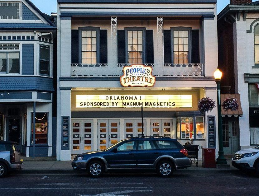
With a seating capacity of 950 seats, the Peoples Bank Theatre in Marietta, Ohio was built as one of the largest performing arts theaters in the region. The theater required 15 years of fundraising, but eventually raised enough money for a complete renovation that was completed in 2016. The theater is a major destination in Downtown Marietta, hosting performing arts events and showing movies.
Image: www.peoplesbanktheatre.com
WE ARE REVISITING HPTC'S SINCE THE DOWNTOWN REVITALIZATION WORKSHOP WITH DESIGNING LOCAL. THEY REALLY MADE IT SEEM LIKE A NO BRAINER FOR PROJECTS THAT HAVE PROPERTIES EITHER REGISTERED AS LOCAL OR NATIONAL HISTORICAL SITES.
Not all historic preservation development projects are viable as historic tax credit projects. There are many instances where adaptive reuse of a historic building is a more viable path towards preservation.

A project that does not pursue a historic preservation tax credit may still be eligible for other types of funding, including grants or loans from local municipalities and various private foundations. This may result in a more straightforward project that can be executed over a longer period of time or as funds become available.
When pursuing this type of project, it is still important to provide a high-quality preservation development. The developer should make great strides to do a historically appropriate preservation project even if local codes and guidelines do not require it. For example, a developer should work hard to maintain the historic integrity of any remaining elements inside the building such as millwork, casework, decorative features, and the general layout and function of the structure. The exterior should include appropriate preservation of masonry and finish materials as well as the preservation of historic doors and windows. If doors and windows must be replaced, it is important to select new windows and doors that maintain the historic integrity of the structure.
There are a number of historic buildings and districts within the Buckeye Hills region that experience flooding issues. While some communities have regional flood protection systems that include levees and floodwalls, many do not. In this case, individual sites and buildings may need to provide flood protection mechanisms that are built into the project. This could include elements like waterproofing of foundations, mechanical flood barriers at doors and windows, and other emerging technologies and engineering practices.
The National Park Service recently released guidelines for flood protection of historic buildings. These guidelines should be referenced as fundamental guidance, particularly if a project is considering a historic tax credit.
If a community has a large collection of historic buildings that includes commercial structures and residential homes, many communities will create design review districts that limit the potential demolition or inappropriate renovation of these historic resources. It's important to note that a local historic district and a national register historic district are separate elements. While there are instances where a local historic district and NRHP district have the same boundaries, these do not necessarily have any relationship in codes and enforcement.

Several buildings on West Union Street in Athens were significantly damaged by a fire in November 2014. Some of these buildings were rebuilt and are now back in occupied use. One of the buildings received an Ohio State Historic Tax Credit and utilized the funds to create well-designed rehabilitation.
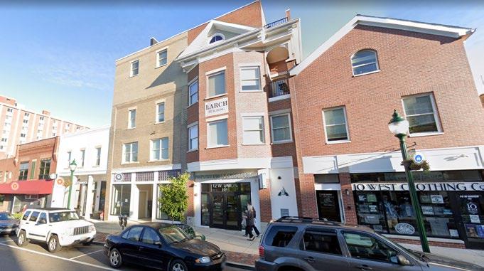
Many communities create historic district design guidelines which describe appropriate exterior renovations and improvements to historic buildings. These guidelines also describe acceptable additions to historic buildings as well as new development within historic districts.
Most recently created guideline documents are highly visual in their description of appropriate projects in order to clearly articulate the intent of the guidelines to the public. Substantial amounts of text and significant jargon should be avoided to minimize confusion by potential users.
Most guidelines are administered by staff of the local municipalities as well as a historic review commission.
The staff role is to help potential property owners navigate through the guidelines in order to create a successful project that adheres to the guidelines.
The design review commission is put in place to help determine when a project is appropriate even if it does not meet all criteria set forth in the guidelines.
These review commissions are often composed of local residents, design professionals, and historic preservation professionals. The historic district commission and staff work in tandem to create positive outcomes in order to maintain the integrity of the district as a whole. The positive result of a staff review and historic district review is an approval often referred to as a Certificate of Appropriateness (COA). This COA is often required to obtain a building permit. In other words, if a property is within a local historic district, it must obtain a COA before the building permit is issued and construction can commence.
If a property owner alters their property without going through a design review, or if a COA is issued but the resulting construction does not conform with the COA, then a code violation can be issued. This code violation can require that the project be corrected to comply with the criteria set forth in the COA.
Image: Athens Messenger Image: GoogleDowntown areas with unique destinations and a strong sense of place are tourism destinations by themselves. When incorporated into a cohesive tourism strategy that features multiple destinations and experiences, potential visitors will have a wide range of options.

HOCKING HILLS DOUBLE ROUNDABOUT
County,

The Buckeye Hills region offers numerous outdoor recreational activities that have significant appeal to a broad cross section of potential tourists.

The marketing of potential recreational experiences offered in the community is critical to draw potential tourists into the area. This may be done through a coordinated marketing campaign that includes numerous municipalities, private businesses, and other interests.
When selecting a travel destination, many tourists desire to have a wide variety of options that can potentially satisfy various members of their group. This can include activities for different ages, interests, and ability levels. Some tourist groups will specifically select a destination because it allows for some members of the group to do one activity while other members can do another. This variety is beneficial to creating a well-rounded experience that will generate tourism year-over-year.
Annually, the Buckeye Trail Association hosts the Blue Blaze Festival. Hosted in the town of Shawnee, the festival brings together runners, hikers, musicians, local crafters and artisans to celebrate the Buckeye Trail. The association hosts trail runs and backpacking outings, as well as a street fair to offer an experience for every type of visitor.
The Blue Blaze Festival is an event for the whole family, to enjoy the Fall colors of the Wayne National Forest and to celebrate the trail with local vendors, music and more.
Image: Blue Blaze Festival - Runsignup.com
CASE STUDY: BUCKEYE TRAILS ASSOCIATION BLUE BLAZES FESTIVALCultural and heritage tourism is based around visitation and exploration of existing historical sites, cultural facilities, and community events.
Most communities in the Buckeye Hills region have historical resources such as historic buildings and sites of notable events. Many visitors will find these resources to be interesting and even a one-of-a-kind experience.


Cultural and historical sites should be included in outdoor recreational activities. This will create a memorable experience for tourists that is unique to the community.
An example of this would include linking a proposed trail network to existing cultural and historical sites. This provides access to these sites while making the trail network more interesting and unique.
There are numerous former industrial sites in the Buckeye Hills region. As a key part of the regional economy, these industrial sites are integral to the culture and history of multiple generations of residents. Tourists will likely want to visit these sites to have a better understanding of the sense of place, and they deserve to have some efforts toward preservation.
These sites often consist of large, unique buildings and expansive landscapes. While many of these have contamination or are not safe to access, they can potentially be remediated for limited or total public access. Preserving the key elements of the sites and providing limited public access is a way to allow the public to develop a sense of the experiences of past generations that worked at these facilities.
The Ohio & Erie Canal Southern Descent was the portion of the canal system extending from Buckeye Lake to the Ohio River at Portsmouth. Several locks and portions of the canal remain throughout Southern Ohio. A coalition of historic preservationists and local municipalities have worked to create a heritage trail which links all of these remaining infrastructure elements. Visitors can drive the corridor and visit the elements while also experiencing the various small towns and rural areas that were originally developed along the canal corridor. The trail passes through the Buckeye Hills region in Perry County at Buckeye Lake.
CASE STUDY: OHIO & ERIE CANAL SOUTHERN DESCENT HERITAGE TRAILThe Eclipse Company Town was built by the Hocking Valley Coal Company to provide housing and services for its employees. The town was operational from 19021938, and from 1940-1948. It is located directly above the Eclipse Mine #4, with the mine entrance nearby.
The town is now listed on the National Register of Historic Places and can be accessed via the Hockhocking Adena Bikeway. The company store has been renovated and is the only known building of its type in Southeast Ohio. The company store now houses a restaurant and a tap room.
When tourists are looking for places to stay, some will want a unique lodging experience in a downtown area.

Many tourists prefer to stay in one location, then venture out to various destinations for daytime activities. Some prefer to camp or stay in a cabin, while others prefer accommodations with more robust amenities, such as a hotel or short term rental. Downtown areas can create a great ‘home-base’ for tourism activities because they are often centrally located and have easy access to transportation corridors. Additionally, Downtowns typically offer dining and various activities in the evening, so this compliments more active daytime adventures.
Online booking platforms such as Airbnb.com and VRBO.com allow property owners to directly lease their properties to tourists for short periods of time. While there are some drawbacks to these services, they are widely utilized and trusted by the general public. A key benefit of these services is that they will provide visibility for a downtown area to potential tourists.
As with all lodging uses, a lodging or bed tax should be collected. Local tax codes or processes should be adjusted to assure that these taxes are accounted for. These taxes are often used to fund tourism-related marketing activities, so this tax is a method for gaining momentum toward making tourism a consistent economic development mechanism.
Creating constant interest through events and activities should be a core strategy of downtown revitalization. This requires strong organizational and funding support.
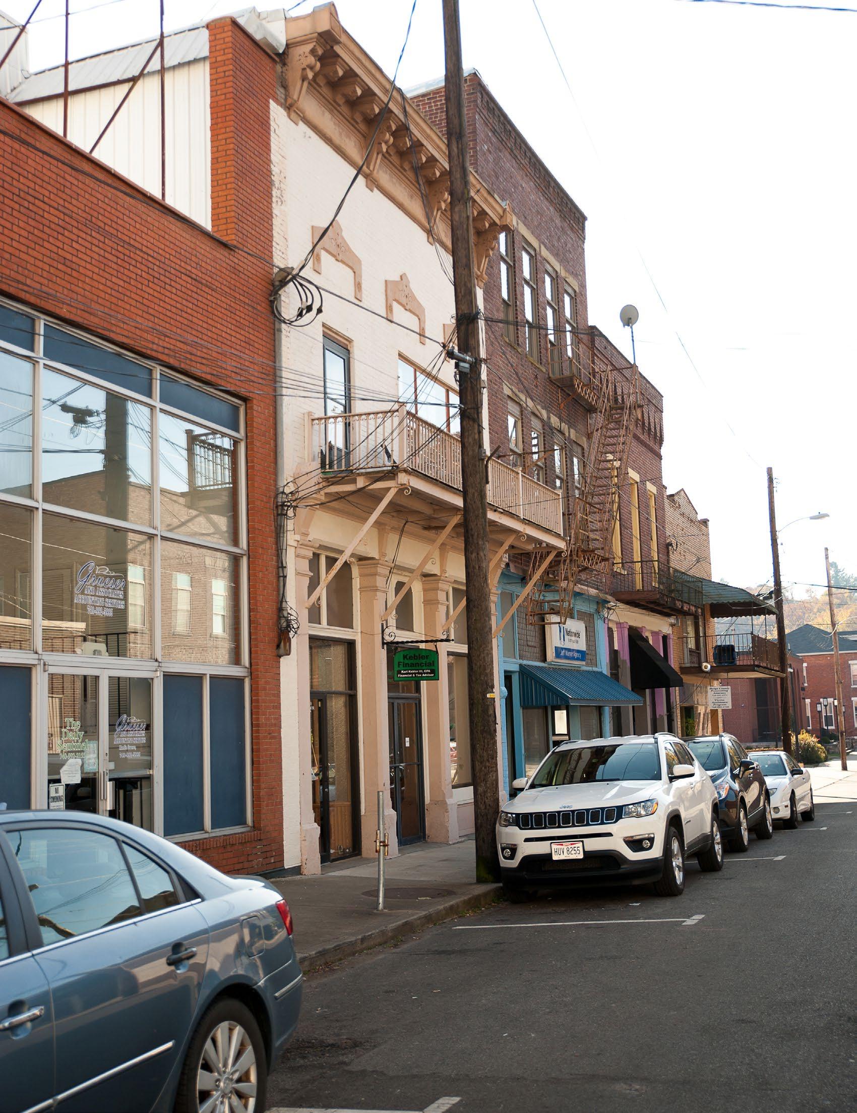
Regularly scheduled community events both draw local residents and outside visitors to a downtown area.

Some community events may be large in scale while others may be very small. An important feature is consistent scheduling of these events to generate weekly or daily visitation of downtown. Examples of these events include movie nights, live music with local bands, morning walks, food truck lunches, etc.
All community events in a downtown area should be promoted to both residents and visitors. A schedule of events may be published at the beginning of each season, and should be promoted regularly through social media or other channels.
Farmers markets are a great way to generate weekly activity in a downtown while supporting local farmers and small businesses.
Local agriculture is prevalent throughout the Buckeye Hills region and is a fundamental element of both the culture and the economy. Farmers markets celebrate this important asset by showcasing the goods and services of the agricultural community to a broad audience.
Farmers markets require special design considerations. Farmers and other vendors will generally desire to back their vehicles directly up to their assigned vendor space. This should be accounted for in the selection of a location for the farmers market as well as the reservation of parking spaces for vendors. Farmers markets should also have significant access to electrical power. A large bank of outdoor outlets should be provided if possible.
Held May through October, Coonskin Saturday is a monthly event that highlights the talents, history and foods of Amesville by providing a regular array of concerts, movies, classes and other programs in Gifford Park, Masonic Lodge, Village Productions Community Center and ACRE. Local businesses sponsor the event each month and local vendors provide food and beverage. Appalachian Renewable Power in Athens have helped to make the event all solar powered.
Image: Coonskin Saturday in Amesville
CASE STUDY: COONSKIN SATURDAYS IN AMESVILLE, OHIO
Many communities host large outdoor festivals in their downtown area to drive visitation and exposure. These events may focus on vendor sales, performing arts, or civic events; or they may include a combination of all of these activities.
Large scale events may attract thousands of visitors over a period of several days. This has the potential for significant economic activity in the community that will benefit local businesses and will result in substantial tax revenue for the local municipalities. The added benefits of a large and successful event will continue to add economic value to the community through ongoing marketing exposure.
However, a large event requires substantial local coordination amongst civic leadership, public safety officials, businesses, and residents. Preparing for such an event will likely require months of planning which results in strong organization and clear roles and responsibilities. Large scale events also require significant infrastructure including public restroom facilities, access to power and water, a coordinated parking strategy, temporary wayfinding, and other logistical considerations.
Large scale events should be a component of a welldeveloped tourism strategy. This strategy can collectively market the general tone and experience that visitors should expect when they visit the area, whether they visit casually or they come to the area to specifically attend an event.

The Village of Caldwell hosts an annual holiday event called 'A Village Christmas to Remember'. The event celebrates the holiday season and draws substantial visitors to Downtown Caldwell. The event features horse drawn carriage rides, a Christmas Tree Lighting Ceremony, a Village Christmas Parade, an ice skating rink, and various other events. The event draws substantial and sustained visitation throughout the duration of the event.
Image: www.caldwellohio.org
