HOW DRONES ARE TRANSFORMING
Energy & Utilities and Civil Infrastructure


The Energy and Utilities sector continues to be the top industry for drone applications, expected to grow from US$4.66 billion to US$7.43 billion by 2030. – Drone Industry Insights
The global market for drones in construction was valued at $4,800 million in 2019, and is expected to reach almost $12,000 million by 2027.
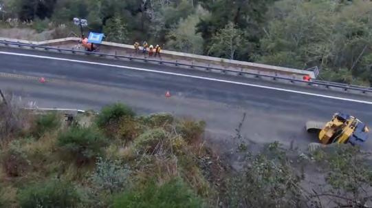
42% of all US bridges are at least 50 years old. Of the 617,000 bridges across the country, a staggering 231,000 need repair or preservation work, with 46,154 classified as structurally deficient and in poor condition.
– American Society of Civil Engineers (ASCE)
According to the Federal Highway Administration (FHWA), traditional bridge inspections using snooper trucks or scaffolding can cost upwards of $4,600 per bridge.
The American Association of State Highway and Transportation Officials (AASHTO) reported that using drones can reduce inspection costs by 74%. For example, a traditional bridge inspection costing $4,600 can drop to around $250 with drones.
According to the American Society of Mechanical Engineers (ASME), drone inspections reduce worker exposure to hazardous environments, lowering the risk of accidents by up to 91%
According to the Michigan Department of Transportation (MDOT), a typical drone bridge inspection can be completed in two hours with just two people, compared to traditional methods that require four people and eight hours.
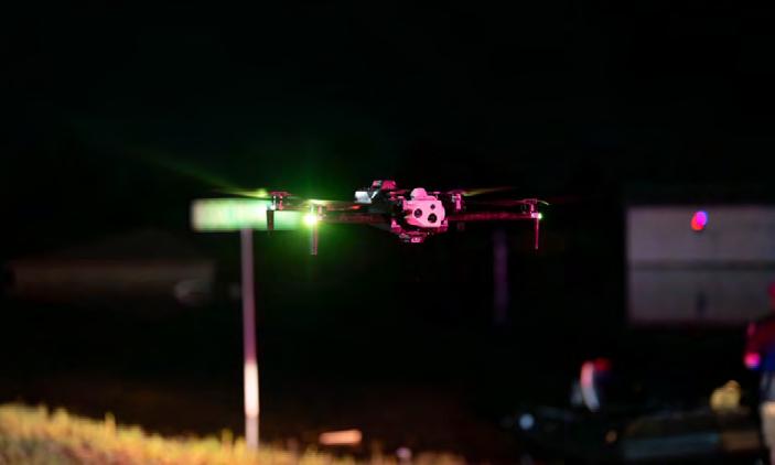
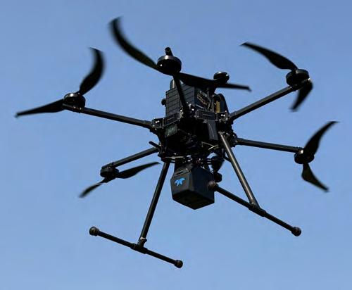
Of the many industries that have embraced drone technology in recent years, few have benefited more than Energy & Utilities and Civil Infrastructure. Uncrewed vehicles can travel to places that are difficult—even unsafe—for humans to go, and they can go to these places repeatedly and efficiently. Equipped with sophisticated cameras and sensors, drones can deliver vast amounts of detailed, accurate, and actionable data, enabling higher levels of performance and improved ROI.
In short, drone technology offers professionals the ability to perform more regular and more accurate inspections, maintenance, and monitoring operations. While regulatory challenges can make it difficult to implement a dronebased program, Energy & Utilities and Civil Infrastructure professionals are strongly encouraged to work through those challenges and embrace drone technology to move their operations forward.
This report will explore how companies and organizations use uncrewed systems in their work, highlight recent innovations, examine the regulatory environment, and provide insights into the ways drones are transforming Energy & Utilities and Civil Infrastructure.
Drones have proven to be highly effective tools for professionals in Energy & Utilities and Civil Infrastructure, and companies, organizations, and government agencies worldwide are adding drone-based systems to their utilities and infrastructure work every day.
For example, the California Department of Transportation (Caltrans) announced that is planning to install drone dock systems in 64 locations. Based around the Skydio X10 drone—a vehicle designed with enterprise and public safety applications in mind—these docks will be set in diverse environments and climate zones to improve monitoring and maintenance of critical assets.
In other recent news, US Department of Transportation announced $85M in grants for its Strengthening Mobility and Revolutionizing Transportation (SMART) Grants Program. Grant money will fund infrastructure inspections in Alaska using UAVs and drone docks, the implementation of drones to improve travel on the New York State Thruway, and much more.
The ability of drones to assist in these types of missions is improving every day, as companies throughout the drone space are updating their existing systems and introducing new products and services. Looking ahead, the continued use of uncrewed systems in Energy & Utilities and Civil Infrastructure will be shaped by improvements in drone platform and sensor technology, along with artificial intelligence (AI), automation, and regulatory reform.
In the months and years to come, it’s safe to say that energy, utilities, and civil infrastructure professionals will see even greater efficiency, accuracy, and safety for infrastructure inspection—all led by UAVs and related technologies.
Here are some new tools for Energy & Utilities and Civil Infrastructure operations.
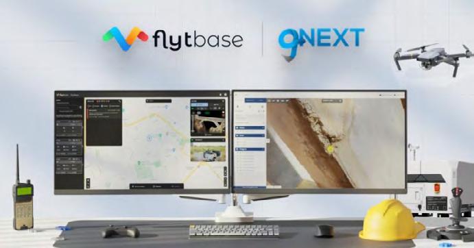
Traditional methods for inspecting aging infrastructure can be inefficient, expensive, and unsafe. To address this problem, autonomy software company FlytBase and gNext, a photogrammetry platform driven by AI, have partnered on a system that allows operators fly routine inspection missions by drone remotely and collect data on that can be easily exported to a cloud platform. The collaboration, the companies say, optimizes “infrastructure asset management while reducing the need for manual input.”
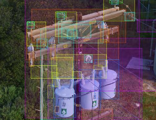
Utility asset management solutions firm Sharper Shape introduced its Asset Insights digital twin software in 2024. Created to simplify and streamline inspection and maintenance operations for companies in the Energy & Utilities sector, the software integrates AI, machine learning, and data analytics learning. With these tools, Asset Insights works as a cloud-based platform to evaluate asset identification and condition. Of particular interest to drone services providers, Asset Insights provides continually updated asset and component coordinates, which can save time and resources during inspections.
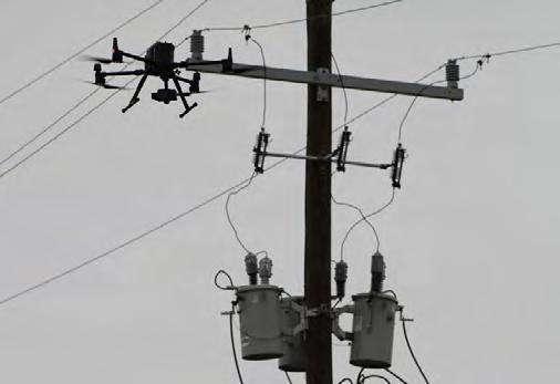
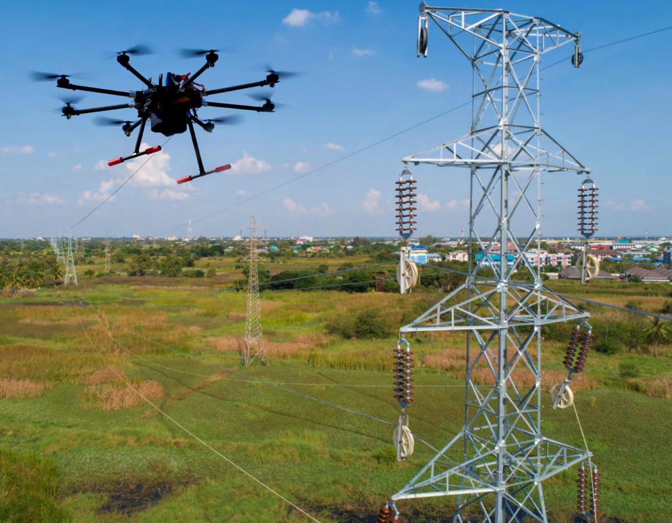
Companies throughout the Energy & Utility sector are concerned with corona discharges, which can damage hardware, cause premature failure, and impact the proper functioning of utility operations. That’s why Volatus has developed a new approach that involves the careful matching of drones, sensors, and cameras and flying those drones close to the electrical hardware to enable the collection of high-quality data that can reveal even small traces of damage. The drone-captured data also allows users to differentiate between distinct types of electrical faults and issues.
Another software innovation aimed at the inspection market comes from OFIL. The company’s new Gridnostic software can analyze data and present personnel with in-field findings with risk visibility and prioritization discoveries. OFIL’s system takes a holistic view of capturing raw field data and presenting detailed diagnostics onto a Geographic Information System (GIS) platform, boosting reliability, efficiency, and worker safety.
Combining Teledyne Geospatial’s lidar and camera technology with Inertial Labs’ Remote Sensing Payload Instrument (RESEPI), the new EchoOne can deliver long-range, engineering-grade 3D point clouds. According to the companies, the system is designed to improve “reliability and return on investment for sensor operators” in a number of fields including infrastructure inspections. The lightweight, NDAA-compliant product can be operated from several drone platforms and creates “full undecimated georeferenced point clouds generated in real-time, allowing infield verification combined with rapid post-processing.”

Uncrewed systems have proven their worth many times over in Energy & Utilities and Civil Infrastructure operations but getting a program off the ground can be challenging. For many companies and organizations, the greatest challenge involves government regulations.
Around the world, there are federal, state, and municipal rules governing drone flights. This patchwork of laws has created an ever-changing, often confusing regulatory environment that can delay or derail the implementation of uncrewed operations. However, as explained in a recent Commercial UAV News article:
Advancements in autonomy and compliance tools, along with clearer regulations, have made success well within reach of teams across government and enterprise organizations. If you’ve been hesitant to enter the drone space because of concerns around compliance, rest assured—it’s easier than ever.
In the US, launching a drone program means complying, first and foremost, with rules established by the Federal Aviation Administration (FAA). Designed to keep people and property safe, the FAA’s drone rules cover who can fly a commercial drone, where drones can operate, and how far drones can fly.
To meet FAA requirements, commercial drone pilots must obtain a remote pilot certificate, as detailed in the agency’s “Part 107” rule. Under Part 107, individuals must pass a basic aeronautical knowledge test and meet a few requirements, including being at least 16 years old, having the ability to read, speak, and write English, and be in a physical and mental condition to fly a drone safely.
Another important consideration for complying with FAA rules involves flights “beyond visual line of sight,” known in the industry as BVLOS. These longer flights are crucial for many Energy & Utilities and Civil Infrastructure operations. For example, inspections of power lines could involve flights covering many miles, pushing the drone far beyond where the pilot can see it.
Fortunately, commercial drone pilots can fly their vehicles BVLOS—provided they have obtained a waiver from the FAA. To get a waiver, the operator must demonstrate that their flights can be done safely, and there are a host of resources and services available to help Energy & Utilities and Civil Infrastructure professionals demonstrate the safety of their missions and acquire the needed waiver.
For example, Skydio Regulatory Services helps organizations work through the approval process and scale their drone operations. The company offers services and guidance to help with BVLOS Certificates of Authorization (COA) approvals tailored to meet the goals of specific drone-based programs.
With the help of these and other services, many companies and groups have obtained BVLOS waiver approvals and advanced their drone-based work. Percepto, for example, received a Type Certificate from the FAA in September 2024. The certificate officially recognized Percepto’s drones as one of only three solutions globally to meet the stringent safety and reliability standards required for such certification and the sole provider within the energy sector.
In January 2025, American Robotics earned FAA approval to conduct true BVLOS operations with its autonomous Optimus sUAS. Commenting on the approval, Timothy “T3” Tenne, CEO of American Robotics, said, “We’re able to fly unfettered, autonomously, over people and vehicles. We can operate this technology in a way that is going to scale, and that’s a major difference when you compare it to how so many other companies are flying.”

Looking ahead, we will surely see more approvals for BVLOS flights as regulatory agencies and drone industry leaders gain more experience in working through the approval process and demonstrating the safety of operations.
Updated rules from the FAA will also spur progress in commercial drone operations. In 2025, the agency is set to release its much anticipated and long overdue Notice of Proposed Rulemaking (NPRM) for “Part 108.” This document will detail the formal regulatory framework for uncrewed BVLOS flights and standardize BVLOS operations for commercial drones. It is believed that Part 108 will allow for more complex and expansive drone operations.
There are countless examples of how drones are transforming work in the Energy & Utilities and Civil Infrastructure industries. Here’s a look at a few recent projects and innovations:
Europe has approximately two million bridges and a railway network of around 124,000 miles. Making sure these assets are safe and secure is no easy task, especially because cracks or faults can easily be overlooked. To address the problem, the EU-funded research project Drones4Safety (D4S) created a cooperative, autonomous, operating drone system to remove safety, cost, and accuracy limitations that railways and bridge inspections present. The proposed system aims to inspect the whole European electrical railway system and a big portion of European bridges by leveraging swarms of drones to monitor infrastructure and report back.

To secure the safety and ongoing operations of utility and infrastructure assets, many government agencies and organizations are turning to Skydio’s drone-based systems. Their drone technology is designed to handle wind, rain, and even dead-ofnight situations, enabling them to deliver real-time intel straight from the scene, helping emergency teams deploy the right people and equipment faster, smarter, and safer. In addition, Skydio’s Drone as First Responder (DFR) solutions have been utilized to provide public safety offices with a new level of safety. This program has improved response times, enhanced situational awareness, and increased safety during emergency events. What’s more, the system has the ability to work around the clock, making it ready to spring into action when disaster strikes, as well as perform routine, day-to-day operations like inspections and post-disaster assessments.
In the UK, the Nuclear Decommissioning Authority (NDA) is leveraging drone technology to help clean up the countries’ earliest nuclear sites safely, securely, and cost-effectively. One of those sites is Sellafield, a large nuclear power plant on the Cumbrian coast. For this operation, the NDA is deploying a drone fleet of more than 20 drones, and around 20 remote pilots, conducting more than 200 flights annually. At Sellafield, clean-up personnel must deal with the threat of contamination from radioactive materials. To help, they have turned to the Elios 3 RAD drone. Designed for remote radiation detection and localization, the Elios drone has successfully detected elevated doses of radiation, keeping workers safe.
Every day, uncrewed vehicles and related systems are making Energy & Utilities and Civil Infrastructure operations more accurate, cost-effective, and safe. With the advent of new technologies, including AI, along with regulatory changes and an increased acceptance of drones by the general public, uncrewed systems will provide more benefits to more people in the years to come.
That’s why it is now more important than ever for professionals in the Energy & Utilities and Civil Infrastructure sectors to embrace the promise of new technologies, take on the regulatory challenges, and commit to improving the quality, profitability, and safety of their operations through the use of uncrewed systems.