4 minute read
Datos sísmicos

Este método busca incrementar la certidumbre de los modelos de deformación en los yacimientos Zaap y Maloob.
Por / By : Gustavo Gutiérrez, Reynaldo Castellanos y Pedro Villaseñor
Los ingenieros Gustavo Gutiérrez, Reynaldo Castellanos y Pedro Villaseñor obtuvieron y procesaron datos sísmicos por medio del multicomponente PP-PS. Esta aplicación los ayudó a incrementar la certidumbre sobre el conocimiento de las áreas de alta complejidad estructural del yacimiento y las zonas prospectivas de los campos Zaap y Maloob, localizados en la sonda de Campeche.
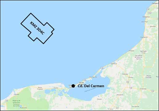
Con los nuevos datos sísmicos, los especialistas lograron actualizar la interpretación estructural de la zona. Con base en el uso del multicomponente de ondas PP-PS (KMZ3D3C), además de la adquisición y procesamiento sísmico con algoritmos de migración en profundidad Kirchhoff y RTM 45Hz, obtuvieron una imagen sísmica superior en definición estructural y estratigráfica en relación con los resultados logrados en 2005.
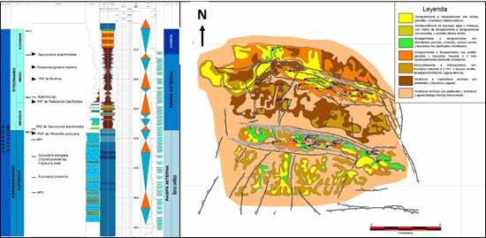
La reinterpretación de los estilos estructurales de los campos Zaap y Maloob implicó la redefinición de las estructuras extensionales jurásicas, graben y medios graben. Además, dio paso a la identificación de estructuras de “raft” tectónico y el desarrollo de “pliegues extensionales” (“turtle structure”) con presencia de diapiros y “rollers” de sal.
Los ingenieros caracterizaron el periodo compresivo tras hallar pliegues de tipo “detachment”,
Seismic data with PP-PS multicomponent processing
This method helped to increase the certainty of the deformation models in the Zaap and Maloob reservoirs
Engineers Gustavo Gutiérrez, Reynaldo Castellanos, and Pedro Villaseñor obtained and processed seismic data using the multicomponent PP-PS. This application helped them to increase the certainty and knowledge of high structural complexity areas in the reservoir and prospective zones of the fields Zaap and Maloob, located in Campeche.
With the new seismic data, specialists were able to update their structural interpretation of the fields. Using multicomponent PP-PS waves (KMZ3D3C), in addition to the acquisition and seismic processing of Kirchhoff and RTM 45Hz depth migration algorithms, they obtained a superior seismic image in the structural and stratigraphic definition compared to the results achieved in 2005.
Reinterpreting structural styles of the Zaap and Maloob fields implied the redefinition of the Jurassic extensional structures, graben, and medium graben. Also, it gave way to identify tectonic “raft” structures and “extensional folds” (“turtle structure”) developed with the presence of diapir and salt rollers.
Engineers also characterized the compressive period after finding “detachment” type folds, where the geometry varied along the


donde la geometría varió a lo largo del anticlinal debido a factores reológicos. En ese caso, hallaron facies de lutita deformada con sal, una reorientación local de la dirección del esfuerzo compresivo del Mioceno, así como inversión tectónica.
La nueva imagen sísmica también define como pliegues detachment fallados a los espacios con variaciones en el tipo de geometría. En ellos, los ingenieros identificaron geometría de caja, por propagación de falla y por flexión de falla.
Para definir la geometría de los pliegues, los ingenieros destacaron la calidad de la imagen obtenida de los flancos frontales. Esto fue posible tras utilizar las etapas del procesado multicomponente, los cuales enfocaron para representar la anisotropía del medio por medio de modelos de velocidades PP-PS ortorrómbicos. Del mismo modo, resolvieron las zonas con alta complejidad estructural a partir de las migraciones en profundidad recurriendo a algoritmos Kirchhoff y RTM.
Los ingenieros afirman que el conocimiento de las propiedades dúctiles del paquete Jurásico (JST, JSK, JSO, Sal), así como de las variaciones en la geometría de las estructuras de los campos Zaap y Maloob será de gran utilidad. Con ello, afirman que se podrán interpretar y validar los resultados de las inversiones sísmicas acimutales PP en el yacimiento Cretácico. anticline due to rheological factors. In that case, they found salt-deformed shale facies, a local reorientation of the Miocene compressive stress direction, as well as tectonic inversion.
The new seismic image also defines faulted detachment folds as spaces with variations in geometry type. In them, engineers identified box geometry by fault propagation and by fault bending.
To define the geometry of the folds, engineers highlighted the image’s quality obtained from the front flanks. This was possible after using multi-component processing stages, which were focused to represent the anisotropy of the medium using orthorhombic PP-PS velocity models. In the same way, they solved areas with high structural complexity from depth migrations using Kirchhoff and RTM algorithms.
Engineers say that knowledge of the ductile properties of the Jurassic package (JST, JSK, JSO, Sal), as well as the variations in the geometry of the structures of the Zaap and Maloob fields, will be of great use. With this, they affirm that the results of the PP azimuthal seismic inversions in Cretaceous reservoirs can be interpreted and validated.


