North Central Conservation District

North Branch Park River
Green Infrastructure Design & Watershed Plan Update


Project Partners Meeting #3
August 25, 2023
Meeting Agenda 9:00 – 10:00 AM • Consultant Team Update 30 min • Project Partner Updates 15 min • Project Schedule & Next Steps 5 min • Questions & Discussion 10 min
Green Infrastructure Design Development (Task 3)
• Compile GIS mapping
• Inventory public and institutional properties
• Identify existing GI
• Identify planned capital improvements
& Selection
• Desktop screening
• Property owner interviews
• Field inventories (20 to 40 sites)
• Green infrastructure concepts (up to 15)
• Technical Memo
• 5 projects
• Field survey
• Test pits & infiltration testing
• Wetland delineation
• Preliminary layout
• Opinion of cost
• Technical Memo
• 3 projects
• Level of detail to support local/state permitting
1. Data Gathering & Review
2. Project Screening
3. Preliminary Design
3. Permit Level Design
Consultant Team Update
Task 3 – Design Development
• GIS Data Gathering and Review (80% complete)
−
Existing watershed characteristics & conditions
− Support desktop screening of GI opportunities and watershed plan update
−
Outstanding GIS data and information requests
• Awaiting Bloomfield storm system data. Currently using 2010 data.
• Requested information on observed flooding locations (MDC, Hartford, Bloomfield, West Hartford)
• Requested existing GSI and planned capital improvements (retrofit opportunities). Partners to review and confirm.
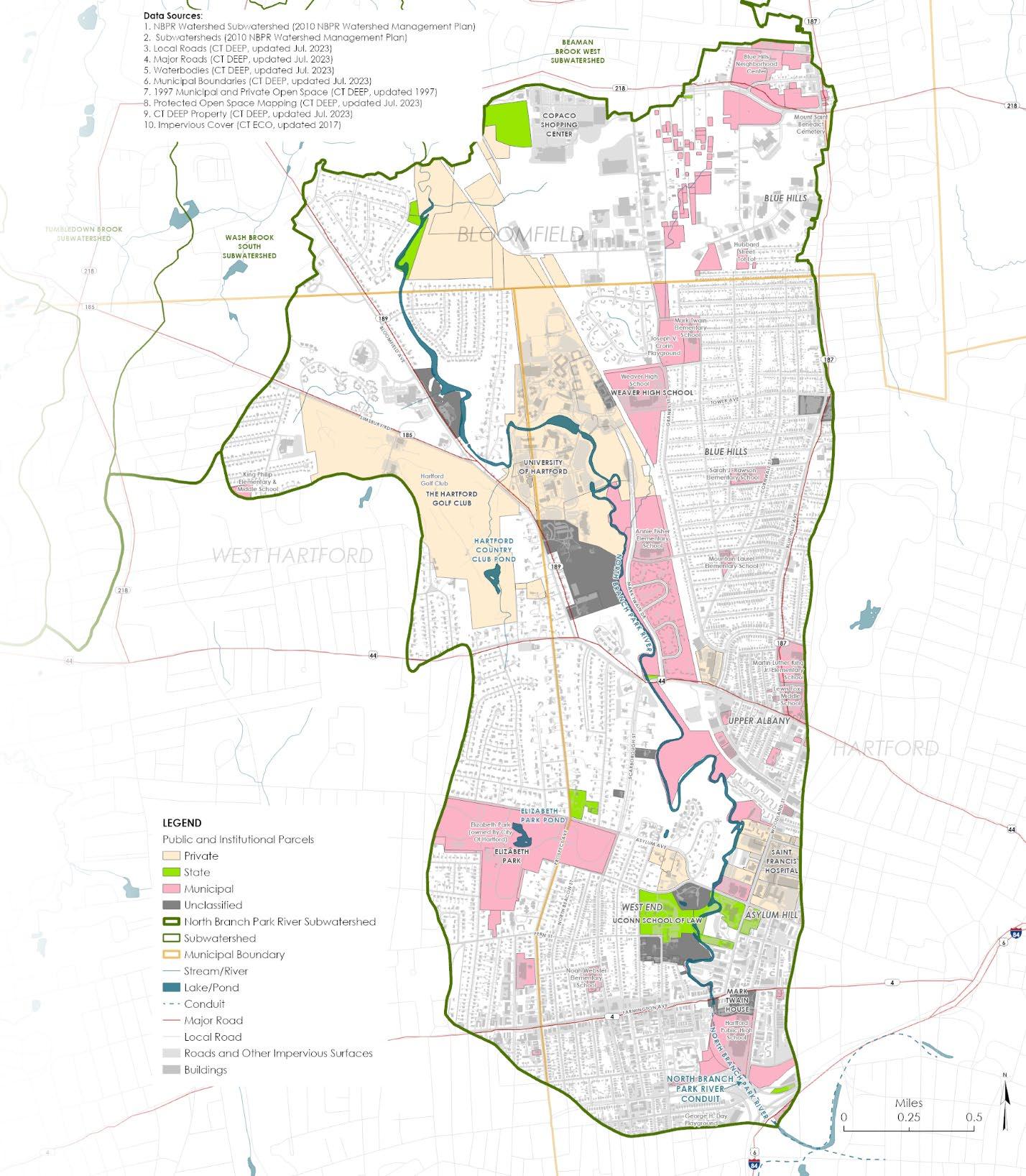
• Draft inventory of public (municipal and state) and institutional properties Parcel Owner Parcel Address University of Hartford 200 Bloomfield Ave, West Hartford, CT Watkinson School 180 Bloomfield Ave, Hartford, CT City of Hartford Board of Education 415 Granby St, Hartford, CT State of Connecticut 61 Woodland St, Hartford, CT University of Connecticut School of Law 55 Elizabeth St, Hartford, CT Town of Bloomfield 800 Bloomfield Ave, Bloomfield, CT St. Francis Hospital 113 Woodland Street, Hartford, CT Hartford Seminary Foundation 77 Sherman Street, Hartford, CT
Consultant Team Update Task 3 – Design Development
Consultant Team Update
Task 3 – Design Development
Desktop screening criteria
− Impervious cover
− Soils
−
Proximity to & condition of river/riparian corridor
− Storm drainage and combined sewer systems
− Parcel size
− Existing flooding
•
Consultant Team Update
Task 3 – Design Development
GI Property Owner
Interviews
Draft Questionnaire
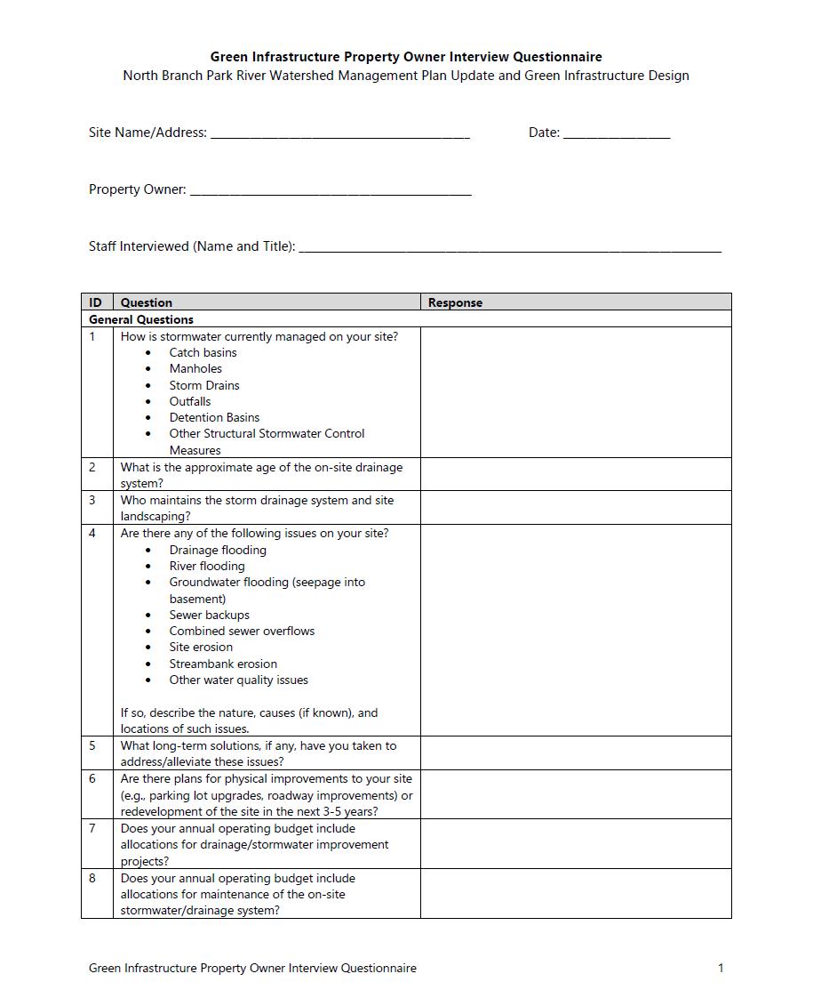

•
−
Consultant Team Update
Task 3 – Design Development (Next Steps)
Finish compiling project GIS database
Complete inventory of public and institutional properties
Identify and map locations of existing and planned stormwater retrofits (MS4 and other projects)
Complete research of ongoing and planned projects & capital improvements • Desktop screening (select sites) • Property owner interviews • Field inventories (20-40 sites)
•
•
•
•
Consultant Team Update Task 4 – Watershed Plan Update
Preliminary existing conditions watershed maps
•
WATERSHED MANAGEMENT PLAN
WATERSHED OVERVIEW
48,000 WATERSHED POPULATION
HOW MUCH OF THE WATERSHED DOES EACH MUNICIPALITY COMPRISE? 74% BLOOMFIELD 22%
WHAT PERCENTAGE OF EACH MUNICIPALITY IS WITHIN THE NBPR WATERSHED?
BLOOMFIELD 68% WEST HARTFORD 17% HARTFORD 12% AVON 1% SIMSBURY 1% WINDSOR 1%
WEST HARTFORD 18% HARTFORD
WATERSHED MANAGEMENT PLAN
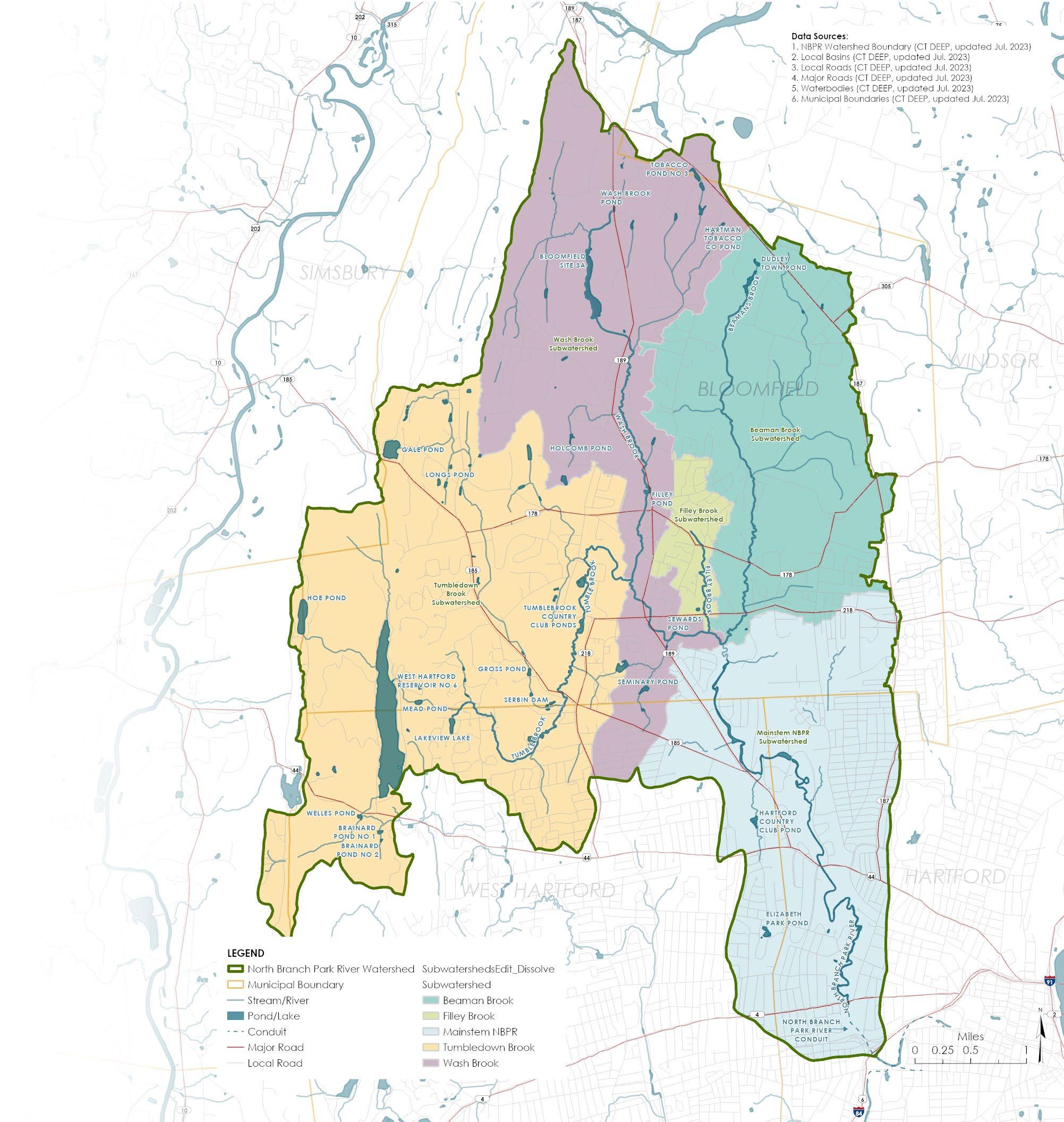
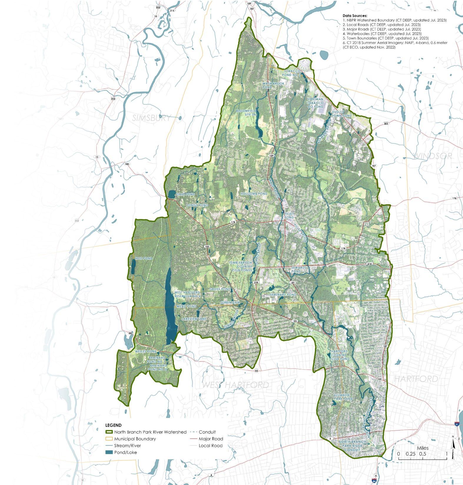
SUBWATERSHED & MAJOR STREAMS
28.6 SQUARE MILES TOTAL WATERSHED AREA
14 MAPPED SUBWATERSHEDS
4 MAJOR TRIBUTARIES
5.4 MILES NORTH BRANCH MAINSTEM (ABOVE GROUND)
0.5 MILES NORTH BRANCH MAINSTEM (BURIED)
WATERSHED MANAGEMENT PLAN
LAND COVER
UConn CLEAR – NOAA High Resolution Land Cover for Connecticut (2016)
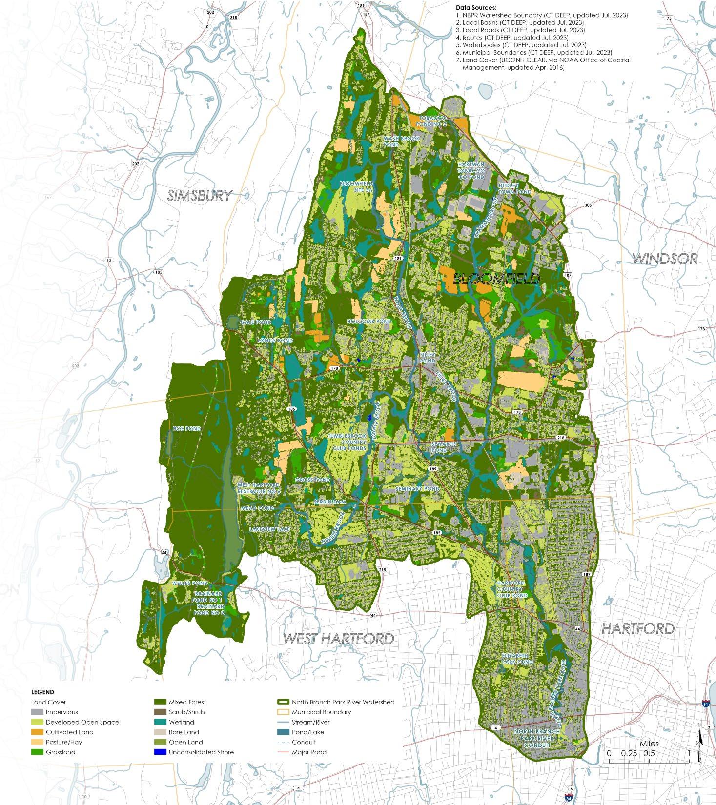
• 1 meter resolution
• 3 categories of land cover
WATERSHED MANAGEMENT PLAN
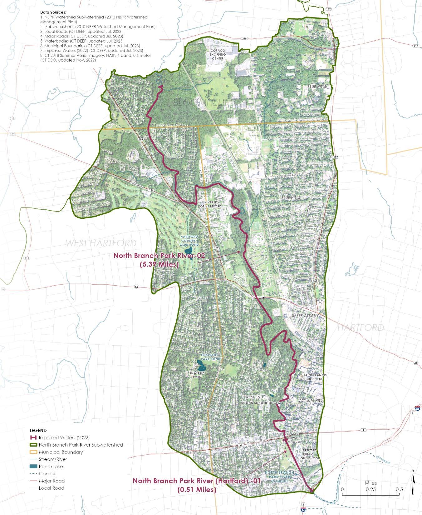
WATER QUALITY IMPAIRMENTS
North Branch Park River-02
• Recreation (E. coli)
• Habitat for Fish, Other Aquatic Life and Wildlife (Cause Unknown)
North Branch Park River-01 (Conduit)
• Recreation and Habitat for Fish, Other Aquatic Life and Wildlife (Physical Substrate Habitat Alterations)
WATERSHED MANAGEMENT PLAN
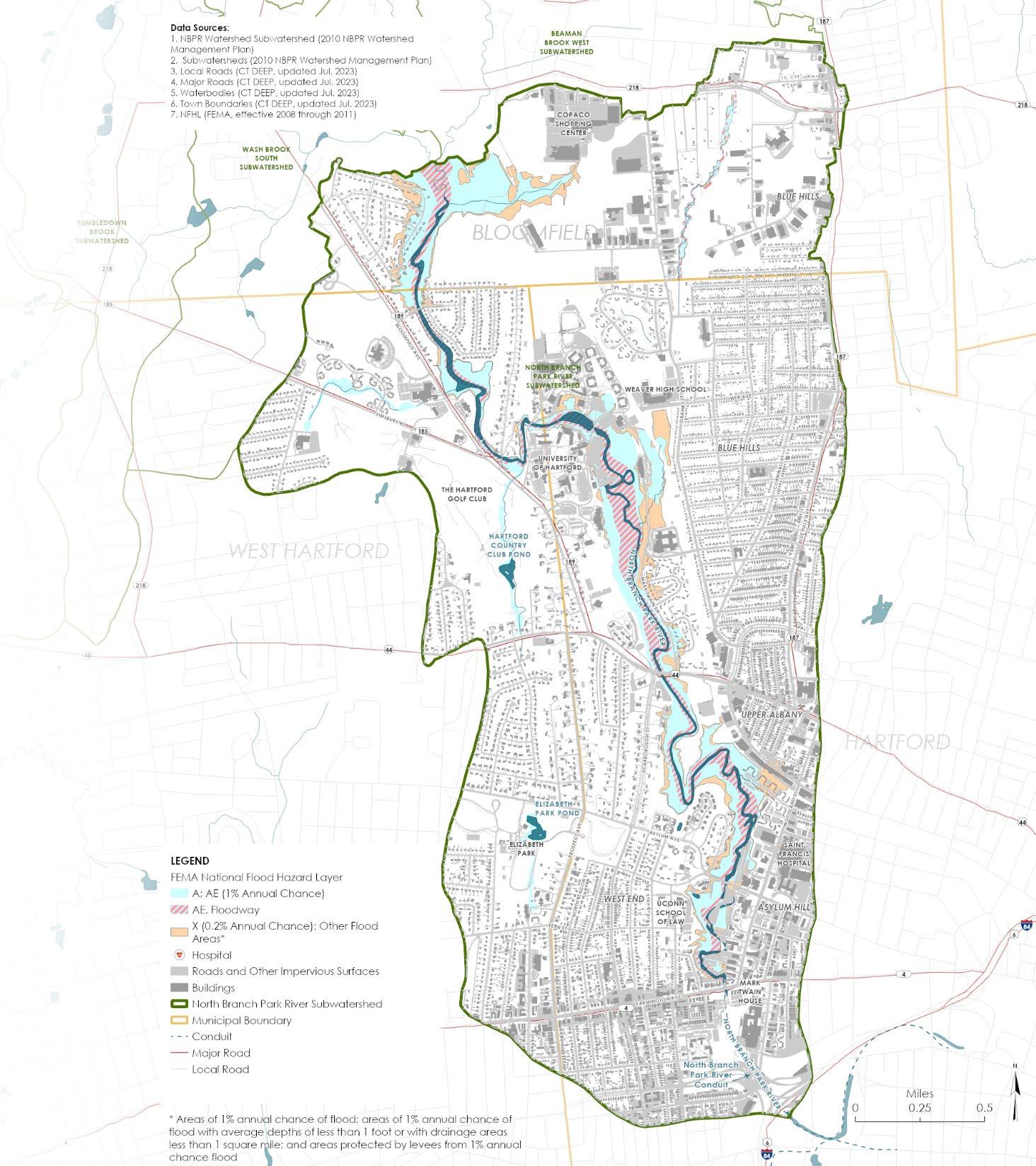
FLOOD PRONE AREAS
FFEMA Mapped Flood Zones
Riverine/Overbank Flooding
Regulatory Floodplain
Other Documented or Observed Flooding Locations
Drainage Related or Riverine Flooding
• Streets/Intersections
• Neighborhoods
• Buildings (Basement Flooding)
• Parcels (Sites & Parking Lots)
• Culverts/Stream Crossings
Looking to add information to this map to inform GI site selection and concept development
Consultant Team Update
Task 4 –
Watershed Plan Update
• Watershed Based Plan
Format
− Modified approach based on feedback from CT DEEP and EPA
−
Web-based deliverable
• Project web app with interactive map (ArcGIS Experience Builder) (in progress)
• PDF format watershed management plan
− EPA Nine Elements
− Graphical format
Consultant Team Update
Task 5 –
Public Outreach & Community Engagement
Community Engagement Strategy
• Team Communications with Multiple Stakeholder groups
− Neighborhood Networks: NRZs and Farmers Market
− Faith Organizations, such as Immanuel Congregational Church
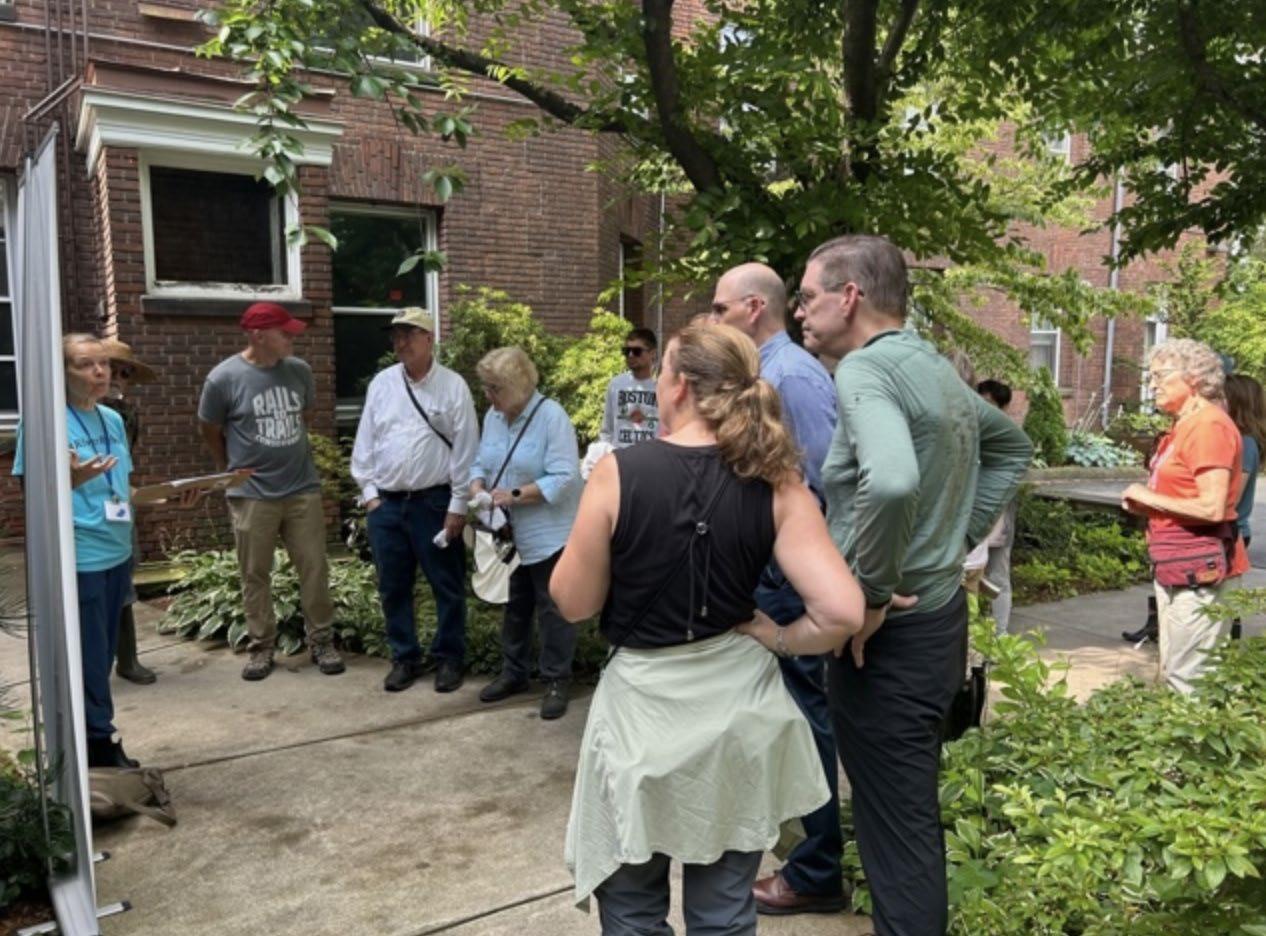
July 15th Walkshop
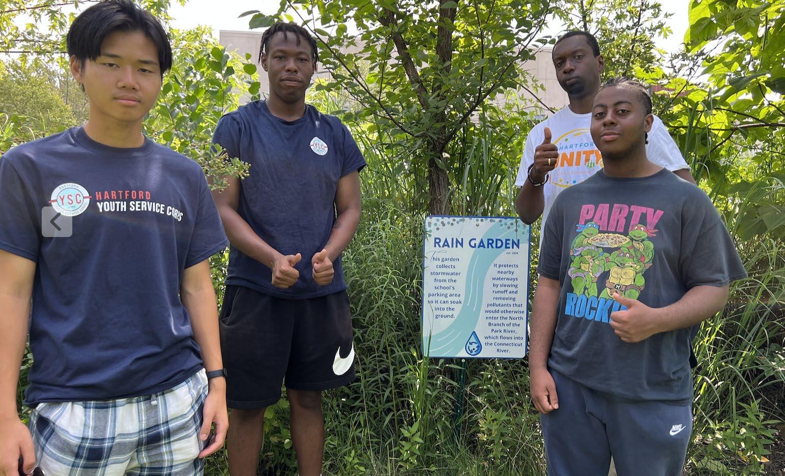
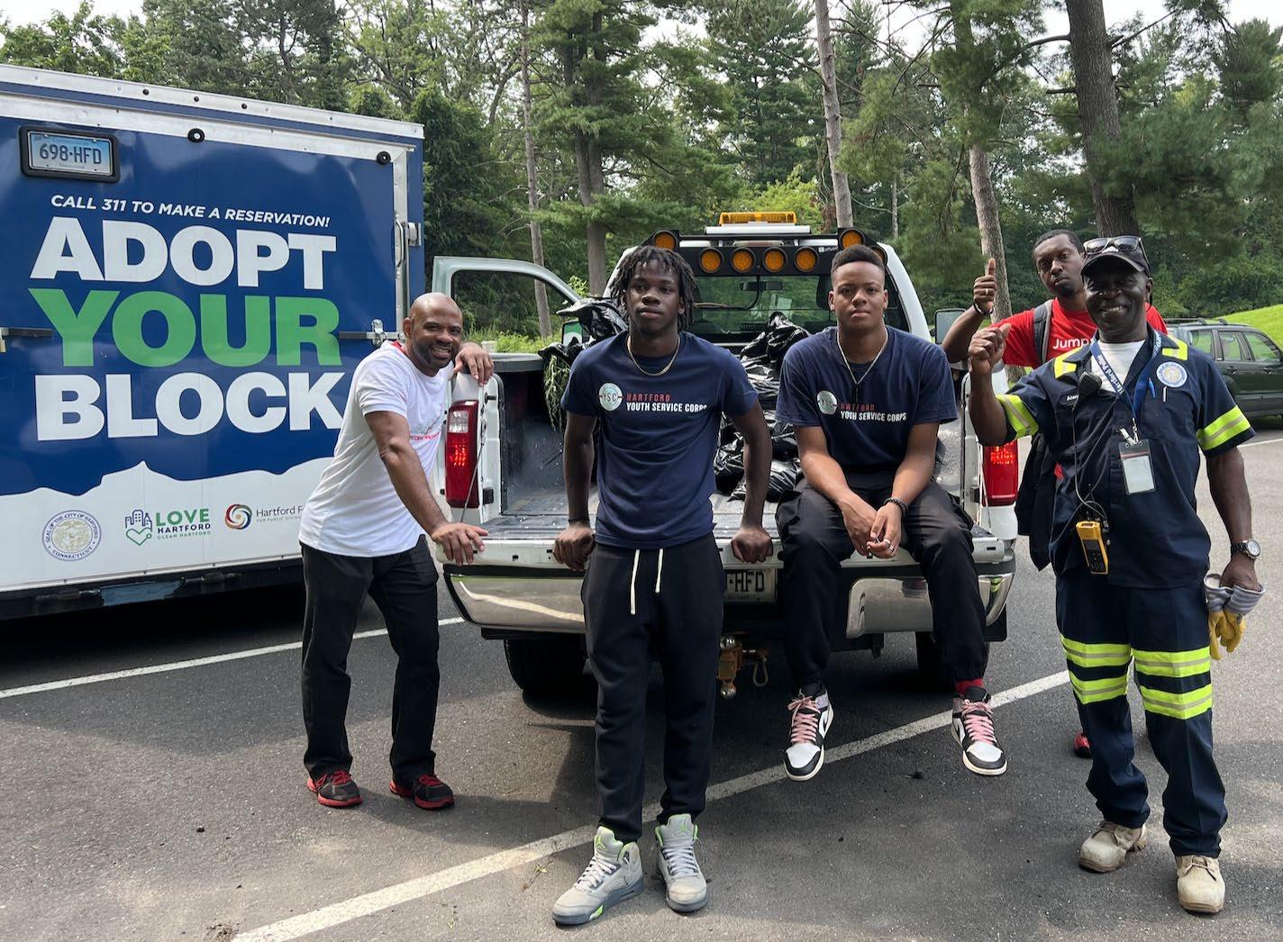
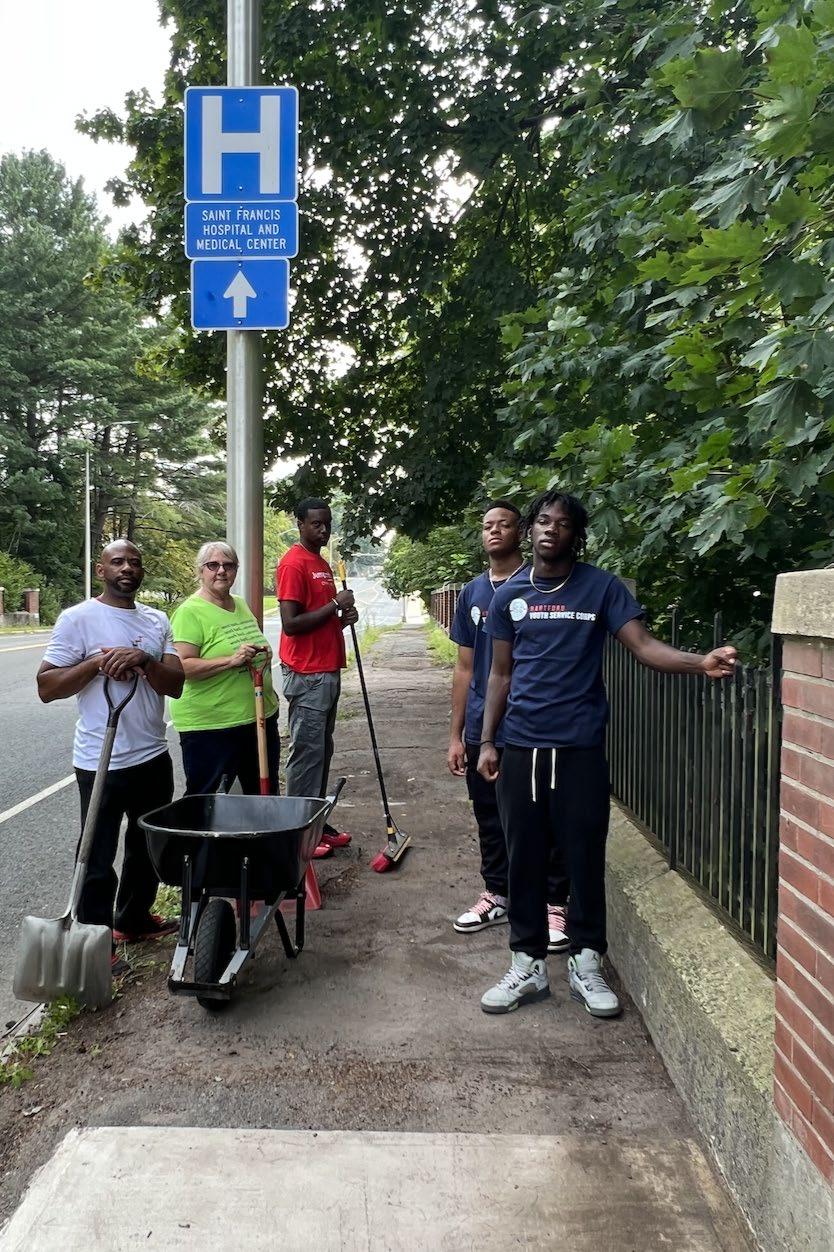
− Volunteer Service, Youth Employment, with Our Piece of the Pie
July 24th maintenance green infrastructure; August 21st bridge sidewalks and
July 25th Walkshop of Classical Magnet green infrastructure features
−
Institutional Property Managers
− K-12 Schools: Hartford Board of Education
−
Elected Officials and municipal staff
Consultant Team Update
Task 5 –
Public Outreach & Community Engagement
Community Engagement Strategy
• Distinct Team Tasks
− Fuss & O’Neill seeking site specific information
− Mary Pelletier (NCCD and Park Watershed) coordinate activities
− Brian Martin (Trust for Public Land)
• expand team understanding of community experiences
• Surveys and Questionnaires
• Other Strategies such as Walkshops and Meetings
Task 5 – Public Outreach & Community Engagement
Task 5 – Public Outreach & Community Engagement
July 15th Walkshop with Immanuel Congregational Church and Asylum Hill Neighborhood Association Green Committee, Park Watershed, NCCD, Trust for Public Land, and West End Civic Association
Consultant Team Update
Task 5 –
Public Outreach & Community Engagement
• Completed Public Outreach and Community Engagement Events
−
July 15th Walkshop with Immanuel Congregational Church and Asylum Hill Neighborhood Association Green Committee, and West End Civic Association
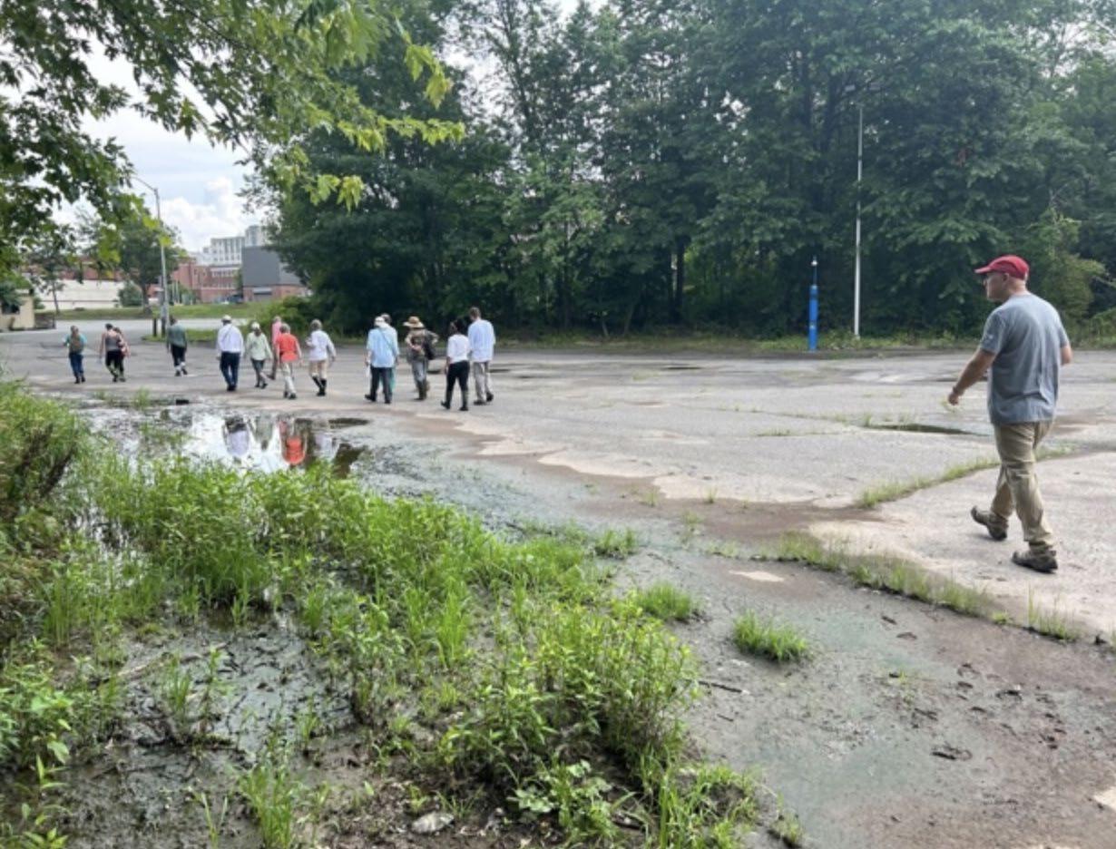
− Volunteer Service and Walkshop Asylum Hill Neighborhood Association Green Committee, Our Piece of the Pie Youth, City of Hartford and Ct Museum
−
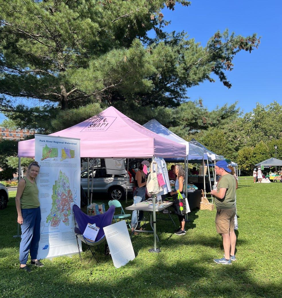
August 22nd (Farmers Market) Park Watershed
Upcoming Public Outreach and Community Engagement Events
− West End Farmers Market: Clemens Green on Farmington Avenue
• September 19th Tuesday 4 – 6:30pm
• October 24th Tuesday 3 – 6pm
−
North Branch Cleanup: HIU 9-12noon Saturday, September 23rd
•
Project Partner Updates
North Branch Park River Drainage Study
− Sewer Separation Design (Granby Street and Blue Hills Avenue)
City of Hartford

− North Branch Park River debris removal efforts
−
CT DEEP Climate Resilience Fund Grant (Citywide flooding/climate resiliency assessment)


−
Others?
• MDC
−
•
Project Partner Updates
− CT DEEP Climate Resilience Fund Grant – Stormwater Authority
Feasibility Assessments
UConn CLEAR
−
Community Engagement/North End Flooding
EPA Region 1 & UNH Stormwater Center
− Granby Street Green Infrastructure Design
CT DEEP
•
CRCOG
•
•
•
Project Schedule


2023 2024 Task Apr May Jun Jul Aug Sep Oct Nov Dec Jan Feb Mar Apr May 1. Quality Assurance Project Plan QAPP Approved - Task Completed 2. Project Advisory Committee Meetings 3. Design Development of Priority GI Projects 4. Watershed Plan Update 5. Public Outreach & Community Engagement 6. Project Meetings and Management 12 Months 6 Months 1 2 3 4 5 6 1 2 3 4 5 6 7 11 Months Advisory Committee Project Partners 8 9 Data Gathering & Review Project Screening & Selection Preliminary Design Permit Level Design
Upcoming Project Partners Meetings
• Meeting Schedule (Friday, 9-10 AM)
− October 13th
• GI site screening
−
December 8th
• Field work results and GI project concepts
−
4 additional meetings in 2024 (date and times to be determined) or another meeting added during autumn of 2023 depending upon development of project content
• Project designs and watershed management plan
Upcoming Advisory Committee Meetings
• Meeting Schedule (Thursday, 2-3 PM)
−
October 12th
−
December 7th
−
2 additional meetings in 2024 (date and times to be determined)
Next Steps
GI Design Development
− Incorporate observed flooding and GSI locations from partners and stakeholders into GI screening and watershed mapping
− Finalize desktop GI screening for review by Project Partners
− Interface with MDC project (NBPR field work and modeling)
− Conduct field inventories of potential GI sites
Watershed Plan Update
−
Finalize updated watershed mapping
− Submit watershed maps for review by Project Partners
−
Finalize and roll out project web app
Stakeholder Engagement
−
Continue public outreach and community engagement
•
•
•
North Central Conservation District
Questions and Discussion
Contacts:
Joanna Shapiro jshapiro@conservect.org
Erik Mas emas@fando.com
Mary Rickel Pelletier maryp@parkwatershed.org
Walker Holmes walker.holmes@tpl.org
