ADA & Accessibility on the Shawsheen River
A participatory study by Elizabeth Maldari with Andover’s Commission on Disabilities for the Shawsheen River Master Plan

2022

A participatory study by Elizabeth Maldari with Andover’s Commission on Disabilities for the Shawsheen River Master Plan
1. Introduction....4-8
1.1 Timeline/5
1.2 Purpose + ADA Compliance/6
1.3 Defining Disability/7
1.4 Planning for Inclusion/8
2. Methodology....9-18
2.1 Case Studies/10
2.2 Round-Table/11

2.3 2016 Land Survey/12
2.4 Survey/13
2.5 Design Charettes/14
2.7 Interviews/16
2.8 Site Visits/18
Special Thanks to;
The Town of Andover, Massachusetts
Justin Coppola, Chair of the Commission on Disability
Robert Douglas, Director of Conservation
Paul Materazzo, Director of Planning and Land Use
Andover Commission on Disabilities
Andover Conservation Commission
All Participants, Interviewees and the Shawhseen River
Illustrations were drawn by Elizabeth Maldari unless otherwise noted.
Cover Image: View of the Shawsheen River from Nason’s Landing
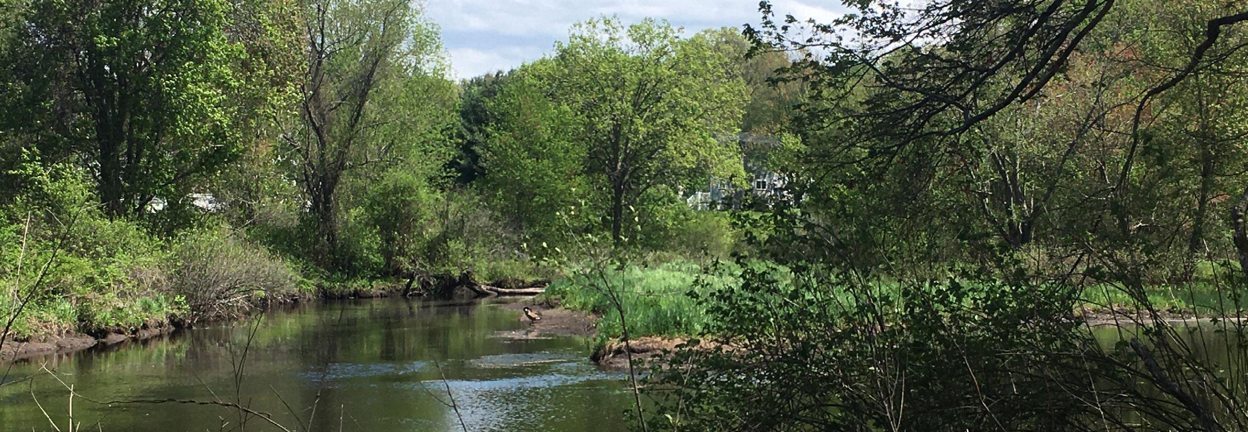
Credit: Colin Smith
3. Conclusion....19-38
3.11nformation/22
3.2 Wide ADA Trail/25
3.3 Parking + Transportation/31
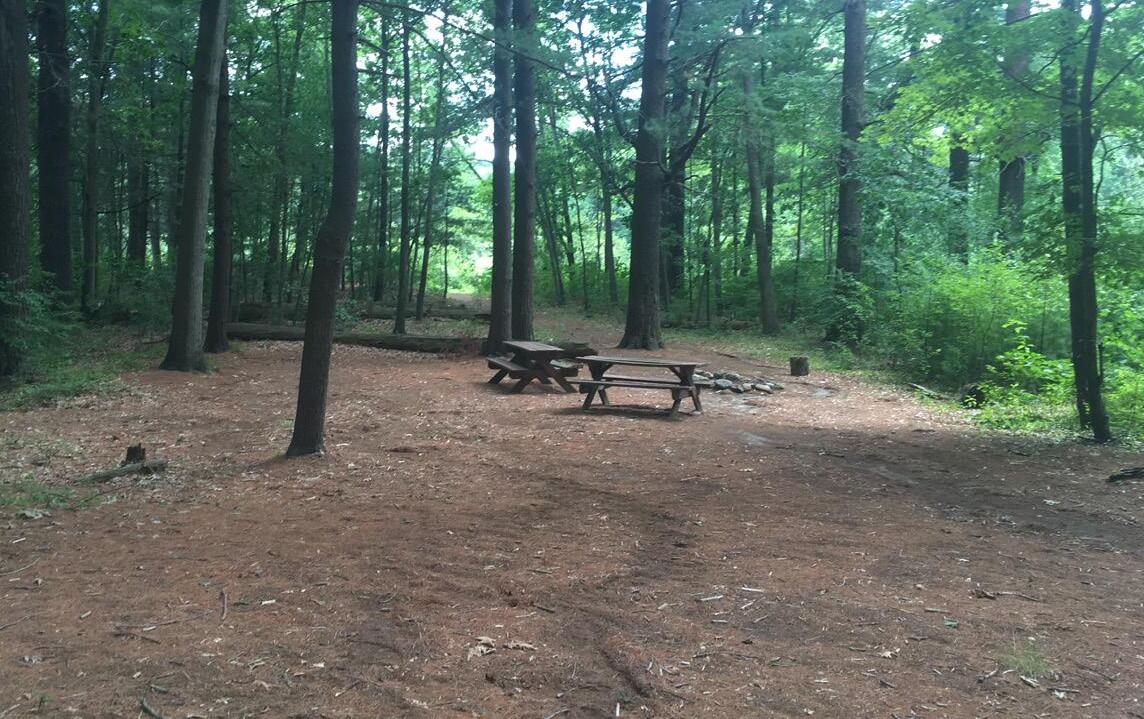
3.4 Picnic Area/32
3.5 Bathrooms/34
3.6 Dock, Lookout, Kayak Launch/35
3.7 Arts, Culture + Education/38
3.8 Site Specific Recommendations/40
4. Appendices....42-50
4.1 Accessibility Projects in Progress/43
4.2 Personas/44
4.3 Sources/49
Ongoing Singular Events
April 28 - Commission on Disabilities Virtual Meeting
May 3 - Site Visits to Possible ADA Kayak Launch Locations
June 7 - Kick-off Meeting with ACOD and Conservation
June 13 - Launch Survey
July 2 - Launch Community Calendar
July 16 - First Design Charrette
July 20 - Second Design Charrette
July 28 - Presentation and Feedback at ACOD Meeting
August 10 - Public Forum on Shawsheen River
August 22 - Teen Visioning Workshop at MHL I
August 27 - Field Trip to Acton Arboretum
August 29 - Poster Co-Design with ACOD
September 6 - Teen Visioning Workshop at MHL II
September 8 - Senior Center Health Fair Priorities
This portion of the Shawsheen River Master Plan uniquely highlights the desires of people with disabilities and their community for accessible river amenities. This document shows how the Shawsheen River can be imagined as an inclusive space for people with different abilities to enjoy each other and the landscape. Research was gathered through input sessions, interviews, and site visits conducted specifically for people with disabilities, but also open to people without disabilities.
While the following pages serve to review the research process and offer amenity concepts based on the research, accessibility will be integrated throughout the rest of the Shawsheen River Master plan to underline the inclusive aspect of accessibility.
The Americans with Disabilities Act (ADA) was passed in 1990 to protect the civil rights of people with disabilities. Building regulations defined by the ADA support inclusive public spaces through structural impact.
A key concept required by ADA compliance is that public programs and services, when viewed in their entirety, must be accessible to people with disabilities, but not all facilities must necessarily be made accessible.
Rhoda Olkin, PSYD explains the three models for defining disability as follows;
1. Moral “In the moral model, disability is seen as having meaning about the person’s or the family’s character, deeds, thoughts, and karma.”
2. Medical “In the medical model, disability is perceived as an impairment in a body system or function that is inherently pathological. From this perspective, the goal is to return the system or function to as close to “normal” as possible.”
3. Social “In the social model, disability is seen as one aspect of a person’s identity, much like race/ethnicity, gender etc. From this perspective, disability is believed to result from a mismatch between the disabled person and the environment (both physical and social).”
People with disabilities may need support with mobility, cognition, hearing, vision, independent living, and self-care. An environment which is designed with these supports built into it promotes self-sovereignty amongst people with disabilities. With guidance from the Andover Commission on Disabilities, this plan supports the social model for defining disability. The unique perspectives from people with disabilities are essential to planning a landscape which enables inclusion.
Planning for inclusive, public spaces does not rest solely on changing the physical structures but also on improving social and individual systems.
A version of the chart below with examples specific to the three categories can be found on page 36.
People with disabilities are important to the social fabric of Andover. There must be events, spaces and activities for people with and without disabilities to enjoy each other’s company.
Structural improvements to public spaces are needed to enable people with disabilities to participate in outdoor recreation. Since human and ecological welfare are intrinsically connected, people with disabilities must continue to be part of the design process following this master plan, working closely with Andover Conservation to find the best solutions for all living things.
Since every person is different, accessibility is not one size fits all. Offering a variety of options to fit different needs and interests encourages all people to contribute to the cultural and ecological landscape.
Initial desktop research was done to look at possible solutions for ADA compliance and access on conservation land. Samples were categorized into three groups;
2. Object - Adaptive tools to support people with disabilities in accessing the outdoors. For example; an all-terrain wheelchair, sensory bag and interpretive signage.
Participants: 5 June 6, 2022
1.
- Creating
3. Activity - Opportunities for interaction and community building. Examples in this category are inclusive hikes, guided tours for people who are blind or low-vision and a fishing group for vets experiencing PTSD and atrisk youth.
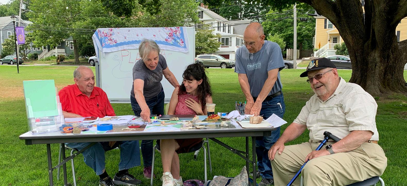
A hybrid discussion with some members of the Commission on Disabilities joining in person at Memorial Hall Library and an additional 3 Commissioners on the ACOD or Conservation Commission joining through a Zoom call. Conservation Director, Bob Douglas gave a brief overview of upcoming conservation projects.
• Commission members introduced themselves and voiced concerns.
• Generated a list of potential stakeholders.
• Set goals to identify and prioritize accessible amenities.
Participants: 19
In 2016, members of the Conservation Division gathered with Andover residents with disabilities and the Institute for Human Centered Design to observe and make suggestions for accessibility along the Haggets Pond Rail Trail in Andover.
Reviewing the notes from this survey offered insight into the barriers to enjoying conservation land that people with disabilities experience.
Insight;
• Empathize with systemic safety concerns such as intentional dehydration.
• Identify community and educational components for inclusive planning.
• Explicit need for interpretive signage to label slope, terrain type, etc.
Participants: 9 Outcomes;
Shortly after the round-table discussion, an exploratory survey was shared with Andover’s Commission on Disabilities.
• Insight to shape desired experiences on conservation land.
• Amenity prioritizing and input.
How would you like to visit conservation land?
Alone - 0%
With one other person - 63.6%
In a group of three or more people - 27.3%
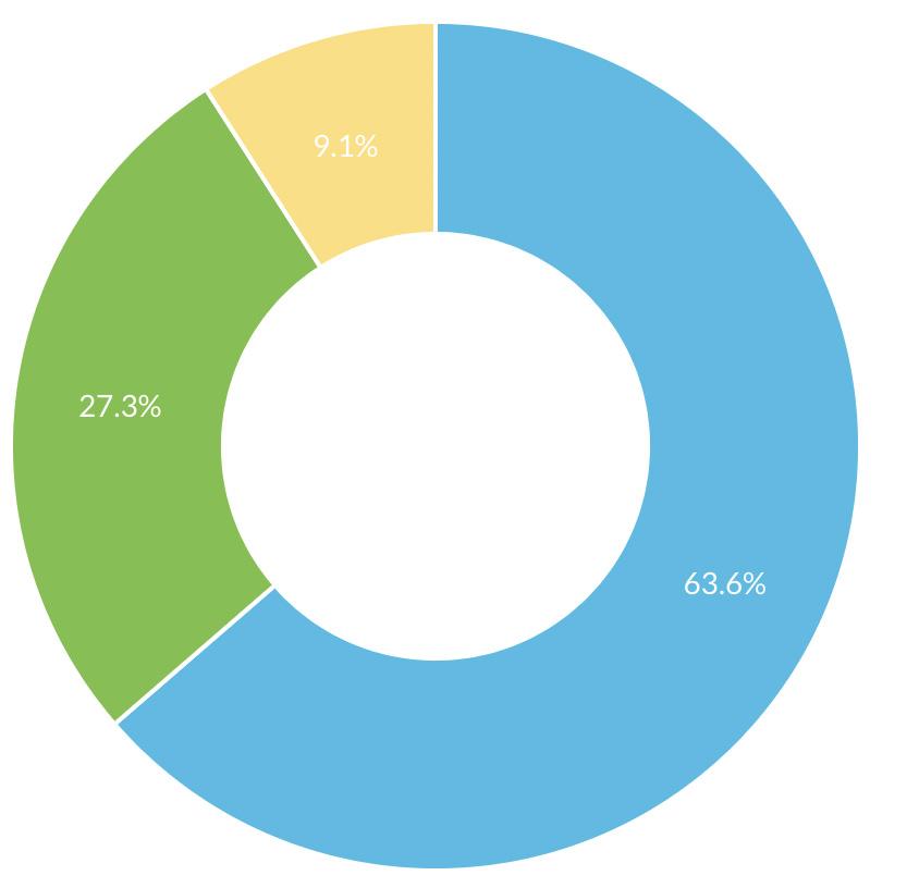
Other - 9.1%
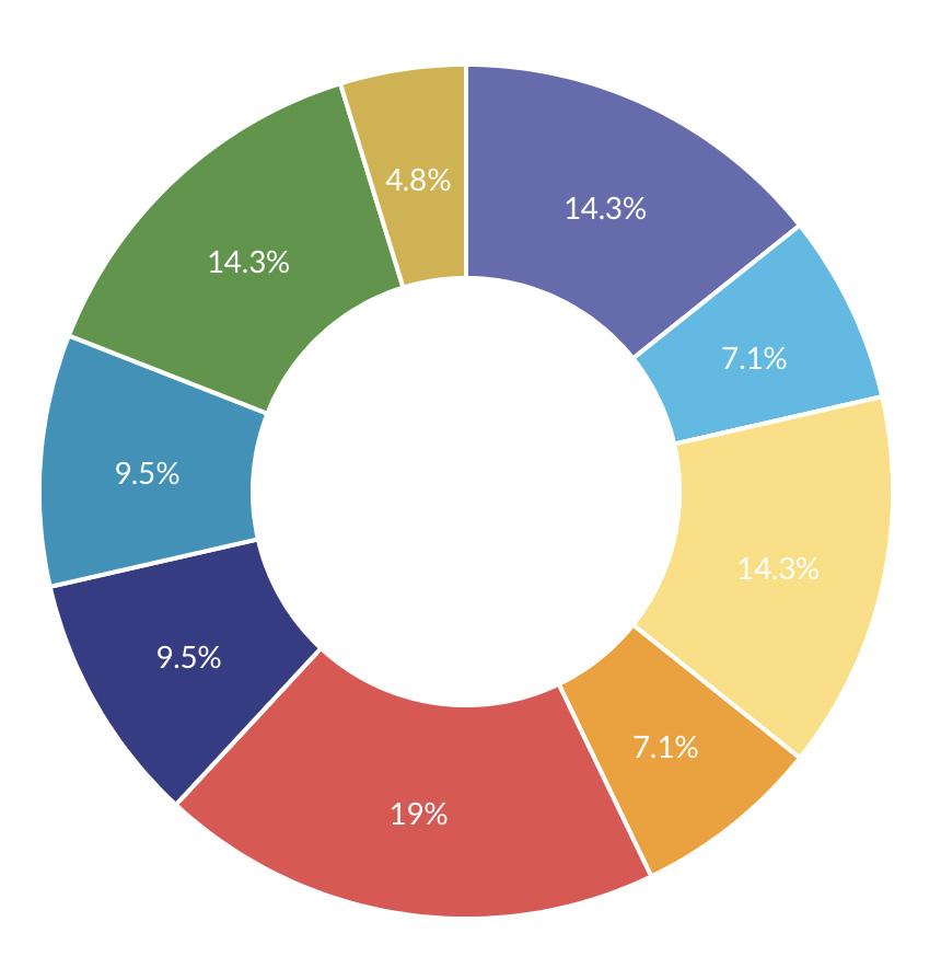
Other than ADA compliant parking and pathways, select up to 5 more accessible amenities that you would like on the Shawsheen*
Bathrooms - 19%
A place to sit - 14.3%
Boat launch - 14.3%
Picnic Table - 14.3%
Lookout - 9.5%
Interpretive Signage - 9.5%
Shade - 7.1%
Safety call box - 7.1%
Other - 4.8%
Welcome center - Welcome Center - 0%
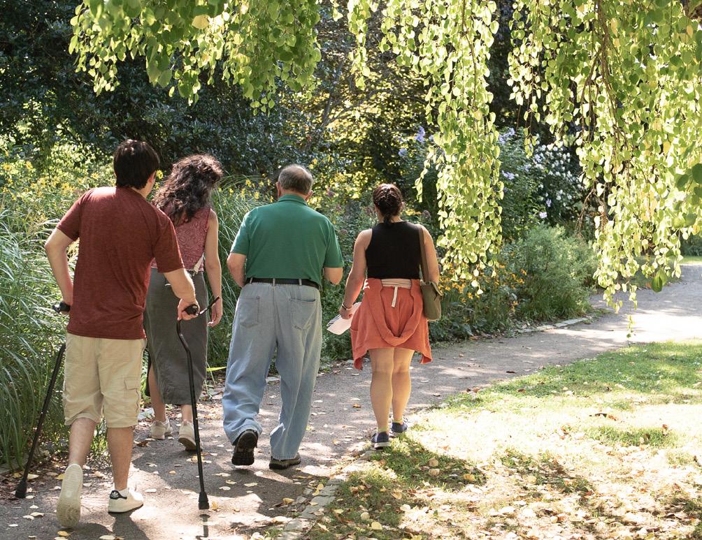
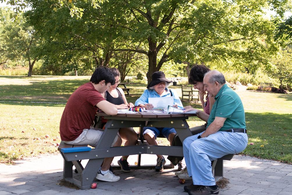
Input in the Park: Part 1
July 16, 2022
Participants: 26
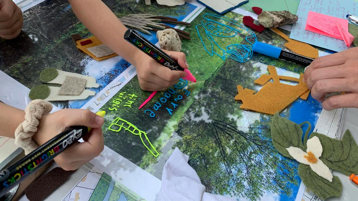
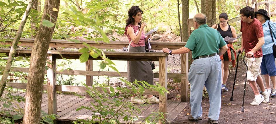
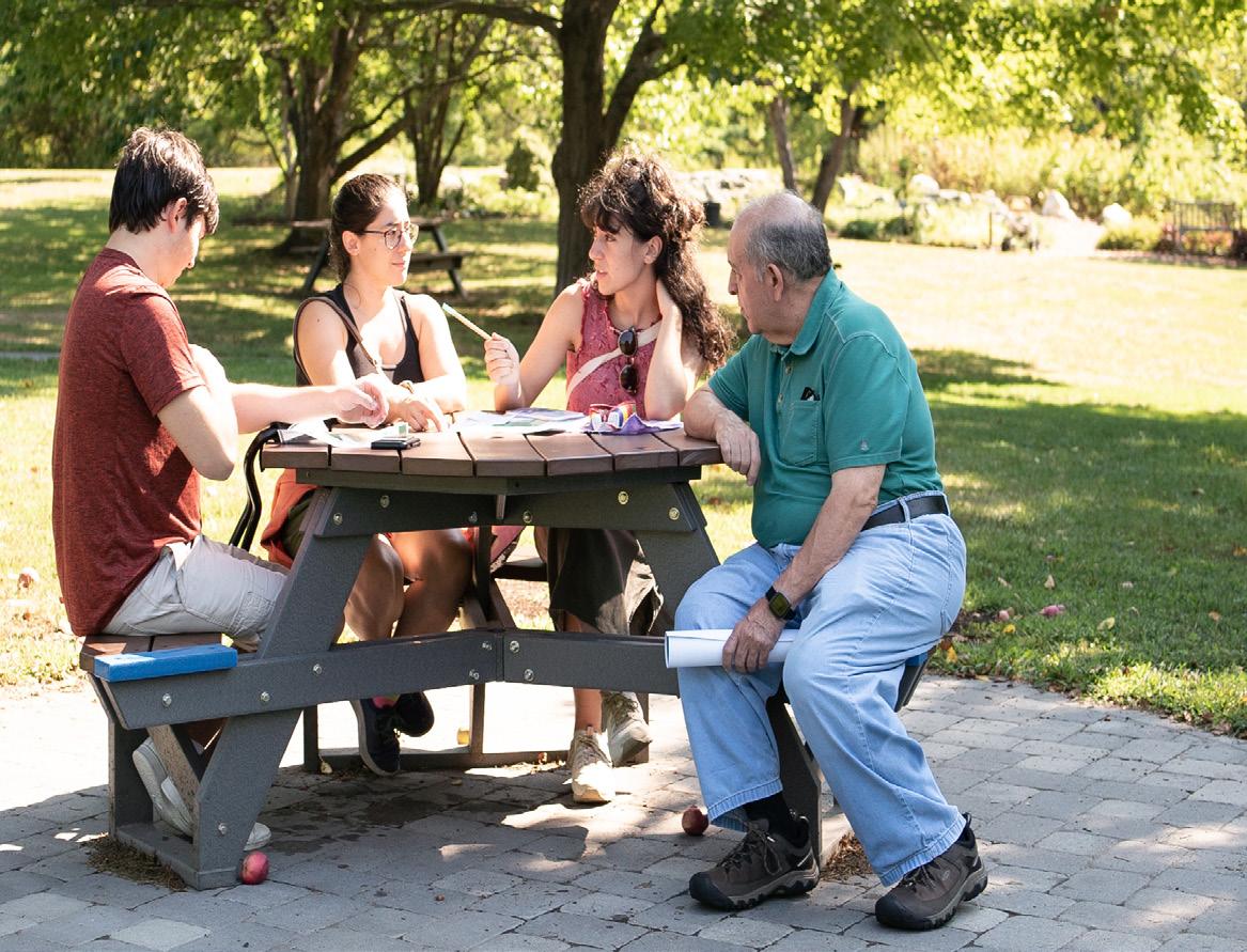
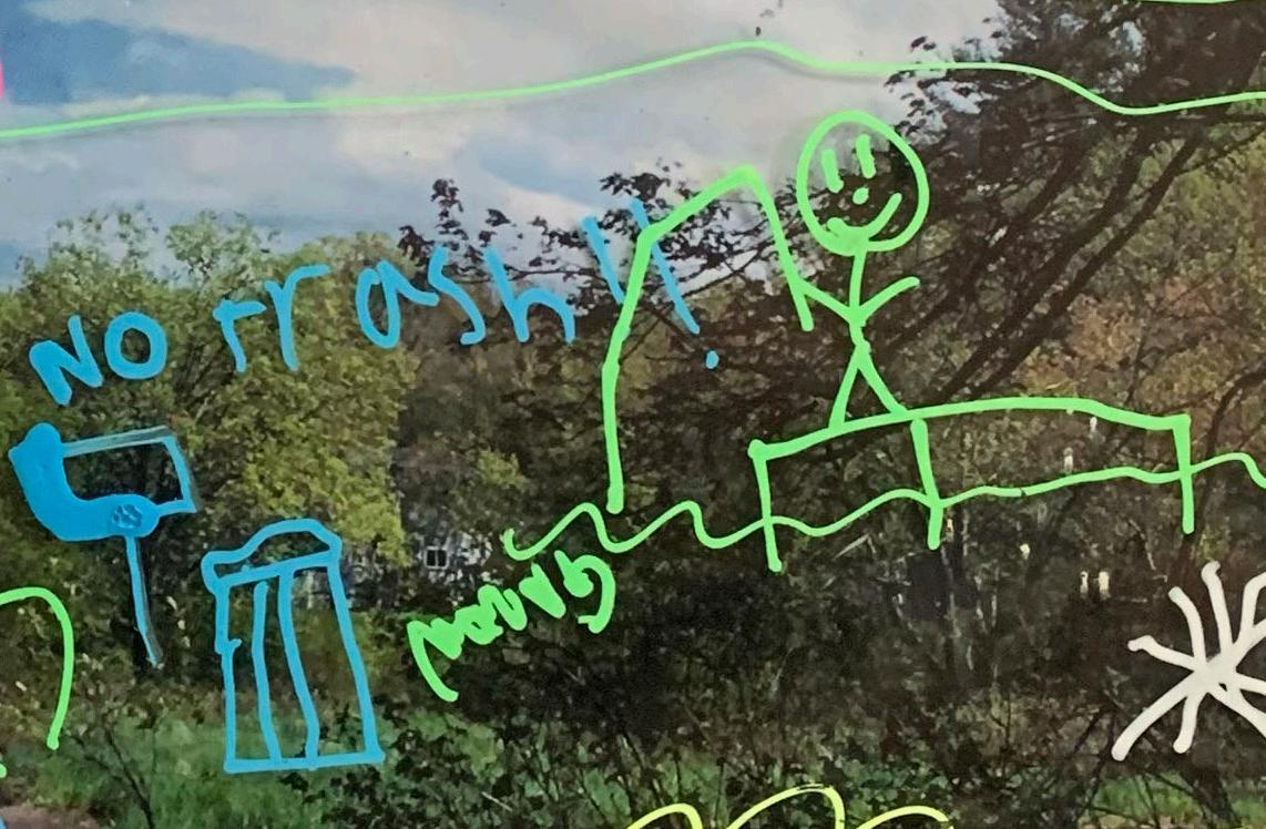
An input table was stationed in the park to engage passersby to envision an accessible riverside. “The Park” was selected since it is a centralized, outdoor space which attracts people with different abilities on a daily basis. Participants were invited to draw desirable amenities onto acrylic sheets placed over images of the Shawsheen River. Members of the Andover Commission on Disabilities and other members of the Andover community with disabilities were invited to join the table and promote the issue of accessibility on conservation land as a shared public interest.
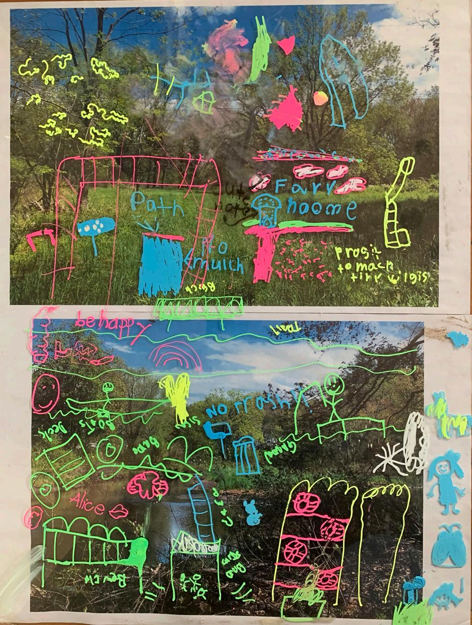
Insight;
• Andover youth view conservation land as a place for inclusive interaction and desire more opportunities for learning about native ecology.
• Senior hiking and kayaking groups need structural support for activities to be inclusive for all abilities. For example; ADA kayak launch for people with difficulty exiting typical kayak.
• Increase in access triggers concern for some residents over ecological impact.
Input in the Park: Part 2
July 20, 2022
Participants: 15
This event was coordinated with Andover Division for Parks and Recreation to take place during “Music in the Park”; a heavily attended, weekly event often including senior citizens and people with neuro-cognitive disabilities living in group homes.
Justin Coppola, chair of the Andover Commission on Disability was present for the duration of the event. Children were eager to participate in the drawing activity, while adults shared their input by writing down comments on prepared forms.
Insight;
• Many concerns about parking
• Stakeholder network can also reach non-English speakers, parents of young children, and tenants.
• Added new and repeat amenities for the master plan.
Participants: 11
Certain disabilities makes large gatherings uncomfortable, therefore the input sessions themselves are inaccessible, especially if they take place in an unfamiliar location. In order not to prioritize input from any one type of disability, efforts were made to take a person-centered approach with individual interviews.
Discussions were not always contained to the river, they also broached a range of concerns. Some of the interviewees had never visited the Shawsheen River.
Insight
• Awareness of the river and safe access points should be improved.
• Parking is a main reason someone with a disability or their caretaker may or may not visit conservation land.
• The restorative, peaceful aspect of the river appeals to many.
• Conservation Land is a place for interaction and community building between people with and without disabilities.
May 3, 2022
Participants: 12
A group of stakeholders including members from the Select Board, AVIS, ACOD, Facilities, Conservation and Planning departments joined to visit about 4 possible locations for an ADA compliant kayak launch. At each site, members discussed pros and cons of the sites.
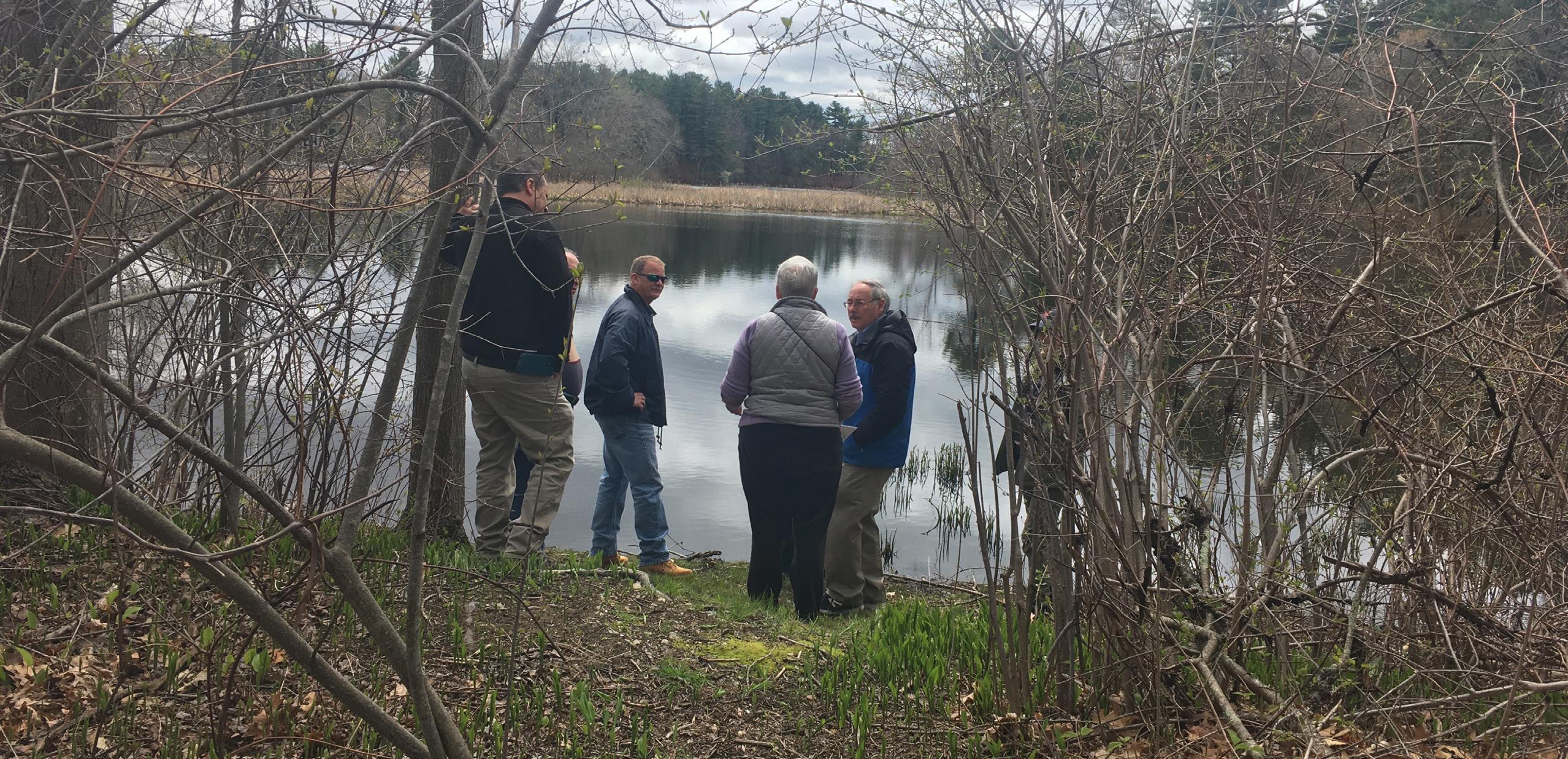
Insight
• Nason’s Landing off of River Street was decided as the best location due to the fact that it had space for parking and the eventual addition for other ADA compliant amenities.
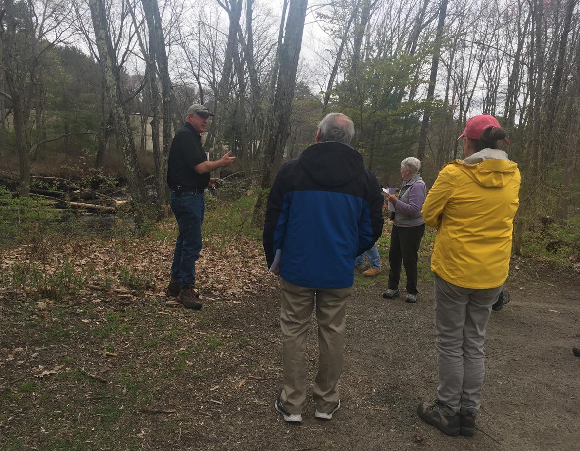
August 27, 2022
Participants: 5
A small group consisting mostly of ACOD members gathered at the Acton Arboretum to wander around the trails, take notes on the experience and evaluate the amenities.
Most of the attention was paid to path surfaces, placement of amenities and way-finding.
Conclusions:
• Boardwalks and stone walkways were the most favorable surfaces over pavement, stone dust, and grass.
• Transitions between surfaces are often a tripping hazard.
• Way-finding signs should include distance and time in addition to name.
• Information for plant identification should be relevant to all seasons.
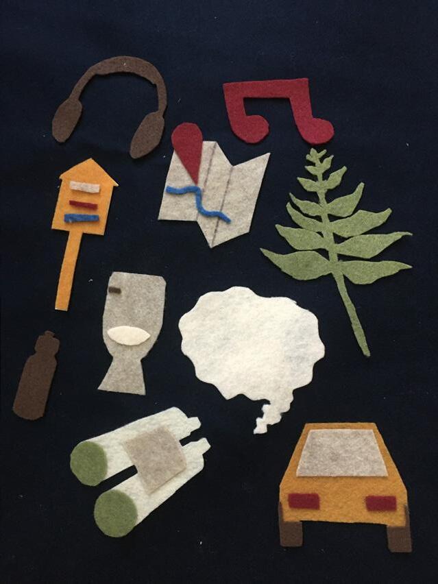
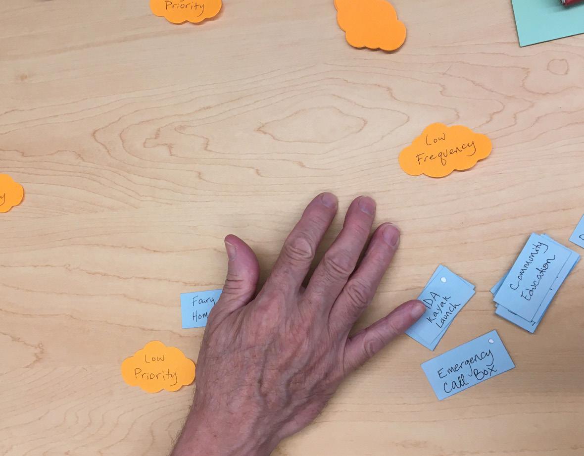
From the research, seven amenities stood out as important improvements to accessibility along the Shawsheen River. The list below outlines these selections, which are then expanded upon in the following pages.
1. Information-22//Welcome kiosk// Signs//Website//Maps
2. Wide ADA Trail-25//Surfaces// Benches//Shade//Railings//Emergency call box//Route Markings
3. Parking & Transportation-31//Adequate, accessible parking//Diverse transportation options//Safer Crosswalks & Intersections
4. Picnic Area-32//Accessible Tables//Trash
5. Bathrooms-34//Composting Toilet// Materials
6. Dock-35//Kayaking//Fishing//Birdwatching
7. Art/Culture/Education-38//Co-created spaces//Outdoor Education//Native Plants//Play Area
Stakeholders
Improving access to the Shawsheen River for people with disabilities also benefits many others in Andover’s Community. Since input activities were open to the public, the stakeholder network was expanded by gathering information from other people whose access to the Shawsheen conservation areas are limited for different reasons.
Information
• Healthcare workers
• Caretakers
• People with temporary disabilities
Wide ADA Trail
• New parents
• Stroller pushers
• People with temporary disabilities
Parking & Transportation
• Senior citizens
• New residents
• People who don’t drive
Picnic Area
• Tenants without a yard
• Folks on staycation
Bathrooms
• Senior citizens
• New residents
• Non-English speakers
• People who don’t drive
• Pedestrians
• Pedestrians
• Scouts
• Cyclists
• New parents
Dock/ADA Kayak Launch
• Scouts
• New parents
• Pedestrians
• People with temporary disabilities
Art/Culture/Education
• New residents
• Non-English speakers
Input gathering events revealed that many Andover residents had little information around the placement and accessibility of conservation land areas in the town. Improving the dispersal and variety of information for accessing the Shawsheen River would enable people to learn about fun, safe and sustainable ways to interact with conservation land. Including specific details about parking, activities and trail conditions help people who don’t have as many opportunities to enjoy outdoor recreation, participate in this beloved Andover pastime.
Outlined on the next pages are recommendations which summarize inputs from public input sessions.
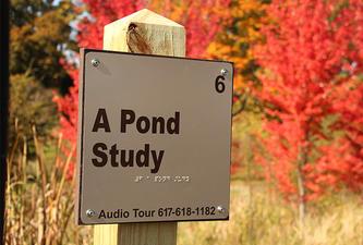
Welcome kiosks with interpretive signage should be prioritized for all trail heads. This information can also be iterated on the Andover trails website and linked from the ACOD website.
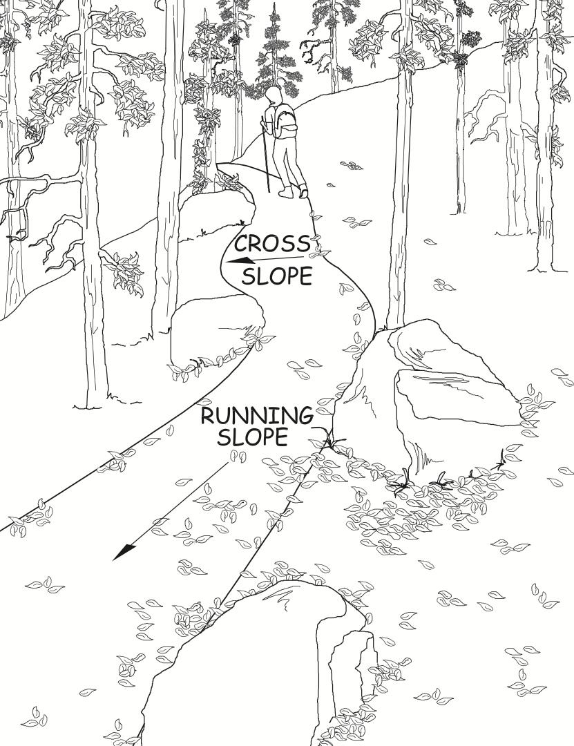
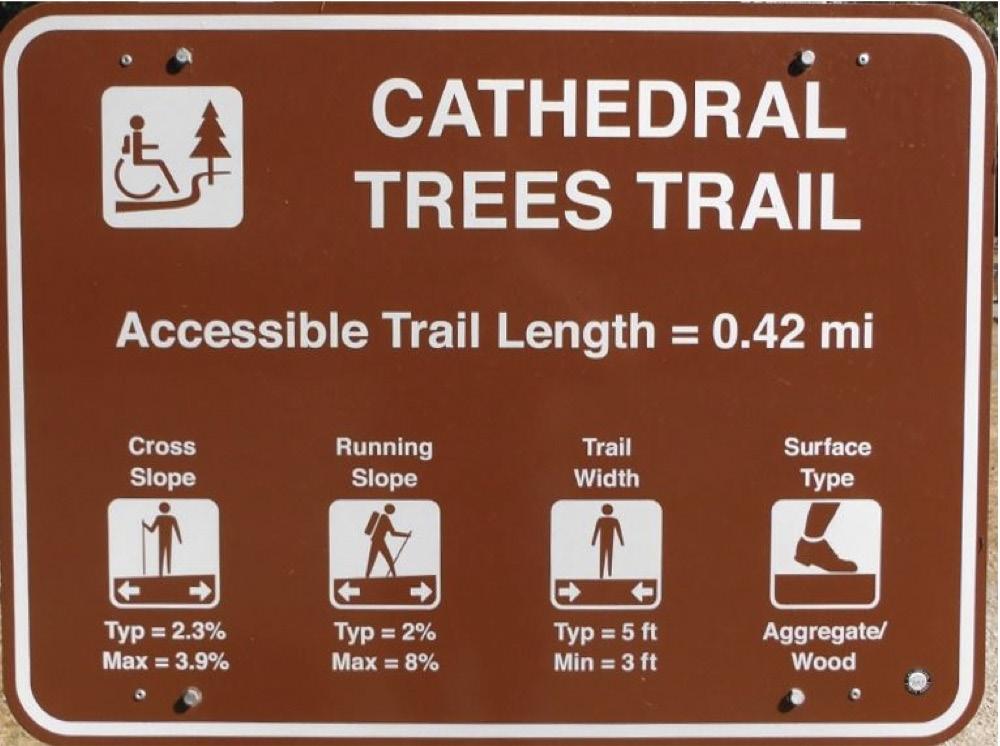
The list below of trail specifications was provided by the Andover Commission on Disabilities;
1. Overall grade (run slope)
2. Maximum grade (run slope)

3. Maximum cross slope
4. Minimum trail width
5. Surface type
6. Surface firmness
7. Availability of accessible toilets
8. Is the trail monitored actively or remotely?
9. Opening times of the trails
10. Availability of accessible parking
11. Size and location of obstacles on the trail
Credit:
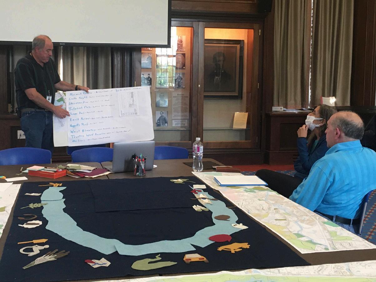
Ideas generated during participatory design sessions:
Wayfinding strategy to mark access points to the Shawsheen River. Like the one at Shawsheen Plaza. (Figure 22. Right. Credit: Elizabeth Maldari)


A strong desire for a firm pathway stretching along the Shawsheen was expressed by many stakeholders with and without disabilities.
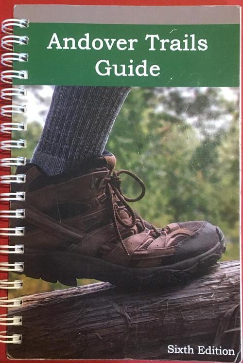
Updated maps in the Andover Trails Guide (above) and produce in larger format. Include information about accessibility.
Trail Signs with distance in miles and approximate time to get to desired location needed.
ACOD and Conservation Commission can coordinate to link a website with all the information about accessibility on the Shawsheen so people with disabilities can plan their trip.
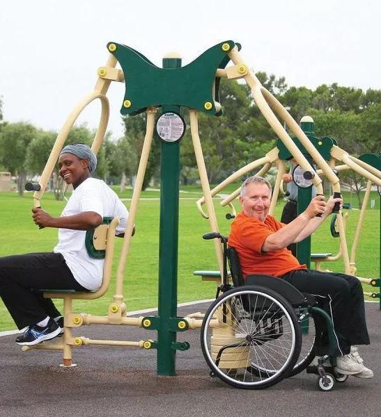
A firm pathway which is wide enough for two wheelchairs to move side by side benefits bikers, people pushing strollers and people who use canes or are worried about balance on varied surfaces. Minimum requirements for an ADA pathway are for it to be 36” wide, however specific requests from the community were for a wider trail with a minimum of 60” wherever practicable. This width would enable two wheelchair users to pass each other, travel together to maintain a conversation, and permit adequate space to crossing traffic. It improves safety for instances of bikers or dog walkers.
The three points listed below are drawn from The USDA Accessibility Guidebook for Outdoor Recreation and Trails1.
• Trails or trail segments of any length may be constructed with a running slope ratio of up to 1:20 (a 5-percent grade)
• To ensure that the trail is not designed as a series of steep segments, do not exceed a grade of 1:12 (8.33 percent) for more than 30 percent of the total length of the trail.
• Ensure that cross slopes do not exceed 1:20 (5 percent).
Key Proposed ADA Path Street
River/Pond Green Space Train Tracks
Shawsheen River Greenway (AVIS)
Ballardvale Train Station
Placemaking and wayfin-
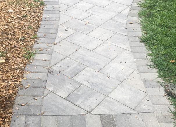
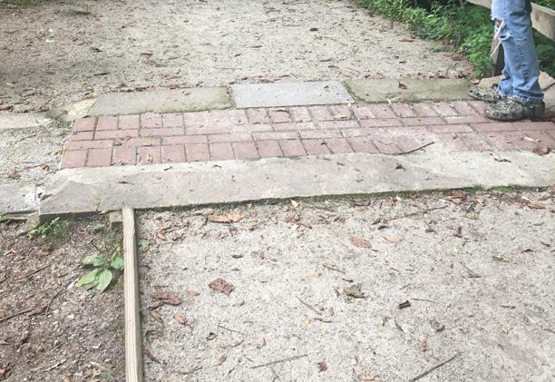
During the field trip to the Acton Arboretum; different surfaces were compared and rated by participants. The group determined boardwalks to be the best surfaces and pavement to be the least preferred due to the many cracks and bumps.
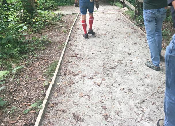
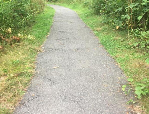
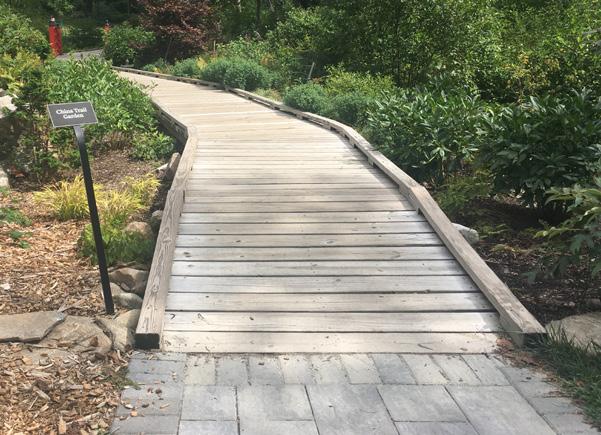
It was also noted that a single, consistent surface is preferable since transitions between different surfaces can create ledges between different surface types.
Surface Type
Boardwalk
Install/Maintenance Notes
First Choice!
• Control tripping hazards
Surface Type
Install/Maintenance Notes
• Can be laid by landscaper.
• Ongoing weeding and sweeping
Good on level ground, will trench when it rains. Loose rocks not ideal for people using canes.
Concrete
• Requires a paver and heavy equipment to install
• Frequent brakes require patching
If well maintained, it is a popular choice with direct users. Can be slippery when wet, should have a railing. Eventual surface irregularities are difficult for people who are low-vision. Higher-Impact than other options
• Occasional stone replacement
Depending on stone type and size, may or may not be smooth enough for rolling devices to comfortably maneuver
• Raking & occasional topping off
Recommended by Bettina Abe of Acton Arboretum
Figures 25-29. Surfaces at the Acton Arboretum. Credit: Elizabeth Maldari
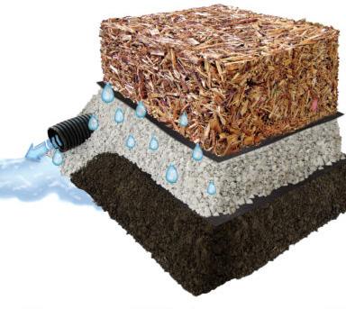
Figure 30. Zeager Wood Carpet. Credit: https://www. zeager.com/products/recreation/woodcarpet-system-1/
Benches should be placed at least every 200 ft. Next to each bench should be a clear space of 38”x48” for a wheelchair.
Dog management Dog management on all Conservation Land is a two pronged issue; 1. Signs and dog poop bags encouraging residents must be available.
2. Community education is paramount to establish a sense of individual responsibility.
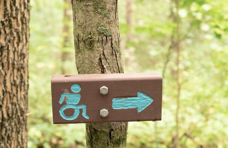
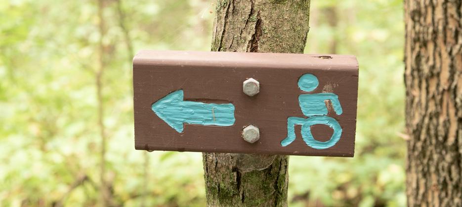
Route markings should be placed in visible locations to indicate to users they are on the right path. Different from the trail signs in the Information section because the route markings can be a single symbol or color.


Adequate shade should be found along the pathway, especially at rest points (every 200ft).
Concerns of adequate, accessible parking were raised during input sessions, and iterated in Andover Facebook Group Discussions, at Public Meetings and in an interview with Jane Burns, director of Elder Services.
For up to every 4 parking spaces, at least one should be accessible.
“Accessible spaces should be at least 8 feet wide, with level access aisles not less than 5 feet wide. Two accessible spaces may share a common aisle.”2
Emergency call boxes should be available on trails. Placement and type will depend on trails.
Railings between 34” and 38” high along the trail are needed where there is a steep drop on the side of the trail or along boardwalks which can be slippery when wet.
“Van accessible” spaces should be available wherever possible since these are common transportation vehicles for group homes, activity centers and other organizations who may like to plan trips to conservation land.
“Van accessible” is 8 feet wide with an access aisle 8 feet wide allowing a van to operate a lift.
A significant portion of the population of people with disabilities do not drive or have access to a vehicle, therefore improving access to the Shawsheen River should include diversifying transportation options including public transportation. Safer Crosswalks, sidewalks and intersections near river access points would improve the overall experience of people with disabilities.
Food was a common topic at input tables. As one Andover resident explained; eating together is one way to feel part of a community, without accessible ways for people with different abilities to gather around food, exclusion and isolation is perpetuated. Picnic areas are already placed along the river so adding accessible paths and tables which allow for wheelchairs will encourage the inclusion of people with disabilities who might otherwise be left out.
Accessible picnic tables can come in different shapes and sizes, but there are still some ADA requirements;
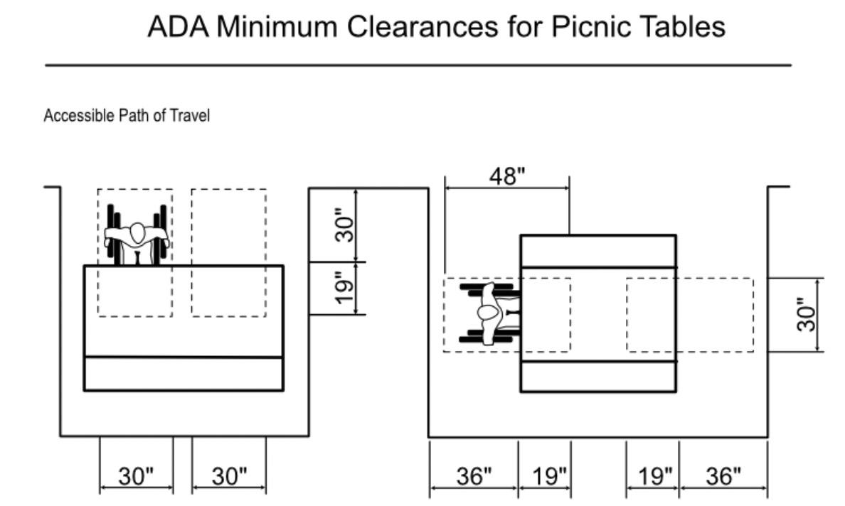
• Surface table height between 28” and 34”
• Knee clearance of minimum 27”
• Clear floor area: 30” by 48” at each seating space with at least one fully unobstructed side and an accessible route to get there
Figure Above; an ADA compliant picnic table at the Acton Arboretum. A good addition to the Pole Hill and Shawsheen Greenway picnic areas. It is placed on a flat, patio surface accessible to the ADA pathway.
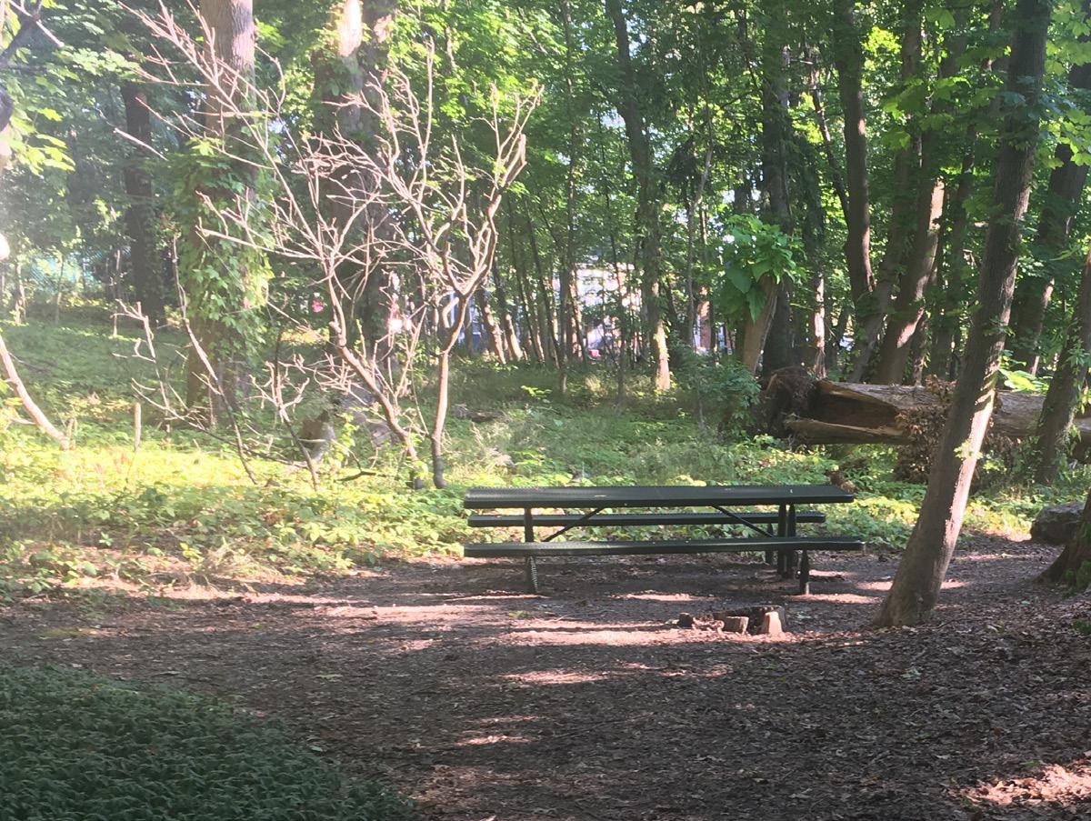
Figure 34
Credit: https://archive. ada.gov/smbustxt.htm https://archive. ada.gov/smbustxt.htm
• Leg and knee extension clearance: at least 19” from the edge of the table inward
Figure 36, Illustrated below; soil on the hill at Castle Park Reservation gradually slides down the slope to bury the picnic table at the bottom. Shortening the distance between the ground and the table top and rendering the table non- ADA compliant.
Many comments found from reviewing the 2016 land survey with the Institute for Human Centered Design revealed that people would intentionally dehydrate themselves while outdoors due to lack of bathrooms. High temperatures and physical activity are dangerous for a dehydrated body.
Conservation land areas along the Shawsheen River are generally not in close proximity to many public bathrooms, therefore constructing accessible bathrooms should be prioritized in certain areas along the River.
An initial suggestion for a composting toilet was endorsed by many future participants at input sessions. On the right, the accessible stall in the AMC Green Leaf Hut in New Hampshire uses a composting toilet, natural light and materials to create an elegant and clean bathroom which even smells like cedar. The only adjustment would be for the toilet paper dispenser to move to the side wall.
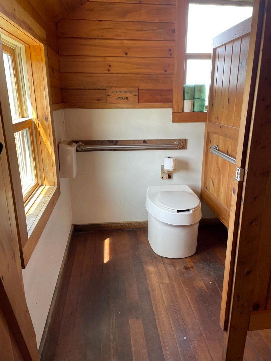
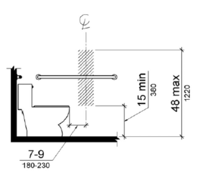
Figure 37. ADA Measurements for a public bathroom. Credit: ADA. 2022. “Review Laws, Regulations & Standards” Accessed October 10, 2022. https://beta.ada.gov/ law-and-regs
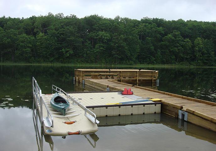
This section combines three experiences which were illustrated and verbalized by participants. The common structure to enable these activities is an accessible dock.

Accessible Kayak Launches are already approved for Nason’s Landing and Pomps Pond. To support independent use of the launch, trainings can be offered for users through the Andover Parks and Recreation Department. Interpretive signs should also be posted with safe use guidelines. An emergency call box on or near the dock would also benefit safety for the community.
Technical requirements for an ADA compliant dock;
• Gangways with minimum width of 36” with a slope maximum of 1:12 or 8.33%
• A landing plate at the end of the gangway.
• Railings which are 34” and 38” (not needed where they would obstruct the kayak launch).
• Edge protection is not required where there are railings, but helps to keep wheelchairs from rolling off docks. They should be 2-4” tall and 2” wide along the edge of the dock
• The dock itself should be of adequate size for the activities, taking into consideration space for secure storage for equipment. Field trips to similar sites can be done to inform final designs.
Since fishing is already observed at informal locations along the river, this is an opportunity for inclusion for people with disabilities in an activity already enjoyed by people of different ages. An accessible dock on the river would bring people closer to the waterfront and be a good place to enjoy these amenities.
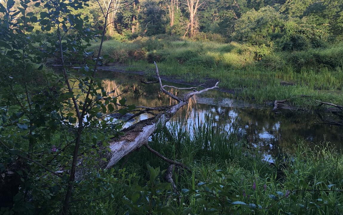
Kayaking was noted as a beloved current and historic pastime on the Shawsheen River. Fishing and bird watching were also frequently discussed.
A dock designed for an accessible kayak launch should also have space for benches as pictured in figure 40.
Encourage activities for diverse groups like fishing, birdwatching and sunrise yoga.
Free, monthly trainings for safe kayak use for at least two years after opening the site to the public.

Residents both with and without disabilities expressed a longing for more nature-related arts and educational opportunities. This sentiment was reinforced based on the fact that many, especially young people with disabilities had not had many opportunities to become familiar with conservation land outside of Environmental Science classes at the High School.
Seasonally-appropriate environmental education encourages deeper connection between people and their landscape. Classes and events which focus on local ecology and topics in sustainability and climate will promote an informed public to support future conservation initiatives.
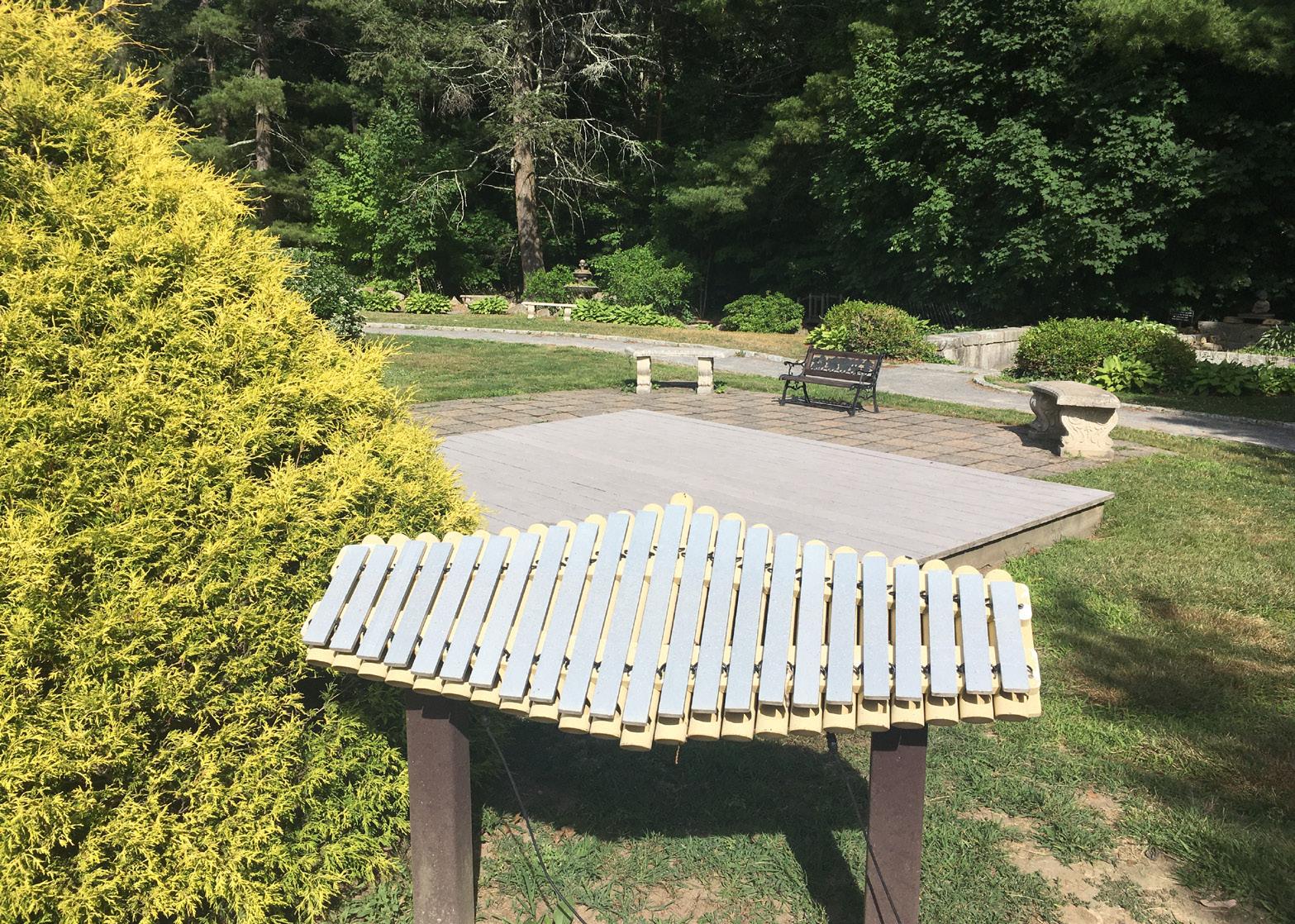
Outdoor spaces are a great location for sensory development. The West Parish Garden Cemetery in figure 44 has a children’s sensory garden which offers instruments, seating, fragrant herbs and more.
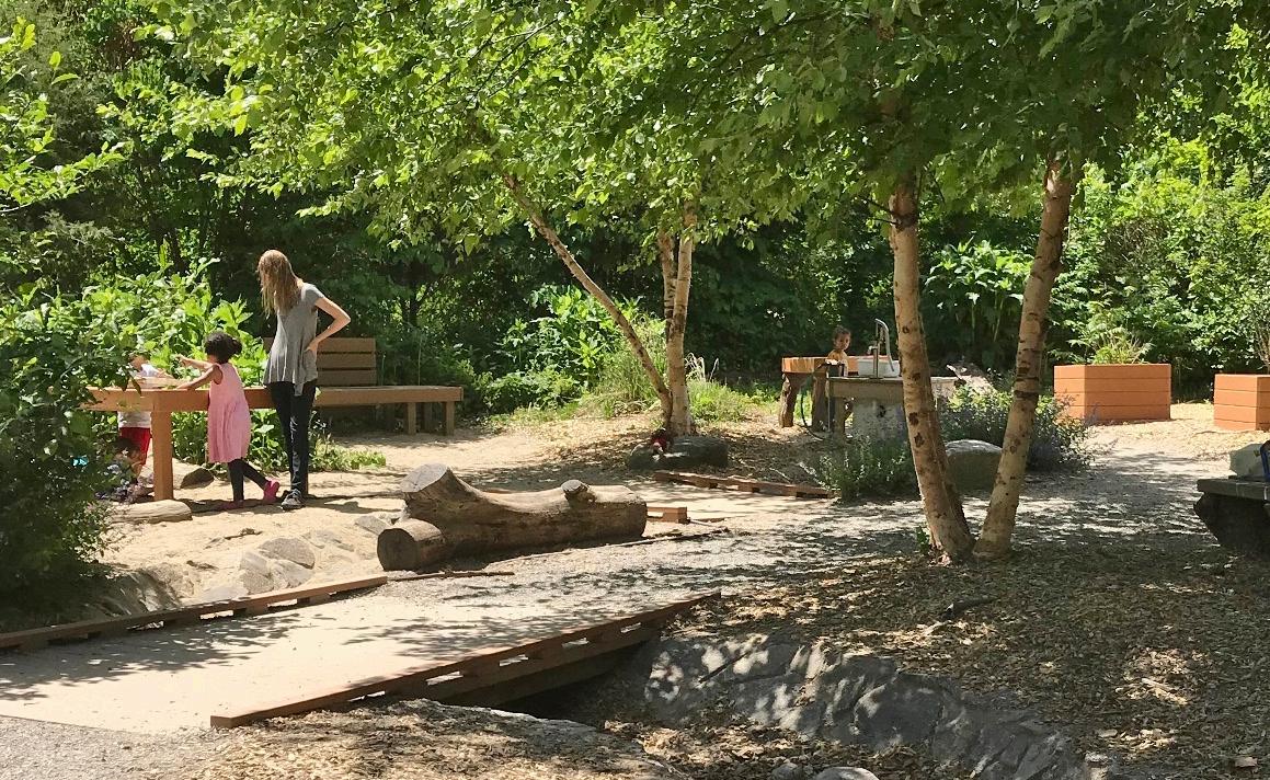
People with disabilities should also be encouraged to take part in conservation efforts like bagging invasive species. Outreach can be supported through the ACOD, Community Services, and during conservation workdays.
+ Picnic Area in green space between Penguin park and SH trails
+ Interpretive signage
+ Sensory garden
+ Fishing dock
+ Seating area
+ Interpretive signs
+ Long ADA trail
+ Picnic areas
+ Lookout area
+ Safer Crosswalks
+ Accessible Parking
+ ADA kayak launch
+ Seating area
+ Accessible parking
+ Dock with space for lookout
+ Wayfinding from Ballardvale
+ Interpretive Signs
+ Picnic Area
+ Lookout
+ Haggets Pond Rail Trail
+ Nason’s Landing ADA Kayak
Launch and Accessible Parking
+ Pomp’s Pond ADA Kayak Launch
+ Story walk in Downtown
“Personas” are a tool used by designers to empathize with a target group. The personas in this section were generated based on the research done for this master plan. Please note that they are not actual people. Kat Holmes, the principal director of Inclusive Design at Microsoft from 20142017 says building personas help to “design for one, extend to many.3”
James L. Creighton, author of the Public Participation Handbook wrote “My experience is that it is less crucial to have a cast of thousands participate in a public participation program than it is to have the full range of opinion represented4”. This master plan reached well over 75 people with a broad range of disabilities. It was the first of it’s kind for the Town of Andover.
Example Description:


+ Relevant information about the persona and their disability
Pains; What does this persona currently struggle with?
Gains; What added amenities will benefit this persona? Goals; How do these amenities help influence the goal of creating an inclusive park?
Allies: Who else benefits?
Mia
Description:
+ 36-year-old Female
+ Temporary, physical disability
+ Uses a knee cart
Pains; wants to continue to be active while injured. Can’t use certain sidewalks because they have too many bumps. Equipment too expensive. Feels like she needs help, but people are afraid to engage and offend her.
Gains; Smooth paths she can use with the cart. Equipment library. Maps with slope, terrain indications, so she can plan her route before heading out.
Goals; People develop more inclusive mindset. Able to be better informed before heading outdoors.
Allies: Parents pushing strollers, People using wheelchairs, People new to the area.
Erin Description:
+ 68 year-old Female
+ Recently retired
+ Doesn’t identify as having disability
+ Joins a weekly kayak group of senior women in Pomp’s Pond
Pains; Often feels unstable getting in and out of the kayak. Sensitive to sunlight due to medication.
Gains; Comfortable outdoors because of adequate shade, ADA compliant Kayak Launch.
Goals; Continue to age in place, remain social, active and independent.
Allies: Infants & Toddlers, Other Retirees, Camp Counselors.
Alex Description:
+ 28 year-old Male
+ Loves Sacred Heart trail on Shawsheen River
+ Emotional disability
Pains; Some conservation trails have too many people and get trashed, noisy.
Gains; Better designation of noise gradient, access to arts, nature and culture. Preservation of near-natural areas.
Goals; Continue to find peace on conservation land. Get involved as a warden.
Allies: Wildlife, Fishers, Solitary Park Visitors, Tenants.
Lydia Description:
+ 40 year-old Woman
+ Developmental disability
+ Loves to walk around town
Pains; Does not know where conservation areas are or how to get there safely. Crosses dangerous train tracks to arrive near the river.
Gains; Transportation, safer crosswalks, birdwatching stations and places to be with community, emergency call box. Goals; Wants to learn more about how to safely access the Shawsheen River, learn about history.
Allies; Historians, High School Students, Non-English Speakers.
Pasquale Description:
+ 80 year-old Man
+ Physical disability
+ Long-time Andover Resident
Pains; Can no longer enjoy the outdoors as he once did, feels disconnected with his identity as an outdoors man.
Gains; Stable pathways, benches every 200 ft., shade. Intergenerational activities.
Goals; Find a long pathway to enjoy, while feeling safe and connected.
Allies; Birdwatchers, People who are blind or low vision, Boy scouts.
Andrew Description:
+ 7 year-old Boy
+ Uses wheelchair
+ Recently moved to Andover
Pains; Nowhere he can easily go with friends to green space together.
Gains; Accessible picnic areas on Conservation Land, improved pathways.
Goals; Have a place for families and friends with different abilities to gather, eat, play and enjoy community and nature.
Allies; Caretakers, Groups of teens, Tenants, Cyclists.
Kira
+ Description:
+ 15 year-old Girl
+ Sensory Disability
+ Lives in an Apartment
Pains; Uncomfortable outside due to sensory over stimulation. Afraid to visit conservation land due to lack of information.
Gains; Forms independent connection with the landscape.
Feels valued and connected tending to sensory garden.
Goals; Is beginning to desire more autonomy, would like to develop independent skills.
Allies; Ecology, People who are deaf or blind, Senior Citizens
1 USDA Forest Service. 2012. Accessibility Guidebook for Outdoor Rec reation and Trails. (81). https://www.fs.usda.gov/sites/default/files/ Accessibility-Guide-Book.pdf
2 Massachusetts Office of Disability. Handicapped Parking Regulations. https://www.mass.gov/doc/disability-parking-regulations/download
3 Holmes, Kat. 2020. Mismatch; How inclusion shapes design. (104). MIT Press, Cambridge
4 Creighton, James L., 2005. The Public Participation Handbook: Making better decisions through citizen involvement. (24) San Francisco
5 Americans With Disabilities Act of 1990, 42 U.S.C. § 12101 et seq. (1990). https://www.ada.gov/pubs/adastatute08.htm