3RD EDITION
DIGITAL TWIN
PHILOSOPHY FOR THE NEW DIGITAL REVOLUTION HOW MAPPING LAND RIGHTS ADVANCES PEACE FIT FOR PURPOSE CASE IN COLOMBIA
DIGITAL CITIES - 4D CONSTRUCTION - GEOTECNNICAL ANALYSISIS DIRECT FROM THE YEAR IN INFRASTRUCTURE 2019
EDITORIAL WELCOME TO TWINGEO MAGAZINE 3RD EDITION
ANOTHER YEAR, MORE FASCINATING STORIES AROUND INFRASTRUCTURE YII 2018 in London, was a phenomenal experience with exceptional interviews with the top executives of Bentley Systems, Topcon and others, dynamic conferences and highly informed sessions, and YII 2019 took the knowledge, skill and engagement to a new level. Bentley Systems has revived the concept of “digital twins� and YII 2019 provided a first hand view of the benefits the concept is bringing world over. The event brought together leaders of almost every industry and the exchange of knowledge, networks and collaboration that happened was beyond words.
made every moment enjoyable and special.. I am glad to share few of the enriching interactions I had with the industry leaders, present at Bentley Systems YII 2019 here. Complemented with the Digital Twin article from Golgi Alvarez, I am sure these will help you gain new insights into digital twins, 4D construction, geotechnical engineering, smart cities and a lot more. Happy reading!
During my time there, from digital advancement academies to use cases, I wanted to capture everything, store the learning and create unique stories. The location, Marina Bay Sands, Singapore perfectly complemented the scale of the magnanimous event, making every moment spent all the more special. The Press Conference, the ACCELERATE sessions, the Industry briefings, the demonstrations at the expo, everything was a memorable experience in itself. Interviews with the senior executives of Bentley Systems, Microsoft, Topcon, Siemens and other top notch names in construction was an exhilarating experience that broadened my knowledge around Digital Twins, Geotechnical Engineering, Structural Engineering, Digital Cities and a lot more. Networking, connecting with old and new friends over lunch and tea breaks
Shimonti Paul Consulting Editor
THE TEAM Editor-in-Chief Golgi Alvarez
editor@twingeo.com
Consulting Editor Shimonti Paul
indiaoperations@twingeo.com
Spanish Journalist Laura Garcia
editor@geoingenieria.org
Graphics Designer Adams Kazeem
datasoftsolution500@gmail.com
Published by: ZatocaConnect Bogota, Colombia Phone: +57 312 279 6581 E-mail: info@zatoca.com Disclaimer TwinGeo does not necessarily subscribe to the views expressed in the magazine. All views expressed in this issue are those of the contributors. TwinGeo is not responsible for any loss to anyone due to the information provided. TwinGeo aims to create awareness about everything Geo-engineering in an unbiased way. We do not claim to be experts, so feel free to correct us if something needs correction.
CONTENTS NEWS
Page (6-13)
• ESRI enters into licensing agreement with European commission • ESRI releases smarter government book By Martin O’malley • DJI introduces ZENMUSE XT S, a new high frame-rate thermal imaging camera • Airbus-built CHEOPS SATELLITE successfully launched on Soyuz • NSGIC releases findings from biennial geospatial maturity assessment survey. • Radiant Earth Foundation releases world’s first open repository for geospatial training data. • UAVOS’S ROBINSON unmanned helicopter extends application range
INTERVIEWS VALUABLE INSIGHTS ON BIM, GEOTECHNICAL ENGINEERING, SMART CITIES, DIGITAL TWINS, AND MUCH MORE FROM INDUSTRY LEADERS AT BENTLEY YII 2019 EXCEPTIONAL INSIGHTS ON DIGITAL CITIES Bob Mankowski, VP Digital Cities; Benoit Fredericque, Director, Product Management-Reality Modeling & Ton De Vries, Senior Director, Business Development, Digital Cities
LET’S KNOW ABOUT 4D CONSTRUCTION MODELLING from the experts- Richard Humphrey, Senior Director, Project Delivery & Construction & Scott Eustace, Senior Marketing Manager STRUCTURAL AND GEOTECHNICAL ANALYSIS Interview with Raoul Karp, VP Design Engineering Analysis, Cindy Ross, Manager, Product Marketing, Geotechnical, Erwin Beernink, VP Marketing, Sales and Services, Plaxis
Page (14-32)
CASE STUDY 1
Page (36-37)
HOW DRONE INSPECTION WA ACHIEVED A RESOLUTION OF 2CM/PIXEL
COVER STORY
Page (38-49)
DIGITAL TWIN: PHILOSOPHY FOR THE NEW DIGITAL REVOLUTION The new protocol, if it wants to be standard, must be able to interconnect more than real-time information. In its scope, it should include all of the existing and newly-built environment, as well as interfaces with the natural environment and social, economic and environmental services provided.
CASE STUDY 2 HOW MAPPING LAND RIGHTS ADVANCES PEACE By the time the Colombian government and the Revolutionary Armed Force of Colombia (FARC) finally brokered a peace agreement in 2016, their 50-year-old civil war had claimed 260,000 lives. Land reform was always at the heart of the conflict. As in many Latin American countries, most land in Colombia is concentrated among an elite group. Just 14 percent of all landowners control 80 percent of the land, a strong indicator of inequality. During the war, some rural areas were effectively cut off from the rest of the country,..
Page (50-55)
ARCHITECTURE MAGAZINE
TWINGEO-NEWS
ESRI ENTERS INTO LICENSING AGREEMENT WITH EUROPEAN COMMISSION On December 20, 2019, Esri, announced that it has entered into a four-year general master agreement (GMA) with the European Commission. The agreement will enable the European Commission and selected Executive Agencies to use Esri software and deploy the full suite of its ArcGIS products in an open, scalable, and standards-based GIS architecture. Implemented and deployed by Esri’s European distributors, the GMA also provides terms and conditions which several other EU institutions, agencies, and bodies can leverage to have access to Esri products. Esri’s European distributors will provide local support, services and training. “We look forward to working with the European Commission as a part of this agreement,” said Jack Dangermond, Esri founder and president. “It is a priority for us to support the European Commission
6
Directorates General and Agencies with our latest geopatial technology, for their important policy work in the EU.” The use of Esri’s GIS technology will enable the European Commission and its Executive Agencies to easily share and analyze geographic information and use them to make better-informed, data driven, policy decisions.
ARCHITECTURE MAGAZINE
ESRI RELEASES
SMARTER GOVERNMENT BOOK BY MARTIN O’MALLEY
TWINGEO-NEWS
Smarter Government: How to Govern for Results in the Information Age is available in print (ISBN: 9781589485242, 332 pages, US$39.99) and as an e-book (ISBN: 9781589485259, US$39.99).
On November 5, 2019, Esri announced the publication of a new book by former Maryland governor Martin O’Malley, Smarter Government: How to Govern for Results in the Information Age. The book proposes new ideas about leadership and applying technology in a way that encourages openness and public collaboration. Smarter Government is a discussion and demonstration of a fundamentally entrepreneurial way of governing that’s about the data, mapping, and method for achieving dramatic public sector progress. According to O’Malley, government should work to make complex problems more transparent while delivering better outcomes and results. Smarter Government makes the case for a new and better way of governing that is simple, demonstrable, and understandable for every citizen. O’Malley’s book also includes study and discussion questions and links to online exercises for readers to experience these tech-enabled methods.
7
ARCHITECTURE MAGAZINE TWINGEO-NEWS
DJI INTRODUCES
ZENMUSE XT S,
A NEW HIGH FRAME-RATE THERMAL IMAGING CAMERA
DJI, the world’s leader in civilian drones and aerial imaging technology, has introduced a new thermal imaging camera, the Zenmuse XT S, for DJI’s Matrice 200 Series drones. The camera features an infrared thermal imaging sensor with high thermal sensitivity and resolutions for clear and detailed thermal imagery. The Zenmuse XT S enables firefighters, police officers, inspectors and more to gather intel beyond the capabilities of visual data, and act on them quickly to save money, time and lives. The Zenmuse XT S will make high resolution and frame-rate thermal imaging cameras more affordable and accessible around the world. “By offering Matrice 200 Series and Matrice 200 Series V2 pilots the ability to capture thermal data that is invisible to the human eye, the Zenmuse XT S will help introduce drone technology into more applications,” said Christina Zhang, Senior Director, Corporate Strategy at DJI. “Specifically, thermal imagery enables drone operators to see through smoke or fog, locate missing persons at night, identify overheating electric elements, and more.”
8
The Zenmuse XT S was developed to handle even the toughest thermal imaging applications, such as long-range inspections. This is enabled through the 19mm lens on a 640×512, 25Hz refresh rate radiometric sensor, and improved further with 2x and 4x digital zoom capabilities. A live view of thermal data is streamed directly to the operator on their mobile device through the DJI Pilot app, where they can access intelligent features that can quickly get insights from the thermal data. The Zenmuse XT S is compatible with DJI’s leading Matrice 200 Series and Matrice 200 Series V2 drone platforms when used with the DJI Pilot flight control app.
ARCHITECTURE MAGAZINE
TWINGEO-NEWS
AIRBUS-BUILT
CHEOPS SATELLITE SUCCESSFULLY LAUNCHED ON SOYUZ
On December 18, 2019, the Airbus-built CHEOPS satellite was successfully launched on a Soyuz rocket from the European spaceport in Kourou, French Guiana. CHEOPS is the first exoplanetary mission of the European Space Agency (ESA). It is also the first satellite built by Airbus in Spain for ESA. CHEOPS will characterize exoplanets of nearby stars, observing known planets in the size range between Earth and Neptune and precisely measuring their radii to determine their density and understand what they are made of. The satellite uses proven technologies to pave the way for bigger and more ambitious missions – with the aim of verifying if any exoplanet may be capable of supporting life.
The Soyuz launcher took off as scheduled with its five passengers allocated on the multipayload dispenser also built by Airbus. CHEOPS separated after two hours and 23 minutes from lift-off. After the in-orbit commissioning, CHEOPS will start its operational lifetime of at least 3.5 years and will operate in a Sun-synchronous Earth orbit at an altitude of 700 km. Phillipe Pham, Head of Earth Observation, Navigation and Science, Space Systems said: “CHEOPS, a pathfinder for future exoplanets missions, is a very important programme for Airbus as it is the first Science mission primed from Spain. With the expertise and the strong engagement of our team and our 24 partners from 11 European countries, we were able to deliver the satellite perfectly on time to ESA and contributed to this success. We look forward to the next ESA Science mission, Solar Orbiter.”
9
ARCHITECTURE MAGAZINE
TWINGEO-NEWS
NSGIC RELEASES FINDINGS FROM BIENNIAL GEOSPATIAL MATURITY ASSESSMENT SURVEY National States Geographic Information Council (NSGIC) has released its biennial comprehensive Geospatial Maturity Assessment (GMA) report, which provides NSGIC members and other partners with a summary of geospatial initiatives, capabilities, and issues within and across state governments. For the first time, NSGIC has modified the GMA survey to produce report cards for each state on central data themes and coordination topics.
The 2019 GMA, augmented with individual state report cards and framework data theme analysis, is an authoritative resource on the status of state geospatial programs. This deeper dive can assist states in setting goals, identifying peer states for collaboration, pinpointing areas requiring attention, and connecting states with opportunities and resources. It also provides an important tool for federal partners to identify areas for key coordination, cooperation, and collaboration, and for the private sector to build software and services that comprise the tools that make it all work.
This report and corresponding resources can be found in a PDF format on the website, nsgic.org/2019-NSGIC-GMA.
BANNER AD
10
ARCHITECTURE MAGAZINE
TWINGEO-NEWS
RADIANT EARTH FOUNDATION RELEASES WORLD’S FIRST OPEN REPOSITORY FOR GEOSPATIAL TRAINING DATA To make geospatial information more accessible to data scientists who are working on global priorities like food insecurity, Radiant Earth Foundation has launched Radiant MLHub, the world’s first cloud-based open library dedicated to Earth observation training data for use with machine learning algorithms, it announced today.
(EO) training datasets and machine learning models. In addition to discovering others’ data, individuals and organizations can use Radiant MLHub to register or share their own training data, thereby maximizing its reach and utility. Furthermore, Radiant MLHub maps all of the training data that it hosts so stakeholders can easily pinpoint geographical areas from which more data is Over a quarter of the global population — needed. 26.4%, or approximately 2 billion people — experienced moderate or severe levels Distributed under the Creative Commons of food insecurity in 2018, according to the license (CC BY 4.0), training datasets hosted United Nations (UN), which cites as major on Radiant MLHub give data scientists causes increasing food prices and decreasing and other machine learning enthusiasts food production, not to mention trends like benchmarks they can use in order to train climate change and population growth, and validate their algorithms and improve which could boost agricultural demand by its performance. 50% by 2050. This first training dataset released on Radiant Despite significant challenges, data from MLHub is funded by The Patrick J. McGovern satellite imagery could help the global Foundation development community achieve the UN’s goal of zero hunger by 2030 by supporting Despite the flow of social and economic resources significant to individuals and communities that need them most. challenges, data There’s just one major problem: Although there’s an abundance of satellite imagery, there’s a shortage of training data and tools to advance applications of machine learning on them. Enter Radiant MLHub, an open digital data repository that allows anyone to discover and access high-quality Earth observation
from satellite imagery could help the global development community achieve the UN’s goal of zero hunger by 2030
11
ARCHITECTURE MAGAZINE
TWINGEO-NEWS
THE WESTGATE RESORT
LAS VEGAS
OCT. 28– 30, 2019
Vertically focused. Market driven.
Quantum-Systems MicaSense
Use code SAVE100CB for $100 off a Conference Pass! expouav.com Visit the exhibits for free!
Microdrones
Commercial UAV Expo is focused on commercial UAS integration and operation and attracts a global audience of drone professionals. With top-notch education, unparalleled networking and an exhibit floor of best in class drones and systems, it’s the one event on the calendar that shouldn’t be missed.
info@expouav.com Produced by Diversified Communications
LEARN how to harness the power of drones for business results today. CONNECT with 2,500 peers and industry leaders from more than 40 countries. SEE 230+ booths of best-in-class UAS solutions.
Join professionals from organizations like these*: AECOM | Anadarko Petroleum | Apple | AT&T | Bureau of Land Management | California Strawberry Commission | CNN | FAA | Facebook | Ford Motor Company | FOX Sports | Georgia-Pacific | Google | Jacobs Engineering | Kiewit | Los Angeles Dept. of Water & Power | Major League Baseball | NASA | Southern Company | Uber Elevate | United Parcel Service Co. | U.S. Air Force | U.S. Department of Energy | U.S. Department of Agriculture | U.S. Forest Service | U.S. Department of the Interior | U.S. Fish & Wildlife Service | Westinghouse Electric | The White House *Sample of 2018 attending organizations
Free Report:
Commercial Drone Insights from 8 Industry Experts Download at expouav.com/news/uav-americas-reports
THE COMMERCIAL UAV EVENT FOR:
12
More exhibitors than any other commercial drone event!
ARCHITECTURE MAGAZINE
TWINGEO-NEWS
UAVOS’S ROBINSON UNMANNED HELICOPTER EXTENDS APPLICATION RANGE
ADVANTAGES OF R-22 • Due to its long endurance capability (6 hours), and ability to operate in harsh weather conditions, in both land and maritime environments, the R-22 is a perfect solution for delivery missions; • Ability to operate in high winds, during weather-related disasters, and night operations; • Carry a cargo load of up to 180 kilograms or 400 pound;
UAVOS has announced that it has unveiled its converted Robinson manned helicopter into unmanned aircraft R-22 as a cargo and farthest range delivery drone. It features a payload capacity of 180 kilograms or 400 pounds and a travel distance of up to 1020 km.
• Cargo dropping at specified location.
R-22 unmanned helicopter is designed for both cargo delivery and humanitarian / disaster relief applications. Failure to deliver vital equipment under austere operating conditions and timelines can incur substantial fiscal costs, making Robinson’s all weather capabilities particularly valuable. This also opens up new possibilities for safely and efficiently transporting goods in a variety of industries.
• All terrain capable.
Another is the disaster relief mission – where R-22 can bring food, fuel, water, supplies, medicine, communications and even electrical power to areas that are hard-hit by natural or man-made disasters.
• Cargo delivery to the most remote parts of the Earth; • Transporting goods taken from a large cargo aircraft.
SPECIFICATIONS OF THE ROBINSON UAS PLATFORM • Takeoff and landing: fully automatic • Level surface: 15 x15m • Maximum cruising speed: 160km/h • Payload with full fuel tank: 40kg • Max. takeoff weight: 635kg • Operational range: 1020km • Endurance: 6h • Service ceiling: 4200km 13
ARCHITECTURE MAGAZINE TWINGEO - INTERVIEW
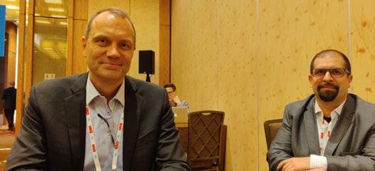
SHIMONTI PAUL 14
interviewer
ARCHITECTURE MAGAZINE TWINGEO - INTERVIEW
VALUABLE INSIGHTS ON - BIM - GEOTECHNICAL ENGINEERING - SMART CITIES - DIGITAL TWINS - AND MUCH MORE FROM INDUSTRY LEADERS AT
BENTLEY YII 2019
15
ARCHITECTURE MAGAZINE TWINGEO - INTERVIEW
EXCEPTIONAL INSIGHTS ON
DIGITAL CITIES
Bob Mankowski, VP Digital Cities; Benoit Fredericque, Director, Product Management-Reality Modeling & Ton De Vries, Senior Director, Business Development, Digital Cities
So, it is basically having a digital representation of a physical asset, like a process plant. A geometric and visually accurate representation of the plant. And then combining with that physical geometric and visual representation, the engineering technology like analysis or simulation applications, information technology so things about work orders and inspection histories, and financial data with operational technology like IOT sensor data, temperature data, occupancy data for rooms, vibration, electrical voltage. A digital twin is then a virtual representation of the plant, that can provide visibility on the current status of the plant, and then can also be used to simulate, changes to the plant. The physical asset could be a plant, a road, a rail system, a water system or it could be a process like a construction process. In simple terms, the Digital City is basically a digital replica of the physical assets and infrastructure in the city. It is digital replica that represents the real-life situation in that city. Is there a difference between digital cities and smart cities?
Yes definitely. For Bentley, the difference is that a Digital City is kind of a prerequisite in order to get to a smart city. Around the world many cities have different views and focuses when it comes to establishing a smart city program in the city, it’s simply Please define Digital Cities in simple because the needs and the requirements terms. in Singapore are different than they are in Rio de Janeiro or in Mumbai or in Munich. A digital twin is a digital representation But all of these use cases or many of these of a physical asset, process or system that use cases will benefit from having a digital acts as a bridge between the digital world twin of a city available because the city is and the physical world. It also includes the conceived basically out of three major things. engineering technology that’s necessary to model and understand the performance of the asset or the process or the systems. One is of course the city government. If you have no government, there is no city. 16
ARCHITECTURE MAGAZINE TWINGEO - INTERVIEW
The second thing is the people. If you don’t have the people you have no city and the third thing is the infrastructure. If you have infrastructure, you have people you have a government, you have a city. So, having that infrastructure available as a digital city as a digital twin of your city helps you to create the smart city and realize the smart city use cases in order to create a better living environment for the citizens and the stakeholders. Smart cities in the industry typically refer to cities which use communications technology, basically sensors to estimate the status of infrastructure assets and make decisions. A smart city is a digital city, but a digital city doesn’t necessarily have to be a smart city. For us in a digital city, there are lots of opportunity to improve the efficiency and resilience of cities by going digital in various workflows. It’s about automating and connecting digital workflows together and replacing some existing manual or paper based or disconnected workflows. So, it can be digital without being smart, but there’s still a lot of value in being digital. How do digital cities help in urban planning? Frequently, a digital city includes the city model as well as a platform to support communication with cities. So, typically during the design phases of urban planning, the city model combined with the GIS enable the urban planner to integrate different sorts of information and then to optimize the design process.
you know many cities need to grow in order to accommodate the growing population in those cities. So that means they need to build new infrastructure, new buildings, new shopping malls, new everything. That requires a planning process and traditionally a planning process; what cities did was they printed a brochure, they informed some of the people, they invited them to a town hall meeting. But only a very limited subset of everybody who’s involved got informed and got actually included in that process. Now with a digital city and our Open Cities planner, our cities are able to actually use the web, mobile, tablets, big displays in city hall and so forth to inform the public about all those upcoming changes or plans and capture input from them in a digital way. So, actually what we are introducing is a kind of crowdsourcing for infrastructure. And that makes the whole process way more inclusive for all the citizens involved. So that’s a benefit for the citizen and it’s also a benefit for the city because they get a way more balanced view on how the public is thinking about their plans on expanding the city. And that leads to basically happier citizens because they are better informed, they know what’s going on. And, on the other hand, it quite often leads to shorter procedures because people are better informed and there is on average less resistance against those plans. How Digital Cities are adopting technologies like AI and Drones?
I think it depends on city by city. The cities as we say are going digital, and you see many cities around the world who are experimenting with those technologies. I think drones have become mainstream and What kind of experience a digital city are in use all over the world and everywhere. provides to its citizens, how it enhances Machine learning, artificial intelligence, I their experience? guess that’s the next step. And by going digital, by creating the digital twin you A good example is what we do or what our create the basis to actually, do that machine users do actually in the planning process. As learning on those digital models of the city. 17
ARCHITECTURE MAGAZINE TWINGEO - INTERVIEW
You can apply machine learning and you can automatically start to recognize potholes, manholes, streetlights and so forth. So, changes over time or put particular objects that you would like to identify, that’s where the machine learning on those digital city models come into play and can help identify certain situations in a city way easier, compared to sending all these survey crews out on the streets. We know digital cities provide a lot of advantage. But how good has been the adoption so far? Is it happening at the desired pace? Sort of depends a little bit on how you look at it. If you look at it from a let’s say a complete digital twin of a full city, I think we are at the starting point over there. There are some cities around the world that actually are working on that or have that. Many cities already have parts of the city as a sort of digital twin available, but most of the cities actually will have the data in silos in disperse systems available and with the introduction of a digital twin, what we do is we separate that data and that allows them to create the digital twin for them based on what they already have. They don’t need to replace systems, they might want to do some additional data creation but in many cases 60, 70, 80 percent of the data is already somewhere available either within the city,
18
or within the ecosystem of the city. So, the step, in order to get there shouldn’t be too big. If we talk about regions or geographies, where do you see the maximum adoption of this transformation? I think this is a global thing. And every city is doing it at their own pace, but there are leading cities in Asia, they are leading cities in Latin America, leading cities in North America, Europe all over the place. I think there’s a little bit of difference between let’s say what’s happening in North America or in Europe where there’s more focus on, I would almost say keeping the systems of a city running and creating a better environment of life, whereas in China they are building new cities with a pace that is incredible, so the focus is a little different. But it’s happening globally. So, that brings me to my next question. What do you think is easier - building a new digital city or transforming an existing city to a digital city? I’m hesitating here because I think the steps you have to take are not that different. In almost all situations. there is existing infrastructure. And the city can be small and expand heavily. Like what’s happening in China or you have a city like Long Island.
ARCHITECTURE MAGAZINE TWINGEO - INTERVIEW
They are close but not at the same pace as the cities in China. But all of them, they have data available and or are creating digital data, because of all those expansions and the step to creating the digital twin is to we look at that data federated, aggregated and create a digital twin and make that available to serve all those smart city use cases. So, a sort of borderline answer is I think that it makes no difference.
perspective, you need to get the data from the Oracles to IBM and so forth from the IOT system from all the IOT vendors, so we work closely with both Microsoft and Siemens on those projects, where Siemens’ IOT is actually the system integrator for us in many of these cases. Microsoft of course is the generic platform and the cloud platform with all the government-based security levels so that they can provide service to each and every country around the world. If you have to pick your best case study So strategic partners are enormous and or best use case in terms of digital twins, very important for us in that respect, and which city will it be? also third parties that we sometimes even consider our competitors are part of the I would say for us it would be Helsinki. They whole journey. have adopted the digital twin starting with 3D modeling back in the 80s. Now they’re What’s the role of reality modeling in the serving more than hundreds use cases concept of Digital Cities? throughout the city internally, but also making them available externally, so the IThat’s an interesting one. Reality modeling use of their digital twin throughout their can play an important role. The reason why operations on a day to day basis is massive. I say “can” is that it’s not necessary, but it They recently have won many awards. will add a very important layer in terms of making a real time connection, or near real How do your strategy partners fit into time connection to the reality possible. So I the whole picture of enabling creation of think many cities can start without a reality digital twins? modeling part, because they can start based on their existing datasets that they If you look at Smart City concept, Digital City have right now, but they will realize that concept it’s not something that we believe with the creation of the reality models and anyone can do on their own, we cannot do it the continuous update of that reality model, on our own, we need the data coming from they will have such a level of fidelity to add other systems like from Autodesk systems, to that digital twin, and that it’s almost a no from Esri GIS systems, from small world brainer of not doing it. So, it’s a little bit the systems, for the utility side from Hexagon, icing on the cake, a very important icing on so from an engineering perspective, we the cake. need it from different systems from an I.T.
19
ARCHITECTURE MAGAZINE TWINGEO - INTERVIEW
LET’S KNOW ABOUT 4D CONSTRUCTION MODELLING from the experts- Richard Humphrey, Senior Director, Project Delivery & Construction & Scott Eustace, Senior Marketing Manager
What is 4D construction modeling in simple terms? At the most basic level, 4D is taking a 3D model project and creating a living breathing representation of what’s actually happening. In the evolution from 3D modeling to 4D, what elements have been added, and what are the enhanced features? From a technology perspective, the enhancements are around how do you go about the classes while taking the 3D design models, and turning them into 4D construction models, how do you decompose the models into a construction performance. 4D data is not just time and tasks, it involves adding quantities of work breakdowns, schedules and pushing 4D scheduling into production planning etc. 4D 20
modelling is more than just an evolution of 3D modelling, it is combining 3D modelling with a schedule as well. Are companies able to move to 4D easily or they are facing issues, what are the challenges? The challenges in some respects are very much the same as any other kind of technology change brings in. It is not just about the technology; it’s about changing the processes as well. When it comes to the technology adoption itself, it’s really about the people involved seeing the value, once they see that they can improve schedules and will be able to get insights into how well the job is progressing faster, once they can see those benefits, then they try the adoption. Usually, we see a lot more adoption where the contractor and designers are on the same team.
ARCHITECTURE MAGAZINE TWINGEO - INTERVIEW
Do we have enough skilled workforce to implement such models or to understand and analyze data from those models? The lack of skilled workforce in construction in general is a problem. We’ve seen success in adoption of our simple 4D technology in rather large organizations, which don’t have the skilled labor problem. They are pretty sophisticated in technology. Smaller engineering construction firms are innovating and invested in those skills. As a technology software company, it’s our strategy to be able to deliver the ability to create 4D models for construction and make the usefulness of the model available to more than just the technologists. We’re creating ease of use in workflows, which can be leveraged by more people than technologists or the engineers inside the construction. Are you providing training? Yes. We provide some training to people who want or need. We also provide training in implementation services. Is Bentley partnering with any other company for this for 4D construction modeling, or any other acquisition? Yes. SYNCHRO software is an acquisition of this year. With SYNCHRO, 4D finally going from planning into operations, and getting connected with cost management,
field management etc. We also have a partnership with Topcon, which allows the users to have a smoother and more efficient workflow, creating significantly less waste, loss of resources and data and generating higher quality work. One of our goals is to be able to ingest data from a lot of different sources, including competitors. We want to connect data workflows with people-do it within our own broad portfolio and connect the dots with the rest of the vendors and technology supply chain. How good you find people in sharing data? In some cases, there are concerns, but many vendors are open to partnership. How can integration of AI make things better in construction? There’s a huge amount of investment going into AI and we’ve built on a pretty big AI team. Actually, that has grown partly organically internally with the people involved. We have also made an acquisition this year. Lot of the construction is task driven, and AI can help in achieving more effective results in those tasks. For instance, AI could be trained to recognize different assets in a photo and index issues. This will lead to faster resolve of issues. Use of drones in construction is also bringing in more efficiency.
21
ARCHITECTURE MAGAZINE TWINGEO - INTERVIEW
STRUCTURAL AND GEOTECHNICAL ANALYSIS
Why geotechnical analysis is important? Geotechnical Engineering is the branch of engineering that merges geology and physics to model soil mechanics and rock behavior. Geotechnical engineering ensures safety in buildings and prevents catastrophes arising out of building collapses. For instance, consider buildings built on areas close to waterways where there is lot of sediment. Buildings built there are not safe since slowly they are likely to become heavier and eventually sink. Geotechnical engineers can prevent such a catastrophe by investigating and making calculations about the soil beforehand. For today’s infrastructure demands, geotechnical considerations are coming to the fore. Urbanization, for instance, drives growth both vertically and underground, with emphasis on the capacity of foundations 22
Interview with Raoul Karp, VP Design Engineering Analysis, Bentley Systems; Cindy Ross, Manager, Product Marketing, Geotechnical, Bentley Systems; Erwin Beernink, VP Marketing, Sales and Services, Plaxis
and tunnels. And new infrastructure projects of every type depend upon constructed dams, embankments, dikes, levees, and reservoirs to improve their resilience. Because infrastructure assets are crucially linked to subsurface environs, they are vulnerable to geo-environmental risks including seismic activity, subsidence, and weather impacts. Leveraging new digital workflows which incorporate realtime monitoring and analytics during infrastructure operations, geotechnical professionals can play the increasingly valuable role they deserve in achieving geoenvironmental resilience.
Cindy Ross, Bentley Systems shares, “Earth is not man made and as infrastructure assets are crucially linked to subsurface environments, they are vulnerable to geotechnical risk”.
ARCHITECTURE MAGAZINE TWINGEO - INTERVIEW
Bentley is proud to expand its portfolio, with the latest acquisitions - Keynetix, PLAXIS and SoilVision; together we are helping engineers play a valuable role in keeping infrastructure safe.
commitment to connected thinking and solving complex infrastructure challenges.
Our mission is to produce the world’s most accurate and accessible geotechnical analysis solutions, backed by world class geotechnical expertise, to produce safer structures and environment for all.
“Plaxis is a great name globally. Bentley Systems. has a global presence; it has a strong structural experience. With Plaxis, Bentley has a strong geotechnical base. The collaboration is a great marriage of efficiencies and improved performance for our users. There would be lot of benefits,” reinforces Erwin Beernink, Plaxis
How collaboration of Bentley and Plaxis taking geotechnical analysis to new levels?
How Bentley and Plaxis is helping in solving the problem of lack of skilled workforce?
“This is a good marriage, shares Raoul. It will help in moving the data between a geotechnical and a structural engineer more efficiently. The collaboration of Bentley and Plaxis, not only does it help in the design efficiency, it adds value to this digital twin that overtime can be used and reused to improve that asset.”
Plaxis pays a lot of attention to geotechnical engineering education. With some of the solutions, they not only provide product training, but also training on the science of geotechnical engineering. Bentley Systems also delivers in-product learning. These steps help in creating a skilled workforce. There’s no doubt that the industry lacks skilled workforce and this is where academies like Bentley Systems Academies are playing a vital role.
Plaxis is a global market leader in geotechnical engineering software based on the finite element method, offering its applications to users in more than 100 countries worldwide. With a wellestablished reputation as the industry standard for geotechnical design, Plaxis software serves project owners, contractors, and consultants in civil engineering, oil and gas, offshore industries, and governmental organizations. PLAXIS is one of Bentley’s core analysis tools being used across its global geotechnics practice. When used by experienced specialists, PLAXIS can analyze many of Bentley Systems’ most complex groundstructure interaction problems. We can accomplish more through digital workflows made possible through integration of PLAXIS technology with Bentley’s comprehensive modeling environment—workflows that are compatible with Mott MacDonald’s
In which geography do you see the maximum awareness about the concept of geotechnical engineering? Is the adoption of technology happening at the desired pace? The adoption definitely needs a thrust. It is picking up. The Europe region is doing quite well when it comes to adoption of latest innovations. What’s next? Sensor data is coming a big way. With sensors live calculations are available, and it becomes easier to analyze whether the building is still strong due to new load etc. That’s where the next step is.
23
ARCHITECTURE MAGAZINE TWINGEO - INTERVIEW
Rahul Savdekar, Director - Industry Solutions (Asia Public Sector), Microsoft Please tell us about Microsoft and Bentley’s collaboration and how is it helping the construction industry? Both Microsoft and Bentley have actually been partners for pretty long. We actually complement our special technologies, special in the sense that they really are unique in their own niche. Microsoft is more of a platform. We are technology providers. Bentley is also an OEM but they actually work with us on our platforms. They leverage our platforms and technologies to build specific vertical solutions. There are a couple of Bentley solutions that have been really very successful on Microsoft platforms. One of them is ProjectWise, and we have a really successful reference of this coming out in the Malaysia MRT systems, when they have actually used ProjectWise for planning and operations, which is actually on the backend posted on Microsoft as well as a technology platform. So, this is just one example, but there are so many other areas that we are working together on. The whole event is around digital twins and the construction industry is actually now looking at the Industry Revolution 6.0 and not Industry 4.0 with digital twins and simulations coming in picture. So, we actually partner with Bentley 24
on their digital twin platform as well where we provide the technology and they have their own simulations around data and IoT side, which they use around cities, smart buildings, all kind of scenarios. Their use cases are phenomenal. Tell us a bit about Bentley Systems’ SYNCHRO and Microsoft’s collaboration. We have multiple collaborations. One of the things that got announced almost a year ago, is a product-based collaboration and code development effort that Microsoft and Bentley will jointly take up in the coming years. There was a formal release by our Product Head and one of the Bentley executives. What’s with ‘City Next’? What the industry can expect? ‘City Next’ is getting rebranded, because there are multiple aspects of the cities that we want to cover including the economical side, not only the digital side. We are augmenting the program. The collaboration between Bentley and Microsoft, from the Smart Cities point of view is really a humongous opportunity, especially from the perspective of ASEAN countries.
ARCHITECTURE MAGAZINE TWINGEO - INTERVIEW
Tell us something about Hololens 2. How is it difference from the previous version? The biggest difference is that, this is very concise in size. It actually been modified in a smaller kind of a frame and with a lot of enhanced features. We are actually bringing in a lot of artificial intelligence features, inside the Hololens itself, which basically help things from a better virtualization & management perspective. It’s a phenomenal product. The use cases that we really see on Hololenses are really amazing and we know that Bentley has a good practice around Hololens 2 as well. We are looking forward to what they come out with. What’s next with the collaboration? What’s coming up now? As of now we want to scale up what we have built-on, and obviously there are many more things to come up as a part of the joint engagement. I think what we need to do now is scale this more and more and make it more beneficial for the cities. My focus at this point of time is to work with the Bentley teams to really define the use cases which the cities can take up, work on the comments and develop solutions which are more easily consumable by cities and beneficial for the citizens. That’s the approach that Microsoft and Bentley share. How do you see the adoption of technologies happening? Is it going good, the way you had expected? I think it is going well, obviously we are still
in the initial stages of this whole journey of digital twins. We are getting onto the next level. The readiness of their data is very country specific, so the countries would have to do that. Our work from Microsoft and Bentley is to actually help countries and cities define the maturity, help them accelerate their journey towards digital transformation, around digital twins and take the whole concept of technology adoption very quickly. Do you think, training and creating awareness are equally important? The biggest challenge which I personally see from a digital transformation view is about how we are really building the change management process, and people are the most critical aspect of change management. So how are you building up skilling of people, what are you doing differently from the program portfolio. I think that’s the most critical part. We have dedicated efforts. Microsoft has launched an AI Business School which is actually an artificial intelligence education program for business decision makers, and it’s not a technology program, it’s more of a business decision maker program, which basically helps people from various industries in the top management level. It is helping them to understand how they can use artificial intelligence as a part of their portfolio. I’m personally doing that myself. It’s a great start for people who really want to know the depth of use of AI in Business.
25
ARCHITECTURE MAGAZINE TWINGEO - INTERVIEW
How is Siemens enabling the world to have smarter cities? What are its core offerings that is enabling this? • Cities face challenges due to the changes brought about by the megatrends of urbanization, climate change, globalization and demographics. In all their complexity, they generate huge volumes of data which the fifth megatrend of digitalization can utilize to get insights and optimize the systems that support urban infrastructure.
ERIC CHONG, President & CEO, Siemens Ltd
26
• In Siemens, we leverage MindSphere, our cloud based, open IoT operating system to enable this “smart city”. Mindsphere is ranked as the “Best in Class” platform for IoT by PAC . With its Open Platformas-a-Service capability, it helps experts to co-create smart city solution. Through its MindConnect capabilities, it enables secured connection for Siemens and thirdparty products and equipment to capture for real-time data for big data analysis that enables various smart city applications. The collected city data in aggregate can also turn into insights for city planners
ARCHITECTURE MAGAZINE TWINGEO - INTERVIEW
and policy makers to outline future smart city development. With the continued development of artificial intelligence and data analytics, it will further advance the process of turning data into knowledge and generate new insights for smart city applications that can help tackle urban challenges raised by megatrends and maximize smart city potential. Are cities becoming smarter at the desired pace? How do you see the progress? How can companies like Siemens help accelerate the pace? The world is getting more awareness in smart city development. Stakeholders like government, infrastructure providers, industry leaders are acting proactively to drive the change. In Hong Kong, the government launched the excellent Smart City Blueprint in 2017 which set the vision for the development of our Smart City with the Blueprint 2.0 on the way. Apart from setting clear directions for the industry, the government also offers financial incentives such as funding and tax reduction to support the development and diffusion of innovations in this fast-growing topic. More importantly it is taking a lead with smart city initiatives such as Energizing Kowloon East where proof of concepts are being tested. We are very happy to contribute our expertise in such PoCs, for instance: • Kerbside loading/unloading bay monitoring system: Innovation to optimize the valuable kerbside space and help direct users to available loading/ unloading bay with AI. • Energy efficiency data system: Installing smart electricity sensors in household for real-time electricity consumption data for users to track consumption patterns with mobile applications to improve electricity consumption habits
Apart from bringing in our global expertise, we believe we can also contribute to build a thriving innovation ecosystem. For this purpose, we invested in the Smart City Digital Hub at the Science Park to provide a platform for start-ups, technological experts and infrastructure providers to create their digital portfolio and develop smart city applications. Our efforts in Hong Kong echoes our efforts elsewhere to help cities get smarter. For example, in Great Britain, we are working with London on building an “Arc of Opportunity “. This is a a Smart City model Driven by the private sector in the region and in collaboration with Great London Authority where a series of smart city initiatives are being carried out focusing on energy, transport and buildings In Vienna, Austria , we are working with the city of Aspern on a smart city demonstration living lab that tests designs and systems for intelligent cities, focusing on energy efficiency and smart infrastructures and develop solutions for renewable energy, low voltage grid control, energy storage and intelligent control of distribution networks. What made you think of establishing a smart city digital hub? Our vision for the Smart City Digital Hub is to accelerate smart city development through collaboration and talent development. Powered by Siemens’ cloud-based IoT operating system MindSphere, the hub is designed as an open lab that enables R&D in buildings, energy and mobility. By enhancing IoT connectivity, our digital hub aspires to help stakeholders to identify the pain points of our city and support companies to scale up their business with digitalization.
27
ARCHITECTURE MAGAZINE TWINGEO - INTERVIEW
BUILT STRONGER TOGETHER With conference programs full of rich content and a vendor-neutral expo hall floor – AEC Next, SPAR 3D and USIBD collide to offer a diverse learning experience built to provide business solutions, unparalleled networking and the latest technical advancements.
The future of AEC and 3D technology is here.
USE CODE SAVE100
for $100 off any conference pass and/or free exhibit hall entry.
Register Online @
aecnext.com or spar3d.com/event Produced by Diversified Communications
28
JUNE 3-5, 2020 McCormick Place CHICAGO, IL
ARCHITECTURE MAGAZINE TWINGEO - INTERVIEW
We hope that the hub will nurture future talents in Hong Kong to support the growth potential that smart city brings. For this reason, the hub initiated the MindSphere Academy to provide training and also collaborates with Vocational Training Council to help meet the manpower needs and encourage entrants to this industry. What are the primary functions of this hub? Our Smart City Digital Hub has a goal to cocreate a smart city innovation ecosystem in collaboration with local partners such as infrastructure providers, educational institutes and startups. The hub aims to acts as a connector to share knowledge on advanced IoT technologies, encourage sectors to open up data for smart city applications, generate insights for a holistic view of city infrastructure, and explore smart city applications. The eventual aim is to build smart city Hong Kong and enhance our city’s livability and efficiency. In which region do you see maximum progress in going digital? We see progress in the building, energy and mobility sectors which benefit the most from going digital. Buildings are major energy consumers in the city as it consumes 90% of the electricity in Hong Kong . There is a great potential to improve building energy efficiency, reduce their impact on the environment and manage the indoor space intelligently through smart technology increasingly driven by A.I. For instance, our “AI Chiller” management system provides 24x7 condition based monitoring of the chiller plant that delivers recommendations instantaneously to the building facilities team to optimize its operations on a continuous basis. Another example are “buildings that can talk” that communicates
seamlessly with the energy system to create an ecosystem that responds to the needs of the buildings and its occupants while ensuring that the valuable energy resources in the city are utilized in an efficient and dynamic manner. In a densely populated city like Hong Kong, there is a great potential to scale up on smart mobility innovations to enable a seamless travel experience for its residents. Innovations in V2X (vehicleto-x) enables constant communication between vehicles and the infrastructure supporting applications such as intelligent control solutions to manage complex traffics situations at urban intersections. Such technologies when deployed at scale are also key to enabling the safe and reliable operation of autonomous vehicles throughout the city. Please tell us about collaboration of Bentley Systems & Siemens - How is this collaboration helping the infrastructure sector? Siemens and Bentley Systems have a track record of complementing their respective portfolios through the licensing of each other’s technology to provide solutions in the digital factories arena. The alliance was further advanced in 2016 to realize new growth opportunities in industry and infrastructure through integration of complementary digital engineering models with joint investment initiatives. Focusing on digital twin and leveraging MindSphere, the alliance utilize digital engineering models for visual operations and connected infrastructure asset performance that enables advance applications such as ‘Simulation as a Service’ solution for the entire asset lifecycle. This reduces the overall lifecycle costs since optimization in design, implementation and operations can be achieved through simulation in the digital twin with implementation only
29
ARCHITECTURE MAGAZINE TWINGEO - INTERVIEW
starting when it meets all expectations and specifications. The Connected Data Environment essential to this provides an end-to-end digital innovation that creates a comprehensive and precise digital twins of the process and physical asset. In the latest collaboration, both parties launched Plant sight to Connect, contextualize, validate and visualize the data from a plant to create a live digital twin for users to discover new insights. In Hong Kong, our smart city digital hub is exploring similar topics with Bentley to create customer values and accelerate smart city transformation. What do you mean by the Connected City Solutions? Connected City Solutions (CCS) integrates Internet of Things, cloud computing and connectivity technologies to support smart city management and enable public convenience. With data collected by embedded intelligent sensors and devices and driven by MindSphere, connected city solutions optimize city operations by enabling IoT connectivity and city data collection and analysis. The proliferation of IoT sensors in the city can enable the collection of environment data including ambient brightness, road traffic, environmental data including temperature, humidity, pressure, noise, vibration level and suspended particulates. The collected data can be analyzed with artificial intelligence to provide insights or predict futures for various urban challenges. These can generate transformational insights for city planners to tackle urban challenges, such as public safety, asset management, energy efficiency and traffic congestion.
30
How is Siemens helping in building a smart city developer community through focus on education? The Siemens Smart City Developer Community (SSCDC) was established on Jan 24, 2019 as an extension of our smart city digital hub to leverage and scale up the power of MindSphere. SSCDC engages business partners, technological experts, SMEs and startups in smart city development through knowledge sharing, collaborative ideation, networking and partnership opportunities. It has 4 key objectives: • Education: provide advanced IoT trainings, collaborative workshop and market-focus seminars to support local talents, engineers, academia and CXOs on developing scalable digital solutions • Networking: build professional networks by forming special interest groups with startups, SMEs and MNCs with networking opportunities in various conferences • Co-creation: leverage MindSphere as an online platform for collaborations with like-minded people to transform industry concepts into real-world applications • Partnership: opportunities to refer potential startups and SMEs to global startup network and industry connections to equip the members the know-how and investments to scale up the solution with MindSphere The community also foster a close-knit innovation ecosystem for companies to withstand the technological disruption brought by IoT, scale up their business and tackle the urgent emerging city challenges. In less than a year, SSCDC are having 120+ members with 13 community events held ranging from hands-on IoT workshops to MindSphere Solution Day, unleashing the potential of IoT and spark dialogues in value co-creation opportunities.
ARCHITECTURE MAGAZINE TWINGEO - INTERVIEW
Any message you want to give to the construction industry/users. • Digitalization brings disruptive changes to many industries which can be a threat if ignored but an opportunity if embraced. In the construction industry which is challenged by decreasing productivity and increasing cost, the entire lifecycle of a project can benefit from digitalization. • For instance, Building Information Modelling can simulate a building virtually then physically, with construction only beginning after the virtual one meets all expectations and specifications. This can be enhanced with MindSphere that enables real-time data collection, consolidation and analysis across the entire building cycle that opens up further opportunities centered around a digital twin of the project. This further allows
the integration of technologies such as Additive manufacturing that can aid the creation of building components from the digital twin to accelerate the adoption of Modular Integrated Construction (MiC) for a more efficient construction process. To transform the construction certification and supervision process currently still heavily paper based, innovations in blockchain technology can enable digital project management and supervision, ensuring transparency, record integrity and improving efficiency. Digitalization presents far-reaching opportunities and transforms the way we build, collaborate and operate – greatly improving construction productivity and reducing overall project cost while also generating measurable advantages over the entire building’s life cycle.
31
ARCHITECTURE MAGAZINE TWINGEO - INTERVIEW
Is Siemens collaborating with other companies to build state of the art technologies that enable creation/ maintenance of smart cities? • Siemens is always open to work with other companies and not limited to enterprise companies. • Siemens has signed MOUs and forged various alliances in Hong Kong to accelerate the smart city development for instance: • Smart City Consortium (SCC): connect MindSphere to HK’s smart city community to showcasing how MindSphere can serve as a city’s IoT platform. • Hong Kong Science and Technology Parks Corporation (HKSTP): Prompt collaboration on smart city solution development with IoT and data analytics • CLP: Develop pilot projects for the energy grid, smart city, power generation and cybersecurity. • MTR: Create digital solutions to optimize rail operations through analytics • VTC: Nurture next-generation talents to ensure the sustainability of the innovative ecosystem and contribute new ideas for future innovations • In Jan this year, Siemens also participated in the GreaterBayX Scalerater Program, a joint initiative with startups and leading corporations such as Greater Bay Ventures, HSBC and Microsoft to help scale-ups to realize their smart city vision and tap into the growing opportunities in the Greater Bay Area with our domain know-how.
32
5G IS HERE… AND THE ENTIRE GEOSPATIAL COMMUNITY WILL BE TALKING ABOUT IT
ARCHITECTURE MAGAZINE TWINGEO - INTERVIEW
7-9 APRIL 2020, AMSTERDAM
| Platinum Sponsor |
| Co-Sponsors |
| Corporate Sponsors |
| Strategic Partners |
| Associate Sponsor |
| Supporting Organizations |
w w w. g e o s p a t i a l w o r l d f o r u m . o r g
| Co-Host |
| Produced by |
33
https://aulageo.com
ARCHITECTURE MAGAZINE TWINGEO - CASE STUDY
HOW DRONE INSPECTION WA ACHIEVED A RESOLUTION OF 2CM/PIXEL THE CHALLENGE Companies are looking to automate the inspection workflows of their larger infrastructure assets, such as buildings, silos, hangers etc. Manned inspections of such assets are expensive, dangerous and in most cases incomplete, as due to the asset’s complexity, it is seldom possible to achieve all required visual vantage points for a complete inspection. The introduction of drones to the industrial site has the potential to solve these problems, granted that the process can be streamlined and automated. In a recent project, Drone Inspections WA was contracted to provide a structural survey of the roofs of grain silos in Western Australia’s Wheatbelt, to determine if structural deformations have occurred. These structures have conical roofs held up by wooden beams that are prone to sag and/or expand as the heat and gases inside the silo expand or contract. The required
36
output was a CAD file that would be overlaid with the structural drawings to determine if deformations had occurred.
CHRIS of Drone Inspection WA commented: “We were required to provide a resolution of a minimum of 2cm/pixel. Only an automated flight could achieve this. The sites were challenging to set an automated flight path for, as the roofs were conical, and had many obstacles to navigate around. Drone Harmony was used as it allowed a very specific flight path, of unique parameters to be designed and to have the camera manipulated independently as well by the program for the points of interest as required. Drone Harmony proved itself admirably, and we achieved in automated flight what would have taken enormous risk and complexity in manual flight.”
ARCHITECTURE MAGAZINE TWINGEO - CASE STUDY
DRONE HARMONY Luzern, Switzerland MAIL: contact@droneharmony.com WEBSITE: droneharmony.com BLOG: blog.droneharmony.com
37
ARCHITECTURE MAGAZINE TWINGEO - COVER STORY
DIGITAL TWIN
PHILOSOPHY FOR THE NEW DIGITAL REVOLUTION
A NEW PROTOCOL
BY GOLGI ALVAREZ
Half of those who are reading this article were born with technology in their hands and used to a digital transformation as fact. The other half are those who witnessed the computer age come without asking permission. It kicked down the door and transformed what we did in books, on paper or at primitive computer terminals that could barely respond to alphanumeric records and linear graphics. It is simply fascinating to discover the BIM-focused software currently does, with realtime rendering, each connected with geospatial context, responding to business processes linked to interfaces operated on mobile phones, is the evidence of how far the industry was able to go in understanding, and meeting the user’s needs. 38
ARCHITECTURE MAGAZINE TWINGEO - COVER STORY
Some terms of the previous digital revolution:
Nobody can guarantee the shape of the new digital landscape – industry leaders suggest a mature, pragmatic approach will stand us PC - CAD - PLM - Internet - GIS - email in good stead. There will be opportunities - Wiki - http - GPS for those with vision and scope to take Each innovation had its followers, which, advantage of this revolution. Governments, when applied, transformed different always mindful of re-election, may also industries. The PC changed the way we move with an eye on the short-term. But, in manage physical documents, CAD sent the long term, it is, ironically, common users, the drawing tables to the wineries; email interested in their own needs who will have became the default method of formal the last word. communication. All of them ended up following globally accepted standards – at And although the new environment may least, from the perspective of the provider. offer better coexistence, with free code living The transformations in the previous digital side by side with private coding according revolution added value to geographic to sustainable standards resulting from a and alphanumeric information, which consensus; nobody guarantees that actors individually helped boosted modern such as government and academia will live businesses. These transformations all relied up to their role in good time. Nobody can on global connectivity; that is, the “http” predict how it will happen, we only know it protocol that we still use today. The new will happen. initiatives took advantage of the information, the inter-connected world and turned them into new businesses like Uber, Airbnb, Digital Twin Udemy and Netflix that have become a part The new TCP / IP? of modern culture. Since we know it will happen, even if we do But today, we are at the doors of a new digital not perceive the gradual changes, we need revolution, which will change all this. to be prepared for change. We know acting with caution will be necessary for those who understand the sensitivity of a globallyNew terms: connected market where added value not Block Chain - 4iR - IoT - Digital Twin only appears in the stock market indicators Big Data - AI - VR but also in the response of increasingly influential consumers with regards to Although the new terms appear to be the quality of services. Undoubtedly, the acronyms like hashtags, we cannot deny standard will play a role in ensuring balance that the fourth industrial revolution is at between industry’s supply of creativity and the door, materializing separately in many the demands of the end users. disciplines. Now the Internet can be much more; taking advantage of everything achieved so far, and breaking paradigms no longer impregnable in a market connects computers and mobile phones as well as human beings even as they continue their normal activities.
The Digital Twin aspires to position itself in the philosophy of this new digital transformation.
39
ARCHITECTURE MAGAZINE TWINGEO - COVER STORY
TO WHAT DOES THE NEW PROTOCOL ASPIRE? For http / TCIP to become the standard communication protocol, still in place today, it had to go through a process of governance and updating by democratic means, a a tortuous process the common user does not realise happened. Users never had to know an IP address, but now it is not even necessary to include the “http” and “www” prefixes – global search engines obviated the need to do that. However, despite the industry questioning the limitations of the elderly behind this standard, it is still the hero that broke global communication paradigms. The new protocol goes beyond connecting computers and phones. The current cloud services, rather than just storing pages and data, are part citizens’ daily lives as well as intrinsic to the operation of governments and businesses. It is just one of the reasons for the death of the original protocol, based on IP addresses, since it is now necessary to connect objects ranging from a washing machine that needs to send a message that it has finished spinning the clothes, to the sensors of a bridge where real-time monitoring can report its level of fatigue and therefore, need for maintenance. This is, in an ignorant version, of what we call the internet of things; to which a new protocol must respond.
40
ARCHITECTURE MAGAZINE TWINGEO - COVER STORY
The new protocol, if it wants to be standard, must be able to interconnect more than real-time information. In its scope, it should include all of the existing and newly-built environment, as well as interfaces with the natural environment and social, economic and environmental services provided.
The digital twin aspires to be that new protocol.
From a company’s point of view, the new standard must closely resemble a digital representation of physical assets; like a printer, an apartment, a building, a bridge. But more than its modelling, it will be expected to add value to operations; so it allows us to make better informed decisions and therefore, get better results. From the perspective of a country, the new protocol needs to be able to create ecosystems of many connected models; like all the assets of a country, in order to release more value by using that data for the public good. In terms of productivity, the new protocol must be able to standardize the life cycle; to simply represent what happens to all material things, such as a road, a plot, a vehicle; and immaterial things such as a stock market investment, a strategic plan, a Gantt chart. The new standard should simplify the cycle - each of them are born, grow, produce results, and die... or transform.
41
ARCHITECTURE MAGAZINE TWINGEO - COVER STORY
WHAT DOES THE CITIZEN EXPECT OF THE NEW DIGITAL REVOLUTION? The best scenario of how it will be in these new conditions, is not to think about what Hollywood predicts, there will be people living inside a dome governed by an elite that controls the activity of survivors of the post-apocalyptic world where it is no longer possible to recognise the augmented reality of artificial simulation; or at the other extreme, a fantasy setting where everything is so perfect human emotion is lost.
But we must imagine something of the future… at least for this article. We may see it in the aspiration of the two most common users in a front-office, backoffice schema. We can call them interested parties. There’s an interested party that needs to be well informed to make better decisions, and a citizen that requires better services to be more productive; remembering that this could be an individual citizen or a group acting in a public or private role, or a mix of the two.
42
So we talk about services; I am Juan Medina, and I need to build an extension to the third floor of my building that my father built in 1988. For now, let’s forget terms, marks or acronyms that muddy the waters in this scenario. Let’s keep it simple.
Juan Medina wants this request approved quickly, cheaply, transparently, and involving the fewest requirements and intermediaries possible, while ensuring the details are properly recorded so each step can later be traced. The authority needs to have enough information to approve this decision in a robust way, recording who made the submissions, what the submission was, and when an where it was made, so the decision is later traceable. Once it approves the decision, it must be able to check the change was made in accordance with its approval, with the same traceability as the submission. This corresponds to the
ARCHITECTURE MAGAZINE TWINGEO - COVER STORY
premise that "The Convergence of Smart Infrastructure, Modern Construction Methods and the Digital Economy present increasing opportunities to improve the quality of life of citizens".
using a minimum of steps. In the end, what the citizen needs is to have the authorization and build; while the government approves it according to its regulations, then gets information back as to the final result. So, the connection between the front-office, back-office models is just at these three The value that data takes in this scenario, points, and that adds value. goes beyond having a single ultra-detailed virtual model of the entire physical world; rather, we talk about having models The owner carried out the construction connected according to the purpose of the he expected, the Government checked workflow participants: that the work was done in compliance
with the regulations and without major effort was able to keep his information • the person who authorizes needs a updated. The only variant is in the purpose. regulation (geospatial zoning), • the citizen who needs an answer (a procedure),
• the professional responds with a design ( BIM to be model), Although for the executor, designer and • a builder responds to the result (plan, supplier of materials there is added value in other aspects; but in the same way those budget, plans), • the suppliers that respond to a list of relationships should be simplified. inputs (specifications),
• the supervisor that responds to the final result (BIM model as built). It is clear that having the interconnected models must make it simpler for the intermediary members of the chain. They are able to automate checking which even the best cases are a service to the end user. They can maintain transparency and traceability,
If we see this example as a model, this application that we have made to a construction could be standardized for other procedures: a sale of property, a mortgage, a loan application, a business operating license, mining natural resources, or updating an urban plan. The only thing that would vary would be the scale and the approach; but if they had the same domain model, they should be able to interconnect.
Digital Twins, aspires to be the model that allows us to standardise and connect multipurpose representations, with different spatial scale, temporal scale and approach.
43
ARCHITECTURE MAGAZINE TWINGEO - COVER STORY
44
ARCHITECTURE MAGAZINE TWINGEO - COVER STORY
45
ARCHITECTURE MAGAZINE TWINGEO - COVER STORY
WHAT CAN WE EXPECT FROM THE GEMINI PRINCIPLES. The previous example is a simple case applied to a transaction between a citizen and an authority; but as seen in the final paragraphs, it is necessary that different models interconnect; otherwise the chain will be interrupted at the weakest link. For this to happen, it is necessary that the digital transformation includes the entire environment built in a general way, so that better use, operation, maintenance, planning and delivery of national and local assets, systems and services are guaranteed. It must bring benefits for the whole society, the economy, business and the environment. For now, the most inspiring example is that of the United Kingdom. With its proposal of Fundamental Gemini Principles and its road map; but before we call friends to always go against the tide and their historical habit of always wanting to do everything in a different but ceremoniously orderly way. To this day, British standards (BS) have had a high impact on standards with an international reach; where the work of current initiatives such as i3P, ICG, DTTG, UK BIM Alliance is respectable.
THE GEMINI PRINCIPLES: These are a guide to the values of “awareness” of the information management framework, which includes 9 principles grouped into 3 axes as follows: Purpose: Public good , Value creation, Vision. Trust: Security, Openness, Quality. Function: Federation, Healing, Evolution. THE ROADMAP. This is a prioritised plan to develop the information management framework, with 5 streams that keep cross way with the Gemini principles. Each of these streams have its own critical routes, with concatenated activities but they are interdependent; as it is displayed on the previous infographic. These streams are: Approach, with 8 critical tasks and 2 noncritical. Key as its definition is necessary to activate the enablers. Governance, with 5 critical tasks and 2 non-critical. It is the stream with less dependencies. Commons, with 6 critical and 7 non-critical, is the most extensive. Enablers,, with 4 critical and 6 non-critical tasks, with a lot of interrelation with change management. Change 7 critical tasks and 1 non-critical. It is the stream whose critical path is a conductive thread.
Because of this particularity in the United Kingdom, we are not surprised by what the Digital Framework Working Group (DFTG) is launching. It brings together key voices from government, academia and industry to reach a consensus on fundamental definitions and values – guidance necessary to shore up the digital transformation. With president Mark Enzer, the DFTG has signed up for an interesting task to create the framework that provides effective information management throughout the built environment, including secure data As you can identify in this scope, you are not exchange. This work, to date, includes two merely thinking of the United Kingdom as documents: your own Brexit of digital transformation,
46
ARCHITECTURE MAGAZINE TWINGEO - COVER STORY
main industry leaders, would become what was "Cadastre 2014" in the late 1990s, which established phylophical aspects for land administration, which later doe Consensus works with initiatives such as INSPIRE, LandXML, ILS and OGC, became as of 2012 the ISO-19152 standard, known today as LADM.
or your taste for driving on the left lane. If you want to promote a digital twins connection model that has a national scope, it is necessary to propose something that can align the industry, especially in terms of standards. The following elements stand out in this regard: ALIGNMENT WITH OTHER INITIATIVES. The acronyms of this element are more than enough, to respect this bet; ISO standards, European standards (CEN), alignment with Innovate UK, Building SMART, W3C, BIM UK, DCMS, i3P, DTTG, IETF. INTERNATIONAL APPROACH. Here we talk about identifying and managing a lobby with programs, initiatives and opportunities with international synergies. Interesting, that they have in their consideration the learnings of good practices in countries that are already trying; with the possibility of consolidating an international knowledge exchange group, including Australia, New Zealand, Singapore and Canada. The document called the Gemini Principles, to achieve the key consensus among the
In this case, it will be interesting to see how great leaders in the technology industry who have brought their own models achieve consensus. Even companies like General Electric have thieir own models and markets, from my point of view, we hope look interesting consensus to this groups: • The SIEMENS - Bentley - Microsoft Topcon group, which in a way make up an almost complete scenario in the GeoEngineering cycle; capture, modelling, design, operation and integration. • The HEXAGON group - which has a set of quite similar solutions with interesting scope in a portfolio that is segmented in agriculture, assets, aviation, conservation, defense and intelligence, mining, transportation and government. • The Trimble group - which maintains an equivalent to the previous two, with many advantages of positioning and alliance with third parties, such as ESRI. • The AutoDesk - ESRI group that in a recent effort seeks to add portfolios of markets in which they are predominant. So, just as when my father took me to the rodeo to see how cowboys dominated the bull, from our pen we have only to notice what we visualize. But it will surely be a great tournament, where the one that achieves consensus is bigger, where getting aligned adds more value than the stock points in the stock market.
47
ARCHITECTURE MAGAZINE TWINGEO - COVER STORY
THE ROLE OF BIM AS DIGITAL TWINS Digital Twins poses is that connecting everything is not just connecting infrastructure. Thinking in interconnected global contexts implies connecting systems that do not necessarily have a geographic modelling. So, we are only in a new stage of context expansion, where no one will take away the paper that has been fulfilled and continue to comply with the BIM Again, the end user is unaware of many methodology, but something higher up will things that happen with standards behind absorb, or integrate it. the scenes. As an ArchiCAD user who could say that he already did it before it was called BIM; partly true, but the scope as a Let’s look at examples: methodology at levels 2 and 3 goes beyond When Chrit Lemenn sought to bring the managing interchangeable information, Core Cadastre Domain Model to a standard and aims at managing the operation and for land administration, he had to find life cycles not only of infrastructure, but also a balance with INSPIRE guidelines and of context. the technical committee of geographic BIM has had a high impact and continuity in a considerable period, not because it facilitates the digital management of 3D models, but because it is a methodology that was agreed by the great leaders of the architecture, engineering and construction industry.
standards. So, whether we like it or not,
Then comes the question. Is BIM not enough? Perhaps the biggest difference from what 48
• In the context of INSPIRE, ISO: 19152 is the standard for cadastral management.
ARCHITECTURE MAGAZINE TWINGEO - COVER STORY
• As for the topographic classes of the LADM, they must comply with the geographic standards of OGC TC211. LADM is a standard specialised in land information. Therefore, although the LandInfra standard includes it, it breaks the search for simplicity, since it is preferable to have a standard for infrastructure and one for land, and link them at the point where the exchange of information adds value. So, in the context of Digital Twins, as detailed in the information value chain figure, BIM could continue to be the methodology that governs standards for infrastructure modelling; Level 2, With all the complexity of detail that design and construction needs. But the operation and integration of level 3, will lead to a more simplified trend for integration by added value and not a whim that everything must be spoken in the same language.
"The convergence of intelligent infrastructure, modern construction methods and the digital economy is increasing opportunities for improving the quality of life of citizens.�
There will be a lot to talk about the value of the data, breaking barriers, open knowledge, the performance of the infrastructures, the successful creation, operation ... Who manages to group the key actors behind this philosophy, understanding the importance of the public good, the economy, society and the environment will realize great advantages
49
ARCHITECTURE MAGAZINE TWINGEO - CASE STUDY
HOW MAPPING LAND RIGHTS ADVANCES PEACE BY BRENT JONES By the time the Colombian government and the Revolutionary Armed Force of Colombia (FARC) finally brokered a peace agreement in 2016, their 50-year-old civil war had claimed 260,000 lives. Land reform was always at the heart of the conflict. As in many Latin American countries, most land in Colombia is concentrated among an elite group. Just 14 percent of all landowners control 80 percent of the land, a strong indicator of inequality. During the war, some rural areas were effectively cut off from the rest of the country, as government troops, paramilitary groups, and the FARC fought over territory. So many people were driven from their land over the years that today Colombia’s displaced population—nearly 8 million—is the world’s largest.
ABOUT THE AUTHOR Brent Jones oversees Esri’s worldwide strategic planning, business development, and marketing activities for land records, cadastral, surveying, and land administration. As a recognized innovator, Jones specializes in modernizing existing land administration systems and designing new GIS-based cadastral management systems for small and large governments globally. He is a member of the URISA board of directors, past president of the Geospatial Information and Technology Association and a current member of the United Nations Committee of Experts on Geospatial Information Management sitting on the Expert Group on Land Administration and Management. Esri creates systems that drive all components of land and cadastral administration, including addressing, registration, taxation/valuation, planning, and development.
Even for rural Colombians who have remained on their land, property rights are highly contingent in the post-conflict era. People who possess small plots of land have no official recognition of their ownership, or even the exact dimension of their plots. “Without having a proper land administration system in place, the government doesn’t know about the relationships between the 50
BRENT JONES, PE, PLS
ARCHITECTURE MAGAZINE TWINGEO - CASE STUDY
people and the land in these post-conflict areas,” said Chrit Lemmen, a professor of geoinformation science at the University of Twente, in the Netherlands. “That’s why it’s so important to make a full inventory and hand out titles whenever possible. These people have suffered for a long time—and now they’re waiting for the government to formalize their land.”
Documenting rights to the land is a multi-step process. (Photo by Liliana Merizalde courtesy Kadaster International.)
PEACE AND LAND AFTER WAR
The Netherland’s Land In Peace project is a joint effort with the Colombian government to survey, map, and register small rural plots. The scale is massive. Cumaribo, just one of the municipalities covered by the project, is home to the indigenous Guahibo people. It alone covers an area 1.6 times the size of the Netherlands.
“A couple of years ago, the official estimate was four million parcels that need to be regularized,” said Mathilde Molendijk, Kadaster’s regional manager for Latin America. “The real number now is at least 12 million, and probably several millions more. Only five percent of the country’s land has an up-to-date cadaster, and nearly 30 percent has never even been part of a cadaster. So this is a huge task for the Colombian government.”
To regularize a parcel of land, surveyors must create a cadastral map that delineates the boundaries and borders. Cadastral surveying The contemporary state of land rights reveals is usually a painstaking process. A complete much about post-conflict Colombia. survey of even a small piece of land in rough terrain can take up to a week. With 12 million parcels, finishing the job in under a century Regularization—a term referring to how would require 2,000 full-time surveyors. land owners get their ownership rights legally recognized—is a pillar of the peace agreement. “A substantial part of the The economic cost is even more prohibitive. document involves implementing “In many African and Latin American a new land administration system countries, a conventional survey could be a year’s income for poor people,” Lemmen that grants land rights nationwide,” said. “The measurement of the parcel can said Lemmen, who also advises Kadaster be worth more than the parcel itself. If you International, the international arm of the follow the usual accuracy requirements, you Netherlands’ official Land Registry and have a system that’s only for the elite. I think Mapping Agency. “It’s seen as a way to bring it should be there for everyone.” peace to the country.”
51
ARCHITECTURE MAGAZINE TWINGEO - CASE STUDY
Young people quickly learn the smartphone app that’s central to Colombia’s fit-for-purpose approach to mapping parcels. (Photo by Liliana Merizalde courtesy Kadaster International.)
REVOLUTIONIZING SURVEYING In lieu of traditional methods, the Colombian mapping program uses fit-for-purpose (FFP) surveying. A conventional cadaster strives for centimeter-level accuracy. FFP surveys operate on the principle that the perfect is the enemy of the good. Completing an FFP survey requires little more than access to a geographic information system (GIS) app running on a mobile device and when appropriate connecting to an external GPS device.
distinct real-world features, such as lakes, parks, or streets and parcels that are often delineated by physical boundaries such as hedgerows and fences.
For the Colombian Land in Peace project, the polygons are the parcels of land that already exist. Partly identifiable from satellite imagery, they become what the program’s proof-of-concept paper calls “evidence from the field.”
The FFP methodology does not require surveying expertise. Representatives from Conventional cadastral surveying the Colombian government and the mapping establishes borders based on predetermined program usually begin by identifying villages requirements such as the measurement with unregistered parcels. Many villages of isolated points. FFP’s foundation is the have a Community Action Board (Junta de “polygon,” GIS-speak for the shapes and Acción Comunal), a legally recognized local blobs on maps we recognize as representing governing body. “We work a lot with the 52
ARCHITECTURE MAGAZINE TWINGEO - CASE STUDY
village’s board, so they know we’re coming,” Molendijk explains. “We discuss the idea and whether they really want to measure their parcels. And they always do.” After studying satellite imagery, the team and the villagers make a general plan for mapping the parcels in and around the village. Team members then organize short training sessions for the mobile GIS app. “The smartphone app is designed so everyone can use it, but younger people understand it very fast,” Molendijk said. “We explain to them how the connection works with the GPS antenna. And then, together with the farmers, they go to the parcel and measure the land. They also collect any accompanying documentation that connects the farmer to the land. And in about three days, we’ve measured the whole village.”
REACHING CONSENSUS While the data-gatherers walk the perimeter of a parcel, the app gathers the data and draws the boundaries. As people from adjoining parcels do the same, the program begins to build boundary lines, initially displayed in black.
The app uploads the data to the cloud for storage and processing. At public meetings, the villagers examine the entire map. If neighbors on adjacent parcels agree on the measurements, the borders go from black to green.
In the end, we hope all the lines are green, but if people don’t agree, the line displays as red,” Molendijk said. “Once we have all the information, the government should be able to process land titles.” “It’s kind of a magic trick,” Lemmen added. “The wonderful thing is that they have a lot of confidence in the measurements because they do it themselves. And with the equipment, they can see every click on the screen and watch the parcel build up. At the end, they are very happy to see the polygon of their parcel.”
Even when the surveys yield dimensions at variance with a farmer’s informal deed “It goes very fast,” Lemmen said. “As of purchase, Molendijk has found the the people walk the polygons, you get discrepancies rarely create new conflicts. observations from both sides of the “Since the farmers measure the parcels boundaries. So each individual boundary is themselves, and can see it happening on observed from two positions by two different their smart phones, they trust their data, people. And if those boundaries are within even if the result is a parcel that is smaller,” a certain tolerance, then you can assume she said. agreement on the location.”
53
ARCHITECTURE MAGAZINE TWINGEO - CASE STUDY
This image shows the borders between neighbors in green, black and red as well as the digital signature that relates the person to the land.
RECORDING LAND TITLES TO PROMOTE PEACE Colombia’s cadastral mapping effort began in 2015 with a proof-of-concept exercise in Tenjo, a town outside of the country’s capital city, Bogotá. The team then moved into the hinterlands, beginning with Apartadó and Vista Hermosa, two sites with heavy symbolic value in post-conflict Colombia. Vista Hermosa, a town in Colombia’s interior, was subject to brutal battles between the government and FARC in the early 2000’s. The municipality of Apartadó, on the Caribbean coast near the country’s border with Panama, was the site of numerous atrocities committed during the decades of conflict. Every family has lost daughters, sons, parents and other loved ones.
54
For the surveying project, the Colombian government collaborates with Kadaster, the Netherlands’ official Cadastre, Registry and National Mapping Agency. Dutch Prime Minister Mark Rutte joined Colombian officials in Apartadó to hand out the first 17 land titles in 2018. “The prime minister’s visit opened doors for us at the highest levels,” said Mathilde Molendijk, Kadaster’s regional manager for Latin America. “The Colombian government became very interested in our app and methodology. From our field experience, we were able to advise them on practical FFP solutions. Because of the new focus on smart automatization, a land title no longer requires 250 legal pages and 47 official signatures, as it did before. I am particularly happy with the focus on serving the people— the beneficiaries— instead of internal governmental bureaucracy and the flexibility of the precision requirements for field measurements.
ARCHITECTURE MAGAZINE TWINGEO - CASE STUDY
“For the people living in these areas, sometimes FARC was the boss and sometimes it was the paramilitary or other groups,” said Chrit Lemmen, a professor of geoinformation science at the University of Twente. “In some of the places where we’ve worked, people had been living on their land for 30 years without government recognition. It’s such a basic thing to
have a piece of land where you can live with your family. And if protection of those rights is enforced, you feel more secure.” “I’ve talked to people from Colombia’s Ministry of Defense,” Molendijk added. “They say ‘you can’t have peace without a land title—give the people titles and then you’ll have peace.’”
55