
Subscriber’s Copy. Not for Sale YOURGEOSPATIALINDUSTRYMAGAZINE R.N.I NoUPENG/2010/34153; Registration no: UP/GBD-136/2017-19 Publication: 10 th of Bi-monthly I Posting: 15 th / 20 th of every second month NOVEMBER-DECEMBERwww.geospatialworld.net 2022»VOLUME12»ISSUE06|ISSN2277—3134 In High Seas Real-Time Intel During Harmony And Discord Geospatial intelligence helps tackle complex challenges, from enhancing maritime domain awareness, to boosting border security. Tightening The Net: New Age Maritime Domain Awareness / 17 Collaborative Spirit, Diverse Ethos to Spark Innovations / 28 Situational Awareness in War and Peace / 33


ADVERTORIAL
Tightening
Tony Long
VOLUME:
/
Editor-in-Chief Sanjay Kumar
Managing Editors Prof. Arup Dasgupta Sanjay Singh Contributing Editor

Geospatial Infrastructure John Kedar Contributing Editor Global Defense and Security Keith J. Masback



Consulting Editor
Spatial Analytics and Location Intelligence Nicolas Duggan Associate Editors
Geospatial World Aditya Chaturvedi
EMEA Meenal Dhande Americas Rituparna Sengupta Asia Pacific Sarah Hisham
Chief Sub Editor Nibedita Mohanta Sub Editor Sachin Awana
Chief Designer Subhash Kumar
Owner, Publisher & Printer: Sanjay Kumar
Printed at All Time Offset Printers
F-406 Sector 63, Noida - 201 301, Noida (UP) India Publication Address
A - 145, Sector - 63, Noida, India
Geospatial World: The edition contains 56 pages including cover. Geospatial Media and Communications Pvt. Ltd. A - 145, Sector - 63, Noida, India Tel + 91-120-4612500, Fax +91-120-4612555/666 Price: INR 150/US$15
CONTENTS INTERVIEWS EXPERT OPINION IN-FOCUS MAP ZONE EO SPOTLIGHT FEATURED 04 / Editorial REGULAR FEATURE 22 / Tracking Dark Vessels 30 / Remote Sensing for Community Development in Asia and Beyond 10 / SatCen Braces Up For The Road Ahead 33 / Situational Awareness in War and Peace 14 / Indoor 3D Mapping Solving the Last Mile Challenges 36 / Geospatial Empowering Non-profits to Tackle Food Insecurity in US 52 / FinTech + GeoInt Synergies Driving Development in St. Louis Downtown 44 / Combating Cyberterrorism 28 / Collaborative Spirit, Diverse Ethos to Spark Innovations 06 / Pléiades Neo: The Most Detailed & Accurate Commercial Satellite Imagery COVER STORY / 17 EO and satellite imagery is playing a key role in tracking sea piracy, dark vessels and other illicit activities that cause ecological imbalances, posing a threat to oceanic sustainability.
12
Visualizers Pradeep Chauhan Saurabh Srivastava ISSUE: 06
Disclaimer
Geospatial World does not necessarily subscribe to the views expressed in the publication. All views expressed in this issue are those of the contributors. Geospatial World is not responsible for any loss to anyone due to the information provided.
Chief Executive Officer, Global Fishing Watch
The Net: New Age of Maritime Domain Awareness
41 / Reinforcing European Defense
Kaname Ikeda President, Remote Sensing Technology Centre of Japan, (RESTEC)
48 / AI to Strategically Reshape Global Security Landscape Professor V.S. Subrahmanian Walter P. Murphy Professor of Computer Science
Adding the Geo Dimension
Prof. Arup Dasgupta arup@geospatialworld.net
The word ‘intelligence’ immediately conjures an image of dark suited men in dark sunglasses with a tightly grasped briefcase. Geospatial Intelligence adds additional mystery in the form of secret imagery of missile sites. Indeed the world of military intelligence and peaceful uses of satellite imagery were set so far apart that never the twain would meet. Advances in technology and resource management have changed that. Now the two not only meet but overlap.
Satellite imagery resolution has improved to a point where commercially available imagery can produce maps at the level of detail that is needed for city ward maps and rural cadastral maps, not to mention the detection and location of defence and offence assets.
Further, the term intelligence now encompasses both military and civil requirements. The need to be able to observe and track military activities also extends to the need for monitoring activities that are inimical to human life and nature. Both need fast information transfer from acquisition to delivery via analytics. The need to track a band of terrorists is no less critical than to predict the path of a cyclone.
From detection, to interdiction, and to prevention needs fast analytics. Data Science, AI, ML and Deep Learning are the tools. Some of these can work on the Edge and provide near real-time analytics. An interesting demonstration of fast computing using satellite data
on a Web Services platform on the Cloud has also established another possibility of fast information turnaround.
An old technology, ELINT has been given a new lease of life through RF sensors which can track dark vessels – ships that have switched off their AIS. This has been used to track ships involving clandestine operations which could include illegal breaching of sanctions as well as illegal fishing in protected waters.
Humanitarian crisis management in times of war and in times of natural or man-made disasters is another area where geo-intelligence plays an important role. The most recent example is the ongoing Ukraine-Russia conflict where populations have been subjected to denial of food, health facilities and electric power. Locating such clusters and reaching them aids tests the capabilities of geospatial technologies.
Disasters due to violent weather events brought on by Climate Change have lent an impetus to the development of world weather Digital Twins which can then predict possible threats, particularly to vulnerable areas like low-lying islands and launch protection measures.
Geo-intelligence is the need of the times which have become very complex in terms of conflict between nations, between humans, and between humans and nature. Meaningful information can lead to thoughtful actions, which in turn can help humankind be at peace with each other and with nature.
4 | www.geospatialworld.net | November - December 2022 EDITORIAL
() FormerlyknownasGeoinfosysTechnologies NeoGeoInfoTechnologiesPvt.Ltd. M M M ap odel anage www.neogeoinfo.com Info@neogeoinfo.com Creating Customer Value Over 15 Years Navigate Geospatial World Confidently First & 5 Successful Statewie CORS Implementations in India The First Property Tax Revenue Optimization Project in India 120+ Engineers with 2000+ Man Years Experience, across Gurgaon, Hyderabad & Kolkata System Integrator providing Engineering solutions across PowerTransmission,Telecom, Highways,Gas&WaterNetworks Partner of Choice for Trimble, ESRI, Hexagon & Here Superior Data Acquisition: Drones, LiDAR, GPR, Edge Devices India’ Master Reseller for Maxar Satellite Imagery & Services India’s Fastest Growing Geospatial Solutions Provider Started as GeoInfosys Technologies CMM Level 3, ISO 27001 & 9000 Certified 20+ Industry Awards 150+ Marquee Clients across Govt & Corporate sectors
Pléiades Neo: The Most Detailed & Accurate Commercial Satellite Imagery
Airbus, Intelligence has delivered on its promise of providing the highest native spatial resolution Earth observation satellite imagery to the commercial market with the Pléiades Neo, which expands the applications of how and what satellite imagery can be used for.
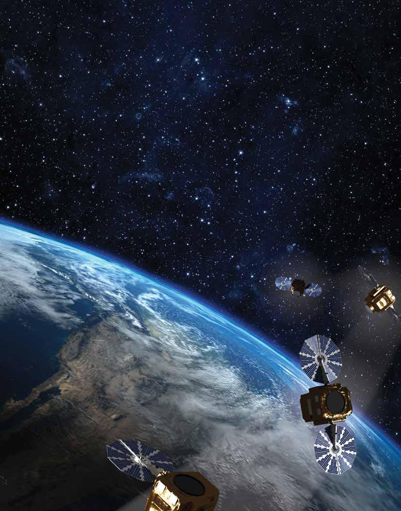
Airbus, Intelligence has delivered on its promise of providing the highest native spatial resolution Earth observation satellite imagery to the commercial market which expands the applications of how and what satellite imagery can be used for.
Pléiades Neo has brought upgrades to the market including a previously unmatched geolocation accuracy and image consistency, which in many ways is just as crucial to many applications as spatial detail. The uncorrected imagery (Primary) has a native accuracy of 3.5 meters
ADVERTORIAL 6 | www.geospatialworld.net | November - December 2022
(m) CE90. In addition, the orthorectified products sold by Airbus boast a stunning 5m CE90 accuracy worldwide. The new constellation provides rapid satellite imagery tasking with enhanced multispectral capacities that make it the most versatile Earth Observation satellite ever built for commercial use.
Completing the Constellation
The four Pléiades Neo satellites each capture 30cm panchromatic and 1.2m multispectral image data at 14km swath widths. Each can collect up to 500,000 km2 per day and up to 7,500 km2 in a single pass. Together, the four will capture 2 million km2 in a single day. The satellites are extremely agile which gives them the ability to slew in orbit to capture imagery at oblique angles. This expands the frequency with which they can collect “revisit” imagery over the same geographic
area on Earth’s surface. With four satellites in orbit, nearly any location on the globe can be imaged at least two times a day, and sometimes three times, depending on viewing angles and latitude. This enables users to monitor rapidly evolving events such as floods, fires, and storms.
Designed with Accuracy and Resolution in Mind
Airbus designed the Pléiades Neo satellites and processing systems from the ground up to capture and deliver the highest quality commercial imagery possible. From the perspective of nearly any geospatial application, especially feature mapping, the accuracy of pixel geolocation is equally important to the pixel resolution. In other words, knowing precisely where a feature is located on Earth is just as crucial as identifying it.
With minimal additional processing, Airbus sells the primary product to customers who perform their own geometric processing. As noted above, the advertised native planimetric accuracy is 3.5m CE90, although most data sets are achieving better results. In addition, a superior 5m geolocation accuracy is achieved worldwide in the Orthorectified image products where geometric distortions have been removed in a processing workflow developed specifically for Pléiades Neo.
To accomplish this, Airbus created a new worldwide database of highly accurate 3D ground control points, called Space Reference Points (SRPs), from archived SPOT 6 and 7 multi-view satellite image stacks acquired over decades of SPOT operations. In addition, the Airbus geometric
November - December 2022 | www.geospatialworld.net | 7
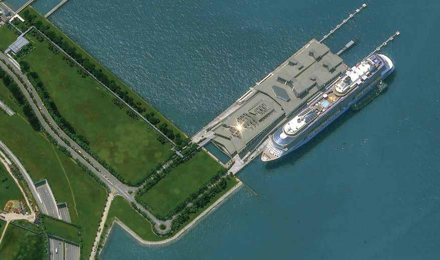
Pléiades Neo 30cm imagery over a cruise ship alongside a dock.
processing workflow uses elevation models from the Airbus WorldDEM4Ortho product database to reach the 5m planimetric accuracy.
Airbus now uses the SRP/ WorldDEM4Ortho geometric processing workflow to generate orthorectified image products for its Pléiades Neo, Pléiades 1A/1B, SPOT 6/7, and Vision 1 Earth observation satellites. This means all Airbus optical ortho images are aligned to the same reference system and are fully compatible with each other for large, multisensor analysis projects, such as
time series change detection. Additionally, inter-sensor compatibility is a necessity for analysis involving Artificial Intelligence.
Available
and Accessible Now
Pléiades Neo data has become an instant hit, due to the combination of spatial detail, geolocation accuracy, and frequent revisit for mapping and monitoring applications in the defense Intelligence, Energy, Agriculture/ Forestry, Civil Engineering, and Maritime sectors.
Customers can also directly task the satellites through the Airbus
OneAtlas Platform in as little as 25 minutes before a satellite passes over an area of interest. An entirely new production workflow can downlink the data from a Pléiades Neo satellite and deliver a finished product to the customer within as little as two hours of order placement – the first truly near real-time imaging capability on the market today.
Contributing to this broad appeal are the advanced multispectral capabilities in the Visible Red, Green, Blue, and Near Infrared portions of the spectrum – as well as two new bands. The new Deep Blue band (400-450 nm) penetrates the water column to deliver insights related to depth and water quality in the near-shore ocean environment, as well as in freshwater lakes, rivers, and streams. Uses have developed hydrologic and bathymetric applications in the coastal zones, including mapping seafloor relief in shallow areas.
The Red Edge band (620-690 nm) is being leveraged to detect subtle vegetative stress in applications related to agriculture and forestry. Sensitive to chlorophyll production in green plants, this wavelength enables users to identify problems in vegetation, such as infestation, poor irrigation, and inadequate fertilization. Red Edge data reveals the stress early in the growth cycle before the human sees it, often before the damage is permanent. The spatial detail of Pléiades Neo data allows farmers and foresters to find vegetative problems in individual plants and trees.
To learn more about Pléiades Neo and other Airbus imagery and data, please visit www.intelligence-airbusds.com
8 | www.geospatialworld.net | November - December 2022 ADVERTORIAL
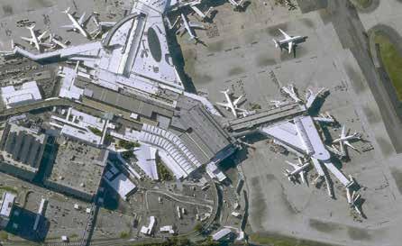
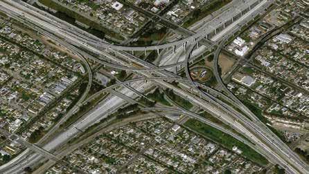
Pléiades Neo 30cm resolution image over Sydney airport in Australia and a major highway intersection in Los Angeles, California.
THE VIEW OF NEW DIMENSION
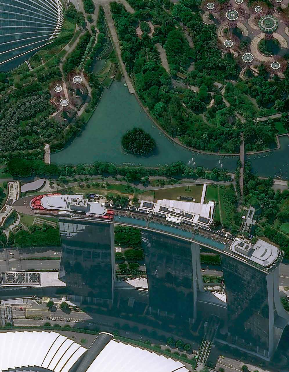
Get a new dimension of insight with Pléiades Neo, a cutting-edge constellation of four Earth observation satellites. Pléiades Neo combines 30cm very high resolution that enables a clear view of objects as small as streetlights, and the ability to perform intraday revisits – giving you operational advantage and unparalleled access to information. With Pléiades Neo, governments, militaries, institutions, and businesses can make the right decisions at the right time – keeping our world safe and beautiful.
airbus.com
SatCen Braces Up For the Road Ahead
The need for a renewed security architecture in Europe has prompted increased reliance on actionable geospatial intelligence, which SatCen remains committed to provide.
By Amb. Sorin Ducaru, SatCen Director
Thirty years ago, European nations decided to establish an autonomous geospatial intelligence analysis capability. The Spanish Government offered to host this Centre in Torrejòn de Ardoz, in the region of Madrid, and SatCen thus became the first European agency in Spain.
For the first ten years of its existence, the Centre functioned as a Western European Union entity, becoming a part of the European Union in 2002. Today, it is the EU's prime provider of geospatial intelligence analysis, as an intergovernmental agency of all the EU Member States.
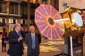
The EU High Representative Josep Borrell (HR/VP) refers to the Centre as the “eyes of Europe”, because “through this Satellite Centre, in Europe, from Brussels, in all capitals, we see what is happening”.
Heightened Security
SatCen's core mission is, in simple words, to provide “security from space” through trustworthy, reliable, timely geospatial intelligence analysis. It also supports “security for space, or in space” through its function as the front desk of the European SST Consortium.
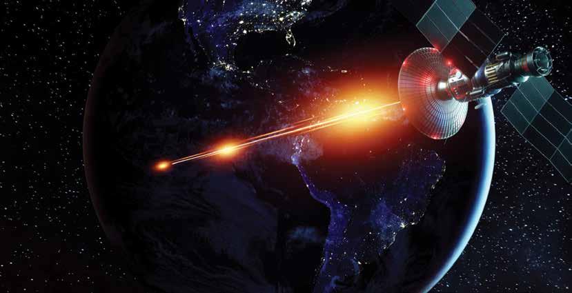
In general, the Centre provides autonomous analysis services for decision-makers in the EU. It supports situational awareness, especially in crisis regions around the world, but also for long-term WMD non-proliferation efforts, humanitarian or crises management missions, disaster relief, refugee contingencies, border security, or the monitoring of irregular migration, to mention just a few key areas of its activity.
The Centre supports EU civilian and military missions across the globe, from the Horn of Africa to
the Sahel, and from the Mediterranean Sea to Georgia. Based on the mandate from the Council of the EU, it also supports international partners such as the UN, the OSCE, and the OPCW.
SatCen maximizes synergies with Commission services and agencies, with EDA and ESA, on activities related to security, defence and space. It is entrusted with the support for external action within Copernicus, the EU's own global, space-based earth observation program.
It was already the original intention at the set-up to provide complex and actionable geospatial intelligence analysis, by exploiting satellite imagery and other relevant data. Today, SatCen covers the full spectrum of European interests, from political planning and operational decision making, to supporting
10 | www.geospatialworld.net | November - December 2022
EXPERT OPINION
external action in missions and operations.
Being one of the few operational entities in the EU working for security and defence, SatCen is an institution shaped by its innovative roots, similar to a start-up. This spirit has survived up to today, keeping SatCen at the cutting edge of technological developments.
Constant Evolution
The key focus in the last years, has been to align the Centre’s evolution with the EU developments and evolving priorities in the fields of space, security and defence. As a result, the volume of activity has increased about 10-fold in a bit more than a decade, with high acceleration, especially in the last four years.
This steep evolution is enabled by rapid technological development. The SatCen analysis work benefits from matured markets with sophisticated supplier services, a drastically increased volume of satellite data with higher resolution from electro-optical sensors and enhanced quality from multi-spectral radar satellites.
The SatCen is gearing-up its development under the influence of three main driving forces: the increased EU level of ambition in the security, defence and space domains; the high user demand and technological innovation. The technological evolution progresses along three main axes.

The first axis represents the automatic extraction of information from satellite images, essential to handle the drastic increase in data volume.
The second axis describes how geospatial intelligence providers and their users access satellite imagery and related analysis products, with secure integrated digital platforms being the service hub of the future.
Finally, the third axis describes synergies between different space systems and technologies from other domains. For example, the new initiative for global secure governmental communication users could enable CSDP teams deployed in remote areas to access analysis services in near-real time. Combined with the geo-localization offered by GALILEO and its Public Regulated Service, new value-added services for final users become possible.
Already today, it is SatCen's special expertise to combine analysis of satellite imagery with complementary data from air and ground sources as well as from open sources. The Centre employs modern Information Technology (IT) and Artificial Intelligence (AI) tools in order to empower and amplify unique human expertise.
Unique Challenges
The new IT tools help to pre-define certain areas of interest, to set up semi-automatic alert services, and integrate first-level analysis from commercial providers and other partners, which in turn help the dedicated specialists to focus on the most value-added parts of the analysis chain.
This way, SatCen manages to provide more, faster, and better analysis to all its customers, improving their situational awareness on the basis of the Centre's operational support services.

Both the COVID pandemic and the Russian aggression in Ukraine have determined the increased use of space-based geospatial analysis capabilities, proving their value in times of crisis, especially when ground access and mobility are severely impacted.
The European Union is increasingly taking over more responsibility for its own security and in the field of defense. The Centre is ready to meet these new challenges and to continue its close and trustful collaboration with its partners. It is our mission to provide comprehensive situational awareness and to match the EU´s increased ambitions in external action, as reflected in the Strategic Compass.
November - December 2022 | www.geospatialworld.net | 11
Ambassador Sorin Dumitru Ducaru is the Director of SatCen. He was selected in June 2019 by the SatCen Board, consisting of representatives of all EU Member States. He is a Romanian career diplomat with a longstanding experience in trans-Atlantic and International Relations and particular expertise in the field of emerging security challenges and the impact of new technologies on security.
Amb. Sorin Ducaru SatCen Director
Scanning has never been this efficient
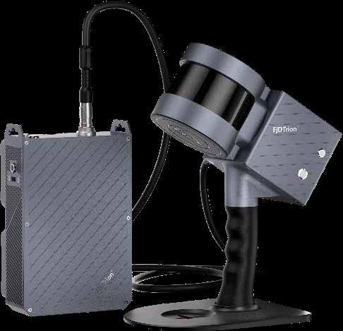
FJDynamics launched Trion S1, the handheld 3D LiDAR Scanner in July this year, providing the industry with a new scanning experience.

Unlike
Real-time Point Cloud
Powered by leading SLAM algorithms, Trion S1 can capture, process, and display accurate point clouds on your phone in real time, assisting you with indoor, outdoor, and underground scanning projects without a GNSS receiver.
Lightweight & Versatile
Weighing 1.8kg only, Trion S1 can be held in your hand, or mounted on drones, cars, or boats for surveying. With hot-swappable dual batteries, it provides an uninterrupted power supply for a consistent scanning experience.
More Accurate
With 320,000 scan points/sec and 0.8-2cm accuracy, Trion S1 can quickly catch high-quality scans. Thanks to built-in LiDAR 3D scanning technology, it allows you to capture precise long-range 3D measurements of complex objects and shapes from up to 120 meters.
Application Scenarios
More Comprehensive
Trion Scan, an app for real-time visualization of 3D point clouds, and Trion Metahub, the point cloud post-process software, tailed with Trion S1 provide a comprehensive scanning experience.
Trion Scan


• Tracks path in real-time
• Visualizes point clouds in real-time

Trion Metahub
• Denoises and colorizes point clouds


• Stitches point clouds, maps shadow, transforms coordinates, and does automatic plane fitting
• Classifies point clouds, produces 2D drawings, and builds 3D models
Trion S1 has been helping surveyors from different industries with efficiency: 10 flights of stairs in 10 mins, 10,000m2 underground carpark in 15 mins, and 18,000m³ coal pile in 19 mins.
FJDynamics is committed to providing ever-accurate, ever-efficient geospatial products to the industry. We are looking for dealers across the globe. Scan the QR code to join us or drop us an email at mkt.global@fjdynamics.com or simply google www.fjdynamics.com/dealer

12 | www.geospatialworld.net | November - December 2022
Terrestrial Laser Scanners (TLS), Trion S1 excels in efficiency, portability, and versatility.
Scan to BIM Pile Measurement Mining Tunnel Forestry Surveying Heritage Conservation Facility Digitalization Indoor, outdoor, and underground without a GNSS receiver PRODUCT WATCH

Indoor 3D Mapping Solving the Last Mile Challenges
The mapping world today is steadily embracing new areas of applications. Providing essential visual images as well as useful data is the natural outcome for each mapping activity. Today, mapping indoor areas with precision and solving the last-mile location accuracy challenge has become a popular area of focus.
Growing popularity of indoor mapping
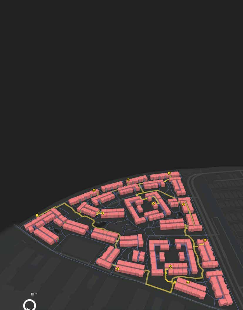
Looking back on the history of mapping, the world outside has seen greater efficiency and accuracy as mapping technologies have evolved. Now is the time to shift focus to mapping indoors. Indoor maps are gaining popularity. They are especially beneficial in situations where people need to locate a very specific location inside a large building - like an apartment complex or office building. For example, when first responders are called to a medical emergency and need a better understanding of the space they are entering to reach a patient in need of urgent medical care.
The reality is that locating a specific address often is not an easy task. This is especially true for Multiple Dwelling Units (MDU) where large apartment complexes have multiple parking areas, entry doors and elevators. While you may be able to get to the right address, that doesn’t guarantee you’ve reached the nearest parking lot or the best entryway or elevator to get to a specific unit quickly. In critical situations where time is of the essence, this presents a potential life and death obstacle.
MAP ZONE 14 | www.geospatialworld.net | November - December 2022
Indoor 3D Mapping
Benefits of 3D Indoor Mapping
California-based company Beans.ai delivers the technology solutions to solve this challenge and reimagine indoor mapping technology. Sri Krishna Hari, Head of the GIS Team at Beans.ai, shared his thoughts with Geospatial World about how their solution “provides the unit level three - dimensional (3D) renderings of apartments, Multiple Dwelling Units and complex addresses.”
According to Murthy, “This allows for easily locating a sub-address in three-dimensional space within a building, essentially allowing geocoding services to operate in this area.”
Head of the GIS Team at Beans.ai

The indoor routing services for apartments across the nation provided by Murthy’s team help users not only know where a specific unit is located within a community but also show them the most effective route to reach the location.
Precise Location Intelligence: Industry Use Cases
Several industries can benefit from precise location intelligence provided by three-dimensional and indoor mapping solutions. Murthy shared, “Logistics companies are one industry that has seen tremendous benefit from our 3D and indoor routing solutions, having faced last mile problems for many years. Difficulty in identifying the unit and lack of detailed routing instructions have hampered the logistics industry at every individual pickup assignment across apartments and MDUs.”
Time is an essential factor in the entire business cost model for logistics companies and such challenges can easily eat into profits. Highlighting their solution Murthy added, “as our partners are tapping into the 3D and indoor routing services we provide, the search element has been eliminated, resulting in a direct bottom line impact, better customer satisfaction and fewer failed deliveries.”
“Route planning and optimization can now be done in a digital framework that replicates the real world in three-dimensional form versus points on a two-dimensional traditional map. Routes and delivery stops can be planned using optimized sequences with the indoor networks across communities also included,” he continued.
The Pandemic Accelerated the Need for Indoor 3D Mapping
The demand for indoor 3D Mapping increased dramatically when the pandemic hit and most of the world started spending significantly more time confined to their own homes. Online deliveries became the lifeline for thousands of people, and the need for accurate location intelligence solutions virtually overnight. Krishna Murthy agrees, pointing out, “with the onset of contactless delivery for food and groceries during the pandemic, the need to provide accurate location and indoor routing services for apartments rose dramatically.”
He further pointed out that the delivery and apartment policies have shifted during the pandemic, requiring delivery personnel to identify units in complex structures and navigate to them to verify doorstep delivery. With millions of deliveries across the nation every day, the demand to map out densely populated areas (such as apartments) has become mainstream.
Solving the Last-Mile Problem Effectively
The Beans.ai team’s location intelligence solution is proving to be useful for many customers. Moreover, the team has been recognized with industry awards and accolades, including the top Creative Content Award at the Esri Partner Conference 2022. In talking about how Beans.ai has innovated in this space, Murthy said, “We developed a complex pipeline based on satellite image processing, machine
November - December 2022 | www.geospatialworld.net | 15
Keeping pace with the rhythm of the world, we will continue to see innovations evolve and more indoor mapping technologies make their way into the location intelligence industry
Sri Krishna
Hari
3D Mapping showing Parking Lot
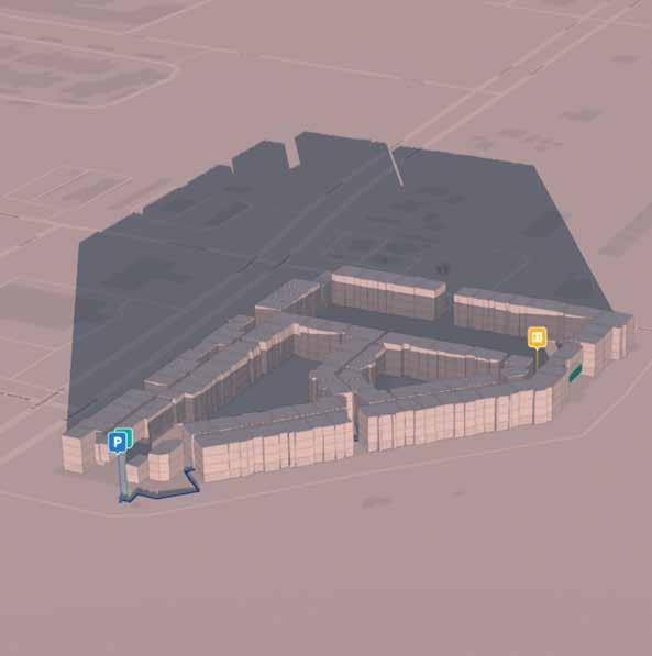
learning, surveying, GIS automation, cartography and three-dimensional routable networks to build realistic representations of traversable paths within apartment communities. This allowed us to provide solutions that can give not only precise geocodes (xyz) of units but also the exact turn-byturn directions to get to them.” This level of precise indoor mapping opportunities have maximized benefits for all users.
Personal Experience Leads to Innovation
Real life challenges have always been the greatest catalyst to creating solutions to solve them. The motivation behind the indoor mapping solution developed by the Beans.ai team is no exception.
Five years ago Beans.ai co-founder and CEO had a family emergency and had to call the paramedics to his apartment. However after reaching the apartment complex the paramedics took far longer to locate the exact unit, losing precious time. Fortunately, everyone in this case was eventually ok, but that isn’t always the outcome. Murthy pointed out the “glaring, critical geospatial layer that was missing and, as a result, Beans.ai was born, with the
mission to solve the problem of navigating complex addresses.
He added, “After countless iterations, manpower and technology innovation, we have now developed a framework that can provide detailed turn by turn indoor routing for apartments, shopping malls, MDUs and any address with secondary units to it.”
Effective Indoor Mapping Solution
Given the demand for indoor 3D mapping solutions, the technology provided by Shri Krishna Murthy’s team has provided a valuable solution for customers. Murthy pointed out “while the data we are creating is exquisite and has the potential to solve many fundamental problems in the geospatial environment, it can be quite complex to implement, analyze and consume the data.”

He shared how their various product features, geocoding services and floor aware maps made available through ArcGIS Online and Enterprise platforms makes it easy for the vast GIS stakeholders to quickly plug in and start using their data. “Similarly, we have designed our indoor and 3D data in compliance with ESRI’s indoors information model. This would allow ESRI users to easily reduce the implementation burden and make it both cost effective and efficient to turn our data into custom solutions.”
Keeping pace with the rhythm of the world, we will continue to see innovations evolve and more indoor mapping technologies make their way into the location intelligence industry.
16 | www.geospatialworld.net | November - December 2022 MAP ZONE
Route planning and optimization can now be done in a digital framework that replicates the real world in three dimensional form versus points on a two dimensional traditional map
Associate
Editor, Americas Rituparna@geospatialworld.net
Rituparna Sengupta
New Age of Maritime Domain Awareness
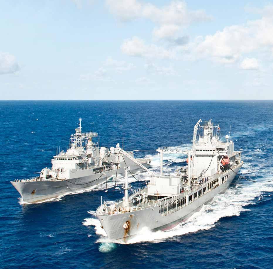
EO and satellite imagery is playing a key role in tracking sea piracy, dark vessels and other illicit activities that cause ecological imbalances, posing a threat to oceanic sustainability.
By Sachin Awana
Waterways have always played a crucial role in boosting trade and commerce, securing national borders, and expanding political heft. Dominance of oceans across the globe has always been a point of contestation. Historically,
seafaring powers were the first to explore and conquer vast swathes.
With the advent of globalization and spiralling trade, there has been a rise in sea piracy and other illicit activities. Population explosion globally has coincided with
changing consumption patterns and other social and behavioural shifts, leading to a massive increase in demand for fishes, especially in China. This has led to illicit fishing by dark vessels across the globe, endangering oceanic biodiversity. Another issue has been the increase in smuggling of narcotics and other contraband.
This brings the need for a system that can monitor the ships. Spanning hundreds of miles, sea territory can be intimidating and out of bounds for manual monitoring. Thus, giving an opportunity for a space-based arrangement that can scan the surface area of the sea to detect any illegal sailings.
Maritime Domain Awareness (MDA) is an umbrella term for monitoring sea-related activities.
COVER STORY November - December 2022 | www.geospatialworld.net | 17 TIGHTENING THE NET
It is defined as all areas and things of, on, under, relating to, adjacent to, or bordering on a sea, ocean, or other navigable waterways, including all maritime-related activities, infrastructure, people, cargo, and vessels and other conveyances, as explained by Dr. Christian Bueger Profesor of International Relations, University
of Copenhagen in his paper ‘From Dusk to Dawn: Maritime Domain Awareness in Southeast Asia’.
“Space-based earth observation does not replace terrestrial systems but does make them substantially more effective and is a significant start to fulfilling the core need of knowing who is where on the
world’s waterways,” said Guy Thomas, Co-founder, C-SIGMA.
“The potential contributions of space-based Earth observation systems to maritime awareness is of growing interest to the world’s naval and law enforcement forces, as well as to environmental preservationists, and commerce, maritime, environmental protection, and disaster preparedness governmental ministries.”
Ship brokers, and others with an interest in the marine domain, are also interested in it, however, there is a lack of coordination for maximizing the capabilities. .
EO imagery has been useful in classifying the type of vessels involved, but it is not a feasible means of surveillance in cloud-covered areas. Similarly, synthetic aperture radar (SAR) has had limited use due to the times of imaging (6AM and 6PM) and its relatively small coverage area. The latest tool for satellite surveillance, radio frequency (RF) detection from marine radars, is already much more effective in detecting commercial fishing vessels conducting IUU fishing.
With a single coverage area spanning up to 700km, monitoring restricted zones have become much easier. This allows maritime authorities to not only interdict, but also discourage national fleets from attempting to engage in IUU activities.
The AIS
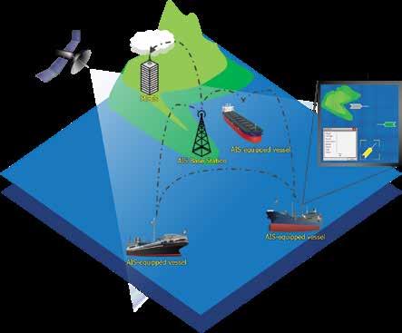
Since its inception, the Automatic Identification System (AIS) has been used as a public broadcast system to identify collisions at
18 | www.geospatialworld.net | November - December 2022
COVER STORY
Overview of the Automatic Identification System (AIS).
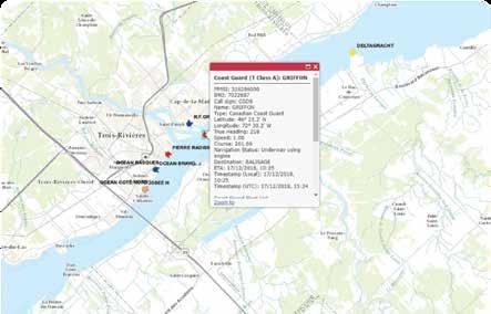
Example of AIS information displayed for a vessel carrying a Class A AIS device.
Picture by Government of Canada Picture by Government of Canada
sea. However, while expanding its capabilities, many organisations stepped forward and added features that would help track dubious activities.
A technology sophisticated enough to give respite to marine security around the world, the AIS proved to be the flagship data procurer for maritime domain awareness agencies. However, there are different technologies within the sub-group of AIS.
Companies such as ORBCOMM, HawkEye 360, and UnseenLabs are innovating these technologies, especially the AIS to make it more efficient and accurate. Organisations like the Global Fishing Watch are furthering the cause of maritime safety by intervening through pre-existing technologies.
Spoofing AIS
There is still a lot to be done in making AIS more reliable as it has been easy to spoof it and create a proxy location for illicit exercises. This is witnessed as many sanctioned countries barred from trading oil or fishing in Economic Exclusive Zones (EEZs) are using AIS to project their initial locations, only to turn off the system and enter forbidden zones. These vessels are known as ‘Dark Ships’.
They have been on the rise throughout the world, with China leading the way in collecting hundreds of ships that sail around the world. Since the RussiaUkraine war, Moscow has also assembled a fleet of over 100 ships that will carry out trade and fishing around the world, as per the Financial Times.
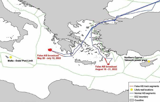
Recently, Russia’s Kapitan Schemilkin was found spoofing its AIS and creating a proxy location. It was sailing off to Greece with barrels of oil but was later seen at Northern Cyprus and Malta.
There are a number of ways in which AIS can be made more efficient and accessible, yet, the complexity of the entire system trumps the efforts driven by many corporations.
Explaining the methods that can be incorporated to make AIS more accessible and relegate spoofing, ORBCOMM’s Business Development Manager, Art Ramirez said, “While cost is often cited as a concern, there are a number of low-cost AIS devices now available for both commercial and artisanal fishers. However, a comprehensive national program, backed by government leadership, is required to ensure compliance with an AIS mandate and succeed with this type of effort.”
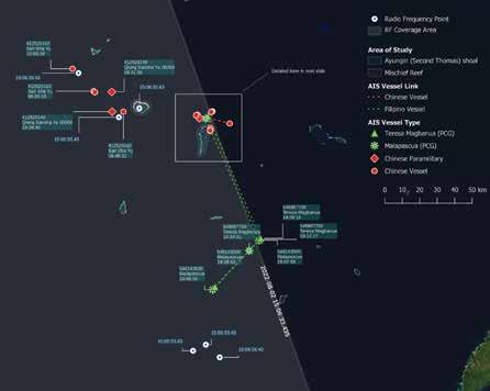
Ayungin (Second Thomas) Shoal, West Philippine Sea. 02 August 2022 — The Philippine Coast Guard’s BRP Teresa Magbanua (MRRV-9701) together with BRP Malapascua (MRRV 4403) safely escorts the reprovisioning boat M/V Unaiza Mae 2 as the latter replenished supplies, medicine and other essential welfare-sustaining support to BRP Sierra Madre LS57. Due to security reasons, only the Philippine Coast Guard vessels transmitted their AIS positions. However, all three vessels were detected using their marine radar RF emissions, as shown on the image above.
“Spoofing AIS is, in fact, a significant indicator of unsanctioned behaviour. Many maritime authorities analyse AIS historical data to identify vessels of interest. The list of such vessels is subsequently monitored with both AIS and remote surveillance to
November - December 2022 | www.geospatialworld.net
| 19
There are a number of ways in which AIS can be made more efficient and accessible, yet, the complexity of the entire system trumps the efforts driven by many corporations
©2022 ORBCOMM Inc.
interdict or prosecute offending vessels,” he added.
Art further explained that ORBCOMM is trialing a low-cost, battery-powered, dual-mode vessel tracking device while using both AIS and satellite IoT connectivity services with some marine authorities around the world.
“There is also an obligation to develop very low-cost trackers for small boats which do not venture very far in to the sea and link them to a shore based monitoring system”, said Rear Admiral Dr. S Kulshrestha.
“There is a need to subsidise AIS for fishing fleets which sail out together, the smaller boats could be equipped with a tracker linked to the mother boat which could be equipped with a low-cost AIS. In this manner the fishing fleet along with its boats could be located at all times,” he added.
Recently, China has been relentlessly gauging across the South Asian sea zone with its newly found naval strength. Reports have shown Chinese vessels entering exclusive zones in unauthorised manners, taking advantage of the loopholes in the MDA system. HawkEye 360, a satellite monitoring company has come out with multiple studies that track the movement of Chinese vessels, which then turn into dark ships.
China’s Oceanic Adventurism
An increasingly assertive China looks to tighten its hold on territories across the globe. The perks of having control over oceans are endless, and all major economies recognize it. Perhaps, China recognizes it more than any other at the moment.
With a growing population, the need to feed over 1.4 billion people every day is undoubtedly a herculean task. The demand for seafood and its scarce availability puts
extra burden on China. Incidentally, it also gives Beijing an incentive to expand its sea territories.
The job of expanding sea boundaries is easier said than done, and often many countries retort to breaking international laws and treaties set in place by mutual agreement of multiple nations. In a similar unruly fashion, China is using all its power to dominate the important sea territories across the world.
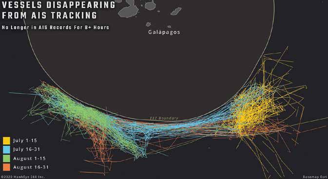
From fishing illegally to exploring restricted water zones, Chinese vessels are roaming around the world. Currently, China is responsible for 85% of the Illegal, Unreported, and Unregulated (IUU) fishing across the world.
“IUU fishing is a growing concern not only because of the impact that depleted fish stocks can have on the local population’s food resources, but also because of the economic
20 | www.geospatialworld.net | November - December 2022 COVER STORY
Image and analysis courtesy: HawkEye 360
Chinese vessels seen fishing outside the EEZ zone of Galapagos.
losses to the country and higher likelihood of modern-slavery labour conditions,” Art Ramirez said.
What is enabling them to do so? The Dark Ships. As per the mandate by International Maritime Organization, 2004, all the ships around the world are required to carry the AIS and send data periodically to other ships and coastal guard authorities.
According to a report by Financial Transparency Coalition, among the top 10 countries involved in IUU fishing, 8 belonged to China with a total of 233 vessels. The data was collected from 2010 to 2022.
“Of the 972 identified vessels suspected or reported to be involved in IUU fishing, flag information was available for 696 of them, representing 72 percent of the total,” the report said.
India's Containment Efforts
In the Indian Ocean alone, more than 200 Chinese fishing Vessels have been monitored in the first half of 2022, according to the Indian Navy. Most of the illegal vessel activities were found to be in the Northern Indian Ocean Region (IOR) and were fishing in the Indian Exclusive Economic Zone (EEZ).
An Exclusive Economic Zone or EEZ is an area on the sea where adjacent countries have special rights to explore and use marine resources that span approximately 137 million square kilometres across the world. The need to protect these areas come naturally, as resources as scarce and the demand is inevitably high.
To curb the illegal Chinese
efforts, the Quad group, consisting of Japan, Australia, India, and the US announced the Indo-Pacific Maritime Domain Awareness (IPMDA), in May 2022. It aims to provide near real-time imagery of the activities happening in the region. All the movements are currently monitored at the Indian Navy’s IMAC and the Information Fusion Centre-Indian Ocean Region (IFC-IOR), both located in Gurugram.
As of now, there are two main regulations on IUU that operate globally; The Cape Town Agreement and the Agreement on Ports State Measures. India has not signed either of these agreements.
“The mitigation of risks associated with supply chains across the oceans may need a constant uninterrupted flow of reliable information. This would have to be managed between the state and private enterprises since the benefits would accrue to both”, said Admiral Kulshrestha (Retd), Indian Navy.
“This in turn would need a whole range of sensors which would be based upon platforms like satellites, aircrafts manned and unmanned, surface installations or those located undersea. The need to process this flow of information into actionable data would require special purpose vehicles”.
Where Does the Future Lie?
The history of Maritime Domain Awareness dates back decades, but a technological advancement in recent years has catapulted its reach and efficiency like never before. This gives a positive outlook to marine security and organisation. With innovations
The Galapagos Islands are 900km away from the coast of Ecuador. This gives the extent of Chinas dire need of fishing.
coming in every year, it is a matter of time before oceans would be as secure as some countries’ borders. However, it won’t come easily.
With the addition of future technologies such as Artificial Intelligence (AI), Machine Learning (ML), and 5G, an ambitious lineup of innovations can be seen on the cards. The amalgamation of these different technologies with each other is yet to be seen, though.
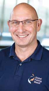
“We see a future where 5G, LoRa and low-cost satellite connectivity makes all points on the planet connected all the time. This means very low-cost tracking devices and continuous coverage is possible, along with collecting rich data from vessels at sea” said Tony Long, CEO of Global Fishing Watch.
“This means that compliant vessels will be increasingly visible in maritime monitoring systems, causing non-compliant vessels to stand out more readily when they are in areas where they can be directly observed”, he added.
Sachin Awana
Sub Editor sachin@geospatialworld.net

November - December
|
| 21
2022
www.geospatialworld.net
Picture by HawkEye 360
Tracking Dark Vessels
EO and geospatial intelligence plays a key role in thwarting illicit maritime activities, promoting sustainability, accountability, and transparency.

A conversation with Tony Long, Chief Executive Officer, Global Fishing Watch
Recently, a Russian oil tanker, Kapitan Schemilkin, was found spoofing its Automated Information System (AIS) to create a proxy of its location. The 138-metre-long oil tanker made two trips using illegal techniques which are pioneered by Venezuela and Iran, as both countries are barred from exporting their oil.
Global Fishing Watch (GFW), which detected it, further revealed that Russia has amassed more than 100 tankers in order to build an alternative pathway to the oil sanctions imposed by the US amidst the war with Ukraine.
GFW used European Space Agency’s radar satellite imagery to display that the Kapitan Schemilkin was deliberately miscommunicating and was not travelling on its designated routed. The ship was claiming to be sailing off to Greece, but its signals were depicting a location in the wrong part of the Mediterranean. It was also pictured near the shores of Malta and Northern Cyprus.
Launched in 2016 by Google along with Oceana and SkyTruth, GFW provides a comprehensive view of commercial fishing across the world. It also partners with leading global research institutions, NGOs, and governments, to promote maritime
22 | www.geospatialworld.net | November - December 2022 INTERVIEW
The suspicious journeys of the Kapitan Schemilkin.
transparency and foster oceanic sustainability.
Automatic identification systems (AIS) is a crucial technology in tracking vessels around the world. Currently, only two percent of all vessels carry AIS. What can be done to increase the number of AIS devices?
The International Maritime Organization Convention for the Safety Of Life At Sea Regulation V/19.2.4 requires all vessels greater than 500 gross tonnage (GT) (irrespective of where they operate), all vessels of 300 GT and above on international voyages and all passenger ships, irrespective of size, to operate AIS. This is the only international mandate and leaves far too many vessels not required to operate AIS. That
said, many countries and regional bodies are mandating the use of AIS as a condition of flying their flag or operating in their waters. The European Union, for example, requires AIS on fishing vessels down to 12 meters. Nigeria, Indonesia and Taiwan are among the other countries that mandate the use of AIS.
While regulations are one very direct way to increase the fitting and operation of AIS, it can be encouraged in several other ways.
For example, buyers could require AIS throughout their supply chain, which would help them conduct proper due diligence and act as a significant deterrent to IUU fishing. Owners and buyers could benefit from the insights provided by AIS, helping
them demonstrate corporate responsibility in areas such as working conditions and safety –we’re testing if our AI models can indicate a risk of bonded labor or poor working conditions on fishing vessels. Financial institutions could require vessels to be fitted with AIS as a condition of insurance, and/or as a condition of financing.
As well as bringing the benefits of safety and improved compliance, AIS is cheaper to fit than alternative tracking systems. Class B systems – intended for vessels that aren’t required to use AIS under SOLAS, such as pleasure crafts and smaller fishing boats – are much cheaper, though they provide limited functionality. It’s important to keep costs as low as possible to encourage more vessels to fit AIS.
November - December 2022 | www.geospatialworld.net | 23
Image: ©Global Fishing Watch
TOOLS FOR UNREPORTED FISHING
Satellite imagery can reliably detect the presence of vessels around the world, and we work with a variety of sensors which have different strengths and weaknesses. This includes:
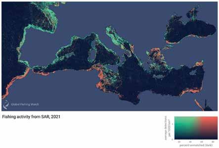
Synthetic Aperture Radar (SAR) – We will be analyzing every maritime acquisition made by the Sentinel-1 mission, identifying vessels which are not broadcasting an AIS signal and publishing this information to the world for free. We also co-hosted the X-View 3 competition to help find an open source algorithm which would better identify if a vessel seen in Sentinel SAR imagery is fishing or not. Additionally, we will be analyzing many years of SAR imagery from the Radarsat-2 satellite thanks to the generous support of our partner MDA, a leading provider of advanced technology and services to the rapidly expanding global space industry.
detecting false position data in the AIS used by ships. Some of these false positions result from GNSS interference.
How do you see maritime monitoring technology innovating and expanding in the future?
Optical Imagery – We will also be analyzing every acquisition made by the Sentinel-2 mission. While optical imagery is limited by cloud cover, it has the potential to provide additional information to help better identify vessel types and activity.
Key advances will be in the types of transponder that can be fitted. In smaller vessels, systems like Pelagic Data Systems are using mobile phone technology and the mobile network. Systems like CLS Nemo are developing more traditional vessel monitoring system, or VMS, models to make them more useful and sustainable in smaller vessels.
Radio Frequency (RF) – Several new constellations are tracking the emissions from various electronic systems vessels use in operations. These sensors have the potential to survey large swaths of ocean at a time and detect vessel presence relatively cheaply. They also could potentially be used to uniquely identify or “fingerprint” specific vessels based on the characteristics of their emissions.
It is difficult if not impossible to completely stop transponders from being manipulated. This is difficult to do, probably impossible. Signals can be manipulated on board a ship or remote from it and AIS can also be simulated – so you don’t even need a ship to create false positions and tracks!
To tackle spoofing it is vital to be able to recognize when
it is happening. If an analyst, or machine learning, can spot tampering then manipulating the AIS signal, instead of hiding a ship's activities, simply highlights them. It’s a clear flag indicating the intent to deceive and therefore warrants deeper investigation.
Global Fishing Watch is working with the U.S. Defense Innovation Unit of the Department of Defense on a project called “HARMONIOUS ROOK — Situational Awareness for Intentional Disruption of Global Navigation Satellite System (GNSS) Users. Our work is focused on
What is very likely is that trackers will get smaller and cheaper, or will be 'leapfrogged' altogether by mobile phones and satellite internet applications. It is also quite reasonable to say that a new technology will emerge that we can’t even imagine yet, such is the speed of advance in this area. For example, could a QR code printed on a vessel be detected and read from space?
Away from vessels allowing themselves to be tracked, we're likely to see advances in the detection of radio frequency. UnseenLabs and Hawkeye 360 lead the way in the development of this system, which has the advantage of working in day, night, poor weather, through clouds and bright sun – all of which impact other systems to some degree.
Illegal fishing has been on the rise as demand keeps rising yet the supply is falling short around the world. This incentivises fishing vessels to
24 | www.geospatialworld.net | November - December 2022 INTERVIEW
What is very likely is that trackers will get smaller and cheaper, or will be 'leapfrogged' altogether by mobile phones and satellite internet applications
It is relatively easy to tamper with or spoof the AIS.. What are the possible ways of preventing or minimizing the spoofing of AIS?
engage in illegal, unreported and unregulated (IUU) fishing. Is there a way to track and prevent such illicit activities with earth observation and satellite imagery?
The most important technology for tracking what vessels are doing at sea are systems which rely on vessels willingly broadcasting their positions using transponders. These include both open systems such as the automatic identification system (AIS) information that drives much of what Global Fishing Watch does, and the typically more closed systems such as vessel monitoring systems (VMS). One of our primary policy objectives is opening these VMS systems to the world and making the associated fishing activity they track more transparent.
The type of IUU fishing you ask about is generally behavior vessels wish to obscure from the world. These actors may not be visible on AIS or VMS systems, which can be disabled or manipulated by those wishing to hide. Global Fishing
Watch is working on several approaches to gain a better understanding of what is missing from these voluntary systems.
Detecting presence and activity is one part of the problem, but to your question, it is important to note that IUU fishing is really three different categories of fishing activity. For something to be ‘illegal’ it means a vessel is not adhering to a relevant legislation or regulation or a local or regional authority does not exist. We work at a global scale and do not track this at a granular enough level to generally assign legality to activity.
Similarly with ‘unregulated’ fishing, we do not attempt to map regulations to activity at scale. We do compile an aggregated list of known vessel fishing authorizations published by regional fisheries management organizations, but they are far from comprehensive and often out of date.
‘Unreported’ fishing, on the other hand, implies vessel activity
which is not being reported at all. We believe all fishing should be reported. This is a key pillar of transparency and better ocean management. Our focus on finding dark targets and improving information about vessels not broadcasting on cooperative systems can be seen as a way of helping to address this aspect of IUU fishing.
What would be the impact of 5G-led near real-time connectivity and the massive increase in analytics due to AI and machine learning to thwart sea piracy and keep maritime trade safe?
We see a future where 5G, longrange radio (LoRa) and low-cost satellite (e.g. Starlink) connectivity
MAKING AIS ACCESSIBLE
Access to Market
A mandate by the port State or market State such as the EU
Requirement of the supply chain; buyers can require as part of improved due diligence
Demonstrate sound working conditions and safety
Access to fisheries resources (Exclusive Economic Zones)
A mandate by the coastal or flag State
As a condition of insurance
As a condition of finance
Reduced costs
AIS is cheaper to fit than other alternatives and brings the benefits of safety as well as improved
INTERVIEW
make all points on the planet connected all the time. This means very low-cost tracking and continuous coverage are possible, along with collecting rich data from vessels at sea. Compliant vessels will be increasingly visible in maritime monitoring systems, causing non-compliant vessels to stand out more readily when they are in areas where they can be directly observed.
For non-compliant vessels, it will be increasingly difficult to remain untracked and undetected. Satellite remote sensing can detect radio frequency emissions from communications devices and navigation radars being used on non-compliant

vessels, allowing them to be identified and tracked. Cargo and other shipping vessels are beginning to install localized sensors with satellite backhaul that have the potential to turn every compliant large vessel into a localized remote sensing hub.
AI and machine learning will turn the resulting flood of data into actionable insights, pulling out specific behaviors that indicate the presence of non-compliant vessels, as well as detecting patterns of risky behavior from superficially compliant and trackable vessels.
This stream of AI produced intelligence will be increasingly
available to vessel operators in real time, at sea, as well as to enforcement and management authorities. We can expect that in just another decade or two the scope for piracy and other lawless activity at sea will be dramatically reduced.

If the bearer of the information is increasing the footprint or amount of data that can be carried, that will help.

Low altitude systems such as OneWeb will allow for global internet coverage and are likely to play an important role in the sharing of vital data.
YOUR OFFICE, ANYWHERE.
Mesa Pro Rugged Tablets are built-to-order in the United States. From processor to storage, each tablet is configured by us, for you. Core benefits include an all-day battery life, ultra-rugged design, sunlight-readable 10-inch display, extreme processing power, and unmatched support. Rain or shine, it’s working when you are. Now available! For more info contact us today. junipersys.com | sales@junipersys.com | 435.753.1881

 Interviewed by: Sachin Awana




GW EVENTS SHARE • ENGAGE • LEARN Come join us in our mission of “Making a Difference through Geospatial Knowledge in the World Economy and Society”. www.geospatialworld.net Save The Dates 6-8 March 2023 California 4-5 May 2023 Rotterdam April 2023 New Delhi September 2023 Washington D.C. 2-5 May 2023 Rotterdam November 2023 Hyderabad INDO-PACIFIC
Collaborative Spirit, Diverse Ethos to Spark Innovations
As the utility of GEOINT increases, there’s a need to foster broad collaboration, get actionable data, and encourage truly representative diversity.
straightforward. But it is not. There are layers of challenges we face when trying to share our data with our partners: licensing; national priorities; vendors maximising profit; different systems; and, of course, the large size of the data we want to share.
Our remit has become global, and response time has decreased. We are gathering, processing and analysing data on larger areas of the Earth than ever before, and no single agency or company can do it all. Collaboration is critical to maintaining coverage and currency of geospatial data on a global scale.
AGO is working to de-conflict our commercial imagery and data purchasing across Australian agencies and with our international partners. Our aim is to achieve open and shareable licensing arrangements that meet our needs, and avoid duplication of effort with partners and industry. I realise this is inimical to those who are in the business of selling data. But if I can’t share your data with my close partners, I will look to buy it from somewhere else. Working from the same data is a priority for AGO and our partners. If you get on-board with us early in this journey, we can design a system that works for us and for you.
GEOINT has today become crucial to senior decision makers and militaries, who heavily rely on geospatial capabilities to meet their requirements.
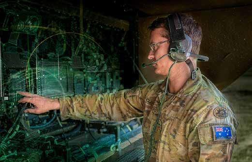
At the Australian Geospatial-Intelligence Organisation (AGO), we deliver GEOINT to help decision makers prevent the next war, and ensure we are postured to respond in the event we find ourselves
in a conflict. To ensure we can continue to meet our leaders’ expectations, AGO is focused on three lines of effort.
Three Lines of Effort Collaboration
For supporting and defending the global order, democracies will often be working together in coalitions. So it appears simple that all coalition partners would all be using the same data. This sounds
Data
Data is growing exponentially. We all know this. Our challenge is to collect, process, store, analyse, move and disseminate the right data to the right people, at the right time. The cost of storing and sharing huge amounts of data will become prohibitive. We will need to become better at collecting, storing and sharing only the data we need. The acceleration of Australian
28 | www.geospatialworld.net | November - December 2022 EXPERT OPINION
By Linda McCann
Defence capabilities is increasing the pressure on us to resolve these issues quickly, which we’re capable of achieving by working together.
Automation and machine learning (ML) is a key part of our business now and into the future. Having excellent artificial intelligence (AI) tools will be increasingly critical for us, as it will not be possible for humans to make all the decisions about our data. But the process of building the AI and ML tools is labour intensive up front, which leads me to the third and most important thing we need to get better at across our industry. Attracting, recruiting and retaining the best people.
People
Collectively, we are investing billions in bigger and faster capabilities. But we need people to make the most of these new sources and volumes of information. Many of us are operating in economies of full employment – in Australia, we have the lowest unemployment rate (3.4%) in nearly 50 years. This means we need to attract the best people into our industry, and work hard to keep them.
Geospatial professionals are in short supply. We need to offer excellent career opportunities and working conditions. We need to attract from the broadest cross-section of the population and invest in pathways from schools and universities to a geospatial profession. We need to scrutinise our diversity and inclusion practices around neuro-diversity, ethnicity, gender, gender identity, age and sexuality, to ensure we aren’t unconsciously excluding whole groups of potentially brilliant GEOINTers.
We often use gender as a quick litmus test of diversity as it can be easy to see. For example, I attended the Defence Geospatial Intelligence (DGI) conference in London in February this year and was struck by how few women were there. With more than 20 years in Australia’s Defence Department, I am used to being the only woman in the room. But at a conference of over 600 attendees, there were only a handful of women. I had a young, junior female member of AGO with me, and I was conscious she would have struggled to see herself in the industry leadership that was on display over those couple of days. I expect there was limited diversity in other areas, but that can be more difficult to discern.
Of course, this is not unique to DGI. It is representative of our industry. Ignoring whole sections of the population and continuing to recruit in our own image is like fighting with one hand tied behind our back. Why would we limit our access to the best brains, the best innovators, and the best leaders? In the intelligence business specifically, a homogeneous workforce is not a recipe for success.
We need genuine diversity of thought, background, approach, expertise and skills, to arrive at assessments that have been appropriately contested. The sort of innovation we need to keep pace with emerging tech can only be
achieved by a diverse workforce.
There is a temptation to think we have years to work on these challenges and that we can kick this can down the road. We do not, and we cannot. We need to build strong partnerships now. We are in this together. GEOINT agencies rely heavily on the geospatial industry for capability, expertise and capacity. The more closely we work together, the better our mutual outcomes.
Our priorities are clear: we need an industry that can help us achieve national security objectives, an industry that is capable, responsive and trustworthy. Together we can deliver this through diverse workforces, and building genuine partnerships.
People will always be the critical factor. The skills we need to take full advantage of our emerging capabilities are in demand across the world. We need to be an industry of choice, fairness and opportunity.
Linda McCann
Assistant Secretary, GEOINT Mission and Engagement, Australian Geospatial-Intelligence Organisation
Linda is an Exec at the Australian Geospatial-Intelligence Organisation (AGO), and a member of Australia’s national intelligence community. Linda led the organisation from July 2021 to March 2022 between substantive Directors. Her current role is Assistant Secretary GEOINT Mission and Engagement. She has been with the Australian Department of Defence since 1999, working across intelligence, policy, corporate, international engagement and operational roles.

November - December 2022 | www.geospatialworld.net | 29
To take full advantage of our emerging capabilities are in demand across the world. We need to be an industry of choice, fairness and opportunity
Remote Sensing for Community Development in Asia and Beyond
Since its inception in 1975, RESTEC has been mandated research and development in Earth Observation (EO) to help relevant knowledge dissemination, not just in Japan, but overseas as well.
It has been long associated with Japanese government efforts to develop technologies to observe the earth from space and design solutions to pressing challenges such as climate change and disaster mitigation.

RESTEC also works to further capacity building in Asia, Africa, Latin America and other developing countries, assisting in the implementation of programs for businesses and governments alike.
“In Japan, the local areas are competing with each other. The situation might be a bit different between India and Japan, but we are serious in making the remote sensing technology available to the community for a wide variety of needs”, says KANAME IKEDA, President, Remote Sensing Technology Centre of Japan, (RESTEC), and former Japanese Ambassador to Croatia, in an interview.
What are the upcoming remote sensing projects in Japan and what are the key areas that you are working on?
Global warming is quite an urgent subject for us and we are associating our effort with that purpose as well as the SDGs, which is another subject internationally. We are keen to work with governments in Africa to help somehow enforce the activities, for the protection of wildlife.
We are working on the research and development of remote sensing and dissemination of the outcome. In this effort we need to be self-sustainable. So while engaged
A conversation with KANAME IKEDA, President, Remote Sensing Technology Center of Japan, (RESTEC)
INTERVIEW 30 | www.geospatialworld.net | November - December 2022
partially like a company, we have both mandates, for the business and public parts to head to government effort.
We find our stance as a public corporation, how we are serious in the capacity building, in other words, knowledge sharing with developing countries like Africa or Asia and Latin America as well. It's not for profit, it's for public welfare and also our common objectives.
Please tell us about your relation with Japan Aerospace Exploration Agency (JAXA)?
Our organization is basically associated as a public corporation to help JAXA's effort in developing the technologies for observing Japan through satellite. Even now a good number of our colleagues are working directly with JAXA, at the Tsukuba Space Center. A lot of our work is devoted to their support, not only in providing
staff but also in calibration and validation of the data obtained from their satellites for a variety of needs.
That's how I introduced the example of GSMaP for precipitation and also GOSAT (The Greenhouse gases Observing SATellite: "GOSAT", launched in 2009). It's an effort to scan the worldwide tropical rain forest and so on for a variety of needs. So that's how
November - December 2022 | www.geospatialworld.net | 31
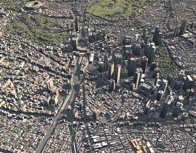
AW3D is a brand of satellite-based 3D digital map, which is co-produced by RESTEC and NTT DATA. The dataset has been used for 3,000 projects in 130 countries for climate simulation, disaster management, 5G telecom optimization, renewable energy development, etc.
Credit: ©NTT DATA Corporation, Included © Maxar Technologies,Inc.
we are still deeply associated with JAXA's efforts.
JAXA is an organization for research and development and our mandate is to work between national research institutes, the public, companies and so on.
They provide the additional effort to disseminate the results of research and development and our mandate is not only to help in their research and development, but also to further support the dissemination of the outcome of the effort to the benefit and welfare of the public. We find our missions in working between the government and private. We are also encouraged to work with the business communities, not just the private entity.
opportunities. Because society itself is changing and our mandate is to make remote sensing as an infrastructure to be used community wide, therefore not only by the Ministry of Agriculture but also by the Ministry of Transport and other industries as well.
Another aspect is that we are vulnerable to natural disasters in many ways, and Japan’s almost all infrastructures, highways, and railroads are more than 50 years old. So they need to be strengthened for necessary resilience. That's why monitoring and the control of the infrastructure is a big task, where, we have to best utilize space technologies, in this regard. So the government sector is our primary client in Japan.
Which countries do you work with and how do you help them?
on a similar case that took place in Peru, and Latin America. We are providing technical support in helping them in such efforts.
Can you please say something about the use cases in terms of disaster management and fishing?
Our staff is heavily engaged in the operation of the so-called Sentinel Asia program to mobilize satellites and use the imageries in case of disaster at any place in Asia for instance. And then they're working to help the operation of JAXA.
We are working with other countries to help them with the analysis of satellite imagery and provide them necessary reactions using the analysis to mitigate disaster and fishing related issues.
What are your plans for collaboration with India?
In regard to the technologies like EO satellites or drones, our mandate is to help the business communities to get interested in it and to be active in providing various services to the communities with their needs.
Engagement related to the government is not only limited to space agencies like JAXA but also the Ministry of Environment, the Cabinet Office, who would like to best utilize the technologies and
For instance, we have worked with Brazil, they are so keen to protect their tropical rainforest against illegal logging. And we help them to master the technology using a satellite with Synthetic Aperture Radar (SAR) sensor, which has the ability to penetrate the rain clouds and can even function during night-time.
They could monitor the forests and keep a check on illegal loggers, which eventually reduced the deforestation done by illegal logging. Besides, we also worked
During my short stay in India in November, I had the chance to listen to the ideas of the company that specialize in LIDAR technology like Geokno India as well as the Minister of Forestry, where people are really concerned about how they could manage the forest here in India.
This is a good occasion for us to learn how you have managed such issues and about your plan considering Japan also faces similar situations.
We would like to deepen our understanding of the area for our collaborations to further our services to the needs of the community.
32 | www.geospatialworld.net | November - December 2022 INTERVIEW
How do you support startups and private sector companies in Japan, and who are your main clients?
Interviewed by: Nibedita Mohanta
We are working with other countries to help them with analysis of satellite imageries and provide them necessary reaction using the analysis to mitigate disaster and fishing related issues
Situational Awareness in War and Peace
Geospatial intelligence has given a boost to near real-time situational awareness for a wide range of applications, ranging from defence to mobility. Be it the protracted conflict in Ukraine, or enabling connectivity in remote terrains, geospatial boosts situational awareness. By Aditya Chaturvedi
Donald Rumsfeld’s now memorable quip about the ‘known knowns, known unknowns, and unknown unknowns’, uttered
during the Iraq War in 2003, expresses the forever looming risk of extreme uncertainty and precarity in indecipherably complex situations and vola-
tile events. Paradoxically, the unheeded statement has become a cautionary fable on the ‘limits of hard power’ and short-sightedness of perilous entanglements.
Decades before Rumsfeld, and in a similar context of Iraq, when the French philosopher Jean Baudrillard provocatively said ‘Iraq War didn’t happen’, he was referring to a phenomenon of simulation & simulacra – of reducing complex, vast events to a representative totemic image, which rapidly captures the public imagination, but often gives a deceptive picture that’s far from reality.
Over the years, gaining incontrovertible insights into any situation has become more
IN-FOCUS November - December 2022 | www.geospatialworld.net | 33
difficult, but thanks to technological advancements in mapping, data analytics, and the power of satellite imagery and geospatial, a high-resolution visualization of on-ground situation can be obtained.
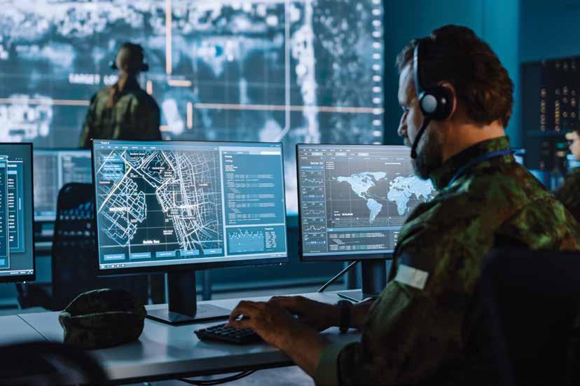
Broadly speaking, situational awareness refers to the ‘perception of environment’, which can be categorized as assessing the situation, taking stock, and gauging the impact. It starts with information gathering and then goes onto gaining insights and using them for modelling and projections for timely anticipation and effective decision-making.
In a fast-changing, interdependent world with cascading domino effects and spillovers expe-
rienced afar, the need of geospatial situational awareness for preemptive measures, planning, and optimization has increased. Data-enabled connectivity and the power of networks have broken barriers, shrunk distances, and made plethora of information available instantly, but simultaneously, the need for accurate near real-time information has intensified.
“The world changes very quickly and unpredictably and digital mapping has enabled us to keep pace with changes happening in the world around us. Through the volume, scale and scope of change captured and processed through it, we’re able to compute real-world change”, says Abhijit Sengupta, Senior Director and Head of Business
for Southeast Asia & India, HERE Technologies.
Frontline Digital Maps
The German word ‘Zeitenwende’, which is loosely translated as epochal shift or historical turning point, has become a defining term in the wake of the RussiaUkraine conflict, encapsulating the political, economic, social, and geographic reset.
Given the increasing use of OSINT, GEOINT, location intelligence, and satellite imagery, this conflict is a turning point on another front as well – extensive use of geospatial intelligence and data in a conflict. The rapid profusion of geospatial, not just in conflicts and reconnaissance, goes in tandem with increased civilian utility as well. So the two cannot be disjoint.
At the core of all these is high-resolution digital mapping. From navigating the dilemmas of geography to development planning and execution, GIS and digital mapping have emerged as indispensable in quality, range, as well as resolution.
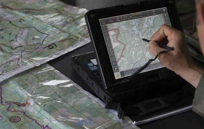
“As the importance of location to every aspect of our lives continues to grow exponentially, we’re taking ‘the map’ and transforming it into a fully digital representation of reality”, says Sengupta.
“Digital mapping has enabled faster updates to keep pace with changing environments. It used to be that maps were updated annually at best, but these days Earth Observation data capabilities can support increased temporal resolutions–in some cases, daily
34 | www.geospatialworld.net | November - December 2022 IN-FOCUS
Situational awareness refers to the ‘perception of environment’, which can be categorized as assessing the situation, taking stock, and gauging the impact
revisions”, says Thomas Van Matre, Vice President, Business Development, Satellogic.
For reconstruction, rehabilitation and emergency response, ranging from conflicts to destruction wrought by global warming and ecological devastation, digital mapping has emerged as a valuable tool.
“We imagine a future of urban design that relies heavily on geospatial data and digital mapping to determine the needs and priorities of communities”, he adds.
5G Arena
Deployment of 5G, AI, and millions of interconnected devices would be a game-changer for all sorts of situational awareness – from ambitious business projections, to government priorities, and defence policies.
Emphasizing the applications for enterprises, Will White, Co-founder and Principal Evangelist, Mapbox, says, "In a post-pandemic society that is increasingly distributed, yet more connected than ever through devices and screens, IoT will play a big role. With a more remote and dynamic world, live location intelligence is essential to making all of it work, be it for startups or Fortune 500 corporations.
“Digital mapping for situational awareness is a must-have for businesses”, he adds.
Location intelligence enables 5G at all levels, from site selection to identifying under-connected areas, and distributing connectivity. Geospatial intelligence will add a new dimension to 5G, limited not just in scope and range.
“Geospatial intelligence, such as our understanding of the world in 3D, will be very beneficial for mobile network operators. There is a common reliance between location technology and 5G to work in harmony to support the growth and success of each vertical”, says Sengupta.

Defining Trends
While the Covid pandemic response and the need to design resilient systems, established the dire salience of geospatial intelligence, the orientation towards building inclusive and sustainable economies, and driving impact, has led to a shift from bespoke solutions to the more broad service model.
In the realm of space, there are radical changes. No country wishes to be left behind in the domain that will influence far-reaching developments across sectors, paving the way for national development.
“We’ve seen a great representation in analytics-as-a-service, but now there are ground station-asa-service solutions and Satellogic’s unique Constellation-as-a-Service, which goes further to enable
governments to deploy a national Earth Observation program with no infrastructure or operations risks”, adds Van Matre.
Furthermore, ever since the conscious shift towards the stakeholder model, and the emphasis on reducing carbon footprints, net zero transition, and ESG reporting, geospatial intelligence and remote sensing has assumed a great significance as the pivot to sustainability.
Sengupta stresses that as businesses are increasingly putting sustainability at the heart of their strategy, many consumers are also opting in for greener supply chains or deliveries. He opines that geospatial intelligence is being tapped on to provide greater end-to-end transparency of supply chains, one where information can be passed on from enterprise to consumers to help them make more well-informed choices.
"Following a global recognition as a national security matter, climate change has dominated conversations across EO markets. We anticipate continued efforts in using EO to study and develop solutions that will combat the effects of climate change and focus on resilience through sustainability", points out Van Matre.
November - December 2022 | www.geospatialworld.net | 35
Ever since the conscious shift towards the stakeholder model, and the emphasis on reducing carbon footprints, net zero transition, and ESG reporting, geospatial intelligence and remote sensing has assumed a great significance as the pivot to sustainability
Associate Editor, GW Media Aditya@geospatialworld.net
Aditya Chaturvedi
Geospatial Empowering Non-profits to Tackle Food Insecurity in US
Several non-profit organizations in the US use Geospatial tools and analytics to introduce predictability with layered imagery and mapping to make better informed decisions for the areas they operate in. By Rituparna Sengupta
Maps have provided GEOINT solutions for several social challenges through the ages. One such powerful example highlights GIS maps empowering non-profit food distribution programs in the US. Today mapping tools are being used to plan and execute food distribution programs to effectively reach large numbers of deserving households.
Location Analysis
Bolsters Non-Profit Food Distribution
Programs
“Mapping and location analysis helps nonprofit food banks to assess their progress as well as identify areas where there is

36 | www.geospatialworld.net | November - December 2022
EO SPOTLIGHT
still unmet need. As the challenges change and shift, Geographic Information System (GIS) can help these organizations to prepare for what’s to come” shared Emily Swenson, non-profit program lead for Esri.
Maps may be used to track the efficiency of their food distribution routes, identify areas in need of the required help and also provide an effective evaluation tool to measure the impact of such programs. This holiday season here in the US, Esri GIS maps are lending their hand in offering effective solutions to food insecurity challenges to ensure the festivities and food distribution networks for underprivileged communities may proceed in the most effective manner.
Festivities Around the Corner
Thanksgiving celebrations just concluded and the Christmas –New Year months are coming up soon. Good cheer and festive spirit have filled up the air. At this point, it is pertinent to look behind the scenes to look at the steady effort being streamlined by so many dedicated social organizations. They are working round the clock to ensure that the not-so-privileged sections of communities can celebrate and have access to equitable food supplies through efficient food distribution networks. Map usage to streamline the delivery routes, identifying the neighborhood needs, and related factors have been a great asset for such campaigns which reach out to large numbers of households to make a difference in the receiving families’ lives. For example, Ed Westreicher, Director, Marketing and Communications with the
Esri Map used by Atlanta Community Food Bank
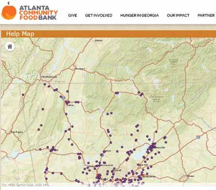
Atlanta Community Food Bank shared that their organization “and their partner network reported approximately 200,000 households served in October 2022”. Michael Truitt, Director of Community Partnerships and Programs at Freestore Foodbank in Cincinnati shared “our large 2022 Thanksgiving distribution served 2000 households” this year. Feeding America Riverside in San Bernardino has served 903,072 households in the one and half year period from January 2021 to June 2022.
Challenges Faced This Season
The present holiday season had the farmers and producers of the nation toiling hard to ensure families can continue to put food on the table and engage in memorable celebrations with their loved ones. This season, in particular, poultry producers have faced a number of
challenges, including an outbreak of highly pathogenic avian influenza (HPAI), which resulted in the loss of over 50 million birds, including over 8 million turkeys.
USDA reported that all stakeholders have been working closely to implement a comprehensive response to this outbreak and ensure there is an adequate supply of turkeys for the holiday season. This factor exacerbated by rising inflation costs and economic challenges caused by rising unemployment has led to several underprivileged sections of many US cities facing threats of food insecurity.
Geospatial Technology Helps Social Organizations in
Serving Communities Better Several social organizations across the nation have risen to the growing need for food distribution. This is not only during the
November - December 2022 | www.geospatialworld.net | 37
holiday season demand but also the overall demand raised through the uncertainties brought in by the pandemic in the last couple of years. Geospatial technologies have been a great asset for many of these organizations lending great value to their dedicated efforts.
Michael Truitt shared how “mapping software has allowed the Freestore Foodbank to better serve the community by providing insights into areas of opportunities.”
“Freestore has utilized this information to do transformative work at the macro level by identifying neighborhoods that lack sufficient food access points and at the micro level by being able to support families directly through an array of strategic programs” added Truitt.
The Esri GIS maps helped the team carry out targeted efforts of food distribution in very specific neighborhoods. They could better
engage target neighborhoods and provide the communities with better service and thereby earning the trust of those being served. This is indeed a wonderful social benefit of a meaningful technology alliance.
Jacqueline Arias, Programs Director of the organization Feeding America Riverside in San Bernardino, California shared similar insights. “GIS mapping has allowed us to be more efficient in running our programs. We want to be able to provide the most help to most of the people in the Inland Empire” shared Arias. Their organization have several food distribution programmes like the HERO (Homebound Emergency Outreach program) program which initiated food boxes for those in need and are homebound and unable to step out to arrange their daily food needs. The California-based food bank is experiencing the effectiveness
of using Esri maps to streamline its activities to address its mission of alleviating hunger in the inland empire region in California.
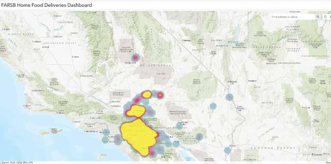
Similar affirmative conversations echoed between Geospatial World and the Atlanta Food Bank. “Geospatial technology is helping us get deeper insights into the food insecurity landscape, allowing us to layer available resources over need to identify areas where more help is needed” shared Sharay Erskine, Chief Information Officer, Atlanta Community Food Bank
The discussion yielded insights on how ground-level execution of food distribution activities is benefitting from mapping technology interventions.
Erskine pointed out that “also, with the ability to add in various demographic data available from the census we can better serve
38 | www.geospatialworld.net | November - December 2022 EO SPOTLIGHT
California-based Feeding America Riverside’s food delivery Map.
our communities, targeting outreach via culturally appropriate mediums and/or languages and plan for more culturally appropriate foods and more. Hunger is a persistent national crisis and so data will help us be more efficient and effective in helping those in need.”
Mapping Relevant Data to Streamline Food Distribution Activities
Charles Hoffman, Data Scientist from Cincinnati, from the organization 84.5, a subsidiary of Kroger the US national food
chain shared some maps he has developed. These Esri maps have helped food distribution activities in Cincinnati. He highlighted how his work is aiding the non-profit work groups since COVID “to support this work stream by providing data science and geospatial support.”
The first map (Figure 1) was a sample map to show where the team started their data analysis. In this case, they mapped the poverty rate by census tract to see where potentially vulnerable populations are located.
The next map (Figure 2) was an example of how the team then added layers to the supply of a certain resource by area. In this case, the map is showing a sample of charitable meals provided in the city as a heat map. If this heat map is now layered on top of the poverty map, then it would start to show where there is a need that is not being met by a certain resource.
(Figure 1) This is a sample map that shows poverty rate by census tract to see where potentially vulnerable populations are located.
The third (Figure 3) This showed the whole work stream where they over layered emergency food support against childhood poverty to identify areas of concentrated poverty that were outside of 1 mile from a food site. This then allowed the food distribution groups to try to direct resources to those underserved areas.
Hoffman added in their “current goal is to build an automated process that can be used in Cincinnati and easily transferred to other cities to convert publicly available data into actionable insights for decision-makers and citizens.”
GIS is an Effective Mapping Tool
(Figure 2) This map shows a sample of charitable meals provided in the city.
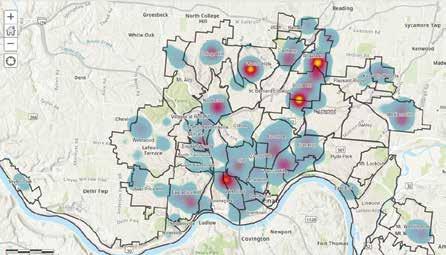
Esri maps and GIS-enabled analytics have been of great aid to
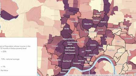
November - December 2022 | www.geospatialworld.net | 39
Maps are an important advocacy tool that help people to understand what’s happening where and why it matters. They help to build support
several food distribution efforts in the US. They have proved to be an effective tool for many US food banks, helping them to understand their service area, better manage their volunteers and efficiently deliver food.
Emily Swenson, pointed out “when resources are limited and demand for those resources increases, nonprofit organizations are required to innovate to continue meeting the needs of the people they are positioned to serve. In the face of the pandemic, inflation, and the myriad web of challenges in our world today, GIS continues to be a means for innovation.”
Maps have provided a visual layer to the non-profit operations which have brought greater clarity at different operation levels of food distribution programs. An important point added in by Swenson was that “maps are an important advocacy tool that help people to understand what’s happening where and why it matters. They help to build support.” This is a very important aspect where “communicating through maps is not only done to build support, but also to quickly and easily share information with those who need it” said Swenson.
“Using geo-enrichment and other network analysis, organ-
izations can understand things like the number of families that may not have access to a car in a given area, or the languages that people speak who may miss out on communications coming from the food bank” continued Swenson.
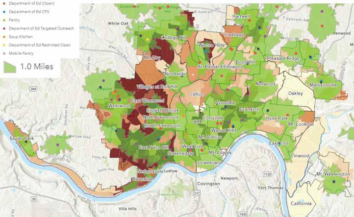
Addressing food insecurity challenges with the aid of geospatial technology is an excellent example of a value-creating collaboration between technology and social change stakeholders. Indeed a holistic overview of the ground zero non-profit actions and also the ability to measure the impact of such initiatives over a period of time gains greater momentum with the usage of mapping and location analysis.
Rituparna Sengupta
Associate Editor Americas
Rituparna@geospatialworld.net

40 | www.geospatialworld.net | November - December 2022 EO SPOTLIGHT
(Figure 3) This map shows layered emergency food support map over childhood poverty map to identify areas of concentrated poverty.
Hunger is a persistent national crisis and so data will help us be more efficient and effective in helping those in need
The world was shocked on February 24 when Russia attacked Ukraine, spurring a wave of severe consequences across Europe, including energy crisis, and high inflation.
The Russo-Ukrainian war forced Europe to increase its defense spending. Some countries, such as Germany, have already taken critical new measures in this area, with €100 billion in additional spending in 2022 and an increase of the budget to above 2% of GDP from 2024. Europe needs to spend more but above all to spend better, i.e., jointly.
Single Umbrella
The European Commission Directorate-General for Defence Industry & Space (DG DEFIS) is in charge of EU policy on the defense industry, and space and leads the European Commission’s activities in these two sectors. DEFIS is in charge of upholding the competitiveness and innovation of the European defense industry.
The establishment of DG DEFIS indicates that defense policy is becoming an increasingly important field of activity for both the
Reinforcing European Defense
By Meenal Dhande
European Commission and the entire EU. Since 2019, the EU has been intensively developing instruments to increase cooperation between the EU member states in the defense industry, military capabilities, EU civilian crisis management, military mobility, and EU activity in its neighborhood.
European Defense Funding
Under the DG DEFIS, the European Defence Fund (EDF) contributes to the continent’s strategic autonomy, protecting and defending its citizens. The EDF supports competitive and collaborative projects throughout the entire research and development cycle for a more significant impact on the European defense capability and industrial landscape. It strongly encourages the participation of small and medium-sized enterprises (SMEs) in collaborative projects and fosters innovative breakthrough solutions.
A budget of close to €8 billion for 2021-2027 is dedicated to the EDF. €2.7 billion is earmarked for funding collaborative defense research to address emerging and future security threats. Additional €5.3 billion is to co-finance collaborative capability development
projects complementing national contributions. It should be noted that the EU’s budget was €590 million for 2017-2020.
On July 20, 2022, the European Commission announced plans to grant a total EU funding of almost €1.2 billion supporting 61 collaborative R&D projects selected following the first-ever calls for proposals under the EDF.
As per the press release by the Commission, with the proposals selected for funding, the fund will support high-end defense capability projects such as the next generation of fighter aircraft, tanks, and ships, as well as critical defense technologies such as military cloud, Artificial Intelligence, semiconductors, space, cyber or medical counter-measures. It will also spearhead disruptive technologies, notably quantum technologies and new materials, and tap into promising SMEs and start-ups.
Welcoming this significant step for European defense cooperation, Executive Vice-President Margrethe Vestager said: “The highquality projects selected have shown that defense industrial cooperation in Europe can be truly achieved, and
November - December 2022 | www.geospatialworld.net | 41
In the wake of the Russia-Ukraine conflict, EU countries are aiming at military modernization and multi-fold increase in defense allocations.
IN-FOCUS
EDF Calls for Proposals
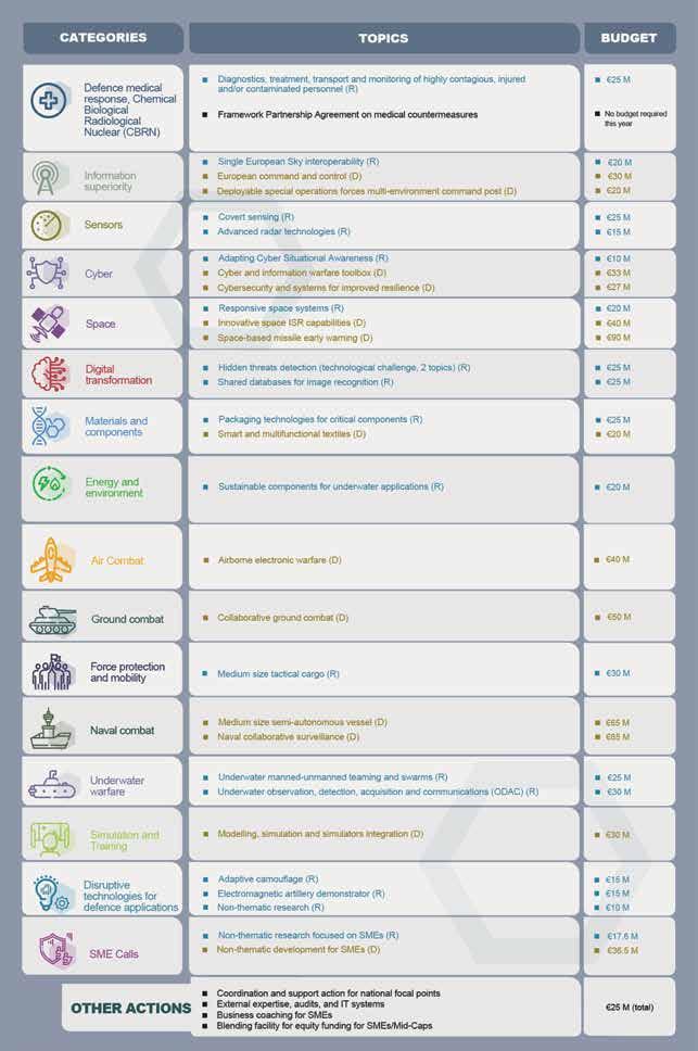
42 | www.geospatialworld.net | November - December 2022
©European Union, 2022 Disclaimer: Budget allocations depend on the adoption of a separate financing decision with reference o 20203 budget appropriations.
even on a wide scale. The almost 700 companies researching and developing the next generation of innovative defense technologies through EU funds will put into motion a resilient and competitive industrial base”.
Not So Pleased Industry
Of the €1.2 billion, €322 million (30%) will go to 31 research projects and €845 million (about 70%) to 30 large-scale projects. Though the EDF supports SMEs, they seem unsatisfied with the funding distribution. “Funds allocated for SMEs are relatively limited, and this results in a limited number of projects, as the majority of funds go to the big companies,” told Roberto Senatore, Chief Technology Officer at Civitanavi Systems to Science Business.
SMEs represent 40% of all the organizations awarded EDF funds; they will only receive around 20% of the total funding. Calling for a broader involvement, the SMEs would like EDF to help them to develop their stand-alone products instead of just supplying components to big companies.
On the other hand, Jan Pie, Secretary General of the Aerospace, Security, and Defence Industries Association of Europe, feels that the EDF should go to the €13 billion budget that was initially planned and be prepared to raise it further in the face of the grim reality of war in Ukraine. “€13 billion was something we saw as a minimum investment for the EDF in peacetime, but now we are looking at wartime,” said Pie at the launch of the Economic Impact Report of the European Aerospace and Defence Industry.
Spikey Road
In its annual Defence Data Report for 2020-2021, the European Defence
Agency (EDA) detailed spending by the 26 EDA Member States. In 2021, total European defense spending stood at a new high of €214 billion, marking a further 6% increase in 2020 and the seventh year of consecutive growth.
EDA’s report finds that Member States are investing more than ever in the procurement of defense equipment and research and development, with a 16% rise compared to 2020, totaling a record €52 billion.
The report finds that the sustained increase in overall spending is also reflected in national numbers. In 2021, of the 18 Member States who increased spending, six raised it by 10% or more. The highest increases amounted to more than €4 billion by Italy in absolute terms and a 42%, 33%, and 27% increase in relative terms by Finland, Greece, and Slovenia, respectively. However, eight Member States reduced spending, with the most significant national cut standing at 15% in relative terms.
Russia’s war of aggression against Ukraine signals that the expenditure increase will likely continue in the years ahead. However, the increase in defense spending has also translated into an appreciable rise in collaborative European expenditures, but still well below agreed collective benchmarks. In most of the awarded funding and Research and Technology (R&T), spending countries like Germany, France, and Italy play a significant role.
Increased European defense spending may lead to competition between European and US defense companies. Though a US company
We need further bold steps in the next five years towards a genuine European Defence Union… I intend to strengthen the European Defence Fund to support research and capability development. In doing so, we will open up major new opportunities for our hightech industries and other parts of our economy.
Ursula von der Leyen President of the European Commission
may want to team up with European ones for expanding their footprint in the local market. However, undoubtedly there is going to be interest in promoting the American products.
On the flip side, the US would be making $2.219 billion in Foreign Military Financing (FMF) available to Ukraine and 18 other European nations to help modernize the militaries in the region. $1 billion of that will be allotted just to Ukraine, with the other countries — Albania, Bosnia and Herzegovina, Bulgaria, Croatia, the Czech Republic, Estonia, Georgia, Greece, Kosovo, Latvia, Lithuania, Moldova, Montenegro, North Macedonia, Poland, Romania, Slovakia, and Slovenia — sharing the remaining dollars.
FMF is, basically, the money the US government gives to other nations for the purchase of US-made military equipment. Supposedly, this creates a closer bond with the partner nation. Still, it also pumps the money back into the US thus, giving competition to the European defense industry.
Meenal Dhande
Associate Editor, EMEA meenal@geospatialworld.net

November - December 2022 | www.geospatialworld.net | 43
Combating Cyberterrorism
Social media has emerged as a new turf of terrorist groups and organized crime syndicates. In this scenario, data-based insights and geospatial visualizations play a key role in tracking these activities. By Nibedita Mohanta
While social media has enhanced connectivity and is a rich source of diverse information, at the same time, it poses several threats, ranging from impersonations, and identity thefts to cyber terrorism, and
racketeering. The dark underbelly of the internet is a hotbed of all sorts of illicit activities that often tend to escape the lens of regulatory agencies.
As per estimates, cyber attacks have spiked by up to 240% since

the second half of 2021.
According to Cybersecurity Ventures report, the estimated cost of cyber crimes would reach up to $10.5 trillion annually by 2025, representing one of the greatest wealth transfers in history.
IN-FOCUS 44 | www.geospatialworld.net | November - December 2022
Had cybercrime been a country, it would have been the third largest economy in the world, after China and the USA, as Cybercrime Magazine forecasts.
How Do Extremist Groups Use Social Media?
Along with disinformation and fraud, the use of social media for terrorist propaganda, recruitment, and funnelling funds, is a big global threat. Counter-terrorism agencies globally are increasingly monitoring social media platforms to prevent these.
As per a study by Gabriel Weimann from the University of Haifa in 2012, nearly 90% of organized terrorist activities on the internet take place via social media.
“Terrorist groups such as ISIS, Al-Qaeda and Hezbollah have long used social media for a variety of purposes: training, recruitment, planning. Groups such as ISIS have used video sharing sites to post training videos on how to carry out beheadings,” says Professor V.S. Subrahmanian, Walter P. Murphy Professor – Dept. of Computer Science & Buffett Faculty Fellow, Buffett Institute of Global Affairs, Head, Northwestern Security & AI Lab (NSAIL), Northwestern University.
“Closed groups have been used to plot attacks, but in order to join such closed groups, potential new members typically need a reference from someone already in the group,” he adds.
Lure of Online Networks
Extremist activities are not only confined to social media but other online networks such as gaming plat-
forms and video channels as well.
There are over three billion gamers worldwide, out of which millions are active users on gaming and gaming-adjacent platforms. Considering the huge population, which mostly comprises teenagers, and adults aged between 20-35 years of age, who invest their leisure-time on gaming platforms, it has become a breeding ground for those with extremist ideologies. The attackers exploit the popularity of this space and accumulate the data about users for spreading propaganda, training and communication efforts.
These online networks and platforms allow terror groups to engage with their target audience, whereas previously terror groups would release messages via intermediaries. Social media platforms allow terror groups to release messages directly to their intended audience and converse with their audience in real time through chat boxes.
Prof. Subrahmanian says that terrorist groups use social media to target people that they don't know. For a long time, ISIS was posting instructional videos on how to carry out beheadings. When those kinds of videos started getting increasingly detected and blocked quickly, they changed tact. They started posting videos on how to cut a melon instead, at some level, melon being like the human head.
“They've taken the problem and
sort of mapped it onto an analogous. They've taken their problem of showing would-be terrorists how to carry out terrible beheadings to an analogous problem, where the would-be terrorists, they're expecting to follow them, are nonetheless trained, but in a domain that none of us could have anticipated, including Facebook, Twitter, YouTube,” he adds.
“Social media was now a "loss leader" for groups like Islamic State (IS),” Cyber terrorism experts Prof Maura Conway, from Dublin City and Swansea universities was quoted as saying.
"IS and the like still post on Facebook and Twitter etc., but they know that they'll quickly be removed, so they use a scattergun approach to entice the most number of people in the limited time their message will be seen," she added.
Geospatial for Intel Gathering Terrorists gather all the vital information about the area through their local source and chalk out the plan and the pattern of attacks. This is why they target young people, especially from the marginalised community of the area, who are either in need of money or a job to carry out their organised crimes.
With the use of geospatial analytics, these activities can be identified and tracked. Demographic mapping and distribution
November - December 2022 | www.geospatialworld.net | 45
The estimated cost of cyber crimes would reach up to $10.5 trillion annually by 2025, representing one of the greatest wealth transfers in history
can come in handy in spotting areas and populations most at risk.
Geospatial Information System (GIS) is used by defense authorities to identify cyber-crime and locate them on maps to track the criminals pre-emptively.
The US cyber-security firm, Mandiant, used geospatial technologies like social
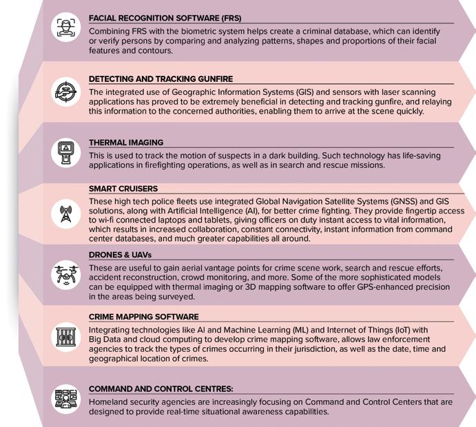
network analytics, intelligence and real-time event scoring to trace cyber-criminal activity in Shanghai, China in 2013.
Geospatial technologies are transforming from identifying traditional crimes and analyzing cyber activities to protecting valuable data and information of the country. It provides important information rich with intelligence
analytics to make informed decisions.
Data Conundrum
With the vast availability of online data and the model of aggregation and monetization by third party companies, there is a risk of this data being used for psychological profiling, behavioural manipulation, and indoctrination by terror groups. However, data-based
Trends in Law Enforcement Sector
46 | www.geospatialworld.net | November - December 2022
IN-FOCUS
Source: Geospatial World Analysis
insights come to aid in tracking criminal activities.

“Ten years ago when I started crowdsourcing data on sexual and gender based violence most people did not understand what I was doing and how the dataset could be useful,” says ElsaMarie DSilva, Founder, Red Dot Foundation.
“We are now actively mapping sexual and gender based violence in 17 countries besides India with partner organisations and it is interesting how they plan to use the data”.
New Response Plan
The behaviour and actions taken by social media companies over the last five years have significantly improved the landscape in terms
LEARN MORE ABOUT THE GEOGRAPHIC ADVANTAGE
of the ability of terrorist groups to carry out these kinds of things.
“Governments have primarily tried to combat terror groups’ social media presence through legislation and regulation. For instance, in the early days (2010-2015), terrorist content on mainstream social platforms was quite extensive,” says Prof. Subrahmanian
“In examples where a group was posting about how to cut a melon, it was not immediately clear if the video was a terrorist video or not, leading to delays and complications in taking the videos offline. In recent years, most major social platforms have cells that are dedicated to taking down such content as soon as possible,” he adds.
“We cannot blame the social media, the real people to blame are the bad guys. The social media companies do have to be put on notice that they need to invest sufficient resources and have a game plan to deal with this kind of thing, and that's part of regulation,” he adds.
Intelligence organizations are challenged to continually deliver the most up-to-date information to decision-makers. Geography provides the context for this data and speeds up the understanding of all types of intelligence activity.
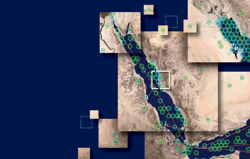
Find more information at go.esri.com/gwgeoint2023
There’s a need for compliance guidelines that are unambiguously mentioned. “Just like the Community Emergency Response Team (CERT) puts out cyber advisories, we need to put out social media advisories, and extensively monitor social media.” he concludes. Chief Sub Editor, GW Media Nibedita@geospatialworld.net
Nibedita Mohanta
Copyright © 2022 Esri. All rights reserved.
What are your views on the future of the geopolitical situation in view of the ongoing Russia-Ukraine war?
It looks currently as though the Ukraine-Russia conflict will continue at a perhaps lower level of engagement on a daily basis than we saw in the first few months of the war. But we expect it to continue in the coming months. This will have very significant repercussions for the rest of the world, as opposed to just that local geography.
The one major issue geopolitically is oil and gas. We've been seeing prices going up, at least in the US and the West. And this winter, Europe is likely to be severely affected by the shortage of gas that they import from Russia for heating purposes.
One of the good things that will come out of this conflict is that
AI to Strategically Reshape Global Security Landscape
He is the Walter P. Murphy Professor of Computer Science at the McCormick School of Engineering, Northwestern University and Buffett Faculty Fellow at the Northwestern Roberta Buffett Institute for Global Affairs. He has also coauthored books on terrorist outfits Lashker-e-Toiba and Indian Mujahideen.
In an exclusive interview with Geospatial World, he discusses the evolving global security configuration, emerging cyber challenges, and the utility of AI and satellite imagery in countering multiple threats.
it'll open up more sources of oil and natural gas from around the world. It has forced some European countries to rethink their dependence on Russia for oil and natural gas.
The second is that we are seeing a significant realignment of global partnerships. We are seeing a closer relationship between Russia and China than we had seen in previous years. China needs friends and allies, and having Russia more strongly in its corner will reshape global geopolitics.
As China carries out increasingly aggressive cross-border activities with India, Japan, Taiwan, and other countries such as the Philippines, we can expect no condemnation from Russia, and at the very worst, active support for those kinds of missions, as a sort of quid-pro-quo payback for
Chinese help during this RussiaUkraine conflict.
That'll have repercussions in how the world, which is already gearing up to combat these kinds of incursions by China, will bring India, Australia, Japan, the United States, New Zealand, and some of the countries in East Asia, such as Singapore, closer together. I expect a coalition of countries to come together more strongly than they've done in the past to combat that Chinese aggression.
You recently released a paper on China's incursion into India. So how do you see the SinoIndian border dispute in the long term?
In the long term, both India and China have strong positions on where the border should be. The actual de facto border has not really changed a lot in the last few
48 | www.geospatialworld.net | November - December 2022
Professor V.S. Subrahmanian is a leader in design, analysis and application of AI-based models for real world problems that helps governments and companies in optimal decision-making.
INTERVIEW
decades. China has aggressively tried to grab pieces of territory over and over again but, nonetheless, any territorial gains by China have been small, one at a time but these aggregated seizures of small amounts of territory start adding up to something more.
India has taken very strong steps to combat this in the past few years, which include beefing up the surveillance and troops along the border, building better roads, air bases, and tunnels along the border. All these efforts are very significant defenses and deterrents to China.
This needs to be beefed up even more. The development and use of autonomous vehicles and weapons, which are capable of navigating the harsh terrain along the India-China border and the harsh weather, is critical.
When I say autonomous vehicles, I really mean drones and land vehicles, both for surveillance and offensive purposes, which is the way forward in terms of mitigating the risk to humans and human life. Some kind of ground vehicles and aerial vehicles that can Chinese aggression in these harsh conditions are going to be needed.
Tell us about the newly launched Northwestern Security and AI Lab (NSAIL), and the technologies that were used. How can policymakers

make the right use of cyber forensics to help in preventing terrorist attacks?
The Northwestern Security and AI Lab is a new lab which is jointly housed between the McCormick School of Engineering at Northwestern (the technology development arm of the lab) and the Buffett Institute for Global Affairs.
We are focused on using AI to reshape the landscape strategically and tactically. Most counterterrorism agencies have been proactive in gathering managing intelligence about attacks, but they have not been proactive in taking the battle to the attackers, regardless of whether they're cyber attackers or whether they are terrorists.
Part of what we are doing in
the NSAIL is to imagine what the next wave of attacks will be, as advanced technology comes out. This is all about being ahead of the curve, instead of constantly being behind the curve.
And of course, once we know how we expect the attackers to attack us, we can come up with better defenses. For example, right now, we are working on a research paper and a demonstration, which will come out in February 2023 titled “Drone Urban Cyber Defense Testbed (DUCK)”. DUCK looks at drone attacks with swarms of on cities and urban areas, because drones are pretty cheap today. We have come up with techniques to simulate how adversaries might use swarms of drones to target cities even before they do so. We
November - December 2022 | www.geospatialworld.net | 49
Most counterterrorism agencies have been proactive in gathering managing intelligence about attacks, but they have not been proactive in taking the battle to the attackers, regardless of whether they're cyber attackers or whether they are terrorists
(DTED)
maps, which tell us about the elevation of every part of the world. One can buy them off the internet at pretty reasonable prices and these maps tell you at fairly finegrain granularity how the terrain changes in terms of elevation.
will come up with multiple defensive methods to guard against that.
We are also working on a system called Tread, which is intended to combat terrorist groups. As an example, in my book on Lashkar-e-Taiba (2012), one of the big findings was that as long as Lashkar-e-Taiba is squabbling internally, fighting amongst themselves, the probability of terrorist attacks goes down dramatically, almost to zero. So, as a counterterrorism strategy, inducing conflict between leaders of Lashkar-e-Taiba is very desirable. So we've been developing deepfake technology with the use of AI, to put words in the mouths of these terrorists, intended to sow such conflict within the group.
We're looking at this nexus of AI and how terrorists might use it, and how we can get ahead of them.
What roles do remote sensors play in predicting terror activities?
Terrain and weather play a huge role in terror attacks. During terrorist attacks, when they look at target selection, the first question is, "What is the value of the target?" The value could be along many different dimensions:
Will a lot of people be killed?
Or will certain groups of people
be killed, such as in the attack on the Indian parliament in 2001.
The second is, "Can it be done?" Terrorists might wish to attack certain targets, but it may or may not be doable. So what is the probability that they can succeed in an attack?
Then the third is backlash.
For the second question, "Is this target attackable," remote sensing and geospatial information play a huge role. If you look at a major target, there are multiple layers of security around it, which are situated in space and time. For example, there's a checkpoint here, or a convoy there and, after an hour, it may be somewhere else. Understanding the nature of the defences of a target is completely embedded in geospatial and temporal domains.
The probability of an attack on a location depends upon several things like, “What is the terrain like?” for example, to traverse one kilometer, a soldier might have to go through a steep downhill or climb uphill in forbidding terrain, hence, understanding the nature of the terrain at a specific point in time is critical.
There are things called Digital Terrain Elevation Data (DTED)
We have collected maps from NASA satellites which are also publicly available that tell us about vegetation, drainage and the presence of water, etc. The channels of water change the traffic-ability of that entire geography, because the parts that were walkable or can be crossed with the help of a vehicle this year may not be doable next year. You need to understand static assets, such as where are the roads, the military encampments, the border posts, or the airfields.
At the same time, you also need to understand, how people are moving across the terrain. This is where satellite imagery is extremely valuable. The airfields are not changing location, they only come up once in a while, but people are changing their location every day. Their patrolling pattern, checkpoints and deployments are changing every day.
For example, it is possible, using AI, to use probes (that is, autonomous vehicles) to review China's defenses. We can send some autonomous vehicles across to see what the Chinese do, and whether they are paying attention or not.
There are both passive methods and active methods where the satellite imagery data is collected, analysed, and all of them live in geography.
50 | www.geospatialworld.net | November - December 2022 INTERVIEW
Digital Terrain Elevation Data
maps tell us about the elevation of every part of the world. One can buy them off the internet at pretty reasonable prices and these maps tell you with granularity how the terrain changes in terms of elevation
Interviewed by: Nibedita Mohanta
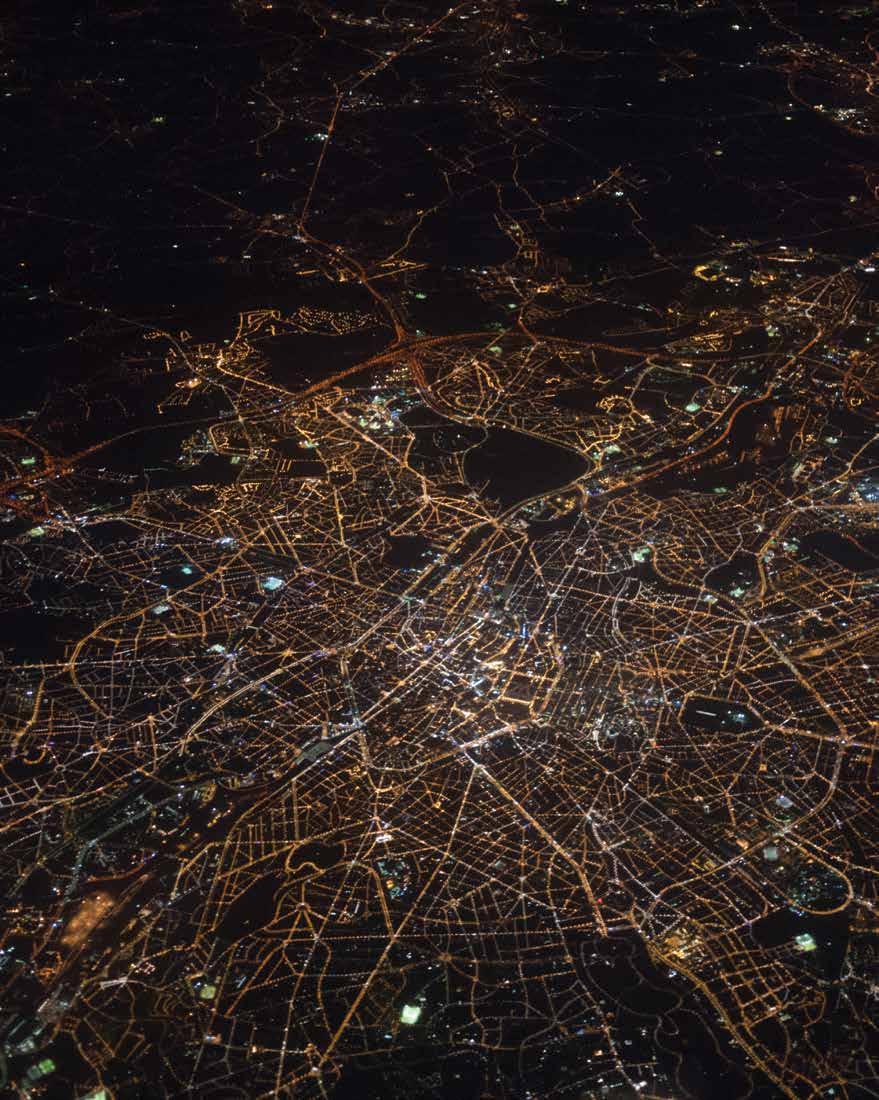
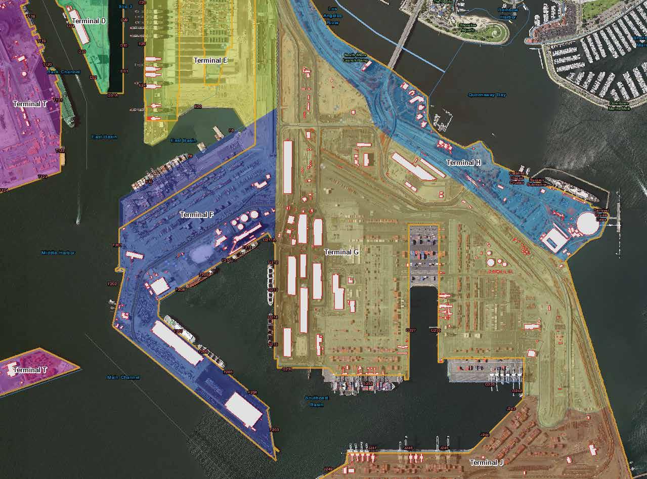
SHOULDN’T BE THE DATA HARDEST THE PART YOUR MISSION OF WE ARE TEXTRON SYSTEMS Textron Systems | Sterling, VA | +1.800.655.2616 | geosales@textronsystems.com © 2022 Overwatch Systems, Ltd. TextronSystems.com LEARN MORE
FinTech + GeoInt Synergies Driving Development in St. Louis Downtown

Earlier this year, Geospatial World Magazine highlighted the evolution and placemaking impacts of a new “urban insight district in St. Louis at the Heart of America,” the Downtown North Insight District.
This tech-focused center city Innovation District is unique in several respects: one, its technology focus includes both Geospatial Intelligence and FinTech anchors, along with several other key tech institutions; and, two, its downtown location spans most of the entire
northern portion of St. Louis’ Central Business District.
The District also is proximate to two anchor public institutions — the now under construction 3,100job, $1.75-billion, 1 million square foot, 100-acre National Geospatial-Intelligence Agency (NGA)
western headquarters, as well as with the now expanding 500,000 square foot America’s Center Convention Complex (home of the 2021 and 2023 GEOINT Symposia).
The focus of previous 2022 Geospatial World Magazine feature articles about St. Louis has been on the continued growth of Geospatial Intelligence firms and institutions and the geospatial intelligence ecosystem in the new District. This article focuses on the companion growth of the FinTech sector and its unique relationship to Geospatial growth within the St. Louis ecosystem.
Malou Damgaard of Denmarkbased MapsPeople describes the relationship of FinTech and Location, “These days, FinTech is a buzzword. Already used by over
FEATURED
General Dynamics recently located in The Globe Building in St. Louis.
52 | www.geospatialworld.net | November - December 2022
Developer of the high-tech renovation of 720,000 square foot Art Deco Globe Building;
Developers the adaptive reuse of the former HQ of the 226,000 square foot St. Louis Post-Dispatch newspaper into the new home for up to 1,400 employees of BLOCK (formerly Square); and, Leader of the T-Rex technology and Entrepreneurial Development Center.
50% of financial customers worldwide, the sector is growing rapidly.” She concludes, “It is not just a trend anymore, it is an innovative industry'… it is a global movement.”
In a June 2022 article in Forbes, Enterprise Tech, "The Rise of Spatial Finance,” Brian Cross of ESRI described “Spatial Finance” as the ability to quantify and analyze the effects of business on nature, and nature on business as a competitive advantage in corporate finance. He observes, "Spatial finance relies on innovative geospatial technologies including a modern geographic information system (GIS), remote sensing, and artificial intelligence.”
He concluded, “The rise of the practice is being magnified by the abundance of near real-time imagery and information generated by satellites, drones, and IoT sensors – and the use of machinelearning algorithms that rapidly
process images and sensor readings for insights, anomalies, or patterns."
The September 27, 2022 edition of Financial IT carried the headline —”How Geospatial Data Is Expected To Revolutionize Fintech & Banking.”
One of the co-founders of the Downtown North District is St. Louis-based global FinTech entrepreneur Jim McKelvey, who is also Co-Founder of Square (now BLOCK) with Jack Dorsey.


Jim spoke recently to the rationale for FinTech and Geospatial Intelligence combining to stimulate innovation: “Larger banks and financial institutions are highly regulated which limits their ability to explore new ideas and innovate. These institutions partner with younger and more flexible technology companies to gain access to new markets and to better understand their customers. This allows the providers to create products and services that meet their needs.”
It's in this context of innovation that McKelvey is also pursuing yet another combination of disciplines; namely, downtown revitalization, tech innovation, and real estate.
Two and a half years ago, along with his real estate partner John Berglund, the Co-Founder and Managing Partner of their real estate development firm, The StarWood Group, Berglund and McKelvey announced that they had purchased the then-headquarters of the St. Louis Post-Dispatch newspaper, and had signed a 15-year lease with San Francisco-based
Square (now BLOCK) and were moving all 500 St. Louis employees of Square to the totally renovated nearly quarter million square foot Post-Dispatch Building, and making high-tech space for an eventual 1,400 employees in the building.
At the same time, the seeds were planted for the development of a multi-block downtown Innovation District, initially called the “NOW Innovation District,” referring to North of Washington, St. Louis’ initial Washington Avenue tech corridor, from which both Square and The Globe Building are 2 blocks north.
In their announcement of Square, McKelvey and Berglund
November - December 2022 | www.geospatialworld.net | 53
Three private sector anchor developers joined together in forming the District
John Bergund Co-founder of The StarWood Group, at the renovated former Post-Dispatch HQ
Jim McKelvey Co-founder, Square (now BLOCK) and Co-founder, The StarWood Group.
Photo: Missouri S&T
indicated that they “wanted more than just the Post-Dispatch building.” As the St. Louis Business Journal chronicled The StarWood Group’s intentions: “Ultimately, it came down to wanting more. They wanted more people. They wanted more growth. They wanted more vibrancy for a forgotten corner of downtown.”
John Berglund has observed, “we knew out interest had to be more than just a building. We believed the north side was an untapped opportunity.”
The decision of BLOCK/Square to locate in St Louis follows a national trend of decentralizing technology jobs outside of Silicon Valley into communities which provide more cost-efficient ways of delivering services. An excellent example is MasterCard's decision some years ago to locate its Global Operations Headquarters and 3,500 jobs in St. Louis. Today, virtually every MasterCard transaction in the world, 24/7, every day of the year is processed thru St. Louis.
Speaking to the unique synergies of FinTech and GEOINT in the
District, Berglund notes, “Integration of geospatial and fintech is a natural progression of two industries expanding rapidly. It is estimated that the Global Fintech market will hit north of $300 billion in five years. Geographic and location data are being collected daily and mined for retail advantage, climate risk, location of competitors, and so forth. This allows them to track foot traffic, demographic data, and customer preferences based on habits."
He continued, "Banks are competing to provide an increased level of personalized service that customers see as standard. Intuitive customer interface while maintaining necessary security protocols are important on a mobile platform. Location of the nearest ATM is just assumed. Location data plays a part of this."
St. Louis’ goal is to continue to ride that trend to showcase how St Louis continues to be the choice for other FinTech and GEOINT companies.
The STL 2030 Jobs Plan, completed last year, provides context here: noting that the 2.8 million-person St. Louis region already includes 22 Global headquarters established there; has a cost of living which is just 88% of the U.S. Average; and that there are presently over 275,000 jobs in the GEONT, FinTech and Digital Transformation sectors.
Meanwhile, on the GEOINT front itself, as NGA’s new western HQ continues to progress towards a first quarter 2026 opening just several blocks from the Downtown North District,
Geospatial Intelligence firms and specialized intel facilities also continue to expand at The Globe Building. The recent location of General Dynamics at The Globe — joining MAXAR, T-Kartor, Ball Aerospace, and Geospatial World — underscores The Globe as the “location of choice for GEOINT firms in St. Louis.”
In this regard, The Globe Building was recently named the “St. Louis Development of the Year for 2022” by St. Louis Mayor Tishaura Jones.
“The District has rapidly become the nucleus for the St. Louis effort to achieve its vision of being a global geospatial intelligence hub,” says GEOINT expert Keith Masback, currently Plum Run, LLC. “The unique combination of a startup ecosystem, world-class workplaces, and a massive multi-tenant classified space – all proximate to Next NGA West – is unparalleled, and is clearly the strategic differentiator for GEOINT in St. Louis.” Masback served as CEO of the U.S. Geospatial Intelligence Foundation (USGIF) for over a decade.
Planning for a Community Improvement District is underway, along with both long terms plans for the overall District by The StarWood Group and their civic colleagues.
Today, this unique synergy of Fintech and GEOINT is helping to chart a new north for St. Louis.
Richard C.D. Fleming
CEO, Community Development Ventures, Inc., St. Louis regionalstrategy@me.com

54 | www.geospatialworld.net | November - December 2022 FEATURED
Map of the multi-block Downtown North Insight District in St. Louis


710 N. Tucker Boulevard, Suite 100, St. Louis, Missouri 63101 jsalvatori@globebuilding.com | www.globebuilding.com 314 241 0450 • Home to General Dynamics, Maxar, Ball Aerospace, T-Kartor—USA and more • Blocks away from the new NGA West campus • Featuring Tier 1-carrier class-fiber and power infrastructure • Located in the emerging Downtown North Insight District GEOINT LOCATION OF CHOICE IN ST. LOUIS BIG SPACE • BIG FIBER • BIG POWER


2-5 May 2023 • Rotterdam, The Netherlands Join The Conversation Witness the ever-growing dimensions of geospatial industry that’s driving the digital age, and how geospatial knowledge and services are getting integrated in workflows and business processes of almost every important industry, supporting sustainability of everything. Thought-provoking, Industry-advancing Topics Strategic Sponsors Institutional Partners Co-Sponsors
… and many others Geospatial Infrastructure and Digital Twins: Powering Sustainability of Everything Resilient PNT Empowering World Economy and Society Space Economy & Public Policy: Supporting Space Economic Growth GEOBIM –Advancing Infrastructure Resilience Location Intelligence in BFSI and Retail Process Optimization www.geospatialworldforum.org
Produced By


 Interviewed by: Sachin Awana


