
25 minute read
FIGURE 2- JEKYLL ISLAND STATE PARK


3.3- REGIONAL CONTEXT
The New Georgia Encyclopedia is a web-based program of Georgia Humanities in partnership with the University of Georgia Press, the University System of Georgia/GALILEO, and the Office of the Governor. In the Geographic Regions section of the Geography and Environment Topic, there is a primer on the history of Jekyll Island (https://www.georgiaencyclopedia.org/articles/geographyenvironment/jekyll-island). The Lower Coastal Plain and Coastal Islands subsection provides details on the geology of Georgia’s barrier islands, including a description of the ecology of Georgia’s Lower Coastal Plain (https://www.georgiaencyclopedia.org/articles/ geography-environment/lower-coastal-plain-and-coastal-islands). This section illustrates the physiographic context of Jekyll Island along the Georgia coast in association with Georgia barrier islands from Tybee Island to Cumberland Island. Figure 2 provides an aerial photograph of Jekyll Island, including natural features from the Altamaha River north of Little St. Simons Island, south to include the Brunswick, Little Satilla,a and Satilla Rivers.
The “sweeping salt marshes” described in the Lower Coastal Plain and Coastal Islands subsection highlights the ecological significance of tidal marshes that were the subject of Sidney Lanier’s poem “The Marshes of Glynn”. These highly productive marshes, along with small “islands” of upland within the marsh, also called “marsh hammocks”, represent more than 8,927 acres of Jekyll Island State Park and provide a valuable nursery for the fish and shellfish that are vital to the economy of the Georgia coast as well as a habitat for migratory birds and rare plants. Jekyll Island’s salt marshes have been protected since the passage of the Marshlands Protection Act by the Georgia General Assembly in 1970. Strict permitting requirements restrict alteration of the marshes within the boundaries of Jekyll Island as well as the vast areas of tidal marsh along Georgia’s coast.
Figure 2. Jekyll Island State Park
3.4- GEOLOGIC FRAME OF REFERENCE
Jekyll Island’s older core was formed approximately 40-50,000 years ago during the Pleistocene Epoch at a time when sea-level was about 6 feet above the current level. This was during an interglacial period (in between ice ages) when the polar ice caps had receded and sea level rose. Subsequently, during the last global ice age of the Pleistocene, continental glaciers expanded again and sea level fell by 300 to 500 feet. During this time, Jekyll Island was no longer an island, becoming part of the mainland with the shoreline shifting about 80 miles to the east of its current location. Approximately 18,000 years ago, the continental ice sheets started to melt, causing the sea level to rise again, sometimes very rapidly, until about 5000 years ago when the rate of sea-level rise settled close to its current rate of about 1 foot of rise every 100 years. The remains of a 4,000-5,000-year-old forest are visible today on Jekyll’s beach adjacent to King and Dexter Avenues. When exposed by wave action, the ancient soil, called a paleosol, and the stumps of the trees that grew in it are revealed between the tides, and beach goers can walk through a landscape that has been preserved for thousands of years buried below sea and sand.
During this same time period, new islands formed along the encroaching shoreline, their sands migrating westward as sea level rose. Geologists associate these islands with the Holocene (recent) Epoch. Along Georgia’s coast, some of the Holocene islands eventually merged with the older Pleistocene islands. Jekyll Island is one of these composite islands. Identifying the Holocene parts of Jekyll Island is easy because these areas at the north and south end of the Island have rolling topography. These ridges and swales were formed as sand dunes along the shoreline. As the shoreline moved, plants became established and began a succession eventually leading to mature live oak-dominated maritime forest on the ridges and freshwater wetland plant communities in the low swales. The south end of Jekyll Island has experienced rapid accretion, or growth, which has been historically documented, with the Island’s southern point expanding southward at an average rate of over three feet per year since the earliest accurate maps became available in the mid 1800s.
As with any science, our understanding of the geology of Georgia’s coast evolves and is driven by the development and vetting of hypotheses about the past, informed by the conditions and processes we observe in the present. The study of geology is known for the extraordinarily long timeframes that must be considered to understand the processes at work. Typically, these timeframes are measured in millions of years. However, coastal geologic processes, particularly at the shoreline, can occur very quickly by comparison, with major changes potentially occurring over timeframes of hundreds to thousands of years – in a blink of an eye, geologically speaking. One emerging hypothesis about Jekyll Island’s geologic past suggests that as recently as 2,800 years ago, Jekyll Island and Saint Simons Island, the next island to the north, may have been connected as a single island. This hypothesis is intriguing because, if confirmed, it would mean that some extreme changes in the coastal landscape surrounding Jekyll Island took place during a time when Native Americans occupied the area. The breaching of Saint Simons Sound, perhaps precipitated by a major hurricane, would have been an extraordinary and dangerous event to have witnessed.


3.5- PREHISTORIC AND HISTORIC LAND USES
Jekyll Island’s earliest known inhabitants were Native American hunter-gatherers who lived on the Island in small groups during the Late Archaic Period, approximately 4,500 years ago. Current boundaries of the Historic District, Horton House and Brewery Ruins Site, Former Huddle House Site, and Great Dunes Golf Course comprise four of the largest prehistoric settlement areas on the Island. The Native American habitation is a significant factor to the landscape we observe today because they disposed of large quantities of oyster, whelk, and clam shells in the form of midden piles throughout the Island in numerous locations. As a result of this activity over several centuries, the soil pH has been altered, producing very fertile basic soils suitable for most plant species. In addition, Native Americans would regularly burn off the underbrush of the Island to improve hunting and minimize attacks from biting insects. Over time, this practice of frequent controlled burns most likely affected plant and animal species diversity on the Island.

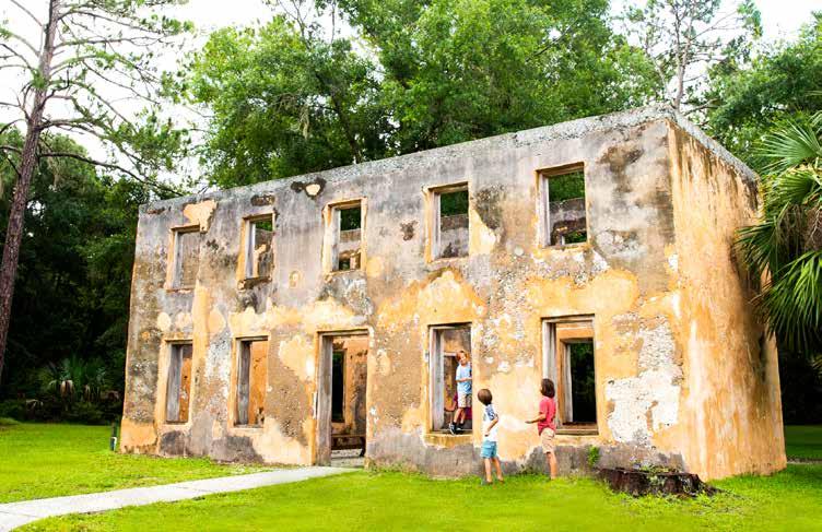
English occupation reached Jekyll Island in 1738-1739 with General James Oglethorpe stationing Captain William Horton on Jekyll. This led to the construction of a home and brewery on the north end of the Island as well as the planting of rye, barley, other grains, and an orange grove. In 1792, Jekyll was purchased by Christophe Poulain du Bignon, who raised sea-island cotton as a prosperous enterprise until the Civil War. A large swath of the Island was cleared from the present Historic District running north to the Horton House Historic Site and utilized for growing cotton. About 1830-1840, the largest live oaks on the Island were sold to the United States Navy for ship timber with most of them going to the Pensacola Naval Yard for ship construction. Cabbage palms were also a rare site on the Island prior to the formation of the Jekyll Island Club as they had been cut for their cabbage, which was considered a delicacy in the South. After the Civil War, feral horses, cattle and hogs multiplied rapidly and they most likely had a significant impact on the Island’s landscape. Not until the Island came into the possession of the Club were efforts taken to mitigate these conditions.
In 1886, the Island was purchased by the Jekyll Island Club, and Club members selected a landscape architect (Horace William Shaler Cleveland) to develop a landscape plan for the Club Grounds in 1887 that accepted the natural beauty of the Island. As a result, most of the Island was primarily managed in its natural state during most of the Club era, also in part to support hunting. Hunting abundant game on the Island was perhaps the activity most highly regarded by early Club members and landscape management efforts were directed towards optimizing this activity, including the use of prescribed burning. As hunting lost its popularity in favor of other activities, the prescribed burnings became less frequent. By 1942, as the Club began to have financial troubles, members decided to raise money by cutting all of the sellable pine timber on the entire Island, excluding the Club compound. The harvesting of pine timber clearly would have resulted in significant disturbance to large portions of the Island. It appears that most of the timber that was harvested on the Island occurred primarily on the older, Pleistocene portions of the Island.

Archival documents reference the vegetation composition and land use of the Island just prior to the acquisition by the Jekyll Island Club and broke down 14,000 acres of Jekyll Island and back-barrier marshes associated with that land transfer as follows:
• 2,500 acres of heavy oak and pine timber • 2,500 acres of sea island cotton land • 2,500 acres of hammock land • 2,000 acres of dry savannah land • 1,000 acres of hard black marsh land • 3,500 acres of salt marsh
While these numbers do not equate closely to the current measurements of Jekyll Island State Park land, they paint a basic picture of the diversity of habitats and land uses in the 1880s.
The State of Georgia acquired the Island from the Club in 1947 and built a causeway to connect the Island to the mainland. During the early State era, the Island underwent significant development. With the creation of Beachview Drive, large sections of the natural dunes, once described as almost 40 feet high in places, were leveled flat from Captain Wylly Drive to south of the Days Inn to create a concrete boardwalk and to provide uninterrupted views of the ocean from Beachview Drive. The creation of Ben Fortson Parkway, South Riverview Drive and other roadways on the Island restricted natural tidal flows into interior salt marsh as natural stream beds were directed into culverts or were completely cut off. This fragmentation severely impacted the headwaters of First Creek, which was once the largest tidal drainage system on the south end of the Island. The airport site was also greatly expanded, resulting in several acres of salt marsh that were filled in, to expand the size of the runway. Some of this fill material might have eroded into the adjacent salt marsh, creating additional high marsh along the north east boundary of the taxiway. The construction of Jekyll Island’s golf courses significantly reduced and altered the Island’s natural freshwater wetlands. Oleander golf course altered the original hydrology of both salt and freshwater systems, magnifying changes that were initiated by ditch building during the Club era.
Perhaps the greatest landscape impact to the Island occurred around 1968 when the JIA attempted to create a marina complex on the southwest end of the Island. Many acres of salt marsh were dredged to create two harbor basins. The spoils were used to construct earthen dykes around each basin, plus an upland area for parking and support activities. The larger basin was tidally connected directly to Jekyll Creek, while the smaller freshwater basin did not initially connect to adjacent tidal waters. Unfortunately, soon after dredging the saltwater yacht basin, it started to silt back in. In time, after the marina project was abandoned, the saltwater basin was then converted into a low-level salt marsh by pumping additional dredge material from Jekyll Creek back into the saltwater yacht basin. The freshwater basin had connecting culvert pipes installed through its dykes in order to allow tidal exchange. For a time, this basin was used as a cable ski/wakeboard park called Ski Rixen. A portion of the high grounds now comprise Summer Waves Water Park, Tidelands Nature Center, and parking for the public boat ramp complex. Overall, the natural hydrology and surrounding plant communities were drastically altered by this project, wiping out all that remained of the former First Creek tidal system. Its name disappears from maps and charts around this time. Upland areas where dredge spoils associated with this project were deposited host novel ecosystems. While being susceptible to invasive plant species, such as salt cedar, they also support rare native plants and provide some of the best habitats on the Island for small mammals and the native predators that rely on them, such as eastern diamondback rattlesnakes and bobcats.

Former dredging operations approved by the Army Corps of Engineers in Jekyll Creek and St. Simons Island Sound during the previous decades have also altered the ecology of the adjacent salt marshes and natural sand sharing processes. Dredge material was periodically pumped directly into the adjacent salt marsh, creating additional hammocks and high marsh flats in several locations. Some of these newly created hammocks allowed for the establishment of very rare plants, but sometimes these disturbed sites also allowed additional invasive exotic species to become more established on the Island. The Jekyll Creek channel of the Intracoastal Waterway was not dredged from the mid-1990s until 2019. In 2019, one-half of the channel was dredged. A small portion of this sediment was utilized to pilot a potential beneficial use known as Thin Layer Placement (https://coastalgadnr.org/JekyllCreek).
The inlet to the north of Jekyll Island at Saint Simons Sound hosts a major shipping channel to the Port of Brunswick, one of the Nation’s major ports for the import and export of motor vehicles. Alteration to the dynamics of nearshore sand movement due to shipping channel dredging and beachfront armoring has affected shoreline change on the Island’s beachfront. Sand migrates along the beachfront to the north and south, depending upon wave energy and tidal currents. This has created localized areas of erosion (loss) and accretion (growth) across the Island’s beaches. Historically, the northern half of the Island has experienced more erosion and the southern half of the Island has experienced more accretion. Shoreline change data for coastal Georgia’s beach and marsh shorelines are easily accessible through the Georgia Coastal Hazards Portal (http://gchp.skio.usg.edu/). Beaches on the southern half of the Island are characterized by wider dune systems backing the beach. In contrast to Saint Simons Sound, the inlet to the south of the Island at Saint Andrews Sound has not been engineered at all. At the Island’s southern point accretion has occurred very rapidly with peak rates exceeding 20 feet of growth per year -- meaning that houses and facilities built just off the beach in the 1950s are now located 1/4- to 1/3-mile away. The expansive early- and mid-successional dune habitat that has been created is one of the Island’s most important wildlife habitats. The frontal dune system here is particularly important for nesting Wilson’s plovers, a State-listed threatened species.
Hurricanes have had direct and indirect impacts on the Island. No major hurricanes have made landfall in coastal Georgia since the 1890s, but Hurricane Dora in 1964, Hurricane Matthew in 2016, and Hurricane Irma in 2017, all passed close enough to cause substantial shoreline erosion across the Island’s beachfront. Initially in response to the impacts of Hurricane Dora, between 1965 and 1976, approximately 4.8 miles of revetment were constructed of granite boulders that sit on top of a base of compacted crushed granite. The granite rocks, also known as Johnson Rocks after President Johnson, are still in place from roughly the southern lease boundary of the Marriot hotel project (under construction in 2020) to 1/4 mile north of Villas By the Sea (VBTS). South of Oceanview Beach Park, natural sand accretion and dune growth has buried over 1/3 of the total length of the revetment structure. However, north of this location, exposure of the rocks due to dominant erosional forces and resulting wave-energy refraction off the rocks has resulted in loss of sea turtle habitat and progressively narrowing intertidal beaches along a south to north gradient. Beaches adjacent to VBTS and the neighboring Cottages development are reduced to the point that during some parts of the tidal cycle they are not exposed even at low tide. Nonetheless, some areas of the intertidal beach with exposed revetment armoring do provide valuable shorebird foraging habitat.
Hurricanes Matthew and Irma caused extensive damage to the revetment structure that had, prior to those storms, been failing to fully prevent landward erosion at its northern extent due to questionable original construction quality and structural compromise over time. In 2018 and 2019, an approximately 11 million dollar, primarily state-funded revetment rehabilitation project was undertaken to restore the functionality of the structure. Fifty thousand tons of larger granite rocks were added to rebuild the revetment to its original design specifications. One hundred cubic yards of sand were backfilled landward of the revetment, replacing what had been lost to erosion to create an engineered dune. A heavy-duty synthetic textile material was added at the interface between the revetment and the sand backfill to prevent sand loss through the rocks. One hundred thirty thousand dune plants were planted on the sand backfill.

Wildfires have also affected the Island during the era of State ownership, but their infrequency and limited size due to suppression have minimized their impact to established plant communities. Their earlier historical significance was likely greater, but with less frequent fire-return intervals than would have occurred on the mainland. The spatial extent of wildfires may also have been limited by the natural resistance of live oak-dominated maritime forest to burning. Considering that 14% of the land acquired by the Jekyll Island Club in 1886 was classified as “dry savannah land”, periodic disturbance of the understory, whether due to fire, livestock grazing, or a combination of the two, was clearly influential on the landscape and would have been reflected in the composition and diversity of the Island’s plant and animal communities.
The most significant change to vegetation communities in the past 15 years has been the dramatic and rapid loss of most of the Island’s mature red bays due to the introduction of laurel wilt disease. The first diagnosis for the Island was in summer 2006, but within two years, almost half of the Island’s red bays had succumbed to the disease, and nearly all of the Island’s red bays were lost by 2010. Red bays persist on the Island, but typically die back before growing larger than a small tree. Nonetheless, they do sometimes produce fruit even in this reduced state. Research on the long-term effects of the disease by the US Forest Service and others continues. Some individual trees on Jekyll Island and some small stands on neighboring islands appear to be resistant to the disease. The largest remaining red bays on Jekyll Island are about six inches in diameter and only a few of these isolated individuals are known. Camphor tree is an invasive exotic plant that has the potential to move into the mid-story niche vacated by red bay and is even capable of becoming a canopy tree displacing other natives. Management strategies to remove camphor tree along with other invasive exotic plants are covered in Chapter 5.
3.6- CULTURAL RESOURCES
Jekyll Island’s recorded prehistoric sites date from the Middle Archaic through the Mississippian periods. Sites occupied by Native Americans during the Contact Period where Europeans first encountered Native Americans have not been clearly identified. Known historic period sites range from Horton House, completed in 1743, to sites affiliated with the Jekyll Island Club period on the Island.
In addition to the well-known Historic District facilities, the Island includes a number of archaeological and cultural resource sites. A total of 54 known archaeological sites were documented as of 2020 on property managed by the Jekyll Island Authority. Fifty of these archaeological sites are currently listed with the Georgia Archaeological Site File (GASF), including 21 prehistoric sites, 14 historic sites, 8 sites with both historic and prehistoric components, and 7 sites of unknown cultural affiliation. Two additional sites are known and have site forms but have not received a State Site Number. They are both listed as prehistoric sites.
Saint Andrews Beach Park on the south end of the island memorializes the victims of the Wanderer, the last known vessel to bring enslaved Africans to the eastern seaboard of the United States, and its infamous, illegal arrival at Jekyll Island in 1858. A memory trail of interpretive exhibits presents this tragic history to the public.

Spanish American Gun Emplacement/Artillery Mounts
• Installed circa 1898, along what was then beachfront • Located southeast of the St. Andrews picnic area
Confederate Battery
• Constructed by the Confederate Army in late 1861 and early 1862 • Abandoned and dismantled by the Union Army in 1862 • Located west of the Jekyll Island Airport
Dairy Silo/Barn Site
• Constructed by the Jekyll Island Club circa 1910 • All that remains is a tabby silo
Archaeological investigations on the Island prior to the middle 1980s are summarized in a 1985 survey report prepared by Morgan R. Crook, Jr. (West Georgia College). Informal studies (i.e., roadside examination of exposed artifacts, brief visits to documented sites) were conducted in the 1950s. In the early 1970s, the University of Florida sponsored test excavations at the Horton House and nearby Horton Brewery site. The University of Georgia and the JIA sponsored additional informal (nonsystematic) archaeological surveys of the Island during the early to middle 1970s. These studies resulted in initial documentation of many of the currently recorded archaeological sites. In 1974, shell and artifacts were exposed during construction work on the fourteenth fairway on the Indian Mound Golf Course, although no report was produced. A researcher from West Georgia College conducted investigations on the Island in 1985 and recorded 16 additional archaeological sites. The same researcher conducted additional archaeological testing at the Horton House site in 1991. Ten archaeological sites were recorded in surveys conducted in 1994 for the proposed Great Dunes Golf Course, while surveys in 2001 and 2002 each recorded two previously unknown archaeological sites. In 2017, The Weber Family Site was revealed by shoreline erosion caused by Hurricane Irma. Native American artifacts including ceramics, a soapstone bowl fragment, and a projectile point were documented originating from this occupational midden site. These artifacts are associated with the Middle to Late Archaic to Woodlands cultural periods, circa 6,000 B.C. to 900 A.D. Work continues annually to identify and survey sites as funding becomes available or as project planning necessitates. These efforts are managed by the Director of Historic Resources for the Jekyll Island Authority and staff.
3.7- ECOLOGICAL THREATS AND STRESSES
Specific ecological threats and stresses have been identified and used in this Plan to define existing and potential pressures on natural resources on the Island. They are characterized for each vegetative community cited in Section 4.0, and they serve as key elements of management actions in Section 5.0. Several of these specific ecological threats and stresses affect multiple vegetation communities and may affect the fulfillment of management objectives for the entire Island. These threats are similar to those identified by the US Fish and Wildlife Service in the Comprehensive Conservation Plan for the Savannah Coastal Refuge Complex for six National Wildlife Refuges in coastal portions of Georgia and South Carolina (see https://fws.gov/uploadedFiles/Region_4/NWRS/Zone_3/Savannah_Coastal_ Refuges_Complex/2011%20Savannah%20Final%20CCP%20formatted.pdf). The identification and use of threats and stresses to guide the development of management actions is also consistent with the Nature Conservancy’s Conservation Action Planning approach. The following summarizes general categories of ecological threats and stresses occurring across the Island.
1. Development and Redevelopment: Development and redevelopment activities can cause the direct loss of habitat, wildlife, and plant species through grading, filling, or other land alterations. They may also affect natural habitats through changes in light and sound conditions and the dynamics of water quality and availability at the surface and beneath the ground. Even redevelopment constructed within an existing building footprint can cause impacts to surrounding habitats during and following construction. Development and redevelopment activities pose some of the more significant stresses and threats to natural habitats on the Island.
2. Habitat Loss or Fragmentation: Existing infrastructure occurs on the margins or already bisects portions of the Island. In some cases, conversion of natural communities to developed uses causes a direct loss of habitat. Incompatible uses that fragment natural communities or erode the ecological continuity between natural vegetation types also serve to facilitate exotic species invasion and destructive fires.
3. Stand-altering Fire: Unplanned fires (from cigarettes and campfires, improper fire prescription, lightning fires, etc.) in areas with high fuel loads have a high chance of intense fires that exceed the fire resilience capacity of characteristic canopy species within many of the natural communities on the Island. A stand-altering fire could remove fire-sensitive, canopy trees (e.g., live oaks) and/or shift successional processes towards a different community type.
4. Indirect Impacts: Natural communities can be impacted by the indirect effects of human use. Specific examples include changes in freshwater or saltwater inputs to wetland areas, changes in lighting or sound that alter the suitability of habitat for wildlife, or nutrient runoff.
5. Exotic, Invasive Species and Native Nuisance Species: Both faunal and floral exotic invasive species have the potential to affect biodiversity, structure, and population dynamics. Floral species such as Chinaberry, salt cedar, camphor tree and Chinese tallow have the capacity to alter stand structure, fire susceptibility, and overall biological diversity. Faunal species such as feral cats and fire ants prey on native species. Non-native plant pests such as the red bay ambrosia beetle with its associated fungus and the cactus moth pose threats ranging from landscape altering to concerning. Feral hogs have not been documented on Jekyll but are known to occur within the Park along the causeway, closer to the mainland, and could be extremely destructive to native plants, sea turtle nests, and ground-nesting birds. While desirable from a wildlife viewing perspective, native wildlife can at times adversely affect long-term conservation goals by preferentially foraging on propagules and saplings of desirable native plant species (e.g., white-tailed deer) or feeding directly on another target priority species (e.g., raccoons foraging on sea turtle eggs). Range-expanding North American species such as armadillo and coyote can have both adverse and beneficial effects. Armadillo were first observed on the Island in 2015, and in 2020 the first coyote was documented on the Island. Research is emerging documenting armadillo burrows creating a habitat that is beneficial to other vertebrates. The consensus among Georgia’s coastal natural resource managers is that the coyote’s net negative impacts on conservation of priority wildlife such as depredation of ground nesting birds, especially shorebirds, exceed any potential collateral benefits, such as white-tailed deer population control. Coyote control is notoriously challenging, but if they can be prevented from establishing themselves on Jekyll Island, they should be.
6. Groundwater Variability: Regional changes in groundwater due to withdrawals and drought have affected freshwater wetlands on the Island. In addition to affecting the hydrology of freshwater wetlands, these groundwater changes affect salinity at locations where the groundwater historically discharged through freshwater systems into tidal marshes. The interaction between groundwater variability and the general absence of fire in the State-era of the Island has resulted in the degradation of small, shallow, freshwater wetlands.

7. Tidal Flow Alterations: Tidal flow alterations can occur from a variety of activities from dredging efforts that alter sand shoals to structural impoundments of historical salt marshes to constrictions on tidal flow such as culverts. These alterations can have direct effects on salinity levels and inundation regimes for salt marsh and beach areas. They can also indirectly affect freshwater flow and retention in freshwater wetland systems upstream of tidal creeks and wetlands.
8. Beach Erosion and Sand Starvation: Beach erosion and sand starvation affect both the beach ecosystem and dunes and interdunal swales that provide a habitat for shorebirds and sea turtles and protect the Island from storm damage.

9. Storm Frequency: Though it is unclear if it is a long-term trend, during the past 20 years, tropical storms and hurricanes have become more intense and more rain is falling in heavy downpours (https://19january2017snapshot.epa.gov/sites/production/files/2016-09/documents/climate-change-ga.pdf). Barrier islands have always been uniquely affected by these high-intensity storms, but an increase in the frequency of their occurrence may cause ecosystem-altering changes on Jekyll Island.
10. Sea-level Rise: The 2014 Jekyll Island Master Plan calls for a precautionary approach in anticipation of 1.3 to 2.3 feet of sea-level rise by the year 2060. An acceleration is suggested by the increasing frequency of observed extreme high tides, which are commonly referred to as King Tides and can result in high tide flooding. These trends will continue to affect inundation regimes, estuarine wetland migration, salinity levels, and structural aspects of vegetation zonation for tidal marshes, beaches, dunes, interdunal swales, and other habitats on the Island. The JIA’s sea level-rise planning parameters will be reevaluated and could be revised with the next iteration of the Master Plan.
11. Limited Regeneration of Canopy Species: The limited number of canopy species saplings in several habitats provides a diminished base for canopy recruitment in the event of a natural event (e.g., storm damage, lightning) or human-induced event (e.g., wildfire, canopy removal). Factors affecting sapling number and diversity may include: over-browsing by deer, and other seed/sapling predators/browsers; lack of appropriate conditions for germination (e.g., thick duff layers, lack of fire or sunlight, etc.); and historical management practices.
12. Climate Change: Global emissions of greenhouse gases are altering the chemical composition and physical properties of the Earth’s atmosphere and oceans. This human-induced phenomenon adds to the other threats and stresses and influences their trajectories.


