45 minute read
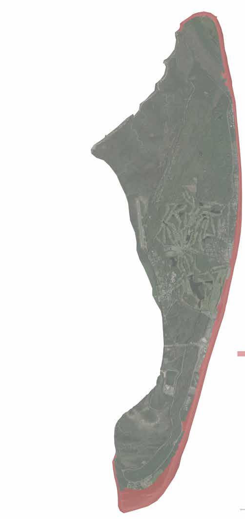
FIGURE 6- DIAMONDBACK TERRAPIN TION CONSERVA


Diamondback Terrapin Conservation Program: On average, 75 adult female diamondback terrapin deaths have occurred annually due to automobile-induced mortality on the causeway since 2017. Thanks to the ongoing terrapin conservation program led by the Georgia Sea Turtle Center (GSTC), mortality is down from an annual average of 131 deaths during the nine years prior to 2017. Research conducted in partnership with the University of Georgia has provided a strong foundation upon which to base mitigation actions.
Figure 6. Proportion of all hit-by-car (hit) diamondback terrapins relative to proportion unharmed (alive) terrapins documented on the Jekyll Island Causeway by the Georgia Sea Turtle Center since initiation of concerted diamondback terrapin conservation efforts in 2007
End Box
Proportion Hit Proportion Alive
Strategies:
1. Update the JIA Causeway Vegetation Management Plan to reflect changes that occurred in 2019 and Strategies: 2020 associated with the Georgia Power transmission line rebuild project. 1. Update the JIA Causeway Vegetation Management Plan to reflect changes that occurred 2. Partner with Georgia Power to maximize ecological values, minimize maintenance burdens, and support in 2019 and 2020 associated with the Georgia Power transmission line rebuild project a stable shoreline compatible with Georgia Power transmission line easement vegetation policies. 2. Partner with Georgia Power to maximize ecological values, minimize maintenance 3. Continue monitoring and research to better understand the effects of the causeway and its management on burdens, and support a stable shoreline, compatible with Georgia Power transmission line priority species, especially diamondback terrapin, to inform strategies that mitigate risk easement vegetation policies. of wildlife mortality due to vehicle strikes, and to evaluate the causeway’s function as a corridor for 3. Continue to implement monitoring and research to better understand the effects of the immigration/emigration and invasion. causeway and its management on Priority Species, especially diamondback terrapin, to 4. Develop road-mortality mitigation strategies (design, engineering, and construction) to reduce the negative inform strategies that mitigate risk of wildlife mortality due to vehicle strikes, and to effects of the causeway on Wildlife Priority Species. evaluate the causeway’s function as a corridor for immigration/emigration and invasion. 5. Continue implementing reduced mowing procedures during diamondback terrapin nesting season.4. Develop road-mortality mitigation strategies (design, engineering, and construction) to 6. Pursue opportunities to promote native grassland habitat and awareness of its value in areas of the reduce the negative effects of the causeway on Priority Species of wildlife. causeway that have been designated to be maintained free of trees/shrubs, either through Georgia Power 5. Continue implementing reduced mowing procedures during diamondback terrapin policies or JIA vegetation management planning. nesting season. 7. Continue implementing a zero-tolerance policy for invasive species on the causeway.6. Pursue opportunities to promote native grassland habitat and awareness of its value in 8. Prioritize human safety considerations along with wildlife protection in evaluating proposals or areas of the causeway that have been designated to be maintained free of trees/shrubs, programs with the potential to affect traffic patterns and driver responses on the causeway. either through GA Power policies or JIA vegetation management planning. 7. Continue implementing a zero-tolerance policy for invasive species on the causeway.MANAGEMENT 8. Prioritize human safety considerations, along with wildlife protection, in evaluating

5.4- SPECIFIC AREA MANAGEMENT
The Plan area has been divided into six units composed of vegetation communities and land uses that exhibit similarities in location, management requirements or constraints, or ecological function. Each of the management units is comprised of multiple land uses and/ or vegetation types described in Section 4.0 of this Plan. As such, the acreages noted for each management unit may not correspond directly with the acreages noted for the land uses and vegetation types noted in Section 4.0. The six management units are:
• Beach – Beach, primary dune, and early successional back dune/swale systems, • Holocene Maritime Forest – Naturally vegetated forested systems in the southern one-third of the Island along with pockets of freshwater wetlands • Salt and Brackish Marsh – Salt marshes, coastal creeks, and small-forested “hammock” islands • Pleistocene Maritime Forest – Pine and oak forests of the northern one-third of the Island, along with pockets of freshwater wetlands, • Golf Courses – The golf courses, forested systems within the golf courses, and the adjacent forested, freshwater wetlands
• Urban/Parks – Residential and commercial leased land along with supporting infrastructure, the Historic District/sites, and all non-golf greenspace and parks
The management and conservation of natural resources requires actions throughout the entire Island. As such, urban land uses such as the Golf Courses, Developed Roads, and Parks/Recreation are included within management units in the Conservation Plan. These land uses retain naturally vegetated habitats that benefit from management activities such as fire control and exotic species removal and provide habitat for a variety of resident and migratory species. In addition, these land uses abut larger areas of natural vegetation and can significantly influence the long-term quality and management actions for these larger natural systems. Urban land uses were designated into two separate Management Units based on existing conditions and anticipated long-term management requirements. The golf course unit is composed of the golf courses and various natural systems inside or adjacent to the courses that are affected by activities associated with golf, and Urban/Park includes residential, commercial, and roadway areas. With a Master Plan for the future of golf on Jekyll island progressing concurrently with this Conservation Plan Update, opportunities to substantially restore these natural systems are now anticipated.
The descriptions that follow provide additional information about the vegetation communities and land uses found within each Management Unit, as well as the types of ecological and physical characteristics that provide the context for management recommendations. Specific management objectives and related priorities are described to address the unique soils and vegetation communities found within the unit. Lastly, strategies that implement the priorities are provided for each unit.
The management strategies identified in the following have been summarized in Appendix F, which includes the text of each management strategy as well as an estimate of the general timeframe in which the strategy would be implemented. The general timeframes are broken down into four categories:
• Short-term - 1 to 3 years after the update to the Conservation Plan • Mid-term - 3 to 8 years of the Conservation Plan implementation • Long-term (remainder of the Conservation Plan duration or 8 to 2-plus years) • Ongoing – tasks that repeat periodically throughout the life of the Conservation Plan
These timeframes provide a general framework in which the implementation of proposed strategies can be prioritized but are subject to change as funding and staffing become available and adaptive management requirements are implemented.


Represented Communities
This unit occurs primarily in the eastern half of the Island and mostly includes the South Atlantic Upper Ocean Beach and Sea Oats Temperate Herbaceous Alliance vegetative communities. However, the subsequent successional stages evolving from beach systems in the southern end of the Island are also included in this management unit, including the Atlantic Coast Interdune Swale and Live Oak – Yaupon Holly – (Wax-myrtle) Shrubland Alliance communities.
Ecological and Physical Influences
The vegetation types within this unit are significantly affected by several common ecological and physical factors, including:
• Erosion and Accretion – The movement of sand associated with the beach unit is highly complex and is influenced by the lunar and seasonal dynamics of tides and waves, storm events, and human engineering. In general, the northern beaches of Jekyll Island are more typically characterized by erosion while the central and southern beaches are more typically characterized by accretion, • Wind – On-shore breezes contribute significantly to the formation of primary dunes adjacent to the open beach and can cause wind erosion in areas damaged by land uses • Salt Spray – Salt spray from wave action generated during both general sea conditions and periodic storms affect the soil conditions, plant physiognomy and community diversity of all systems within the unit • Inundation – The types (freshwater vs. brackish vs. salt water) of water inputs, depths and duration of inundation have significant influence on plant diversity and density in the back-dune systems
Objective 1A - Manage and monitor beaches to address erosion, accretion, storm events, and future sea-level rise
Discussion: Maintaining a dynamic beach ecosystem that supports natural geophysical processes and accommodates visitor enjoyment requires careful, balanced, and adaptive management.
Management Priorities:
1. Determine when management actions such as dune restoration and sand nourishment should be considered to sustain biological diversity.
2. Prepare for an increase in dynamic storm events/sea-level rise through native plant re-vegetation, dune restoration, and conservation of buffers.
3. Minimize soil disturbances in dunes, interdune swales, and successional vegetation communities along the youngest dune systems.
Strategies:
1. Establish a working group to formalize plans, timelines, and implementable steps to continue to protect and promote a natural dune system as the first order of beach protection from storm events and beachfront shoreline erosion. The group will consider impacts from human traffic/recreational use, revetments, authorized-vehicle driving, sea-level rise, sand supply and human alterations to sediment dynamics; maintenance and research needs and interests; and regulatory and financial limitations. The group should include, among others, a representative of the JIA, the public, a beach restoration specialist, and an expert on the ecology of the priority species that depend on these communities. In subsequent years, the group will meet annually and provide actionable beach management recommendations.
2. Conduct an Environmental Assessment Procedure (EAP) review to evaluate new crossings, infrastructure, or restoration projects that may be proposed in this unit.
3. Ensure that regular monitoring of beach/dune profiles and shoreline positions is occurring and that data/products are available for JIA use.
4. Prioritize protection and restoration of vegetation stands which shield interior vegetation from the impacts of ocean salt spray.
5. Maintain access to the most up-to-date and accurate maps and tools to identify areas to be affected by projected sea-level rise and incorporate this information into all JIA land-use planning products and processes.
Discussion: The Island is an important nesting site for sea turtles and a significant roosting and foraging area for beach-dependent birds such as red knot, wintering piping plover, and nesting Wilson’s plover. Recreational use of the beach, especially in the southern portion of the Island, has the potential to affect the viability and success of nests and disturb these and other species throughout the year.
Management Priority:
1. Protect red knot staging areas, wintering piping plover, Wilson’s plover nesting habitat and sea turtle nesting habitat in beach and dune areas across the Island.
Strategies:
1. Reduce authorized motor vehicle traffic from beaches south of southern water tower to minimum achievable levels while ensuring that responsibilities for public safety and stewardship of Endangered Species Act listed species are met.
2. Continue to concentrate public beach facilities and services between Oceanview Beach Park and Corsair Beach Park.
3. Design conservatively when considering new or improved beachfront public facilities to sustain the current visitor experience and wildlife habitat value of the beach south of Corsair Beach Park, characterized by low visitor-density gaps between beach access points and minimalist beach convenience services.
4. Continue policy of leaving natural beach wrack/debris in place to help build dune systems.
5. Continue beach elevation profile monitoring through partnership between GSTC and the Glynn County GIS department.
6. Continue active partnerships with Georgia Sea Turtle Cooperative, Georgia Shorebird Alliance, and others to ensure that the habitat needs of beach-dependent priority species, including sea turtles, red knots, piping plovers, and Wilson’s plovers are well understood; key trends are monitored; and threats are managed, reduced, or eliminated.
7. Strictly enforce lighting ordinance measures for adjacent lands to prevent light impacts to sea turtles.
8. Implement the EAP review for any proposed new development, redevelopment, or major renovation of public, residential, or commercial projects that are proposed to be built near the beach and could impose negative effects on natural resources.
9. Identify any potential additions to Wildlife and Plant Priority Species lists that utilize the beach and warrant special protection and monitoring.
10. Work with JIA Marketing team and utilize beach ranger staff to continually and adaptively communicate conservation messages about protecting beaches, dunes, and associated wildlife.
Represented Communities
This unit occurs on the northern and southern ends of the Island and is composed primarily of the Maritime Live Oak Hammock vegetative community. Additional small-scale vegetation communities surrounded by the dry live oak hammock are also included in this unit, including:
• Maritime Slash Pine Upland Flatwoods • Southern Atlantic Coastal Plain Carolina Willow Dune Swale • Red Maple – Tupelo Maritime Swamp Forest • Coastal Salt Shrub Thicket • Blackberry – Greenbriar Successional Thicket • Sand Cordgrass – Seashore Mallow Herbaceous Vegetation • Southern Hairgrass – Saltmeadow Cordgrass – Dune Fingergrass Herbaceous Vegetation • South Atlantic Coastal Pond • Successional Broom-sedge Vegetation • Southern Atlantic Coastal Plain Salt and Brackish Tidal Marshes
Ecological and Physical Influences
This unit is characterized by linear ridge and swale topography indicative of it’s relatively recent geologic origination from sand dunes formed along accreting shorelines. Although composed of a number of different habitat types, the dominant Dry Live Oak Hammock provides the matrix for the establishment of management requirements for the unit. Ecological, physical, and aesthetic influences for this unit include:
• Fire - Whether prescribed or wild, fire would negatively affect canopy composition, age structure, and aesthetic due to fuel loads, • Canopy Regeneration - The (extremely slow) process of regenerating canopy species sustains the forest structure, and • Hydrological Alteration - Wetlands within the Unit have been affected by regional groundwater alterations and/or alterations to surface water flows.

Objective 2A – Rare plant community and species conservation
Discussion: In the southern component of this Unit, Carolina Willow Dune Swale community with large-flowered hibiscus is a unique wetland community for the Island. Other large-flowered hibiscus locations such as the margins of Cabin pond near the Convention Center are important populations for this species as well. The northern component of this unit hosts a unique shallow brackish wetland, that is dynamic but at times offers high quality habitat for waterfowl and other aquatic birds.
Management Priorities:
1. Document existing conditions and specific requirements for Plant Priority Species and sustain or enhance these populations. 2. Manage trail access and roadway improvements around wetlands to limit alterations to the community. 3. Preserve the undisturbed nature of the forests and wetlands in the remote northern component of this unit.
Strategies:
1. Conduct an EAP review for any development, infrastructure retrofits, or trails occurring within 100 feet of the Carolina Willow Dune Swale community. 2. Incorporate the Carolina Willow Dune Swale community into the Island-wide hydrological monitoring program. 3. Conduct surveys of wetland habitat to monitor use by Plant and Wildlife Priority Species.
Discussion: This management unit exists in a relatively continuous block of diverse habitats extending north/south between Beachview and Riverview Drives and east/west between the salt marshes and beach. Protection of these continuous habitats will maintain the characteristic aesthetic of the southern end of the Island as well as maintain wildlife movement corridors in the area.
Management Priority:
1. Protect the habitats between the two roadways.
Strategy:
1. Evaluate any projects proposed to occur between the two roadways with the EAP process and maintain landscape-scale connections (both north/south and east/west) that currently occur.
Objective 2C – Habitat management and enhancement
Discussion: Several of the wetland systems occurring in this Unit exhibit signs of hydrological alteration, including transitional vegetation encroachment and limited inundation/saturation. Pine flatwoods systems that would benefit from fire occur as small pockets within an otherwise infrequent to rarely burned matrix of live oak hammocks.
Management Priorities:
1. Maintain or enhance the hydrology of historical wetland communities within the unit.
2. Sustain native canopy diversity and age distribution for oak-dominated areas and allow succession to occur in pine flatwoods.
3. Assure that negative effects of development/altered habitat areas within the Uunit do not compromise the quality of native habitats through the spread of invasive species, increased risk of wildfire, influx of untreated stormwater runoff, etc.
4. Incorporate the trail network as part of fire control features.
5. Limit hiking/biking to within identified trails to restrict entry into wetlands and sensitive upland areas.
Strategies:
1. Limit fires within the unit to maintain oak canopy.
2. Implement prescribed burns within pine flatwoods and herbaceous wetlands if effective small-scale units can be established consistent with fire management goals.
3. Develop a GIS database documenting connections and culverts under Riverview Drive that may impair tidal flow into historical salt marshes within the unit.
4. Implement culvert modifications in conjunction with road improvement projects to improve tidal flow and wildlife passage under South Riverview Drive.

5. Provide signs, fences, trail markers, and other structures to limit pedestrian use to established trails.


Represented Communities
This unit occurs in the western half of the Island and is composed primarily of salt marsh systems, including creeks and ecotones, associated with the Southern Atlantic Coastal Plain Salt and Brackish Tidal Marsh vegetation community. Additional small-scale vegetation communities in this management unit include:
• Red-cedar – Live Oak – Cabbage Palmetto Marsh Hammock, • South Atlantic Coastal Shell Midden Woodland, • Coastal Salt Shrub Thicket, • Sand Cordgrass – Seashore Mallow Herbaceous Vegetation, and • Southern Hairgrass – Saltmeadow Cordgrass – Dune Fingergrass Herbaceous Vegetation.
Ecological and Physical Influences
This unit is composed of broad areas of salt marsh flats as well as smaller fingers of salt marsh that occur adjacent to tidal creeks and extend interior into the Island. The shell midden and salt shrub thicket vegetation types occur as islands within the greater salt marsh context and have been included in this unit. Ecological, physical, and aesthetic influences for this unit include:
• Tides - The extent and duration of daily tidal inundation are significant influences on vegetation zonation • Periodic Storms – Inundation, salt spray, wave energy, and high winds associated with can alter structure and diversity of these systems • Salinity – Salinity levels driven by differential evaporation rates and/or freshwater inputs influence vegetation structure and diversity • Inundation Depth – The depths and duration of inundation have significant influence on the community types within the salt marsh • Flow Constrictions - Physical impediments to water movement provided by structures, roads, fallen trees, or other features can result in altered salinity and inundation levels, thereby affecting vegetation composition

Objective 3A – Maintain/improve salinity levels and water quality for salt marshes
Discussion: Development activities in adjacent uplands can result in alterations to surface sheet flow and result in concentrated areas of stormwater discharge that alters the freshwater/brackish water balance. These stormwater discharges may also carry altered nutrient loads, which affect water quality of the discharge and can alter species composition.
Management Priorities:
1. Continue to evaluate water quality of current discharges into tidal wetlands/waterways. 2. Minimize or remediate new point-source freshwater discharges directly to tidal wetlands/waterways.
Strategies:
1. Evaluate, document and monitor new and existing freshwater discharge locations for potential effects on salinity levels, water quality and inundation regimes. 2. Integrate GADNR EPD Coastal Stormwater Supplement to the Stormwater Management Manual into Jekyll Island Design Guidelines and/or local ordinance. 3. Retrofit existing stormwater discharges into salt marshes based on data obtained from the monitoring program. 4. Enhance, re-route or remove existing freshwater discharge points to restore historical salinity levels. 5. Promote use of bioswale systems and route existing stormwater discharges to bioswale retention where feasible.
Discussion: The salt marshes around the Island have been affected by historical alterations including culverts, impoundments, creek armoring and fill deposition. Salt marsh fingers in the interior of the Island maintain tidal connections through culverts under roadways throughout the Island. These culverts and roadways can restrict the free flow of tidal waters and may affect residence time and salinity levels. Impoundments, including the areas near the causeway entrance and adjacent to the trail system in the north end of the Island, were created to provide open water areas from historical salt marsh for wildlife use and hunting purposes. The bike trail on the northern portion of the Island passes through salt marsh habitats and may affect tidal exchange between the bisected portions of the marsh. Historical spoil deposition from dredging and development activities resulted in the deposition of fill on historical salt marsh in the southern portion of the Island. Although the fill areas are now vegetated with rarer coastal shrub thicket communities, the piles may have altered tidal creek configuration in this area, thereby affecting tidal exchange within the marshes.
Management Priorities:
1. Restore and enhance tidal flow and appropriate ecological functions to fragments of the former First Creek system, prioritizing restoration of Fortson Pond followed by Cabin Pond. 2. Evaluate feasibility of establishing a salt marsh mitigation bank based around the large tidal lake on Oleander Golf Course, which was once the tidal headwaters of First Creek. 3. Enhance salt marsh habitats through improved tidal flow and hydrologic patterns in historically impounded areas in the central portion of the Island. 4. According to priority and funding opportunities, optimize culvert sizing for compatibility with historical tidal flow patterns; consider converting culverts to bridge spans if possible. 5. Retrofit trails and service roads as needed to improve tidal exchange.
Strategies:
1. Identify and document hydrological regimes, wildlife uses, and potential downstream impacts for historically impounded salt marsh areas in the central portion of the Island and develop restoration/enhancement plans to increase tidal flow and wildlife habitat availability; initiate restoration/enhancement of impounded salt marshes as funding becomes available or through mitigation projects. 2. Evaluate ecosystem function and habitat value or lack thereof in historically ditched saltmarsh. 3. Retrofit undersized culvert locations in association with road improvements, mitigation projects, or as other funding becomes available to provide improved tidal exchange for salt marshes in the Island’s interior. Interior locations include the marshes between Riverview and Beachview Drives in the southern portion of the Island south of the Island entrance and marshes immediately north of the Ben Fortson Parkway/Causeway entrance. 4. Implement culvert replacement to increase tidal connections under Crane Road. 5. Assess the effects of sea-level rise on tidal connections to interior portions of the Island and develop restoration/enhancement procedures for addressing the impacts. Consider the subtle but important distinctions in salinity as marshes transition from freshwater to brackish to salt marsh.
Objective 3C – Maintain coastal shrub thicket and shell midden communities
Discussion: The shell midden communities include unique habitats for that are home to several rare plant species. The coastal shrub thicket primarily occurs over historical dredge spoil deposition and is susceptible to exotic plant invasions, particularly by salt cedar and Chinaberry. Regardless of the artificial origins of these habitats, their value for priority species contributes substantially to biodiversity. Both areas are highly productive for marsh rabbits and other small mammals, which in turn support eastern diamondback rattlesnake and bobcat populations.
Management Priorities:
1. Manage access to shell midden communities to limit potential impacts to priority species. 2. Control invasive plant species. 3. Evaluate potential positive and negative impacts of prescribed fire application in these communities.
Strategies:
1. Do not create new access or encourage additional outdoor recreation/education use of shell midden communities. 2. Work with Georgia 4-H Camp Jekyll staff to mitigate impacts associated with educational programs utilizing the shell midden on the causeway. 3. Collaborate with CG-CISMA to develop practicable and achievable methods and a timeline for addressing salt cedar invasion. 4. Test and evaluate the benefits of prescribed fire in the coastal salt shrub thicket on the north end of the Island adjacent to the airport.
Represented Communities
This unit occurs in the northern third of the Island and is primarily composed of two vegetation communities: Maritime Slash Pine Upland Flatwoods and Maritime Live Oak Hammock. Additional small-scale vegetation communities within the matrix provided by these forested upland communities include:
• Southeastern Florida Maritime Hammock • Outer Coastal Plain Sweetbay Swamp Forest • Loblolly-bay Forest • Red Maple – Tupelo Maritime Swamp Forest • Blackberry – Greenbriar Successional Shrubland Thicket • Sawgrass Head • Urban/Developed (water towers)
Ecological and Physical Influences
This unit is comprised of large blocks of forested systems (both upland and wetland) in the northern area of the Island. Although portions of this unit were used for agriculture from the late 1700s through the mid-1800s, canopy species and structure have re-established and reflect historical conditions (closed canopy, pine with mixedoak dominance). Large portions of this unit exhibit fire-dependent or fire-resistant plant species that are suggestive of relatively frequent fire in the historical past. Small pockets of urban uses, primarily consisting of water tower and/or well locations, have been included within the unit. Ecological, physical, and aesthetic influences for this unit include: • Characteristic Canopy - The existing canopy provides a characteristic look for the Island • Fire Fuel Loads - Fuel loads within the majority of the unit pose a risk for catastrophic fire that would radically alter the canopy structure and aesthetic contribution of this community • Salt Spray – Salt spray and tidal inundation affects diversity and vegetation form in portions of the unit near coastal creeks and beaches by limiting establishment and survival of salt-sensitive species • Hydrological Alterations - Wetlands within the unit have been negatively affected by regional groundwater alterations and/or alterations to surface water flows • Invasive Fungal Species - Laurel wilt has significantly altered the structure, and composition of the understory shrub/sub-canopy through loss of red bays

Objective 4A – Sustain large, diverse landscape connections
Discussion: This unit predominantly consists of the largest block of forested uplands on the Island, with some saltwater marshes, freshwater wetlands, and infrastructure associated with urban/development uses embedded within. The ecological legacy of historical land uses, including agriculture, forestry and wetland modification, is more significant in this unit than elsewhere on the Island. Protecting the integrity (connectedness) of the Pleistocene Maritime Forest community, as well as most of the natural communities on Jekyll Island, is important for ecological and management reasons. Sustaining landscape connections allows movement of wildlife without risk of mortality from cars and disturbance from humans and supports the flow of genetic information between populations of plants. Protecting large blocks of forest minimizes edge effects, particularly from invasive, exotic plants, and reduces disturbance from noise and lights.
Management Priorities:
1. Prevent invasive plant incursion. 2. Enhance understanding of plant community population dynamics and stressors. 3. Maintain landscape connectivity between this unit and the golf course, western salt marshes, and the northern Holocene maritime forest habitats. 4. Implement a comprehensive fire management program in pine-dominated stands within this unit with an emphasis on safety and operational sustainability. 5. Prevent unauthorized vehicle traffic and create managed opportunities for outdoor recreation/education access to appropriate areas in the interior of this unit.
Strategies:
1. Evaluate any projects proposed in the unit with the EAP process with the priority to maintain landscape-scale connections (both north/south and east/west) that currently occur and that protect the natural communities in the northern end of the Island. 2. Identify actionable information in products of the 2016-2020 UGA study that investigated multiple stressors in maritime forest communities and implement actions to mitigate stressors threatening this community. 3. Carry out and evaluate a relatively small-scale prescribed fire in the least challenging burn block available in this unit to assess whether the benefits of mid- and under-story plant management outweigh the expense of implementing the burn and the risk of killing trees.
Objective 4B – Wetland enhancement
Discussion: Historical wetlands within this Unit exhibit signs of hydrological alteration, including growth of transitional/upland vegetation on the margins of the wetland. The Sawgrass Head exhibits significant blackberry and dog fennel growth interior to the wetland, while roadways in the northern portion of the Unit have altered freshwater exchange from the Outer Coastal Plain Sweetbay Swamp Forest into the salt marsh extension. Many of the canopy trees in the loblolly bay wetland have fallen and/or exhibited subsidence around the bases. Groundwater withdrawals, surface-water alterations from ditches, and culvert sizing under roads may all play a role in the apparent hydrological alterations. Natural cycles of drought and rainfall are also a factor to be considered and accounted for in considering restoration and management options.
Management Priority:
1. Evaluate the effects of ditches in and outside of the unit on the hydrology of wetlands.
Strategies:
1. Monitor natural recruitment of desirable wetland canopy vegetation within the loblolly bay community and Outer Coastal Plain Sweetbay Swamp Forest areas; plant replacement canopy trees if monitoring indicates recruitment is not sufficient to re-vegetate the canopy and the natural hydrology can be restored. 2. Assess the long-term need for the portion of “ditch road” that separates the northern end of Indian Mount Golf Course from the adjacent loblolly bay wetland; study potential benefits of enhancing hydrological connections between the two systems while promoting retention of freshwater. 3. Map existing ditches in the unit and adjacent golf course and identify effects on surface water discharge/drainage. In coordination with golf course maintenance needs, identify priorities for ditch modification, or abandonment, to enhance retention and detention of stormwater runoff to support wetland hydrology, pollutant filtration, and groundwater recharge, and to mitigate tidal flooding of freshwater wetlands. 4. Monitor surficial groundwater levels in association with any major freshwater wetland restoration project and, if needed, limit nearby withdrawals from the surficial aquifer to sustain wetland ecosystem functions. 5. Plan for wetland restoration opportunities anticipated to result from golf course land use changes.


Discussion: Large portions of the live oak hammock in this unit exhibit few saplings of the characteristic canopy species in the understory. Coupled with the laurel wilt effects on red bay occurrences, the young tree source for canopy replacement after a stand-altering event is limited. Extensive areas of pine flatwoods occur, many of which exhibit fire-dependent or resilient species.
Management Priorities:
1. Address fire management comprehensively through stepwise program development. 2. Begin the effort to sustain or enhance canopy diversity and age distribution of both oak and pine habitats over the long-term. 3. Develop forest health response protocols in the event of canopy loss due to fire, pests, or disease.
Strategies:
1. Address fire management through a comprehensive fire management program that addresses firebreak locations, management unit sizes and control measures, communication protocols for adjacent residents, wildland-urban interface burn issues, use of natural features such as wetlands as control features, and prescribed fire locations. 2. Strategically expand reforestation efforts beyond high-visibility areas to include naturally forested areas with canopy gaps and limited regeneration of representative canopy species (e.g. live oak). 3. Selectively and sensitively remove dead canopy tree biomass, following tree die-offs exceeding approximately one acre, to reduce fuel loads; replant with appropriate native species. 4. For targeted live oak reforestation or larger-scale maritime forest restoration, utilize and refine the custom decision support tool (developed through JIA-funded research carried out by the University of Georgia) to consider the age of juvenile live oak trees to plant, understory vegetation control, and herbivore exclusion.. 5. Identify high-priority sites to implement deer exclusion to facilitate plant diversity enhancement and/or desired canopy tree recruitment, particularly in association with reforestation/restoration efforts. 6. Create and maintain native grass-dominated communities in order to restore grassland species diversity to the Island and to enhance small mammal productivity in support of predator populations.
Unit 5: Golf Courses
Represented Communities
This unit occurs in the central third of the Island and is composed primarily of the facilities associated with the golf courses on Jekyll Island and are mapped as golf course land-use type. Naturally-vegetated forested systems occur in small patches throughout the golf courses as do wetlands, ponds, and streams associated with the drainage infrastructure. Some of these features are remnants of historical wetlands and include Plant Priority Species such as loblolly bay, pond pine, and buttonbush. The margins of this management unit include small aggregations of naturally vegetated uplands composed of Maritime Live Oak Hammock and/or Maritime Slash Pine Upland Flatwoods.
Ecological and Physical Influences
The forested systems interspersed within the maintained fairways, roughs, greens, tees, and stormwater systems of the golf courses provide a mosaic of habitat types and conditions in the central portion of the Island. Although some of these forested areas are “islands” of canopy within the golf course, larger forested blocks occur around the margin of the golf courses, some of which have landscape connections to habitats within other management units. These forested communities provide valuable habitat within and adjacent to the golf courses and should be managed as a natural resource. Many of the forested systems exhibit significant fuel loads, which can pose increased risk for wildfire that would radically change the composition, structure, and aesthetic of these systems. Canals, lakes, and other water alterations within the golf courses have changed hydrological patterns within the central portion of the Island and may be affecting and affected by the hydrological regimes of adjacent wetlands. All courses are currently certified through the Audubon Cooperative Sanctuary Program for Golf. Ecological and aesthetic influences for this unit include:
• Characteristic Canopy - The existing canopy provides a characteristic look for the golf course and a recognizable aesthetic for the Island • Fire and Fuel Loads - Fuel accumulation within most of the unit can pose a risk for catastrophic fire that could radically alter the canopy structure • Hydrological Alterations - Canals and ponds have reconfigured how water flows through the unit and across the Island and contribute to freshwater run-off into adjacent salt marshes • Water Quality - Maintenance practices and stormwater treatment ponds affect water quality leaving the unit and flowing into adjacent wetlands
Discussion: Systems within the unit would benefit from fuel load reductions consistent with the comprehensive fire program. Ditches occur on and adjacent to the golf courses that serve important functions for golf maintenance, but may affect surface hydrology of wetlands in adjacent units. The anticipated opportunity for ecological restoration of substantial acreage currently occupied by golf has potential to earn high-profile commendation from Jekyll Island stakeholders and supporters of ecological restoration. Should this opportunity occur, it can be expected to leverage partnerships and attract renewed interest in diversified outdoor recreation on Jekyll Island.
Management Priorities:
1. Identify and pursue opportunities for ecological restoration of disturbed habitats that contribute to long-term ecological health of the Island. 2. Identify hydrological alterations, including groundwater impacts and ditching, and pursue opportunities for wetland restoration and/or enhancement. 3. Manage land currently within Oleander Golf Course with prescribed fire to reduce fuels, increase herbaceous cover, maintain herbaceous wetlands, and enhance ecological productivity.
Strategies:
1. Coordinate fire management within the golf course unit with the comprehensive fire management program for the Island. 2. Identify and pursue opportunities to create wildlife corridors preserving the integrity of modern golf design and maintenance practices. 3. Implement ecological restoration projects through budgeted funding, fund raising, mitigation opportunities, or volunteer projects. Large-scale restoration and conservation land management associated with any future changes in the layout of golf should go through a structured planning and design process. 4. Recreate natural landscape features to accommodate a diverse array of native species that complement the conservation goals of adjacent natural lands, favoring establishment of native-grassland systems where appropriate.
5. Establish mechanisms for sustaining these investments in public greenspace and ecological infrastructure over a multi-decadal timeframe.
6. Achieve consistency with the Georgia Chapter of the Golf Course Superintendents Association Best Management Practices for Water-use Efficiency in association with any major golf course renovations.”


Discussion: The golf courses provide a significant open space within the central portion of the Island. Pesticide and fertilizer use on the courses can have direct or indirect effects on plant and wildlife populations in the natural areas adjacent to the courses if improperly applied. Excessive nutrients can affect water quality of downstream freshwater wetlands and salt marshes. All of the courses have received certification from Audubon International as Cooperative Sanctuaries, which mandates benchmarks for chemical use reduction and safety. Furthermore, JIA’s professional golf course maintenance staff is highly trained and experienced in best management practices to prevent waste and collateral damage from chemical and fertilizer applications.
Management Priorities:
1. Maintain a natural resource-compatible integrated pest management and maintenance program for golf course operations. 2. Evaluate and pursue opportunities to improve stormwater quality, reduce discharge quantity to tidal wetlands, and enhance wetland hydroperiod. 3. Identify and pursue opportunities to incorporate natural features within the golf course unit into educational programs and conservation-oriented monitoring and research. 4. Maintain awareness of potential for conservation-oriented activities to affect, positively or negatively, the game and business of golf, including golf course maintenance. Actively communicate with golf course staff accordingly.
Strategies:
1. Continue implementing the Watershed Protection Plan, which monitors freshwater discharge points from the golf course unit and is a mandatory element of compliance with Georgia DNR Environmental Protection Division requirements. 2. Identify and implement improvements to the stormwater system to enhance water quality, timing, and discharge rates into offsite wetlands. 3. Address dual challenge to maximize retention/detention of stormwater runoff and nutrient filtration while providing for appropriate turf management conditions on the courses. 4. Continue advancing irrigation reduction measures and water recapture/re-use approaches. 5. Continue to recertify Cooperative Sanctuary status through Audubon International (https://auduboninternational.org/acsp-for-golf/) for all golf courses. 6. Achieve consistency with the Georgia Chapter of the Golf Course Superintendents Association Best Management Practices for Water-use Efficiency in association with any major golf course renovations.


Discussion: Wading bird rookeries commonly occur within this unit. The Island’s alligator and freshwater turtle populations are heavily dependent on this unit. Maintenance operations and future modifications to the courses should be designed to minimize potential impacts on rookeries. Restoration enhancements outlined in Objective 5A should also improve habitat values of the lake systems for wildlife by creating habitat types currently limiting or absent from the Island.
Management Priorities:
1. Manage human/wildlife interactions within the golf course to minimize the risk of negative interactions with wildlife and maximize positive outdoor recreation experiences. 2. Control non-native plant species that may invade course edges and natural areas between holes, such as camphor tree, Cherokee rose, Chinese Tallow, Chinese privet, chinaberry tree, and lantana. 3. Restore native plant community structure and species composition on golf course out-of-play areas, reducing the frequency of maintenance but preserving the ability to actively manage these areas.
Strategies:
1. Monitor and protect wading bird rookery habitat from alteration and human disturbance that could reduce its potential to support successful nesting. 2. Pursue opportunities for enhancing waterfowl habitat by establishing appropriate densities of native emergent and submerged vegetation within ponds, where compatible with golf play and maintenance. 3. Monitor water quality and wildlife use in artificial ponds and modified wetlands to support future restoration and habitat enhancement efforts. 4. Maintain and/or improve water quality to improve habitat for native aquatic species. 5. Increase awareness of the effects of feeding wildlife, especially alligators, on animal behavior and health, as well as human safety. 6. Evaluate the opportunity for beneficial use of dredged material from Jekyll Creek to modify the salt marsh/open water balance of the large lake on the Oleander Golf Course for either wetland mitigation banking purposes or waterfowl habitat enhancement. 7. Work with golf course maintenance staff to enhance native plant diversity in out of play areas. 8. Continue to implement and expand upon prescribed fire management for natural areas within and adjoining the golf course.


Represented Communities
This unit occurs throughout the Island and is composed of the non-golf course portions of the Urban/ Developed communities, including residential lots, educational facilities, parks and open space, the Historic District, commercial land uses, and roads. Small areas of naturally vegetated forested uplands occur within this unit on the margins of some residential and commercial areas, while disturbed or altered undeveloped (or previously developed) lands are also included.
Ecological and Physical Influences
Although the various development land uses are the dominant component of this unit, relatively small areas of naturally vegetated communities (land that is leased but not built upon), engineered bioswales and dunes, canopy trees and native-plant landscaping, contribute to the ecological function of the Island. Protection and management of these smaller-scale natural features can buffer conservation lands and maintain habitat or structural connectivity between habitat patches. Building practices, landscape practices, and operations can also reach beyond the margins of the development use, supporting or detracting from ecosystem functions in natural areas. Ecological, physical, and aesthetic influences for this unit include:
• Vegetation Alterations - These effects may include introduction of exotic species, creation of wind gaps that introduce salt or sand movement inland, habitat fragmentation effects, and hydrological alteration • Water Quality and Flow - Water quality and salinity of wetlands (both freshwater and tidal) can be affected by direct inputs of stormwater discharge, constrictions to water movement such as berms, control structures, or culvert constrictions, and inundation patterns that are different from historical conditions because of timing, temperature, or nutrients • Integration to Overall Island Operations - Management priorities and actions for this Unit require significant coordination with other departments and JIA plans and processes pertaining to on the Island, such as the Master Plan, Environmental Assessment Procedure (EAP), Design Guidelines, and various operational functions

Objective 6A – Minimize footprint of development uses on conservation lands
Discussion: The ecological impact of development can extend beyond the physical footprint of structures and facilities. Pollution, in the form of chemicals, trash, sediment, noise, or light, can extend into adjacent natural areas affecting biology and ecology. Development expansion and increased visitation can amplify these threats, leading to habitat degradation, loss, or fragmentation, especially when additional roadway and stormwater infrastructure is required. Urban/developed areas often the origin of exotic species invasions and wildfire ignition.
Management Priorities:
1. Minimize the introduction of invasive exotic species within developed landscapes through the JIA Design Review Process, Environmental Assessment Procedure (EAP, Chapter 7), and community outreach. 2. Minimize fragmentation of, and deleterious edge effects on, natural habitats by future development and roadways. 3. Investigate wildlife/people interactions to evaluate health and safety hazards, as well as population and health effects impacting wildlife. 4. Promote use of native and locally sourced landscape materials. 5. Support the monitoring and enforcement of all laws and ordinances in place to protect environmental values on Jekyll Island. Support the development and/or revision of ordinances to this effect. 6. Communicate and partner with commercial entities and community groups to promote a common culture of conservation and sustainability and sense of unified stewardship across the Island.
Strategies:
1. Utilize management recommendations for Management Units, Conservation Priority Areas (CPAs) and criteria associated with landscape-scale evaluation in the EAP to provide input to updates to the Jekyll Island Master Plan that identify the parcels most appropriate for development or redevelopment compliance with statutory limitations on subdividing and improving not more than 1,675 acres of the land area of Jekyll Island. 2. Implement buffers for CPAs identified in the EAP when designing and constructing development/redevelopment projects. 3. Negotiate revised or new lease agreements that preserve the ecological value of habitat features on leased parcels to support the Parkwide Management Objectives articulated in this chapter. 4. Negotiate revised and new lease agreements that contribute to the advancement of the institutional sustainability goals outlined in Chapter 6 of this plan as well as sustainability targets that may be established by the JIA in future planning. 5. Implement the EAP review for any proposed new development or redevelopment, renovation or remodeled residential and commercial projects that could negatively impact CPAs. 6. Adopt specific stormwater guidelines to maintain appropriate freshwater/brackish inputs, water quality, and water quantity for wetland systems on, or surrounding the Island. 7. Evaluate practicalities of passing a new ordinance that would require new development, construction, and major renovation to utilize Green and Sustainable Technology and, where appropriate, achieve certification through LEED, Green Globe or other environmental certification programs. 8. Continue implementing public outreach and education to promote awareness of human-caused wildlife threats, such as roadway mortality and feeding, and the individual decisions that can reduce these threats. 9. Update design guidelines to integrate design requirements of the Coastal Stormwater Supplement. 10. Monitor and consistently enforce the beach lighting ordinance. 11. Prevent unauthorized alterations and penalize damaging uses of non-leased lands, such as clearing and walkway construction, especially pertaining to designated CPAs and associated buffers.
Objective 6B – Restore and enhance areas that benefit Island ecology
Discussion: This unit includes degraded natural lands and development uses that occur as small “islands” within other management units. Parks and recreation facilities include a variety of lands ranging from intensive active recreation fields to passively used, relatively natural areas. Roadways throughout the Island include culverts and drainage features, or lack thereof, affecting tidal flow and/or freshwater hydrology for wetlands in adjacent units.
Management Priorities:
1. Incorporate ecological restoration of disturbed/altered systems within or immediately adjacent to management units 1 through 4 that contribute to long-term ecological health of the Island into JIA strategic and budgetary planning. 2. Encourage recreational and educational uses that meet the needs and interests of diverse user groups. 3. Evaluate the condition of culverts and drainage features and seek opportunities for hydrological enhancement of freshwater and coastal wetlands, prioritizing the most degraded systems, such as Fortson Pond. 4. In landscape applications, encourage the use of native plant species and discourage the use of invasive non-native species.
Strategies:
1. Develop and maintain a restoration database that documents the locations and characteristics of old and new disturbances and completed restoration projects. 2. Promote diversification of active outdoor recreational and nature-oriented educational facilities within existing urban/developed land footprint. 3. Continue to increase use of native species in planting palettes for lands adjacent to management units 1 through 4 as designated during the Design Guidelines review process. 4. Maximize stormwater retention on the Island to sustain wetland ecology and enhance surficial aquifer recharge. 5. Revise ordinances to accommodate well-maintained and proportional native plant landscaping in residential areas.


5.5- MONITORING
A successful management plan requires adaptation to changing environmental conditions, new techniques and relevant research. Understanding the aspects of management that are successful requires monitoring and frequent evaluation with comparison to reference sites and desired future conditions. Many of the components of this Plan cite the specific needs for monitoring (e.g., priority species, water quality, exotic species, hydrology). The level of effort assigned to monitoring often depends on the level of funding and staffing and should be balanced to avoid overinvestment in monitoring, which causes “analysis paralysis”. The JIA conservation program should always be poised to act in a precautionary and informed manner in the interest of its mission to protect and enhance biodiversity. Investments in monitoring and research are essential, but care should be taken to prevent these programs from consuming resources to the extent that they could unduly delay active management and restoration to sustain species or enhance habitat. Monitoring programs will need to be strategically instituted and adapted over time. The objectives from Section 5 above were used to create an outline for monitoring that can be expanded to meet specific needs and budget/funding practicalities.
Ongoing and planned monitoring activities are listed in Appendix J as related to the Management Strategies presented in this chapter.
In general, the strategies for implementing monitoring should include:
• Develop and implement a strategic monitoring program for natural resources of the Island. Include quantitative evaluation of factors such as fuel load, exotic and invasive species occurrences, water quality, wetland hydrology, erosion and/or human disturbance to dunes, vegetation structure and diversity, and priority species population indices • Use effective monitoring tools ranging from photo-documentation to quantitative vegetation plots to long-term research studies that may result in publication of pee-reviewed articles • Maintain, organize, and manage all data files to facilitate quality control, timely analysis, and product development to provide information to decision-makers as well as institutional and stakeholders from the general public • Assess the results, costs, and benefits of monitoring on a regularly scheduled basis and utilize results and products to support JIA stewardship, and to inform ongoing implementation of and updates to the objectives, priorities, and strategies in the Conservation Plan
Objective: Minimize Habitat Fragmentation/Loss
Monitoring Framework:
• Identify and document impacts of barriers to movement on wildlife, such as roadways, through documentation of locations of roadkill and reduced wildlife movement permeability, types of species affected, and times of year in which the movement disruption/kills occur.
Objective: Implement a Comprehensive Fire Management Program
Monitoring Framework:
• Establish a GIS database to document prescribed and unintentional fires to capture the date, location of area burned, and acreage burned. • Establish a fuel load monitoring program to determine the need for fuel reduction measures, which would include monitoring duff thickness, fuel loads by fuel type, and fuel structure (e.g., needle drape).

Monitoring Framework:
• Monitor the locations, extent occupied, and outcomes of control efforts, for exotic, invasive plant and animal species. • Through collaboration with CG-CISMA, monitor the spread of exotic species found in the region but not yet on the Island and prepare contingency plans to proactively address if found. • Monitor behaviors and impacts of native wildlife species that potentially conflict with human activities and priority species conservation.
Objective: Assess regional and local groundwater dynamics to better understand factors effecting ecological systems on Jekyll Island as well as contributions of Jekyll Island withdrawals to regional groundwater dynamics.
Monitoring Framework:
• Convene a meeting with regional partners to assess current groundwater levels on and around the Island, determine their effect on wetland hydrology, and create a plan to minimize the impacts. • Incorporate the Carolina willow dune swale community into the Island-wide hydrological monitoring program and monitoring inundation levels, seasonality of inundation, and duration of inundation. • Monitor natural recruitment of desirable wetland canopy vegetation within the loblolly bay community and Outer Coastal Plain sweetbay swamp forest areas.
Objective: Protect Wildlife Priority Species
Monitoring Framework:
• Monitor, in collaboration with resource partners, the status of priority species and the conditions of the habitats on which they depend. • Monitor nesting use and success and protect nesting areas for priority species.
Objective: Protect Wildlife Species That Nest or Roost on Beaches
Monitoring Framework:
• Monitor beach-dependent priority species in coordination with key external partners.
Objective: Manage and Maintain Beaches to Address Erosion, Accretion, Storm Events, and Future Sea-level Rise
Monitoring Framework:
• Ensure that regular monitoring of beach/dune profiles and shoreline positions is occurring and that data/products are available for JIA use. • Identify the areas most likely to be affected by projected sea-level rise and monitor the vegetation composition and structure, hydrology, and the occurrence of exotic species.
Objective: Maintain/Improve Connectivity and Water Quality for Salt Marshes
Monitoring Framework:
• Identify all locations where stormwater infrastructure facilitates flow between freshwater wetlands, brackish wetlands, and saltmarshes. • Evaluate how existing stormwater infrastructure contributes to or detracts from wetland ecology throughout the salinity gradient. • Continue to evaluate water quality of current discharges into tidal wetlands/waterways.

Monitoring Framework:
• Evaluate the effects of ditches in and outside of the unit on the hydrology of wetlands. • Map and monitor existing ditches in the unit and adjacent golf course and identify effects on surface water discharge/drainage. • Monitor wildlife use and wildlife issues reported within the golf course unit. • Monitor natural resources addressed in Audubon International certifications for periodic recertification requirements. • Develop and monitor metrics of success for restoration efforts.
Objective: Minimize Footprint of Development Uses on Conservation Lands
Monitoring Framework:
• Conduct baseline assessments before and after development implementation significant changes to development uses to assess effects on vegetation composition and structure, exotic species occurrences, and wildlife use. • Monitor water quality, infiltration rates, and/or other surface water characteristics of impervious surfaces and associated drainage infrastructure. • Monitor wildlife use and compatibility issues within developed lands. • Monitor the enforcement of all laws and ordinances in place to protect environmental values on Jekyll Island. Support the development and/or revision of ordinances or other legal mechanisms, including those that:
- Prevent unauthorized landscape modification of non-leased lands, especially within Conservation Priority Areas. - Revise ordinance language to balance accommodation for native plant friendly landscaping with modern standards for residential neighborhood aesthetics and fire safety. - Prevent the unauthorized collection, harm, and/or removal of native wildlife and plants from the Park. - Prohibit the use of rodenticides that are potentially lethal to rodent predators including multiple Wildlife Priority Species.
Reporting
Periodic reports that document the results of monitoring efforts conducted on the Island are helpful both to provide a snapshot of the results of ongoing management and provide long-term trend information that can guide adaptive management efforts. Reporting types may vary depending upon the type of monitoring activity that occurs, although some level of periodic reporting should occur for most monitoring types. Potential reporting types and frequencies that may be useful for the Park include:
• Monthly updates provided to the JIA Board to document ongoing work conducted by staff, partners, and volunteers • Annual or more frequent data updates placed on websites for public and researcher review • Published papers or presentations at professional societies of ongoing work conducted on the Island • Public education and stakeholder involvement through field programs, local, regional, or national presentations, and citizen science • Periodic reports in community forums
Other reporting approaches may also be suitable for work conducted on the Island and the type and frequency of reporting will need to be considered based on staffing, volunteer levels, and funding requirements.