REGIONALPLANNINGSTUDIO&INTEGRATEDDESIGNSTUDIO

REGIONALPLANNINGSTUDIO&INTEGRATEDDESIGNSTUDIO
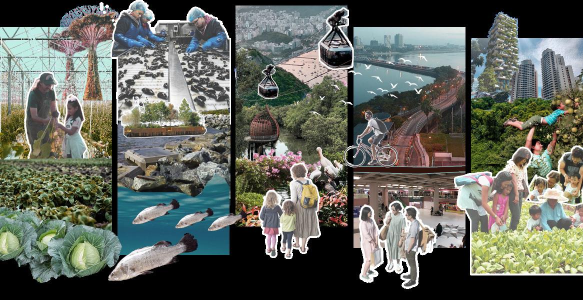
SafeguardingSingapore’sFuturethroughEnvironmentalandEconomicResilience


AnUrbanPlanningandUrbanDesignSampleWorkbyKeshiaSimatupang
OriginalStudioWorkbyMUPClassof2024Group5(from2023-2024)
KeshiaSimatupang(groupleader),LiYiwen,YangJiaxi,andLimZemin(2023)
KeshiaSimatupang(groupleader),LiYiwenandYangJiaxi(2024)
StudioTutors
JeffreyHo,DjokoPrihanto,andYuliangZhou
FinalPresentationwasheldinMay2024 inattendanceofUrbanRedevelopmentAuthority, HousingandDevelopmentBoard,SurbanaJurongandJTC.
Keshia’scontributiontotheworkincludesandnotlimitedto:
•Leadthegroupandprojectdirectionthroughdiscussionsandbrainstorming •Spatialanalysis.ThiswasdoneusingQGIS,andfindingsweresynthesizedthrough strategiesandobjectives.
•Analysisofcurrentenvironmental,resilience,andlandscapeconditions.Additionally, analysisoffuturetrendsandconditions.
•Attheurbanlevel,landuseplanningandurbandesignareintegratedwithlandscape approaches.Furthermore,Keshiaproducedgraphicimages,diagrams,andplansof planningintentions.
•Concerningcoastalresilience,Keshiasynthesizedthedifferentapproachesandsections ofcoastalresiliencesolutionsandenhancements.
Keshia’sbriefpresentationandshortsharingsessionaboutthisstudioproject (inIndonesian)canbefoundthroughthislinkandQRcode:


keshia.simatupang@gmail.com keshia.simatupang@u.nus.edu
+628558338905
Linked.inprofile ArchitecturePortfolio
KeshiaSimatupanggraduatedwithaMaster'sinUrban PlanningfromtheNationalUniversityofSingapore. Previously,shewasajuniorarchitectanddesignerasa landscapearchitectureconsultantbasedinJakarta, whereshewasinvolvedinlandscapeprojectsinJava andBali.
ShereceivedaBachelorofArchitecturedegreefrom InstitutTeknologiBandung,whichequippedherwith herunderstandingofthebuiltenvironment.
DuringherstudiesatNUS,sheinternedatBappenas andvolunteeredattheWorldCitiesSummit2024, whichcementedherinterestinresilienceandclimate challengesincities.
Introduction
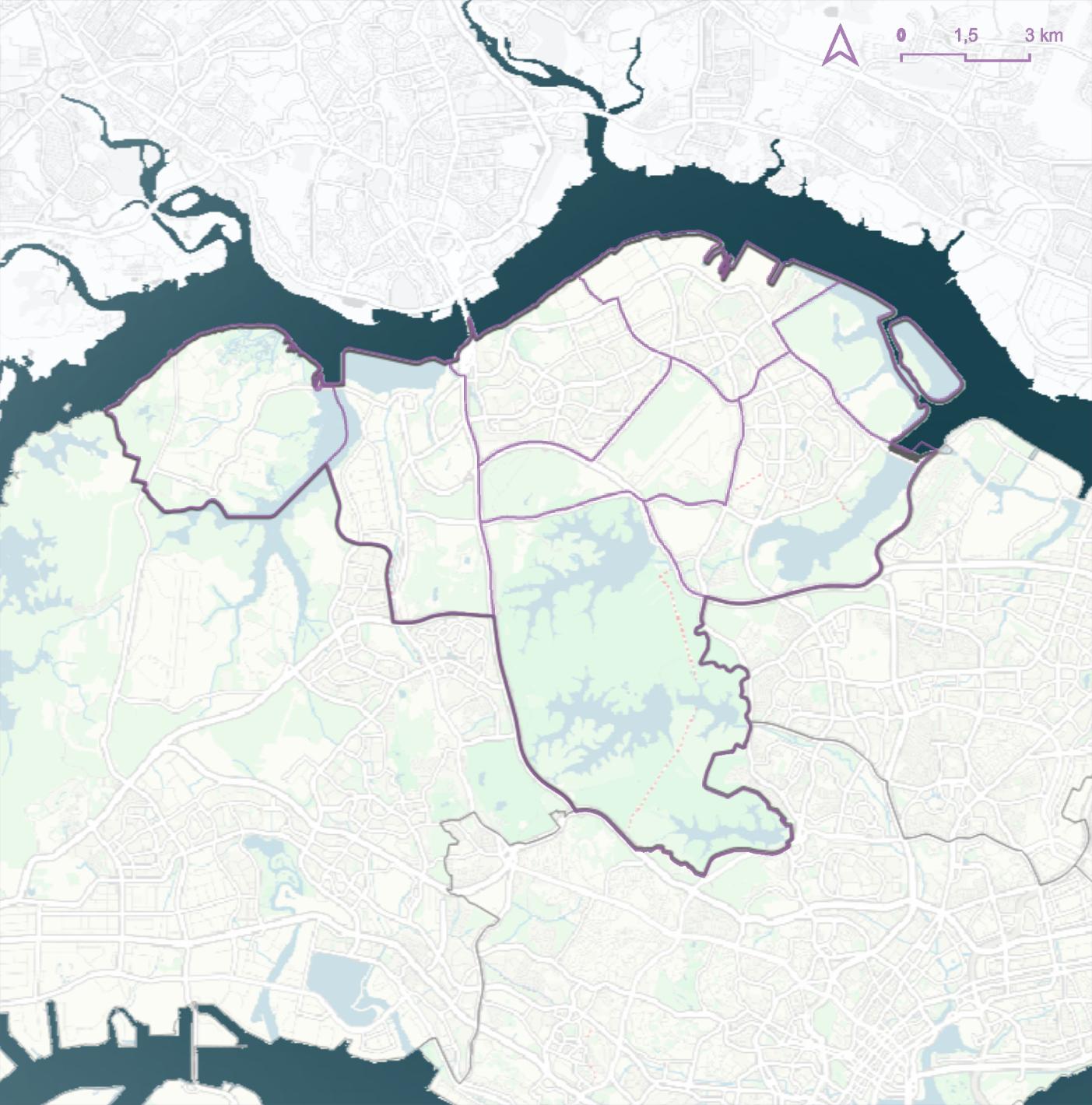
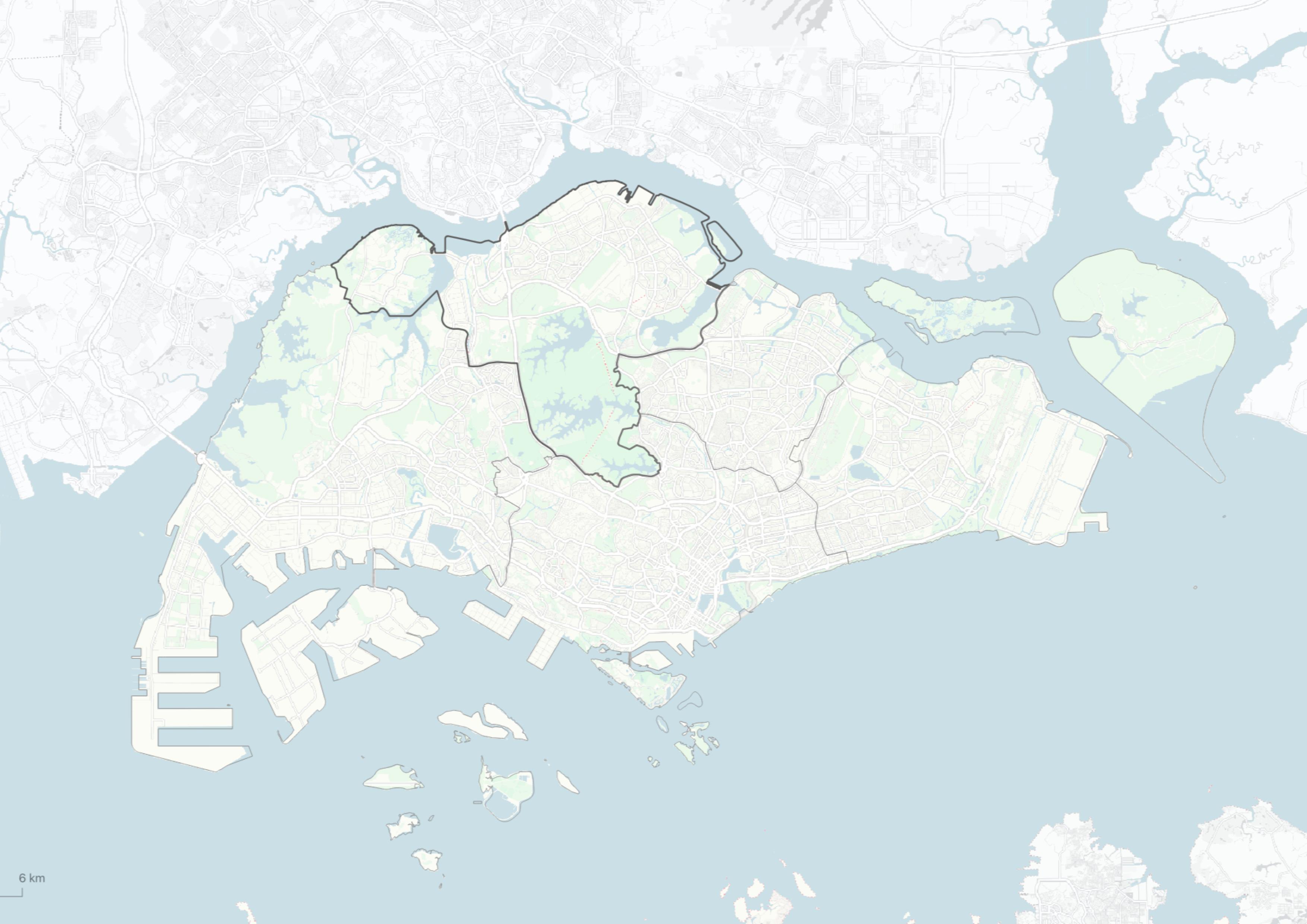
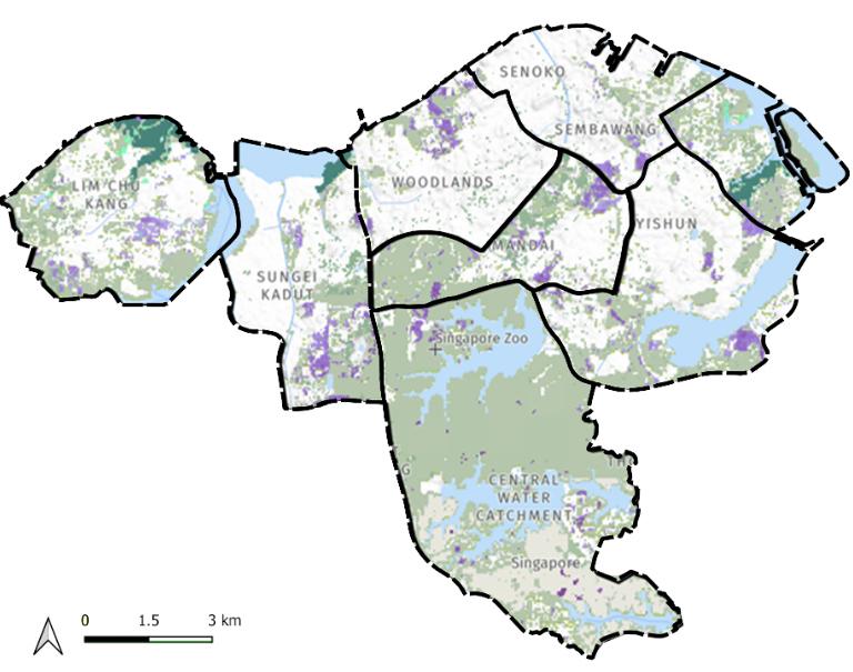
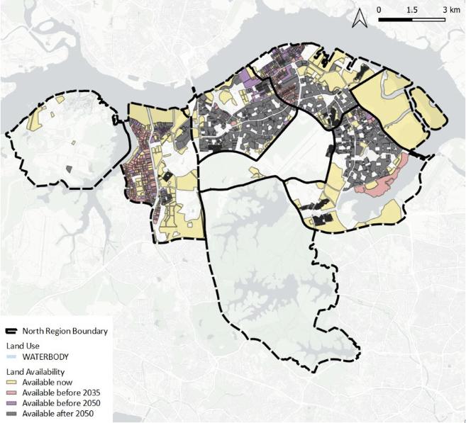
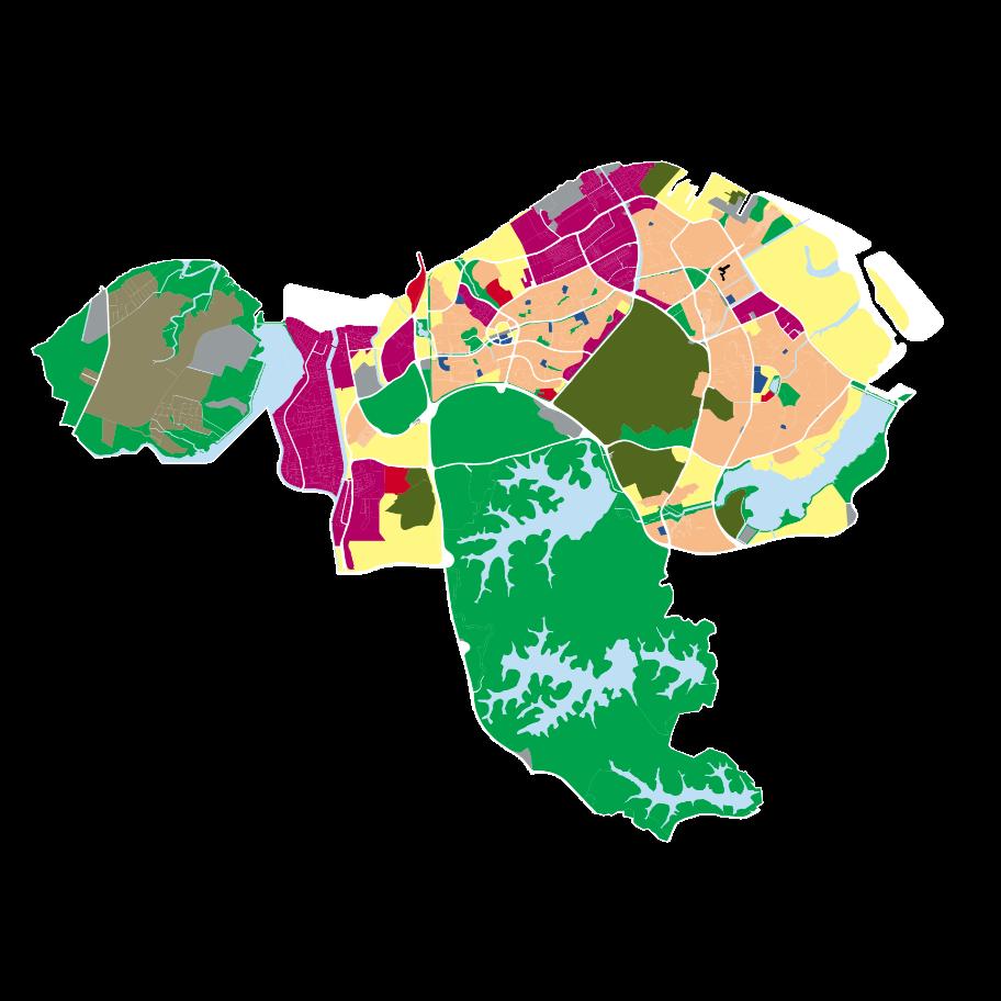
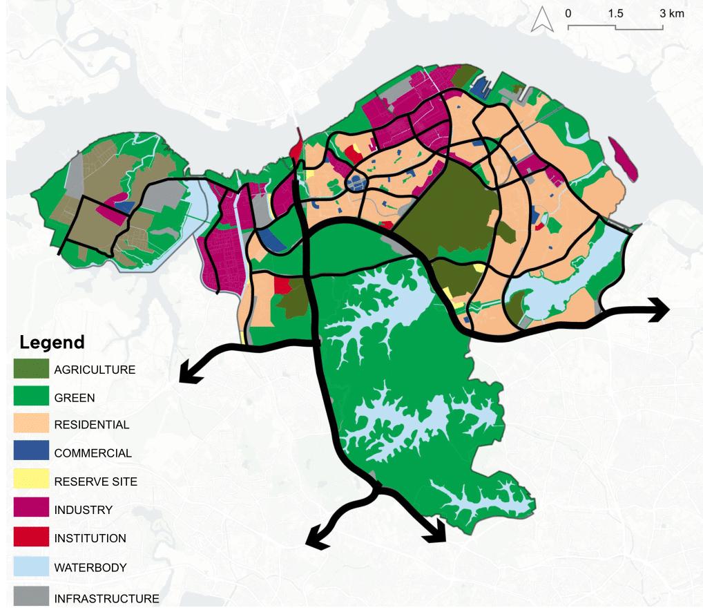
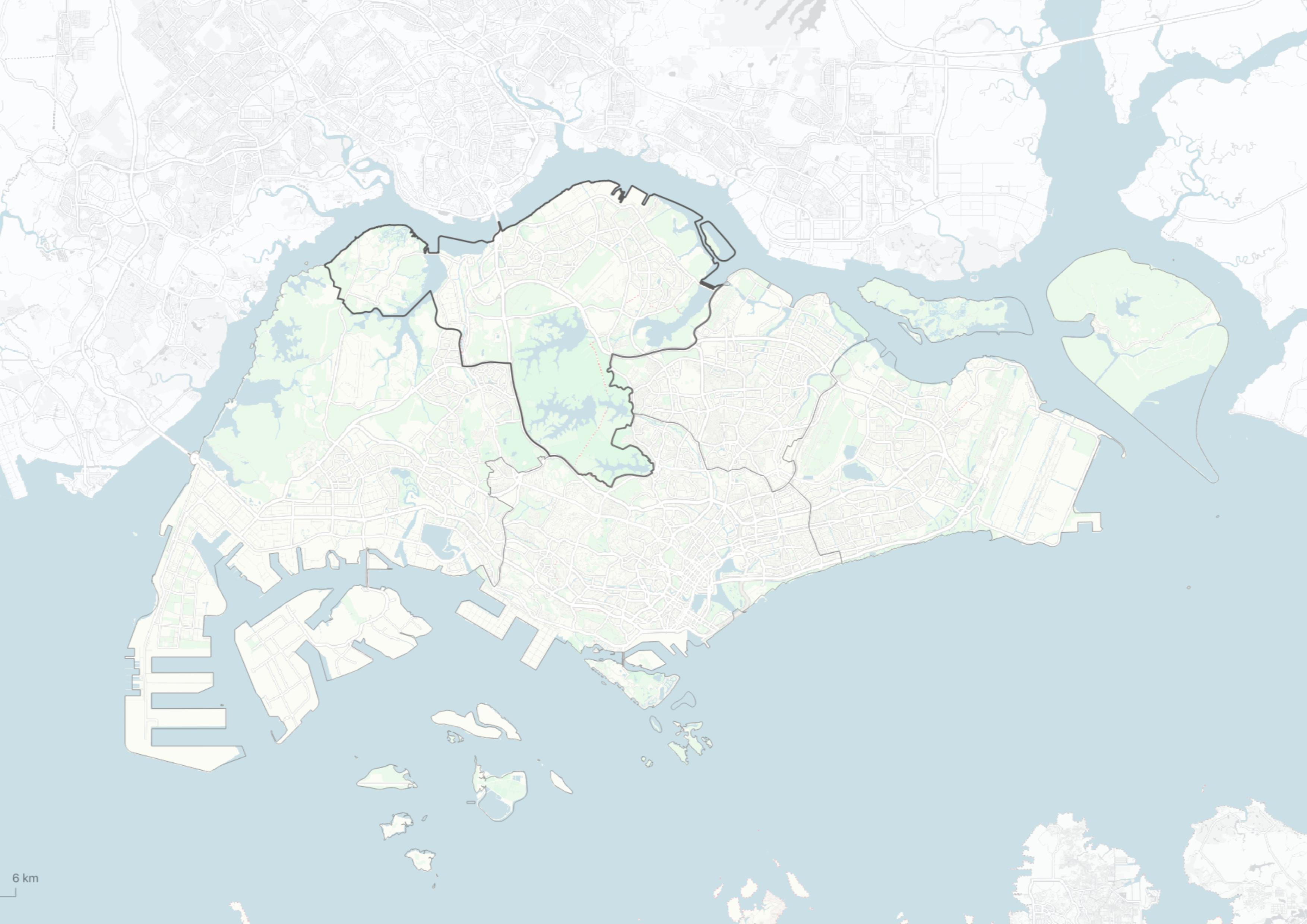
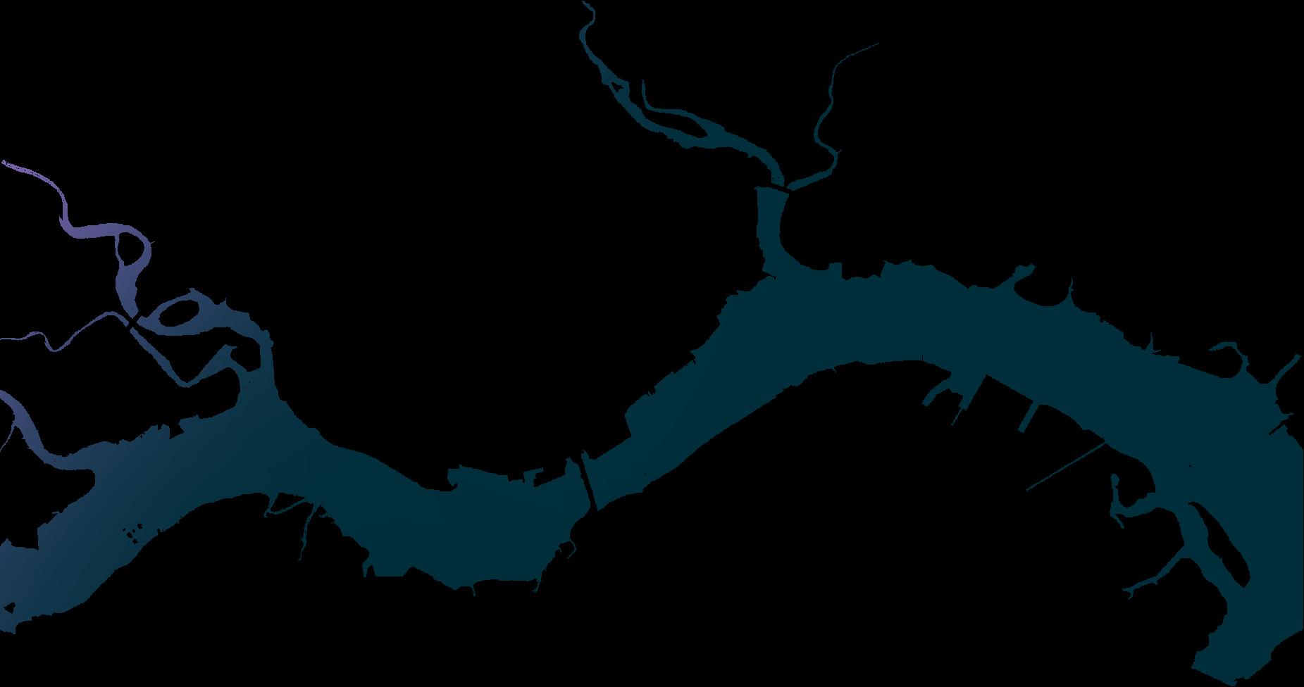
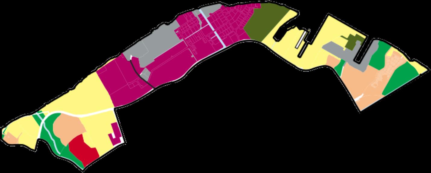
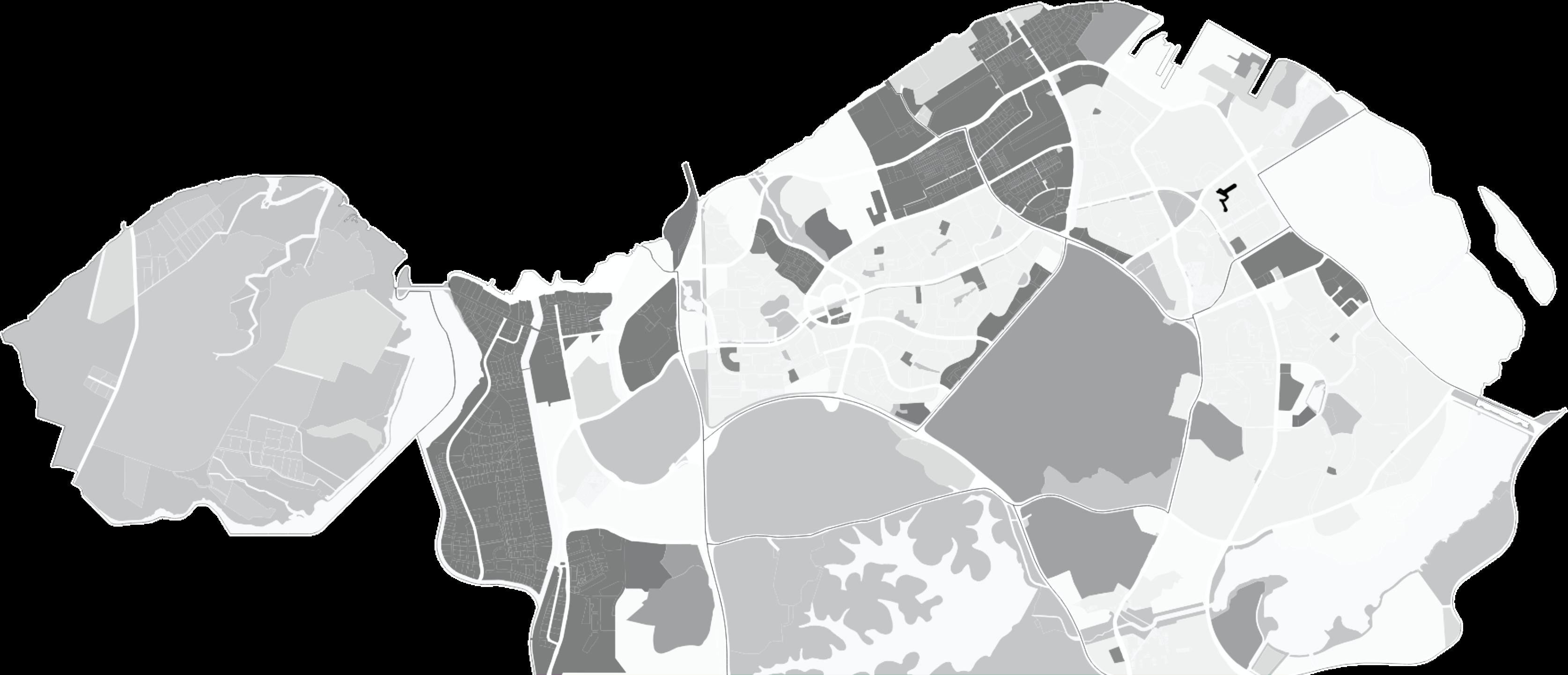
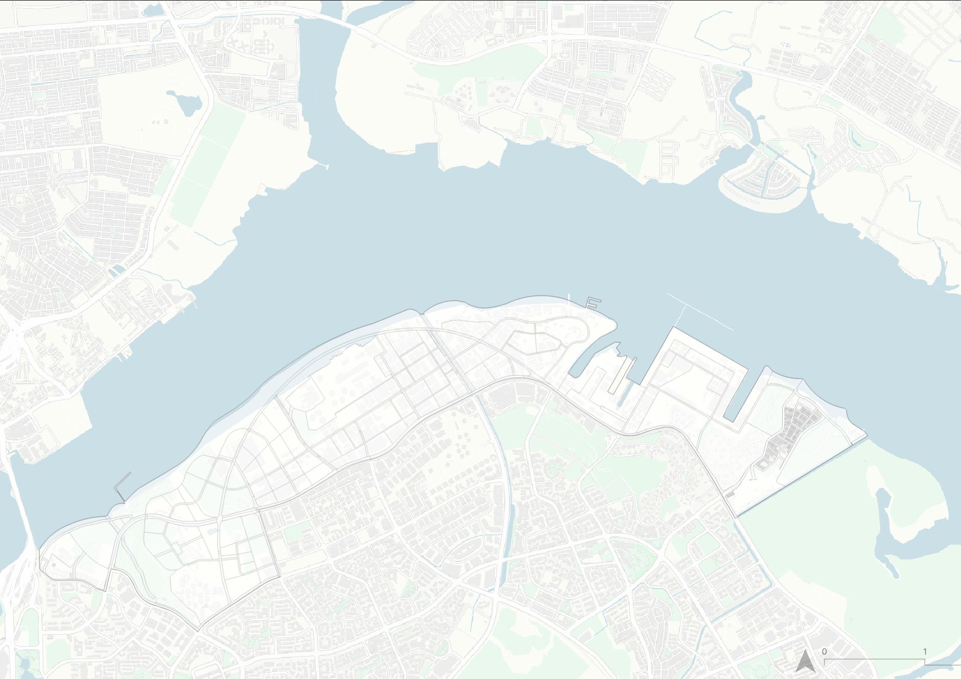
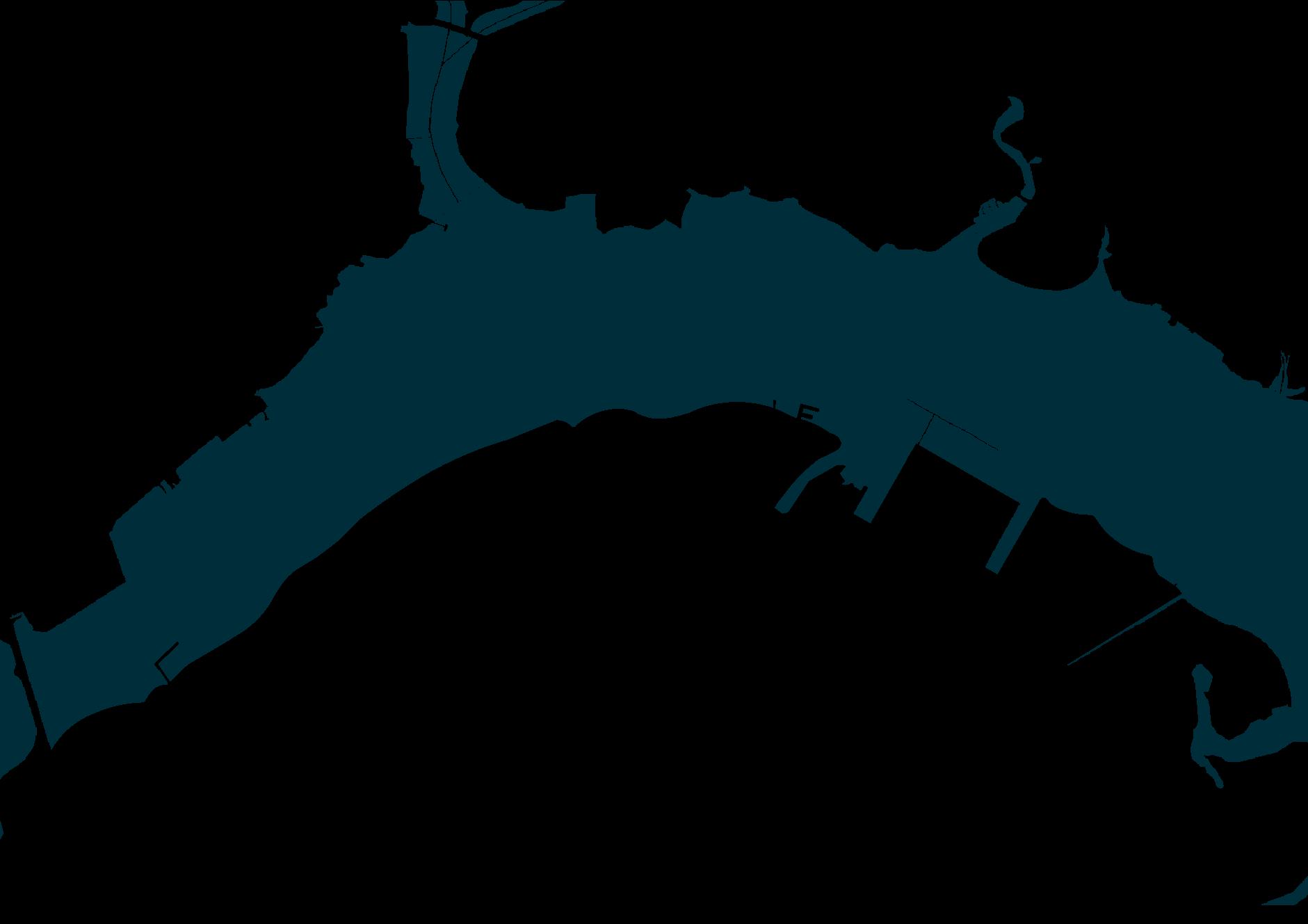
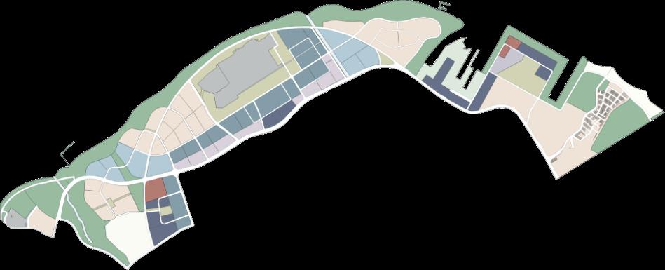
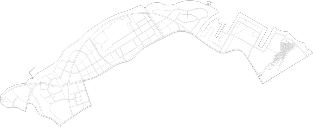
Regionalplanningisthemainfocusforthisproject.WithNorthRegionserving astheprimaryareaofinterest,itmustbepositionedclearlyinSingapore context.NorthRegionofSingaporeisthebiggestregionintermsoflandsize andbordersJohorBahruintheNorth.Itconsistsof8planningareaswith distinctcharacteristicsandpurpose,namelyLimChuKang(agricultural production),SungeiKadut(industrialestates),Woodlands(regionalcentre andfoodindustries),Mandai(militaryuses),Sembawang(industrialestates), Yishun(residentialtowns),Simpang(reservedland)andCentralWater Catchment(waterreservoirs).
Analysiswasdoneinthebeginning,coveringdemography,jobsand employment,accessibility,greenandblue,landavailability,coastalprotection andheritage.ThroughanalysisinsideofNorthRegionandSingapore,theblue andgreenfeatureswhichisprominentintheNorthemphasizedit’sdifference tootherregionsinSingapore.
Afteranalysiswhichresultsinissues,constraints,andopportunities,and futureoutlookwassynthesizedtocreatevisionfor2050withobjectivesand strategiesoflive,work,playintheNorthRegion.
(2nd largestregionbylandarea)
NorthofSingapore,SouthofMalaysia(JohorBahru)
582,230
TotalPopulation(2020)
2050Projection
870,000
Highprojection (1.35%increase)
740,000
Lowprojection (0,8%increase)

*
134.5sqkm
Spanning8planningareasfromEastto West.
(Yishun,Simpang,Sembawang,Mandai, CentralWaterCatchment,Woodlands, SungeiKadut,LimChuKang)
864ha
30sqmperperson(288,000increase)
AdditionalLand(Gross)forHousing N.A*
135,000newjobs
AdditionalLand(Gross)forNewJobs
Byrecyclingindustriallandwhenleasesexpire,developindustrialzonedlots,effects ofemploymentinservicesisnotsignificanttotheNorthRegion.
JohorBahru CityCentre


WesternWater Catchment


Woodlands RegionalCentre &Causeway Agricultural Production @LimChuKang

Mandai Wildlife Park

JurongLake District& JurongInnovation District


OneNorth& BuonaVista
BukitTimah NatureReserve


Botanic Gardens


Sentosa LabradorPark & Harbourfront

Pasir Gudang Port

PunggolDigital InnovationHub
CentralWater Catchment MarinaBay &Kallang
Central Business District


Tampines RegionalCentre

WORK (industries,offices) PLAY (recreation,leisure) SUSTAIN (naturalresources) LIVE (residentialcenters)
IntheNorthRegion,theinfluxofpopulationover theyearshascontributedtoamedianage slightlylowerthanthenationalaverage.We calculatedtheaverageoverthisperiod,resulting inanannualaveragecompoundedgrowthrate of1.35%.
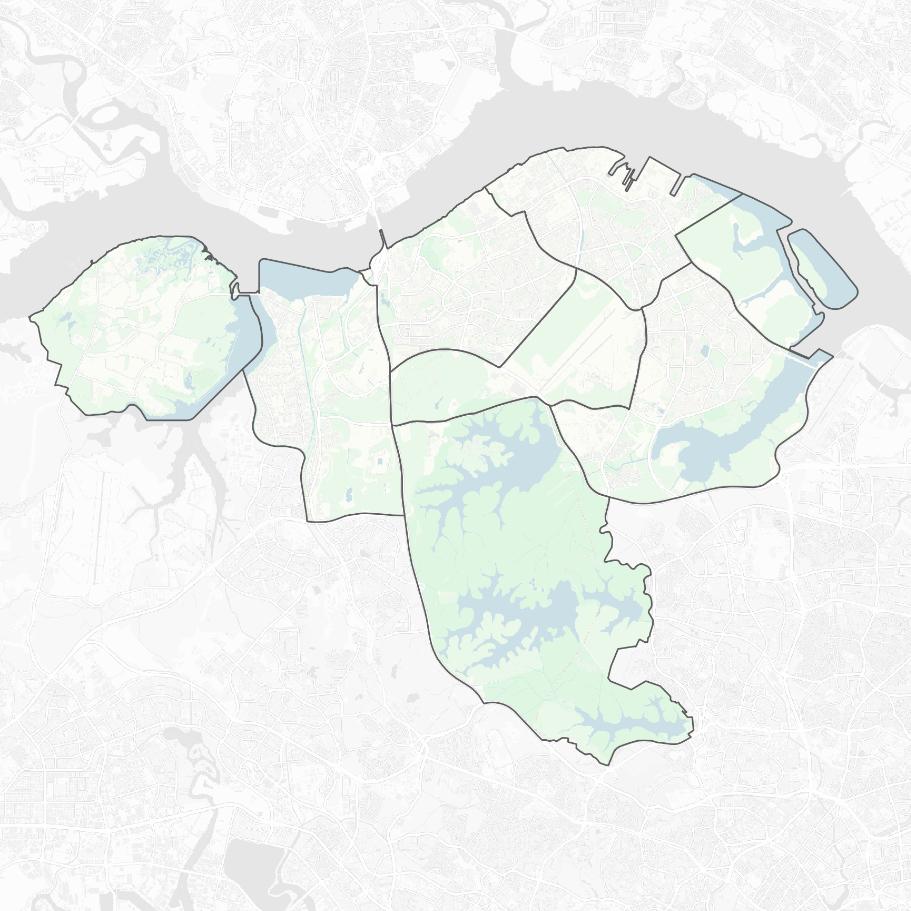
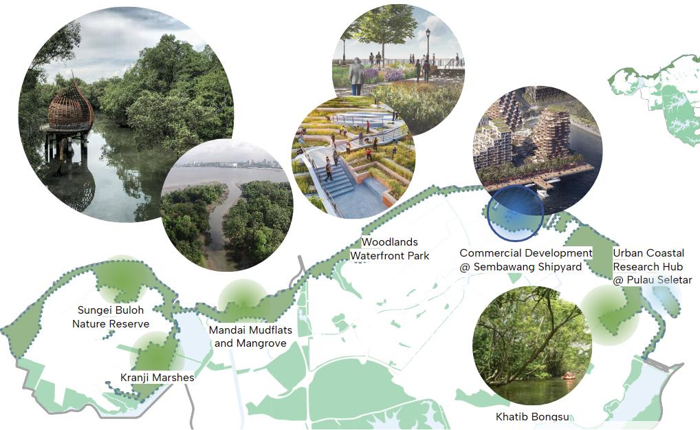
GreenandBlue
Diversematurenaturalresourcesandhabitats.
•2NatureReserves:SungeiBulohWetlands andCentralWaterCatchment
•1WildlifePark(MandaiWildlifePark)
•5Reservoirs(Kranji,UpperSeletar,Lower Seletar,UpperPeirce,LowerPeirce, MacritchieReservoirs)
WhileNorthRegionhasagoodamountofgreen space,somemajorgreendestinationsarenot mostaccessibleasastheyarefoundtobeoutof reachevenwitha15minutewalkingbuffer.
Only32%ofgreenlandusescomparedtothe entireNorthRegion.
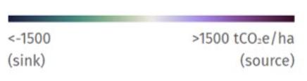
NetforestGHGflux(balancebetweensink(removal)andsource(emission)(2001–2022)inIndustrialareas.
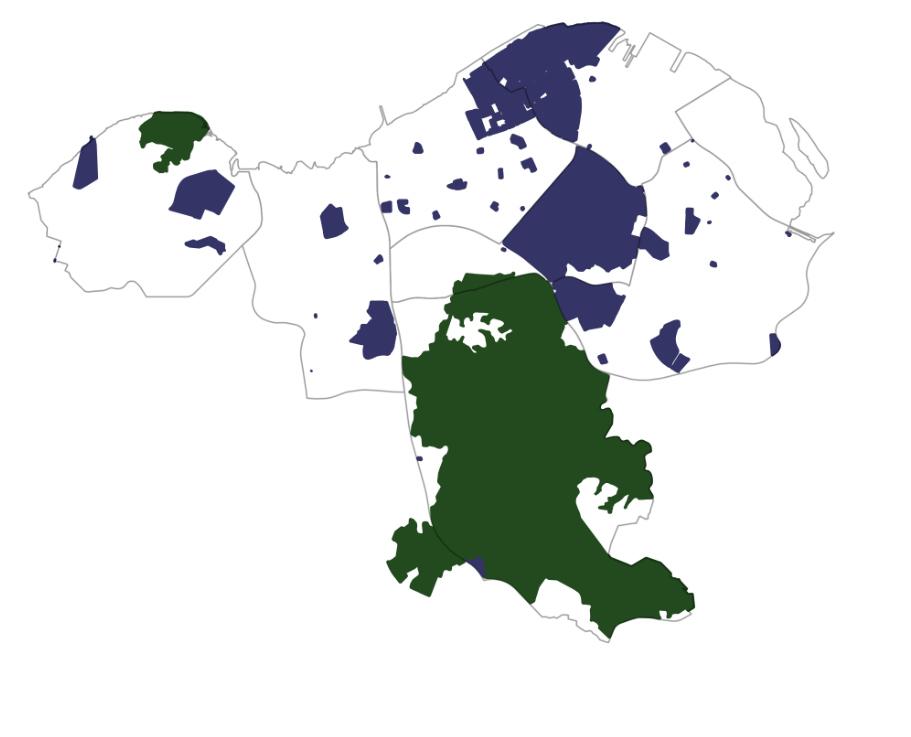
Simpangpresentsagreatopportunityforgreenfielddevelopment,asitiscurrentlyalargeexpanseofsecondaryforest.Whileindustrialland usesareplannedtoextendbeyond2050,there ispotentialforrevitalizationintheSungeiKadut industrialareaasleasesapproachexpiration.
•Hightomoderatefloodrisk.Notablynear LimChuKang,SungeiKadut,Simpangand Sembawang.
•NaturalintertidalzonessuchasMudflats andMangroveForest.
•Inaccessiblewaterfrontareasduetosurroundinglanduseandlackofconnectors.
Therearethreeprimaryplanningissuesinthe NorthRegion:
WeakconnectivitywithinNorthRegion.
Primarilyinrelationtogoodsdistributionand logistics.
Vulnerabletosupplychainshocks
Vulnerabletoenvironmentalrisk
Forfoodandgoodsproductionanddistribution, especiallylearningfromcriseslikeCOVID-19 Pandemic. Duetotheeffectsofclimatechange.
NotallareasintheNorthRegioncanbe developed,whichincludes:
NatureReserveandConservedAreas
Mostgreenareasareleftuntouched.Primarily SungeiBulohandCentralWaterCatchmentarea.
Leasesextendbeyond2050. Allspecialusesitesarekeptfornationalsecurity. Someleasesextendbeyond2050.


Combinedwithexistingconstraints,thereare opportunitiesforNorthRegion:
RedevelopmentofSembawangShipyard InSimpang InSungeiKadut InLimChuKang InMandaiandCentralWaterCatchment
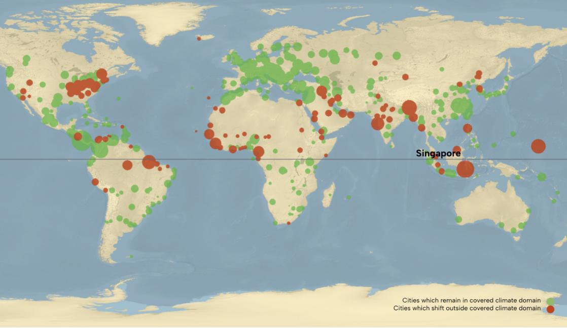
^Mapofcitieswithshiftingclimatedomains(Bastinetal.,2019)
ToeffectivelyplanfortheNorthRegionofSingaporein2050,wemustfirstgaina comprehensiveunderstandofwhatSingaporeandtheworldwilllooklikein2050.This outlookwillhelpustomakeinformeddecisionsandprepareforthefuture.In2050,the worldwillexperienceincreasingtemperatureandheavyrainfallandlackofsufficient foodresource.Singaporewillfacehigherenvironmentalrisksandglobalconditionsin 2050duetoclimatechange,suchassealevelriseandacidification,risingtemperatures, andheavyrainfall.
In2050,theworld:
•AccordingtoFAO,mustproduce60percentmorefoodtofeedtheworldpopulation of9.3billion.(UN,2012)
•Increasingtemperatureandheavyrainfallcauseclimatemigration.(IEP,2020)
•Allfisheriesasafoodresourcemightcollapse.(NationalGeographic,2019)
•Technologywillbemoreintegratedandadvanced
Strengtheningtheabilitytorecoverandadaptatthenationalleveliscrucialtotackling adverseconditionsintheglobalcontext.Byutilisingtheuniquegreenandblueresources, theNorthRegioncanleadthewayincollectiveresilienceforSingapore.TheNorth Region,withitspotentialtobecomeapioneerofeconomicandenvironmentalresilience, holdsabeaconofhopeforSingapore'sfuture.Itcanmakesignificantcontributionsto Singapore'sfood,economic,andenvironmentalsecurity.
VisionStatement
MissionStatement
Thisvisionshiftsthewaypeoplewilllive,work,playandsustain,whichresultsinnewobjectivesandstrategiesfortheNorthRegiontoworkthrough.
Objectives
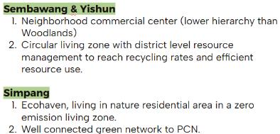
1.Attain16.3sqmofgreenspace percapita.
2.Conviviallivingwithaccessible amenitieswith5-10minuteslife circle.
Objectives
1.Increasingfoodself-production capacitytoupto50%by2050.
2.Industrialestatecomplementary tootherregions,suchas semiconductor,wholesale, trade,packaging,etc.
3.R&Dclimatetechfacilityin Singapore
4.Create135,000newjobs.
Objectives
1.Singapore’sfirstecoagritourism integratedaccommodationand3 well-connectedecoagritourism destinations.
2.Developanewintegratedeco coastalpark.
3.300%increaseannualvisitorsto theNorthRegion
4.280%increaseinhotel accommodation.
Objectives
1.40%ofdomesticrecyclingrate in3planningareas
2.Newmodelfornetzero emissionandcircularlivingzone inSingapore.
3.ExtensionofParkConnector NetworksandNatureWay.
Strategies
1.Conserveandintegratenature intonewestates
2.Developnewneighborhood modeltointegratemoregreen spacesandfacilities.
Strategies
1.Optimisingindustriallanduses
2.Improvingconnectivitybetween agriculture,foodindustryand sourcesofdemand.
Strategies
1.Growanddiversifythechoiceof Ecoagritourismdestinations
2.Facilitateastrongintegration betweentourismandlocalfood production
3.Activatecoastalspaceand waterfrontspaces.
Toachievethegoalsoflive,work,playandsustain,fourprojectsareformulated
Strategies
1.Prioritizeredevelopmentof convertedland.
2.Createcircularlivingandnetzeroemissionzones.
3.Promotegreenmobilityand environmentalconnectivity.
4.Stewardandpreservenatural ecologicalsystemsandlifecycle.

(industries,offices)
(recreation,leisure)
(naturalresources)
(residentialcenters)
sustain
TheconceptdiagramisdrawnasaresultoftheanalysisoftheNorthRegion, positioning,andprogrammingdevelopedinresponsetoanticipatedneeds.It isdesignedtoguideandstructuretheconceptplan.
Linkstheecosystemandhabitatsthroughcorridorsfromandintothegreencore (CentralWaterCatchment)
IntegratedCoastalResiliencePark
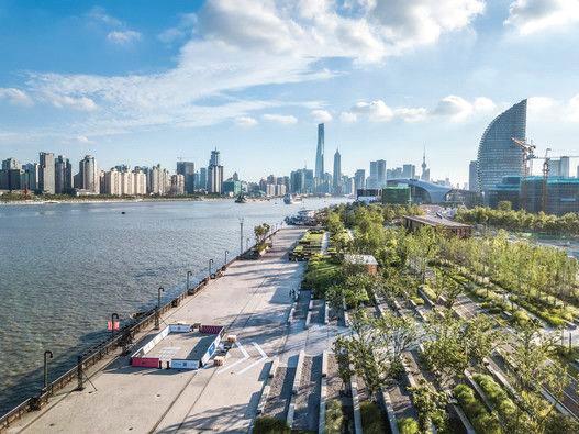
ConnectingandretainingnaturalhabitatsthroughouttheNorthCoast.
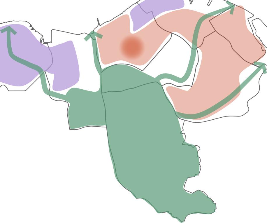
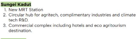
ConnectingagriproductioninLimChuKang,throughCircularHubinSungeiKadut, SenokoIndustrialEstatetoSembawang.
Hierarchyofdifferentcommercialcenters,withWoodlandsasthebiggestcenter followedbycommercialneighborhoodscentersinSembawang,YishunandSimpang.
ConnectingtheecoagritourismdestinationsintheNorthandcirculatingvisitors.
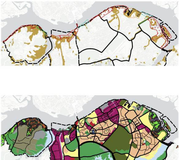
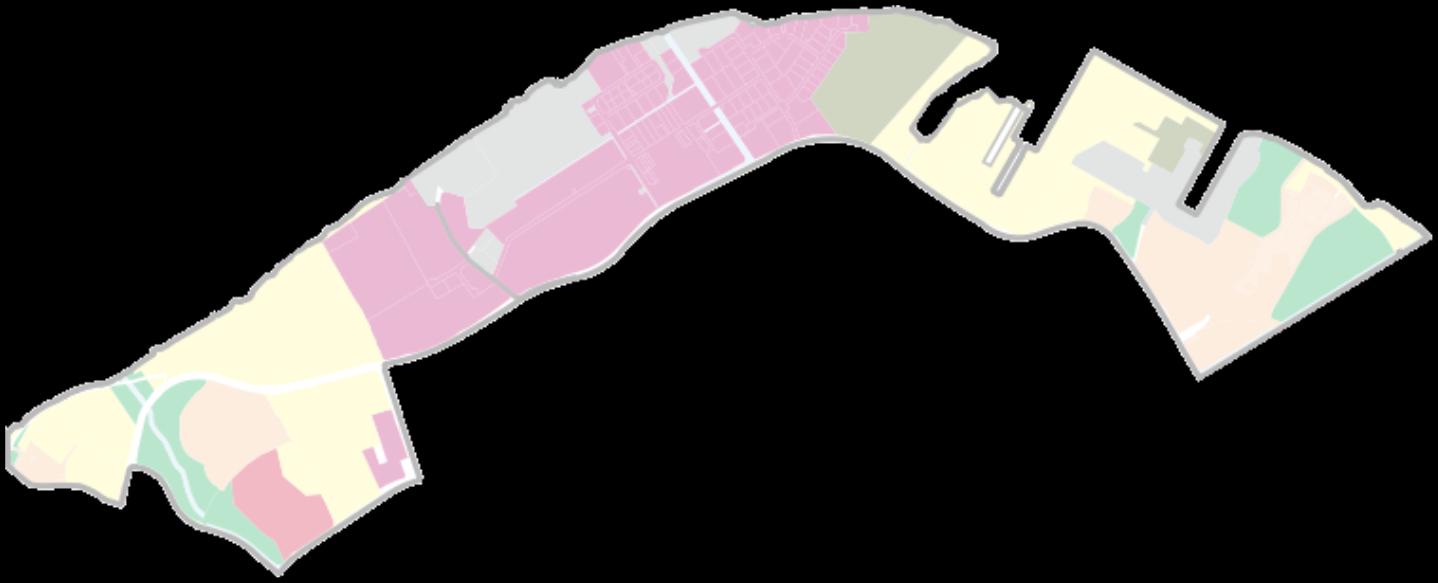
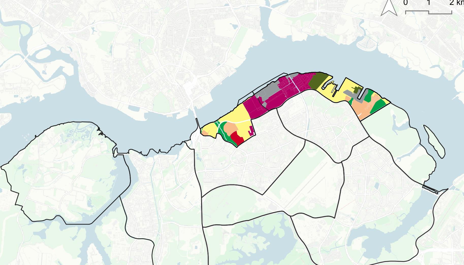
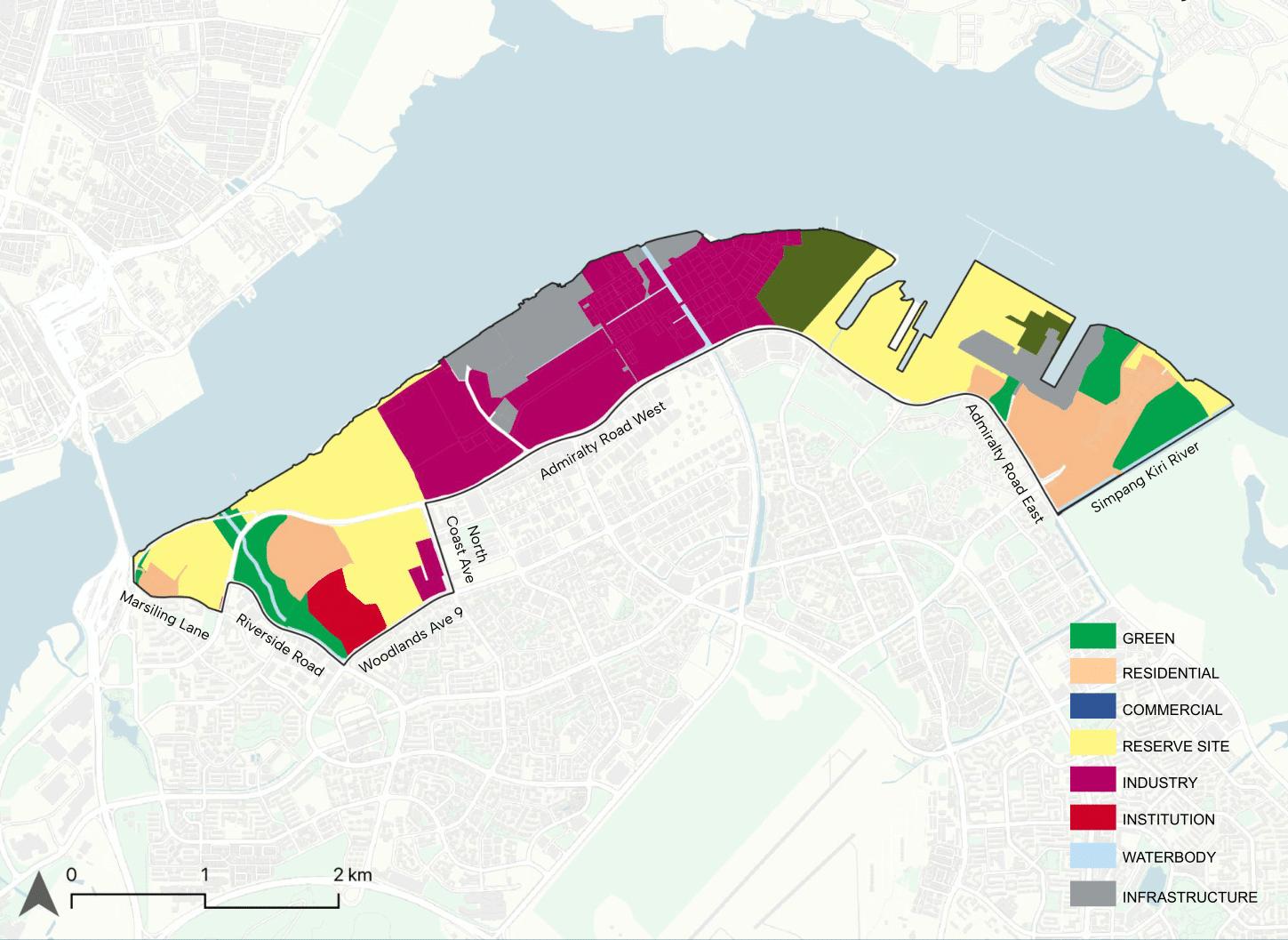
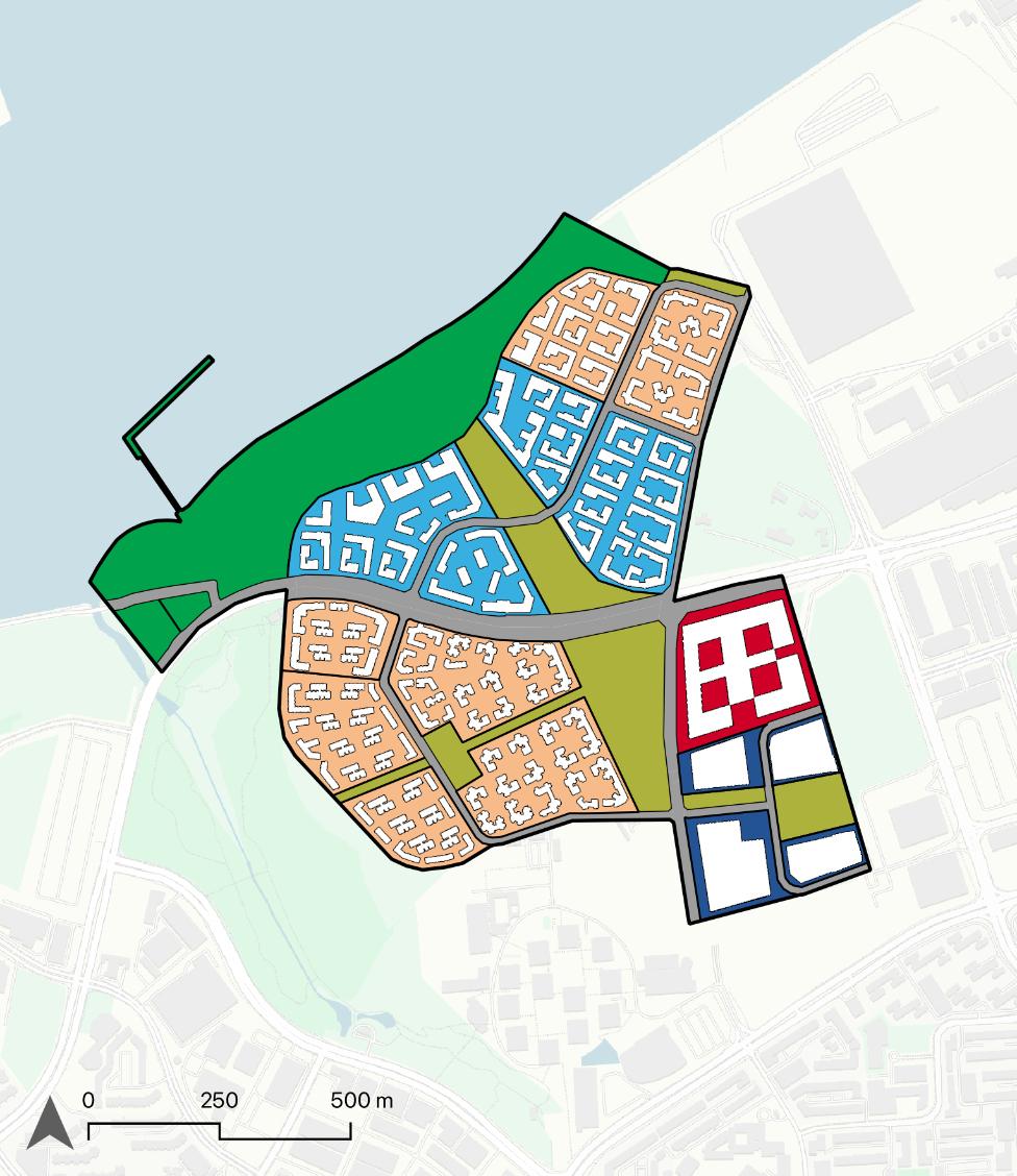
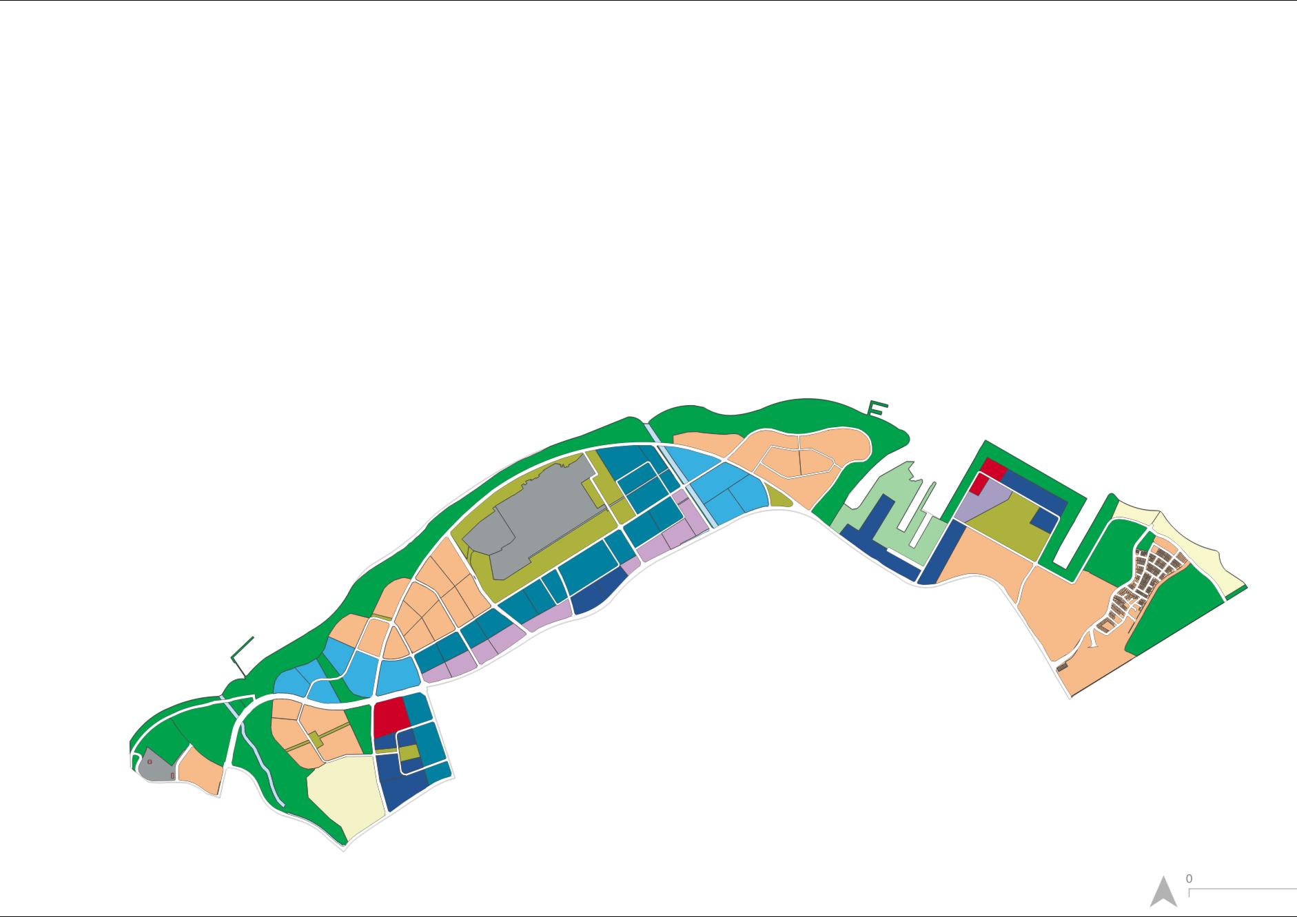
Guidedbytheconceptdiagram,thelandusesanddevelopmenthighlightsareas follows:
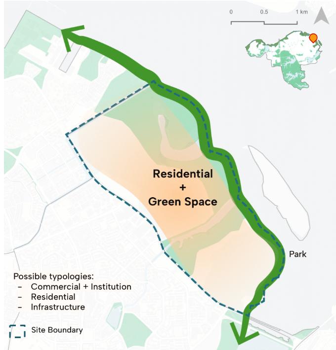
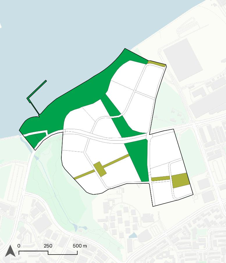
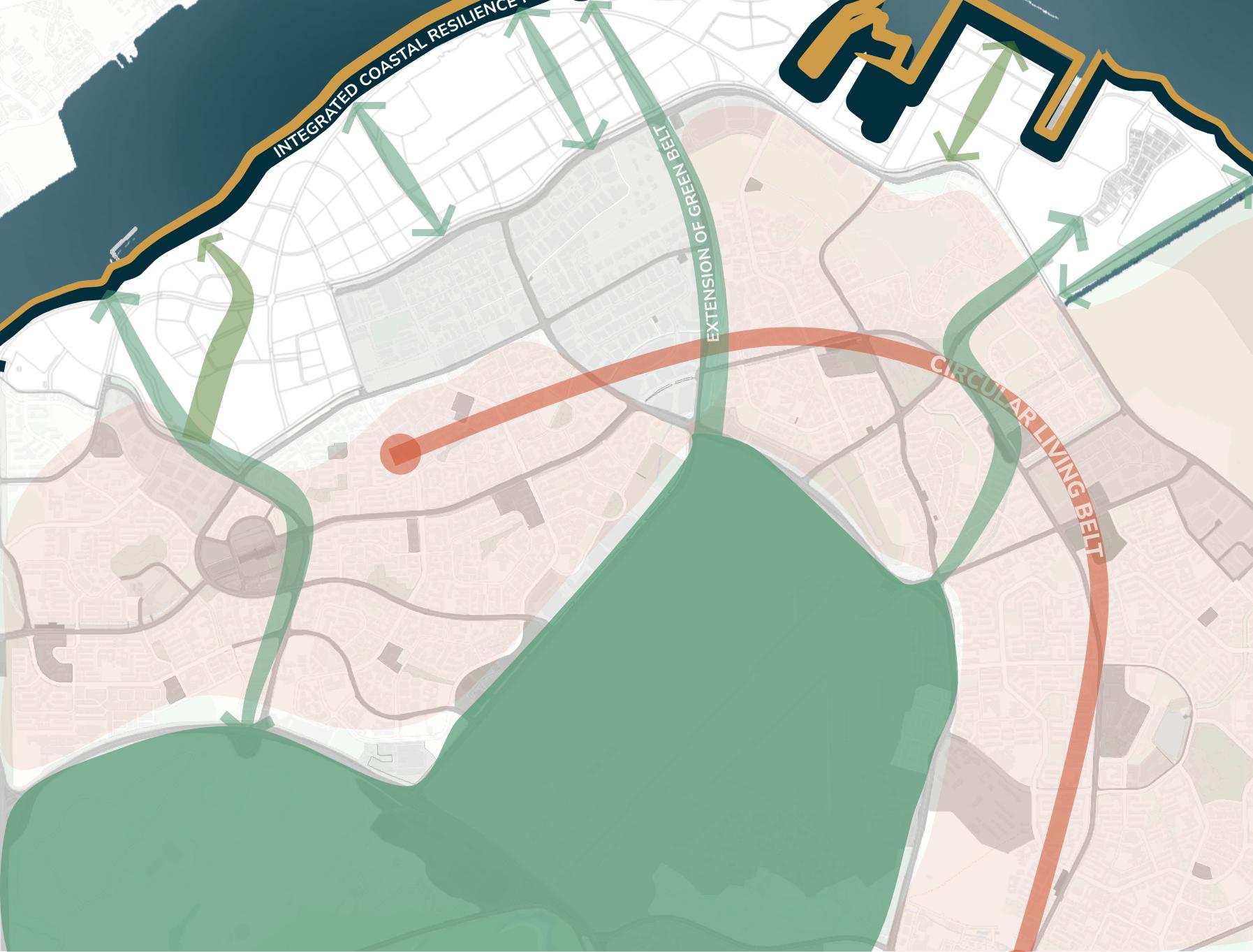
Green: Expandtheparkareasalongnorthcoast,addMandaiMudflatsand reclamationareaforintegratedcoastalresiliencepark.
Residential: ResidentialareagrowthismainlyinSimpangtoaccommodatethe growingpopulationof287,670
Commercial: MorecommercialfacilitiesinWoodlandsandLimChuKang Addnewhotelneareco-agritourismdestinationsfortourismandbusinesstrip
Industry: Colocatingofindustryforinnovativelivinglab
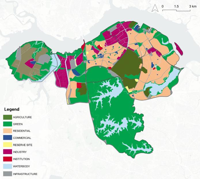
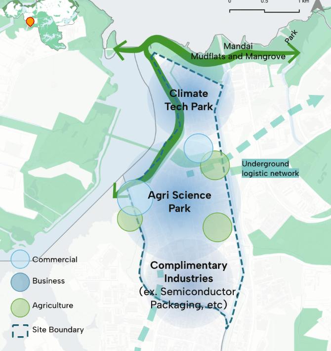
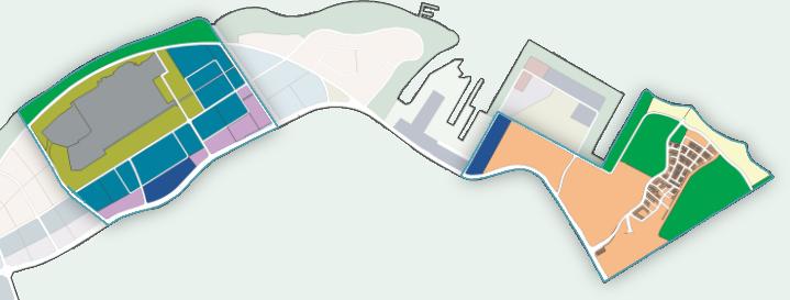
AgricultureconcentratedinLimChuKangwithindustrialforfoodprocessinginthecentre.Expansionof greenspacesalongthecoast.Newresidentialin sungeikadut.Morecommercialfacilitiesinresidential areasaroundMRT.
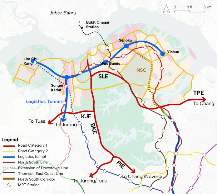
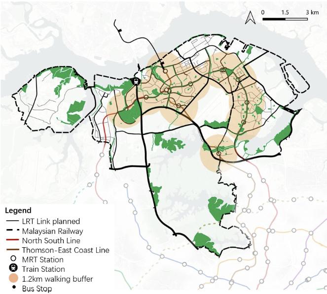
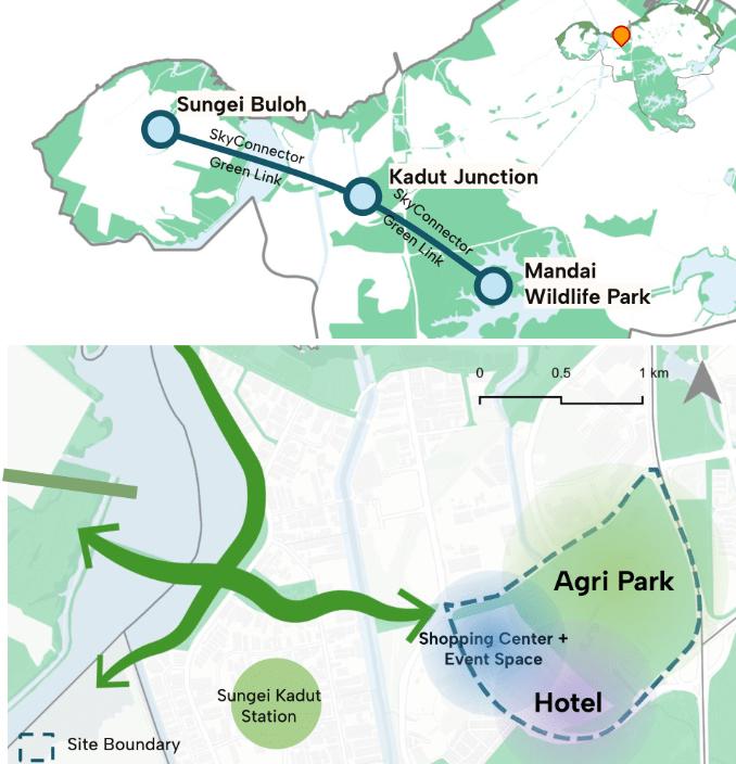
1.ImproveaccessibilitytoagricultureandfoodproductionzoneinLimChuKangandSungeiKadut throughtheextensionofDowntownLineandthe increaseofroadcapacity.
2.Undergroundlogisticstunneltoenhanceconnectivitytosurroundingindustrialareas.
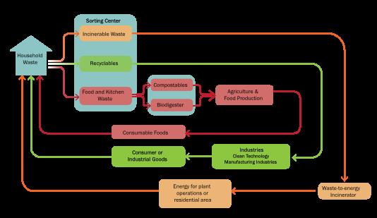
Acircularwastemanagementmodelwillbeadopted intheNorthRegiontoincreasethedomesticrecyclingrate.Toachievethis,recyclinghubsprocessing householdwastewillbeintroducedineachplanning area.Eachhubwillcompriseasortingcenter,biodigester,andcomposter.Notably,theoutputsfrom theserecyclinghubswillbevaluableforagricultural production.Anticipatinganincreaseinindustrialand agriculturalactivity,theKranjiReclamationPlantwill beexpanded.Anadditionalintegratedwaterand wastefacilitylocatednexttotheKranjiReclamation Plantwillfurtherenhanceitscapabilities.
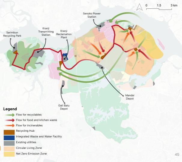
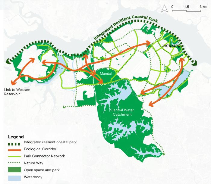
1.ExtensionofexistingPCNtoSimpangtofacilitate zeroemissionzone.
2.Integratedcoastalparkcorridortoadapttosea levelriseandintegratewithdifferentlanduse.
3.Intensificationofthenetworkofnaturewaytoenhanceenvironmentalresiliencethroughbiodiversity.
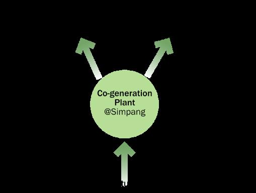
SimpangwillbedesignatedasaNet ZeroEmissionZone,promotingenvironmentallyfriendlymodesofmobilitysuch ascyclingandwalking,andutilizing greenautomatedvehicles.Anewcogenerationplant,utilizinghorticultural wastetogenerateelectricityandresidualheat,willcatertothecoolingneeds andtransportationwithinSimpang.
Implementationwillbeginwithkeyinfrastructureprojectssuchasextension ofMRTLines(NorthSouthandDowntownLinetoSungeiKadutandLimChu Kang),followedbyrecyclinghubandIWMF@Kranjiandlastlythe undergroundlogisticstunneltoJurong.Priorityofkeyprojectsareasfollows:
Focusoncreatingnewjobsandopeningcomplementaryindustries toLimChuKangagriproductionandotherSingaporeanindustries.
Developnewlivingwithnatureneighborhoodmodelandincrease housingsupplyandintroducenewgreenlifestyle.
Fromprojectprioritization,thephasingofeachprojectarespreadoverthe next20yearstowards2050,withconsiderationsofinfrastructureandland availability.
•MRTExtension
•RecyclingHubs
•CircularInnovation Hub(Phase1): Agri-sciencePark
•Ecohaven@ Simpang(Phase1)
BuildingresilienceintheNorthCoast,retainingmarinehabitats andbiodiversity.
Capitalizeonfootfallandtraffictoexistingecoagritourism destinations.
•IntegratedCoastal ResiliencePark (Phase1)
•SungeiKadut Commercial Complex
•Underground LogisticsTunnel
•IntegratedWaste ManagementHub @Kranji
•CircularInnovation Hub(Phase2): Complimentary IndustrialFacility
•Ecohaven@ Simpang(Phase2)
•IntegratedCoastal ResiliencePark (Phase2)
•CircularInnovation Hub(Phase3)
•Ecohaven@ Simpang(Phase3)
•IntegratedCoastal ResiliencePark (Phase3)
Description:
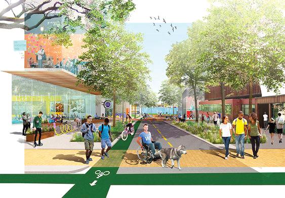
Anewlivingwithnatureandcomfortable residentialmodelwithelderlyfriendlyand dementiafriendlyfeatures,suchasmixedlanduses,conviviallivingspaces,and amenities5to10walkingdistancefrom homes.
Objectives
EnvironmentalResilience
1.SelectivepreservationofSimpang’sforestand mangroves.
2.CreateSingapore’sfirstlivingwithnatureresidentialcomplex.
3.Introducelivingwithnaturelifestyle
Description:
Anewupgradedindustrialcenterwith Mixed-usecommercial
Foragriproductsdistributionandanchornew MRTstation.
UndergroundLogisticHub
Streamlinedistributionofgoodsandproducts.
OptimizedIndustrialTypologies
Forcomplimentaryindustries
InnovativeResearchLabsandFarms
Allowingforflexibilityandhandsonresearch.
Objectives
FoodResilience
Developfoodalternativesandagritech.
EconomicResilience
Diversifyjoboptionsandbringinstrategictech andskillstobuildindustrialcapacity.
EnvironmentalResilience
Climatetechnologyresearchforadaptationand mitigation.
Description:
AcoastalparkspanningtheentireNorth Coastwith NorthCoastCommercialCenter
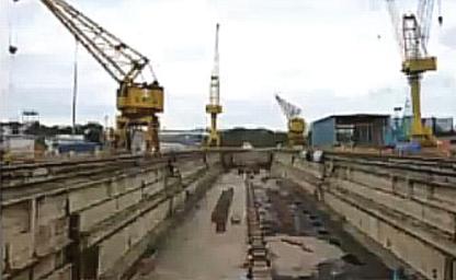
RedevelopmentofSembawangShipyard.
WaterfrontParksandGreenPathways
Foragriproductsdistributionandanchornew MRTstation.
CoastalResearchHubs
ResearchfacilitiesalongthecoastandPulauSeletar
Objectives
EconomicResilience
Boosttourismespeciallydomestictourismbyofferinganewecoagritourismexperience.
EnvironmentalResilience
1.Coastalprotectionusinghybridandnaturebasedsolutions
2.Boostbiodiversityandurbanecosystemby preservingnaturalhabitats.
Description:
Acommercialcenterwhichconnectsto othertourismdestionationsintheNorth EcoagritourismDestination
Redevelopmentofracecourse
FamilyFriendlyAccomodations
Tocaterfordomestictouristsandinternational AffordableandConvenientLocation
SupporttravellersandbusinessesinNorthRegion
Objectives
EconomicResilience
1.Boosttourismespeciallydomestictourismby offeringanewecoagritourismexperience.
2.IncreaseaccommodationsintheNorth
FollowingtheconceptionandimplementationofthisplanfortheNorth Region,thelive,work,playandsustainaspectswillshift.
31,000newhomes
CoexistingwithnatureinSimpang
Firstnet-zeroemissionszone inSimpang
135,000newjobs
Bycreatingcapacitytogrowhighvalue-addandessentialindustries
Closedresourceloopandlocallyproduce50%offoodneeds Forthefoodindustry
4integratedecoagritourismdestionations whichdiversifythetourismdestinationintheNorthandactivatecoastalspaces. 13millionvisitorsannually
InWoodlands,Yishun,andSembawangwithdecentralizedwastemanagement NorthCoastalProtection
Buildingcoastalprotectionandprotectingcoastalecosystem
EcosystemProtection
Protectingecologicalcorridorsandecosystemthroughnatureways
ForSingaporeasislandcity,thenewplanforNorthRegionwillstrengthen Singapore’sresilience.Inenvironmentalresilience,theGreencorewith ecologicalcorridorconnectionstootherpartsofSingaporeandleadcircular livinginSingapore.Infoodandindustrialresilience,theNorthRegion,asthe forefrontofSingapore’sresourceclosedloop,bringingintechsandskillsto buildSingapore’scapacityinmanufacturing.Intourismresilience,thenew ecoagriotourismdestinationsandpromotesdomestictourism,whichwilllead tourismconnectivityinSingapore.Lastly,incoastalresilience,theNorthCoast willleadSingaporecoastalresilienceinadaptingandmitigatingclimate change.Furthermore,improvementsintheseaspectsofresilienceinturnwill affectsocialandeconomicresilienceandstabilityofSingaporeasawhole.
WesternWater Catchment
JohorBahru CityCentre


Pasir Gudang Port

BukitTimah NatureReserve

JurongLake District& JurongInnovation District OneNorth& BuonaVista

Botanic Gardens
LabradorPark & Harbourfront

PunggolDigital InnovationHub

Central Business District MarinaBay &Kallang


Tampines RegionalCentre
WORK (industries,offices) PLAY (recreation,leisure) SUSTAIN (naturalresources) LIVE (residentialcenters)
Part2:IntegratedDesignStudio
Introduction
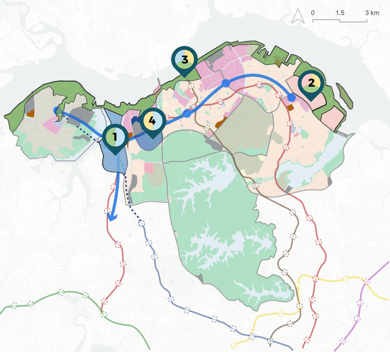
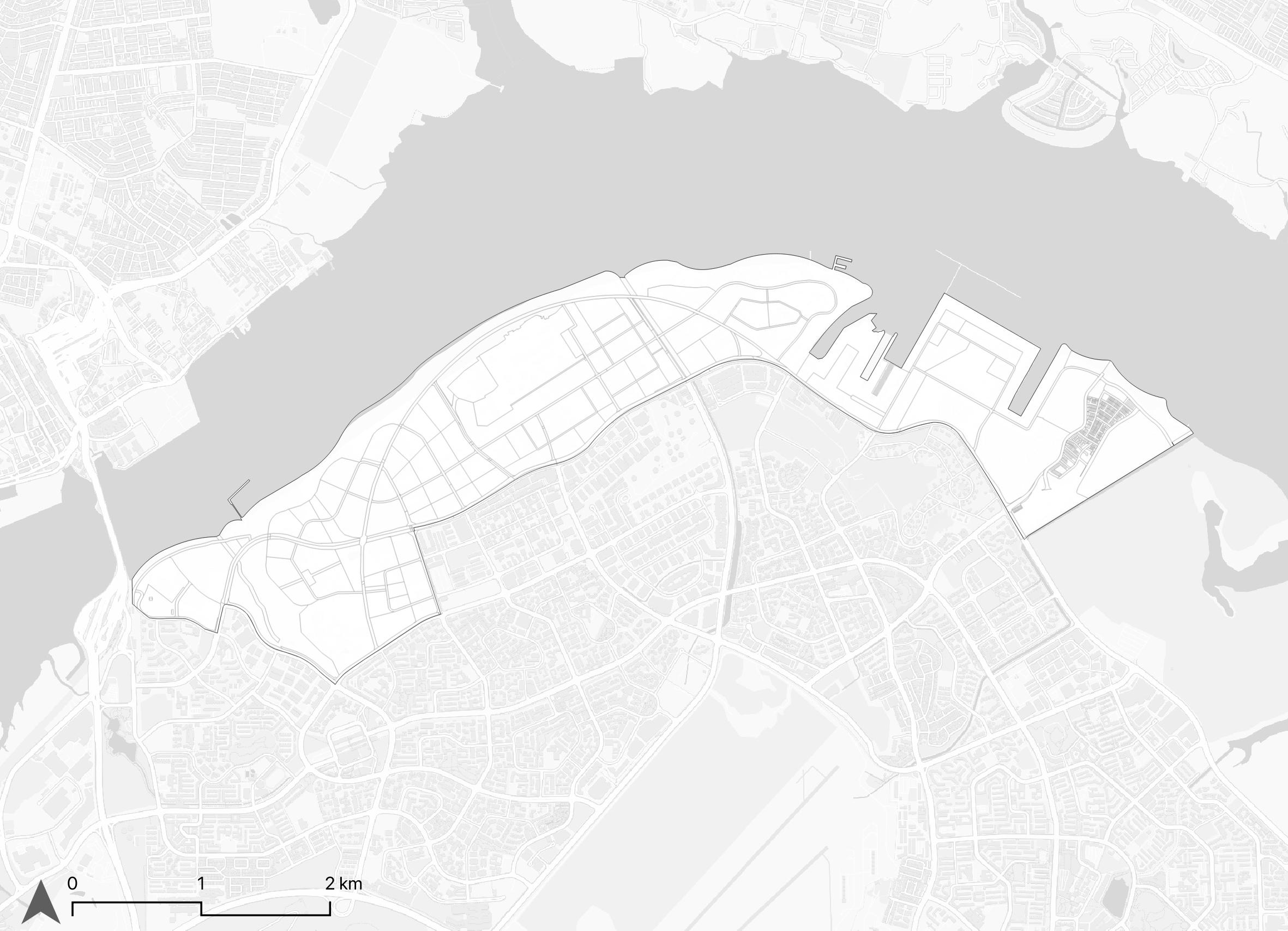
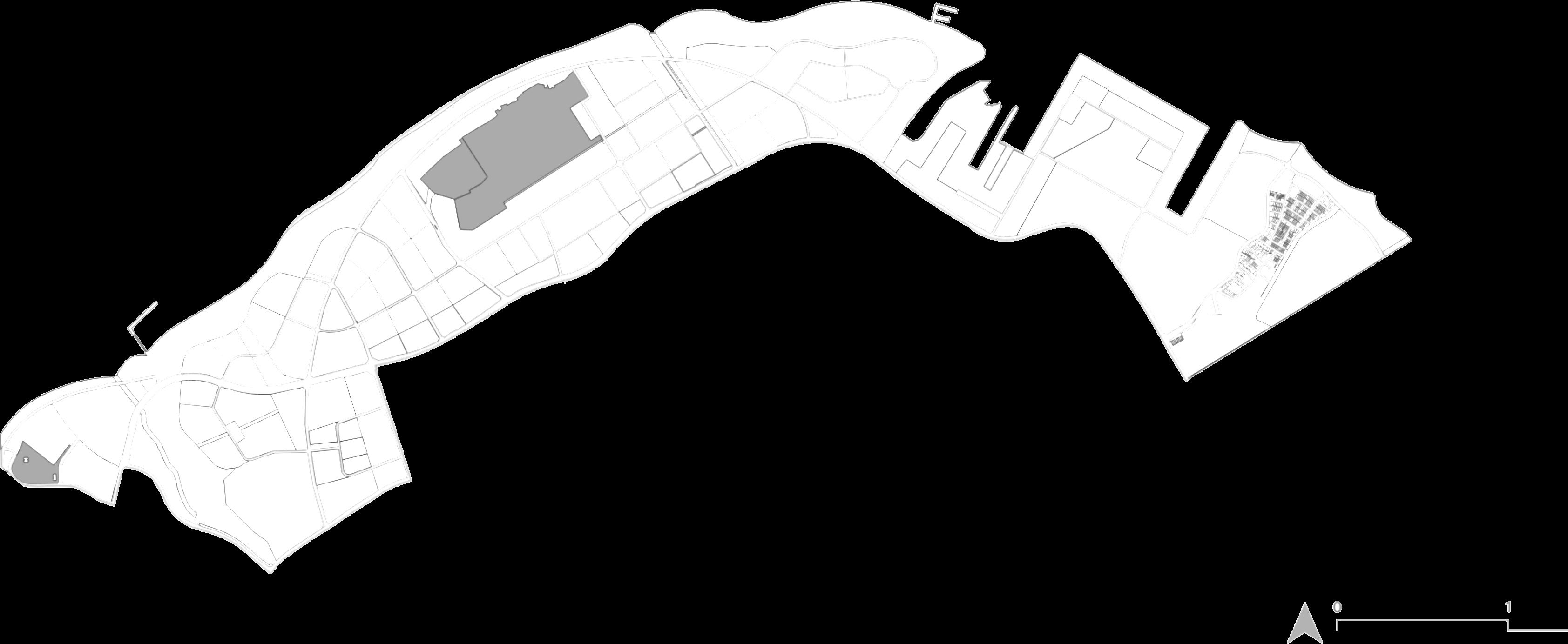
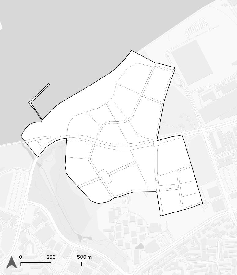
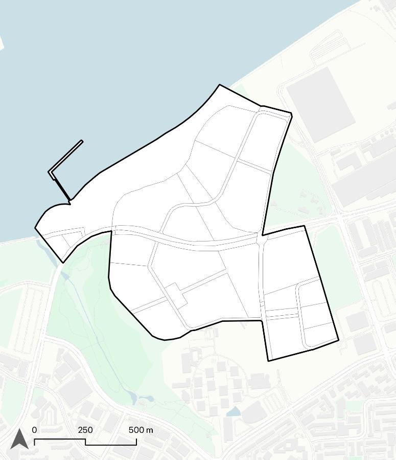
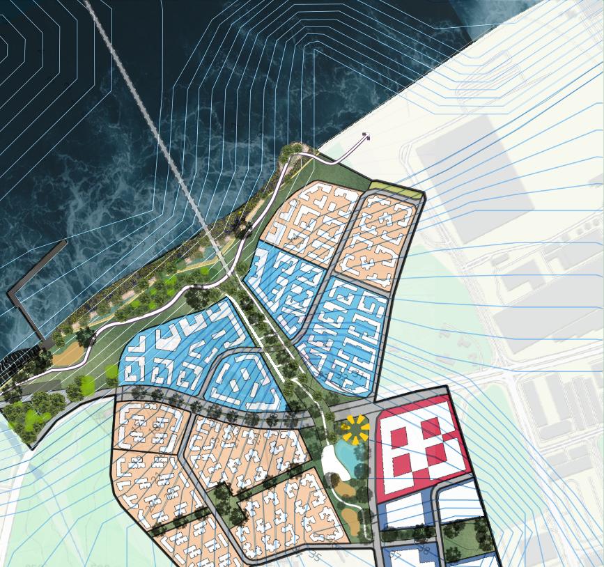
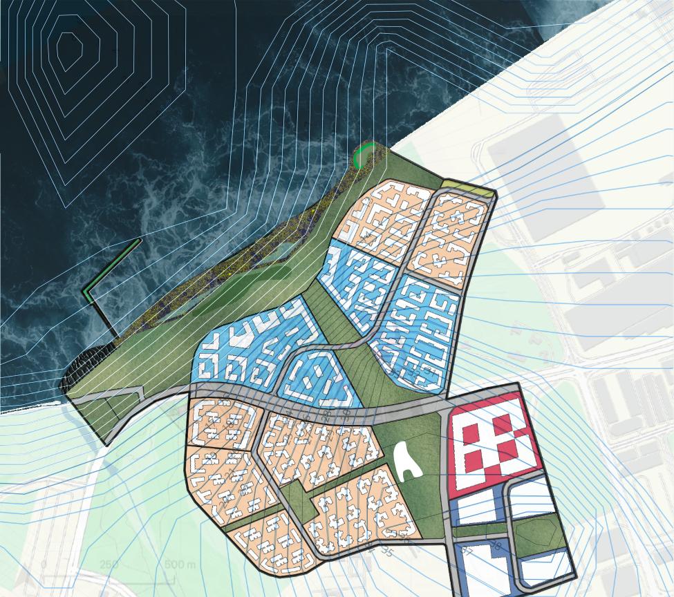
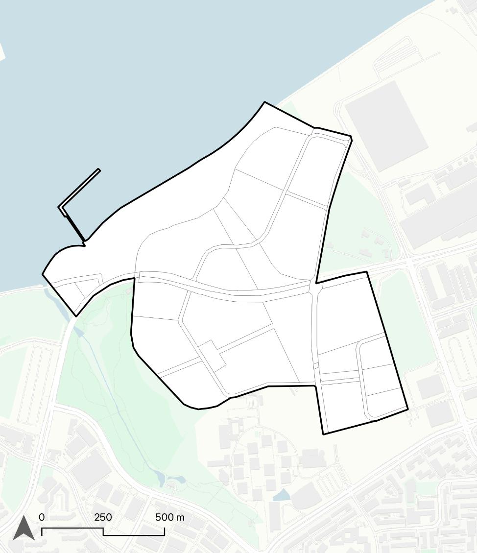
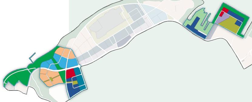
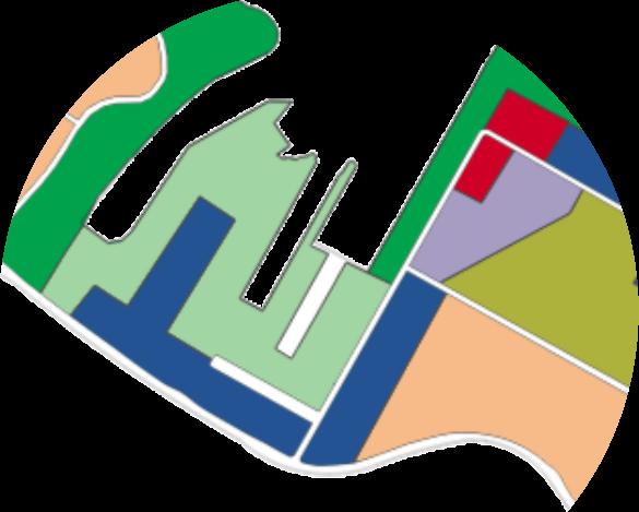
ToachievethevisionfortheNorthRegion,fourkeyprojectsaresynthesized andprioritized.Thissemester,thefocuswillbeonthe IntegratedCoastal ResiliencePark, toestablishamodelforresilienceduetotheurgencyof climateimpacts.Focusingoncoastalareas,theareacomprisingofNorth Coast,SenokoNorth,TheWharvesandSembawangStraitssubzoneswere chosenastheGreaterNorthernWaterfronttoinitiatetheprojectwithtotal areaof 817.5ha.
TherearefourkeyreasonstostartinGreaterNorthernWaterfrontandunlock NorthCoast’spotential:
1.ThisareaembodiestheNorthRegion’sexistingidentityandfunctions
-ThreeprimarynodesandfunctionsthatservestheentireSingapore: -WoodlandsNorth(gatewaytoMalaysia)
-SenokoIndustrialEstate(apartofSingapore'sindustrialecosystem) -SembawangShipyard(Singapore'snavallegacyandhistory).
2.Untappedpotentialtocapitalizeonthewaterfront
Largelyinaccessiblewaterfront,opportunitytorestoreecosystems.Leveragingtheaccessible waterfronttogeneratenewdestinationsthatserveastheNorthRegion'sdevelopmentanchor.
3.Vulnerabletosealevelriseflooding. SembawangShipyardandsurroundingareasarepronetoflooding.
4.Containsallelementsoflive,work,play,andsustain. Manyresidential,industrial,commercialandgreenlotsandundevelopedreservedsitescreates roomforwaterfrontdevelopment.
Basedonthepositioning,visionandconceptplanoftheNorth Region,fourkeyplanningdirectionsforGreaterNorthern Waterfrontisestablished.
Newapproachtolivinginharmonywithnature andonthewaterfront. Notonlytosupportenvironmentalresiliencebutalso socialresilience.
Newresearchanddevelopmentcenterfor environmentalandclimatetechnologies. Toachieveenvironmentalresilienceandachievethe Workaspectofthevision.
Newuniqueandattractiverecreationdestination withmoretourismoptions. SettodiversifythetourismdestinationintheNorthand activatecoastalspaces.
Newanduniquemodelofcoastalprotectionin Singapore.
Tostewardnaturalecosystemsandinitiateanew approachtocoastaldefenseintheNorthCoast.


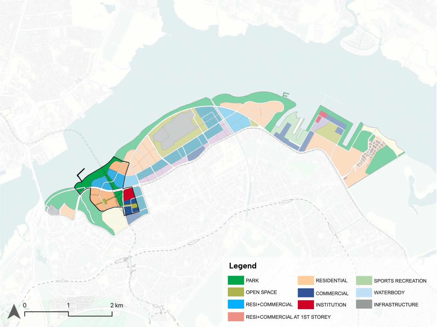
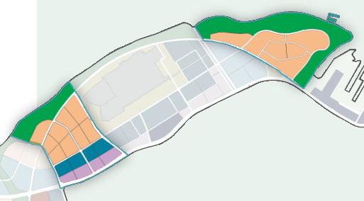
SENOKOINDUSTRIAL ESTATE


WOODLANDSNORTH Futurebusiness andcommercialcentre

SEMBAWANG SHIPYARD RecreationRedevelopment
JohorBahru CityCentre


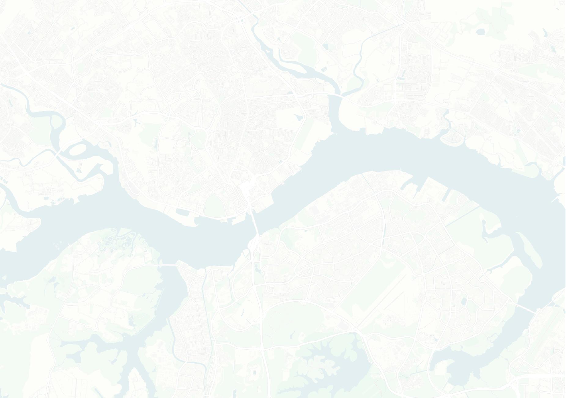


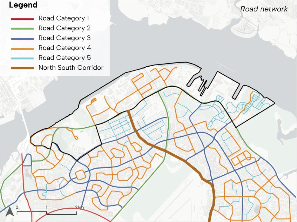
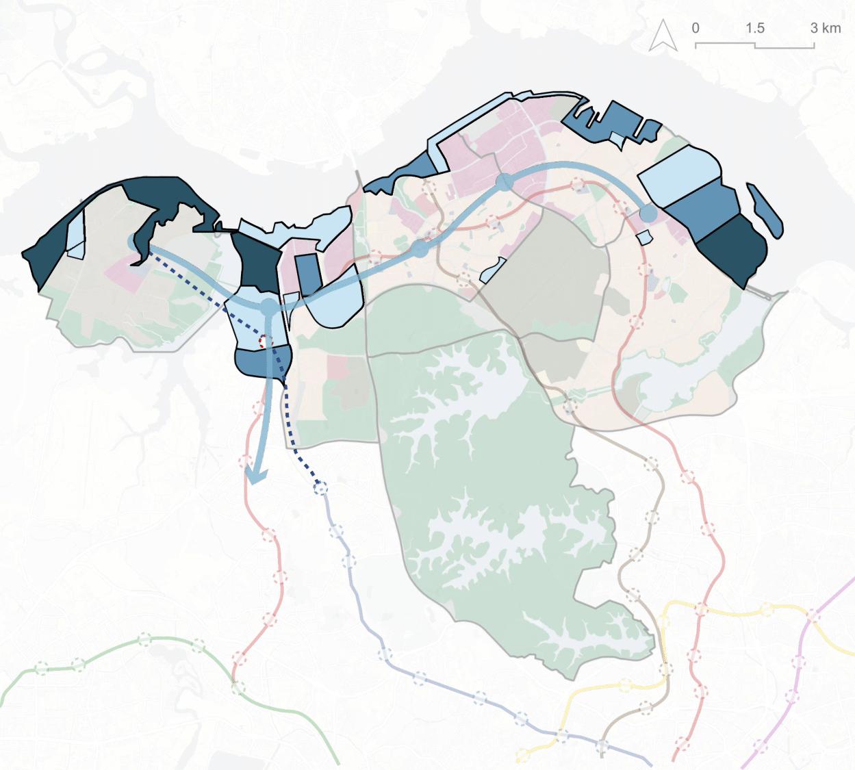
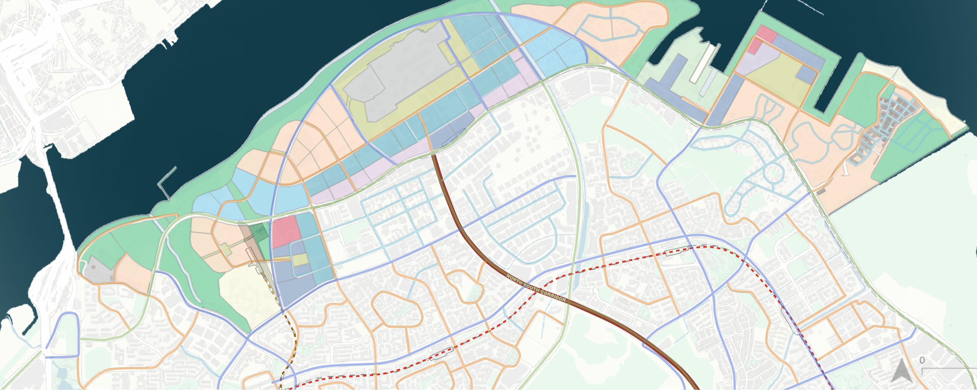
Theexistingroadnetworkinthisareaiscurrentlyfragmentedandlacksconnectivity,withaclearroadhierarchy absent.Additionally,thewaterfrontisinaccessiblethrough theexistingroadnetwork.TheplannedNorth-SouthCorridor representsanopportunitytoenhanceaccessibilityandnetworkcohesion,asitwillendatSenoko.
Currentconditionofthesiteislargely undevelopedintheWoodlandsNorth andSembawangShipyard.Thebuilt industriallotsandbuildingsareamix ofoldlow-risebuildingsandwarehouseswithsomenewmedium-rise building.
TheWoodlandsNortharearemains largelyunbuiltandopenfordevelopment,whileSembawangShipyardis availableforredevelopment.ThemajorityofplotswithintheSenokoIndustrialEstateareslatedtobecomeavailablefordevelopmentby2050. Additionally,theNationalGasCenter andSAFCampwillberedeveloped.
WoodlandsNorthistheonlymajortransportationgateway withinfocusarea,whichwillbeelevatedwithRTSLinkstationin2026.Theexistingrailwaynetworksuffersfromalack ofinternalconnectionsbetweenkeydestinations.TheupcomingSeletarLineisexpectedtosignificantlyincreaseaccessibility,attractingmorevisitorstothearea.
Manyoftheindustriesinthisareaarefood,construction,and manufacturingindustriesinB2categories.Vacantlandbetweensomelotsallowroomfordevelopment.Withapriority oncreatingconvenientaccessandactivatingthewaterfront, theseexistingindustriesarepotentiallyrelocatedtoSungei Kadut,makingitasignificantindustrialhub.
Withinthefocusedarea,greenspacesarenotablyscarce, particularlyalongthecoast.Additionally,PCNlackseffective integrationwithcoastalareas,limitingrecreationalconnectivityandaccessibility.
Establishedcoastalzonestocreatecontinuouspark spacetobuildcoastalprotectionandachieveenvironmentalresilience.
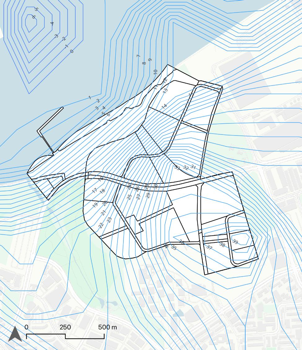
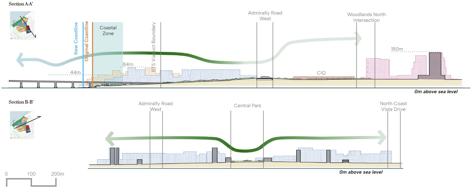
CoastalZonesareareaswithin50-100metersoftheoriginalcoastline,basedonthelandelevationandfloodrisk,to limitnewdevelopments.Thepurposeofestablishinga coastalzoneistorestricttheconstructionofnewdevelopmentsandinsteadallocategreenspacesthatserveas coastalprotection.Thisdesignisspecificallyintendedtoregulatecoastaldevelopmentstoachievecoastalresilience whilelimitingtheuseofexistingland.Allowablelanduses areusesthatpotentiallyactivatethewaterfront;allowfor publicaccesstotheseafront;allowforintegratedcoastalresiliencepurposes;potentiallyoffsetthenegativeenvironmentalimpactswithinnovativetypologies.
SembawangShipyardanditssurroundingareasareatriskoffloodingassealevelsrise(ChannelNewsAsia,2023).The coastalarealandscapeisratherflatcomparedtoitssurroundings,andtheoceanterrainisrelativelyshallow.(GEBCO,2023). TheNorthCoast'scoastalareasaremostlybuiltup,butithasretainedsomeofitsnaturalcoastalconditions.
Mixesof8typesofcoastalandmarinehabitats: Mudflats,vegetation,coralreefandrubble,sandflats,vegetationandrockbund,shallowwaterandmudflats,builtarea, sandybeach.(NParks,2018)
Realigntheidentityofcurrentdistrictstothevision andconnectthemtoactivatethewaterfront.
WoodlandsNorthwillbecomeamajormixed-usebusiness andcommercialdistrictforMalaysianandSingaporean workersundertheNorthRegionconceptplan.Thisproject leveragestheRTSLinkandCausewaytoJohorBahru.The currentgeneralindustriesinSenoko'sB2landuseslimitwaterfrontuseandmaynegativelyimpacttheenvironment, hinderingcoastalprotection.SenokoNorthmightreduce Business2industriesbyintroducinglightandcleanindustriallanduses(Business1andBusinessPark)andnon-industriallanduseslikeresidentialandparks.Sembawang Shipyard'sredevelopmentwillpreserveandintegrateitsrich maritimehistoryandheritageintoavibrantmixed-usedestinationforalltourists.
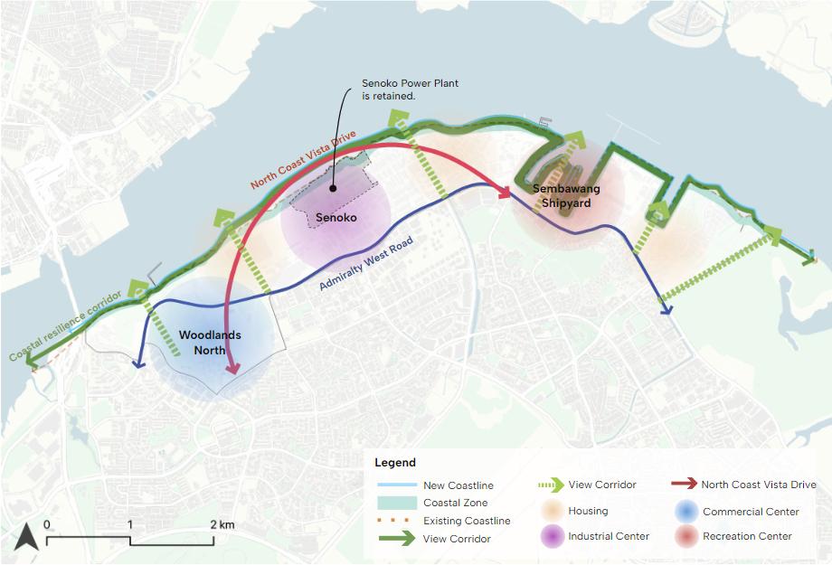
Organizingelementstocreateawaterfront-oriented,well-connected,andlegiblespatialorganizationintheNorthCoast. Therearefourkeyelements: ThreeprimarydistrictsofWoodlandsNorth,Senoko,SembawangShipyard,whichwillcreatethesynergy,activatethe waterfrontandbuildupeconomicresilience CoastalResiliencecorridor,toanchorallelementsofthe NorthCoasttotheseafrontandenhancecoastalresilience. NorthCoastVistaDrive,toimproveconnectivityfromEastto Westanddistinctivelyformthedistricts.Theformofthe roadisdesignedtobevisuallyimpactfulandaidurbandesigneffortswhichallowscenicviewofthecoast 6MajorViewcorridors,toimprovevisualandphysicalconnectiontowardstheseafrontfrominlandandcreateSouthto Northconnection.

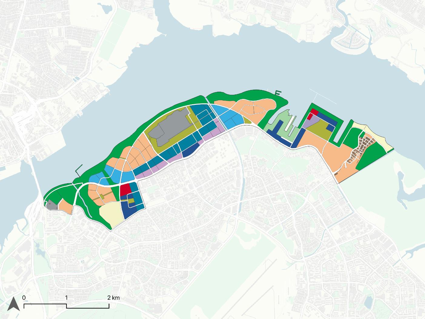
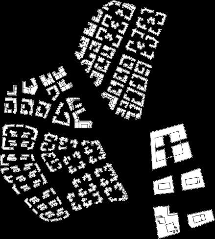
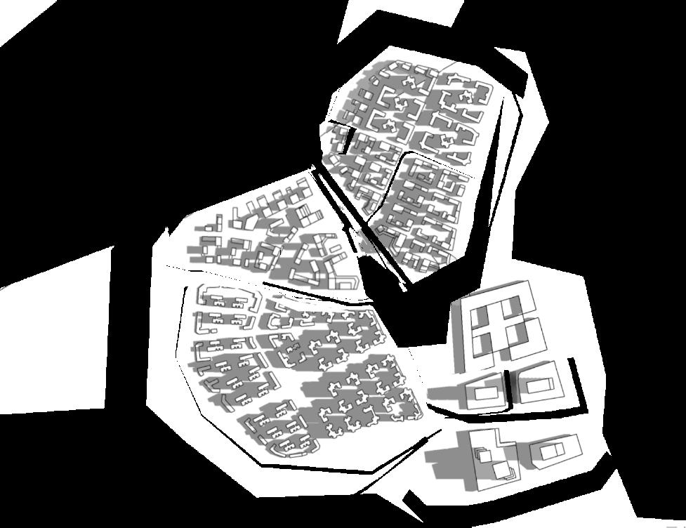
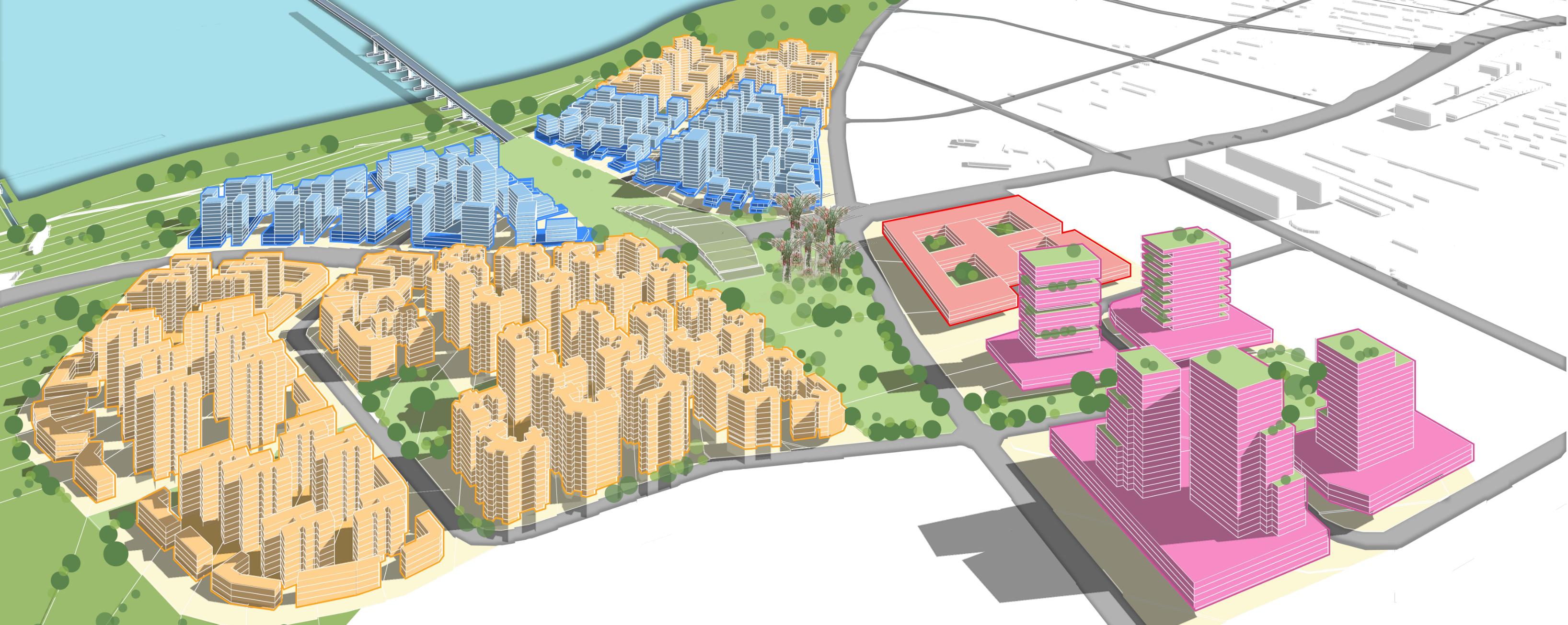
Guidedbytheframework,thelanduseplanisformed,andthethreedistinctdistrict emerged.WoodlandsNorthisbusinessandcommercialdistrictwithprimarilycommercialuses(retail,office,andhotel)aroundRTSLinkandMRTStation.Senokowill bevibrantmixedneighborhoodwithcommercialandbusinessusestointerconnect WoodlandsNorthandSembawang.Intheeast,SembawangShipyardwillbecome heritageandrecreationdistrictwithpreservelandedhousingandshipyardbuildings, introduceeventspaceincludingsportsandrecreation,civicuse,openspaceforheritageconservation,commercialandrecreation.
Basedonthemasterplanframework,therearethreeprimaryreasonswhichexplains thedifferencesbetweencurrentconditionsandmasterplan2050. Rezonedandredesignedcoastalzonetobuildcoastalresilience.
Increaseofpark&openspaceandotherallowableuseswithincoastalzone. Intensificationofusestocreatevibrancy,reaffirmdistrictidentitiesandactivate thewaterfront.
Increaseofcommercial,residential,park,openspacesandsports&recreationuses.
Realigntheidentityofcurrentindustrialestatetowardsmixedwaterfrontdevelopment.
DilutetheexistingB2landusesusingBusinessPark&B1toshifttowardscleanindustries.
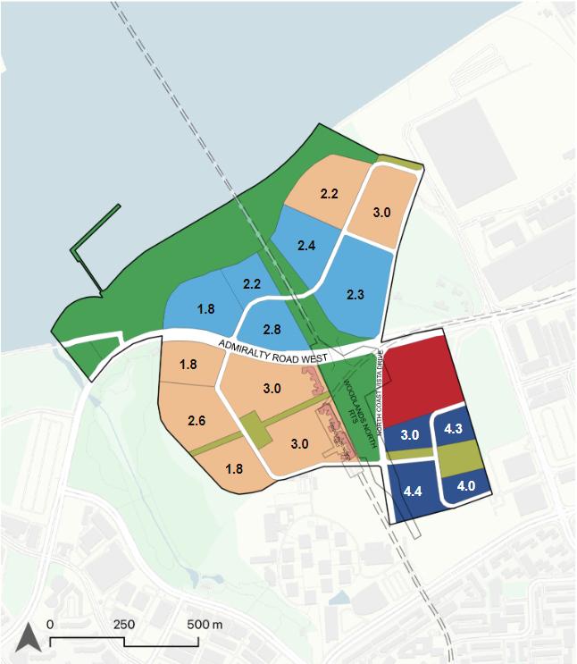
NewplotratioallocationfortheGreaterNorthernWaterfrontaimstoredefinethe skylineoftheNorthCoastandcreateauniqueskylineidentityviewedfromJohor Bahru.NewplotratiodistributionalsoemphasizecoastalorientationofNorth Coastdevelopmentsandwhichbalancesleveraginglandvalueonthewaterfront andcoastalenvironmentalconsiderations.
TherearethreemajorconsiderationsforGPRallocation:
1.GreaterplotratioforbusinessandcommercialpurposesnearmajorthoroughfaresandMRTstations.
2.Reducetheplotratiowithinandaroundconservedbuildingstopreservethe site'snaturalsetting,especiallyinSembawangShipyard
3.Controltheheightofbuildingsalongthewaterfrontparkandviewcorridors.
Basedonanalysis,theexistingroadnetworkofthisarea needstobemorecohesiveandconnectedtothethreedistricts.Therearetwoprioritiesforrepairingtheroadnetwork: 1)enhancingtheconnectivityofthreedistricts and 2)improvingtheaccessibilityofthewaterfront.Thefirst isachievedthroughaninterwovenroadnetworkwitha clearroadhierarchy,whichisachievablethroughtheretentionofroadsintheSenokoNortharea.Thisplanleverages theupcomingSeletarMRTline,whichconnectstheGreater NorthernWaterfronttotheGreaterSouthernWaterfront. Secondly,thenewroadnetworkimprovesaccessibilitytowardsthewaterfrontandoffersbothphysicalandvisual connectiontotheseafront.
Previously,thewalkingandcyclingpathswerefragmented.In thisproposal,thewalkingandcyclingpathsareincreasedand densifiedbyextendingthePCNnetwork,whichenhancesconnectivityfrominlandtowaterfrontareas.Withcyclinglane andpedestrianwalksdesignedintoeachroadcategory,theinterconnectivitybetweenthethreedistrictsisimproved.
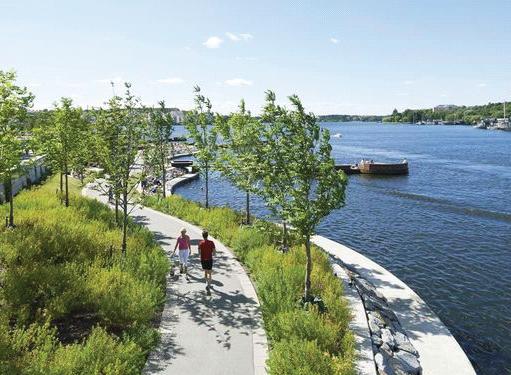
Tofacilitatecoastalresilienceandmitigatefloodrisks,theinitiativeseekstodensifythegreennetworkbyextendingthe existingPCNtowardthewaterfront.Thisnewgreennetwork willconnectWoodlandsNorthandSenokoNorthwiththe SembawangShipyard,forgingacomprehensivegreennetworkthatenhancesecologicalconnectivitywhileoffering recreationalspaces.Acontinuouscoastalparkbeltisalso proposedasanaturalsafeguardtomitigatecoastalandinlandfloodrisk.
RoadHierarchy
Interlinkinggreen spaces,infrastructure andfloodcontrolfor resilience
Category2Road
-Addedcyclingpathonbothsidestoencourageactivemobility. -Bioswaleinthemiddletofacilitatedrainage.
Category3Road
-Twogreenwaysonbothsidestoenhanceviewcorridor. -Bioswaleinthemiddletofacilitatedrainage.
Clearandwell-connectedroadnetworkisaidedbynewroaddesignswhichoffersvehicularmobility,safetyforwalking andcyclingandalsodrainageandvegetationforresilience.
Floodinghasinlandandcoastalcomponents,thusincreasing thecapacityofdrainageisimportant.Toseparatesaltwater andstormwater,bioswalesanddrainageareintegratedintoeveryroadcategory(see3.5.1RoadSections),,basedonwaterretentionflowandtopography.Drainageinallroadcategories willbeupgraded,toallowwatertoflowtowardsSungeiSembawangandSungeiChina.
Category4Road
ExampleofBioswalesandplantedsidewalkstoallowforretentionofrainwateronroadlevel.
Integratingmultilevelcoastal protection,enhancementand experience
TreatmentoftheNorthCoastwillspecificallypreventcoastalflooding,erosion,andsaltwaterintrusion.MaintainingtheoriginalNorthcoastlineisapriority,consideringmostofthecoastlineisnatural andrichwithbiodiversity.ThecoastaldefensetreatmentsfortheNorthCoastconsistofhardandsoft solutionsandnature-basedsolutions,whicharedifferentfromtherestofSingapore,whichis70% protectedbyseawalls.Furthermore,thecoastalareawillcreateaseamlessexperiencewhiledifferent treatmentswillbeused,creatingandmaintainingthepublicconnectiontothewaterfront.
Fromanalysis,therearethreetreatmentsfor coastalprotectionintheNorthCoast:
1.Increasingplatformheightandintroducesoft treatments.
2.Managedrealignmentoffloodriskareawith partialremovaloffloodbank
3.Controllingthemovementofhighwatertowardsinlinepositions.
4.Beachnourishmentforexistingbeachareas.
Thefivefactorsforconsideration:
1.Existingecosystemandmarinehabitats
2.Coastalfloodrisk
3.Adjacentlanduses
4.Possiblehardandnature-basedsolutions
5.Publiccoastalexperience
TreatmentA isbyincreasingplatformheightandintroducesofttreatmentsinintertidalzones.


SectionA1 (Existingmudflats):Increaseplatformheight(using coastalterracesandboulders)andoptionalfloatingplatformfor waterfrontpark.


SectionA3 (Existingnon-coastalvegetation/coralreefs):Seadikeroadandcoastalterracesoptionalfloatingplatformincoralreefsareas


SectionA2 (Existingrockbund&mudflats):PlatformIncrease(usingcoastalterraceandboulders)andraingardeninthemiddletofacilitatedrainage.


TreatmentB usesmanagedrealignmentinvolvesrelocatinghighwaterprotectionlinesfurtherinland,utilisingnaturalinfrastructure.Usingcontrolledrealignmenthasnumerousbenefits:(1)Facilitatesecologicalrestoration;(2)Establisheseasilyreachable waterfrontareas;(3)Moreeconomicalthanrigidengineeringmethods.TheNorthCoastispredominantlynatural,characterisedby ecosystemsandintertidalregions,unlikethesouthernregion.Reclaiminglandinsensitivelyisnotaneffectivemethodforlong-term protection.


SectionA4 (Existingbuiltareas): Softtreatmentsusingrocksand plantsandbuiltintertidalzones
TreatmentC usesbeach nourishmentsInvolvesdepositingsiltontoorneara beachthatisexperiencing erosion.Coastalbeaches dissipatewaveenergyand preventcoastalerosion.


SectionB (Existingnon-coastalvegetation/coralreefs):Managedrealignmenttorelocatehighwaterlinesfurtherinlandbyutilisingnaturalinfrastructure.
Tocreateadistinctivespatial qualityintheGreaterNorthern Waterfront,thereareseveral elementstotheUrbanDesign Framework:
3Axes
CoastalResilienceCorridor tobuildcoastalprotectionandactivatethewaterfront NorthCoastVistaDrive tolinkandcreatesynergiesamongthedistricts, changingvistasallowdifferentspatialexperience
AdmiraltyRoadWest tointerweavemajordistricts
3Districts
WoodlandsNorth
Businessandcommercialcenter
SenokoIndustrialEstate
Cleanandgreenindustrialparks
SembawangShipyard
Newleisureandrecreationcenter
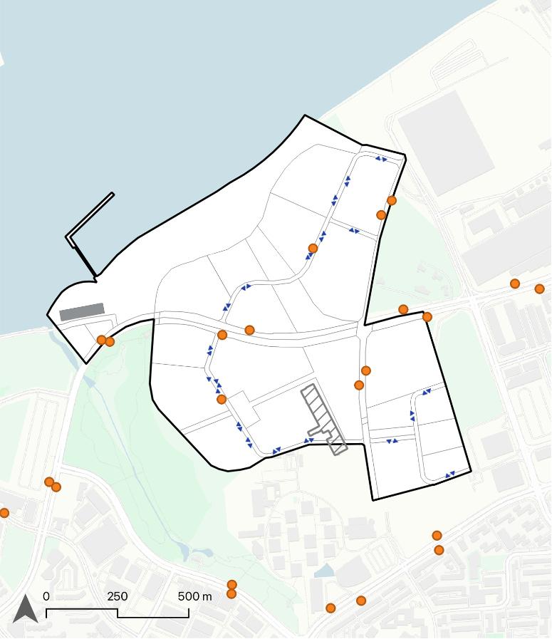
8ViewCorridors
3MajorLandmarks
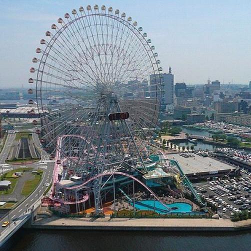
(1)CommercialComplex@WoodlandsNorth (2)SenokoPowerplant (3)SembawangShipyardAmusementPark
4PrimaryNodes
RTSCentralPark
CommercialstriparoundSenoko MRT
SAFYachtMarina
SembawangWharves
2SecondaryNodes
WoodlandsJetty
SembawangBeach

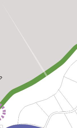
CoastalResilienceCorridor
NorthCoastVistaDrive
AdmiraltyRoadWest
ViewCorridor
Gateway(MRTStations)
Landmark
PrimaryNode
SecondaryNode

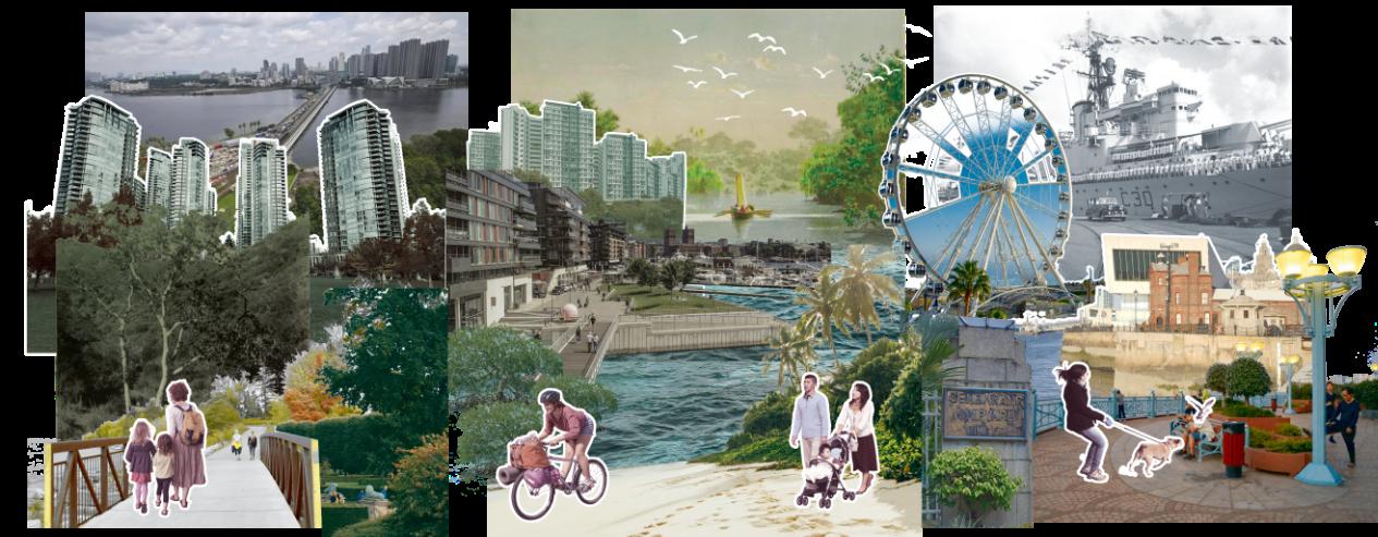
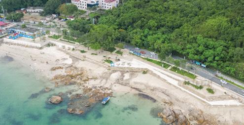
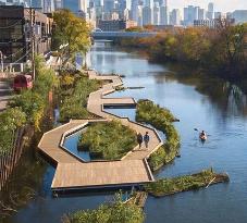
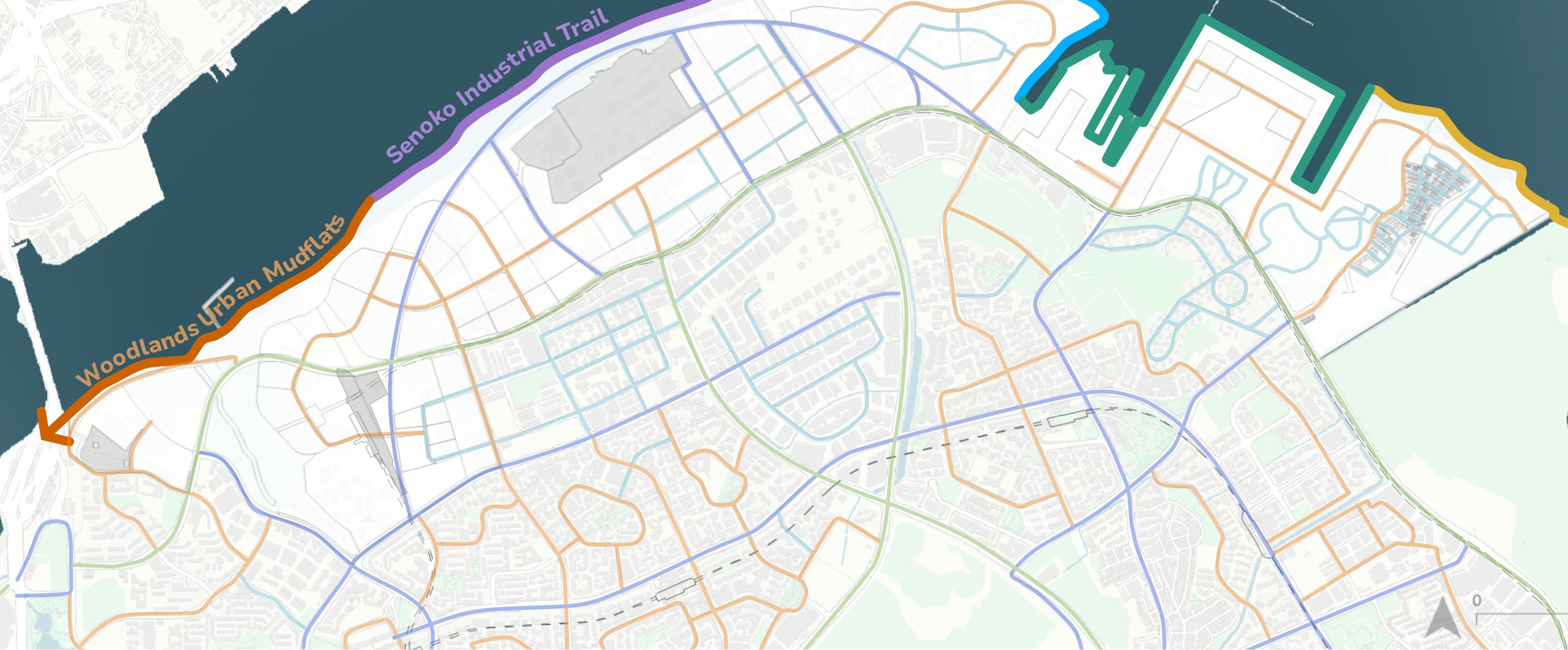
WoodlandsUrbanMudflats
Mudflatstometropolis,thispart ofthetrailofferingahistorical startofSingapore’sbeginnings.
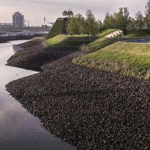
SenokoIndustrialTrail
Thissectionoftheroute showcasesthehistorical,current, andfutureindustrialimportance ofSenoko.
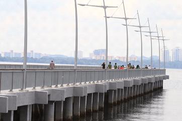
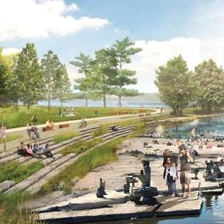
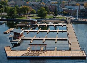
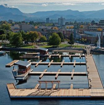
LivingShoresMarina
Thissegmentwillelevatethe SAFYachtClubasasignificant hubintheNorthCoastregion.
SembawangShipyardShores
Thissectioncommemoratesthe historicalsignificanceof SembawangShipyard.
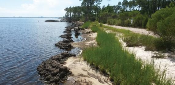
UluSembawangSandyShores
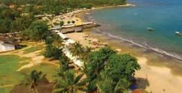
Oneofjusttworemainingnatural sandybeachesinSingapore.An explorationofSingapore'sorigins intheKampongandits connectionstoSimpang.
Additionally,ourgoalistodevelopanenhancedcoastalencounterthatseamlesslyincorporatesSingapore'sabundanthistoricalandgeographicalfeatures. Toaccomplishthis,weinitiallyidentifiedanddocumentedtheprominentlandmarksintheNorthRegionspanningfromWoodlandstoSembawangShipyard, takingintoaccounttheirhistoricalcontextandimportance.Afterlocatingallof thelandmarksintheNorthCoast,weformedsmallerthemes,thatcombinethe historyandtheenvironmentalconditions.ThuscreatingacomprehensiveNorthernCoastalExperienceTrailthatcanalsomergewithGreaterRusticCoast.


Initially,weselectedaarea,105hainsize,nearthecoastinWoodlandsNorth. WeselectedthislocationtotakeadvantageofthepotentialofferedbytheRTS link,whichinvolvesincreaseddevelopmentaroundtransporthubsandthecreationofadistinctiveandlivelyconnectionbetweeninlandandcoastalareas.
Followingthemasterplan,WoodlandsNorthwillbe anewmajorbusinessandcommercialnodeinthe North,whichwillincludethesekeyfeatures:
ExpandedWoodlandsWaterfrontPark forcoastal protectionandenhancement.
Newofficeandretailcommercialcenter nearby WoodlandsNorthMRTStation.
CentralPark toallowforinlandconnectionfrom WoodlandsNorthcentertocoastalarea.Different commercialmixlandusestoframeandactivatethe openspaces.
Newresidentialdevelopments inthewaterfront andnearbyAdmiraltyParkandopenspacetoactivatetheopenspace.
BuildinguponUrbanDesignFrameworkforGreater NorthernWaterfront,NorthCoastVistaDriveand AdmiraltyRoadWestandCoastalResilienceCorridorisstillthemainorganizingelementprimarilyfor theEast-WestConnection.FortheNorth-South Connection,uniquetothisareaistheGreenLink, thatwillconnectCoastalCorridortowardsopen spacesaroundresidentialandcommercialareas throughtheCentralParkastheprimarynode


Intermsofstreetscapeandaccess,Thisareais servedbyanetworkofshelteredpedestrianpaths, withlandscapedlinkwaycentredalongtheCentral Parkandopenspaces.Busstopsarelocatedaround 200to300mincrementsandprioritizedaccessibility tootherareas.
CentralParktoallowforinlandconnectionfrom WoodlandsNorthcentertocoastalarea.Different commercialmixlandusestoframeandactivatethe openspaces.
Newresidentialdevelopmentsinthewaterfront andnearbyAdmiraltyParkandopenspacetoactivatetheopenspace.

Thebuildingsetbackplaniswhereweaimtocreate avibrant,protectedstreetscape.Tomaintainalegiblespatialorganization,allboundariesandtransitionareasbetweendevelopmentsarewelldefined. Alldevelopmentsallowforgreenbuffersandshelteredwalkwaysalongroadreservelines.


Tocreateadistinctivegreenscapeandtransition fromsurroundingareastowardsCentralPark whichallowsactivationofthecommunalgreen space.


Towardsthewaterfrontpark,thebuildingedgerespondstothewaterfrontthroughgradualbuildingheightchange. Arcade,outdoorcommercialandgreenbufferallowtransitiontowardswaterfrontareas.
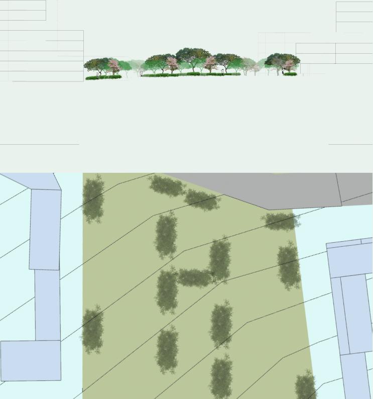
TosupporttheoverarchingconceptoftheNorthern CoastalLandscape,wehavedevelopedalandscape designconcepttoconveyourdesignintentionsin WoodlandsNorth.Thereexistthreeprimarycomponents.TheNorthCoastPromenadefacilitatesthe integrationofcoastalenhancementandprotection throughlandscapedwalkways.CentralParkand GreenBridgeserveasbothacommunalgreen spaceandameansofsupportingecologicalfunctions.Thisapproachtocoastalandinlandlandscapingcombinesvariousspeciesthroughmulti-tiered landscapingtoenhancebiodiversity.
RockBundsareterrestrialandintertidalrockrevetments,withlowto moderatealgaecover.Thematurevegetationsareterrestrialvegetation withcanopycovernotdominatedbycoastalspecies(CLC,2022).

Thetreatmentshouldaimto:
•Introducemorenon-invasivecoastalspecies.
•Decreasesealevelriseimpacts&reducestormsurges.


•Restoreendangeredhabitats&createconnectiontowardsothermarinehabitats.
InourmasterplanforGreaterNorthernWaterfront,wehaveoutlinedourideasforcoastalprotectionandenhancement.InthisfocusareaofWoodlandsNorth,wewanttodemonstratehow coastalprotectioncanbeachievedbypreservingexistingecosystems.OntheseafrontedgeofWoodlandsNorth,therearetwo typesofmarinehabitats:A)rockbundsandmaturevegetation andB)mudflats.


Mudflatsaredefinedasareaswithintertidalflat,mud,lowsurfacebiotic cover(CLC,2022).Mudflatsaugmentationistheplacementofsiltsand claystoelevatemudflats.Thistreatmentdecreasessealevelriseimpacts, reducesstormsurges,restoresendangeredhabitats.Itcanalsoofferopportunitytoconnecttootherintertidalzones.


SectionandModel
CombiningallofourdifferentapproachestoWoodlands North,throughthissectionthegreenvalleyisclearly shown,purposefullyemphasizedbythebuiltforms aroundit.Thegreenvalleyontheuppersectionshows theintegrationofRTSapproachtunneltothelandscape andseamlessconnectionfromNorthtoSouthCentral park.
(Below)This3Dmodelshowcasedofourintentionsand culminatesinalegiblemassingforWoodlandsNorth. Togetherwithgradualterrainheightandbuildingheight changethiscoastalareaisfurtheremphasized.Greenlink isenhancedbythebridgebutalsothebuildingsflanking onitssidewhichcreatedthisvalleyfortheopenspace. NorthCoastVistaDriveoffersasequentialchangeof vistastowardsthecoastalareathroughthedifferent typologiesaroundit.


TheGreaterNorthernWaterfront'sphasingplanisbasedonland availability,upcominginfrastructureprojects,andtheproposedplan. NorthCoastVistaDriveisthepriorityroadconstructiontobedonein phases,whicharespecificallydesignedtomaintainconnectivityas eachphaseprogresses.
Withthenewplansandadditionsofdistrictsandurbanqualities,North CoastwillbetransformedintoavibrantandaccessibleGreaterNorthern Waterfront.


•FirstphaseofNorthCoast VistaDriveconstruction
•WoodlandsNorthBusiness District
•SembawangShipyard RecreationDistrict(after remediationworks)
•NorthSouthCorridor completed

•SecondphaseofNorthCoast VistaDriveconstruction
•SenokoRedevelopment (afterMicronremediation works)
•SembawangRedevelopment (areaaroundSAFCampand Marina)
Firstly,thepreviouslyfragmentedroadnetworkoftheNorthCoastis improvedforbothvehicularandpedestrianconnectivity,withNorthCoast VistaDriveasananchorandorganizingelement.Secondly,newsynergistic anddistinctdistricts.WithWoodlandsNorthbecomingasignificant businessnode,Senokowillbeafuturemixed-useforinnovativetechnology district.SembawangShipyardwillbeavibrantrecreationdistrict,offeringan arrayofopportunitiestolive,work,andplay.Thirdly,thenewlyaccessible vibrantandattractivewaterfront.Usingthecoastalzoneandnewcoastal developments,whichintegratecoastalprotection,enhancement,and experience,thepreviouslyinaccessibleNorthCoastisactivatedandwell connectedtoinlandareas.
ThesechangesintheNorthCoastwillpilotanewtypeoflivinginharmony withthecoast.InnovativetechnologyindustrialcenterinSenokowillthe Northtowardsfuturebusinessesandachieveenvironmentalresilience. Lastly,theNorthCoastwillbeanopen,attractiveandvibrantplacetolive, work,andplay.
•ThirdphaseofNorthCoast VistaDriveconstruction
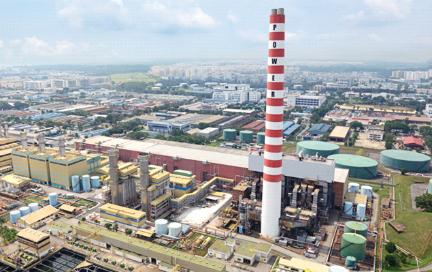
•SenokoRedevelopment aroundSenokoPowerPlant
•SembawangResidentialarea
PlanningoftheGreaterNorthernWaterfrontwillfurtherstrengthenthe NorthRegion’sroleinSingapore’sresilience,especiallyintheseaspects:
EnvironmentalResilience
ExtensionoftheecologicalcorridortowardstheNorthCoastfromMandai andCentralWaterCatchment,whichenhancesthemovementoffloraand faunaandpromotesbiodiversity,contributingtotheoverallecological resilienceintheNorthRegion.
IndustrialandEconomicResilience
SenokoIndustrialisamajorinnovativeindustrialhubthatbringstechand skillstotheNorthCoastandfocusesonresearchanddevelopmentfor environmentalandclimatetechnologiesinSingapore.Thishubcancreatea synergisticrelationshipwithSungeiKadut,anothercentralindustrialhubin theNorthRegion.WoodlandsNorth,aprimarybusinesshub,isalsoelevated withdirectconnectionstoJohorBahruandSingapore’sCBD.
CoastalResilience
TheGreaterNorthernWaterfrontkickstartsthemulti-levelprotectionand public-accessiblewaterfrontintheNorthCoast.Itisauniquemodelof coastalprotectioninSingaporethatpreservesexistingmarinehabitatsand marineconnectivitytootherpartsofSingapore.
TourismResilience
NewdestinationontheNorthCoasttoservethelocalpopulationand touristswiththeelevatedSembawangShipyardasarecreationandheritage district;SembawangBeaches;SAFYachtMarinaandWaterfrontPark.This newdestinationcanattractupto1millionannualvisitorstotheNorth Region.


Bastin,J.-F.,Clark,E.,Elliott,T.,Hart,S.,Hoogen,J.vanden,Hordijk,I.,Ma,H.,Majumder,S.,Manoli,G.,Maschler,J.,Mo,L.,Routh,D.,Yu,K.,Zohner,C.M.,&Crowther,T.W.(2019).Understandingclimatechange fromaglobalanalysisofcityanalogues. PLOSONE, 14(7),e0217592.https://doi.org/10.1371/journal.pone.0217592
Borsje,B.W.,DeVries,S.,Janssen,S.K.H.,Luijendijk,A.P.,&Vuik,V.(2017).BuildingwithNatureasCoastalProtectionStrategyintheNetherlands.InD.M.Bilkovic,M.M.Mitchell,M.K.LaPeyre,&J.D.Toft (Eds.), LivingShorelines (1sted.,pp.137–156).CRCPress.https://doi.org/10.1201/9781315151465-10
Bricheno,L.,Cannaby,H.,&Howard,T.(n.d.). ExtremeSeaLevelProjections CentreforLiveableCities(CLC).(2022). AGuidetoImplementingCoastalNature-BasedSolutionsforSingapore.https://www.clc.gov.sg/research-publications/publications/books/view/a-guide-to-implementingcoastal-nature-based-solutions-for-singapore
deSchipper,M.A.,Ludka,B.C.,Raubenheimer,B.,Luijendijk,A.P.,&Schlacher,T.A.(2021).Beachnourishmenthascompleximplicationsforthefutureofsandyshores. NatureReviewsEarth&Environment, 2(1),70–84.https://doi.org/10.1038/s43017-020-00109-9
Jaarsma,C.F.,Langevelde,F.V.,&Beunen,R.(2013).LandscapeEcologyandRuralRoads:TrafficCalmingforimprovingbothlandscapeandwildlife? Ekologia, 32(4).https://doi.org/10.2478/eko-2013-0032 NYCEDC.(2019,March). LowerManhattanClimateResilienceStudy.https://edc.nyc/sites/default/files/filemanager/Projects/LMCR/Final_Image/Lower_Manhattan_Climate_Resilience_March_2019.pdf Palinkas,C.M.,Orton,P.,Hummel,M.A.,Nardin,W.,Sutton-Grier,A.E.,Harris,L.,Gray,M.,Li,M.,Ball,D.,Burks-Copes,K.,Davlasheridze,M.,DeSchipper,M.,George,D.A.,Halsing,D.,Maglio,C.,Marrone,J., McKay,S.K.,Nutters,H.,Orff,K.,…Williams,T.(2022).InnovationsinCoastlineManagementWithNaturalandNature-BasedFeatures(NNBF):LessonsLearnedFromThreeCaseStudies. Frontiersin BuiltEnvironment, 8,814180.https://doi.org/10.3389/fbuil.2022.814180 Park,S.(n.d.). BadgerSheetMetalProperty Prominski,M.,Stokman,A.,Zeller,S.,Stimberg,D.,Voermanek,H.,Bajc,K.,&Zheng,N.(2023). River.Space.Design:Planningstrategies,methodsandprojectsforurbanrivers (Thirdandenlargededition). Birkhäuser.
RogerTym&Partners.(2011).Coastaltypologies:Detailedmethodandoutputs. FinalReport. SantaClaraClimateCollaborative.(n.d.). MudflatAugmentation.SCCCollaborative.RetrievedApril25,2024,fromhttps://www.climatecollaborativescc.org/strategies/mudflat-augmentation Sun,Y.,Eltahir,E.,&Malanotte-Rizzoli,P.(2017).ThebottomwaterexchangebetweentheSingaporeStraitandtheWestJohorStrait. ContinentalShelfResearch, 145,32–42.https://doi.org/10.1016/j. csr.2017.07.004
Sutton-Grier,A.E.,Wowk,K.,&Bamford,H.(2015).Futureofourcoasts:Thepotentialfornaturalandhybridinfrastructuretoenhancetheresilienceofourcoastalcommunities,economiesandecosystems. EnvironmentalScience&Policy, 51,137–148.https://doi.org/10.1016/j.envsci.2015.04.006
SydneyMetropolitanCMA.(2009).Howtomakeyourseawallmoreenvironmentallyfriendly.
Tan,K.S.,Acerbi,E.,&Lauro,F.M.(2016).MarinehabitatsandbiodiversityofSingapore’scoastalwaters:Areview.RegionalStudiesinMarineScience,8,340–352.https://doi.org/10.1016/j.rsma.2016.01.008
TheFloodHub.(2021).Coastal-Management-Hard-and-Soft-Engineering.pdf.
Ting,K.W.(2023,December2).INFOCUS:With“noplacetoretreatto”,Singaporeadvancestoprotectitscoastlines[News].ChannelNewsAsia.https://www.channelnewsasia.com/singapore/rising-sea-levelslow-lying-vulnerable-coastal-protection-long-island-3955651
Tun,K.,&Tan,J.(n.d.).CoastalProtection:HarnessingNature’sTypologiesinSingapore. Webb,B.,Dix,B.,Douglass,S.,Asam,S.,Cherry,C.,&Buhring,B.(2019).Nature-BasedSolutionsforCoastalHighwayResilience:AnImplementationGuide.ICF&SCE. WorldBank.(2021).ACatalogueofNature-BasedSolutionsforUrbanResilience.WorldBank.https://doi.org/10.1596/36507
Datasources
ForgeneralSingapore,URA,NParksdata:https://beta.data.gov.sg/ ForLTAdata:https://datamall.lta.gov.sg/content/datamall/en.html ForBathymetryGEBCOdata:https://download.gebco.net/
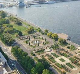
WoodlandsUrbanMudflats
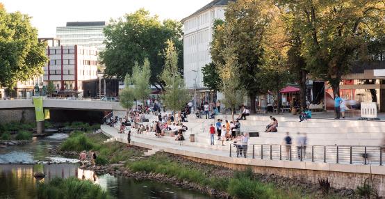
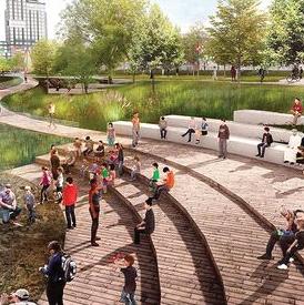
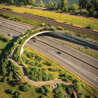
WildMileSOM,Chicago:SOMandurbanriversenliventhechicagoriverwithafloatingeco-park TerracedDike:SouthPlatteRiverIntegrationPlan|LivableCitiesStudio TripeDikeFelixxx:YangmeikengSeaBoulevard-Felixx SenokoIndustrialTrail
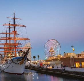
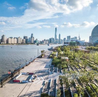
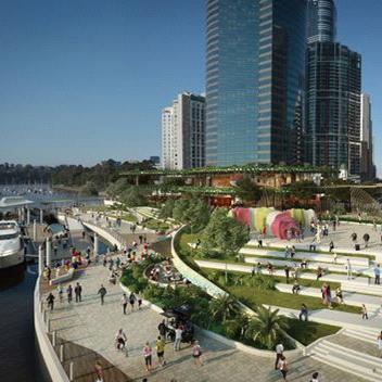
Zuneuenufern(Siegen):AtelierLOIDL—LandscapeArchitecturePlatform|Landezine OttawaRiver:NCCapprovesplanfor9-kmriverfrontrevamp|CBCNews Baakenpark:https://landezine.com/baakenpark-by-atelier-loidl/ LivingShoresMarina: KelownaDowntownMarina:PhotosoftheKelownaDowntownMarina PanamaCityLivingShoreline:https://floridalivingshorelines.com/what-is-a-livingshoreline/ SembawangShipyard: YokohamaMinatoMirai21:https://creativemarket.com/ YamashitaPark:https://planetyze.com/ UluSembawangSandyShores:
StHelena:https://landezine-award.com/st-helena/?mc_cid=d0b993ccf1&mc_eid=d3fc066aa4 AnyerBeach:https://www.tourisminindonesia