June Lake Loop Active Transportation Plan
Final: February 2023

Final: February 2023
Mono County: Community Development
Wendy Sugimura, Community Development Director
Kelly Karl, Associate Planner
Caltrans
Ben Downard
KTUA
Joe Punsalan, Principal
Jacob Leon, Associate, Project Manager
Alex Samarin, GIS Manager
Marissa Ritter, Senior Planner
Morgen Ruby, Senior Planner
Mariella Delfino, Planner
CivicWell
Tony Leonard, Project Manager
Josh Meyer, Program Director
Central Coast Transportation Consulting (CCTC)
Michelle Matson, PE, TE
Mono County Local Transportation Commission
June Lake Citizens Advisory Committee
All stakeholder and community members that participated in the planning process
This plan is funded by Caltrans through the Sustainable Communities Transportation Grant program.
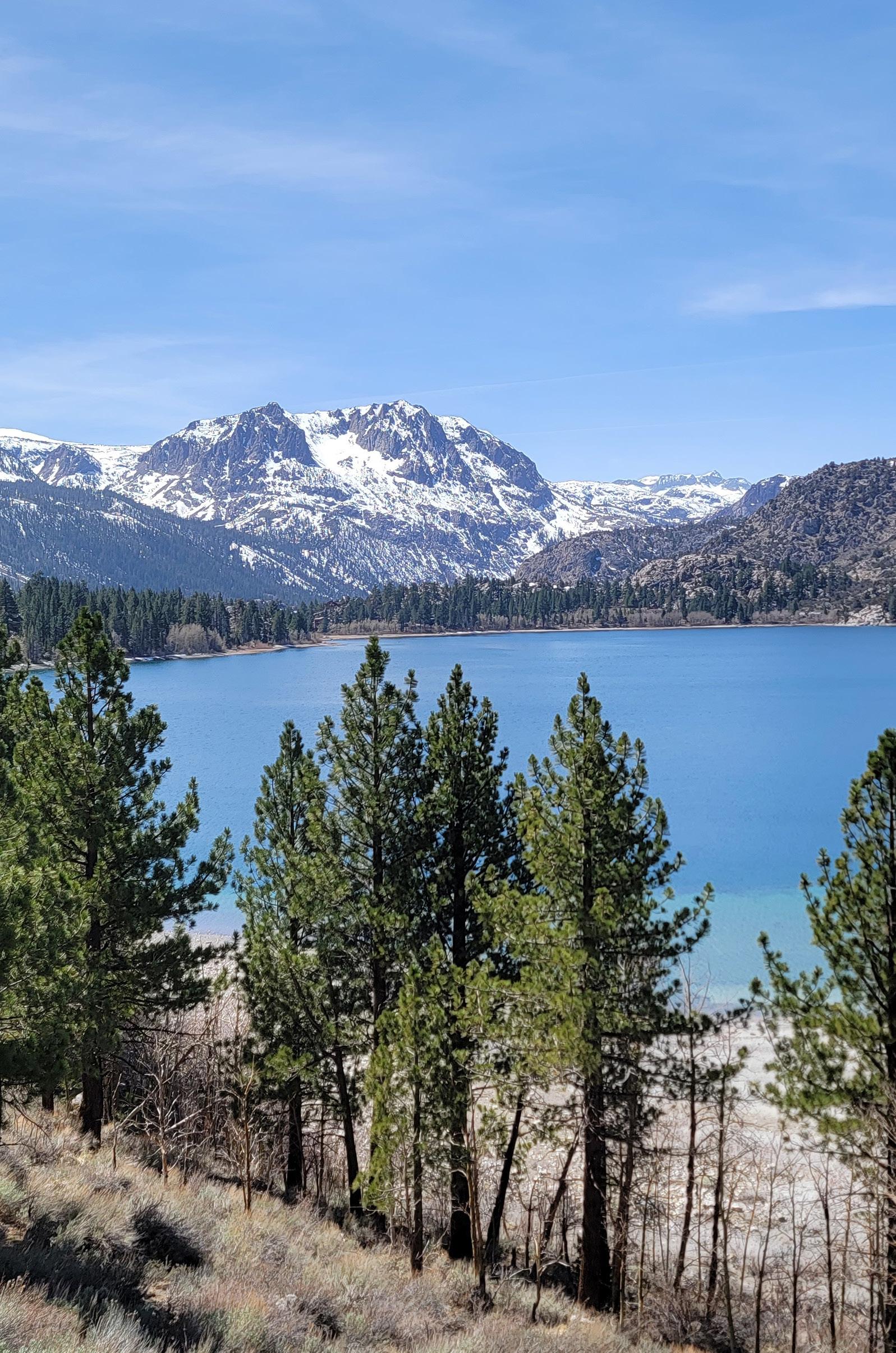
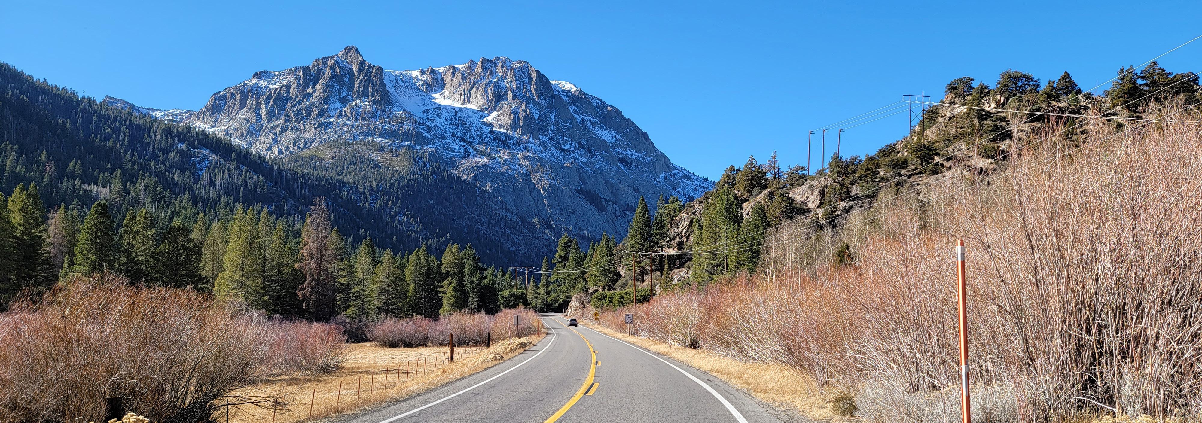
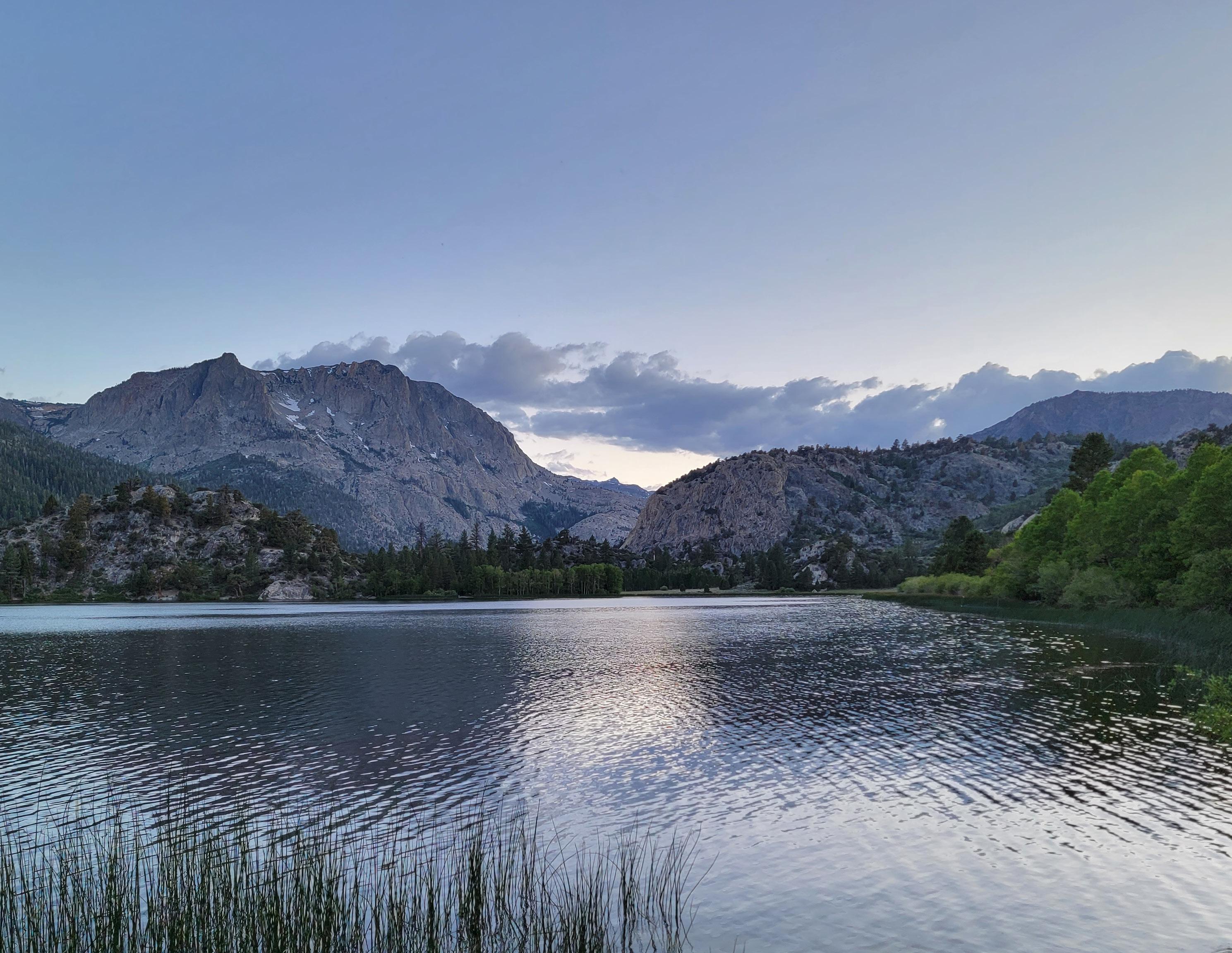
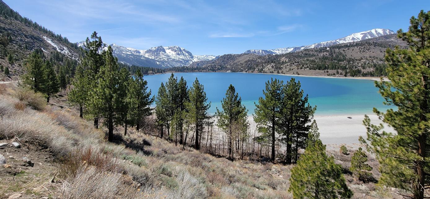
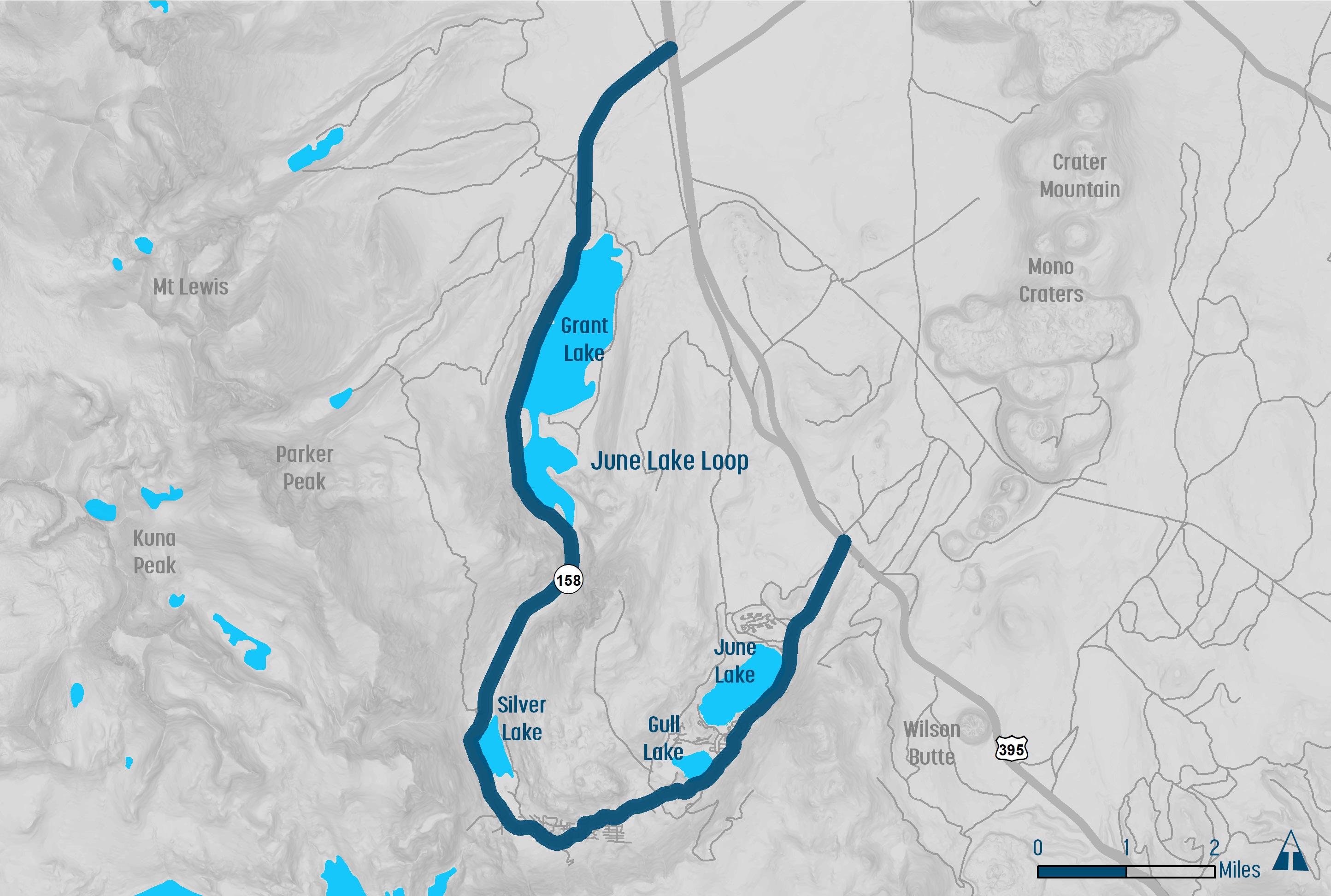
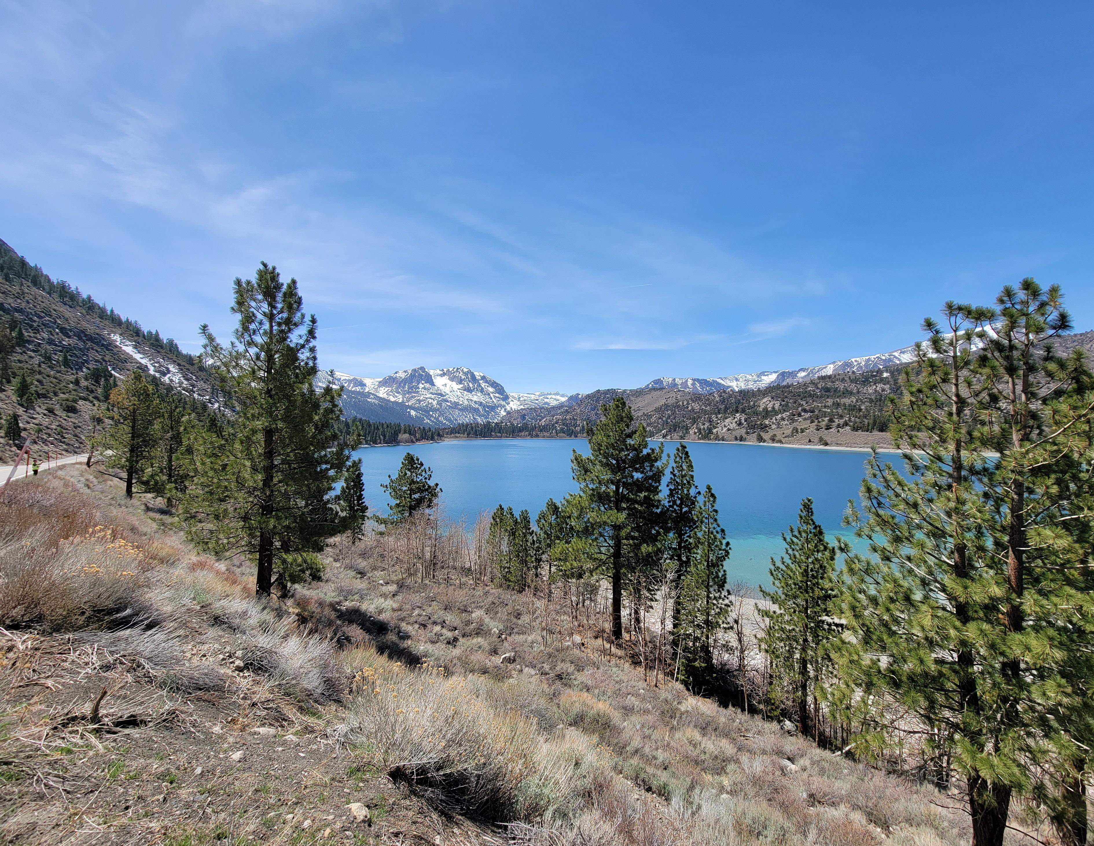
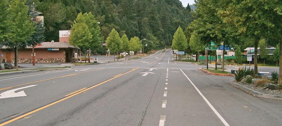
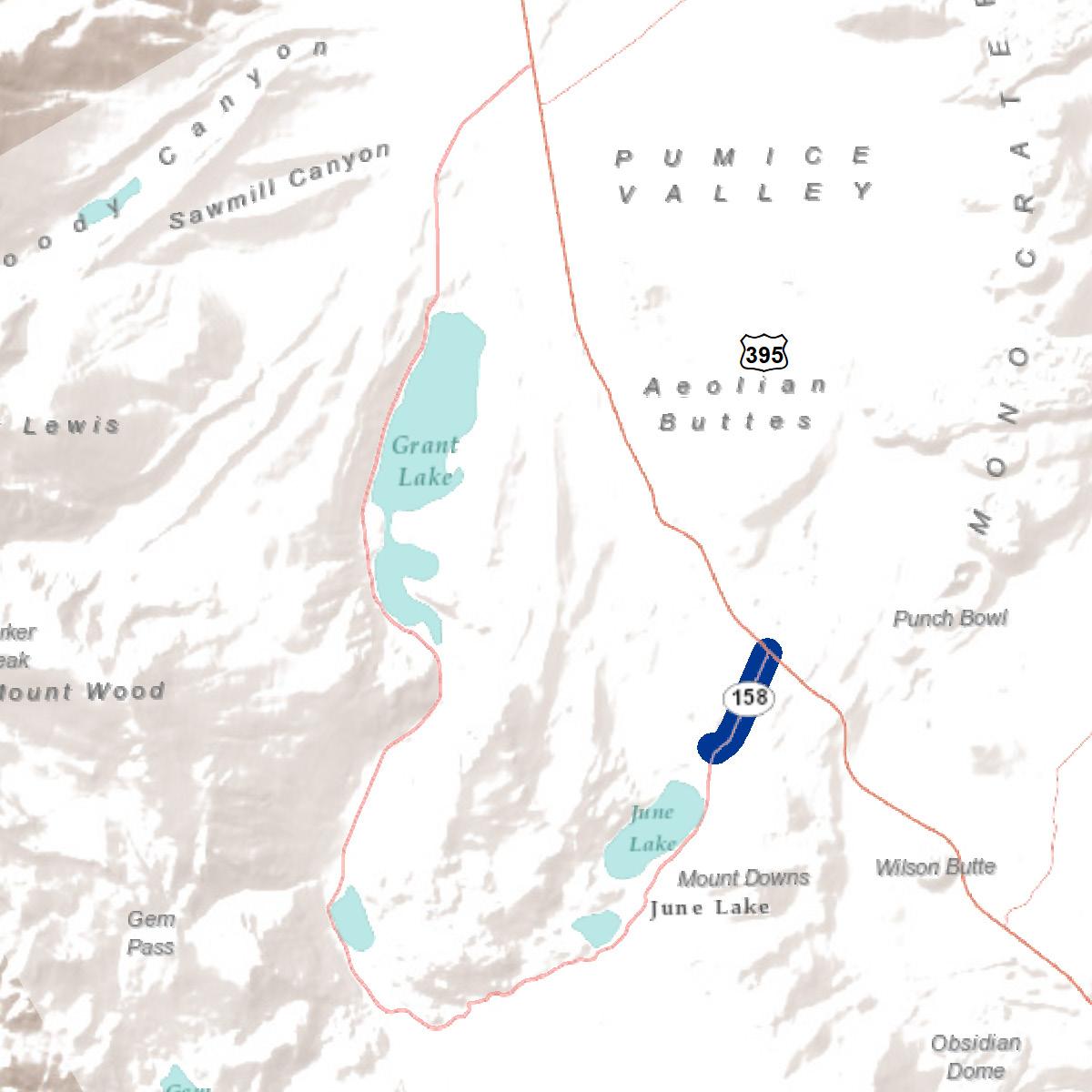
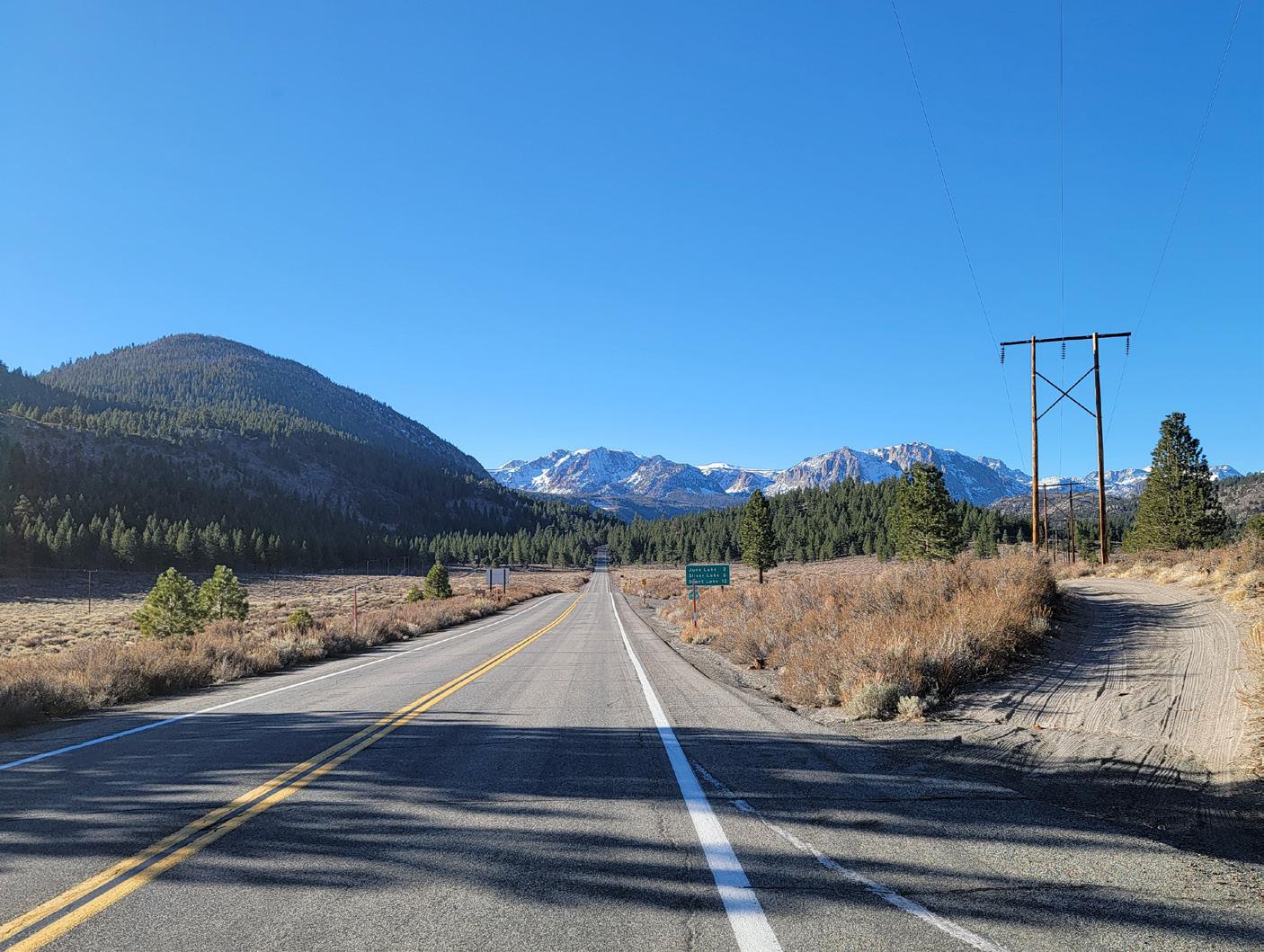
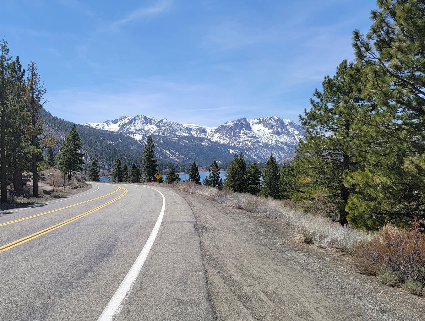
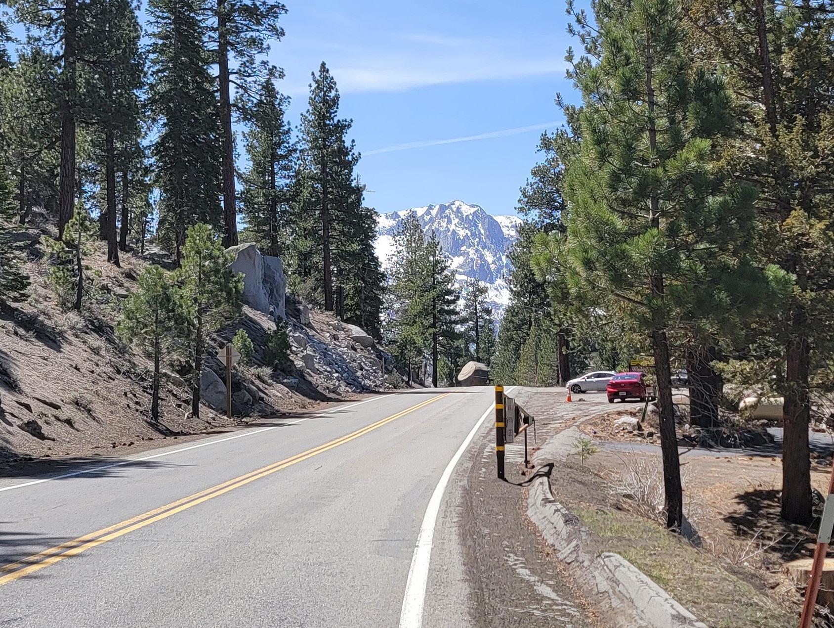
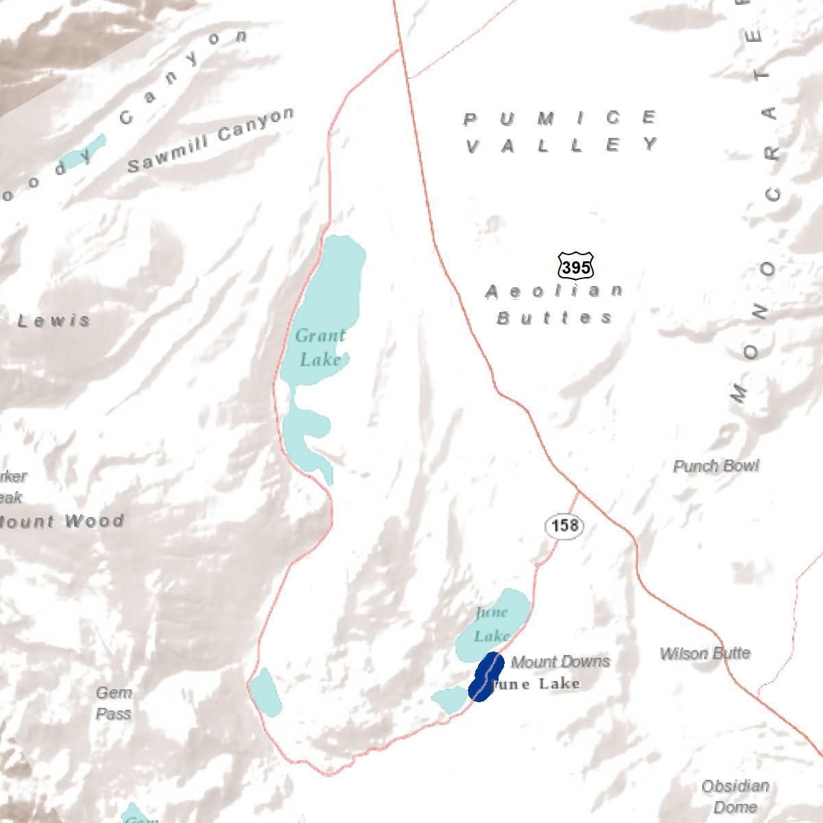
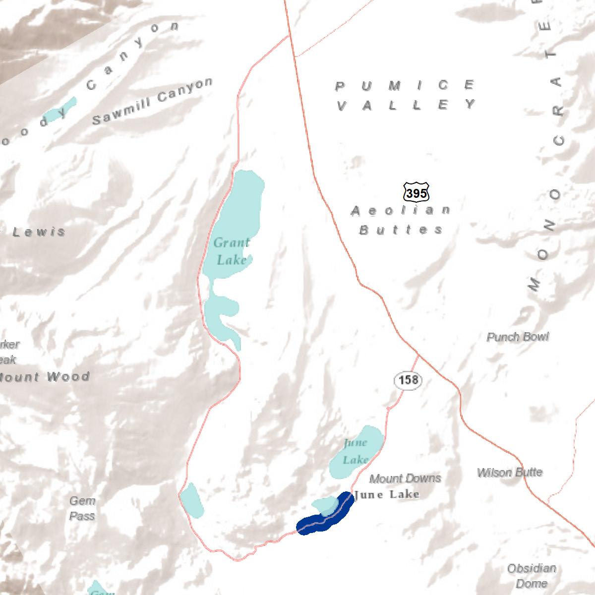
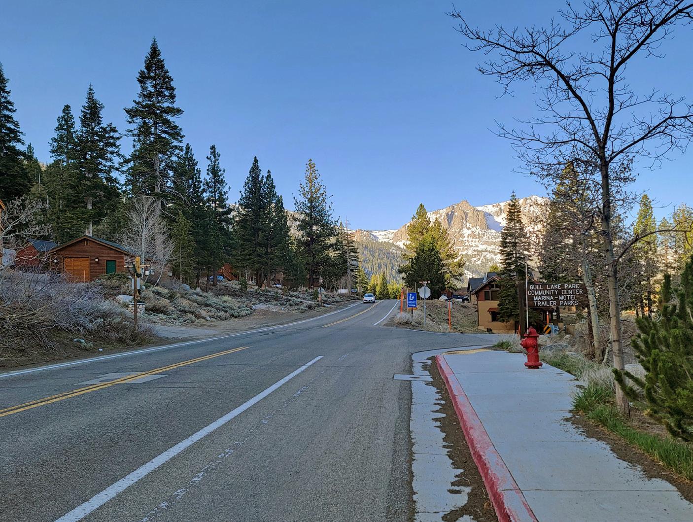
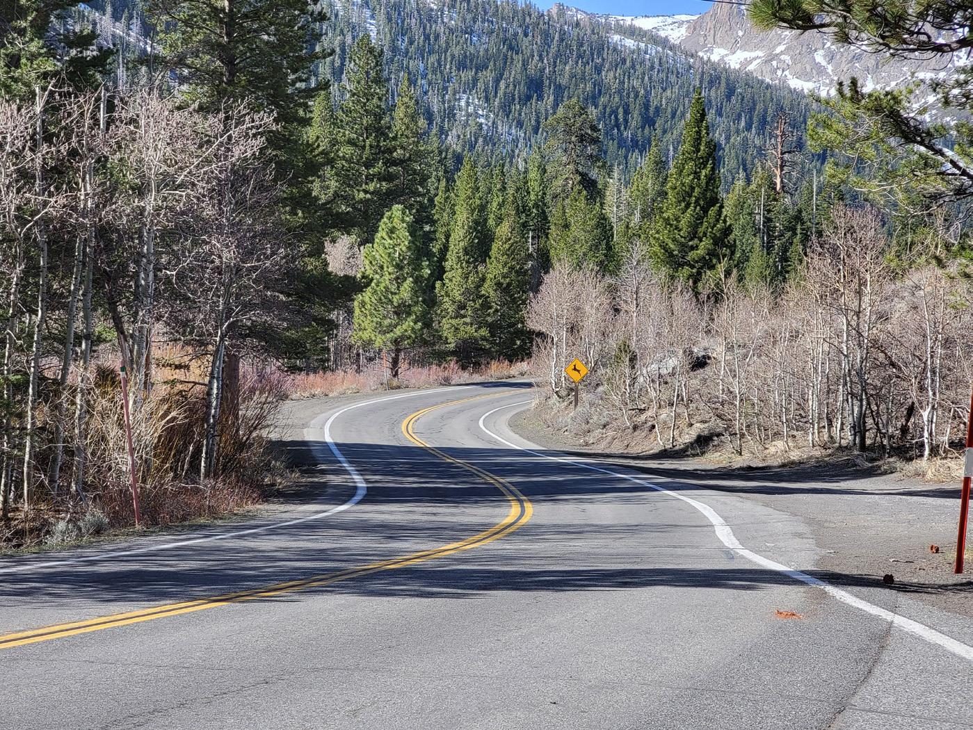
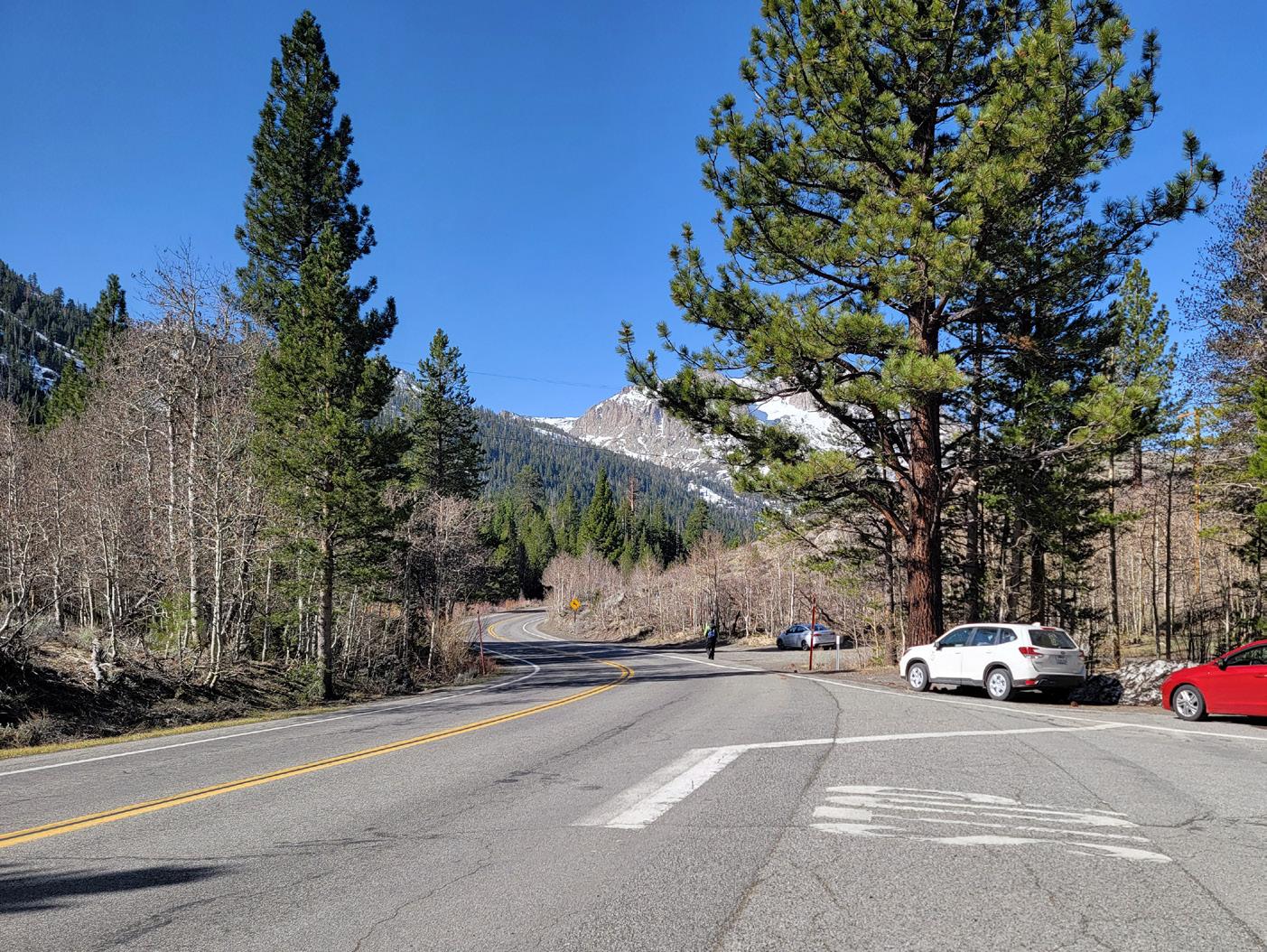
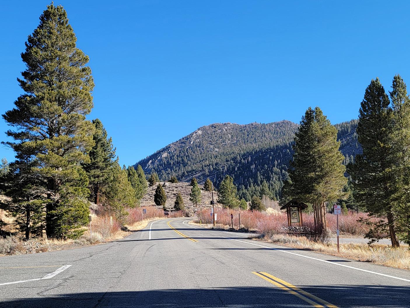
The June Lake Loop, State Route 158, is a 16-mile loop that branches off to the west of US Highway 395 about five miles south of Lee Vining. It is a rural, two-lane highway that passes through the Census-designated place of June Lake in Mono County. This loop follows a horseshoe-shaped canyon containing four lakes, surrounded by a dramatic mountainous backdrop. Within this canyon and among the lakes and streams lies June Lake Village, a full-service community, available to vacationers year round.
This Active Transportation Plan (ATP) will set the framework for safer, walkable, and comfortable streets for June Lake residents and visitors. The recommendations in this Plan - both physical and programmatic - are designed to support bicycling and walking in all communities along the June Lake Loop for the existing and future population. Mono County Local Transportation Commission (LTC) is the lead agency overseeing this plan.
This ATP includes an inventory of existing bicycle and pedestrian infrastructure, identifies physical and programmatic gaps, and includes a list of recommendations that will support annual funding and grant cycles. The LTC will use this ATP to guide additional studies as needed to design and implement projects identified in this plan to improve active transportation and mobility throughout the Loop and community. This ATP uses the latest design standards and guidelines by the State of California and other communities alike to ensure that all recommendations are feasible. Details for improvement projects will be designed and environmentally assessed according to Caltrans standards, at which point the concepts described in this plan will undergo further refinement based on engineering, environmental, right of way, funding, and other constrains. Adoption of this plan by Mono County or the LTC does not constitute a pre- decision by Caltrans on engineering, environmental, or other issues.
The following objectives will guide the planning process to ensure a successful plan that leads to project implementation:
Identify gaps and barriers, both perceived and actual, in the existing pedestrian and bicycling network. 1
Engage with the community to gather local knowledge on existing challenges and opportunities. 2
Analyze the existing infrastructure around activity centers such as campgrounds, resorts, trailheads, June Lake Village and residential areas. 3
4
Develop a list of prioritized projects that encourage walking and bicycling as transportation modes.
Provide the LTC an implementable document they can use to pursue future grant and funding opportunities. 5
This Active Transportation Plan is organized in an easy-to-understand manner that meets State and local requirements. By accepting and/or adopting this ATP, the LTC is able to qualify for future funding pursuits related to active transportation, new mobility, urban greening, corridor planning, and much more. This document consists of three major chapters that describe the planning process from inception to completion.
The existing conditions analysis is located in Chapter 2. This section consists of mapping all available data to help understand the Loop’s existing conditions. Datasets such as land use, existing bicycle and pedestrian infrastructure, and collisions are included. A series of maps and tables are included to help take a deeper look at certain datasets that support conversations with the community and get a better understanding of the Loop.
Chapter 3 summarizes the various outreach activities that were completed as part of the planning process. Activities such as community workshops, stakeholder meetings, and the project survey are included in this section. The feedback collected from community members is used to develop project recommendations.
Proposed recommendations are included in Chapter 4. This section begins with an overview of all available active transportation infrastructure that can be explored based on the latest Federal and State guidelines. Project recommendations are described in a table and through cut-sheets that depict the top projects in an easy to understand manner.
Spectacular natural scenery and abundant outdoor recreation opportunities draw people to the June Lake Loop. According to the Eastern Sierra Corridor Enhancement Plan, there are 1.5 million annual visitors to Mono County, and about 26% - or 390,000 people - visit the June lake Loop. The community of June Lake is an unincorporated census-designated place with a population of 613 people, according to the Mono County Housing Element. The central business district of June Lake is known as “the Village” and is heavily-dependent on seasonal tourism.
Due to the fluctuations of seasonal tourism, the population in June Lake varies significantly depending on the level of visitation. Thus, the infrastructure associated with the June Lake Loop needs to be able to accommodate a population spike many times larger than its resident population. This fluctuation creates significant connectivity, accessibility, and safety issues for non-motorized users. SR 158 lacks bicycle-friendly or multi-modal features and lacks convenient non-motorized connections to major destinations in the area which deters non-motorized travel to destinations on SR 158.
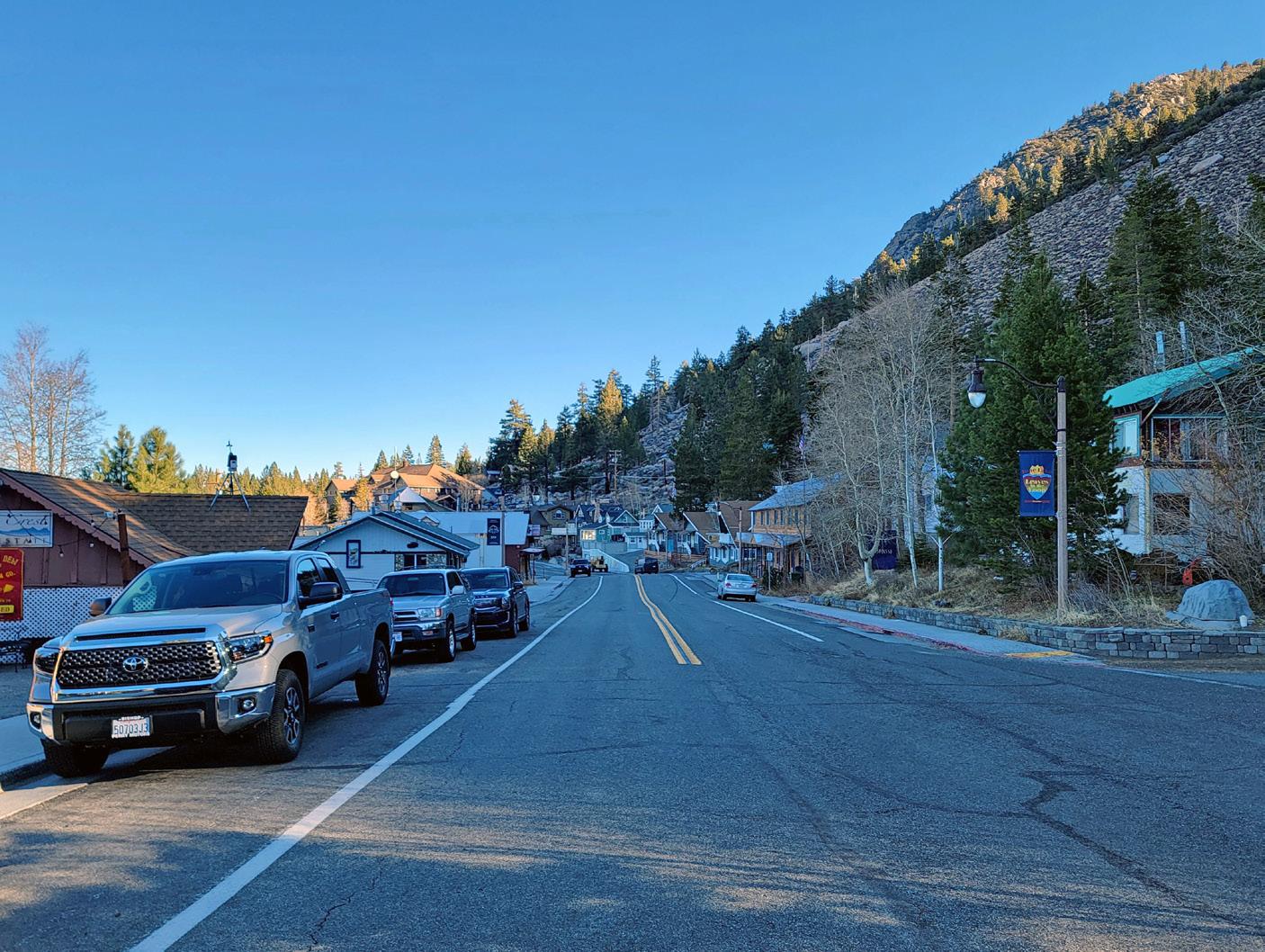
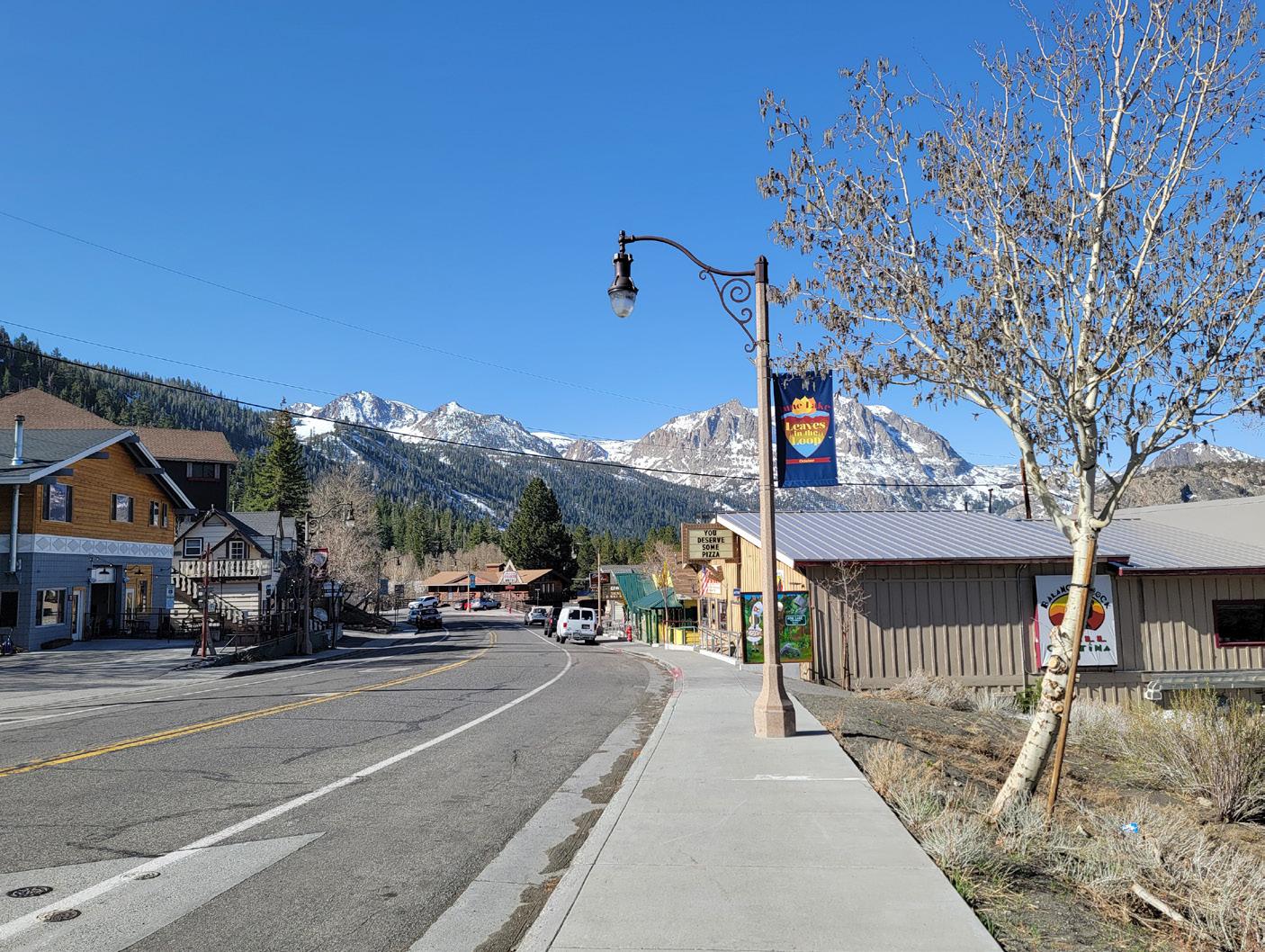
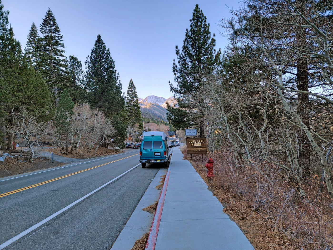
June Lake Village, a quaint commercial and retail district, serves as the heart of the community. Unfortunately, this section of the Loop is missing complete street features for vehicles, pedestrians, and bicyclists that would make the Village truly shine as both a community gathering place and the hub of the local economy. Improvements to sidewalks and pedestrian crossings, bicycle-friendly design features, and parking facilities to encourage visitors and locals to explore the area on foot or bike would dramatically improve multi-modal and complete street versatility in the Village. Recent economic revitalization such as new restaurants and coffee shops has brought some economic growth that has already outpaced the capacity of existing parking and pedestrian infrastructure. Enhanced pedestrian crossings are being explored due to the recent growth. This plan provides a holistic view of connections between amenities within the Village and destinations along the Loop as well. Through the community engagement process, connectivity between Silver Lake and June Lake Village has been identified as a high priority.
Trends in active transportation planning and design have evolved over the last decade. Communities across the country and throughout California have seen the growth of both conventional and progressive active transportation infrastructure. Local leaders, community members, and advocates are showing ongoing interest in ensuring that walking, biking, other forms of non-motorized transportation, and new mobility are included in their built environment. The State of California continues to show its commitment through its Active Transportation Program. In June 2022, the State approved an additional $1.05 billion from the state’s general fund surplus, communicating their continued support for improving active transportation throughout the State.
In addition to funding sources trending upwards, there are other design and programmatic trends that have supported active transportation throughout the last few years. For example, The Project for Public Spaces, a non-profit organization that “shares a passion for public spaces” reported in 2021 that health equity and access is a major theme across mobility planning. Equitable and safe access to open space, trails, bike paths, walkways, etc., has been a major discussion point since the pandemic. Surveys, conversations with local leaders, and advocates have all expressed the importance of addressing generations worth of decisions that have left many communities, especially those of color, with inequitable access to open space. Access to walking trails, bike paths, trails, etc. have long been proven to improve mental and physical health as well as being a catalyst for community pride and social programming.
Street adaptation is another trending theme that many communities are addressing. Thinking of streets as other than moving vehicular traffic is important. Over the last 5 years, quick build projects, parklets, street dining, open street events, and others have demonstrated that streets can be adapted to serve multiple purposes.
The Rails to Trails Conservancy, a non-profit organization whose vision statement is “Trails connect everyone, everywhere”, has also reported on positive trends related to trails, bikeways, and active transportation. They reported in 2020 that “more Americans are walking, biking and using trails in 2020 than ever before—bike sales have boomed and trail use is up 60% over the same period in 2019.”
Trends related to the type of infrastructure being built and advocated for have also shown a growing preference for facility types that enhance pedestrian and bicyclist safety, particularly bicycle lanes that are physically separated from motor vehicle traffic. Class 1 multi-use paths and Class 4 separated bikeways are being highlighted as the types of facilities that will and have encouraged people to bicycle more to reach their local destinations. Pedestrian infrastructure such as enhanced crossings with rectangular rapid flashing beacons (RRFB) or pedestrian hybrid beacons (PHB) are being installed at higher rates since studies have shown increased safety for pedestrians.
Since SR 158 is Caltrans owned and operated, design and implementation would still need to adhere to the Project Development Procedures Manual (PDPM) and Standard Environmental Reference (SER) guidance for State highway improvement projects.
According to the United States Environmental Protection Agency (EPA), the transportation sector accounted for the largest portion of GHG emissions (28 percent) in the United States in 2018. Increasing access to active transportation and shifting travel mode share to non-motorized means of travel will continue to help reduce GHG emissions to improve air quality. Additionally, the construction of new bikeways or pedestrian infrastructure also provide opportunities for designing and introducing green infrastructure into the public realm. The EPA acknowledges the many benefits of green infrastructure, including treating stormwater at its source, reducing flooding, adding street trees, improving air quality, creating new habitat, and improving community pride.
Vehicle emissions pose a significant threat to human health. Vehicle-generated air pollution contains harmful GHG emissions such as carbon dioxide, carbon monoxide, methane, nitrous oxide, and volatile organic compounds. These pollutants and irritants can cause asthma, bronchitis, pneumonia, and decreased resistance to respiratory infections. Increasing access to active transportation and other related clean mobility choices will decrease people’s dependency for car-generated trips and contribute to the reduction of emissions. Reducing GHG emissions will have positive cumulative effects on people’s health. More specifically for the June Lake Loop, non-motorized amenities will provide additional mode choices for residents and visitors while encouraging an active lifestyle.
Regular exercise also reduces the risk of high blood pressure, heart attacks, and strokes. Exercise has also been shown to improve mental health by relieving depression, anxiety, and stress. More importantly, in areas such as the June Lake area, many individuals may lack the opportunity to access gyms or fitness centers. Due to this, well-designed and located sidewalks, bike facilities, and shared use paths become even more critical in supporting community health.
Equity in transportation planning has become a priority topic over the past few years. Planners and agencies are recognizing that projects need to serve people across all socioeconomic statuses. The League of American Bicyclists and the Alliance for Biking and Walking defines equity in two manners:
Geographic Equity - The distribution of bicycling and/or walking facilities and programs within a community, and/or
Social or Demographic Equity - The characteristics of populations served by bicycling and/or walking facilities and programs.
These definitions are important because planners must remind related parties that historically, many low-income communities and underserved populations have been excluded from the transportation planning process. Transportation planning projects should always facilitate effective, humble, and approachable community engagement strategies. All communities should be heard and their participation should help prioritize and design the transportation network that they will be using in their day-to-day lives.
“More Americans are walking, biking, and using trails in 2020 than ever before”
-Rails to Trails Conservancy
Active transportation planning projects are meant to adhere to design guidance established by the State of California. There are other published documents that also influence projects, but the primary document used to help implement projects is the California Manual on Uniform Traffic Control Devices (CA MUTCD).
The latest update to this document came in March 2021. The California Department of Transportation (Caltrans) made edits, referred to as Revision 6 (Rev 6), to the CA MUTCD, to provide uniform standards and specifications for all official traffic control devices in California. It builds upon the comprehensive 2014 update that was meant to implement Caltrans’ 2014 mission to provide a safe, sustainable, integrated, and efficient transportation system to enhance California’s economy and livability. The purpose of the CA MUTCD is to improve safety and mobility for all travelers by setting minimum standards and providing guidance intended to balance safety and convenience for everyone in traffic, including drivers, pedestrians, and bicyclists.
The CA MUTCD contains the basic principles that govern the design and use of traffic control devices that aim to promote highway safety and efficiency by providing for the orderly movement of all road users on streets, highways, bikeways, and private roads open to public travel. Multi-modal policies for safer crossings, work zones, and intersections are integrated as part of the CA MUTCD. Additionally, NACTO guidance was analyzed to ensure flexibility and innovation in the design and operations of streets and highways in California. Much of the guidance provided in the CA MUTCD is consistent with the NACTO Urban Bikeway Design Guide.
Chapter 1000 of the Caltrans Highway Design Manual serves as the official design standard for bikeways in California. This chapter defines a “bikeway” as a facility that is provided primarily for bicycle travel and recognizes its importance in improving bicycling safety and convenience. Chapter 1000 intends to help accommodate motor
vehicle and bicycle traffic on the roadway system, or as a complement to the road system to meet the needs of bicyclists. This chapter classifies bikeway facilities into five different types that include:
» Shared Roadway (No Bikeway Designation)
» Class I Bikeway (Bike Path)
» Class II Bikeway (Bike Lane)
» Class III Bikeway (Bike Route)
» Class IV Bikeways (Separated Bikeways)
Chapter 1000 states that these designations should not be construed as a hierarchy of bikeways since each bikeway type has its appropriate application. In selecting the proper facility, an overriding concern is to assure that the proposed facility will not encourage or require bicyclists or motorists to operate in a manner that is inconsistent with the rules of the road. An important consideration in selecting the type of facility is continuity as well as the highway context or community setting.
This 2019 document is a resource developed to help make informed decisions for the selection of bikeway types. It is intended to supplement planning and engineering processes. It builds upon the Federal Highway Administration’s (FHWA) support for design flexibility to assist transportation agencies in the development of connected, safe, and comfortable bicycle networks that meet the needs of people of all ages and abilities. This guide provides planners and designers additional tools such as matrices, flow charts, and graphs that facilitate the design of the appropriate bikeway based both on roadway characteristics and the intended type of bicyclist.
This guide also references existing national resources from FHWA, the American Association of State Highway and Transportation Officials (AASHTO), the National Association of City Transportation Officials (NACTO), the Institute of Transportation Engineers (ITE), and others.
Additional summaries for guiding documents can be found in Appendix A.
Active transportation in California is supported by legislation and policies at the federal, state, and local level. The following section describes major active transportation legislation and policies. A lot of the legislation is based on greenhouse gas (GHG) reduction and how active transportation can help achieve GHG reduction goals. Others highlight the importance of safe and convenient accommodation of bicyclists and pedestrians, especially as it applies to social and infrastructure equity throughout communities.
California Transportation Plan 2050
A long-range plan completed in 2021 to provide a common framework for transportation decisions and investments throughout the state. It aims to meet the growing needs of California residents as it relates to travel accessibility, emissions, and economic impacts. There are 14 overarching recommendations that correlate to the goals of the CTP.
Under SB 1000, cities and counties are required to adopt an Environmental Justice element, or integrate EJ-related policies, objectives, and goals throughout other elements of their General Plan. The bill also includes a process for communities to become meaningfully involved in the decision-making processes that govern land use planning in their neighborhoods.
This bill seeks to reduce vehicle miles traveled (VMT) through land use and planning incentives. Key provisions require the larger regional transportation planning agencies to develop more sophisticated transportation planning models and to use them to create “preferred growth scenarios” in their regional plans that reduce greenhouse gas emissions. The bill also provides incentives for local governments to incorporate these preferred growth scenarios into the transportation elements of their general land use plans.
AB-1358 requires the legislative body of a city or county, upon revision of the circulation element of their general plan, to identify how the jurisdiction will provide for the routine accommodation of all users of the roadway including drivers, pedestrians, cyclists, individuals with disabilities, seniors, and public transit users. The bill also directs the OPR to amend guidelines for general plan circulation element development so that the building and operation of local transportation facilities safely and conveniently accommodate everyone, regardless of their travel mode.
This bill seeks to establish a Division of Active Transportation within Caltrans to give attention to active transportation program matters to guide progress toward meeting the department’s active transportation program goals and objectives. This bill requires the California Transportation Commission to give high priority to increasing safety for pedestrians and bicyclists and the implementation of bicycle and pedestrian facilities. The bill also directs the department to update the Highway Design Manual to incorporate “Complete Streets” design concepts, including guidance for the selection of bicycle facilities.
Additional summaries for legislation and policies can be found in Appendix A.
The following section includes information for three precedent projects that have similar characteristics to the primary proposed project in this ATP. These projects are Class 1 multi-use paths that were planned and constructed along areas that also face challenges related to topography, environmental protection, scenic resources, and engineering. They are constructed and have since provided valuable connections to destinations for both residents and visitors. Examples of pedestrian intersection improvements in rural communities with seasonal changes are also included in this section.
City / County: Washoe County, NV
Completion: Summer 2019
Cost: $40.5 million
Length: 3 miles
Cost per Mile: $13.5 million
The Tahoe East Shore Trail is a class 1 multi-use path located in Washoe County, Nevada. The trail was completed in Summer 2019 and has since been dubbed as “America’s Most Beautiful Bikeway.” The trail has multiple vista points, shoreline access points, bear-proof trash stations, dog waste bag stations, bike racks, bike repair stations, bathrooms, and seating areas with more amenities planned as funding becomes available. The three-mile paved trail is 10-feet wide and is open to pedestrians and bicyclists on standard bicycles or pedal-assist e-bikes. The trail, restrooms and vista points are handicapped accessible. This project took decades to complete due to the required integration between multiple agencies and 13 partners. The family-friendly trail now welcomes thousands of visitors every year.
City / County: Mammoth Lakes, CA
Completion: Fall 2011
Cost: $12 million
Length: 5.3 miles
Cost per Mile: $2.25 million
The Lakes Basin Path is a 5.3-mile long Class 1 multi-use path located in the Town of Mammoth Lakes. This path runs parallel to Lake Mary Road and it provides a separated facility for residents and visitors that want to visit popular destinations such as local shops, restaurants, Twin Lakes, or Horseshoe Lake. The project was a multi-year effort that was made possible by funds collected from sources such as Development Impact Fees (DIF).
The path required extensive design and engineering to make the eight-foot wide asphalt bike path a reality. Retaining walls, prefabricated bridges, concrete curbs and gutters, erosion control, drainage improvements street lights, and traffic signal modifications were all part of the project. The path itself is a popular destination and it provides vital connections to some of the most scenic areas of the Mammoth Lakes area.
City / County: Jefferson County, CO
Completion: Ongoing
Cost: $29.9 million
Length: 3 miles
Cost per Mile: $10 million
Summary
The Peaks to Plains Trail is a visionary 65-mile trail that aims to serve the 3 million residents of the Denver metro area. The goal is to one day connect the South Platte Trail in Denver to the headwaters of Clear Creek at Loveland Pass. The Clear Creek Trail segment is called the “Mouth of the Canyon” and it is an important three-mile segment classified as a Class 1 multi-use path. This segment will include three pedestrian bridges, one improved underpass beneath U.S. Highway 6, multiple creek access locations for visitors, and two parking lots. The bridges will be designed with overlooks so that visitors can enjoy scenic views.
Project design is fairly complex because it requires planning for steep canyon walls, narrow trail corridors, sensitive riparian areas, historic structures, general accessibility, and minimizing impacts to natural resources. The segments that are already complete include 10-foot wide concrete paths that are ADA accessible. The timeline for design and construction for this segment started in 2021 and is planned through 2023. Funding was secured in 2018 when the Denver Regional Council of Governments (DRCOG) approved the $9.75 million needed to complete this segment.
Improving intersections is an important step for increasing comfort and safety for pedestrians.
City/County- Any area that experiences snowy conditions
Completion: Varies
Cost: Varies
Length: Varies
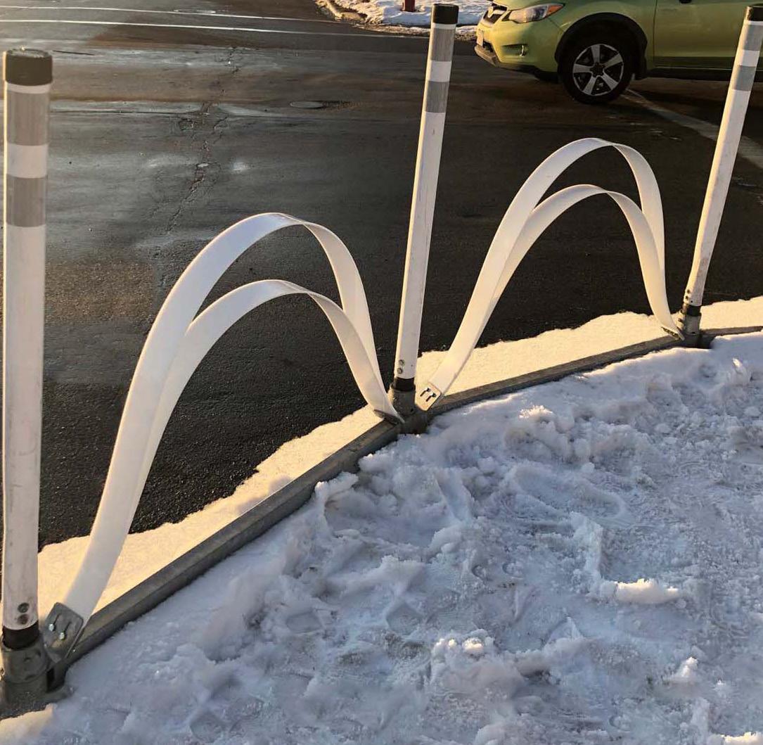
Planners and engineers have devised solutions to the challenges that winter conditions - like snow - present in the design, implementation, and maintenance of street improvements. Some possible solutions - used in communities around the country - include things like designing improvements to accommodate snow removal equipment or utilizing portable improvements that can be removed in snowy conditions. Considerations for winter weather should play a role in the recommendations that are ultimately pursued.
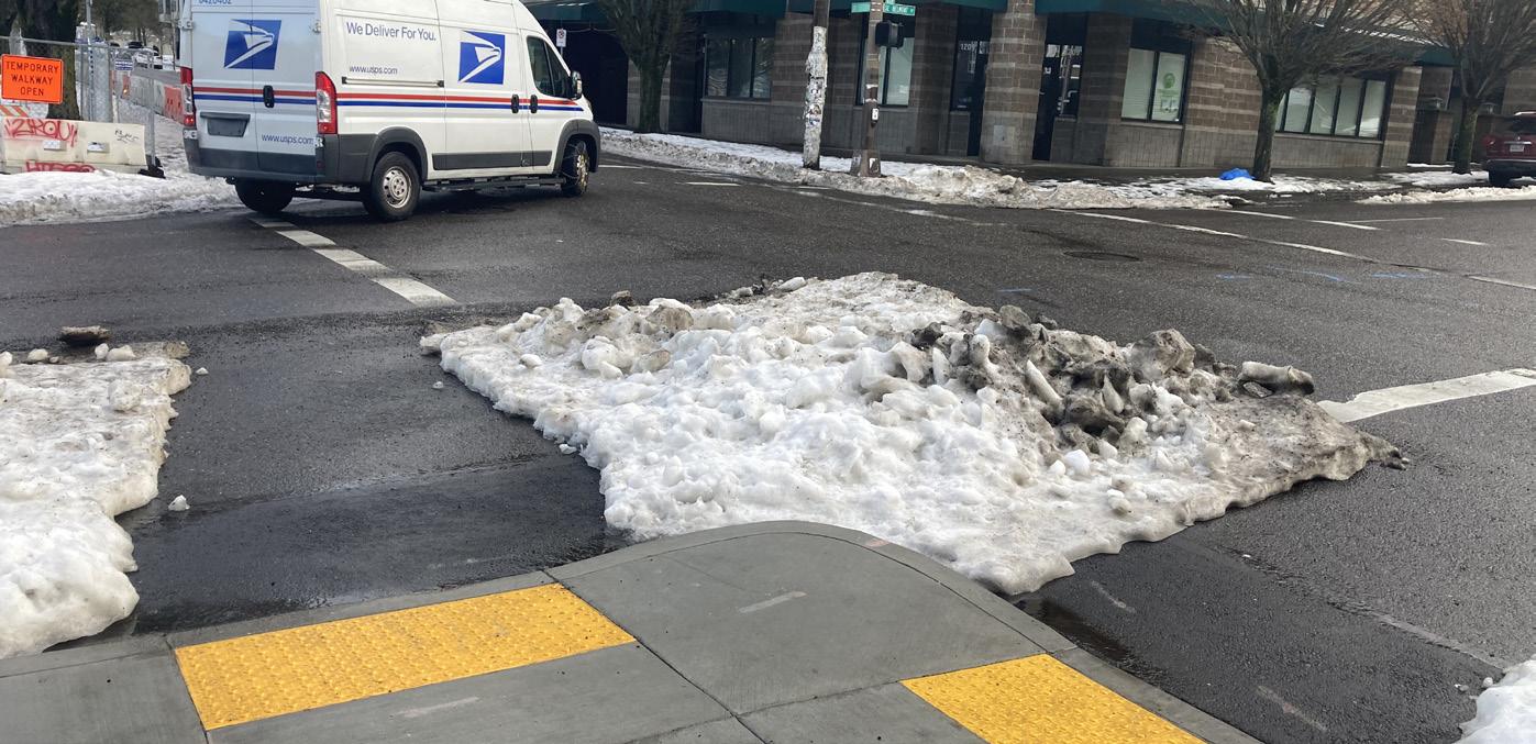
Communities have explored portable improvements such as bollards, bike facility barriers, planters, and curb extensions that can be removed during the winter season and placed back during the non-snowing months of the year. Alternatively, planners and engineers can observe how the built environment is designed based on the patterns of snow-melt. This design principle was coined in 2014 as a snowy neckdown - or “sneckdown” - by the Streetsblog Founder Aaron Naparstek. This design principle is based on the temporary areas where snow has built up in the road but not been flattened by vehicles. These areas inadvertently show how an intersection or street segment are used by vehicular and pedestrian traffic, ultimately revealing areas that can be improved. Sneckdowns can depict areas where a street can be narrowed to slow vehicular speeds or areas that can shorten pedestrian crossing distances.
Page Left
Intentionally Blank

The following section summarizes key documents that provide either direct or related background to the goals and objectives of this ATP. These documents can influence the focus of the existing conditions analysis, direct parts of the community engagement process, and help dictate part of the recommendations phase.
The 2019 Regional Transportation Plan serves as a long-range vision for Mono County’s transportation priorities and investments by clearly identifying achievable goals. The Plan involves public, federal, state, and local agencies in decisions on social, economic, air quality, environmental issues related to transportation. The document presents a comprehensive overview of each of its communities, including June Lake, and includes a high-level analysis of local transportation needs, issues, public input regarding existing systems, and provides realistic recommendations for projects and funding programs.
Goal 25 of the Regional Transportation Plan states, “Provide and maintain a multi-modal circulation system and related facilities that promote the orderly, safe, and efficient movement of people, goods, and services, and preserve the mountain village character of June Lake.”
The June Lake Area Plan from 2015 is used as the foundation for future land use decisions made by the Planning Department, Planning Commission and Board of Supervisors with input from the June Lake Citizens Advisory Committee. All proposed projects in June Lake must conform to the Area Plan.
The Plan provides valuable insight into the characteristics of the June Lake Area. For example, the Plan states that community members often leave town to access healthcare, education, and shopping centers. Housing is oriented to second-home owners and vacation homes rather than residents. The local economy depends heavily on tourism which also affects the general demand to improve yearround recreation, trail maintenance, and other tourism-based elements.
The Plan includes policies that support the growth of June Lake. Policies stress the development of a pedestrian-oriented atmosphere in the village with off-street parking, crosswalks, walkways, and transit service to boost commercial strength. The policies concentrate on reducing traffic congestion and automobile usage through the use of “pedestrian-oriented villages” throughout town that include connections to the trail system. The Plan also includes guidance on providing alternatives to automobile transportation, such as developing a comprehensive trail system plan and a multi-use trail loop with lake access. Other policies encourage stimulating the tourism-based economy by attracting businesses, opening and operating a visitor center to help promote the June Lake Loop, and providing a balance of recreational opportunities.
The objectives range include reducing vehicular congestion, enhancing safety and accessibility for pedestrians and bicyclists, adopting maintenance programs, introducing multi-modal circulation systems, constructing covered parking facilities, and enhancing recreational opportunities. Recommendations in June Lake are specified primarily along the SR-158 (June Lake Loop) and in the June Lake Village, which parallels in importance as a preceding document to the June Lake Loop Active Transportation Plan.
The Inyo Forest Motor Vehicle Use Map from 2015 depicts the roads, trails, and areas of the Inyo National Forest that are designated for vehicles. The map can be used to locate possible connections to the June Lake Loop from the surrounding areas. Numerous trails and campgrounds have been identified in the area and serve as considerations when prioritizing new multi-modal connections.
The June Lake Trails Committee was formed in 2007 to plan and create trails in the June Lake Area. The Down Canyon Trail is one of several trail projects this group has initiated. Efforts for the creation of this trail included public meetings to gather input on trailheads and the overall alignment of the trail. The proposed trail would provide a connection between the Double Eagle Resort and June Mountain Ski Area. Final alignment will be determined based on existing conditions and connections to other established trails.
The Walk, Bike, Ride Plan (Plan) is a comprehensive planning effort for the Town of Mammoth Lakes that aims to reduce the need of driving for recreation purposes by promoting multi-modal connections. It also aims to support the growth of Mammoth Lakes as a year-round recreation destination by introducing multi-modal connections and a network of mobility hubs to serve as information centers, walking and biking facilities, and connections to key destinations.
While the Plan focuses on the Town of Mammoth Lakes, a number of recommended actions can be applied to this ATP. Useful actions to consider for the ATP are listed below.
The Plan recommends that the town adopt both NACTO Urban Street Design Guide and the FHWA’s Small Town and Rural Design Guide to develop complete streets. These documents will be of ample significance for redesigning the right of way to accommodate alternate modes of transportation. The Plan recommends loop trails between activity centers to connect the bicycle and pedestrian network via in-town multi-use trails and hiking trails for more scenic and safe connections.
The Plan notes that as part of a community survey for the project, 66% of respondents said snow removal from paths would encourage them to walk or bicycle more. Improving snow management
can help encourage people to choose to walk or bike rather than drive. Additionally, active recreation shuttles to transport people around town to enjoy hiking, biking, backcountry skiing, that require gear and may begin in one destination and end in another. This can help reduce car trips by providing in-town transportation between trail heads, residences, and the Village.
The Plan recommends implementation of a wayfinding program to include informational and wayfinding signs or banners throughout town. The Plan recommends implementing an educational campaign around e-bikes and the policy differences from traditional bikes, especially in sensitive environmental areas.
June Lake is an unincorporated community in the Eastern Sierra region of Mono County. The population was 611 in the 2020 Census, compared to a county population of 14,395. The median age of June Lake residents is 66.5 years old, significantly older than the average age of 39.5 countywide and 36.7 statewide. 64% of the June Lake residents are age 65 or older, a significantly higher percentage than the county and state. 5% of June Lake residents are under age 18, which is significantly lower than the county and state.
All commuters in June Lake have access to a vehicle in their household. This is unlike the rest of Mono County, in which 4.2% of commuters do not have access to a household vehicle. June Lake and Mono County have similar drive-alone commute mode shares (54% and 55%, respectively), though both are less than the statewide drivealone commute mode share (72%). Carpooling to work is more common in June Lake and Mono County compared to statewide (13% carpool mode share for both, compared to 10% statewide). Walking to work is more common as well, with 16% of commuters in June Lake walking to work and 6% in Mono County, compared to 3% statewide. No commuters in June Lake ride a bike or take transit to work, which are more common commute modes in Mono County than statewide. June Lake, however, does have a higher percentage of people working from home (18%) than the county (8%) and state (8%).
83% of commuters in June Lake travel less than 10 minutes to work. In Mono County this number is 40%, and statewide, 9%. No June Lake residents travel more than 30 minutes to work. The high percentage of commuters with commutes less than ten minutes is indicative of the relative isolation of employment centers around the June Lake Loop and proximity of residences around them. Census data supports the idea that these distances and times are traversable by walkers. The data may also support the idea that there is opportunity to create opportunities for bike commuters where no bike commute mode share currently exists.
Percent of Commuters with No Vehicle Available
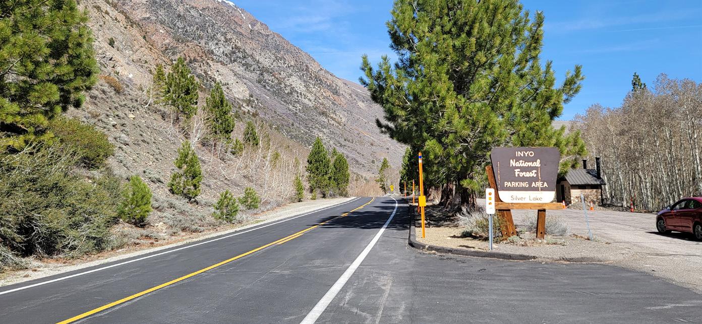
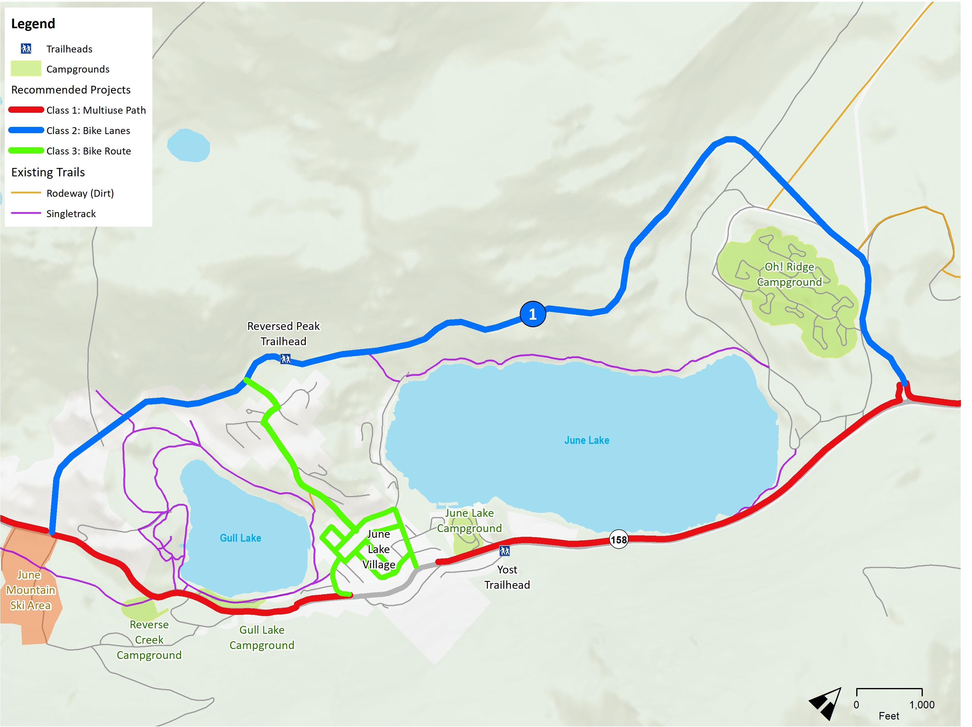
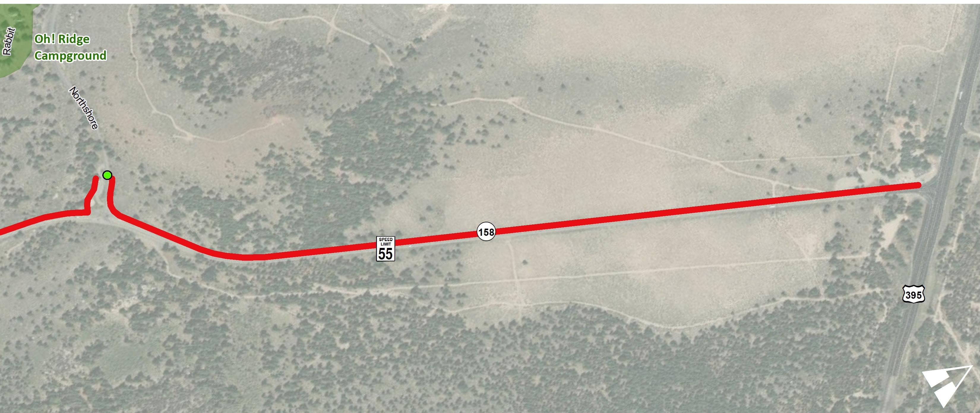
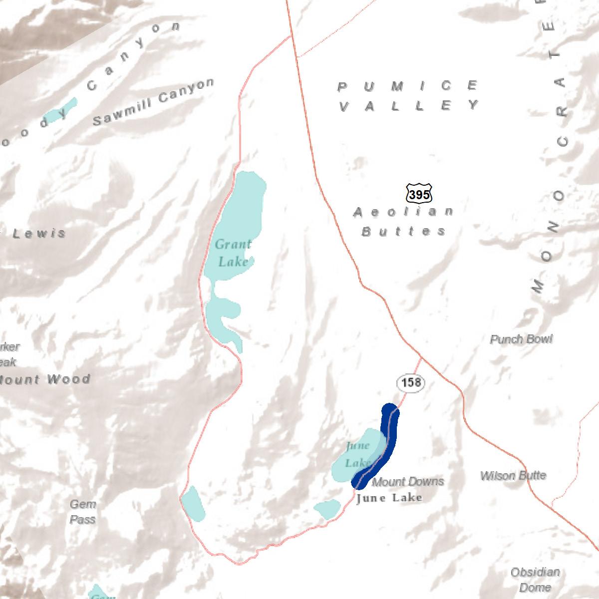
The destinations along the June Lake Loop are primarily focused on the southern and eastern end of the loop between Silver Lake and US 395, which has been identified as the priority segment of the loop. Along this section of the loop are the access points to June Lake beach and Gull Lake Marina. Five campgrounds can also be accessed along SR-158, Oh! Ridge Campground, June Lake Campground, Gull Lake Campground, Reversed Creek Campground and Silver Lake Campground. Three major destinations also include the June Mountain Ski Area, June Lake Village and Silver Lake Resort. Residential, resorts, hotels and some commercial destinations are also found along this section of the loop.
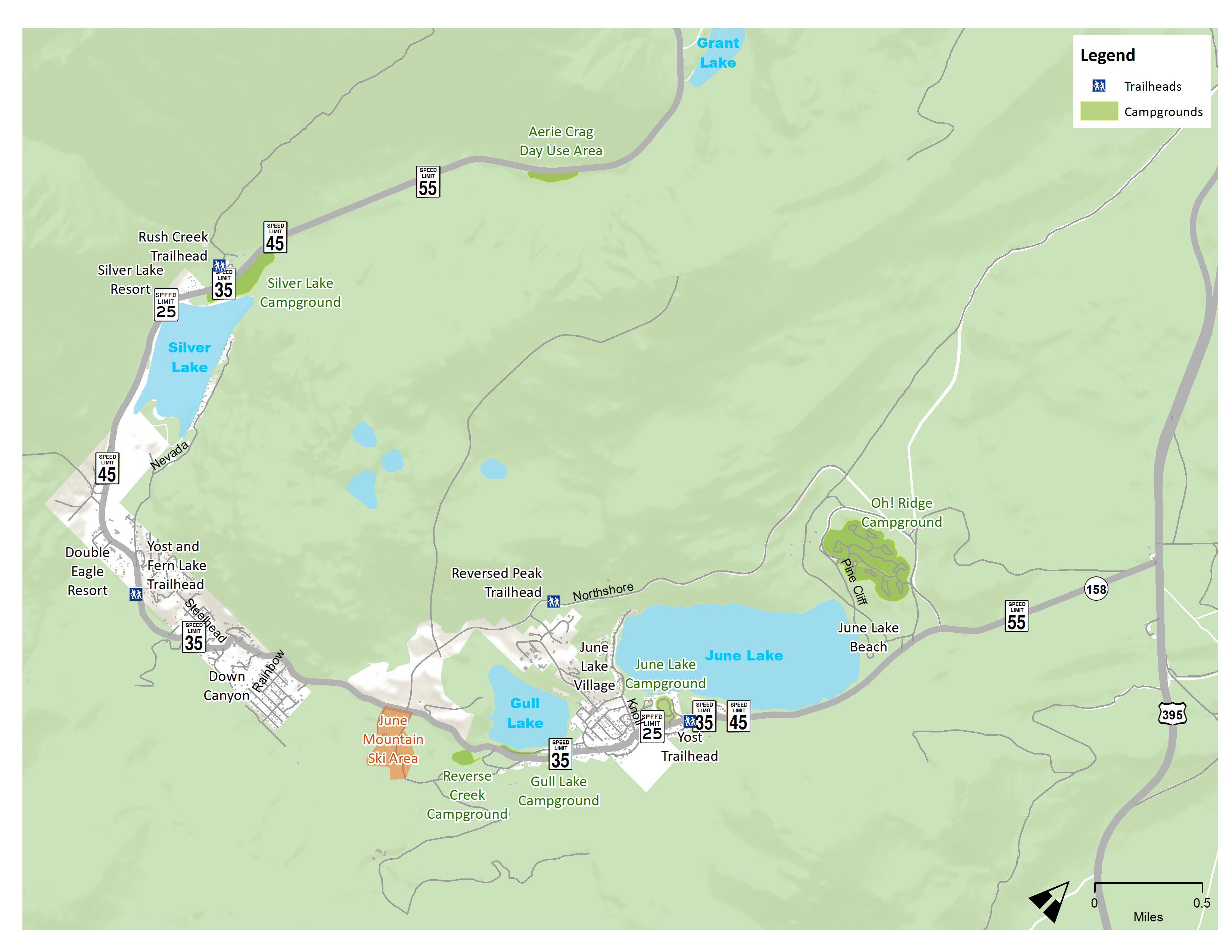 Figure 2-1: Local Destinations
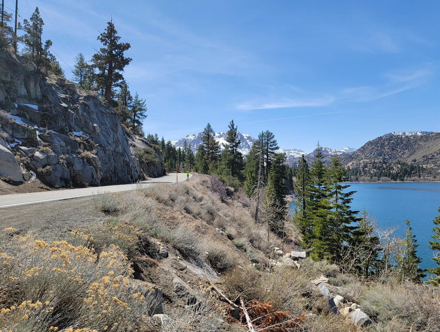
Improving multi-modal connections to existing and planned trailheads in an important goal for this ATP. Existing trails that can be accessed directly from SR-158 and the Village include the Yost Trailhead, Yost and Fern Lake Trailhead, and the Rush Creek Trailheads. The planned Down Canyon Trail would eventually have a direct connection to SR-158 as well.
Other nearby popular trailheads that can be accessed indirectly from SR-158 include Reversed Peak Trail (off Northshore Drive) and Parker Lake Trail (off Aqueduct Road intersection at SR-158).
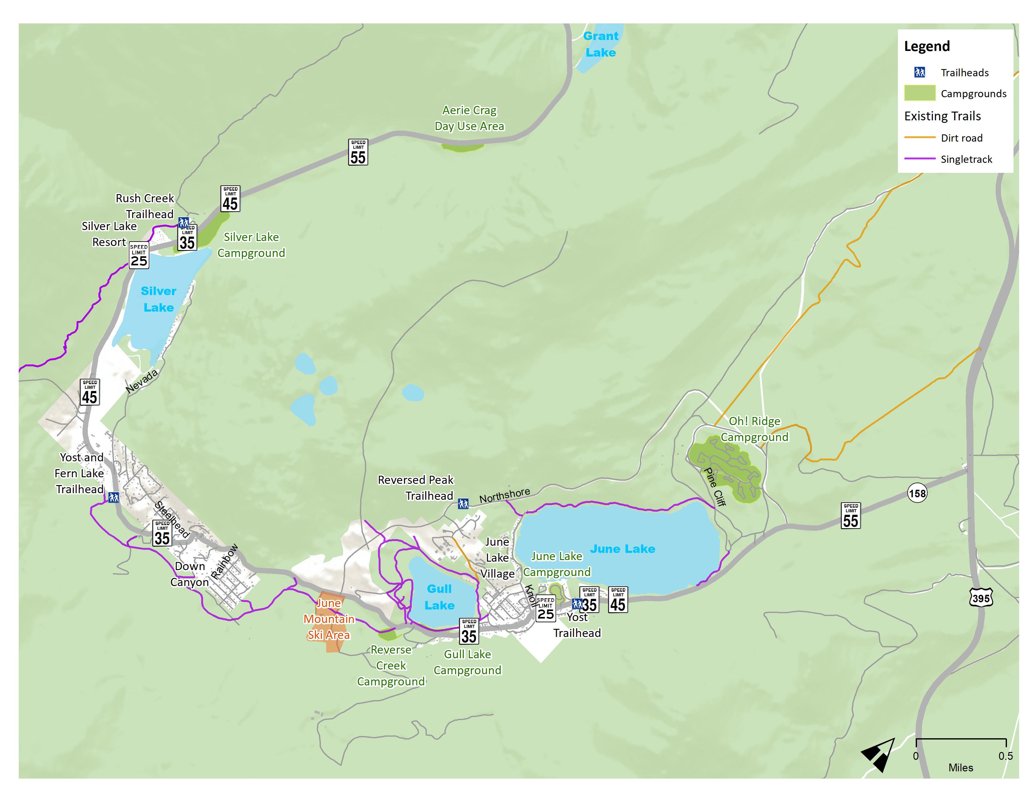 Figure 2-2: Existing Trails and Trailheads
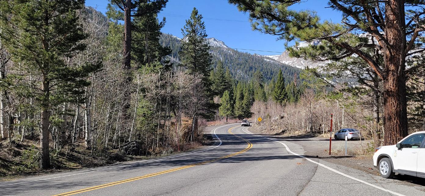
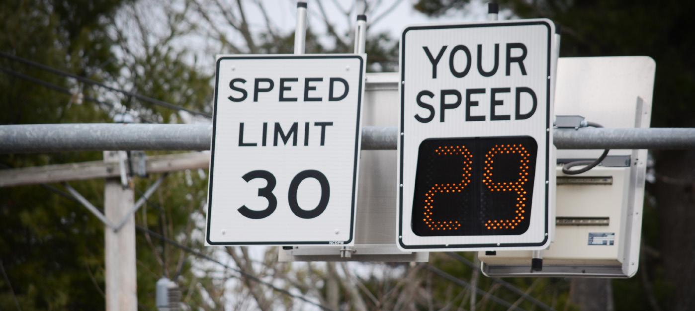
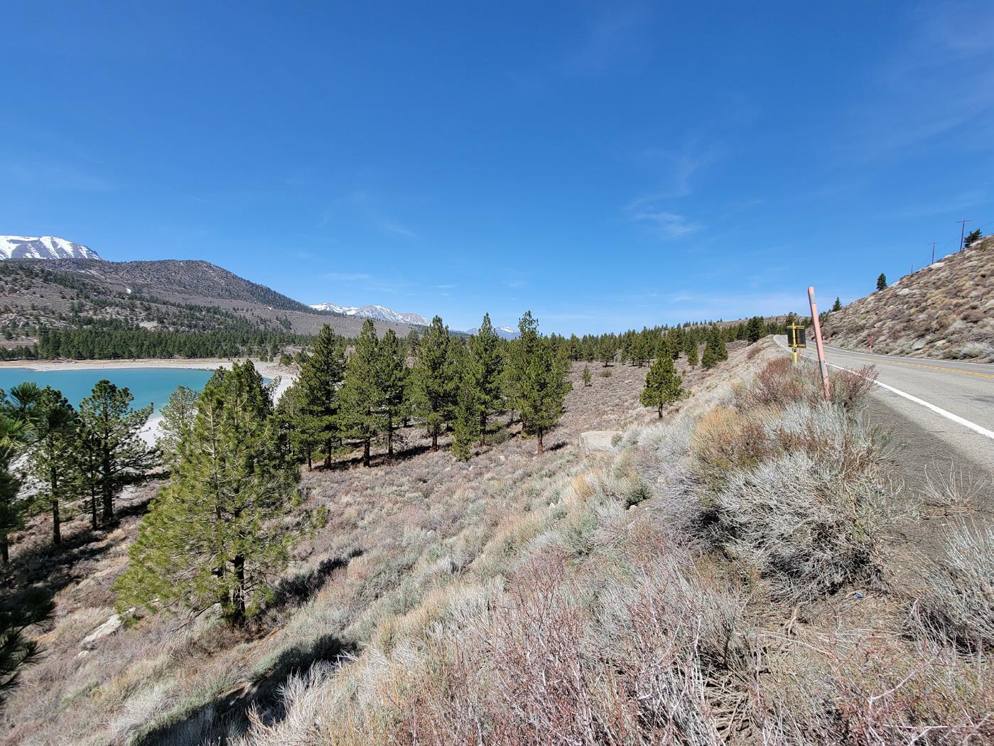
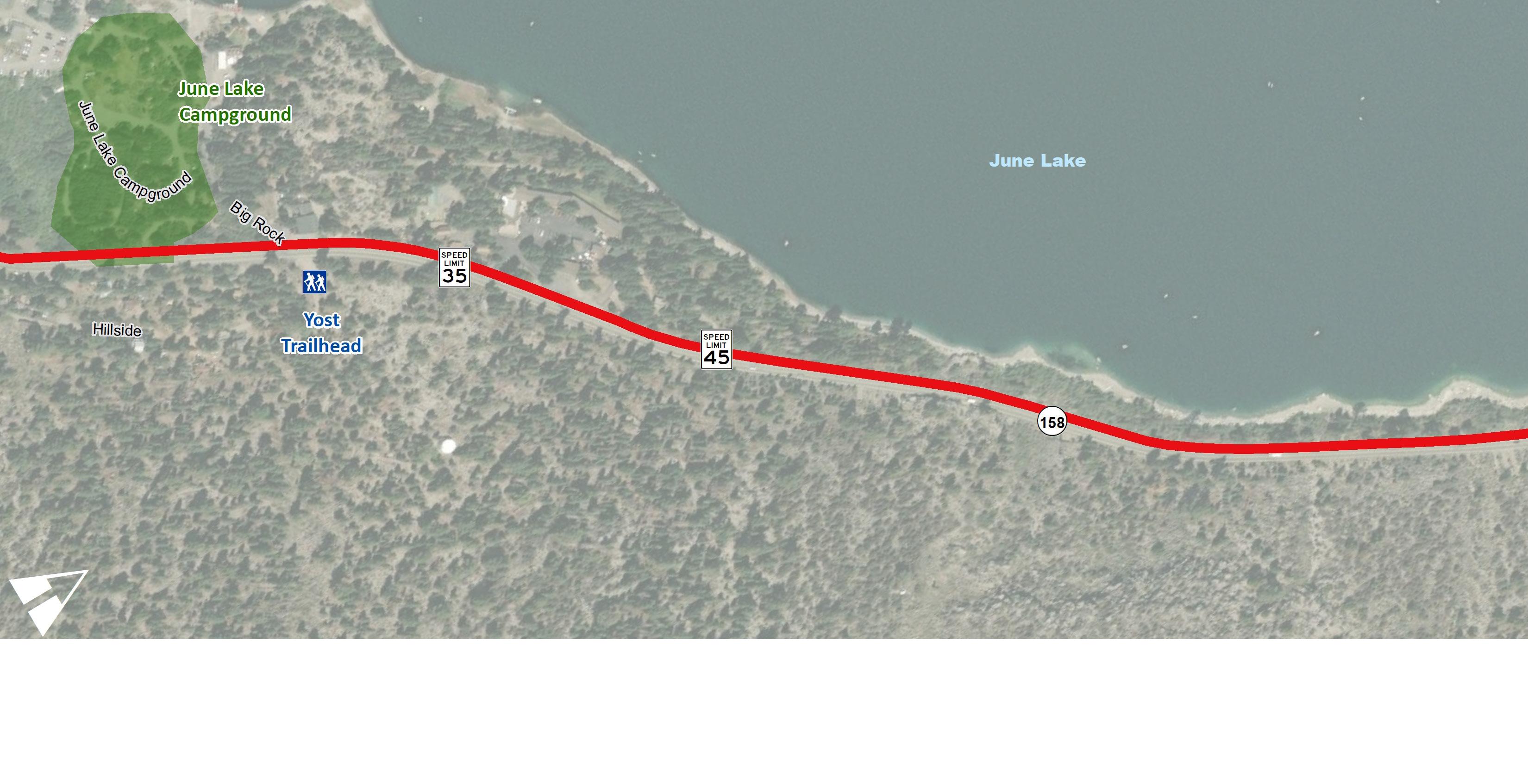
Posted speed limits vary between 25 mph and 55 mph depending on the adjacent land uses and road conditions. Posted speed limits are reduced to 25 mph through the June Lake Village and Silver Lake Resort where pedestrian activity is more prevalent. Along the long straight segments posted speed limits are 45 and 55 mph. The winding segments between Gull Lake and Silver Lake are 35 mph.
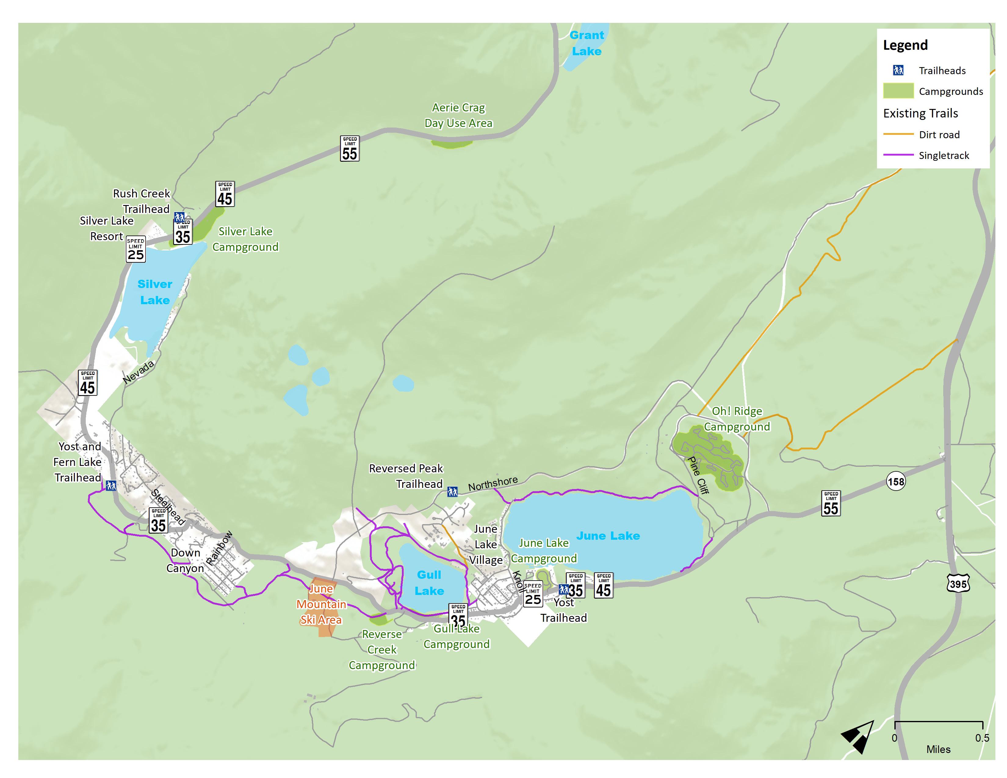 Figure 2-3: Speed Limits
According to Caltrans data on Annual Average Daily Trips (AADTs), the highest volumes of traffic is found between Silver Lake and US 395. Traffic volumes are the highest between Northshore Drive and US 395 with AADTs above 1,500 trips. Between Northshore Drive and Silver Lake, the AADTs range between 750-1,500 AADTs as the only route between the two destinations. From Silver Lake, past Grant Lake to US 395, the AADTs are the lowest with up to 500 AADTs. This traffic volume data coincides with the priority segments identified through the community engagement process.
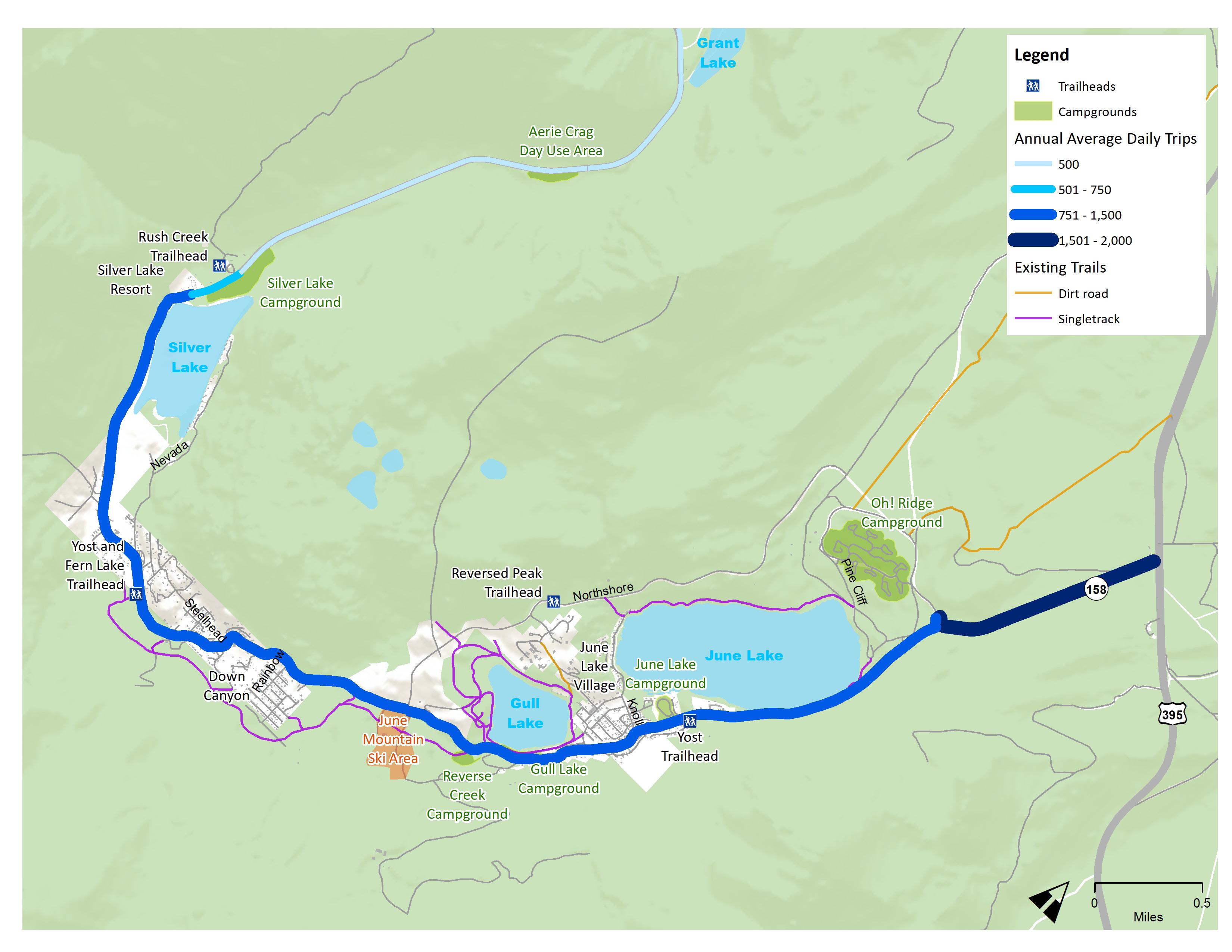 Figure 2-4: Traffic Volumes
Bicycle and pedestrian related collisions have been collected and reviewed to assist analyzing trends and assisting with developing recommendations. Between 2017-2021, there were no reported bicycle collisions. The single pedestrian-related collision occurred along the tight bend just before Shadow Pines Road. The cause of this vehicle-pedestrian collision was the vehicle driving on the wrong side of the road striking a pedestrian walking on the shoulder. Fortunately, no fatal pedestrian-related collisions occurred.
There were 43 vehicle-related collisions along SR-158 between Northshore Drive and Silver Lake Resort. Vehicle-related collisions were widespread along SR-158 with a large cluster occurring at June Lake Village. The primary causes of these being unsafe lane changes, unsafe starting or backing up the vehicle and speeding. Unfortunately, between the June Lake Village and Silver Lake Resort, eight collisions involved driving under the influence and another six caused by speeding.
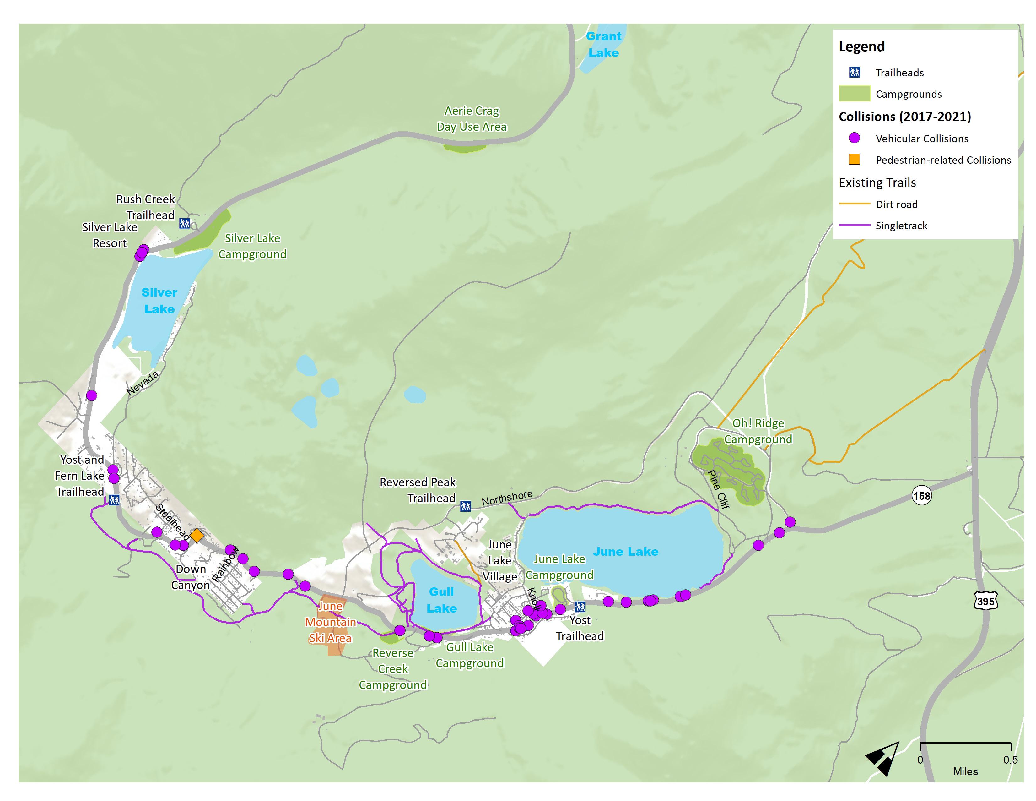 Figure 2-5: Collisions
The June Lake Loop lacks dedicated bicycle facilities. Off-road and natural trails are present throughout the Loop but don’t provide an alternative to active transportation connectivity. Sidewalks are present on both sides along SR-158 between the June Lake Campground and Lakeview Drive. The remaining streets within the June Lake Village and other commercial areas all lack sidewalks.
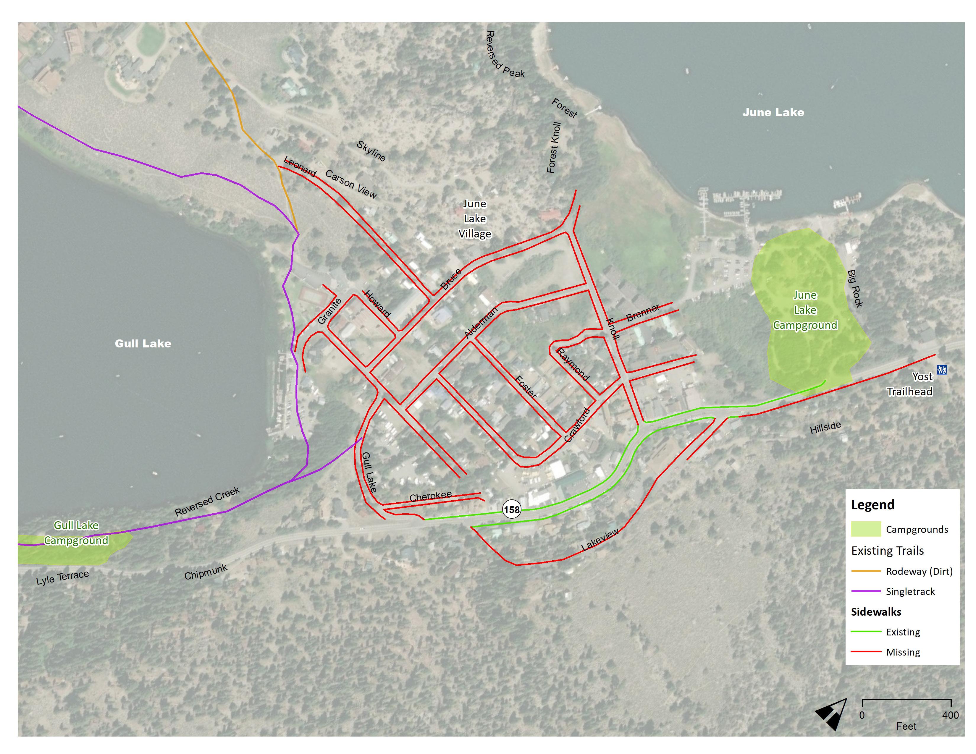 Figure 2-6: Existing Bicycle & Pedestrian Facilities
Page Left
Intentionally Blank
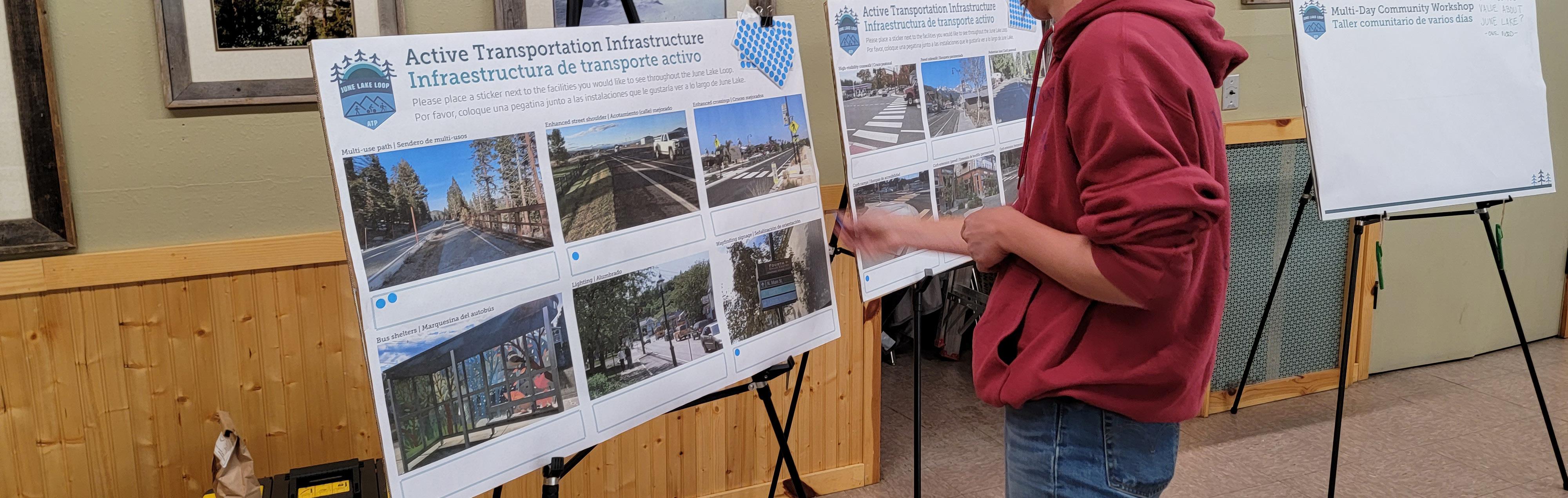
The June Lake Loop Active Transportation Plan was developed through a robust public process that engaged residents, property owners, businesses, community stakeholders, and tourists to improve the SR-158 (June Lake Loop) for walking, bicycling, and access to trails. The project employed a variety of engagement strategies to engage various stakeholders to identify the barriers to walking, bicycling, and other modes of travel. It was important to get community input from those that live or work in the area and those that visit for recreational purposes to address the conditions that exist during different time of the year.
The main engagement activities to inform the public about the June Lake Loop ATP and to get meaningful input included:
» Citizens Advisory Committee Meetings
» Active Transportation and Map Surveys
» Design Workshop
» Pop-ups
» Walk Audits
» Stakeholder Meetings
» Draft Plan Workshop
Several outreach methods were used to connect with, and engage residents, businesses and other stakeholders about the project and upcoming events, and to maximize engagement.
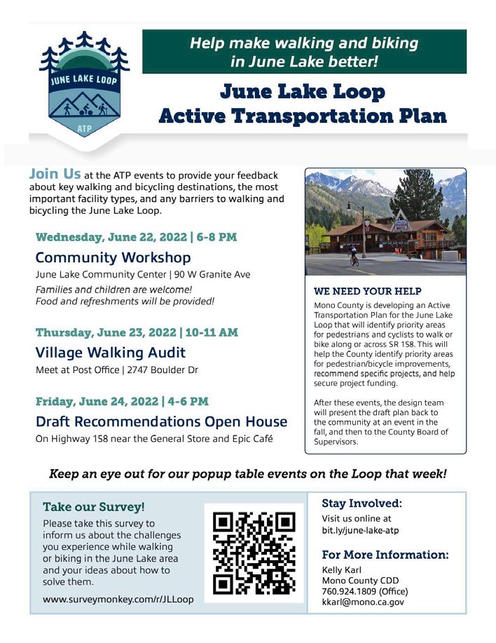
» Creating a logo to brand the project and to increase it’s visibility.
» Flyers and posters to publicize events produced in English and Spanish for community-wide distribution. They were distributed at Mono County locations and local businesses, and mailed to all residences within the June Lake Loop.
» Citizens Advisory Committee and other community members were asked to distribute flyers through other channels.
» The County used social media to encourage public participation and announce events.
» Meeting announcements and project updates were posted on the project website.
» Links to the Active Transportation survey and map survey were provided on the main website and advertised on social media and flyers.
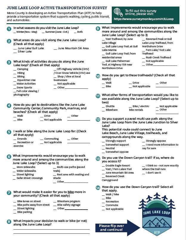
Two surveys were prepared for the project: 1) Active Transportation Survey, and 2) an online mapping survey. These surveys posed multiple questions to help the team identify which locations along the Loop needed to be addressed, what were the main destinations, modes of travel, and uses for the June Lake Loop area. People were also asked what kinds of improvements would encourage them to walk or bike more. The surveys were provided online, with English and Spanish versions available and made available through September 2022. Hard copies of the survey were distributed during the June 2022 multi-day charrette. A summary of the results from the surveys is found at the end of this chapter.
The team engaged the June Lake Citizens Advisory Committee (CAC) as the advisory group for the project, guiding the team on the best ways to engage the public and discuss the plan concepts. Members included residents, business owners, and Mono County staff who could provide local knowledge of the issues and people of June Lake. They also served as champions for the project—helping to spread the word about events and to carry the recommendations forward.
Meetings with the CAC were held on the following dates to discuss engagement strategies, plan recommendations, and to provide project updates to the Committee:
The team provided an overview of the CAC’s role in the process, the scope of work, and the timeline. This was also an opportunity to identify the best way to engage the CAC moving forward.
This meeting focused on existing conditions and key issues and locations to address in the process. The group also discussed the public engagement strategy for the charrette.
The CAC was updated about what the team learned from previous site visits, and from community input during the charrette. Also discussed were the results of the ATP survey.
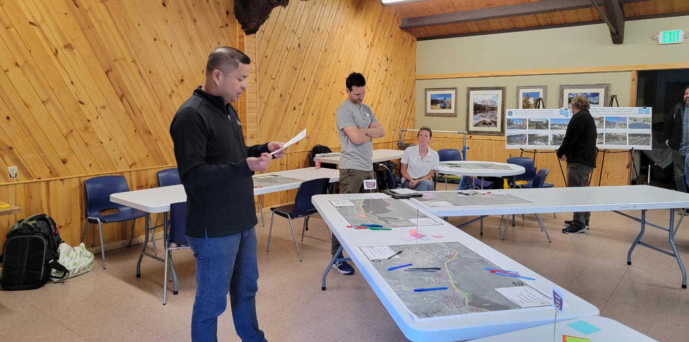
During the meeting, the team reviewed the proposed infrastructure recommendations for the June Lake Loop and discussed plans for the draft plan workshop.
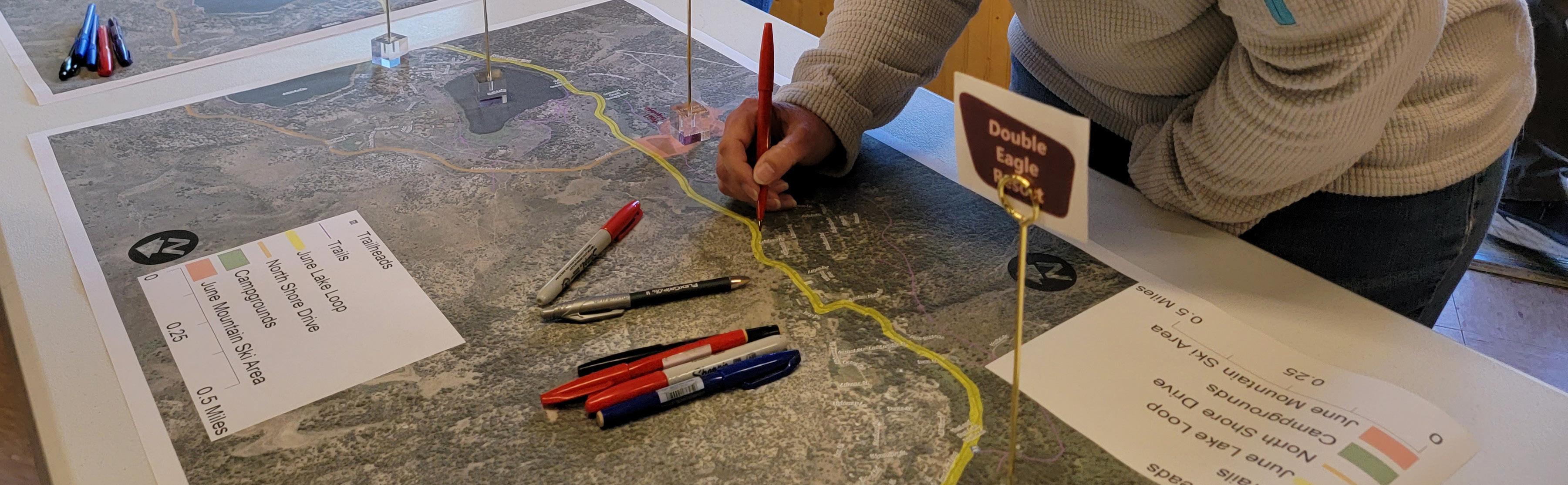
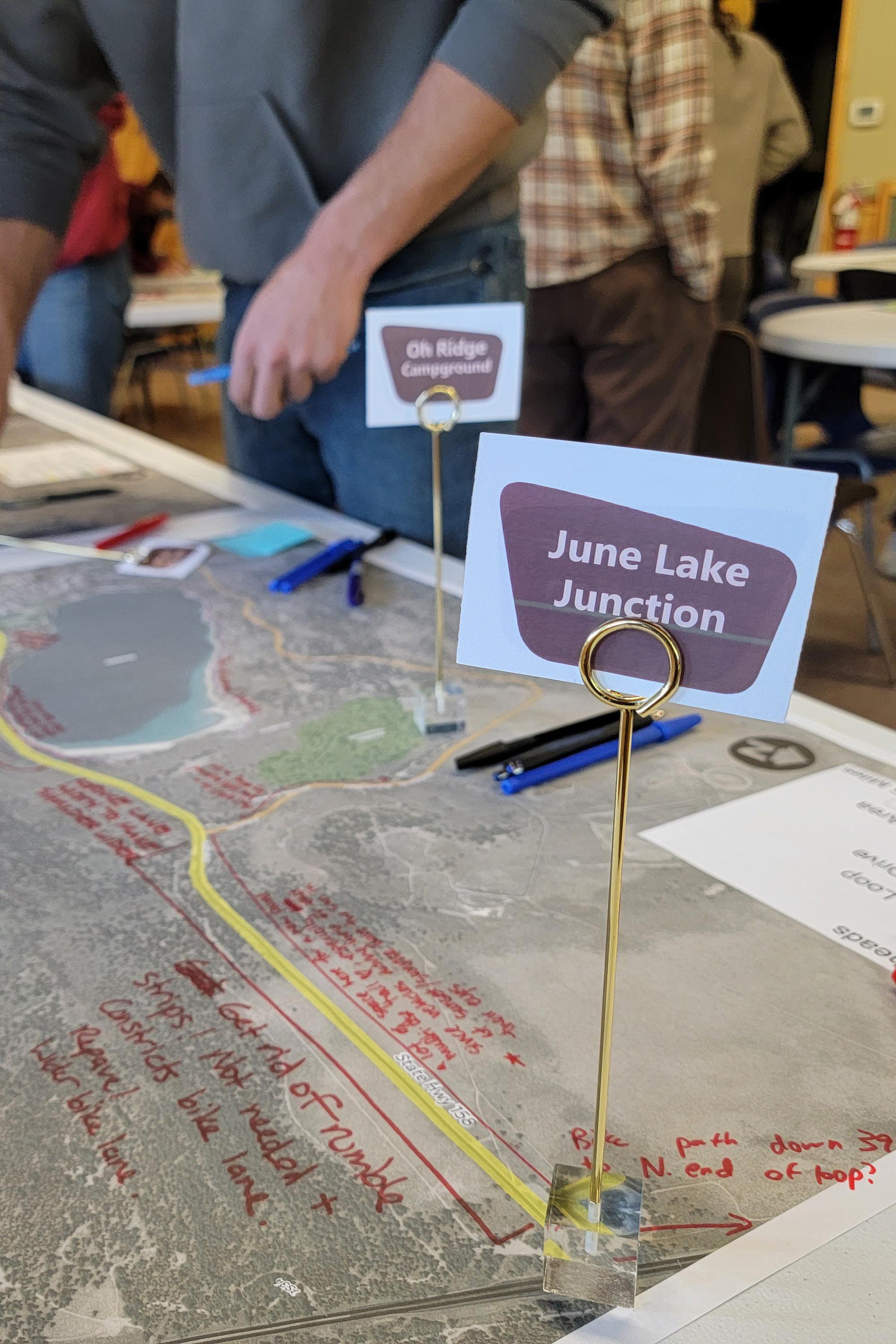
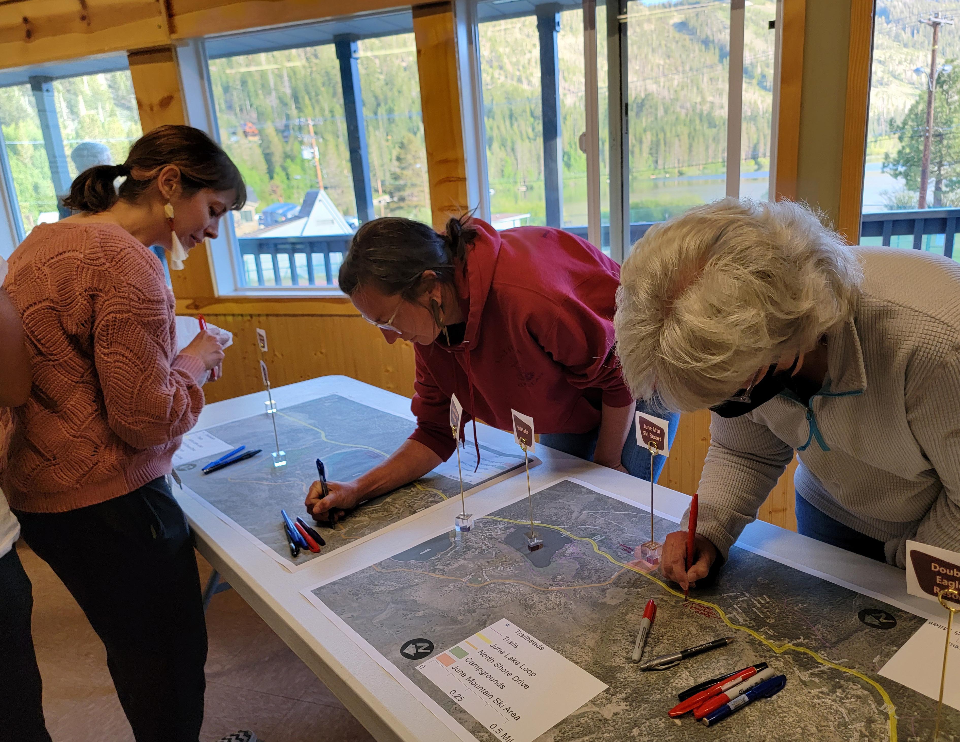
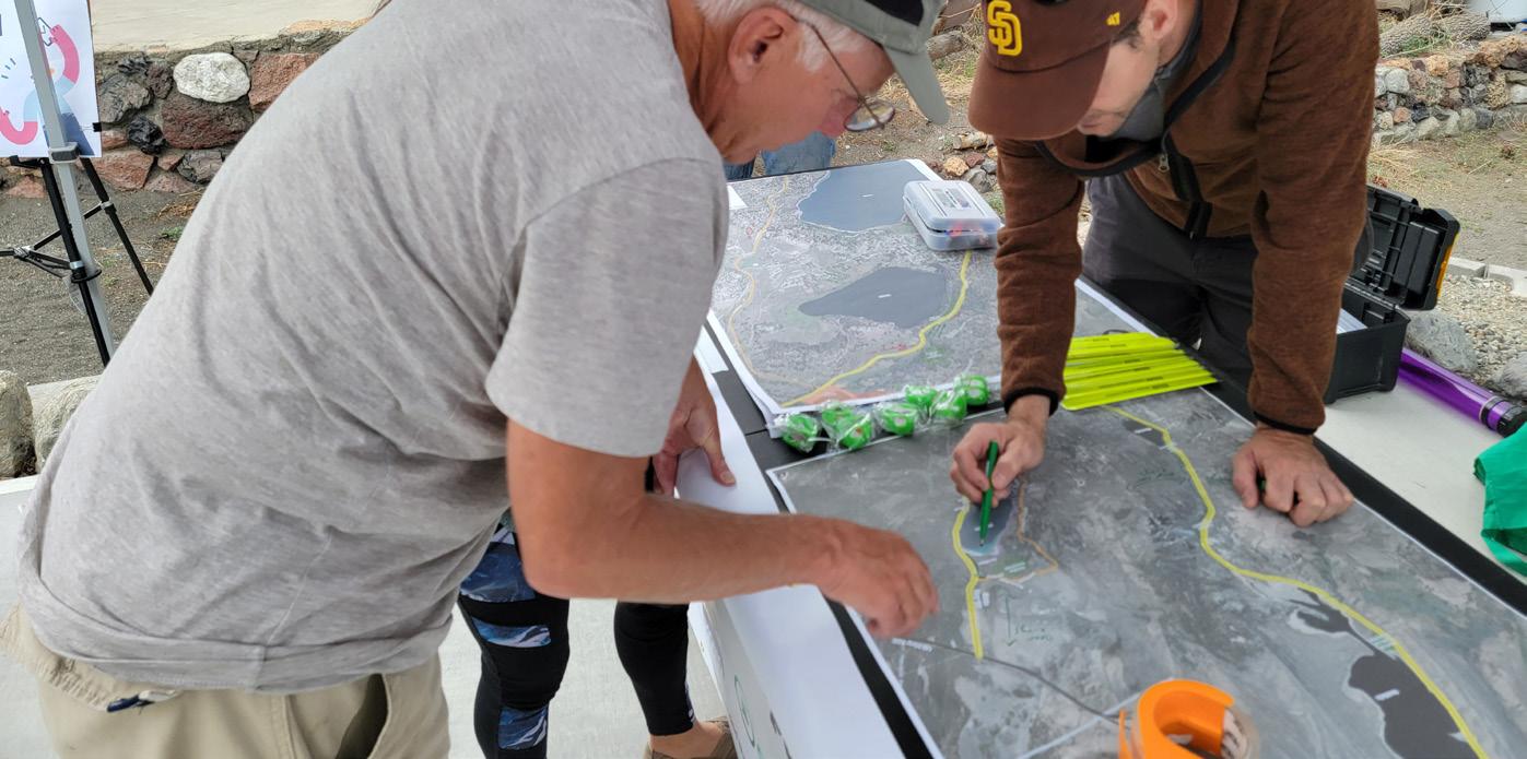
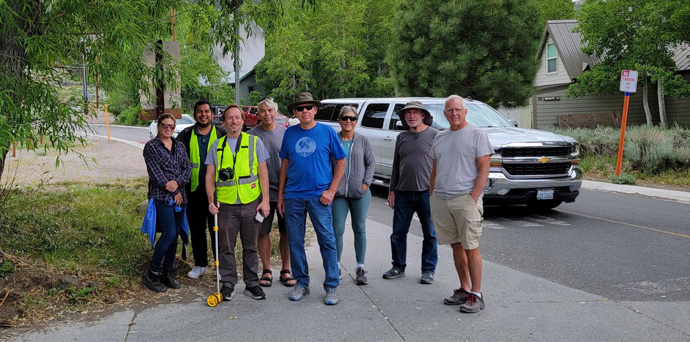
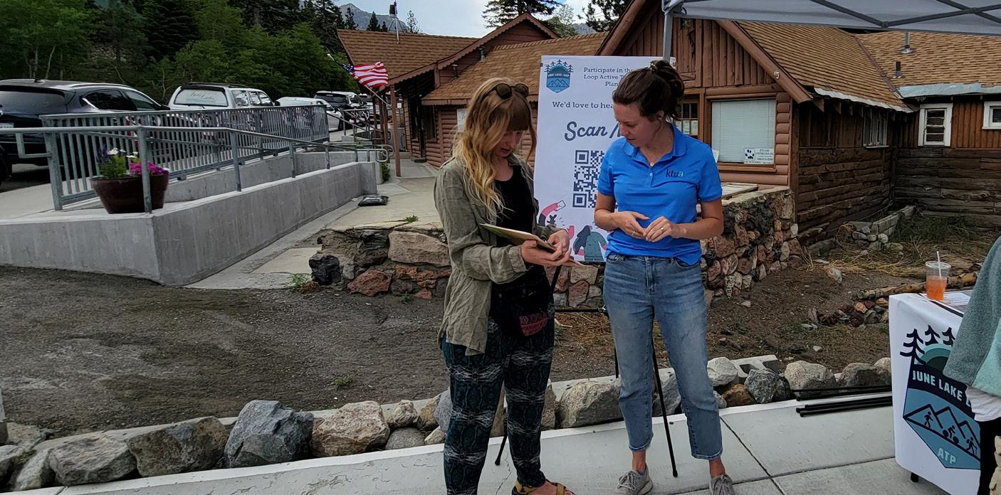
The team visited June Lake from June 21–24, 2022 to hold a multi-day charrette. The purpose of the charrette was to engage people in various activities to identify issues and locations the plan should address, and to develop initial infrastructure recommendations along the Loop that the community would like to see. In consultation with the CAC, the team held multiple outdoor activities on the Loop to make sure that not only residents and stakeholders in the community were engaged, but that the team also gathered input from tourists visiting June Lake. The team was able to engage over 60 people (both residents and visitors) during these activities.
Team members set up an information table at the June Lake Brewing’s 8th Anniversary celebration. The pop-up provided information on upcoming events, surveys, and large maps to identify potential issues to address.
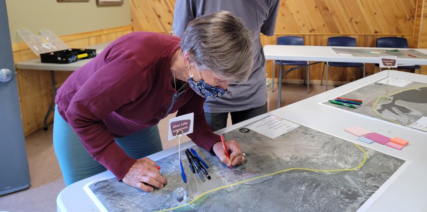
This was the opening workshop for the charrette. At the beginning of the workshop, the team asked participants to write down their visions for the June Lake community over the next 20 years. Participants then had the opportunity to share those visions with the rest of the group. CivicWell and KTUA then did a short presentation to highlight the existing conditions for the area and the tools and strategies for improving Active Transportation along the Loop. After the presentation, large aerial maps were laid out on the tables and participants were asked to break up into groups to write down their concerns and issues related to walking, bicycling, equestrian, transit, and other modes of transit around the Loop. They were then encouraged to provide their ideas and suggestions for active transportation projects that should happen along the corridor. Each group then presented back its suggestions.
Team members led community members on a walk audit around parts of the Village area. This was an opportunity for participants and the team to discuss specific issues to address along the walk and provide a different perspective for discussion from maps.
The team set up a pop-up table at the Silver Lake area near the Silver Lake Resort and Café. This was an opportunity to engage people outside of the Village by providing information about the project and asking them to take the Active Transportation Survey.
An online meeting was held for Agency Stakeholders to learn about their plans for areas around the Loop, and to identify any issues the team would need to address when developing recommendations. Participants at the meeting included Caltrans, Mono County Local Transportation Commission, Mono County Economic Development, Mono County Planning, and the Los Angeles Department of Water and Power.
The team spent time in the community developing some initial recommendations after the workshop and other charrette activities. This was in preparation for an Open House pop-up in the Village alongside SR-158 to get feedback from the public on the initial recommendations. The pop-up was set up next to a local cafe to engage the foot traffic of residents and visitors to the area. Exhibits with the initial feedback the team received and aerial maps with initial recommendations were highlighted at this pop-up.
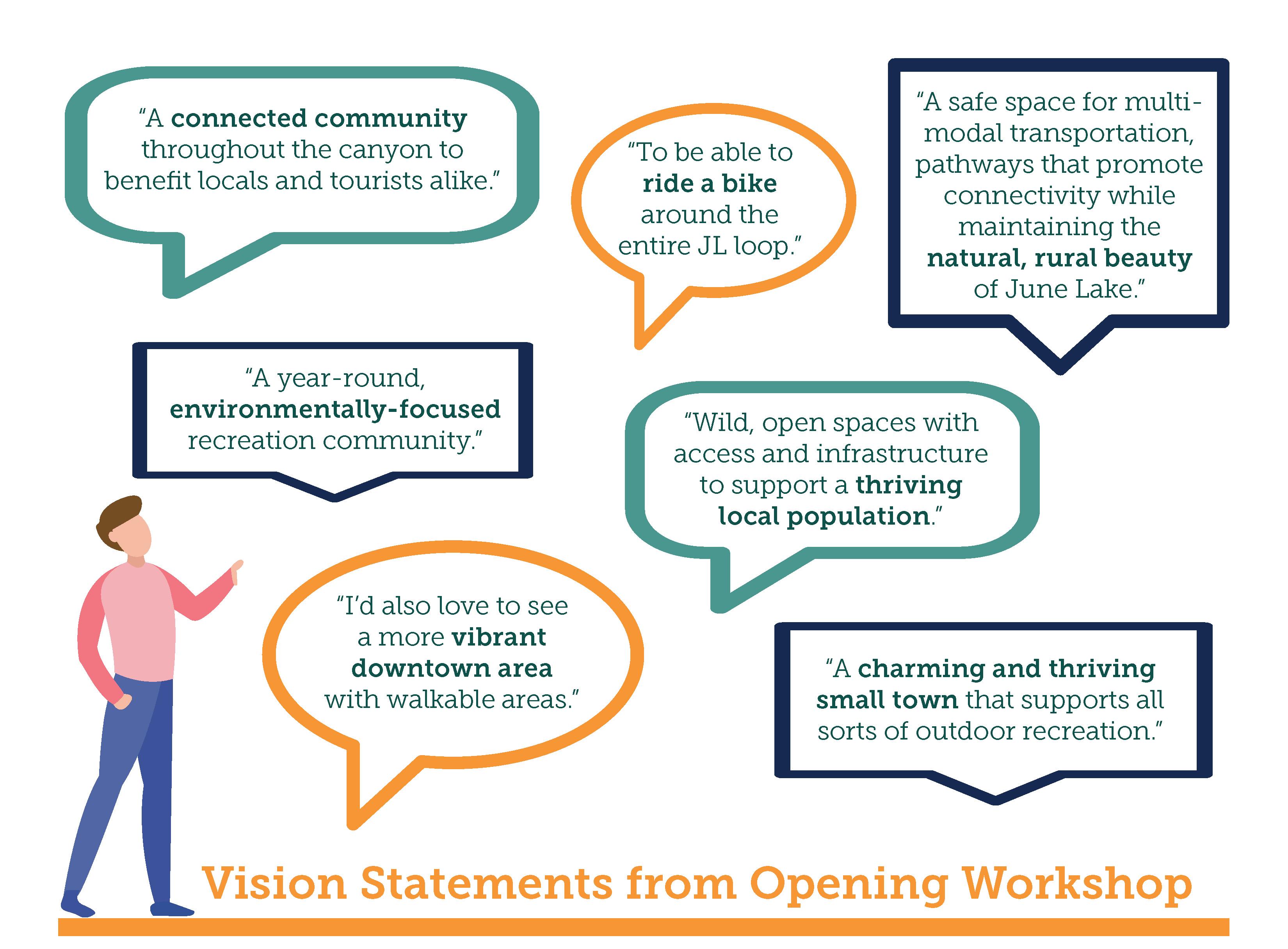
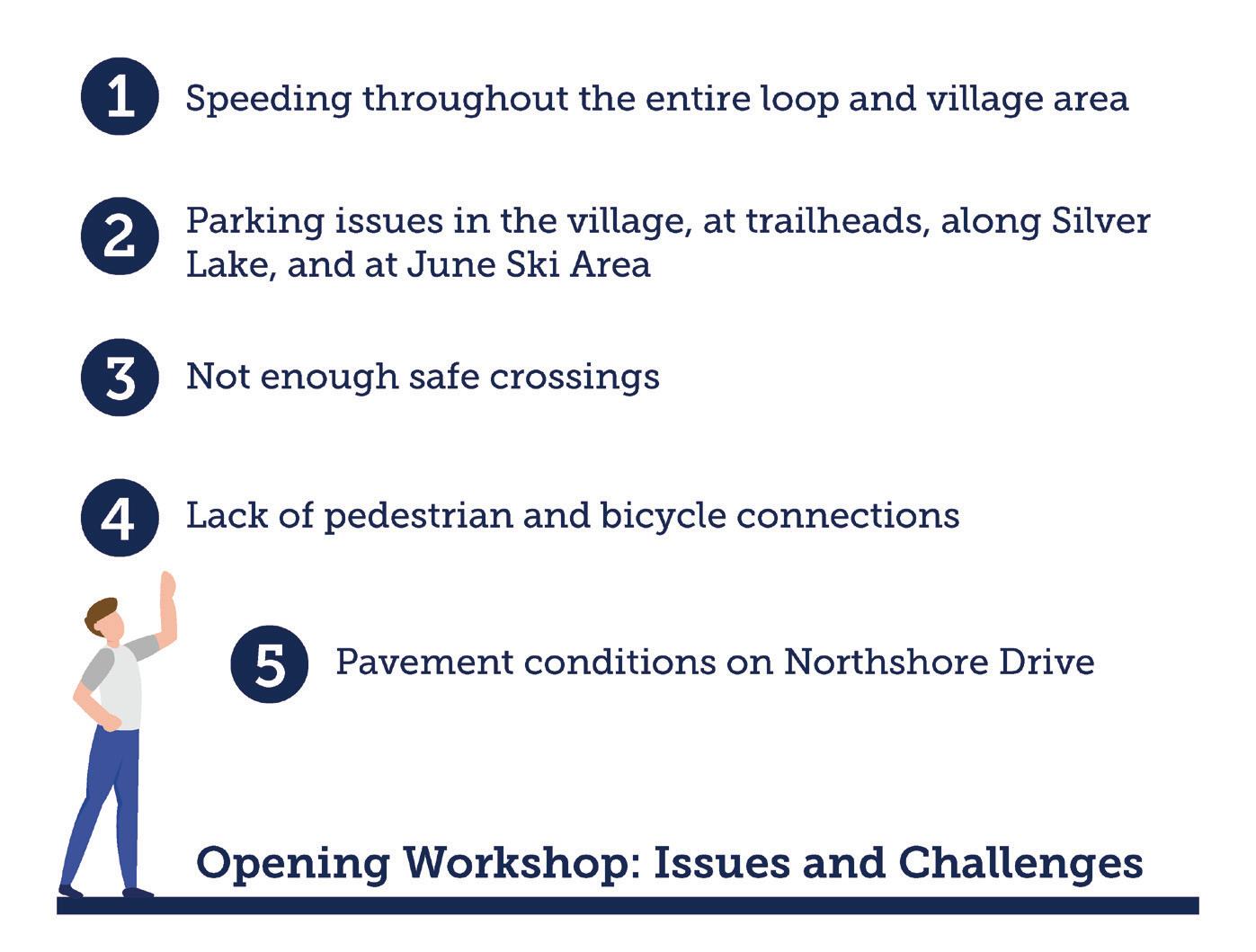
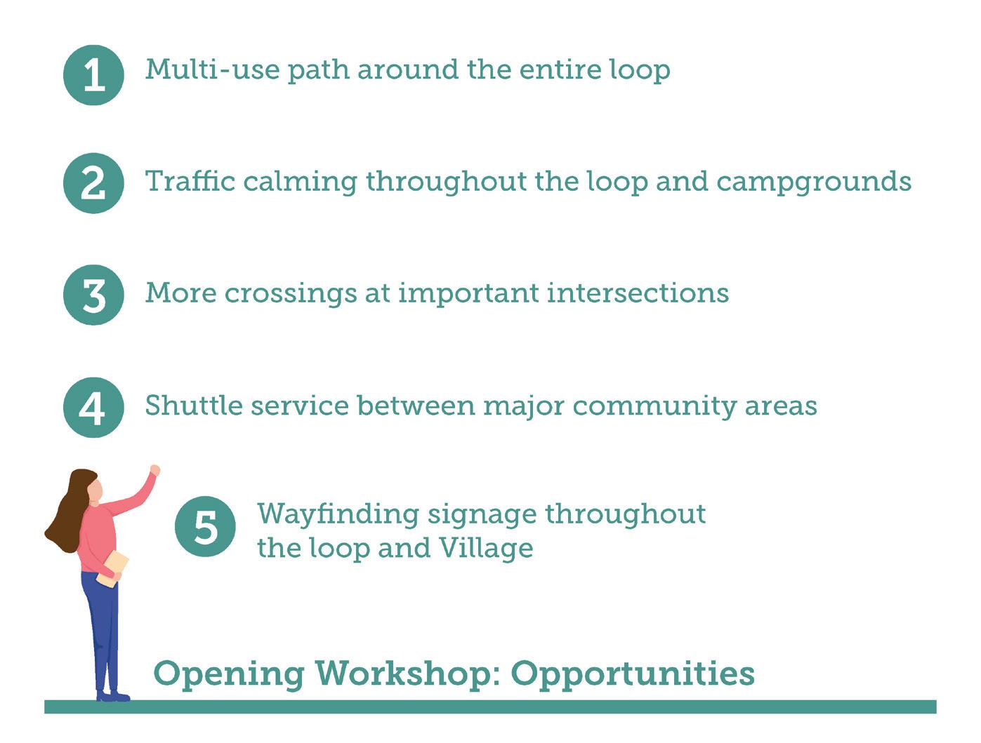
Throughout the charrette, several issues were repeated to the team. These centered around speeding throughout the entire loop and the Village area, a lack of safe crossings along the highway, a lack of pedestrian and bicycle connections to various destinations, and parking issues at certain locations. However, participants also identified several opportunities that they felt should be considered for the Loop. These include the creation of a multi-use path and traffic calming around the entire Loop or the possibility of prioritizing one between June Lake Beach and the Silver Lake Campgrounds. The community had multiple questions on this around whether certain segments were more feasible, whether phasing would be needed or whether multi-use paths require extensive engineering solutions. Other opportunities included having better crossings at important locations, and better use of wayfinding signage throughout the Loop and the Village.
To continue engaging relevant decision-makers, presentations and discussions with additional stakeholders took place following the June charrette. These offered opportunities to engage agencies and entities that were not able to participate in the charrette activities. As well as to provide them with information about the public input to date and revised project recommendations. The following meetings were held:
This was an opportunity to discuss the project and present the initial recommendations to a multifaceted team comprised of directors of federal, state, and local entities as well as collaborators on a variety of planning issues. The team presented the feedback from the charrette and the initial recommendations. This meeting had representatives from the following agencies: California Department of Fish & Wildlife, Caltrans, Lahontan Regional Water Quality Control Board, Los Angeles Department of Water and Power, Mono County Board of Supervisors, National Park Service, BLM, Town of Mammoth Lakes, US Forest Service, and U.S. Marine Corps Mountain Warfare Training Center.
Additional meetings were held with various stakeholders to get their feedback on revised recommendations, and to make sure any remaining issues to address in the plan were identified. The team presented the recommendations proposed for each leg of the Loop. These meetings offered an opportunity to have more in-depth conversations about those recommendations and how to implement projects. The following meetings were held in the fall of 2022:
» Mono County Public Works (October 18, 2022)
» June Mountain Ski Area (October 26, 2022)
» Eastern Sierra Transit Authority (October 26, 2022)
» US Forest Service, Inyo National Forest (November 4, 2022)
» Caltrans (November 29, 2022)
The team visited June Lake on December 7, 2022, to hold a workshop to present the recommendations from the draft plan. The meeting was held in person with an online option for those who were not in June Lake at the time. This offered the public an opportunity to provide final input before the Active Transportation Plan was presented to the Mono County Local Transportation Commission for adoption.

Over 80 people responded to the Active Transportation survey which helped the team identify whether people resided in, worked in, or were visitors to the area. The survey also asked which modes of transportation were used to get around the Loop and the types of activities they used the loop for. It also offered people the opportunity to respond about which types of improvements they would like to see and to provide general and specific comments are where there were gaps in the system.
The following figures show some of the results from the Active Transportation Survey. The majority of responses were from those that lived in June Lake (68%), while only 16% of respondents were visitors to the area. Over 90% of the respondents who walk or bike along the June Lake Loop do so for recreation or exercise. About 50% do so to run errands. When asked what types of improvements would encourage respondents to walk more around the Loop, most (70%) said that more multi-use paths would encourage them to walk more. Adding more sidewalks and providing safer street crossings were the second and third-highest responses. When it came to what would encourage people to bike more around the June Lake Loop, bike paths away from the street (72%) or bike lanes on the streets (66%) were the highest responses.
Which of the following best describes your residency in this area?
How would you best describe your relationship with the June Lake Loop? (Check all that apply)
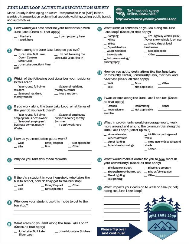
What kinds of activities do you do along the June Lake loop? (Check all that apply)
How do you get to destinations like the June Lake Community?
What improvements would encourage you to walk more around and among the communities along the June Lake Loop?
What improvements would encourage you to bike more around and among the communities along the June Lake Loop?
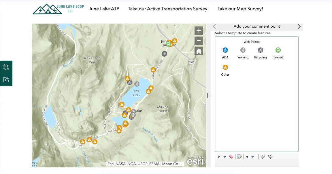
This option provided the public an opportunity to drop pins to identify safety issues and specific locations to address during the process. Users could also easily identify types of issues and improvements as related to ADA access, walking, bicycling, etc. The team was also able to use this system to catalog public comments from the aerial maps used during other events. The image below represents the locations where comments were provided.
Page Left
Intentionally Blank
This chapter includes project recommendations meant to enhance multi-modal transportation throughout SR-158, the Village, and the surrounding areas. The recommendations are designed to help the LTC allocate funds as they become available and compete for grant funds as opportunities arise. The chapter begins with an overview of the different types of built infrastructure that have been designed throughout California. Although this “Street Toolkit” includes active transportation recommendations that may be found in urban and suburban areas, as compared to the rural/mountainous character of the June Lake area, it’s meant to serve as a general guide as trends and policies evolve.
The recommended infrastructure projects include both the primary improvement concept that is divided into 10 segments as well as other active transportation recommendations in the areas adjacent and close to SR-158. The primary improvement concept and its 10 segments are laid out as cutsheets which contain vital conceptual improvement alternatives and planning-level recommendations that can be further evaluated through future design and engineering efforts. The end of this chapter includes programs that support active transportation such as education campaigns, community events, or metrics tracking.
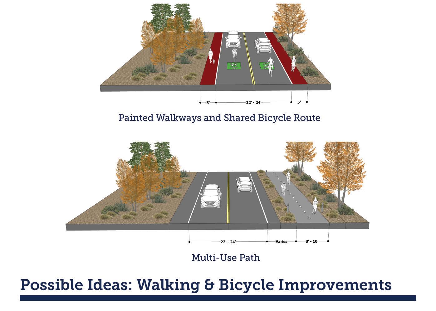
Class I Multi-Use Paths
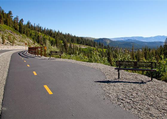
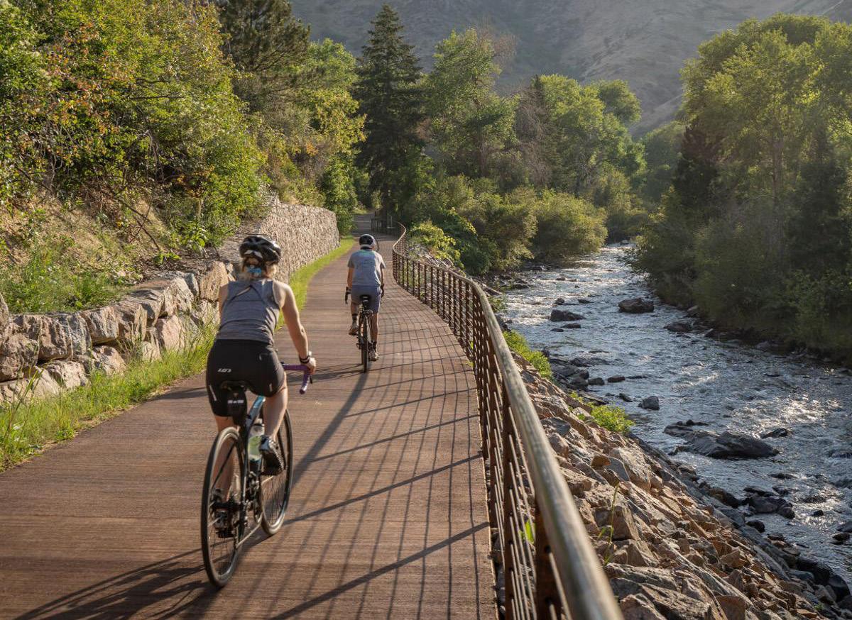
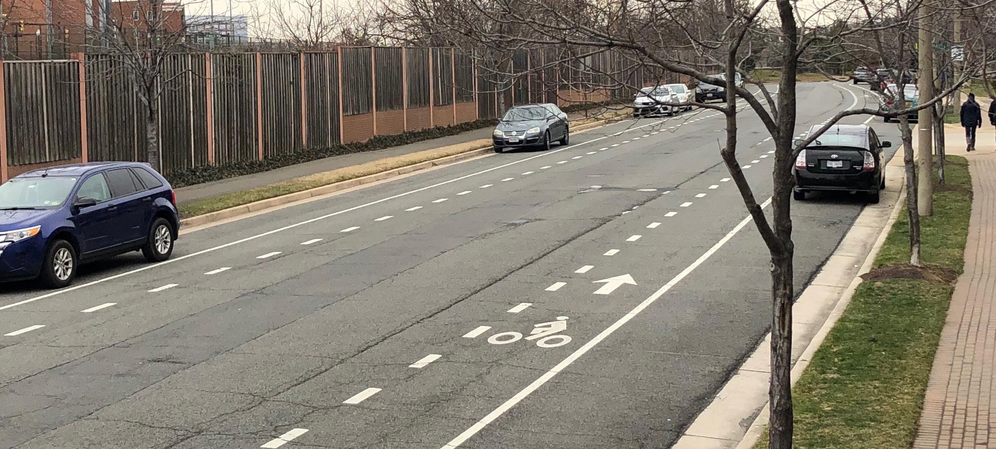
Class I multi-use paths (frequently referred to as “bicycle paths”) are physically separated from motor vehicle travel routes, with exclusive rights-of-way for non-motorized users like bicyclists and pedestrians. They require physical buffers to ensure safety and comfort of the user.
Bicycle lanes are one-way facilities that carry bicycle traffic in the same direction as the adjacent motor vehicle traffic. They are typically located along the right side of the street (although can be on
the left side) and are between the adjacent travel lane and curb, road edge, or parking lane. They are not physically separated from motor vehicle traffic.
A bicycle route is a suggested bicycle corridor marked by signs designating a preferred street between destinations. They are recommended where traffic volumes and roadway speeds are 35 mph or less.
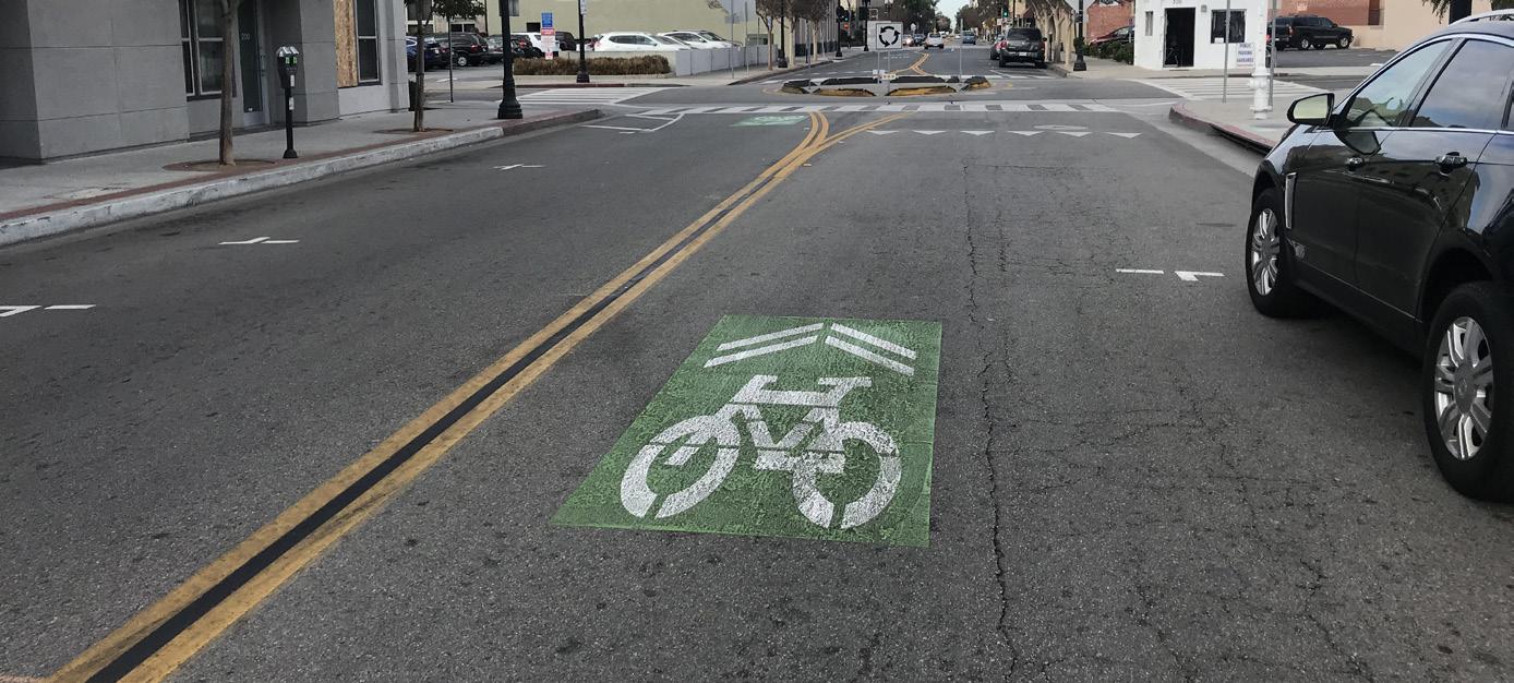
The shared lane marking is commonly used where parking is allowed adjacent to the travel lane. It is now common practice to center them within the typical vehicular travel route in the rightmost travel lane to ensure adequate separation between bicyclists and parked vehicles. Many cities install sharrows over a green background to enhance visibility.
Intersection or mid-block crossing markings indicate the intended path of bicyclists. Colored striping can be used to highlight conflict areas between bicyclists and vehicles, such as where bicycle lanes merge across motor vehicle turn lanes.
An advisory bicycle lane is a preferred space for bicyclists and motorists to operate on narrow streets that would otherwise be a shared roadway. Roads with advisory bike lanes accommodate low to moderate volumes of two-way motor vehicle traffic and provide a safer space for bicyclists with little or no widening of the paved roadway surface. Due to their reduced cross section requirements,advisory bike lanes have the potential to open up more roadways to accommodate comfortable bicycle travel.
Signage and wayfinding on all streets and bicycle routes are intended to identify routes to both bicyclists and drivers, provide destination information and branding, and to inform all users of changes in roadway conditions.
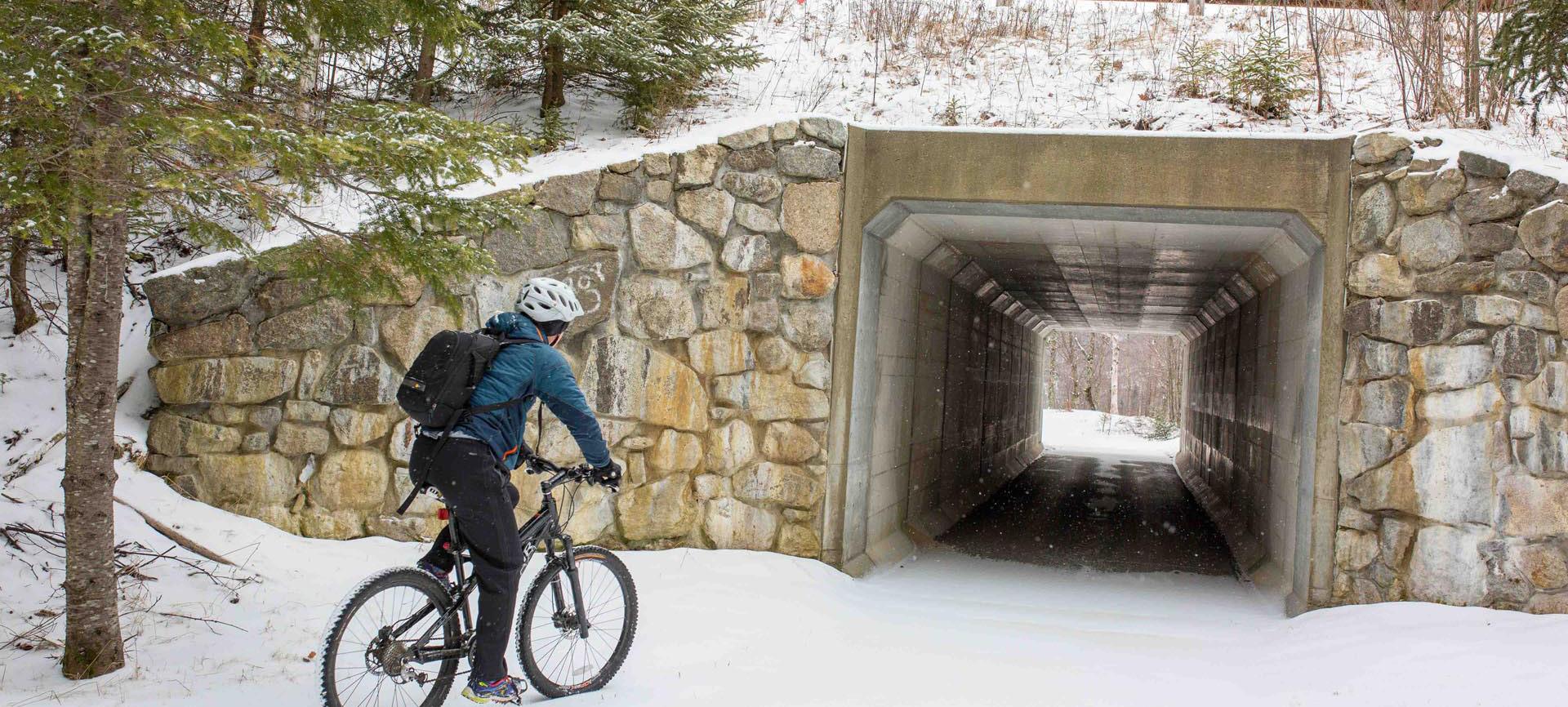
Large culverts can be used for both stormwater management and to improve access between two challenging areas. Culverts can be designed as underpasses for trails or multi-use paths. Their overall location, height, lighting, and visibility are key to their longterm success. Culverts can be expensive, but when located correctly, they can dramatically enhance the safety of a crossing for trail users.
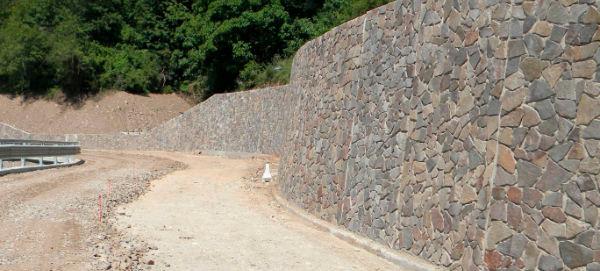
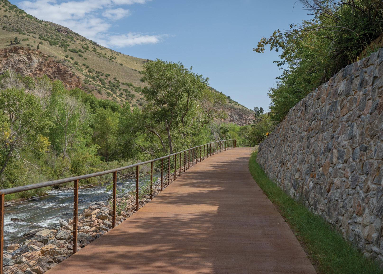
Retaining walls are generally used to retain earth or other materials laterally in areas that have been disturbed. Retaining walls can vary widely but commonly materials and styles include stone and reinforced concrete.
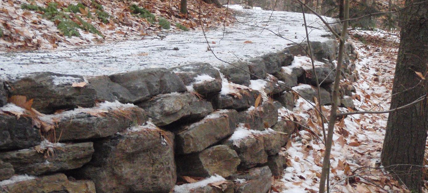
Stone (masonry) retaining walls are built from bricks, blocks, stone and precast art stone. These are generally used in areas that only need minimal height retention and that do not require extensive engineering. Stone walls tend to be aesthetically pleasing and can easily match the local theme.
Reinforced concrete retaining walls are typically used in challenging areas that require walls with varying heights. Reinforced concrete retaining wall can resist larger loads of lateral pressure depending on their specific design. Concrete retaining walls can include cantilever, counterfort, and gravity poured designs.
Prefabricated bridges are used to provide a continuous connection over difficult terrains. They are typically built in a separate location and then transported to the project site for installation. Prefabricated bridges have a quick assembly rate and are less susceptible to weather delays.
These types of bridges are often out in less populated areas,in higher elevations, and rough terrain, so they are typically designed to withstand varying weather conditions such as storms, snow, and long-lasting, icy conditions.
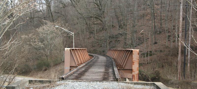
Types of bridge material include:
Steel
Steel bridges hold high strength and stiffness, are corrosion resistant, and have more of a design flexibility. The cost is relatively lower and have a longer span as weathering steel is more durable and maintenance-free.
Composite lumber is lightweight, corrosion resistant, and maintenance-free. Cost is moderate, but holds for short spans, lower strength and requires reinforcement.
Aluminum
Aluminum bridges are high strength, lightweight, offer quick installation, and are corrosion resistant. The cost is lower, but custom aluminum designs beyond railings become very expensive.
(FRP) has high strength and stiffness, is lightweight, has design flexibility, and is maintenance free. The cost is high, but offer more structural reinforcement than wood for longer spans.
Treated lumber is lightweight and has a lower cost point. It has lower strength reinforcement, slower installation, less corrosion resistance, and higher maintenance is required.
Traffic calming involves changes in street alignment, installation of barriers, and other physical measures to reduce traffic speeds and/or cut-through motor vehicle traffic volumes. The intent of traffic calming is to alter driver behavior and to improve street safety, livability, and other public purposes. Other techniques consist of operational measures such as police enforcement and speed displays.
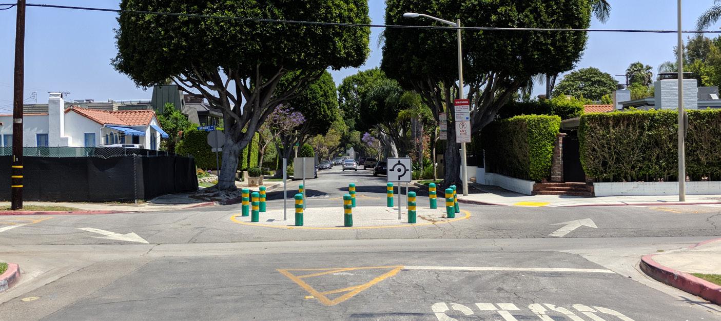
A roundabout is a circular intersection with yield control at its entry that allows a driver to proceed at controlled speeds in a counter-clockwise direction around a central island. Roundabouts are designed to maximize motorized and non-motorized traffic through their innovative design that includes reconfigured sidewalks, bikeway bypasses, high-visibility crosswalks, pedestrian flashing beacons, and other traffic measures. Roundabouts can be implemented on most streets but may require additional right-of-way.
A traffic circle is a small-scale traffic calming measure commonly applied at uncontrolled intersections on low volume, local residential streets. They lower traffic speeds on each approach and typically avoid or reduce right-of-way conflicts because the overall footprint is smaller compared to roundabouts. Traffic circles may be installed using simple markings or raised islands but are best accompanied with drought-tolerant landscaping or other attractive vertical elements.
Traditional pedestrian signals with countdown timers remain the gold standard for high quality pedestrian crossings, although some cases warrant new signal technologies. Pedestrian Hybrid Beacons (PHBs) and Rectangular Rapid Flashing Beacons (RRFBs) are special signals used to warn and control traffic at unsignalized locations to assist pedestrians in crossing a street via a marked crosswalk. PHBs include a “red phase” requiring vehicles to come to a full stop while RRFBs are yield stops. Either of these devices should be installed at locations that have pedestrian desire lines and that connect people to popular destinations such as schools, parks, and retail. Research has shown that PHBs tend to have a 90 percent motorist compliance rate versus RRFBs, which tend to have an 80 percent motorist compliance rate. Traditional pedestrian signals with countdown timers at signalized intersections tend to have a near 100 percent compliance rate. Signals and warning devices should be paired with additional pedestrian improvements where appropriate, such as curb extensions, enhanced crosswalk markings, lighting, median refuge islands, corresponding signage, and advance yield markings to mitigate multiple threat crashes on multi-lane roadways.
Speed displays measure the speed of approaching vehicles by radar and inform drivers of their speeds using an LED display. Speed displays contribute to increased traffic safety because they are particularly effective in getting drivers traveling ten or more miles per hour over the speed limit to reduce their speed.
A traffic diverter is a roadway design feature placed in a roadway to prohibit vehicular traffic from entering into or exiting from the street, or both.
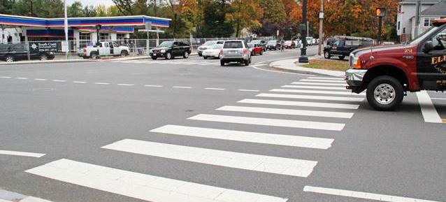
Enhanced crosswalk markings are designed to both guide pedestrians and to alert drivers of a crossing location. The bold pattern is intended to enhance visual awareness. Cities in Southern California often install “Continental” style or “Ladder” style markings due to their higher contrast on a roadway.
Curb extensions extend the curb line outward into the travel way, reducing the pedestrian crossing distance. Typically occurring at intersections, they increase pedestrian visibility, reduce the distance a pedestrian must cross, and reduce vehicular delay. Curb extensions must be installed in locations where they will not interfere with bicycle lanes or separated bikeways. If both treatments are needed, additional design features such as ramps, or half-sized curb extensions should be considered. For snow maintenance, curb extensions can be designed with tapered front ends and vertical delineators to allow snow plows to clear and move over the curbs.
Refuge islands provide pedestrians and bicyclists a relatively safe place within an intersection and midblock crossing to pause and observe before crossing the next lane of traffic.
Mid-block crossings provide convenient locations for pedestrians and bicyclists to cross thoroughfares in areas with infrequent intersection crossings or where the nearest intersection creates substantial out-of-direction travel. Mid-block crossings should be paired with additional traffic-control devices such as traditional Pedestrian Signals, PHBs, RRFBs, LED enhanced flashing signs, and/or refuge islands.
Designated senior zones can be enhanced with street signage, increased crossing times at traffic signals, benches, bus stops with shelters, and pedestrian lighting. Transit Stop Amenities
Transit stop amenities such as shelters with overhead protection, seating, trash receptacles, and lighting are essential for encouraging people to use public transit.
Special intersection paving and crosswalk art provide unique opportunities at intersections to highlight crossings or key civic or commercial locations, while breaking the visual monotony of asphalt. Intersection paving treatments and crosswalk art can integrate context-sensitive colors, textures, and scoring patterns.
Paving treatments and crosswalk art do not define a crosswalk and should not be seen as a safety measure. Standard transverse or longitudinal high visibility crosswalk markings are still required.
Pedestrian-scale lighting provides many practical and safety benefits, such as illuminating the path and making crossing walkers and bicyclists more visible to drivers. Lighting can also be designed to be fun, artistic, and interactive.
Sidewalk treads or anti-slip solutions can be explored where sloping sidewalks are installed to provide additional slip resistance. The City of Seattle has installed concrete treads on some sidewalks to help with snowy or rainy conditions. There is no guidance for these treads but they can be an experimental treatment in steep conditions.
Sidewalk heating is installed as either heating mats or cables running underneath the sidewalks to melt any snow away from the surface. This ensures that sidewalks, ramps or stairs stay ice-free during the snow periods.
Transit stop amenities such as shelters with overhead protection, seating, trash receptacles, and lighting are essential for encouraging people to make use of public transit.
Parklets are made by converting one or two parking stalls into spaces for outdoor seating, public art, or other outdoor amenities that improve the streetscape experience.
Displaying community art is a great way to engage the Reservation. Community art projects can include murals, sculptures, crosswalk art, or sidewalk chalk art.
Transit shelters, bicycle racks, seating, and public art provide important amenities for functionality, design, and vitality of the urban environment. They announce that the street is a safe and comfortable place to be and provide visual detail and interest.
Wayfinding signage is a fundamental element of a comprehensive bicycling, walking, and trail network. Effective wayfinding systems communicate designated corridors, destinations, and other points of interest throughout a community. Wayfinding signage should be designed with local design aesthetics in mind.
Monument signs can serve as powerful tools that welcome people to visit, engage, and enjoy a space or area in a unique way. These signs often reflect the character or personality of the culture and are usually located near popular points of interest or at intermediary gathering spaces along a corridor.
The following section highlights environmentally-friendly mobility options that complement a comprehensive transportation network. These clean energy transportation options can provide alternatives to gas-powered, single occupancy cars for travel and help reduce air pollution and greenhouse gas emissions. Clean mobility and shared options also help address transportation equity by providing affordable transportation choices for lower-income households and those who are unable to drive or own a car.
Electric shuttles can help address gaps within a community by supplementing the existing transit network or by creating new transit routes where they currently don’t exist. Depending on make and model, electric-powered shuttles can be used to offer transit services within a specified radius. Zero emission models reduce the carbon footprint by eliminating greenhouse gas emissions.
Vanpool and carpool programs have existed for several decades, but these services have evolved with the “electrification” the transportation industry is experiencing. Electric versions of typical 12 and 18-passenger vans are being welcomed as clean mobility options for communities.
Docked bikeshare is a shared transport service in which bicycles or e-bicycles are made available for shared use to individuals on a short term basis for a price or for free. Docked bikeshare systems typically include electric-assist bicycles that provide extra comfort for users. Docked bike share systems allow people to borrow a bike from a “dock” or station and return it to another dock belonging to the same system.
Traffic signage alerts drivers of what is expected ahead. It is important to advise drivers of any hazards or traffic conditions to keep everyone safe. These will be present during the cut-sheets.
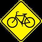
» Bike Warning (W11-1)
» Share the Road (W16-1P)
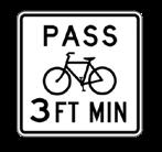
» 3 ft to Pass (R117 CA)
» Pedestrian warning signage (W15–11)
» Walk on left facing traffic (R9-1)
» Bike route (D11-1)
The proposed recommendations in this ATP are intended to improve active transportation options for community members. The list of conceptual improvement alternatives includes both bicycling and pedestrian infrastructure that improve safety and comfort for those wishing to travel to destinations along the June Lake Loop and to neighboring areas. The projects were developed with input from the community, the June Lake Citizens Advisory Committee, and field work verification. Infrastructure project recommendations are also supported by programmatic recommendations found at the end of this chapter.
The primary improvement concept is depicted in “Figure 4-1: Primaery Project: 10 Segments”. These 10 segments are explained in further detail in the cutsheets section of this chapter. The cutsheets include a project summary, “At-A-Glance” quick facts, and planning-level recommendations to help describe the overall design intent of each segment. The final design for each segment will take this plan into consideration.
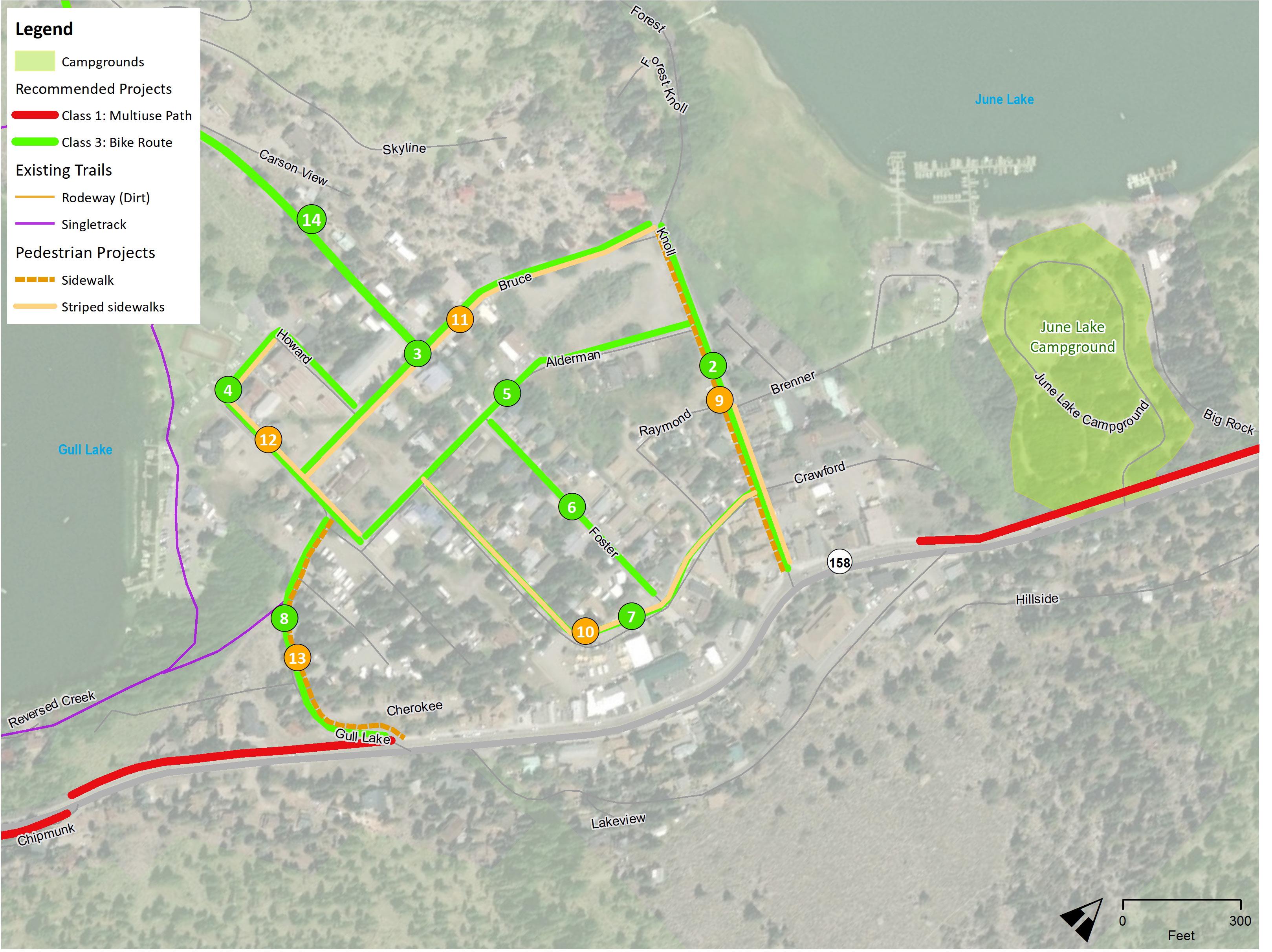
The remaining active transportation recommendations are depicted in “Figure 4-2: Northshore Drive Recommendations” and in “Figure 4-3: Village Area Recommendations”. These projects help connect residents and visitors to SR-158 and the local destinations throughout the Village Area.
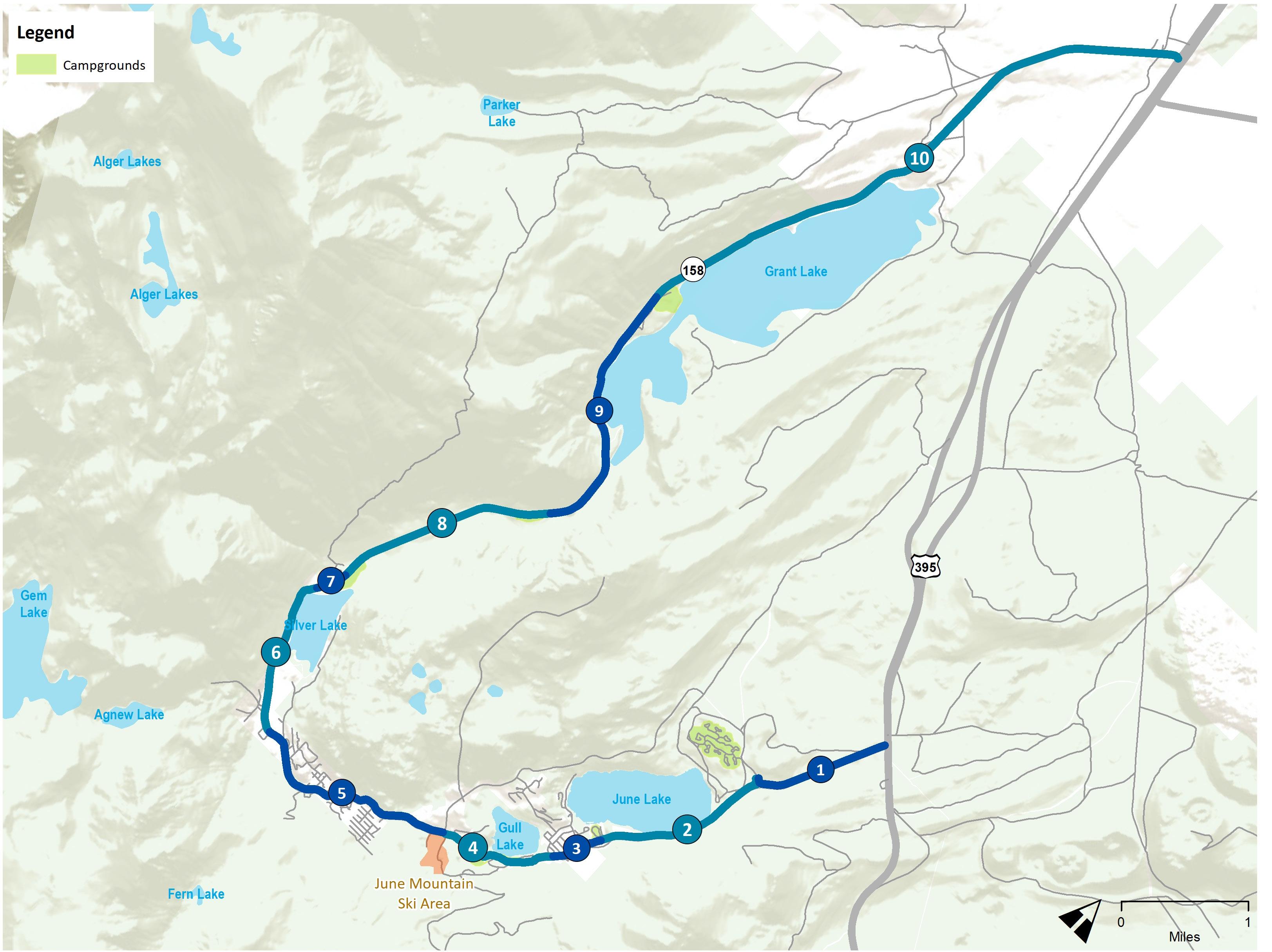


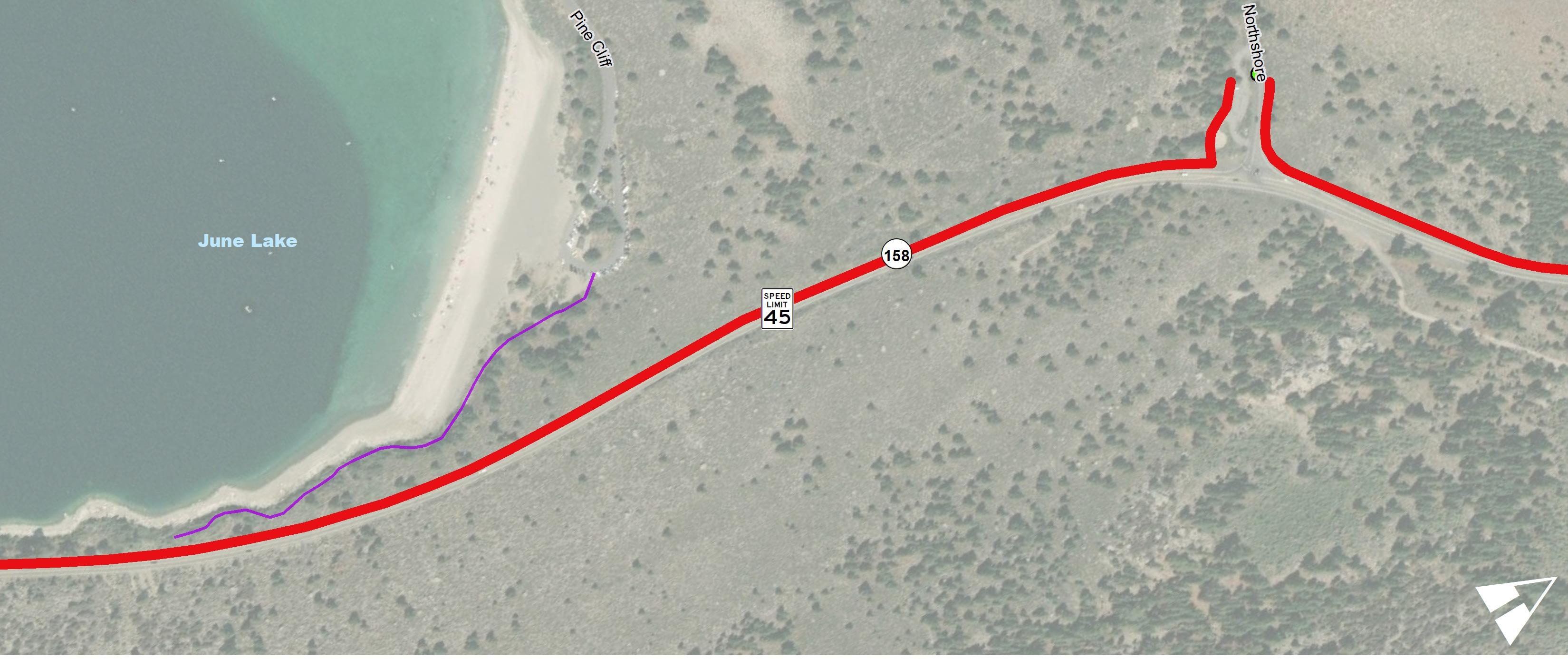
US-395 (South) to Northshore Drive (June Lake Overlook)
Project Length: 1.09 Miles
Segment 01 is 1.09 miles long and it extends from US-395 to Northshore Drive. The area is called “June Lake Junction” and it currently serves as one of two main entrances into SR-158 (June Lake Loop) from US-395. A gas station, coffee shop, a parking lot with interpretive signage, an Eastern Sierra transit stop, and a staging area for OHV use are found here. The average traffic volumes range between 1,500 to 2,000 vehicles per day, the speed limit is 55 mph, and there are three vehicular collisions recorded in this segment.
The active transportation recommendations include regulatory and wayfinding signage, transit stop amenities, and a class I multi-use path. The class I path is recommended on the interior (west) side of the corridor due to the existing wide shoulder and flatter terrain. The topography becomes more challenging closer to the Northshore Drive intersection. A multi-modal crossing with a flashing beacon is recommended on Northshore Drive west of the intersection near the staging area (parking lot) driveway to ensure adequate visibility.

Install for Northshore Drive:
Interim Recommendation:
In 0.5 to 1.0 mile increments
(W11-1) (W16-1P) (D11-1)
TVGFD
Recommend class I crossing on Northshore Drive west of SR-158 at parking area western driveway. Consider RRFB and lighting.

(W11-1) (W16-1P) (R117 CA)
Interior (westside) multi-use path alignment recommended due to minimal crossings of SR-158 between destinations.
Provide connection to beach area and parking area at Northshore Drive. Preferred alignment on slope south of road for lake access.
New Pedestrian Crossings


Trail Alternatives
Encourage Caltrans to reduce lane widths, widen shoulders, and move rumble strips to edgeline when resurfaced.

NorthShore Drive To Lakeview (east)
Project Length: 1.40 Miles
Segment 02 is 1.40 miles long and it extends from Northshore Drive to the June Lake Campground entrance. This segment has been identified as a vital corridor by stakeholders and community members because it connects two major destinations: June Lake Beach area and the June Lake Village. The area is characterized by its scenic landscapes, challenging topography, fishing access points, and lodging and camping opportunities. The average traffic volumes range between 750 to 1,500 vehicles per day, the speed limit varies 55, 45, and 35 mph, and there are eight vehicular collisions recorded in this segment.
Active transportation recommendations include regulatory and wayfinding signage and a class I multi-use path. The class I path is recommended on the interior (west) side of the corridor due to the location of important destinations and because the topography allows for better path alignments. The County will need to conduct additional feasibility analyses to identify a preferred path alignment. The existing topography is challenging due to the steep terrain and the existing roadway is not built out to the full right-of-way.
Options include a road-adjacent class I path with appropriate vertical barriers or a class I path located lower, closer to the lake that is designed as a bridged/elevated path. Multi-modal crossings between the proposed class I path and the roadway near the June Lake Campground and Village will be important.
This segment is also part of an avalanche zone. Special engineering is needed to properly identify the preferred alignment and it’s overall design treatment.
New Pedestrian Crossings
Interior (lakeside) multi-use path alignment recommended from June Lake Campground to Lakeview Drive (east). Enhanced crossing needed to transition between facilities.
Interim Recommendation: Expand 35 MPH transition zone (if supported by Engineering and Traffic Survey).
Interior (lakeside) multi-use path alignment recommended. Walls and structures needed where adjacent to June Lake whether path is attached or detached.
Attached alignment may also be considered and is recommended from Boulder Lodge to the existing sidewalk. Driveway grades difficult to reconstruct.
Trail Alternatives
Explore alternative trail and class I multi-use alignments to and from June Lake Beach Area.
Interior (lakeside) multi-use path alignment recommended. Walls and structures needed where adjacent to June Lake whether path is attached or detached.
Interim Recommendation: In 0.5 to 1.0 mile increments
Provide connection to beach area and parking area at Northshore Drive. Preferred alignment on slope south of road for lake access.
(W11-1) (W16-1P) (R117 CA)
Recommend class I crossing on Northshore Drive west of SR-158 at parking area western driveway. Consider RRFB and lighting.
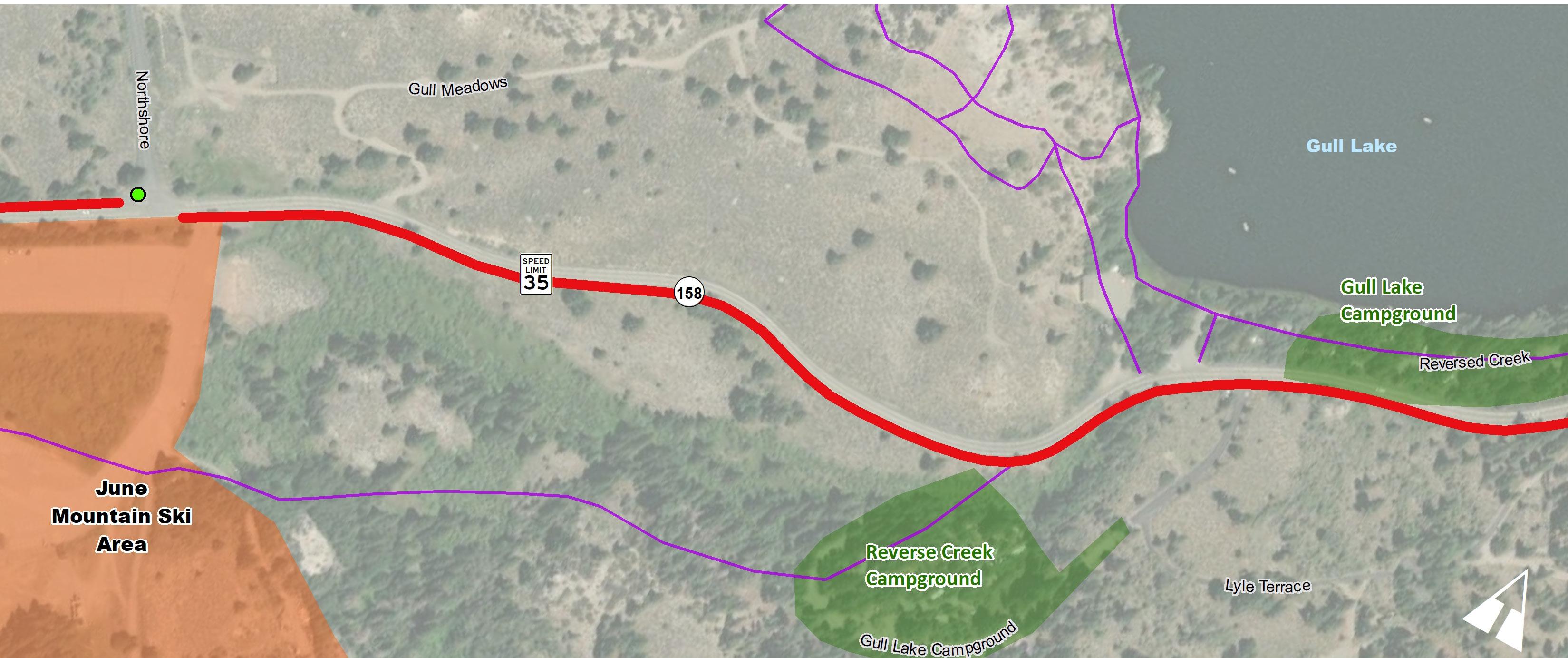
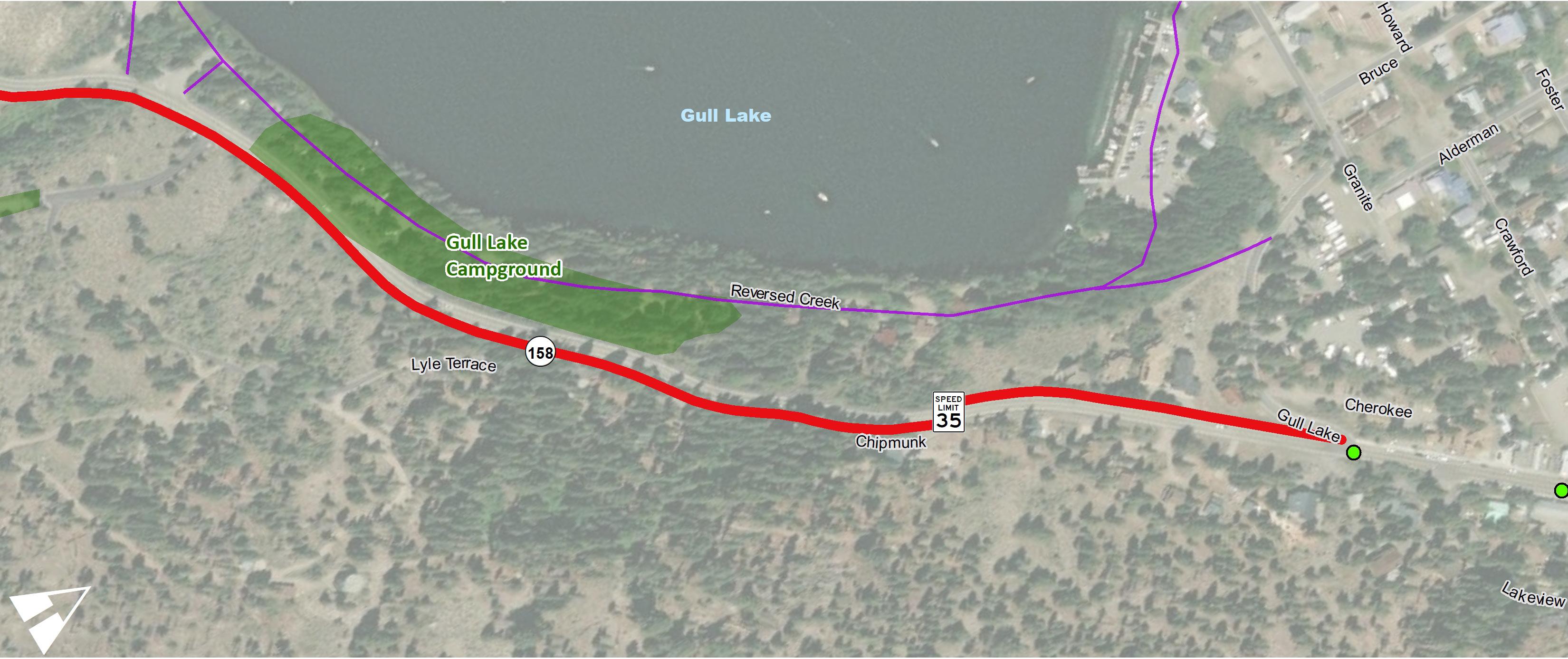
June Lake Campground Road to Gull Lake Road
Project Length: 0.41 Miles
Segment 03 is 0.41 miles long and it extends from the June Lake Campground entrance to Gull Lake Road. This segment is important for stakeholders and community members because it serves as the “main street” for June Lake Village. The area is characterized by the narrow roadway that provides multi-modal access to community destinations such as lodging, a U.S. Post Office, retail and food venues, a general store, residential homes, the June Lake Community Center, and Gull Lake Marina. The average traffic volumes range between 750 to 1,500 vehicles per day, the speed limit varies between 35 and 25 mph, and there are 13 vehicular collisions recorded in this segment.
Active transportation recommendations include regulatory and wayfinding signage and enhanced pedestrian crossings. The existing rightof-way is very limited and maintaining on-street parking through this corridor is important for the community, therefor traffic calming though signage and radar speed feedback signs is important. The residential roads west of this segment are proposed as class III shared facilities. Pedestrian improvements include sidewalk maintenance and several enhanced crossings with flashing beacons. The transitions between the shared road and the class I paths that connect to both ends of this segment are vital to ensure comfort and safe access to these facilities.
The segment of SR-158 through June Lake Village is currently classified by Caltrans as a collector highway. Caltrans does not support designating any portion of State Route 158 as a class III bike route at this time. In the absence of a bikeway designation, bike travel is permitted on State Route 158. Although bike route signage and shared lane markings are not supported by Caltrans, “Share the Road” and “3 Feet to Pass” signs consistent with the California Vehicle Code (CVC) are still recommended.
Install enhanced crossing and additional pedestrian warning signs by the post office.
Install RRFB at existing Knoll Avenue crossing. Replace streetlight bulbs where needed. Maintain existing lighting. Fill in lighting gaps in sidewalk corridor.
Install crossing and additional pedestrian warning signs west of Lakeview Dr (west) on either side of sidewalk area.
Interior (lakeside) multi-use path alignment recommended from June Lake Campground to Lakeview Drive (east).
Install enhanced crossing and additional pedestrian warning signs west of Gull Lake Road on either side of sidewalk area.
Install Speed Limit Signs with radar feedback entering 25 MPH zone. Consider additional pedestrian scale wayfinding.
Install bikeway signage. Use every block or 500’ from Lakeview Drive to Lakeview Drive.
New Pedestrian Crossings
Trail Alternatives

Interim Recommendation:
In 0.5 to 1.0 mile increments
(W11-1) (W16-1P) (R117 CA)
Gull Lake Road To Northshore Drive (South)
Project Length: 0.93 Miles
Segment 04 is 0.93 miles long and it extends from Gull Lake Road to Northshore Drive. This segment was identified as a vital corridor by stakeholders and community members because it would provide a connection between the June Mountain Ski Area, campgrounds and the Village. The area is characterized by its scenic landscapes, varying topography, and a narrow roadway that curves between important destinations. The average traffic volumes hover around 1,500 vehicles per day, the speed limit varies between 35-55 mph, and there are three vehicular collisions recorded in this segment.
Active transportation recommendations include regulatory and wayfinding signage and a class I multi-use path. The alignment of the proposed class I path varies along the corridor due to the location of destinations, the challenging topography, and the existing narrow roadway that passes in front of residential driveways. A multi-modal enhanced crossing is identified east of the Lyle Terrace Road intersection. The County will need to conduct additional feasibility analyses to identify the exact location of the preferred path alignments and the required crossings.
New Pedestrian Crossings
Recommended crossings at Northshore Dr and at the Reverse Creek Campground Drive entrance.
Interim Recommendation:
In 0.5 to 1.0 mile increments
Exterior (June Mountain side) multi-use path alignment recommended from Reverse Creek Campground to June Lake Ski Area due to topography. Detached path through meadow preferred.
Exterior (hillside) multi-use path recommended. Enhanced pedestrian crossing located just east of Reverse Creek Ln and just west of Lyle Terrace Rd
Explore converting unofficial trail into a path to improve connections
Trail Alternatives
Enhanced pedestrian crossing located just east of Reverse Creek Ln and just west of Lyle Terrace Rd
Class I multi-use path on the interior (lakeside) would impact campground
Interim Recommendation:
In 0.5 to 1.0 mile increments
Structures and walls needed adjacent to guardrail and on steep slopes. Consider use of Gull Lake Campground Road and new path connection to Gull Lake Road as alternative.
Option 2: cross at Gull Lake Road with multi-use path transitioning to exterior (hillside) alignment. Explore option for an undercrossing.
(W11-1) (W16-1P) (R117 CA)
Explore converting unofficial trail into a path to improve connections
Consider under-crossing here with access to campground cul de sac.
Option 1: cross at Chipmunk Lane with multi-use path transitioning to exterior (hillside) alignment. Explore option for an undercrossing
Northshore Drive To Edison Way
Project Length: 1.81 Miles
Segment 05 is 1.81 miles long and it extends from Northshore Drive to Edison Way. This segment would provide connections between the residential homes of the Down Canyon area to community destinations such as employment areas, lodging such as the popular Double Eagle Resort and Spa, a laundromat, trailheads, National Wounded Warrior Center and the June Mountain Ski Area.
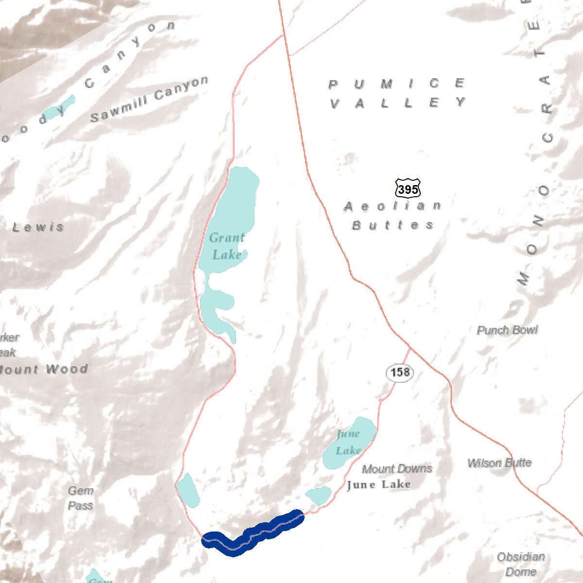
The area is characterized by its scenic landscapes, varying topography, and a narrow roadway that curves between important destinations. The average traffic volumes range between 750 and 1,500 vehicles per day, the speed limit is 35 mph, and there are 10 vehicular collisions recorded in this segment.
Active transportation recommendations include regulatory and wayfinding signage and a class I multi-use path. The alignment of the proposed class I path varies along the corridor due to the location of destinations, the challenging topography, and the existing narrow roadway that passes in front of residential and commercial driveways. The County will need to conduct additional feasibility analyses to identify the exact location of the preferred path alignments and the required crossings. Special attention should be placed on signage that warns users of the road’s curvature, especially at the curve located west of Bay Street.
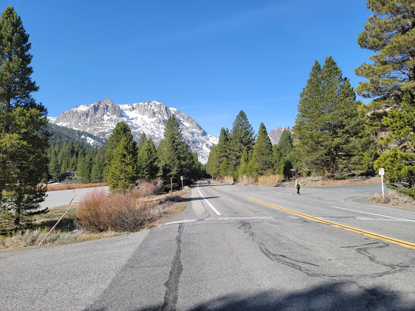
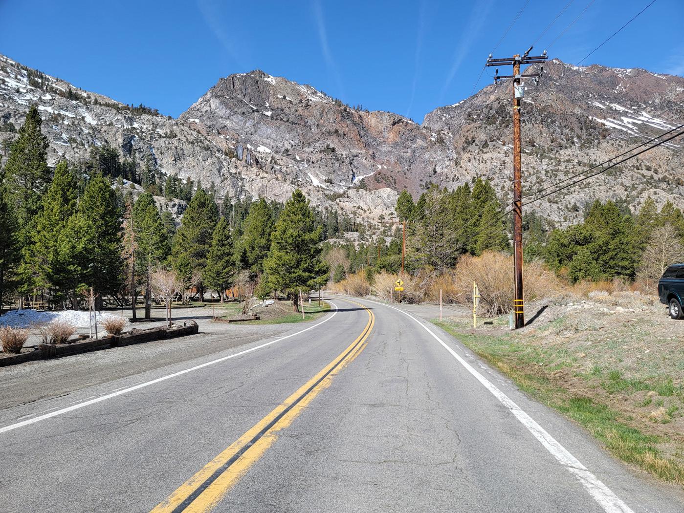
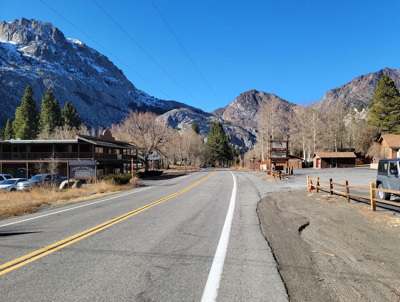
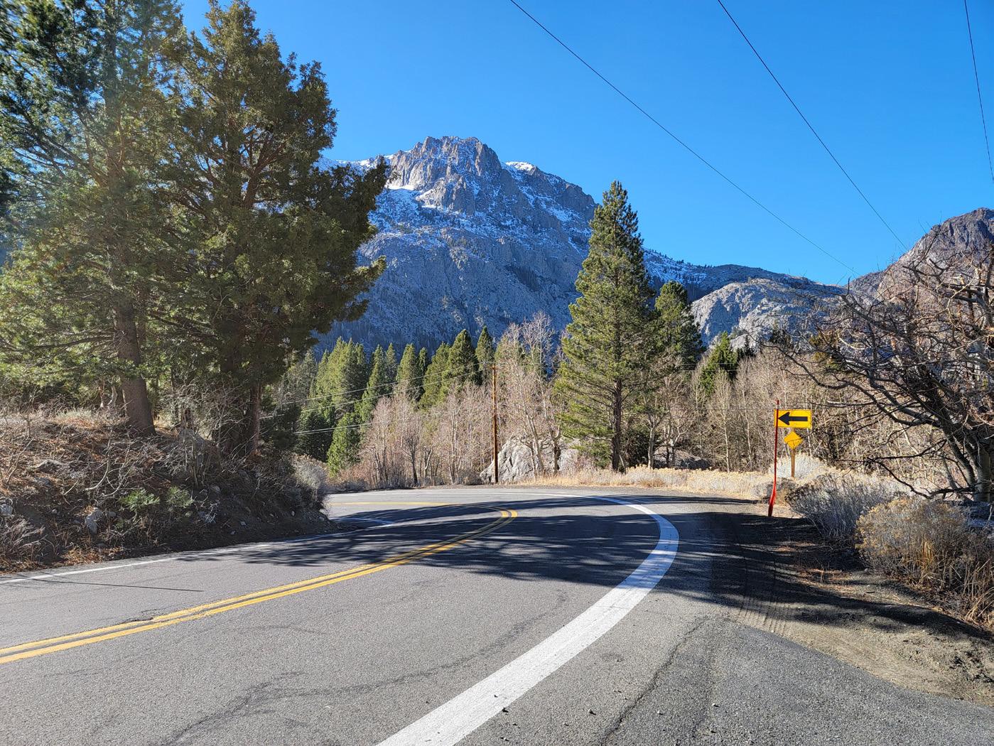
Interior (northside) multi-use path recommended from Nevada St to Silver Lake.
Consider pedestrian crossing west of Nevada Street or at class I crossings
Add/improve trailhead connections to Yost and Fern Lake
Exterior (southside) multi-use path alignment recommended east of Nevada Street; easier to construct.
Interior (northside) multi-use path alignment recommended at the hairpin turn west of Bay Street.
Interim Recommendation: In 0.5 to 1.0 mile increments
(W11-1) (W16-1P) (R117 CA)
Trail
Interior (northside) multi-use path alignment recommended at the hairpin turn west of Bay Street.
Consider adding pedestrian-scale lighting throughout Segment 05
Interim Recommendation: In 0.5 to 1.0 mile increments
Add/improve trailhead connections to Down Canyon Trail
(W11-1) (W16-1P) (R117 CA)
Exterior (southside) multi-use path recommended from June Mountain Ski Area to Boulder Drive; interior could be considered. From Boulder Drive to Fern Creek Lodge, both sides are difficult to construct. Will need walls and structures east of Fern Creek.

Dream Mountain Drive (east) To Silver Lake Resort
Project Length: 1.29 Miles
Segment 06 is 1.29 miles long and extends from Edison Way to Silver Lake Resort. This segment was identified by stakeholders and community members as to the overall grand vision of creating a fully-separated facility between June Lake Beach and Silver Lake Resort. This segment would provide connections between residents in homes and destinations of the Down Canyon to the popular Silver Lake Resort,home to a boat launch, equestrian facilities, campgrounds, and popular trailheads such as Rush Creek Trail.
The area is characterized by its attractive landscapes such as the groves of aspen, varying topography, and the scenic roadway that runs parallel and adjacent to Silver Lake. Traffic volumes range between 500 and 1,500 vehicles per day, the speed limit varies between 45, 35, and 25 mph, and there are three vehicular collisions recorded in this segment.
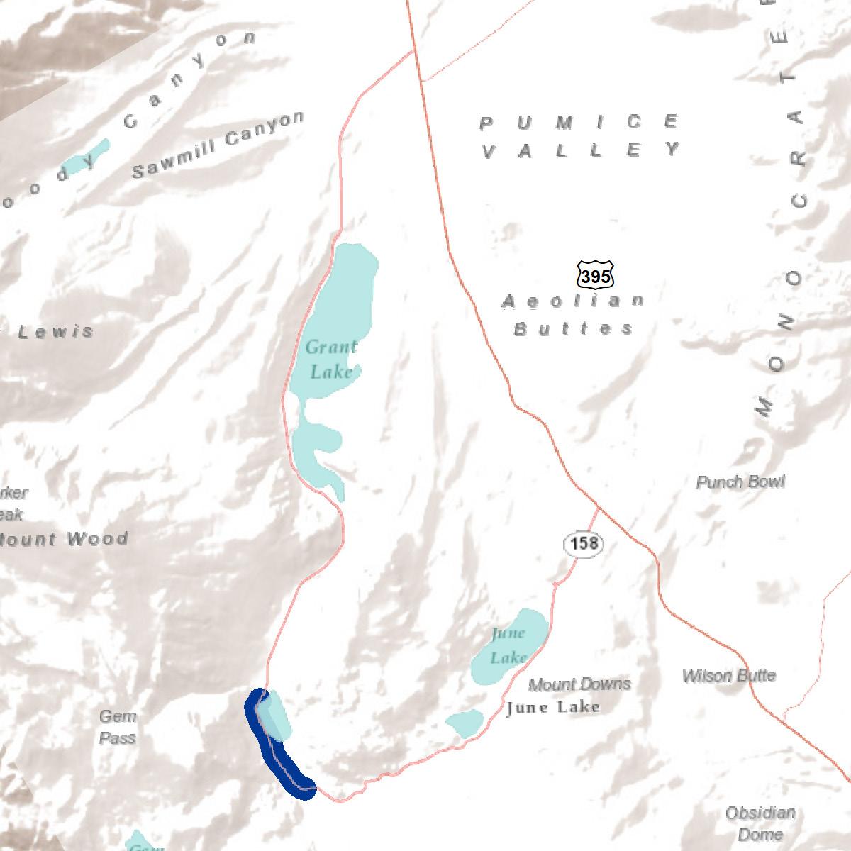
Active transportation recommendations include regulatory and wayfinding signage and a class I multi-use path. The alignment of the proposed class I path is recommended on the interior (lake) side, but the existing right-of-way and landscape pose challenges to the alignment of the class I path. The County will need to conduct additional feasibility analyses to identify the best option. Suggestions can range from a road-adjacent path that would require tree removal and an extension of the road where it meets the water’s edge, or a fully-suspended, bridged class I path that is completely separated from the roadway.
This segment is also part of an avalanche zone. Special engineering is needed to properly identify the preferred alignment and it’s overall design treatment. ”
Concerns about removing the trees adjacent to the road and impeding access for fishermen were discussed by the community. If the class I facility through this segment is deemed infeasible, alternative options can be explored such as traffic calming and a shareduse road. Challenges to this segment supporting a shared-use facility are similar to that in the Village. This segment of SR-158 is currently classified by Caltrans as a collector highway. This classification is typically not suitable for class III shared facilities, but vehicular speeds tend to be lower through his segment. A comfortable shared facility would include regulatory signage, bicycle markings, and traffic calming measures such as speed radar signs. This segment is important to the community, so a detailed feasibility study will be required to determine the best active transportation options.
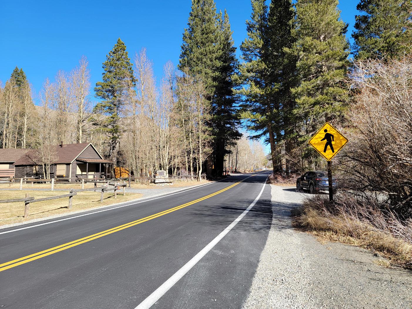
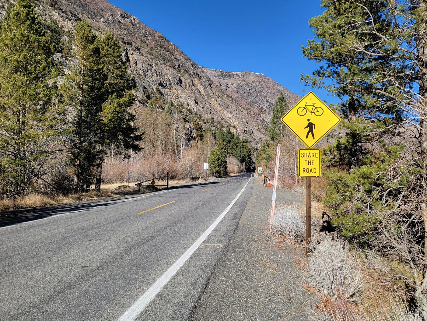
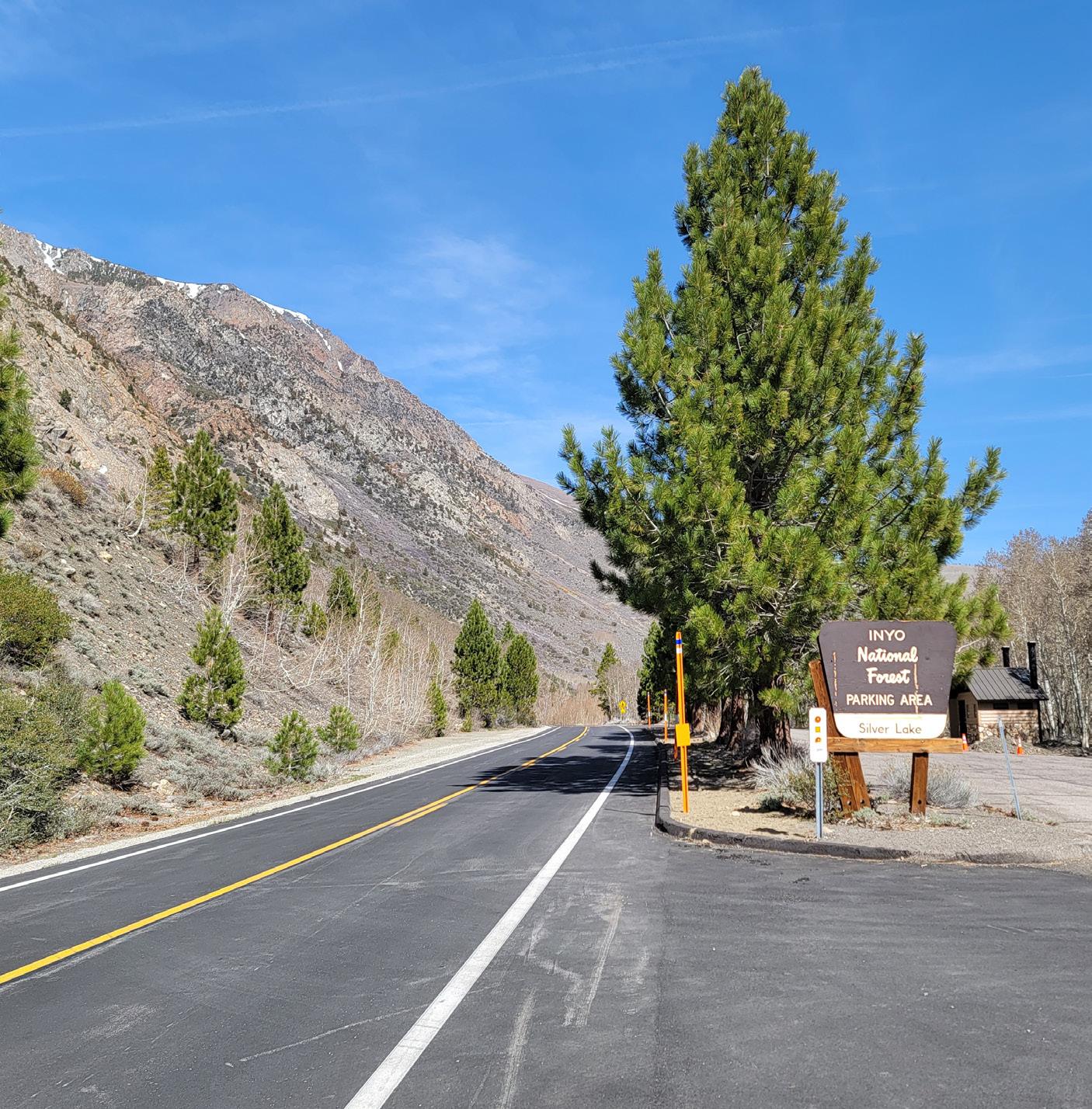
Please see comments for Segment 08
Please see comments for Segment 07
Consider enhanced crossing here with RRFB, signage, and high-visibility crosswalks.
Interior (lakeside) multi-use path alignment recommended due to destinations, cantilevered structures likely needed where adjacent to Silver Lake access. Extensive tree removal may be required.
Install Southbound curve warning sign
(W1-1) near Silver Lake Resort. Curve speed estimated at 20 MPH.
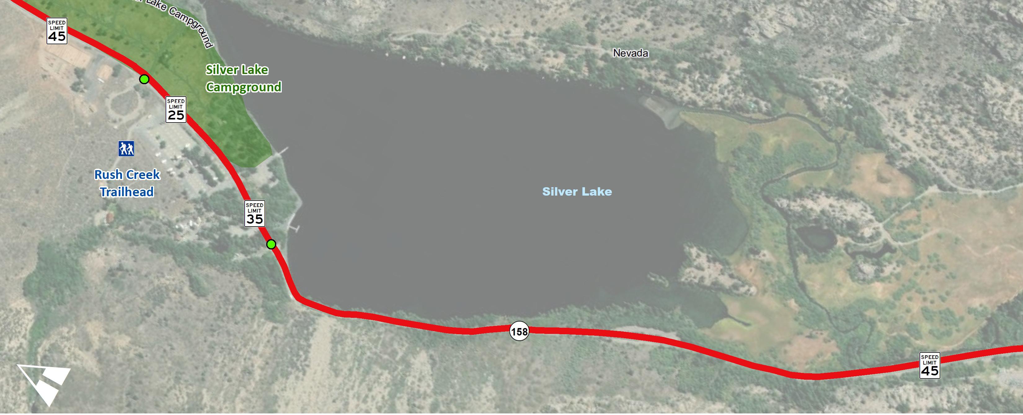
New Pedestrian Crossings
Trail Alternatives
Feasibility study needed to determine alignment between Silver Lake Resort and Southern Parking Lot. Options may include a shared road with signage and traffic calming measures, an elevated/bridged class I path over June Lake, or advisory bike lanes. Caution against tree removal along edge of road. Recommended option will require Caltrans approval and environmental studies.
Interim Recommendation: In 0.5 to 1.0 mile increments
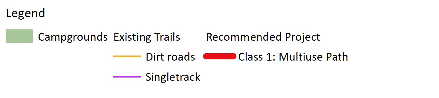
(W11-1) (W16-1P) (R117 CA)
See comment on other sheet duplicate areas
Interior (lakeside) multi-use path recommended due to destinations, cantilevered structures likely needed where adjacent to June Lake access. Extensive tree removal required. Consider impact to existing recreational activities such as fishing.
Recently resurfaced and new ped/bike signage installed. Encourage Caltrans to reduce lane widths and widen shoulders on future resurfacing projects.
Consider exterior alternative path if interior option cannot be accommodated adjacent to lake. This will require extensive analysis due to topography, avalance zone, and cost of construction.
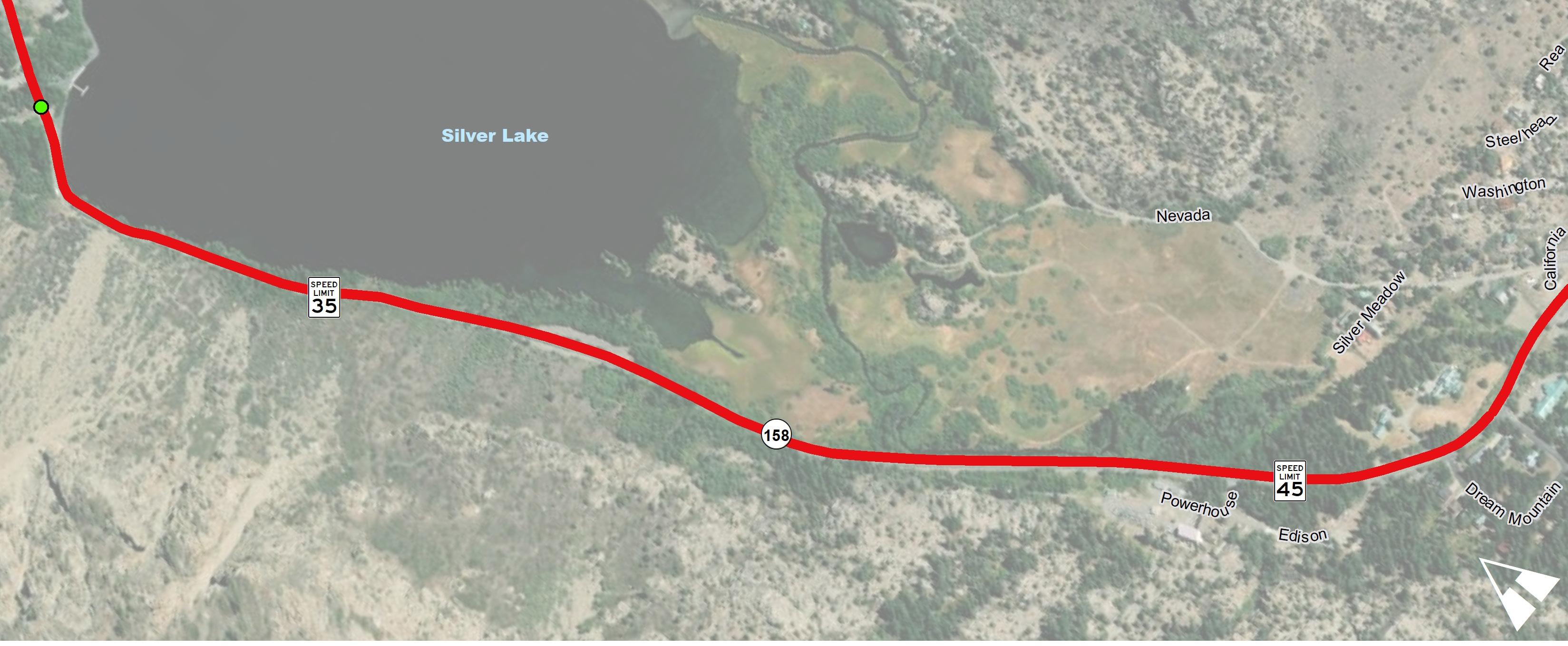
Interim Recommendation:
In 0.5 to 1.0 mile increments
(W11-1) (W16-1P) (R117 CA)
Silver Lake Resort To Rush Creek Trailhead Parking
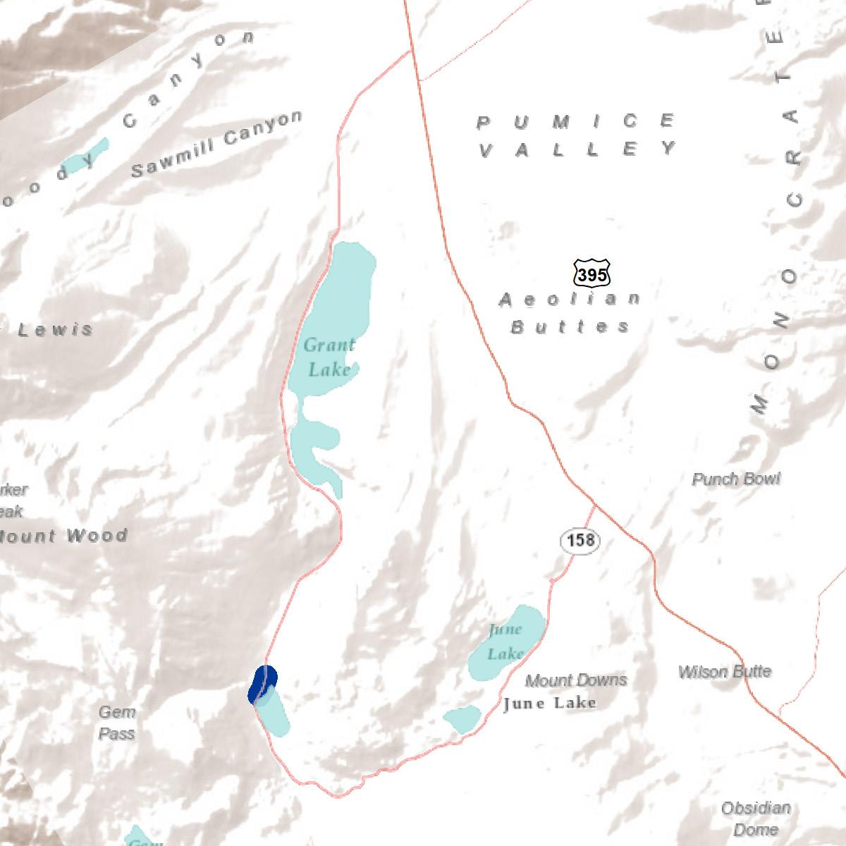
Project Length: 0.24 Miles
Segment 07 is 0.24 miles long and it extends from the Silver Lake Resort to the Rush Creek Trailhead Parking lot. This small segment would provide a much-needed dedicated space for visitors to travel on between the amenities of the Silver Lake Resort area, Silver Lake Campground, and the trailhead. The average traffic volumes hover around 500 vehicles per day, the speed limit is 25 mph, and there are zero vehicular collisions recorded in this segment.
Active transportation recommendations include regulatory and wayfinding signage and a class I multi-use path. The alignment of the proposed class I path is recommended on the east side of the roadway due to the available right-of-way. There is an existing grove of trees immediately north of the Silver Lake Resort entrance that may be affected for the implementation of a class I path. A pre-fabricated multi-modal bridge crossing may also be needed to allow people to cross over Alger Creek. The area is also a popular equestrian destination, so special design consideration can be explored as a shared facility or class II if needed.
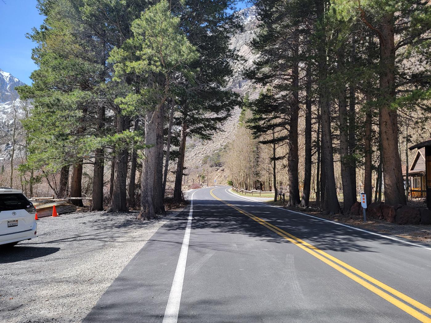
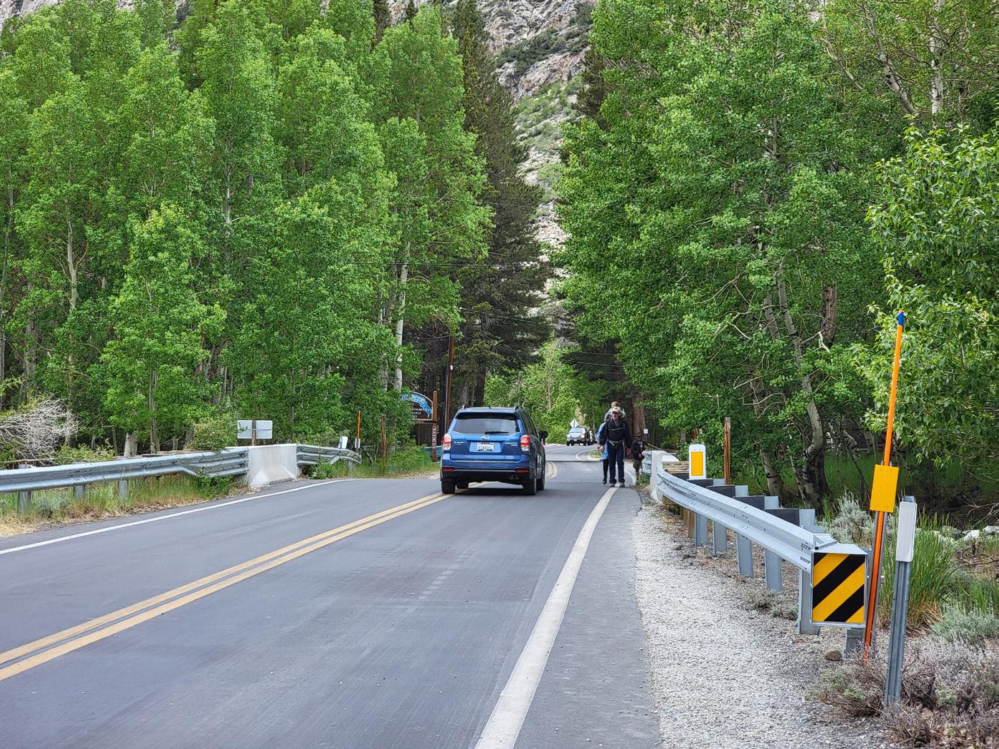
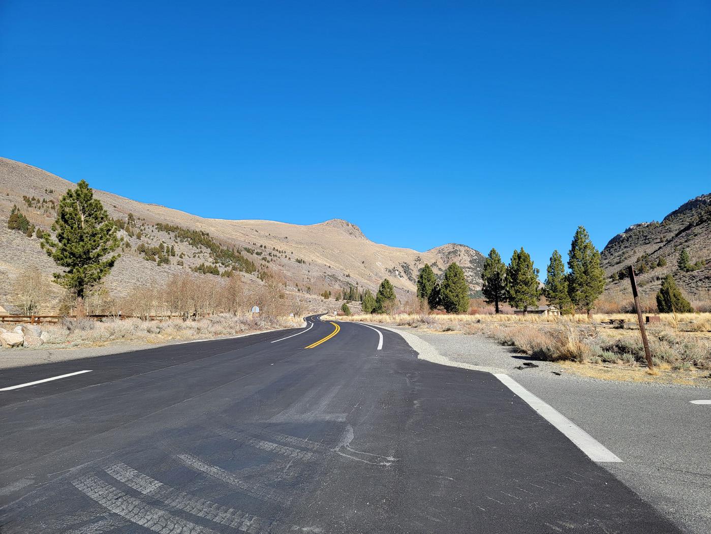
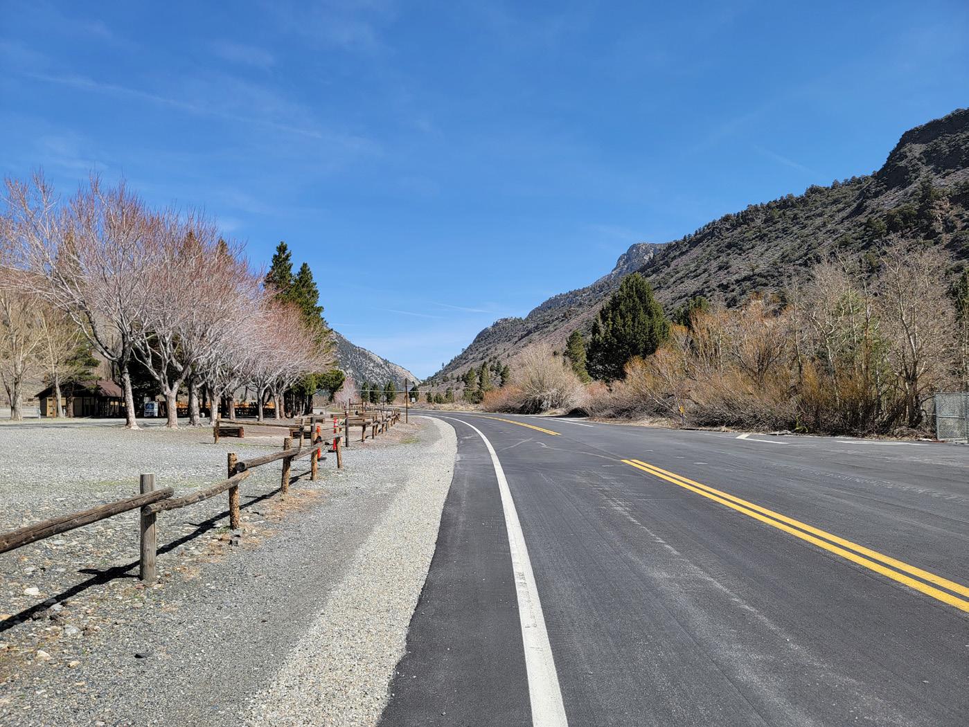
Consider enhanced crossing here with RRFB, signage, and highvisibility crosswalks.
Interim Recommendation:
Recommended interior (lakeside) alignment due to destinations. Pedestrian bridge needed; structures are needed where adjacent to Silver Lake access. Tree removal may be required
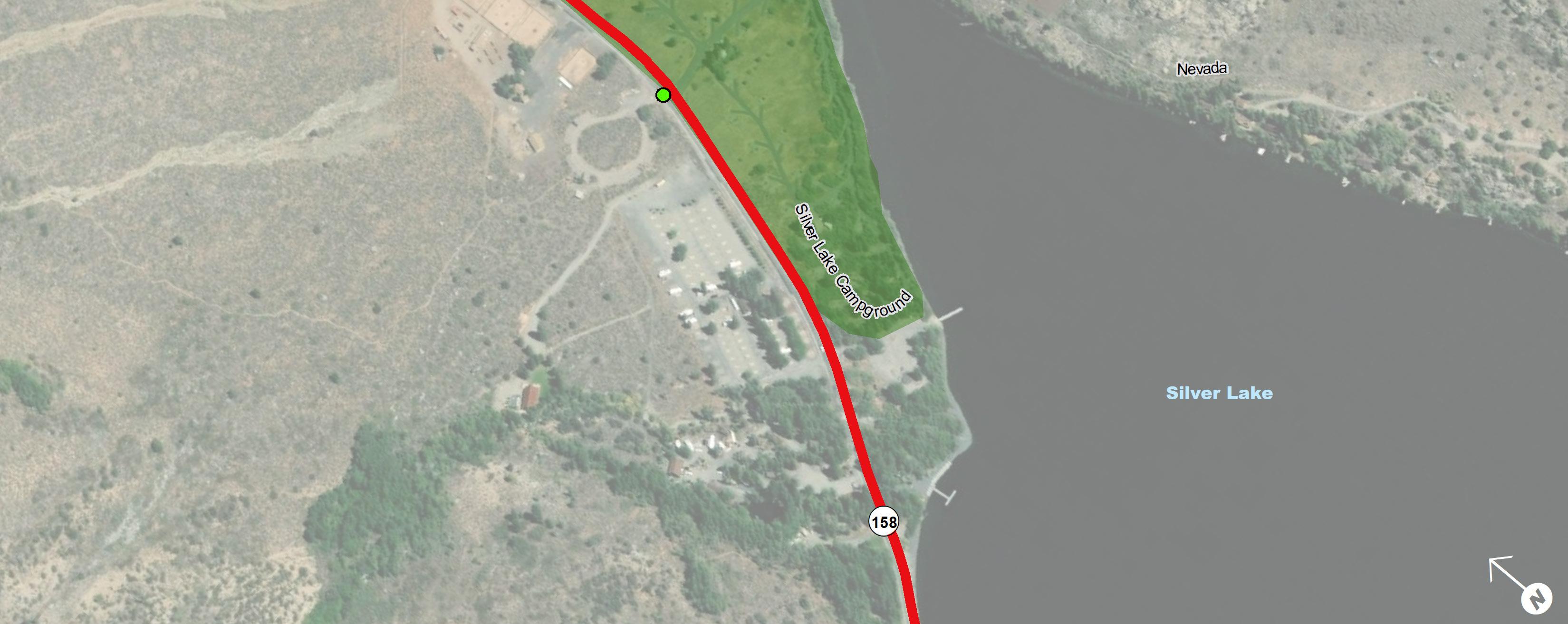
(R9-1) signs at Silver Lake Resort and campground entrances.
New Pedestrian Crossings
Consider additional pedestrian scale wayfinding. Consider no parking signs where needed for pedestrian travel paths.
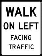
*Can consider an exterior (hillside) alignment based on location of pedestrian bridge. No additional crossings of SR-158 recommended.
Consider enhanced crossing here with RRFB, signage, and high-visibility crosswalks.
Trail Alternatives
Rush Creek Trailhead to Aerie Crag Picnic Area
Project Length: 1.76 Miles
Segment 08 is 1.76 miles long and it extends from the Rush Creek Trailhead Parking lot to the Aerie Crag Picnic Area parking lot. The average traffic volumes hover around 500 vehicles per day, the speed limit varies from 55, 45, and 35 mph, and there are zero vehicular collisions recorded in this segment. The overall demand for active transportation declines north of the Silver Lake Resort but stakeholders did identify that a connection to and from Aerie Crag would be supported due to its popularity as a scenic, passive, recreation area.
Active transportation recommendations include regulatory and wayfinding signage and a class I multi-use path. The alignment of the proposed class I path is recommended on the east side of the roadway due to the available right-of-way. The area is also a popular equestrian destination, so special design consideration can be explored as a shared facility or class II if needed. There are two existing marked equestrian crossings along this segment that should connect to the proposed class I path.
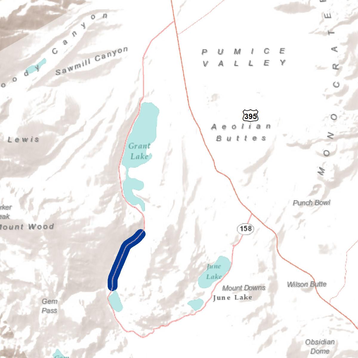
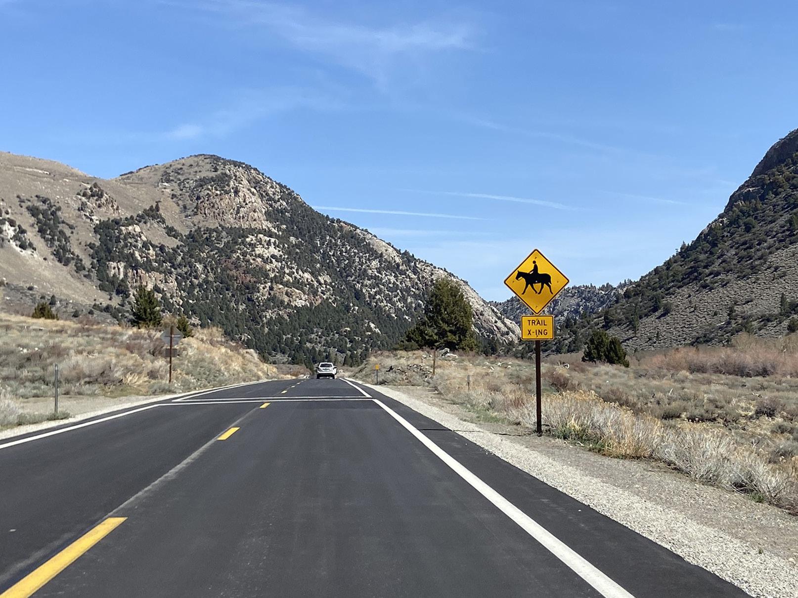
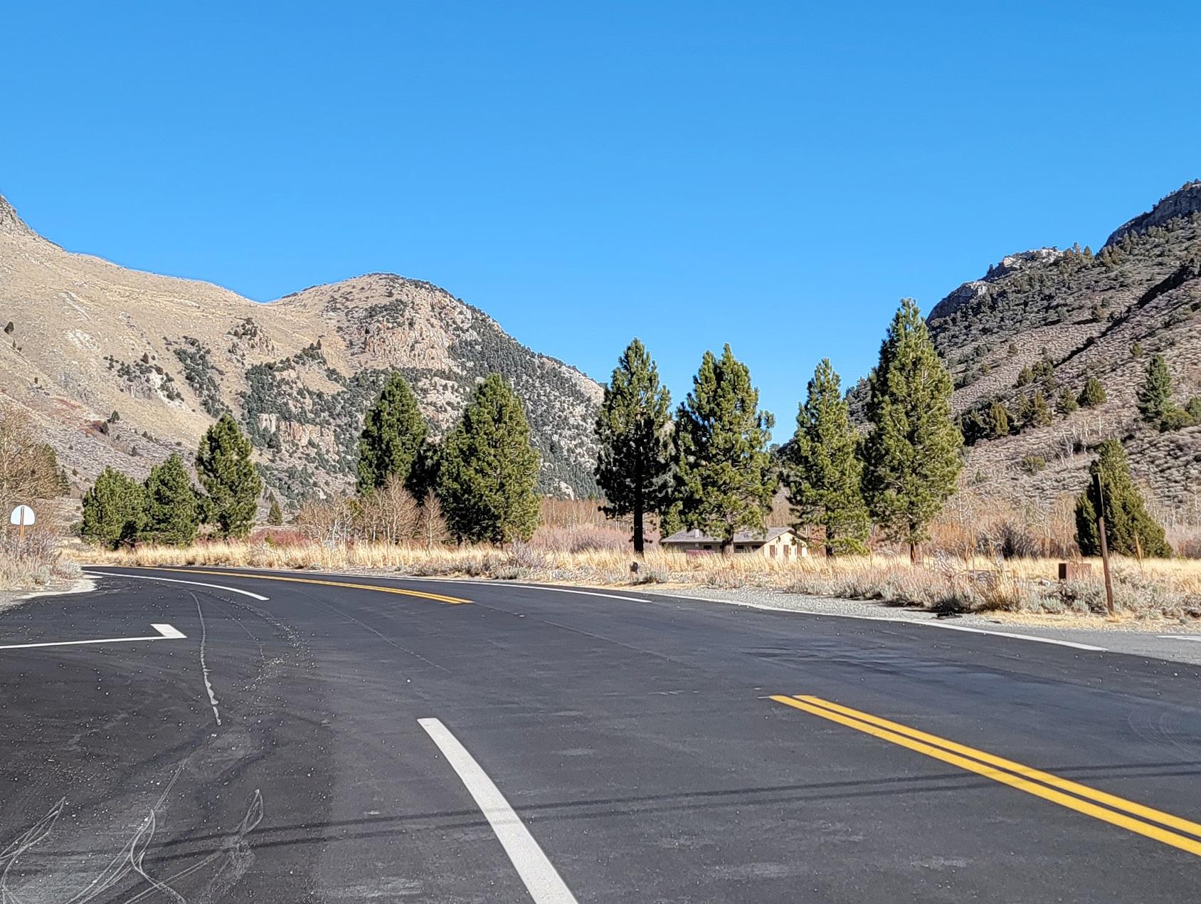
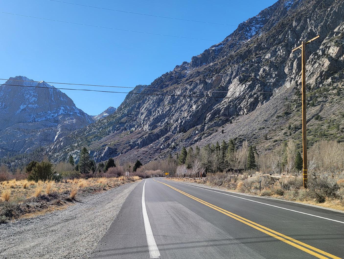
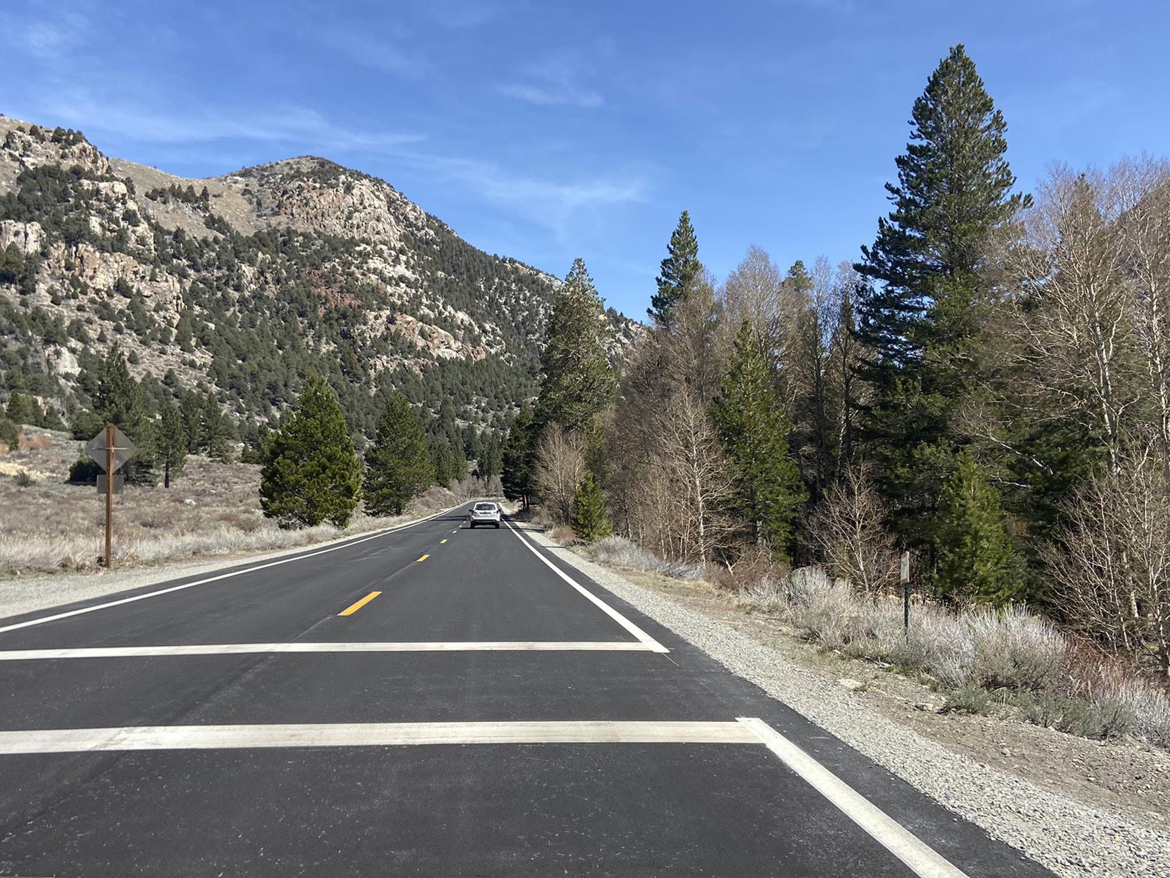
Legend:
Interior (riverside) multi-use path alignment recommended due to destinations. Walls, structures or realignment needed where road is adjacent to river. Consider and utilize existing horse crossings if path cannot be accommodated on interior of loop.
Explore additional class I multi-use path alignments. Paths closer to Rush Creek offer scenic and unique experiences.
Interim Recommendation:
In 0.5 to 1.0 mile increments
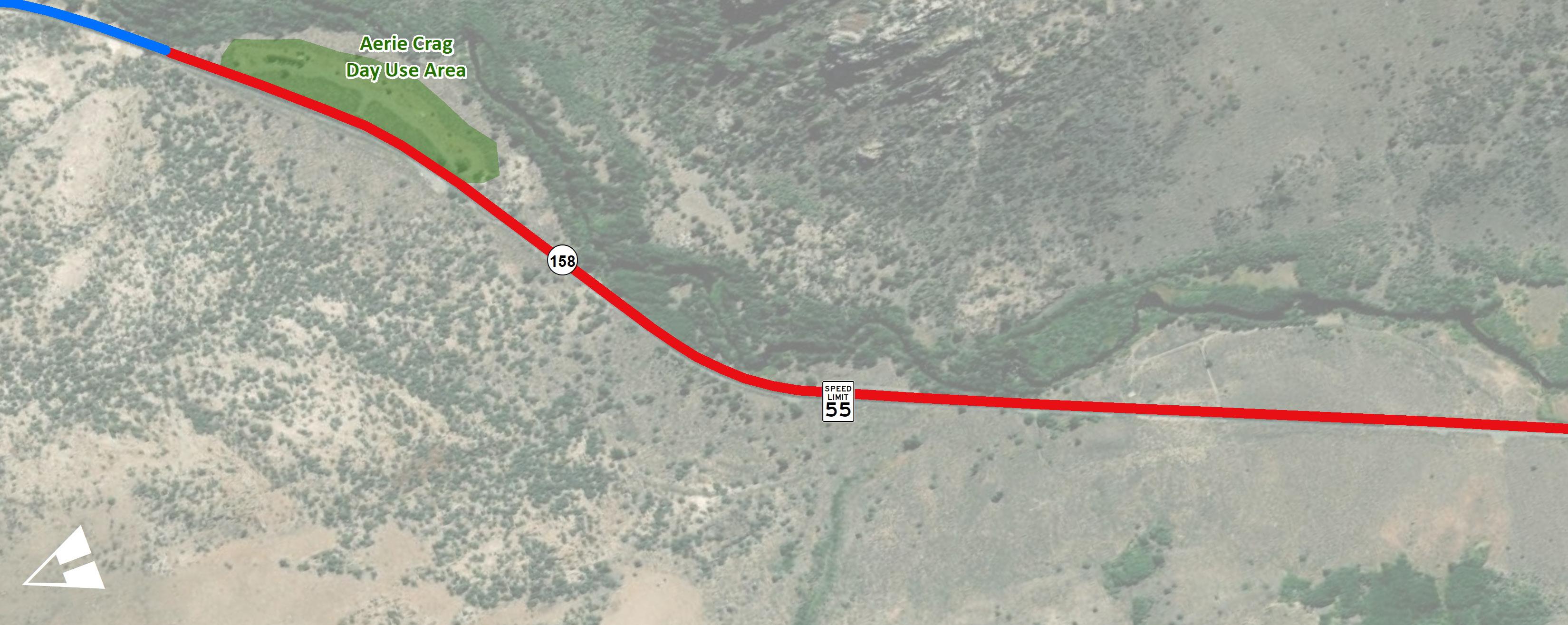
(W11-1) (W16-1P) (R117 CA) New Pedestrian Crossings
Trail alternatives
Interior (riverside) multi-use path alignment recommended due to destinations. Walls, structures or realignment needed where road is adjacent to river.
Recently resurfaced road and new pedestrian/bike signage installed. Encourage Caltrans to reduce lane widths and widen shoulders on future resurfacing projects.
Explore additional class I multi-use path alignments. Paths closer to Rush Creek offer scenic and unique experiences.
High speeds observed through this segment. Explore traffic calming measures between Aerie Crag and Silver Lake Resort where possible
Interim Recommendation:
In 0.5 to 1.0 mile increments
Exterior (hillside) multi-use path alignment not recommended. Although minimal or no structures or walls would be required, crossing of SR-158 is not recommended due to 55 mph speed limit. Could consider and utilize existing horse crossings if path cannot be accommodated on interior of loop.
(W11-1) (W16-1P) (R117 CA)
Aerie Crag Picnic Area to Grant Lake Marina
Project Length: 2.10 Miles
Segment 09 is 2.10 miles long and it extends from the Aerie Crag Picnic Area parking lot to the Grant Lake Marina. The average traffic volumes hover around 500 vehicles per day, the posted speed limit is 55 mph, and there are zero vehicular collisions recorded in this segment. The overall demand for active transportation in this segment is low. Most visitors of Grant Lake Marina drive to this destination for camping, RV park, boating, and fishing activities.
Active transportation recommendations include regulatory and wayfinding signage and class II bike lanes with shoulder enhancements. The County can explore a class I multi-use path alignment on the east side of the roadway, but the existing topography does create challenges in some areas. Protecting the existing groves of trees is important to the community (those near Aerie Crag and Rush Creek).
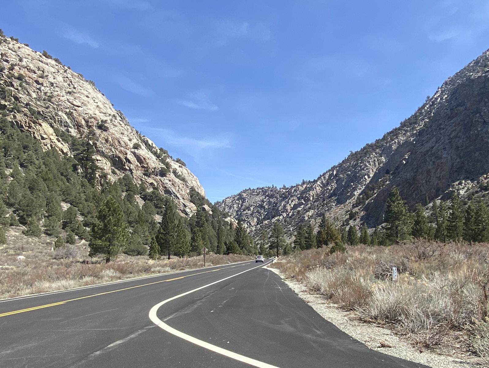
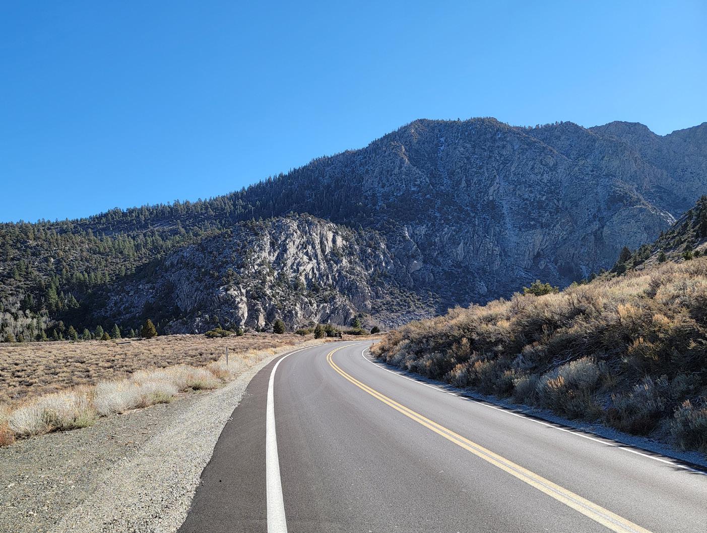
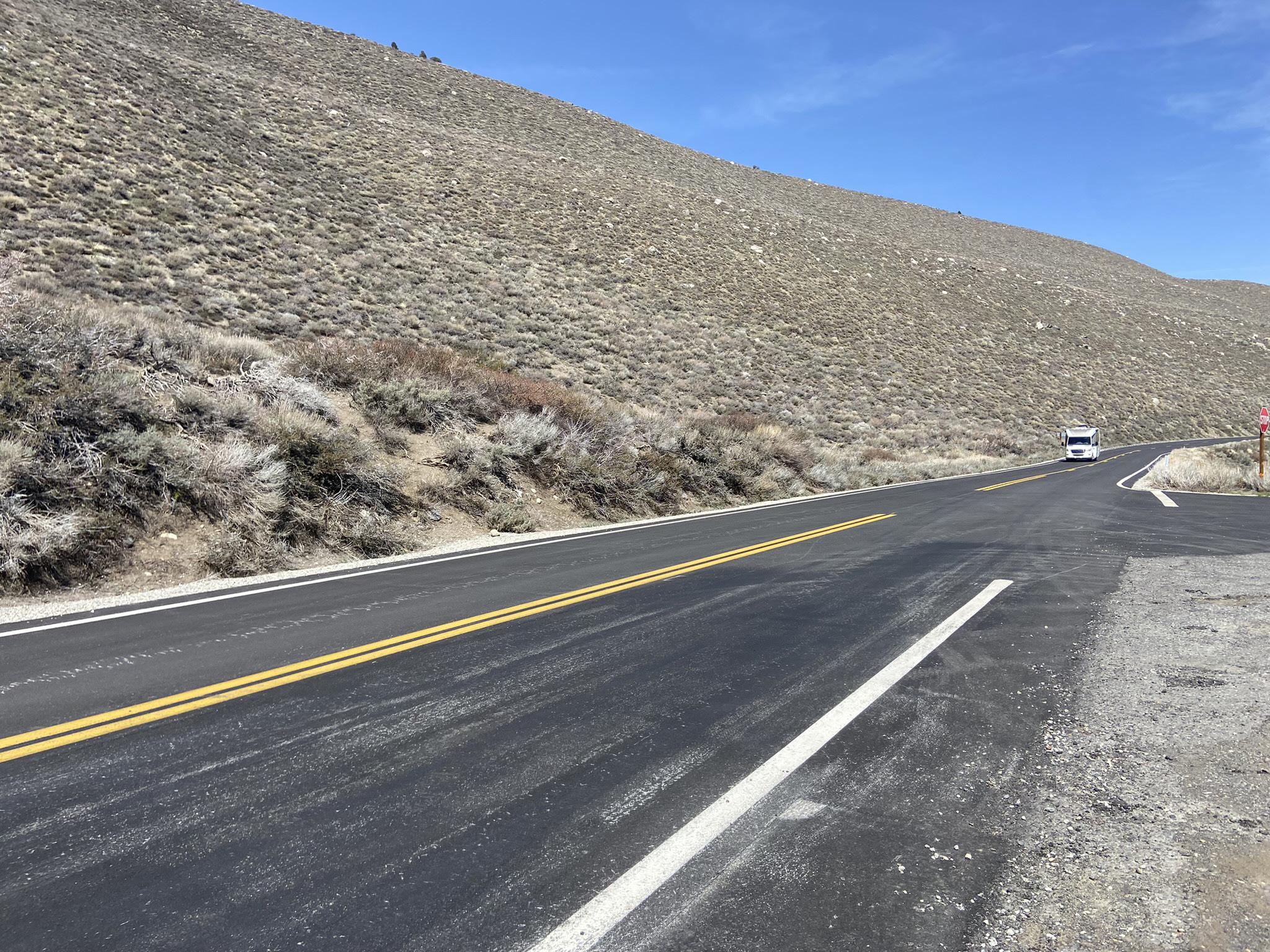
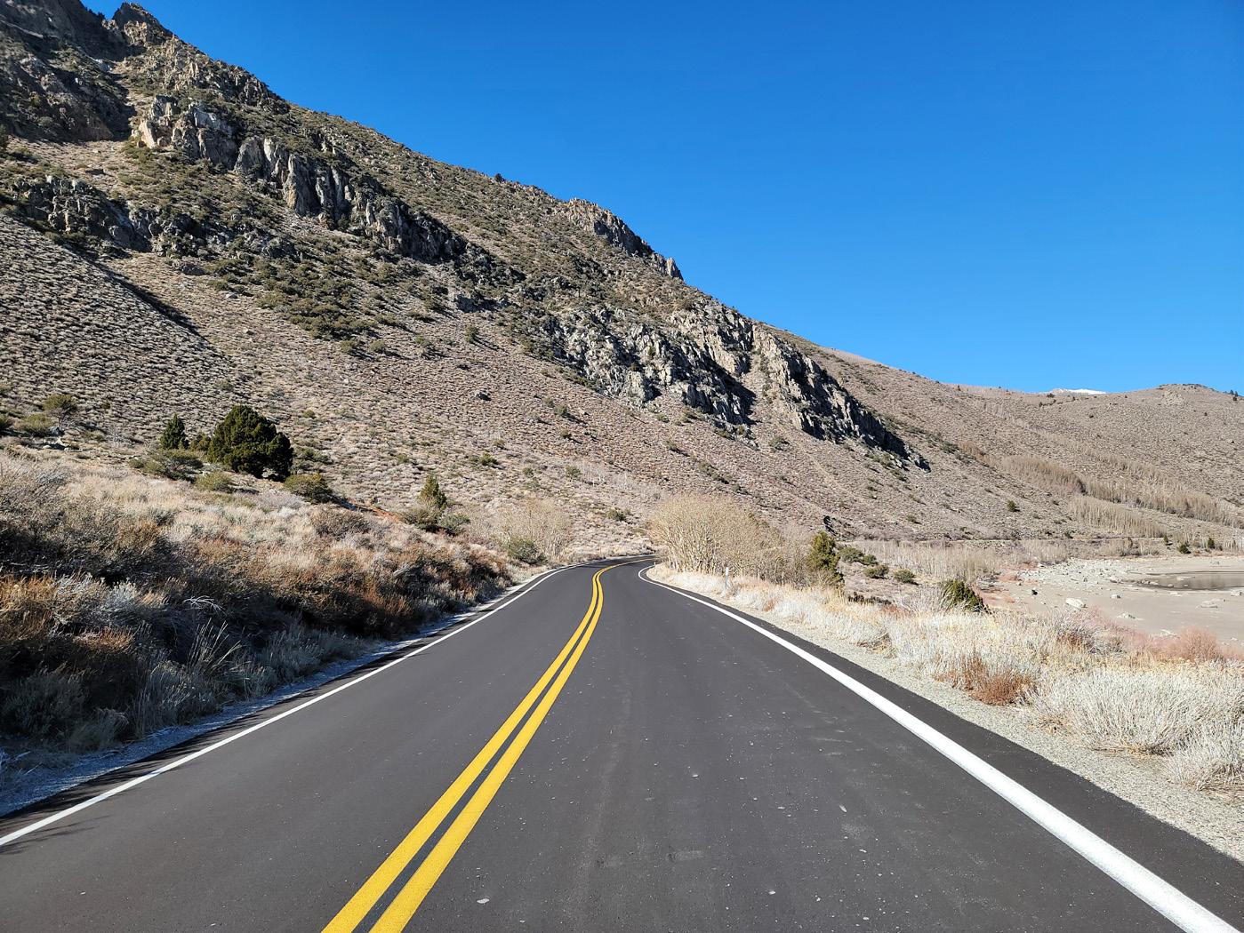
Legend:
Interior (lakeside) class I multi-use path alignment can be explored if desired. Walls needed where adjacent to Grant Lake whether path is attached or detached. Detached path with access to lake preferred.
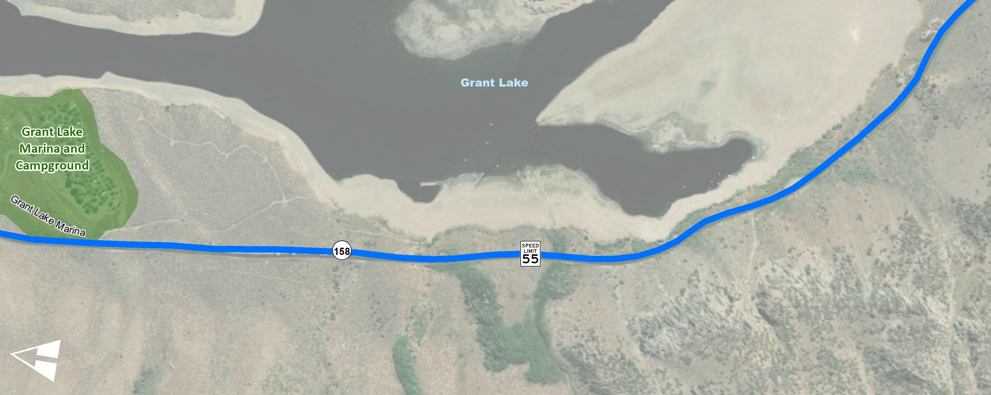
Class II bike lanes with shoulder enhancement recommended.
Interim Recommendation:
In 0.5 to 1.0 mile increments
Recently resurfaced. Encourage Caltrans to reduce lane widths and widen shoulders on future resurfacing projects.
Trail alternatives
New Pedestrian Crossings
Recently resurfaced. Encourage Caltrans to reduce lane widths and widen shoulders on future resurfacing projects.
Interim Recommendation:
In 0.5 to 1.0 mile increments
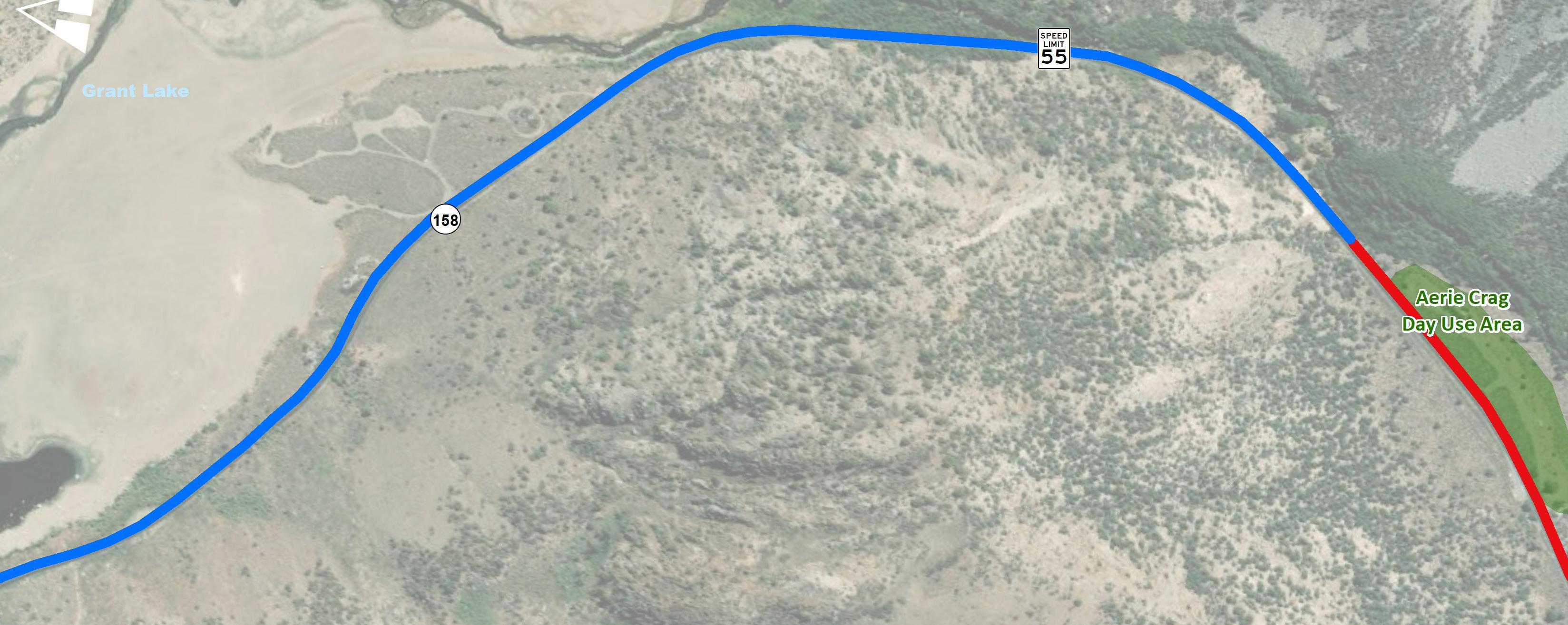
Class II bike lanes with shoulder enhancement recommended. Bicycling demand north of Aerie Crag diminishes.
Interior (lakeside) alignment recommended. South of lake, path could meander with access to river. Walls or realignment needed where adjacent to river. Enhanced crossing required to allow bicyclists to transition from class II bike lanes to class I path.
Grant Lake Marina To US-395 (North)
Project Length: 4.75 Miles
Segment 10 is 4.75 miles long and it extends from the Grant Lake Marina to the US-395 junction. The average traffic volumes hover around 500 vehicles per day, the posted speed limit is 55 mph, and there are zero vehicular collisions recorded in this segment. The overall demand for active transportation in this segment is low. Avid cyclists travel along this area and most visitors of the Grant Lake Marina drive to this destination for camping, hiking, RV park, boating, and fishing activities.
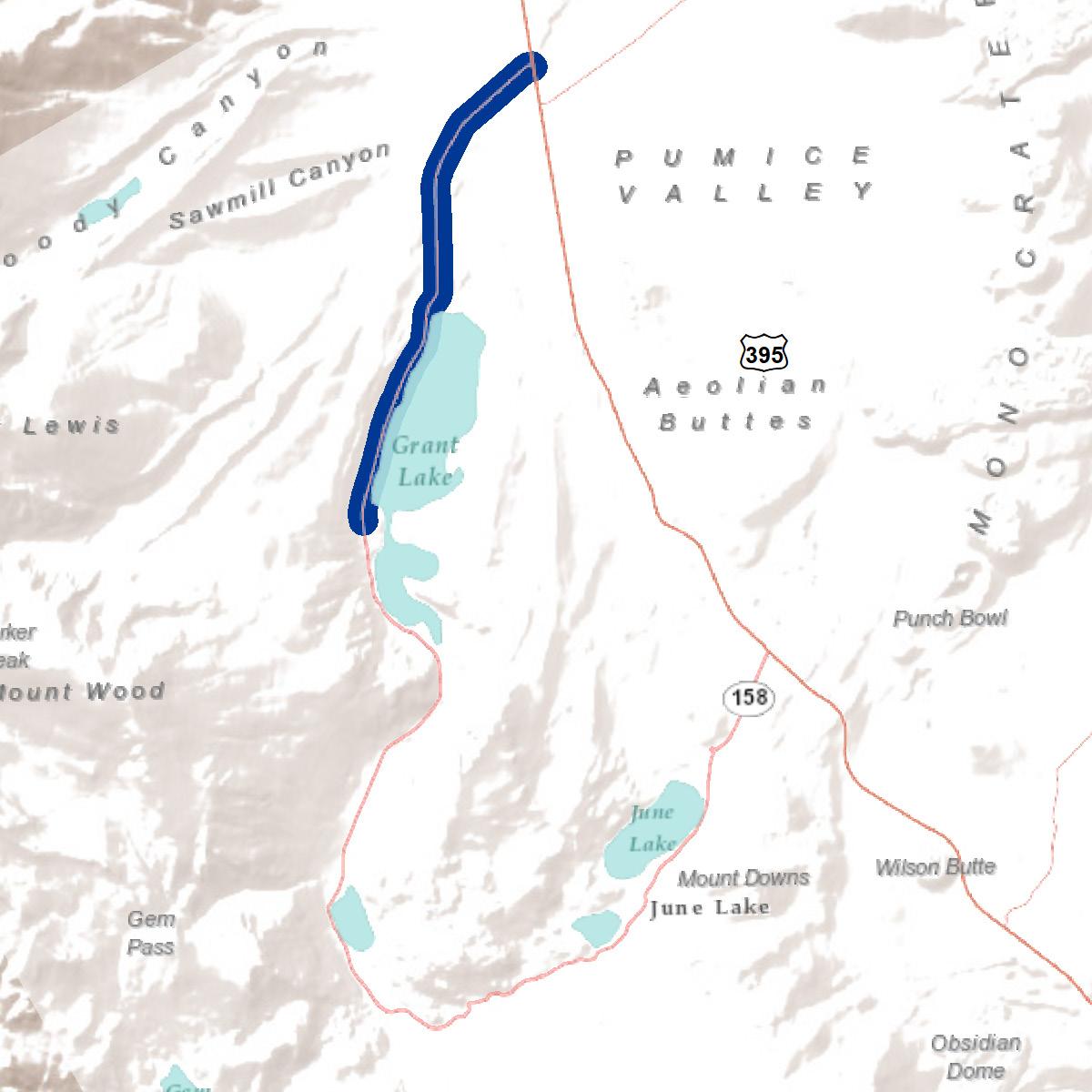
Active transportation recommendations include regulatory and wayfinding signage and class II bike lanes. Shoulder enhancements such as striping and rumble strip maintenance on both sides of the roadway will also improve bicycling comfort.
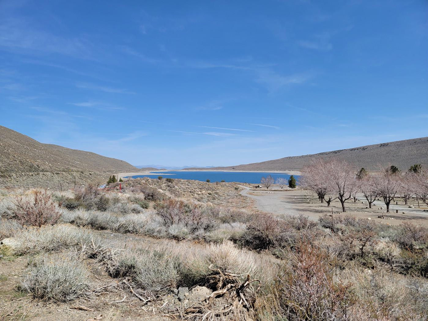
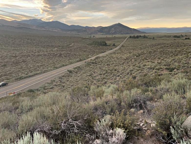
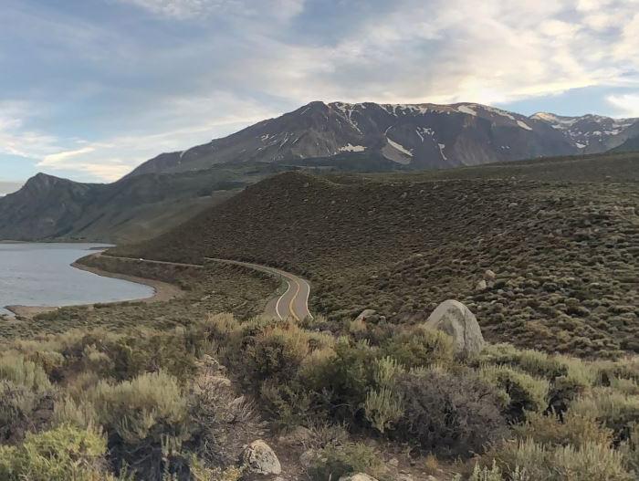
Wayfinding signage recommended at US-395 junction
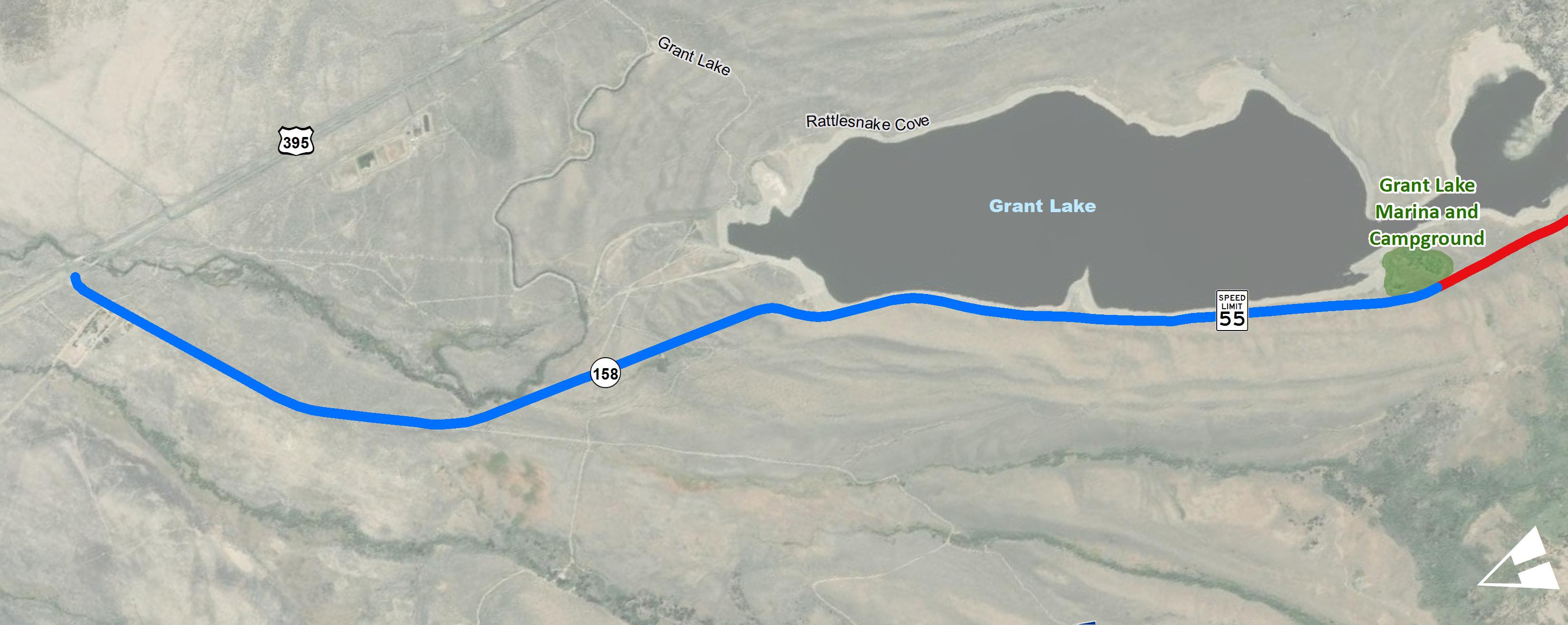
Interim Recommendation:
In 0.5 to 1.0 mile increments
(W11-1) (R117 CA) (W16-1P)
SR-158 crossings not recommended.
Recently resurfaced. Encourage Caltrans to reduce lane widths and widen shoulders on future resurfacing projects.


This section includes a diverse menu of programs intended to support the conceptual improvement alternatives recommended in this plan. The programs are typical organized by the Six E’s of transportation planning, commonly associated with Safe Routes to Parks, but now used for all kinds of mobility and active transportation planning processes. The Six E’s care categorized into: Encouragement, Education, Engineering, Evaluation, Equity, and Enforcement.
During the month of May, cities across the country organize events and campaigns to educate people about biking and to encourage them to bike more to their destinations. Activities such as Bike Week, Bike to Work, and Bike Fridays can be organized and promoted.
Fun family-friendly summer bike rides meant to encourage bike usage. This event teaches about bicycle and road safety.
Encourage key businesses such as local restaurants, retail, campgrounds, hotels to become bike-friendly businesses to encourage people to ride and support the local economy. Bike-friendly elements include but are not limited to bike parking or storage, bike map or information, bike repair or fix-it stations, and air pumps. This could also be a space to include a transportation-related bulletin board space to leave information for residents looking to carpool or vanpool, who are offering bike maintenance, skills training classes, and community rides.
Alternate Location - circle June Lake on the 158 and Northshore Drive, ending with a celebration at June Lake Beach. Keep vehicle traffic near campground, resort, and along the 158.

Vehicle usage can be decreased in part by actively encouraging residents and visitors to bike, walk, and ride transit for a variety of trips and purposes. Encouragement is all about making bicycling and walking more fun, healthy, and easy to do. In order to achieve this, the June Lake Village, along with local organizations, can organize a series of activities and events that promote alternate modes of transportation and healthier lifestyles.
Design and install quick build bicycle and pedestrian infrastructure using temporary materials. Projects may include but are not limited to: curb extensions, sidewalks, midblock crossing, protected bike lane, parklet, etc. The purpose of the demonstration projects is to educate residents about bicycle and pedestrian safety and traffic calming as well as to obtain feedback for the solutions demonstrated.
Encourage key businesses such as local restaurants, retail, campgrounds, hotels to become bike-friendly businesses to encourage people to ride and support the local economy. Bike-friendly elements include but are not limited to bike parking or storage, bike map or information, bike repair or fix-it stations, and air pumps. This could also be a space to include a transportation-related bulletin
board space to leave information for residents looking to carpool or vanpool, who are offering bike maintenance, skills training classes, and community rides.
Encourage resident activists to form a June Lake Active Transportation or Trails Coalition to lead bicycle and pedestrian facilities maintenance. Through these programs, activities can be developed such as trail maintenance, clean up, repair and snow removal.
Incorporate a local shuttle bus that circulates between the Silver Lake Campground and June Lake Beach (30 minutes roundtrip) or between the Whispering Pines Motel and the June Lake Campground (15 minutes roundtrip). Include well-lit, covered waiting areas at pick up spots. A transportation demand study should be completed to predict an efficient schedule seasonally. Explore the idea of snowmobile shuttles or snow coaches that can travel safety in snow and icy conditions. Yellowstone National Park provides snow coaches to various locations throughout the Park. Heavenly Ski Resort in Lake Tahoe employs SHERPA snowmobile shuttles for snow grooming and transportation around the resort. For the 2010 Winter Olympics in Whistler Canada, snowmobiles were used to shuttle visitors between the Whistler Village and nearby Olympic events.
Encourage resident activists to form a June Lake Bicycle Coalition to lead bike facilities clean ups, etc.
Test a docked bike share system between June Lake Village and Silver Lake Campground and integrate it with a wayfinding signage program and education program.
The Mono County Local Transportation Commission should explore carrying out public education campaigns to improve pedestrian and bicyclist safety. These education campaigns can help teach motorists, pedestrians, and bicyclists how to share the road safely.
A class intended to build habits and skills, and an in-depth exploration of rights and responsibilities of bicyclists, including an “on bike” maneuvers class intended to increase confidence. Participants get a free helmet and bike lights. This includes an obstacle course to teach pedestrians and bicyclists how to identify different street signs and use street infrastructure to increase safety. Youth and children navigate the obstacle course to win free helmets and lights. Mono County LTC can assist with teaching students how to stay safe around street traffic using their mock-safety city.
Bike maintenance and ride workshops can include a series of classes for youth between 12-18 years. (How to Ride Workshops might be better targeted at ages under 12.) These classes teach riders how to fix and ride a bicycle. Participants learn the rules of the road, as well as their rights and responsibilities as bicyclists. These classes can offer the opportunity for participants to receive a free bike.
Changeable message signs can be an effective tool to inform motorists of pedestrian and bicycling safety. Such messaging can also encourage drivers to be more cognizant when sharing the road with cyclists.
The training involves teaching participants how to safely operate a bicycle. It consists of both a sitdown discussion as well as hands-on training where participants can apply their knowledge on the road. A certified instructor may be required. Mono County LTC can assist this campaign by organizing with various community organizations to raise awareness about bicycle and pedestrian safety. This campaign may also include tabling at community-wide events like the June Lake Triathlon.
Mono County Public Works Department is responsible for building and maintaining all public streets within the June Lake community to ensure that residents and visitors alike can travel the June Lake Loop safely and efficiently using various modes of transportation. Any improvements to the State Highway System requires coordination and approval from Caltrans. A variety of engineering tools can be used to make sure that the roadways in June Lake are designed to keep bicyclists and pedestrians safe at all times. Some of these tools include street design techniques that are meant to reduce traffic congestion, decrease vehicular speeds, provide safe and clearly designated spaces for pedestrians and bicyclists to use the road and cross safely, and enhance pedestrian and bicycle safety and comfort.
Some examples of engineering and traffic enhancements that provide a safer environment for pedestrians and bicyclists include:
» Traffic control signs
» Pedestrian-controlled traffic control signals
» Curb and high visibility pavement markings
» Traffic safety monitoring
» Separated bike path
» Sidewalks or multi-use trail
» Parking facilities
Refer to Section 4.1.1 that highlights many engineering countermeasures and best practices to improve walking and bicycling in June Lake.
In order to improve programs and ensure that the bicycle and pedestrian conditions along the June Lake Loop are adequate, audits, traffic-safety data collection, analysis, and reporting are necessary. Additionally, surveys allow the June Lake Village to gain input from users on existing issues and potential solutions.
Conduct regular bicyclist and pedestrian counts throughout the LTC to determine baseline mode share and subsequent changes. Conducting counts also collects information on where the most bicycling and walking occurs and assists in prioritizing and justifying projects when funding is solicited and received. Counts can also be used to study bicycling and walking trends throughout the community. Analysis that could be conducted includes:
» Changes in volumes before and after projects have been implemented
» Prioritization of local and regional projects
» Research on clean air change with increased bicycle use
Counts should be conducted at the same locations and at the same times every year. Conducting counts during different seasons within the year may be beneficial to understanding the differences in bicycle and pedestrian traffic volumes based on seasonal weather. In addition, bicycle and pedestrian counts should be collected as part of any existing traffic counts. Results should be regularly recorded for inclusion in the bicycle and pedestrian report card.
Continue to collect and analyze pedestrian and bicyclist-related collisions evaluated to establish baseline safety conditions. Follow up analysis of pedestrian and bicycle collisions over time can give feedback on the safety improvements made, or identify areas where further improvements may be warranted. This is particularly important because bike ridership and foot traffic increases; LTC
can monitor and evaluate corridors and/or intersections as travel behavior changes.
Online Surveys can be a cost-effective way to gather feedback on effectiveness of programs and improvements made as part of this plan. It is recommended that after improvements are implemented, LTC should conduct community surveys to evaluate the effectiveness of this Plan and improvements through before and after data.
Conduct workshops to review and evaluate existing pedestrian facilities. Results from these workshops can be used to prioritize improvements and grant pursuits.
Have at minimum one staff member dedicated to overseeing the implementation of the active transportation plan’s prioritized projects and program recommendations as well as measuring the ongoing impact, both through data collection and community feedback.
The ATP prioritizes the safety of residents and visitors in the June Lake Community through the development of multi-modal connections. Not all residents have access to a vehicle and a number of employees in June Lake live outside of the area, and there are no other options than to drive
Recognize the importance of addressing the barriers that prevent trips from being safe, especially for the younger and lower income populations who cannot afford, operate, or choose to forgo vehicle ownership.
Agencies can aim to implement improvements in areas that are disproportionately affected by health and safety burdens, acknowledg-
ing that policies and designs that improve conditions for vulnerable groups can benefit everyone in the community.
Continuing collaboration with the community is an integral part of the planning process.
Incentivize employees to take (newly implemented, if adopted) transit or carpool by providing a free or low-cost shuttle service or travel reimbursements for employees who do not reside in June Lake.
Encourage the June Lake area to form a community-led carpooling system from neighboring towns, such as Lee Vining. Coordinate with the June Lake Citizens Advisory Committee to promote.
Educate Mono County Sheriff’s Department and California Highway Patrol regarding bicycle and pedestrian issues.
If the ultimate aim is to promote bicycling as a legitimate form of transportation, all officers should receive some form of bicycle training. Appropriate training regarding pedestrian issues and solutions should be provided as well.
Many law enforcement departments employ targeted enforcement to educate drivers, bicyclists, and pedestrians about applicable traffic laws and the need to share the road. These efforts are an effective way to expand mobility education, such as in the form of a brochure or tip card explaining each user’s rights and responsibilities.
Communication process that encourages students and parents to notify the school and law enforcement of the occurrence of a crash or near-miss during school commute trips involving auto, bus, pedestrian or bicycle transportation.
The campaign would place speed feedback trailers at specific locations where pedestrians are present. It seeks to curb speeding by warning motorists of their current speed, and thus slow down if they are going above the posted speed limit.
The campaign would educate the June Lake community to limit on-street parking during winter peak period and designate parking restrictions for snow removal.
Educate motorists on how to share the road with non-motorists and new bicycle and pedestrian or traffic calming infrastructure.
Clearing snow and ice from all bicycle and pedestrian infrastructure, but also at crosswalks, curb ramps, and bus stops is an essential part of making walking practical, safe, and comfortable in the winter. Clear pathways can promote and encourage year-round non-motorized use or be used as an alternative transportation mode such as cross country skiing. It will be at the discretion of the County to maintain these trails during the winter. The following provides some considerations when designing and maintaining these trails.
There are some key considerations when designing a multi-use path for maintenance and snow removal.
» Total clear width between the curb face and vertical element should be at least the fleet maintenance (sweeping or snowplow) vehicle width.
» Select physical buffers that are snowplow compatible (i.e., have a continuous edge such as bolt-down precast curb stop, K-Rail, or planted buffer strip with poured in place concrete).
» Conduct frequent maintenance to avoid trail hazards such as potholes and debris.
» Maintain posts, bollards, or other physical buffers.
» Refresh striping and repair or replace damaged or faded signage.
» Institute snow removal requirements at all stages of design and construction of active transportation facilities.
» Consider miniature tractors, ATVs, snowmobiles and skid steers with a snow blower or snow plows to clear multi-use paths.
» Limit salt usage for de-icing due to its highly corrosive nature and June Lake surrounding sensitive natural environment. Explore alternative de-icing solutions such as beet juice to reduce environmental impacts. Beet juice mixed with salt brine allows less salt use and can lower the freezing point of water to -20 degrees.
» Continue to research alternative de-icing solutions that are safe for the environment as experiments are continuously being conducted.
Sidewalks and walkways provide people with space to travel within the public right-of-way that is separated from roadway vehicles. Upgrades to existing sidewalks or new sidewalks may be attached or detached with parkway strips based on adjacent land uses, available space, shade trees, snow storage needs, and so on.
As the freeze and thaw cycle begins, asphalt will expand and contract with the moisture in the air and the moisture in the ground. During winter preparations, identify any areas on paved trails and along SR-158 where water tends to pool. Note these locations so they can be repaired in the spring and ensure standing water is removed before it has a chance to freeze and turn to ice. Water can also penetrate underneath damaged asphalt, which may cause further cracking and potholes. There are steps you can take to help your asphalt maintain structural integrity and high performance as the winter months pass, such as:
» Repair cracks and potholes so water doesn’t pool and expand, making the pothole or crack larger.
» Fill any cracks in your pavement, so water cannot seep underneath the asphalt surface and comprise the sub-base.
» For snow plowing, use a rubber or polyurethane cutting edge on the blades of their plow to lessen the impact it will have on your asphalt
» Set plow blades to ½” above the surface
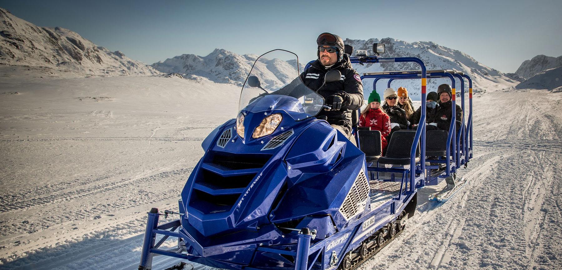
The segments of SR-158 between Northshore Drive and June Lake Village as well as the segment between Down Canyon and Silver Lake Resort are designated avalanche zones. Design recommendations for a multi-use path include reinforced, or removable, guardrail fencing and other structural considerations to withstand potential avalanches. During these avalanche prevention activities, trail width should also be considered to enable small snow plow vehicles to clear the trail. The location of the trail is also important if desired to keep the trail open during winter months. If the trail is located adjacent to SR-158, the trail can temporarily be used to store snow for clearing SR-158, then cleared right after.
Mono County is encouraged to evaluate and identify all other forms of support facilities when carrying a project into design and engineering phase. Support facilities such as wayfinding signage, restrooms, waste and recycling receptacles, benches, picnic tables,bicycle parking, water fountains, and interpretive signage should all be considered when possible. Coordination with Federal entities such as the Forest Service is recommended since several of the proposed projects in this Plan can connect to existing or planned trails within Forest Service right-of-way.
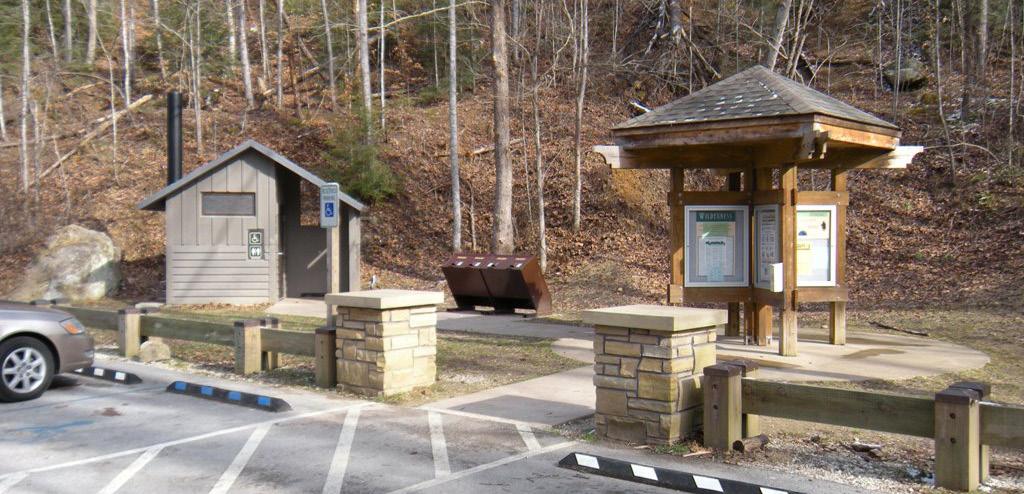
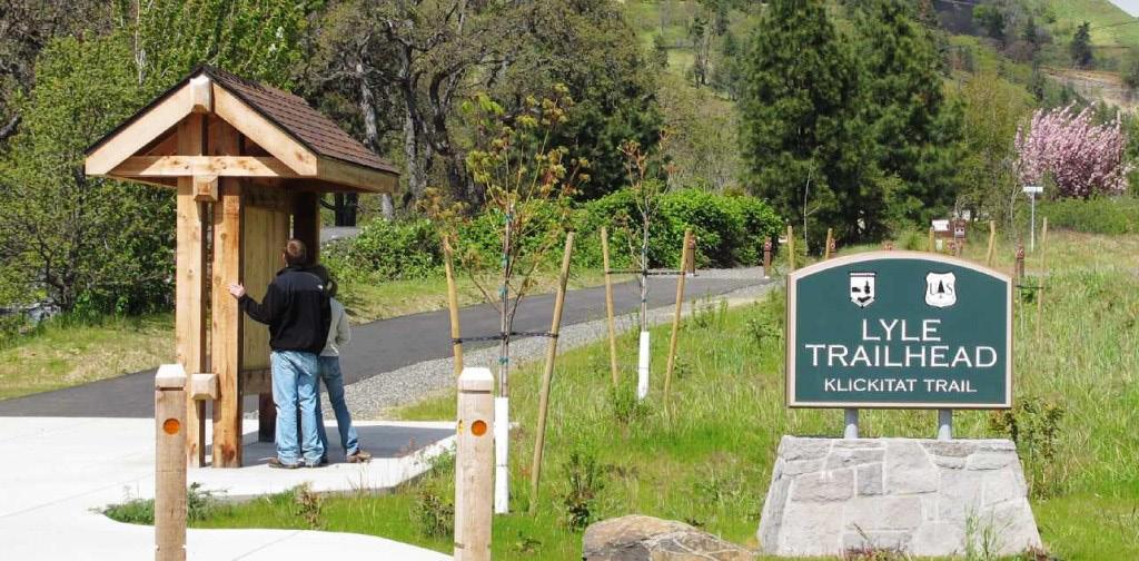
Page Left
Intentionally Blank
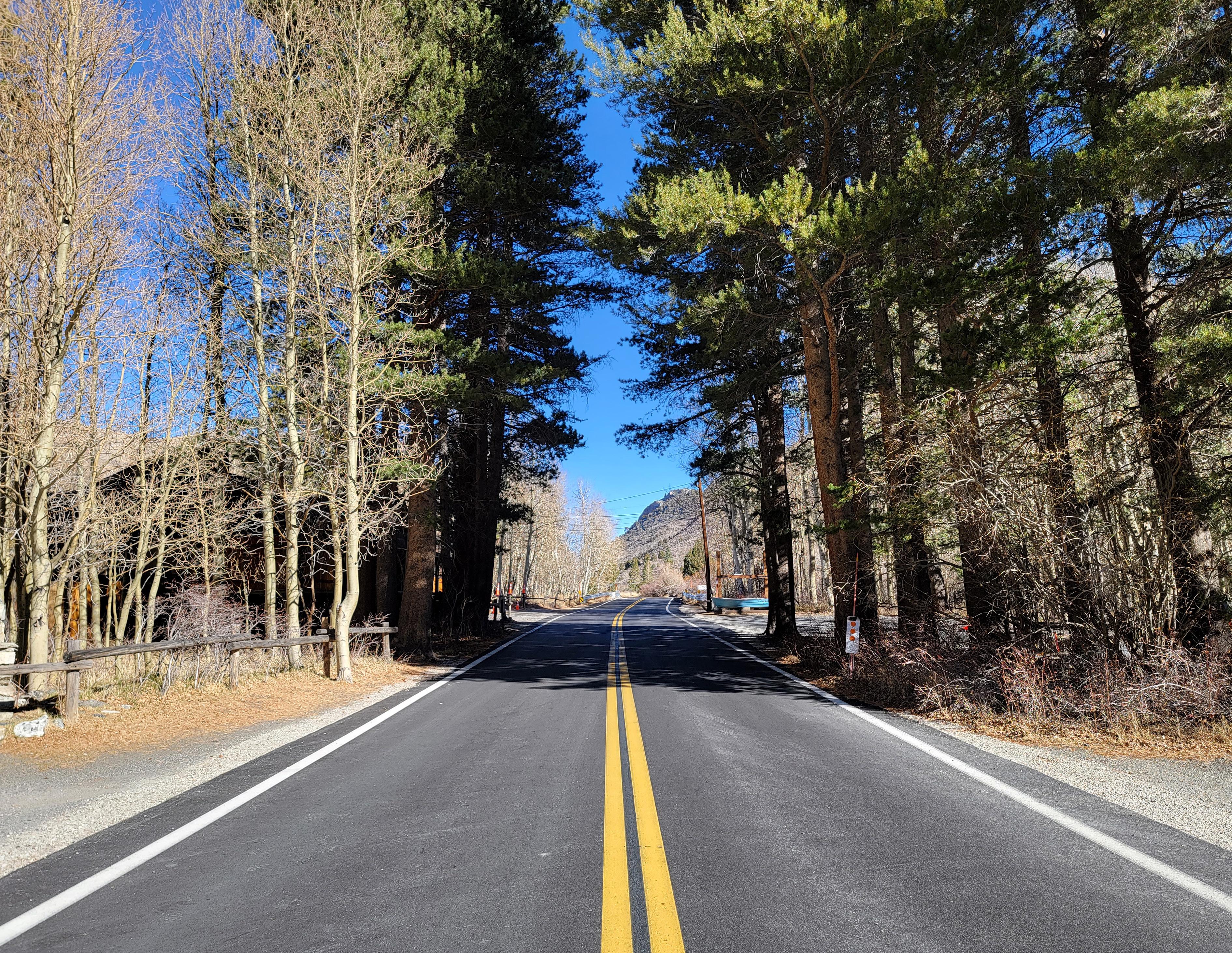
The implementation of the recommendations in this ATP can vary from agency to agency. There are numerous factors that affect how quickly a project or program can move forward. Having an adopted or accepted plan such as this ATP is a critical step in this process. Showing an audience that this ATP completed tasks related to research, analyses, community engagement, and project development has become an essential component of moving planning, design, and funding processes forward.
The LTC is encouraged to use “Table 5-2: Implementation Stratelgies” as a guide to facilitate the implementation of the projects and programs outlined in this plan.
The prioritization process is typically a data-driven and interactive process consisting of various criteria that is determined by the planning team. The goal of project prioritization is to provide the LTC guidance on which projects to pursue for future design and funding opportunities. The criteria that was used for this project is consistent with best practices. Criteria used to determine priorities include:
» Proximity to parks, campgrounds, trailheads, residential areas, and commercial areas
» Pedestrian and bicycle collisions
» Citizens Advisory Committee (CAC) Input
» Community Input
The 10 segments of the primary project are prioritized and shown in “Table 5-1: Prioritized Segments”. The LTC reserves the right to implement projects as they see fit as other projects or funding sources become available.
1 Identify items on the LTC’s Capital Projects list that can incorporate recommended projects outlined in this plan
2 Integrate the recommendations and projects from this Plan into all applicable grant applications
3 Perform an Environmental Review for each project to determine level of impact
5 Identify sources of funding for ongoing maintenance of street enhancements
6 Develop a volunteer program focused on implementation and sustainment
7 Identify alternative funding sources and fund-raising opportunities
8 Develop employment and job creation programs that assist with the installation and maintenance of the projects in this Plan
9 Identify opportunities to incorporate plan recommendations and projects into proposed redevelopment projects
LTC, community organizations
LTC, community organizations, and community stakeholders
Major projects are defined as a street reconfiguration of lanes, geometry, curbs, drainage systems or other major utility improvements requiring a substantial percentage of the pavement to be removed and/or replaced.
In some cases, grants could be pursued specifically for only projects identified in this plan, while in others, parts of this plan can be used to strengthen benefits for other projects.
Projects classified as maintenance or replacement can be considered categorical exemptions under CEQA or NEPA. Major projects affecting traffic, natural areas land, or ROW acquisitions may require full environmental review.
Ongoing maintenance responsibilities will likely need to be identified prior to implementation.
Utilize neighborhood residents, community leaders, and volunteers from schools, churches, community organizations and businesses.
Examples include philanthropic offers, donations, endowment funds, corporate sponsorships, capital fund-raising efforts, grants, government sources.
Tasks would include development of a growing grounds for street trees, the installation and ongoing maintenance of trees and maintenance of public realm spaces.
LTC, community organizations
For major projects, the improvements should go beyond the immediate project parcel boundaries.
The following section describes potential federal, state, regional, and local funding sources that the LTC can pursue to advance the recommendations in the ATP. The funding sources vary in purpose and scope, but are intended to help an agency implement active transportation, placemaking, urban greening, and other related projects. The tables in this section include information on their funding sources, a general description of the program, funding cycle, and project examples. A more detailed version of these tables can be found in the Appendix.
The LTC is encouraged to pursue state level grants through programs such as Caltrans’ Active Transportation Planning (ATP), Sustainable Transportation Planning grants, the Strategic Growth Council’s Sustainable Community Planning Grants, Urban Greening Grants, and the Highway Safety Improvement Program (HSIP).
It is important to coordinate efforts with adjacent jurisdictions on projects that affect and benefit all agencies. Joint applications also strengthen an application due to combined benefits for multiple jurisdictions. Joint applications with the US Forest Service or LADWP could be explored.
Funding agencies also encourage applicants to design their projects to be as “multi-benefit / multi-purpose” as possible. The LTC is encouraged to refine their infrastructure projects as needed to ensure the project provides multiple benefits. The primary project identified in this ATP is a prime example of a multi-benefit project that would be positively competitive in a grant application.
The projects addresses:
» Increasing safety and comfort for pedestrians and bicyclists traveling to and from their destinations
» Creating vital links to local destinations of employment and outdoor recreation
» Improving stormwater management facilities through green infrastructure and low-impact development design principles
» Promoting healthy habits and well-being by having a physically-separated facility that can be enjoyed by people of all ages and abilities.
Inf. NI Plan
1 Safe Streets and Roads for All (SS4A) Grant Program
The SS4A program funds regional, local, and Tribal initiatives through grants to prevent roadway deaths and serious injuries. There are two types of SS4A grants: Action Plan Grants and Implementation Grants.
- Action Plan Grants assist in developing or complete an Action Plan or to conduct supplemental planning activities.
- Implementation Grant includes infrastructure, behavioral, and operational safety activities identified in an Action Plan
Annual, $1B for the next five years starting in 2022
X X X
• Safety analysis
• Engagement & Collaboration
• Planning structure
• Transforming a roadway corridor
• Installing pedestrian safety enhancements and closing network gaps
• Supporting the development of bikeway networks
• Evaluating and improving the safety of intersections
2
Congestion Mitigation and Air Quality Improvement (CMAQ) Program
The purpose of the CMAQ program is to provide a flexible funding source to State and local governments for transportation projects and programs to help meet the requirements of the Clean Air Act. The program supports surface transportation projects and other related efforts that contribute air quality improvement and provide congestion relief.
Annually X
• Travel Demand Management to promote clean commutes
• Public Education and Outreach
• Bicycle amenities; Class I, II, III, & IV bike lanes
3 Highway Safety Improvement Program (HSIP)
The Program funds work on any public road or publicly owned bicycle or pedestrian pathway or trail, or on tribal lands for general use of tribal members, that improves the safety for its users. Project maximum funding- $10M. Solicitation varies from annually to semiannually.
Annually X X
• Install hybrid pedestrian signals
• Improve pedestrian and bicycle safety at locations with uncontrolled crossings
• Plans
* Inf - Infrastructure NI - Non Infrastructure Plan - Planning and Design
4
Inf. NI Plan
Enhanced Mobility of Seniors and Individuals with Disabilities
The goal of this program is to improve mobility for seniors and individuals with disabilities by removing barriers to transportation service and expanding transportation mobility options.
Annually X X
• Mobility management programs
• Building an accessible path to a bus stop
• improving signage, or wayfinding technology
5 Safety Research and Demonstration Program
The Safety Research and Demonstration (SRD) Program is part of a larger safety research effort at the U.S. Department of Transportation that provides technical and financial support for transit agencies to pursue innovative approaches to eliminate or mitigate safety hazards. The SRD program focuses on demonstration of technologies and safer designs.
Annually
X
• Operational safety programs
6
Enhanced Mobility of Seniors & Individuals with DisabilitiesSection 5310
Formula funding to states for the purpose of assisting private nonprofit groups in meeting transportation needs of the elderly and persons with disabilities.
Annually X
• Planning program to meet the special transportation needs of seniors and individuals with disabilities
7 Formula Grants for Rural Areas5311
Provides capital, planning, and operating assistance to states to support public transportation in rural areas with populations less than 50,000, where many residents often rely on public transit to reach their destinations.
Annually X
• Planning, capital, operating, job access and reverse commute projects, and the acquisition of public transportation services.
* Inf - Infrastructure NI - Non Infrastructure Plan - Planning and Design
Inf. NI Plan
8 Grants for Buses and Bus Facilities Formula Program - 5339(a)
Provides funding to states and transit agencies through a statutory formula to replace, rehabilitate and purchase buses and related equipment and to construct bus-related facilities. In addition to the formula allocation, this program includes two discretionary components: The Bus and Bus Facilities Discretionary Program and the Low or No Emissions Bus Discretionary Program.
Annually X
• Projects to replace, rehabilitate and purchase buses, vans, and related equipment, and to construct bus-related facilities
9
Low and NoEmission Component Assessment Program (LoNoCAP)
10 Mobility for All Pilot Program Grants
On September 29, 2016, FTA announced the opportunity for eligible institutions of higher education to apply for funding to conduct testing, evaluation, and analysis of low or no emission (LoNo) components intended for use in LoNo transit buses used to provide public transportation. The deadline for applications is November 28, 2016.
This funding opportunity seeks to improve mobility options through employing innovative coordination of transportation strategies and building partnerships to enhance mobility and access to vital community services for older adults, individuals with disabilities, and people of low income.
April X
• Programs that have zeroemission and low emission transit buses
January
X
• Transportation projects with a focus on employing mobility management strategies, vehicle purchase, IT purchase, leasing equipment or a facility for use in public transportation etc
* Inf - Infrastructure NI - Non Infrastructure Plan - Planning and Design
11
Mobility on Demand (MOD) Sandbox Demonstration Program - 5312
Funds projects that promote innovative business models to deliver high quality, seamless and equitable mobility options for all travelers. Annually
• Private for-profit and not-forprofit organizations, including shared use mobility providers, and technology system suppliers
• Operators of transportation services, such as employee shuttle services, airport connector services, university transportation systems, or parking and tolling authorities
• State or local government entities
• Other organizations that may contribute to the success of the project team including consultants, research consortia or not-for-profit industry organizations, and institutions of higher education
Inf. NI Plan
1 Safe Streets and Roads for All (SS4A) Grant Program
The SS4A program funds regional, local, and Tribal initiatives through grants to prevent roadway deaths and serious injuries. There are two types of SS4A grants: Action Plan Grants and Implementation Grants.
- Action Plan Grants assist in developing or complete an Action Plan or to conduct supplemental planning activities.
- Implementation Grant includes infrastructure, behavioral, and operational safety activities identified in an Action Plan
Annual, $1B for the next five years starting in 2022
X X X
• Safety analysis
• Engagement & Collaboration
• Planning structure
• Transforming a roadway corridor
• Installing pedestrian safety enhancements and closing network gaps
• Supporting the development of bikeway networks
• Evaluating and improving the safety of intersections
2
Congestion Mitigation and Air Quality Improvement (CMAQ) Program
The purpose of the CMAQ program is to provide a flexible funding source to State and local governments for transportation projects and programs to help meet the requirements of the Clean Air Act. The program supports surface transportation projects and other related efforts that contribute air quality improvement and provide congestion relief.
Annually X
• Travel Demand Management to promote clean commutes
• Public Education and Outreach
• Bicycle amenities; Class I, II, III, & IV bike lanes
3 Highway Safety Improvement Program (HSIP)
The Program funds work on any public road or publicly owned bicycle or pedestrian pathway or trail, or on tribal lands for general use of tribal members, that improves the safety for its users. Project maximum funding- $10M. Solicitation varies from annually to semi-annually.
Annually X X
• Install hybrid pedestrian signals
• Improve pedestrian and bicycle safety at locations with uncontrolled crossings
• Plans
* Inf - Infrastructure NI - Non Infrastructure Plan - Planning and Design
Inf. NI Plan
4 Enhanced Mobility of Seniors and Individuals with Disabilities
The goal of this program is to improve mobility for seniors and individuals with disabilities by removing barriers to transportation service and expanding transportation mobility options.
Annually X X
• Mobility management programs
• Building an accessible path to a bus stop
• improving signage, or way-finding technology
5 Public Transportation Innovation - 5312
Provides funding to develop innovative products and services assisting transit agencies in better meeting the needs of their customers.
Annually X
• Research, development, demonstration and deployment projects
6
Rural Transportation Assistance Program - 5311(b) (3)
Provides funding to states for developing training, technical assistance, research, and related support services in rural areas. The program also includes a national program that provides information and materials for use by local operators and state administering agencies and supports research and technical assistance projects of national interest.
Annually X
• Training, technical assistance, research, and related support services
7 Safety Research and Demonstration Program
The Safety Research and Demonstration (SRD) Program is part of a larger safety research effort at the U.S. Department of Transportation that provides technical and financial support for transit agencies to pursue innovative approaches to eliminate or mitigate safety hazards. The SRD program focuses on demonstration of technologies and safer designs.
Annually
X • Operational safety programs
8 Zero Emission Research Opportunity (ZERO)
On November 22, 2016, FTA announced the opportunity for nonprofit organizations to apply for funding to conduct research, demonstrations, testing, and evaluation of zero emission and related technology for public transportation applications.
Annually X
• Research, innovation and development, demonstration, deployment, and evaluation * Inf - Infrastructure
9 Accelerating Innovative Mobility
Accelerating Innovative Mobility (AIM) will highlight FTA’s commitment to support and advance innovation in the transit industry.
10
Enhanced Mobility of Seniors & Individuals with DisabilitiesSection 5310
Formula funding to states for the purpose of assisting private nonprofit groups in meeting transportation needs of the elderly and persons with disabilities.
Annually X
• Research and technology programs and plans
• Planning program to meet the special transportation needs of seniors and individuals with disabilities
11
Flexible Funding ProgramsCongestion Mitigation and Air Quality Program -
23 USC 149
12 Formula Grants for Rural Areas - 5311
CMAQ provides funding to areas in nonattainment or maintenance for ozone, carbon monoxide, and/or particulate matter. States that have no nonattainment or maintenance areas still receive a minimum apportionment of CMAQ funding for either air quality projects or other elements of flexible spending. Funds may be used for any transit capital expenditures otherwise eligible for FTA funding as long as they have an air quality benefit.
Provides capital, planning, and operating assistance to states to support public transportation in rural areas with populations less than 50,000, where many residents often rely on public transit to reach their destinations.
Annually X
• Mobility projects
• Planning, capital, operating, job access and reverse commute projects, and the acquisition of public transportation services.
13 Grants for Buses and Bus Facilities
Formula Program5339(a)
Provides funding to states and transit agencies through a statutory formula to replace, rehabilitate and purchase buses and related equipment and to construct bus-related facilities. In addition to the formula allocation, this program includes two discretionary components: The Bus and Bus Facilities Discretionary Program and the Low or No Emissions Bus Discretionary Program.
Annually X
• Projects to replace, rehabilitate and purchase buses, vans, and related equipment, and to construct busrelated facilities
14
Inf. NI Plan
Low and NoEmission Component Assessment Program (LoNoCAP)
On September 29, 2016, FTA announced the opportunity for eligible institutions of higher education to apply for funding to conduct testing, evaluation, and analysis of low or no emission (LoNo) components intended for use in LoNo transit buses used to provide public transportation. The deadline for applications is November 28, 2016.
April X
• Programs that have zero-emission and low emission transit buses
15 Mobility for All Pilot Program Grants
This funding opportunity seeks to improve mobility options through employing innovative coordination of transportation strategies and building partnerships to enhance mobility and access to vital community services for older adults, individuals with disabilities, and people of low income.
January X
• Transportation projects with a focus on employing mobility management strategies, vehicle purchase, IT purchase, leasing equipment or a facility for use in public transportation etc
• Private for-profit and not-for-profit organizations, including shared use mobility providers, and technology system suppliers
16
Mobility on Demand (MOD) Sandbox Demonstration Program - 5312
Funds projects that promote innovative business models to deliver high quality, seamless and equitable mobility options for all travelers. Annually X
• Operators of transportation services, such as employee shuttle services, airport connector services, university transportation systems, or parking and tolling authorities
• State or local government entities
• Other organizations that may contribute to the success of the project team including consultants, research consortia or not-for-profit industry organizations, and institutions of higher education
* Inf - Infrastructure NI - Non Infrastructure Plan - Planning and Design
Inf. NI Plan
17 Community Traffic Safety Grants (NHTSA)
Grants that support projects, programs, and research that help achieve the “Road to Zero” mission of zero traffic deaths. Grants can be used to kick-start new initiatives or grow existing efforts.
Annually X X X
• Wide range of projects such as: Designing an interactive and accessible data dashboard that creates a series of community-specific traffic safety reports building awareness; providing education and hands-on demonstrations; collaborating with indigenous communities to increase awareness and implementation of Safe Systems approaches